


TOTAL ACREAGE 1,653.36± | OFFERED AT $7,220,000 ranchandrecreation.com Sorensen Farms WESTERN NEBRASKA

Sorensen Farms is located just minutes from Hemingford, NE, in the panhandle of Nebraska where the roots of agriculture run deep in the highly productive soil. This irrigated farm consists of eleven center pivot systems in four convenient parcels and has historically produced corn, wheat, soybeans and alfalfa. The farm is centrally located close to several markets and feedlots providing stability to the local grain markets. This farm is a generational operation and is being offered in its entirety, with all water rights conveying upon a fully funded closing. If you are looking to expand a current operation or a very stable long term investment, this offering is sure to fit the bill.
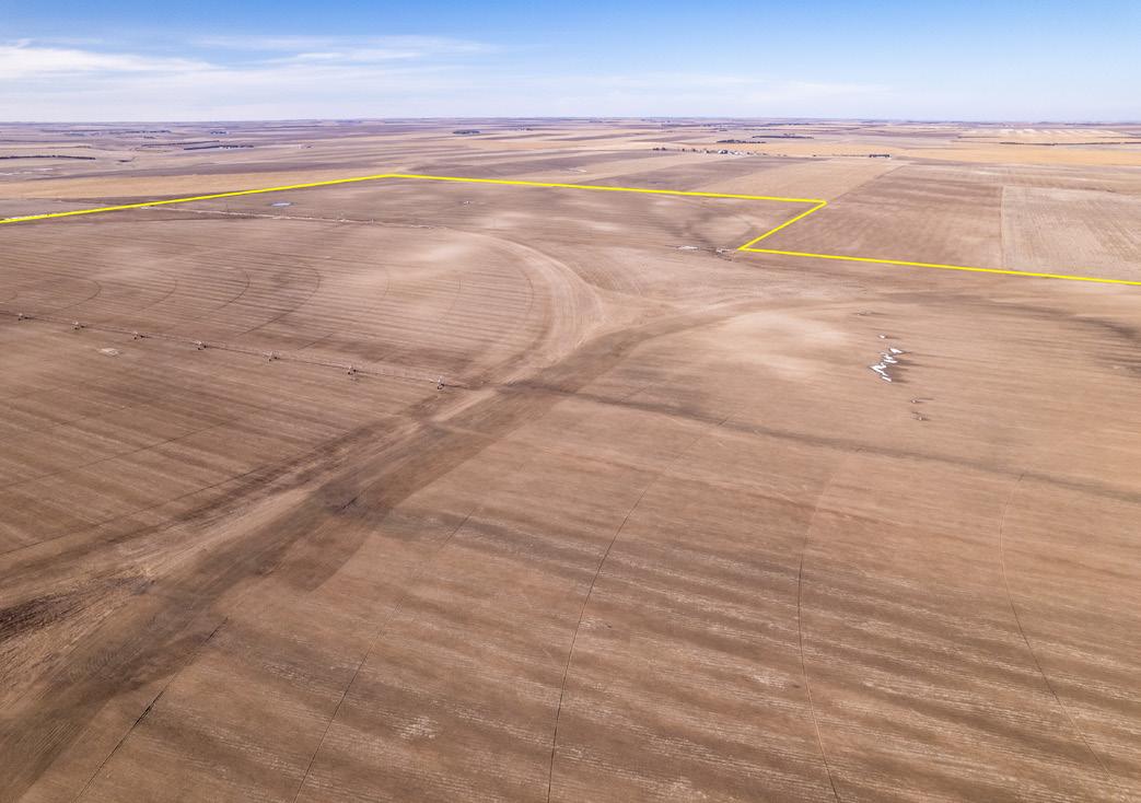
With a total of 1,653.36± acres, this farm boasts 1,376± adjudicated irrigated acres under eleven center pivots.

Irrigated farms in the area routinely produce 200 bu corn, 100 bu wheat, and 40 bu beans.
The property is currently leased through the 2023 farming season, with the sellers retaining all residue. There is an abundance of water remaining for the allocation period ending 12/31/2024. Any potential Buyers will be required to honor the current leases through the 2023 farming season. Crop residue will transfer to the new buyers if closed prior to year-end.
Acreage counts are believed to be accurate but have not been verified by a professional survey. Yields can vary due to weather conditions and management practices. Potential buyers are advised to consult their experts to make their own analysis.

PRICE $7,220,000 (SEVEN MILLION AND TWO HUNDRED AND TWENTY THOUSAND DOLLARS)
1031 EXCHANGE @: This contract contemplates an exchange of real property under 1031 of the IRS Code. All parties are hereby advised and have been advised to seek competent legal, accounting, and such other advice as they in their own discretion determine to be advisable. Brokers and Salespeople do not and have not offered any legal, tax, or accounting advice with regard to this or any other transaction.

ranchandrecreation.com
Hemingford, NE is a charming town with a population of 767, and the farm is centrally located close to several markets and feedlots. This proximity ensures that the local grain markets remain stable, providing a reliable source of income for the farm’s new owners.
The town is located just off of Highway 385, which runs north-south through the state and provides easy access to major cities such as Denver, CO and Rapid City, SD. This location makes it easy to transport crops to local and regional markets, as well as feedlots and other agricultural operations in the area.
• Western Nebraska Regional Airport (BFF) - Located in Scottsbluff, Nebraska, approximately 40 miles west of Hemingford.
• Rapid City Regional Airport (RAP) - Located in Rapid City, South Dakota, approximately 90 miles north of Hemingford.
• Cheyenne Regional Airport (CYS) - Located in Cheyenne, Wyoming, approximately 170 miles southwest of Hemingford.

• Denver International Airport (DEN) - Located in Denver, Colorado, approximately 200 miles south of Hemingford.
All four airports provide easy access to major cities and transportation hubs, making it convenient to transport goods and travel for business or personal reasons.
ranchandrecreation.com
Nebraska’s area is just over 77,220 square miles with a population of over 1.9 million. Its capital is Lincoln, and its largest city is Omaha, which is on the Missouri River. Nebraska was admitted into the United States in 1867, two years after the end of the American Civil War. The Nebraska Legislature is unlike any other American legislature in that it is unicameral, and its members are elected without any official reference to political party affiliation.

Nebraska is composed of two major land regions: the Dissected Till Plains and the Great Plains. The Dissected Till Plains region consists of gently rolling hills and contains the state’s largest cities, Omaha and Lincoln. The Great Plains region, occupying most of western Nebraska, is characterized by treeless prairie. Nebraska has two major climatic zones. The eastern twothirds of the state has a humid continental climate; a unique warmer subtype considered “warm-temperate” exists near the southern plains, which is analogous to that in Kansas and Oklahoma, which have a predominantly humid subtropical climate. The Panhandle and adjacent areas bordering Colorado have a primarily semi-arid climate (Köppen BSk). The state has wide variations between winter and summer temperatures, variations that decrease moving south within the state.
Sorensen Farms is nicely located to be able to enjoy several local, State, and National attractions.

Box Butte County, Nebraska is known for its diverse wildlife and is a popular destination for hunting and outdoor recreation. The area is home to a variety of game species, including whitetailed deer, mule deer, pronghorn antelope, and wild turkey. Additionally, there are several species of upland game birds, including pheasants, quail, and grouse.
The farm being offered for sale provides an excellent opportunity for hunting enthusiasts and outdoor recreationists. With the abundance of wildlife in the area, the property could be utilized as a hunting lease, providing an additional income stream for the new owner.
The property is also located near several state parks and wildlife management areas, providing even more opportunities for outdoor enthusiasts.
• Chadron State Park - Located approximately 40 miles west of Hemingford, Chadron State Park offers hiking, camping, fishing, and boating opportunities in a beautiful natural setting.


• Wildcat Hills State Recreation Area - Located approximately 30 miles northwest of Hemingford, Wildcat Hills State Recreation Area offers hiking trails, camping sites, and scenic views of the surrounding landscape.

• Agate Fossil Beds National Monument - Located approximately 50 miles north of Hemingford, Agate Fossil Beds National Monument is a unique destination that offers hiking, camping, and educational opportunities related to the area’s rich fossil history.
• Box Butte Reservoir State Recreation Area - Located approximately 25 miles south of Hemingford, Box Butte Reservoir State Recreation Area offers fishing, boating, and camping opportunities in a beautiful lakeside setting.
All of these state parks and recreational areas provide opportunities for outdoor recreation and enjoyment of the natural beauty of the region. The farm being offered for sale is ideally situated to take advantage of these nearby attractions and provides a unique opportunity for those looking to invest in the agriculture industry in Nebraska while also enjoying the many recreational opportunities available in the area.
The irrigation equipment includes seven Reinke 8 tower pivots and four Zimmatic 7 tower machines, ensuring a highly efficient and productive operation. This gives the farm a total of twelve pivots. There are two 25 k/ bu bins with drying floors, four 7500 bu bins, and one 9000 bu bin, all in usable condition. There is a total of eleven irrigation wells with all of the wells in each block tied together to offer a greater flexibility in your water management plan.


This farm is within the Upper Niobrara White Irrigation District, which is headquartered out of Chadron Nebraska. The farm is allocated 65 acre inches per five year allocation period with a maximum carry forward of 32.5” from the previous period. The current allocation period runs from Jan 1, 2020-Dec 31, 2024. There is ample allocation remaining for the remainder of the current allocation period.


Sorensen Farms sits on top of the Ogalala Aquifer, which provides a significant advantage for irrigation and water management. The Ogalala Aquifer is a massive underground reservoir that spans across several states, including Nebraska. This aquifer is one of the largest sources of fresh water in the world and is a vital resource for agriculture operations in the region. It ensures a reliable source of water, which is essential for crop production, and provides a competitive advantage in the agriculture industry. With access to this abundant source of water, the farm has the potential to produce high yields of quality crops for years to come. Remaining allocations for each parcel can be found on page seven of this brochure.
Any and all permitted and adjudicated water rights associated with the property, which the Sellers own, shall be transferred to the Buyer upon a fully funded closing.
Any and all mineral rights that the Sellers own shall convey upon a fully funded closing.
All offers shall be in writing and accompanied by an Earnest money deposit of $150,000 (one hundred fifty thousand dollars) and proof of funds and/or financing sufficient to complete the transaction. All earnest money deposits shall be deposited in the Listing Broker’s trust account. The Seller agrees to provide and pay for an Owners title insurance policy in full satisfaction of the purchase price. Both buyers and seller shall be responsible for their own attorneys’ fees.
ranchandrecreation.com


Box Butte County, Nebraska is known for its excellent soil quality and favorable climate for agriculture. The soil in this area is rich in nutrients and has a high water-holding capacity, making it ideal for growing a wide range of crops. The most common soil types in Box Butte County are silt loams, which are well-draining and highly productive.
In addition to the exceptional soil quality, the weather in Box Butte County is also favorable for farming. The average annual rainfall is 16 inches, providing a consistent source of water for crops. The area also receives an average of 229 sunny days per year, allowing for ample sunlight and optimal growing conditions. During the winter months, the area receives an average of 38 inches of snowfall, which can be beneficial for crops. Snow acts as a natural insulator, protecting crops from extreme cold and helping to retain moisture in the soil.
This, combined with the highly productive irrigated farm being offered for sale, presents a unique opportunity for those looking to invest in the agriculture industry.


(*) Total acres may differ in the second decimal compared to the sum of each acreage soil. This is due to a round error because we only show the acres of each soil with two decimal.
ranchandrecreation.com
(*) Total acres may differ in the second decimal compared to the sum of each acreage soil. This is due to a round error because we only show the acres of each soil with two decimal.
(*) Total acres may differ in the second decimal compared to the sum of each acreage soil. This is due to a round error because we only show the acres of each soil with two decimal.
(*) Total acres may differ in the second decimal compared to the sum of each acreage soil. This is due to a round error because we only show the acres of each soil with two decimal.
ranchandrecreation.com
(*) Total acres may differ in the second decimal compared to the sum of each acreage soil. This is due to a round error because we only show the acres of each soil with two decimal.

Originally from Alliance, Nebraska, Jeff Garrett proudly hails from generations of cattle producers. He and his wife own a cattle operation east of Cheyenne, where they raise their four children: Macie, Tripp, Wade, and Bridger. When not selling real estate, Jeff loves to spend time with his family – at the lake in the summer, and in the mountains in the fall. He also enjoys team roping as well as training horses.

Jeff has a Bachelor of Arts in Business Administration, and minors in Ag Business, Animal Science, and Ag Management. He is a member of the Nebraska Cattlemen Association, the Colorado Livestock Association, the Wyoming Stock Growers Association, the REALTORS® Land Institute, the Cheyenne Board of REALTORS®, the Wyoming Association of REALTORS® , and the National Association of REALTORS® .
After spending twelve years as a pharmaceutical representative working with ranches, veterinarians, and feed-yards, Jeff has contacts with farmers and ranchers all over the country, and a real-world view of what it takes to make an operation work in today’s economy.


Stewardship of the land is important to Jeff; his aim is to teach his children a strong work ethic and self-reliance, and he is proud to bring these values to his real estate business on behalf of all his clients.

Whether you’re buying or selling, you’ll find Jeff’s experience and commitment to traditional Wyoming values a tremendous asset!

Please note: Offering is subject to errors, omissions, prior sale, change or withdrawal without notice and approval of purchase by owner. All information regarding land classifications, acreages, building measurements, carrying capacities, potential profits, etc, are intended only as general guidelines and have been provided by sources deemed reliable, but whose accuracy we cannot guarantee. Prospective buyers should verify all information to their complete satisfaction.


