6 minute read
NORTHEAST REGION

Discover Two Gems in the Rough
LAONA & MOUNTAIN – We’re calling these two autumn hikes “gems in the rough.” Sturdy hiking boots are advised, and watch your step.
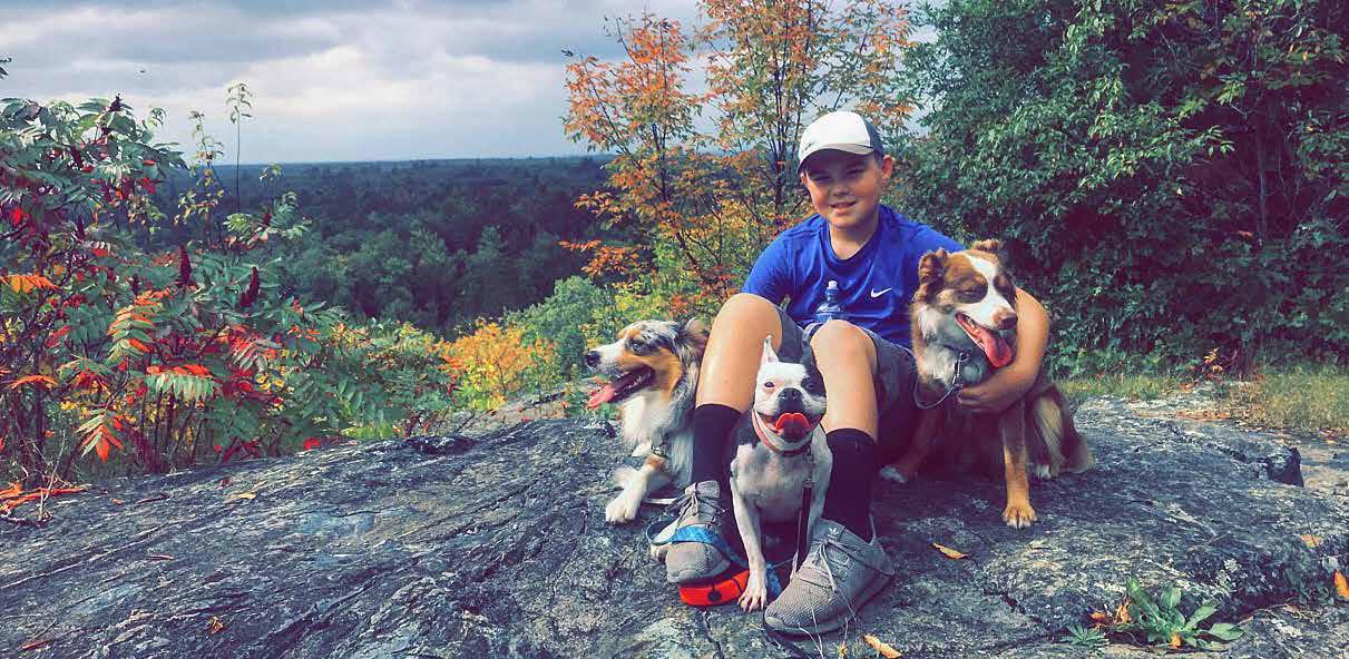
Butler Rock (Butler Rock Lookout Lane, Mountain) A hiking trail was developed in the Town of Brazeau to reach the county’s highest point, called Butler Rock. This two-mile sand trek is not for the faint-hearted, but the views are spectacular, especially during the fall colors. According to one online post, the first half of the (1/3-mile) trail is relatively flat, and you gain most of the almost 200 feet of elevation at the end. Make sure to make it to the summit, which is farther than the first two overlooks. Rock outcroppings are at the top, and it’s very secluded. To get there from Mountain, turn right onto Old 64 Road/Old Hwy. 64, take a sharp right onto Butler Rock Road, and turn left onto Butler Rock Lookout Lane.


Quartz Hill Trail (Highway 32 South, Laona) Discover the breathtaking Quartz Hill Trail located in the Chequamegon-Nicolet National Forest in Laona. This stunning trail cascades into two sections. One portion is located on the east side of State Highway 32, and the other portion is located on the west side. The east section leads across a boardwalk to the top of McCaslin Mountain. It has moderately steep sections, but the view from the top of this quartz rock outcrop is worth the climb. The prettiest time to explore the trail is in fall, when the brilliant fall colors will be visible on the surrounding hills from the overlook.
As you take the pleasant walk through the northern hardwood forest, you will pass a quartz crystal deposit with an informational sign, which describes how early Native Americans came here to quarry quartz to create their tools. The west portion of this trail leads to the site of the Carter Fire Lookout Tower. Once used to spot forest fires, all that now remains are four concrete pilings. Use caution going to the trailhead. It is located on the opposite side of State Highway 32. This is the most popular segment of the trail, and crossing the highway is necessary to access the trail. Also, be mindful that the trail on the east side of the highway is heavily used by ATVs.
Pick a Pumpkin and Watch a Threshing Demo at Historic Farm Day
OCONTO – Gather up the kids and spend a festive fall day on a farm by visiting the Meadow Brook Farm Rural Life Center, 5085 County Road J, Oconto. The farm is hosting its Autumn Historic Farm Day from 10 a.m. to 4 p.m. on Saturday, Sept. 26.

Pumpkins will be available for $1 each. There will be children crafts, antique flywheel engines display, cider press/bottling, threshing demonstration, honey beekeeper demonstration, wine tasting, daily BBQ, needlecraft, and metal arts. Admission is free. For a complete list of activities, demos, and vendors, see the Meadow Brook Farm Facebook page. The mission of the Rural Life Center in Couillardville is to provide a living history museum and nature conservancy that offers a representation of Oconto County’s rural heritage through preservation, restoration, and education.

O O C C O O NTO NTO If hi County County you're lookingto escape to a destination that's full ofcolor, storyand endless opportunities foradventure, then Oconto Countyis the place foryou! With nearly1,000 miles of ATV/UTVand snowmobile trails, the NicoletNational Forest, and the BayofGreen Bay, Oconto Countyis everyoutdoor enthusiast's dream. Plus, a visitto the BeyerHome orCopper
Culture State Parkis perfectforfam ilies and historylovers alike. No matterwhich adventure you choose, Oconto County has a place foreveryvisitorall yearlong!

a a l a s t i n g l a s t i n g L e a v e s L e a v e s i m p r e s s i o n ! i m p r e s s i o n !


www. www. O O c c o o nto nto C C o o unty. unty. o o rg rg UpNorthAction.com | Fall 2020 UpNorthAction.com | Fall 2020

We Care!

We Care! You are all an extension of our family, that is why we have taken additional measures to ensure your well-being, health and safety are priority one. We promise to provide a safe place for you to enjoy your gaming and entertainment!


For a full listing of our health and safety precautions, current promotions, as well as areas of our facility that are open visit our website.
MenomineeCasinoResort.com
N277 Hwy. 47/55 • Keshena, WI 54135 800-343-7778
Put Breakwater Falls on Your Fall Trip Planner

FLORENCE – There’s breaking news on the waterfront. Which is say that a little-known but impressive waterfalls just below the Pine River Dam now has an official name.
Breakwater Falls is one of eight waterfalls located in Florence County’s Pine and Popple rivers. It’s the sixth-largest waterfall in Wisconsin. Until recently, the towering waterfall didn’t even have a name and was omitted from maps, making it one of Wisconsin’s best-kept secrets. Breakwater Falls features three tiers of cascading falls, with rapids, to create a spectacular 60-foot waterfall. Unique rock formations of two-billion-year-old bedrock show the power of the river and beauty of nature. Breakwater Falls changes drastically with water flow: thundering at high flow and intricate ledge flows during low flow. The south side has the best trail, while the north side offers a high bluff view and delicate back channel falls.

To get to the south side, turn west on Power Dam Road off Hwy N. After 1.25 miles, stay right at the Y-intersection. The road dead-ends at the Pine River Dam powerhouse. Park there; walk around the gate and up the gravel road. At the top of the road, follow the signs down to the top of the first tier. The trail along the river is primitive and requires a climb uphill after the third tier to get back up to the road. To see the falls from the north, turn south on Pine River Road off of Hwy D. Follow Pine River Road to the Pine River Flowage We Energies campground. From the parking lot, walk down to the dam and follow the footpath to the falls.
Other Fall Options The fall colors have started. So plan a trip to photograph all hikeable waterfalls in Florence County. Or plan an ATV/UTV color ride on the Blue Ox Trails. Hike, drive, or disc golf to the top of Keyes Peak for the best fall color shot in the county. Or drive Rustic Road #74 in Fence between County C and Hwy 139. Go to ExploreFlorenceCounty.com or the Visitor Center on the corner of U.S. 2 and Hwy 70 for more information.


