PORTFOLIO


CHARTING NULL ISLAND
> Speculative Cartographic Architecture <
> Speculative/Allegorical Architecture <
> Pandemic Architecture < ON LILITH’S HOUSE IN EDOM
MT CRAWFORD'S QUARANTINE FACILITY
RE-DESIGN OF WELLINGTON CENTRAL LIBRARY
> Conceptual Architecture <
CENTRE FOR CREATIVE PRACTICES
> Conceptual Architecture <
2022 - 2023 I SPECULATIVE CARTOGRAPHIC REPRESENTATION
Featured on KooZA/rch, Toffu Co
Thesis Supervisor: Daniel K. Brown
Research Stream: Architecture & Dystopia/Architectural Narratives Stream
This speculative design-led research investigation is 'sited' on Null Island, a 'mythological' island located in the Atlantic Ocean at 0° latitude and 0° longitude, at the intersection of the prime meridian and the equator. While no physical island is actually located on this site, it is marked by a permanently moored weather buoy called "soul". Looking at the geographical location of Null Island from an East-West perspective, the equator is a 'real' line inscribed on the centre of the globe. From the North-South perspective, the meridian through Greenwich England that we consider to be zero degrees of longitude is an ‘unreal’ line. It was designated the Prime Meridian by the British Empire during its greatest period of colonial upheaval, whilst other nations historically had their own guidelines for where the ‘prime’ meridian was located. Viewed in this sense, the Prime Meridian is culturally charged and 'imaginary'. Today, the 'island' marking the intersection of the equator and the Prime Meridian serves as an absolute cartographic reference for navigation databases in computing and placenames. In this sense, Null Island represents a liminal territory between fiction and reality, a place where a natural order, a constructed order, and a digital order coalesce.
In architectural cartography, the spatial potential of the architectural mapping of the unreal, related to the imagination, has been largely absent. The principal aim of this thesis is to explore the dual realms of Null Island — a 'mythical' island at the 'real' intersection of 0° longitude and 0° latitude — by using three-dimensional, speculative cartographic representation as a critical method.
The thesis investigation asks:
How can three-dimensional, imaginative cartographies establish place identity for a placeless place located between fiction and reality?
2022 - 2023 I SPECULATIVE CARTOGRAPHIC REPRESENTATION
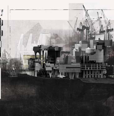
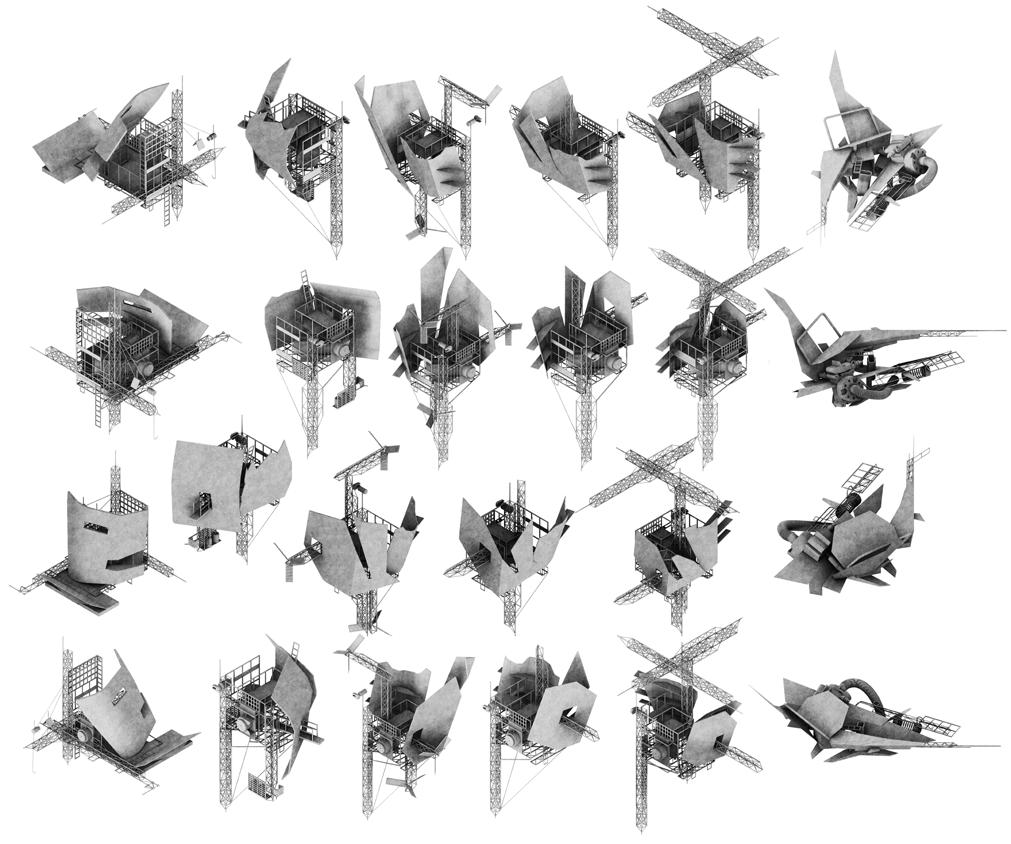
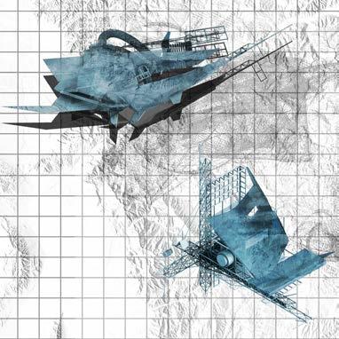
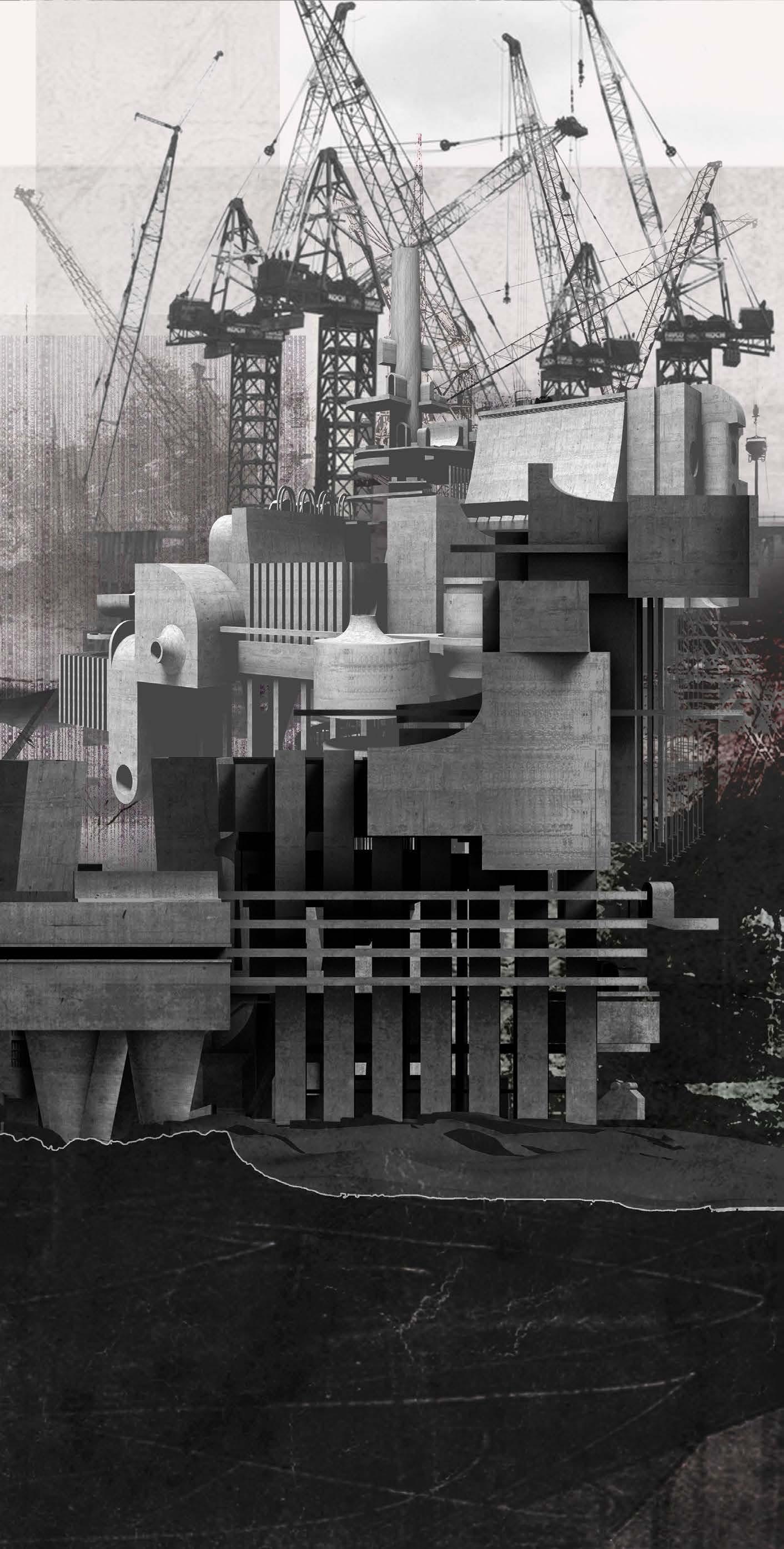
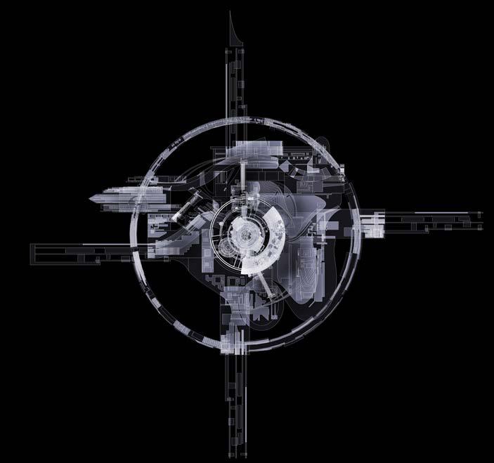
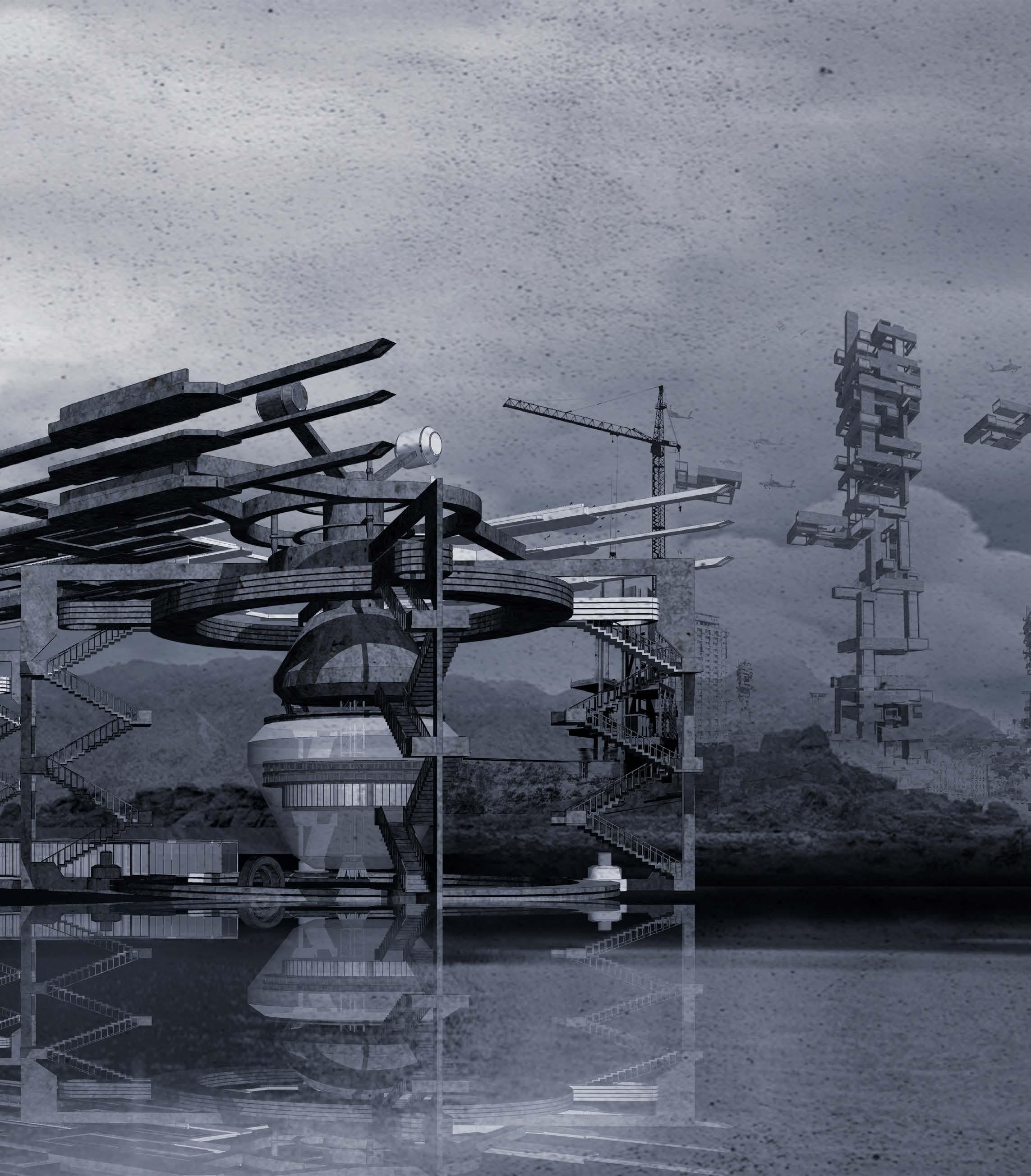
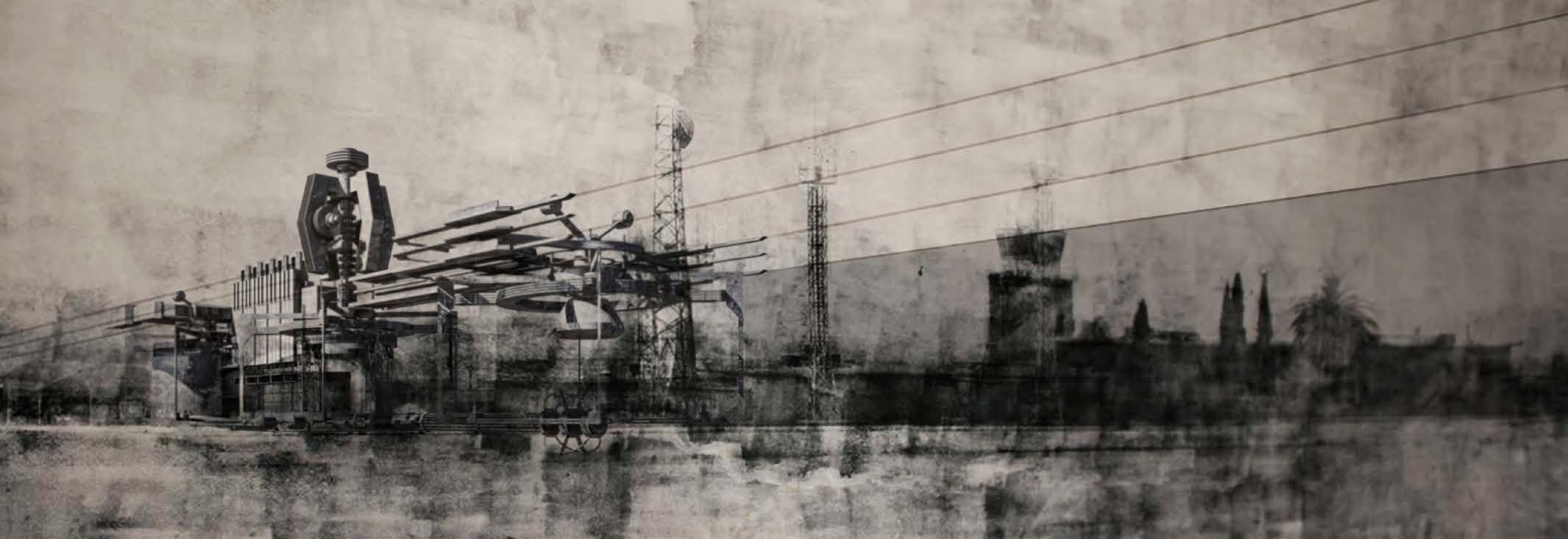
FIG1.2 Axonometric drawing showing architectural notation devices drawing the map on the surface of the ocean.

Thesis Supervisor: Daniel K. Brown
Research Stream: Architecture & Dystopia/Architectural Narratives Stream
CHARTING NULL ISLAND_CONCEPTUAL DESIGN EXPERIMENTS INTEGRATION
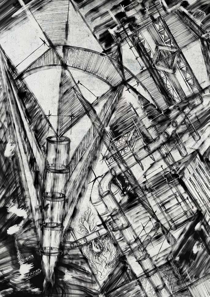
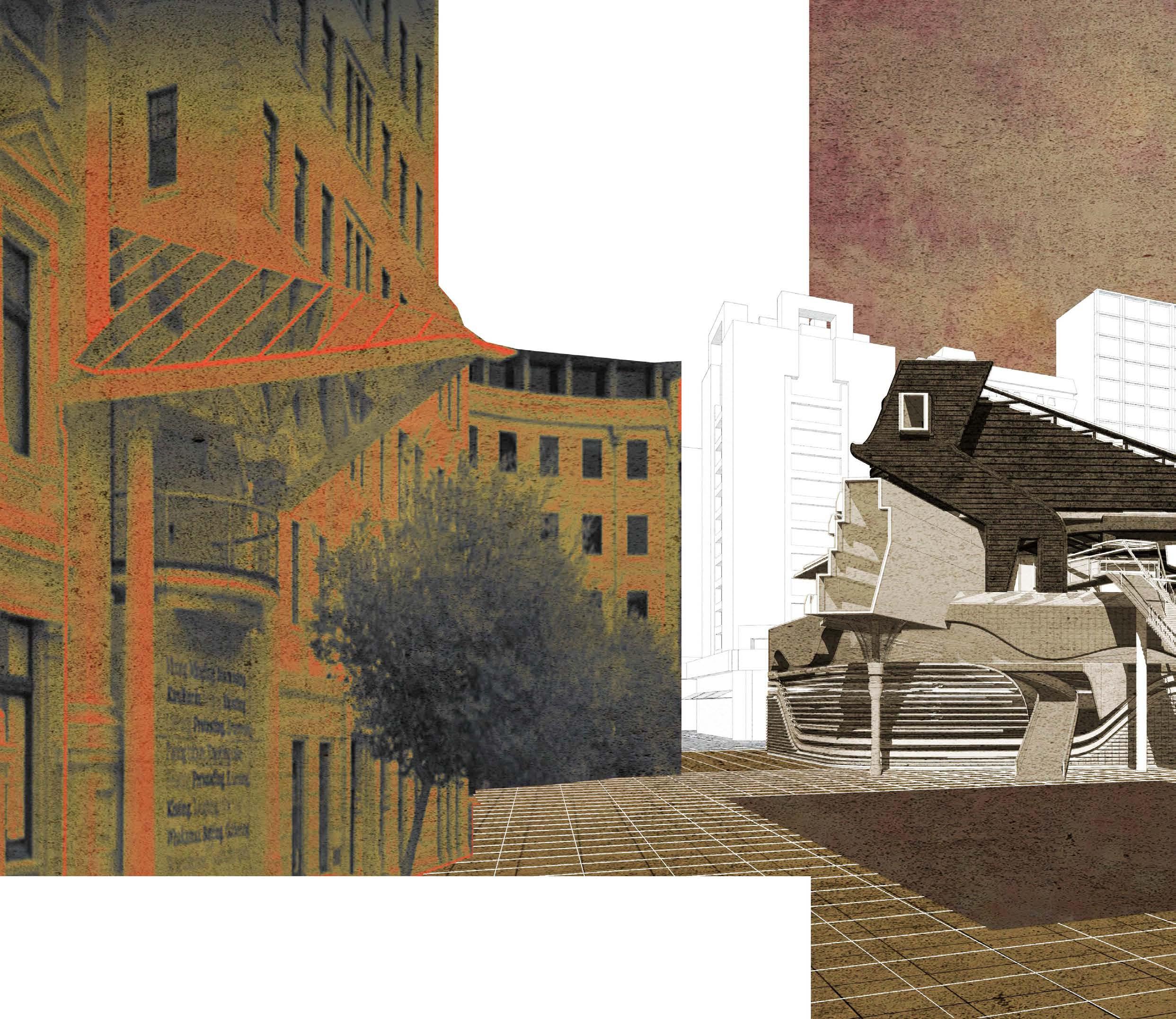
Conceptual Drawings were used to explore the ‘vertical’ overlapping of cartographic representations that traditional cartography does not typically consider. In the case of the research site, Null Island’s ‘identity’ is defined by the ocean floor, the intermediate currents, and the ocean surface. In figure 1.3, Machine-like devices, derived from three-dimensionalised cartographic notations, appear to draw lines upon the surface of the site (see fig. 1.4) where Null Island is located. The axonometric drawing (see fig. 1.2) appears to map the place by simultaneously engaging the topography of the ocean surface, the currents in-between, and the underwater terrain;
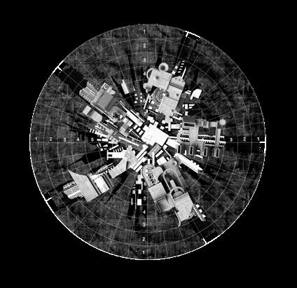
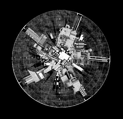
all are of equal importance in the mapping. It portrays a real/ unreal site that is simultaneously topographic, cartographic, and architectural. A sail-like device suggests programmatic functionality, representing the implied dynamic movements inherent to the site, as if the site’s dynamic characteristics may have been caused by architectural interventions.
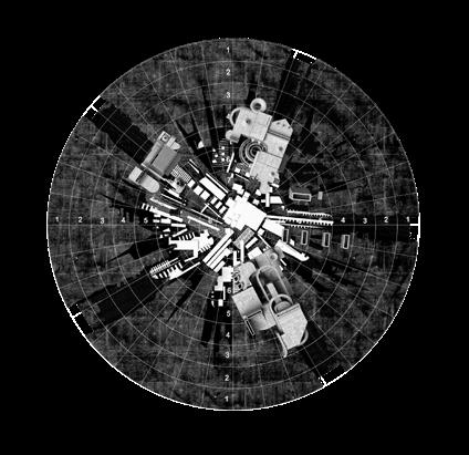
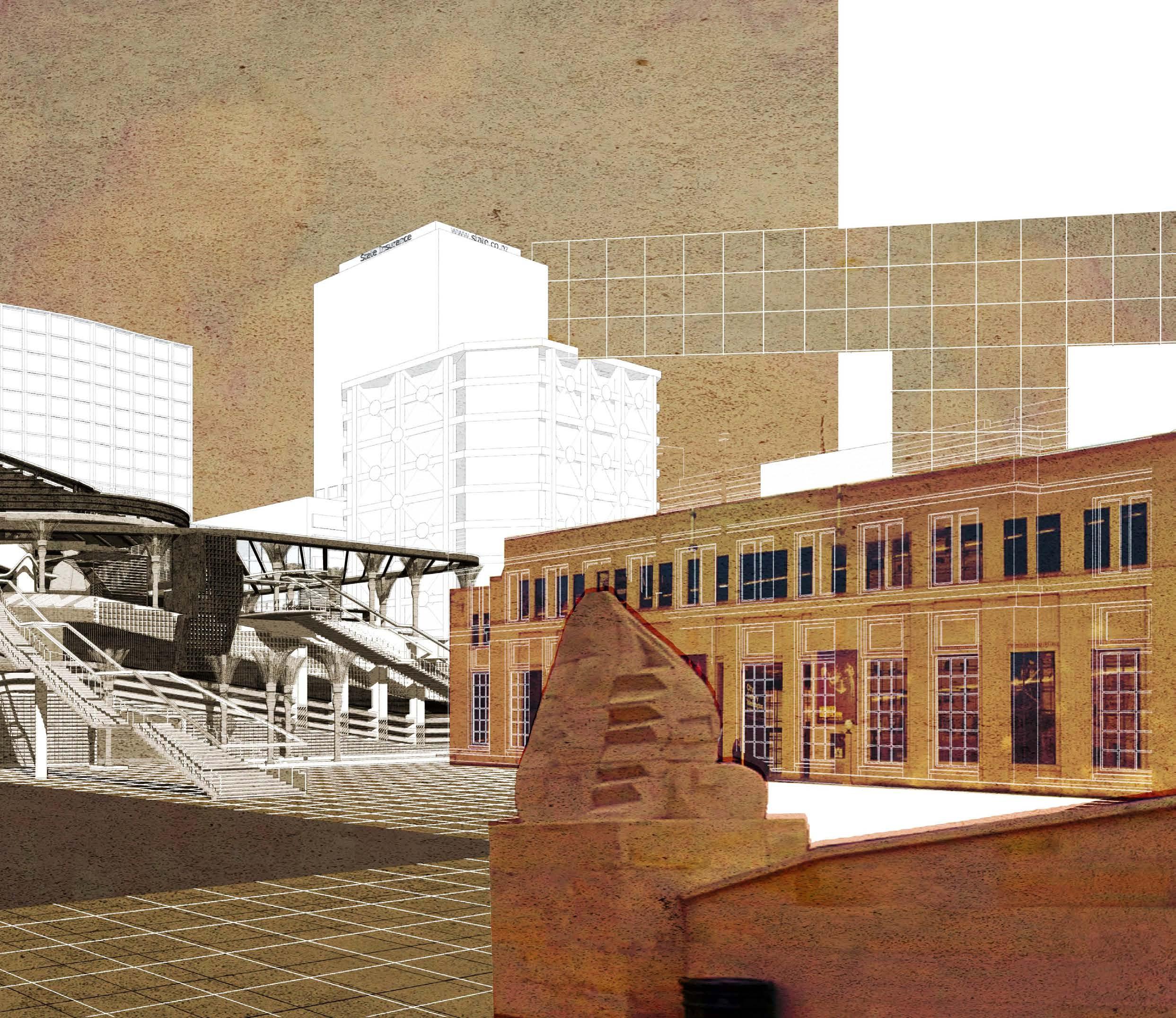
In figure 1.5, drawings were initially reflected upon as temporal and memory fragments of longitude and latitude, which primarily focuses on the investigation of Null Island as a conceptual set of
underwater 'urban textures' that cross the meridian and equator. They take on the form of a collage superimposed onto the previous fictitious plan, creating a hypothetical city layout on the ocean floor. They are presented as a series of 'memory fragments' extracted from historic urban textures from a cartography perspective, which look at the site as a compass rose spanned by the prime meridian and the equator. In terms of temporality, the fragments appear as a continual depiction of growth and decay. They represent the experience of duration and time, past and future––a fictional realm remembering the real world.
2022 - 2023 I SPECULATIVE CARTOGRAPHIC REPRESENTATION
FIG1.8 Urban textures in the form of ruins merge into the natural environment to evoke memory on the site.
Thesis Supervisor: Daniel
K. Brown
Research Stream: Architecture & Dystopia/Architectural Narratives Stream
The ruin as an allegory of memory is fragmentary, imperfect, partial and thoroughly incomplete. There is no clear sign that the meaning of the past is self-evident and easy to decode if you possess the necessary expertise. There is an excess of meaning in the remains: a plenitude of fragmented stories, elusions, fantasies, inexplicable objects and possible events which present a history that can begin and end anywhere, and refuses the master narratives of history, or instance, of the stories which encapsulate places within cycles of boom, bust and decay.
––Tim Edensor, Industrial Ruins: Space, Aesthetics and Materiality 141
CHARTING NULL ISLAND_PRELIMINARY DESIGN EXPERIMENTS THE MOVEMENT OF OBJECTS IN THE DRAWING
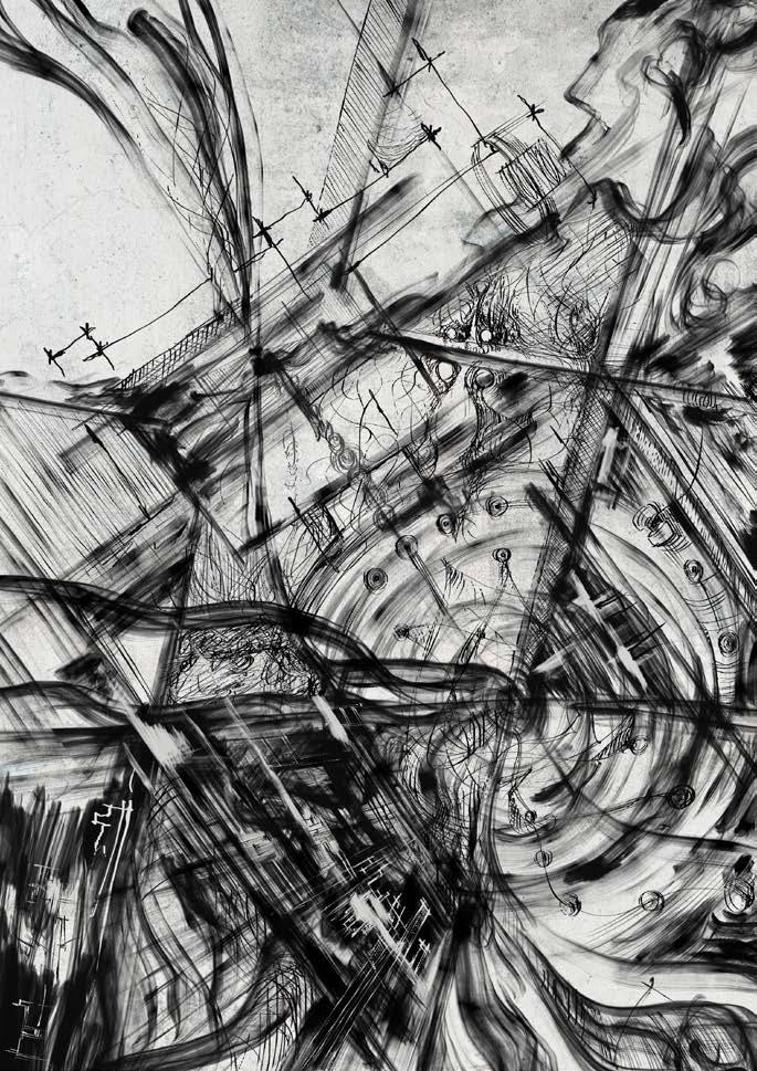
Figure 1.6 and 1.7 illustrates the use of projection lines to re-situate speculative cartographic representations as dynamically transforming temporal and memory fragments. They move between layers of the drawing surface to transform architectural linework into a mapping system that infers and circumnavigates spatiality within the drawing. The movement of the objects, as functioning artefacts, offers potentials for the discovery of dynamic and temporal spatial prototypes. The notion of projection lines suggests a set of known data from the site that affects the architectural form through spatial production.
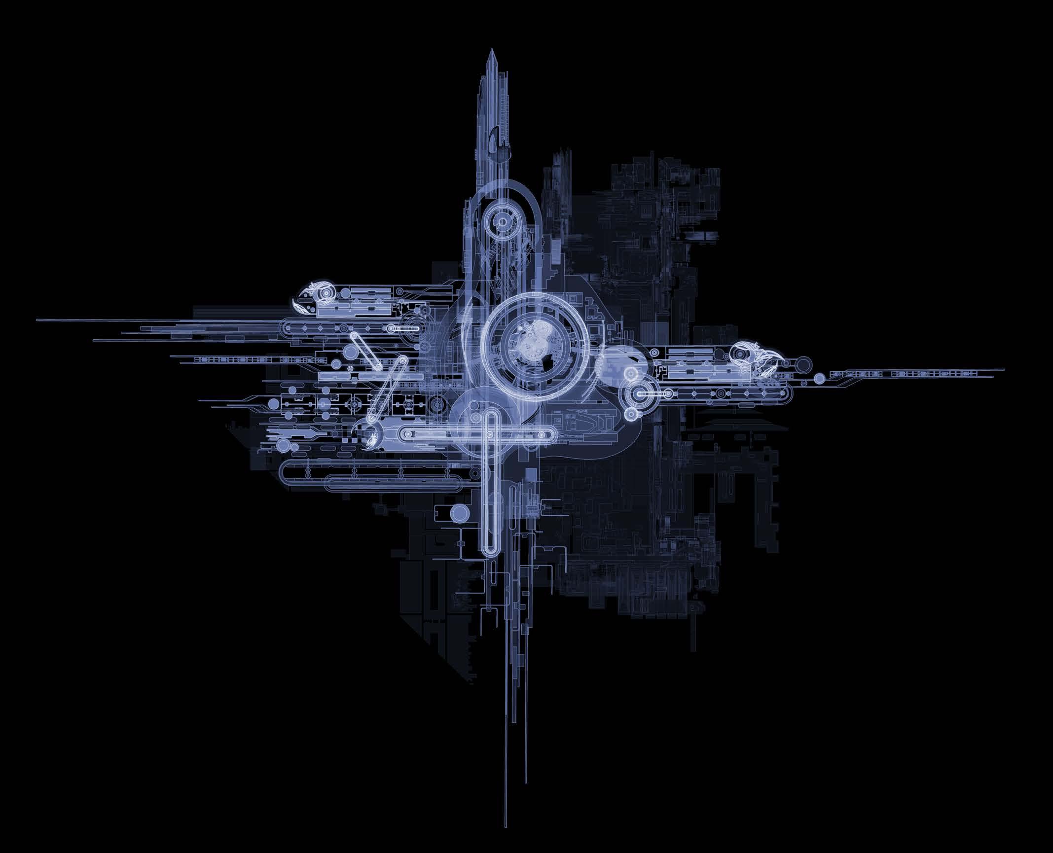
In figure 1.6, the architectural device is represented by two mechanical armatures moving across the drawing plane that simulate the ‘whirlpool’ created by the ocean at this site over time. The use of the projection lines aims to outline a vortex that turns into an architectural barrier, which is further developed in the next experiment. Figure 1.7 can be seen as a combination of the representation of plan and elevation drawings simultaneously appearing in the same plane. By suspending the architectural device vertically, the longitude line represented by the horizontal mechanical armature divides the architectural device into two parts: the upper part can be regarded as a 'Soul' Buoy in reality, while the lower part can be seen as a metaphor for the imaginary world underwater, both located at the intersection of the Prime Meridian and the Equator. This series of drawings invite the architectural device to manipulate the drawing composition itself, which provides a dialogue between drawing and building, while allowing a more architectural spatiality through the speculative cartographic drawing.
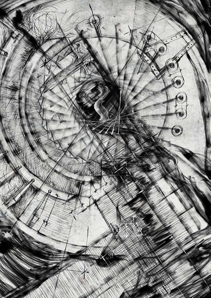
In figure 1.8, the drawing builds upon the previous plan experiment by considering its appearance in elevation. It explores dynamic confrontations between environmental and man-made architectural objects, to encourage the architectural fragments to blend with the natural environment and undergo a dynamic transformation. The transformation from architectural fragments as man-made architectural objects into the form of ruins generates a temporal dialogue between the past and future, memory and point of view.
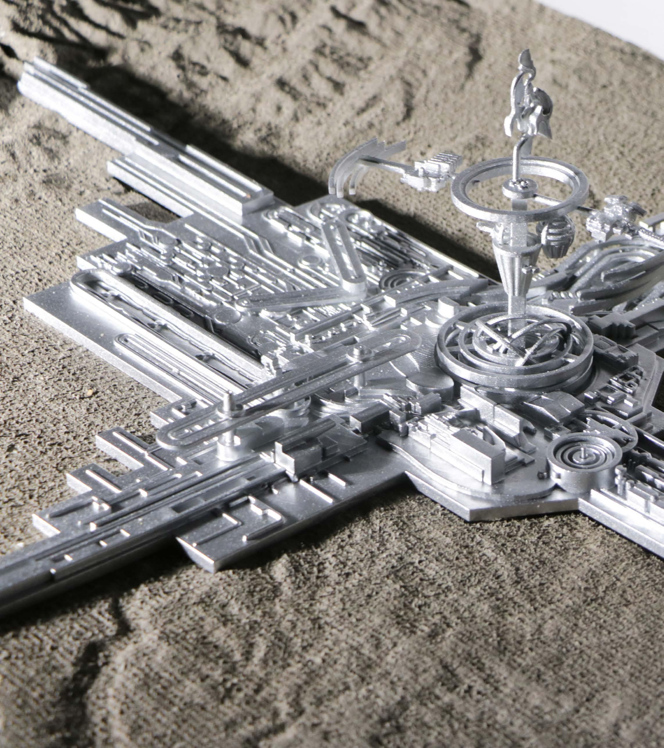
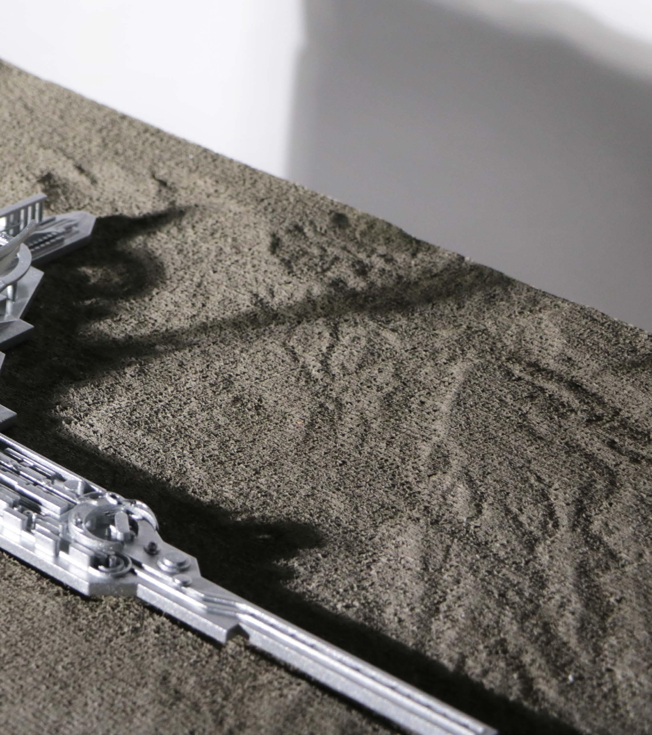
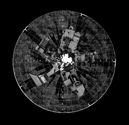
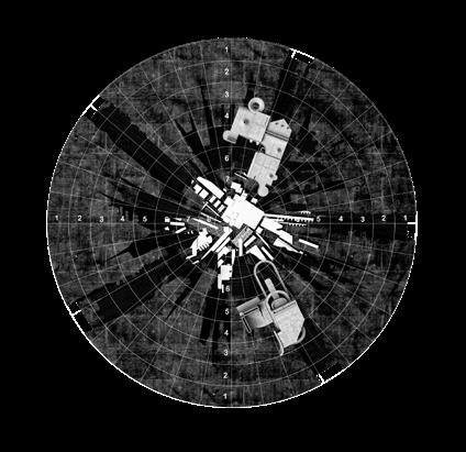
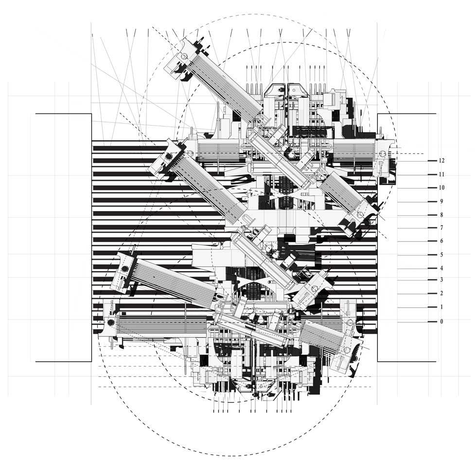
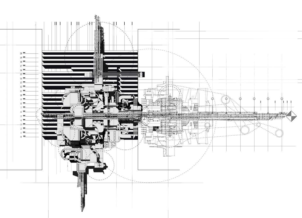
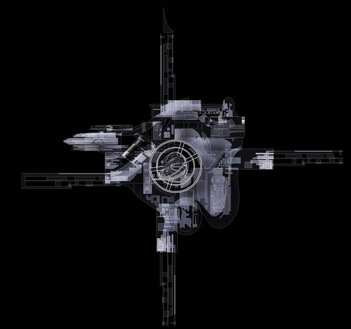
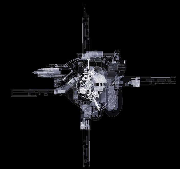
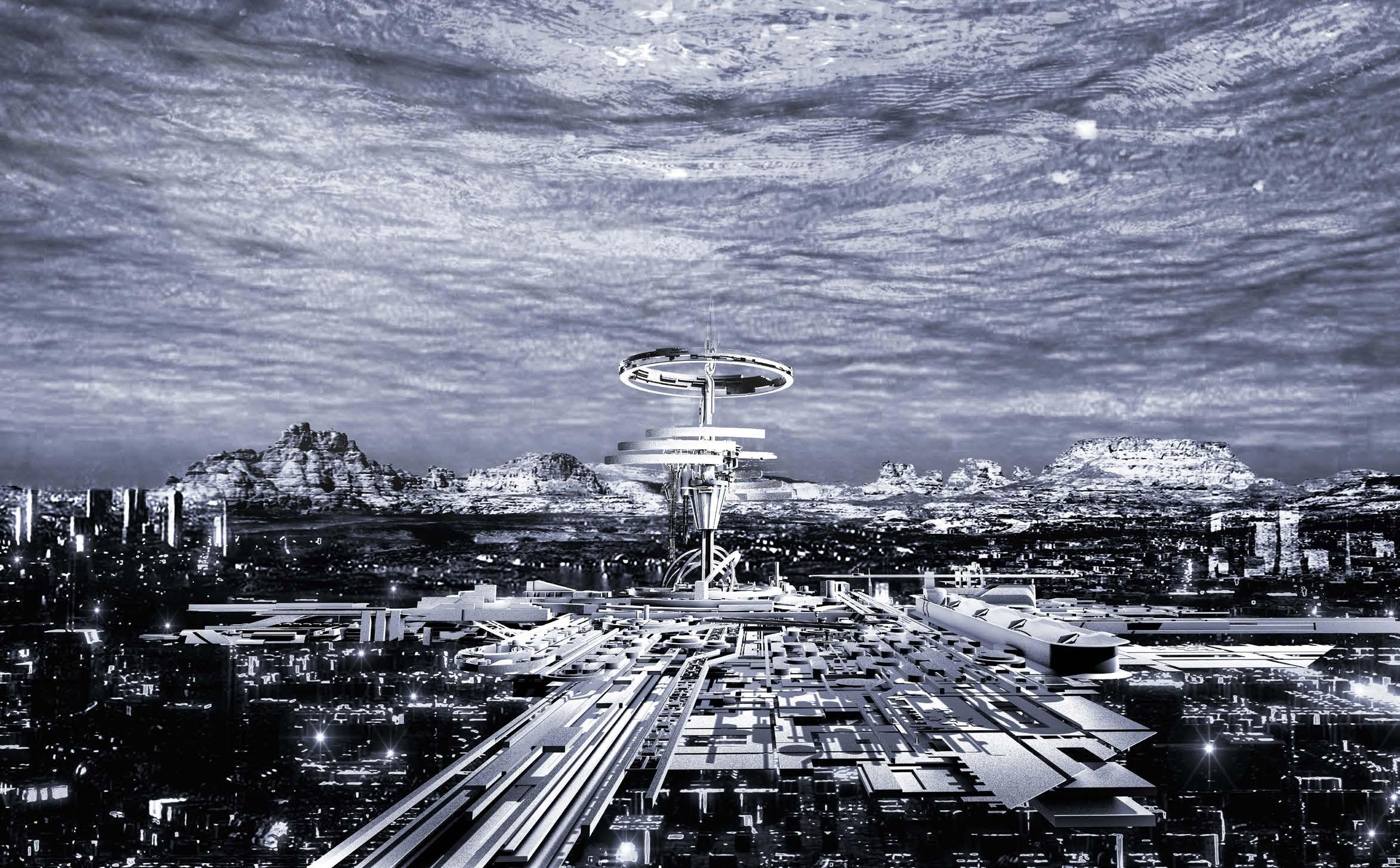
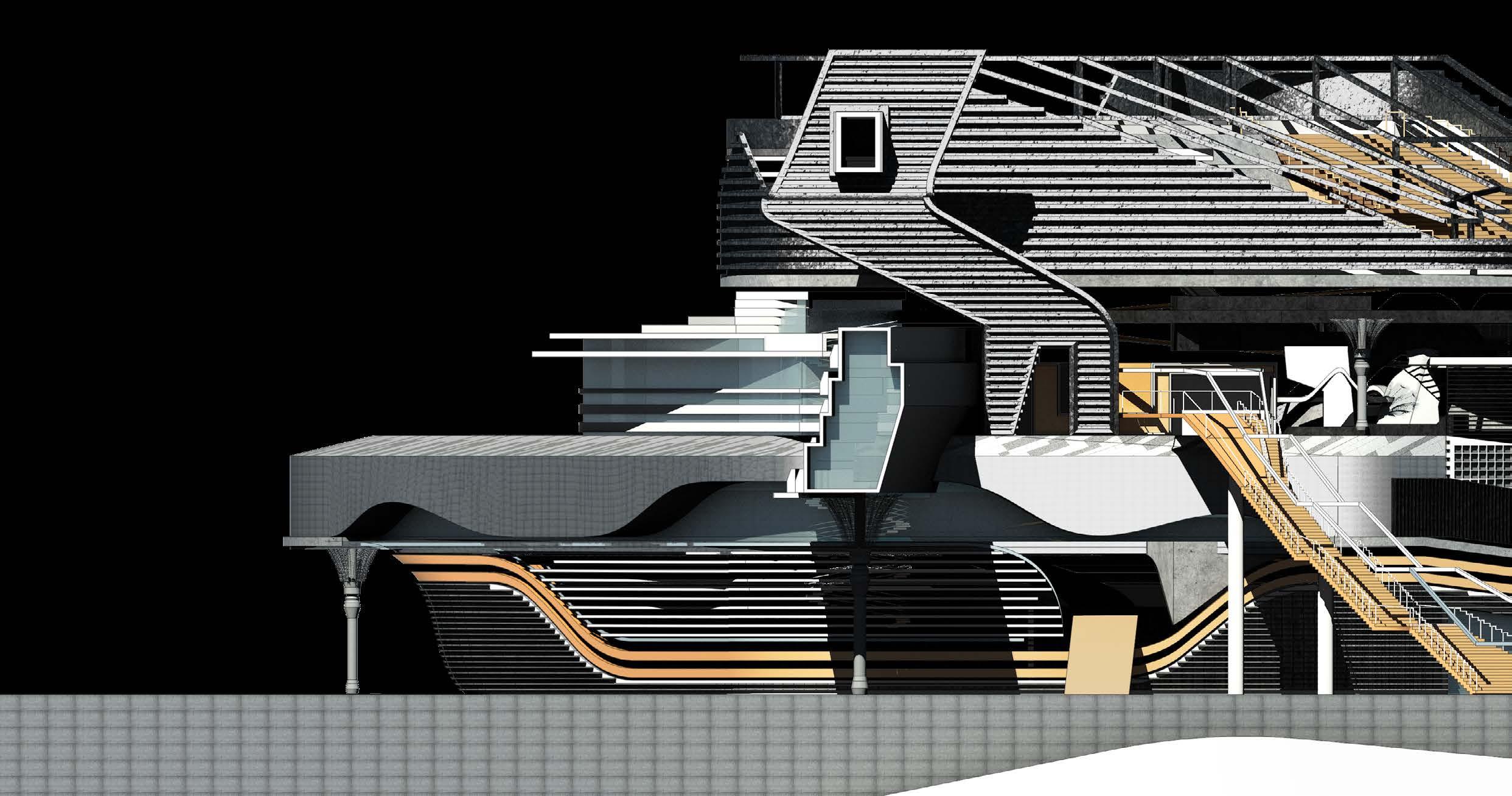
FIG1.9 The master plan of the architecture and the site.
CHARTING NULL ISLAND_DEVELOPED DESIGN EXPERIMENTS INTRODUCING THE THREE LAYERS
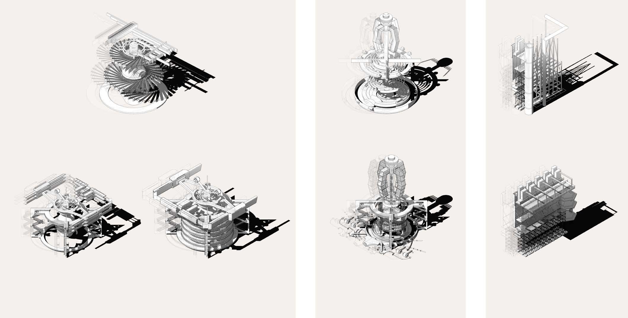
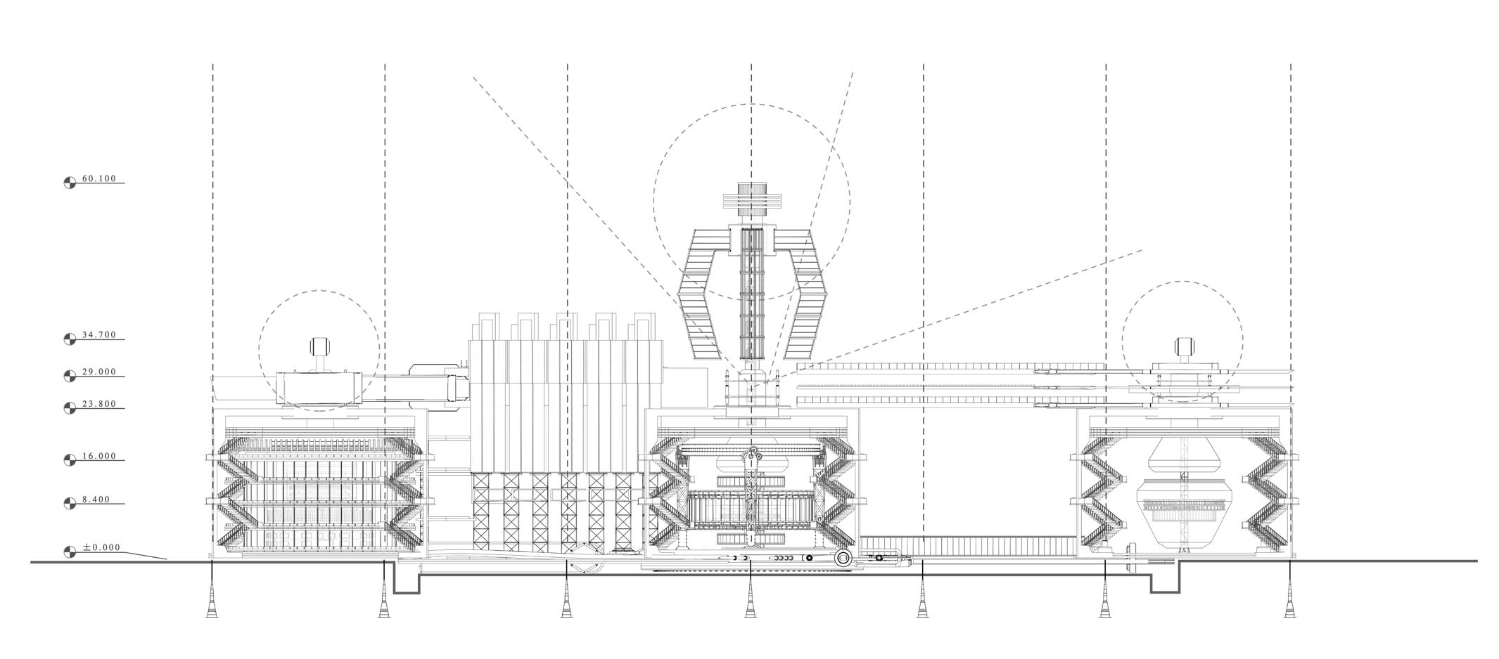
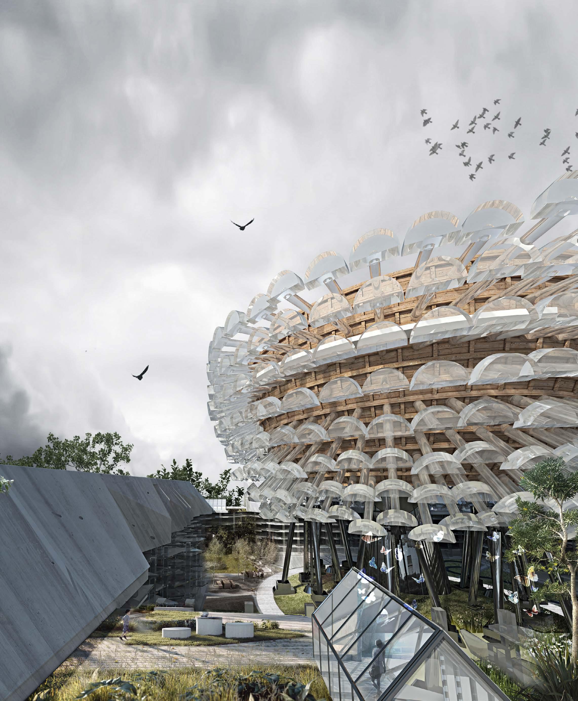
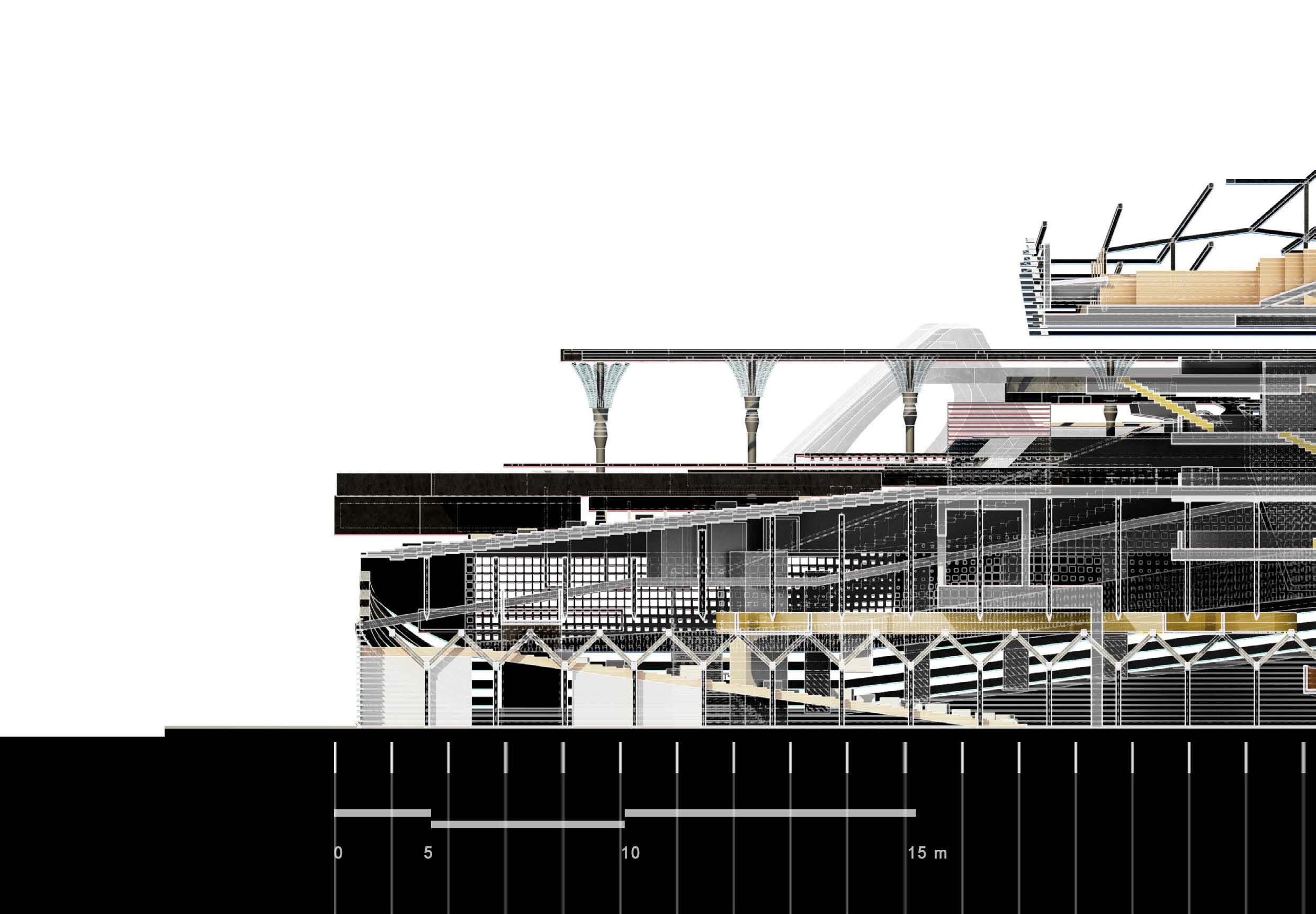
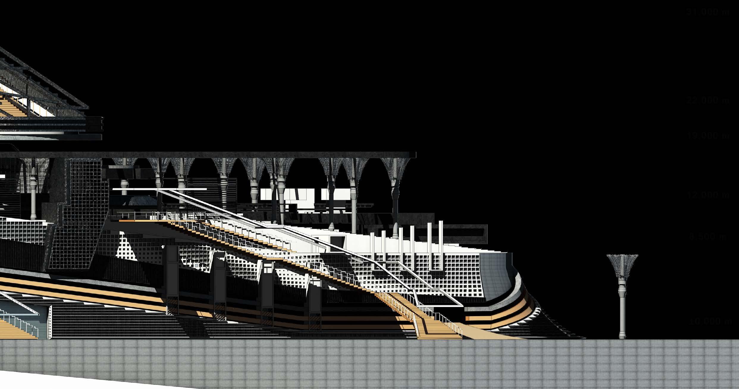
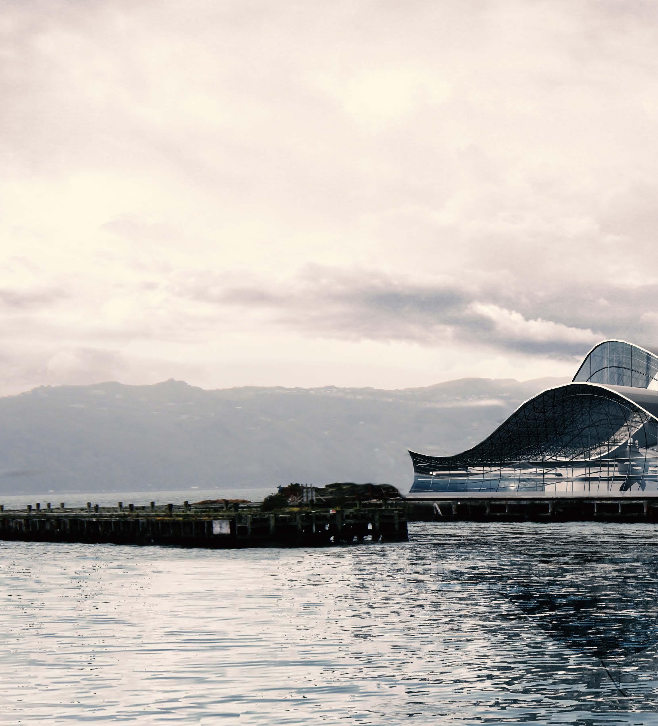
The architectural device is divided into three vertical layers. The bottom layer is represented as a realm of temporality and memory sited on the ocean floor that chronicles the shifting patterns of sand. The intermediate layer represents a realm defined by the dynamic movements of the ocean currents. The top layer builds upon the three armatures in the previous experiments; they stand hidden just beneath the ocean surface, continually spinning and causing the ocean waves to surge. All
that can be seen from the surface is the tip of one armature, which takes on the form of the Soul Buoy. The architectural device appears to be composed of an infinitely expandable series of parts in a changeable environmental system, simultaneously providing a dual place identity of both mythical and real. The three principal plans (see figs. 1.10 – 1.12) are located on the sand, current, and ocean layers. Each plan represents one 'unit' of a habitable community in the sea, assembled as a new urban
archetype to offer a solution to marine pollution. In the lower plan, the circular architectural barrier appears as a baseline, against which the dynamic transformation of form that is theoretically changed by ocean conditions can be assessed over time. Programmatically, the building is conceived as both the source of the ocean’s turbulence, as well as an archive for the continuous recycling and recovery of marine waste, oil pollution, etc. The dynamic transformations and rotations throughout
Thesis Supervisor: Daniel K. Brown
Research Stream: Architecture & Dystopia/Architectural Narratives Stream
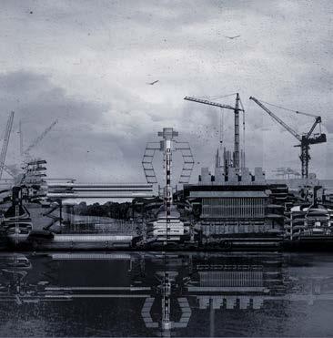
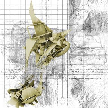
The perspective of the architecture located in Null Island looking at the ocean surface.
the building stir and gather these pollutants together, and the progressive filling of ‘memory chambers’ with the earth’s discarded fragments becomes an allegorical ‘timeline’, showing the effects of mankind’s treatment of the earth. The complex on the ocean floor, extending in the direction of the Prime Meridian and the equator, physically re-presents the latitude and longitude lines as architectural components of the building, progressively covered and uncovered by ever-changing fluid patterns of sand.
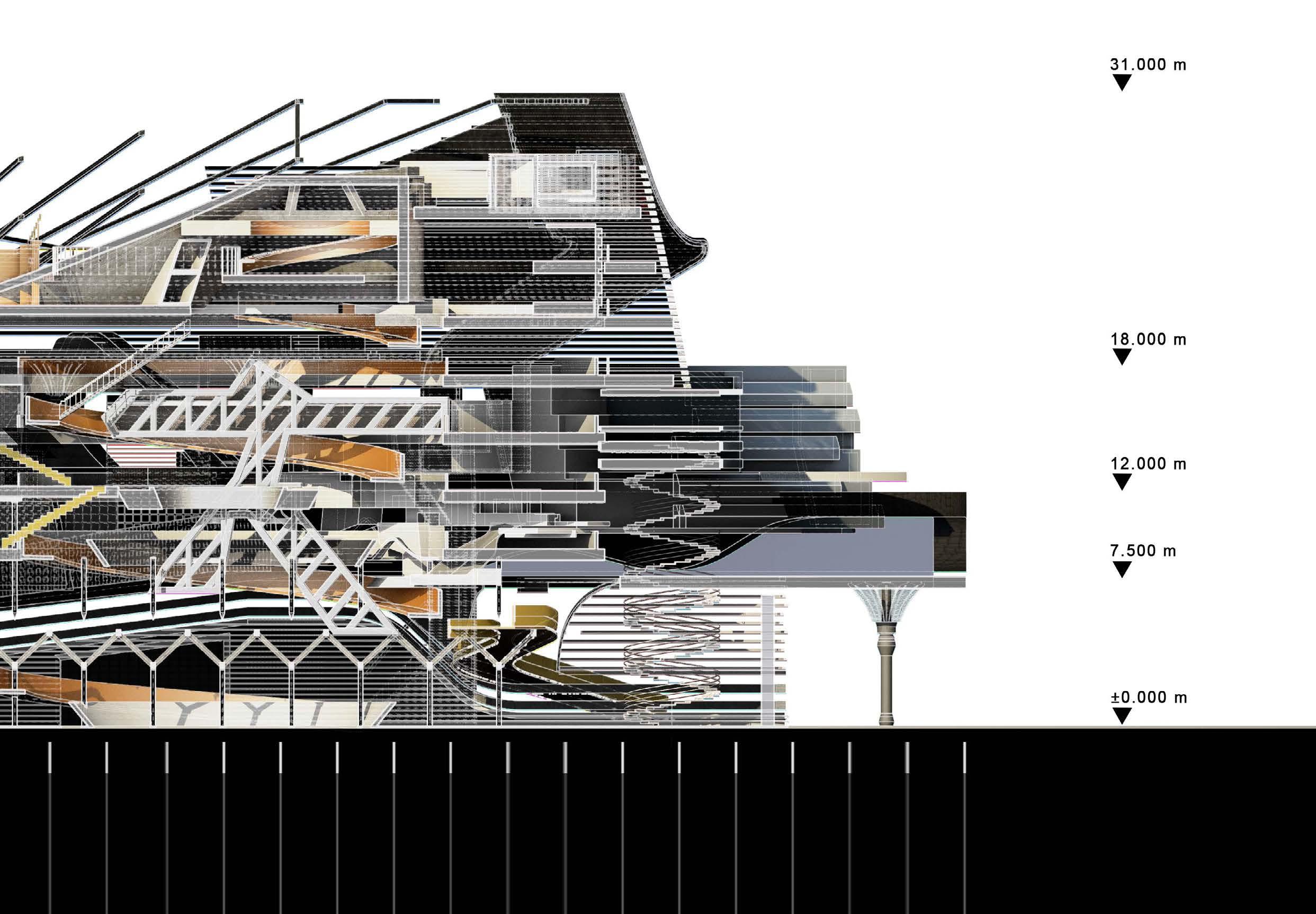
THE INFINITELY EXPANDABLE SITE AND THE INTERIOR SPACES
Figure 1.14 explores the middle of the three zones of the
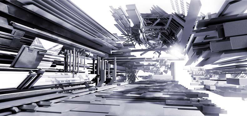
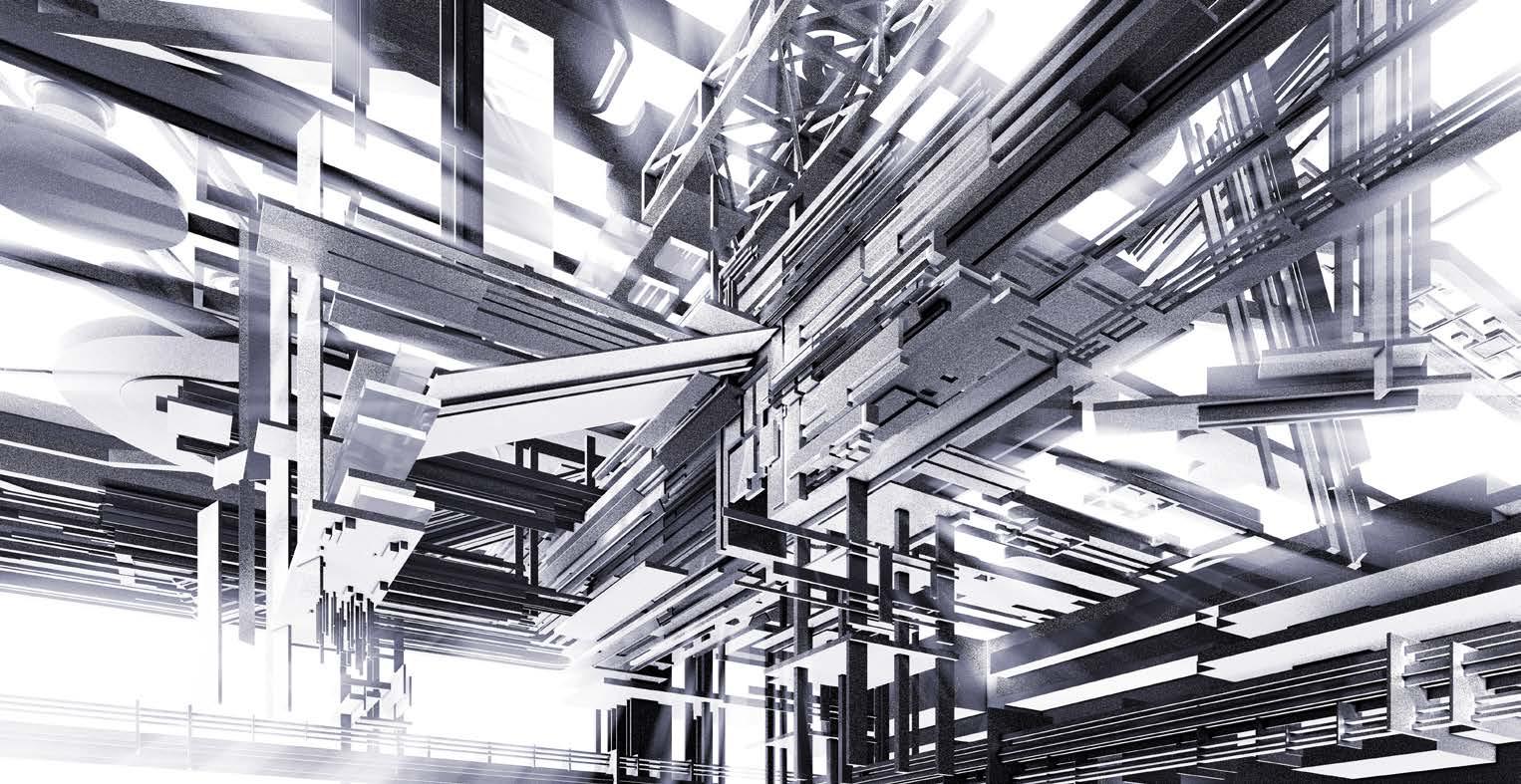
The selected interior perspectives show the habitable architectural environment.
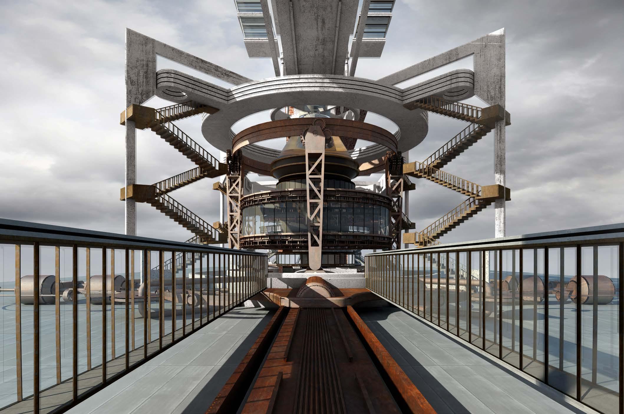
structure that is defined by the flowing ocean currents. The aim is to build upon the previous design experiment and attempt to investigate the habitable interior spaces of the three-dimensional cartographic architecture that blends into the site as a set of cause-and-effect mythical relationships with reality. Figures 1.15 and 1.16 offer a fresh perspective to witness the composition of the architecture and the site. The series of interior renders seen in figure 1.14 draws from the earliest design experiment that was constructed with the real and unreal, 'memory fragments' and 'temporal fragments' over time. The interior spaces are consistently changing with the transformation of the infinitely expandable site, which acts as the foundation of the architecture
in response to imaginative cartographies, implied dynamic transformation, temporality, and memory. The spaces feature situations of liminality and transformation, within memory and temporal space, created to invite viewers to travel and imagine the space that lies between fiction and reality.
Figure 1.13 explores the upper of the three zones of the structure that is defined by the turbulent ocean surface. Its counter-pivot creates the turbulence, inviting the ocean’s detritus to settle to the bottom where it can be collected and stored: a memory archive of mankind’s destruction of the environmental systems. Once the archive is full, the machine will come to a stop. The ocean currents will no longer flow, and the seas will rise above

Design Tutor: Daniel K. Brown
Project Stream: Architecture & Dystopia/Architectural Narratives Stream
This design-led project uses architecture to interpret a story from the Book of Isaiah According to early translations of the Book of Isaiah, the first wife of Adam before Eve was Lilith, who was created from mud. When Lilith turned to sin, God cast her out of Paradise to live in Edom, an apocalyptic city that had been smote into ruins by God. This project reflects on Joseph Rykwert’s On Adam’s House in Paradise (1971) from the alternative point of view of the dystopian condition. On Adam’s House in Paradise is a seminal book on the origins of architectural dwelling. Structured as a mythological quest for the origins of the first hut, it effectively critiques what Adam’s house would have looked like in the Garden of Paradise. This project is a contemporary, design-based counterpoint to Rykwert's analysis of the utopian hut. "On Lilith’s House in Edom" critiques what Lilith’s house––also a first dwelling––would have looked like in the dystopian city of Edom, while Adam and Eve resided in a very different house in the utopian Garden of Paradise.
This project investigation asks:
What happens to architecture when the image of nature changes, and when the laws of nature change?
As the worst of the venom left my lips, I thought, ‘If, despite this lie, he strips The mask from my soul with a kiss — I crawl His slave,—soul, body, and all!’"
— Browning 1883
‘If Paradise-door prove locked?’ smiled you. I thought, as I nodded, smiling too, ‘Did one, that’s away, arrive—nor late Nor soon should unlock Hell’s gate!’
— Browning 1883
It ceased to lighten and thunder. Up started both in wonder, Looked round and saw that the sky was clear, Then laughed "Confess you believed us, Dear!"
"I saw through the joke!" the man replied They re-seated themselves beside.
— Browning 1883
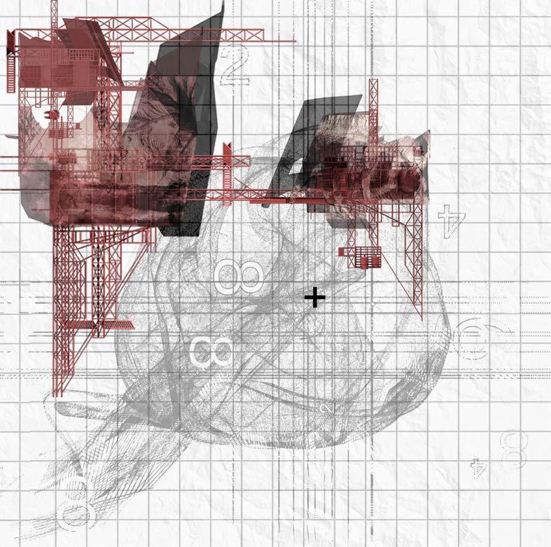
FIG2.3 The concept diagram shows the transformation from drawing elements to integrated machines that symbolise the allegory.
REMEMBERING Memory
MACHINE: Camera Obscura PROGRAM: The Viewing Room
REMEMBERING Temporality
MACHINE: Camera Obscura PROGRAM: The Archive
The Victorian poet Robert Browning re-envisioned Lilith in his poem "Adam, Lilith, and Eve". The poem uses the traditional myths surrounding the triad of Adam, Eve, and Lilith. Browning depicts Lilith and Eve as being friendly and complicitous with each other, as they sit together on either side of Adam. Under the threat of death, Eve admits that she never loved Adam, while Lilith confesses that she always loved him:
I thought, 'If, despite this lie, he strips The mask from my soul with a kiss — I crawl His slave, — soul, body, and all!
SURVERYING Place
MACHINE: Theodolite PROGRAM: Generator Room
PROGRESSING Direction
MACHINE: Loom PROGRAM: Mechanical Plant Room
Each drawing is composed of a myriad of integrated architectural languages translated from the ancient carvings and sculptures to portray Lilith that symbolise place identity over time: a woman with wings flanked by bird owls; a "dwelling of the night" and associated with night demons or creatures; a clock that keeps the time; castles are overgrown with thorns with the rise of the smoke, while hoot owls nest in the shadow of the "night" (The name Lilith translates as "night" in the Hebrew root word). ON LILITH’S HOUSE IN
As the worst of the venom left my lips,
— Browning 1883
Browning focused on Lilith's emotional attributes, rather than that of her ancient demon predecessors. In figure 2.2, as an architectural allegory, three drawings respectively imply Lilith's mental journey after learning the truth: shock, struggle and fall.
Design Tutor: Daniel K. Brown
Project Stream: Architecture & Dystopia/Architectural Narratives Stream
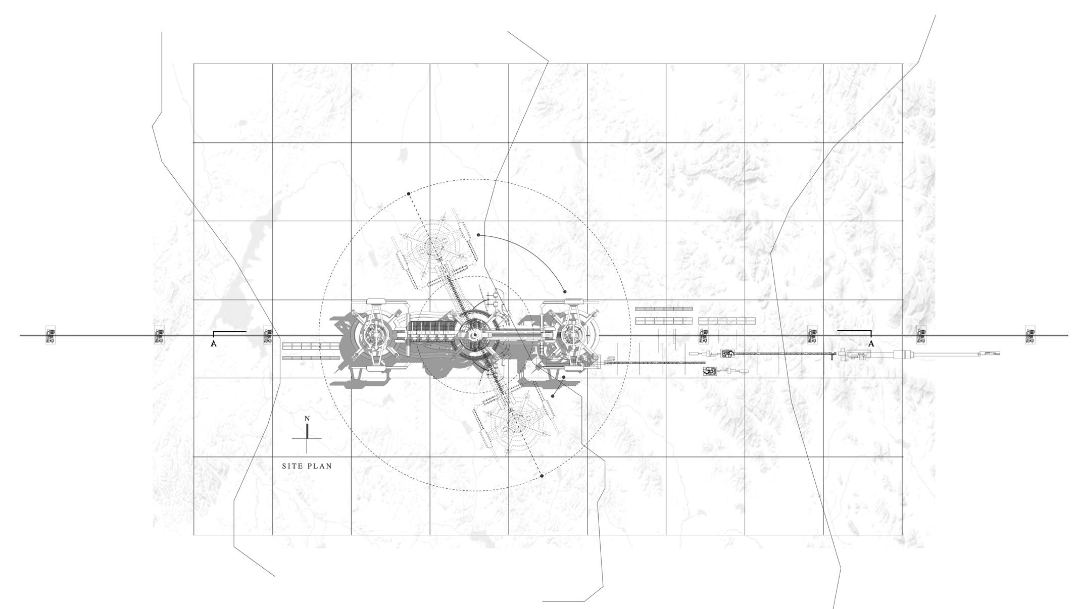
FIG2.4 The plan shows the armatures moving across the site.
The section shows the relationship between three primary volumes.
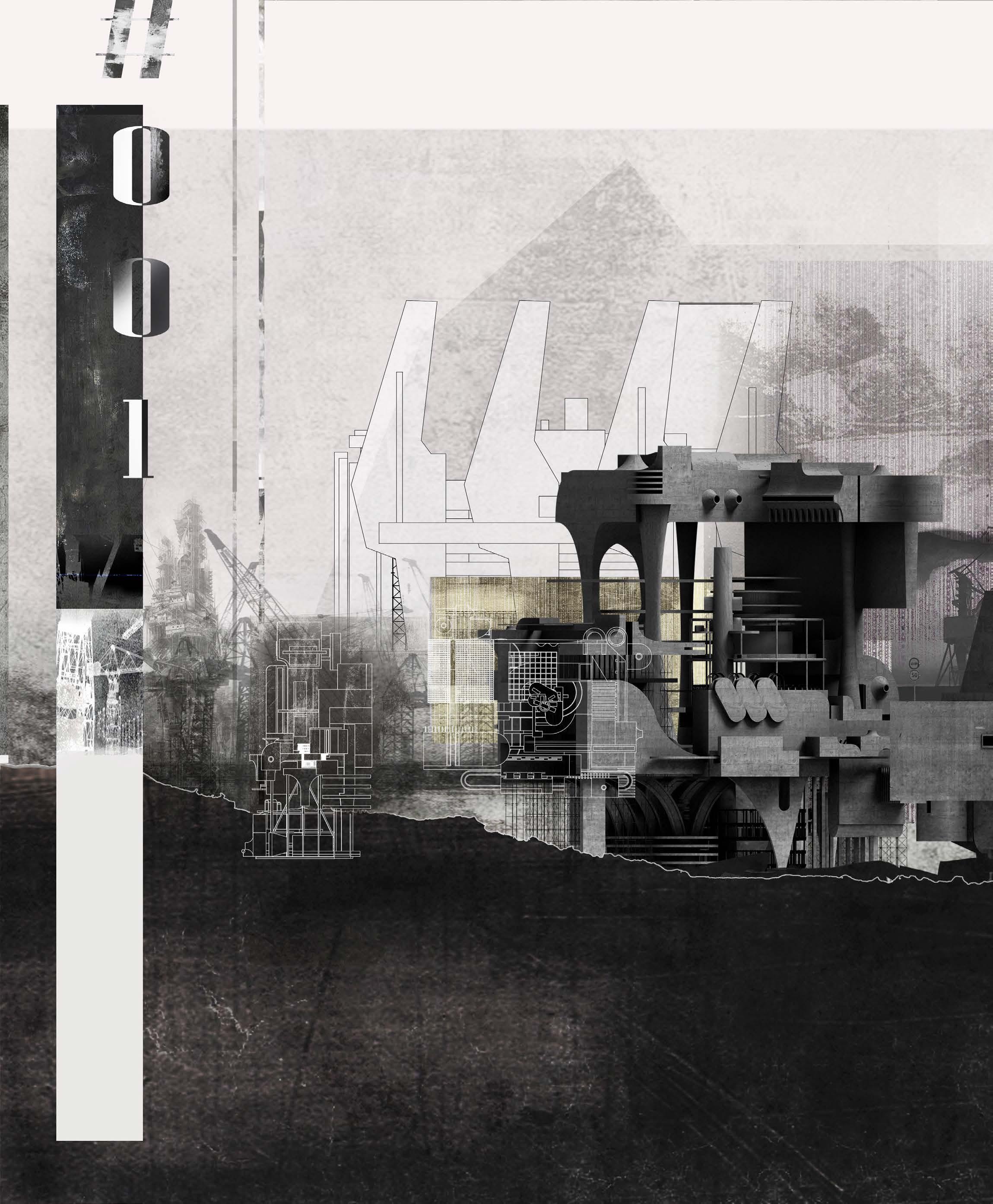
The perspective shows the allegorical architecture located on historic industrial sites.
FIG2.7 The section shows the habitable architectural spaces in the building.
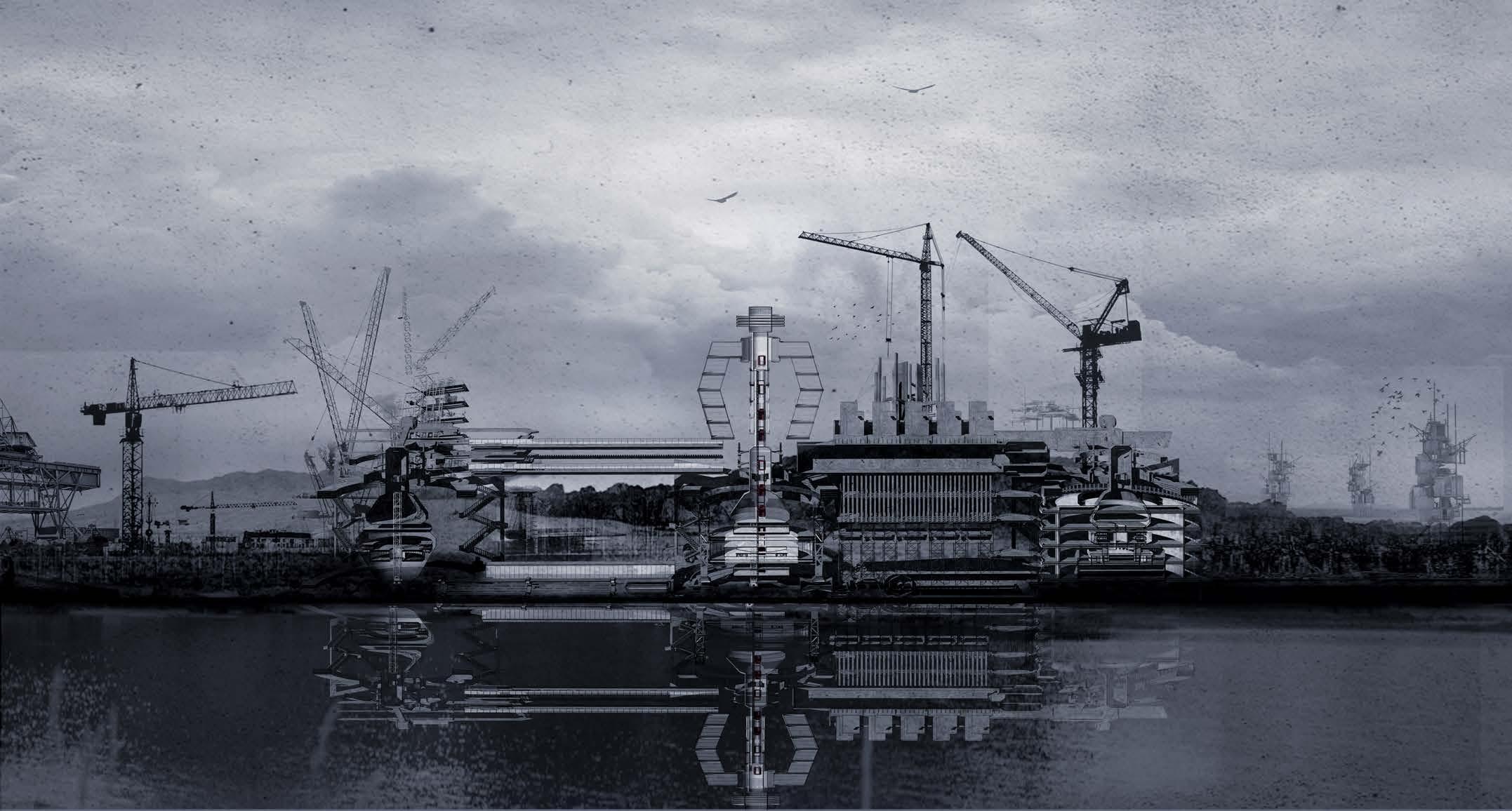
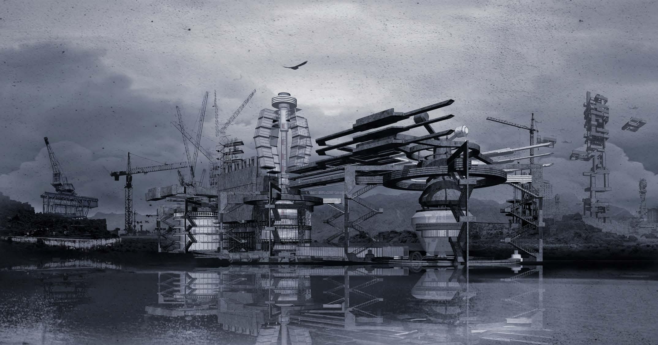
FIG2.8 The exterior perspective shows the habitable architectural environment located on historic industrial sites.
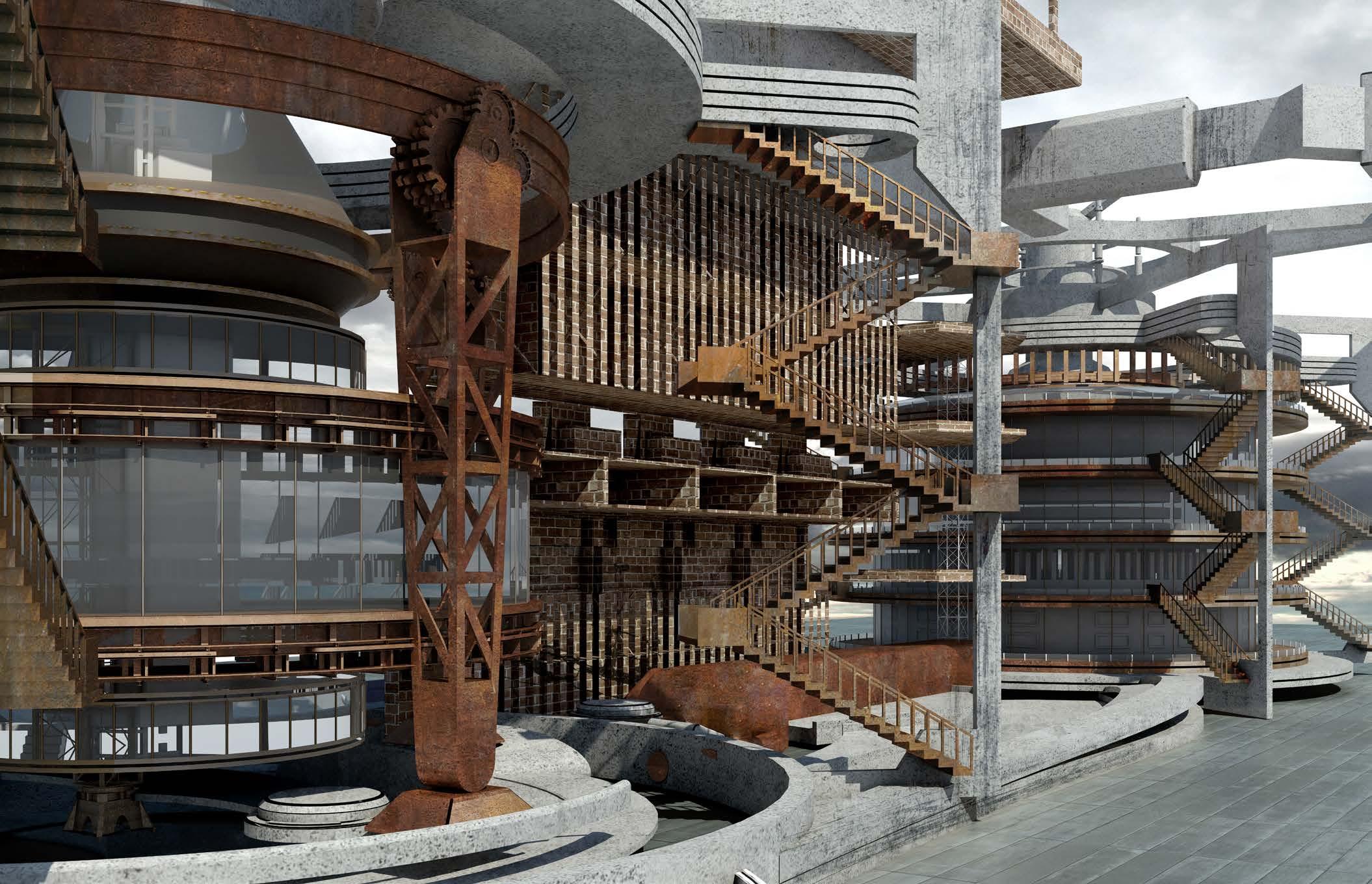
The overall programme for the project investigation is a contemporary programme such as tourism that provides the economic ability to foster a new era of heritage and conservation. This allegorical architecture argues that conventional programme approaches to interventions can often destroy the heritage they advocate preserving. The project proposes testing guerrilla architecture as a viable new approach for contemporary design interventions on historic industrial sites; guerrilla architecture interventions can both challenge and strengthen the notion of place. The thesis argues that guerrilla architecture interventions can become active participants in the on-going evolution of the site’s history. Often such historic industrial sites are dangerous
and fragile. This project investigates habitable guerrilla architectural interventions that are responsive to the progressive evolution of a site’s decay. The project argues that different types of guerrilla intervention can offer different modes of experiencing a site by framing significant moments within the site’s history while retaining them safely at a distance.
Often important historic architectural moments are concealed by the very ruins themselves. This project proposes that by acknowledging and unveiling layers of significance hidden within the rubble, guerrilla interventions can safely begin to reactivate, reconstruct and redefine these lost significant moments and
reclaim the historic site as viable once again. Figure 2.9 shows the cooling tower of an abandoned power plant in the industrial heart of the dystopian city of Edom. These obsolete archetypes are ideal vehicles for the conception of speculative architectural interventions necessary for the near-future. Through their inhabitation, as opposed to their destruction, community and industrial heritage can be maintained and celebrated. This project proposes that this can be achieved by introducing a forwardlooking architectural program providing a utopian identity to Edom – making it self-sustaining and independent from existing urban infrastructure – and enhancing the narrative potentiality of the site.
Design Tutor: Daniel K. Brown
Project Stream: Architecture & Dystopia/Architectural Narratives Stream
You can't build an entire separate infrastructure to sit there empty in case of a pandemic, but you can build a shadow pandemic architecture into your existing architecture by thinking through your needs. Can you mandate that these large structures are transformable?
Geoff Manaugh
This project presents an opportunity to investigate other architectural possibilities for quarantine in the Wellington area. It aims to test and explore the physical, ethical, spatial, social, political and temporal aspects of quarantine through the design of a quarantine facility. During the pandemic, hotels were semicolon re-purposed to provide temporary shelter to isolate traveller, however, this may not be the best longterm solution as humans are a social species. This project investigates the typology of contemporary quarantine and how to maintain physical isolation while remaining socially connected. The principal aim of this project is to explore how can architecture be used to deal with future pandemics.
The project investigation asks:
How can quarantine infrastructure include other programmes or be reconfigured to extend its use beyond the immediate need for quarantine?

Design Tutor: Victoria Willocks
Project Stream: Conceptual Architecture Stream TZ
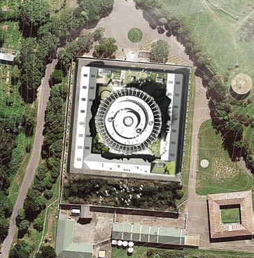
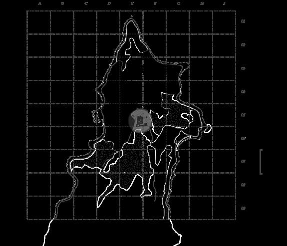
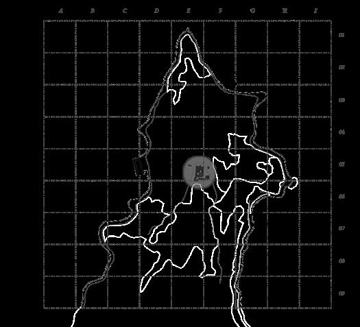
- Located on the western side of the peninsula in close proximity to the Wellington Harbour. Meanwhile, it is also the potential port nearest to Mt Crawford Prison. Scorching Bay - Situated on the east side of the peninsula, it has a closer connection with the town due to the urban structure, making it relatively complicated for the transport and control of the people under quarantine. Capacity: Though the existing facility can accommodate about 200 people, the capacity of the current facility system is sufficient compared to the overseas arrivals and quarantine capacity in New Zealand. Therefore, the underutilized or abandoned architecture can be renovated under the current quarantine system. MT CRAWFORD'S QUARANTINE FACILITY_SITE ANALYSIS
Mt Crawford is the entrance to the Wellington Harbour. It provides precious research value to architectural quarantine in Wellington under the COVID-19 pandemic with its advantageous geographical location, and special relationship with cities. In figure 3.2, the site analysis of Mt Crawford reflects the possibility, strengths, and weaknesses of Mt Crawford to serve as the quarantine architecture in Wellington. Green Cover Ratio: The advantage of the site lies in the functionality and concealment of the existing facility. The green coverage around the site offers a natural barrier to the architectural environment. In terms of prevention, control, and safety, the flat and spacious
terrain around the architecture also provides conditions for the management of people under quarantine. Road Relationship: There are two trunk roads around the site, one of them surrounds the gulf and extends to the whole peninsula, while the other is mainly in the southeast of the site. Despite the intricacy of auxiliary lanes on the whole peninsula, for places near the site, road relationships are less complicated, thus providing conditions for the deployment of quarantine and lockdown. Harbour Relationship: There are three potential ports surrounding the site: Point Halswell - Situated at the northernmost tip of the peninsula, which has advantages in ship berthing and port trade. Shelly Bay
FIG3.2 The site plan shows Mt Crawford situated at the northernmost tip of the peninsula is isolated from Wellington's central areas.

Design Tutor: Victoria Willocks
Project Stream: Conceptual Architecture Stream
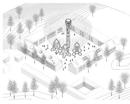
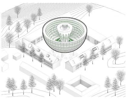

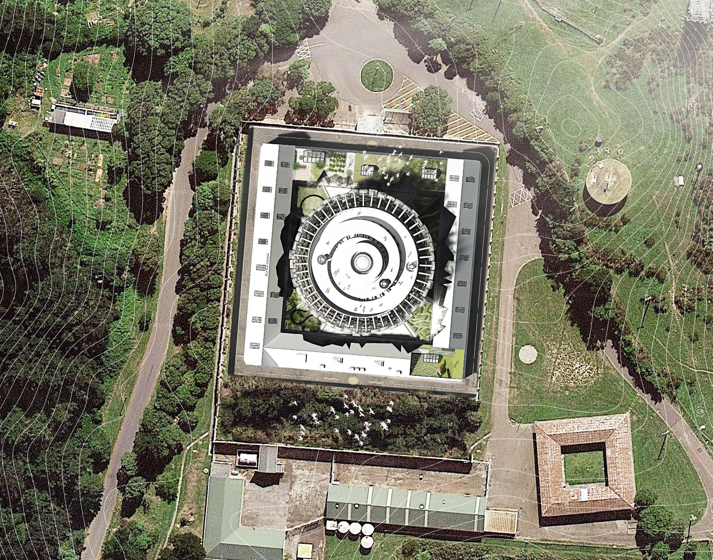
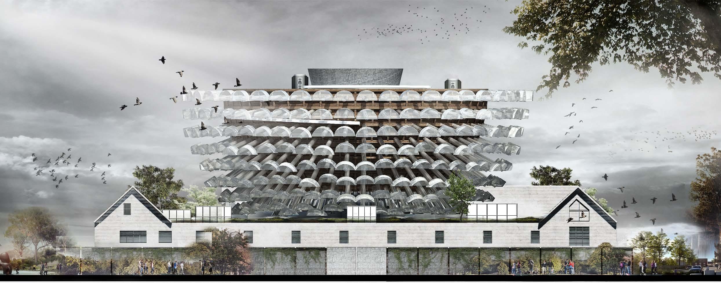
MT CRAWFORD'S QUARANTINE FACILITY_INTERACTION
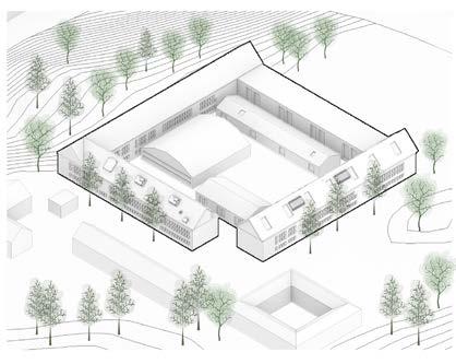
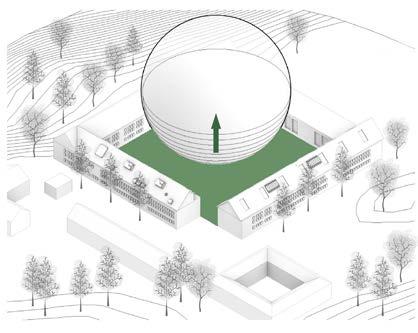
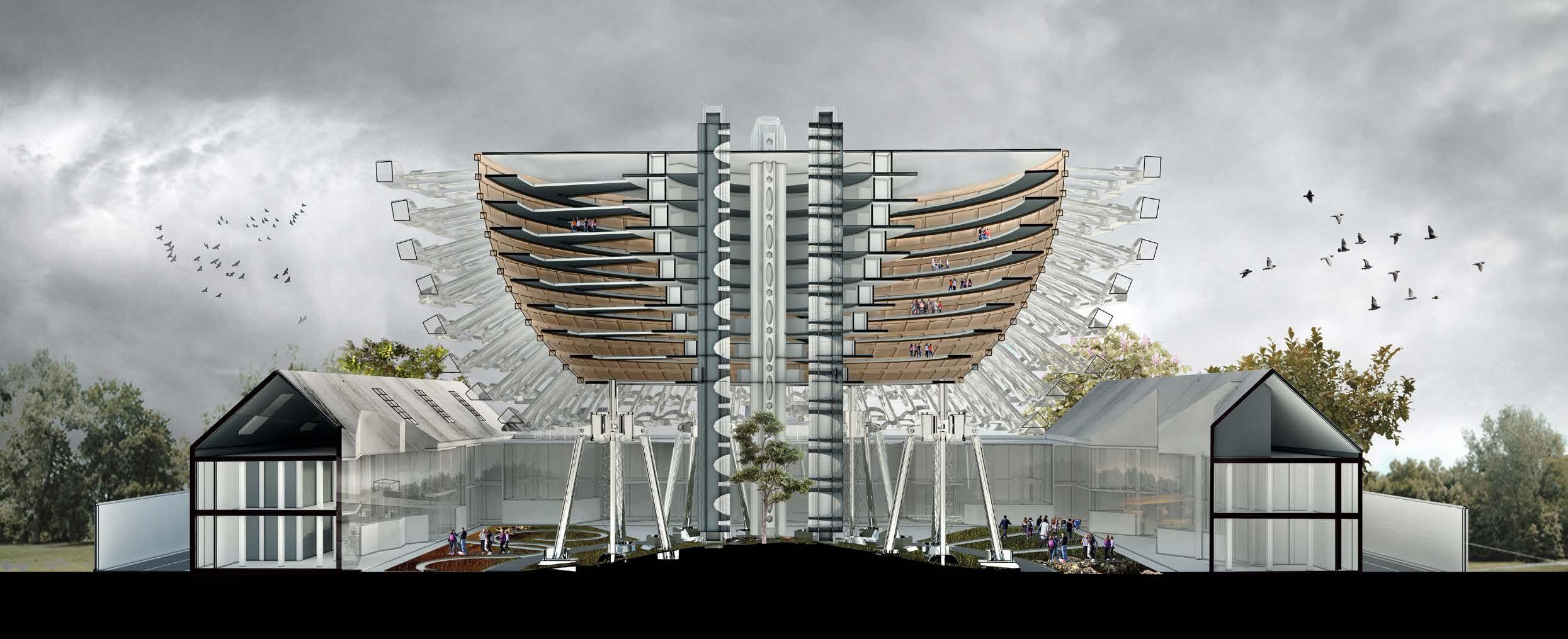
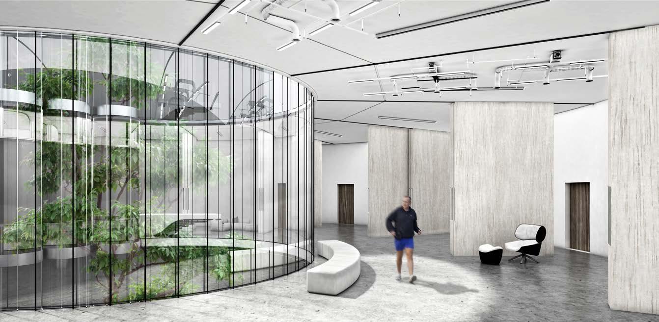
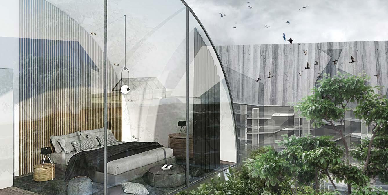
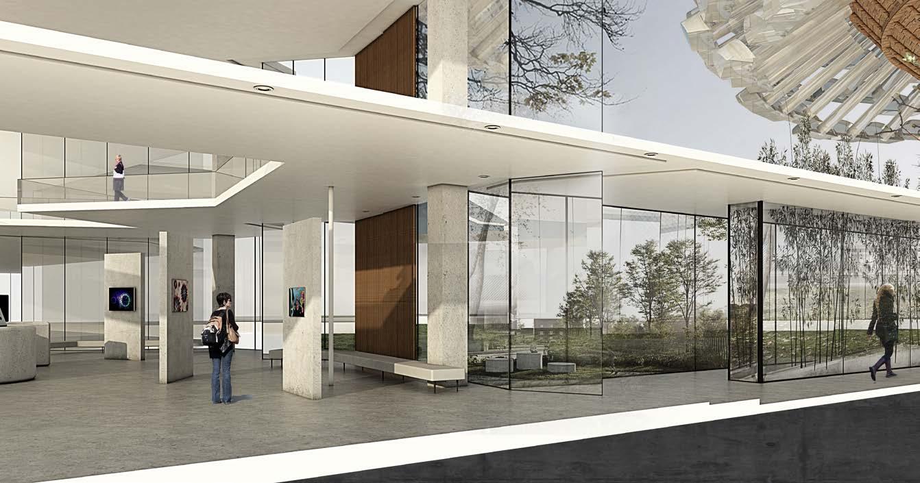
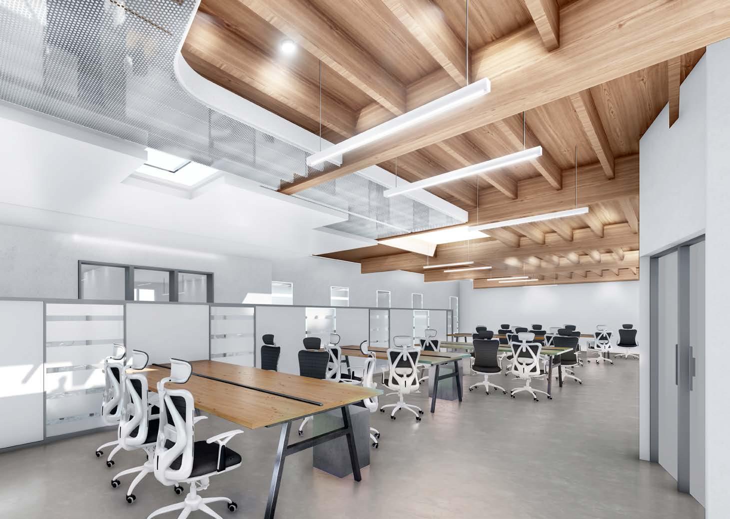
Programmatically, the quarantine facility is conceived as a ‘selfcontained environment', that fundamentally transports the traveller from the bottom to the surroundings of the facility through the core of the centre. In terms of circulation, the quarantine facility is completely isolated from the renovated existing building however they are connected through corridors in between the courtyard in the forms. This idea of interaction is translated into the interior of the quarantine pods where each pod contains a series of viewing platforms that protrude into the open space, providing unique places for quarantine travellers.
The intention of the design is to design the architecture itself as part of the cure. The combination of architecture with psychology contributes to an important investigation of quarantine facilities, particularly when people have spent two weeks in a confined and narrow space. Although the quarantine pods are closed spaces as part of a barrier system for controlled access and isolation, the individual pods between each other are distributed along the ring-shaped building skin and closely relies on each other, fundamentally transforming the passive behaviours of isolation into active user experience and remaining socially connected
simultaneously. In terms of the interaction with the natural environment, the extended quarantine pods delicately embed narratives within the spatial experience, and consciously design the unobstructed view communal courtyard to provide more possibilities for every user to interact with the outdoors from indoors.
THE TERRACE Spherical Space Frame
THE FACADE Timber Cladding
THE 9TH FLOOR Quarantine Area
THE 7TH FLOOR Quarantine Area
THE 5TH FLOOR Quarantine Area
THE 3RD FLOOR Quarantine Area
THE 1ST FLOOR Quarantine Area
THE 3RD FLOOR Existing Building Nursing station/Outpatient area/ Emergency observation rooms
THE 2ND FLOOR Existing Building Offices/Medical supplies rooms/ Emergency laboratory
THE 1ST FLOOR Existing Building Research laboratory/Staff accommodation/Meeting rooms
Design Tutor: Victoria Willocks
Project Stream: Conceptual Architecture Stream
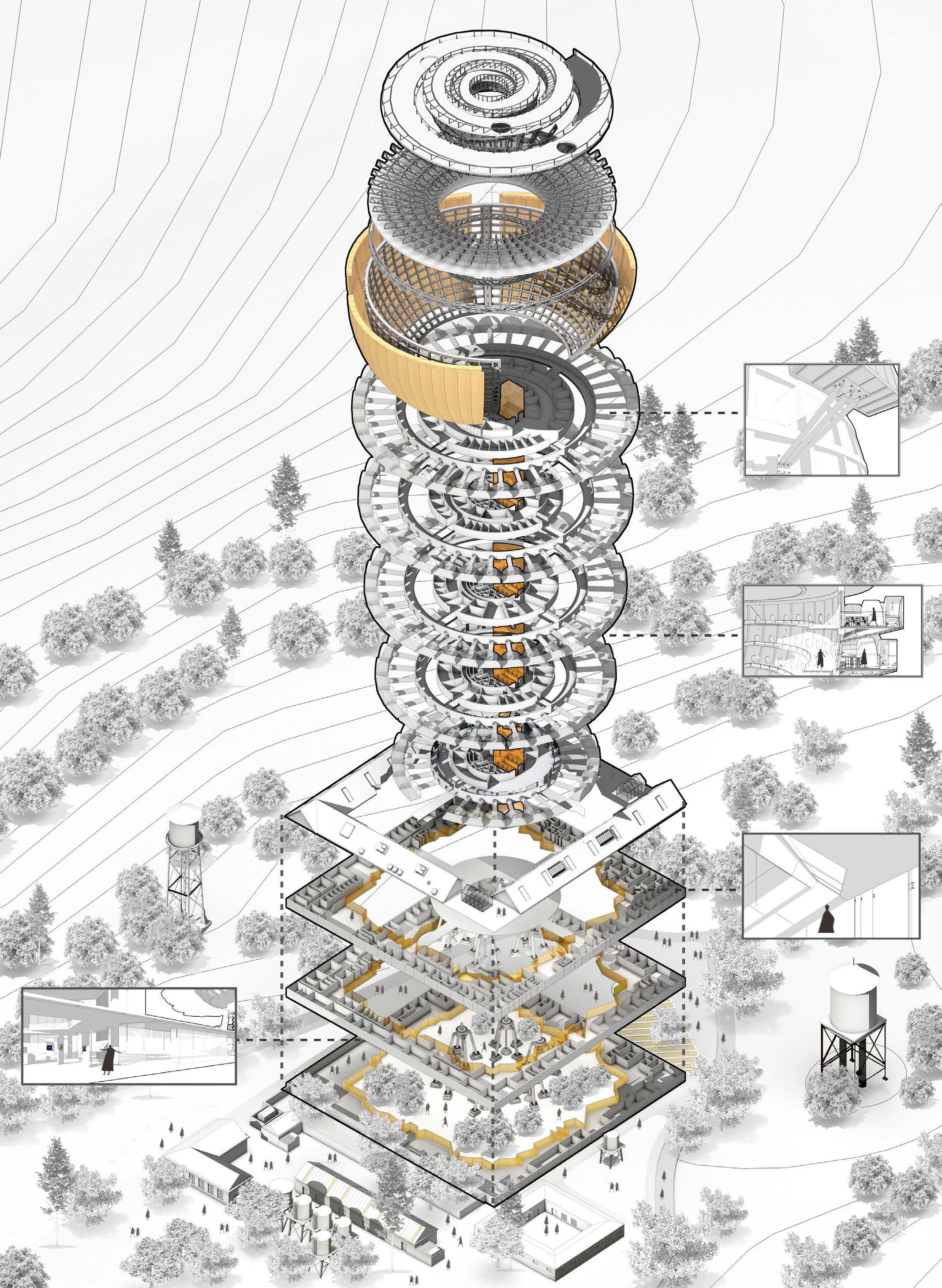
Suspended structure to support quarantine pods.
The section perspective of the atrium to quarantine pods.
existing buildings.
2020 - 2021 I PANDEMIC ARCHITECTURE
Design Tutor: Victoria Willocks
Project Stream: Conceptual Architecture Stream
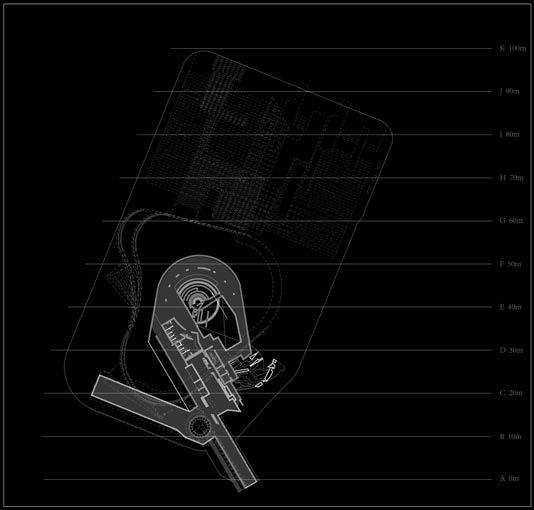
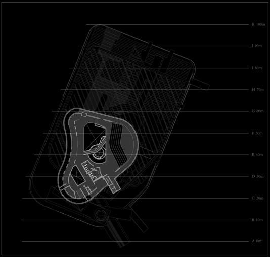
Wellington's Central Library closed indefinitely due to structural advice that the library may not perform well in a significant earthquake. Wellington City Council (WCC) is seriously considering demolishing the library and replacing it on the same site. The library served far more purposes than the storage of books. Many Wellingtonians see the library as a ‘home away from home’. This project investigates how a new Wellington Central Library provides an important opportunity for the design of an internationally recognised Landmark Architecture building for New Zealand’s capital city of Wellington.
Design Tutor: Daniel K. Brown/ Daniele Abreu e Lima
Project Stream: Conceptual Architecture Stream TZ
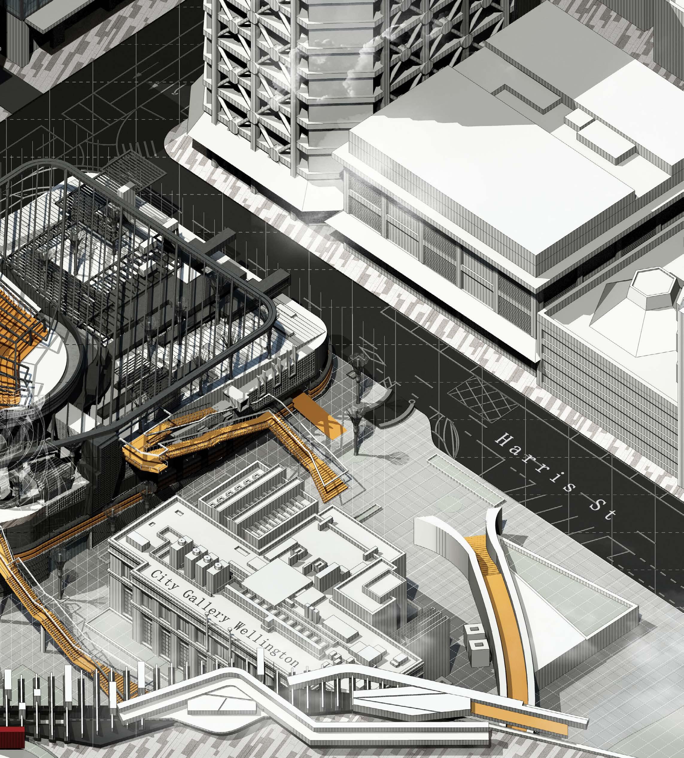
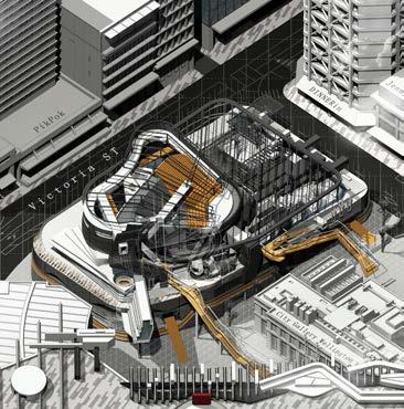
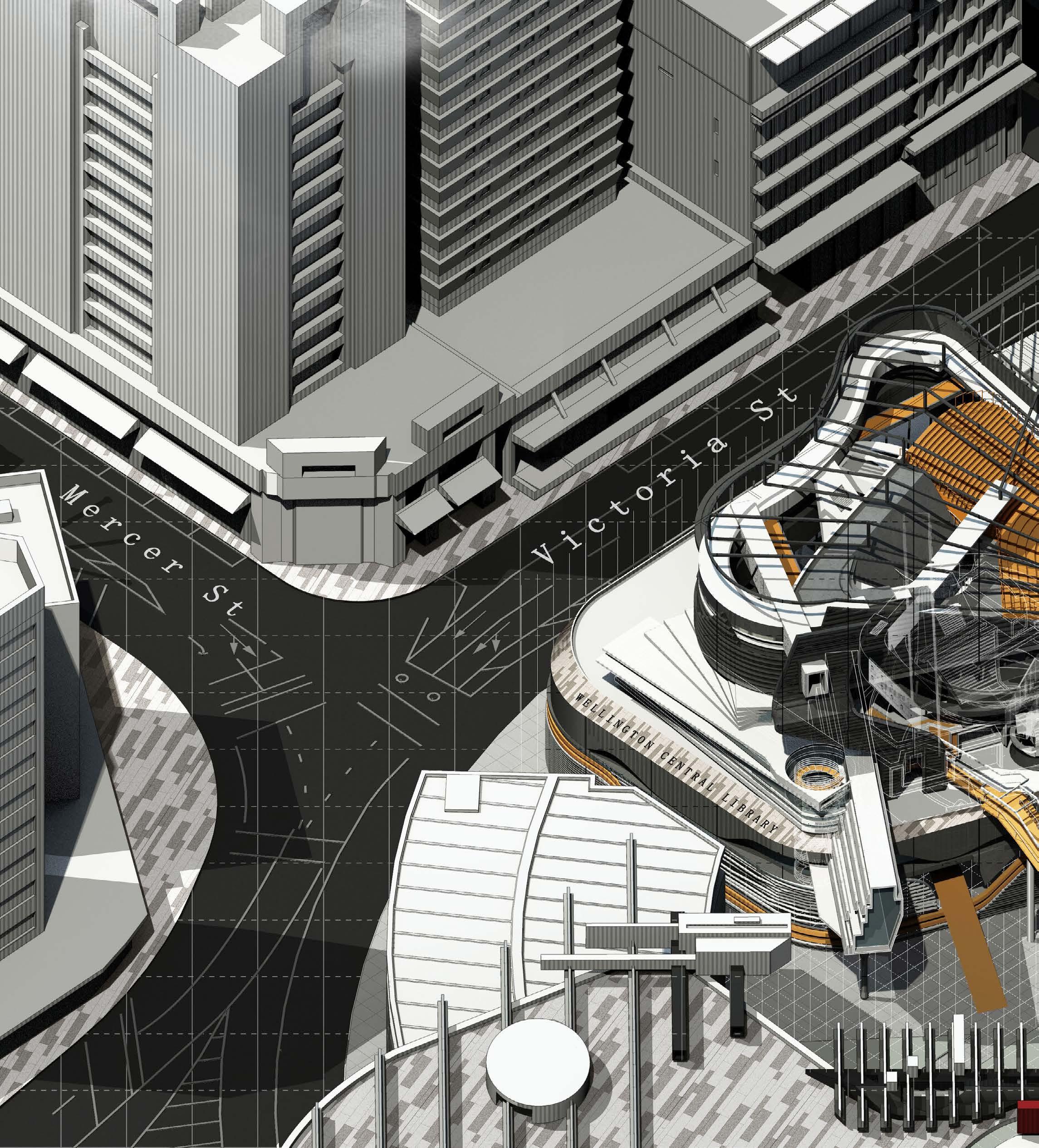
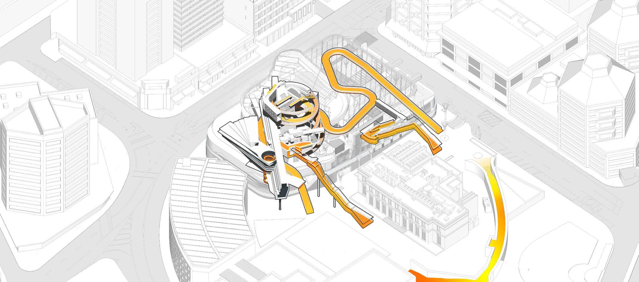
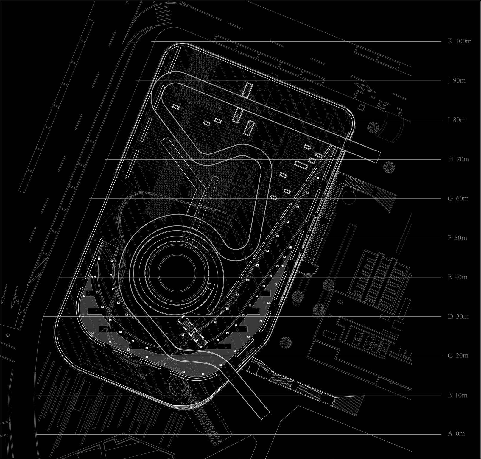
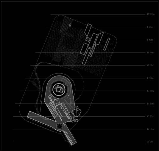
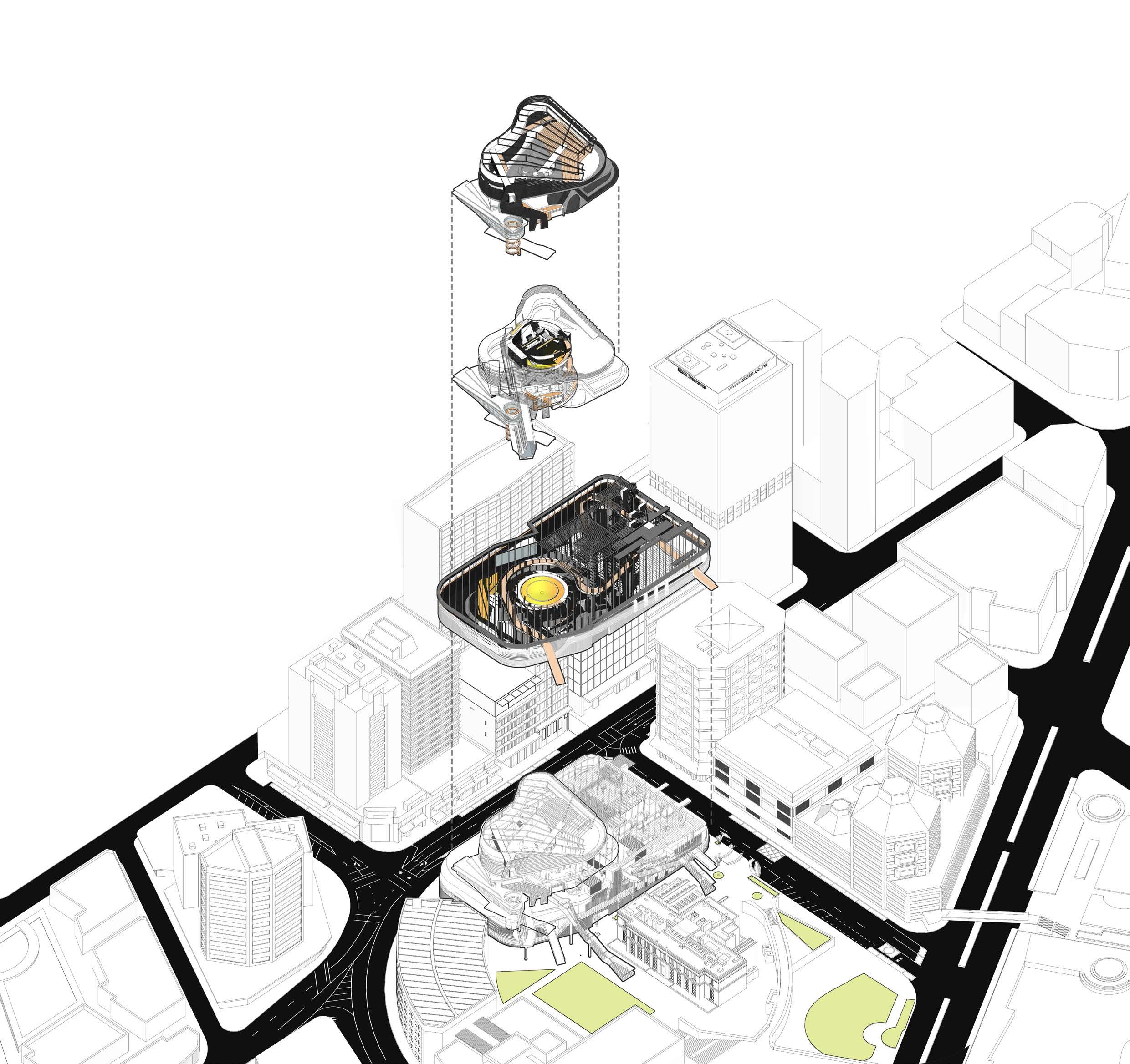
Wellington Central Library is a cultural nexus situated at the heart of Civic Square on Victoria Street. Being one of Wellington’s most historically relevant infrastructural sites, Victoria Street hosts a number of 19th century landmarks. The project inscribes itself into the urban landscape by operating as an extension of an infrastructural network as well as an anchor for an academic campus, interfacing cultural, institutional and infrastructural functions to augment its neighbouring buildings. The library’s new design is defined by three intersecting circles. It appropriates the historic structure’s scale and geometry as a scaffolding for a new cultural centre.
Design Tutor: Daniel K. Brown/ Daniele Abreu e Lima
Project Stream: Conceptual Architecture Stream
OBJECT_LIBRARY
1. READING ROOMS
2. AMPHITHEATRE
3. CAFE
4. STUDY ROOMS
5. MEDIA ROOM
FIGURE_CIRCULATION OBJECTS
1. NEXUS DATA ARCHIVE
2. BOOKSTACKS
5. TERRACE ACCESS
FIELD_PRODUCTION FACILITY
1. CONTROL ROOM
3. SERVICE DEPOT
4. OFFICE
5. READING TERRACE
FRAME_WATERFRONT
1. RETAIL
2. RESTAURANT
3. WELLINGTON CITY GALLERY
4. CIVIC SQUARE
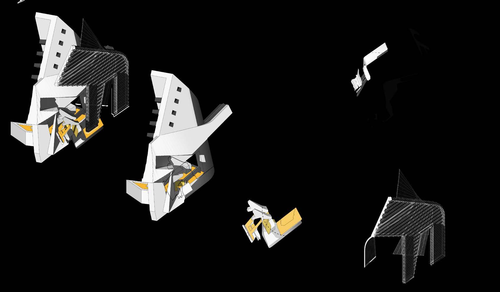
The overlap of tectonic, graphic, and organizational systems aims to represent an ecology of design decisions, where its aesthetic is contingent on the collision and exchange between the layers that form the building. The aggregation of conflicting geometries widens the perception of the whole by disrupting its legibility into a tension field: an assemblage of fragments that signal towards each other by means of projection, creating coherence as a whole. The complexity and density of the project is driven from the urban relationship to the architectural scale by using projective techniques to create coherence between distinct parts.
Design Tutor: Daniel K. Brown/ Daniele Abreu e Lima
Project Stream: Conceptual Architecture Stream
The cross-section shows the aggregation of conflicting geometries and the projection of fragments to create coherence as a whole.
2019 - 2020 I CONCEPTUAL ARCHITECTURE
RE-DESIGN OF WELLINGTON CENTRAL LIBRARY ENTANGLEMENT
The facade of the building unifies the scheme by masking it with a uniform skin, but as we dig deeper into its interior, the project reveals a complex arrangement of differentiated objects contained within its mass. The project is organized by combining distinct building types, overlapping their forms to promote a sense of diffusion between programs. The complex operates less as a static planning device and more as an ecology, where the threshold between architecture and infrastructure, interior and exterior, part and whole becomes obscured. The
project rejects the treatment of the whole as either a smooth continuum or a discrete collection. It refrains from slicing a mass into neat compartments where functions obediently reside within a single roof or dividing the complex into an aggregation of discrete buildings. Rather, the Wellington Central Library aims to invigorate the site’s urban potential by interrogating the boundaries of each function, allowing their jurisdictions to permeate one another. Rather than homogenizing the program to produce an explicit whole, the project celebrates difference
Design Tutor: Daniel K. Brown/ Daniele Abreu e Lima
Project Stream: Conceptual Architecture Stream
The perspective shows the new Wellington Central Library situated between the centre of Wellington and the Waterfront creating a dialogue between architectural objects. and contradiction to produce unanticipated effects of continuity and fragmentation through causality.
The Library is entangled with the City to Sea Bridge, slithering through the landscape to shape the different elements that build up its mass. The new Library has paid tribute to the Māori culture in their portrayal of the Nikau Palms around the building. The remains of the Nikau Palms aim to revisit the roots of the land on which Wellington City stands, as well as its distinct qualities of
a strong column like structure and ringed detailing of the trunk. The Wellington Central Library’s concentric typology harbors a collection of sculpted circulation objects whose qualities provide a unique sense of character and posture – a cross bridge that intersects a study room, an exterior staircase that breaks up the building’s skin, and a spiralling bookcase that frames a central atrium. These three circulation objects connect the Wellington Central library to the City to Sea Bridge that shapes the Waterfront, forming a promenade that leads the public from the
iconic landmark towards a public terrace atop the library. The stepped roofscape acts as a performance space that gazes back at the centre of Wellington and the Waterfront, setting up a dialogue between the architectural objects that shape Victoria Street.
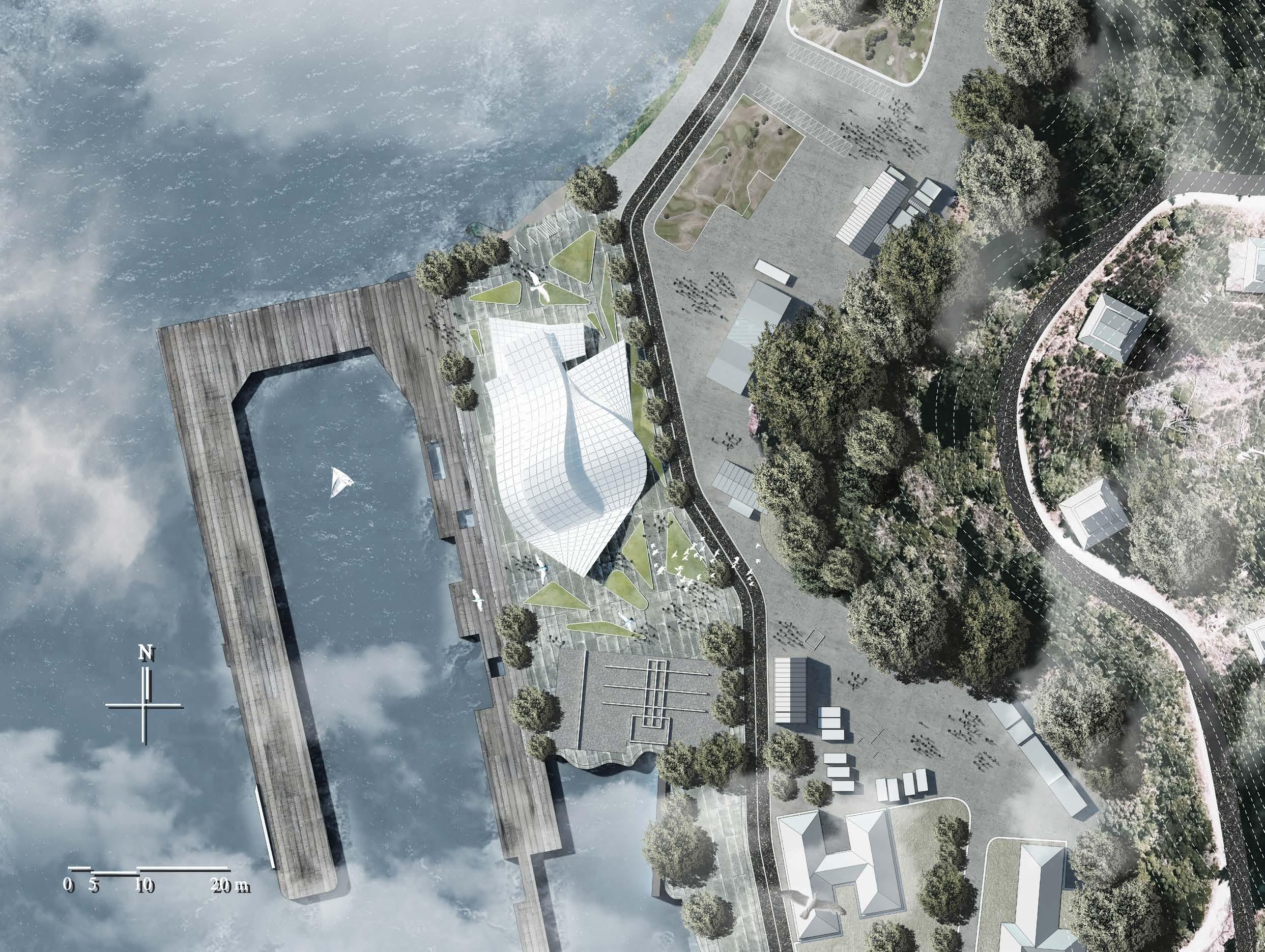
This project is situated at Shelly Bay in Miramar, Wellington, and proposes a bold programme that would bring together VUW’s programmes of Fine Arts (Creative Practice), Architecture, Creative Writing, Dance, Design, Film and Theatre. The aim of this project is to design a major urban gesture that would enhance access routes and the development of a public pedestrian wharf connecting Miramar Avenue to the selected site. As a new creative hub for Wellington and an epicentre for the cultural life of the capital, the new complex is to be a utopian vision of arts integration, meeting its spatial requirements and housing an institution that will foster innovation, research, collaboration, creativity, and education in the arts.
Design Tutor: Daniel K. Brown/ Daniele Abreu e Lima
Project Stream: Conceptual Architecture Stream TZ
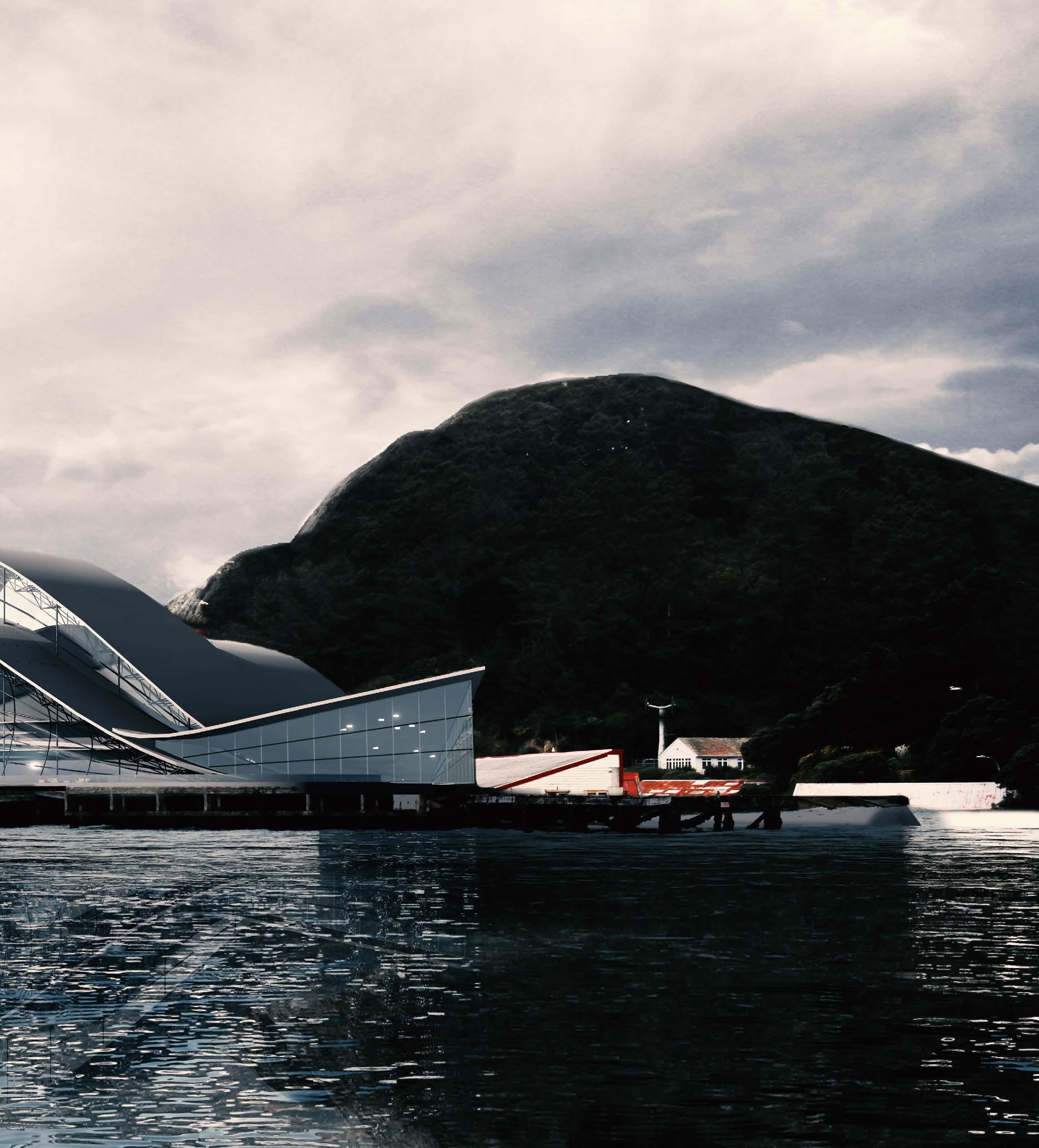
FIG5.2 The morphology diagram and concept sketches.
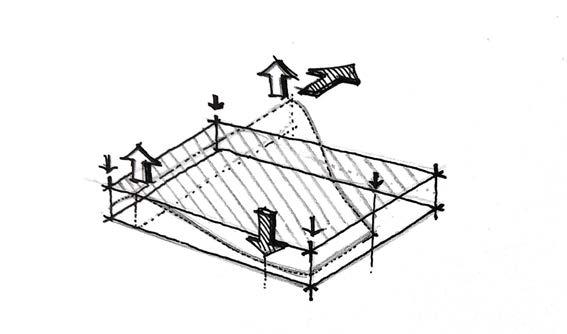
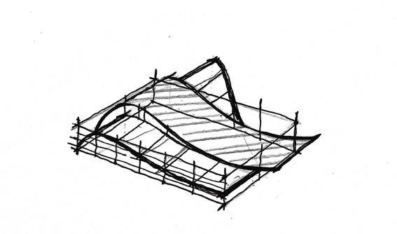
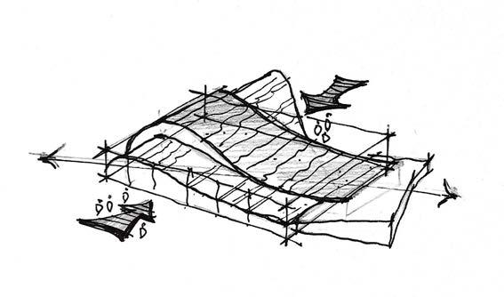
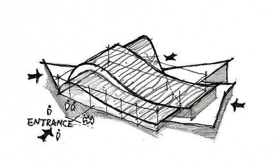
FIG5.3 The site plan of the Centre for Creative Practices.
Design Tutor: Daniel K. Brown/ Daniele Abreu e Lima
Project Stream: Conceptual Architecture Stream
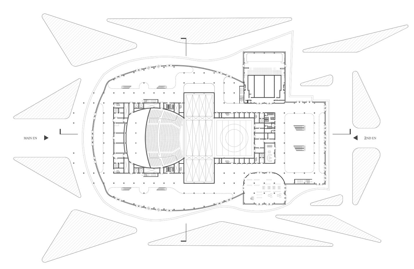
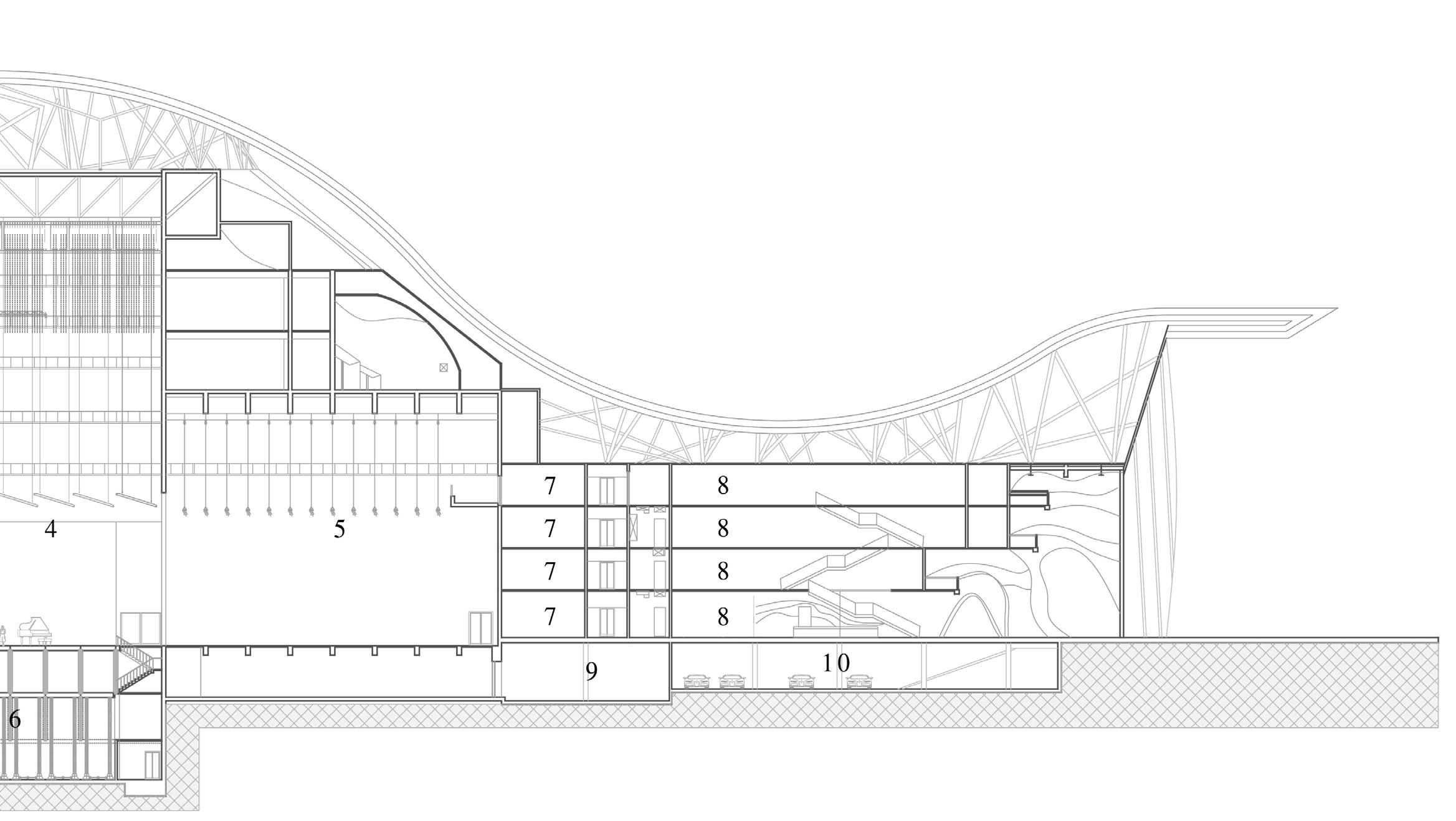
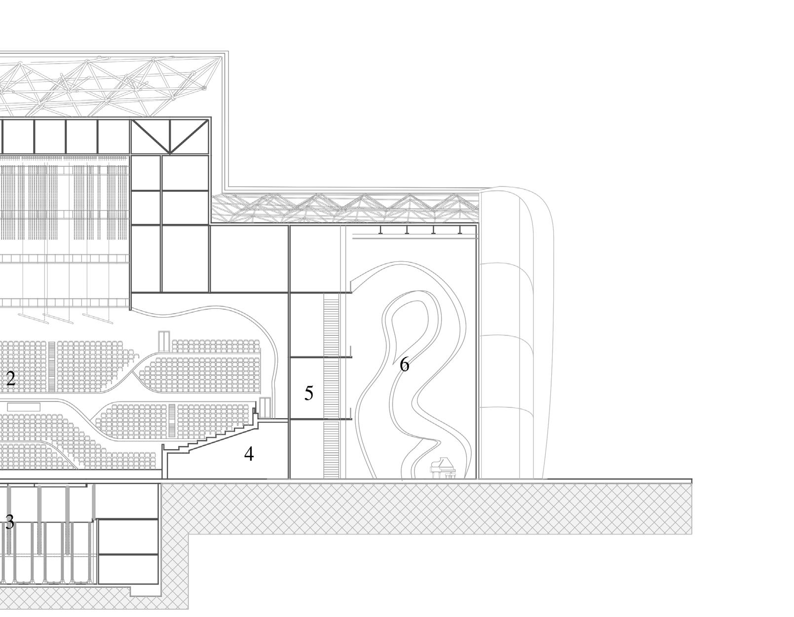
GROUND PLAN ACADEMIC BLOCKS / AUDITORIUM / LIBRARY / SUPPORT AREAS
1.
FIG5.4 The floor plans of
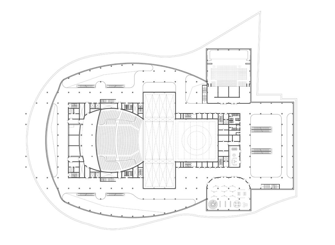
FLOOR PLAN
ACADEMIC BLOCKS / AUDITORIUM / LIBRARY / SUPPORT AREAS
1.
2.
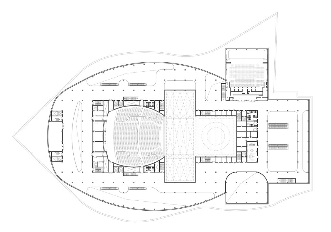
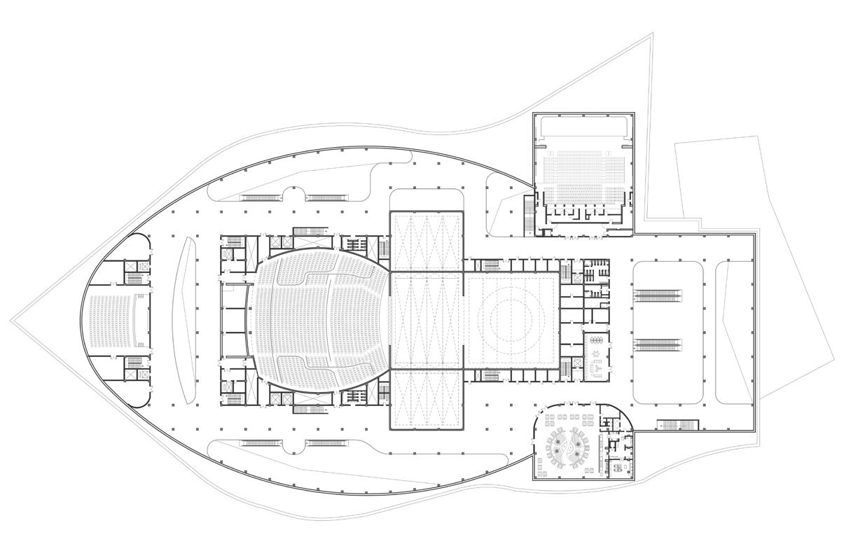
1. SMALLER AUDITORIUM
2. ATRIUM
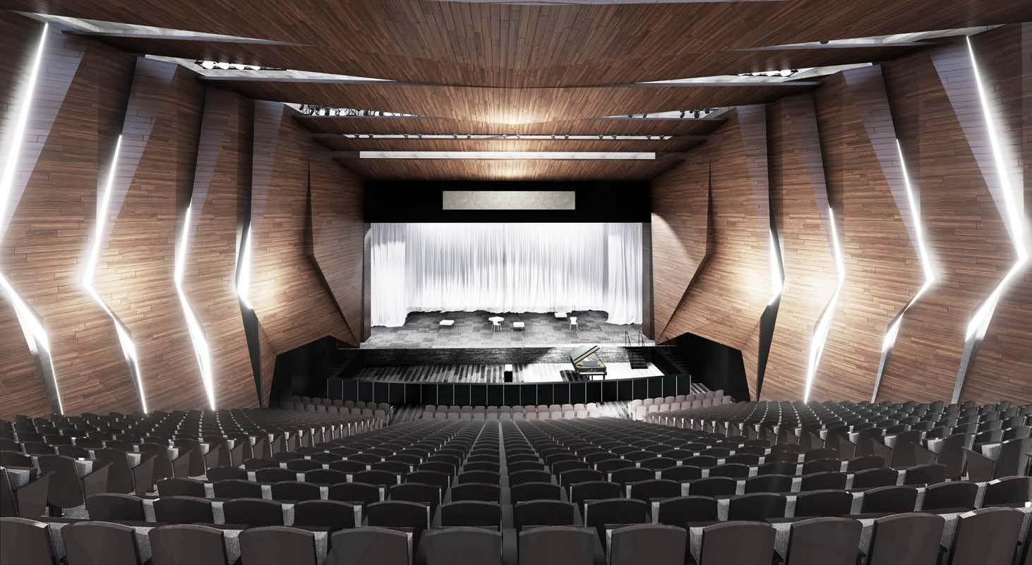
3. LARGE AUDITORIUM
4. MAIN STAGE
5. CHANGING ROOM/BACKSTAGE
6. STORAGE/ EQUIPMENT ROOM
7. SMALLER DANCE/THEATRE STUDIO
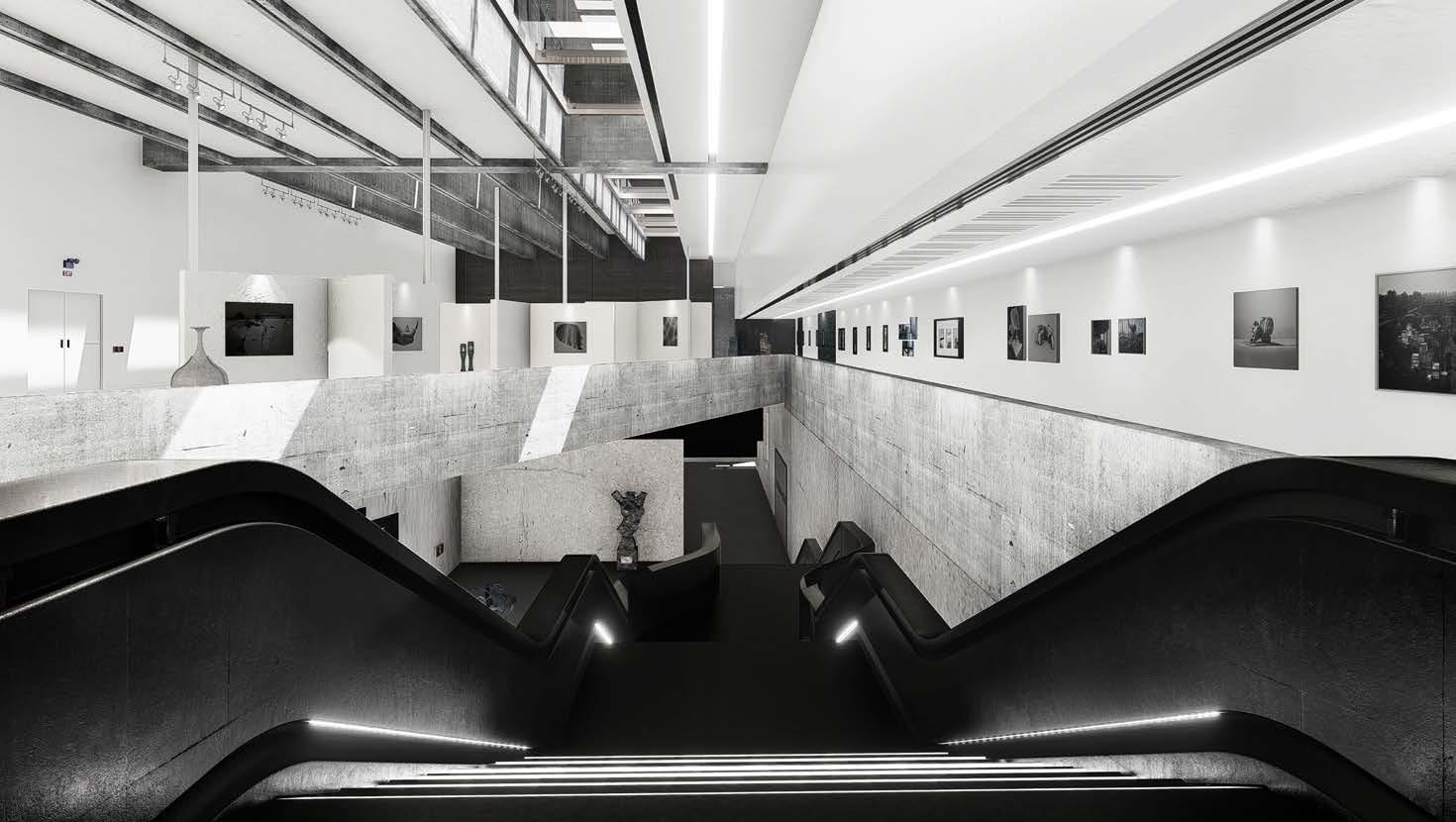
8. EXHIBITION SPACE/ATRIUM
9. LARGE TEACHING ROOMS
10. CAR PARKS
Design Tutor: Daniel K. Brown/ Daniele Abreu e Lima Project Stream: Conceptual Architecture Stream
2019 - 2020 I CONCEPTUAL ARCHITECTURE
Design Tutor: Daniel K. Brown/ Daniele Abreu e Lima
Project Stream: Conceptual Architecture Stream
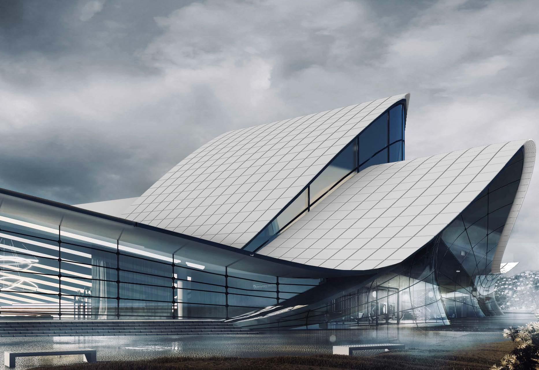
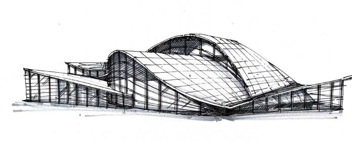
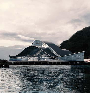
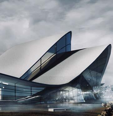
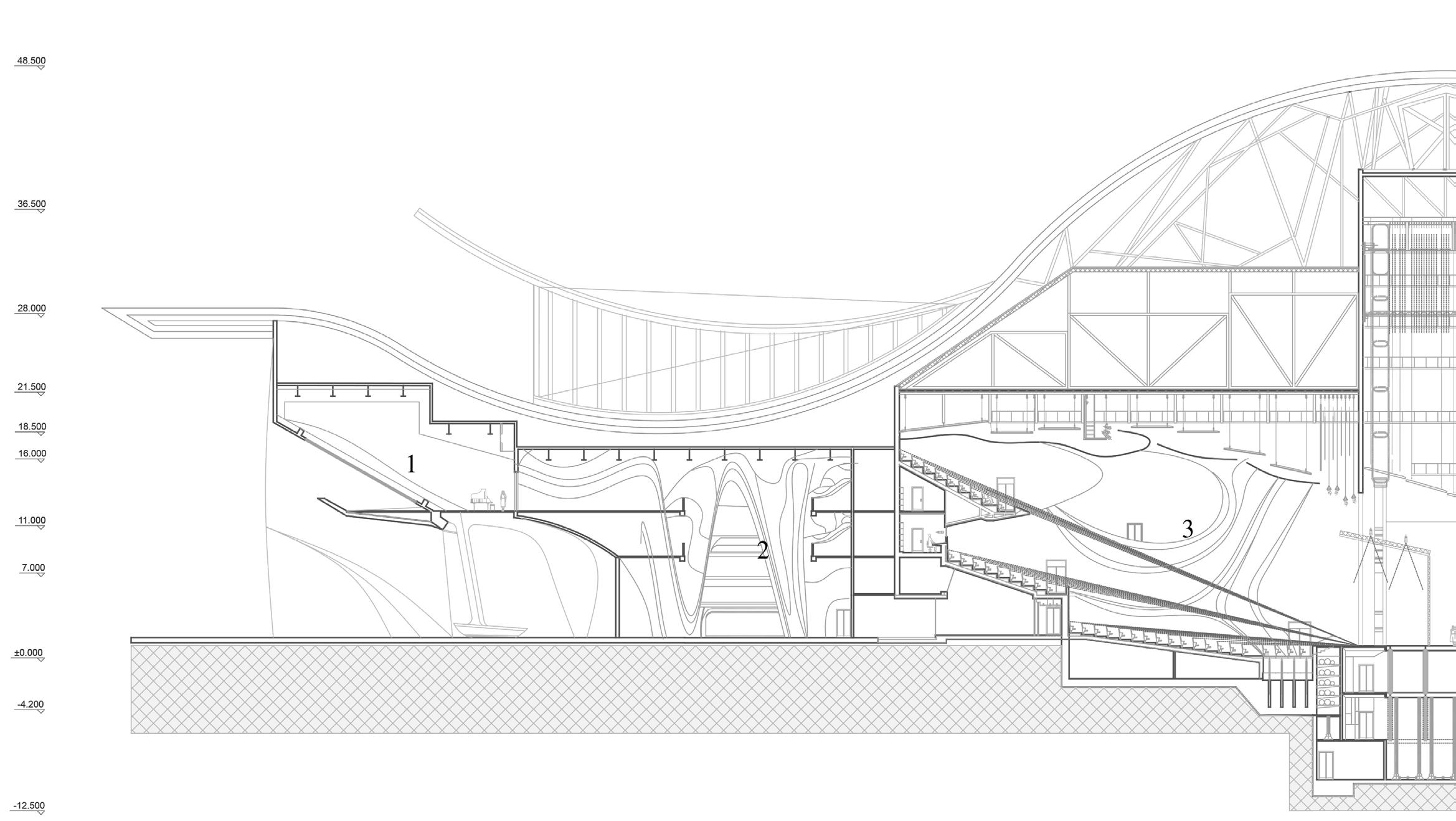
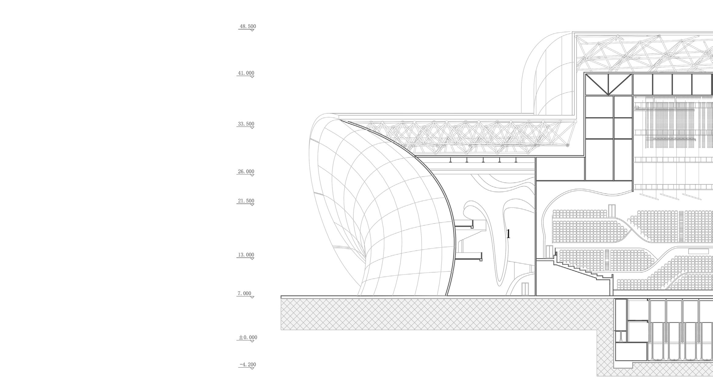
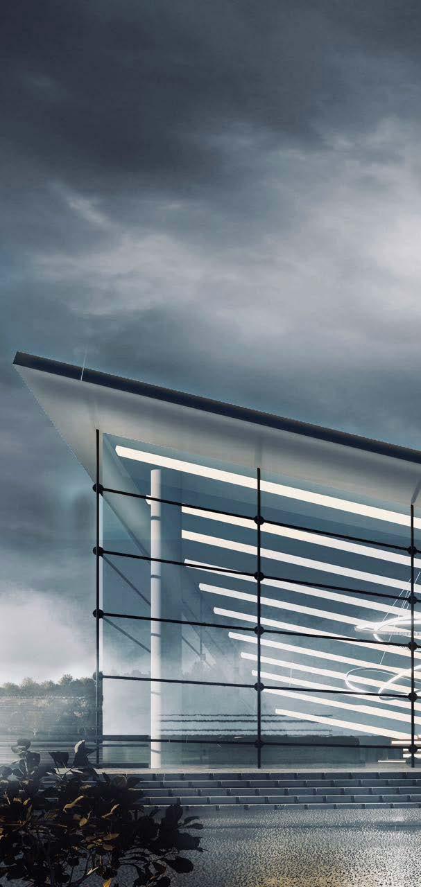
Inspired by the idea of wave, the building focuses on the theme of “water”, extracts the concept of “water drop and wave” from waves and creates an image on the sea, looking like a floating spatial structure above the sea. The original idea of the project is to resemble the wave to create a dialogue between the building and nature and allow the building to become a symbolic existence where the sea and the earth converge. The entire area planning elevates the terrain and erects a new building to fill the gap in the landmark nodes resulting from the along-the-sea planning. The building dissects the ground across the site to channel pedestrian flows from the building to its wharf and the road around the coast. The axis that cuts the site harbours outdoor public spaces
contained between the landscape and the building, carving entrances to the major volumes, at the same time offering pedestrians the opportunity to meander along the water and enjoy views of the city, theatre, and waterfront as they approach the building. The Centre for Creative Practices is composed of major functional areas: the Wave (auditoriums), theatre and public space (exhibition space). The entire functional distribution follows the basic logic of a ‘dynamic zone above, while a quiet zone below’ vertically, as well as ‘open on the north and closed on the south'. The central auditorium penetrates the main volumes, carving out tolerance between them to create relationships between interior and exterior. The building principally consists
of two collaborating systems: a steel structure combined with a space frame system. Timber joists and floor diaphragms are used as the reinforced connection between steel frames. The space frame system enables the construction of a free-form structure and saves significant time throughout the construction process, while the substructure is developed to incorporate a flexible relationship between the rigid grid of the space frame and the free-formed exterior cladding seams. As the auditorium is the main function area throughout the building, the structural design is specifically thought out to complement the overall concept.