CREATIVE CORRIDORS
retrofitting hampstead high street
BARC0118_22-23 Landscape Design 3
Practice tutors : Canon Ivers, Alex Malaescu
Module Coordinator: Laura Allen, Mark Smout
Radhika Maheshwari
MLA Year 01


retrofitting hampstead high street
BARC0118_22-23 Landscape Design 3
Practice tutors : Canon Ivers, Alex Malaescu
Module Coordinator: Laura Allen, Mark Smout
Radhika Maheshwari
MLA Year 01
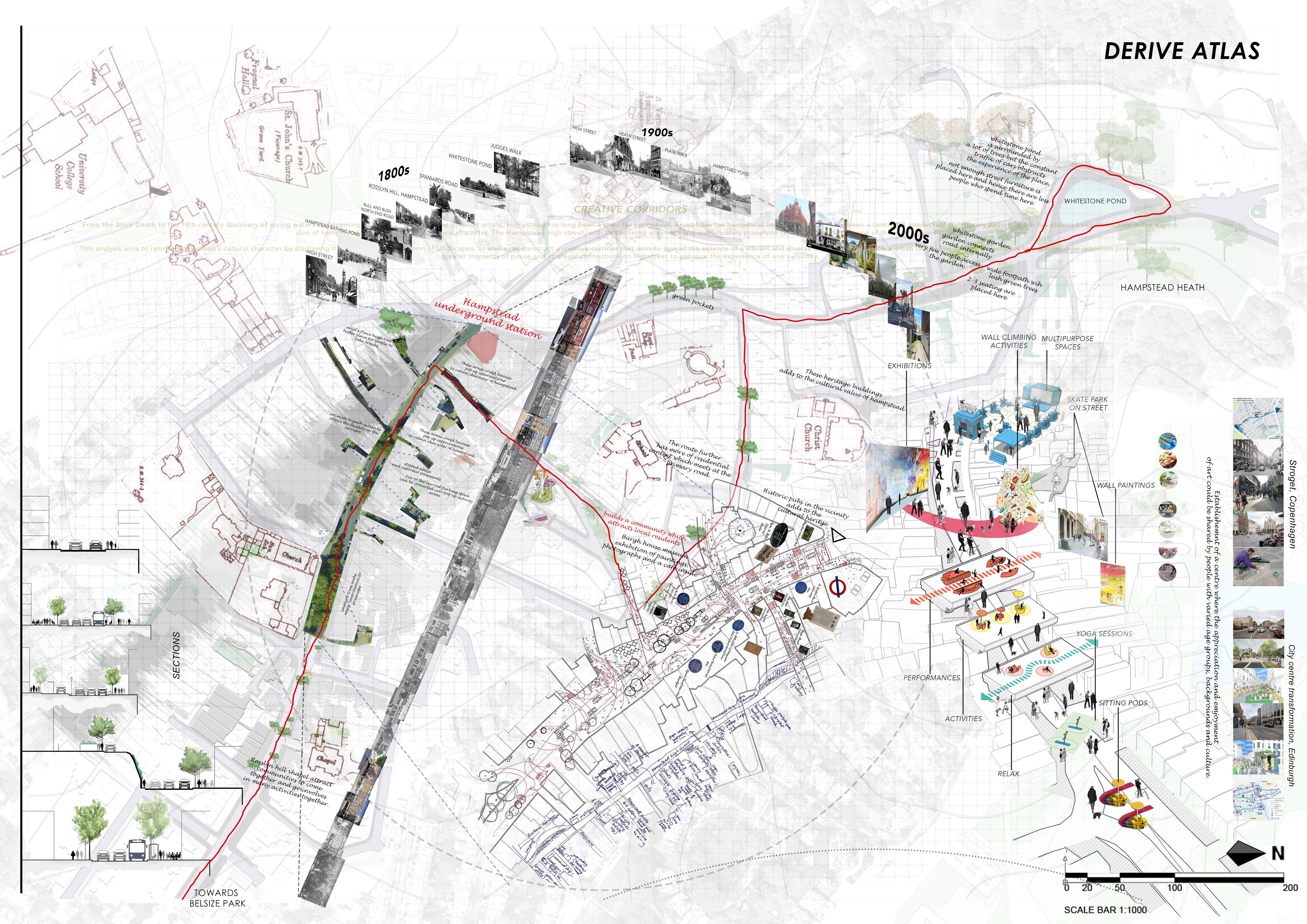
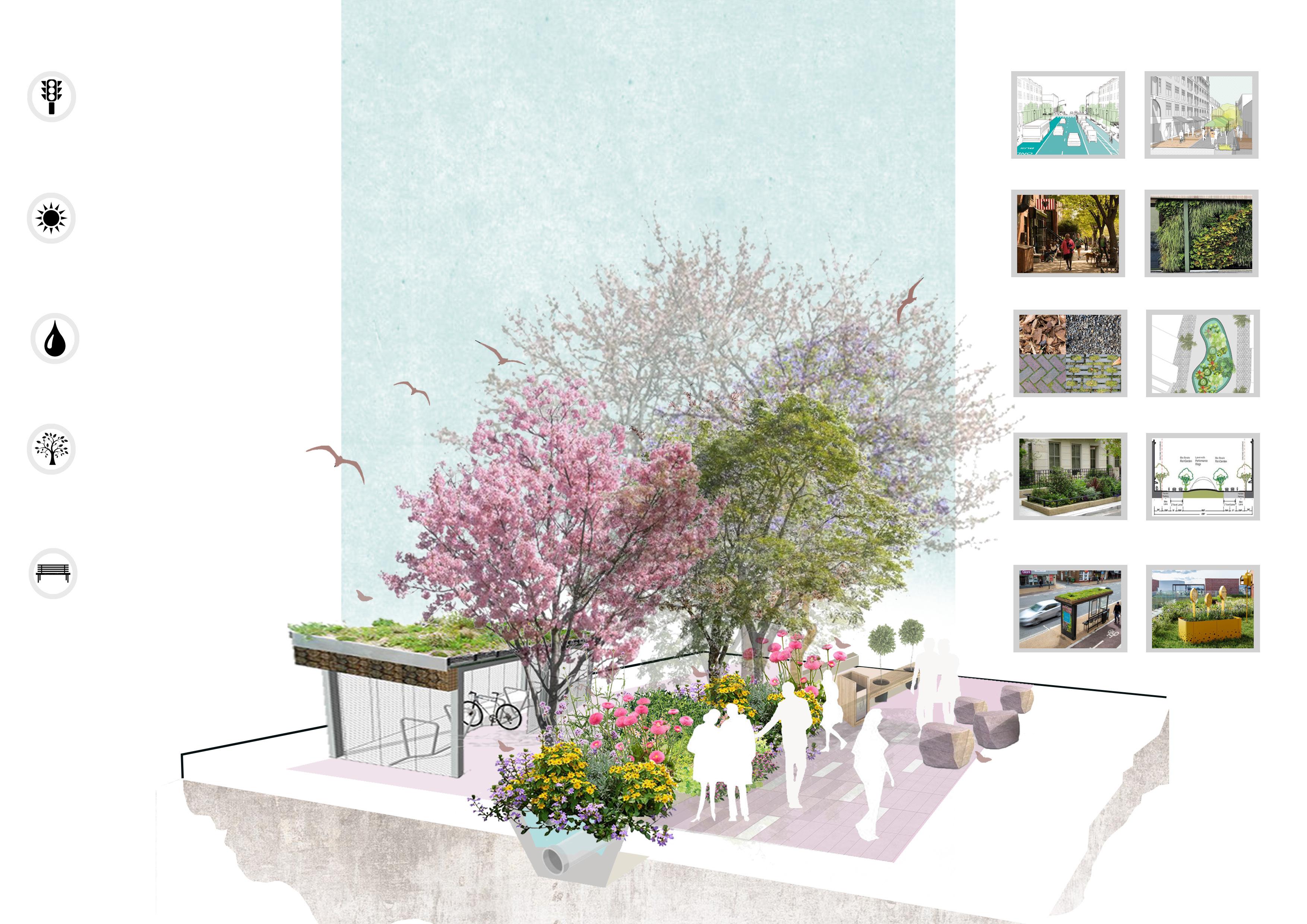
From the Black Death to the 19th-century discovery of spring waters to becoming the cradle of some of the greatest artists, Hampstead has long been a draw for Londoners. Apart from the hampstead heath, this location has been a centre for intellectual and literary history, which has played a significant role in the expansion of hampstead while retaining its historical character. The Hampstead high street, with its charming alleyways and immaculately preserved Georgian buildings, is one of the most vibrant streets.
This analysis aims to retrofit Hampstead’s cultural character by displaying it on the streets in the form of landscapes, as well as to construct a creative corridor that aims to spread the essence of a vibrant and diverse high street in London’s urban fabric. The primary objective is to use landscape urbanism principles to create greater moments of pause and strategic connections on highstreet to enhance the experience of one’s journey.
The intervention aims to make high street a place to learn and innovate. Being a centre for its intellectual character, this place could be a destination where ideas are born and exhibited to the world.
The design vision revolves around the concept of developing biophillic streets which tackles the problems arising with in the cities with rising temperatures which is directly affecting climate change. The strategies used for the project works around phases to fully transform high street into better public realm. The phases of transformation also helps in
Project statement
1.1 Urban context
1.2 Contextual analysis
1.2.1 Wider context mapping
1.2.2 Figure ground mapping
1.2.3 Building typology
1.2.4 Historical and cultural context
1.2.5 Traffic pattern mapping
1.2.6 Listed buildings mapping
1.2.7 Existing planting mapping
1.2.8 Derive atlas
1.3 Site Analysis
1.3.1 Key moments of the site
1.3.2 Site sections
1.3.3 Frontage mapping
1.3.4 Analysis of human activity
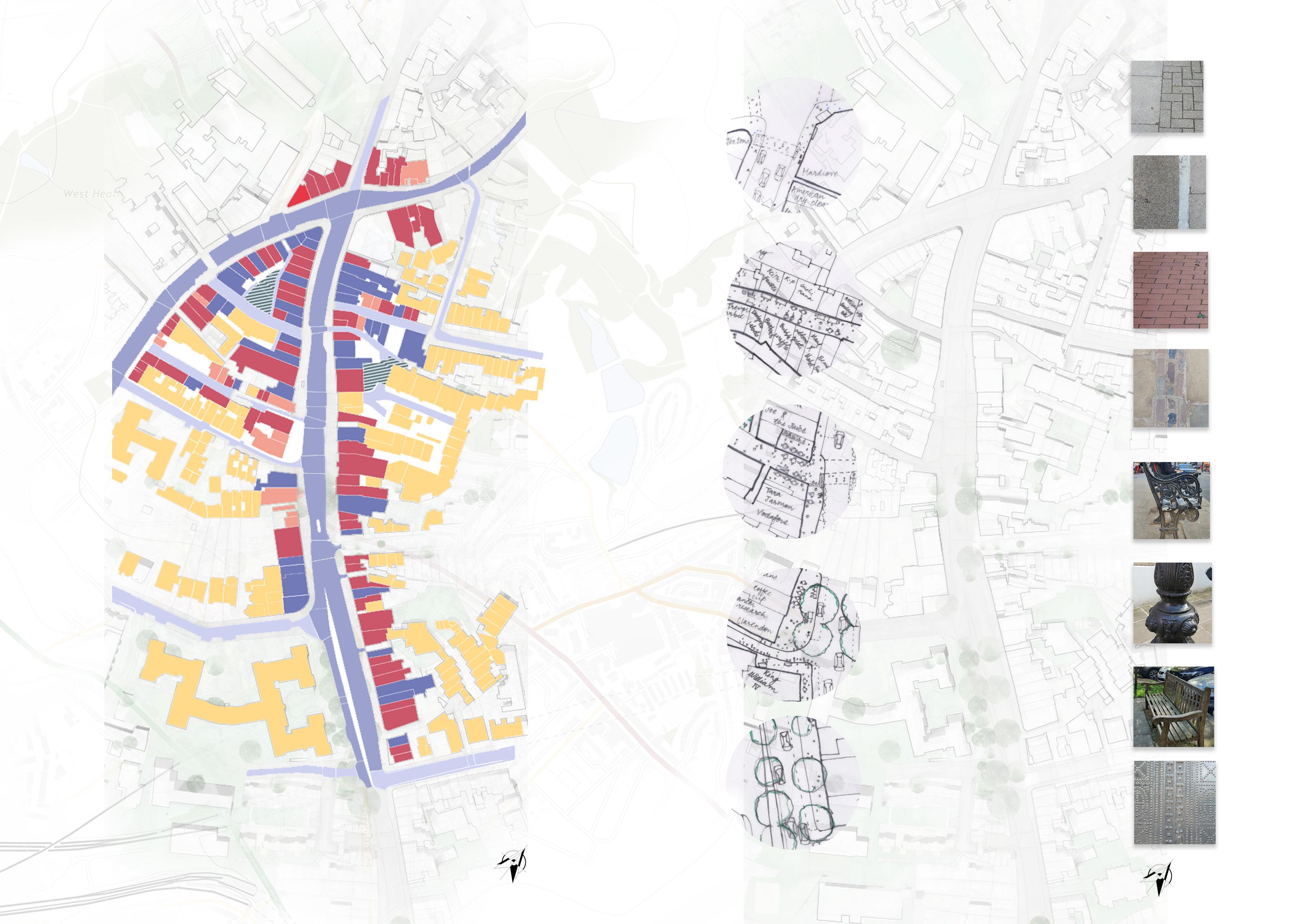
1.3.5 Analysis of existing material
1.3.6 SWOT analysis
2.1 Challenging issues of the site
2.1.1 Analysis of air quality
2.1.2 Analysis of current traffic
2.1.3 Microclimate analysis
2.2 Design principles and vision
2.3 Technical vision
2.3.1 Traffic management
2.3.2 Biodiversity management
2.3.3 Stormwater management
3.1 Case study
3.1.1 Scale comparison
3.1.2 Understanding dimension of the site
3.2 Place making strategies
3.2.1 Analysis of existing human activity
3.2.2 Analysis of Frontage mapping
3.3.3 Proposed circulation and zoning
3.4.4 Proposed overlayers of activities
3.3 Design development
3.4 Proposed sections for the site
3.5 Design demonstration
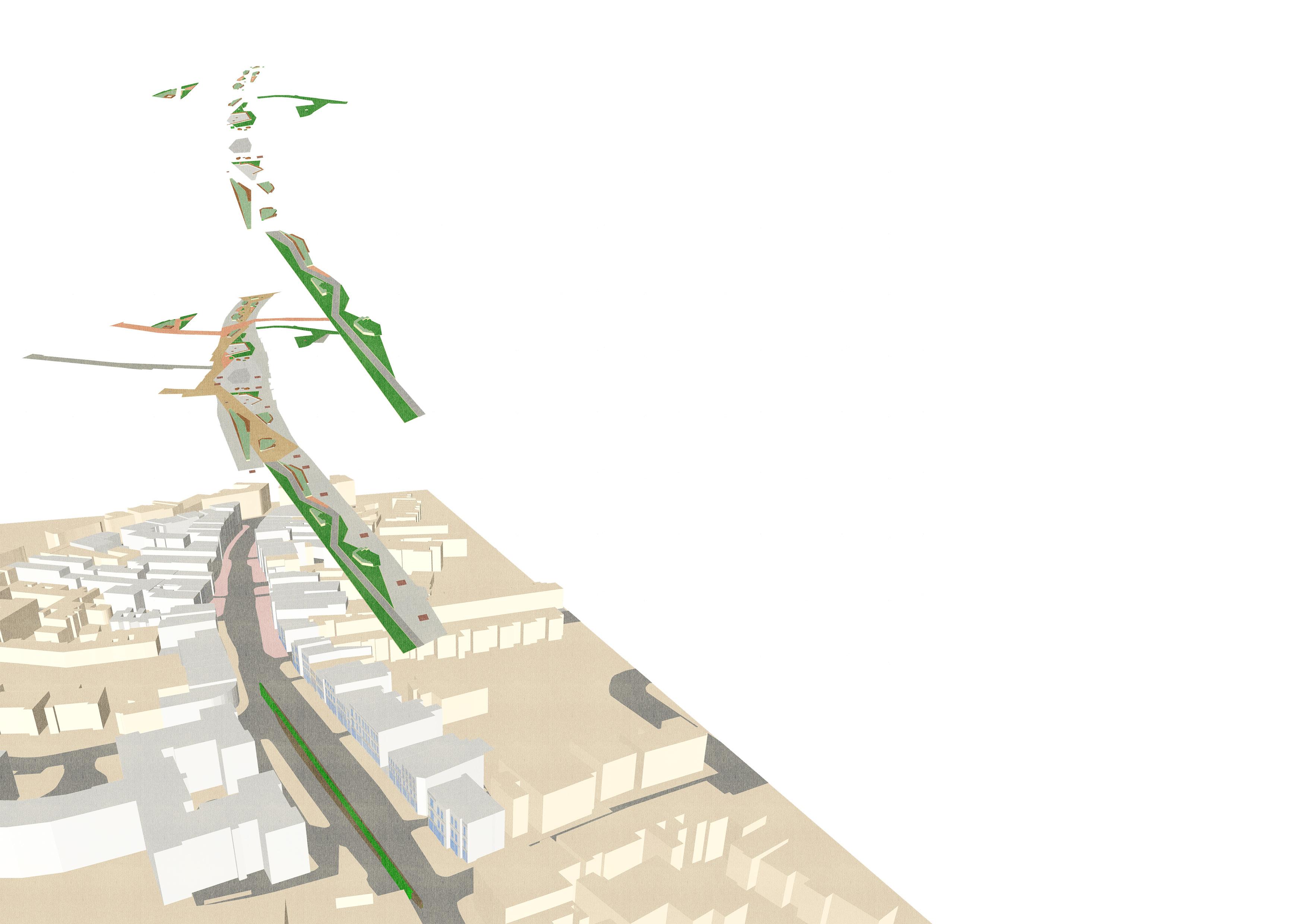
3.5.1 Site Master Plan
3.5.1.1 Overlay of Temporary Activities
3.5.1.2 Proposed circulation and zoning
3.5.1.3 Proposed overlayers of activities
3.5.2 The promenade Specific design
3.5.3 The Pop-up bazaar specific design
3.5.4 The gardens specific design
3.6 Conclusion
04 Appendix
1.1 Urban context
1.2 Contextual analysis
1.2.1 Wider context mapping
1.2.2 Figure ground mapping
1.2.3 Building typology
1.2.4 Historical and cultural context
1.2.5 Traffic pattern mapping
1.2.6 Listed buildings mapping
1.2.7 Existing planting mapping
1.2.8 Derive atlas
1.3 Site Analysis
1.3.1 Key moments of the site
1.3.2 Site sections
1.3.3 Frontage mapping
1.3.4 Analysis of human activity
1.3.5 Analysis of existing material
1.3.6 SWOT analysis
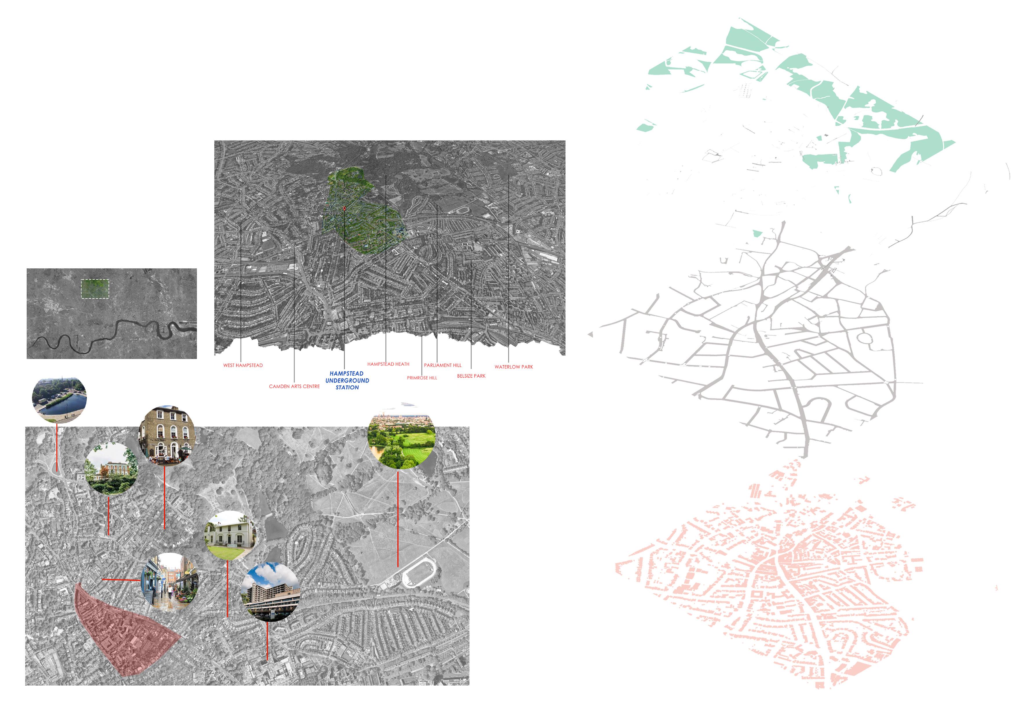
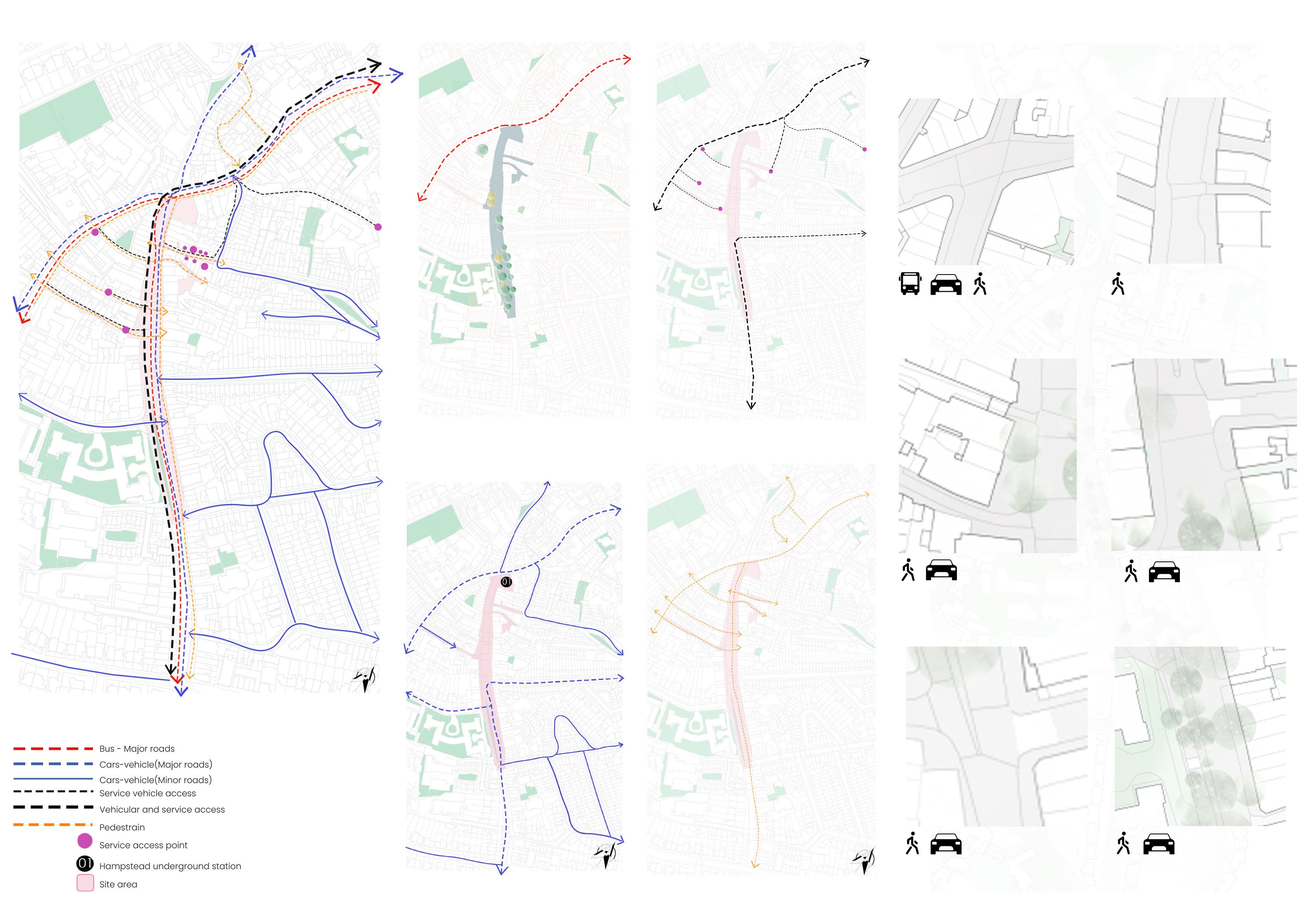
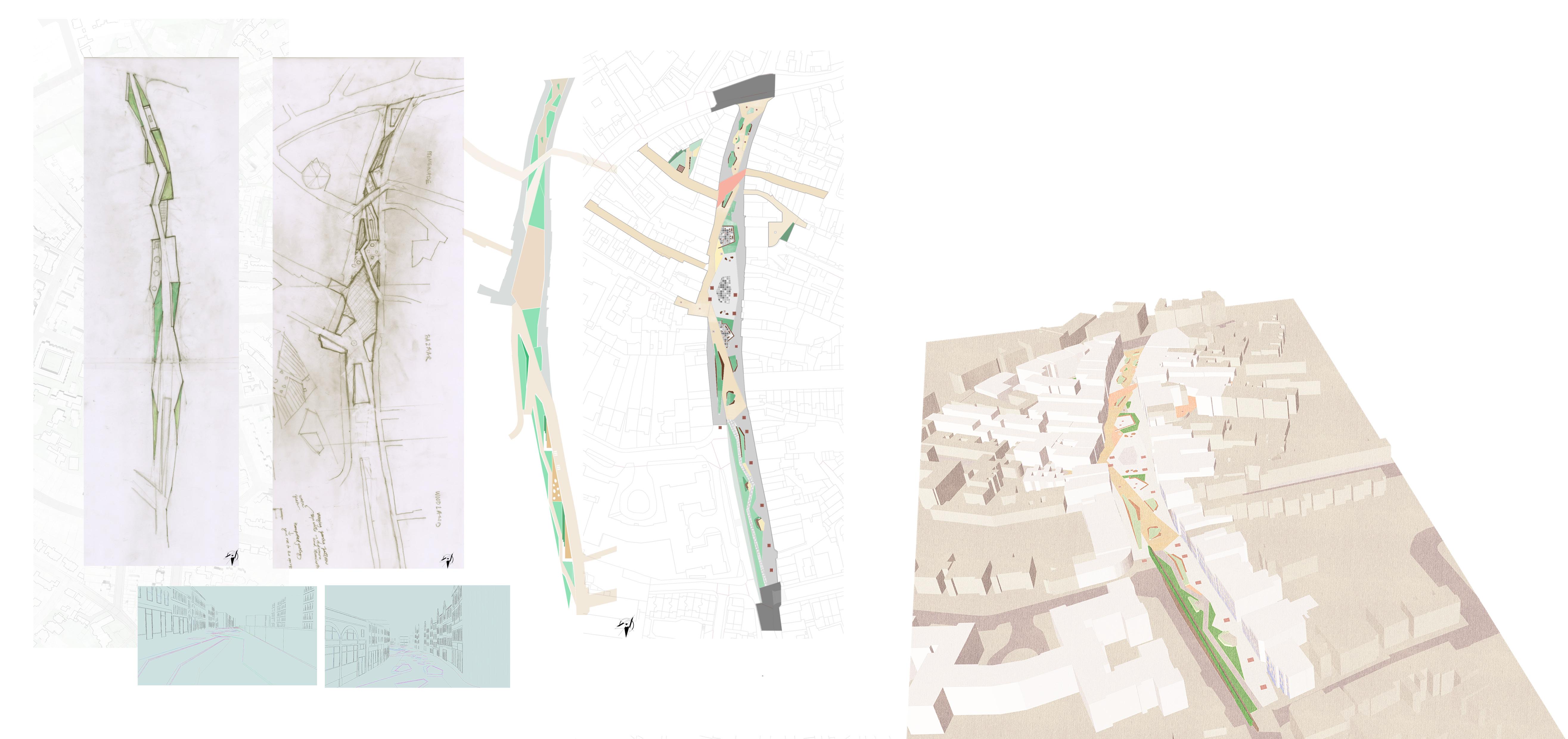
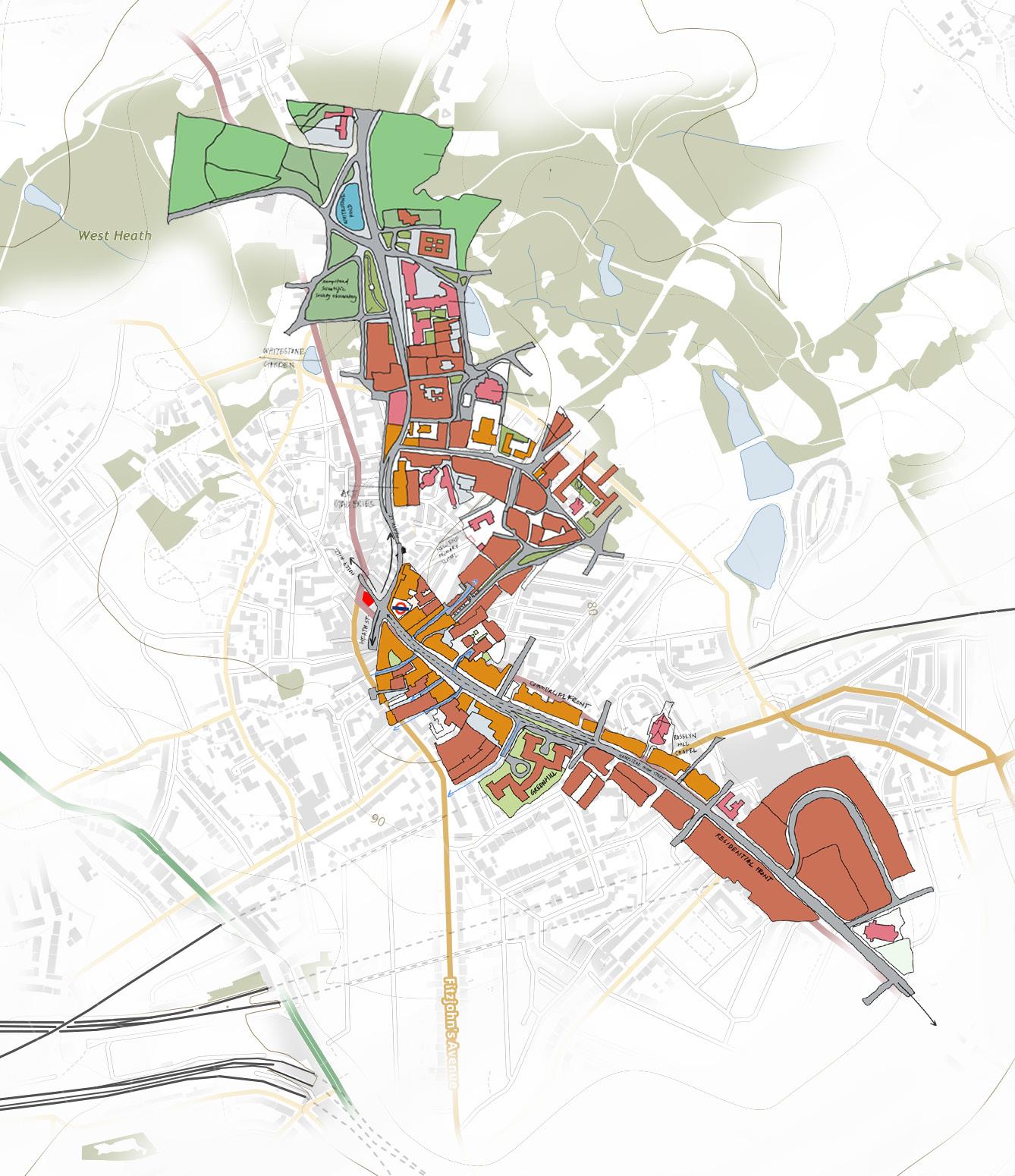
The area of development is the hampstead high street, located in northwest part of London. The area is composed by narrow alleyways and small courtyards which gives the neighbourhood village like character. The area has long been home to writers, artists, and other creative types, and it has a rich cultural legacy.
The brief was to choose three different routes from station and analyze the urban fabric and its character to retrofit in the context.
There is a cultural richness to the context of the site. From lush green hampstead heath, village like settlements, narrow passages to different museums of great artists who lived in Hampstead, It is one of the vibrant part of London which attracts people by its character.
1.2.1 Wider context mapping
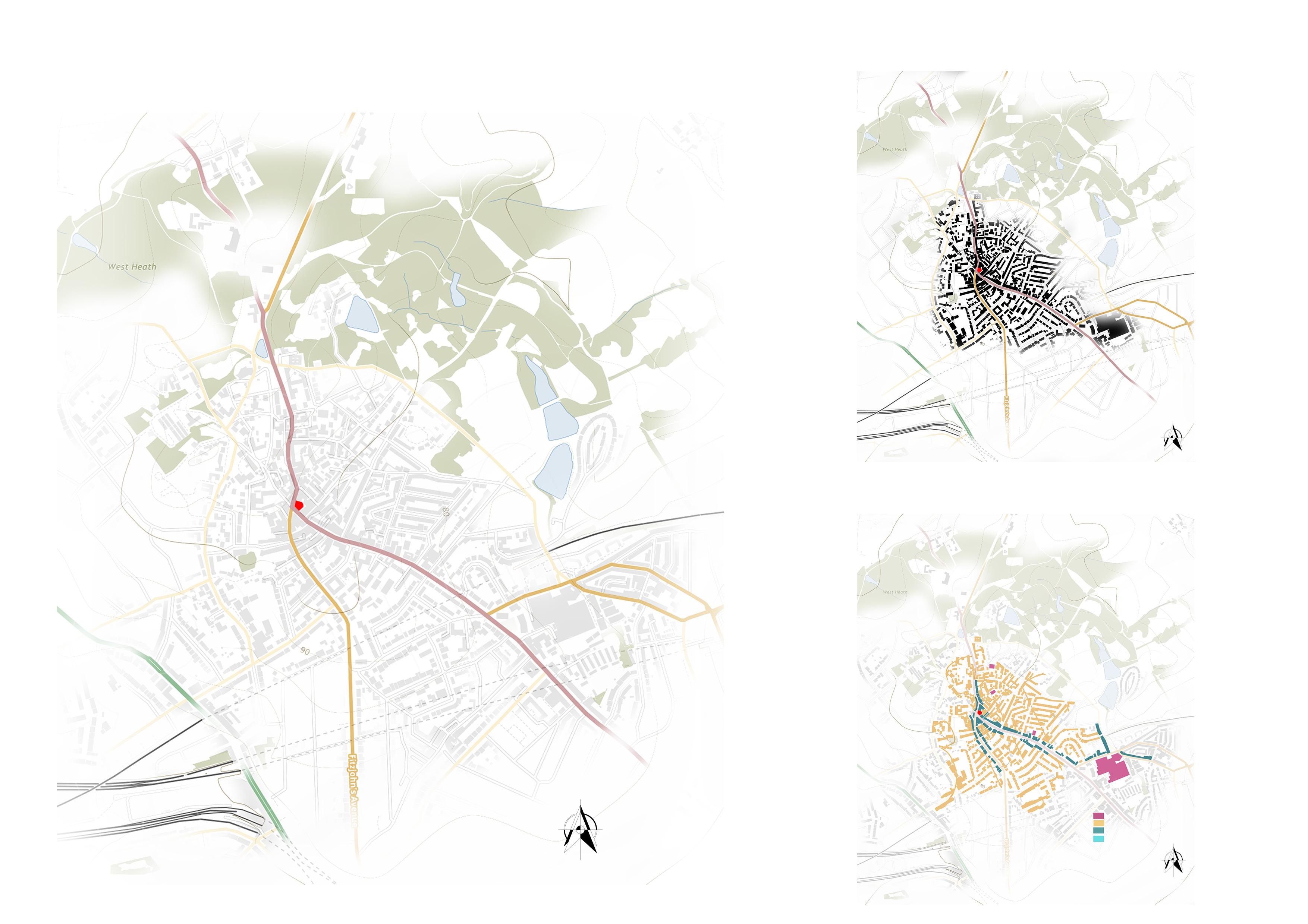
1.2.2 Figure ground mapping
The figure ground method of analysis represnts that immediate context of the site is densly occupied with building footprints. This suggest that there is a lack of green pockets around the site.
The analysis suggests that immediate context of the site is majorly accomodated with residential typology makin hampstead high street and heath street major roads for other aenities.
1.2.2 Building typology mapping
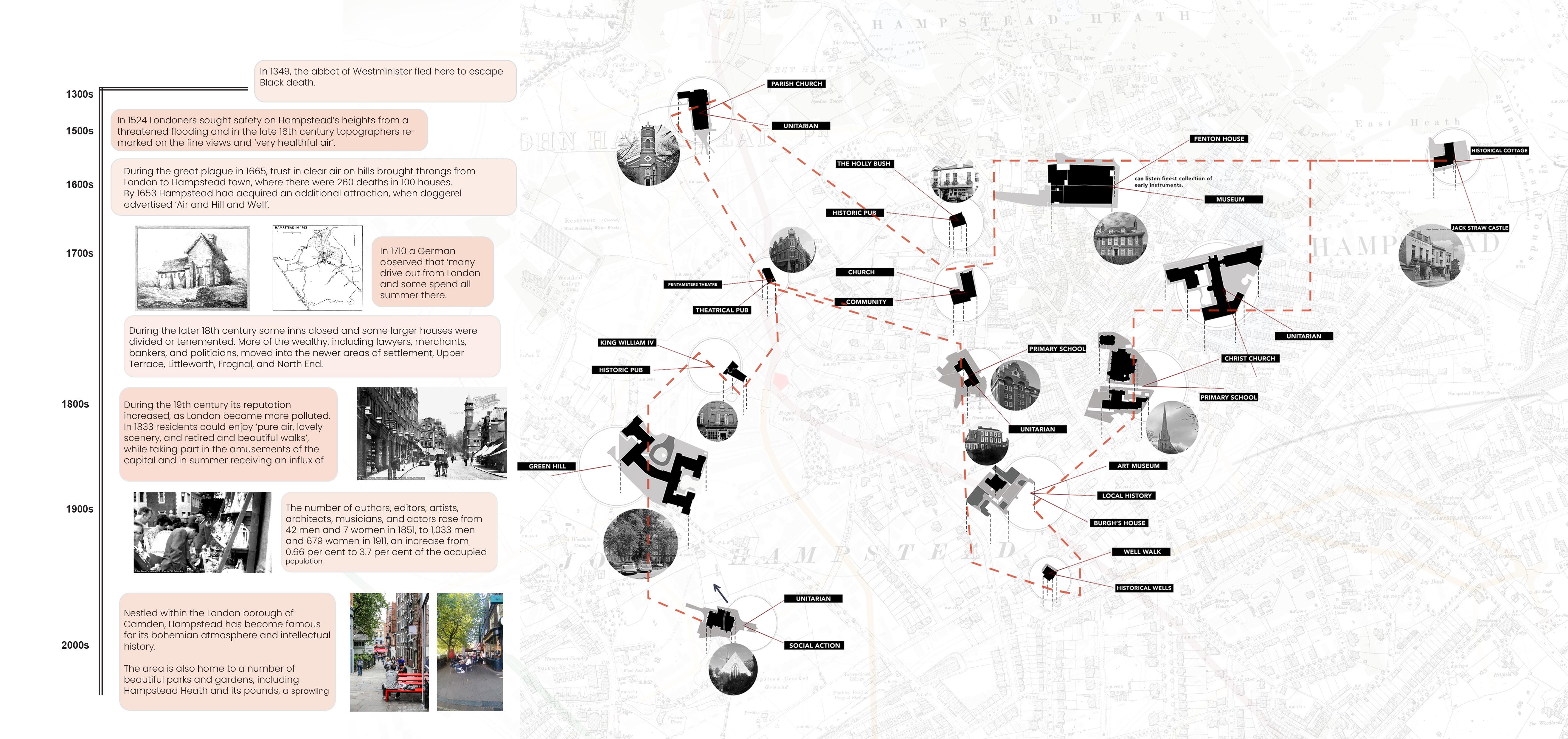
The historical and cultural mapping illustrates the cultural significance of the site and its context.
Apart from the lush green heath and its healthy environemnt, hampstead was also know for all the intellectual and literature culture that have had a huge impact in buildig of hampstead’s culture.
Few of the key sites are converted into museums attracting locals to understand more about history of Hampstead.
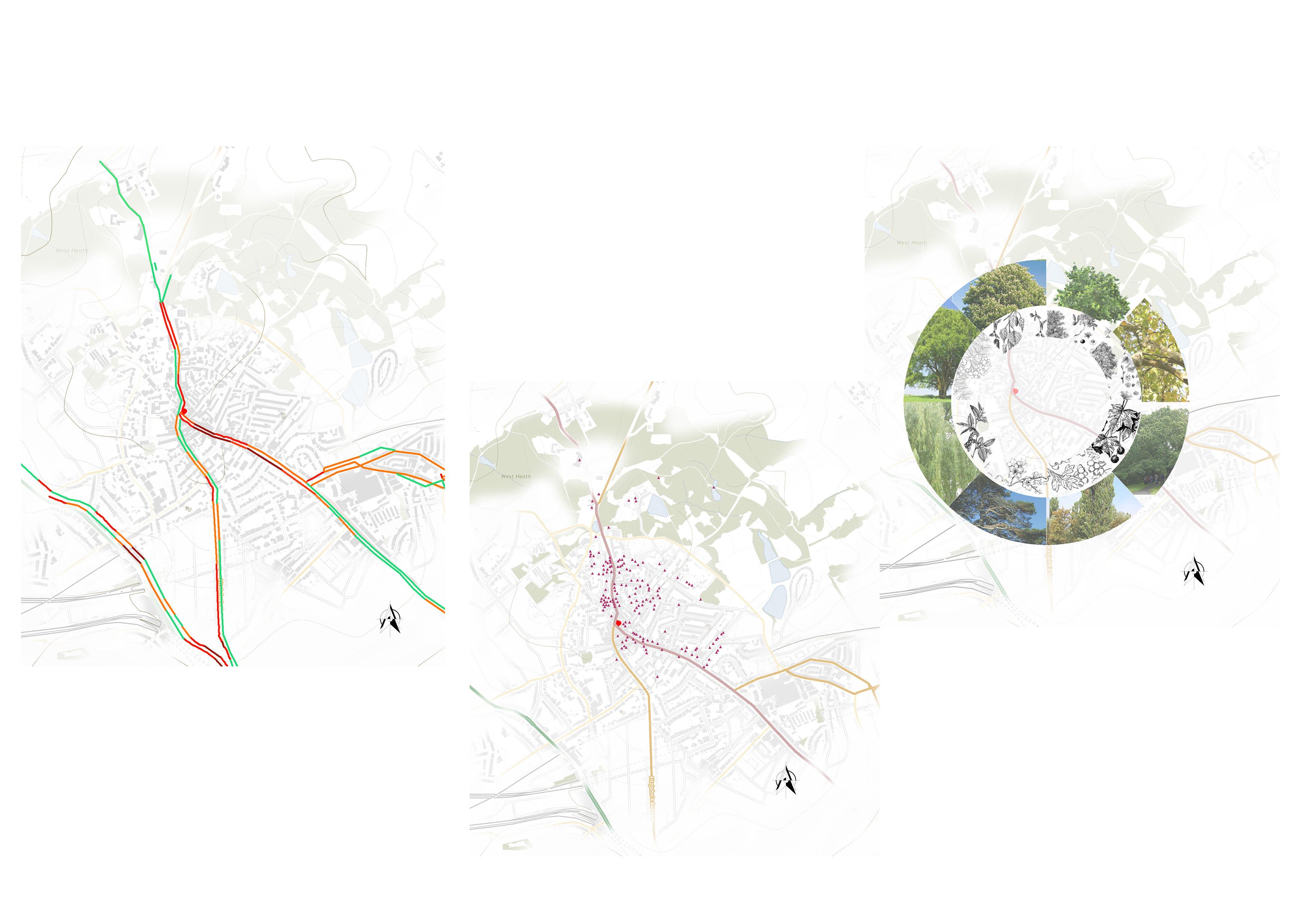
The Traffic pattern on the high street can be observed as slow compared to other road networks. The heath street is slightly slow compared to high street.
1.2.6 Listed Buildings mapping
1.2.7 Existing Planting Mapping
The immediate context of the site is surrounded by many planting species. The hampstead high street is has lot of mature trees with dense canopies which provides more biodiversity in the surrounding.
There are lot of Listed buildings in the immediate context which illustrates the historical character of the site. This showcases the rich cultural character of the context.
The Derive atlas was a part of exploration in term 01 which helped understanding the site better by analysis existing character of the site
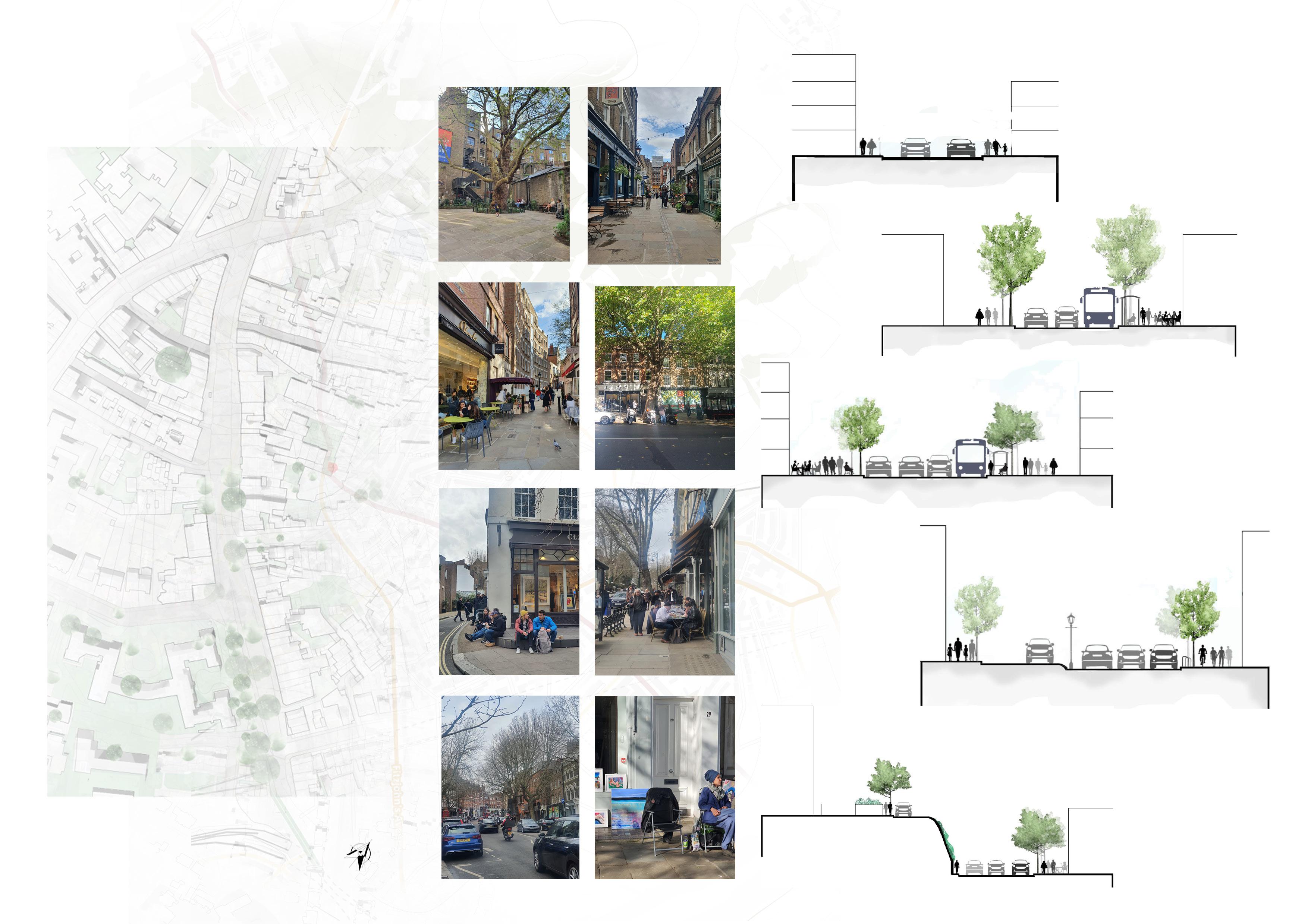
The Analysis summarizes that high street has majorly retail shops and restaurants and cafe.
The stuy was done to understand ground level analysis of the street and to make analysis about how ground floor integrates with the street.
This analysis was done to understand human activity in the site. This helped in better understanding of how users use specific sections or nodes of the site in response to theground floor typology.
Rich cultural Historrical character.
Existing Biodiversity in the immediate context.
The site is surrunded by Hampstead heath which give people the benefit of accesibility of a large green area in close proximity.
The important landmarks such as Burgh house, keat house, Kenwood house etc. give this neighbourhood more intellectual character.
Hampstead community centre organizes small exhibition every weekend to showcase local artist. This enhances the vibrancy of the neighbourhood.
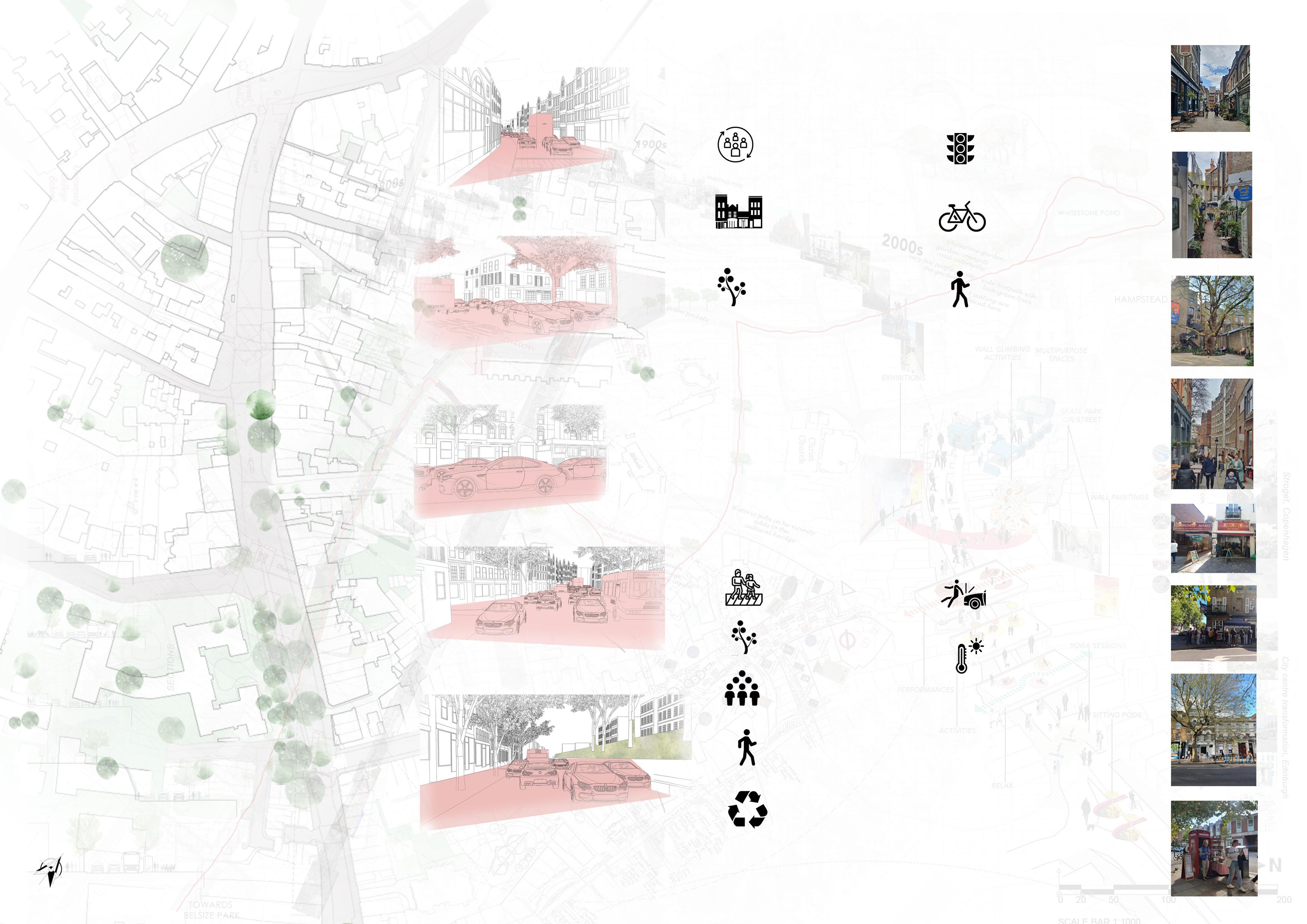
Increase in traffic on high street.
The rising level of NO2 beacuse of the traffic which affects health of the users.
The rising level of noise in the neighbourhood due to increase in traffic.
The sidewalks are not of sufficient width for people to perform various activities.
The lack of small pocket parks which make accessible to green quite hard for the users. S W O T
The neighbourhood can become more pedestrian friendly by making highstreet fully pedestranised.
The addition of more biodiversity into the street and making it more softscape can enhance overall wellbeing.
community Buildingopportunities for more local artist to experience a space to learn and innovate.
Enhancing experience of walking journey of the site.
Increased traffic can cause major accidental collisions which can be a danger to the pedestrians.
The rise in levels of Urban heat island effect which will cause more temperature to increase which will ultimately affects the life of humans and other living beings.
2.1
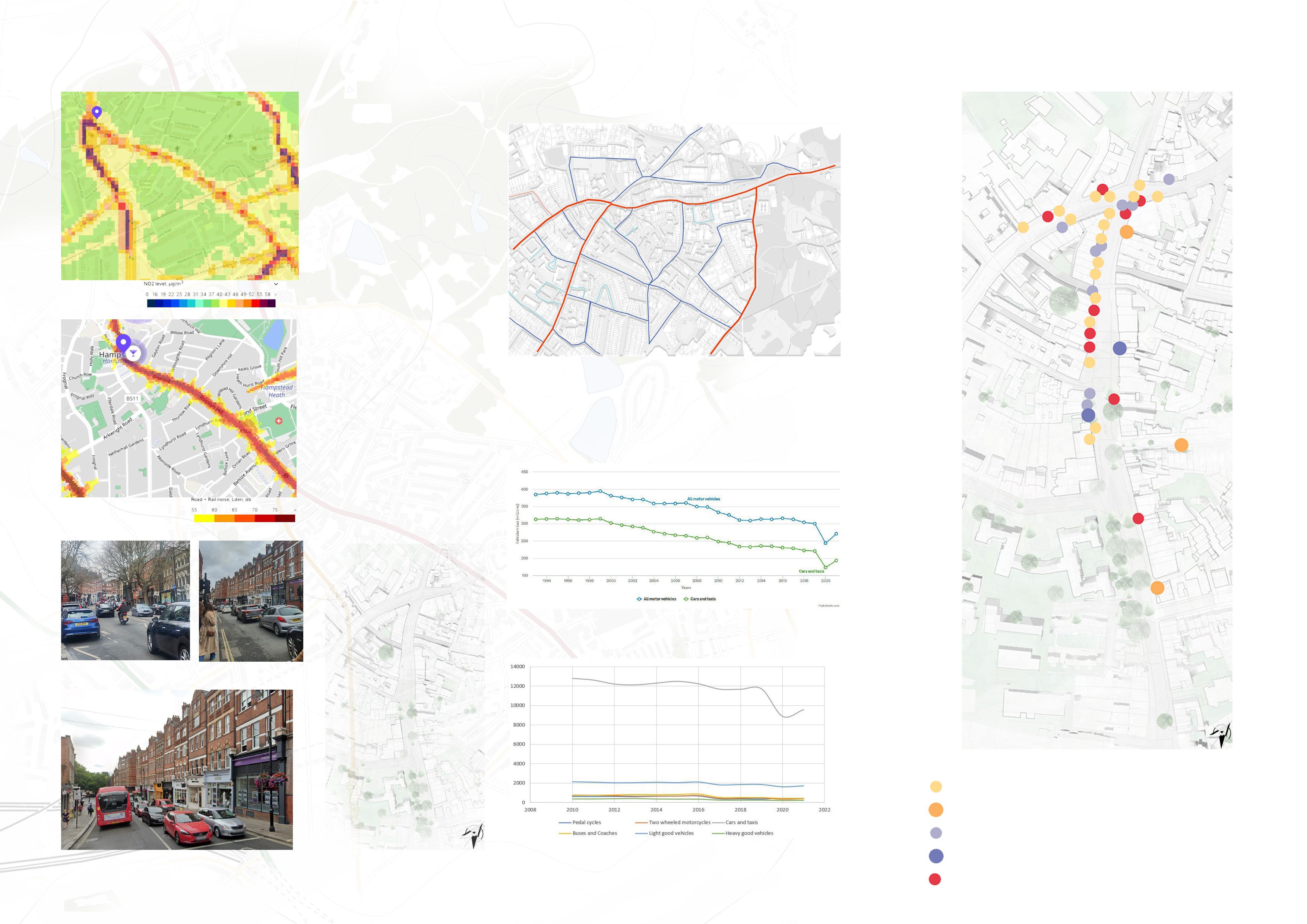
NO2 (nitrogen dioxide) annual mean level is 45.2 µg/m3, which is above EU quality limit set to 40 µg/m3.
Increased levels of nitrogen dioxide can have significant impacts on people with asthma because it can cause more frequent and more intense attacks. Children with asthma and older people with heart disease are most at risk.
The most noise at the high street comes from the traffic that has been increasing day by day.
This creates an unpleasant experience to the journey of pedestrians.
This graph illustrates the annual traffic analysis in camden borough. It has been increased in conseutive years.
Pedestrian light collisions Legend
Pedestrian severe collisions Cycle Light collisions
This mapping illustrates the analysis of collisions of pedestrians, cycles and cars on hampstead high street.
Cycle severe collisions
This graph illustrates anuual average flow of traffic on high street (A502). The no. of cars and taxis have increased enormously since year 2008.
Cars severe collisions Annual average traffic flow on main road A502’(Hampstead high street)
The maximum no. of collision happens on the square of hampstead underground station. The collision happens because of the increasing traffic in the area. Also, the sidewalks in the high street are not wide enough hence, people start walking on road sometimes which causes minor collision of vehicles with pedestrians.
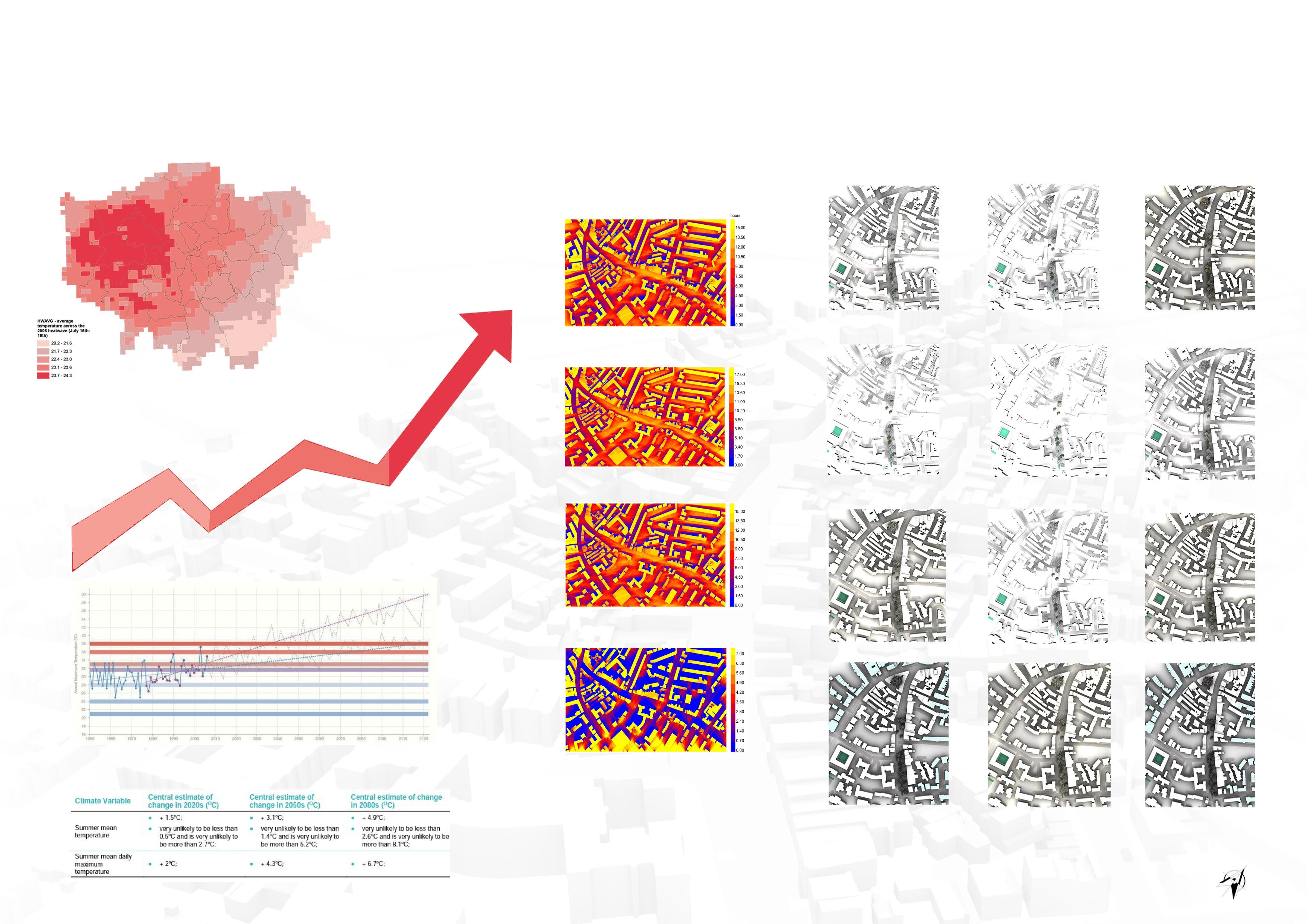
Climatic conditions Direct Sunlight Urban Heat Island Effect
London is experiencing hotter and drier summers that are further impacted by the Urban Heat Island effect (UHI). The UHI can cause London to be up to 10’C warmer than neighbouring rural areas. This is because the sun’s rays are absorbed by hard surfaces rather than by vegetation such as trees, plants and grass.
The hottest summer day in 30 years from 1991-2019 in hampstead was 37.1 C. If global temeperature increase 2C and 4C above preindustrial levals, the hottest summer day could be about 38.7C and 42.8 respectively.
The southern Part of the street remains shaded throught, which could be suitable for public realm interventions. The northern part of the street is mostly sunny as there are less of vegetation and hence it would be more suitable for day to day activities.
After analyzing the character of site and understanding the challenging issues of the site, The proposal is to create more a neighbourhood which celebrates the context and history of the site. Also, the addition of small public realm intervention can benefit the wellbeing of the locals. This aims to make the area more vibrant and creative which open doors for people to learn and grow in the space.
Existing character of
Traffic Management
Traffic reducing strategies that use measures to decrease the impact of traffic should be used to achieve safety criteria on biophilic streets. The methods like adding more planters and trees. Also, introducing transformation of street in phases might help managing the increased traffic issues.
Heat Management
This strategy helps in cooling down the city when urban heat island effect is leading to ill health across globe Urban tree canopies provide cooling effect in street canyons and also reduce temperature by 0.7-1.3 degrees. Introducing green walls and roofs can also help in reducing air temperature.
Stormwater Management
Large numbers of impermeable surfaces in cities result in large wastewater that needs to be managed. Through bio-retention and bio-filtration, it has been established that green infrastructure can keep the majority of the initially contaminated runoff.
Biodiversity Management
Urban streets have the potential to promote biodiversity by providing food, shelter, and breeding grounds, as well as supporting the movement of species. By serving as a corridor to allow movement, for instance, a biophilic street’s design detail could be used to support a variety of biodiversity goals.
Street Furniture
The natural flora and fauna, as well as several other ecosystem services, have been supported in several major cities by the use of bus shelters, bicycle stalls, street art, play projects, and benches.
Traffic Management Heat Management
Stormwater Management
Biodiversity Management Street Furniture
2.3.2.1
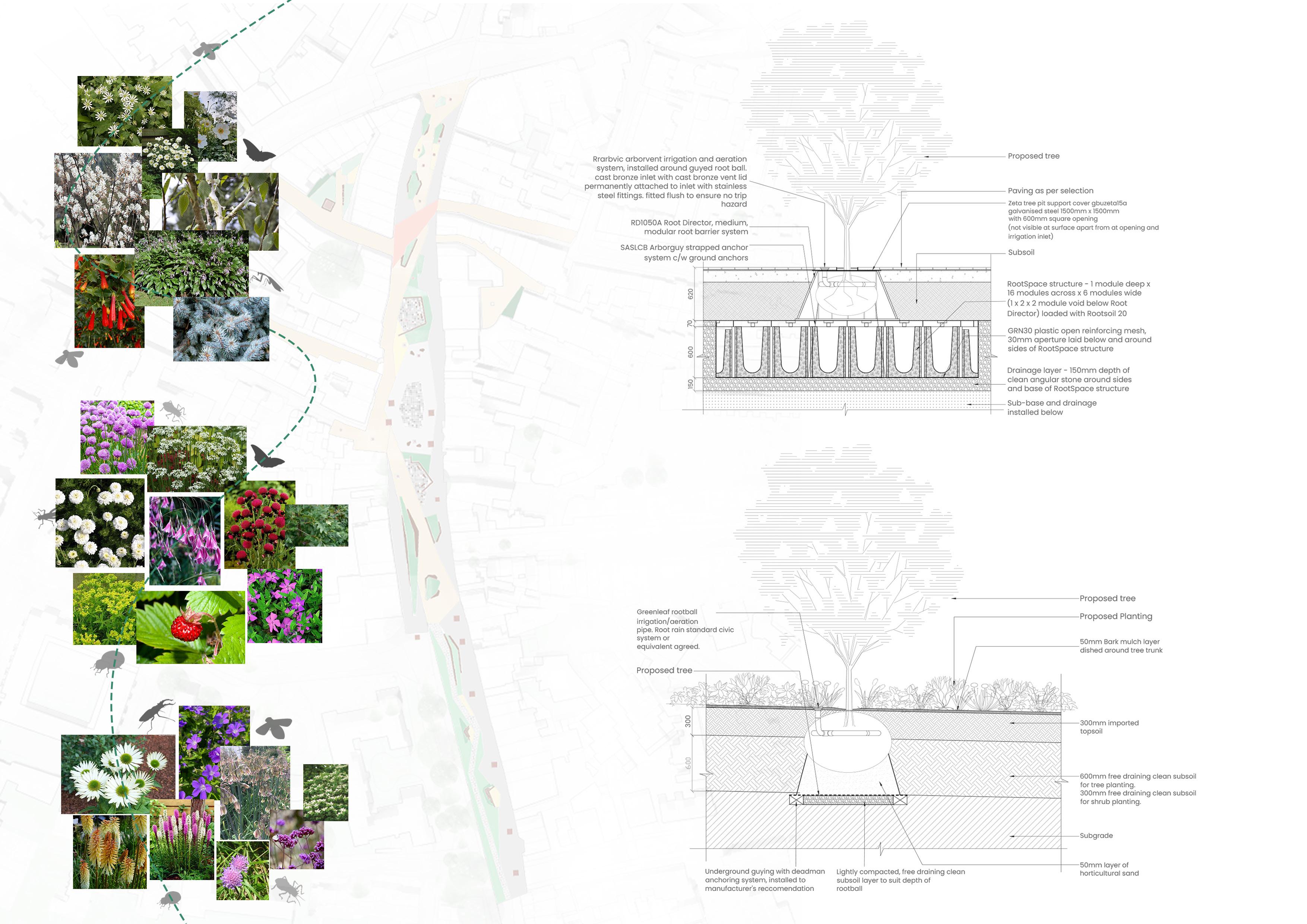
Aster divaricatus
Honorine Jobert
Amelanchier lamarckii
Betula utilis jacquemontii
Whirlwind
Hosta lancifolia
Desfontainia spinosa
Allium
schoenoprasum
Fragaria vesca
Purple Smoke
Euphorbia palustris
Flore Pleno
Atropurpureum
Echinacea ‘Virgin’
Mayflower
Verbena bonariensi
Liatris spicata
Nectaroscordum siculum
Typical section of bioretention system
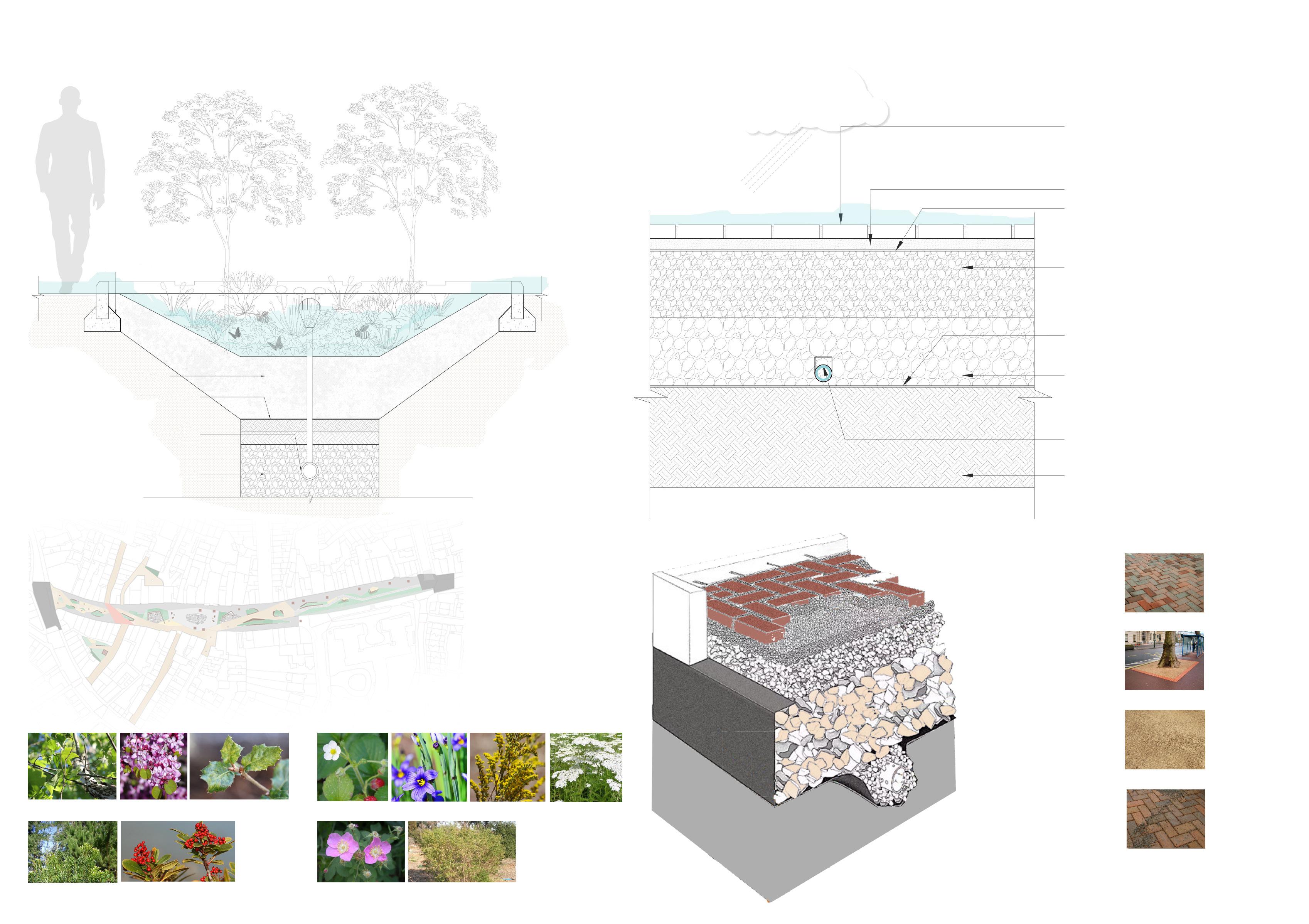
Bioretention areas (also referred to as bioretention cells or rain gardens) use soil, plants and microbes to treat stormwater before it is infiltrated or discharged. Bioretention areas are shallow depressions filled with sandy soil, topped with a thick layer of mulch, and planted with dense vegetation.
Stormwater runoff enters the bioretention area, percolates through the soil (which serves as a filter), and eventually drains into the groundwater; part of the water is also absorbed by the plants. In order to prevent flooding during stronger storm events, bioretention spaces are typically built to accommodate ponded water and an overflow outlet.
3.1 Case study
3.1.1 Scale comparison
3.1.2 Understanding dimension of the site
3.2 Place making strategies
3.2.1 Analysis of existing human activity
3.2.2 Analysis of Frontage mapping
3.3.3 Proposed circulation and zoning
3.4.4 Proposed overlayers of activities
3.3 Design development
3.4 Proposed sections for the site
3.5 Design demonstration
3.5.1 Site Master Plan
3.5.1.1 Overlay of Temporary Activities
3.5.1.2 Proposed circulation and zoning
3.5.1.3 Proposed overlayers of activities
3.5.2 The promenade Specific design
3.5.3 The Pop-up bazaar specific design
3.5.4 The gardens specific design
3.6 Conclusion
Kingdom street , London
Alfred Place London LDA Design Townshend Landscape Architects
The Kingdom street has varied kind of circulation space along with green areas provided. Both side of the street has commercial front hence, the zoning of circulation and green space is according to the frontage. The experience of the space is more intimate because of closely placed green pockets.
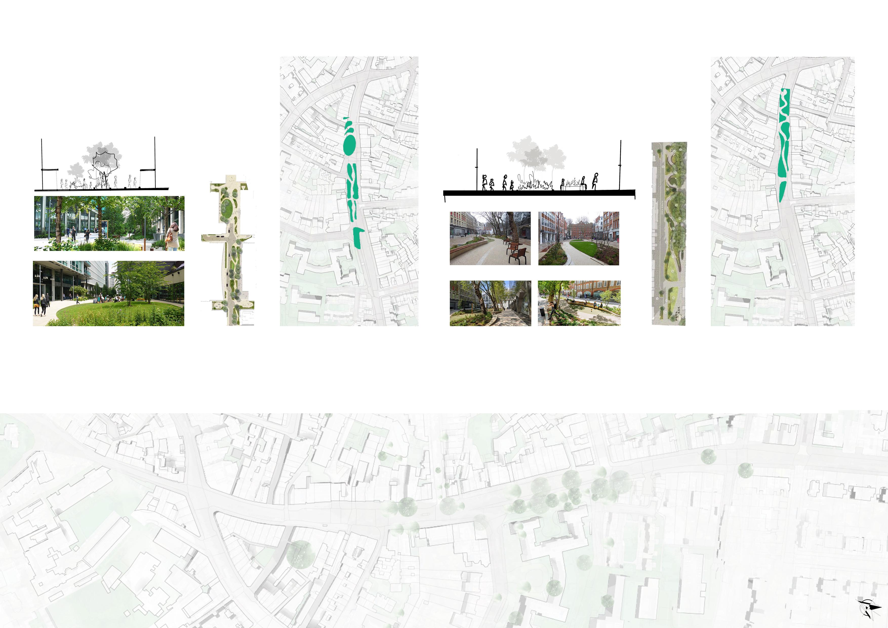
The Alfred Place is divided in to three parts along the street. Each section provides different experience in the space. The circulation is more organic and hence creating playable element to the space. The circulation space along the site is left for service vehicles and hence the middle part of the site is designed for pedestrain circulation.
The scale comparison study was done to understand hierarchy and diviosn of space within site. The understanding of ratio of hardscape to softsacpe in the site was also understood. By studying these two case study I gained better understanding of circulation within spaces.
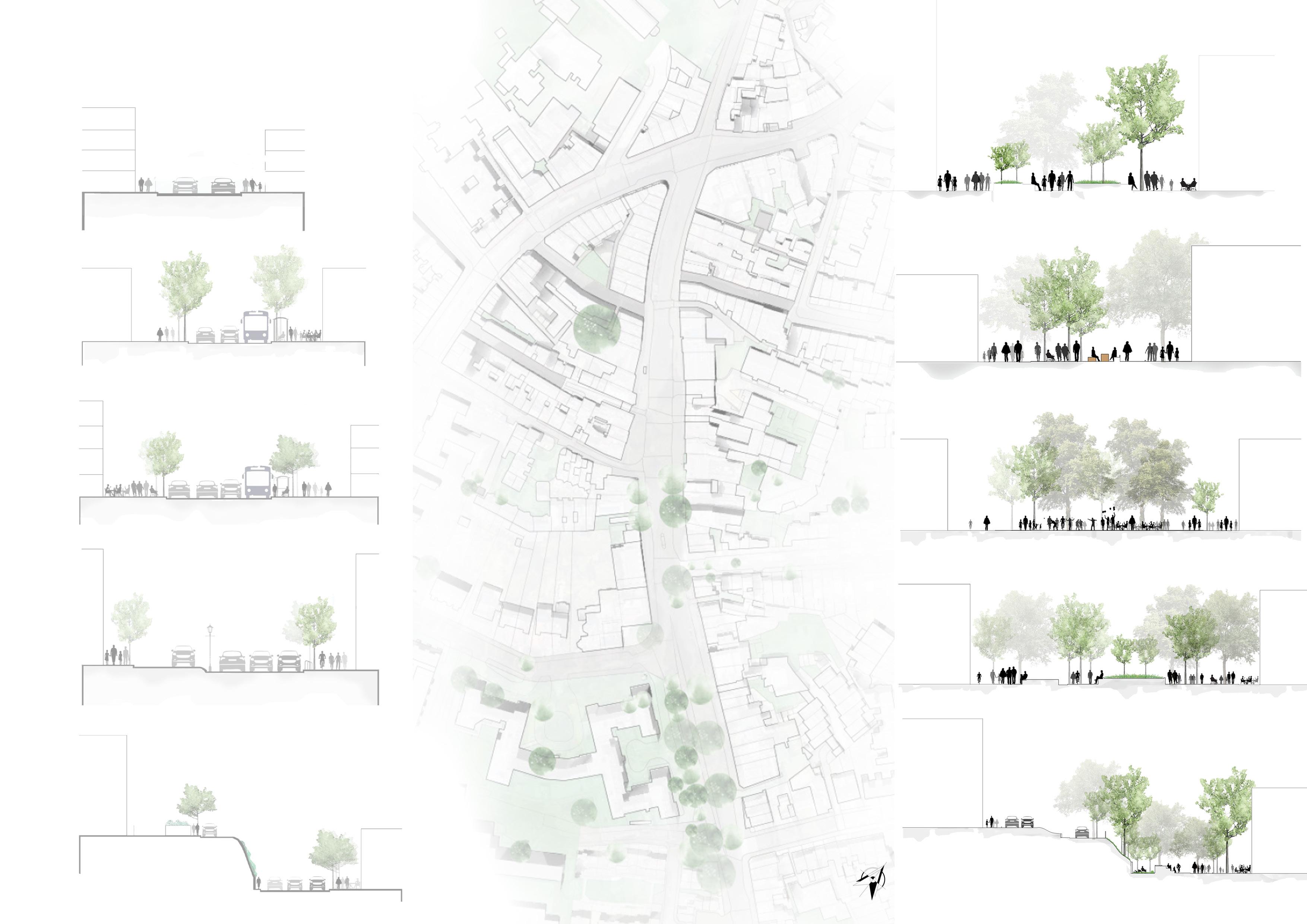
3.2.1 Analysis of existing activities along the street
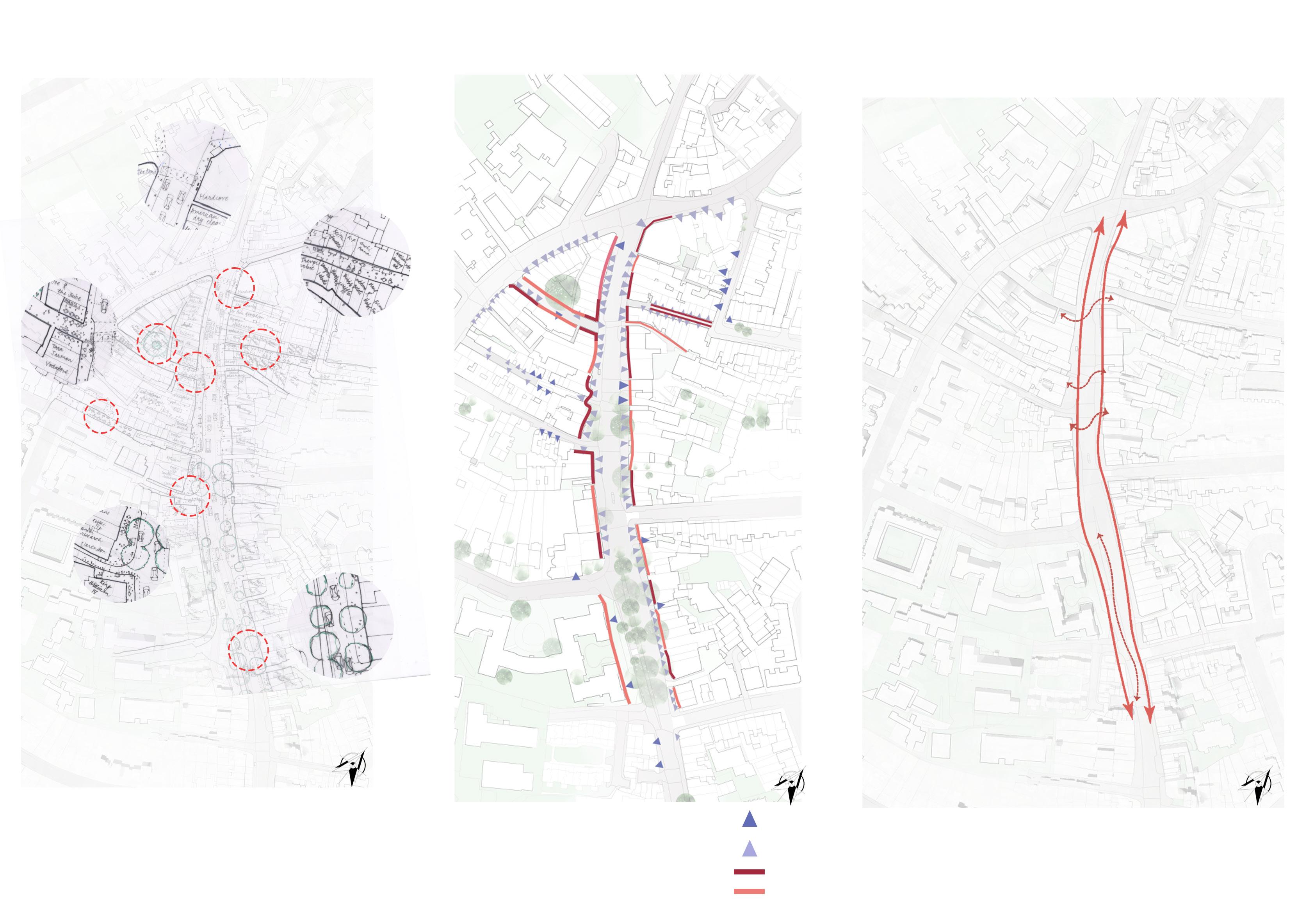
This analysis illustrates the activity mapping of existing character of the site to gain better understanding of most and least active areas along the street. The dotted red circle are the most active nodes along the high street. This gives clear analysis as to why people use specific spaces of the street majorly. Further this analysis is used in zoning for spaces to reatin key moments of the site.
3.2.2 Active and Passive Frontage
This analysis illustrates the ground use of the street and which all fronts have private and public entrances. Also, this mapping determine active and passive frontages along the street to get better understanding of existing circulation and pause moments. This analysis further supports the proposed circulation and activities along the site.
3.2.3 Proposed circulation and Zoning along the site
Proposed circulation
The proposed circulation goes along the two sides of the street and also integrates within the street. The edge circulation is for the shop fronts which allows users to move freely into the space. The middle section along the street is for the permanent and temporary activities proposed for the site. This differentiates the use of the street for specific activities.
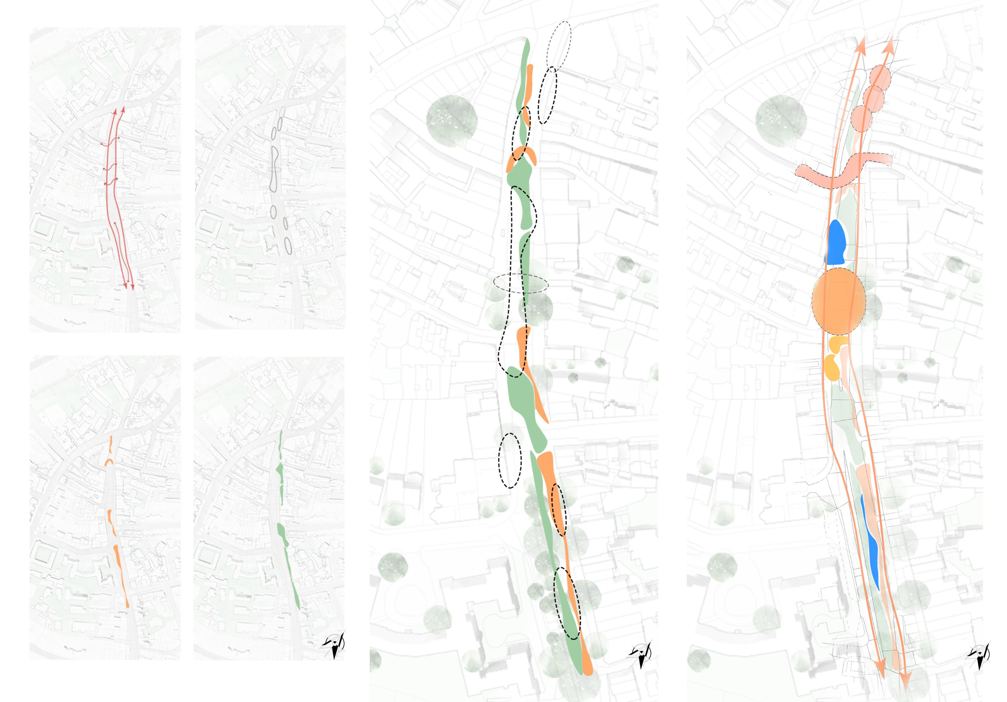
Conceptual Plans for division of spaces
Conceptual sketches for the design
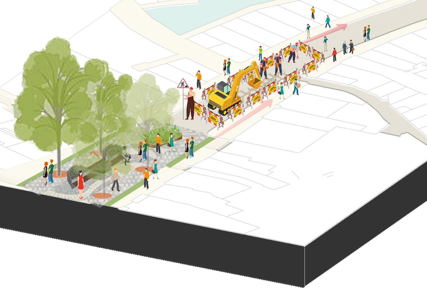
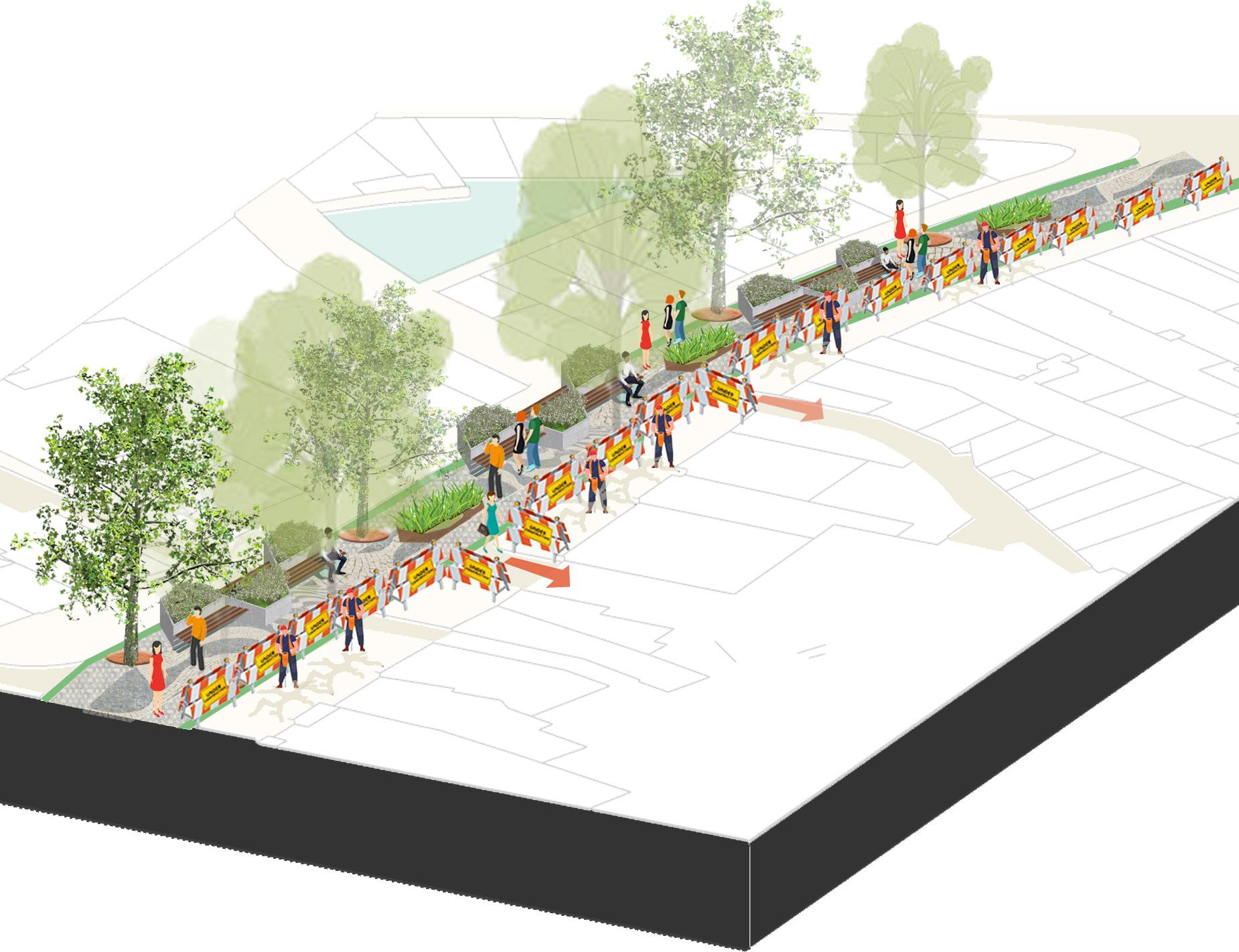
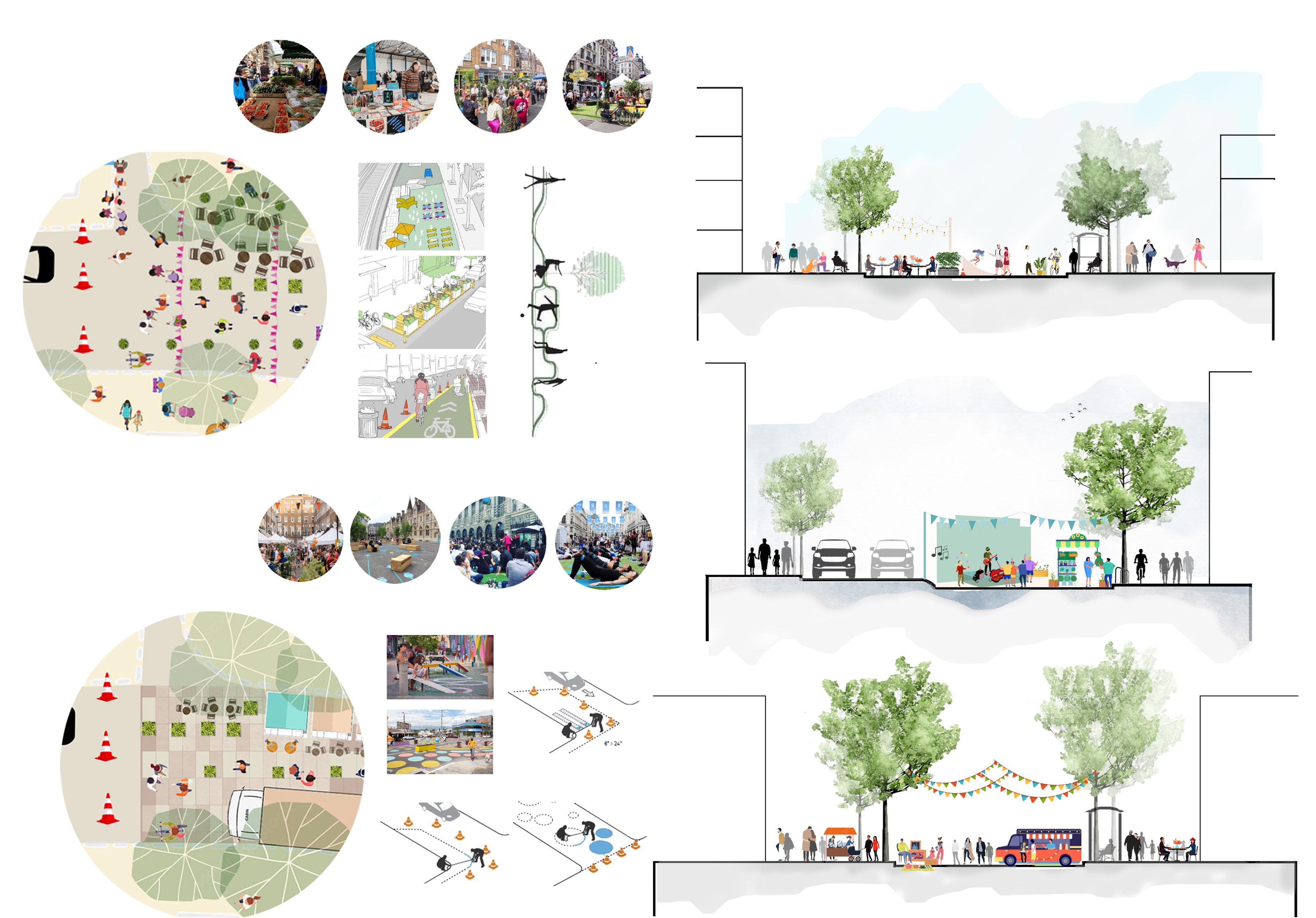
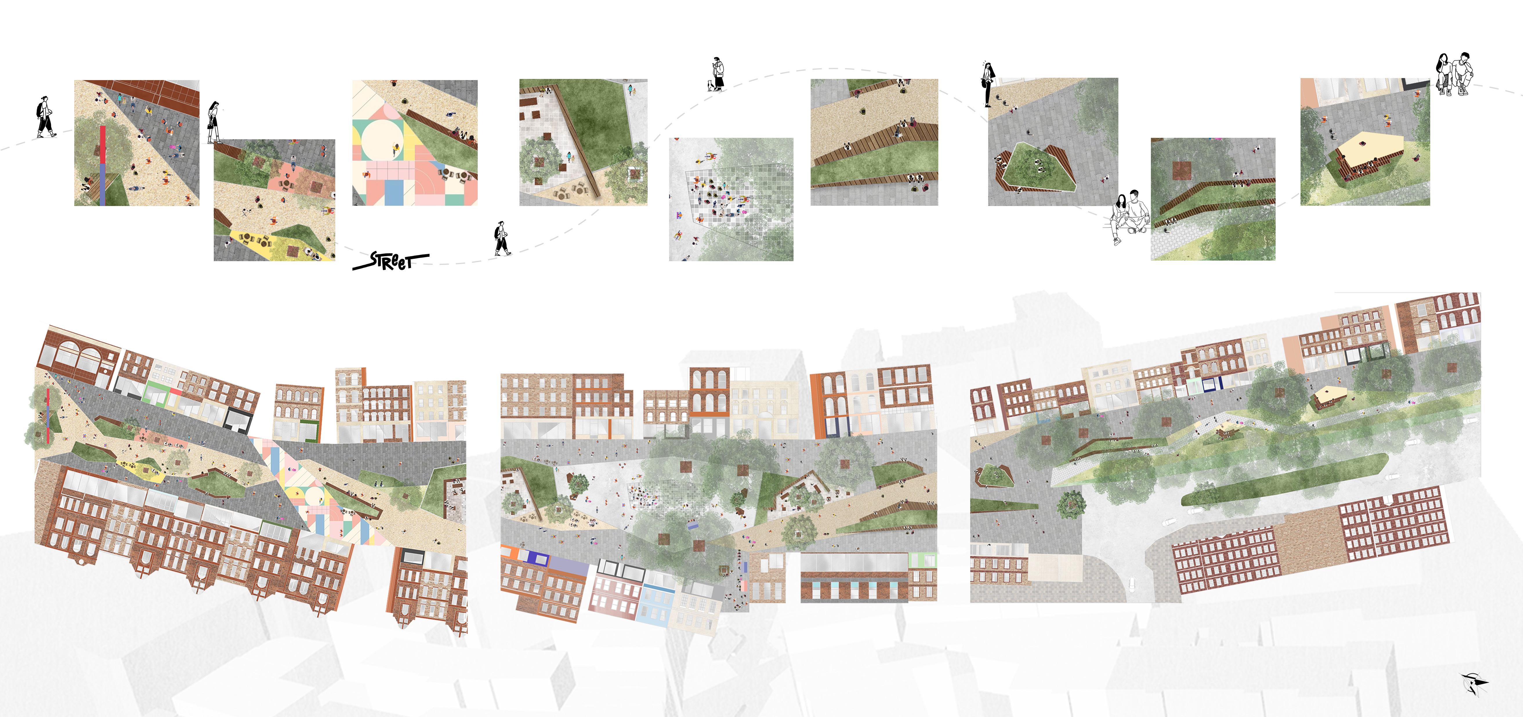
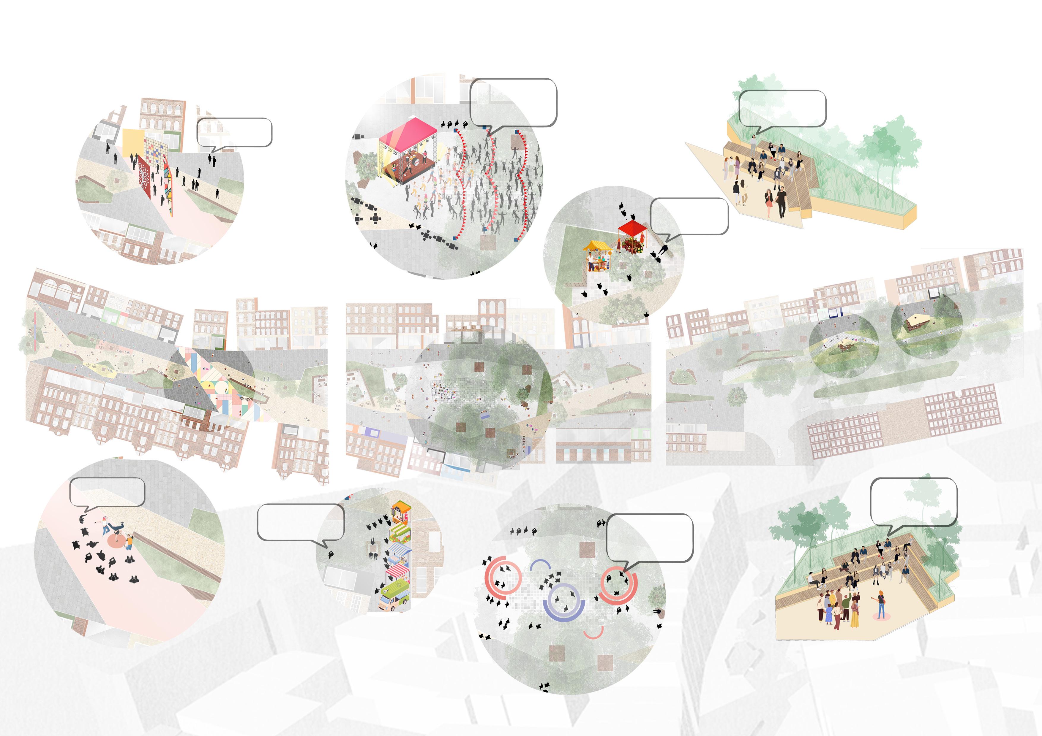
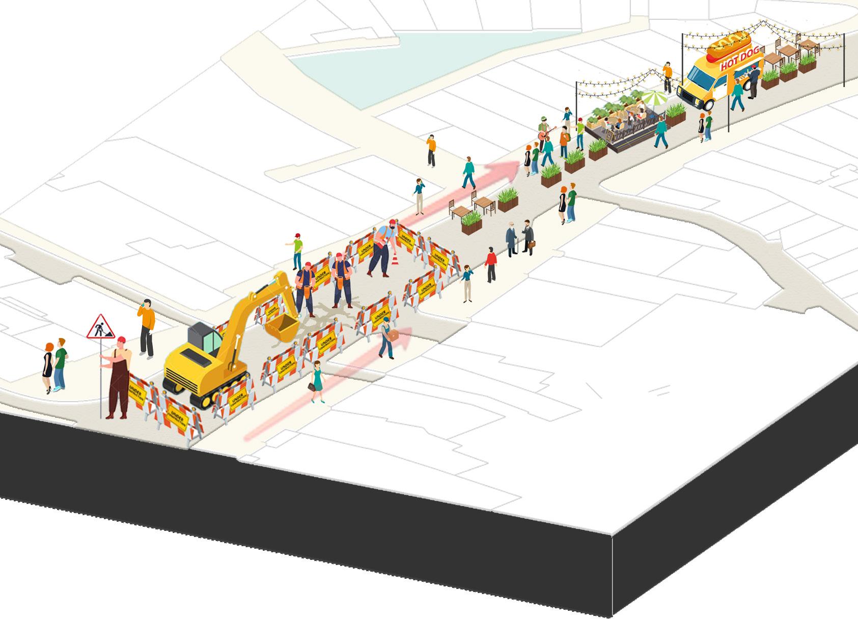
The space of intervention is divided into three parts - The promenade, The pop-up bazaars and The gardens The division is done after analyzing the current character and conditions of the site.
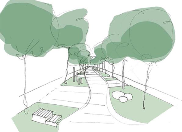
The promenade- This section of the street is designed to accomodate more of daily activities goes on the street. The spill-out spaces and more of seating area is designed after understanding the active and passive use of the street at ground level.
The pop-up bazaars- This section of the street accomodates more of street performing activities, the local markets, exhibitions and slightly bigger gathering space. The width of the street allows more number of people to be accomodated.
The gardens - This section of the street exhibits more relaxed and intimate experience to the users. As this section of the site is surrounded by mature trees, it allows to create more intimate and flexible spaces to allow people to have more community interaction.
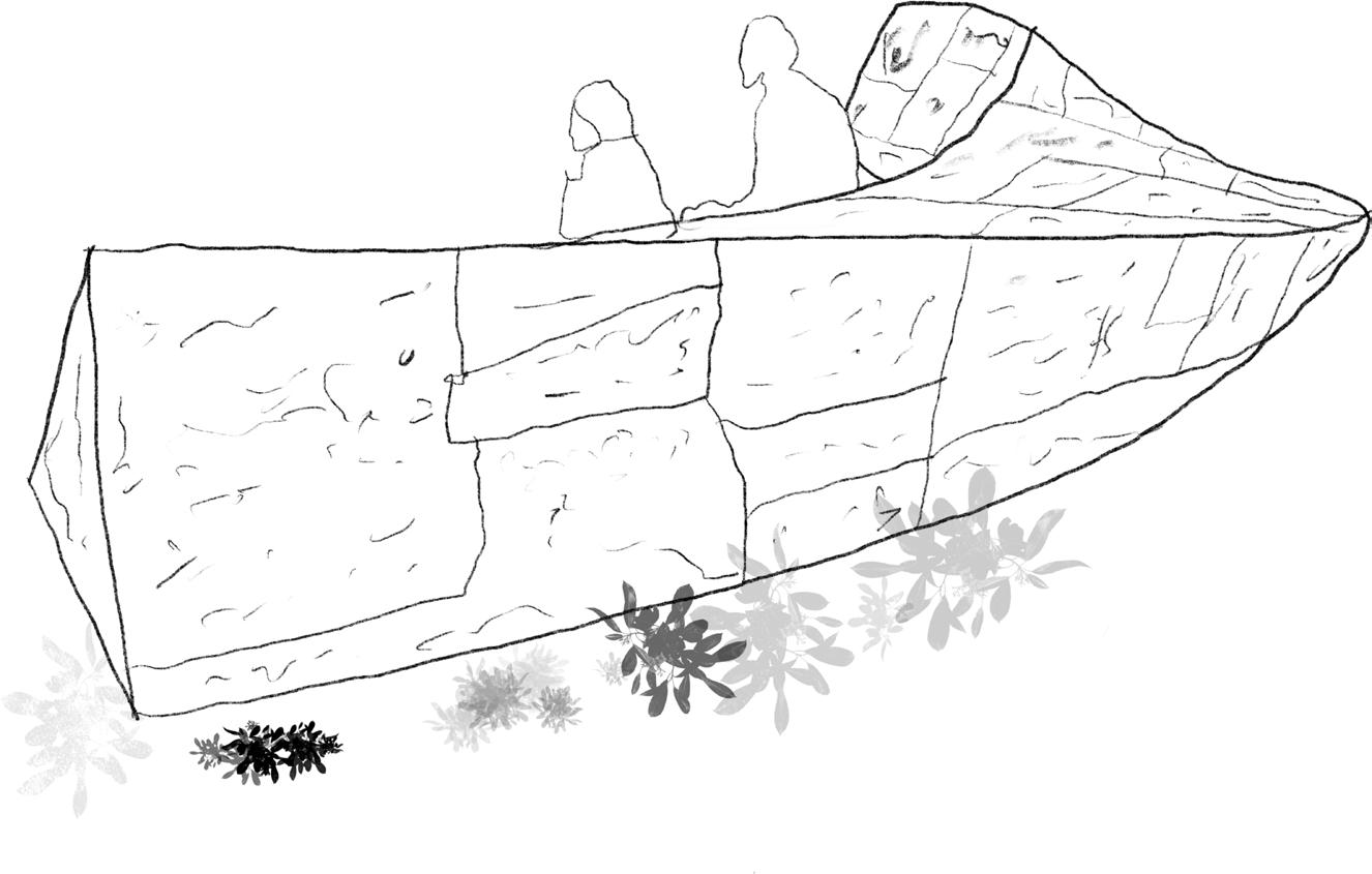
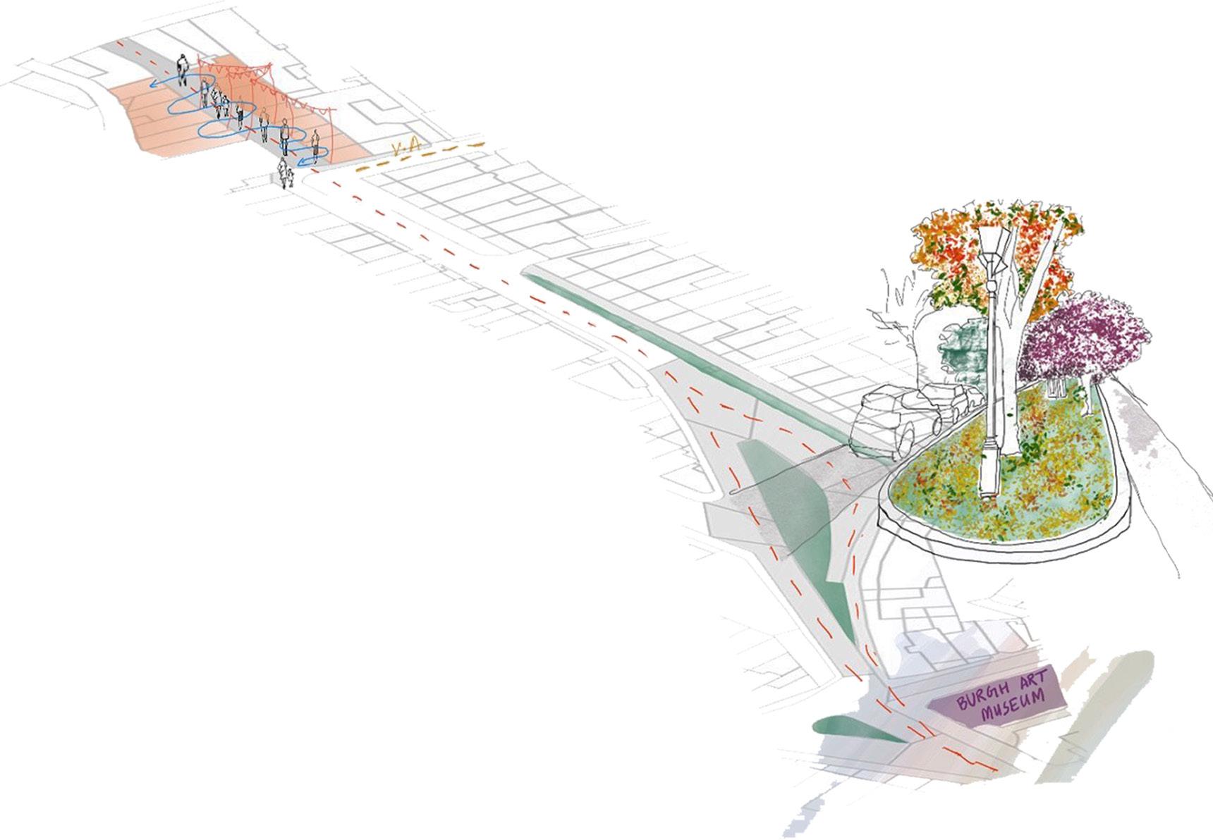
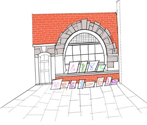
The existing place has a mature tree surroued by few seatings. The proposed plan is to creat a pocket garden for the passerby as thisnarrow passage connects two primary streets. Hence, this space acts like a transition space for the users of the site.
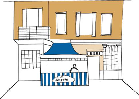
The existing Flask walk has a lot of vibrancy as there are outdoor dining spaces and few stalls outside which attracts a lot of Londoners. The design allows this narrow lane to integrate more with high street and hence making it one experience.
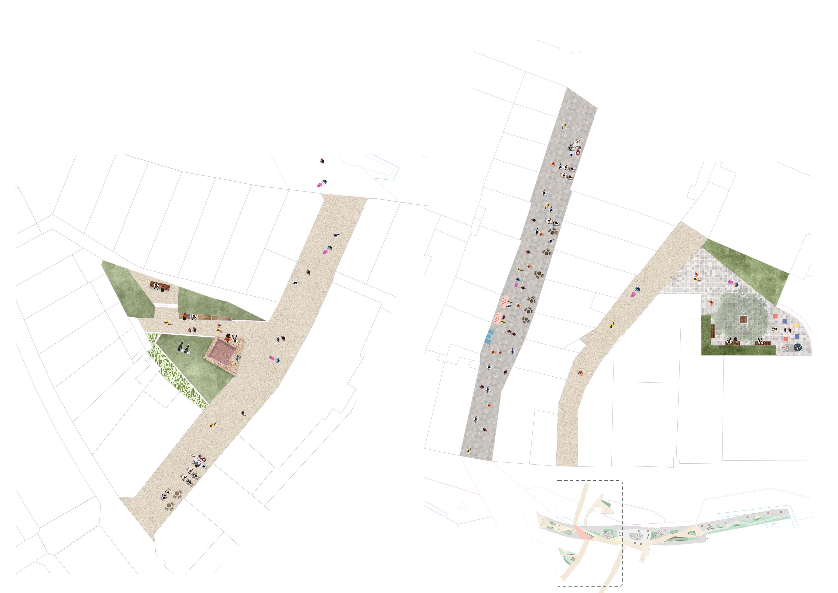
The existing condition of Bird in Hand yard courtyard is approached by a narrow lane ending into an unused part of the site. The lane filled withh dustbins and hence does not integrate with the vibrant culture of the high street. The proposed design transforms the courtyard into pocket garden and hence creating a moment of pause for the pedestrians and also connects more with the proposed design of high street.
This place promotes local artists. cant wait to see other artist perform.
I would love to work from here. This would be great place for expressing my ideas will definitely come here again!! The market here is so diversified
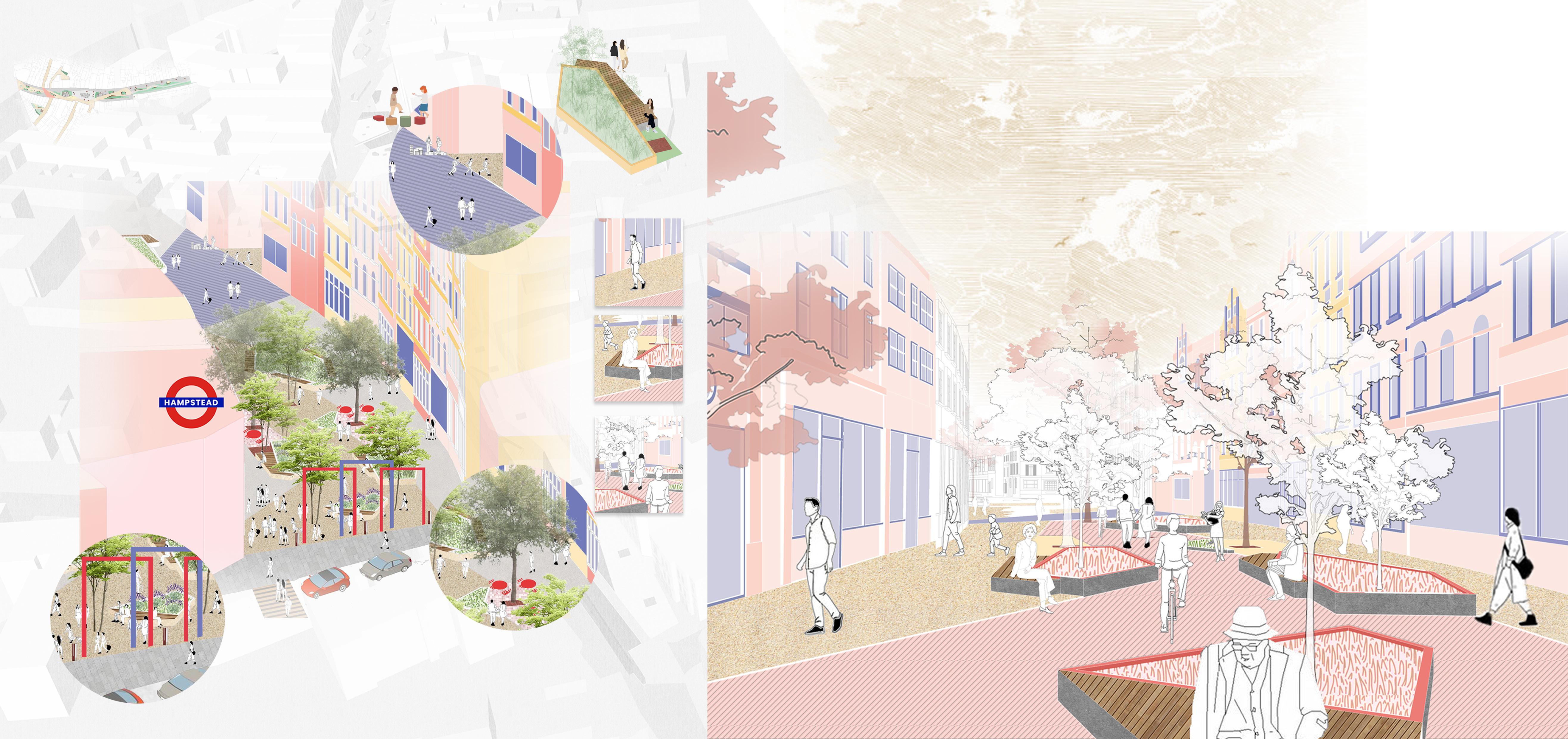
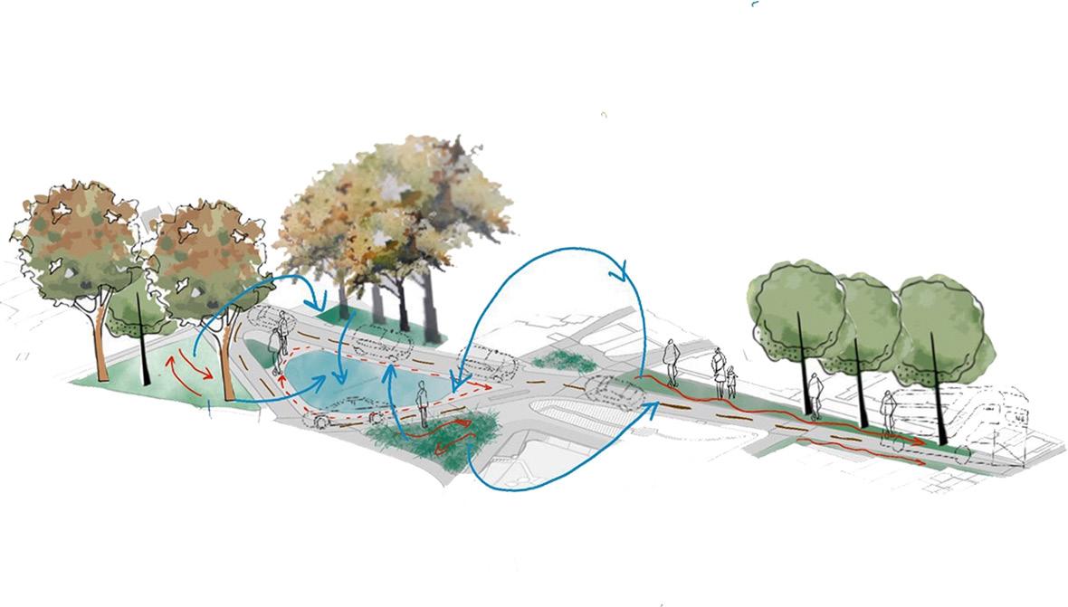
The promenade is the starting point of the creative corridor. This section is designed specifically for pedestrians to experience moment of pauses in their journey through ths street. The area also opens up to narrow street branches and creating gateways to the street, thus the spillover spaces are designed for users to have ample of space to interact and enhance community buiding. The seating is designed inward looking towards inner circulation of the
The pop -up Barzaar is the middle section of the creative corridor.
This section is designed specifically for pedestrians to experience variety of activities in their journey through the street. This part of the street acts as multipurpose area for various permanent and temporary activities. The width of the street allows small performances, Local markets and festivals to be held here
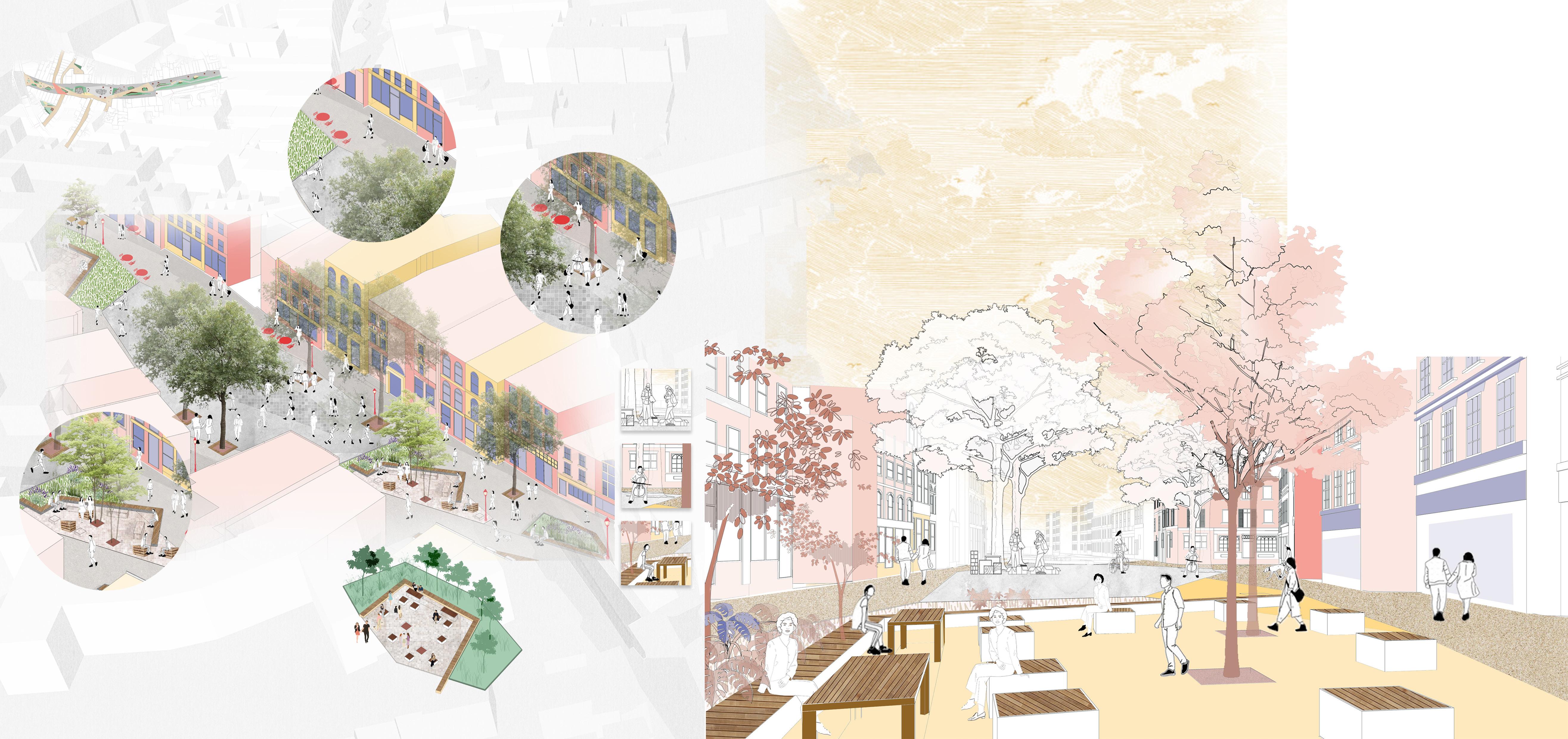
The dense canopy of the existing trees illustrates intimate feel to the space. Also, it allows harsh sunlight to not directly increase temperature on the ground.
and lunch spots for regular users of the street.
This seating space is specifically designed to create more flexible spaces along the street. The area could be used for different purposes and can be a place to learn and grow.
Biodiversity Interactions
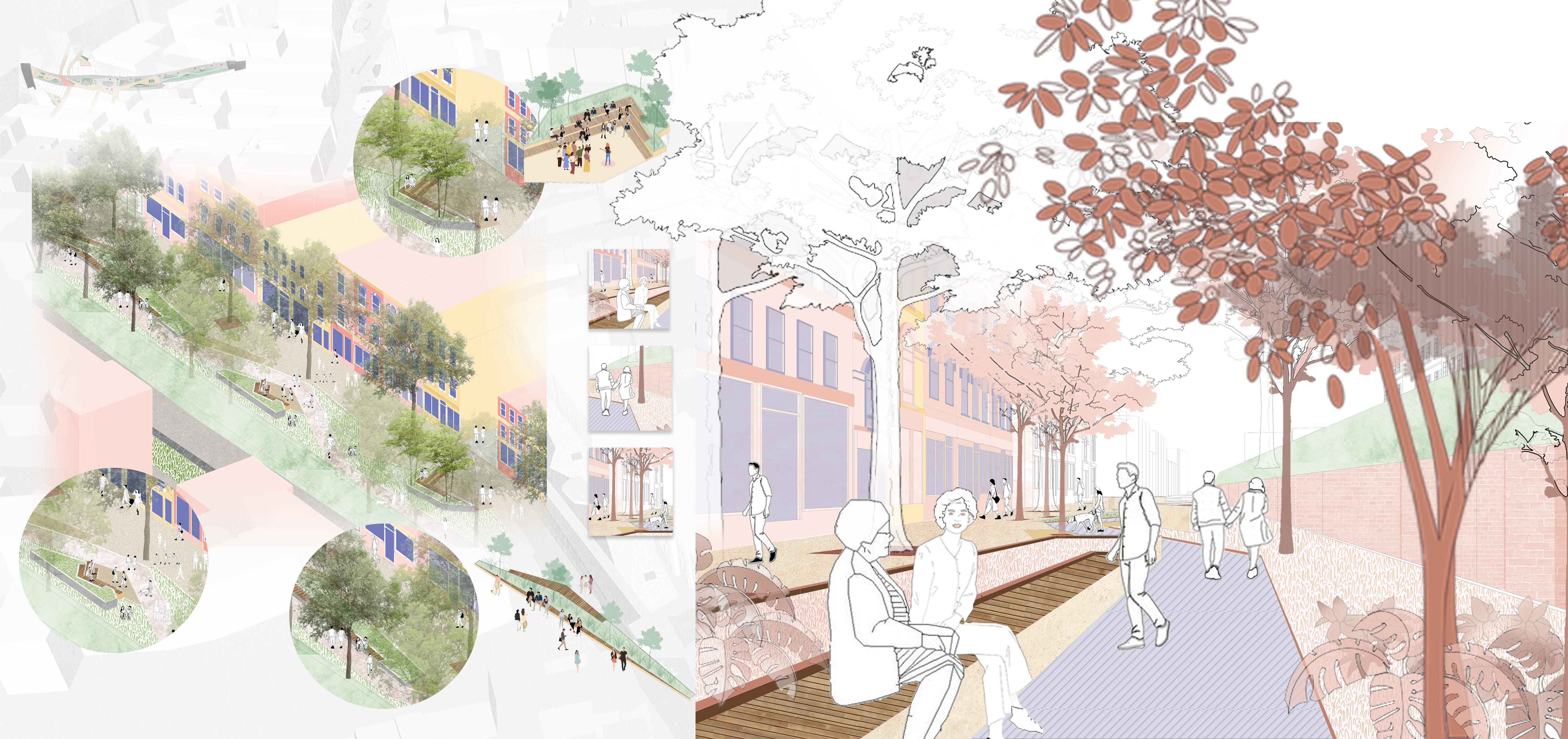
The gardens is the end section of the creative corridor. This section is designed specifically for pedestrians to experience most green part of the site. As this part of the street consists of various mature trees. Th shade allows users to relax and enjoy the gardens.
The design of the gardens is in such a way that it creates different pathway for the pedestrians to enjoy more of nature in the street.
In conclusion, the proposed design aims to inculcate more green to the existing high street. The project has been focused on creating opportunities for Londoners to have access to a place where they can learn and innovate. The spaces designed has flexibility to perform different activities which can boost the identity of Hampstead and can be a great initiative to integrate into its existing culture.
Area converted to softscape after intervention
Total Area = 1505 sq.m
35% of the area is converted into softscapeby addig planters, green pockets and trees to the proposed
Proposed Master Plan
Existing hardscapeAsphalt
Total Area = 4300 sq.m
Phase 02
Interim Transformation
Temporary methods are used using materials like paints and stencils to mark up the street for interim use by public.
Phase 03
Permanent Transformation
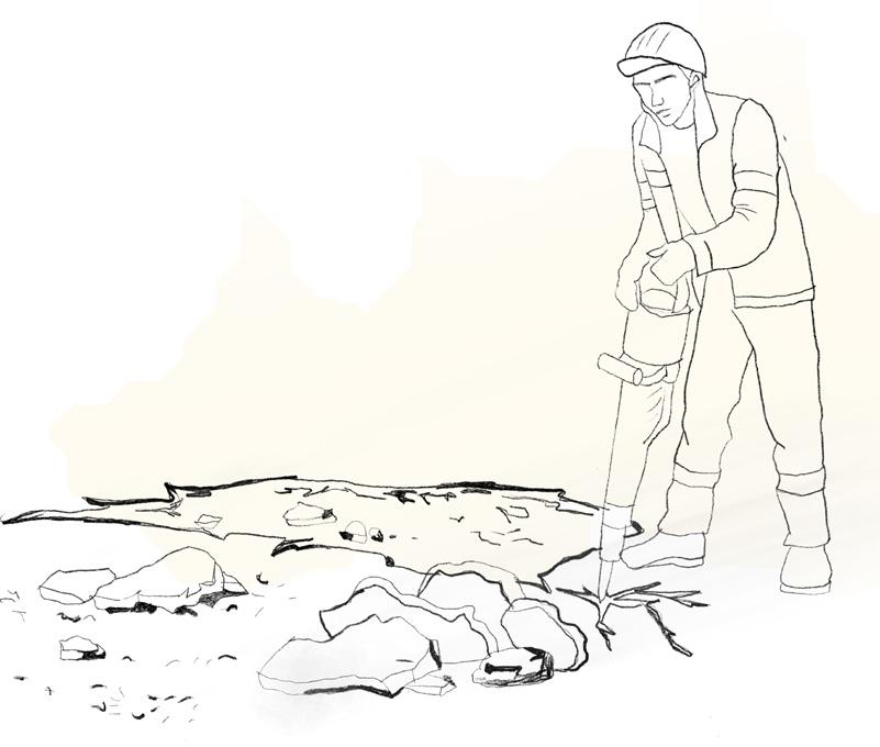
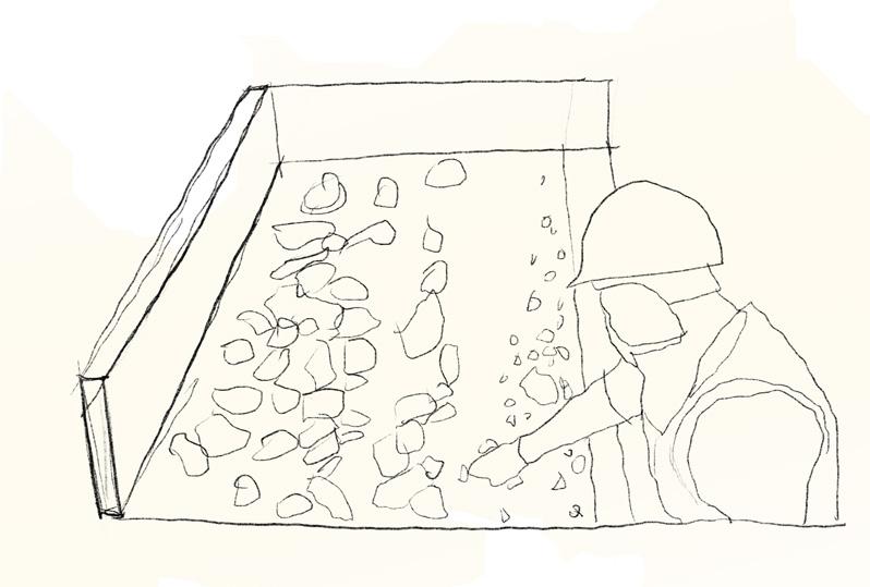
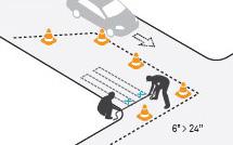
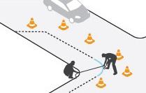
Use a jackhammer to dismantle concrete. It would be advisable for construction workers to break the Up the concrete to allow the use of pieces of varying sizes.
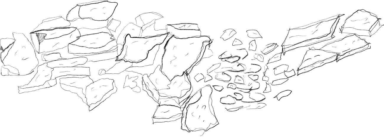
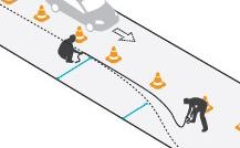
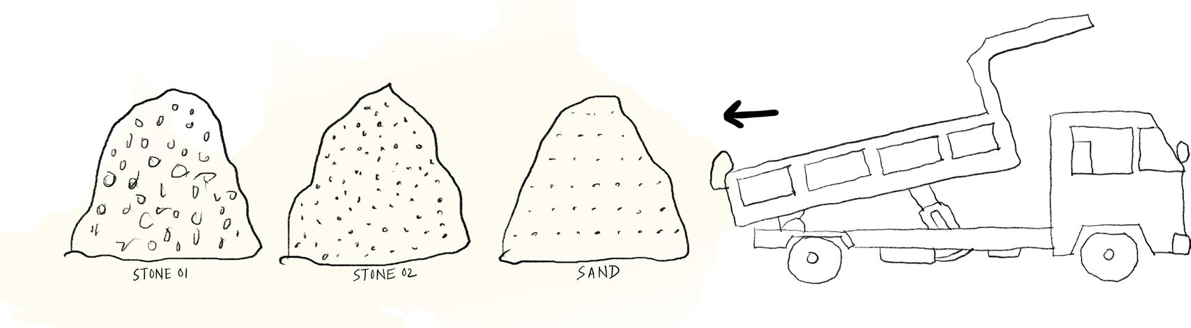
The sorted material if required for street furniture can be transported to factories for further treatment. The material for pavements can be stord at site. Due to the proximity of the material, superfluous shipping and storage are avoided, saving time and money.
Material is further processed The pieces would need to be arranged neatly and categorised according to their colour, shape, size, and material. These would be kept on the property in order to reuse the material for