Design Tutors - Gunther Galligioni Christina Leigh Geros
Module name - Advance landscape design 2 MLA2 23/24
Module code - BARC0113
Project Statement
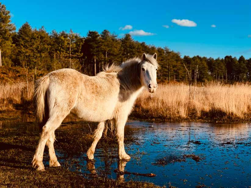
The project is situated in the New Forest National Park in southern England, an area renowned for its heathlands and wetlands. However, over the past few decades, agricultural drainage systems have significantly altered the wetland ecosystems, leading to the drying up of mires and bogs. This degradation, exacerbated by climate change and rising temperatures, poses a severe threat to the New Forest’s biodiversity, particularly to breeding waders such as lapwing, redshank, curlew, and snipe. The decline in suitable breeding habitats has led to a reduction in bird populations, disrupting the broader ecosystem. Additionally, recreational activities in the area create micro-disturbances that further deter waders from nesting, compounding the challenge.
In response to these pressing issues, the project focuses on two primary objectives:
Restoration and Preservation of Wetlands : The project aims to restore and enhance wetland systems by implementing measures to trap water and retain moisture during the hot summer months. This not only supports the survival of wetland habitats but also mitigates the risk of wildfires, thereby contributing to the overall resilience of the New Forest ecosystem.
Creating Disturbance-Resilient Wader Habitats: To address the impact of recreational activities, the project proposes the creation of “bog islands”— specialized habitats designed to integrate human presence with nature. By establishing buffer zones, these islands will provide wader species with safe, undisturbed breeding grounds while allowing for controlled human access. This innovative approach seeks to balance the needs of wildlife with the realities of human activity, ensuring that wader populations can thrive without being displaced by recreational disturbances.
The ultimate goal of this project is to restore and improve wetland environments while designing and implementing habitats that protect breeding waders from both environmental and anthropogenic threats, thereby supporting the long-term health and diversity of the New Forest
Introduction to New Forest Exploration of Wetlands Design with disturbance
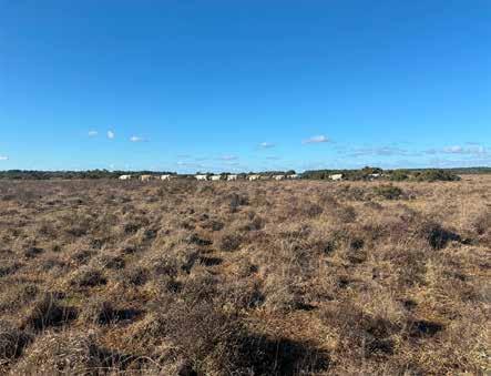
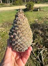
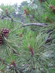
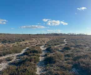
The site is located in New forest national park which is situated in southern England. The New forest have wide range of landscapes made up of woodlands and open habitats. The forest has rich mosaic of heaths, woodlands, bogs, lawns, streams, farmlands, plantations and coastal marshes.
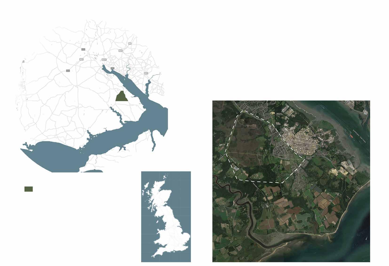
Site
Lyndhurst
Beaulieu Southapmton
Brockenhurst
New Forest National Park
Dibden Purlieu
Hardley
Beaulieu
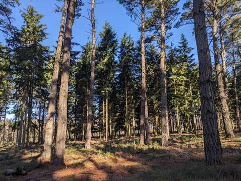
WOODLANDS
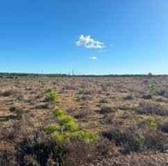
HEATHLANDS
WETLANDS
The site is mainly divided into three habitats - Woodland, Heathlands and Wetlands. These habitats have been shaped through centuries of management activities and grazing, thanks to commoners’ ponies and cattle turned out onto the Forest. They are internationally important and support many species, including birds, reptiles, invertebrates, flowering plants, lichens and fungi.
The new Forest offfers wide range of activities like, hiking, cycling, walking, horse riding. Communal activities like volunteering with locals encourages communities to participate into understanding management of New Forest and educate about wildlife and habitats of the Forest. However, sometime these human led activities leads to disturbances to few wildlife species and hence drive them away.
Managing recreation becomes an important subject to integrate nature and humans.
The New Forest is rich in wildlife with combination of habitats of wet and dry heaths, Mires and bogs, ancient pasture woodland, coniferous plantation, acid grasslands, mixed farmland and coastline. The National park is abundant with huge range of birds, deer, dragonflies, reptiles and much more.
WILDLIFE RECREATION
The burning is carried out by Forestry England which usually takes place during Feb and March. Heathland is a low nutrient habitat and controlled burning helps maintating this status. Gorse and heather burning encourages new growth, which benefits flora and fauna of New Forest. It also builds effective fire breaks to protects areas of heathland and woodland from wildfire. The rotation of burning for Gorse and Heather is 12-15 and 20-25 years respectively.
BURNINGCONTROLLED
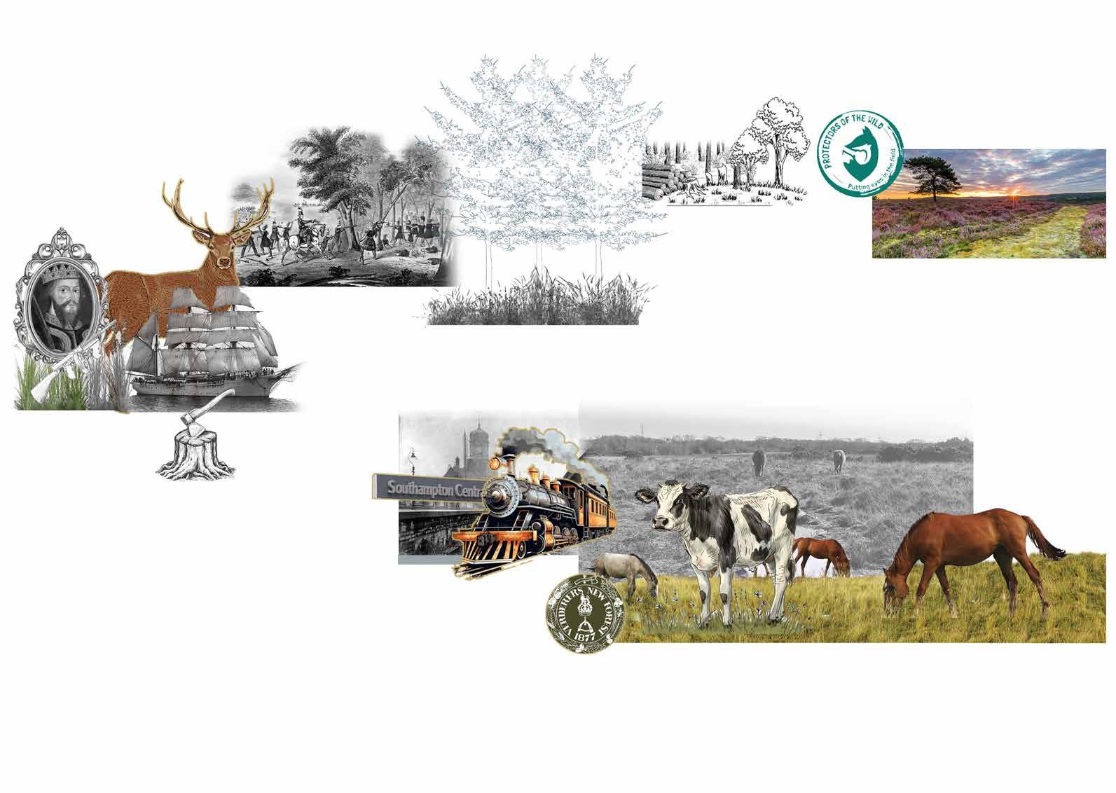
NEW FOREST MANAGEMENT
COMMONING
Commoning in the New Forest preserves its medieval heritage, recognized officially since the mid-16th century. Common rights, tied to land and properties, not individuals, encompass Pasture, Mast, Marl, Turbary, Sheep, and Fuelwood. Commoners, occupying such land, enjoy privileges like grazing stock on the Open Forest. The landscape of the New Forest owes much of its current appearance to the presence of ponies, cattle, and deer. Through their browsing and grazing activities, they have shaped the Open Forest lawns and trees, while also controlling the growth of brambles, gorse, and other coarse vegetation.
Grazing by ponies, cattles sheep and donkeys.
Forest managed exclusively for deer and other game by William I.
Oak cut from Open Forest to supply timber for building naval ships
Act of the Increase and Preservation of Timber in the New Forest: Conflicts with commoners over loss of grazing. First large scale afforestation.
Large scale introduction of conifers and drainage works.
The War & Inter War Years: Forest intensively managed for timber production
Countryside and Rights of Way Act 2000 (CROW)
The New Forest National Park Establishment Order: New Forest designated a National Park. New Forest receives full status as a Special Area of Conservation (SAC)
1845
Opening of Southampton and Dorchester railway.
1877
“Re-creation” of court of Verderers to administer common rights and pastoral interests
Forest Acts 1949 1964
Revived Verderers Court and clarified responsibilities between Verderers and Forestry Commission.
Alteration of perambulation boundary and addition of fencing and cattle grids to help control livestock movement and prevent accidents.
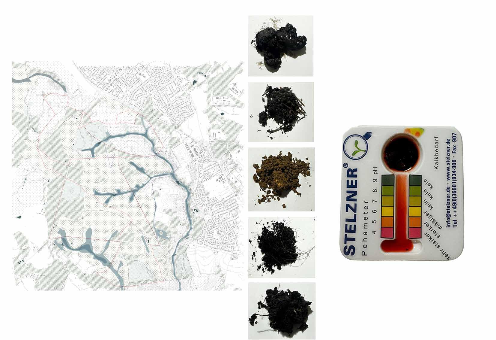
The soil testing results from the New Forest indicate that the pH levels range from 4 to 6, confirming that the soils in this area are generally acidic. This acidity is characteristic of heathland ecosystems, which are a prominent feature of the New Forest.
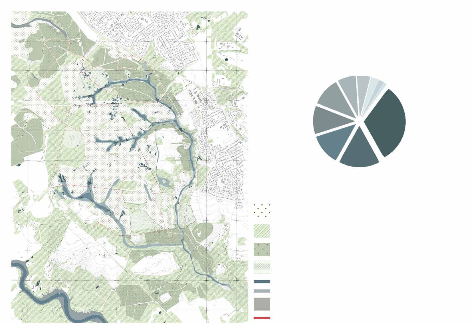
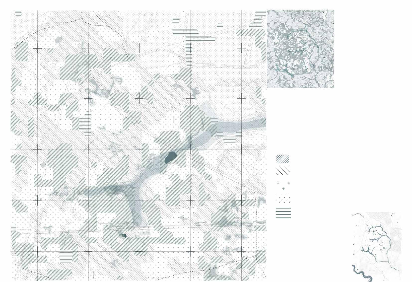
Habitat Mapping
The New Forest is one of the largest remaining tracts of unenclosed pasture land, heathland, and forest in Southern England, and its varied habitats support a rich array of wildlife. Habitat mapping involves the detailed recording and analysis of different habitat types, their distribution, and their condition across the forest.
Heathland
Categories of Crownland Heathland.
Source Hampshire Rural Pathfinder Project EIA
Invasive shrubs and Gorse
Woodland
Grassland
Water(streams, rivers, bogs , mires)
Water(streams, rivers, bogs , mires)
Settlements
Walking
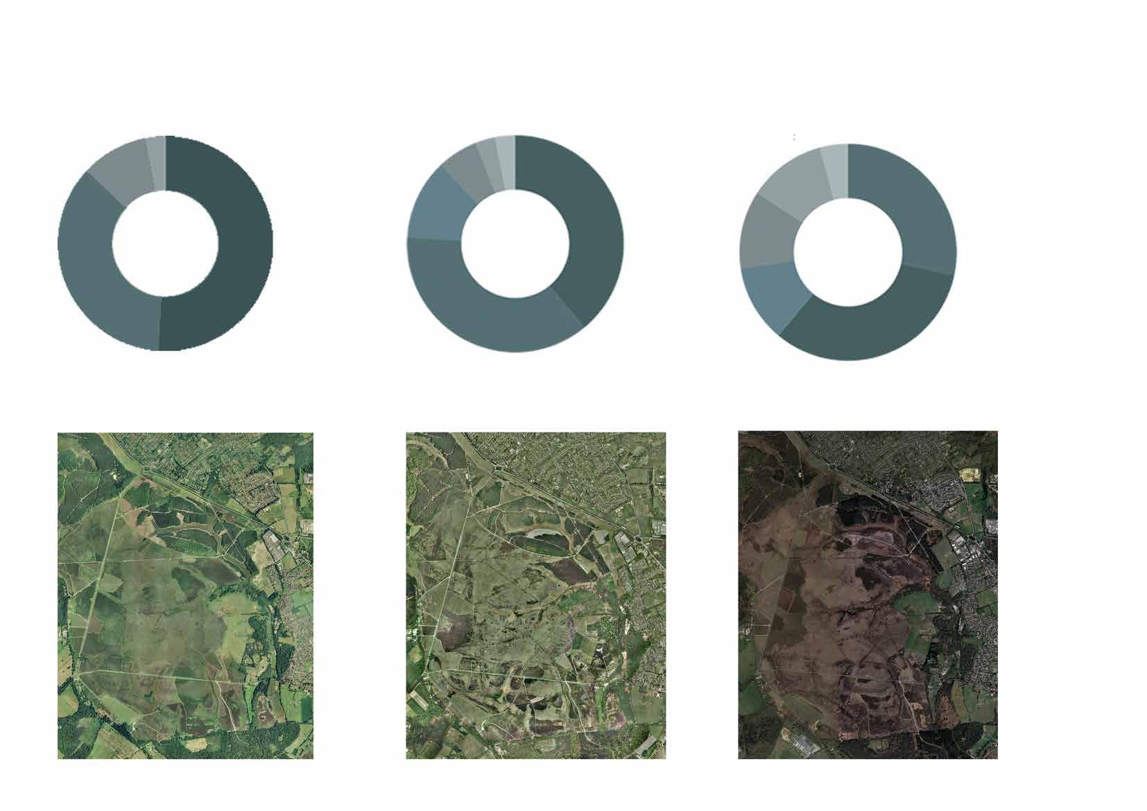
Change in Forest land cover
The data indicating that woodland in the New Forest has been cleared over the past 25 years to create more open habitats highlights significant land management and conservation strategies.
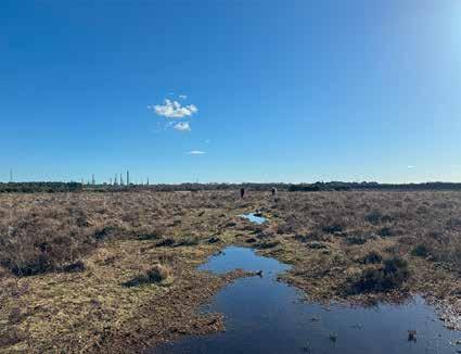
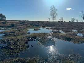
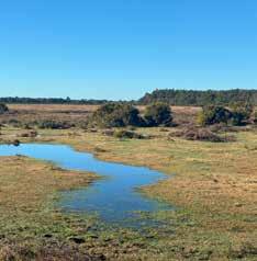
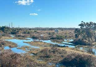
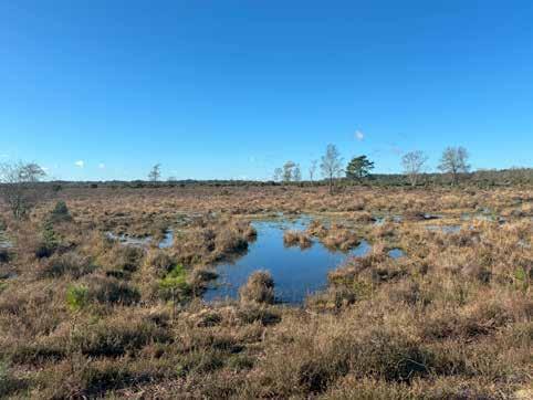
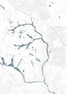
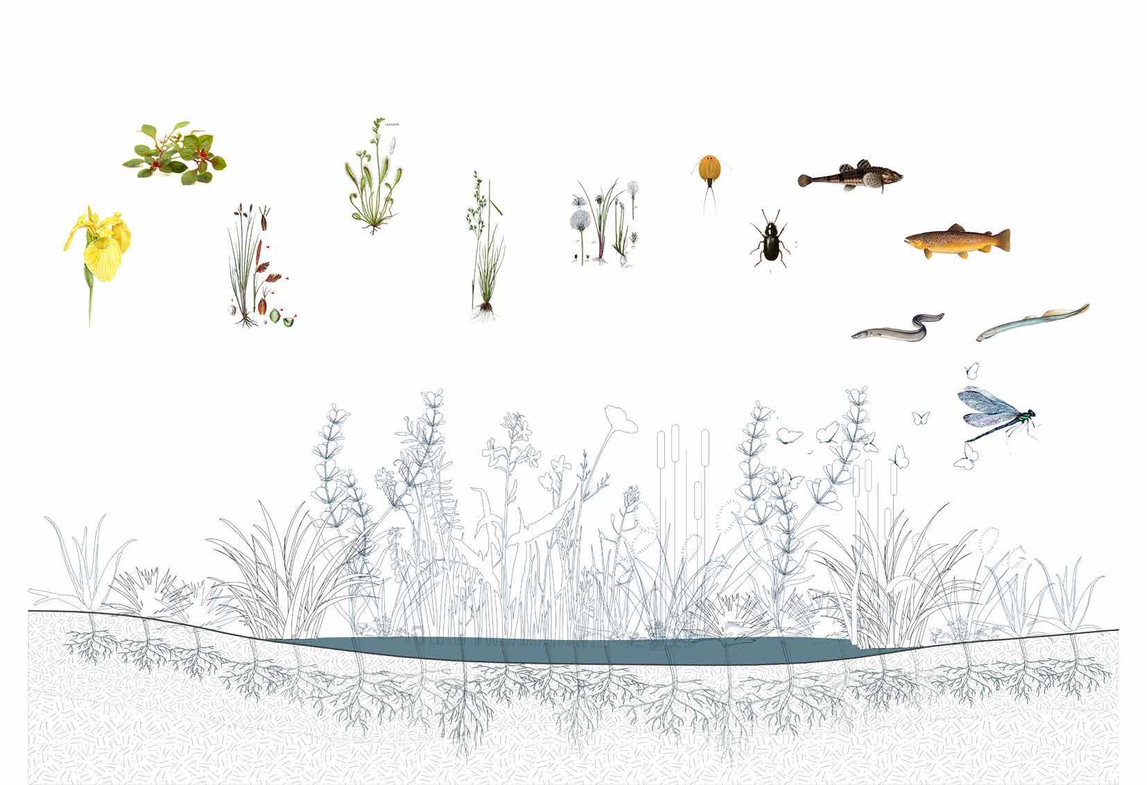
The New forest is enriched with different wetland systems like mires, bogs, rivers and streams which enhances variety of wildlife. Types of
carbon returns to atmosphere through respiration and decomposition
Disturbance of wetland soils and hydology releases carbon.
Trees and vegetation fix atmospheric carbon through photosynthesis
Vegetation dies and sinks below water annually depositing carbon.
Wetland ecosystem
Wetlands as carbon sinks
Wetland vegetation sequesters carbon dioxide during its growth, and upon its demise, this carbon remains trapped rather than being released into the atmosphere. The plant material sinks to the wetland floor, where it undergoes incomplete decomposition, leading to the accumulation of carbon over extended periods. This stored carbon persists for centuries or even millennia within the partially decomposed plant matter at the wetland’s bottom.
Deschampsia Setacea
Carex Limosa Iris Pseudacorus
Water table
Eriophorum Gracile
Ludwigia Palustris
Triops Cancriformi
Graptodytes Flavipes(Beetles)
Cottus Gobio
Salmo Trutta
Lampetra Planeri
Lampetra Planeri
Dragonflies and damsleflies
Drosera Intermedia
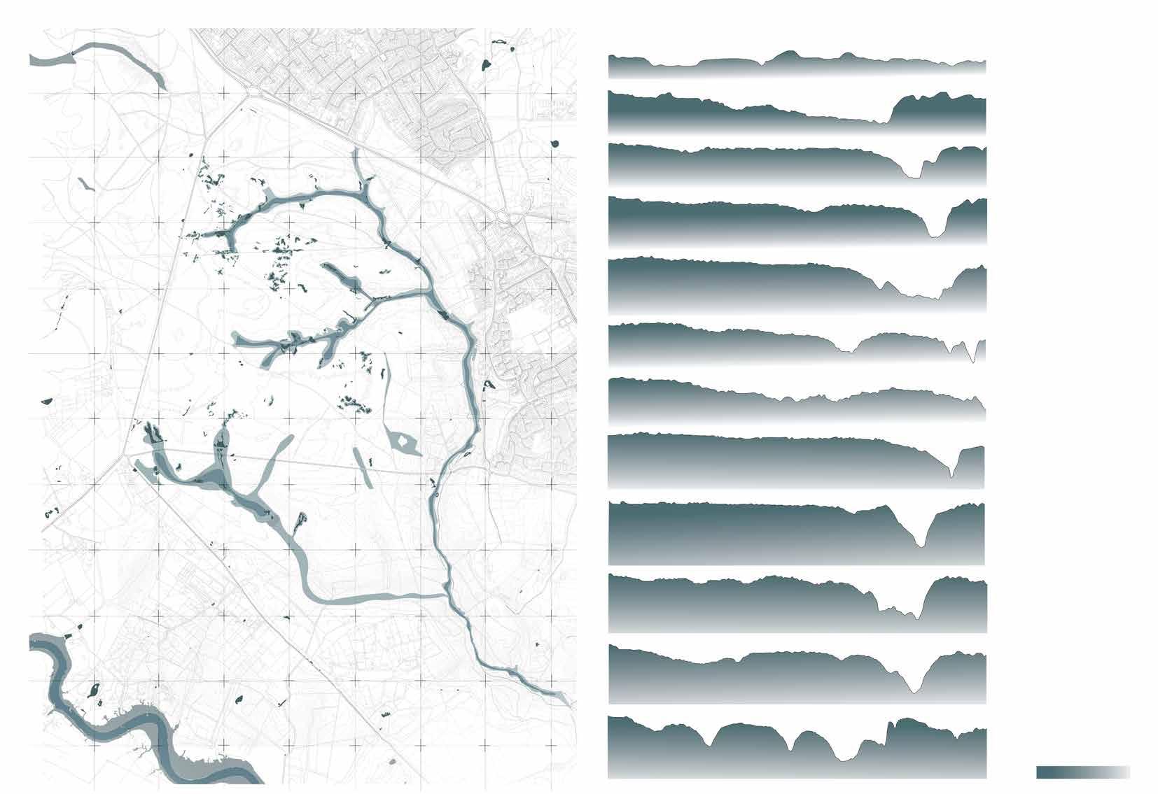
Section through different types of wetland system in New forest
The wetland systems in the New Forest, which include rivers, streams, mires, and bogs, vary significantly in depth, creating a diverse range of habitats for different wildlife species. Mires and bogs typically have shallow depths ranging from 20 to 60 cm, while streams and river areas can reach depths of around 1 to 3 m.
The varying depths of these wetlands support a wide array of wildlife by providing suitable conditions for different species. Shallow mires and bogs are ideal for amphibians, invertebrates, and certain plant species that thrive in wet, oxygen-poor environments. These areas also offer breeding grounds for birds such as snipe and curlew. Deeper streams and rivers support fish, aquatic mammals like otters, and waterfowl, creating a complex and interconnected ecosystem that supports biodiversity.
Deeper wetland pools
Shallow wetland pools
Resides in Farmland, Marshes, Water meadow
Water table is important to enable access to abundant insects and invertebrates.
Drier and warmer climates makes forest less suitable for breeding.
Wetland importance to Breeding Waders
Breeding wader bird surveys, including the survey carried out by the RSPB for the Life 3 Project, have noted the continuing and significant decline in breeding wader populations and their ranges in lowland Britain. Thus it is considered more important than ever to maintainand enhance habitats such as those within the New Forest which still support large numbers.
Resides in Farmland, Wetland, grassland
Habitat loss and degradation due to modern farming practice and land use.
Predators like foxes and crows.
Breeding months
Resides in Wetlands, grassland.
Wader of bogs and mires on lowland heath.
Proximity of tidal estuaries.
Resides in Wetlands, grasslands.
Inhabits in deep marshy places-bogs, water meadows, mosses.
Suffered badly due to drainage and agricultural intensification.
Drying of wet heaths and mires-not conducive for ideal chick rearing conditions.
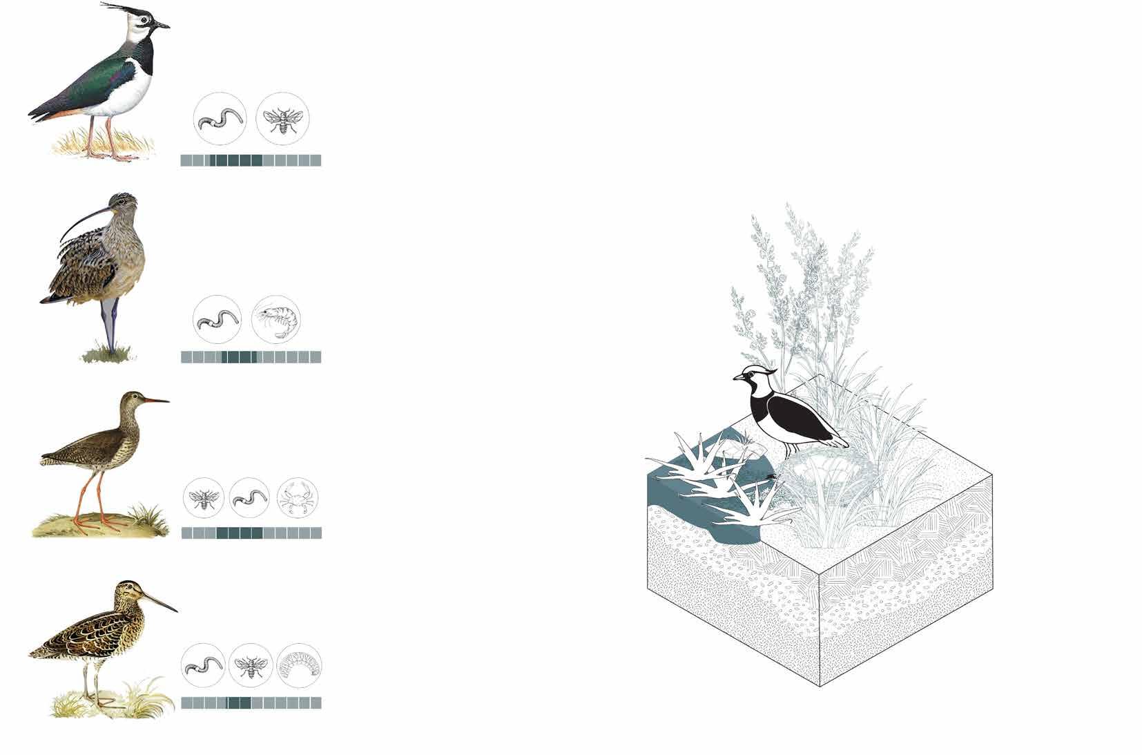
Shallow water (usually 30 cm and deep) and muddy areas are crucial for feeding and nesting.
Waders prefer low vegetation or bare ground for visibility and predator avoidance. Sward height to be maintained between 5-15cm to create appropriate breeding habitat.
The nesting sites are often chosen for their ability to camouflage the eggs, which are typically speckled or colored to blend in with the surroundings.
Vanellinae
Numenius
Tringa totanus
Gallinago stenura
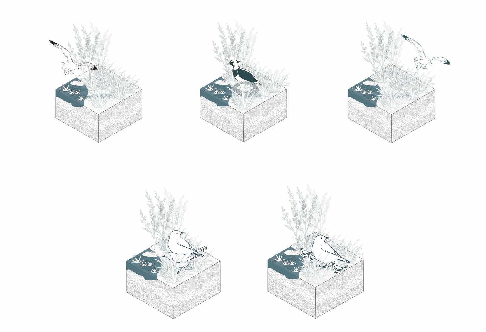
Lapwing
Curlew
Redshank
Snipe
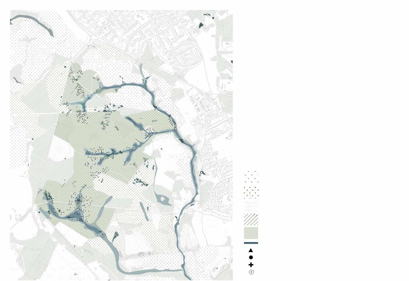
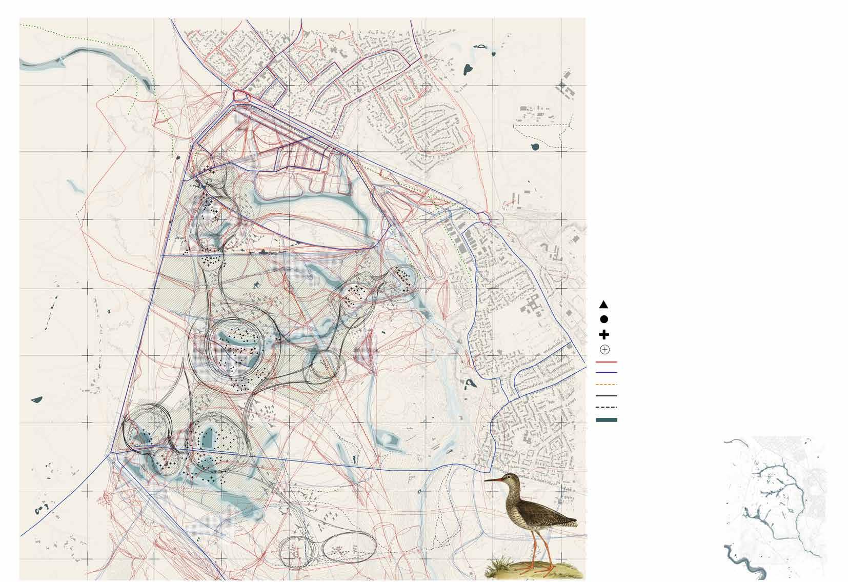
This mapping identifies the crucial zones of wader habitats and highlights their preferred breeding locations. By pinpointing these key areas, the mapping serves as a foundational tool for understanding the spatial relationship between wader breeding sites and various disturbances. Overlaying data on human activities, predator presence, and other micro disturbances on this habitat map will allow for a precise assessment of how these factors impact the breeding success of waders. This information is essential for developing targeted conservation strategies, such as designating protected areas, implementing buffer zones, and managing recreational activities to minimize negative effects on these sensitive breeding habitats.
Source - Mapping data from HLS New Forest waders 2019-2021 report
Important zone for Breeding waders
Wetlands
Curlew
Snipe
Coniferous woodlands
Heathlands
Grasslands
Invasive shrubs(Gorse, bracken)
Lapwing
Redshank
Restricted bird’s view
Habitat Fragmentation
As habitats shrink, the availability of ideal breeding sites decreases.
Increase in global temperature Zone of influence
Redistricution of birds to location with reduced food
Reduced Breeding Success
Fleering of waders and never returning to same location.
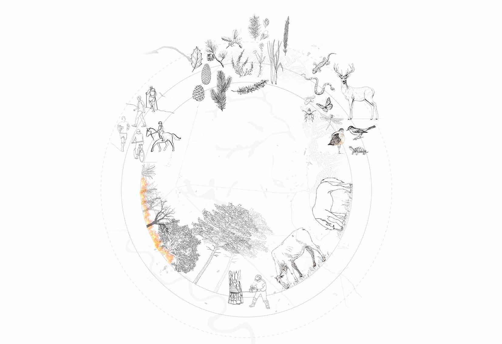
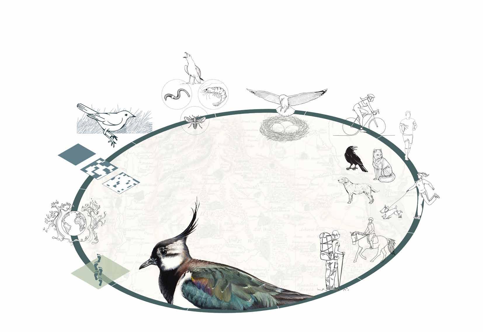
Types of Disturbances
Circle of disturbance - Micro and macro disturbances
Breeding waders face macro disturbances like climate change, habitat fragmentation, and urban expansion, which reduce habitat and increase isolation. Micro disturbances, such as recreational activities (hiking, cycling) and predation by crows and foxes, directly threaten nests. Effective conservation requires habitat protection, regulating human activities, predator control, and public awareness to mitigate these impacts and support wader populations.
Cycling
MACRO MICRO
Predators
Crow
Increase in human footprint due to developments in nearby urban areas.
Running
Off leash dogs
Horse riding
Hiking
Lapwing
Dogs Foxes
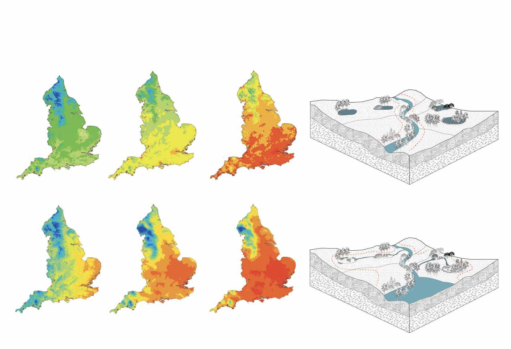
Rising climate change - projection in next 75 years
Accumulated temperature for baseline period (1961-90) and projected for long period((2041-2100) for emissions scenarios.
Source : Hulme et al., 2001)
Moisture deficit for baseline period (1961-90) and projected for long period((2041-2100) for emissions scenarios.
Changes because of drainage system
Source Hulme et al., 2001)
Intact Wetlands
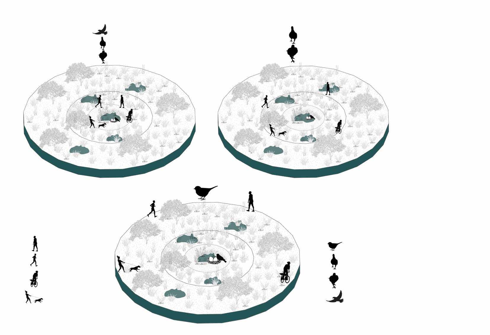
Behaviour pattern of Waders to recreational disturbance
When breeding waders encounter micro disturbances, such as recreational activities (hiking, cycling, running) within a certain radius of their nesting sites, they exhibit several distinct behavioral responses that indicate stress and potential disruption to their breeding success.
Disturbance Mapping
The disturbance mapping illustrates the overlay of macro and micro disturbances, highlighting the zones of influence for breeding waders. This mapping identifies areas where the zones of influence and micro disturbances intersect, pinpointing regions that may negatively impact waders. By understanding these overlaps, the design can focus on mitigating disturbances and creating safer spaces within the habitat to support successful breeding and reduce stress on the wader populations.
Lapwing bird
Redshank bird
Curlew bird
Snipe bird
Walking path
Cycling path
Dog pathway
Disturbance circle
Existing pathways
Wetlands
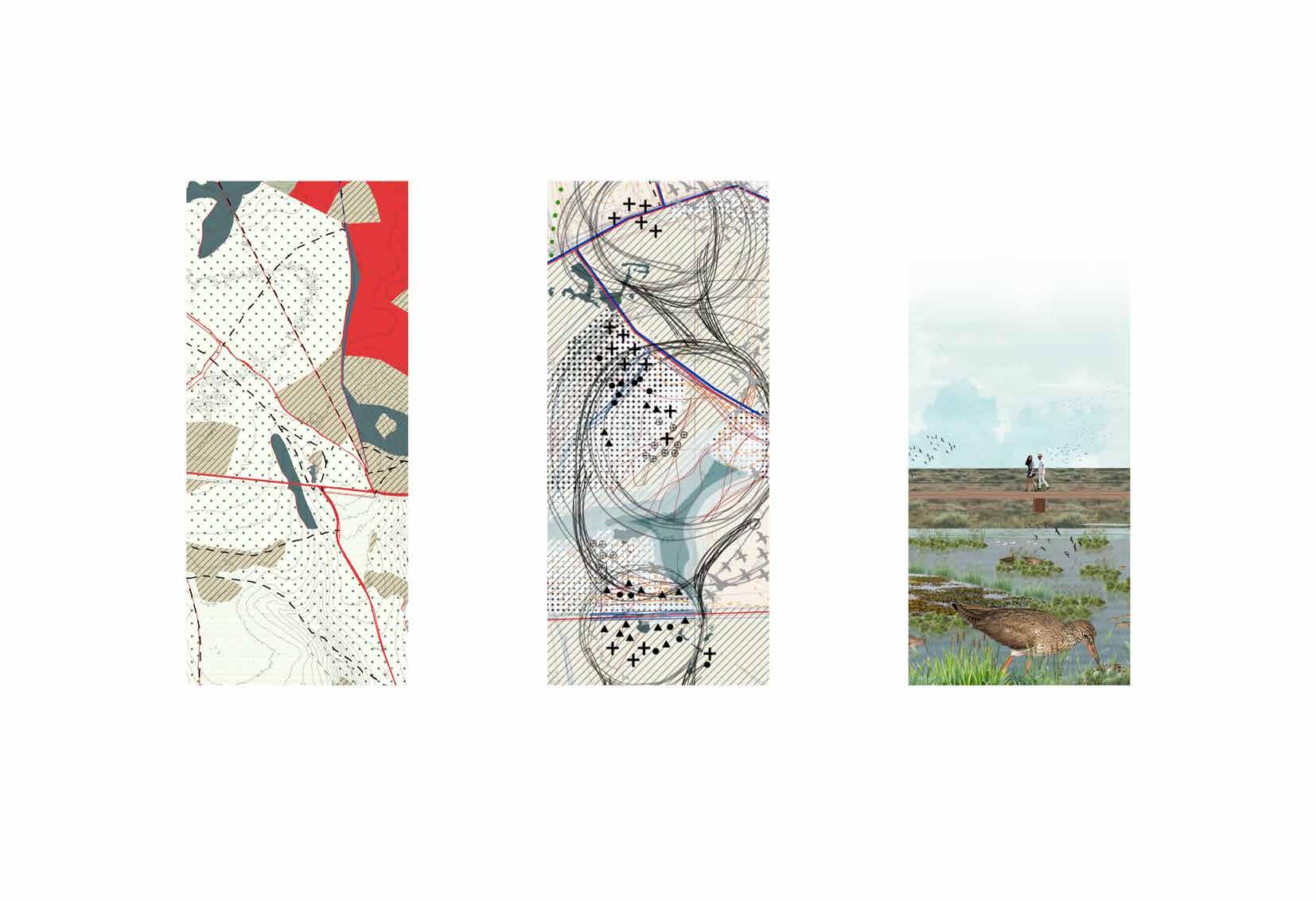
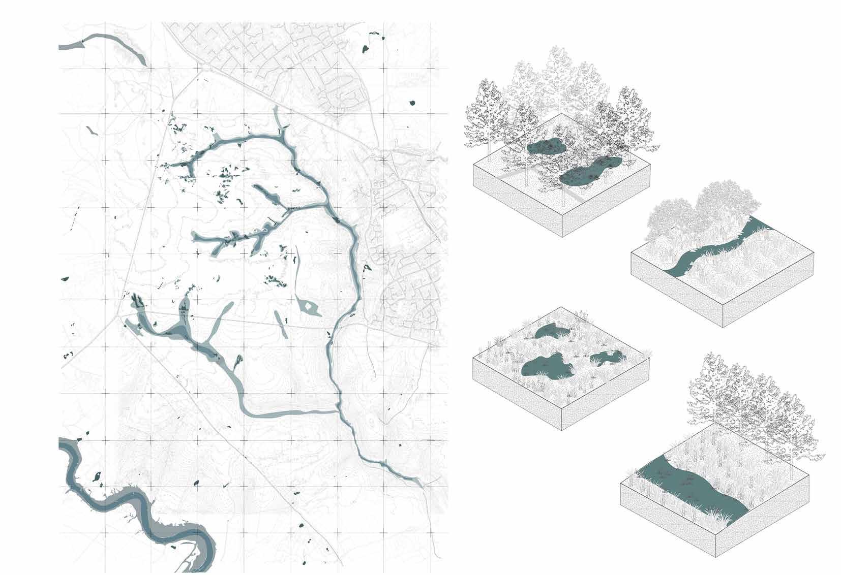
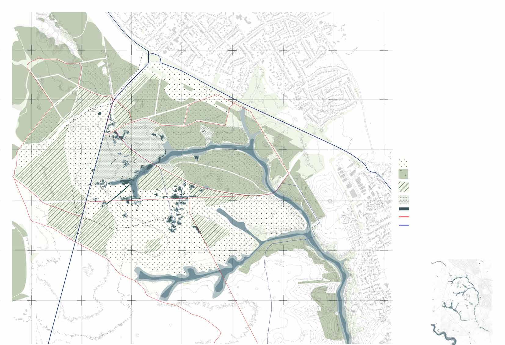
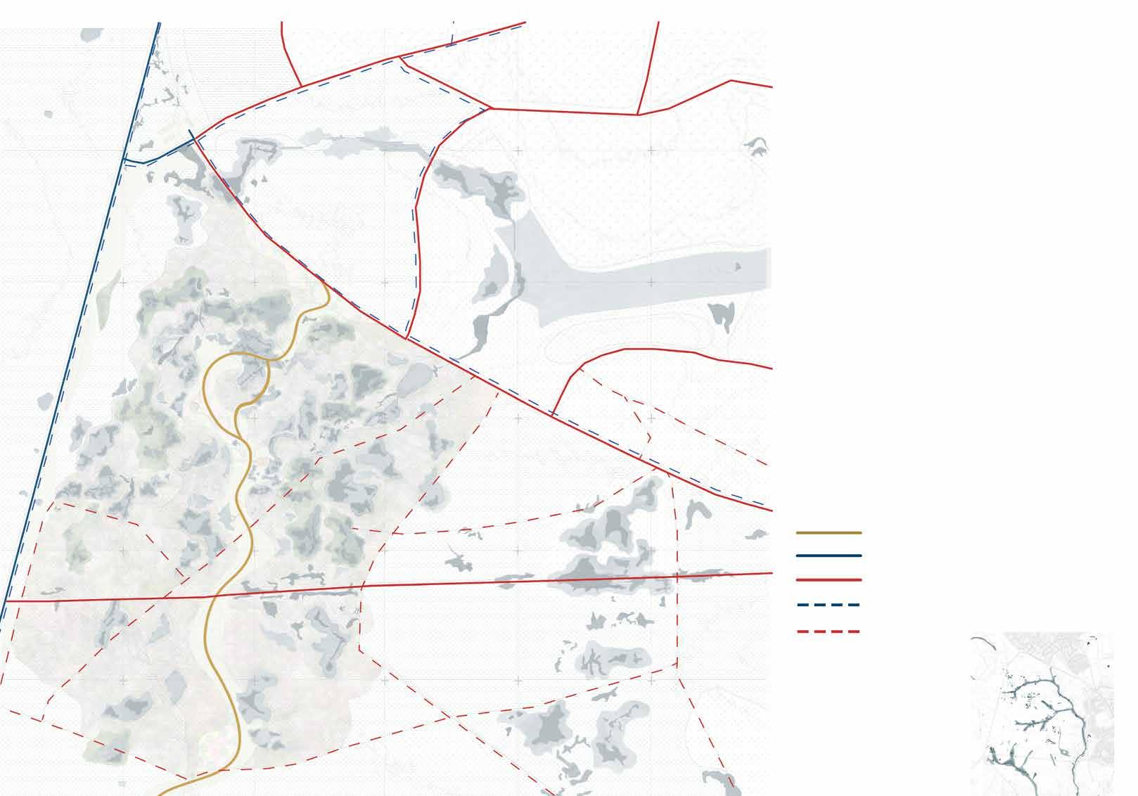
Initial Strategy Planning
Overlaying the concept of Bog
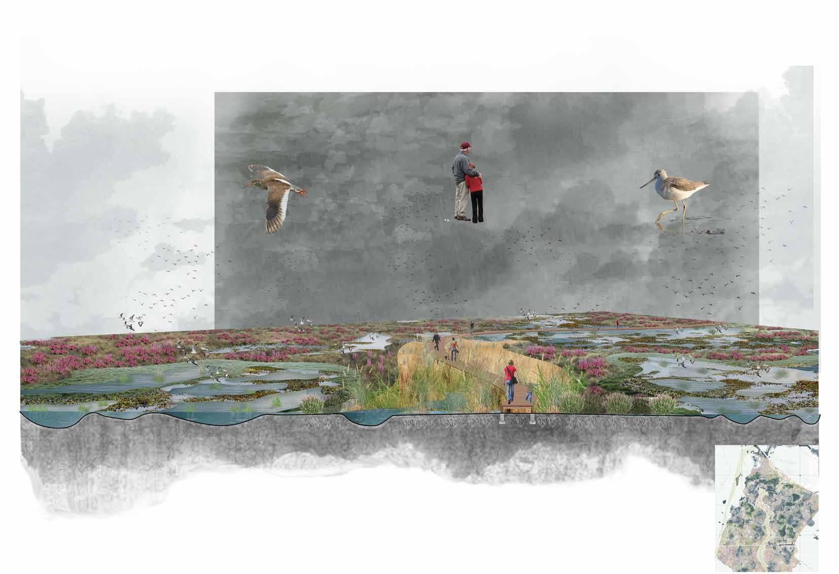
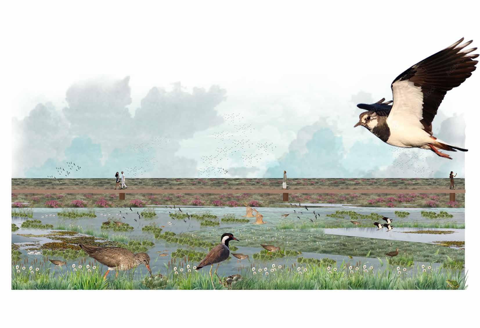
The initial planning strategy to minimize macro and micro disturbances involves understanding the impact zones of breeding waders and strategically planning bog islands throughout the site. These islands, situated within the impact zones, are designed to create safe breeding habitats for waders. Additionally, the placement of these islands at specific intervals serves to mitigate fire risks by establishing natural fire breaks across the landscape. These islands will also act as water storage areas will trap water during dryer summers.
The proposed walkway on the island is designed to enrich the visitor experience while providing educational opportunities about the bogs and wildlife of the new forest. This pathway will allow visitors to explore the unique environment up close, deepening their understanding of the ecosystem and its inhabitants.
Impact zone for breeding waders
Existing wetlands
Proposed bog islands
Proposed walking path
Existing walking path
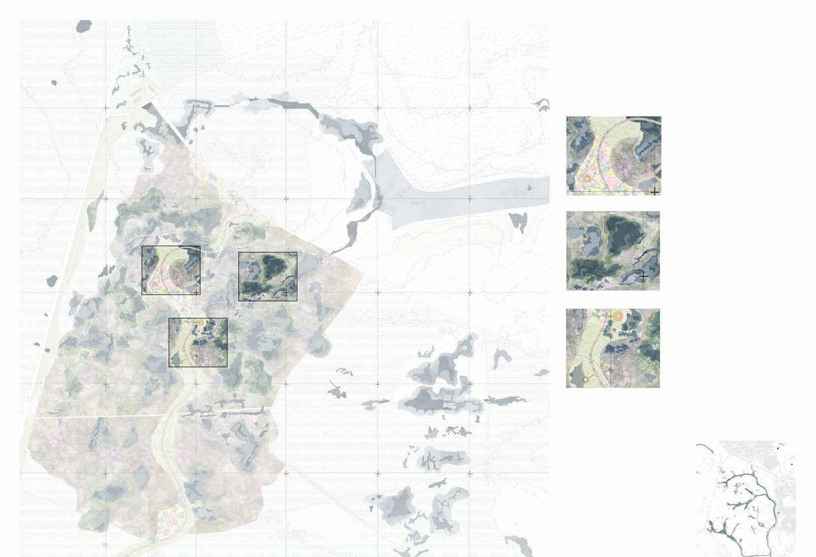
This area selected to detail out design is chosen because of its close proximity to urban areas. The close approach to site from urban areas will increase human footprints and activities into intervention site creating more educational and recreational activities for visitors.
Hardley
Dibden Purlieu
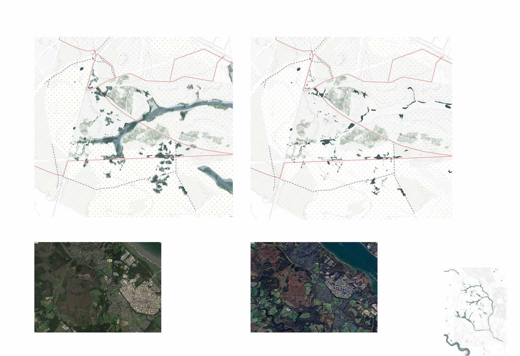
During autumn and winter, the wetlands are typically at their wettest. Increased rainfall and cooler temperatures lead to higher water levels, saturating the soil and creating expansive, waterlogged areas.
Existing site conditionSeasonal change condition
As temperatures rise in the spring and summer months, the wetlands begin to dry out. Evaporation increases, and water levels recede, often leading to more exposed mudflats and drier soil conditions.
Existing conditions- Autmn and Winter
Existing conditions- Spring and summer months
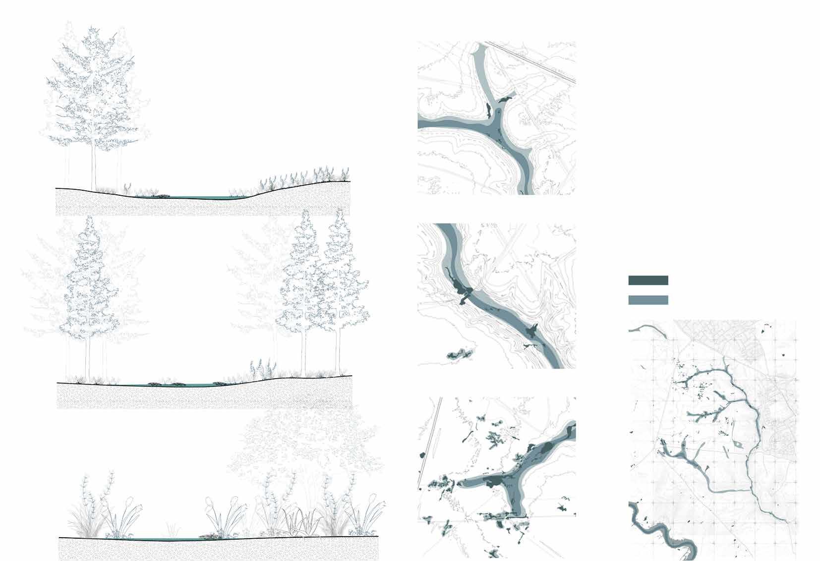
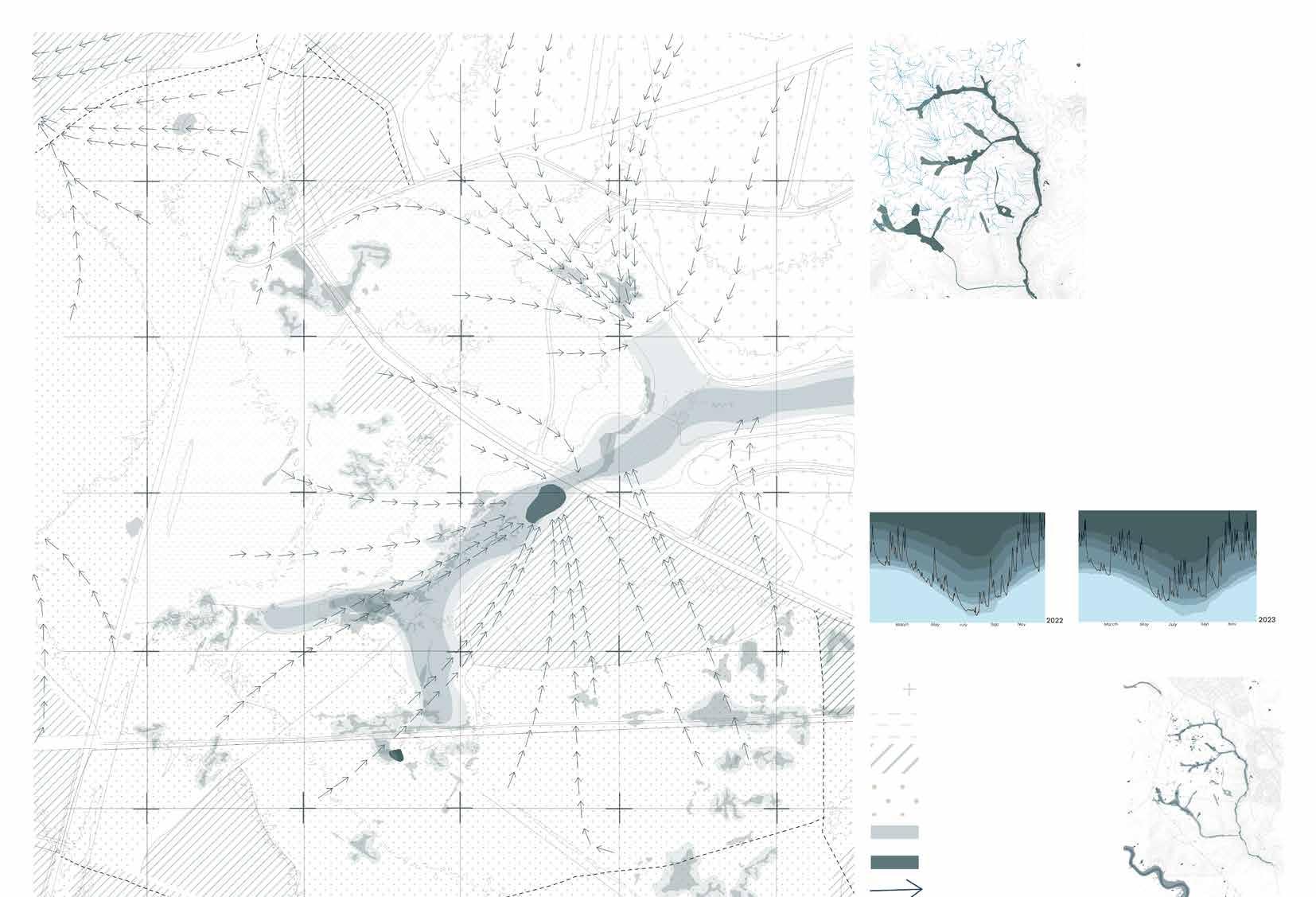
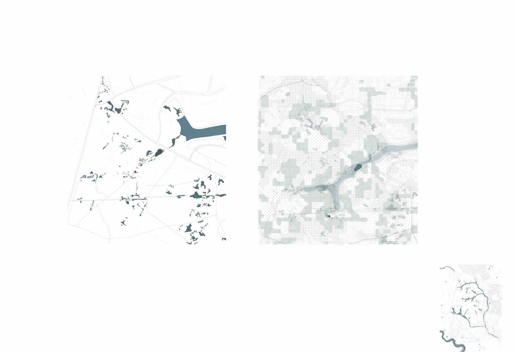
Water flow Analysis of overall site
The water flow analysis is conducted to gain a comprehensive understanding of the catchment dynamics within the site. This analysis examines how water moves through the landscape, identifying key flow paths, drainage patterns, and areas of accumulation. The analysis will be used for designing effective water management strategies, ensuring the sustainability of wetlands, and optimizing habitat conditions for waders.
River flow data
Data from National River Flow Archive
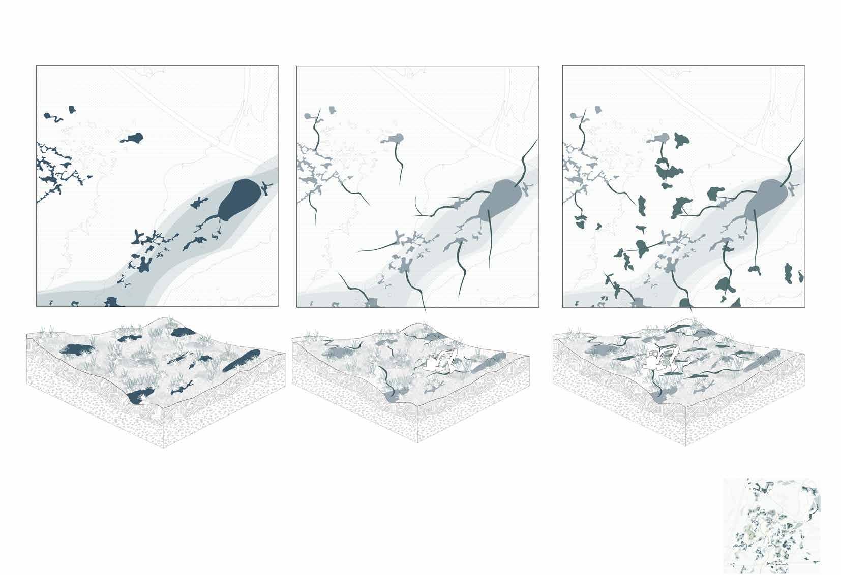
The topographic wetness index (TWI) analysis of the site reveals water accumulation patterns across the landscape, determined by the terrain’s slope and elevation. High TWI areas indicate where water is most likely to gather, making this analysis crucial for identifying natural wetland zones, planning drainage, and designing habitats for moisture-dependent species. The insights from this analysis will guide the spatial planning of wetland systems, helping to integrate these areas into the overall design. By understanding the wet and dry zones, the analysis will inform the allocation of habitats for waders and the placement of recreational activities, ensuring a balanced development that can integrate humans and nature.
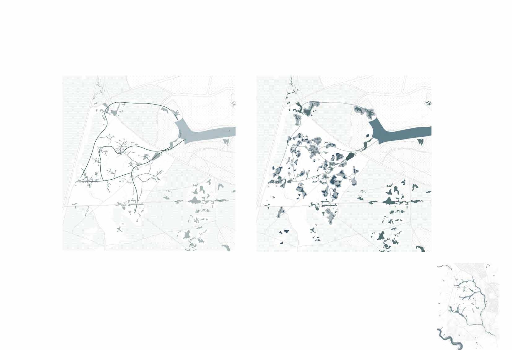
01 - Identifying the existing wetland systems
02- Overlaying TWI mapping on existing conditions
The overall analysis dveloped thinnking towards understanding exisiting problems due to climate change and dry wetlands.
Overlaying Topographic wetness index analysis on existing wetlands for planning areas of wetland pools.
03- Proposing new primary and secondary creeks according to TWI mapping
04- Designing shallow and deep pools
Proposing new creeks on the high water accumulation areas and allocating areas for wader habitat with integrating disturbance in spatial planning.
Digging out shallow and deep bogs to create a mix of wetlands, heathlands and wet grassland areas.
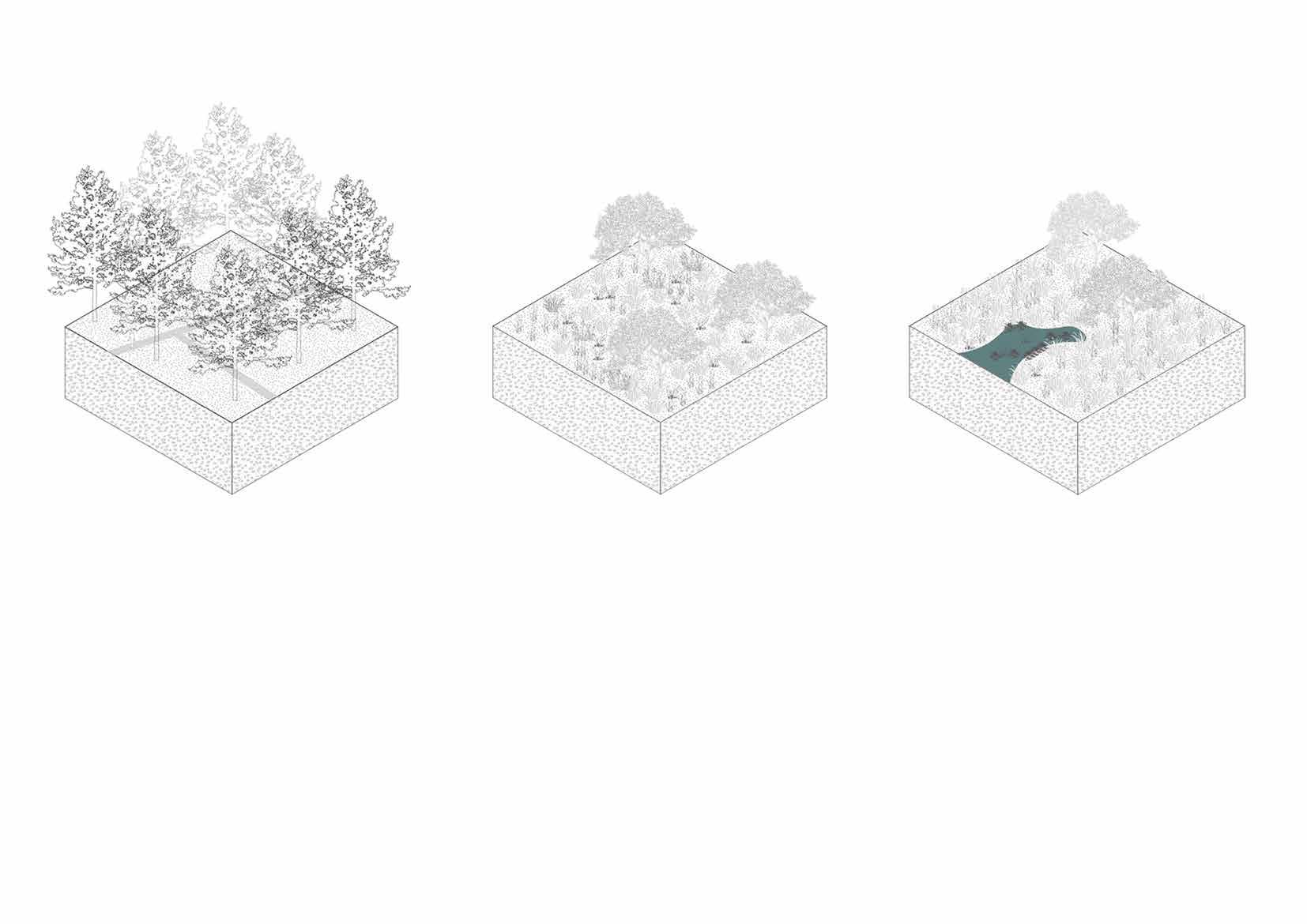
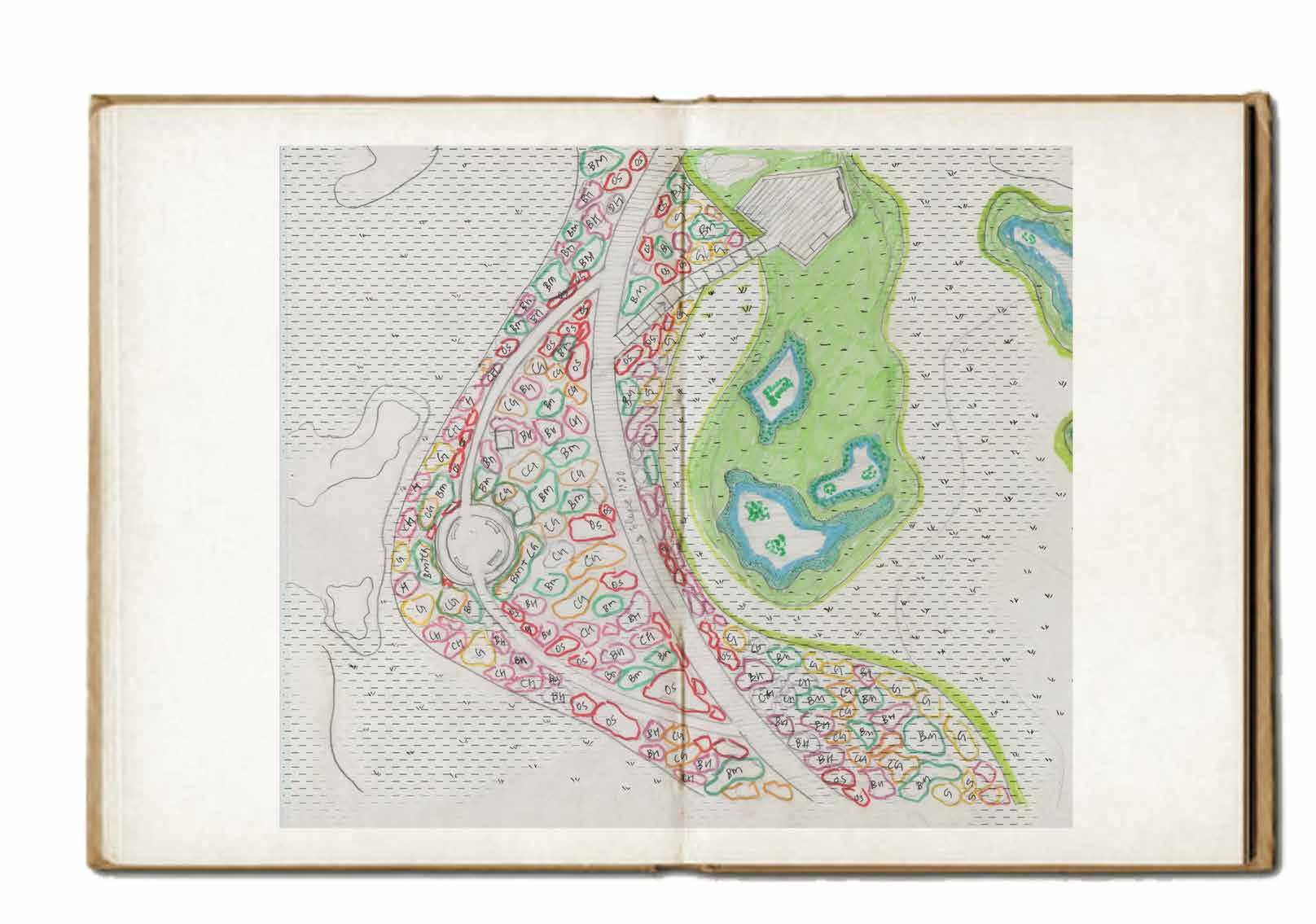
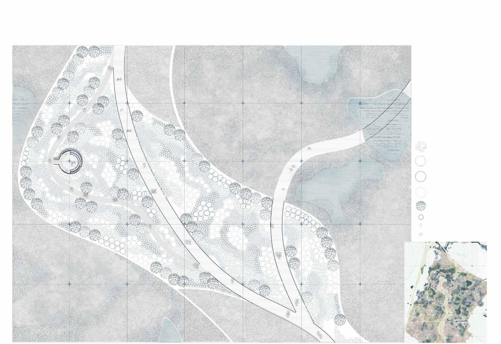
Design
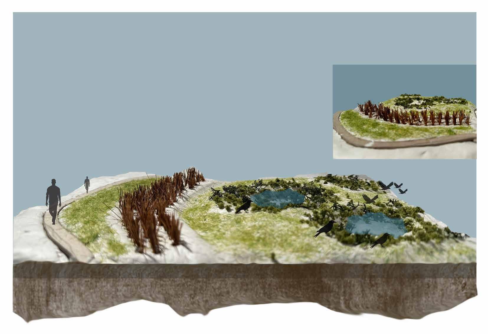
Boardwalk Heathland
Common Reed or shrubs buffer Heathland Wet grasslands
Shallow and deep bogs Wet garsslands
Bird habitat
Heathland
Dry Grassland
Wet Grassland
Common Reed/ Shrubs buffer
Wildflower garden
Heathland extended
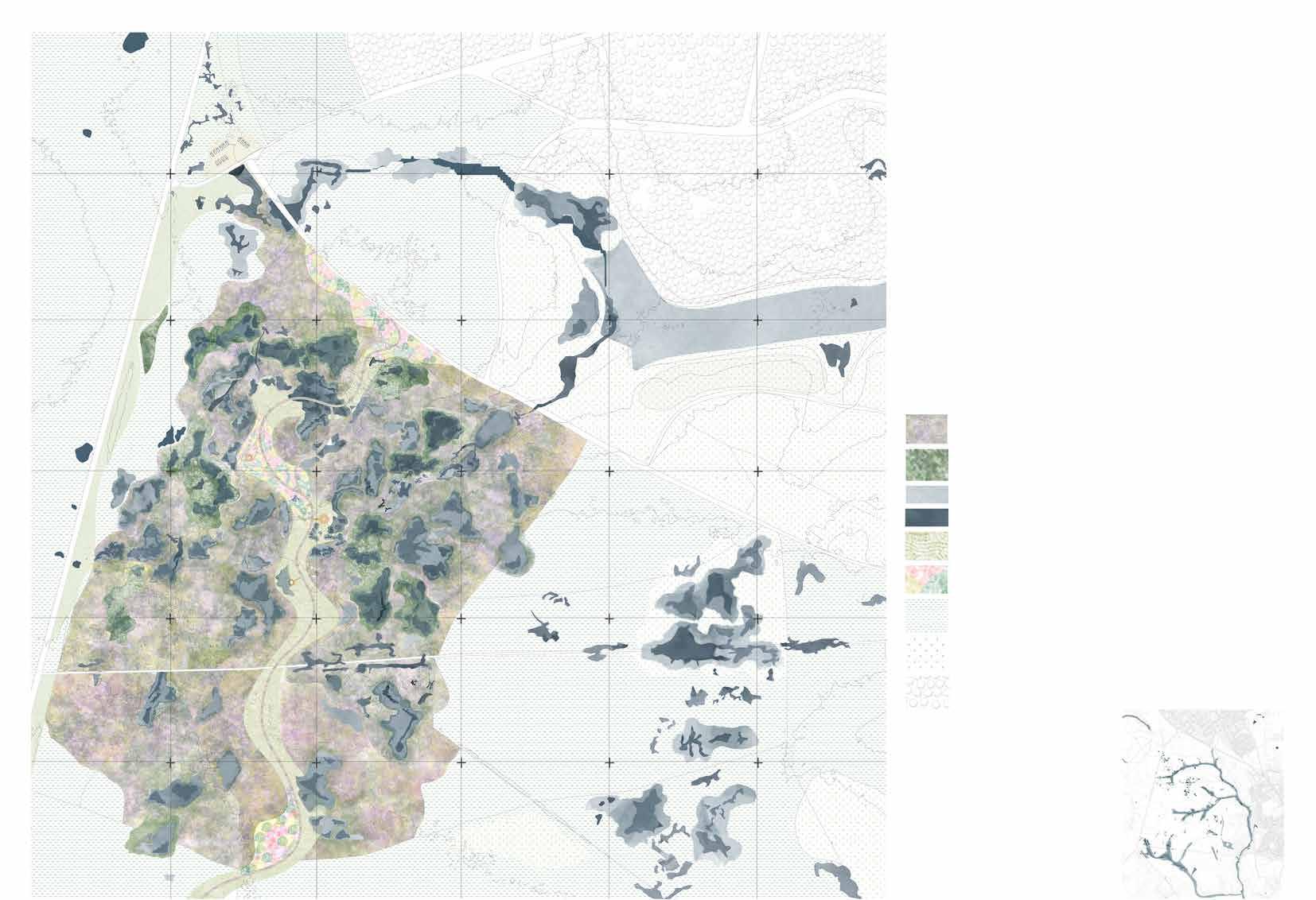
Master Plan- Home for Waders
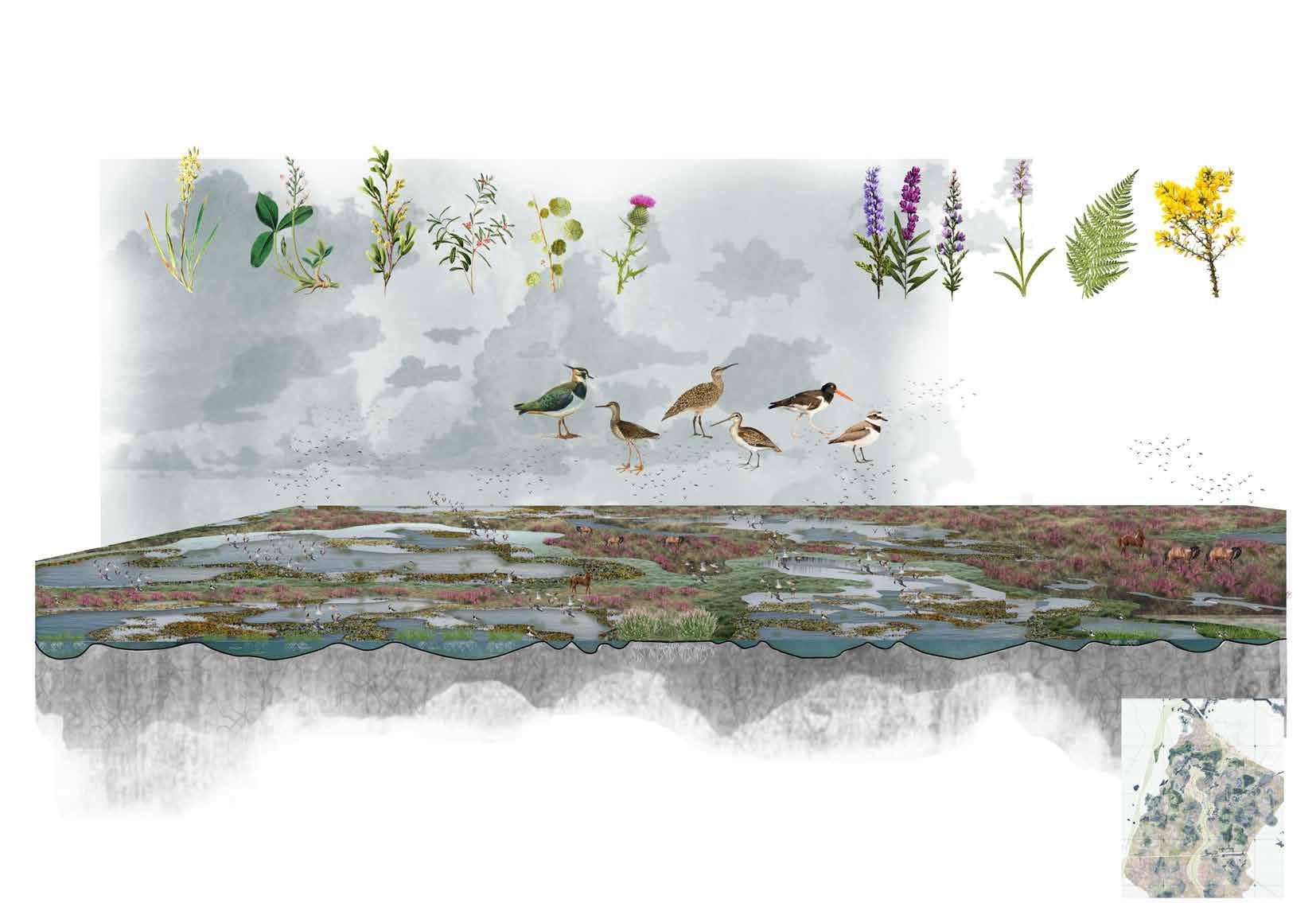
The final master plan for the design project focuses on longterm planning to transform the forest into a more open habitat. The plan divides the area into distinct sections: heathlands, wetlands, and grasslands, each designed to create suitable environments for breeding waders and to attract a diverse range of wildlife to the site.
Wet Grassland
Shallow wetland pools (mires, bogs)
Deep Wetland pools (mires, bogs)
Reedbed(buffer)
Wildflower garden(buffer)
Extended heathland areas
Extended Grassland areas
Existing coniferous woodland
Heathland
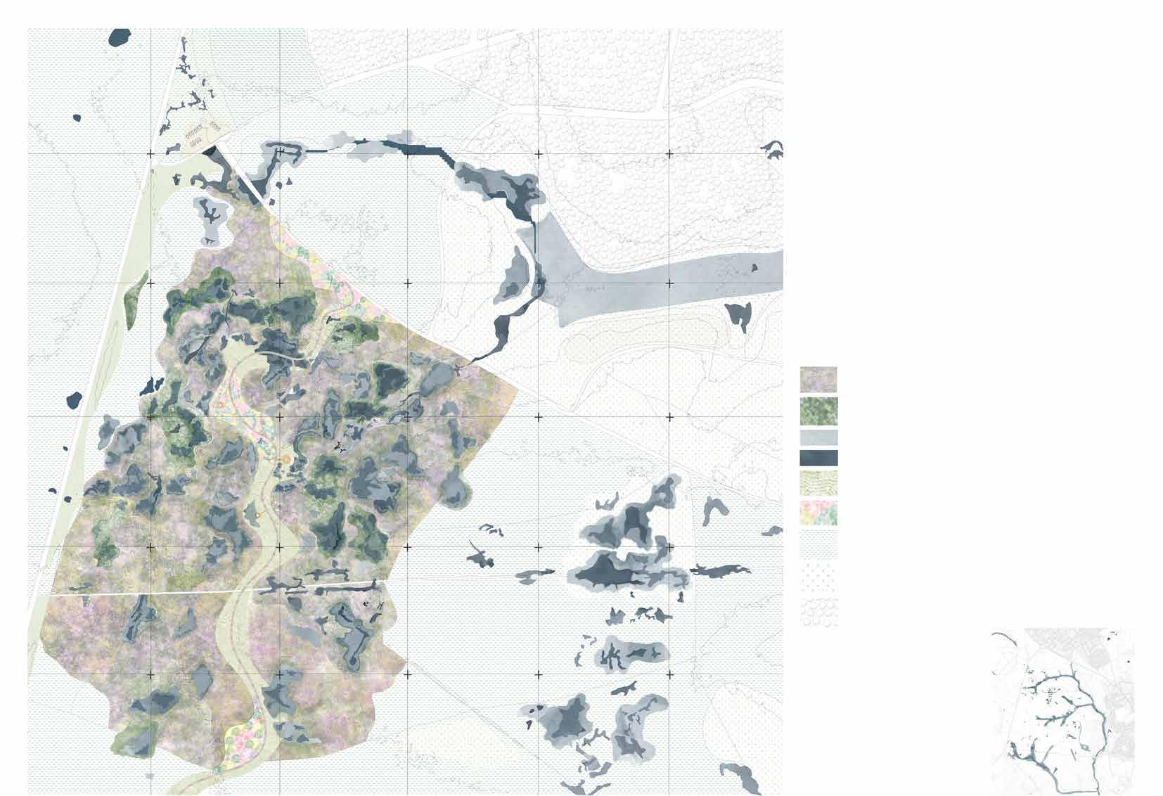
Master Plan- Home for Waders
Key points
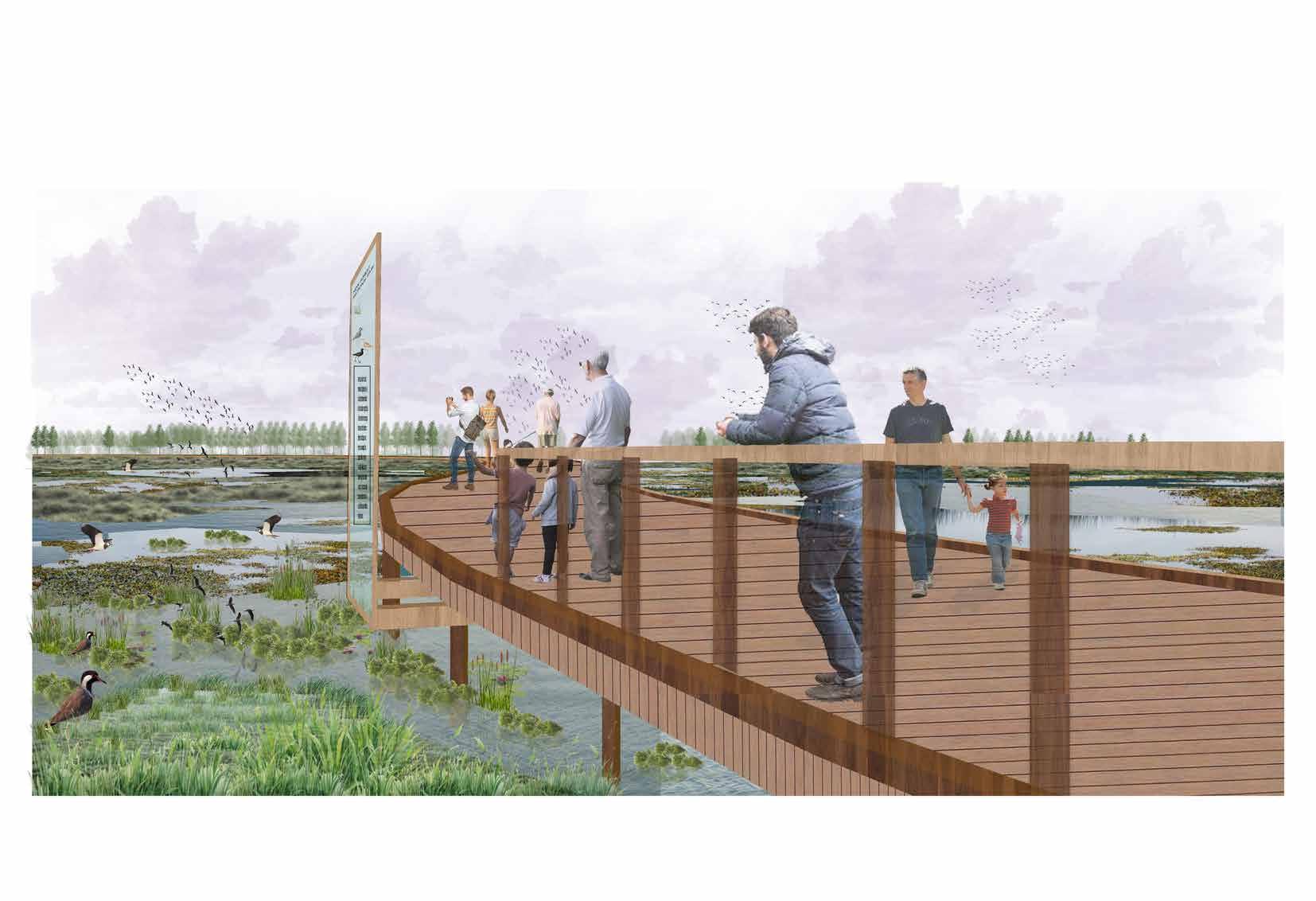
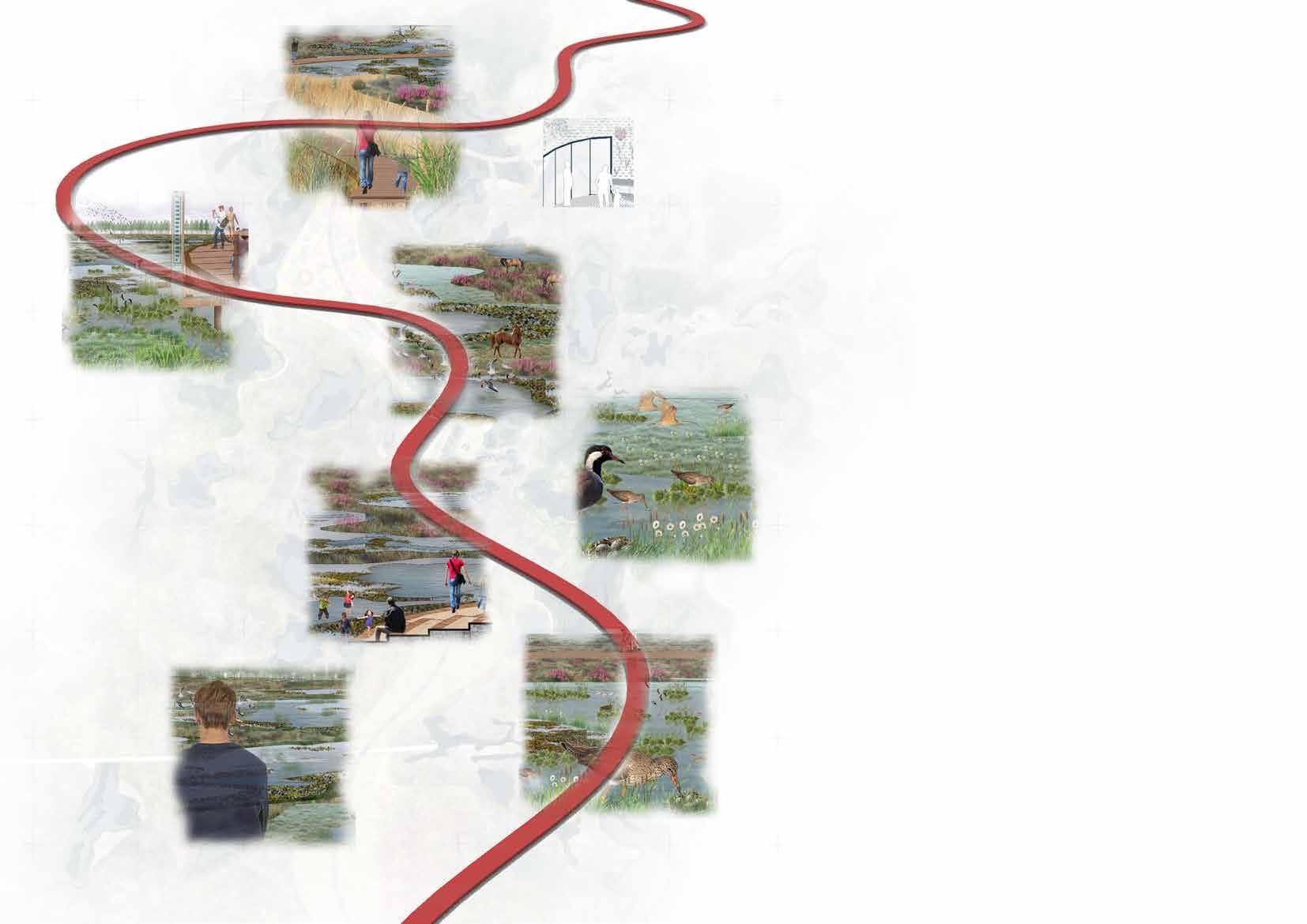
The boardwalk, seamlessly connected to the existing pathway, weaves through the site, offering various vantage points for birdwatching while minimizing human impact. This design not only provides a safe haven for birds but also creates experiential spaces, including wildflower gardens, birdwatching platforms, and decks. As the boardwalk flows through diverse habitats— such as wetlands, heathlands, reedbed buffers, and wildflower gardens—visitors can immerse themselves in the site’s rich wildlife. Additionally, the journey fosters an educational experience, enhancing understanding of the flora and fauna of the new forest.
The boardwalk is strategically planned to integrate with the existing pathways, using them as access points. The current parking area will remain in its original location.
Proposed Boardwalk
Master Plan- Key functional Areas
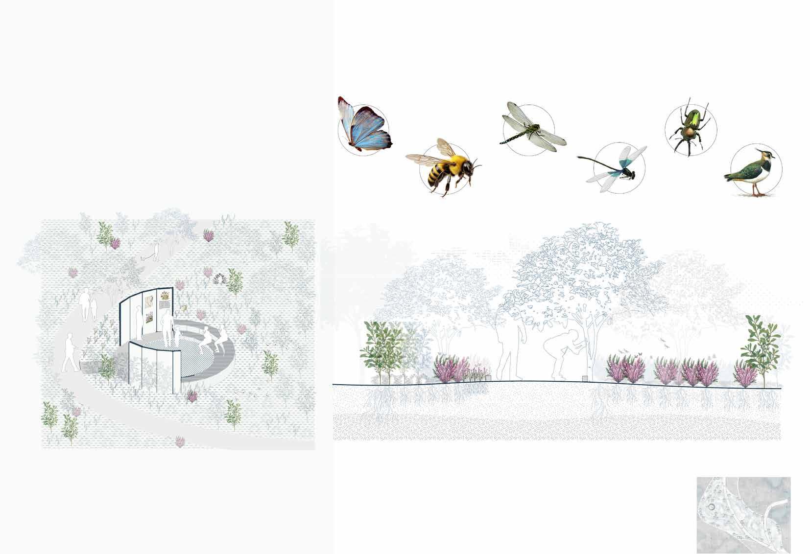
The design incorporates several functional areas, including a wildflower garden, wader scrapes, and birdwatching zones. Each of these areas is carefully detailed to enhance the experience, illustrating how they will harmoniously integrate with both human activity and the natural environment.
Gathering space for Information about wildflower meadows and educational programmes.
Section through pathway and flowerbeds
Butterflies and moths
Small amphitheatre- giving pause points
Bees
Damsleflies
Dragonflies
Myrica gale
Myrica gale
Ulex europaeus
Erica tetralix
Calluna vulgaris
Calluna vulgaris
Beetles
Birds Lapwing, curlew
Summer water level
Winter water level
Wet grassland with grass height of 20-30 cm. This creates appropriate habitat for breeding waders in summer.
The mix of shallow and deep bogs will allow various wildlife to the wetlands enhancing open habitat.
Elevated Boardwalk through the bogs.
Reedbed buffer between boardwalk and wader habitat. Wader scrape(habitat)
View of Boardwalk
Vantage point for visitors to wader habitat and wetlands
Information Board
Wader scrape
The wader scrape provides safer habitat for wading birds to breed on wet grasslands and wetlands. These habitats are visioned to reduce disturbances from other activities.
Controlled grazing to maintain sward(grass) heigh in wet grasslands for appropriate habitat for wading birds to breed.
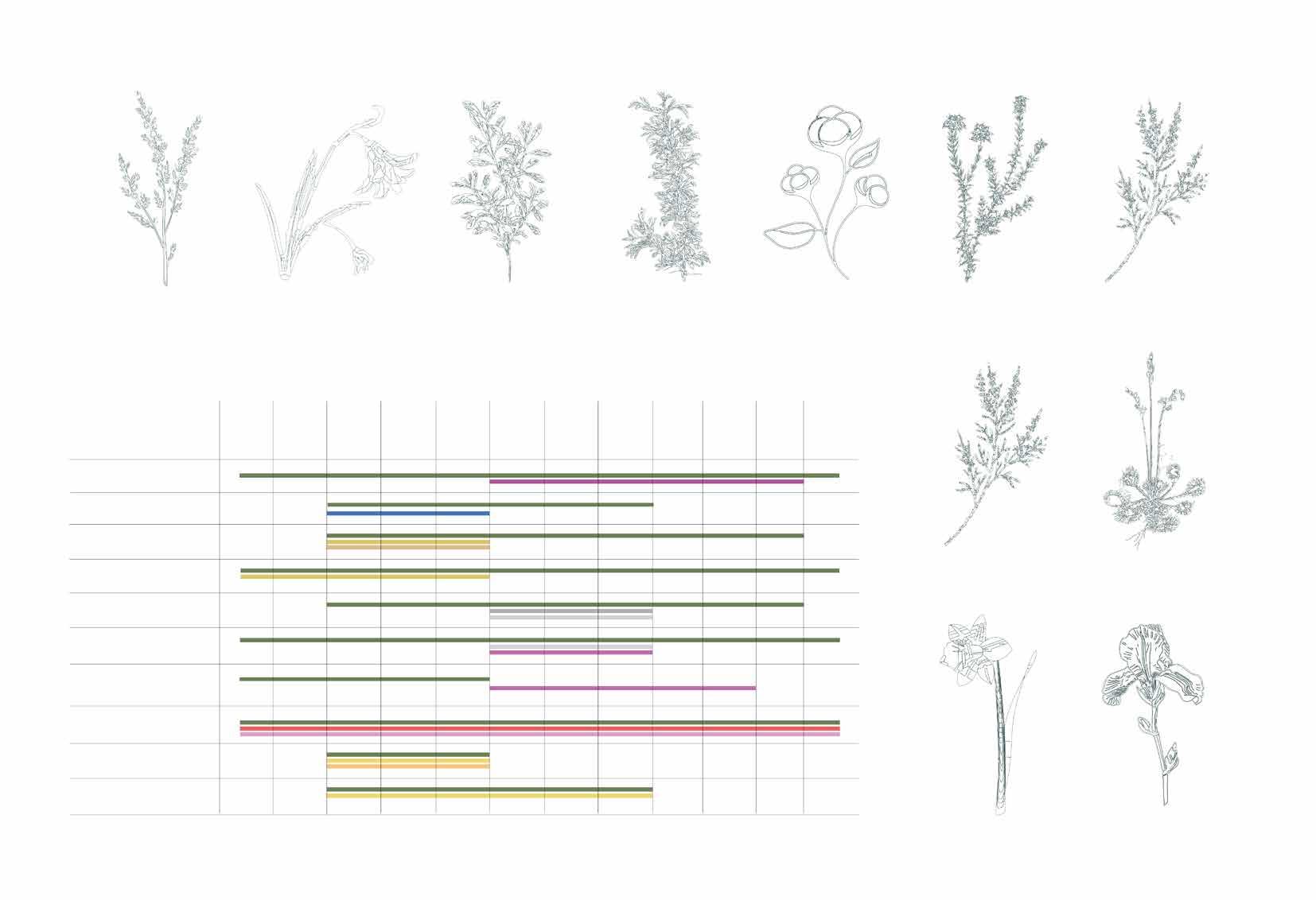
Menyanthese trifoliata Myrica gale Anagallis tenella Hydrocotyle vulgaris
Cirsium dissectum
Wading birds
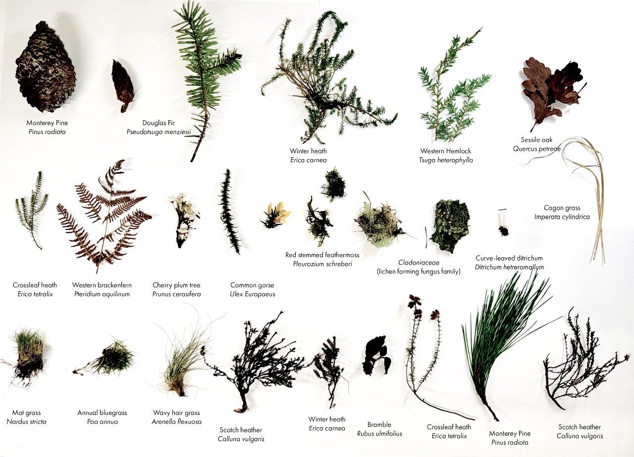
Heathland Plants
Wetlands Plants
Bog Asphodel
Common heather Heath spotted orchid Bracken Common Gorse
Bog Bean Bog Myrtle Bog Pimpernel Marsh pennywort
Meadow thistle
Summer Water level
Heathland
Winter Water level
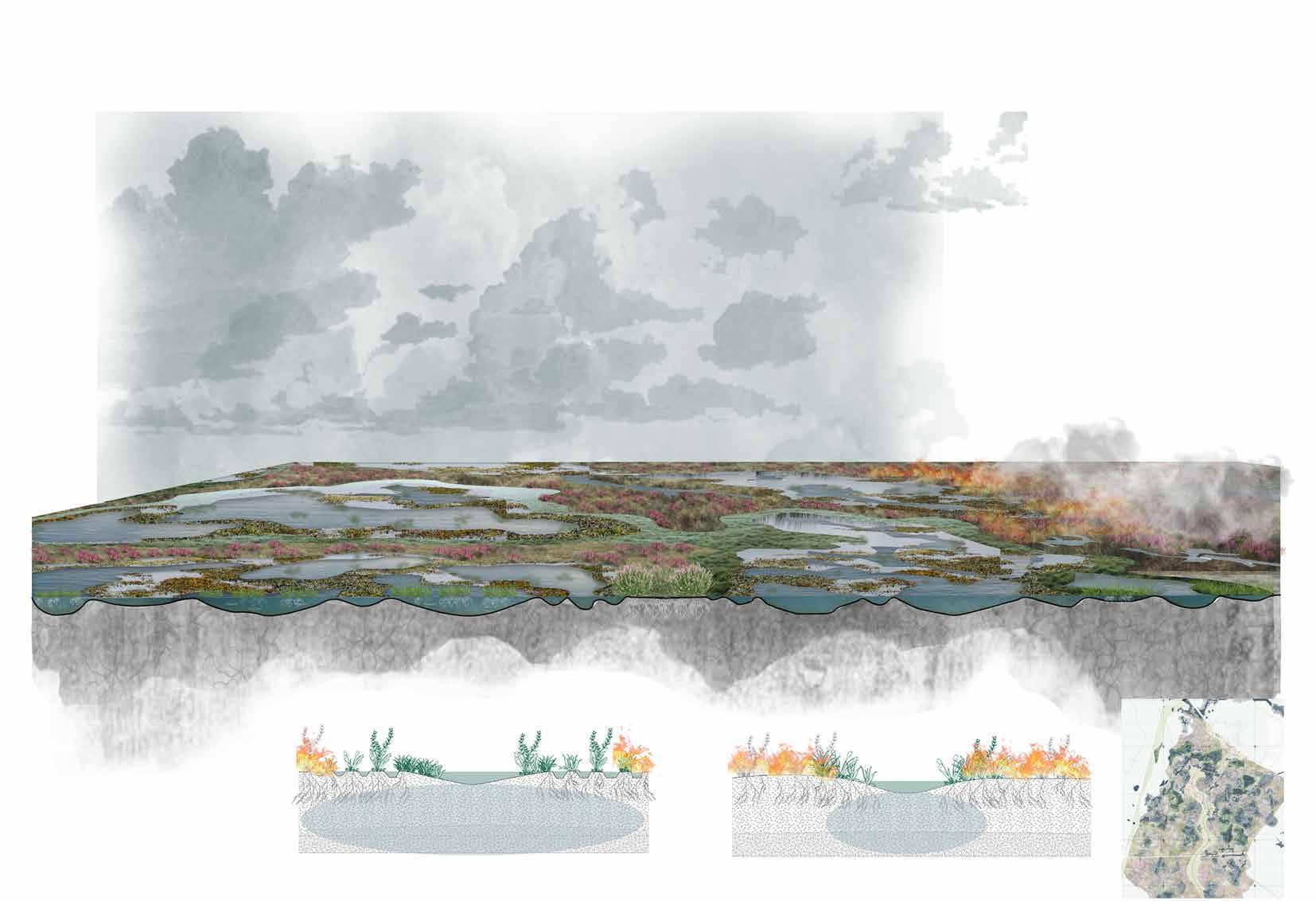
Shallow and deep bogs acting as fire breaks
Potential fire starts in a part of heathland
The proposed new wetlands acts as fire break by retaining moisture and not letting fire spread. Fire break
Groundwater spread
Extensive groundwater spread
Boardwalk
Heathland
Wader scrape
Seasonal guide that outlines the key periods of breeding activity for wader bird species.
Non Breeding month
Display and courtship
Arrive on Breeding Grounds
Waders start to form pairs and establish territories.
Nesting and incubation
Leaving the breeding grounds Eggs are laid, and incubation begins. Both parents typically share incubation duties.
Adult and juvenile waders may begin migrating to wintering
Non Breeding months
Controlled grazing of cattles and ponies - to maintain sward(grass) height for breeding season and maintain nutrients of heathlands.
Eggs hatch, and chicks are nurtured and fed by parents. Young waders start to learn feeding techniques.
Chick rearing
Waders begin building nests, usually on the ground in open areas or shallow wetlands.
Seasonal Construction phase
wetlands(mires and bogs)
Eggs hatch, and chicks are nurtured and fed by parents. Young waders start to learn feeding techniques.
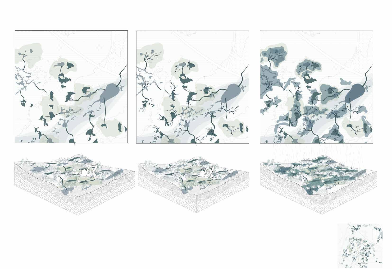
Proposed new primary creeks
Digging proposed deep wetland
The new creeks will be dug out following existing ponds and wetlands. Further, construction of deeper pools will be carried out which will start trapping water during wet months. The dams will be constructed in order to spread watershed of the wetlands pools.
Existing
Existing pond
The area for wet grasslands will be dug out to prepare breeding habitat for wading birds.
Proposed secondary creeks
Secondary creeks will be dug out with installing dams so that wetland pools spreads creating shallow water areas.
Breeding habitat
The construction work will be majorly carried out during Autmn-winter season so tha it minimizes the disturbance to waders during breeding months.
Wet grasslands
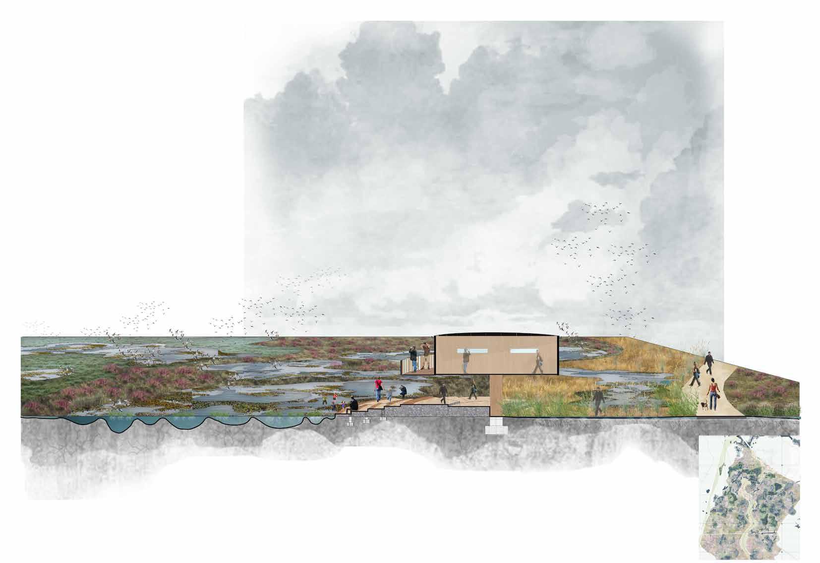
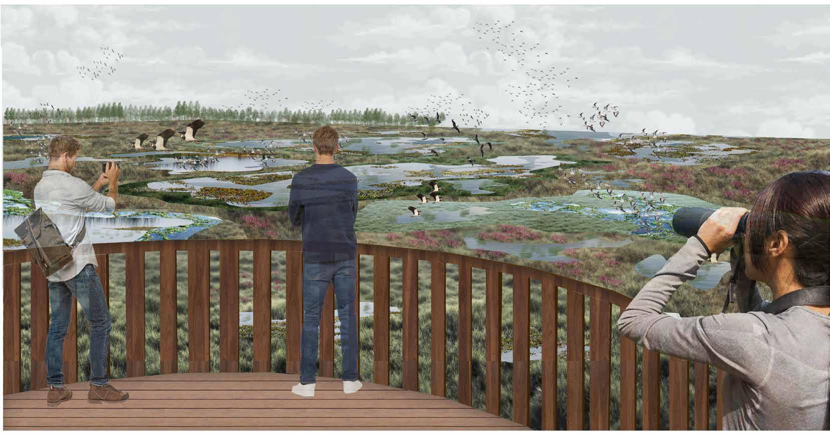
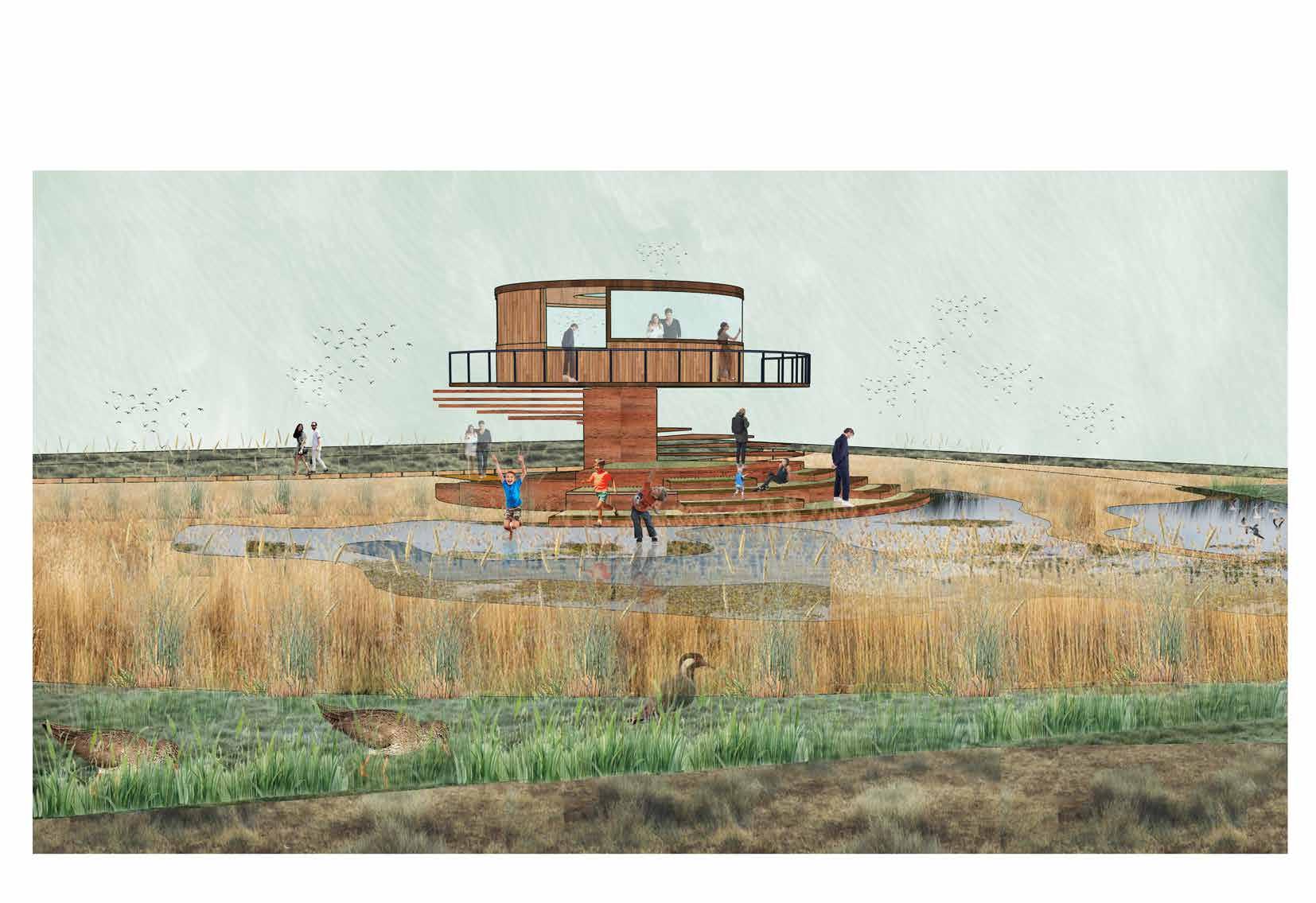
The Viewing Point
The viewing point, or birdwatching platform, will offer visitors a prime vantage point to observe a variety of bird species and wildlife. This design not only enhances the birdwatching experience but also provides a pause point along the boardwalk, allowing visitors to take in a broader perspective of the entire site.
A mix of habitat - wetlands, heathlands and grasslands.
Stepped seating near wetlands which encourages visitors to experience wetland system closely to interact with nature.
Bird watching deck- The deck provides broader view of the site.
Birdwatching information center
Summer water lvl Winter water lvl
View from birdwatching deck towards the wetland areas and wader scrapes
View from wader scrapes towards bird watching
Reedbed buffer
This project represents a holistic approach to addressing the complex challenges facing the New Forest National Park. The degradation of wetlands due to agricultural drainage, climate change, and rising temperatures has had a profound impact on the park’s ecosystems, particularly on the breeding habitats of wader species. The decline in bird populations underscores the urgent need for intervention to preserve the ecological balance of the region.
The project’s dual focus on restoring wetlands and creating disturbanceresilient habitats is both timely and innovative. By rehydrating mires and bogs, the project not only aims to restore these critical ecosystems but also to reduce the risk of wildfires, which are becoming an increasing concern with climate change. The concept of “bog islands” as safe havens for waders, designed with buffer zones to minimize human disturbance, represents a forward-thinking strategy to integrate conservation with the realities of recreational land use.
In conclusion, this project is a significant step towards revitalizing the New Forest’s wetland ecosystems and ensuring the survival of its unique wildlife. By blending ecological restoration with thoughtful habitat design and integrated recreational activities, it offers a sustainable model for conserving biodiversity in the face of environmental and human pressures.