Community-Led wetland Conservation in the New Forest
Landscape Architecture MLA Y2 2023-2024
BARC0111: Landscape, Ecology & Urban Environments
Submission B: Design Project Report
Module coordinator:Vladimirs Guculaks
Practice tutor: Vladimirs Guculaks
Student Number:
Submission Date: 22/04/2024
Global ecosystems are seriously threatened by rising temperatures brought on by climate change, which also increases the frequency of drought and habitat loss. The New Forest in the United Kingdom plays a critical role in carbon sequestration and provides essential habitat for many conservation species. The integrity of its wetland habitats, which include bogs, rivers, ponds, and mires and are crucial for preserving biodiversity and lessening the effects of climate change, is threatened by the changing climate.
Project Objectives:
1. Wetland restoration - Encouraging the resilience of wetland ecosystems in the New Forest to climate change and protecting vital habitats for species conservation are the main objectives of this project, which aims to return these ecosystems to their native state.
2. Community Education and Engagement By establishing a wetland walking trail, the surrounding communities will be educated about the necessity of restoring wetlands to protect species and lessen the consequences of climate change.
3. Wildlife Protection The initiative intends to protect endangered species in the New Forest from the negative effects of climate change and predatory threats by restoring wetlands.
4. Water System Solution Water management systems that are integrated into the New Forest landscape will guarantee the sustainable coexistence of nature and human activity, encouraging the preservation of wetlands while satisfying community requirements.
By involving communities in education and outreach, the project seeks to accomplish vital goals while restoring wetlands in the New Forest. By protecting important habitats from drought and rising temperatures, it aims to increase wetland resilience to climate change. It fosters understanding of the interdependence of humans and the environment by raising awareness of wetland conservation and climate adaptation through education and community involvement. Enhancing the quality of habitat for conservation species and creating refuges for threatened plant and animal species is the goal of restoration projects. The initiative ensures the long-term resilience and vitality of the New Forest ecosystem by encouraging sustainable water management techniques that balance ecological integrity with human requirements. Integrated initiatives foster sustainable resource management for coming generations, safeguard species, and lessen the effects of climate change.
Nearly, one third of earth’s land surface is covered by forests, which provide habitat to humans and other wide range of species with cultivating varied ecological functions. However, Global climate change is accelerating and human caused emissions of green house gases are the major cause (Hersher, 2021). Climate change is predicted to bring warmer, drier summers with more heat waves, milder, wetter winters, increasing sea levels, and greater danger of flooding to the world.
Approximately, one third of 2.6 billion tonnes of CO2 is absorbed by forests every year. Nearly two billion hectared of land across the world offer opportunities for restoration.
The carbon sink function of jungles slows climate change by lowering the rate at which CO2 accumulates in the atmosphere. Thus, maintaining forests responsibly is a key tactic in the fight against climate change in the future.
Project background
Section 01
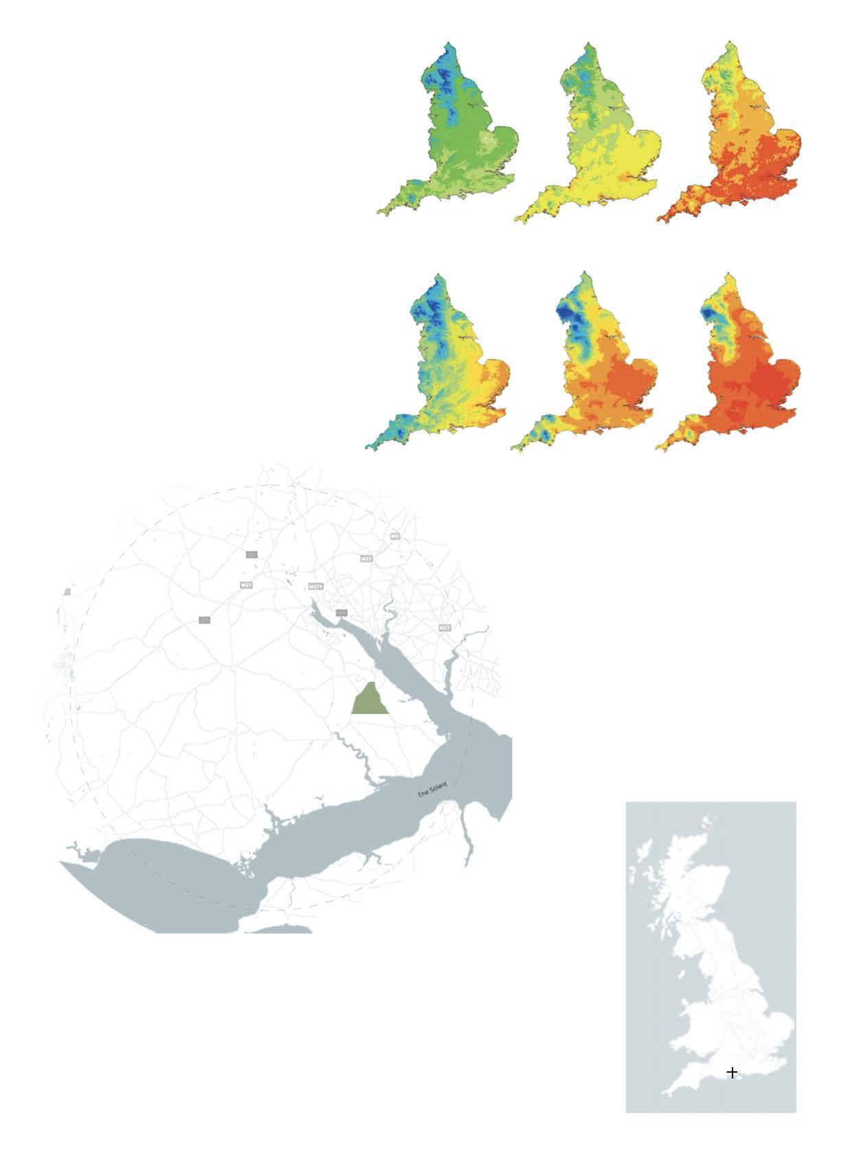
Fig 01 Accumulated temperature for baseline period (1961-90) and projected for long period((2041-2100) for emissions scenarios.
Fig 02 Moisture deficit for baseline period (1961-90) and projected for long period((2041-2100) for emissions scenarios.
Source Hulme et al., 2001)
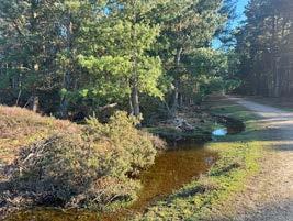
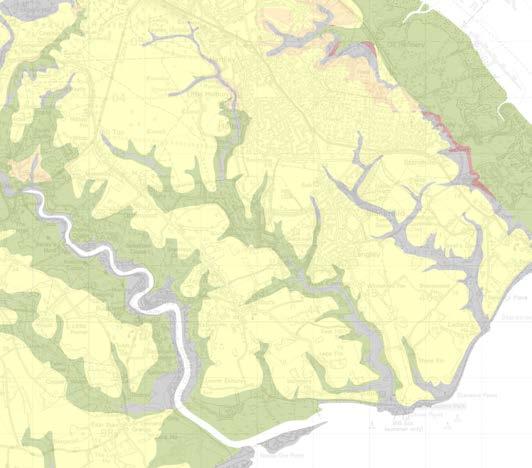
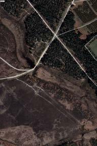
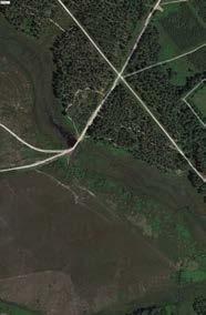
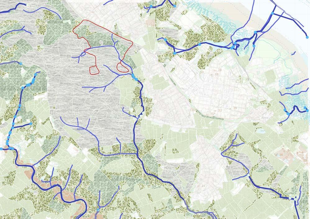
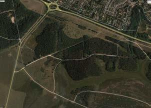
Fig 03 Site Location
Source Author’s own diagram
Over half of the habitat of new forest is designated as Site of Special Interest (SSSI), a National Nature reserve and a Ramsar site(wetland of international importance). Over recent years, the forest landscape has changed intended to benefit wildlife species. The Habitats directive prioritizes Special Area of Conservation(SAC).
Source Hulme et al., 2001) Source Author’s own diagram
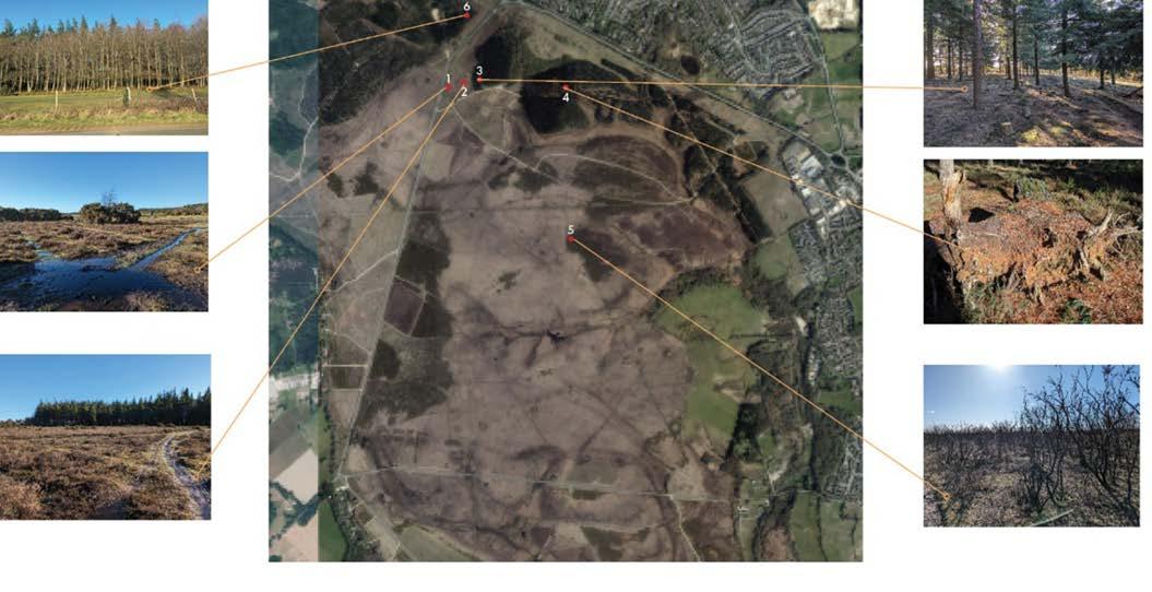
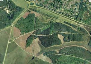
The site is located in New forest national park which is situated in southern England. The New forest have wide range of landscapes made up of woodlands and open habitats. The forest has rich mosaic of heaths, woodlands, bogs, lawns, streams, farmlands, plantations and coastal marshes.
Lyndhurst
Beaulieu
TheSolent
Brockenhurst New Forest National Park
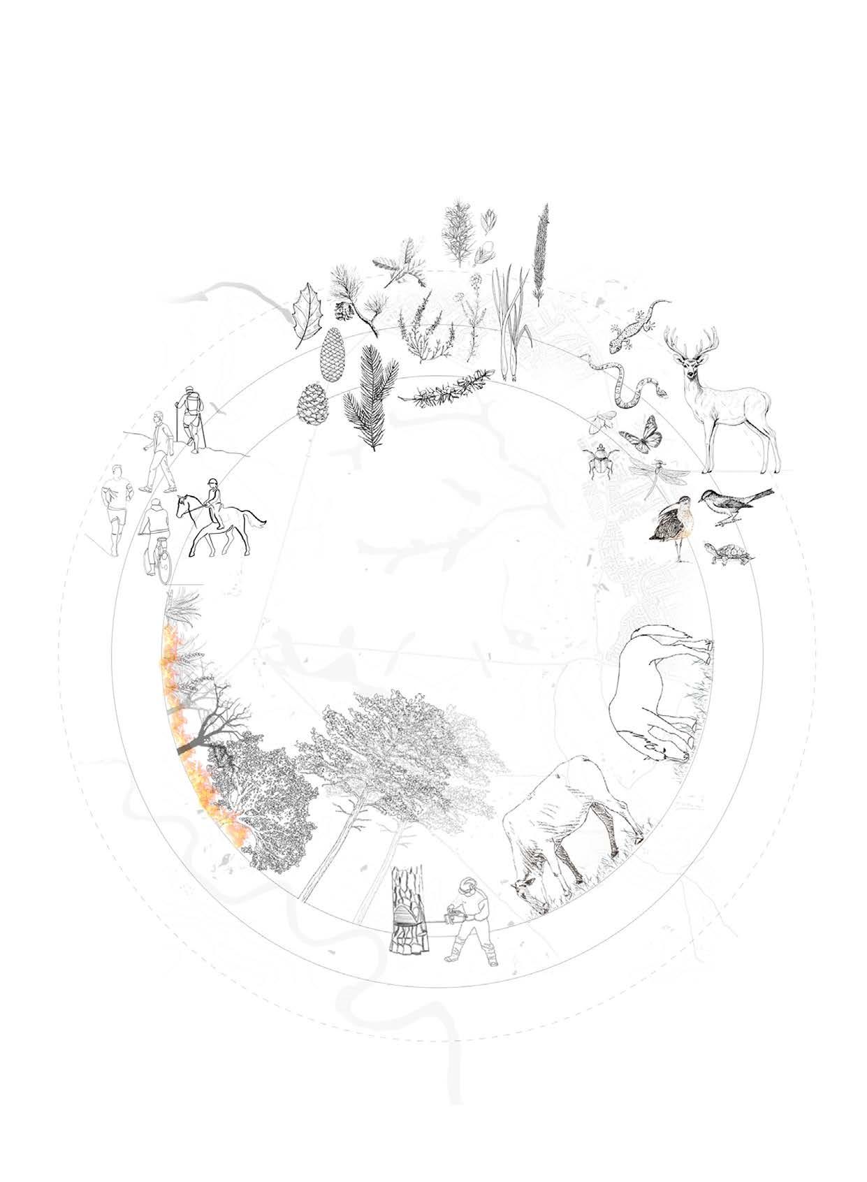
The new Forest offfers wide range of activities like, hiking, cycling, walking, horse riding. Communal activities like volunteering with locals encourages communities to participate into understanding management of New Forest and educate about wildlife and habitats of the Forest. However, sometime these human led activities leads to disturbances to few wildlife species and hence drive them away. Managing recreation becomes an important subject to integrate nature and humans.
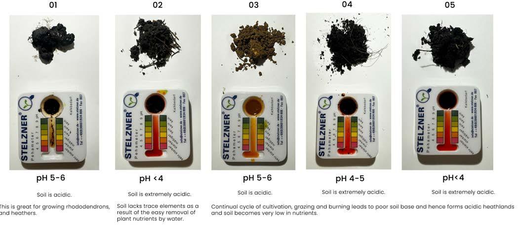
The burning is carried out by Forestry England which usually takes place during Feb and March. Heathland is a low nutrient habitat and controlled burning helps maintating this status. Gorse and heather burning encourages new growth, which benefits flora and fauna of New Forest. It also builds effective fire breaks to protects areas of heathland and woodland from wildfire. The rotation of burning for Gorse and Heather is 12-15 and 20-25 years respectively.
The New Forest is rich in wildlife with combination of habitats of wet and dry heaths, Mires and bogs, ancient pasture woodland, coniferous plantation, acid grasslands, mixed farmland and coastline. The National park is abundant with huge range of birds, deer, dragonflies, reptiles and much more.
NEW FOREST MANAGEMENT
by ponies, cattles sheep and donkeys.
Commoning in the New Forest preserves its medieval heritage, recognized officially since the mid-16th century. Common rights, tied to land and properties, not individuals, encompass Pasture, Mast, Marl, Turbary, Sheep, and Fuelwood. Commoners, occupying such land, enjoy privileges like grazing stock on the Open Forest. The landscape of the New Forest owes much of its current appearance to the presence of ponies, cattle, and deer. Through their browsing and grazing activities, they have shaped the Open Forest lawns and trees, while also controlling the growth of brambles, gorse, and other coarse vegetation.
Grazing
Felling of trees.
Burning
Source Hampshire Rural Pathfinder Project EIA, Author’s own diagram
Source Author’s own diagram.
Source Author’s own diagram.
Source Author’s own diagram.
Source Hampshire Rural Pathfinder Project EIA, Author’s own diagram
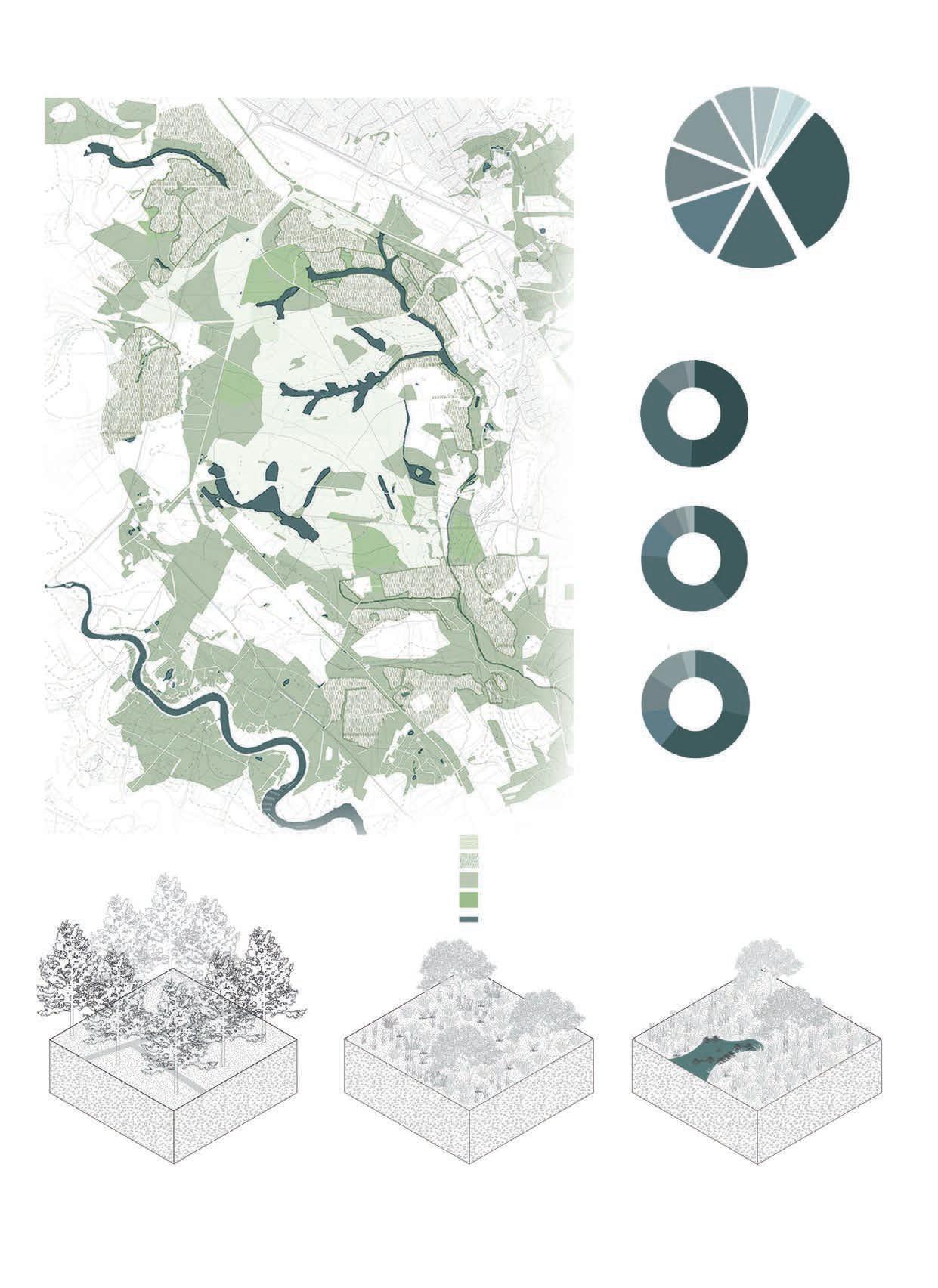
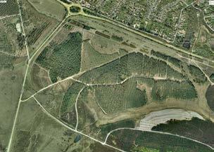
Fig 06 Change in forest cover.
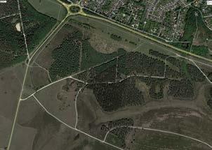
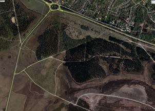
Fig 07 Habitat Mapping for site area.
Fig 09 New Forest Management
Fig 08 Types of Habitats in New Forest.
Fig 05 Categories of Crownland Heathland.
N
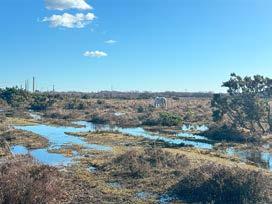
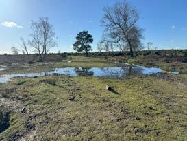
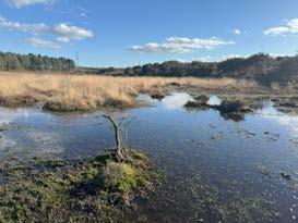
The New Forest has one of the most intact networks of wetland habitat in Western Europe. Its mires, bogs, ponds, rivers and streams are one of the important qualities of national park.
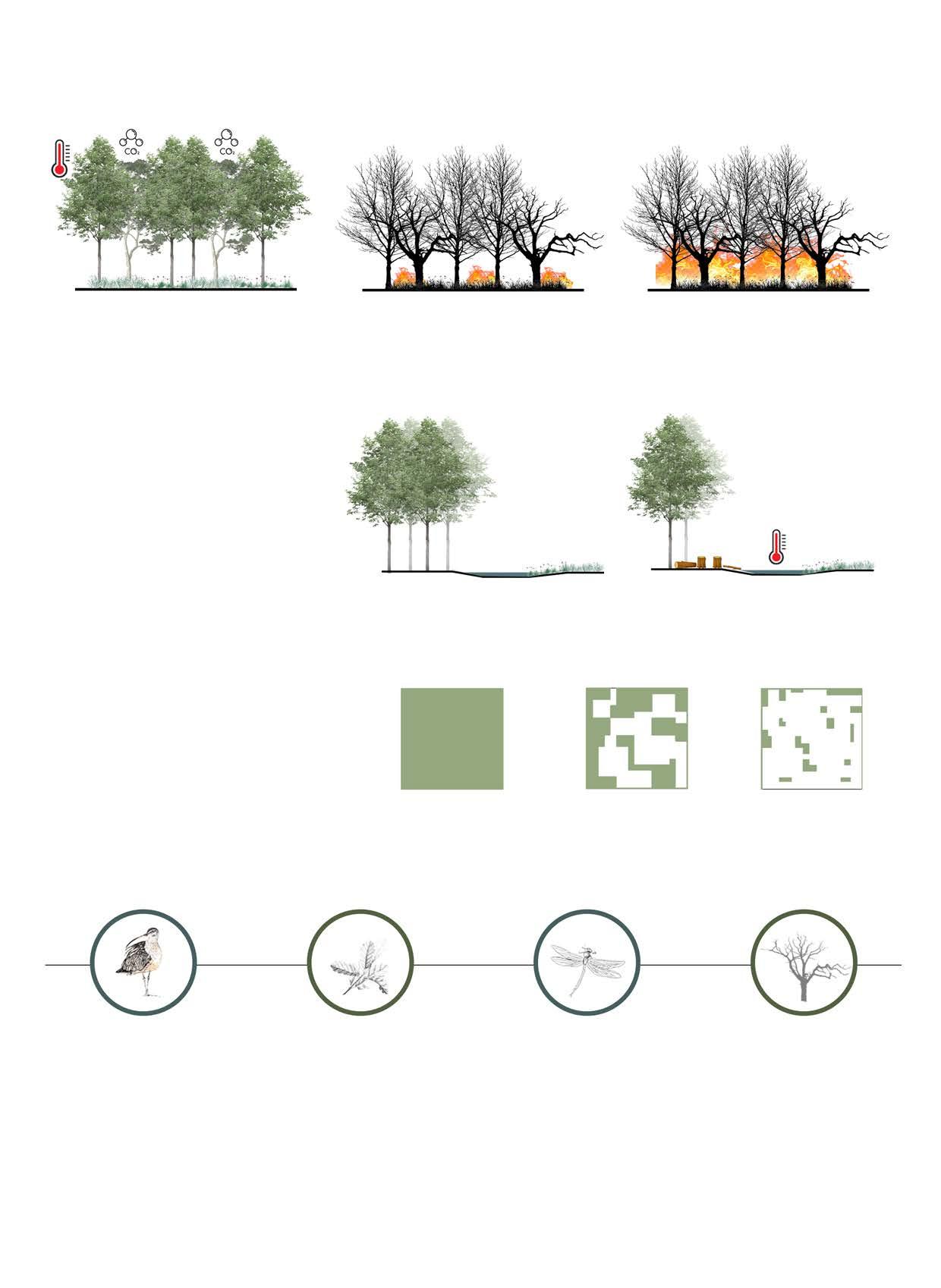
Wetland vegetation sequesters carbon dioxide during its growth, and upon its demise, this carbon remains trapped rather than being released into the atmosphere. The plant material sinks to the wetland floor, where it undergoes incomplete decomposition, leading to the accumulation of carbon over extended periods. This stored carbon persists for centuries or even millennia within the partially decomposed plant matter at the wetland’s bottom.
Disturbance
carbon
and a lack of moisture is potential fuels for wildfires in forest
Increased evaporation due to vegetation clearance and low summer flows
Concerns have been raised about clearing streamside vegetation, especially in Inclosures, during summer. This may increase sunlight reaching the stream, raising water temperatures and evaporation rates, potentially drying out streams and affecting fish and macroinvertebrates. While benefits of clearance outweigh local drawbacks so far, future planning should balance vegetation along streams, preserving overhanging scrub in areas previously heavily shaded.
Fragmentation of Habitats
Fragmentation occurs when segments of a habitat are destroyed, resulting in smaller, disconnected areas. While it can happen naturally, such as through fire, human activity is typically the main cause. These habitats are often lower in quality. As a habitat is broken into smaller sections, the proportion of edge - where one habitat meets another - increases. Fragmentation causes lack of wildlife mobility and can result in loss of genetic diversity.
A diverse ecosystem. Rich in flora and fauna. Hub for specie protection. Vast wetland system as carbon sink.
Diversity of species can lead to a higher chance of risk from invasive species and diseases if any. Climate change impact especially rising temperature and droughts can change rainfall pattern and can have huge effect on forest’s ecosystem.
Wetland restoration mangement to combat for future climate change. protecting water table and its structure through a developed system that also helps in enhancing quality of other habitats.
Negligence in forest management planning. Old drainage system and water collected in ditches are not in its best state due to lack of a proper sysytem.
Peat acidity slows decomposition, creating layers of stored carbon as litter builds.
Vegetation dies and sinks below water annually depositing carbon.
returns to atmosphere through respiration and decomposition
of wetland soils and hydology releases carbon.
Increased global CO2 emissions lead to higher temperature and more droughts.
Increase in temperature, decrease in humidity
habitats.
The temperature of wet areas are maintained due to canopy of trees.
The temperature of wet areas are maintained due to canopy of trees.
Felling of inclosures leads to less canopy shade to water systems leading to higher temperature in water bodies.
Large areas burn as fire becomes more frequent and intense, leading to higher CO2 emissions, which enter the atmosphere and contribute further to climate change, restarting the cycle.
Trees and vegetation fix atmospheric carbon through photosynthesis
Above ground carbon: branches, trunk and foliages.
Soil organic carbon : litter, roots, peat
Source Author’s own diagram.
Source Author’s own diagram.
Source Author’s own diagram.
Source Author’s own diagram.
Source Author’s own diagram.
Source Author’s own diagram.
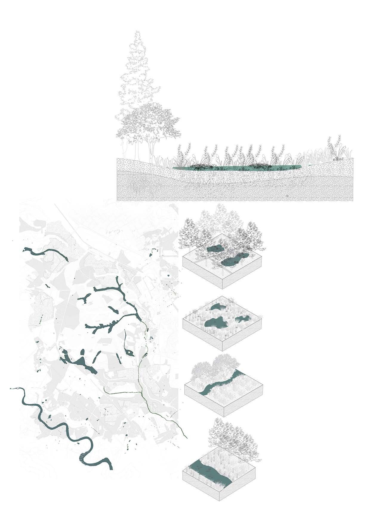
Fig 10 Section through Wetlands.
Fig 10 Types of Wetlands
Fig 11 Forest Fire loop.
Fig 12 Climate change issues affecting wetlands.
Fig 13 Fragmentation of habitats.
Fig 14 SWOT Analysis for New Forest.
Topic Research
Section 02
2.1 Wetland Ecosystem
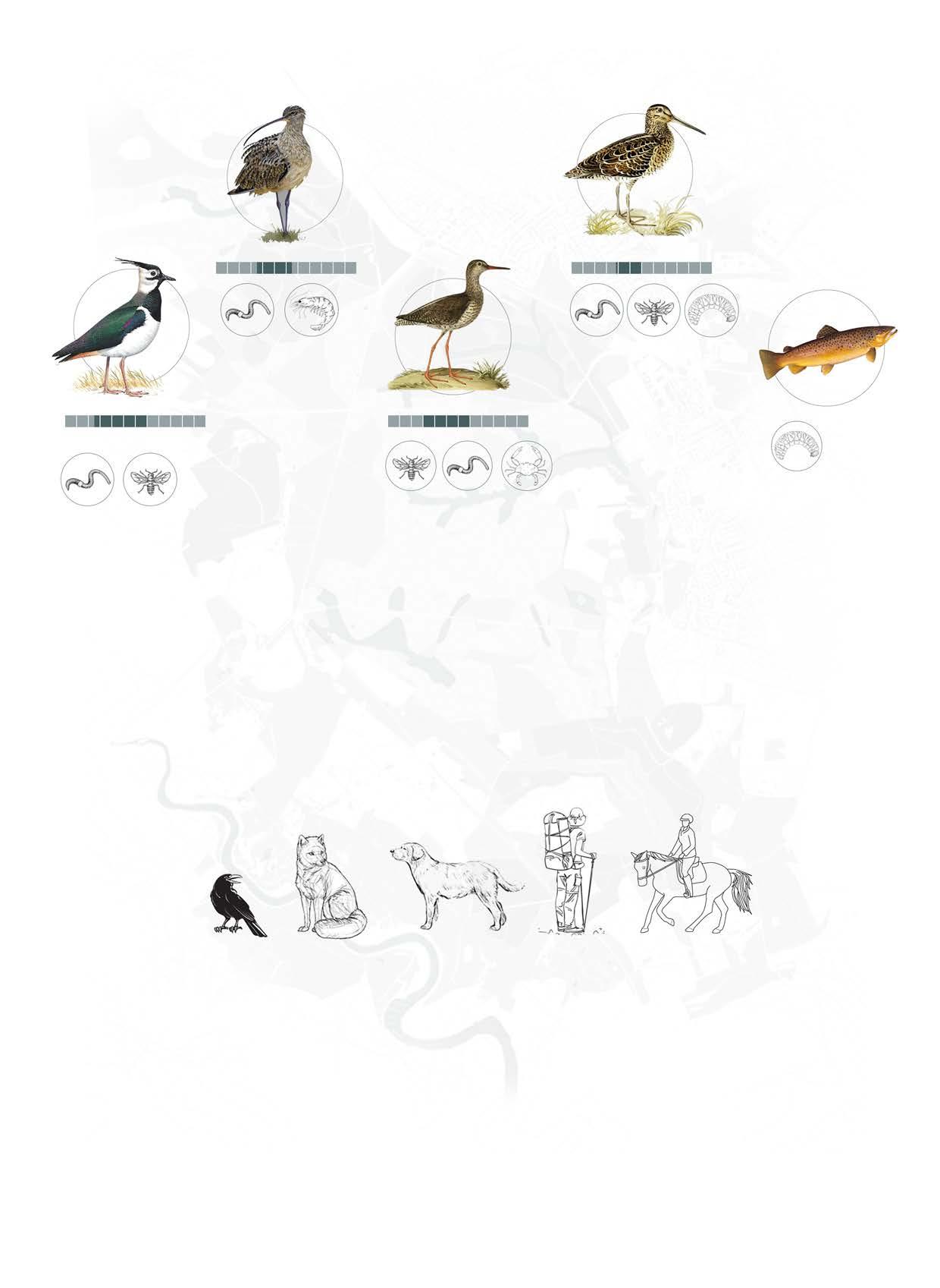
Past land management practices have resulted in damage and degradation of important wetland habitats which restoration and management is seeking to reverse. The New Forest wetlands in southern England have become increasingly important for numerous rare and/ or declining species. Examples of these species include the large marsh grasshopper, Stethophyma grossum, and the rare southern damselfly, Coenagrion mercuriale. Previously, larger species like curlew, Numenius arquata, and snipe, Gallinago gallinago, were much more widespread. Many of these species’ conditions in the New
continue to be of concern.
There are intact transition zones and excellent ecological quality and diversity in the mire ecosystems. Because of the concentration of uncommon and threatened wetland species, the invertebrate fauna of the site is significant.
Drained and destroyed wetlands New drainage area expanded due to wetlands destruction leads to flooding
WETLAND ECOSYSTEM
Streams Bogs and Mires Ponds River
Intact Wetlands Historic drainage area
Forest
Source Author’s own diagram.
Source Author’s own diagram.
Fig 15 Wetland ecosystem in New Forest. Drosera Intermedia
Fig 16 Land Management and drainage system of New Forest.
Resides in Farmland, Marshes, Water meadow
Water table is important to enable access to abundant insects and invertebrates.
Drier and warmer climates makes forest less suitable for breeding.
Resides in Farmland, Wetland, grassland
Habitat loss and degradation due to modern farming practice and land use.
Predators like foxes and crows.
Resides in Wetlands, grassland.
Wader of bogs and mires on lowland heath.
Proximity of tidal estuaries.
Resides in Wetlands, grasslands.
Inhabits in deep marshy places-bogs, water meadows, mosses.
Breeding wader bird surveys, including the survey carried out by the RSPB for the Life 3 Project, have noted the continuing and significant decline in breeding wader populations and their ranges in lowland Britain. Thus it is considered more important than ever to maintainand enhance habitats such as those within the New Forest which still support large numbers. Jan
Suffered badly due to drainage and agricultural intensification.
Drying of wet heaths and mires-not conducive for ideal chick rearing conditions.
Cold-water species and have specific thermal limits.
Maximum growth occurs at 13°C and growth ceases altogether at 19.5°C. The species’ seven-day upper lethal limit is 25°C, so water temperatures between 19.5-25°C are critical and are likely to result in stress, disturbance to normal behaviour, higher susceptibility to disease and, ultimately, reduced survival.
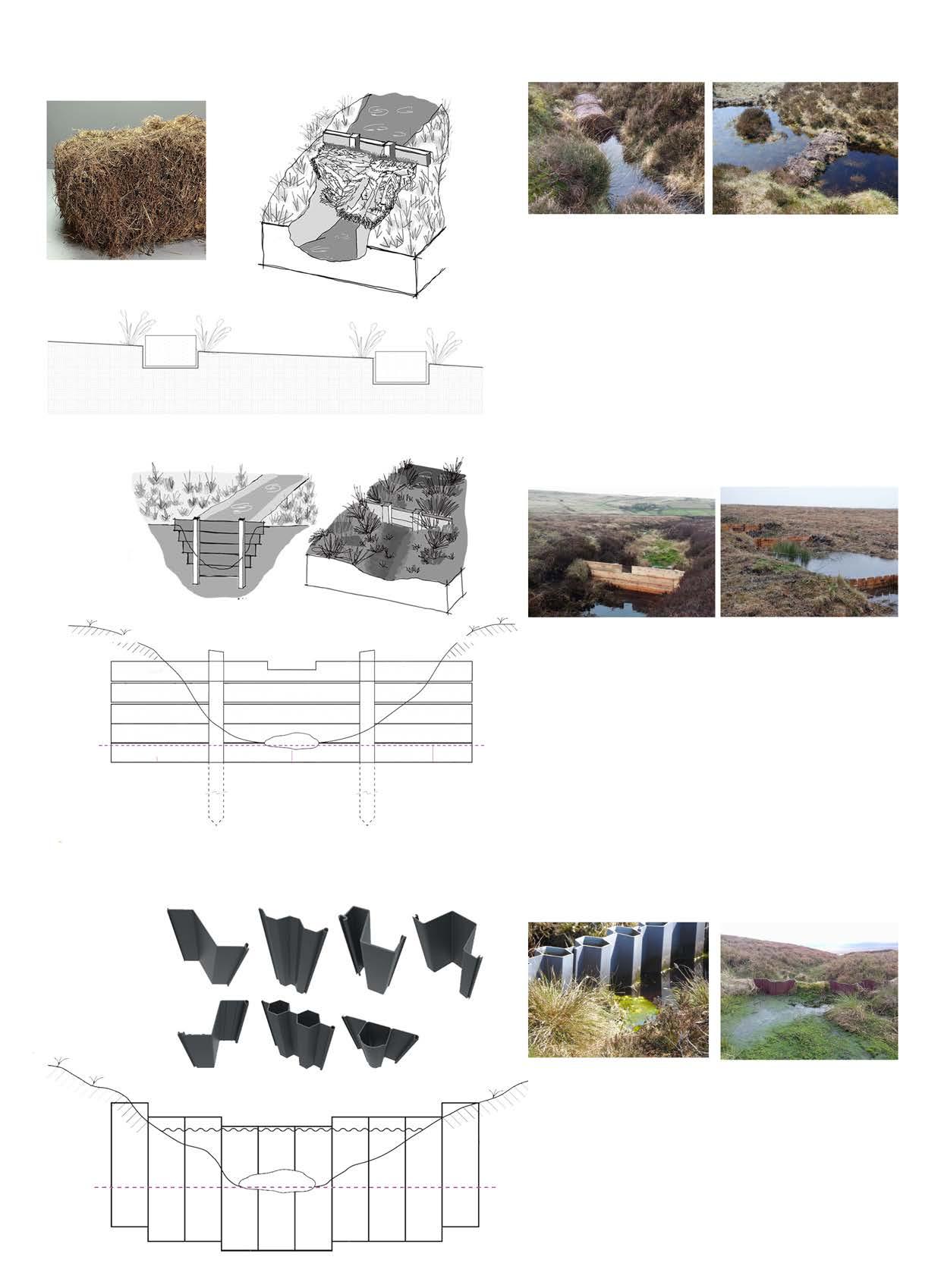
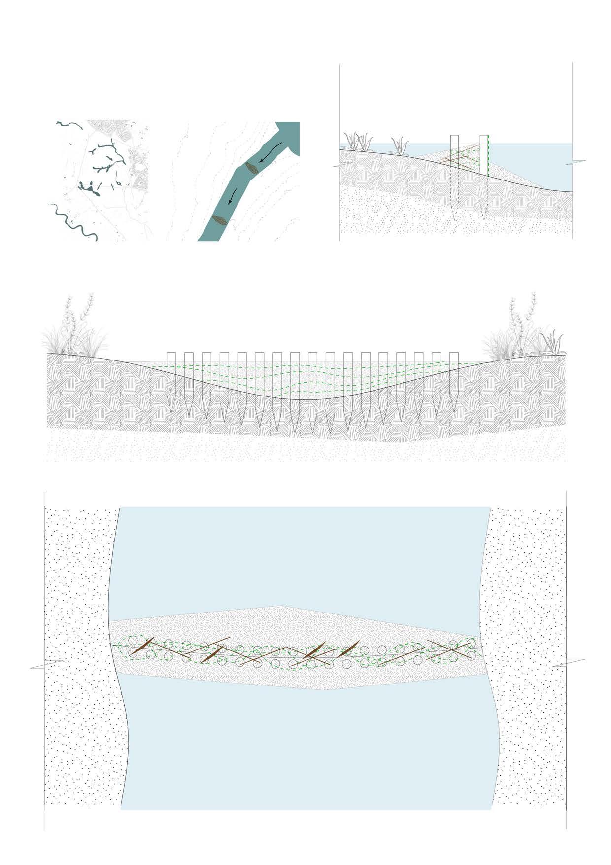
Heather bale dams are semi-permeable gully and grip blocks that are intended to capture silt that would otherwise be lost from the moor and to impede the flow of water downstream. They can also be constructed using coir logs. As the gully’s bed rises due to the accumulation of silt, vegetation like cotton grass or sphagnum moss may recolonize it (sometimes with artificial assistance, like plug planting or seeding). The water flow is slowed by the heather bales, which helps this process. The bales are a naturally occurring material that will eventually turn green and become part of the surrounding environment.
Timber dams are blocks of somewhat permeable ravine material that are used to both create pools and impede the flow of water downstream. They can capture water from heavy rainstorm events and then gradually release part or all of it since they are (intentionally) leaky. This leaves an empty space that can be used to catch the following rainfall event. Additionally, they capture silt that would otherwise be lost from the moor during this process. Gradually, the sediment builds up until the pool is filled. At that point, the dam can no longer store water because it has raised the gully’s bed. However, vegetation like cotton grass or sphagnum moss may then recolonize the area (perhaps with artificial assistance, like planting plugs or seeding).
ISSUES
Plastic dams are impermeable gully blocks made of interlocking plastic piling sheets. Large, deep pools can be created by using plastic piling, which has a significant capacity to hold water. There is a chance that one or more of the dams could break, though, so these need to be spaced properly. They are only successful in situations when the peat, not the mineral soil underneath, supports the foundation of the pile.
Source Author’s own diagram.
Source Author’s own diagram.
Dogs
Running Horse Riding
Fig 17 Importance of wetlands to differnt species.
Fig 18 Flowchart concluding issues in New Forest
Source Author’s own diagram.
Source Author’s own diagram.
Source Author’s own diagram.
Fig 20 Cross-section of timber dam structure.
Fig 21 Cross-section of Plastic pile dam
Fig 19 Cross-section of heather bale dam structure.
2.3.3 PLASTIC PILE DAM
Heather bale
Heather bale structure
Case study Wessenden Moor, West yorkshire, England
Case study Kinder scout, Peak District, England
Case study West Nab and Deer Hill, England
Untretaed timber
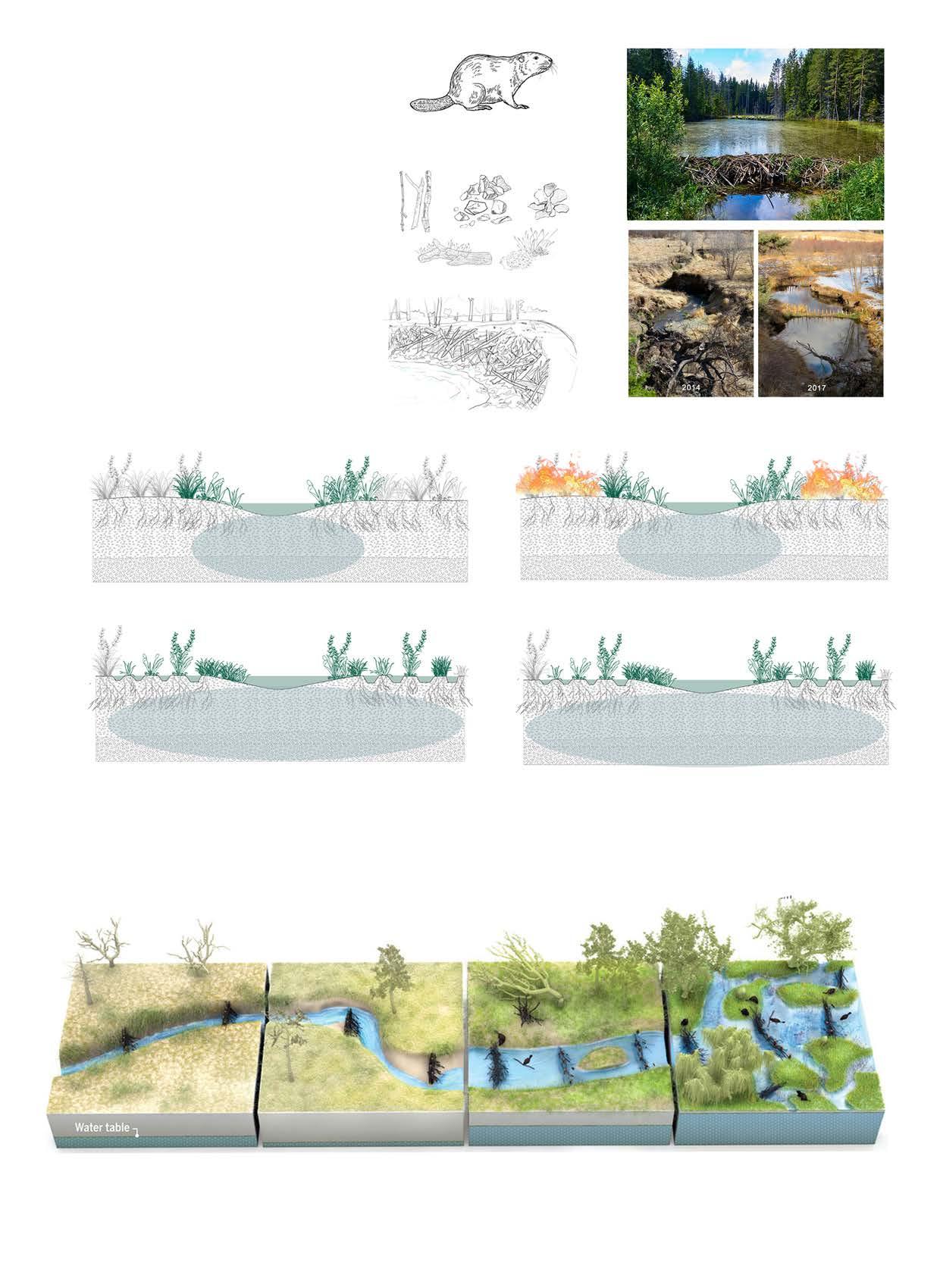
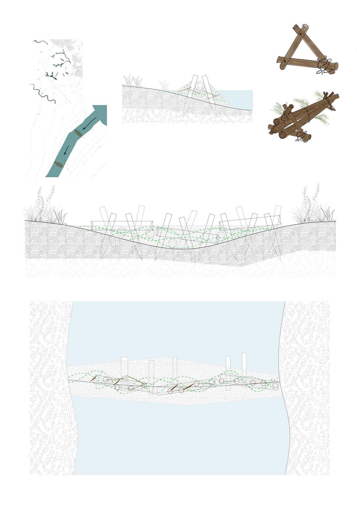
River hydrology can be significantly altered by beaver dams, which are well known for being built by these highly respected ecological engineers (Castor canadensis and Castor fibre). Beavers are therefore being used more and more in green infrastructure techniques to counteract the effects of climate change and improve the resilience of ecosystems. Beaver dam structures in watersheds have demonstrated the ability to mitigate both drought and floods.
The dam creates a pond large enough for refuge by increasing the depth of water. By increasing surface and ground water storage and extending open water areas, dam construction modifies the ecosystems of streams and wetland areas. Beaver dams have the ability to reduce flooding in addition to protecting against drought. By reducing peak discharges and slowing surface runoff, dams can help decrease the downstream transmission of floodwaters, resulting in smaller floods.
2.4 Channel enhancement techniques
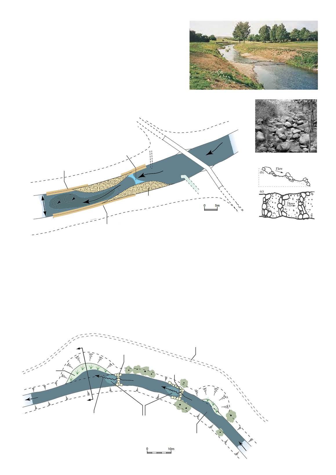
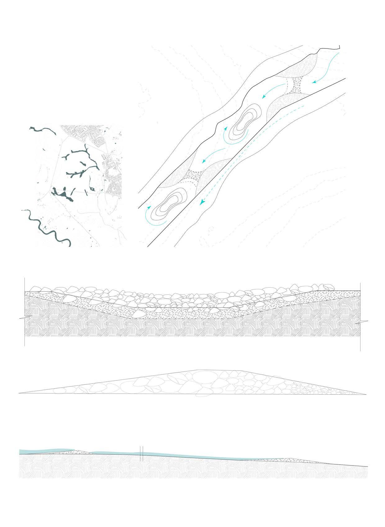
The riffle’s configuration consists of two semi-eliptical shoals that are diagonally opposed to one another and connected by a shallow weir that slopes downward, creating an overall homogenous structure. The weir is the only area that is submerged at low flows, but when flows rise, the shoals swiftly drown. The arrangement maintains a deeper, quicker water flow around the downstream shoal, causing noticeable eddies when the currents combine with the lower river. The diversity of habitat is maintained by these fluctuations in flow direction, depth, and speed. The riverbanks adjacent to every shoal are graded as level as feasible to facilitate simple and secure access to the water’s edge. Where the river runs faster as it passes over the structure and beyond, the toes of the river banks are reveted with stone.
FIRE CONDITIONS
BEAVER DAM ANALOGS (BDA)
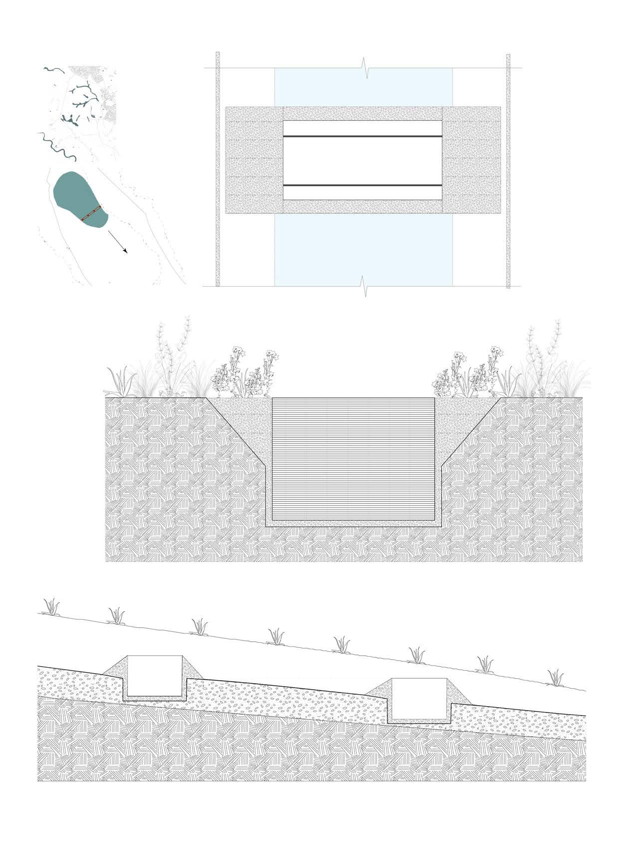
An artificial structure called a “Beaver Dam Analogue” (BDA) is made to resemble a real beaver dam in both form and function. The utilisation of BDAs can further raise the likelihood of a successful beaver transfer by generating an immediate deep water habitat that lowers the danger of predators. In order to accomplish a variety of common restoration objectives, the design and installation of BDA complexes is generally a straightforward, economical, non-intrusive method of stream restoration. It can affect a suite of hydraulic, geomorphic, and hydrologic processes.
Across the reach, four bays of varying dimensions were dug out. Upstream stone cascades were placed alongside three of them to create turbulence and prevent the bays from rapidly silting up. A low ledge that was slightly below summer water level was also placed into the bays to accommodate a range of macrophyte species. The nearly semicircular bays were dug out all the way to the bed at the channel-bay junction. After that, this level is reversed and followed back up to the low ledge level at the edge of the bay. Based on the size of the bay, the ledge’s width changes.
and alder, and create a maze of pools and side channels for fish and wildlife.
Stream without beavers
Stream without beavers
Stream with beavers
Stream with beavers Beaver (Castor canadensis and Castor fiber)
Source Author’s own diagram.
Source Peter Skidmore.
Source Author’s own diagram.
Fig 23 Drought and fire conditions illustrated with and without beaver dams
Fig 22 Materials and construction of beaver dams.
Fig 24 Illustration of BDA and its change into river stream and ecology.
Adding dams Beaver trapping and overgrazing have caused countless creeks to cut deep trenches and water tables to drop, drying floodplains. Hence installing BDA can help retaining that.
Widening the trench BDAs divert flows causing streams to cut into banks, widening the incised channel, an dcreating a supply of sediment that helps raise the stream bed.
Beavers return As BDAs trap sediment, the stream bed rebuilds and forces water onto the floodplain recharging groundwater. Slower flows allow streams to retain its structure. A complex haven BDA raise water tables, irrigate new stand of willow
Case study River Skerne, Darlington, Co Durham
Case study River Tall, Ireland
CREATION OF BAYS
VIEW
Source Manual of river restoration techniwues, Altered by author.
Source Manual of river restoration techniwues, Altered by author.
Fig 25 PLAN VIEW
Fig 26 PLAN VIEW
Strategy and Objectives
site for amphibians, birds and invertebrate
OBJECTIVES
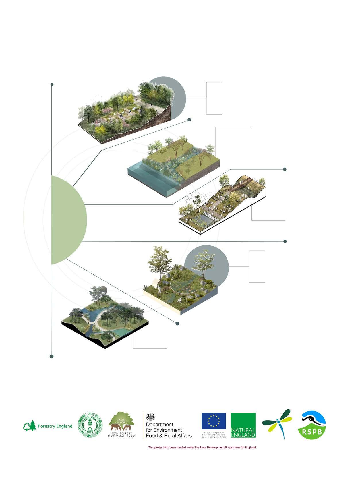
Landscape Realisation
Section 03
Enhancing water quality
Co-design for humans and other species
Trapping water for dry summers
Increased floodplain connectivity and restore geomorphic process on the floodplain
27 Realisation Strategies and Objectives.
Source Author’s own diagram.
Hydology, topography and geomorphology
Fig
STAKEHOLDERS
Headwater
Source Author’s own diagram.
Source Author’s own diagram.
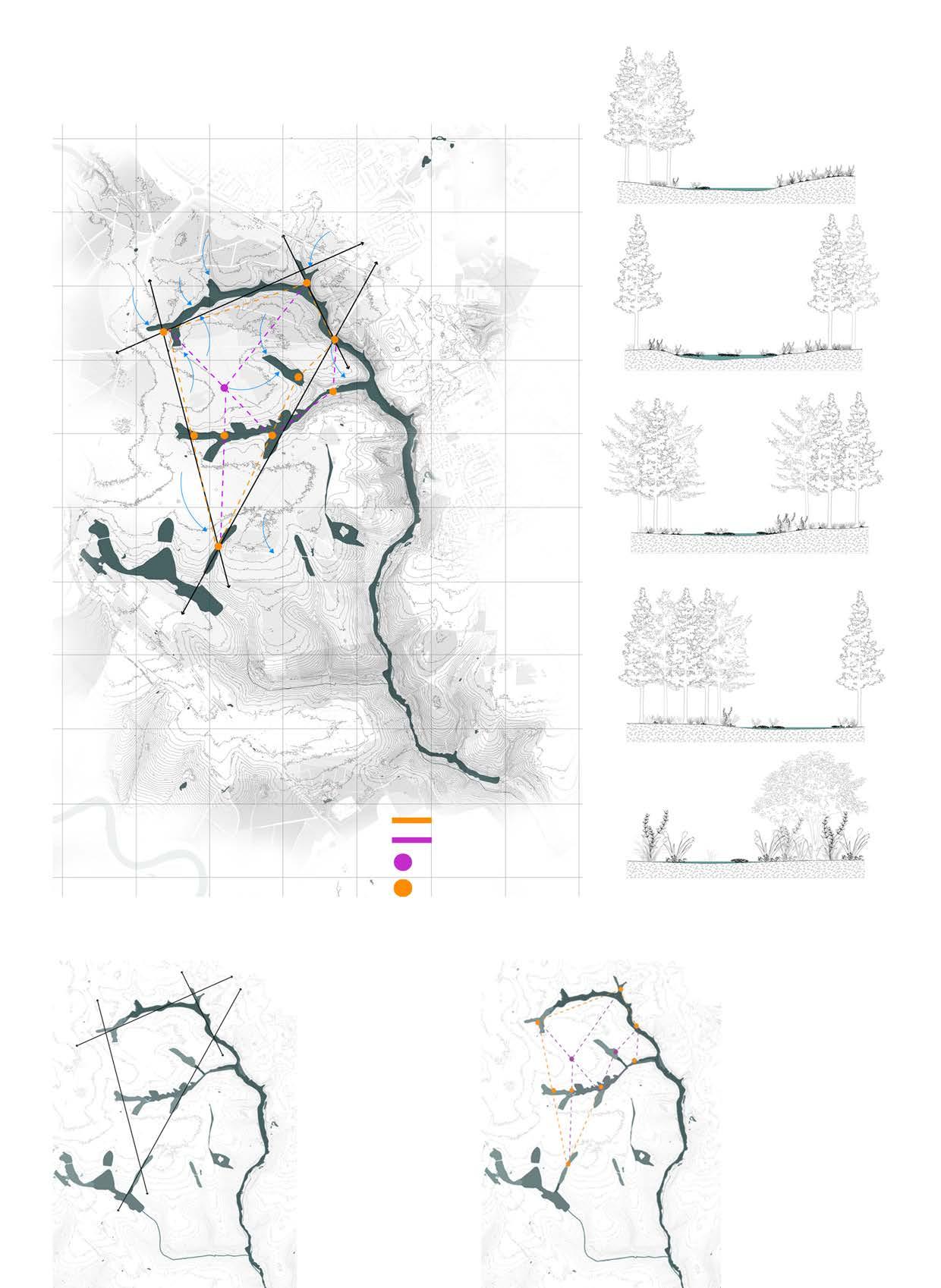
3.2 Water Flow Analysis
Source Author’s own diagram.
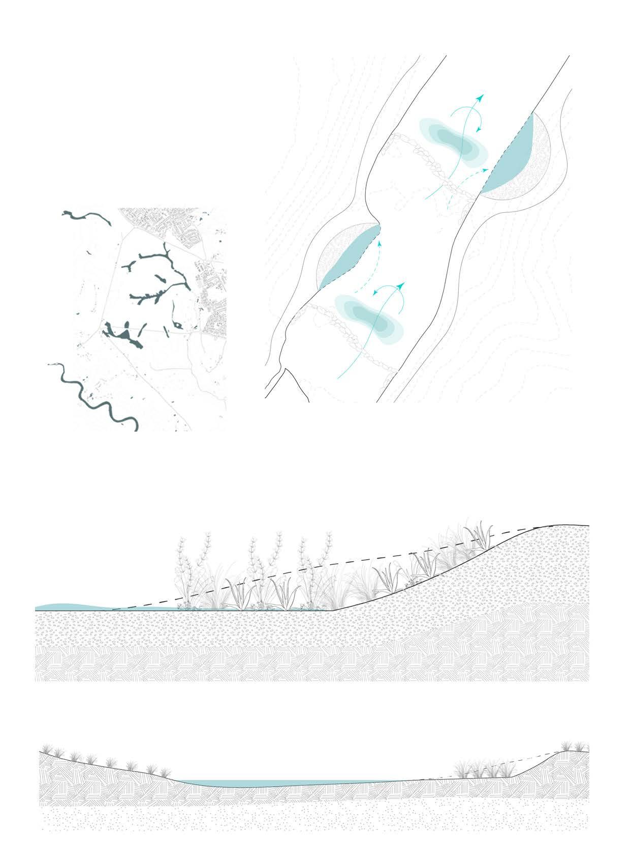
Because the Forest streams have a naturally occurring spatial flow, significant rainfall causes them to expand and deposit more silt. A common natural aspect of many headwaters is the drying out of some streams in the summer. The habitat around the streams that drain the valley mires functions as a sponge, lowering some of the streams’ flashy qualities while retaining some flow during the dry summers.
Source Author’s own diagram.
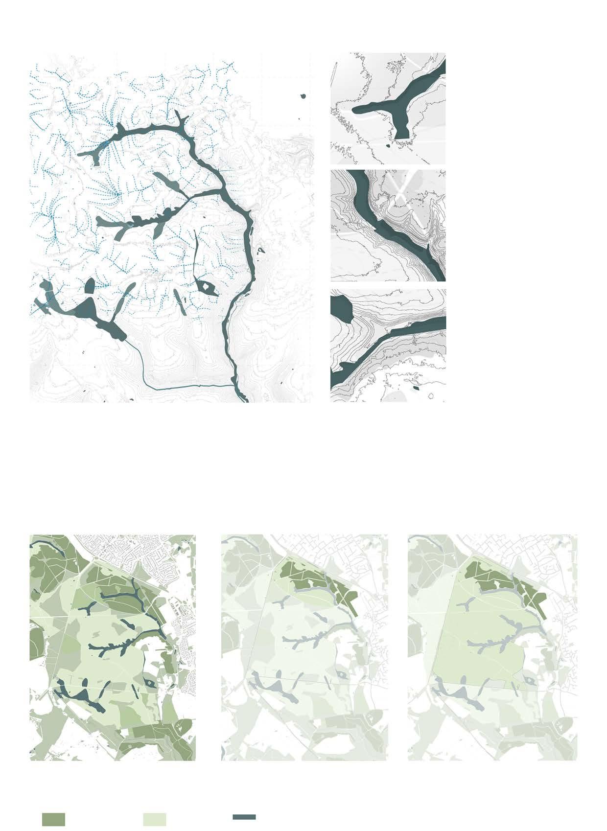
The proposed biodiversity plan below for New Forest illustrates that more open habitats- heathlands, grasslands and wetlands are given more space. The conifer plantation which was done in past for timber will be removed to allow more native species to grow in forest.
The following data helps in understanding the vegetation in long term and hence helps in designing accordingly for wildlife and humans.
Source Author’s own diagram.
Source Author’s own diagram.
Fig
Source Author’s own diagram. Source Author’s own diagram.
Source Author’s own diagram.
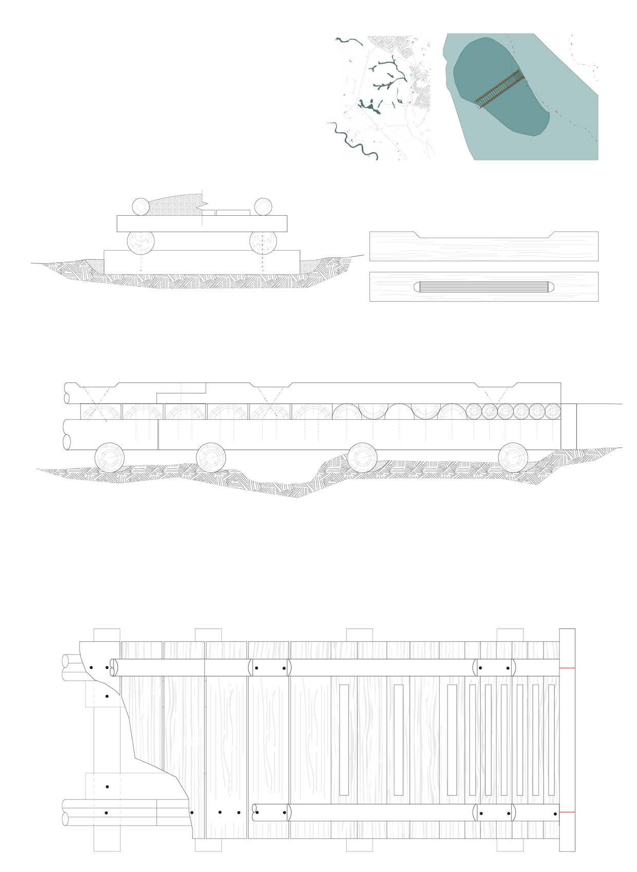
Fig 28 Proposed Conceptual Wetland Trail for New forest.
Fig 30 Axis routes
Fig 31 Longer and shorter loops of wetland trail
Fig 29 Section through wetlands.
Fig 34 Existing Biodiversity Plan. Fig 35 Proposed 20 year Biodiversity Plan. Removal of conifer plantation to open habitats.
Fig 32 Existing Water flow Analysis.
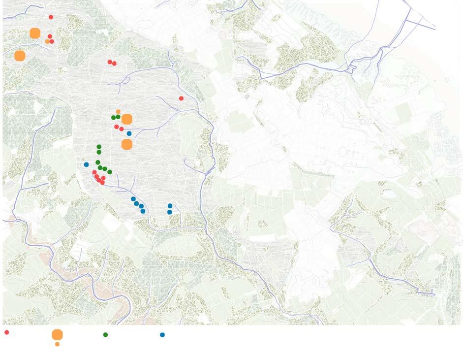
Fig 33 Intervention areas.
36 Proposed long term Biodiversity Plan. Further cutting invaisve species and clear scrub for more open habitats.
Mire
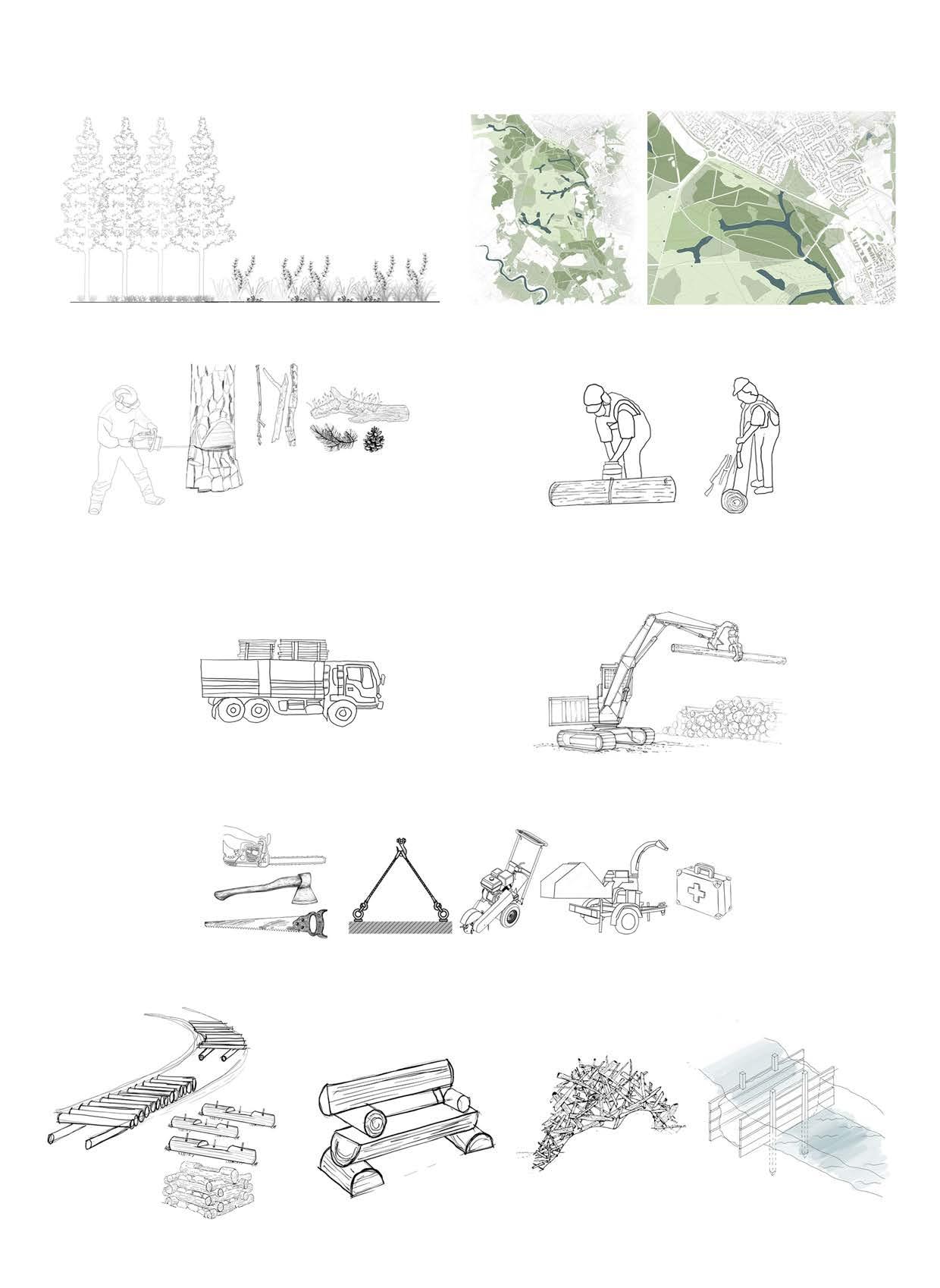
Proposed Beaver dam analogs(BDA) will be installed by reusing the branches and leaves of conifer plantation cleared.
Felling of trees(Conifer plantation)
to open habitats
Silt deposition
BDA will allow stream to widen and divert water flow with simultaneously slowing flow of water.
Dam will slow the flow of water and also helps with the erosion. Water will further penetrate into other bog fens.
The stone cascade will divert the flow of water towards bay creating pool of water and also enhancing vegetation growth.
Further, smaller section of BDA can be installed to widen the water flow more and create vast habitat for vegetation and other species.
The neighbouring area will be dug further to create more bog fens to allow wet areas to penetrate creating fire breaks.
The timber reused along with branches, twigs and leaves will eventually be integrated with peat and will become part of vegetation.
Silt trap
The bays allow meandering chnnel converted from straight channels. The reduced flow velocity now acts as a silt trap, promoting silt deposition and vegetation growth.
The dug out soil can be reused into walking trail and using it in bog bridges.
of timber for commercial use in urban settings.
Timber dams are installed. Creation of bays.
Wedge and cut
Branches, leaves
Vegetation plugs
Transportation
Loading of timber.
Tools for felling of trees.
Uses of timber after tree felling.
Chainsaw, axes and hatches Rigging equipments. Stump grinder Wood chipper First aid kit.
Construction of Bog bridges. Logs reused for seating for walking trail. Branches and leaves used for Beaver dam analogs. Timber used for dam construction.
Source Author’s own diagram. Fig 12 Part of Forest to be cut down.
Fig 38 Reuse of Timber after tree felling process.
Source Author’s own diagram.
Conifers, cobble, brush, sod, planted willow
3.5.4 Post Assisted Logs
Conifers, cobble, brush, sod, planted willow
Woven willows and conifers
Existing soil substrate
Woven willows and conifers 450-250 mm
600-900 mm wooden Post (Harvested conifers)
Scour apron (Conifer/willow and Brush)
Branches, Cobble, Brush, Sod
Whole conifer, planted willow
Scour apron (Conifer/willow and Brush)
Post can be lashed together with biodegradable rope.
Channel bank
Conifers, cobble, brush, sod, planted willow
Scour apron(Conifer/ willow and Brush)
Whole conifer, planted willow
Existing soil substrate
Logs can be wedged into triangle frames and used as key pieces in any post assisted installations.
Floodplain
600-1200 mm wooden Post(Harvested conifers)
Woven willows and conifers
mm
Branches, Cobble, Brush, Sod
Drive posts at angles to wedge and pin woody debris together.
Conifers, cobble, brush, sod, planted willow
Scour apron(Conifer/ willow and Brush)
Woven willows and conifers
A mixture of crushed rock with gradations ranging from 300 mm to 5 mm was utilised in the creation of the stone weir. While some change to form would unavoidably occur, the dominating size (at least 50%) was in the range of 125-300mm to ensure that the structure would not wash away during floods.
Rocks larger than 0.5 metres were used to build the stone cascades.Having the flow directed away from the possibly erodible banks is made easier by this structure. The boulders by the bank are firmly fastened to the sides using keys. Because of the loose construction, there is a good amount of turbulence and less backwater effect at low flows because water can pass through the structures.
Riffles - Fast, shallow flow over boulders and cobbles which break the water surface. Shoal
Run - Smooth, unbroken flow, connecting riffles and pools
Pool - Areas of slow flowing, deep wate, often on the outside of bends.
and
High water levels retained by downstream cascade
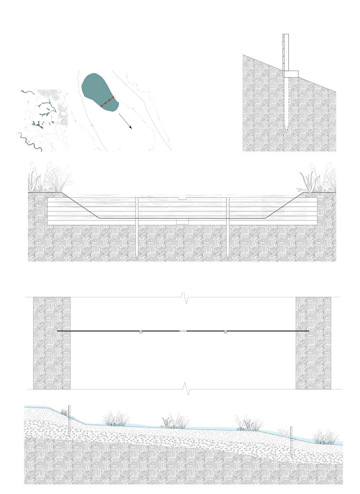
The anatomy of a bog bridge is made up of two base logs, or sills, and big boards, or half logs, called stringers. Spikes or long screws hold the stringers together as they lie above the sills. Bog bridges can span brief areas of standing water or connect to form longer, more extensive stretches of wetlands.
Wearing surface running planks
Backfill Wearing surface backfill with suitable material
sill Stringer
Flatten top of each split log or round log deck member to provide 50mm wide bearing surface
Project Appendix
decking with 10 mm gap.
Excavate for min 200 mm for mud sill and backfill with suitable material
and stringer
decking
Bibliography
Reference list
An assessment of evidence supporting a programme of wetland restoration projects in the New Forest Site of Special Scientific Interest www.gov.uk/natural-england. (n.d.).
Anabranch Solutions. (n.d.). Beaver Dam Analogs. [online] Available at: https://www.anabranchsolutions.com/ beaver-dam-analogs.html.
Hersher, R. (2021). A Major Report Warns Climate Change Is Accelerating And Humans Must Cut Emissions Now. [online] NPR.org. Available at: https://www.npr.org/2021/08/09/1025898341/major-report-warns-climatechange-is-accelerating-and-humans-must-cut-emissions-.
IUCN (2021). Forests and climate change. [online] IUCN. Available at: https://www.iucn.org/resources/issuesbrief/forests-and-climate-change.
mcourt (2021). Keeping the New Forest Wetlands special. [online] HLS New Forest. Available at: https://www. hlsnewforest.org.uk/2021/02/02/keeping-the-new-forest-wetlands-special/ [Accessed 21 Apr. 2024].
Melillo, J. (2021). Forests and Climate Change. [online] MIT Climate Portal. Available at: https://climate.mit.edu/ explainers/forests-and-climate-change.
New Forest National Park Authority. (n.d.). Wading birds. [online] Available at: https://www.newforestnpa.gov.uk/ discover/wildlife/wading-birds/ [Accessed 21 Apr. 2024].
Rewilding Europe. (2022). The benefits of the beaver. [online] Available at: https://rewildingeurope.com/blog/ beaver-benefits/.
Ronnquist, A.L. and Westbrook, C.J. (2021). Beaver dams: How structure, flow state, and landscape setting regulate water storage and release. Science of The Total Environment, 785, p.147333. doi:https://doi.org/10.1016/j. scitotenv.2021.147333.
Smart, J. and Gill, J. (n.d.). Climate change and the potential impact on breeding waders in the UK. Timber Dams FACTSHEET. (n.d.).