
4 minute read
America's Engineers: The People, Programs, and Projects of the U.S. Army Corps of Engineers


BY FRONTIER PRECISION
Engineers love data, but when it comes to the technological revolution of drone usage, information overload can be overwhelming. “There’s a flood of information out there,” says Dennis Kemmesat, founder and CEO of Frontier Precision. “At first everyone wanted to get a drone to see what it can do. But you need to be sure you’re getting the right one for your needs. You can find all kinds of data about the various types of drones and instrumentation, but what customers really need is the answer to the question, ‘What can it do for me?’”
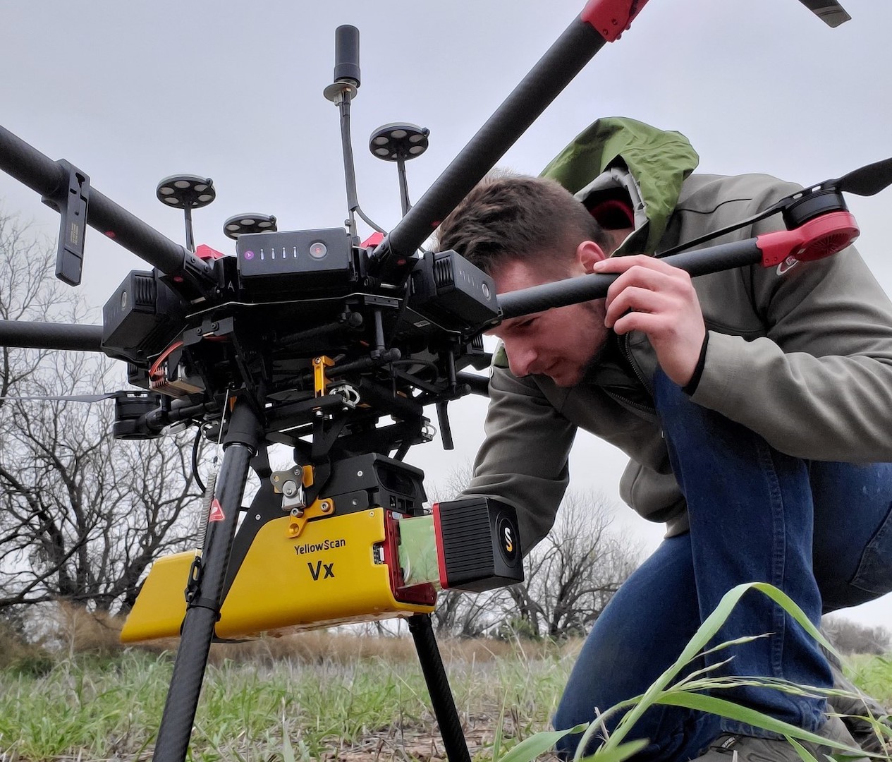
Frontier Precision Unmanned specializes in answering that question to its customers all across the country. Businesses are seeing a return on their investment in drones as they’re being used for data collection, asset inspection, and much more. “We’ve moved far beyond the idea that drones are novelties used by hobbyists,” says Kemmesat. “Their applications across a wide range of industries are almost limitless. We’ve worked with the U.S. Army Corps of Engineers (USACE) on multiple projects using drones.” One recent project was a study of the Cherry Creek Dam near Denver, Colorado. Data for the study was collected with an M600 UAS platform and a Yellowscan VX20 LiDAR sensor flying 200 feet high at about 8.5 miles per hour. USACE had original spillway construction information and this data was used to calculate volumes of the amount of material needing to be dredged.
Kemmesat has seen huge changes in the industry since founding Frontier Precision in 1988. “We founded the company to serve the geospatial industry with a focus on surveying, civil engineering and construction. With 35 years of experience, we have an in-depth understanding of the industry and have stayed at the forefront of new technologies. One of the game-changers that we’re seeing now is the advances in the capabilities of sensors. We can put sensors on a drone that gather data more efficiently and economically than anything on the ground.”

Kemmesat notes that not everyone is ready to make a big commitment to drone technology. “We’re long-term partners with our customers. If a customer wants the benefits of a drone but isn’t ready to purchase, we can help them with first steps by providing drone services directly or through a subcontractor. We work with them every step of the way so they can advance up the technology ladder with confidence that they’re getting a good value and making smart choices.”
But with all the choices out there today, how do you sort through it all? “We start with the customer’s end goal,” says Kemmesat. “We gain an in-depth understanding of what kinds of data will be gathered, what it will be used for, and what conditions the drone will be working in. Then we pair that with the technology. We’re experts in every aspect of the industry, so we know what works best for different applications. We offer the latest in UAV products and software from Watts Innovations, Inspired Flight, DJI, and Freefly, so we can get the right match for each customer and each project.”
Frontier Precision’s service to its customers doesn’t end with the sale. With nine regional Trimble Certified Service Centers and Trimble and Nikon-certified technicians, your equipment service is in good hands. With the latest calibration and alignment tools, Frontier Precision keeps your equipment working to factory specifications.
As far as the technology has come to date, there’s much more to look forward to. “The evolution of the industry makes me excited to go to work every day,” says Kemmesat. “We’re always adding new products and seeing new innovations. There’s a lot more to come, and Frontier Precision Unmanned will be right where we’ve been for 35 years – at the forefront of the latest developments in geospatial measurement technologies.”
Frontier Precision Unmanned is an employee-owned company with over 35 years of experience serving survey, mapping, engineering, construction, GIS, drones/UAS/ unmanned, forensics, law enforcement, forestry, water resources, mosquito & vector control, and natural resources professionals throughout the United States.

The appearance of or reference to the U.S. Army Corps of Engineers, the U.S. Army, the U.S. Department of Defense, or the U.S. Government does not imply or indicate endorsement by any of these entities.


