2 minute read
WHITE ROCK LAKE TRAIL


THE
9.2-MILE
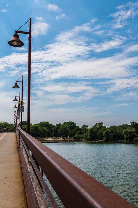
TRAIL CONNECTS AT WEST LAWTHER UNDER NORTHWEST HIGHWAY TO THE WHITE ROCK CREEK TRAIL and encircles one of our city’s main attractions, White Rock Lake. Trekkers pass the historic Bath House Cultural Center; the picturesque spillway; the old filter building; a dog park along Mockingbird Lane, which recently received close to $1 million in improvements; picturesque piers; and bridges and enviable multi-million-dollar residences. A stretch of new trail opened on the lake’s east side last summer, after Dallas’ Park and Recreation Board and Dallas City Council in 2014 approved about $1.2 million for the next phase of upgrades. Improvements to the White Rock Lake Trail have steadily occurred over the last decade. The west side, for years now, has offered a wide, smooth lakeside trail that runs parallel to the city street accommodating faster cyclists and motor vehicles. East of the lake, however, nearly all traffic, both wheel and foot, has long utilized the public street which runs along the shoreline, in lieu of a narrow, crumbling path above it. Cars, runners, strollers and cyclists all share space, often creating hairy situations.
The new pedestrian path from the base of the Mockingbird Bridge/Boy Scout Hill to the Bath House Cultural Center, about a mile, stands to quell the chaos. The Dallas Park Department rebuilt the new 12-feet-wide trail over the existing beat-up route as opposed to constructing a new shoreline trail as it did west of the lake. The revamped section has been open for the past year (though many pedestrians don’t seem to have discovered it yet). It offers impeccable views of the water and Dallas skyline and more shade than the road as well as new rest areas with seating at Boy Scout Hill, Big Thicket and the Bath House. Project manager Richard Stauffer adds that minor changes were made to the original plan; a realignment of the trail behind Big Thicket was allowed to spare an owl habitat, for example. Native prairie grasslands also were protected throughout construction, he notes.
Meanwhile, on the west side of the lake, just north of the Santa Fe Trail connection, step off the beaten path and explore a circuit of nature trails at the Old Fish Hatchery, whose entrance you’ll find between the spillway and the pump station.
TRAILS FOR ALL: Longtime Park and Recreation staffer Peter Bratt, who oversees city trail and park planning, says his department wants to ensure that every Dallasite has a park or trail within a half mile of home.
The Flag Pole Hill Trail, once called Katy Trail, Phase IV, connects by way of the SoPac Trail to Ridgewood Trail and the Katy Trail (p. 46). In the other direction, it runs east along Northwest Highway past the Merriman Park/ University Manor neighborhood. In fact, that neighborhood helped come up with the new name, according to its newsletter. “Our desire was to have a name closely associated with White Rock Lake, since we consider our neighborhood as the gateway to White Rock." The hike/bike trail will intersect the White Rock Creek and White Rock Lake trails and extend to the Dallas Police Department substation and the former Muchert Army Reserve Center, which will be the new Dallas Park and Recreation Department headquarters come 2018; the property neighbors Flag Pole Hill.
The Cottonwood Creek Trail connects our neighborhood to northern Dallas; White Rock Creek Trail melds into it near the base of the I-635 interchange. The Cottonwood Trail includes an impressive section marked by long murals and blossoming foliage (and, at times, yes, graffiti) underneath the massive highway. City planners also hope to make connections between Cottonwood and southern Dallas via the planned Loop (p. 47).


