
1 minute read
Kiest Park


As told to Keri Mitchell by Sally rodriguez, the Dallas park and recreation Department’s historian. All photos are courtesy of the Dallas Municipal Archives and curated by rodriguez. She authored the book “White rock lake,” available at area bookstores and through arcadiapublishing.com.
Now we’re looking south, and you can tell by the development, this is much later. That airport has been replaced by all these homes, and you see the field house here on the circle. The field house actually predates the WPA.

We’re looking to the north, and you can see Kiest and North Hampton. This photo was taken after WPA [Works Progress Administration] work, which was done in the ’30s. The pergola, which we are getting ready to restore, is sitting there in the Y. The WPA put this road in and some bridges, and you see the stone gates that were built at the entrances to the park. North of Kiest Park, you can see the Volk Airport runway going across.
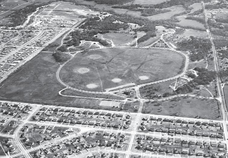
In this one, the pergola is gone, so it may be the late ’50s or early ’60s. If you look, there’s a carnival going on in the back, with school buses off to the side. If you look in the middle of the trees, you see the WPA-built pavilion. That’s currently where the trail runs, but at one time there was a roadway back there.


