13 minute read
Time to Find New Zealand's Buried Spanish and Portuguese Treasure
FEATURE WINSTON COWIE
We have some buried treasure to find ladies and gentlemen. Buried treasure that could re-write New Zealand history. We need some adventurous types with a “can do” attitude to have a crack at finding it. If that is you then read on.

Pope Alexander the XI drew a line of demarcation down the middle of the world in the 16th century. All lands to the east were available for Portuguese exploration while all lands to the west were for the Spanish. Interestingly the line bisects South America where modern day Brazil is – that is why the Portuguese language is spoken in Brazil with Spanish the main language in other South American countries.
An opinion piece by New Zealand historical author, whale shark whisperer, master diver and fellow of the Royal Geographical Society, Winston Cowie.
You are divers or those with an interest in the sea of Aotearoa and the Pacific. You will know the legendary stories of Kelly Tarlton and Wade Doak who found the gold on the Elignamite up at the Three Kings. You will have heard of the General Grant down at the Auckland Islands at the bottom of New Zealand, still unfound, still keeping the whereabouts of its 5 million dollar gold haul a secret. You will know that the Niagara, written by New Zealand underwater diving legend Keith Gordon, sits at 120 metres deep off Northland’s coast, sinking after hitting a German mine (true story) in WWII, and still with 5 bars of gold unaccounted for – around 3.5 million dollars (9 million dirhams) worth. It also has 1,000 tonnes of oil on board that poses a risk to New Zealand’s marine environment. There you go – three challenges worth taking on – finding the gold of the General Grant, and in the case of the Niagara, it’s double motivation – yes the gold, but more importantly, removing the risk that the oil poses to Northland’s underwater world.
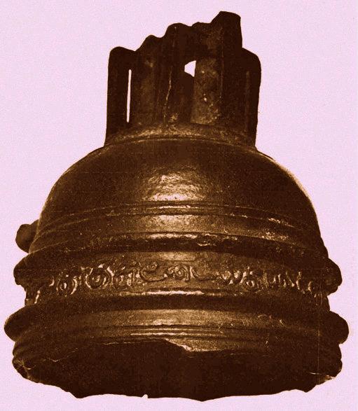
Artefacts like the Tamil bell and korotangi (stone bird), may provide clues of early Portuguese or Spanish exploration. The Tamil bell dates to around 500 years ago in India, where the Portuguese had bases.

Artefacts like the Tamil bell and korotangi (stone bird), may provide clues of early Portuguese or Spanish exploration. The Tamil bell dates to around 500 years ago in India, where the Portuguese had bases.
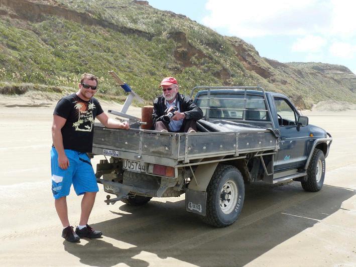
Winston Cowie and New Zealand film maker David Sims on the set of Cowie’s first film: ‘Mystery at Midge Bay: Discovering New Zealand’s earliest shipwreck.’
There is other buried treasure to find too, but you may not know of it. Why would you? I didn’t. We weren’t taught this interesting stuff at school, but with New Zealand history to be compulsory by 2022, as a society we are set to challenge existing paradigms. In seeking and finding the Spanish or Portuguese treasure that is the subject of this article, you will rewrite New Zealand history and conclusively prove that the first Europeans to discover and map New Zealand were not the Dutch and Tasman or the British and Cook, but the Portuguese or Spanish. It is not contested that eastern Polynesians perhaps from the Society of Cook Islands were the first to discover New Zealand. Kiwa, Hotu Matua, Maui and Kupe are part of our folklore. We are talking about the European wave of voyagers.
There has been a fair bit of smoke billowing around the Portuguese and Spanish subject for a while now and at the outset I wanted to take a different approach to researching the subject. Rather than say ‘this definitely happened’ as others have in the past, I wanted to present this historical mystery as a puzzle – presenting those antiquities that have been put forward as potential evidence of a discovery – from maps to shipwrecks to artefacts – as puzzle pieces, putting forward the arguments for and against their antiquity to the reader, and encouraging the reader to decide what part of the Conquistador Puzzle that piece forms. Each puzzle piece is presented to the reader on its own merit; I explain how I came across it, what or who is the source of the puzzle piece, and let you decide where it fits into the theoretical framework. If a puzzle piece doesn’t fit, it doesn’t fit; I have not tried to twist a puzzle piece to fit with the theory. Each puzzle piece is what it is and means what it means.
The puzzle pieces are fascinating – you may have heard of some of them – they include the likes of sixteenth-century maps of New Zealand and Australia; shipwrecks; oral folklore of white voyagers coming ashore wearing armour; their massacre by natives; cannon, helmets, a ship’s bell, ruins, stone crosses and other enigmatic artefacts found in the vicinity centuries later; red-haired and fair skinned Maori noted by the next wave of settlers to New Zealand; buried treasure; pohutukawa trees on the far side of the world; and lost caravels.
Let’s go back in time, 500 years back, to give you the background to this story.
The Fifteenth and sixteenth centuries were the golden age of Spanish and Portuguese exploration. Pope Alexander VI drew a line of demarcation down the middle of the Atlantic and said all lands to the east were available for Portuguese exploration (this included Africa and India), while all lands to the west were available for Spanish exploration – the Americas and Pacific. By the 1520s Magellan had gone around the world for the first time, and on the other side of the world in the Spice Islands, modern day Indonesia, both seafaring nations met, sailing in from opposite directions – the east and west.

The sixteenth century Dieppe maps include a land mass where modern day Australia is with the most detailed map, the Vallard Atlas including over 120 Portuguese place names which are descriptive of physical features. The late Helen Wallis (OBE) considered that on the balance of probabilities these maps were evidence of a Portuguese discovery of Australia. Wallis was president of the British and international cartographical societies.
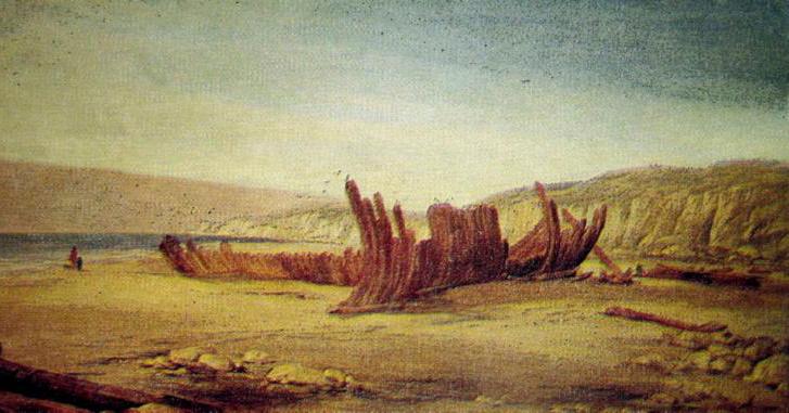
The Mahogany ship from Warrnambool, Victoria, Australia is another part of the Conquistador Puzzle.
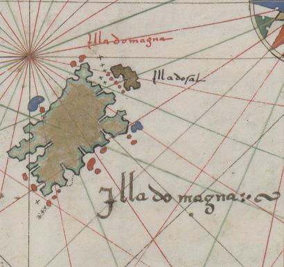
Is this island off the southern landmass in the sixteenth century maps the North Island of New Zealand, as mapped by the Portuguese 500 years ago?
It was at this time, so the chronicles say, that one Christopher Mendonca, a Portuguese captain, was given a secret mission by the Portuguese King, Manuel I, to find the great southern land of gold of Marco Polo fame. Through google, yes, modern day google – amazing what you can find there – I have managed to source an official record from the Lisbon Archives referencing this very expedition. I can even tell you that he had four ships in his fleet, the names of those ships and their captains.
Between 1520 and 1524 Mendonca was, we have reason to believe, following the instructions of his King and discovering the Great Southern Land that in later years it was claimed that nothing was known about – the Terra Australia Incognita. We know from a postal stone in Cape Town that Mendonca passed through there in May of 1524 and then there is radio silence in respect to his expedition. Funnily enough he ended up in our neck of the woods, not five hours drive from where I write this in Ormuz at the head of the Arabian Gulf.
I digress. How do we know that Mendonca likely went on the expedition? Because in the 1540s these beautiful world maps started appearing from Dieppe in France where the top cartographers and mapmakers congregated in the 1540s to 1560s; and where modern day Australia and New Zealand are located, there are landmasses that match part of what they look like today. Furthermore, there are over 120 Portuguese names on the most detailed map, the Vallard Atlas of 1547, place names that are descriptive of physical features and when the old Portuguese words are compared to what is there today, they match in some places – e.g. the Great Barrier Reef is located where it says ‘Costa Dangeroza’; there is a prawn fishery where it says prawns; and pumice deposits where it says pomezita, to name a few.
Why aren’t the maps viewed as a Portuguese discovery of Australia and New Zealand you might ask? What do the historians say? Funnily enough, some of the top historians of their day have looked at the maps as you are probably doing now, and have seen what you are probably seeing – a 500 year likeness in the coastlines, where Australia and New Zealand are located today.
Let’s start with how we know about the maps. Sir Joseph Banks, Captain Cook’s botanist, donated one of the maps to the British Library in 1790, 19 years after he voyaged on Cook’s 1769 expedition. This fact raises the question. Did Cook and Banks have these Portuguese charts when they ‘mapped’ New Zealand for the first time? The story goes that Banks purchased the map from Edward Harley, Earl of Oxford and one of the principal earls of the admiralty. The fact is: he gifted one to the British Library in 1790. Why did he have it?
When the map became available, in 1803, William Faden, who was the Royal Geographer to King George III and also the Chart Committee of the British Admiralty, he reassessed what was known of the world. On the chart of the Indian Ocean he wrote next to New Zealand: ‘New Zeeland (Discovered and named by Tasman 1642 but where eastern coast was known to the Portuguese, about the year 1550).’ We are talking about the Geographer to the King here – 250 years ago he was the global expert.

An early oral tradition account of a Spanish wreck and interaction with local Maori on the Pouto Peninsula.
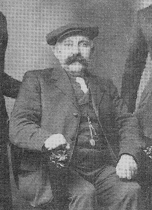
Gustav Schick. Good honest country people who told the story that was told to them by local Maori.

A young Trevor Schick. Good honest country people who told the story that was told to them by local Maori.
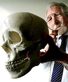
The Ruamahunga skull dates to between 1619-1689 and is of a woman who was around 45 years old. The Dutchman Abel Tasman who is said to have discovered New Zealand in 1642 is also said to not have landed and there were no women on his ship. Perhaps the skull is related to a Portuguese or Spanish voyage over a century earlier. It is currently an unexplained anomaly in New Zealand’s history.
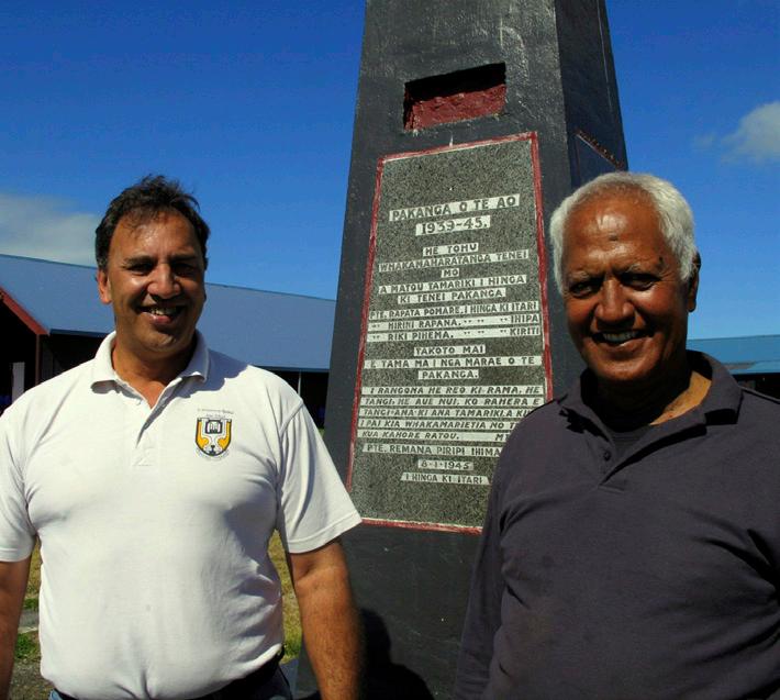
Local Maori from Waikaretu Marae Uncle Paki Pomare Kena and Tahu Kena had interesting early stories about Pouto and wrecks.
Similarly, in 1894, two of New Zealand’s most famous historians, Dr Thomas Hocken and Dr Robert McNab, theorised that further research might reveal the true story of the discovery of New Zealand: ‘Doubtless before Tasman, there were voyagers who had visited New Zealand. We are justified in thinking that they are buried in the old archives of Portugal and Spain’s journals… (that would prove this)!
In the 20th and 21st centuries, the likes of Australian Kenneth McIntyre and, more recently, Peter Trickett have had similar views.
Simple human deduction has not changed in 230 years. A person looked at a map over two centuries ago and, seeing the similarities in the coastline to a continent, coupled with the Portuguese names, drew a conclusion on it; voila. We can do the same today.
What does the most recent expert to review the maps say? We can respect their view. Surely. In the 1980s, this was Dr Helen Wallis (OBE), the top of her field and president of both the British and International cartographical and mapping societies. Her honours included an OBE in 1986. Her view after reviewing the maps was that “the balance of evidence was in favour of a Portuguese discovery.” Like Faden and Hocken and McNab, she was the top of her field.
Moving from theory to practicality – Matthew Flinders who was the second man to circumnavigate Australia in 1802-1803 – he did so with Banks’ donated Portuguese map in his hands. His view was that the coastline on the map was too close to the truth to have been made by conjecture alone – his conclusion – Australia appears to have been mapped pre Tasman.
Why have we ignored the advice of what these experts are saying? In all honesty, I think it comes down to the mood of society at the time and political sensitivities. If you look at the 1980s in New Zealand when Wallis made this conclusion, there were claims of all sorts of random discoverers of New Zealand from Phoenicians to Celts to all sorts. My view is the water got muddy for the Portuguese and Spanish and they were put in the same boat, excuse the pun, as the others. This was the time also that the Treaty of Waitangi land claims were in full swing – the mood was sensitive – anything out of the ordinary just didn’t gain traction – despite a Portuguese or Spanish discovery having no impact whatsoever on ahi kaa and tangata whenua. Different personalities were also dominating research within the New Zealand historical community on pre Tasman at this time – simply put – the personalities didn’t get on and rifts developed and this influenced the research that was done. Put all that together, and you have the perfect Spanish and Portuguese theory fire extinguisher.
But… what about that buried treasure. It’s 2020. Nearly 2021. History will soon be compulsory.
I’ll tell you what I found. Then it’s your turn. Get fired up.
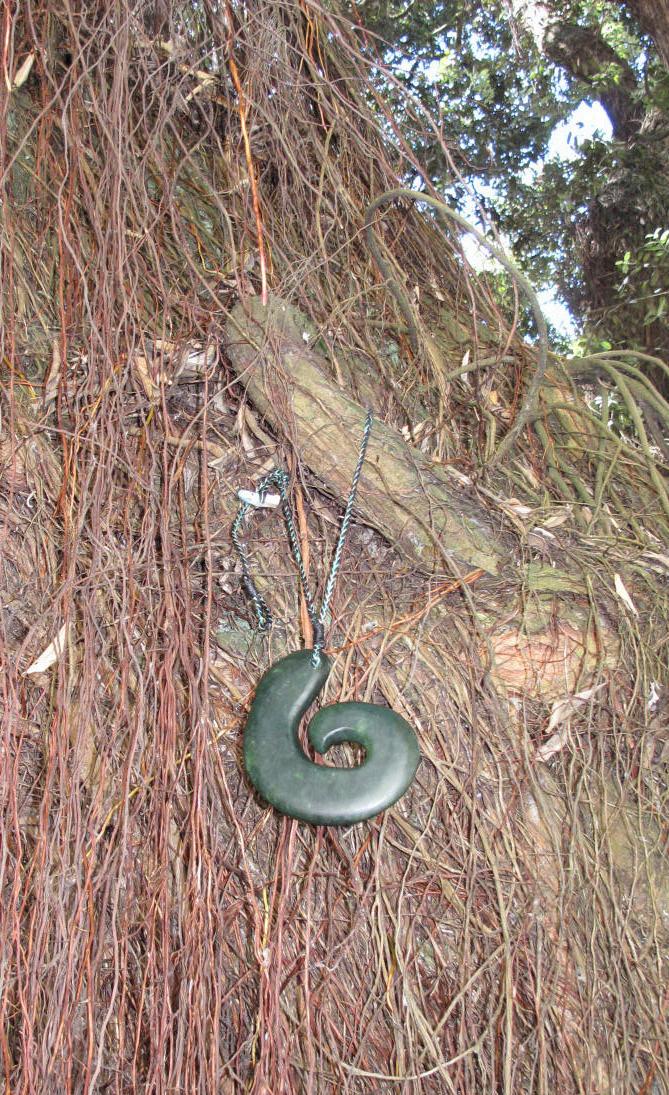
A large speciman of the New Zealand pohutukawa tree, endemic to New Zealand, is found in the coastal city of La Coruna where many Spanish voyages departed from including the Loaisa expedition of 1525. No one knows how old the tree is – it may hold a missing piece to the discovery puzzle. Cowie and the late Maori carver Kerry Strongman gifted the people of La Coruna this greenstone treasure to be worn by the tree as a lasting symbol of friendship between the two countries.
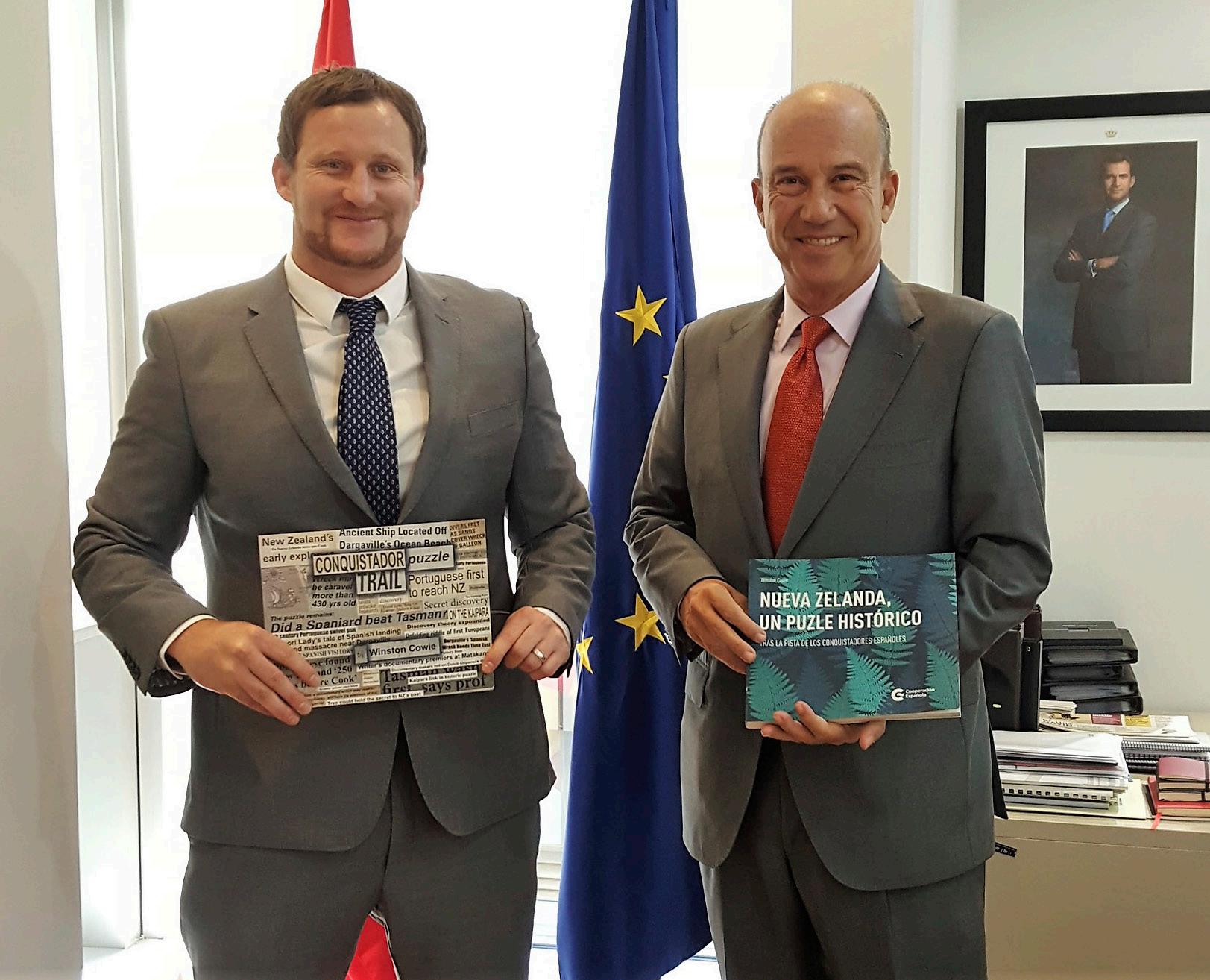
The Ambassador of Spain to the United Arab Emirates, Jose Eugene Salarich and Winston Cowie holding both copies of Cowie’s book – the Conquistador Puzzle Trail (English version) and the Spanish version which was translated by AECID, the Spanish Foreign Office, with the support of the Embassy of Spain to New Zealand.
I headed to one of the most isolated parts of New Zealand, Northland's rugged Pouto Peninsula where the smoke from these Spanish and Portuguese stories was coming from, with the view of speaking to the elderly people that lived there and finding out more. With David Sims, former New Zealand National Film Unit, we captured a generation of oral tradition on camera, interviewing elderly Maori and Pakeha, many of whom have passed on now, may peace be upon them.
Three stories stand out. This is your treasure hunt.
In the 1890s Gustav Shick, one of the first European settlers to the area, was told a story by an elderly red-haired Maori woman that was living on his farm. She told him that many, many years before, a ship had been wrecked and men with armour had come ashore. The local Maori had killed most of them, allowing some to live, and she considered herself to be a descendent of one of them, given her red hair. She said they had a chest of treasure that they buried in a cave on the peninsula. This story is corroborated by old Jim and Tom Pomare of Waikaretu Marae One of them was going fishing one night out towards the Pouto lighthouse, and he came across skeletons and armour lying in the sand. He picked up a helmet which had a skull inside it, and buried the helmet nearby. He recited the story to the local police constable Corbett, who we interviewed in detail. That is two different and independent accounts of the same story – both talking about physical artefacts that exist. Get your metal detectors ready. It is a long beach.
Back on the Schick farm, Trevor Schick, Gutstav Shick’s grandson, went into one of the caves on the peninsula and came across a helmet that was described as Spanish or Portuguese. He took it for the morning talk on the mat to Te Kopuru School in the 1930s. We interviewed one of his farming neighbours, the elderly Louis Kneebone who has since passed away. Louis was at school with Trevor Schick and she remembered the day he brought the helmet to school. She said he got in trouble and was told to put the helmet back where he found it.
That is a number of different accounts by credible people – good honest country people – of physical artefacts that have been found and reburied in the shifting sands or caves of the peninsula. This is the same coast where a shipwreck resembling a caravel was also seen by two local farmers in the 1980s although it was covered soon after… it’s likely still there… waiting for its secrets to be told.
Those helmets; those skeletons with armour lying on the beach; that caravel and that treasure, if found, will change New Zealand’s discovery history. The Pouto Peninsula calls. It’s time to find New Zealand’s buried Spanish and Portuguese treasure – in both the physical and metaphorical sense. It’s there somewhere. And it’s time to find it and put to rest those 500 year old ghosts.
Who is keen for a treasure hunt? The Portuguese and Spanish historical treasure in Pouto, Northland; the gold of the Niagara wreck in Northland; and that of the General Grant wreck down in the Auckland Islands, in the sub-Antarctic windswept seas at the bottom of New Zealand.
Elal Amaam. Forwards
WINSTON COWIE
Winston Cowie is an award winning environmental policy manager and New Zealand author, based in Abu Dhabi where he works as the Marine Policy Manager for the Environment Agency – Abu Dhabi. A fellow of the Royal Geographical Society, he has an interest in history having written the New Zealand Land Wars historical fiction series, and recently ‘Conquistador Puzzle Trail’ that proposes that the Portuguese and Spanish voyaged to Australia and New Zealand pre-Tasman.
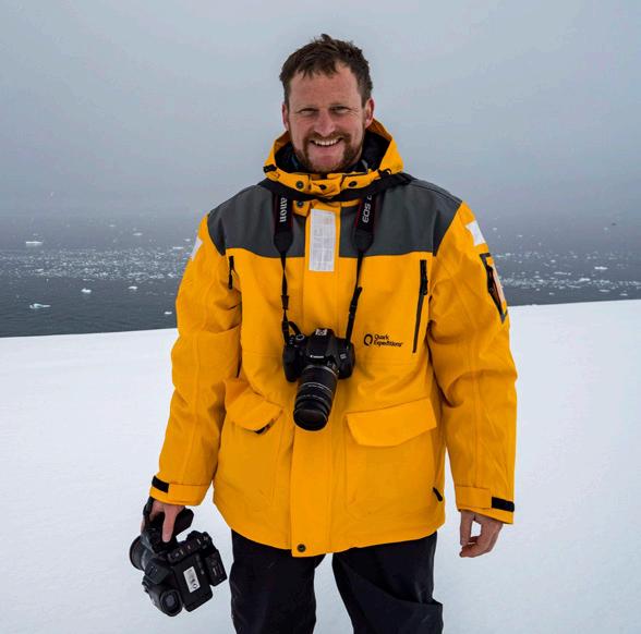
www.winstoncowie.com


