Urban Tears & Repairs 01
Re-Casting Austin’s Urban Corridors
UTSOA | Sem I | 2024
Advanced Urban Design Studio
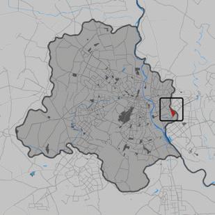
Location: Austin, Texas
Collaborators: Morphological Study- Lauren Miraldi, Design Proposal- Namratha Thrikutam, William McLean
Contribution: Conceptualization, design development, diagrams, plan oblique, site plan
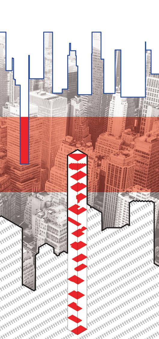
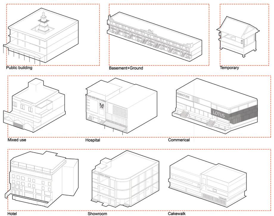
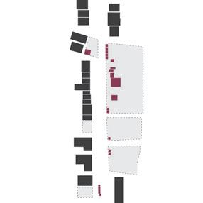
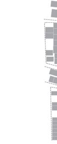
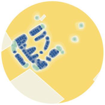
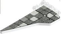
432 Park Avenue, precedent study 1, typological inventory
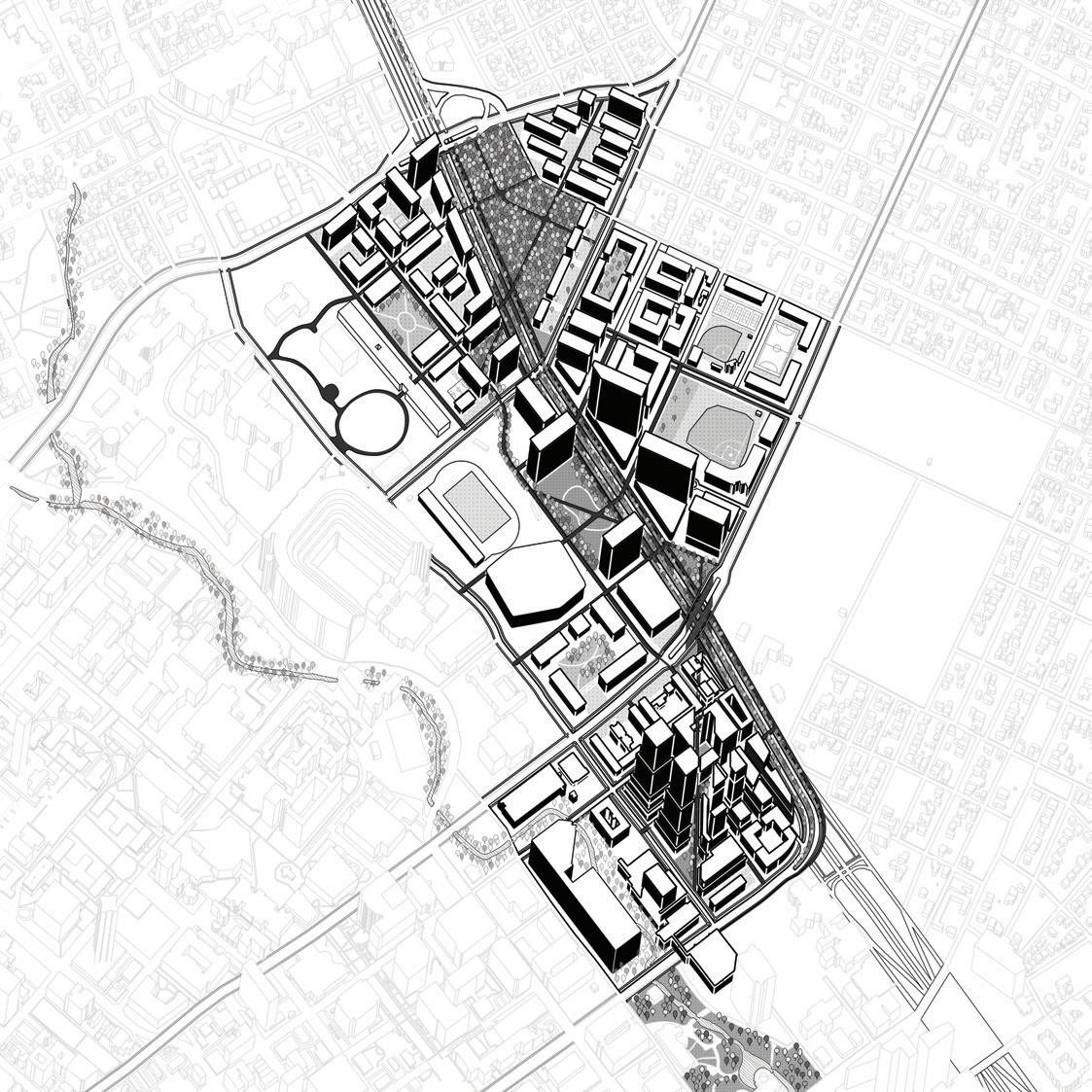
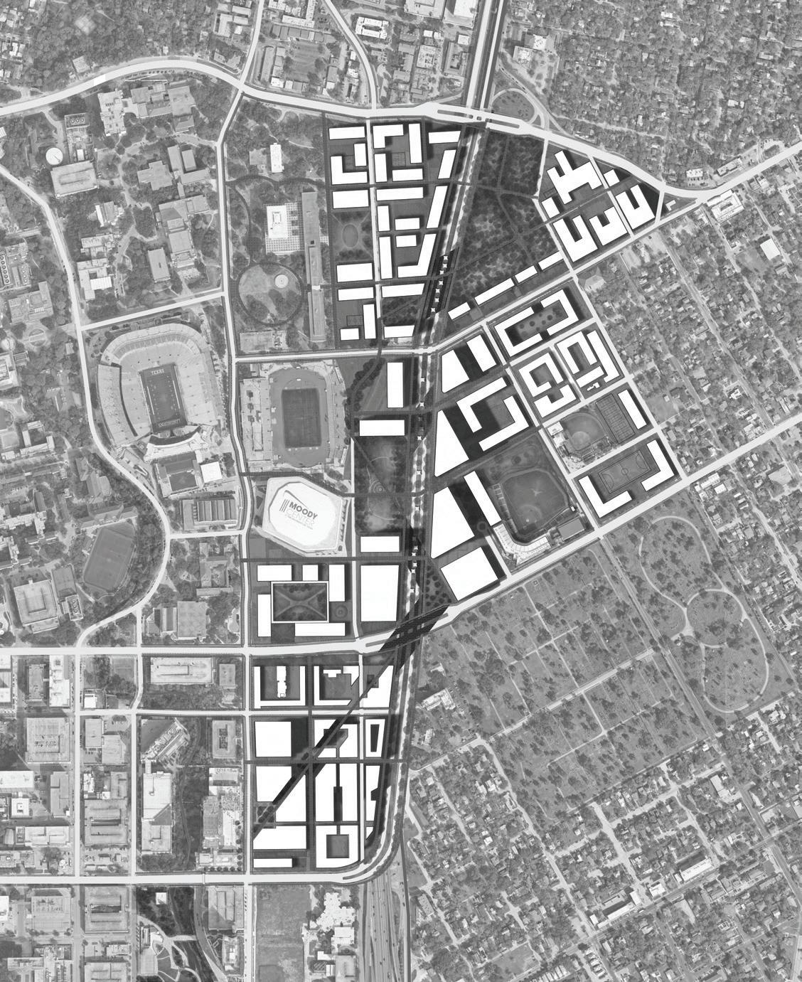
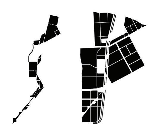
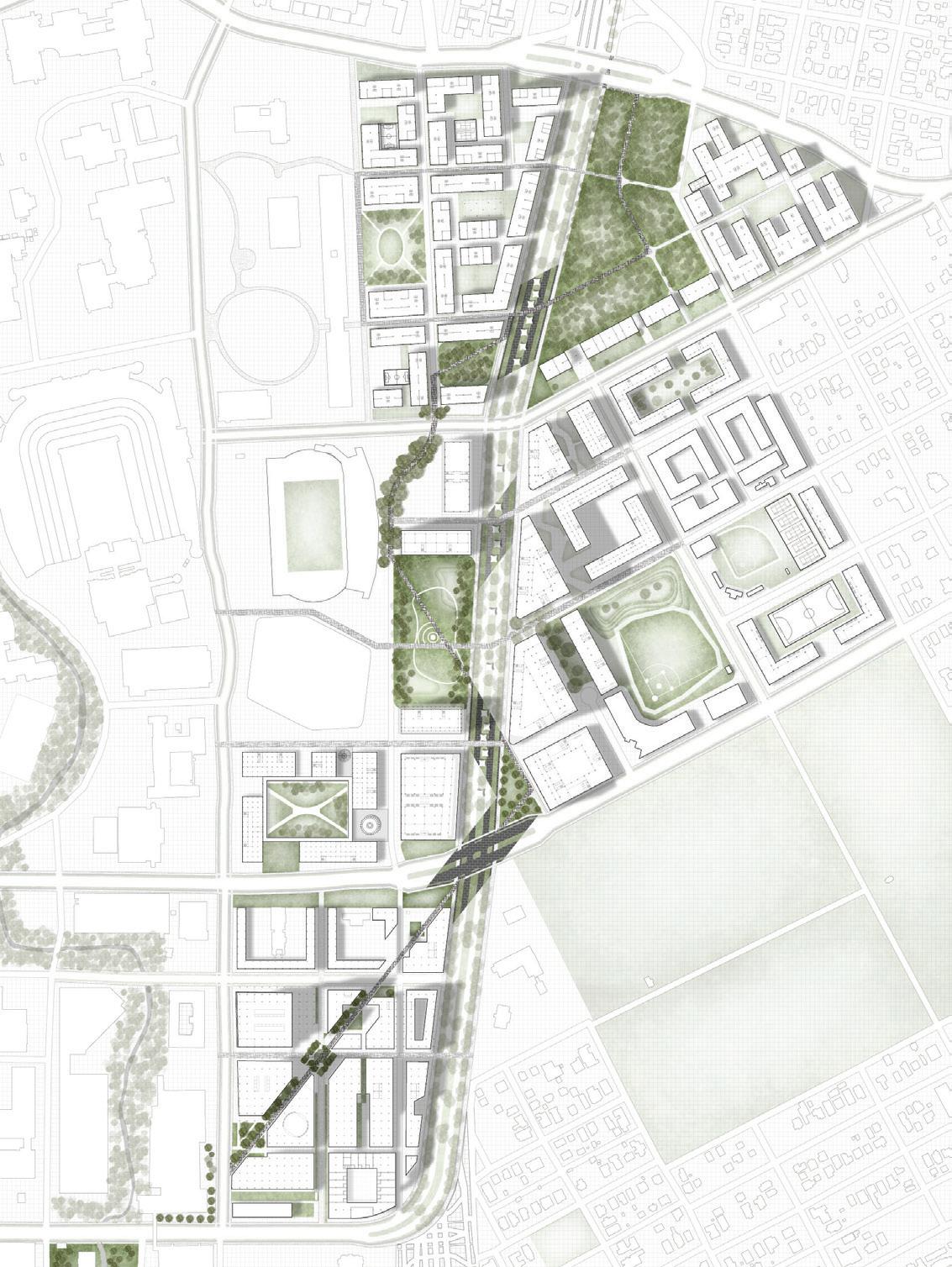
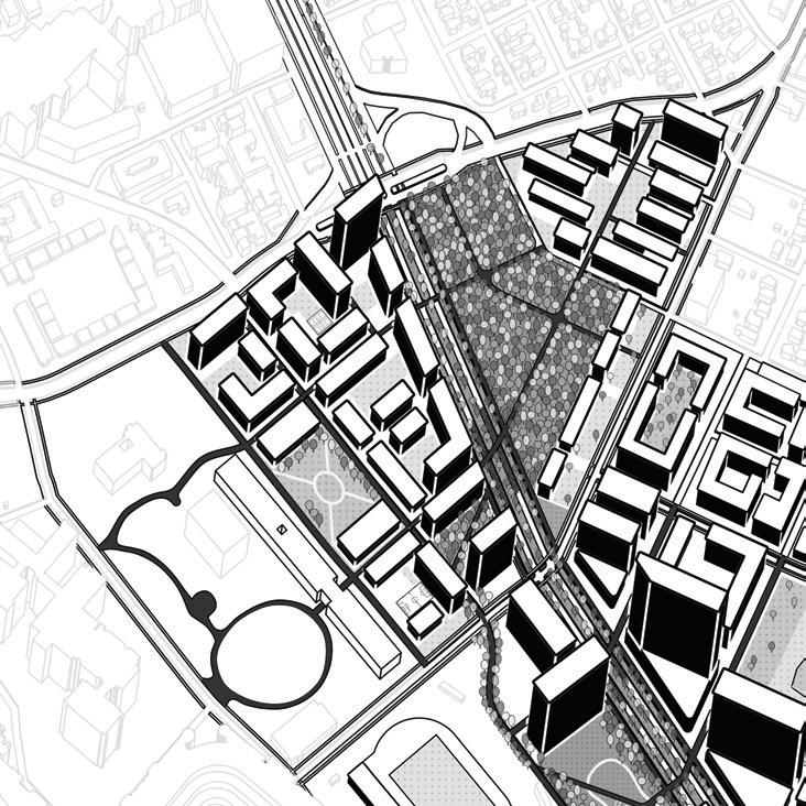
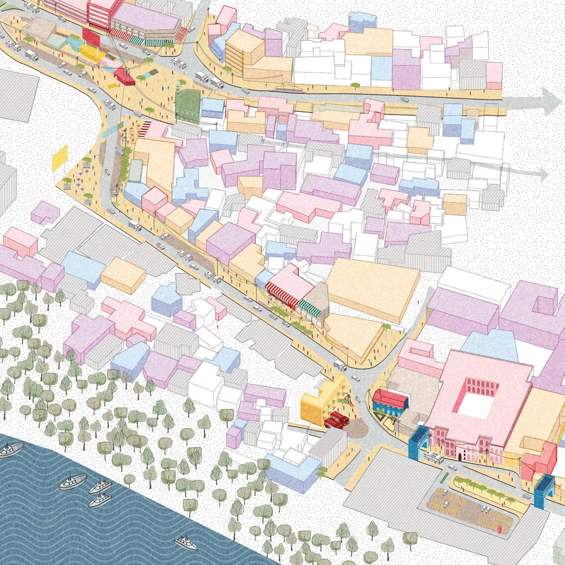
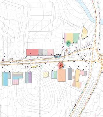
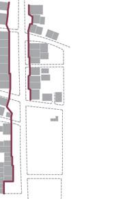
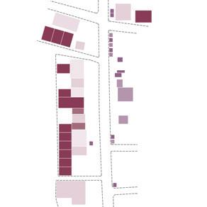
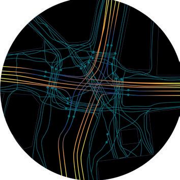
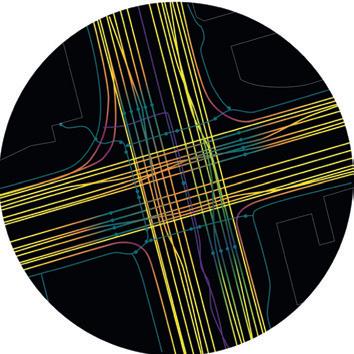
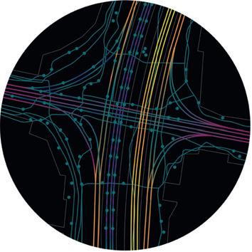
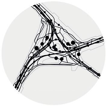
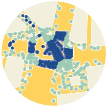
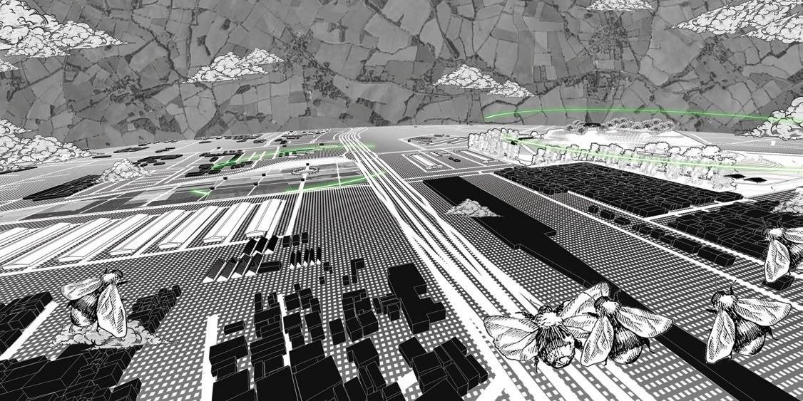
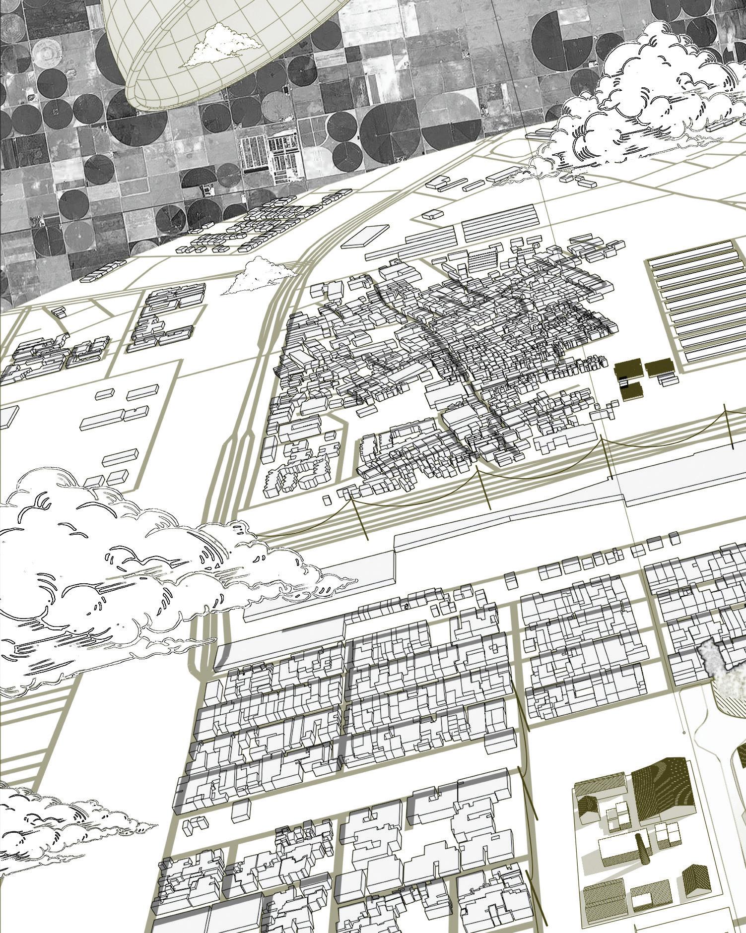
The studio served as a comprehensive platform for investigating new urban infrastructure and landscape strategies to reimagine Austin’s urban corridor. Structured into three key projectsa typological inventory of urban blocks, an analysis of Austin’s morphological formation, and a comprehensive urban corridor redesign.
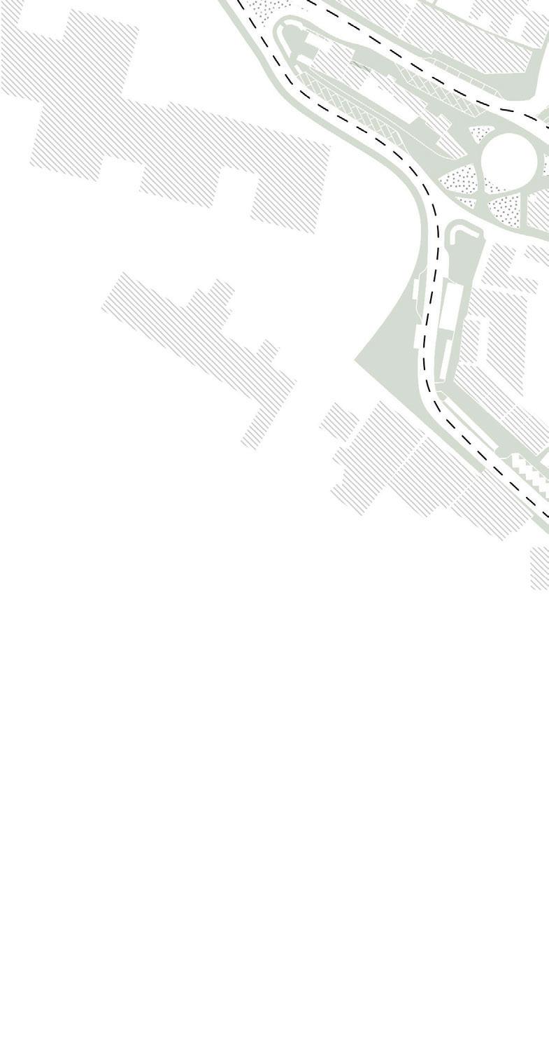
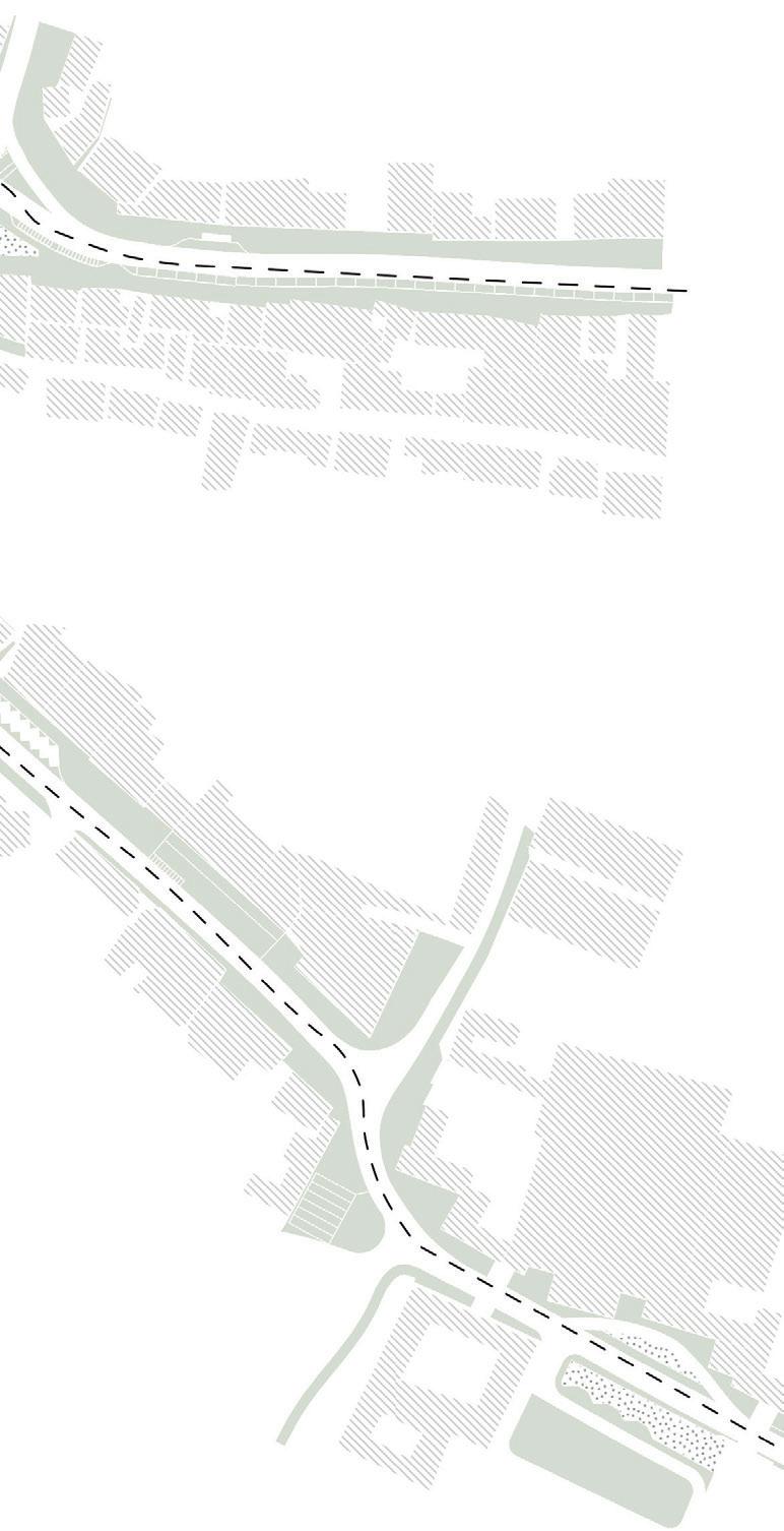
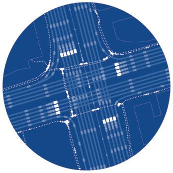
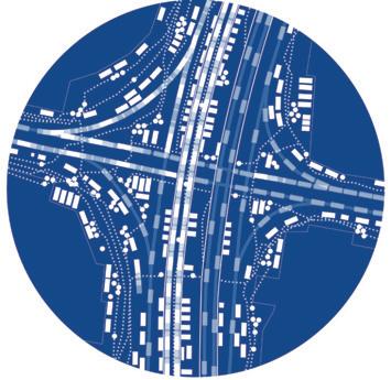
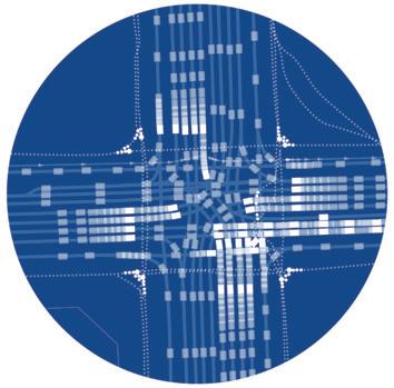
The background research examined the city’s morphologies across multiple scales, from the metropolitan area to blocklevel interventions. Through iterative design exercises, precedent studies, and speculative proposals, the project utilized Austin’s I-35/UT Cap site as a testing ground for innovative building typologies and sustainable urban frameworks, aiming to foster connectivity, diversity, and long-term urban resilience.
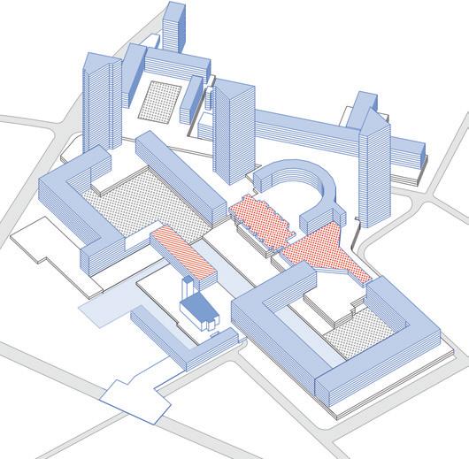
Circulation
Programmatic Components
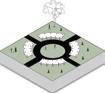
Barbican Estate, precedent study 2, typological inventory
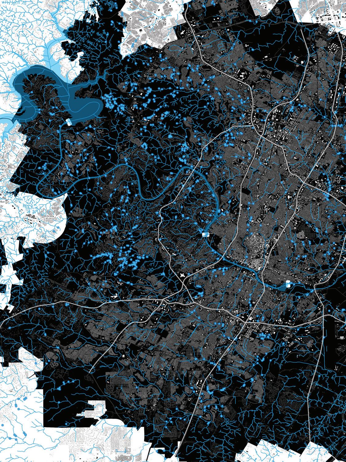
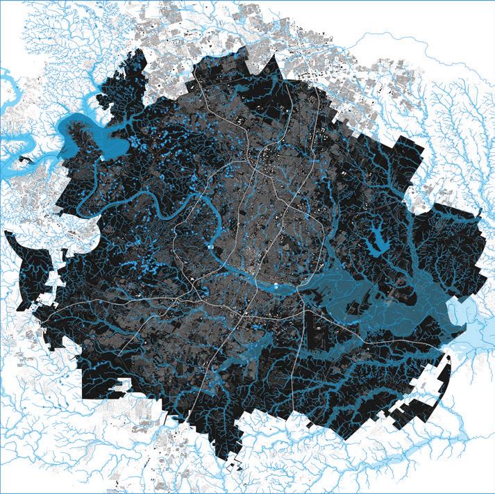
Hydrology
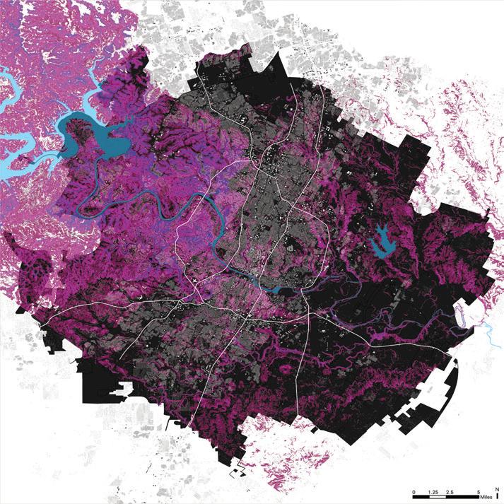
Metropolitan Scale
Morphological Study
Topography
Metropolitan Scale
Morphological Study
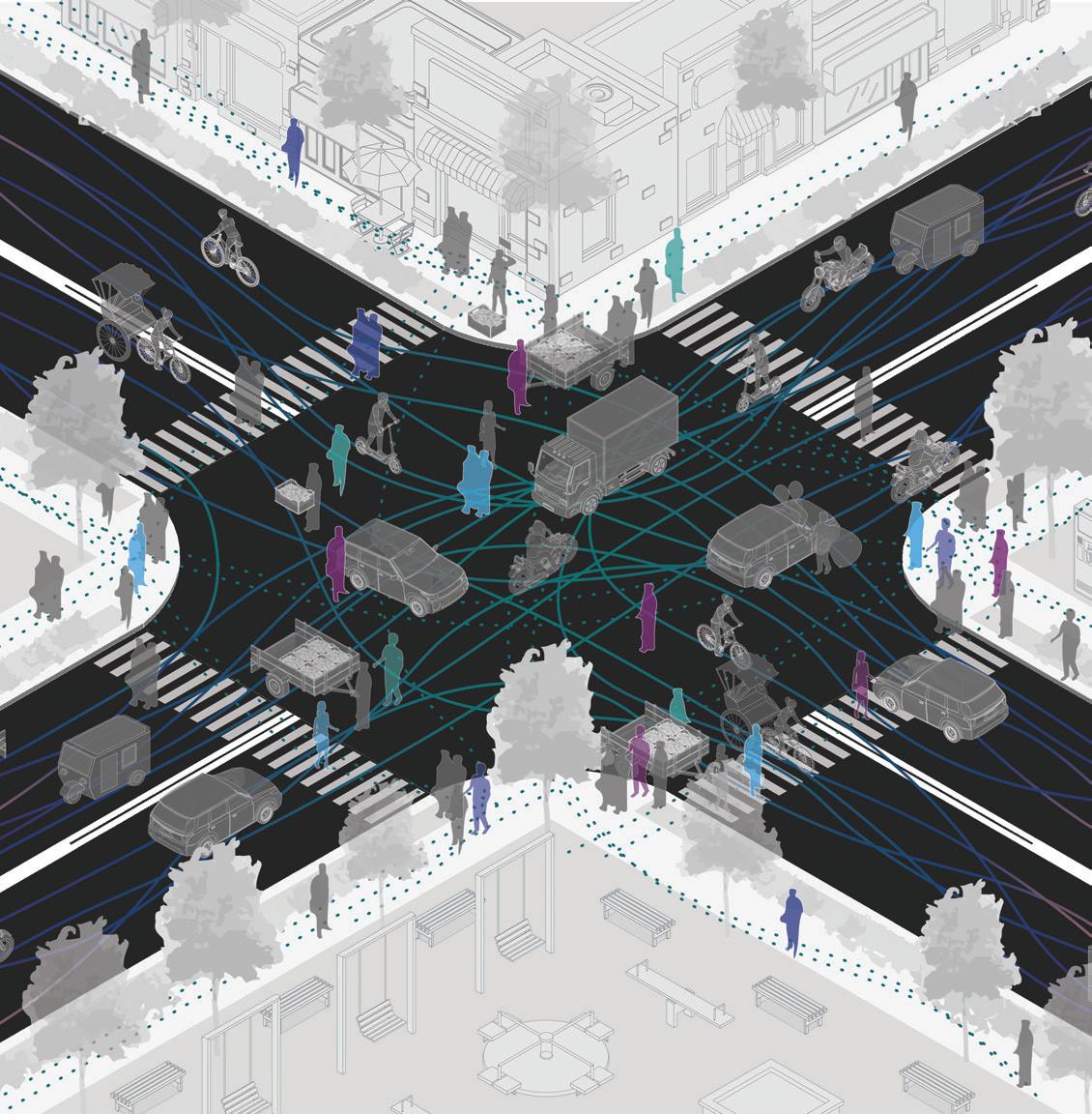
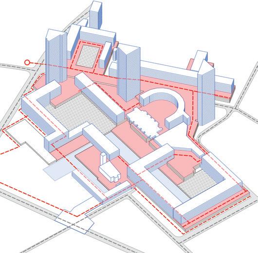
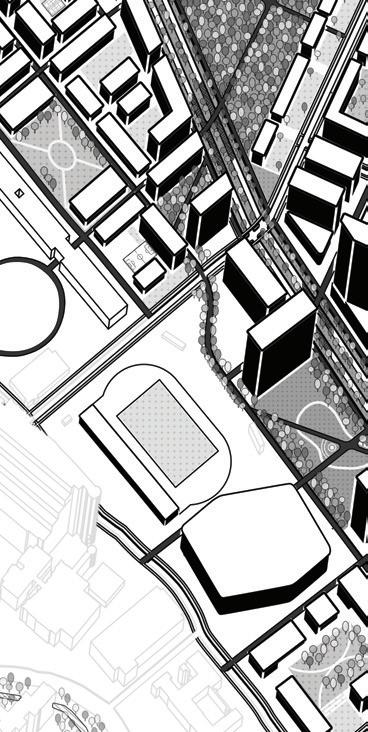
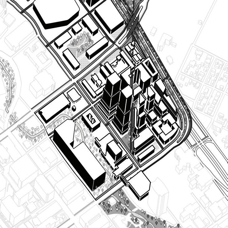
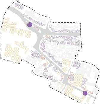
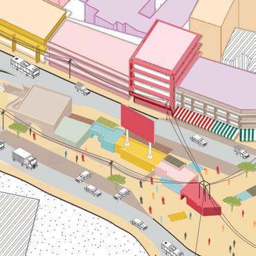
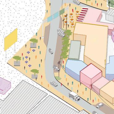
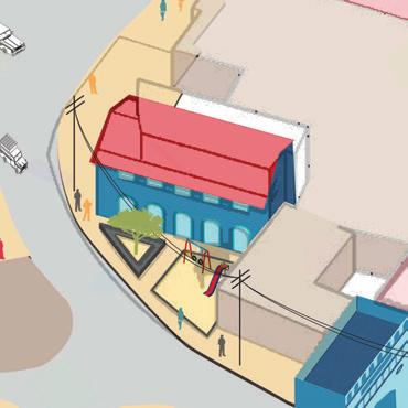
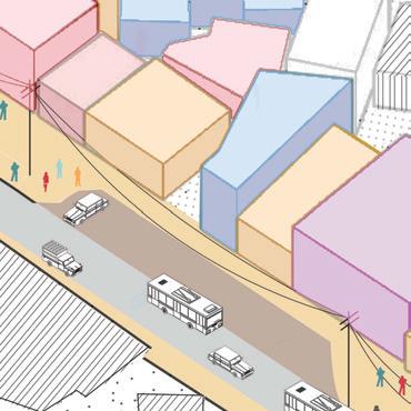
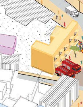
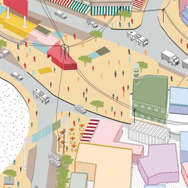
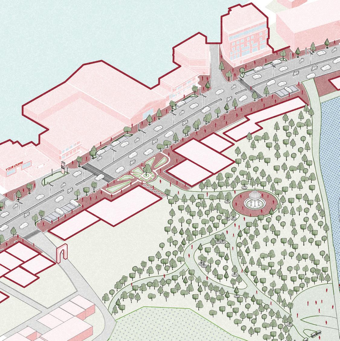
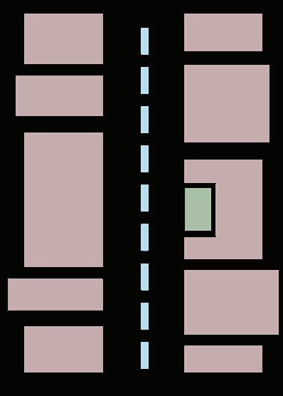
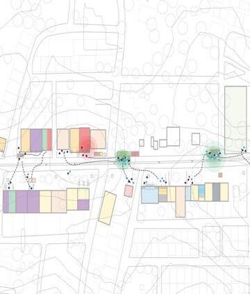
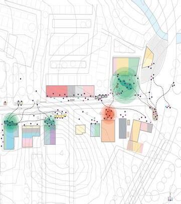
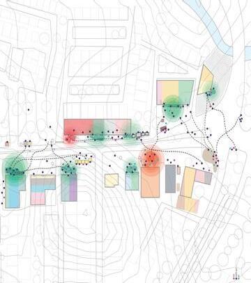
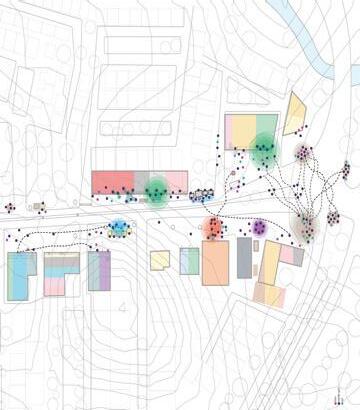
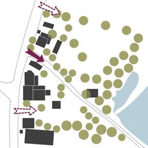
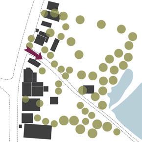
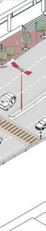
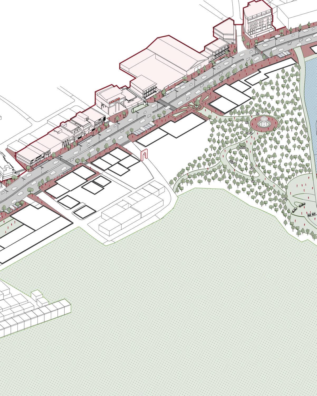
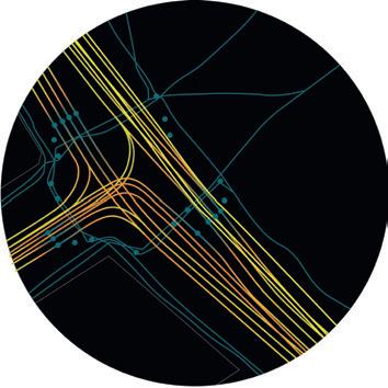
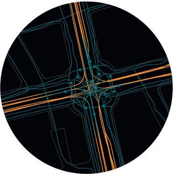
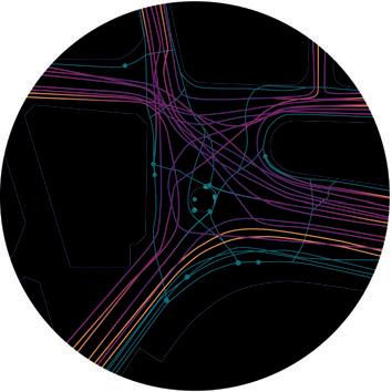
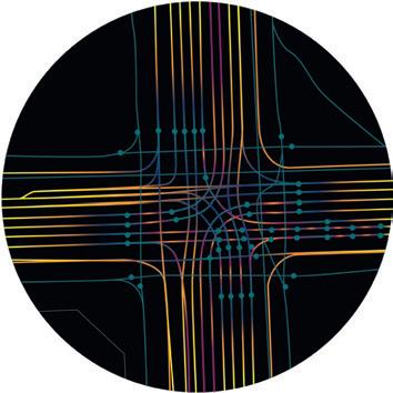
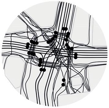
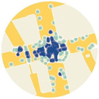
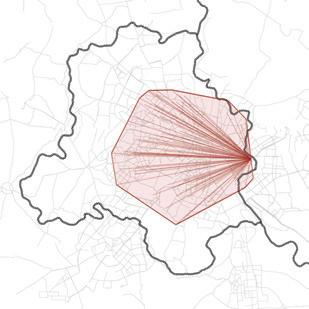
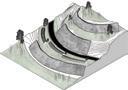
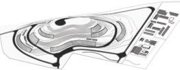
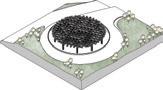
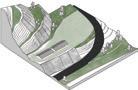
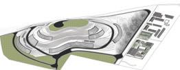
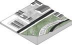
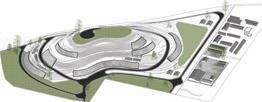
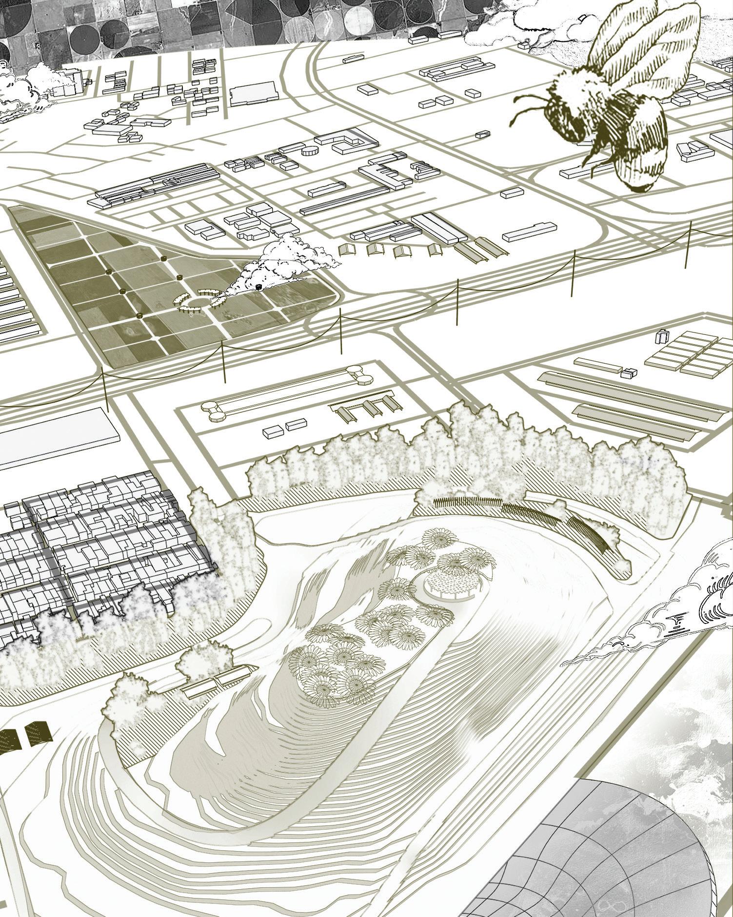
The proposal for the I-35 UT Cap features a multi-modal system with a boulevard and multi-scalar urban nodes facilitating various levels of social interaction. The nodes act as pause points connected by a network of trails and pedestrian paseos. The proposed east avenue trail is diverted through the site, creating a “stitch” pattern to blend the visual and social divide of I-35 and promote equal access on both sides.
The design integrates the cap with the city ecologically and programmatically, with buildings and open spaces interacting symbiotically. The strategic building layout optimizes urban edges and enhances adjacent open spaces.
Diverting the proposed East Avenue trail onto the site to connect UT to East Austin and Downtown Austin and tap into the ecological potential of the region
Creating new centralities within the campus that enhance internal connectivity while linking it to East Austin and the broader city network
Equal open spaces and urban nodes on both sides of the boulevard ensure equitable social opportunities for meaningful interactions
Prioritizing urban nodes and connections while developing blocks around the urban system
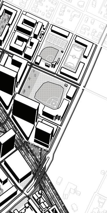
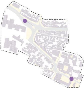
College, Residential District
Athletics, Arts and Entertainment District
Medical District
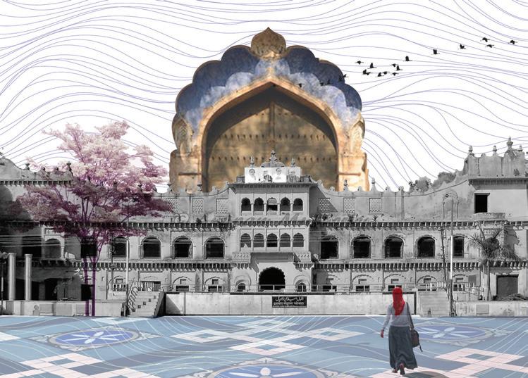
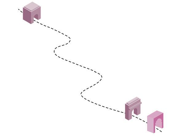
Between 2 Gates
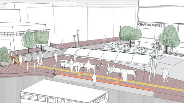
Revitalizing Sultania Road for safer streetscapes
NASA India | DesTech Trophy | 2021 Competition Entry
Location: Bhopal, India
Collaborators: Sukrit Marwaha, Saavi Natekar, Abhinav Ramesan
Contribution: Conducted local site visits, on-site problem identification, illustrations and graphic visualization
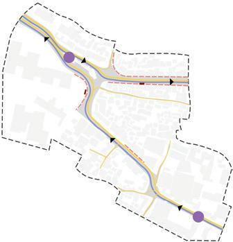
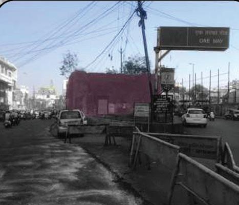
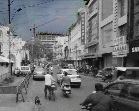
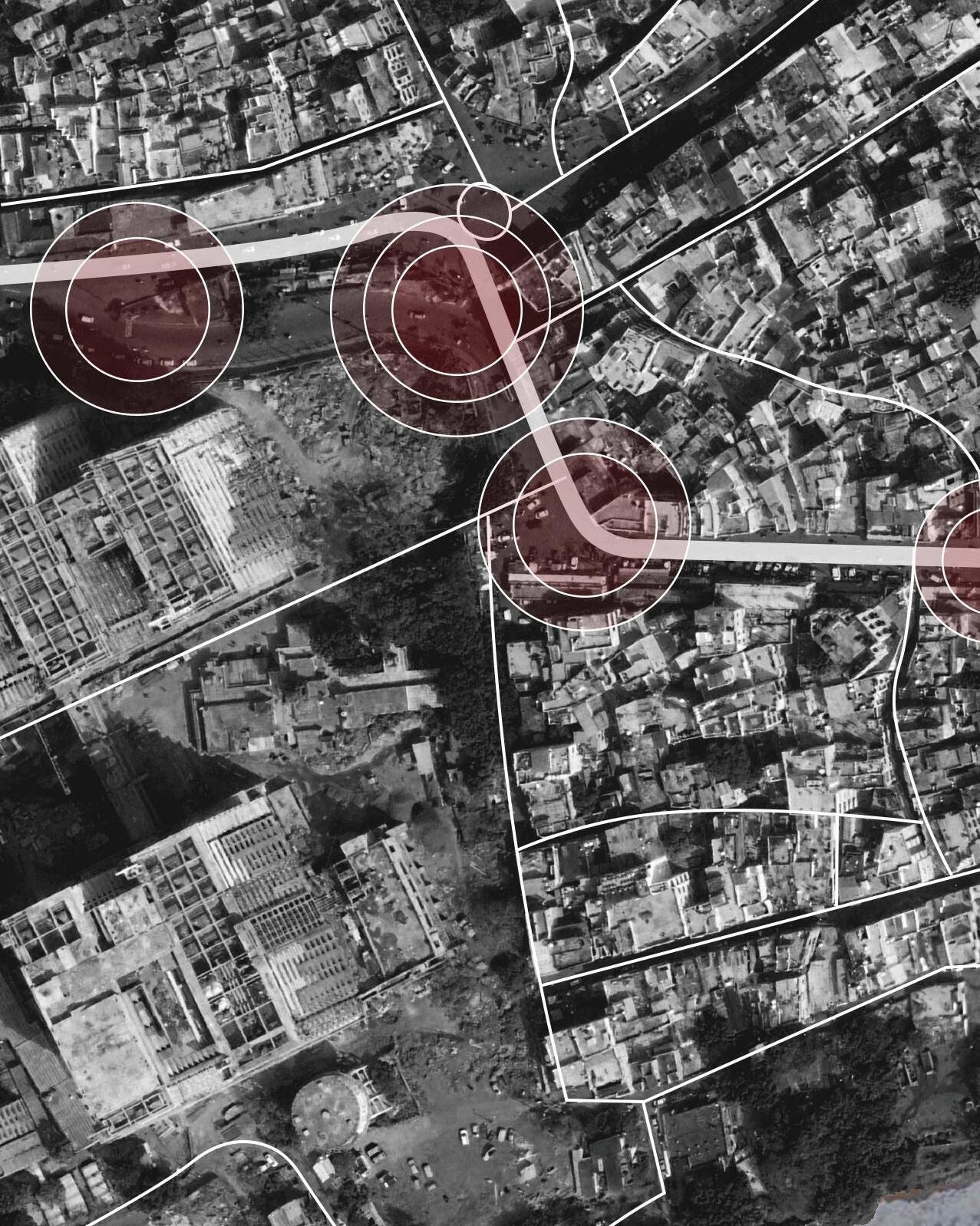
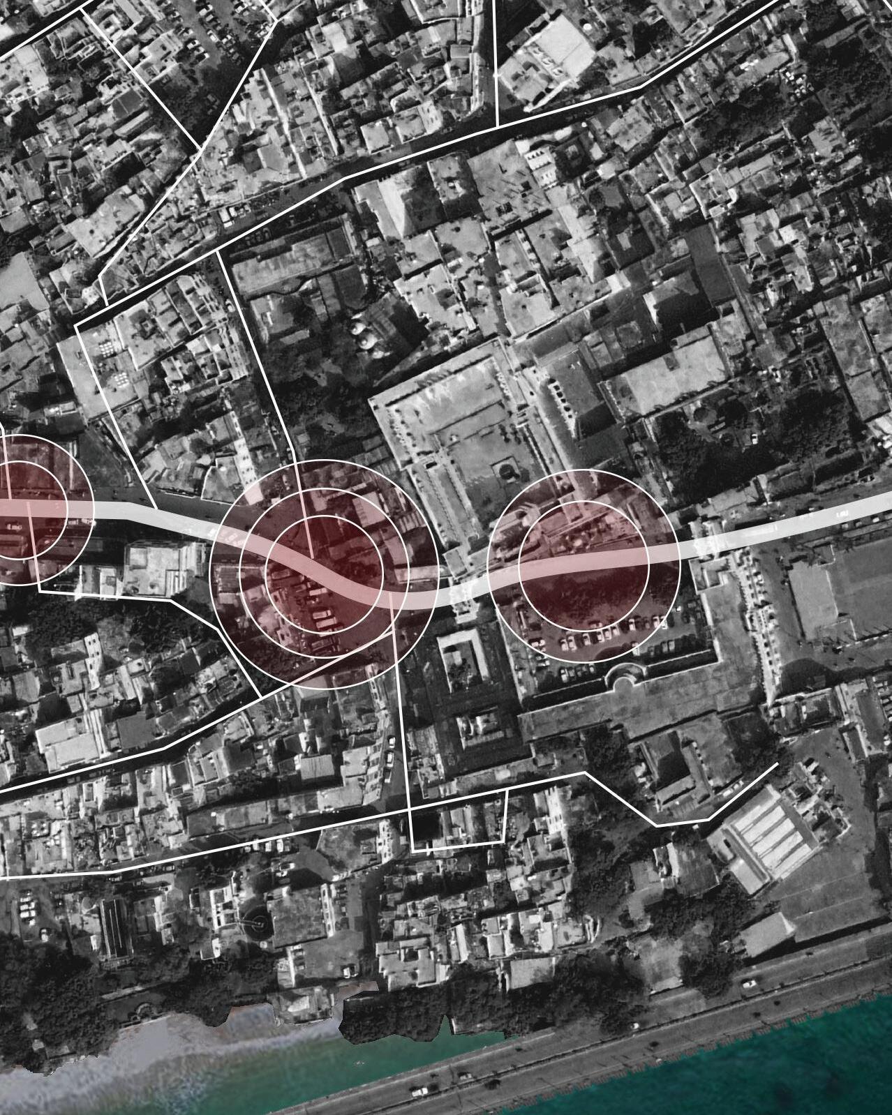
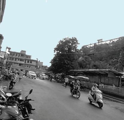
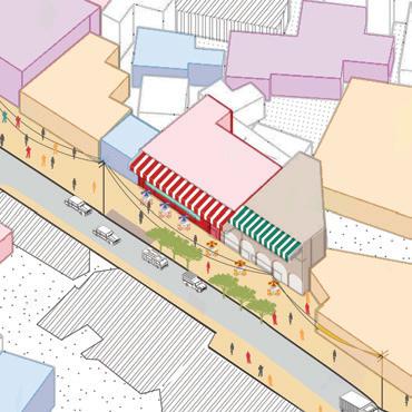
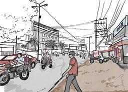
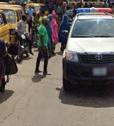
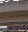
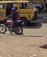
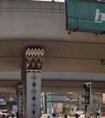
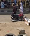
Sultania Road has always been a major route for vehicular circulation in the old city. On our site, the road runs from the ruins of Imami Gate in the northwest to Sadar Manzil gate in the southeast.
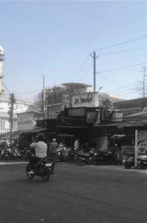
The site hosts a variety of medical establishments : Pharmaceuticals, diagnostics and blood banks owing to its proximity with the main city hospital. Additionally, there are automobile repair shops around the relics of Imami gate, several eateries too have opened along the stretch that serve customers and commuters alike. In response to high traffic, the narrow road was declared a one-way and an extension of the road proposed at its end in the Imami Gate area.
Despite its historical significance and crucial role in the city’s transportation network, this section of the road is in a state of neglect and is susceptible to accidents. Additionally, the absence of open spaces compels pedestrians to yield to vehicular traffic, forcing them to the peripheries of the road.
Imami Gate
Sadar Manzil
-traffic island formed due to new road, adds to congestion -barricades installed to enforce one-way rule
- spillover from repair shops, street disrupted - imami gate ruins, unused neglected space
-unorganised roadside parking -inconsistent roadwidth causes bottlenecks
- huge spill over - no footpaths
over from raju tea stall
or organised parking
- street hawkers spill on to the street -narrow gate causing further bottlenecks
-inconsistent road widths causing bottlenecks -fire station requires space for parking its vehicles
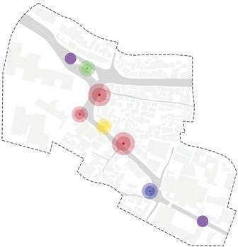
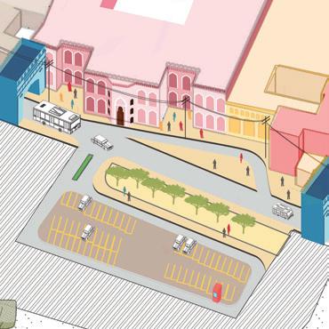
Imami gate activated as a public space and community area with parks and other recreational activities
Right-sizing roads has freed up significant space, transforming the area into a plaza for social activities
Hamidiya Girls School now has an open ground for students, thanks to rightsizing that freed up a nearby triangular patch of land
Parking spaces have been provided in front of retail shops for ease of access to prevent
The fire station also benefits by extra much-needed parking spaces
Spillover spaces in areas of large public gatherings, such as the fruit juice stalls next to the mosque at Imami Gate area
In the narrow road stretch, reducing parking creates extra space, preventing pedestrian congestion and traffic issues
This space is solely reserved for parking, while the remaining area can serve as a green lung for the locality, providing much-needed greenery
Raju Tea Stall
Moti Mahal
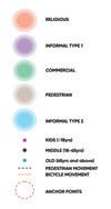
Pause
Reconfiguring the street fabric to enhance accessibility
SPA, Bhopal | IX Sem | 2023
Urban Design Studio
Location: Bhopal, India
Collaborators: Nancy Sahu, Palak Gupta, Divisha Vadehra, Aditya Vijay, Amarnath PS, Ramiz Akhtar, Navyaa Taneja
Contribution: Site study, synthesized inference matrix, concept development, modelling, illustrations and graphic visualization
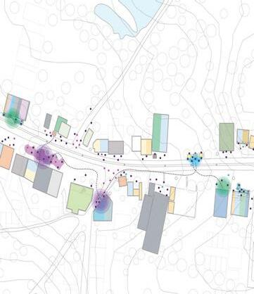
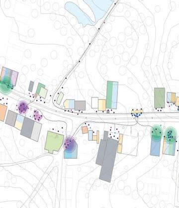
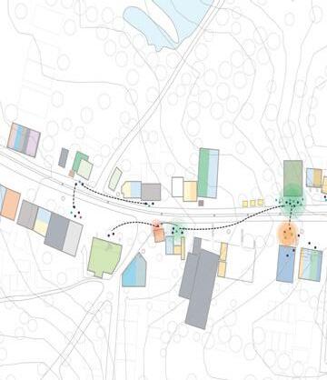
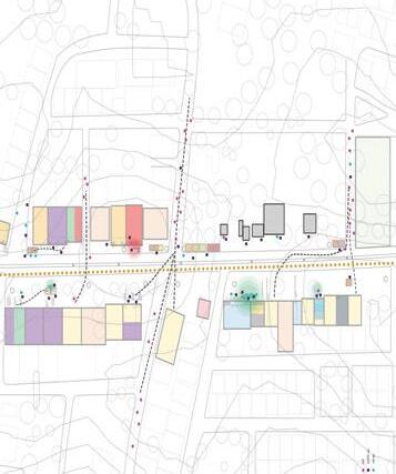
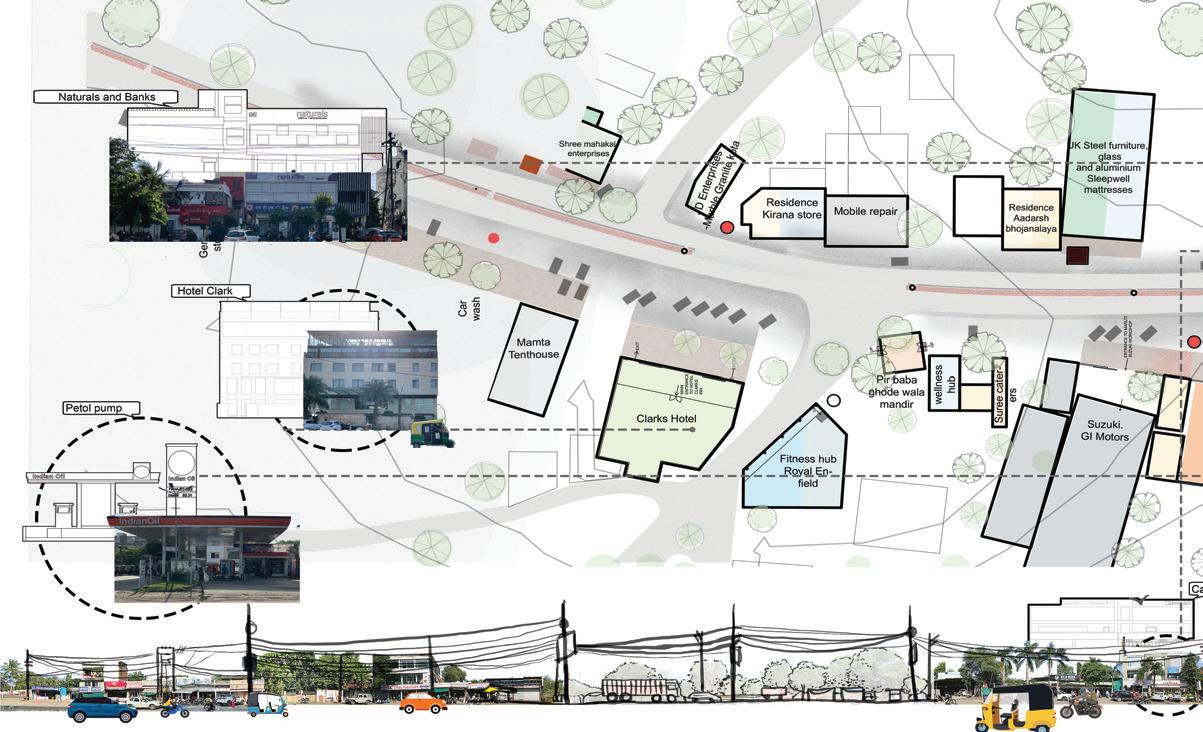
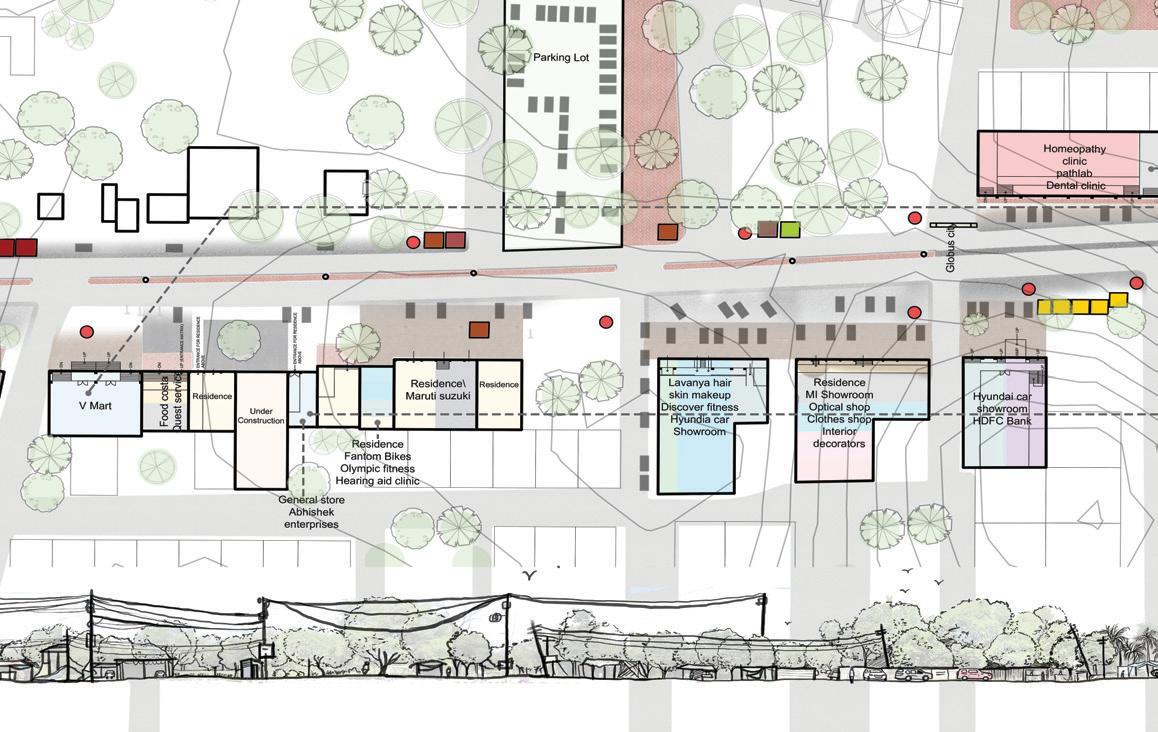
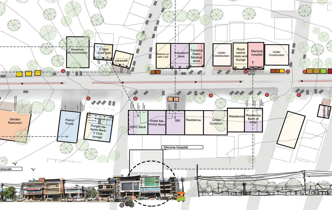
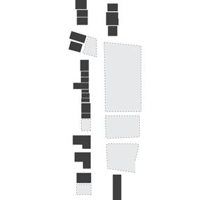
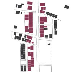
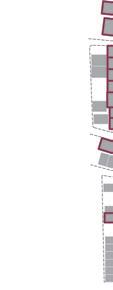
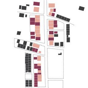
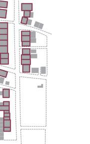
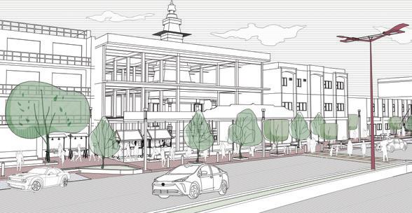
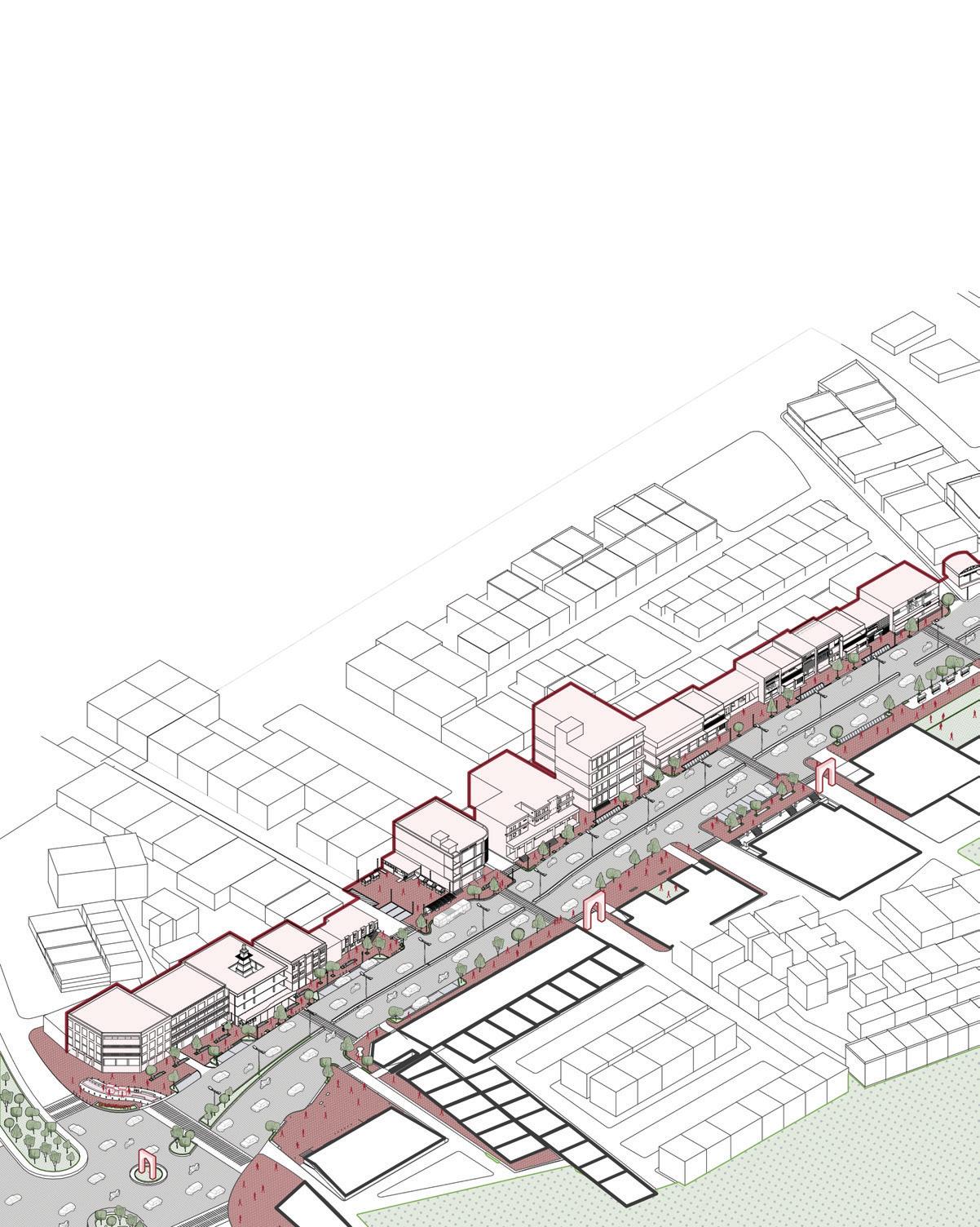
Kolar Road, a prime neighborhood in South Bhopal, derives its name from the Kolar Dam.The development of commercial infrastructure is primarily concentrated along Kolar Road.Shahpura Lake, a treatment reservoir collecting water draining from surrounding areas, is a part of the site. Initially less populated, the area has thrived in the past 1015 years, attracting a surge in residents due to affordable living. Residential buildings have transformed into
mixed-use typologies, capitalizing on the lucrative frontage along Kolar Road. Shops, restaurants, boutiques, and convenience stores have emerged, along with hospitals, upscale showrooms, and car dealerships. In recent years, authorities have proposed a 6-lane expressway, set to enhance the site’s character as a bustling commercial
Due to the disputed ownership status, a lot of privately owned empty plots are present on the eastern stretch of the site.
Commercial spaces have been developed in residential areas rather than in dedicated commercial spaces.
The development inconsistent with and permissions.
Due to their unobstructed frontage, these plots act as an oasis for informal activities to thrive.
The site has potential to be commercially rich and is undergoing urban transformation owing to its location.
This results in an as each building character and therefore cohesive streetscape
Develop open spaces with temporary interventions while focusing on exisitng informal activities.
Develop spaces in a way that it complements the urban transformation of this stretch.
Some sense of - sensory or circulatory, character of the site patches and segments.
during early stages was respect to proper bylaws There is no uniform front
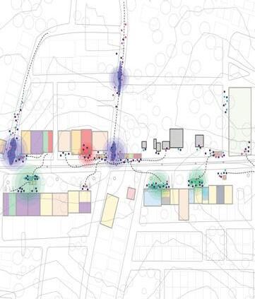
Despite the proximity of the site with respect to the shahpura lake, there is a lack of visual transparency in terms of viewpoints.
experiential discontinuity building develops an isolated therefore takes away from a streetscape experience.
With the ongoing development, the fabric further becomes visually impenetrable.
There are mainly four types of users that use this stretch
1) People from neighbouring residential colonies.
2) Users from other parts of the city visiting commercial establishments.
3) workers and labourers working at various informal as well as formal establishments.
4) passer bys using the street as a means of circulation.
continuity or uniformity circulatory, embrace the site and develop the site in segments.
The stretch can provide better access to the lake to aid the utilisation of the lake edge as a public space. Contours can be utilized to aid visibility and establish viewpoints.
There is versatility in terms of typology as each user group has a separate typology that caters to them.
User oriented approach that provides a holistic solution for all users involved and doesn’t isolate one from the other. An approach that also bridges the gap between the two.
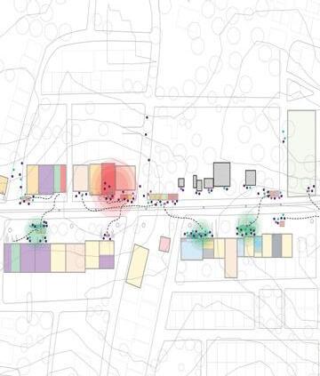
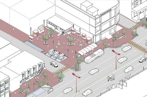
traffic island developed to decongest the vehicular traffic at the junction
pedestrian walkways, tree pits and designated parking
Gates at colony entrances replaced and repeated to establish a serial connection
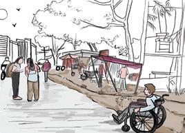
View showing vending zones and stalls outside the temple
View of modified bus stop equipped with tactile tiles and wheelchair bays View showing vending zone, public toilets and bus stop on the opposite
spaces
View showing proposed park plaza that provides access to the lakefront from the stretch
Pocket park with seating and vending zones recessed in between buildings
vending zones that cater to users visiting manoria hospital
easy vehicular access for the petrol pump
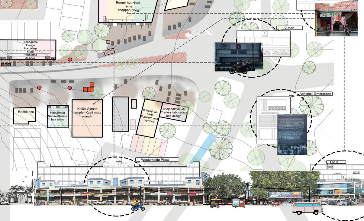
Mix Urbains
Book authored by Stephane Lemoine
UG Internship | UG VIII Sem | 2023 Agence AP5
Location: Paris, France
Published by: Actar Publishers
Contribution: Acquired raw data for research on crossroads, studied the data for 8 different locations to maintain records of vehicle frequency and speed, organized data for mapping, graphic visualization.
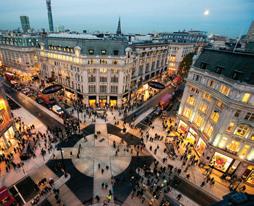
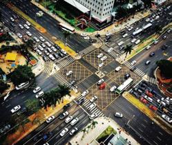
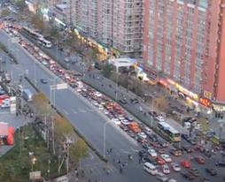
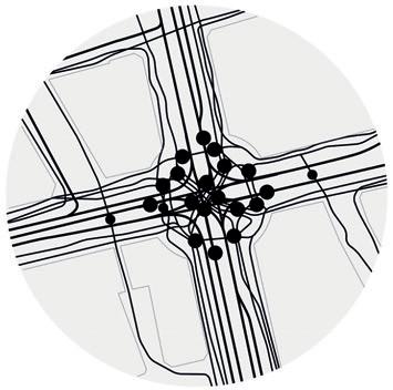
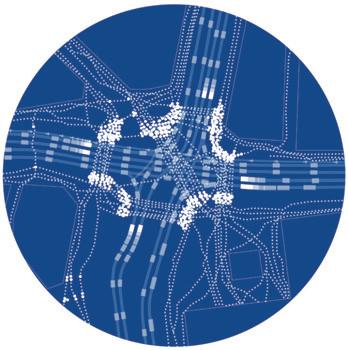
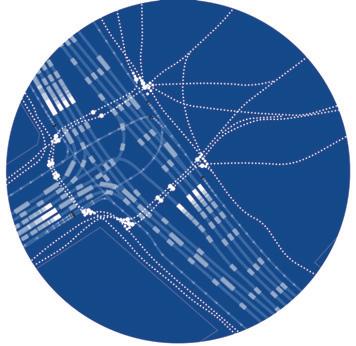
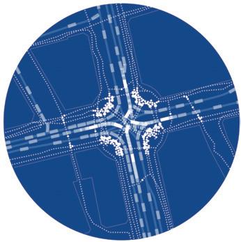
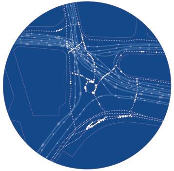
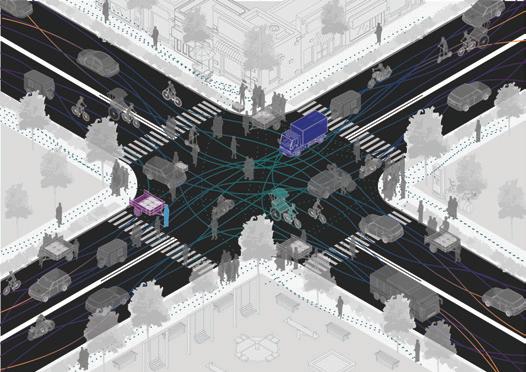
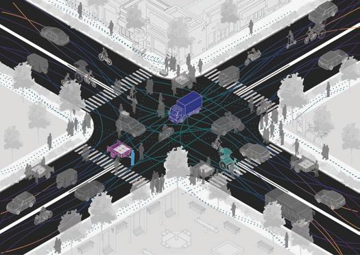
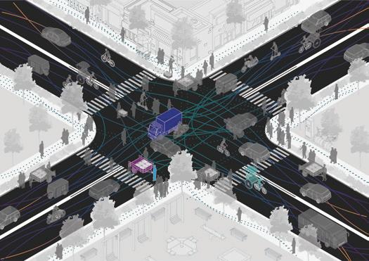
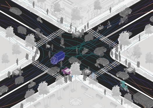
This study concentrates on the activities and dynamics observed in urban intersections across eight major global metropolises. The examination delves into the movements of all modes of transportation and their interactions over a 3-minute period. The varied and intricate nature of these intersections provides the
necessary variable freedom of movement and friction essential for urban life, contributing to the allure of cities in accordance with their cultural distinctiveness.
Sao Paulo Lagos
London
Copenhagen
New Delhi
Beijing
Hanoi
Tokyo
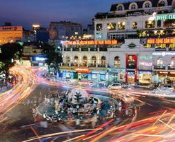
Old Delhi
Tokyo Hanoi
Sao Paulo
Beijing
Copenhagen
London Lagos
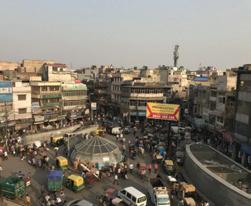
Old Delhi, India
Old Delhi, India
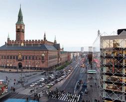
Copenhaguen, Denmark
Copenhaguen, Denmark
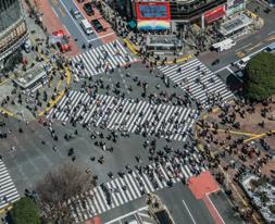
Tokyo, Japan
Tokyo, Japan
Copenhaguen, Denmark
Copenhaguen, Denmark
Copenhaguen, Denmark
Copenhaguen, Denmark
Copenhaguen, Denmark
Copenhaguen, Denmark
Hanoi, Vietnam
Hanoi, Vietnam
London, England
Vietnam
Lagos, Nigeria
Sao
Lagos, Nigeria
Old Delhi, India
Old Delhi, India
Old Delhi, India
Old Delhi, India
Old Delhi, India
Old Delhi, India
Old Delhi, India
Old Delhi, India
Qualitative Analysis
The book suggests creating synthetic representations of movements to capture the unique qualitative aspects of each studied site. These visuals enhance comprehension of the experienced dynamics, offering a departure from the typical numerical, abstract, and distant representations.
Beijing, China
Beijing, China
Tokyo, Japan
Tokyo, Japan
Tokyo, Japan
Tokyo, Japan
Tokyo, Japan
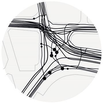
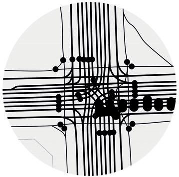
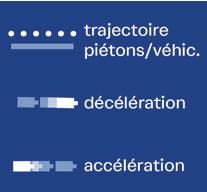
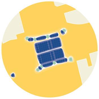
Heat flow: the mixing of speeds
Copenhaguen, Denmark
London, England
London, England
London, England
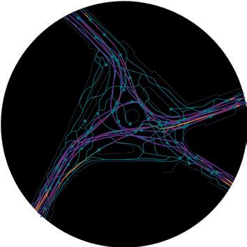
The illustrations show the speed at which all the mobile elements cross the intersection over 3 minutes. This synthesis gives a color for each level of speed: the colors go from the coldest (blue) for slow, to the warmest (yellow) for fast. The speed variations are also indicated, as well as the nature of the paths: straight for vehicles and winding for pedestrians.
Credit - University of Michigan 0-5 km/h
Sao Paulo, Brazil
Sao Paulo, Brazil
5-10 km/h
10-15 km/h
15-20 km/h
20-50 km/h
>50 km/h
Copenhaguen, Denmark
Copenhaguen, Denmark
Copenhaguen, Denmark
Copenhaguen, Denmark
Beijing,
Hanoi, Vietnam
Beijing, China
Lagos, Nigeria
Tokyo, Japan
Hanoi, Vietnam
Sao Paulo, Brazil
Beijing,
Lagos, Nigeria
London, England
Hanoi, Vietnam
Beijing, China
Lagos, Nigeria
Tokyo, Japan
Hanoi,
Copenhaguen, Denmark
Sao Paulo, Brazil
Beijing,
Lagos,
London, England
Old Delhi, India
Tokyo, Japan
Hanoi, Vietnam
London, England
Sao Paulo, Brazil
Beijing, China
Lagos, Nigeria
Tokyo, Japan
Hanoi,
Copenhaguen, Denmark
Sao Paulo, Brazil
Beijing,
Lagos,
London, England
Hanoi,
Hanoi,
Beijing,
Lagos,
Paulo, Brazil
Hanoi, Vietnam
Lagos,
London, England
Sao Paulo, Brazil
Beijing, China
Lagos, Nigeria
Hanoi,
Sao Paulo, Brazil
Beijing,
Lagos,
Old Delhi, India
Tokyo, Japan
Hanoi, Vietnam
London, England
Sao Paulo, Brazil
Beijing, China
Lagos, Nigeria
Hanoi,
Copenhaguen, Denmark
Sao Paulo, Brazil
Beijing, Lagos, London, England
Old Delhi, India
Tokyo, Japan
Hanoi, Vietnam
London, England
Sao Paulo, Brazil
Beijing, China
Lagos, Nigeria
Hanoi,
Sao Paulo, Brazil
Beijing, Lagos, London, England
Old Delhi, India
London, England
Lagos, Nigeria
Sao Paulo, Brazil
Beijing, China
Copenhagen, Denmark
Hanoi, Vietnam
Tokyo, Japan
Copenhaguen,
Copenhaguen, Denmark
Copenhaguen, Denmark
Copenhaguen, Denmark
Copenhaguen, Denmark
Copenhaguen, Denmark
Copenhaguen, Denmark
Accept slow speeds
Accept slow speeds
Accept slow speeds
Accept slow speeds
Accept slow speeds
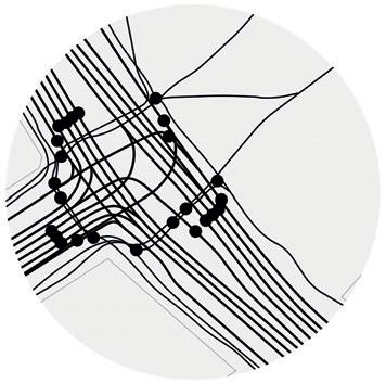
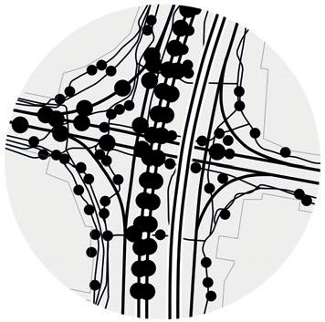
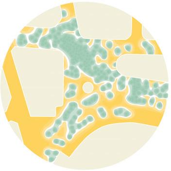
Musical score: paths and stops
The illustrations show the speed at which the intersection over 3 minutes. This synthesis speed: the colors go from the coldest (blue) for fast. The speed variations are also indicated, paths: straight for vehicles and winding for
The illustrations show the speed at which the intersection over 3 minutes. This synthesis speed: the colors go from the coldest (blue) for fast. The speed variations are also indicated, paths: straight for vehicles and winding for
The illustrations show the speed at which the intersection over 3 minutes. This synthesis speed: the colors go from the coldest (blue) for fast. The speed variations are also indicated, paths: straight for vehicles and winding for
The illustrations show the speed at which the intersection over 3 minutes. This synthesis speed: the colors go from the coldest (blue) for fast. The speed variations are also indicated, paths: straight for vehicles and winding for
The illustrations show the speed at which the intersection over 3 minutes. This synthesis speed: the colors go from the coldest (blue) for fast. The speed variations are also indicated, paths: straight for vehicles and winding for
The illustrations show the speed at which the intersection over 3 minutes. This synthesis speed: the colors go from the coldest (blue) for fast. The speed variations are also indicated, paths: straight for vehicles and winding for
The illustrations show the speed at which the intersection over 3 minutes. This synthesis speed: the colors go from the coldest (blue) for fast. The speed variations are also indicated, paths: straight for vehicles and winding for
The illustrations show the speed at which the intersection over 3 minutes. This synthesis speed: the colors go from the coldest (blue) for fast. The speed variations are also indicated, paths: straight for vehicles and winding for
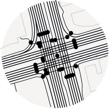
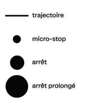
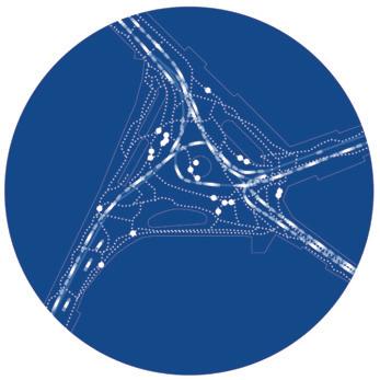
Musical score of stops on the trajectories From macro crossroads to micro crossings
Musical score of stops on the trajectories From macro crossroads to micro crossings
Musical score of stops on the trajectories From macro crossroads to micro crossings
Musical score of stops on the trajectories From macro crossroads to micro crossings
Musical score of stops on the trajectories From macro crossroads to micro crossings
Musical score of stops on the trajectories From macro crossroads to micro crossings
Musical score of stops on the trajectories From macro crossroads to micro crossings
Musical score of stops on the trajectories From macro crossroads to micro crossings
Making diagrams of the intersections shows and the stopped moments for 3 minutes. small point, a long time by a large point, elements. This makes it possible to distinguish and the fluidity of the trajectory.
Making diagrams of the intersections shows and the stopped moments for 3 minutes. small point, a long time by a large point, whatever elements. This makes it possible to distinguish and the fluidity of the trajectory.
Making diagrams of the intersections shows and the stopped moments for 3 minutes. small point, a long time by a large point, elements. This makes it possible to distinguish and the fluidity of the trajectory. Old
Making diagrams of the intersections shows and the stopped moments for 3 minutes. small point, a long time by a large point, whatever elements. This makes it possible to distinguish and the fluidity of the trajectory.
Making diagrams of the intersections shows and the stopped moments for 3 minutes. small point, a long time by a large point, whatever elements. This makes it possible to distinguish and the fluidity of the trajectory.
Making diagrams of the intersections shows and the stopped moments for 3 minutes. small point, a long time by a large point, elements. This makes it possible to distinguish and the fluidity of the trajectory.
This diagram illustrates the trajectories of mobile elements and their pauses over a 3-minute period. Brief pauses are depicted as small points, while extended pauses are represented by larger points, regardless of the nature of the mobile elements. This approach aids in differentiating between stationary moments and the smoothness of the trajectory.
Making diagrams of the intersections shows and the stopped moments for 3 minutes. small point, a long time by a large point, elements. This makes it possible to distinguish and the fluidity of the trajectory.
Making diagrams of the intersections shows and the stopped moments for 3 minutes. small point, a long time by a large point, whatever elements. This makes it possible to distinguish and the fluidity of the trajectory.
Old Delhi, India
Tokyo, Japan
Hanoi, Vietnam
Sao Paulo, Brazil
Beijing, China
Lagos, Nigeria
London, England
Old Delhi, India
Tokyo, Japan
Hanoi, Vietnam
Sao Paulo, Brazil
Beijing, China
Lagos, Nigeria
London, England
Old Delhi, India
Tokyo, Japan
Hanoi, Vietnam
Sao Paulo, Brazil
Beijing, China
Lagos, Nigeria
London, England
Old Delhi, India
Tokyo, Japan
Hanoi, Vietnam
Copenhaguen, Denmark
Sao Paulo, Brazil
Beijing, China
Lagos, Nigeria
London, England
Old Delhi, India
Tokyo, Japan
Hanoi, Vietnam
Denmark
Sao Paulo, Brazil
Beijing, China
Lagos, Nigeria
London, England
Old Delhi, India
Tokyo, Japan
Hanoi, Vietnam
Sao Paulo, Brazil
Beijing, China
Lagos, Nigeria
London, England
Old Delhi, India
Tokyo, Japan
Hanoi, Vietnam
Sao Paulo, Brazil
Beijing, China
Lagos, Nigeria
London, England
Old Delhi, India
Tokyo, Japan
Hanoi, Vietnam
Sao Paulo, Brazil
Beijing, China
Lagos, Nigeria
London, England
Delhi, India
London, England
Lagos, Nigeria
Sao Paulo, Brazil
Beijing, China
Copenhagen, Denmark
Hanoi, Vietnam
Tokyo, Japan
of the 8 sites
of the 8 sites
and accelerations on the 8 sites
and accelerations on the 8 sites
and accelerations on the 8 sites
and accelerations on the 8 sites
Old Delhi, India
Old Delhi, India
Copenhaguen,
Old Delhi, India and accelerations on the 8 sites
Copenhaguen,
Old Delhi, India of the 8 sites
of the 8 sites
of the 8 sites
and accelerations on the 8 sites of the 8 sites
Old Delhi, India
Old Delhi, India of the 8 sites
Old Delhi, India
Old Delhi, India and accelerations on the 8 sites
Old Delhi, India
Copenhaguen,
Copenhaguen,
Copenhaguen,
Copenhaguen,
Old Delhi, India
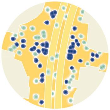
Chrono-drawing: variations of movements, decelarations and accelerations
Creating diagrams for intersections presents a challenge when there’s insufficient activity to depict movement, yet excessive movement in a single image hinders analytical synthesis. The diagrams, inspired by Eadweard Muybridge’s layered photographic images, portray points that converge for deceleration and spread out for acceleration.
Tokyo, Japan
Tokyo,
This chronological illustration enables the simultaneous interpretation of the observed or perceived movement at the intersection over a 3-minute timeframe. All trajectories are depicted to illustrate the diverse movements characteristic of the site.
Tokyo, Japan
Hanoi, Vietnam
Sao Paulo, Brazil
Beijing, China
Lagos, Nigeria
London, England
Hanoi,
Sao Paulo, Brazil
Beijing,
Lagos,
Tokyo, Japan
Hanoi, Vietnam
Sao Paulo, Brazil
Beijing, China
Lagos, Nigeria
London, England
Tokyo, Japan
Hanoi,
Copenhaguen, Denmark
Sao Paulo, Brazil
Beijing,
Lagos,
Old Delhi, India
Tokyo, Japan
Hanoi, Vietnam
Denmark
Sao Paulo, Brazil
Beijing, China
Lagos, Nigeria
London, England
Tokyo, Japan
Hanoi,
Copenhaguen,
Sao Paulo, Brazil
Beijing,
Lagos,
Old Delhi, India
Tokyo, Japan
Hanoi, Vietnam
Denmark
Sao Paulo, Brazil
Beijing, China
Lagos, Nigeria
London, England
Japan
Hanoi, Copenhaguen, Denmark
Sao Paulo, Brazil
Beijing, Lagos,
Old Delhi, India
Tokyo, Japan
Hanoi, Vietnam
Denmark
Sao Paulo, Brazil
Beijing, China
Lagos, Nigeria
London, England
Old Delhi, India
Tokyo, Japan Hanoi, Copenhaguen, Denmark Sao Paulo, Brazil Beijing,
Lagos,
Old Delhi, India
London, England
Lagos, Nigeria
Sao Paulo, Brazil
Beijing, China
Copenhagen, Denmark
Hanoi, Vietnam
Tokyo, Japan
Credit - Slate Magazine
Conditions for an intersection to become a square following research:
- The site is a destination,
- The organization of crossings takes into account the number of participants (quantity) and local practices (multi-modality),
- The sharing of public space at intersections integrates as many modes of transport as possible (minimum 3),
- Traffic management includes time phasing for several modes,
- Mobility services are part of the management of the intersection,- the ability to stop and change course are mandatory for the pedestrian,
- The public space of the intersection welcomes practices other than passage, with breaks, exchanges (bartering, trade, words...), festivities, the unexpected, plants, water and flora,
- The practices are simultaneous and alternative,
- Speed, distance, and cost are no longer the measurable indicators for the urban quality of a square, it becomes the diversity (multiplicity and complexity) of possible movements,
- Speed is limited for all, so as to increase multi-modality,
- The possibility of speed and trajectory variation increases the freedom of movement for mobile people, and in priority for pedestrians.
Mention
Picky Eaters
Productive Urbanism
NASA India | G-Sen Trophy | 2021 Competition Entry
Location: New Delhi, India
Collaborators: Palak Gupta, Anubhav Saxena, Soumyadeep Das, Saavi Natekar, Eish, Abhinav Ramesan, Dhruv Bhatia, Srishti Sarkar, Shriram R, Ayushi Srivastava, Vishali Srikanth, Soumya Anand, Nitya Soni, Ojasvi Maurya, Nishant Hemant Walchale, Akshat Bhagat
Contribution: Helped with background study and concept development, designed illustrations
Landfill Flower Market Poultry Market
Ghazipur : At the Eastern edge of Delhi
Ghazipur : Local Imports
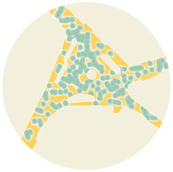
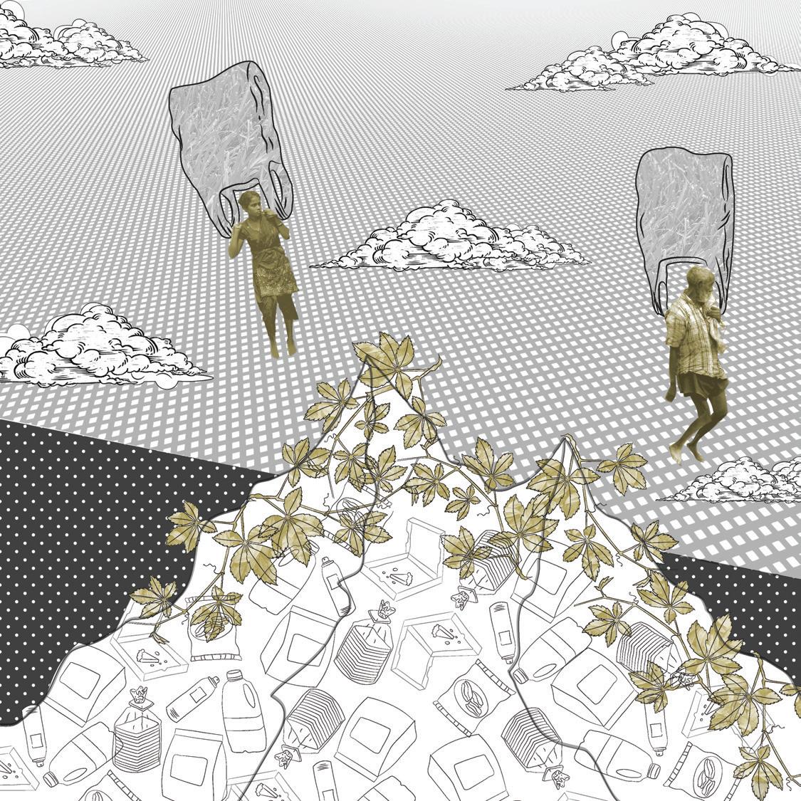
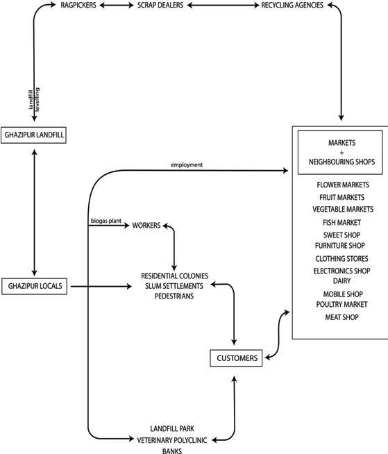
Located at the edge of Delhi, Ghazipur is home to the city’s largest wholesale food markets. Selling vegetables, flowers, poultry, fish and mutton to the rest of the city, it is a vital part of Delhi’s food supply chain. These markets directly employ the residences next to them. Ghazipur, however, is more famously identified by its monstrous garbage dump looming in the background.
: National Imports
Soaring into the hazy skies of New Delhi, Asia’s tallest landfill at the eastern fringe, Ghazipur, has become a fetid symbol. Over-saturated in 2002, the city’s scrap has kept on arriving each day in hundreds of trucks. With fires sparked by methane and leachate oozing from the dump into the canal, the landfill is a health hazard for the markets lying at its edges.
Ghazipur
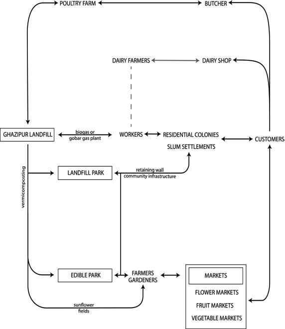
Crop Fields : adjacent to the Vegetable Market, Part of the Urban Farm.
Sunflowers : At times and areas of high toxicity. Consumed as Decorative Flowers by the Flower Market.
Vegetable Gardens : At times and areas of no toxicity. Support to the Vegetable Market.
Stage I : Erection of Retaining walls to prevent Landslides
Stage II : 50% of the landfill is covered up. Rag-pickers still access the rest.
Stage III : 75% of the landfill is covered up. Available space hosts civic infrastructure
Stage III : Last of the Landfill is utilized as a grazing field that supports dairy.
Plans to eliminate the landfill have materialized over the years, but this has led to conflicts with the community of rag-pickers whose livelihoods are dependent on the existence of the landfill. The proposal aims to turn this Centre of the city’s food
supplies into a neighborhood that would be able to independently sustain its occupants in times of a break in the supply chain. It also seeks to slowly convert the landfill on a time-scale large enough to enable the drift of the rag-picker community towards formalized employment.
Nodes as Community Oriented Spaces Urban Farm as open space for the Informal Settlement.