15 minute read
the poMpeII of the aMerICas


Payson Sheets fired off a rocket. It was a homemade firework: a propulsion chamber with a fuse taped to a long, thin stick that surged a short distance into the air before exploding. This was the latest of countless rockets that Sheets, a greying, mustached man has ignited over the years. The pyrotechnics serve as a low-tech means of communication, akin to smoke signals, informing the residents of the town of Ceren that Sheets and his crew have made another discovery.
This particular find was unremarkable—“It’s probably a corn plant,” Sheets said—but it’s the first discovery during this, his 21st season of field work, at Joya de Ceren (Jewel of Ceren), a World Heritage Site in southwest El Salvador that takes its name from the adjacent town. Approximately 1,400 years ago a nearby volcano known as Loma Caldera erupted, burying a small Maya farming village under layers of ash.
Advertisement
This brutal act of nature destroyed the village while, ironically, exquisitely preserving its remains. “In terms of preservation, I don’t know of (a site) that’s better,” Sheets said. Roberto Gallardo, an archaeologist at the National Museum of Anthropology in San Salvador, echoed Sheets: ”This archaeological site is one of the best preserved Maya villages from the Classic period in Mesoamerica.” The exceptional condition of the ruins, “combined with good archaeological practice and theory, have provided a unique insight of daily life in this Maya settlement.”
Joya de Ceren is sometimes compared to Pompeii, the ancient Roman city that was buried under an eruption from Mount Vesuvius in a.d. 79. But as Wyllys Andrews, a Tulane University Mayanist who has worked in El Salvador noted, “Pompeii was excavated and partially restored in the 16th through 19th centuries, when archaeologists had few of the modern methods Payson has been able to use and develop at Ceren to reconstruct what was happening at the moment the eruption started.” In fact, representatives from Pompeii visited Joya de Ceren and, according to Sheets, they were amazed by the organic preservation they saw.
Uncovering these exceptionally preserved items is, however, exceptionally difficult. The pit where the corn plant was found was perhaps 15 feet deep, and Sheets surmised that the ground that the Maya once farmed was another three feet down. The excavators have to dig so deep because of the thickness of the ash layer that blanketed the village centuries ago.
There were 26 people excavating four square pits on a hot day last June. The excavators—men from Ceren—shovel dirt into buckets attached to ropes that are hauled up by other men standing on the surface. (During the dig season, Sheets is the town’s largest employer.) To get in and out of the pits, the workers carve out earthen steps that have to be adjusted as the depth of the pit increases. It’s hard work, and the pay is only $12 a day, which Sheets said is good for manual labor in El Salvador. But the men are eager to work here because of their interest in the site. Many Salvadorans, he said, are very curious about the ancient Maya because of their tremendous accomplishments. “At the real core of it is identity,” said Sheets: the Maya are their glorious ancestors.
This interest in and respect for their deceased forebears manifests itself very differently than it does among Native Americans in the United States, who generally insist that their ancestors rest in peace. The Salvadorans “want me to find bodies” of the ancient Maya,” Sheets said. “It’s real important because they want to see what (the Maya) looked like.” as well as other details about them.
Sheets got his first glimpse of this remarkable preservation back in 1978, when he was doing an archaeological survey of the area. He stopped at a house and asked the owners if he could survey their property. They agreed, and they also informed him of a nearby house that had been recently buried under a volcanic eruption.
Payson Sheets shoots a rocket into the sky to announce another discovery to the people of Ceren.
When Sheets arrived there the land was being bulldozed in preparation for the construction of grain silos. About 15 feet below the surface the bulldozer had exposed an earthen floor and a thatched roof that had collapsed. The life of a thatched roof is usually 15-20 years, according to Sheets, so the eruption presumably occurred during the 1950s at the latest. And he, with his interest in volcanoes, would have known of the eruption, but he didn’t. “This made no sense. This was a huge puzzle,” he said. So he had samples of the thatch radiocarbon dated, and he found out, to his great surprise, that they were roughly 1,400 years old.
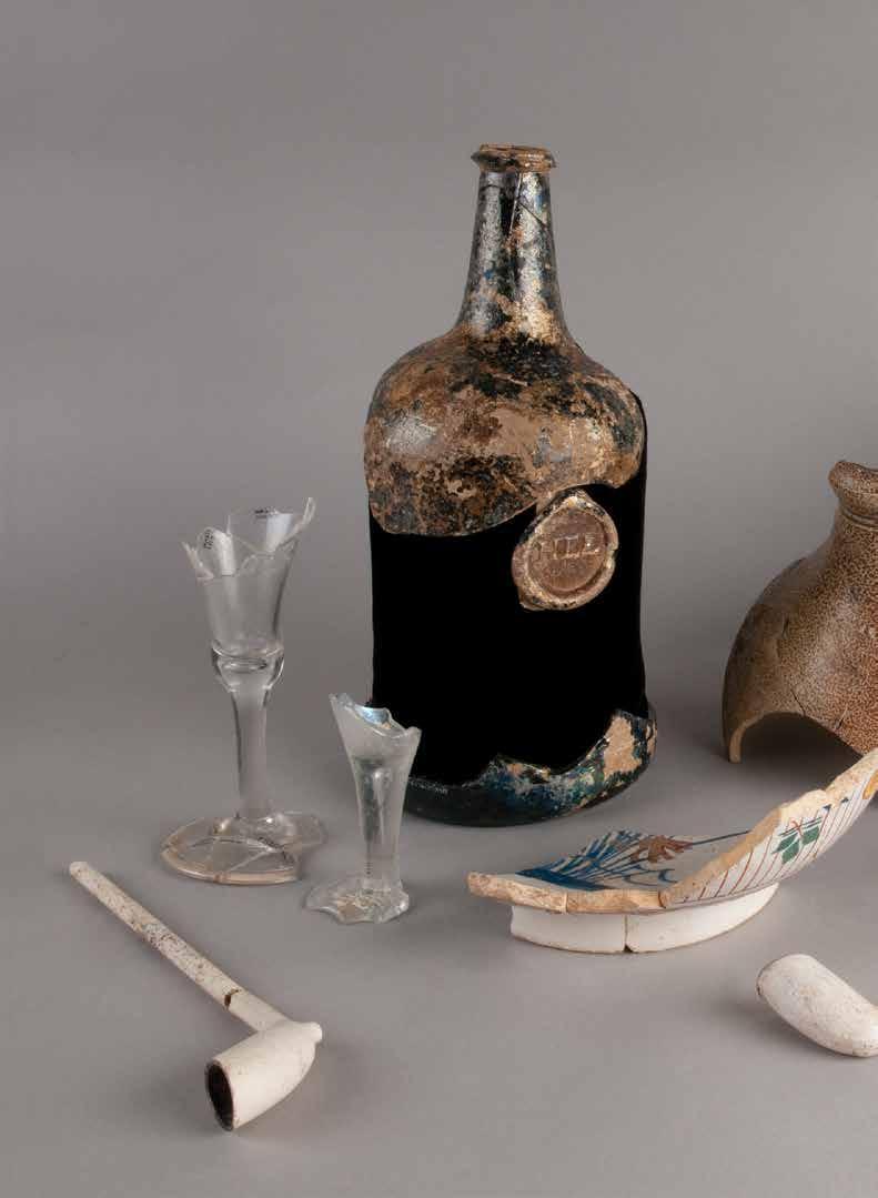
The following year Sheets began to excavate the site, uncovering two pots on a bench that contained beans. They also found an unfired pot and a lump of clay, both of which had visible fingerprints, as well as various sherds. All of these were found in a house called Structure 1. They also identified another building, known as Structure 5, that was exposed by the bulldozer. This building contained human remains that forensic analysis revealed to be a male in his 20s who died long before the eruption.
Sheets has been working at Joya de Ceren ever since. Shortly after the project began, El Salvador became mired in a lengthy civil war, pitting the government against the FMLN rebels, which lasted from 1979-92. But even a war failed to deter Sheets, who curtailed, but did not discontinue, his research.
To avoid endangering himself and his crew, he was advised to do his best to escape the scrutiny of the warring parties. But a Salvadoran friend counseled the opposite, suggesting Sheets invite representatives of the government and the FMLN to observe the dig, though at different times. In 1989, after 10 years of the war limiting his work, Sheets adopted this risky gambit, and it paid off. Both sides recognized the project’s importance, and chose not to interfere. “We became the safest people in the whole country,” he said. “This transcended politics.”
The site, which became a national archaeological park in 1980 and a World Heritage Site in 1993, is fenced, handsomely landscaped in parts, and patrolled by armed guards to prevent looting. It has a small but impressive museum and an adjacent restaurant where visitors can sample pupusas, a signature food of Salvadorans. The park averages 2,000 visitors a day, and they come primarily for the main attraction—the well preserved remains of 12 structures that the researchers have exposed.
For years Sheets was uncertain as to who the site’s farmers were. “I suspected they were Maya. They looked more Maya than anything else,” he said. But it wasn’t until 1991 that he was finally certain of that. The tipping point came when he and his crew uncovered a building they refer to as Household 1, which has three sections—the living area known as Structure 1, a kitchen, and storage space—that are

typical of Maya houses in Guatemala and Honduras. They subsequently excavated two buildings, known as Structures 10 and 12, that have floors at different levels that rise steplike. This feature is characteristic of religious structures, in which the raised floors placed people closer to the firmament. The buildings also had religious artifacts.
The structures are covered by roofs to protect them from the elements and surrounded by railings to protect them from overly curious people. Structure 3, the largest of these buildings, is thought to have been a place where political decisions were made. The archaeologists assume this because there are two benches in the front of the building, and a frequent tableau in Maya glyphs depicts rulers grappling with the issues of the day while seated at similar types of benches. This building, amazingly enough, also has striation patterns in its earthen wall engraved by ash deposits from the volcanic eruption.
Structure 10 is equally amazing in that it contained food remains from a feast and harvest ceremony that was going on when Loma Caldera erupted. As he gazed at the building’s ruins, Sheets recounted that fateful, 1,400-year-old event in such uncanny detail one would think he experienced it.
During an August day the villagers had gathered in Structure 10 to celebrate the harvest of maize and manioc. Sometime that evening between seven and nine Loma Caldera blew, spewing several clouds of ash, but no lava. The volcano was only about a third of a mile away, and the ash clouds bore down on the village at a speed of 30 to 120 miles an hour. The party ended abruptly, with the celebrants fleeing to the south, away from the volcano and the approaching debris that would quickly bury their village, but, as best as Sheets can tell, not them.
It’s rare that an ancient event can be reconstructed in great detail, but the evidence is such that Sheets is confident in his telling of the tale. He inferred the month from the remains of mature corn stalks he found, which reach that stage in August, and the time of day from the farming tools having been put away and the sleeping mats not yet rolled out. Food remains and dirty dishes littered the area, indicating the people fled before finishing their meals. He’s

A street vendor prepares lunch for her customers as a modified pickup truck that serves as a bus drives by.

consulted volcanologists who have estimated the speed at which the ash clouds moved based on the striation patterns on the wall of Structure 3. To date he’s found no bodies, so it’s possible the villagers escaped.
Though Sheets is remarkably precise about some aspects of when the eruption occurred, there is no way to determine the exact year due to the imprecision of radiocarbon dating, so he can only say that it happened some time in the a.d. 630s. One of the unanswered questions about the event is how long it took for the ash clouds to cover the village. If it was, say, 30 minutes, the villagers could have escaped.
He suspects they fled south on a road called a sacbe (pronounced SOCK-bay) that the researchers discovered in 2011 after digging through layers of volcanic ash. The sacbe is about six-feet wide, has canals on both sides, and a maize field next to one of the canals. It’s also capped with a bright white ash. That implies that “it had more than just a utilitarian function,” said Chris Dixon, a University of Colorado archaeologist who’s worked at the site for eight years.
Sacbeob (plural of sacbe) usually connect settlements, and Sheets would like to know where this one begins and ends, but exposing it is extremely laborious because it’s buried so deep. He thinks Joya de Ceren is its northern terminus, and exactly where it ends could reflect its primary purpose. If it ends at the town plaza by Structure 3, its fuctions were likely economic, political, and social. Should it end at one of the religious structures, it was presumably ceremonial.
As for its southern terminus, he can only guess. By digging test pits the archaeologists have determined that the sacbe ran by the exposed buildings, and that it’s at least 148 feet long. It appears to be headed in the direction of San Andres, another Maya site about three miles south.
The archaeologists are focusing on the sacbe because it could also provide insights into the social-political organization of the commoners who inhabited this village. Most Mayanists focus on cities with temples and other monumental architecture rather than small villages. “Maya archaeologists just love the fancy stuff,” Sheets observed. “I’m unusual in that I revel in what the commoners do.”
According to Sheets, scholars have debated the extent to which rulers controlled agricultural production throughout the Maya world, and consequently he’s trying to determine


David Lentz and Venicia Slotten use a flotation device to recover ancient seeds.
how politically autonomous these farmers were. Did they control their own production, or did they act at the behest of village elders, or perhaps political superiors who resided south of the village?
The answer to that question could lie in the answer to a related question: who maintained the sacbe? If each farmer worked his own plot and the plots of the various farmers ran contiguously along the sacbe, the archaeologists can compare the plot boundaries with any changes they discover in the maintenance of the road. A correlation between plot boundaries and changes in sacbe maintenance would suggest each farmer was responsible for keeping his own stretch of the road in working order, which in turn suggests a degree of self-governance.
If, on the other hand, sacbe maintenance was assigned by village elders to a group of workers, it’s likely there will be no changes in the condition of the road as it runs along the various plots. In the case of authorities south of the village controlling the sacbe, the archaeologists could discover that it becomes wider, better constructed, and more heavily trafficked as they expose that section of the road.
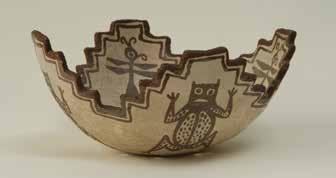
“We know they’re not completely economically autonomous,” Sheets said, because of the evidence that they traded for such goods as polychrome pots, jade axes, and obsidian tools. Indeed, whatever their level of freedom, these commoners were enjoying a surprisingly good lifestyle. Having exposed four residences and done test excavations at a number of others, the researchers have found the Maya households possessed 70 pots on average, some of which were handsome polychrome vessels. That, along with the jade and obsidian tools, is a lot of stuff, and some of it was highend. This indicates to Sheets that the farmers were to some extent dependent on the people who supplied these goods.
How they achieved this level of relative prosperity is an interesting question. By using trace elemental analysis, he determined that most of the pottery was locally made, and the remainder, including the polychrome pots, came from the Copán Valley in neighboring Honduras. The jade and obsidian tools originated in Guatemala. It’s likely the farmers traded surplus produce for these items, but they could also have exchanged their labor or wood from the trees on their land. These goods could have moved up and down the sacbe. To get a clearer picture of the type of trade the road accommodated, the archaeologists are recovering and identifying items such as the plant remains that were buried next to it.
The job of identifying the ancient plant remains, which are often nothing more than tiny seeds, falls to David Lentz, a tall, silver-haired paleobotanist with the University of Cincinnati. Working in a small, Spartan, decidedly low-tech laboratory, he and his grad student, Venicia Slotten, have identified the remains of various plants such as cacao, guava, avocado, maize, beans, and squash. Because of the extraordinary preservation, he’s also


This Maya household features the domicile on the left, the storehouse in the middle, and a sauna in the right background.
identified an extinct grass used as thatch for their roofs and several plants that had never been documented in the Maya region, such as malanga, a tropical root crop.
The most surprising and important find was an abundance of manioc, which is also known as cassava and yuca. During their zeniths, a number of Maya cities were apparently densely populated, and archaeologists have wondered how the masses were fed. In addition to maize and a few other staple crops, manioc—which had not been found in the Maya world prior to its discovery at Ceren in 2010— could be the answer.
“This is an incredibly important site for understanding Maya agriculture. This shows the agricultural system that allowed the cultural complexity seen throughout the Maya world,” Lentz said. “At Ceren we can not only find out what they were growing, but we can also learn how they were growing it,” Lentz said. He’s discovered that the agricultural practices were not uniform, and this could be a sign that each farmer made his own decisions.
The lab is next to a cinderblock house that Sheets, with his own money and financial assistance from the University of Colorado and the National Science Foundation, built in Ceren. The town has no lodgings, and some of the archaeologists working on the project stay here. Outside the lab in a courtyard, Lentz has jerry-rigged a flotation device consisting of a metal barrel and a pile of bricks to separate the seeds from the soil they’re embedded in.
While Lentz and Slotten extract the seeds, children from a neighboring house play in the courtyard. Sheets puts a heavy emphasis on ethnography—“Our thinking is more ethnographic than archaeological,” he said—and he wants his crew to be exposed to Ceren’s residents. The site’s exquisite preservation has presented them with the challenge of recording “a village right after the villagers left,” and Sheets believes that understanding the lives of the modern townspeople can help his crew understand their ancient ancestors. Toward that end, Alexandria Halmbacher, who is studying for her master’s degree under Sheets, is interviewing Ceren’s residents and mapping their homes. It was lunchtime, and Sheets walked the short distance to a street vendor who set up shop just outside the park. He ordered, and took a seat on a bench next to the street. The limited menu—hamburgers, hot dogs—seemed nondescript, but his lunch proved to be a culinary novelty: two hamburgers with ham. He seemed mildly surprised at the first bite, commenting on the odd combination of ground beef and ham, and then kept on eating. The vendor beamed as more customers arrived. A makeshift bus—a pickup truck with a bed crowned by bars that prevented its half dozen passengers from falling out—pulled up, and a few of them disembarked. This corner of this small, sleepy town had come alive with a din that made conversation difficult.
Back in 1978, when Sheets first learned the site was 1,400 years old, he realized it was so rich and significant that the rest of his professional life would be spent here. Having invested decades, he’s convinced decades of work remain. His lunch finished, Sheets leaned against a pole and stretched his legs out on the bench, looking perfectly at home.