2 minute read
GOVERNMENT SPRINGS RANCH


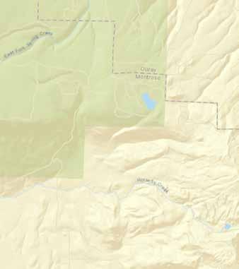
2,940± ACRES | MONTROSE, COLORADO
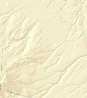
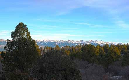
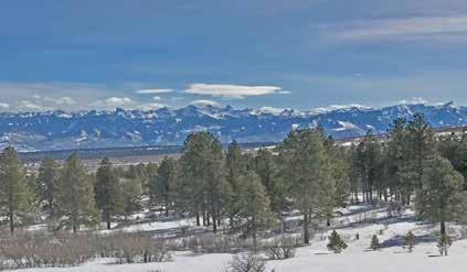
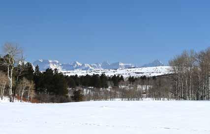
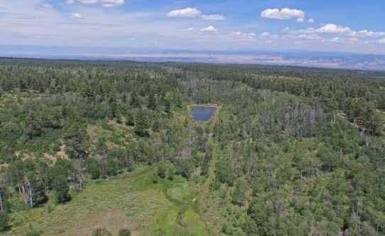
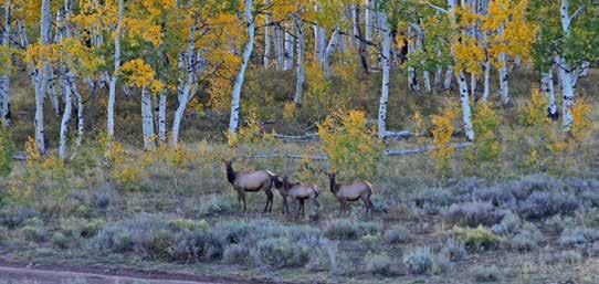
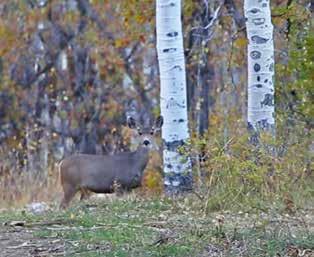
This 2,940-acre ranch is a combination of beauty, accessibility and history, making it one of the finest and well-located mountain properties you will find in the Western United States. Once used by the soldiers from Fort Crawford as a water source, this abundant spring still supplies good clean water. Located between Montrose and Telluride, Colorado, the ranch features year-round paved access, 6 miles of national forest boundary, underground utilities, 60%-70% ponderosa pine, aspen and spruce with huge views of the San Juan Mountains and the lush valley below. It is a true trophy-hunting ranch in a great location, only minutes from a commercial airport.
Advertisement
The Property
This truly is one of the finest ranch properties available. The ”Government Spring” is located on the property and is a great source of water. Many years ago this spring provided water for the cavalry post Fort Crawford, which was located in the valley below the ranch. Occasional finds of cavalry artifacts attest to its authenticity.
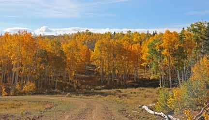
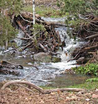
Still used for cattle ranching, the land has been well cared for. Its plentiful supply of lush grassy meadows, and small streams, springs and ponds are well scattered throughout the dense stands of Ponderosa, Aspen, Blue Spruce and Oak.
An extensive common boundary with the national forest provides for great recreation possibilities. The ranch has the unique characteristic of being the only single piece of privately owned property, which connects Government Springs Road to the Dave Wood Road. A basic road has been constructed across the ranch connecting these two major accesses to the Uncompahgre Plateau.
Utilities
Electrical power is underground and runs the full length of the ranch. A utility easement has been reserved along the new road to the west boundary.
Cellular phone service is available in the area. Depending upon need, hard wire phone service should be checked out by a possible buyer. There are several suppliers of propane gas in the area. Water source would be domestic wells and sewage disposal would be by a private septic system.
Access
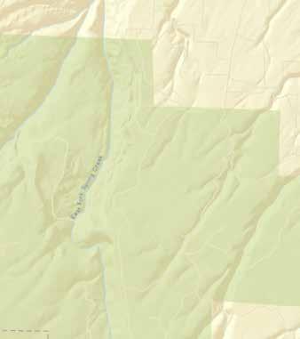
The east edge of the ranch abuts Government Springs Road and is only 9 paved miles from Highway 550 and 16 miles from Montrose. The west side abuts Dave Wood Road and is approximately 37 miles from the Telluride ski area.
Water Rights
Many springs and ponds are scattered throughout the property. Nine have been adjudicated primarily for livestock watering purposes.
None of the property is irrigated; however, three small streams - the east and west forks of Dolores Creek and Happy Canyon Creek do originate on the property.
Vegetation
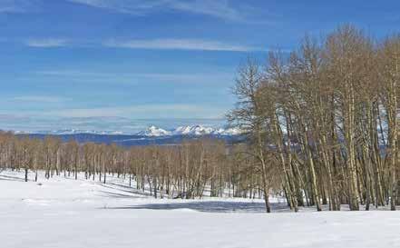
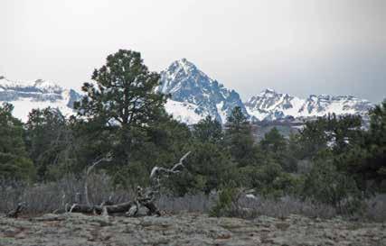
The east end of the ranch begins at an elevation of 8,000 feet. The vegetation is a combination of Oak, Aspen, Ponderosa Pine and Juniper. There are a number of wooded draws, productive springs and dynamic views in all directions.
The midsection of the ranch is a combination of meadows, ridges and draws. Large stands of Ponderosa Pine are the primary ground coverage. Moving to the south and west, the property constantly gains elevation. At this point, Aspen trees predominate.
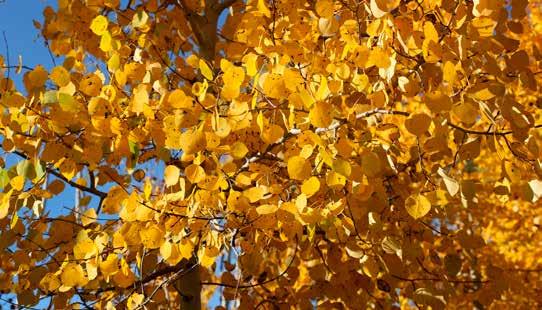
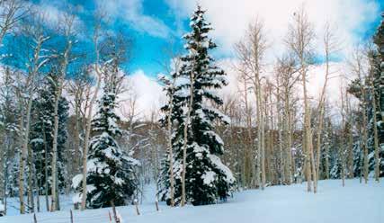
To the west, at an elevation of 9,300 feet, the highest point on the ranch, large Blue Spruce trees and Ponderosa Pine intermix with the virgin Aspen groves. The setting is as spectacular as the finest winter postcard.
Possible Uses
The possible uses for this ranch are as diversified as the high country itself. It is currently used for livestock and wildlife grazing and is among the best around. The potential for a private retreat or an exclusive subdivision speaks for itself.
Wildlife
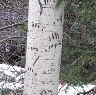
Sizable herds of Rocky Mountain elk and mule deer inhabit the property. Many trophy size elk and deer have been harvested. The adjoining Uncompahgre National Forest is among the best wildlife areas in Colorado.
Improvements
The ranch has a seasonal four-bedroom cabin, livestock corrals and good perimeter fencing for livestock. All property lines have been surveyed.