
THE BARTLETT SCHOOL OF PLANNING BPLN0056 | URBAN DESIGN: LAYOUT, DENSITY & TYPOLOGY INTEGRATING ISLINGTON Holloway Prison site proposal

TUT 2 (Group 1) | TASK 2: URBAN DESIGN PROPOSAL | 2021 - 22PAGE 2 INTEGRATING ISLINGTONCONTENTS Analysis 1. Introduction 2. Stakeholder analysis 3. Access and permeability 4. Social 5. Street life 6. Green infrastructure and natural resources 7. Wider context 8. Analytical synthesis Vision 9. 13.12.11.10.ObjectivesStrategyDesignproposalCriticalreectionHousingtypeand density Design Proposal 14. Wider connectivity 15. Access and movement 16. Access and green space 17. Building to street relationship 18. Human perspective 19. Green space 20. Pankhurst square design 21. Pankhurst square uses 22. Women’s building 23. Active frontages Conclusions 24. Stakeholder re ections 25. Conclusions 26. Bibliography
CamdenRoad
Location of the London Borough of Islington, St George’s Ward and Holloway Prison Holloway Prison site
ParkhurstRoadHillmartonRoad
The London borough of Islington is one of the most densely populated local authorities in London, with a population of around 240,000 (GLA, 2018). The development style of the borough is diverse, illustrating a history of di erent design and architectural styles, as well as the social, economic and cultural diversity of the borough (Islington 2017).
TUT 2 (Group 1) | TASK 2: URBAN DESIGN PROPOSAL | 2021 - 22PAGE 3 INTEGRATING ISLINGTONINTRODUC TION
Situated within St George’s ward, the Holloway Prison was rst opened in 1852, becoming a women’s prison in 1902. Until its closure in 2015 the prison was the largest women’s prison in Today,Europe.the site is slated for redevelopment to provide for London’s growing population. This document outlines a design proposal to integrate the site with the surrounding area. This is done by ensuring the design is sensitive to the existing context, creates a strong sense of place through active streets, and improves physical and visual permeability in the area..


DEVELOPERS
Islington Council has emphasised the need to maximise the delivery of genuinely a ordable housing in order to meet the housing crisis. The council’s Supplementary Planning Document also cites sustainability and a prison legacy project as high priorities. FUTURE GENERATIONS
ANALYSIS TUT 2 (Group 1) | TASK 2: URBAN DESIGN PROPOSAL | 2021 - 22PAGE 4 STAKEHOLDER ANALYSIS
The development must adhere to the objectives in the London Plan, speci cally article D3. This will ensure that the development responds to the site’s context and capacity for growth (London Plan 2021), and is well linked to jobs, services, infrastructure and amenities. Reference to the London Plan will also be utilised to promote a high quality of place and lived experience for new residents.
LOCAL GOVERNMENT
The development must be sensitive to the existing urban fabric. This includes typological and material consistency, the sensitivity to surrounding building heights and the availability of local amenities.
Current developers Peabody have committed to ongoing community consultations and engagement to inform the development. These have been largely criticised by the local community who feel that their views have not been accommodated, speci cally in relation to the women’s building and genuinely a ordable housing quotas. This design responds to these criticisms in order to improve upon Peabody’s design by providing an independent women’s building and a higher proportion of a ordable housing.
Future generations rights to inherit a liveable environment must be accounted for alongside current needs. The development must provide high quality accommodation that will stand the test of time and allow for a high standard of living.
Community groups such as the Community Plan for Holloway are calling for the integration of di erent tenure structures, the provision of co-housing, genuinely a ordable housing, strong environmental credentials, community facilities and open public space.
WOMEN’S RIGHTS ORGANISATIONS
LONDON PLAN
EXISTING NEIGHBOURHOOD
The development of Holloway Prison has been highly contested. Women’s rights organisations such as Sisters Uncut maintain that the site should be transformed for the public good and house a women’s building which provides services to women and non-binary people who have been a ected by state violence. COMMUNITY GROUPS


• The local area is well serviced by buses and has access to the Northern Line at Tu nell Park. The site has direct access to a bus services from Camden Road and Parkhurst Road, however access to Tu nell Park station is limited due to a lack of entry points at the north and west of the site.
Currentwest.access
ANALYSIS TUT 2 (Group 1) | TASK 2: URBAN DESIGN PROPOSAL | 2021 - 22PAGE 5 ACCESS AND PERMEABILITY
PERMEABILITYACCESS
Current pedestrian routes
Potential access point Hard boundary/ barrier
Dalmeny Road modal lter Impermeable prison walls Current site access Major junction Tu nell Park Station
• The site has good access to the wider area from its eastern boundary, however, these access points all lead onto major and polluted routes which are neither pedestrian nor cycle friendly.
• The site opens onto a major junction between Camden Road and Parkhurst Road. Despite limited cycle and pedestrian infrastructure, this junction links Tu nell Park to Caledonian Road through a strategic cycle route and clean air route. It also links Camden to Finsbury Park through a major cycle route.
• Overall, the site has low visual and physical permeability. This takes the form of a gradient with permeability lowest in areas furthest from Camden and Parkhurst Roads.
--Permeabilityjunctiongradientdark=lowpercieved/physicalpermeabilitylight=highpercieved/physicalpermeability
Current vehicle access
Major
• Access points are limited and clustered in the south east area of the site, however, there is the potential for two new pedestrian and cycle access points which could improve accessibility to the north and point
• Surrounding developments back onto the site with private or semi-private gardens and green spaces.
• The current morphological and typological layouts create hard boundaries and barriers, especially at the interface between the site and Camden Road and Parkhurst Road.


ANALYSIS TUT 2 (Group 1) | TASK 2: URBAN DESIGN PROPOSAL | 2021 - 22PAGE 6 SOCIAL 100m 200m 300m 400m Cultural and community facilities Supermarkets>3.5%households in 4 deprivation indexes (census 2011) >50% households not deprived in any dimension (census 2011) SchoolsPubsDoctors and pharmacists CafesLibrariesand restaurants Social amenities within a 400m radius. IMMEDIATE AREA (WITHIN 200M OF SITE) Community facilities • Relatively well served within 200m by the Cat and Mouse Library, Islington Arts Factory and Holloway Estate Community Centre. Supermarkets • Poorly served by supermarkets. Two corner stores providing mainly dried goods with limited fresh food. Deprivation index • The immediate area consists of a mixture of deprivation indexes (education, employment, health and disability, household overcrowding). These are spatially dispersed. Schools • There are two educational facilities within 200m of the site.
schools
and
Deprivation index •
HERITAGE AND HISTORICAL CONTEXT Shops
Community facilities
FURTHER AREA (200 – 400M FROM SITE)
• Site served by Hilldrop Community Centre to the south. Closest pub, the Prince Edward, located to the north. Larger supermarkets clustered around Holloway Road to the north, Hillmarton and Caledonian Road to the east, Brecknock Road to the south and Tu nell Park in the west. Clusters of properties close to Tu nell Park station
do not fall under any deprivation indexes. Schools
• Between 200m and 400m distance from the site there is a good provision local including Tu nell Park Primary School Beacon High School. on Holloway Road Tu nell Park Primary School
of
Supermarkets •


Active streets are created in neighbouring Tabley Road due to minimised vehicular tra c. This creates space for increased cycling and pedestrian use, alongside opportunities for the ornamentation of public space.
Active street frontages are created on St. George’s Avenue due to multiple windows facing onto the street and small front gardens that enable greater interaction between the buildings and the streets.
ANALYSIS TUT 2 (Group 1) | TASK 2: URBAN DESIGN PROPOSAL | 2021 - 22 STREET LIFE
Inactive street frontages at the Hilldrop Estate are created by external corridors that prevent visual permeability. Additionally, fences around the rear of the block create a barrier between ground oor ats and the street, leading to an inactive boundary between public and private space.


ANALYSIS TUT 2 (Group 1) | TASK 2: URBAN DESIGN PROPOSAL | 2021 - 22 GREEN INFRASTRUC TURE AND NATURAL RESOURCES TOPOGRAPHY • Gradual decline in height across the site from south west to north east. • North east edge is the site’s natural drainage point. PUBLIC PARKS • Closest park is located 15-20 minutes walk from the site. ASPEC T • North east and north west sections of site receive less direct sunlight. WIND • Prevailing wind from the west means that large building openings should be limited on the western side of the development to avoid wind tunnels. GREEN SPACES • Predominantly private and semi-private green spaces around site. • Poorly de ned semi-private green spaces are under utilised by residents. • Private green spaces are clearly de ned. TREES • Several protected trees including: 1. Willow tree 2. Cherry tree 3. London plane tree • There is a tree belt located along site interface with Camden Road and Parkhurst Road which creates a green barrier into the site. 1 2 Natural resources analysis Green spaces analysis


• Smaller green spaces that are clearly de ned as private space show greater signs of use by residents. These often border the street or lie in relatively secluded plots to the back of properties.
• Large semi private green spaces linked to neighbouring estates are under-utilised by residents.
Three storey buildings on Treecastle Way Six storey buildings on the Holloway Estate Eight storey section of the Bakers eld Estate
• Buildings between 10 -15m in height will be approximately 3 - 5 storeys high.
ANALYSIS TUT 2 (Group 1) | TASK 2: URBAN DESIGN PROPOSAL | 2021 - 22 WIDER CONTEXT
- Poorly de ned semi private green spaces surrounded by residential -propertiesamorphous shape, limited privacy gradient and prescriptive design limits use by residents
• Predominant brick colour is light brown.
BUILDING HEIGHT ANALYSIS TYPOLOGICAL ANALYSIS
• Site itself is surrounded primarily by 10 -15m high buildings.
• North corner of the site is overlooked by the Bakers eld Estate. This is one of the tallest buildings in the area ranging between 20 - 40m high.
- Existing prison green spaces mirror characteristicstheof semi private green spaces found in neighbouring estates
• Older buildings have complex facades creating sense of local character.
• Majority of buildings in the ward are between 10 -15m in height.
- Front gardens are privately owned but publicly visible enabling public / private interaction - Gardens that are clearly de ned as private show signs of personalisation and use


Active streets with strong sense of Wellcommunityconnected bus
• The site lies at a junction between three main roads that connect St George’s ward to the surrounding area. This area has the potential for high footfall as a central connection point which forms part of several cycle routes and has existing bus services.
• The historical signi cance of the prison o ers an opportunity to enhance the area’s unqiue identity.
• The site contains a number of landscaped green spaces and mature trees that could be utilised to provide public green space for the surrounding area.
Limited amenities such as supermarkets nearby Above average crimes rates
Historical signi cance of the area giving it a unique withactivePotentialpresentfacilitiesMultipleidentitycommunityalreadyfornewfrontageinareahighfootfallMajor/strategiccycleroutes
OPPORTUNITIES CONSTRAINTS
• Surrounding developments face away from the site. As a result, most of the site is surrounded by private or semi private green space that create impermeable boundaries.
DarkBusyboundaryjunctionPollutedroadsnorthernedge of the site which rarely gets direct Backssunlightonto private land Locally protected view
• Considering the location of the site (a busy junction which connects St George’s Ward to Camden, Finsbury Park and Holloway), both the site and surrounding area are relatively poorly serviced by shops, cafés and restaurants. The current number and range of services are not su cient to provide for a growing community.
• The aspect of the site means that areas towards the north of the development will receive limited direct sunlight, especially during the winter months.
• A protected view crosses the site limiting the height of buildings in this corridor.
Largely impermeable site
ANALYSIS TUT 2 (Group 1) | TASK 2: URBAN DESIGN PROPOSAL | 2021 - 22 ANALYTIC AL SYNTHESIS
Existingnetworkmature trees
• Much of the surrounding area is made up of perimeter blocks with enclosed street systems that clearly de ne public and private space. The more contemporary 20th century block housing developments are less legible and often lack a clearly de ned public / private interface.
• There are several community services in close proximity including a GP and the Cat and Mouse Library.
• Opportunities for improved access are primarily limited to the east and south east of the site. This area is characterised by a junction between three busy roads which form a heavily polluted route.
• The proposal takes advantage of the site’s position within the wider area through the creation of a new service node for the local community.
• Perimeter blocks and row housing integrate the development with surrounding typologies.
• A public square will be placed strategically in relation to the junction, creating new open space for the local community.
• Building height will not exceed 6 storeys to t the context of low and medium height development, whilst also preserving protected views across the site.
Orientating buildings towards the street, creating useful public spaces that encourage mixing and ownership.
• Access points and the spatial distribution of public and private spaces re ects the characteristics of surrounding developments.
• Where feasible, new pedestrian and cyclist access points will be provided, creating new and safe active travel connections across the ward.
Retaining the existing cultural signi cance of the site whilst ensuring sensitivity to surrounding developments.
• The junction between Camden Road, Parkhurst Road and Hillmartin will be repurposed as a con uence for active modes of travel promoting higher footfall.
VISION TUT 2 (Group 1) | TASK 2: URBAN DESIGN PROPOSAL | 2021 - 22
• The layout will provide public space for both new residents and the existing community. To maximise the bene ts of public space, high quality and clearly de ned open space is prioritised over the semi private style of green space found in neighbouring estates.
Removing boundaries to create an open and welcoming environment that improves local connectivity.
• The proposal outlines a dedicated women’s building which adheres to the speci cations requested by women’s rights organisations. The building will help to form a continued sense of place by acknowledging the legacy of the prison.
• Where possible existing trees and green spaces will be maintained to promote continuity and minimise ecological damage.
OBJEC TIVES
streetsActive Physical and integrationvisual Sensitive to the existing context
• A grid structure and generous public square will allow for visual permeability into the site from the junction.
• Vehicle access will be limited, creating streets that feel inviting, safe and comfortable. These streets will provide space for interaction and rest, and will promote walking and cycling through the development.
• Utilising perimeter blocks and grid systems the plan creates enclosed streets and clearly de ned private and public space.


VISION TUT 2 (Group 1) | TASK 2: URBAN DESIGN PROPOSAL | 2021 - 22 Private back gardens Enclosed street system Vehicle access to all properties Central pedestrian access point and public square New pedestrian and cyclist access points Evenly spaced access points along main road Dedicated women’s building Mixed use providing several services DESIGN ITERATIONS Private front gardens leading onto streets Green space provided in perimeter blocks MASTERPLAN


• The public square does not take advantage of the location of the Cat and Mouse library. Instead, the square is positioned strategically to bene t from high footfall at the junction.
• 7,500m2 Women’s Building providing services for the community
• Building heights do not exceed 6 storeys, resulting in the development being in keeping with surrounding building heights and maintaining the local protected view.
• New access points created onto Carleton Road and Chambers Road
• Sight-line created in line with Hillmartin Road, connecting the development to the existing fabric.
• Public square containing statue commemorating the area’s history and celebrating the unique identity of the site.
• Communal open space in the centre of courtyards for all residents to enjoy
• Height-to-width ratios, active frontages, and eyes on the street create active streets
• Private gardens on the northern edge will receive less sunlight than other open spaces. However, their clearly de ned private function should promote greater usage compared to public or semi private green space.
VISION TUT 2 (Group 1) | TASK 2: URBAN DESIGN PROPOSAL | 2021 - 22 CRITIC AL REFLEC TION STRENGTHS WEAKNESSES
• Design re ects the surrounding context, creating a sense of continuity with the existing neighbourhood.
• New active frontage created in area with high footfall
• The prioritisation of a mixed use public square, enclosed streets and clearly de ned private green space means that the development does not provide new public green space. This is in response to analysis of public/ semi private green spaces in surrounding developments that fail to provide attractive or useful space for residents.
• Private green space at back of row housing, ensuring sensitivity to neighbouring properties and gardens.
• Amenities such as a GP, pharmacy, cafés, restaurants and a nursery are provided, responding to the existing lack in the area.
• Some existing trees and green spaces will be removed to accommodate the street grid system.
• The development does not provide new access points onto Dalmeny Avenue or Holloway Estate. These access points were deemed unsuitable due to thethe private nature of developments to either side of the site.

gardens create a bu er between shared courtyard and ground oor housing. • Extended balconies for upper level ats. All ats gain access to open space. •
• Private back Large
VISION TUT 2 (Group 1) | TASK 2: URBAN DESIGN PROPOSAL | 2021 - 22 HOUSING TYPE AND DENSITY The proposal creates 1,000 new 1 to 4 bedroom residential ats. As the 29.5% of households in the ward are currently one-person households, (OCSI, 2018), 70% of the ats in the new development are 1-bed and 2-bed units. Blocks A, B, C are Mmd-rise residential terrace developments. Blocks D, E are residential courtyard blocks. Blocks F, G are mixed-use with commercial and residential units. PROPOSED RESIDENTIAL TYPOLOGIES UNIT TYPE AND DISTRIBUTION KEY DESIGN FEATURES Site Area (sqm) 6 2.2538.6 Plot Cover (sqm) No.UnitsOf F.A.R.CoverGround(%) 248 Density (units/ha) Max No. of Storeys Flat (Bedroom/Persons)Type Flat GEAArea(sqm) (%)Distribution No. of Flats Total (sqm)areaTotal A (%)ordable 1b2p 60 30% 300 200 (66.7%) 18,000 2b4p 84 40% 400 300 (75%) 33,600 3b6p 114 20% 200 150 (75%) 22,800 4b6p 118.8 10% 100 50 (50%) 11,880 Total 1000 700 (70%) 86,280 Unit A1 - 7.5*8m = -60sqmEssential GEA for 1b2p type units Unit B1 - 15*8m = -120sqmEssential GEA for 2b4p, 3b6p and 4b6p type units TYPICAL PLAN FOR UNITS IN BLOCKS A, B & C TYPICAL PLAN FOR UNITS IN BLOCKS D - One service core for 2, 3, or 4 units on each oor - One service core for 6, 7, or 8 Units on each oor. A ordability of housing units will be determined by the following •factors:Location of the unit - storey level, view • Total area of the unit and number of rooms • Provision of private green space (front and back) • Proximity or to amenities and main road • Front private garden creates a bu er between the pavement and ground oor residences.
service core and staircases will allow ample light into shared indoor spaces. • Units B1 serves as a convertible unit for 2,3 and 4-bed atsmaximizing the opportunity to create a varied range of a ordable homes within the same block. • Designed in sympathy to the local neighbourhood (e.g. Archibald Road and Tabley Road) in terms of typology, architectural style and building heights.


• New cycle movement through the site to improve accessibility across the ward. Cyclist separation and signal crossings is essential at large junctions to improve actual and perceived safety. Realignment of current pedestrian crossings and new pedestrian crossing points improves pedestrian permeability.
PAGE 16
• One-way system adheres to existing one-way system on Parkhurst Road.
PROPOSAL TUT 2 (Group 1) | TASK 2: URBAN DESIGN PROPOSAL | 2021 - 22 WIDER CONNEC TIVITY
The design proposes a new road and access layout which limits vehicle use and promotes walking and cycling. This directly responds to the London Plan, which advocates car free development in areas of su cient public transport.
The provision of su cient and secure cycle parking is essential to encourage those visiting and residing in the development to cycle. To ensure cycle parking is t-for-purpose, secure and well located (TFL, 2014), a mixture of on-street cycle hangars and pavement tubular stands will be implemented. In total, 300 new cycle parking spaces will be provided, well exceeding London minimum standards (GLA, 2021). In addition, space has been allocated for a limited number of on street car parking spots (priority will be given to blue badge holders) and short stay parking spots for deliveries.
• Linking existing cycle routes.
• Proposed new segregated cycle route on A053 (TFL road network) to improve major cycle route.
• One-way system prevents dangerous right turns across three lanes of tra c onto Camden Road.
A junction improvement proposal for the intersection between Camden Road, Parkhurst Road and Hillmarton Road is outlined following TFL guidelines (TFL, 2014) and the borough (Islington, 2019) and Greater London Authority’s (GLA, 2021) latest transport strategy proposals. The plan aims to improve pedestrian and cyclist accessibility across the wider area and to facilitate a safer and more pleasant entrance into the site.
• Cycle parking facilities located in visible spaces to ensure security.
• Two-way vehicular access to properties.
Removal of tra c lanes to provide space for two one-way segregated cycle lanes whilst also maintaining current bus lanes, onmitigatingthereforetheimpactbusservices.AB Details of junction at B.
• One-way access road for vehicles with contra ow cycle access.


Local pedestrian/ cyclist movement: Wider pedestrian/ cyclist movement: Combined movement: Grid network promotes wider public movement through the site from the main road to the new access points in the north and west corners.
TR
Junction footfallsquarepavementredevelopment,wideninganddesignincreasesalongthemainroad.
Legible grid network allows for easy pedestrian and cycle access across the site. Blocks do not exceed 100m in length, creating su cient movement corridors. New access points create quicker links for residents between the site and Tu nell Park.
Wider public movement corridors focused towards the edge of the site. Predominantly local movement within centre of the site, however grid structure allows for all streets to be used for wider access.
Privacy gradient created with wider public movement concentrated at the edge of the site with local public movement in the centre of the site.
SiteroutesNewcycleContraSpacePedestrianSpaceCarparkingowlanecycleboundaryServiceaccess
The road and street network are designed to promote accessibility around the site and across the surrounding area. Three wide access points from the main road ensures visual permeability into the site, whilst a grid network allows for e cient routes across the development through the site towards Tu nell Park.
MOVEMENT MAPS
PROPOSAL TUT 2 (Group 1) | TASK 2: URBAN DESIGN PROPOSAL | 2021 - 22PAGE 17 ACCESS AND MOVEMENT Road
A limited number of on street parking spaces will be provided to ensure inclusivity. This is in acknowledgment of the limitations of London’s walking, cycling and public transport infrastructure which does not provide suitable access for all lifestyles and occupations. ANSPORT HIERARCHY
A transport hierarchy is enforced, whereby cyclists and pedestrians are prioritised over motorised vehicles. The development will be car light, with road access to each property to allow for deliveries and emergency services.
Improved access to current public transport and upgraded bus Limitedinfrastructure.access and parking for cars. Walking and Cycling provided aroundaccessibilitygreatestintoandthedevelopment


Combining the shared spaces with the neighbouring estates adds to the potential development of usable green spaces, bene ting the community as a whole.
CONNEC TING TO THE NEIGHBOURHOOD
PROPOSAL TUT 2 (Group 1) | TASK 2: URBAN DESIGN PROPOSAL | 2021 - 22PAGE 18
2B
Typical Section at 2A, 2B View at 2A
PEDESTRIAN ACCESS ON SITE
fromShrubshumanclosercanopytoscaleasabuerbuildings
Pedestrian and cycle access is promoted across the front edge of the site leading onto Camden Road and Parkhurst Road. A pedestrianised square allows for access at the central point of this interface, whilst roads provide access at corners 2A and 2B. Two new access points are proposed at the back of the site in the western and northern corners, connecting them to the adjoining residential neighbourhoods (1A, 1B).
Elements closer to human scale such as trees, street lights, benches make the open space more comfortable despite being in proximity to large structures.
New play area with adjoining residential estate (Trecastle Way) modiplayExistingareaed 1A 1B Tree
Typical view at 1A and 1B - entry to the residential zone Typical section at 1A and 1B - entry to the residential zone
2A
Unimposing green barrier to protect privacy of ground oor Fenceresidencesforprivate garden at a lower height to allow larger visual range on the footpath
JUNC TION NEAR PRIVATE RESIDENCES
Expanding existing pavement to ow into open space continuityMaintainingin material along PathwayGrouped seating to smallaccommodategatherings


• Road and street height-to-width ratios are 1:1, creating a strong sense of enclosure and consistency of place.
PROPOSAL TUT 2 (Group 1) | TASK 2: URBAN DESIGN PROPOSAL | 2021 - 22 01 02 BUILDING-TO-STREET RELATIONSHIPS
YX’-X’-Y 3 m 3 m 3 m PAGE 19
• The sections offer a sense of the building dimensions, distance between buildings and spaces for vehicular access, private gardens, pavements, and shared open spaces.
• Cross sections, x, x’ and y are drawn in 1:1000 scale to provide a sense of height-to-width ratios between buildings.


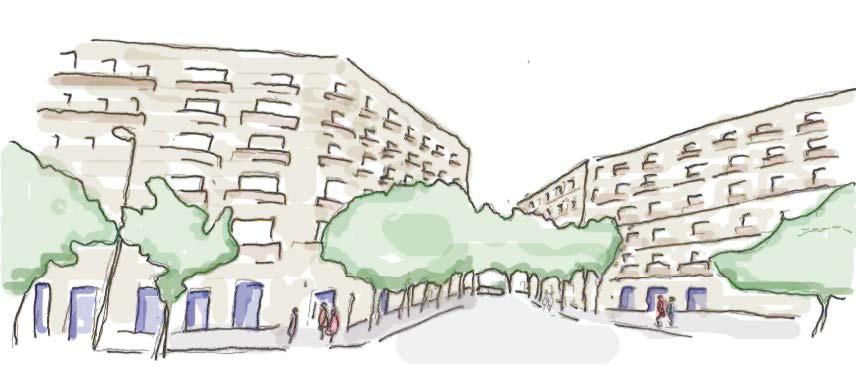
View A looking down the central street towards the square Angled building corners inspired by Barcelona. This create new sight lines that increase visual connectivity.
A B (Gehl 1987:13)
View B from the square looking towards the central street. Angled corners increase visual permeability around corners.
The design draws upon the theoretical frameworks of Jan Gehl (1987) and Ali Madanipour (2014) to inform a vision for active streets. This vision emphasises the sociality of boundaries and the impact they have on behaviour, sense of belonging and well-being.
TUT 2 (Group 1) | TASK 2: URBAN DESIGN PROPOSAL | 2021 - 22 THE HUMAN PERSPEC TIVE
Key attention has been paid to the relationship between the public and private realms, ensuring that this interface is designed in such a way to facilitate communication and interaction. This is done through creating small front gardens which ensure privacy for ground oor residents whilst also maintaining the proximity of public and private space, enabling interaction. The design includes a large number of windows and doorways facing onto the street in order to create an active human presence across the development (Carmona 2021:409).
“Although the physical framework does not have a direct in uence on the quality, content and intensity of social contacts, architects and planners can a ect the possibility for meeting, seeing and hearing people”
Views A and B Light brown brickwork creating continuity with surrounding neighbourhood and aiding legibility.
High density housing surrounding a public square with mixed use on the ground oor. Balconies facing onto square enabling increased interaction between the public and private realms.
PAGE 20
Additionally, the public square is designed as a central point for the community, creating a space of sociability. The square accommodates a spectrum of activities, facilitating human contact and sparking an active public realm.


PROPOSAL TUT 2 (Group 1) | TASK 2: URBAN DESIGN PROPOSAL | 2021 - 22
The front gardens maintain privacy with the street, whilst the back gardens create a clear demarcation between private and public shared courtyard space. Shared courtyard spaces will create open space for all residents from the two perimeter blocks. These will be well-de ned spaces, inspired by the Coin Street Iroko Housing Co-operative, with clear boundaries between public and private areas.
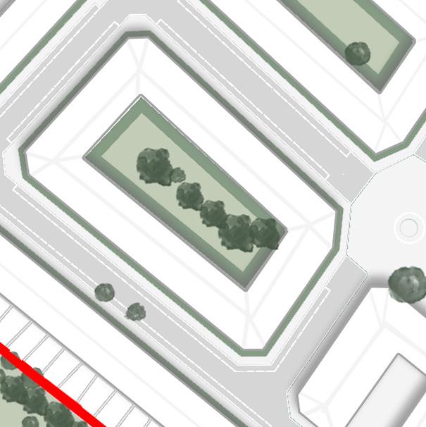
GREEN SPACE
Clear demarcation of private and shared green spaces to encourage active uses
The neighbourhood playground and green space seek to address the existing inadequacies of public green spaces within a 15-minute walk of the site. The neighbourhood playground is for use by residents as well as the surrounding community. By combining the sites edges with surrounding estates, the shared playground and green space are enlarged to serve families from both within and outside the development. Seating is also provided to help these spaces cater for a broad selection of the local community.
Courtyard shared green space, Private front and back gardens neighbourhoodSharedplayground greenSharedspace
Front and back gardens of Archibald Road (Source: Google Maps)
As exempli ed by Archibald Road, the surrounding neighbourhood bene ts from having private front and back gardens. The proposed design o ers ample private green spaces for ground oor residents.
COURTYARD SHARED GREEN SPACE, PRIVATE FRONT AND BACK GARDENSSHARED NEIGHBOURHOOD PLAYGROUND AND GREEN SPACE
PAGE 21
Shared courtyard space with group seating at Iroko Housing Co-operative (Source: Coin Street Community Builders, 2021)


To create a public space which is truly usable and belongs to the community, the square is designed for exibility and caters to di erent activities throughout the year. The multiple uses of this square will encourage recurring visits, making the site a gathering point for people in the neighbouring areas and encouraging community interaction. The square and its frontages towards the two courtyard blocks will be pedestrianised to prioritise walking and enhance the experience of visitors in the public space. The square will prohibit vehicular access at all times unless for emergency vehicular access or to set up of markets.
PANKHURST SQUARE: DESIGN CONTEXTUAL SENSITIVITY
AC TIVE STREETS AND VISUAL INTEGRATION
PAGE 22
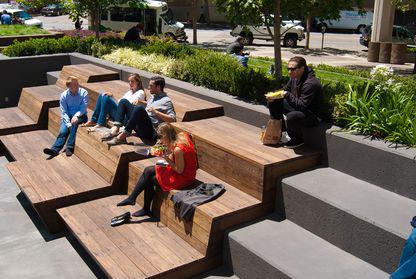
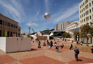
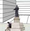
Key Elements: 1. Public space 2. Statue / Local landmark 3. Informal seating (steps) 4. Community mural art / pop-up installations Informal seating Steps around the statue act as informal seating for community gathering. Community space Space designed to accommodate exibility and a mix of uses. This responds to the lack of public open space in the district and caters for communal needs including leisure and relaxation. Statue The statue should be determined in collaboration with the local community, Sister’s Uncut, Historic England and the Museum of London. The statue should also be accompanied by a plaque which explains the history and signi cance of the site and continues its legacy as a local landmark. Public space Pankhurst square will serve as the central public space to be enjoyed by all residents and surrounding community. This is of high importance due to the density of the development.
The history of women’s rights is of national signi cance and unique to the area’s identity. To recognize this history, a square has been created as a node for the local community to gather. The square is strategically located to provide an active frontage along Parkhurst Road, taking advantage of the high footfall that this area receives. It is proposed that the square is named Pankhurst Square in order to recognise the role of Su ragettes such Emmeline and Sylvia Pankhurst in the women’s rights movement. The square aims to connect the community by creating an safe, open and pedestrian friendly space. We propose that a statue is erected in the square to commemorate this history and represent the signi cance of the prison in the struggle for women’s rights.
PROPOSAL TUT 2 (Group 1) | TASK 2: URBAN DESIGN PROPOSAL | 2021 - 22
Pankhurst Square is designed to be a node and the “strategic focus point for orientation”(Lynch 1960:12)
Visualisation of public square


Art installations can be designed by local artists or users of the women’s building, encouraging community ownership of the square through co-Designdesign. caters for informality, allowing for pop up markets. Public square clearly visible from Hillmarton Road New junction design with increased pedestrian mobility and additional greening Restaurants and cafés with outdoor seating creating a sense of as a GP and pharmacy VIEW FROM HILLMARTON ROAD
PROPOSAL TUT 2 (Group 1) | TASK 2: URBAN DESIGN PROPOSAL | 2021 - 22 PANKHURST SQUARE: USES SCENARIO 2 – LEISURE SQUARE SCENARIO 1 – MARKET SQUARE Art 2020).Newspaper(TheManhattanGround’‘RestorativeHudsonInstallation:SquareinArchitect’s
Amenitiesplacesuch
The sloped interface between square and road creates a continuum between the two, encouraging pedestrian and cyclist use of the whole street. This functional design also allows for vehicle access to set up markets. To ensure pedestrian safety removable bollards and planters will be placed at the interface.
PAGE 23
Market Guernseyin atmosphere.andadesign,informaladvantagetakesofsquarecreatingrelaxedinviting
SQUARE/ STREET INTERFACE
The square creates a new vista from Hillmarton Road into the development site. The width of the entrance is in proportion to the size of the junction creating a funnel of vision that draws people into the square.


The 7,500m2 women’s building has been designed to provide like-for-like services to those which were o ered within the prison. These will support women, non-binary, trans and intersex people and their families, therefore responding to the demands of Sister’s Uncut (2021) and the Community Plan for Holloway Partnerships(2021). will be formed with organisations such as Clinks, The Koestler Trust and Women in Prison in order to provide a wealth of services such as nancial planning, library access to computers, mental health services and employment support. The accessibility of this space is key, and therefore it will be tted with full wheelchair access, gender neutral toilets and hearing loops. Additionally, the design responds to the community’s desire for the centre to be an independent building, rather than located underneath ats.
Within the community responses to the redevelopment of the site, it was noted that red brick facades resemble the old prison site. The facade of the new women’s centre has been carefully chosen so as to not resemble the prison. Instead, it will be made from a lighter coloured brick, creating a continuity with the surrounding neighbourhood. The building is located on the south side of the site, ensuring that it receives optimum sunlight and is located next to the public square. The new centre also faces directly onto the busy junction, giving it visibility and prominence within the community. At the same time, there is a discrete back entrance which provides security for people seeking to access sensitive services.
PROPOSAL TUT 2 (Group 1) | TASK 2: URBAN DESIGN PROPOSAL | 2021 - 22 01 02 WOMEN’S BUILDING AERIAL VIEW Floor 5 Floor 4 Floor 3 Floor 2 Floor 1 ExhibitionPharmacyNursery EmploymentSpaceadvice/nancialplanningsupport / legal Libraryclinics with access to phones and computers Mental health support Short-term dwellings Short-term dwellings GP/ Doctors VIEW FROM SQUARECOMMUNITY RESPONSE
Discrete entranceback PAGE 24


• Provision of 70% a ordable housing, creating the opportunity for rst-time homeowners to enter the property market.
• The development meet the needs of Islington Council and the community, whilst also ensuring that the project is nancially viable.
WOMEN’S RIGHTS ORGANISATIONS
LOCAL GOVERNMENT
•Plan:Experience of place and quality of character have been carefully considered by designing for sensitivity with the surrounding context. This has been done through a continuity of building heights, material similarities and typological similarities.
• Community facilities.
• Provision of square which addresses the lack of public open space in the nearby area.
LONDON PLAN
PAGE 26
• The development prioritises the community, ensuring the lasting success of the project.
• Public square commemorates the history of the Su ragettes and the national signi cance of the site.
• Provision of essential amenities such as GP and pharmacy.
• High quality housing and healthy streets promoting walking and cycling create long term resilience.
• New cafés and restaurants, providing new services for the existing community.
• Provision of a nursery, pharmacy, GP, exhibition space, library space with computer access and mental health support services.
• The proposal develops local cycling infrastructure and amenities such as a doctors, pharmacy, cafe, restaurant and supermarket.
• The high density of the development ensures sustainability and e ective land use in a prime central London location.
• Women’s building is 7,500 m2, exceeding the Community Plan for Holloway’s request for 6,000m2.
EXISTING NEIGHBOURHOOD
The plan meets the following needs voiced by the Community Plan for
FUTURE GENERATIONS
• Environmental sustainability achieved by a car light development that promotes active travel.
PROPOSAL TUT 2 (Group 1) | TASK 2: URBAN DESIGN PROPOSAL | 2021 - 22 STAKEHOLDER REFLEC TION DEVELOPERS
The design responds to the following criteria of article D3 in the London
COMMUNITY GROUPS
• Provides 1,000 new dwellings responding to the council’s housing crisis.
• 70% genuinely a ordable housing.
• Open public space which is accessible to everyone.
•Holloway:Avariety of di erent tenure structures which provide support for women in need.
• Women’s building and public square with central statue respond to the calls for a strong legacy for the prison.
Accessible women’s building located towards Camden Road with high footfall. Prioritise pedestrian and cyclist access to ensure a safe and active environment.
PROPOSAL TUT 2 (Group 1) | TASK 2: URBAN DESIGN PROPOSAL | 2021 - 22PAGE 27
Flexible, multipurpose design to encourage active use and interaction.community
Overall building design Grid morphology promotes easy movement across the site and ensures connectivity to the surrounding area.
Clearly greenprivatedemarcatedandpublicspacestoavoidunderutilisedopenspaces.
High number of windows and doorways facing onto the street to increase the possibility for community interaction.
Eradicating disused spaces to connect with neighbouring developments through the provision of new playgrounds.
Independent women’s building and a range of community services in response to historical context and existing lack of amenities in the area.
Physical and visual integrationActive streets Sensitive to the existing context
ratios optimise housing density and are sensitive with existing urban fabric.
Mixed developmentuseon the ground oor to invite visitors into the public space.
Access to green elementshuman-scalespace,andsoftnaturalbarriers.
Dedicated statue to commemorate Su ragette history.
Angled corners to increase permeability.visual New cycle routes and access points to improve accessibility across the ward. Site advocates limited car usage in line with the broader development goal of the London Height-to-widthPlan.
5 new access points and enhanceimprovementsjunctiontopedestrianandcyclistaccessibility.
Pedestrianisedandopenfrontagetointegratewiththewidercommunity.
CONCLUSIONS movementaccessConnectivity,andStreetinterfaceandhumanperspectiveGreenspacePankhurstsquareWomen’sbuilding Vision proposalDesign
Development is consistent with the surrounding area and housing provision responds to a lack of a ordable housing in Islington.
Building typology and street morphology promote active street life.


O’Brien and Cheshire., 2016. Datashine Census. [Online]. Available from: https://datashine.org.uk/#table=QS106EW&col=QS106EW0004&ramp=YlOrRd&layers=BTTT&zoom=12&lon=-0.1500&lat=51.5200
The Riba Journal., 2018. Available at: https://darkroom.ribaj.com/0/668/838aa908e47da7576e37b46fda1ebd26:547dd688b813b5721b5285f4b720a0a9/note-the-step-in-plan-allowing-light-into-the-rear-of-the-existing-terrace https://darkroom.ribaj. com/0/668/838aa908e47da7576e37b46fda1ebd26:547dd688b813b5721b5285f4b720a0a9/note-the-step-in-plan-allowing-light-into-the-rear-of-the-existing-terrace [accessed 12/12/21].
Sisters Uncut., 2021. Why we plastered our demands on the fence of Holloway Prison. Available at: https://www.sistersuncut.org/2019/10/11/why-we-plastered-our-demands-on-the-fence-of-holloway-prison/ [accessed 20/11/2021].
Carmona, M., 2019. Principles for public space design, planning to do better. Urban Design International, 24(1), 47-59. Carmona, M., 2021. Public places urban spaces : The dimensions of urban design / Matthew Carmona. (Third ed.).
TFL., 2014. London Cycling Design Standards. Available at: https://t .gov.uk/corporate/publications-and-reports/streets-toolkit#on-this-page-2 (Accessed 1 December 2021).
The Architect’s Newspaper., 2020. WIP Collaborative’s Restorative Ground wins Care for Hudson Square design competition. Available at: https://www.archpaper.com/2020/09/wip-collaborative-restorative-ground-hudson-square/ [accessed: 1 Dec 2021].
Islington., 2017. Urban Design Guide: Supplementary Planning Document. London Borough of Islington: Spatial Planning and Transport. Islington., 2019. Islington Transport Strategy 2019-2041. Consultation Draft Report. Unpublished. Jacobs, J., 2016. The death and life of great American cities. Vintage. Kevin, L., 1960. The image of the city. Cambridge Massachussettes. Metropolitan Police., 2021. Safer Neighbourhood Team Map. [online]. Available from https://www.met.police.uk/sd/stats-and-data/met/crime-data-dashboard/ [Accessed 24 November 2021]. Museum of London., 28 March 2021. Available online from: https://www.museumo ondon.org.uk/discover/su ragettes-holloway-prison [Accessed 20 November 2021]. Nerdwallet., 22 October 2020. Available online from : https://www.nerdwallet.com/article/small-business/how-to-open-a-co ee-shop [Accessed 10 December 2021] OCSI., 2019. Local Insight pro le for ‘St George’s’ area. [online]. Available at: https://www.islington.gov.uk/-/media/sharepoint-lists/public-records/publichealth/qualityandperformance/pro les/20192020/20191206stgeorgeswardpro lejanuary2019.pdf [Accessed 24 No vember Opentable.,2021].2021.
[Accessed 27 November 2021].
Sustainable Transport, Walking and Cycling Guidance. Consultation Draft Report. Unpublished. Historic England., 2021. Holloway Prison and the Fight for Freedom. [online]. Available from: https://historicengland.org.uk/research/inclusive-heritage/womens-history/su rage/hmp-holloway/ [Accessed 2 December 2021]
BIBLIOGRAPHY
PROPOSAL TUT 2 (Group 1) | TASK 2: URBAN DESIGN PROPOSAL | 2021 - 22
Gehl, J., 1987. Life between buildings : Using public space / Jan Gehl ; translated by Jo Koch. New York ; Wokingham: Van Nostrand Reinhold. GLA., 2018. Land Area and Population Density, Ward and Borough. Available at: https://data.london.gov.uk/dataset/land-area-and-population-density-ward-and-borough (Accessed 29 October 2021). GLA., 2021. Parking Addendum to Chapter 6 - cycle parking. Available at: https://www.london.gov.uk/what-we-do/planning/london-plan/past-versions-and-alterations-london-plan/london-plan-2016/london-plan-chapter-six-londons-transport-2 (Accessed 2 December GLA.,2021).2021.
10 of the Most Festively Decorated Restaurants in the U.S. and Canada for Celebrating the Holidays. [online]. Available online from: https://blog.opentable.com/ [Accessed 10 December 2021]
Sisters Uncut., 2019. Why we plastered our demands on the fence of Holloway Prison. Available at: https://www.sistersuncut.org/2019/10/11/why-we-plastered-our-demands-on-the-fence-of-holloway-prison/ [Accessed 20 November 2021].
Community Plan for Holloway,. 2021. [Online]. Available online at: https://plan4holloway.org [Accessed 20 November 2021].
Squaremeal., 2019. 20 Nice Restaurants in London. [online]. Available online from: https://www.squaremeal.co.uk/restaurants/best-for/nice-restaurants-in-london_9224 [Accessed 10 December 2021]
PAGE 28
GROUP WORK Our work is a joint submission and includes an account of the contributions made by each group member, signed by all of us. TO BE COMPLETED BY EACH MEMBER OF THE GROUP We confirm that all the components of this project are the joint work of the authors. The contribution of each was as follows: STUDENT’S NAME DESCRIPTION OF CONTRIBUTION (inc. research, presentation, etc.) SIGNATURE Anjali Maniar NaturalAnalysis:resource, Green Space, and climate Division of Work in finalising the proposal document: • Drawing Masterplans • CAD drawings and site areas • Iteration sketches • Room orientations • Pedestrian access pages • Square uses page AM Ethan Caris Analysis: Accessibility, Permeability and Movement.Divisionof Work in finalising the proposal document: • Title page • Contents page • Intro page • Analysis pages • Vision pages • Access pages • InDesign compilation EC Wai Chuang Analysis: Well-being and Safety (Crime Rate, Sense of Security) Division of Work in finalising the proposal document: • Justification of Affordable housing • Green Space courtyard page • Square design • Square uses • Conclusion WC
Milly Warner Analysis: History, Heritage, Social Context (Women’s Building) and Social Capital. Division of Work in finalising the proposal document: • Analysis synthesis • Street life pages • Masterplan reflection • Square justification • Write up on women’s building • Stakeholder reflection slide • InDesign compilation MW MuhammadSaid Zulfitri Analysis: Sustainability, Potential Retainment of Old Prison, Movement. Division of Work in finalising the proposal document: • Street sections and page • Sustainable design pages (not used due to contrast with vision not reflection of quality) • Women’s building visualisations • Mixed use development page • Bibliography SZ TO BE COMPLETED BY THE TUTORS: Was the work equally shared among all members of the team? YES □ NO □