8 minute read
New place for care ecology
1.1 Wandle corridor. Potential of inner peripheral conditions to house care.
There is a type of areas that we often consider appropriate for care environments like nursing homes, homes for elderly, assisted living, etc. These areas are often characterised by amazing landscape, access to water and relatively quiet and calm settings in general. However, this also means that such care venues usually end up in isolation from the central city environments as desire for privacy, quietness and a certain level of security seem to be dominant considerations in their design process. If we agree to look at the potential of care ecologies in their urban value and their ability to rethink our neighbourhoods, then the first step would be to consider areas in our cities that are well-connected to the central city environments but still offer the qualities we value so much in relation to care. In this case, we would suggest to shift our attention to the inner periphery of the city, which offers fabric that is free from the ‘straitjacket of identity’1 that we inevitably face when working in the central city environments.
Advertisement
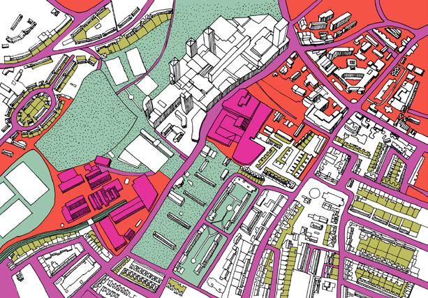
One of the corridors that starts offering this is the inner-peripheral area on the South bank of London, located along the river Wandle, stretching from the borough of Wandsworth in the North to Croydon in the South [6]. Exceptionally well located in relation to the inner city, the Wandle river trail2 offers access to landscape that is almost rural in character, vast open green areas and clean water that supports biodiversity of the area. However, as well as many other areas in London that are located along the significant water routes, Wandle river is still dominated by the industrial hubs, storage and service centres which represent the ‘furious industrial activity’ of its past3
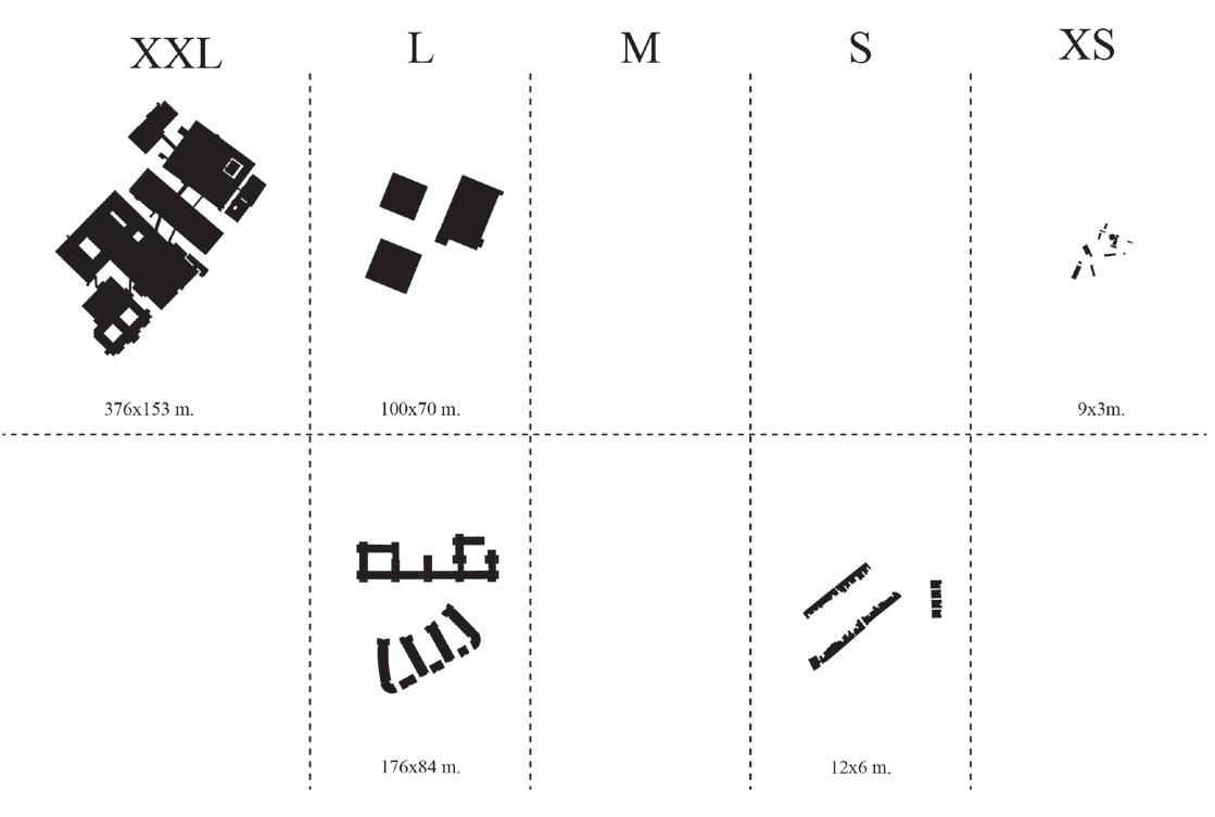
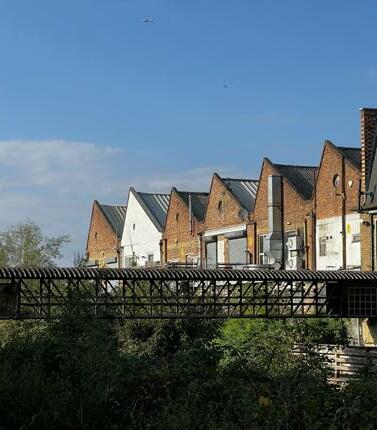
There is a distinctive transition in terms of the development models and type of settings that can be identified along the Wandle, as one moves from the Thames waterfront towards the southern end of the corridor4. Not in the last place due to the improved transport links over the last years5, the waterfront is considered an area of opportunity and high market value, and begins to be dominated by commercially oriented developments and regeneration schemes6 emerging around district centres. The fabric further to the South constitutes a combination of the ‘London vernacular’ villages – endless strips of terraced housing, under-performing high-street environments, and large scale post-industrial hubs. [7-12] Juxtapositions of scale are found between extra-small of the terraced houses and minor industrial structures to the extra-large storage and service sheds, with the medium scale of the built fabric missing from the bigger picture. [13]
1 Rem Koolhas, “The Generic city”, in B. Mau and OMA. S,M,L,XL (New York: The Monicelli Press, 1995): 1248-1264.
2 The Wandle Trail is a 12.5-mile walking and cycling trail that follows the River Wandle from Croydon to Wandsworth.
3 Tom Bolton in the ‘London’s lost rivers’ describes a walk along the Wandle as ‘unfurling a hidden history, of a rural past and of furious industrial activity’.
4 Similar conditions can be observed in other parts of the London inner periphery, for example in the Vauxhall-Battersea stretch.
5 Moreover, there is the Crossrail 2 system coming in the area in the nearest future.
6 Projects like the Ram Quarter in Wandsworth.
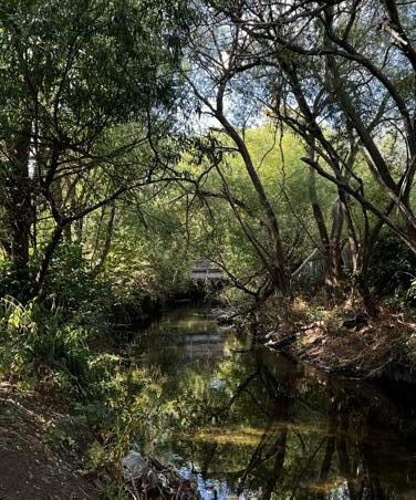


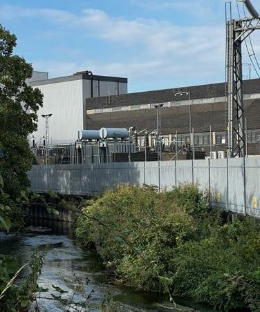


The most ‘trivial’ medium scale is missing from the built fabric, and the new project can play a mediating role in filling the gap.
Both the post-industrial and the nature landscapes in the area are at the moment under-utilised. The patterns of land ownership and plots dimensions and borders are historically challenging in the area. In combination with a lack of common framework and vision for change it results in independent developments that happen regardless of their impact on the future of the neighbourhoods and are unable to create benefits for a wider urban area https://duplex-architekten.swiss/en/#/en/projects/bell-areal/. accummulation of care environments oriented towards collectivity as a framework for a new version of neighbourhood
Today, the Wandle corridor is considered a very attractive area for young families and people with kids. It is possible due to the layered infrastructure of the schools, kindergartens, nurseries, sport facilities, and different versions of child care found in the area. In addition to that,it also is the place for St. George’s Hospital, one of the largest hospitals and educational/research institutions not only in South London but in the whole city.
The question is: are we doing enough in order to benefit from the phenomenal stretch along the river Wandle, all the layered infrastructure it offers, its landscape resources and heterogeneous morphology? We would claim that, in words of Duplex architects this heterogeneity ‘has a potential of transforming the direct juxtaposition into a high-contrast coexistence’5. A new version of care ecology could be fundamental to transformation in this area but is unthinkable today in the context of the kinds of care environments that we are traditionally facing in health and well-being.
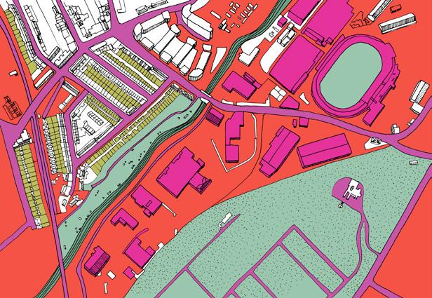
The thesis puts forward a design-led project located on the border between the Merton and Wandsworth councils, within the North Wimbledon/Garrett Business Park area. [14] It occupies a 15 ha. site, works with partial requalification of the exisiting industrial area. It puts forward an adaptable urban strategy and typological framework with a goal of requalifying the area into a productive neighbourhood which can potentially boost transformation of a wider urban area and become apart of a rethought Wandle corridor.
Strategic urban framework. Vision for a new neighbourhood
Although in general the morphology of the Wandle trail comes across as broken and irregular, there are consistencies to be found if we zoom out and look at the corridor holistically. The high-street, railway and Wandle armatures emphasise the prevalence of the North-South axis of the corridor and start forming distinctive post-industrial enclaves along the water. [15-20] Following David Graham Shane, each of these enclaves can be read as a ‘recombinant assemblage’ working on the basis of neighbour-to-neighbour relationships of the fragments, as ‘an unpredictable, self-organised system with strictly local rules that can nonetheless produce predictable largescale patterns’6.
Within the disjunctions and irregularities of the enclave fabric certain strong urban conditions can be found. For the purposes of this research, 3 of them are rethought. They are: the industry, the park and the high street. [2129] At the moment each of these conditions presents its own conflicts.
The issue of losing employment lands to housing has become urgent in the UK over the last years7. However, an attempt to continuously retain industrial land leads to creation of conservation areas and the strategies offering crossovers between production and housing often ends in a 'limited promise, seized upon as a nostalgic dream, thereby unconsciously transformed into an unsatisfying theme park’8. Crossovers with new care ecology could help us to retain viability of the employment lands by broadening the set of businesses they can support.
We are shifting our attitude to the role parks have to play in our cities today from ‘negative’ green spaces to places promoting event-led urbanity and different culture of using green and blue infrastructure that is more civic oriented and activity-based.
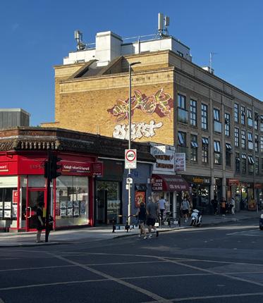
Today the traditional high-street so typical for residential areas of London is struggling to redefine its purpose. We see the need to shift away from a concentration of commerce to a less linear and more layered way of organising our daily rhythms.
As a result of all these conflicts, we tend to separate these environments to have dedicated city spaces for production and logistics, for leisure and sport, and for everyday activities associated with home, family and work respectively. The fact that they overlap only for a limited amount of time and do so ineffectively, is the reason why areas like the one we are investigating, are under-performing.
6 David Graham Shane, Recombinant urbanism : conceptual modeling in architecture, urban design, and city theory (Chichester: John Wiley, 2005): 145-146.
7 Oliver Wainwright, “Made in London no more: will property speculation kill industry in the capital?”, Guardian (2017), https://www. theguardian.com/cities/2017/feb/06/made-london-property-speculation-industry-capital.
8 Julia Spirig, From employment land to makers society (London: Architectural Association, 2021): 10.






Unlocking the potential of the area: integration of new logistics
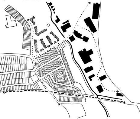
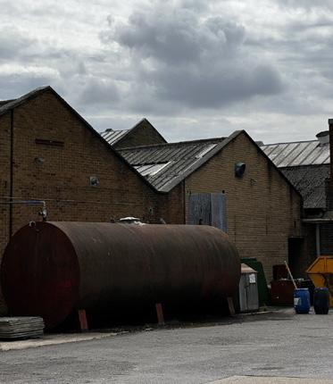
To start changing the way the enclave operates today and to address the challenge of separation described above, thesis suggests to rethink the way service delivery is currently organised on the site. Right now the heavy mobility and logistics routes are spread within the industrial part of the area with the main access road located between the sheds. Therefore, the space between the industrial structures is compromised by the parking of heavy machinery and delivery trucks and vans. As a result, the connection to the land in the northern part of the site is restricted, in addition to the railway line running in the West and river in the East. It makes it challenging for any substantial development to come in and start forming a dialogue with the industrial land9. A solution put forward by the project is to organise a separate service corridor between the back of the sheds and the lifted railway line by disassembling part of the sheds structure and shifting their borders farther in. This could unload the logistics and servicing demands off the industrial yards and turn them into much more purposeful civic-oriented spaces engaging with the waterfront and accessible for the local residents. The goal is not to mask the activity that belongs to the realm of the sheds. On the contrary, the space between them can still be productive and used as a working yard. However, all the ‘disruptive’ mobility is handled in a much more systematic way and allows to unlock possibility for a different landscape.[30] In order to allow for seamless and quick turning of large vehicles in the corridor, as well as create a dedicated parking area for them, one of the existing sheds structure is transformed into a garage.
Paying attention to the way the buildings on the site are currently organised, one can notice that despite the fact that the North-South axis is the dominant one, the eastwest direction is already registered in the way the industrial structures are organised on the site. They form an array located almost perpendicular to the waterfront.
This exisiting parcellation provides a system of striations that run through key armatures (the railway, the river, and the road). They also give a sense of dimensions and help to locate the ptoject as something that establishes balance and integration within a wider circulatory system.
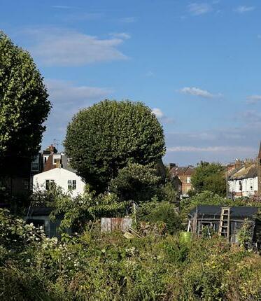
The project uses the existing directions formed by this array and transforms them into physical links – the new light mobility routes crossing the river and connecting the industrial land and new clusters to the high street on the other side.This way the waterfront becomes an extension of the buildings’ organisation logic and part of the everyday life activities of the residents, putting emphasis on actively engaging with the water. [31-33] The existing park in the middle of the site becomes a crucial element in negotiating between all the elements of the site.[ 34] Right now this green area is treated almost like a backyard of the residential fabric and the high-street and is under-performing.
Zooming out, the urban area of each enclave along the river Wandle can be thought of as a node within a larger system. On the basis of understanding the form and potential of each of these urban areas we can start conducting design investigations. These investigations would have an aspiration of turning what is currently the Wandle corridor into a series of well-defined, highly performing neighbourhoods; where the strength of the enclaves system lies in ‘the proximity and the accessibility of ‘the other’ Enclaves, despite their independent position, are a boon for the city as a whole. They can give the city the layeredness and multifaceted identity fitting to our present-day society10.
9 Right now a Garratt Mills co-housing project is being delivered on the northern end of the site. However, the project does not seem to offer qualities addressed at a wider urban area.
10 Dick Van Gameren and Pierijn Van Der Putt. In: The Urban Enclave, Fragments of an Ideal City, 2011. P.4-11.


The placement and dimensions of the project are determined by the existing parcels. The light industrial vocation remains in place, and new residential care-driven environments come in


