


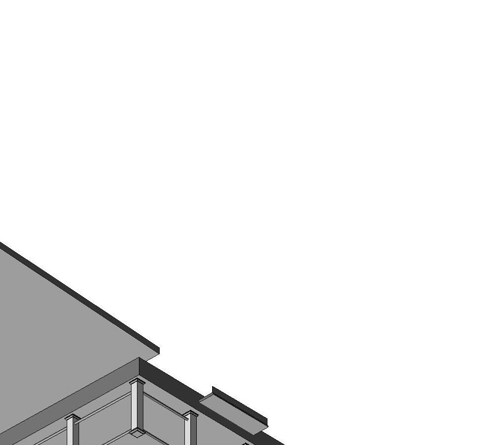


Scale: Drawn By: Call us at: (617) 247 9161 info@existingconditions.com www.existingconditions.com The Most Accurate Existing Conditions Surveys and As-Built Surveys Date: All projects are measured using the most advanced aser measuring equipment and our best standards and practices. All work will be field verified by client prior to design or construction or other use. General Notes: 1. is expressly understood by client that ECS is not an architectural or engineering entity. None of the documents prepared by ECS for client shall have any stamping or certification of such trade professionals. 2. This is not structural or MEP analysis or due diligence model. Visible and accessible elements are modeled for location and size. Further structural or MEP analysis could be ecessary by others. 3. STANDARD OF PRACTICE. Services performed by ECS under this Agreement will be conducted in a manner consistent with that level of care and skill ordinarily exercised members of the profession currently practicing in the same localit under similar conditions. No other representation, expressed or mplied, and no warranty or guarantee is included or intended in this Agreement, or in any report, opinion, document or otherwise. Client shall field verify all work prior to design construction, or other use. 4. These drawings are for the intended purposes listed in the scope of work at the time of survey and should not be use for any other reasons. See scope of work provided to client for further information. Laser Scanning Notes: 1. Visit FARO.com and leica-geosystems.com for 3D aser scanner tolerances, range information and product specifications. 2. Laser scanning equipment uses light waves to measure distances, unforeseen site conditions such as dust, moisture, vibration, surface reflectivity, lighting conditions, temperature, humidity, ferromagnetic materials, building configuration etc. may impact registration between scan locations. 3. Accuracy over long distances can be improved the client provides survey benchmarks prior to scanning in order to reference the laser scan data into coordinate system. 4. The Revit file contains the most complete alignment of point cloud data. All laser scanning by default is in ocalized coordinate system. Laser scans completed on multipl days may be tied into previous laser scans by use of site specific features and targets. Point cloud adjustments are made in Revit for a final verification. TM AREA CALCULATIONS BASED ON POINT CLOUD DATA ARE ESTIMATES. ACTUAL AREA MUST BE DETERMINED BY CLIENT, OR CALCULATED AFTER COMPLETION OF DELIVERABLES. Project Number: Perspective View EX00 Author 05/25/23
Waterfront 1 Masthead Drive Warwick, RI 10287047851 Scale: 1 Perspective View
Chelo's
UP UP UP DN DN UP UP DN EX05 3 EX04 1 EX04 2 EX04 3 EX04 6 EX05 2 EX04 8 EX05 8 EX05 EX04 5 EX04 7 EX04 4 EX05 1 RAMP UP RAMP UP RAMP UP DN LOW WALL LOW WALL FE = -0' - 10 1/2" FE = -0' - 7" FE = -0' - 7" FE = -0' - 7" FE = -1' - 2" UP FE = -0' - 2" FE = -0' - 2" FE = -0' - 7" FE = -0' - 7" FE = -0' - 7" CEILING HEIGHT: 7'-7.5" CEILING HEIGHT: 7'-10.5" CEILING HEIGHT: 7'-9.5" CEILING HEIGHT: 7'-9" CEILING HEIGHT: 8'-8" CEILING HEIGHT: 8'-1" CEILING HEIGHT: 8'-1" CEILING HEIGHT: 8'-6.5" CEILING HEIGHT: 7'-9" CEILING HEIGHT: 7'-7" CEILING HEIGHT: 8'-4" CEILING HEIGHT: 7'-8" CEILING HEIGHT: 9'-1.5" CEILING@RIDGE: 10-55 CEILING@EDGE: 9-4 CEILINGHEIGHT: 8-85 " CEILINGHEIGHT: 12 '05 " CEILINGHEIGHT:7-9 CEILINGHEIGHT: 7-25 "CEILINGHEIGHT: 8-0 CEILINGHEIGHT: 7-1.5 CEILINGHEIGHT: 7-25 " CEILING@EDGE 7-10" CEILING@RIDGE: 9 ' -105 " CEILING@EDGE:7-25" CEILING@RIDGE: 9-105 " FE = 0' 3" CEILING HEIGHT: 8'-0" CEILING HEIGHT: 8'-5.5" CEILING HEIGHT: 8'-0" CEILING HEIGHT: 8'-0" CEILING HEIGHT: 7'-2.5" CEILING HEIGHT: 7'-8" CEILING HEIGHT: 7'-8" CEILING HEIGHT: 7'-8" CEILING HEIGHT: 8'-0" B.O.B: 7'-0.5" CEILING HEIGHT: 7'-2.5" FE = -0' - 2" 6' 11 3/4" 12'3" 9' 10 3/4" 12'3 1/2" 3'8" 7'0" 8'7" 17'7 1/2" 3' 10 1/2" 6'3 3/4" 10' 10 3/4" 7' 8 1/2" 8' 11 3/4" 19'8 1/2" 19' - 0 3/4" 24 -83/4 8111/4 973/4 " 3103/4 " 6'1" 7' 10 3/4" 4'0 1/2" 5'0 1/4" 6113/4 9 -53/4 " 703/4" 10 -13/4 10 ' -31/2" 37'2 3/4" 13 -23/4 1301/2" 39' - 8" HEAD : 71 SLL : 19 HEAD : 70 SILL 111 HEAD: 70 SILL 111 HEAD 70 SILL 111 SHEAD7-012 ILL1-1112 HEAD6-10 SILL7 HEAD: 5'-11 1/2" SILL: 2'-11 1/2" HEAD: 5'-11 1/2" SILL: 2'-11 1/2" HEAD: 5'-11 1/2" SILL: 2'-11 1/2" LOUVER 7' 10" 9 10 DN DN FE = -1' - 2 1/2" FE = 0' 0" FE = 0' 0" 1 EX06 EX05 4 EX05 5 EX05 6 EX05 7 2 21 0 1 / 4 11 - 5 3 4 FE = -0' - 6" FE = -1' - 2" 1 EX06 Scale: Drawn By: Call us at: (617) 247 9161 info@existingconditions.com www.existingconditions.com The Most Accurate Existing Conditions Surveys and As-Built Surveys Date: All projects are measured using the most advanced aser measuring equipment and our best standards and practices. All work will be field verified by client prior to design or construction or other use. General Notes: 1. is expressly understood by client that ECS is not an architectural or engineering entity. None of the documents prepared by ECS for client shall have any stamping or certification of such trade professionals. 2. This is not structural or MEP analysis or due diligence model. Visible and accessible elements are modeled for location and size. Further structural or MEP analysis could be ecessary by others. 3. STANDARD OF PRACTICE. Services performed by ECS under this Agreement will be conducted in a manner consistent with that level of care and skill ordinarily exercised members of the profession currently practicing in the same localit under similar conditions. No other representation, expressed or mplied, and no warranty or guarantee is included or intended in this Agreement, or in any report, opinion, document or otherwise. Client shall field verify all work prior to design construction, or other use. 4. These drawings are for the intended purposes listed in the scope of work at the time of survey and should not be use for any other reasons. See scope of work provided to client for further information. Laser Scanning Notes: 1. Visit FARO.com and leica-geosystems.com for 3D aser scanner tolerances, range information and product specifications. 2. Laser scanning equipment uses light waves to measure distances, unforeseen site conditions such as dust, moisture, vibration, surface reflectivity, lighting conditions, temperature, humidity, ferromagnetic materials, building configuration etc. may impact registration between scan locations. 3. Accuracy over long distances can be improved the client provides survey benchmarks prior to scanning in order to reference the laser scan data into coordinate system. 4. The Revit file contains the most complete alignment of point cloud data. All laser scanning by default is in ocalized coordinate system. Laser scans completed on multipl days may be tied into previous laser scans by use of site specific features and targets. Point cloud adjustments are made in Revit for a final verification. TM Project Number: 1/8" = 1'-0" Existing First Floor Plan EX01 EC 12/15/2022 Chelo's Waterfront 1 Masthead Drive Warwick, RI 10287047851 Gross Area Schedule NameArea First Floor7200 SF First Floor Deck3246 SF Gazebo/Storage287 SF Patio1105 SF Second Floor3805 SF Second Floor Deck1671 SF Total17315 SF Scale: 1/8" = 1'-0" 1 First Floor Scale: 1/8" = 1'-0" 2 Gazebo/Stage
DN DN DN DN DN DN DN DN EX05 3 EX04 1 EX04 2 EX04 3 EX04 6 EX05 2 EX04 8 EX05 8 EX04 5 EX04 7 EX04 4 EX05 1 FE = 11' 10" FE = 11' 10" FE = 11' 10" FE = 9' 6" CEILING HEIGHT: 8'-9" HCEILINGEIGHT:10-2" CEILING HEIGHT: 7'-5.5" CEILING HEIGHT: 7'-4.5" CEILING HEIGHT: 14'-6" CEILING HEIGHT: 8'-9.5" CEILING HEIGHT: 7'-6.5" CEILING HEIGHT: 7'-4.5" CEILING HEIGHT: 8'-7.5" B.O.B.: 7'-3" CEILING HEIGHT: 9'-2" B.O.B.: 7'-11" CEILING @EDGE: 10'-6" CEILING @EDGE: 8'-11.5" CEILING @EDGE: 12'-8.5" CEILING HEIGHT: 7'-10" FE = 5' 3" FE = 3' 5" CEILING HEIGHT: 8'-9.5" B.O.B.: 7'-7" 411/4 551/2 371/2 911/4 " 13 - 5 3 4 12' - 4 3/4" 1101/2 963/4" 20'5" 9113/4 983/4 " 142 781/2" 3' 6 1/2" 5'4 1/2" 8' 6 3/4" 96 20 -23/4" 7' 8 1/2" 8'2" 53 -21/2 HEAD 781/2 SILL 27 1/2 HEAD 54 1/2 SILL 3 1/2 HEAD 54 1/2 SILL : 3 1/2 HEAD5-6 SLL5 HEAD5-6 SLL5 HEAD5-1112 SLL312 HEAD 54 1/2 S LL: 3 1/2 HEAD 54 1/2 SILL: 3 1/2 HEAD5-61/2 SLL:512 H E A D 54 1 2 S L L 3 1 2 H AD 5S L 3 H E A D 55 1 2 S L L6 1 HEAD:5-612 SILL51/2 SHEAD6-0 ILL:1-7 HEAD5-912 SLL:-31/2 SHEAD6-0 LL:1-7 SHEAD6-0 ILL 1-7 1 EX06 Scale: Drawn By: Call us at: (617) 247 9161 info@existingconditions.com www.existingconditions.com The Most Accurate Existing Conditions Surveys and As-Built Surveys Date: All projects are measured using the most advanced aser measuring equipment and our best standards and practices. All work will be field verified by client prior to design or construction or other use. General Notes: 1. is expressly understood by client that ECS is not an architectural or engineering entity. None of the documents prepared by ECS for client shall have any stamping or certification of such trade professionals. 2. This is not structural or MEP analysis or due diligence model. Visible and accessible elements are modeled for location and size. Further structural or MEP analysis could be ecessary by others. 3. STANDARD OF PRACTICE. Services performed by ECS under this Agreement will be conducted in a manner consistent with that level of care and skill ordinarily exercised members of the profession currently practicing in the same localit under similar conditions. No other representation, expressed or mplied, and no warranty or guarantee is included or intended in this Agreement, or in any report, opinion, document or otherwise. Client shall field verify all work prior to design construction, or other use. 4. These drawings are for the intended purposes listed in the scope of work at the time of survey and should not be use for any other reasons. See scope of work provided to client for further information. Laser Scanning Notes: 1. Visit FARO.com and leica-geosystems.com for 3D aser scanner tolerances, range information and product specifications. 2. Laser scanning equipment uses light waves to measure distances, unforeseen site conditions such as dust, moisture, vibration, surface reflectivity, lighting conditions, temperature, humidity, ferromagnetic materials, building configuration etc. may impact registration between scan locations. 3. Accuracy over long distances can be improved the client provides survey benchmarks prior to scanning in order to reference the laser scan data into coordinate system. 4. The Revit file contains the most complete alignment of point cloud data. All laser scanning by default is in ocalized coordinate system. Laser scans completed on multipl days may be tied into previous laser scans by use of site specific features and targets. Point cloud adjustments are made in Revit for a final verification. TM Project Number: 1/8" = 1'-0" Existing Second Floor Plan EX02 EC 12/15/2022 Chelo's Waterfront 1 Masthead Drive Warwick, RI 10287047851 Scale: 1/8" = 1'-0" 1 Second Floor Gross Area Schedule NameArea First Floor7200 SF First Floor Deck3246 SF Gazebo/Storage287 SF Patio1105 SF Second Floor3805 SF Second Floor Deck1671 SF Total17315 SF
DN 3 1/4" / 12" 15.16° 7 13/64" / 12" 30.97° 7 31/256" / 12" 30.69° 7 13/64" 12" 30.97° 4 109/256" 12" 20.25° 4 107/256" 12" 20.22° 5111/256" /12" 2436° 511/32" /12 2400° 57/256" /12 2273 199/256 /12 " 659 4 21 7 / 256 / 12" 22. 0 0° 4 21 7 / 256 / 12" 22. 0 0° EX05 4 EX05 5 EX05 6 EX05 7 5 1 3 / 2 5 6 / 1 2 2 2 8 3 4 2 5 1 / 2 5 6 / 1 2 2 2 5 4 1 EX06 Scale: Drawn By: Call us at: (617) 247 9161 info@existingconditions.com www.existingconditions.com The Most Accurate Existing Conditions Surveys and As-Built Surveys Date: All projects are measured using the most advanced aser measuring equipment and our best standards and practices. All work will be field verified by client prior to design or construction or other use. General Notes: 1. is expressly understood by client that ECS is not an architectural or engineering entity. None of the documents prepared by ECS for client shall have any stamping or certification of such trade professionals. 2. This is not structural or MEP analysis or due diligence model. Visible and accessible elements are modeled for location and size. Further structural or MEP analysis could be ecessary by others. 3. STANDARD OF PRACTICE. Services performed by ECS under this Agreement will be conducted in a manner consistent with that level of care and skill ordinarily exercised members of the profession currently practicing in the same localit under similar conditions. No other representation, expressed or mplied, and no warranty or guarantee is included or intended in this Agreement, or in any report, opinion, document or otherwise. Client shall field verify all work prior to design construction, or other use. 4. These drawings are for the intended purposes listed in the scope of work at the time of survey and should not be use for any other reasons. See scope of work provided to client for further information. Laser Scanning Notes: 1. Visit FARO.com and leica-geosystems.com for 3D aser scanner tolerances, range information and product specifications. 2. Laser scanning equipment uses light waves to measure distances, unforeseen site conditions such as dust, moisture, vibration, surface reflectivity, lighting conditions, temperature, humidity, ferromagnetic materials, building configuration etc. may impact registration between scan locations. 3. Accuracy over long distances can be improved the client provides survey benchmarks prior to scanning in order to reference the laser scan data into coordinate system. 4. The Revit file contains the most complete alignment of point cloud data. All laser scanning by default is in ocalized coordinate system. Laser scans completed on multipl days may be tied into previous laser scans by use of site specific features and targets. Point cloud adjustments are made in Revit for a final verification. TM Project Number: 1/8" = 1'-0" Existing Roof Plan EX03 EC 12/15/2022 Chelo's Waterfront 1 Masthead Drive Warwick, RI 10287047851 Scale: 1/8" = 1'-0" 1 Roof Scale: 1/8" = 1'-0" 2 Gazebo/Stage Roof Gross Area Schedule NameArea First Floor7200 SF First Floor Deck3246 SF Gazebo/Storage287 SF Patio1105 SF Second Floor3805 SF Second Floor Deck1671 SF Total17315 SF
Second Floor 11' - 10" First Floor Lower -1' - 2" SHINGLE TYP. SIDING TYP. First Floor 0' - 0" Lower Second Floor 9' - 6" First Floor Lower -1' - 2" SHINGLE TYP. SIDING TYP. First Floor 0' - 0" Second Floor 11' - 10" Lower Second Floor 9' - 6" First Floor Lower -1' - 2" 2' 4" 9'6" 1'2" SHINGLE TYP. SIDING TYP. First Floor 0' - 0" Lower Second Floor 9' - 6" 9'6" SHINGLE TYP. SIDING TYP. Second Floor 11' - 10" First Floor Lower -1' - 2" SIDING TYP. 10'2" First Floor 0' - 0" Second Floor 11' - 10" Lower Second Floor 9' - 6" First Floor Lower -1' - 2" SHINGLE TYP. SIDING TYP. 2'4" 9' 6" 1'2" First Floor 0' - 0" Second Floor 11' - 10" Lower Second Floor 9' - 6" SHINGLE TYP. SIDING TYP. 2'4" 9' 6" First Floor 0' - 0" Second Floor 11' - 10" Lower Second Floor 9' - 6" 2'4" 9' 6" SHINGLE TYP. SIDING TYP. Scale: Drawn By: Call us at: (617) 247 9161 info@existingconditions.com www.existingconditions.com The Most Accurate Existing Conditions Surveys and As-Built Surveys Date: All projects are measured using the most advanced aser measuring equipment and our best standards and practices. All work will be field verified by client prior to design or construction or other use. General Notes: 1. is expressly understood by client that ECS is not an architectural or engineering entity. None of the documents prepared by ECS for client shall have any stamping or certification of such trade professionals. 2. This is not structural or MEP analysis or due diligence model. Visible and accessible elements are modeled for location and size. Further structural or MEP analysis could be ecessary by others. 3. STANDARD OF PRACTICE. Services performed by ECS under this Agreement will be conducted in a manner consistent with that level of care and skill ordinarily exercised members of the profession currently practicing in the same localit under similar conditions. No other representation, expressed or mplied, and no warranty or guarantee is included or intended in this Agreement, or in any report, opinion, document or otherwise. Client shall field verify all work prior to design construction, or other use. 4. These drawings are for the intended purposes listed in the scope of work at the time of survey and should not be use for any other reasons. See scope of work provided to client for further information. Laser Scanning Notes: 1. Visit FARO.com and leica-geosystems.com for 3D aser scanner tolerances, range information and product specifications. 2. Laser scanning equipment uses light waves to measure distances, unforeseen site conditions such as dust, moisture, vibration, surface reflectivity, lighting conditions, temperature, humidity, ferromagnetic materials, building configuration etc. may impact registration between scan locations. 3. Accuracy over long distances can be improved the client provides survey benchmarks prior to scanning in order to reference the laser scan data into coordinate system. 4. The Revit file contains the most complete alignment of point cloud data. All laser scanning by default is in ocalized coordinate system. Laser scans completed on multipl days may be tied into previous laser scans by use of site specific features and targets. Point cloud adjustments are made in Revit for a final verification. TM Project Number: 1/8" = 1'-0" Existing Exterior Elevations EX04 EC 12/15/2022 Chelo's Waterfront 1 Masthead Drive Warwick, RI 10287047851 Scale: 1/8" = 1'-0" 2 South 1 Exterior Elevation Scale: 1/8" = 1'-0" 1 West 1 Exterior Elevation Scale: 1/8" = 1'-0" 3 South 2 Exterior Elevation Scale: 1/8" = 1'-0" 4 South 3 Exterior Elevation Scale: 1/8" = 1'-0" 5 East 1 Exterior Elevation Scale: 1/8" = 1'-0" 6 East 2 Exterior Elevation Scale: 1/8" = 1'-0" 7 East 3 Exterior Elevation Scale: 1/8" = 1'-0" 8 East 4 Exterior Elevation
Chelo's
First Floor 0' - 0" Lower Second Floor 9' - 6" SIDING TYP. 9'6" First Floor Lower -1' - 2" SHINGLE TYP. SIDING TYP. Gazebo/Stage -0' - 6" SIDING TYP. Gazebo/Stage -0' - 6" SHINGLE TYP. SIDING TYP. Gazebo/Stage -0' - 6" SIDING TYP. Gazebo/Stage -0' - 6" SHINGLE TYP. SIDING TYP. First Floor 0' - 0" Second Floor 11' - 10" SHINGLE TYP. SIDING TYP. 2' 5 1/4" 9'7 3/4" Gazebo/Stage Roof 13' - 7" First Floor Lower -1' - 2" SIDING TYP. First Floor Lower -1' - 2" SIDING TYP. SHINGLES TYP. First Floor Lower -1' - 2" SIDING TYP. Scale: Drawn By: Call us at: (617) 247 9161 info@existingconditions.com www.existingconditions.com The Most Accurate Existing Conditions Surveys and As-Built Surveys Date: All projects are measured using the most advanced aser measuring equipment and our best standards and practices. All work will be field verified by client prior to design or construction or other use. General Notes: 1. is expressly understood by client that ECS is not an architectural or engineering entity. None of the documents prepared by ECS for client shall have any stamping or certification of such trade professionals. 2. This is not structural or MEP analysis or due diligence model. Visible and accessible elements are modeled for location and size. Further structural or MEP analysis could be ecessary by others. 3. STANDARD OF PRACTICE. Services performed by ECS under this Agreement will be conducted in a manner consistent with that level of care and skill ordinarily exercised members of the profession currently practicing in the same localit under similar conditions. No other representation, expressed or mplied, and no warranty or guarantee is included or intended in this Agreement, or in any report, opinion, document or otherwise. Client shall field verify all work prior to design construction, or other use. 4. These drawings are for the intended purposes listed in the scope of work at the time of survey and should not be use for any other reasons. See scope of work provided to client for further information. Laser Scanning Notes: 1. Visit FARO.com and leica-geosystems.com for 3D aser scanner tolerances, range information and product specifications. 2. Laser scanning equipment uses light waves to measure distances, unforeseen site conditions such as dust, moisture, vibration, surface reflectivity, lighting conditions, temperature, humidity, ferromagnetic materials, building configuration etc. may impact registration between scan locations. 3. Accuracy over long distances can be improved the client provides survey benchmarks prior to scanning in order to reference the laser scan data into coordinate system. 4. The Revit file contains the most complete alignment of point cloud data. All laser scanning by default is in ocalized coordinate system. Laser scans completed on multipl days may be tied into previous laser scans by use of site specific features and targets. Point cloud adjustments are made in Revit for a final verification. TM Project Number: 1/8" = 1'-0"
Exterior Elevations EX05 EC 12/15/2022
Existing
Waterfront 1 Masthead Drive Warwick, RI 10287047851 Scale: 1/8" = 1'-0" 1 North 1 Exterior Elevation Scale: 1/8" = 1'-0" 3 North 3 Exterior Elevation Scale: 1/8" = 1'-0" 4 Shed West Exterior Elevation Scale: 1/8" = 1'-0" 5 Shed South Exterior Elevation Scale: 1/8" = 1'-0" 6 Shed East Exterior Elevation Scale: 1/8" = 1'-0" 7 Shed North Exterior Elevation Scale: 1/8" = 1'-0" 2 North 2 Exterior Elevation Scale: 1/8" = 1'-0" 8 East 5 Exterior Elevation Scale: 1/8" = 1'-0" 9 East 6 Exterior Elevation Scale: 1/8" = 1'-0" 10 West 2 Exterior Elevation
First Floor 0' - 0" Second Floor 11' - 10" Roof 32' - 5" Lower Second Floor 9' - 6" First Floor Lower -1' - 2" Level 1.1 -0' - 10 1/2" Level 1.2 -0' - 7" Scale: Drawn By: Call us at: (617) 247 9161 info@existingconditions.com www.existingconditions.com The Most Accurate Existing Conditions Surveys and As-Built Surveys Date: All projects are measured using the most advanced aser measuring equipment and our best standards and practices. All work will be field verified by client prior to design or construction or other use. General Notes: 1. is expressly understood by client that ECS is not an architectural or engineering entity. None of the documents prepared by ECS for client shall have any stamping or certification of such trade professionals. 2. This is not structural or MEP analysis or due diligence model. Visible and accessible elements are modeled for location and size. Further structural or MEP analysis could be ecessary by others. 3. STANDARD OF PRACTICE. Services performed by ECS under this Agreement will be conducted in a manner consistent with that level of care and skill ordinarily exercised members of the profession currently practicing in the same localit under similar conditions. No other representation, expressed or mplied, and no warranty or guarantee is included or intended in this Agreement, or in any report, opinion, document or otherwise. Client shall field verify all work prior to design construction, or other use. 4. These drawings are for the intended purposes listed in the scope of work at the time of survey and should not be use for any other reasons. See scope of work provided to client for further information. Laser Scanning Notes: 1. Visit FARO.com and leica-geosystems.com for 3D aser scanner tolerances, range information and product specifications. 2. Laser scanning equipment uses light waves to measure distances, unforeseen site conditions such as dust, moisture, vibration, surface reflectivity, lighting conditions, temperature, humidity, ferromagnetic materials, building configuration etc. may impact registration between scan locations. 3. Accuracy over long distances can be improved the client provides survey benchmarks prior to scanning in order to reference the laser scan data into coordinate system. 4. The Revit file contains the most complete alignment of point cloud data. All laser scanning by default is in ocalized coordinate system. Laser scans completed on multipl days may be tied into previous laser scans by use of site specific features and targets. Point cloud adjustments are made in Revit for a final verification. TM AREA CALCULATIONS BASED ON POINT CLOUD DATA ARE ESTIMATES. ACTUAL AREA MUST BE DETERMINED BY CLIENT, OR CALCULATED AFTER COMPLETION OF DELIVERABLES. Project Number: 1/8" = 1'-0"
Section EX06 Author 01/20/23
Waterfront 1 Masthead Drive Warwick, RI 10287047851 Scale: 1/8" = 1'-0" 1 Section 1
Building
Chelo's
CEILING@EDGE:7-10"
SD SD SD SD SD MS SD SD MS MS MS SD MS SD SD MS SD SD SD SD SD MS MS SD MS SD SD MS MS MS SD MS MS SD MS SD SDMS MS SD EX05 3 EX04 1 EX04 2 EX04 3 EX04 6 EX05 2 EX04 8 EX05 8 EX05 EX04 5 EX04 7 EX04 4 EX05 1 9 10 CH = 8' 6" CH = 8' - 6" CH = 7' 11" CH = 8' 4" CH = 8' - 4" CH = 8' 6" CH = 8' 4" CH = 7' 8" CH = 7' - 2" CH = 7' 8" CH = 7' 8" CH = 7' - 2" CH = 7' 2" CH = 8' 0" CH = 8' 0" CH = 8' 0" CH = 7' 2" CH = 7' - 9" CH = 7' 3" CH = 8' 0" CH = 8' 0" CH = 8' 5 1/2" CH = 7' 6 1/2" CH = 7' 4 1/2" CH = 7' - 1 1/2" CH = 7' - 0" CH = 7' 9" CH = 7' 2" CH = 7' 9 1/2" CH = 7' 2 1/2" CH = 7' - 3 1/2" CH = 7' 9 1/2" CH = 8' - 1" CH = 8' 1"
CEILING@RIDGE 9-105 CEILING@EDGE 7-25 CEILING@RIDGE: 9-105 CEILING@RIDGE: 10-55 " CEILING@EDGE: 9 '4 B.O.B: 7'-0.5" B.O.B: 7'-5" B.O.B: 7'-5" B.O.B: 7'-5" B.O.B: 7'-5" B.O.B: 7'-5" Scale: Drawn By: Call us at: (617) 247 9161 info@existingconditions.com www.existingconditions.com The Most Accurate Existing Conditions Surveys and As-Built Surveys Date: All projects are measured using the most advanced aser measuring equipment and our best standards and practices. All work will be field verified by client prior to design or construction or other use. General Notes: 1. is expressly understood by client that ECS is not an architectural or engineering entity. None of the documents prepared by ECS for client shall have any stamping or certification of such trade professionals. 2. This is not structural or MEP analysis or due diligence model. Visible and accessible elements are modeled for location and size. Further structural or MEP analysis could be ecessary by others. 3. STANDARD OF PRACTICE. Services performed by ECS under this Agreement will be conducted in a manner consistent with that level of care and skill ordinarily exercised members of the profession currently practicing in the same localit under similar conditions. No other representation, expressed or mplied, and no warranty or guarantee is included or intended in this Agreement, or in any report, opinion, document or otherwise. Client shall field verify all work prior to design construction, or other use. 4. These drawings are for the intended purposes listed in the scope of work at the time of survey and should not be use for any other reasons. See scope of work provided to client for further information. Laser Scanning Notes: 1. Visit FARO.com and leica-geosystems.com for 3D aser scanner tolerances, range information and product specifications. 2. Laser scanning equipment uses light waves to measure distances, unforeseen site conditions such as dust, moisture, vibration, surface reflectivity, lighting conditions, temperature, humidity, ferromagnetic materials, building configuration etc. may impact registration between scan locations. 3. Accuracy over long distances can be improved the client provides survey benchmarks prior to scanning in order to reference the laser scan data into coordinate system. 4. The Revit file contains the most complete alignment of point cloud data. All laser scanning by default is in ocalized coordinate system. Laser scans completed on multipl days may be tied into previous laser scans by use of site specific features and targets. Point cloud adjustments are made in Revit for a final verification. TM AREA CALCULATIONS BASED ON POINT CLOUD DATA ARE ESTIMATES. ACTUAL AREA MUST BE DETERMINED BY CLIENT, OR CALCULATED AFTER COMPLETION OF DELIVERABLES. Project Number: 1/8" = 1'-0" Existing First Floor Reflected Ceiling Plan EX07 Author 01/23/23 Chelo's Waterfront 1 Masthead Drive Warwick, RI 10287047851 Scale: 1/8" = 1'-0" 1 First Floor
MS SD SD SD F MS MS MS SD SD SP SP C SD MS MS SD C MS MSSD C MS B.O.B: 5'-8" CH = 6' 10 1/2" CH = 14' 5 1/2" CH = 8' 8" CH = 8' 7" CH = 8' 7" CH = 7' - 9" CH = 7' - 9" CH = 7' 5" CH = 7' 6" CH = 7' 6" CH = 7' - 10" CH = 8' 9" CH = 8' 9" B.O.B: 7'-7" CH = 7' - 6" CH = 7' - 4" B.O.B: 7'-3" CEILING @ EDGE 8' -4 1/2" CEILING @ RIDGE : 14' -6" CEILING @ EDGE 7' -11 1/2" CEILING @ EDGE 8' -7" CEILING @ RIDGE 14' -6" CEILING @ EDGE 12' -0" CEILING @ EDGE 7' -9" CEILING @ EDGE 12' -3 1/2" CEILING @ EDGE 12' -7 1/2" CH = 14' 6" Scale: Drawn By: Call us at: (617) 247 9161 info@existingconditions.com www.existingconditions.com The Most Accurate Existing Conditions Surveys and As-Built Surveys Date: All projects are measured using the most advanced aser measuring equipment and our best standards and practices. All work will be field verified by client prior to design or construction or other use. General Notes: 1. is expressly understood by client that ECS is not an architectural or engineering entity. None of the documents prepared by ECS for client shall have any stamping or certification of such trade professionals. 2. This is not structural or MEP analysis or due diligence model. Visible and accessible elements are modeled for location and size. Further structural or MEP analysis could be ecessary by others. 3. STANDARD OF PRACTICE. Services performed by ECS under this Agreement will be conducted in a manner consistent with that level of care and skill ordinarily exercised members of the profession currently practicing in the same localit under similar conditions. No other representation, expressed or mplied, and no warranty or guarantee is included or intended in this Agreement, or in any report, opinion, document or otherwise. Client shall field verify all work prior to design construction, or other use. 4. These drawings are for the intended purposes listed in the scope of work at the time of survey and should not be use for any other reasons. See scope of work provided to client for further information. Laser Scanning Notes: 1. Visit FARO.com and leica-geosystems.com for 3D aser scanner tolerances, range information and product specifications. 2. Laser scanning equipment uses light waves to measure distances, unforeseen site conditions such as dust, moisture, vibration, surface reflectivity, lighting conditions, temperature, humidity, ferromagnetic materials, building configuration etc. may impact registration between scan locations. 3. Accuracy over long distances can be improved the client provides survey benchmarks prior to scanning in order to reference the laser scan data into coordinate system. 4. The Revit file contains the most complete alignment of point cloud data. All laser scanning by default is in ocalized coordinate system. Laser scans completed on multipl days may be tied into previous laser scans by use of site specific features and targets. Point cloud adjustments are made in Revit for a final verification. TM AREA CALCULATIONS BASED ON POINT CLOUD DATA ARE ESTIMATES. ACTUAL AREA MUST BE DETERMINED BY CLIENT, OR CALCULATED AFTER COMPLETION OF DELIVERABLES. Project Number: 1/8" = 1'-0" Existing Second Floor Reflected Ceiling Plan EX08 Author 01/23/23 Chelo's Waterfront 1 Masthead Drive Warwick, RI 10287047851 Scale: 1/8" = 1'-0" 1 Second Floor


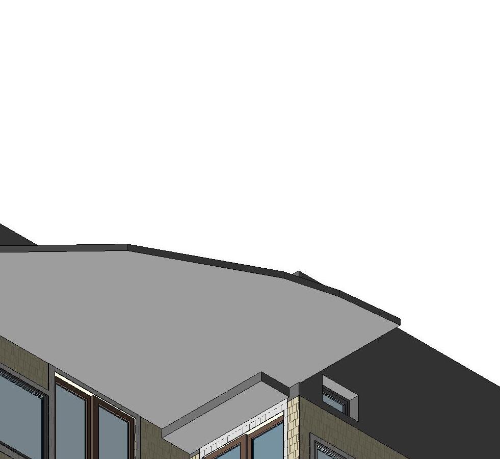


Scale: Drawn By: Call us at: (617) 247 9161 info@existingconditions.com www.existingconditions.com The Most Accurate Existing Conditions Surveys and As-Built Surveys Date: All projects are measured using the most advanced aser measuring equipment and our best standards and practices. All work will be field verified by client prior to design or construction or other use. General Notes: 1. is expressly understood by client that ECS is not an architectural or engineering entity. None of the documents prepared by ECS for client shall have any stamping or certification of such trade professionals. 2. This is not structural or MEP analysis or due diligence model. Visible and accessible elements are modeled for location and size. Further structural or MEP analysis could be ecessary by others. 3. STANDARD OF PRACTICE. Services performed by ECS under this Agreement will be conducted in a manner consistent with that level of care and skill ordinarily exercised members of the profession currently practicing in the same localit under similar conditions. No other representation, expressed or mplied, and no warranty or guarantee is included or intended in this Agreement, or in any report, opinion, document or otherwise. Client shall field verify all work prior to design construction, or other use. 4. These drawings are for the intended purposes listed in the scope of work at the time of survey and should not be use for any other reasons. See scope of work provided to client for further information. Laser Scanning Notes: 1. Visit FARO.com and leica-geosystems.com for 3D aser scanner tolerances, range information and product specifications. 2. Laser scanning equipment uses light waves to measure distances, unforeseen site conditions such as dust, moisture, vibration, surface reflectivity, lighting conditions, temperature, humidity, ferromagnetic materials, building configuration etc. may impact registration between scan locations. 3. Accuracy over long distances can be improved the client provides survey benchmarks prior to scanning in order to reference the laser scan data into coordinate system. 4. The Revit file contains the most complete alignment of point cloud data. All laser scanning by default is in ocalized coordinate system. Laser scans completed on multipl days may be tied into previous laser scans by use of site specific features and targets. Point cloud adjustments are made in Revit for a final verification. TM AREA CALCULATIONS BASED ON POINT CLOUD DATA ARE ESTIMATES. ACTUAL AREA MUST BE DETERMINED BY CLIENT, OR CALCULATED AFTER COMPLETION OF DELIVERABLES. Project Number: Perspective View EX00 Author 06/05/23
Troon Way Mashpee, MA 11132889729 Scale: 2 3D View 1 Scale: 3 3D View 2 Scale: 1 {3D}
92
UP UP EX06 1 EX06 2 EX05 2 EX05 1 BEAM HEIGHT: 6' -9.5" BEAM HEIGHT: 5' -10" BEAM HEIGHT: 7' -6.5" FE = -8' - 5" FE = -8' - 5" FE = -8' - 5" 18'3 3/4" 14'3 3/4" 15' 4 1/2" 12' 0" 5' 0 1/4" 22' 3 1/2" 15'8" 2' 11 1/2" 8' - 3 3/4" 23' 2 1/2" 4'-103/4" 4'5 3/4" 4'5 3/4" 4'-11" 26' 8" 11' 10 1/2" 8' 1" Scale: Drawn By: Call us at: (617) 247 9161 info@existingconditions.com www.existingconditions.com The Most Accurate Existing Conditions Surveys and As-Built Surveys Date: All projects are measured using the most advanced aser measuring equipment and our best standards and practices. All work will be field verified by client prior to design or construction or other use. General Notes: 1. is expressly understood by client that ECS is not an architectural or engineering entity. None of the documents prepared by ECS for client shall have any stamping or certification of such trade professionals. 2. This is not structural or MEP analysis or due diligence model. Visible and accessible elements are modeled for location and size. Further structural or MEP analysis could be ecessary by others. 3. STANDARD OF PRACTICE. Services performed by ECS under this Agreement will be conducted in a manner consistent with that level of care and skill ordinarily exercised members of the profession currently practicing in the same localit under similar conditions. No other representation, expressed or mplied, and no warranty or guarantee is included or intended in this Agreement, or in any report, opinion, document or otherwise. Client shall field verify all work prior to design construction, or other use. 4. These drawings are for the intended purposes listed in the scope of work at the time of survey and should not be use for any other reasons. See scope of work provided to client for further information. Laser Scanning Notes: 1. Visit FARO.com and leica-geosystems.com for 3D aser scanner tolerances, range information and product specifications. 2. Laser scanning equipment uses light waves to measure distances, unforeseen site conditions such as dust, moisture, vibration, surface reflectivity, lighting conditions, temperature, humidity, ferromagnetic materials, building configuration etc. may impact registration between scan locations. 3. Accuracy over long distances can be improved the client provides survey benchmarks prior to scanning in order to reference the laser scan data into coordinate system. 4. The Revit file contains the most complete alignment of point cloud data. All laser scanning by default is in ocalized coordinate system. Laser scans completed on multipl days may be tied into previous laser scans by use of site specific features and targets. Point cloud adjustments are made in Revit for a final verification. TM AREA CALCULATIONS BASED ON POINT CLOUD DATA ARE ESTIMATES. ACTUAL AREA MUST BE DETERMINED BY CLIENT, OR CALCULATED AFTER COMPLETION OF DELIVERABLES. Project Number: 1/4" = 1'-0" Existing Basement Floor Plan EX01 EC 12/15/2022 92 Troon Way Mashpee, MA 11132889729 Gross Area Schedule LevelArea Basement1301 SF First Floor1277 SF Second Floor928 SF Total3506 SF
DN UP UP UP UP UP EX06 1 EX06 2 EX05 2 EX05 1 6' 8 1/2" 4' 11 1/2" 6'1 3/4" 2'11 1/2" 4' 11 1/2" 2' 7" 19'4" 1'5 3/4" 2'11 3/4" 7'3 1/2" 5' 6 3/4" 2' 0" 23' 4 1/2" 15'8" 4' - 0 1/2" 3' 7 1/4" 9' 6 1/2" 6' 2 1/4" 12'11" 3' 10 1/2" 5'-4" 8'6 1/2" 31' 3 1/4" 15'4 1/2" 2' 6" 6' 3" 8' 1" 9'0" 12' 7" 5'-51/2" 7' 7 3/4" 6' 7" 8'7 1/2" 2'5 3/4" 2' 3" 4' 11 1/2" 2'0" 3' 8" 2'5 1/4" 4'10" FE = -0' - 11 1/2" FE = 0' 0" FE = 0' 0" FE = 0' 0" FE = 0' 0" FE = 0' 0" CH = 7' -5.5" CH = 7' -6.5" CH = 7' -6.5" FE = 0' 0" CH = 7' -6.5" HEAD: 6'-10" SILL: -11" HEAD: 5'9 1/2" SILL: 9 1/2" HEAD: 5'- 1/2" SILL: 10 1/2" HEAD: 6'-9" SILL: 3'- 1/2" HEAD: 5'- 1/2" SILL: 10 1/2" HEAD: 5'8 1/2" SILL: 10" HEAD: 6'11" SILL: 2'0" HEAD: 6'- 1/2" SILL: 3'-11" HEAD: 6'-10" SILL: 3'-10" HEAD: 6'-10" SILL: 3'-10" FE = -0' - 5" FE = -1' - 3" Scale: Drawn By: Call us at: (617) 247 9161 info@existingconditions.com www.existingconditions.com The Most Accurate Existing Conditions Surveys and As-Built Surveys Date: All projects are measured using the most advanced aser measuring equipment and our best standards and practices. All work will be field verified by client prior to design or construction or other use. General Notes: 1. is expressly understood by client that ECS is not an architectural or engineering entity. None of the documents prepared by ECS for client shall have any stamping or certification of such trade professionals. 2. This is not structural or MEP analysis or due diligence model. Visible and accessible elements are modeled for location and size. Further structural or MEP analysis could be ecessary by others. 3. STANDARD OF PRACTICE. Services performed by ECS under this Agreement will be conducted in a manner consistent with that level of care and skill ordinarily exercised members of the profession currently practicing in the same localit under similar conditions. No other representation, expressed or mplied, and no warranty or guarantee is included or intended in this Agreement, or in any report, opinion, document or otherwise. Client shall field verify all work prior to design construction, or other use. 4. These drawings are for the intended purposes listed in the scope of work at the time of survey and should not be use for any other reasons. See scope of work provided to client for further information. Laser Scanning Notes: 1. Visit FARO.com and leica-geosystems.com for 3D aser scanner tolerances, range information and product specifications. 2. Laser scanning equipment uses light waves to measure distances, unforeseen site conditions such as dust, moisture, vibration, surface reflectivity, lighting conditions, temperature, humidity, ferromagnetic materials, building configuration etc. may impact registration between scan locations. 3. Accuracy over long distances can be improved the client provides survey benchmarks prior to scanning in order to reference the laser scan data into coordinate system. 4. The Revit file contains the most complete alignment of point cloud data. All laser scanning by default is in ocalized coordinate system. Laser scans completed on multipl days may be tied into previous laser scans by use of site specific features and targets. Point cloud adjustments are made in Revit for a final verification. TM AREA CALCULATIONS BASED ON POINT CLOUD DATA ARE ESTIMATES. ACTUAL AREA MUST BE DETERMINED BY CLIENT, OR CALCULATED AFTER COMPLETION OF DELIVERABLES. Project Number: 1/4" = 1'-0" Existing First Floor Plan EX02 EC 12/15/2022 92 Troon Way Mashpee, MA 11132889729 Gross Area Schedule LevelArea Basement1301 SF First Floor1277 SF Second Floor928 SF Total3506 SF
UP EX06 1 EX06 2 EX05 2 EX05 1 2' - 3 1/4" 4'1 1/2" 15'3" 1'10 3/4" 2' 7 3/4" 8' 10 1/4" 2' 3 1/4" 4'1 1/2" 8'5" 8' 1 1/2" 3' 4 1/4" 2' - 11 1/4" 8'5" 1'10 3/4" 2' - 3 1/4" 7' 8 1/2" 4' 11" 2'8 1/4" 2' 11 3/4" 15' 0" CH = 7' -7.5" FE = 8' - 6 1/2" FE = 8' 6 1/2" CH = 7' -7.5" CH = 7' -7.5" CH @ EDGE = 1' -10" FE = 8' 6 1/2" FE = 8' 6 1/2" 9'9 3/4" 7'11 1/2" 5' 2 1/4" 14' - 8 1/4" HEAD: 7'- 1/2" SILL: 3'-8 1/2" HEAD: 7'- 1/2" SILL: 3'- 1/2" HEAD: 7'1" SILL: 3'8 1/2" HEAD: 6'9 1/2" SILL: 3'7 1/2" Scale: Drawn By: Call us at: (617) 247 9161 info@existingconditions.com www.existingconditions.com The Most Accurate Existing Conditions Surveys and As-Built Surveys Date: All projects are measured using the most advanced aser measuring equipment and our best standards and practices. All work will be field verified by client prior to design or construction or other use. General Notes: 1. is expressly understood by client that ECS is not an architectural or engineering entity. None of the documents prepared by ECS for client shall have any stamping or certification of such trade professionals. 2. This is not structural or MEP analysis or due diligence model. Visible and accessible elements are modeled for location and size. Further structural or MEP analysis could be ecessary by others. 3. STANDARD OF PRACTICE. Services performed by ECS under this Agreement will be conducted in a manner consistent with that level of care and skill ordinarily exercised members of the profession currently practicing in the same localit under similar conditions. No other representation, expressed or mplied, and no warranty or guarantee is included or intended in this Agreement, or in any report, opinion, document or otherwise. Client shall field verify all work prior to design construction, or other use. 4. These drawings are for the intended purposes listed in the scope of work at the time of survey and should not be use for any other reasons. See scope of work provided to client for further information. Laser Scanning Notes: 1. Visit FARO.com and leica-geosystems.com for 3D aser scanner tolerances, range information and product specifications. 2. Laser scanning equipment uses light waves to measure distances, unforeseen site conditions such as dust, moisture, vibration, surface reflectivity, lighting conditions, temperature, humidity, ferromagnetic materials, building configuration etc. may impact registration between scan locations. 3. Accuracy over long distances can be improved the client provides survey benchmarks prior to scanning in order to reference the laser scan data into coordinate system. 4. The Revit file contains the most complete alignment of point cloud data. All laser scanning by default is in ocalized coordinate system. Laser scans completed on multipl days may be tied into previous laser scans by use of site specific features and targets. Point cloud adjustments are made in Revit for a final verification. TM AREA CALCULATIONS BASED ON POINT CLOUD DATA ARE ESTIMATES. ACTUAL AREA MUST BE DETERMINED BY CLIENT, OR CALCULATED AFTER COMPLETION OF DELIVERABLES. Project Number: 1/4" = 1'-0" Existing Second Floor Plan EX03 EC 12/15/2022 92 Troon Way Mashpee, MA 11132889729 Gross Area Schedule LevelArea Basement1301 SF First Floor1277 SF Second Floor928 SF Total3506 SF
EX06 1 EX06 2 EX05 2 EX05 1 4 3/8" 1'-0" 8 1/4" 1'-0" 8 1/4" 1'-0" 8" 1'-0" 8" 1'-0" 8" 1'-0" 8" / 1'-0" 8" 1'-0" 8" / 1'-0" Scale: Drawn By: Call us at: (617) 247 9161 info@existingconditions.com www.existingconditions.com The Most Accurate Existing Conditions Surveys and As-Built Surveys Date: All projects are measured using the most advanced aser measuring equipment and our best standards and practices. All work will be field verified by client prior to design or construction or other use. General Notes: 1. is expressly understood by client that ECS is not an architectural or engineering entity. None of the documents prepared by ECS for client shall have any stamping or certification of such trade professionals. 2. This is not structural or MEP analysis or due diligence model. Visible and accessible elements are modeled for location and size. Further structural or MEP analysis could be ecessary by others. 3. STANDARD OF PRACTICE. Services performed by ECS under this Agreement will be conducted in a manner consistent with that level of care and skill ordinarily exercised members of the profession currently practicing in the same localit under similar conditions. No other representation, expressed or mplied, and no warranty or guarantee is included or intended in this Agreement, or in any report, opinion, document or otherwise. Client shall field verify all work prior to design construction, or other use. 4. These drawings are for the intended purposes listed in the scope of work at the time of survey and should not be use for any other reasons. See scope of work provided to client for further information. Laser Scanning Notes: 1. Visit FARO.com and leica-geosystems.com for 3D aser scanner tolerances, range information and product specifications. 2. Laser scanning equipment uses light waves to measure distances, unforeseen site conditions such as dust, moisture, vibration, surface reflectivity, lighting conditions, temperature, humidity, ferromagnetic materials, building configuration etc. may impact registration between scan locations. 3. Accuracy over long distances can be improved the client provides survey benchmarks prior to scanning in order to reference the laser scan data into coordinate system. 4. The Revit file contains the most complete alignment of point cloud data. All laser scanning by default is in ocalized coordinate system. Laser scans completed on multipl days may be tied into previous laser scans by use of site specific features and targets. Point cloud adjustments are made in Revit for a final verification. TM Project Number: 1/4" = 1'-0"
Roof Plan EX04 EC 12/15/2022 92 Troon Way Mashpee, MA 11132889729
Existing
Second Floor 8' - 6 1/2" First Floor 0' - 0" Top of Roof 21' - 3" 12'8 1/2" 8'6 1/2" SIDING SHAKE TYP. SHINGLES TYP. Second Floor 8' - 6 1/2" First Floor 0' - 0" Top of Roof 21' - 3" 12'8 1/2" 8' 6 1/2" SIDING SHAKE TYP. SHINGLES TYP. Scale: Drawn By: Call us at: (617) 247 9161 info@existingconditions.com www.existingconditions.com The Most Accurate Existing Conditions Surveys and As-Built Surveys Date: All projects are measured using the most advanced aser measuring equipment and our best standards and practices. All work will be field verified by client prior to design or construction or other use. General Notes: 1. is expressly understood by client that ECS is not an architectural or engineering entity. None of the documents prepared by ECS for client shall have any stamping or certification of such trade professionals. 2. This is not structural or MEP analysis or due diligence model. Visible and accessible elements are modeled for location and size. Further structural or MEP analysis could be ecessary by others. 3. STANDARD OF PRACTICE. Services performed by ECS under this Agreement will be conducted in a manner consistent with that level of care and skill ordinarily exercised members of the profession currently practicing in the same localit under similar conditions. No other representation, expressed or mplied, and no warranty or guarantee is included or intended in this Agreement, or in any report, opinion, document or otherwise. Client shall field verify all work prior to design construction, or other use. 4. These drawings are for the intended purposes listed in the scope of work at the time of survey and should not be use for any other reasons. See scope of work provided to client for further information. Laser Scanning Notes: 1. Visit FARO.com and leica-geosystems.com for 3D aser scanner tolerances, range information and product specifications. 2. Laser scanning equipment uses light waves to measure distances, unforeseen site conditions such as dust, moisture, vibration, surface reflectivity, lighting conditions, temperature, humidity, ferromagnetic materials, building configuration etc. may impact registration between scan locations. 3. Accuracy over long distances can be improved the client provides survey benchmarks prior to scanning in order to reference the laser scan data into coordinate system. 4. The Revit file contains the most complete alignment of point cloud data. All laser scanning by default is in ocalized coordinate system. Laser scans completed on multipl days may be tied into previous laser scans by use of site specific features and targets. Point cloud adjustments are made in Revit for a final verification. TM Project Number: 1/4" = 1'-0" Existing Exterior Elevations EX05 EC 12/15/2022 92 Troon Way Mashpee, MA 11132889729 Scale: 1/4" = 1'-0" 1 South Exterior Elevation Scale: 1/4" = 1'-0" 2 East Exterior Elevation
Second Floor 8' - 6 1/2" First Floor 0' - 0" Top of Roof 21' - 3" SIDING SHAKE TYP. SHINGLES TYP. 8'6 1/2" 12'8 1/2" Second Floor 8' - 6 1/2" First Floor 0' - 0" Top of Roof 21' - 3" 12'8 1/2" 8' 6 1/2" SIDING SHAKE TYP. SHINGLES TYP. Scale: Drawn By: Call us at: (617) 247 9161 info@existingconditions.com www.existingconditions.com The Most Accurate Existing Conditions Surveys and As-Built Surveys Date: All projects are measured using the most advanced aser measuring equipment and our best standards and practices. All work will be field verified by client prior to design or construction or other use. General Notes: 1. is expressly understood by client that ECS is not an architectural or engineering entity. None of the documents prepared by ECS for client shall have any stamping or certification of such trade professionals. 2. This is not structural or MEP analysis or due diligence model. Visible and accessible elements are modeled for location and size. Further structural or MEP analysis could be ecessary by others. 3. STANDARD OF PRACTICE. Services performed by ECS under this Agreement will be conducted in a manner consistent with that level of care and skill ordinarily exercised members of the profession currently practicing in the same localit under similar conditions. No other representation, expressed or mplied, and no warranty or guarantee is included or intended in this Agreement, or in any report, opinion, document or otherwise. Client shall field verify all work prior to design construction, or other use. 4. These drawings are for the intended purposes listed in the scope of work at the time of survey and should not be use for any other reasons. See scope of work provided to client for further information. Laser Scanning Notes: 1. Visit FARO.com and leica-geosystems.com for 3D aser scanner tolerances, range information and product specifications. 2. Laser scanning equipment uses light waves to measure distances, unforeseen site conditions such as dust, moisture, vibration, surface reflectivity, lighting conditions, temperature, humidity, ferromagnetic materials, building configuration etc. may impact registration between scan locations. 3. Accuracy over long distances can be improved the client provides survey benchmarks prior to scanning in order to reference the laser scan data into coordinate system. 4. The Revit file contains the most complete alignment of point cloud data. All laser scanning by default is in ocalized coordinate system. Laser scans completed on multipl days may be tied into previous laser scans by use of site specific features and targets. Point cloud adjustments are made in Revit for a final verification. TM Project Number: 1/4" = 1'-0" Existing Exterior Elevations EX06 EC 12/15/2022 92 Troon Way Mashpee, MA 11132889729 Scale: 1/4" = 1'-0" 1 North Exterior Elevation Scale: 1/4" = 1'-0" 2 West Exterior Elevation
UP UP UP UP UP UP EX02 EX02 2 EX02 4 EX02 1 27/8 1-0 5 7/8" / 1'-0" 6" 1'-0" 6" 1'-0" 2" 1'-0" 4 7/8" 1'-0" 4 7/8" 1'-0" 4 7/8" / 1'-0" 4 7/8" / 1'-0" 7/8" 1'-0" 5 1/8" 1'-0" 4 7/8" 1'-0" 5" 1'-0" 5" 1'-0" 5" / 1'-0" 2 1/8" 1'-0" 4 7/8" 1'-0" 4 7/8" 1'-0" 4 7/8" 1'-0" 7/8" 1'-0" 4 7/8" / 1'-0" 4 7/8" 1'-0" 1/8" 1'-0" 4 7/8" 1'-0" SCAN DATA NOT AVAILABLE SCAN DATA NOT AVAILABLE Scale: Drawn By: Call us at: (617) 247 9161 info@existingconditions.com www.existingconditions.com The Most Accurate Existing Conditions Surveys and As-Built Surveys Date: All projects are measured using the most advanced aser measuring equipment and our best standards and practices. All work will be field verified by client prior to design or construction or other use. General Notes: 1. expressly understood by client that ECS is not an architectural or engineering entity. None of the documents prepared by ECS for client shall have any stamping certification of such trade professionals. 2. This not structural MEP analysis or due diligence model. Visible and accessible elements are modeled for location and size. Further structural or MEP analysis could be necessary by others. 3. STANDARD OF PRACTICE. Services performed by ECS under this Agreement will be conducted manner consistent with that level of care and skill ordinarily exercised members of the profession currently practicing the same localit under similar conditions. No other representation, expressed or mplied, and no warranty guarantee is included or intended th Agreement, or in any report, opinion, document or otherwise. lient shall field verify all work prior to design construction, or her use. 4. These drawings are for the intended purposes listed in the scope of work at the time of survey and should not be use for any other reasons. See scope work provided to client for further information. Laser Scanning Notes: 1. Visit FARO.com and leica-geosystems.com for 3D aser scanner tolerances, range information and product specifications. 2. Laser scanning equipment uses light waves mea distances, unforeseen site conditions such as dust, moisture, vibration, surface reflectivity, lighting conditions, temperature, humidity, ferromagnetic materials, building configuration etc. may impact registration between scan locations. 3. Accuracy over long distances can be improved the client provides survey benchmarks prior to scanning in order to reference the laser scan data into coordinate system. 4. The Revit file contains the most complete alignment of point cloud data. All laser scanning by default in ocalized coordinate system. Laser scans completed on multipl days may be tied into previous laser scans by use site specific features and targets. Point cloud adjustments are made in Revit for final verification. TM Project Number: 1/8" = 1'-0" Existing Clubhouse Roof Plan EX01 EC 12/7/2022 24 Club House Drive Pocasset, MA 10676689013 Scale: 1/8" = 1'-0" 1 Clubhouse Roof
Clubhouse Roof 15' - 2" First Floor Clubhouse 1' - 2" 14' 0" SIDING SHAKE TYP. SHINGLS TYP. Clubhouse Roof 15' - 2" First Floor Clubhouse 1' - 2" SIDING SHAKE TYP. SHINGLS TYP. 14' 0" Clubhouse Roof 15' - 2" First Floor Clubhouse 1' - 2" 14'0" SIDING SHAKE TYP. SHINGLS TYP. Clubhouse Roof 15' - 2" First Floor Clubhouse 1' - 2" 14'0" SIDING SHAKE TYP. SHINGLS TYP. Scale: Drawn By: Call us at: (617) 247 9161 info@existingconditions.com www.existingconditions.com The Most Accurate Existing Conditions Surveys and As-Built Surveys Date: All projects are measured using the most advanced aser measuring equipment and our best standards and practices. All work will be field verified by client prior to design or construction or other use. General Notes: 1. expressly understood by client that ECS is not an architectural or engineering entity. None of the documents prepared by ECS for client shall have any stamping certification of such trade professionals. 2. This not structural MEP analysis or due diligence model. Visible and accessible elements are modeled for location and size. Further structural or MEP analysis could be necessary by others. 3. STANDARD OF PRACTICE. Services performed by ECS under this Agreement will be conducted manner consistent with that level of care and skill ordinarily exercised members of the profession currently practicing the same localit under similar conditions. No other representation, expressed or mplied, and no warranty guarantee is included or intended th Agreement, or in any report, opinion, document or otherwise. lient shall field verify all work prior to design construction, or her use. 4. These drawings are for the intended purposes listed in the scope of work at the time of survey and should not be use for any other reasons. See scope work provided to client for further information. Laser Scanning Notes: 1. Visit FARO.com and leica-geosystems.com for 3D aser scanner tolerances, range information and product specifications. 2. Laser scanning equipment uses light waves mea distances, unforeseen site conditions such as dust, moisture, vibration, surface reflectivity, lighting conditions, temperature, humidity, ferromagnetic materials, building configuration etc. may impact registration between scan locations. 3. Accuracy over long distances can be improved the client provides survey benchmarks prior to scanning in order to reference the laser scan data into coordinate system. 4. The Revit file contains the most complete alignment of point cloud data. All laser scanning by default in ocalized coordinate system. Laser scans completed on multipl days may be tied into previous laser scans by use site specific features and targets. Point cloud adjustments are made in Revit for final verification. TM Project Number: 1/8" = 1'-0" Existing Clubhouse Exterior Elevations EX02 EC 12/7/2022 24 Club House Drive Pocasset, MA 10676689013 Scale: 1/8" = 1'-0" 1 South Exterior Elevation Clubhouse Scale: 1/8" = 1'-0" 2 West Exterior Elevation Clubhouse Scale: 1/8" = 1'-0" 3 North Exterior Elevation Clubhouse Scale: 1/8" = 1'-0" 4 East Exterior Elevation Clubhouse
First Floor Proshop 0' - 0" Proshop Roof 10' - 6" 10'6" SIDING SHAKE TYP. SHINGLS TYP. First Floor Proshop 0' - 0" Proshop Roof 10' - 6" 10'6" SIDING SHAKE TYP. SHINGLS TYP. First Floor Proshop 0' - 0" Proshop Roof 10' - 6" Basement -9' - 8" SIDING SHAKE TYP. 10' 6" 9' 8" SHINGLS TYP. First Floor Proshop 0' - 0" Proshop Roof 10' - 6" 10' 6" SIDING SHAKE TYP. SHINGLS TYP. EX03 EX03 4 EX03 EX03 1 2 3 5 7/8" 1'-0" 6" 1'-0" 6" 1'-0" 5 7/8" 1'-0" 5 7/8" 1'-0" Scale: Drawn By: Call us at: (617) 247 9161 info@existingconditions.com www.existingconditions.com The Most Accurate Existing Conditions Surveys and As-Built Surveys Date: All projects are measured using the most advanced aser measuring equipment and our best standards and practices. All work will be field verified by client prior to design or construction or other use. General Notes: 1. expressly understood by client that ECS is not an architectural or engineering entity. None of the documents prepared by ECS for client shall have any stamping certification of such trade professionals. 2. This not structural MEP analysis or due diligence model. Visible and accessible elements are modeled for location and size. Further structural or MEP analysis could be necessary by others. 3. STANDARD OF PRACTICE. Services performed by ECS under this Agreement will be conducted manner consistent with that level of care and skill ordinarily exercised members of the profession currently practicing the same localit under similar conditions. No other representation, expressed or mplied, and no warranty guarantee is included or intended th Agreement, or in any report, opinion, document or otherwise. lient shall field verify all work prior to design construction, or her use. 4. These drawings are for the intended purposes listed in the scope of work at the time of survey and should not be use for any other reasons. See scope work provided to client for further information. Laser Scanning Notes: 1. Visit FARO.com and leica-geosystems.com for 3D aser scanner tolerances, range information and product specifications. 2. Laser scanning equipment uses light waves mea distances, unforeseen site conditions such as dust, moisture, vibration, surface reflectivity, lighting conditions, temperature, humidity, ferromagnetic materials, building configuration etc. may impact registration between scan locations. 3. Accuracy over long distances can be improved the client provides survey benchmarks prior to scanning in order to reference the laser scan data into coordinate system. 4. The Revit file contains the most complete alignment of point cloud data. All laser scanning by default in ocalized coordinate system. Laser scans completed on multipl days may be tied into previous laser scans by use site specific features and targets. Point cloud adjustments are made in Revit for final verification. TM Project Number: 1/8" = 1'-0" Existing Proshop Roof Plan / Exterior Elevations EX03 EC 12/7/2022 24 Club House Drive Pocasset, MA 10676689013 Scale: 1/8" = 1'-0" 1 South Exterior Elevation Proshop Scale: 1/8" = 1'-0" 2 West Exterior Elevation Proshop Scale: 1/8" = 1'-0" 3 North Exterior Elevation Proshop Scale: 1/8" = 1'-0" 4 East Exterior Elevation Proshop Scale: 1/8" = 1'-0" 5 Proshop Roof


Scale: Drawn By: Call us at: (617) 247 9161 info@existingconditions.com www.existingconditions.com The Most Accurate Existing Conditions Surveys and As-Built Surveys Date: All projects are measured using the most advanced aser measuring equipment and our best standards and practices. All work will be field verified by client prior to design or construction or other use. General Notes: 1. is expressly understood by client that ECS is not an architectural or engineering entity. None of the documents prepared by ECS for client shall have any stamping or certification of such trade professionals. 2. This is not structural or MEP analysis or due diligence model. Visible and accessible elements are modeled for location and size. Further structural or MEP analysis could be ecessary by others. 3. STANDARD OF PRACTICE. Services performed by ECS under this Agreement will be conducted in a manner consistent with that level of care and skill ordinarily exercised members of the profession currently practicing in the same localit under similar conditions. No other representation, expressed or mplied, and no warranty or guarantee is included or intended in this Agreement, or in any report, opinion, document or otherwise. Client shall field verify all work prior to design construction, or other use. 4. These drawings are for the intended purposes listed in the scope of work at the time of survey and should not be use for any other reasons. See scope of work provided to client for further information. Laser Scanning Notes: 1. Visit FARO.com and leica-geosystems.com for 3D aser scanner tolerances, range information and product specifications. 2. Laser scanning equipment uses light waves to measure distances, unforeseen site conditions such as dust, moisture, vibration, surface reflectivity, lighting conditions, temperature, humidity, ferromagnetic materials, building configuration etc. may impact registration between scan locations. 3. Accuracy over long distances can be improved the client provides survey benchmarks prior to scanning in order to reference the laser scan data into coordinate system. 4. The Revit file contains the most complete alignment of point cloud data. All laser scanning by default is in ocalized coordinate system. Laser scans completed on multipl days may be tied into previous laser scans by use of site specific features and targets. Point cloud adjustments are made in Revit for a final verification. TM Project Number: Existing 3D View EX00 EC 11/18/2022 422 South 3rd Street Wilmington, NC 10487243140
ELEV UP UP UP UP EX07 1 EX10 1 EX08 1 EX09 1 CEILING HEIGHT: 8'-8" CEILING HEIGHT: 9'-2.5" FE = -10' - 0 1/2" FE = -8' - 5 1/2" CEILING HEIGHT: 7'-3.5" CEILING HEIGHT: 7'-3.5" FE = -8' - 5 1/2" FIREPLACE FE = -8' - 5 1/2" FE = -8' - 5 1/2" FE = -8' - 5 1/2" FE = -8' - 5 1/2" FE = -8' - 5 1/2" FE = -8' - 5 1/2" BEAM HEIGHT: 6'-6" BEAM HEIGHT: 6'-1.5" CEILING HEIGHT: 7'-5" CEILING HEIGHT: 7'-3" CEILING HEIGHT: 7'-4" CEILING HEIGHT: 7'-8.5" CEILING HEIGHT: 7'-8.5" CEILING HEIGHT: 7'-4" BEAM HEIGHT: 6'-1.5" CEILING HEIGHT: 6'-10.5" CEILING HEIGHT: 7'-3" CEILING HEIGHT: 7'-4" CEILING HEIGHT: 7'-3" CEILING HEIGHT: 7'-2" CEILING HEIGHT: 7'-4" CEILING HEIGHT: 7'-2" CEILING HEIGHT: 7'-4" CEILING HEIGHT: 7'-4" CEILING HEIGHT: 7'-4" CEILING @ RIDGE: 7'-5.5" CEILING @ EDGE: 0'-5" HEAD: 6'-0" SILL: 2'-5 1/2" HEAD: 5'-10 1/2" SILL: 2'- 1/2" HEAD: 5'-10 1/2" SILL: -4" HEAD: 6'-2" SILL: -5" HEAD: 6'-2" SILL: 2'-5" HEAD: 6'-2" SILL: 2'-5"SILL: 2'4 1/2"SILL: 2'4 1/2" HEAD: 6'1 1/2" SILL: 2'4 1/2" HEAD: -3 1/2" SILL: -6 1/2" HEAD: 6'- 1/2" SILL: 2'- 1/2" HEAD: 6'-4 1/2" SILL: 2'-7 1/2" HEAD: 6'- 1/2" SILL: 2'- 1/2" HEAD: 6'-3" SILL: 2'-6" H E A D : 62 1 2 S L L 40 HEAD: 6'2" SILL: 2'7 1/2" 8' 3 1/4" 11'6 1/4" 5'9" 18'9 1/4" 15' 2 1/2" 11' 11" 4' - 8 3/4" 26' 10 3/4" 9'5 3/4" 18'9 3/4" 4'10" 9' 3 3/4" 19' 6 1/4" 23' 2 1/4" 6' - 0" 9'4 1/2" 10' 11 1/2" 7'5" 4' 2" 9' - 6 3/4" 14' - 10 1/4" 7'7" 8' 8 3/4" 10'9 1/2" 4' 6 1/4" 4' 6 3/4" 2'-113/4" 4' 0 3/4" 5'9 3/4" 9' 3" 24' 5 1/4" 8'7 1/4" 20'11 1/4" 7' 3 3/4" 6'4" 11' 7 3/4" 5'7" 4' 5 1/2" 19' - 4" 11' 2 3/4" HEAD: 5'- 1/2" SILL: 4'- 1/2" FLOOR SLOPES UP Scale: Drawn By: Call us at: (617) 247 9161 info@existingconditions.com www.existingconditions.com The Most Accurate Existing Conditions Surveys and As-Built Surveys Date: All projects are measured using the most advanced aser measuring equipment and our best standards and practices. All work will be field verified by client prior to design or construction or other use. General Notes: 1. is expressly understood by client that ECS is not an architectural or engineering entity. None of the documents prepared by ECS for client shall have any stamping or certification of such trade professionals. 2. This is not structural or MEP analysis or due diligence model. Visible and accessible elements are modeled for location and size. Further structural or MEP analysis could be ecessary by others. 3. STANDARD OF PRACTICE. Services performed by ECS under this Agreement will be conducted in a manner consistent with that level of care and skill ordinarily exercised members of the profession currently practicing in the same localit under similar conditions. No other representation, expressed or mplied, and no warranty or guarantee is included or intended in this Agreement, or in any report, opinion, document or otherwise. Client shall field verify all work prior to design construction, or other use. 4. These drawings are for the intended purposes listed in the scope of work at the time of survey and should not be use for any other reasons. See scope of work provided to client for further information. Laser Scanning Notes: 1. Visit FARO.com and leica-geosystems.com for 3D aser scanner tolerances, range information and product specifications. 2. Laser scanning equipment uses light waves to measure distances, unforeseen site conditions such as dust, moisture, vibration, surface reflectivity, lighting conditions, temperature, humidity, ferromagnetic materials, building configuration etc. may impact registration between scan locations. 3. Accuracy over long distances can be improved the client provides survey benchmarks prior to scanning in order to reference the laser scan data into coordinate system. 4. The Revit file contains the most complete alignment of point cloud data. All laser scanning by default is in ocalized coordinate system. Laser scans completed on multipl days may be tied into previous laser scans by use of site specific features and targets. Point cloud adjustments are made in Revit for a final verification. TM Project Number: 1/4" = 1'-0" Existing Basement Floor Plan EX01 EC 11/18/2022 422 South 3rd Street Wilmington, NC 10487243140 Gross Area Schedule LevelArea Basement3265 SF First Floor1228 SF Second Floor3377 SF Third Floor380 SF Fourth Floor380 SF Total8630 SF
DN DN ELEV UP DN UP UP EX07 1 EX10 1 EX08 1 EX09 1 9' 5 1/2" 27' - 0 3/4" CEILING HEIGHT: 9'-5" CEILING HEIGHT: 9'-5" CEILING HEIGHT: 9'-5" CEILING HEIGHT: 9'-5" CEILING HEIGHT: 9'-5" 2' 5 1/2" 9' 7" 18'7 1/2" 3' 3" 2'2 1/4" 8' 4" 10'0" 2'6 1/2" 3'4 3/4" 1'5" 2' - 11 1/2" 6'7 3/4" 5'1" HEAD: 8'-2" SILL: 2'- 1/2" HEAD: 8'-2" SILL: 2'-7 1/2" HEAD: 8'-2" SILL: 2'- 1/2" HEAD: 8'-2" SILL: 2'- 1/2" HEAD: -2" SILL: 2'-7 1/2" HEAD: 8'-2" SILL: 2'- 1/2" HEAD:8-2SILL2-9 HEAD:8'-2" SILL:2'-9" HEAD: 8'2"HEAD: 8'5 1/2"HEAD: 8'5 1/2" SILL: 2'10 1/2"SILL: 5'9" HEAD: 8'-6" SILL: 2'-11" HEAD: 8'-6" SILL: 2'-11" HEAD: 8'-6" SILL: 2'-11" HEAD: -6" SILL: 2'-11" HEAD: 8'-6" SILL: 2'-11" HEAD: 8'-6" SILL: 2'-11" HEAD: 8'3 1/2" SILL: 2'9 1/2" HEAD: 8'3 1/2" SILL: 2'9 1/2" HEAD: 8'9" SILL: 5'9" HEAD: 8'6" SILL: 2'11 1/2" UNIT NOT VERIFIED ELEMENTS COPIED FROM SCANNED UNIT UNIT NOT VERIFIED ELEMENTS COPIED FROM SCANNED UNIT UNIT NOT VERIFIED ELEMENTS COPIED FROM SCANNED UNIT Scale: Drawn By: Call us at: (617) 247 9161 info@existingconditions.com www.existingconditions.com The Most Accurate Existing Conditions Surveys and As-Built Surveys Date: All projects are measured using the most advanced aser measuring equipment and our best standards and practices. All work will be field verified by client prior to design or construction or other use. General Notes: 1. is expressly understood by client that ECS is not an architectural or engineering entity. None of the documents prepared by ECS for client shall have any stamping or certification of such trade professionals. 2. This is not structural or MEP analysis or due diligence model. Visible and accessible elements are modeled for location and size. Further structural or MEP analysis could be ecessary by others. 3. STANDARD OF PRACTICE. Services performed by ECS under this Agreement will be conducted in a manner consistent with that level of care and skill ordinarily exercised members of the profession currently practicing in the same localit under similar conditions. No other representation, expressed or mplied, and no warranty or guarantee is included or intended in this Agreement, or in any report, opinion, document or otherwise. Client shall field verify all work prior to design construction, or other use. 4. These drawings are for the intended purposes listed in the scope of work at the time of survey and should not be use for any other reasons. See scope of work provided to client for further information. Laser Scanning Notes: 1. Visit FARO.com and leica-geosystems.com for 3D aser scanner tolerances, range information and product specifications. 2. Laser scanning equipment uses light waves to measure distances, unforeseen site conditions such as dust, moisture, vibration, surface reflectivity, lighting conditions, temperature, humidity, ferromagnetic materials, building configuration etc. may impact registration between scan locations. 3. Accuracy over long distances can be improved the client provides survey benchmarks prior to scanning in order to reference the laser scan data into coordinate system. 4. The Revit file contains the most complete alignment of point cloud data. All laser scanning by default is in ocalized coordinate system. Laser scans completed on multipl days may be tied into previous laser scans by use of site specific features and targets. Point cloud adjustments are made in Revit for a final verification. TM Project Number: 1/4" = 1'-0" Existing First Floor Plan EX02 EC 11/18/2022 422 South 3rd Street Wilmington, NC 10487243140 Gross Area Schedule LevelArea Basement3265 SF First Floor1228 SF Second Floor3377 SF Third Floor380 SF Fourth Floor380 SF Total8630 SF
ELEV UP UP UP UP EX07 1 EX10 1 EX08 1 EX09 1 CEILING HEIGHT: 9'-3" CEILING HEIGHT: 9'-3" CEILING HEIGHT: 9'-3" CEILING HEIGHT: 9'-0" CEILING HEIGHT: 9'-3" CEILING HEIGHT: 9'-1" CEILING HEIGHT: 9'-1" CEILING HEIGHT: 9'-1" CEILING HEIGHT: 9'-1" CEILING HEIGHT 9'-1" CEILING HEIGHT: 9'-3" CEILING HEIGHT: 7'-9.5" CEILING HEIGHT: 9'-3" CEILING HEIGHT: 7'-9.5" CEILING HEIGHT: 9'-3" CEILING HEIGHT: 9'-5" CEILING HEIGHT: 9'-5" CEILING HEIGHT: 9'-3.5" CEILING HEIGHT: 9'-3.5" CEILING HEIGHT: 7'-9" CEILING HEIGHT: 9'-3.5" CEILING HEIGHT: 9'-3.5" CEILING HEIGHT: 9'-2" CEILING HEIGHT: 9'-2" CEILING HEIGHT: 9'-2" CEILING HEIGHT: 9'-2" CEILING HEIGHT: 9'-2" CEILING HEIGHT: 9'-4" CEILING HEIGHT: 9'-3" CEILING HEIGHT: 9'-2" CEILING HEIGHT: 7'-9.5" CEILING HEIGHT: 7'-9.5" CEILING HEIGHT: 7'-9.5" FE = 10' 6 1/2" FE = 10' 6 1/2" FE = 13' 3 1/2" FE = 10' 6 1/2" FE = 10' 6 1/2" FE = 10' - 6 1/2" FE = 10' 6 1/2" FE = 10' 6 1/2" FE = 10' 6 1/2" FE = 10' 6 1/2" FE = 10' 6 1/2" FE = 10' 6 1/2" FE = 10' 6 1/2" HEAD: 8'- 1/2" SILL: 2'- 1/2" HEAD: -3 1/2" SILL: 2'-8 1/2" HEAD: 8'- 1/2" SILL: 2'-8 1/2" HEAD: 8'-3 1/2" SILL: 2'-8 1/2" HEAD: 8'3 1/2" SILL: 2'HEAD: 8'3 1/2" SILL: 2'SHEAD8-2 ILL 2-9 HEAD:8'-2"SILL:2'-9" HEAD: 8'2"HEAD:8-2SILL2-9 HEAD:8'-2" SILL:2'-9" HEAD: 8'2"HEAD: 8'3 1/2"HEAD: 8'5 1/2" SILL: 2'10 1/2" HEAD: 8'9" SILL: 5'9" HEAD: 8'-2" SILL: 2'- 1/2" HEAD: 8'-2" SILL: 2'-7 1/2" HEAD: 8'-2" SILL: 2'- 1/2" HEAD: 8'-2" SILL: 2'- 1/2" HEAD: -2" SILL: 2'-7 1/2" HEAD: 8'-2" SILL: 2'- 1/2" HEAD: 8'-4" SILL: 2'-9" HEAD: 8'9" SILL: 5'9" 9'10 1/2" 15' - 9" 12' 0 3/4" 1'5 1/4" 3'6" 7'11 1/2" 10' - 9 1/4" 1' 6 1/2" 9'10 1/2" 9' 9 3/4" 11'7 3/4" 2' 4 1/2" 2'1" 9' 5 1/2" 9' 11 1/2" 10'3 1/4" 9' 2 1/4" 10' 0 1/2" 10' 1 3/4" 11'6 1/2" 2'10" 13' - 7" 9'5 1/4" 4'8 1/2" 4' 10 1/4" 9' 10 1/2" 7'11 1/2" 10'1 1/2" 9' 6 1/2" 10'0" 11' - 2" 13' 0 1/4" 6'8" Scale: Drawn By: Call us at: (617) 247 9161 info@existingconditions.com www.existingconditions.com The Most Accurate Existing Conditions Surveys and As-Built Surveys Date: All projects are measured using the most advanced aser measuring equipment and our best standards and practices. All work will be field verified by client prior to design or construction or other use. General Notes: 1. is expressly understood by client that ECS is not an architectural or engineering entity. None of the documents prepared by ECS for client shall have any stamping or certification of such trade professionals. 2. This is not structural or MEP analysis or due diligence model. Visible and accessible elements are modeled for location and size. Further structural or MEP analysis could be ecessary by others. 3. STANDARD OF PRACTICE. Services performed by ECS under this Agreement will be conducted in a manner consistent with that level of care and skill ordinarily exercised members of the profession currently practicing in the same localit under similar conditions. No other representation, expressed or mplied, and no warranty or guarantee is included or intended in this Agreement, or in any report, opinion, document or otherwise. Client shall field verify all work prior to design construction, or other use. 4. These drawings are for the intended purposes listed in the scope of work at the time of survey and should not be use for any other reasons. See scope of work provided to client for further information. Laser Scanning Notes: 1. Visit FARO.com and leica-geosystems.com for 3D aser scanner tolerances, range information and product specifications. 2. Laser scanning equipment uses light waves to measure distances, unforeseen site conditions such as dust, moisture, vibration, surface reflectivity, lighting conditions, temperature, humidity, ferromagnetic materials, building configuration etc. may impact registration between scan locations. 3. Accuracy over long distances can be improved the client provides survey benchmarks prior to scanning in order to reference the laser scan data into coordinate system. 4. The Revit file contains the most complete alignment of point cloud data. All laser scanning by default is in ocalized coordinate system. Laser scans completed on multipl days may be tied into previous laser scans by use of site specific features and targets. Point cloud adjustments are made in Revit for a final verification. TM Project Number: 1/4" = 1'-0"
Floor Plan EX03 EC 11/18/2022 422 South 3rd Street Wilmington, NC 10487243140 Gross Area Schedule LevelArea Basement3265 SF First Floor1228 SF Second Floor3377 SF Third Floor380 SF Fourth Floor380 SF Total8630 SF
Existing Second
UP DN ELEV UP UP EX07 1 EX10 1 EX08 1 EX09 1 HEAD: 8'-2" SILL: 2'- 1/2" HEAD: 8'-2" SILL: 2'-7 1/2" HEAD: 8'-2" SILL: 2'- 1/2" HEAD: 8'-2" SILL: 2'- 1/2" HEAD: -2" SILL: 2'-7 1/2" HEAD: 8'-2" SILL: 2'- 1/2" HEAD:8-2SILL2-9 HEAD:8'-2" SILL:2'-9" HEAD: 8'2"HEAD: 8'5 1/2"HEAD: 8'5 1/2" SILL: 2'10 1/2" HEAD: 8'9" SILL: 5'9" HEAD: 8'-2" SILL: 2'-7" HEAD: 8'-2" SILL: 2'-7" HEAD: 8'-2" SILL: -7" HEAD: -2" SILL: -7" HEAD: 8'-2" SILL: 2'-7" HEAD: 8'3 1/2"HEAD: 8'3 1/2"SHEAD8-2 ILL 2-9" HEAD:8'-2"SILL:2'-9" HEAD: 8'2" SILL: 2'9" HEAD: 8'9" SILL: 5'9" 4' 10 1/4" 4'8 1/2" 2' - 11 1/2" 6'8" 9' 9 3/4" FE = 21' 0" CEILING HEIGHT: 9'-5" CEILING HEIGHT: 9'-5" 16'2 1/2" UNIT NOT VERIFIED ELEMENTS COPIED FROM SCANNED UNIT UNIT NOT VERIFIED ELEMENTS COPIED FROM SCANNED UNIT UNIT NOT VERIFIED ELEMENTS COPIED FROM SCANNED UNIT UNIT NOT VERIFIED ELEMENTS COPIED FROM SCANNED UNIT Scale: Drawn By: Call us at: (617) 247 9161 info@existingconditions.com www.existingconditions.com The Most Accurate Existing Conditions Surveys and As-Built Surveys Date: All projects are measured using the most advanced aser measuring equipment and our best standards and practices. All work will be field verified by client prior to design or construction or other use. General Notes: 1. is expressly understood by client that ECS is not an architectural or engineering entity. None of the documents prepared by ECS for client shall have any stamping or certification of such trade professionals. 2. This is not structural or MEP analysis or due diligence model. Visible and accessible elements are modeled for location and size. Further structural or MEP analysis could be ecessary by others. 3. STANDARD OF PRACTICE. Services performed by ECS under this Agreement will be conducted in a manner consistent with that level of care and skill ordinarily exercised members of the profession currently practicing in the same localit under similar conditions. No other representation, expressed or mplied, and no warranty or guarantee is included or intended in this Agreement, or in any report, opinion, document or otherwise. Client shall field verify all work prior to design construction, or other use. 4. These drawings are for the intended purposes listed in the scope of work at the time of survey and should not be use for any other reasons. See scope of work provided to client for further information. Laser Scanning Notes: 1. Visit FARO.com and leica-geosystems.com for 3D aser scanner tolerances, range information and product specifications. 2. Laser scanning equipment uses light waves to measure distances, unforeseen site conditions such as dust, moisture, vibration, surface reflectivity, lighting conditions, temperature, humidity, ferromagnetic materials, building configuration etc. may impact registration between scan locations. 3. Accuracy over long distances can be improved the client provides survey benchmarks prior to scanning in order to reference the laser scan data into coordinate system. 4. The Revit file contains the most complete alignment of point cloud data. All laser scanning by default is in ocalized coordinate system. Laser scans completed on multipl days may be tied into previous laser scans by use of site specific features and targets. Point cloud adjustments are made in Revit for a final verification. TM Project Number: 1/4" = 1'-0" Existing Third Floor Plan EX04 EC 11/18/2022 422 South 3rd Street Wilmington, NC 10487243140 Gross Area Schedule LevelArea Basement3265 SF First Floor1228 SF Second Floor3377 SF Third Floor380 SF Fourth Floor380 SF Total8630 SF
ELEV UP EX07 1 EX10 1 EX08 1 EX09 1 HEAD: 8'-2" SILL: 2'- 1/2" HEAD: 8'-2" SILL: 2'-7 1/2" HEAD: 8'-2" SILL: 2'- 1/2" HEAD: 8'-2" SILL: 2'- 1/2" HEAD: -2" SILL: 2'-7 1/2" HEAD: 8'-2" SILL: 2'- 1/2" HEAD:8-2SILL2-9 HEAD:8'-2" SILL:2'-9" HEAD: 8'2"HEAD: 7'9"HEAD: 7'9" SILL: 2'2" HEAD: 8'9" SILL: 5'9" HEAD: 7'- 1/2" SILL: 2'- 1/2" HEAD: -8 1/2" SILL: 2'-1 1/2" HEAD: 7'- 1/2" SILL: 2'-1 1/2" HEAD: 7'-8 1/2" SILL: 2'-1 1/2" HEAD: -8 1/2" SILL: 2'-1 1/2" HEAD: 7'10 1/2" SILL: 2'4 1/2" HEAD: 7'10 1/2" SILL: 2'4 1/2" SHEAD:8-2 ILL:2-9 HEAD:8'-2"SILL:2'-9" HEAD: 8'2" SILL: 2'9" HEAD: 8'9"4' 10 1/4" 2' - 11 1/2" 6'8" 9' 9 3/4" FE = 31' 6 1/2" CEILING HEIGHT: 9'-5" CEILING HEIGHT: 9'-5" UNIT NOT VERIFIED ELEMENTS COPIED FROM SCANNED UNIT UNIT NOT VERIFIED ELEMENTS COPIED FROM SCANNED UNIT UNIT NOT VERIFIED ELEMENTS COPIED FROM SCANNED UNIT UNIT NOT VERIFIED ELEMENTS COPIED FROM SCANNED UNIT Scale: Drawn By: Call us at: (617) 247 9161 info@existingconditions.com www.existingconditions.com The Most Accurate Existing Conditions Surveys and As-Built Surveys Date: All projects are measured using the most advanced aser measuring equipment and our best standards and practices. All work will be field verified by client prior to design or construction or other use. General Notes: 1. is expressly understood by client that ECS is not an architectural or engineering entity. None of the documents prepared by ECS for client shall have any stamping or certification of such trade professionals. 2. This is not structural or MEP analysis or due diligence model. Visible and accessible elements are modeled for location and size. Further structural or MEP analysis could be ecessary by others. 3. STANDARD OF PRACTICE. Services performed by ECS under this Agreement will be conducted in a manner consistent with that level of care and skill ordinarily exercised members of the profession currently practicing in the same localit under similar conditions. No other representation, expressed or mplied, and no warranty or guarantee is included or intended in this Agreement, or in any report, opinion, document or otherwise. Client shall field verify all work prior to design construction, or other use. 4. These drawings are for the intended purposes listed in the scope of work at the time of survey and should not be use for any other reasons. See scope of work provided to client for further information. Laser Scanning Notes: 1. Visit FARO.com and leica-geosystems.com for 3D aser scanner tolerances, range information and product specifications. 2. Laser scanning equipment uses light waves to measure distances, unforeseen site conditions such as dust, moisture, vibration, surface reflectivity, lighting conditions, temperature, humidity, ferromagnetic materials, building configuration etc. may impact registration between scan locations. 3. Accuracy over long distances can be improved the client provides survey benchmarks prior to scanning in order to reference the laser scan data into coordinate system. 4. The Revit file contains the most complete alignment of point cloud data. All laser scanning by default is in ocalized coordinate system. Laser scans completed on multipl days may be tied into previous laser scans by use of site specific features and targets. Point cloud adjustments are made in Revit for a final verification. TM Project Number: 1/4" = 1'-0" Existing Fourth Floor Plan EX05 EC 11/18/2022 422 South 3rd Street Wilmington, NC 10487243140 Gross Area Schedule LevelArea Basement3265 SF First Floor1228 SF Second Floor3377 SF Third Floor380 SF Fourth Floor380 SF Total8630 SF
EX07 1 EX10 1 EX08 1 EX09 1 1" 1'-0" 1" 1'-0" 2 5/8" 1'-0" 2 5/8" 1'-0" 1" 1'-0" 1" 1'-0" RE = 44' 2 1/2" RE = 44' 2 1/2" 7 3/4" 1'-0" 7 3/4" 1'-0" 7 3/4" / 1'-0" 6 3/8" / 1'-0" Scale: Drawn By: Call us at: (617) 247 9161 info@existingconditions.com www.existingconditions.com The Most Accurate Existing Conditions Surveys and As-Built Surveys Date: All projects are measured using the most advanced aser measuring equipment and our best standards and practices. All work will be field verified by client prior to design or construction or other use. General Notes: 1. is expressly understood by client that ECS is not an architectural or engineering entity. None of the documents prepared by ECS for client shall have any stamping or certification of such trade professionals. 2. This is not structural or MEP analysis or due diligence model. Visible and accessible elements are modeled for location and size. Further structural or MEP analysis could be ecessary by others. 3. STANDARD OF PRACTICE. Services performed by ECS under this Agreement will be conducted in a manner consistent with that level of care and skill ordinarily exercised members of the profession currently practicing in the same localit under similar conditions. No other representation, expressed or mplied, and no warranty or guarantee is included or intended in this Agreement, or in any report, opinion, document or otherwise. Client shall field verify all work prior to design construction, or other use. 4. These drawings are for the intended purposes listed in the scope of work at the time of survey and should not be use for any other reasons. See scope of work provided to client for further information. Laser Scanning Notes: 1. Visit FARO.com and leica-geosystems.com for 3D aser scanner tolerances, range information and product specifications. 2. Laser scanning equipment uses light waves to measure distances, unforeseen site conditions such as dust, moisture, vibration, surface reflectivity, lighting conditions, temperature, humidity, ferromagnetic materials, building configuration etc. may impact registration between scan locations. 3. Accuracy over long distances can be improved the client provides survey benchmarks prior to scanning in order to reference the laser scan data into coordinate system. 4. The Revit file contains the most complete alignment of point cloud data. All laser scanning by default is in ocalized coordinate system. Laser scans completed on multipl days may be tied into previous laser scans by use of site specific features and targets. Point cloud adjustments are made in Revit for a final verification. TM Project Number: 1/4" = 1'-0" Existing Roof Plan EX06 EC 11/18/2022 422 South 3rd Street Wilmington, NC 10487243140
422 South 3rd Street
Existing Front Exterior Elevations
First Floor 0' - 0" Second Floor 10' - 6 1/2" Third Floor 20' - 11 3/4" Fourth Floor 31' - 6 1/2" Roof 46' - 6 1/2" 10'6 1/2" 10' 5 1/4" 10'6 3/4" 15'0" 9'9 1/2" BRICK TYP. CONCRETE TYP. Scale: Drawn By: Call us at: (617) 247 9161 info@existingconditions.com www.existingconditions.com The Most Accurate Existing Conditions Surveys and As-Built Surveys Date: All projects are measured using the most advanced aser measuring equipment and our best standards and practices. All work will be field verified by client prior to design or construction or other use. General Notes: 1. is expressly understood by client that ECS is not an architectural or engineering entity. None of the documents prepared by ECS for client shall have any stamping or certification of such trade professionals. 2. This is not structural or MEP analysis or due diligence model. Visible and accessible elements are modeled for location and size. Further structural or MEP analysis could be ecessary by others. 3. STANDARD OF PRACTICE. Services performed by ECS under this Agreement will be conducted in a manner consistent with that level of care and skill ordinarily exercised members of the profession currently practicing in the same localit under similar conditions. No other representation, expressed or mplied, and no warranty or guarantee is included or intended in this Agreement, or in any report, opinion, document or otherwise. Client shall field verify all work prior to design construction, or other use. 4. These drawings are for the intended purposes listed in the scope of work at the time of survey and should not be use for any other reasons. See scope of work provided to client for further information. Laser Scanning Notes: 1. Visit FARO.com and leica-geosystems.com for 3D aser scanner tolerances, range information and product specifications. 2. Laser scanning equipment uses light waves to measure distances, unforeseen site conditions such as dust, moisture, vibration, surface reflectivity, lighting conditions, temperature, humidity, ferromagnetic materials, building configuration etc. may impact registration between scan locations. 3. Accuracy over long distances can be improved the client provides survey benchmarks prior to scanning in order to reference the laser scan data into coordinate system. 4. The Revit file contains the most complete alignment of point cloud data. All laser scanning by default is in ocalized coordinate system. Laser scans completed on multipl days may be tied into previous laser scans by use of site specific features and targets. Point cloud adjustments are made in Revit for a final verification. TM Project Number: 1/4" = 1'-0"
EX07 EC 11/18/2022
Wilmington, NC 10487243140
422 South 3rd Street
Existing Right Exterior Elevations
First Floor 0' - 0" Second Floor 10' - 6 1/2" Third Floor 20' - 11 3/4" Fourth Floor 31' - 6 1/2" Roof 46' - 6 1/2" 9'9 1/2" 15'0" 10' 6 3/4" 10'5 1/4" 10'6 1/2" BRICK TYP. CONCRETE TYP. Scale: Drawn By: Call us at: (617) 247 9161 info@existingconditions.com www.existingconditions.com The Most Accurate Existing Conditions Surveys and As-Built Surveys Date: All projects are measured using the most advanced aser measuring equipment and our best standards and practices. All work will be field verified by client prior to design or construction or other use. General Notes: 1. is expressly understood by client that ECS is not an architectural or engineering entity. None of the documents prepared by ECS for client shall have any stamping or certification of such trade professionals. 2. This is not structural or MEP analysis or due diligence model. Visible and accessible elements are modeled for location and size. Further structural or MEP analysis could be ecessary by others. 3. STANDARD OF PRACTICE. Services performed by ECS under this Agreement will be conducted in a manner consistent with that level of care and skill ordinarily exercised members of the profession currently practicing in the same localit under similar conditions. No other representation, expressed or mplied, and no warranty or guarantee is included or intended in this Agreement, or in any report, opinion, document or otherwise. Client shall field verify all work prior to design construction, or other use. 4. These drawings are for the intended purposes listed in the scope of work at the time of survey and should not be use for any other reasons. See scope of work provided to client for further information. Laser Scanning Notes: 1. Visit FARO.com and leica-geosystems.com for 3D aser scanner tolerances, range information and product specifications. 2. Laser scanning equipment uses light waves to measure distances, unforeseen site conditions such as dust, moisture, vibration, surface reflectivity, lighting conditions, temperature, humidity, ferromagnetic materials, building configuration etc. may impact registration between scan locations. 3. Accuracy over long distances can be improved the client provides survey benchmarks prior to scanning in order to reference the laser scan data into coordinate system. 4. The Revit file contains the most complete alignment of point cloud data. All laser scanning by default is in ocalized coordinate system. Laser scans completed on multipl days may be tied into previous laser scans by use of site specific features and targets. Point cloud adjustments are made in Revit for a final verification. TM Project Number: 1/4" = 1'-0"
EX08 EC 11/18/2022
Wilmington, NC 10487243140
422 South 3rd Street
Existing Rear Exterior Elevations
First Floor 0' - 0" Second Floor 10' - 6 1/2" Third Floor 20' - 11 3/4" Fourth Floor 31' - 6 1/2" Roof 46' - 6 1/2" 9'9 1/2" 15'0" 10'6 3/4" 10'5 1/4" 10'6 1/2" BRICK TYP. CONCRETE TYP. Scale: Drawn By: Call us at: (617) 247 9161 info@existingconditions.com www.existingconditions.com The Most Accurate Existing Conditions Surveys and As-Built Surveys Date: All projects are measured using the most advanced aser measuring equipment and our best standards and practices. All work will be field verified by client prior to design or construction or other use. General Notes: 1. is expressly understood by client that ECS is not an architectural or engineering entity. None of the documents prepared by ECS for client shall have any stamping or certification of such trade professionals. 2. This is not structural or MEP analysis or due diligence model. Visible and accessible elements are modeled for location and size. Further structural or MEP analysis could be ecessary by others. 3. STANDARD OF PRACTICE. Services performed by ECS under this Agreement will be conducted in a manner consistent with that level of care and skill ordinarily exercised members of the profession currently practicing in the same localit under similar conditions. No other representation, expressed or mplied, and no warranty or guarantee is included or intended in this Agreement, or in any report, opinion, document or otherwise. Client shall field verify all work prior to design construction, or other use. 4. These drawings are for the intended purposes listed in the scope of work at the time of survey and should not be use for any other reasons. See scope of work provided to client for further information. Laser Scanning Notes: 1. Visit FARO.com and leica-geosystems.com for 3D aser scanner tolerances, range information and product specifications. 2. Laser scanning equipment uses light waves to measure distances, unforeseen site conditions such as dust, moisture, vibration, surface reflectivity, lighting conditions, temperature, humidity, ferromagnetic materials, building configuration etc. may impact registration between scan locations. 3. Accuracy over long distances can be improved the client provides survey benchmarks prior to scanning in order to reference the laser scan data into coordinate system. 4. The Revit file contains the most complete alignment of point cloud data. All laser scanning by default is in ocalized coordinate system. Laser scans completed on multipl days may be tied into previous laser scans by use of site specific features and targets. Point cloud adjustments are made in Revit for a final verification. TM Project Number: 1/4" = 1'-0"
EX09 EC 11/18/2022
Wilmington, NC 10487243140
422 South 3rd Street
Existing Left Exterior Elevations
First Floor 0' - 0" Second Floor 10' - 6 1/2" Third Floor 20' - 11 3/4" Fourth Floor 31' - 6 1/2" Roof 46' - 6 1/2" 9'9 1/2" 15'0" 10'6 3/4" 10'5 1/4" 10'6 1/2" CONCRETE TYP. BRICK TYP. Scale: Drawn By: Call us at: (617) 247 9161 info@existingconditions.com www.existingconditions.com The Most Accurate Existing Conditions Surveys and As-Built Surveys Date: All projects are measured using the most advanced aser measuring equipment and our best standards and practices. All work will be field verified by client prior to design or construction or other use. General Notes: 1. is expressly understood by client that ECS is not an architectural or engineering entity. None of the documents prepared by ECS for client shall have any stamping or certification of such trade professionals. 2. This is not structural or MEP analysis or due diligence model. Visible and accessible elements are modeled for location and size. Further structural or MEP analysis could be ecessary by others. 3. STANDARD OF PRACTICE. Services performed by ECS under this Agreement will be conducted in a manner consistent with that level of care and skill ordinarily exercised members of the profession currently practicing in the same localit under similar conditions. No other representation, expressed or mplied, and no warranty or guarantee is included or intended in this Agreement, or in any report, opinion, document or otherwise. Client shall field verify all work prior to design construction, or other use. 4. These drawings are for the intended purposes listed in the scope of work at the time of survey and should not be use for any other reasons. See scope of work provided to client for further information. Laser Scanning Notes: 1. Visit FARO.com and leica-geosystems.com for 3D aser scanner tolerances, range information and product specifications. 2. Laser scanning equipment uses light waves to measure distances, unforeseen site conditions such as dust, moisture, vibration, surface reflectivity, lighting conditions, temperature, humidity, ferromagnetic materials, building configuration etc. may impact registration between scan locations. 3. Accuracy over long distances can be improved the client provides survey benchmarks prior to scanning in order to reference the laser scan data into coordinate system. 4. The Revit file contains the most complete alignment of point cloud data. All laser scanning by default is in ocalized coordinate system. Laser scans completed on multipl days may be tied into previous laser scans by use of site specific features and targets. Point cloud adjustments are made in Revit for a final verification. TM Project Number: 1/4" = 1'-0"
EX10 EC 11/18/2022
Wilmington, NC 10487243140
Scale: Drawn By: Call us at: (617) 247 9161 info@existingconditions.com www.existingconditions.com The Most Accurate Existing Conditions Surveys and As-Built Surveys Date: All projects are measured using the most advanced aser measuring equipment and our best standards and practices. All work will be field verified by client prior to design or construction or other use. General Notes: 1. is expressly understood by client that ECS is not an architectural or engineering entity. None of the documents prepared by ECS for client shall have any stamping or certification of such trade professionals. 2. This is not structural or MEP analysis or due diligence model. Visible and accessible elements are modeled for location and size. Further structural or MEP analysis could be ecessary by others. 3. STANDARD OF PRACTICE. Services performed by ECS under this Agreement will be conducted in a manner consistent with that level of care and skill ordinarily exercised members of the profession currently practicing in the same localit under similar conditions. No other representation, expressed or mplied, and no warranty or guarantee is included or intended in this Agreement, or in any report, opinion, document or otherwise. Client shall field verify all work prior to design construction, or other use. 4. These drawings are for the intended purposes listed in the scope of work at the time of survey and should not be use for any other reasons. See scope of work provided to client for further information. Laser Scanning Notes: 1. Visit FARO.com and leica-geosystems.com for 3D aser scanner tolerances, range information and product specifications. 2. Laser scanning equipment uses light waves to measure distances, unforeseen site conditions such as dust, moisture, vibration, surface reflectivity, lighting conditions, temperature, humidity, ferromagnetic materials, building configuration etc. may impact registration between scan locations. 3. Accuracy over long distances can be improved the client provides survey benchmarks prior to scanning in order to reference the laser scan data into coordinate system. 4. The Revit file contains the most complete alignment of point cloud data. All laser scanning by default is in ocalized coordinate system. Laser scans completed on multipl days may be tied into previous laser scans by use of site specific features and targets. Point cloud adjustments are made in Revit for a final verification. TM Project Number:
3D View EX00 EC 2/23/2023 33 Verndale St Brookline, MA 11042124703
Existing
UP DN DN EX04 3 EX04 4 EX04 2 EX04 1 23' 7 3/4" 35'1" 33' - 3 3/4" 12' 7 1/2" FE = -8' - 10 1/2" HEAD: 7'10" SILL: 6'2" HEAD: 7'10" SILL: 6'2" HEAD: 7'10" SILL: 6'2" HEAD: 7'10" SILL: 6'2" HEAD: 7'10" SILL: 6'2" HEAD: 7'-10" SILL: -2" HEAD: 7'-10" SILL: -2" HEAD: 7'10" SILL: 6'2" OIL TANK UNABLE TO ACCESS BULKHEAD EX04 3 EX04 4 EX04 2 EX04 1 26' 0 1/2" 15'7 3/4" 35' - 9 1/2" 7' 0 1/4" 42'8 1/4" FE = 0' 0" FE = -0' - 4" FE = -0' - 2" HEAD: 7'-9" SILL: 2'-5" HEAD: -4" SILL: 3'-0" HEAD: 7'4 1/2" SILL: 3'11 1/2" HEAD: 6'10" SILL: 3'11" HEAD: 7'9" SILL: 2'5" HEAD: 5'-11" SILL: 2'-5"SILL: 2'5" HEAD: 7'-9" SILL: 2'-5" HEAD: 5'-11" SILL: -5" EXPOSED STUD WALLS TYPICAL FOR ALL INTERIORS 38'2 1/4" Scale: Drawn By: Call us at: (617) 247 9161 info@existingconditions.com www.existingconditions.com The Most Accurate Existing Conditions Surveys and As-Built Surveys Date: All projects are measured using the most advanced aser measuring equipment and our best standards and practices. All work will be field verified by client prior to design or construction or other use. General Notes: 1. is expressly understood by client that ECS is not an architectural or engineering entity. None of the documents prepared by ECS for client shall have any stamping or certification of such trade professionals. 2. This is not structural or MEP analysis or due diligence model. Visible and accessible elements are modeled for location and size. Further structural or MEP analysis could be ecessary by others. 3. STANDARD OF PRACTICE. Services performed by ECS under this Agreement will be conducted in a manner consistent with that level of care and skill ordinarily exercised members of the profession currently practicing in the same localit under similar conditions. No other representation, expressed or mplied, and no warranty or guarantee is included or intended in this Agreement, or in any report, opinion, document or otherwise. Client shall field verify all work prior to design construction, or other use. 4. These drawings are for the intended purposes listed in the scope of work at the time of survey and should not be use for any other reasons. See scope of work provided to client for further information. Laser Scanning Notes: 1. Visit FARO.com and leica-geosystems.com for 3D aser scanner tolerances, range information and product specifications. 2. Laser scanning equipment uses light waves to measure distances, unforeseen site conditions such as dust, moisture, vibration, surface reflectivity, lighting conditions, temperature, humidity, ferromagnetic materials, building configuration etc. may impact registration between scan locations. 3. Accuracy over long distances can be improved the client provides survey benchmarks prior to scanning in order to reference the laser scan data into coordinate system. 4. The Revit file contains the most complete alignment of point cloud data. All laser scanning by default is in ocalized coordinate system. Laser scans completed on multipl days may be tied into previous laser scans by use of site specific features and targets. Point cloud adjustments are made in Revit for a final verification. TM Project Number: 1/4" = 1'-0"
Floor Plans EX01 EC 2/23/2023
Verndale St Brookline, MA 11042124703 Gross Area Schedule LevelArea Attic1235 SF Second Floor1237 SF First Floor1232 SF Basement1178 SF Not Placed0 SF Total4883 SF Scale: 1/4" = 1'-0" 1 Basement Scale: 1/4" = 1'-0" 2 First Floor
Existing
33
Existing Floor Plans
DN UP DN DN EX04 3 EX04 4 EX04 2 EX04 1 36' 2 3/4" 15'5 3/4" 40'0 1/4" 26' 5 3/4" FE = 10' 1 1/2" 3 1/2" 1'-0" 3 1/2" 1'-0" 6 1/8" 1'-0" 6 1/8" / 1'-0" 6 1/8" 1'-0" HEAD: 6'7" SILL: 3'8" HEAD: 6'7" SILL: 2'4" HEAD: 6'7" SILL: 2'4" HEAD: 6'7" SILL: 2'4" HEAD: 6'7" SILL: 2'4" HEAD: 6'7" SILL: 2'4" HEAD: 6'-7" SILL: 2'-4" HEAD: 6'11" SILL: 2'4" HEAD: 6'-7" SILL: 2'-4" HEAD: 6'-7" SILL: 2'-4" HEAD: 6'-7" SILL: 2'-4" HEAD: 6'-7" SILL: 2'-4" HEAD: 6'-9" SILL:-0'-4" EX04 3 EX04 4 EX04 2 EX04 1 40'2 1/4" 25' 11 1/4" 15'7 3/4" 35' - 11 1/4" FE = 19' - 8 1/2" HEAD: 4'0" SILL: 1'8" HEAD: 6'-8" SILL: -4" HEAD: 6'-8" SILL: 2'-4" HEAD: 7'6 1/2"HEAD: 7'6 1/2" SILL: 3'9 1/2" HEAD: -6" SILL: 2'-3" Scale: Drawn By: Call us at: (617) 247 9161 info@existingconditions.com www.existingconditions.com The Most Accurate Existing Conditions Surveys and As-Built Surveys Date: All projects are measured using the most advanced aser measuring equipment and our best standards and practices. All work will be field verified by client prior to design or construction or other use. General Notes: 1. is expressly understood by client that ECS is not an architectural or engineering entity. None of the documents prepared by ECS for client shall have any stamping or certification of such trade professionals. 2. This is not structural or MEP analysis or due diligence model. Visible and accessible elements are modeled for location and size. Further structural or MEP analysis could be ecessary by others. 3. STANDARD OF PRACTICE. Services performed by ECS under this Agreement will be conducted in a manner consistent with that level of care and skill ordinarily exercised members of the profession currently practicing in the same localit under similar conditions. No other representation, expressed or mplied, and no warranty or guarantee is included or intended in this Agreement, or in any report, opinion, document or otherwise. Client shall field verify all work prior to design construction, or other use. 4. These drawings are for the intended purposes listed in the scope of work at the time of survey and should not be use for any other reasons. See scope of work provided to client for further information. Laser Scanning Notes: 1. Visit FARO.com and leica-geosystems.com for 3D aser scanner tolerances, range information and product specifications. 2. Laser scanning equipment uses light waves to measure distances, unforeseen site conditions such as dust, moisture, vibration, surface reflectivity, lighting conditions, temperature, humidity, ferromagnetic materials, building configuration etc. may impact registration between scan locations. 3. Accuracy over long distances can be improved the client provides survey benchmarks prior to scanning in order to reference the laser scan data into coordinate system. 4. The Revit file contains the most complete alignment of point cloud data. All laser scanning by default is in ocalized coordinate system. Laser scans completed on multipl days may be tied into previous laser scans by use of site specific features and targets. Point cloud adjustments are made in Revit for a final verification. TM Project Number: 1/4" = 1'-0"
EX02 EC 2/23/2023
Brookline, MA 11042124703 Gross Area Schedule LevelArea Attic1235 SF Second Floor1237 SF First Floor1232 SF Basement1178 SF Not Placed0 SF Total4883 SF Scale: 1/4" = 1'-0" 1 Second Floor Scale: 1/4" = 1'-0" 2 Attic
33 Verndale St
EX04 3 EX04 4 EX04 2 EX04 1 1'-1 3/8" 1'-0" 1'-1 3/8" 1'-0" 1'-1 5/8" / 1'-0" 1'-1 1/2" / 1'-0" 11 5/8" 1'-0" 11 3/4" / 1'-0" 11 1/2" 1'-0" 1'-0" 1'-0" Scale: Drawn By: Call us at: (617) 247 9161 info@existingconditions.com www.existingconditions.com The Most Accurate Existing Conditions Surveys and As-Built Surveys Date: All projects are measured using the most advanced aser measuring equipment and our best standards and practices. All work will be field verified by client prior to design or construction or other use. General Notes: 1. is expressly understood by client that ECS is not an architectural or engineering entity. None of the documents prepared by ECS for client shall have any stamping or certification of such trade professionals. 2. This is not structural or MEP analysis or due diligence model. Visible and accessible elements are modeled for location and size. Further structural or MEP analysis could be ecessary by others. 3. STANDARD OF PRACTICE. Services performed by ECS under this Agreement will be conducted in a manner consistent with that level of care and skill ordinarily exercised members of the profession currently practicing in the same localit under similar conditions. No other representation, expressed or mplied, and no warranty or guarantee is included or intended in this Agreement, or in any report, opinion, document or otherwise. Client shall field verify all work prior to design construction, or other use. 4. These drawings are for the intended purposes listed in the scope of work at the time of survey and should not be use for any other reasons. See scope of work provided to client for further information. Laser Scanning Notes: 1. Visit FARO.com and leica-geosystems.com for 3D aser scanner tolerances, range information and product specifications. 2. Laser scanning equipment uses light waves to measure distances, unforeseen site conditions such as dust, moisture, vibration, surface reflectivity, lighting conditions, temperature, humidity, ferromagnetic materials, building configuration etc. may impact registration between scan locations. 3. Accuracy over long distances can be improved the client provides survey benchmarks prior to scanning in order to reference the laser scan data into coordinate system. 4. The Revit file contains the most complete alignment of point cloud data. All laser scanning by default is in ocalized coordinate system. Laser scans completed on multipl days may be tied into previous laser scans by use of site specific features and targets. Point cloud adjustments are made in Revit for a final verification. TM Project Number: 1/4" = 1'-0"
Roof Plan EX03 EC 2/23/2023
Verndale St Brookline,
11042124703
Existing
33
MA
First Floor 0' - 0" Second Floor 10' - 1 1/2" Attic 19' - 8 1/2" Top of Roof 34' - 6" 14'9 1/2" 9'7" 10'1 1/2" CEDAR SHAKE SIDING SHINGLES TYP. First Floor 0' - 0" Second Floor 10' - 1 1/2" Attic 19' - 8 1/2" Top of Roof 34' - 6" 14'9 1/2" 9'7" 10'1 1/2" SIDING SHAKE TYP. SHINGLES TYP. First Floor 0' - 0" Second Floor 10' - 1 1/2" Attic 19' - 8 1/2" Top of Roof 34' - 6" 10' 1 1/2" 9'7" 14'9 1/2" CEDAR SHAKE SIDING, TYP. SHINGLES TYP. First Floor 0' - 0" Second Floor 10' - 1 1/2" Attic 19' - 8 1/2" Top of Roof 34' - 6" 14'9 1/2" 9'7" 10' 1 1/2" CEDAR SHAKE SIDING SHINGLES TYP. Scale: Drawn By: Call us at: (617) 247 9161 info@existingconditions.com www.existingconditions.com The Most Accurate Existing Conditions Surveys and As-Built Surveys Date: All projects are measured using the most advanced aser measuring equipment and our best standards and practices. All work will be field verified by client prior to design or construction or other use. General Notes: 1. is expressly understood by client that ECS is not an architectural or engineering entity. None of the documents prepared by ECS for client shall have any stamping or certification of such trade professionals. 2. This is not structural or MEP analysis or due diligence model. Visible and accessible elements are modeled for location and size. Further structural or MEP analysis could be ecessary by others. 3. STANDARD OF PRACTICE. Services performed by ECS under this Agreement will be conducted in a manner consistent with that level of care and skill ordinarily exercised members of the profession currently practicing in the same localit under similar conditions. No other representation, expressed or mplied, and no warranty or guarantee is included or intended in this Agreement, or in any report, opinion, document or otherwise. Client shall field verify all work prior to design construction, or other use. 4. These drawings are for the intended purposes listed in the scope of work at the time of survey and should not be use for any other reasons. See scope of work provided to client for further information. Laser Scanning Notes: 1. Visit FARO.com and leica-geosystems.com for 3D aser scanner tolerances, range information and product specifications. 2. Laser scanning equipment uses light waves to measure distances, unforeseen site conditions such as dust, moisture, vibration, surface reflectivity, lighting conditions, temperature, humidity, ferromagnetic materials, building configuration etc. may impact registration between scan locations. 3. Accuracy over long distances can be improved the client provides survey benchmarks prior to scanning in order to reference the laser scan data into coordinate system. 4. The Revit file contains the most complete alignment of point cloud data. All laser scanning by default is in ocalized coordinate system. Laser scans completed on multipl days may be tied into previous laser scans by use of site specific features and targets. Point cloud adjustments are made in Revit for a final verification. TM Project Number: 1/4" = 1'-0"
Exterior Elevations EX04 EC 2/23/2023 33 Verndale St Brookline, MA 11042124703 Scale: 1/4" = 1'-0" 1 Southeast Exterior Elevation Scale: 1/4" = 1'-0" 2 Northeast Exterior Elevation Scale: 1/4" = 1'-0" 3 Northwest Exterior Elevation Scale: 1/4" = 1'-0" 4 Southwest Exterior Elevation
Existing
EX04 3 EX04 4 EX04 2 EX04 1 CH = -0' - 5" BOTTOM OF BEAM:-8'(TYPICAL) EX04 3 EX04 4 EX04 2 EX04 1 CH = 9' 8 1/2" BOTTOM OF BEAM:-9' 3"(TYPICAL) Scale: Drawn By: Call us at: (617) 247 9161 info@existingconditions.com www.existingconditions.com The Most Accurate Existing Conditions Surveys and As-Built Surveys Date: All projects are measured using the most advanced aser measuring equipment and our best standards and practices. All work will be field verified by client prior to design or construction or other use. General Notes: 1. is expressly understood by client that ECS is not an architectural or engineering entity. None of the documents prepared by ECS for client shall have any stamping or certification of such trade professionals. 2. This is not structural or MEP analysis or due diligence model. Visible and accessible elements are modeled for location and size. Further structural or MEP analysis could be ecessary by others. 3. STANDARD OF PRACTICE. Services performed by ECS under this Agreement will be conducted in a manner consistent with that level of care and skill ordinarily exercised members of the profession currently practicing in the same localit under similar conditions. No other representation, expressed or mplied, and no warranty or guarantee is included or intended in this Agreement, or in any report, opinion, document or otherwise. Client shall field verify all work prior to design construction, or other use. 4. These drawings are for the intended purposes listed in the scope of work at the time of survey and should not be use for any other reasons. See scope of work provided to client for further information. Laser Scanning Notes: 1. Visit FARO.com and leica-geosystems.com for 3D aser scanner tolerances, range information and product specifications. 2. Laser scanning equipment uses light waves to measure distances, unforeseen site conditions such as dust, moisture, vibration, surface reflectivity, lighting conditions, temperature, humidity, ferromagnetic materials, building configuration etc. may impact registration between scan locations. 3. Accuracy over long distances can be improved the client provides survey benchmarks prior to scanning in order to reference the laser scan data into coordinate system. 4. The Revit file contains the most complete alignment of point cloud data. All laser scanning by default is in ocalized coordinate system. Laser scans completed on multipl days may be tied into previous laser scans by use of site specific features and targets. Point cloud adjustments are made in Revit for a final verification. TM Project Number: 1/4" = 1'-0" Existing Reflected Ceiling Plans EX05 EC 2/23/2023 33 Verndale St Brookline, MA 11042124703 Scale: 1/4" = 1'-0" 1 Basement Scale: 1/4" = 1'-0" 2 First Floor
EX04 3 EX04 4 EX04 2 EX04 1 CH = 19' - 3 1/2" BOTTOM OF BEAM:-8' 9" (TYPICAL) EX04 3 EX04 4 EX04 2 EX04 1 BOTTOM OF BEAM:-7' 11 1/2"(Typical) CEILING @ EDGE= 0' -0" CEILING @ RIDGE = 14' -6 1/2" CEILING @ EDGE= 0' -0" TYP. BEAM @ EDGE= 0' -0" TYP. BEAM @ RIDGE = 14' -6 1/2" CEILING @ EDGE= 0' -0" CEILING @ RIDGE = 8' -7" TYP. BEAM @ EDGE= 0' -0" CEILING @ EDGE= 0' -0" TYP. BEAM @ EDGE= 0' -0" TYP. BEAM @ RIDGE = 8' -7" Scale: Drawn By: Call us at: (617) 247 9161 info@existingconditions.com www.existingconditions.com The Most Accurate Existing Conditions Surveys and As-Built Surveys Date: All projects are measured using the most advanced aser measuring equipment and our best standards and practices. All work will be field verified by client prior to design or construction or other use. General Notes: 1. is expressly understood by client that ECS is not an architectural or engineering entity. None of the documents prepared by ECS for client shall have any stamping or certification of such trade professionals. 2. This is not structural or MEP analysis or due diligence model. Visible and accessible elements are modeled for location and size. Further structural or MEP analysis could be ecessary by others. 3. STANDARD OF PRACTICE. Services performed by ECS under this Agreement will be conducted in a manner consistent with that level of care and skill ordinarily exercised members of the profession currently practicing in the same localit under similar conditions. No other representation, expressed or mplied, and no warranty or guarantee is included or intended in this Agreement, or in any report, opinion, document or otherwise. Client shall field verify all work prior to design construction, or other use. 4. These drawings are for the intended purposes listed in the scope of work at the time of survey and should not be use for any other reasons. See scope of work provided to client for further information. Laser Scanning Notes: 1. Visit FARO.com and leica-geosystems.com for 3D aser scanner tolerances, range information and product specifications. 2. Laser scanning equipment uses light waves to measure distances, unforeseen site conditions such as dust, moisture, vibration, surface reflectivity, lighting conditions, temperature, humidity, ferromagnetic materials, building configuration etc. may impact registration between scan locations. 3. Accuracy over long distances can be improved the client provides survey benchmarks prior to scanning in order to reference the laser scan data into coordinate system. 4. The Revit file contains the most complete alignment of point cloud data. All laser scanning by default is in ocalized coordinate system. Laser scans completed on multipl days may be tied into previous laser scans by use of site specific features and targets. Point cloud adjustments are made in Revit for a final verification. TM Project Number: 1/4" = 1'-0"
EX06 EC 2/23/2023 33 Verndale St Brookline, MA 11042124703 Scale: 1/4" = 1'-0" 1 Second Floor Scale: 1/4" = 1'-0" 2 Attic
Existing Reflected Ceiling Plans


Scale: Drawn By: Call us at: (617) 247 9161 info@existingconditions.com www.existingconditions.com The Most Accurate Existing Conditions Surveys and As-Built Surveys Date: All projects are measured using the most advanced aser measuring equipment and our best standards and practices. All work will be field verified by client prior to design or construction or other use. General Notes: 1. is expressly understood by client that ECS is not an architectural or engineering entity. None of the documents prepared by ECS for client shall have any stamping or certification of such trade professionals. 2. This is not structural or MEP analysis or due diligence model. Visible and accessible elements are modeled for location and size. Further structural or MEP analysis could be ecessary by others. 3. STANDARD OF PRACTICE. Services performed by ECS under this Agreement will be conducted in a manner consistent with that level of care and skill ordinarily exercised members of the profession currently practicing in the same localit under similar conditions. No other representation, expressed or mplied, and no warranty or guarantee is included or intended in this Agreement, or in any report, opinion, document or otherwise. Client shall field verify all work prior to design construction, or other use. 4. These drawings are for the intended purposes listed in the scope of work at the time of survey and should not be use for any other reasons. See scope of work provided to client for further information. Laser Scanning Notes: 1. Visit FARO.com and leica-geosystems.com for 3D aser scanner tolerances, range information and product specifications. 2. Laser scanning equipment uses light waves to measure distances, unforeseen site conditions such as dust, moisture, vibration, surface reflectivity, lighting conditions, temperature, humidity, ferromagnetic materials, building configuration etc. may impact registration between scan locations. 3. Accuracy over long distances can be improved the client provides survey benchmarks prior to scanning in order to reference the laser scan data into coordinate system. 4. The Revit file contains the most complete alignment of point cloud data. All laser scanning by default is in ocalized coordinate system. Laser scans completed on multipl days may be tied into previous laser scans by use of site specific features and targets. Point cloud adjustments are made in Revit for a final verification. TM AREA CALCULATIONS BASED ON POINT CLOUD DATA ARE ESTIMATES. ACTUAL AREA MUST BE DETERMINED BY CLIENT, OR CALCULATED AFTER COMPLETION OF DELIVERABLES. Project Number: Perspective View EX00 Author 05/25/23 47 Washington Street Gloucester, MA 11361264932
UP UP UP EX05 2 EX04 1 EX05 1 EX04 2 CEILING HEIGHT: 10'-10" 9' 0" CEILING HEIGHT: 10'-6" CEILING HEIGHT: 10'-6" CEILING HEIGHT: 10'-6" CEILING HEIGHT: 10'-6" CEILING HEIGHT: 10'-10" CEILING HEIGHT: 10'-6" CEILING HEIGHT: 10'-10" CEILING HEIGHT: 10'-10" CEILING HEIGHT: 10'-8" CEILING HEIGHT: 10'-8" CEILING HEIGHT: 9'-5" FE = 0' 0" 7' 7 3/4" 8' 1 1/2" 7' - 3 3/4" 5' 4 1/4" 11' 8" 11'9" 18'1 3/4" 11' 8" 4' 3 3/4" 10' 11" 9' - 3 1/2" 8' 7 1/2" 4' 5" 7'11" 9' 0" 9'0 1/4" 12'2 3/4" 5' 3 3/4" 8' 0 1/2" 8' 0 3/4" 7' 0 1/2" 9'3" 13'6" 10' 11" 11'1" HEAD: 8'-7" SILL: 2'-5" HEAD: 8'-7" SILL: 2'-5" HEAD: 8'-8" SILL: -6" HEAD: 8'10 1/2" SILL: 2'7" HEAD: 8'10 1/2" SILL: 2'7" HEAD: 8'10 1/2" SILL: 2'7" HEAD: 8'-10" SILL: -6 1/2" HEAD: 8'-10" SILL: 2'- 1/2" HEAD: 8'-10" SILL: 2'- 1/2" HEAD: 8'10 1/2" SILL: 2'8" HEAD: 8'10 1/2" SILL: 2'8" Scale: Drawn By: Call us at: (617) 247 9161 info@existingconditions.com www.existingconditions.com The Most Accurate Existing Conditions Surveys and As-Built Surveys Date: All projects are measured using the most advanced aser measuring equipment and our best standards and practices. All work will be field verified by client prior to design or construction or other use. General Notes: 1. is expressly understood by client that ECS is not an architectural or engineering entity. None of the documents prepared by ECS for client shall have any stamping or certification of such trade professionals. 2. This is not structural or MEP analysis or due diligence model. Visible and accessible elements are modeled for location and size. Further structural or MEP analysis could be ecessary by others. 3. STANDARD OF PRACTICE. Services performed by ECS under this Agreement will be conducted in a manner consistent with that level of care and skill ordinarily exercised members of the profession currently practicing in the same localit under similar conditions. No other representation, expressed or mplied, and no warranty or guarantee is included or intended in this Agreement, or in any report, opinion, document or otherwise. Client shall field verify all work prior to design construction, or other use. 4. These drawings are for the intended purposes listed in the scope of work at the time of survey and should not be use for any other reasons. See scope of work provided to client for further information. Laser Scanning Notes: 1. Visit FARO.com and leica-geosystems.com for 3D aser scanner tolerances, range information and product specifications. 2. Laser scanning equipment uses light waves to measure distances, unforeseen site conditions such as dust, moisture, vibration, surface reflectivity, lighting conditions, temperature, humidity, ferromagnetic materials, building configuration etc. may impact registration between scan locations. 3. Accuracy over long distances can be improved the client provides survey benchmarks prior to scanning in order to reference the laser scan data into coordinate system. 4. The Revit file contains the most complete alignment of point cloud data. All laser scanning by default is in ocalized coordinate system. Laser scans completed on multipl days may be tied into previous laser scans by use of site specific features and targets. Point cloud adjustments are made in Revit for a final verification. TM AREA CALCULATIONS BASED ON POINT CLOUD DATA ARE ESTIMATES. ACTUAL AREA MUST BE DETERMINED BY CLIENT, OR CALCULATED AFTER COMPLETION OF DELIVERABLES. Project Number: 1/4" = 1'-0" Existing First Floor Plan EX01 EC 2/7/2023 47 Washington Street Gloucester, MA 11361264932 Gross Area Schedule LevelArea Second Floor1638 SF First Floor1638 SF Total3276 SF
DN UP EX05 2 EX04 1 EX05 1 EX04 2 CEILING HEIGHT: 12'-12" CEILING HEIGHT: 12'-12" CEILING HEIGHT: 12'-12" CEILING HEIGHT: 12'-12" CEILING HEIGHT: 12'-12" CEILING HEIGHT: 12'-12" FE = 11' 10 1/2" FE = 15' 5 1/2" FE = 12' 6" 11' - 8 1/4" 8' 11" 8' 11 1/4" 11'7 1/2" 5'3" 10'0 1/4" 3' 7 1/4" 5'11 1/2" 30'1 1/2" 20' 2 3/4" 8' 10 1/2" 12'2" 11' 7 1/2" 20' - 3" 12'6 1/4" HEAD: 7'-8" SILL: 2'-5 1/2" HEAD: 7'-8" SILL: 2'- 1/2" HEAD: 7'-8" SILL: 2'- 1/2" HEAD: 7'-6 1/2" SILL: 2'-4" HEAD: 7'- 1/2" SILL: 2'-4" HEAD: 7'9" SILL: 2'6 1/2" HEAD: 7'9" SILL: 2'6 1/2" HEAD: 7'9" SILL: 2'6 1/2" HEAD: 8'3" SILL: 2'7" HEAD: 7'9" SILL: 2'6 1/2" HEAD: 11'-1" SILL: 7'-5" Scale: Drawn By: Call us at: (617) 247 9161 info@existingconditions.com www.existingconditions.com The Most Accurate Existing Conditions Surveys and As-Built Surveys Date: All projects are measured using the most advanced aser measuring equipment and our best standards and practices. All work will be field verified by client prior to design or construction or other use. General Notes: 1. is expressly understood by client that ECS is not an architectural or engineering entity. None of the documents prepared by ECS for client shall have any stamping or certification of such trade professionals. 2. This is not structural or MEP analysis or due diligence model. Visible and accessible elements are modeled for location and size. Further structural or MEP analysis could be ecessary by others. 3. STANDARD OF PRACTICE. Services performed by ECS under this Agreement will be conducted in a manner consistent with that level of care and skill ordinarily exercised members of the profession currently practicing in the same localit under similar conditions. No other representation, expressed or mplied, and no warranty or guarantee is included or intended in this Agreement, or in any report, opinion, document or otherwise. Client shall field verify all work prior to design construction, or other use. 4. These drawings are for the intended purposes listed in the scope of work at the time of survey and should not be use for any other reasons. See scope of work provided to client for further information. Laser Scanning Notes: 1. Visit FARO.com and leica-geosystems.com for 3D aser scanner tolerances, range information and product specifications. 2. Laser scanning equipment uses light waves to measure distances, unforeseen site conditions such as dust, moisture, vibration, surface reflectivity, lighting conditions, temperature, humidity, ferromagnetic materials, building configuration etc. may impact registration between scan locations. 3. Accuracy over long distances can be improved the client provides survey benchmarks prior to scanning in order to reference the laser scan data into coordinate system. 4. The Revit file contains the most complete alignment of point cloud data. All laser scanning by default is in ocalized coordinate system. Laser scans completed on multipl days may be tied into previous laser scans by use of site specific features and targets. Point cloud adjustments are made in Revit for a final verification. TM AREA CALCULATIONS BASED ON POINT CLOUD DATA ARE ESTIMATES. ACTUAL AREA MUST BE DETERMINED BY CLIENT, OR CALCULATED AFTER COMPLETION OF DELIVERABLES. Project Number: 1/4" = 1'-0"
Second Floor Plan EX02 EC 2/7/2023
Washington Street Gloucester, MA 11361264932 Gross Area Schedule LevelArea Second Floor1638 SF First Floor1638 SF Total3276 SF
Existing
47
EX05 2 EX04 1 EX05 1 EX04 2 7" 1'-0" 6 7/8" / 1'-0" Scale: Drawn By: Call us at: (617) 247 9161 info@existingconditions.com www.existingconditions.com The Most Accurate Existing Conditions Surveys and As-Built Surveys Date: All projects are measured using the most advanced aser measuring equipment and our best standards and practices. All work will be field verified by client prior to design or construction or other use. General Notes: 1. is expressly understood by client that ECS is not an architectural or engineering entity. None of the documents prepared by ECS for client shall have any stamping or certification of such trade professionals. 2. This is not structural or MEP analysis or due diligence model. Visible and accessible elements are modeled for location and size. Further structural or MEP analysis could be ecessary by others. 3. STANDARD OF PRACTICE. Services performed by ECS under this Agreement will be conducted in a manner consistent with that level of care and skill ordinarily exercised members of the profession currently practicing in the same localit under similar conditions. No other representation, expressed or mplied, and no warranty or guarantee is included or intended in this Agreement, or in any report, opinion, document or otherwise. Client shall field verify all work prior to design construction, or other use. 4. These drawings are for the intended purposes listed in the scope of work at the time of survey and should not be use for any other reasons. See scope of work provided to client for further information. Laser Scanning Notes: 1. Visit FARO.com and leica-geosystems.com for 3D aser scanner tolerances, range information and product specifications. 2. Laser scanning equipment uses light waves to measure distances, unforeseen site conditions such as dust, moisture, vibration, surface reflectivity, lighting conditions, temperature, humidity, ferromagnetic materials, building configuration etc. may impact registration between scan locations. 3. Accuracy over long distances can be improved the client provides survey benchmarks prior to scanning in order to reference the laser scan data into coordinate system. 4. The Revit file contains the most complete alignment of point cloud data. All laser scanning by default is in ocalized coordinate system. Laser scans completed on multipl days may be tied into previous laser scans by use of site specific features and targets. Point cloud adjustments are made in Revit for a final verification. TM Project Number: 1/4" = 1'-0"
Roof Plan EX03 EC 2/7/2023
Gloucester, MA 11361264932
Existing
47 Washington Street
First Floor 0' - 0" Second Floor 11' - 10 1/2" Roof 23' - 10" 11'11 1/2" 11'10 1/2" SIDING TYP. First Floor 0' - 0" Second Floor 11' - 10 1/2" Roof 23' - 10" 11'11 1/2" 11'10 1/2" SIDING TYP. Scale: Drawn By: Call us at: (617) 247 9161 info@existingconditions.com www.existingconditions.com The Most Accurate Existing Conditions Surveys and As-Built Surveys Date: All projects are measured using the most advanced aser measuring equipment and our best standards and practices. All work will be field verified by client prior to design or construction or other use. General Notes: 1. is expressly understood by client that ECS is not an architectural or engineering entity. None of the documents prepared by ECS for client shall have any stamping or certification of such trade professionals. 2. This is not structural or MEP analysis or due diligence model. Visible and accessible elements are modeled for location and size. Further structural or MEP analysis could be ecessary by others. 3. STANDARD OF PRACTICE. Services performed by ECS under this Agreement will be conducted in a manner consistent with that level of care and skill ordinarily exercised members of the profession currently practicing in the same localit under similar conditions. No other representation, expressed or mplied, and no warranty or guarantee is included or intended in this Agreement, or in any report, opinion, document or otherwise. Client shall field verify all work prior to design construction, or other use. 4. These drawings are for the intended purposes listed in the scope of work at the time of survey and should not be use for any other reasons. See scope of work provided to client for further information. Laser Scanning Notes: 1. Visit FARO.com and leica-geosystems.com for 3D aser scanner tolerances, range information and product specifications. 2. Laser scanning equipment uses light waves to measure distances, unforeseen site conditions such as dust, moisture, vibration, surface reflectivity, lighting conditions, temperature, humidity, ferromagnetic materials, building configuration etc. may impact registration between scan locations. 3. Accuracy over long distances can be improved the client provides survey benchmarks prior to scanning in order to reference the laser scan data into coordinate system. 4. The Revit file contains the most complete alignment of point cloud data. All laser scanning by default is in ocalized coordinate system. Laser scans completed on multipl days may be tied into previous laser scans by use of site specific features and targets. Point cloud adjustments are made in Revit for a final verification. TM Project Number: 1/4" = 1'-0" Existing Exterior Elevations EX04 EC 2/7/2023 47 Washington Street Gloucester, MA 11361264932 Scale: 1/4" = 1'-0" 1 West Exterior Elevation Scale: 1/4" = 1'-0" 2 South Exterior Elevation
First Floor 0' - 0" Second Floor 11' - 10 1/2" Roof 23' - 10" 11'11 1/2" 11'10 1/2" SIDING TYP. First Floor 0' - 0" Second Floor 11' - 10 1/2" Roof 23' - 10" 11'10 1/2" 11'11 1/2" SIDING TYP. Scale: Drawn By: Call us at: (617) 247 9161 info@existingconditions.com www.existingconditions.com The Most Accurate Existing Conditions Surveys and As-Built Surveys Date: All projects are measured using the most advanced aser measuring equipment and our best standards and practices. All work will be field verified by client prior to design or construction or other use. General Notes: 1. is expressly understood by client that ECS is not an architectural or engineering entity. None of the documents prepared by ECS for client shall have any stamping or certification of such trade professionals. 2. This is not structural or MEP analysis or due diligence model. Visible and accessible elements are modeled for location and size. Further structural or MEP analysis could be ecessary by others. 3. STANDARD OF PRACTICE. Services performed by ECS under this Agreement will be conducted in a manner consistent with that level of care and skill ordinarily exercised members of the profession currently practicing in the same localit under similar conditions. No other representation, expressed or mplied, and no warranty or guarantee is included or intended in this Agreement, or in any report, opinion, document or otherwise. Client shall field verify all work prior to design construction, or other use. 4. These drawings are for the intended purposes listed in the scope of work at the time of survey and should not be use for any other reasons. See scope of work provided to client for further information. Laser Scanning Notes: 1. Visit FARO.com and leica-geosystems.com for 3D aser scanner tolerances, range information and product specifications. 2. Laser scanning equipment uses light waves to measure distances, unforeseen site conditions such as dust, moisture, vibration, surface reflectivity, lighting conditions, temperature, humidity, ferromagnetic materials, building configuration etc. may impact registration between scan locations. 3. Accuracy over long distances can be improved the client provides survey benchmarks prior to scanning in order to reference the laser scan data into coordinate system. 4. The Revit file contains the most complete alignment of point cloud data. All laser scanning by default is in ocalized coordinate system. Laser scans completed on multipl days may be tied into previous laser scans by use of site specific features and targets. Point cloud adjustments are made in Revit for a final verification. TM Project Number: 1/4" = 1'-0" Existing Exterior Elevations EX05 EC 2/7/2023 47 Washington Street Gloucester, MA 11361264932 Scale: 1/4" = 1'-0" 1 East Exterior Elevation Scale: 1/4" = 1'-0" 2 North Exterior Elevation