7 minute read
3. Understanding Thaltej


Thaltej Gamtal History & Evolution
Origin of Thaltej
Advertisement
Thaltej Village dates back to thousand years when it was a Brahmin settlement known as Brahmanpura. Their main occupation was farming, worshipping,
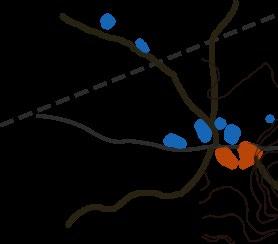
2000
2005
Rail Route introduced to the North
2010
Development of SG Highway
2015


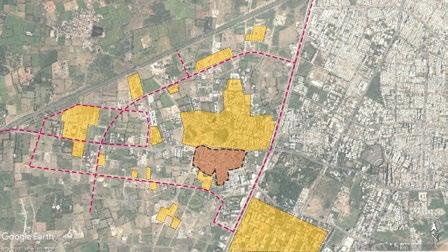
TP scheme on the east of highway. The sprawl is limited at the SG highway Development beyond the highway. Slum encroachment around lake.
2019

Understanding the Village The Morphology
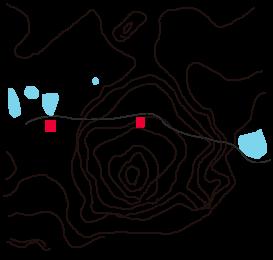
The Site
Auda Synthesis Park
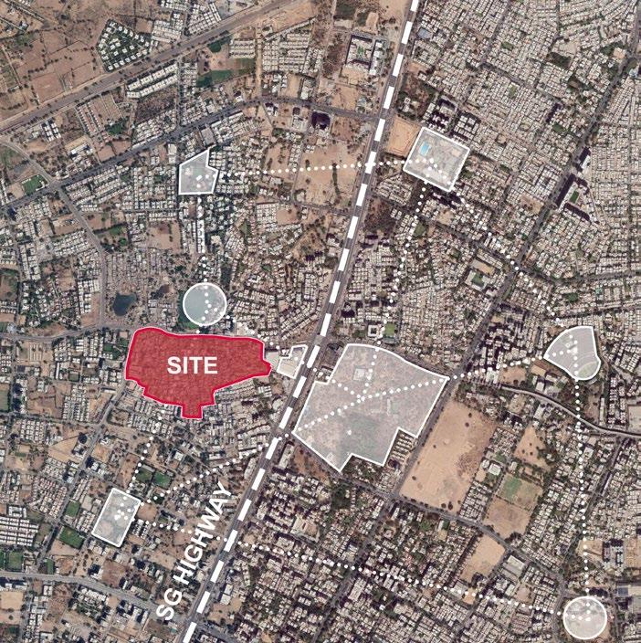
Thaltej Lake Sports Academy
Drive-in Cinema
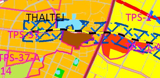
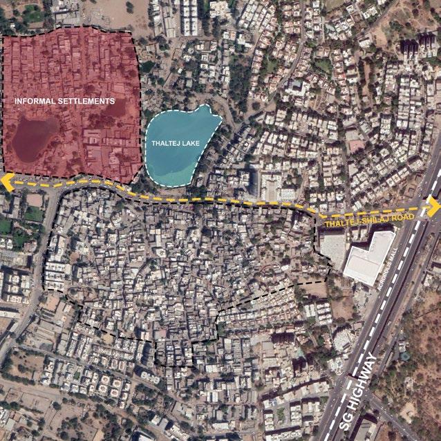
Thaltej Gamtal is located to the west of the intersection of SG highway and Thaltej –Shilaj road. Thaltej is strategically located in proximity to several local area level landmarks giving it an important edge.
These public landmarks create a network of city level destinations that give the village a strategic edge over the other villages.
Auda Park Indian Institute of Public Health
The village has a TOZ line passing through the village although the ramifications are still ambiguous.
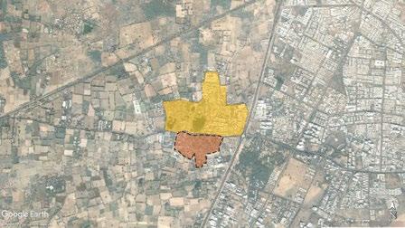
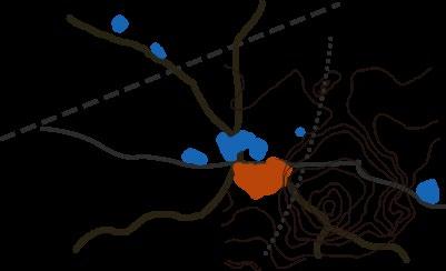
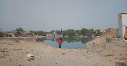
Spanning an area of 91.4 acres, the village is abutting the Thaltej – Shilaj road. Adjacent to this arterial road in close proximity is the Thaltej lake along with a small informal settlement across the village. The existing situation of the thaltej lake is very poor, however the AMC plans to revive the lake as a city level public infrastructure.
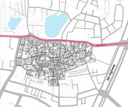

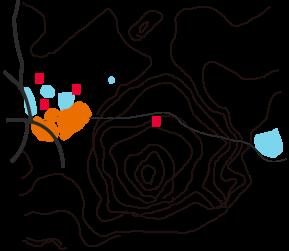
Connectivity and Road network
The adjoining map illustrates the important arterial roads that encircle the village. While these arterials have considerably greater ROW, the internal roads of the village are much lesser in width.
The major arterial is the thaltej Shilaj road that links the village to SG Highway on one side and the shilaj gamtal on the other.
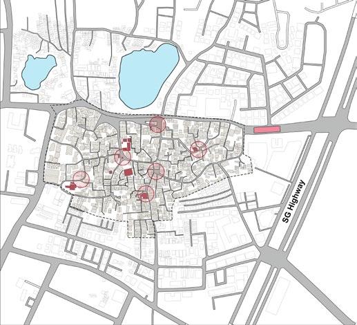
Major Nodes and Landmarks
The major landmarks in and around the site include religious institutions like temples and schools that are adjoining important nodes that form intersections of pedestrian and vehicular activity.
Building Use Distribution
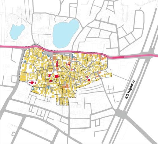
The village has predominantly residential building use with the buildings adjacent to the thaltej Shilaj road have mixed use and commrcial building use. The institutional building use is mainly due to temples across the village as well as a primary school and a post office.
Community Mapping
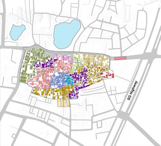
The communities are segregated according to caste. The people of one caste reside together in one colony, and rent out their units to people of the same caste.
Understanding the Village The Places
Chowks as Gathering Spots
The chowks are important social interaction spaces, but in most cases they are used for parking with no designated programme or urban furniture.
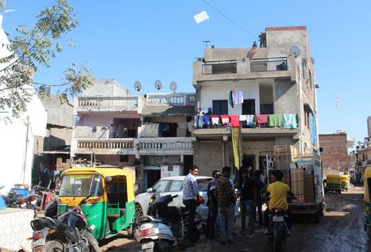
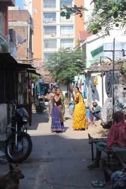
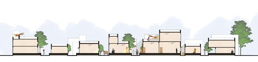
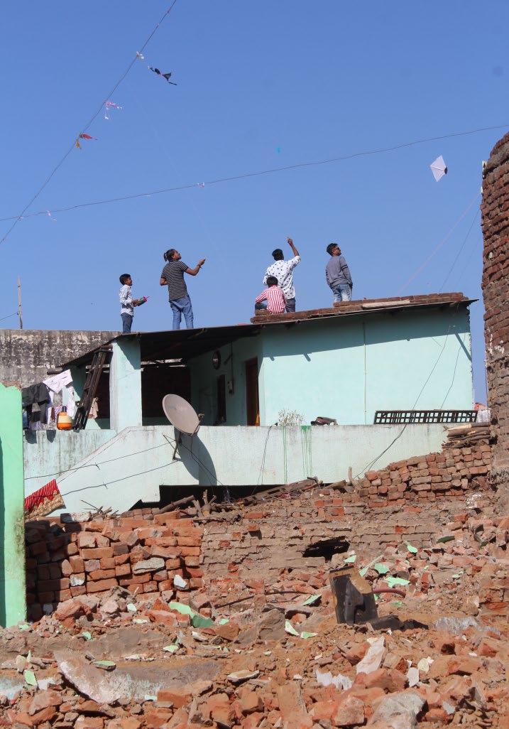
Owing to the close proximity of the houses , the terraces are interconnected to each other leading to close interactions especially during festivals like Uttarayan, or Holi. Terraces as Interlinked Social Spaces
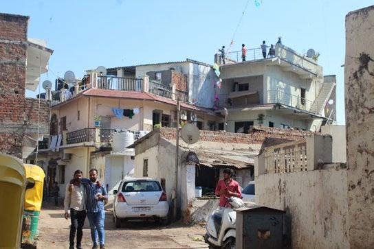
Residential tenements with accessible terraces
One storied, single family units

Small retail setups on the ground floor
Informal Markets along Edges
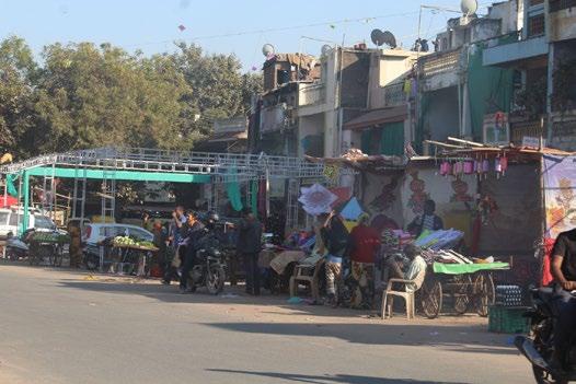
The Thaltej Shilaj road transforms into a busy, interactive commercial edge where it abuts the Gamtal, leading to important economic opportunities for the residents, as well as an interface between the lake and the village.
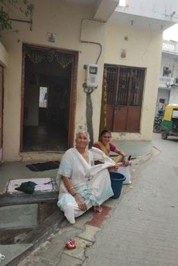
Incidental Open Spaces, and Otlas
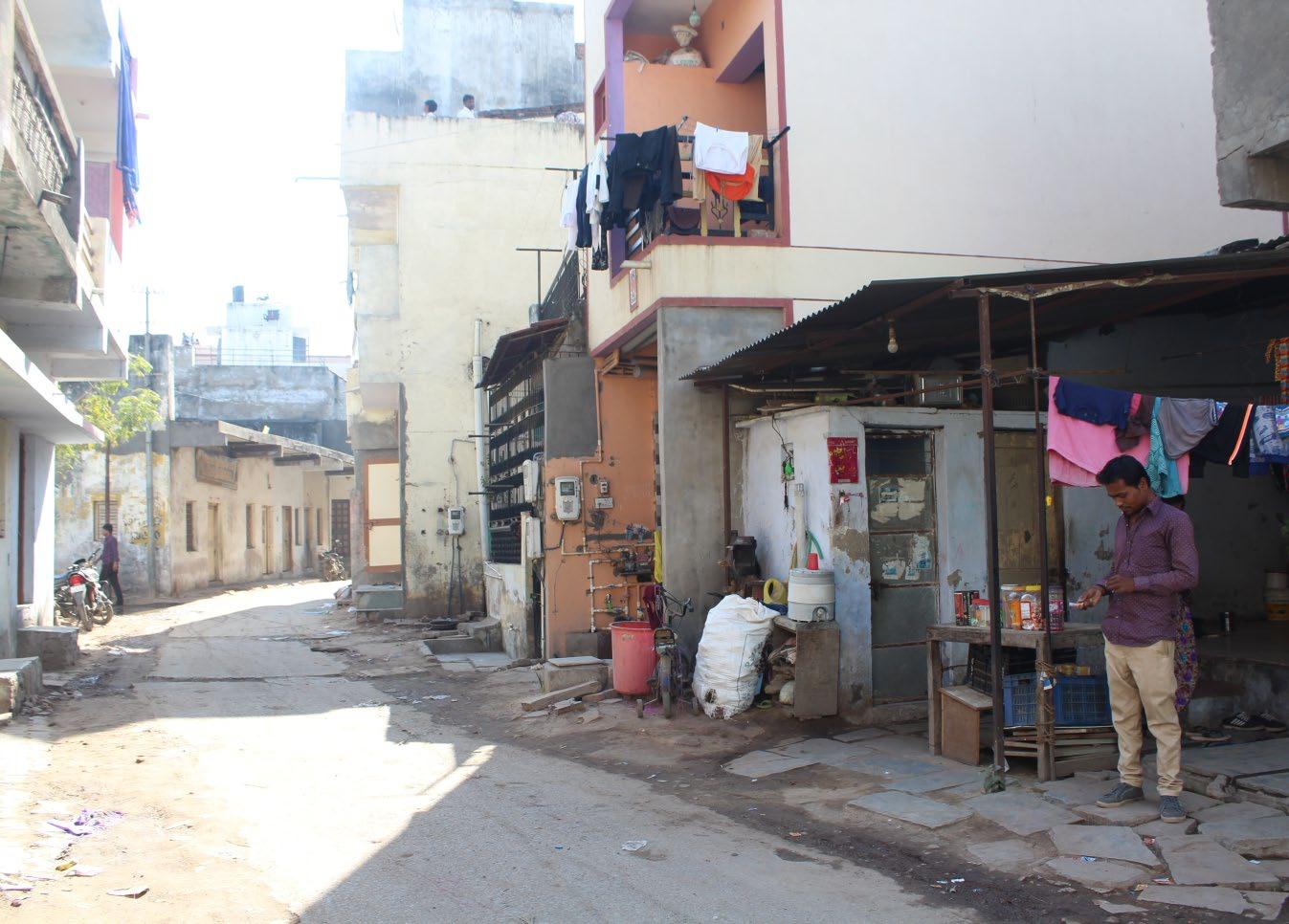
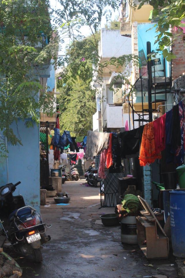
The incidental open spaces are the only breathing spaces for the residents, often being occupied by parking of vehicles, or very poor infrastructure. Streets and otlas are important public spaces for the residents, especially women.
Understanding the Village The Streets
Main Street
The main streets are used for vehicular and pedestrian movement along with the occasional mobile vending, retail along the edges as well as unorganized vehicle parkig activity.
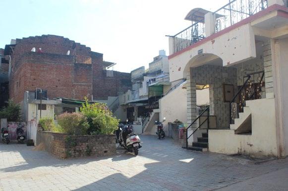
Cul de Sacs
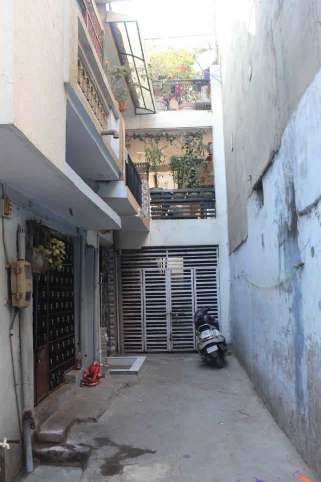
The main streets end in internal cul de sacs. These cul de sacs are spillover spaces for the households, becoming a semi private semi public realm for the residents utilized for parking, storage, socializing as well as a relief space for ventilation and recreation.
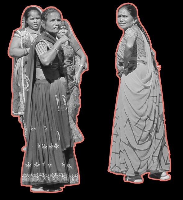
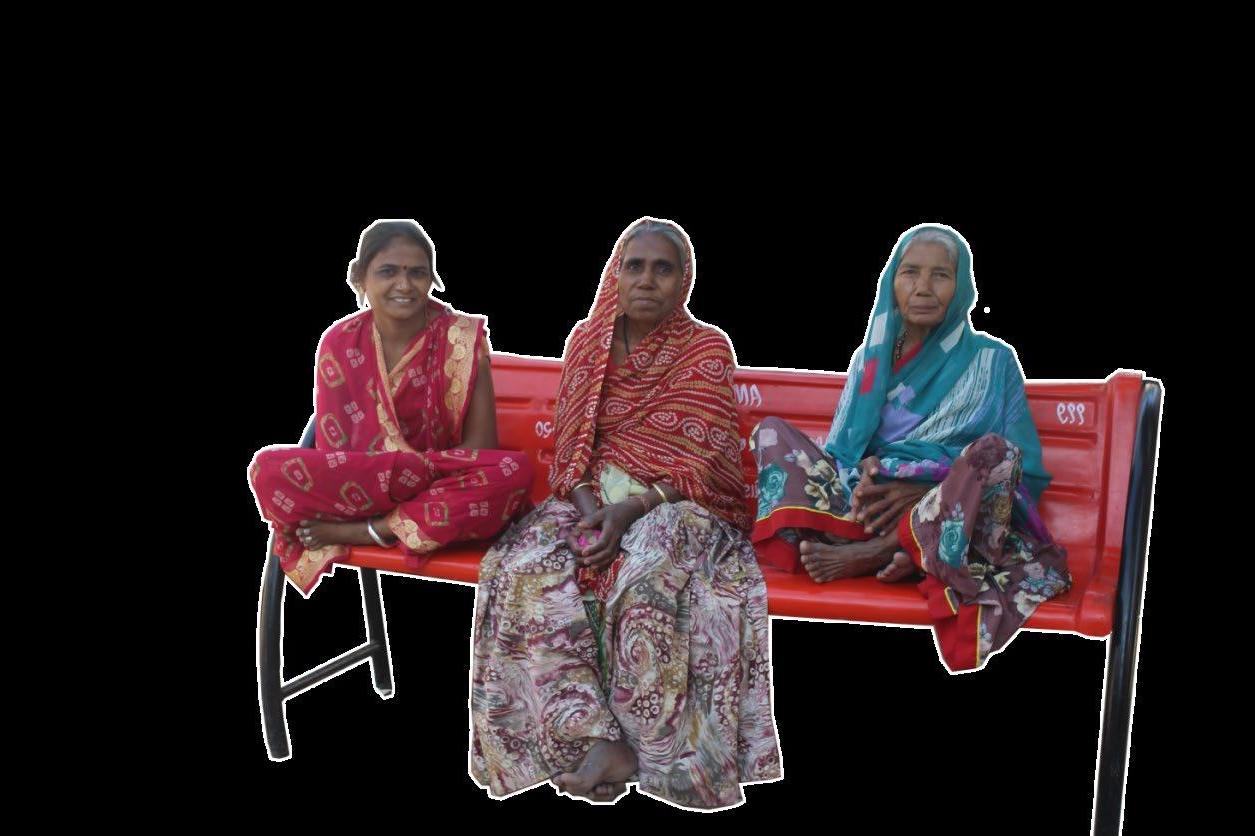
Understanding the Village The People
The majority of the population of the village consists of families with a small portion contributed by migrant population. The village settlement pattern is heavily influenced by the community based lines. The village consist of distinct clusters of Patels, Thakors, Prajapatis,etc. The caste based divisions also seep into the rental market were the rented out units are also occupied by the same caste as that landlord.
But apart from the community based divisions, there is an collective aspiration among the villagers to create entrepreneurial opportunities from their land holdings inside the Gamtal. Thaltej is one of the expensive real estate hotspots of the city. The villagers are well aware of the value of their land holdings and thus there is an opportunity for the project to empower people to make choices that gives them economic stability and still retain ownership.
There is also a very strong sense of community interdependence and the villagers enjoy the sense of community and interpersonal relationships they create in the village. The inherent sense of community should always be retained.
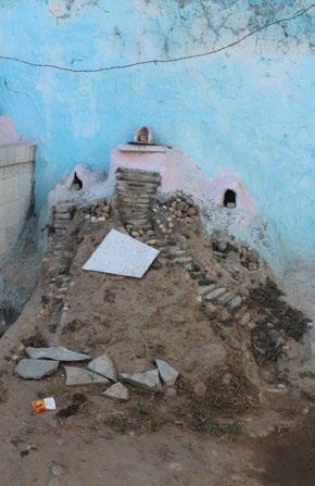

Also religion is an important bonding experience for the village residents, which explains the presence of a temple at all the important nodes which is accompanied by chowks.
Apart from a sturdy social fabric, the built environment of the village is in need of rehabilitation and regeneration. Also thaltej is surrounded by immense pressure to urbanize, which explains the restlessness among the villagers regarding the proposed metro station.
Understanding the Village The Problems
Insufficient Street ROW
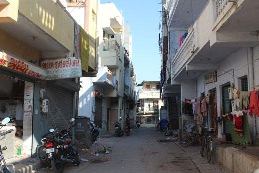
The streets in the village that are used as major thoroughfares are encroached considerably by two wheeler parking and spillover from retail setups and households. The movement of vehicles as well pedestrians is hampered.
Underutilized Public Space
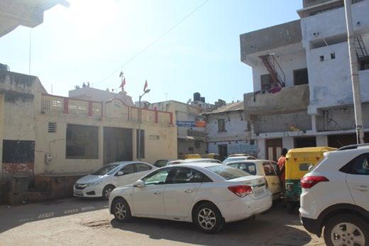
The chowks of the village which happen to be adjoining major nodes are over taken by four wheeler parking, taking away from very few public open spaces that is already rare in the village.
Need for Densification
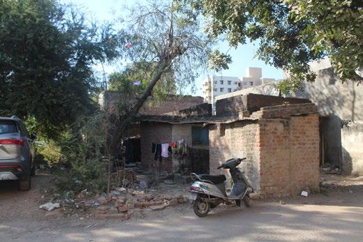
There are a lot of dilapidated one storey structures that are either abandoned or are under utilized. These structures have potential for redevelopment as they can add to the housing stock inside the village leading to a more sustainable, compact setup.
Poor Condition of Infrastructure

The condition of a lot of public infrastructure in the village is very poor or is either in need of state intervention as people lack the resources to repair it on their own. These points are good points to intevene and propose something that can tie in to a bigger scheme for the village.


