

A MESSAGE FROM THE MAYOR
On behalf of the City of Azle, we are thrilled to present the Azle: On the Horizon Comprehensive Plan 2024 Update. Azle’s first Comprehensive Plan was adopted in 1987 and updated in 2005. Since then, our City has undergone significant growth while diligently planning for the future. Azle is a City brimming with potential, attracting families seeking a nurturing environment, a unique way of life, and the support of a resilient community. Our challenge lies in preserving our small-town charm as we evolve within the growing region, all while maintaining the cherished quality of life that defines us.
This updated Comprehensive Plan serves as a roadmap for the next two decades and beyond, placing the community’s vision for Azle at the forefront. It tackles our current challenges and sets ambitious goals to ensure tangible progress and lasting improvements. Thank you for your continued support throughout this process. We hope this plan reflects the values and vision the community has for Azle’s future.
Sincerely,

Mayor Alan Brundrett

ACKNOWLEDGMENTS
The City of Azle Comprehensive Plan Update would not have been possible without the following individuals. Thank you for your guidance and insight throughout the process!
City Council
Alan Brundrett - Mayor
Randa Goode - Mayor Pro Tem
Derrick Nelson - Councilmember, Place 1
Amy Estes - Councilmember Place, 2
Stacy Peek - Councilmember Place, 3
Rouel Rothenberger Jr - Councilmember, Place 5
Brian Conner - Councilmember, Place 6
Planning & Zoning Commission
Jared Arneson - Place 1
Ricky Simmons - Place 2
Laurel Mosier - Place 3
Leonard Wheeler - Place 4, Chairman
Cynthia Barrios - Place 5
Curt Lampkin - Place 6
Jim Carlson - Place 7, Vice Chairman
City Staff
Tom Muir, City Manager
David Hawkins, Director of Planning & Development
Lawrence Bryant, Assistant City Manager
Rick White, Director of Public Services
Kyle Culwell, Parks Superintendent
Kristen Pegues, Community & Marketing Specialist
Malinda Nowell, Sr. Administrative Assistant
Vision Committee
Alan Brundrett - Mayor
Randa Goode - Mayor Pro Tem
Amy Estes - Councilmember, Place 2
Leonard Wheeler - P&Z, Chairman
Ricky Simmons - P&Z, Place 2
Todd Smith
Jennifer Herrington
Marsha Hardin
Kristie Cooper
Kip Kruger
David Shaffer
Rick Reeves
Brad Johnson
Maddie Skidmore
Whitney Linder, AICP-C Halff
Jason Claunch Catalyst Commercial

LIST OF FIGURES
LIST OF TABLES
Map
Map
Map


HOW TO USE THIS DOCUMENT
What is a Comprehensive Plan?
The City of Azle Comprehensive Plan is a policy document that articulates a vision, outlines goals and objectives, and recommends specific actions for implementation. It ensures that new development and redevelopment of land, roads, parks, utilities, and public facilities are well-planned and occur in a manner that achieves the desired vision of the community.
One of the primary purposes of a Comprehensive Plan is to guide land use decisions. Texas communities are given authority to conduct comprehensive planning in Section 213 of the Texas Local Government Code.
A Comprehensive Plan provides a 20-to-30-year framework for staff, as well as elected and appointed officials, to make public policy decisions related to land use, transportation, parks and recreation, capital investments and other topics that shape the future growth and sustainability of the community. This document provides a high-level, graphic overview of the planning process, analysis and outcomes, and recommendations. Additional technical analysis is included in the Appendix.
Relationship to Other Plans
A sound plan is based on a thorough understanding of community assets and provides a firm foundation upon which communities can make decisions about the future investment of their resources. It is important to note that a Comprehensive Plan does not replace zoning regulations, development codes, capital improvement programs, or other regulatory documents. Instead, the plan is meant to serve as the foundation for updates to those other regulations and implementation tools.
This Plan is an integral part of the City’s planning efforts to meet the needs of its growing community. Current planning efforts and projects that are relevant to the implementation of the Plan are listed below:
• Downtown Plan Report March 2010
• Zoning Map 2015
• Annexation Service Plan 2017
• Land Use and Master Thoroughfare Plan 2017
Planning Process
The Comprehensive Planning process should be tailored to the unique issues and opportunities of the community. Typically, this process is broken down into multiple phases with various engagement opportunities to capture the ideas and hopes for the future of the citizens of Azle.
Over the course of one year, the following phases were completed to establish Azle 2045 On the Horizon:


PHASE 1 | EXPLORE
In the first phase, a thorough review of the City’s existing conditions was performed. This included a community audit and market review that focused on current demographic and economic trends, as well as existing opportunities and challenges that are present in Azle.
PHASE 2 | ENVISION
Community leaders, stakeholders, and residents were engaged to establish a vision for the future of the community. Feedback gained through focus group meetings, public workshops, and an online survey served as the foundation for the Plan’s guiding principles and vision statement, which were established during this phase.
PHASE 3 | GUIDE
Using the land use and engagement analyses established in the previous phases, growth scenarios were created to inform the Future Place Type Map (FPTM). Plan themes were also drafted. Finally, a small area plan was developed to establish a framework and location for a potential City Center.


PHASE 4 | PLAY
The fourth phase focused on a community touchpoint to initiate the Parks Visioning to lead into the development of the Parks & Recreation Master Plan Update. This phase included a set of conditions assessments, workshops, and an Implementation Action Program.
PHASE 5 | ACTIVATE
The final phase focused on developing the recommendations, which serve as the vehicle for achieving the Plan’s vision and tracking its progress. Final revisions based on community feedback were incorporated into the Draft Plan before being presented to the Vision Committee, Planning and Zoning Commission, and City Council for formal approval and adoption.
HOW TO USE THIS DOCUMENT
Plan Summary
This Plan document acts as a clear definition for what the City aims to achieve over the next 20 years and provides an action plan that will help the City reach its goals. This includes six Guiding Principles, developed based on community input and background research, each with a specific set of goals corresponding to strategies that will be key to the City achieving its vision for the future. It also includes the City’s future land use plan which outlines the Future Place Type Map. When new development proposals are submitted to the City, staff and City Council will use the policy framework established in this plan to determine whether the proposal fits with the community-driven vision. The document is flexible and can be amended over time to meet the needs of the community as it evolves.
Plan Elements
The Plan includes the following elements that provide an overview of the community today as well as goals and strategies that will help shape the future growth and character of the City over the next 20 years:


STUDY LIMITS
The study limits for the Comprehensive Plan include the incorporated City limits and land designated as the City’s extraterritorial jurisdiction (ETJ).
What is an ETJ?
The area of land lying outside and adjacent to the corporate limits of the City of Azle over which the City has limited legal control as set forth in Chapter 42 of the Local Government Code (within one mile of the corporate limits).

There are a number of reasons for cities to annex adjacent land, however, due to recent changes in state law, unilateral annexations are no longer possible for most Texas municipalities. Any annexation within a community’s ETJ must be voluntary and led by landowners.
Azle ETJ
Eagle Mountain Lake
Azle City Limits
COMMUNITY PROFILE
Planning Area
Located in the Dallas-Fort Worth Metroplex, Azle sits 17 miles northwest of Fort Worth. It is bifurcated by both Tarrant and Parker counties. The City is affectionately described as a suburban community with a rural quality of life. This is represented by its many natural resources such as Eagle Mountain Lake that comprises the eastern border of the City and Ash Creek that runs through Ash Creek Park. Map 1.1 illustrates the boundaries of the City.
TABLE 1.1 | PROXIMITY TO MAJOR DESTINATIONS
Azle’s total area within the city limits is 8.8 square miles with an additional 15.54 square miles in the extraterritorial jurisdiction (ETJ) that could potentially be annexed into the city limits at a future time. The City has experienced significant growth of 30% since 2010 and has a current population of 14,298. Changes in demographics, transportation, development, and technology have impacted land use priorities. The location of where certain industries and land uses can develop is impacted by the floodplain which covers 17 percent of the City.
Residents have emphasized the importance of the rural character of Azle and how it impacts their quality of life. This is an important consideration for this plan as the rural character of the area can change as the population grows and subsequent development continues. Azle is located in one of the fastest growing counties in the region and is seeing a considerable amount of development and growth pressure as the Dallas-Fort Worth Metroplex continues to expand. Table 1.1 highlights Azle’s close proximity to major cities and transit hubs, offering a chance for residents to enjoy the rural character while still being connected to major commercial and transportation amenities.
The commercial area of the City resides along Highway 199 and FM 730 North. A considerable area of land, around 81%, is designated as rural to medium density residential uses. Highway 199 runs through the western portion of the City and branches off at Main Street, where development is ramping up to revitalize the downtown district. Complications surrounding Texas Department of Transportation’s (TxDOT) ownership of Main Street (State Spur 344) has made this endeavor difficult though there have been discussions about TxDOT conveying ownership of the road to the City.
LEGEND
Azle City Limits
Azle ETJ
Eagle Mountain Lake
100-Yr Floodplain
Surrounding Communities Roads


Eagle Mountain Lake
COMMUNITY PROFILE Growth Trends
Azle became an incorporated city in 1957 and reached the status of home rule city by 1969 when the population ballooned to over 5,000. Between 1975 and 2015, the population increased by 134%. Since 2015, the population has steadily increased by about 15% and is expected to continue to increase by 15-20% in the coming decades. This population growth expectation falls in line with the surrounding counties and the State of Texas overall. Figure 1.1 shows Azle’s historic population growth according to the US Census Bureau.
The projection analysis shown in Table 1.2 was completed by the North Central Texas Council of Governments (NCTCOG) in 2022 and demonstrates projections for number of households and employment approximations in the City of Azle. This approximation does not account for the ETJ nor is there any consideration for future annexations that may occur. Estimates for Azle, as well as other surrounding communities, can be found on the NCTCOG website.
The figures on the following page present a brief overview of 2022 demographic trends in Azle, using Esri Advanced Demographics.
FIGURE 1.1 | HISTORIC POPULATION GROWTH
TABLE 1.2 | AZLE HISTORIC GROWTH
REGIONAL POPULATION GROWTH
FIGURE 1.2 | REGIONAL GROWTH

Despite making up only 9% of the country’s population, the State of Texas accounted for 32% of the population growth seen in the United States between 2019 and 2020. Texas has 40 cities with populations over 100,000 and is projected to reach 52.5 million residents by 2050 according to the Texas Demographic Center. This growth trend is also mirrored in Tarrant and Parker County.
Demographic Snapshot
FIGURE 1.3 | AGE & SEX RATIO

FIGURE 1.5 | MEDIAN HOUSEHOLD INCOME
FIGURE 1.4 | RACE
FIGURE 1.7 | MEDIAN HOME VALUE
FIGURE 1.6 | ETHNICITY
FIGURE 1.8 | HOUSING TENURE
LAND USE CONDITIONS
Current Zoning
Zoning regulations serve as the basis for applying land use goals and development standards for different areas or districts across the city. It is a tool that ensures that land uses are located appropriately and provide synergistic and compatible uses to surrounding land uses. Zoning regulations create site-specific requirements for the types of development that are allowed. Traditional components of zoning regulations include the use of the property, intensity and density, and the design of site features like landscaping, parking, or setbacks.
As illustrated in Map 1.2, the City of Azle contains 17 active zoning districts which include 11 residential districts, two commercial districts, and designations for Central Business District, Industrial, Institutional, and Planned Development. The Institutional designation accounts for 17.3% of the total land area in Azle with the next largest category being Single Family 4. The Single-Family categories make up the largest group within the city, encompassing a total of 48% of city limits while Medium Density and Multi Family categories make up less than two percent of the city, combined. Table 1.3 provides a breakdown of all the land uses in Azle.
It is worth highlighting that a notable portion of the Institutional zoned area consists of parkland or Tarrant Regional Water District (TRWD) land. Although these areas don’t hold substantial development potential, they present an opportunity for the City to establish parks, trails, and open spaces for community enjoyment. These possibilities are extensively examined in the Parks & Open Space Master Plan. Primarily, residential zoning categories of all types dominate the city, encompassing nearly 60% of the land within city limits.
TABLE 1.3 | AZLE LAND USE BREAKDOWN
Key Takeaways
Residential zoning categories encompass nearly 60% of the city limits, resulting in the majority of residents (58%) commuting outside the city for work due to the limited local employment opportunities within Azle.


TRANSPORTATION & MOBILITY
Current Thoroughfare Network
The City of Azle has 145 miles of local, state and interstate roads creating connections to the surrounding region and access to the city’s neighborhoods, facilities, and commercial developments. Highway 199 runs north and south and is the major regional access thoroughfare connecting Azle to the DFW Metroplex and continuing north to Jacksboro. It presently operates as an expressway with a speed limit of around 60 mph and three lanes on each side. Highway 199 only has two exits in the Azle city limits and eventually splits off just south of State Spur 344 to become Main Street, a key arterial. Due to its designation as a state highway the road is under the jurisdiction of TxDOT.
Other major connections in and around Azle include FM 730 (North and South) and Stewart Street that bisects the City from east to west.
Within Azle, there are 56 miles of asphalt streets and at least 8 miles of concrete streets. all maintained by the City. According to the City’s assessment, of the total 64 miles of streets that are maintained:
• 32 miles are in above average condition
• 20 miles are in average condition
• 12 miles are in poor condition
Additionally, county maintained streets consist of:
• 24 miles of curb and gutter drainage
• 40 miles of open ditch drainage
Alternative Modes of Transportation
Incorporating “Complete Street” elements to future and existing roadways contributes to safer traffic patterns and encourages better habits among drivers, resulting in safer access between local destinations for all uses of the road. Street design elements can also establish clear delineations between the rural areas and areas targeted for future growth opportunities within Azle. Complete Streets take a context sensitive approach to designing the right-of-way (ROW), so the streetscape design and elements support the surrounding characteristics of the adjacent land uses.
THE ELEMENTS OF A COMPLETE STREET CAN INCLUDE THE FOLLOWING:
DESIGNATED BUS LANES

ROADWAY CLASSIFICATIONS
The following functional classifications of streets as defined by the U.S. Department of Transportation (DOT) currently provide access to and within Azle’s City Limits and ETJ:
Interstate Highways
Interstate Highways/Principal Arterials are designed and constructed with mobility and long-distance travel in mind. These roads provide the highest level of vehicular mobility and the highest speeds over the longest uninterrupted distance. Interstates nationwide usually have posted speeds between 55 and 75 mph. Design types are interstate, other freeways, and other principal arterials.
Arterials
Arterials support trips of moderate length at a lower level of vehicular mobility than interstates. Arterials may carry local bus routes and provide intra-community continuity but do not penetrate neighborhoods.
Collectors
Collectors are major and minor roads that connect local roads and streets with arterials. Collectors provide less mobility than arterials at lower speeds and for shorter distances. They balance mobility with land access and the posted speed limit on collectors is usually between 35 and 55 mph.
Local Streets
Local roads provide direct access to adjacent land within a community and are not intended for long-distance travel. They support through access to residential areas, businesses, amenities, and other local areas. These roads give access to adjacent land by the lowest traffic volumes, between 20 and 45 mph, in the network and make-up the greatest percentage of the city’s entire transportation network and are usually intended to prevent through traffic.
TRANSPORTATION & MOBILITY
FIGURE 1.9 | REGIONAL COMMUTE TIME Mobility & Connectivity
Azle does not have direct access to many public transportation options, making automobiles the primary mode of transportation. Map 1.3 illustrates the roadway network in the City of Azle.
As depicted in Figure 1.10, about 58% of Azle’s employed residents commute beyond the city limits for work. This contributes to lengthy commute times, as illustrated in Figure 1.9, with an average of 32.2 minutes within Azle, which is more than Tarrant County and the DFW region. Notably, more than half of the community, (60.3%) drives 30 minutes or more to commute to and from work, as seen in Table 1.4.
There is an existing contract with Trinity Metro to provide doorto-door transportation service throughout Tarrant County to Azle residents who are disabled or 65 years of age or older through a program called Tarrant County Transportation Services (TCTS). Additionally, Public Transit Services (PTS) provides door-to-door transportation service for anyone living in Parker County.
While the residents have identified a great interest in hike and bike trails, citywide trails have yet to be developed, and multimodal infrastructure (i.e., multi-use paths and bicycle lanes) has not yet been developed within Azle either.
TABLE 1.4 | TRAVEL TIME TO WORK
FIGURE 1.10 | AZLE PRIMARY JOBS IN-FLOW & OUT-FLOW PATTERNS


COMMUNITY INFRASTRUCTURE
Utilities & Facilities
The City’s drinking water is obtained from Eagle Mountain Lake, and owned and operated by the Tarrant Regional Water District. The 2023 Texas Commission on Environmental Quality (TCEQ) Water Quality Report determined that Azle’s drinking water meets and exceeds all state and federal quality laws. The Azle water system has achieved “Superior Status” and consists of 137 miles of water lines. This includes connections with surrounding communities and water systems. There are three ground storage tanks, two elevated storage tanks, and five pump stations, amounting to a storage capacity of 3.9 million gallons of water. The City’s wastewater system consists of 144 miles of sewer pipes and 25 lift stations.
Azle’s water pipelines range from 2 inches to 16 inches in diameter, and illustrated in Map 1.4, sewer pipelines range from 2 inches to 18 inches. On average, the City of Azle consumed 1.97 million gallons per day in 2023—this equates to 719 million gallons drawn from Eagle Mountain Lake. The raw water pump station is capable of supplying six million gallons of raw water per day, which greatly exceeds the average daily usage. This level of preparation represents the City of Azle’s commitment to its water customers to provide sufficient high-quality water to satisfy their daily needs.
Parks & Recreation
The Azle Parks and Recreation Department oversees more than 358 acres of diverse parkland, catering to individuals of all age groups. The park system features an array of amenities, including picnic pavilions, engaging playgrounds for kids, versatile sports courts, and fields accommodating a range of activities. At Ash Creek Park, the City offers a Senior Citizens Center. The department also curates a concert series at Central Park, enchanting audiences throughout the summer. The City’s 2024 Parks and Open Space Master Plan Update delves further into the Azle Park System to enhance the City’s current offerings and explore future opportunities.
DESIGNING FOR RESILIENCE
There are a number of strategies cities can adopt to plan for risk and mitigate damaging effects to their built environment and social networks. The City of Azle recognizes the need to increase its resilience and mitigate future problems as they plan for the decades to come. In June 2021, one such effort to build resiliency was accomplished when the water plant was certified through the Risk and Resilience Assessment under the U.S. Environmental Protection Agency (EPA). This assessment demonstrates that the City has analyzed their water system for its ability to provide clean, plentiful water daily and in times of a natural or man-made disaster. Azle was also designated as a Tree City USA in March 2023 by the Arbor Day Foundation. The award demonstrates the community’s commitment to environmental harmony by installing a tree board, adopting a tree-care ordinance, and budgeting for the maintenance of the City’s trees.
MAP 1.4 | AZLE SEWER INFRASTRUCTURE


COMMUNITY INFRASTRUCTURE
Wildfire Risk
The Wildland Urban Interface (WUI) denotes the area where homes and other structures are built in or near natural vegetation and forests, putting them at a higher risk for wildfires. As noted by Table 1.5, 4,956 acres (88%) of land in Azle falls within the WUI.
In the event a wildfire breaks out in the region, these areas would be the highest priority for protection and/or evacuation. Educational programs that bring awareness to residents about risk factors and property maintenance considerations can mitigate overall risk. The City can also build resilience by adopting stricter building codes and ordinances that consider landscaping and planting guidance that creates a buffer between the natural and built environment.
Floodplain & Flood Risk
TABLE 1.5 | AZLE WUI
acres to 1 house/10 acres
1 house/40 acres to 1 house/20 acres 2.97%
1 house/5 acres to 1 house/2 acres 17.28% Greater than 3 houses/acre 0.35%
Azle is part of the Trinity River Basin and adjacent to a large water body called Eagle Mountain Lake. Water flows from the north through Azle to drain into the lake that was man-made after the installation of Eagle Mountain Dam. This diverse and beautiful landscape provides quality of life benefits, but it can also lead to a number of flooding issues. Azle is at risk from overtopping of the two creeks that run through its border, flooding from rain events, and lake shore flooding either from overtopping of Eagle Mountain Lake or dam failure. Around 17% of Azle’s land is located within the 100-year floodplain. This accounts for about 445 buildings (including residential) at risk of flooding. The City is a participant in the National Flood Insurance Program (NFIP) which has helped Azle to identify the high-risk regions and access information about their loss statistics to understand the effects flooding has on the overall community.
Participating in NFIP and the Community Rating System (CRS) are particularly important steps any community can take to reduce their risk of flooding. The CRS is a voluntary program for communities that participate in the NFIP. If a community participates in the CRS, they can get incentives in the form of premium discounts for going beyond the minimum floodplain management requirements to develop extra measures to protect from flooding.
The City can also track their repetitive loss structures and explore buyout program options to reduce the drain on NFIP Program and need for borrowing. According to Tarrant County’s Hazard Mitigation Plan, between 1978 and 2018 Azle had 53 total losses of properties at a cost of $1,114,627.32. Other options include increasing freeboard requirements for new development in or near the 100-year floodplain and adopting ordinances that discourage development in the floodplain and support use of open space for flood mitigation.

LEGEND Roads
Azle City Limits
Azle ETJ
Surrounding Communities
Eagle Mountain Lake 100-Yr Floodplain
City Properties
Wildland Urban Interface
<1 House/40 Ac
1 House/40 Ac - 1 House/20 Ac
1 House/20 Ac - 1 House/10 Ac
1 House/10 Ac - 1 House/5 Ac
1 House/5 Ac - 1 House/2 Ac
1 House/2 Ac - 3 Houses/1 Ac
Greater than 3 Houses/Ac
MainSt
ParkSt
Eagle Mountain Lake
FUTURE DEVELOPMENT TRENDS
KEY TAKEAWAYS
Azle’s economy is made up of a unique and diversified mix of businesses. While historically reliant on agriculture and ranching, the City has seen an increase in various industries, including manufacturing, healthcare, retail, and construction. This diversification has created new job opportunities and contributed to the overall economic growth of Azle. In addition to major employers, Azle has several smaller businesses, including service and retail. The presence of both small, local establishments and larger companies creates numerous employment opportunities for residents. Today, Azle has more than 280,000 square feet (SF) of industrial and 1.3 million SF of retail.
As previously discussed, Azle has experienced significant growth in recent years due to its proximity to major highways, such as State Highway 199 and FM 730. As Fort Worth continues to expand, Azle has become an attractive alternative for those desiring a quieter and more spacious living environment while maintaining convenient access to the urban center of Fort Worth. Azle has grown in population by more than 30% and has grown every year in several industries over the past 10 years. Despite this growth, many residents still lack access to daily needs and desired services such as sit-down restaurants, medical services, and groceries. In addition to nearby industrial jobs and regional attractions and amenities, Azle’s rural character and strong sense of community are also attracting more residents.
A high level overview of Azle’s future development potential is listed below:
• Industrial – It is anticipated that Azle will experience negative absorption of industrial on a yearly basis
• For-rent Housing – It is estimated that Azle could capture and absorb 99 units annually of renter-occupied housing, with 62% of the units at a price point of $1,500
• For-sale Housing – It is estimated that Azle could capture up to 129 new owneroccupied, single family detached units annually with 35% of the units at a price point above $350K
• Office – With limited existing demand for office, Azle has experienced a negative absorption of 15K SF of office over the last 12 months
• Retail - There is a potential demand of 19,600 SF of retail space in Azle currently. Azle’s trade area has a projected demand of over 600K SF in 2028
Residential Trends & Potential Demand
Owner-Occupied Homes
Housing demand in Azle has witnessed a notable surge in recent years due to several factors including population growth and economic development throughout the DFW Metroplex. According to Esri, Azle’s population increased over 30% from 2010 to 2023, with total current population at 14,298 residents. Affordability is another key factor, with the median home value in Azle at $293,107, an 11% increase over the past year. Based on Parker and Tarrant counties growth rates, it is estimated that Azle could capture up to 129 new owner-occupied, single-family detached units annually; 35% of this demand is for units at a price point of $350,000 or more. There is also demand for an additional 25 owner-occupied units annually (approximately 16% of the owner-occupied demand) in the form of multi-unit buildings, townhomes, or condos.
Renter-Occupied Homes
In addition to single-family and owner-occupied demand, an analysis of the region was also performed to understand the renter-occupied residential market. It is estimated that Azle could capture and absorb 99 units annually of renter-occupied housing with 77% in the form of multifamily residential and 23% in other formats such as duplex/triplex/fourplex or single-family build-to-rent. Most of the multifamily residential demand (62%) is for units commanding rents of $1,500+ per unit. These annual demand numbers for both owner-occupied and renteroccupied homes do not represent what the City of Azle must absorb but rather represents the amount that it could absorb annually if development of all types and price points were targeted.
FIGURE 1.11 | ANNUAL OWNER-OCCUPIED DEMAND (SINGLE-FAMILY DETACHED)
FIGURE 1.12 | ANNUAL RENTER-OCCUPIED DEMAND (MULTI-FAMILY)
FUTURE DEVELOPMENT TRENDS
Non-Residential Trends & Potential Demand
Industrial
The market demand for industrial space in Azle is considered a medium demand due to the proximity to major highways and Fort Worth. According to CoStar, a comprehensive database of real estate data throughout the US, Azle’s industrial market currently has a total inventory of 282,000 SF and industrial vacancies are at 6.6%. The industrial market has grown for the past 10 years in Azle with a total growth of 43,000 SF of inventory since 2013. The market rent is $11.94 per SF and there is currently no industrial development under construction. Azle benefits from its strategic location near major highways and rail lines, and provides convenient access to regional and national markets. However, future development will be dependent on available development sites and market conditions.
Office Retail
Today, Azle has 175,000 SF of office space and demand is limited. While office space here has grown by about 4,000 SF per year since 2013, according to CoStar, there is currently no substantial office space under construction and there is a negative absorption of -15,000 SF over the last 12 months. Azle’s market vacancy rate is at 12.3% and market rent is $26.94 per SF. Azle’s modest population growth and correlated employment growth show the market demand focused in other development areas.
Today, Azle has a total of 1.3 million SF of retail, with several retail projects in the pipeline and a 12-month net absorption of 19,600 SF. Population data for 2023 shows 131,000 people within an 18-minute drive time of Azle’s Primary Trade Area (PTA), who have a median household income of $79,229. These figures equate to a retail purchasing power of over $10.3 billion and the ability to support eight million SF of retail. As previously noted, population growth and economic development have played a key role in overall demand and growth and especially in the retail market with an increase in disposable income. By 2028, it is expected that additional retail demand will increase by $190,455,838 in spending and a need of 634,853 SF of retail space with the greatest demand for grocery, followed by entertainment, and then restaurants and fast food.


ENGAGING THE COMMUNITY
Community feedback is essential to the comprehensive planning process. The feedback collected provides the foundation for the goals and recommendations of this Plan. This chapter summarizes tthe engagement process for this Plan and presents the feedback from the public which formed the Plan Vision.
Public Engagement
A variety of engagement efforts were conducted throughout the engagement process. Varied engagement strategies allowed people of all ages and backgrounds to express their opinions on the future direction of Azle. Engagement strategies included the following:
• Focus groups
• Check-ins with a designated Vision Committee
• Public Workshops
• Community Survey
Focus Groups
To initiate the engagement process, a series of focus group listening sessions were conducted in June 2023. The goal of the listening sessions was to introduce participants to the planning process and facilitate discussions regarding the City of Azle. A series of exercises were designed to gain insight on Azle’s current conditions and community perceptions, as well as obtain feedback on the community’s long-term vision and aspirations.
The following lists each of the focus groups that were conducted:
• Focus Group #1: Neighborhood Groups
• Focus Group #2: City Staff & Government Agencies
• Focus Group #3: Public Safety
• Focus Group #4: Business Interests & Developers


Vision Committee
The Vision Committee (Committee) consisted of 12 City-selected community members who served as an advisory body throughout the process. The Committee reviewed content and provided strategic direction and feedback. The purpose of the Committee was to provide a balanced opinion on important City issues, share input on the vision for the 20-year horizon, and respond to community feedback and draft plan recommendations. Over the course of the project, the Vision Committee met four times to share expertise and ideas on a variety of topics related to the Comprehensive Plan.
Public Meetings
Four public meetings were held as part of this planning process. These provided opportunities for Azle citizens to provide input and feedback for the development of the Plan.
PUBLIC MEETING 1 | The first public meeting was held in conjunction with Music in the Park, a popular weekly local music event held at Central Park during the summer. The public engaged in a variety of exercises while they attended the event, including participation in the online Community Survey.
PUBLIC MEETING 2 | The City of Azle’s second public meeting was held on October 12th, 2023 at City Hall. The primary focus of this workshop was to set the framework for the goals of the plan and present the draft Vision Statement and Future Place Type Map to the public for comments.
PUBLIC MEETING 3 (DOWNTOWN) | A third public meeting was held in spring 2024 to specifically discuss the downtown area. This meeting followed an interactive workshop format, where participants worked in small groups to provide feedback on land use, design and mobility alternatives.
PUBLIC MEETING 4 | The last public meeting in the process provided an opportunity to share their final feedback on the Plan’s draft recommendations.
2023
JUNE
• Committee Meeting #1
• Focus Groups
• Community Survey
• Public Meeting #1
JULY
• Community Survey
AUGUST
• Committee Meeting #2
OCTOBER
• Public Meeting #2
• Committee Meeting #3
FEBRUARY
• Public Meeting #3 2024
SEPTEMBER
• Committee Meeting #4
• Public Meeting #4
COMMUNITY SURVEY
An online survey was conducted in summer 2023. The community survey was open for four weeks. This survey is a key component of the engagement process, providing an opportunity to obtain feedback from community members who may not have been able to attend an event in-person.

Survey participants indicated that they are very satisfied or satisfied with...
• Parks (76%)
• Police/Fire Protection (74%)/(75%)
• Emergency & Medical Services (74%)
• Community Events (66%)
• Trash & Recycling Collection (54%)
Survey respondents would support directing tax revenue toward...
• Public infrastructure improvements (45%)
• Pedestrian infrastructure (22%)
• Developing community design standards (24%)
FIGURE 2.2 | ARE THERE ENOUGH HOUSING CHOICES CURRENTLY AVAILABLE IN AZLE?


SURVEY RESPONDENT INSIGHT
378 RESPONSES 80% ARE HOMEOWNERS 55% HAVE CHILDREN <18 AT HOME
41% WORK INSIDE CITY LIMITS
13% ARE RETIRED
42% HAVE LIVED IN AZLE 20+ YEARS
FIGURE 2.1 | WHAT IS YOUR LEVEL OF SATISFACTION WITH THE QUALITY OF LIFE IN AZLE TODAY?
ENGAGEMENT OUTCOMES
The Azle community provided valuable input on how the City can better serve its residents. The following images and graphics illustrate how feedback was gathered and what the community shared. The next pages provide an in-depth look at the primary topics that emerged from the feedback collected.


Figure 2.3 illustrates focus group participant responses when asked to describe Azle today, in one word. Many residents have described Azle as a friendly, small-town and acknowledge the potential effects that growth may have on that. There is general consensus among the public that the small-town feel of Azle should be preserved.
Azle residents are proud of their community and want to see the downtown area live up to its fullest potential. Many community members expressed the need for diverse retail and entertainment options for all ages. Figure 2.4 illustrates responses at a public meeting where participants were asked to list elements that make a good downtown.
Community Feedback Themes
Throughout the engagement process, a number of ideas and opinions were shared on a wide range of topics. Nine key topics emerged as priorities for the City, as outlined below:
CITY STAFF & SERVICES
CITY STAFF & SERVICES relates to leadership involvement, public services, and programming offered to City residents. Public feedback acknowledges the effectiveness of the city’s leadership and illustrates a positive perception from the community. City staff expressed a desire for a shift from reactive to proactive approaches in addressing city issues, aligning with the community’s aspirations for forwardthinking and strategic governance. In addition, the need for improved maintenance throughout the City was underscored by residents.
COMMUNITY CHARACTER
ECONOMIC DEVELOPMENT
COMMUNITY CHARACTER conveys the City’s values, identity, and way of life to its residents and visitors. As the City changes and continues to develop, participants would like to preserve the relaxed pace and small-town feel of Azle. Public feedback reflects family and service-oriented core values that foster strong relationships in the community. The citizens of Azle desire to maintain this strong sense of community through community events and programming.
LAND USE & PLACEMAKING
ECONOMIC DEVELOPMENT is a key concern for the community. Feedback highlighted a desire for improved local retail options and strong potential for revitalizing Main Street. By pursuing a balanced approach that attracts businesses, creates jobs, and enhances the local quality of life, Azle aims to achieve sustainable economic growth while preserving its small-town charm. The establishment of more restaurants and small shops that offer unique and locally sourced products will not only provide residents with additional choices but also attract visitors that bring economic benefits.
LAND USE & PLACEMAKING relates to the function and character of the different areas in Azle. As outlined under the Community Character feedback theme, the general sentiment of citizens is that the City should maintain its small-town, rural feel where possible. This is achieved through land use and placemaking efforts including preservation of open space and low density development except in strategic locations like Downtown. City beautification and design standards in residential and commercial areas were also highlighted as a needed improvement to the City’s image and first impression to visitors.
MOBILITY
& TRANSPORTATION
NATURAL ENVIRONMENT
MOBILITY & TRANSPORTATION relates to improving connectivity and safety for motorists, pedestrians, cyclists and micromobility users. This involves improved visibility through enhanced development standards including lighting, signage, landscaping maintenance, and roadway infrastructure and capacity. The community has identified needs for infrastructure and traffic improvements in many areas, and has also highlighted a strong desire for connectivity improvements that would better connect the public to community destinations, including safe pedestrian and bicycle connections.
NATURAL ENVIRONMENT relates to the ecosystem and natural resources present in the City. The community has identified Azle’s natural features as a key component of the City’s identity that should be preserved for the future. Feedback from the community included calls for conservation of the tree canopy and open space as development occurs. The community has also identified Eagle Mountain Lake as an asset and opportunity for recreation and quality of life improvements.
PUBLIC SAFETY
PUBLIC SAFETY is another feedback theme observed by the Azle community. The community generally feels safe in Azle, however, concern was shared regarding staff capacity and emergency response times in relation to traffic congestion as the region grows. The community also recognized a need for increased access to hospital and healthcare services. Another priority identified by the public includes the desire for safe and accessible pedestrian routes.
SOCIAL & RECREATIONAL OPPORTUNITIES
SOCIAL & RECREATIONAL OPPORTUNITIES are key engagement themes emphasized by the community. The public expressed a need for more opportunities to socialize and gather. Feedback underscored a need for recreation options including lakeside events and amenities, nature trails, and both youth and adult programming. Additionally, feedback outlined a desire for entertainment options and community facilities such as a pool or recreation center.
REGIONAL IMPACTS & PARTNERSHIPS
REGIONAL IMPACTS & PARTNERSHIPS relate to where Azle fits into the Dallas-Fort Worth (DFW) Metroplex and how it may be impacted by the changes in surrounding areas. The community recognizes that regional development and traffic could support Azle’s future development goals. Additionally, regional partnerships can act as an important opportunity for the City to accomplish goals it could not otherwise reach on its own. Relationships with TXDOT and the uS Army Corps of Engineers will be vital in efforts to achieve the full potential of the land within city limits.
PLAN VISION
Implementation Framework
In order to make implementation efforts more manageable, an implementation framework was developed to organize the various components of city planning that are typically addressed by a comprehensive plan.
This Plan is organized with a hierarchy that provides broad direction first, and then more detailed guidance and actions tier from this broad direction. This includes a Vision Statement, Guiding Principles, Goals, and Recommendations, as illustrated in the graphic on the right.
The overall vision for this Plan is defined by the vision statement. Guiding principles define overarching topical themes which create the foundation for the goals and recommendations. Azle’s vision statement and guiding principles were developed in the engagement process and confirmed by the community at the second public workshop. A set of goals are associated with each guiding principle which provide categories for the Plan’s recommendations based on intent. The recommendations in this Plan are specific, actionable strategies that will help the City realize the vision set out by the community.
• VISION STATEMENT – Defines the overall vision and aspirations of the City for the next 20+ years.
• GUIDING PRINCIPLES – Overarching themes that set the foundation for the plan.
• GOALS – Broad statements of intent that categorize plan recommendations.
• RECOMMENDATIONS –Specific strategies that will help the City achieve the vision of the plan.
GUIDING PRINCIPLES VISION STATEMENT
Azle envisions a journey of excellence over the next 20 years, merging small-town warmth with responsible progress.
We’re dedicated to sustainable growth, enhancing our parks, and expanding retail opportunities. Our commitment is to ensure a high quality of life for all residents in our tight-knit community.
Guiding Principles

COMMUNITY CHARACTER
Azle fosters a strong sense of community that celebrates the City’s diversity and natural features through high-quality development and branding, bringing residents together through well-maintained and connected neighborhoods and nodes of programmed recreational and social gathering spaces throughout the City’s civic, natural, and commercial spaces.
GROWTH MANAGEMENT


Azle manages the direction and intensity of development through thoughtfully planned land use, supporting a strategic network of functions and amenities that sustain and enhance it’s high-quality neighborhoods, amenities, and services while protecting and celebrating the City’s natural spaces and rural heritage.
ROADWAY NETWORK & ACCESSIBILITY
Azle maintains and enhances the transportation network through context-sensitive design practices and regional partnerships by providing safe, efficient, and reliable roadway access, connecting residents to local amenities, neighborhoods, and regional destinations. Azle prioritizes the accessibility and safety of users of all ages and abilities through multimodal infrastructure and inclusive mobility networks.

ECONOMIC DEVELOPMENT
Azle is a business-friendly community that invites and attracts a diversity of retail offerings, services, and employment opportunities that cater to local needs and create regional attractions, bolstering economic vitality and prosperity for the community as a whole.


NATURAL ENVIRONMENT
Azle prioritizes environmental stewardship through preservation and conservation of natural resources and features and implementation of development and mitigation standards that safeguard the community from hazards. Connecting the community to natural areas and recreational space is paramount.
COMMUNITY INFRASTRUCTURE
Azle contributes to the City’s high-quality of life and well-being for all ages and stages of life, providing a range of civic programming, public safety services, and modern facilities that have the capacity to support needs of the community. Azle provides a reliable and modern infrastructure network that establishes a blueprint for future development decisions, affording adequate access to critical utilities, including water, sewer, and broadband.


GROWING WITH PURPOSE
As the Azle community continues to grow and evolve, having a roadmap for future development helps ensure new projects are located and designed in a way that preserves and enhances existing community character and aligns with the overall vision the City has for the next 20+ years. A Future Place Type Map (FPTM) serves as a dynamic tool that illustrates the spatial vision for the community. This chapter outlines the FPTM for the City of Azle and provides an in-depth overview of each of the place types that are utilized in the map.
Scenario Planning
As part of the planning process, multiple scenarios were considered in order to develop Azle’s FPTM. Each scenario is composed of future land use categories called Place Types, which aim to embody a place-based approach to future development. This approach leads to the development of a FPTM that is rooted in the character of development such as building and site design, as opposed to having a singular focus on land use.
Three different scenarios were presented and discussed at a joint workshop with the Vision Committee, City Council and Planning & Zoning Commission. Many of the key attributes of each scenario were developed based on community feedback and existing development patterns. Feedback from this workshop was utilized in order to develop a preferred scenario, which was presented to the public at the second public meeting as the FPTM for Azle.
A brief description of the three initial scenarios that were used to develop the preferred scenario is listed below:
1. Baseline Scenario: represents existing City land use in the context of place types with no changes
2. Business & Corridor Scenario: prioritizes mixed use commercial development along major corridors and incorporates business parks/lighter industrial uses in existing locations
3. Neighborhood Village Scenario: aims to support neighborhoods by providing local amenities and job opportunities in primarily residential areas


Future Development
The map on page 45 is the Future Place Type Map (FPTM) for the City of Azle, which outlines the preferred future development pattern within the city limits and ETJ. Detailed descriptions of the place types shown in the map begin on page 47. The FPTM is one of the primary outcomes of this Comprehensive Plan, helping shape the direction, character, and intensity of potential development and capital infrastructure.
It is important to note, the map does not establish zoning boundaries or regulations, but serves as the foundation for future updates to the zoning regulations. The FPTM should be referenced regularly to evaluate zoning requests, but because a FPTM does not have the same force of law as a zoning map, interpretation and a flexible approach are critical when planning for development. A breakdown of the difference between the FPTM and a zoning map is illustrated in the table below.
TABLE 3.1 | FPTM VS ZONING MAP
Future Place Type Map Zoning
Purpose
• Vision for future use and character of development
• High-level, general
Use
• A guide for the City’s zoning and development related decisions
• Provides a baseline for monitoring the consistency of actions and decisions with the comprehensive plan
Purpose
• Basis for applying land use regulations and development standards in different areas
• Ensures that land uses are in the appropriate location and are compatible to surrounding land uses
Use
• Regulating the use of property, design of structures and site features (landscaping, parking, etc.)

FUTURE PLACE TYPE MAP
The locations of the place types on this map have been determined based on the general balance of land uses desired by the community, as heard in community engagement processes. This includes the community’s desire for additional commercial and retail anchors along the major thoroughfare of Highway 199. locating place types that reflect these uses along the City’s prime thoroughfare helps to balance the support of commercial and urban areas for a vibrant, redeveloped Downtown with the community’s desire to maintain established neighborhoods and prepare for new residential areas in recognition of coming growth.
The place type boundaries shown in the FPTM are not tied to specific locations, but instead are meant to represent approximate areas. These boundaries are subject to be modified based upon new or changing information and circumstances, and the practical application of these should account for any contextual nuances such as site specificity, compatibility of adjacent land uses, and development timing.
Timing of development is important in considering place types. In areas with existing development, the intended nature of the place type is expected to evolve incrementally, allowing the City the ability to use their discretion regarding place type boundaries denoted on the map as proposed development projects arise. In areas without existing development, larger, master-planned developments may be allowed to occur.
The City will need to exercise their discretion in scenarios such as rezoning applications and planned development projects. In comparing such applications or developments with the FPTM, there are certain things that should always be considered:
• Context: When a rezoning or PD is proposed for a site, the existing context of the area should be considered. The boundaries of the place types may be applied with limited flexibility given the rezoning request or PD is consistent with the overall specificity and character of the area.
• Place types: The FPTM and descriptions should be used to guide which types of zoning may be appropriate. Place type context should be consistent across an area and should avoid parcels that are not cohesive with the intent of an area. The City may apply limited flexibility to the boundaries of place types found on the FPTM, especially along edges of each place type, as land uses and the built form in these areas are more prone to serving as a transition between place types.
• Growth strategy: Certain place types are expected to support more growth in jobs, businesses, and residences than others. Rezonings and planned developments should be able to support the intended growth strategy for both areas of more jobs and housing or smaller-scale growth. The thoroughfare plan should also be considered to evaluate whether existing or planned roadways can accommodate the type of proposed rezoning or development.

Citywide Decision-Making Criteria
The City may consider limited flexibility when interpreting and applying the boundaries of the FPTM, especially in requests for rezonings or Planned Developments. In determining whether requests are compatible with the intent of the FPTM, it is recommended that requests meet the majority of the following criteria:
1. Help achieve the Vision and Guiding Principles of the Comprehensive Plan
2. Advance the Place Type’s intent
3. Include uses compatible with the FPTM
4. leverage and protect natural areas and amenities and infrastructure
5. Strengthen or create connections to destinations in Azle
6. Provide a positive fiscal impact for the City
7. Demonstrate that the thoroughfare network can accommodate the demand generated by the request or project
8. Demonstrate the cost of constructing, maintaining, and operating infrastructure can be accommodated by the request or project
DOWNTOWN AREA PLAN

As the Comprehensive Plan for Azle was developed, the community continuously highlighted the potential they see in Azle’s downtown area as an inviting gateway to the City. Residents illustrated their vision for a walkable and vibrant downtown that demonstrates the community’s character and supports the local economy. A revitalized downtown would facilitate a positive environment for additional entertainment and restaurant options, satisfying another community need that was highlighted during the development of this plan. The Downtown Core place type shown in the FPTM represents Azle’s downtown area. A small area plan was developed specifically for this location, which takes an in depth look at the potential future for Azle’s downtown. Details about the downtown planning process and the design concept can be found in Chapter 5.
PLACE TYPE DESCRIPTIONS
The following pages describe each of the place types used in the FPTM. The attributes used to define and characterize each place type are outlined in the table below.
TABLE 3.2 | PLACE TYPE ATTRIBUTES
Attribute Description
objective
Residential Density Range
land use Intensity
Building Height
Supported land uses
Compatible Zoning Districts
Key Characteristics & Community Design Considerations
Provides a brief description of the purpose and intended character of the Place Type.
outlines the minimum or maximum lot size. Density Range is measured in Dwelling units per Acre (DuA) for residential place types.
outlines the minimum or maximum Floor Area Ratio (FAR) associated with non-residential Place Types. FAR is the percentage of the lot that is covered by buildings for non-residential place types.
Describes the maximum building height, by number of stories, that is appropriate for each Place Type.
Provides a list of land uses that are best suited for the Place Type. In most cases, more than one land use is appropriate within a single Place Type.
lists existing zoning districts that may support some or all of the identified land uses. Since some of the Place Types represent new types of development, there are some instances where there are not existing zoning categories that fit, therefore new zoning categories would need to be created.
outlines design considerations for each Place Type related to, but not limited to, screening, circulation, building form, and landscaping. These preliminary design considerations should serve as a framework for future updates to the City’s development regulations.
RURAL ESTATE
The Rural Estate place type provides for low-density residential and limited agricultural land uses including ranchettes, master planned subdivisions, large-lot single family subdivisions, and conservation subdivisions. large areas within this place type are reserved for resource conservation or open space preservation. low-impact and green infrastructure, including preserving tree canopies, bioswales, permeable surfaces, and vegetated curb extensions can be incorporated features to minimize flooding. Sidewalk and multi-use path connections should be made where possible.
CHARACTER & FORM
Density Range: o.5 to 2 DuA
Building Height: 1 to 2 stories
Supported Land Uses
• Single Family Detached
• Ranchettes
• Estates
• Conservation Cluster Developments
• Accessory Dwelling units (ADus)
• Existing Agriculture
• open Space
Compatible Zoning:
• E-1
• E-2
• E-3
KEY CHARACTERISTICS
• Resource conservation
• open space preservation
• low impact and green infrastructure
• larger setbacks
• Two-lane roads and sidewalks
• Permeable surfaces
• Access to trails
• landscaping buffers and vegetation
• Dark-sky compliant or controlled lighting
• Tree canopy preservation


DESIGN CONSIDERATIONS
• Since much of the land in this place type category is located in the ETJ, subdivision regulations and standards should be evaluated to ensure desired development character is implemented if the land is never annexed.
• limit extensions of water and sewer infrastructure and utilize infrastructure concurrency requirements to encourage small-scale development activity and development of a rural nature.
• Prioritize environmentally-friendly solutions such as low-Impact Development (lID), reduced impervious surfaces, preservation of tree canopy, and green street design to mitigate stormwater impacts.
• Minimize clearing and grading for new development to preserve the natural context and topography as much as possible.
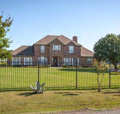
SUBURBAN NEIGHBORHOOD
The Suburban Neighborhood place type provides for low-to-moderate density residential land uses intermixed with areas of commercial development. Predominant land uses include single-family detached and attached homes. Supporting uses, such as limited retail uses and other ancillary institutional and public uses such as schools and places of worship, should be incorporated when appropriate. These amenity-rich neighborhoods provide ample open and recreation space, internal and external connections through a network of trails and sidewalks, and a range of housing types that support individuals and families at various stages of life.
CHARACTER & FORMKEY CHARACTERISTICS
Density Range: 1 to 8 DuA
Building Height: 1 to 2 stories
Supported Land Uses
• Single Family Detached/Attached
• Patio Homes
• ADus
• limited Retail and Institutional uses
• Parks and Recreational Space
Compatible Zoning:
• SF-1
• SF-2
• SF-3
• Amenity-rich neighborhoods
• Internal and external pedestrian connections
• Medium setbacks
• Medium-width sidewalks
• Diverse housing types
• Neighborhood scale commercial
• Native landscaping standards and xeriscapes
• Bike routes and trails
• Pedestrian scale lighting
• Access between developments to community destinations


DESIGN CONSIDERATIONS
• Provide a mix of residential building types, lot sizes, density ranges, and architectural styles.
• Smaller lots and denser development can serve as a transition between residential areas and other areas of more intensive use. Infill that increases density should be visually compatible with the character of surrounding structures.
• Neighborhood-scale commercial land uses are appropriate on intersections of larger streets and should be compatible with the intensity of the surrounding residential development.
• Reserve land for parks, trails, schools, churches, and other civic and institutional uses. Parks and common spaces should be centralized, focal points of the community to provide easily walkable access.
• Existing street stubs should be connected regardless of density, and new street connections should be made to encourage a wellintegrated network.
LIFESTYLE NEIGHBORHOOD
The lifestyle Neighborhood place type includes a variety of residential housing types at medium-to-high densities and areas of supporting neighborhood commercial development. The place type includes single family and multi-family dwelling types, and neighborhood retail, institutional, and office use. Transitions between non-residential and residential uses are achieved through horizontal mixed use development patterns. open green space and social gathering spaces are woven throughout these neighborhoods.
CHARACTER & FORMKEY CHARACTERISTICS
Density Range: up to 10 DuA
Building Height: 1 to 3 stories
Supported Land Uses
• Small-lot Single Family Detached
• Single-Family Attached
• Townhomes and Duplexes
• Patio Homes
• Multi-unit Residential
• Retail and office uses
• Institutional uses
• Parks and Recreational Space
Compatible Zoning:
• SF-3
• SF-3.5
• SF-4
• SF-5
• MD-1
• MD-2
• Variety of housing types
• Mixed-use development
• Wide, landscaped sidewalks
• Tree-lined streets
• Native landscaping standards & xeriscapes
• Multimodal infrastructure
• on-street and parking and nonresidential parking lots
• Pedestrian scale lighting
• Pocket parks and public gathering spaces
• Building orientation & natural buffers
• opportunity for infill development and revitalization


DESIGN CONSIDERATIONS
• Allow for a diverse mix of detached and attached single-family housing types.
• Promote higher development intensities along larger thoroughfares.
• Incorporate small-scale commercial and mixed-use development on larger thoroughfares.
• New development should be built with large active roadsides suited for pedestrian activity, including larger sidewalks and street trees.
• Vehicle access should be concealed behind building facades where feasible.
• This land use category can serve as a transition from lower density residential to higher density or nonresidential uses.
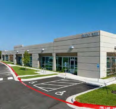
NEIGHBORHOOD RETAIL
The Neighborhood Retail place type is intended to provide neighborhood-scale goods and services, including fast casual dining options, healthcare and other professional services, and groceries. Commercial land uses are of a scale and character to serve local residential needs and are in proximity to more suburban and rural areas throughout the City. Smallerscale retail and professional service uses will be located along major or minor arterial roads within these residential areas. A mix of non-residential uses may be achieved through horizontal development, that may support shopping plazas and pad sites.
CHARACTER & FORMKEY CHARACTERISTICS
Land Use Intensity: 20% FAR
Building Height: 1 story
Supported Land Uses
• Retail uses
• office uses
• Institutional uses
Compatible Zoning:
• o
• C
• Small-scale retail and professional services
• Horizontal mixed-use
• Small to medium setbacks
• Moderate sidewalk width
• Tree-lined streets
• Native landscaping standards & xeriscaping
• Multimodal infrastructure
• Shared/street parking and nonresidential parking lots
• Design for future street extensions of major thoroughfare corridors


DESIGN CONSIDERATIONS
• Provide vehicular and pedestrian connectivity between parking, adjacent streets, and internally to on-site facilities.
• Provide primary vehicular access points from major thoroughfares.
• on-site parking should be first accommodated through reduced parking minimums, followed by on-street parking, shared parking, and structured parking. Individual surface lots for each parcel should be minimized.
• New development should provide for pedestrian activity with wide sidewalks, street trees, and landscaping.
CORRIDOR COMMERCIAL
The Corridor Commercial place type includes a horizontal mix of commercial, office, and entertainment uses. These areas are defined by large retail and professional service uses, often located in multi-tenant shopping centers and office buildings, as well as hotels, restaurants, and other services. Corridor Commercial land uses are of a scale and character to serve as a city -wide and regional draw. A mix of larger box stores, specialty stores, medical and professional services, entertainment venues, and a mix of upscale and fast casual dining options will serve both local and regional needs. Emphasis is placed on pedestrian walkability throughout developments.
CHARACTER & FORMKEY CHARACTERISTICS
Land Use Intensity: 30% FAR
Building Height: 1 to 3 stories
Supported Land Uses
• Commercial
• Retail uses
• office uses
• Entertainment Compatible Zoning:
• C
• HC
• o
• Destination retail and entertainment
• large setbacks
• landscape buffers
• Tree-lined paths
• Native vegetation standards and xeriscapes
• Branding, public art, and wayfinding
• Shaded seating and gathering spaces
• Pedestrian-friendly parking lots


DESIGN CONSIDERATIONS
• This place type should be focused on auto-oriented retail businesses that expand Azle’s tax base through boosted sales taxes, primarily along major thoroughfares such as Highway 199, service roads, and other commercially-oriented public streets in the corridor.
• Secondary parcels and off-highway areas can be more focused on employment uses, professional services, and other non-sales tax generating businesses.
• Site design considerations should be given to incorporate thoughtful organization and connection of parking lots, inclusion of functional landscaping, and building articulation which maximizes the pedestrian experience.
• Encourage regional detention to serve multiple parcels for better efficiency and more intensity of use.
DOWNTOWN CORE
The Downtown Core place type includes a mix of residential and non-residential land uses that are associated with the traditional city center of Azle. The place type supports institutional, cultural, employment, shopping, and entertainment uses while also providing urban residential living options to create an energized environment to live, work, and play.
CHARACTER & FORMKEY CHARACTERISTICS
Land Use Intensity: up to 40 DuA
Building Height: 1 to 5 stories
Supported Land Uses
• Small-lot Single-family Detached
• Townhomes and Duplexes
• Multi-unit Residential
• Retail and office uses
• Institutional uses
• Entertainment uses
• Recreational Spaces
Compatible Zoning:
• CBD
• Historic and cultural features
• Horizontal and vertical mixed-use
• Facades and architectural character
• Wide sidewalks for pedestrian activity
• Multimodal infrastructure
• Development transitions
• Shade
• Branding, public art, and wayfinding
• Pedestrian-friendly parking
• Storefronts & patio dining
• Civic parks for public gatherings and recreation
• on-street parking and off-street parking that is accessed from interior streets


DESIGN CONSIDERATIONS
• New development should include building facades with windows and architectural features to promote visual interest.
• Support walkability by taking access from rear or side streets and minimize interruptions in the sidewalk and pedestrian realm.
• Incorporate public gathering spaces.
• Promote higher development intensities along major thoroughfares.
• Construct mixed-use buildings with upper-floor residential or office space and ground-floor space for non-residential uses.
MIXED-USE CENTER
The Mixed-use Center place type includes a mix of commercial and residential uses on the same parcel either through horizontal or vertical mixed-use development. This place type is intended to be flexible in function and design. Emphasis is placed on pedestrian walkability throughout developments.
CHARACTER & FORMKEY CHARACTERISTICS
Land Use Intensity: up to 40 DuA
Building Height: 1 to 4 stories
Supported Land Uses
• Vertical Residential
• Multi-unit Residential
• Mixed-use
• Retail
• Entertainment
• Recreational
• Grocery
Compatible Zoning:
• PD
• Horizontal or vertical mixed-use
• Traditional pad site development
• Gathering spaces
• large active roadsides for pedestrian activity
• Concealed parking areas
• Varied facades
• Higher development intensities along major thoroughfares
• Native vegetation standards and xeriscapes


DESIGN CONSIDERATIONS
• Encourage regional detention to serve all parcels within a mixed-use activity center to allow for greater intensity of use across the entire development.
• Both vehicular and pedestrian interconnectivity between uses and buildings is extremely important throughout the area.
• Buildings should be sited in close proximity to each other and wellconnected via pedestrian pathways and sidewalks.
• on-site parking should be concealed behind buildings and within structures. Parking should be first accommodated through minimum reduced parking requirements, followed by on-street parking, shared parking, and structured parking.
INDUSTRIAL INNOVATION
The Industrial Innovation category supports industrial uses that sustain the community’s tax base. This category invites corporate headquarters and clean industrial uses, such as research and development (R&D), data centers, showrooms, and shipment and warehousing. Heavy industrial uses should be limited.
CHARACTER & FORMKEY CHARACTERISTICS
Land Use Intensity: 50% FAR
Building Height: 1 to 2 stories
Supported Land Uses
• Industrial uses
• Commercial uses
• Retail uses (limited)
Compatible Zoning:
• I
• Existing and traditional industrial uses
• Consider transition, adjacency and screening standards
• Shipping and transportation logistics
• All structures out of floodplain
• Ample median widths to provide visual and physical separation between large vehicles and pedestrians
• Wide streets and consider queuing areas for freight trucks


DESIGN CONSIDERATIONS
• Provide primary vehicular access points from major thoroughfares, or an internal road network designed as part of a larger industrial center.
• Provide transition areas from non-residential land to residential uses through adequate setbacks, buffering, nuisance-shielding, etc.
• Design roadways with adequate turning radii to accommodate large trucks.
• Establish restrictions to decrease the amount of sound, dust, vibration, odor, and glare, etc. which can occur off-parcel or between future developments.
BUSINESS & INNOVATION CENTER
The Business & Innovation Center place type is intended for concentrations of warehousing, trade, transportation, research and development, manufacturing, corporate campus, and light industrial uses. This place type allows for the development of supporting infrastructure for freight traffic, water, and sewer services needs.
CHARACTER & FORMDESIGN CONSIDERATIONS
Land Use Intensity: 50% FAR
Building Height: 1 to 4 stories
Supported Land Uses
• Industrial Park
• Business Campus
• Research & Development
• light Industrial
Compatible Zoning:
• I
• Encourages industrial and business parks
• Invites regional and local headquarters
• Development transition and screening standards
• Promote safe interaction between vehicles and pedestrians
• Building footprint that encourages plazas and courtyards
• Internal circulation


DESIGN CONSIDERATIONS
• Provide primary vehicular access points from major thoroughfares, or an internal road network designed as part of a larger industrial center.
• Provide transition areas from non-residential land to residential uses through adequate setbacks, buffering, nuisance-shielding, etc.
• Design roadways with adequate turning radii to accommodate large trucks.
• Establish restrictions to decrease the amount of sound, dust, vibration, odor, and glare, etc. which can occur off-parcel or between future developments.
PARKS & OPEN SPACE
These areas include public parkland, trails, and open space that have been committed to long-term public use and enjoyment. locations will provide active and passive recreation opportunities in addition to preserving natural areas.
CHARACTER & FORMKEY CHARACTERISTICS
Land Use Intensity: N/A
Building Height: 1 to 2 stories
Supported Land Uses
• Parks
• Preserves
• open Space
• Active Recreation
• Passive uses
Compatible Zoning:
• N/A
• Natural features
• Permeable surfaces
• Active and passive programming
• Waste and recycling baskets
• Native landscaping and xeriscaping
• Multimodal infrastructure
• Shaded structures
• Pedestrian scale lighting
• Educational opportunities
• Wayfinding and branding
• Tree canopy preservation


DESIGN CONSIDERATIONS
• Parks, open space, and trails should be defined during the development approval process.
• Non-residential development should be required to set aside land and build trails for public use.
• Current regulations should be evaluated to require and/or incentivize the protection of sensitive natural resources (e.g., creek corridors, lake front, floodplains) as common open space areas.
• Stormwater should be well-integrated with regional solutions desired.
• utility easements should be considered and utilized, where possible, as corridors for pedestrian/bicycle paths.
• Trees should be preserved to retain soil durability and shade for patrons.
CIVIC & INSTITUTIONAL
The Civic and Institutional place type is defined by large public or private facilities and complexes. large tracts of land may support high schools, campuses, colleges, hospitals, convention centers, libraries, and government buildings.
CHARACTER & FORMDESIGN CONSIDERATIONS
Land Use Intensity: N/A
Building Height: 1 to 3 stories
Supported Land Uses
• Schools
• universities
• City Properties
• Public utilities
• Public Buildings
Compatible Zoning:
• INS
• Public and educational facilities
• Promote safe pedestrian connections
• Branding, public art, and wayfinding
• Shaded seating and gathering spaces
• opportunity for supplemental amenities

DESIGN CONSIDERATIONS

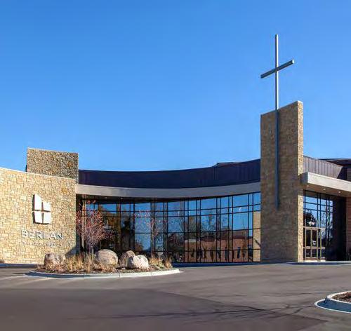
• Site design considerations should be given to incorporate thoughtful organization and connection of parking lots, inclusion of functional landscaping, and building articulation which maximizes the pedestrian experience.
• Social gathering spaces should be integrated as public parks, passive open space, or active private spaces within a development.
• Maximize tree cover and landscaping along pedestrian corridors and in association with public gathering spaces.
• New development should aim to incorporate architectural standards that support visual interest and maintain compatibility with the surrounding areas.


A city’s transportation system impacts the daily life of every citizen. A well-functioning transportation network enhances a city’s economic vitality and residents’ quality of life by offering efficiency, connectivity, and safety. The foundation of this network is a comprehensive thoroughfare plan.
This Thoroughfare Plan is a long-range planning tool that identifies locations, alignments, and designs of street and roadway facilities needed to accommodate growth within Azle. By identifying these roadways early on, Azle can preserve these corridors for transportation system development both as the need arises and to guide future development along these corridors, ensuring the system can meet projected demand. The Thoroughfare Plan also informs capital improvement projects and funding considerations.
The following five categories are considerations of this Thoroughfare Plan that collectively impact Azle’s transportation system.
Connectivity
Connectivity directly affects how people and goods move within a community. A well-connected system reduces travel time and distances and improves access to employment centers, essential services, and community assets and amenities.
Capacity
Capacity of roadways refers to the ability of streets to accommodate current and future traffic volumes with minimal vehicle congestion.
Safety
The thoroughfare network directly impacts the safety of a city’s residents. Designing and constructing facilities with a clear purpose, whether for mobility or access, and ensuring they can handle traffic volumes, can help reduce confusion and traffic accidents.
Multimodal Access
A thoroughfare plan must prioritize multimodal access. This means prioritizing bicycle and pedestrian facilities that feel safe to the user and encourage greater use. These qualities have been shown to lead to economic vitality, community vibrancy, and an overall improved quality of life.
Desired Character
Thoroughfares have a significant impact on resident experiences and visual quality/ character of the community. Landscaping, signs, pathways, and other amenities may occur within the street right-of-way that shape the look and feel of Azle.
Functional Classifications
The Thoroughfare Plan designates roadways based on their specific function and level of throughput and access. Mobility and access have an inverse relationship, meaning roads with greater mobility are designed for higher speeds and less access to adjacent properties or land uses. Conversely, streets designed to provide vehicular access to nearby businesses maintain lower posted vehicle speeds and are better suited for vehicle, bicycle, and pedestrian access to properties. However, as shown in Figure 4.1, Mobility vs. Access, there is not a clean differentiation between these two purposes, and because many roads and streets serve both purposes, the inverse relationship of these functions becomes blurred. Ultimately, this hierarchy of roadway types aims to not only distribute traffic efficiently throughout the city but recognize the role that the transportation network plays in defining specific land uses and character areas of a city.
FIGURE 4.1 | MOBILITY VS. ACCESS

EXISTING CONDITIONS
This section describes Azle’s existing transportation system, including the current roadways, trails network, and crash data.
There are currently 145 miles of local, state, and interstate roads within Azle. With Highway 199 bisecting the City and a lack of public transit options, Azle’s existing transportation network is largely auto-oriented.
Crash Analysis
The safety of Azle’s current thoroughfare network was examined using Crash Records Information System (CRIS) data from the Texas Department of Transportation (TxDOT), for the January 1, 2017, to November 3, 2023, timeframe. This included a map of the locations of vehicular crashes and crash hotspots within Azle and its ETJ. In this timeframe, a total of 2,045 crashes were identified, which are broken down into four crash analysis types and described in greater detail below.
Non-highway Vehicular Crash Data Trends (2017-2023)
Of the 2,045 total crashes identified, 1,567 occurred on nonhighway roadways. A total of 12 non-highway crashes resulted in a fatality, four of which involved a pedestrian or bicyclist. As shown in Map 4.1, Non-Highway Roadway Crashes, high concentrations of crashes occurred along Farm-to-Market (FM) 730 North, Stewart Street, and FM 730 South. Between 2019 and 2022, the number of crashes on non-highway roadways increased by 43 percent, as shown in Figure 4.2. Nearly 39 percent of crashes in Azle occurred at an intersection, indicating the potential need for intersection safety improvements.

Azle City Limits
Azle ETJ
Roads Rivers & Streams
Eagle Mountain Lake

Dense Sparse
Suspected


Crash Severity Breakdown (Non-Highway)
• 65 percent of non-highway crashes resulted in a “non-injury”, indicating less severe crashes.
• 4 percent of non-highway crashes resulted in suspected serious injuries.
• 26 percent of non-highway crashes resulted in possible injuries or suspected minor injuries.
Manner of Collision Breakdown (Non-Highway)
• One Motor Vehicle – Going Straight (27 percent)
• Same Direction – One Straight – One Stopped (21 percent)
• Angle – Both Going Straight (9 percent)
Manner of Collisions
The manner of collisions can provide insights as to what types of improvements or additional study is needed. Collisions involving only one motor vehicle can be attributed to a variety of issues such as incidents with crossing wildlife, objects in the road, distracted driving, or issues related to the grade or curve of the road. Collisions with two vehicles traveling the same direction can indicate issues related to driver distractions or the slope of the road. Right-angle collisions at intersections can reveal a pattern of drivers running red lights. Additional study can reveal more specific patterns in the types of collisions most often occurring.
Corridor Crash Data
Crash rates were also calculated at the corridor level. A crash rate is the number of crashes that occur at a given location compared to the traffic volume. Many corridor segments in Azle have crash rates that exceed the statewide average. Table 4.1, 2022 Statewide Crash Rates, identifies the 2022 TxDOT Statewide Traffic Crash Rates by highway system and road type, per 100 million vehicle miles traveled.
TABLE 4.1 | 2022 STATEWIDE CRASH RATES
Roadways that are more rural in nature, such as Stewart Street, Wells Burnett Road, and Flat Rock Road have multiple segments with crash rates 10 times higher than the State average. High crash rates on rural roadways are caused by a combination of factors, including a lack of safety resources, minimal roadway infrastructure, poor emergency medical response, and risky driver behaviors. In Azle, crashes in these areas are also sometimes the result of wildlife-vehicle collisions.

The following corridors have crash rates greater than the statewide average and are identified as corridors of interest:
• Wells Burnett Road, from Beverly Road to Columbia Drive, experienced nearly 8,750 crashes per 100 million vehicle miles traveled. This road segment is a 2-lane, 2-way road with a crash rate 92.46 times greater than that of the state average.
• North Stewart Street, from Southeast Parkway to Park Drive, is an urban 4-lane, divided road. With close to 4,160 crashes per 100 million vehicle miles, this segment has a crash rate 19.56 times greater than the statewide average. This roadway is a short road segment immediately to the east of the intersection leading to the Highway 199 frontage road.
• Flat Rock Road from Silver Creek Azle Road to Adams Lane South experienced just under 970 crashes per 100 million vehicle miles resulting in a crash rate 10.24 times greater than the statewide average for this rural 2-lane, 2-way road.
• The road segment of FM 730 from NW Parkway Street to West Main Street includes the stretch of roadway under the Highway 199 overpass. This urban Farm-to-Market road segment experienced close to 2,425 crashes per 100 million vehicle miles traveled resulting in a crash rate 9.71 times greater than the statewide average.

Crash Data Definitions
First harmful event: The first injury or damage-producing event of the crash.
Intersection crash: A traffic crash that occurs within the boundaries of an intersection.
Intersection related crash: A traffic crash in which (1) the first harmful event occurs on an approach to or exit from an intersection and (2) results from an activity, behavior, or control related to the movement of traffic units through the intersection.
Vehicle Miles Traveled (VMT): The measurement of the total miles traveled by all vehicles in a specified area during a specified time.
Intersection Crash Data
According to TxDOT crash data, 16 percent of non-highway roadway crashes in Azle occurred at an intersection, 23 percent were intersection-related, and 18 percent involved driveway access, accounting for over 800 total crashes. Table 4.2, Intersection Collisions highlights the manner of collisions that occurred at intersections. Between 2017 and 2023, 19 fatal and suspected serious injury crashes occurred at or were related to an intersection. The first harmful event for over 88 percent of intersection and intersection-related crashes involved another motor vehicle in transport. Four crashes involved a pedestrian as the first harmful event.
The following intersections have high crash numbers and have been identified as intersections of interest:
• FM 730 North at Lake Crest Parkway (62 crashes)
• FM 730 North at Commerce Street (46 crashes)
• FM 730 North at Stribling Drive (36 crashes)
• FM 730 South at Main Street (25 crashes)
TABLE 4.2 | INTERSECTION COLLISIONS
Crash Analysis Key Findings
Boyd Road is an area of concern for crash location hotspots. Factors contributing to the crash patterns included location, configuration, and frequency of intersections which increased the number of possible conflict points and potentially caused confusion for drivers. Other factors which may have contributed to crash patterns include road designs which may not be adequate for the traffic volumes and speeds experienced on these roads, or curves and grades in the road, such as on Wells Burnett Road, which reduce visibility for drivers and may be inappropriate for the traffic speeds. Additional studies for access management and road design will offer further insight into specific and feasible improvements in the identified areas.
Active Transportation
A well-connected and multimodal mobility network system should be a component of all comprehensive thoroughfare networks. This plan inventoried the following three types of active transportation facilities:
• Sidewalks: A sidewalk provides a dedicated space for use by pedestrians.
• Bikeways: Bikeways may take different forms and delineate space for bicyclists using pavement markings, signage, or physical buffers.
• Trails: Trails may also be known in a variety of forms and names. Shareduse paths or sidepaths include paved paths parallel to and physically separated from adjacent roadways and accommodate both pedestrians and cyclists.
Current Bicycle and Pedestrian Inventory
A desktop review of the Azle’s existing active transportation infrastructure was performed to assess deficiencies. An inventory of each facility type was created. Roadways classified on the TxDOT Functional Classification as Collectors and above were analyzed.
• Sidewalks: As shown in Map 4.2, Existing Active Modes, sidewalk infrastructure is limited throughout the city and ETJ. Sidewalk segments can be found along FM 730 North, Stribling Road, Stewart Street, Denver Trail, and Lakeview Drive. According to the City’s municipal code, sidewalks are required with ADA curb ramps in newly constructed subdivisions on both sides of the street. However, there are no written guidelines for the construction of sidewalks outside of subdivision developments. The City of Azle Public Works Design Criteria Manual states the minimum sidewalk width to be four feet. According to the Federal Highway Administration (FHWA), modern sidewalks should have minimum widths of five to six feet to accommodate bidirectional pedestrian traffic. Existing sidewalk segments throughout the city are often discontinuous and do not provide sufficient connectivity from residential neighborhoods to commercial or retail centers.
• Bikeways: The desktop review revealed a deficiency in bicycle infrastructure throughout the city. According to publicly available data and aerial imagery, there are no bikeways in Azle.
• Trails: As shown in Map 4.2, Existing Active Modes, there is one trail adjacent to Stribling Drive. This trail connects the existing sidewalk along Stribling Drive to Shady Grove Park, Azle High School, and Walnut Creek Elementary. Trails that serve as internal walking paths for city parks such as Central Park were not analyzed for this review. However, Ash Creek Trail is depicted on the map for its significance as an active transportation opportunity, as discussed in Chapter 5.
Azle City Limits
Azle ETJ
Roads
Rivers & Streams
Eagle Mountain Lake
Active Modes
Existing Sidewalks
Existing Trails
SANDY
Bicycle and Pedestrian Crash Analysis
Trends
According to the FHWA, approximately 25 percent of nationwide pedestrian and bicycle fatal and serious injury crashes occur on rural roadways. In contrast to urban roadways, rural roads often have higher vehicle speeds and lack sidewalk and bicycle provisions.
Between 2017 and 2023, 28 non-highway roadway crashes in Azle included a pedestrian or bicyclist, with five resulting in a fatality. Of the 28 crashes involving pedestrians or bicyclists, approximately 46 percent resulted in suspected serious injuries or possible injuries. As shown in Map 4.3, Pedestrian/Bicycle Crashes, high concentrations of pedestrian- or bicyclist-involved crashes are located near major retail centers and intersections leading to residential neighborhoods. These crashes are likely due to a lack of safe pedestrian or bicycle infrastructure or accessible crossings. As shown in Figure 4.3, Pedestrian/Bicyclist Crash Trends, crashes involving a pedestrian or bicyclist have fluctuated throughout the years, with a 100 percent increase between 2021 and 2022. Corridors with pedestrian- and bicyclistrelated crashes include FM 730 North, Stewart Street, and FM 730 South. Almost half (47 percent) of crashes involving a pedestrian or bicyclist occurred when light conditions were dark, suggesting a need for improved lighting near destinations to increase visibility for non-motorized road users.
FIGURE 4.3 | PEDESTRIAN/BICYCLIST CRASH TRENDS
MAP 4.3 | PEDESTRIAN/BICYCLE CRASHES

Azle City Limits
Azle ETJ
Roads Rivers & Streams
Eagle Mountain Lake
Crash Data
Sparse
Dense
Crash Severity
Suspected Serious Injury
Fatal Injury


THOROUGHFARE PLAN FRAMEWORK
This section establishes the long-term vision for Azle’s thoroughfare network. The Guiding Principles should inform long-term decision making regarding thoroughfare elements.
Guiding Principles
Safety in the network: Develop a thoroughfare network that prioritizes the safety of all users.
• Design roadways with comprehensive and innovative safety measures to minimize risks and potential hazards for all user types.
Complete street design: Ensure the roadway network contributes to a high quality of life and balances the needs of all modes of transportation.
• Prioritize pedestrian and bicycle facilities in all future roadway projects to expand safe, convenient, and enjoyable mobility options.
• Create complete streets which contribute to Azle’s sense of place and promote economic development.
Coordination with future land use plan: Ground the development of the roadway network in local policy to further community goals and achieve desired land uses.
• Plan the transportation system to support the desired outcomes of land uses outlined in the Future Land Use Plan.
• Develop a connected road network that anticipates future development and traffic demands.
Quality and innovation in the network: Invest in forward-thinking design and maintenance solutions to ensure a high-quality thoroughfare network.
• Embrace traffic management technology to enhance efficiency and reduce vehicle congestion.
• Invest in the thoroughfare network to ensure existing streets are well-maintained and of high-quality.
Future Thoroughfare Plan
This section presents future direction for Azle’s roadway network, including broad guidance on street design and trends to consider when planning for future streets.
How to Use the Thoroughfare Plan Map
The thoroughfare map, shown in Map 4.4, Thoroughfare Plan, is an important planning tool for the City. For roadways identified on this map, right-of-way corridors should be preserved and designated in future development. This map should be used in conjunction with other city planning and policy efforts to ensure that roadway design and development are cohesive with each other and the stated goals and priorities of this Plan.
Functional Classifications
The following six classifications are based on TxDOT classifications and used in the Thoroughfare Plan.
• Freeways/Expressways are multi-lane, divided roadways that are primarily intended to serve large volumes of highspeed traffic and long trips.
• Frontage Roads provide a high degree mobility for medium to long-distance trips at high to moderate speed levels to provide access to freeways that connect cities and regions.
• Arterials provide a high degree of mobility for medium to long-distance trips at moderate to high speed levels to provide access between major destinations or activity centers within a municipality, or secondary connections to outside cities.
• Major Collectors provide a balance of mobility and property access at low speeds for local trips and distribution to the arterial system. The surrounding land uses and roadway characteristics may vary depending on context.
• Minor Collectors provide access between arterials and local streets at low speeds. Minor collectors may connect neighborhoods within and between activity centers of a city.
• Local Streets provide access to neighborhoods and connectivity to Collectors.
Key Map Elements
Approach and comparison to 2017 Thoroughfare Plan: The previous Thoroughfare Plan identified relatively few arterials or collectors. Those that were identified, both existing and proposed, were scattered throughout the city limits, with the most prominent classifications being state-controlled roads. The majority of roads depicted in the map were Local Streets, and many of these are not adequately sized to accommodate current volume and speeds of traffic. Further, the previous plan provides for few connections between the east and west sides of Highway 199, creating congestion and bottlenecks. The few areas of access across Highway 199 were areas where higher crash occurrences were observed.
Roadway classifications have been updated and upgraded to reflect actual travel patterns and conditions.
Arterial upgrades: Roadways which stand out as clear corridors where travel is happening over longer distances have been classified as Arterials, such as FM 730 South and FM 730 North. Roads which provide connections across Highway 199, such as FM 730 and Stewart Street, have been designated as Arterials in order to accommodate greater traffic volumes and speeds, and to disperse traffic across multiple access points to alleviate congestion and associated safety concerns.
Collector upgrades: Local streets that connect to Arterials, link neighborhoods, or lead to schools are likely to experience more highly traffic than those that connect to other internal neighborhood roads. These Local Streets are upgraded to Major or Minor Collectors in order to plan for a greater level of capacity and connectivity in the future.
Main Street classification downgrade: Main Street, as a statecontrolled roadway and primary thoroughfare through Azle, has previously been classified as an Arterial. Because of the desire to transform Downtown Azle into a pedestrian-oriented area, the Plan proposes to downgrade the classification of Main Street. A downgraded classification allows for narrower lane widths and amenities within the right-of-way that contribute to improved pedestrian safety and comfort. A robust network of Arterials around Downtown Azle will allow for traffic volumes to be distributed around Downtown and support a downgraded classification on Main Street.


Azle City Limits
Azle ETJ
Thoroughfare Classification

Freeway/Expressway
Frontage Road
Arterial

Major Collector
Minor


Accommodate future growth: In the update of the Thoroughfare Plan, opportunities for roadway extensions into the ETJ are designated. These extensions will ensure organized growth even in areas outside of the City’s formal city limits and ensure that infrastructure will be sized to meet future development in these areas. As mentioned in Chapter 1, Azle’s population is expected to continually increase at a rate of 15-20 percent in the coming decades, and in the community engagement process of this Plan, Azle residents expressed a concern about the ability of existing infrastructure to accommodate new residential developments. Boyd Road is currently the only major thoroughfare in the City’s ETJ and already experiences issues with congestion. An expansion is currently planned for Boyd Road.
ETJ connectivity: The Arterials now proposed in the ETJ are intended to alleviate pressure from Boyd Road and collect traffic from neighborhoods and adjacent uses via the proposed Collectors. Without investments in additional roadway capacity in this area, future development is likely to overload the existing local streets in the ETJ. Residential developments should also be planned with multiple points of access to further spread and disperse traffic entering the road network. Because Tarrant County has its own set of design standards for roadways that are found in the ETJ and review authority for plat applications in the ETJ, it will be essential for Azle to collaborate with Tarrant County to adequately plan for and accommodate future demands.
Local Street extensions: The Thoroughfare Plan also aims to improve connectivity and ease of access by proposing road extensions in many locations where a Local Street has a deadend or lacks multiple access points.
Grid/network enhancement: A grid layout provides a structure for a regular, organized pattern of land development. This layout provides efficient distribution, access, and connectivity for vehicular mobility and improves access for emergency ingress and egress. Many of the arterials depicted in this Plan enhance connectivity and routes of access by extending roadways which currently end in a dead-end.
Though a greater level of deviation from a gridded pattern may occur outside of the ETJ, the key objective to enhance connectivity remains the same, and arrows indicate opportunities to extend the proposed roadways. A primary northsouth corridor and east-west corridor, potentially along FM 2257 and FM 1542, respectively, will be key in meeting this objective.
It is important to note that many of the identified roadways in Azle’s ETJ are currently rural in nature (one lane in each direction and no road striping), and current traffic levels do not warrant immediate need to construct an Arterial in these areas. The near-term goal of the City should be to acquire right-ofway space along the corridors identified in the Thoroughfare Plan in order to construct larger roadways when needed.
Future Network Considerations
As future roadways are planned, designed, and right-of-way is acquired, the following should be considered:
Network Gap Closure and Connectivity
Identifying network gaps and closing them can lead to reduced congestion, fewer vehicle miles traveled, and improved access to community and regional destinations. The location of these gaps should be identified and prioritized for future connections. Implementing gap closures in conjunction with pedestrian and bicycle infrastructure can encourage additional trips made without a vehicle and improve safety and comfort levels by reducing the interaction between vehicles and pedestrians or cyclists.
Safety measures and programs
The safety of all user types should be the first priority in planning for and designing a transportation network. There are several measures the City can take to advance the safety of the transportation network. Vision Zero is a policy approach which aims to eliminate all traffic-related fatalities. With a Vision Zero policy, the City can build upon the analysis of crash locations identified in this plan and prioritize these areas for future improvements, as well as implement safety measures in all future system improvements to further reduce and eliminate traffic collisions. Safe Routes to School programs contribute to increased safety and convenience for children walking or cycling to school, and measures which improve safety for pedestrians and cyclists should be implemented where possible.

Transportation technologies and future trends/innovations
Changing trends in transportation modes and travel patterns will require the City to account for more than traffic volumes and speeds.
Smart city technology includes tools that cities can use to monitor the state of their transportation network, increasing efficiency, safety, and maintenance of the roadways. With smart city technology, data from traffic signals, smartphone apps, and vehicles can improve flow of traffic by adjusting traffic signals based on real-time traffic flow, and citizens can be alerted to traffic conditions or parking availability in real time through smartphone apps. Cities can also use data from smart city technology to monitor and schedule maintenance for city vehicles and local roadways, helping to prevent unforeseen delays.
The rise of electric vehicles has significantly increased the demand for plug-in electric vehicle (PEV) charging stations. Additional study could be undertaken to understand the demand and need for integrating PEV charging stations in projects which impact the overall streetscape, such as in the Downtown Core.
Micromobility is broadly defined as an alternative mode of transportation for short trips which utilizes any small, low-speed human or electric-powered transportation device. As a result of the surge of micromobility in recent years, many cities now have fleets of shared micromobility systems for electric bikes and electric scooters. Micromobility devices can play an important role in providing mobility for distances that may be too far for some to comfortably walk but are too short to warrant driving a personal vehicle. Azle does currently have an ordinance in place allowing the use of golf carts, provided they are not driven on state highways. However, because these may be subject to different regulatory standards, golf carts are not generally considered a type of micromobility. The City may consider additional studies to determine the demand and/or feasibility of shared micromobility systems to reduce vehicle use and congestion in areas such as the Downtown Core.
Smart City Technology
The use of technology to help provide city services, enhance efficiencies, build sustainability and resilience, and improve overall quality of life has been on the rise in many cities. This “smart city” technology can include digitally connected traffic sensors, lights, and meters which collect data that cities can then use for improving infrastructure and public utilities and services, often doing so faster and with lower costs. Coupled with the widespread use of smartphones, city alerts and service updates can be accessed directly by citizens and utility consumers, helping them to make decisions each day.
Relation to land use and complete streets
Road and street design should function synergistically with the character of adjacent land uses. When developing roadways identified in Azle’s Thoroughfare Plan, consult the updated Thoroughfare Plan to understand how the street network fits into its context.
Thoroughfare Plans can better serve the city when they consider not just vehicular traffic, but the mobility needs of all users. Complete streets are designed to balance the needs, safety, and comfort of both vehicles and active transportation users. Common elements of Complete Streets contribute to greater convenience of walking or cycling and encourage greater use of active transportation methods and reductions in trips made by personal vehicles. Complete streets should be designed to fit the context of the surrounding land use, and the City should strive to include these design elements wherever possible. Active transportation can be further encouraged with various safety and connectivity measures such as separation between vehicle and pedestrian/cyclist facilities, leading pedestrian intervals at traffic signals, and providing trail connections to create a citywide trail network.

EXAMPLE
Design Standards
To maintain an intentional approach in designing and constructing streets according to the Thoroughfare Plan and the City’s desired character, the City should implement and adhere to policy and design standards that achieve the desired outcomes. Table 4.3, Design Characteristics presents design standards for each functional street classification. These standards are based on complete street design principles, and it is important to note that these standards may be inconsistent with what is currently seen in Azle today and what is called for in the City’s current Design Criteria Manual. Moving forward, it is essential for the City to establish standards for all future development or upgrades to existing roadways to meet the City’s vision for a safe and walkable transportation network.


Decel lanes required; 1 to 2 turn lanes at highway crossing intersections
TABLE 4.3 | DESIGN CHARACTERISTICS
Decel lanes may be required; intermittent left-hand turn lanes required (e.g., 1 at most intersections & up to 2 at major intersections)
On-street Parking No No
Typically subsurface storm drain in developed areas
Median Not appropriate
Often discontinuous but should be interconnected where feasible Generally discontinuous, but connects to collectors
One left-hand turn lane at signalized intersections when warranted Not typical
Typically restricted, but may be appropriate in certain areas
vehicular movement, no striping travel lanes
None
Typically restricted, but may be appropriate in certain areas Permitted
Street Trees/ Landscaping Not appropriate
Typically subsurface storm drain in developed areas
Medians are intended to manage turning movements and access, provide refuge for pedestrians crossing, and landscaping
Typically subsurface storm drain in developed areas
Typically subsurface storm drain in developed areas
Medians are appropriate to improve visual character and access management
On-street 5’ bike lanes or shared-use paths
Typically subsurface storm drain in developed areas and open channel/culverts in rural areas
Medians may be appropriate to improve visual character and traffic calming Not recommended
Not designated (shared lanes at ≤25 mph), striped bike lanes or shared-use paths Not designated (shared lanes at ≤25 mph)
Shade trees and/ or ornamental trees in medians and landscaped buffer zones where appropriate
Shade trees and/ or ornamental trees in medians and landscaped buffer zones where appropriate
Shade trees and/ or ornamental trees in medians and landscaped buffer zones where appropriate
Shade trees in landscaped buffer zones or outside of right-of-way
Priority Areas
Several key areas should be prioritized for road or safety improvements, as shown on Map 4.5, Priority Areas. The priority intersections, corridors, and zones identified reflect areas of poor traffic flow, poor intersection design or angles, or in many cases, the locations of the City’s highest crash rates. As the City plans for future improvements to the transportation system, these areas should be prioritized to improve safety and efficiency of the overall system. Design improvements should improve sight lines and visibility, manage vehicle speeds, enhance pedestrian crossings, and separate pedestrian or cyclist infrastructure. The recommendations in this section are informed by a planning level analysis and additional study will be needed to determine the most appropriate improvements for each location.
Priority Zones
Four Priority Zones are identified, three of which are gateway areas leading to Downtown Azle. Improvements in these gateway areas are intended to make Downtown access simpler and safer, benefiting both the mobility and safety of Azle’s thoroughfare network, but also strengthening the opportunity for Downtown as a destination.
In addition to improvements within the Priority Zones, an access management study for Highway 199 frontage road near Downtown can identify improvements. The number of ramps and driveways present along the frontage road increases conflict points, and off-ramps from the highway contribute to congestion at intersections on the frontage road. Minimizing conflict points and reducing congestion will result in improved walkability and visitor appeal within Downtown.
Azle
Azle
Rivers
Eagle
Roads Locations
Priority
Priority
Priority
Priority Zones

North Gateway
The North Gateway zone includes the area around Highway 199 northwest of its intersection with Commerce Street.
Key Challenges: Vehicles exiting from southbound Highway 199 onto Main Street must travel through Downtown because there is not currently direct access to a frontage road. Drivers that do wish to access the frontage road in this area must make an immediate left turn at the intersection of Main Street and FM 730. The lack of direct frontage road access results in an excess of thru-traffic in Downtown and creates additional traffic and safety concerns for pedestrians in the area. The FM 730 corridor from Main Street to the Highway 199 frontage road and the intersection of Commerce Street and Redbud Drive were identified as crash hotspots.
Next Steps: Splitting the frontage road from Main Street prior to the intersection with FM 730 is recommended to provide a southbound frontage road through the Downtown area, thereby allowing travelers to stop at businesses or for gas without the need to pass through Downtown and reducing traffic along Main Street. Additional study is recommended to determine potential options for the realignment of Commerce Street and Redbud Drive.

Central Gateway
The Central Gateway zone includes the area of Highway 199 where Boyd Road intersects the highway to the north.
Key Challenges: The five-legged intersection, which includes Highway 199, the Highway 199 frontage road, Boyd Road, and Speer Street at Central Drive, is unconventional for an intersection with a freeway frontage road in Texas. While the intersection of Speer Street and Central Drive with the freeway frontage road was not identified as a major crash location in the crash analysis, this location is a potential source of confusion for drivers and may lead to safety hazards. Similarly, Dunaway Lane and Boyd Court intersect with the Highway 199 frontage road at the same location, potentially creating a source of confusion for drivers that may lead to safety hazards.
Next Steps: Study the removal of the connection of Speer Street such that only Central Drive and Boyd Road intersect with the Highway 199 frontage road. Doing so could make the intersection conform to conventional intersection design. Study the removal or realignment of the connection of Boyd Court to create a simpler intersection design.
MAIN ST.
DUNAWAY LN.
BOYD RD. BOYD CT.

South Gateway
The South Gateway zone includes the area at the southern end of Downtown where Stewart Street intersects with Main Street and Highway 199.
Key Challenges: The southbound Highway 199 frontage road in this area ends south of the intersection with Stewart Street and curves to the west to intersect Main Street, which becomes the southbound frontage road further south. The intersection with Main Street unnecessarily redirects traffic back towards Main Street and has the potential to create confusion at the intersection with Main Street and the above-grade crossing over Highway 199. The corridor from the frontage road to Shady Lane on the north side of Highway 199 was identified as a crash hotspot. The location, configuration, and frequency of intersections and driveways on this segment of North Stewart Street is the primary factor in the crash pattern. The number of access points to the roadway from surrounding properties allows for many potential conflict points between drivers coming off or onto the road.
Next Steps: It is recommended to remove the curve in the frontage road and instead extend the frontage road to the south. It is also recommended to extend the above-grade portion of Main Street to connect to Lakeview Drive on the east side of Highway 199 in order to improve east-west connectivity across Highway 199, thus providing some relief to traffic on Stewart Street. For traffic-control purposes, the crossing over Highway 199 may need to become a signalized, at-grade diamond interchange.
An access management study could reveal additional recommendations such as the closure of several driveways, rerouting or closure of Park Street, and a potential change in lane configuration with a median to further reduce conflict points.
HIGHWAY
WELLS BURNETT RD.
NORMANDY AVE.

Normandy Avenue and Wells Burnett Road
This priority zone includes the area where Normandy Avenue intersects Wells Burnett Road to the east of Highway 199 in the southeastern portion of Azle.
Key Challenges: The intersection of Normandy Avenue and Wells Burnett Road was identified as a crash hotspot. The above-grade crossing of Normandy Avenue over Highway 199 does not provide direct access to the Highway 199 frontage road, and the curve of Normandy Avenue and angle at which Normandy Avenue intersects Wells Burnett Road may not be appropriate for the vehicle speeds seen here.
Next Steps: Study the potential to realign the segment of Normandy Avenue that crosses Highway 199 in order to create a simpler and easier east-west connection across Highway 199 to Wells Burnett Road.
IMPLEMENTATION
Using the Plan
The placement of proposed thoroughfares on the map is conceptual. Actual locations and design will be determined by development, physical design considerations, funding, and further alignment and feasibility studies. The Thoroughfare Plan should be aligned with the City’s Code of Ordinances and thoroughfare design should be in accordance with the City’s Design Criteria Manual. Alignment of this Plan with the City’s Code of Ordinances provides predictability and clarity for landowners and the development community regarding thoroughfare design as properties develop. Responsibility of costs, timing of construction for thoroughfares, and consideration of impacts from new development to the overall network shall be outlined in the City’s code.
Amendments and Adjustments
After this Thoroughfare Plan is adopted, new development and significant changes such as realignments or reclassifications may warrant discussion and approval of amendments. As more refined alignments of thoroughfares are determined (by concept plan, planned development, plat or site plan), it will be necessary to adjust the Thoroughfare Plan to clearly represent the onthe-ground street network. This helps landowners, developers, utility providers, and governmental entities plan for public infrastructure, access, and development.
Regulatory
The City should update regulations governing street design to be consistent with the vision of this Plan. This includes the City’s subdivision regulations in the Code of Ordinances, the Design Criteria Manual, and any other related policy documents. Subdivision regulations specify the minimum required improvements for all new developments, including sidewalks, trails, lighting, and road layouts. Design guideline manuals or engineering standards manuals provide the detailed specifications for constructing these improvements.
Further Study and Policy Development
• Active transportation plan: Specific options, feasibility, and costs for improvements to walking and bicycling infrastructure can be explored in an active transportation plan. Public engagement conducted as part of this planning process can also provide insight into the community’s priorities for the locations and types of pedestrian and bicycling facilities.
• Intersection redesign analysis and concept development: As previously discussed, further study and analysis is needed for each of the identified intersections, corridors, or zones of interest. Additional study may include the development of various redesign concepts and their estimated costs. This step will aide in determining the best solution based on cost feasibility and the degree to which the proposed concept will support the goals of improved safety, reduced collisions, reduced congestion levels, and other goals identified by the community and this Plan.
Other Initiatives
• Take back of Main Street: Main Street is presently in the responsibility of TXDOT, and due to state safety and design requirements, the City is limited to the types of improvements that can be made. In close collaboration with TXDOT, the City should take strategic steps toward reclaiming responsibility of Main Street. Doing so would allow the City to implement many of the recommendations in this Plan, including creating a more urban and pedestrian-oriented streetscape.

Coordination
Azle’s transportation network falls under the jurisdiction of the City, both Tarrant and Parker Counties, and the State, warranting coordination with each of these parties for design, construction, funding, and maintenance of roads within Azle. The North Central Texas Council of Governments (NCTCOG) also serves a role in planning and funding roads.
• Counties (Tarrant and Parker): Nearly 32 percent of road miles in Azle are maintained by Tarrant County or Parker County. Further, 64 miles of drainage infrastructure are included along these roadways. This necessitates strong communication and coordination between Azle and these county entities to ensure proper road and utility maintenance. Further, collaboration between Azle and Tarrant and Parker County is necessary to ensure that roadway improvements and projects performed on County roadways integrate design standards and elements which further the goals of this Plan and the community’s desired goals.
• NCTCOG: The North Central Texas Council of Governments is the regional Metropolitan Planning Organization (MPO) and serves as a regional transportation planning entity. Because NCTCOG administers and distributes federal and state funding to local governments, Azle should work closely with NCTCOG to develop regional transportation plans and bicycle-pedestrian facilities in order to increase the City’s competitiveness for receiving funding. NCTCOG collects and produces data, travel demand models, and map analyses, making it a vital resource for the City, which may lack the capacity to perform these tasks.
• TXDOT: Highway 199 and Main Street (State Spur 344), the two most significant thoroughfares in Azle, are under the jurisdiction of the TXDOT. Because of the daily throughput of Highway 199, the local importance of Main Street in Downtown, and the economic impact of each of these roads, it is essential for the City to maintain a strong relationship with TXDOT. Coordination with TXDOT will be necessary for making streetscape improvements along TXDOT maintained roads. Further, TXDOT administers funding to local jurisdictions for roadway improvements and developing active transportation infrastructure. Ongoing coordination with TXDOT can enhance Azle’s access to planning, data, and funding resources.
• Azle ISD: Safe Routes to School programs promote improved safety for school-aged children to walk and bike to school through infrastructure improvements, enforcement, tools, safety education, and incentives. Coordination with Azle ISD will help the City to identify key areas for improvements and to assist in implementing the program.
Ongoing Transportation Monitoring
Continued improvement and success of Azle’s transportation network will not occur without regular monitoring and updates. The City should develop a method for regular and ongoing performance monitoring of the system to understand where investment has been successful in meeting goals such as increased safety or reduced congestion, and where additional investment is needed. Strategies for ongoing system monitoring may include producing annual project summaries, made available to the public, which outline project types, costs, and the relation of the project to furthering community goals. Annual system-wide reports are also valuable tools for monitoring and improving the system and may highlight a variety of performance metrics such as traffic collisions, vehicle miles traveled, pedestrian/bicycle counts, and vehicle congestion. The results of monitoring efforts should be a guide for the City to regularly update priority project lists and identifying capital improvement projects.


Downtowns, though just one area within the greater whole of a city, are oftentimes the most recognizable area of a city and play a tremendous role in shaping the city’s identity and character. Downtowns often capture a community’s historical and cultural assets, and they serve as hubs of economic activity with locallyowned businesses and destinations that attract visitors to the area to shop or dine. Because downtown areas play a significant role for the overall vibrancy and success of a city, it is essential for a city to plan for the future of their downtown thoughtfully and with intention, which is where this Downtown Element of the Comprehensive Plan plays a role.
In many ways, Downtown Azle is already the cultural heart of the City. Main Street is the focal point of annual community gatherings, such as the Christmas parade, and several beloved community anchors are found either on or close to Main Street, including the Azle Memorial Library, Central Park, the Azle Historical Museum, and a handful of churches. However, Downtown Azle is falling short of having a signature Main Street and providing the enjoyable experience that many hope for it to be. Main Street, as it exists today, is auto-oriented and lacks features which make it a safe, comfortable, pedestrian-friendly space. Where there are community attractions, such as Red’s and El Paseo Restaurant, these are concentrated in the southern portion of Main Street. Azle residents have made it clear that they desire a vibrant Downtown, and this Downtown Element provides the roadmap to get there.
This Downtown Element serves as a component of the overall Comprehensive Plan and contains a long-term vision and guidance for future development and improvements tailored to this specific area of Azle. This Element identifies key opportunities to improve and enhance land use, housing, transportation, public spaces, and urban design, and finally, highlights recommendations to implement these improvements.
The information contained within this Element is intended to support and build upon the themes and recommendations of this overall comprehensive plan. This Element is organized into the following parts:
• Existing Setting: This part introduces Downtown Azle and provides context for the recommendations in this Element.
• Engagement: The engagement section describes each of the community engagement processes which informed the Downtown Framework and recommendations of this Plan.
• Vision: The vision statement and guiding principles establish the foundation and aspirations for Downtown Azle’s future.
• Downtown Framework: The framework introduces the key overarching elements recommended for Downtown.
• Area Recommendations: This part provides details related to specific opportunities and enhancements for land use and urban design in each of the Downtown Subareas.
• Mobility: This section describes specific opportunities for multimodal enhancements.
• Infrastructure and Placemaking: This part provides details on specific improvements which promote the Downtown identity.
• Implementation: This part highlights the actions and steps recommended to achieve the vision for Downtown Azle.

EXISTING SETTING
Location
As shown in Map 5.1, Downtown Study Area, Downtown Azle is comprised of the area to the east of Ash Creek and to the west of Highway 199. Farm-to-market (FM) road 730 serves as the northern border and Southeast Parkway, at the intersection with East Main Street, provides the southern boundary.
Key Opportunities and Challenges
Downtown Azle is not a blank canvas to develop. Instead, Azle must work strategically to leverage existing assets or opportunity sites and navigate through constraints. Map 5.2, Existing Downtown Conditions identifies where existing strengths and challenges are located within Downtown Azle.
Opportunities include important community institutions or places like local churches, Central Park, and Ash Creek Trail. Gateways, at key entrance points to Downtown, and signature buildings provide character and identity to Downtown. When looking West along Industrial Avenue, the view path provides a clear view of Azle City Hall, presenting an opportunity to create a gateway to Main Street and an important civic anchor. The city-owned property represents an opportunity to serve as a catalyst for redevelopment in Downtown.
MAP 5.1 | DOWNTOWN STUDY AREA
A key challenge is TXDOT’s authority of Main Street. Improvements to Main Street are an essential component of reinvigorating Downtown, and the ability to make such improvements will be critical. Other challenges to consider include coverage of the floodplain, drainage, and funding.
MAP 5.2 | EXISTING DOWNTOWN CONDITIONS


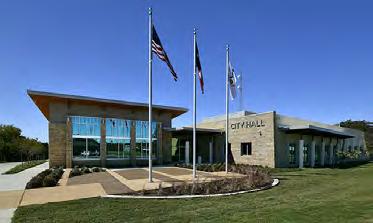

ENGAGEMENT
Community engagement for this Element was conducted both in conjunction with engagement efforts for the overall plan and in efforts specific to Downtown. Themes and community sentiments derived from each of these efforts were consistent and ultimately influenced the downtown framework described in the following pages. The key findings of these engagement efforts are described below.
Downtown Inspiration Tour
On October 5, 2023, a Vision Committee, comprised of 10 Azle residents representing various businesses or civic organizations (City Council, Azle ISD, Planning and Zoning Commission), visited three cities in the nearby metroplex to gather inspiration for the future of Azle’s Downtown. These cities included Roanoke, Coppell, and Grapevine. Vision Committee members were asked to rate their perceptions of the site features seen in each city’s Downtown and consider how these features might apply to Azle. Key features that committee members found to be appropriate to Azle included commercial land uses, pedestrian infrastructure, density, and public space.

Key Themes from the Engagement Process
Key themes that emerged from the engagement process included:
• Main Street is a priority area for investment and future improvements should be prioritized here. Investment along Main Street will set up secondary streets and other parts of Downtown for future enhancement.
• Residents desire additional shops, restaurants, and entertainment options in Downtown, especially along Main Street, to have a one-stop destination.
• Bicycle and pedestrian facilities should be included throughout Downtown and connect to Ash Creek Trail.
• Residents desire multiple uses, especially vertical mixed-uses with residential on upper floors and shops or restaurants to activate ground floors.
• The existing Ash Creek Trail should be expanded and new recreational facilities and programming can further enhance Central Park as a community destination.
Community Vision Workshop
On October 12, 2023, a public workshop was held for members of the community to provide their comments on how they would like to see Azle develop. As part of this workshop, participants were asked what makes a downtown special and what features would make Downtown Azle a “success.” Residents indicated that Downtown would be a success when it is pedestrian and cyclist friendly, has placemaking features such as public art, and offers a variety of destinations and uses.
Downtown Planning Workshop
A Downtown Planning Workshop, open to the entire community, was held on February 29, 2024, and offered participants an opportunity to envision the future of Downtown Azle. In this hands-on workshop, groups of participants chose their desired land use types and character from a selection of images and placed these on maps to indicate where they felt these uses should be found within the area. Each group also discussed the Guiding Principles of the Plan to ensure the Principles captured the community’s aspirations for Downtown Azle. Participants also had the opportunity to revise concepts for improvements to Main Street, Industrial Avenue, and Central Drive and indicate their preferences for elements such as sidewalks, bike lanes, and on-street parking.


VISION
This section establishes a long-term vision for what Downtown will become. The vision statement provides the overarching outcome desired by Azle residents, and the guiding principles provide the guidance to support long-term decision making for achieving the vision statement.
Vision Statement
As the heart of Azle, Downtown is a vibrant, inviting, and safe destination where modern amenities and local charm blend to offer a unique experience for residents and visitors alike. Here, local businesses thrive, circulation is seamless, and the identity of Downtown is instantly recognizable. Downtown Azle is Azle’s living room, serving as the site of community celebration and where Azle residents live, work, and play.
Guiding Principles
Make Main Street safe, walkable, crossable, and iconic.
• Create generous pedestrian spaces on both sides of Main Street that accommodate users of all abilities. Create lively urban streets where visitors can relax on street furniture under the shade of a street tree or at a restaurant patio under ambient nighttime street lighting. Create an activated urban streetscape with a mix of uses.
• Provide for safety and ease of mobility with on-street parking and enhanced Main Street crosswalks.
• Encourage the recognition of Downtown as an iconic Azle destination through the use of cohesive branding, placemaking, and comfortable pedestrian spaces that contribute Downtown’s unique identity.
Make Downtown a destination with places for community celebration and activity.
• Integrate public open spaces into the fabric of Downtown in coordination with new development and public improvements to provide vibrant social gathering opportunities.
• Enhance Main Street as a space for community parades and celebrations through intentional design elements like stylized pavers and shaded sidewalks.
Create a robust North-South and East-West pedestrian and bicycle network that connects civic anchors such as City Hall, Central Park, Azle ISD, and churches.
• Enhance connectivity to promote cycling and walking by creating safe crossings on Main Street and connecting bike and pedestrian facilities to Ash Creek Trail.
Create a new mixed-use neighborhood district, between Main Street and Highway 199, that supports and complements Main Street businesses.
• Broaden the Downtown footprint by transforming interior areas east of Main Street into urban, livable centers that complement and support the vibrancy of Main Street. Extending the iconic character of Main Street strengthens the area as a core piece of Downtown, and providing a variety of uses, multi-modal infrastructure, and community open spaces promotes a high quality of life for those who live, work, play, and visit here.
Enhance and activate Ash Creek Trail with new connections and recreational opportunities.
• Preserve natural areas along Ash Creek to create a signature recreation destination complete with an extended Ash Creek Trail, accessible from pedestrian and bicycle connections throughout Downtown.
• Enhance and emphasize Central Park by developing new recreational amenities and opportunities with sports fields, courts, open space, and active recreation areas.
Expand and reconfigure the street network to enhance walkability, safety, placemaking, and open space.
• Design streets to promote safety and connectivity for vehicles, pedestrians, and cyclists.
• Enhance opportunities for development by realigning and/or extending streets to create simplified, more usable property and increasing visibility of and access to local businesses.
Ensure Downtown is easily accessible through an enhanced multi-modal network and parking options.
• Design for and integrate pedestrian/cyclist infrastructure and on-street parking on Main Street and where possible throughout Downtown.
Create a climate for investment.
• Recognizing Downtown as an integral activity center of Azle, seek opportunities to creatively integrate a variety of businesses.
• Ensure good design is emphasized in development through the thoughtful placement of buildings, integration of landscaping, pedestrian-orientation and other features. Well-designed projects will continue to build confidence that Downtown is a safe and smart investment for private developers.
• Integrate high-quality infrastructure in all new development and public improvements to ensure that Downtown is an attractive place for people to live and visit.
DOWNTOWN FRAMEWORK
The Downtown Framework identifies a series of fundamental recommendations for Downtown in keeping with the vision and guiding principles identified in the previous section. The Downtown Framework should be used as a flexible, but fundamental, guide to future public and private investment in Downtown. This section outlines the key elements of the Downtown Framework.
Incremental Approach
Future improvements in Downtown Azle, regardless of whether they apply to the entirety of the Downtown area or to a specific subarea, will take time to implement. This will be an incremental process where development or redevelopment occur as opportunities arise. There are several locations within Downtown which present opportunities for new development, such as the Cityowned site in the southern portion of Downtown. However, many other areas will require redevelopment and as such, improvements to these areas may take longer to achieve. Furthermore, because the individual elements of a Downtown work together to make it a thriving area, decisions should not be made in isolation. Projects should aim to integrate as many identified improvements as possible, and in doing so, can achieve additional goals or objectives of this Downtown Element.
Design Standards
The recommendations of this Downtown Framework identify various building types and design standards that contribute to a recognizable urban Main Street character. These include:
• Vertical mixed-use: Buildings that are considered to be vertical mixed-use allow for more than one use, such as residential and commercial, within the same structure and separated by floor. In the context of this Plan, structures with vertically mixed-uses are intended to fit into the existing design context of the area, with 2-3 stories allowed on Main Street and up to 4 stories allowed in Supportive Interior areas.
• Activated street wall: The urban street wall refers to the space where buildings front the street and create the lot edge. This is where pedestrians interact with the building. To be activated means to minimize the amount of dead space along the street wall, encouraging an inviting space where pedestrians can interact with the streetscape, perhaps by enjoying rest on a bench under the shade of a street tree, or interact with businesses on the street.
Activated Main Street
Supportive Interior
Highway Edge
Civic Anchor
Recreational Corridor
Reimagined Main Street
Bike/Pedestrian Connection
Enhanced Intersection
Ash Creek Trail
Key Framework Elements
Subareas
Downtown is perceived by the community as a series of subdistricts based on existing character, infrastructure characteristics, and context. These Subareas are used as organizing elements for this Downtown Element and should be considered for future implementation, phasing, decision making and branding. Downtown Subareas include:
• South Downtown includes the area between Highway 199 and Ash Creek from Stewart Street to Locust Street. This existing retail and restaurant node should be enhanced as a unique mixed-use neighborhood destination with new housing and neighborhood commercial uses, tied together with great streets and new small scale open spaces.
• The Civic Core includes the area in the central portion of Downtown. Anchored by Central Park, City Hall, Azle Memorial Library, and the Azle ISD building, this area will be infused with new retail, restaurants, offices, and housing that complement these civic institutions.
• The North Gateway should be maintained as a flexible district with a variety of uses that are appropriate close to Highway 199 but present an enhanced edge and visual entry into Downtown from the north.
• The Recreation Corridor includes the areas immediately bordering Ash Creek within Downtown. The Ash Creek Trail should be extended through the entire north-south span of Downtown and potentially flanked by new recreation, open space, and parks destinations should these properties discontinue their current operations over time. Though an integral part of Downtown’s future, the Recreation Corridor is not its own subarea and should be intentionally considered in conjunction with each of the adjacent subareas.
Character Areas
Character Areas are used to identify differing areas of desired visual and physical character within Downtown. Character Areas provide more direction on land use mix, urban design, and development character and are informed by the Downtown vision and contextual considerations.
• Main Street Edge areas are generally located directly along Main Street within the Civic Core and South Downtown Subareas. In these areas, development should directly engage Main Street with active ground floor uses, a consistent street wall, and a high level of visual and physical connectivity between the public realm and private realms.
MAP 5.5 | CHARACTER AREA FRAMEWORK
Main Street Edge
Supportive Interior
Highway Edge
Civic Anchor
Open Space/Recreation
• Supportive Interior areas are generally located off of Main Street and should accommodate a range of uses that complement business activities along Main Street. Retail, restaurants, housing, offices, and other uses are appropriate in these areas with greater flexibility in the siting and arrangement of buildings within a pedestrian-oriented street network.
• Highway Edge areas are generally located at the northern edge of Downtown and flanking Highway 199. These areas could be developed with a wide variety of uses that are conducive to being located proximate to the highway edge. Development in these areas should be granted the greatest amount of design flexibility and could be home to supportive uses like public parking.
• Open Space/Recreation areas are concentrated along Ash Creek Trail and within the South Downtown Subarea. These are envisioned as greenspaces, parks, and other open spaces of varying scales that are well connected to Main Street and providing amenities to the uses within their immediate context.
Main Street Reimagined
Main Street is the central spine that stitches the east and west sides of Downtown together. This critical community street should be thoughtfully redesigned as the living room of Azle within a bold, pedestrian oriented streetscape. Generous sidewalks, street trees, onstreet parking, decorative lighting, and sidewalk cafes will collectively provide a vibrant street that allows Downtown visitors to stroll from business to business. Enhanced intersection crossings and mid-block crossings provide for safe and seamless movement between the east and west sides of Main Street. Designed to be flexibly adapted for events, Main Street will be enhanced to become the inviting heart of Downtown.
MAP 5.6 | MAIN STREET
Enhanced Street Network
Downtown’s public streets will be the network by which people move and experience Downtown. As development and redevelopment occurs, the street network should be enhanced with new connections that facilitate meaningful redevelopment opportunities, enhance pedestrian connectivity and provide for bicycle circulation. New street network reconfigurations and expansions should be considered in the South Downtown, Civic Core, and the North Gateway Subareas, as shown by the dashed lines in the map to the right. Streets shown with solid red lines are recommended to be vacated to open up opportunities for future development and green space and to enhance the safety of the road network. Recommended enhancements to the street network are described in greater detail in the following sections.
MAP 5.7 | ENHANCED STREET NETWORK
Primary Bike and Pedestrian Network
Pedestrian and bicycle connectivity will be prioritized in all Downtown improvements as this Downtown Element is implemented. Central to these efforts is the establishment of a interconnected pedestrian and bicycle network providing safe and pleasant east-west and north-south connections throughout the entirety of Downtown. Enhanced Main Street crossings and bike/pedestrian facilities along Industrial Avenue, Locust Street, and a realigned Green Way will connect Ash Creek to Highway 199. In the long term, if the opportunity is presented, new east-west connectivity over Highway 199 from points east to the Ash Creek Trail should be explored. North-south bike/pedestrian connections should be established along Ash Creek and Central Drive, including connecting to the multi-use path planned for Boyd Road north of Highway 199. The network will provide for seamless non-vehicular mobility throughout Downtown at locations that connect key civic anchors like the Azle ISD campus, key churches, parks and open space, and civic facilities like City Hall and the Azle Police Building. LEGEND
MAP 5.8 | BIKE AND PEDESTRIAN NETWORK
SUBAREA RECOMMENDATIONS
This Section builds on the Downtown Framework with more detailed recommendations and guidance for each Subarea. This includes guidance on land use, urban design, and mobility.
To better determine the type and character of land uses, recommendations are provided for each of the three Subareas – South Downtown, Civic Core, and North Gateway. The purpose of this subarea organization is two-fold: the subareas guide strategic decisionmaking and investment phasing and allows for a vision consistent with how the community views the current Downtown area.
For each Subarea, this Section addresses:
• Land Use Considerations: Broad guidance related to land uses for each subarea informed by a vision for the future and locational context. Understanding this context aides in determining which areas are better suited for certain land uses such as residential uses on interior streets and higher intensity uses along frontages with Highway 199.
• Site Design: Broad guidance for urban design standards such as building siting, orientation, street edge character, and parking location.
• Form and Character: Broad guidance for building form, including scale and design character.
• Mobility: Broad guidance related to street network improvements and pedestrian and cyclist connections.
• Special Features: Broad guidance related to unique areas or opportunities specific to each Subarea.
South Downtown
South Downtown is where much of Azle’s existing downtown activity is concentrated with the inclusion of several local restaurants, signature historic buildings, and important community assets like Azle Christian Church and First Methodist Church of Azle. As the current hub of activity, the South Downtown framework encourages strengthening the urban feel along Main Street with a compact urban environment and a highly activated street wall and pedestrian realm. An uninterrupted street wall along Main Street should feature local businesses, shops, and restaurants, while second and third floors accommodate offices, services, or residential uses. Interior and adjacent streets within the South Downtown framework are characterized by largerscale uses of vertical mixed-use residences and dining or retail options.
Land Use Considerations
• Main Street: As the most iconic setting in Downtown Azle, uses on Main Street should encourage an active and inviting Main Street, enhancing it as a community destination. Uses should include dining experiences which invite people to gather and spend time on Main Street such as restaurants/cafes and bars with patio seating, and Main Street should feature unique local businesses for retail and services. Upper floors of Main Street buildings should house office space or residential uses to support ground-floor uses.
• Interior: Interior areas of the South Downtown area are intended to be of a less compact nature with greater setbacks and the inclusion of purely residential uses. Though visitors will still enjoy restaurants or cafes in these areas, uses designed to meet daily needs of
residents can be found here. Residential uses may be found along Locust Street, Church Street, or the realigned Green Way. Townhome neighborhoods or vertical mixed-use residential buildings should be accompanied by community green spaces or plazas.
• Freeway edge: The presence of civic anchors on property fronting Highway 199 in the South Downtown framework are expected and desired to remain in place, thereby making significant redevelopment north of Stewart Street unlikely. However, at the southernmost edge of the study area, a variety of land uses should be accommodated and should emphasize the gateway into Downtown. Uses may include restaurants, commercial uses, or multiunit residential.
Site Design
• Siting: Buildings in the Activated Main Street character area should be placed close to Main Street with a consistent street wall. For development in Supportive Interior areas, more space between buildings, front setbacks, community green space, and variation in building placement is appropriate.
• Building orientation: Buildings and entries should face and orient to public streets. Main Street and Stewart Street are priorities.
• Street edge character: Along Main Street, buildings should interface directly with the public realm with entries opening onto hardscaped sidewalk areas. Outdoor seating, generous sidewalks, and street trees should establish Main Street as a place where the public streetscape and businesses blend together rather than just a street for cars. Secondary streets, in Supportive Interior areas, may include moderately setback buildings with both hardscape and landscaping within the public right-of-way.
• Parking: Angled or parallel on-street parking should be integrated into a redesigned Main Street streetscape but all other parking should be located to the rear of buildings to minimize visibility from Main Street. On secondary streets and in Supportive Interior areas, parking should be located to the rear of buildings wherever possible. Any parking in front of buildings should be screened.
Representative Imagery


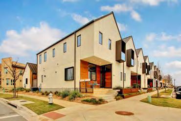

Form and Character
• Scale: Encourage buildings up to three stories in the Activated Main Street character areas with the third story set back to maintain visual compatibility with existing lower scale buildings. Buildings may be up to four stories in Supportive Interior and Highway Edge character areas.
• Design character: Traditional building styles, including materials of brick and wood should be encouraged along Main Street with more contemporary styles more appropriate in Supportive Interior areas, including brick, wood, stone, metal, and glass building materials. Stone or wood materials to maintain visual compatibility with existing signature buildings, such as the AISD facility, Azle Historical Museum, or Red’s restaurant are encouraged.
Mobility
• Locust Street extension: Mobility improvements within South Downtown include extending Locust Street to create an east-west connection between the existing Locust Street and Church Street. Doing so will provide access to residential and commercial uses in Supportive Interior character areas as they’re developed and allow for emergency ingress/egress.
• Realigned Green Way: Similar to Locust Street to the north, Green Way should be realigned to create an east-west corridor fully spanning from Main Street to Church Street. Straightening the road serves multiple purposes. The Cityowned property becomes more usable because the shape of the property is more rectangular, and a new opportunity for a green space is created. This green space should be designed to function as stormwater management and provide an easement for a trail corridor. Further, this natural area provides an attractive green space as the front door to Azle Christian Church. As interior development occurs, the realigned Green Way extension will open up greater connectivity and access to residential and commercial uses in this area, helping to prevent and mitigate additional congestion along Church Street and Locust Street.
• Enhanced crossings: There are three intersections in the South Downtown subarea which are essential to achieving the network of pedestrian and cyclist connections in Downtown. Redesign of these intersections to include traffic and crossing signals should be integrated as a priority in the redevelopment of the Main Street streetscape.
• Connections to Ash Creek Trail: Three new connections to Ash Creek Trail, spanning from the three proposed enhanced intersections, will play an essential role in creating a comprehensive pedestrian and cyclist network throughout Downtown. Providing pedestrian and cyclist connections across Highway 199, as part of long-term development strategies, will be difficult. Having a comprehensive network in place in Downtown will allow the City to leverage for the inclusion of similar facilities in future improvements to the Highway 199 corridor by TxDOT.
Special Features
• City-owned site: The majority of the property located between Locust Street and Green Way, as shown in the “Existing Setting” figure on the following page, is owned by the City and, currently, is largely undeveloped. This large piece of property presents a unique and valuable opportunity for the City to catalyze Downtown redevelopment. It is important to note that the concepts described below assume that some existing single-family properties surrounding the city-owned site would also redevelop. These scenarios are strictly conceptual and are for planning purposes only. Any inclusion of a singlefamily property in a future redevelopment of this site would be based on voluntary participation by the owner of such property. The acquisition of additional parcels fronting the north-south portion of Locust Street is recommended to create the potential for public access to and engagement of the Plan Framework’s recommended open space and trail features.
A variety of uses were identified as appropriate for this site in supporting overall Downtown revitalization and Main Street businesses.
1. Townhome Village: A Townhome Village would involve developing the site with attached townhome units with individual parking units integrated to the rear of each unit. A Townhome Village should include a smaller street network and allow for small areas along corners to be set aside as passive green space and a small linear green space along the existing drainage corridor.
2. Multi-unit Residential Node: A Multi-unit Residential Node would involve developing the site with one or more moderately scaled multi-unit residential buildings which could be condos or apartments. If a larger residential development like this is pursued for the site, it should integrate a large publicly accessible green space near the existing drainage corridor.
MAIN STREET
TOWNHOME VILLAGE
Here, yellow areas represent existing single-family residential and gray areas are currently undeveloped. The city-owned portion is outlined in black.
STREET
Yellow areas represent attached single-family and integrated green spaces that are accessible to all and provide access to the envisioned greenway to the west.
Here, brown areas represent multi-unit residential with activated open spaces represented in green.
Orange areas represent mixed-use development with both residential and commercial uses, and community green spaces are shown in green.
3. Mixed-use Residential District:
A Mixed-use Residential District would involve developing the site with horizontally mixed-uses, such as food and beverage, retail, and residential. A horizontal mixeduse project mixes uses (such as residential and commercial) on a site but not within the same building.
A Mixed-Use Residential District should create activated plazas and green space, strategically located to be activated by ground-floor commercial or community-oriented uses. Depending on the scale of development and configuration of uses in this scenario, either a smaller street grid or a larger block could be appropriate.
The recently opened food-truck park, The Feedlot, is an important step in the long-term development of the City-owned site by encouraging nearterm activation of the space. In both near-term and long-term planning timeframes, the City will need to take an intentional and thoughtful approach in designing and programming this space to ensure activated and cohesive uses.


• Open space opportunity: The realignment of Green Way creates a new property parcel adjacent to the current site of Azle Christian Church. Because of the relatively small size and unique shape of this property, this site provides an opportunity for community open space. Integrating green space in this area provides a recreational and gathering space for Downtown residential uses and should be designed to also function as stormwater management. Incorporating the existing drainage easement between Locust Street and Green Way into the design of the property will further strengthen the site’s role as stormwater management. Together, these areas should be leveraged as opportunities to tie into the overall pedestrian and cycling network with a natural walking trail along the drainage corridor.
Civic Core
With its location in the geographic heart of downtown and the presence of several important community assets, the second subarea is aptly named the Civic Core. A highly compact urban form and activated Main Street is also found in the Civic Core to further emphasize and attract visitors to Central Park and City Hall. Interior streets here provide larger scale uses which support both businesses and residents in Downtown, including local grocery stores and vertical mixed-use residences or townhomes. The northeast portion of the Civic Core framework, accounting for the Highway 199 edge, is appropriate for non-residential uses, potentially including public parking.
Land Use Considerations
• Main Street: As the geographic core of Downtown, Main Street in the Civic Core should include uses that draw visitors to the heart of Downtown and be of a compact urban form. To create a cohesive continuation between the subareas, Main Street in the Civic Core should be of a similar character to the South Downtown subarea. Restaurants, cafes, retail, and other customeroriented businesses should activate the ground floor of multi-story buildings. Upper stories may include offices, or residential. A public plaza located along Main Street adjacent to Azle City Hall should be explored to create a welcoming space and highlight both City Hall and Central Park.
• Interior: With a greater level of vehicular access and frontage along Highway 199, interior areas of the Civic Core will include services and uses supportive of residents in the area and civic facilities. Offices, local businesses, a local grocery store, a community recreation center,
or other services should be encouraged within this area and may be of greater intensity and scale given their proximity to the Highway 199 edge. Residential uses should be located within the most interior area of the Civic Core away from Highway 199 to provide a neighborhood character and protect from noise or light nuisance.
• Freeway edge: Uses in this area are likely to blend with those of the Supportive Interior uses, but given the auto-oriented nature near the highway, the greatest auto-oriented uses may be most appropriate in the northeast portion of the Civic Core. Uses here may include existing civic uses, commercial businesses, or offices. As part of a longterm redevelopment strategy, a public parking structure adorned with public art or other placemaking elements may be included here.
Site Design
• Siting: Buildings in the Activated Main Street character area should be placed close to Main Street with a consistent street wall. For development in Supportive Interior areas, more space between buildings, front setbacks, community greenspace, and variation in building placement is appropriate.
• Building orientation: Buildings and entries should face and orient to public streets. Main Street and Industrial Avenue are priorities.
• Street edge character: Along Main Street, buildings should interface directly with the public realm with entries opening onto hardscaped sidewalk areas. Outdoor seating, generous sidewalks, and street trees should establish Main Street as a place where the public streetscape and businesses blend together rather than just a street for cars. Secondary streets in Supportive Interior character areas may include moderately setback buildings with both hardscape and landscaping within the public right-of-way.
• Parking: Angled or parallel on-street parking should be integrated into a redesigned Main Street streetscape but all other parking should be located to the rear of buildings to minimize visibility from Main Street. On secondary streets and in Supportive Interior areas, parking should be located to the rear of buildings wherever possible. Any parking in front of buildings should be screened.
Representative Imagery


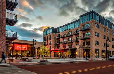

Form and Character
• Scale: Encourage buildings up to three stories in the Activated Main Street character area and along Industrial Avenue with the third story set back to maintain visual compatibility with existing lower scale buildings. Buildings may be up to four stories in Supportive Interior areas and Highway Edge areas.
• Design character: Traditional building styles, including materials of brick and wood should be encouraged along Main Street and Industrial Avenue which should become a “secondary Main Street.” More contemporary styles are more appropriate in Supportive Interior areas, including brick, wood, stone, metal, and glass building materials. Stone or wood materials to maintain visual compatibility with existing signature buildings, such as the Azle ISD or Azle Historical Museum, or Red’s restaurant, are encouraged.
Mobility
• Reconfiguration at Speer Street: The intersection of Speer Street at Central Drive and Northwest Parkway near Highway 199 is an intersection of interest as identified in the Master Thoroughfare Plan of this Comprehensive Plan. The intersection’s existing configuration creates confusion and can lead to accidents. Drivers turning left from Speer Street turn directly into the intersection of FM 730, creating potential conflict with drivers on Central Drive and oncoming traffic.
• As redevelopment occurs, Speer Street should be reconfigured as more internal and private to suit development with Central Drive and Industrial Avenue serving as the primary public streets. Any reconfiguration at Speer Street should be done with significant coordination among existing businesses and in conjunction with other future investment, to ultimately result in a simpler intersection without limiting access to businesses adjacent to this intersection. This reconfiguration can create additional opportunities for redevelopment by increasing the amount of usable property and creating an opportunity for a pedestrianoriented streetscape with improved business visibility.
• Enhanced crossings: The intersection of Main Street and Industrial Avenue is an essential location for enhanced pedestrian and cyclist crossing features. This crossing will serve as the primary east-west connection in the northern portion of Downtown and provide access between Main Street and its extension along Industrial Avenue.
• Connections to Ash Creek Trail: The pedestrian/cyclist connection between Ash Creek Trail and Industrial Avenue will be the primary east-west connection in the northern area of Downtown and will be critical for creating a link to pedestrian facilities in the South Downtown subarea. Further, developing this loop around Downtown will aid the City in leveraging for the inclusion of pedestrian facilities across Highway 199 from Central Drive.
• Industrial Avenue: Serving as an extension of Main Street, Industrial Avenue will be an essential pedestrian-oriented corridor. Redesign of this roadway should accommodate sidewalks, bike lanes, and on-street parking.
• Central Drive: This roadway is the primary north-south connection to the east of Main Street throughout Downtown. To achieve the vision of being a signature “green” street, the right-of-way should be expanded to accommodate both vehicular and pedestrian/ cyclist traffic while allowing for landscaped amenity zones.
Special Features
• Ash Creek Trail extension: Ash Creek Trail is already a community asset, and the extension of this trail was a prominent theme of the engagement process. Because Ash Creek Trail will be an essential component of improving pedestrian and cycling connectivity in Downtown, the City should take advantage of opportunities to extend this trail to the north, whether through property acquisition or easement agreements.
• Gateway to Central Park: Central Park serves a key role as a community destination for recreation and community gatherings. Many residents in the engagement process expressed a desire to enhance the gateway into Central Park in recognition of its local importance. A gateway entrance to the park, with stronger visual appeal from Main Street, could be developed with signage and public art. If future investment provides the opportunity, a community plaza could be constructed to create a seamless transition between Central Park and City Hall.

• Industrial Avenue: A direct view of Azle City Hall can be seen from Industrial Avenue. A variety of streetscape improvements along Industrial Avenue could transform this roadway into a pedestrian-oriented hub for retail and other commercial establishments. Keeping the relation of this roadway in mind when designing for future investments along Industrial Avenue can help to create a gateway to City Hall and further solidify Industrial Avenue as an extension of Main Street.
North Gateway
The North Gateway framework is an area with a significant amount of Highway 199 frontage and limited land space, and the natural gateway into Downtown is located near City Hall at the southern boundary of this subarea. As such, the greatest amount of flexibility for redevelopment is afforded in this subarea. Uses located here will provide support for the rest of Downtown and may blend with the characteristics of any character area.
Land Use Considerations
• Main Street: Most property along Main Street in the North Gateway subarea shares frontage with the Highway 199 edge, and as such, land uses in this area need to be thoughtful of the differing intensities of these two thoroughfares. Because of this, Main Street in the North Gateway may differ from the two subareas to the south. Uses here are flexible and may be representative of Activated Main Street or Highway Edge character areas.
• Interior: The south side of Main Street is considered to be interior in this subarea due to its location away from the freeway edge and its proximity to property with little development. Recommended uses in this area include residential uses, commercial businesses, or makerspace.
• Freeway edge: The area fronting Highway 199 will blend with land uses closer to the Main Street edge but will be of the greatest auto-oriented character in this area. Uses located here may include commercial businesses, offices, personal services, or makerspace. Public parking structures may be located here as part of long-term redevelopment strategies.
Site Design
• Siting: Building placement in the Supportive Interior and Highway Edge character areas is flexible. Future development may choose to place buildings close to Main Street with a consistent street wall, but more space between buildings, front setbacks, community greenspace, and variation in building placement is also appropriate.
• Building orientation: Buildings and entries should face and orient to public streets. Main Street is the priority.
• Street edge character: In Supportive Interior and Highway Edge areas, buildings may be moderately setback with both hardscape and landscaping within the public right-of-way.
• Parking: On-street parking is discouraged in this subarea, and parking in front of buildings is acceptable but discouraged. If parking is provided in front of buildings, the amount of parking should be limited and should be screened from Main Street.
Form and Character
• Scale: Encourage buildings up to four stories in Supportive Interior and Highway Edge areas. Should an Activated Main Street character area be developed in the North Gateway, buildings up to three stories are encouraged with the third story set back from lower stories to maintain visual compatibility with existing buildings on Main Street. In areas along Highway 199, structures up to four stories with no set backs may be more appropriate.
• Design character: A mix of traditional and contemporary styles, including materials of brick, masonry or stone, metal, and glass, may be appropriate.
Mobility
• Main Street and Highway 199 (north of Speer Ave): Concurrent with future redevelopment in the North Gateway, public access should be provided between West Main Street and Highway 199. Doing so will maintain the level of connectivity to the northern area of Downtown following reconfiguration of Speer Street. Further, expanding the public street grid in this area can help alleviate traffic and vehicular pressure on Main Street.
Representative Imagery


Recreational Corridor
Relation to Floodplain
To the west of this Element’s study area, Ash Creek runs north to south. Though Central Park lies within the middle of this area, properties to the north and south of Central Park along Ash Creek are currently privately owned. This corridor is largely located within the floodplain, and while development within floodplains is not impossible, it does create additional design and construction challenges. As Downtown redevelops, if individual property owners become interested in discontinuing their private use of the land, there is a tremendous opportunity for the creation of a recreational destination in the heart of Azle. Preservation of this area as a natural resource and use as a recreational destination provides numerous benefits related to economic development, stormwater management, and quality of life.
Recreational Destination
Central Park and Ash Creek Trail are already beloved community assets and would serve as the anchor to this expanded recreational corridor. Ash Creek Trail should continue to follow along Ash Creek with new pathways to provide additional pedestrian and cyclist access at multiple points along Main Street. This Ash Creek Trail extension, in conjunction with mobility enhancements throughout Downtown, would create a walking and cycling loop.
Natural space near Central Park and along Ash Creek in the southwest portion of Downtown should be activated with new community open spaces and recreational areas to provide a wide array of recreational, fitness, and leisure options. Sports fields and ball fields could be used as revenue
generating spaces for adult or youth sports leagues. Passive park spaces, educational nature areas, or sensory play can both leverage and preserve the unique landscape along the creek to provide unique experiences. Civic plazas, in addition to passive park spaces, could provide an additional space for community gatherings, such as a weekly farmers market.
Representative Imagery


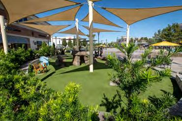


Streetscape Improvements
Main Street
As the main thoroughfare through Downtown and focal point of visitor and pedestrian activity, Main Street is the backbone of Downtown. For all future investment, developing Main Street as the signature placemaking site and destination for Downtown visitors is the highest priority, and achieving the first guiding principle of a walkable, crossable, and iconic Main Street will require significant investment. Main Street is currently under the authority of TXDOT. The City should take steps to obtain authority of Main Street in order to transform the Main Street streetscape.
Improvements to roadside infrastructure will minimize visual clutter and provide additional space necessary for pedestrian and streetscape improvements. Electrical utility lines should be buried underground and open roadside drainage ditches should be replaced with underground storm sewer systems.
Following these essential improvements the City should create a Main Street environment which provides for safe mobility and is supportive of shops and restaurants. Sidewalks on either side of Main Street should be widened and vehicle lanes should be narrowed to encourage slower vehicle speeds. Defined and well-organized on-street parking should be integrated along Main Street and can be configured for parallel or angled parking. Driveways and direct access to Main Street businesses should be consolidated to reduce vehicle and pedestrian conflict.
The final component of enhancing the Main Street streetscape is to integrate amenities, such as street trees, public seating, street lighting, and bicycle racks, and placemaking elements such as public art, wayfinding signage, and planters.
Additional technical studies will be necessary to further understand the feasibility, costs, and streetscape options for Main Street, and to determine opportunities to phase these improvements, potentially starting in the South Downtown subarea and progressing north.
Industrial Avenue
As an existing corridor of commercial activity, Industrial Avenue should be reimagined as a pedestrian-oriented “main street” extension that complements Main Street itself. Industrial Avenue presents an opportunity for an active, customeroriented signature street tying together new mixed-use development with City Hall and other nearby destinations. The right-of-way on Industrial Avenue will be narrower than Main Street, but in a similar manner, travel lane widths should be narrowed to provide space for bike lanes, wider sidewalks, and street trees, resulting in a pedestrian-oriented space supportive of the activated ground floor and businesses. On-street parking may be acceptable here, but parking provided in the rear of buildings is encouraged.

Travel Lane
Sidewalk Travel Lane Bike Lane Bike Lane
Parallel Parking
Sidewalk
Central Drive
Central Drive is envisioned as a signature “green” street for its unique landscaped character. Central Drive is the primary north-south pedestrian and bicycle corridor found between Main Street and Highway 199 and as such serves a significant role in providing access to surrounding residential and commercial uses. Landscaped amenity zones should be provided as buffer areas between onstreet parallel parking and sidewalks, and additional parking should be located in the rear of buildings. The landscaped amenity zones provide street shade for pedestrians and cyclists and contribute to the neighborhood character of the street. A shared-use path on one side of Central Drive provides a protected lane for cyclists to reach connections at Locust Street or Industrial Avenue. To accommodate the proposed elements, the right-of-way on Central Drive will need to be expanded. In conjunction with this, open roadside drainage and above-ground utility lines should be replaced with underground systems. Additional technical studies will help to determine the various options and related feasibility and costs.

Sidewalk Setback
Other Streets
A variety of general streetscape improvements can be incorporated along other streets within Downtown in conjunction with future investments. The location and level to which certain improvements are included may vary depending on the specific context of the street. For example, sidewalks may be prioritized adjacent to Main Street or residential areas while on-street parking may be located closer to commercial areas or on streets with greater capacity. In all cases, Downtown streetscapes should be thoughtfully designed to include landscape elements, continuous sidewalks, and safe crossings at all intersections.

MOBILITY
Mobility enhancements are necessary to ensure Downtown is accessible by foot, bike, and car. This Section identifies overarching mobility improvements to ensure Subareas and key Downtown areas are seamlessly and conveniently connected.
Street Network
To enhance safety, connectivity, and placemaking, several modifications to the existing street network are proposed. The strategic realignment and extension of streets in key areas could open up additional access for those traveling to and from new commercial and residential areas in Downtown. The additional access provided by expanding Locust Street, realigning Green Way to be an east-west corridor, and adding a street corridor from Main Street to Highway 199 in the North Gateway help to relieve pressure and traffic on Main Street. The realignment is also strategic in transforming parcels, such as the Cityowned site, into a more easily developable shape. This creates opportunity for a more usable property with less challenges in future design and layout considerations. Similarly, removing access to Speer Street at the intersection with Highway 199 and Industrial Avenue opens up additional opportunities for redevelopment. This reconfiguration would not only remove a dangerous intersection, it could be used to create a secondary “town center” with expanded business visibility from the improved pedestrian realm. As with many of the proposed improvements in this Element, transforming the Downtown street network will be a large undertaking and will happen over many years. Though construction and implementation of the street network will occur in phases, the overall network should be planned and designed in a comprehensive manner prior to any phases to avoid piecemeal or undesired outcomes. As these phases are initiated, many of the following mobility elements should be applied simultaneously.
Bicycle and Pedestrian Connections
Pedestrian and bicyclist safety, comfort, and overall mobility are primary objectives of this Downtown Element, as noted in the Guiding Principles. Multimodal circulation should be a prioritized component of all public right-of-way improvements and private development by including pedestrian and bicycle facilities in the design and construction of public streets and public or private development. The addition of these sidewalks and dedicated bike facilities help to create a continuous loop of protected facilities for pedestrians and cyclists to navigate throughout Downtown and along Ash Creek Trail.
Both pedestrian and bicycle facilities should be planned in conjunction with vehicular facilities to ensure the safety and comfort of the user is fully accounted for and that conflicts between vehicles and pedestrians or cyclists are minimal. This includes pedestrian facilities accommodating of all users’ abilities.
Protected bike lanes are separated from vehicular traffic lanes and provide users with a greater level of comfort on roadways with higher traffic levels. Protected bike lanes are proposed along Central Drive and Industrial Avenue. In locations where there is less right-of-way or on streets with lower traffic volumes, bicycle facilities may need to be provided on the street.
Should public transit be incorporated into Azle’s transportation network in the future, care should be given to place transit stops near pedestrian and bicycle facilities as much as possible to accommodate a user’s first and last mile commute.


Crossings
Safe access to both the east and west side of Main Street is necessary to achieve the Downtown vision for a highly walkable district. Currently, no designated pedestrian crossings are found on Main Street and Downtown visitors must either park near their destination or illegally cross the road (“jaywalk”). Crossings for pedestrians and cyclists should be placed at all significant intersections along Main Street, including at Stewart Street, the realigned Green Way, Locust Street, and Industrial Avenue.


Crossings should be designed to reduce conflict between vehicles and pedestrians or cyclists. Designated crosswalk markings should signal crossings to drivers and alert pedestrians of where to cross. These elements can be designed as public art and placemaking. To preserve Main Street’s role as a site for community celebration and parades, the addition of pedestrian islands is not recommended. Therefore, vehicle travel lanes should be reduced to the fullest extent feasible to minimize crossing distances. Narrowing travel lanes will contribute to the desired urban feel of Main Street and encourage slower driving speeds. Curb extensions or bulbouts can be used at crosswalks to minimize crossing distances and increase visibility of pedestrians where street parking is present, and these should be provided at key intersections.
Pedestrian and cyclist signalization should be provided concurrent with enhanced crossings, whether as part of an overall traffic signal or a pedestrian crossing. If signalization is included as part of an overall traffic signal, a leading pedestrian interval (LPI) should be utilized to allow pedestrians and cyclists to begin crossing several seconds before vehicles are given a green light. Flashing beacon signals can also be utilized to allow pedestrians and cyclists to safely cross at mid-block locations where a traffic signal is not present or prior to a signal being warranted. All crossing signals should be equipped with features to enhance accessibility such as audio signals.
Vehicle Parking
Public parking in downtown Azle can be improved with a variety of physical improvements, and several techniques can be used to efficiently increase the supply and availability of parking in Downtown.
• On-street parking: On-street parking provided with future public improvements should be clearly defined to improve clarity and provide for a greater number of parking spaces. To improve access to and awareness of available parking, signage should be provided throughout Downtown. In addition to on-street parking, shared parking lots and structures should provide parking at centralized locations to better serve Downtown visitors and businesses.

• Shared parking (private): Shared parking between businesses helps to reduce the number of individual lots and the number of access points, contributing to greater pedestrian safety. Shared parking should be encouraged, especially when parking is not needed by the primary site use. For example, Azle ISD, First Methodist Church of Azle, and Azle Christian Church have significant amounts of parking which are primarily needed during weekly business hours or on Sunday mornings. Shared parking agreements could allow for this space to be used by businesses at other times thereby helping to address parking needs in Downtown.
• Public parking: There are several areas for potential public parking lots or structures along the highway edge where pedestrian interaction and residential uses are unlikely to be successful. Where possible, future development projects should minimize the amount of surface parking to reduce impacts from increased impervious cover and to contribute to more efficient land use.
• Long-term considerations: As redevelopment occurs in Downtown, additional methods may be used for parking management such as constructing a shared parking structure or implementing paid and timed on-street parking. The City may also determine variations in the parking fee structure, including surges for peak times.
Access for All Abilities
Improvements in the pedestrian realm should serve users of all abilities. Sidewalks should be designed to be compliant with standards for accessibility. Sidewalks should be designed to allow for passing space by wheelchair users and curb ramps should be installed wherever a sidewalk intersects with a road. As Main Street and Downtown become more vibrant, clear paths on sidewalks must be maintained alongside outdoor seating, street trees, lighting, and other placemaking/streetscape elements.
Traffic Signals
As redevelopment occurs in Downtown, the City will need to monitor and anticipate increased traffic demand resulting from additional visitors to Downtown. The addition of traffic signals at key intersections which currently lack signals may be warranted to address traffic flow, congestion, and safety for vehicles and pedestrians/cyclists.
Intersection Design
Where roads intersect at sharp or awkward angles can create traffic congestion and safety issues if vehicles cannot easily turn into a roadway or if there is poor visibility. In conjunction with future roadway improvements, intersections with poor roadway angles should be realigned such that right angles and perpendicular intersections are created.
INFRASTRUCTURE AND PLACEMAKING
Infrastructure and placemaking improvements often occur in the public realm, meaning they serve private properties with access or infrastructure services but allow full public access. The improvements introduced in this section can also be thought of as areawide recommendations which are best implemented seamlessly throughout the three subareas. Though these improvements serve the public, they will be achieved with both public and private contributions.
Underground Utilities
Future trends are moving towards the burial of utility lines since there are clear benefits that come with underground utilities. Above-ground utilities contribute to visual clutter and their location along the street edge or within the sidewalk right-of-way can inhibit walkability, access to businesses, storefront visibility, and parking opportunities. Aboveground utilities are also more susceptible to damage from weather events or vegetation growth. Placing utility lines underground frees up space for pedestrians and contributes to an overall cleaner visual impact of the streetscape. Further, buried utility lines face less risk from vegetation or falling branches, which in turn reduces the time and money spent by public works departments and utility companies to maintain vegetation and repair damaged lines. Existing above-ground utilities should be buried concurrent with any development in Downtown.
Drainage
Stormwater drainage is currently conveyed in open roadside ditches in areas throughout the downtown. Sidewalks, street trees, on-street parking spaces, and other features which create an improved urban Main Street are located in the space currently occupied by roadside ditches. Further, drainage needs to accommodate increases in land use intensity, especially if there are increases in impervious surface. Underground storm drainage should be planned for and constructed in order to accommodate an urban streetscape as well as new development and growth in Downtown.

Open Space
Open space, in the form of parks, squares, and plazas, is encouraged to be integrated into development projects, wherever possible, with coordination from both public and private entities. Parks, squares, streetscapes, and plazas should be designed to serve a placemaking role and provide amenities to residents and visitors. Where possible, new open spaces should be connected to existing or planned trail systems and other pedestrian systems.
Lighting
Adequate lighting is one of the key elements in ensuring that users of a space feel safe. Unique lighting fixtures, such as string lighting or stylistic lampposts, contribute to a sense of place and enhance the visual quality and richness of the streetscape. Adequate lighting should be provided in all public and private improvements so that Downtown feels safe and inviting, encouraging a lively nightlife. New or updated lighting fixtures should be designed for low-energy use and dark-sky compliance to promote sustainable and efficient infrastructure.
Temporary Activations
Near-term and temporary activations can play a significant role in creating a lively Downtown and attracting visitors early in the implementation process of this Plan, before catalyst sites or major streetscape improvements have been developed. The City has already taken a strong first step in this with the opening of “The Feedlot” food truck park and should continue to strengthen this activation. Main Street restaurants may expand outdoor dining, and the City can encourage tactical urbanism methods, such as creating parklets or engaging citizens in a public art project.


Public Art
Incorporating public art in the public realm provides visual intrigue and further yet, can be a tool for city placemaking and economic development by promoting Azle’s downtown identity. Public art, whether as a mural, sculpture, or sidewalk mosaic, connects the city to local artists, inspires creativity, and can be a unique tourist attraction through “art walks.” Public art should also be utilized at gateways into Downtown, such as on Main Street near Stewart Street and Azle City Hall, to signal to visitors that they have entered the signature Downtown area. Public art should also be provided in public spaces, parks and other areas with high levels of pedestrian activity.
Street Furniture
Street furniture can include a variety of elements such as benches, picnic tables, landscaping planters, water fountains, trash receptacles, or signage kiosks. Street furniture can be a significant component of the streetscape character and can contribute to the strength and identity of Downtown as a destination for residents and visitors to gather and congregate. Street furniture adds to the visual appeal of the pedestrian realm, provides a place for users to rest, and promotes social interaction within Downtown.


Gateways
Gateways, strategically located at primary access points into Downtown, help encourage the identity of Downtown as a recognizable place. Currently, there is little to signal to Downtown visitors that they have entered Downtown Azle. A signature gateway, such as a mural, statue, or archway, can set apart Downtown as a unique area. Key locations for gateways into Downtown include Main Street at City Hall and at the intersection with Stewart Street and at the intersection of Central Drive and Highway 199.
Streetscape Character
Though private development will greatly influence the character of the streetscape, the City can implement policies which promote attractive, inviting, and great streets. Where possible, public and private investment should create complete streets that serve pedestrians, cyclists, and vehicles. This is especially important along Main Street in the South Downtown and Civic Core subareas (discussed in the following pages) where the greatest level of pedestrian activity is anticipated. However, the same design principles should be implemented on all Downtown streets. Low-impact design elements and stormwater management features, such as bioswales, can also be integrated to mitigate stormwater impacts while enhancing the character of the streetscape. The frontages and ground floors of private development should also be carefully designed to enhance and activate the public street experience.


Expanded Street Network
An expanded street network with reconfigured roads is proposed to increase connectivity and north-south access between the primary roads located east of Main Street. Doing so will aide in reducing vehicular congestion and improving safety. Expanding the street network will also result in smaller block sizes and greater interconnectivity, both of which will enhance pedestrian mobility.
Parking Access
Defined parking areas are currently lacking in Downtown, which oftentimes limits more people from visiting Downtown because there is a perception that there is not sufficient parking. However, it is important to limit the amount of surface parking so that available property can provide valuable uses and amenities for Downtown visitors, to ensure a safe, walkable environment, and to prevent environmental issues related to impervious surfaces. Thoughtfully locating where parking is available can prevent its detrimental impact to the pedestrian realm. Future improvements should consider a multi-pronged approach to locating additional Downtown parking. On-street parking should be integrated as streets are improved and surface parking areas should be shared among multiple businesses, including multi-unit residential buildings. Public parking structures can be considered as part of a long-term development strategy and potentially located to buffer Downtown uses from major roadways.
Sidewalks
A key to promoting walkability is to ensure that pedestrians feel safe and comfortable walking. Sidewalks designed for safe pedestrian access as well as for people with disabilities should be incorporated with all development and roadway improvement projects. Sidewalks should be designed with plenty of space for wheelchairs to pass, curb ramps, appropriate slopes, and minimal to no obstructions.
Signage
Wayfinding and branding signage is a key placemaking component for improving the overall visitor experience in Downtown. Wayfinding signage plays an important role in connecting both pedestrians and vehicles to their destinations, and when designed consistently with other forms of thematic branding for Downtown, can serve as tool for connecting visitors with the Downtown experience. Branding signage, such as banners on lampposts, can also enhance the visual appeal of Downtown, and marketing signage can help to attract additional visitors to businesses along Main Street. Implementing future improvements may necessitate a thoughtful and intentional policy approach which ensures that signage permitted in Downtown aligns with community branding and does not create visual clutter or safety concerns.


IMPLEMENTATION
This Downtown Element of the Comprehensive Plan serves to guide the City of Azle towards their vision for a remarkable downtown area. Implementing this vision will take place over time, in phases and as incremental opportunities, and doing so will require updates to city policies, additional studies, and creative funding mechanisms. The first step in implementing the vision is to adopt the Comprehensive Plan to guarantee that future policies and development are consistent and aligned with the goals and vision of an adopted city document.
REGULATORY
Code Amendments
Amendments to the City’s existing code of ordinance should be pursued to allow development and building types that are consistent with the Future Land Use Plan adopted as part of this plan. Updated zoning ordinances which are clear, simple, consistent, and easy to apply encourage development of desired or more complex building types such as mixed-use buildings. The process of amending the Code of Ordinances will involve public engagement, rewriting code language, and review and adoption by the City’s governing bodies.
Following an updated or amended Code of Ordinances, the City should pursue rezonings, particularly in the Downtown Core where more flexible land use types are proposed. Without rezoning, existing uses may be deemed non-conforming uses and incompatible uses or uses which are inconsistent with the desired nature of Downtown may develop. The rezoning process requires coordination with and support from property owners as new zoning could introduce new restrictions to existing property. As part of amending the Code of Ordinances and pursuing rezoning, the City should develop and implement a citywide educational strategy to inform and build support among residents for the new policies.
Parking Audit and Downtown Parking Plan
The City should conduct a parking audit and Downtown parking plan to gain an in-depth analysis and understanding of parking needs within the study area. A parking audit can provide insights on issues such as times and locations of high traffic stress or parking availability, and a Downtown parking plan can provide recommendations tailored to efficiently and safely addressing parking needs.
Main Street and Industrial Avenue Streetscape Study
A technical study dedicated to streetscape improvements for Main Street and Industrial Avenue should be conducted to determine the various options which could be implemented on each of these roadways. As part of this, the feasibility and specific costs of these options can be understood in greater detail. Such a technical study will help to determine the phasing of streetscape projects and outline necessary steps for implementation.
Marketing, Branding, and Promotion Strategies
As part of the overall placemaking strategy for Downtown, a cohesive marketing, branding, and promotion strategy should be developed. Downtown branding can be incorporated throughout the area in a variety of ways including on street and wayfinding signage. Downtown marketing and promotion is a valuable economic development tool for creating a recognizable Downtown and encourages Azle residents and visitors to engage with Downtown.
DECISION-MAKING
The City should consider establishing a downtown manager position as part of city staff or a downtown core management group, which may operate as a volunteer-basis commission, similar to a planning and zoning commission. Having a designated management position or group allows for a designated decision-making body. This position may be responsible for coordinating funding, overseeing planning, design, and construction processes, and engaging with Downtown businesses and residents.
FINANCING
The City should evaluate a variety of funding mechanisms for implementing Downtown improvements including grants and financing options such as issuing bonds. Because issuing bonds requires the support of the community, the City should evaluate the community’s willingness to support a bond measure and take steps to position for a local bond election. Other financing options may include:
• Revolving loan fund: Revolving loan funds can be a source of funding for the growth and expansion of small businesses, which are vital for creating a unique Downtown experience. Revolving loan funds are a self-replenishing pool of money that serve as a gap financing measure and can be used to fund operations or the purchase/improvement of the business’s building or equipment. Funds may be administered by federal, state, or local agencies.
• TxDOT Transportation Alternatives Grant Program: The Texas Department of Transportation administers funds for locally sponsored bicycle and pedestrian infrastructure projects across the state. These grant funds could be utilized to develop pedestrian and bicycle facilities throughout Downtown. In addition to these TxDOT funds, grant funding for Downtown or trail improvements is available from a variety of organizations including federal/state entities and nonprofit organizations.
PARTNERSHIPS
• Azle ISD: The Azle Independent School District administration offices are located Downtown and future development or improvements in Downtown will naturally have an impact on this site. Additionally, the site of the Azle ISD school bus yard presents an opportunity for future development. As an important community institution and a Downtown property owner, Azle ISD will continue to be an important partner for the City, and the City should continue to strengthen this partnership.
• Local churches: Several local churches are located in the Downtown area and serve as important community institutions. The recommendations of this Plan will undoubtedly impact these sites, so it is essential for the City, and other stakeholders involved in Downtown’s future development, to partner and collaborate with these local churches. This collaboration will be critical for developing Downtown in a manner which engages the community and maximizes the benefit for all parties.
• Civic organizations: There are numerous civic organizations in Azle that will play an important role in shaping the future of Downtown. The City should continue to strengthen and build these partnerships to further maximize efforts and the outcomes of future improvements. Civic organizations such as the Chamber of Commerce, a newly formed Main Street organization, and other organizations which represent local businesses and residents can play a role in engaging residents and stakeholders, promoting future projects, funding, and guiding decisions.
• Public-private partnerships: Public-private partnerships (PPP) offer a collaborative approach to financing Downtown improvement projects using both public and private investment. Resources from the private sector may be used to fund, plan, or construct improvement projects such as roadways, community centers, or park improvements.
• TXDOT: Main Street, the focal point of Downtown, is currently operated under the responsibility of TXDOT. The City should consider gaining responsibility of Main Street; however, a strong partnership between the City and TXDOT will be necessary regardless of who holds responsibility for Main Street operations. Partnerships with TXDOT will promote the inclusion of desired facility and infrastructure improvements in future projects and open up funding opportunities.
• Main Street America Network: Programs such as Main Street America help communities to advance economic development and community quality of life. The City should seek involvement in the Main Street America network to strengthen efforts for shaping and developing Downtown and gain access to a variety of resources.
PUBLIC INVESTMENT
A Tax Increment Refinancing Zone (TIRZ) established in Downtown would allow the City to collect tax revenues from increased property values as a result of redevelopment in the area. These revenues would support economic development and infrastructure improvements within the zone and could be used to further advance future redevelopment. Funds could be allocated towards streetscape improvements, Central Park improvements, and other projects. Collaboration with local business owners and stakeholders within the TIRZ is essential for maximizing these investments.


REALIZING THE VISION
The vision of this plan can only be achieved through action, decision-making, coordination, and monitoring over time. This chapter provides an actionable road map that can be used to achieve the goals of the community. Realizing the recommendations laid out in the following pages will require significant commitment and collaboration from elected officials, many City departments, and community partners, all of whom are called to be “Champions” of this Plan.
Implementation Program
The Implementation Program provides a series of strategies, organized around the three main components of this plan:
• GUIDING PRINCIPLES: Broad statements of desired community outcomes. The six guiding principles were developed as a result of community input and are intended to guide the City’s priorities and decision-making throughout the course of this Plan.
• GOALS: Thematic areas of focus related to each guiding principle that create structure around the strategies.
• STRATEGIES: Associated policies and actions that advance the intent of the goals.
It is important to note that implementation of a comprehensive plan is complex due to the nature and scale of comprehensive planning. Future projects should aim to implement as many strategies concurrently as possible. City priorities for implementing these actions may shift over time based on the political landscape, funding availability, concurrent projects, or other circumstances outside the City’s control. However, even as priorities change, any future actions or decisionmaking should remain aligned with the guiding principles and goals of this Plan.


Implementation Program Components
Strategy Type
Each strategy is categorized into a distinct type, which will impact how it is implemented, which departments or partners are involved in implementing it, and the cost that may be associated with implementing the strategy.
• INVESTMENT: New or adjusted capital or operational expenditures.
• OPERATIONAL: Requires a new or modified program and/or staffing arrangement.
• PARTNERSHIP: Formal agreement or informal pursuit of shared goals with an external entity.
• POLICY: Requires a new or modified process or policy.
• REGULATION: Requires Council approved modification to the City Code of Ordinances.
• STUDY: Requires further analysis or investigation to determine most appropriate solution.
Timeframe
The strategies listed in the matrix are allocated among four timeframes. Not all strategies can be implemented at the same time, and as priorities shift, the City may determine to initiate certain strategies sooner or later than provided. Factors that help determine the implementation timeframe include feasibility of implementation, anticipated costs, and overall priority based on feedback from the community.
• SHORT-TERM: 1-3 years
• MID-TERM: 3-5 years
• LONG-TERM: 5 years or beyond
• ONGOING: Throughout the Plan horizon
Implementing Agency and Partners
Though the Planning and Development Department has spearheaded the Comprehensive Planning effort for the City, the implementation of this Plan’s vision and actions will take the efforts of many City departments and external partners. City departments or entities will be responsible for initiating and executing the recommended actions and partner organizations or stakeholders will play a critical role in contributing resources, expertise, and support to achieve the Plan’s goals.
The Implementing Agencies and Partners may be denoted in the Implementation Matrix as:
• AISD: Azle ISD
• CoC: Chamber of Commerce
• CC: City Council
• CM: City Manager
• CE: Code Enforcement
• MDD: Municipal Development District
• PARD: Parks and Recreation Department
• P&Z: Planning and Zoning
• PD: Planning and Development
• PS: Public Services
COMMUNITY CHARACTER
Azle fosters a strong sense of community that celebrates the City’s diversity and natural features through high-quality development and branding, bringing residents together through well-maintained and connected neighborhoods and nodes of programmed recreational and social gathering spaces throughout the City’s civic, natural, and commercial spaces.
Goals
The community of Azle is proud of the friendly and welcoming environment that has been cultivated in the City over the years. In order to preserve this culture as the community grows and develops, it will be important to prioritize opportunities for social connection and ensure improvements that will reflect the community’s identity and enhance quality of life.
The recommendations for this guiding principle have been organized by the following goals:
GOAL ONE
• Foster Azle pride through citizen engagement and community partnerships.
GOAL TWO
• Continue to provide and enhance Azle’s signature events.
GOAL THREE
• Promote a distinct Azle identity.


TABLE 6.1 | IMPLEMENTATION MATRIX - COMMUNITY CHARACTER
Goal One: Foster Azle pride through citizen engagement and community partnerships.
CC1.1
CC1.2
CC1.3
Offer spirit wear and City-branded “swag” to residents as a form of fundraising and to be used as prizes at community events. Investment Short
Offer community-oriented volunteer opportunities and beautification campaigns that will improve the City and promote community connections and civic pride.
Partner with local neighborhood groups to continue and strengthen working relationships, ensuring effective communication regarding safety, upkeep, service delivery, and community amenities.
CC1.4
Ongoing
Create a community youth council to engage young citizens in the community and for collaboration in developing desired amenities and programs for youth and teens. Operations Mid
Goal Two: Continue to provide and enhance Azle’s signature events.
CC2.1
CC2.2
CC2.3
Continue to offer annual and regular traditions and events as signature regional and local attractions.
Develop programs that allow locals to showcase their culture, traditions, and artisan products, fostering a more authentic experience for visitors.
Develop events of high interest to pursue including cultural, food and beverage-related, and musicrelated events. Operations Mid
MDD, PARD
CoC, MDD, PARD
CC2.4
CC2.5
Using public events as a data and information gathering opportunity, survey community to better understand multigenerational programming needs and scheduling preferences for recreational activities and programming. Avoid survey fatigue by exploring new ways to obtain feedback.
Work with community event organizers, such as Sting Fling, to evaluate whether such events successfully provide attractions for all age groups. Create plans to include any necessary adjustments in the next event.
CC2.6
Create or identify a permanent physical space to promote events and programming (marquee, sign/billboard, bulletin board).
Study Short
MDD, AISD
MDD, PARD
TABLE 6.1 | IMPLEMENTATION MATRIX - COMMUNITY CHARACTER
RECOMMENDATIONS
Goal Three: Promote a distinct Azle identity.
CC3.1
CC3.2
Signify the entrances into the community along Highway 199 by implementing impactful gateways that leave a lasting impression on residents and visitors alike.
Register vacant, dilapidated structures and nonconforming uses and structures. Maintain a log with up-to-date information and continue to support code enforcement activities.
CC3.3
CC3.4
CC3.5
Pursue, promote, and encourage public art in public spaces that highlights the distinct charm of Azle.
As roadways are reconstructed, utilize street trees and street furniture to create an inviting and aesthetically pleasing streetscape.
Develop a landlord assistance program to ensure rental properties are maintained in a good condition and contribute to the positive identity of Azle.
Short
Long
Operations Mid
GROWTH MANAGEMENT
Azle manages the direction and intensity of development through a thoughtfully planned land use pattern, supporting a strategic network of land uses and amenities that sustain and enhance the community’s high-quality neighborhoods, amenities, and services while protecting and celebrating the City’s natural spaces and rural heritage.
Goals
With the expected growth in the DFW metroplex, many cities and towns are developing plans to ensure new development is thoughtful and in alignment with the unique aspirations of their community.
The recommendations for this guiding principle have been organized by the following goals:
GOAL ONE
• Preserve existing housing and support the development of high-quality housing as Azle grows.
GOAL TWO
• Implement development policies to ensure community character and support quality of life.
GOAL THREE
• Implement mechanisms to sensibly support growth and consider the economic impact of development.


TABLE 6.2 | IMPLEMENTATION MATRIX - GROWTH MANAGEMENT
Goal One: Preserve existing housing and support the development of high-quality housing as Azle grows.
GM1.1
GM1.2
GM1.3
GM1.4
GM1.5
Conduct a housing needs assessment to determine regional housing demand and housing types that are currently underserved in Azle.
Promote affordable housing via development incentives such as density bonuses and parking requirement reductions.
Allow senior housing options within the Lifestyle Neighborhood place type to encourage aging in place within Azle.
Partner with public health organizations and regional housing advocates to provide upgrades with older apartment complexes.
Steward new and existing relationships with HOAs to increase communication and awareness of priorities between the City and neighborhoods.
GM1.6
Evaluate neighborhood development tools to assess and invest in aging neighborhoods such as Neighborhood Improvement Districts, Tax Increment Reinvestment Zones, and Neighborhood Empowerment Zones.
Goal Two: Implement development policies to ensure community character and support quality of life.
GM2.1
GM2.2
GM2.3
GM2.4
GM2.5
Update the density requirements for residential zoning districts to be consistent with the recommendations in this Comprehensive Plan.
Update the zoning and subdivision regulations to incorporate the character and design attributes identified in each of the recommended place types and promote high quality development.
Evaluate future development proposals based on their consistency with the established place types and the surrounding land use context.
Minimize the provision of infrastructure for areas identified as Rural Estate in order to maintain the rural character.
Create and distribute community education materials on the benefits of missing middle housing types.
GM2.6
Assess the zoning code to identify regulatory barriers to developing diverse housing types. Implement zoning code revisions to facilitate compatible development in recognition of forthcoming growth, allowing for greater flexibility and minimizing the need for PDs.
TABLE 6.2 | IMPLEMENTATION MATRIX - GROWTH MANAGEMENT
Goal Two (cont.): Implement development policies to ensure community character and support quality of life.
GM2.7
Following updates to the zoning code, update the City’s zoning map using the Future Place Type Map as a guide.
GM2.8
GM2.9
Coordinate with Tarrant and Parker Counties to improve ETJ strategy and related subdivision agreements. Explore the use of incentives such as the provision of utilities to achieve ETJ development strategies and work with the County to develop relationships with landowners in the ETJ to plan ahead for future service delivery and roadway installation.
Create a Development Manual to summarize the development process and to lay out clear expectation for review timelines and application requirements.
Goal Three: Implement mechanisms to sensibly support growth and consider the economic impact of development.
GM3.1
Identify priority catalytic sites that will spur economic growth and develop a strategic plan or master plan for redevelopment of these sites.
GM3.2 Promote the co-location of future schools, neighborhood centers, parks, and trails.
GM3.3
GM3.4
Create an integrated official map of streets, greenways, bicycle paths, pedestrian paths, drainage easements, open spaces, utility easements. Include ETJ in official maps. Use this official map to create certainty for new development areas, and to guide redevelopment efforts and retrofits in existing developed areas.
Work with Azle ISD to establish joint goals for future school siting to ensure they are well integrated into neighborhoods and meet future demand. Explore the possibility of positioning for a bond for future school construction needs.
GM3.5
GM3.6
GM3.7
Communicate and work with property owners of underutilized or vacant land to create more infill opportunities for housing or parks/open space development.
Revise development regulations to permit adaptive reuse where feasible to encourage the use of existing vacant buildings.
Create an evaluation method for new developments that considers infrastructure economics, community character, adherence to official maps, and the economic impact of each proposed development.
TABLE 6.2 | IMPLEMENTATION MATRIX - GROWTH MANAGEMENT
RECOMMENDATIONS
Goal Three (cont.): Implement mechanisms to sensibly support growth and consider the economic impact of development.
GM3.8
Develop, either independently or in partnership with a regional or private entity, a Geographic Information System (GIS) - based asset management inventory to efficiently track and manage community assets and growth.
Investment, Operations Mid PD, PS
ECONOMIC DEVELOPMENT
Azle is a business-friendly community that invites and attracts a diversity of retail offerings, services, and employment opportunities that cater to local needs and create regional attractions, bolstering economic vitality and prosperity for the community as a whole.
Goals
A healthy economic environment supports community needs through provision of jobs and access to goods and services, as well as encourages spending within city limits. The Azle community repeatedly highlighted a need for improved retail and entertainment options, especially in the downtown area.
The recommendations for this guiding principle have been organized by the following goals:
GOAL ONE
• Expand strategies to develop a diverse workforce.
GOAL TWO
• Pursue growth of catalyst businesses to serve as community anchors and support a diverse economy.


TABLE 6.3 | IMPLEMENTATION MATRIX - ECONOMIC DEVELOPMENT
Goal One: Expand strategies to develop a diverse workforce.
ED1.1
Ensure City permitting processes are conducive to business start-ups and expansions. Encourage growth of targeted businesses, such as local businesses by providing incentives such as expedited processes or waived permit fees.
ED1.2
ED1.3
ED1.4
Continue to build positive relationships with the development community and business owners through frequent outreach and opportunities for discourse.
Partner with the Chamber of Commerce and other applicable business groups to develop a business growth program.
Create an internship program with the Chamber of Commerce to provide high school students the opportunity to learn about local jobs.
ED1.5
ED1.6
Partner with local higher education centers, private and public schools, businesses, and other entities for workforce training program (i.e., creation of a youth entrepreneurship program, classes/certifications through the University Center or the Create Healthy Foundation, Child Development Associate (CDA) degree, and the Certified Nursing Assistant (CNA) program.).
Track job creation, public/private investment, change in tax value, and income to measure Azle’s economic health over time.
Goal Two: Pursue growth of catalyst businesses to serve as community anchors and support a diverse economy.
ED2.1 Explore strategic mixed-use options that will maximize development opportunities.
ED2.2 Utilize development agreements as a tool to encourage highly amenitized developments.
ED2.3
Utilize the plans and recommendations in Chapter 5 to improve retail/entertainment offerings and enhance pedestrian conditions in Downtown Azle.
ED2.4 Develop a “buy local” campaign to continuously promote Azle area businesses.
ED2.5 Increase neighborhood retail options that support daily needs of the community.
TABLE 6.3 | IMPLEMENTATION MATRIX - ECONOMIC DEVELOPMENT
RECOMMENDATIONS
Goal Two (cont.): Pursue growth of catalyst businesses to serve as community anchors and support a diverse economy.
ED2.6
Implement targeted strategies to attract grocery and retail businesses to the community, enhancing convenience and local economic vitality.
ED2.7
ED2.8
ED2.9
Utilize partnerships with the Chamber of Commerce and the County to determine strategies for attracting additional sit-down restaurant options.
Develop strategies for attracting fiber internet providers and leverage this to attract business development in Azle.
Explore State or regional incentive programs for attracting desired larger retailers.
NATURAL ENVIRONMENT
Azle prioritizes environmental stewardship through preservation and conservation of natural resources and features and implementation of development and mitigation standards that safeguard the community from hazards. Connecting the community to natural areas and recreational space where possible is paramount.
Goals
As the City continues to develop, special attention is needed to ensure existing natural resources in Azle are preserved in a way that benefits both the built and natural environment. Potential climate hazards such as flooding can be mitigated through the application of green infrastructure which provides ecosystem benefits. Preservation of the natural features and green space in the community will also preserve it’s character and quality of life.
The recommendations for this guiding principle have been organized by the following goals:
GOAL ONE
• Implement sustainable development practices to support protection of Azle’s natural resources.
GOAL TWO
• Leverage opportunities to support a green Azle.


TABLE 6.4 | IMPLEMENTATION MATRIX - ENVIRONMENT
Goal One: Implement sustainable development practices to support protection of Azle’s natural resources.
E1.1
E1.2
E1.3
E1.4
Review and amend development regulations to require or incentivize sustainable or low impact design practices in new development (i.e., lowflow fixtures, rainwater harvesting, native/drought tolerant landscaping, etc.).
Require all public landscaping in medians, on City property, and within public gathering spaces to be native and/or drought tolerant species.
Explore becoming certified through FEMA’s Community Rating System (CRS) to reduce flood insurance rates.
Develop a comprehensive floodplain protection plan to safeguard the community against potential flood hazards.
E1.5
E1.6
Promote and foster increased use of water conservation practices throughout Azle. Leverage local resources, such as Master Naturalists, to provide community education programs on water conservation practices (native gardening at home, rain barrel installation, etc.).
Identify no-mow zones on City-owned property, specifically in City parks and along riparian corridors.
E1.7
E2.1
Create a Citywide Resiliency Plan to proactively identify solutions targeting air quality, water quality and availability, drought mitigation, urban heat island impacts, and renewable energy sources.
Utilize the tree preservation and landscape ordinances to ensure inclusion of green spaces and trees in both new residential areas and areas to be revitalized.
E2.2
E2.3
Revise the subdivision regulations to require parkland and trail dedication for all new developments to ensure that adequate park space is available to meet growing demands and provide connections to natural areas.
Utilize the Parks & Recreation Master Plan to improve the existing parks system and enhance recreation opportunities in the community.
E2.4 Encourage connections between existing and new development to natural areas.
Goal Two: Leverage opportunities to support a green Azle.
TABLE 6.4 | IMPLEMENTATION MATRIX - ENVIRONMENT
RECOMMENDATIONS
Goal Two (cont.): Leverage opportunities to support a green Azle.
E2.5
E2.6
Identify potential tracts of land for open space. Work with property owners and nonprofit organizations to preserve the land through conservation easements or prepare funding strategies to acquire the land for open space preservation.
Establish and maintain a collaborative partnership with the United States Army Corps of Engineers (USACE) for lands owned by the USACE within the community.
E2.7
E2.8
Identify and capitalize on passive/pocket park opportunities to create serene and natural spaces that promote relaxation, reflection, and connection with nature.
Update the City’s Drainage Master Plan and ensure that drainage areas can be utilized as parkland or trails, ensure the Drainage Master Plan and Parks Master Plan are connected.
E2.9
Review the existing tree preservation ordinance with city staff and update enforcement policies to ensure tree canopy is being preserved to the greatest extent feasible to promote neighborhood character.
ROADWAY NETWORK & ACCESSIBILITY
Azle maintains and enhances the transportation network through context-sensitive design practices and regional partnerships by providing safe, efficient, and reliable roadway access, connecting residents to local amenities, neighborhoods, and regional destinations. Azle prioritizes the accessibility and safety of users of all ages and abilities through multimodal infrastructure and inclusive mobility networks.
Goals
To combat long commute times, promote safety, and encourage walkability, Azle’s transportation network is an important priority for the City. The recommendations for this guiding principle have been organized by the following goals:
GOAL ONE
• Support a safe and connected multimodal network.
GOAL TWO
• Improve the safety of Azle’s transportation network.
GOAL THREE
• Partner in regional planning efforts to enhance transportation connectivity and choices in Azle.

GOAL FOUR
• Apply forwardthinking to improve safety and efficiency of the transportation network.
GOAL FIVE
• Support continual improvement and maintenance of the transportation system.
TABLE 6.5 | IMPLEMENTATION MATRIX - TRANSPORTATION
RECOMMENDATIONS
Goal One: Support a safe and connected multimodal network.
T1.1
T1.2
Complete a citywide sidewalk inventory to identify gaps in the existing sidewalk system, areas with no sidewalks at all, areas where sidewalks are in need of repair or replacement, and areas with the most substantial pedestrian activity where sidewalks are most needed. Continually update the inventory and utilize the inventory to identify priority gap areas.
Develop an active transportation plan to identify opportunities and strategies for creating a pedestrian and cyclist-friendly community that promotes healthy lifestyles, reduces traffic congestion, and enhances overall quality of life.
T1.3
In conjunction with street rehabilitation or other public improvement projects, construct or reconstruct sidewalks where they do not exist or are in poor condition.
T1.4
T1.5
Create safe multimodal crossings across HWY 199 near Downtown through placemaking and mobility enhancements to connect residents across east and west Azle. Work with TxDOT to implement these enhancements.
Implement a Complete Streets Policy to incorporate multimodal facilities and amenities on roadways throughout the City. As part of this policy, update development regulations and Engineering Design Criteria to permit multimodal facilities and establish standards for high-quality design of these facilities.
T1.6
T1.7
Amend the zoning and subdivision ordinances to require new residential developments to include a connected network of paths and/or bike routes within neighborhoods and connecting to nearby collector and arterial streets. Designs should prioritize adequate buffering between bike lanes and sidewalks from vehicular traffic using National Association of City Transportation Officials (NACTO) standards.
Revise the Design Criteria Manual to require sidewalks to be a minimum of five feet per Federal Highway Administration guidance.
T1.8 Prepare a Sidewalk Action Plan every five years.
T1.9
Collaborate with community partners or nonprofit organizations to promote a bicycle-supportive culture through a bikeshare pilot program and/or bicycle education and awareness.
TABLE 6.5 | IMPLEMENTATION MATRIX - TRANSPORTATION
RECOMMENDATIONS
Goal Two: Improve the safety of Azle’s transportation network.
T2.1
Implement a Vision Zero policy to reduce the number of transporation-related injuries and fatalities. Partner with regional planning entities, Azle ISD, the Vision Zero Texas program of Farm&City to develop strategies and obtain funding resources. Monitor and annually report progress on safety improvements and reductions in accidents.
T2.2
T2.3
T2.4
Evaluate, or update as necessary, existing Standard Operating Procedures (SOPs) and maintenance schedules to ensure timely and high-quality maintenance of roadways and sidewalks.
Coordinate with Azle ISD to identify optimal projects and pursue funding through Safe Routes to Schools programs.
Conduct additional studies for each of the identified priority areas to determine the best feasible solutions for redesign. Develop realignment concepts as part of these studies.
Goal Three: Partner in regional planning efforts to enhance transportation connectivity and choices in Azle.
T3.1
T3.2
Actively participate in regional transportation planning efforts to promote funding and infrastructure improvements which benefit Azle.
Continue to work with other agencies in the spirit of intergovernmental cooperation. Projects involving the City and other governmental entities should be evaluated as a means for achieving transportation projects that are regional in scale.
T3.3 Collaborate with regional planning agencies to plan for potential transit needs.
T3.4
T3.5
Develop a Downtown Parking Management Strategy. This may include revising existing standards, programs, or fees, the implementation of paid parking, the implementation of timed parking, or other programs to limit long-term parking, increase parking capacity, and encourage economic activity.
Work with Tarrant County and Parker County to plan for growth and future roadway improvements in the ETJ and to develop design standards that integrate the recommendations of this Plan on roads in the ETJ.
T3.6
Collaborate with NCTCOG to determine potential for connecting active transportation facilities with the NCTCOG Veloweb network.
Tarrant County
TABLE 6.5 | IMPLEMENTATION MATRIX - TRANSPORTATION
Goal Four: Apply forward-thinking to improve safety and efficiency of the transportation network.
T4.1
T4.2
Prepare an update to development codes to facilitate the growth of EV charging infrastructure. Consider adopting EV-ready building codes, creating incentives, rebates, or expedited permitting processes.
Evaluate opportunities to invest in transportation demand management and smart city technologies to improve transportation efficiencies.
Goal Five: Support continual improvement and maintenance of the transportation system.
T5.1
Evaluate the City Code of Ordinances and Design Criteria Manual to align requirements with the recommendations of this Thoroughfare Plan.
T5.2 Update the Thoroughfare Plan every five years.
T5.3
T5.4
T5.5
Inventory the amount of roadway and provide progress updates of roadways added and improvements made to City Council annually.
Regularly monitor the performance of the transportation system and provide regular updates to City Council. Using performance monitoring data, update policies as needed to accommodate future traffic demands.
Establish a designated funding source or fee structure dedicated to roadway maintenance to ensure the longevity of the community’s road infrastructure.
T5.6
Develop context-sensitive street cross-sections tailored to the character of neighborhoods and nearby land use. Apply these context-sensitive design standards in the construction of new or updated streets.
COMMUNITY INFRASTRUCTURE
Azle contributes to the City’s high-quality of life and well-being for all ages and stages of life, providing a range of civic programming, public safety services, and modern facilities that have the capacity to support needs of the community. Azle provides a reliable and modern infrastructure network that establishes a blueprint for future development decisions, affording adequate access to critical utilities, including water, sewer, and broadband.
Goals
Many of the services and infrastructure maintained by the City are vital to the daily life of the Azle community. The City’s primary responsibility to it’s people is to ensure it is well-equipped to operate and maintain community infrastructure in a way that is efficient and effective.
The recommendations for this guiding principle have been organized by the following goals:
GOAL ONE
• Sustain open communication and accountable governance operations.
GOAL TWO
• Support staff resources and informed decision-making.
GOAL THREE
• Invest efficiently in community infrastructure and services.


TABLE 6.6 | IMPLEMENTATION MATRIX - COMMUNITY INFRASTRUCTURE
Goal One: Sustain open communication and accountable governance operations
CI1.1
CI1.2
Establish an Annual Progress Report process to benchmark comprehensive plan implementation through integration of applicable departments, accountability, and comprehensive public reports on plan progress and amendments. Present annual report findings to City Council.
Continue to support Police Department efforts to establish relationships to ensure efficient and effective provision of law enforcement in Azle.
CI1.3
Enhance a community outreach and engagement strategy that foster dialogue, builds community trust, and encourages informed civic participation. Programs to encourage open dialogue may include “Coffee with the Mayor” or “Coffee with a Council Member” programs.
CI1.4 Maintain transparency of decision-making and collaboration with community stakeholders.
CI1.5
CI1.6
Complete an audit of the provision of city services to understand where time and financial resources are lost and can be reallocated to implementing improvements elsewhere.
Prepare educational and promotional materials about this comprehensive plan to promote community understanding of the plan priorities and implementation.
Goal Two: Support staff resources and informed decision-making.
CI2.1
CI2.2
With guidance from existing staff, develop an official operation manual for all city staff positions and responsibilities to ensure adequate passing of knowledge with staffing changes and new hires.
Continue to devote resources across all City departments for education and training of staff and volunteers, technology enhancements, and recruiting to maintain forward-thinking infrastructure.
CI2.3 Pro-actively hire new staff and create new City departments, as needed.
CI2.4 Establish and undertake a staff-led 5-year plan update process within five years of plan adoption.
CI2.5 Undertake a 10-year plan update within 10 years of plan adoption.
TABLE 6.6 | IMPLEMENTATION MATRIX - COMMUNITY INFRASTRUCTURE
Goal Two (cont.): Support staff resources and informed decision-making.
CI2.6
CI2.7
Encourage City Council and the Planning and Zoning Commission to directly reference guiding principles and objectives of the comprehensive plan when accepting or rejecting proposals and making decisions.
Annually budget the necessary funds to implement identified projects set out in the Comprehensive Plan Implementation Action Plan. Prepare annual departmental budgets and fiveyear budget projections following directives from this Plan to ensure alignment and compliance with long-range planning goals.
CI2.8
CI2.9
CI2.10
Hire or contract services for a grant writer to assist the City in finding and applying for grants to fund plan implementation.
Ensure that code enforcement is fully staffed to maintain effective oversight and enforcement of regulations.
Prepare a Capital Improvement Program (CIP) to incorporate recommendations related to this Comprehensive Plan.
CI2.11
CI2.12
Encourage volunteer assistance to generate civic pride and enthusiasm, park and street cleanup, trail maintenance and enhancements, and educational leadership and mentoring.
Identify opportunities to partner with local groups to achieve the goals and objectives of this Comprehensive Plan.
Goal Three: Invest efficiently in community infrastructure and services.
CI3.1
CI3.2
CI3.3
Explore partnerships with neighboring communities and external vendors to offer shared community facilities such as public pools and recreation centers.
Continue coordination with COG and other regional entities to provide adequate safety and emergency response.
Regularly evaluate the need for new fire, police, and EMS facilities to serve both the city limits and emergency service districts commensurate with population growth and service areas.
TABLE 6.6 | IMPLEMENTATION MATRIX - COMMUNITY INFRASTRUCTURE
RECOMMENDATIONS
Goal Three (cont.): Invest efficiently in community infrastructure and services.
CI3.4
CI3.5
Prioritize long-term system planning of the water and wastewater utility system through regular review of master plans and subsequent plan updates, investment in capital facilities, monitoring for system efficiency, and partnerships with area providers to ensure their alignment with changing community needs, technological advancements, and environmental considerations.
Research best practices to develop standards for installation of EV charging infrastructure in new development. Explore grant opportunities for cityowned property.
CI3.6
CI3.7
CI3.8
Require utilities to be underground in new development and retrofit underground utilities in existing developed areas to the maximum extent feasible.
Identify potential public-private partnerships to work with both the City and Azle ISD to develop a community recreation and sports facility.
Ensure development regulations align with ADA accessibility compliance requirements. Identify areas within Azle that need to be retrofitted to comply and develop steps for implementing these improvements.

DOWNTOWN
Azle boasts a vibrant and thriving Downtown featuring thoughtful and high-quality development to provide Azle residents and visitors with diverse entertainment, employment, and residential options connected by a safe multi-modal network, creating a recognizable and signature destination.
Goals
An enhanced Downtown can serve as a source of community pride and a driver for the local economy. A thoughtful and strategic approach is needed to ensure public and private development in Downtown contributes to a unique and high-quality Downtown district.
The recommendations for Azle’s downtown have been organized by the following goals:
GOAL ONE
• Design a safe and wellconnected Main Street to serve as the hub of Downtown.
GOAL TWO
• Pursue long-term activation for city-owned property.
GOAL THREE
• Invest in high-quality development and infrastructure.
GOAL FOUR
• Support safe, welcoming, and efficient mobility systems.

GOAL FIVE
• Utilize development tools to support Downtown improvements.
GOAL SIX
• Pursue creative and diverse funding mechanisms.
GOAL SEVEN
• Cultivate partnerships to support Downtown improvements.
GOAL EIGHT
• Create a signature and iconic Downtown.
TABLE 6.7 | IMPLEMENTATION MATRIX - DOWNTOWN
Goal One: Design a safe and well-connected Main Street to serve as the hub of Downtown.
D1.1
D1.2
Develop a Main Street Streetscape Master Plan with TXDOT, local businesses, and residents to identify major constraints and develop a streetscape redesign vision for Main Street including realistic alternatives and strategies for funding and transfer authority from TXDOT.
Coordinate with TXDOT to initiate a turnback process for authority of Main Street. Explore required match requirements and the merits of preliminary design to “fastrack” approvals.
D1.3
In the interim period of gaining authority of Main Street, continue working with TXDOT to implement solutions regarding transportation issues on Main Street such as enhanced crosswalk safety and multimodal infrastructure.
D1.4
D1.5
D1.6
Develop conceptual designs for Main Street improvements.
Develop conceptual designs for Industrial Avenue improvements to promote this roadway as a “Main Street extension.”
Create continuity between mobility and walkability, including Main Street connections to regional trails and improved trailheads to enable greater functionality of Downtown as a walkable and connected “hub.”
Goal Two: Pursue long-term activation for city-owned property.
D2.1
Continue short-term activations, such as The Feedlot, on the city-owned site. Gather community feedback to determine strategies for ongoing improvement.
D2.2
D2.3
D2.4
Develop a master plan for the city-owned site based upon factors established in the Downtown Plan.
Create a recruitment process that identifies recruitment prospects, supports the review and management and financial incentives and/or developer selection for the city-owned site.
Invite proposals for the development of the cityowned site. Proposals should demonstrate how the proposed development project will meet the City’s objectives and comply with the Downtown Plan. Policy,
TABLE 6.7 | IMPLEMENTATION MATRIX - DOWNTOWN
Goal Three: Invest in high-quality development and infrastructure.
D3.1
D3.2
Develop design guidelines for any new development or redevelopment in Downtown to promote a cohesive architectural character that differentiates Downtown as a unique area of Azle.
Continue discussions with Azle ISD to explore relocation of the Azle ISD bus barn. Assist Azle ISD by identifying potential sites for future location of the Azle ISD bus barn.
D3.3
D3.4
Conduct additional studies to determine feasibility and costs associated with upgrading infrastructure including underground drainage and burying overhead franchise utilities.
Develop a landowner outreach program with the assistance of conservation nonprofit organizations to identify strategies for funding and purchasing or conserving land along Ash Creek for the development of a recreational corridor.
D3.5
D3.6
Continue to implement the City’s Façade and Signage Improvement Program (FSIP) to assist business and property owners with building maintenance. Update the eligible improvements of the FSIP to allow for the implementation of incremental improvements such as outdoor seating and window dressings to encourage outdoor activations and improve the pedestrian realm.
Identify nearby cities to serve as examples of successful Downtown redevelopment and develop a program to learn from these cities.
D3.7
Develop a framework for identifying priority sites to serve as catalysts for Downtown redevelopment. Proactively re-zone these parcels to prepare for new development or redevelopment.
D3.8 Develop a comprehensive database of available sites as a prospecting tool.
D3.9 Create marketing information for Downtown to be used as a recruitment tool.
D3.10
Create a retail recruitment team to assist in marketing and outreach of future developments and retail prospects.
TABLE 6.7 | IMPLEMENTATION MATRIX - DOWNTOWN
RECOMMENDATIONS
Goal Four: Support safe, welcoming, and efficient mobility systems.
D4.1
D4.2
Create a Downtown Public Realm and Mobility Plan to determine design concepts, street cross-sections, and feasibility and costs of road redesigns and realignments of Locust Street, Green Way, and Speer Street. As part of this plan, identify appropriate street trees.
Conduct a parking audit to determine parking needs and opportunities in Downtown and develop a Parking Management Strategy to address these.
D4.3
D4.4
Ensure that space is allocated along street rightsof-way for the future development of active transportation facilities to be incrementally developed in public right-of-way improvements and constructed as part of private development projects.
Update the City’s Design Criteria Manual as needed to accommodate the design concepts and street cross-sections for roads in Downtown.
Goal Five: Utilize development tools to support Downtown improvements.
D5.1
D5.2
As staff and resources and Downtown development activities increase, consider hiring a city staff position which works in conjunction with the Chamber of Commerce to promote Downtown, special events, tourism, attracting local residents to Downtown. This position would also serve as the point person for the redevelopment of Downtown and oversee, coordinate, and promote development on and around Main Street.
Evaluate and revise current zoning and development regulations to achieve the outcomes of this Plan: allow new uses and adaptive reuse; to require the provision of open space for all new development; to ensure more pedestrian-oriented design outcomes from site design, building form, building design, etc., and remove barriers to developing these; reduce minimum parking standards and encourage the use of alternative parking requirements such as shared parking agreements with Azle ISD and local churches.
TABLE 6.7 | IMPLEMENTATION MATRIX - DOWNTOWN
Goal Five (cont.): Utilize development tools to support Downtown improvements.
D5.3
D5.4
Consider the creation of a Downtown Overlay District or form-based code district to regulate uses and design standards specific to Downtown Azle. Create a regulating plan based upon the character and road network. Create a committee to draft updated form-based code regulations. Submit the final form-based code to the Planning and Zoning Commission and City Council for adoption.
Following a zoning code update, develop design guidelines to provide guidance for new development or redevelopment in Downtown that deviates from zoning standards.
D5.5
Create and/or expand development incentives to support implementation of projects in Downtown. Example incentives include: impact fee credits, fee waivers, tax incentives, or expedited reviews.
D5.6
D5.7
Establish mechanisms for monitoring, reviewing, and evaluating progress for Downtown improvements. Using these mechanisms, develop an annual report detailing progress made and share this report with City Council and the public.
Establish standard operating procedures for maintaining Downtown infrastructure and amenity improvements. Create policies or incentives for Downtown business owners to contribute to improvements in the public realm.
Goal Six: Pursue creative and diverse funding mechanisms.
D6.1
D6.2
D6.3
D6.4
D6.5
Utilize the Downtown Tax Increment Reinvestment Zone (TIRZ) to fund redevelopment in Downtown and capture incremental property tax growth. Update the project plan to incorporate the TIRZ eligible costs.
Develop a phasing strategy and cost estimate for future improvements and investments in Downtown.
Identify and apply for relevant grants for Main Street improvement, Downtown beautification, stormwater management, land acquisition, etc.
Update the City’s Capital Improvement Program to include infrastructure improvements identified in this Plan.
Explore community fundraising programs to help fund improvements such as brick paver donations or street furniture donations.
TABLE 6.7 | IMPLEMENTATION MATRIX - DOWNTOWN
Goal Seven: Cultivate partnerships to support Downtown improvements.
D7.1
D7.2
D7.3
Create a volunteer-based Downtown Business Interest Group or Downtown Committee, comprised of business owners, property owners, Chamber of Commerce representatives, City Staff, and other stakeholders, to serve as a working group to guide decision-making for Downtown improvements. Regularly meet with members to identify challenges and solutions for implementing Downtown improvements. As development activity increases with time, take steps to formalize this group.
Engage with local organizations to develop new community events or pilot activations which showcase local interests.
Seek membership in the Main Street America and Main Street Texas organizations to expand access to resources.
D7.4
D7.5
Develop a framework to continually engage with the community regarding Downtown improvements. Create educational and promotional materials related to the Downtown Plan to generate support from the public, and incorporate feedback into decision-making processes.
Identify potential private-public partnerships or corporate and nonprofit organizations that may help to contribute to achieving the vision and long-term success of Downtown.
Goal Eight: Create a signature and iconic Downtown.
D8.1
Create signature gateways into Downtown at the intersections of Main Street/Stewart Street and Main Street/FM730 S to signal one’s entrance into Downtown and differentiate the area as the cultural heart of Azle.
D8.2
D8.3
Establish a unified Downtown Azle brand and create marketing and promotional materials with this brand to attract interest from private developers, property owners, and visitors.
Develop a public art program and funding strategy. Work with the Downtown Committee, Downtown Business Interest Group, the Chamber of Commerce, and local culture, art, and heritage organizations to develop a plan to selecting and siting public art. Identify a long-term funding mechanism for public art.
TABLE 6.7 | IMPLEMENTATION MATRIX - DOWNTOWN
RECOMMENDATIONS
Goal Eight (cont.): Create a signature and iconic Downtown.
D8.4
D8.5
Install wayfinding signage that is cohesive with the Downtown brand at strategic locations throughout Downtown. Wayfinding signage should improve navigation to and within Downtown and acknowledge key sites in Downtown.
Research existing barriers limiting short-term activations and take steps to remove these barriers. Identify opportunities for the private realm to host or participate in activations, such as parklets, food vendor markets, or retail pop-up shops, and promote these activations.
D8.6
D8.7
Install placemaking design elements such as specialty lighting and develop strategies for implementing larger placemaking elements such as accented crosswalks.
Collaborate with the Parks and Recreation Department, Chamber of Commerce, and local property owners to explore the potential for a community plaza at the entrance to Central Park as coordinated and integrated within a larger streetscape master plan vision.
D8.8
D8.9
Coordinate with Downtown businesses to develop visitor packages and encourage visitors to visit multiple businesses each time they visit Downtown.
Promote and host festivals and events downtown to increase visitor count and increase exposure for Downtown.
PLAN ADMINISTRATION
Roles & Responsibilities
City of Azle staff, City Council, and the Planning and Zoning Commission will be responsible for administering this Plan, as well as monitoring progress and amending the Plan. Each of these entities should assess all decision-making and recommendations for consistency with the Comprehensive Plan. These administrative roles are described in more detail.
City Staff
• Managing day-to-day implementation of the Plan, including ongoing coordination
• Supporting and carrying out capital improvement planning efforts
• Managing drafting of new or amended land development regulations
• Conducting studies and developing additional plans
• Reviewing development, zoning, and other land use applications for consistency with this Plan
City Council
• Adopting amendments to the Plan by ordinance
• Adopting new or amended land development regulations to implement the Plan
• Approving inter-local agreements
• Establishing the overall action priorities and timeframes for initiation and completion
• Considering and approving funding commitments
• Approving projects, activities and budgets in a manner consistent with this Plan
• Providing policy direction to the Planning & Zoning Commission, other boards, and City staff
Planning and Zoning Commission (P&Z)
• Making recommendations related to development and redevelopment
• Ensuring that development is consistent with the vision, guiding principles, objectives, actions, and policies of this Plan
• Preparing a periodic progress report with the help of City staff to review goals to evaluate consistency with the Plan’s vision
Amendments
Changing circumstances, development trends, or a unique opportunity may warrant future amendments to the Comprehensive Plan, including adjustments to the Future Place Type map. A process and amendment guide providing criteria and direction for future amendments should be prepared by City Staff following the adoption of this Plan. To further maintain alignment with growth trends and to evaluate the relevance of the Plan’s recommended actions, the Plan should undergo a comprehensive review and update every five years. A new comprehensive plan should be developed every 10 years to encompass the next 20-year planning horizon.
Five-Year Update
The purpose of the update is to evaluate the original assumptions from the Plan regarding growth and development trends, emerging issues, and to determine if remaining proposed action strategies are still relevant. The five year update should include the following:
• A summary of plan amendments and accomplishments to date;
• Changes in trends and issues since the previous plan adoption (e.g., changes in the predicted growth rate and the corporate boundaries; demographic composition; community attitudes; or other social, environmental, or political issues which may affect the feasibility of implementation);
• Conflicts between decisions made and implementation actions yet to be undertaken;
• Changes in law, procedures, or programs which will affect identified implementation actions; and
• A comprehensive re-evaluation of the Implementation Action Plan.
Ten-Year Update
The Plan should undergo a full update process every 10 years. This should include the following:
• Comprehensive re-evaluation of the community’s vision for the future;
• Evaluation of action items from this Plan that have yet to be considered;
• Re-engagement of the public;
• Re-analysis of the issues and trends related to community growth, transportation, land use, parks and recreation, public facilities and services, and infrastructure; and
• A new plan of action reflective of the refined vision for the future.
Monitoring Progress
To ensure transparency about forthcoming progress in the Plan implementation, benchmarking and monitoring should take place regularly. An effective approach for conveying progress is through an annual progress report. Such reports should include a status update, important actions and accomplishments, and identification of actions and programs to be implemented in the coming year. The Planning and Development Department will be responsible for producing the annual report and should be presented to the City Council.
Funding
As this Plan is put into action, many of the actions will necessitate financial support for their implementation. Some essential components for facilitating the implementation of these actions will include annual budgets, capital improvement program (CIP), departmental business plans, and other conventional municipal funding sources such as tax revenues and fees. Other resources the City can explore may include:
• Tax Increment Refinancing Zone (TIRZ)
• Public Improvement District (PID)
• Chapter 380 Economic Development Agreements
• Texas Main Street Program
• Community Development Block Program
• Transportation Alternatives Funding
• Recreational Trails Program
• Texas Parks and Wildlife Department Local park Grants


