
13 minute read
Methodology


1. Creation of typological and morphological catalogues of UK and international precedents to support comparison and analysis
At the start of the masterplanning process, in parallel with contextual analysis and historical desktop research, a programme of systematic typological and morphological investigation was undertaken. The purpose of this exercise was to explore and catalogue relevant models of urban and architectural form for reinterpretation within the proposals.
Models of urban, peri-urban and campus-based districts and research parks were reviewed, alongside emerging models of singular architectural design at the extremes of scale. The recently completed Apple Park, Cupertino, is a case in point, primarily formed of a pure ring of built form defining and enclosing a circular internal parkland. Of particular consideration was the relationship between generic and specific architectural form, the mixing/separation of land uses and the hybridity of urban and rural for an urban- edge condition.
Reference places and projects including the MIT/Kendall Square area of Boston and Novartis Campus in Basel and buildings such as Clark Centre, Stanford University and Carlsberg Plot 8 in Copenhagen were redrawn to an agreed set of common scales and notations in plan and section. These included colourcoded representations of public, semipublic and private internal functions. Location-specific information on the MIT campus and its relationship to the surrounding urban context of Boston was particularly informed by Clark et al. (2010), Jaroff et al. (2009), Mitchell (2007) and Simha (2001). Building-focused studies informing this exercise included Braun and GrÖmling (2005), Joyce (2004) and Southworth and Southworth (2008) for key sites within Boston and White et al. (2010) for New York. The diagrams generated through this activity were used throughout the design process to support exploration of building and cluster scales, and levels of permeability. They were also used as a basis to test, explain and support emerging proposals with the design team, clients and stakeholders, and through community consultation and engagement with officers. Comparison was also made to contemporary precedents for university-led urban regeneration, reflecting more academically focused reinterpretations of campus planning and relationship to the city, drawing on the work of Melhuish (2015).
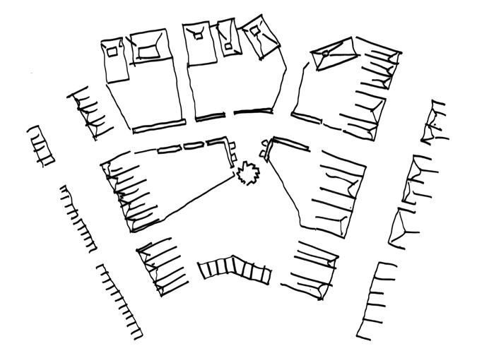
17 Figure-ground urban- scale comparison, showing Oxford North boundary overlaid on the MIT campus.
18 (overleaf) Figure-ground urban-scale comparison, showing Oxford North boundary overlaid on Kings Cross, London.
19 (overleaf) Figure-ground urban-scale comparison, showing Oxford North boundary overlaid on Novartis Campus, Basel.
17

18
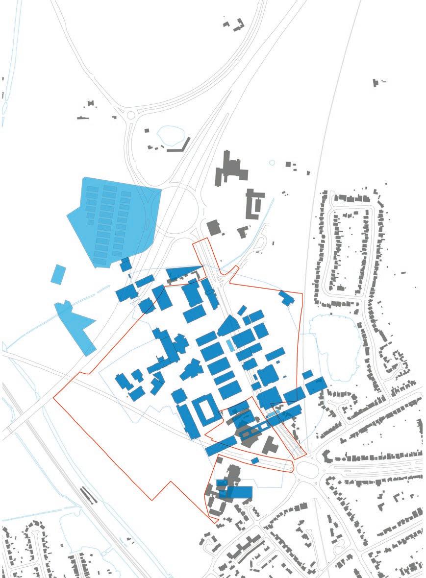
19
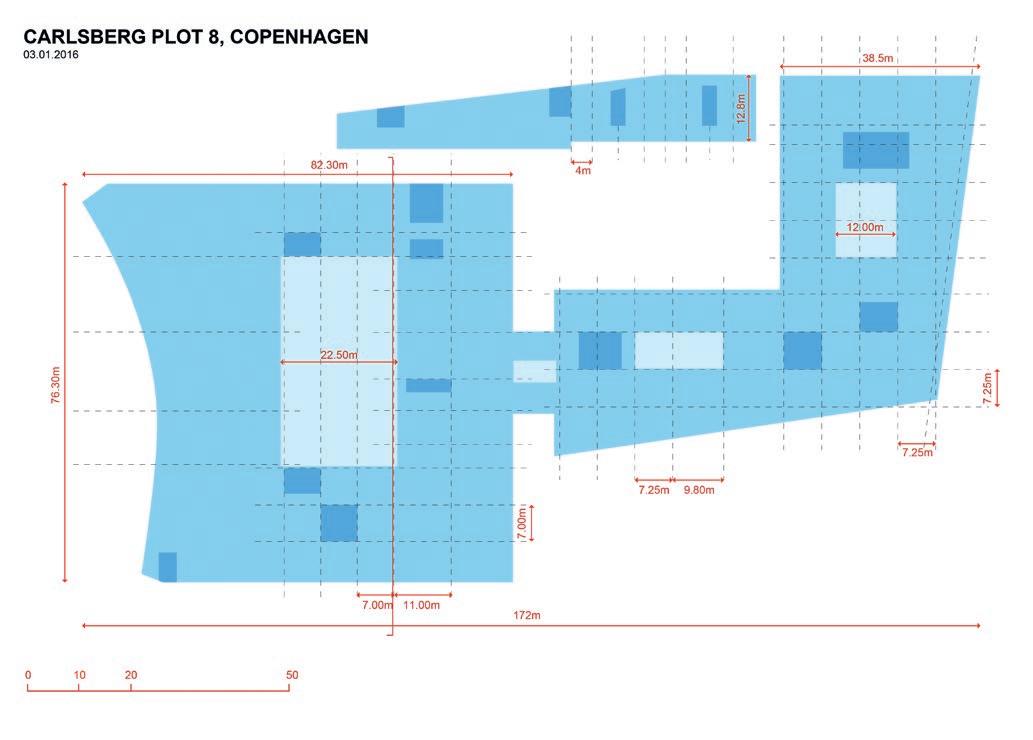
20


20 Research laboratory typology study diagram, Carlsberg Plot 8, Copenhagen.
21 Research laboratory typology study diagram, Clark Centre, Stanford University, California. 22 MIT Brain and Cognitive Sciences Complex, Cambridge, Massachusetts.
2. Creation of context-specific strategic landscape connectivity proposals, combined with abstracted organisational principles for ‘clusters’ of mixed-land uses
Parallel strands of design investigation shaped the approach to the masterplan, building on multiscalar morphological and typological research.
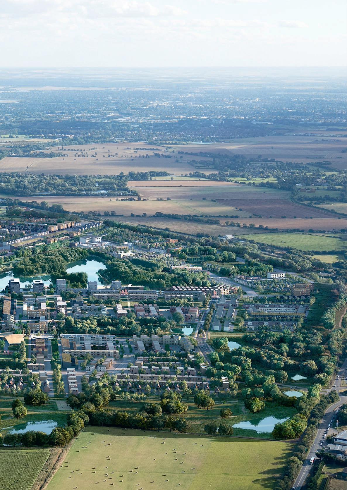
A series of design options were tested in which organisational landscape relationships were used to structure the configuration of streets, open spaces and movement patterns across the site, reflecting its complex topography and orientation. In broad terms, these sought to overlay diagonal lines of movement, reflecting local and regional relationships from south west to north east, and linking the immediate surroundings of Wolvercote and Port Meadow with the newly established infrastructural system of Oxford Parkway railway station. These linkages align with the site’s historic field patterns that date back to the Enclosure Acts as well as longstanding hedgerow planting that predates and traverses the road systems that currently fragment the site.
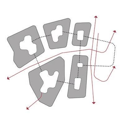
23 Abstracted morphological diagram exploring fragmentation and permeability within and between clusters of activity.
24 Abstracted morphological diagram exploring the relationship between defined clusters and strategic movement networks. 25 Abstracted morphological diagram exploring hierarchy of relationships between clusters and strategic movement networks.


26 27

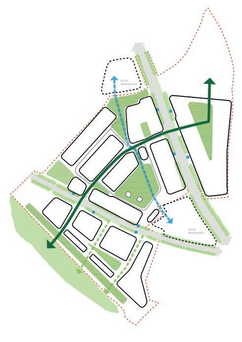
26 Masterplan diagram showing abstraction of landscape structure and interconnection of spaces. 27 Masterplan option diagram showing alternative configurations of open spaces and key connections.
28 Drawing showing landscape relationships around the Oxford North site, identified by a red line.
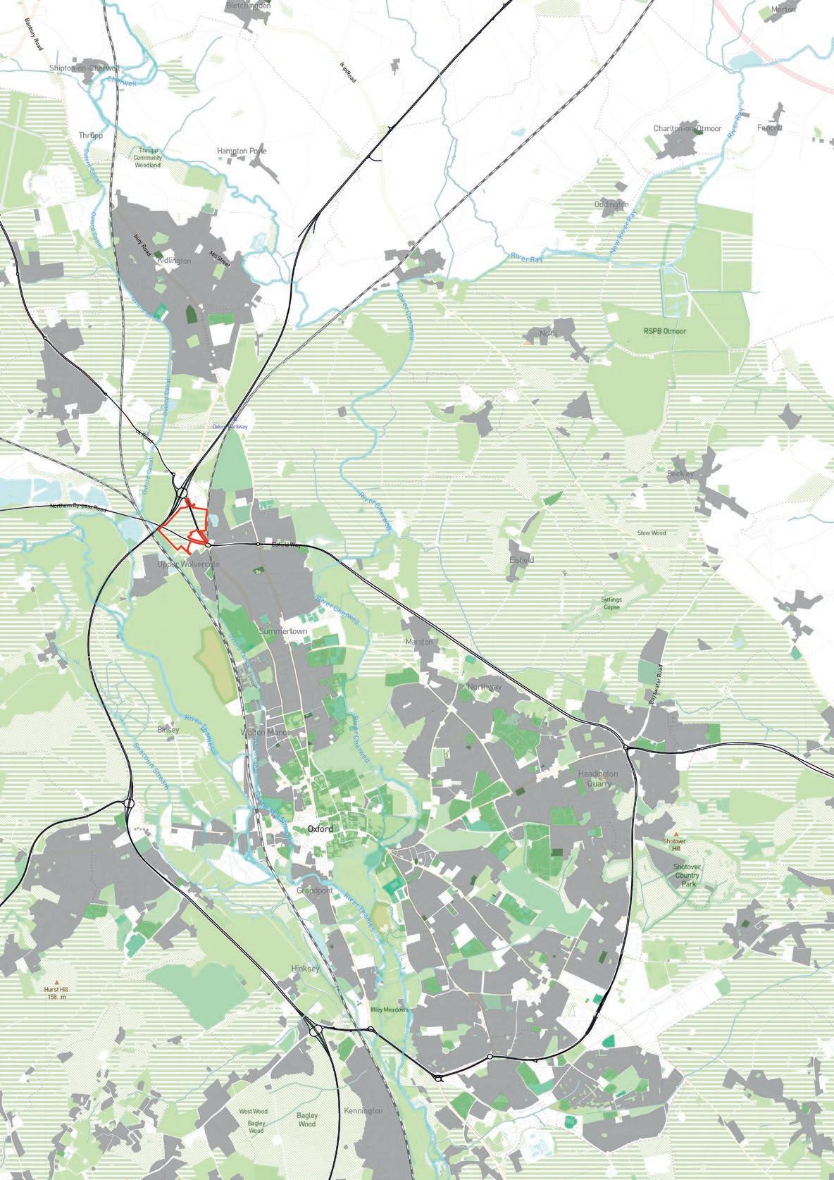
Seeking to create place, identity and enclosure within the site, and drawing on models identified in the cataloguing of precedents, options were developed for grouping buildings into localised but permeable clusters. These clusters support linkages within, between and beneath built form to establish hybrids of public and private space. These approaches were informed by the client and public authority’s desire to reject the exclusive qualities of the historical collegiate ‘quad’, documented in Tyack (1998) and Tyack (2005), and hermetic private science park models. The process was undertaken with ambitions to establish a new type of environment that hybridised urban and arcadian qualities, reflecting the relationship with the nearby and visually proximate landscapes of Oxford Canal, Port Meadow and Wytham Woods.
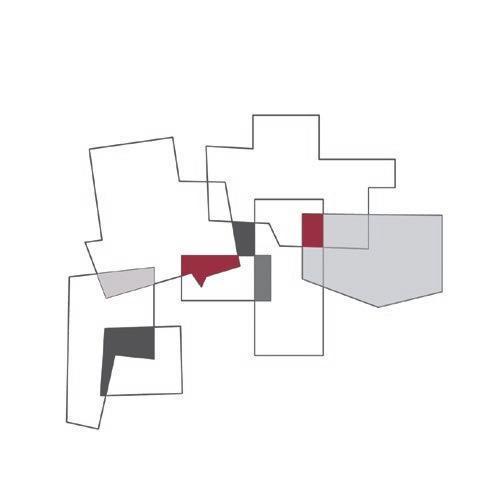
29 Abstracted organisational diagram exploring overlaps and interactions between clusters of activity.
30 Exploded axonometric diagram of abstracted mixed-use development cluster. 31 (overleaf) Mid-Vale Archipelago, 2017. Regional diagram showing relationship between poles of activity, infrastructure networks, trajectories of growth and sites for intervention.
32 (overleaf) Mid-Vale Archipelago, 2017. Scalar repetition of triangular groups of settlements between wider triangular settlements.

3. Parallel and analogous speculative design proposals for placemaking, in relation to infrastructure investment from the National Infrastructure Commission
In parallel with the masterplan design process, a series of theoretical design proposals were generated for the National Infrastructure Commission (NIC), as part of an Ideas Competition to explore the integration of placemaking with infrastructure in the Cambridge–Milton Keynes–Oxford Corridor. The proposals were selected as one of four finalists from more than 50 original submissions, and were subsequently developed for presentation and review with NIC jury members.
The NIC was set up by the government in 2015 to develop long-term infrastructure policy and strategy. The competition sought inspirational and deliverable visions for the future of development in an arc encompassing the UK’s fastest growing and most productive centres. Its purpose was to inform thinking regarding the delivery of rail and road infrastructure in relation to growth scenarios for the transformational introduction of new homes and employment spaces across the region, as set out in the National Infrastructure Commission’s report Partnering for Prosperity: A New Deal for the Cambridge–Milton Keynes–Oxford Arc (NIC 2018).
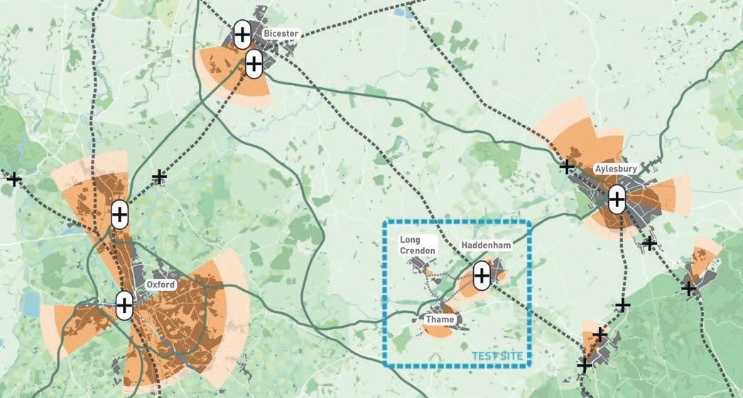
Kendall led the proposal, entitled Mid-Vale Archipelago, that was developed in the context of his team’s work on Oxford North, and the ongoing design of a major new settlement, Waterbeach, immediately north of Cambridge. Mid-Vale Archipelago draws on experiences relating to these live projects, abstracting and synthesising dynamics of urban development and exploring physical forms and organisational scenarios that could inform design and policy elsewhere. The strategy explores the relationship between delivery of new homes, with benefits for existing communities and incentives for long-term ‘patient capital’ returns for landowners. In the initial design phase, a setting of a fictitious town was postulated, drawing on characteristics of similar settlements in the region. Identified as Middleville, the town was defined as a settlement with a population of 5,000, with strong rail links to London but weak connections to the rest of the corridor. The designs create a vision in which the place could double in scale while protecting and enhancing surrounding landscape, as new sustainable transport connections are brought forward. Site-specific prototyping was undertaken for a specific location between the towns of Haddenham and Thame and the village of Long Crendon. This location presented the potential for excellent rail connections to London and Oxford, and integration of East West Rail and expressway road links to Cambridge.
Review was undertaken of emerging infrastructure proposals for the Oxford to Cambridge corridor, and for areas with potential population growth in existing poles of activity with proximity to smaller existing communities and currently unpopulated areas. New connections were drawn between historic and contemporary patterns of urban growth in Oxford and Cambridge. Historic new town and gardencity planning principles were reviewed, particularly with reference to underpinning economic models including land-value capture and endowment building, to support long-term maintenance and the management of community facilities.
The proposals focussed on essential challenges facing the UK, including how to accelerate the supply of affordable homes without sacrificing the quality of the environment, and how to engage and enthuse the public.


33 (previous) Mid-Vale Archipelago, 2017. Abstracted proposal diagram showing relationship between existing town-, village- and hamlet-scale settlements, and sites for new interventions. 34 Mid-Vale Archipelago, 2017. Axonometric view showing concentration of development around enhanced railway infrastructure.

35 Mid-Vale Archipelago, 2017. Axonometric view showing co-located civic and community infrastructures.

36 Mid-Vale Archipelago. Landscape montage, notional date 2022.


37 Mid-Vale Archipelago. Landscape montage, notional date 2050.

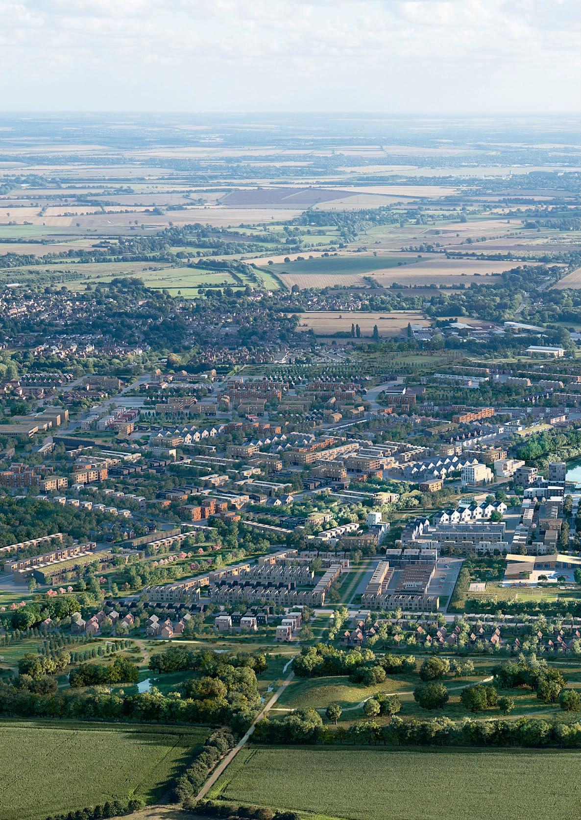
38 (overleaf) CGI of Waterbeach masterplan, Cambridgeshire. View looking south towards Cambridge.
4. Consultation and engagement with existing communities living in proximity of the site and across Oxford, Oxford City Council, Oxfordshire County Council and representatives of numerous statutory bodies
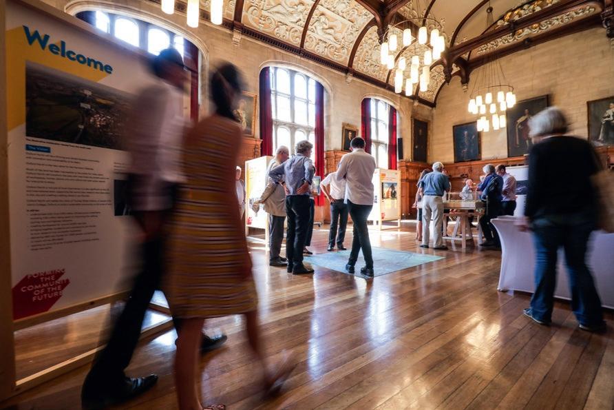
As the largest strategic project undertaken within the city of Oxford over the past 100 years, with significant physical, economic and social impact, it has been essential to undertake a substantial process of consultation and engagement with existing communities and stakeholders to shape the masterplan process. The 2015 policy for the site by Oxford City Council was the product of a detailed evidence base, including consultation originally undertaken to justify the designation of the land through the creation of an Area Action Plan. Masterplan consultation was therefore not the start of engagement activity but the continuation of an ongoing process, albeit with the distinction that it was being undertaken to support development proposals and a planning application reflecting land ownership rather than city council policy.
Major public exhibitions were held at a large hotel adjacent to the site and in Oxford Town Hall shortly before submission of the planning application. A digital engagement platform entitled Commonplace was also deployed to reach a wider, more diverse audience. In the early stages of the design process, detailed briefing meetings and consultation events were held. Extensive dialogue has been held throughout design development with representatives of statutory bodies and other scales of governance, including Oxfordshire County Council, Highways England, Oxfordshire Local Enterprise Partnership, Historic England and Wolvercote Neighbourhood Forum. Five key issues arose from the consultation process and were addressed in response:
1. Traffic and sustainable transport
Issue: Severe highways congestion and the need to support modal shift at a local and city scale.
Response: Significant reductions in car parking standards compared to current market expectations, with 850 electric car sharing points and a maximum total number of cars set at one per 50 m2 of employment floorspace; creation of new dedicated bus and cycle lanes on the A40 and A44; and connections to Oxford Parkway rail station.
2. Visual and townscape impact
Issue: Impact on views from historically open meadow landscapes and the heritage-protected city centre.
Response: Extensive testing and iterative adjustment of height parameters across the masterplan area in response to identified key viewpoints; strategic design principles for future roofscape form; and building materials, colours and tones.
39
39 Oxford North public exhibition, Oxford Town Hall, 2018.
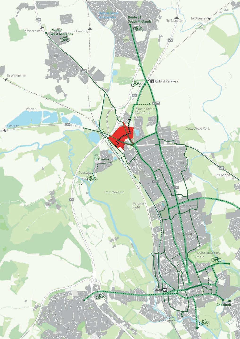
40 (overleaf) City-scale diagram showing relationship of site to networks of expanded cycle infrastructure. 41 (overleaf) Diagram showing areas of conservation and heritage protection around the site.

43

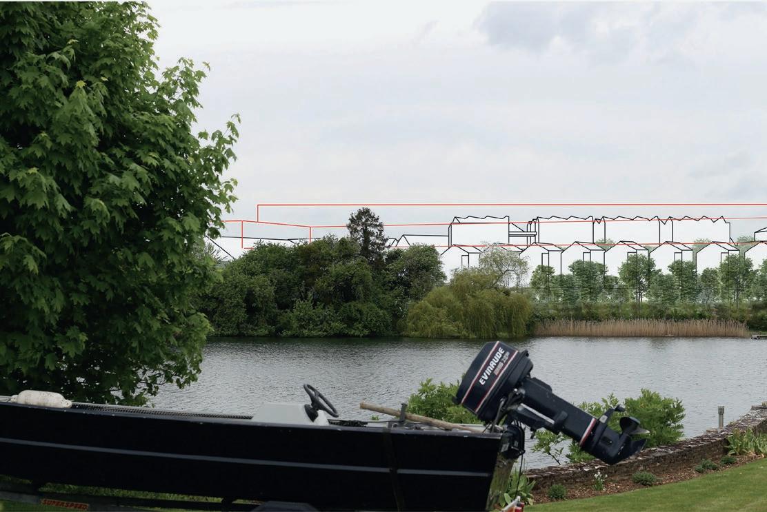
42 Typical photomontage study showing the visual impact of illustrative buildings (white) and parameter limits (red) from beyond site. 43 Abstracted diagram exploring roofscape orientation in relation to formal street and space frontages.
3. Energy and air quality
Issue: Development needs to respond to the climate crisis and significantly reduce carbon in the built environment; poor air quality onsite, particularly in immediate proximity to busy roads, with the risk that new development will worsen the situation.
Response: Creation of combustion-free energy sharing loop for the first phase of development, saving 21,000 tonnes of CO2 compared to a conventional system, using a grid of 450 closed-loop co-axial boreholes and elimination of central energy centre plant; commitment to sustainable travel modes, especially new bus and cycle provision, onsite and strategically, including almost 10 km of new and upgraded cycle paths.
4. Housing need and affordability
Issue: Oxford has some of the most extreme housing costs in the UK due to a sustained demand and a lack of supply, with pressure across all tenure, size and type of home. There is a concern that new development will worsen rather than ameliorate the problem.
Response: Provision of nearly 500 homes (the maximum allowed by policy for a site in an employment-led location) and a commitment to between 35% and 50% affordable housing within the masterplan.

44 Energy sharing loop diagram overlaid on masterplan digital model.
5. Character and identity
Issue: The character and identity of a new district of a historic city set immediately adjacent to heritage-protected open landscape and predominantly residential districts created by urban expansion in the nineteenth century. The need to find appropriate expression for new typologies and mixes of functions reflecting contemporary forms of research and employment activity.
Response: Extensive exploration of historic urban and architectural growth and change within Oxford, including manufacturing traditions and the role of roofscape and materiality in shaping identity; first phase detailed architectural design developed as proof of concept, and extensive modelling and testing of site-wide illustrative building designs.
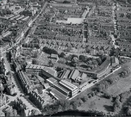
45
45 Aerial view of Jericho, Oxford, showing interface of Lucy’s Ironworks, terraced housing and open landscape, 1952.
46 Detailed material samples for the first phase workspace buildings. 47 Detailed material samples for first phase Red Hall amenity and incubator building.
48 Detailed material studies for first phase workspace buildings, exploring tonal variation.

46

47

48


