
3 minute read
chicken


Chicken is located at mile 66.8 of the Taylor Highway and is 78 miles from Tok. It was originally going to be named Ptarmigan, due to the number of these birds in the area. However, the spelling could not be agreed on and Chicken was chosen because it was easier to spell! If you are driving to Chicken from the Alaska Highway, the road has been reconstructed and is usually in pretty good condition.
The Taylor Highway is part of the Top of the World Highway, which leads 108 miles to Dawson City, another famous town with a gold rush history.
Advertisement
The history of Chicken is rich and began with the discovery of gold, on Franklin Gulch, in 1886. Ten years later in 1896, Bob Mathieson made a major discovery on Upper Chicken Creek, staked his claim and built a cabin, ushering in a rush of prospectors. 700 miners were thought to be working the area between 1896 and 1898. A post office was established in 1903 to serve a population of around 400.
The Historic Town of Chicken was a hub of activity for the southern portion of the Fortymile Mining District. Many of the original buildings still stand including “Tisha’s Schoolhouse” made famous by the book “Tisha” about Anne Purdy’s life teaching in this community in 1927.
In 1939, the F.E. Company began acquiring claims and built a camp on Nora Bench. In 1953 they bought the town site and turned it into a camp for their dredging operation. Dredge #4 (the Pedro Dredge) was moved from Fairbanks to Chicken in 1959 and was operated until 1967. In 1998, after sitting idle for 31 years, the million pound dredge was moved in one piece to its present location in town. Chicken Gold Camp, RV Park and Outpost with rooms and cabins. The “Outpost” gift store has Alaska artisan made gifts, clothing, jewelry and more. The cafe serves homemade entrees, fresh-baked pastries, espresso drinks, wood-fired pizza and Alaska craft beers. The camp features gold panning, gold mining outings and historic tours. Chicken Gold Camp is a National Historic Site, which includes the Pedro Dredge and mining museum. 1/4 mile south on Airport Road in Chicken. 907-782-4427

ALAskA HIgHWAY
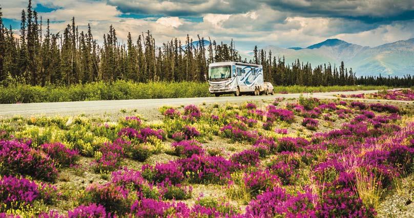
The Alaska Highway was the engineering marvel of World War II. It took more than 25,000 men and 7000 pieces of equipment less than 10 months to build the Highway, which stretches 1422 miles from Dawson Creek, BC to Delta Junction, Alaska. The original highway was marked with mileposts in 1947 and many of the towns and highway lodges became known by their milepost number. Even today, many lodges use Historical Mileposts (HM) to refer to their location.
The Canadian portion of the highway is now marked with kilometer posts and due to highway reconstruction and rerouting over the years, the road is now 40 miles (64 km) shorter than the original Alaska Highway. Alaska, however, has not changed the original mileposts, so there is a mileage discrepancy of 40 miles when you cross the border.
From historical mile (HM) 1222 at the Alaska/Yukon Border the highway winds its way to Delta Junction at HM 1422, which is the true end of the Alaska Highway. If you continue north to Fairbanks you will be on the Richardson Highway.
This beautiful drive passes by the Tetlin National Wildlife Refuge Visitors Center at mile 1229. The Refuge’s 700,000 acres include snow capped mountains, rivers, forests, treeless tundra and an abundance of wetlands. From scenic overlooks you can view wetlands, boreal forests and alpine habitats teeming with wildlife. Preservation of these lands represent the legacy of early conservationists who recognized the importance of this area.
Mile 1302 is the junction with the Taylor Highway which accesses Eagle and Chicken in Alaska and Dawson City, in the Yukon.
Backcountry camping is allowed throughout the Tetlin Wildlife Refuge. If you choose to camp, please keep a clean campsite and practice bear awareness. Both black and grizzly bears make their homes here. Pamphlets concerning bear safety are available at the Tetlin Visitor Center and Refuge headquarters.
The following are public campgrounds. Deadman Lake Campground mile 1249 has 15 campsites (4 sites are suitable for large RV’s) firepits, toilets, picnic tables, boat ramp, no drinking water. There is a self-guided ¼ mile Taiga Trail walk at the campground. During the summer, Ranger lead wildlife programs are conducted Monday through Friday at 7pm. Lakeview Campground mile 1257 has 11 campsites, tables, toilets, firepits, no drinking water. Delta State Recreation at mile 267 Richardson Highway. 25 campsites, a picnic area, covered shelter, water & toilets.


