Ben_Smallwood_

This portfolio has been curated to show my breadth of skills and experience and the development of my working methods both from my time in education and industry.
Starting with my most recent work from my Masters and ending with projects from my Part 1 position at Anderson Orr Architects.
Each project has been listed with the skills used and a statement of the projects intentions to accompany visuals of the developments and final proposal.
Throughout my projects I have evolved an iterative process working between digital and analogue media that allows me to develop and express both overall concepts and detailed understandings through physical models and drawing, paired with the precision and speed of digital softwares.
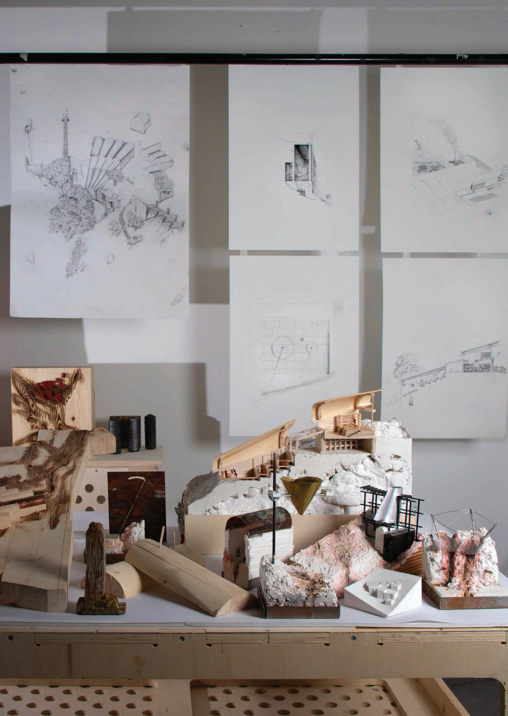
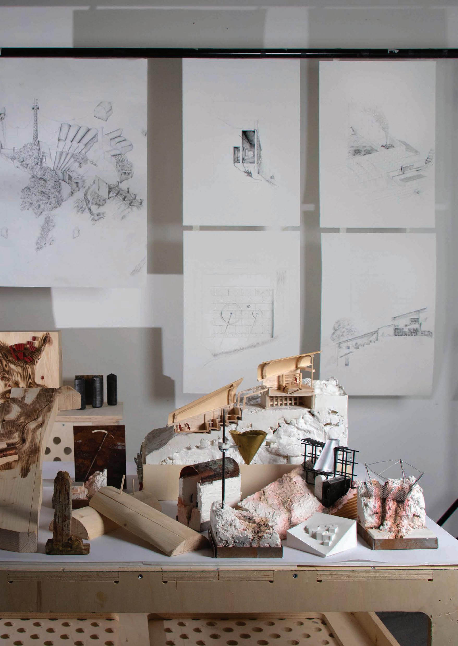
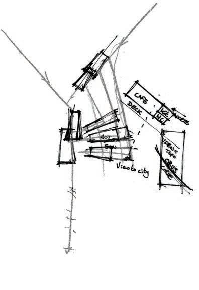
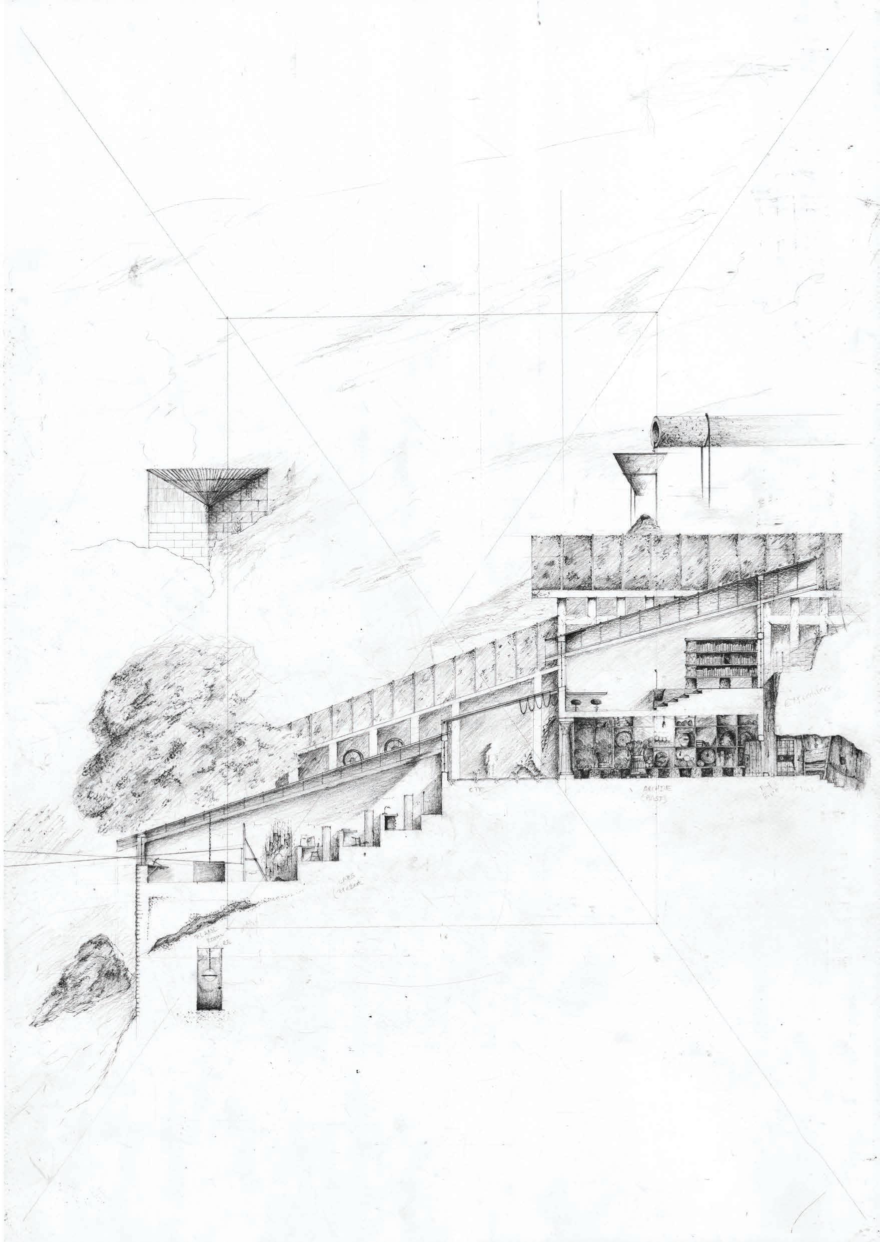
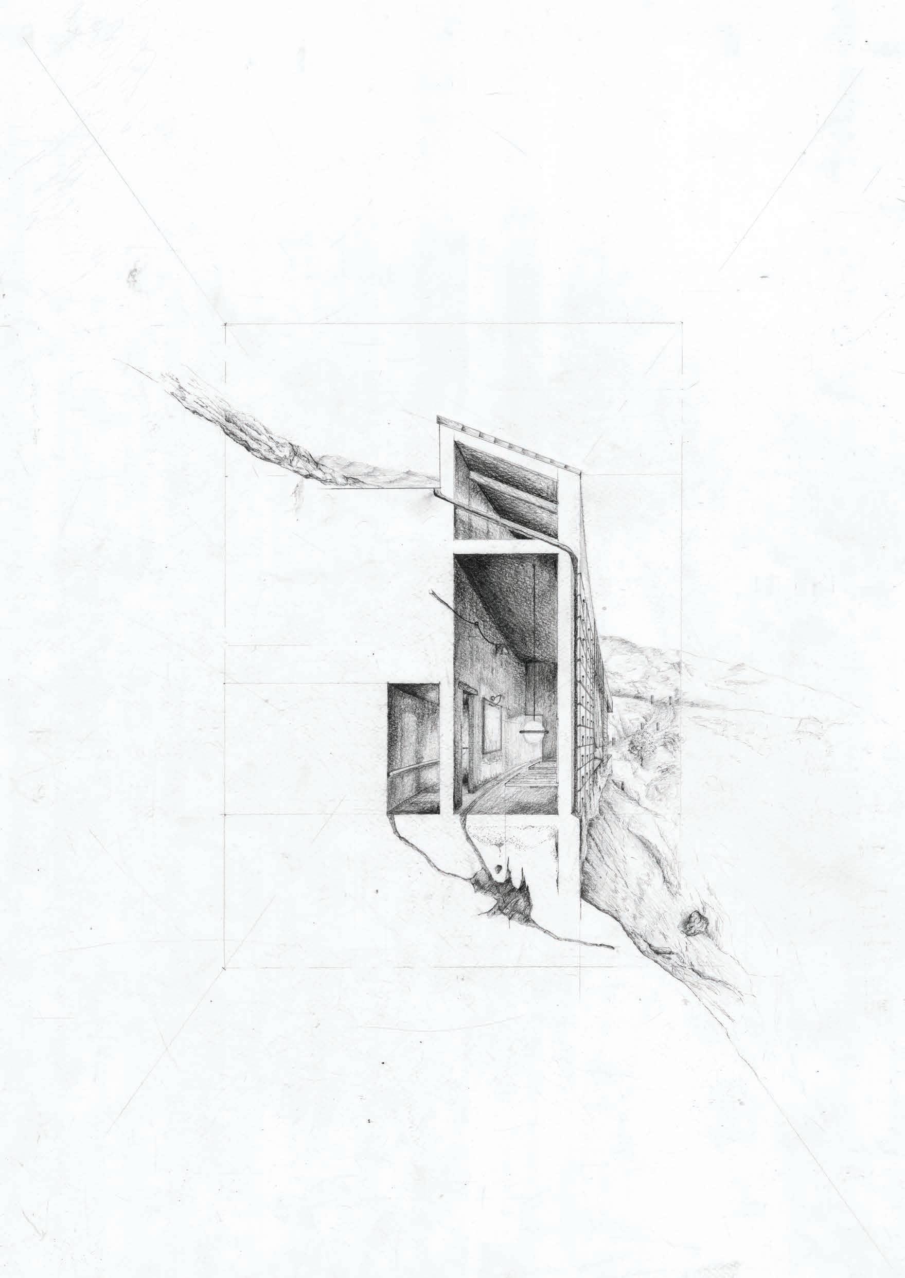
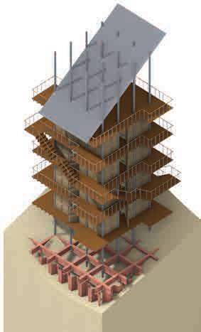
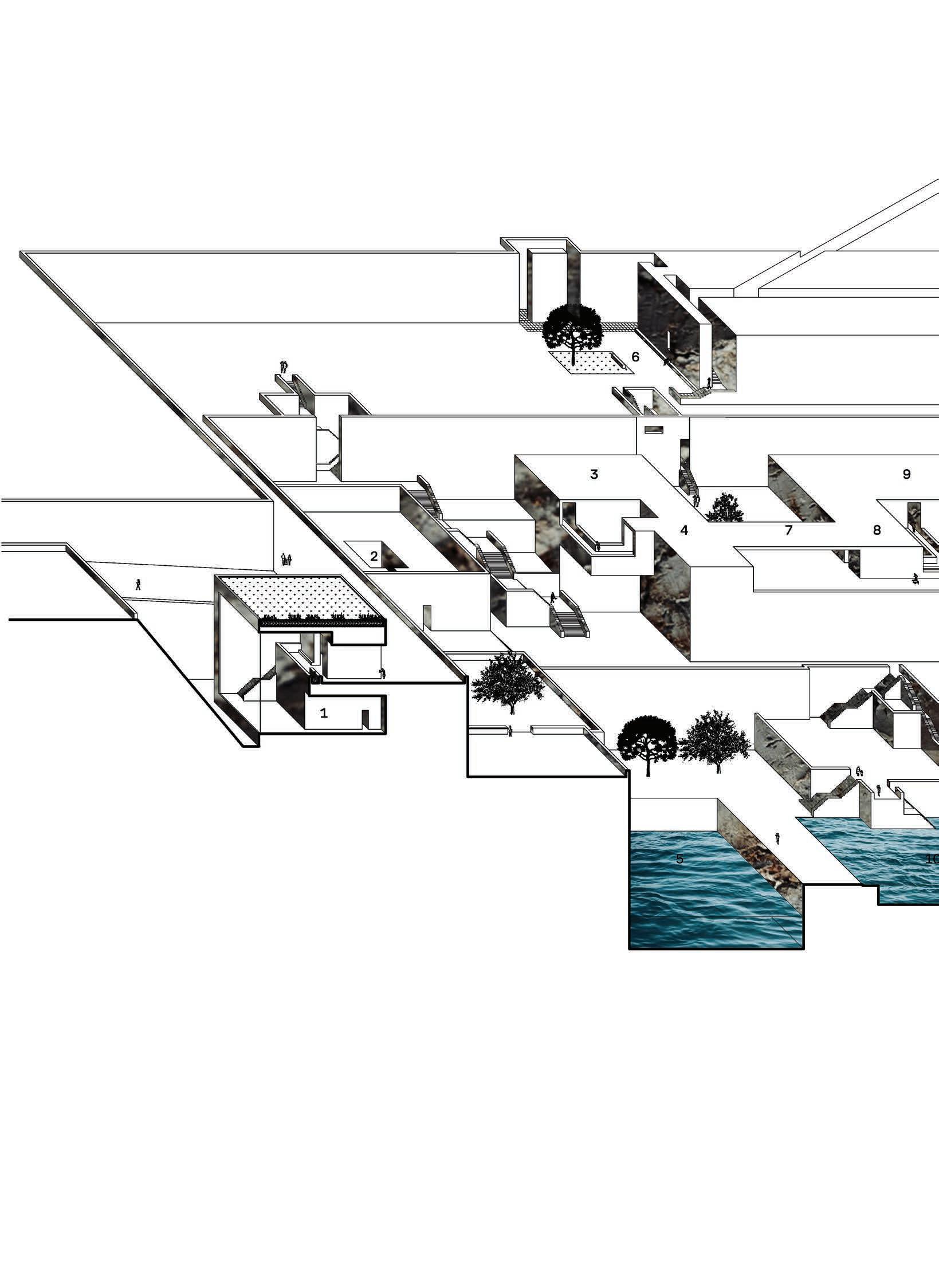
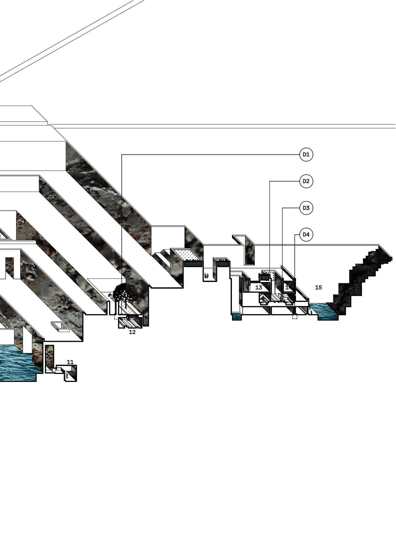
Project 1: The Notifier of the Anthropocene, Year 5, MArch, Bartlett
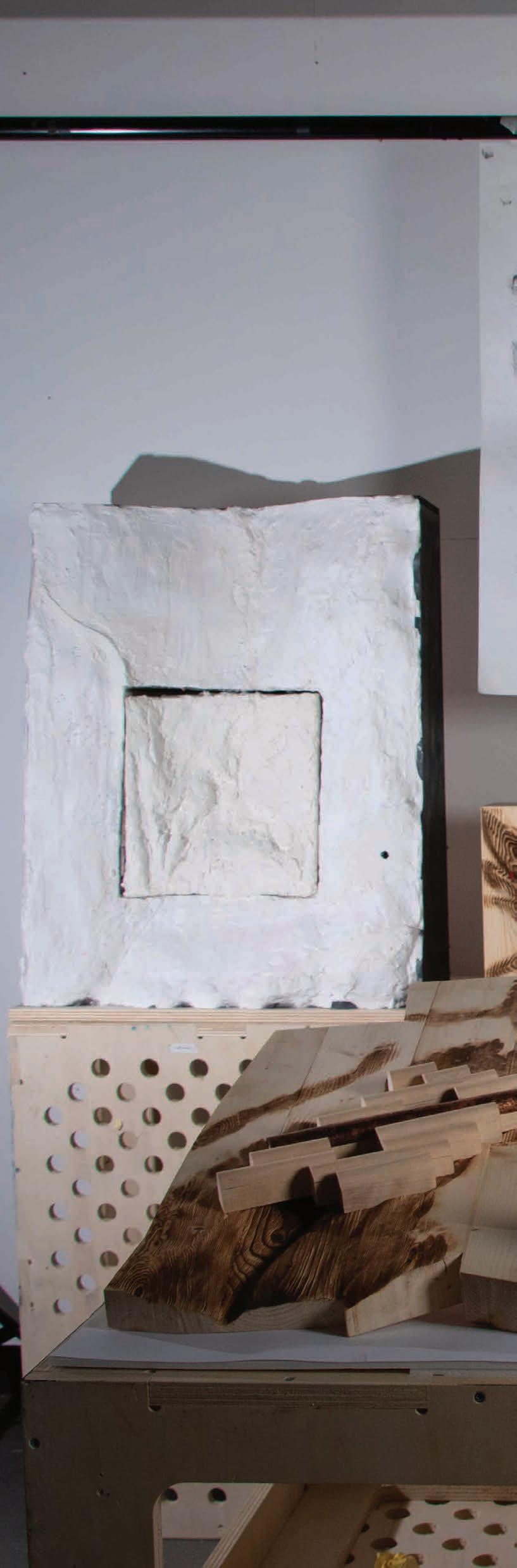
A Sicilian archive of proxy records that evolves as it interacts with the climate. Analogue working methods were translated to rhino and visa versa to develop materiality and massing in relation to climate change and the sites steep topography.
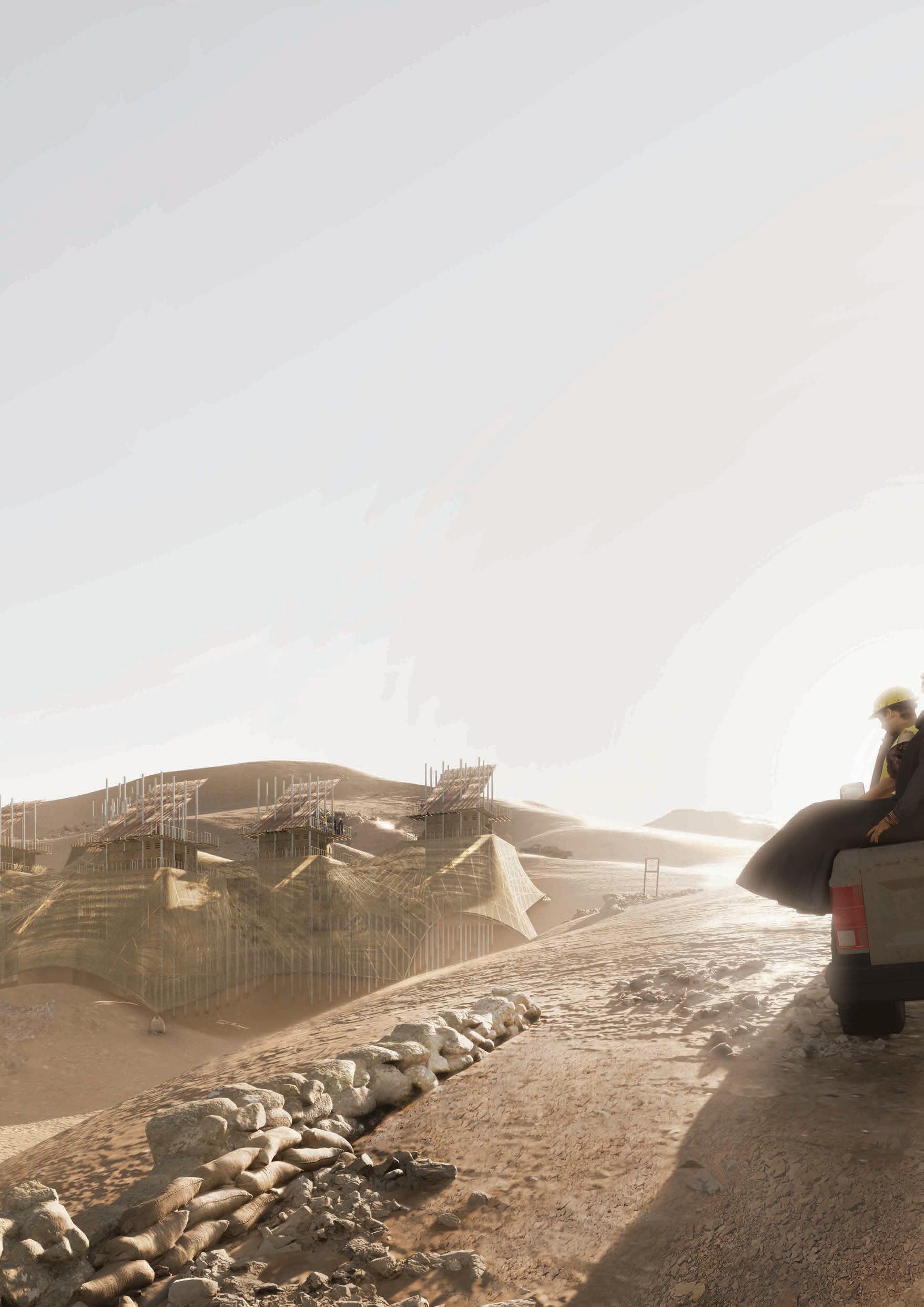
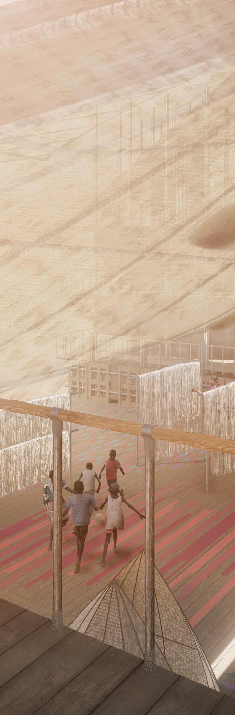
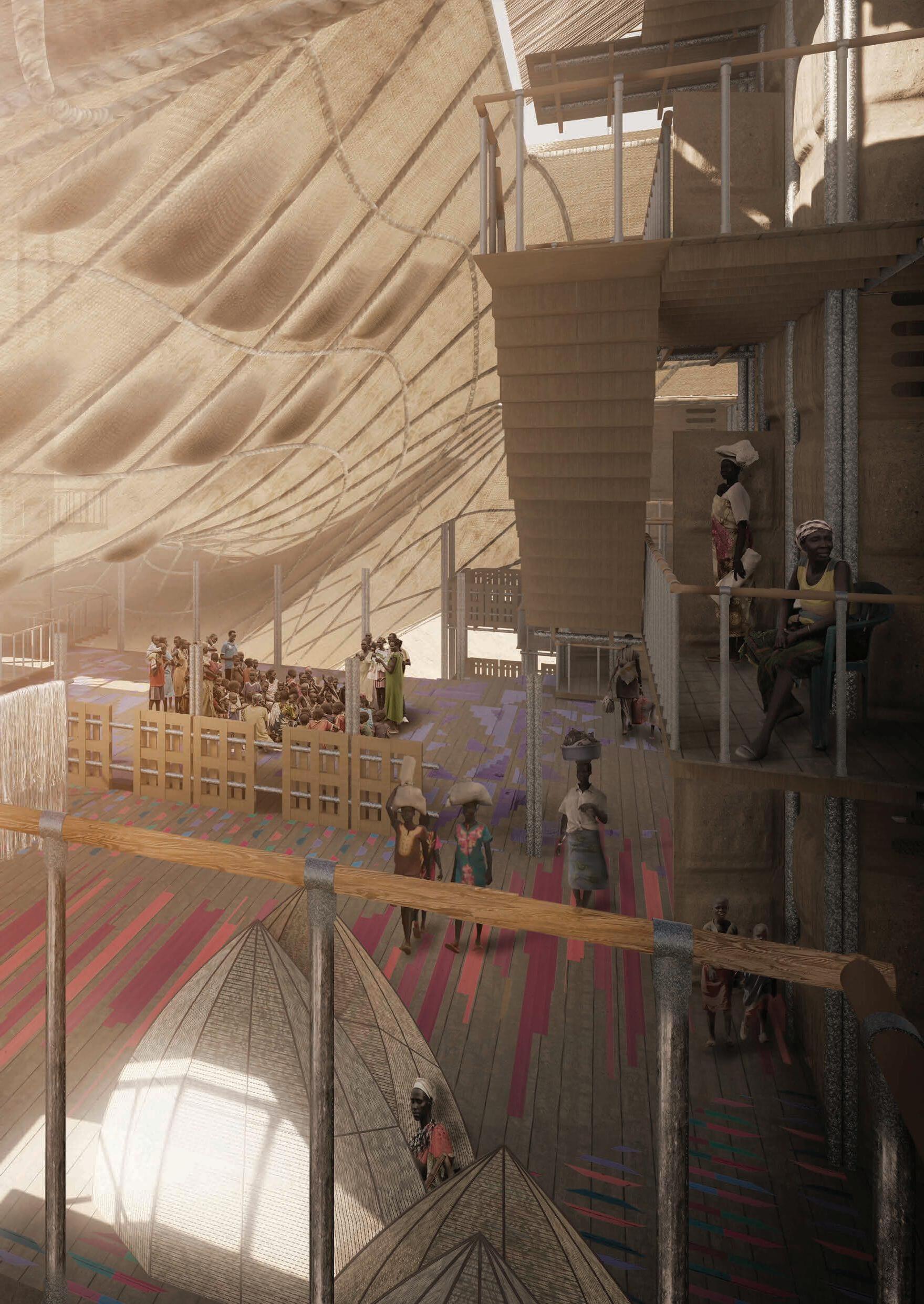
Project 2: The Outpost, Year 4, MArch, Bartlett
A vertical refugee camp within the Sahara dessert. Using Rhino to develop a kit of parts and run environmental simulations for an adaptable structural system whilst using physical models to understand atmosphere and materiality.
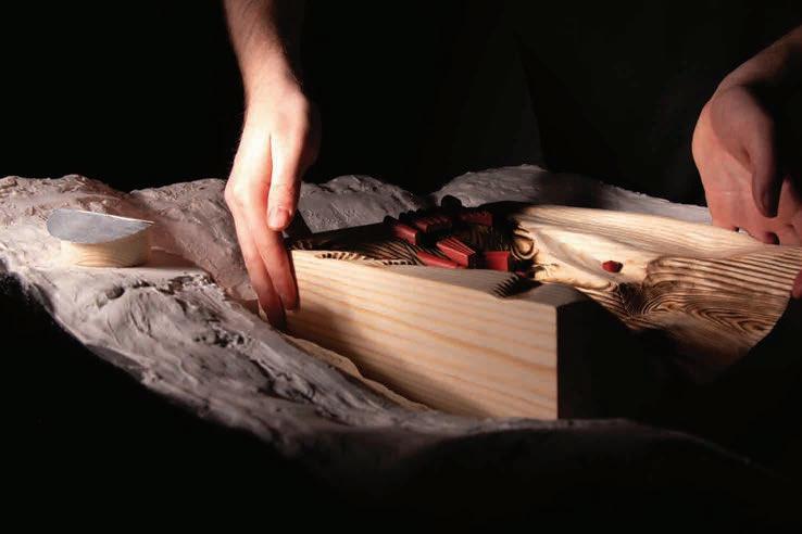
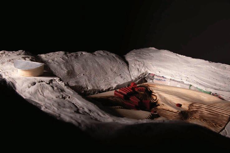
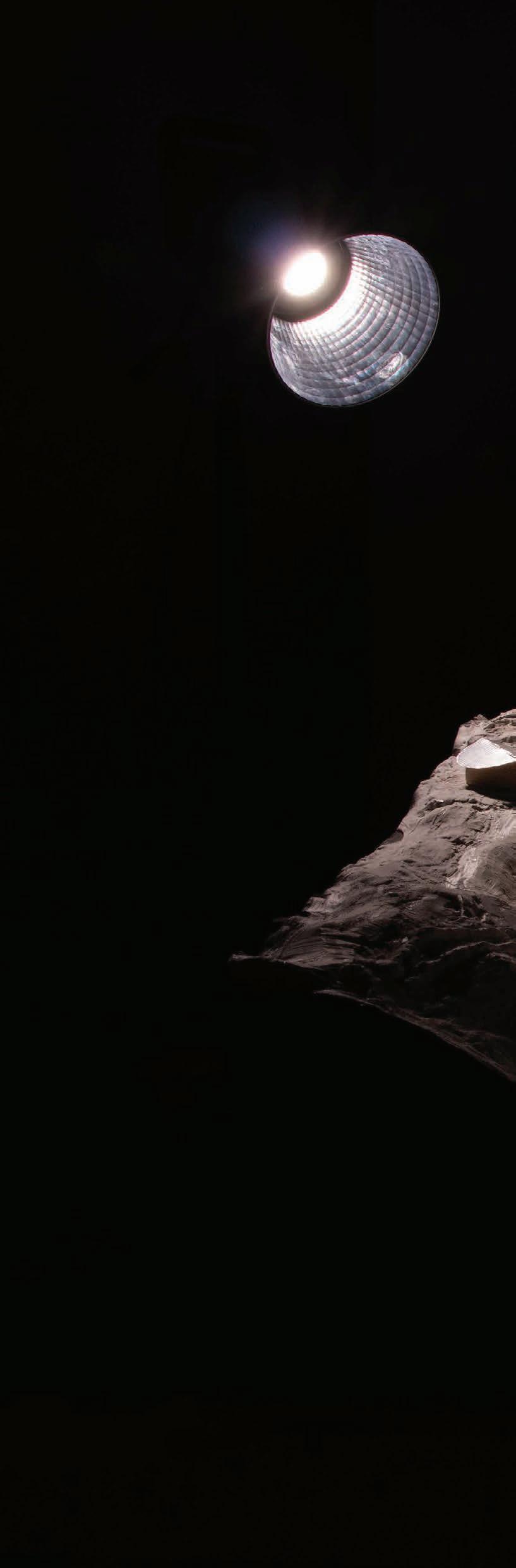
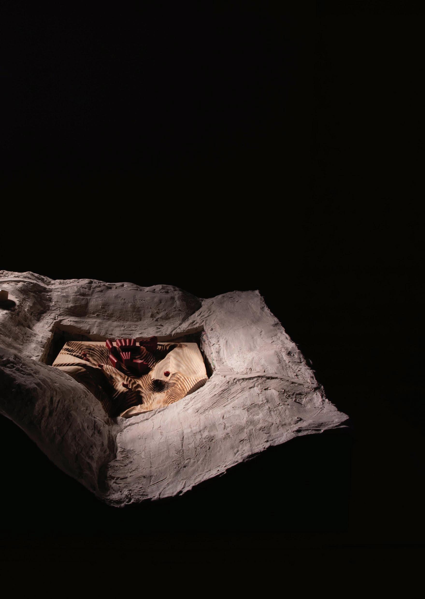
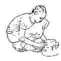
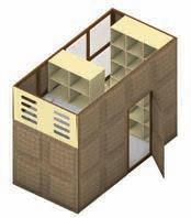
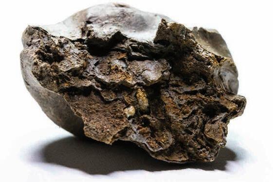
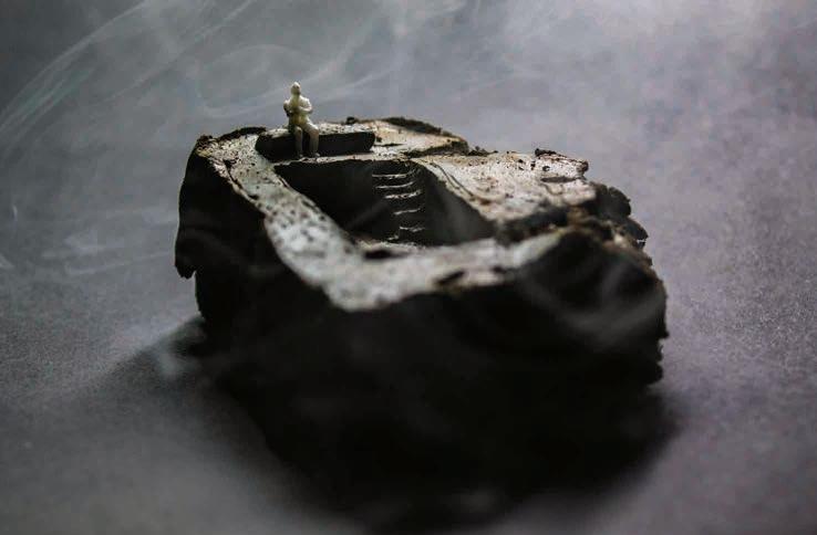
Project 3: Excavation, Year 3, BArch, NTU
A communal spa, carved from Nottinghams history of coal mining. Using self dug clay within physical models to develop a language of architecture through carving and moulding, whilst AutoCad and Sketchup added feasibility to the proposal.
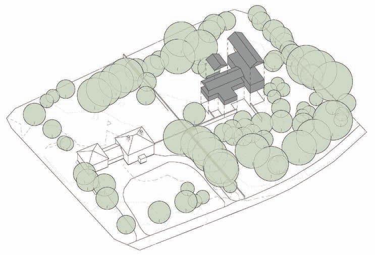
Project 4: Private Residential / AONB, 2021, Anderson Orr
To develop a one-off home for an elderly couple within an AONB and the grounds of their existing property for which I was design lead. Providing space for visiting family, natural light and built in secure by design principles.
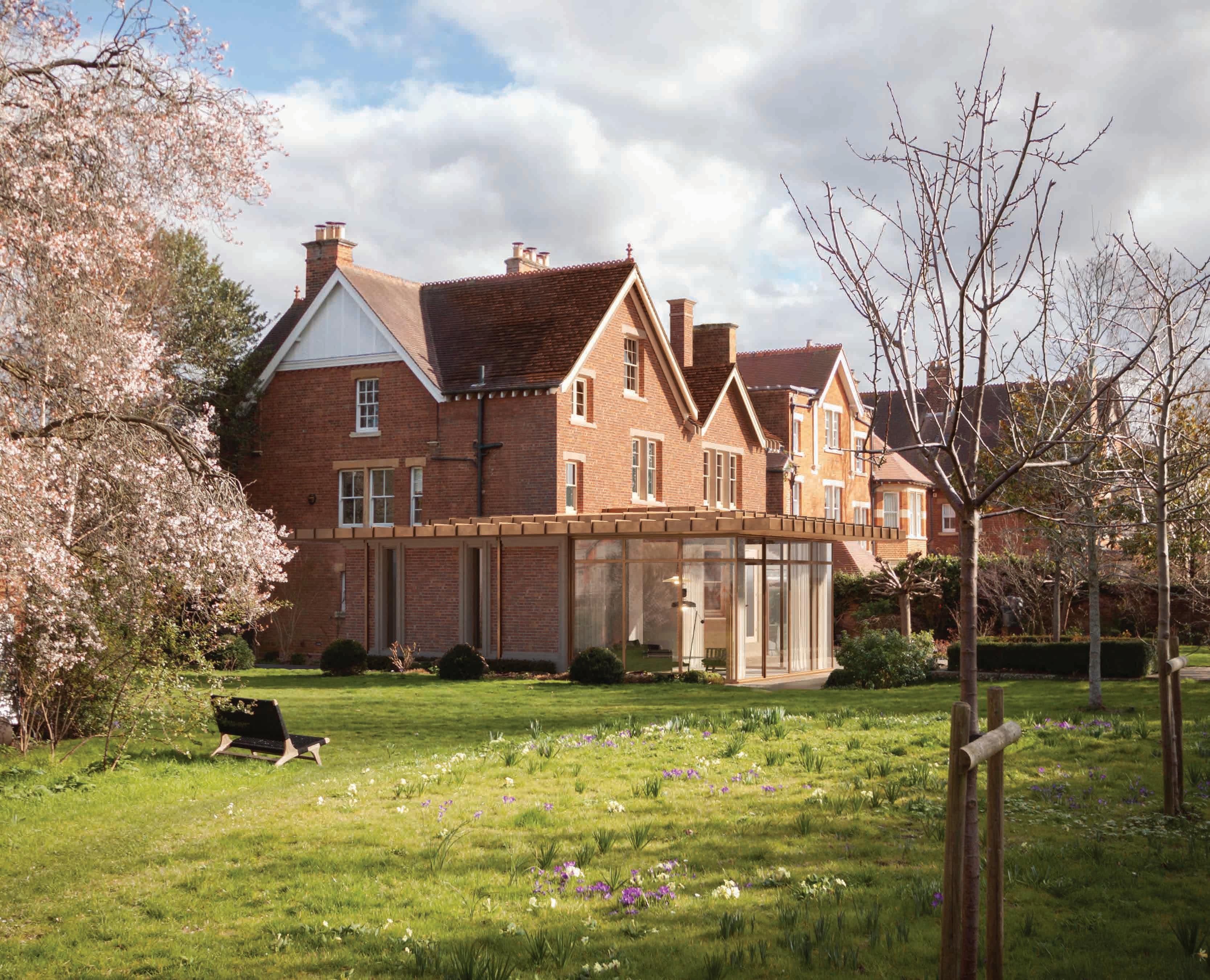
Project 5: Conservation / Alteration, 2022, Anderson Orr
A replacement and enlarged extension to a unique property within Oxfords Victorian suburb conservation area for which I was design lead. Developed through meticulous modeling of the existing property and surrounding context environmental studies and site lines from neighboring properties formed the constraints for the sympathetic but clearly distinguishable design.
Masters Project - Year 5, PG 17 2023-24
The Bartlett School of Architecture, UCL Architectural Design
TutorsYeoryia Manolopoulou, Tamsin Hanke, Nasios Varnavas
Thesis TutorHector Altamirano
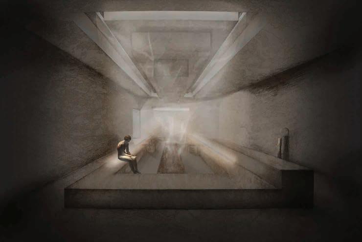
Thesis - Producing a physical record of flood disasters through the production of physical material changes responding to changing climactic conditions.
Methods - Physical model making, hand drawing and sketching, diagramming using illustrator, digital modelling, rendering and animation in Autocad, Rhino and Twinmotion.
Flooding is the most common and fatal natural disaster globally, exacerbated in frequency and severity by humans impact on the climate. This direct correlation between global warming and the number of disasters mean that floods are not only a consequence but a measure of the climates condition.
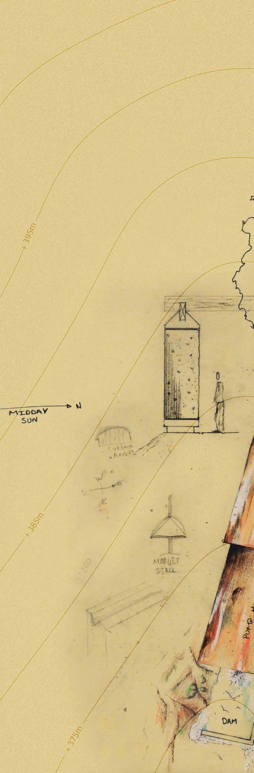
These changes in climate are witnessed in the natural and built landscapes. Red sky in the morning; Or efflorescence on walls are both potential notifiers of macro or micro climates, but how can these notifiers be built in to the architecture? Set to erode, stain, sound and change over time without human intervention the materiality becomes a key notifier and record of climate change beyond the anthropocene.
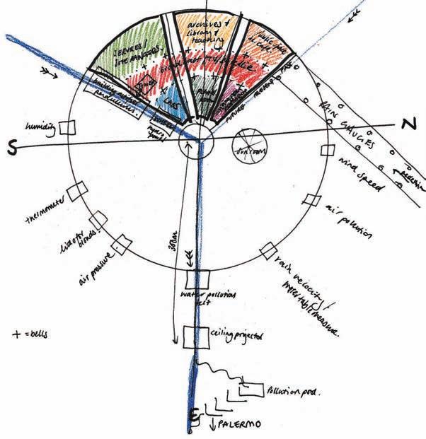
In the present time the building will serve as a weather station and paleoclimatology research centre. But as climates change beyond the possibility of human inhabitation of Palermo it will be left to notify and warn future epochs of the catastrophic impacts humanity has had on the planet.
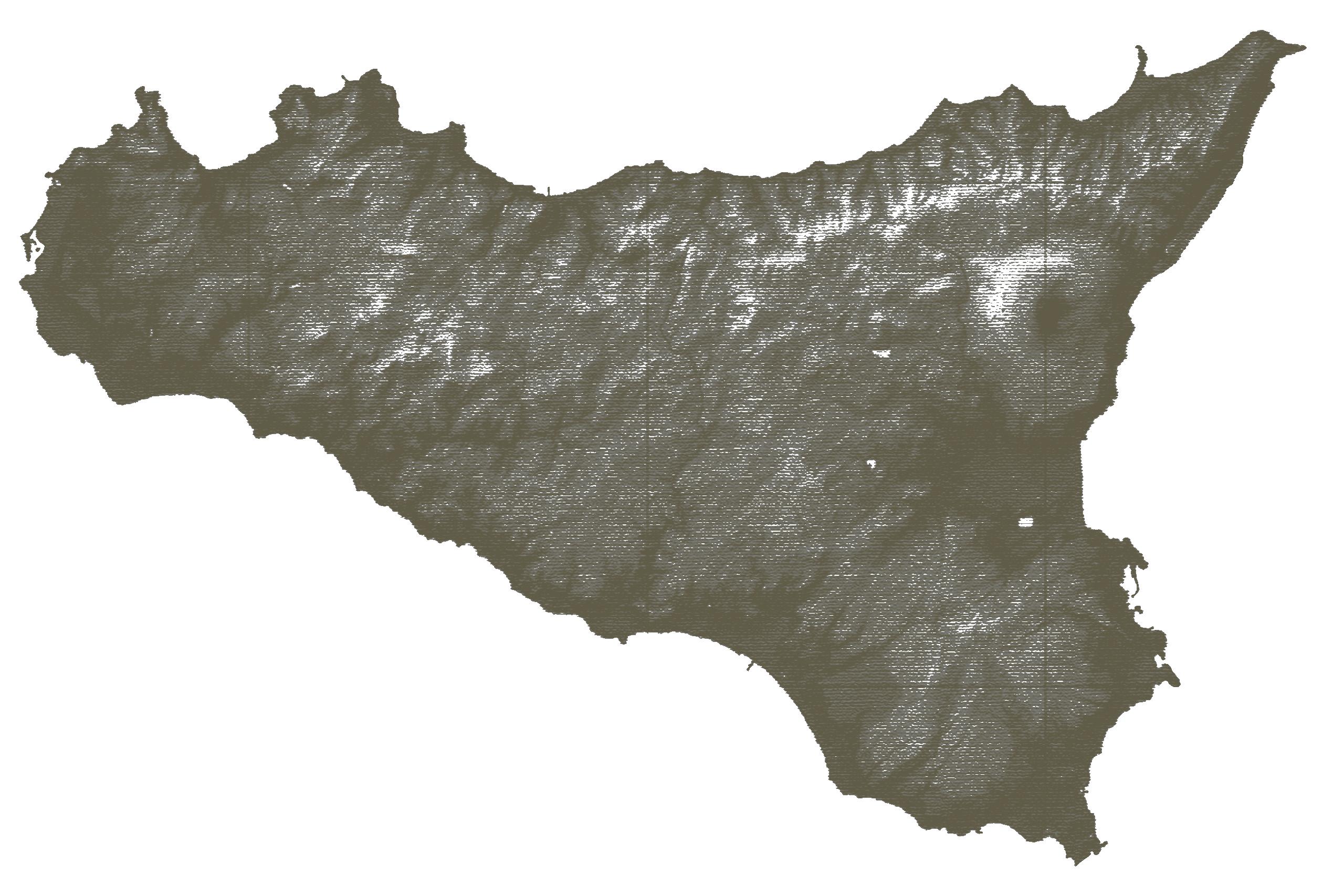
Sicilian Geology & ICS Golden Spikes
The ICS is the Internations Comission for Stratigraphy and Identifies key sites throughout the globe that are the best visible representations of key changes in time. Time is split into 5 orders: Eons
Eras
Periods
Epochs Stages
These sites are marked with a metaphorical and physical Golden Spike. Within Sicily there are three of these sites.
01 - Gela, Sicily, Italy
Phanerozonic Eon, Cenezoic Era, Quaternary Period, Pleistocene Epoch, Gelasian Stage
02- Porto Empedocle, Sicily, Italy
Phanerozonic Eon , Cenezoic Era, Neogene Period, Pliocene Epoch, Piacenzian Stage
03- Heraclea Minoa, Cattolica Eraclea, Sicily, Italy
Phanerozonic Eon , Cenezoic Eon, Neogene Period, Pliocene Epoch, Zanclean Stage Flood levels and climate change
Timeline of climate disasters in Sicily
0.3 metres - Estimated sea level rise by 2050 18 metres - Highest flood height recorded globally + 30% - Ammount to increase historic records to account for increases due to climate change
4.1 km - Furthest point inland of historic flooding in Palermo 70m - Estimated highest possible sea level if all ice were to melt 380 metres - Altitude of site
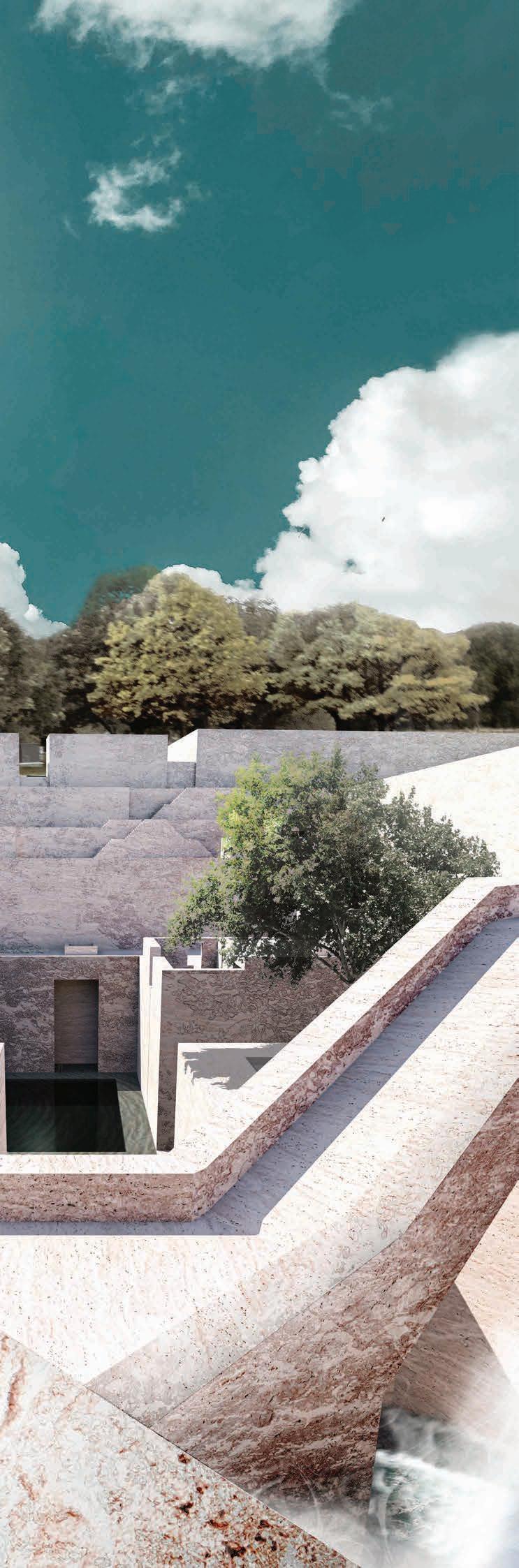
The site is located at this height to ensure an overview of the city and the impacts on watercourses due to climate change. The height also ensures the safety and preservation of the archive.
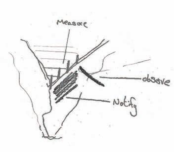
Justification for site location:
- A place to measure, observe and be effected
- Safe storage for archive away from potential damage
- Public to access on hiking trails and offers ammenities
- Visible to the city
- Interacts with weather
Major Cities
Tectonic Plate Overlap
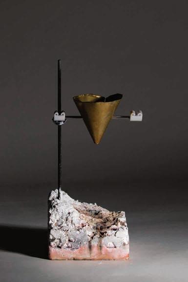
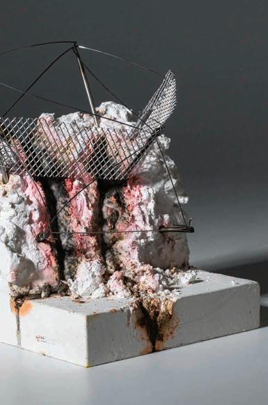
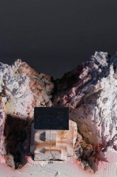
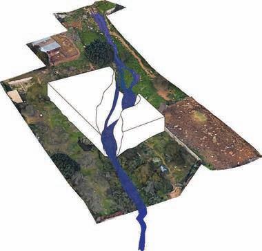
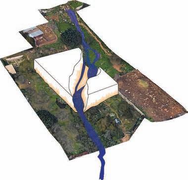
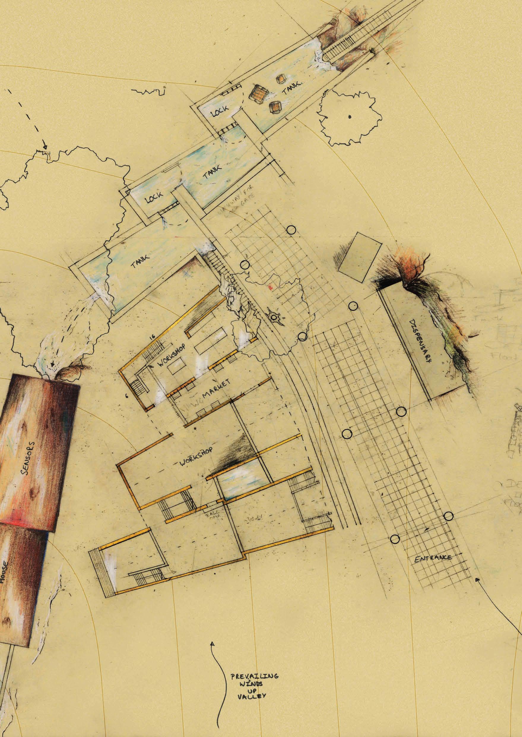
The Process Water and the site
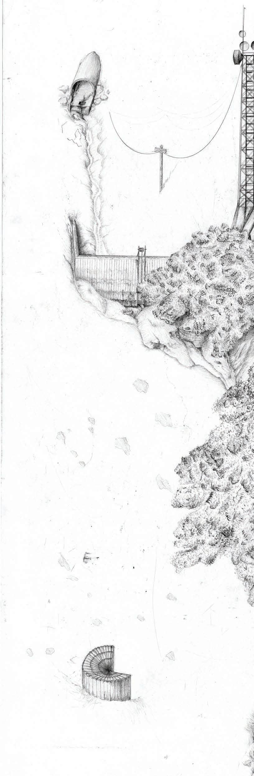
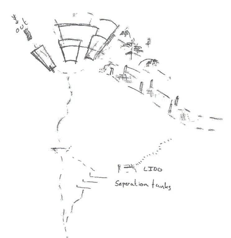
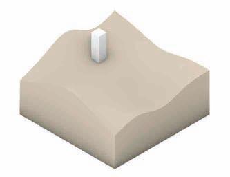
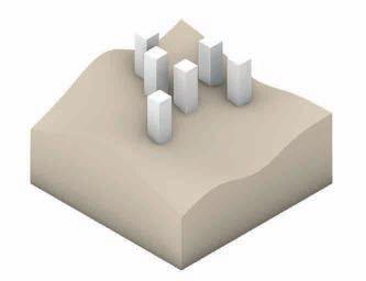
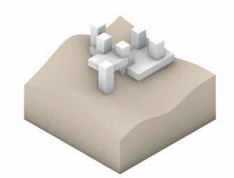
The site is at the origin of a water route that flows under Palermo and into the Tyrheian sea. This water s often polluted and becomes further effected by interaction with other man made interventions. At this high point it is possibl to filter it, and potentially warn of any incoming storm surges.
The set of models adjacent represent the three stages of this water. Firstly from the physical waste suspended above the city, dripping into the water course. Flowing through quarries and eroding routes through artificial and ill considered landscapes and finally through the city and peoples lives where it can cause immense damage to peoples properties and lives due to the submerged waterways in floods.
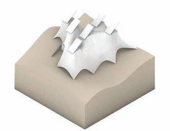
Architecture caused by... Forces on architectural form making
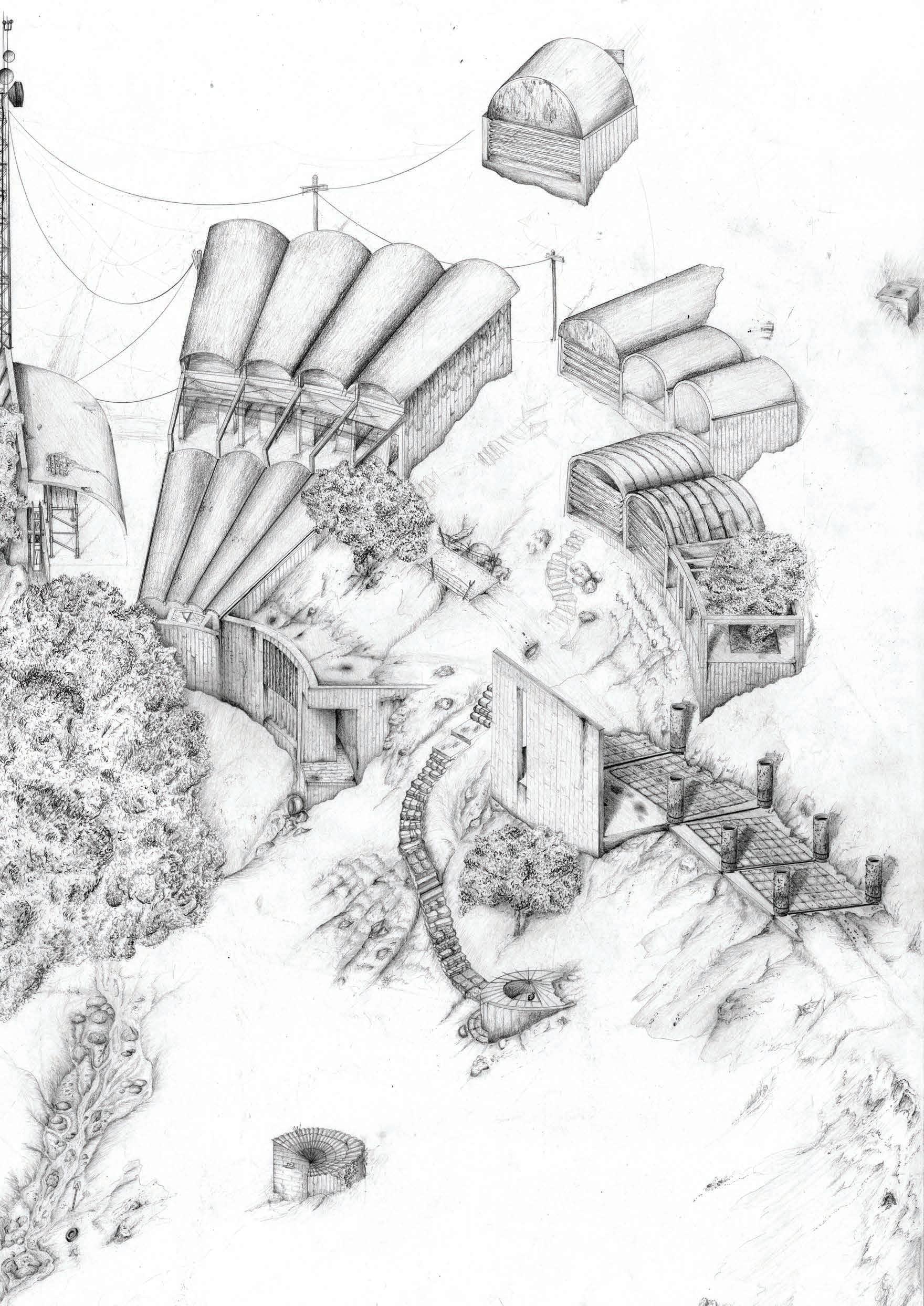
Using the existing site conditions at the base of Bellolampo Valley the architecture will look to be affected and interact with the watercourse, heavily affected by human intervention.


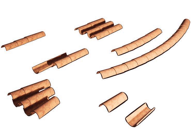
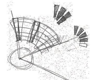
Using a consistent form from the spanish tiles arranged within the site and in different configurations to best fulfil the programme.
Each follie has been placed radially about th central point of the site, similar to that of the main buildings. Each follie holds apparatus to measure climate factors including sun and wind and precipitation. They have been designed to follow vernacular forms and allow the elements to interact necessarily. Each location is determined based on the instruments individual needs.
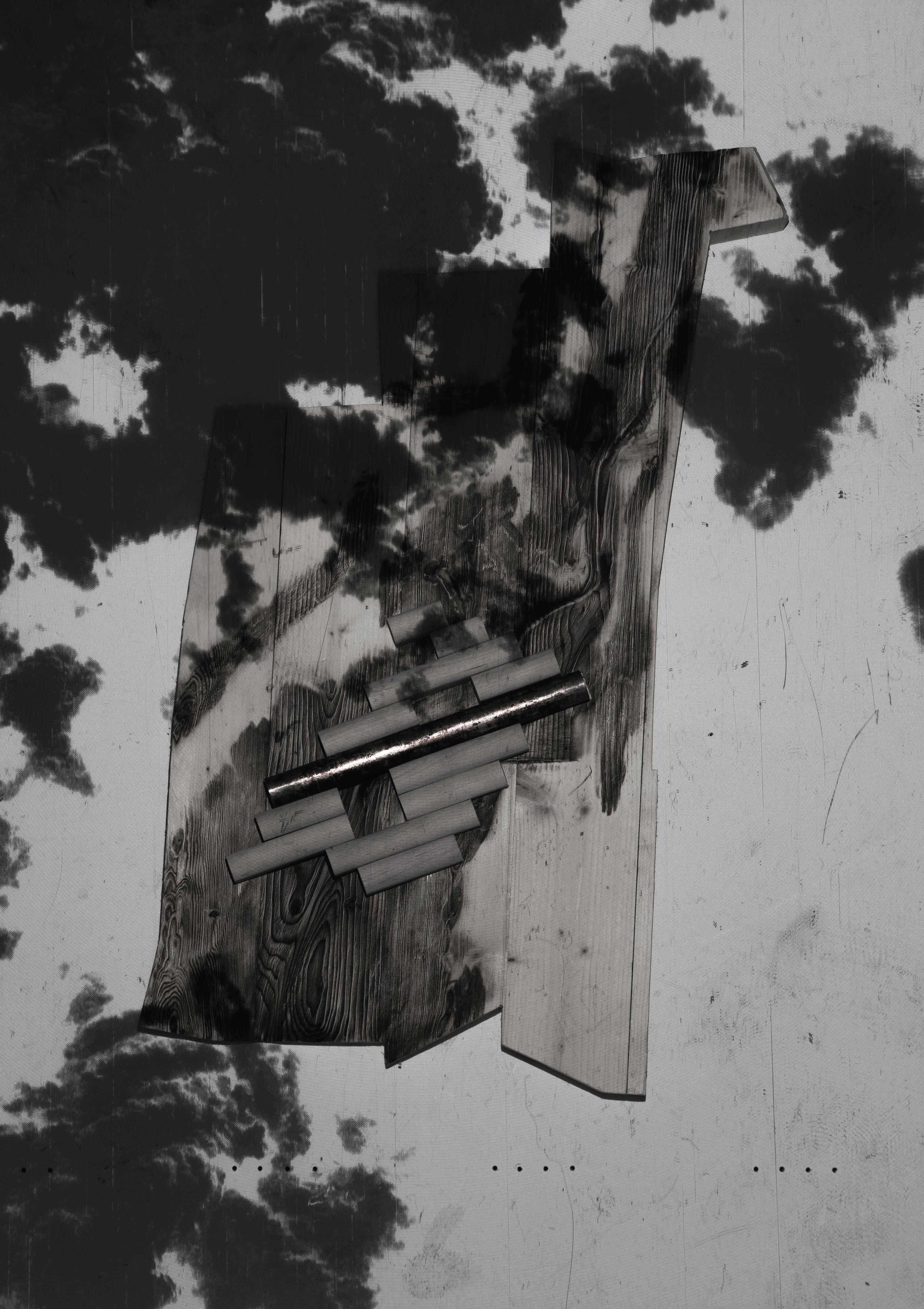
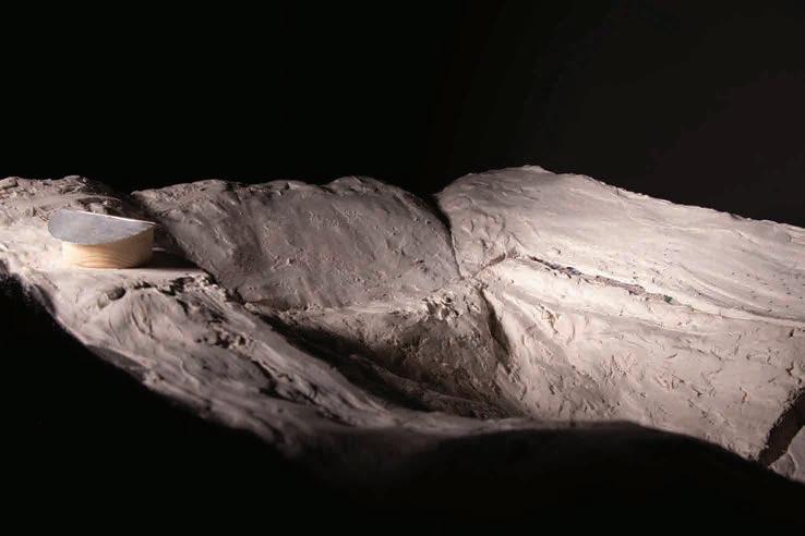
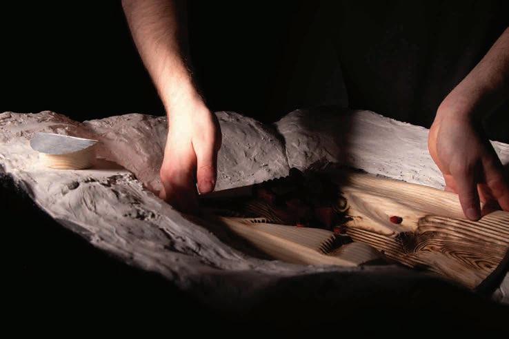
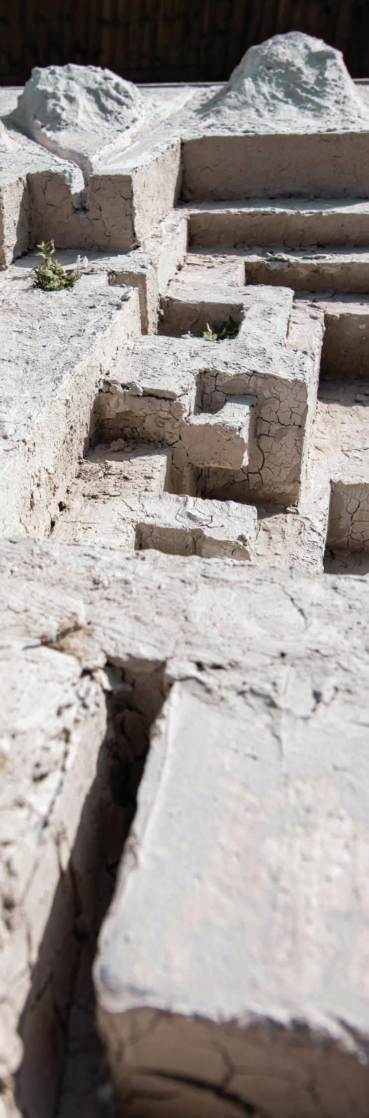
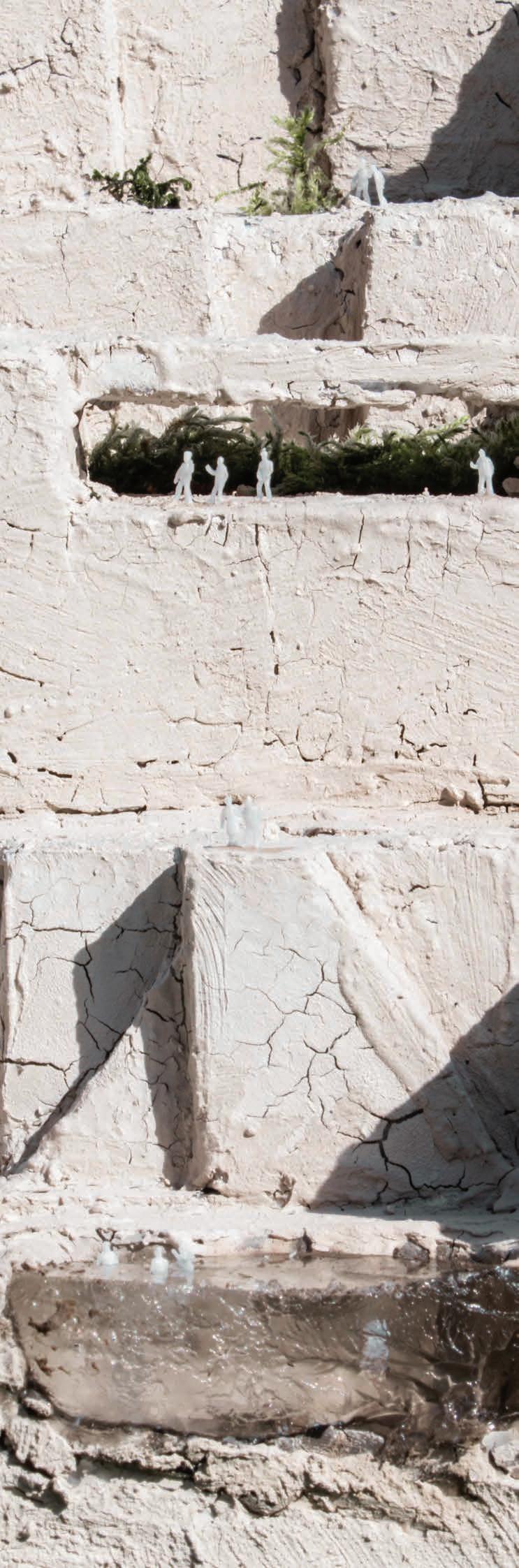
Carving and molding the landscape through plaster and wood before iterating between digital and physical media to negotiate topography.
Masters Project - Year 4, 2022-23
The Bartlett School of Architecture, UCL Architectural Design - Design Realisation
TutorsIsaie Bloch, Riccardo Carvalho de Ostos
Technical TutorsRobert Haworth, Nick Ling, Dr. Michael Woodrow
Methods - Rhino, V-Ray, Twinmotion, Model making, Hand sketching, Photoshop, InDesign, Illustrator, AutoCAD
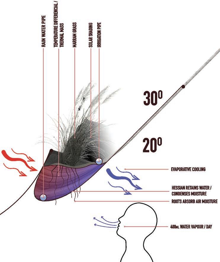
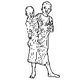
Positioned in the Libyan Desert far from any permanent society the outpost offers a break along the Northward heading migration route from South Sudan. Due to the forced displacement of these people and their dignity stripped by authorities and traffickers alike the outpost aims to provide spaces for its inhabitants to engage in a more normal life whilst awaiting the conditions to be appropriate for Mediterranean crossings.
The brief of the project was contextual futurism. First looking at futuristic literature and film to extract a critical issue. In the case of this project, the displacement of native people in ‘Dune’ was explored and a modern day derivative was found. The global refugee crisis, specifically in the harsh arid climate of the Sahara Desert. The architecture created then seeks to understand and implement responses to the geographic and cultural contexts of the inhabitants and host nation to promote harmony, creation or disruption in community.
The outpost follows guidance and policy towards refugees in Egypt to not allow settling of migrants due to the strain on existing resources. But also helps to ease and direct the flow to unused land. This is of mutual benefit to the migrants allowing settlement away from the harmful and abusive reach of authority and traffickers.
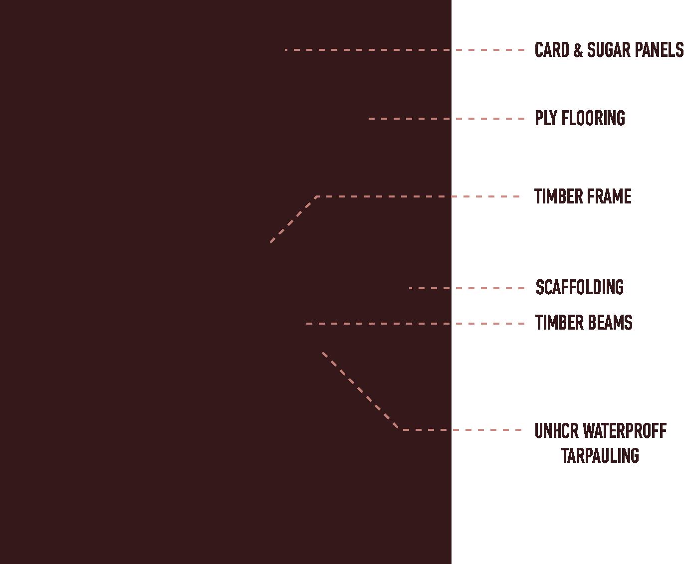
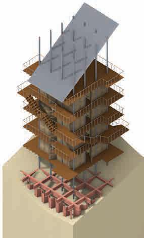
Created of a readily available kit of parts the outpost houses a population of 400 within compact towers that induce natural ventilation and shading and a hub that uses the same parts in a different language. Consisting largely of scaffolding, course natural fabrics and timber panels. Through the establishment of life in the environment the proposal will encourage a manipulation of the landscape and encourage growth in the area, making a naturally evolving concept.


Material Strategy
The design called for a modular system for walls that could:
• Easily be transported, handled and installed.
• Be made from recycled materials and possible to bio-degrade after use. Have good quality thermal and acoustic insulation.
Inspired by the material qualities of GRP and the principles of densified waste as a building material, a bio-composite was designed to meet these criteria.
The panels are made up of recycled cardboard mulch, and a sugar and water solution. The materials are mixed together and set under pressure in a mould using the heat from the sun. The cardboard becomes impregnated with the crystalline structure of the sugars that sets hard and is reinforced with the card fibres. The material is energy efficient, safe and scalable to produce and light, and durable to use.
PROJECT TITLE: OUTPOST PROTOTYPE
DRAWING TITLE: L 03 FLOOR PLAN
PROJECT LOCATION: QATTARA DEPRESSION
DRAWING SCALE: 1:200 A2


PROJECT TITLE: OUTPOST PROTOTYPE
DRAWING TITLE: TOWER SECTION
PROJECT LOCATION: QATTARA DEPRESSION
DRAWING SCALE: 1:100 A3
PROJECT TITLE: OUTPOST PROTOTYPE
DRAWING TITLE: TOWER FLOOR PLAN
PROJECT LOCATION: QATTARA DEPRESSION
DRAWING SCALE: 1:50 A3
Awards
Sustainability in Practice
Carbon Literacy
Bachelors Project - Year 3, 2020-21
Tutor - Gabor Gallov gallov.gabor@ntu.ac.uk
Nottingham Trent University
Studio - Context - Environment and Technology
Methods - Physical model making, hand drawing and sketching, diagramming using ProCreate, manipulation of images and renderings in Photoshop, Orthographic drawings using AutoCAD, digital 3D modelling using SketchUp and rendered in V-Ray.
A civic bath carved in the landscape. Sustainable through the materials of its construction and it’s interaction with society. Location -Nottingham Victoria Embankment.
This project aims to illustrate how locality is represented within architecture, specifically through use of materiality. Locality is a combination of the Zeitgeist and Genius-Loci embodying the physical, environmental, and socio-political contexts, of the place.
The baths are a civic space connected to the geographic and social context through materiality, function and form. The importance of locality is in creating a deeper connection between the user and the architecture provoking emotions and memories that make the atmosphere a discovery whilst remaining familiar.
This exploration is done through the restructured use and opinion of the familiar and ubiquitous material, Clay.
The baths are designed wholly around the immersive experience of the body. Through the tactility of the materials. Materials that echo the sounds of movement in and around the spaces, juxtaposed by the quiet of isolation.
Anderson Orr Architects Ltd
Placement year 2021-22
Supervised by Neil Perry n.perry@andersonorr.com
Methods - Revit, Hand Sketching, Photoshop, Procreate. Stage 3 - Pre-Planning.
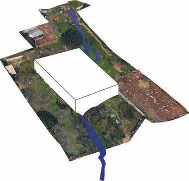
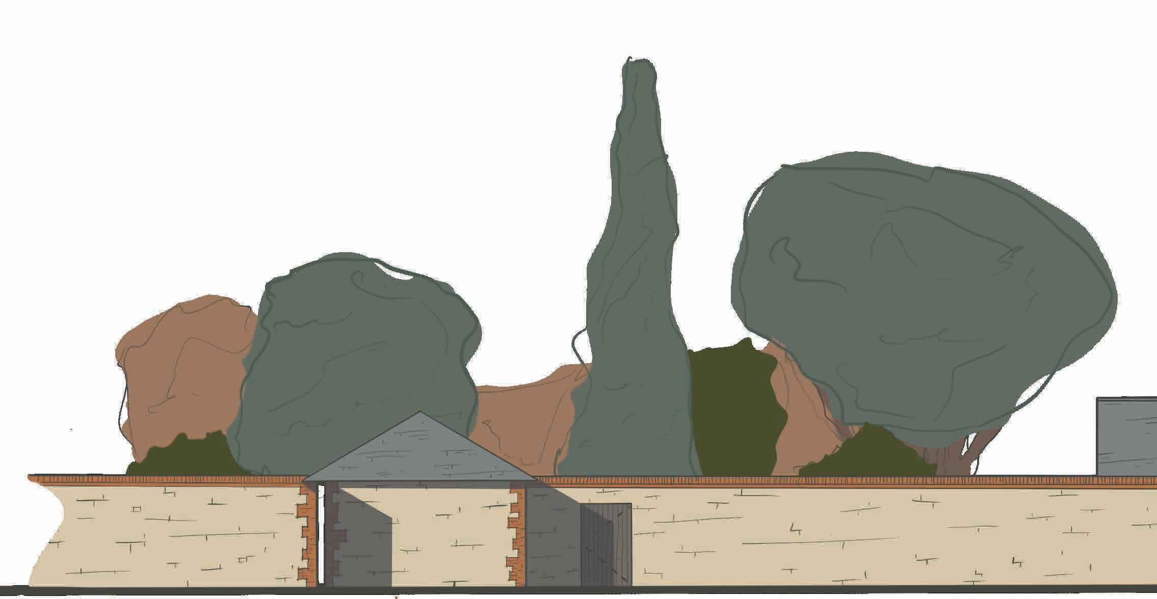
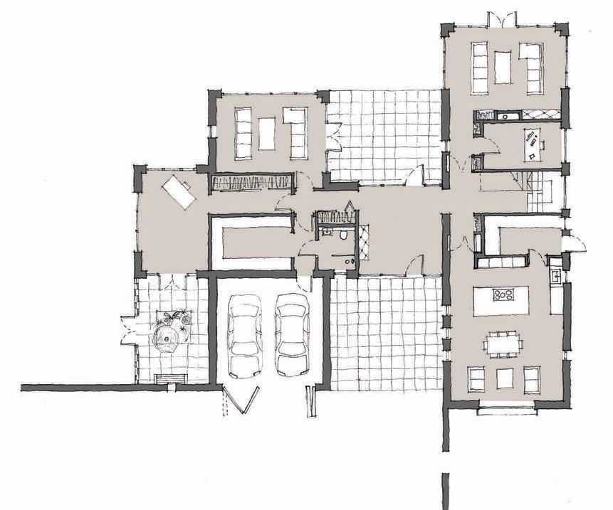
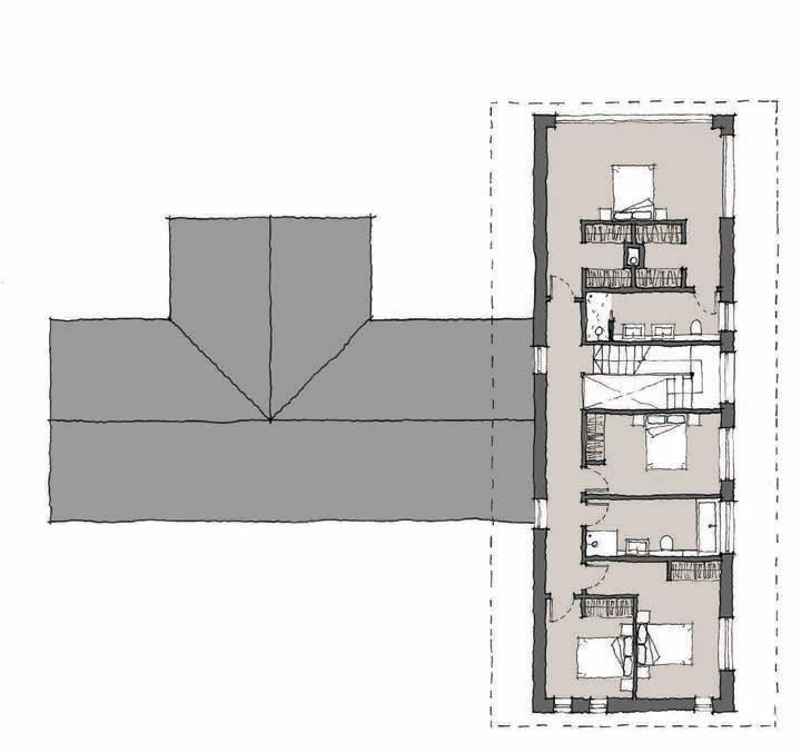
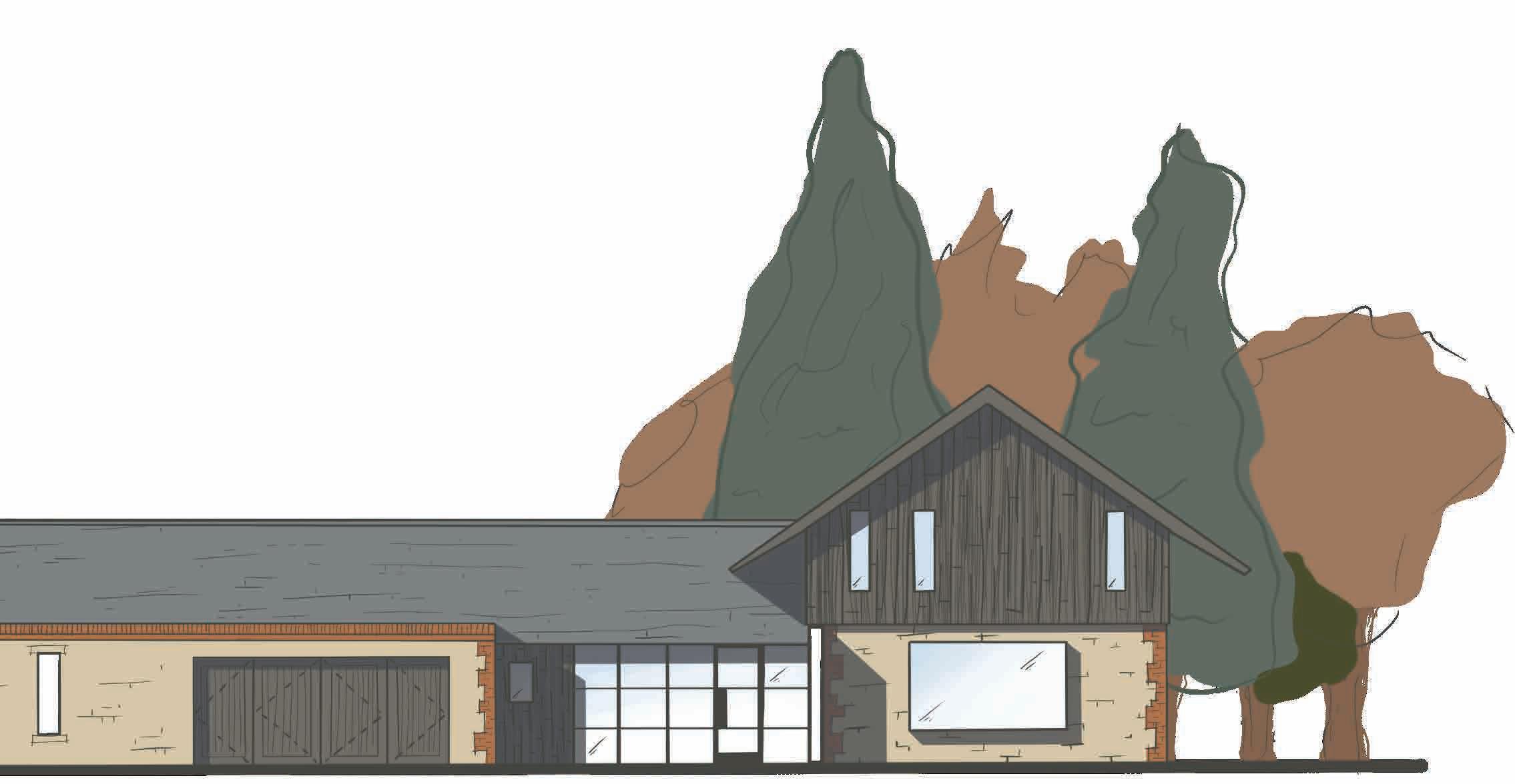
Circa. 400 sqm High quality bespoke home in South Oxford for a private client.
The brief is to create a new detached dwelling on the land to the northwest of the existing property. The property is in the region of 40004500ft² and was designed with the client’s aging situation in mind, with a view to potentially sell the property within a 5-10 year period.
The proposed property needed to be seen as a subservient ‘house in the woods’. It should not compete visually or in scale with the existing dwelling, and while modern detailing was embraced the design aimed not to be ‘boxy’ or monolithic in its composition. Strong traditional forms were appealing to the client, with barn / agricultural style gables and simple roof forms.
The properties orientation aims to retain as many of the existing trees on site as possible, and focuses on views both within the site itself and out through to the wider landscape.
Anderson Orr Architects Ltd
Placement year 2021-22
Supervised by Neil Perry n.perry@andersonorr.com
Methods - Revit, Hand Sketching, 3D printing, SketchUp, Photoshop, Procreate.
Stage 3 - Planning application submitted.
Circa. 25 sqm High quality extension in North Oxford for a private client.
The client asked for a range of options to be proposed that would both enhance the existing aesthetic of the Oxfordshire, arts and crafts, home, as well as improving the usability of the ground floor plan.
As part of delivering this criteria we explored numerous avenues of plans and elevations that would compliment and creatively overcome the issues of the existing property.
The proposals ranged from traditional to contemporary and organic to geometric. Aiming to capitalise on volume and connectivity between the main house and the gardens.
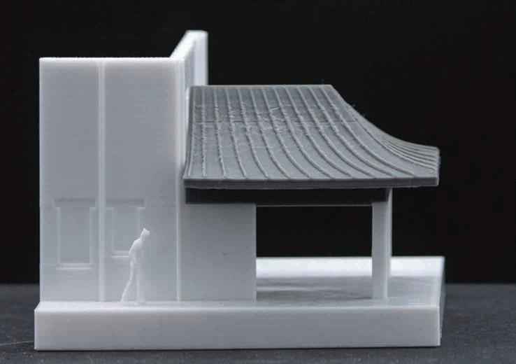
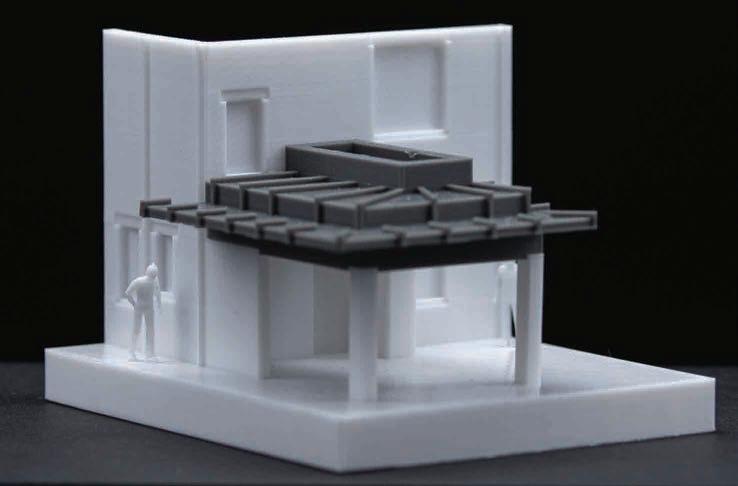
Initial sketch design iterations drawn by hand in isometric plan, and elevational views to allow the client to better understand the form before seeing the 3D printed model.