PORTFOLIO
YUHAO ZOU
p1
Toronto, Ontario | Academic Project | Duration One Semester
VOICE OF THE FOREST
THORNCLIFFE PARK URBAN DESIGN STUDY p2
Toronto, Ontario | Academic Project | Duration Four Weeks
SMYTHE PARK REDESIGN
REES GAEWAY PARK
Toronto, Ontario | Academic Project | Duration One Semester
Toronto, Ontario | Academic Project | Duration One Semester p3 p4
p5
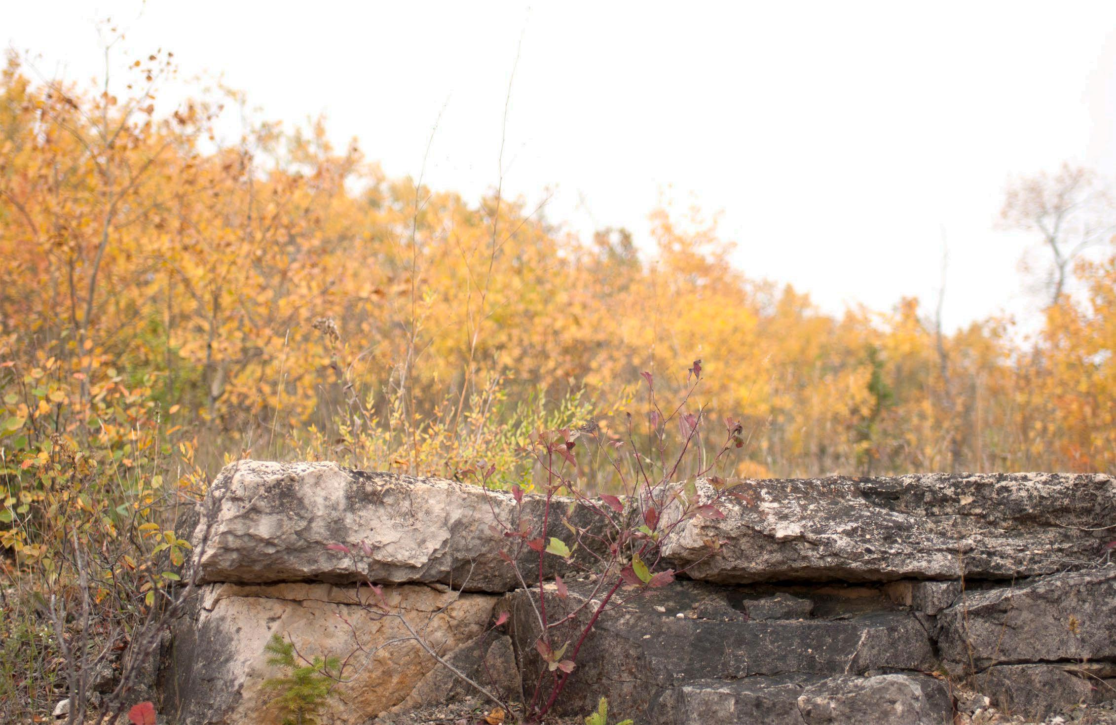
STONY MOUNTAIN QUARRY RECLAMATION p6
Stony Mountain, Manitoba | Academic Project | Duration One Semester
EARTH SCIENCE COURTYARD PLANTING DESIGN
THE BENCH DESIGN COMPETITION
Winnipeg, Manitoba | Personal Project | Duration Two Weeks p7
WARMING HUT DESIGN COMPETITION
Toronto, Ontario | Academic Project | Duration One Week p8
Winnipeg, Manitoba | Personal Project | Duration One Week
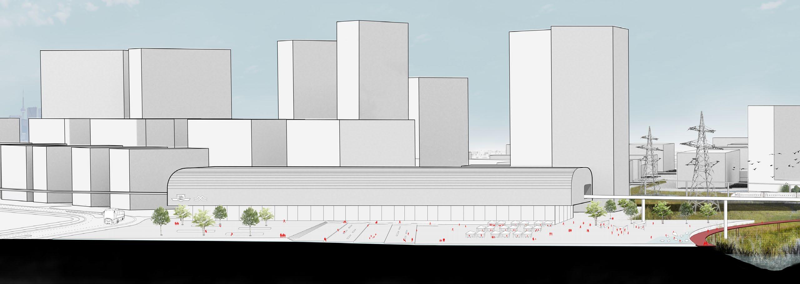
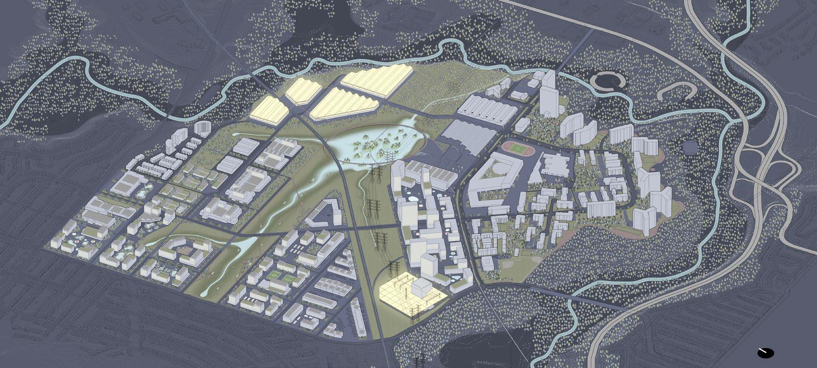
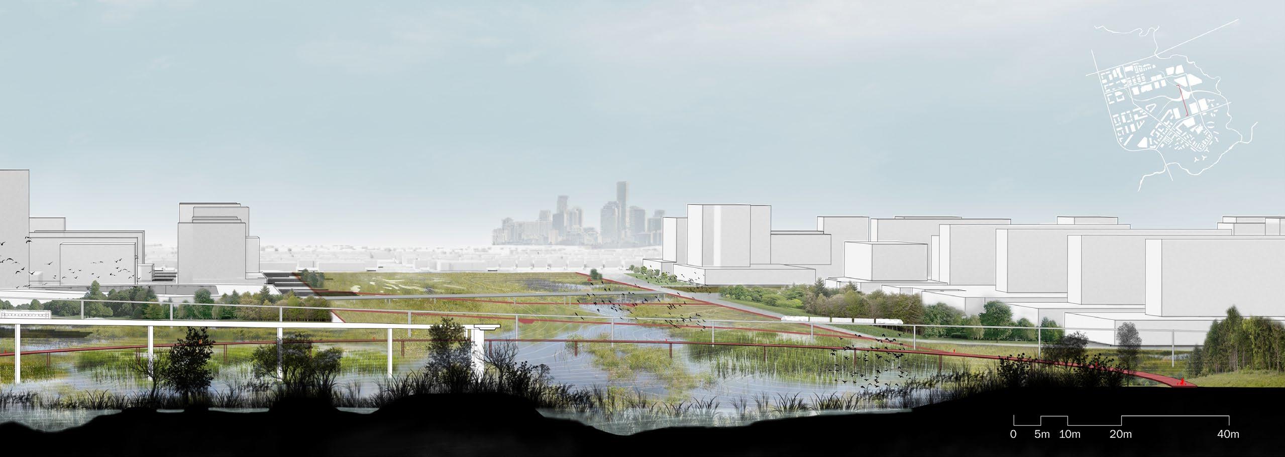
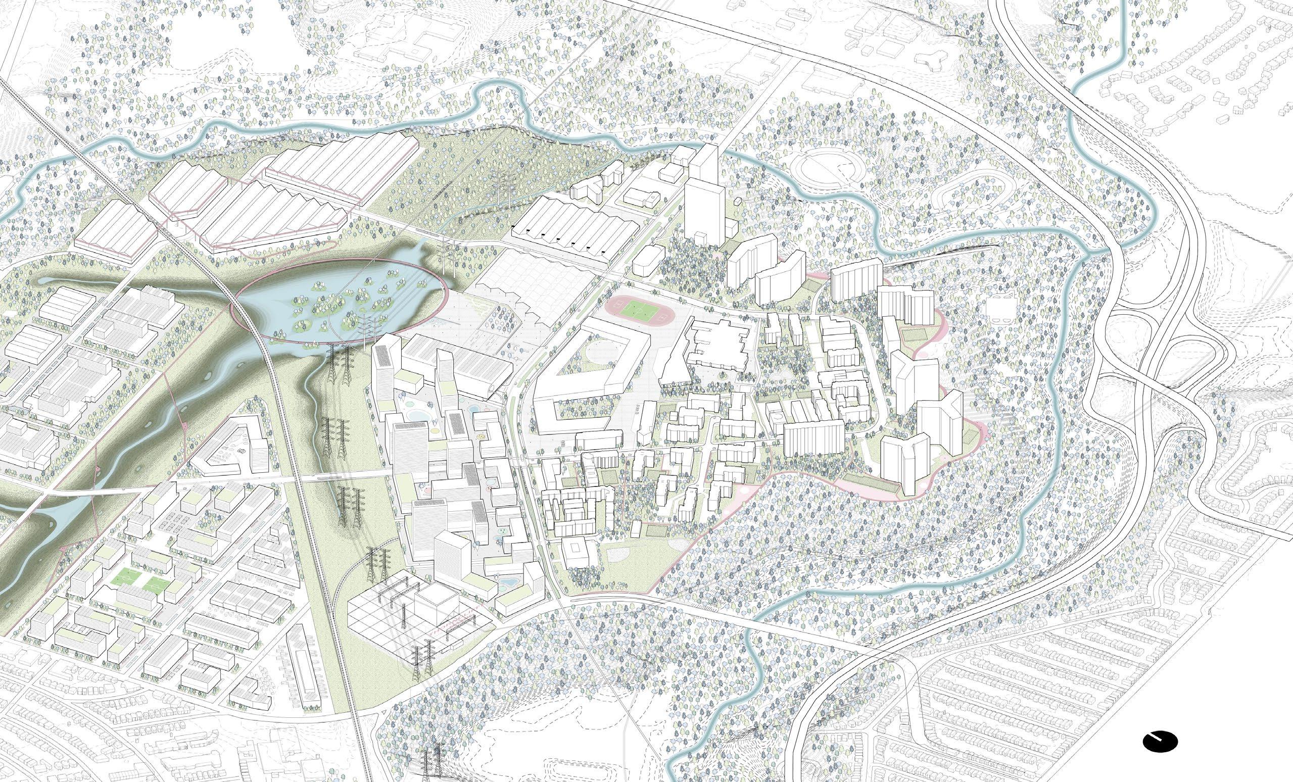
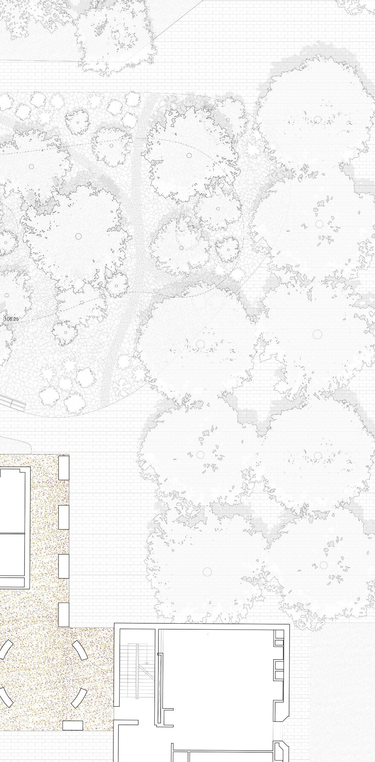
Thorncliffe Park Urban Design Study
Collaborated with Luis Bendezu and Yue Wang
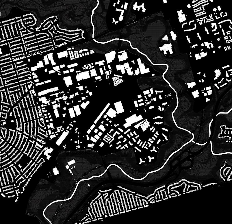
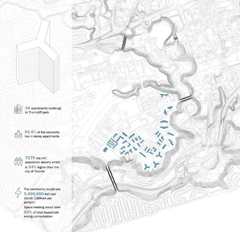
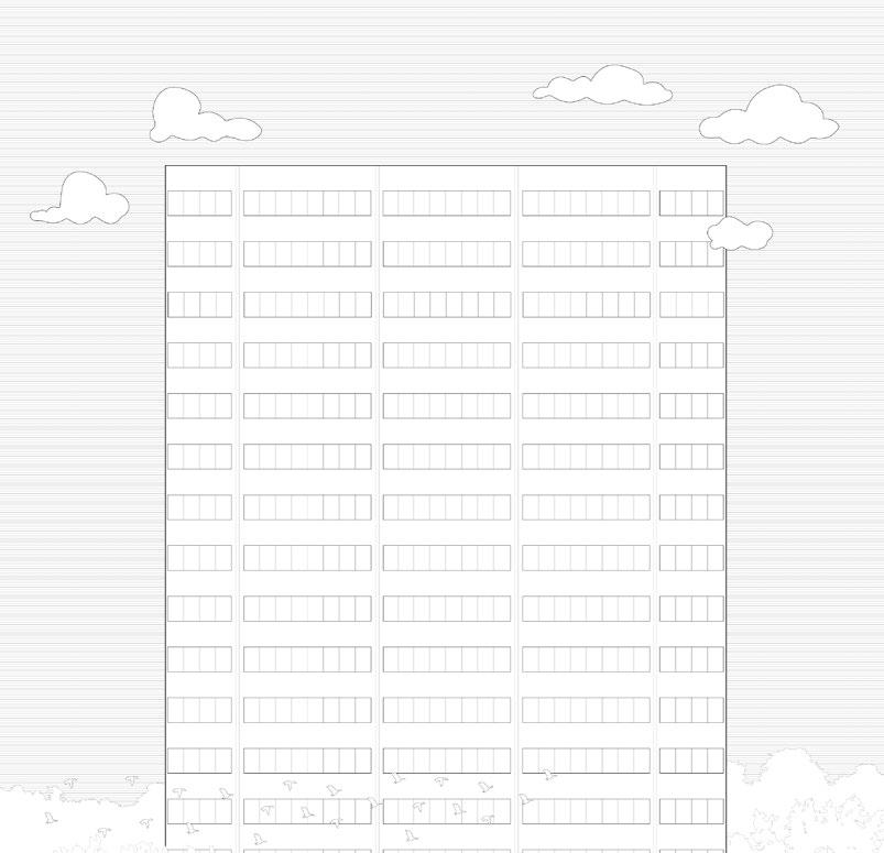
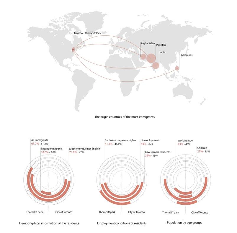
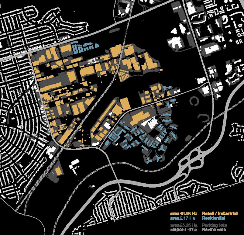
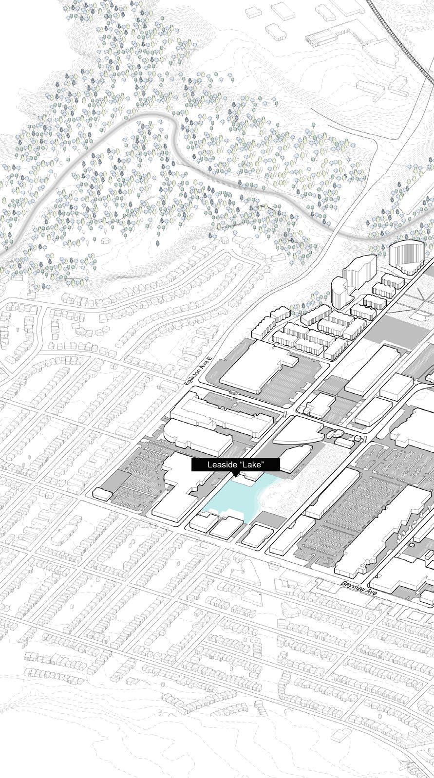
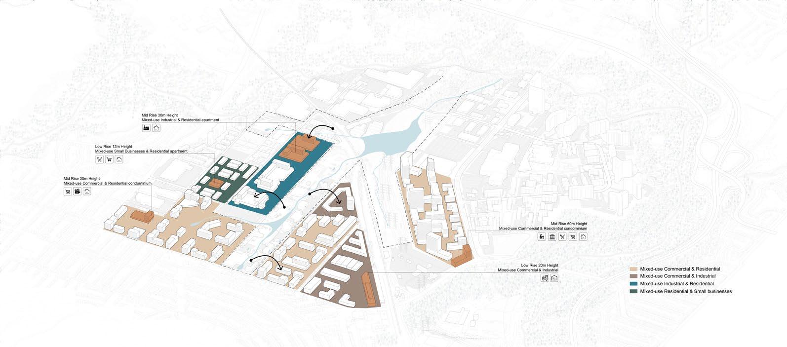
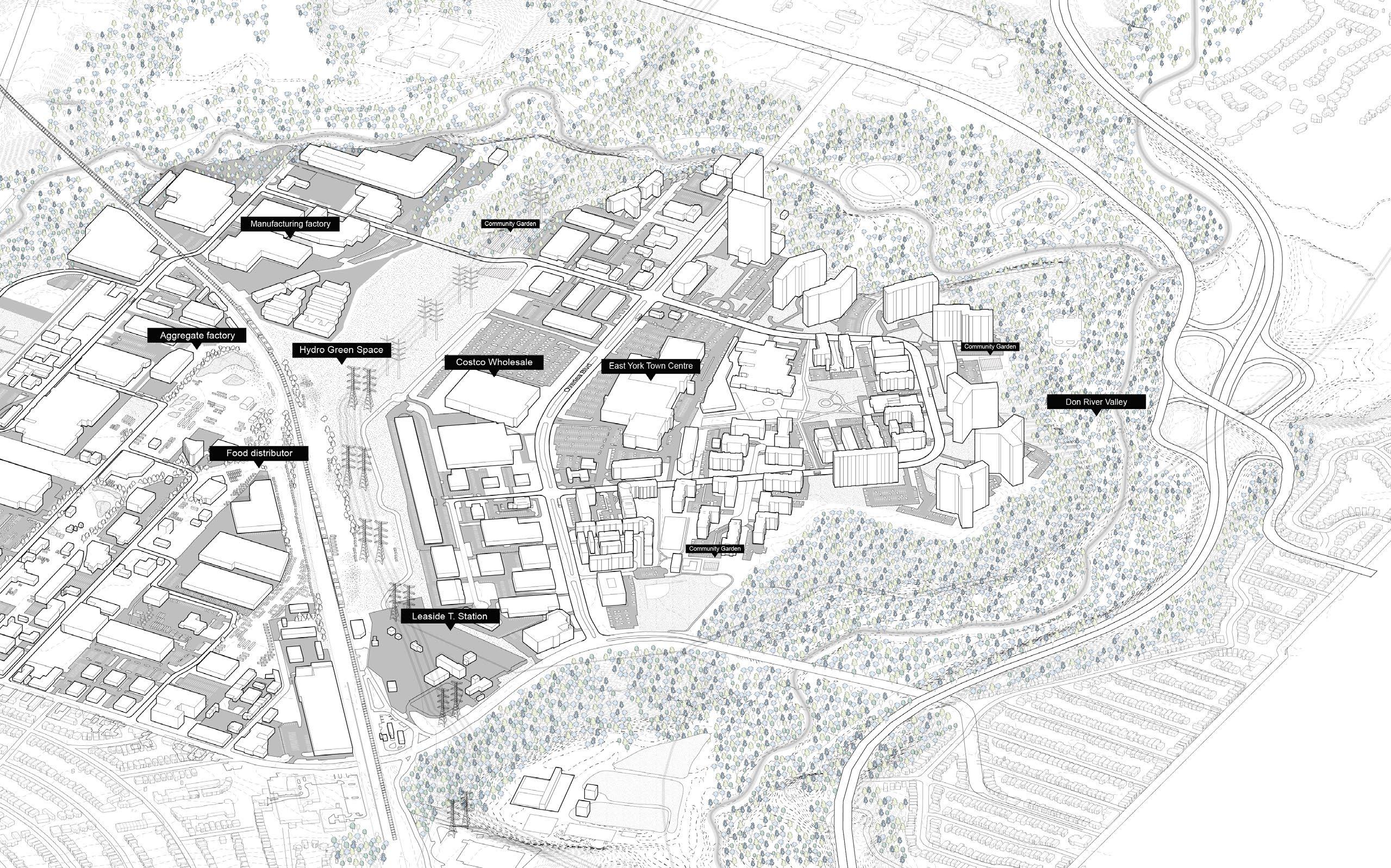
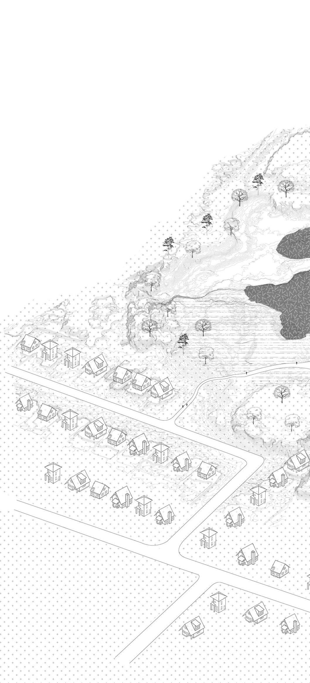
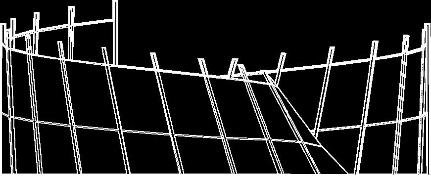
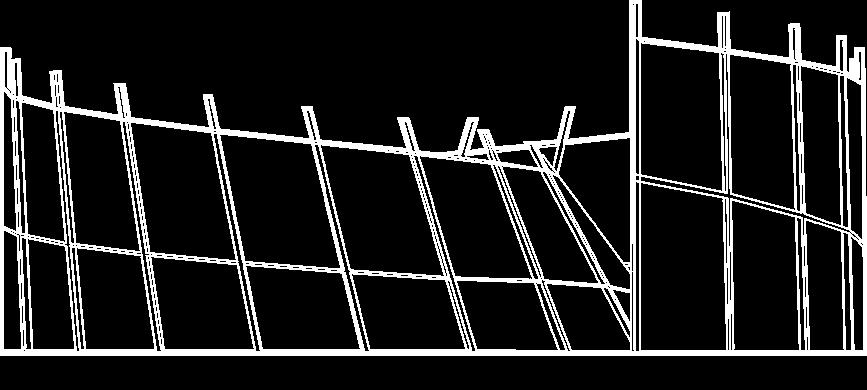
Thorncliffe Park is a low-income neighbourhood with a majority of immigrant population. The neighbourhood is located at the northeast part of Toronto. The project tackles the social, economic, and ecological issues faced by Thorncliffe Park residents. It aims to transform Thorncliffe Park into a selfsustaining neighbourhood by proposing a mixed-use industrial, commericla, and residential development that incorporates economic revitalization and ecological restoration.
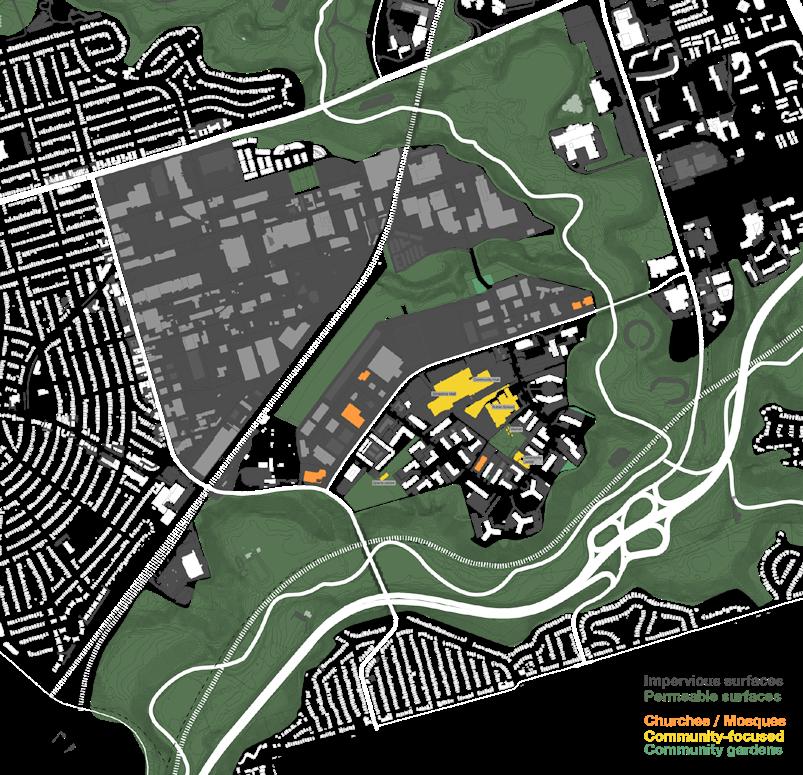
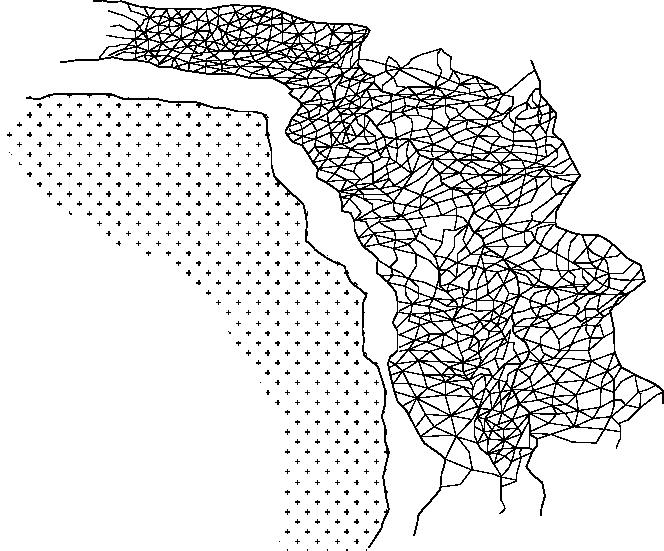
The regional analysis of Toronto reveals that in Thorncliffe Park, there is the highest population density, lowest income level, lowest percentage of canopy cover, highest percentage of impervious surface. As these socioeconomic and environmental issues intertwine, we decided to choose Thorncliffe Park as the study area and further investigate these issues at the neighbourhood scale.
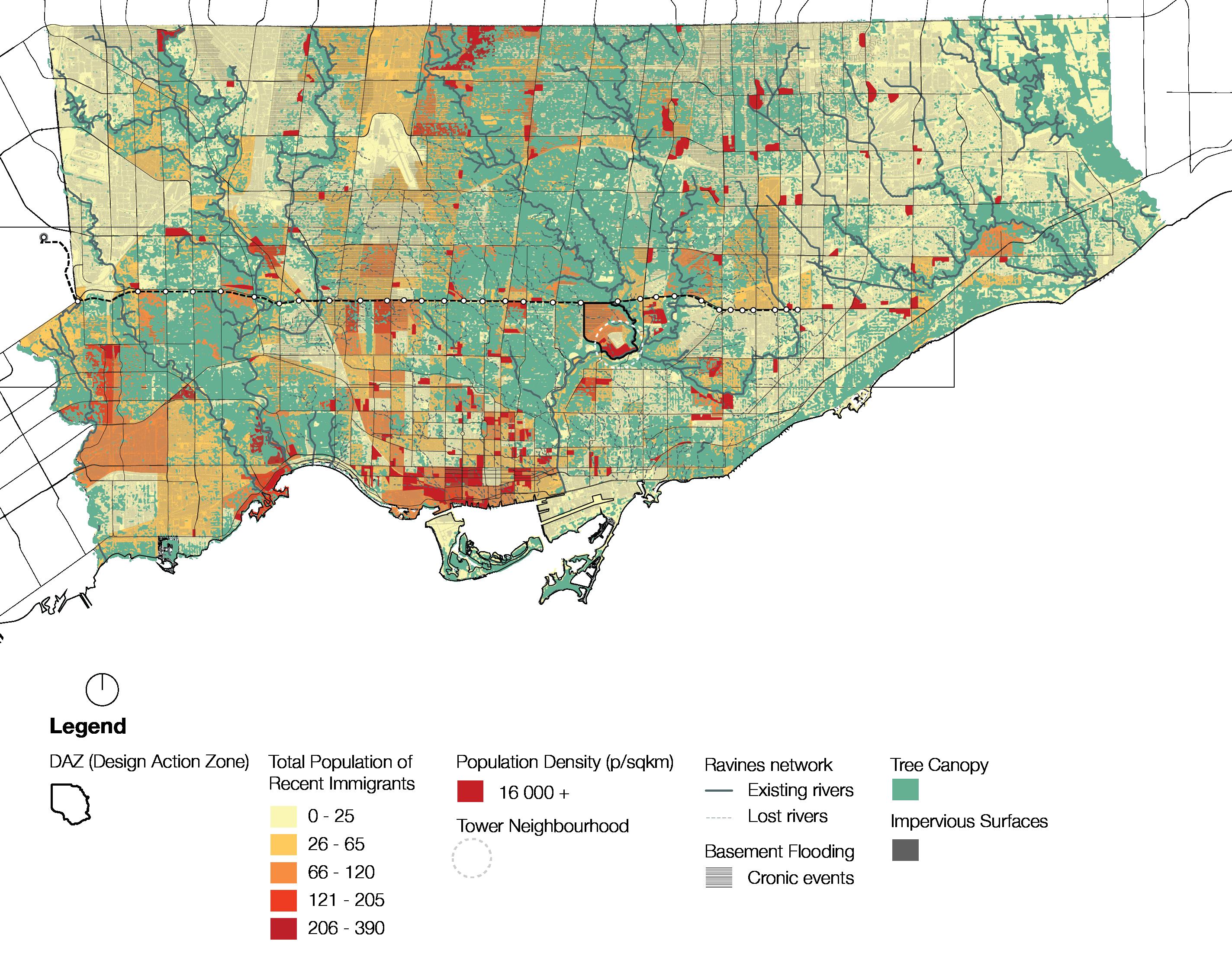
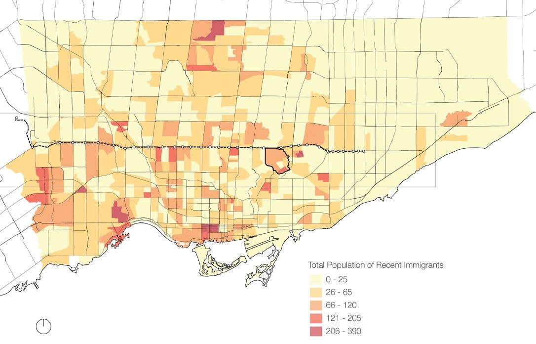
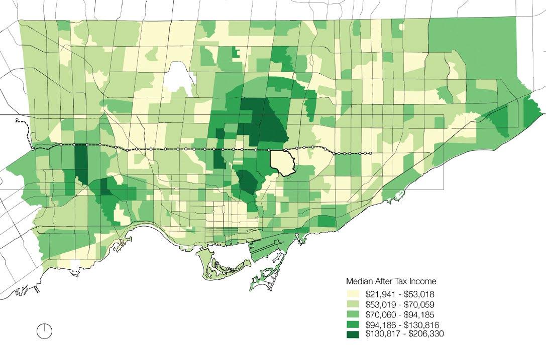
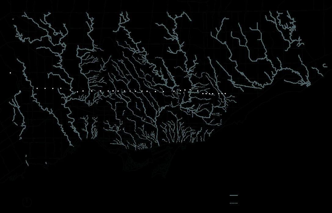
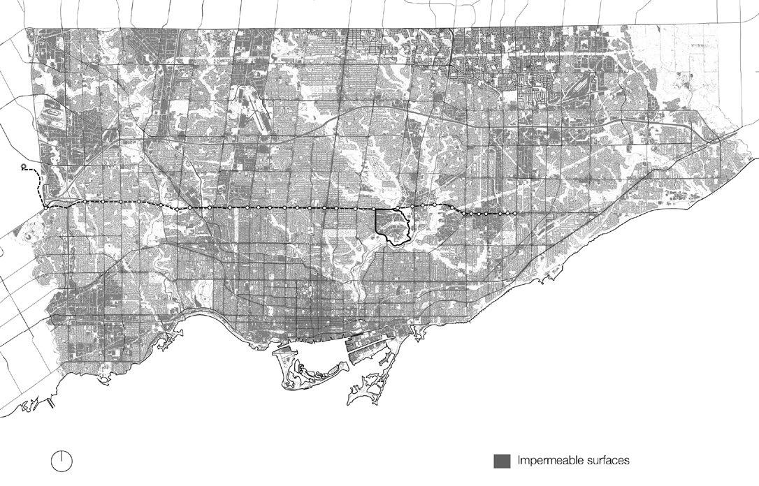
Regional maps of Toronto
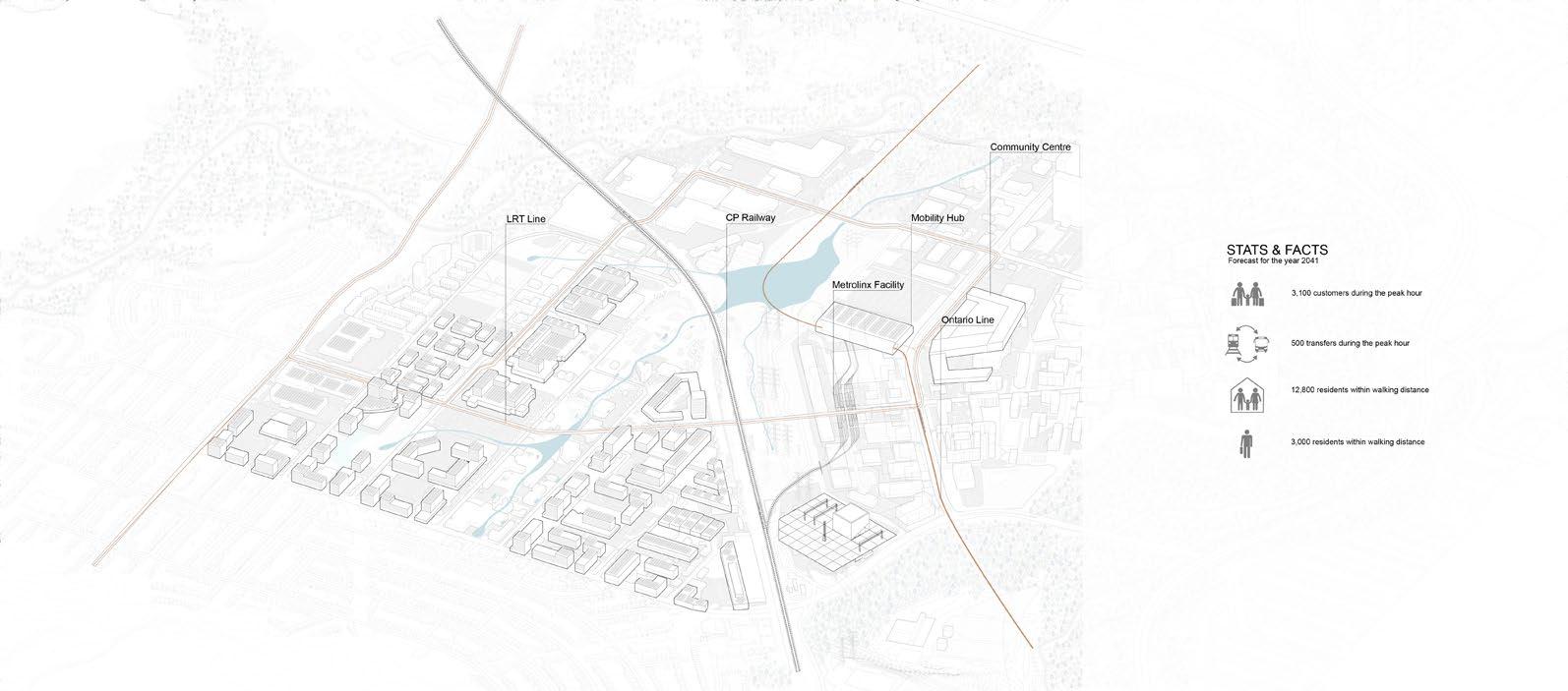
Fragmentation & Infrastructures
Demographic
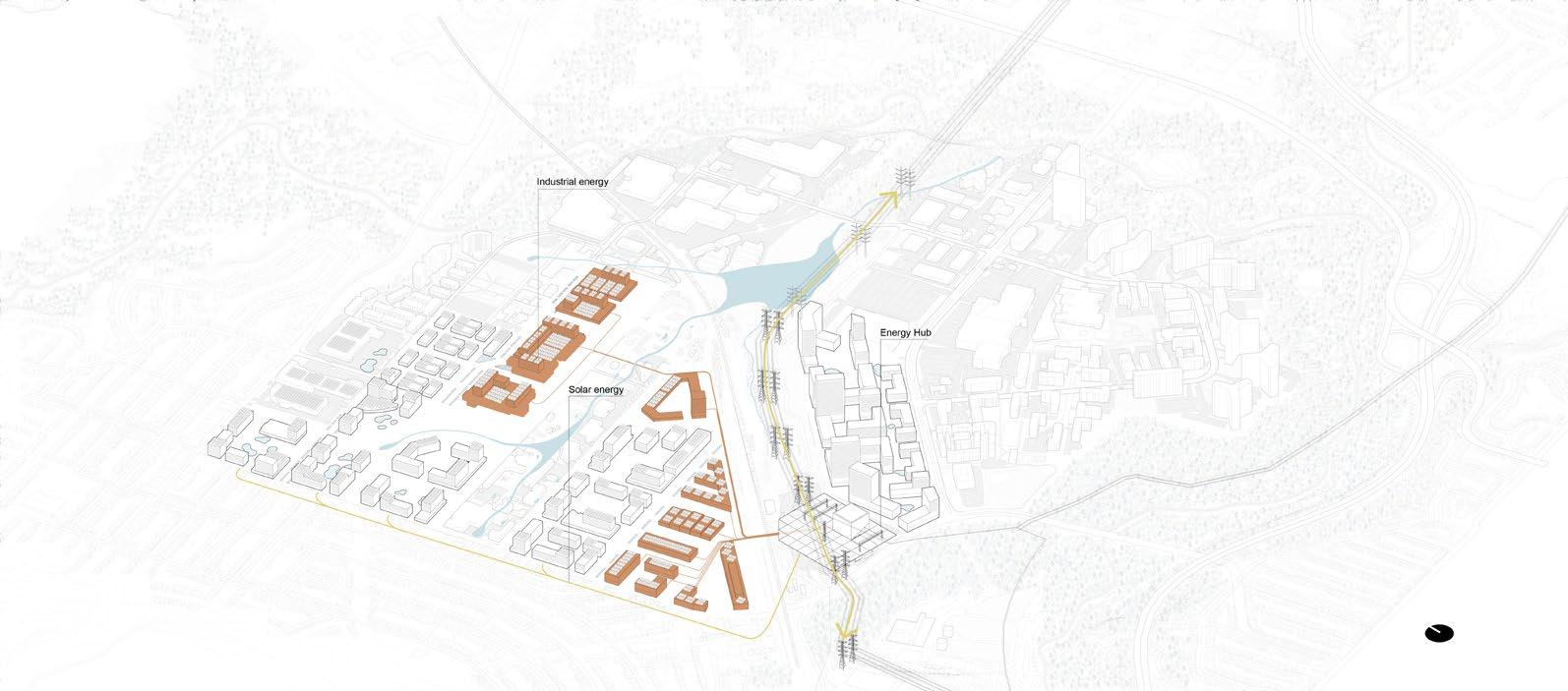
energy
Housing density &
consumption
Ground analysis & public programs
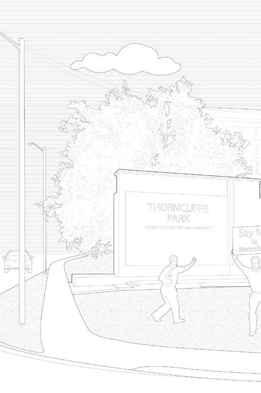
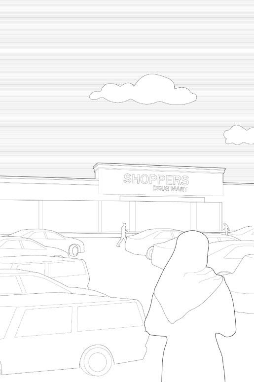
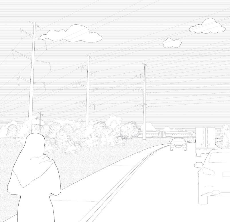
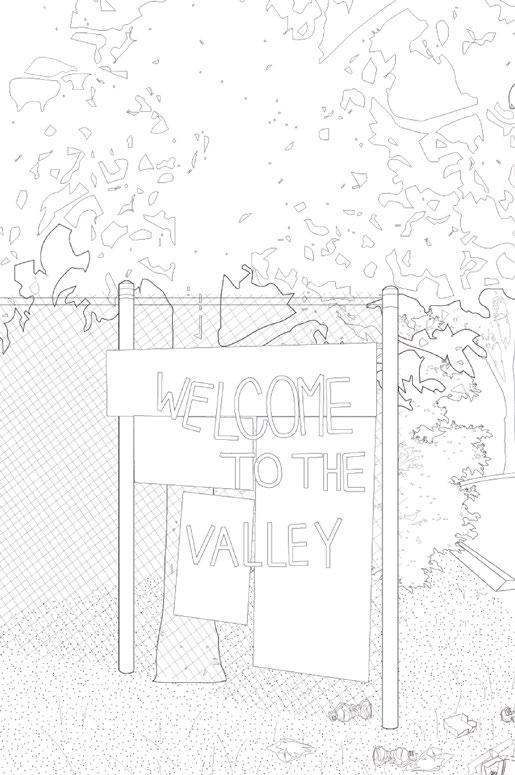
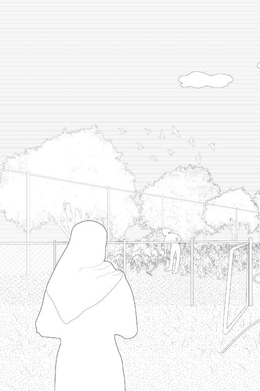
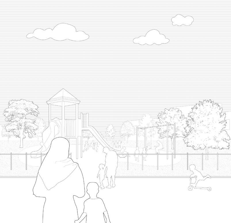
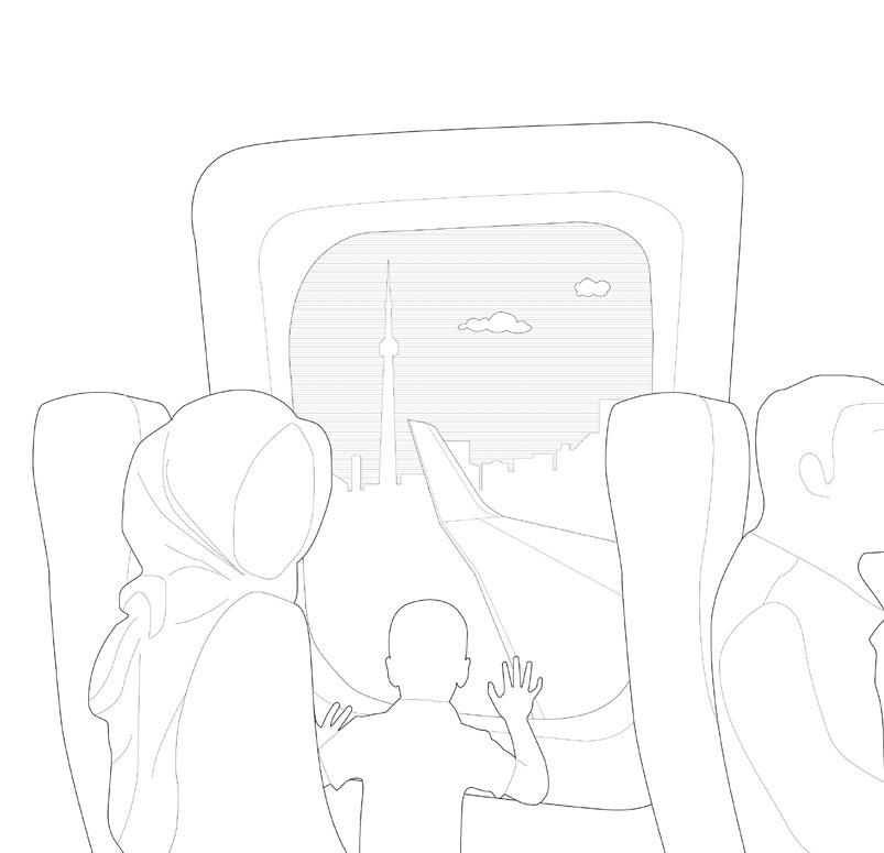
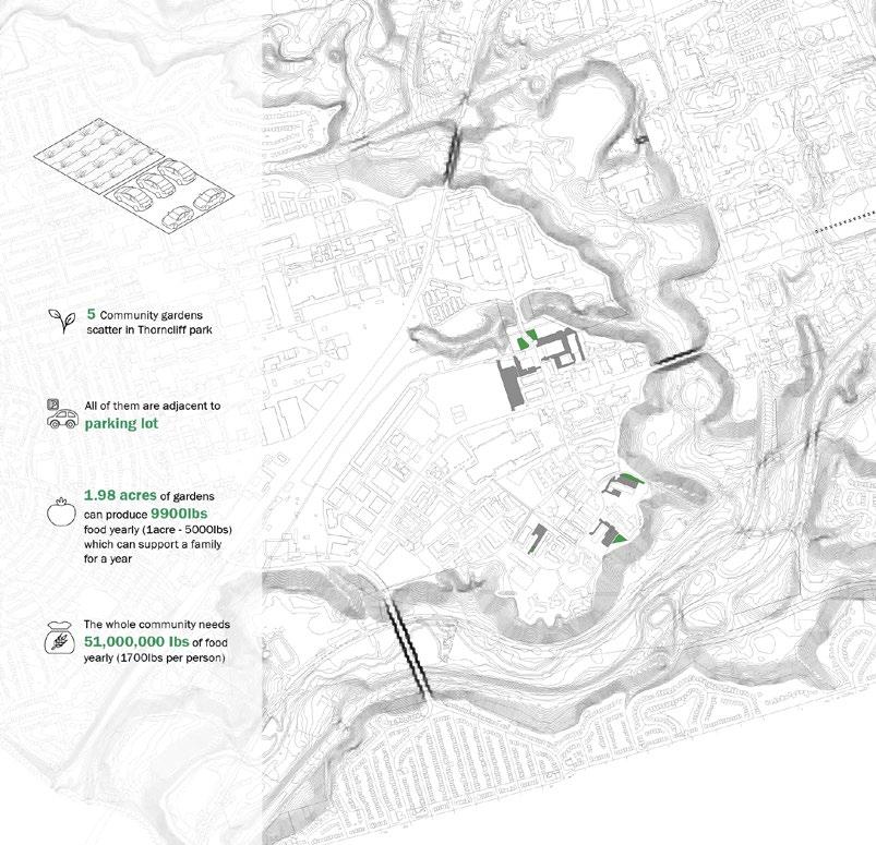
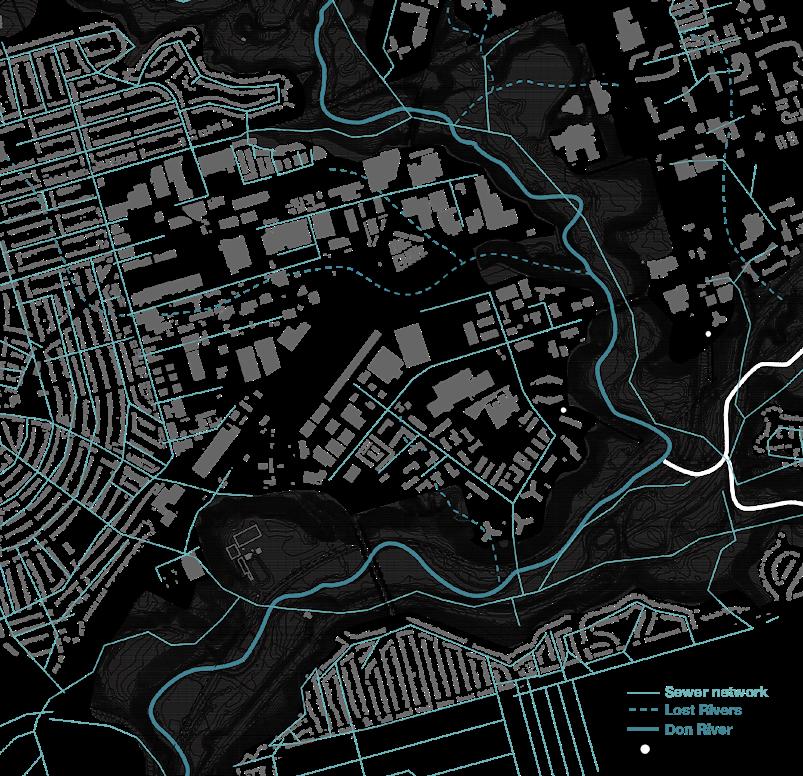
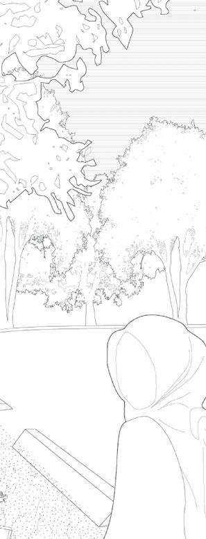
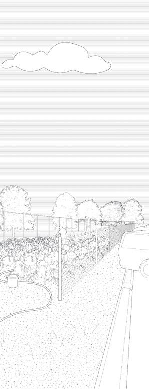
The visual essay depicts the experience of living in Thorncliffe Park through the eyes of an immigrant. Accompanied with mapping, the visual essay further dissects the ongoing social, economic, and ecological predicament exacerbated by the inadequate planning and design in Thorncliffe Park. The occupation of housing is way over its designed capacity, yet there is insufficient public green space, space for community gardens, and playgrounds. There is also a lack of clear access to the ravine. The neighbourhood is designed primarily for vehicles. The fragmentation caused by the existing infrastructures is aggravated by newly proposed railway facility.
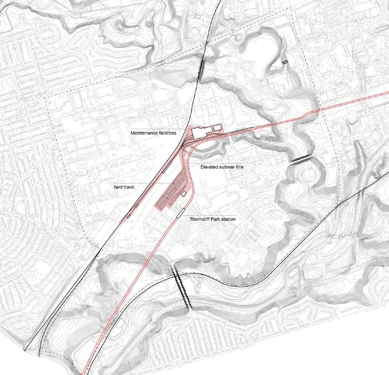
Newly proposed railway facility
Landuse
Disconnection to the ravine
Insufficient community space
Creek restoration
Densification
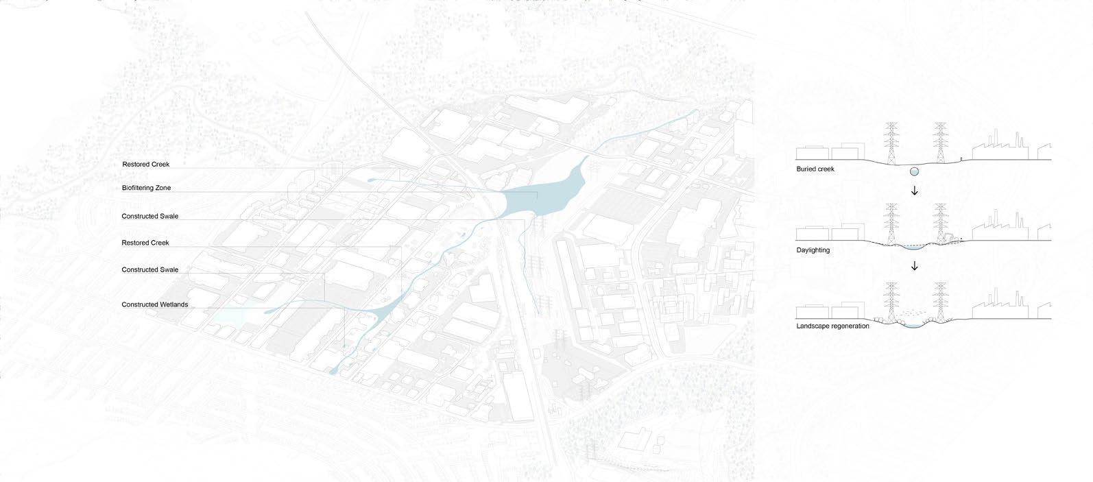
Hydrological network
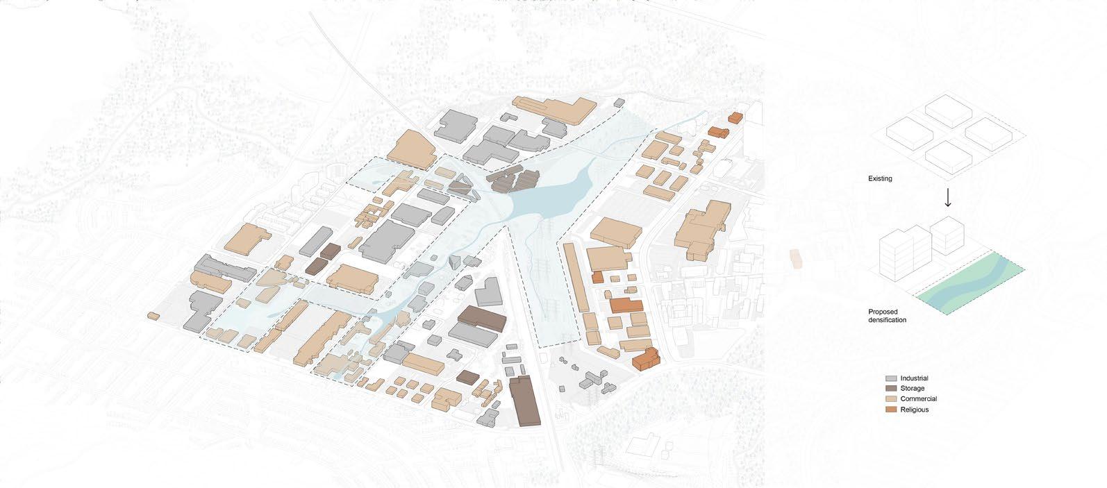 Land swap
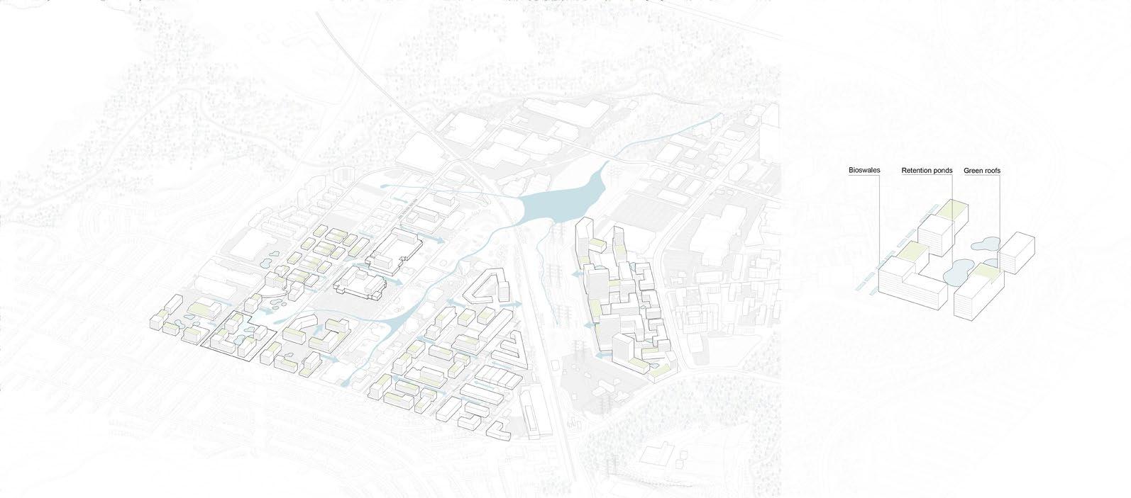
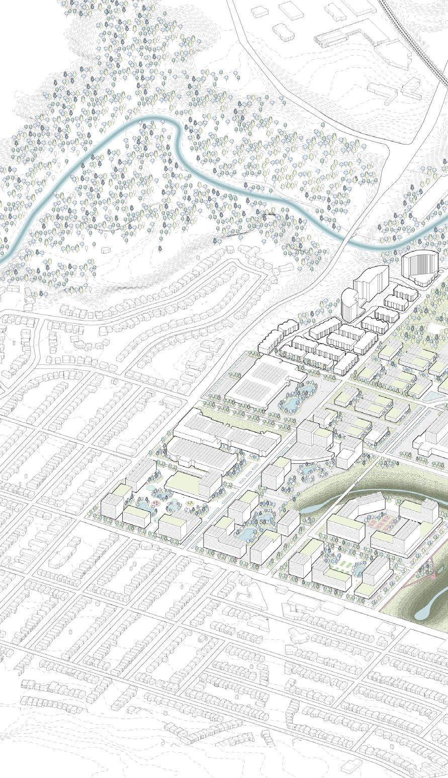
Focusing on water, food, and energy, the project aims to empower the community by effectively reutilizing their infrastructural and natural resources on-site, and transform Thorncliffe Park from a neighbourhood of fragmentation into a community of growth. The axonometric illustrates the existing development in Thorncliffe park, and how each design strategy can be implemented onsite. By reconfiguring the relationships between different infrastructural systems, we envision Thorncliffe park as this new neighborhood of mixed-use high density development with extensive green space. The previous unpleasant infrastructures and the space in between have now become the focal point that unites the neighborhood.

 Axo view - Existing development
network
scene
Energy network Mobility
Night
Axo view - Proposed development Section perspective
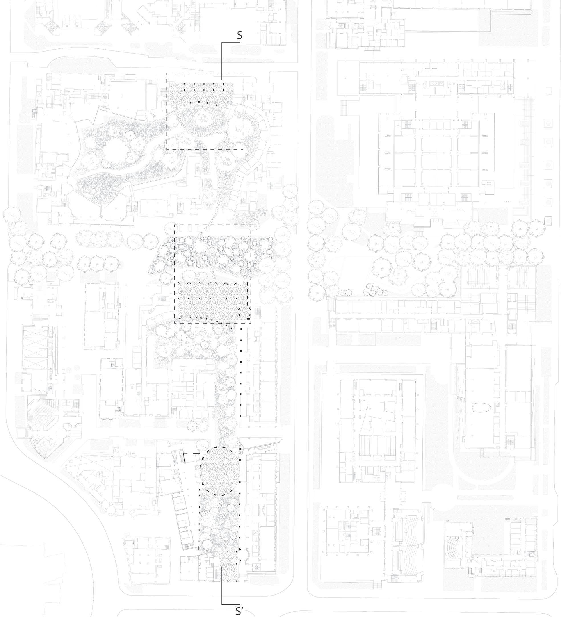
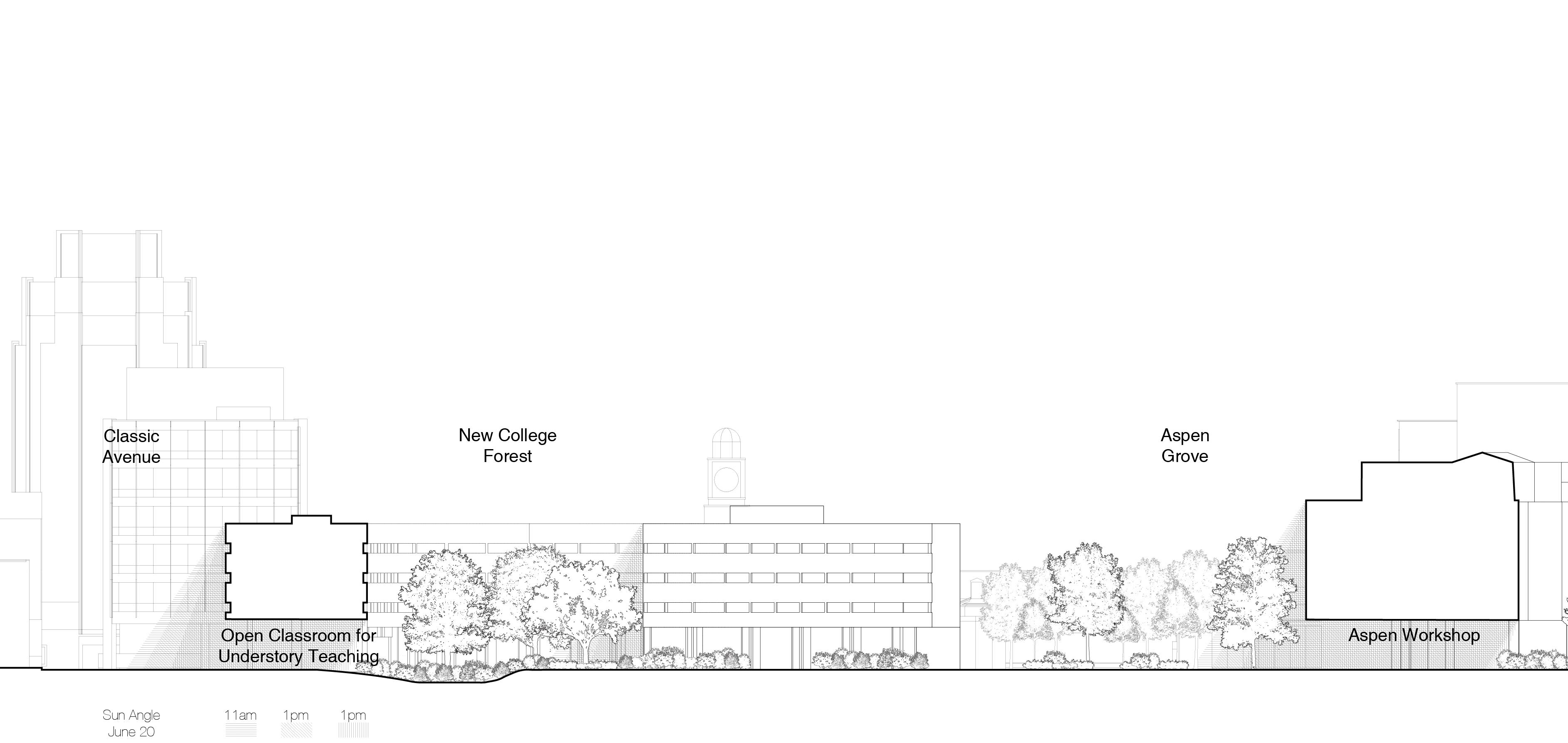
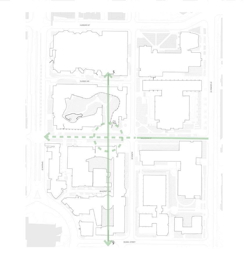
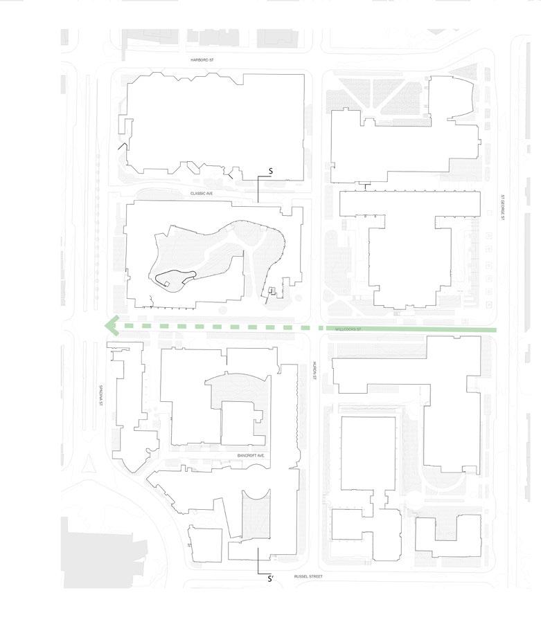
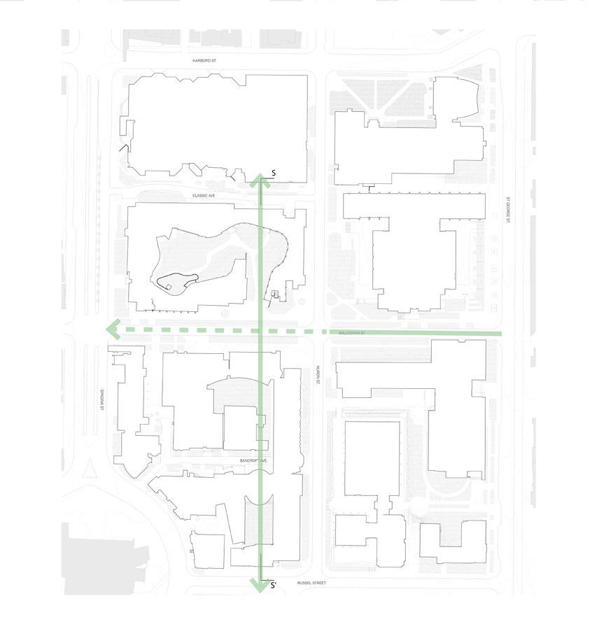
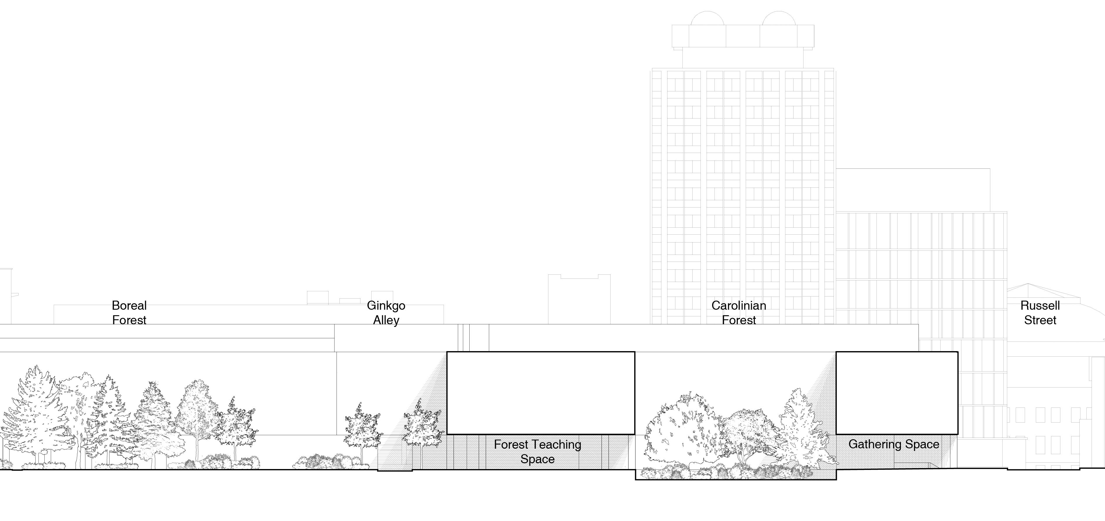
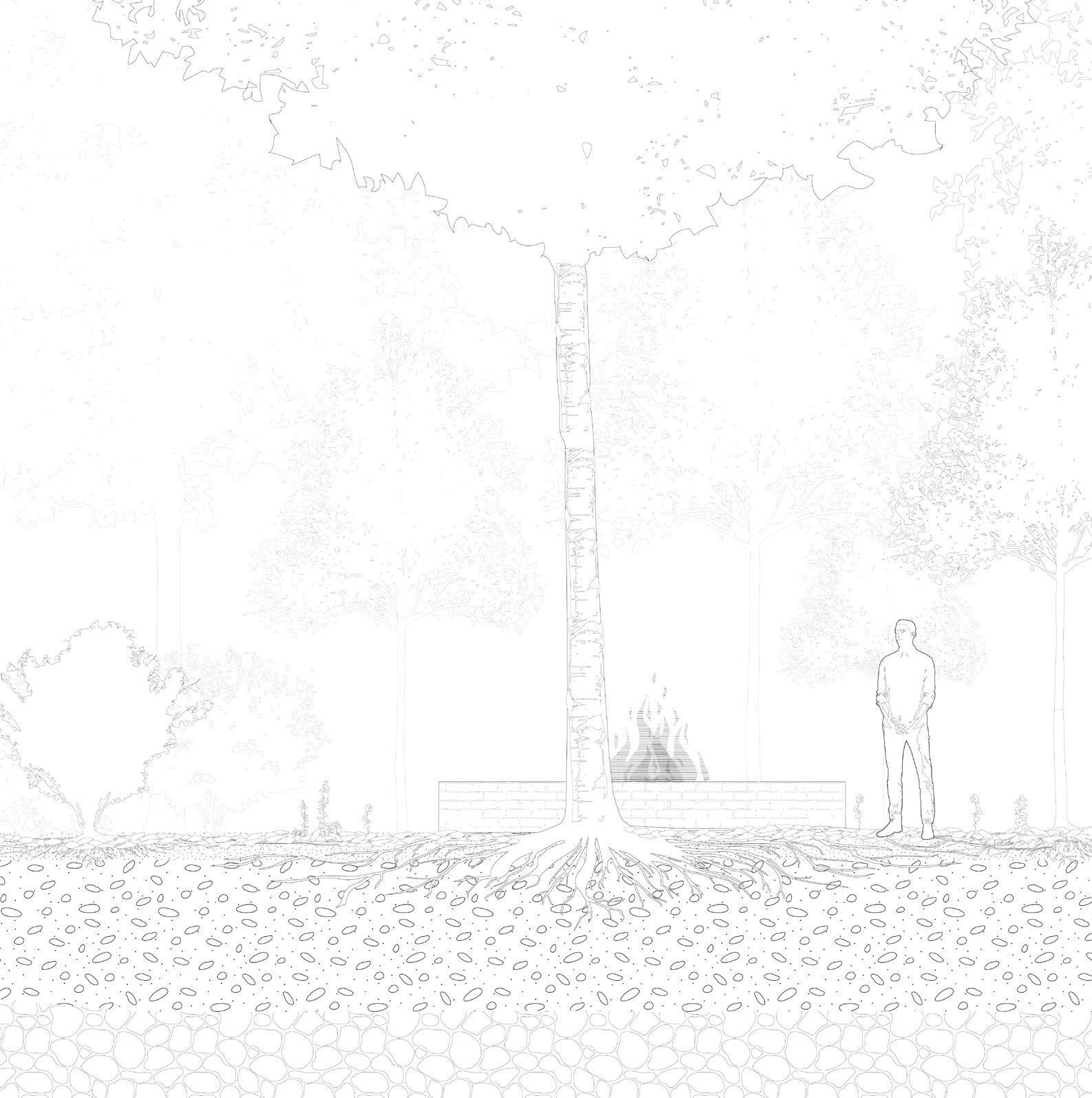
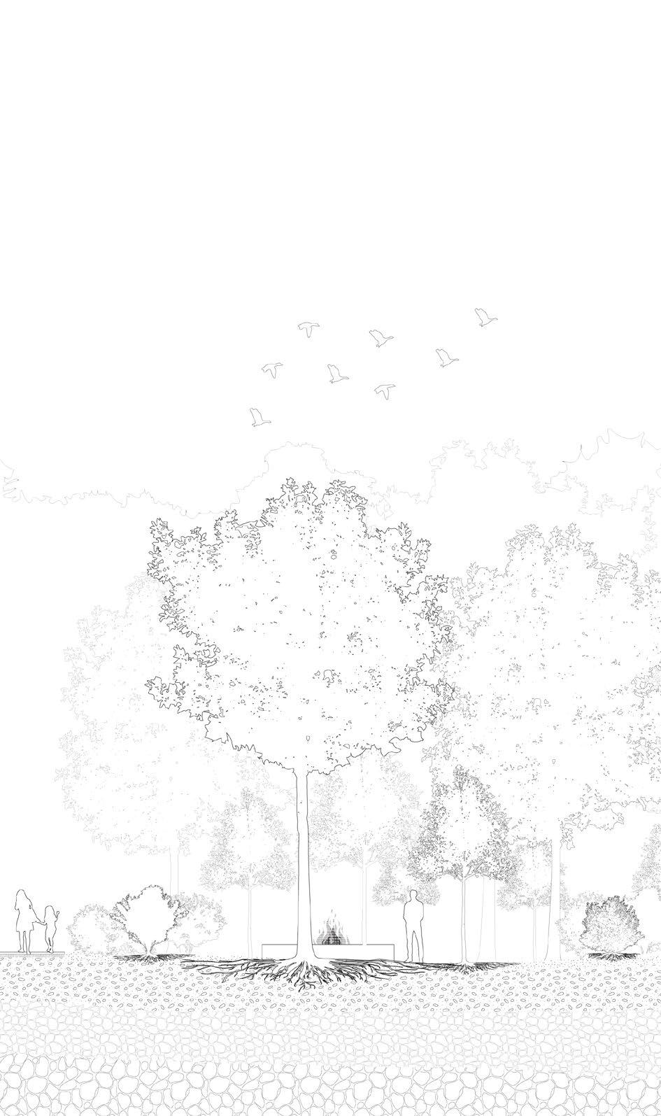
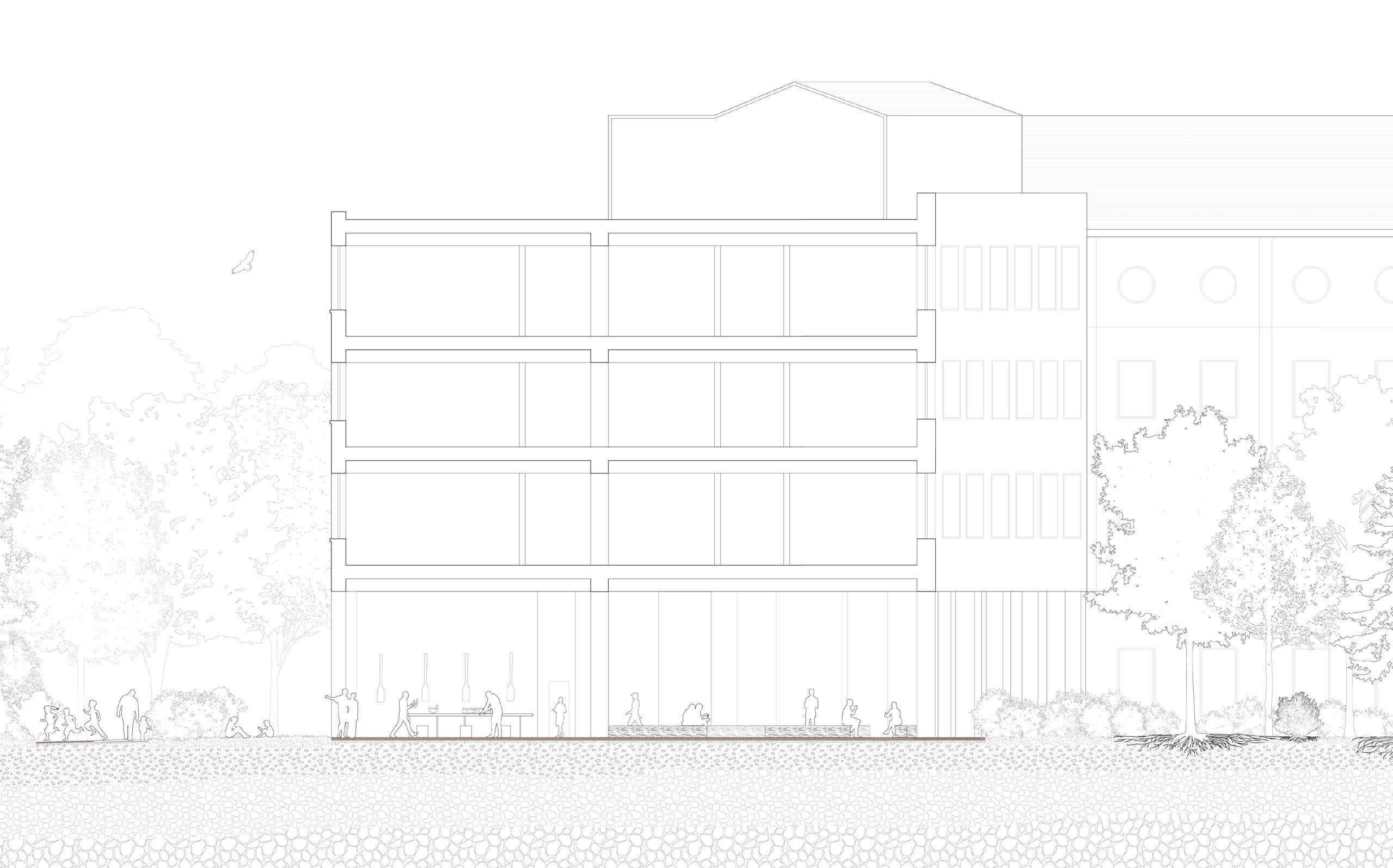
Voice of the forest: Shifting the center of west campus
All drawings in this project are produced by myself Collaborated with Luis Bendezu
0 5m 15m 30m Site plan
The project critically examines the current design configuration of the UofT campus where there is a lack of gathering spaces, buildings and paved surfaces dominate the land. With the limited amount of space for landscape, there are mainly manicured lawns and stand-alone trees. The design aims to inverse the building and landscape relationship by “trimming” the buildings, connecting the main courtyards, and claiming more space for landscape.
0 5m 15m 30m Section SS’
the
Concept diagrams
Extend the pedestrian-only street Connect the courtyards Shift
center
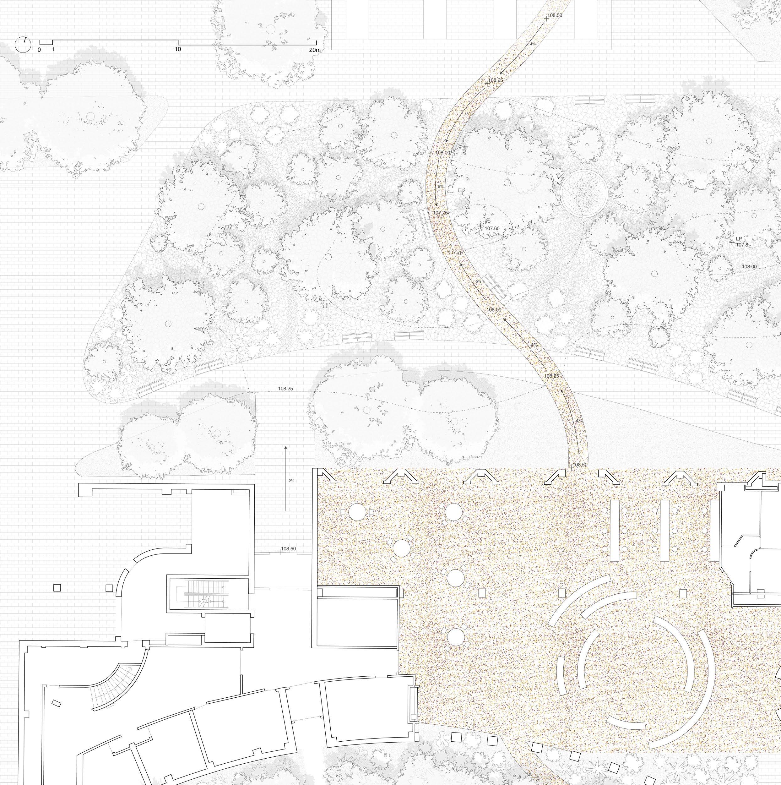 Aspen grove & workshop plan
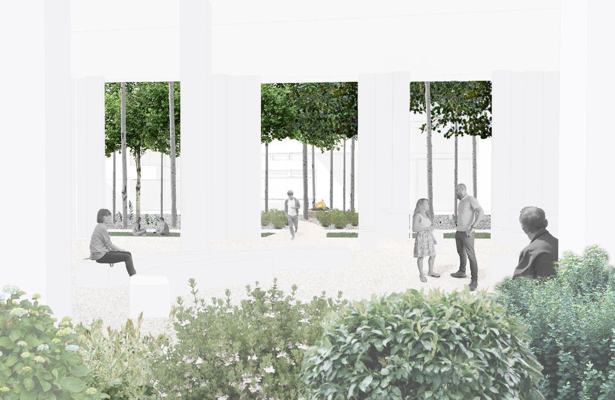
The design of Aspen Grove allows Quaking Aspen to reclaim the space for landscape by forming their colony. Quaking Aspen is a native species that grows in the natural forest. It has cultural significance as different parts of the trees are used by indigenous people as food, medicine, and material for crafts-making which are all essential to our daily life. As a fast-growing pioneer species, whenever there is a disturbance, quaking aspen can always rapidly colonize the site by creating suckers through its root system. Their exceptional ability to clone themselves is commonly considered as problematic in urban landscaping, but we see this as an opportunity to allow nature to take over. After the initial planting, the Aspen saplings will quickly grow to form canopies and transform the site into a grove within 10 to 15 years. The ground floor of the Forestry building is programmed as a workshop space for gathering and teaching indigenous knowledge.
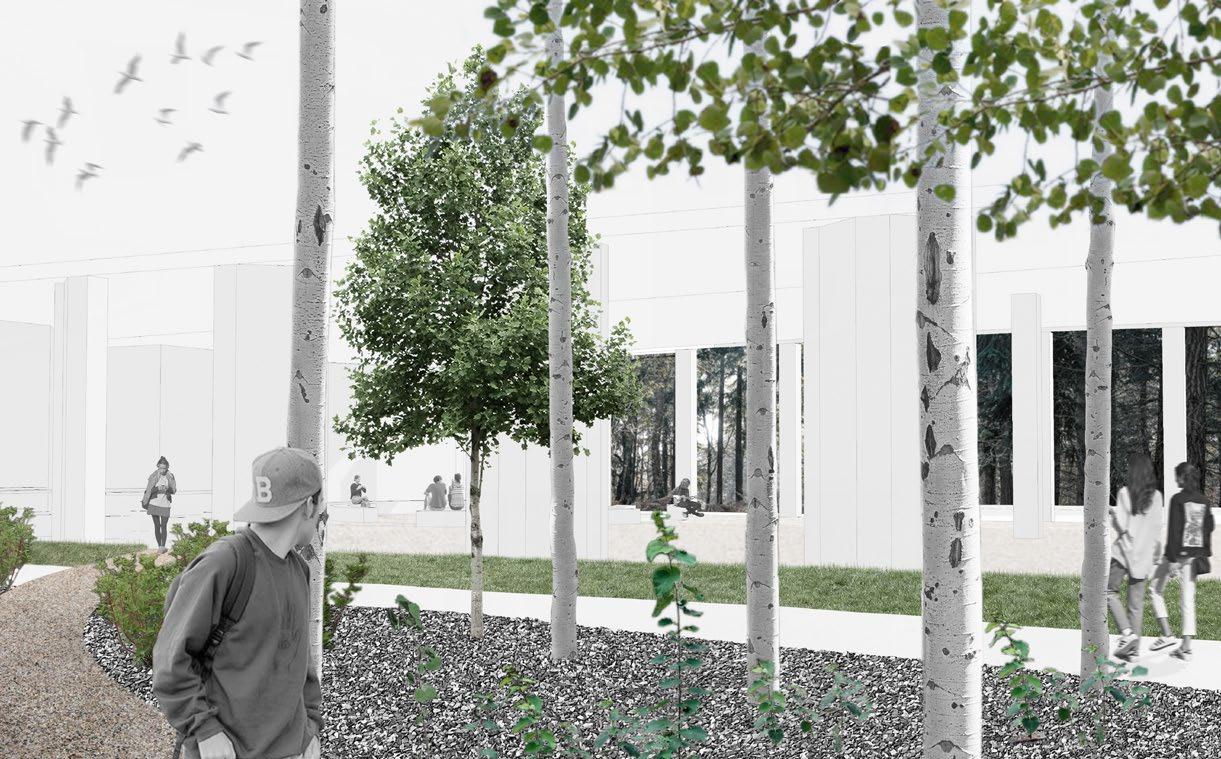
 Perspective view from the Boreal Forest
Perspective view from the Aspen Grove
Perspective view from the Boreal Forest
Perspective view from the Aspen Grove
Aspen grove detail section 0 2m Aspen
The Aspen workshop will connect the Boreal forest courtyard and the Aspen grove spatially and experientially. Curriculums such as harvesting, tea making, and crafts making will be available for students as well as everyone from the local community. The edge of the Aspen grove will be planted with native shrubs such as red osier dogwood, highbush cranberry, and saskatoon berry as the understory to enhance the seasonal interest. By restoring our plant relations through learning and experiencing, the design allows visitors to reconnect themselves to the land both physically and spiritually.
 Aspen grove & workshop section
grove Aspen workshop Boreal forest
Aspen grove & workshop section
grove Aspen workshop Boreal forest
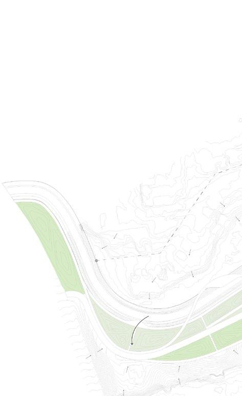
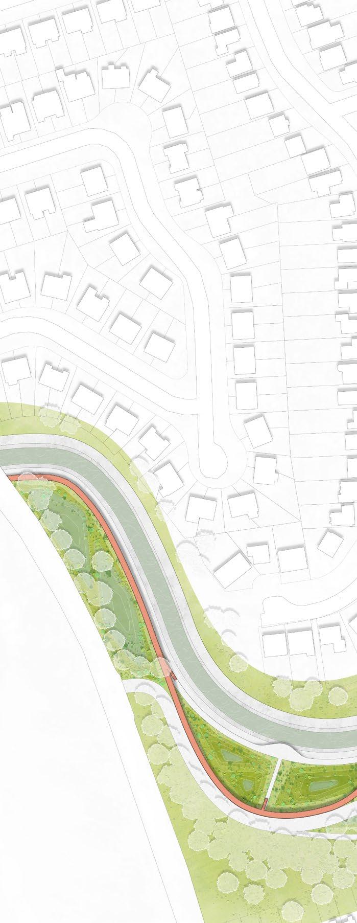
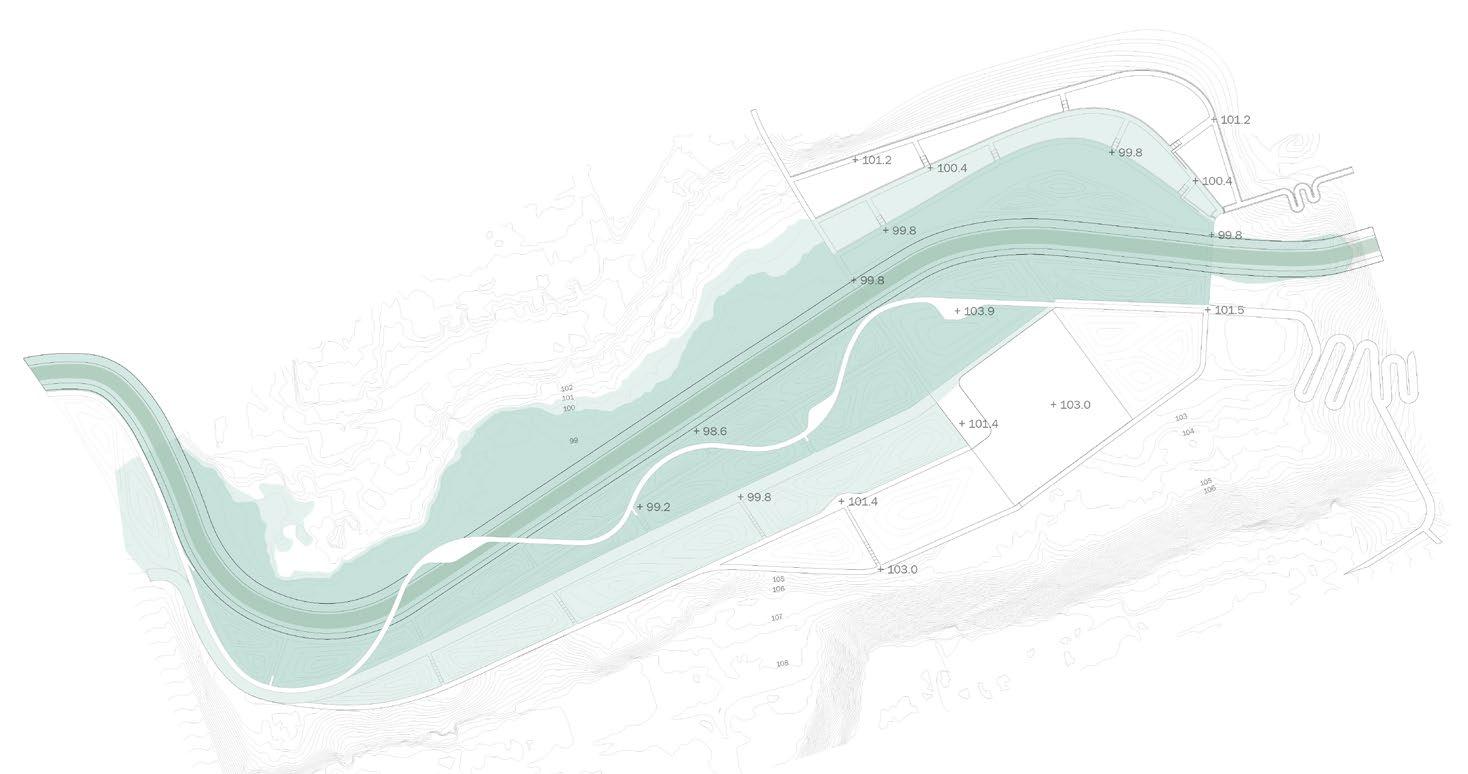
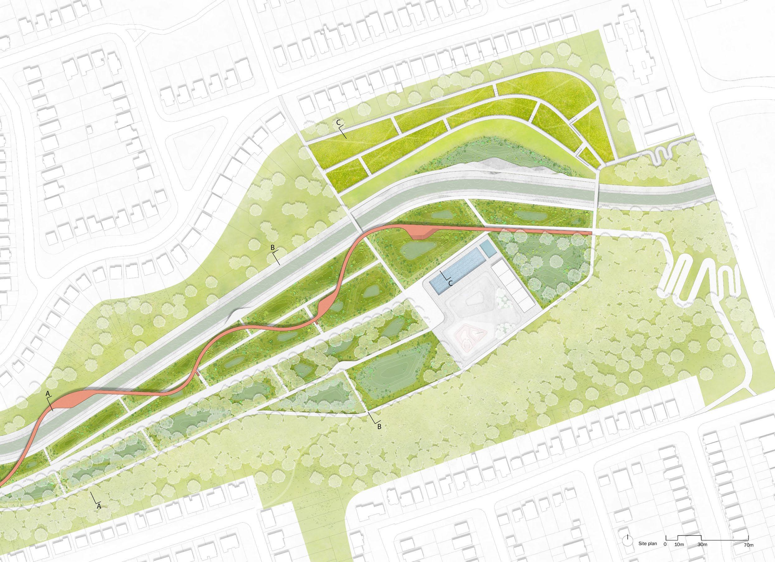
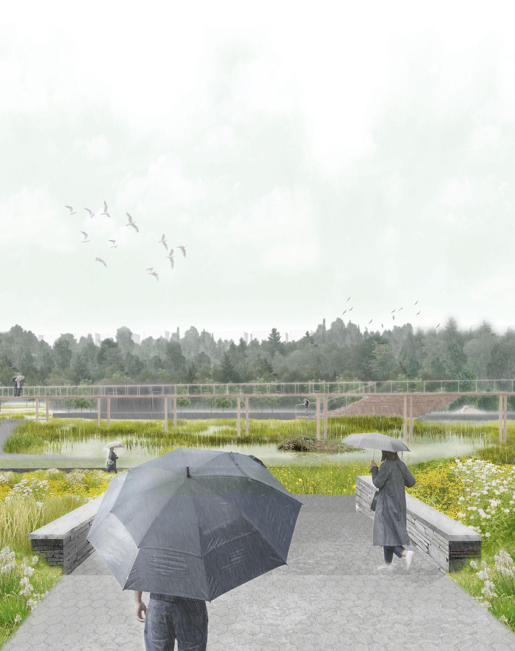
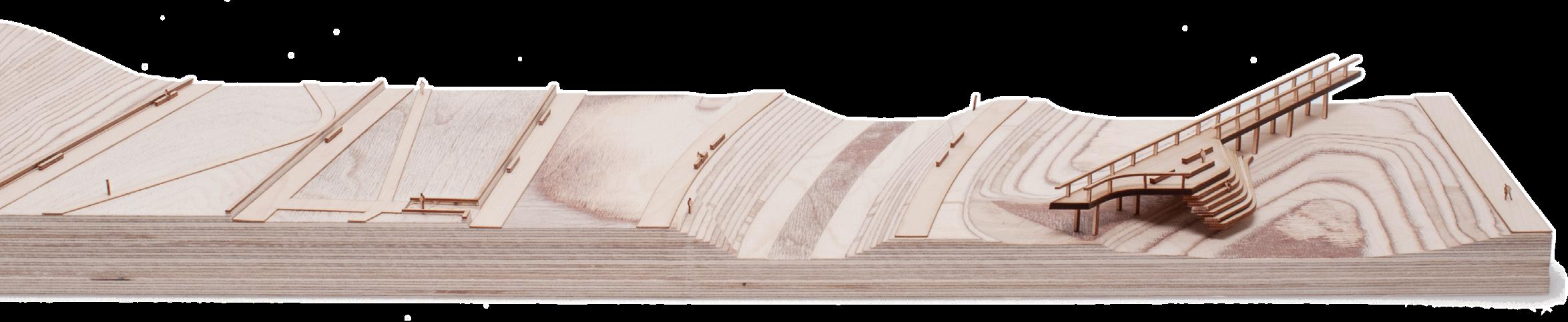
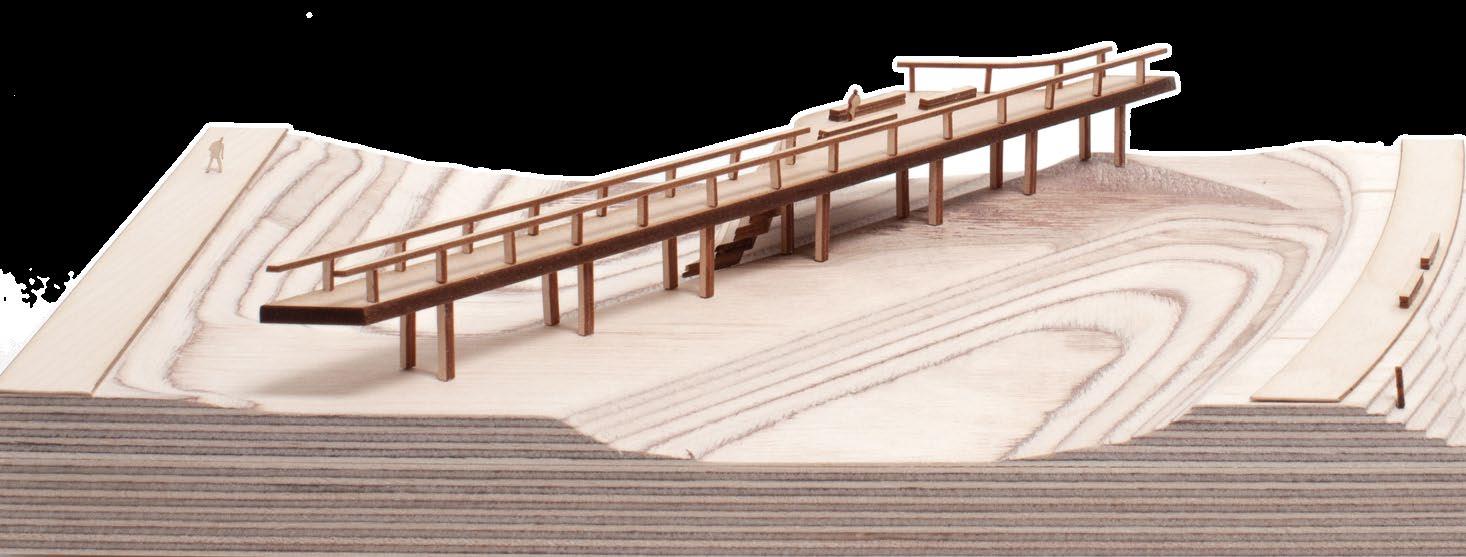
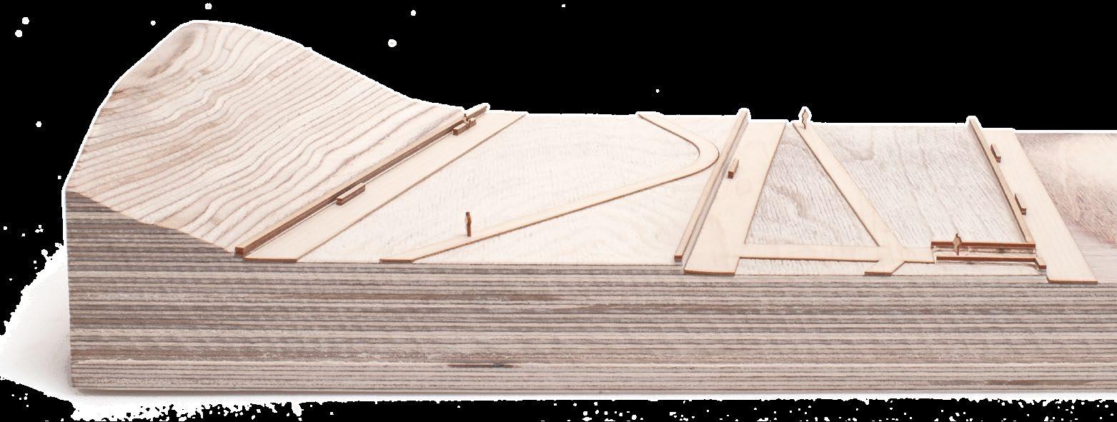
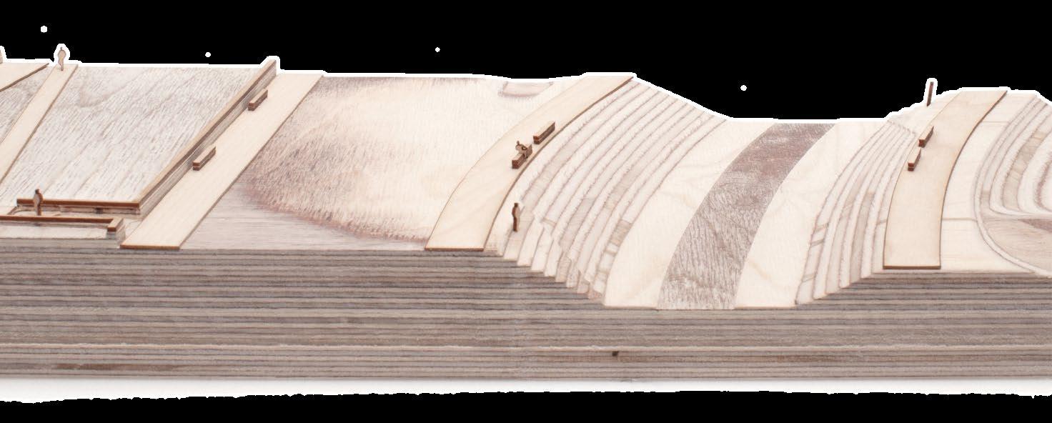
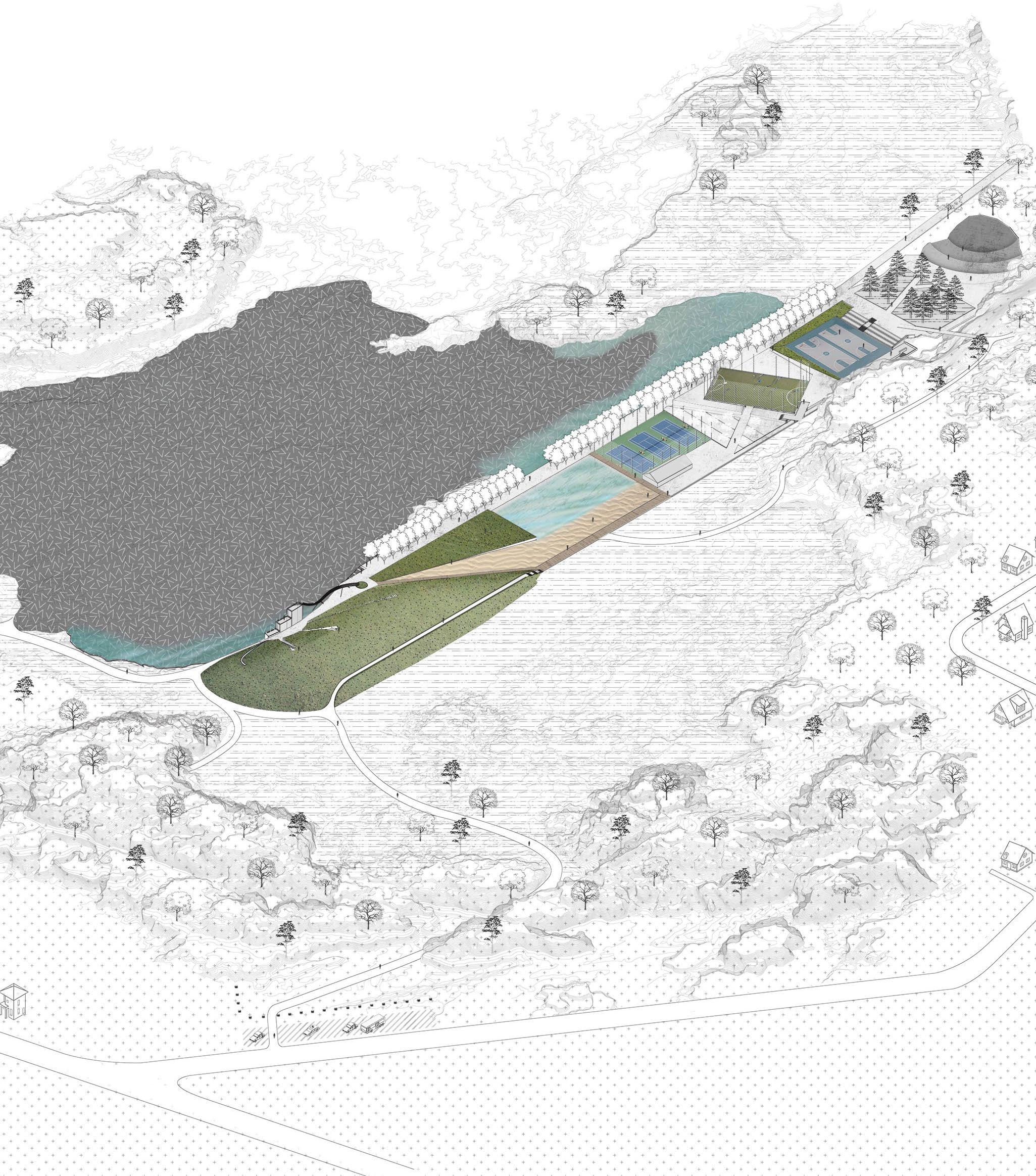
Smythe Park Redesign: The interplay between social and
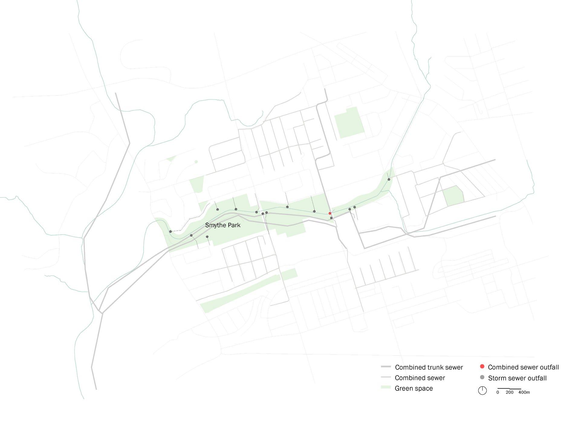
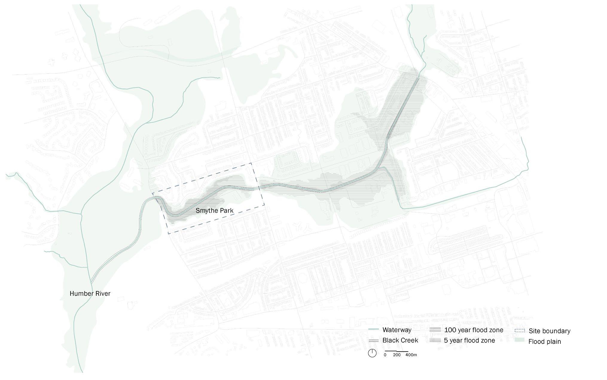
Combined trunk sewer Combined sewer outfall Combined sewer Storm sewer outfall Green space Waterway 100 year flood zone Black Creek 5 year flood zone Site boundary Floodplain
Collaborated with Yue Wang
and

water infrastructure
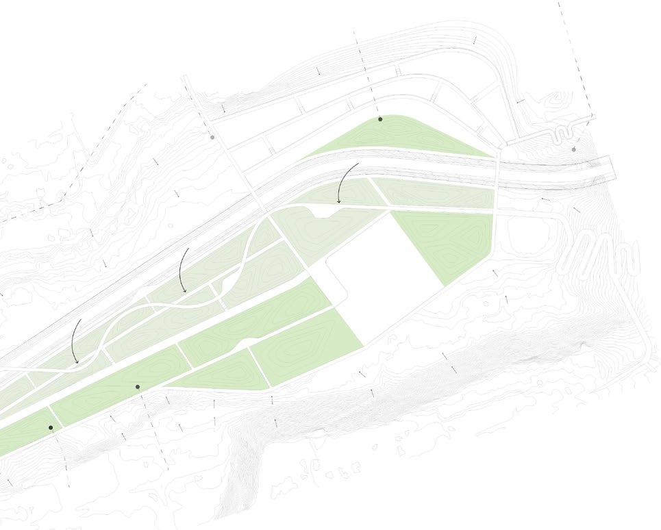
5 4 2 3 1 6 7
0 30m 70m
Site plan
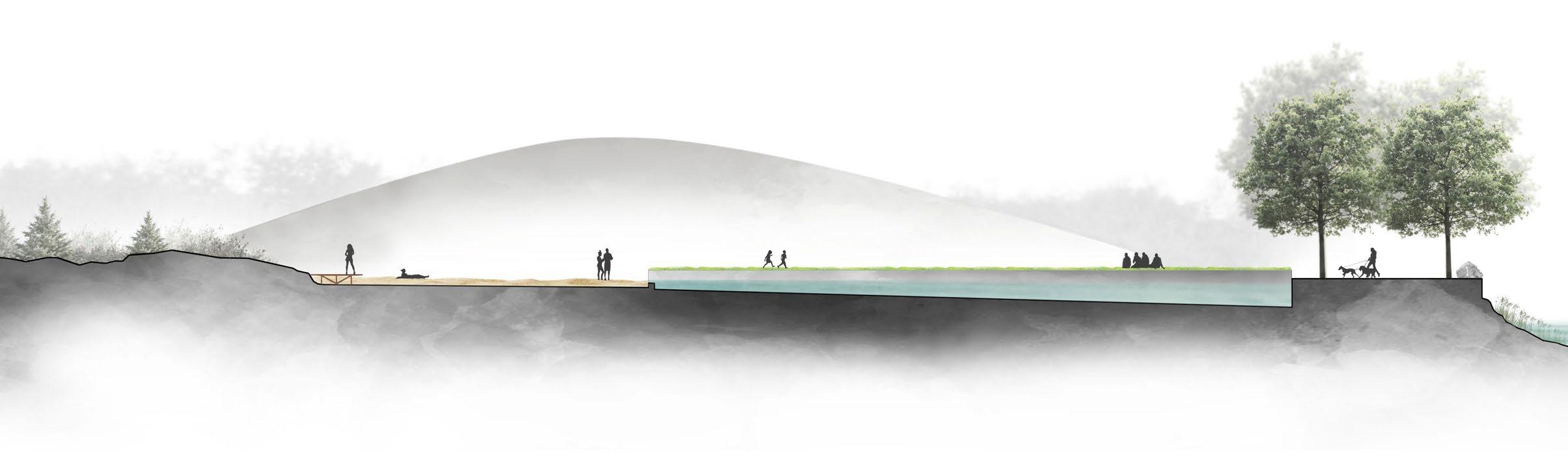
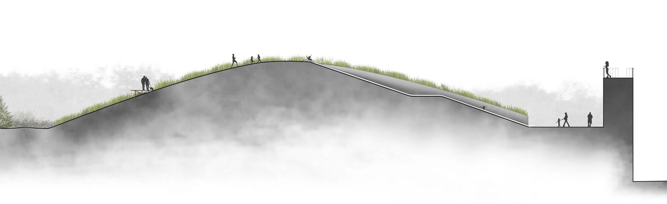
1. Prairie terrace
2. Wetland platforms
3. Elevated boardwalk
4. Swimming pool
5. Water plaza
6. Playground
7. Parking lot
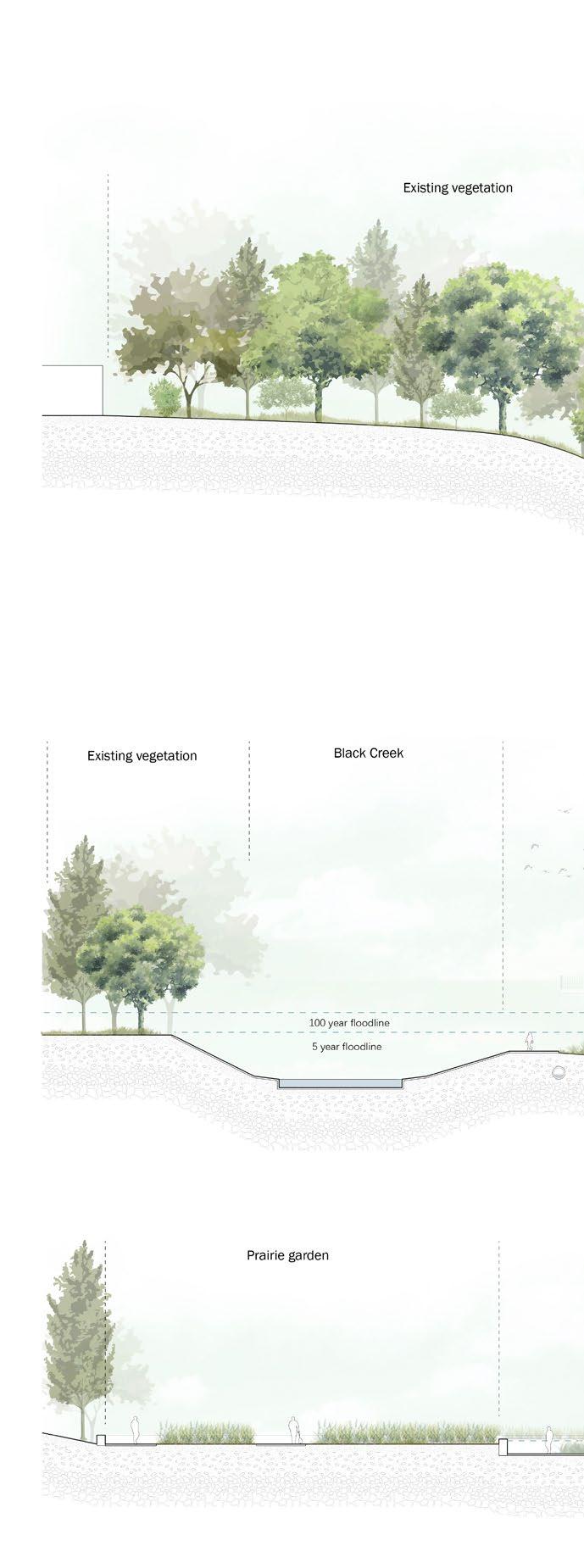 Existing vegetation Black Creek
Prairie garden
Existing vegetation
Prairie terrace view
Existing vegetation Black Creek
Prairie garden
Existing vegetation
Prairie terrace view
The design explores the interplay between social activities and water infrastructure. By integrating grey infrastructures with natural systems, the project proposes an alternative stormwater management strategy that will not only improve the ecological values of Smyth Park but also enhance the experience of humans in relation to water, creating a space where people can observe, play, and engage with the water.
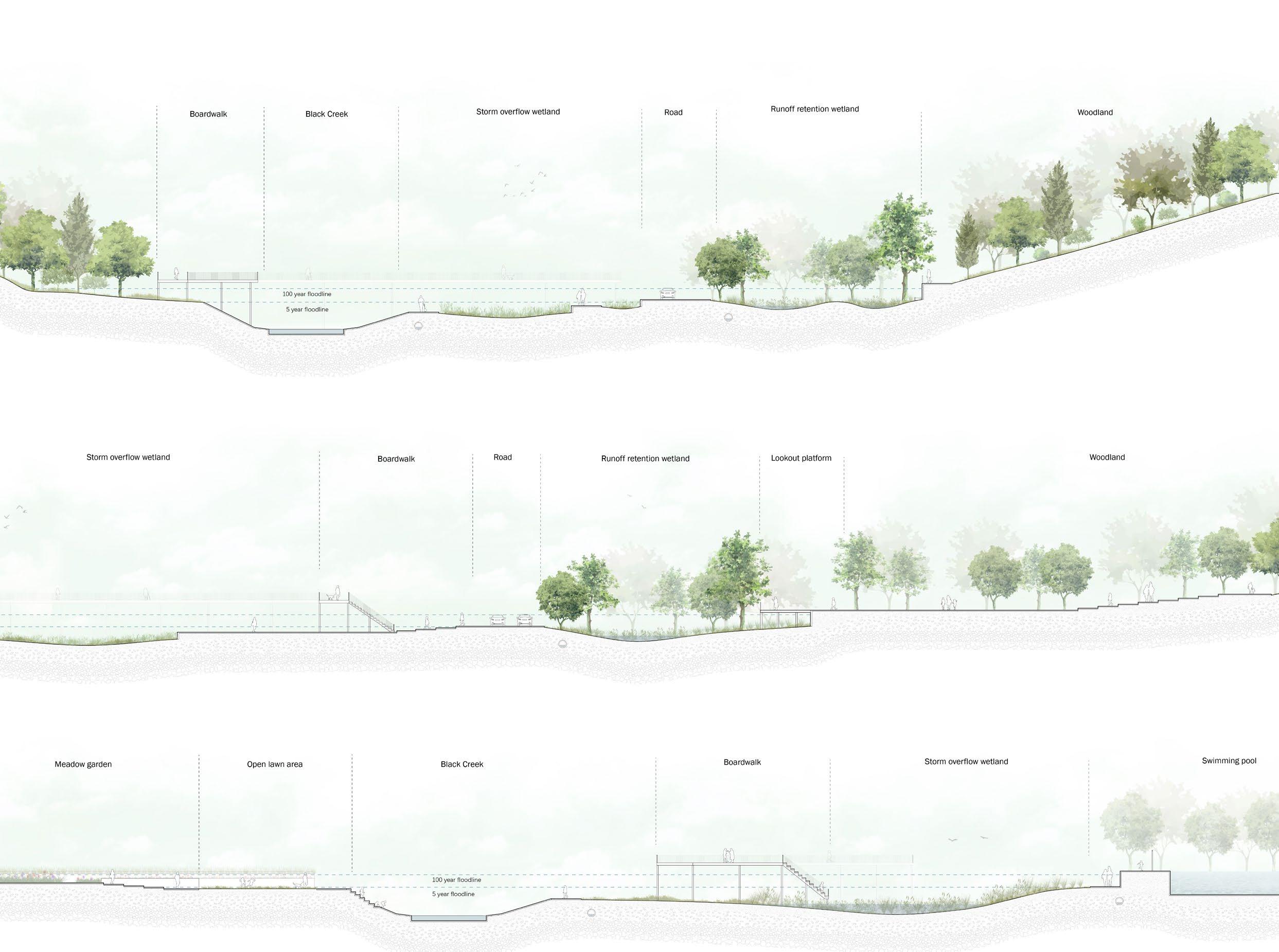 Boardwalk Storm overflow wetland Runoff retention wetland Woodland Lookout platform Road
vegetation
Black Creek Meadow garden Open lawn area Boardwalk Swimming pool Storm overflow wetland
Boardwalk Black Creek Storm overflow wetland Runoff retention wetland Woodland Road
Section C
Section B
Section A Contributed by Yue Wang Contributed by Yue Wang Contributed by Yue Wang
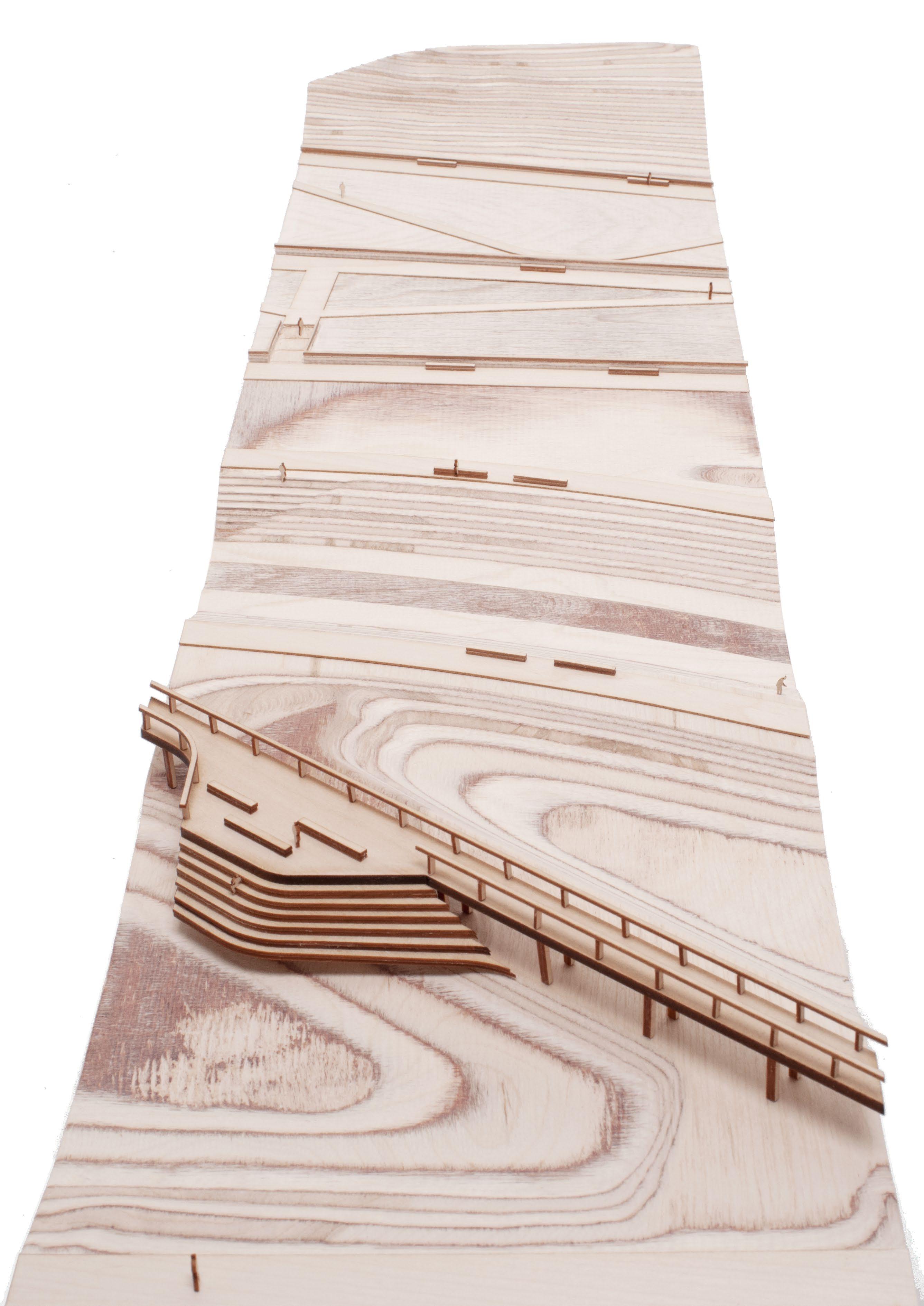
 Section terrain model
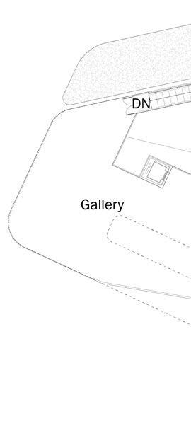
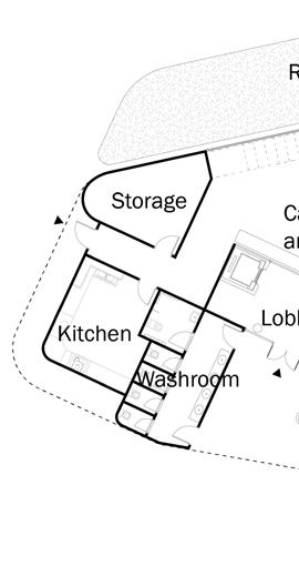
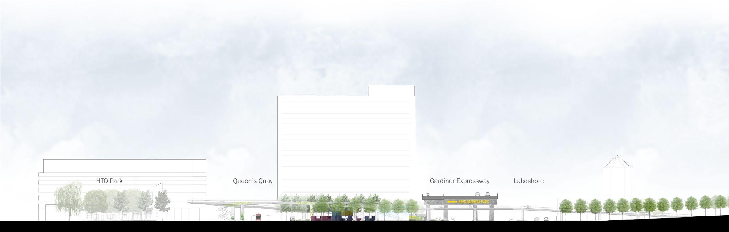
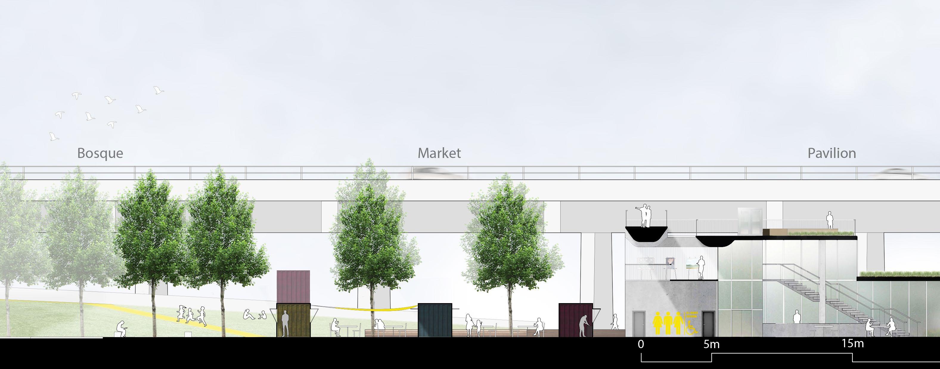
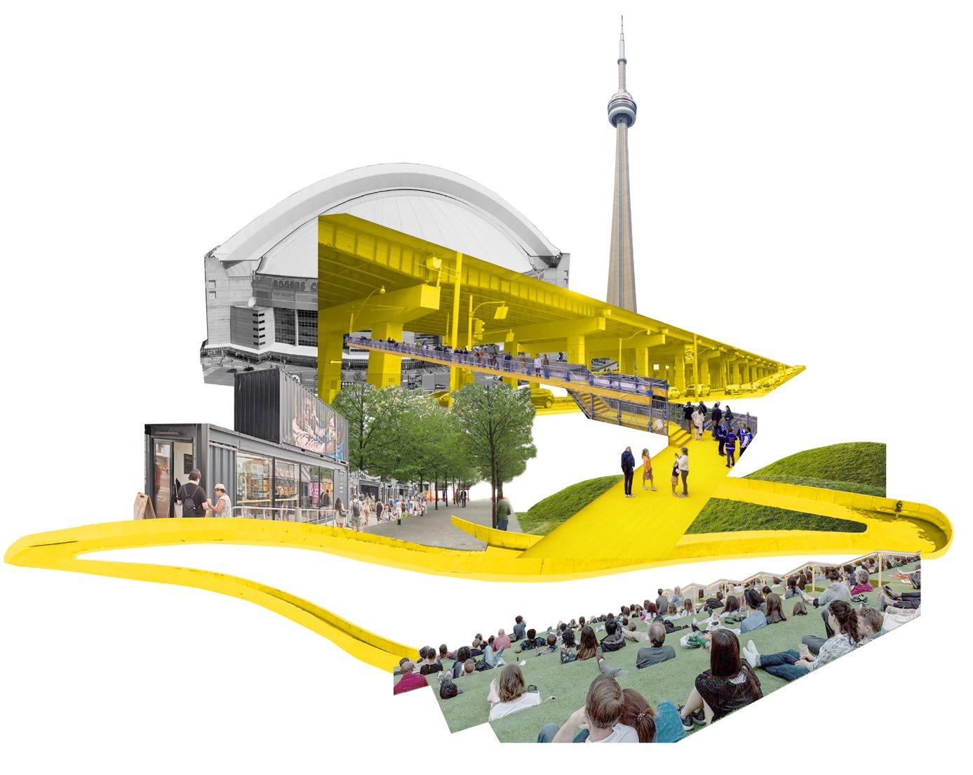
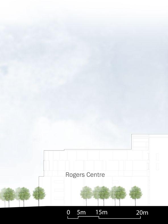
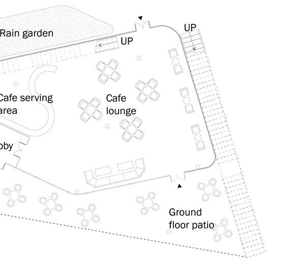
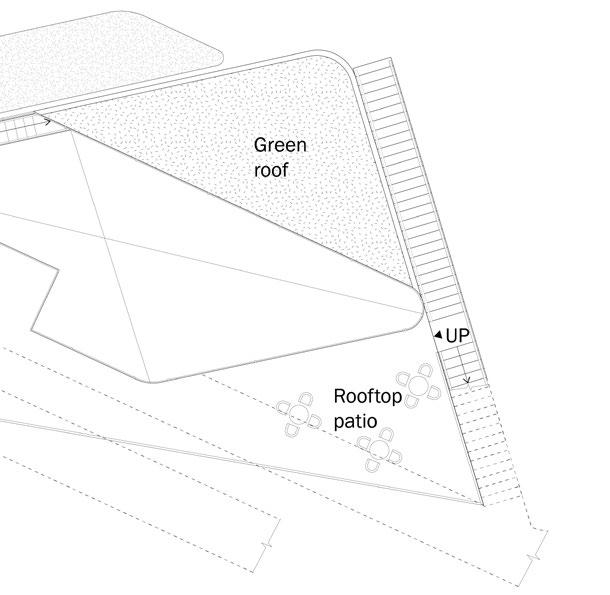
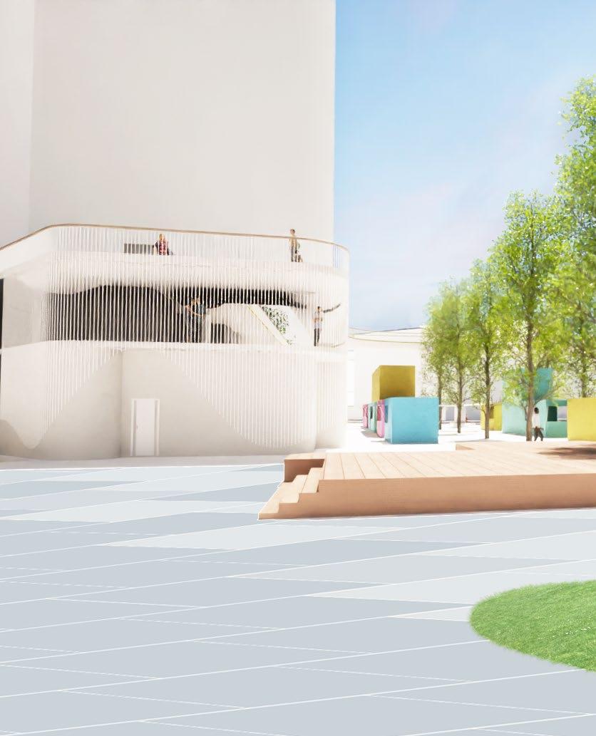
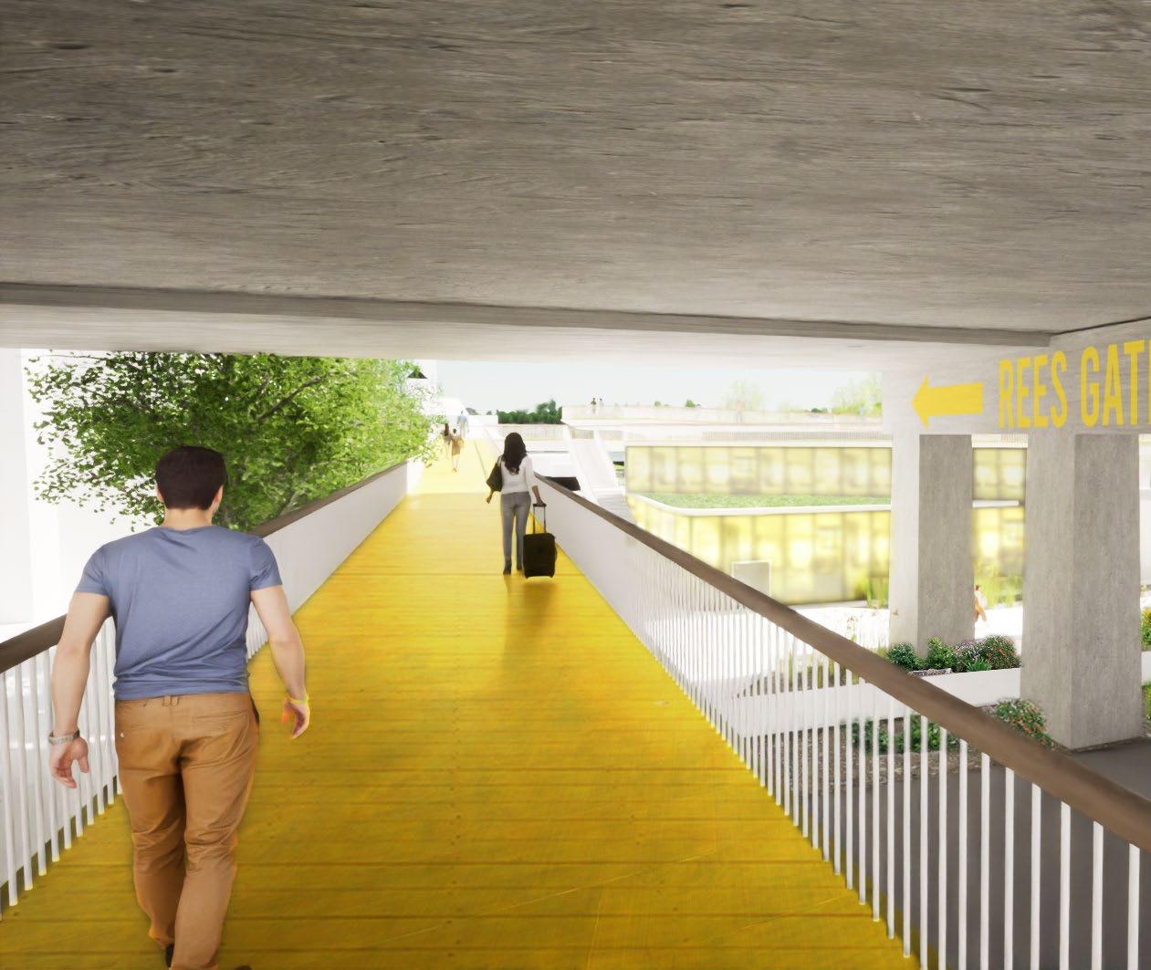
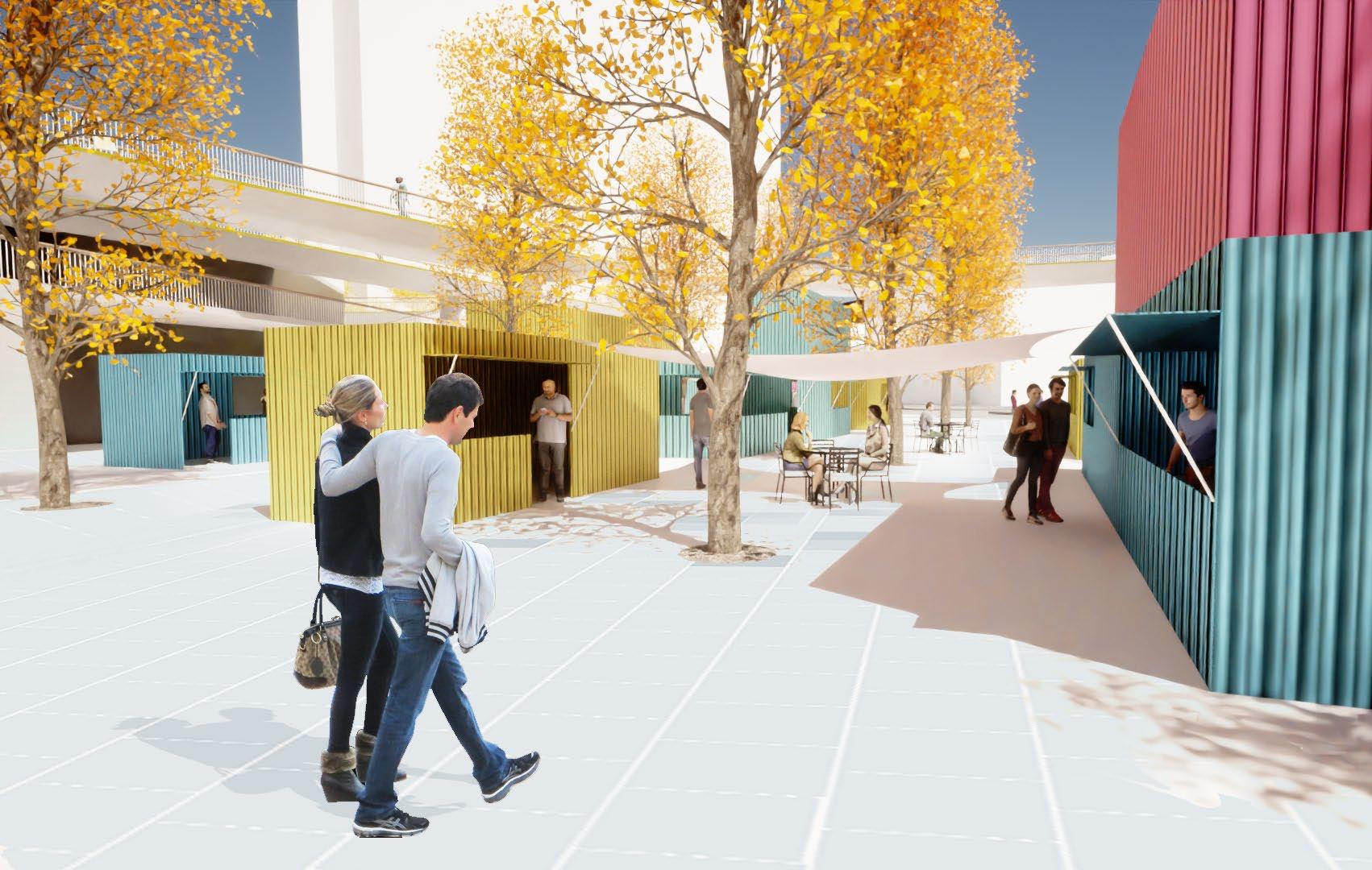
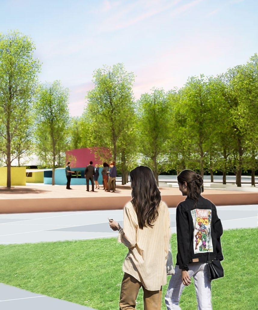
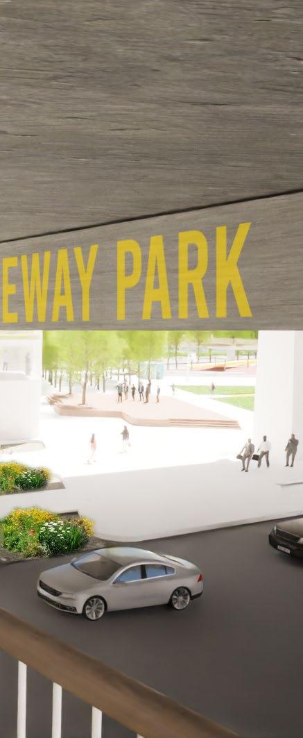
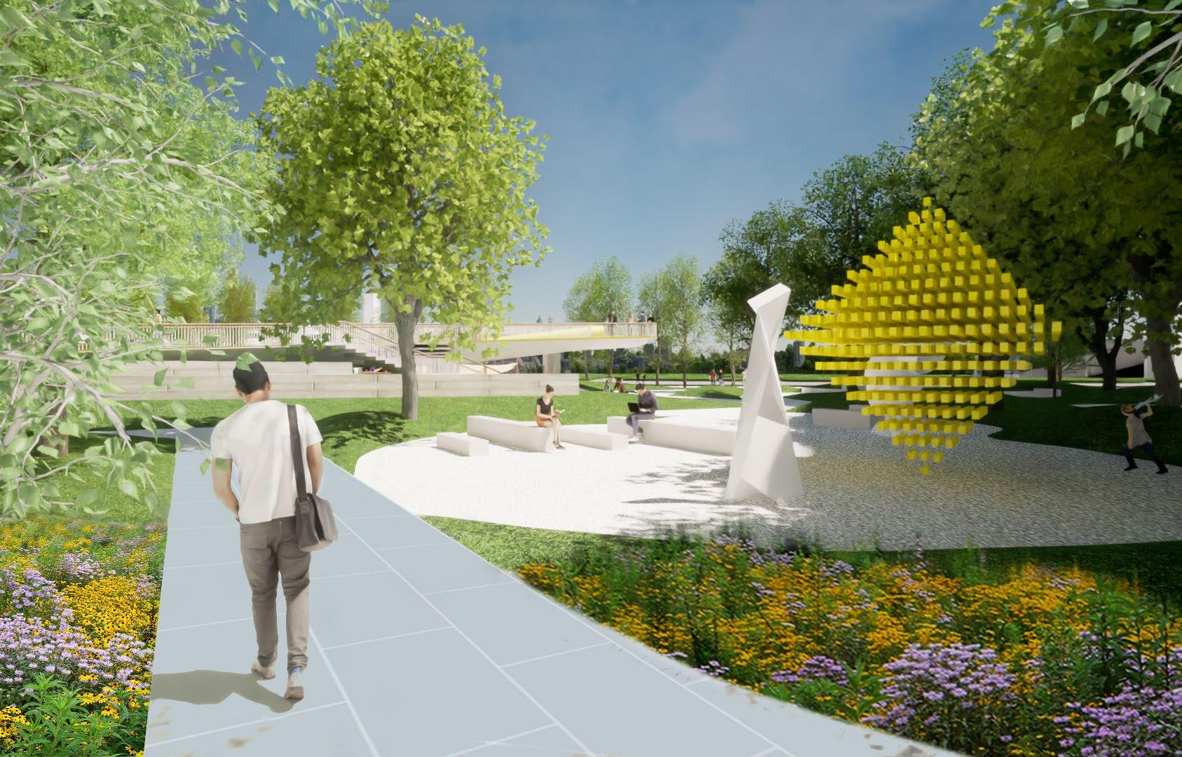
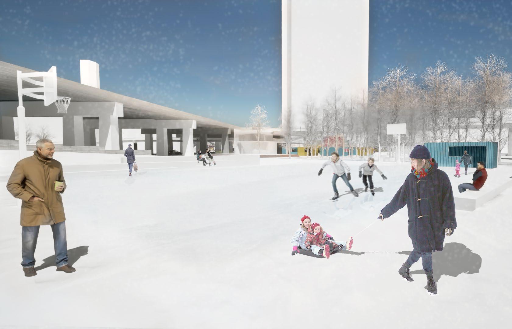
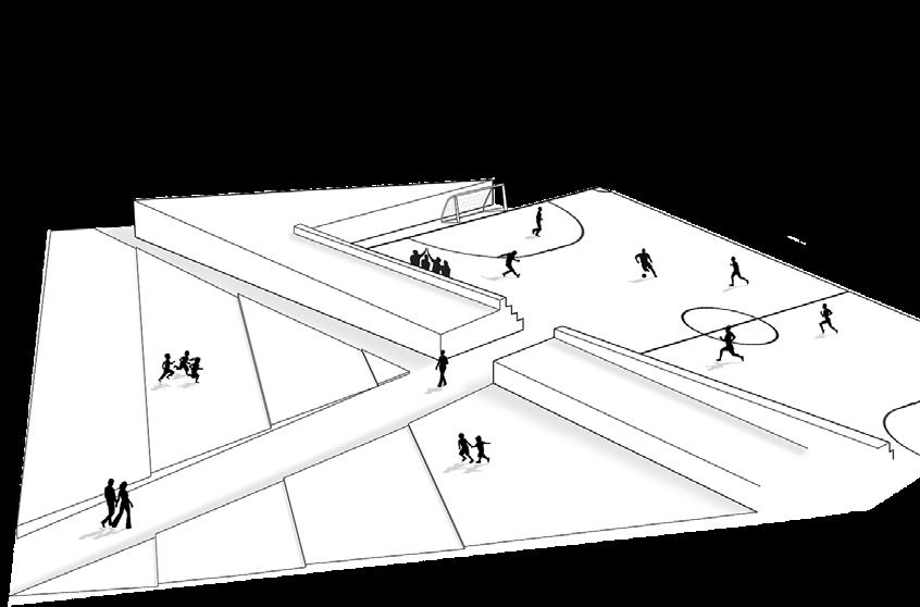
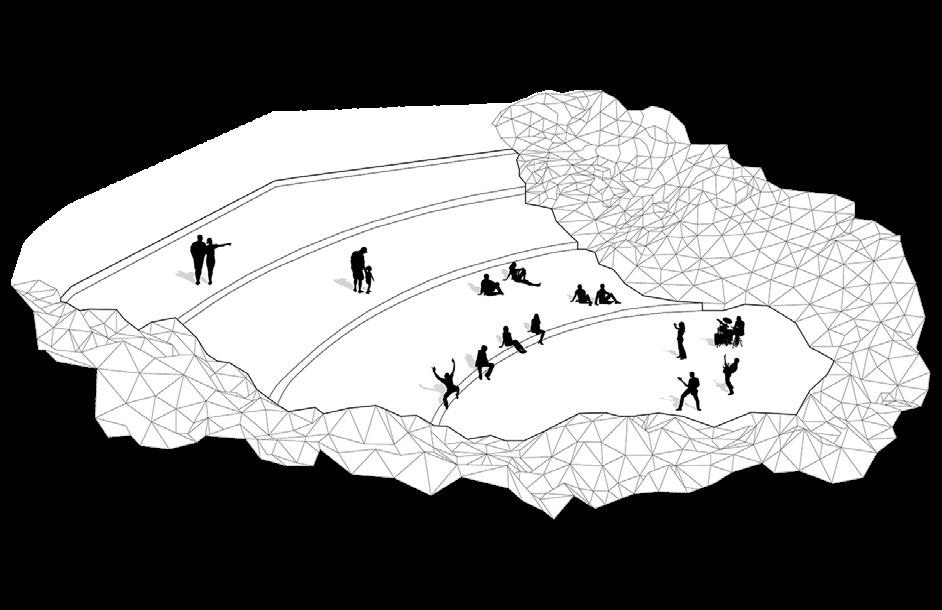
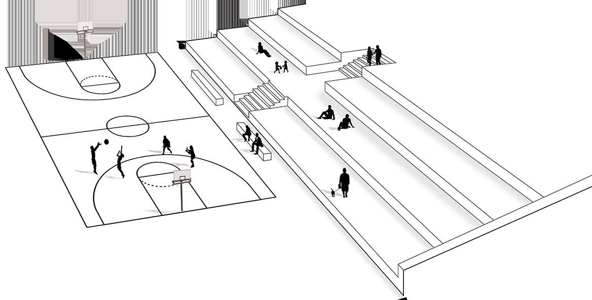
Rees gateway park
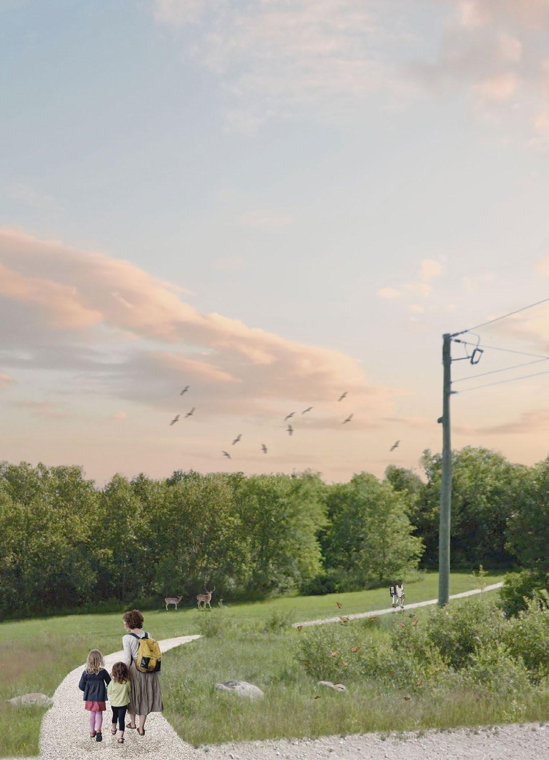
Rees gateway park aims to reconnect Waterfront to the North side of downtown Toronto by extending the pedestrian environment from CN tower and Rogers Centre in the Entertainment District. Not only this provides an accessible promenade to Waterfront, but also space with amenities for art, a market, outdoor concerts, sports, playgrounds, and greenery that serve both the residents and visitors.
Pavilion
 Concept collage
Pavilion
Concept collage
Pavilion
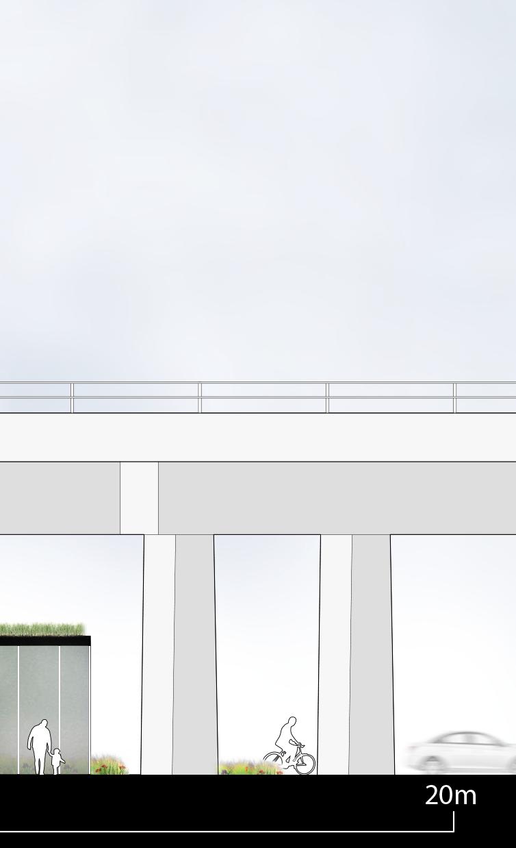
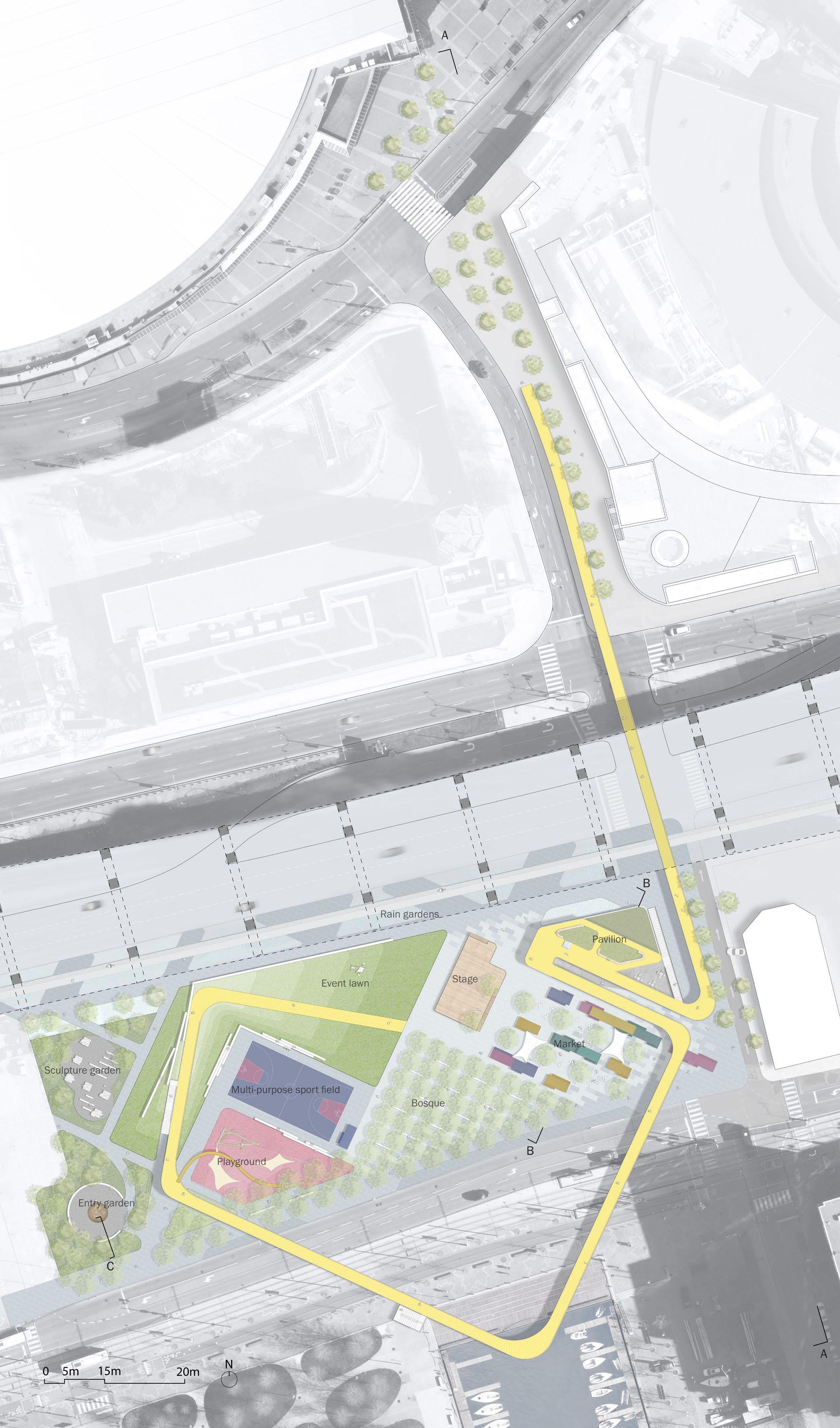
Section A Section B Site plan Pavilion 1st floor plan 1:600 Pavilion 2nd floor plan 1:600
Section C 1:25
Market in Fall
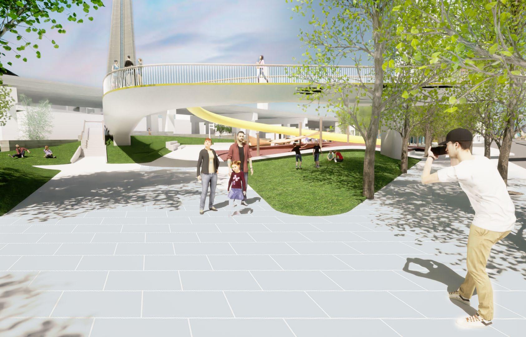
 Walkway and pavilion
Pavilion and stage
South-West entrance
Skating rink in Winter
Sculpture garden
Walkway and pavilion
Pavilion and stage
South-West entrance
Skating rink in Winter
Sculpture garden
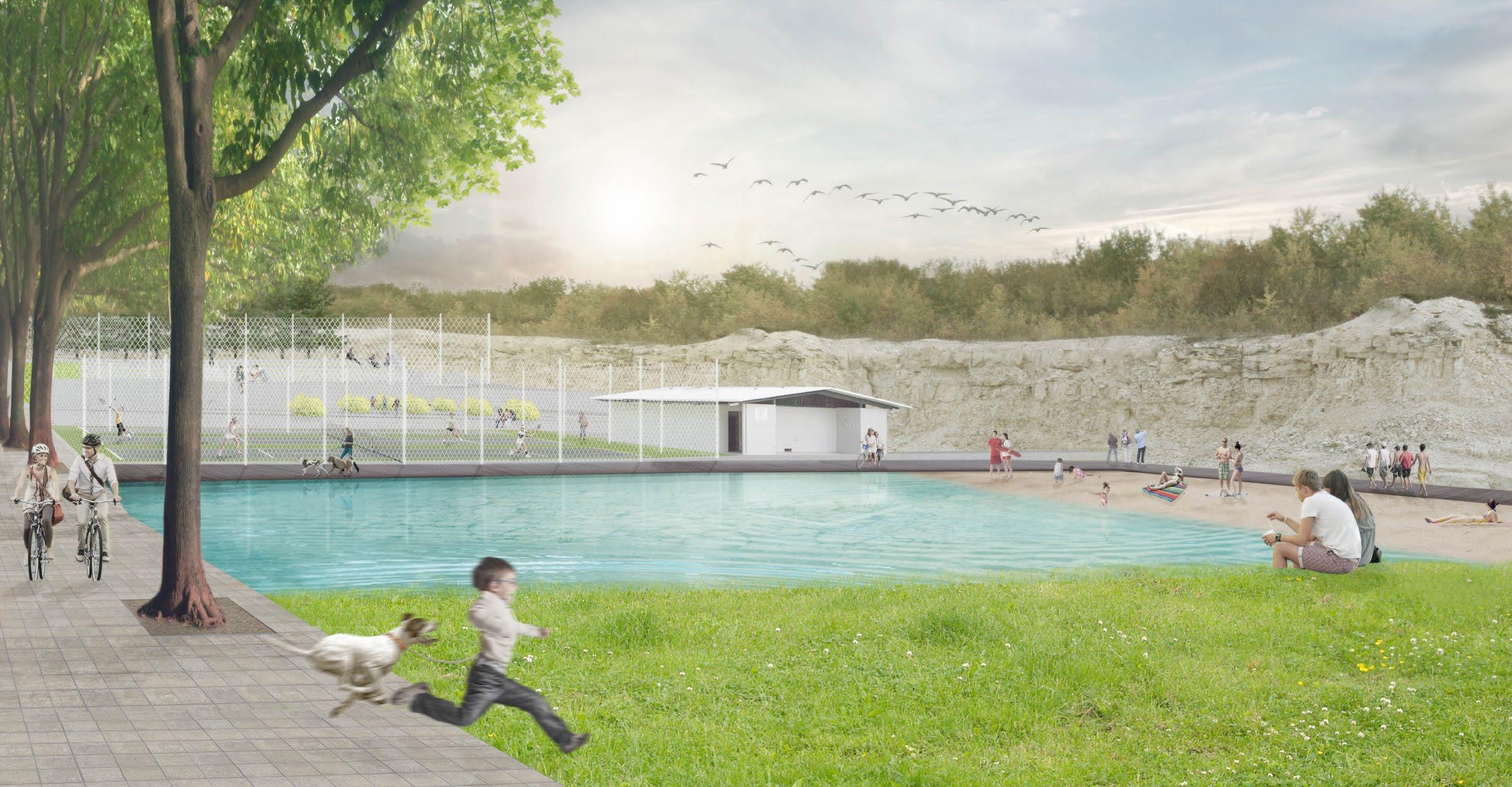
Stony Mountain Quarry Reclamation
All drawings in this project are produced by myself Collaborated with Paulo Nogueira and Akash Singh
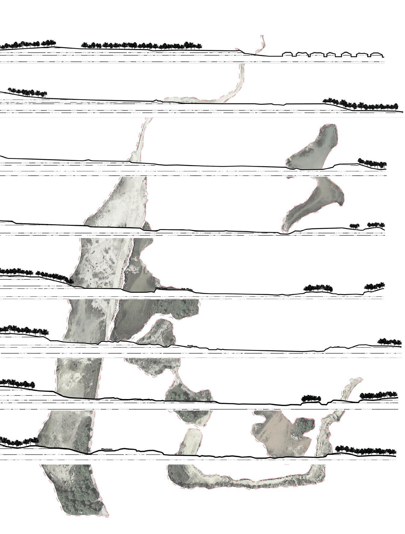
Stony Mountain is a town located 11km north of Winnipeg. For decades quarrying activities have created a mosaic of topographic features. After the ceasing of commercial quarrying, nature restores its course. Stony Mountain became a wild playground for plants and animals, a diamond in the rough for the local community. This project explores possibilities for reclaiming a post-industrial landscape.
The site survey is done through by using a drone equipped with 4k cameras. The concept design is achieved through a collaboration of three people. My role in the team includes identifying and implementing the landscape characters in the design, incorporating different design ideas from group members, and designing details of each programmed space.

A B C D 264.00 247.50 237.75 245.00 245.00 241.25 253.75 253.00 252.00 251.00 250.00 249.00 248.00 247.00 246.00 243.00 242.00 241.00 240.00 241.00 242.00 243.00 241.00 1 2 3 4 5 6 7 8
A. The Mound
B.The
Ridge
 C. The Valley
D. The Terrace
C. The Valley
D. The Terrace
Entrance
2 3 4 5 7 6 8 1
Quarry
Perspective View
Accessibility Programs
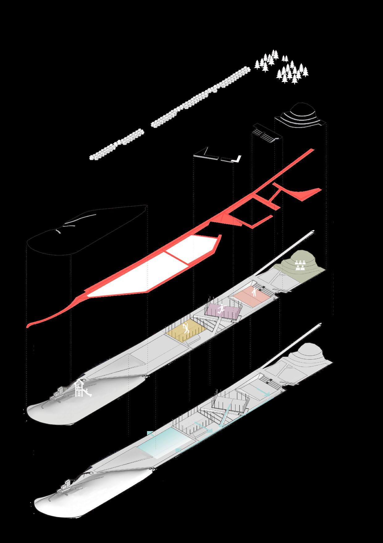
The design of Stony Mountain Quarry aims to reclaim the deserted quarry space by providing recreational programs for the local community. Though the quarry is connected to the local residents by many secluded paths, a minimally designed parking lot is introduced as a threshold where a winding path leads visitors into the quarry. The landscape characters found in the quarry, the Mound, the Ridge, the Valley, and the Terrace are implemented in the design of different programs to complement the surroundings. A promenade planted with sugar maples is sloped to connect different levels and provide access to various programmed spaces. A drainage system collects stormwater runoff from each programmed space and channels it into the pool. When the pool overflows, water drains to the marsh at the lower level of the quarry where aquatic plants thrive.
 Picea glauca
Acer saccharum
Picea glauca
Acer saccharum
S1 S2 S3
Acer ginnala
A B C D
Drainage
Isometric Diagram

Section 1 0 2m 4m 8m 16m Section 2 0 2m 4m 8m 16m Section 3 0 2m 4m 8m 16m
 A. The Mound
B.The Ridge
D. The Valley
C. The Terrace
Main Perspective View
A. The Mound
B.The Ridge
D. The Valley
C. The Terrace
Main Perspective View
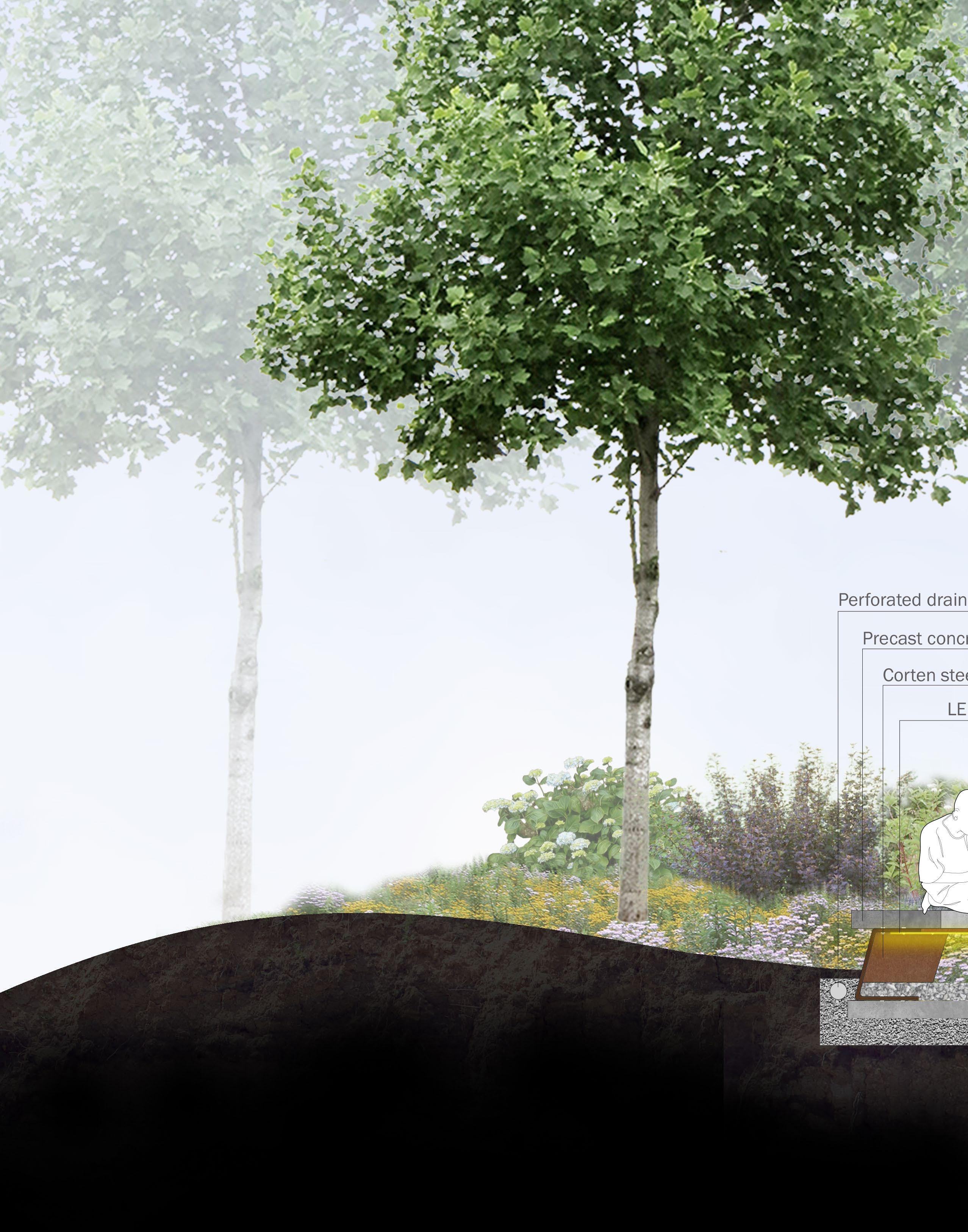
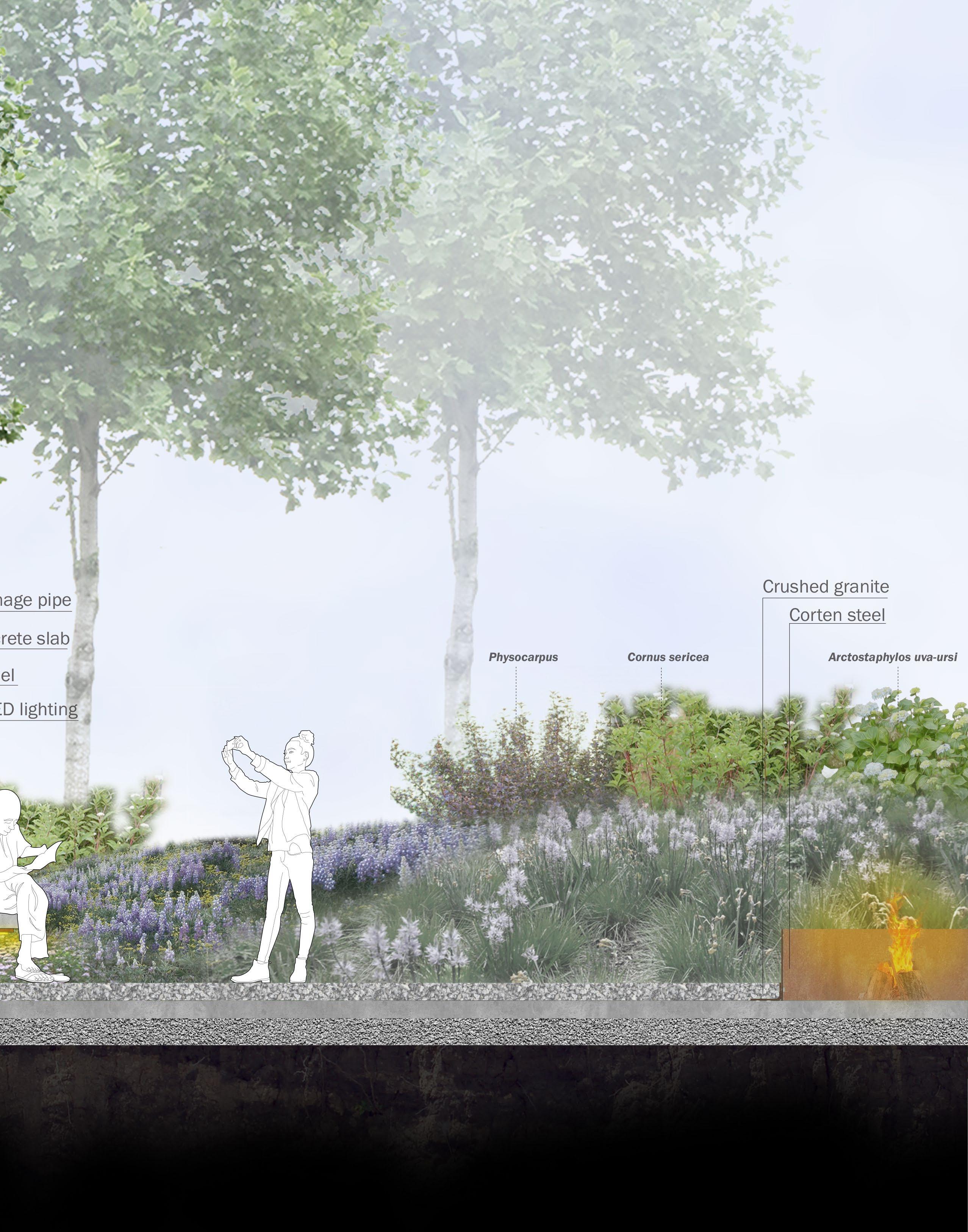
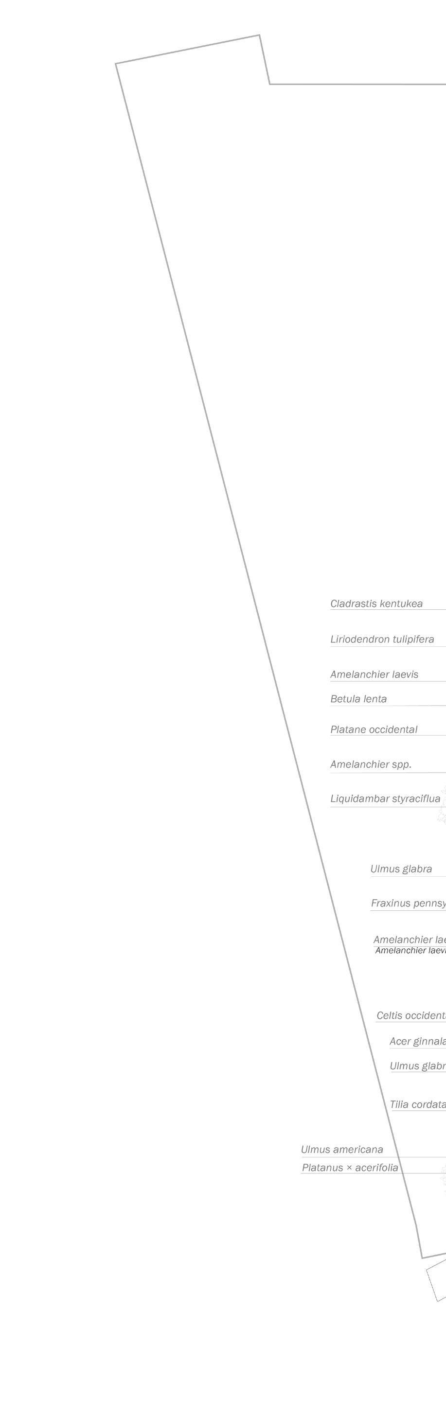
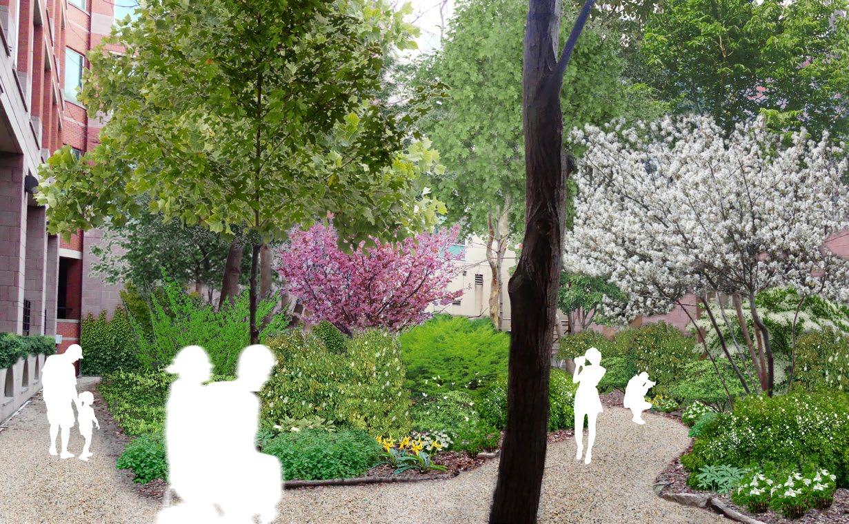
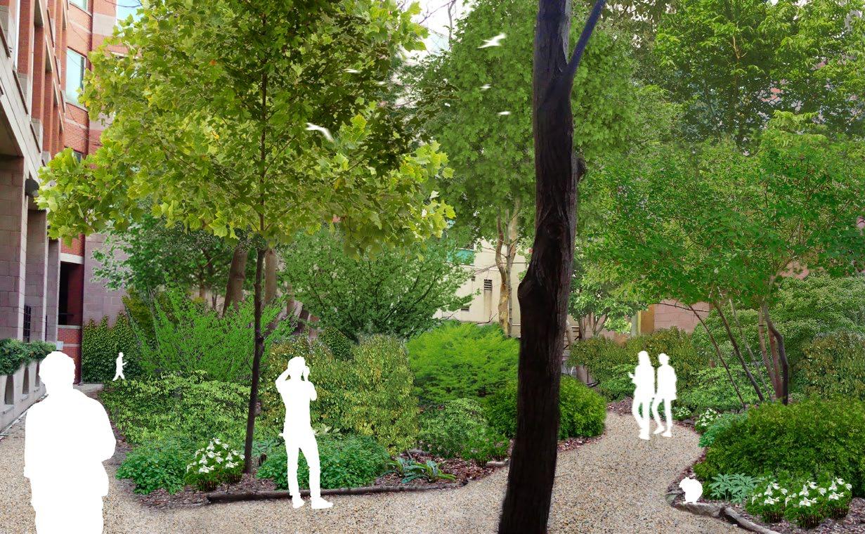
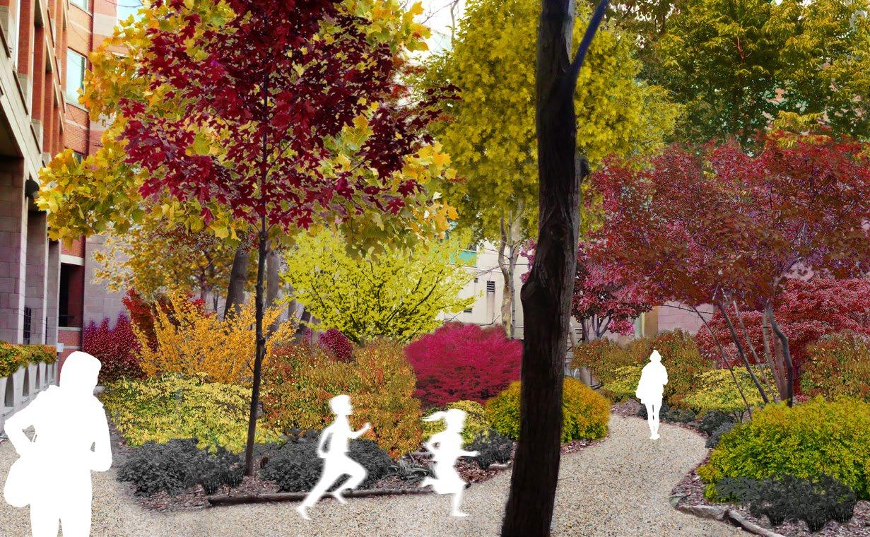
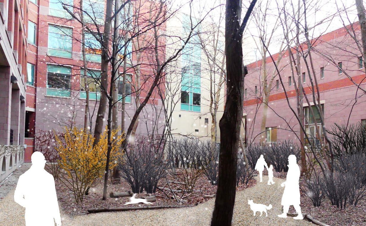
UofT Earth Science Courtyard Planting Design Carolinian Forest Courtyard
The Carolinian courtyard at the UofT earth and science building was originally designed by Michael Hough based on the Carolinian forest. The new planting design focuses on the understory and aims to enrich the courtyard planting by introducing native shrubs and perennials. The newly introduced understory will diversify the existing planting and create seasonal interests all year round. The planting scheme is carried out in an organic layout where large shrubs are spread out and accompanied by smaller perennial plants in groups. Plant selection is based on their origin, shade tolerance, bloom time, foliage color, and winter interests. While colors are used to complement the existing planting, different textures are used to create contrasts.
Hamamelis virginiana
Cornus florida
Zanthoxylum americanum
Staphylea trifolia
Lindera benzoin
Euonymus atropurpureus
Herbaceous species
Arisaema dracontium
Impatiens capensis
Panax quinquefolius
Sanguinaria canadensis
Trillium grandiflorum
Er ythronium americanum
Hydrophyllum virginianum
Herbaceous species
Par thenocissus quinquefolia
Campsis radicans
Can tolerate full shade June
Par t shade to full shade May to June
Par t shade to full shade June to September
Par t shade to full shade June to July
Par t shade to full shade March to April
Par t shade to full shade April to June
Par t shade to full shade April
Par t shade May to June Tolerates full shade M to August
Full sun to par t shade July
Shrub Species Bloom Time Foliage Winter Interest Sun Condition Full sun to par t shade Oct - Dec Yellow fall color Attractive red in fall Yes No Par t
Full sun
Fragrant NA No Yes
Fragrant, attractive yellow No
Dull to greenish red
No
shade to full shade April - May
to par t shade April
Par t shade to full shade April - May
Can tolerate heavy shade March
Attractive crimson red in fall Leaves turn yellow in fall
Plants selection May
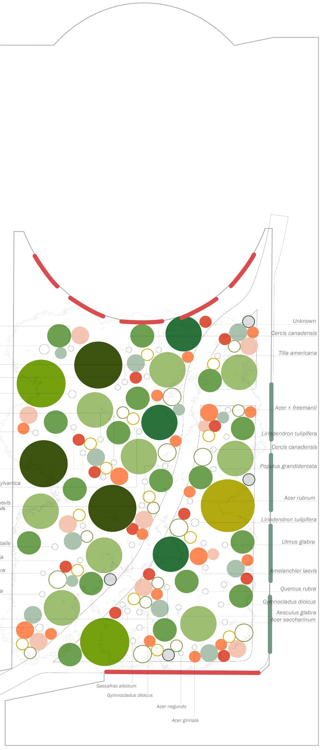
Winter Fall Summer Spring Planting plan
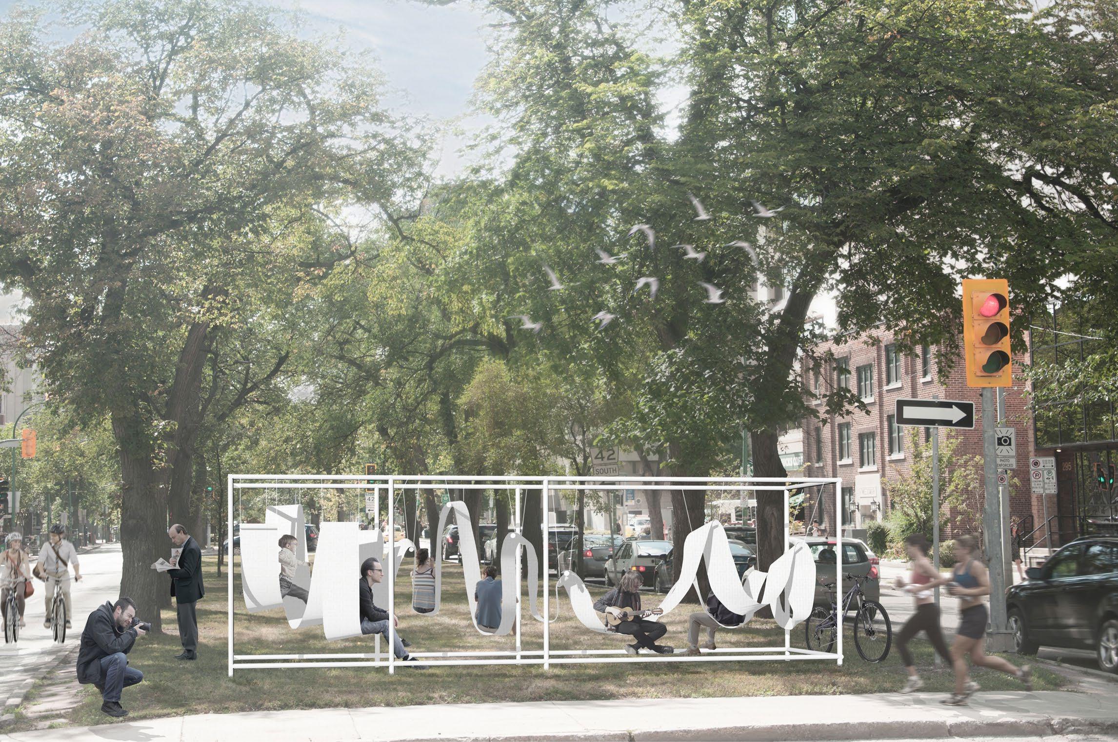
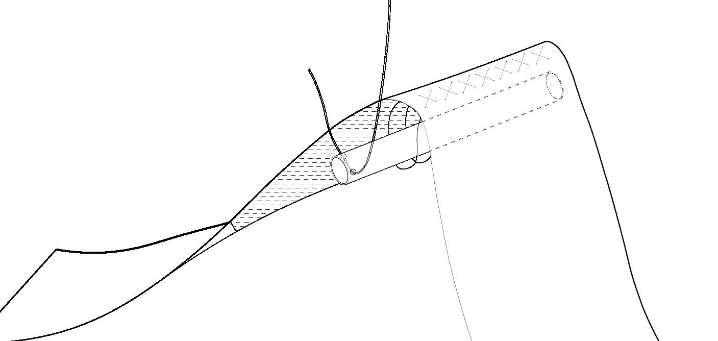
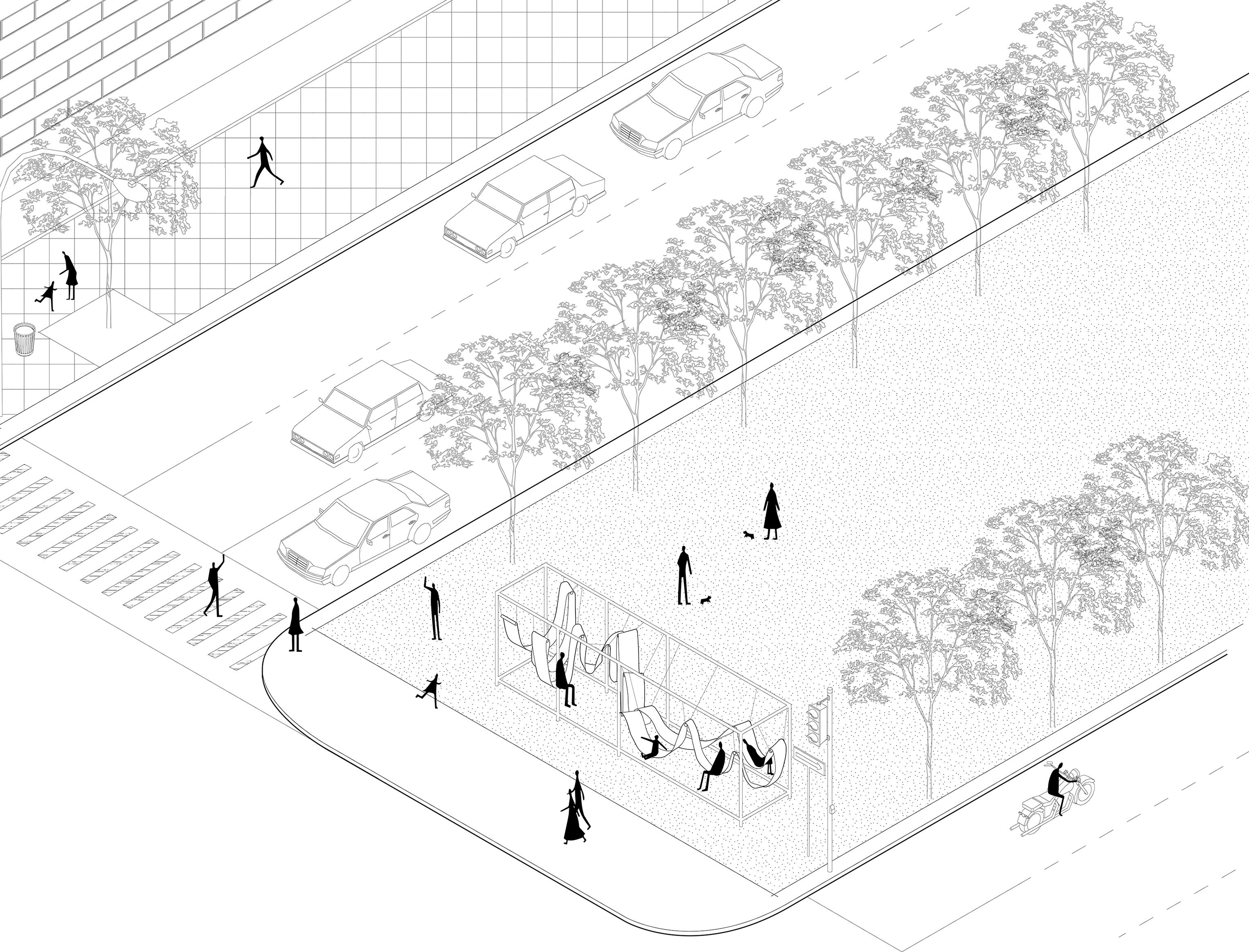
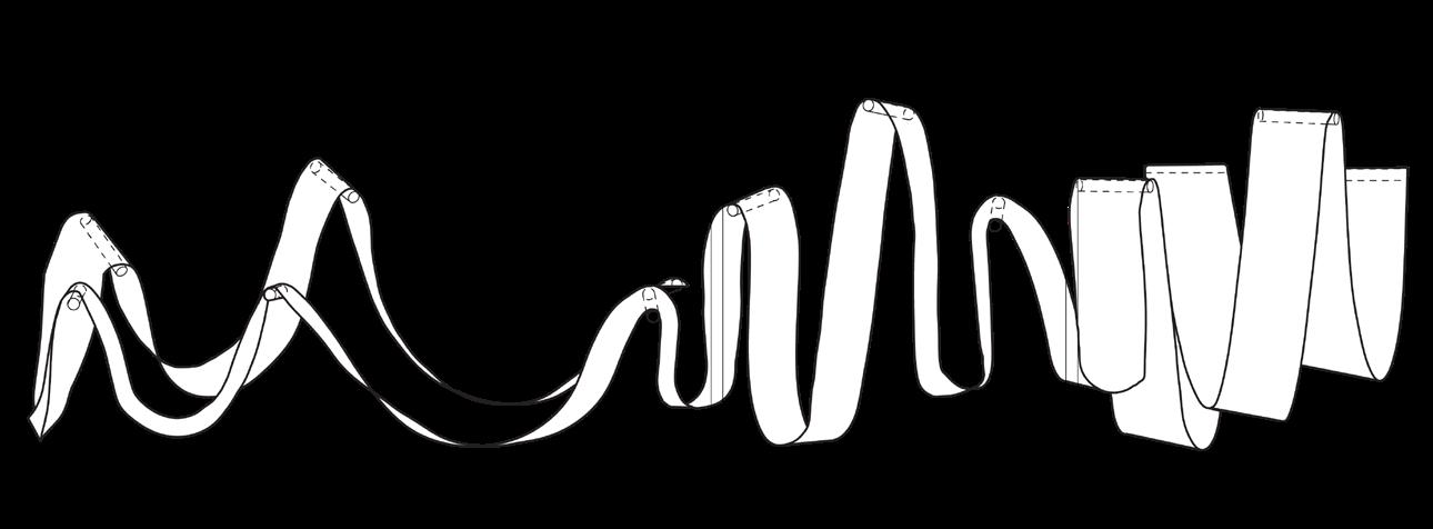
The Bench Competition
The Ribbon
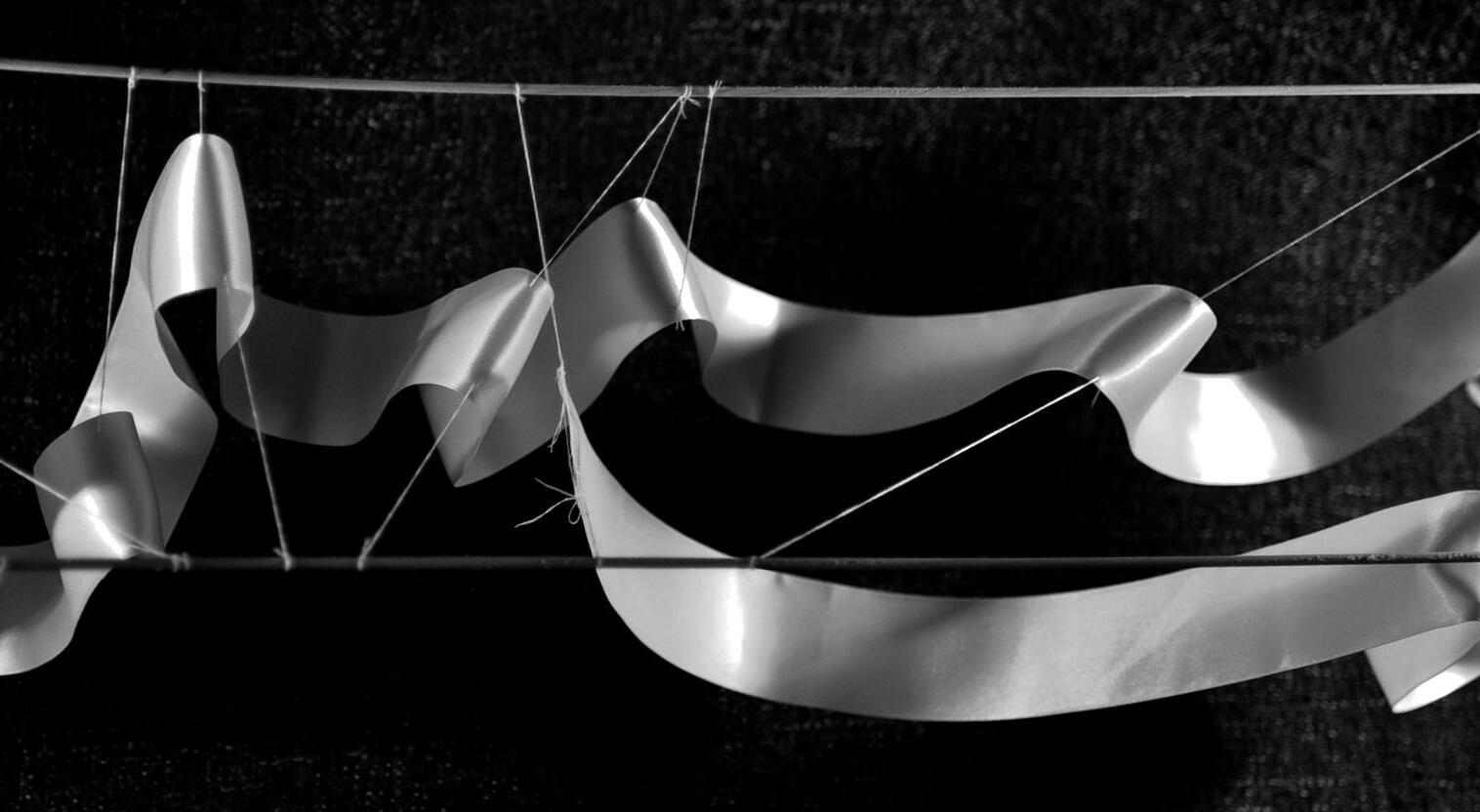


Collaborated with Rui Tang
The Bench Competition is an international design competition organized by STUFF. The design is achieved through collaboration while my role in the team includes producing digital model and renderings. ‘The Ribbon’ challenges the conventional idea of a public bench. Instead of providing a rigid seating device, ‘The Ribbon’ enriches the experience of pedestrians and enhances vitality in the urban public space by composing a dynamic structure.
Space for seating is created within or on top of the suspended canvas while different heights and depths for seating serve people with different needs.‘The Ribbon’ sways in the breeze, creating the subtle movement that people can interact with.
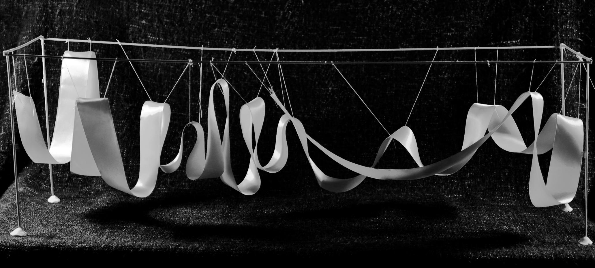
Study Model
Perspective View
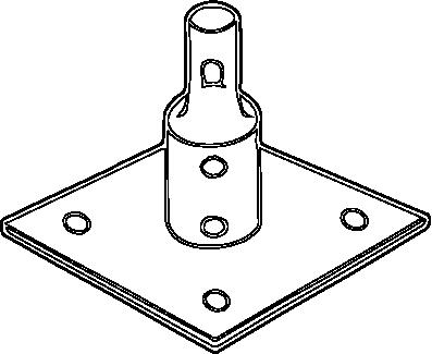
 B. Scaffolding joint
C. Scaffolding base
D. Assembly method
B. Scaffolding joint
C. Scaffolding base
D. Assembly method
C B A D
A. Knotting
Isometric diagram

Contributed by Rui Tang
+ 0.00 m + 0.40 m + 1.50 m + 2.00 m + 1.00 m Elevation 6000 mm 1500 mm 1500 mm 1100 mm Plan Isometric street view Contributed by Rui Tang
BROADWAY SMITH ST.
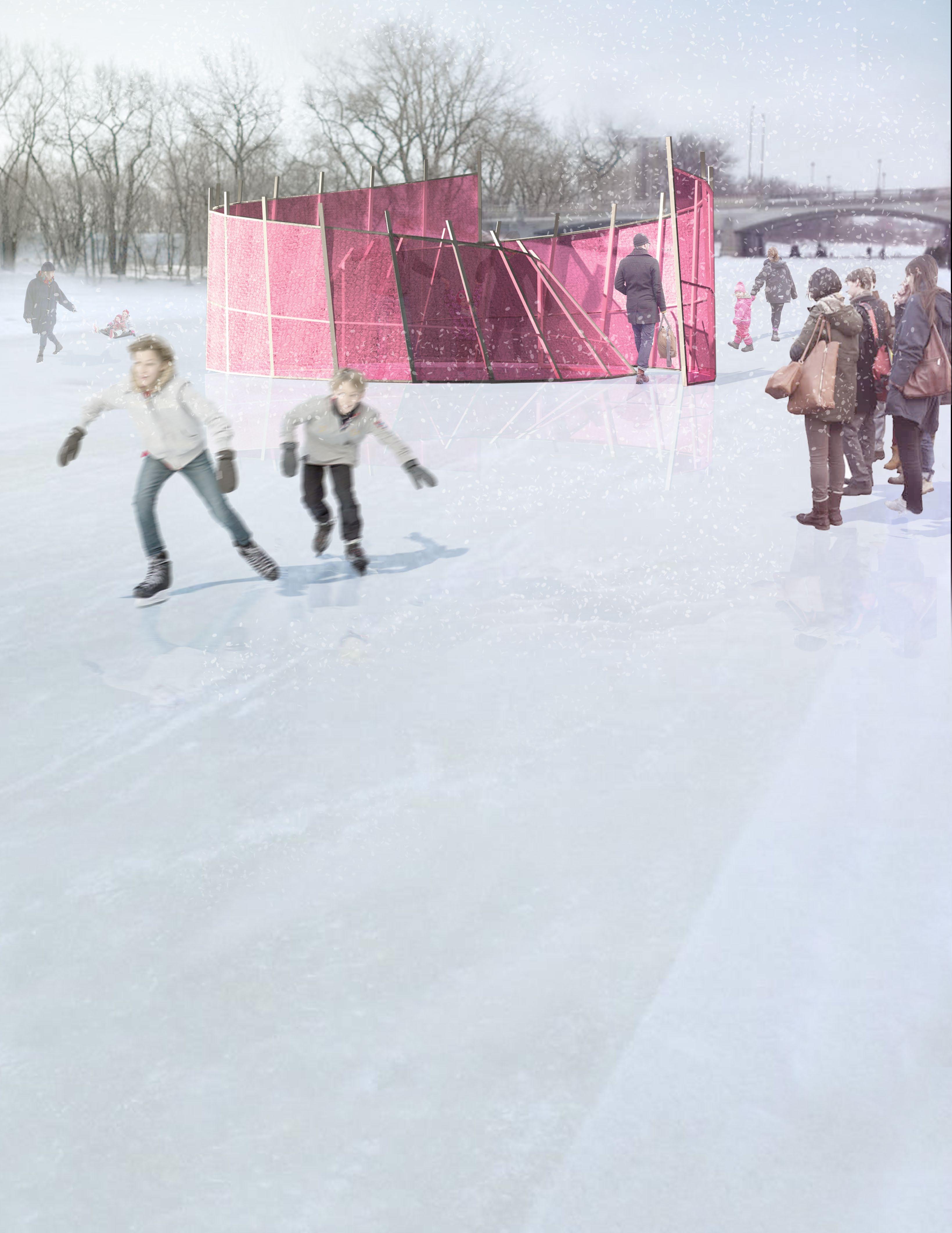
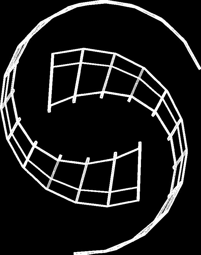
Warming Huts Competition
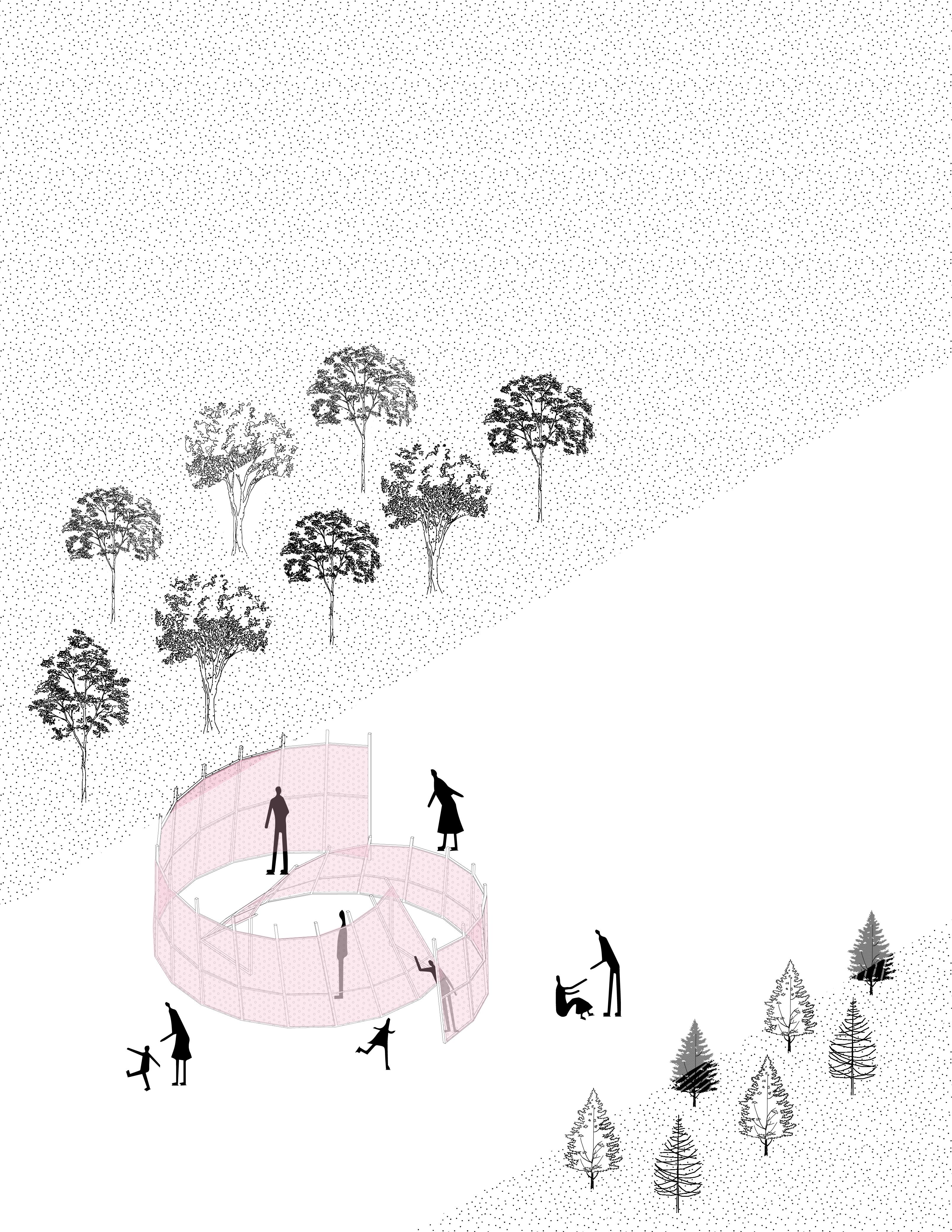
The Bubble Cloak
Warming Huts Competition is an international design competition supported by the Manitoba Association of Architects. The project is achieved in collaboration while my role in the team includes the detail design, producing digital model and renderings. The Bubble Cloak is a temporary structure constructed by framing lumber and bubble wrap. The use of bubble wrap addresses the issue of recyclability, and the air inside the bubble helps resist against temperature change so the bubble wrap would retain heat inside the space.
As visitors skate along the river trail, the appealing appearance of the structure will attract people immediately. The half-encircled structure guides visitors through an open to an intimate space, while sheltering them from wind just as a cloak protects visitors from the cold. The translucent bubble wrap reflects and refracts sunlight, creating a pleasant place with an ambient color.
Isometric diagram

1/2” size strong anti-static bubble wrap
2”x2” framing lumber
1”x2” framing lumber
2”x2” framing lumber
Vertical Columns Horizontal Beams Foundation
Collaborated with Rui Tang Isometric view
Contributed by Rui Tang
7.4 m 5.9 m Plan +0.00 m Left Elevation +1.20 m +2.60 m +0.00 m +0.70 m Back Elevation +2.15 m Right Elevation +0.00 m +0.90 m +3.00 m +0.00 m +1.50 m +3.00 m +2.70 m Front Elevation

Thank benson.zou@mail.utoronto.ca
Thank You
benson.zou@mail.utoronto.ca
