


Draft – September 9, 2024


Draft – September 9, 2024
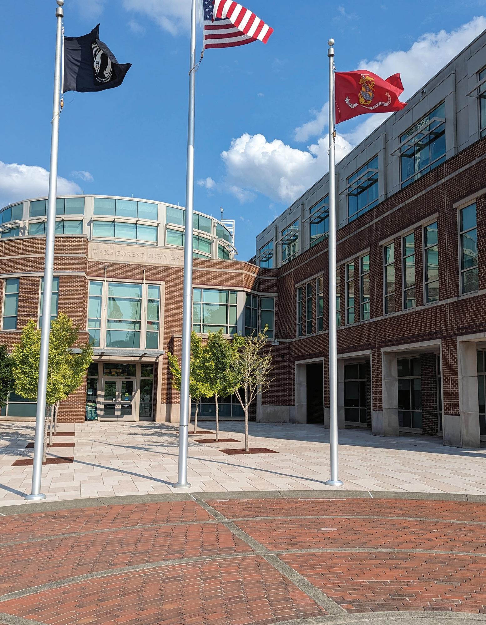
Mayor Vivian Jones
Commissioner Ben Clapsaddle
Commissioner Faith Cross
Commissioner Keith Shackleford
Commissioner Nick Sliwinski
Commissioner Adam Wright
Amy Burkhardt
Megan Hairston
Rick Houser
Ellen Turco
Anthony Harris
Liz Simpers
Dave Lucy
Adam Redler
Karin Kuropas
Sheila Bishop
Michael Almquist
Anna Shope
Elaine Sheppard
Matt Davis
Courtney Tanner Planning Director
Jennifer Currin
Assistant Planning Director
Brad West
Long Range Planning Manager
Kari Grace Senior Planner - Development Services
Patrick Reidy, AICP, CZO Senior Planner - Development Services
Tim Richards, AICP, CZO Senior Planner - Development Services
Michelle Michael, MHP, CZO Senior Planner - Historic Preservation
Emma Linn, CZO
Planner II - Long Range Planning
Antione Jordan
Planner I - Long Range Planning
Kathryn Salisbury, CZO Planning Technician
Ben Coleman
Zoning Enforcement Officer
John Stauffer
Zoning Enforcement Officer
Administration
Communications
Downtown Development
Economic Development
Finance
Fire
Human Resources
Inspections
Information Technology
Parks, Recreation & Cultural Resources
Police
Public Works
Wake Forest Power
Wake Forest Renaissance Centre
A special thank you goes to everyone who participated in the planning process for the Wake Forest Downtown Plan. This Plan was made possible by the contributions and insights of the residents, business owners, property owners, developers, and representatives from various groups and organizations.
Houseal Lavigne
Toole Design
City Collective
Noell Consulting
Wake Forest is faced with a unique opportunity to bring about significant and positive change Downtown. The 2017 Renaissance Plan was strong and insightful in its direction, but Downtown is faced with new issues and opportunities that were unforeseen in 2017. Paramount among these is the S-Line project and the development and redevelopment anticipated with a new Downtown passenger rail station. The town’s plans and regulations have also evolved, with new plans adopted for transportation, the Northeast Community, and overall growth and development in the town--and with a newly updated Unified Development Ordinance. This Downtown Plan continues that evolution to set a new vision and policy framework for Downtown, in order to fully meet the issues and opportunities we face today.
The Downtown Plan serves as the Town’s official guide to direct growth, investment, improvement, and development within Downtown Wake Forest. It provides a decision-making framework for staff, appointed officials, and elected officials.
Presenting a vision for the year 2035, the Downtown Plan also provides goals and other recommendations of action to be undertaken by the Town to maintain Downtown as an attractive and vibrant Town center.
In addition, the Downtown Plan provides property owners and the development community with the Town’s expectation for private development and improvement. The Plan’s recommendations and policies, along with the development guidelines, set a standard for new development and indicate the types of uses and desirable character and built form throughout Downtown.


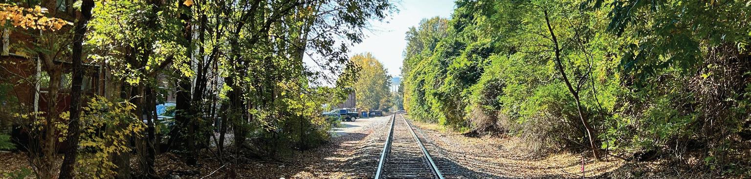
The Town of Wake Forest is in Central North Carolina, about fifteen miles northeast of Downtown Raleigh. The Town’s position, on the periphery of North Carolina’s Research Triangle Park, gives access to one of the fastest-growing research and development hubs in the country. Downtown is advantageously located along the historic Raleigh and Gaston Railroad which will serve as the location for the highly anticipated passenger rail.

Due to this advantageous position, Wake Forest enjoys rapid population growth and is currently one of the fastest growing municipalities in the state. The community is connected to the surrounding region by the major routes US 1, NC Hwy 98, I-540, and US 401, with access to destinations across the world via the Raleigh-Durham International (RDU) Airport located just 17 miles away.

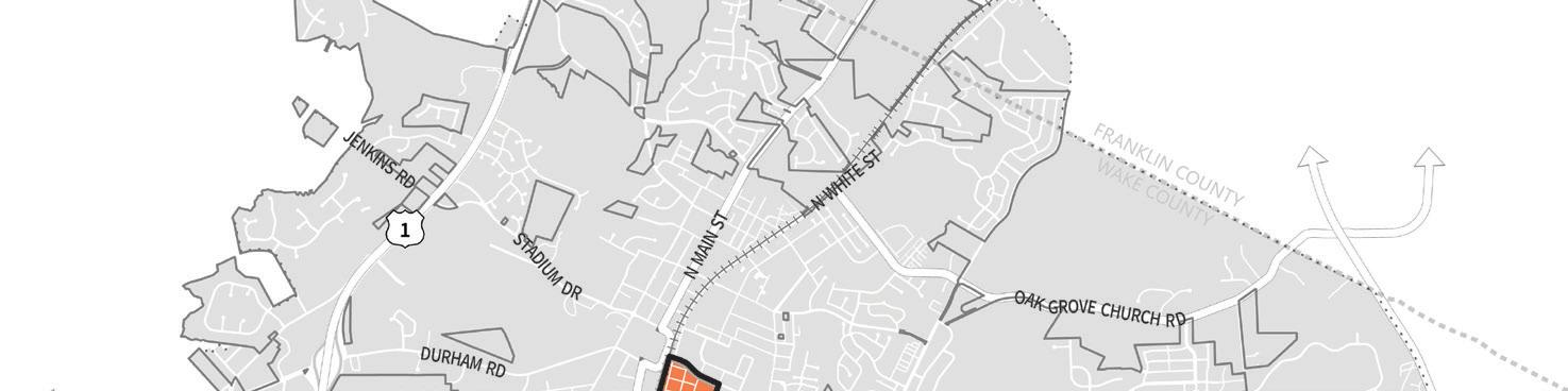


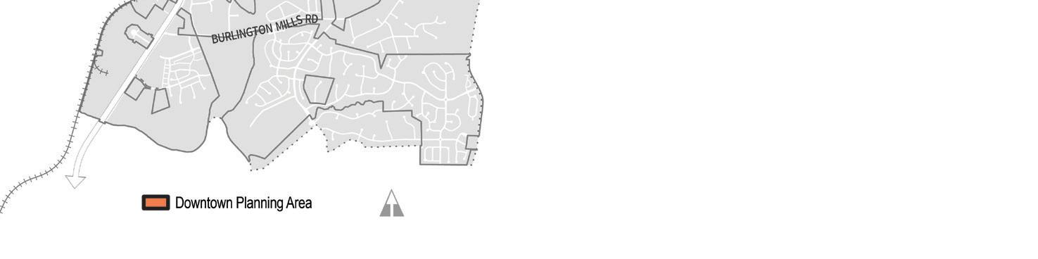
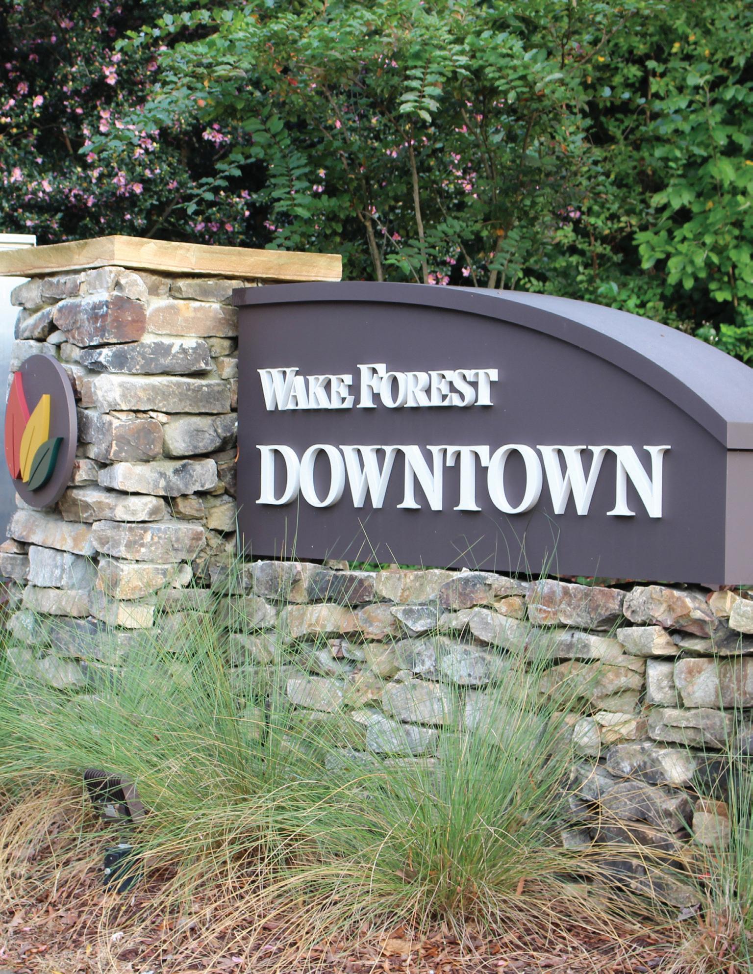
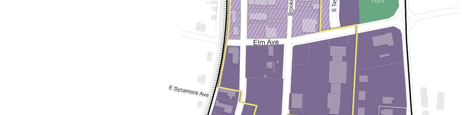
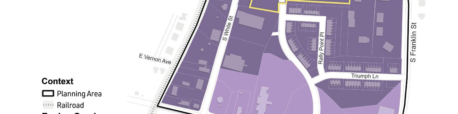
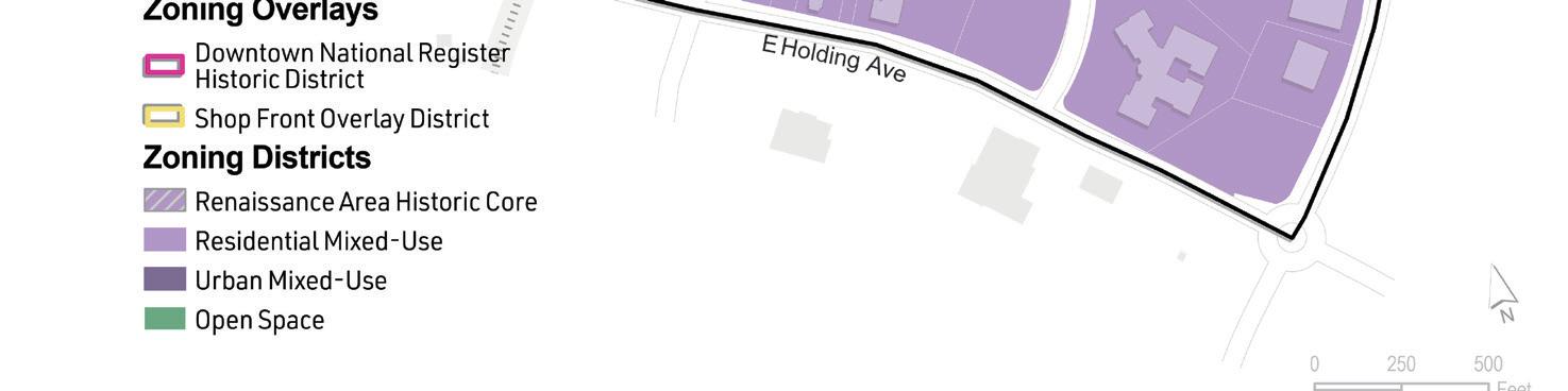
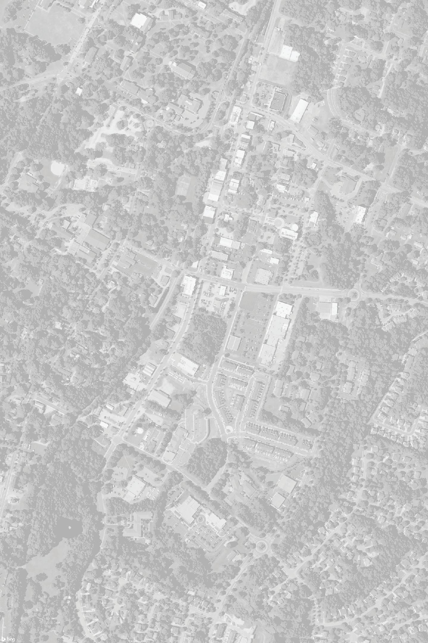
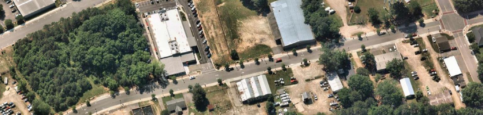
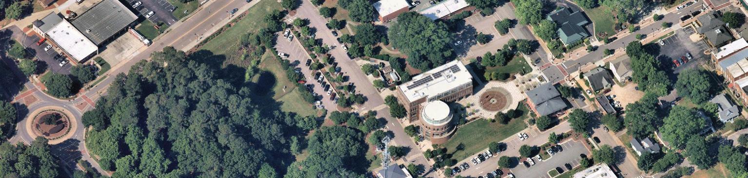
The Downtown Wake Forest planning area is bounded by railroad tracks to the west, East Holding Avenue to the south, Franklin Street to the east, and East Roosevelt Avenue and Wait Avenue to the north. The planning area includes the Historic District, Town Hall, and a variety of businesses and residential uses.

Creating new plans requires a comprehensive understanding of previous planning efforts and documents. The Town of Wake Forest developed numerous plans in the previous decade that cover a range of focuses including growth management, historic preservation, transportation, parks and recreation, and important neighborhoods. The following section contains many plans previously created for Wake Forest as well as the NCDOT S-Line TOD Study. The summaries compiled here provide background which inform the Wake Forest Downtown Plan.
The Wake Forest Community Plan establishes a comprehensive long-term vision for planning and development around Wake Forest for the next 10 to 20 years. Community engagement for the Plan revealed the community’s desire to preserve and enhance the Town’s current small-town character while accommodating projected population growth in a strategic and sustainable manner. It covers an array of topics including land use designations, urban design, greenspace management, transit, and more. All other plans should refer to the Community Plan to understand the overarching vision of Wake Forest.
The Town of Wake Forest is seeking to expand its transit service. The Wake Forest Loop (WFL) circulator and the Wake ForestRaleigh Express (WRX) have served the Town since 2008. The circulator service provides residents access to public services, medical facilities, and commercial destinations in Wake Forest and the Wakefield neighborhood in Raleigh. The express service provides commuter access to downtown Raleigh. The Town conducted the Wake Forest Public Transit Plan (Transit Plan) to explore the options to expand transit to serve growing parts of the Town and connect to key activity centers. The Transit Plan summarizes the evaluation of existing transit services in Wake Forest, discusses the viability of different transit expansion alternatives, and recommends a preferred option to expand transit – including the service type, cost of the service expansion, and steps to implement the service.
The S-Line Transit-Oriented Development Study is a wideranging plan that studies the feasibility of designing and implementing transit-oriented developments (TOD) within communities along the proposed S-Line rail corridor. The study was conducted by NCDOT and focused on 3 S-Line potential station locations in Wake Forest, which included Burlington Mills, Old Forestville, and Downtown. Proposed developments are intended to provide new housing units, commercial space, and transportation infrastructure in accordance with projected population and employment growth over the next 20 years. The Study acknowledges that all developments will be conducted under the priorities of current area plans, such as the Wake Forest Renaissance Plan. The Study Area Vision for Downtown Wake Forest is to support existing successes in Downtown with regional transit connections and targeted TOD development that preserves the existing character of the downtown.
The Wake Forest Housing Affordability Plan highlights current challenges to maintaining and developing affordable housing given the region’s rapid population growth. According to the Housing Affordability Plan Public Survey, 35 percent of white respondents and 63 percent of black respondents struggle to find housing in a neighborhood they want to live in. Special emphasis was given to senior residents who find themselves costburdened, as their ability to move to new housing is limited. The Plan recommends a variety of strategies and actions that could be employed to help keep existing residents in their homes and provide new, affordable housing to those who need it.
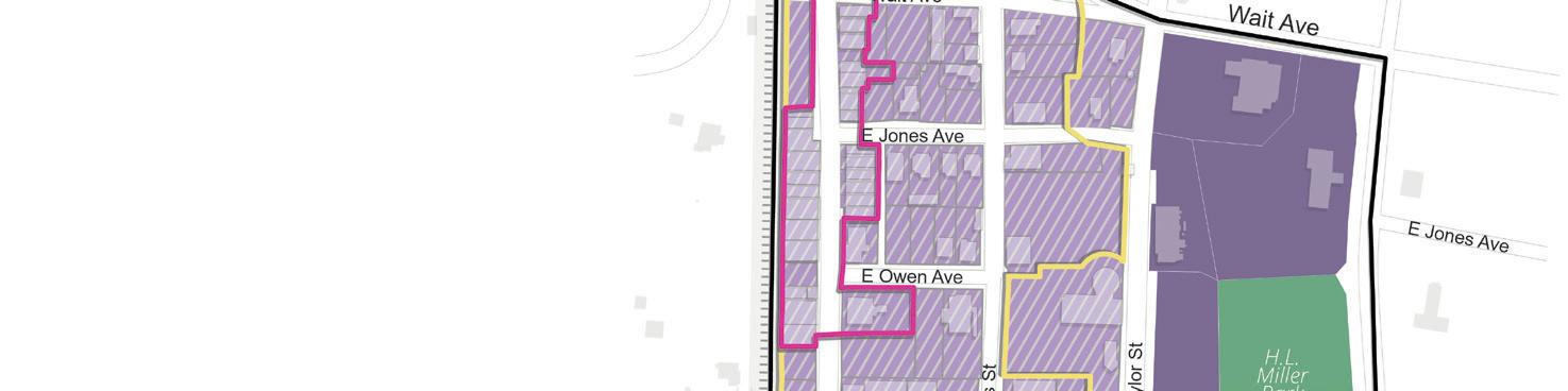
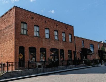
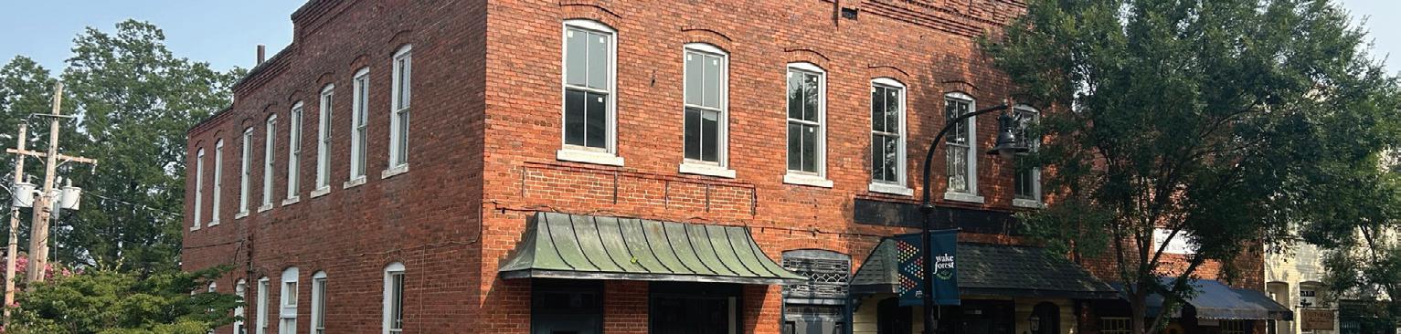
The Historic Preservation Plan was adopted in 2022 and provides an overview of the current funding, programs, and processes of the Town’s Historic Preservation Commission. The current inventory of historic districts and certain properties within them are highlighted in addition to the development requirements indicated by the overlays of certain historic districts. Wake Forest’s Downtown is covered by the Downtown Wake Forest NRHP Historic District. It was established in 2002 and encompasses the buildings on S. White Street constructed between 1890 and 1951. The Plan recommends implementation items that will strengthen the historic preservation program; maintain historic character; increase diversity, equity, and inclusion; and encourage community learning opportunities within the historic preservation program in Wake Forest.
The Northeast Community Plan recommends policies and actions to address the current and future needs of the Northeast Community in Wake Forest. Community members voiced concerns that developments around the Northeast Community could lead to current residents being priced out and the loss of the unique community culture. The Plan aims to help preserve the history, diversity, and affordability of the area while addressing issues of growth, economic health, public infrastructure, and preservation.
The 2019 Comprehensive Transportation Plan (CTP) is a longrange plan that provides recommendations to address the Town’s multimodal transportation needs for the next 25 to 30 years. This includes improvements to highways and streets, pedestrian and bicycle infrastructure, and transit that will steer the Town toward providing a safe, efficient, flexible, innovative, and inclusive transportation system with a multitude of options for residents and visitors. Recommendations include specific locations for new multi-use paths, bicycle lanes and sharrows, rail service, and a “reverse route” of the existing Wake Forest Loop bus service.
The 2017 Renaissance Plan, which is based upon the original 2004 Renaissance Plan, establishes recommendations for the revitalization of Wake Forest’s historic Downtown. The Plan aims to create a vibrant core for the community that provides a place to live, work, and play for both locals and visitors. It also identifies key new development and redevelopment opportunities for mixed-use, housing, retail, office, and dining. Mobility is a major theme carried throughout the Plan, with recommendations for enhancing the pedestrian environment, bikeability, and access to transit from within the Downtown. The Plan sets the framework for urban design enhancements that promote a high quality of life, such as appropriate building height standards, continuous frontages, spatial enclosure, and gateway improvements.
The 2015 Parks, Recreation, and Cultural Resources Master Plan guides the Town in meeting the needs of current and future residents by enhancing and expanding on the community’s unique parks, recreation, and cultural assets. The Plan includes a facility inventory, GRASP (Geo-Referenced Amenities Standards Process) Level of Service Analysis, needs assessment, and operational and marketing analysis, that inform recommendations on how to enhance existing facilities while pursuing opportunities for new facilities and improvements. Issues identified include the need for better circulation systems within parks, increased connectivity to the trail system, enhanced open space integration into parks, and better provision of park facilities west of Capital Boulevard and south of Dr. Calvin Jones Highway (Hwy 98). The Plan describes ways to enhance the level of service and the quality of life through improvements, increased programming, improved safety, and potential partnerships. It also promotes better connectivity to all recreational resources, and it ensures ADA accessibility. The Plan is currently in the process of being updated and the anticipated adoption date is 2024.
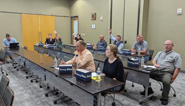
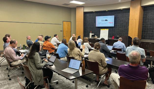
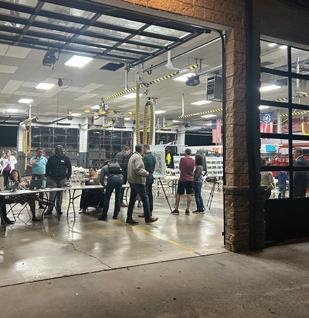
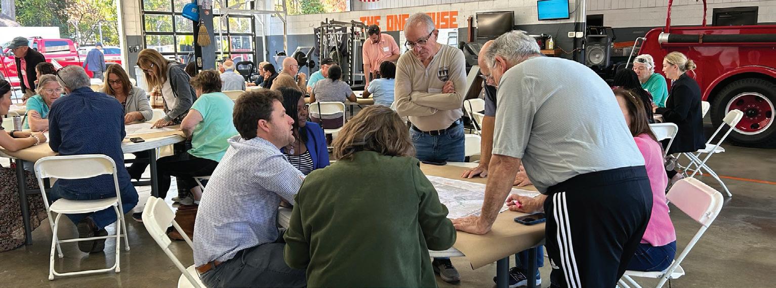
As part of the initial phase of the planning process, community outreach was conducted to gain input from residents, local businesses, the development community, Town staff, and key stakeholders on issues, challenges, and opportunities facing Downtown Wake Forest. To date, the outreach process garnered 882 points of engagement through a combination of in-person and online community outreach tools and exercises.
In-person outreach provided participants the opportunity to discuss issues, opportunities, potential projects, and strengths on Downtown. It also offered stakeholders the opportunity to hear ideas and engage with other participants.
• Department Heads Workshop
• Business Workshop
• Board of Commissioners Workshop
• Advisory Group Workshop
• Planning Board Workshop
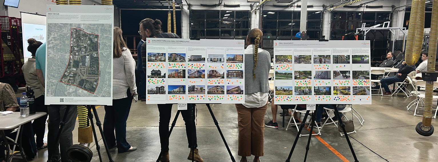
• Downtown Visioning Workshop and Visual Preference Boards
• Draft Downtown Plan Community Open House
• Final Downtown Plan Community Open House
In addition to the various forms of in-person outreach, there was an opportunity for online participation via the Downtown Plan Survey and the Community Facilities Survey.
• Online Downtown Survey
• Service Provider Survey
Additional outreach was conducted to capture insight into the strengths, weaknesses, and opportunities, from more specific groups. DIY kits and key stakeholder meetings offered a more focused discussion with specific groups.
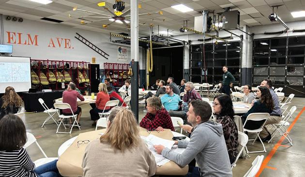
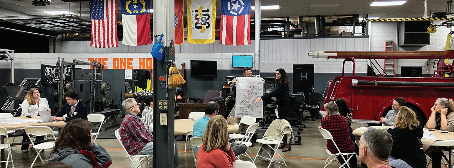
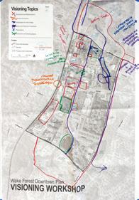
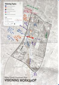
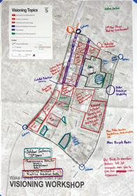
On November 8, 2023, the Town of Wake Forest hosted two Visioning Workshops at the Wake Forest Fire Department Station #1 to discuss the Downtown Plan. The workshops allowed residents, business owners and operators, and other key stakeholders to discuss the future of the community and provide visioning input for the Downtown Plan. The workshops were designed to allow participants to voice their thoughts on the Downtown before plan recommendations are crafted. In addition to offering feedback regarding the vision for Downtown, participants were encouraged to provide feedback on potential urban design elements using a visual preference survey.
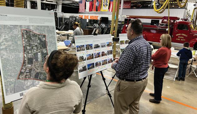
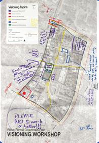
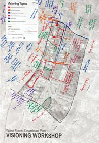
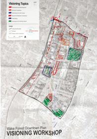
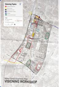
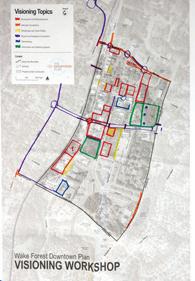
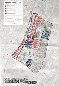
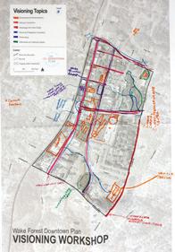
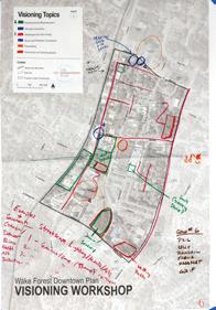
The following is a summary of commonly discussed issues and opportunities organized by topic. These common themes informed the vision, goals, and recommendations found in the Plan.
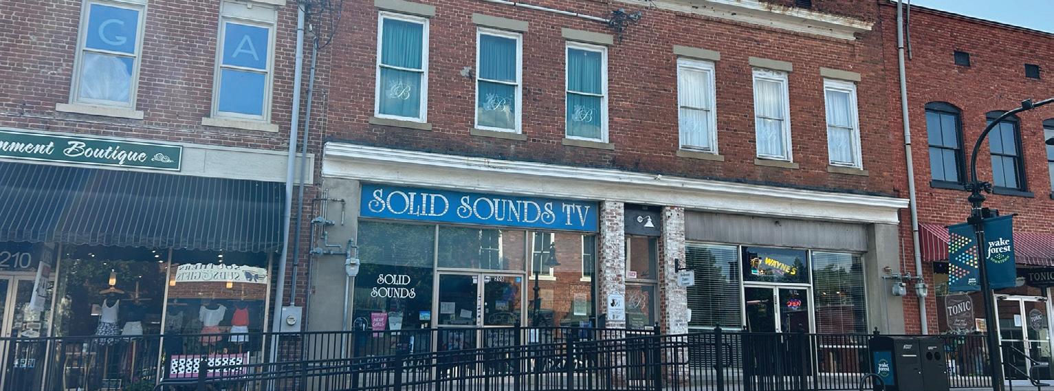
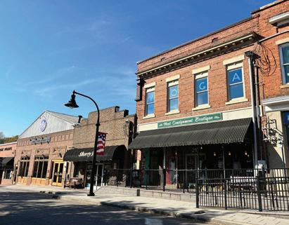
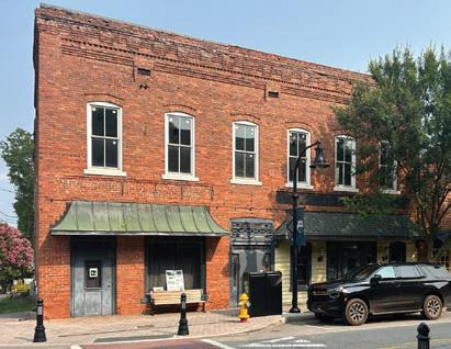
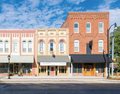
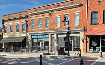
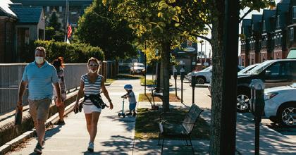
Many respondents remarked that the defining feature of Wake Forest is its small-town, historic character and its natural areas. However, many are concerned that these two aspects of the Town are disappearing with rapid population growth. Participants mentioned that the defining physical elements of Downtown’s identity are the historic buildings along S. White Street. They are beloved for their historic architecture and scale, yet, it was repeatedly mentioned that ways to encourage property owners to maintain and rent their vacant buildings is essential to preserving the character of the historic downtown.
Many participants indicated that Downtown needs more affordable housing. It was mentioned that the newly constructed single-family and multifamily housing stock is not considered affordable for residents earning below the area’s median income. While participants mentioned that affordable housing options are needed, many survey respondents were concerned about the Town’s current pace of development. Several respondents felt that Downtown should not see residential development as it may worsen the availability of parking and detract from the area’s current small-town charm and natural beauty.
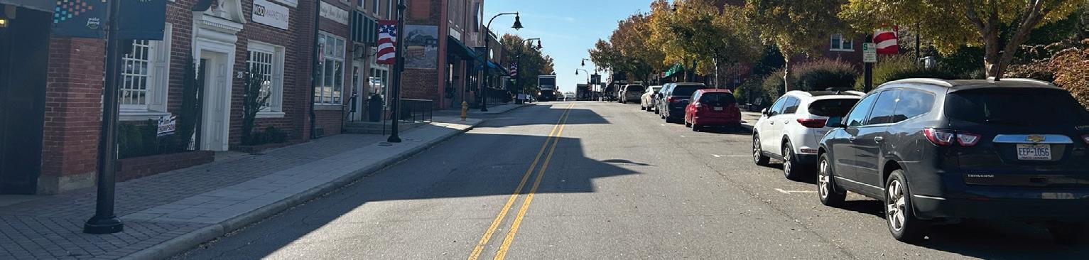
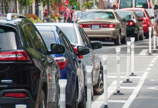
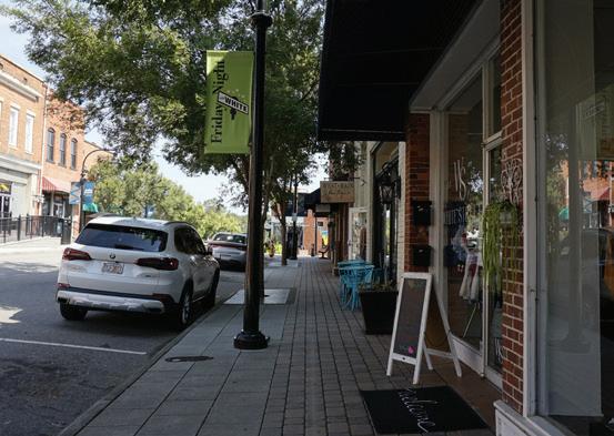
Traffic congestion and parking were common topics of discussion in all forms of community outreach. Many respondents felt that the Town is growing too quickly for current infrastructure to handle and is causing traffic in and around Downtown. Several respondents called out S. White Street as an example of the traffic issues in Downtown, particularly during special events, such as Friday Night on White.
Note on Summary Context: The items identified in this summary are not recommendations or observations of the consultant. They represent feedback and comments received from those who participated in the various workshops, interviews, and survey.
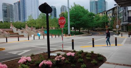
Intersections around Downtown, particularly the intersection at S. White Street and Elm Avenue, were cited as dangerous. Respondents mentioned that there is a desire to walk into Downtown but current conditions do not provide a safe and comfortable environment to do so. Several participants mentioned that Elm Avenue and E. Roosevelt Avenue need street improvements to increase safety and visibility, particularly Elm Avenue because of its width.
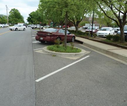
With much of Wake Forest’s traffic converging Downtown, parking is a big issue amongst respondents. Some respondents did not like that visitors would sometimes park in spots designated for Downtown residents or businesses. In addition, respondents pointed out that the lack of available parking becomes more of an issue during Downtown events.
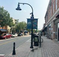
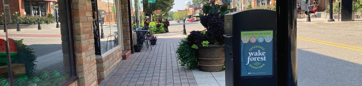
Feedback from respondents noted that street trees, lighting, and other public amenities on S. White Street provided a great atmosphere to Downtown. Many individuals compared S. White Street to the other downtown streets (Wait Avenue, E. Jones Street, Brooks Street, etc.) and noticed the “feel” of Downtown disappears on these streets and walking becomes less pleasant. Participants felt that streets should receive streetscape improvements to improve the walking experience throughout Downtown. During the visioning workshop, groups mentioned the need for more public art and signage. Groups suggested that more public art should be added to current parks and public spaces to add to the identity of Downtown.
Many respondents liked the idea of installing gateways into Downtown and pointed to the railroad overpass as the only significant gateway into Downtown. Participants said that improvements need to be made to the railroad bridge along with the road and sidewalk passing under it.
Respondents are happy with the current commercial stock in Downtown. However, when asked what could attract more customers and visitors downtown, respondents overwhelmingly responded with a desire for a greater number and diversity of restaurants. The reasoning for this response came from a desire for more social spaces downtown and activations of more rooftops and/or outdoor spaces. Apart from restaurants, respondents wanted new “quality” shopping options, such as grocery stores, bakeries, or clothing stores. Multiple groups emphasized the desire for a locally owned and operated Downtown and wanted to ensure that new development does not include chains.
Natural space in and around Downtown is highly valued and residents are concerned that it may be lost if new development occurs. More green space in Downtown, especially along streets was a common comment from survey respondents. Several participants noted the wooded site at the corner of E. Holding Avenue and Brooks Street as a location for future park amenities or gathering spaces. Participants wanted to see areas within Downtown for recreation and gathering to enjoy the favorable climate of the Town. In addition to creating new spaces for recreating and gathering, many participants highlighted H.L. Miller Park as an underutilized asset.
Respondents noted that many buildings are sitting vacant. Outreach participants cited uncooperative landowners, noncontributing businesses, lack of cooperation from business owners, and historic preservation challenges as issues contributing to underdeveloped and underutilized properties. During the visioning workshop, participants identified possible development or redevelopment sites. These areas included the Renaissance Plaza, Franklin Academy, and properties between S. White Street and Brooks Street.
While these areas were specifically highlighted, there was excitement around the development potential contained within Downtown. Outreach participants envisioned mixed-use structures as the primary example of redevelopment in Downtown. E. Jones Avenue, E. Owen Avenue, S. White Street, and Brooks Street were identified as streets for future mixed-use development. Emphasis was placed on preserving the existing historic structures while respondents felt that new mixed-use development should be constructed as infill on vacant or underutilized lots.
The Demographic Snapshot summarizes existing characteristics within the Town’s current population. Understanding Wake Forest’s demographics enables the Town to respond to the community’s needs, predict future demands, and support appropriate future land uses with adequate developments. The following snapshot was used to guide the Downtown Wake Forest Plan by uncovering existing trends, issues, and opportunities. Where appropriate, the Town of Wake Forest has been compared to Wake County and the State of North Carolina. Data was collected from the 2021: ACS 5- Year Estimates as well as the U.S. Census Bureau data source OnTheMap.
Since the 1990s, Wake Forest has experienced significant growth, with its population increasing by almost eight times.
The Town of Wake Forest has a current population of 49,657. Between 1990 and 2022, the Town experienced a 760 percent increase in population, or a total 43,888 new residents. This is over four times greater than Wake County’s population growth (177.5 percent) and over twelve times greater than North Carolina’s growth (61.4 percent) within the same period. The Town’s significant increase in population is reflective of the major growth occurring in municipalities across the Research Triangle Region and is most likely associated with the availability of lower cost land and housing compared to that of the City of Raleigh. Over the next two decades, Wake County’s population is projected to increase by 35.3 percent, reaching 1,528,450 in 2039. The Town is poised to capture some of the County’s projected growth and continue its recent growth trends.
Wake Forest’s senior population is increasing, which is in line with county, state, and national trends.
Wake Forest’s largest age groups are residents aged 5 to 19, 25 to 44, and 45 to 64 years old, which respectively make up 22.5 percent, 27.2 percent, and 27 percent of the population. As indicated by the American Community Survey, the Town experienced a significant increase in seniors over the past decade (125 percent), which includes people aged 65 years and older. The second largest increase occurred in the 45 to 65 age group (94.6 percent), signifying the community is growing older. Wake County and North Carolina both show a similar pattern, though less significant, with the highest growth in people aged 65 and older at 71.3 percent and 36.6 percent, respectively. All three geographies are in line with national trends driven by the large, aging baby boomer generation.

Wake Forest is less diverse than Wake County and North Carolina.

According to the U.S. Census Bureau, most of Wake Forest identifies as White (70.4 percent). Black or African American is the second largest racial group (17.8 percent). The Town is less diverse than Wake County, which is comparatively composed of a population that is 62.5 percent White and 19.9 percent Black or African American. This coincides with North Carolina which shows a similar racial composition to the County at 66.2 percent White and 21.2 percent Black or African American. Wake Forest also has a lower proportion of people who identify as Hispanic (an ethnicity which can be made up of any race) at 7 percent, compared to 10.1 percent (Wake County) and 10.1 percent (North Carolina). However, the Hispanic and racial minority population is increasing as a percentage of the total population in Wake Forest, albeit at a minimal rate. Source:
Like Wake County and North Carolina, Wake Forest’s higher income households have grown over the last eight years while lower income households have decreased.
Currently, Wake Forest’s largest household income group is the $150,000 and over group, at 29.9 percent, followed by the $100,000 to $149,000 group at 23 percent. Between 2010 and 2021, the $150,000 and over household income group experienced the largest increases in Wake Forest, Wake County, and North Carolina. The group with the second largest increase was the $100,000 to $149,000 group. Household income groups earning $74,999 and under experienced a decrease in percent composition for all locations, with the percentage decrease growing the lower the income group is. Overall, all three geographies show similar trends displaying a growing high income population and a simultaneously shrinking lower income population.
$100,000-$149,999
$75,000-$99,999
$50,000-$74,999
$35,000 - $49,999
$25,000-$34,999
Wake Forest’s largest industry is Retail Trade, which has experienced the largest increase in jobs over the last eight years.
Wake Forest’s corporate community and expanding business environment has created a variety of local job opportunities over the past 10 years. It has experienced a 94 percent increase in total primary jobs between 2013 and 2021, reflective of the fastpaced economic development occurring throughout the Triangle Region. Presently, the Town’s largest industry is Retail Trade, which makes up 24.7 percent of its employment base with 3,621 employees. Accommodation and Food Services (16.8 percent or 2,461 employees) and Professional, Scientific, and Technical Services (11.6 percent or 1,695 employees) are the Town’s second and third largest industries by employment. Retail Trade experienced the largest growth between 2013 and 2021 (2,043 new jobs), followed by Accommodation and Food Services (1,476 new jobs) and Professional, Scientific, and Technical Services (922 new jobs).
In comparison, Wake County’s current largest industry is Professional, Scientific, and Technical Services (12.1 percent or 74,194 employees), followed by Public Administration (11.9 percent or 73,369 employees) and Health Care and Social Assistance (11.1 percent or 68,007 employees), with Professional, Scientific, and Technical Services experiencing the highest growth over the past five years (25,828 new jobs). North Carolina’s largest industry is Healthcare and Social Assistance (14.1 percent or 581,266 employees), followed by Retail Trade (11.6 percent or 478,383 employees) and Manufacturing (10.9 percent or 453,292 employees). Like Wake County, the State’s fastest growing industry is Professional, Scientific, and Technical Services with 74,110 new jobs between 2013 and 2021.
Source: ACS 2021 5 Year-Estimates
Source: ACS 2021 5 Year-Estimates


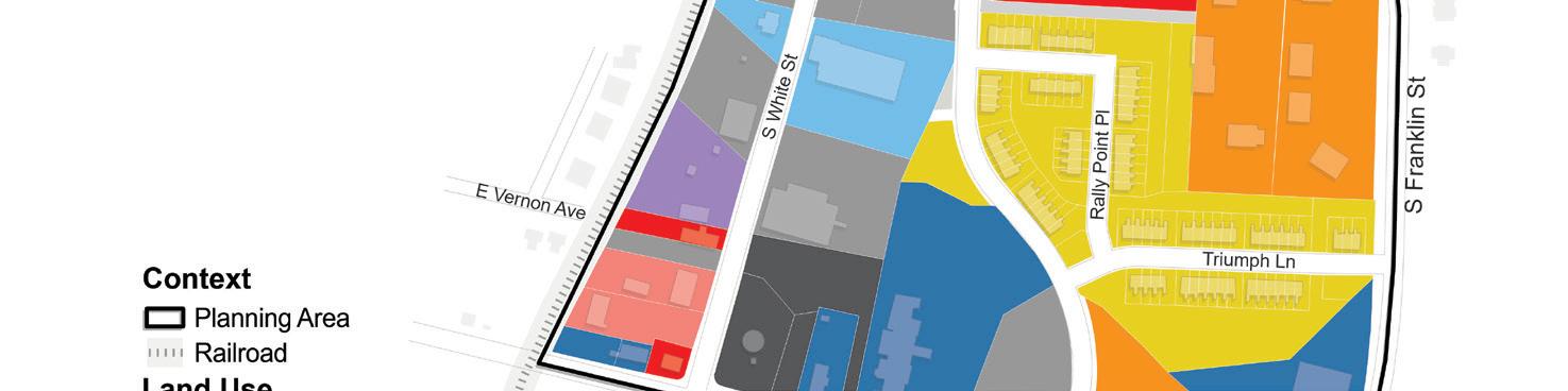
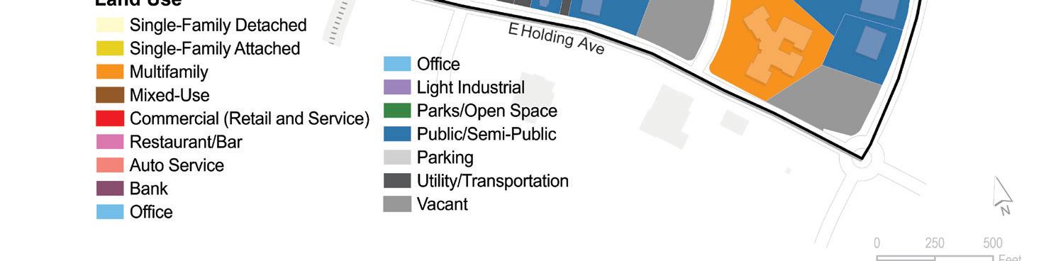
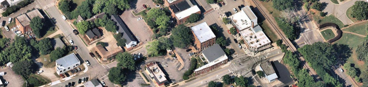
A review of existing land use was conducted to identify how Downtown’s land is being used. This review was informed by field reconnaissance, research, and available existing data. All parcels were divided up into 15 unique land use designations, which represent all the different uses found Downtown.


The Wake Forest Unified Development Ordinance (UDO) combines the Town’s zoning, subdivision, land use, grading, stormwater management, and historic preservation regulations into a single document. It outlines the requirements for all development activity. These zoning and development controls are critical to shaping the community as they establish what specific land uses are permitted, the density, intensity, and scale of those uses, and requirements for parking, signs, and other on-site improvements. These regulations help direct growth in a visually attractive and suitable manner and are the primary tools for implementing the downtown plan. The following are the current zoning classifications in Downtown.


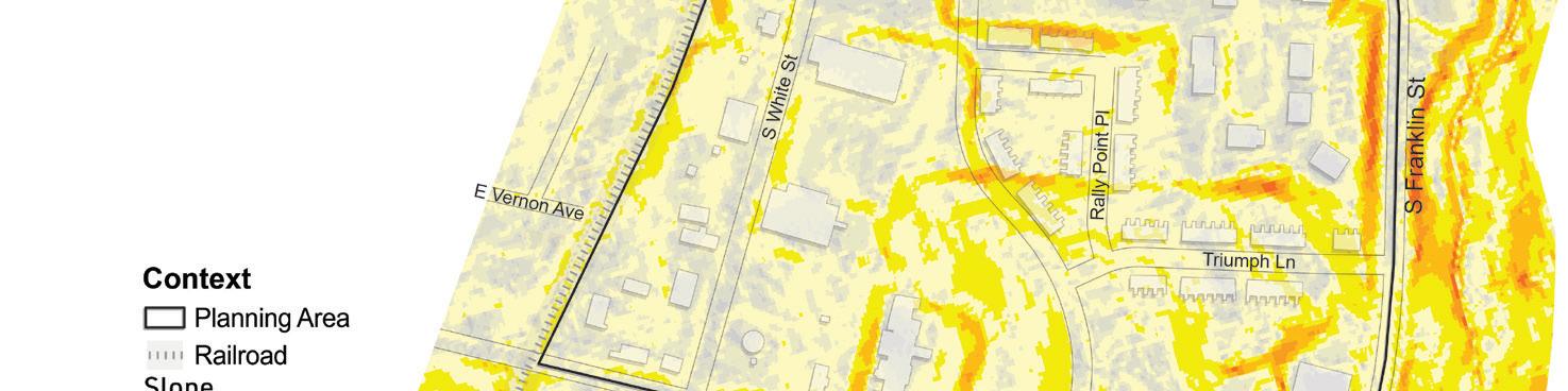
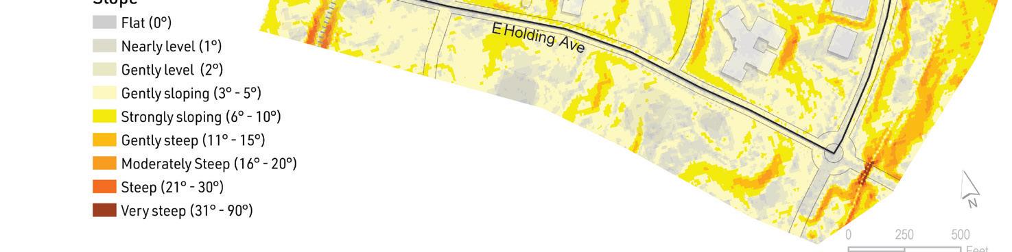
Downtown Wake Forest sits on a gentle hill sloping downwards from the railroad tracks on the west side of the planning area to the Smith Creek channel on the east side of the planning area. The commercial core along S. White Street rests on flat ground, but the blocks east of S. White Street feature slopes from 0 to 10 degrees. The map shows the steepest slopes along the railroad embankments on the western boundary and the creek channel on the eastern boundary. The map also shows the manmade slopes and retaining walls constructed around newer developments south of Elm Avenue.


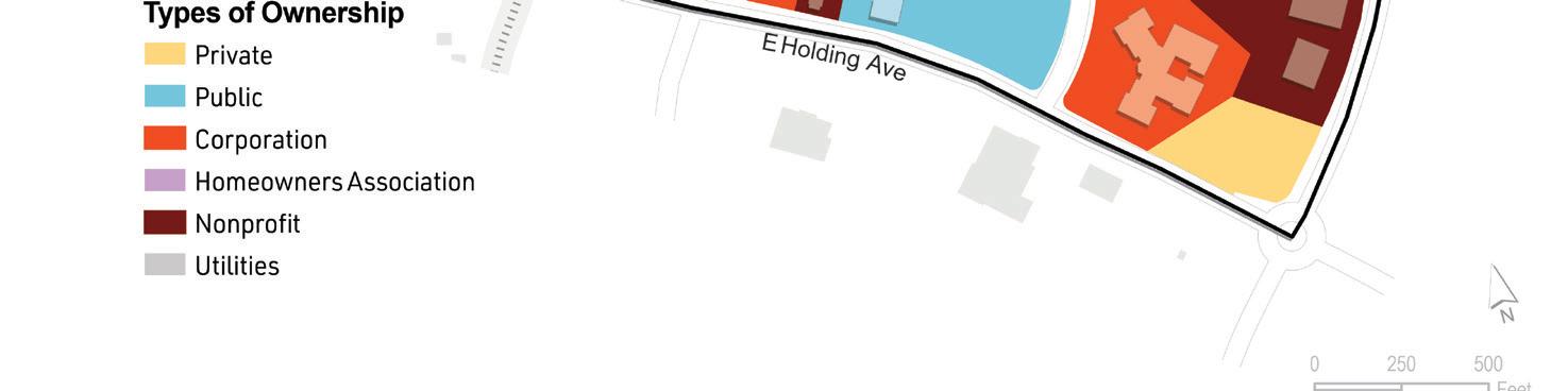
Downtown’s planning area contains 221 parcels with a total of 98.5 deeded acres. Approximately 33 percent of the land area is owned by the Town of Wake Forest, which includes land around Town Hall, H.L. Miller Park, the fire station, and the Northern Wake Senior Center. Privately owned parcels are split between private individuals, businesses, non-profits, and utilities. Of the remaining land area in Downtown, 41 percent is owned by a corporate entity, 11 percent is owned by private individuals, 7 percent is owned by utilities, 4 percent is owned by the Retreat at Renaissance Homeowner’s Association, and 4 percent is owned by a nonprofit.
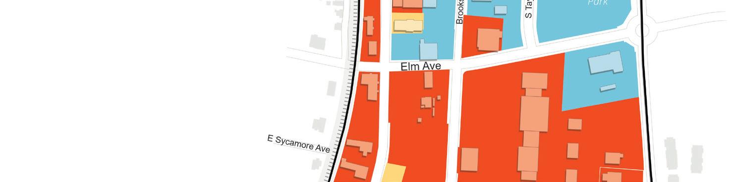
Downtown’s historic core contains a greater diversity of owners, with many properties along S. White Street alternating between public, individual, and corporate ownership. Most of the land area south of Elm Avenue is consolidated into fewer larger parcels owned by corporate entities (56 percent), but much of this land consists of landscaping, open space, or parking.

The Vision Statement and Goals for Downtown Wake Forest describe its future in 2035 and provide a detailed, actionable blueprint outlining the projects, improvements, and developments needed to achieve the community’s desired outcome.
Vision Statement. The Vision Statement paints a picture of what the Town of Wake Forest can achieve after adopting the Downtown Plan. The Vision Statement was developed from input expressed by participants during the community outreach process and depicts the community’s collective desires and aspirations for Downtown Wake Forest.
Goals. The Goals are broad and long-range desired outcomes. The Town’s planning efforts should work to support these goals. They are ambitious and will require the execution of many policies, recommendations, and actions in the Downtown Plan to be fully achieved. These goals hold importance for providing the desired outcome of the Plan.

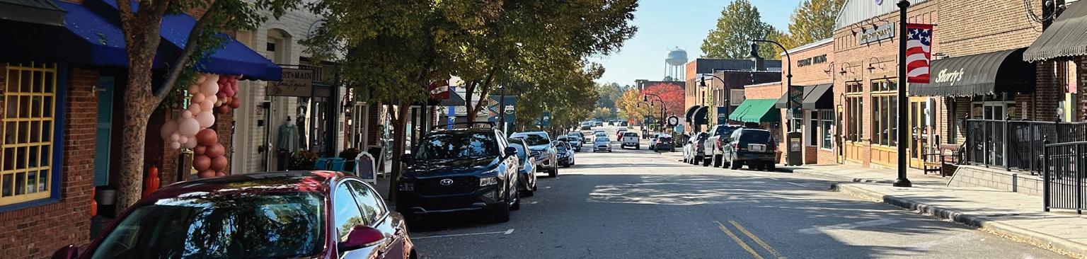
Downtown Wake Forest will continue to be known as the heart and soul of the Town, serving as the central business district, civic and cultural hub, historical center, and vibrant focal point for both residents and visitors alike.
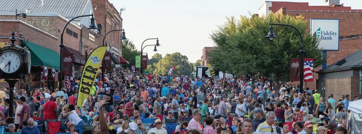
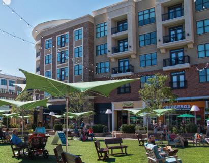
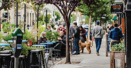
Downtown will be “the place to be.” Downtown is already known as the charming and stylish center of Wake Forest. Investments in public spaces and gathering places, and improvements to the public realm – the streets, sidewalks, public benches, art, outdoor dining areas, and more – will strengthen Downtown as a destination. These improvements will create a vibrant energy that makes Downtown a regional draw for residents and visitors alike to shop, eat, work, and spend time.
Downtown will continue to grow and prosper. Expansion and reinvestment will attract new and returning visitors and residents to Downtown. New multifamily and mixed-use buildings will provide increased living opportunities Downtown, including attainable and affordable housing choices. The increase in housing options Downtown will support economic vitality, livability, and vibrancy. The Downtown economy will be strengthened with more diverse businesses, attracting a wider range of clientele, yet maintaining the local-business charm. As a result, Downtown will develop as an amenity-rich destination that draws residents and visitors 365 days a year, not only on prominent festival days.
Visiting Downtown will be an all-day experience. Residents and visitors, friends, and family – all will enjoy being in the Downtown any time, from morning to evening, spending time in cafes, restaurants, boutiques, and bars. Increased walking and biking connections to surrounding neighborhoods will make it easy to get Downtown. Traffic and parking will be addressed with a strategic, safe, and efficient system that supports the current and future needs of Wake Forest. People will find it easy to “park once” and spend the day perusing multiple Downtown destinations during the same trip.
The heart of Wake Forest will remain the quaint, walkable, and friendly core of the Town that is already appreciated today while expanding its reputation as one of the best places to live or visit in the region.
Encourage diverse businesses such as restaurants, shops, and boutiques to enliven the area to encourage people to spend the whole day or evening Downtown.
Preserve and protect Downtown’s historic character while accommodating development that is context sensitive and aligns with the established character of the Town.
Accommodate more mixed-use development in appropriate locations. Leverage redevelopment opportunities between the built form and evolving streetscape to improve the pedestrian experience throughout Downtown.
Ensure new development fits within the established context of Downtown to enhance the “quality and feel” while ensuring that the charm and character of Wake Forest is not loStreet.
Ensure that attainable housing is developed in appropriate locations to accommodate a range of potential residents in all stages of life.
Cultivate a safe, efficient, and enjoyable transportation system which improves the way pedestrians, bicyclists, and drivers move in and out of Downtown through new roadway and building design, crosswalk and sidewalk improvements, and dedicated paths and connections.
Update and expand the current streetscape to include more trees, parklets, sidewalk amenities, and outdoor dining opportunities.
Develop more interesting and effective placemaking elements in Downtown utilizing more public art, signage, and wayfinding.
Enrich and strategically expand the current green spaces to offer a respite for those spending time Downtown. Provide more options where people can gather to eat, talk, and spend time in flexible spaces such as pocket parks or other programmed small spaces.
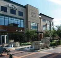
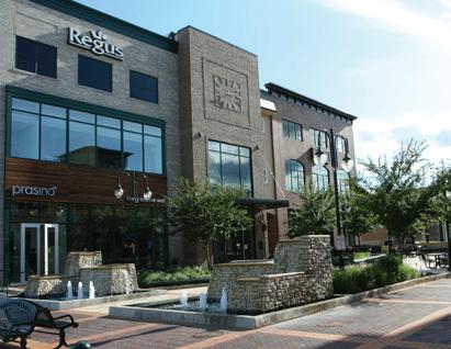
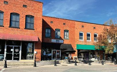
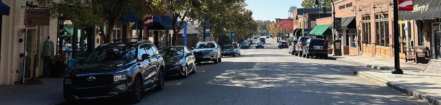
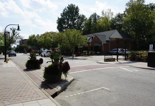
Downtown Wake Forest is the Town’s historic core that serves as the vibrant hear of the community. Historically, ground-floor commercial uses occupy storefronts along S. White Street, while civic buildings, emergency services, a senior center, and H.L. Miller Park, are conveniently located attracting a variety of users.
Throughout the planning process, residents, local business owners and operators, community stakeholders, and Town staff have voiced a strong desire to maintain and strengthen Downtown as a thriving center with a critical mass of retail, entertainment, civic, cultural, and residential activity. By embracing traditional planning principles such as walkability, density, mixed-use environments, and design quality, Downtown Wake Forest can be positioned for decades of continued success. To this end, the Downtown Plan seeks to activate and better utilize Downtown’s redevelopment potential of the surrounding areas of historic S. White Street to accommodate future mixed-use and residential opportunities.
This chapter outlines an approach for future land use and Functional Subarea development within Downtown in a manner that harmonizes its existing charm and character with opportunities for reinvestment and growth. The recommendations presented in this chapter are based on an assessment of existing conditions and market potential, previous planning efforts, input from residents and business owners, and best planning practices.
Downtowns are best described as a mix of different land uses within a walkable environment. A combination of appropriate land uses is essential for establishing Downtown as a selfsustaining, vibrant destination, full of activity. Downtown should continue to be strengthened and improved as a “mixed-use” area, unique to the Town and the region. By remaining flexible and promoting a variety of uses, the Town can diversify redevelopment options and continue to support the desired character and intensity expected in Downtown. This section provides an overview of land uses within Downtown Wake Forest and how they could be classified as either a primary land use or a secondary land use, which contribute to making the functional subareas unique and active. Specific recommendations relative to land use, intensity, and location are included in the Functional Subareas.
Mix of uses describes the distribution of uses and buildings across a single site. Mixed-use describes buildings that stack uses vertically within the same structure, with retail, restaurant, service, small-format grocery store, or office space on the ground-floor and office or residential uses on the upperfloors(s).
A residential population provides a consumer base for Downtown businesses and leads to greater pedestrian activity and foot traffic making the area more vibrant. These uses can be built as standalone multifamily buildings or be incorporated into upper-floor uses with retail, restaurant/bar, entertainment/ culture, service and/or office uses on the ground-floor.
Retail is an essential element in positioning Downtown as a shopping destination for residents and visitors. Retail uses within Downtown Wake Forest should provide reasons for individuals to spend time and contribute to the Town’s local economy. Downtown is currently home to a wide variety of retail establishments ranging from traditional clothing and hardware stores to experience-based niche retailers.
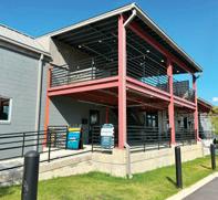
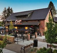
Restaurants, bars, and breweries are a crucial part of creating a lively Downtown for both residents and visitors, significantly contributing to the overall character, appeal, and experience of the area. A mix of cuisines and restaurant/ bar environments should be encouraged to ensure Downtown has something to offer to everyone. Drive-thrus are not compatible with the development pattern in Downtown and should not be allowed.
Entertainment uses include businesses that offer unique experiences and make Downtown a destination. These types of “experience-driven” uses generate foot traffic and activity and create a unique experience that is generally difficult to replicate in other areas of the community.
Service uses, such as hair salons, spas, yoga studios, dry cleaners, and banks, generate activity Downtown and support the day-to-day needs of Downtown residents, employees, and visitors. The operating hours of many service uses are often limited to the daytime and can lead to a lack of vibrancy at night if there is too great a concentration in a compressed area. Drive-thrus are not compatible with the development pattern in Downtown and should not be allowed.
Office uses, including professional firms and medical practitioners, provide important services and employment opportunities. Office uses increase the daytime population of Downtown Wake Forest and support retail, restaurant, and service businesses, particularly during lunch and after work hours. Office uses can take different forms, including freestanding multi-story spaces or as part of mixed-use buildings
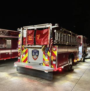
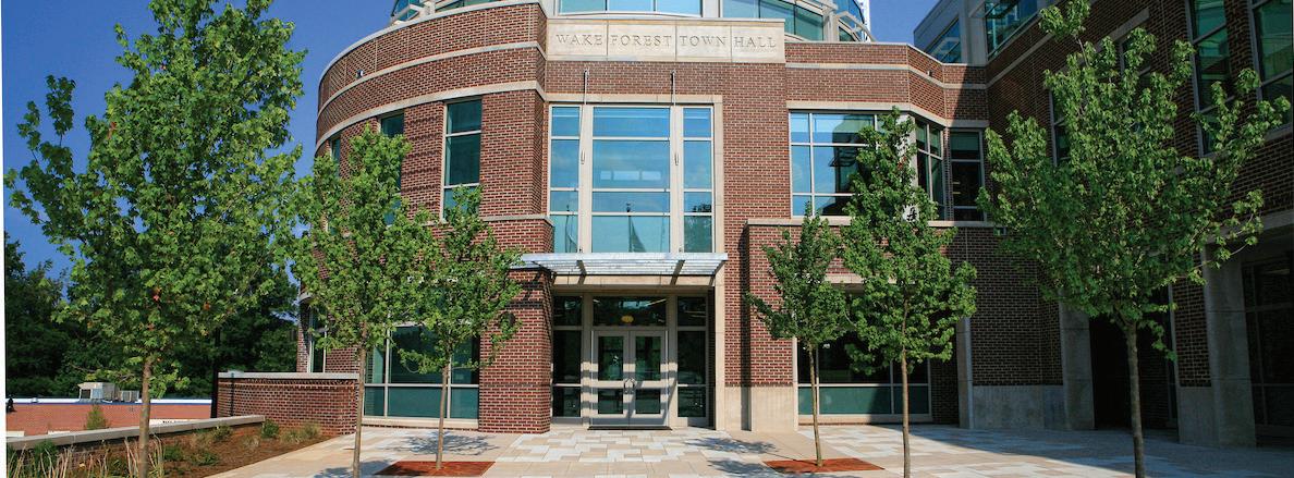
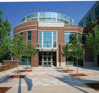
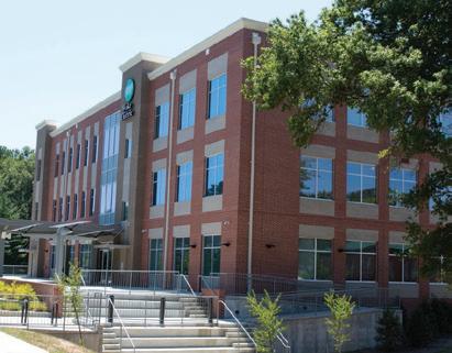
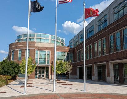
Downtown serves as the civic heart of Wake Forest and is home to Town Hall, the police department, Fire Station #1, and other Town facilities. Town Hall is a major employer and helps to drive Downtown business activity. These civic uses remain stable over time and help Downtown remain a community focal point.
Parks and open space provide essential public gathering spaces and green spaces that differentiates Downtown from other commercial areas in the Town. H.L. Miller Park is a significant asset for the Downtown area. Future parks and open spaces should be located alongside other uses, such as residential uses.
A diverse range of building types are crucial to shaping the character, functionality, and vibrancy of any downtown. The following section describes key building types necessary to contribute to the future development of Downtown Wake Forest. Each building type serves a distinct purpose, contributing to the overall intensity and cohesiveness of Downtown.
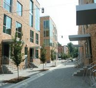
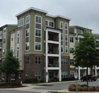
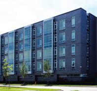
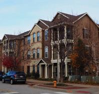

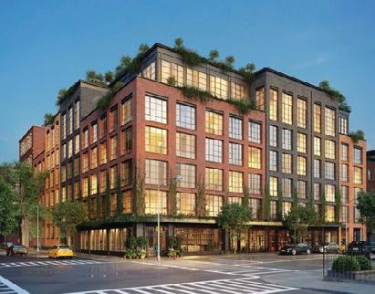
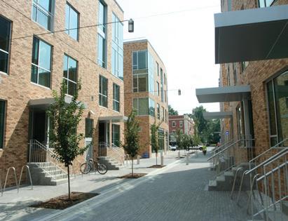
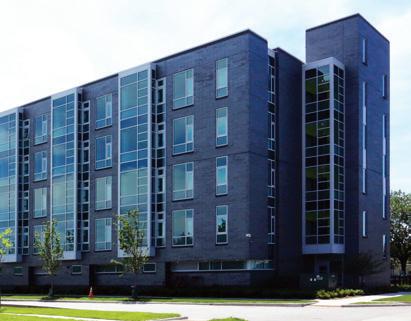
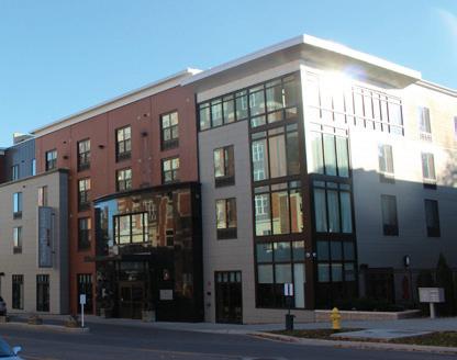
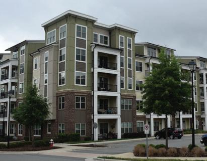
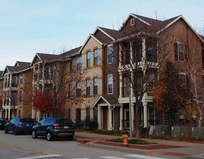
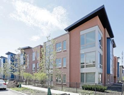
Multifamily buildings are structures that include multiple residential units within a single building. Multifamily buildings in Downtown Wake Forest will likely range between four to six stories and may include elevators. They contain numerous units per floor and offer shared amenities such as lobbies, fitness centers, rooftop terraces, swimming pools, and parking garages. Multifamily buildings provide high-density residential housing options critical to serving Wake Forest’s expanding workforce and housing needs. Multifamily building types should incorporate pedestrian amenities, sidewalks, pocket parks, and public gathering spaces.
Supported Uses: Residential
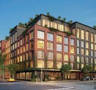
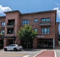
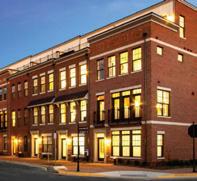
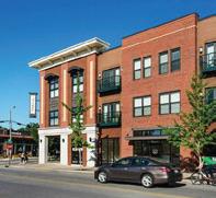
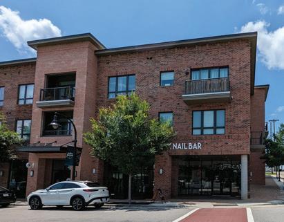
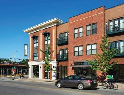
Mixed-use buildings stack uses vertically within the same structure, with retail, restaurant, service, small-format grocery store, or office space on the ground-floor and office or residential uses on the upper-floors(s). Constructing mixed-use buildings maximizes land efficiency, expands the urban streetwall, and creates a more vibrant and attractive Downtown. Surface parking should be discouraged. Parking decks should be considered to accommodate desired building height and density. Mixed-use buildings should be the predominant building type considered for future development.
Supported Uses: Residential; Retail; Restaurant & Bar; Entertainment & Culture; Service; Office
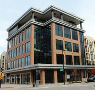
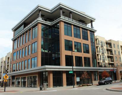
Single-use non-residential buildings are structures designed for a specific, singular use. These buildings serve one primary use and are not mixed with other uses, such as residential or other non-residential uses. Examples include office buildings, retail stores, and institutional buildings like schools or Town facilities.
Supported Uses: Retail; Restaurant & Bar; Entertainment & Culture; Service; Office; Civic
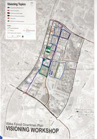
The Functional Subareas are based on existing land use, development patterns, built form, character, transportation/ connectivity, streetscape, and other factors. Downtown has been divided into seven Functional Subareas. The subareas are intended to guide planning efforts within Downtown, providing recommendations and policies that address the specific needs of each subarea. The Wake Forest Downtown Plan includes a more comprehensive set of recommendations for each Functional Subarea including appropriate land use, building height, parking, and redevelopment pattern. Planning efforts are context sensitive ensuring that each subarea promotes a cohesive direction for Downtown Wake Forest.
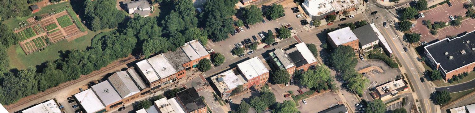
This subarea is significant as the core of Wake Forest’s downtown commercial history and maintains its charm and historic character. Redevelopment in this area is envisioned to complement and enhance the character of existing historically significant structures. The functional subarea should support a wide variety of commercial and entertainment uses that encourage activity both during the day and in the evening. The Town should remain flexible to accommodate the potential S-Line station and
• Include the densest cluster of mixed-use structures in Downtown
• Maintain a consistent streetwall along S. White Street to continue to foster a walkable environment
• Build off the development momentum of the future S-Line Station to promote redevelopment throughout Downtown
• Allow for flexibility in development

This subarea contains a mix of vacant lots, residential, commercial, office, light industrial businesses, and autooriented uses. Several redevelopment projects, such as The Loading Dock co-working space and the new mixed-use at Elm Avenue and S. White Street, have contributed to creating a welcoming and vibrant Downtown atmosphere. Looking ahead, future infill development should be prioritized and complement the existing development in the area.
• Encourage mixed-use infill development that fronts S. White Street and Elm Avenue to better define the streetwall
• Support redevelopment of underperforming buildings, vacant lots, and incompatible uses
• Consider adaptive reuse, building off of recent successes (i.e. the Loading Dock and the newly converted historic Welsh building)
This subarea includes retrofitted buildings and a mix of uses including residential, offices, a bank, and vacant lots. Additionally, the area includes bank use, parking use and some vacant lots. Adjacent to the Historic White Street subarea, this area presents an opportunity to incorporate supporting parking infrastructure for visitors while improving its streetscape and architectural style. Its proximity also makes it an excellent location for higher-residential options, fostering a symbiotic relationship
• Locate higher-density residential options that support Historic White Street subarea businesses
• Use the natural topography to ensure new development is sensitive to the character of the adjacent Historic White Street
• Incorporate parking that serves new development and overflow for Historic White Street subarea businesses
This subarea contains the Renaissance Plaza and properties north of Elm Avenue The large in-line building in the Renaissance Plaza includes several businesses including the Wake Forest Renaissance Centre For the Arts, Strike & Barrel, Page 158 Books, Destiny Dance Studio, and Over the Falls. The two outlots include a Dollar General and a vacant lot. North of Elm Avenue, the subarea contains Forks Cafeteria & Catering and two Town-owned public facilities buildings. This subarea has
• Explore options to improve or redevelop suburban-style strip malls
• Provide a better connection to existing uses in HistoricWhite Street subarea and proposed improvements in White Street Extension subarea
• Land Use: Residential, Retail, Restaurant, Service, Office, Parks/ Open Space
This subarea contains the Wake Electric Membership Corporation office building and a bank and feels detached from other areas of Downtown Wake Forest. This subarea will likely be one of the last areas of the Downtown to experience redevelopment pressure over the lifespan of the Downtown Plan. Town leaders and staff should use the following development, land use, and built form considerations if market conditions change and this area becomes a priority for future redevelopment.
• Consider development limitations due to significant grade change and ravine that divides the subarea
• Future redevelopment should consider the northeast corner of the subarea as a key transition between Magnolia Square and the Northeast Neighborhood which sits to the north, across Wait Avenue
• Address concerns that this area functions more like a suburban office

This subarea contains civic buildings including the Town Hall, H.L. Miller Park, Fire Station #1, Police Department, and the Old Town Hall. This area provides services, amenities and employment that brings individuals to Downtown, not just on the weekends, but throughout the week. Residents and local business owners are regularly drawn to Downtown Wake Forest for various purposes from public meetings to recreational activities, making it a dynamic focal point of civic life.
Development Considerations:
• Improve access to the underutilized H.L. Miller Park (currently serves as the only green park space Downtown)
• Continue to serve as the civic center of the Downtown and community
Land Use / Built Form Considerations:
• Land Use: Civic, Parks/Open Space, Residential, Retail, Restaurant, Service, Office
• Building Type: Single-Use

This subarea is the largest within the Study Area. This subarea has an assortment of uses including townhomes, apartments, senior housing, child care, and vacant or under developed parcels. The development pattern fits more closely with the residential areas south of Downtown near Dr. Calvin Jones Highway, which provide a residential feel on the edges of the Study Area. The area should also serve as a transition between the active Downtown areas and the quieter residential areas to the east and south.
• Increase density if the Forest Ridge Apartments are redeveloped
• Bolster the gateway and wayfinding to announce and direct residents and visitors
• Connect this subarea, and the residential uses around it, to Brooks Street and S. White Street
• Provide options for undeveloped and vacant properties (i.e. the recently considered skate park)
Continue to enhance connections to civic uses south of E. Holding Avenue (post office, Wake Forest Library, Wake County Northern Regional Center, and
Land Use / Built Form Considerations:
Residential, Office, Parks/
Single-Use
Non-Residential; Multifamily 1-5 stories
Building Setbacks: 10’-25’ front yard build-to-zone (BTZ); 15’ side yard
On-site surface parking and/ or parking decks (minimize visibility from the public right-of-way)
Designating historic districts helps the Town protect its heritage and preserve areas of historical, cultural, and architectural significance. These districts also stabilize and improve property values and strengthen the local economy by attracting tourism.
The Town has four historic districts including a local historic district and three districts listed in the National Register of Historic Places. Of the three National Register historic districts, only the Downtown Historic District is within the study area. Listing in the National Register does not require approval for exterior changes; however, the Town has a Demolition of Historic Structures Ordinance that requires Historic Preservation Commission review of proposed demolition of National Register individually listed properties or structures contributing to a historic district.
• Continue to utilize the Demolition of Historic Structure Ordinance to review demolition permits and ensure that the historic character and charm of Downtown is maintained.
• Consider hosting yearly historic property owner workshops to inform and educate property owners in the Downtown Historic District of the Historic Tax Credit Program and Secretary of Interiors Standards for Rehabilitation.
• The Town should work to limit incompatible development and prevent “demolition by neglect,” where due to a failure to maintain historic buildings they are threatened by demolition.
• Consider designating the Downtown Wake Forest Historic District to provide additional protections for the Downtown buildings under the Historic Property Handbook and Design Standards
• Implement ordinances that are sensitive to historic context to ensure new construction within and around the Downtown historic district is compatible with the character of the district.
While opportunities for large-scale redevelopment of vacant or underutilized lots will be discussed later in the Plan, it is important to offer strategies that will reinvigorate deficient buildings that currently exist to maintain the allure of Historic White Street. A number of underperforming buildings have been identified for strategic investment as they are in need of interior or exterior rehabilitation. These properties should not be considered for complete redevelopment because of historic significance or key architectural elements. The structure, and often use, of the existing property is worth maintaining if significant improvements are made to better match the character of adjacent buildings and support the overall function. Identified properties require some combination of adaptive reuse, activation of vacant storefronts, façade enhancements, or creative temporary uses to complete the rehabilitation process. Buildings within the Downtown Wake Forest Historic District should be prioritized for preservation.
Adaptive reuse is defined by the National Park Service (NPS) adaptive reuse as a way to preserve historic properties by improving or restoring them for new uses. Adaptive reuse is a process that involves repurposing a building or site for a new purpose, such as turning a vacant building into a school, office, or apartment. Adaptive reuse of Downtown buildings would likely only require interior renovation to meet the needs of the new use, rather than a rehabilitation of the entire structure.
Several buildings within the study area have significant architectural features but are affected by damaged or altered façades which detract from Downtown’s overall aesthetic appeal. These buildings/ structures require facelifts to improve the overall character and feel of Downtown.
Activating vacant storefronts is critical to enhancing the pedestrian experience, reducing visual eye sores, and improving the streetscape. Though it can be challenging to work with owners to improve a vacant storefront, utilizing the following strategies could help mitigate the effects of vacancies.
Pop-up shops provide property owners and Downtown alternative options to combat vacancies. As a win-win scenario, small businesses can access prime retail space without long-term financial commitments while landlords fill vacant properties, generating revenue and enhancing the vibrancy of urban commercial areas.
A number of buildings and properties within Downtown present redevelopment opportunities due to the underutilization of the space. The impacts of the S-Line station locating in Downtown are significant not only in increasing property values, but also creating a market that was previously absent from the area. Strategies are needed to encourage property sales, incentivize property owners, and guide town acquisitions to ensure that any redevelopment has a positive impact on Downtown and the community.
Recommendations:
• Transform historic buildings into mixed-use spaces.
• Transform underutilized commercial buildings into residential apartments, attracting more residents to Downtown and increasing vitality.
• Retrofit buildings to be more energyefficient and eco-friendly, aligning with sustainability goals and attracting eco-conscious tenants.
• Implement an annual vacancy fee program requiring property owners and managers to pay for persistently vacant buildings which can help discourage the practice of leaving buildings vacant with the hope of landing a tenant who will pay the asking rent.
• The revenue generated from the vacancy fee program can be combined with funds from the Municipal Service District (MSD) to finance Downtown improvement projects.
• Vacant buildings can be revitalized by decorating the windows with public art or signs, creating a more inviting and livelier atmosphere.
• Consider implementing a pop-up shop program where the Town facilitates short-term leases with property owners to fill vacant spaces.
• Small businesses should work with property owners to temporarily open a brick-and-mortar location, often for a few days or weeks, and rarely more than a few months.
• Engage and incentivize property owners to improve their properties or consider selling.
• The Town may want to consider acquiring parcels to better guide future redevelopment.
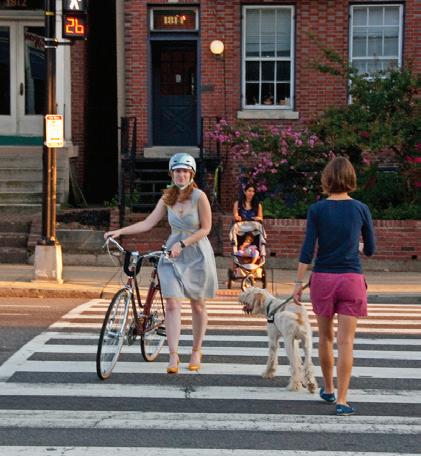
Amidst the current conditions and growth in Wake Forest, improved multimodal connectivity emerges as a key opportunity in Downtown. While pedestrians benefit from a consistent sidewalk network, there are places in Downtown where there is limited access to public space amenities that promote safety and comfort. Bicyclists encounter limited infrastructure, with only two streets offering formal bikeways. Motorists navigate well-connected streets with ample parking, suggesting there are opportunities for repurposing space. By addressing disparities in mobility options and building on existing strengths, Downtown can become more inclusive where all users can safely access destinations and comfortably move around.
Mobility is at a turning point in Downtown, shaped by a variety of community needs and opportunities that can be addressed to improve the experiences of travelers while prioritizing:
Safety. Reducing the likelihood of incidents between roadway users, especially the most vulnerable, so all can move throughout Downtown freely.
Access. Prioritizing multi-modal access throughout Downtown removes barriers for vulnerable users and ensures a more equitable Downtown.
Comfort. Individuals have a variety of mode choices in Downtown Wake Forest with adequate supporting amenities to create a dynamic public realm that strengthens Downtown as a destination.
Convenience. Creating a more efficient use of roadway space provides all with easy access to Downtown destinations.
As the ways in which people move throughout Downtown are assessed and planned for, establishing a priority for individual modes is critical to decision making and future investments. The mobility pyramid illustrates a hierarchy of user modes for Downtown. Starting with pedestrians, then people bicycling, transit users and vehicles, and finally personal vehicles. This approach prioritizes the most vulnerable users above throughput or travel time. Utilizing the mobility pyramid, Downtown streets can accommodate the needs of all travelers, whether walking, rolling, bicycling, taking transit, or driving. While modal priorities may differ for each street, all streets should include accessibility features that foster a safe, comfortable and convenient experience.
Certain design elements should be prioritized when considering opportunities for public realm investments that will improve mobility in Downtown.
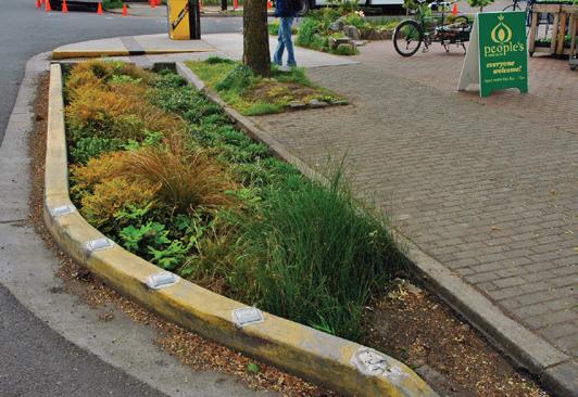
Street trees provide a wide range of environmental, social, and economic benefits. Street trees are a valuable resource that contribute to the character and ambiance of the public realm and provide much-needed shade for pedestrians. Street trees can enhance outdoor seating and dining areas, and they can significantly transform streets into memorable corridors.
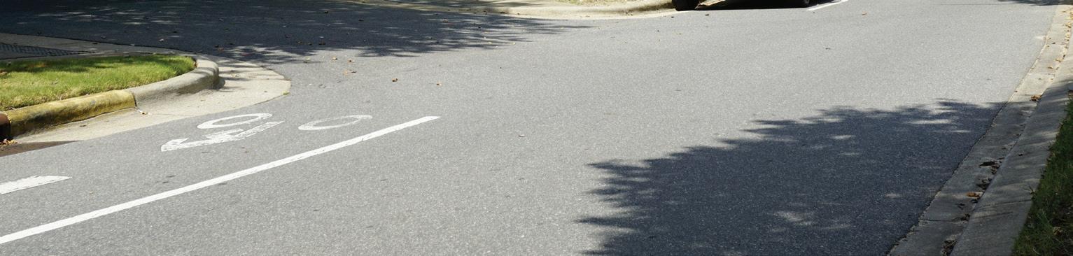
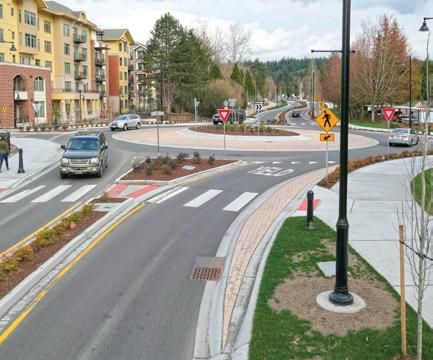
Extending the curb beyond the sidewalk or buffer edge shortens crosswalk length, reduces pedestrian exposure to motor vehicles, and increases visibility of people walking and rolling, particularly where there is on-street parking. This element can formalize on-street parking locations, maintaining adequate sight lines for users. Curb extensions are effective tools for narrowing streets or tightening intersections to reduce motor vehicle turning speeds. Additionally, extensions offer more flexible planting and vegetation opportunities.
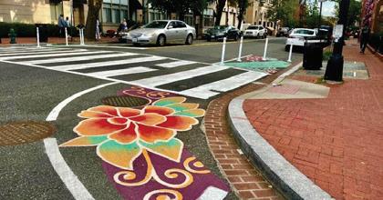
Well-designed crosswalks are important to create pedestrian-friendly environments. Safety for all pedestrians, especially for those with limited mobility or people using mobility assistance devices, is a key criterion informing crosswalk design. Marked crosswalks indicate a designated path for people walking and rolling through intersections, mid-block crossings, and high-volume driveways. Consistent application should be applied throughout downtown Wake Forest to provide clear expectations and to promote a sense of place. Downtown Wake Forest has already implemented decorative crossings that could be used throughout the study area. However, at minimum a ladder style crosswalk that is high visibility should be used to align with best safety practices.
Street furniture includes an array of elements, including benches, trash and recycling receptacles, bollards, transit stops and shelters, decorative planters, and more.
• Seating is an essential component of each street and includes temporary and permanent fixtures such as chairs, benches, seat walls, steps, public art, and raised planters. The location and type of seating element should respond to adjacent land uses, available shade from either buildings or street trees, and the width of the amenity zone.
• Trash and recycling receptacles are important to keep active, busy public realms clean and free of litter. Receptacles should be located in areas with high volumes of pedestrian and bicycle travel and at all transit stops.
• Other street furniture such as bollards, transit stops and shelters, and decorative planters are important for comfortable travel on many types of streets. Site-specific conditions will dictate where these elements are most appropriate. Ensure that street furniture does not impede mobility or impair sight distance for street users.
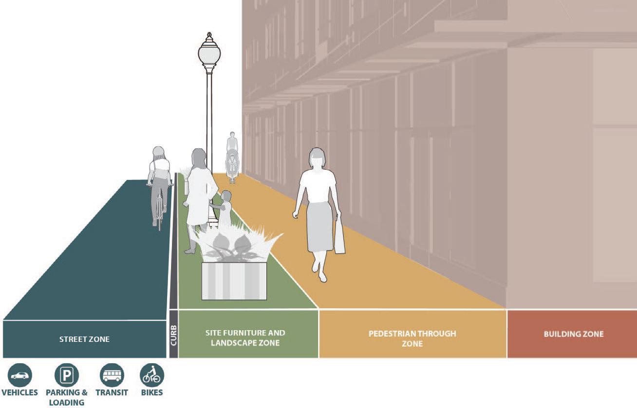
Prioritizing a high-quality pedestrian experience is central to creating a safe, welcoming and vibrant downtown Wake Forest. The relationship of the pedestrian realm to the street and buildings correlates directly to the user experience. The Pedestrian Mobility recommendations categorizes downtown Wake Forest corridors by pedestrian use, experience, and design elements. Each street type identified on the map serves pedestrians in different ways, and the street element compatibility spectrum identifies design elements appropriate for each street type that will improve pedestrian mobility.
Downtown Wake Forest should prioritize pedestrian mobility on every street to ensure that people walking and rolling are safe, comfortable, and willing to explore. Essential to pedestrian comfort is adequate space between the building frontage and the street. Although much of the development has clustered along S. White Street, there are opportunities to transform the pedestrian experience along Brooks Street, Elm Avenue, E. Owen Avenue, and Wait Avenue by dedicating space for wider sidewalks, street amenities such as benches, trees, lighting, and intuitive crossings, specifically at the edges of the downtown area.
Downtown Study Area Civic Core Downtown Hinge Comfort Standard
The compatibility spectrum prioritizes the quality and functionality of the pedestrian network based on the streetscape zones. Streetscape zones refer to different segments or areas along a street that are designated for specific functions and activities. These zones are discussed further in the Building Fabric and Public Realm chapter.
Civic Core Streets are characterized by a density of activities and uses, people lingering in addition to traveling, and a high level of pedestrian comfort.
Recommendations:
• Building Zone. High-quality, engaging storefronts and outdoor seating.
• Pedestrian Through Zone. Wide, unobstructed paths in the Civic Core for maximum safety and mobility
• Site Furniture and Landscape Zone. Amenities are abundant and high-quality.
Downtown Hinge Streets enable pedestrians to get to where they want to go, these streets act as transition zones between areas of downtown and beyond.
Recommendations:
• Building Zone. Moderately engaging.
• Pedestrian Through Zone. Sufficiently clear paths.
• Site Furniture and Landscape Zone. Amenities are moderate.
Comfort Standard Streets represent a more conventional pedestrian experience, but include elements and amenities to elevate the experience beyond typical conditions.
Recommendations:
• Building Zone. Basic but functional.
• Pedestrian Through Zone. Narrowed but still safe paths, ensuring accessible mobility throughout.
• Site Furniture and Landscape Zone. Minimal but functional, contributing to varying levels of pedestrian comfort.
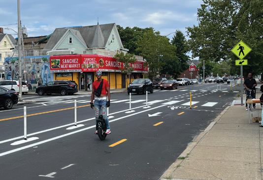
Providing separation between modes, including both horizontal and vertical delineation, contributes to improved user safety and accessibility, while increasing bicycle mobility options downtown. The Bicycle Mobility recommendations differentiate corridors by their function, not necessarily by their facility type. The street element compatibility spectrum identifies opportunities to incorporate various elements to support safe bicycle movement into and throughout downtown.
Not every street in Wake Forest needs a dedicated and separated bikeway; however, the environment throughout downtown must be inviting and safe for people of all ages and abilities to use a bicycle for downtown trips. Both Brooks Street and Elm Avenue create connections across downtown and can serve as internal connections where bike parking can be accessed. These parking areas allow people arriving by bike to park once and explore as a pedestrian. Dedicating space for bicycle facilities on these corridors highlight the multimodal character that is necessary for downtown Wake Forest.
Edge streets such as E. Holding Avenue and S. Franklin Street should have a more distinct and separated bikeway to allow people to move around downtown at a higher speed and with fewer conflicts.
The compatibility spectrum considers the effectiveness and suitability of the bike network by focusing on factors such as the provision of Bike Amenities along routes, the degree of Vehicular Separation, the integration of Green Infrastructure to enhance environmental sustainability, and the clarity and visibility of Signs and Pavement Markings for guiding bicyclists.
Through Corridors are streets with a high volume of bicycle traffic that move along the edge of downtown, not necessarily into it. They act as segments of larger bicycle corridors and connect to other greenways and bikeways outside of downtown.
Recommendations:
• Bike Amenities. Bicycle amenities are high-quality and abundant, providing excellent support and convenience for cyclists.
• Separated Bike Paths. Vehicular separation is high, reducing interactions with motor vehicles through dedicated bike lanes that are physically separated from vehicular traffic by barriers or markings.
• Green Infrastructure. Green Infrastructure is slightly above intermediate importance, providing benefits like enhancing safety by creating natural barriers between bicyclists and vehicular traffic.
• Signage. Highly necessary with high bicycle traffic volume for clear guidance through marked lanes with symbols painted to indicate designated areas for bicyclists.
Dedicated Bikeway Streets act as connection for bicyclists to enter or exit downtown, or to move through it. These streets connect to neighborhoods outside downtown and to key areas within it. Bicycle parking along these corridors occurs adjacent to major destinations and at intersections with Through Corridors.
Recommendations:
• Bike Amenities. Bike amenities are above intermediate, offering good but not extensive amenities.
• Separated Bike Paths. Separation is more than intermediate, enhancing protection for bicyclists through dedicated bike lanes that are marked with painted lines.
• Green Infrastructure. Intermediate, offering moderate green features.
• Signage. Such as shared lane markings (sharrows), are of substantial importance in Dedicated Bikeway streets because they remind bicyclists and drivers to share the road safely in areas without dedicated bike lanes.

Shared Slow Streets are slow spaces where people bicycling ride the final portion of their journey. They have a density of destinations and bike parking. These streets are the most likely candidates for restricting access to bicycles, which would require adequate bike storage at the intersections of other street types.
Recommendations:
• Bike Amenities. Present but more basic, ensuring essential support for cyclists.
• Separated Bike Paths. Separation is sufficient but less robust, offering safety from traffic.
• Green Infrastructure. Green infrastructure is minimal, contributing to a more pleasant environment for bicyclists completing their journeys.
• Signage. Moderate requirement to provide basic navigation support through warning signs, directional signs, and intersection markings.
In Downtown, access to the curb should be managed to ensure equity and efficiency. The accommodation of street parking in Downtown should be different based on the location, the surrounding land uses, and the different travel modes. Street space dedicated to vehicular parking is highly valuable in Downtown and should be utilized for increasing opportunities for the safe movement of pedestrians, cyclists, and transit users. Off-street parking (both surface and the potential of structured parking), should be available for people that work Downtown, use transit for commuting, live downtown, or for events. Parking is an important consideration as the community continues to grow and new development is introduced.
Recommendations:
• Off-street parking, including parking decks, should be considered to allow for the reallocation of space to create an inviting public realm and increase mobility options.
• Areas of increased density and pedestrian activity may warrant the removal of on-street parking to increase sidewalk widths and improve accessibility for non-vehicular modes.
• Ensure that both on and off-street parking includes designated ADA accessible spaces.
• Bicycle parking hubs should be located across Downtown to increase capacity and encourage downtown travel by other modes.
Downtown Study Area
High Turnover Streets
Long-term Parking Streets
Close to Vehicles
Bicycle Parking Hub
The spectrum emphasizes the effectiveness and suitability of parking by focusing on the provision and management of Loading Zones to facilitate efficient goods delivery, the Parking Density to accommodate varying levels of demand, the designation and regulation of Curbside Management Zones to balance competing needs, and the Turnover Rate to ensure optimal utilization of parking spaces based on the surrounding uses and travel patterns.
High Turnover Streets are places where parking is encouraged to be shorter term to enable a lively and active downtown character.
Recommendations:
• Loading Zones. Ensure quick turnover and provide accessibility for deliveries and pickups, catering to public and private parking needs.
• Parking Density. Feature dense parking arrangements to maximize short-term availability and support frequent turnover.
• Curbside Managements. Regulated to optimize space and facilitate efficient parking turnover. They are designed to balance the needs of businesses and residents, providing clear guidelines for parking duration and accessibility.
• Turnover Rates. Maintain high turnover rates to support active business environments and enhance customer accessibility especially on S. White Street, E. Jones Avenue, S. Taylor Street and evaluate the potential for metered parking.
Long-Term Parking Streets are corridors further away from businesses or active areas, where it is less important to have turnover on parking. These are areas where parking is not scarce, either because there is less demand for parking or a greater supply because of surface lots or private parking.
Recommendations:
• Loading Zones. Strategically located to support business operations provide accessibility for deliveries and pickups, catering to public and private parking needs.
• Parking Density. Prioritize lower density to accommodate longer-term parking needs and reduce congestion.
• Curbside Managements. Regulated to optimize space and facilitate efficient parking turnover. They are designed to balance the needs of businesses and residents, providing clear guidelines for parking duration and accessibility.
• Turnover Rates. More relaxed turnover rate to accommodate extended stays and needs.
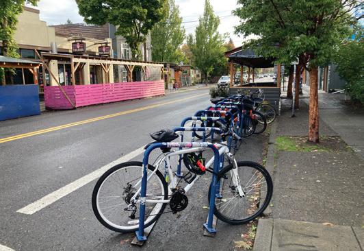
Bicycle Parking and parking for micromobility devices are key end-of-trip features.
• Install structures for people to securely lock their bicycles or micromobility devices on or off the street.
• Locate parking near transit stops as well as in the amenity zone, provided there is adequate width to maintain an unobstructed path of travel for people walking and using assistive mobility devices.
• Locate bike parking corrals in the curbside lane of streets or in daylighting areas (areas with no visual obstructions) at street corners where there is high parking demand and little available sidewalk space.
Vehicle capacity on downtown streets should be highest along the edges and gradually decrease as users approach the most active, dense internal areas. Lane widths and speed limits should be decreased to facilitate safe movement of all users. Travel lanes may be reconfigured, or removed via a road diet, to repurpose street space to accommodate all users, prioritizing comfort and safety of pedestrians, bicyclists and transit users.
The three categories of streets recommended for downtown Wake Forest respond to local context and complement the mobility recommendations for pedestrians, people bicycling, transit users, and parking. Critical to the success of downtown Wake Forest is to design each street for slower vehicle speeds. Additionally, street characteristics should reinforce that downtown is not an area to go through but a destination that is filled with pedestrians, bicyclists, motorists, and transit users that are sharing space safely.
Two of the key long term recommendations are closing a portion of Elm Avenue adjacent to the railroad crossing and a portion of Wait Avenue to vehicles. The local traffic streets (e.g, S. Taylor Street, Elm Avenue, Triumph Lane) correspond with longer term on-street parking while slow destinations streets (e.g, S. White Street, E. Owen Avenue, etc.) reflect the higher-turnover parking streets that can further reduce speeds and increase safety.
Map Key
The spectrum prioritizes the efficiency and functionality of the motor vehicle network by considering the Number of Lanes, the Lane Width, appropriate Speed Limit to balance vehicular flow and pedestrian safety, and the presence of Traffic Calming Devices to manage speeds and enhance the pedestrian experience in downtown areas.
Throughput Edge Streets have the highest volume of traffic and are for people who are driving past downtown. They generally have fewer stops and signals and will have the least amount of interaction with other modes of transportation. Signage and traffic calming elements will be present at key locations, such as school zones or railway crossings.
Recommendations:
• Number of Lanes. Multiple lanes to ensure efficient vehicular flow.
• Lane Width. Wider lanes are used to accommodate high traffic volumes and larger vehicles, ensuring safe passage.
• Speed Limit. Higher speed limits to facilitate efficient traffic movement through downtown.
• Traffic Calming. Fewer to maintain flow, but strategically placed signals, signage, and bollards, along with chicanes to help manage speeds.
Local Traffic Streets are used by people traveling to Downtown destinations, whether that is home, work, a business, or just downtown itself. These streets will support a moderate amount of traffic, but trips are likely to either start or end on these streets. These streets will be mixing areas for multiple transportation modes and will require a density of signage, stops, and traffic calming measures.
Recommendations:
• Number of Lanes. Fewer lanes to support access to downtown destinations without excessive congestion.
• Lane Width. Moderately wide lanes to balance vehicle flow and safety for pedestrians and bicyclists.
• Speed Limit. Use devices like curb extensions and roundabouts to moderate traffic flow.
• Traffic Calming. Moderate speed limits to ensure safety while accommodating access to downtown destinations.
Slow Destination Streets have a density of activity and are the focus for multiple types of users and trips. These streets are generally narrower and facilitate slower speeds by design, which aligns with the goal of having the lightest amount of traffic on these streets. This can be elevated through signage, stops, and other traffic calming measures.
• Number of Lanes. Least number of lanes, prioritizing pedestrian activity and minimizing vehicular traffic.
• Lane Width. Narrow lanes to calm traffic and promote a pedestrianfriendly environment.
• Speed Limit. Frequent crosswalks and raised intersections, and to slow traffic. Rail crossings along E Roosevelt Avenue and Front Street, Elm Avenue, and E Holding Avenue are managed with appropriate signals and safety measures to ensure safe crossings for both vehicles and pedestrians.
• Traffic Calming. Lowest speed limits to protect pedestrians and create a safe, slow-paced environment.
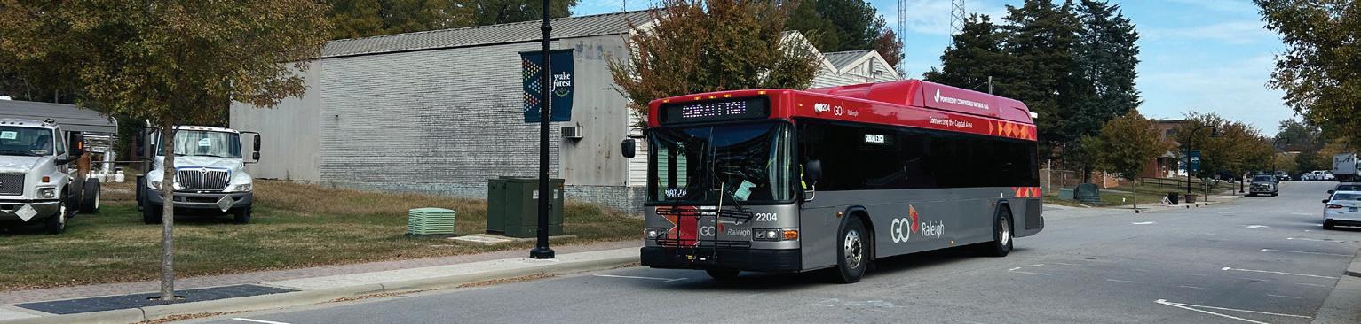
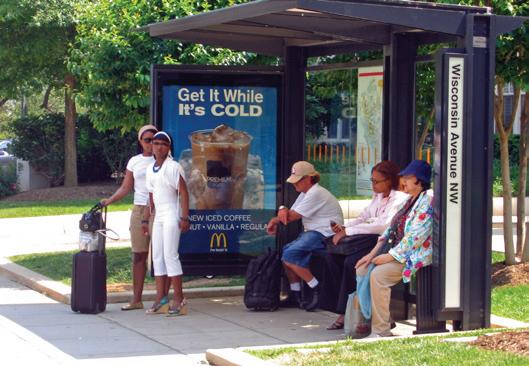
Transit is a key part of the mobility story for Downtown Wake Forest. Current and proposed transit routes allow for residents across the community to access Downtown without a car, reinforcing the need for a high quality pedestrian environment that allows convenient travel between transit stops and local destinations and services.
The following recommendations highlight essential elements needed to create a complete transit system Downtown.
Recommendations:
• Proximity to Bus Stops. Bus stops should be easily accessible with a short walking distance, ensuring convenience for daily commuters.
• Signage and Wayfinding. Signage should be frequent and clear, helping users navigate to stops from various directions.
• Shelters and Seating. Basic shelters and seating to enhance the comfort of waiting passengers, especially in areas with moderate transit use.
• Accessibility. Bus stops should be ADA-compliant with basic features such as ramps, tactile paving, boarding and alighting clearance, and accessible routes to support a wide range of users.
Starting on Tuesday, October 1, the Town will introduce “Go Wake Forest,” a microtransit pilot program offering on-demand, door-to-door rides similar to Uber and Lyft. While the Wake Forest Loop (WFL) Bus Service will be temporarily suspended during this pilot, the WRX Express route to Triangle Town Center and Downtown Raleigh will continue its regular service. This pilot, in partnership with Via, seeks to enhance transit options and resolve service issues. This flexible, point-to-point service will allow the Wake Forest community the opportunity to explore Downtown without having to drive. Those choosing to live Downtown, could potentially do so without a car.
Recommendations:
• Collect ridership data and conduct user surveys to continually improve the service based on evolving community needs.
• Implement a marketing campaign to raise awareness about microtransit.
• Implement a system for collecting real-time feedback from riders.
The Wake Forest Mobility Hub could be open by 2030 with 30% design anticipated for May 2025. As Wake Forest considers the impact of the S-Line, the experience of transit users must be considered.
Recommendations:
• Ensure that adequate connections are made to allow residents in neighborhoods surrounding Downtown the ability to safely and easily walk or bike to the new mobility hub.
• Utilize wayfinding and signage to guide visitors and residents to the proposed mobility hub.
• A mobility hub should seek to integrate passenger rail service with transit, microtransit, bicycling, dockless vehicles, and other multimodal options.
• Ensure that commuters and visitors have easy access to and from supplemental parking structures.
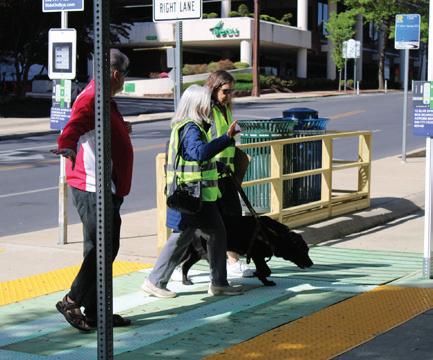
The S-Line R2R project is a proposed passenger rail line that would run from Richmond, VA to Raleigh, NC. It would connect to existing rail lines to reduce costs and take advantage of existing infrastructure. The proposed rail service is a part of a larger effort to connect cities across the United States to respond to population growth and employment opportunities in areas underserved by transit.
The potential implications associated with a new passenger rail line running through Downtown Wake Forest are significant. It presents both the opportunity for redevelopment and increased density within Downtown but also could change the existing built form and fabric of Downtown.
• Commuter and S-Line users should anticipate parking in nearby lots and walking to the station, with accommodations available for individuals with mobility challenges.
• Development surrounding the mobility hub should both meet the parking needs of potential commuters but also utilize TOD -style developments to increase residential development Downtown.
• Future developers should consider the affects of a passenger rail station within Downtown and the potential market implications.
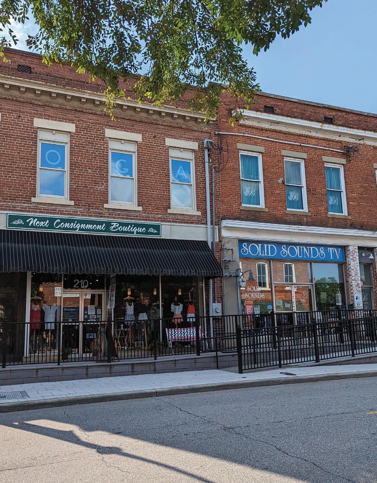
A successful Downtown focuses on creating cohesive building fabric and engaging public realm. This integration of architectural form, street life, public spaces, and overall appearance is essential for fostering pedestrian-friendly environments. Thoughtful design encourages people to gather, enhancing the Town’s livability and appeal while supporting economic growth through vibrant local businesses. Wake Forest, with its historic S. White Street, traditional grid pattern, charming spaces, and redevelopment opportunities provides an ideal setting for innovative urban design and placemaking. This chapter offers general recommendations for strategies that strengthen the building fabric and activate the public realm.
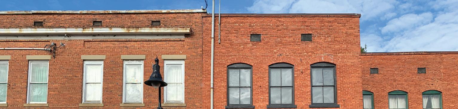
Built form refers to the physical characteristics and layout of buildings and structures within a particular urban or rural setting. It encompasses factors such as building heights, architectural style, density, setbacks, and the arrangement of streets and public spaces. The built form significantly shapes the identity and functionality of a place, influencing how people interact with their surroundings and experience the urban environment.
Human-scale built form refers to designing buildings and blocks that are proportionate to the size and movement of people, creating spaces that feel comfortable and accessible. This involves breaking down building masses into smaller elements, varying heights, setbacks, and architectural details to avoid overwhelming pedestrians and to promote visual intereStreet.
Recommendations:
• Promote development patterns similar to buildings along S. White Street.
• Promote compact, human-scale blocks to avoid superblocks such as the block between Elm Avenue, E. Holding Avenue, S. White Street, and Brooks Street.
• Mix building scale, configurations, and heights across Downtown to encourage variety.
• Ensure that new buildings are built along the perimeter of blocks rather than encroach into the interior of the blocks.
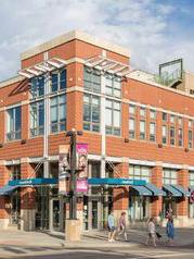
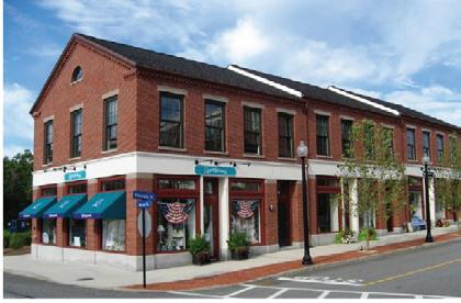
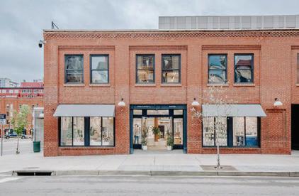
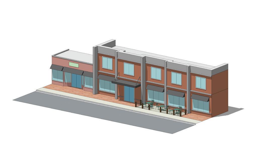
This diagram shows some of the elements that can contribute to a more active street life Downtown
Human Scale Building Mass
Building Signage
Facade Articulation
Awnings and Canopies
Street Level Transparency
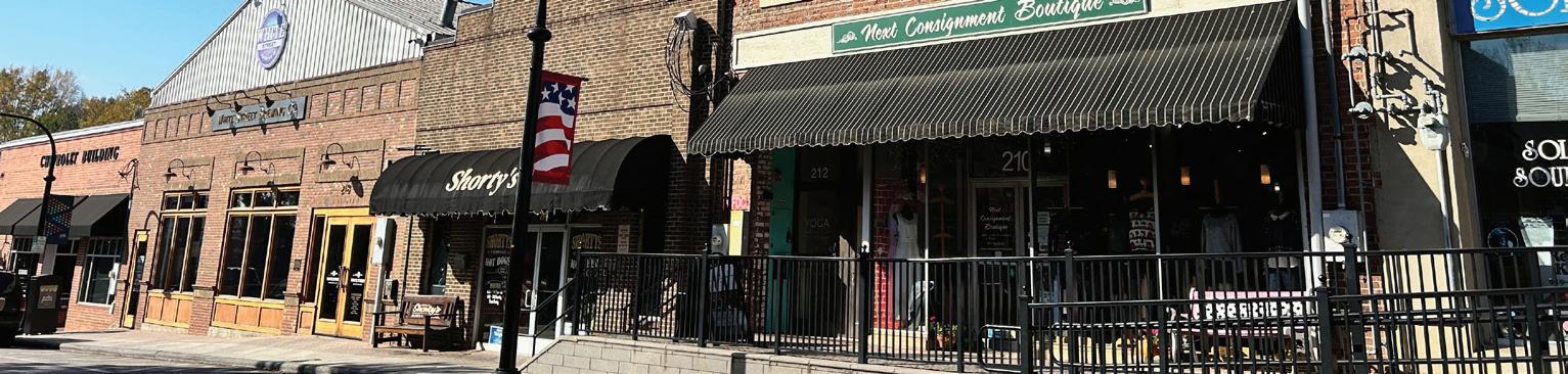
A streetwall is the collective alignment of building façades along a street. A consistent streetwall provides a sense of enclosure while an inconsistent streetwall may contain breaks for parking lots or spaces, driveways, or yards. While a consistent streetwall is important to provide comfort to pedestrians, streetwall articulation and breaks are important to create an interesting pedestrian experience. All functional subareas, aside from Southeast Transition, should have a continuous street wall, where buildings are aligned with minimal gaps, enhancing the sense of enclosure, making the street feel more like an outdoor room.
Recommendations:
• In areas where there are gaps in the streetwall, landscaping, plazas and pocket parks should be incorporated to give the illusion of a continuous streetwall especially along the existing streetwall found on S. White Street.
• The height and design of the street wall should be proportional to the width of the street to maintain a human scale.
• Variations in building heights should be used add visual interest, but too much disparity can disrupt the cohesion of the street wall.
• New construction should have a more traditional facade design along S. White Street while more contemporary design can be shown along Elm Avenue and Brooks Street.
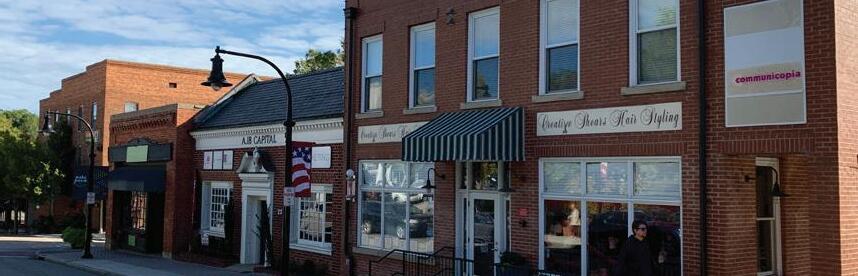
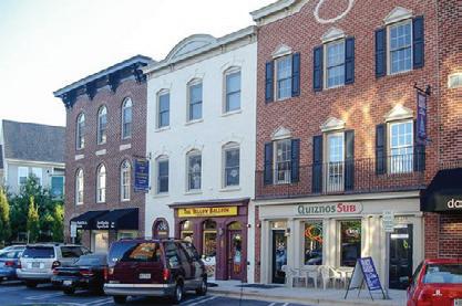
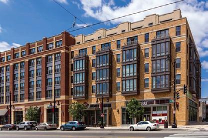
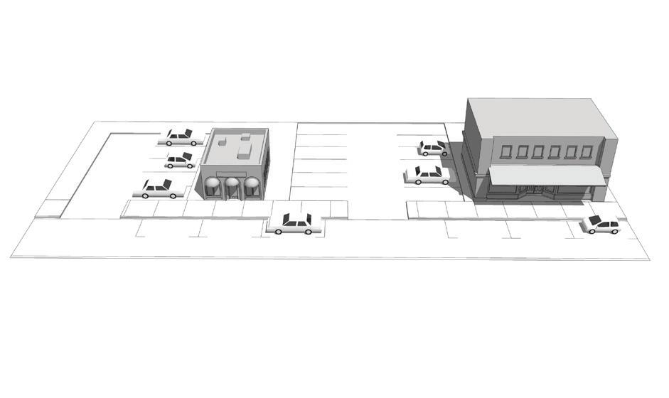
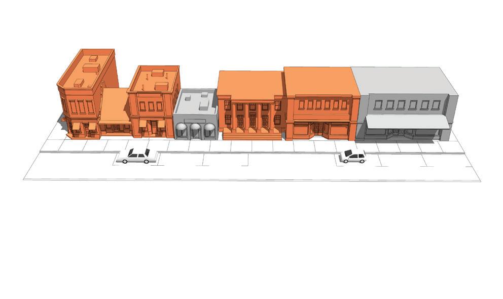
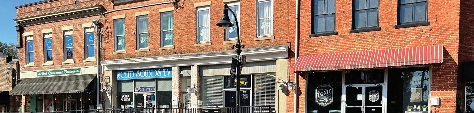
Building location provides guidance on where structures should be placed on a property. Downtown buildings should have a strong orientation to the primary street frontage.
A setback is the minimum distance a building or structure should be separated from the right-of-way or lot line. Building setbacks should be minimal to provide a seamless transition between the building zone and pedestrian through zone.
Build-to zones refer to specific areas or lines where buildings are encouraged or required to be positioned in relation to the property line and/or street edge. Establishing consistent setbacks and build-to zones will help create a cohesive streetswall that enhances walkability, supports active street frontages, and contributes to a sense of place.
Recommendations:
• Building location within Downtown should be such that a consistent streetwall is maintained along its main street and Downtown approach streets.
• Require 0’ front and corner side yard setbacks on S. White Street within the Historic White Street Functional Subarea.
• Permit more flexible setbacks on Brooks Street south of Elm Avenue, S. Taylor Street, E. Holding Avenue, and S. Franklin Street.
• Require strict build-to-zones along S. White Street, Elm Avenue, Brooks Street, and Roosevelt Avenue to promote active streetscapes.
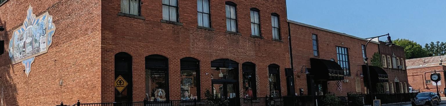
The importance of building heights in a small Town Downtown lies in maintaining a harmonious urban scale that preserves the area’s charm and character. Limiting heights also helps preserve views, sunlight access, and the overall pedestrian experience by preventing overshadowing and maintaining a human-scale environment.
Recommendations:
• One story buildings are inconsistent with the desired urban character and streetwall and should be discouraged.
• Design elements that extend beyond the typical building height, such as chimneys, spires, clock towers, should be allowed on a case-by-case basis provided that they enhance the character of Downtown.
• New construction should respect the scale and character of Downtown.
Building Heights by Functional Subarea

2-6
1-5
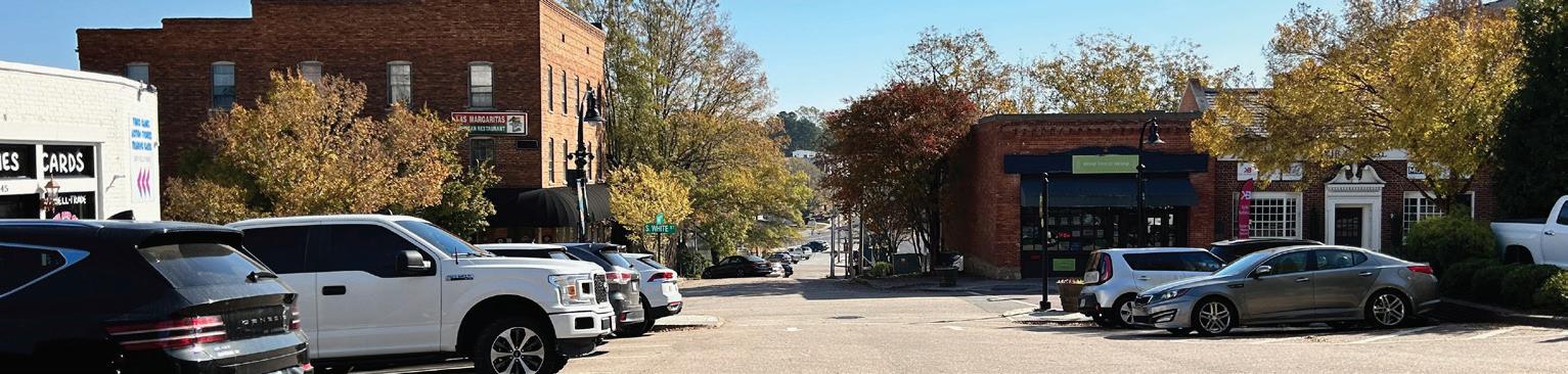
As redevelopment occurs, it is important to adapt building heights to the contours of the terrain. This approach minimizes visual disruption, preserves sightlines, and enhances aesthetic appeal.
Recommendations:
• Introduce buildings with taller heights on the lowest topography to balance with the higher topographies on S. White Street.
• Utilize stepped or terraced designs for new development which follow the slope and shape of the terrain.
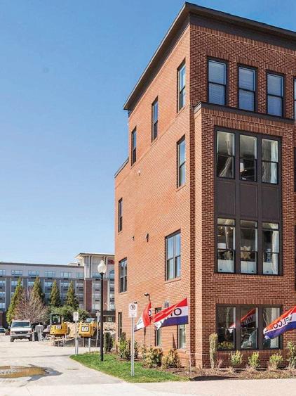
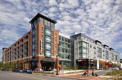
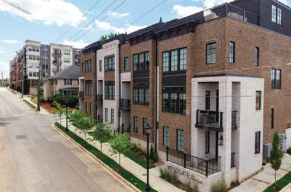
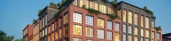
Upper-Floor step backs are an architectural element used to reduce the scale of taller buildings. It can be used to allow sunlight to reach the ground, eliminating a cavern effect. It can create usable outdoor spaces and allows better air circulation.
Recommendations:
• Step backs should be utilized in new developments to transition to adjacent low-density neighborhoods such as the Northeast Neighborhood, Cardinal Hills, and Deacons Ridge to name a few.
• Step backs should be used to minimize visual impacts along S. White Street.
• Upper-floor step backs should be used to maintain a consistent, context-sensitive streetwall while also promoting additional building height.
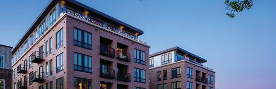

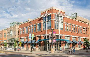
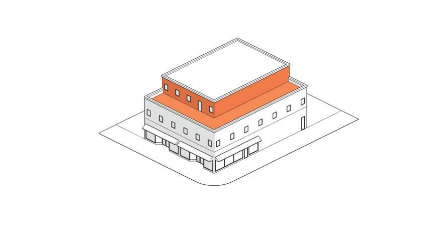
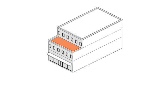
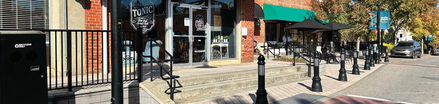
The topography and grade challenges present accessibility challenges for those with disabilities. The Town has ensured that building entrances are ADA accessible resulting from the ramps. However, improvements can be made to the design of both public right-of-way areas and private properties to appeal to all users by incorporating Universal Design and Americans with Disabilities Act (ADA) standards.
Downtown sits on a gentle hill sloping downwards from the railroad tracks on the west side of the planning area to the Smith Creek channel on the east side of the planning area. The commercial core along S. White Street rests on flat around, but the blocks east of S. White Street features slopes from 0 to 10 degrees. Challenging topography creates issues for building entries, sidewalks, ADA standards, and future development.
Building entrances should remain at grade to ensure easy access in and out. However, some of the opportunity sites identified present redevelopment challenges due to the grade changes. To remain at grade, building entrances may vary from the lower level to the first floor. An example is Town Hall. The entrance facing Brooks Street is classified as the first floor while the entrance on S. Taylor Street is classified as the lower level. To maintain active storefronts on Downtown streets, both entrances should have active and engaging storefronts with high transparency. Both entrances should act as the primary entrance.
Sidewalks within Downtown are affected by topography and grade changes. S. White Street has several instances where sidewalks diverge creating two levels of the sidewalk to provide access to building entrances. This limits the accessibility and functionality of the sidewalk as the landscape and furniture zone now has to accommodate additional pedestrians.
• Consideration should be given to the practicality of adding additional ramps to existing building entrances (as needed).
• The design and construction of existing ramps should be evaluated to improve or provide alternative solutions.
• Design both public right-of-way areas and private properties to appeal to all users by incorporating Universal Design and Americans with Disabilities Act (ADA) standards.
• Ensure that any improvements to publicly accessible areas, including streets, sidewalks, and parking lots, include ADA upgrades.
• Ensure all sidewalks, curb ramps, and crosswalks in Downtown meet current ADA and Public Right-of-Way Accessibility Guidelines (PROWAG) standards.
• If the minimum design standards cannot be met, provide ADA compliance to the maximum extent feasible.
• Ramps longer than 6 feet should have handrails on both sides, and these should extend beyond the top and bottom of the ramp for additional support.
• Ramps should have flat landing areas at the top and bottom to provide a resting place and allow for easier maneuvering.
• Crosswalks should be clearly marked, ideally with audible signals to assist those with visual impairments.
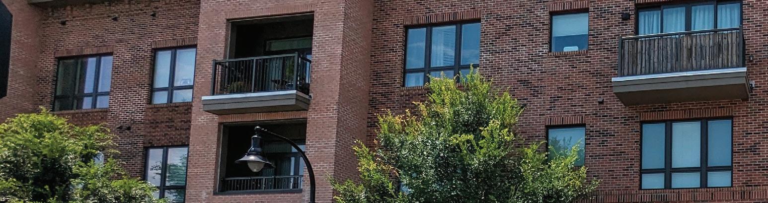
The quality of architectural design is foundational to shaping the physical, social, and economic aspects of communities. Architectural quality encompasses not only the aesthetic appeal of buildings but also their functionality, sustainability, and cultural relevance within the urban context. Well-designed architecture considers the scale and character of surrounding structures, integrating harmoniously into the fabric of the city while contributing to its identity and sense of place. As new development and redevelopment happens in Downtown, developers should be encouraged to follow a prescribed quality of architectural design.

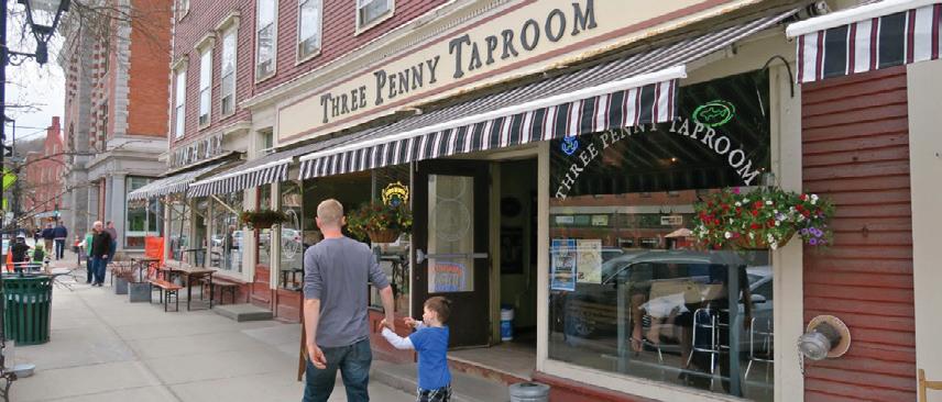
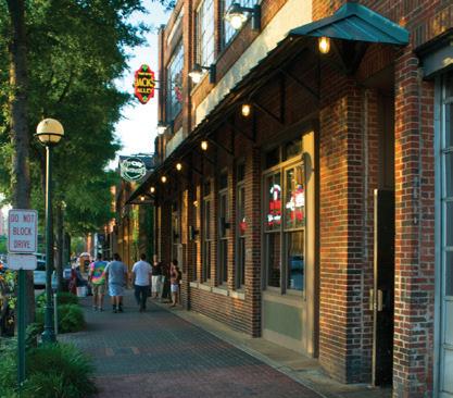
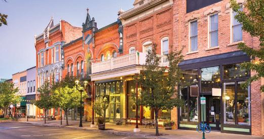
Building entries in Downtown should be prominent and in prime locations for shifts in massing and features that welcome pedestrians along the street include awnings, signage and lighting. These features should be integrated into the design of the building with the highest levels of design attention and texture where people will be entering and exiting.
Recommendations:
• To the extent possible, doors should be at grade with the public sidewalk at the point of entry to the building to accommodate those with mobility issues.
• Entrances should be clearly identified and emphasized with address numbers and attractive doorway detailing.
• Front doors should reflect the doorway placements and proportions of existing buildings.
• Property owners should be encouraged to beautify their doors with interesting design elements.
• Entrances should be recessed from the front lot line in order to accommodate out-swinging doors that do not interfere with pedestrian movement on the public sidewalk.
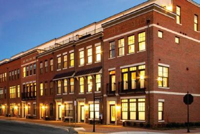
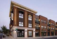
Façade articulation is a technique in architecture which uses edges and corners to break up building facades which eliminate large expanses of blank walls. While streetwalls are essential in a Downtown, expansive walls without interesting features are sterile and dull. Building facades in Downtown are currently divided into sections that range between 25’ to 30’. This articulation is appropriate for a Downtown and should be incorporated in new developments.
Recommendations:
• Facade articulations in Downtown should incorporate architectural details such as pilasters, cornices, and varied materials.
• Facades should be broken up into visually appealing sections that reflect the area’s historical context and create a cohesive streetscape using minor wall offsets, wall setbacks, accent lines, and upper-floor step-backs.
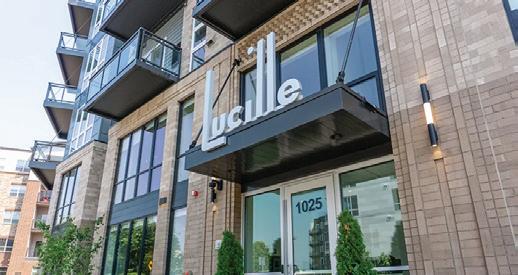
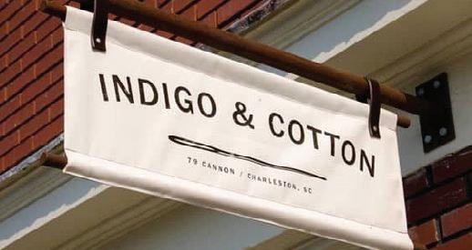
Building signage provides information and enhance the visual appeal of streetscapes. Different types of building signage include wall signs, projecting or blade signs, awning signs, and window signs, which are placed inside or on windows. Each type of signage plays a specific role in wayfinding, branding, and contributing to the overall character and vibrancy of urban environments.
• Exterior signs should be limited to business identification and description.
• The size, material, color, and shape of signs should complement the architectural style and scale of the building.
• When a building contains multiple storefronts, signage for all businesses should be consistent in design and placement.
• Illuminated box signs are not appropriate in the Downtown.
• Small signs, graphics, and logos applied directly on windows and doors should be encouraged.
• The use of temporary sidewalk “sandwich boards” signs should be considered, subject to strict control for safety and accessibility.
• Temporary signs for special promotions, sales, products, and advertising should be discouraged.
Awnings and canopies provide shade and weather protection for pedestrians, outdoor seating areas, and storefronts, contributing to comfort and usability year-round. They can serve as branding opportunities for businesses, create a sense of enclosure that defines public spaces, and contribute to the overall charm and character of small-town streets.
Recommendations:
• Awnings and canopies should be in character with the architectural style of the building.
• Awnings should fit within the frame of the storefront; they should not hide the building’s facade, distort its proportions, or cover architectural features. Awnings should be mounted above the transom window above the front entrance or storefront.
• Where several storefronts were developed as a single building, they should have awnings of a similar style and similar color.
• Adjacent buildings developed at different times should have awnings of a compatible style and color scheme.
• Awnings should be made of a canvas or durable fabric material that can be easily cleaned; vinyl awnings should be discouraged.
• Shingle, mansard and arch-profiled canopies should be discouraged.
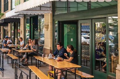
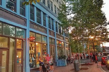
Street level transparency refers to the design principle of incorporating large windows, glass facades, or open storefronts at ground level of buildings facing the street. On S. White Street nearly all the storefronts have some level of transparency. New development in other areas of Downtown should maintain or improve the level of transparency.
Recommendations:
• Transparency should be focused on retail stores, cafes, or offices on streets such as S. White Street, Elm Avenue, and portions of Brooks Street.
• Blank walls should be avoided along frontages facing sidewalks.
• Ground-floor display windows are encouraged in storefronts to create more interesting street interactions.
• Tall ground floors with high levels of transparency should be encouraged in areas where a consistent streetwall is recommended.
• Transparent materials shall occupy at least 70 percent of the surface area of such ground floor level street wall between a height of two feet and 12 feet, or the height of the ground floor ceiling, whichever is higher, as measured from the adjoining sidewalk.
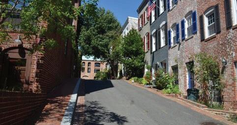
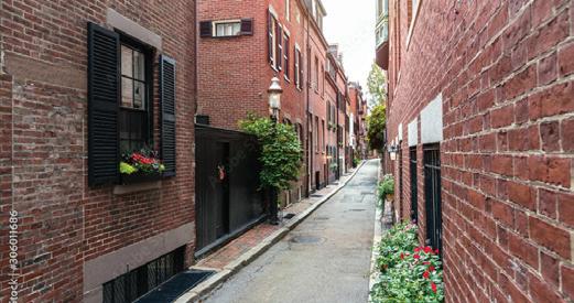
Alleys are narrow passageways typically found between buildings or at the rear of properties, often used for service access, deliveries, and utilities. Alleys can be revitalized to enhance the functionality and aesthetic appeal of a city. Transforming alleys into vibrant public spaces can involve adding lighting, greenery, art installations, and seating areas, making them safe and inviting for pedestrians. Even in contemporary city planning, alleys are a functional approach to separating the public front of buildings and the back-of-house necessities.
• Buildings should be encouraged to have side and/or rear entrances when alley access is possible.
• Side and/or rear entrances should be clearly identified and design should be similar to the front entrance.
• Alleys should be utilized for creative placemaking elements such as lighting, public art, temporary pop ups, and outdoor dining.
• Ensure that alleys are properly paved using materials that can withstand deliveries, parking, and service trucks.
• Consider expanding the streetscape into the alleys to encourage activation and utilization.
• Ensure that alleys are well-lit to encourage usage, promote safety, and discourage crime.
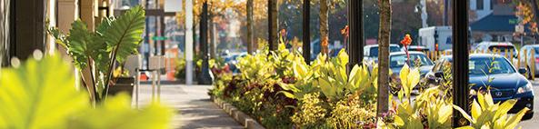
Streetscape zones refer to different areas along a street that are designated for specific functions and activities. These zones are typically categorized to optimize the use of public space and enhance the overall urban experience. Effective planning and design of streetscape zones contribute to the safety, accessibility, and aesthetic appeal of urban environments, promoting a balanced and enjoyable experience for all users.
Building Zone. The building zone typically includes the frontage of buildings along a street, encompassing elements such as entrances, windows, architectural features, and building materials that contribute to the character and visual diversity of the urban environment.
Pedestrian Through Zone. The pedestrian through zone is designed to prioritize safe and comfortable passage for pedestrians, often featuring wide sidewalks, minimal obstructions, and amenities like seating or pedestrian-scale lighting.
Site Furnishing & Landscape Zone. The site furniture and landscape zone includes elements such as benches, planters, trees, and other greenery strategically placed to enhance the aesthetic appeal and functionality of public spaces.
Street Zone. The street zone encompasses the area designated for vehicular traffic flow, parking spaces, and may include features like bike lanes and public transit stops to optimize urban mobility and accessibility.
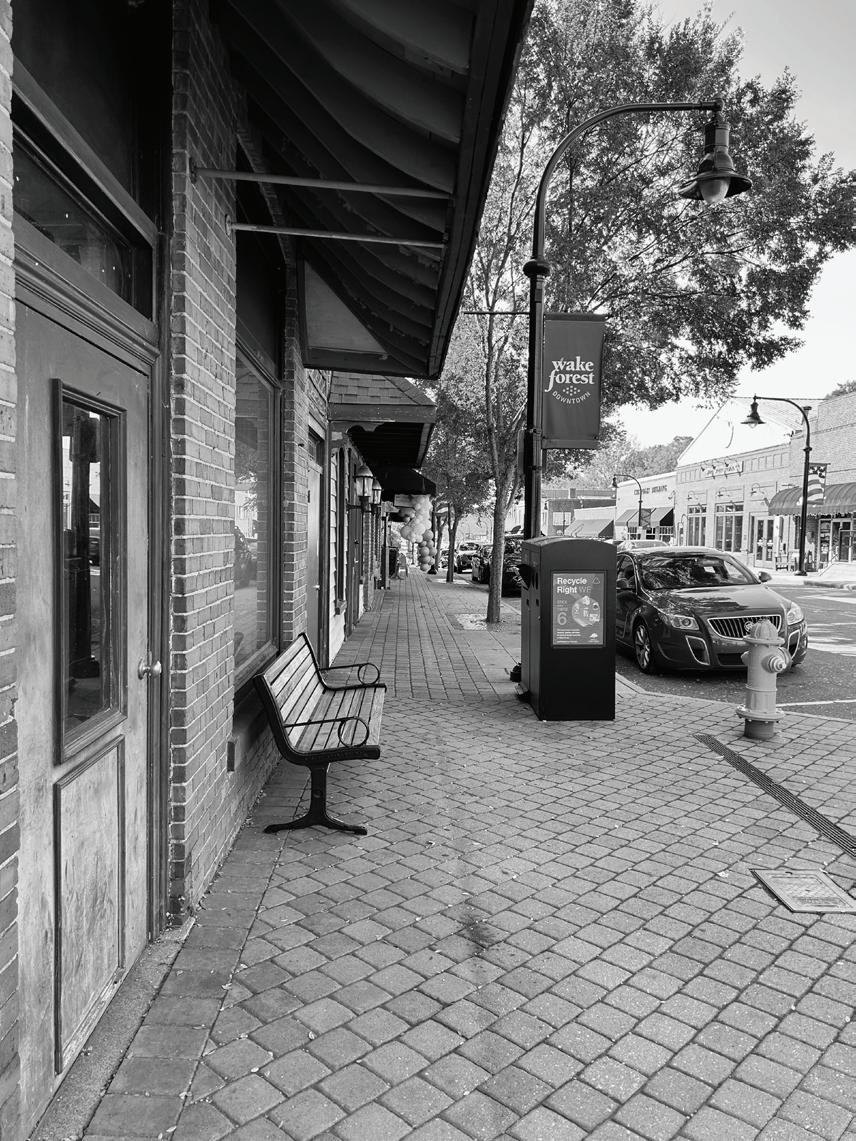
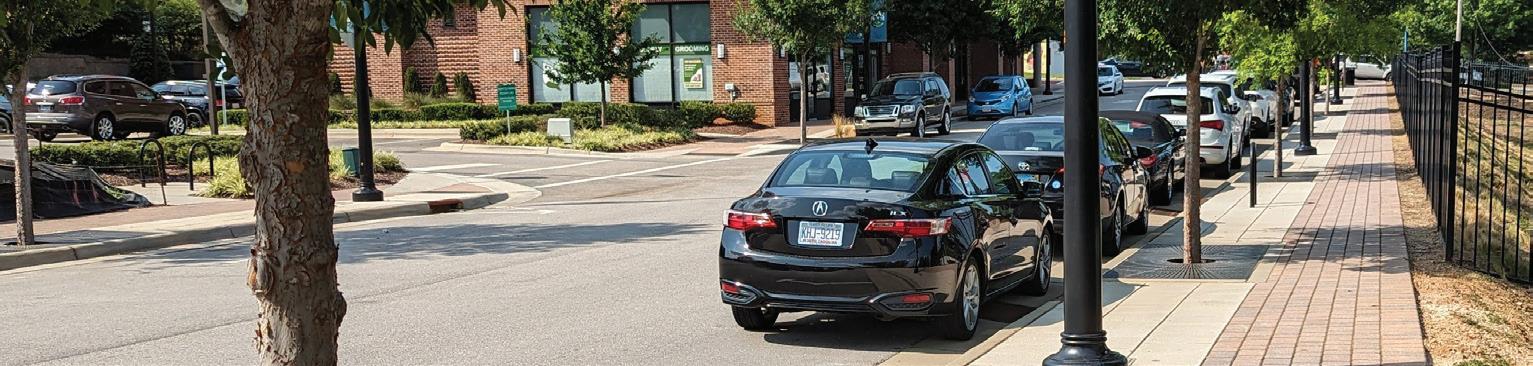
Streetscape types refer to the different design approaches and configurations used to enhance the visual, functional, and experiential qualities of urban streets. Downtown is broken up into four streetscape types: Main Street, Downtown Approach, Neighborhood Transition, and Neighborhood Street. These streetscape types are distinct in their function to Downtown and therefore consist of various urban design elements, some overlapping, some unique.
Recommendations:
• Main Street should include a minimum of 5 ft sidewalks, outdoor dining and additional seating where possible, traditional style of lighting and signage, wayfinding, and street trees.
• Downtown Approach should include a minimum of 8 ft sidewalks, breaks for plazas and pocket parks, bike lanes, street trees, outdoor dining, contemporary lighting and wayfinding, and more modern building designs.
• Neighborhood Transition should include a minimum of 5 ft sidewalks, bike lanes, street trees, outdoor dining, contemporary lighting and wayfinding, more modern building designs along with smaller scale retail and stoops for housing.
• Neighborhood Street should include a minimum of 5 ft sidewalks, parallel parking, traditional lighting, and street trees.
Main Street exhibits strong urban design with its public art, uniform street furniture, pedestrian-level lighting, and wide sidewalks for seating and street trees. It should incorporate more seating, retail spill out, and additional street trees. The historical brick facades enhance the streetscape’s character, and pedestrian-friendly crosswalks ensure safety. While sidewalks north of Elm Avenue are consistently 10 feet wide, those to the south should be widened as redevelopment occurs to create a more cohesive streetscape.
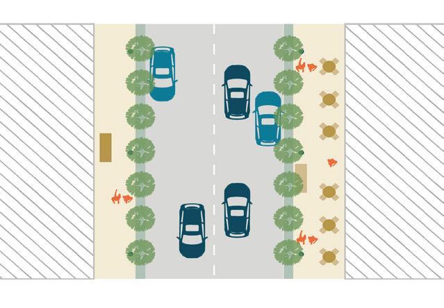
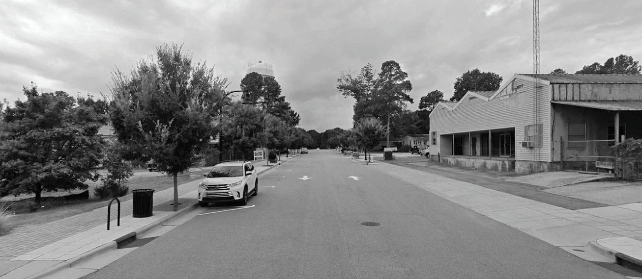

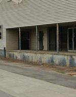
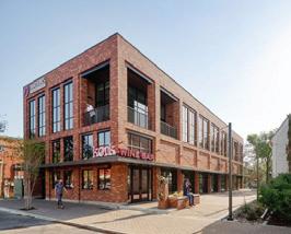

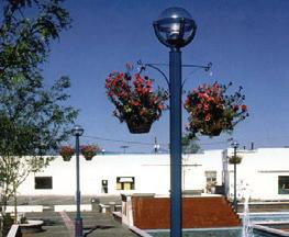
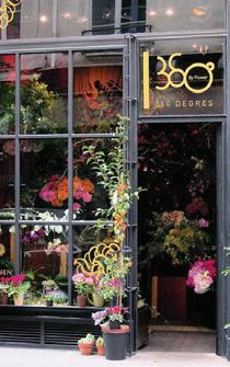
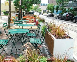
Downtown Approach streets should introduce wider sidewalks, allowing for more space for outdoor seating as well as bicycle lanes to encourage alternative modes of transportation. A number of streetscape elements are also needed such as brick pavers, pedestrian-level street lighting, consistent crosswalks, and cohesive street furniture to improve the current conditions.
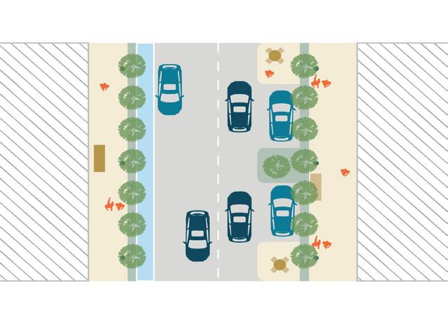
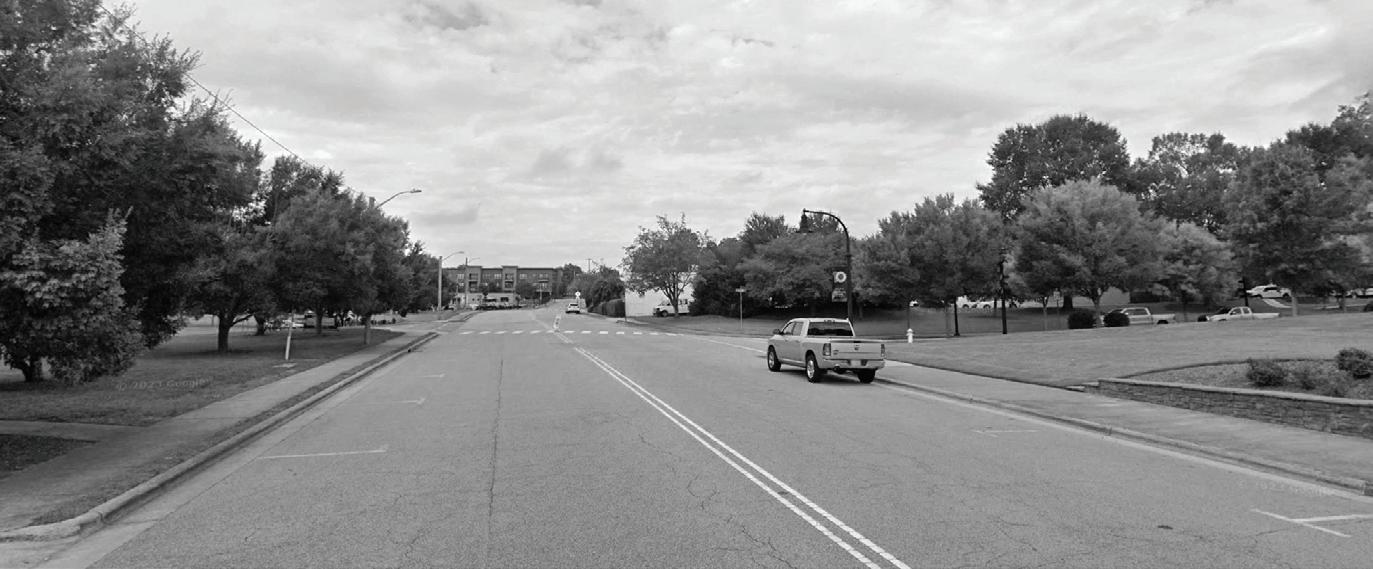


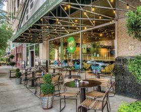
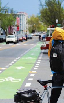
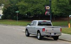

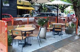
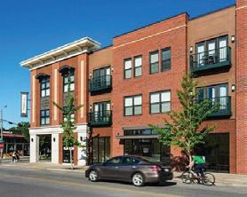
Neighborhood Transition streets should accommodate both vehicular and bicycle traffic, characterized by their inclusion of a planted median which adds greenery to the urban landscape. Missing streetscape elements include public art, a uniform style of street furniture, attractive sidewalk treatments, and wider sidewalks which restrict the potential for seating, street trees, and additional pedestrian spill-out spaces. Bicycle lanes should also be accommodated on these streets.
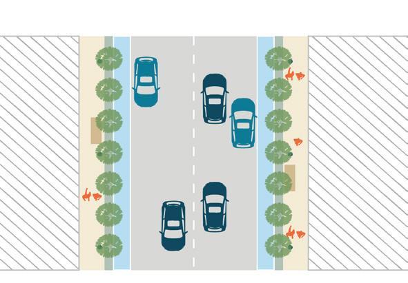
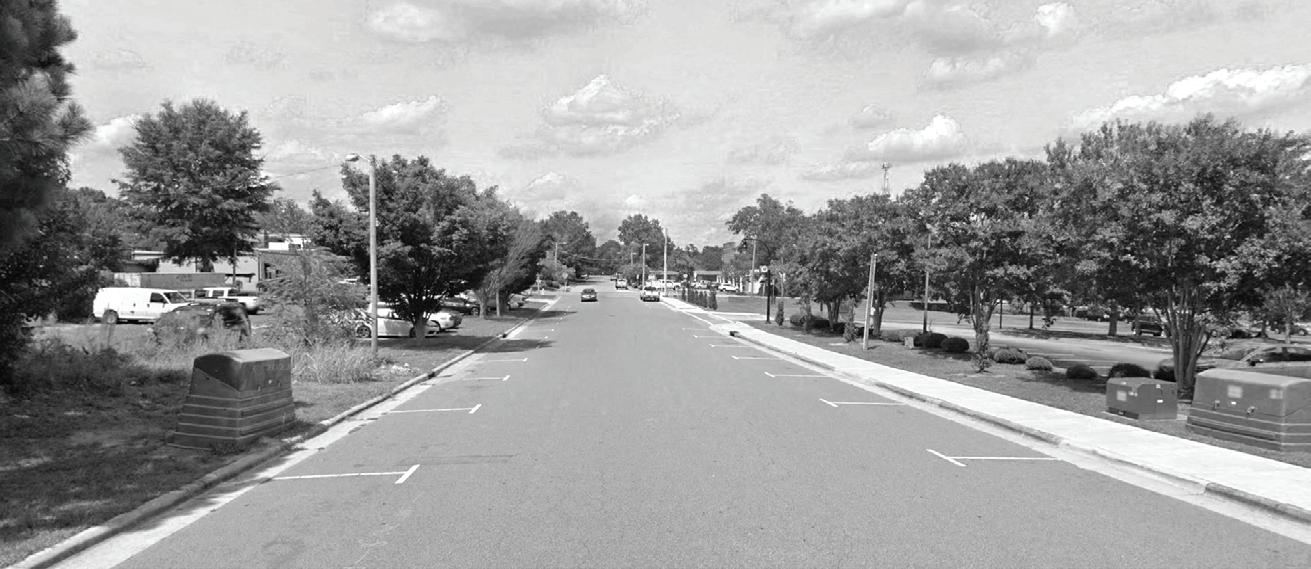
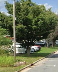
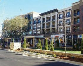
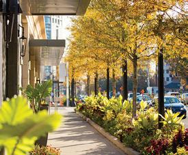
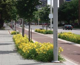
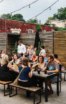
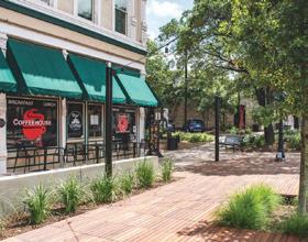
Neighborhood Street streets should include more public art, cohesive street furniture, and visually appealing sidewalks, which would enhance the pedestrian experience. Additional streetscape elements should include pedestrian-level street lighting, street trees and plantings, street light banners, and pedestrian-friendly crosswalks.
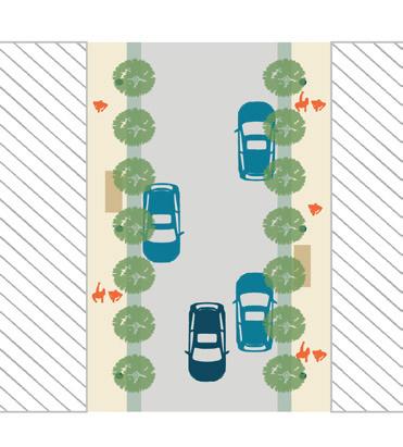
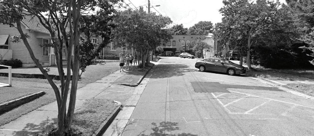
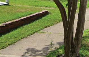
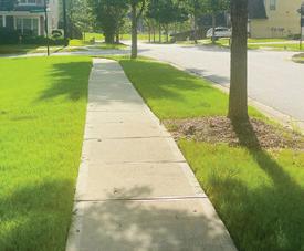
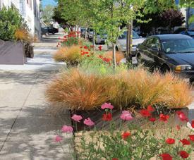
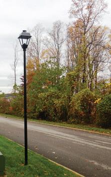
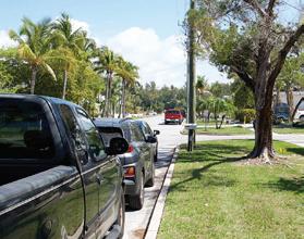

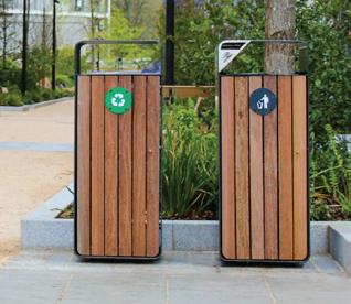
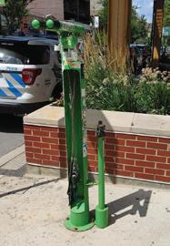
Well-designed street furniture, such as benches, seating areas, trash receptacles, and bike racks, provide amenities that support pedestrian activities and encourage people to spend time outdoors. Street furniture offers places for rest and social interaction, contributing to a sense of community and belonging. People infrastructure such as outdoor power units, charging stations, wifi hubs, informal workstations, and pay stations, bring connectivity to outdoor working, studying, socializing, relaxing and traveling. Utilizing creative elements that make Downtown more people-oriented are strongly encouraged.
Recommendations:
• Street furniture should not obstruct pedestrians utilizing the sidewalk; therefore, a 9 ft path should be maintained on all sidewalks.
• The installation of street furniture and other permanent objects on streets that may restrict pedestrian circulation and degrade the visual quality of the street is discouraged.
• Consistent design in street furniture (benches, garbage bins, bike racks, shelters, etc.) is encouraged.
• Furniture should be designed to accommodate as wide a range of potential users as possible.
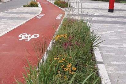
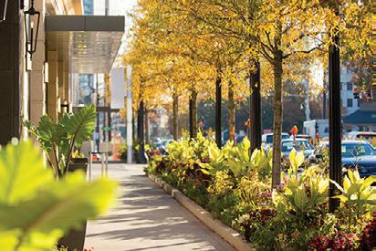
Street trees provide shade, reducing the heat island effect and creating more comfortable pedestrian environments, particularly during hot summer months. Street trees also help to improve air quality by absorbing pollutants and releasing oxygen, contributing to a healthier and more sustainable urban environment. Plantings reduce impervious area, treat stormwater, add aesthetic value and promote community stewardship, and provide a buffer between the active pedestrian area of sidewalks and the street, enhancing pedestrian comfort. Plantings coupled with street trees should be found along all major street types.
Recommendations:
• Explore the possibility of diversifying the tree species Downtown to reduce the heavy reliance on the American Elm, Chinese Elm, Willow Oak, and Common Crepe Myrtle.
• Plantings coupled with street trees should be found along all street types.
• Incorporate additional plantings and furnishings such as hanging baskets on street lights, street light wrap arounds, and other creative options.
• Ensure that all plants are wellmaintained including seasonal planting, trimming, and litter control.
• Explore the possibility of introducing green infrastructure such as rain gardens to improve resiliency.
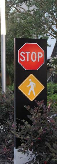

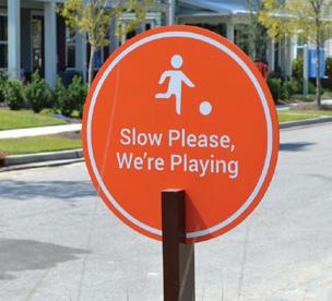
Traffic signage plays a crucial role in ensuring safety, order, and efficiency within the public realm. These signs provide essential information and guidance to pedestrians, cyclists, and motorists, helping them navigate the urban environment and understand the rules and regulations that govern it. By clearly communicating expectations and standards, traffic signage helps create a predictable and orderly public realm, enhancing the overall quality of life and facilitating smooth movement and interactions for everyone in the community.
• Traffic signs should be on all streets in Downtown and in accordance with any required regulations.
• Place signs at an appropriate height and distance from the roadway, with consideration for both vehicle and pedestrian traffic.
• Position signs for maximum visibility, taking into account sight lines, road curvature, and potential obstructions like trees or buildings.
• Signs should be well-lit or reflective to ensure readability in low-light conditions.
• Consider using flashing beacons or pedestrian-activated signals at hightraffic crosswalks.
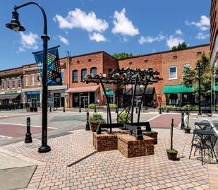
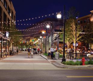

Lighting plays a crucial role in creating a vibrant and inviting public realm. Effective lighting enhances safety and security, especially during evening hours, making pedestrians feel comfortable and secure as they navigate the streets and public spaces. Good quality lighting can also boost an area’s night-time use and commercial viability. Lighting consists of exterior building lighting and streetscape lighting. Exterior building lighting could include lanterns, canisters, sconces, domes, floodlights to name a few. Streetscape lighting includes the streetlights, streetlamps, bollard lighting, festoon lights, string lights, or other decorative lights. Lighting can also be used in unique ways to enhance placemaking. Exploring creative ways to incorporate lighting throughout Downtown should be considered.
Recommendations:
• Lighting shall be placed at all street intersections in accordance with the Unified Development Ordinance.
• Pedestrian-scaled street lighting (no taller than 18 feet) shall be required using decorative fixtures.
• Replace streetlights on Brooks Street, Elm Avenue, E. Holding Avenue, and Roosevelt Avenue.
• Encourage property owners to illuminate front entryway, recessed entryways, walkways, garage areas, and building addresses so they are clearly visible from the street at night.

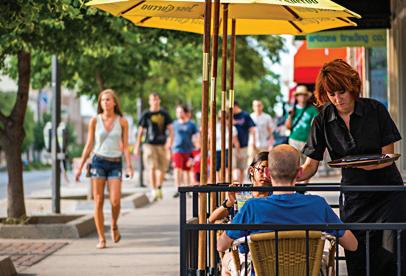
Outdoor dining, sidewalk patios, on-street patios, and other creative seating options, benefit local businesses and residents and promote pedestrian friendliness, active streetscapes, and visual distinctiveness. Even narrow sidewalks can accommodate café-style seating.
Recommendations:
• Outdoor dining should be permitted in areas where sidewalks can maintain the necessary sidewalk clearances with designated access/exit to ensure accessibility and ease of circulation.
• Outdoor dining should maintain a cohesive design with colors, textures, and decor.
• Outdoor dining and retail display areas should be enclosed by a highquality decorative fence or corral compatible with the Downtown character.
• Furniture should use materials that are weatherproof and easy to clean.
• Outdoor dining should consider different seating options such as benches, chairs, or booths, depending on space and ambiance.
• Outdoor dining layouts should ensure pathways and seating areas are accessible to all, including those with mobility aids.
• It is encouraged that furniture be consistent between each dining areas and adjacent properties.
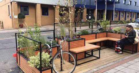
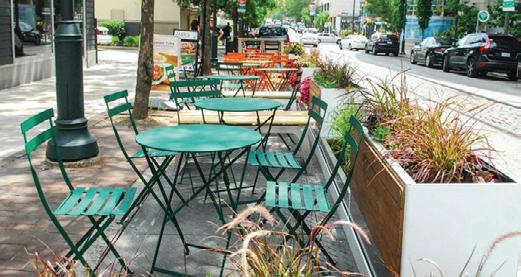
A temporary seating installation in the furnishing zone or parking lane that creates an inviting location for eating, reading, working, meeting a friend, or taking a rest during the warm-weather months. Parklets are typically created by repurposing on-street parking spaces or other underutilized urban areas.
• Consider converting parking spaces into parklets along S. White Street in front of storefronts with businesses such as bars, restaurants, coffee shops, etc.
• A parklet pilot program should be considered to gauge public reaction, assess their impact, and refine the concept based on feedback before committing to permanent installations.
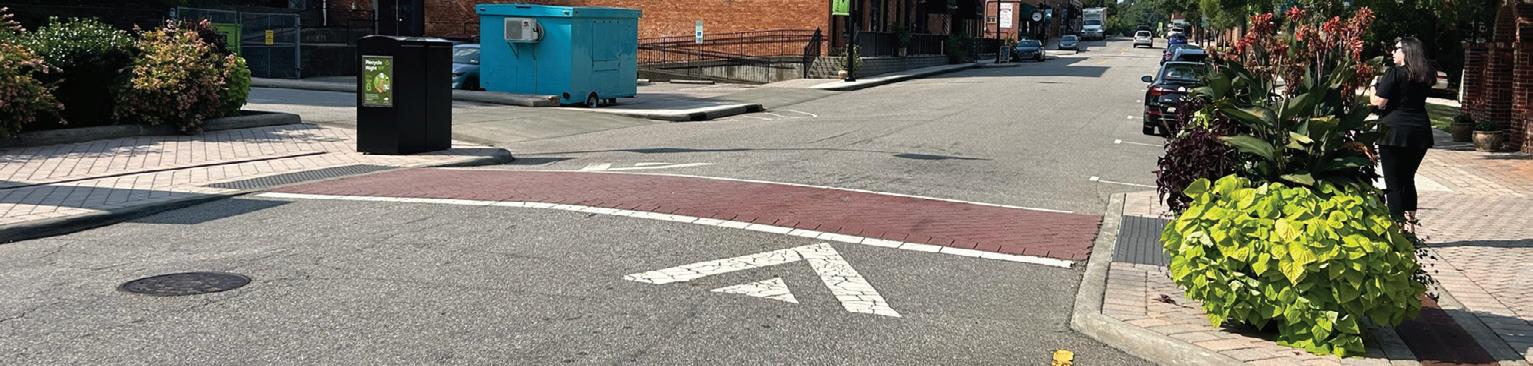
Pedestrian intersection improvements play a pivotal role in shaping the safety, accessibility, and vitality of urban environments. By prioritizing the needs of pedestrians and implementing targeted improvements, Downtown can create safer, more inclusive, and more vibrant intersections that promote active transportation, support economic vitality, and enhance the overall quality of life for residents and visitors alike.
Major Intersections
Minor Intersections
Intersection Enhancement to NE Neighborhood
Enhace key connections to the Northeast Neighborhood
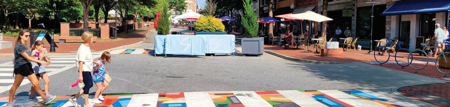
Crossing infrastructure at major intersections should be equipped with extensive crossing features such as hawk signals, refuge islands, and advanced stop lines to handle high volumes of traffic and ensure safe passage. Minor intersections should have basic yet effective crossing features including curb extensions, yield lines, and sidewalk ramps to facilitate safe crossings.
Recommendations:
• Use clearly delineated crosswalks using consistent patterns on all four sides of the intersection at all intersections in Downtown.
• Minimize turning speeds from the major to the minor street.
• Use the combination of signage, crosswalks, and design elements so that drivers on more prominent streets such as Elm Avenue, E. Holding Avenue, and Franklin Street yield to people in the crosswalk.
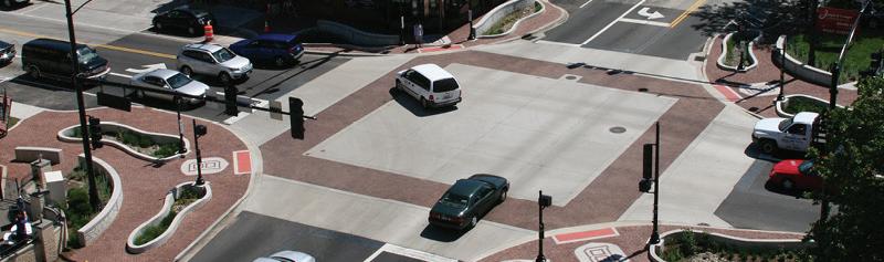
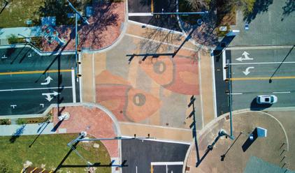
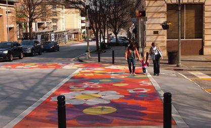
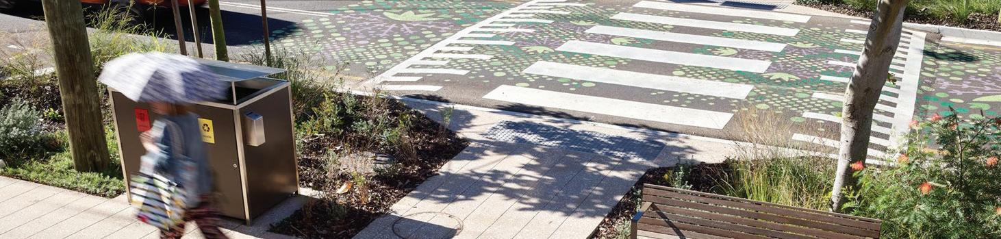
Curb extensions extend the sidewalk into the roadway at intersections to reduce crossing distances for pedestrians, increase visibility at crosswalks, and create opportunities for landscaping and/or street furniture. Curb extensions should include a pedestrian-friendly turning radii to create a tighter, more compact intersection. This slows down turning vehicles, enhancing safety for pedestrians by reducing crossing distances and making pedestrians more visible to drivers. Curb extensions exist at the intersection of E. Owen Avenue and Brooks Street, E. Owen Avenue and S. White Street, and throughout Retreat at Renaissance.
Recommendations:
• Curb extensions should be explored at intersections along Elm Avenue and S. White Street to improve the pedestrian environment.
• Curb extensions should be long enough to “daylight” the crossing, i.e, provide open sight-lines to the pedestrian crossing for approaching motorists at crossings that have low pedestrian visibility.
• Curb extension width is typically two feet less than the width of the parking lane and length is typically equal to the full width of the crosswalk.
• Smaller corner radii are preferred and actual corner radii exceeding 15 feet should be the exception.
• Unsafe intersections such as Elm Avenue and Brooks Street and Elm Avenue and S. White Street should be retrofitted with temporary materials such as epoxied gravel, planters, and bollards to define the curb radius until funding is available for a permanent solution.
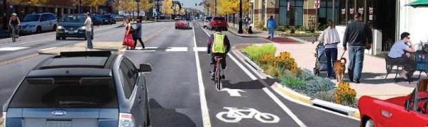
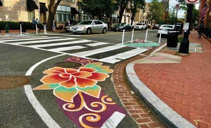
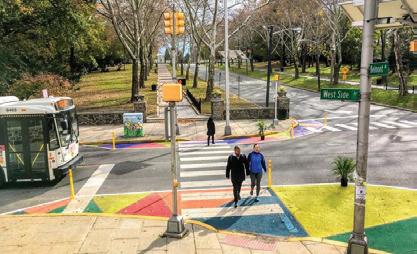

Clearly marked crosswalks improve pedestrian visibility and safety by signaling designated crossing points. High-visibility crosswalk markings, such as ladder or zebra stripes, increase pedestrian awareness and driver compliance, especially at night or in low-light conditions.
Recommendations:
• Install “High-visibility” crosswalks throughout Downtown.
• Crosswalks should be outfitted to remain ADA compliant.
Lines: 12-24”
Spacing: 12-60”
Midblock crossings are pedestrian crosswalks located between intersections, providing a safe way for pedestrians to cross streets at convenient locations. Midblock crossings are particularly beneficial in areas with long distances between intersections or where there is significant pedestrian traffic, enhancing walkability and reducing the risk of accidents by clearly designating safe crossing points.
Recommendations:
• Install where there is a significant pedestrian desire line (path that pedestrians naturally prefer to take).
• Stripe the crosswalk, regardless of the paving pattern or material. Otherwise, drivers are not likely to see it, especially at night.
• Unsignalized midblock crosswalks should be installed at locations with low pedestrian demand.
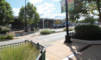
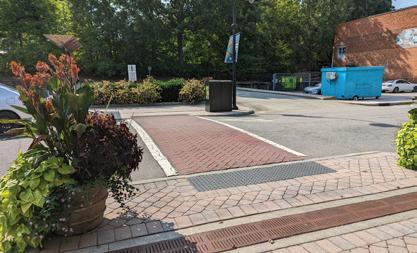
A road diet is a traffic calming strategy that involves reducing the number of drive lanes and/or roadway widths to accommodate additional streetscape elements. Road diets provide additional space for on-street parking, bike lanes, street trees, and increased sidewalk space improving multimodal access and connectivity.
The current configuration of Elm Avenue and Brooks Street include excessively wide travel lanes, narrow sidewalks, minimal pedestrian amenities, and intersections that prioritize vehicular traffic flow. Elm Avenue is a vehicle-focused corridor with ~20-foot-wide travel lanes with narrow sidewalks. Brooks Street is a vehicle-focused corridor with ~13-foot-wide travel lanes south of Elm Avenue and ~11-foot-wide travel lanes north of Elm Avenue. Sidewalks are inconsistently designed and located on one-side of the street. The road diets should optimize the existing right-of-way to enhance pedestrian safety by incorporating traffic calming measures, reducing vehicle speeds, and minimizing vehicular-topedestrian conflict points.
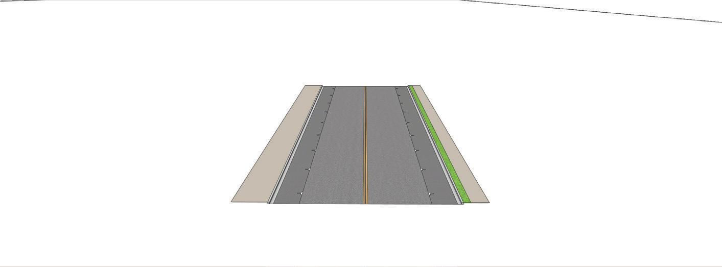
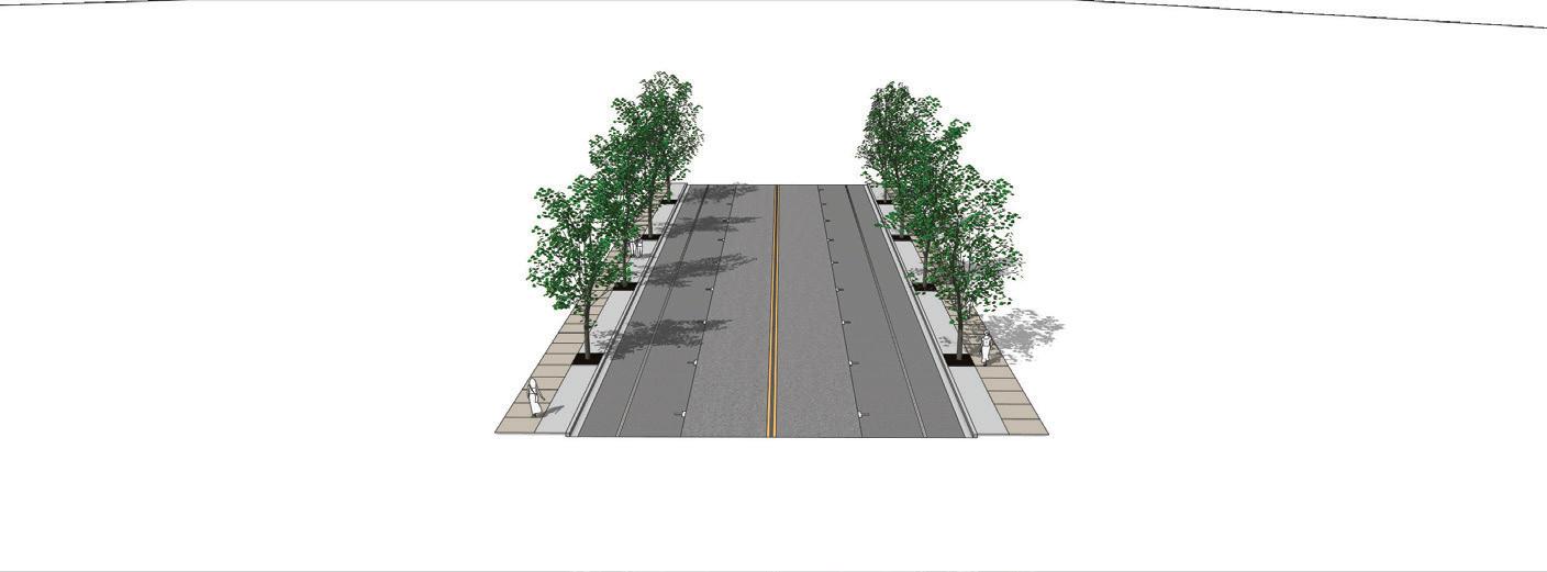
Elm Avenue and Brooks Street should be reconfigured to accommodate wider sidewalks, street trees, bike lanes, on-street parallel parking, and appropriate vehicular travel lanes. A roundabout should be considered at the intersection of Elm Avenue and S. Taylor Street (realigned). These reimagined streets will create a more vibrant, walkable street environment, which can attract more visitors and boost pedestrian activity for local businesses.
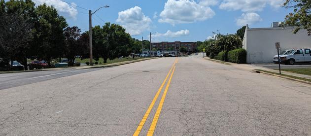
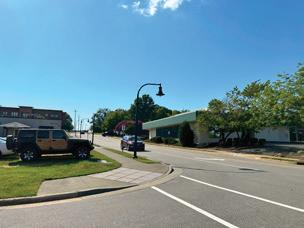

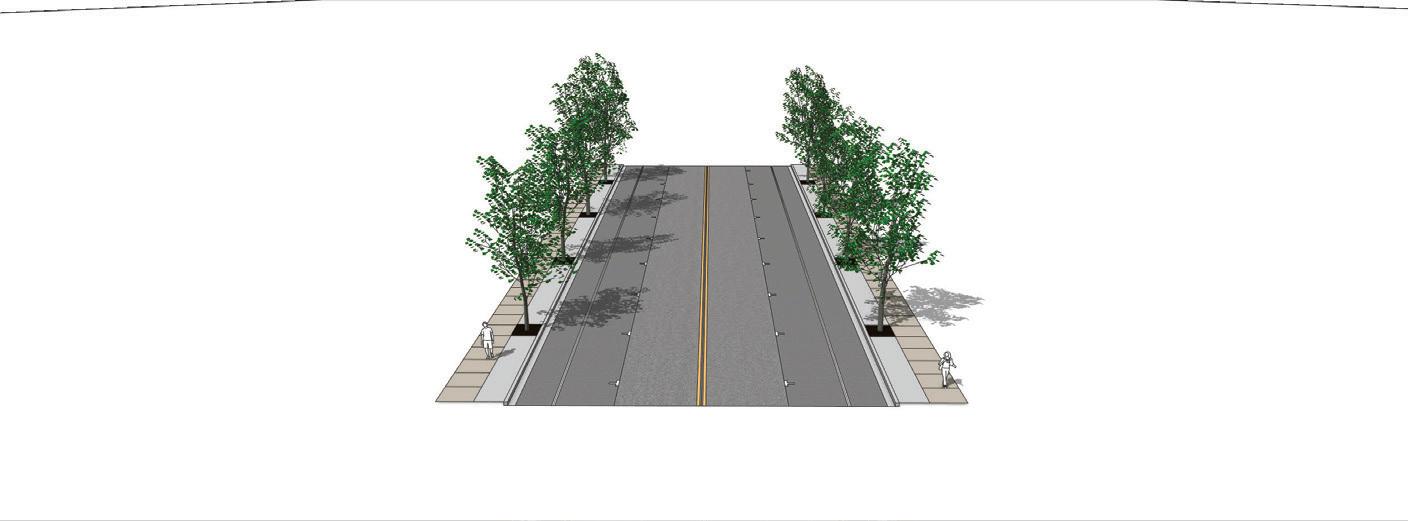
Converting a one-way street to a two-way street offers several benefits. This reconfiguration enhances traffic flow and safety by reducing confusion and conflicts at intersections. It also improves accessibility for all road users, including pedestrians and cyclists, making streets more welcoming.
The existing one-way circulation pattern for E. Jones Avenue and Wait Avenue should be reconfigured to better facilitate Downtown traffic patterns along S. White Street and for future development. Reconfiguration can occur in two ways.
Convert the streets into a two-way pattern. This alternative would not require substantial changes to current road dimensions or impact the existing property lines.
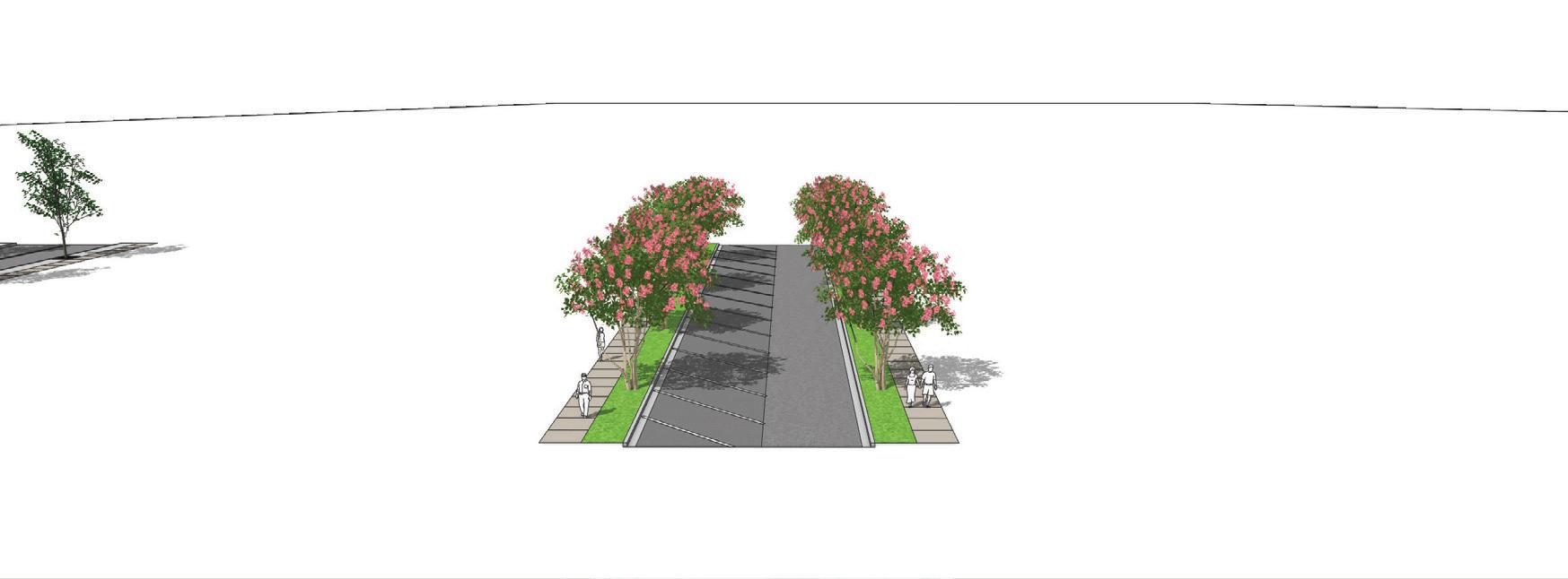
Convert the streets to two-way, increase the sidewalk width, and incorporate on-street parallel parking. This alternative would require right-of-way acquisition to accommodate all the elements identified in the graphic to the right.
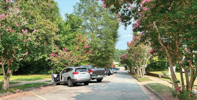
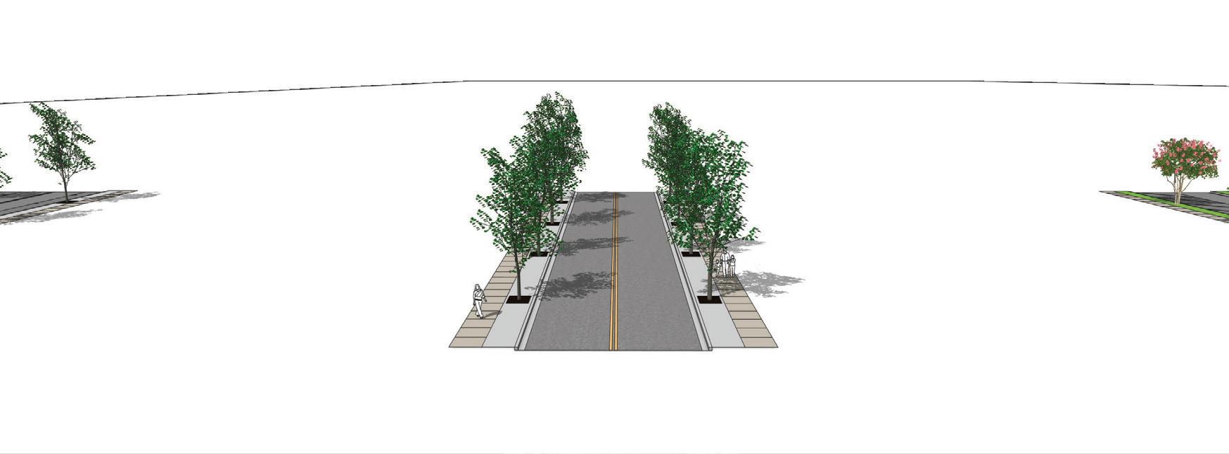
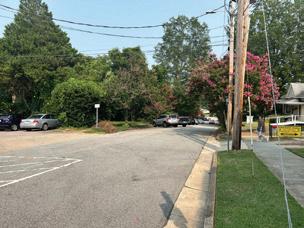
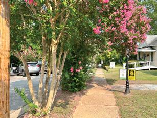

Placemaking refers to the process of creating public spaces that promote people’s health, happiness, and wellbeing. It involves designing and managing spaces that are not only functional but also engaging, vibrant, and reflective of the community’s identity and values. Placemaking emphasizes the importance of the human experience in the built environment, aiming to create places where people want to live, work, and spend time.
Environmental graphic design — sometimes known as experiential graphic design — incorporates branding and signage to enhance placemaking and create a physical space that people can connect to.
Town branding is the strategic process of developing a unique identity and image for a Town to distinguish it from other places, attract tourists, residents, and businesses, and foster local pride. This involves creating a cohesive visual and narrative identity that reflects the Town’s unique characteristics, culture, history, and aspirations. Elements of Town branding can include logos, slogans, marketing campaigns, and consistent messaging across various platforms. Effective Town branding enhances a Town’s visibility, supports economic development, and strengthens community engagement by highlighting what makes the Town special and worth visiting or investing in.
• Continue to encourage local businesses to adopt and reinforce the Downtown brand in their own marketing efforts by providing branding toolkits with logos, color schemes, and messaging guidelines to ensure consistency.


Approach routes are how residents, visitors, and commuters navigate major arterials, collectors, local streets, and public transit lines to converge toward Downtown. Effective approach routes not only facilitate smooth transportation but also set the tone for the Downtown experience, contributing to its economic vitality and overall appeal. Approach routes should implement clear signage, attractive landscaping, and wellmaintained infrastructure to create a welcoming entry experience.
Recommendations:
• Directional signage should be placed on the major corridors such as Dr. Calvin Jones Highway, US Route 1, Durham Road, and N. White Street.
• Directional signage should be placed on the collector/local streets such as Franklin Street, Wait Avenue, Main Street, and N. White Street.
• Directional signage should be placed within nearby neighborhoods to direct people to and from Downtown.


Signage should provide the visual confirmation that the Downtown area is a great place to walk, bicycle, drive, and use transit. Adequate signage is essential for guiding people, ensuring safety, and enhancing the identity and aesthetics of Downtown. It helps with wayfinding, traffic management, and emergency information, while also promoting local businesses and supporting tourism. Additionally, signage contributes to branding, provides public information, and can improve the visual appeal of public spaces. Overall, signage plays a crucial role in making urban areas functional, safe, and attractive. The adjacent map is meant to complement the Town’s Wayfinding Plan.
Enhace key connections to the Northeast Neighborhood
Underpass Gateway
Prominent Gateway Feature Directional Signage Kiosk/Directory
Public Parking Directional Sign
Public Parking Gateway Feature
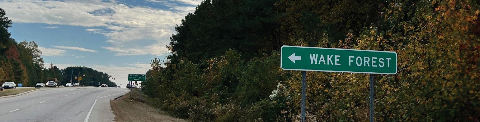
Gateways can signify to users that they are entering a vibrant downtown and encourage people to explore. Gateways vary in size based on their proximity to hubs of activity in downtown and connections outside downtown. Gateways should be incorporated at strategic locations, establishing downtown Wake Forest as a distinct destination. Wake Forest can enhance Downtown connectivity by establishing a Southern Gateway and revitalizing the existing north and east gateways. These underperforming entrances hold great potential for improvement. Upgrading them, along with adding the Southern Gateway, will create a more balanced and inviting access system, strengthening Downtown’s cohesion and accessibility. This initiative aims to welcome visitors from surrounding neighborhoods and link to key thoroughfares, transforming entry points into vibrant spaces that reflect the Town’s character and reinforce Downtown as a bustling community hub.
Directional signage offers guidance to drivers, bicyclists, and pedestrians pointing towards Downtown. Currently, directional signage is limited and community members stated the difficulty in finding Downtown unless you had prior knowledge of where it was. As people enter Downtown, directional signage is needed again to provide clear guidance by indicating routes, locations, or points of interest, helping pedestrians and drivers navigate efficiently within urban areas. Directional signage should be included throughout Downtown for pedestrians, bicyclists, and vehicles.
Signage is needed for parking lots and future public parking structures that indicate that a lot is public. Consideration should be given to including parking counters which indicate the number of total parking spots remaining.
Regulatory signage is a proactive form of wayfinding. It’s focused on safety and liability concerns and sets boundaries — what is and isn’t acceptable in your facilities. It establishes and reinforces rules, safety standards, and privacy expectations. Signage should be consistent, easily accessible, and clearly visible.
Kiosks and directories convey information, advertisements, or public messages, enhancing communication and visual appeal in urban environments. Kiosks and directories should be strategically located throughout Downtown to assist pedestrians. Kiosks or directories should be consistent with branding efforts.
• Consider developing specialized street name blades for Downtown with the Downtown logo and colors scheme.
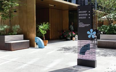
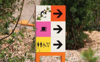
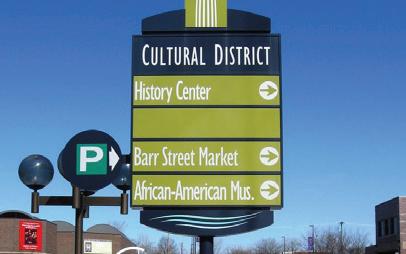
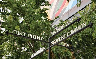
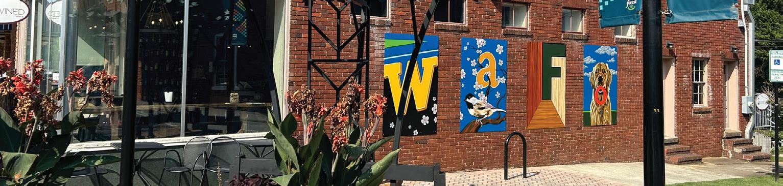
Public art is vital for enriching the cultural and aesthetic appeal of communities. It turns ordinary spaces into dynamic, engaging environments, helping to build a strong sense of identity and pride among residents. Public art can spark thought, inspire creativity, and mirror the community’s history and values. Additionally, it encourages social interaction and boosts tourism, contributing to the local economy. Various forms of public art include murals, sculptures, installations, street art, functional art, interactive art, digital and light art, performance art, and memorials and monuments. Recommended locations for public art in Wake Forest include S. White Street, the northern half of Brooks Street, and Elm Avenue.
Recommendations:
• Encourage all capital improvement and development projects to integrate public art into the design of public streetscape elements (e.g. paving, street furniture, transit shelters, lighting, etc.)
• Locate public art in areas where it can be viewed and enjoyed by a large number of people, including sidewalks, intersections, plazas, and medians.
• Three-dimensional installations that occur within the public right-of-way should not obstruct pedestrian circulation, and should be considered in the same manner as other street furnishings.
• Engage local Wake Forest artists in the creation of public art installations.
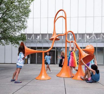
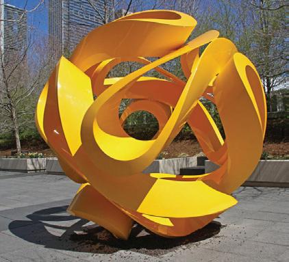
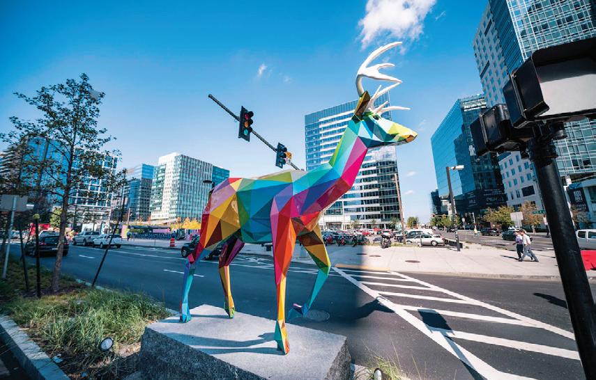
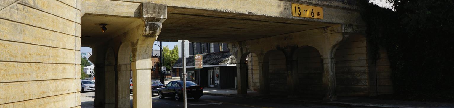
Throughout outreach, community members consistently referenced the unattractiveness of the viaduct. Participants wanted to see improvement of the design and appearance of the underpass. The railroad viaduct presents a unique gateway and placemaking opportunity. As a main entrance into Downtown it should be improved to provide an inviting entrance to Downtown.
Recommendations:
• Commission murals that reflect the cultural heritage, natural beauty, and community values of Wake Forest.
• Consider commissioning a rotating mural program where the underpass is repainted throughout the year to feature multiple designs and exhibits.
• Engage local artists to create works that resonate with residents and visitors alike, celebrating the Town’s history and identity.
• Consider incorporating interactive elements, such as QR codes that link to information about the art or historical context, enhancing the educational and cultural value of the murals.
• Install energy-efficient LED lighting that highlights architectural features of the viaduct, creating a striking visual effect at night.
• Incorporate historical plaques or interpretive signage that tells the story of the viaducts and their role in Wake Forest’s development.
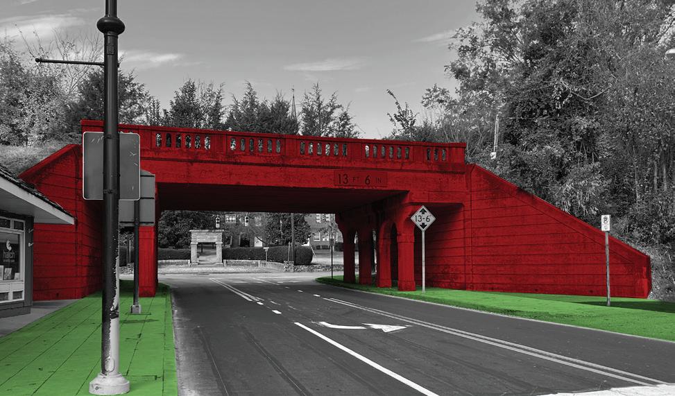
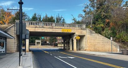
The Hamburger Square railroad bridge in Greensboro, NC, is undergoing a beautification project. The bridge is being painted Greensboro Green with gold and tan accents to match the city’s logo and highlight its architectural elements. The project is a collaboration between the City of Greensboro and the nonprofit Greensboro Beautiful, which contributed $6,000 for the accents. The City is also planning a $344,000 beautification project for Hamburger Square. The rejuvenation aims to enhance safety, promote pedestrian crossing, and support Downtown development.
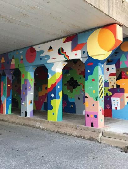
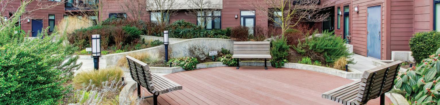
Public gathering places are areas designed for people to come together for social, cultural, or recreational activities. These spaces, which can include parks, plazas, Town squares, and community centers, play a vital role in fostering community interaction and engagement. Well-designed public gathering spaces are accessible, welcoming, and equipped with amenities like seating, greenery, and lighting to enhance the user experience. They provide a venue for events, promote social cohesion, and contribute to the overall quality of life by offering a place for relaxation, entertainment, and connection among community members. Public gathering spaces offer numerous benefits to communities, including: social interaction, cultural expression, recreation and relaxation, economic boost, civic engagement, aesthetic appeal, environmental benefits, health and wellness.
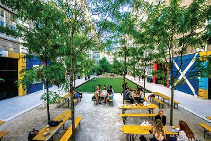
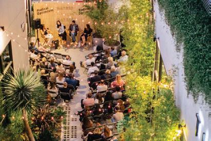
Creating places for gathering such as central squares, fountains, intimate courtyards, and urban parks is vital. Places for gathering can serve as focal points for community interaction, fostering social connections and enhancing the quality of urban life. Well-designed gathering places can break up the monotony of continuous street corridors and rich architecture, offering a respite and a sense of openness within the dense urban fabric. They also provide opportunities for public events and casual leisure, which can attract visitors and increase foot traffic, benefiting local businesses. The Town should encourage developers to incorporate vibrant public spaces into future developments to enhance connections between private properties and the streetscape to promote a more cohesive Downtown experience.
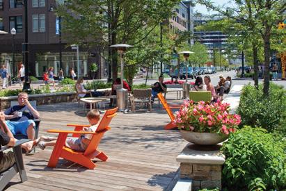
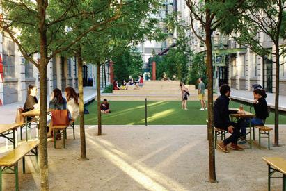
Pocket plazas play a crucial role in enriching the urban landscape. Positioned strategically at activity centers, major pedestrian circulation routes, and as part of new development, these small spaces encourage community engagement and social interaction. They are designed primarily for passive gathering, civic purposes, and commercial activities, often characterized by a mix of hardscape and green space. Pocket plazas provide venues for public events, art displays, or simply spaces for relaxation and peoplewatching. Pocket plazas break up the urban density, offering accessible and inviting areas that can foster a sense of community and enhance the overall quality of urban life.
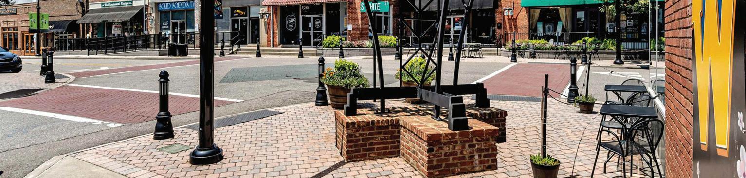
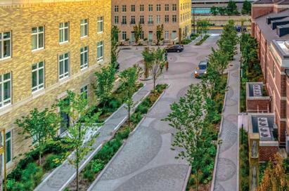
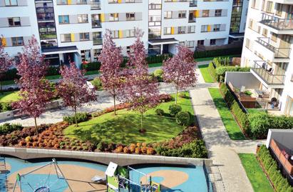
Places for movement are spaces intentionally designed to accommodate pedestrian movement and connection. Strategically placed, places for movement can enhance the overall walkability and connectivity of Downtown. Thoughtful placement of these places for movement can enrich the pedestrian experience, making key spaces Downtown more functional and enjoyable.
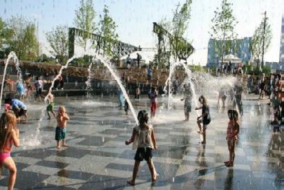
Play areas are crucial components of a great public realm, especially for families and children. These spaces offer opportunities for recreation, physical activity, and socialization, contributing to the overall health and well-being of residents and visitors. Play areas provide children with safe and engaging environments where they can develop physical skills, creativity, and social connections. Play areas should be programmed to offer activities to adults as well, be it a cafe/bar, comfortable seating or free Wifi.
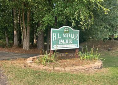
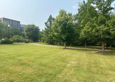
H.L. Miller Park is the only park space that is currently existing in Downtown Wake Forest. It is a two-acre wooded park located at the northwest corner of Elm Avenue and S. Franklin Street, behind the Wake Forest Town Hall.
There is an opportunity to enhance the park by upgrading playground equipment, adding or refurbishing walking and biking trails, installing new seating and picnic areas, and improving landscaping with trees, gardens, and green spaces. Lighting and security measures can be enhanced to improve safety, while amenities like restrooms, water fountains, and sports facilities can be updated or added.
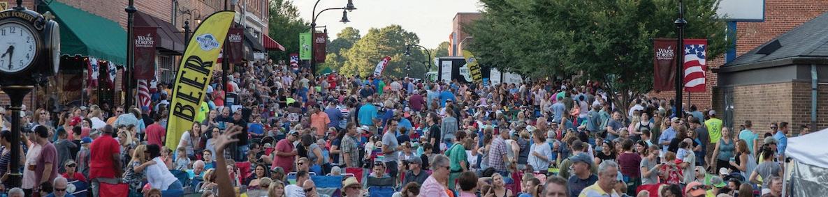
The Town has pride in the events and attractions that bring people to Downtown. The Town calendar and the website news and updates page are regularly updated to promote and market the various concerts, festivals, celebrations, markets, and other outdoor events that take place throughout the Town. Some of the largest community events take place in Downtown including Friday Night on White and Meet in the Street drawing thousands of people to Downtown every year.
During outreach, participants were complimentary of the many Downtown events that take place. However, participants wanted more events throughout the year. Building off the success of the Lighting of Wake Forest, activities such as holiday lights on buildings, illuminated art walks, ice skating, or winter-themed pop-up bars and restaurants could be utilized to bring more people Downtown during the winter months.

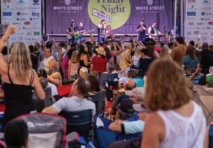
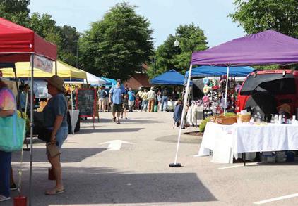
A 24-hour town revitalizes downtowns by promoting mixed-use developments and continuous activity beyond traditional business hours. This approach boosts the nighttime economy, enhances safety, and creates a more inclusive environment. Greenville, SC, employed this concept by increasing downtown housing, hosting round-the-clock events, improving lighting, expanding sidewalks, and enhancing public transportation. These strategies have transformed Greenville into a lively, 24-hour city, improving residents’ quality of life and attracting visitors.
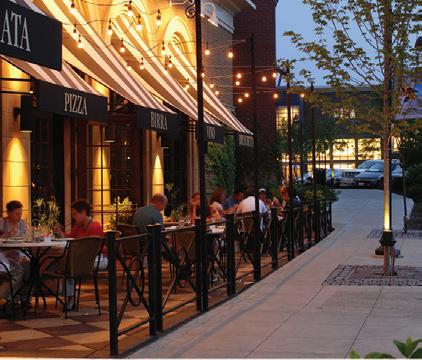
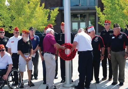

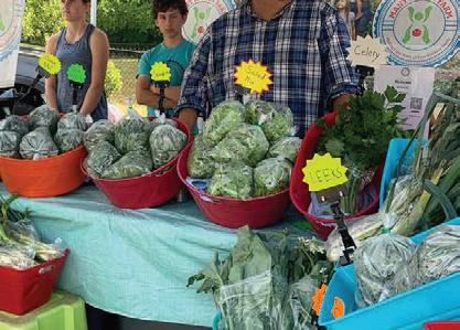
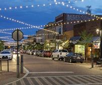

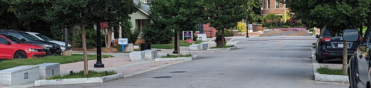
To accommodate the foot traffic and the vendors, the Town utilizes S. White Street, E. Owen Avenue, and Brooks Street for booths, stages, food trucks, and other event activities. Cited as the “event street”, E. Owen Avenue was retrofitted with curb cuts and additional outlets to accommodate vendors during these events. While the updates are useful for the various events, the streetscape should be constructed to accommodate daily use rather than the events that are put on throughout the year.
Recommendations:
• Implement clear signage to help visitors navigate the area easily, reducing confusion and improving the overall event experience.
• Host street-wide events on Elm Avenue and utilize H.L. Miller Park for other gatherings.
• Incorporate streetscape improvements discussed earlier in this chapter to ensure E. Owen Avenue matches the streetscape throughout Downtown.
• Evaluate and utilize surveys regularly to identify and address issues impacting the operation of events and festivals, ensuring continuous improvement.
• Explore opportunities for creating more year-round outdoor events to take advantage of the region’s agreeable climate.
• Enhance safety and security by providing adequate lighting, especially in areas where events occur at night, to make attendees feel comfortable.
• Explore the possibility of installing stand-alone public restrooms.
Areas for Events and Markets
Areas for Street Events
This chapter identifies redevelopment opportunities throughout Downtown. The Town should use the following recommendations to evaluate development proposals to ensure they align with the vision and goals of the Downtown Plan.
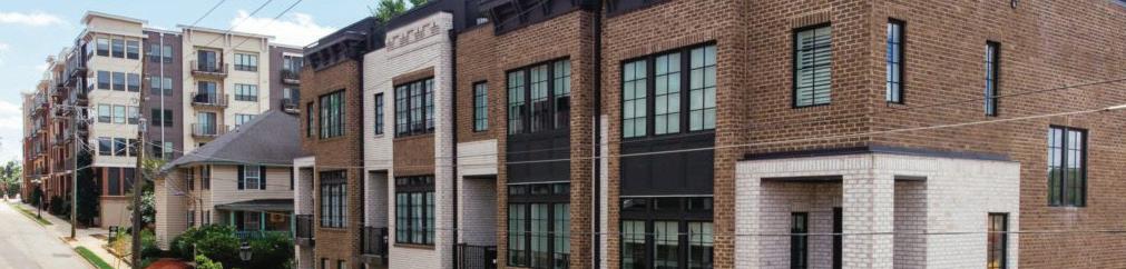
There are several approaches to improve the development pattern in Downtown Wake Forest including investing in storefronts and building facades, transforming underutilized surface parking lots, developing vacant wooded lots, and reimagining distressed buildings and properties. The following section has been divided into four categories including strategic investment, parking lot redevelopment, vacant lot development, and underperforming building and/or lot redevelopment.
The following page identifies several redevelopment opportunities made up of vacant parcels, underutilized properties, and/or surface parking lots where redevelopment would have a significant positive effect on the appearance and functionality of the surrounding area. The Town should actively work with property owners and developers to position these identified sites for new development.
These properties are worth investing in due to their aesthetic appeal, architectural significance, and/or functionality. The Town should work with property owners and business operators to activate vacant storefronts, enhance outdated or deteriorating façades, and explore adaptive reuse where feasible.
Surface parking lots in Downtown represent potential redevelopment opportunities and should be planned for accordingly. Redevelopment should only be considered if parking spaces can be accommodated elsewhere or if they are deemed no longer necessary based on changes in transportation habits.
These properties include parcels were no development has occurred. These greenfield opportunities are rare in Downtown. The Town should work with property owners to encourage development consistent with the Downtown Plan’s recommendations.
It is important to note that redevelopment may occur at any time on properties not identified on the opportunity sites map or discussed in this section. The recommendations included in this section reflect desired redevelopment outcomes at the time of Plan adoption. The recommendations are flexible and should be considered in part with all other Plan goals and objectives.
These sites include underperforming building and/or lots that are likely to redevelop to better leverage their value and contribution to Downtown. The Town should work with property owners and developers as proposals come forward to position these sites for redevelopment.
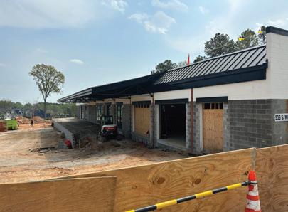
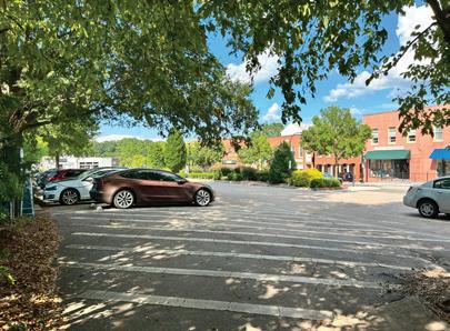
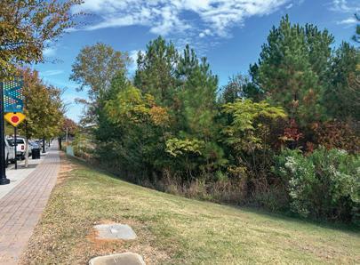
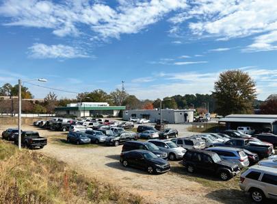
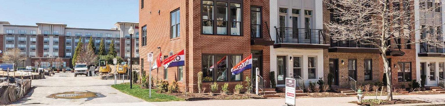
Opportunity sites are made up of vacant parcels, underutilized properties, and/or surface parking lots where redevelopment would have a significant positive effect on the appearance and functionality of the surrounding area. New development on these properties should align with the recommendations outlined in the Functional Subarea section (see pg 26).
Catalyst sites highlight Downtown Wake Forest’s most significant opportunities for redevelopment. The transformation of these properties could have a catalytic impact on surrounding development— spurring future reinvestment and enhancement. The identified catalyst sites should serve as a “model” for future redevelopment throughout Downtown, taking into consideration uses, built form, parking, connectivity, and transitions into surrounding neighborhoods.
Future consideration sites include properties not likely to be redeveloped within the lifespan of the current Downtown Plan. These sites may currently be occupied by long-standing businesses, under long-term ownership, or simply not aligned with current market trends. These sites should remain on the Town’s radar for potential redevelopment opportunities if circumstances change through shifts in market demand, changes in property ownership, and/or broader economic trends.
Map Key
Opportunity Site
Catalyst Site
Future Consideration Site
Consider vacating Wait Avenue and consolidating these blocks to set the stage for a larger redevelopment opportunity
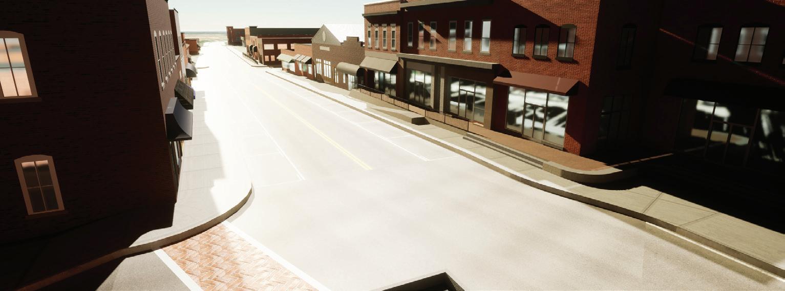
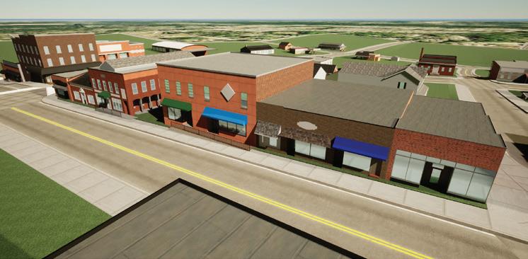
As part of the Downtown planning process, we developed an immersive digital twin of Downtown Wake Forest to visualize and assess potential Plan recommendations. The immersive digital twin was developed to visualize potential changes to design standards and building heights within the defined study area— spanning Roosevelt Avenue to Taylor Street, and Elm Avenue to the railroad. Leveraging the Town’s existing GIS information, our approach incorporated tools including ArcGIS Pro, ArcGIS CityEngine, Epic’s Unreal Gaming Engine, and other advanced 3D modeling applications, to construct a detailed digital representation of the Downtown terrain and topography.
This tool will be used during the Community Open House to allow users to navigate the digital environment in a third-person view, offering a tangible sense of scale and immersion. Participants will be able to interact with the model, toggle redevelopment options and building heights, and provide feedback directly with the consultant team.
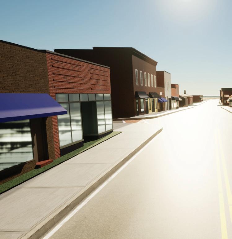
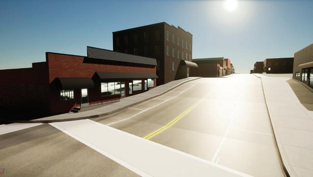
Opportunity Site Details:
Parcel(s): 1
Total Lot Size: 0.84 ac; ~36,500 sq ft
Existing Land Use(s): Former Drive-Through Fast-Food
Existing Structure(s): 1 building
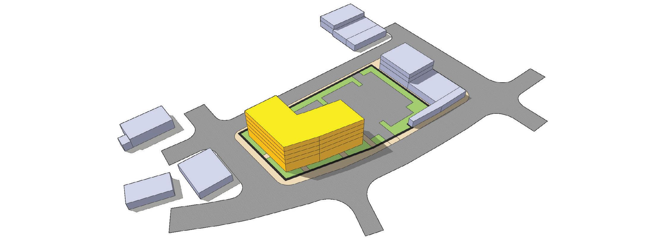
OPPORTUNITY SITE #1
This site is located in the Brooks Street Infill functional subarea. Formerly a drive-through fast-food restaurant, this site presents challenges due to significant grade changes between Roosevelt Avenue and Wait Avenue. The recommended redevelopment for this site is a single mixed-use building with ground-floor retail, restaurant, or service uses fronting Roosevelt Avenue and residential units on the upper floors. To enhance connectivity and accessibility, Wait Avenue should be converted from a one-way to a two-way street, with on-street parking converting from angled to parallel as part of a comprehensive streetscape redesign. This redesign should incorporate wider sidewalks, enhanced landscaping, and improved traffic calming measures such as mid-block crossings, bumpouts, and crosswalks. Parking for the site should be provided on-site with either covered parking or a shared parking deck.
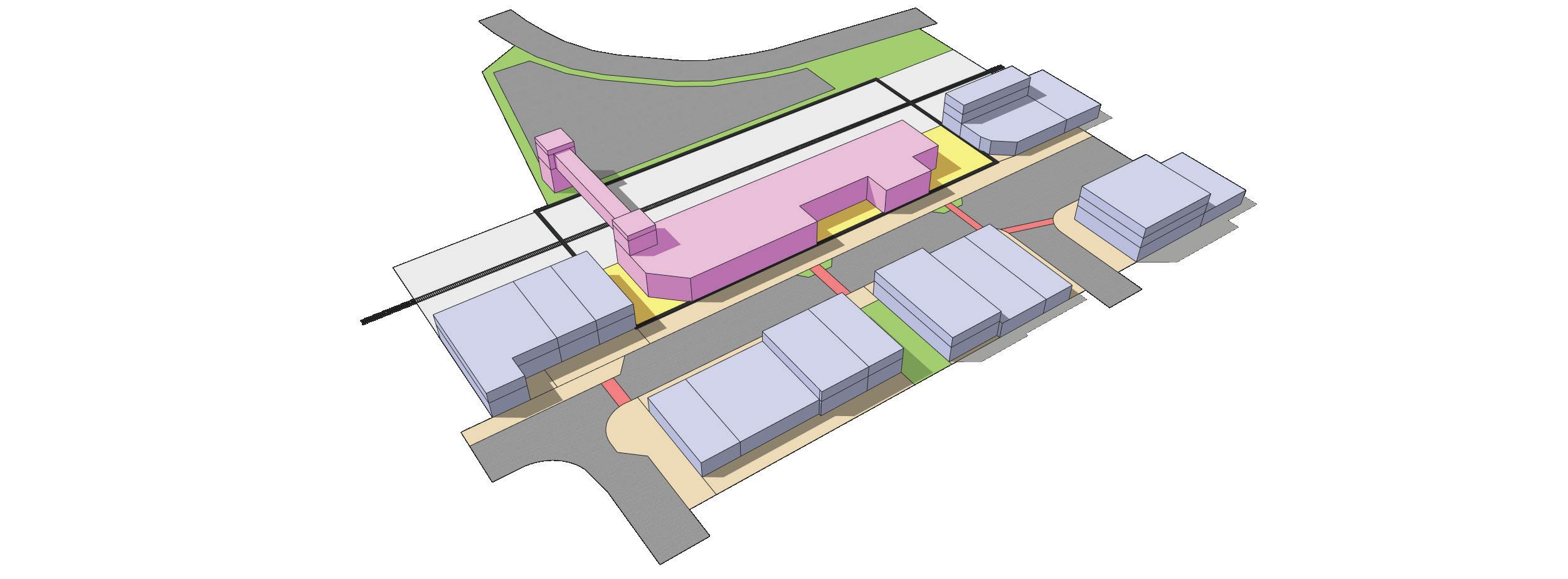
This site is located in the Historic White Street functional subarea. This site includes the Town-owned public surface parking lot. This surface parking lot has been identified by North Carolina Department of Transportation (NCDOT) as the preferred future location to construct a new mobility hub. NCDOT has hosted a series of open houses and design workshops to solicit feedback from the public on how this new mobility hub should look to ensure the proposed design and programming fit well into the surrounding area. The public also provided input on potential parking and drop-off strategies to maximize accessibility and convenience, while balancing considerations for the historic area’s integrity. The Town should continue to advocate for the construction of the S-Line Mobility Hub to support the growth of freight and passenger rail services between Richmond, VA, and Raleigh, NC. Town staff will continue to update the Downtown Plan’s polices and recommendations as more information is provided by additional studies and reports. Redevelopment of the site should integrate various transit-supportive elements, including bicycle, electric vehicle charging stations, a mini park or plaza for waiting areas, and designated pick-up and drop-off locations for ride-share services.
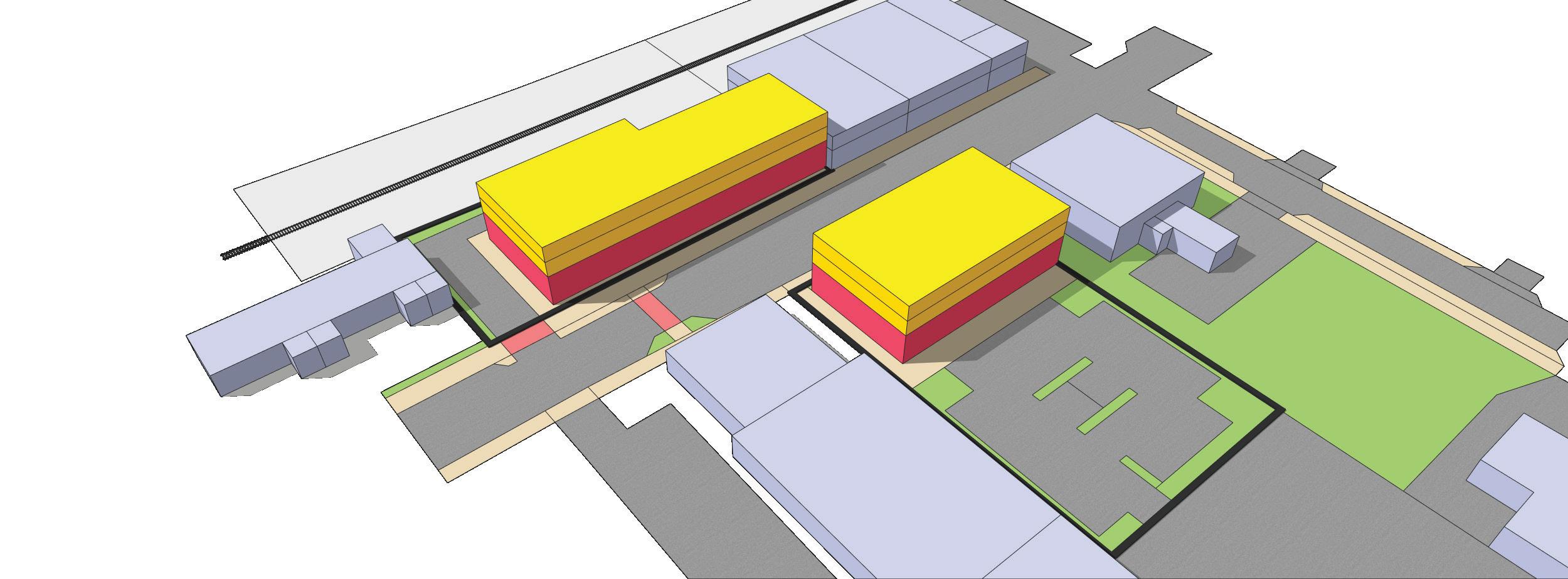
Opportunity Site Details
Parcel(s): 3
Total Lot Size: 3.49 ac; ~146,000 sq ft
Existing Land Use(s): Paved Parking Lots; Gravel Parking Lot
Existing Structure(s): None
OPPORTUNITY SITE #3
This site is located in the Brooks Street Infill and White Street Extension functional subareas. This site is an ideal opportunity for infill development aimed at restoring the continuity of the building streetwall along S. White Street. Redevelopment should incorporate retail, restaurant/bar, and service uses on the groundfloor, with residential and/or office spaces on the upper-floors, ensuring a vibrant mix of activities that contribute to the area’s vitality. New construction should be designed to complement the architectural character of buildings within the Historic White Street functional subarea, preserving the historic integrity and enhancing the cohesive aesthetic of the downtown environment. Given the shallow lot depth along the railroad, creative solutions for on-site parking are essential, such as tuck-under parking, rearaccess parking, and shared parking agreements.
Opportunity Site Details
Parcel(s): 3
Total Lot Size: 2.52 ac; ~109-850 sq ft
Existing Land Use(s): Office; Industrial; Vacant Lot
Existing Structure(s): 6 buildings; several tanks; filling stations; tall ground-mounted antennas
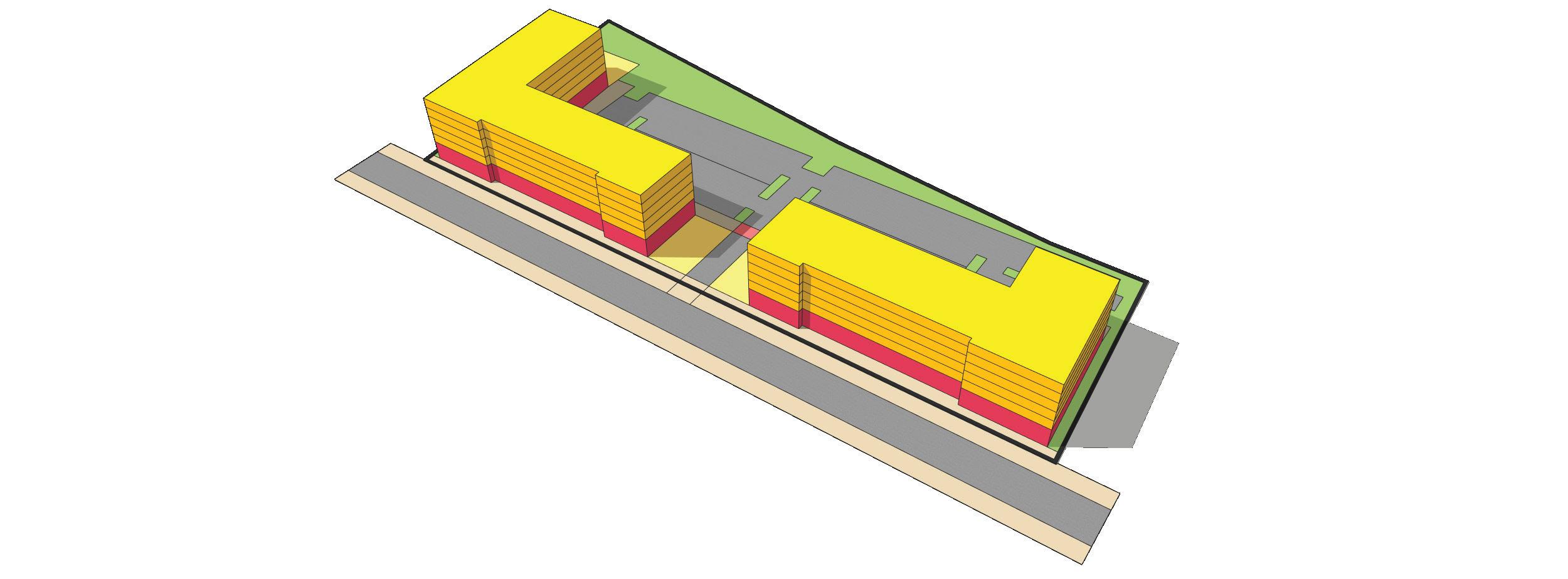
OPPORTUNITY SITE #4
This site is located in the White Street Extension functional subarea. This site currently includes a mix of office and industrial buildings, storage tanks, filling stations, and groundmounted antennas, and has been occupied by long-standing establishments adjacent to the “traditional main street area” of Downtown Wake Forest. As development pressures and market trends have expanded south along S. White Street, these properties have become prime candidates for redevelopment. This shift presents an ideal chance to transform this site into uses and buildings more compatible with the Historic White Street. functional subarea. Redevelopment should incorporate a mix of retail, restaurant/bar, entertainment, and service uses on the ground-floor, complemented by residential units on the upperfloors, revitalizing the area and integrating it more cohesively with Historic White Street.
Multifamily 5-stories
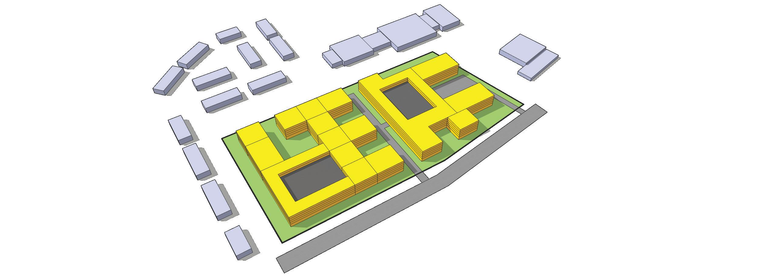
This catalyst site is located in the Southeast Transition functional subarea. The Forest Ridge apartments, constructed in 1981, includes 88 garden-style apartment units on an 8.59-acre site. The existing suburban-style design includes 2-story buildings with large setbacks and excessive surface parking lots. This low-density multifamily type is not consistent with the housing options needed to support a growing and thriving Downtown. While this area may not see redevelopment within the lifespan of the current Downtown Plan, should market conditions evolve to make this site a viable candidate for redevelopment, the Town should advocate for multifamily development that aligns with the denser, transit-supportive development types recommended in other redevelopment sites throughout Downtown. Presently, the site’s density is roughly 10 dwelling units per acre. To support increased density, new multifamily buildings could be up to 5-stories with a range of 25-40 dwelling units per acre.
Multifamily 5-stories
Opportunity Site Details
Parcel(s): 3
Total Lot Size: 8.59 ac; ~374,000 sq ft
Existing Land Use(s): Multifamily
Existing Structure(s): 10 buildings (2-stories)
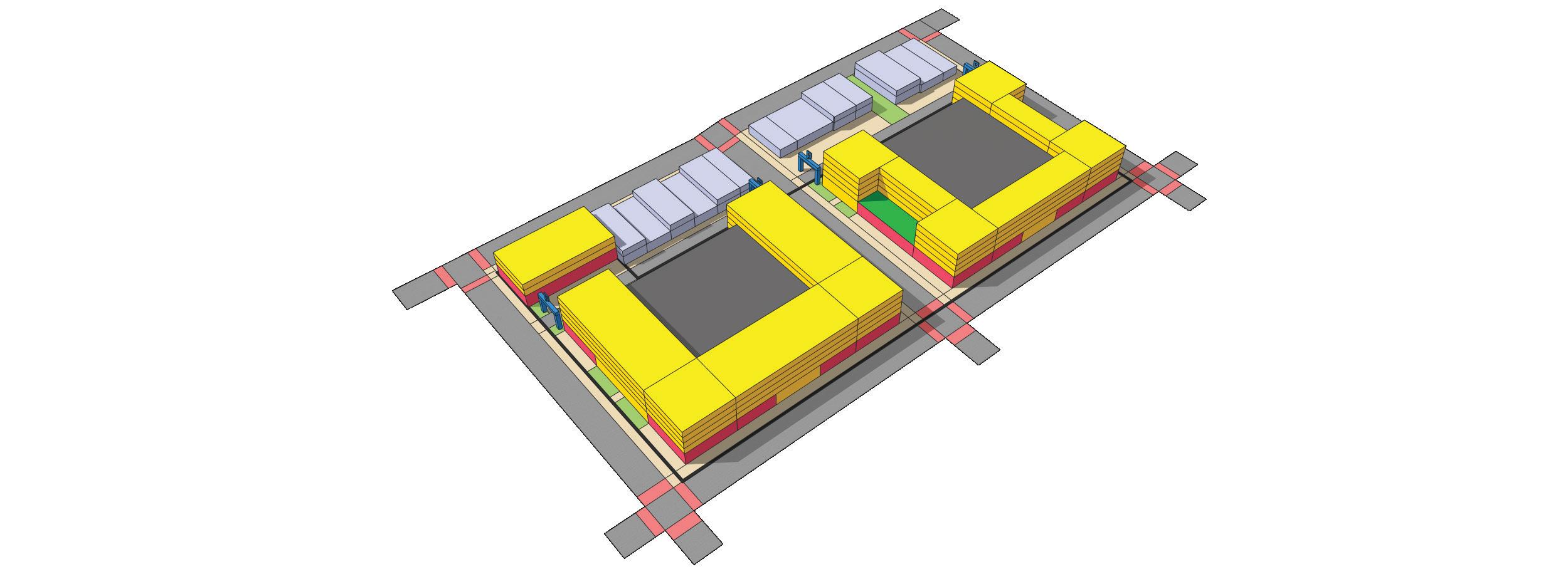
This catalyst site is located in the Brooks Street Infill functional subarea. This catalyst site is well positioned for multifamily development designed to complement the character and style of buildings along S. White Street while growing the residential population of Downtown Wake Forest. The catalyst site should predominantly feature multifamily residential uses with opportunities to integrate retail, restaurant/bar, and service uses on the ground-floor at strategic intersections. The multifamily buildings should be designed to step down with the existing topography, utilizing the natural grade change to minimize their visibility from S. White Street. Parking should be integrated into the building’s design, ensuring minimal visibility from the public right-of-way. Additionally, the multi-story parking deck should accommodate public parking spaces to support businesses in the Historic White Street functional subarea. To ensure easy navigation, directional signage should be prominently placed, directing shoppers and visitors to the conveniently located public parking within these structures.
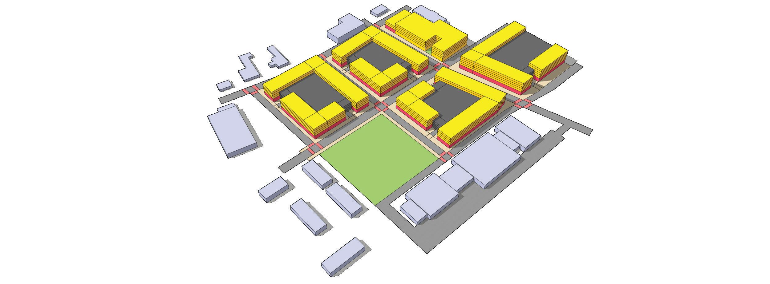
This catalyst site is located in the Brooks Street Infill, Civic Center, Brooks Street/Elm Avenue, and White Street Extension functional subareas. This site embodies the concept of a catalytic opportunity with the potential to transition a once auto-centric node into a walkable, urban mixed-use district. The existing development in this site represents the past suburbanization of the downtown edge. This area offers significant potential to evolve into a walkable, urban mixed-use district with a variety of housing options and increased densities that support a thriving Downtown. Positioned at the base of the hill from the historic core, the site can comfortably accommodate mixed-use buildings and high-density multifamily that complement the existing buildings along S. White Street. Redevelopment should incorporate retail, restaurant/bar, and service uses on the groundfloor, with high-density residential and/or flex office spaces on the upper-floors. This catalyst site is poised to replace the suburban-style model, that is typically not appropriate for downtowns, in a way that is contextually respectful with surrounding uses.
Taylor St and Elm Ave Intersection
Opportunity Site Details
Parcel(s): 9
Total Lot Size: 11.25 ac; ~490,000 sq ft
Existing Land Use(s): Restaurant; Public/Semi-Public; Commercial; Auto Service; Vacant
Existing Structure(s): 8 buildings
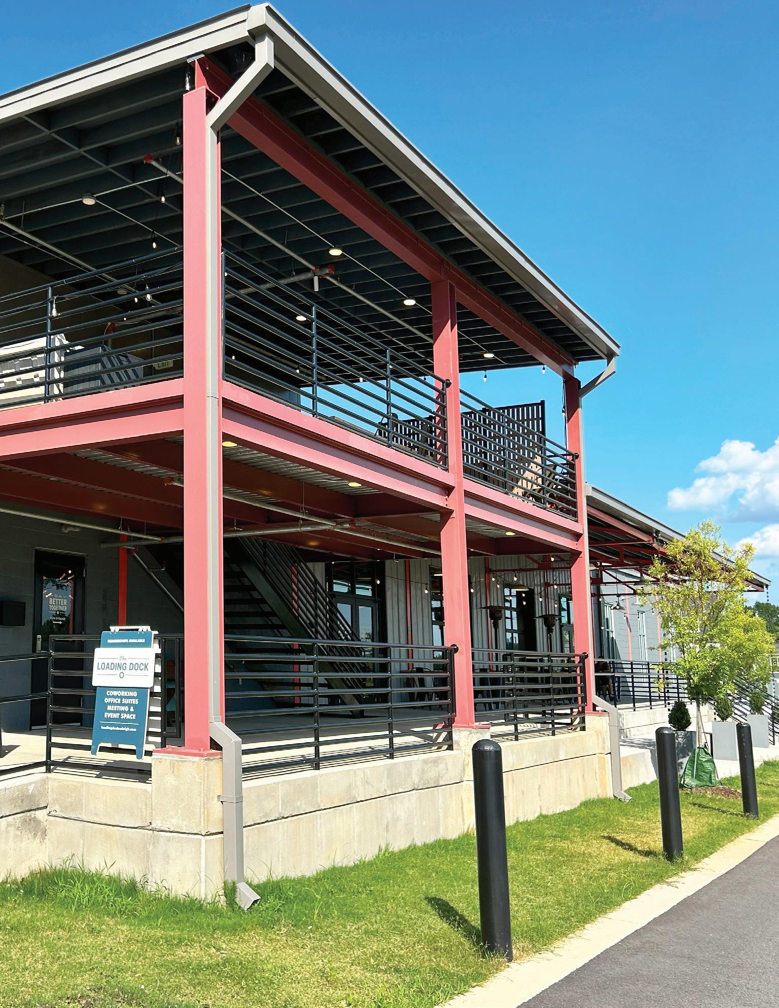
The implementation process for Downtown Wake Forest has just begun. In many ways, formal adoption of the Wake Forest Downtown Plan is only the first step, not the laStreet. Without continuing action to implement and update the Plan, Town efforts up to this point will have minimal lasting impact. The Wake Forest Downtown Plan sets forth an agreed-upon “road map” for the next twenty years. It is the product of considerable effort on the part of Downtown partners, Town staff, business leaders, community organizations, and residents.
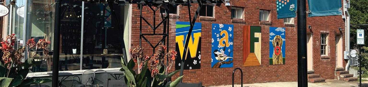
The Town should continue to regularly communicate development and businesses activity Downtown to the Wake Forest community.
The planning process for the Downtown Plan involved a considerable amount of public outreach and communication. Members of the Wake Forest community stayed involved through outreach events, the project website, and interactive tools. Building on these efforts, the Town should ensure that the plan’s major recommendations and overall vision continue to be conveyed to the entire community. This should include regular updates, coverage of major milestones, and providing additional opportunities for residents to voice their opinion. This should be communicated through a variety of mediums including the Town website, newsletter, and social media.
The Town should further develop avenues by which community members can not only receive information about planning and development, but also communicate with local government. This should include ways for resident questions and concerns to be heard and addressed. In addition, the Town should continue to provide accessible materials, both online and in print, that simplify and explain regular civic functions. These include informational materials that provide guidance on applying for zoning, building, subdivision, or other development-related permits and approvals.
It is essential that the Downtown Plan be utilized by Town staff, elected officials, and commissions on a daily basis to review and evaluate proposals for improvement and development within the study area.
The Downtown Plan should be used on a day-to-day regular basis, acting as the official policy guide for land use, development, and reinvestment in Downtown Wake Forest. The Downtown Plan should be regularly consulted by Town staff, the Board of Commissioners, Planning Board, and other Advisory Boards to review and evaluate proposals for improvement and development within the study area. It should also be accessible for residents, business owners, and developers to review and utilize as a guide. To further educate the community about the Downtown Plan, the Town should:
• Make the Downtown Plan available online for free.
• Aid the public in understanding the intent of the Downtown Plan and its relationship to private and public development projects and other Town proposals, as appropriate.
• Assist the Board of Commissioners and various advisory boards in the day-to-day administration, interpretation, and application of the Downtown Plan.
• Maintain a list of current possible amendments, issues, or needs that may be a subject of change, addition, or deletion from the Downtown Plan.
The Downtown Plan itself should be subjected to a monitoring process and be updated periodically to continually reflect local aspirations and opportunities.
The Downtown Plan is not meant to be a static document; the Downtown Plan should be monitored and updated on a regular basis. The need for plan updates is the result of many community influences. Most frequently these are brought about by changes in attitudes, emerging needs, or market shifts not foreseen at the time of Downtown Plan adoption.
Although a proposal to update the Downtown Plan can be brought forth by petition at any time, the Town should regularly undertake a systematic review of the Downtown Plan. While an annual review is desirable, the Town should initiate a review of the Downtown Plan at least every two to three years. Ideally, this review should coincide with the preparation of the annual budget and Capital Improvement Program. In this manner, recommendations or changes relating to capital improvements or other programs can be considered as part of the upcoming commitments for the fiscal year. Routine examination of the Downtown Plan will help ensure that the planning program remains relevant to community needs and aspirations.
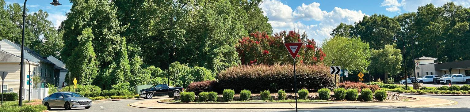
For the Downtown Plan to be successful, there must be strong and steady leadership from the Town of Wake Forest supported by partnerships with other public agencies, local institutions, community groups and organizations, the local business community, and the private sector. Wake Forest already has a wide variety of partnerships, which should be maintained in the future. Possibilities for new partnerships with organizations and agencies should be identified by the Town to aid implementation. This could include neighboring municipalities, regional and state agencies, neighborhood groups, the local business community, and other groups with a vested interest in Wake Forest.
Some of the Town’s partners should include:
• Other governmental and service districts: depending on site or issue (e.g, North Carolina Department of Transportation (NCDOT) and Wake County)
• Local Economic Development and Advocacy Organizations: Engaging with local entities like the Greater Wake Forest Area Chamber of Commerce, which is dedicated to economic development and community advocacy, is essential.
• Builders and Developers: Engage Wake Forest developers in projects aligned with the Downtown Plan’s objectives and contribute to the overall enhancement of the study area by partnering with the private sector.
• Educational Institutions: Working with the Southeastern Baptist Theological Seminary to facilitate cooperation and coordination in and surrounding the study area.
• Property Owners and Businesses: Encouraging property owners and businesses, in Downtown Wake Forest to invest in property improvements or redevelopment projects that are in harmony with the Downtown Plan’s vision and goals.
A strong partnership between these stakeholders will facilitate the implementation of the Downtown Plan for Downtown Wake Forest leading to a thriving and vibrant Town.
The Downtown Plan includes numerous policy, project, and strategy recommendations. The following Action Matrix summarizes the key actions the Town can undertake to achieve the community vision. It also establishes the goal alignment, associated time frame, and potential partners. The Town should use the Action Matrix to explore strategic partnerships.
Key actions include capital projects, policy or regulatory amendments, or strategies that should be prioritized to lay the foundation for long-term Downtown Plan implementation.
Each action item is paired with thematic icons that identify the Plan’s goals that it supports. See page 21 for descriptions of each goal.
Each action has been assigned a general time frame for estimated completion:
• Short = 0-2 years
• Medium = 2-5 years
• Long = 5 years+
Responsibility includes government bodies, civic organizations, private entities, and other associations that may be able to aid implementation. As applicable, the Town should coordinate with potential partners to explore opportunities for collaboration to implement the identified recommendation.