23 minute read
ARoUND - TASMANiA Part 2
By Duncan Bennett, Member #4171
Tasmania. The mere mention of the name brings up happy thoughts of glittering golden temples, tropical beaches, and green curry. Oh hang on, that’s Thailand. Pretty much all happy dreams are taken out the back and shot by hooting of the 4:45am alarm as the Spirit of Tasmania drifts into Devonport, why isn’t there a snooze feature? We are experienced Spirit travellers though so manage to get to the right vehicle deck, get the tie down straps off the bikes, have all our gear packed, and use exactly the right tone of condescension when telling other motorcyclists they still have a rubber band locking their front brake on.
The duck-people hybrids are breeding up in the time of the ‘Rona
Tasmania riding plan was a novel one for us. The norm has always been every day up, pack, get on the bikes and move to the next place. With 12 days on the island this would result in at least 6 laps or only riding about 100km before calling it a day, so the novel plan was to set up in a town/city hub and radiate (rideiate?) out to places of interest before being sucked back to the hub. First hub was Burnie, an exhausting 46.3km ride from the ferry terminal. So there was time for some deviation via Railton (for no particular reason) and the House of Anvers, place of the greatest hot chocolates on earth, to meet up with old friends Denise and Jon for an aforementioned hot chocolate plus other stuff with chocolate in it. That was about it for the day, we had the code for the Airbnb apartment in a fairly dodgy part of Burnie near the Centrelink centre so got in early to complete the exciting activity of laundry. A nice steak dinner in town with friends and Day 9 was completely done.
Cindy’s Covid-free happy face unfortunately vomited after too much strawberry panna cotta
Day 10 was mainly about doing real work as there are some world class laboratories and mineral analysis providers in Burnie. We did get in an afternoon ride out to one of our favourite places – Boat Harbour. As a rare north-east facing beach the number of days when it isn’t calm are practically nil and with the white sand and turquoise water between the rocky headlands it a beautiful place. A return trip via Table Cape and Cooee Beach for Cindy to collect some sea glass and it was all over.
8 minus 5 equals 10 Days? Maths has changed a lot since we left school
We took the riding up a big notch on Day 11. Out to Somerset for a coffee, admittedly that isn’t much of an achievement at 7.5km, then the Murchison Highway. When we lived in Burnie we used to warn people off this because of Hellyer Gorge car sick risk, now we were encouraged to do it because of Hellyer Gorge. Oonah Road on the left looked attractive as the mandatory dirt of the day so was placed in the memory bank. The gorge was empty when we arrived so we had a nice wander along the river before the crowds started swarming in, which was our cue to head into Waratah.


Cindy admiring the surprisingly un-grey sky in Hellyer Gorge
Waratah holds the record for the most consecutive rain days in Australia, something like 370 in a row. So a clear blue sky is like finding a natural pearl that would choke a mule. We revelled in the conditions; no icy blasts from the south west and it was suns out, guns out. A great cauliflower soup lunch in the MUSHroom café, a chat with a nice Husqvarna adventure rider named Doug from Noosa and we headed for the Kenworthy Stamper Mill to experience olde worlde tin ore processing.

39 On the way back to Burnie I noted that we hadn’t done any dirt so decided Oonah Road must be completed to tick that box. Cindy said wanted to peruse the extensive Burnie Bookshop in peace, so I turned left at Hampton, and Cindy didn’t. Oonah Road is a primary logging area access road, so is jolly nice riding. “They” look after this road, with “they” the forest management company, whomsoever “they” may be – but “they” are certainly inadvertent friends of adventure riders.
Tiger Woods
Back in Burnie, Cindy had indeed been to Burnie’s excellent book shop and said she’d seen a Tasmanian 4WD tracks book, so should we buy it? With visions of smooth graded tracks taking us over gently rolling hill and dale around Tasmania while white fluffy lambs gambolled through green grass and non-invasive flowers, I said good idea. The book was very precise in its descriptions of the tracks, many of which looked like they would take us through great country, and used an “easy”, “medium”, or “hard” classification.


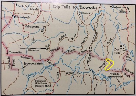
With the Western Explorer to Corrina and onto Strahan in the plan for Day 12, it was up early and go. We wanted to go to Mawbanna, a place of historical significance, and the Doomsday Book suggested that there was a shortcut after that through Dip Falls to get to the Western Explorer. The route was classified as “medium” apart from a section down to the Arthur River that we weren’t even going to take. Looked good. What we didn’t read was the disclaimer up the front of the book that gave no guarantee the tracks would be in the same condition as when they were first recorded.
Dip Falls to Trowutta, note bit marked in yellow
So west we went with food and water packed, there aren’t many places for cups ‘o chino out in western Tasmania so we had to BYO. Out to Black River, home of the world’s best oysters if you can sneak through the paddock to get to the mouth without getting caught. Then we discovered the world’s most hyperactive French Bulldog who raced a long way up and down the fence when a motorcyclist passes, and into Mawbanna. There isn’t much in Mawbanna at all, but as Tiger riders it is a sad place as the last wild Tasmanian Tiger was shot there in 1930 by a Mr Wilf Batty, who we assume was a dentist. Onto Dip Falls with the road turning to dirt, easy dirt, just beforehand. It is a very nice place so there were a few other van people slogging their way down to the base of the falls, fully realising that what went down must go back up if expensive coffee was ever to be had again.


Dip Falls
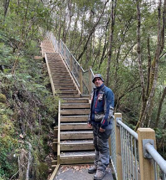
No, I wasn’t resting, my head was between my legs to get a better view
Then about another kilometre in on an easy dirt road comes the Big Tree. It is big. Perhaps all that saved it from logging was it has some nasty knotty bits in it, but there are also others nearby so another self-developed theory is that they may have been simply too big to get them out easily. The trees here are Stringybark Eucalypts, with the
focus groups suggesting to the marketing team that Tasmanian Oak might sound better to customers.

The Big Tree behind The Small Cindy
We then realised that Henry V had been an adventure rider - Once more unto the “easy” track dear friends, once more… But when the blast of dust blows in our ears, then imitate the action of the Triumph Tiger: Stiffen the suspension, summon up the blood, disguise fair nature with hard-favoured rage and off-road mode… With Mud Maps supporting the navigation, only one error was made, and coincidentally it was morning tea-time so we could pretend the Trip Turnabout No.2 was simply to utilise the nice big space and a perfect big flat rock to set the kettle up.
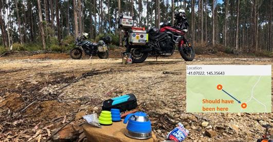
41 Joining Henry V back on the “easy” track, it was indeed reasonably easy riding on the secondary logging roads, although a couple of k’s in it was becoming obvious that not many people had bought Chris Boden’s fifth edition as there was no sign of recent tyre marks. Then the bit marked in yellow in the map was reached. Started with a few puddles and 1” sticks, no dramas. Then the steep bits down into the low bits began, which means ruts, and while heading down one of these a 6” log sitting about 2” off the ground appeared. Neither of us have ever ridden over a log this size, and to make it more interesting it wasn’t perpendicular across the road, but a bit angled down the slope. Lucky it wasn’t wet or getting over it might have been very interesting. Not that there was an option as turning around or even stopping was close to impossible, so turning to line it up at 90° and a blip on the throttle to try to lift the front up, to my surprise Aquaman went over like a champion steeple chaser. Even more surprising, Cindy came over with no dramas after me on the much-closer-to-the-ground Ruby. Confidence high, the next nervy challenge was through a very big and very dirty puddle then up a steep rutted road around a bend. Cindy had remembered to turn the video on this time: https://youtu.be/tui8Gku4gbA
The moment when there is only one direction - forward
And then the yellow section was over and the road improved dramatically, we’d apparently crossed between plantation areas and so they don’t really put much effort into maintaining it. The joie de vivre kicked in and soon we were blasting along, with the road eventually turning to bitumen. Into Trowutta, then down the Arthur River Road which somewhat obviously goes to the Arthur River.
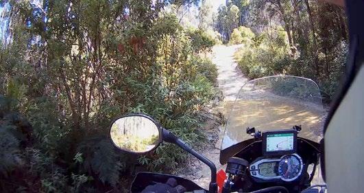

The technical terror was over by the Savage River Pipeline Access Road
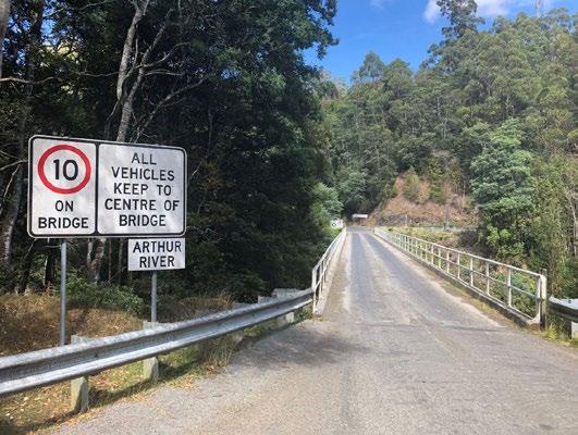
A little shelter near the bridge provided a nice luncheon venue. Where we met for with a chat with a nice Husqvarna adventure rider named Doug from Noosa. Yes, Tassie isn’t that big so it was the same Doug as the Waratah Doug, who had done the Western Explorer and back that morning and said it was a bit loose gravel squirrelly in places and had a few potholes but otherwise nice.
Keep to centre? What are the alternatives?
The Western Explorer has become a “mustdo” road in Tasmania, and as it is dirt it tends to discourage most van people. To be honest the scenery isn’t blindly beautiful and a lot of it is across stony and scrubby heath country that is a feature of the extreme wind and weather of the west coast, but there is little traffic and it makes for a great ride. Apart from the lack of heated-seat lavatory facilities.
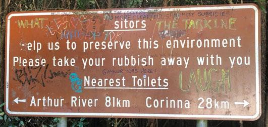
OMG. I’m busting. I’m in the very heavily wooded wilderness. Do I go forward or back?
Into Corinna with plenty of time to spare; the sign at the start of the road says the ferry closes down at 5pm but reality in peak season is 7pm. A cool drink and and a chat with the friendly staff and we paid our $8 or $80/km per bike fee and we were across.
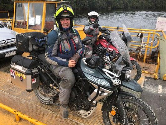
First on, first off
We were now well within old stamping ground territory, having lived and worked on the west coast for 5 years the challenge is not to fall into old routines, rather to try new things. We pretty much failed. Through Zeehan and the fantastic day was done in Strahan – technical riding challenges, interesting things, great roads, Doug, a ferry ride - it had everything. Just to finish on a high, we wandered down to Hamer’s Hotel on the waterfront to meet up with very good friends Bill & Deb who we got to know before they did the Cape Town to Cairo ride in 2019 and who we have caught up with numerous times since. They were lined up to get into the pub with friend Rory from Yamba on the NSW north coast. The Himalaya area of Yamba where the air is thin. A great night ensued, although by 9pm we were the last remaining guests and the staff were firing up the vacuum cleaner.
Gaiety Theatre Zeehan, from the time when it was a rich silver town
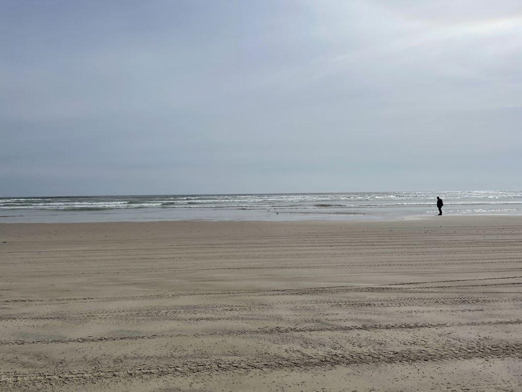
Day 13 was fairly casual. More stick-to-westcoast-routine stuff happened but we also walked about 14km for the day which is completely at odds with acceptable adventure motorcycling behaviours. So to avoid being black-balled from the self-image club we did a ride out to Ocean Beach. Cindy and I were on proven hard core adventure bikes so when we hit the dirt we respectfully offered Deb and Rory the option to turn around. Self-image was totally destroyed by Deb riding her Indian Scout and Rory riding an old Kwaka with bald tyres – zero clearance and zero suspension – down the very rough track.

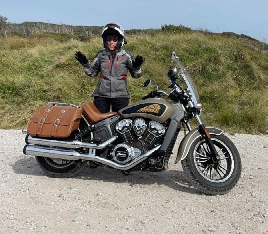
What do you mean off-road? We were always on a road!
I could have saved the reputation by riding down the sketchy and sandy track to the beach, but if I dropped it I couldn’t shelter behind the
43 “we’re just out here having fun, whatever” façade, so didn’t.
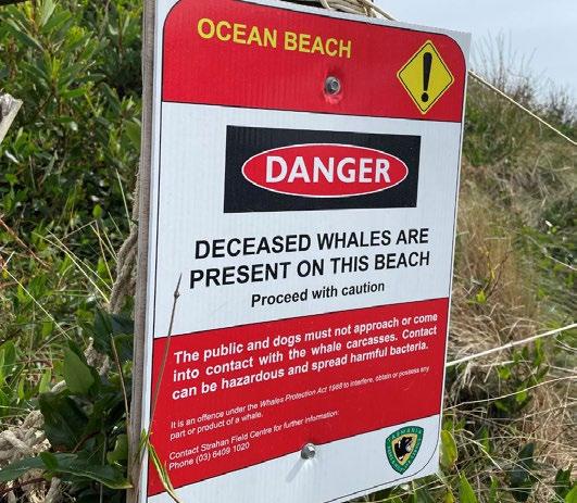
Key information missing – dead whales are also highly inflammable and don’t smell that good
Dead Whale Blowies. What is it about me and flies?

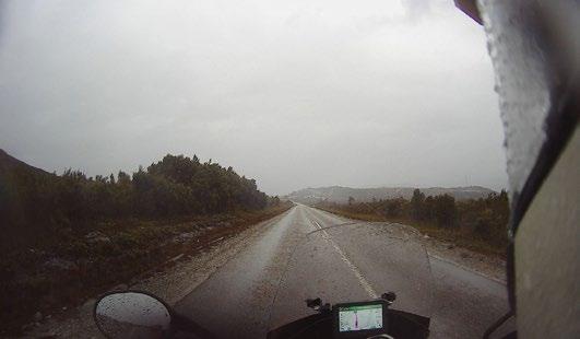
That night we were up in View 42 restaurant, it is a buffet so 28 oysters (12 entrée, 16 dessert) later I was replete. By 8:30pm the bus tourists who had packed out the place had completely cleared out and the staff were firing up the vacuum cleaner, signalling time for the 2km walk back to our accommodation. That night as per west coast tradition, it started to rain. Day 14 was rain continued, the sort of rain the west coast word for is “normal”, i.e. relentless. To Queenstown, then some attire adjustments as
we knew it would get a lot colder up high. Then commenced the slog. Carefully up the “awesome when dry” road to Gormanston, over to Linda, over Lake Burbury, and the rise commenced.
Les Misérables outside the Queenstown Theatre
The rain didn’t get worse, and it didn’t get better, so like the zombies in World War Z the rain just keeps working at the weaknesses until it finds a way in. Usually the neck region is a weakness, but the feeling from the boots and hands seems like they are immersed from the get-go. After an hour the upper front pants area starts to feel sub-comfortable – did I tuck my shirt in? I can’t remember! Is it providing a Panama Canal volume of water to the area that is least able to handle discomfort? It feels like it. The helmet chin strap is soaked. It has saturated my neck warmer which is designed to keep cold gas out but not cold liquid, it gives up easily and joins the other side, positively wicking cold water down my front. Derwent Bridge and the Hungry Wombat Café appeared just before hope was abandoned.
Please let this end
Plans to visit The Wall moved from “great idea” to “I’m not taking my gloves off again so can’t get at my wallet”, and we pushed on to Ouse which marked the eastern boundary of the rain, and besides one can’t ride past a place pronounced Ooze. The water was doing just that out of every clothing item, with Rory’s boots probably winning the prize for the most tragic looking, R.M. Williams didn’t design his elastic sided boots for motorcycling in relentless rain. Mid afternoon we pulled into our Hobart accommodation, and commenced the “find everything wet and festoon everything with it” process. A full social calendar awaited in Hobart, our daughter Kate leading the program over the two full days we had.
The furthest south car park in Australia
Day 15 was a day off the bikes and we took a family road trip to complete the “drive as far south as possible” theme. Cockle Creek is it, accessible by adventure motorcycles and also small Hyundais. Again it is several hours walk to see the very southern point, which doesn’t actually appear to be accessible. The fact that we had no food and it was already past lunchtime sort of destroyed the walking plans anyway. So we headed back and did a winery visit instead that required no walking. That evening we had a nice final dinner with Bill & Deb and Rory, and our day off the bikes was complete.



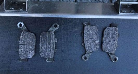
Day 16 was more socialising starting with a breakfast catch-up with Compass Alaska 2019 tour friends Tim & Karen. Tim was a wealth of local knowledge including where I could find two sets of rear brake pads for Triumph Tigers. For some reason the dirt roads in the west had worn the pads down a lot on both bikes, and with only a trip up Mt Wellington with daughter Kate planned I had time to change them. I carry all the tools for this type of thing, although a trip had to be made to get yet more expensive tools when one bolt just would not come undone no matter how much swearing I did or how much WD40 I accidentally sprayed on the brake discs while trying to hit the bolt.
A bit close to metal on metal
Day 17 was breakfast at Banjos where the egg and bacon pie phenomenon was discovered. Yes it is a pie, but it has egg and bacon in it so contains all essentials in the breakfast hierarchy of needs, so can be eaten before 7am. The plan for the day involved the Doomsday Book once more, head up the east coast and cut inland on the ‘M’ Roads which are primary and theoretically well maintained logging roads. “Easy” according to the book, although we’d seen that before. So ride to Triabunna where a break was taken and lunch ingredients gathered, then to Little Swanport where the ‘M’ Roads started.
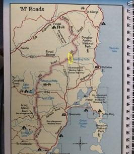
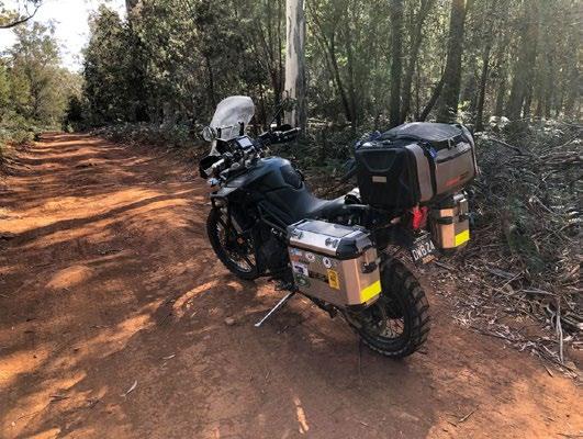
45 The M Road was rough and rocky in places but otherwise no dramas for bikes with new rear brake pads.
Stress-free M Road
Just before the B34 Lake Leake road we called a break for lunch, we were making excellent time and so could expect to arrive early into St Helens for the booked glamping experience. We were in fairly dry eucalypt scrub so there didn’t appear to be any concerns heading off the road into the heavily wooded wilderness, well not for chaps anyway. Cindy disappeared into the heavily wooded wilderness, and then a minute later emerged with Klims at half-mast screaming “Get them off! Get them off!”. There were two of them, and their transition from the Gore-Tex to the exposed transom was imminent. Not having a cigarette lighter or salt to hand, the only course of action was to pull the very slippery things off the Gore-Tex, not easily done. Feverishly inspecting other exposed areas without finding anything, the crisis was officially declared over, quickly forgotten about by me, and we packed up and rode on.

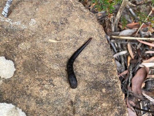
At the B34, the survivor of the crisis decided she would head up the highway through Bicheno, while I continued up the ‘M’ Road now designated as the MS Road. The MS Road was a dirt superhighway in very good condition all the way up to the junction with the C301 road to Avoca. After that it became the MG Road and suddenly looked a lot more secondary and the heavily wooded wilderness closed in, but it was still reasonably easy going. Passing the turn-off to Harding Falls, the road deteriorated even further which seemed odd as the lines on the map were still the same chunky dashes as the MS Road. Then the reason for the deterioration was discovered.
Turnabout No.3
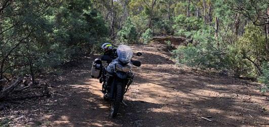
The road over a major creek was gone, with a bit of caution tape stopping anyone from plunging off the edge. A bypass and creek crossing which featured large and almost certainly very slippery rocks was inspected, with chance of dropping the bike in the creek given as 50-75%, too high for a lone traveller who had a glamping experience schedule to keep. Besides, who knew what it was like further on, it showed signs of zero traffic. So turnabout No.3 back to the Harding Falls turnoff which had a sign saying 22km to the highway. That’s not too bad I thought. 2km in on a fairly atrocious road I reached the Harding Falls car park, which had a sign saying 28 km to the highway. What? How could I have come 2km and yet have added 8km to the distance? Who is doing signage around here? I want to speak with your supervisor! Those who glamp are renowned for their toughness, but it was after 3pm by now and I was in serious danger of missing pre-dinners if I continued on. So turnabout for the trip No.4. Back to the C301 which was a high-speed dirt super road and onto the highway at Cranbrook, seeing the first cars since the ‘M’ Road experience began.
Turnabout No.4
I went through Bicheno about 2½ hours behind the advance party, and arrived at the glamping at Binalong Bay at about 6pm, just in time for pre-dinners.
Waiting for the shadow puppet theatre to start
Day 18 was to Launceston. Via Derby or not via Derby, that was the question. Is it pronounced Darby or Derrrby, that was also the question. With so many unanswered questions, we went to Derby. I’m making a big statement here, but the Tasman Highway up here has to be one of Australia’s best motorcycle roads. Not many corner speed

caution signs, so the motored cyclist has to rely on one person and one person only; themselves. A 100kmh speed limit, so effectively no limit on such a winding road as only Casey Stoner himself could do it at 100kmh.
Suddenly we were cheap
Derby is the mountain bike capital of Australia. The national championships were on the coming weekend and most of the QLD Sunshine Coast was in town to get amongst it. Coffee with a Noosa lady rider put our rides in perspective – some of the tiny waifs hanging on the coffee shop bike rack out the front were around the same cost as a 2020 BMW F850GSA. On road. Back on and racing away to show the 2 leg power people the value of 100 horses with zero banana bread calorie burn, we headed to Scottsdale to complete leechfree toileting. With Cindy having a Launceston engagement, I decided that Mt Ben Lomond was a good plan. We split at the Camden Hill Road.

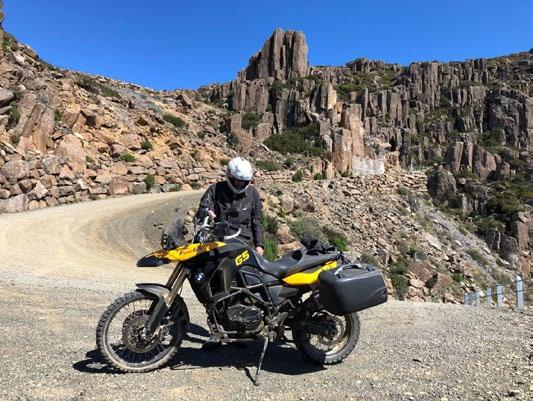
47 With total confusion between Mt Barrow and Ben Lomond, there was some wild navigation happening before I ran into a 2009 BMW F800GS Bumblebee rider named Rod. We teamed up and found the road to Upper Blessington, and then ascended Jacob’s Ladder. I remember this from 2015 on a motorcycle and less so from 2002 and 1982 in cars, and it has its challenges. There was a fine loose gravel covering on the corners that made it a bit technically interesting, but we made it to the top. Hardly a cloud in the sky, yet no people up there. A bite of lunch and back down which was way more difficult, the loose gravel meant that the rear brake was as useful as fingerless gloves at the South Pole, and the front brake just wanted to lock the front wheel up so it was a slow process.
Last technical bit for Tasmania
At Launceston for Day 19 and the around Tasmania was nearly complete, the rest was about catching up with Compass friends Bruce and Maureen, Peter and Maxine, and Trevor, also veterans of the 2019 Alaska trip and reunions. Bruce and Maureen took charge of showing us around their home town, a highlight apart from the fun socialising included going to the National Automobile Museum of Tasmania and seeing the actual Holden HQ GTS Monaro that was hanging off the edge of the Batman Bridge which had been taken out by a ship on 5th January 1975. Day 20 was about getting as much procrastination in as one could for a total required distance of 101km to the Spirit ferry terminal. We procrastinated leaving the Coach House Motel due to the almost vertical climb out onto York St, then procrastinated some more at Deloraine with

a lengthy coffee. Mole Creek was a bit early for lunch but gave opportunities for photos to slow the whole thing down enough so the arrival into Sheffield just fell after the 11:30am acceptable lunch period start time.
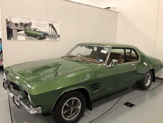
Unlucky to be there, but lucky to survive
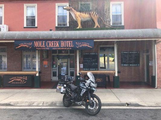
The Tasmanian Tiger theme continues
A long procrastinating lunch with wanderings about the retail and murals zone completed, we waltzed up to Cethana and back down, with me coming first and Cindy coming second into Forth. Forth meant we’d gone past the Spirit, so we decided to keep on to Ulverstone and then Penguin, finally locating a safe place to turn around at the Maker’s Workshop in Burnie which happily also does great iced coffees with maximum ice-cream and cream loading.
Speaking of loading, the sum of all the day’s procrastinations equalled it was time to get to East Devonport and leave.
Prepared for a seriously unlikely scenario
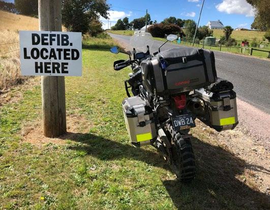
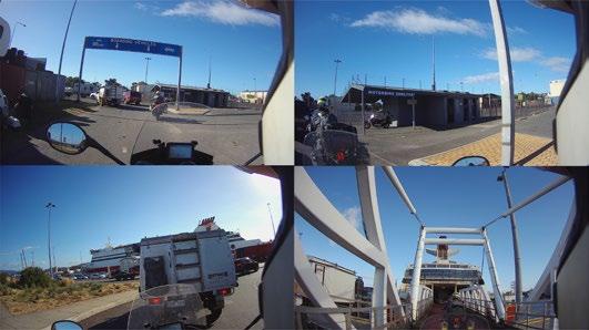
All Aboard!
Twelve days and it seemed but a minor scratch on a 300km equilateral triangle island. What about the north-west, we had missed most of that, or the centre, we hadn’t seen any of that. What about the east coast, had ridden up that in one day, or the north-east, had stopped there for a toilet break.
That sums up Tasmania; you can ride Around it in one day, but you can’t see it in a month.
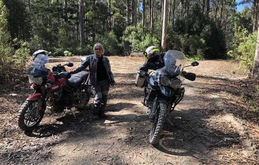
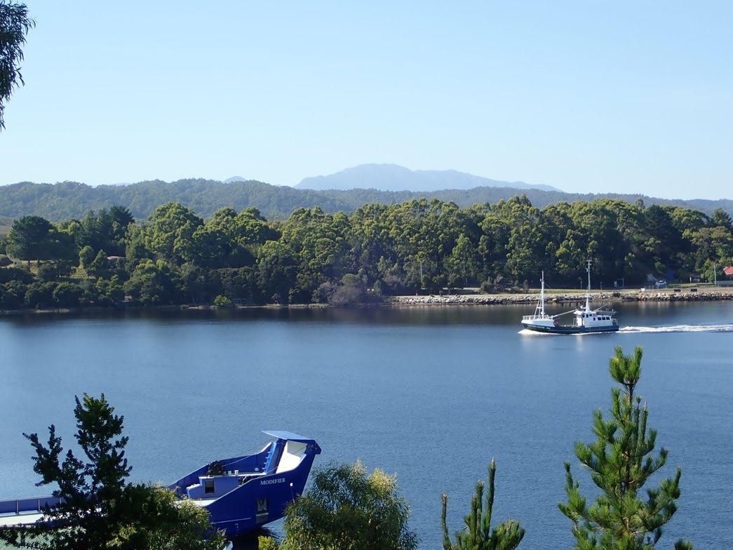
Ocean Beach
