WONG CARACCIOLI, Brandon
MASTER OF LANDSCAPE ARCHITECTURE
THE UNIVERSITY OF HONG KONG

PORTFOLIO
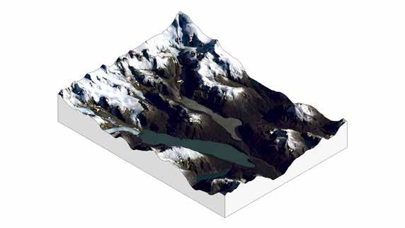
Patagonia, Chile
glaciers, water and climate change
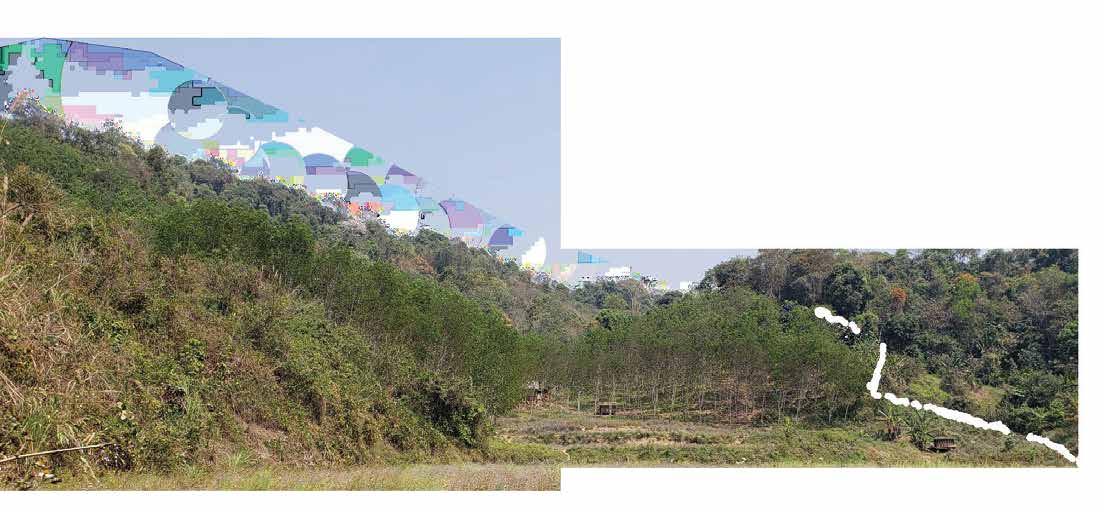
Tung Chung
the dynamics of the intertidal zone
Hong Kong’s Coastal Trail
retaking urbanized landscapes

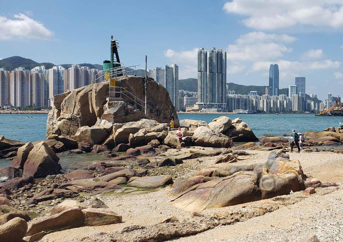
Lei Yue Mun
traversing the transect
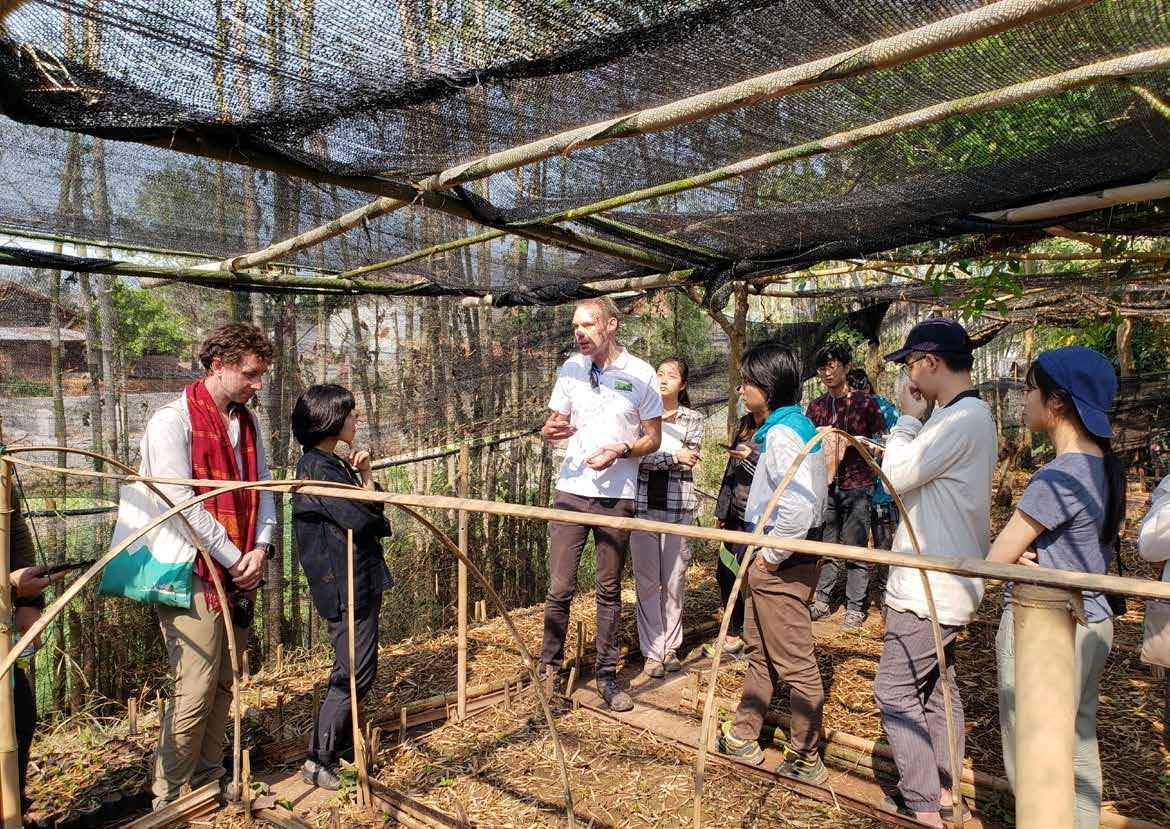
Coffee Planting and Ecotourism
From Street to Estate
Patagonia, Chile
Thesis : Glaciers, Water and climate change
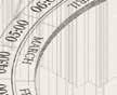
01
100km 50km 10km
Glacier outlet typologies


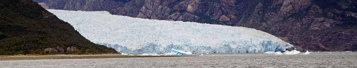
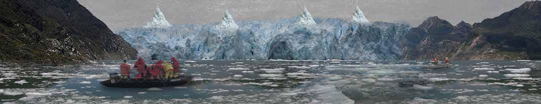
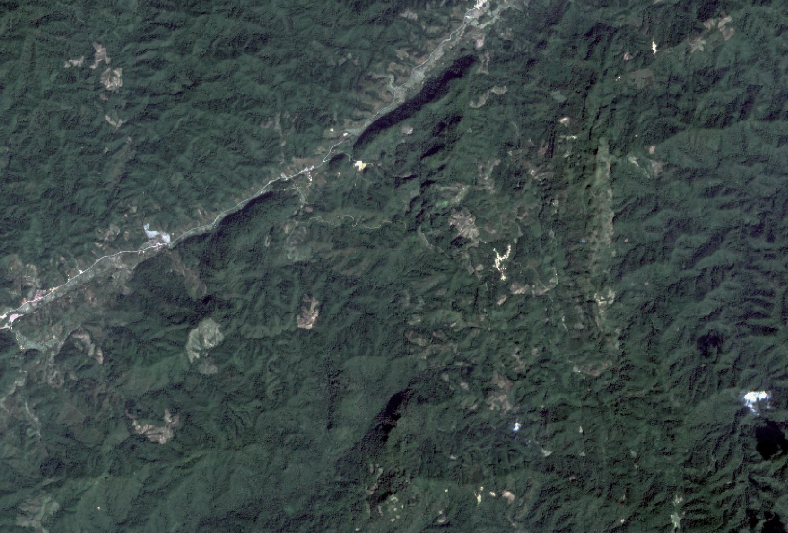
San rafael glacier
The initial typology of glaciers and their outlets refers to the manner in which glaciers outflow (whether their surface runoff of water, or where glacier ice melts and/or glacier advances/retreats. In reference to San Rafael Glacier, this glacier has its outflow pointed towards Laguna San Rafael, which itself feeds out into an estuary, meaning it is a mixture of fresh and saltwater (brackish). This places great concern to water that is lost, due to ice reserves, being broken off and dropped into the lagoon.
Accommodation for tourists of the San Rafael Glacier
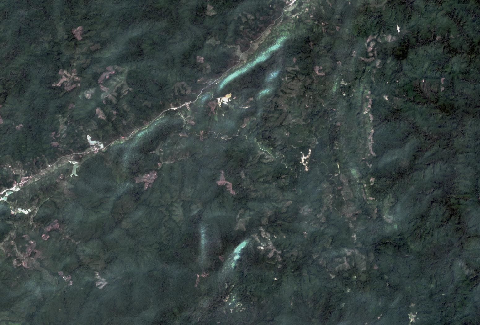
leones and fierro glaciers


This alternative to glacier outlets thus refers to an outflow of water that leads to freshwater basins. In the case of the Leones and Fierro glaciers, they outflow towards the largest freshwater basin in the region, the Lake General Carrera. This typology is important to consider in these scenarios because of its relative importance to retaining water supply in an otherwise high risk area for glaciers. Glacier ice as reserves is retained through the capacity of the basin’s watershed, and the fact that it feeds numerous waterside communities in the form of ports is cause for consideration in the environmental and political factors discussed in this thesis.
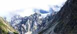
Hiking grounds leading up to and around glacier
Waterside acitivties such as kayaking and boating to see glacier
Rivers to and fro glaciers

 San Rafael
Cerro Guadal Mina
San Quentin
Landing Zone
Accommodation Trail to Glacier San Rafael Fierro
Leones
Rio Leones
San Rafael
Cerro Guadal Mina
San Quentin
Landing Zone
Accommodation Trail to Glacier San Rafael Fierro
Leones
Rio Leones
periglacial lake
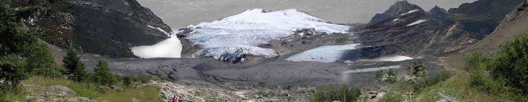
Tourists and visitors often come to this glacier as part of an extensive trip, and take kayaks, zodiacs, or boats to get up and close with the glacier. At times, these visitations can land ashore on the glacier’s moraines, to be able to walk up the hiking trails adjacent to the San Rafael Glacier.
Glacier melt is accumulated on the Laguna San Rafael, which is a primary source of freshwater for communities around Chile’s glaciers. With more and more of the glacier melting and/or retreating, it significantly cuts down on the amount of water for consumption use.
Approx. 70 m
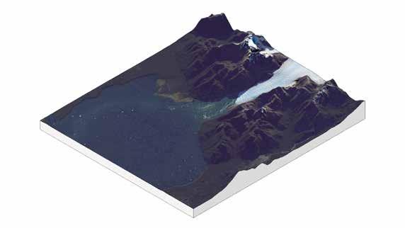
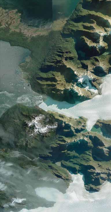
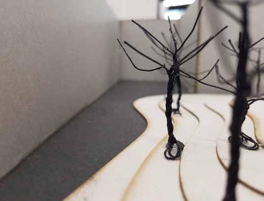
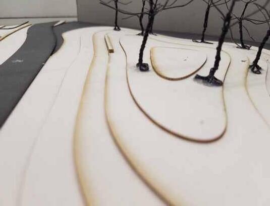
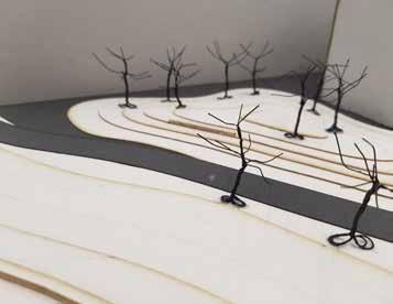
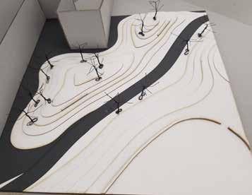
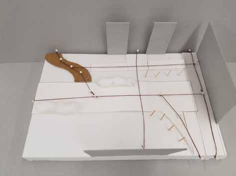
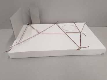
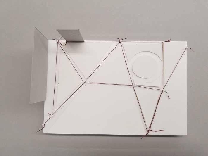
site of study : san rafael glacier
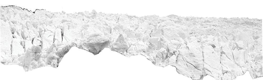
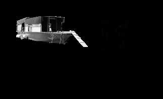
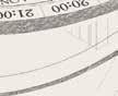
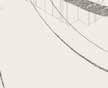
An outlet glacier that forms part of the Laguna San Rafael National Park, it is one of the largest glaciers within the Northern Patagonian Icefield, and feeds into a glacial lake, the titular Laguna San Rafael. This glacier-lake combo is a popular tourist destination for Patagonia tourists, though it is not the most accessible. It is often traveled to by kayak or zodiac but nearby ports, with Puerto Montt being the furthest and longest journey. A steep glacier, it has seen an approximate 12 km retreat in the last 150 years or so. With it retreating further and further, this is an interesting pilot site to study for the purpose of experimenting with strategies for the deceleration of melting rates.
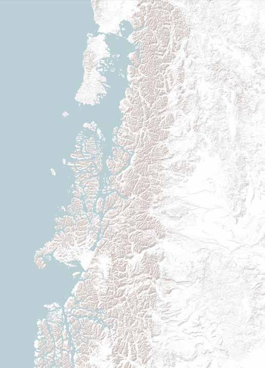
site of study : lake general carrera
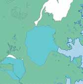


The Lake General Carrera (Lake Buenos Aires in Argentina) is an enormous watershed just east of the Laguna San Rafael National Park. This lake is fed into by multiple rivers, along with outlet streams coming from the Soler and Leones glaciers, each with their own glacial lakes. This lake has entered multiple conflicts with hydroelectric projects, and its proximity to multiple mining projects, have affected the health and prosperity of the watershed and the communities that benefit from it. As lakeside communities, they benefit from water sources flowing from glacier-fed streams for their livelihoods. These are also the same communities that partake in tourism for the various protected parks in Patagonia.

Laguna San Rafael 1: 1,000,000 Laguna San Rafael 1: 500,000 Lake General Carrera 1: 1,000,000 Puerto Guadal Puerto Rio Tranquilo Puerto Sanchez Puerto Murta Glacier Fierro Glacier Leones Glacier Soler Rio Soler Rio Leoes Rio Exploradores Rio Cochrane Lake General Carrera 1: 500,000 Simpson 1871 Steffen 1898 Garcia Huidobro 1904 Garcia 1766 de Vea 1675 Landsat 2001 Landsat 2022
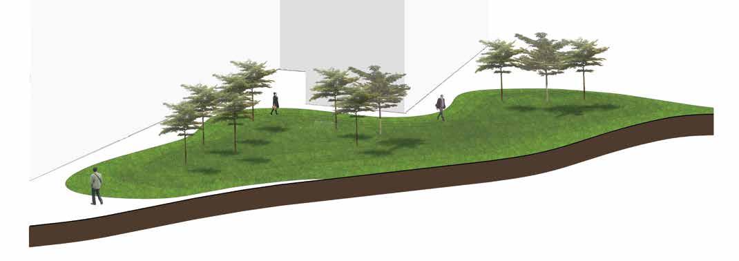
Deceleration
Last Chance landscape
Emergence of pro-glacial lands
site

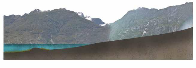

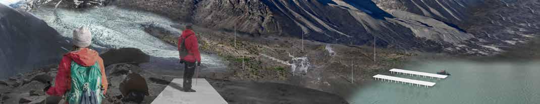
2022 Glacier Terminus Ice bergs fall and transport debris into lagoon
are
the years,
an immortalization of where the glacier used to be
Glacier
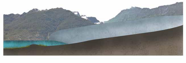
2035 Glacier
Poles
installed over
adding
~2027
Terminus
Terminus
Receding Glacier Outlet Glacier has Disappeared Lagoon Landing Dock for Boats/Zodiacs Newly Exposed Ground Face Land Emerged is Significant Translates Sacred Glacier Ground Into Memorialized Space Additional poles are
providing clearer picture for the future of glacier’s extent Tourist and visitors dock and can walk up to glacier
Present Day San Rafael Glacier
installed,
glaciers Waterside Tourism Attraction Glacier Base Melts
Poles can be outfitted with remnant of geotextile, to symbolize attempt to save the
Runway Existing Hiking Trail Proposed Hiking Trail Section cut Proposed Dock
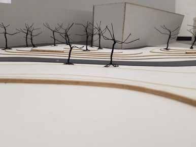
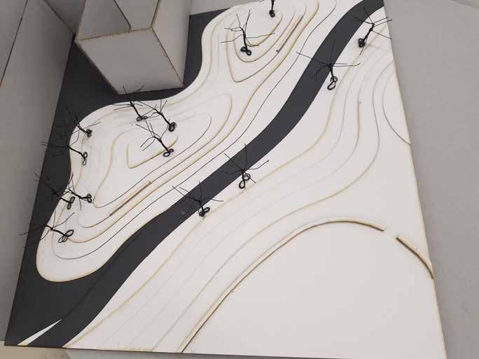
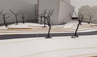
plan : san rafael glacier (1:60,000)
What happens to a glacier once they melt away? They turn into fjords, leaving behind these massive, long narrow formations with a water body flowing through it. Both are natural, beautiful landscapes. Fjords as landscapes pre-dated my thesis. I intended for a topic along the lines of degradation of fjord ecosystems. Instead, I decided to pursue glaciers, the predecessors to fjords. I wanted to find out how to design for them. But, I also wanted others to realize that there are problems surrounding their very existence.
I began exploring some of these questions, related to both fjords and glaciers, through the Masters Program of Landscape Architecture at The University of Hong Kong. I took inspiration for this topic from fellow landscape student Alexandra van Zyl from the Wageningen University in The Netherlands.
Through initial inspiration and research, I set my eyes on pursuing these pristine and remote landscapes. My interest has been long set, and through reading more and more, I realized my goal is very possible. This thesis has become my pursuit for exploring landscapes in entirely new ways and possibly inspiring others to do the same.
The Patagonian region, governed by Chile and Argentina, is by and large a region of wilderness. One of the few places in the world untouched by human development and expansion, a place for the pristine. Historically,


the Patagonia is referred to as a bridge between Chile and Argentina, therefore boundaries are of little issue. In truth, ‘untouched’ is a word used lightly here, for while the region can be described as remote, it is far from isolated. For the past decades, the Patagonia, in specificity the Aysén (northern Patagonia) and Magallanes (southern Patagonia) regions, have faced numerous transformations brought forth by dreams of development and environmental protection. The environmental aspect focuses on the extensive natural heritage and conservation practices established and soon-to-be expanded across the region’s natural park list. Development falls primarily on nature-based, or eco, tourism that walks hand in hand with natural parks and reserves. While remaining true to a pristine and wild nature for its conservation practices, its aquaculture practices paint a different picture.
There are thousands upon thousands of individual glaciers (24,000 approximately) recorded in the Southern Andes region, according to the Randolph Glacier Inventory index. The popular and remote regions of established national protected areas and/or parks, the Aysén and Magallanes territories have an enormous distribution of glacial lands. Specifically focused for this thesis is the Northern Patagonian Icefield, a large remnant of the Patagonian Ice Sheet. Composed of a contiguous area of about 4200 km², the icefield is made up of 28 outlet glacier masses (Masamu Aniya, 1988). Being the smaller of two icefields, the other being the Southern Patagonian Icefield, the northern is contained
Little Ice Age advance prior to 1800s Terminus as of end of Little Ice Age circa 1870 Access
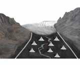
lichens shrubs Verrucaria Schrader Erioderma leylandii Berberis buxifolia Empetrum rubrum Pernettya mucronata Escallonia alpine Pseudocyphellaria coerulescens Micarea fr. Caloplaca sub. Placopsis pycnotheca Psoroma cinnamomeum Degelia gayana COLD WATER WARM WATER COLD WATER WARM WATER Grounding Line Glacier IMPLEMENTATION Loss of ice is prevented by either refreezing water at the base zone, building artificial islands berms or walls that blocks warm water from cycling to the glacier base. Artificial Wall/Island Free-floating zone Subject to melting due to warmer waters Water at base no longer ablates glacier diagram of water cycle affecting glacier base Long section across laguna
0 km 4 8 0 meters 100 -100 -200 -300
into Laguna San Rafael from Río Témpanos, Fjord Elefantes
san rafael
with the boundaries of the Laguna San Rafael National Park. This makes the park an extremely popular destination for tourists specifically looking to travel and journey to see glaciers. The closest port is Puerto Chacabuco, which according to various travel sites, leads a journey of approximately 14 hours to the northwestern glacier, San Rafael.
The San Rafael glacier is the second largest (outlet) glacier within the northern icefield, the largest being its neighbor, San Quentin. What makes this glacier so special in relation to its 27 other distinct masses is that San Rafael is the only glacier in this field that terminates to an ocean. The other 27 glaciers all terminate to glacial lakes of freshwater bodies and watersheds, often serving to feed and provide sources of water for the local communities and ports. San Rafael’s melt and discharge feeds into the San Rafael lagoon (the national park’s namesake), which exits into the Tempanos river, whose mouth feeds into the Elefantes fjord.
It has been publicly known that the climate change catastrophe that is global warming is currently in motion, and has affected the glaciers of the world. Glaciers in Scandinavia, Greenland, New Zealand, the Arctic, etc. have all shown to be retreating, melting, and showing deductions in mass. Chile’s glaciers, being in the Southern Hemisphere have shown fewer developments across the Holocene glacial retreats (Villalba, 1994; Koch and Kilian, 2005). Besides being vast and immense natural sculptures of ice that not many people can say they have ever seen before, what


problems arise from the glaciers melting?


The core problem associated with the melting of the glaciers is in regards to the water lost from glacial debris. Especially so is the case of glacial debris lost in ocean-terminating glaciers, to which freshwater ice is lost to saltwater bodies. Without proper management of melting glaciers, that is, any and all debris calved being collected, would result in a large amount of water lost. Of course, this becomes an absurd notion for management, what with having an extremely high amount of glaciers calving, least of all in Chile alone. Ideally, this would be the case for ocean-terminating glaciers only, though that still presents an impossible task. The ideal scenario is instead to develop strategies to slow the melting and calving of glaciers, to mitigate the loss of glaciers, and by extension water. Retreats have been a very obvious indication of climate change, and without any attempt to design for it can have massive environmental, economic, and social implications. Flood risks, mudslides, sea level rise, are the main issues one would jump to when considering the disappearing of glaciers.
This issue begins with a look at how water, and glaciers, fit within the global world system. Patagonia can be said to be a peripheral region, and this is the case when we consider its value as water and tourism. Water, tourism, and even mining, makes Chile a semi-peripheral country within the world system. To deal with the ‘peripheral’ is to deal with the remote.
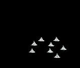
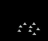
Terminus as of glacier research circa 1950-1980 trees Drimys winteri Podocarpus nubigena Psuedopanax laetevirens Ribes magellanica Embothrium coccineum Lomatia ferruginea Nothofagus betuloides Nothofagus nitida Runoff Runoff Runoff Runoff Water Catchment Collection Irrigation Water Cycle Runoff converges here Irrigation Stupas can provided with water collected Retains water reserves Creek 12 16 Water Catchment and glacier melt provides for stupa/vegetation Lichens Lichens colonize the Precede other vegetation communities Stupas remain weather allows, providing water resource for future Irrigation May see first signs following disappearance ice 20
02
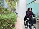
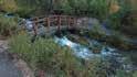
Tung Chung Dynamics of the Intertidal Zone
Low Tide Zone | Mudflat - Channel Interface
Low Tide Zone | Seawall - Channel Interface

Floating Communities | Drainage Outlet at Sha Tsui Tau
Natural River | River as Resources
Riparian Vegetation
Cleistocalyx nervosum 水翁

Ficus fistulosa 水同木
Cyperus papyrus 紙莎草
Colocasia esculenta 芋
Leaf Litter Input in Tai Po Kau (Dudgeon & Corlett, 2011)
<1.0 kg/m2/year
Leaf-litter | Detritus Inpit Natural Sediment Sadimentation Rate (Peart, 1989)

3000 - 4500 t km-2year-1
Boulders stabilize riverbed, without them, river flow increases suspended particles and murkiness of water.
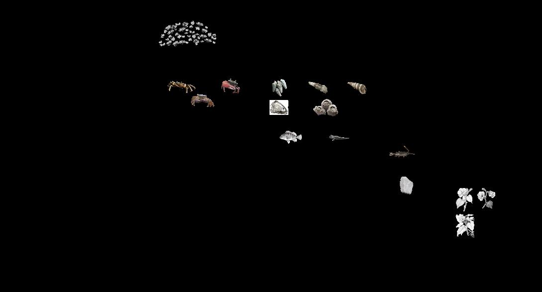
The natural stream flows along a number of boulders/rocks/pebbles that stabilise the riverbed and banks. Among these are a number of dragonfly and fish species, along with caddisfly larvae that burrow underneath rocks. Removing them destabilises the riverbed, and directly erodes it, where the river flow suspends particles, suffocating fish by blocking their gills. Bacteria grows rapidly in water (and accumulates in stagnant water), further depleting oxygen in the water.
East Stream 東河
Acrossocheilus beijiangensis
Rhinocypha perforata
Aethriamanta brevipennis
Stagnant water due to rock formation, promotes mosquito breeding.
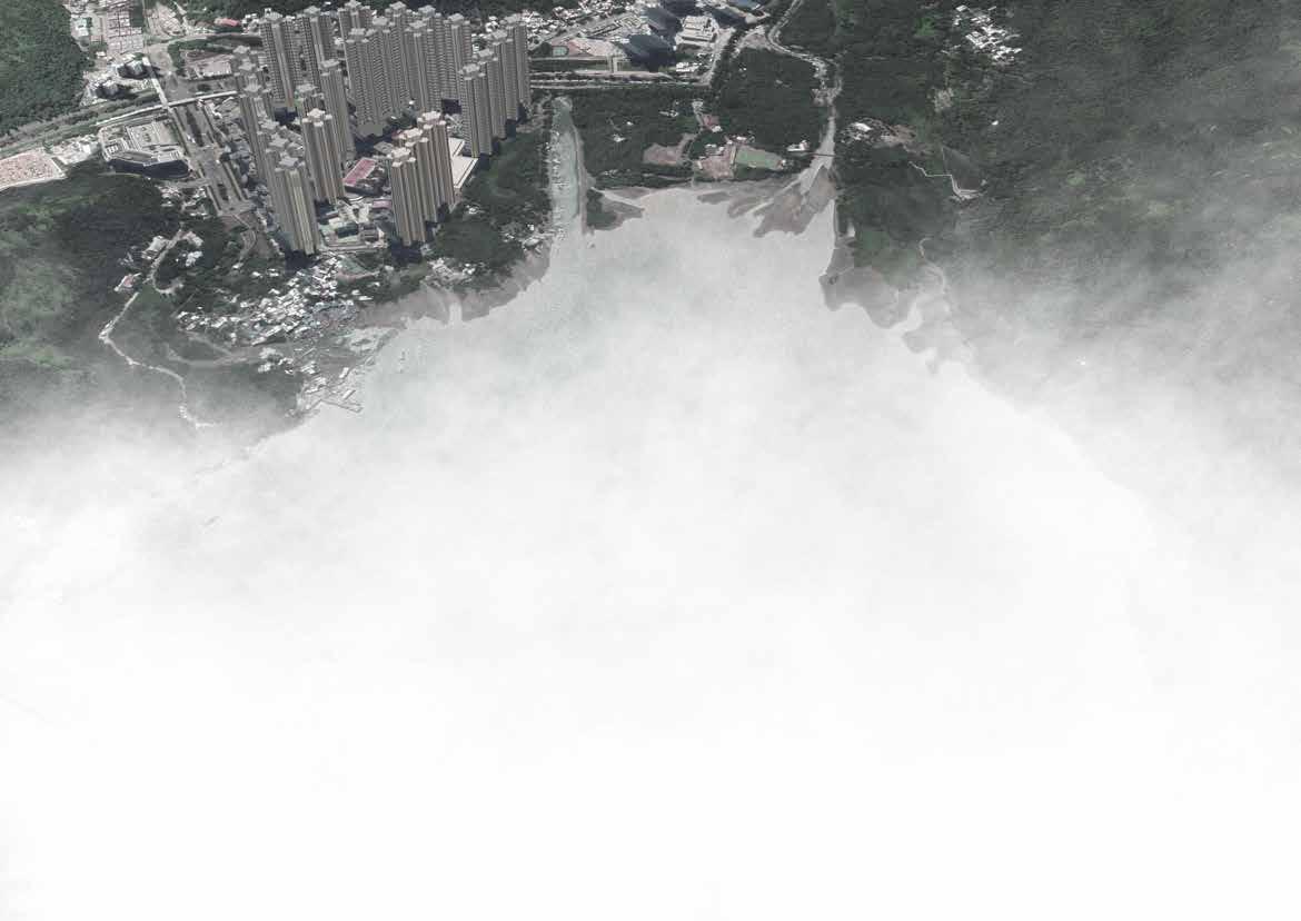
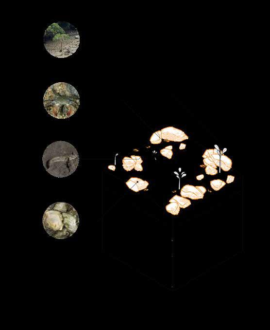
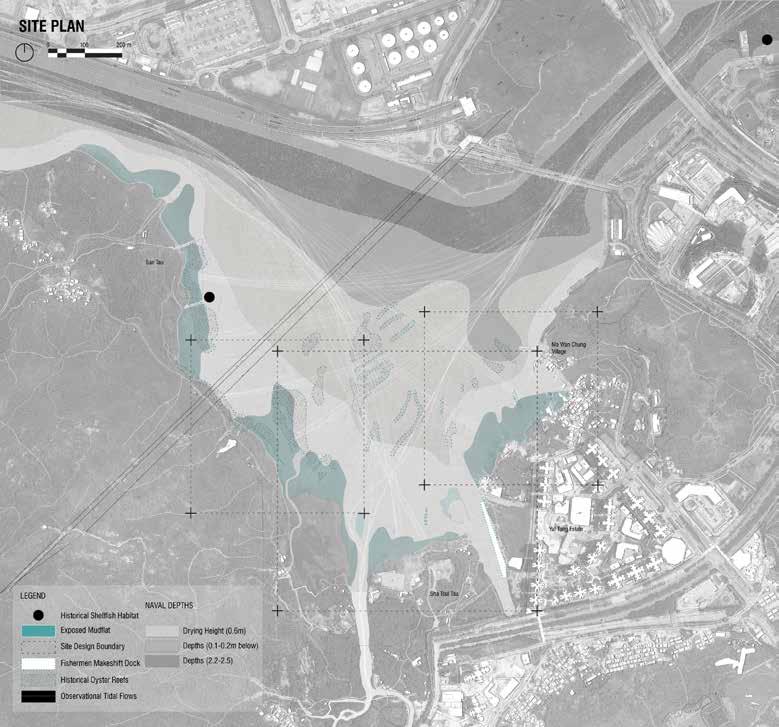
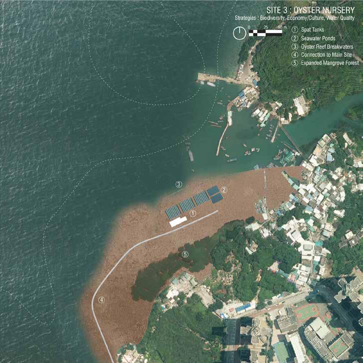
The extent of this site lies on the outer edge of Tung Chung Bay, following the mudflat zone.This drawing represents the site of study, as well as the forces at play, depicting existing/ historical oyster reefs, ocean depths, tidal movement, for contextual knowledge and reference.
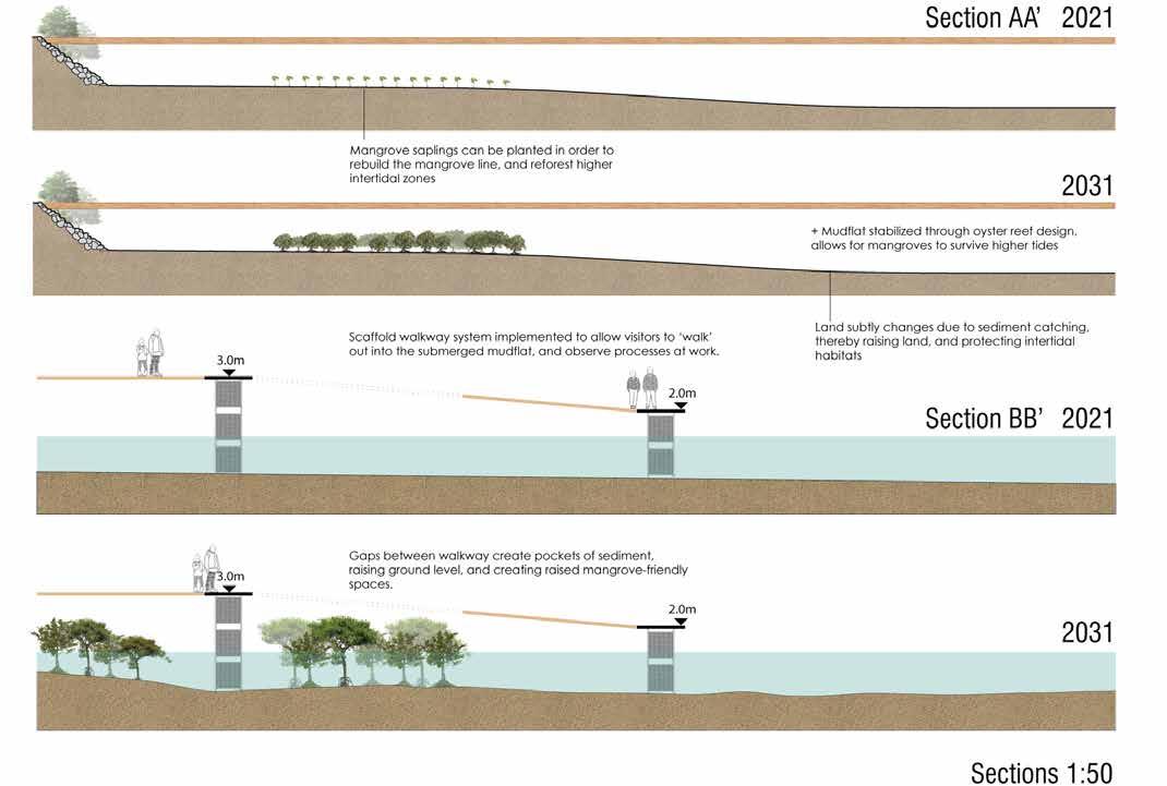
The first site, the largest and of most intervention, follows a scaffolding and elevation design. The purpose of this is to utilize the dynamics of oysters in gabion scaffolds to generate morphological change in the mudflat, and in turn generating opportunity for mudflat habitat and ecology to thrive under the protection of the oyster reefs as barrier.
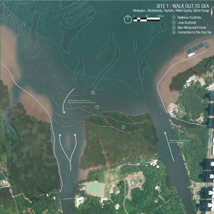
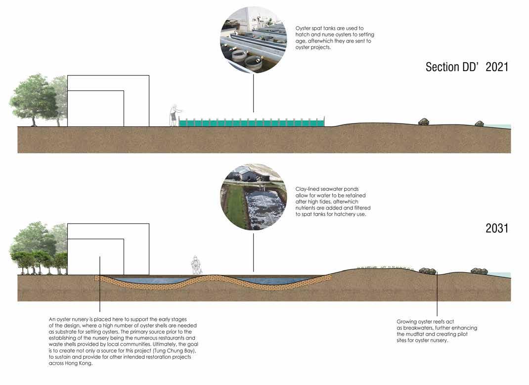
The third site, is a supportive one for the other two. This site is designated for the implementation and establishment of an oyster nursery and hatchery. The purpose here is for sustainable oyster farming, whose production can be directed towards filling the other two sites’ projects within oysters, substrate, and cultch. The ultimate goal is to also become a source of oysters for other restoration projects across Hong Kong.
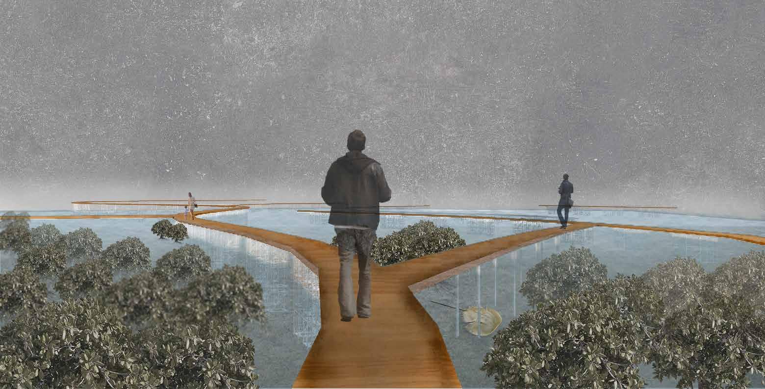
Walk on the Wild Side: View Atop the Scaffold Walkway
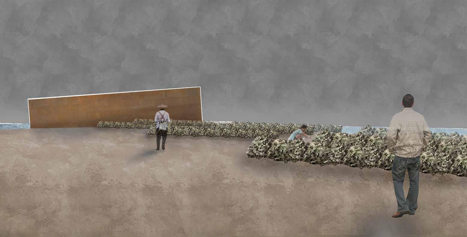
Gatherer’s Hotspot : Sheltered Oyster Reefs and Thriving Ecological Habitat
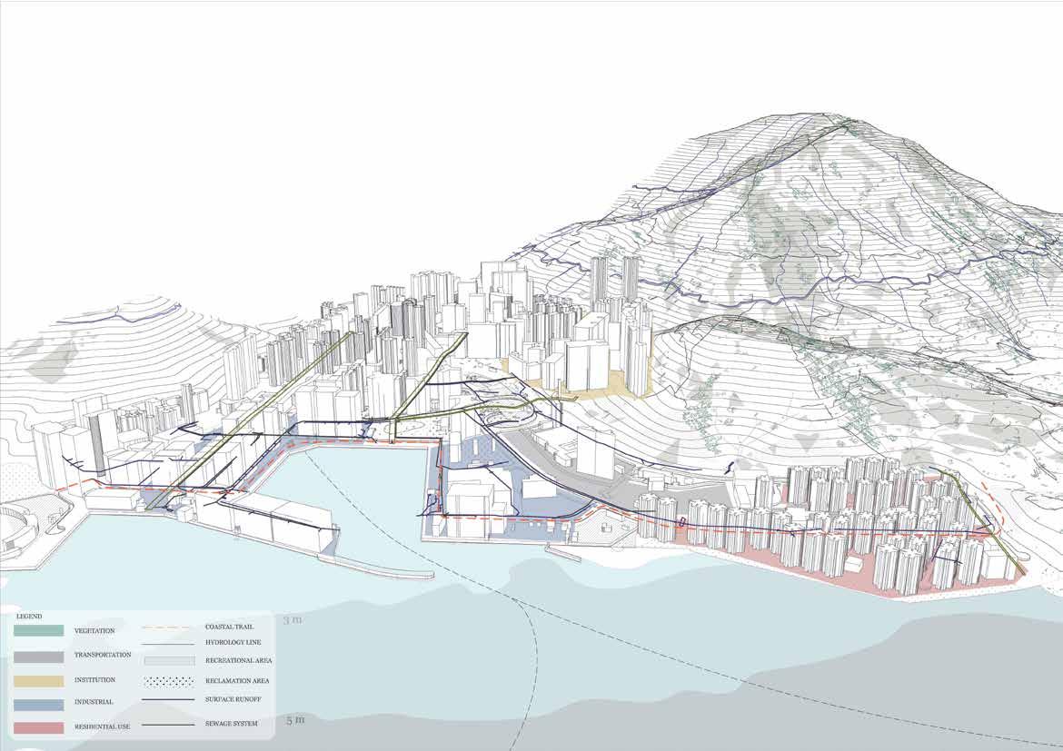
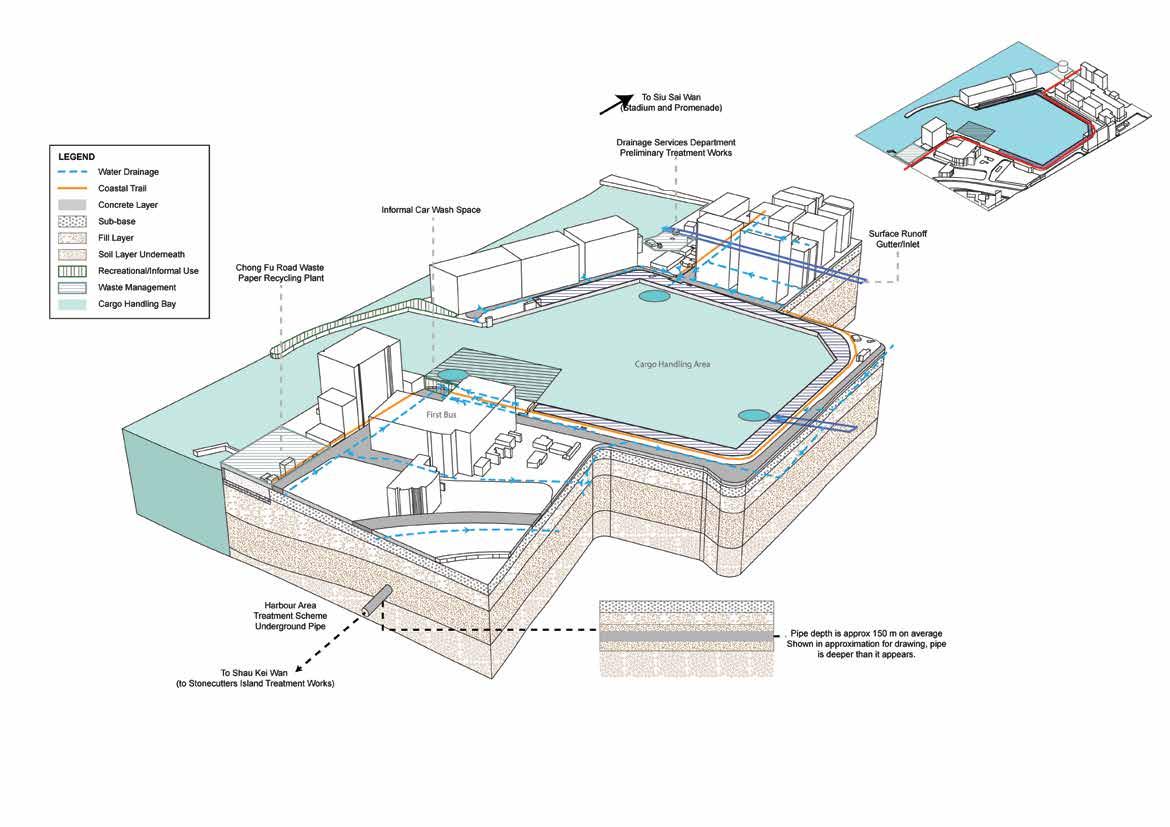
Hong Kong’s Coastal Trail
Retaking urbanized landscapes
03
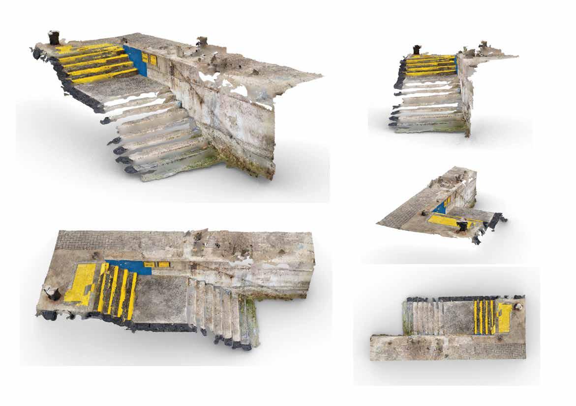
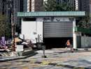
Taking photographs from outside in created difficulties in generating a full and complete site scan, particularly around the stair area, therefore, some post-processing was done in Photoshop.
Revised site selection resulted in a site scan of a dock’s stairway, leading out into Chai Wan’s Cargo Handling Bay.
Organic form in addition to perforated/drilled holes would allow for water to be retained at varying tide heights during the day, and marine organisms can nest and stay within these rock pools.
Modeling typologies, beginning to form modular designs, while retaining organic forms and shapes. Applying such large structures, however, proved to be difficult, and not feasible, considering scale, form, and application to water environments.
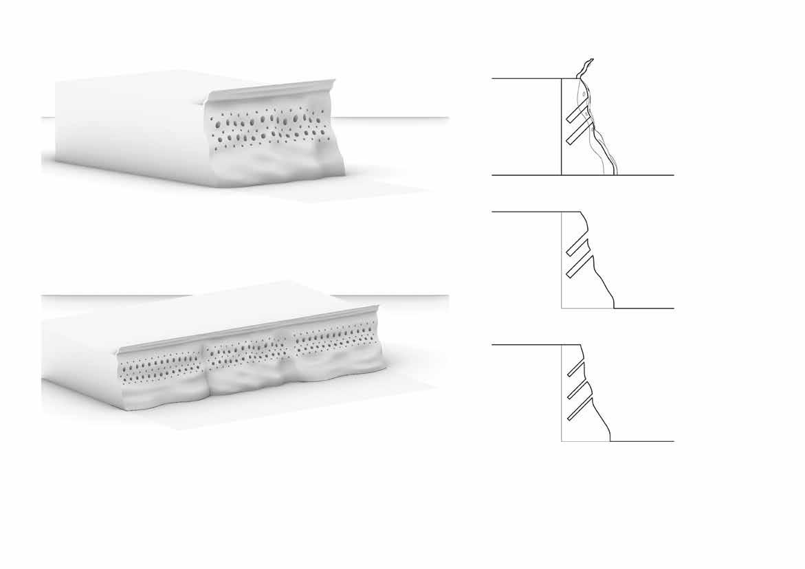
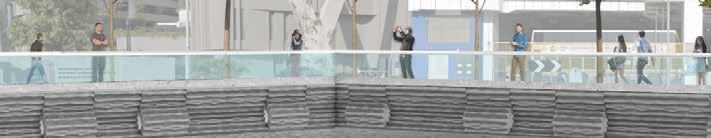
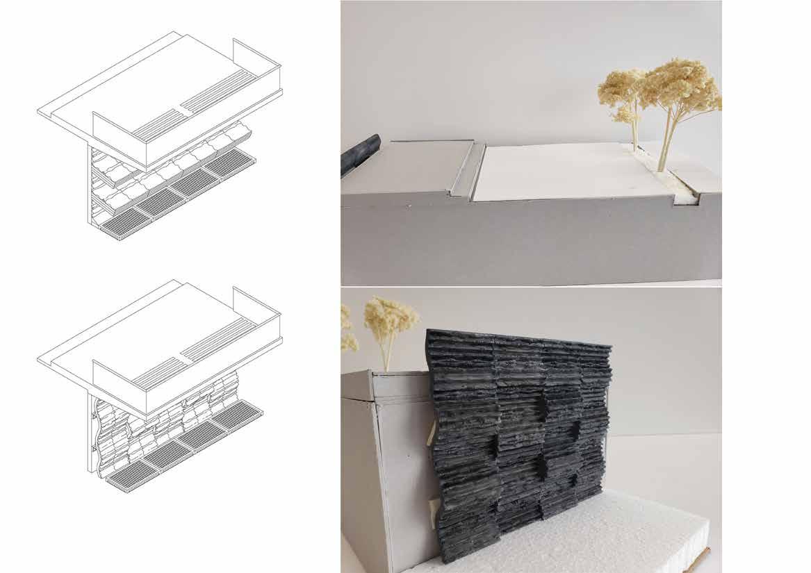
Left demonstrates design with an up to date approach to the project, with my seawall designs at different typology variations, with overhangs taken from the early project iterations.
The physical model is an accurate representation of the bay’s redesigned open space, from the roadway to the tree planter, to the open walkway area, and into the elevated steps towards the seawall. The design of the seawall was 3D printed, painted, and made to resemble an Eco concrete materiality with growing organisms, accumulated algae, and other growths on it.
Difference in the sketch shows the basic seawall (bottom) as well as the shelf typology (top) which would incorporate the rock pool iterations.
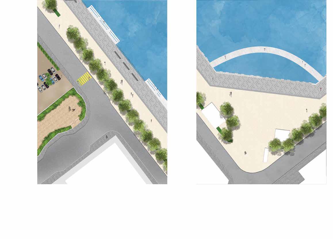
This particular segment of the site shows a typical contextual element adjacent to a majority of the bay. Roadway, building, carpark, etc. Here, a mostly unused pet garden is right next to a fenced off bay, surrounded by road and a parking lot. Through the redesigning of the bay, the pet garden can act as a connecting location to the bay, receiving more visitors and attention.
This other segment shows the primary entryway into the bay. Where previously fenced off, this space can act as the entrance into the largest area of the site, directly towards the extended bridge walkway, and immediately be greeted with the greatest view of the bay.
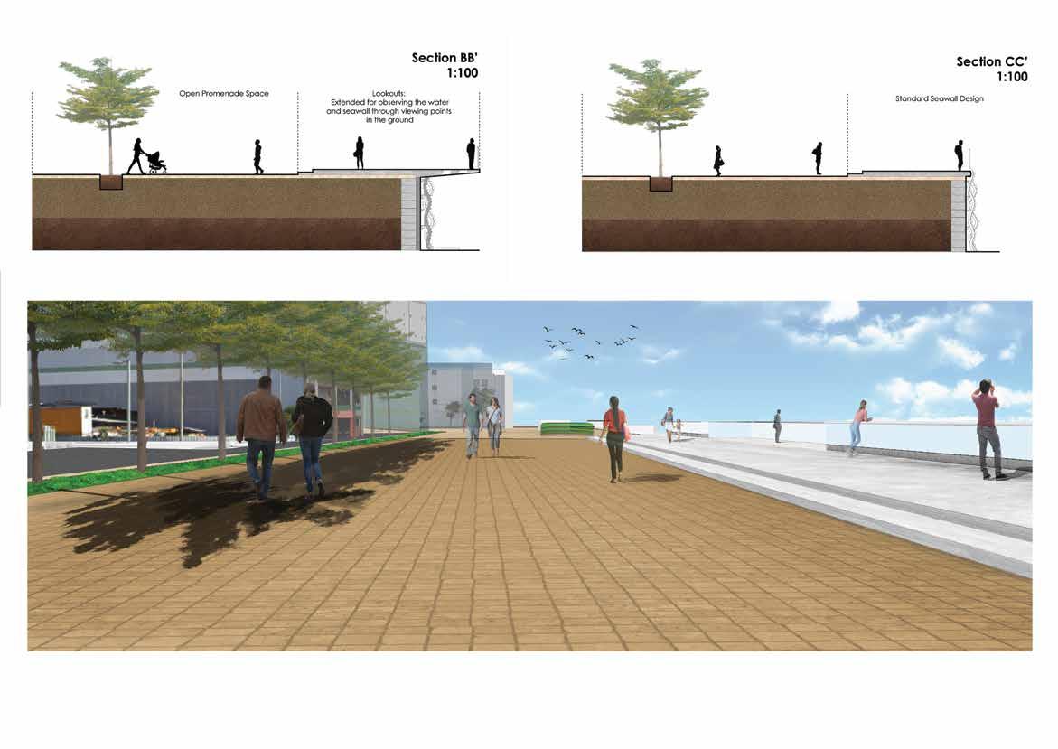 Shaded walking
Open air walking
Waterfront walk
Shaded walking
Open air walking
Waterfront walk
LAYOUT PLAN 1:20
Supplementary project - covered seating area for prior design project
ELEVATION 1:20 ELEVATION 1:20 SECTION 1:20 ROOF PLAN 1:20
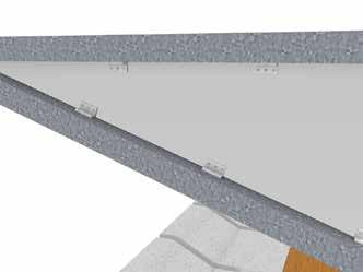
Folded Steel Sheet Steel Rectangular Tube Wooden Block Seating Precast Concrete (Waterfront Facing) Bolted Joint Fittings GREY EXPOSED AGGREGATE Precast Concrete (Walking Surface) Handling Bay Folded Steel Sheet Box Raised Concrete Legs Mortar Bed Drainage Gap GREY POLISHED STEEL HARDWOOD EPOXY & VARNISH GALVANIZED MILD STEEL 1090 1100 220 190 135 300 2488 1330 400 760 200 1000 1132 402 2306 1104 700 100 Cantilever Weight Load Lifting points
DETAIL
DETAIL
DETAIL
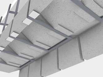
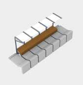
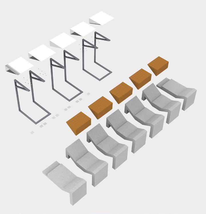
Precast Concrete Modules Mortar Bed Hardwood Block Seating Folded Steel Sheet Box Galvanized Mild Steel Rectangular Tube Frame
EXPLODED AXONOMETRIC
OVERVIEW
WEIGHT
1:
2: CORNER BRACE
LOCK Mortar Bed Steel Corner Brace Galvanized Mild Steel Tubes Precast Concrete Hardwood Block Seating Folded Steel Box Galvanized Mild Steel Tubes Precast Concrete Legs
3: RAISED EDGE
Traversing the Transect 04
Lei Yue Mun

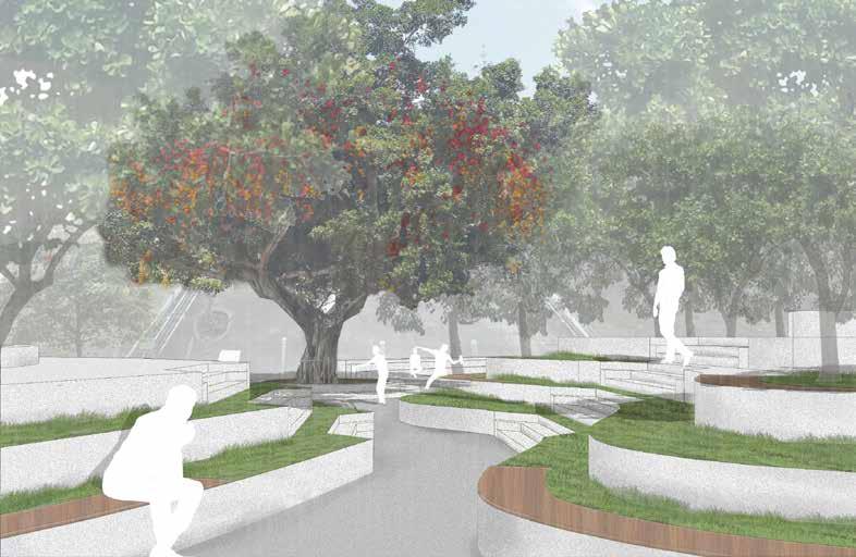
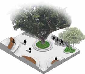
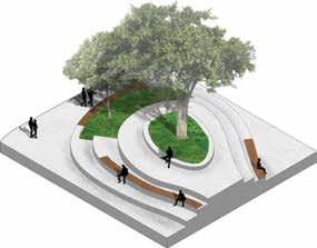
 Wishing Tree
SECTION AA’
Wishing Tree
SECTION AA’
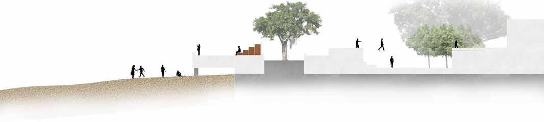
OPENING UP THE BEACH
Beach accessible by Promenade Waterfront Promenade Wishing Tree Forest
VIEWING DECK
GLASS BRIDGE RESTAURANT
SECTION BB’
ENTRYWAY AND RECREATION
Terraced seating and delineating pathways

Hideaway area, creating more intimate spaces
Restaurant
 SECTION CC’ ATMOSPHERE ON TERRACED STEPS
SECTION DD’ EXPERIENCE AND EXPLORATION
SECTION EE’ CANOPY AND VEGETATION
Tree Planters throughout terracing
Pathways from Wishing Tree to waterfront to beach
Centrallized element of site
Viewing Deck, adjacent to Pier
Glass Bridge to restaurant
go-ers can have a good view of the site
SECTION CC’ ATMOSPHERE ON TERRACED STEPS
SECTION DD’ EXPERIENCE AND EXPLORATION
SECTION EE’ CANOPY AND VEGETATION
Tree Planters throughout terracing
Pathways from Wishing Tree to waterfront to beach
Centrallized element of site
Viewing Deck, adjacent to Pier
Glass Bridge to restaurant
go-ers can have a good view of the site
05
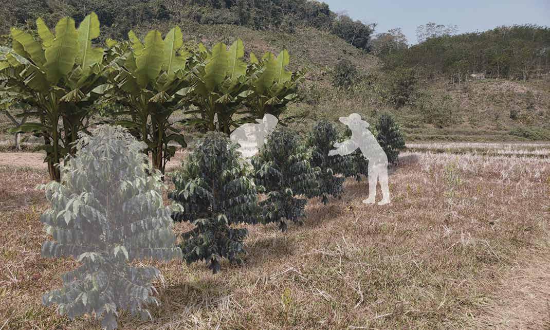
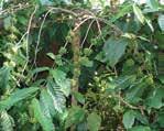
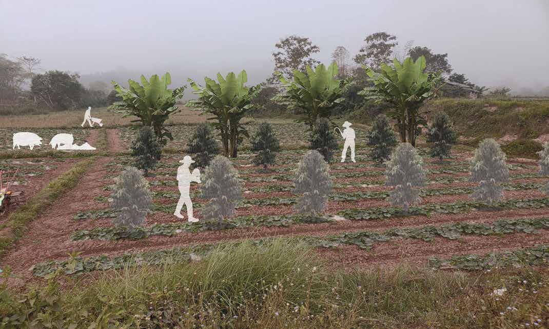
Studio Laos Strategies for coffee planting villages in Northern Laos
The site of study is in the Laos city of Luang Namtha, located within the Luang Namtha province. The UpLao organization is dedicated to helping local communities of Laos to be able to attain a sustainable future through means of agriculture and eco-tourism. Their nursery is located within Luang Namtha, however, my site of study also includes the village of Namvang, southwest of Luang Namtha along Route 3. This village is the main project focus of UpLao, having begun coffee plantations as of 2017. The villagers are all new to the concept of coffee planting, all of whom require and receive adequate training as handled by UpLao, slowly expanding their plantations as more family households participate. They expect their first harvest by the end of 2019 or beginning of 2020, meaning that the nursery requires the installment of proper processing facilities in order to handle and manage their harvest before shipping the coffee beans to their intended roaster in the Netherlands. The latter half of my study is in speculating the kinds of needs the nursery
and/or village have, as well as the sources of these needs. I demonstrate the agricultural processes that occur in the village plantations, encompassing the ecological and geographical needs of Arabica and Robusta coffee, i.e. in elevations, growth needs, inter-cropping, etc. Additionally, I look at where possible could the nursery get or provide its composting from, as Laos laws prohibit the direct use of waste on agriculture land. Issues exist within the Namvang - Luang Namtha project through the means of dependencies. In the eyes of UpLao, they seem to provide such a simple economic model through the coffee plantations. However, their goal for expansion by 2027 does not allow any room for error on the part of Namvang village. Not only do the members of village’s households need to expand their coffee plantations (by hectare) but they need to accommodate protection of ecological sites by rule of the Nam Ha Protected Area, as well as engage in eco-tourism activities.
Luang Namtha City to Namvang Village 2019
Luang Namtha
Legend
1.00
Forest
Nam Ha Protected Area
Villages
Villages residing in the NPA
Shifting Cultivations from 2010
Highway
River
Route from village to nursery km
Namvang
Map depicting roads between Laos city of Luang Namtha to remote village of Namvang, demonstrating distance needed to travel between coffee nursery and plantations in village
Luang Namtha
Coffee introduced to Thailand as a new method of alternative agriculture, to replace tradition of monoculture
Begin Namvang Village Project
Dutch organization, UpLao, wants to bring coffee to northern Laos people in order to diversify economics and ecological sites Regulation from the Ministry of Agriculture and Forestry forbids the use of urban waste (to compost) in agricultural crops
Expand Coffee Plantations Expect first harvest of coffee beans
 Luang Namtha/Nursery
2000s 2016 2017 November 2018+ 2020
Village to Nursery 1 hr.
Depiction of Agricultural Land typologies surrounding Namvang Village Fallow
The map above demonstrates the area of land surrounding Namvang village that is fallow at the time of 2017 prior to the beginning of the coffee plantation
Fallow
1200m
below 1100m Roadway
from village to nursery 1.00 km
Shrubland Area above
Area
Route
Cultivated
Cultivated (Coffee, Banana, etc.)
Shrubland
In this iteration of the map, it depicts similarly the area that is currently cultivated as of February 2019, given that the area of cultivated can be adhered to coffee plantations or other form of cash crop.
1.00 km
Roadway Route from village to nursery
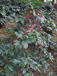
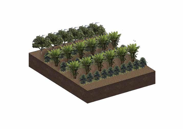
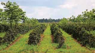
Coffee Plantation Model - Strategies for Planting Varieties in Coffee Robusta


Grows effectively below 1000 m
Larger, and more resilient at higher temperatures. Can withstand direct sunlight.
More produce per hectare than arabica species
Robusta plants are easy to manage and grow in multiple rows, however their high altitude weakness to coffee rust makes it dif cult for Laos’ high altitude villages.
These drawings represent the manner in which UpLao proposes the village to handle the coffee plantations, depending on specific species of coffee. The types that are most prominent in South-East Asia and countries surrounding Laos are robusta and arabica. These representations are my own interpretation on what the village farmers would be doing for their plantations based on what the founder of UpLao.

Absolute maximum eleavation of 1100m
Rows of robusta are effective in producing high yield

Arabica


Grows above 1200m, withstands coffee rust at these temperatures
Resistant to many diseases, produces quality yield
Overall less revenue, but typically higher quality coffee
Fruit trees act as extra source of income through additional cash crop
Banana as a long-time traditional cash crop for villagers
Fruit trees in macadamia and citrus are also planted through each hectare to provide additional fruit every 5 years.
Banana trees are grown in between arabica coffee to function as shadow plants and retain soil quality

On the right here, I depict a model of an arabica plantation (java, typica, catimor). Based on information discussed with UpLao directly, the arabica plantation is an attempt at reducing the amount of monocultures in the country. Since Namvang village is situated at high altitudes (of about 1100m approximately), it is the most effective species to use at such altitudes.
ROBUSTA : BEGINNING OF PLANTATION PROJECT

Robusta saplings are planted at lower altitudes (than are around the project site)
ARABICA : BEGINNING OF PLANTATION PROJECT
Fruit trees such as macadamia are planted alongside coffee to provide additional sources of income
Plantation has intervals of banana and arabica plants, alternating rows
ROBUSTA : EXPECTING FIRST HARVEST (3 years)
Robusta needs less intensive care than arabica, depending on elevation. The higher it is, the better care it may need to prevent coffee frost from killing plants
ARABICA : EXPECTING FIRST HARVEST (3 years)
Banana grows relatively well for the villagers of Namvang, as is a traditional cash crop, therefore it is grown alongside coffee.
Arabica coffee is the primary coffee type grown in Namvang, as it will dominate the majority of the fallow land surrounding the village

Macadamia, and fruit in general, is grown in order to challenge the monoculture tendencies of many Laos plantations
External Sourcing and Speculation


A large segment of my project relies on careful speculation on the future development currently planned for Northern Laos provinces. Largely based, that is, on the expansion of the road connecting Southern China to Thailand through Laos. The road, which crosses through the city of Luang Namtha and is in the vicinity of Namvang village, is responsible for bring in a number of travelers, especially eco-tourists for the Nam Ha Protected Area. Much of that revenue that is earned from eco-tourism projects is additive to what many farmers earn through agricultural processes.
The 222,400 square-hectare Nam Ha Protected Area is a popular tourist spot for its significant biodiversity and habitats, as well as its cultural and natural resources. 70% of tourists demonstrate interest in guided tours throughout the protected area. Ethnic minority villages are visited, activities include multi-day forest trekking, as well as river and cave tours.
The eco-tourism activities have been going on in Laos for multiple decades now, keeping its distance from the villages and their plantations, previously being rubber.
Tourists are discouraged from visiting plantations when they see that it is deforested land. It is not in their interest to go near village area or plantation that is not intentionally part of the tour.

2,000 1,200 1,800 1,000 3,000 Euro € Cost Co ee Pulper Co ee Processing Facility Co ee Hulling Facility Additional Equipment Co ee Seedlings per ha. Ecotourism Facilities Processing Facilities for Co ee (Nursery) 4,000 6,000 8,000 10,000
NAM HA
Superficially there exist many dependencies between the nursery and the village. Aside from information regarding market prices of the various cash crops the village grows in its plantations, I decided to explore waste statistics surrounding the city of Luang Namtha. Such statistics serve to govern the potential sources of waste-to-compost material for the plantation’s agricultural purposes. I performed some calculations based purely on my own reserach and what I could find based on the city’s demographics. Through this figure ground drawing (right), I counted roughly how many restaurants or hotels are within the area, which would be feeding this solid urban waste to the nursery and the plantations.
WASTE ANALYSIS : Throughout Luang Namtha, Veng Phoukha to Namvang
Sees approximately 14,000 - 20,000 AADT
Expansion of the highway would increase capacity to at least 30,000 - 40,000
Only 2000 - 2800 is organic
This means that Vieng Phoukha would need at least 14 sources of solid waste to provide 4000 tons per

Vieng
29,000 in Population
20
city5800
per year
Luang Namtha Route 3 / 13 Luang Namtha Vieng Phoukha
Phoukha Namvang
200 kg solid waste per capita
sources of solid waste, gives the
tons
1900
20,000 1245
families
20 households
Only 2400 - 4060 is organic 1000
- 3000 is used for animal feeds goes to landfills/dumps goes to landfills/dumps
across 55
or
year and sustain its OWN nursery
AADT
700 1300 - 2100 is used for animal feeds
Visuals
Flatland or Mountainsides is effective for coffee as long as elevation requirements are met
Farmers living near their plantations can partake in ecotourism activities along NPA
Banana / Coffee intervals must be met throughout start of project in order to maintain plant health, given farmers’ inexperience with coffee.
Perspective Representation
 Animal feeding on site
Composting directly feeds plantation
Animal feeding on site
Composting directly feeds plantation
RELATIONSHIPS BETWEEN AGRICULTURE AND ROAD EXPANSION


Labour Necessities

A family is able to run 1 ha. of plantation
Coffee/Banana/Fruit Eco-Tourism
The road expanding brings in more traf c to Nam Ha Protected Area and ecotourism projects
At least half is needed to run patrols and protect plantations
Jobs/Business

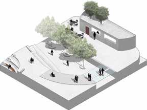
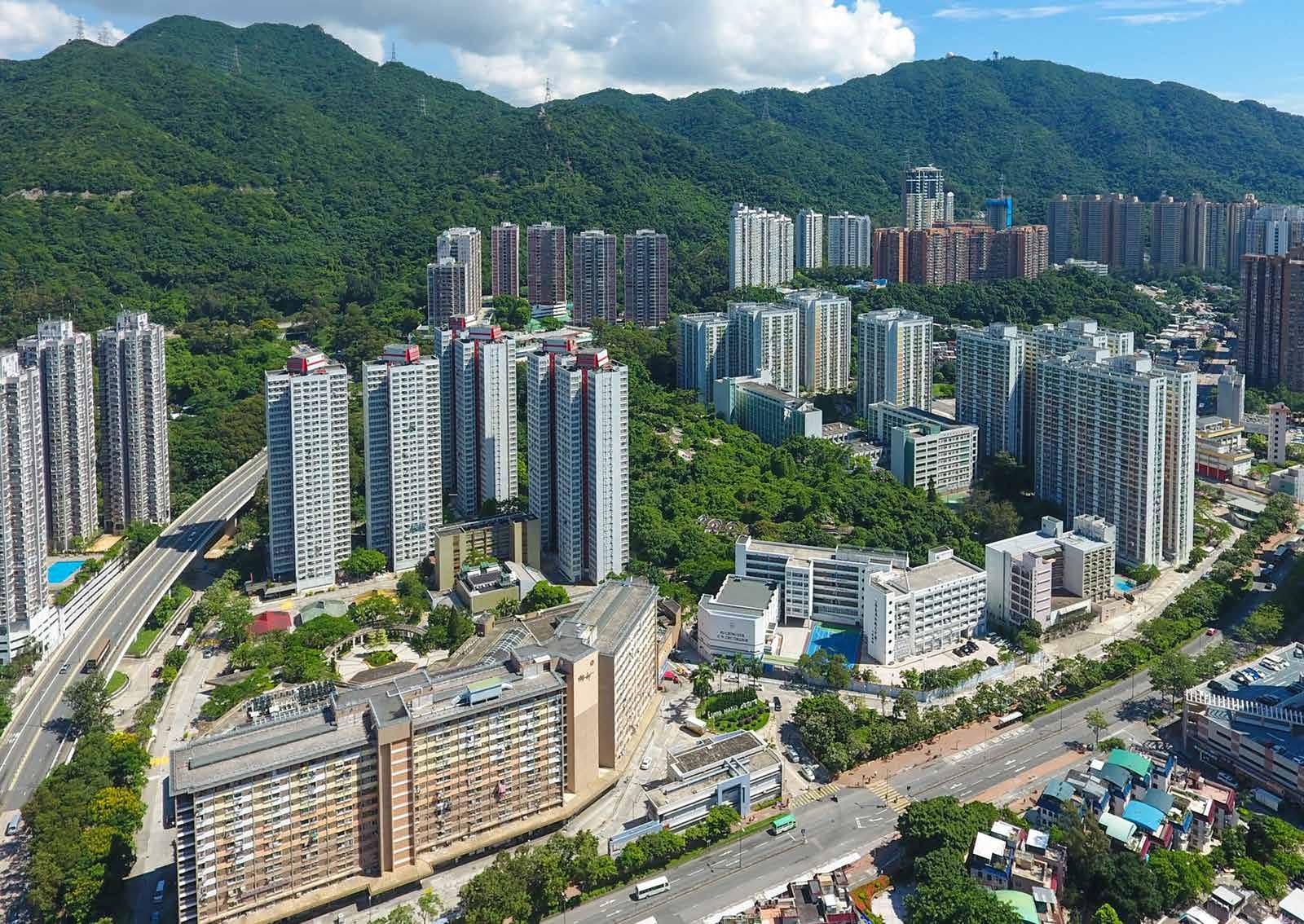
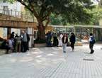
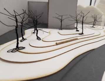
From Street to Estate Communities and Design in Public Housing Estates 06
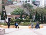
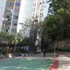
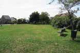
The purpose of this project was to place focus on communities within Hong Kong living in public estates. Many of the existing public estates were establishing between the 1960s and the 1980s. The public estate I focused on for my project was Lung Hang Estate in Tai Wai, established in 1983. This estate is not far off from the Tai Wai MTR station, making it quite easily accessible. I say that because part of our study was to study and analyze the estate’s position within its surrounding urban context. In doing so, I managed to identify the ins and outs of the estate, including identifying the most effective methods of transportation in and out of the estate, where people walked to and the routes they took, as well as the demographics of the residents. Much of what is shown in this section includes various forms of illustrations and representations depicting data collected while visiting the estate. The result of this form of study is in broadening our knowledge of how this particular estate works, in tandem with our preconceived knowledge
for what a public estate should have. Certain facilities are absolutely necessary in order to provide residents with the commodities they require. In the example of Lung Hang Estate, it had a myriad of kindergartens, primary schools, and secondary schools, resulting in a high number of children and adolescents present. This meant a high number of playgrounds and open spaces for people of these age ranges to utilize. A mall, supermarket and wet market were also present, demonstrating high priority for people to visit. Finally, as students we were tasked with proposing an intervention into a particular aspect of the estate, whether for any of the varying systems we studied prior.
Hydrology, ecology, transportation, circulation, all became important factors to consider when detailing our proposal for change, addition, removal or overall improvement to the estate. My focus then became to revive the existing entrance points of the estate, focusing then on transportation and circulation.
The study of the workings throughout the exterior of an estate is as important as the workings within the estate. This initial project aimed to study various cityscape spaces outside the estate, including public space, and the qualities they present when paired together with a near identical space in the estate.
Context Flow
Estates house people. That is the main factor. As such, it becomes an important notion to study these people. Where they go, what they do, where they come from. Through these factors, I had decided to select spaces that involved upper and lower levels.
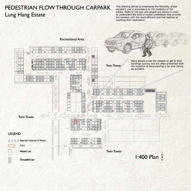 Drawing of Pedestrian Flow through Estate Carpark
Overlapping Levels
For this, the carpark within the residential area of the estate was selected, along with the Octopus Bridge leading from the Tai Wai MTR station to the estate. A comparison of these two allowed me to differentiate entrances and flow within their respective locations, at different times of the day and under different circumstances.
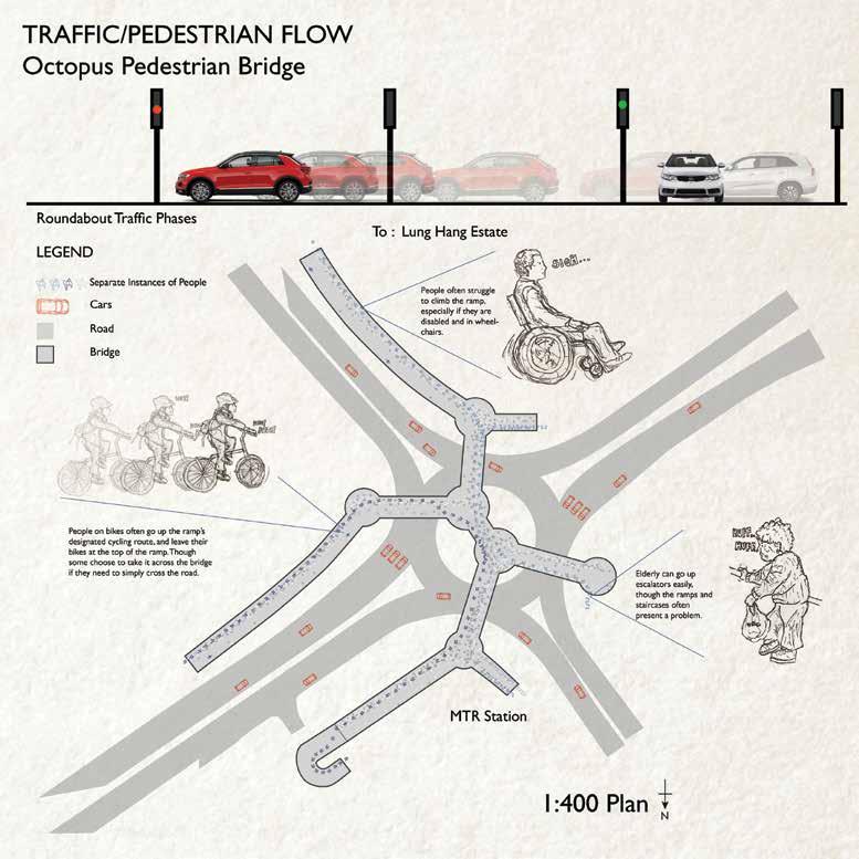 Octopus Bridge - Pedestrian Flow
Space and Dimensions
The spaces themselves have become places that we have experienced beyond that of a visitor. The more time we spend there, the more we notice and begin to appreciate about the space. Such things include thoughts about the location of these spaces. We often think, why the carpark is located underneath the rooftop garden? People walk through the carpark as if it were meant to be a directional pathway out of their residential buildings, even though it may not have been intended that way.
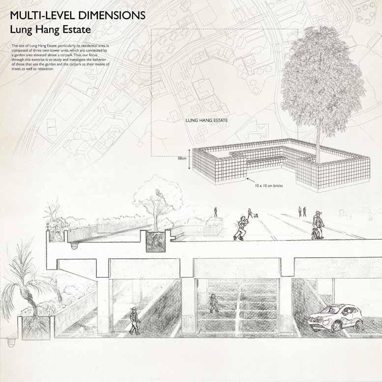 Drawing depicting spatial dimensions of Rooftop Garden
The Octopus Bridge leads to many different roadsides. Of course, since its located above a dense intersection. The heavy flow of people is something to be carefully observed, yet impossible to do without disrupting it and causing a nuisance. A resident will definitely know which path to take throughout the bridge, but a newcomer will have to stop and observe the area first before understanding which direction to take. Small details like this make the spaces feel more alive and help you understand the manners in which these spaces work and function.
Level
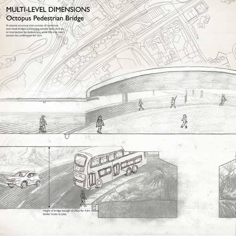 dimensions of Octopus Bridge
SHADOW AFFECTING CHANGE IN USE Lung Hang Estate


Shadow


As said before, the way these spaces function is key to understanding the residents’ position within the estate. One key factor within the estate is how shadow functions and how it affects living standards. The point of study is once again the rooftop garden. This place is situated right in between three twin tower residential units. This makes certain sections of the garden a shaded space, varying throughout different times of day. A noticeable influence this has on the residents is where they would choose to hang wet clothes out to dry at different times of the day. Another is of course where people choose to sit.

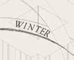
9am 1pm 3pm 5pm 11am LEGEND
This composite is a demonstration of the shadows that act upon the rooftop garden from 9am to 5pm. The reason for this choice of timeframe is due to the fact that most times before or after this range show virtually no shadows being cast by objects on site.
Sitting in the sun during Winter
Shadows on Rooftop Garden
Sound


Since shadow is important for estate areas meant for holding people in, it may not be for places where movement of people is key. Instead, the area of focus for the bridge area is in its noise pollution. At varying points of the day, the vehicles on the road get considerably louder than the chatter that occurs on the bridge itself. Ultimately however, the amount of noise pollution would not matter for the people traversing the bridge. As the same is said for shadow, it can be quite difficult to identify a factor that influences a person’s choice to cross the bridge or not. It is the only effective method of crossing the road and likely the only possible route home from the MTR station.
CHANGE IN USE AFFECTING SOUND


Octopus Pedestrian Bridge
Noise Levels by Vehicles
Noise Levels by Pedestrians


Noise Emanating from Vehicles


Noise Emanating from Pedestrians


Total Produced Noise on the Bridge
Sound levels throughout day


 This drawing presents the level of sound produced by humans and vehicles throughout the bridge, including the roads below. The ring formation presents the level of noise according to the time of day. At the same time, it represents the amount of noise that emanates from individual instances of vehicles and people, shown as dome structures.
LEGEND
A prerequisite to creating a Masterplan is to identify first and foremost, what is actually good about the estate, and what is bad. It’s not enough to say you will be redesigning a certain something about the estate, there must be a reason attached to it.
HIGH ACCESSIBILITY


HIGH FLEXIBILITY
HIGH RELIANCE
PARK PARK VILLAGE PUBLIC ESTATE PRIVATE RESIDENTIAL
VILLAGE PUBLIC ESTATE LUNG HANG ESTATE 1:1000 STRENGTH 20 20
PRIVATE RESIDENTIAL PRIVATE RESIDENTIAL
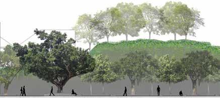
tree
tree Quiet shade providing tree Ornamental tree Quiet The only indoor sports center in the district.
shade providing
Ornamental
Strengths


PARK PARK VILLAGE PUBLIC ESTATE PRIVATE RESIDENTIAL PRIVATE RESIDENTIAL PRIVATE RESIDENTIAL VILLAGE PUBLIC ESTATE LUNG HANG ESTATE 1:1000 WEAKNESS CommercialArea School School School School 20 20 20 poorly maintained planting foul smell noise LOW ACCESSIBILITY LOW COMFORTABILITY OVERSHINE BY OTHER PROGRAMS LOW RELEVANCE Weaknesses
Circulation is shifted from the central part to the outer part of the estate. It is also diverted into 3 parts to defuce the circulation and alleviate the overuse of one single walkway. The 3 parts have difference in accessibility, pace and atmosphere, catoring demands of different users.
Following the more dynamic relationship between the space and the social groups, we have created a master plan. Here we aimed to overlap a majority of the issues we perceive on the site, as well as propose our strategies for development. This became an opportunity for us to develop an understanding for everything that occurs through the entirety of the site, and identify ways to move forward.
10 10 12 22 20 20 10 20 20 36 16 20 20 CIRCULATION Express lane Intermediate lane Leisure lane NeighbouringRetainInteractionswithCommunities Elderly Gathering Area Retain Commercial Hub Commercial Commercial Create Central Hub Younger Residents Area
Masterplan
EcologicalTunnelforWildlife
Recreational
Planters to be removed
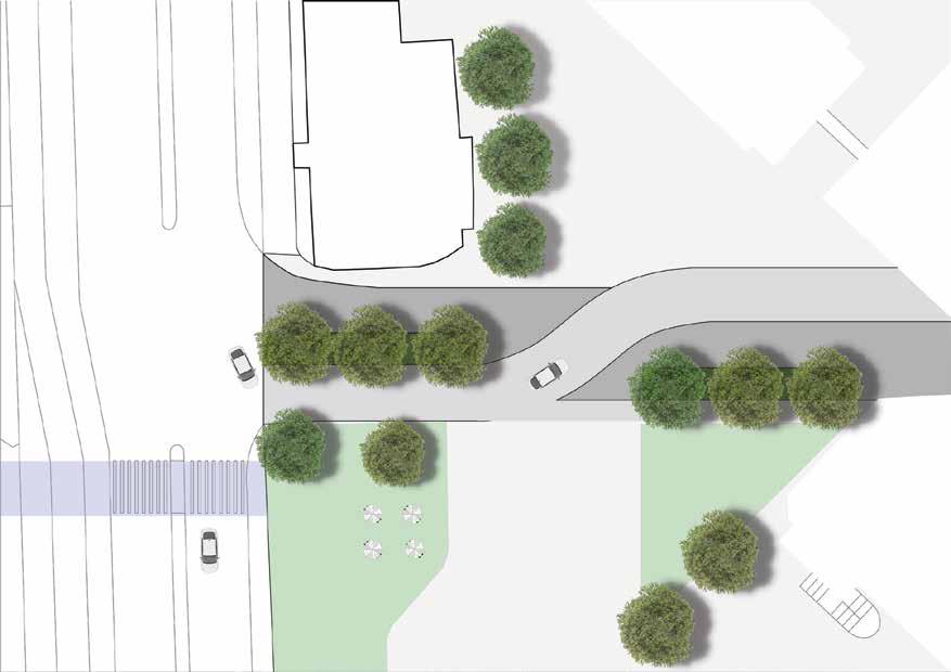
The primary goal of this design is to recreate the main entrances of the estate, which follows up to a redesigning of the most ‘open’ space in the estate. The aim is to transform this space into a hub that can act as the central piece of the estate, improving circulation by create more open ground, breaking boundaries that currently exist in the estate.


Western entrance ful lls a similar purpose as the north entrance. It allows for residents to get a more streamlined access to the estate, especially since this entrance is nearer to the residential buildings. The entrance is extremely close to another bus stop, creating a better ow of transportation in and out of the estate.
North entrance creates better access into the estate from the bus stops as well as the MTR station. This opening becomes more accessible for pedestrians traveling to the estate from public transportation, as well as for vehicular access to the mall and commercial space.
10 12 22 20 20 20 16 20 20 20 20 16 Master Plan : Proposed New Circulation
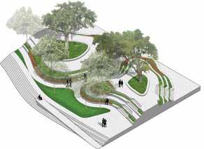
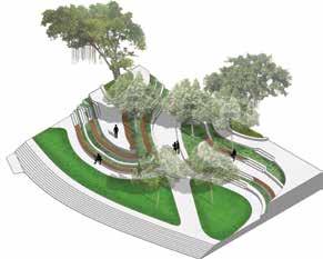
A reinterpretation of the master plan. This was made for the purpose of identifying a more specified way forward, identifying specific sites for intervention and methodologies in redesigning/ improving them. Here I included my design ideas for each site I selected.
Detailed Plan
Sections - Perspectives
Drawings - Sections
Long section 1 - 1:200
These sections serve to demonstrate the subtle topographic change that occurs throughout the site.
Long section 2 - 1:200
Section 1 - 1:50
Section 2 - 1:50
Section 3 - 1:50
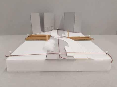
Model - Topography
Topography Model
The model itself does not serve to demonstrate the entirety of the site, but is more focused on the topographic elements. I wanted to create a model that would represent the subtlety of the topography change, but found it difficult to do so with a limited selection of materials.
Designing Sites - Experimentation
Out of the three sites I had selected within the estate, two of them included the entrances to the estate. My objective for these two is shared, in that I wanted to reintroduce these spaces as the true entrances. Currently, these are only used for vehicular access, and even so, they are particularly underused by anyone other than those wanting to enter their residential building or the mall area.
Therefore, my idea for these two spaces involved the use of the ‘shared space’ concept. I aimed to make these spaces more appealing for both vehicle access and pedestrian use. Ideally, this would mean the removal of physical boundaries that separate the road users. This includes curbs, fencing, signage, etc. Anything that would effectively make a person question whether or not they can or should access this area.

The middle site would act as a central hub (as noted on Master Plan), aiming to create a centralized space in the middle of the pathway connecting both entrances. This design is an initial idea aiming to revamp the current space, and once again implementing the shared space concept used for the entrances.

Site 1 - Study Models
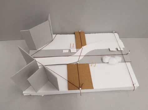
Site 3 - Study Models

Site 2 - Study Models
The middle site model serves to help me identify points of entry and points of main circulation. Through this, the string connections helped to identify what the main routes of movement would be, and manners in which I could manipulate these routes without breaking the flow of the estate.

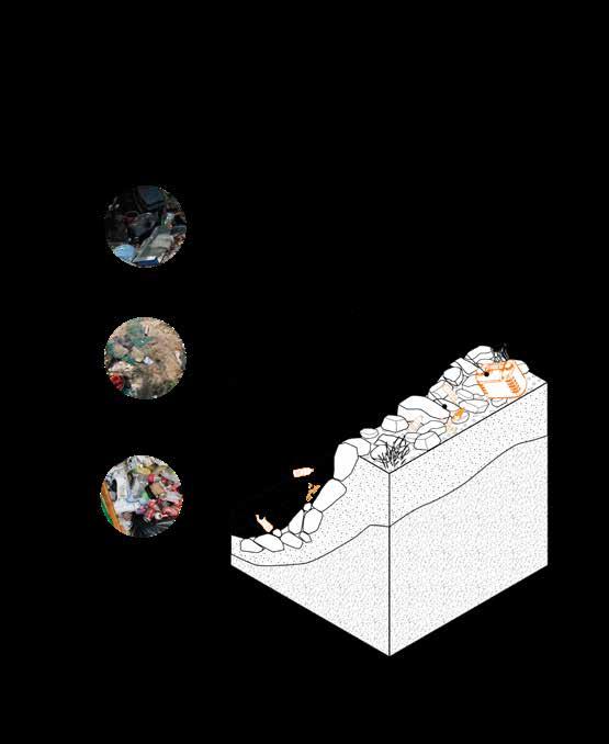
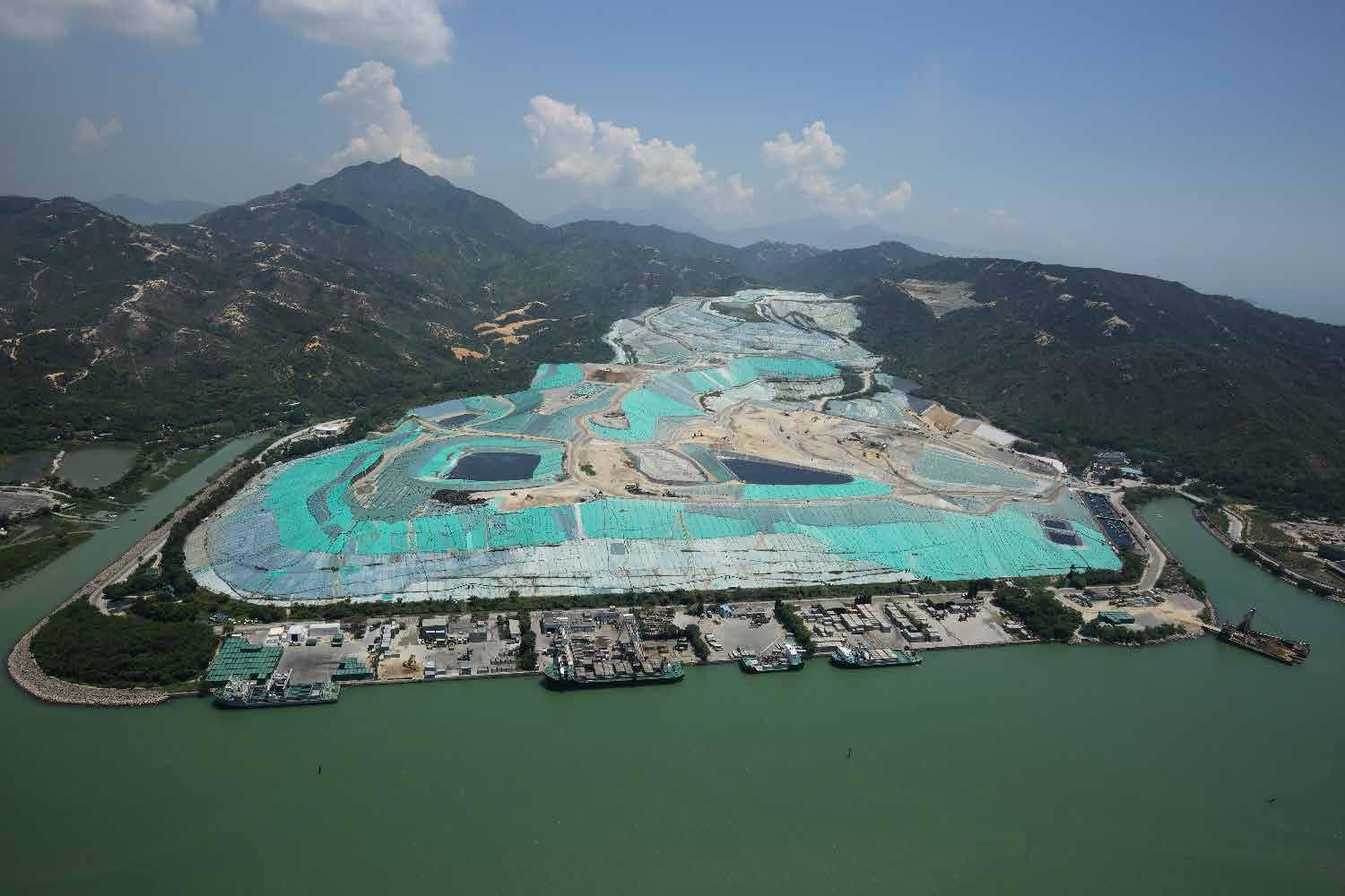
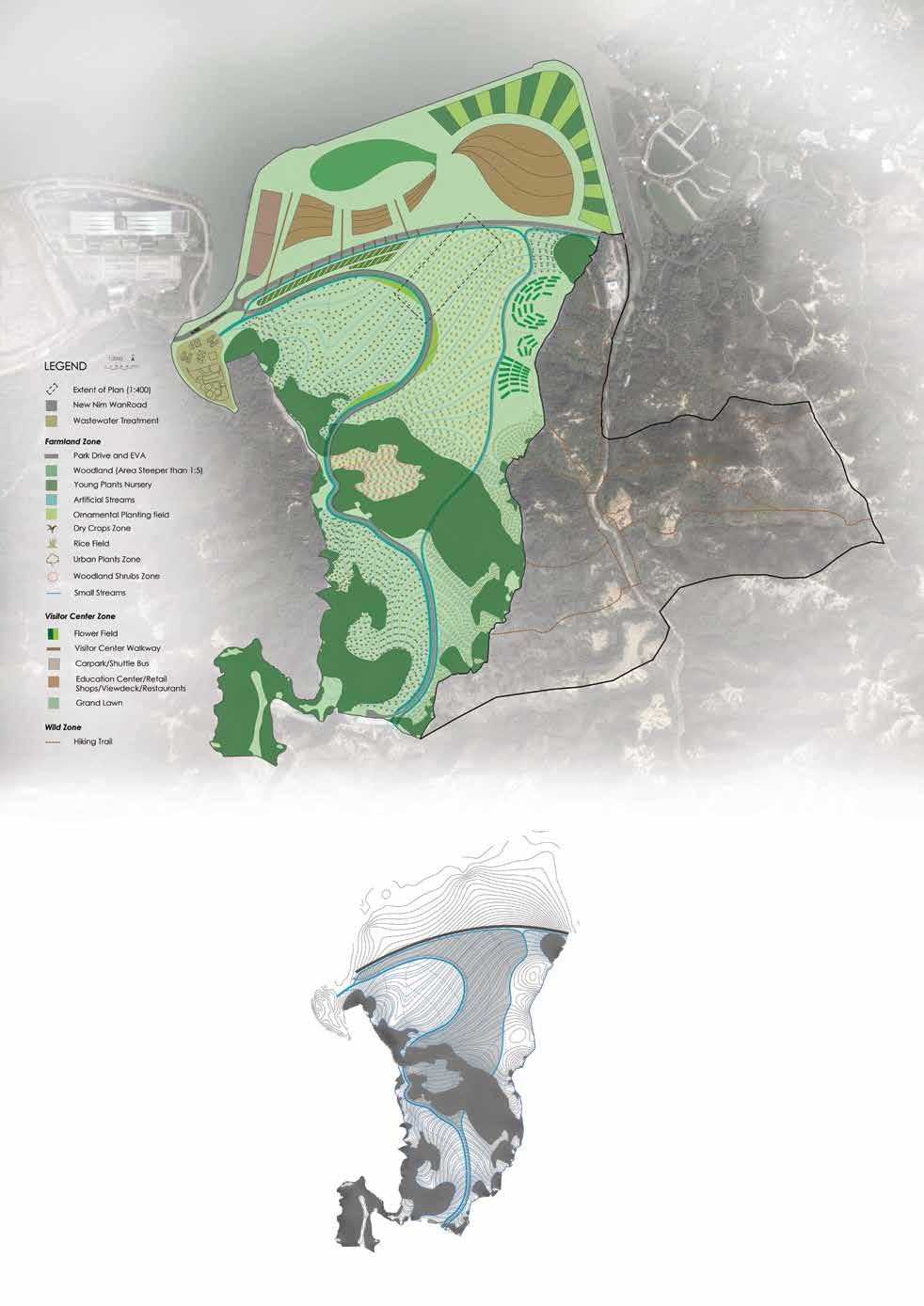
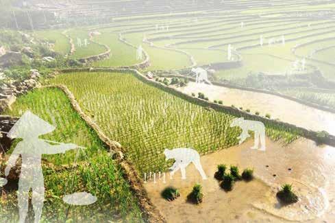
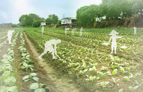
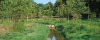
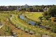
Castle Peak Community Farming on Former Landfill Zone 07
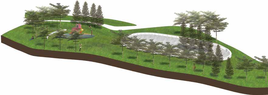
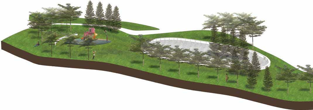
Hong Kong has an abundance of green spaces for a thriving city, which gives people a chance to see, experience and be amongst plants. Even so, being surrounded by plants throughout the city’s urban settings, and even rural areas, there exists no opportunity for people to take part and be involved in the cultivating of these planted areas. The Planning Department’s data on the land utilization in Hong Kong states that there are about 51 square kilometers of farmland, where only 7 square kilometers are actively used. A reason for this is due to the issues of land ownership, where much of this farmland is private land. The site of study covers the West New Territories (WENT) Landfill, including the mountainous area leading up to the popular hiking trail from Leung King to Pak Nai (and the mini Grand Canyon in between). As Pak Nai is a hotspot in the Western New Territories for viewing the sunset, it becomes a very crowded place during the weekends. This project is aimed at establishing community engagement within the area,
in efforts of also promoting leisurely planting and the decorating of Tuen Mun’s urban zones. The West New Territories is a place of very low circulation and overall pedestrian use, simply because it is primarily industrial land, and the existing landfills. The present roads encounter heavy traffic congestion issues, especially at Pak Nai, due to the narrow roads disallowing for two way lanes. There is an opportunity for a comprehensive transportation network to be established, linking North Lantau, Tuen Mun and Shenzhen.
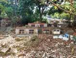
The WENT Landfill is speculated to be full between 2018 and 2019. The government has been conducting feasibility studies in order to propose for an extension to the landfill, by approximately 200 hectares. As a result, this project acts as a counter proposal to extending the landfill. By building a public nursery park, the WENT landfill will be sealed and closed. It is recommended that policy makers seek an alternative waste treatment method, such as incineration.
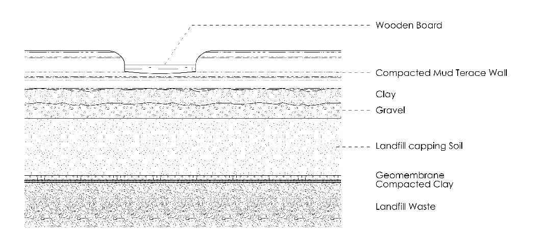
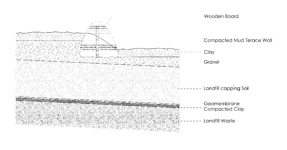
Master Planning Section AA’ A Section BB’ B
1:50 (approx.)
Typical section across park driveway
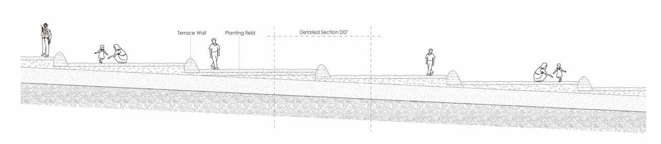
Depicting Sloping Terrace Farming
Typical section across terraces
AA’
A’
1:50
BB’
B’
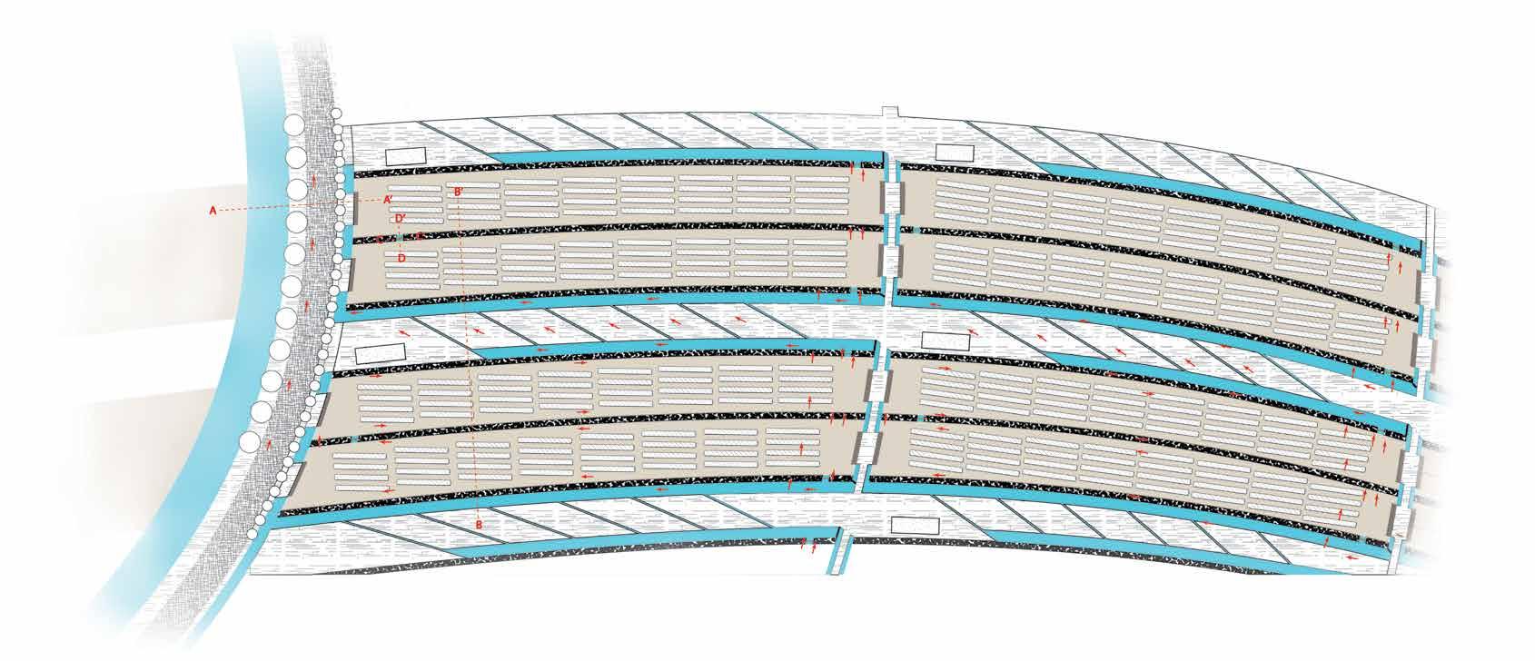
Detailed Plan on Farmland Arrangement
LEGEND
Main Road
Trees
Stairs to Field
Farmland
Terrace Wood Board (Water control)
Water Flow
Walkway
Water Catchment
Terrace Wall
Storage Huts
Farmland Water flow Design
Section Cut Lines
1:400 2 0 4 6 8 10 (m) N
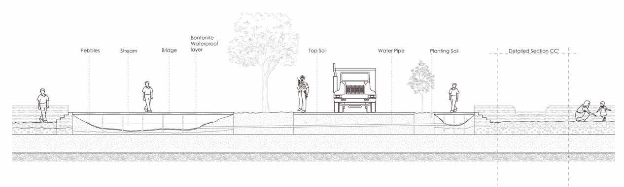
Additional Detailed Sections depicting Water Management
Section CC’ 1:30 C C’
Typical section along water channel
D D’
Section DD’ 1:30
Typical section across water channel
Extra Additional
00
Drawings


Exchange Semester at University of Illinois at Urbana-Champaign


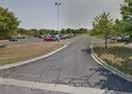
Shade Trees Seating Areas Extended Lawnscape Stream flow Bridge New Shade Trees Original Trees Campus Gathering Space River CAMPUS Natural Forest Area Removed to connect Green Spaces Maintenance Area moved Space Sit-out Areas Extended and Expanded New Trees for Shading and Enhance Woodland Expanded Green Open Space Expands and Connects into College Campus BUILDING MAINTENANCE C R E E K Forested Area 153rd STREET 153rd STREET PARKING MAINTENANCE MAINTENANCE BUILDING Bridge over stream Create Entrances from C R E E K Forested Area
River Shared Space
Entrance from Residential Original Trees
RESIDENTIAL
Transpiration
Shade tolerant trees
Water-tolerant plants
Groundwater Recharge
Evaporation
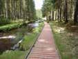
Riverside Boardwalk
Water absorbed into soil and gravel
Water Flow
Stones slow down overflow
Entrance points from College Campus area
Boardwalk along River
PARKING MAINTENANCE
MAINTENANCE BUILDING
153rd STREET
Green Open Space
Riparian Buffer Zone
C R E E K
River Shared Space
