27 minute read
Gerbe 1135, 6863 Egg
hiking
Hiking and rambling are the best ways to discover the beauties and mysteries of the Bregenzerwald. Hiking tips take you to alpine pastures where cheese is made, across historical wooden bridges and to magnificent vantage points.
Hikers on Sattelegg alp in Au
Uniformly signposted paths and hiking maps make it easier to find your way around the mountains. Practical: the ramble and hiking packages offered by Bregenzerwald Tourismus. Signposting of the hiking paths All hiking paths are clearly and uniformly signposted according to the Vorarlberg hiking path concept. The hiking paths are divided into three degrees of difficulty:
Walking or rambling paths: Easy
Mountain hiking paths: Non-slip footwear suitable for wearing in the mountains is recommended
Steep alpine trail: Suitable only for those with mountain experience, who are sure-footed and have no fear of heights
Hiking deals You can book selected hiking deals directly from Bregenzerwald Tourismus. For more information, see the Bregenzerwald Travel Magazine and www.bregenzerwald.at/en
Bregenzerwald hiking map → p. 38
Hiking paths on the Internet www.bregenzerwald.at/tourenkarte
Culinary hikes → p. 98 Walking tours of the moor→ p. 110
recommended reading
Wanderbuch Bregenzerwald by R. Berchtel, published by Tyrolia Verlag (in German only)
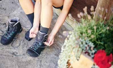
The right equipment for the mountain
For your safety • The correct equipment is a central safety factor: mountain or hiking boots, good outdoor clothing worn in layers, a functional top to change in to, sunglasses and sun cream. • Don’t embark upon a tour on your own. Always inform others about your tour. • Only set off into the mountains if you are in good physical condition. • Take (hot) drinks and a snack with you. • Set off in good time so that you are back when it is still light. It gets dark relatively early in the autumn, for example. • Check the weather forecast before you set off. Stay in the valley if it is misty. Should the weather deteriorate, return to the valley. • Take orientation aids with you: a hiking map, perhaps an altimeter. • Stick to signposted paths. • Applies particularly to tours in the high mountains: take with you a bivouac sack, a head light, mobile phone and First Aid kit. Action in the event of an emergency 1. Move the injured person from the source of danger (rockfall, further fall) 2.Check the vital functions 3.Use your mobile to call the emergency services: • 144 alpine emergencies • 112 European emergency number 4. Administer First Aid
Respect your boundaries The Vorarlberg state government’s “Wohngemeinschaft Natur” initiative to encourage living in harmony with nature offers locals and visitors information about how to deal respectfully with nature. It is in with this in mind that we also appeal to you to respect preservation and conservation areas. The most important recommendations are that you stay on signposted paths and keep the countryside clean.
10 rules for encounters with grazing animals www.sichere-almen.at
flyer “miteinander auf vorarlbergs alpen”
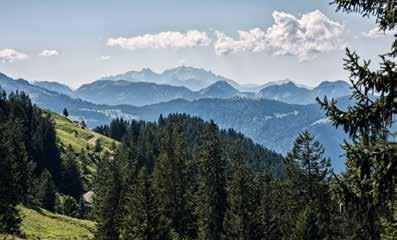
Niedere with a view of the Swiss mountains
Andelsbuch-Bezau – float like a butterfly Bregenzerwald hiking map: Tour 28
Andelsbuch’s very own mountain – the “Niedere” – is known not only for its magnificent view from Lake Constance as far as the Swiss mountains: paragliders also appreciate its fantastic thermal currents. When the weather is good, you can see them floating like bright butterflies around the mountain and across the valley. starting point Bezau-Baumgarten cable car mountain station destination Bezau-Baumgarten cable car mountain station itinerary Baumgarten cable car mountain station (1,648 m) – panoramic circular route – Niedere Höhe (1,711 m) – Baumgarten cable car mountain station chances to stop off for a drink/food Baumgarten panorama restaurant, Niedere mountain inn information This hike can also be started with the mountain lifts from Andelsbuch.
Difference in altitude: 170 m Trail category: white-red-white Total hiking time: 1 ½ hours
Opening times: Seilbahn Bezau:
T +43 (0)5514 2254
Bergbahnen Andelsbuch:
T +43 (0)5512 2540
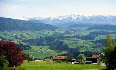
View from Sulzberg into the Bregenzerwald
Sulzberg – protected by St Lawrence Bregenzerwald hiking map: Tour 1
The gentle panoramic hike at an altitude of over 1,000 m takes you along the nature trail into the gently undulating hills of the Upper Bregenzerwald. The return journey is taken in good, pleasantly cool forest air. The church on the village square, renovated in 1828/29 by Alois Negrelli, the planner of the Suez Canal, is worth a visit. The church, constructed in Empire style, is dedicated to St Lawrence, the patron saint of pub landlords, cooks and brewers. starting point Sulzberg centre of town destination Sulzberg centre of town itinerary Sulzberg centre of town (1,013 m) – Hochsträß (1,025 m) – Sulzberg forest path chances to stop off for a drink/food inns in Sulzberg
Difference in altitude: 20 m Trail category: yellow-white Total hiking time: 1 ½ hours

Out and about on the Hochhäderich
Hittisau – along the Nagelfluh rock face on Hochhäderich Bregenzerwald hiking map: Tour 3
Hochhäderich offers a magnificent view to the north as far as the Allgäu and, to the south, to the Bregenzerwald. You pass large rock faces made up of Nagelfluh rock which are very distinct here. In 2008, 15 towns and villages in the border area of Allgäu and Vorderwald established the “Nagelfluhkette National Park” which covers an area of around 400 km². starting point Hittisau-Reute destination Hittisau-Reute itinerary Hochhäderich (via Streichbrunnenalpe and Lochalpe) – Leckenholzalpen – Reute chances to stop off for a drink/food Hochhäderich mountain inn
Difference in altitude: 735 m Trail category: white-red-white Total hiking time: approx. 3 ¼ hours

Above Schwarzenberg
Schwarzenberg – Legend Trail to the Ilga spring Bregenzerwald hiking map: Tour 24
Above Schwarzenberg, in a tranquil, isolated location, you can find the Ilga Chapel and the Ilga spring. The Blessed Ilga (from the House of the Counts of Montfort) lived here as a recluse. According to legend, a spring emerged on the spot where she spilled some water. The water from the Ilga spring is still believed to have healing properties for eye problems and is said to open a person’s eyes to what is important. starting point Schwarzenberg village centre destination Schwarzenberg village centre itinerary Schwarzenberg village centre – Unterkaltberg – Ilga Chapel (Ilga spring) – Haldenstüble – Gmeind – Oberkaltberg – Schwarzenberg village centre chances to stop off for a drink/food Restaurants in Schwarzenberg, Haldenstüble inn (upon request)
Difference in altitude: 320 m Trail category: yellow-white Total hiking time: 2 hours
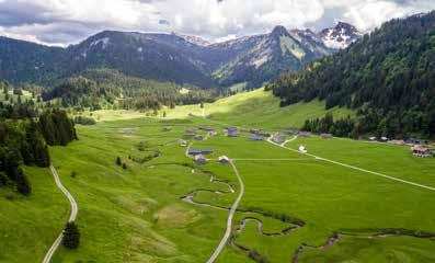
Mountain pasture settlement, Schönenbach
Bezau – from the loveliest mountain pasture to the alp Bregenzerwald hiking map: Tour 30
Schönenbach is only inhabited from June to September, and is one of the loveliest mountain pasture settlements in Vorarlberg. The ramble takes you to the Almisguntenalpe, which lies isolated in a col beneath the Diedamskopf. Just before the newly built Stoggertenn alpine hut, you arrive at the highest point on the ramble. The path along the Osterguntenbach takes you down to the car park. starting point car park Schönenbach destination car park Schönenbach itinerary car park Schönenbach – Schönenbachvorsäß (1,020 m) – Unterspitzalpe – Almisguntenalpe – Stoggertennalpe (1,500 m) – Osterguntenalpe – direction Kretzbodenalpe to Hänslervorsäß – car park chances to stop off for a drink/food Jagdgasthaus Egender and alps (during the alp season from mid/late June through to mid-September)
Difference in altitude: 500 m Trail category: white-red-white Total hiking time: 3 ½ hours
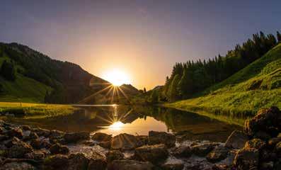
Lecknersee in Lecknertal
Hittisau – the village with most alps Bregenzerwald hiking map: Tour 4
The Lecknertal is located in Hittisau, the village with the most alps in Austria. A toll road takes you to the hiking car park. The route takes you along the sunny slope of the Hochhäderich-Hochgrat mountain range up to the Rohnehöhe (at 1,639 m). It is worth taking a short detour to the nearby Lecknersee. Along this mountain hiking path – whose 660 m difference in altitude makes it hard-going – are six alps, four of which are where milk is processed there and then. starting point car park Lecknertal destination car park Lecknertal itinerary car park Lecknertal (980 m) – Juliansplattealpe – Schwarzenberger Plattealpe – Plattentischalpe – Rohnehöhe (1,639 m) – Rohnealpe – Glockenplattealpe – car park chances to stop off for a drink/food alps (during the alp season from mid/late June through to midSeptember)
Difference in altitude: 660 m Trail category: white-blue-white Total hiking time: 4 hours
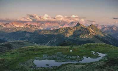
Damüls circular tour
Damüls – around the Wals settlement Bregenzerwald hiking map: Tour 43
At an altitude of over 1,800 m, the Damüls circular tour starts with two peak crossings. After walking for about 1 ¼ hours, you reach the Hochblanken and then follow the mountain ridge at an altitude of almost 2,000 m for about 45 minutes until you reach the peak of the Ragazer Blanken. From here, the descent commences: via the Sünser pass as far as the Oberdamüls alp and on to Damüls. The mountain church in Damüls, with its exceptional fresco wall-painting depicting the Biblia pauperum dating back to 1484, is well worth a visit. starting point Damüls-mountain station Uga-Express destination Damüls centre or valley station Uga Express itinerary mountain station Uga-Express (1,800 m) – Ugaalpe – Hochblanken (2,068 m) – Ragazer Blanken (2,051 m) – Sünser Joch – Oberdamülser Alpe – Damüls (1,430 m) chances to stop off for a drink/food mountain inn Elsenalpstube, mountain inn Ugaalpe, Summer alpine dairy farms (during the alp season from early July to late September), inns in Damüls
Difference in altitude: 430 m (up), 860 m (down) Trail category: white-red-white Total hiking time: 4 hours
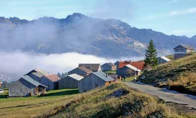
Mountain pasture settlement near Schetteregg
Egg – Falzalpen circuit walk Bregenzerwald hiking map: Tour 22
The route leads from the ski and hiking district of Schetteregg into the mountain pasture districts of Eggatsberg and Hammeratsberg, where one can see many traditional Bregenzerwald-style mountain pasture cabins. A little later, one arrives at the Alp Untere Falz, which offers a fine view of the mountains to the south, Bullerschkopf and Winterstaude. The trail leads up to the Alp Obere Falz, continues over the Alp Brongen and back to the starting point at Schetteregg. There is active farming in the alps from June through mid-September. starting point car park Schetteregg destination car park Schetteregg itinerary Schetteregg (1,066 m) – Eggatsberg – Hammeratsberg – Alp Untere Falz – Alp Obere Falz (1,217 m) – Brongen Alp – Schetteregg chances to stop off for a drink/food Alp Untere Falz, Alp Obere Falz, Brongen Alp (during the alp season from mid/end June to mid September), inns in Schetteregg
Difference in altitude: 276 m Trail category: yellow-white Total hiking time: approx. 2 hours
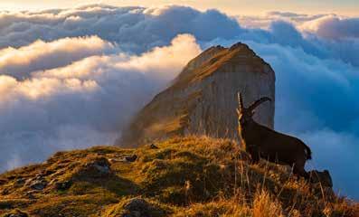
Ibex on the Kanisfluh
Mellau – in the land of the ibex Bregenzerwald hiking map: Tour 32
The Kanisfluh is one of the most striking mountains in the Bregenzerwald. The rocky north side is visible from the valley, the southern slopes are green and sunlit. It offers the ideal habitat for ibex as well as for 930 different species of butterfly. The first part of the hike is easygoing, and follows an agricultural path. After you have passed the Kanis alp, the ascent begins on a narrow path which takes you to the top of the Kanisfluh. To descend, take the Wurzachalpe option back down to the mountain station. starting point Mellaubahn mountain station destination Mellaubahn mountain station itinerary Mellaubahn mountain station (Roßstelle, 1,395 m) – Kanisalpe – Kanisfluh (2,044 m) – Wurzachalpe – Kanisalpe – Mellaubahn mountain station chances to stop off for a drink/food Wurzachalpe, Kanisalpe (during the alp season from mid/late June through to mid-September), inns at the mountain station
Difference in altitude: 680 m Trail category: white-red-white Total hiking time: 3 ¾ hours

Lake Körbersee
Schröcken – up to the highest point Bregenzerwald hiking map: Tour 46
The Braunarlspitze is the highest mountain in the Bregenzerwald. An agricultural path leads from Schröcken to the Fellealpe. This is the start of the mountain hiking path to the Fürggele, a pass to the Große Walsertal. From here, the alpine trail (which demands that hikers be sure-footed and not afraid of heights) takes you through the rocky part up to the peak, continues to the idyllic Butzensee and, via the Jägersteig, back to the Fellealpe. From here, you take the same path back to Schröcken. starting point Schröcken-centre of town destination Schröcken-centre of town itinerary Schröcken-centre of town (1,250 m) – Fellealpe – Fürggele – Braunarlspitze (2,649 m) – Butzensee – Jägersteig – Schröcken chances to stop off for a drink/food inns in Schröcken
Difference in altitude: 1,500 m Trail category: white-blue-white Total hiking time: approx. 8 hours
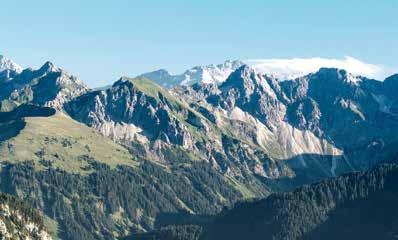
Zitterklapfen
Au – climbing up to the Zitterklapfen Bregenzerwald hiking map: Tour 37
The Zitterklapfen offers an impressive panorama and is one of the most beautiful mountain peaks in the Bregenzerwald. The rocky mountain massif rises at the end of the idyllically located Dürrenbachtal valley. The bike route follows a curving freight trail in the woodland up to the Annalperaualpe. This is where the mountain hiking trail begins. The last section in the rocks up to the summit requires surefootedness and a head for heights. starting point Au-tourist office destination Au-tourist office itinerary Au-Argenau tourist office (810 m) –Bodenvorsäß – Annalperaualpe (1,364 m) – Zitterklapfen (2,403 m) – return to Au via the same way chances to stop off for a drink/food Inns in Au, Bergkristall hut (at Bodenvorsäß)
Bike route: 7.4 km (as far as the Annalperaualpe) Hiking route: 3 ¼ hours to the top Difference in altitude bike: 555 m Difference in altitude hike: 1,040 m Trail category: white-blue-white

On the way to the Hirschberg
Schnepfau – Hirschberg
The cycle trip starts from Schnepfau along the road up to the Schnepfegg. This is where a long freight trail starts that continues across the Hirschberg Alps up to the Hirschbergsattel. The mountain trail begins here on the southern slope of the Hirschberg leading up to the summit with a wonderful panoramic view. Alternative: the tour is also easily possible from Bizau (bike route 12.2 km; altitude difference bike: 945 m). starting point Schnepfau Kirchplatz destination Schnepfau Kirchplatz itinerary Schnepfau (734 m) – Schnepfegg (880 m) – Hirschbergsattel (1,625 m) – Hirschberg (1,834 m) – return to Schnepfau by the same route chances to stop off for a drink/food Berggasthaus Kanisfluh (on the Schnepfegg)
Bike route: 10.3 km (up to the Hirschbergsattel) Hiking route: 40 min. to the top Difference in altitude bike: 890 m Difference in altitude hike: 210 m Trail category: white-red-white
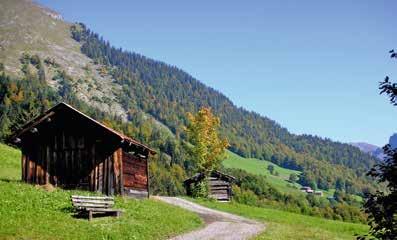
Wooden huts in the Auer Ried
Au – delicate plants and wooden huts Bregenzerwald hiking map: Tour 35
The path leads you from the Argen gorge into the Auer Ried nature reserve. The power of water, geology, nature conservation, ancient cultivated landscapes and the mighty Kanisfluh provide the subjects and the stations of the hike for those interested in nature. Over 50 rare species of plant thrive in the Auer Ried. Watercourses, gallery forests and damp biotopes run through the humid rough pastures and upland hay meadows with their numerous characteristic old hay huts. starting point Au parish church destination Au parish church itinerary Au-Jaghausen (parish church, 791 m) – Auer Ried (1,050 m) nature trail (via Argenbachtal) – Jaghausen parish church chances to stop off for a drink/food inns in Au
Literary hike The volume of poems by Birgit Rietzler invites you to a literary hike through Auer Ried: „Berberitzen“ puts in words the externally visible and the internally perceptible. Available in the tourist information offices in Au and Schoppernau. (in German only)
Difference in altitude: 300 m Trail category: white-red-white Total hiking time: 2 ½ hours
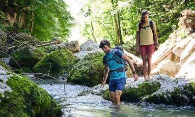
Engenloch Gorge in Hittisau
Hittisau – across bridges, through the gorge Bregenzerwald hiking map: Tour 6
At the end of the Ice Age, a lake emerged at the foot of the Hochhäderich. The Bolgenach carved its path out of the cliffs which formed the “dam wall” of the lake. And so the Komma gorge arose. For almost 300 years, the Komma bridge has been crossing the river and the gorge at a height of 15 m: this bridge is the oldest covered bridge in the province. The water hiking path follows the Bolgenach, over the suspension bridge into the wild yet romantic Engenlochschlucht. starting point Hittisau-centre of town destination Hittisau-centre of town itinerary Village square (792 m) – open-air swimming pool (Kommabrücke) – Hechtbrücke – Engenlochschlucht – Bartenstein water-operated sawmill – Steg – Rain – village square chances to stop off for a drink/food Inns on the square, open-air swimming pool kiosk (in the summer, good weather only)
Difference in altitude: 80 m Trail category: yellow-white Total hiking time: 2 ¼ hours
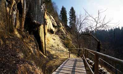
Calc-tufa area in Lingenau
Lingenau – when water turns to stones Bregenzerwald hiking map: Tour 8
The calc-tufa in Lingenau is one of the most unique calc-tufa formations north of the Alps, making it one of the outstanding geological phenomena in Vorarlberg. The water flows in small flumes over rocks as far as the riverbed of the Subersach, forming canopies and sinter curtains. Five information boards describe the geology and vegetation of this spectacle of nature. starting point Lingenau swimming pool car park destination Lingenau swimming pool car park itinerary Lingenau swimming pool car park (680 m) – calc-tufa nature trail (610 m) – Rain – St. Anna chapel – car park swimming pool chances to stop off for a drink/food inns in Lingenau
Difference in altitude: 70 m Trail category: white-red-white Total hiking time: 1 ½ hours
Detailed directions are available from the tourist office. The wooden bridges can be slippery when wet.
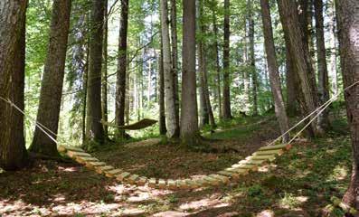
Rest area – Tobelweg Sibratsgfäll
Tobelweg in Sibratsgfäll
The Tobelweg follows firm gravel paths and soft forest soil mostly along small watercourses to the Subersach’s floodplain. The interactive stations – Quellwasser (Spring Water), Balance, Tagträume (Daydreams), Waldmeister (Woodruff), Ausblick (View), Einblick (insight) and Baumklang (Tree Sound) – help visitors become aware again of their own original senses. The senses are sharpened in a playful style and a very intense perception of intact nature is created. starting point Sibratsgfäll-centre of town destination Sibratsgfäll-centre of town itinerary Centre of town – towards the tennis court – Krähenbergbrücke – centre of town chances to stop off for a drink/food inns in Sibratsgfäll
Difference in altitude: 98 m Trail category: white-red-white Total hiking time: approx. 1 hour
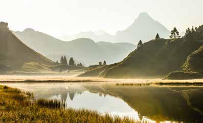
Kalbelesee lake with view of the Biberkopf
Warth-Schröcken – on the trail of the Walsers Bregenzerwald hiking map: Tour 48
The villages of Lech, Schröcken and Warth are typical Walser settlements. In the 14th century, the Tannberg area was populated by the Walsers, who came from the West Swiss canton of Valais. In cultivating the alpine terrain, these pioneers developed a first-rate, fascinating cultivated landscape. Robust benches point out the stations along the trail. A book is available which describes the objects that tell the history of the Walser settlers on the Tannberg. starting point Schröcken parish church destination Warth itinerary Schröcken – Alpe Felle – Körbersee – Hochtannbergpass – the old salt road to Warth (return by bus) chances to stop off for a drink/food Hotel Körbersee, inns in Schröcken and Warth information Körbersee near Schröcken was awarded Austria’s most beautiful location by ORF (Austrian Broadcasting Corporation) viewers in 2017.
Difference in altitude: 590 m (up), 350 m (down) Trail category: yellow-white Total hiking time: 4 hours
Detailed documentation in the form of a book is available from the tourist offices in Lech, Schröcken and Warth. www.tannberg.info
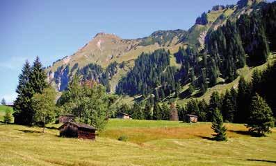
Hay landscape in Au
Au-Schoppernau – “Alpgang” Bregenzerwald hiking map: Tour 36
Insights into farming in the Bregenzerwald are afforded by the 14 stations on the “Alpgang” thematic trail. For economical reasons and in order to maintain the mountain’s sensitive nature, farmers in the Bregenzerwald have been farming their fields in several stages for hundreds of years: in the early summer, Alpine dairymen and their cows leave the valley and head for the mountain. They spend the summer on the high mountain pasture, and return to the mountain pasture in the autumn, and finally back to the valley. starting point Au/Rehmen church destination Au/Rehmen church itinerary
Long tour:
Au/Rehmen church – Berbigen mountain pasture – Upper Sattelalpe – Liegstein – Alpe Sattelegg – Wika – Holand – Au/Rehmen church
Short tour:
Au/Rehmen church – Berbigen mountain pasture – Wika – Au/Rehmen church chances to stop off for a drink/food inns in Au, Alpe Sattelegg (from midJune to early September)
Difference in altitude:
approx. 765 m long tour, (650 m without Liegstein), approx. 355 m short tour Trail category: white-red-white
Total hiking time:
long tour approx. 4 ¾ hours, (approx. 1 hour less without Liegstein), short tour approx. 2 hours.
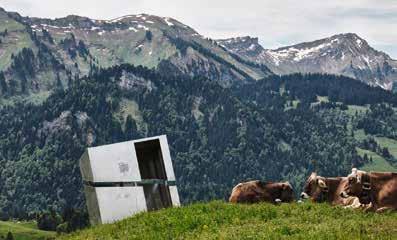
The “not quite perpendicular” station – Georunde Rindberg in Sibratsgfäll
Sibratsgfäll – Georunde Rindberg Bregenzerwald hiking map: Tour 15
The tour brings you closer to the power of Mother Nature, letting you experience it for yourself: in May 1999, the mountainsides in the plot moved inexorably. The major incident left behind deep scars. On the landscape as well as on the spirit of the village. The stations of the Georunde Rindberg trace the happenings, communicate interesting information and provide insights into the way the inhabitants of Sibratsgfäll dealt with the situation. starting point Felber’s leaning house destination Alpenrose inn itinerary Rindberg Geological Circuit:Felber’s leaning house – The moved house – Living on a slant – Not quite perpendicular – The leaning fir tree – The demolition – St Mary’s Chapel – Alpenrose inn
Riesalpen Geological Circuit:
Torrent and Avalanche Control – Steter Tropfen (Constant Dripping) – Bader Schuttstrom (Debris Flow) – Kapelle zum heiligen Wendelin (St. Wendelin’s Chapel) – Bergrast Wildries (Wildries Mountain Rest) chances to stop off for a drink/food Alpenrose inn-Rindberg, Bergrast Wildries
Difference in altitude: 250 m Trail category: separate signposting Total hiking time: approx. 2 ½ hours
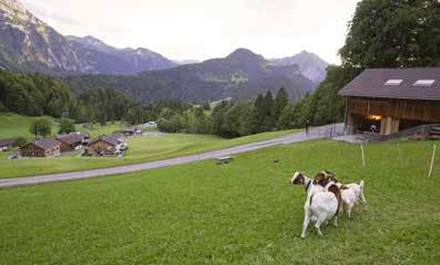
Goßarweag (“Goatherd’s path”) in Bizau
Bizau – Goßarweag (“Goatherd’s path”) Bregenzerwald hiking map: Tour 31
Goatherding was an essential part of daily life in Bizau for many centuries. The hike is reminiscent of this cultural heritage, is enlightening from both a historic and natural landscape point of view, as well as being a scenic delight. Five stations for touching, seeing, listening, feeling, guessing and climbing are an attraction for children. There are several options for joining/leaving the hike along the Goßarweag via existing hiking paths and back into the village. starting point Bizau village centre (village hall) destination Bizau village centre (village hall) itinerary Bizau village centre (village hall, 681 m) – towards Känzele – Oberbergsiedlung – Hilkat –Langenalpe – Hilkat – Bizau village centre chances to stop off for a drink/food inns in Bizau rest and play Benches and play stations along the Goßarweag, playground on the Oberberg
Difference in altitude: approx. 320 m Trail category: white-red-white Total hiking time: approx. 2 ½ hours
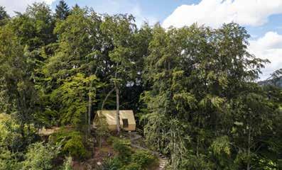
Rotenberg wood
Lingenau – Rotenberg wood thematic trail Bregenzerwald hiking map: Tour 9
Rotenberg wood is the property of 170 owners – one of the smallest structured forests in Austria. The thematic trail comprises 20 stations, a forest room, an upland moor, and a natural arena of Nagelfluh. Forest path, root path, woodland path, mud pits and stone steps follow one another. starting point Lingenau village square destination Lingenau village square itinerary 20 stations with forest room, Nagelfluh arena and Bruggmoos as the highlights chances to stop off for a drink/food inns in Lingenau
Difference in altitude: 270 m Trail category: yellow-white Total hiking time: approx. 2 hours.
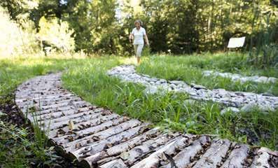
Barefoot spiral in Langenegg
Langenegg – energy hike Bregenzerwald hiking map: Tour 11
The various “energy portal paths” make energy comprehensible, and hands-on. The hike starts at the village hall. Through the red portals, it takes visitors to the sundial, and through the Wind and Water Portal with its energy works. At the Hotel Krone, the trail crosses the country road and continues to the Mythical Portal.Continue along the forest trail to the Tranquillity Portal with its barefoot spiral made from natural materials. Via Leiten, you return to the village centre where, if you take a detour, you arrive at the Portal am Kapf (lovely vantage point). starting point Langenegg village centre destination Langenegg village centre itinerary village centre – Nord – Leiten – Finkenbühl – Kapf – village centre chances to stop off for a drink/food inns in Langenegg
Difference in altitude: 130 m Trail category: white-red-white Total hiking time: 1 ½ hour
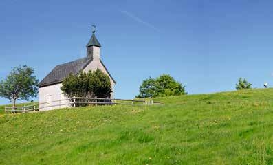
In the Langen nature reserve
Langen – past the downy birch groves on the Feßlerberg
The last downy birch grove that is at least sporadically cut for brushwood that still remains within the northern Vorarlberg region’s entire molasse zone is to be found on the Feßlerberg. Groves where downy beeches grow are extensively used tree-lined pastures or sparsely wooded pastures from which the birch is taken to make brooms. The destination of this hike is the Hirschberg, which is situated at an altitude of 1,095 metres in a designated nature reserve. starting point Langen village centre destination Langen village centre itinerary village centre (658 m) – Geserberg via Bergerweg – Ahornach – Hirschberg (1,095 m) – Feßlerberg – village centre chances to stop off for a drink/food Gasthaus Adler, Hirschberghütte (only open when the alpine farms are in operation)
Difference in altitude: 437 m Trail category: white-red-white Total hiking time: 2 ¾ hours
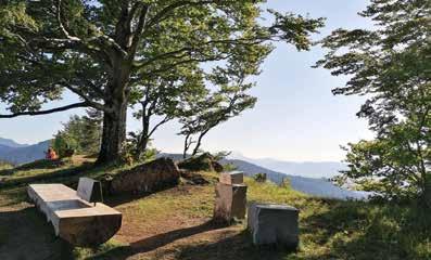
Musical stations at the Brüggelekopf
Alberschwende – Musikwanderweg am Brüggelekopf
The Brüggelekopf is Alberschwende’s local mountain. The summit presents a magnificent view across the Rhine Valley, Lake Constance and the mountain world of the Bregenzerwald. The Musikwanderweg is a musical hiking trail along which 10 musically structured stations have been installed. Songs that are traditional to the Bregenzerwald – sung and played by Alberschwende choirs and music societies – blend with nature to provide a joyful and harmonious ambience. starting point Alberschwende village square destination Alberschwende village square routenführung village square via Greban and Moltach – Brüggelekopf – Lorenapass – village square chances to stop off for a drink/food Alpengasthof Brüggele, Jausenstation Berchtoldshöhe
Kunst am Berg Art projects by Ariane Patout and Rene Müller may be admired around the Berggasthof Brüggele. Fascinating objects have been created here from domestic silver fir, cherry, ash and beech.
Difference in altitude: 460 m (from village square), 190 m (from Brüggelekopf) Trail category: white-red-white Total hiking time: approx. 1.5 hours (music hiking trail), approx. 4 hours (hike from the village square)
Information
www.musikwanderweg.at A detailed brochure is available from the tourist office.
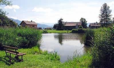
Dörnlesee in Lingenau
Between the village square and the swimming pool: wellness in Lingenau
Lingenau is located in the gently undulating countryside of the Vorderwald. The hospitable village has won the Vorarlberg Horticultural Competition several times, and has received awards for being a community whose buildings are suitable for the disabled. Lingenau is also wellknown for its barrier-free swimming pool with adjacent hotel. starting & finishing point Lingenau village square (car park) Variant: Vitalhotel Quellengarten (car park) itinerary Lingenau village square (685 m) – Gschwend – St. Annakapelle (669 m) – Vitalhotel Quellengarten – Dörnlesee – village square; signposted as a yellow-white rambling path barrier-free refreshments & wc Hotel Löwen, Gasthaus Traube, Vitalhotel Quellengarten indoor swimming pool Vitalhotel Quellengarten, Lingenau T +43 (0)5513 6461-0 www.bregenzerwaldhotels.at
Distance: 3 km Condition of the path: pavements and roads with little difference in height, all tarmacked
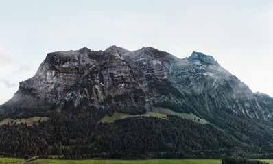
At the foot of the Kanisfluh
At the foot of the Kanisfluh – from Mellau to Schnepfau
The Kanisfluh could easily give rise to the argument whether this, the Bregenzerwald’s most striking mountain, is more impressive on the curved southern side of Au or on the northern face between Mellau and Schnepfau. On our route, the rocks of the northern face tower up to 1,300 meters above the bottom of the valley. If you take a really close look, you can detect a mosaic of completely different natural habitats. starting & finishing point Mellau cable cars, car park itinerary Mellau cable cars (705 m) – Engevorsäß (705 m) – Ach bridge towards Hirschau – Schnepfau (734 m, car park) – return via the same way; signposted for the most part as cycle and hiking paths barrier-free refreshments M1 bistro, Mellau cable cars valley station barrier-free wc Mellau cable cars valley station, Schnepfau village hall (on workdays) barrier-free cable cars (→ p. 5)
Distance: 10.4 km Condition of the path: tarmacked throughout, more or less level for the most part, with differences in height at stream crossings
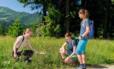
Out and about with the nature park ranger
Nagelfluhkette Nature Park is located where the Alps start, Lake Constance is close by and the landscape is characterized by special rock formations.
A magnificent cultural landscape, awarded the much-coveted designation „nature park“, developed on the interface between Bregenzerwald and Allgäu over the course of several centuries. It covers 15 local authorities, including 8 from Lower Bregenzerwald, the first crossborder park to cover Austria and Germany. Alpine meadows with 290 different species of plant, valuable upland moors, forests of white firs and ravine forests and an alp density unmatched anywhere else in Austria are characteristics of the nature park. A connecting element is the impressive Nagelfluh range, which crosses the nature park from the west to the east. Large height differences, geological variation, sustainable Alpine pasture farming – all of this means that a large number of different habitats are created over a comparatively small area. The nature park is therefore home to the shy black grouse, imposing golden eagle and rare apollo butterfly and is the habitat for the most varied of orchids and gentians. In summer, the easy to be reached mountains and hiking paths of the nature park invite you to undertake pleasurable hiking tours in the varied landscape.
Themed hikes – out and about with the ranger
Tours:
24 April, 8 a.m. – 10 a.m.: What birds reveal about their environment. 7 May, 2 p.m. – 5 p.m.: Golden eagles and rocks 28 May, 2 p.m. – 5 p.m.: The secret language of flowers 10 July, 9.30 a.m. – 12.30 p.m.: In the habitat of the Apollo butterfly 23 July, 2 p.m. – 5 p.m.: On the trail of the secret of alpine cheese 24 Sept., 2 p.m. – 5 p.m.: Changing forest 22 Oct., 12 p.m. – 4 p.m.: Where the chamois live Meeting points: will be provided on registration Price per person: free of charge information & registration www.nagelfluhkette.info
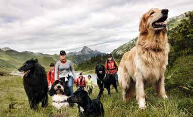
Out and about with dogs
Man and his best friend can benefit from taking a hike together.
communities
Dogs must be kept on a leash in
the entire area: Au, Bezau, Bizau, Damüls, Langenegg, Langen (Fighting dogs), Riefensberg, Schoppernau, Sibratsgfäll
Dogs must be kept on a leash
in certain areas: Egg, Lingenau, Hittisau, Schröcken, Schwarzenberg
Dogs do not need to be kept on a
leash: Alberschwende, Andelsbuch, Doren, Krumbach, Langen, Mellau, Reuthe, Schnepfau, Sulzberg, Warth cable cars (→ p. 5) Dogs are welcome: Bergbahnen Andelsbuch, Mellaubahn, Seilbahnen Damüls, Seilbahnen Faschina, Seilbahnen Sonntag, Steffisalp-Express Warth
Dogs – only wearing a muzzle
and on a leash: Seilbahn Bezau, Diedamskopf
what to do when encountering grazing animals (→ p. 9) www.sichere-almen.at
Please note that dogs are not permitted in the following places:
cemeteries, children’s playgrounds, water reserves.
public buses Dogs must be muzzled and on a leash. A fare is payable for the dog.
tip: veterinary surgeon
Die TierÄrzte Bundesstraße 682, Andelsbuch T +43 (0)5512 264260 www.dietieraerzte.com
Bregenzerwald hiking map Bregenzerwald mountain bike map
incl. booklet with 50 hiking routes
More than 1,500 kilometres of signposted hiking trails criss-cross the valley and its mountains. Fifty selected hiking routes have been collected in a hiking guide that accompanies the hiking map.
Price: € 14.90
incl. 20 top routes
To try out and experience. The fastest way to explore the Bregenzerwald and to experience it in all its variety.
Price: € 9.90
Available from: Bregenzerwald Tourismus, local tourist offices and sports shops in the Bregenzerwald Order online: www.bregenzerwald.at

