The Staples Corner Masterplan & Design Code has been developed by Brent Council in collaboration with 5th Studio, RCKa, Alan Baxter, PRD, XCO2 and Colliers.
The Staples Corner Masterplan & Design Code has been shaped by the input of many people including local community and stakeholders and we would like to thank all contributors for their advice, support and feedback.
Executive Summary
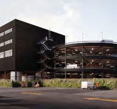
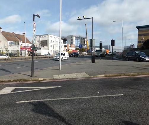
Staples Corner has a long and rich industrial history and much of the current estate fulfills a strategic function by supporting logistics, distribution and other industrial uses essential to London’s economic competitiveness.
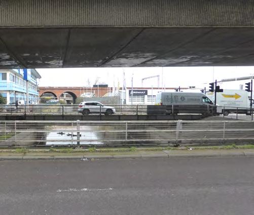
The existing industrial stock is however mixed in quality, with older, poorer quality buildings in places. The area is dominated by highways infrastructure, heavily trafficked and polluted, and presents a hostile environment, particularly for pedestrians and cyclists.
London’s industrial and housing demands necessitate unlocking the potential for more effective and better performing land use in this gateway location through industrial intensification and residential, co-location around a robust movement network.
The recent opening of the Brent Cross West Thameslink station and the town centre at Brent Cross, plus increased connectivity through the proposed West London Orbital line (WLO), present opportunities that cannot be ignored to improve accessibility and the quality of life for existing and new communities alike.
Brent’s Local Plan therefore identified Staples Corner as a Growth Area, recognising the
need for transformational change. The Staples Corner Growth Area Masterplan Supplementary Planning Document (SCGA SPD) now provides the vision and framework to realise its potential.
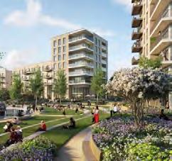
Staples Corner will be enhanced as an attractive, prosperous and sustainable place, supporting new industrial business and employment growth, as well as welcoming new residents to the neighbourhood.
• New open spaces, incorporating play for a range of ages, and public realm improvements particularly along the North Circular Road and Edgware Road;
• A high quality environment that is safe and accessible to everyone;
Protecting and intensifying the majority of the industrial land solely for industrial purposes, but allowing some either for a mix of uses incorporating some industrial or for residential led development, will deliver:
• Modern, fit for purpose industrial spaces for local businesses including logistics, light industrial units and affordable workspace;
DRAFT
• Opportunities for employment, skills and training for local people;
• A minimum of 2,200 new high quality homes, including affordable homes and family sized-dwellings;
• A range of new local services and community spaces that support interaction and community cohesion;
• An industrial movement network that keeps HGV and large vehicles to the strategic road network, with other streets encouraging walking and cycling over private motor vehicles, and better connect Staples Corner to the surrounding area;
• A place that achieves the highest standards of sustainability to support a low carbon circular economy.
The Masterplan SPD has been informed by extensive engagement with the community. The SPD will be used to assess planning applications and inform future planning decisions for development in the area. It will help to ensure that the transformation of Staples Corner brings forward physical, social and economic regeneration for the benefit of local businesses, residents and communities.
About the Document
Why is this Masterplan needed?
Brent Local Plan identifies Staples Corner as a Growth Area and requires a masterplan to facilitate its regeneration.
The Staples Corner Growth Area (SCGA) Masterplan is needed to:
• Establish the long-term vision, aspirations and objectives for SCGA;
• Bring forward physical, social and economic regeneration for the benefit of all the community;
• Set out guidance relating to land use, the intensification of industrial sites and co-location with residential uses, and appropriate locations for different uses;
• Identify and secure community facilities, green open spaces, employment and commercial uses, transport and other infrastructure to support good growth;
• Provide detailed design coding requirements for new developments coming forward in the area
• Provide a clear framework for coherent; and comprehensive redevelopment of an area where land ownership is highly fragmented;
• Ensure that the negative consequences of piecemeal development are avoided; and
• Provide a basis for planning decisions.
The masterplan is a Supplementary Planning Document (SPD) to Local Plan policy BEGA 2A.
Barnet and other statutory bodies, alongside direct engagement with landowners, developers and local councillors.
Statutory Consultation
Following the work developed throughout 2022 and 2023, the SCGA Masterplan SPD was developed in 2023 and 2024. It was subject to 6 weeks of formal consultation from 4 June to 16 July 2024.
How has the Masterplan been developed?
The Council is committed to effectively engaging with its communities. In developing the SCGA Masterplan SPD the Council aims to ensure transparent communication with local residents, community groups and businesses.
DRAFT
The masterplan designs were informed by a number of engagement activities. These took place with the Staples Corner community from August 2022 to July 2024.
These events provided useful feedback which is summarised in Appendix A – Consultation Statement.
Discussions also took place with representatives from the Greater London Authority (GLA), Transport for London (TfL), National Highways (NH), London Borough of
This process provided stakeholders with another opportunity to provide feedback on the work developed to date. Stakeholders were invited to participate in different ways, including face-to-face and online.
Who should use the Masterplan SPD?
Applicants seeking planning permission to bring forward new development in the area or to make improvements to their business premises.
Councillors, supporting their communities to make decisions about new developments.
Professionals working on development proposals in the area and Officers guiding regeneration and new development in the borough.
DRAFT
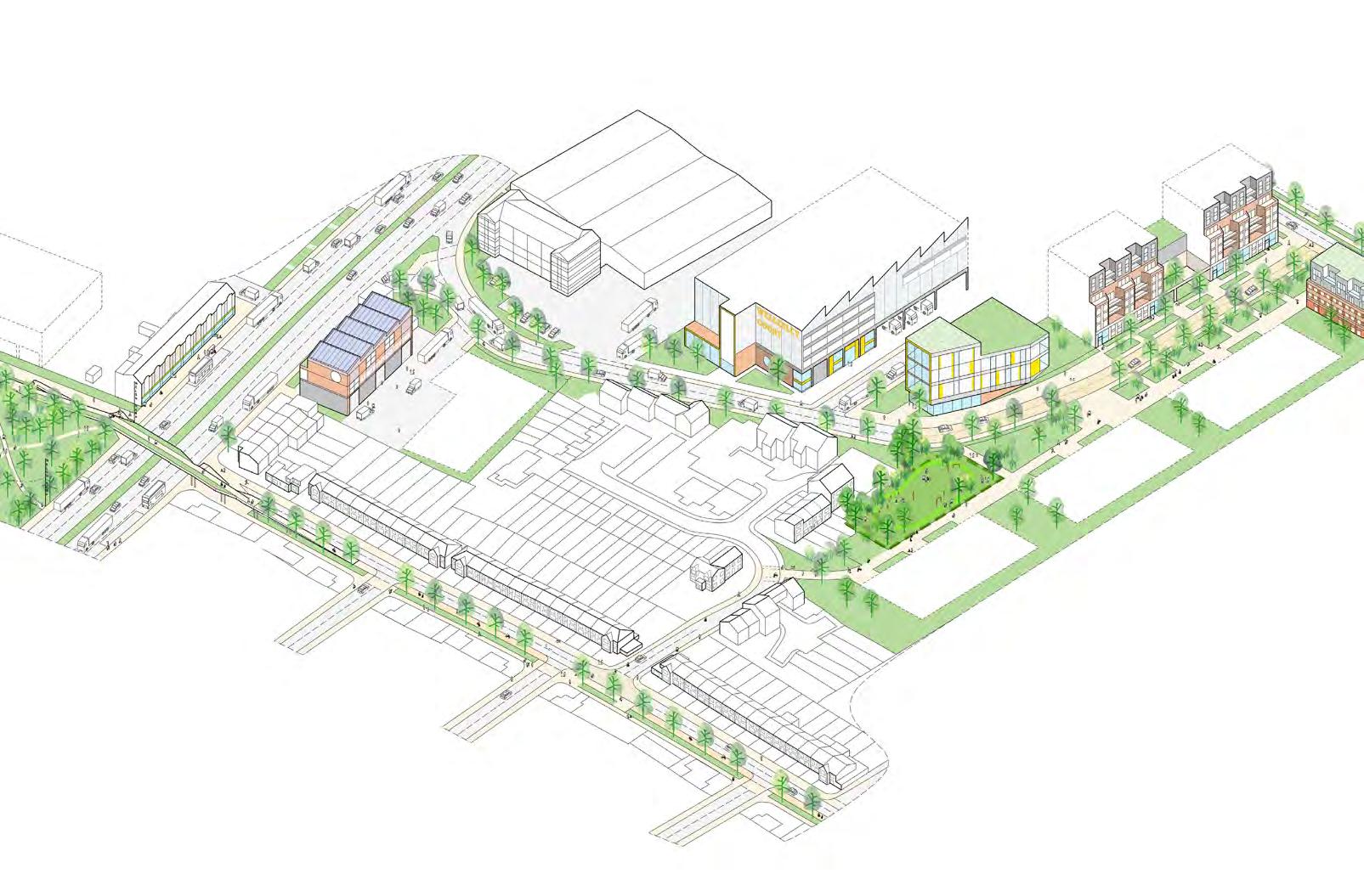
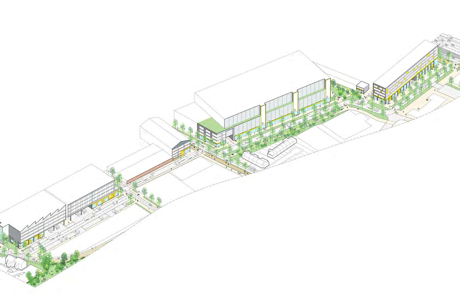
1 STAPLES CORNER REGENERATION
1.1 Vision
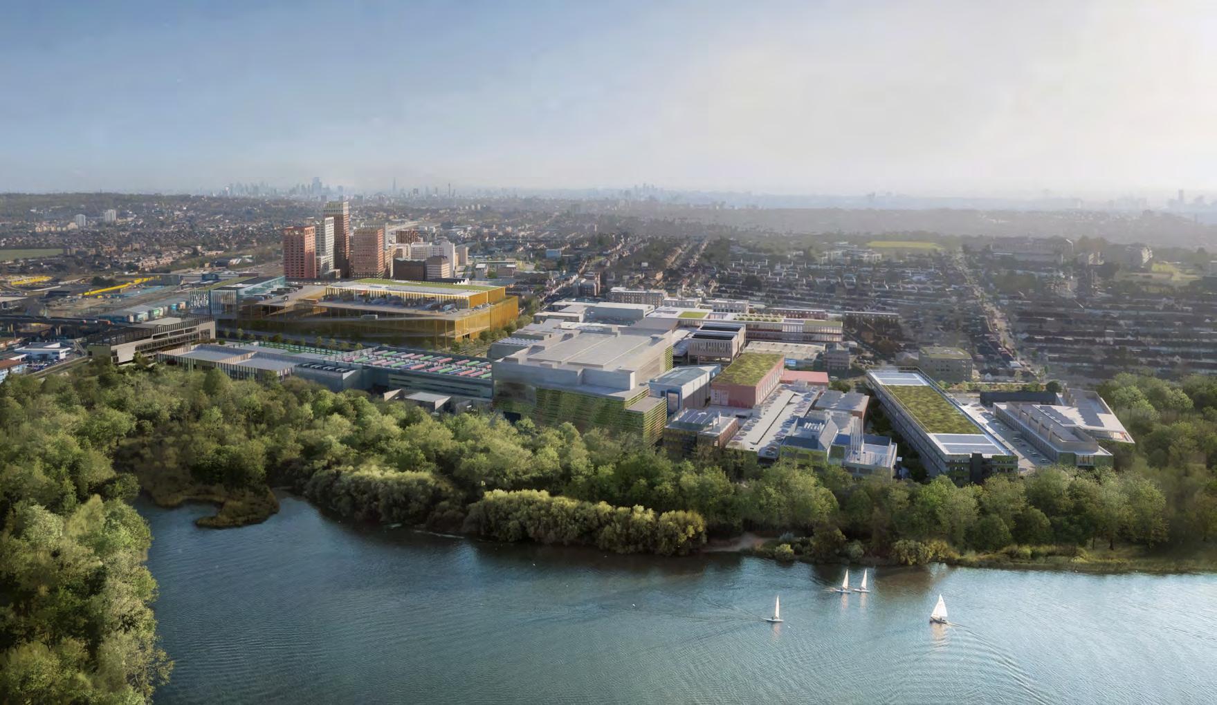
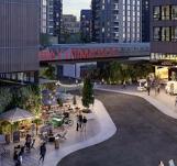
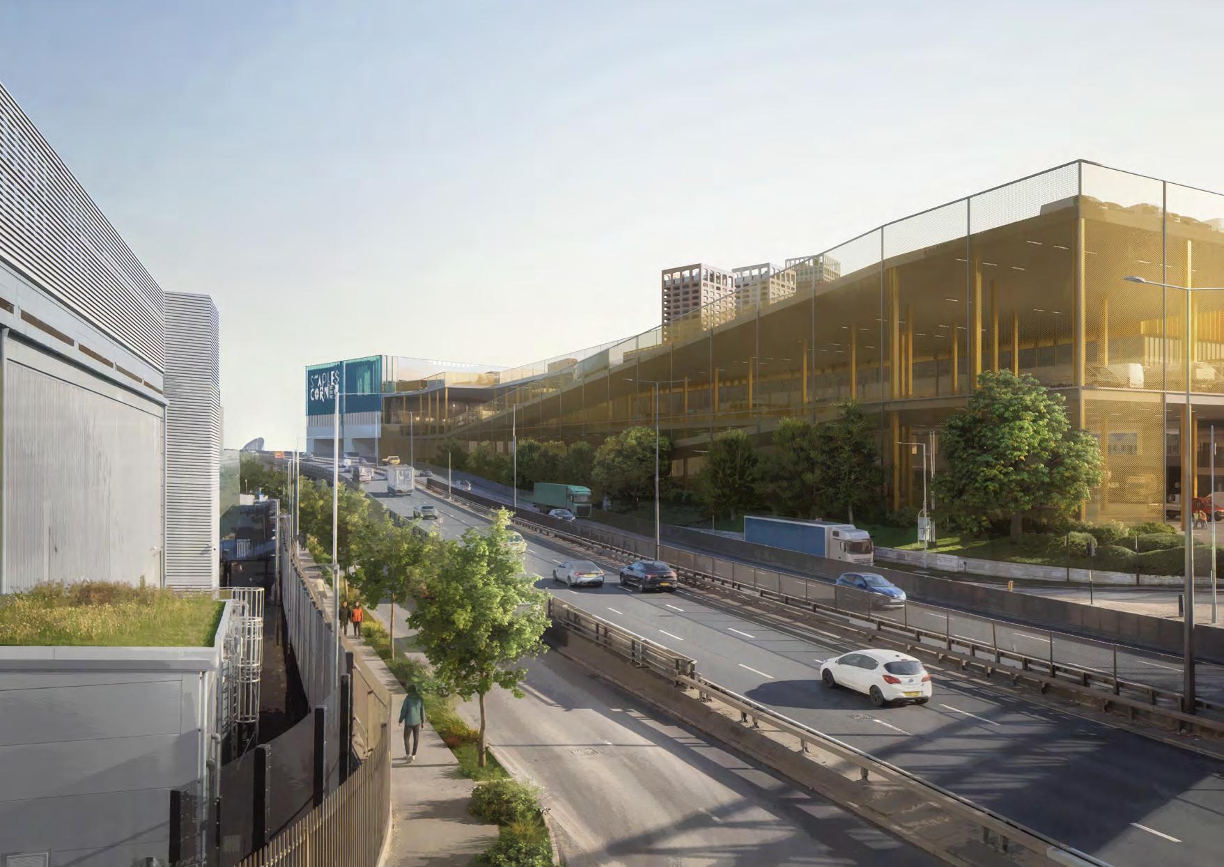
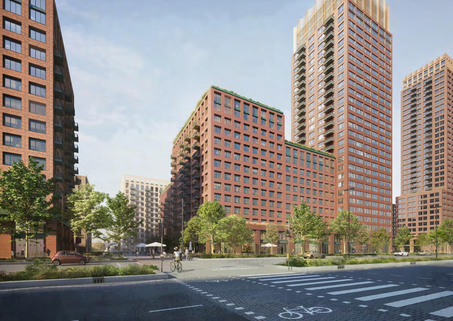
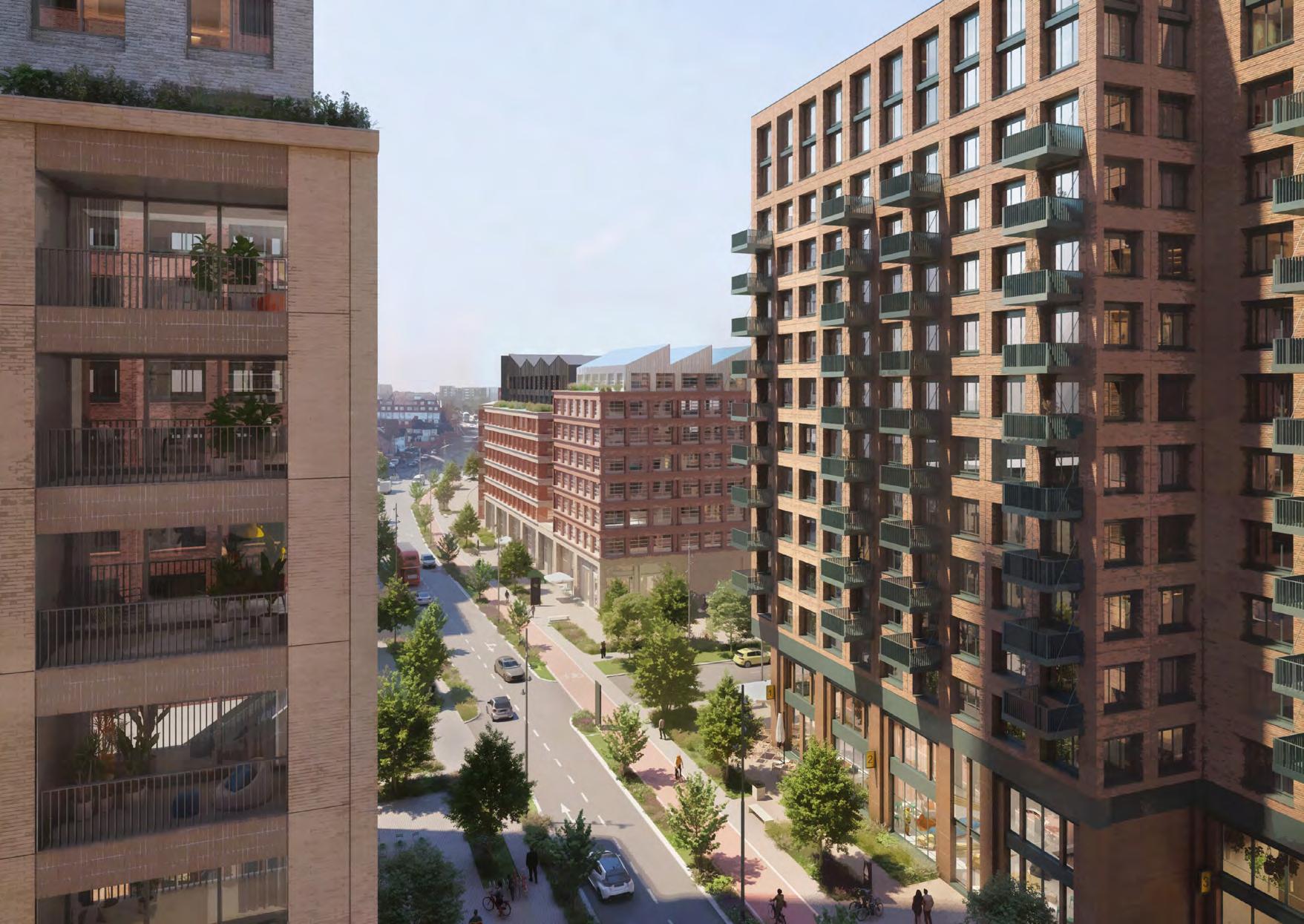
1.1.1 Staples Corner will be transformed into a higher quality and intensified industrial area sitting adjacent to a new urban community. Regeneration and growth will support a rich ecology of industrial and co-located residential uses to create an exemplary 15-minute neighbourhood where people live, work and interact. Intensification will deliver a new and varied supply of modern industrial premises for London’s strategic and local business needs, as well as commercial space, social infrastructure and an improved public realm to support a mixed use residential community.
1.1.2 This Masterplan sets the framework to facilitate the delivery of high-quality homes, more business opportunities and jobs, all supported by new infrastructure and community facilities. Business growth will strengthen the area’s existing economy and provide space for emerging sectors, including logistics, light industrial units, workspaces and integrating the latest business and digital technologies. By 2041, Staples Corner will deliver at least 2,200 new homes co-located alongside new and refurbished industrial premises in a way that supports the transition to a net zero carbon circular economy and the challenges of climate change.
Staples Corner following an extensive engagement and review process and bringing together all members of the local community, including the Staples Corner Community Champions.
DRAFT
Overarching Vision statement
• A thriving industrial place with a rich mix of uses and efficient servicing.
• A socially orientated, wellbeing focused place that enables businesses and communities to thrive.
• A place with its own distinct industrial identity and character that offers balanced density for housing and intensified employment needs.
• A functional and permeable place with improved environment for active travel, health, biodiversity and ecology.
1.1.3 Brent Cross West station has improved Staples Corner public transport connectivity into central London and beyond. Planned West London Orbital services will further improve connections and cut journey times around West London, providing future residents and workers greater choice and convenience.
1.1.4 This section sets out the vision, values and objectives for
• A well-designed place that is safe, inclusive and promotes community cohesion and resilience.
Unlock Value
Enabling existing and future businesses through investment and collaboration to make Staples Corner an ideal place to grow your business. Existing complex land ownerships require a cohesive and long-term approach to unlock economic growth, including manufacturing, logistics and the creative industries.
Destination Corner
Staples Corner’s industrial heritage has a distinctive identity and will have reputation for its patchwork of thriving businesses, culture and training opportunities. A desirable location for employment that attracts new competitive industry and a diverse neighbourhood.
New Connections
Staples Corner will be connected by healthy, safe and active travel corridors, distinct from new simplified vehicular routes to improve walkability, servicing and access to public transport links. Strategic improvements to the vehicular, cycle and pedestrian movement around the site will transform Staples Corner’s connectivity, not only for businesses but also creating healthy, safe, active travel routes.
Harmony and Balance
Staples Corner will balance industrial and human needs, providing essential services, public realm and social infrastructure. Safety, wellbeing and a collaborative business environment will be prioritised to foster a harmonious environment creating a great place to live and work.
Celebrate the Existing
Staples Corner will have a resourceful approach to the enhancement of existing landscape, the built assets and future development that supports green infrastructure and ensures the area meets ambitious sustainability targets. Celebrating the landscape and industrial heritage by providing new green infrastructure and refurbishment and reuse of buildings.
DRAFT
Love and Care
The diverse community at Staples Corner will be empowered for active ownership and stewardship of their flourishing neighbourhood. Evolution of the industrial park people-focused place and community with the agency to create change.
1.3 Opportunities
1.3.1 The following opportunities have been identified following analysis of the area and engagement findings:
1.3.2 Industrial intensification: Vacant sites and plots with low densities offer opportunity for industrial intensification. Industrial development is generally low-rise, offering potential for vertical stacking of uses. Larger plots against the North Circular provide the greatest potential for comprehensive redevelopment of larger units for distribution, logistics and wholesale uses.
1.3.3 Strategic location: Most businesses note that Staples Corner is a great location, being located on the strategic road network. This would support the renewal of the old, low quality building stock with new modern premises capable of delivering industrial intensification and co-located homes.
1.3.4 Public Transport & Active Travel: Brent Cross West will be a multi-modal transport hub with connecting bus services and pedestrian and cycle links. Improvements to active travel infrastructure around public transport stops will increase the attractiveness of public transport.
1.3.7 Sustainable neighbourhoods: Create new green infrastructure to reinforce walking and cycling routes and improve air quality and reduce traffic on adjacent residential streets. Residential development should be located near transport links to reduce reliance on the car. There is opportunity for district heating systems and renewable energy generation.
DRAFT
1.3.5 Industrial identity: Identity and character should respect the industrial legacy. Architecture should have an industrial character and materials palette.
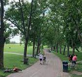
1.3.6 Green infrastructure: The area has many assets within walking distance such as the Neasden Recreation Ground, the Welsh Harp and Gladstone Park. Connectivity to these spaces could be improved as well as providing new open spaces to support the growth area.
1.3.8 Economic development: New business and employment floorspace in successful and growing sectors will support the creation of more and better paid jobs which would benefit local people and the economic wellbeing of the borough.
1.3.9 Strategic developments: The arrival of the Brent Cross West station has made Staples Corner better connected and enable sustainable travel patterns. The proposed West London Orbital line will further benefit the area.
1.3.10 Investment and infrastructure: Investment in the physical infrastructure and an improved public realm will be essential to the growth of the area, and to accommodate a new mixed use residential community.
1.3.11 Social infrastructure: Staples Corner should provide a liveable neighbourhood with shops, local amenities and community infrastructure.
1.3.12 Housing & Affordable Housing: The ambition is to provide at least, 2200 new homes, including new affordable homes and larger family homes, to meet a diverse range of local housing needs.
1.3.13 New emerging sectors: Staples Corner would be ICT, digital & digital creative, life sciences, knowledge economy and artists.
1.4 Challenges
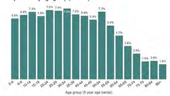
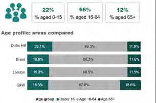
1.4.1 An analysis of local data and demographics* have highlighted the following:
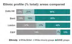
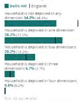
1.4.2 Deprivation: Staples Corner sits in Dollis Hill which is the fifth most deprived ward in Brent and is in the 18th percentile of most deprived wards in England (with the 1st percentile indicating highest relative deprivation).
1.4.3 Crime: Dollis Hill exhibits a notable concentration of criminal activities, particularly involving anti-social behaviour, violence and sexual offences, and vehicle crime.
1.4.4 Open space deficiency: Dollis Hill achieves well above the average standard of park provision based on the GLA’s accessibility standards. This is due to the ward’s proximity to the Welsh Harp and Gladstone Park, however this does not take into consideration how easily these spaces can be accessed.
1.4.5 There are spatial deficiencies to children’s play facilities. There is a high population of children living in the north of Dollis Hill ward along the A406. However, due to a lack of access points into Neasden Recreation Ground, these children are over 400m from play facilities and open space. Other children such as those living on Oxgate Gardens need to travel up to a mile to access play facilities and open space.
DRAFT
1.4.7 Climate change: Brent Council is committed to doing all in our gift to achieve carbon neutrality on a borough-wide basis by 2030. Staples Corner sits within one of the most deprived areas of the borough and its inhabitants are therefore more vulnerable to climate impacts. We know this as residents in more deprived areas are more likely to live in poorly ventilated homes, with less access to green space, have poorer public health outcomes, and therefore face greater risks from the physical impacts of climate change – such as floods and heatwaves.
1.4.8 Overall state of the area: The existing industrial stock is mixed in quality, with older, poorer quality buildings in places. The area is dominated by highways infrastructure, that is heavily trafficked and polluted, and presents a hostile environment, particularly for pedestrians and cyclists. The findings below are from engagement activities undertaken with the community since 2022 and details are set out in the SPD’s Statement of Community Involvement.
• Businesses feel the quality of environment and footfall is poor and concerns are noted regarding traffic levels, safety and security. The lack of footfall results in a lack of passing trade and customers not being able to locate the businesses.
• There is an absence of shops, cafes and other amenities in the area.
1.4.6 Brownfield and occupied sites: Staples Corner is a well occupied area, with new growth and development planned to be delivered on current low density, but mainly occupied, industrial sites.
Source: Taken from Census 2021 data
• The space around buildings is almost exclusively hardstanding. Parks and open space provision are difficult to get to and there is nothing within immediate walking distance of the area.
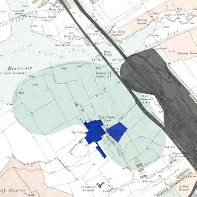
1.5 Site History
Staples Corner timeline
Late 19th century
• In agricultural use as part of Upper Oxgate Farm.
• Willesden Paddocks, a famous stud farm, was also located on the site.
• The development of the railway lead to the expansion of West Hendon and Cricklewood.
• Surrounding uses were largely sports and recreational, including Boating, Golf, Shooting and Athletics
1920-1930s
DRAFT
1950-70s
• The site became desirable for industrial uses with construction of the North Circular Road.
• Bentley opened their first factory in 1921 on the site of the Oxgate Centre. Mattress makers Staples & Co. relocated here in 1925, and Pathescope Camera Works in 1932.
• By 1929, 57 factories were situated on the site, with many firms relocating from more congested, central locations.
• Continued industrial expansion: 10,681 people were employed on the site by 1960
• Industries were light, depending on road transport and electrical or engineering skills.
• Manufacturing of recent inventions featured prominently, with many firms having showrooms in London.
• The Brent Cross Shopping Centre opened in 1976.
1980-90s
• Industrial decline as part of a national trend. Firms and skilled workers moved out, leading to mass unemployment for the immigrant population.
• The A5 and A406 flyovers were constructed and the M1 Junction 1 opened in 1977.
• Further encroachment of retail and non-industrial uses against Edgware Road, including Land Rover and Wing Yip.
2000-20s
DRAFT
2030-40s
• There was a general movement from manufacturing towards warehousing, offices and retail.
• This was also the period that saw the permitted developments for change of use to residential.
• The site was first designated as a Preferred Industrial Location (PIL) in 2004 and SIL in 2011 (with the first edition of the London Plan).
• The area to the east of the Growth Area will see a general shift to residential (from retail)
• Brent Cross Town residential-led mixed-use
• West London Orbital and surrounding residential developments.
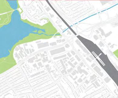
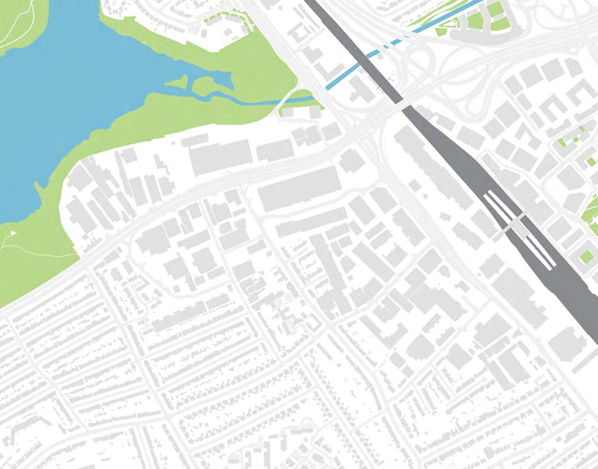
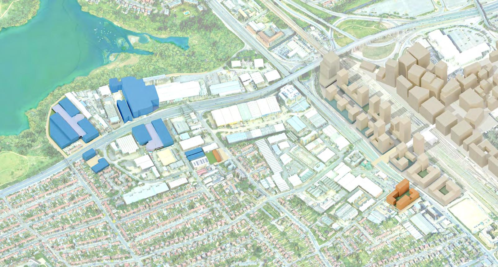
1.6 Location
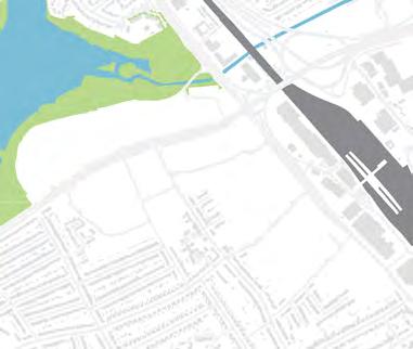
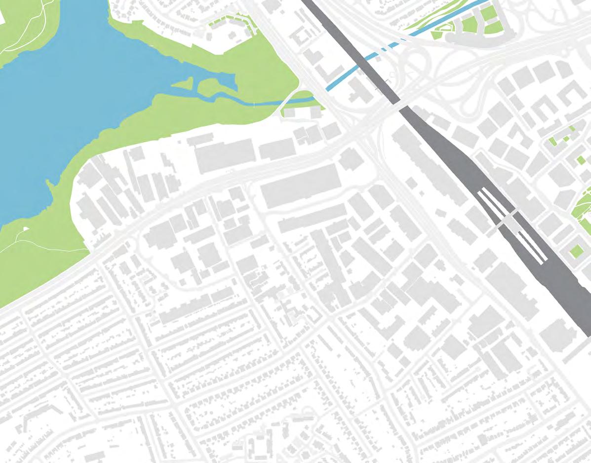
1.6.1 Staples Corner is a large industrial area in North West London, primarily located in the London Borough of Brent and crossing over into the adjoining Brent Cross Town Barnet/Cricklewood Opportunity Area.
1.6.2 Strategically located at the intersection of the North Circular Road A406, the M1 and A5 Edgware Road the Midland Main line, the SCGA is an important strategic industrial location, serving London’s need for logistics and manufacturing.
Map 1: Location of Staples Corner in London Borough of Brent
Cross OA
Burnt Oak Colindale OA
STAPLES CORNER
Brent Cross West Growth Area
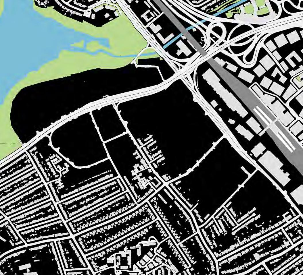
1.7 Staples Corner Growth Area
1.7.1 The masterplan boundary is set by the Staples Corner Growth Area (SCGA).
1.7.2 The Strategic Industrial Location (SIL) boundary is used for mapping of industrial capacity, and policies relating to industrial intensification.
1.7.3 Areas beyond the masterplan boundary are also to be considered, particularly connections to surrounding communities (including Brent Cross Town) and links to the surrounding open and green spaces.
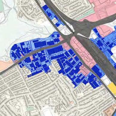
Key
Growth Area boundary
General Industrial: B2
Manufacturing
Motor repair
Construction business
Food production
Warehouse: B8
Distribution and logistics
Wholesale
Storage
Data centre
Light industrial: E(g)(ii) & (iii)
Service-based
Product based
Hybrid office
Excluded buildings
Non-industrial uses
Vacant
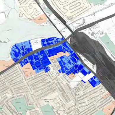
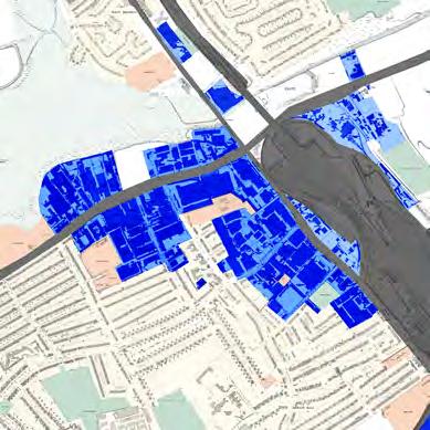
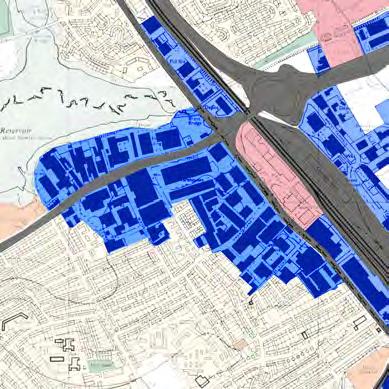
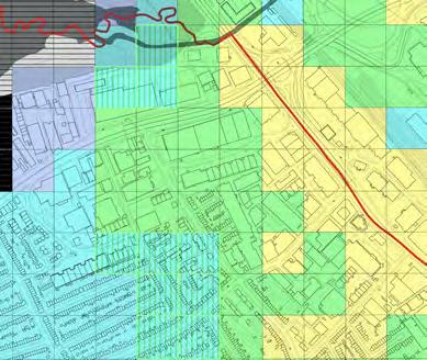
Map 3: Plan of existing industrial uses
Dollis Hill
OxgateGardens
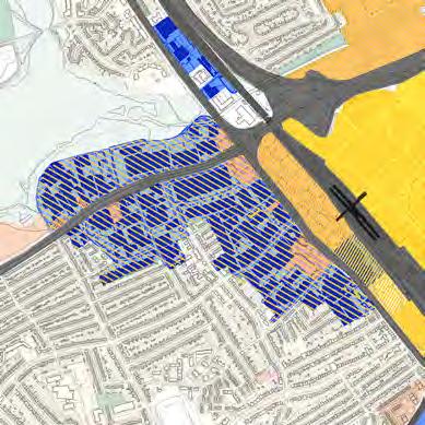
Active non-industrial uses
1.8.1 This does not include buildings that are longterm vacant.
1.8.2 Total GIA in active nonindustrial use = 46,100m2
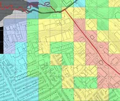
Key
Growth Area boundary
Non-industrial uses
Residential: C3
Hotel: C1
Retail: E(a)
Cafe/Restaurant: E(b)
Offices/Services: E(c)
Hiring/selling vehicles: SG
Fuel station: SG
Excluded buildings
Non-industrial uses
Vacant unit
2 STRATEGIC OVERVIEW
2.1 West London Orbital
West London Orbital
2.1.1 Staples Corner Growth Area may in the future benefit
London Orbital (WLO) route proposed in the Mayor’s Transport Strategy 2018. The WL would reactivate the Dudding Hill freight line for passenger travel.
Key
Opportunity Areas
Strategic Interchange
Proposed West London
Orbital station
Proposed West London
Orbital Rail
Existing West London
Overground station
Existing West London
Overground line
Staples Corner Growth Area
Brent Growth Areas
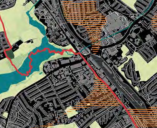
2.2 Policy Context
2.2.1 The masterplan area is designated as SIL. It is also a Growth Area which is allocated for mixed use regeneration by Local Plan Policy BEGA2.
Key
Growth Area boundary
Borough boundary
Opportunity Area:
Brent Cross Cricklewood
Growth Area:
Staples Corner
Brent Cross
Brent Cross West
Cricklewood
Employment Land:
Strategic Industrial Location
Locally Significant Industrial
Site
Other:
Grade II* listed Oxgate Farm
Site of Archaeological Interest
Protected View Corridor
Town Centre
Metropolitan Open Land
Brent Reservoir SSSI
Cricklewood
Cricklewood Town Centre
Clitterhouse Playing Fields
Cross CricklewoodOpportunityArea
3 SPATIAL STRATEGIES
3.1 Movement
PTAL levels in Staples Coner
Existing PTAL
The Public Transport Accessibility Level (PTAL) of the masterplan area currently ranges from 2 to 3 (on a scale of 0 worst to 6b best), with small pockets of lower PTAL north of the A406 towards Neasden Recreation Ground.
Estimated PTAL, 2040 without the WLO
DRAFT
The introduction of train services at Brent Cross West station as well as extended bus routes to the station will increase the PTAL for most of the site to 3 and 4. This would support car-free living (i.e. no parking space provision for residential uses) for much of the new residential development. Improvements to the walking network brought by the masterplan could bring additional areas within the walking catchment of the station, expanding the PTAL 3 area further west.
Possible PTAL, 2040 with quarterhourly West London Orbital service
Towards the end of the masterplan period, the West London Orbital could further increase PTAL category up to 5 in the eastern part of Staples Corner.
Strategic aims
A) Improve connections to the Strategic Road Network - M1, A406, A5 - through new service street loops to better support industrial uses
B) Ensure lighter industrial traffic is able to use Edgware Road towards the Central Activities Zone, so Edgware Road can also function as a high street to support the future activities of Staples Corner
C) Create clear, safe and accessible connections to public transport links to unlock the co-location potential of Staples Corner
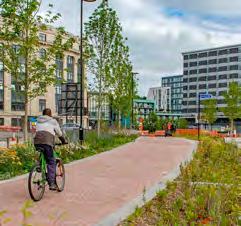
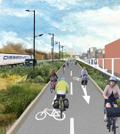
D) Create a high quality network of walking and cycling routes to encourage residents to use active travel, including strategic cycle route along the A5
E) Transform Staples Corner by reducing the dominance of traffic on residential streets, making a safe network of streets
Strategic road network servicing routes
Proposed servicing routes
Thameslink rail route
West London Orbital proposed route
Growth Area Servicing Strategy
1) Safeguard substantial SIL designation
2) Provide adequate HGV servicing facilities with junctions designed to be safe and convenient for active modes
3) Reconfigure junction layouts along North Circular Road to improve safety and convenience for active travel modes
4) Traffic calming along service roads at all junctions with local streets
5) Street layouts should ensure any change in priority is intuitively recognised by all modes
6) New spine route predominantly servicing residential uses, with delivery access for co-located uses
7) Freight consolidation for redistribution of goods to smaller vehicles
The servicing strategy aims to concentrate servicing activity by HGVs and large servicing vehicles along the North Circular while the Edgware Road area will be serviced by smaller vehicles such as cargo bikes and LGVs. Three measures support this strategy:
for a logistics hub close to the North Circular that allows for freight consolidation and onward transportation by smaller vehicles
Main HGV servicing route
Mixed-use servicing route
Site servicing access
One way vehicle route
Local streets
Data centre planning application
Improve junctions for active travel safety and convenience
Brent Cross West
Walking and Cycling Strategy
1) Create new accessible pedestrian and cycle crossings over A406
2) New pedestrian and cycle crossing over A5 for better interchange at Brent Cross West station to encourage public transport use
3) New off carriageway cycle route running east-west from Brook Road to Edgware Road
4) Improved junction and street quality to encourage active travel uses and reduce the dominance of industrial traffic on residential streets
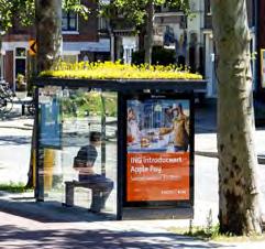
5) Improved accessibility and quality of bus stop environments. Bus service frequency to be increased to meet demand from increased activity in masterplan area
Pedestrian and cycle route on public land
Pedestrian and cycle route on private land
Pedestrian route on public land
Pedestrian route on private land
New crossing infrastructure
Improvements to existing crossings
New bus routes and bus stops
Improved bus lanes and bus stops
Map 9: Sustainable movement strategy diagram
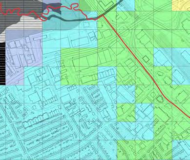
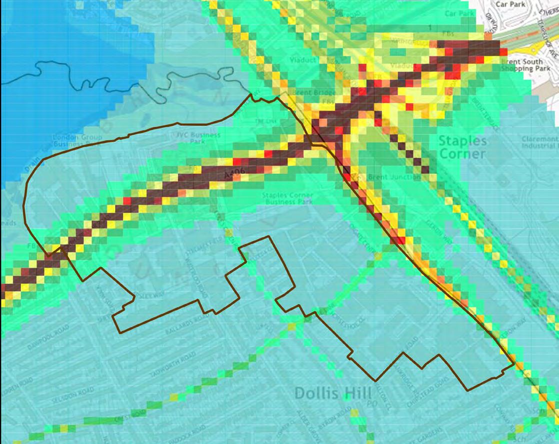
3.1.1 The Staples Corner Growth Area is in Brent’s Air Quality Management Area (AQMA), meaning the levels of Nitrogen Dioxide and Particulate Matter exceed the national air quality objectives.
3.1.2 The Staples Corner Growth Area is also within an Air Quality Focus Area, meaning it is a location with particularly high human exposure to excessive levels of air pollution.
Map 10: Map of Air Quality Management Areas and
Cricklewood
3.1.3 The average annual concentration of NO2 along the North Circular and Edgware Road exceeds the UK legal limit (which is anything above 40 µg/m3).
From 46-49 From 22-25
From 43-46 From 19-22
From 40-43 From 16-19
From 37-40 <16
3.2 Land Use and Zoning
3.2.1 Staples Corner currently accommodates 179,300sqm of industrial space across circa 100 individual units.
3.2.2 There are a significant number of landowners (c.120) and business leases (c.130) within the growth area, which could create delivery challenges. There are a number of large areas under single ownership toward the central section of the growth area. Towards the west of North Circular Road, the land is particularly fragmented into multiple land parcels.
3.2.3 There are multiple vacant sites and plots within areas of predominantly general industrial or wholesale uses that have low densities. These sites offer opportunities for industrial intensification, especially at Staples Corner West.
3.2.4 There is a concentration of larger plots of predominantly big shed wholesale, storage and logistics uses against North Circular Road (such as at Staples Corner Business Park), which offer the greatest potential for comprehensive redevelopment. Clusters of medium-sized land parcels along Edgware Road, such as around Wing Yip supermarket, would be appropriate for land assembly.
DRAFT
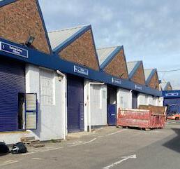
3.2.5 Many of the uses are general industrial and warehousing, which can be challenging to co-locate with other uses. Many of the industrial units towards the middle of the growth area are small and have high potential for co-locating with other uses. However, renewal of old, low quality building stock is required.
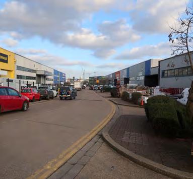
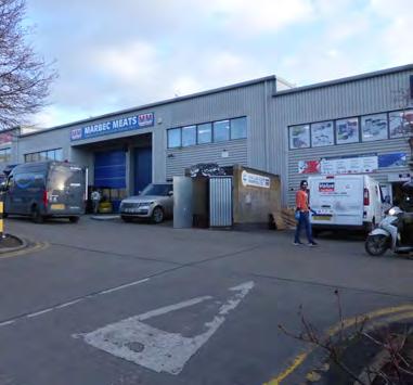
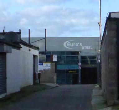
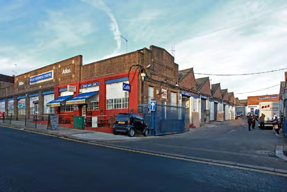
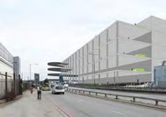
Figure 1: Big shed wholesale at Staples Corner Business Park
Figure 2: Wholesale and general industrial at the Apsley Centre
Figure 3: General industrial at Staples Corner West
Figure 4: Finer grain industrial uses at Atlas Business Centre
3.2.6 There is a significant range of nonindustrial uses present within the Growth Area, including a small amount of residential and office space.
3.2.7 The industrial stock is mixed in quality and the industrial sectors it accommodates. Most industrial units are two to three storeys and range from modern fit for purpose units to older poorer quality buildings.
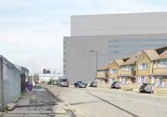
3.2.8 Residential uses such as housing, schools and supporting social infrastructure border the site to the south. The northern site boundary is adjacent to Brent Reservoir and Neasden Recreation Ground. To the east, Staples Corner adjoins Edgware Road and LB Barnet. Across Edgware Road sits Brent Cross West Station, and LB Barnet’s Brent Cross and Brent Cross West (Staples Corner) Growth Areas. The North Circular Road dissects the growth area and its central reservation and flyover infrastructures cause severances for service vehicles, cyclists and pedestrians attempting to move north-south across the growth area.
Key
Land parcels in individual ownership
XLarge land parcel: 2ha+
Large land parcel: 1-1.9ha
Medium land parcel: 0.5-0.9ha
Existing land parcels across the growth area vary in size, with some larger land owners along North Circular Road and Edgware Road.
Strategic aims - Land Use
Proposed land uses
A) Intensify substantial SIL designation
B) New dense mixed-use town centre development
C) Explore options for colocation of industrial and residential uses
D) Integrate new commercial, business, service, cultural, leisure and community uses
Key
Growth Area boundary
Industrial sites
Co-location
High density residential areas
Local centres
Designated open space
Railway land
Strategic Road Network
Railway stations
Underground stations
BrentCrossTown
Golders
Land Use Strategy
1) Intensify substantial SIL designation
2) Ensure forthcoming new development supports a vibrant mix of uses
3) Introduce higher density buildings with active frontages on key routes
Key Growth Area boundary
Industrial
B2 General Industrial / B8
Storage or distribution / E(g)(ii) Research and development of products or processes / E(g)(iii) Industrial processes
Co-location
B8 Storage or distribution / E(g)(ii) Research and development of products or processes / E(g)(iii)
Industrial processes / Class C (Hotels, Residential)
Mixed-use Residential
Class C (Hotels, Residential) / E (Commercial, Business and Service) / F (Local Community Uses)
In terms of developments proposed within the area identified as Industrial, any uses that are not consistent with London Plan Policy E4 will not be allowed. In the co-location areas, for non-residential uses the emphasis will be on prioritising the range of industrial uses identified, although in exceptional circumstances non-industrial uses where appropriately justified, may be allowed.
No new residential floor-space will be permitted in the intensified SIL area (1). The amount of new residential floor-space permitted in other areas (2) and (3) will not be allowed to exceed the amount of additional industrial floor-space above the baseline (179,300sqm) that is completed in areas (1) and (2) until the 65% plot ratio industrial intensification floorspace target (241,100sqm) is fully met.
Map 13: Land use and zoning strategy diagram
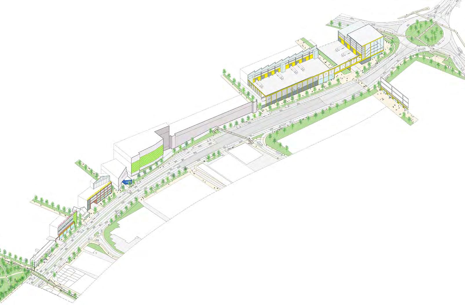
3.3 Public Realm
Analysis
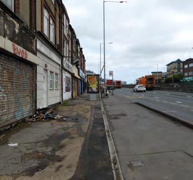
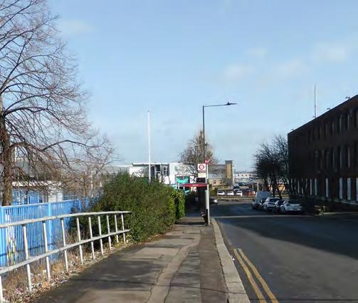
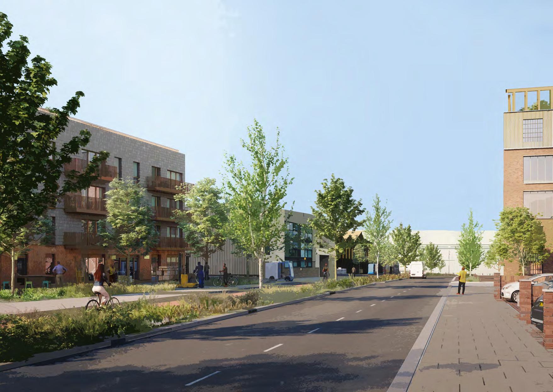
3.3.1 Staples Corner is bounded by dominating transport infrastructure. Infrastructure causes problematic severances and poor quality environments for walking and cycling and poor quality bus stop environments with unsafe crossings.
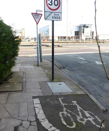
3.3.2 Existing walking and cycling routes do not support sustainable mobility. Journey times for pedestrians are currently impacted by severances and barriers, such as convoluted crossings over the road and rail infrastructure. These are not accessible or convenient pieces of walking and cycling infrastructure. Designated cycle routes (LCN 5 along the A5 and LCN 85 along Oxgate Lane and Tilling Road) are poorly signed and poorly maintained, terminating at cluttered points, often junctions, without wayfinding and safety provisions for cyclists. It could become much safer and easier to navigate with an improved network of streets and routes.
3.3.3 The wider area has many assets and people could benefit from the open spaces being delivered in the Brent Cross Town development. However, without improved accessibility, safe and legible routes to these assets, they will continue to be inaccessible.
DRAFT
Figure 5: Bus stop along North Circular Road
Figure 6: Convoluted crossing routes
Figure 7: LCN 85 on Oxgate Lane
Figure 8: Entrance to Neasden Recreation Ground
Street types
3.3.4 The ‘London Street Family Types’ has been used to classify the existing (right) and proposed (p. 57) street network:
Key
Growth Area boundary
Core Roads: should provide reliable major routes for large volumes of traffic
High Roads: should provide reliable major routes through, and make shops and services easily accessible
Connectors: should provide reliable routes for medium distance and local road journeys
High Streets: should provide access to shops and services by all modes
Town Squares/Streets: should provide areas for community activity and services
Local Streets: should provide quiet, safe and desirable residential areas that foster community spirit
Hendon
Map 14: Existing ‘London Street Family Types’ mapped at Staples Corner
Strategic aims - Public Realm
A) Establish the Brent Cross Broadway to create commercial and social uses that support the new homes
B) Make excellent interchange spaces at Brent Cross West Stn
C) Create high quality, inclusive, safe and convenient walking and cycling routes
D) Invest in appropriate new pieces of infrastructure to reduce rail and road severances
E) Invest in connections and access to open space, parks, public squares and local amenities such as schools
Key
Growth Area boundary
Improved existing or new routes
Major routes - pedestrian and cycle
Local routes - pedestrian and cycle
New ped and cycle infrastructure
Existing open space
Local centres and amenities
Map 15: Public realm strategic aims diagram
Gladstone Park
Clitterhouse Playing Fields
Playing Field
Golders Green
Kingsbury
Kingsbury Green
Hendon Brent Cross
Brent Cross Town
Temple
Fortune
Neasden
Public Realm Strategy
1) Create safe transport interchange spaces for all modes at Brent Cross West Station
2) Connect to the new pedestrian and cycle routes from the east
3) Improve the existing local LCN routes
4) Encourage active ground floor uses along Edgware Road
5) Create safe cycle infrastructure along Edgware Rd
6) Ensure that Staples Corner has green and public space at key locations along walking and cycling routes
Key
Growth Area boundary
Core Roads
High Roads
Connectors
High Streets
Town Squares/Streets
Local Streets
Possible locations for new public spaces
New interchange space
Existing Bus stops
3.4 Places and Change
Analysis
3.4.1 Staples Corner is known primarily for its role as an industrial location, however there are also a range of places in and around Staples Corner with distinct characters.
3.4.2 It’s current role in provisioning the city through logistics, distribution and other uses originates from its historical role as a railhead. Brent sidings was an important marshalling yard and freight facility on the Midland Railway extension to London. This has left a legacy of largescale rail infrastructure which, combined with strategic road infrastructure, create big features in the landscape.
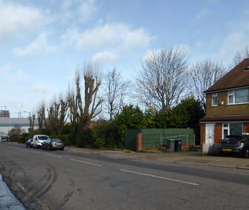
3.4.3 Other notable local landscapes include the Brent Reservoir and the residential neighbourhoods sloping up to Dollis Hill.
Map 17: Places diagram
West Hendon
Brent Cross Town Golders Green
The Hyde Kingsbury Kingsbury Green
Hendon
Brent Cross Temple Fortune
Neasden
Cricklewood
Staples Corner
Brent Reservoir Clitterhouse Playing fields
Gladstone Park
3.5 Activation
1) Vehicular and Business Activity 2) Destination Amenities
3) Neighbourhood Amenities
4) Courtyard Light Industrial Business Activity
3.5.1 Staples Corner currently has a limited amount of active frontages throughtout and therefore lacks a vibrant street-scape.
3.5.2 There are a number of cafés and food services spread throughout, mostly catering for workers in the daytime.
3.5.3 There are few commercial, retail or community uses. There are vacant and disused buildings, large amounts of carparking and ‘dead-end’ routes, all of which have resulted in areas feeling unsafe, particularly out of business hours.
Map 18: Public realm strategy diagram
Dollis Hill
Activation Strategy - Aims
A) Create active and safe routes connecting train stations, amenities (including retail facilities at Brent Cross Shopping Centre and Brent Cross Town) and local neighbourhoods during the day and night
B) Building signage and way-finding along North Circular Road to activate the Staples Corner at a city-wide scale
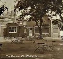
C) Daytime activation along recreation route with food relating to leisure offer. Offer support to community leisure activities in groups such as the Welsh Harp
D) Concentrate food and beverage offer along Oxgate Lane to bring a mix of uses to the industrial high street
E) Allow for meanwhile uses to activate areas in interim phases
City-wide way-finding and activation
Landmarks or marker buildings
Day and night activation
Day activation
Activation Strategy - Implementation
1) Primary pedestrian routes located where businesses are open on evenings and weekends
2) Seek opportunities for food businesses in Staples Corner to have more prominent street presence, both in shopfronts and van/cargo bikes in attractive locations on prominent routes
3) Activity and uses appropriately located within the public realm and public space, primary building entrances being on street facing elevations
4) Safe, active routes with visibility of businesses
5) Vacant units with meanwhile uses
Day activation
Visual activation
Active uses
Secondary route
Primary activation route
Brent Cross West North Circular Road
3.6 Green and Blue Infrastructure
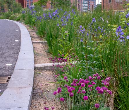
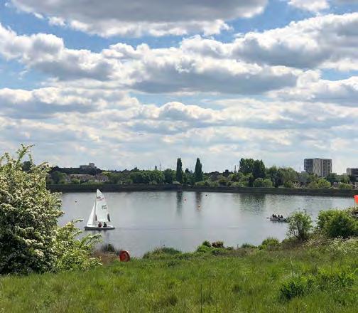
3.6.1 The open spaces around Staples Corner are not well connected, with low-quality entrance spaces and limited accessibility. Gladstone Park and Brent Reservoir (SSSI) have historic significance as open recreational and leisure spaces, and continue to be an asset to Brent residents. However, River Brent and Brent Reservoir are under appreciated natural assets.
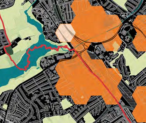
3.6.2 Green space is lacking within the Growth Area. Across the southeast of the growth area, there is open space deficiency as identified in Brent’s Open Space, Sports and Recreation Study (2019). The GLA has identified the majority of the south of Staples Corner as being in the highest priority category for requiring new accessible green spaces within a 10 minute walk.
3.6.3 Improved access to Brent Reservoir to the north and west of the growth area, new connections east to new open spaces within Brent Cross Town, alongside an introduction of new open spaces and squares at Staples Corner, will have a positive impact on any future development, as well as for existing residents and businesses.
Figure 9: Neasden Recreation Ground looking across Brent Reservoir to West Hendon
Figure 10: Brent’s Open Space, Spor ts and Recreation Study deficiency areas in orange hatch
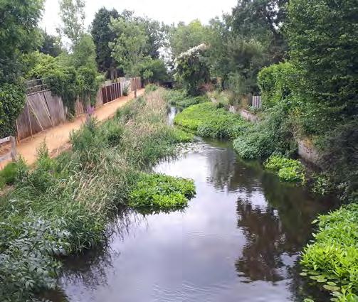
Figure 11: River Brent is canalised from the M1 to Edgware Road
Figure 12: 10 minute walk map highlights priority areas in orange needing accessible open space
Clitterhouse
Playing Fields
Gladstone Park
Gladstone Park
3.6.4 Generally, ecological value inside of the growth area is relatively low. The most established street trees and planted areas such as hedges and landscaping are on Oxgate Lane, Coles Green Road and along River Brent at Priestley Way. The northern edge of Staples Corner benefits from an adjacency to established landscaping at Brent Reservoir. However, gaining access to Brent Reservoir at Neasden Recreation Ground is particularly challenging for residents with mobility issues.
3.6.5 A borough wide tree strategy is being prepared - which is beyond the scope of this masterplan - to understand how the council will increase tree canopy in those areas in most need including Staples Corner Growth Area.
Figure 13: Oxgate Lane established hedge
Figure 14: Established landscaping along Coles Green Road
Figure 15: GLA London Tree Canopy cover map shows a low level of tree coverage in the Growth Area
Figure 16: Street trees and pockets of planting along Waterloo Road
Gladstone Park
Strategic aims
A) Improve connectivity to Brent Reservoir, Gladstone Park, Clitterhouse Playing Fields, and West Hendon Playing Field
B) Establish leisure loop around Brent Reservoir that connects into the Capital Ring walking route
C) Create new entrances to Brent Reservoir to improve access, and knowledge of this natural asset
D) Create three new green public spaces that address the deficiency in Open Space
E) Open up access to River Brent (in partnership with Barnet)
F) Introduce new SuDS along existing and new streets to improve air quality and contribute to urban greening
G) Introduce new SuDS along existing and new streets to improve air quality and contribute to urban greening
Main proposed connective routes
Leisure loop around Brent Reservoir
Existing local routes
Entrance improvements
Existing open space and green corridors
LEISURELOOP
to Hampstead Heath
RiverBrent
Fryent Country Park West Hendon Playing Field
Welsh Harp Open Space
Gladstone Park
Clitterhouse Playing Fields
University
College School
Sports Field
Hendon Park
Green & Blue Infrastructure Strategy
1) Green fingers pull existing character of Brent Reservoir into the site
2) Concentration of urban greening along the new Broadway
3) Landscaped, east-west route with opportunity for playable landscapes
4) Landscape buffers along A406 and A5
5) New entrance space to Neasden Recreation Ground accessible via potential new green bridge over A406
6) Avenue of trees to new spine route
7) Make River Brent accessible and enhance its setting with riverbank restoration, floating reed beds and riverbed planting
+ Possible locations for pocket parks and public squares
Street trees with supportive planting where possible
+ Play provision
New entrance space to Brent Reservoir
Concentrated area of new trees
Enhance existing landscape character with additional supportive planting
Landscape buffer such as SuDS
Open Space Strategy
1) Ensure that all areas of Staples Corner have access to green public space within 400m walking distance
2) Link existing and new parks into a connected cycling, walking and public transport network, to provide easy and attractive access to public spaces
3) Improve the quality of open space, address deficiency and raise the profile of green spaces for local residents and visitors with new wayfinding strategy
4) Provide new areas of landscaping in new public squares and open spaces located along key routes
5) Enhance brook with new landscaped wildlife area with restored reed beds to improve the water quality
6) Enhance areas of existing established planting for increased biodiversity value
Possible location for pocket park
Possible location for new public square
Existing public space
400m walking radius from the centre of the public pocket park
New entrance to open space
Walking and cycling network
Bus stops around the growth area
Landscape Character
3.6.6 There is an opportunity to enhance areas of existing established planting and create new green infrastructure to enhance walking and cycling routes. New green infrastructure should build on the existing landscape character in Staples Corner and draw the character of key places such as Brent Reservoir into the site. Along Oxgate Lane, there are tall evenly spaced trees and grassy embankments of a more urban nature. Brent Reservoir is heavily planted with diverse species and is much more natural in character. Waterloo Road has some established tree planting that could be enhanced by in ground planters such as at Vauxhall Walk. River Brent could undergo riverbank restoration, with new floating reed beds and riverbed planting to create a character similar to Riverside Walk. Servicing routes, including along Edgware Road and Coles Green Road, could have landscape buffers such as at Grey to Green in Sheffield.
DRAFT
Figure 17: Street planting used to suppor t restricted vehicular access –Vauxhall Walk, Lambeth
Figure 18: Planted public square with opportunities for public ar tworkWindrush Square, Lambeth
Figure 19: Landscape buffer to an existing inner-city service road – Grey to Green, Sheffield
Figure 20: River restoration uses a variety of native planting – Duke of Northumberland’s River
Brent Cross West
Dollis Hill North Circular
OxgateLane
OxgateGardens
CrestRoad
HumberRoad
Coles Green Road Waterloo Road
Brook Road
ApsleyWay EdgwareRoadA5 MidlandMainLine
Neasden Recreation Ground
LB Brent
LB Barnet
3.7 Intensification/ Optimising Sites and Building Heights
3.6.9 Staples Corner sits in the valley of Dollis Hill. The southern edges of the Staples Corner Growth Area (black outline) rise up Dollis Hill with a total rise of almost 25m (8 storeys).
3.6.10 The sloping site also creates favourable conditions where taller industrial buildings are lower than the adjacent lowdensity residential streets. There are a number of picturesque views from the Staples Corner Growth Area due to the natural topography of the south-west of the growth area, such as along Oxgate Lane and along Apsley Way.
3.6.11 The Brent Tall Building Strategy identifies the tall building zone (red outline), which sits at the base of Dollis Hill. The strategy states that tall buildings could be from six to twenty storeys (approx. 18m - 60m). The tall building zone is impacted by protected view corridors:
3.6.12 There is one protected view across the site from Golders Hill to Harrow on the Hill, although with trees in full leaf, this is restricted, ‘The trees also mask the significant number of taller buildings in the valley floor around Brent Cross and the southern part of Edgware Road’ (LB Barnet Tall Buildings Update 2019). The topography allows more flexibility in building heights within areas to the base of Dollis Hill.
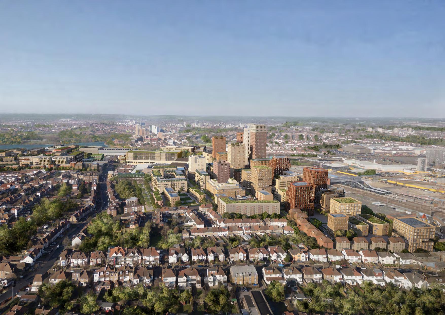
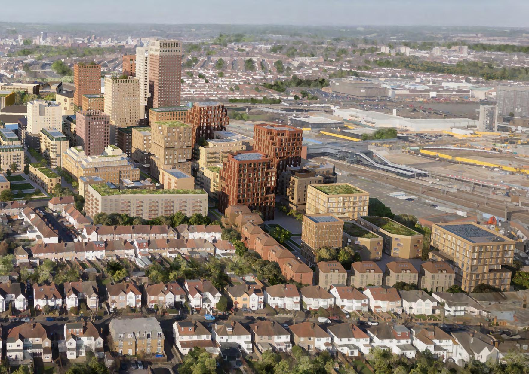
3.6.13 The proposed urban grain of the Brent Cross Town development is of a different typology than that of the surrounding area. The residential typologies are generally courtyard blocks ranging from 27m high to approximately 85m high, feeling much more urban in character than the nearby two storey terraced or semi-detached blocks.
Figure 22: Due to the site’s topography, taller buildings set within the valley will appear shorter
24: Tall buildings in the yellow filled area will have less impact on protected view cones
Figure 21: There is a 24m level change across Staples Corner as it sits within the valley of Dollis Hill
Figure 23: The tall building zone sits within a protected view
Figure
Strategic aims - Tall Buildings
A) Consider the topography when permitting tall buildings - the north-eastern area of Staples Corner sits within the valley of Dollis Hill.
B) Tall buildings towards the south of Staples Corner are not to unacceptably impact on the protected vistas of Harrow-On-the-Hill from Golders Hill.
C) Tall buildings should be considered in relation to the cumulative impact of new tall buildings within Brent Cross Town. The scale and massing of development proposals must not create a canyon effect in order to prevent extreme wind conditions at ground level.
Greatest potential for tall buildings
Medium potential for tall buildings
Low potential for tall buildings
Protected view
Brent Local Plan Tall building zone
* Location of new tall buildings in surrounding developments
Topography
The illustrated protected views are sourced from a supporting document to the Brent Local Plan 2019-2041 (B/ HS07/7a) Tall Buildings and Protected Views Addendum to Matter 7 (2020).
West Hendon Estate Regeneration (85m)
Brent Cross Town (≈70m)
Staples Corner (60m)
1) Tall buildings are appropriate in the areas adjacent to the emerging Brent Cross West development, particularly in areas close to Brent Cross West station and Brent Cross Town
2) Building massings should consider the setting of the locally listed Brent Reservoir, and also respond sensitively to suburban streets to the south
3) Tall buildings should provide high quality, mixed-use environments that add quality to Staples Corner’s character and sense of place
4) Flight paths of breeding birds to Brent Reservoir SSSI must be considered
Brent Tall building zone
Most appropriate for tall marker buildings (20+ storeys)
Most opportunity for tall buildings
Consider opportunities for tall buildings
Inappropriate for tall buildings
Topography
* Sites suitable for marker buildings
Tall Building Strategy
Brent Cross West
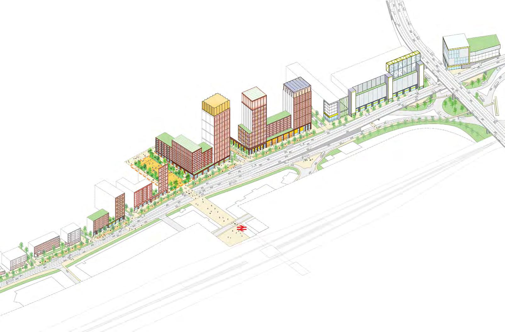
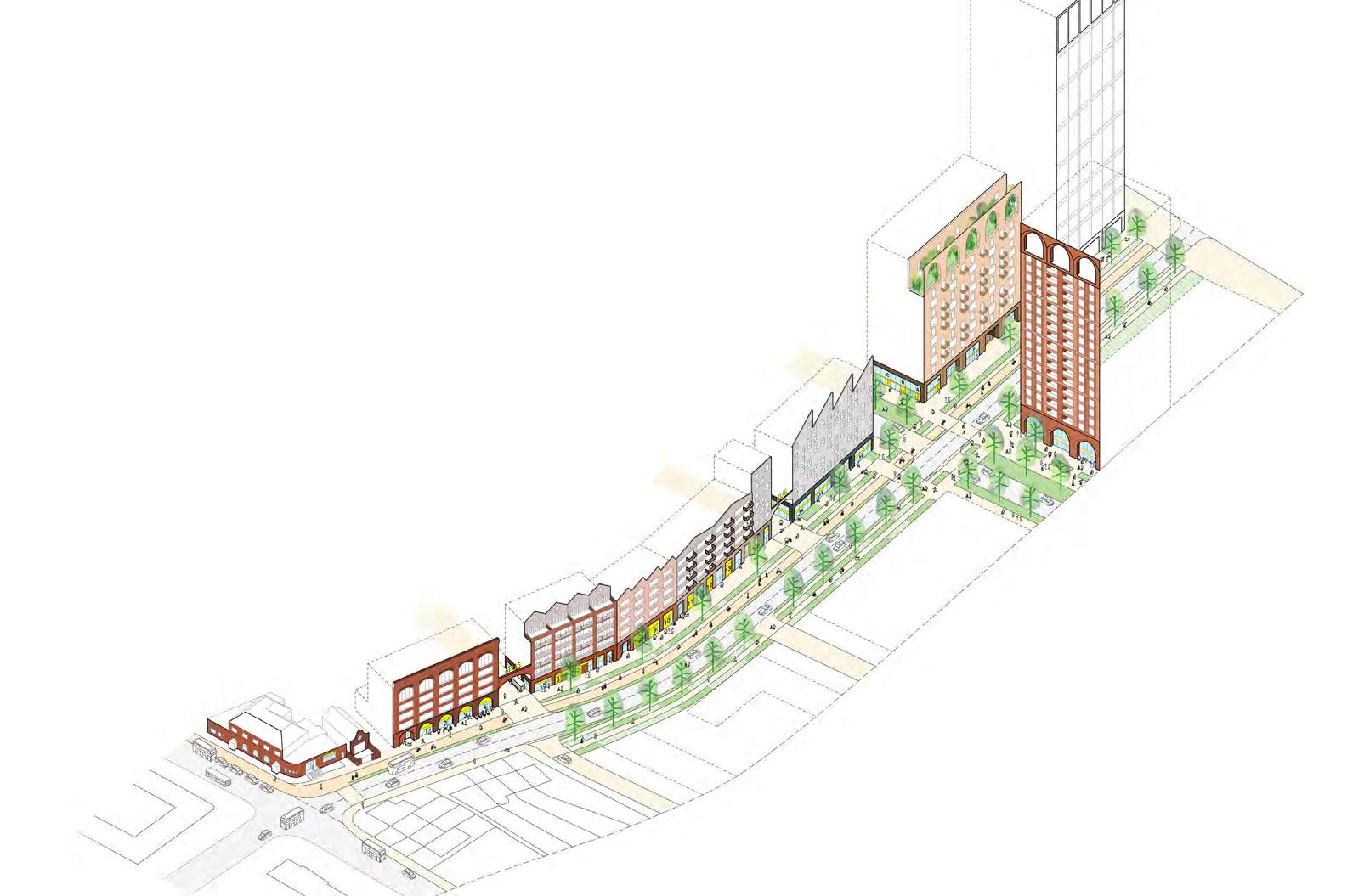
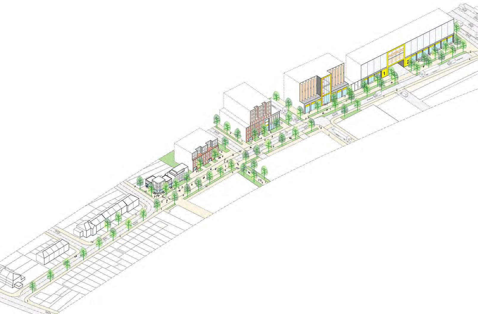
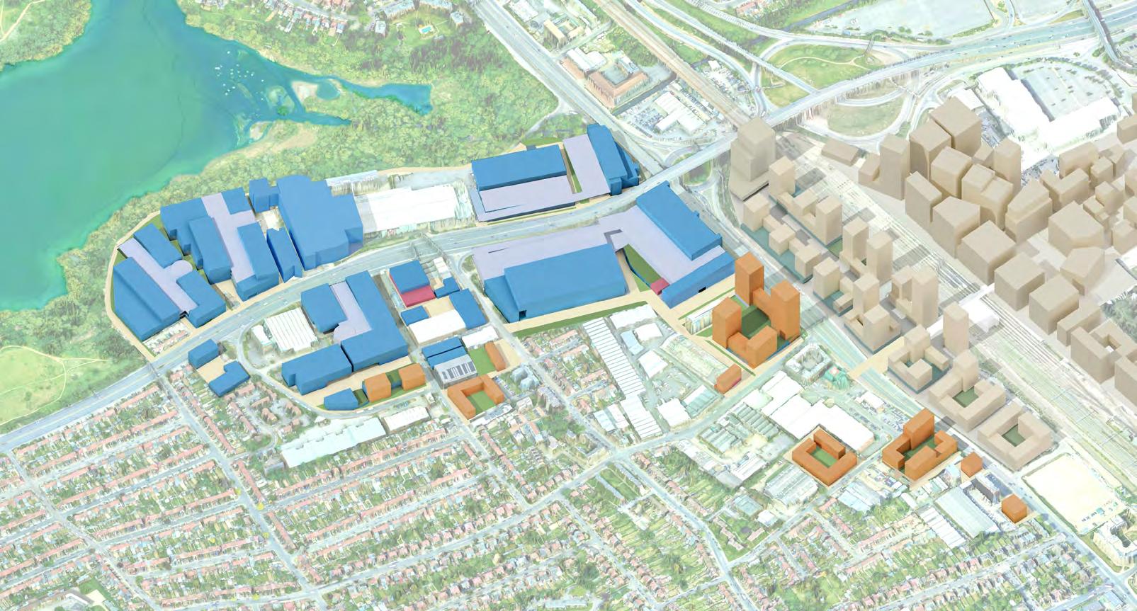
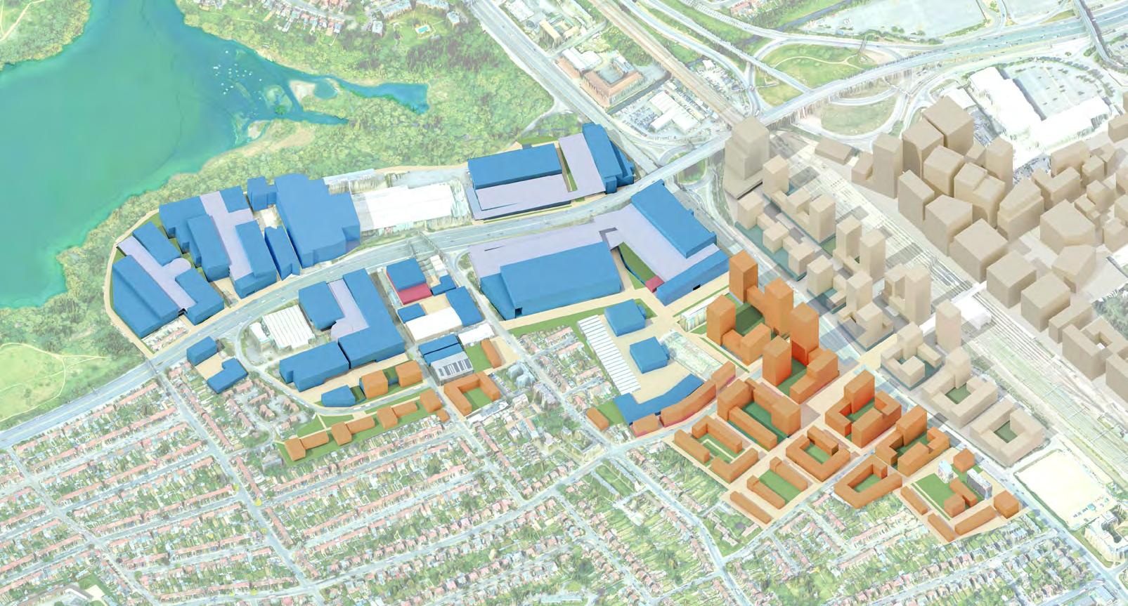
4 ILLUSTRATIVE MASTERPLAN
4.1 Introduction
The Masterplan demonstrates how development at Staples Corner can meet LB Brent’s Local Plan policy objectives.
It also demonstrates how future development can work within the spatial framework defined in the previous chapter, the ‘spatial strategies’.
The purpose of the Illustrative Masterplan is to:
• Test development scenarios and present a preferred scenario that can meet policy objectives
• Demonstrate that the spatial strategies can provide a context for positive change
• Be used as a tool to enable investment and development activity – allowing future flexibility in adapting to marketplace changes
An Illustrative Scenario
4.1.1 The process of masterplanning can be instrumental in building a unifying and resilient strategic narrative to achieve buy-in, consensus and guide coordinated positive change. It is important to consider how the masterplan can
balance defining this narrative with being commercially viable, and optimised in terms of value and ultimately deliverable.
4.1.2 The Illustrative Masterplan demonstrates how a broadly acceptable scenario for development could come forward. It should not be read as a fixed masterplan because different acceptable scenarios –dependent on different design and delivery approaches – could be equally or more successful in fulfilling the policy objectives.
co-location of industrial uses with residential uses
• High density residential typologies, some options incorporating and testing co-location of lighter scale industrial and business uses
4.1.5 Precedents have been used to determine high-level design approaches across the site, along with informing servicing and access strategies for these sites.
Design Limitations
4.1.3 Development scenarios which differ from those illustrated here will still be considered, as long as they align with the Spatial Strategies, including the replacement of existing buildings which have been shown as retained.
Typologies
DRAFT
4.1.4 The Illustrative Masterplan is based on typologies that will likely be expected to come forward within allocated zones within the evolving masterplan, including:
• Substantial industrial intensification approaches including stacking options
• Lighter scale – medium scale density industrial intensification including
4.1.6 The illustrative masterplan has been subject to high-level design development and testing appropriate to this design stage.
4.1.7 The development figures provided here are indicative, based on the massing and heights illustrated. As schemes come forward for planning, more detailed strategies requiring design development at the next stage must include;
• Fire engineering;
• Microclimate analysis (wind), daylighting, sunlight, overlooking, outlook etc.);
• Structural and MEP engineering;
• Vehicle tracking;
• Acoustic and air quality assessments;
• T.V.I.A.s for tall buildings.
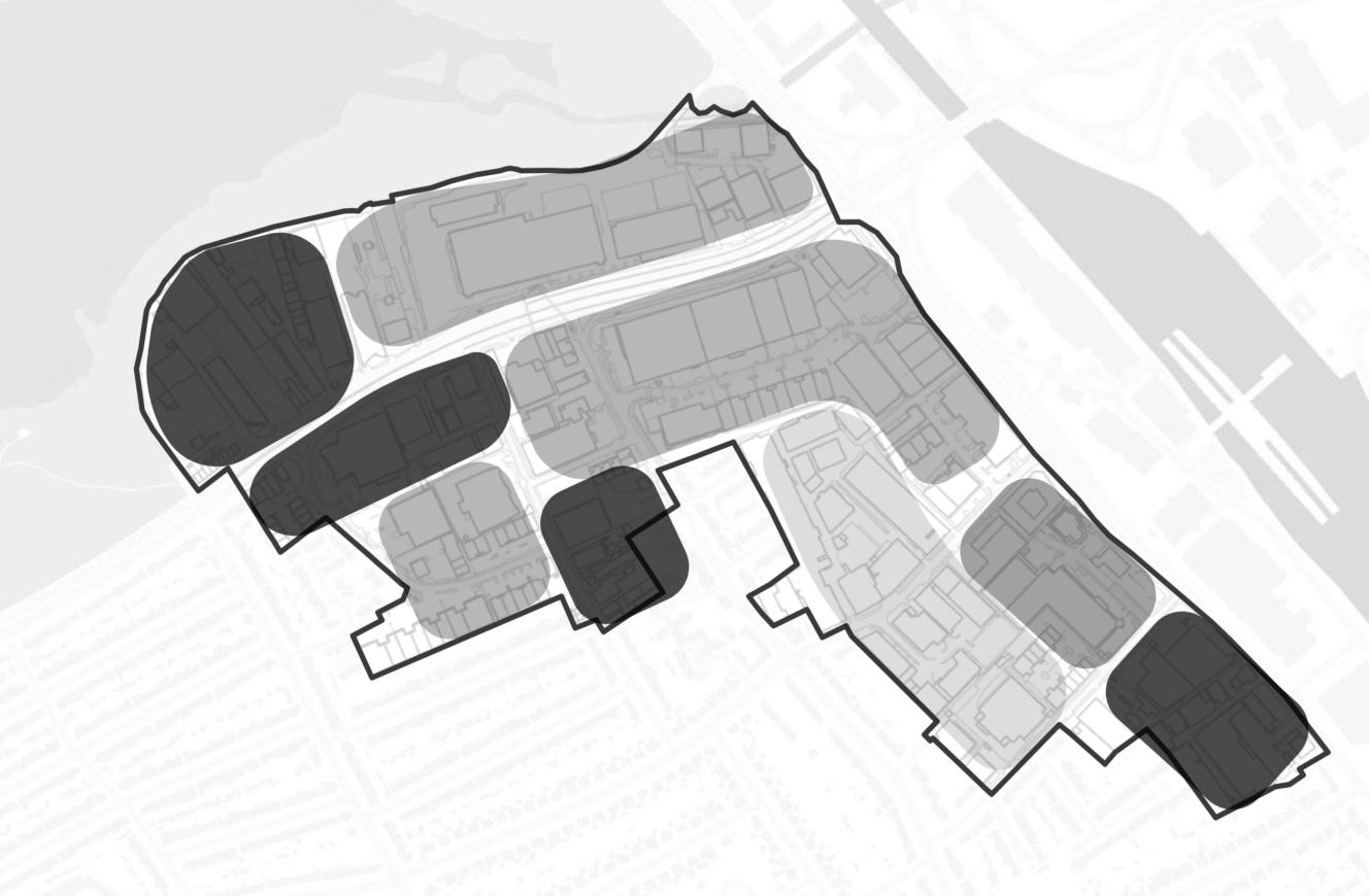
In order to test typologies and develop scenarios, the overall Growth Area has been divided into the following sub-areas.
Note that these acknowledge, but do not follow land ownership boundaries, and assume land assembly scenarios.
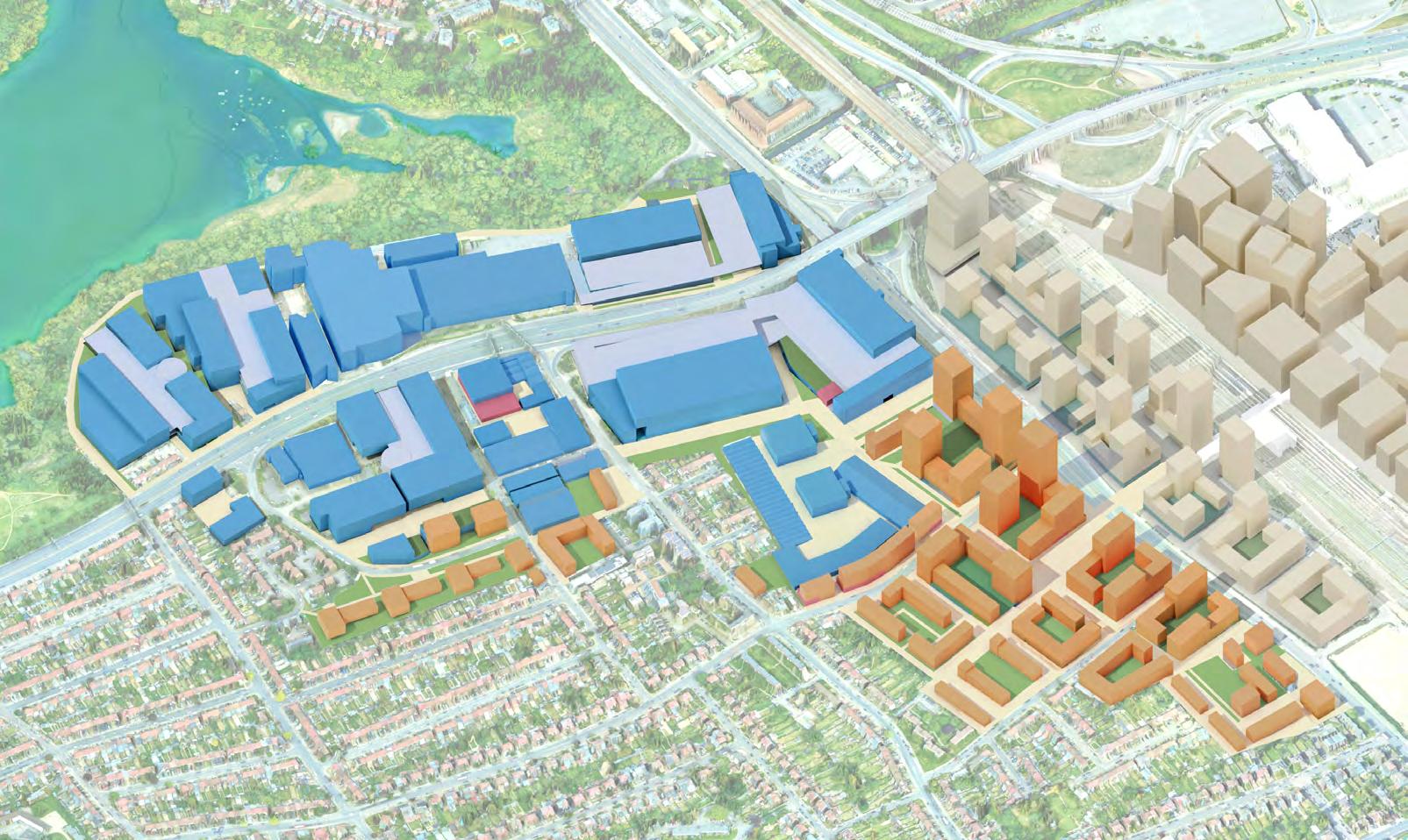
4.2 The Illustrative Masterplan
Key
General industrial / Storage & distribution / Data centre
Light industrial
Substation
Residential Hotel
Café/Retail/Class E
Community
Office / Services
Yard / Car parking
Retained existing building
Landscaped areas
including tree planting
Growth Area boundary
Floorspace – Growth Area • Floorspace accommodated by the Illustrative Masterplan across the Growth Area. • Includes existing retained floorspace. • Total homes includes new/proposed homes only.
Overview of Illustrative Masterplan
2
This option includes the alternative development scenario for Sub-area 8 (Horseshoe Close & Humber Road)
Key
General industrial / Storage & distribution / Data centre
Light industrial
Substation
Residential
Hotel
Café / Retail
Community
Office / Services
Yard / Car parking
Retained existing building
Landscaped areas
including tree planting
Growth Area boundary
NorthCircularRoadA406
– Growth
• Floorspace accommodated by the Illustrative Masterplan across the Growth Area. • Includes existing retained floorspace. • Total homes includes new/proposed homes only.
4.3 Working Assumptions
Housing Tenure and Mix
Assumed split between tenures (market and affordable homes):
• Market Housing 50%
• Affordable Housing 50% Policy BH6
• 25% of new homes as family sized (3+ bedrooms) dwellings
Public Amenity
• 1.2ha (or 12,000 sqm) (expected to be delivered by a number of smaller spaces)
• Comparative examples e.g. Kings Cross X public square
Private Amenity Policy BH13
• 50sqm per home for family housing (3 bedrooms or more) situated at ground floor level
• 20sqm for all other housing
Play Space
Using GLA child yield calculator
• 19590 sqm for 3066 units in PTAL 3-4
• Total children 1959
Car Parking
• Assumed PTAL 3 rating
• 0.25 per dwelling
• Total no. spaces = 550
• Total area = 13,750 sqm
Non-residential Uses
Non-industrial and non-residential uses should be located in the mixed use and colocation zones of the masterplan.
General residential assumptions:
• No single aspect North facing apartments in towers
• No single aspect South facing units
• Maximising dual aspect provision by using maximum depths of 12m
• Ground floor 90% GIA to GEA
Stacked Duplexes
• 2 family duplexes of 102sqm stacked above one another with private terraces
• 12m deep and 5.4m wide
Towers
• 6-10 storey towers for 1+2B apartments with duplexes at ground level
• Generally max 10 stories to allow for CLT construction
• Servicing allowance of ground floor and basements 50% net to gross ie half of usable area allocated to entrances, bins, bikes, plant
• 1bed 2people 50sqm
• 2bed 4people 70sqm
• 3bed 6people 102sqm
• Unit mix 25% 3Bed+, 50% 2Bed and 25% 1Bed
(10% wheelchair housing)
• Allowance made in calculations for additional stair cores, circulation, daylight/sunlight and massing gaps
DRAFT
• All family units provided at ground floors
• Typical residential floors 3.3m
• Typical commercial floors 4.65m
• Typical minimum 21m spacing between blocks
Town houses
• Family homes of 108sqm with rear private gardens
• 4.8m wide by 9.2m deep
• 3 storeys
Linear blocks
• Family duplex units with 3-4 storeys of apartments above
• 12m deep and average of 5.85m wide
Public and Private Amenity
• Ambition for all ground floor family homes within the townhouse and stacked duplex typologies to have 50sqm amenity space.
• Current working assumption is that all ground floor family homes will have at least 30sqm private amenity space - this will need further clarification during the planning application stage.
• Working assumption that play space will be distributed throughout pocket parks and residential courtyards.
Number of Jobs
• Estimated job numbers have been calculated using employment densities from the London Employment Sites Database (GLA, 2021).
Page left intentionally blank
Existing
Estimated no. of jobs
Predominantly general industrial uses, with a mix of unit sizes and building ages. A number of the larger units have been vacant long-term, and have fallen into disrepair. Stakeholder engagement suggests this is because these plots suffer from poor servicing provision, and do not have turning facilities for articulated lorries. Surrounding plots share yards and servicing routes off the North Circular.
Illustrative Masterplan
Industrial
4.4 Sub-Area 1: Staples Corner West DRAFT
The sub-area is made up of medium sized land parcels to the west, and very fragmented ownership towards the east.
• Industrial intensification. Ageing building stock and high vacancy rates presents the opportunity for comprehensive redevelopment, and so consolidation into two large land parcels has been tested.
• Two large stacked industrial buildings are proposed – these arrange General industrial/ Storage & distribution uses around three floors of shared yard space, with vehicle servicing to the inside face of each unit.
• An additional storey of studio space (served by goods lifts) is provided to the top floor of the eastern development.
• Ancillary office spaces are located on the
external, street-facing elevation of each unit to provide active frontages to the public realm.
• A new walking and cycling route to the Welsh Harp/ Brent Reservoir boundary improves accessibility to green, open space for the local community, with two new landscaped, shared walking and cycling routes connect back to the North Circular.
• Alternative development scenarios which differ from those illustrated here (including the replacement of existing buildings which are shown as retained) will still be considered as long as they align with the Spatial Strategies.
Map
4.5 Sub-Area 2: JVC Business Park
Illustrative Masterplan
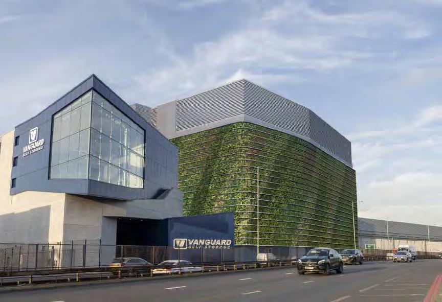
• Industrial sites here have been intensified since the baseline date. This includes the data centre and associated electrical substation, for which 10,289m2 additional industrial floorspace has been delivered. Vanguard self storage has also provided 7,363m2 of floorspace.
• An application to extend the data centre by 53,570m2 has been approved, and is included in the Illustrative Masterplan.
• Given the recent and upcoming industrial redevelopment projects, this site is considered ‘fixed’ for the Local Plan period to 2041, so no additional industrial development has been illustrated.
• A new pedestrian and cycle path to the Brent Reservoir boundary has been tested. This is routed across the northern edge of the data centre compound –outside of the SSSI boundary – and would require the secure boundary line of the data centre to be pushed back.
Key
General industrial / Storage & distribution
Substation
Yard space
Retained existing building
Vacant
Servicing access
Ownership boundaries
Landscaped areas including tree planting
Map 33: Existing ground floor plan
Map 34: Illustrative ground floor plan
4.6 Sub-Area 3: Aquarius Business Park
Existing
(FAR)
Estimated no. of jobs 120
Existing building stock is predominantly made up of medium sized, single-storey units used for storage & distribution. Low vacancy rates and relatively high quality stock indicates that this sub-area is successful and intensified space would be in demand, and so stacked industrial typologies are likely to be more viable in this sub-area.
Well consolidated ownership, including two large land parcels. Good location on the strategic road network provides direct, efficient access for industrial traffic, with egress onto North Circular and twoway access onto Edgware Road, although compromised walking provision through the site along The Link.
Illustrative Masterplan
Industrial Floorspace
Density (FAR) 0.94
Estimated no. of jobs 616
• Industrial intensification
• 2 storeys of stacked large-medium industrial spaces suitable for logistics uses, with a HGV ramp providing access to an elevated service yard.
• 2 additional storeys of light industrial space (serviced via goods lifts from a shared yard at ground), adds height to the eastern edge of the sub-area, marking this gateway site from Edgware Road and North Circular. Provision of light industrial uses maintains a varied employment offer, and focuses higher employment densities in areas with better PTAL rates.
• Delivery could be phased between the western and eastern blocks.
• Entrances to the upper floor units are provided off Priestley Way and Edgware Road, creating active and more people friendly street conditions.
• An improved, landscaped north-south pedestrian & cycle link connects Priestley Way to a new at-grade crossing over the lower level of North Circular Road. Ground floor ancillary office spaces lines the public realm along this route and the North Circular.
General
Sui
Retained
Servicing
Ownership boundaries
Landscaped areas including tree planting
4.7 Sub-Area 4: North Circular
Existing
Density (FAR)
Estimated no. of jobs 717
This sub-area has a wide range of uses and building stock, with land parcels also varying in size. The site is located along the south edge of the North Circular, but has limited entry and egress points from this strategic road.
The site levels drop towards the North Circular, resulting in separation of individual development plots by significant level changes: overall there is a 9.5m level difference between the eastern and western edges of the sub-area.
Illustrative Masterplan
Industrial Floorspace 34,745m2
Non-industrial Floorspace Floorspace2,320m2
Density (FAR) 0.85
Estimated no. of jobs 944
• Industrial intensification, with a range of design approaches taken for each site.
• At Harp Business Centre: new mediumscale industrial units with improved yard space suitable for HGV access. A new 3-storey block of light industrial units creates a positive frontage to North Circular, and sets up friendlier adjacencies with the existing residential uses which flank the site on both sides.
• High quality building stock at Vitabiotics is shown as retained.
• A large-scale, stacked typology has been tested where there is potential for comprehensive redevelopment in the middle of the sub-area. General
industrial/ Storage & distribution uses are arranged around three floors of shared yard space, with vehicle servicing to the inside face of each unit.
• To the east of the sub-area, a shared yard provides efficient HGV servicing access to the surrounding units. DX Network is extended horizontally, setting up a positive relationship to Coles Green Road. Atlantic Electrics is extended vertically to provide retail space at lower ground (accessed off the North Circular), and wholesale space at upper ground floor (serviced from the yard to the rear).
• Buildings with heritage value have been retained, providing a positive relationship to the public realm along Waterloo Road and Coles Green Road.
• Alternative development scenarios which differ from those illustrated here (including the replacement of existing buildings shown as retained) will be considered if they align with the Spatial Strategies.
Key
General industrial / Storage & distribution
Light industrial
Café / Retail
Office / Services
Sui generis
Yard space
Retained existing building
Vacant
Servicing access
Ownership boundaries
Landscaped areas including tree planting
Map 38: Existing typical floor plan
Map 39: Illustrative upper ground floor plan with indicative phasing
Map 40: Illustrative lower ground floor plan
Existing
Site
Industrial
Non-industrial
Estimated no. of jobs
Predominantly made up of large and medium warehouse units. The site is the best connected in terms of direct, efficient access to the strategic road network.
A large site in single ownership, providing an excellent opportunity to deliver stacked large units with multi-level HGV access suitable for e-fulfilment uses and freight consolidation. Low vacancy rates and relatively high quality stock indicates that this site is commercially successfuland intensified space would be in demand, therefore stacked typologies will likely be most viable on this site.
4.8 Sub-Area 5: Staples Corner Business Park DRAFT
There is an 8.8m level change east-west across the sub-area, and an established area of tree planting runs east-west along the embankment at the southern site boundary.
Illustrative Masterplan
Industrial Floorspace 71,230m2
Non-industrial
• Industrial intensification.
• The ground floor level provides a range of General industrial/ Storage and distribution units of varying sizes. These are arranged around two shared yards, providing vehicle servicing to the inside face of each unit. Independent, secure vehicular access is provided to each service yard, either off Coles Green Road or the new east-west service road.
• The first and second floors provide largescale industrial and distribution spaces. These units are served by generous vehicle yards located away from the existing homes to the south, and designed for standard HGV dock operation. The second floor is accessed via a vehicle ramp located on the northern site boundary.
• Two multi-storey light industrial buildings provide active frontages to Coles Green Road and the east-west service route – this second building also serves as a screen to the intensified heavy industrial activity in the north, particularly for the existing homes at Myrdale Lodge.
• New east-west public highway allows all industrial traffic south of the North Circular to directly access the strategic road network north, south and east bound without having to travel along local streets.
• A new landscaped, north-south walking and cycling route connects to a new at-grade crossing across North Circular Road. Ground floor ancillary office spaces line the public realm along this link. Entrances to the upper floor units are provided off North Circular and Edgware Road, creating active and more people friendly street conditions.
General
Light
Yard
Sui
Retained
Vacant
Servicing access
Ownership boundaries
Landscaped areas including
EdgwareRoad
Existing
Varied building stock, for predominantly general industrial and distribution uses. Recently completed residential conversion and a cluster of shops on Waterloo Road. Restaurant on Coles Green Road. The sub-area borders residential neighbourhoods to the west and south, requiring careful consideration of Agent of Change principles to mitigate any negative impacts of intensified industrial uses. There is a 12.5m level change east-west across the area.
Illustrative Masterplan
4.9 Sub-Area 6: Apsley Way DRAFT
• Industrial intensification and co-location with new homes.
• On Apsley Way, 3-storey stacked General industrial/ Storage uses are shown in the north, accessed from a new shared yard/ route. Vertically co-located homes area accommodated in the centre of the site, with light industrial units at the lower levels – illustrated at 8-storeys tall.
• The southern section of Apsley Way and is redeveloped into a dual-sided residential street, with active frontages from the light industrial buildings also
contributing to a vibrant, people-friendly street environment. The new homes on the south side of Apsley Way back onto existing low-rise residential streets, and are shown at 4-6 storeys.
• A new east-west, landscaped, shared walking and cycling route connects Brook Road to Edgware Road. New Pocket Parks are provided along the new route, activated by public-facing ground floor uses including cafés and shops on Coles Green Road.
• Infill of vacant sites between Rustins and Magic House. Low-quality, old industrial units at the southern end of Coles Green Road are replaced with 6-storeys of new residential accommodation.
• See Infrastructure Focus Area 2 for detail relating to transport and movement.
General industrial / Storage & distribution
Light industrial
Residential
Café / Retail
Community
Yard space
Sui generis
Retained existing building
Vacant
Servicing access
Ownership boundaries
Landscaped areas including tree planting
4.10 Sub-Area 7: Atlas Business Centre
Existing
Site Area 3.27ha
Industrial
Non-industrial Floorspace 707m2
Density (FAR) 0.68
Estimated no. of jobs 604
Atlas Business Centre is mainly made up of single-storey, inward-facing studio/ workshop units. 2-3 storey studio buildings and a Work Man's Cafe front onto Oxgate Lane. Gated access to the shared yard space is provided off Oxgate Lane. The sub-area has some of the oldest building stock in Staples Corner, most of which have a strong industrial character, and have a good scale / relationship to Oxgate Lane and residential cul-de-sacs off Coles Green Road. The buildings are well maintained, and Oxgate House (under separate ownership) has recently undergone significant refurbishment works.
Illustrative Masterplan
Industrial Floorspace
• Co-location of industrial and new residential uses.
• New homes fronting Oxgate Lane and Coles Green Road. Café and light industrial units are located on the ground floor of Oxgate Lane, contributing to an active mix of uses along the street. To the rear, light-industrial units are arranged around the existing internal yard space.
• The existing industrial yard arrangement is retained, although vehicular access is relocated to the east of the sub-area (off the new north-south spine route) so that servicing traffic is diverted away from local streets to the south.
• Two new 3-storey, stacked industrial buildings are provided in the depth of the site, with heavier industrial uses accommodated in the ground floor of the northern block, away from the new homes to the south.
• The historic, recently refurbished rear portion of Oxgate House is retained, whilst the mid-century building which fronts Oxgate Lane is shown as replaced. The sawtooth industrial units with heritage value to the west of the site are also retained, as they have a positive relationship to the neighbouring low-rise residential streets to the west of the site.
Key
General industrial / Storage & distribution
Light industrial
Residential
Café / Retail
Yard space
Sui generis
Retained existing building
Vacant
Servicing access
Ownership boundaries
Landscaped areas including tree planting
Map 47: Existing ground floor plan
Map 48: Illustrative ground floor plan
Map 49: Illustrative upper floor plan with indicative phasing
Road
4.11 Sub-Area 8: Horseshoe Close & Humber Road (Option 1)
Existing
Mainly medium and studio industrial unit sizes, with a varied mix of one and twostorey buildings. There is a large level change along the northeast to southwest axis of the site of approximately 5m.
Servicing access is accommodated off Oxgate Lane, Humber Road and Coles Green Road. The sites are all inward-looking and do not provide much active frontage along the existing routes.
Illustrative Masterplan
Industrial
Estimated no. of jobs 204
• A large, vertically co-located podium block is provided in the northern corner of the site.
• The podium accommodates two floors of light industrial studio units, which are serviced from an internal, shared yard space located at lower ground level, and accessed off Oxgate Lane, and fronting the new public square and Spine Route to the north.
• New homes are arranged around a highdensity courtyard above, with building heights ranging from 8 to 14-storeys. The development is located close to the new Brent Cross West station, making it suitable for high-density residential.
• Lower-density residential streets are located in the south of the site, tying into the surrounding low-rise residential areas. A mix of unit types are accommodated, including dualaspect, deck-access apartments, stacked duplexes and townhouses. The new residential streets provide increased site permeability, and deliver predominantly family-sized housing.
• Building heights step down to the south, with 7-storeys illustrated along Oxgate Lane, 6-storeys to the Spine Route, and 3 to 4-storeys on Humber Road.
Servicing
Ownership
Landscaped
Map 50: Existing ground floor plan
4.12 Sub-Area 8: Horseshoe Close & Humber Road (Option 2)
Illustrative Masterplan
Mainly medium and studio industrial unit sizes, with a varied mix of one and two storey buildings. There is a large level change along the north-east to south-west axis of the site of approximately 5m, so the southern sites sit on podiums.
• This alternative scenario allows for the phased relocation of the Wing Yip Superstore in a way that maintains the operations of the existing building during delivery of the new facilities. The new retail unit has frontages onto the new public square and Spine Route to the north, and Oxgate Lane to the west.
Servicing access is accommodated off Oxgate Lane, Humber Road and Coles Green Road. The sites are all inward-looking and do not provide much active frontage along the existing routes.
• The proposed Superstore is accommodated within a large podium block, and high-density housing is arranged around a shared courtyard above. Residential typologies illustrated here include mid-rise, deck-access blocks and taller tower elements.
• Lower-density residential streets are located in the south of the site, tying into the surrounding low-rise residential areas. A mix of unit types are accommodated, including dualaspect, deck-access apartments, stacked duplexes and townhouses. The new residential streets provide increased site permeability, and deliver predominantly family-sized housing.
• Building heights step down from 8 to 14-storeys in the north, to 3 to 4-storeys in the south. Existing
General
Light
Servicing
Ownership boundaries
Landscaped
Map 53: Existing ground floor plan Map 54: Illustrative ground floor plan
Map 55: Illustrative upper floor
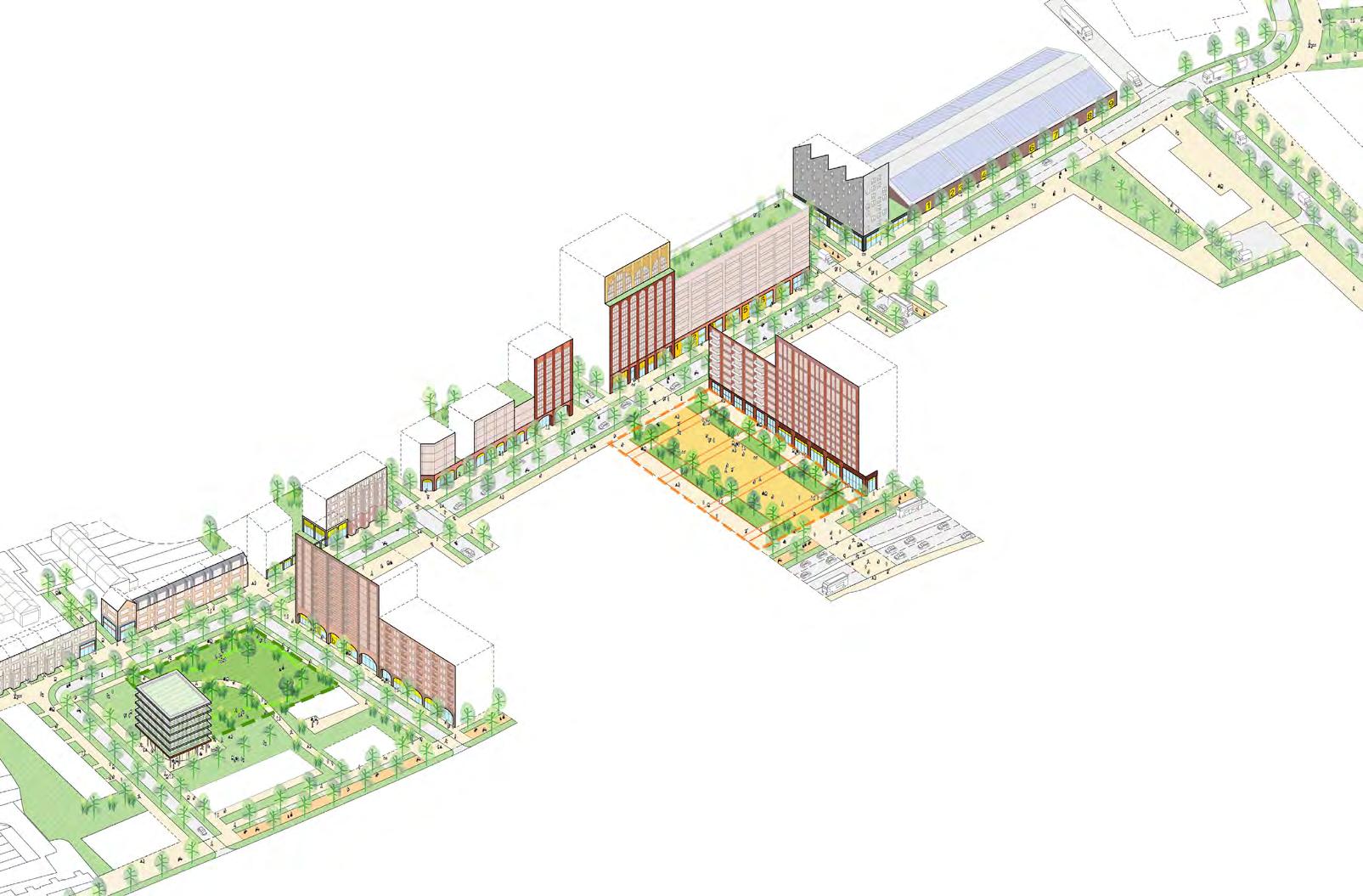
4.13 Sub-Area 9: Wing Yip & Oxgate Centre
Existing
Site Area 3.82ha
Industrial Floorspace 10,119m2
Non-industrial Floorspace 21,536m2
Density (FAR) 0.83
Estimated no. of jobs 908
Broad mix of uses, including a supermarket, business centre, permitted development residential block, and general industrial / storage uses.
Land ownership is fairly well consolidated into groups either side of Oxgate Lane. Site levels drop significantly from the western ends of Oxgate Lane and Humber Road down to Edgware Road. No servicing access off Edgware Road: this is provided off Oxgate Lane and Humber Road instead.
Illustrative Masterplan
Industrial Floorspace 7,357m2
Non-industrial Floorspace Floorspace164,370m2
Density (FAR) 4.50
1,567
Estimated no. of jobs 720
• Mixed-use podiums front onto Edgware Road, accommodating light industrial and cafe/ retail uses.
• Hotels uses may be considered acceptable subject to compliance to relevant policy/guidence.
• High-density residential accommodation above. 8-10 storey shoulder heights, with towers of 22 to-31 storeys in the west (outside the protected view corridor), stepping down to heights of 12 to 16-storeys in the east (within the view corridor).
• A new pedestrian and cycle crossing across Edgware Road connects Staples Corner with Brent Cross West, and provides improved access to public transport for people living and working in the area, and significantly improves connectivity between Brent and Barnet. The proposed crossing opens out into a new public square fronted by shops and cafés/restaurant.
Light
EdgwareRoadA5
Sui
Yard
Vacant
Servicing access
Ownership boundaries
Landscaped areas including tree planting
Map 56: Existing typical floor plan
Map 57: Illustrative ground floor plan Map 58: Illustrative upper floor plan with
There are two permitted developments; Hanover House residential scheme and Victoria Studios hotel development.
Land ownership is fairly even, with Builders Depot being the largest site. The topography in this area is particularly challenging, with levels rising towards Dollis Hill to the southwest. This means each site sits on a separate podium. Individual sites are serviced off Humber Road and Edgware Road.
• A vertically co-located podium block is provided in the northern corner of the site, fronting onto Edgware Road. New homes are arranged around a highdensity courtyard above, with building heights ranging from 9 to 16-storeys. The building is located close to the new Brent Cross West station, making it suitable for high-density residential accommodation.
• Medium-density housing is located in the south of the sub-area, tying into the surrounding low-rise residential streets. Building heights are illustrated
DRAFT
at 7-storeys along Edgware Road and the Spine Route, stepping down to 4 to 6-storeys in the south.
• A new public park which terminates the new north-south Spine Route is located in the centre of the sub-area, and is fronted by a mix of residential, community and light-industrial uses.
Retained existing building
Servicing access
Ownership boundaries
Landscaped areas including tree planting
Map 59: Existing ground floor plan
60: Illustrative ground floor plan
4.15 Indicative Massing and Building Height
Indicative Massing
4.15.1 The Illustrative Masterplan demonstrates how new development can optimise the potential of the site whilst respecting the existing context and character of Staples Corner.
4.15.2 The proposed massing illustrated on the following page demonstrates that the numbers of homes proposed in the Brent Local Plan can be achieved in locations which have been identified in the Spatial Strategies as appropriate for tall buildings.
4.15.3 Tall buildings are shown in the areas with highest future PTAL (refer to infrastructure chapter for PTAL diagrams) close to Brent Cross West Station.
4.15.4 The Illustrative Masterplan proposes taller buildings on sites with appropriate adjacent conditions, and lower buildings in areas where tall buildings could negatively impact on the local and wider area.
Industrial Building Height
4.15.8 Stacked industrial typologies have been proposed along the North Circular. These range in height from 2 to 4-storeys for large to medium scale industrial, and up to 5-storeys for studio and small scale industrial.
4.15.9 Assumed storey heights:
• Large-scale Industrial: 9 to 14m
• Medium-scale Industrial: 8m
• Small-scale Industrial: 7m
• Studio: 5m
4.15.10 These multiple storey industrial buildings have been arranged in a number of different, sitespecific ways. Stacking offers the most potential for industrial intensification, but presents challenges in terms of servicing which would need to be overcome through design to meet the needs of businesses and therefore be a suitable option.
4.15.11 In addition it is assumed that large to small-scale industrial units have an additional 10% of floorspace as mezzanines.
Residential Building Height
4.15.5 High density residential developments are proposed to the southeast of the site along Edgware Road, close to Brent Cross West Station: proposed heights here range from 10 to 30 storeys. Towards the west, heights reduce to 4 to 7-storeys to tie into the low density residential streets of Dollis Hill.
4.15.6 Assumed storey heights:
• Retail and other ground floor nonresidential uses: 7.5m (to allow for mezzanine)
• Residential: 3.2m
4.15.7 A high density neighbourhood, such as shown here, creates an opportunity for genuinely mixed use districts, replacing the existing suburban distinction between housing and industrial areas. In doing so it offers a positive response to the more intensive use of land within Staples Corner.
5 ALTERNATIVE SITE BRIEFS
5.1 Introduction
Development Brief Sites
Six sites (mapped on the following page) have been selected as representative of the range of proposed land uses and building typologies that are expected to be delivered within the Growth Area: Industrial, co-located industrial and residential (both horizontal and vertical), and mixed-use residential.
Development Brief Scenarios
Different scenarios for each site have been developed to test a range of factors influencing delivery of these sites:
• Land ownership/ land assembly
• Building typologies
• Land use
• Access and servicing arrangements
• The design scenarios also consider:
• Strategic objectives and delivery considerations
• Building heights, massing and plot ratios (to achieve a minimum 0.65 plot ratio)
• Movement network – pedestrian/cycle and vehicular and industrial traffic
• Amenity space, urban greening and biodiversity
These scenarios are summarised on page 96-98. The preferred/most viable scenario for each site forms part of the Illustrative Masterplan as shown on pages 62 and 64.
There are many potential variations for how development could come forward across the Growth Area, subject to detailed design. Development scenarios which differ from those illustrated in this document will still be considered as long as they align with the Spatial Strategies and the Design Code. This includes the replacement of existing buildings which have been shown to be retained, alternative land assembly scenarios and other arrangements.
Delivery Considerations
The Development Briefs have been developed to inform and understanding of the financial viability and commercial deliverability of the proposed mix of uses set out within the Masterplan, to inform the overall delivery potential, identify investable and developable propositions within the Masterplan area, and inform phasing and delivery strategies.
5.2 Development
Brief Sites
Development brief sites key
Industrial intensification
Co-location
Mixed-use residential
INDUSTRIAL INTENSIFICATION •
MIXED-USE RESIDENTIAL
• High density residential
• Active ground floor uses
5.3 Design Scenarios
The Staples Corner Growth Area Masterplan has tested different development scenarios from a design and deliverability perspective, to present an Option 1 and an Option 2 and a series of alternative scenarios.
Site 1A-1: Industrial, minimal land assembly. Up to three storeys, upper floors accessed via goods lifts. One way HGV loop. 713a (Eurosteel) is largely retained and has separate two-way access.
Site 1A-2: Industrial, partial land assembly. Up to two storeys, upper floor accessed via vehicle ramp for larger units and goods lifts for smaller units. Light industrial units fronting North Circular Road. Two-way access exists.
Site 1A-3: Industrial, comprehensive land assembly. Up to four storeys, arranged around three floors of shared yard spaces. HGV access to the ground floor via two way entry. Van ramp to three storeys of upper shared yards, goods lift access to the fourth floor which comprises smaller studios. In Option 1.
Site 1B-1: Industrial, three storey stacked industrial units with some light industrial, arranged around yards. Access from North Circular Road and Coles Green Road (on a new service road). Access to upper floors via
HGV ramp. North-South pedestrian route through the site. Minimal land assembly. In Option 1.
Site 1B-2: Industrial, five storey stacked for industrial logistics/distribution. Access to upper floors via oval shaped HGV ramp. Access from North Circular Road and Coles Green Road (on a new service road). Smaller light industrial block with upper floors accessed with goods lift. Minimal land assembly. In Alternative Site Briefs.
in podium. Four storey light industrial unit. Two way access to the site from Apsley Way and Waterloo Road. Residential buildings of 10 storeys and 6 storeys (292 homes). Comprehensive redevelopment in Alternative Site Briefs.
DRAFT
Site 2A-1: Horizontal co-location, three storey stacked industrial accessed via Aspley Way and Waterloo Road with goods lifts to the upper floors. Four storey light industrial with one way access from the two above mentioned roads with lift access to upper floors. 141 homes to the south of the site. Minimal land assembly.
Site 2A-2: Horizontal and vertical colocation with three storeys stacked general industrial, two storey light industrial and residential buildings of eight storeys and four storeys to south (221 homes), two way access to the site from both Waterloo Road and Apsley Way. Partial land assembly. In Option 1.
Site 2A-3: Horizontal and vertical colocation with two storeys general industrial
Site 2B-1: Vertical co-location. Single podium block with two storey light industrial unit, parking to the rear accessed from Oxgate Lane, vehicle access from Edgware Road. Six residential towers up to 19 storeys, one is standalone and five others are above the industrial unit (387 homes). Some external access to the units to the units. Requires some land assembly. Retained Myrdale Lodge.
Site 2B-2: Vertical co-location. Two podium blocks each with one storey general industrial and one storey light industrial. Central street access to all units from Oxgate Lane with no allocated yards. Five residential towers above ranging up to 20 storeys with central cores (437 homes). Minimal land assembly. Retained Myrdale Lodge.
Site 2B-3: Horizontal co-location. Two blocks, a five storey general/light industrial block fronting Edgware Road with goods lifts to access upper floors. A residential block to the rear with some ground floor community space. Vehicle access from Oxgate Lane in
a shared yard. Residential towers around a single core, up to 20 storeys (228 homes). Minimal land assembly. Retained Myrdale Lodge.
Site 2B-4: Vertical co-location. Single podium block with light industrial on lower two levels and two residential blocks on upper floors, up to 28 storeys (695 homes). Service access to the east off Oxgate Lane. Minimal land assembly. Retained Myrdale Lodge. In Option 1.
Site 2C-1: Vertical co-location. One large block with light industrial and community uses on the ground and basement floors, and three residential blocks on the upper floors. Three additional linear-shaped blocks with retail / café at ground and residential above (319 homes). External access to some homes. No land assembly.
Site 2C-2: Vertical co-location. Seven blocks, three with ground / first floor light industrial/ commercial / retail, with residential above in towers up to 11 storeys (350 homes). Ground floor service yard accessed off Oxgate Lane. External access to some homes. No land assembly.
Site 2C-3: Retention and relocation of Wing Yip superstore/cash and carry with residential. Phased provision with customer
parking and café in the basement and retail unit on the ground and upper floors residential. Four additional residential blocks (total 325 homes). Up to 12 storeys. External access to most homes. Serviced via Oxgate Lane. No land assembly. In Option 2.
Site 2C-4: Vertical co-location. Large podium block with studios on the ground with residential courtyard above. Three additional linear residential blocks and café (total 456 homes) Vehicular access from Oxgate Lane with small service yard and residential service street. Up to 14 storeys. No land assembly. In Option 1.
residential above (376 homes). Minimal land assembly. In Alternative Site Briefs.
Site 3-4: Mixed-use residential, maximum land assembly. 3 blocks of residential with ground floor retail / light industrial (1,139 homes). Service yards for each block. Up to 31 storeys. The public square provides access to the new pedestrian crossing on Edgware Road. In Option 1.
Site 3-1: Mixed use residential, comprehensive land assembly. Three blocks with café / retail and residential above (617 homes). External access to most homes. Basement parking and servicing area. Up to 19 storeys.
DRAFT
Site 3-2: Mixed-use residential, no land assembly. 10 blocks with café / retail and residential above (819 homes). External access to some homes. Basement parking and servicing area. Up to 19 storeys.
Site 3-3: First phase of mixed-use residential development. Mixed use development along Edgware Road up to 19 storeys, four blocks with hotel/retail / light industrial and
5.4 Site 1B Alternative Scenario
Large-scale stacked industrial logistics and distribution centre aimed at last mile /e-commerce operators.
Scenario 1B has five-storeys of logistics space and HGV service yards (totalling 70m in height) – this would make it significantly taller than it's immediate context. The massing is challenging, particularly in relation to the residential streets to the south of the site, therefore a setback is provided at fourth floor to reduce the impact of the building massing on it's immediate context. Further testing is therefore required at the next design stages to reduce it's overbearing impact.
A new stacked light industrial building (30m in height) in the east of the site serves as a screen to the heavier industrial activity to the north, particularly for the existing homes at Myrdale Lodge.
Servicing and access arrangements:
• Entry into the site off Coles Green Road, and independent egress directly onto Edgware Road.
• HGV ramp provides access to service yards at each level.
• Existing east-west serve route relocated to the southern site boundary.
• 150 car parking spaces provided in a deck at mezzanine level for staff/visitors. 105 operational van parking spaces provided in a multi-storey structure.
Phasing and Delivery:
• Minimal land assembly is required
• Required to be delivered in a single phase
Figure 25: Illustrative views along North Circular Road (left) and Coles Green Road (right) shows the significant scale of the proposal Map 64: Landownership and phasing diagram
5.5 Site 2A Alternative Scenario
Comprehensive redevelopment
Comprehensive redevelopment with medium to large-scale General industrial/ Storage uses in podium serviced from a shared yard in the north.
New homes are provided in 10-storey villa blocks to the north side of Apsley Way, and a mix of new units to the south side of Apsley Way with heights of up to six storeys.
Servicing and access arrangements:
• Two-way access route off Apsley Way and Waterloo Road, with a shared service yard space provided to the north of the site, away from the new homes.
Vehicle parking:
• 33 staff and visitor parking spaces provided on-plot for industrial uses. Blue badge parking for residential uses is provided on-street.
Land assembly:
• Significant land assembly is required for the industrial sites to the North of Apsley Way.
Phasing:
• This could be delivered in two phases, with plots to the north and south of Apsley Way being delivered in separate phases.
Map 65: Upper floor plan
Map 66: Landownership and phasing diagram
5.6 Site 3 Alternative Scenario
First phase of mixed-use residential development – Minimal land assembly
Scenario three demonstrates how – in high-level terms – a first phase of mixeduse development could be delivered on Edgware Road in a way that allows the superstore to remain operational during this phase of works. This arrangement allows a future phase to deliver further mixed-use development on the current superstore site. This scenario also includes pending planning application 20/4143 for mixed-use hotel development at 403-405 Edgware Road.
Servicing and access arrangements:
• Access to Wing Yip superstore retained
as existing, with service yard provided on Oxgate Lane and customer access from Edgware Road and Humber Road.
• New retail units on Edgware Road serviced from loading bays along southern elevation.
Vehicle parking:
• The existing amount of parking on the Wing Yip site is retained where possible, with 65 car parking spaces plus 4 van loading bays provided at ground level. Basement parking retained as existing.
• 11 on-street blue-badge parking spaces are provided for residential uses.
Land assembly:
• This scenario requires no land assembly, with development respecting the existing ownership boundaries.
Phasing:
• The first phase would deliver mixed-use development along Edgware Road.
• A second phase on Site 2c could deliver a new Wing Yip superstore whilst maintaining the operation of the current facilities (see 2c Scenario 3 for detail).
• A third phase could deliver further mixeduse accommodation on the current superstore site.
68: Landownership and phasing diagram
Map 67: Typical upper floor plan
Map
6 DESIGN CODE A: CODING PLAN
6.1 What is a Design Code?
6.1.1 Recent changes to the National Planning Policy Framework (NPPF) have sought to give design coding a greater role in the planning system. Published in 2021, the National Model Design Code provides detailed guidance on the production of design codes, guides and policies to promote successful design.
6.1.2 A design code is a set of concise, measurable and illustrated design requirements for new developments coming forward in an area. They are important because they can provide greater certainty for communities about the design of the development and bring conversations about design to the start of the planning process rather than the end.
6.1.3 A design code will underpin decision-making for Council Officers and, through the use of clear language such as ‘must’, ‘should’ and ‘could’, will give developers, occupants, and adjacent communities greater certainty about what may be acceptable when seeking planning permission.
6.2 Who is this Design Code for?
6.2.1 This Design Code will primarily be used by the following groups to shape development proposals emerging within the Staples Corner Growth Area and associated Design Code area boundary:
• Landowners;
• Developers;
• Design Teams;
• Council Officers; and
• Members
6.2.2 This Design Code is to be utilised as early as possible in the design and planning process and will form a material consideration in the determination of relevant planning applications.
6.3 Where does this Design Code apply?
6.3.1 This Design Code applies to the Staples Corner Growth Area, as defined in the Brent Local Plan.
6.3.2 It also applies to a section of Brook Road between Shepherds Walk and the North Circular Road. Whilst, Brook Road is outside the Growth Area boundary, it is considered strategically important for improving connectivity between Staples Corner and Neasden Recreation Ground, as well as between Neasden Recreation Ground and Gladstone Park.
Staples Corner Growth Area and Strategic Industrial Location (SIL)
Section of Brook Road covered by the Design Code
26: Design code area comprising the Staples Corner Growth Area and Brook Road
Figure
6.4.1 There are three parts to this Design Code:
• Part A provides an introduction setting out what a design code is, who this design code is for, where it applies, and how it is structured and to be used. It also describes the coding plan and how the design code relates to the masterplan.
• Part B sets out the area-wide design codes that act as general principles and apply to the entirety of the Growth Area.
• Part C sets out the street-focussed design codes that define specific principles for all existing and planned streets within the Growth Area, as well as Brook Road.
Part A: Coding Plan
Part B: Area Design Code
6.5 Using this Design Code
6.5.1 Design codes differ to design guides by enabling binary decision-making as to whether they have been followed or not. They do this through careful use of language, relying on three key words to establish the hierarchy of importance for the requirements set out:
• A ‘must’ is a mandatory code that represents an essential requirement to be met;
• A ‘should’ is an advisor y code that represents a requirement it is strongly encouraged to be met; and
• A ‘could’ is an indicatory code that represents an opportunity for additional value to be added above and beyond the mandatory and advisory requirements.
An effective design code will use this language to ensure it is practical, legible and enforceable.
6.5.2 This Design Code has been designed for ease of use to allow its content to be understood by a range of different people. Throughout the document, each design code theme utilises the colour palette defined in the National Model Design Code with varying tints to highlight whether it is a ‘must’, a ‘should’, or a ‘could’.
6.5.3 Each code requirement has also been assigned a unique reference number composed of the following:
• A letter indicating its corresponding design code theme;
• A number indicating its place in the sequence of code requirements; and
• A three letter acronym indicating to which street it relates. An example reference number is illustrated below:
6.6 Approach to Design Coding
Effective Design Coding and the Masterplan
6.6.1 This Design Code has been developed alongside the Masterplan and is informed by key decisions made as part of the masterplanning process. Equally, aspects of the Design Code have influenced the Masterplan as part of the design coding process.
6.6.2 The scope of this Design Code is limited to address matters that are not already covered as part of the spatial strategies set out in Section 3. To ensure this Design Code is effective, it has been carefully structured to provide a hierarchy of design codes. This hierarchy ensures that a baseline level of design codes apply to all of the Growth Area.
Refers to the design code theme of Movement
Refers to the abbreviated street name NCR Is the second code requirement in the sequence 02
6.6.3 Where it has been necessary to provide a more detailed level of design codes, these have been introduced and apply to all existing and planned streets. Given much of the council’s landownership in the Growth Area is limited to the streets and public realm, it is felt this is where this Design Code can have the greatest scope of influence.
6.5.4 Area-wide design codes follow the same reference numbering system above, however the three letter acronym is omitted.
6.7 Hierarchy of Design Codes
Area-Wide Design Codes
6.7.1 All of the Staples Corner Growth Area is covered by area-wide design codes.
6.7.2 These design codes set out general principles that relate primarily to the importance of improving the movement network and public realm, providing more and better access to green infrastructure, enhancing the character of the area and improving architectural quality, and tackling climate change.
6.7.3 If an applicant requires further information on matters not covered, such as land use or building heights etc. then they should refer to the relevant spatial strategies in Section 3.
Street-Focussed Design Codes
6.7.4 All existing and planned streets within the Staples Corner Growth Area, as well as Brook Road, are covered by streetfocussed design codes.
6.7.5 These design codes set out specific principles that relate primarily to the importance of delivering active travel infrastructure, providing street greening and sustainable drainage, defining how buildings interface with public realm, and creating a safe, legible and inclusive streetscape for all.
6.8 Delivery and Phasing
6.8.1 It is clear from both the council’s own observations and the representations made as part of the Draft Staples Corner Design Code statutory consultation, that there is a pressing need to improve the quality of the movement network and public realm within the Staples Corner Growth Area, particularly for the benefit of pedestrians and cyclists.
6.8.2 In accordance with the Mayor’s Transport Strategy, the aim of this Design Code is to support modal shift, by increasing levels of walking, cycling and public transport use, and decreasing vehicle dependency across and beyond the Growth Area.
6.8.3 To facilitate this modal shift, the appropriate infrastructure must be delivered, and the street-focussed design codes and supporting illustrations in Part C of this Design Code set out the council’s ambitions for what form this could take across all existing and planned streets within the Growth Area, including Brook Road. Whilst these ambitions have been informed by the council’s transport planners and engineers, it is worth highlighting, that none of the design codes nor supporting illustrations represent final proposals.
6.8.5 Given the fragmented landownership across the Growth Area, it is most likely that the delivery of improvement works will be unavoidably piecemeal, and secured via sequential combinations of S278 and S38 agreements and works on privately-owned land, as and when development proposals come forward.
6.8.6 Where development proposals come forward simultaneously on adjoining and/or opposing sites, the council will secure an agreement whereby one developer delivers the improvement works, with the other developer(s) making a financial contribution towards them.
DRAFT
6.8.4 In terms of highway management, whilst the North Circular Road and its junction with Edgware Road are maintained by Transport for London, and the eastern part of Edgware Road beyond the borough boundary is maintained by Barnet Council, almost all of the streets within the Growth Area are adopted highways maintained by Brent Council. As such, the council has a significant opportunity to comprehensively oversee and manage the delivery of improvement works.
6.8.7 Once improvement works are delivered, developers will be responsible for maintenance for the first year. Beyond this, the council will secure commuted sums for future maintenance.
6.8.8 This approach represents the least risk to delivered improvement works becoming damaged throughout the ongoing transformation of the Growth Area, though the council will secure agreements that require developers to repair any damage incurred during construction.
6.8.9 However, this approach does not provide the benefits a comprehensive public realm improvement scheme can bring in terms of signalling investment in and the regeneration of an area. At this stage, the council will continue to engage with landowners and review whether such a scheme can be identified and delivered in the short-term.
7 DESIGN CODE B: AREA
7.1 Area-Wide Design Codes
7.1.1 These area-wide design codes have been developed to give people certainty as to the council’s overarching ambitions for the Growth Area. Aligned to the 10 Characteristics of Well Designed Places set out in the National Design Guide, these design codes represent the requirements that apply to all sites, regardless of where they are located or the scale of development proposals, though some are specific to ‘major development’ only.
Context
C.01All development proposals classed as ‘major development’ must undertake a comprehensive context study incorporating analysis of:
• street network and hierarchy; public transport; walking and cycling routes; notable local buildings; local amenities; views, vistas and landmarks; urban grain; green and blue infrastructure; boundary treatments; topography; and local vernacular and materiality.
C.02All development proposals classed as ‘major development’ must undertake a comprehensive site study incorporating analysis of:
Movement
M.01Improved provision for pedestrians and cyclists must be delivered across all parts of the movement network, including:
• along the North Circular Road and Edgware Road;
• along Oxgate Lane to enhance east-west connectivity to the new Brent Cross West station, Brent Cross Town and beyond; and
DRAFT
• along Brook Road to enhance north-south connectivity between Gladstone Park and Neasden Recreation Ground.
M.02 Healthy Streets and Vision Zero principles must be applied to all parts of the movement network.
M.03New pedestrian crossings must be safe, accessible and legible, to meet relevant standards.
Nature
N.01Existing green and blue assets, and wildlife habitats, including native established vegetation, must be protected as a minimum and enhanced where possible.
• access points; orientation; topography; drainage; existing structures; ground conditions; noise and air quality; ecology; and water.
C.03All development proposals must respond to the spatial strategies set out in the masterplan, to define a series of well-informed design principles.
N.02Any proposed loss of green infrastructure that contributes to the character, biodiversity and/or amenity of the area must be mitigated.
N.03Development proposals must integrate water management and take a comprehensive approach to SuDS and the mitigation of flooding.
N.04 Artificial grass, planting and other soft landscaping must not be provided within any development proposals.
B.01Development proposals must optimise the capacity of development sites relative to the built form and density set out in the masterplan.
B.02Development proposals incorporating tall buildings must be informed by overshadowing and wind analysis from the outset, and utilise the built form to mitigate against any resultant impacts.
B.03Development proposals must not prejudice the future development of neighbouring sites through:
• poorly designed party wall conditions; and/or
• reliance on those sites for outlook or daylight.
Identity
I.01Development proposals must respond to the industrial heritage and character of the Staples Corner area.
I.02Tall buildings must have a clearly defined base, body and top, with well-proportioned facades that have a balanced solid to void ratio.
I.03Existing buildings of notable architectural character should be retained and adapted, where possible, as set out in the masterplan.
Public Space
P.01The public realm must feel safe, accessible and inclusive for all, and be designed to address the needs of vulnerable and marginalised groups at all times.
P.02Development proposals must take a proactive approach to designing out crime with consultation undertaken with Metropolitan Police Designing Out Crime Officers (DOCOs) from the outset.
P.03Streets and public spaces:
DRAFT
• must be designed to allow clear lines of sight, without hiding places;
• must be well-lit and well-overlooked; and
• must not harm the biodiversity or ecology of the surrounding area.
Use
U.01Development proposals must support the creation of a mixed community of workplaces, homes and social infrastructure through the delivery of industrial, residential and community uses, as set out in the masterplan.
I.04Streets and public spaces must be designed to create visual focal points and moments of interest, utilising existing topography.
U.02Development proposals incorporating residential uses must be tenure-blind with no distinction between the visual appearance or location of different tenures, and no segregation of external communal amenity and/or play space.
Homes and Buildings
H.01Homes must be designed to respond appropriately to any acoustic and/or air quality challenges, such as those associated with neighbouring industrial uses, or the North Circular Road and Edgware Road.
H.02Homes that are:
• dual aspect must be prioritised and provided, particularly on north facing buildings;
• single aspect north or south facing must not be provided.
H.03Private external amenity spaces must be provided to all homes, including in areas where there are acoustic challenges.
H.04 Development proposals incorporating residential uses must provide a range of external amenity spaces, as set out in the Residential Amenity Space & Place Quality SPD.
Resources
R.01Development proposals must refer to the Sustainable Environment & Development SPD from the outset.
Resources
R.03 Opportunities for reuse, adaptation and retrofitting must be explored as a first approach to any and all development proposals.
R.04All development proposals must demonstrate that they will be easily connectable to a district heat network in the future.
R.05All development proposals incorporating 1,000sqm of non-residential uses or more must achieve a BREEAM ‘Excellent’ rating, and demonstrate that opportunities to exceed this rating have been explored.
DRAFT
R.02The layout and orientation of development proposals must be informed by passive design principles from the outset to reduce energy demand by:
• optimising passive solar gain and ventilation;
• maximising internal daylight levels; and
• avoiding overheating and overshadowing.
R.06Tree and plant species selected as part of development proposals and public realm improvements must be able to endure prolonged severe weather conditions, such as drought and heavy rainfall, and where relevant, well-suited to SuDS.
R.07All development proposals should demonstrate that they have been designed and will be constructed to be flexible and adaptable, to allow use and re-use without the need for comprehensive demolition. Careful consideration should be given to:
• Structural grid;
• Core arrangement and location;
• Facade composition; and
• Method of construction.
R.08Development proposals incorporating residential or commercial uses should refer to the LETI Climate Emergency Design Guide
L.01Streetscape improvements on privately-owned land must be designed to adoptable standards and offered to the council for adoption.
L.02The design and delivery of public spaces must involve the local community to foster a sense of ownership, encourage pride in place and promote self-regulation.
L.03The management and maintenance of streets and public spaces must be the responsibility of developers for the first year, with commuted sums secured by the council for future management and maintenance.
L.04The design of play space must be:
• responsive to the diverse needs of all users, such as children, young people, parents and carers, and the elderly;
• developed through multi-generational engagement processes; and
• based on careful urban design analysis of sites within the context of the wider area.
L.05All development proposals classed as ‘major development’ must be reviewed at least twice by both the Brent Quality Review Panel (QRP) and Community Review Panel (CRP), with the review format to be agreed with the council on a case-by-case basis.
DRAFT
L.06Developers must prepare community-led management plans as part of management and maintenance strategies to support opportunities for residents to take ownership over communal amenity spaces within individual developments.
8 DESIGN CODE C: STREETS
Figure 27: View of the North Circular Road as it might be
8.1 North Circular Road
Movement
M.01.NCRA minimum footway width of 2 metres must be provided along the North Circular Road.
M.02.NCRA minimum width of 4 metres must be provided within buffer zones along the North Circular Road (see B.01.NCR) to allow for a shared space for pedestrians and cyclists.
M.03.NCRServicing must be undertaken on plot along the North Circular Road.
M.04.NCRThe footway width along the North Circular Road should be extended to 2.5 metres around bus stops, to meet relevant standards, and up to 3 metres (or more) where site conditions allow.
M.05.NCRCarriageway widths could be reduced or reconfigured in key locations along the North Circular Road e.g. where there is currently painted hatching.
Nature
N.01.NCRSemi-mature trees of climate resilient species must be planted and spaced appropriately along the North Circular Road, where site conditions and visibility splays allow.
Figure 28: Existing and aspirational sections through the North Circular Road
Nature
N.02.NCR Existing green buffers to sites along the North Circular Road must be retained or replaced as a minimum and enhanced where possible.
N.03.NCRA minimum width of 3.5 metres should be provided within buffer zones along the North Circular Road (see B.01.NCR) to allow for trees, soft landscaping and SuDS, where required and site conditions allow.
N.04.NCRThe central reservation could be reconfigured along the North Circular Road to allow for SuDS, where required and site conditions allow.
Built Form
B.01.NCRStreet facing building lines must be set back a minimum of 7.5 metres from the footway to both sides of the North Circular Road to create a buffer zone.
B.02.NCRBuilding entrances must address the North Circular Road and be located on street facing elevations to be legible within the wider streetscape.
B.03.NCRStreet facing buildings along the North Circular Road should enforce a clear separation between public frontages and private spaces at the rear of sites.
DRAFT
Figure 29: North Circular Road streetscape and public realm as it might be
Identity
I.01.NCRThe character and identity of the North Circular Road must be industrial and celebrate the long and rich industrial legacy of Staples Corner.
I.02.NCRLarge-scale and stacked industrial buildings along the North Circular Road must include clearly defined bases that relate to the human scale and enhance the wider streetscape.
I.03.NCRStreet facing elevations to the North Circular Road must include a minimum of 50% active frontage at ground floor level.
I.04.NCRBuildings at the east end of the North Circular Road should feature a material palette that celebrates industrial uses, incorporating metal cladding or other similar robust systems.
I.05.NCR Buildings at the west end of the North Circular Road should feature a material palette that transitions from industrial uses to the neighbouring residential uses and green spaces, incorporating brick, timber, green walls and other similar materials.
I.06.NCRExisting buildings along the North Circular Road of notable architectural character (such as 968 and 998 North Circular Road) should be retained and adapted.
Identity
I.07.NCRIndustrial buildings along the North Circular Road could incorporate business-related large-scale signage and supergraphics or area branding to enhance the industrial character and identity.
Public Space
DRAFT
P.01.NCRLandowners along the North Circular Road must work together with the council and TfL to ensure the public realm is integrated and accessible.
P.02.NCRForecourts and yards to industrial or commercial uses along the North Circular Road must be secure out-ofhours to discourage crime and antisocial behaviour.
P.03.NCRCar parking must not be provided at the front of sites along the North Circular Road to avoid creating vehicle dominated frontages.
P.04.NCRRest spaces should be provided along the North Circular Road at intervals of no more than 50 metres.
P.05.NCRRest spaces should be oriented away from the North Circular Road, facing towards public realm.
P.06.NCR Signage and wayfinding for sustainable modes could be provided at crossings and road junctions along the North Circular Road.
Figure 30: Character and identity principles for North Circular Road
8.2 Edgware Road
Movement
M.01.EWRA minimum footway width of 2 metres must be provided along Edgware Road.
M.02.EWRServicing must be undertaken on plot along Edgware Road.
M.03.EWRThe footway width along Edgware Road should be extended to 2.5 metres around bus stops, to meet relevant standards, and up to 3 metres (or more) where site conditions allow.
M.04.EWRProvision should be made for a twoway cycle route at a minimum width of 4 metres along Edgware Road - this should be subject to further consultation with TfL.
M.05.EWRCarriageway widths could be reduced or reconfigured in key locations along Edgware Road e.g. where there is currently painted hatching.
Nature
N.01.EWRSemi-mature trees of climate resilient species must be planted and spaced appropriately along Edgware Road, where site conditions and visibility splays allow.
Figure 31: Existing and aspirational sections through Edgware Road
*Please note this illustration shows existing development on the Barnet side of Edgware Road unchanged Nature
N.02.EWRA minimum width of 2 metres must be provided within buffer zones along Edgware Road (see B.01.EWR) to allow for trees, soft landscaping and SuDS, where required and site conditions allow.
N.03.EWRProvision should be made for a green buffer at a minimum width of 2.5 metres between the cycle route and Edgware Road.
N.04.EWRThe central reservations could be reconfigured along Edgware Road to allow for SuDS, where required and site conditions allow.
Built Form
B.01.EWRStreet facing building lines must be set back a minimum of 6 metres from the footway to Edgware Road to create a buffer zone.
B.02.EWRBuilding entrances must address Edgware Road and be located on street facing elevations to be legible within the wider streetscape.
B.03.EWRStreet facing buildings along Edgware Road should enforce a clear separation between public frontages and private spaces at the rear of sites.
DRAFT
Figure 32: Edgware Road* streetscape and public realm as it might be
Figure 33: View of Edgware Road as it might be
Identity
I.01.EWRThe character and identity of Edgware Road must be high-density mixed-use, transitioning to industrial at Staples Corner roundabout.
I.02.EWRLarge-scale residential and mixed-use buildings along Edgware Road must include clearly defined bases that relate to the human scale and enhance the wider streetscape.
I.03.EWRStreet facing elevations to Edgware Road must include a minimum of 75% active frontage at ground floor level.
I.04.EWRBuildings at the north end of Edgware Road should feature a material palette that celebrates industrial uses, incorporating metal cladding or other similar robust systems.
I.05.EWRBuildings at the south end of Edgware Road should feature a material palette that transitions from the established suburban to envisaged high-density urban character, incorporating brick, precast concrete, clay tiles and other similar materials.
Identity
I.08.EWRIndustrial buildings along Edgware Road could incorporate business-related large-scale signage and supergraphics or area branding to enhance the industrial character and identity.
I.09.EWRFacades of residential and mixeduse buildings along Edgware Road could incorporate industrial inspired architectural features, such as arches, lintels, corbelling, Crittall-style glazing.
Public Space
DRAFT
P.01.EWRLandowners along Edgware Road must work together with the council to deliver a new public space and crossing that serves as a gateway to Staples Corner.
P.02.EWRCar parking must not be provided at the front of sites along Edgware Road to avoid creating vehicle dominated frontages.
P.03.EWRRest spaces should be provided along Edgware Road at intervals of no more than 50 metres.
I.06.EWRTall buildings should feature articulated and distinctive tops that create an architecturally varied skyline.
I.07.EWRFacades of industrial buildings at Staples Corner roundabout could animate the ground level, and Edgware Road and North Circular Road flyover levels above.
P.04.EWR Ground floor uses along Edgware Road could spill out into buffer zones to create active forecourts, incorporating elements such as awnings, street furniture and signage.
P.05.EWRIncidental play space could be provided along Edgware Road in suitable locations within buffer zones.
Figure 34: Character and identity principles for Edgware Road
I. 04. EWR
I. 05. EWR
Figure 35: View of Oxgate Lane as it might be
8.3 Oxgate Lane
Movement
M.01.OGLA minimum footway width of 2 metres must be provided along Oxgate Lane.
M.02.OGLServicing must be undertaken on plot along Oxgate Lane.
M.03.OGLThe footway width along Oxgate Lane should be extended to 2.5 metres around bus stops, to meet relevant standards, and up to 3 metres (or more) where site conditions allow.
M.04.OGLProvision should be made for a twoway cycle route at a minimum width of 3 metres along Oxgate Lane.
M.05.OGLServicing bays should only be provided on Oxgate Lane if no suitable on plot alternative is possible.
M.06.OGLCarriageway widths could be reduced in key locations along Oxgate Lane to help deliver public realm improvements.
Nature
N.01.OGLSemi-mature trees of climate resilient species must be planted and spaced appropriately along Oxgate Lane, where site conditions and visibility splays allow.
Figure 36: Existing and aspirational sections through Oxgate Lane
Nature
N.02.OGLA minimum width of 2 metres must be provided within buffer zones along Oxgate Lane (see B.01.OGL) to allow for trees, soft landscaping and SuDS, where required and site conditions allow.
N.03.OGLProvision should be made for a green buffer at a minimum width of 1 metre between the cycle route and Oxgate Lane.
Built Form
B.01.OGLStreet facing building lines must be set back a minimum of 6 metres from the footway to both sides of Oxgate Lane to create a buffer zone.
B.02.OGLBuilding entrances must address Edgware Road and be located on street facing elevations to be legible within the wider streetscape.
B.03.OGLRoof forms should reference the industrial buildings of notable architectural character along and adjacent to Oxgate Lane.
B.04.OGLStreet facing buildings along Oxgate Lane should enforce a clear separation between public frontages and private spaces at the rear of sites.
37: Oxgate Lane streetscape and public realm as it might be
Figure
Identity
I.01.OGLThe character and identity of Oxgate Lane must balance industrial and residential, transitioning to high-density mixed-use towards Edgware Road.
I.02.OGLMixed-use industrial and residential buildings along Oxgate Lane must include clearly defined bases that relate to the human scale and enhance the wider streetscape.
I.03.OGLStreet facing elevations to Oxgate Lane Road must include a minimum of 75% active frontage at ground floor level.
I.04.OGLBuildings at the east end of Oxgate Lane should feature a material palette that creates a high-density urban character, incorporating brick, precast concrete and other similar materials.
I.05.OGLBuildings at the west end of Oxgate Lane should feature a material palette that transitions from the established suburban to envisaged mixed-use character, incorporating brick, glazed tiles and other similar materials.
Identity
I.08.OGLFacades of mixed-use industrial and residential buildings along Oxgate Lane could incorporate industrial inspired architectural features, such as arches, lintels, corbelling, Crittall-style glazing.
Public Space
DRAFT
I.06.OGL Tall buildings should feature articulated and distinctive tops that create an architecturally varied skyline.
I.07.OGLCourtyard entrances along Oxgate Lane could incorporate business-related large-scale signage and supergraphics to enhance the industrial character and identity.
P.01.OGLAn uninterrupted public realm must be provided along Oxgate Lane, incorporating raised side road entry treatments and/or continuous footways, to meet relevant standards.
P.02.OGLCar parking must not be provided at the front of sites along Oxgate Lane to avoid creating vehicle dominated frontages
P.03.OGLCar parking should be provided on plot, where possible, or along Oxgate Lane in small clusters of no more than two bays, to meet London Plan standards.
P.04.OGLRest spaces should be provided along Oxgate Lane at intervals of no more than 50 metres.
P.05.OGL Ground floor uses along Oxgate Lane could spill out into buffer zones to create active forecourts, incorporating elements such as awnings, street furniture and signage.
P.06.OGLIncidental play space could be provided along Oxgate Lane in suitable locations within buffer zones.
Figure
P.01.OGL
I.06.OGL
P.05.OGL
B.03.OGL
I.07.OGL
I.08.OGL
B.03.OGL
8.4 Coles Green Road
Movement
M.01.CGRA minimum footway width of 2 metres must be provided along Coles Green Road.
M.02.CGRServicing must be undertaken on plot along Coles Green Road.
M.03.CGRThe footway width along Coles Green Road should be extended to 2.5 metres around bus stops, to meet relevant standards, or more, where site conditions allow.
M.04.CGRProvision should be made for a twoway cycle route at a minimum width of 3 metres along Coles Green Road.
M.05.CGRServicing bays should only be provided on Coles Green Road if no suitable on plot alternative is possible.
M.06.CGRCarriageway widths could be reduced in key locations along Coles Green Road to help deliver public realm improvements.
Nature
N.01.CGRSemi-mature trees of climate resilient species must be planted and spaced appropriately along Coles Green Road, where site conditions and visibility splays allow.
Figure 39: Existing and aspirational sections through Coles Green Road
Nature
N.02.CGRA minimum width of 2 metres must be provided within buffer zones along Coles Green Road (see B.01.CGR) to allow for trees, soft landscaping and SuDS, where required and site conditions allow.
N.03.CGR Provision should be made for a green buffer at a minimum width of 1.5 metres between the cycle route and Coles Green Road.
Built Form
B.01.CGRStreet facing building lines must be set back a minimum of 6 metres from the footway to both sides of Coles Green Road to create a buffer zone.
B.02.CGRBuilding entrances must address Coles Green Road and be located on street facing elevations to be legible within the wider streetscape.
B.03.CGRRoof forms should reference the industrial buildings of notable architectural character along and adjacent to Coles Green Road.
B.04.CGRStreet facing buildings along Coles Green Road should enforce a clear separation between public frontages and private spaces at the rear of sites.
Figure 40: Coles Green Road streetscape and public realm as it might be
Figure 41: View of Coles Green Road as it might be
Identity
I.01.CGRThe character and identity of Coles Green Road must be industrial, transitioning to residential towards Oxgate Lane.
I.02.CGRLarge-scale industrial buildings along Coles Green Road must include clearly defined bases that relate to the human scale and enhance the wider streetscape.
I.03.CGRStreet facing elevations to Coles Green Road must include a minimum of 75% active frontage at ground floor level.
I.04.CGRBuildings along Coles Green Road should feature a material palette that transitions from the established suburban to envisaged industrial character and celebrates industrial uses, incorporating brick, glazed tiles and precast concrete, with metal cladding or other similar materials at upper levels.
I.05.CGRExisting buildings along Coles Green Road of notable architectural character (such as 158-162 Coles Green Road) should be retained and adapted.
I.06.CGRIndustrial buildings along Coles Green Road could incorporate businessrelated large-scale signage and supergraphics to enhance the industrial character and identity.
Public Space
P.01.CGRLandowners along Coles Green Road must work together with the council to deliver a new public space.
P.02.CGRCar parking must not be provided at the front of sites along Coles Green Road to avoid creating vehicle dominated frontages.
P.03.CGRCar parking should be provided on plot, where possible, or along Coles Green Road in small clusters of no more than two bays, to meet London Plan standards.
P.04.CGRRest spaces should be provided along Coles Green Road at intervals of no more than 50 metres.
P.05.CGR Ground floor uses along Oxgate Lane could spill out into buffer zones to create active forecourts, incorporating elements such as awnings, street furniture and signage.
P.06.CGRIncidental play space could be provided along Coles Green Road, adjacent to residential uses, in suitable locations within buffer zones.
Figure 42: Character and identity principles for Coles Green Road
B.03.CGR
P.05.CGR
I.06.CGR
I.02.CGR
P.01.CGR
N.03.CGR
M.04.CGR
I.05.CGR
8.5 Humber Road
Movement
Existing
M.01.HBRA minimum footway width of 2 metres must be provided along Humber Road.
M.02.HBRServicing must be undertaken on plot along Humber Road.
Existing
M.03.HBRThe footway width along Humber Road should be extended to 2.5 metres (or more) in high footfall areas, where site conditions allow.
M.04.HBRProvision should be made for an on carriageway cycle route along Humber Road, with junctions and signage to meet relevant standards.
M.05.HBRServicing bays should only be provided on Humber Road if no suitable on plot alternative is possible.
M.06.HBRCarriageway widths could be reduced in key locations along Humber Road to help deliver public realm improvements.
Proposed
Nature
N.01.HBRSemi-mature trees of climate resilient species must be planted and spaced appropriately along Humber Road, where site conditions and visibility splays allow.
Proposed
Figure 43: Existing and aspirational sections through Humber Road
Nature
N.02.HBRA minimum width of 2 metres must be provided within buffer zones along Humber Road (see B.01.HBR) to allow for trees, soft landscaping and SuDS, where required and site conditions allow.
N.03.HBRDefensible planting should be provided to create separation between forecourts associated with residential uses along Humber Road.
N.04.HBRPlanning contributions could be directed towards initiatives promoting street tree planting outside the Growth Area along Humber Road.
Built Form
B.01.HBRStreet facing building lines must be set back a minimum of 6 metres from the footway to Humber Road to create a buffer zone.
B.02.HBRBuilding entrances must address Humber Road and be located on street facing elevations to be legible within the wider streetscape.
B.03.HBRBuilding forms should reinforce street frontages whether placed parallel or perpendicular to Humber Road.
B.04.HBRRoof forms should reference the established residential character at the west end of Humber Road.
44: Humber Road streetscape and public realm as it might be
Figure
Built Form
B.05.HBRStreet facing buildings along Humber Road should enforce a clear separation between public frontages and private spaces at the rear of sites.
Identity
I.01.HBRThe character and identity of Humber Road must transition from low-density residential to high-density mixed-use towards Edgware Road.
I.02.HBRLarge-scale residential and mixed-use buildings along Humber Road must include clearly defined bases that relate to the human scale and enhance the wider streetscape.
I.03.HBRStreet facing elevations to Humber Road must include a minimum of 50% active frontage at ground floor level.
I.04.HBRBuildings along Humber Road should feature a material palette that transitions from the established suburban to envisaged mixed-use character, incorporating brick, glazed tiles and other similar materials.
Public Space
P.01.HBRAn uninterrupted public realm must be provided along Humber Road, incorporating raised side road entry treatments and/or continuous footways, to meet relevant standards.
P.02.HBRCar parking must not be provided at the front of sites along Humber Road to avoid creating vehicle dominated frontages
DRAFT
I.05.HBR Facades of residential buildings along Humber Road could incorporate ‘Metroland’ inspired architectural features, such as arches, projecting bays, dormers, decorative brickwork.
P.03.HBRCar parking should be provided on plot, where possible, or along Humber Road in small clusters of no more than two bays, to meet London Plan standards.
P.04.HBRRest spaces should be provided along Humber Road at intervals of no more than 50 metres.
P.05.HBR Ground floor uses at the east end of Humber Road could spill out into buffer zones to create active forecourts, incorporating elements such as awnings, street furniture and signage.
P.06.HBRIncidental play space could be provided along Humber Road in suitable locations within buffer zones.
Figure 45: Character and identity principles for Humber Road
P.01.HBR
I.05.HBR
I.02.HBR
P.05.HBR N.02.HBR
N.03.HBR
8.6 Waterloo Road
Movement
M.01.WLRA minimum footway width of 2 metres must be provided along Waterloo Road.
M.02.WLRServicing must be undertaken on plot along Waterloo Road.
M.03.WLRServicing bays must not be provided on Waterloo Road north of the junction with the East-West Service Route (Streakes Field Road).
M.04.WLRThe carriageway width must be reduced along Waterloo Road north of the East-West Service Route to improve pedestrian and cyclist safety and help deliver public realm improvements.
M.05.WLR A modal filter must be provided at the junction of Waterloo Road and Ballards Road to improve pedestrian, cyclist and vehicle safety.
M.06.WLRThe footway width along Waterloo Road should be extended to 2.5 metres (or more) where site conditions allow.
M.07.WLRProvision should be made for a contraflow cycle route at a minimum width of 1.5 metres along Waterloo Road north of the East-West Service Route.
Figure 46: Existing and aspirational sections through Waterloo Road (north)
Movement
M.08.WLRThe carriageway width should be reduced along Waterloo Road south of the junction with the East-West Service Route to help deliver public realm improvements.
M.09.WLRA minimum width of 3.5 metres should be provided to both sides of Waterloo Road, south of the East-West Service Route, to allow for a shared space for pedestrians and cyclists.
M.10.WLRServicing bays should only be provided on Waterloo Road south of the junction with the East-West Service Route (Streakes Field Road) and if no suitable on plot alternative is possible.
M.11.WLRA shared surface could be provided along Waterloo Road between the junction with Apsley Way and Ballards Road, to meet relevant standards.
Nature
N.01.WLRSemi-mature trees of climate resilient species must be planted and spaced appropriately along Waterloo Road, where site conditions and visibility splays allow.
Figure 47: Waterloo Road (north) streetscape and public realm as it might be
Existing
N.02.WLRDefensible planting must be provided to create separation between forecourts associated with industrial uses along Waterloo Road north of the East-West Service Route.
N.03.WLRA minimum width of 1.5 metres must be provided within buffer zones along Waterloo Road south of the East-West Service Route (see B.01.WLR) to allow for trees, soft landscaping and SuDS, where required and site conditions allow.
Existing
B.02.WLRBuilding entrances must address Waterloo Road and be located on street facing elevations to be legible within the wider streetscape. Nature
N.04.WLRProvision should be made for a green buffer at a minimum width of 1.5 metres between the carriageway and contraflow cycle route along Waterloo Road north of the East-West Service Route.
Proposed
B.01.WLRStreet facing building lines must be set back a minimum of 4 metres from the footway to Waterloo Road to create a buffer zone.
Proposed
Figure 48: Existing and aspirational sections through Waterloo Road (south)
Built Form
B.03.WLRRoof forms to residential and mixed-use buildings along Waterloo Road south of Apsley Way should reference the established residential character of the surrounding area.
B.04.WLRStreet facing buildings along Waterloo Road should enforce a clear separation between public frontages and private spaces at the rear of sites.
Identity
I.01.WLRThe character and identity of Waterloo Road must be industrial, transitioning to residential towards Apsley Way and Ballards Road.
I.02.WLRLarge-scale industrial buildings along Waterloo Road must include clearly defined bases that relate to the human scale and enhance the wider streetscape.
I.03.WLRStreet facing elevations to Waterloo Road must include a minimum of 50% active frontage at ground floor level.
I.04.WLRBuildings at the north end of Waterloo Road should feature a material palette that celebrates industrial uses, incorporating metal cladding or other similar robust systems.
49: Waterloo Road (south) streetscape and public realm as it might be
Figure
Identity
I.05.WLRBuildings along Waterloo Road between the East-West Service Route and Apsley Way should feature a material palette that transitions from the established suburban to envisaged industrial character, incorporating brick, glazed tiles and precast concrete, with metal cladding or other similar materials at upper levels.
I.06.WLRBuildings along Waterloo Road between Apsley Way and Ballards Road should feature a material palette that relates to the established suburban character, incorporating brick, precast concrete and clay tiles or other similar materials.
I.07.WLRIndustrial buildings along Waterloo Road could incorporate businessrelated large-scale signage and supergraphics to enhance the industrial character and identity.
I.08.WLRFacades of residential buildings along Waterloo Road could incorporate ‘Metroland’ inspired architectural features, such as arches, projecting bays, dormers, decorative brickwork.
Public Space
P.01.WLRAn uninterrupted public realm must be provided along Waterloo Road, incorporating raised side road entry treatments and/or continuous footways, to meet relevant standards.
P.02.WLRCar parking must not be provided at the front of sites along Waterloo Road to avoid creating vehicle dominated frontages.
DRAFT
P.03.WLRCar parking should be provided on plot, where possible, or along Waterloo Road, south of the East-West Service Route in small clusters of no more than two bays, to meet London Plan standards.
P.04.WLRRest spaces should be provided along Waterloo Road at intervals of no more than 50 metres.
P.05.WLR Ground floor uses along Waterloo Road could spill out into buffer zones to create active forecourts, incorporating elements such as awnings, street furniture and signage.
P.06.WLRIncidental play space could be provided along Waterloo Road, adjacent to residential uses, in suitable locations within buffer zones.
Figure
N.03.WLR
B.02.WLR
I.08.WLR
8.7 Apsley Way & Brook Road
Movement
M.01.AWBA minimum footway width of 2 metres must be provided along Apsley Road.
M.02.AWBA pedestrian and cyclist connection must be delivered between Apsley Way and Brook Road via Shepherds Walk.
M.04.AWBServicing must be undertaken on plot along Apsley Way or via the East-West Service Route.
M.05.AWBServicing bays must not be provided on Apsley Way.
Existing Proposed
M.06.AWBAn assessment of on-street parking demand should be undertaken along Brook Road and adjoining streets to identify opportunities for public realm improvements.
M.07.AWBThe footway width along Apsley Way and Brook Road should be extended to 2.5 metres (or more) where site conditions allow.
M.08.AWBA minimum width of 4 metres should be provided to the south side of Apsley Way to allow for a shared space for pedestrians and cyclists.
Existing Proposed
DRAFT
M.09.AWBProvision should be made for a twoway cycle route at a minimum width of 3 metres along Brook Road.
51: Existing and aspirational sections through Apsley Way
Figure
M.10.AWBServicing bays should only be provided on Apsley Way if no suitable on plot alternative is possible.
M.11.AWBCarriageway widths could be reduced in key locations along Apsley Way and Brook Road to help deliver public realm improvements.
Nature
N.01.AWBSemi-mature trees of climate resilient species must be planted and spaced appropriately along Apsley Way and Brook Road, where site conditions and visibility splays allow.
N.02.AWBDefensible planting must be provided to create separation between forecourts associated with residential uses along Apsley Way.
N.03.AWBA minimum width of 1.5 metres must be provided within buffer zones along Apsley Way (see B.01.AWB) to allow for trees, soft landscaping and SuDS, where required and site conditions allow.
N.04.AWB Provision should be made for a green buffer at a minimum width of 1.5 metres between the footway and the shared space for pedestrians and cyclists along the south side of Apsley Way.
Figure 52: Apsley Way streetscape and public realm as it might be
Nature
N.05.AWBProvision should be made for a green buffer at a minimum width of 2.5 metres between the cycle route and footway along Brook Road.
N.06.AWBPlanning contributions could be directed towards initiatives promoting street tree planting outside the Growth Area along Brook Road.
Built Form
B.01.AWBStreet facing building lines must be set back a minimum of 4 metres from the footway to Apsley Way to create a buffer zone.
B.02.AWBBuilding entrances must address Apsley Way and be located on street facing elevations to be legible within the wider streetscape.
B.03.AWBBuilding forms should reinforce street frontages whether placed parallel or perpendicular to Apsley Way.
B.04.AWBRoof forms of industrial buildings should reference the established industrial character of the surrounding area.
B.05.AWBRoof forms to residential and mixeduse buildings along Apsley Way should reference the established residential character of the surrounding area.
53: Existing and aspirational sections through Brook Road
Figure
Built Form
B.06.AWBStreet facing buildings along Apsley Way should enforce a clear separation between public frontages and private spaces at the rear of sites.
Identity
I.01.AWBThe character and identity of Apsley Way must be industrial, transitioning to residential towards Waterloo Road.
I.02.AWBLarge-scale industrial buildings along Apsley Way must include clearly defined bases that relate to the human scale and enhance the wider streetscape.
I.03.AWBStreet facing elevations to Apsley Way must include a minimum of 50% active frontage at ground floor level.
I.04.AWBBuildings at the north end of Apsley Way should feature a material palette that celebrates industrial uses, incorporating metal cladding or other similar robust systems.
I.05.AWBBuildings at the east end of Apsley Way should feature a material palette that transitions from the established suburban to envisaged industrial character, incorporating brick, glazed tiles and precast concrete, with metal cladding or other similar materials at upper levels.
DRAFT
54: Brook Road streetscape and public realm as it might be
Figure
Identity
I.06.AWBBuildings to the south side of Apsley Way should feature a material palette that relates to the established suburban character, incorporating brick, precast concrete and clay tiles or other similar materials.
I.07.AWBLandowners could work together with the council to remove the fence between Shepherds Walk and Apsley Way and deliver a visually permeable boundary treatment incorporating defensible planting.
I.08.AWBIndustrial buildings along Apsley Way could incorporate business-related large-scale signage and supergraphics to enhance the industrial character and identity.
I.09.AWBFacades of residential buildings along Apsley Way could incorporate ‘Metroland’ inspired architectural features, such as arches, projecting bays, dormers, decorative brickwork.
Public Space
P.01.AWBLandowners along Apsley Way must work together with the council to deliver a new public space.
P.02.AWBCar parking must not be provided at the front of sites along Apsley Way to avoid creating vehicle dominated frontages.
P.03.AWBCar parking should be provided on plot, where possible, or along Apsley Way in small clusters of no more than two bays, to meet London Plan standards.
DRAFT
P.04.AWBRest spaces should be provided along Apsley Way and Brook Road at intervals of no more than 50 metres.
P.05.AWB Ground floor uses along Apsley Way Road could spill out into buffer zones to create active forecourts, incorporating elements such as awnings, street furniture and signage.
P.06.AWBIncidental play space could be provided along Brook Road within the 2.5 metre minimum width green buffer.
P.07.AWBA new or improved pedestrian and cyclist bridge could be provided via financial contributions to connect Brook Road to Neasden Recreation Ground.
B.06.AWB N.04.AWB
I.09.AWB N.03.AWB
P.01.AWB N.02.AWB
M.02.AWB
8.8 East-West Service Route
Movement
M.01.EWSA servicing route must be provided between Coles Green Road and Edgware Road to enable the delivery of the EastWest Service Route.
M.02.EWSThe servicing route must be built to adoptable standards and supervised by the council under a Section 38 agreement.
M.03.EWSA minimum footway width of 2 metres must be provided along the East-West Service Route.
M.04.EWSServicing must be undertaken on plot, where possible, or along the East-West Service Route in servicing bays.
M.05.EWSServicing bays must not be provided adjacent to neighbouring residential properties.
M.06.EWSCrossings and junctions along the EastWest Service Route must be safe, legible and inclusive to ensure the public realm is integrated and accessible.
Nature
N.01.EWSSemi-mature trees of climate resilient species must be planted and spaced appropriately along the East-West Service Route, where site conditions and visibility splays allow.
DRAFT
N.02.EWSDefensible planting must be provided to create separation between buildings and spaces associated with industrial uses along the East-West Service Route, particularly adjacent to neighbouring residential properties.
N.03.EWSProvision should be made for a buffer zone between the footway and carriageway along the East-West Service Route at a minimum width of 1.5 metres to allow for trees, soft landscaping and SuDS, where site conditions allow.
N.04.EWSBuild outs for trees, soft landscaping and SuDS could be provided where the carriageway width is required to be reduced along the East-West Service Route to reduce vehicle speeds.
M.07.EWSThe footway width along the East-West Service Route should be extended to 2.5 metres (or more) where site conditions allow.
B.03.EWS
B.04.EWS
I.04.EWS
B.03.EWS
Built Form
B.01.EWSStreet facing building lines must be set back a minimum of 3.5 metres from the carriageway along the East-West Service Route to allow space for a footway and planted buffer zone.
B.02.EWSBuilding forms along the East-West Service Route must comply with the principles of SPD1 Brent Design Guide where applicable e.g. adjacent to neighbouring residential properties.
B.03.EWSBuilding entrances addressing the EastWest Service Route must be legible within the wider streetscape.
B.04.EWSBuilding forms should reinforce street frontages whether placed parallel or perpendicular to the East-West Service Route.
Identity
I.01.EWSThe character and identity of the EastWest Service Route must be industrial.
I.02.EWSLarge-scale industrial buildings along the East-West Service Route must include clearly defined bases that relate to the human scale and enhance the wider streetscape.
Identity
I.04.EWSBuildings along the East-West Service Route should feature a material palette that celebrates industrial uses, incorporating metal cladding or other similar robust systems.
I.05.EWSIndustrial buildings along the EastWest Service Route could incorporate business-related large-scale signage and supergraphics to enhance the industrial character and identity.
DRAFT
Public Space
P.01.EWSLandowners must work together with the council to deliver a new public right of way between the East-West Service Route and the North Circular Road to improve north-south connectivity.
P.02.EWSCar parking must be provided on plot along the East-West Service Route.
P.03.EWSCar parking must not be provided on street along the East-West Service Route.
P.04.EWSRest spaces should be provided along the East-West Service Route at intervals of no more than 50 metres.
I.03.EWSStreet facing elevations to the East-West Service Route must include a minimum of 25% active frontage at ground floor level.
P.05.EWS Signage and wayfinding for drivers could be provided at key decision points along the East-West Service Route to improve the safety and efficiency of servicing.
Figure 57: Aerial view towards the Nor th-South Spine Route
8.9 North-South Spine Route
Movement
M.01.NSSA new street must be provided between the East-West Service Route and Edgware Road, via Oxgate Lane and Humber Road, to enable the deliver of the North-South Spine Route.
M.02.NSSThe new street must be built to adoptable standards and supervised by the council under a Section 38 agreement.
M.03.NSSA minimum footway width of 2 metres must be provided along the NorthSouth Spine Route.
M.04.NSSServicing must be undertaken on plot, where possible, or along the NorthSouth Spine Route in servicing bays.
M.06.EWSCrossings and junctions along the North-South Spine Route must be safe, legible and inclusive to ensure the public realm is integrated and accessible.
M.07.EWSA pedestrian and cyclist connection must be delivered between Chipstead Gardens and the North-South Spine Route.
M.08.EWSThe footway width along the NorthSouth Spine Route should be extended to 2.5 metres (or more) where site conditions allow.
Nature
N.01.NSSSemi-mature trees of climate resilient species must be planted and spaced appropriately along the North-South Spine Route, where site conditions and visibility splays allow.
DRAFT
N.02.NSSDefensible planting must be provided to create separation between buildings and spaces associated with residential, industrial or mixed uses along the North-South Spine Route, particularly adjacent to neighbouring residential properties.
N.03.NSSProvision should be made for a buffer zone between the footway and carriageway along the North-South Spine Route at a minimum width of 1.5 metres to allow for trees, soft landscaping and SuDS, where site conditions allow.
N.04.NSSBuild outs for trees, soft landscaping and SuDS could be provided where the carriageway width is required to be reduced along the North-South Spine Route to reduce vehicle speeds.
DRAFT
N.02.NSS
P.02.NSS
B.01.NSSStreet facing building lines must be set back a minimum of 3.5 metres from the carriageway along the NorthSouth Spine Route to allow space for a footway and planted buffer zone.
B.02.NSSBuilding forms along the North-South Spine Route must comply with the principles of SPD1 Brent Design Guide where applicable e.g. adjacent to neighbouring residential properties.
B.03.NSS Building entrances addressing the North-South Spine Route must be legible within the wider streetscape.
B.04.NSSBuilding forms should reinforce street frontages whether placed parallel or perpendicular to the North-South Spine Route.
Identity
I.01.NSSThe character and identity of the NorthSouth Spine Route must transition from low-density residential to highdensity mixed-use towards Oxgate Lane, transitioning to industrial towards the East-West Service Route.
Identity
I.03.NSSStreet facing elevations to the NorthSouth Spine Route must include a minimum of 50% active frontage at ground floor level.
I.04.NSSBuildings at the north end of the NorthSouth Spine should feature a material palette that celebrates industrial uses, incorporating metal cladding or other similar robust systems.
DRAFT
I.05.NSS Buildings at the south end of the North-South Spine should feature a material palette that transitions from the established suburban to envisaged highdensity urban character, incorporating brick, precast concrete, clay tiles and other similar materials.
I.06.NSSTall buildings along the North-South Spine Route should feature articulated and distinctive tops that create an architecturally varied skyline.
I.05.NSSIndustrial buildings along the NorthSouth Spine Route could incorporate business-related large-scale signage and supergraphics to enhance the industrial character and identity.
I.02.NSSLarge-scale residential and mixed-use buildings along the North-South Spine Route must include clearly defined bases that relate to the human scale and enhance the wider streetscape.
I.08.NSSFacades of residential buildings along the North-South Spine Route could incorporate ‘Metroland’ inspired architectural features, such as arches, projecting bays, dormers, decorative brickwork.
Public Space
P.01.NSSLandowners along the North-South Spine Route must work together with the council to deliver new public spaces.
P.02.NSSAn uninterrupted public realm must be provided along North-South Spine Route, incorporating raised side road entry treatments and/or continuous footways, to meet relevant standards.
P.03.NSSCar parking must not be provided at the front of sites along North-South Spine Route to avoid creating vehicle dominated frontages.
P.04.NSSCar parking should be provided on plot, where possible, or along North-South Spine Route, south of the East-West Service Route in small clusters of no more than two bays, to meet London Plan standards.
P.05.NSSRest spaces should be provided along North-South Spine Route at intervals of no more than 50 metres.
P.06.NSS Ground floor uses along NorthSouth Spine Route could spill out to create active forecourts, incorporating elements such as awnings, street furniture and signage.
P.07.NSSIncidental play space could be provided along North-South Spine Route, adjacent to residential uses, in suitable locations.
Public Space
P.08.NSS Signage and wayfinding for drivers could be provided at key decision points along the North-South Spine Route to improve the safety and efficiency of servicing.
9 INFRASTRUCTURE SUSTAINABILITY & ENERGY
9.1 Introduction
The infrastructure chapter provides further detail to support the spatial strategies and the delivery of the Masterplan, on highways, public realm, and energy use across Staples Corner.
The delivery of the infrastructure projects identified in this chapter will act to catalyse and support development across Staples Corner.
Where relevant, the council will be looking to secure s106 contributions towards infrastructure delivery.
The council also recognises the role of digital connectivity and securing the fastest possible broad band speeds to enable businesses to carry out their functions.
Transport and Movement
9.1.1 The intensification of industrial activity and introduction of new homes and other supporting uses will generate a significant increase in the amount of movement in and around Staples Corner. In order to reduce the potential impacts of this and ensure sustainable development, the strategy is to enhance accessibility by active travel and public transport modes, increase the mix of uses and facilities in the most
accessible locations, and use parking restraint measures in and around new development to discourage car use. Together these measures will act to shift to more sustainable patterns of movement, avoiding the need for significant traffic capacity upgrades to the local highway network.
Sustainability and Energy
9.1.5 The Staples Corner masterplan has been developed from the outset with environmental sustainability embedded in the proposals with a commitment to the net zero carbon target agenda.
DRAFT
9.1.2 Locations have been identified across the Staples Corner areas where improvements are required to rationalise road access, reduce conflicts (especially between industrial traffic and local movement), improve accessibility and promote active travel.
9.1.3 There is a key overlap between highways and public realm opportunities which have been previously identified as part of the Staples Corner Public Realm Strategy.
9.1.4 The focus of this chapter is on infrastructure interventions within the Staples Corner Masterplan area. However, the strategy supports other planned improvements (related to development in Barnet), such as the reconfiguration of Staples Corner West Roundabout and enhancement of routes and spaces across Staples Corner Retail Park.
9.1.6 A communal heating strategy is proposed based on connection to the emerging District Heat Network (DHN) at Brent Cross Town. The DHN could utilise waste heat generated on-site (including from the data centre), and would offer a great opportunity for buildings to reduce their carbon footprint. Passive solutions can be prioritised to mitigate potential overheating risk.
9.1.7 On-site generation of renewable energy has been considered, and a site-wide massing strategy has been developed for buildings to step down to the south to maximise opportunities for roof-level photovoltaics.
9.1.8 The Brent Sustainable Environment and Development SPD 2023 should be consulted for more detailed guidance.
Figure 59: There are many layers of infrastructure across Staples Corner
Figure 60: Junctions along the A406 should be reconfigured to improve safety for pedestrians
DRAFT
Figure 62: The current road infrastructure is dominant in Staples Corner and dissuades active travel
Figure 63: The new Brent Cross West Thameslink station greatly improves PTAL in the area
Figure 64: Pure data centre has the potential to deliver
for
A Waterloo Road modal filter and pocket park
B North Circular Road (lower) at grade crossing
C North Circular Road new ped/cycle green bridge
D Welsh Harp footpath and cycle route
E Junction redesign for active travel & safety improvements
F Edgware Road at grade crossing
G New street providing servicing access
H Oxgate Lane/Coles Green Road junction and public realm redesign
I Shepherds Walk active travel connection
J East-west active travel connection
K New cycling infrastructure
L Humber Road junction alterations for servicing
M Servicing loop to Staples Corner West
N Maintenance of existing bridge
O New public space/pocket park
P River Brent boardwalk (LB Barnet)
Q New ped/cycle/bus connection over MML (LB Barnet)
Staples Corner West Roundabout active travel improvements (LB Barnet)
9.3 Sustainability and Energy
Introduction
9.3.1 The Staples Corner masterplan has been developed from the outset with environmental sustainability embedded in the proposals with consideration to opportunities for an aspirational and innovative energy and sustainability strategy.
9.3.2 From Smart City investment to creating Healthy Streets, to emerging thinking on energy and environmental sustainability the approach supports the Mayor’s ‘Good Growth’ and other aspirational borough policies. It aspires to create a place that is low carbon, resource efficient, high quality and that promotes health and well-being for future generations.
9.3.3 Staples Corner should set an environmental sustainability precedent for other local communities by reducing carbon emissions as far as feasible and be a development adapted and designed to respond sensitively, and sensibly, to the inevitable effects of climate change.
9.3.4 The objectives and aspirations included in this section of the report
are in line with the GLA and Brent policies.
9.3.5 Proposals for new development at Staples Corner should be based on a fabric first approach with efficient services, and exceeding minimum requirements for carbon reductions:
DRAFT
• Sustainable solutions should be provided and circular economy principles be applied for retention of resources
• Materials selection should focus on local and sustainable sourcing with priority for products that have a low embodied carbon footprint
• Development should be air quality neutral as a minimum, with aspiration for air quality positive, and will promote sustainable means of transport
• The masterplan area should connect to existing green spaces, provide improved landscaping and maximised planting to help against the urban heat island effect and to enhance biodiversity
• Rainwater and greywater harvesting should offset freshwater
• As far as feasible 100% diversion of construction waste from landfill should be targeted
• Where possible, to introduce publicly
accessible amenity for the local community at roof level, alongside renewable energy generation and biodiversity measures
Innovation
We acknowledge that over the time period of the Staples Corner Masterplan there will be technological innovation, explored through institutional partnerships promoting environmental resiliency.
Innovation
Refer to these markers throughout this chapter relating to innovation, precedent projects and references.
Figure 65: Belltown Building, Seattle is an example of a net zero high-rise development with roof and facade mounted PVs and battery storage.
9.4 Energy Strategy
9.3.6 Passive solutions should be prioritised to mitigate potential overheating risk such as avoiding single aspect north or south facing homes, priotising and maximising dual aspect homes including a consideration to Passivehaus design principles. Building massing should consider the surroundings, and buildings should be designed following London Energy Transformation Initiative (LETI) guidance with efficient form, solar orientation, and shape factor to maximize ability for natural ventilation in a dual-aspect flat configuration. Overheating and facade modelling assessments should be undertaken.
9.3.7 Renewable energy generation should be maximised on site, and peak demand response considered.
9.3.8 A district heat network (DHN) is proposed, which could utilise the waste heat from the data centre on site, and would offer a great opportunity for neighbouring buildings to connect and reduce their carbon footprint.
Renewable Energy
Photovoltaics
• Opportunities to incorporate photovoltaics onto roofs, of both residential and industrial buildings should be considered.
• Building massing should be optimised to reduce over-shading to neighbouring roofs.
Biosolar Roofs
• Photovoltaics could be integrated with green roofs (ie Biosolar roofs).
• The combination of the two gives the opportunity for biodiversity enhancement, alongside reduction of the urban heat island effect and reduction of cooling loads on the respective (industrial) buildings.
• Increases the efficiency of renewable energy generation (this type of PV installation increases their efficiency as the panels do not overheat).
Solar Films
• Solar films should be considered for vertical surfaces to further maximise on-site renewable energy generation.
Innovation: SolShare Technology
This allows surplus energy generated by a bulding's PVs to distributed using a smart grid to communal areas, individual flats, and businesses depending on demand.
Figure 66: SolShare connects building to grid loop
Figure 67: SolShare installed in development in Chatham, Kent - 90 residential units across 3 buildings
District Heat Network
Other Technologies
• Electric vehicles utilising batteries to balance peak usage and smart hot water cylinders using water as thermal storage. As there may be a surplus of energy generated from PVs and other renewable technologies (including waste heat from data centre uses), adding the ability to store this energy (EVs for electrical energy and smart HWC for both electrical and waste heat) for usage during peak times could reduce reliance on the grid.
• Smart homes could also tap into the surplus, allowing families to capitalise on lower energy costs (when there is surplus) to do laundry, dish washing etc.
Figure 68: 7 MWp PV installation on the rooftop of the Alblasserdam Logistics Centre in the Netherlands for Goodman.
A low carbon district heating network (DHN) is proposed as part of the Staples Corner Masterplan. This could take a number of forms, including:
1. Connection to Brent Cross Town's DHN
• LB Brent's preference is to connect the Staples Corner development to the proposed DHN at Brent Cross Town, which would provide a heating flow and return pipe connection for the masterplan development.
Connection to Brent Cross Town DHN
The aspiration is to deliver a DHN at Staples Corner which connects to the proposed DHN at Brent Cross Town for improved system efficiencies. Existing major transport infrastructure and below ground utilities (including the rail corridor and National Grid transmission route which runs parallel to Edgware Road) constrain opportunities to connect to Brent Cross Town. Following high-level scoping, two potential connection locations have been identified:
• A focus on heating design would be required to ensure return temperatures were sufficiently low to enable the DHN to operate at the expected higher efficiencies.
2. Local DHN with on-site energy centre
• Zero-emission energy centre
3. Ambient heating/cooling network
DRAFT
• A 5th generation ambient loop would be expected to self-balance as it would be located a minimum of 0.6m underground.
• If the natural environment was not sufficient for the total heating/cooling load, it could be supplemented using boreholes/air source heat pumps.
• In the north of the site, using the viaduct over River Brent as a route below the railway. This would allow early connection for the initial, industrial intensification phases of the Staples Corner masterplan, but is expected to require longer routing/ tunnelling to reach the Brent Cross Town heat network, and would involve crossing multiple landholdings.
• In the south of the site, potentially installed during delivery of a new pedestrian crossing over Edgware Road to minimise disruption to the strategic road, although this option would require new bridging/tunnelling across the rail corridor. The connection is expected to be available during the latter, residential/ co-location phases of the masterplan.
Further investigation required to appraise connection options.
Phasing
Connection to the Brent Cross DHN is only expected to be available partway through the masterplan period, therefore an onsite energy centre would be required to support the local network in the meantime. The energy centre would be temporary and decommissioned following completion of the connection. It would operate at the same temperature as the Brent Cross DHN to allow ease of switch-over.
A DHN can be delivered effectively under phased development, even if the site boundaries of consecutive phases do not adjoin (as is expected for Staples Corner). The network would be designed considering all phases, although initially only the infrastructure for the first phase would be installed, with the pipework isolated and capped off at the site boundary for connection to future phases. If the next phase required infrastructure to run through future phases then the backbone network infrastructure would be installed through the future phased developments to connect the next phase to the network.
This backbone network infrastructure would require careful planning, taking into account the proposed development of future phases to ensure that it would not need adjustment as future phases were developed, as this would cause disruption to phases already connected to the network.
9.5 Environmental Sustainability
Water Use
Water systems at Staples Corner should prioritize a reduction-first approach for consumption, rainwater harvesting, and will incorporate Sustainable Drainage Systems.
Recycling Water
In accordance with London Plan Policy SI5 (water infrastructure), water consumption targets should be developed for each building, looking to use technology to minimise waste wherever possible with high water efficiencies standards. Rainwater and/ or greywater harvesting systems should be installed, which significantly reduce drinkable water consumption while providing cost benefits to businesses and occupants.
Innovation: Grey to Green SuDS
Mimicking the natural flow of rivers, a series of connected swales collect rainwater, creating footpaths and cycleways alongside which connect urban areas with the river.
DRAFT
Drainage
A creative and strategic approach to SuDS is vital for managing surface water and mitigating flooding across Staples Corner, particularly in areas with large industrial yard spaces and within close proximity of the Brent Reservoir. Rainwater drainage systems and SuDS should be designed to be attractive and functional with swale planting, ponds, water tolerant species and various elements such as reed beds and cleansing plants for buffering and purifying the water prior to it entering local groundwater catchment.
Benefits of SuDS include improving air quality, enhancing biodiversity and creating diverse and engaging places for people and wildlife.
Alongside SuDS, green space in the public realm can deliver high quality drainage, rainwater discharge attenuation and water filtration to protect groundwater quality in urban areas. The use of green, blue and brown roofs could also be explored in the next stages of design by developers. Permeable paving may also be considered where planting is not feasible (industrial yards, etc.) to maintain SuDS across the site. Artificial grass should not be provided.
Figure 69: Greywater recycling loop in high-rise development
Figure 70: Grey to Green swales in Sheffield
Urban Greening
The SIL is almost exclusively hardscaping. There is a clear opportunity to increase and enhance biodiversity, ecological value and the green and blue infrastructure, enhancing its ecological value and increasing its resilience towards climate change.
The Brent Reservoir provides a fantastic green and blue space for local people, however given its importance for nature conservation, access is limited. As a result, it is important that the masterplan provides generous new open spaces and green spaces to meet the needs of communities in the area and to provide urban greening for shade and biodiversity.
DRAFT
Planting Strategies
Dependent on a variety of factors, including soil, light, and adjacencies, the strategic placement of plant species may be used for bioretention in rain gardens, living roofs, and swales to increase green space with lower maintenance requirements. Poplar, Willow, Sweetgum and Swamp Cypress are well suited to SuDs. Trees should be planted to withstand effects of wind.
Innovation: Industrial Building Roof Gardens
Taking advantage of the large spans of industrial buildings creates opportunities for productive green, blue, and brown spaces, creating cooler environments, and improving overall biodiversity. These may also serve as extensions to adjacent parks.
Noise
Potential noise associated with the roads and industrial uses will have to be addressed in the design of development as well as in supporting noise / acoustic reports.
Figure 71: Brent Reservoir
Figure 72: Proposed street-scape for Staples Corner
Figure 73: Industrial building with green roof - Hempcrete Distribution Centre: Adnams Brewery Southwold
9.6 Social Infrastructure
9.6.1 The Illustrative Masterplan indicates some of the key areas where social infrastructure would be expected to be delivered. The following requirements must be delivered to support the new mixed use community.
• A minimum of 2,000sqm of new multi-functional community facilities at a rate of 370 sqm per 1,000 new population and it must accommodate co-location of social infrastructure and community uses.
• A minimum of three pocket parks and a series of open spaces to deliver a total of 4ha of provision*.
9.6.2 It is expected that larger sites and schemes would deliver these social infrastructure requirements.
*Field in Trust benchmark provision
Figure 74: Grand Union, Alperton
Figure 76: Pancras Square, Kings Cross
Figure 75: Bridge Park Community Centre, Brent
Figure 77: Brent Reservoir
10 DELIVERY APPROACH & PHASING
10.1.1 Council land ownership within the masterplan boundary is minimal, so it will need to take a multifaceted approach to driving change at Staples Corner - leveraging its roles as policy maker, convening stakeholders and partners, and acting as an agent of change, to instigate and support the transition of Staples Corner.
LB Brent’s role:
• Local authority leadership
• Local Planning Authority
• Partnerships
• Promotion and engagement
• Investment in key infrastructure projects
• CPO as a mechanism of last resort Local Planning Authority
10.1 LB Brent’s Strategic Approach to Delivery DRAFT
10.1.1 In its capacity as planning authority, LB Brent will play a key role in setting, translating and enforcing policy to support change at Staples Corner. Through this masterplan SPD and in turn, will establish the ability to consolidate Strategic Industrial Land (acting in partnership with the GLA and other public bodies), in order to accommodate
business and employment growth, and to introduce and deliver new residential uses and supporting infrastructure within the Staples Corner area. LB Brent will work alongside GLA planners, ensuring that the masterplan and forthcoming development at Staples Corner adhere to London Plan policies and perform against London Plan and Local Plan objectives; this includes monitoring industrial intensification and number of homes built.
10.1.2 LB Brent is also the steward of the masterplan SPD and will have the ability to influence development by providing clarity to landowners and the market on what types of development would be permissible at Staples Corner, proactively undertaking pre-application discussions and ultimately determining planning applications guided by the overall vision and development principles for the area.
10.1.3 The use of planning performance agreements can also be utilised to focus LPA resource on strategic applications which seek to deliver comprehensive redevelopment in alignment with the masterplan.
Regeneration Agency - Promotion & Engagement
10.1.4 Brent will play a signficant role in convening and activating the market; promoting inward investment at Staples Corner through pro-active engagement with landowners and the market and by publicising the adoption of the masterplan and stewarding the transformation of Staples Corner.
10.1.5 It is unlikely market forces alone can comprehensively and holistically deliver the masterplan vision. To enable development to come forward, there is a role for the Council to play in identifying where there are barriers for the market to act and seeking to intervene through opportunities to fund, promote and de-risk critical elements of the masterplan such as infrastructure to unlock development.
10.1.6 For example this might include alterations to the highway network, enhanced pedestrian and cycling crossings, comprehensive and considered servicing arrangements, generating appropriate separation of uses, public realm and place shaping
interventions such as meanwhile uses, which will stimulate the market and encourage land assembly activity and the eventual delivery of new typologies.
Infrastructure & Land Acquisition
10.1.7 Dependent upon the Council’s corporate objectives and priorities, there are further opportunities for the Council to directly intervene in the shaping of the area. This could take the form of strategic land acquisitions, with the intent to bring forward development either directly by the Council or through a range of partnered delivery structures. This option is only advisable with the benefit of detailed options and market testing on specific sites which would deliver financially viable development and tangible socioeconomic outcomes for local people.
10.1.8 Ultimately the masterplan and associated planning policy needs to support the market to take the initiative to deliver the plan over the short, medium, and long term. However, as outlined there may be a role for LB Brent to further
The Market takes capital risk to deliver...
DRAFT
incentivise the market through interventions such as public investment in infrastructure or introducing new uses to the area to support the transformation of the place.
10.1.9 The diagram shows how LB Brent and public sector partners (e.g. funders such as the GLA or government) might deliver regeneration where intervention is required to trigger market-led transformation. Here highway and public realm improvements are likely to be delivered by the Council to support and stimulate market-led
LB Brent & Partners secures Community Infrastructure Levy, section 106 and grant funding to deliver...
investment to deliver new homes and intensified industrial uses.
10.1.10 Depending on the scale of development, the market might deliver social infrastructure –however this must be coordinated by LB Brent to ensure the wider area is sufficiently serviced to meet population needs.
10.1.11 Meanwhile uses could be delivered by the market where there is long term investment, however the Council may want to take a proactive role in delivering meanwhile use to deliver placemaking outcomes.
10.2 Sequencing and Zoning
10.2.1 The Masterplan Framework seeks to align to the Brent Local Plan and GLA London Plan policy objectives. Brent Local Plan Policy BEGA2 seeks to deliver industrial intensification across the area, and to accommodate the creation of 2,200 new homes. GLA London Plan Policy E7 allows for the creation of new homes – if industrial sites are intensified ahead of new homes and delivered as part of a plan-led masterplan approach.
10.2.2 The masterplan provides a coordinated plan across the whole of the growth area that demonstrates how industrial intensification can increase general and heavier industrial uses and meet floorspace targets so as to allow the accommodation of new homes. The masterplan lays out a strategy for how industry and residential uses can exist and co-exist on site and proposes scenarios for how industrial co-location, mixed use regeneration and new homes could come forward.
10.2.3 The Council, by adopting this masterplan, via the SPD process, and
the principles within it, will provide clarity to developers and landowners about what is permissible on their sites, encouraging development to happen. The development briefs have tested a number of innovative co-location typologies and will further encourage landowners and developers to think differently about the art of the possible at Staples Corner.
10.2.4 The Masterplan demonstrates how more efficient use can be made of industrial land within the Growth Area. This recognises that the industrial functions are important to the operation and the economy of London, but also that London is responding to significant pressures for growth and needs to intensify the use of previously developed land.
DRAFT
10.2.5 All phased development should follow a net positive approach i.e. in the first phases of construction, provide more floorspace than is demolished. Landowners should be ambitious about the amount of additional industrial floorspace they aim to deliver. The Council will expect a net increase unless robustly justified.
10.2.6 The Council will ensure that new industrial spaces are located and designed to protect their ongoing future from ‘agent of change’ issues. Non-industrial spaces should also be designed with this principle in mind. (Note - design Considerations and Agent of Change are incorporated within the other sections within this report).
10.2.7 The masterplan identifies areas within Staples Corner for future mixed use and residential uses, with the highest occupancy densities focussed around the station. New residential development at Staples Corner will benefit from connections to Brent Cross Town and the new Brent Cross West station. The masterplan establishes a vision for Staples Corner as a 15-minute neighbourhood with both places to live and to work.
10.2.8 Providing affordable housing is an integrated component of the development and the Council will seek to maximise affordable housing provision in line with local, regional and national policy. There is a strategic target of 50%, although, consistent with the London Plan, the
specific target will depend on the circumstances of the site.
10.2.9 LB Brent Council will have an important role to play in safeguarding and enforcing these policy objectives within Staples Corner, ensuring it remains a functioning and productive employment area, but also a vibrant and high-quality residential area.
10.2.10 The LB Brent Local Plan gives a projected timeframe for regeneration and delivery in Staples Corner as being over the medium to longer term, 2029-2041. However, with industrial intensification already coming forward within the SCGA, opportunities should be sought to accelerate residential delivery once the Masterplan SPD is approved and adopted.
10.2.11 LB Brent will need to continue to liaise with the GLA regarding Staples Corner’s SIL designation and will use the established annual monitoring process to monitor industrial intensification and numbers of homes throughout the plan period.
10.2.12 This defines a high-level approach to phasing across the Growth Area that could come forward in various configurations.
Existing
Growth Area boundary SIL boundary
The Masterplan boundary is set by the LB Brent Local Plan Staples Corner Growth Area (SCGA).
The SIL boundary extends to the extent of the SCGA. London Plan Policy seeks to restrict development within this area to compliant Use Classes B2, B8, E(g)(ii) and E(g) (iii).
LB Brent Local Plan Adoption 2022
There are a large number of landowners (approximately 200 landowners) within the SCGA with intersecting strategic and local concerns and priorities.
There are a number of large areas under single ownership toward the central section of the growth area. Toward the west of North Circular Road, ownership or interests in land and buildings is very fragmented.
Map 71: Existing Policy Boundaries
Map 72: Existing Land Ownership
Early Phase 1
Map 73: Land Use Plan - Phase 1 Extents of Industrial Land Use
Industrial land use
Co-location land use
Residential/mixed use land use
The high-level land use strategy shows the proposed extent of industrial land uses to the north of the SCGA
Map 74: Delivered Intensified Industrial sites
Map 75: Sites with Development Proposals Submitted
Land ownership boundary
Intensification of industrial land
Land ownership boundary
Intensification of industrial land
1.Vanguard Self Storage
2.JVC Data Centre - change of use
Residential/mixed use development
1.JVC Data Centre Extension
2.43-47 Waterloo Rd
3.403-405 Edgware Rd
Note all these planning applications are pending decision.
Industrial sites with additional floorspace
delivered since Local Plan adoption.
Land ownership boundary Vacant sites
Derelict / poor condition buildings
Vacant or derelict sites have the
to be developed in an early phase.
Sites with single land ownership interests over one hectare have the potential to be developed in an early phase.
Map 76: Sites with Potential for Redevelopment in the First Phase Map 77: Sites with Potential for Redevelopment in the First Phase Map 78: Sites with Potential for Redevelopment in the First Phase
Phase 1
Map 79: Industrial Site Land Assembly Map 80: Delivery of Industrial Intensification Sites (early phases)
Land ownership boundary Industrial development
Opportunities for Land Assembly
There is potential to deliver much higher FAR with industrial intensification on sites with the biggest land assembly value. By assembling these sites, larger developments with better servicing arrangements could provide much higher industrial floorspace areas than would be possible without land assembly.
Land ownership boundary Industrial development Building retained
The first phase of delivery will generate additional industrial floorspace. We know this has already begun across the SCGA, with the previous diagrams highlighting where there is potential interest and opportunities for this first phase.
Map 81: Public Realm and Infrastructure Projects
New crossing
New cycling infrastructure
East-west active travel connection
New street providing servicing access Junction improvement
Pocket park
Delivery of key infrastructure projects across the SCGA will be needed to support development. For example, there is significant benefit to the area if a new direct crossing over the Edgware Road connects Oxgate Lane to the new Brent Cross West Station.
Map 82: Delivery of Early Phase Colocation, Mixed Use and Residential Sites
Land ownership boundary
Industrial development
Co-location development
Residential/mixed use development
Building retained
Once the Masterplan SPD is adopted applications for non-industrial sites may be approved by LB Brent. The sites shown here are indicative of how that may happen.
Map 83: Development of Industrial Sites - Later Phases
Land ownership boundary
Industrial development
Co-location development
Residential/mixed use development
DRAFT
Building retained
Further development of sites for industrial intensification would be expected to continue across the SCGA, with later phases including sites with longer leases.
Phase 2
Map 84: Land Use Plan - Phase 2 Extents of Co-location and Residential Land Use
Industrial land use
Co-location land use
Residential/mixed use land use
The high-level land use strategy shows the proposed extent of co-located industrial and residential land uses and residential and mixed-use land uses to the south of the SCGA
Map 85: Residential, Co-location and Mixed Use Sites with Highest Land Assembly Value
Land ownership boundary
Industrial development
Co-location development
Residential/mixed use development
Map 86: Development of New Phases of Co-located, Residential and Mixed Use sites
Land ownership boundary
Industrial development
Co-location development
Residential/mixed use development
Map 87: Policy Targets Achieved
Industrial development
Co-location development
Residential/mixed use development
Illustrative plan showing one way in which the Masterplan could come forward in line with the objectives of the LB Brent Local Plan.
Page left intentionally blank
10.3 Industrial Capacity, Housing
and Co-location
The following drawings illustrate massing across the SCGA with tables alongside quantum of industrial floorspace and number of new homes over the following time periods: 0-5 years, 6-10 years, 11-15+
years
0-5 years
Early phase with development that has been started since the adoption of LB Brent Local Plan.
Sites to be developed in this phase:
• Delivered intensified sites
• Sites with development proposals submitted Sites with potential to be developed in this phase:
• Sites with developer interest
• Vacant or derelict sites
• Sites with low FAR
Note that any mixed use development can come forward in an early phase if industrial intensification has been delivered in line with the relevant phasing diagrams of this Masterplan SPD.
Map 88: Total Development 0-5
NOTE:
• Includes existing retained floorspace
• Total homes is new/proposed homes only
Sites to be developed in this phase
Sites with potential for redevelopment in this phase
Sites developed in previous phases
Sites with potential for development in previous phases
Land Ownership Boundaries
6-10 years
Next phase with development focus on industrial intensification.
The adoption of this Masterplan SPD and delivery of industrial intensification in line with the SPD, enables some mixed use development to come forward in this phase.
Sites to be developed in this phase:
• Industrial land assembly
• Sites with single landownership over 1ha
• Industrial sites - later phases
Sites with potential to be developed in this phase:
• Early phase co-location, mixed use and residential sites Map 89: Total Development 6-10
• Total homes is new/proposed homes only
Sites to be developed in this phase
Sites with potential for redevelopment in this phase
Sites developed in previous phases
Sites with potential for development in previous phases
Land Ownership Boundaries
11-15+ years
Final phase with ongoing industrial intensification and creation of new homes with new phases of co-located, residential and mixed use developments.
Sites to be developed in this phase:
• Co-location, mixed use and residential sites
• All remaining sites Map 90: Total Development 11-15+
• Includes existing retained floorspace
• Total homes is new/proposed homes only
Sites to be developed in this phase
Sites with potential for redevelopment in this phase
Sites developed in previous phases
Sites with potential for development in previous phases
Land Ownership Boundaries
Overview of massing 0-5 years
Note - this massing drawing reflects the sites shown to be developed in this phase and sites that have been developed in previous phases
Overview of massing 6-10 years
Note - this massing drawing reflects the sites shown to be developed in this phase and sites that have been developed in previous phases
Overview of massing 11-15+ years
351,585m2
3,066
Note - this massing drawing reflects the sites shown to be developed in this phase and sites that have been developed in previous phases
Brent Cross West development (indicative only)
10.4.1 Given that the Council does not own any land within the masterplan boundary, it currently has a limited ability to partake in land assembly itself. However, the Council can play an important and influential role in convening and enabling landowners to think differently about their sites, in line with the strategy laid out in the masterplan.
10.4 Land Ownership & Land Consolidation Strategy DRAFT
10.4.2 The masterplan provides an urban design and planning framework for the area but also needs to be seen as an investment-led strategy that encourages the consideration of land uses and future transition by incumbent landowners and supports the coordination and organisation of investors and developers who will seek to assemble land for delivery. 'The sequencing and phasing of delivery therefore adapts and responds to market activity, with the potential for accelerated shifts in phasing and sequencing patterns on the back of previously successful phases of activity. Conversely, there is potential for a slowing of development delivery in times of market uncertainty or economic recession.
10.4.3 The growth area is made up of multiple, complex and diverse land ownership arrangements. The masterplan has been developed with recognition of landownership boundaries and seeks to overcome the associated delivery challenges, enabling each landowner – large or small - to unlock their site's full potential. Equally so, the street network and block structure are set out in a way that the SIL should still work if a landowner decides not to redevelop their site. A gradual and phased regeneration and development is anticipated for the SIL.
10.4.4 LB Brent Council could deliver infrastructure and servicing improvements which will unlock some land parcels for land assembly and enable large format stacked industrial uses.
10.4.5 Development scenarios have been tested to demonstrate a range of land assembly scenarios for key sites.
10.4.6 The diagram on the next page sets out the spectrum of roles and activities the Council might employ to support land assembly.
10.4.7 As mentioned above, LB Brent could explore strategic land acquisitions in the area for a range of purposes, such as affordable workspace or affordable housing, delivering development either directly or through some type of partnered delivery structure. CPO will be used only as a mechanism of last resort if there is a clear public benefit and market failure argument.
Landowner Engagement
Broker discussions between Landowners within areas of land assembly potential
Developer Forums, Comms and Branding
Establish an outward facing identity for Staples Corner to attract inward investment, this could also include investor events
Planning Policy
Adoption of SPD including a Design Code to encourage private owners to engage in land assembly activity
Targeted Infrastructure Investment
Direct CIL/s106 funds or seek grant funding opportunities or other measures to deliver infrastructure or affordable housing which unlocks development opportunities
CPO
Last resort - if there is clear public benefit and market failure argument
Private Treaty Land Acquisition
Directly intervene through land acquisition
Direct Intervention
Influence Locally Outward Engagement
illustrating the possible spectrum of intervention from LB Brent in delivering the Masterplan
Embed in Policy
Diagram
10.5.1 The future of Staples Corner will be most successful if it is developed in accordance with the Spatial Strategies – the Masterplan Urban Design Framework, and Design Code principles set out in the SPD. All development proposals should align with the Spatial Strategies to create a coherent place, unlock strategic opportunities and safeguard important new routes and connections.
10.5 Public Realm and Infrastructure Delivery DRAFT
10.5.2 LB Brent can play an active role in unlocking the opportunity at Staples Corner by delivering public realm improvements, social infrastructure, and hard infrastructure in line with the masterplan and the public realm strategy. LB Brent will need to explore funding mechanisms to deliver these improvements, such as S106, CIL, grant funding from government/GLA, and capturing land value uplift and recycling it. It is expected that development within SCGA has the potential to generate significant CIL receipts which could be recycled into investment in strategic infrastructure across SCGA.
10.5.3 Improved road layout and servicing arrangements will be instrumental in enabling land assembly and
industrial intensification, as demonstrated by the Development Briefs, and must be delivered by the Brent Council. Examples of this include:
• New pedestrian and cycle crossing over the Edgware Road between Oxgate Lane and Humber Road
• Modal filters at key locations to reduce impact of heavy vehicles on residential streets - such as Waterloo Road
• Junction improvements redesign for active travel and safety improvements along the North Circular Road
10.5.4 In its capacity as planning authority, Brent Council can compel developers to deliver social infrastructure and public realm on their sites through S106 commitments. However, LB Brent may want to use its position and network to influence and enable community groups or operators in Voluntary and Community Sector to rent space in Staples Corner.
10.5.5 Involving the local community in the design of public spaces is encouraged for pride of place.
10.5.6 The Staples Corner Masterplan maps infrastructure projects that relate to the spatial strategies in the masterplan. The design code also identifies opportunities for improvements.
10.5.7 The Staples Corner Design Code also includes guidance for streets and public realm.
10.6 Decant and Business Relocation
10.6.1 Wholesale transformation of the Growth Area will likely mean that some existing businesses will have to relocate, and that new businesses will move in. This will need to tie into LB Brent’s wider economic strategy and support the borough’s economy by growing and attracting target sectors, upskilling workers, and providing the right type of spaces that are able to meet current and future business and employment needs.
10.6.2 As a consequence of redevelopment and modernisation of the estate, existing businesses on site may not be able to afford rents in redeveloped premises. Consideration should be given to developing a strategy for supporting existing businesses to either remain or relocate, ideally within the Borough. There is a spectrum of level of intervention that this support could take.
10.6.3 The decant and business relocation strategy, whatever form it takes, will need to be underpinned by meaningful engagement with the businesses and understanding their needs. The Council can undertake
mapping of existing businesses to understand their intentions for the future and their needs, and the types of demand at Staples Corner.
LB Brent as LPA suppor ting decant and relocation
SPD - https://www.brent.gov.uk/ business/regeneration/affordableworkspace/affordable-workspacesupplementary-planning
DRAFT
10.6.4 The Council typically requires that developers explore relocation options and and propose and implement a robust business decant and relocation strategy as part of any planning application. However, this alone may not be sufficient to facilitate successful business decant and relocation, and for example businesses not directly impacted by redevelopment of their sites may face pressure to relocate due to other factors such as price increases or increasing number of residents.
10.6.5 Brent’s Local Plan policy requires that 10% of employment floorspace delivered in Staples Corner is affordable workspace (Policy BE2). The Council should actively enforce this policy and guide developers towards delivering the types of spaces where there is demand in the borough, as laid out in Brent's Affordable Workspace
10.6.6 In Staples Corner Growth Area new Affordable Workspace at no more than 50% OMV/OMR is recommended to be used as decant premises for local businesses.
LB Brent as Regeneration Agency supporting decant and relocation
10.6.7 The Council should signpost businesses looking to relocate to alternative premises to local commercial estate agents, as well as any new and vacant commercial opportunities it is aware of in Staples Corner, the borough or local vicinity.
10.6.8 Light touch intervention might also extend to establishing a business forum to broker relationships between local businesses and local landowners.
10.6.9 Early developments on site will need to deliver a significant quantum of industrial space to provide ‘swing space’ on site to begin decanting businesses into. Here, LB Brent has
a role in monitoring and tracking the delivery of employment space to ensure that it is meeting local needs. This would include understanding the types of industrial development coming forward as well as rents and vacancy rates.
10.6.10 Blackhorse Lane in Waltham Forest is a substantial area of Mayoral Strategic Industrial Location Land. Over recent years, the area has undergone significant masterplanning to plan for regeneration in the area – including substantial residential delivery, and Waltham Forest has recently adopted the Blackhorse Lane SIL Masterplan Framework.
10.6.11 As part of the masterplanning process, a Blackhorse Lane Business Charter has been established. A similar process could be followed for Staples Corner. This states that if development comes forward, a number of commitments will be required from landowners:
• Increase industrial floorspace
• Retain existing businesses
• Enable the delivery of the wider masterplan (by following key principles)
• Explore the potential for other uses.
• In respect of retaining existing businesses, the charter states that:
• Landowners should engage with existing businesses to create buildings, yards and streets that meet their needs and are affordable
• Development should create spaces that are adaptable to future changes in business needs and market trends
DRAFT
• Disruption to businesses should be minimised, and the need for them to relocate more than once avoided.
• A significant planning application for the area, containing industrial intensification, colocation, and residential units, has subsequently been and prepared and submitted by a private developer
LB Brent as potential landowner supporting decant and relocation
10.6.12 The Council expects that the majority of development delivered in the area will be market led. However, upon the basis of a good business case, there is potential to acquire land or premises to deliver socio-economic outcomes such as affordable workspace. The most proactive intervention is for the Council to acquire land or premises to deliver
affordable workspace themselves. This would mean acquiring land or assets within the Masterplan area and delivering employment space which meets an identified need or priority. This may need to consider various sources of funding, such as GLA or national government grants. This is something that other London boroughs have done successfully where industrial intensification is a clear and established priority. There are examples of intensified industrial use that have received GLA funding such as the Charlton Workstack which received £700,000 of Good Growth funding (on privately owned land developed by Greenwich Enterprise Board, a social enterprise).
10.6.13 Brent already has an established affordable workspace strategy and register of approved affordable workspace operators for developers to partner with to oversee Local Plan policy BE2. It is recommended guidance is applied flexibly to allow for the potential direct disposal or leasing of affordable workspace to existing local businesses, so new affordable workspace can be used to support business decant and relocation within the SCGA.
10.7 Stakeholder and Community Involvement
10.7.1 Coordinated stakeholder involvement is important to:
• Ensure that strategies and proposals are coordinated with other development projects, helping to stitch them together.
• Help raise ambition in terms of development quality, encouraging developers and landowners to think beyond the red line of their sites, and to integrate proposals with each other and with the wider area.
• Enable others responsible for delivering projects to share ownership of principles, guidelines and strategies.
Community Engagement
10.7.2 Meaningful community engagement is instrumental in ensuring
that Staples Corner evolves into an area that benefits the people living and working there.
10.7.3 The people working in Staples Corner should be considered and engaged with in the development of proposals.
10.7.4 Engagement strategies include:
• Continue to build trust and support within the local community though ongoing engagement and further opportunities to be involved. Consider
how the Staples Corner Community Champions can support this.
• Consider how LB Brent can act as a lead/ champion to help bring community stakeholders together, particularly local businesses and employees through a Staples Corner Business Forum or similar.
• Use the stakeholder list made up of the Community Champions, residents, landowners, businesses, local groups and councillors as a
tool to support future engagement, ensuring ongoing opportunities to contribute and a greater sense of ownership that this brings.
10.7.5 LB Brent Council should ensure that development proposals have undergone rigorous and meaningful community engagement and could require a statement of community involvement and a social impact strategy as part of significant planning applications.
11 PLANNING PROCESS
11.1 Pre-application
Discussions
11.1.1 The Council encourages early engagement to discuss proposals for development. It is recognised that to address particular site specific issues that developers might want or need to depart from some of its content. In these cases early engagement with the Council and communities and a clear narrative on why solutions are being proposed will be helpful. It is likely to reduce potentially abortive work and enable clarity from the Council on likely acceptable development schemes.
11.1.2 It is recommended that applicants consider the viability of a site at the pre-application stage. This will allow any issues around policy compliance to be resolved before the submission of a planning application.
11.1.3 Depending on the scale of the proposal, a planning performance agreement setting out the roles, responsibilities and a timeline for the pre-application, and application, process, may be applicable.
11.1.4 Meetings with councillors, and a pre-application presentation to
the Planning Committee, may be applicable. Early engagement with the Council’s Quality Review Panel (QRP) and Community Review Panel (CRP) is highly recommended.
schemes which will help to deliver on the Council’s objectives as set out in the Local Plan and this document, and will enter into any negotiations positively with a view to securing an outcome that works for all parties.
11.2 Planning Applications
11.2.1 A list of information to be submitted to ensure a valid application can be found at the Council’s website.
11.2.2 The Council’s Statement for Community Involvement (SCI) sets out the consultation methods that are strongly encouraged before submission of a planning application.
DRAFT
11.2.3 The Council will consult nearby occupiers and relevant stakeholders – in addition to statutory consultees, and responses will inform the Council’s assessment of the proposals.
11.2.4 The Council’s scheme of delegation – setting out what applications will be determined by the Planning Committee – is set out in the constitution.
11.2.5 The Council seeks to support
11.3 CIL/S106 Planning Obligations
11.3.1 The mechanism to deliver wider infrastructure associated with SCGA will predominantly be through financial contributions received via the Community Infrastructure Levy (C I L). Where infrastructure relates to a site specific mitigation measure, its provision may be via a planning obligation, or conditions attached to the planning permission.
11.3.2 More details on CIL and S106 Planning Obligations can be viewed at the Council’s website.
APPENDICES
Appendix A – Consultation Statement
STATEMENT OF CONSULTATION
Appendix B – Social Demographics Data (Dollis Hill)