BRIAN NJOROGE
linkedin.com/in/brian-njoroge-design/ njorogeb@uw.edu
Educational Experience
2021 - 2024
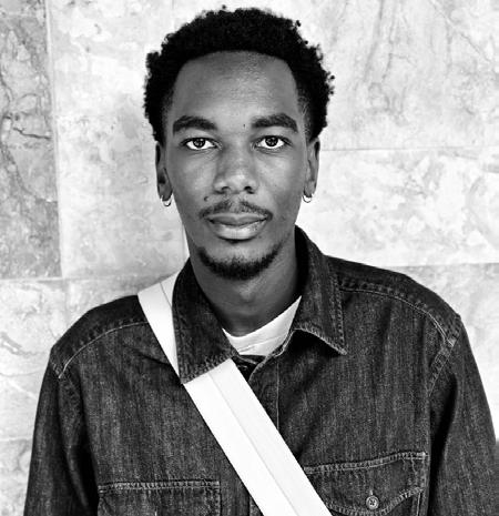
Hello, My name is Brian Njoroge, a graduating Urban Designer from the University of Washington Tacoma. Excited about my upcoming journey in design, I’m passionate about delving into the cultural aspects of architectural and urban spaces and their connections to social dynamics and power relations. Envisioning a future where design collaboration fuels change, I’m eager to explore new ideas, acquire skills, and push the boundaries of design.
Bachelor of Science in Urban Design
University of Washington Tacoma
Professional Experience
October 2023
Present Housing Developer and Project Manager Internship
GS Consulting & ALLY Community Development
Provided support in outreach to inform housing projects, worked on project feasibility reports, and contributed in various capacities to project funding, management, as well as supporting projects in various stages of design and construction.
Softwares Interests
Design
SketchUp - AutoCad
3D Rendering
Lumion
Adobe Creative Suite
InDesign - Illustrator - Photoshop
Geo-spatial
Esri ( Arcgis ) - Qgis
Design
Urbanism
History
Sustainability
Languages
Swahili
English
RETROFITTING A SMALL URBAN SPACE
URBAN DESIGN STUDIO 3
2022
CONTENTS
FOSS
URBAN DESIGN STUDIO 4
2023


OTHER WORK
URBAN SPACE AND THE REPRODUCTION OF INEQUALITIES CLASS PROJECT 2023
SOCIAL PRODUCTION OF SPACE
PERSONAL PROJECT
PROJECT : RESIDENTIAL RE - USE
PERSONAL DESIGN EXPLORATION
2022
RETROFITTING A SMALL URBAN SPACE
SUMNER , WA
URBAN DESIGN STUDIO 3
PROFESSOR : KO WIBOWO
WINTER 2022
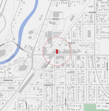
Site location : Sumner WA
Condition of the site
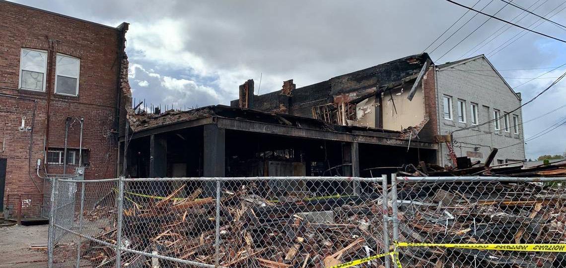
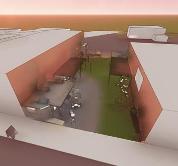
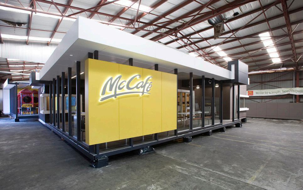
In our urban design studio, we collaborated to activate a site in downtown Sumner, WA, responding to a fire that had previously destroyed the existing structure. Engaging with both the city and property owners, our goal was to propose innovative and inviting temporary uses for the site while awaiting the development of a permanent reconstruction plan. My proposal entails the creation of a low-maintenance pop-up public space featuring two prefabricated structures suitable for retail or food purposes, complemented by an interactive wooden play bench adaptable for various uses. This concept aligns with residents’ visions and needs for a versatile space open beyond regular hours, catering to events, leisure, and play. The strategic location of the site offered an ideal opportunity to explore possibilities in introducing unexpected elements within a downtown space.
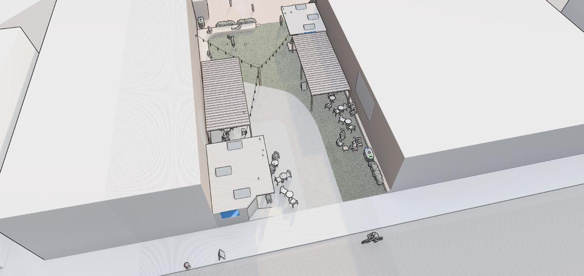
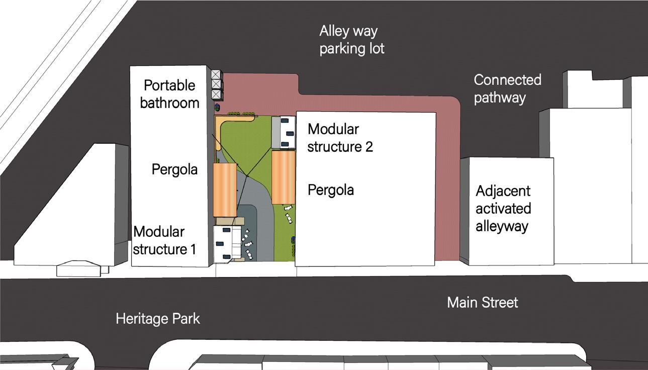
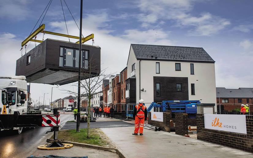
Central to my study and proposal was a thorough consideration of the desire for an adaptable and inviting space, addressing their needs for play and leisure. While the owners and city were supportive, concerns arose due to the site’s developmental future. To meet this, my proposal introduced a prefabricated modular structure that could serve temporary needs and be easily relocated to a different suitable site a solution welcomed by both the owners and the city.
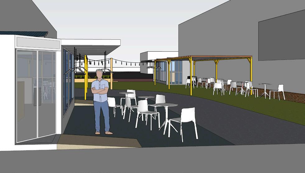
The space surrounding the structure would be programmed with landscaping and pergolas, offering flexibility for various site requirements. Additionally, the easily transportable pergolas and furniture could be utilized across different locations.
Invitation to slowdown
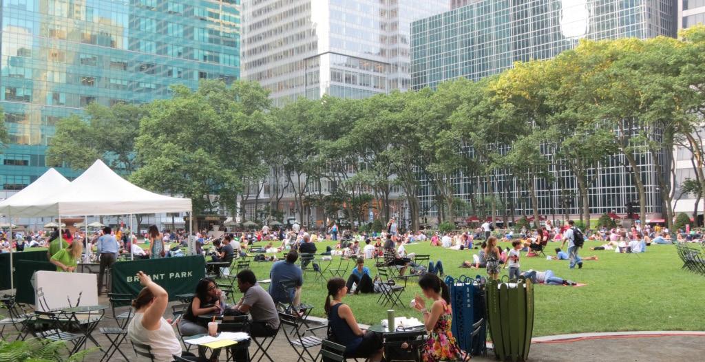
Creation of seating options for all abilities to create social interaction Ideas of multi-use in space can be adapted by space users for various uses.
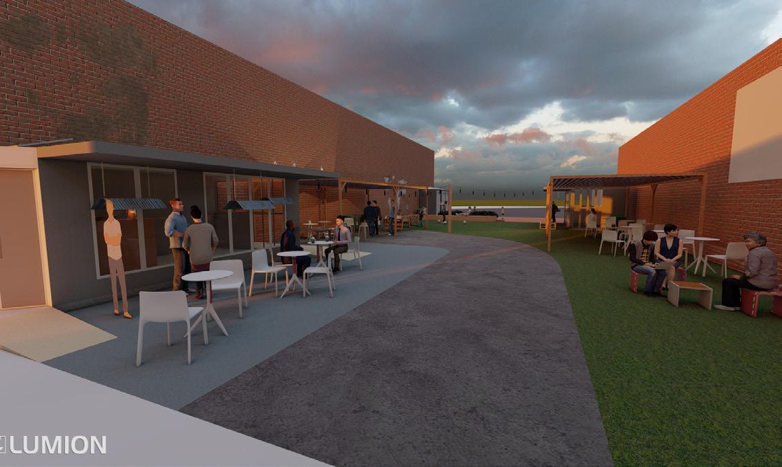
Covered sections of the space make it usable through the various weather and seasons. Possible integration of the back alleyway to continue the movement to the adjacent alleyway
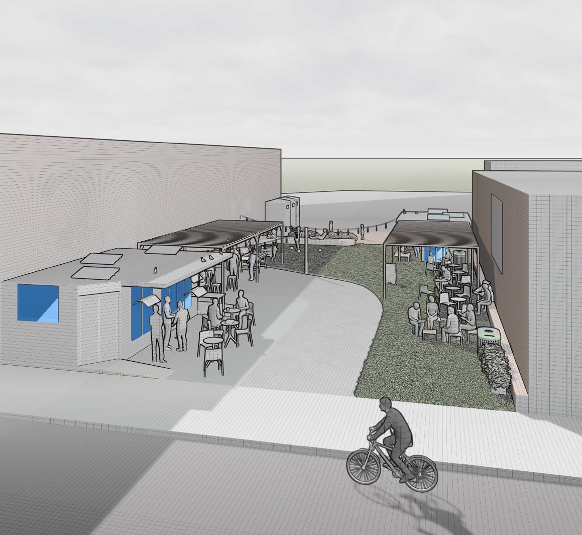
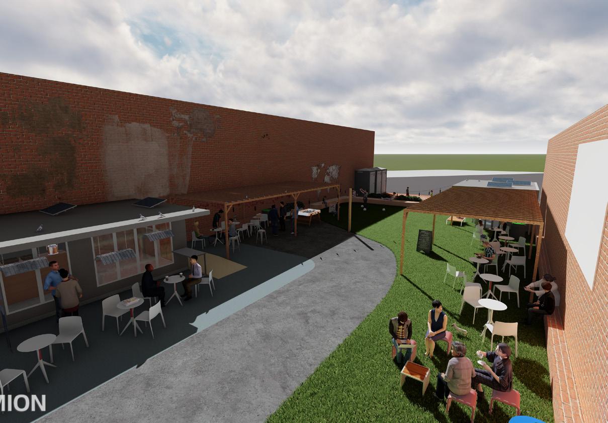
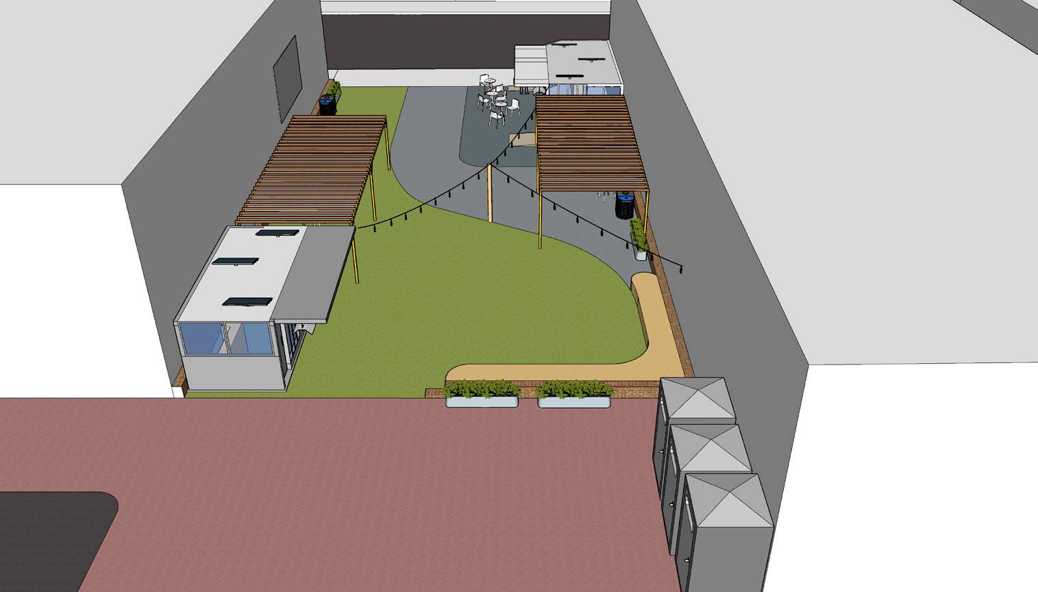
In a small urban setting, open space is ingeniously crafted through the strategic orientation of modular structures, accompanied by the implementation of grass and concrete elements. This thoughtful arrangement enhances the flow within the compact area, creating a welcoming environment.
The addition of cafe-style outdoor seating introduces versatility, ensuring the space remains dynamic and adaptable to a variety of uses.
BALLARD , WA
URBAN DESIGN STUDIO 5
PROFESSOR : Bára Šafárová, Ph.D.
AUTUMN 2023
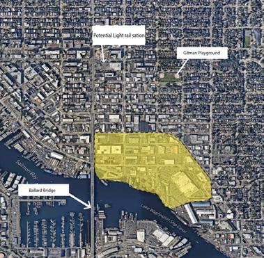
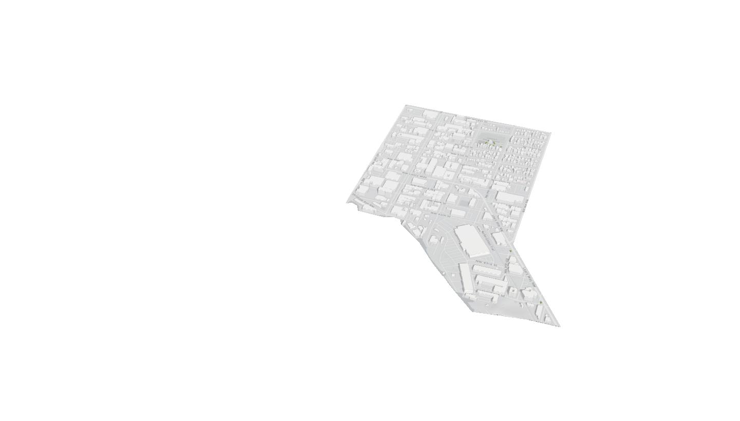
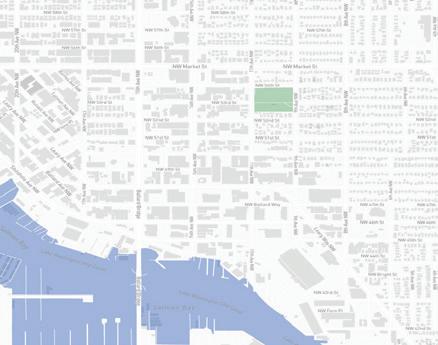
Site location : Ballard WA
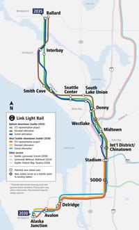
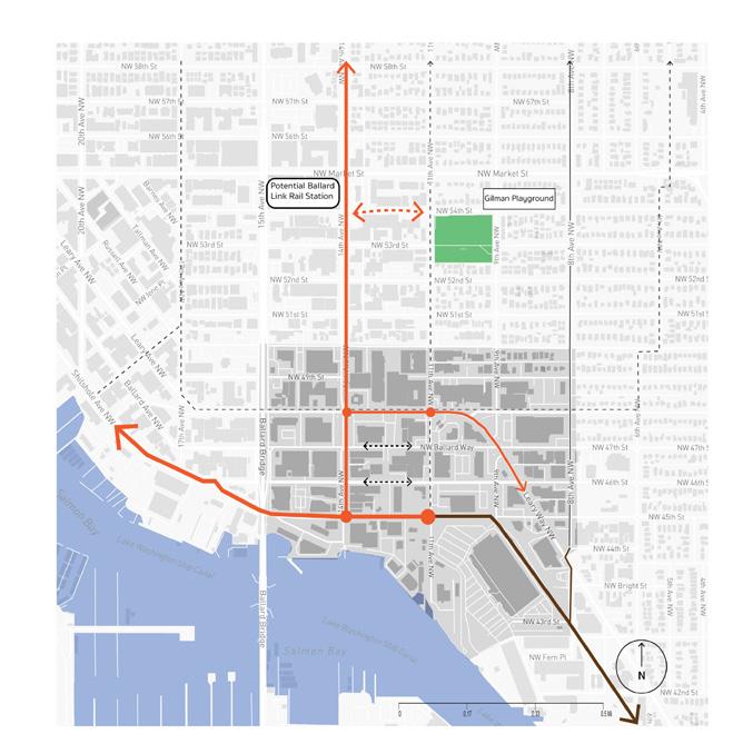
My focus was on integrating housing, care, and climate justice into a historically non-residential site in Seattle’s Ballard neighborhood. While much of Seattle has undergone significant changes in rezoning and transit-focused developments. Ballard preserved its industrial character, fostering a vibrant hub of artist studios, independent breweries, and restaurants. The impending light rail station construction in Ballard offers an opportunity for transit-oriented projects that address climate, housing, and care. To gauge program viability, I analyzed transit data, population trends, and projected growth, with a specific focus on current space use and envisioning the completion of the Burke-Gilman trail.
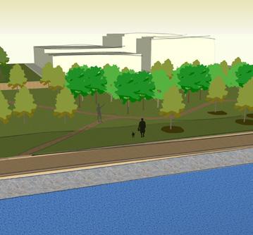
The study underscored the critical need to link the upcoming light rail station and recommend rezoning to reclaim an underutilized section of the waterfront, transforming it into public space. Envisioned as a sanctuary, this park would not only celebrate Ballard’s rich indigenous and historical legacy but also provide daily utility and access for both its current and future users.
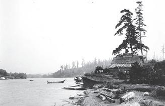
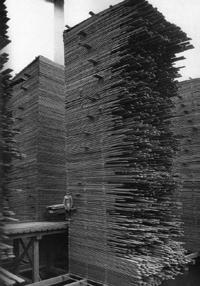
History of Ballard
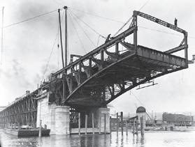
Incorporated / town Annexed
European Settlers
Duwamish Tribe
Homelands for at least 12,000 years
World War I World War II Ballard Lock / Bridge
1850s
1890 1906 1918
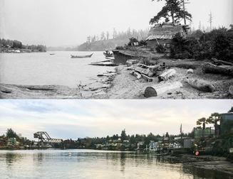
Urban Village
1990s
2000s
Vision for the Ballard Waterfront
To restore and revitalize the The Ballard Waterfront into a multi functional economic and Eco sensitive waterfront, this is done by carefully revitalizing its streets, public spaces, landscapes, and waterways.
The re-imagined Ballard urban bike corridor taps into already established routes. The addition of the light rail and a proposed Ballard station creates opportunity to leverage the value of alternative modes of transit into this car reliant district.
This corridor will see : Completed
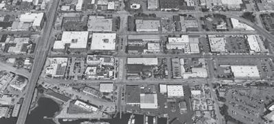
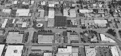
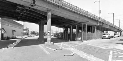
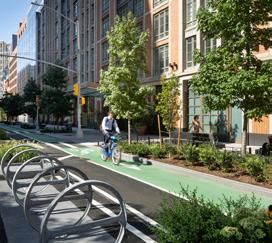
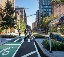
Complete street scape improvements along 14th Ave would establish a corridor designed to encourage pedestrian and bicycle interaction by formalizing comprehensive sidewalks and bike lanes, fostering a sense of embrace, consideration, and opportunities for deviation. Enhanced landscaping and neighborhood branding further elevate the user experience, acting as catalysts for the impact of the nearby transit station. This initiative aims to connect residents, workers, and visitors to the waterfront its parks, creating a beautifully curated network of connected streets capes. This transformation not only invites new residents but also provides a welcoming and safe community for current users and residents alike.


















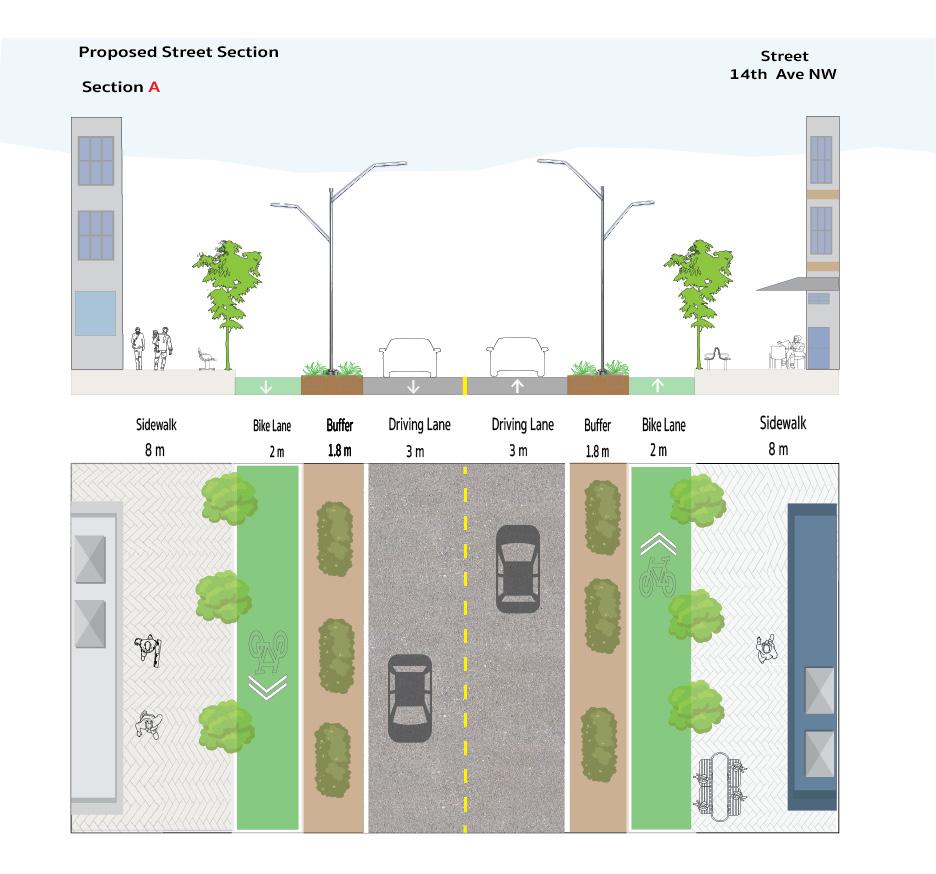
Case study Source : mnlandscape.com/hudson_square_streetscape_master_plan
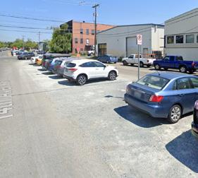
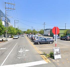
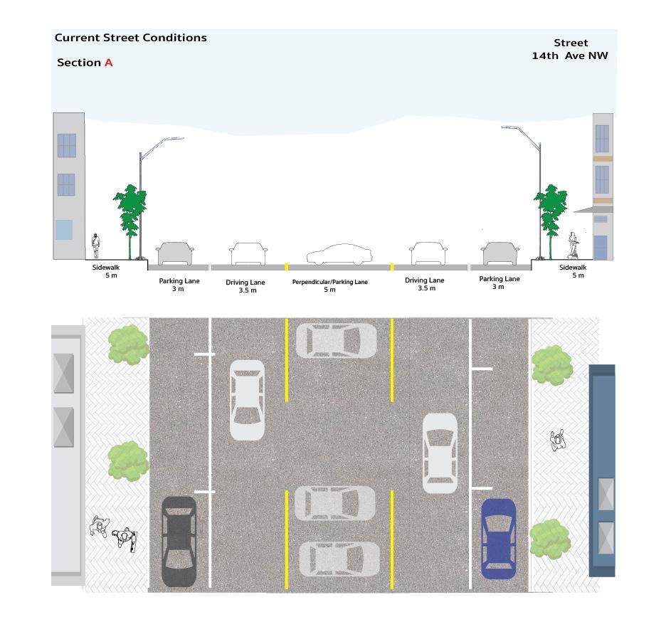
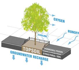
The street sections along the 14th Ave segment reveal wide possibilities for implementation. Currently, the street’s existing conditions prioritize parking with two side parking allotments and parallel parking in the middle of the drive lanes. While studying the site I discovered that this section was on a decommissioned rail line, covered with gravel and re purposed for parking, the current programming significantly impacting neighborhood accessibility and users. The proposed changes involve replacing parking on this major street with a fully protected bike lane, redistributing the space to widen the sidewalk and introduce a green buffer between vehicular traffic and bike/ pedestrian users. Drawing insights from the Hudson Street scape project, these modifications aim to achieve cohesion among different user levels, mobility options, and traffic considerations.
FOSS WATERWAY REVITALIZATION
TACOMA , WA
URBAN DESIGN STUDIO 4
PROFESSOR : GARETH ROE, ANDRES DE WET
CONTRIBUTORS : ANGELINA AKINSHEV, MIRYAN MANJARREZ-HURTADO, RAMAZAN MAMATOV
SPRING 2023
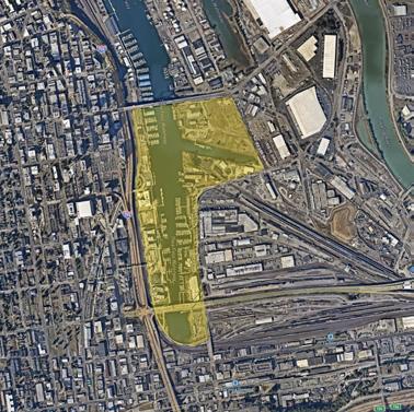
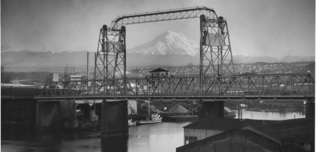
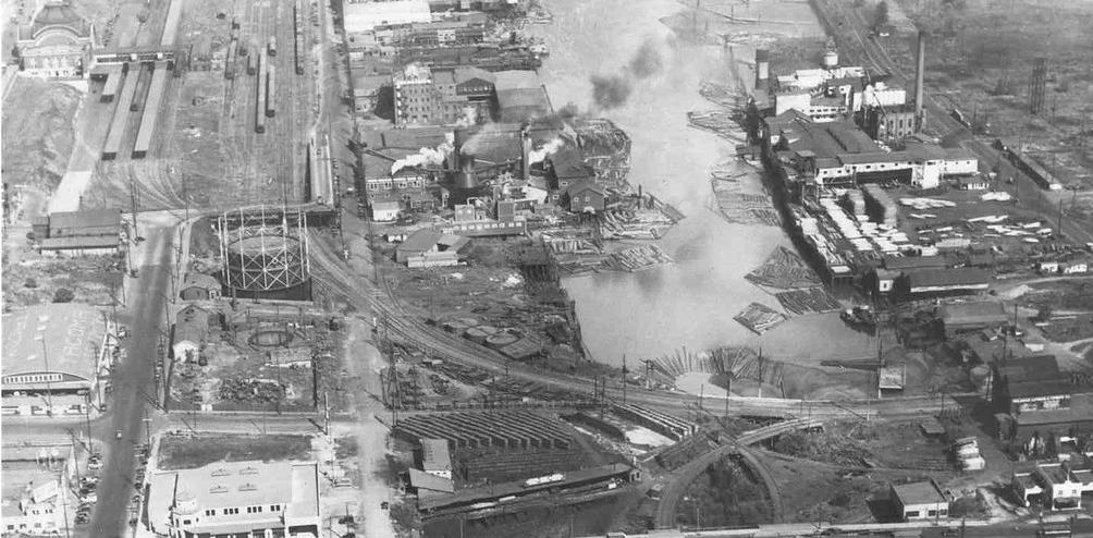
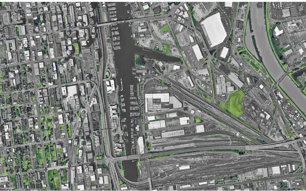
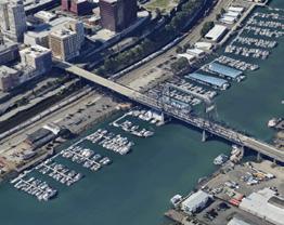
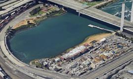
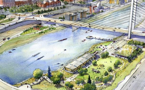
Developing a vision for a waterfront that has suffered severe pollution and neglect requires careful consideration and strategic planning. As a valuable asset to the city, the Thea Foss waterfront has been central to the region’s economic growth. However, in the decades since the factories and warehouses that once relied on this waterfront shuttered, after heavy pollution and abuse it eventually became a Superfund site . Working in groups, our approach was to develop a vision for this area through a series of design choices that would safeguard and enhance the public realm.
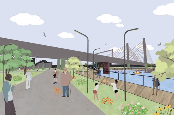
This vision aimed to take advantage of waterfront access, strengthen the connection between the city and the waterway, and create a space for refuge and reclamation for the indigenous Puyallup tribe, which holds great historical and cultural significance. This vision seeks to become a space of refuge and reprieve for the residents of Tacoma who have been exposed to the pollution and damage emitted by previous users.

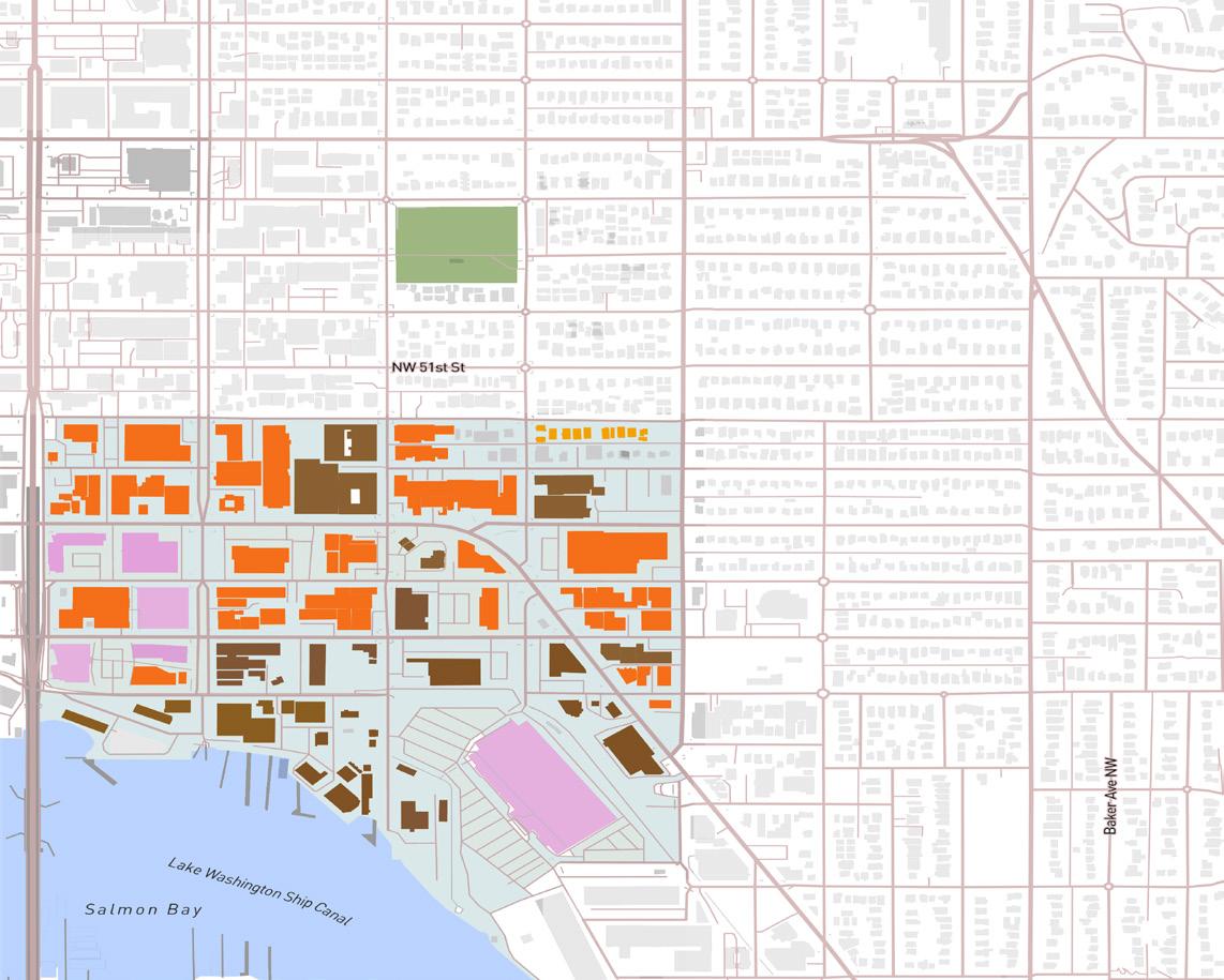
Legend
Outdoor Underutilized (1.1M sq ft)
Outdoor In Use (468k sq ft)
Structures In Use
Structures Not In Use
Boat Storage
Recreation N
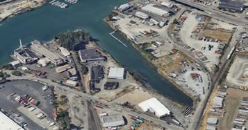
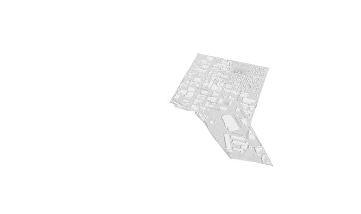
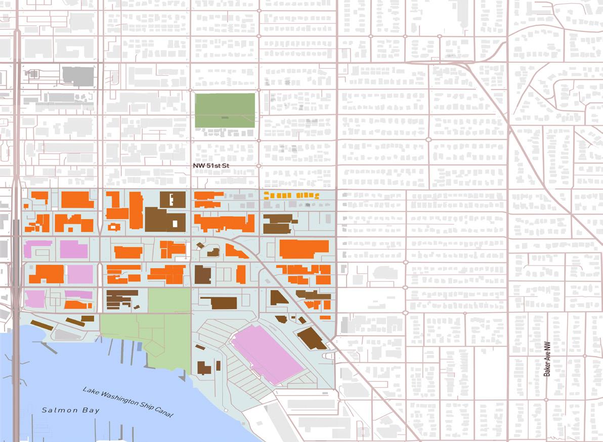
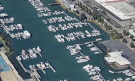
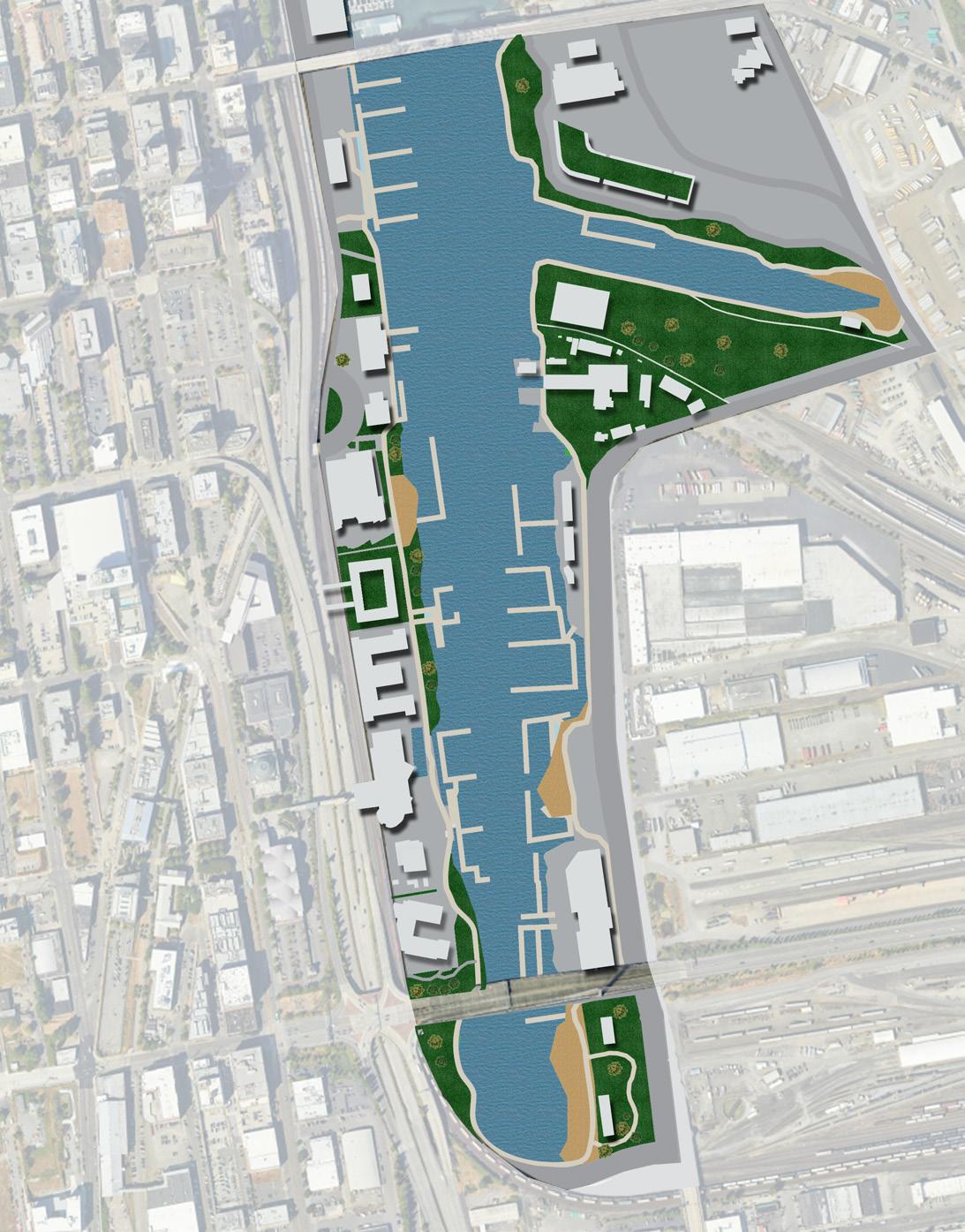
A comprehensive study of the green and tree canopy in the district highlighted a severe lack of vegetation. This is a matter of great concern, especially as we were in the process of developing a master plan for the waterfront, where the incorporation of a robust canopy is crucial. A closer look at the land utilization survey provided insights into the primary uses within the waterfront district. Predominantly, a significant portion of the land was either unused or utilized for boat storage.
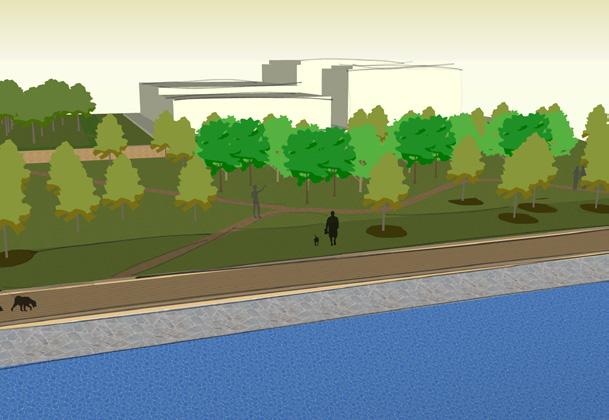
The flood analysis played a pivotal role in identifying opportunities within the area, considering the threat of rising sea levels and the occurrence of more frequent flooding. These analyses and addressing the overarching objectives outlined in our brief, we formulated the Foss Waterway Reclamation Master plan. This plan aims to explicitly address the dire lack of canopy, optimize land usage, reclamation of space for parks, waterfront access and incorporate measures to mitigate the challenges posed by rising sea levels and flooding in the waterfront district.
The conditions observed during a site visit highlights an unsafe environment lacking connection of the waterfront district to the downtown center. Currently, there is a noticeable lack of connectivity and inadequate pedestrian access throughout the district. The existing roadways were initially programmed primarily for freight purposes, considering the area’s active industrial status.
New connections proposed must carefully strike a balance to accommodate both freight through traffic, essential for the ongoing industrial activities, and improvements that enhance accessibility for other users. Achieving a safe and well-connected environment is crucial, and careful consideration in the planning and programming of the roadways is necessary to ensure the coexistence of industrial functionality and enhanced accessibility for pedestrians and other users.
URBAN SPACE AND THE REPRODUCTION OF INEQUALITIES
PROFESSOR
: LISA M. HOFFMAN PH.D.WINTER 2022
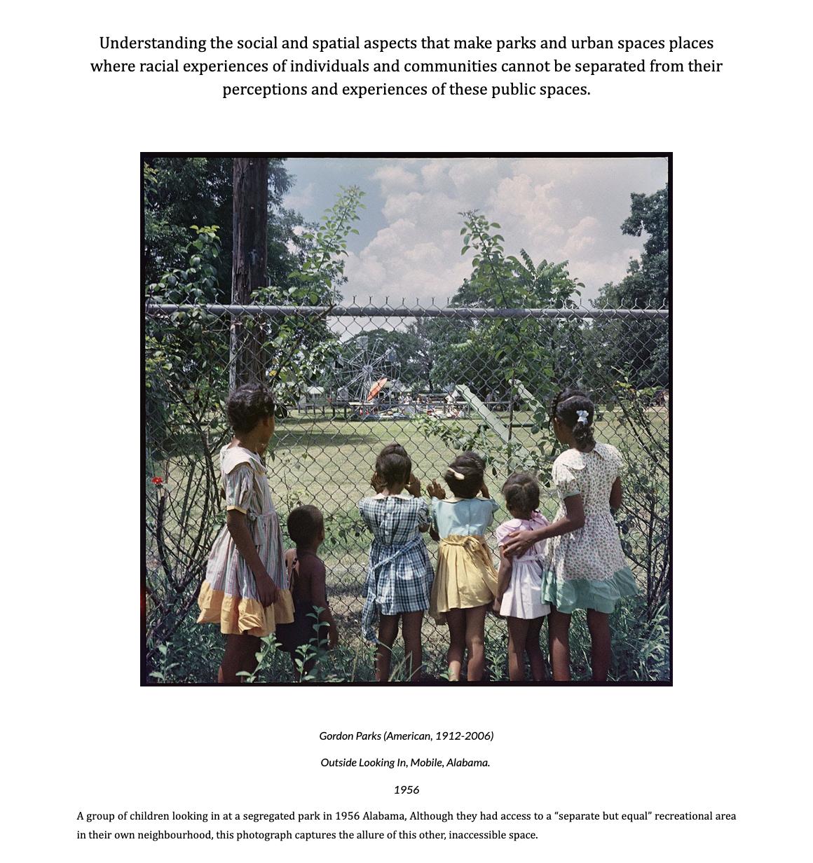
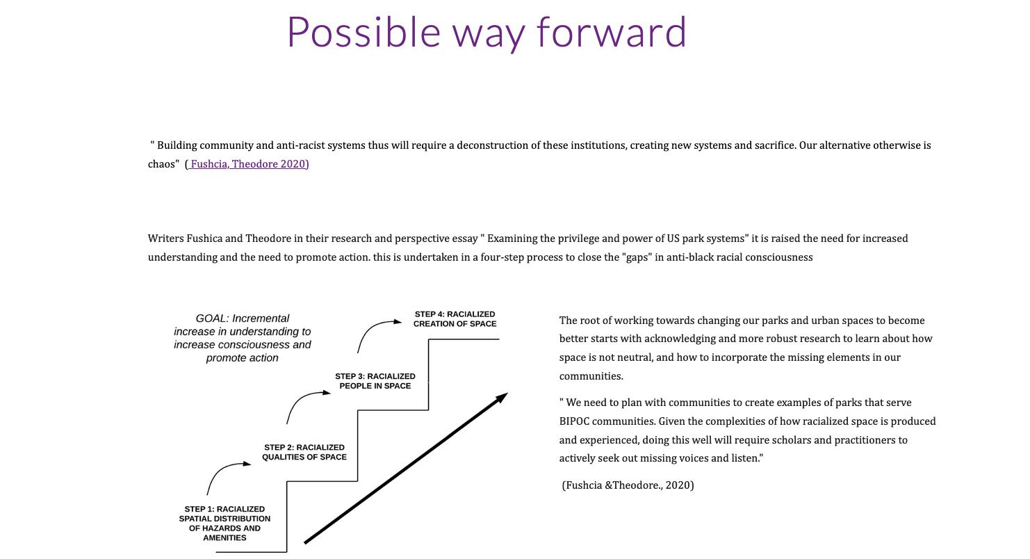
Under guidance of Professor Lisa M. Hoffman of the School of Urban Studies, this project delves into the intricate realm of the social production of space, with a specific focus on exploring the role of race in the creation of urban areas. My primary objective was to curate a website or blog as a platform for presenting both my findings and commentary on the historical and contemporary interactions contributing to the unequal reproduction of parks and urban spaces. This endeavor involves a thorough investigation into the experiences of marginalized groups traditionally excluded from these spaces.
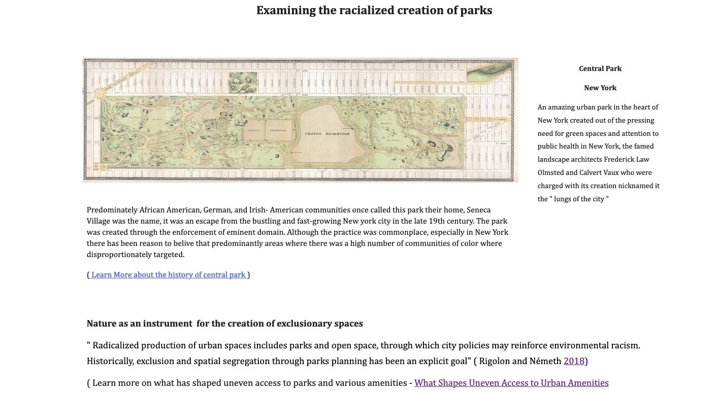
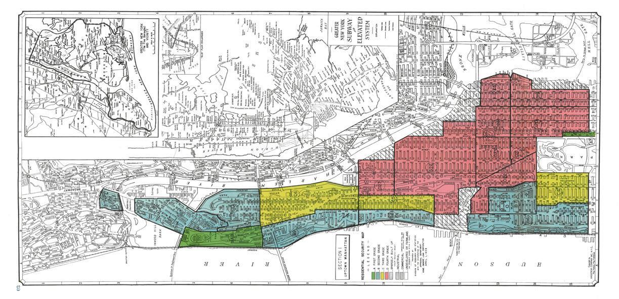
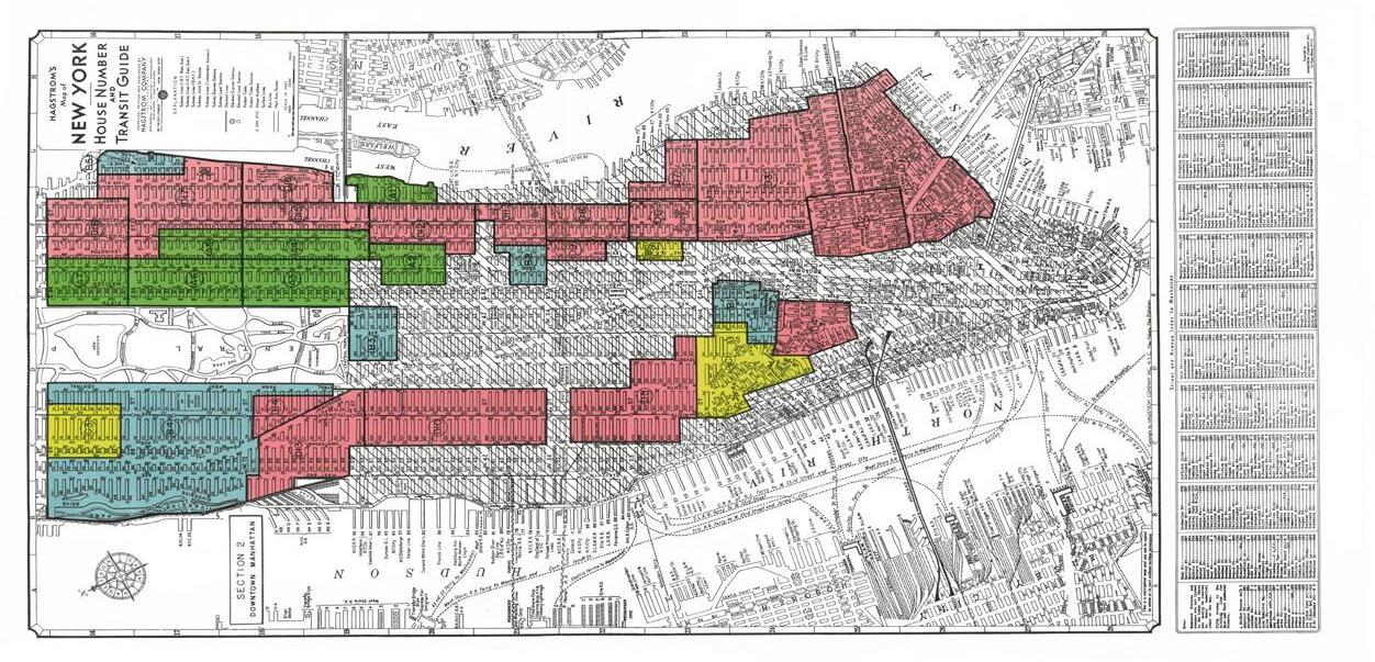
Seizing the opportunity for deeper exploration, I drew inspiration from Gordon Parks’ work, particularly his resounding photographic series “Outside Looking In, Mobile Alabama 1956,” and the social commentary his photographs evoked on segregation and the imperative need for access to recreation areas. Additionally, I conducted a comprehensive study on the racialized creation of parks, examining Central Park and its history before the creation of the park as we know it by Olmsted and Vaux as they sculpted it into the lungs of the city. This exploration was complemented by examining historical redlining maps of the neighborhoods in proximity to Central Park, providing commentary on the use of nature as a catalyst potentially reinforcing historically segregated communities.
PERSONAL PROJECT
Brian NjorogeProject: Residential Re - use
Site location , Nairobi, Kenya
I engaged in a simple design exploration during the summer to improve my skills. I landed on a project site in my neighborhood in Kenya. The site was an abandoned end-lot house that I walked past daily. The challenge was to re imagine the site, preserving much of the existing structure. Undertaking this personal project was enjoyable, and I was pleased with the development of the concept.
BRIAN NJOROGE
SELECTED WORKS 2021 -2023
