Western Hills Viaduct

Adaptive Reuse of Dying Infrastructure
 John Shear

John Shear
Explore multi-scalar urban revitalization interventions.
Identify fragments of obsolescence in the urban core of Cincinnati.
Determine appropriate adaptive reuse program to bring occupancy and vibrancy.

Spanning over 3,500' in length connecting uptown/downtown Cincinnati with western Hamilton County, the Western Hills Viaduct is a critical linkage in Cincinnati's urban core. Built in the early 1930's, the viaduct carries roughly 55,000 cars per day above Mill Creek Valley and CSX Queensgate yard, one of the largest and most active rail yards in the country. As the bridge nears 100 years old, its useful life is coming to an end, and construction of a new bridge is slated for completion by 2030.

VERTICAL CIRCULATION

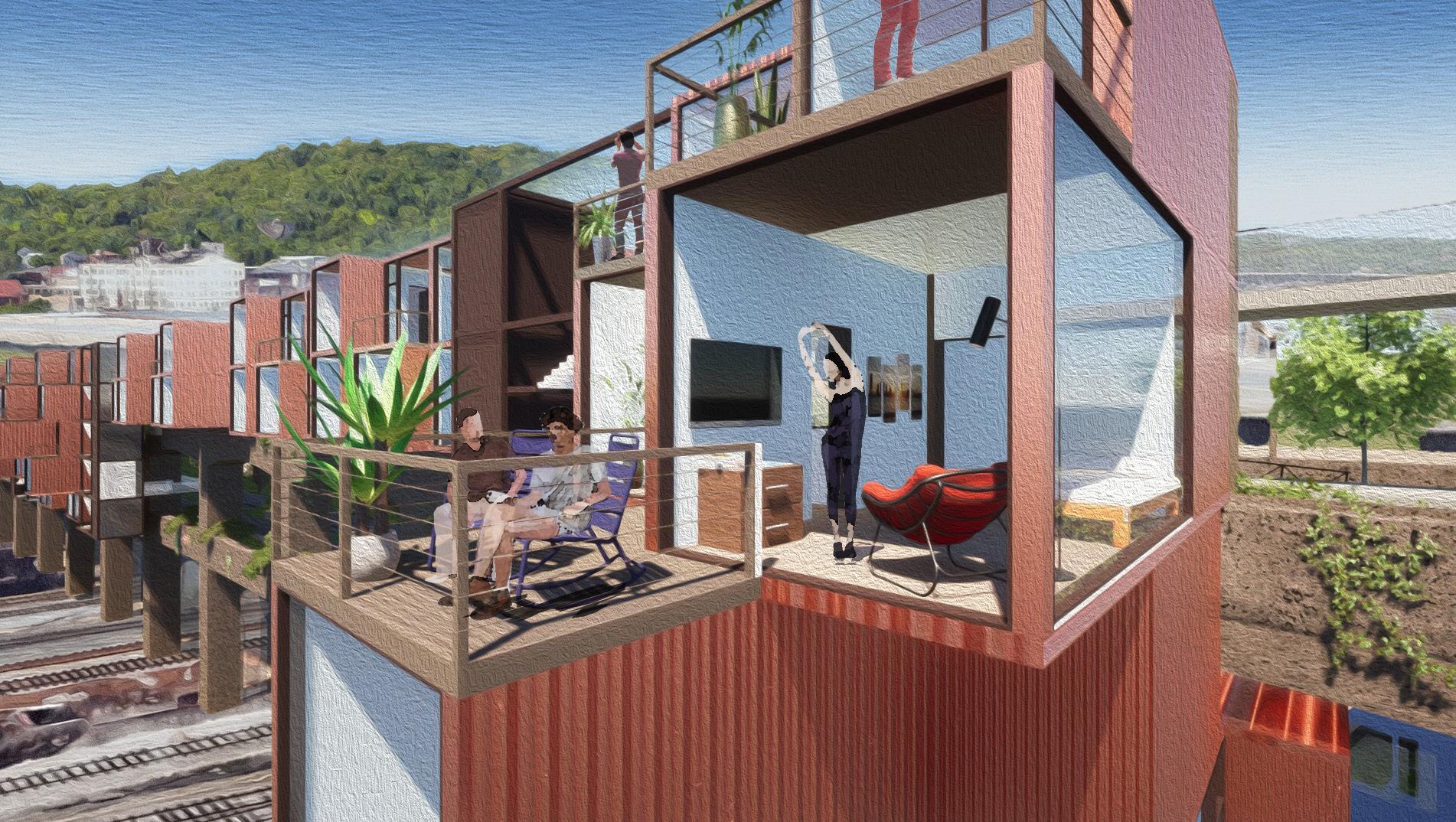
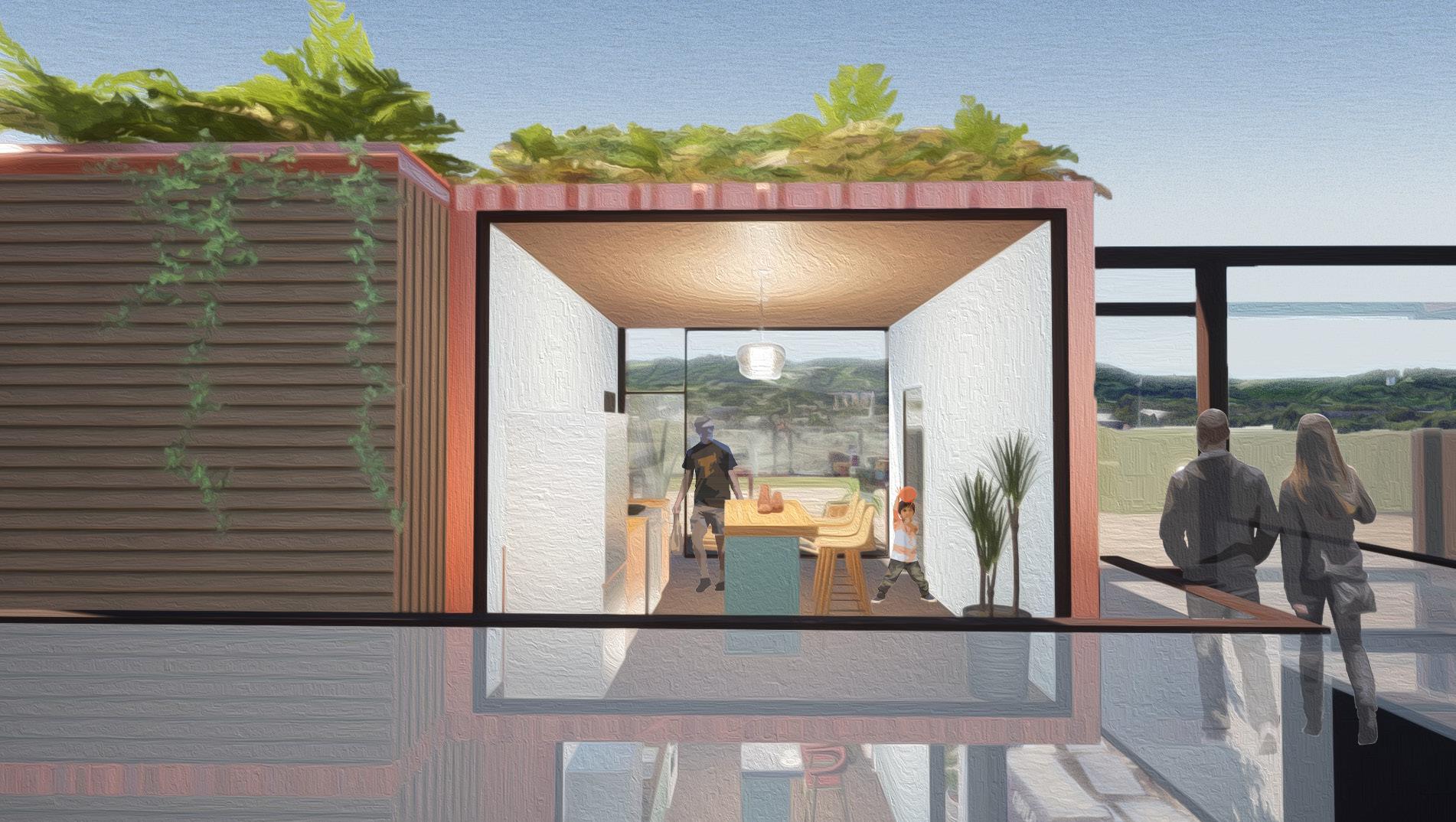
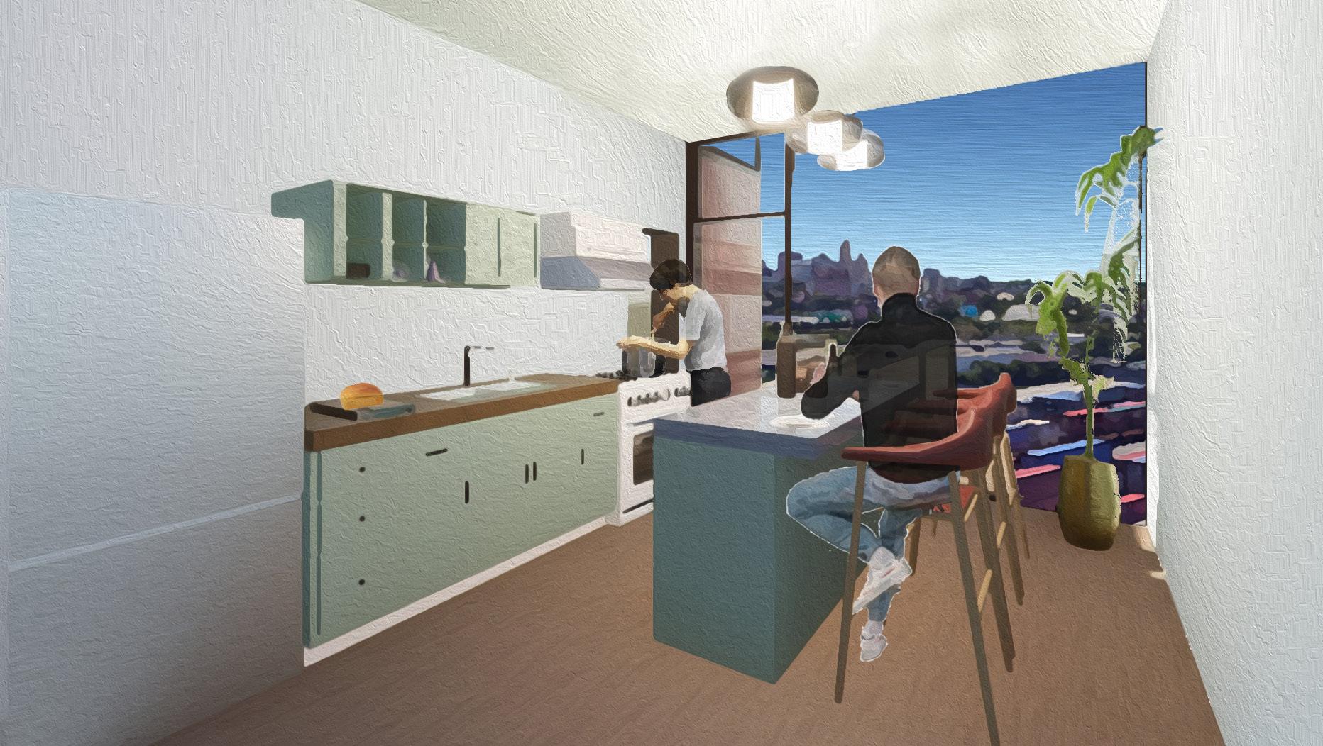
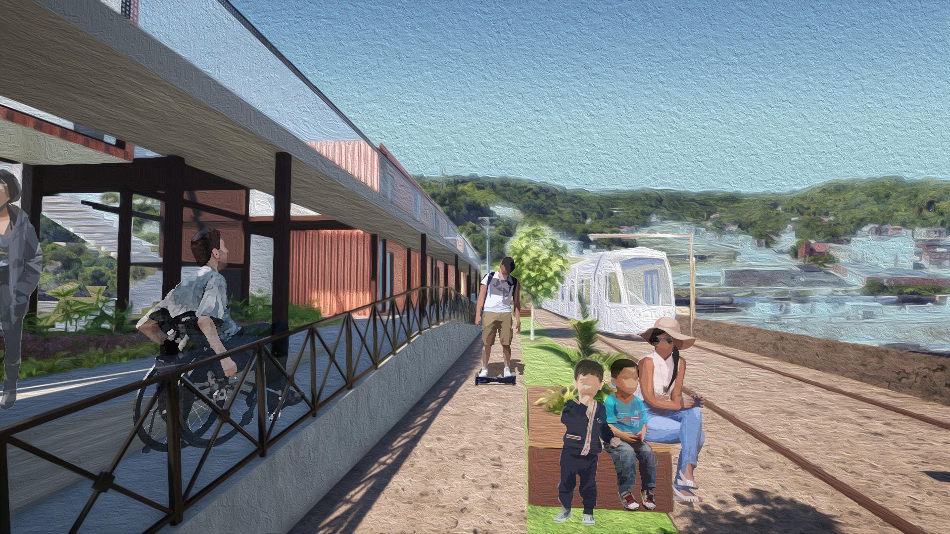
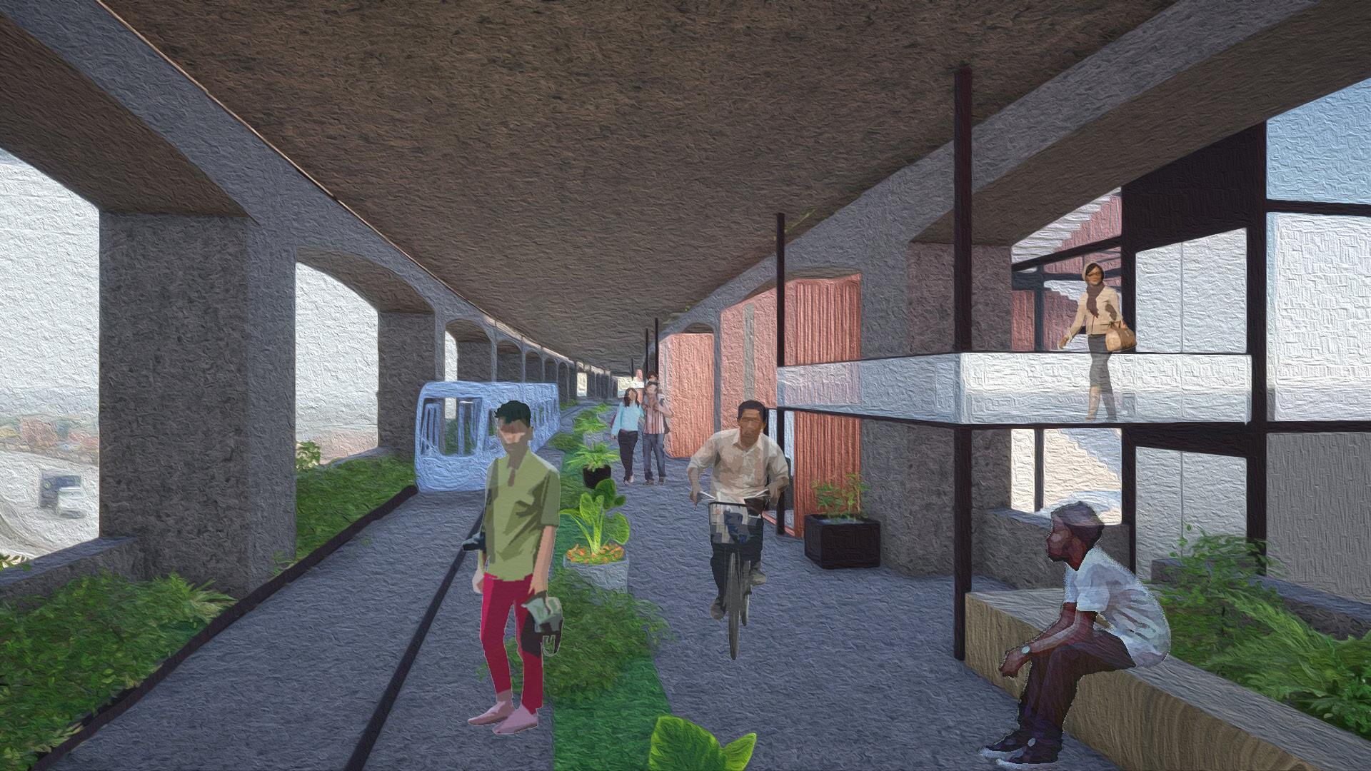
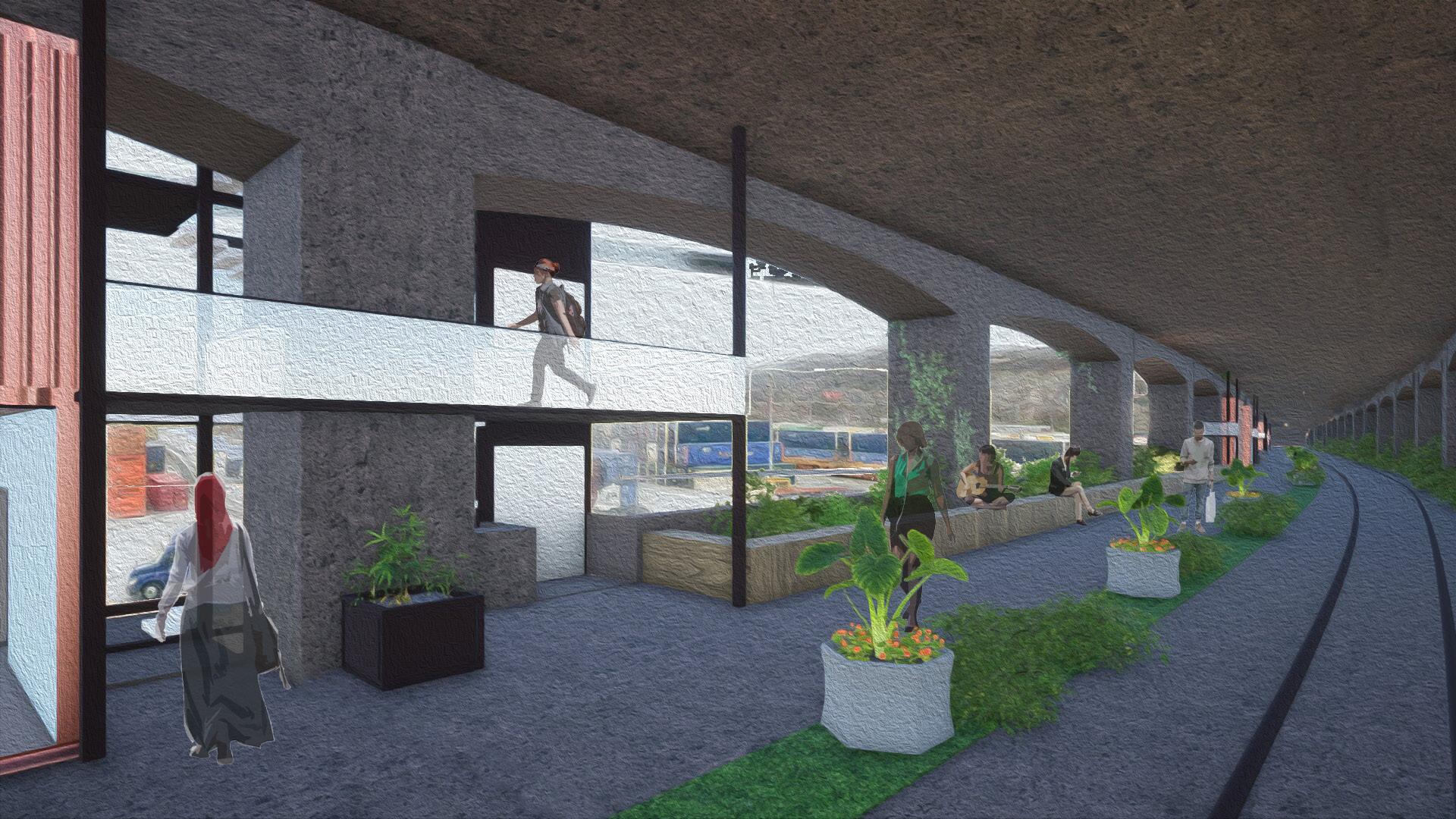
Given the historical significance of this bridge and in the spirit of enhancing Cincinnati’s walkability, this proposal seeks to reimagine the bridge in a green, pedestrian-oriented manner that removes vehicular traffic from the equation entirely. The main components of the new WHV adaptation includes an affordable housing solution as well as connection to the city’s increasingly popular yet limited streetcar system.


Prefabricated, modular units designed with the proportion and materiality of cargo shipping containers ever present on the tracks below aggregate in one final solution of 9 one-bedroom units spanning five floors and roughly 100’ in length. Anchored by a verticle circulation tower housing stairs and elevator, this aggregate is then repeated and mirrored down the length of the bridge 8 times, for a total of 72 units.
The axonometric section to the left illustrates the stacking of the units on the south-facing side of the bridge as well as the relationship between the housing and the streetcar track directly across, on the north-facing side. Between the two is an open pathway for pedestrian movement.


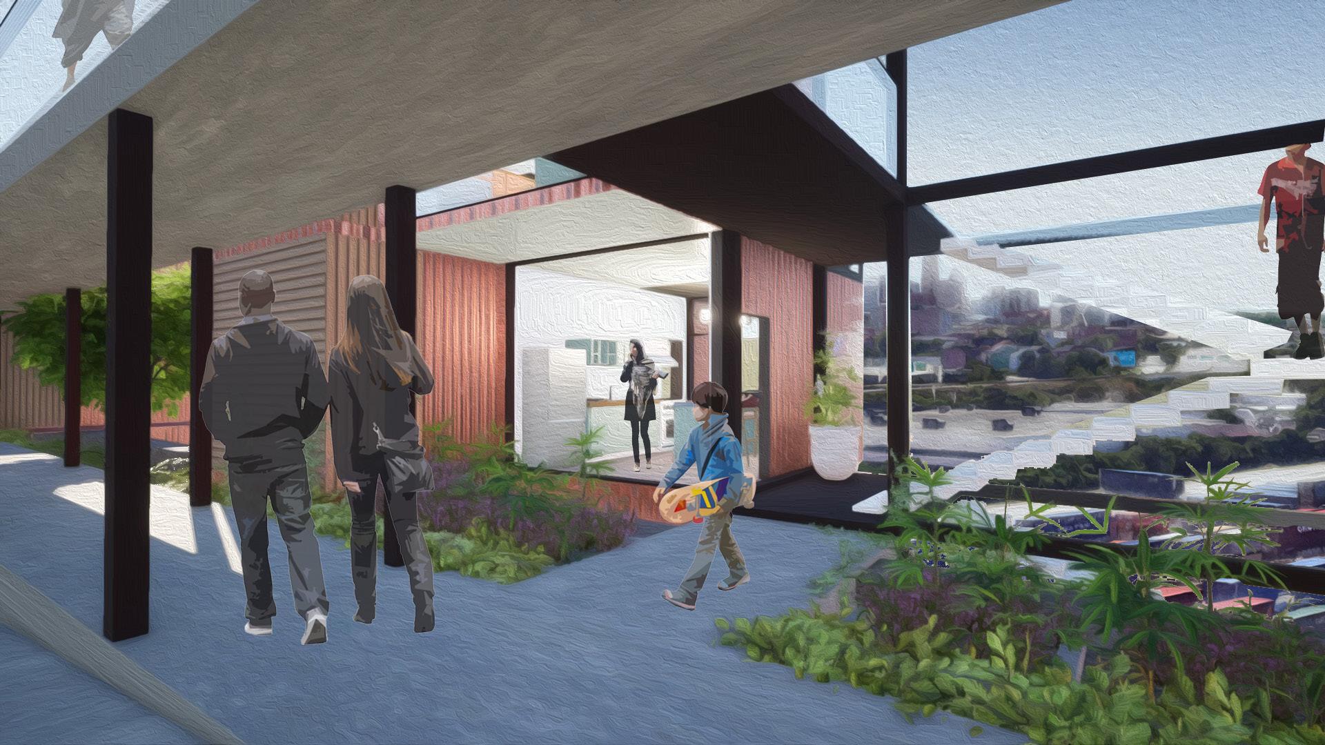
Upper Deck Looking West
Upper Deck Looking South
Lower Deck Looking West
Lower Deck Looking East