5 minute read
The Ohio River

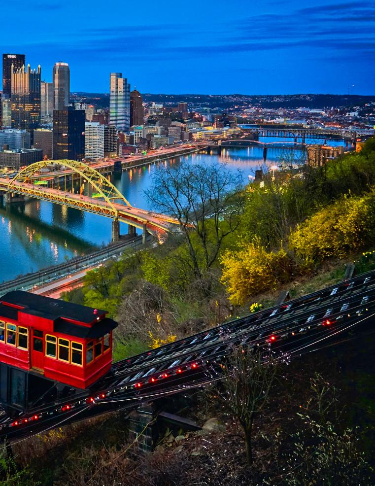
The Ohio River is formed by the confluence of the Allegheny and Monongahela rivers at Point State Park in Pittsburgh. Pittsburgh by night, Duquesne Incline in front.
Photo courtesy Vidar Nordli-Mathisen on Unsplash.
The Ohio River is a 981-mile long river formed by the confluence of the Allegheny and Monongahela rivers in Pittsburgh. It flows northwest out of Pennsylvania, then in a general southwesterly direction to join the Mississippi River at Cairo, Illinois.
It is the 10th longest river in the United States.
The Ohio forms the northern borders of West Virginia and Kentucky; and the southern borders of Ohio, Indiana and Illinois. The Ohio River contributes more water to the Mississippi than does any other tributary. At the confluence, the Ohio is considerably bigger than the Mississippi River.

The Ohio River in downtown Louisville.
Photo courtesy Belle of Louisville.
The Ohio is navigable, and, despite seasonal fluctuations that occasionally reach flood proportions, its fairly uniform flow has supported important commerce since settlement first began.
The lower Ohio River just below Louisville is obstructed by rapids known as the Falls of the Ohio where the water level falls 26 ft. in 2 miles and is impassible for navigation. The McAlpine Locks and Dam, a shipping canal bypassing the rapids, now allows commercial navigation from the Forks of the Ohio at Pittsburgh to the Port of New Orleans at the mouth of the Mississippi on the Gulf of Mexico.
History
European discovery of the Ohio River may be attributed to English explorers from Virginia in the latter half of the 17th century. In his Notes on the State of Virginia published in 1781–82, Thomas Jefferson stated: “The Ohio is the most beautiful river on earth. Its current gentle, waters clear, and bosom smooth and unbroken by rocks and rapids, a single instance only excepted.” In the late 18th century, the river was the southern boundary of the Northwest Territory.
The river is sometimes considered as the western extension of the Mason–Dixon Line that divided Pennsylvania from Maryland, and thus part of the border between free and slave territory, and between the Northern and Southern United States or Upper South. Where the river was narrow, it was the way to freedom for thousands of slaves escaping to the North, many helped by free blacks and whites of the Underground Railroad resistance movement.

Belle of Louisville on Ohio River in Louisville
Photo courtesy Belle of Louisville.
The river had great significance in the history of the Native Americans, as numerous civilizations formed along its valley. For thousands of years, Native Americans used the river as a major transportation and trading route.
The economic connection of the Ohio Country to the East was significantly increased in 1818 when the National Road being built westward from Cumberland, Maryland reached Wheeling, Virginia (now West Virginia), providing an easier overland connection from the Potomac River to the Ohio River.
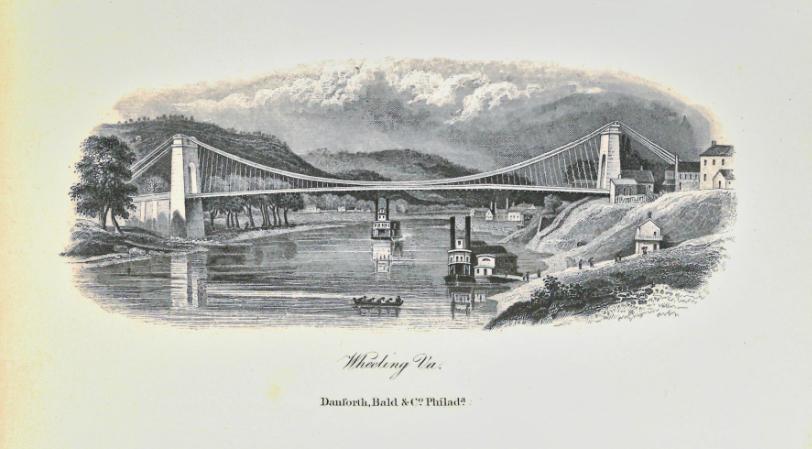
The Wheeling Suspension Bridge was built over the river at Wheeling from 1847 to 1849, making the trip west easier. For a brief time, until 1851, it was the world’s largest suspension bridge. Fortunately, the bridge was not blown up during the American Civil War. The bridge has been improved in 1859 and 1872, and remains in use as the oldest vehicular suspension bridge in the United States.

Built between 1847 and 1849, the Wheeling Suspension Bridge was the first bridge across the Ohio River and a crucial part of the National Road.

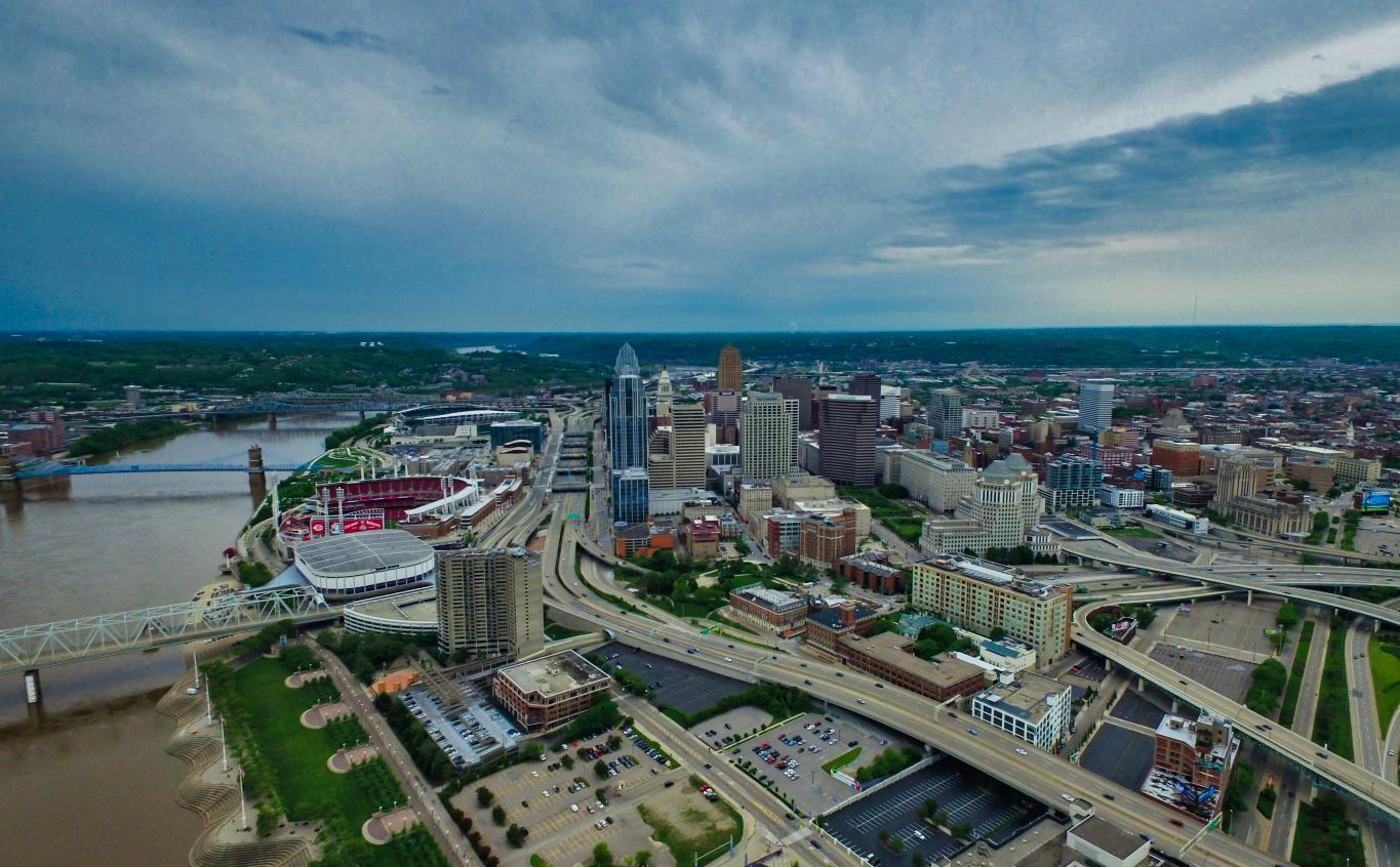
Downtown Cincinnati Skyline on the Ohio River.
Photo courtesy JP Valery on Unsplash.
Louisville was founded in 1779 at the only major natural navigational barrier on the river, the Falls of the Ohio. The first locks on the river – the Louisville steamboats came from Pittsburgh or Wheeling, within and Portland Canal – were built to circumnavigate the a short period of time Cincinnati had also emerged as falls between 1825 and 1830. The increasing size of a significant part of the industry. Cincinnati shipyards steamships and barges on the river meant that the launched twenty-five steamboats between 1811 and outdated locks could only service the smallest vessels 1825. until well after the Civil War.
The U.S. Army Corps of Engineers improvements were expanded again in Beginning in the 1850s, railroads provided the 1960s, forming the present-day McAlpine Locks competition for the Ohio River trade but never and Dam. replaced it entirely. In the twentieth century, barges Today, there are 20 dams on the Ohio River, managed by the Army Corps of Engineers. The dams have greatly changed the flow of the Steamboat Morning Star, a Louisville and Evansville river, creating a series of very slow moving pools rather than a free flowing river. mail packet, in 1858. Photo courtesy Smithsonian Institution.
Steamboats
Steamboats revolutionized river travel during the first half of the nineteenth century. The first steamboat to travel on the Ohio River was named the New Orleans. Although not as well-constructed as later vessels, it managed to steam its way from Pittsburgh to the city of New Orleans in 1811. Within the next few years, many additional steamboats were built in the East. Although most of the earliest carrying coal and other materials replaced steamboats.

Steamboat Morning Star, a Louisville and Evansville mail packet, in 1858.
Photo courtesy Smithsonian Institution.

Wheeling Suspension Bridge.
Photo courtesy Chris Light, BY-SA 3.0, and Wikimedia Commons.
Now steamboats are primarily a tourist attraction, carrying passengers on short trips along the river.
Cities Along the River
Along the banks of the Ohio are some of the largest cities in their respective states:
• Pittsburgh: the largest city on the river and second-largest city in Pennsylvania.
• Cincinnati: the third-largest city in Ohio.
• Louisville: the largest city in Kentucky.
• Evansville: the third-largest city in Indiana.
• Owensboro: the fourth-largest city in Kentucky.
• Huntington: the second-largest city in West Virginia.
• Parkersburg: the fourth-largest city in West Virginia.
• Wheeling: the fifth-largest city in West Virginia.

Barge at the Portland Canal in Louisville.
Photo courtesy Joe Schneid, CC BY 3.0, and Wikimedia Commons.
Other cities include Steubenville, Ohio, Parkersburg, West Virginia, Huntington, West Virginia, Ashland, Kentucky, Owensboro, Kentucky, and Paducah, Kentucky.
Cairo, Illinois, at the mouth of the Ohio on the Mississippi River, is the southernmost and westernmost city on the river.
Cities along the Ohio are also among the oldest cities in their respective states and among the oldest cities in the United States west of the Appalachian Mountains.
The Ohio River Scenic Byway follows the Ohio River through Illinois, Indiana and Ohio ending at Steubenville, Ohio, on the river.

The Ohio River is formed by the confluence of the Allegheny and Monongahela rivers at Point State Park.
Photo courtesy Vidar Nordli-Mathisen on Unsplash.

