6 minute read
Colorado’s Front Range

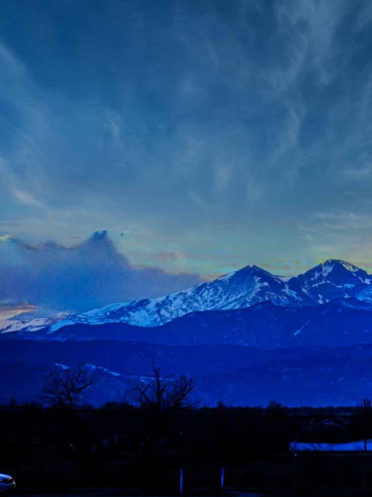
Longs Peak as viewed from Windsor, Colorado. Photo courtesy Peter Romero and Wikimedia Commons.


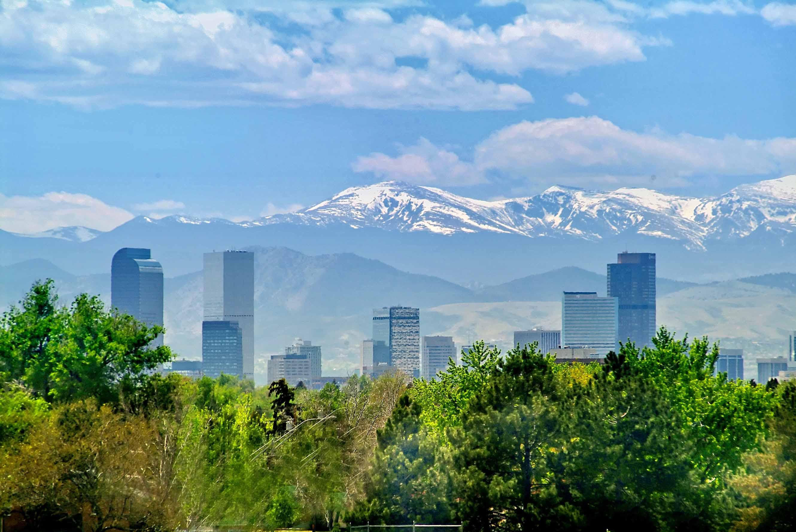
Mount Evans and the Front Range dominates the Denver Skyline. Photo courtesy Visit Denver.


The Front Range of the Southern Rocky Mountains is located in the central portion of Colorado and the southeastern portion of Wyoming. It is the first mountain range encountered as one goes westbound across the Great Plains of North America.
Lying largely within conservation areas, the Front Range constitutes the whole of Rocky Mountain National Park and occupies portions of Pike, Arapaho, Routt, Roosevelt, and Medicine Bow national forests. The range is known for its variety of minerals and its recreational appeal, and it serves as a source region for head streams of the Cache la Poudre and Colorado rivers.
North-South Range
The Front Range runs north-south between Casper, Wyoming and Pueblo, Colorado and rises nearly 10,000 feet above the Great Plains. Longs Peak, Mount Evans, and Pikes Peak are its most prominent peaks, visible from the Interstate 25 corridor.
The area is a popular destination for mountain biking, hiking, climbing, and camping during the warmer months and for skiing and snowboarding during winter.
The name “Front Range” is also applied to the Front Range Urban Corridor, the populated region of Colorado and Wyoming just east of the mountain range and extending from Cheyenne, Wyoming south to Pueblo, Colorado. This urban corridor benefits from the weathermoderating effect of the Front Range mountains, which help block prevailing storms.
20 Peaks Over 11,000 Feet
Twenty peaks over 11,000 feet make up the Front Range. Four of the mountains have an elevation over 14,000 feet.
Grays Peak
These include Grays Peak, the tenth-highest summit of the Rocky Mountains. The prominent 14,278-foot fourteener is the highest summit of the Front Range and the highest point on the Continental Divide in North America. Grays Peak is located in Arapahoe National Forest, about 4 miles east of Loveland Pass.
Grays Peak is one of 53 fourteeners, mountains of over 14,000 feet in elevation in Colorado. Botanist Charles C. Parry made the first recorded ascent of the summit in 1861 and named the peak in honor of his botanist colleague Asa Gray. Grays Peak is commonly mentioned in conjunction with adjacent Torreys Peak.
is one of the characteristic Front Range peaks, dominating the western skyline of the Great Plains along with Pikes Peak, Longs Peak, and nearby Mount Bierstadt. Mount Evans can be seen from over 100 miles to the east, and many miles in other directions. Mount Evans highway above Summit Lake is the highest paved road in North America
Mount Evans dominates the skyline, rising over 9,000 feet above the area. Mount Evans can be seen as far away as Castle Rock, 65 miles to the south and as far north as Fort Collins, 95 miles, and from areas near Limon, 105 miles to the east.
In the early days of Colorado tourism, Mount Evans and Denver were often in competition with Pikes Peak and Colorado Springs.
Longs Peak
Longs Peak rises 14,259-feet and is 9.6 miles southwest of the Town of Estes Park, Colorado. Longs Peak is the northern most fourteener in the Rocky Mountains and the highest point in Rocky Mountain National Park.
Longs Peak is one of the most prominent mountains in Colorado, rising 9,000 feet above the western edge of the
Parry Peak, west of Denver. Photo courtesy Tom Berrigan & Wikimedia Commons.


Great Plains.
The peak is named for Major Stephen Long, who is said to be the first to spot the great mountains on behalf of the U.S. Government on June 30, 1820.
Together with the nearby Mount Meeker, with an elevation of 13,911 feet, the two are sometimes referred to as the Twin Peaks.


Click for Video


View from the summit of Mount Evans. Photo courtesy Daniel Schwen and Wikimedia Commons.

Together with the nearby , with an elevation of 13,911 feet, the two are sometimes referred to as the Twin Peaks.
Pikes Peak
Pikes Peak is the highest summit of the southern Front Range. The ultra-prominent 14,115-foot fourteener is located in Pike National Forest, 12 miles west of downtown Colorado Springs. The summit is higher than any point in the United States east of its longitude.
Pikes Peak rises 8,000 ft above downtown Colorado Springs. It is a designated National Historic Landmark. It is composed of a characteristic pink granite called Pikes Peak granite. The color is due to a large amount of potassium feldspar.
The first Europeans to see Pikes Peak were the Spanish in the 1700s. The first American sighting is often credited to members of the Pike expedition, led by Zebulon Pike, for whom it is named. Pike, however, was unable to reach the summit.
Pikes Peak Gold Rush
Gold was discovered in the area of present-day Denver in 1858, and newspapers referred to the gold-mining area as Pikes Peak. Pikes Peak or Bust became the slogan of the Colorado Gold Rush. This was more due to Pikes Peaks visibility to gold seekers traveling west across the plains than any actual significant gold find anywhere near Pikes Peak.
Major gold deposits were not discovered in the Pikes Peak area until the Cripple Creek Mining District was discovered southwest of Pikes Peak and led, in 1893, to one of the last major gold rushes in the lower 48 states.

Denver’s International Airport and the Front Range. Photo courtesy Visit Denver.
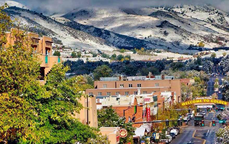
Golden, home of Coors Brewery, and the Front Range. Photo courtesy Visit Denver.


America the Beautiful
In July 1893, Katharine Lee Bates wrote the song “America the Beautiful”, after having admired the view from the top of Pikes Peak. It appeared in print in The Congregationalist, a weekly journal, on July 4, 1895. A plaque commemorating the words to the song was placed at the summit.
Other mountains in the Front Range include Parry Peak, elevation 13,397 ft. The peak is on the continental divide southeast of Winter Park in the Arapahoe National Forest. The name honors Charles Christopher Parry, a botanist who made extensive studies of the Colorado mountain flora in the 1860s.
It is one of the 637 peaks over 13,000 ft elevation in the state of Colorado.
Bard Peak is a prominent mountain summit in the Front Range. The 13,647-foot thirteener is also located in Arapaho National Forest, 4.5 miles west-northwest of the Town of Silver Plume.
Finally, the Twin Sisters Peaks are located in the Front Range, straddling Rocky Mountain National Park and Roosevelt National Forest.
The peaks of the Front Range of the Rocky Mountains are some of the most dominant in Colorado. They are easily visible when traveling from the North, South or East, and they form the backdrop to two of Colorado’s largest metropolitan areas, Denver and Colorado Springs.
The Front Range will be hard to miss on your next visit to Colorado. https://www.visitcos.com https://www.denver.org
Pikes Peak and the Garden of the Gods, Colorado Springs. Photo courtesy VisitCOS.Com.


