
CairnsLOCATION:CAIRNSREGIONscreenlocationguide


LOCATION:CAIRNS

cairns.qld.gov.au/filmLOCATION:CAIRNS 4 Inner City & Esplanade • urban • industrial • waterfront p13 DistrictWharf • warehouses • industrial p35 IndustrialPortsmith • industrial • rail + shipyards p43 Edge BotanicHillPrecinct • parks • rainforest • lakes p51 &Freshwatersurrounds • historic • rural • township p61 &Aeroglenairport • industrial • airport p67 Cairns BeachesNorthern • beaches • coastal rivers p71 GorgeBarron • canyon • waterfalls • jungle p97 LOCATIONS


cairns.qld.gov.au/filmLOCATION:CAIRNS 5 TrinityEast • beaches • shipwrecks • ruins p137 CenteredaroundthesmallsugartownofGordonvale (25minutessouth) theareaisdottedwithone-pubrural townsandrurallandscapesbacked byQueenslandshighest mountains,fromwhichrunstunningcrystalclearrivers. Southern Corridor BABINDABOULDERS 49kmfromCBD easilyaccessible Southern Corridor & Babinda • jungle • waterfalls • townships p145 ValleyGoldsborough •jungle • river • rural p157 Lakes EachamBarrine,&Tinaroo • lakes • forest • rural townships p167 &Innisfailsurrounds • township • jungle ruins • rural p181 &Mareebasurrounds • rural • agriculture • bush p197 &Athertonsurrounds • jungle • township • rural p207 Outback • bush • ghost towns p227 Islands of the Great Barrier Reef • tropical Islands • coral reef p111 Lamb RangeMountain • jungle • mountains • creeks p123 CampPackers • cane farms • rural • mangroves p131 Port DOuglas Anhistoricseasidetownwithplentifullocations includingFourMileBeach Port Douglas •beach•township•island p221


Cr Bob MAYORManning Kahlpahlim Rock
cairns.qld.gov.au/film
Our region might be characterised by coconut palm lined beaches, tropical islands and waterfalls, but within just two hours of our international airport, you will also find dystopianlooking ghost towns, industrial estates, deep jungle rainforest, railway lines, small towns filled with art deco buildings, farms, rural landscapes, and scenes of suburbia.
Cairns Regional Council is a film-friendly council and we’d love to welcome you. Our team at Council, together with Screen Queensland, can provide a high level of service and connect you into local networks, talent and suppliers. We can assist with filming permits, location advice and local knowledge for any size, scale and type of production. We invite you to browse these location images, see what our region has to offer, and get in touch with our Film Liaison officer for further support and information.
The Cairns region and surrounding areas of Innisfail, Mareeba, Atherton Tablelands, Daintree, and Port Douglas have a uniquely diverse range of landscapes, locations and amenities to suit any film production, all of which are easily accessible. Being a world-class tourist destination, our region also has five-star accommodation, experiences and dining to cater to any exclusive tastes and needs.
You won’t find many places in the world quite like the Cairns region in Far North Queensland as a destination for filming. We have an unparalleled quality and variety of landscapes, infrastructure and amenities. Cairns is bestknown as an Australian tourist city in the middle of two World Heritage-listed areas – the Great Barrier Reef and the Wet Tropics rainforest – but we have so much more than that. Drive for just a half an hour from the city and you can be in deep jungle rainforest or on a picture postcard beach. Another 30-minute drive will take you to the top of rolling green hills or to a volcanic crater lake. Hop in the car again and another half-hour drive will have you in the outback.
Paronella Park
City view looking west OFMAYORCAIRNS
FROM THE


NOWHERE ELSE IN AUSTRALIA HAS SUCH A DIVERSE RANGE OF WORLD CLASS LOCATIONS SO CLOSE TO A WORLD CLASS CITY Zillie Falls Trinity Wharf
Crystalbrook Riley Hotel Chillagoe Caves


TInaroo
Almaden Barron Gorge Packers Camp Lake


Cairns, situated on the Far North Queensland Coast is Australia’s most global regional city. In our city, you The Great Barrier Reef
COASTAL REGION TABLELANDS REGION YEARDAYSOFNUMBERAVERAGESUNNYPERDAYS256 DAYS300 867725OCOF30OCOF20OC68OF15OC59OF JAN FEB MAR APR MAY JUN JUL AUG SEP OCT NOV DEC AVERAGE TEMPERATURES DAILY HIGHS DAILY LOWS
LOCATION:CAIRNS 9
AthertonChillagoeTablelands willfindalltheservicesandfacilitiesyouwouldexpect fromamajormetropolis—withoutthebigcityattitude. Ourrelativelysmallpopulationandourtropicallifestyle leadstoarelaxedatmospherethathasluredexpert creativesofallfieldstocallCairnshome.Together,we havere-imaginedaonce-sleepytownintothevibrant artsandculturalcapitalofregionalAustraliawhich welcomesthefilmindustrywithopenarms. Butit’sournaturalenvironmentthatreallystandsus apartfromtherestoftheAustralia.Ourcosmopolitan cityisborderedbynotone,buttwoWorldHeritagelisted areas—theWetTropics(hometolushjunglesand soaringmountains)andtheGreatBarrierReefandher islands.Butwearemorethanthat.TaketheTablelands region,whichisjustwestofthecity,whichishometo somespectacularlocations.Theseincludethelushgreen rollinghillsaroundthetownofAtherton,theundeniably AustralianbusharoundthetownofMareebaorthe sometimesdystopianlandscapesofourOutback.There arenotwowaysaboutit,filmmakersarespoiltforchoice inCairns.NowhereelseinAustraliaistheresuchadiverse rangeoflocations,bothbuiltandnatural,soclosetoa world-classcity.
CLIMATE Cairnshasatropicalclimatewithwarmtemperatures allyearround.Rainfallsduringthesummerperiodof DecembertoMarch.
ABOUT CAIRNSTHEREGION


Gordonvale Sikh Temple Cruise Liner Terminal
Walsh’s Pyramid
Nowhere else in the world can you be shopping in a downtown Louis Vuitton one munite, then immersed deep in the rainforest 10 minutes later. Same day you could be sailing off to a tropical island or scaling the highest, free-standing natural pyramid on earth.
cairns.qld.gov.au/filmLOCATION:CAIRNS 10
The Straits (TV miniseries) REASONS TO CHOOSE CAIRNS
WE’RE CONNECTED TO THE WORLD A SAFE, AFFORDABLECLEANCITY
SIX
Cairns is Australia’s most global regional city. With an international airport, minutes from the city centre, there are direct flights to all Australian capitals (2.5hrs to Sydney), Asian destinations (including Singapore), and one-stop flights available to North America and Europe. With dense jungle, tropical beaches and dystopian outback landscapes our regions diverse locations give us the ability to double as just about anywhere — Colombia, Cambodia, Calcutta or the Carribbean. We’re also pretty good at being ourselves — Cairns. You will be welcomed with open arms by all of Cairns, but especially by the vibrant arts and culture community, as well as the highly trained camera crews, technicians, TheCairnsregionpridesitselfonbeingoneofthesafest tropicalcitiesintheworld.Althoughrelativelysmallwe haveallthemodernconveniencesofacapitalcity (includingaworldclasshospital)butwithoutthecost associatedwithcaptialcityproductions. Ourfilm-friendlypolicymeanswegooutofourwayto lookafteryourproduction’sneeds.Wehaveadedicated FilmLiaisonOfficerwhoprovidesahighlevelofservice includinglocationservices,communitycontactsand permitapprovals.Wewillmakeithappenforyou.


GET IN TOUCH
GOVERNMENT)(FEDERAL
Location
THE PACIFIC (HBO miniseries) With our world-class infrastructure and services, and Cairns Regional Council’s film-friendly approach, Cairns is the smart choice for your next project. Our spectacular locations and support network make it all work! Contact Cairns Regional Council’s Film Liaison Officer for more information and help with local locations, infrastructure, services and community contacts to support your next filming project in the Cairns region. Film Liaison Officer, Cairns Regional Council Email: filming@cairns.qld.gov.au Telephone +61 07 4044 3347 or 0459 999 027.
historicalsleepysprawlingmeadows,swamps,rainforests,whiteAustralia’sincludingoptionslocation.producersassistancelocationQueensland’sscoutingcanhelpfindtheperfectMyriadlocationareavailable,someofmostenviablebeaches,tropicaldeserts,lushgreendrygrasslands,cityscapes,townsandarchitecture.
FILMCAIRNSSTUDIO
Cairns will soon be home to Screen Queensland’s newest film and television studio – the multi-million dollar Screen Queensland Studios, Cairns to be constructed on a 6,500 square metre building site, minutes from the Cairns CBD in 2022. The Queensland Government committed to building the new $6.8 million studio in Cairns in October 2021. Once completed the studio complex will house a sound stage and support facilities including production offices, construction, wardrobe, and hair and makeup departments, along with an events space and permanent creative tenancy opportunities. The facility will function as a vital creative hub for the city of Cairns and FNQ region and service visiting filmmakers, production crews and creatives.Thestudio is expected to be operational by mid-2022. For enquiries about Screen Queensland Studios, Cairns, contact Screen Queensland’s Head of Studios, Derek Hall via dhall@screenqld.com.au, or visit screenqueensland.com.au LOCATED ON THE EDGE OF THE CBD
INCENTIVES FOR FILMMAKERS
The LocationOffsetisa16.5 percent inprovidersproductioncrewforincreasedIttlarge-budgetdesignedrebatetoencouragefilmandelevisionprojects.aimstoprovideopportunitiesAustraliancasts,andotherscreenservicetoparticipatetheseproductions.
ProgramAttractionProduction (SCREEN QUEENSLAND) Screen theincentivescombinedTVofferedofQueensland.productioneconomieswillandtoproducersdomesticIncentiveProductionQueensland’sAttractionisopentoallandinternationalwhoarelookingbringfootloosefilmTVprojectsthatdirectlybenefitlocalthroughexpenditureinTherangecompetitiveincentivesforbothfilmandproducerscanbewithotherandoffsetsfromAustralianGovernment
Location and assistancescouting (SCREEN QUEENSLAND) Screen
cairns.qld.gov.au/filmLOCATION:CAIRNS 11 Offset


BoughtonGlen Yarrabah False Cape Turtle Bay PackersCamp TrinityEast Edmonton Aloomba Little Mulgrave Gordonvale Lake (CopperlodeMorrisDam) Machans Beach Holloways Beach Yorkeys Knob Half Moon Bay Trinity Beach Taylor Point Kewarra Beach Clifton Beach Palm CoveDoubleHaycockIslandIsland Ellis KurandaBeach CascadesCrystalSmithfieldFreshwaterEdgeGoldsboroughHill Behana Gorge PyramidWalshs Portsmith CAIRNSCITY Aeroglen NORTH Green Island BARRONGORGE GOLDSBOROUGHVALLEY EAST TRINTY NORTHERNLAMBBEACHESRANGEStoney Creek AdmiraltyIsland SOUTHERNCORRIDORINNISFAILLAKESTABLELAND&ATHERTONMAREEBA,OUTBACK GREAT BARRIER(12.5MILES)REEF20KM (6.25MILES)10KM (18.5MILES)30KM LOCATION:CAIRNS PORT DOUGLAS


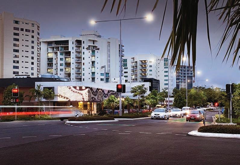
city CairnsCentralBusinessDistrict(CBD)ishometomodernhighrises, eleganthistoricalbuildings,amyriadoflanewaysandourworldfamous Esplanadeforeshorewhichstretchesforover2kmalongTrinityBay

cairns.qld.gov.au/filmLOCATION:CAIRNS 14 CITY LAKE ST PEDESTRIAN OVERPASS Central CBD easily accessible CRYSTALBROOK RILEY HOTEL Central CBD easily accessible on the esplanade


cairns.qld.gov.au/filmLOCATION:CAIRNS 15 City WILLIAM MCCORMACK PLACE Central CBD easily accessible on a quite side street HARTLEY STREET Central CBD easily accessible


cairns.qld.gov.au/filmLOCATION:CAIRNS 16 CITY CAIRNS RAILWAY STATION Central CBD easily accessible CAIRNS RAILWAY STATION ENTRY


cairns.qld.gov.au/filmLOCATION:CAIRNS 17 City MARLIN PARADE Central CBD easily accessible SPENCE ST BUS TERMINALS Central CBD easily accessible


cairns.qld.gov.au/filmLOCATION:CAIRNS 18 CITY OLD COURTHOUSE PRECINCT OLD COURTHOUSE PRECINCT Central CBD easily accessible


cairns.qld.gov.au/filmLOCATION:CAIRNS 19 City THE BOLANDS CENTRE Central CBD easily accessible CITY LIBRARY Central CBD easily accessible


cairns.qld.gov.au/filmLOCATION:CAIRNS 20 CITY THE BISHOP’S HOUSE Central CBD easily accessible OLD ST MONICA’S CATHERDAL Central CBD easily accessible


cairns.qld.gov.au/filmLOCATION:CAIRNS 21 City REEF HOTEL CASINO Central CBD easily accessible


cairns.qld.gov.au/filmLOCATION:CAIRNS 22 CITY ABBOTT STREET (VIEW TO NORTH) Central CBD easily accessible ABBOTT STREET ( WOLF LANE)

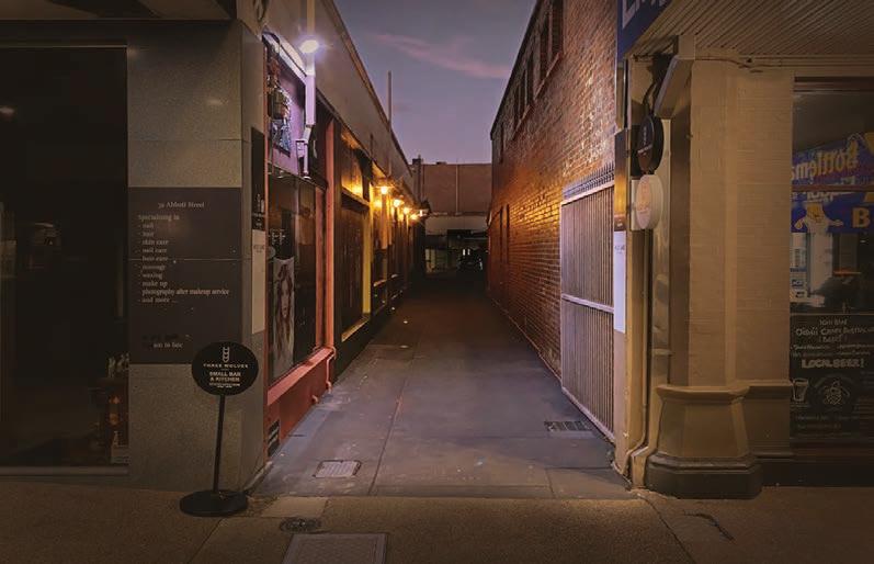
cairns.qld.gov.au/filmLOCATION:CAIRNS 23 City ABBOTT STREET ( CNR FLORENCE ST) ABBOTTSTREET(CNRSPENCEST)

cairns.qld.gov.au/filmLOCATION:CAIRNS 24 CITY LAKECentralSTREETCBD easily accessible LAKE STREET (CONSERVATORY LANE) Central CBD easily accessible


cairns.qld.gov.au/filmLOCATION:CAIRNS 25 City GRAFTON STREET Central CBD easily accessible GRAFTON STREET


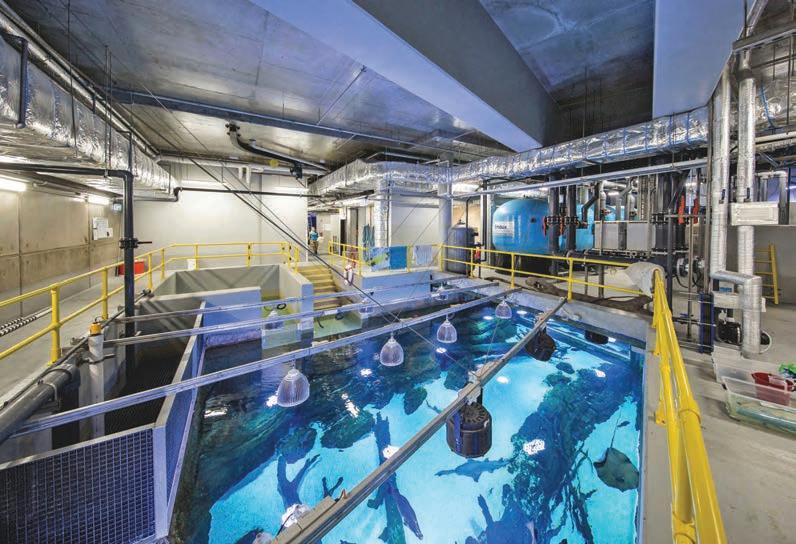
cairns.qld.gov.au/filmLOCATION:CAIRNS 26 CITY CAIRNS AQUARIUM RESEARCH CENTRE Central CBD easily accessible FRED MOULE PAVILLION Central CBD easily accessible

cairns.qld.gov.au/filmLOCATION:CAIRNS 27 City PULLMAN INTERNATIONAL HOTEL Central CBD easily accessible SOUTHERN GRAFTON STREET Central CBD easily accessible


cairns.qld.gov.au/filmLOCATION:CAIRNS 28 CITY SEVERIN STREET Central CBD easily accessible SHIELDS STREET MALL Central CBD easily accessible


cairns.qld.gov.au/filmLOCATION:CAIRNS 29 City MUNRO MARTIN PARKLANDS MUNRO MARTIN PARKLANDS Central CBD easily accessible MUNRO MARTIN PARKLANDS


cairns.qld.gov.au/filmLOCATION:CAIRNS 30 CITY ESPLANADE (FIGTREE BOULEVARD) Central CBD easily accessible ESPLANADE PROMENADE Central CBD easily accessible


cairns.qld.gov.au/filmLOCATION:CAIRNS 31 City ESPLANADE DINING PRECINCT Central CBD easily accessible ESPLANADE LAGOON Central CBD easily accessible


cairns.qld.gov.au/filmLOCATION:CAIRNS 32 CITY ESPLANADE SKATE PARK 1km from CBD easily accessible ESPLANADE BOARDWALK Central CBD easily accessible


cairns.qld.gov.au/filmLOCATION:CAIRNS 33 City NORTHERN ESPLANADE 3km from CBD easily accessible NORTHERN ESPLANADE


cairns.qld.gov.au/filmLOCATION:CAIRNS 34 CITY AllcitystreetsandparksarecontrolledbyCairnsRegionalCouncil CairnsStationcontrolledbyQueenslandRail.
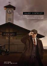
On the edge of the CBD, the Wharf District includes historic Trinity Wharf (also known as the Cruise Liner terminal), the modern Reef Fleet terminal and the large Marlin Marina complex. easily accessible
TRINITY WHARF Central CBD
Wharf District

cairns.qld.gov.au/filmLOCATION:CAIRNS 36 Wharf District TRINITY WHARF CENTRAL BREEZEWAY TRINITY WHARF INTERIOR


cairns.qld.gov.au/filmLOCATION:CAIRNS 37 Wharf District TRINITY WHARF CENTRAL BREEZEWAY TRINITY WHARF CENTRAL BREEZEWAY


cairns.qld.gov.au/filmLOCATION:CAIRNS 38 Wharf District SUPERYACHT MARINA Central CBD easily accessible TRINITY WHARF PARK Central CBD easily accessible


cairns.qld.gov.au/filmLOCATION:CAIRNS 39 Wharf District WHARF ST WAREHOUSE Central CBD easily accessible WHARF ST WAREHOUSE


cairns.qld.gov.au/filmLOCATION:CAIRNS 40 CITY WHARF ST WATERFRONT Central CBD easily accessible WHARF ST WATERFRONT


cairns.qld.gov.au/filmLOCATION:CAIRNS 41 City CAIRNS MARLIN MARINA Central CBD easily accessible CAIRNS MARLIN MARINA


cairns.qld.gov.au/filmLOCATION:CAIRNS 42 The wharves and surrounding areas are controlled by Cairns Regional Council and Ports North (Qld Goverment) wharf District
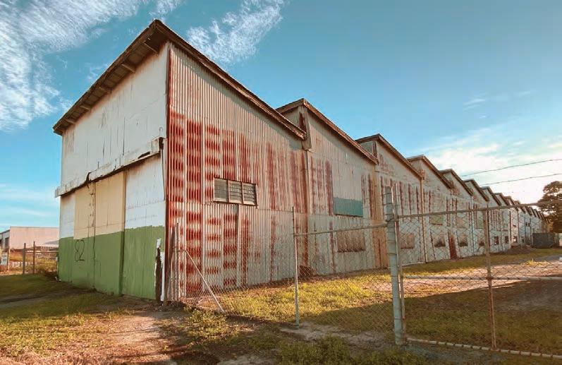
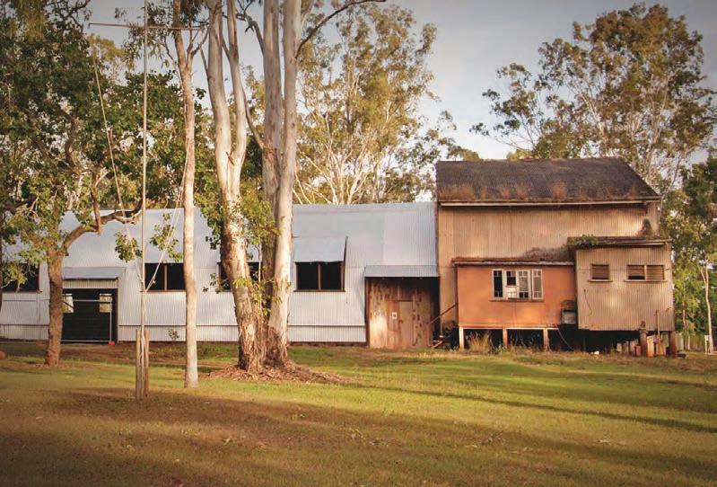
PORTSMITH PortsmithandtheadjoiningsuburbofBungalowishometothecity's industrialareas.Hereyouwillfindstreetsofagingwarehouses, modernindustrialfactories,junkyardsandlargeshipyards.
2km from CBD easily accessible
KNIGHT STREET

cairns.qld.gov.au/filmLOCATION:CAIRNS 44 PORTSMITH DUTTON STREET 2km from CBD easily accessible TINGIRASTREETWHARF 2km from CBD


cairns.qld.gov.au/filmLOCATION:CAIRNS 45 PORTSMITH TRAWLER BASE ROAD 2km from CBD easily accessible TRAWLER BASE ROA D


cairns.qld.gov.au/filmLOCATION:CAIRNS 46 PORTSMITH BUNDA STREET SHEDS 2km from CBD easily accessible QUEENSLAND RAIL YARDS 4km from CBD easily accessible

cairns.qld.gov.au/filmLOCATION:CAIRNS 47 IPORTSMITH COUNCIL MATERIAL RECOVERY FACILITY 5km from CBD easily accessible BUNGALOW CANAL NETWORK 4km from CBD easily accessible


cairns.qld.gov.au/filmLOCATION:CAIRNS 48 PORTSMITH SMITHS FEARNLEYCREEKSTBOAT RAMP FEARNLEY STREET BOAT RAMP 2km from CBD easily accessible


cairns.qld.gov.au/filmLOCATION:CAIRNS 49 PORTSMITH 3km from CBD TRINITY INLET 2km from CBD access depends on location


cairns.qld.gov.au/filmLOCATION:CAIRNS 50 Portsmith is controlled by Cairns Regional Council and Ports North (Qld Goverment) Portsmith

The historic suburb of Edge Hill and surrounds, just minutes from the city, is the city’s botanic playground. It contains the largest areas of parks and gardens in the city as well as being home to a series of lakes and swamps.
CAIRNS BOTANIC GARDENS 5
Botanic Precinct km from CBD accessible
easily

cairns.qld.gov.au/filmLOCATION:CAIRNS 52 Botanic Precinct CENTENARY LAKES 5 km from CBD easily accessible CENTENARY LAKES CHINESE FRIENDSHIP GARDEN


cairns.qld.gov.au/filmLOCATION:CAIRNS 53 Botanic Precinct SALTWATER CREEK 5 km from CBD easily SALTWATERaccessibleCREEK


cairns.qld.gov.au/filmLOCATION:CAIRNS 54 Botanic Precinct CENTENARY LAKES (BAMBOO GROVES) 5 km from CBD easily accessible CENTENARY LAKES RAINFOREST BOARDWALK


cairns.qld.gov.au/filmLOCATION:CAIRNS 55 Botanic Precinct CAIRNS CEMETERY 4 km from CBD easily accessible THE LAKES (GATED COMMUNITY) 5 km from CBD easily accessible

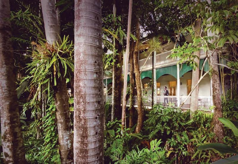
cairns.qld.gov.au/filmLOCATION:CAIRNS 56 Botanic Precinct WHITFIELD HOUSE 5km from CBD easily accessible COMINOS HOUSE 4km from CBD easily accessible


cairns.qld.gov.au/filmLOCATION:CAIRNS 57 CAIRNS COLONIAL CLUB Botanic Precinct CAIRNS COLONIAL CLUB 4km from CBD easily accessible

cairns.qld.gov.au/filmLOCATION:CAIRNS 58 Botanic Precinct THE TANKS ART COMPLEX 5 km from CBD easily accessible THE TANKS ART COMPLEX


cairns.qld.gov.au/filmLOCATION:CAIRNS 59 THE TANKS ART COMPLEX 5 km from CBD easily accessible Botanic Precinct MOODY DETENTION BASIN 6km from CBD easily accessible


cairns.qld.gov.au/filmLOCATION:CAIRNS 60 •CairnsBotanicGardens,CenteneryLakesandtheTanksArtCentreareall controlledbyCairnsRegionalCouncil CominosHouseisownedbycouncilbutrunbytheFriendsofCominosHouse •TheLakesgatedcommunityisprivatelycontrolled •WhitfieldHouseprivatelyowned •CairnsColonialClubisaholidayresort Botanic Precinct
SACRED HEART 8km from CBD easily accessible
FRESHWAter
The suburbs of Freshwater and neighbouring Stratford, just 10 minutes drive north of the city are true character suburbs. With a village atmosphere, the area features streets of old timber Queenslander homes as well as being home to the historic Freshwater train station.

cairns.qld.gov.au/filmLOCATION:CAIRNS 62 FRESHWATER LOWER FRESHWATER ROAD 8km from CBD easily accessible FRESHWATER CREEK 8km from CBD easily accessible


cairns.qld.gov.au/filmLOCATION:CAIRNS 63 FRESHWATER DALZIEL STREET 7km from CBD easily accessible FRESHWATER STATION 8km from CBD easily accessible


cairns.qld.gov.au/filmLOCATION:CAIRNS 64 FRESHWATER STRATFORD VILLAGE 7km from CBD easily accessible RANKINE TIMBER YARD 7 km from CBD easily accessible


cairns.qld.gov.au/filmLOCATION:CAIRNS 65 STRATFORD VILLAGE 7km from CBD easily accessible FRESHWATER PONY CLUB 8km from CBD easily accessible


cairns.qld.gov.au/filmLOCATION:CAIRNS 66 Freshwater •FreshwaterandStratfordsuburbsareundercontrolofCairnsRegionalCouncil •SacredHeartChurchiscontrolledbytheCatholicDioceseofCairns •RankineTImberyardisprivatelyowned
GENERAL
AVIATION PRECINCT 5km from CBD easily accessible
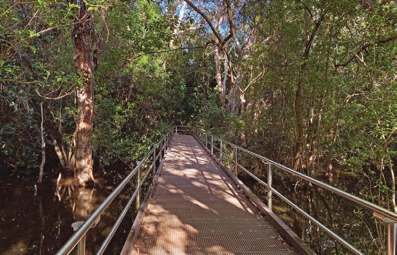
On the northern edge of the city the suburb of Aeroglen is dominated by Cairns Airport, split between the modern international terminals and the less shiny general aviation precinct. The area is also home to an extensive mangrove boardwalk system.
Aeroglen

cairns.qld.gov.au/filmLOCATION:CAIRNS 68 AEROGLEN MARLIN COAST WATER TREATMENT PLANT 5km from CBD easily accessible GENERAL AVIATION PRECINCT 5km from CBD easily accessible


cairns.qld.gov.au/filmLOCATION:CAIRNS 69 AEROGLEN AIRPORT AVENUE 5km from CBD easily accessible JACK BARNES BOARDWALK 5km from CBD easily accessible


cairns.qld.gov.au/filmLOCATION:CAIRNS 70 Freshwater •Cairns Airport is controlled by North Queensland Airports Pty Limited •Marlin Coast treatment plant is a Cairns Regional Council facility Jack Barnes boardwalk image: Jason Sulda/Flickr
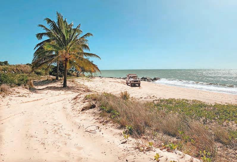
Northern Beaches
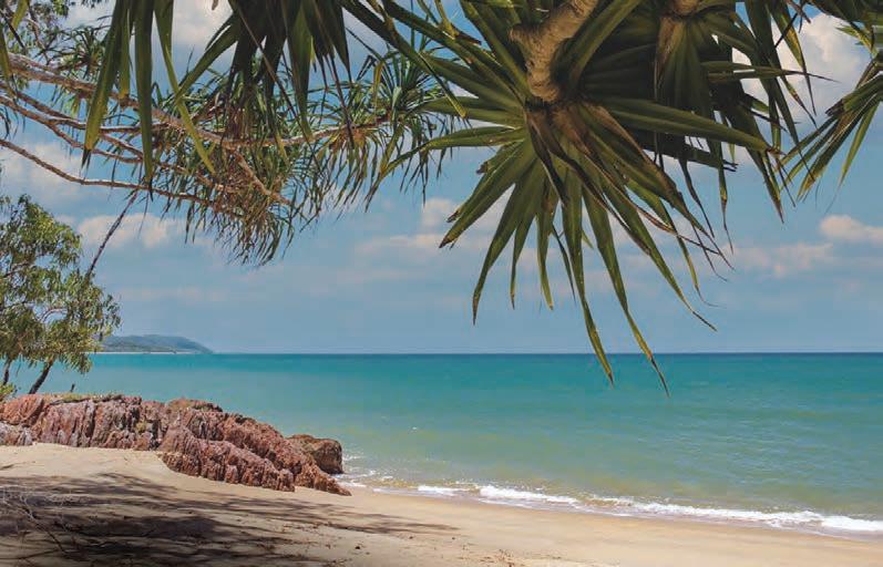
PALM COVE 23km from CBD easily accessible A chain of beaches stretches north from Machans Beach (10 minutes drive from the city) to Ellis Beach (35 minutes drive). Each beach has its own character - from bohemian fishing shacks to glittering five-star hotel strips

cairns.qld.gov.au/filmLOCATION:CAIRNS 72 NORTHERN BEACHES PALM COVE (WILLIAMS ESPLANADE) 22 km from CBD easily accessible


cairns.qld.gov.au/filmLOCATION:CAIRNS 73 NORTHERN BEACHES PALM COVE (THE BEACH CLUB) 22 km from CBD easily accessible PALM COVE (ALAMANDA RESORT)


cairns.qld.gov.au/filmLOCATION:CAIRNS 74 NORTHERN BEACHES PALM COVE JETTY 22 km from CBD easily accessible PALM COVE JETTY


cairns.qld.gov.au/filmLOCATION:CAIRNS 75 NORTHERN BEACHES ELLIS BEACH 27 km from CBD easily accessible ELLIS BEACH

cairns.qld.gov.au/filmLOCATION:CAIRNS 76 DEADMANS GULLY 21 km from CBD easily accessible NORTHERN BEACHES DEADMANS GULLY

cairns.qld.gov.au/filmLOCATION:CAIRNS 77 NORTHERN BEACHES CLIFTON BEACH CLIFTON BEACH 21 km from CBD easily accessible


cairns.qld.gov.au/filmLOCATION:CAIRNS 78 NORTHERN BEACHES KEWARRA BEACH RESORT 20 km from CBD easily accessible KEWARRA BEACH RESORT


cairns.qld.gov.au/filmLOCATION:CAIRNS 79 NORTHERN BEACHES PARADISE PALMS COUNTRY CLUB 19 km from CBD easily accessible PARADISE PALMS ESTATE


cairns.qld.gov.au/filmLOCATION:CAIRNS 80 NORTHERN BEACHES KEWARRA BEACH (PARADISE PALMS) 19 km from CBD easily accessible KEWARRA BEACH (PARADISE PALMS)


cairns.qld.gov.au/filmLOCATION:CAIRNS 81 NORTHERN BEACHES KEWARRA BEACH QUARRY 19 km from CBD easily accessible KEWARRA BEACH QUARRY


cairns.qld.gov.au/filmLOCATION:CAIRNS 82 NORTHERN BEACHES TAYLOR POINT 17 km from CBD 800m on 4wd track TAYLOR POINT


cairns.qld.gov.au/filmLOCATION:CAIRNS 83 NORTHERN BEACHES TRINITY BEACH TRINITY BEACH (BLUE LAGOON) 16 km from CBD easily accessible


cairns.qld.gov.au/filmLOCATION:CAIRNS 84 CATTANA WETLANDS 13 km from CBD easily accessible NORTHERN BEACHES CATTANA WETLANDS


cairns.qld.gov.au/filmLOCATION:CAIRNS 85 NORTHERN BEACHES BLUEWATER ESTATE 15 km from CBD easily accessible BLUEWATER ESTATE


cairns.qld.gov.au/filmLOCATION:CAIRNS 86 NORTHERN BEACHES HALF MOON BAY BEACH 15 km from CBD easily accessible HALF MOON BAY BEACH

cairns.qld.gov.au/filmLOCATION:CAIRNS 87 NORTHERN BEACHES HALF MOON BAY COVE 15 km from CBD easily accessible HALF MOON BAY MARINA 15 km from CBD easily accessible


YORKEYS KNOB 14 km from CBD easily accessible THOMATIS CREEK MOUTH 13 km from CBD easily accessible


cairns.qld.gov.au/filmLOCATION:CAIRNS 89 YORKEYS KNOB NORTHERN BEACHES YORKEYS KNOB 14 km from CBD easily accessible


cairns.qld.gov.au/filmLOCATION:CAIRNS 90 NORTHERN BEACHES MACHANS BEACH 11 km from CBD easily accessible MACHANSBEACH(O’SHEAESPLANADE)


cairns.qld.gov.au/filmLOCATION:CAIRNS 91 NORTHERN BEACHES MACHANS BEACH (BARRON RIVER) MACHANS BEACH (BARRON RIVER)


cairns.qld.gov.au/filmLOCATION:CAIRNS 92 NORTHERN BEACHES HOLLOWAYS BEACH (HIBISCUS LANE) 11 km from CBD easily accessible HOLLOWAYS BEACH (STRAIT ON THE BEACH)


cairns.qld.gov.au/filmLOCATION:CAIRNS 93 NORTHERN BEACHES OLD CAPTAIN COOK HWY 8 km from CBD easily accessible HOLLOWAYS BEACH (COCONUT STREET) 11 km from CBD easily accessible


cairns.qld.gov.au/filmLOCATION:CAIRNS 94 NORTHERN BEACHES GREAT BARRIER REEF DRIVE 27 km from CBD easily accessible GREAT BARRIER REEF DRIVE


cairns.qld.gov.au/filmLOCATION:CAIRNS 95 NORTHERN BEACHES GREAT BARRIER REEF DRIVE WANGETTI BEACH 33 km from CBD easily accessible

cairns.qld.gov.au/filmLOCATION:CAIRNS 96 All beaches and foreshore areas are Cairns Regional Council controlled areas Northern Beaches
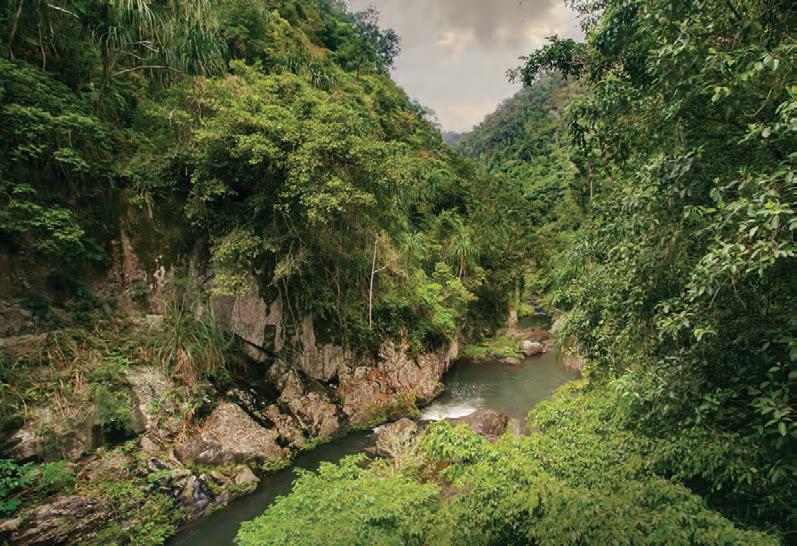
Barron GORGE
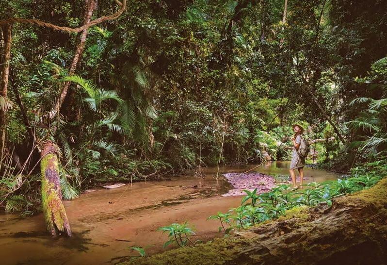
The spectacular Barron Gorge, just a twenty minute drive from the city, dominates a landscape that includes thundering waterfalls, rugged mountain scenery, thick jungle and diverse wildlife.

cairns.qld.gov.au/filmLOCATION:CAIRNS 98 Barron GORGE LOWER BARRON GORGE 13 km from CBD easily accessible LOWER BARRON GORGE SERVICE BRIDGE


cairns.qld.gov.au/filmLOCATION:CAIRNS 99 BARRON GORGE BASE OF BARRON FALLS BARRON FALLS 16 km from CBD restrictedvehicleaccess


cairns.qld.gov.au/filmLOCATION:CAIRNS 100 Barron GORGE BARRON GORGE HYDRO 13 km from CBD easily accessible BARRON GORGE HYRDO


cairns.qld.gov.au/filmLOCATION:CAIRNS 101 BARRON GORGE BARRON GORGE HYRDO BARRON GORGE


cairns.qld.gov.au/filmLOCATION:CAIRNS 102 Barron GORGE STONEY CREEK 13 km from CBD easily accessible STONEY CREEK


cairns.qld.gov.au/filmLOCATION:CAIRNS 103 BARRON GORGE STONEY CREEK 13 km from CBD easily accessible STONEY CREEK


cairns.qld.gov.au/filmLOCATION:CAIRNS 104 Barron GORGE KURANDASCENICRAIL 13 km from CBD restricted road access KURANDA RAILWAY STATION 20 km from CBD easily accessible


cairns.qld.gov.au/filmLOCATION:CAIRNS 105 BARRON GORGE SKYRAIL CABLEWAY 12 km from CBD restricted road access STONEY CREEK BRIDGE 14km from CBD restricted road access


cairns.qld.gov.au/filmLOCATION:CAIRNS 106 Barron GORGE STONEY CREEK ROAD 12 km from CBD easily accessible BARRON GORGE ROAD 13 km from CBD easily accessible


cairns.qld.gov.au/filmLOCATION:CAIRNS 107 BARRON GORGE LAKE PLACID 13 km from CBD easily accessible LAKE PLACID


cairns.qld.gov.au/filmLOCATION:CAIRNS 108 Barron GORGE RAINFORESTATION NATURE PARK 18 km from CBD easily accessible RAINFORESTATION NATURE PARK


cairns.qld.gov.au/filmLOCATION:CAIRNS 109 BARRON GORGE SMITHFIELD CONSERVATION PARK 16 km from CBD easily accessible SMITHFIELD CONSERVATION PARK


cairns.qld.gov.au/filmLOCATION:CAIRNS 110 BarronGorgeareaiswithintheCairnsRegionalCouncilregionandismostlyNationalPark BarronGorgeHydroStationiscontrolledbyClearWaterCo(aStateGovernmentcompany). KurandaScenicRailiscontrolledbyQueenslandRail RainforestationNatureParkisprivatelyowned. SkyrailCablewayisprivatelyowned. Barron GOrge
ISLaNDS+REEF FRANKLANDISLANDS 45 km from CBD Access by boat only

cairns.qld.gov.au/filmLOCATION:CAIRNS 112 ISLaNDS+REEF Wharf Helicopteraccesspad FITZROY ISLAND (Main Beach) FITZROY ISLAND 29 km from CBD


cairns.qld.gov.au/filmLOCATION:CAIRNS 113 ISLaNDS+REEF FITZROY ISLAND FITZROYISLANDABANDONEDLIGHTHOUSE


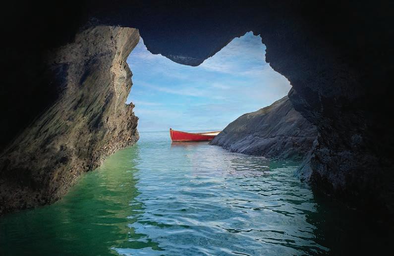
cairns.qld.gov.au/filmLOCATION:CAIRNS 114 ISLaNDS+REEF DOUBLE ISLAND + HAYCOCK ISLAND Access by boat only DOUBLE ISLAND


cairns.qld.gov.au/filmLOCATION:CAIRNS 115 ISLaNDS+REEF DOUBLE ISLAND (SEA CAVE) HAYOCK ISLAND

cairns.qld.gov.au/filmLOCATION:CAIRNS 116 ISLaNDS+REEF FRANKLAND ISLANDS GROUP 45 km from CBD Private boat access only FRANKLANDISLANDSGROUP


cairns.qld.gov.au/filmLOCATION:CAIRNS 117 ISLaNDS+REEF FRANKLAND ISLANDS GROUP FRANKLAND ISLANDS GROUP


cairns.qld.gov.au/filmLOCATION:CAIRNS 118 ISLaNDS+REEF GREEN ISLAND 27 km from CBD Wharf Helicopteraccesspad GREEN ISLAND (Main Beach)


cairns.qld.gov.au/filmLOCATION:CAIRNS 119 NIGHT PONTOON ISLaNDS+REEF MOORE REEF PONTOON 27 km from CBD Boat Helicopteraccesspad


cairns.qld.gov.au/filmLOCATION:CAIRNS 120 ISLaNDS+REEF BARNARD ISLAND GROUP 98 km from CBD Private boat access only BARNARD ISLAND HutchinsonGROUPIsland


cairns.qld.gov.au/filmLOCATION:CAIRNS 121 ISLaNDS+REEF MICHAELMAS CAY (Bird sanctuary) MICHAELMAS CAY 33km from CBD Boat Helicopteraccessaccessible


All Islands listed are National Parks, except for Double Island which is privately owned. Filming on the reef is contolled by the Great Barrier Reef Marine Park Authority (Haycock Island image: ModFilms/Facebook. Frankland Island image: Matthew Kenrick)
cairns.qld.gov.au/filmLOCATION:CAIRNS 122
ISLaNDS+REEF
Mountain range hugs the western edge of Cairns city (25 minutes drive) and is home to winding mountain roads, lush rainforest, towering monoliths, lakes and waterfalls including the idyllic Crystal Cascades.
ROCK 23 km from CBD nearHelipadsummitTheLamb
KAHLPAHLIM
LAMB RANGE

cairns.qld.gov.au/filmLOCATION:CAIRNS 124 LAMB RANGE CRYSTAL CASCADES 13 km from CBD easily accessible CRYSTAL CASCADES (FAIRY FALLS)

cairns.qld.gov.au/filmLOCATION:CAIRNS 125 LAMB RANGE CRYSTAL CASCADES (SERVICE RD)


cairns.qld.gov.au/filmLOCATION:CAIRNS 126 LAMB RANGE LAKE MORRIS (COPPERLODE DAM) 13 km from CBD easily accessible


cairns.qld.gov.au/filmLOCATION:CAIRNS 127 LAMB RANGE THE ROCKS (FRESHWATER CREEK) 8 km from CBD easily accessible THE ROCKS (FRESHWATER CREEK)


cairns.qld.gov.au/filmLOCATION:CAIRNS 128 LAMB RANGE LAKE MORRIS RD 7 km from CBD easily accessible LAKE MORRIS RD


cairns.qld.gov.au/filmLOCATION:CAIRNS 129 LAMB RANGE COPPERLODE DAM 13 km from CBD easily COPPERLODEaccessibleDAM


cairns.qld.gov.au/filmLOCATION:CAIRNS 130 The Range is divided between Dinden National Park and Lake Morris Reserve. Copperlode Dam, Lake Morris Road and Cyrstal Cascades Service road is controlled by Cairns Regional Council. Image page 123: FB@BenHitchens Lamb Range
PACKERS CAMP 25 minutes south of the city Packers Camp is a tiny community of old farm houses dotted across a rural landscape. Bordered by mangroves the historic area is home to sugar cane farms, pockets of rainforest and hidden creeks.

cairns.qld.gov.au/filmLOCATION:CAIRNS 132 PACKERS CAMP GREGORY FARM 12 km from CBD easily accessible GREGORY FARM


cairns.qld.gov.au/filmLOCATION:CAIRNS 133 PACKERS CAMP GREGORY FARM GREGORY FARM 12 km from CBD easily accessible


cairns.qld.gov.au/filmLOCATION:CAIRNS 134 PACKERS CAMP REDBANK ROAD 11 km from CBD easily accessible REDBANK ROAD


cairns.qld.gov.au/filmLOCATION:CAIRNS 135 PACKERS CAMP MACKEYS CREEK 11 km from CBD easily accessible


cairns.qld.gov.au/filmLOCATION:CAIRNS 136 PackersCampandMackeysCreekisunderCairnsRegionalCouncilcontrol GregoryFarmisprivatelyowned PACKERS CAMP
A few minutes by boat across the bay (40 minutes drive) East Trinity is dotted with rocky coves, small beaches and untouched open spaces. There’s also a WWII gunnery complex and the area is home to the Yarrabah Aboriginal community.
East Trinity YARRABAH SHIP WRECKS 11km from CBD easily accessible

cairns.qld.gov.au/filmLOCATION:CAIRNS 138 East Trinity FALSE CAPE WWII BATTERY 10 km from CBD 4WD access only (1.2km from sealed road) FALSE CAPE SUNNY BAY


cairns.qld.gov.au/filmLOCATION:CAIRNS 139 East Trinity FALSE CAPE BATTERY #1 FALSE CAPE BATTERY #2


cairns.qld.gov.au/filmLOCATION:CAIRNS 140 East Trinity GIANGURRA5kmfromCBD easily accessible SECOND BEACH 6km from CBD easily accessible


cairns.qld.gov.au/filmLOCATION:CAIRNS 141 East Trinity KOOMBAL ESPLANADE 8 km from CBD easily accessible KOOMBAL ESPLANADE


cairns.qld.gov.au/filmLOCATION:CAIRNS 142 East Trinity YARRABAH11kmfromCBD easily accessible YARRABAH


cairns.qld.gov.au/filmLOCATION:CAIRNS 143 East Trinity TURTLE BAY 19 km from CBD Boat or helicopter access only GLEN BOUGHTON 6km from CBD easily accessible


cairns.qld.gov.au/filmLOCATION:CAIRNS 144 East Trinty region is spread across Cairns Regional Council and Yarrabah Aboriginal Council. False Cape is Heritage listed by the Queensland Government and is privately owned. east trinity
Centered around the small sugar town of Gordonvale (25 minutes south) the area is dotted with one-pub rural towns and rural landscapes backed by Queenslands highest mountains, from which run stunning crystal clear rivers.
Southern Corridor BABINDA BOULDERS 49 km from CBD easily accessible

cairns.qld.gov.au/filmLOCATION:CAIRNS 146 Southern Corridor SUGARWORLD GARDENS 12 km from CBD easily accessible SUGARWORLD GARDENS


cairns.qld.gov.au/filmLOCATION:CAIRNS 147 Southern Corridor RUSSELL HEADS 38 km from CBD Boat or helicopter access only RUSSELL HEADS


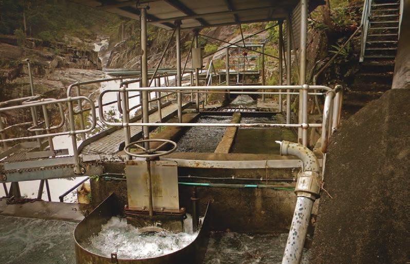
cairns.qld.gov.au/filmLOCATION:CAIRNS 148 Southern Corridor BEHANA GORGE 26 km from CBD easily accessible BEHANA GORGE (CLAMSHELL FALLS)
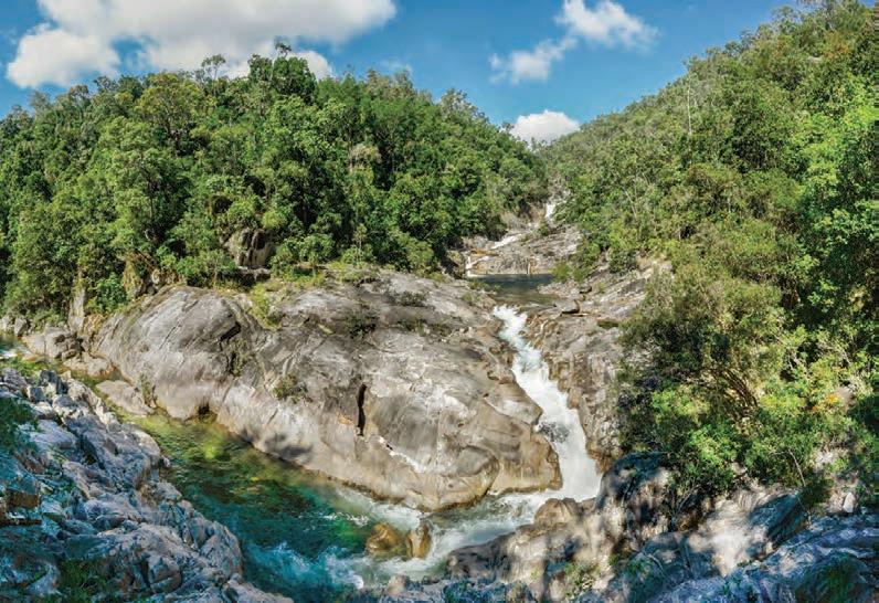

cairns.qld.gov.au/filmLOCATION:CAIRNS 149 Southern Corridor BEHANA GORGE INTAKE 26 km from CBD easily accessible BEHANA GORGE INTAKE

cairns.qld.gov.au/filmLOCATION:CAIRNS 150 Southern Corridor GORDONVALE SUGAR MILL 18 km from CBD easily accessible GORDONVALE OLD HIGHWAY BRIDGE 18 km from CBD easily accessible


cairns.qld.gov.au/filmLOCATION:CAIRNS 151 Southern Corridor GORDONVALE TOWNSHIP 18 km from CBD easily accessible GORDONVALE TOWNSHIP


cairns.qld.gov.au/filmLOCATION:CAIRNS 152 Southern Corridor MT BARTLE FRERE (QLD’S HIGHEST MOUNTAIN) 51 km from CBD Restricted vehicle access Helipad near summit


cairns.qld.gov.au/filmLOCATION:CAIRNS 153 Southern Corridor BABINDA BOULDERS 49 km from CBD easily accessible BABINDA BOULDERS


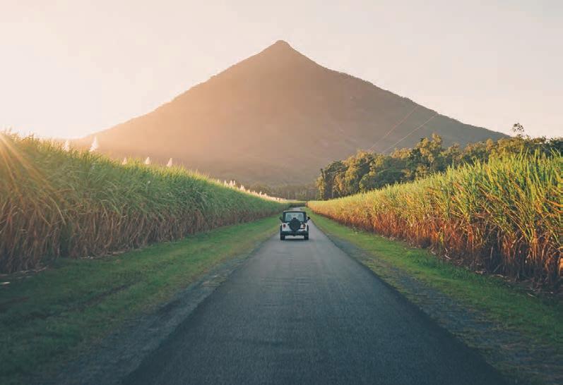
cairns.qld.gov.au/filmLOCATION:CAIRNS 154 Southern Corridor WALSHS PYRAMID 19km from CBD easily accessible WALSHS PYRAMID SUMMIT TRACK 22km from CBD

cairns.qld.gov.au/filmLOCATION:CAIRNS 155 Southern Corridor ALOOMBA20kmfromCBD easily accessible BABINDA TOWNSHIP 48 km from CBD easily accessible


cairns.qld.gov.au/filmLOCATION:CAIRNS 156 Southern Corridor ThesoutherncorridorisunderthecontrolofCairnsRegionalCouncil.The BehanaGorgewaterintakeplantisaCairnsRegionalCouncilfacility. Picturep154:WeAreExplorersCo
Goldsborough valley Hidden between towering mountains 30 minutes south of Cairns there are beautiful vistas everywhere you look. This is one of our greenest areas and is dotted with ranches, thick jungle and picturesque river crossings. 25 km from CBD easily accessible

cairns.qld.gov.au/filmLOCATION:CAIRNS 158 GOLDSBOROUGH VALLEY PEETS BRIDGE 22 km from CBD easily accessible LITTLE MULGRAVE 24 km from CBD easily accessible


cairns.qld.gov.au/filmLOCATION:CAIRNS 159 GOLDSBOROUGH VALLEY LALOLI ESTATE LALOLI ESTATE 24 km from CBD easily accessible


cairns.qld.gov.au/filmLOCATION:CAIRNS 160 GOLDSBOROUGH VALLEY GOLDFIELD TRACK GOLDFIELD TRACK 38km from CBD partially accessible


cairns.qld.gov.au/filmLOCATION:CAIRNS 161 GOLDSBOROUGH VALLEY GOLDFIELD TRACK GOLDFIELD TRACK


cairns.qld.gov.au/filmLOCATION:CAIRNS 162 GOLDSBOROUGH VALLEY MULGRAVE FORESTRY RD 33 km from CBD easily accessible MULGRAVE FORESTRY RD


cairns.qld.gov.au/filmLOCATION:CAIRNS 163 GOLDSBOROUGH VALLEY MULGRAVE RIVER CROSSING 33 km from CBD easily accessible MULGRAVE RIVER CROSSING


cairns.qld.gov.au/filmLOCATION:CAIRNS 164 GOLDSBOROUGH VALLEY ROSS & LOCKE 23 km from CBD easily accessible ROSS & LOCKE


cairns.qld.gov.au/filmLOCATION:CAIRNS 165 GOLDSBOROUGH VALLEY ROSS & LOCKE 23 km from CBD easily accessible ROSS & LOCKE


cairns.qld.gov.au/filmLOCATION:CAIRNS 166 The Valley area is under the control of Cairns Regional Council. The Goldfield trail passes through Wooroonooran National Park. The Mountain View Hotel and Laloli Esate are privately owned Goldsborough Valley
Anhoursdrivewest,ontheAthertonTablelands,isaseriesofdramatic lakes.LakeTinaroo(dam)isthelargestandisfringedwithforestsand ruraltownships.LakeBarrineandLakeEachamarenearby volcaniccraterlakeswithcrystalclearwaters.
LAKE TINAROO 36km from CBD easily accessible
Tableland Lakes

cairns.qld.gov.au/filmLOCATION:CAIRNS 168 LAKE36kmTINAROOfromCBD easily accessible tableland lakes


cairns.qld.gov.au/filmLOCATION:CAIRNS 169 tableland lakes LAKE TINAROO 36km from CBD easily accessible TALLANGALOOK LAKE HOUSE 36km from CBD easily accessible

cairns.qld.gov.au/filmLOCATION:CAIRNS 170 tableland lakes LAKE36kmTINAROOfromCBD easily accessible LAKE TINAROO


cairns.qld.gov.au/filmLOCATION:CAIRNS 171 tableland lakes TINAROO DAM 36km from CBD easily TINAROOaccessibleDAM


cairns.qld.gov.au/filmLOCATION:CAIRNS 172 tableland lakes TINAROO TOWNSHIP 36km from CBD easily accessible LAKE TINAROO HOLIDAY PARK 36km from CBD easily accessible


cairns.qld.gov.au/filmLOCATION:CAIRNS 173 tableland lakes KAIRI41kmTOWNSHIPfromCBD easily accessible KAIRI SILOS 38km from CBD easily accessible


cairns.qld.gov.au/filmLOCATION:CAIRNS 174 tableland lakes KAURI CREEK 29km from CBD easily accessible KAURI CREEK


cairns.qld.gov.au/filmLOCATION:CAIRNS 175 tableland lakes KAURI CREEK KAURI CREEK 35km from CBD easily accessible

cairns.qld.gov.au/filmLOCATION:CAIRNS 176 tableland lakes LAKE EACHAM LAKE42kmEACHAMfromCBD easily accessible


cairns.qld.gov.au/filmLOCATION:CAIRNS 177 LAKE EACHAM FALLS tableland lakes LAKE EACHAM


cairns.qld.gov.au/filmLOCATION:CAIRNS 178 tableland lakes LAKE BARRINE LAKE38kmBARRINEfromCBD easily accessible


cairns.qld.gov.au/filmLOCATION:CAIRNS 179 tableland lakes YUNGABURRA YUNGABURRA 43km from CBD easily accessible


cairns.qld.gov.au/filmLOCATION:CAIRNS 180 The lakes are within the Tablelands Regional Council area Lake Barrine and Lake Eacham are within Crater Lakes National Park Some areas around Lake Tinaroo are covered by Danbulla National Park. Tallangalook Lake House and Lake Tinaroo Holiday Park are privately owned. Pictures page 168-172 : Legendary Adventures tableland lakes
INNISFAIL
You’ll
87 km from CBD easily accessible hoursdrivesouthofCairnsisAustralia’sartdecoarchitecturecapital —Innisfail. alsofindbananaandteaplantations,wildriverrapids,a crumblingSpanishcastlecomplexandlongdesertedbeaches.
An

cairns.qld.gov.au/filmLOCATION:CAIRNS 182 INNISFAIL SHIRE72kmHALLfromCBD easily accessible RANKIN STREET


cairns.qld.gov.au/filmLOCATION:CAIRNS 183 INNISFAIL INNISFAIL CATHEDRAL 72km from CBD easily accessible RANKIN STREET


cairns.qld.gov.au/filmLOCATION:CAIRNS 184 INNISFAIL SOUTH JOHNSTONE RIVER 72km from CBD easily accessible LIT SING GONG CHINESE TEMPLE 72km from CBD easily accessible


cairns.qld.gov.au/filmLOCATION:CAIRNS 185 INNISFAIL NUCIFORA TEA PLANTATION 78km from CBD easily accessible BANANADependsPLANTATIONSonlocation


cairns.qld.gov.au/filmLOCATION:CAIRNS 186 INNISFAIL MAMU RAINFOREST SKYWALK 79km from CBD easily accessible MAMU RAINFOREST SKYWALK


cairns.qld.gov.au/filmLOCATION:CAIRNS 187 INNISFAIL HENRIETTA CREEK 81km from CBD easily accessible HENRIETTA CREEK


cairns.qld.gov.au/filmLOCATION:CAIRNS 188 INNISFAIL NORTH JOHNSTONE RIVER 60 km from CBD access depends on location NORTH JOHNSTONE RIVER


cairns.qld.gov.au/filmLOCATION:CAIRNS 189 INNISFAIL NORTH JOHNSTONE RIVER NORTH JOHNSTONE RIVER


cairns.qld.gov.au/filmLOCATION:CAIRNS 190 INNISFAIL PARONELLA PARK 81km from CBD easily accessible PARONELLA PARK


cairns.qld.gov.au/filmLOCATION:CAIRNS 191 INNISFAIL PARONELLA PARK 81km from CBD easily PARONELLAaccessiblePARK


cairns.qld.gov.au/filmLOCATION:CAIRNS 192 INNISFAIL ELLA65kmBAYfrom CBD easily accessible ELLA BAY

cairns.qld.gov.au/filmLOCATION:CAIRNS 193 INNISFAIL CUNNINGHAM HOUSE 68km from CBD easily accessible FLYING FISH POINT 68km from CBD easily accessible


cairns.qld.gov.au/filmLOCATION:CAIRNS 194 INNISFAIL COWLEY BEACH 87km from CBD easily accessible


cairns.qld.gov.au/filmLOCATION:CAIRNS 195 INNISFAIL MOURILYAN HARBOUR 84km from CBD easily accessible


cairns.qld.gov.au/filmLOCATION:CAIRNS 196 INNISFAIL InnisfailisthecentreoftheCassowaryCoastCouncilRegion TheNorthJohnstoneRiver,MamuSkywalk,andHenriettaCreekare withinWooroonooranNationalPark. MourilyanHarbouriscontrolledbyPortsNorth. NuciforaTeaPlantationisprivatelyowned ParonellaParkisprivatelyowned. CunninghamHouseisprivatelyowned. Images:pages182,183,184&193VinceSofia,HDeVolution
BIBOOHRA RAIL BRIDGE 37 km from CBD easily accessible
The country town of Mareeba, an hour west of Cairns, is the gateway to the outback. Here you’ll find spectacular bushscapes as well as unique locations like the Mareeba Rodeo grounds, Springmount Raceway and the region’s only large-scale jail facility.
MAREEBA

cairns.qld.gov.au/filmLOCATION:CAIRNS 198 MAREEBA DAVIES CREEK DAVIES CREEK FALLS 36 km from CBD easily accessible


cairns.qld.gov.au/filmLOCATION:CAIRNS 199 GRANTIE GORGE MAREEBA GRANTIE GORGE 42 km from CBD easily accessible


cairns.qld.gov.au/filmLOCATION:CAIRNS 200 MAREEBA MAREEBA WETLANDS 41 km from CBD easily accessible MAREEBA WETLANDS SAVANNAH

cairns.qld.gov.au/filmLOCATION:CAIRNS 201 MAREEBA RINGERS REST 37 km from CBD easily accessible RINGERS REST


cairns.qld.gov.au/filmLOCATION:CAIRNS 202 MAREEBA MAREEBA RODEO GROUNDS MAREEBA RODEO GROUNDS 41km from CBD easily accessible


cairns.qld.gov.au/filmLOCATION:CAIRNS 203 MAREEBA MAREEBA TURF CLUB 38 km from CBD easily accessible MAREEBACEMETERY 39 km from CBD easily accessible


cairns.qld.gov.au/filmLOCATION:CAIRNS 204 MAREEBA SPRINGMOUNT RACEWAY 42km from CBD easily accessible SPRINGMOUNT RACEWAY


cairns.qld.gov.au/filmLOCATION:CAIRNS 205 MAREEBA LOTUS GLEN PRISON 42km from CBD MAREEBA WARBIRDS 39 km from CBD easily accessible


cairns.qld.gov.au/filmLOCATION:CAIRNS 206 Mareeba is the centre of Mareeba Shire Council. Springmount Raceway, Ringers Rest & Granite Gorge are privately owned. Lotus Glen Prison is controlled by the Department of Corrections (State Government) Image page 198: Olly Gaspar/ We Seek Travel GMareeba
Atherton hour and twenty minutes west of Cairns is the lush southern tablelands. Rolling green hills and pastures, historic streetscapes and picturesque is what Atherton is all about. HYPIPAMEE CRATER 48km from CBD easily accessible
An
MOUNT

cairns.qld.gov.au/filmLOCATION:CAIRNS 208 ATHERTON THE SEVEN SISTERS 44km from CBD easily accessible THE SEVEN SISTERS


cairns.qld.gov.au/filmLOCATION:CAIRNS 209 ATHERTON MCHUGH LOOKOUT 65km from CBD easily accessible HALLORANS HILL 46km from CBD easily accessible


cairns.qld.gov.au/filmLOCATION:CAIRNS 210 ATHERTON ATHERTON TOWNSHIP (ATHERTON HOTEL) 45km from CBD easily accessible ATHERTON COURTHOUSE


cairns.qld.gov.au/filmLOCATION:CAIRNS 211 ATHERTON ST JOSPEH’S ATHERTON MERRILAND HALL (ATHERTON SHOWGROUND)


cairns.qld.gov.au/filmLOCATION:CAIRNS 212 ATHERTON ROCKY CREEK IGLOO 43km from CBD easily accessible ROCKY CREEK IGLOO

cairns.qld.gov.au/filmLOCATION:CAIRNS 213 ATHERTON ROCKY CREEK WEIR 43km from CBD easily accessible ROCKY CREEK PARK


cairns.qld.gov.au/filmLOCATION:CAIRNS 214 ATHERTON MALANDA MAJESTIC THEATRE 47km from CBD easily accessible WINDY HILL RAVENSHOE 77km from CBD easily accessible


cairns.qld.gov.au/filmLOCATION:CAIRNS 215 ATHERTON RAVENSHOE 74km from CBD easily accessible MILLSTREAM FALLS (RAVENSHOE) 78km from CBD easily accessible


cairns.qld.gov.au/filmLOCATION:CAIRNS 216 ZILLIE FALLS 69 km from CBD 400m walk from easily accessible carpark ATHERTON ZILLIE FALLS


cairns.qld.gov.au/filmLOCATION:CAIRNS 217 ATHERTONRURAL MILLAA MILLAA FALLS 62km from CBD easily accessible MILLAA MILLA FALLS


cairns.qld.gov.au/filmLOCATION:CAIRNS 218 ATHERTON HERBERTON TOWNSHIP 62km from CBD easily accessible HERBERTON VILLAGE BRIDGE


cairns.qld.gov.au/filmLOCATION:CAIRNS 219 ATHERTONRURAL ATHERTON TO HERBERTON OLD RAILWAY 52km from CBD easily accessible ATHERTON TO HERBERTON OLD RAILWAY


cairns.qld.gov.au/filmLOCATION:CAIRNS 220 Atherton Atherton and the surrounding areas are controlled by the Tablelands Regional Council. Rocky Creek Park is Council controlled in collaboration with the Rocky Creek War Memorial Park Committee. Herberton Historic Village is privately owned. Image page 198: Olly Gaspar/ We Seek Travel
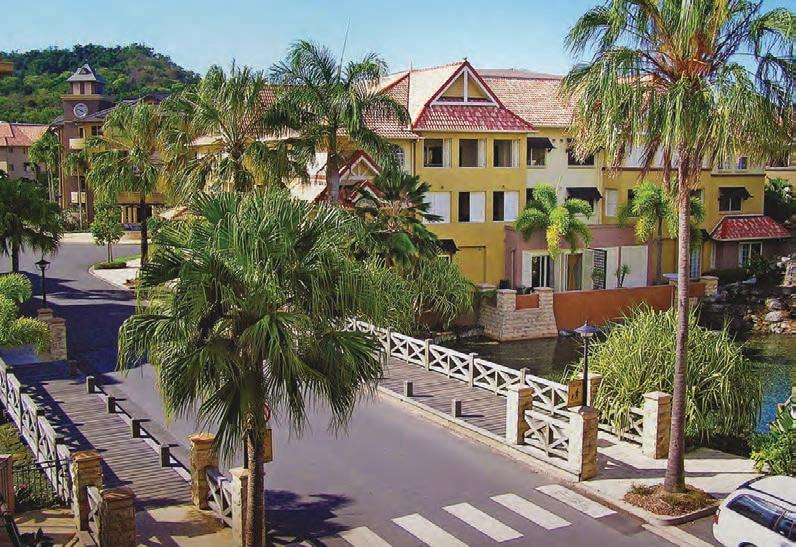
Port DOuglas
An historic seaside town with plentiful locations including Four Mile Beach

cairns.qld.gov.au/filmLOCATION:CAIRNS 222 PORT DOUGLAS ST MARY’S BY THE SEA / SUGAR WHARF 66km from CBD easily accessible SUGAR WHARF


cairns.qld.gov.au/filmLOCATION:CAIRNS 223 PORT DOUGLAS COURTHOUSE HOTEL 66km from CBD easily accessible WILDLIFE HABITAT 65km from CBD easily accessible


cairns.qld.gov.au/filmLOCATION:CAIRNS 224 PORT DOUGLAS LOW71kmISLESfromCBD easily accessible LOW ISLES


cairns.qld.gov.au/filmLOCATION:CAIRNS 225 PORT DOUGLAS MOSSMAN 71km from CBD easily accessible MOSSMAN GORGE 78km from CBD easily accessible


cairns.qld.gov.au/filmLOCATION:CAIRNS 226 Port Douglas is controlled by Port Douglas Regional Council. The Courthouse Hotel and Wildlife Habitat are privately owned. PORT DOUGLAS
OUTBACK Cairns outback region is home to abandoned mines, ghost towns, dystopian landscapes and awe inspiring underground cave systems

cairns.qld.gov.au/filmLOCATION:CAIRNS 228 OUTBACK CHILLAGOE125kmfromCBD easily accessible CHILLAGOE

cairns.qld.gov.au/filmLOCATION:CAIRNS 229 OUTBACK IRVINEBANK83kmfromCBD easily accessible

cairns.qld.gov.au/filmLOCATION:CAIRNS 230 OUTBACK MOUNT MULLIGAN 115km from CBD easily accessible MOUNT MULLIGAN LODGE


cairns.qld.gov.au/filmLOCATION:CAIRNS 231 OUTBACK MOUNT MULLIGAN MOUNT MULLIGAN


cairns.qld.gov.au/filmLOCATION:CAIRNS 232 OUTBACK ALMADEN120kmfrom CBD easily accessible BURKE DEVELOPMENT RD TO ALMADEN


cairns.qld.gov.au/filmLOCATION:CAIRNS 233 OUTBACK ALMADEN RAILWAY HOTEL ALMADEN RAILWAY STATION


Cairns Regional Council acknowledges the First Peoples within our region who are the Traditional Custodians of this country. Within the Cairns Region, there are 4 Traditional Owner groups: Dawul Wuru (Yirrganydji) Aboriginal Corporation – the corporation was established to protect, secure, support and promote the rights and interests of local Aboriginal Traditional Owners in the area between Cairns and Port Douglas. Djabugay – native title rights and interests have been granted to the Djabugay people over land and waters within the Barron Gorge National Park near Kuranda. Gunggandji – the Gunggandji people hold native title rights over more than 7,500 ha of land on the Yarrabah Peninsula, east of Cairns.
LOCATION:CAIRNS
TABLELANDS REGIONAL COUNCIL
SUPPORTING COUNCILS
cairns.qld.gov.au/film
LOCATION:CAIRNS
DISCLAIMER: Inclusion in this location guide does not grant access to any facility or privately owned property to the general public or film production. Permits must be sought. Cairns Regional Council does not claim copyright to the images in this guide by photographers or studios not commissioned by Council.
TRC
Yidinji – the Yidinji tribe is comprised of 8 clans, whose traditional lands included Cairns, south to the Russell River and west to parts of the Tablelands. Today, these clans are represented by a range of groups and corporations who manage native title and relevant cultural matters, including Gimuy Walubara Yidinji, Dulabed Malanbarra and Yidinji, Mandingalbay Yidinji and Wadjanbarra Tableland Yidinji.


