1 minute read
RIVER OF TEARS
Term Winter 2019 Project Urban Studio Location Thunder Bay, ON, Canada Course Studio 4 individual project Instructor Dr. Alan Tate recovered bodies nodes of reconnection reconnection with land & water

Advertisement
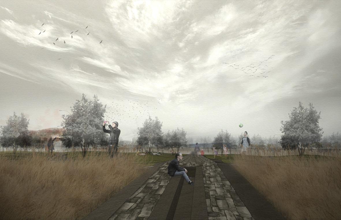
The River of Tears Memorial Park aims to commemorate the lives of the Indigenous kids of Thunder Bay that have died or gone missing within its vast network of waterways, as well as remove the notion that the rivers of the city have become places for death and violence by reconnecting the community back to the the water and revealing its importance - water as life. The memorial park aims to invite people in through a plaza and gathering space, offer a public-to-private transitional place of journey to the water where visitors could interact with it and allow for memorial ceremonies & rituals, and lastly, reveal a secluded place for people to be isolated from the city and contemplate. A series of Northern Pin Oak marker trees located on the other side of the floodway from the memorial aims to represent the lives of the children that have been taken away. A water feature that leads the eye to the marker trees across the water framed by native prairie grass aims to add a temporal element to the memorial by working with the seasonal change in water levels, creating a space for people that adapts with the regular flooding within the site.


RILL + STEPS
PRAIRIE GRASS
Most of the Indigenous children who have gone missing within the city’s waterways went missing in the months of May and November. This story is subtly revealed through the water feature located at the highest point of the park which aims to be a dynamic gathering space and a play area that works with the conditions of the floodway’s rising and receding water levels. The months when the water level is the highest in the floodway coincides with the months of the year the children have gone missing. A catchment basin at the end of the rill adjacent to the water collects water from the floodway. At low water levels, the feature is a seating area. During high water levels, it becomes a water feature, creating a temporal element to the space.
INDIANGRASS
MAIN PATH
WATER FEATUERE
MODEL + ISOLATED SPACE
NORTHERN
+187 m highest point
+185 m maximum water level (spring & fall)


+183 m minimum water level (summer & winter)


