MAJORS BAY RESERVE Prepared for Canada Bay Council SEPTEMBER MASTERPLAN2022 DRAFT


DESIGN GROUP SEPT 2022DRAFT
PLACE
Place Design Group acknowledges the Wangal people, one of the 29 tribes of the Eora nation and the traditional custodians of this land.
ACKNOWLEDGMENTdocument.OFCOUNTRY
These principles will provide insight into the proposed design interventions at the Majors Bay Reserve as outlined in this
We pay respect to Elders past and present and extends this respect to all Aboriginal people living in or visiting the City of Canada Bay.
Aboriginal People have had a custodial role with the Parramatta River and the land surrounding it since time immemorial. It is internationally recognised that Aboriginal nations manage land and waterways as living entities and Aboriginal principles of sustainable preservation of the land and waterway are based in beliefs, tradition, customs and practices.
2 MAJORS BAY RESERVE PARK MASTERPLAN
Phase 04: Masterplan Draft Nick Ison Nick Ison
Disclaimer: This report has been prepared in accordance with the scope of services described in the contract or agreement between Place Design Group Pty Ltd ACN 082 370063 and the Client. The report relies upon data, surveys, measurements and results taken at or under the particular
Approved Nick Ison
Rev.DateDescriptionApproved by MasterplanNick Ison
Report title Majors Bay Reserve Document number 2521076
Prepared for City of Canada Bay Authors Tim Field, Ethan Ramos, Shirelle Altona
Document History & Status
recommendations only apply to the aforementioned circumstances and no greater reliance should be assumed or drawn by the Client. Furthermore, the report has been prepared solely for use by the Client and Place Design Group accepts no responsibility for its use by other parties.
0322.07.22Phase 04:
Phase 04: Masterplan
Revision issue date 14.09.2022
3 MAJORS BAY RESERVE PARK MASTERPLAN PLACE DESIGN GROUP SEPT 2022DRAFT 4.3.2.1.CONTENTSINTRODUCTIONPOLICYCONTEXTSITEANALYSISOPPORTUNITIES+ CONSTRAINTS 5. MASTERPLAN 6. APPENDIX 351913964#
Reason for revision Phase 04: Final Masterplan
11.05.2206.05.220201
Revision number 04
4 MAJORS BAY RESERVE PARK MASTERPLAN PLACE DESIGN GROUP SEPT 2022 1. INTRODUCTION DRAFT 1. INTRODUCTION
SEPT 2022 1. INTRODUCTION DRAFT INTRODUCTION
Place Design Group was engaged by the City of Canada Bay (Council) to develop a Masterplan for Majors Bay Reserve that incorporates sporting, active recreation and passive uses.
In order to maximise the sporting, recreation and ecological functions of the Reserve for the local and broader community, this Masterplan will provide Council with the design guidelines and objectives to direct future development of the Reserve.
• Integrate the park into its surrounding context
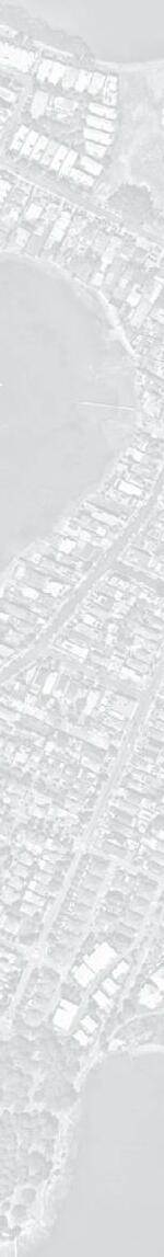
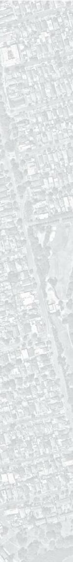
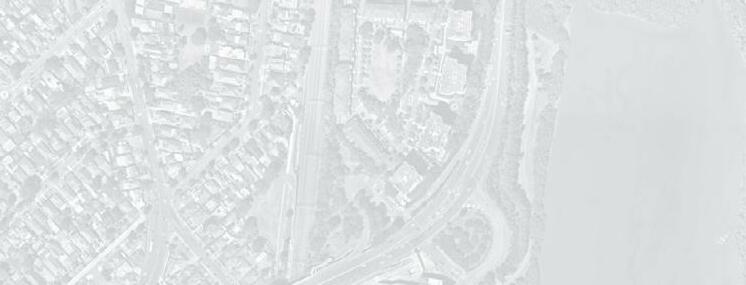
Majors Bay Reserve is approx. 16.42 hectares in size and is located within the suburb of Concord along the Parramatta River. It is situated by Majors Bay, which forms the Reserve’s north eastern boundary. As a result the Reserve has a key linkage to the Concord Foreshore Trail.
5 MAJORS BAY RESERVE PARK MASTERPLAN
PLACE DESIGN GROUP
• Improve the recreational and ecological functions of the park
e goals of this Masterplan are to:
• Guide Council over the coming years on how Majors Bay Reserve will be improved and renovated with new uses and infrastructure.
• Transform Majors Bay Reserve a local and regional destination and integrate the reserve to the wider foreshore access strategy (2020) and Majors Bay.
2. POLICY CONTEXT 6 MAJORS BAY RESERVE PARK MASTERPLAN PLACE DESIGN GROUP SEPT 2022DRAFT
2. POLICY CONTEXT
Social Infrastructure (Open Space AndSocial Infrastructure Space And Recreation) Strategy And Action PlanStrategy And Action Plan (Canada Bay City Council)Bay City

• e Canada Bay Community feels “safety for people with a disability to get around... (is a way) we can work towards maintaining and improving safety.”
• As part of the proposed objective to create three new swimming spots by 2025... All council areas within the Parramatta River catchment are to implement water sensitive urban design guidelines.
• With prospects of a population increase by 32,000 people by 2036, more residents will require a greater variety of spaces for recreation. Improving the quality and capacity of our existing open space and recreation facilities, and utilising what we have better, will help to meet additional demand.
• Canada Bay City have a priority need to increase diversity of recreational opportunities across the LGA, including walking/ cycling, outdoor fitness stations, youth spaces, and other informal recreation opportunities.
Duba, Budu, Barra Ten Steps To A Living Water: e Paramatta River Masterplan (Canada Bay City Council)

• ere is a strong desire from the community, given the significant foreshore, for improving public access to foreshore parks.

2. POLICY CONTEXT 7 MAJORS BAY RESERVE PARK MASTERPLAN PLACE DESIGN GROUP SEPT 2022DRAFT
Your Future 2030: Community Strategic Plan (Canada Bay City Council)Plan Bay City
• Canada Bay City Council is committed to improving and protecting the river and its tributaries and creating new recreational opportunities for the community.
2019
• e Canada Bay Community identified “green spaces, local parks and opportunities to be near the water as the most valued local assets”.
2018-20302018-2030
Report Review Summary:
20192019
• Council is an active member of the Parramatta River Catchment Group.
Report Review Summary:
• e Canada Bay Community feels that “the City is a leader in sustainability”.
Report Review Summary:
e Greater Sydney Green Grid (Government Architect NSW) 2017


• ere are important mangrove habitats protected under the
Report Review
• ere is a potential threat to existing EEC’s (Sydney Turpentine-Ironbark Forest, Swamp Oak Floodplain Woodland and Saltmarsh)due to unleashed dogs on wildlife and impact on saltmarsh from track widening proposals through Yaralla.
•ManagementFisheries Act 1994 (NSW; EPBC Act Protected Matter Report), as well as a number of critical habitats that are located along the foreshore. erefore foreshore access should only be provided in instances where ecologial habitats will not be adversley affected.
2. POLICY CONTEXT 8 MAJORS BAY RESERVE PARK MASTERPLAN PLACE DESIGN GROUP SEPT 2022DRAFT
• e Green Grid Plan presents a preliminary project prioritisation matrix in the Canada Bay LGA, including the Foreshore walk and Concord Open Space Precincts.
•ParramattaSummary:Riverand
•Majors Bay Reserve is ranked ‘Very High’ in the order of priority for management action.

Report Review Summary:
Foreshore Access Strategy (Canada Bay City Council) 2020
•In order to increase the awareness of circuits and recreation opportunities a wayfinding strategy that defines a ‘foreshore brand’ is to be developed.
•A significant portion of this precinct already has publicly accessible foreshore. However, there are several ‘blockages’ in access.
Report Review Summary:
•Potential for revegetation and improved protection measures such as stopping mowing to edge of native vegetation to create a buffer to protect stands of vegetation from weed encroachment. Potential to improve tree corridor to connect Majors Bay and Golf Course to the south.
•Connecting these open spaces, such as Concord Golf Course and the former Concord RSL lands will make better use of under-utilised open space around community facilities and create a connected walking and cycling trail along the river foreshore.
Canada Bay Biodiversity Framework and Action Plan (Canada Bay City Council) 2019
Canada Bay have been identified as project opportunity clusters. New project works should aim to support work already undertaken within the corridor, establishing Parramatta River as a key active recreation link and regional open space corridor between the city and the west.
3. SITE ANALYSIS 9 MAJORS BAY RESERVE PARK MASTERPLAN PLACE DESIGN GROUP SEPT 2022DRAFT 2. SITE CONTEXT
20
88,015
Source: LSP, City of Canada Bay 2020
Source: LSP, City of Canada Bay 2020


Source:240playgrounds.sportingfields.swimmingcentres.LSP,CityofCanadaBay2020
As


MAJORS recreation spaces. parks. off-leash dog areas.

RESERVEBAY CITYOFCANANDABAY SPORTS + PLAYGROUNDS 142
POPULATION in 2016. 120,000 by 2036. 20% households with children. born40.8%overseasand speak a language other than English at home.

per Local Strategic Planning Statement: City of Canada Bay 2020 COMMUNITY CONTEXT
45
April 2022
OPEN SPACE + VEGETATION ha of open space - LSP 18.2% tree canopy cover. 36 kms of foreshore along the Parramatta River.
348
150+
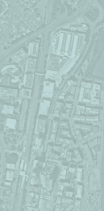
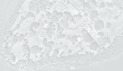
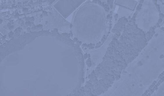
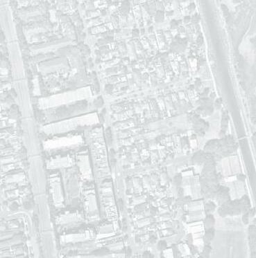
This page illustrates the changes to Majors Bay over time.
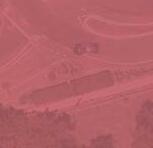
Aerial Photograph; Source: City of Canada Bay Mapping Service
Survey of Port Jackson; Source: State Library of New South Wales
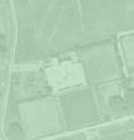
1840: Thomas Walker bought “Yaralla” at 1905:auctionConcord Golf Links Limited brought 46ha of Yaralla Estate from the trustees of the Thomas Walker Estate. The Company leased 12ha of land which was extensively cleared
Aerial Photograph; Source: City of Canada Bay Mapping Service
Aerial Photograph; Source: City of Canada Bay Mapping Service
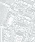
1963-1969: Majors Bay Reserve used as a garbage disposal depot, which resulted in a loss of forest trees and extensive filling
Early settlement: 50 acres was granted to Isaac Nichols (convict transported in 1791), by Governor Hunter, it was named “Yaralla” and included Majors Bay Reserve + Arthur Walker Reserve.
1980: Official opening of the sports oval, horse riding circuit and amenities building at Majors Bay Reserve (Ron Routley Oval by Ken Booth, the NSW Minister for Sport and Recreation 1981: Majors Bay Reserve was officially named by the geographical names Board
1822 YARALLA 1972 1930 1994 200920211961
1995: 12 Native trees planted and plaque installed to commemorate the 12 River Class Frigates that served during WII in Korea.
1935: Land made available to Concord West Cricket Club 1955: Concord Council purchased Majors Bay reserve for 2,800 pounds from Concord Golf Club for reclamation and public recreation.


2019: Upgrades to the sporting precinct begin with a synthetic soccer field


3. SITE ANALYSIS 11 MAJORS BAY RESERVE PARK MASTERPLAN PLACE DESIGN GROUP SEPT 2022DRAFT


Aerial Photograph; Source: City of Canada Bay Mapping Service
1933: The northern edge of the golf course was reclaimed to create an access point between east + west Concord, Norman St was constructed.

Aerial Photograph; Source: City of Canada Bay Mapping Service
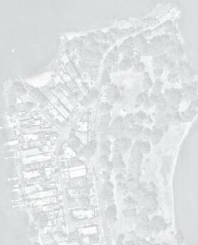
1966: Concord RSL Club opened 1978: Concrete sea wall was constructed around the head of Majors Bay
HISTORICAL EVOLUTION
For thousands of years prior to European settlement, the area was inhabited by the Wangal People. The Wangal people have a deep connection to the land and landscape of Canada Bay. The pre-European vegetation communities included mangroves + salt-marsh flats. Arthur Walker Reserve was vegetated by Open Eucalyptus forest on deep clay soils of Wianmatta Shale.
1985: Concord Foreshore Trail from Majors Bay Reserve to Rhodes Park opened
1993: Over 1,000 tube-stock planted in the Reserve by local volunteers as part of the Federal Government’s One Billion Trees program
Aerial Photograph; Source: City of Canada Bay Mapping Service


3. SITE ANALYSIS 12 MAJORS BAY RESERVE PARK MASTERPLAN PLACE DESIGN GROUP SEPT 2022DRAFT CABARITAWHARF SITE CONTEXT + EXISTING OPEN SPACES LEGEND Major Road Site LocalRegionalDistrictPublicTrainTrainPrivatePublicEducationIndustrial/MixedHealthWalkingSuburbBoundaryBoundaryDistancesUseOpenSpaceOpenSpaceLineStationFerryWharfPlaySpacePlaySpacePlaySpacex x xCONCORD CONCORDWESTCONCORDWEST WEST CONCORD LIBERTYRHODESWEST NORTHSTRATHFIELDCONCORDBREAKFAST BREAKFASTPOINTPOINT MORTLAKEBREAKFAST POINT CONCORDCABARITACITY OF CANADA BAY COUNCIL CONCORD GOLFCLUBMASSEYPARK GOLFCLUB BRAYS BAY HOMEBUSH BAY YARALLABAY KENDALLBAYCONCORDRHODESSTATIONWESTSTATION MORRISONSBAY GLADESBAY FRANEBAYEXILEBAY PA R R A M ATTA B AY HASLAMS CRK CRK 5mins400m10mins800m15mins1000m 30mins2000m YARALLA CONCORDHOUSE REPATRIATION GENERALHOSPITAL MAJORSRESERVEBAY HEN CHICKENANDBAY HASLA CSOPWELLRK SAL Wangal ReserveBreakfast PointCabarita KendalPark ReservePrince Edward EdwardsPark Park GreenleesWarbrickParkMasonPark Park Bressington Park ConcordWest WentworthPlayground Common Blaxland RiversideParkLewisBergerParkRhodes Park McIlwaine BicentennialPark ParkHowse Park NTS CITY PARRAMATTAOFCOUNCIL


13 MAJORS BAY RESERVE PARK MASTERPLAN PLACE DESIGN GROUP SEPT 2022DRAFT 4. OPPORTUNITIES + CONSTRAINTS
FIT FOR PURPOSEVARIED SPACES + WAYFINDING COMMUNITYIDENTITY
RecreationmanageObservingbiodiversity.enhancetheBiodiversityFramework&ActionPlan(2019),theparkshouldseekoutcomestoprotectandrestorenativevegetation,promoteandenhancebiodiversitycorridorsandplayitspartinrestoringtheriverforeshoreenvironmentoftheParramattaRiver.andopenspaces
The park should perform as a system to improve soil + water, to filter air, provide habitat and
4. OPPORTUNITY + CONSTRAINTS 14 MAJORS BAY RESERVE PARK MASTERPLAN PLACE DESIGN GROUP SEPT 2022DRAFT
The park should offer a range of spaces to cater for the needs of a diverse range of age groups, cultures and genders. From informal and unstructured, to formal and programmed spaces. From small spaces providing refuge to larger spaces with expansive views over the landscape. Varying spaces/uses need to work together, have legibility and cohesiveness.
PERFORMANCEECOLOGICAL

WHAT MAKES A SUCCESSFUL RECREATION/OPEN SPACE PRECINCT?
must balance many competing objectives, consider many complex and varied unrelated uses, and perform as a coherent system to be successful. The following principles outline key attributes for consideration in the master-planning of a successful community recreation and open space
precinct:Thepark
The Community should feel a sense of ownership of the park. The park’s identity should represent the Community, resonate with the local character, while contributing to the community aspirations and evolving character of the local environment.
should provide spaces which are considerate and function well for the proposed use. It should be tailored to respond to its users’ needs.
Equitable access and inclusiveness is paramount to a successful open space. Universal design guidelines embrace the richness in uses. There should also be resolved and clear links between transport, active transport, facilities and services.
ACCESSIBILITY CONNECTIVITY+


Opportunity to increase buffer and enhance planting along boundary
Retain established trees to provide passive shade amenity. Clearly define Dog park off-leash area through signage + landscaping. Improve passive surveillance of space.
Improved shade amenity with tree plantings to the periphery of sporting fields.

New amenity block to service sporting field


Play Area to activate streetfront of park
Reuse fill in proposed BMX pump track from existing dog park. Proposed location highly visible from the street and surrounding residential properties.


Opportunity to introduce carparking along Norman Street


4. OPPORTUNITY + CONSTRAINTS 15 MAJORS BAY RESERVE PARK MASTERPLAN PLACE DESIGN GROUP SEPT 2022DRAFT NTS NORMAN ST CONCORD DEAKINST RICKARDST FORESHORE TRAIL 1 13 14 WATER VIEWS 7 7 7 7 7 MAJORSBAYRD NULLAWARRAAVE Site BufferWaterProposedExistingPotentialPotentialProposedStructuredUnstructuredBoundaryProgramProgramTreePlantingBoardwalkNodeBoardwalkAmenities/buildingsAmenities/buildingsViewsPlanting LEGEND 151413123214567891011613 9 5 5 5 3 10 1112 LAYOUT + USES I OPPORTUNITIES + CONSTRAINTS 2 4 6 13 MAJOORSRSBBAYA 1 15
Boardwalk nodes to enhance outlook and access to the bay.
Existing Sydney Turpentine-Ironbark Forest to be enhanced and Familyprotected+Youth


OPPORTUNITIES
Potential for car park to be congested at peak times of use (weekends)
Retain existing use of sporting facilities


Upgrade existing amenities to service sporting field + proposed future uses
Existing mangrove swampland / saline vegetation within estuary to be enhanced and protected


Retain storage shed for use of community sporting clubs

Collisions are a risk at the pump track, to be managed by separating jump track and pump track.

Open lawn, shade amenity and proximity to water making it ideal for enhancing biodiveristy and maintaining open “green feel”.
CONSTRAINTS


4. OPPORTUNITY + CONSTRAINTS 16 MAJORS BAY RESERVE PARK MASTERPLAN PLACE DESIGN GROUP SEPT 2022DRAFT


Improve connections + accessibility to the existing Concord Foreshore Trail.
Improve park users experience + ease of arrival with new parking along Norman Street
Proposed Mangrove Boardwalk / Improve Connection To Water’s PotentialEdgeBoardwalk Node
Estuarine mangrove community inhibits visual access to bay.
Maintain maintenance/emergency access point to inner precinct.
Improve connections to water’s edge and enhance views of Majors FormaliseBay connections into park and improve accessibility to sporting, facilities and amenities.
INTERNAL CIRCULATION + ACCESS I OPPORTUNITIES + CONSTRAINTS NTS NORMAN ST CONCORD DEAKINST RICKARDST FORESHORE TRAIL 1 2 3 3 3 9 5 8 10 10 MAJORSBAYRD NULLAWARRNULLAWARRAAVEWA Site VehicularBoundaryAccess
existing connection to Arthur Walker Reserve to improve presence within the broader precinct.
Improve street connections by establishingnew arrival points with signage and way-finding.
Provide accessible path/ramp to Arthur Walker Reserve.
Concord Foreshore Trail
NodesLocationOf Program


Vehicular Access Road - Sealed


Improve spectator’s experience with upgraded seating and shading options at high-points in the precinct.
Proposed Improved Formalised Accessible Pedestrian Connections
SecondaryEntryEntry LEGEND 10986321457114912 11 MAJOORSRSBBAYA 7 12 4

Community regeneration planting and levels constraints access to Arthur Walker Reserve.
Improve sense of arrival at Nullawarra Ave entry with planting and Enhancesignage.
CONSTRAINTS

Nodes Of Prospect Primary
Tight access point. Road - Unsealed

OPPORTUNITIES
Formalise agreement and access to foreshore edge of adjacent Yaralla Estates with Land owners and Trustees.
nh 4. OPPORTUNITY + CONSTRAINTS 17 MAJORS BAY RESERVE PARK MASTERPLAN PLACE DESIGN GROUP SEPT 2022DRAFT


Estuarine Swamp Oak Forest is subject to various degrees of weed invasion, i.e. Woody Lantana le in clumps. However, indiscriminate removal of weeds such as Lantana may result in the local extinction of fauna species
Mudflat known to contain toxins. Physical engagement with mudflat is to be limited.


Enhance valuable green spaces to so en the harsh urban edge and create an attractive setting.


Opportunity to consider width of existing she-oak strips to improve current canopy connection and provide habitat corridor for understorey birds to move between.
Construction methodology to be reviewed to ensure minimal excavation into existing fill


CONSTRAINTS


Poor drainage and flood prone


Potential for regeneration efforts to restore remnant Sydney Turpentine-Ironbark Forest (currently classified as an ecologically endangered community) dominated by exotic shrubs and groundcovers in the understorey, as well as strengthen corridor connections to assist vegetation of the community located within the golf course.
Current rubbish dumping along foreshore walking track
Works pose potential threat to Estuarine mangrove forest. is community provides valuable habitat that needs to be protected.
Stormwater pipe outlets


ECOLOGICAL VALUES + CONSTRAINTS NTS NORMAN ST DEAKINST MAJORSBAYRD RICKARDST NULLAWARRAAVE 3 4 6 LEGEND 1. Estuarine Mangrove 5.ForestSwamp Oak Forest Flood Impacted Area Areas of programproposed(structured +Stormwaterunstructured)pipe outlet611789 9 3221455 2. Turpentine - GreyIronbark Open Forest 5 2 2 1 MAJOORSRSBBAYA 7 7 8 8


Diverse mix of resident, nomadic and migratory species confined to the continuum of mangrove forest extending from Brays Bay Reserve to Majors Bay. ese forests provide the most important foraging, roost and shelter habitats for waterbirds, shorebirds and other fauna. Opportunity to retain and restore bird attracting planting to provide habitat for small birds ( e fauna of City of Canada Bay LGA: 2013-2014).
Works may pose potential threat to EEC’s Sydney TurpentineIronbark Forest Swamp Oak Floodplain Woodland through weed encroachment. is community provides valuable habitat that needs to be protected.
Strengthen and enhance Estuarine mangrove forest connections along foreshore corridor.
OPPORTUNITIES
Opportunity to improve spectator’s Establishexperience.central ‘meeting place’ to improve navigation and Improvewayfinding.sense of arrival at Nullawarra Ave.


DRAFT DEAKINST NULLAWARRAAVE
15.13.14.12.16.17.18.19.20.21. 050M/ 1:1000@A140302010 8 8 DRAFT 4. OPPORTUNITY + CONSTRAINTSKEY MOVES: COMBINED OPPORTUNITY AND CONSTRAINTS 10.9.8.7.6.5.4.3.2.1.11. Site KeyToEdgepropertiesEdgeSiteProposedExistingPriorityBoundaryViewsPathwayPathwayConnectiontoResidentialConditionsBeEnhancedIntersection LEGEND Entry Feature Key SecondaryEntry Entry Sydney IronbarkTurpentine-Forest Mangrove Forest Flood Impacted Area Area for ProgramProposed(Structured + ExistingUnstructured)Mounding


Utilise and enhance existing trees to create pockets of passive open space and reinforce a sense of “green Opportunityspace”for new parking along Norman St Enhance buffer planting for privacy to adjacent private Highresidents.point within site. Opportunity for pathway connection and avoid flood Strengthenarea. existing path network


Improve accessibility to sporting, facilities and amenities.


Establish key pedestrian arrival point as an extension to Majors Bay BufferRoad.planting to boundary of site for shade to existing sport fields.


Provide accessible path/ramp to Arthur Walker Reserve.


Opportunity to utilise usable existing site fill for play or feature.


MAJOJOORS BRS AAY


FLOODLEVELLINENORMANST 1 1 2 3 4 5 21 6 7 8 9 20 10 11 12 13 16 1714 19 18 18 15 3 RICKARDSTRDST


Key Moves

Protect and Enhance EEC Sydney Turpentine-Ironbark Forest habitat corridor.


Maintain planting.FormaliseadjacentOpportunityconnectivityActivateEnhanceemergencymaintenance/accesspoint.passivesurveillance.siteedgeandimprovetothestreet.toactivateareabushland.existingtreeavenue


Opportunity to utilise existing fill for pump Opportunitytrack to activate central ‘meeting place’ as youth zone

5. MASTERPLAN 19 MAJORS BAY RESERVE PARK MASTERPLAN PLACE DESIGN GROUP SEPT 2022DRAFT 5. MASTERPLAN
2.3. Define circulation and nodes
Ensure movement and circulation throughout the park is clear and legible.
CONNECTIONEXTERNAL3.0
Create an inclusive space for all users irrespective of age, gender or ability.
3.2. Ensure considered entry points

3.1. Provide clear entry signage
3.3. Design for external visual connections that provoke interest
2.1. Identify clear path heirarchy
STRENGTHENING1.0
SENSE
OF PLACE
INCLUSIVENESS4.0
CONNECTIONINTERNAL2.0


Ensure the presence of the existing mangroves are acknowledged and celebrated within the park.
1.1. Increase park connectivity to existing mangroves by locating activity +

Establish strong entry legibility throughout park for external connections.
4.3. Incoorporate ‘Everyone Can Play’ guidelines into the design of play areas, including an ‘Changing Places’ amenities building
4. OPPORTUNITY + CONSTRAINTS 20 MAJORS BAY RESERVE PARK MASTERPLAN PLACE DESIGN GROUP SEPT 2022DRAFT DESIGN OBJECTIVES I MASTERPLAN
2.2. Provide wayfinding through use of materiality and form
4.2. Provide an accessible ramp to Arthur Walker Reserve
1.3.1.2.opportunitiesrecreationaladjacentProvideboardwalkexperiencethroughmangrovesEnhanceconnectiontoexistingConcordForeshoreTrail
4.1. Offer a range of programs to cater for the needs of a diverse range of age groups, cultures and genders
5. MasterplanMASTERPLAN MAJORS BAY 050M/ 1:1000@A140302010 1.ExistingForeshoreWalk Retained 2.ExistingSeawallRetained 3.EnvironmentalKiosk 4.WidenedEntryRoadStage2 (unfunded) 5.ProposedDeakinStreet ForeshoreBoardwalk(indicative) 6.CycleServiceArea 7.Off-road90 8.oParking(Stage2) FamilyPlayandOutdoor Fitness 9.PicnicAreaWithShelters 10.Off-leashDogPark(unfenced) 11.ProposedAccessibleRampTo ArthurWalkerReserve 12.EnhancedBufferPlanting (LowLevel) 13.TreePlantingToMedianin Carpark 14.KeyPedestrian/CycleEntry 15.FormalisedPathAround CricketOvalFutureStage 16.JuniorPumpTrack17.IntermediateJumpTrack 18.EntryStatementAnd Signage 19.EmergencyAccess 20.MemorialTreePlanting 21.CentralMeetingPlacewith OptionforMulti-Courtsand Parkour 22.RetainExistingTrees 23.RenovatedChangeRooms withAmenities(unfunded) 24.ChangingPlacesAmenity Building 25.ExistingCricketNets 26.ProposedCricketAmenity Block(unfunded) 27.FormalisedEntryPoints FromCarPark(Stage2) 28.RenovatedAmenities (unfunded) 29.AdjacentSydney TurpentineIron-barkForest EcologicalEndangered Communitytobeprotected LEGEND 11135 8914 71018141418 61218172115 1619 RONOVALROUTLEY RWALKERARTHURESERVEARTHURWALKERRESERVE CONCORD CLUB 2623 1824ExistingBuildings ProposedShelters ProposedBuildings ExistingTrees ProposedTrees DecomposedGraniteMassplanting Sofall PlaygroundMulch Existingsportsfields Turf ExistingLighting KEY 283-Unfunded-ExistingItems 2712 272727 42727 DRAFT 2520xx-FundedDPEGrantx 291 222


5. MASTERPLAN 22 MAJORS BAY RESERVE PARK MASTERPLAN PLACE DESIGN GROUP SEPT 2022DRAFT SECTIONS I MASTERPLAN EXISTING GROUND LINE SECTION AA | NEW ACCESSIBLE RAMP TO ARTHUR WALKER RESERVE | 1:100 1:14 RampBush Regeneration Bush RegenerationExisting ShrubConcretePath1:14 Ramp 1:14 Ramp NULLAWARRA NORMAN NIRRANDA NORMAN HEATH AUGUSTAMAJORSROAD KEY AA

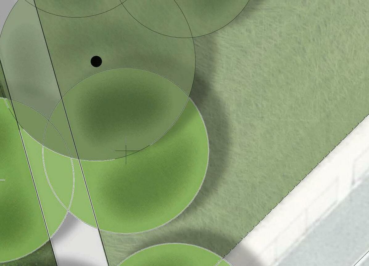
PUMP TRACK I CONCEPT DESIGN LEGEND 1SiteBoundary 2KeyPumpTrack 3ProposedTrees 4ExistingTrees 5ProposedPathway 6ProposedCarParkingNormanSt 7ProposedSheltersProposedSeating14235 NULLAWARRAAVE NORMAN ST NIRRANDAST ST NORMANSTHEATHST AUGUSTASTMAJORSBAYROAD KEY 0246810M/ 1:200@A3 766 5. MASTERPLAN 23 MAJORS BAY RESERVE PARK MASTERPLAN PLACE DESIGN GROUP SEPT 2022DRAFT

NORMAN ST NIRRANDAST ST NORMANSTHEATHST AUGUSTASTMAJORSBAYROAD 5. MASTERPLAN 24 MAJORS BAY
PLACE DESIGN GROUP
NULLAWARRAAVE RESERVE PARK
SEPT 2022DRAFT PUMP TRACK I PRECEDENT IMAGERY KEY


MASTERPLAN

0246810M/ 1:200@A3 5. MASTERPLAN 25 MAJORS BAY RESERVE PARK MASTERPLAN PLACE DESIGN GROUP SEPT 2022DRAFT NULLAWARRAAVE NORMAN ST NIRRANDAST ST NORMANSTHEATHST AUGUSTASTMAJORSBAYROADLEGENDKEY 1ExistingConcreteDrainageSwale 2ProposedMainPathwithFeaturePaving 3ProposedSecondaryPath 4ProposedMemorialTreePlanting 5Seating 6Planting 7ExistingSportingAmenityBuilding 8ParkourEquipment 9MultipurposeSportCourt221567 38493 CENTRAL MEETING PLACE/YOUTH PLAY I CONCEPT DESIGN

NORMAN ST NIRRANDAST ST NORMANSTHEATHST AUGUSTASTMAJORSBAYROAD KEY CENTRAL MEETING PLACE/YOUTH PLAY I PRECEDENT IMAGERY


SEPT 2022DRAFT
5. MASTERPLAN 26 MAJORS BAY RESERVE PARK MASTERPLAN


NULLAWARRAAVE

PLACE DESIGN GROUP


05101520M/ 1:400@A3 NULLAWARRAAVE NORMAN ST AST ST NORMANSTHEATHST AUGUSTASTMAJORSBAYROAD MAIN PLAY I CONCEPT DESIGN KEYLEGEND 1SiteBoundary 2SeatingBench+ShelterAccessibleCirculationPath 3(2400mmW.) 4ChangingPlacesAmenities 5Timber‘LookOut’AcousticCornerContaining 6MusicalPlay 7BalanceLogs 8ProposedTreePlanting 9ExistingTreesInterpretative‘MangroveInspired’ 10TimberPolesToDryCreekBed 11TimberArborTunnel 12Planting 13Story-tellingCircle 14ConcreteSleeperstoEntries 15SandstoneSteppers 16SofallPlaygroundMulch13 1313 NIRRANDAST 22 84567 1091112141615 5. MASTERPLAN 27 MAJORS BAY RESERVE PARK MASTERPLAN PLACE DESIGN GROUP SEPT 2022DRAFT

SEPT 2022DRAFT
PLACE DESIGN GROUP

MASTERPLAN
5. MASTERPLAN

AUGUSTASTMAJORSBAYROAD MAIN PLAY I PRECEDENT IMAGERY KEY NIRRANDAST

28 MAJORS BAY RESERVE PARK


NORMAN ST AST
NULLAWARRAAVE ST NORMANSTHEATHST


NULLAWARRAAVE NORMAN ST NIRRANDAST ST NORMANSTHEATHST AUGUSTASTMAJORSBAYROAD KEY MAJORS BAY RD ENTRY (TYPICAL ENTRY) I CONCEPT DESIGN LEGEND 0246810M/ 1:200@A3 Site boundary 1Proposedconcretepavedentrypath 2Proposedconcretesleeperpaving 3Proposedin-situconcreteseatingbenchwith 4signageincorporated 5Proposeddecomposedgranitepaving 6FeatureplantingProposedinterpretivewayfindingfeatureto 7expressmangrovesforesttheme Retainexistingtreeswherepossible, under-prunewherenecessaryto 8openviewsintothereserveRetainsandstonelogsandmakegoodrecent planting.Relocatesandstonelogsfor formalisationofpathway.12 743568 5. MASTERPLAN 29 MAJORS BAY RESERVE PARK MASTERPLAN PLACE DESIGN GROUP SEPT 2022DRAFT


MASTERPLAN
NORMANSTHEATHST AUGUSTASTMAJORSBAYROAD ENTRIES I PRECEDENT IMAGERY KEY


NULLAWARRAAVE ST NIRRANDAST ST
PLACE DESIGN GROUP


NORMAN
30 MAJORS BAY RESERVE PARK
5. MASTERPLAN

SEPT 2022DRAFT

NIRRANDANULLAWARRAAVEST ST NORMANSTHEATHST AUGUSTASTMAJORSBAYROAD KEY NORMAN STREET OFF ROAD PARKING I CONCEPT DESIGN LEGEND 0246810M/ 1:200@A3 Site boundary 1ProposedTreePlanting 2ExistingShelter 3Off-Road90DegreeParking 4PlantingMedians 5ExistingTurfLawn 6ParallelParking 7ConcreteMedianSeparator 8ExistingTwo-WayRoad(NormanStreet) 9Proposedentry+pathway12344 456 78 9 5. MASTERPLAN 31 MAJORS BAY RESERVE PARK MASTERPLAN PLACE DESIGN GROUP SEPT 2022DRAFT NORMAN ST NORMAN ST

MajorParkEntrySignage
VehicularDirectionalSignage
WAYFINDING AND SIGNAGE
ParkWayfinding
5. MASTERPLAN 32 MAJORS BAY RESERVE PARK MASTERPLAN PLACE DESIGN GROUP SEPT 2022DRAFT


SiteBoundary


SecondaryEntrySignage
LEGEND


AreaInformationSignage
EnvironmentalKiosk
1MajorParkEntrySignage 2VehicularDirectionalSignage 3AreaInformationSignage 4ParkWayfinding 5EducationKiosk1 542 5. MASTERPLAN 33 MAJORS BAY RESERVE PARK MASTERPLAN PLACE DESIGN GROUP SEPT 2022DRAFT WAYFINDING AND SIGNAGE I PRECEDENT IMAGERY LEGEND 3


5. MASTERPLAN DRAFT34 PLACE DESIGN GROUP April 2022


CIRCULATION STRATEGY
050M/ 1:1000@A140302010
MAJOAJOARS BRSS AY


ProposedExistingProposedExistingEmergencyAccessAccessBuildingBuildingShelterShelter


Site MainBoundaryPathNetwork (3m Wide)


Secondary Entry Point Vehicle
Secondary Path Network (1.5m Wide)


KEY
Primary Entry Point
6. APPENDIX 35 MAJORS BAY RESERVE PARK MASTERPLAN PLACE DESIGN GROUP SEPT 2022DRAFT 6. APPENDIX
6. APPENDIX 36 MAJORS BAY RESERVE PARK MASTERPLAN PLACE DESIGN GROUP SEPT 2022DRAFT SCALE STUDY PLAYGROUNDS PLAYGROUNDBUNGARRIBEE LIZARD LOG PICNIC AREA THE IAN PLAYCHILDREN’SPOTTERWILDGARDEN GREEN PICNIC AREA BUNGARRIBEE GOSFORD LEAGUES CLUB PLAYGROUND PRIRRAMA PARK PICNIC SHELTERS LIZARD PLAYGROUNDLOG BEACHTAMARAMA APPROX. 1665 m2 APPROX. 8850 m2 APPROX. 7120 m2 APPROX. 9553 m2 APPROX. 8541 m2 APPROX. 3785 m2APPROX. 5384 m2 APPROX. 5384 m2 APPROX. 8274 m2 APPROX. 6148 m2 PASSIVE PICNIC AREA/ KICK ABOUT ZONE MAJORS BAY PLAYGROUND MAJORS BAY PASSIVE PLAY


6. APPENDIX 37 MAJORS BAY RESERVE PARK MASTERPLAN PLACE DESIGN GROUP SEPT 2022DRAFT BARDEN RIDGE PUMP TRACKGLADSTONETRACKPUMP MAJORS BAY PUMP TRACK LEUMEAHHEADSSHOALHAVEN APPROX. 3068 m2 APPROX. 3211 m2 APPROX. 5127 m2 APPROX. 2456 m2 PUMP TRACK SCALE STUDY PUM APPROX. 1920m2


3. SITE ANALYSIS 38 MAJORS BAY RESERVE PARK MASTERPLAN PLACE DESIGN GROUP SEPT 2022DRAFT MAJORSRESERVEBAY BRAYS BAY HOMEBUSH BAY KENDALLBAY MORRISONSBAY GLADESBAY FRANEBAYEXILEBAY PA R R A M ATTA B AYHOMEBUSHBAYRDKRCSLLEWOP SALT CRK W A T E R 3. CONTRIBUTORYBUILDINGS 3. CONTRIBUTORYBUILDINGS 2. DAME EADITH WALKER HOSPITAL GROUP 1. THOMAS CONVALESCENTWALKERHOSPITAL HASLAMS CRK HEN CHICKENANDBAY YARALLAMAJORSBAYBAY HERITAGE + CONSERVATION Source: https://maps.canadabay.nsw.gov.au/ LEGEND Major Road Site ConservationStateSuburbBoundaryBoundaryHeritageItemArea 3 2 1 NTS


Note: Majors Bay Reserve is listed as NSW Contaminated Notified to the EPA as of 9 January 2019


3. SITE ANALYSIS 39 MAJORS BAY RESERVE PARK MASTERPLAN PLACE DESIGN GROUP SEPT 2022DRAFT SOIL + CONTAMINATION 9130bt 9130bt 9130xx 9130of 913 99130gy 9130gy 9130bg 9139130bg0et BRAYS BAY HOMEBUSH BAY KENDALLBAY MORRISONSBAY EXILEBAY PA R R A M ATTA B AY SALT CRK W A T E R xxoflaetgybtbg LEGEND Major Road Site HighSuburbBoundaryBoundaryAcidSulfate Risk Medium Acid Sulfate Risk DisturbedOxfordLambertEttalongGymeaBlacktownBirrongFallsTerrain HASLAMS CRK P MAJORSRESERVEBAY HEN CHICKENANDBAY Source: geo.seed.nsw.gov.au, epa.nsw.gov.au YARALLAMAJORSBAYBAY NTS


4. OPPORTUNITY + CONSTRAINTS 40 MAJORS BAY RESERVE PARK MASTERPLAN PLACE DESIGN GROUP SEPT 2022DRAFT FLOOD IMPACT STUDY: EXISTING CONDITIONS Site Boundary 10% AEP Peak Flood Depth 1% AEP Peak Flood Depth Stormwater Pipes Stormwater Pits < 0.150.15to 0.30 0.30 to 0.50 0.50 to 1.00 1.00 to 2.00 > 2.00 LEGEND PVF Peak Flood Depth Source: Hydro Spatial Majors Bay Reserve Flood Study And Flood Impact Assessment (2018) NTS


Local Strategic Planning Statement: City of Canada3.BaySITE ANALYSIS 41 MAJORS BAY RESERVE PARK MASTERPLAN PLACE DESIGN GROUP SEPT 2022DRAFT KENDALLBAY MORRISONSBAY GLADESBAY EXILEBAY PA R R A M ATTA B AYHOMEBUSHBAYRDKRCSLLEWOP SALT CRK W A T E R HASLAMS CRK HEN CHICKENANDBAY HOMEBUSH BAY RHODESSTATION CABARITAWHARF TRANSPORT + ACCESS 5mins400m10mins800m15mins1000m 30mins2000m Site ExistingBusBusPublicTrainTrainBoundaryLineStationFerryWharfRouteStopOn-roadCycle Route (LSP, Existing2020)Off-road Cycle Route (LSP, Proposed2020)


Future Cycle Route (LSP, Existing2020)Foreshore Walk
Existing Informal Foreshore ProposedWalk Future Foreshore Connection
LEGEND TENNYSONRDBEFORE BETRAMSTBUSSTOP CONCORD12minWalk850m BEFORERD AVEVICTORIA BUSSTOP NORTH10minWalk750m STRATHFIELD FUTUREMETRO 28minSTATION SYDNEYWalk2200m FUTUREOLYMPICPARK STATIONMETRO 44minWalk3400m 17CONCORDWESTSTATIONMinWalk1300m NTS
3. SITE ANALYSIS 42 MAJORS BAY RESERVE PARK MASTERPLAN PLACE DESIGN GROUP SEPT 2022DRAFT EXISTING OPEN SPACE NETWORK LEGEND Major Road Site LocalRegionalDistrictSuburbBoundaryBoundaryPlaySpacePlaySpacePlaySpacex x x BRAYS BAY HOMEBUSH BAY KENDALLBAY MORRISONSBAY GLADESBAY FRANEBAYEXILEBAY PA R R A M ATTA B AYHOMEBUSHBAYRDKRCSLLEWOP SALT CRK W A T E R 174108 1411 HEN CHICKENANDBAY 652121161815 37 Wangal ReserveBreakfast PointCabarita KendalPark ReservePrince Edward EdwardsPark Park GreenleesMasonWarbrickPark Park Bressington Park ConcordWestWentworthPlayground CommonLewisBergerParkRhodes Park McIlwaine BicentennialPark ParkHowse Park5mins400m10mins800m15mins1000m 30mins2000m YARALLAMAJORSBAYBAY NTS MurphyReserve


3. SITE ANALYSIS 43 MAJORS BAY RESERVE PARK MASTERPLAN PLACE DESIGN GROUP SEPT 2022DRAFT REF #.OPENSPACE EQUIPMENTPLAY PLAYWATER TABLESPICNIC BLOCKAMENITY BBQCOMMUNITYGARDEN GARDENSENSORY FACILITIESSPORTING FITNESSOUTDOOR SWIMMINGCYCLETRACK TRACKWALKING DOG LEASHED)(UNLEASHED/AREA ACCESS EDGEFORESHORETO MONUMENTCULTURAL VIEWSIGNIFICANT ASSETSECOLOGICAL Majors ReserveBay XXXXX 1. McIlwaine ParkXXXXX 2. Rhodes ParkXXXXXXX 3. Wangal ReserveXXXXXXXXX 4. Murphy ReserveXXXX 5. LewisBerger ParkXXXX 6. Wentworth CommonXXXXXX 7. Breakfast PointXXXXX 8. Cabarita ParkXXXXX 9. Howse ParkXX 10. Kendal ReserveXXX 11. Concord West PlaygroundXXXXX 12. Bicentennial ParkXXXXXXXX 13. Warbrick ParkXX 14. Bressington ParkXXXXXX 15. Prince Edward ParkXX 16. Edwards ParkXXXXX 17. Mason ParkXXXXXX 18. Greenlees ParkX EXISTING OPEN SPACE MATRIX 2516 38


MAJORSRESERVEBAYM
3. SITE ANALYSIS 44 MAJORS BAY RESERVE PARK MASTERPLAN PLACE DESIGN GROUP SEPT 2022DRAFT VEGETATION COMMUNITIES HOMEBUSH BAY


HOMEBUSHBAYRDKRCSLLEWOP
YARALLAMAJORSBAYBAY
PA
Vegetation Class: Northern Hinterland Wet Sclerophyll Forests
Sydney Turpentine - Grey Ironbark open forest on shale in the lower Blue Mountains, Sydney Basin
KENDALLBAY
HASLAMS CRK


Source: geo.seed.nsw.gov.auNTS
Vegetation Formation: Wet Sclerophyll Forests


MORRISONSBAY GLADESBAY HEN CHICKENANDBAY R R A M ATTA B AY


LEGEND
FRANEBAYEXILEBAY
SALT CRK W A T E R
VegetationBioregion


Class: Mangrove
CoastalCoastalSalineVegetationSwampsFormation:WetlandsMangroveForestsinestuariesoftheSydneyBasinBioregionandSouthEastCornerBioregionVegetationClass:FloodplainWetlandsVegetationFormation:ForestedWetlandsSwampOakswampforestfringingestuaries,SydneyBasinBioregionandSouthEastCornerBioregionVegetationClass:SwampForestsVegetationFormation:ForestedWetlandsFlax-leavedPaperbarkopentoclosedmesicforestonalluvialriverflatsintheSydneyregionVegetationClassSaltmarshesVegetationFormation:SalineWetlands.SaltmarshinestuariesoftheSydneyBasinBioregionandSouthEastCornerBioregionMajorRoadSiteBoundarySuburbBoundary
3. SITE ANALYSIS 45 MAJORS BAY RESERVE PARK MASTERPLAN PLACE DESIGN GROUP SEPT 2022DRAFT BIODIVERSITY CORRIDORS LEGEND Major Road Site corridorsexistingOpportunitiesSupportingSignificantCriticalSuburbBoundaryBoundaryHabitatHabitatHabitattoconnectBiodiversitynect HOMEBUSH BAY KENDALLBAY MORRISONSBAY GLADESBAY FRANEBAYEXILEBAY HEN CHICKENANDBAY PA R R A M ATTA B AYHOMEBUSHBAYRDKRCSLLEWOP SALT CRK W A T E R HASLAMS CRK MAJORSRESERVEBAYM YARALLAMAJORSBAYBAY Source: geo.seed.nsw.gov.auNTS


CONCORDRHODESSTATIONWESTSTATION BRAYS BAY HOMEBUSH BAY KENDALLBAY MORRISONSBAY GLADESBAY FRANEBAYEXILEBAY PA R R A M ATTA B AYHOMEBUSHBAYRDKRCSLLEWOP SALT CRK W A T E R LEGEND Major Road Site (PotentialNoWalkExistingExistingWalkExistingSuburbBoundaryBoundaryFormalForeshorePathwayroughParkInformalForeshoreForeshoreConnectionConnection) MAJORSRESERVEBAY FORESHORE CONNECTIONS 1. Opportunity to improve foreshore along existing mangrove edge. 3. Viewing platform, Wangal Reserve. 2. Viewing Platform, Northcote Street Reserve. HASLAMS CRK HEN CHICKENANDBAY 3 2 1 MAJORSBAY Local Strategic Planning Statement: City of Canada3.BaySITE ANALYSIS 46 MAJORS BAY RESERVE PARK MASTERPLAN PLACE DESIGN GROUP SEPT 2022DRAFT MAJORSBAY YARALLABAY NTS