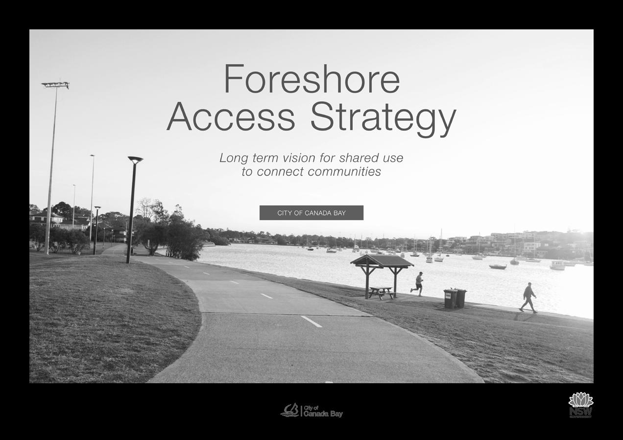
MAJORS BAY RESERVE

Prepared for Canada Bay Council OCTOBER 2022 MASTERPLAN
ACKNOWLEDGMENT OF COUNTRY
Place Design Group acknowledges the Wangal people, one of the 29 tribes of the Eora nation and the traditional custodians of this land.
We pay respect to Elders past and present and extends this respect to all Aboriginal people living in or visiting the City of Canada Bay.
Aboriginal People have had a custodial role with the Parramatta River and the land surrounding it since time immemorial. It is internationally recognised that Aboriginal nations manage land and waterways as living entities and Aboriginal principles of sustainable preservation of the land and waterway are based in beliefs, tradition, customs and practices.
These principles will provide insight into the proposed design interventions at the Majors Bay Reserve as outlined in this document.
2 MAJORS BAY RESERVE PARK MASTERPLAN PLACE DESIGN GROUP OCT 2022
CONTENTS
Report
3 MAJORS BAY RESERVE PARK MASTERPLAN PLACE DESIGN GROUP OCT 2022
1. INTRODUCTION 2. POLICY CONTEXT 3. SITE ANALYSIS 4. OPPORTUNITIES + CONSTRAINTS 5. MASTERPLAN 6. APPENDIX # 4 6 9 13 19 35 Disclaimer: This report has been prepared in accordance with the scope of services described in the contract or agreement between Place Design Group Pty Ltd ACN 082 370063 and the Client. The report relies upon data, surveys, measurements and results taken at or under the particular times and conditions specified herein. Any findings, conclusions or recommendations only apply to the aforementioned circumstances and no greater reliance should be assumed or drawn by the Client. Furthermore, the report has been prepared solely for use by the Client and Place Design Group accepts no responsibility for its use by other parties.
title Majors Bay Reserve Document number 2521076 Prepared for City of Canada Bay Authors Tim Field, Ethan Ramos, Shirelle Altona Revision number 04 Revision issue date 4.10.2022 Approved Nick Ison Reason for revision Phase 04: Final Masterplan Document History & Status Rev. Date Description Approved by 03 22.07.22 Phase 04: Masterplan Nick Ison Phase 04: Masterplan Draft Phase 04: Masterplan Nick Ison Nick Ison 06.05.22 11.05.22 01 02
1. INTRODUCTION
4 MAJORS BAY RESERVE PARK MASTERPLAN PLACE DESIGN GROUP OCT 2022 1. INTRODUCTION
Place Design Group was engaged by the City of Canada Bay (Council) to develop a Masterplan for Majors Bay Reserve that incorporates sporting, active recreation and passive uses.
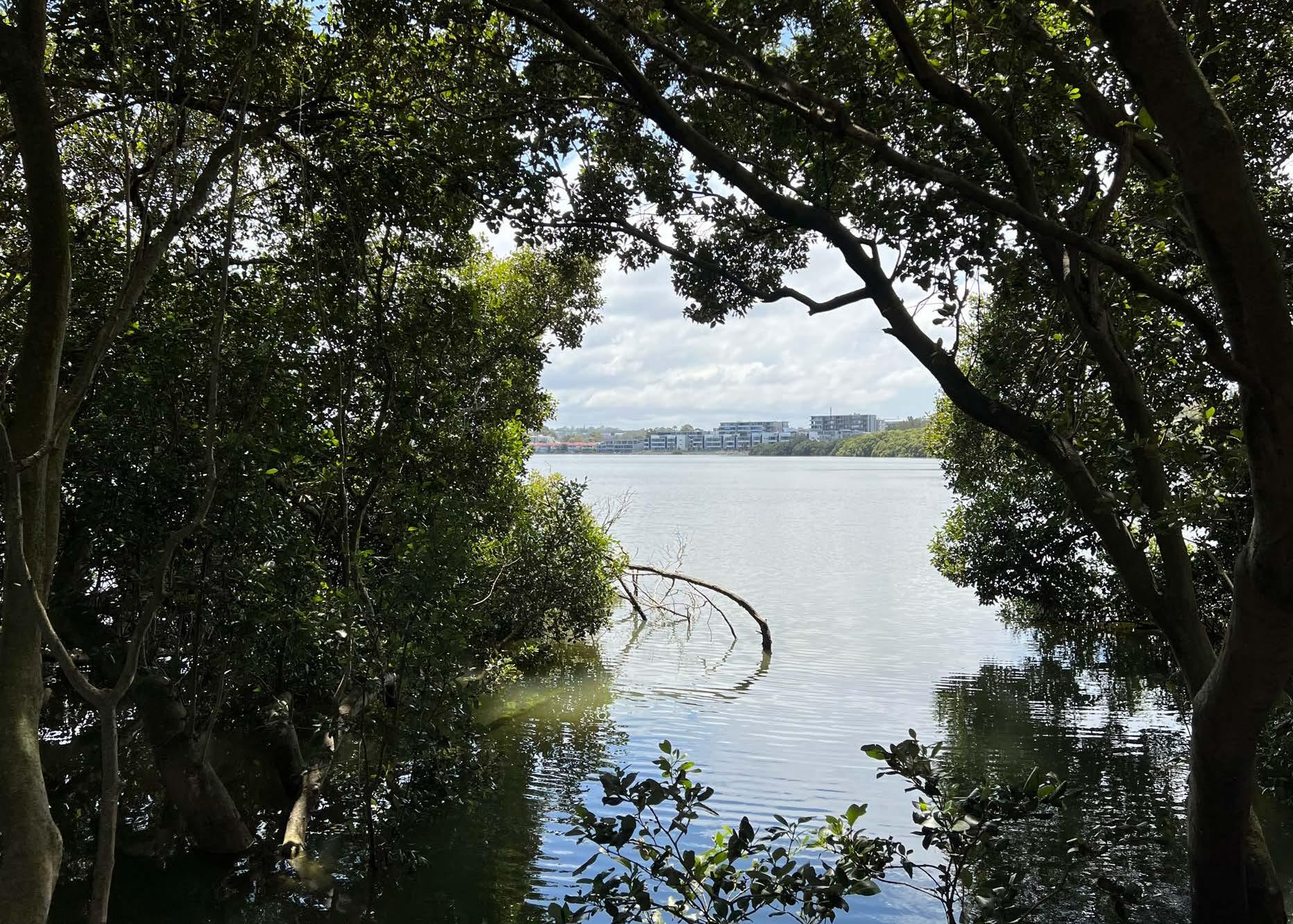
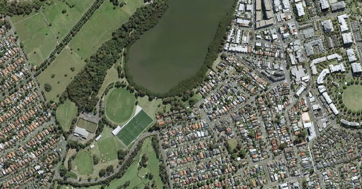
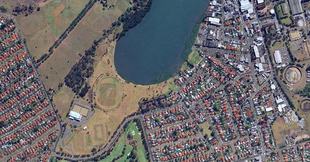
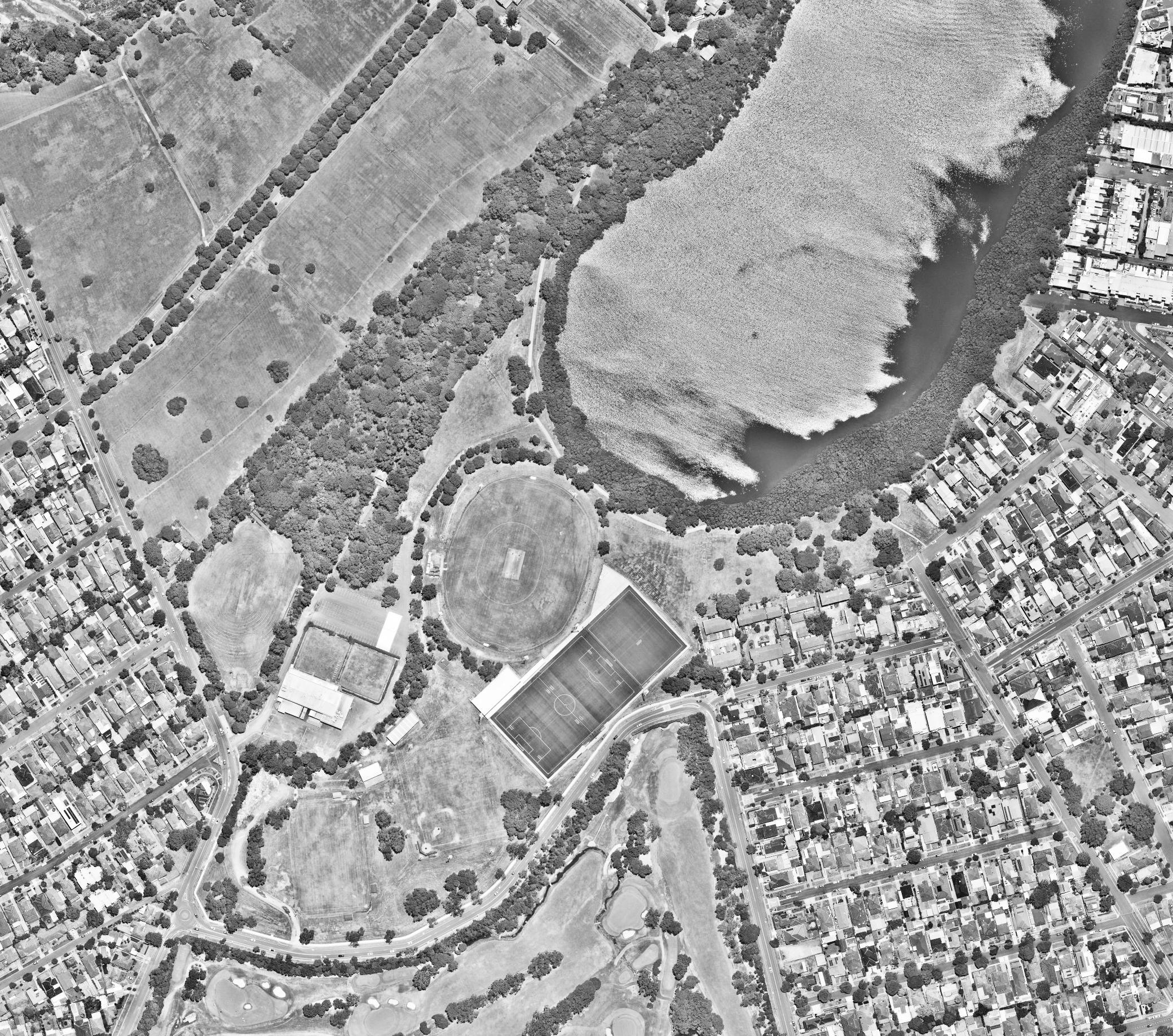
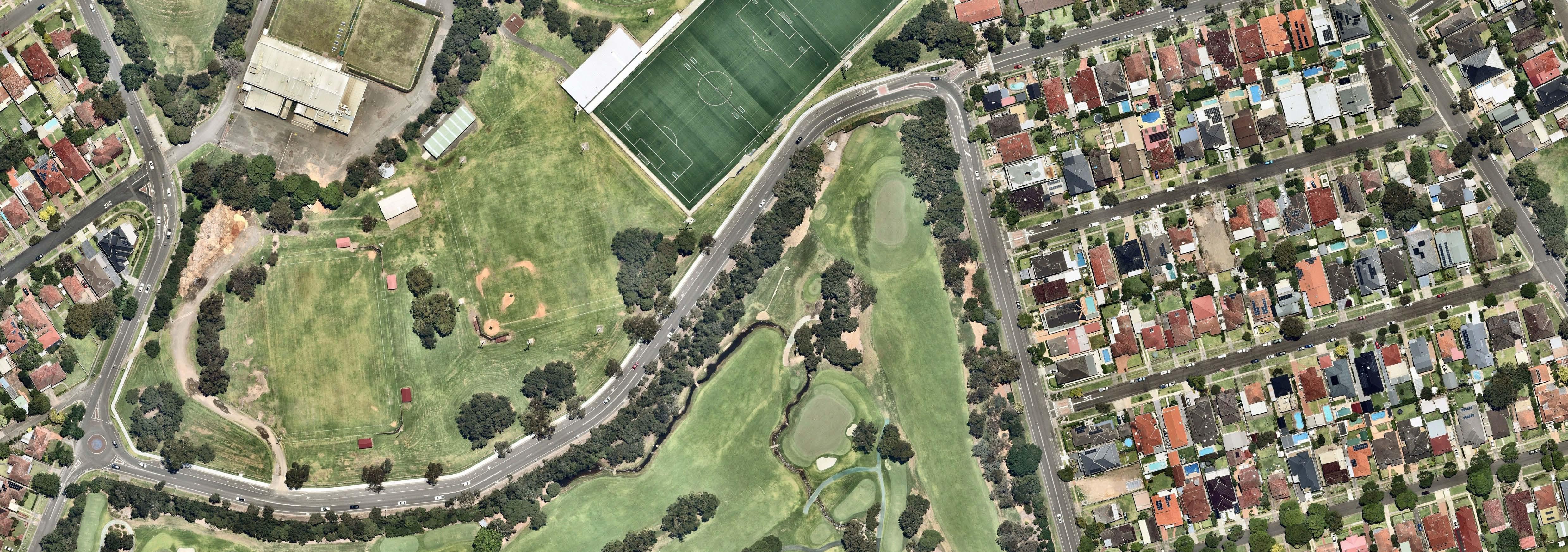
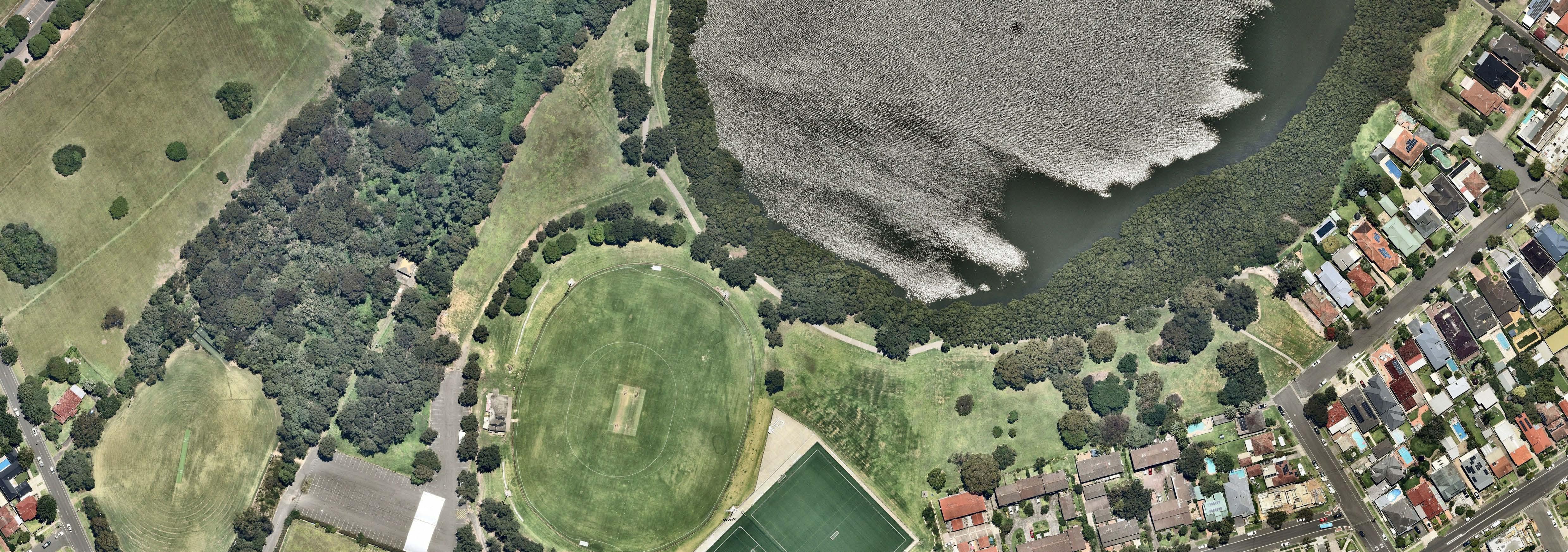
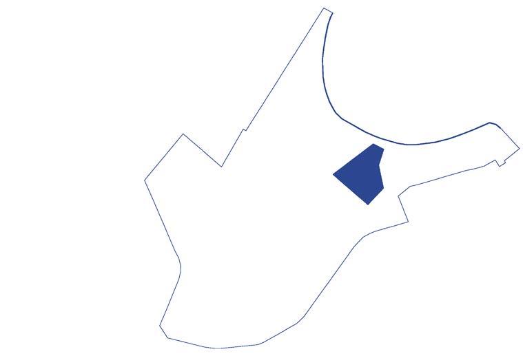
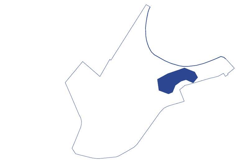
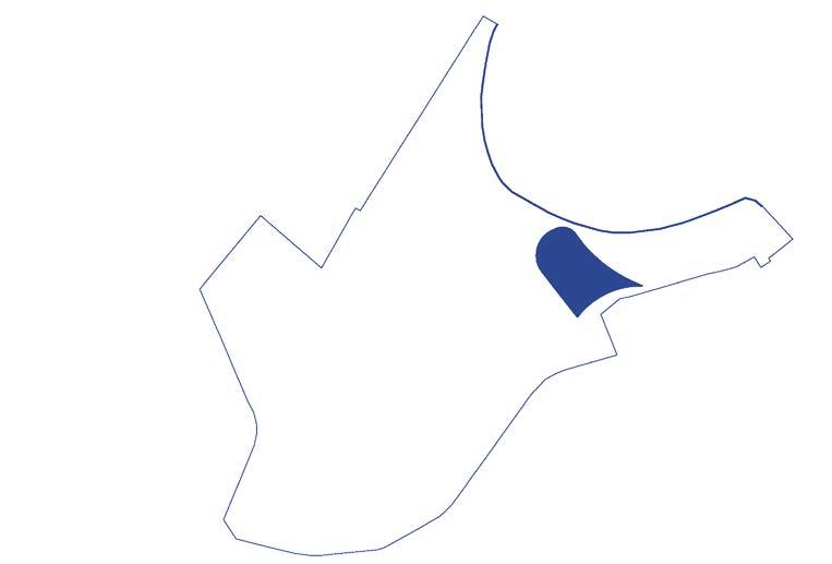
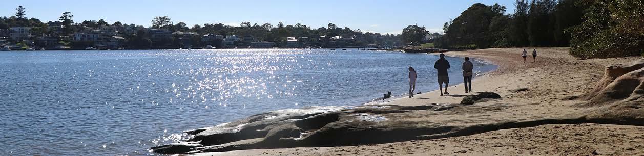
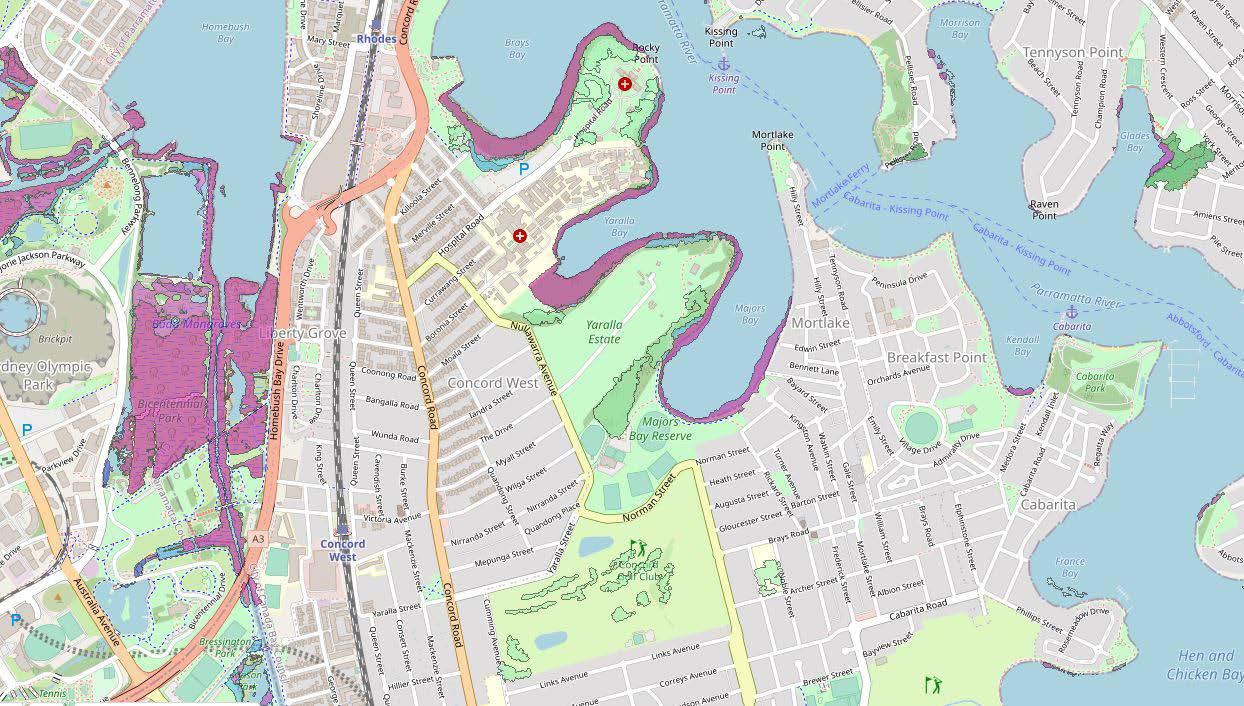
Majors Bay Reserve is approx. 16.42 hectares in size and is located within the suburb of Concord along the Parramatta River. It is situated by Majors Bay, which forms the Reserve’s north eastern boundary. As a result the Reserve has a key linkage to the Concord Foreshore Trail.
The goals of this Masterplan are to:
• Integrate the park into its surrounding context
• Improve the recreational and ecological functions of the park
• Transform Majors Bay Reserve a local and regional destination and integrate the reserve to the wider foreshore access strategy (2020) and Majors Bay.
• Guide Council over the coming years on how Majors Bay Reserve will be improved and renovated with new uses and infrastructure.
In order to maximise the sporting, recreation and ecological functions of the Reserve for the local and broader community, this Masterplan will provide Council with the design guidelines and objectives to direct future development of the Reserve.
5
MAJORS BAY RESERVE PARK
MASTERPLAN
PLACE DESIGN GROUP
OCT 2022 1. INTRODUCTIONINTRODUCTION
2. POLICY CONTEXT
2. POLICY CONTEXT 6 MAJORS BAY RESERVE PARK MASTERPLAN PLACE DESIGN GROUP OCT 2022
Report Review Summary:
• The Canada Bay Community identified “green spaces, local parks and opportunities to be near the water as the most valued local assets”.
• The Canada Bay Community feels that “the City is a leader in sustainability”.
The Canada Bay Community feels “safety for people with a disability to get around... (is a way) we can work towards maintaining and improving safety.”
Report Review Summary:
• Canada Bay City Council is committed to improving and protecting the river and its tributaries and creating new recreational opportunities for the community.
• Council is an active member of the Parramatta River Catchment Group.
• As part of the proposed objective to create three new swimming spots by 2025... All council areas within the Parramatta River catchment are to implement water sensitive urban design guidelines.
Report Review Summary:
• With prospects of a population increase by 32,000 people by 2036, more residents will require a greater variety of spaces for recreation. Improving the quality and capacity of our existing open space and recreation facilities, and utilising what we have better, will help to meet additional demand.
• Canada Bay City have a priority need to increase diversity of recreational opportunities across the LGA, including walking/ cycling, outdoor fitness stations, youth spaces, and other informal recreation opportunities.
• There is a strong desire from the community, given the significant foreshore, for improving public access to foreshore parks.
2. POLICY CONTEXT 7 MAJORS BAY RESERVE PARK MASTERPLAN PLACE DESIGN GROUP OCT 2022 Your Future 2030: Community Strategic Plan (Canada Bay City Council) 2018-2030 Duba, Budu, Barra Ten Steps To A Living Water: The Paramatta River Masterplan (Canada Bay City Council) 2019 Social Infrastructure (Open Space And Recreation) Strategy And Action Plan (Canada Bay City Council) 2019
•
Foreshore Access Strategy (Canada Bay City Council)
Canada Bay Biodiversity Framework and Action Plan (Canada Bay City Council)
The Greater Sydney Green Grid (Government Architect NSW)
Report Review Summary:
• A significant portion of this precinct already has publicly accessible foreshore. However, there are several ‘blockages’ in access.
• There are important mangrove habitats protected under the Fisheries
• Management Act 1994 (NSW; EPBC Act Protected Matter Report), as well as a number of critical habitats that are located along the foreshore. Therefore foreshore access should only be provided in instances where ecologial habitats will not be adversley affected.
• In order to increase the awareness of circuits and recreation opportunities a wayfinding strategy that defines a ‘foreshore brand’ is to be developed.
Report Review Summary:
• Majors Bay Reserve is ranked ‘Very High’ in the order of priority for management action.
• Potential for revegetation and improved protection measures such as stopping mowing to edge of native vegetation to create a buffer to protect stands of vegetation from weed encroachment. Potential to improve tree corridor to connect Majors Bay and Golf Course to the south.
• There is a potential threat to existing EEC’s (Sydney Turpentine-Ironbark Forest, Swamp Oak Floodplain Woodland and Saltmarsh)due to unleashed dogs on wildlife and impact on saltmarsh from track widening proposals through Yaralla.
Report Review Summary:
• Parramatta River and Canada Bay have been identified as project opportunity clusters. New project works should aim to support work already undertaken within the corridor, establishing Parramatta River as a key active recreation link and regional open space corridor between the city and the west.
• The Green Grid Plan presents a preliminary project prioritisation matrix in the Canada Bay LGA, including the Foreshore walk and Concord Open Space Precincts.
• Connecting these open spaces, such as Concord Golf Course and the former Concord RSL lands will make better use of under-utilised open space around community facilities and create a connected walking and cycling trail along the river foreshore.
2. POLICY CONTEXT 8 MAJORS BAY RESERVE PARK MASTERPLAN PLACE DESIGN GROUP OCT 2022
2020
2019
2017
2. SITE CONTEXT
3. SITE ANALYSIS 9 MAJORS BAY RESERVE PARK MASTERPLAN PLACE DESIGN GROUP OCT 2022
SPORTS + PLAYGROUNDS
MAJORS BAY RESERVE CITYOFCANANDABAY
+ VEGETATION


As per Local Strategic Planning Statement: City of Canada Bay 2020 COMMUNITY CONTEXT POPULATION 88,015 in 2016. 120,000 by 2036. 20% households with children. 40.8% born overseas and speak a language other than English at home. OPEN SPACE
348 ha of open space - LSP 18.2% tree canopy cover. 36 kms of foreshore along the Parramatta River.
142 recreation spaces. 150+ parks. 20 off-leash dog areas. 45 playgrounds. 40 sporting fields. 2 swimming centres. Source: LSP, City of Canada Bay 2020 Source: LSP, City of Canada Bay 2020 Source: LSP, City of Canada Bay 2020
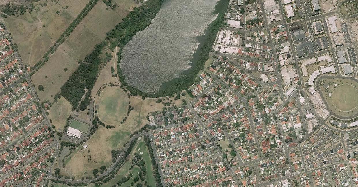
EVOLUTION

This page illustrates the changes to Majors Bay over time.
For thousands of years prior to European settlement, the area was inhabited by the Wangal People. The Wangal people have a deep connection to the land and landscape of Canada Bay.
The pre-European vegetation communities included mangroves + salt-marsh flats. Arthur Walker Reserve was vegetated by Open Eucalyptus forest on deep clay soils of Wianmatta Shale.
Survey of Port Jackson;
Source: State Library of New South Wales
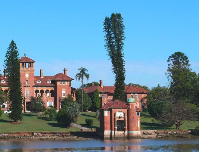
Early settlement: 50 acres was granted to Isaac Nichols (convict transported in 1791), by Governor Hunter, it was named “Yaralla” and included Majors Bay Reserve + Arthur Walker Reserve.
Aerial Photograph;
1840: Thomas Walker bought “Yaralla” at auction
1905: Concord Golf Links Limited brought 46ha of Yaralla Estate from the trustees of the Thomas Walker Estate. The Company leased 12ha of land which was extensively cleared
1963-1969: Majors Bay Reserve used as a garbage disposal depot, which resulted in a loss of forest trees and extensive filling
1966: Concord RSL Club opened 1978: Concrete sea wall was constructed around the head of Majors Bay
1980: Official opening of the sports oval, horse riding circuit and amenities building at Majors Bay Reserve (Ron Routley Oval by Ken Booth, the NSW Minister for Sport and Recreation 1981: Majors Bay Reserve was officially named by the geographical names Board 1985: Concord Foreshore Trail from Majors Bay Reserve to Rhodes Park opened
RESERVE PARK
City of Canada Bay Mapping Service
1933: The northern edge of the golf course was reclaimed to create an access point between east + west Concord, Norman St was constructed. 1935: Land made available to Concord West Cricket Club 1955: Concord Council purchased Majors Bay reserve for 2,800 pounds from Concord Golf Club for reclamation and public recreation.
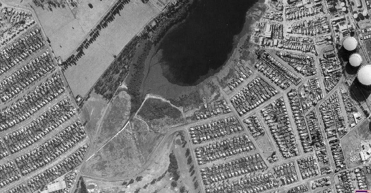
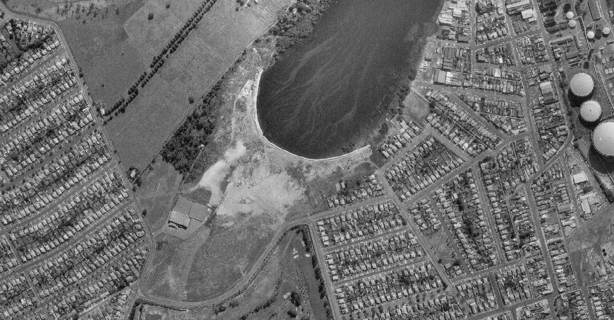
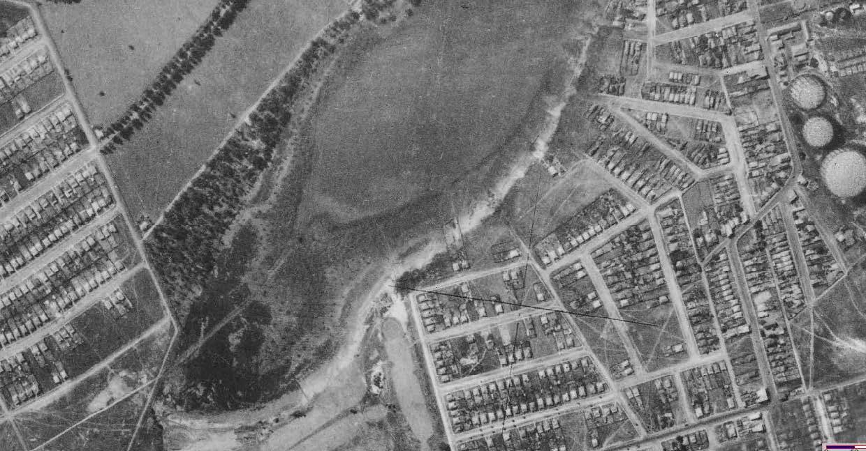
1993: Over 1,000 tube-stock planted in the Reserve by local volunteers as part of the Federal Government’s One Billion Trees program
1995: 12 Native trees planted and plaque installed to commemorate the 12 River Class Frigates that served during WII in Korea.
2019: Upgrades to the sporting precinct begin with a synthetic soccer field
3. SITE ANALYSIS 11 MAJORS BAY
MASTERPLAN PLACE DESIGN GROUP OCT 2022 HISTORICAL
Source: City of Canada Bay Mapping Service
Aerial Photograph; Source: City of Canada Bay Mapping Service Aerial Photograph; Source: City of Canada Bay Mapping Service
Aerial Photograph;
Source:
Aerial Photograph; Source: City of Canada Bay Mapping Service Aerial Photograph; Source: City of Canada Bay Mapping Service 1822 YARALLA 1972 1930 1994 1961 2009 2021
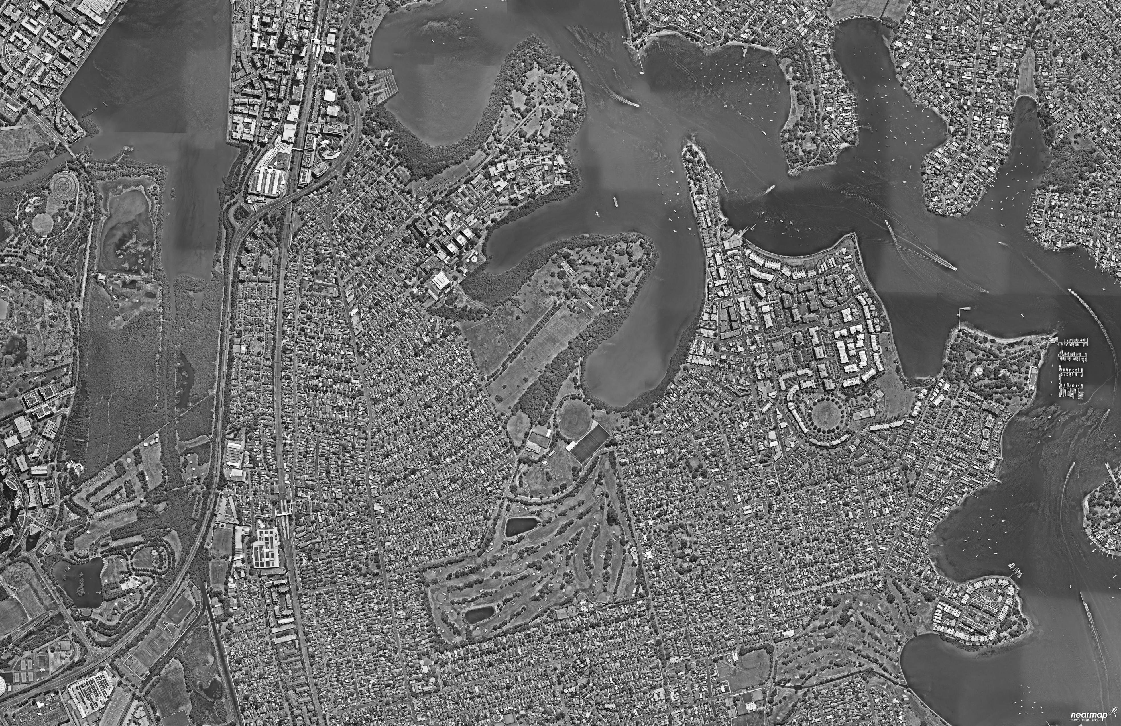
3. SITE ANALYSIS 12 MAJORS BAY RESERVE PARK MASTERPLAN PLACE DESIGN GROUP OCT 2022 CABARITA WHARF SITE CONTEXT + EXISTING OPEN SPACES LEGEND Major Road Site Boundary Suburb Boundary Walking Distances Health Industrial/Mixed Use Education Public Open Space Private Open Space Train Line Train Station Public Ferry Wharf District Play Space Regional Play Space Local Play Space x x x CONCORD WESTCONCORD WEST CONCORD WEST CONCORDWEST RHODES LIBERTY NORTH STRATHFIELD CONCORD BREAKFAST POINT MORTLAKEPOINTBREAKFAST BREAKFAST POINT CONCORD CABARITACITY OF CANADA BAY COUNCIL CONCORD GOLF CLUB MASSEY PARK GOLF CLUB BRAYS BAY HOMEBUSH BAY MAJORS BAY YARALLA BAY KENDALL BAY RHODES STATION CONCORD WEST STATION MORRISONS BAY GLADES BAY FRANE BAY EXILE BAY PA R R A M ATTA B AY H O M E B U S H B A Y R D P O W E L L S C R K HASLAMS CRK SALT CRK W A T E R 5mins400m10mins800m15mins1000m 30mins2000m YARALLA HOUSE CONCORD REPATRIATION GENERAL HOSPITAL MAJORS BAY RESERVE HEN AND CHICKEN BAY Wangal Reserve Breakfast Point Cabarita Park Kendal Reserve Prince Edward Park Edwards Park Greenlees Park Warbrick Park Mason Park Bressington Park Concord West Playground Wentworth Common Blaxland Riverside Park Lewis Berger Park Rhodes Park McIlwaine Park Bicentennial Park Howse Park NTS CITY OF PARRAMATTA COUNCIL
4. OPPORTUNITIES + CONSTRAINTS
13 MAJORS BAY RESERVE PARK MASTERPLAN PLACE DESIGN GROUP OCT 2022
WHAT MAKES A SUCCESSFUL RECREATION/OPEN SPACE PRECINCT?
Recreation and open spaces must balance many competing objectives, consider many complex and varied unrelated uses, and perform as a coherent system to be successful. The following principles outline key attributes for consideration in the master-planning of a successful community recreation and open space precinct:
ECOLOGICAL PERFORMANCE
The park should perform as a system to improve soil + water, to filter air, provide habitat and enhance biodiversity.
Observing the Biodiversity Framework & Action Plan (2019), the park should seek outcomes to protect manage and restore native vegetation, promote and enhance biodiversity corridors and play its part in restoring the river foreshore environment of the Parramatta River.
FIT FOR PURPOSE VARIED SPACES + WAYFINDING
The park should provide spaces which are considerate and function well for the proposed use.
It should be tailored to respond to its users’ needs.
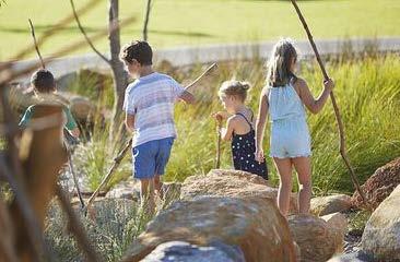
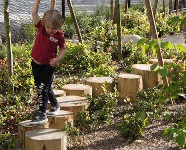
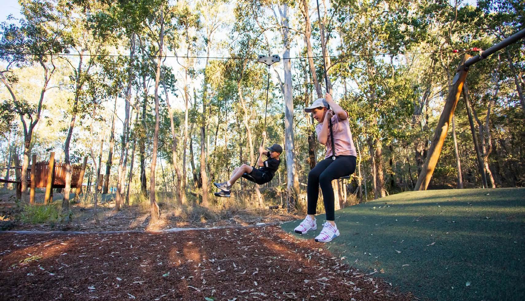
The park should offer a range of spaces to cater for the needs of a diverse range of age groups, cultures and genders. From informal and unstructured, to formal and programmed spaces. From small spaces providing refuge to larger spaces with expansive views over the landscape. Varying spaces/uses need to work together, have legibility and cohesiveness.
COMMUNITY IDENTITY ACCESSIBILITY + CONNECTIVITY


The Community should feel a sense of ownership of the park. The park’s identity should represent the Community, resonate with the local character, while contributing to the community aspirations and evolving character of the local environment.
Equitable access and inclusiveness is paramount to a successful open space. Universal design guidelines embrace the richness in uses. There should also be resolved and clear links between transport, active transport, facilities and services.
4. OPPORTUNITY + CONSTRAINTS 14 MAJORS BAY RESERVE PARK MASTERPLAN PLACE DESIGN GROUP OCT 2022
OPPORTUNITIES
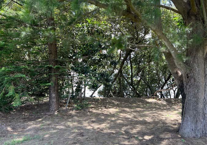
Open lawn, shade amenity and proximity to water making it ideal for enhancing biodiveristy and maintaining open “green feel”.
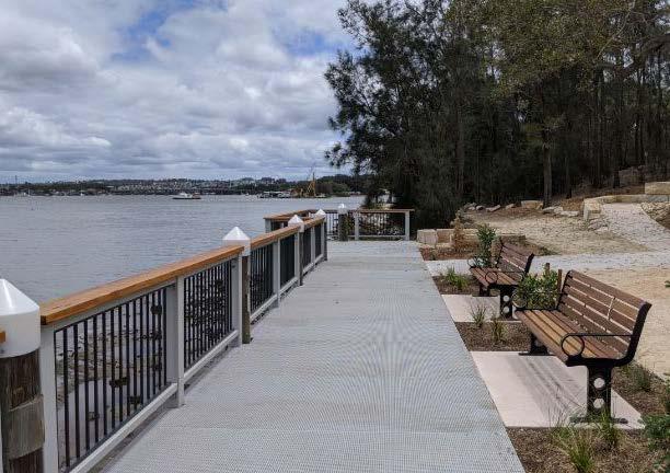
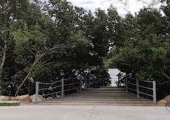
Boardwalk nodes to enhance outlook and access to the bay.
Retain established trees to provide passive shade amenity.
Clearly define Dog park off-leash area through signage + landscaping. Improve passive surveillance of space.
Improved shade amenity with tree plantings to the periphery of sporting fields.
Reuse fill in proposed BMX pump track from existing dog park.
Proposed location highly visible from the street and surrounding residential properties.
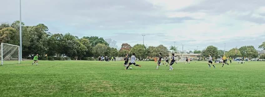
Retain existing use of sporting facilities
Upgrade existing amenities to service sporting field + proposed future uses
New amenity block to service sporting field
Retain storage shed for use of community sporting clubs
Existing mangrove swampland / saline vegetation within estuary to be enhanced and protected
Existing Sydney Turpentine-Ironbark Forest to be enhanced and protected
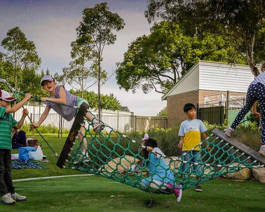
Family + Youth Play Area to activate streetfront of park
Opportunity to introduce carparking along Norman Street
Opportunity to increase buffer and enhance planting along boundary
CONSTRAINTS
Collisions are a risk at the pump track, to be managed by separating jump track and pump track.
Potential for car park to be congested at
times
use (week
peak
of
ends) 4. OPPORTUNITY + CONSTRAINTS 15 MAJORS BAY RESERVE PARK MASTERPLAN PLACE DESIGN GROUP OCT 2022 NTS NORMAN ST CONCORD DEAKINST RICKARDST FORESHORE TRAIL 1 13 14 WATER VIEWS 7 7 7 7 7 MAJORS BAY RD NULLAWARRA AVE Site Boundary Unstructured Program Structured Program Proposed Tree Planting Potential Boardwalk Node Potential Boardwalk Existing Amenities/buildings Proposed Amenities/buildings Water Views Buffer Planting LEGEND 1 2 3 12 13 14 15 4 5 6 7 8 9 10 11 6 13 9 8 5 5 5 3 10 1112 LAYOUT + USES I OPPORTUNITIES + CONSTRAINTS 2 4 6 13 MAJORS BAY 1 15
OPPORTUNITIES
Improve sense of arrival at Nullawarra Ave entry with planting and signage.
Enhance existing connection to Arthur Walker Reserve to improve presence within the broader precinct.
Improve street connections by establishing new arrival points with signage and way-finding.
Improve connections to water’s edge and enhance views of Majors Bay
Formalise connections into park and improve accessibility to sporting, facilities and amenities.
Improve spectator’s experience with upgraded seating and shading options at high-points in the precinct.
Improve connections + accessibility to the existing Concord Foreshore Trail.
Formalise agreement and access to foreshore edge of adjacent Yaralla Estates with Land owners and Trustees.
Provide accessible path/ramp to Arthur Walker Reserve.
Maintain maintenance/emergency access point to inner precinct.
Improve park users experience + ease of arrival with new parking along Norman Street
CONSTRAINTS
Estuarine mangrove community inhibits visual access to bay.
Community regeneration planting and levels constraints access to Arthur Walker Reserve.
access point.
4. OPPORTUNITY + CONSTRAINTS 16 MAJORS BAY RESERVE PARK MASTERPLAN PLACE DESIGN GROUP OCT 2022
Tight
INTERNAL CIRCULATION + ACCESS I OPPORTUNITIES + CONSTRAINTS NTS NORMAN ST CONCORD DEAKINST RICKARDST FORESHORE TRAIL 1 2 3 3 3 9 5 6 8 6 10 10 MAJORS BAY RD NULLAWARRA AVE Site Boundary Vehicular Access Road - Unsealed Vehicular Access Road - Sealed Proposed Improved Formalised Accessible Pedestrian Connections Concord Foreshore Trail Proposed Mangrove Boardwalk / Improve Connection To Water’s Edge Potential Boardwalk Node Location Nodes Of Program Nodes Of Prospect Primary Entry Secondary Entry LEGEND 1 2 3 4 5 6 7 8 9 10 11 4 9 12 11 MAJORS BAY 7 12 4
OPPORTUNITIES
Strengthen and enhance Estuarine mangrove forest connections along foreshore corridor.
Potential for regeneration efforts to restore remnant Sydney Turpentine-Ironbark Forest (currently classified as an ecologically endangered community) dominated by exotic shrubs and groundcovers in the understorey, as well as strengthen corridor connections to assist vegetation of the community located within the golf course.
Diverse mix of resident, nomadic and migratory species confined to the continuum of mangrove forest extending from Brays Bay Reserve to Majors Bay. These forests provide the most important foraging, roost and shelter habitats for waterbirds, shorebirds and other fauna. Opportunity to retain and restore bird attracting planting to provide habitat for small birds (The fauna of City of Canada Bay LGA: 2013-2014).
Enhance valuable green spaces to soften the harsh urban edge and create an attractive setting.
Opportunity to consider width of existing she-oak strips to improve current canopy connection and provide habitat corridor for understorey birds to move between.
CONSTRAINTS
Current rubbish dumping along foreshore walking track
Works may pose potential threat to EEC’s Sydney TurpentineIronbark Forest Swamp Oak Floodplain Woodland through weed encroachment. This community provides valuable habitat that needs to be protected.
Works pose potential threat to Estuarine mangrove forest. This community provides valuable habitat that needs to be protected.
Estuarine Swamp Oak Forest is subject to various degrees of weed invasion, i.e. Woody Lantana left in clumps. However, indiscriminate removal of weeds such as Lantana may result in the local extinction of fauna species
Mudflat known to contain toxins. Physical engagement with mudflat is to be limited.
Stormwater pipe outlets
Construction methodology to be reviewed to ensure minimal excavation into existing fill
drainage and flood prone
nh 4. OPPORTUNITY + CONSTRAINTS 17 MAJORS BAY RESERVE PARK MASTERPLAN PLACE DESIGN GROUP OCT 2022
Poor
ECOLOGICAL VALUES + CONSTRAINTS NTS NORMAN ST DEAKINST MAJORS BAY RD RICKARDST NULLAWARRA AVE 3 4 6 LEGEND 1. Estuarine Mangrove Forest 5. Swamp Oak Forest Flood Impacted Area Areas of programproposed(structured +unstructured) Stormwater pipe outlet 1 1 6 7 8 9 9 1 2 2 3 4 5 5 2. Turpentine - GreyIronbark Open Forest 5 2 2 1 MAJORS BAY 7 7 8 8
Moves
Protect and Enhance EEC Sydney Turpentine-Ironbark Forest habitat corridor.
Provide accessible path/ramp to Arthur Walker Reserve.
Improve accessibility to sporting, facilities and amenities.
Opportunity to improve spectator’s experience.
Establish central ‘meeting place’ to improve navigation and wayfinding.
Improve sense of arrival at Nullawarra Ave.
Maintain maintenance/ emergency access point.
Enhance passive surveillance.
Activate site edge and improve connectivity to the street.
to activate area adjacent bushland.
Formalise existing tree avenue planting.
Opportunity to utilise usable existing site fill for play or feature.
Utilise and enhance existing trees to create pockets of passive open space and reinforce a sense of “green space”
Opportunity for new parking along Norman St Enhance buffer planting for privacy to adjacent private residents.
High point within site. Opportunity for pathway connection and avoid flood area.
Strengthen existing path network
Establish key pedestrian arrival point as an extension to Majors Bay Road.
Buffer planting to boundary of site for shade to existing sport fields.
to utilise existing fill for pump track
to activate central ‘meeting place’ as youth zone
DEAKINST RICKARDST MAJORS BAY RD NULLAWARRA AVE MAJORS BAY FLO O D LEVELLINE NORMANST 1 1 2 3 4 5 21 6 7 8 9 20 10 11 12 13 16 17 14 19 18 18 15 3 Key
Opportunity
Opportunity
Opportunity
12. 14. 13. 15. 16. 17. 18. 19. 20. 21. 0 50M/ 1:1000@A140302010 8 8 4. OPPORTUNITY + CONSTRAINTSKEY MOVES: COMBINED OPPORTUNITY AND CONSTRAINTS 1. 2. 3. 4. 5. 6. 7. 8. 9. 10. 11. Site Boundary Priority Views Existing Pathway Proposed Pathway Site Connection Edge to Residential properties Edge Conditions To Be Enhanced Key Intersection LEGEND Entry Feature Key Entry Secondary Entry Sydney TurpentineIronbark Forest Mangrove Forest Flood Impacted Area Area for Proposed Program (Structured + Unstructured) Existing Mounding
5. MASTERPLAN
5. MASTERPLAN 19 MAJORS BAY RESERVE PARK MASTERPLAN PLACE DESIGN GROUP OCT 2022
1.0 STRENGTHENING SENSE OF PLACE
Ensure the presence of the existing mangroves are acknowledged and celebrated within the park.
1.1. Increase park connectivity to existing mangroves by locating activity + recreational opportunities adjacent

1.2. Provide boardwalk experience through mangroves
1.3. Enhance connection to existing Concord Foreshore Trail
2.0 INTERNAL CONNECTION
Ensure movement and circulation throughout the park is clear and legible.
2.1. Identify clear path heirarchy
2.2. Provide wayfinding through use of materiality and form
2.3. Define circulation and nodes
3.0 EXTERNAL CONNECTION
Establish strong entry legibility throughout park for external connections.
3.1. Provide clear entry signage
3.2. Ensure considered entry points
3.3. Design for external visual connections that provoke interest


4.0 INCLUSIVENESS
Create an inclusive space for all users irrespective of age, gender or ability.
4.1. Offer a range of programs to cater for the needs of a diverse range of age groups, cultures and genders

4.2. Provide an accessible ramp to Arthur Walker Reserve
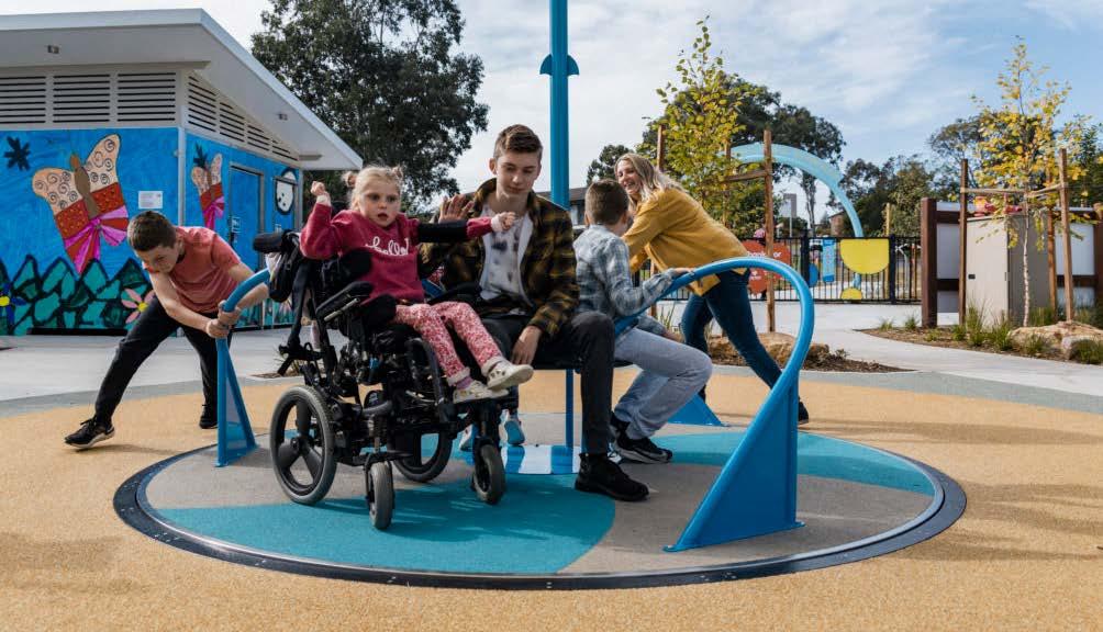
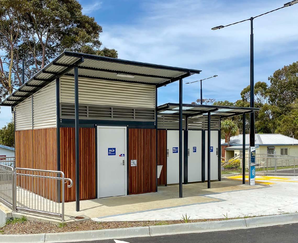
4.3. Incoorporate ‘Everyone Can Play’ guidelines into the design of play areas, including an ‘Changing Places’ amenities building
4. OPPORTUNITY + CONSTRAINTS 20 MAJORS BAY RESERVE PARK MASTERPLAN PLACE DESIGN GROUP OCT 2022 DESIGN OBJECTIVES I MASTERPLAN


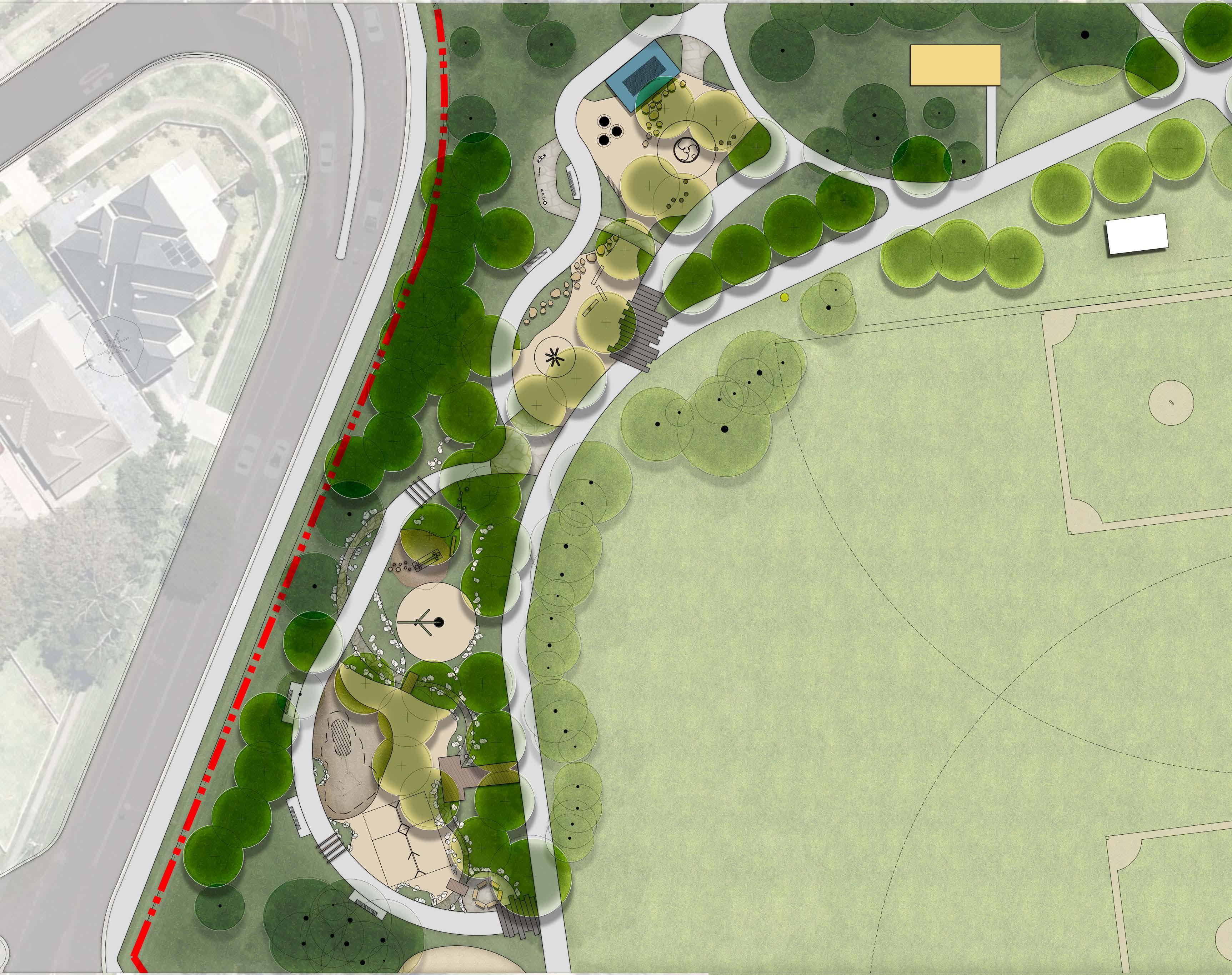
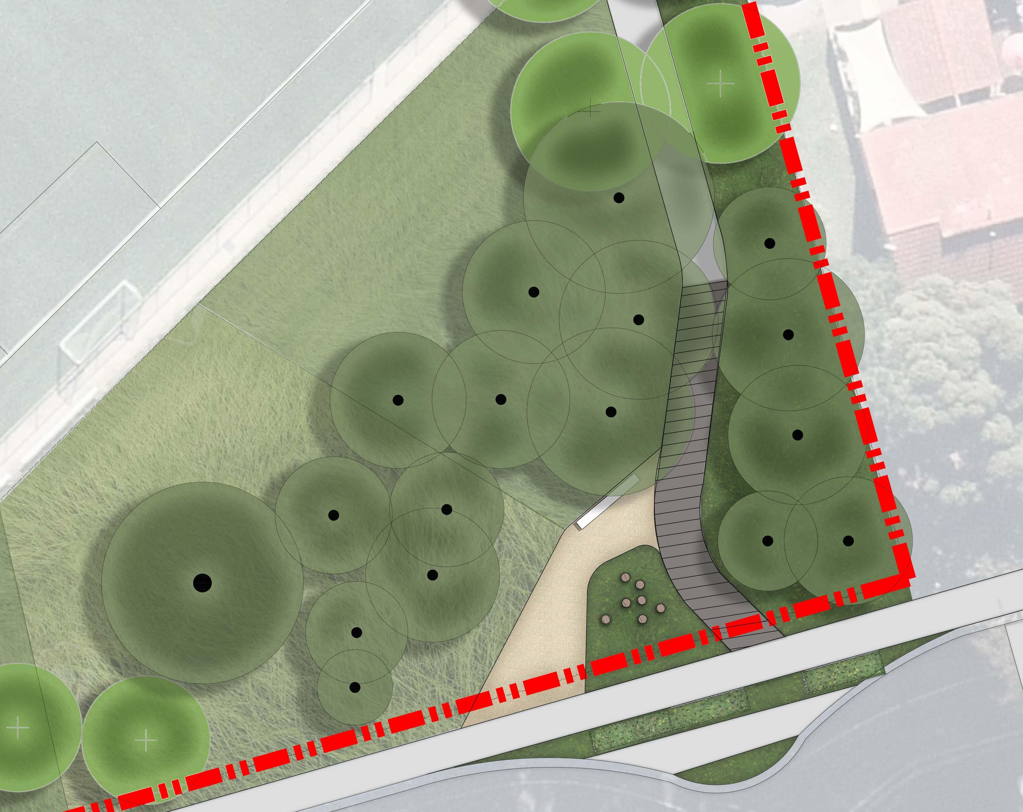
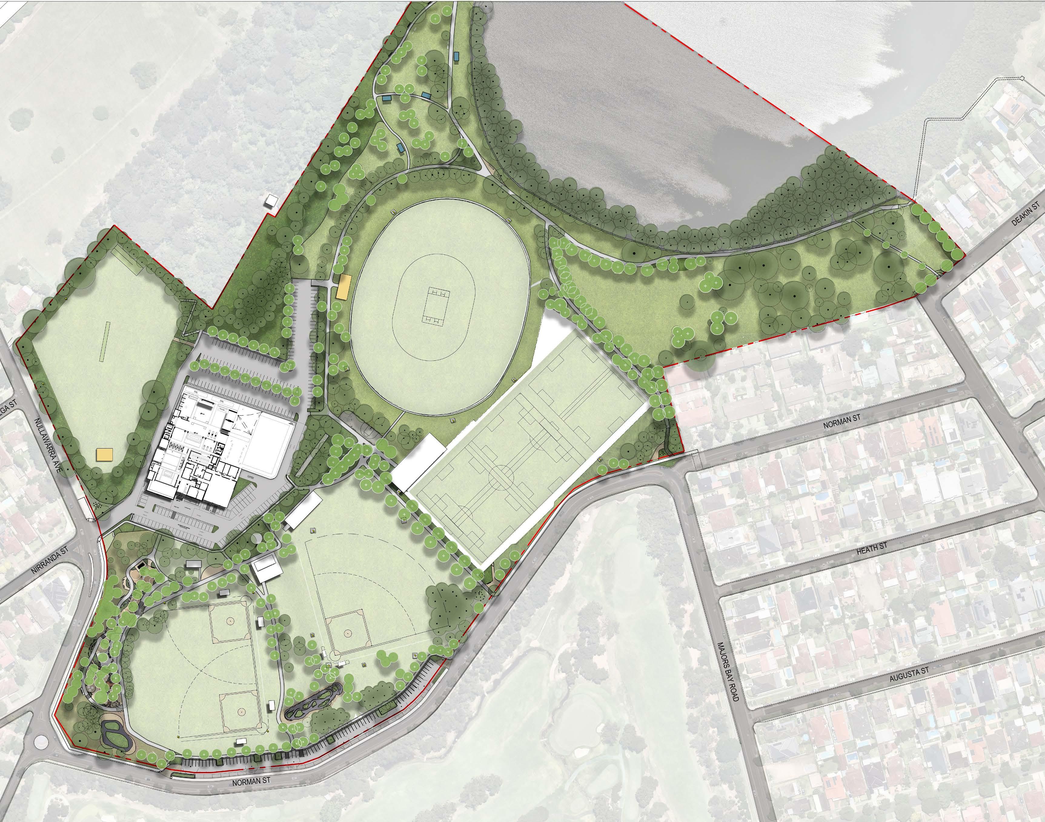
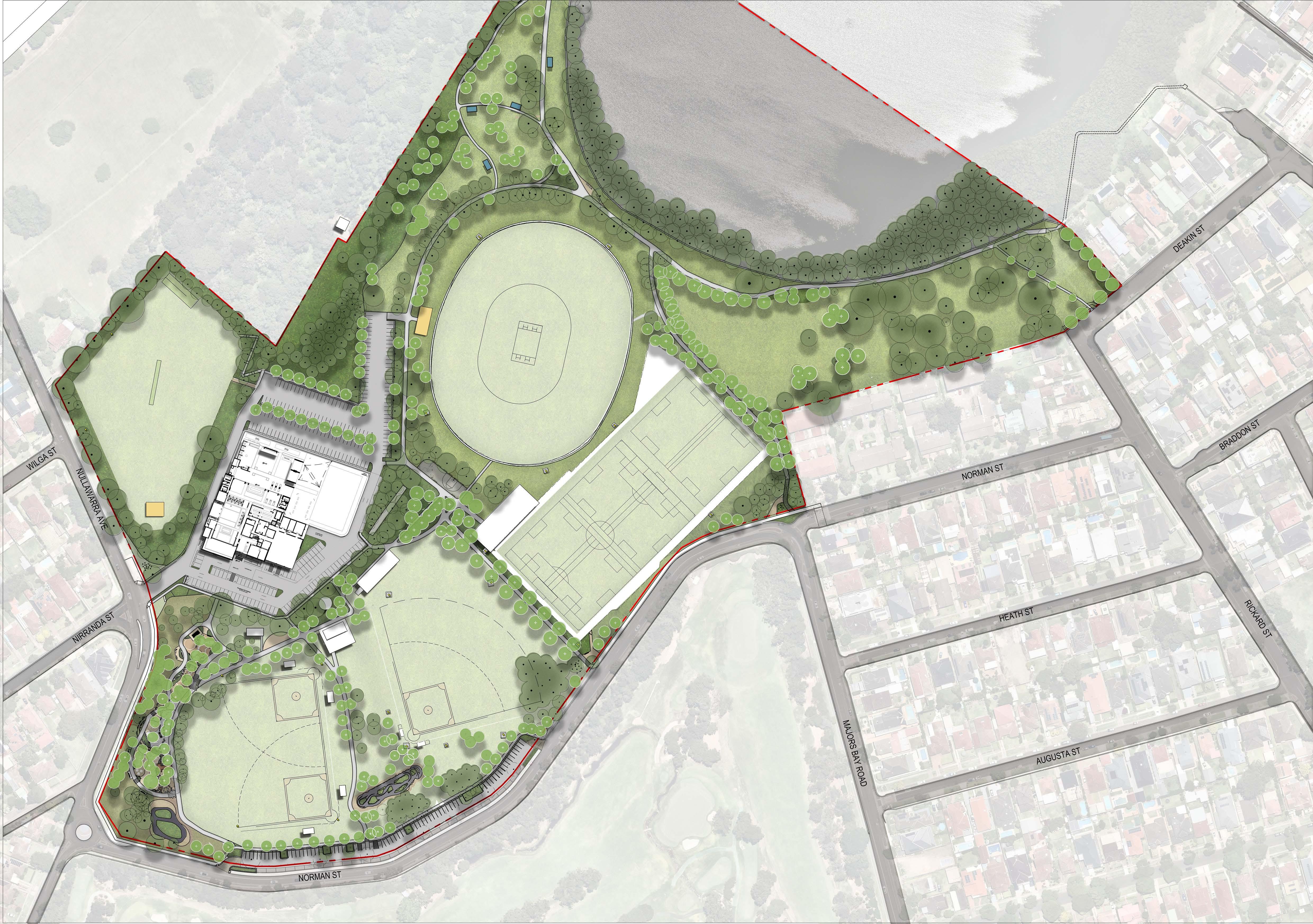
5. MasterplanMASTERPLAN MAJORS BAY ARTHUR WALKER RESERVE 0 50M/ 1:1000@A140302010 1. Existing Foreshore Walk Retained 2. Existing Seawall Retained 3. Environmental Kiosk 4. Widened Entry Road Stage 2 (unfunded) 5. Proposed Deakin Street Foreshore Boardwalk (indicative) 6. Cycle Service Area 7. Off- road 90o Parking (Stage 2) 8. Family Play and Outdoor Fitness 9. Picnic Area With Shelters 10. Off-leash Dog Park (unfenced) 11. Proposed Accessible Ramp To Arthur Walker Reserve 12. Enhanced Buffer Planting (Low Level) 13. Tree Planting To Median in Carpark 14. Key Pedestrian/Cycle Entry 15. Formalised Path Around Cricket Oval Future Stage 16. Junior Pump Track 17. Intermediate Jump Track 18. Entry Statement And Signage 19. Emergency Access 20. Memorial Tree Planting 21. Central Meeting Place with Option for Multi-Courts and Parkour 22. Retain Existing Trees 23. Renovated Change Rooms with Amenities (unfunded) 24. Changing Places Amenity Building 25. Existing Cricket Nets 26. Proposed Cricket Amenity Block (unfunded) 27. Formalised Entry Points From Car Park (Stage 2) 28. Renovated Amenities (unfunded) 29. Adjacent Sydney Turpentine Iron-bark Forest Ecological Endangered Community to be protected LEGEND 11 13 5 9 8 14 10 18 7 18 14 14 12 6 15 21 17 18 19 16 RON ROUTLEY OVAL CONCORD CLUB26 23 24 18 Existing Buildings Proposed Shelters Proposed Buildings Existing Trees Proposed Trees Decomposed Granite Massplanting Softfall Playground Mulch Existing sportsfields Turf Existing Lighting KEY - Unfunded 3 28 - Existing Items 12 27 27 27 27 27 27 4 - Funded DPE Grantxx x 20 25 29 1 2 22
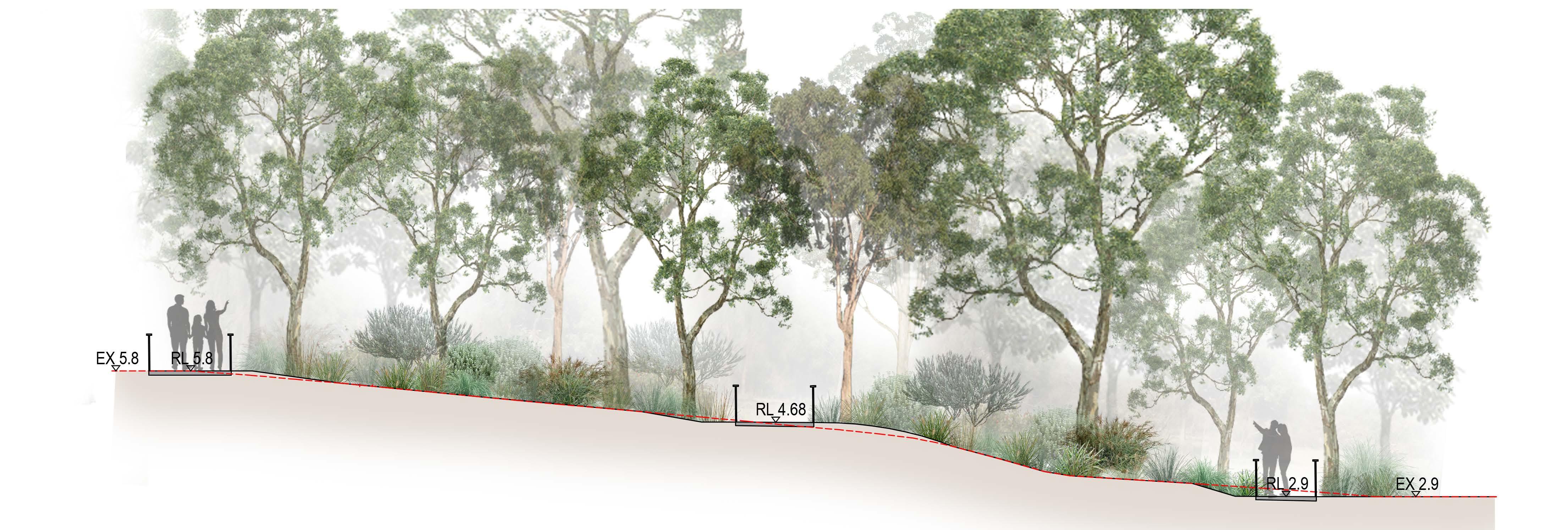
5. MASTERPLAN 22 MAJORS BAY RESERVE PARK MASTERPLAN PLACE DESIGN GROUP OCT 2022 SECTIONS I MASTERPLAN EXISTING GROUND LINE SECTION AA | NEW ACCESSIBLE RAMP TO ARTHUR WALKER RESERVE | 1:100 1:14 Ramp Bush Regeneration Bush Regeneration Existing Shrub Concrete Path 1:14 Ramp 1:14 Ramp NULLAWARRA AVE NORMAN QUANDONGPL NIRRANDAST WILGAST NORMAN HEATH AUGUSTASTMAJORS BAY ROAD DEAKINST BRADDON RICKARD KEY AA
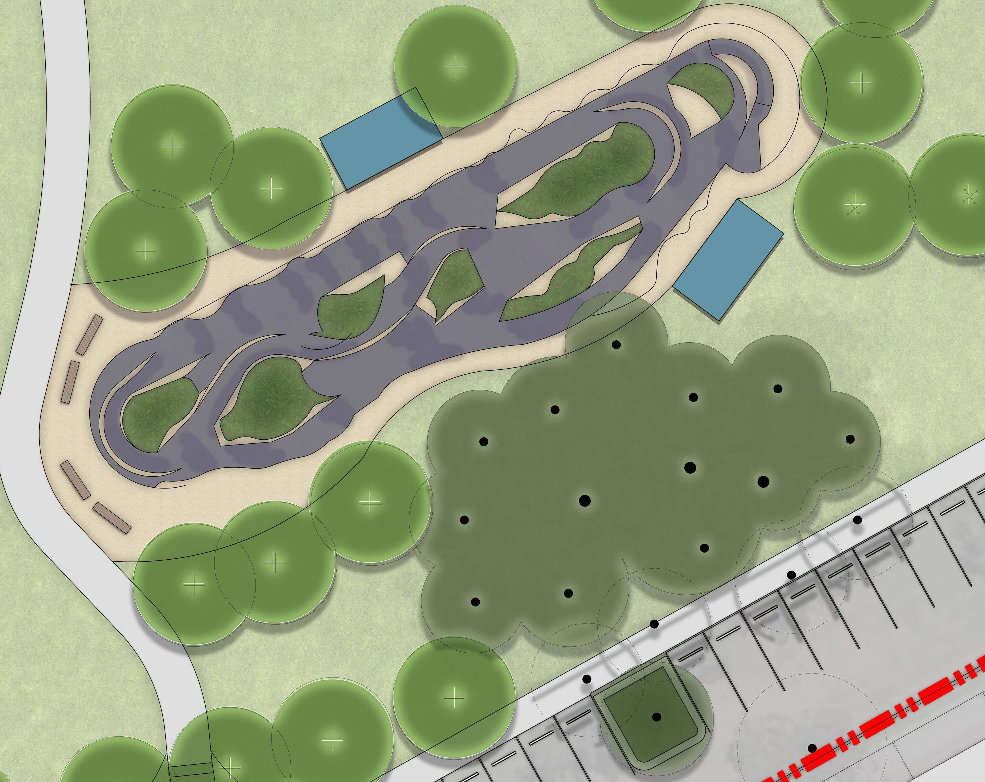
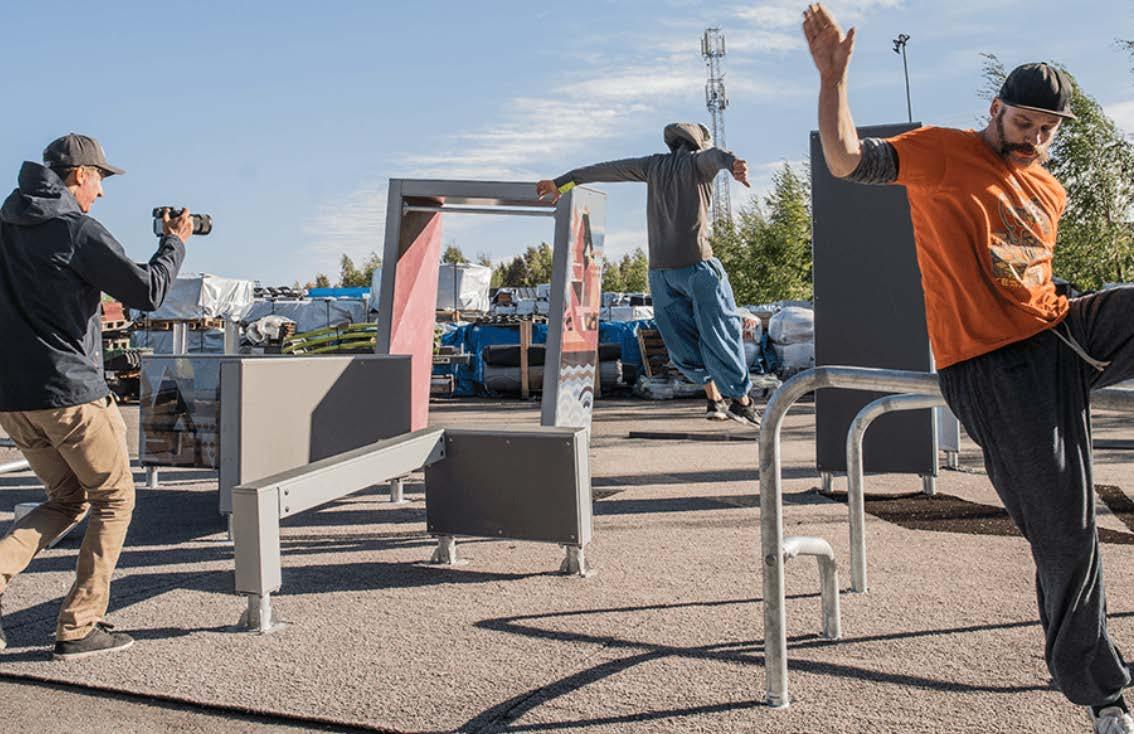
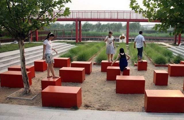
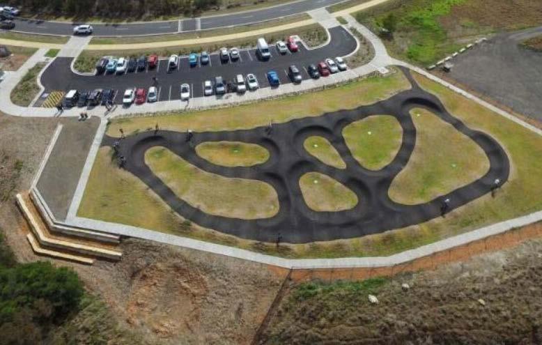
PUMP TRACK I CONCEPT DESIGN LEGEND Site Boundary 1 Key Pump Track 2 Proposed Trees 3 Existing Trees 4 Proposed Pathway 5 Proposed Car Parking Norman St 6 Proposed Shelters 7 Proposed Seating 1 2 3 4 5 NULLAWARRA AVE NORMAN ST QUANDONGPL NIRRANDAST WILGAST NORMANST HEATHST AUGUSTASTMAJORS BAY ROAD DEAKINST BRADDONST RICKARDST SCALE 1:1000 A1 1:2000 KEY 0 2 4 6 8 10M/ 1:200@A3 6 6 7 5. MASTERPLAN 23 MAJORS BAY RESERVE PARK MASTERPLAN PLACE DESIGN GROUP OCT 2022
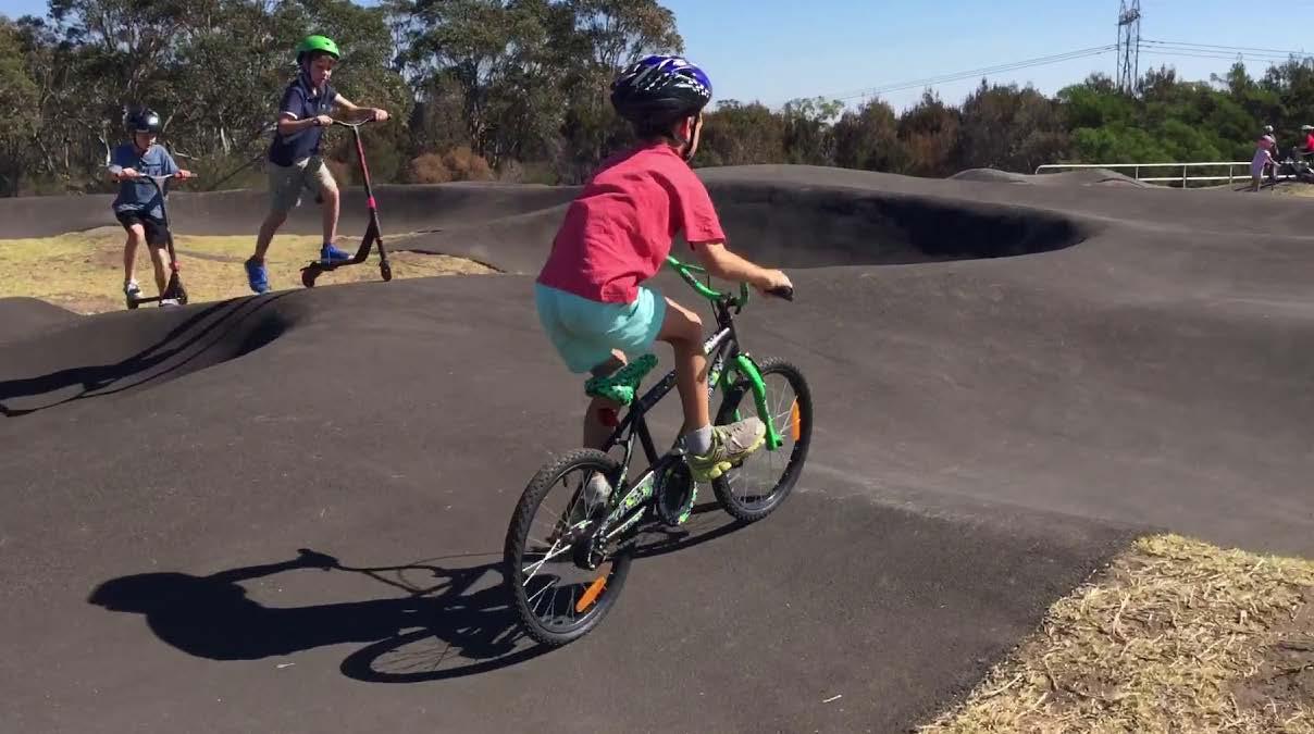
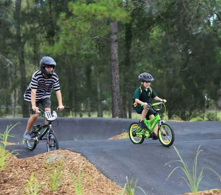
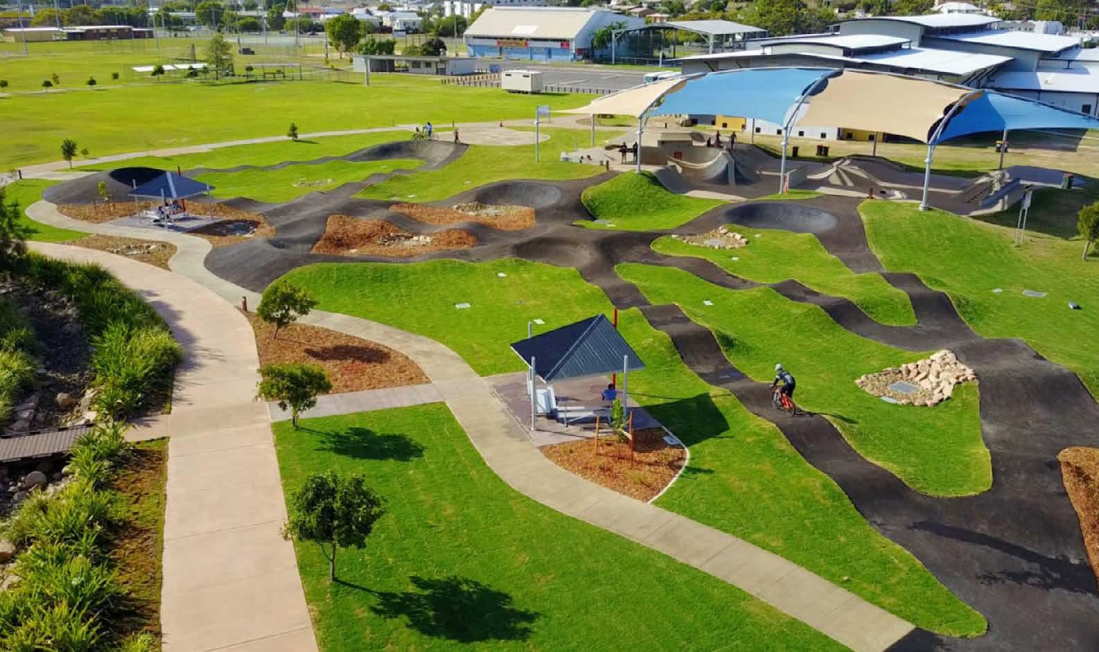
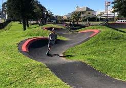
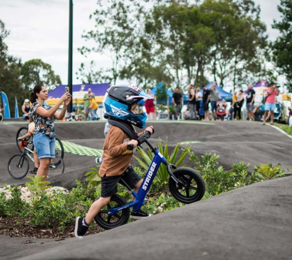
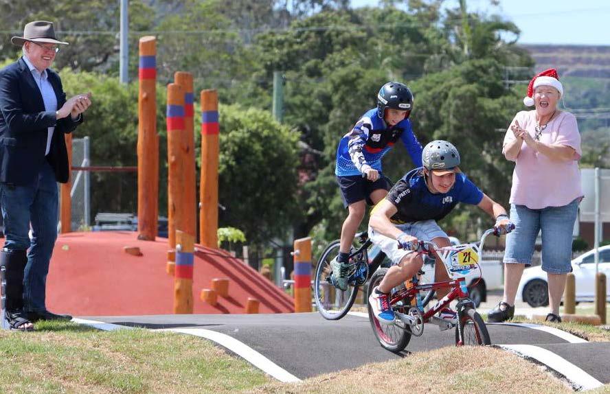
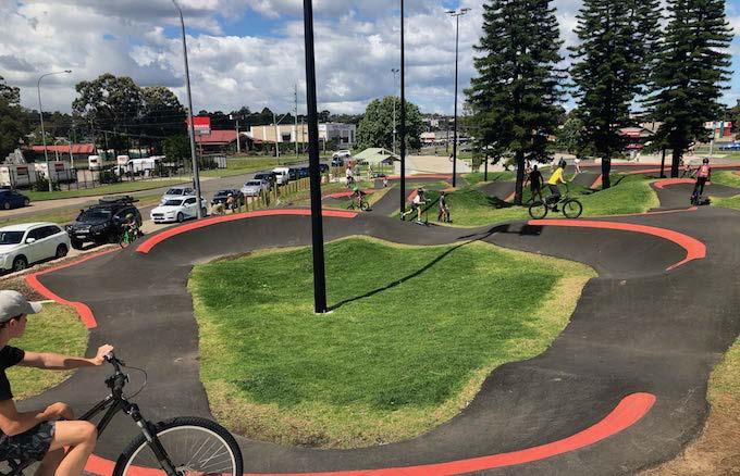
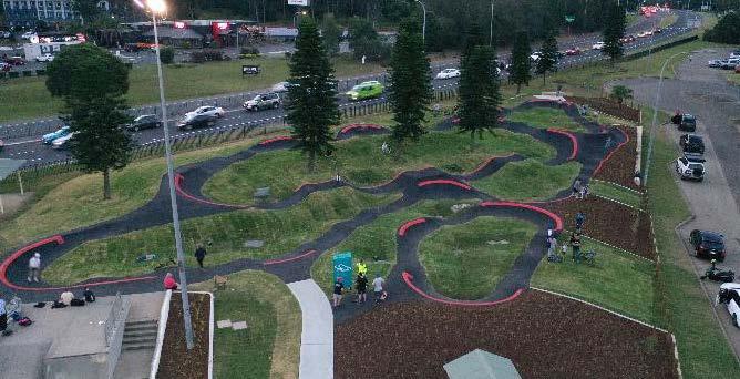
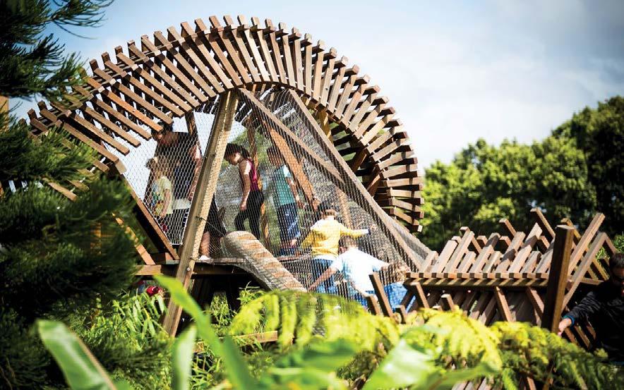
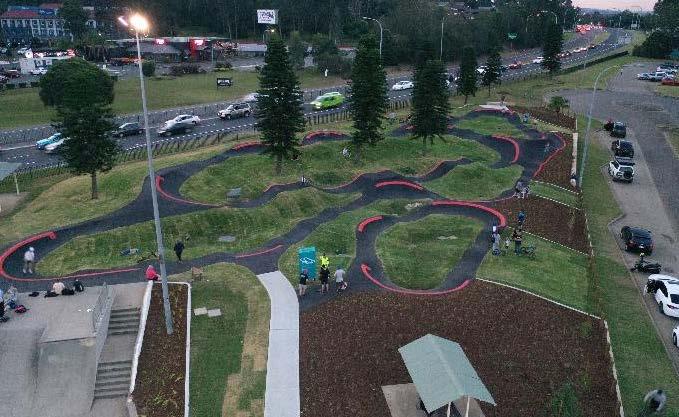
NULLAWARRA AVE NORMAN ST QUANDONGPL NIRRANDAST WILGAST NORMANST HEATHST AUGUSTASTMAJORS BAY ROAD DEAKINST BRADDONST SCALE 1:1000 A1 1:2000 5. MASTERPLAN 24 MAJORS BAY RESERVE PARK MASTERPLAN PLACE DESIGN GROUP OCT 2022 PUMP TRACK I PRECEDENT IMAGERY KEY
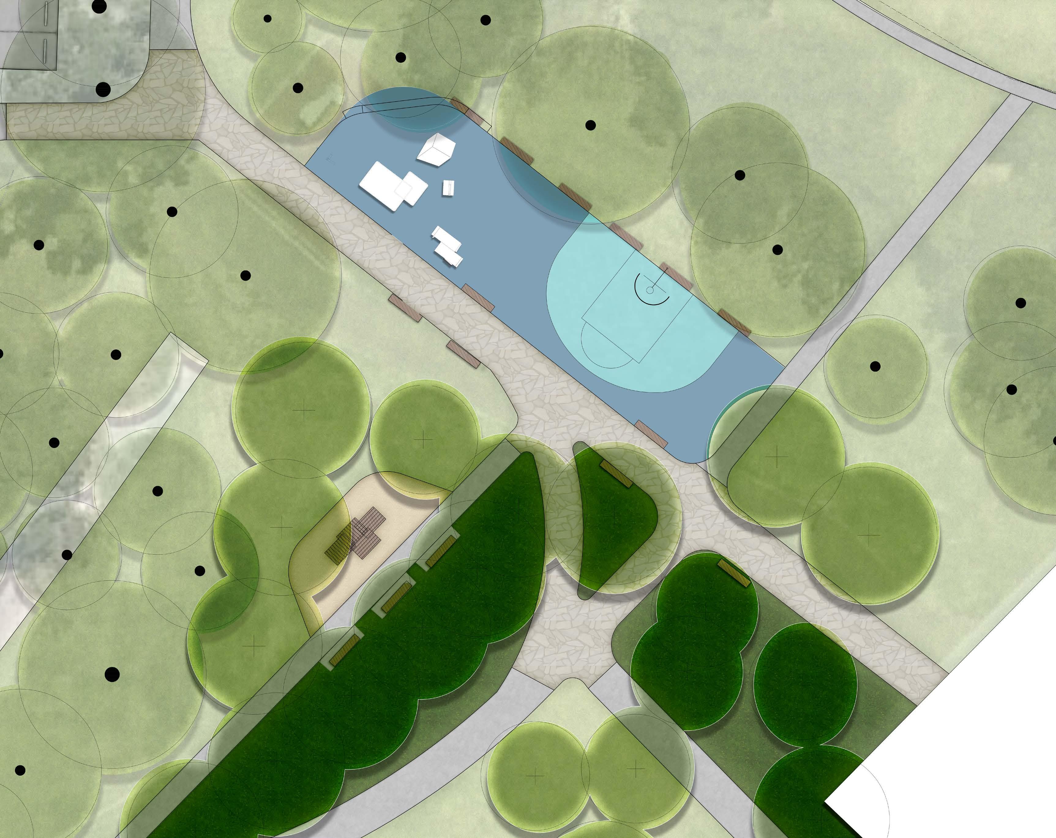
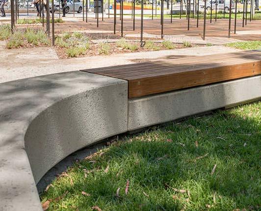
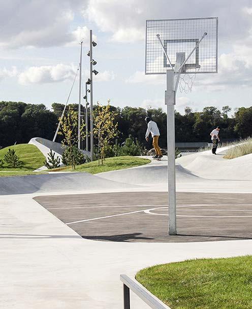
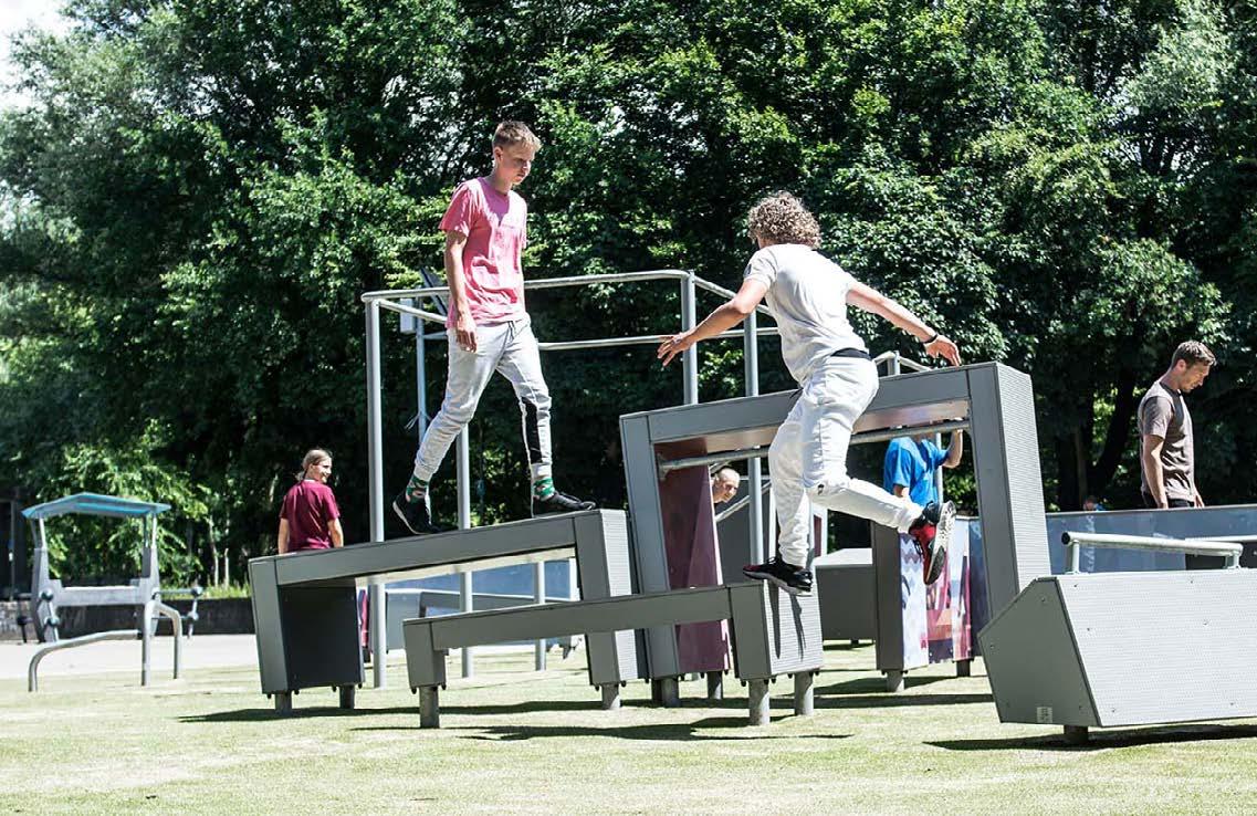
0 2 4 6 8 10M/ 1:200@A3 5. MASTERPLAN 25 MAJORS BAY RESERVE PARK MASTERPLAN PLACE DESIGN GROUP OCT 2022 NULLAWARRA AVE NORMAN ST QUANDONGPL NIRRANDAST WILGAST NORMANST HEATHST AUGUSTASTMAJORS BAY ROAD DEAKINST BRADDONST RICKARDST SCALE 1:1000 A1 1:2000 KEY LEGEND 1 Existing Concrete Drainage Swale 2 Proposed Main Path with Feature Paving 3 Proposed Secondary Path 4 Proposed Memorial Tree Planting 5 Seating 6 Planting 7 Existing Sporting Amenity Building 8 Parkour Equipment 9 Multipurpose Sport Court 2 2 1 5 6 7 4 8 9 3 3 CENTRAL MEETING PLACE/YOUTH PLAY I CONCEPT DESIGN
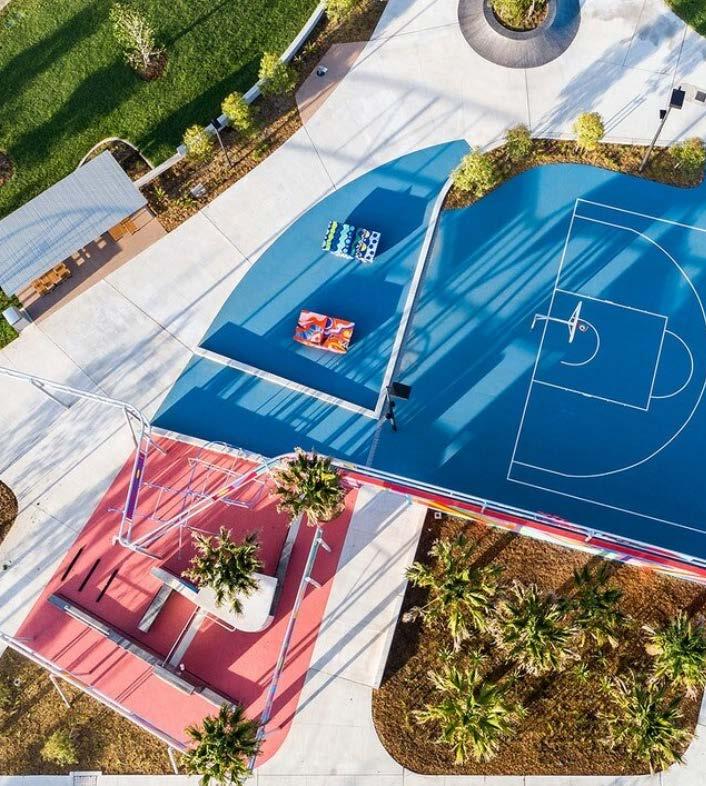
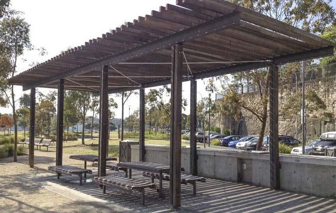
5. MASTERPLAN 26 MAJORS BAY RESERVE PARK MASTERPLAN PLACE DESIGN GROUP OCT 2022 NULLAWARRA AVE NORMAN ST QUANDONGPL NIRRANDAST WILGAST NORMANST HEATHST AUGUSTASTMAJORS BAY ROAD DEAKINST BRADDONST RICKARDST SCALE 1:1000 A1 1:2000 KEY CENTRAL MEETING PLACE/YOUTH PLAY I PRECEDENT IMAGERY
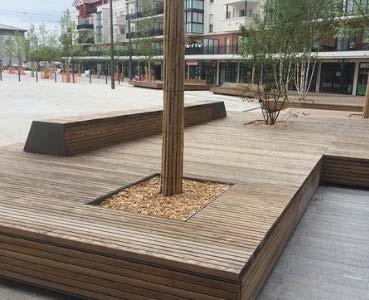
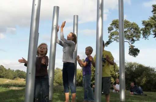
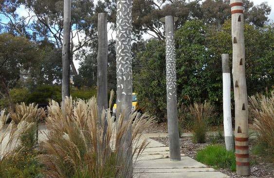
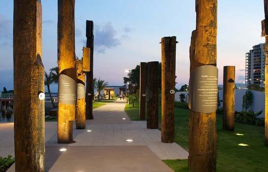
0 5 10 15 20M/ 1:400@A3 NULLAWARRA AVE NORMAN ST QUANDONGPL NIRRANDAST WILGAST NORMANST HEATHST AUGUSTASTMAJORS BAY ROAD DEAKINST BRADDONST RICKARDST SCALE 1:1000 A1 1:2000 MAIN PLAY I CONCEPT DESIGN LEGEND KEY Site Boundary 1 Seating Bench + Shelter 2 Accessible Circulation Path (2400mm W.) 3 Changing Places Amenities 4 Timber ‘Look Out’ 5 Acoustic Corner Containing Musical Play 6 Balance Logs 7 Proposed Tree Planting 8 Existing Trees 9 Interpretative ‘Mangrove Inspired’ Timber Poles To Dry Creek Bed 10 Timber Arbor Tunnel 11 Planting 12 Story-telling Circle 13 Concrete Sleepers to Entries 14 Sandstone Steppers 15 Softfall 16 Playground Mulch 1 3 13 13 2 2 4 5 6 7 8 910 11 12 14 15 16 5. MASTERPLAN 27 MAJORS BAY RESERVE PARK MASTERPLAN PLACE DESIGN GROUP OCT 2022
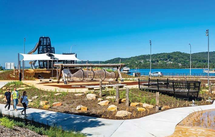
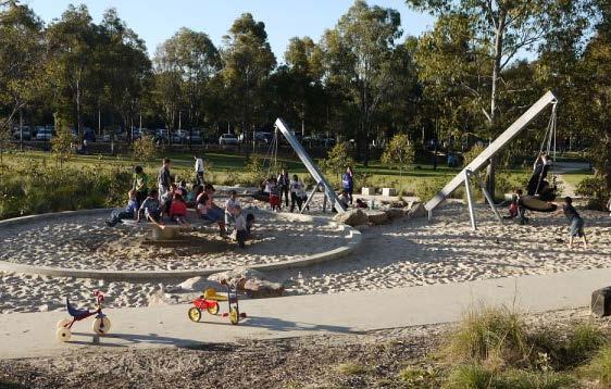
5. MASTERPLAN 28 MAJORS BAY RESERVE PARK MASTERPLAN PLACE DESIGN GROUP OCT 2022 NULLAWARRA AVE NORMAN ST QUANDONGPL NIRRANDAST WILGAST NORMANST HEATHST AUGUSTASTMAJORS BAY ROAD DEAKINST BRADDONST SCALE 1:1000 A1 1:2000 MAIN PLAY I PRECEDENT IMAGERY KEY
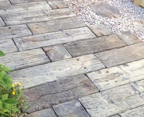
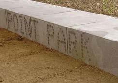
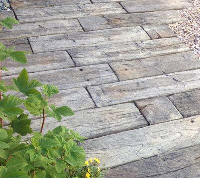
NULLAWARRA AVE NORMAN ST QUANDONGPL NIRRANDAST WILGAST NORMANST HEATHST AUGUSTASTMAJORS BAY ROAD DEAKINST BRADDONST SCALE 1:1000 A1 1:2000 KEY MAJORS BAY RD ENTRY (TYPICAL ENTRY) I CONCEPT DESIGN LEGEND 0 2 4 6 8 10M/ 1:200@A3 Site boundary 1 Proposed concrete paved entry path 2 Proposed concrete sleeper paving 3 Proposed in-situ concrete seating bench with signage incorporated 4 Proposed decomposed granite paving 5 Feature planting 6 Proposed interpretive wayfinding feature to express mangroves forest theme 7 Retain existing trees where possible, under-prune where necessary to open views into the reserve 8 Retain sandstone logs and make good recent planting. Relocate sandstone logs for formalisation of pathway. 1 2 3 4 5 6 7 8 5. MASTERPLAN 29 MAJORS BAY RESERVE PARK MASTERPLAN PLACE DESIGN GROUP OCT 2022
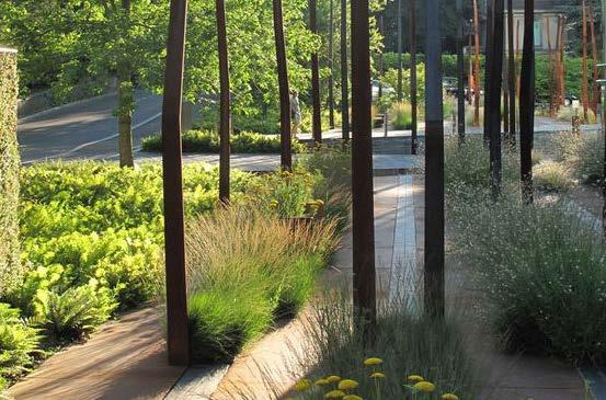
5. MASTERPLAN 30 MAJORS BAY RESERVE PARK MASTERPLAN PLACE DESIGN GROUP OCT 2022 NULLAWARRA AVE NORMAN ST QUANDONGPL NIRRANDAST WILGAST NORMANST HEATHST AUGUSTASTMAJORS BAY ROAD DEAKINST SCALE 1:1000 A1 1:2000 ENTRIES I PRECEDENT IMAGERY KEY
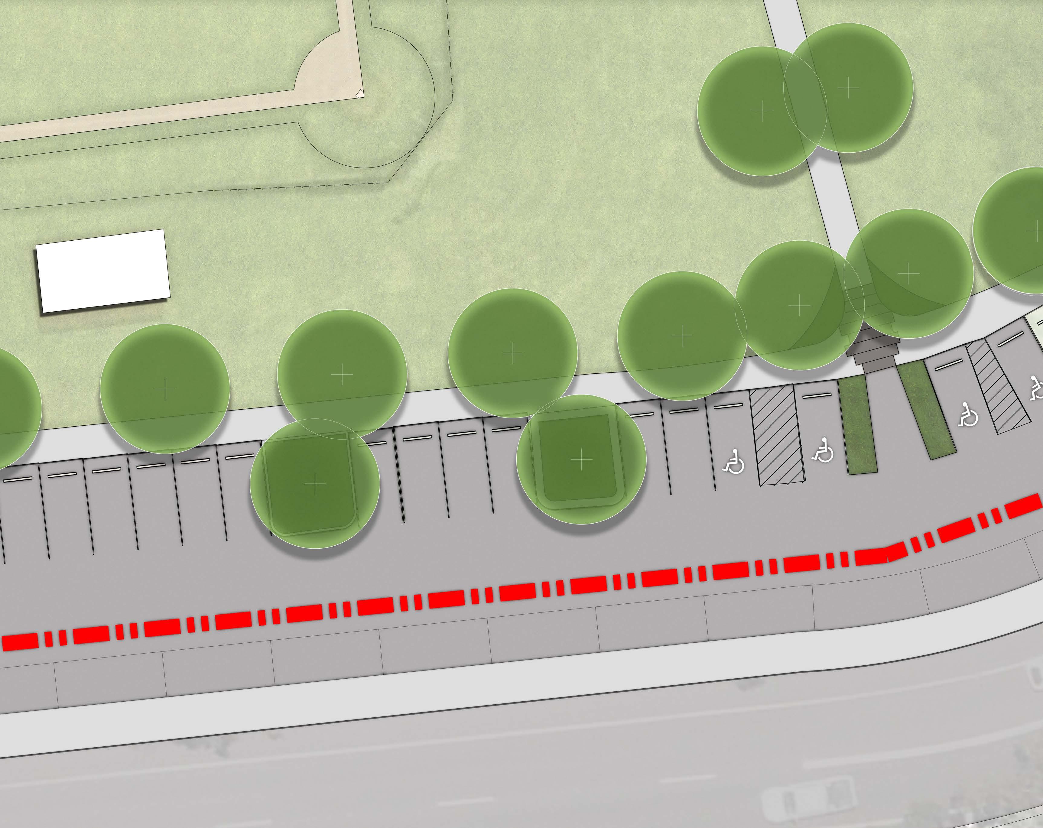
NULLAWARRA AVE NORMAN ST QUANDONGPL NIRRANDAST WILGAST NORMANST HEATHST AUGUSTASTMAJORS BAY ROAD DEAKINST BRADDONST RICKARDST SCALE 1:1000 A1 1:2000 KEY NORMAN STREET OFF ROAD PARKING I CONCEPT DESIGN LEGEND 0 2 4 6 8 10M/ 1:200@A3 Site boundary 1 Proposed Tree Planting 2 Existing Shelter 3 Off-Road 90 Degree Parking 4 Planting Medians 5 Existing Turf Lawn 6 Parallel Parking 7 Concrete Median Separator 8 Existing Two-Way Road (Norman Street) 9 Proposed entry + pathway 1 2 3 4 4 4 5 6 7 8 9 5. MASTERPLAN 31 MAJORS BAY RESERVE PARK MASTERPLAN PLACE DESIGN GROUP OCT 2022 NORMAN ST
Site Boundary
Major Park Entry Signage
Vehicular Directional Signage
Secondary Entry Signage
Park Wayfinding
Area Information Signage
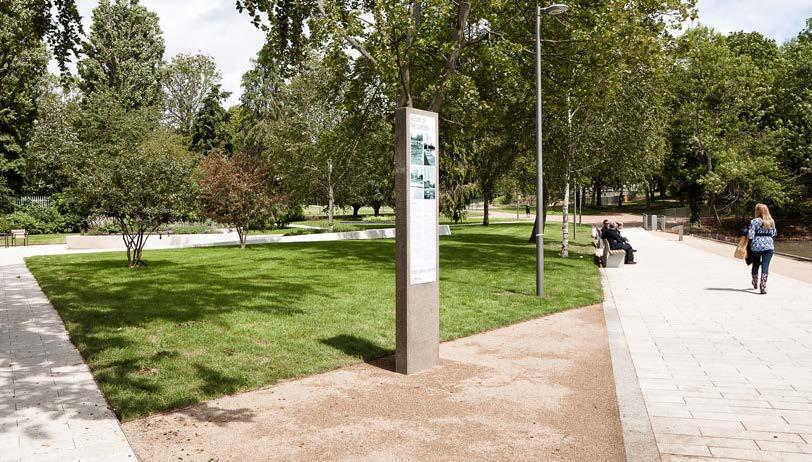
Environmental Kiosk
5. MASTERPLAN 32 MAJORS BAY RESERVE PARK MASTERPLAN PLACE DESIGN GROUP OCT 2022 LEGEND
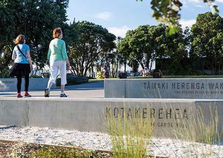
WAYFINDING AND SIGNAGE
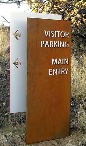
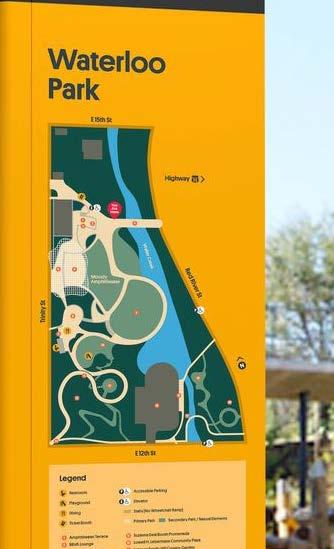
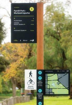
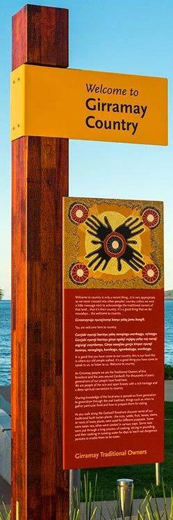
1 Major Park Entry Signage 2 Vehicular Directional Signage 3 Area Information Signage 4 Park Wayfinding 5 Education Kiosk 1 5 4 2 5. MASTERPLAN 33 MAJORS BAY RESERVE PARK MASTERPLAN PLACE DESIGN GROUP OCT 2022 WAYFINDING AND SIGNAGE I PRECEDENT IMAGERY LEGEND 3
Site Boundary
Main
Secondary
Primary
Secondary

Existing
Existing
Proposed

5. MASTERPLAN 34 PLACE DESIGN GROUP OCT 2022
Path Network (3m Wide)
Path Network (1.5m Wide)
Entry Point
Entry Point Vehicle Access Emergency Access
Building Proposed Building
Shelter
Shelter KEY CIRCULATION STRATEGY 0 50M/ 1:1000@A140302010 MAJORS BAY
APPENDIX
6. APPENDIX 35 MAJORS BAY RESERVE PARK MASTERPLAN PLACE DESIGN GROUP OCT 2022 6.
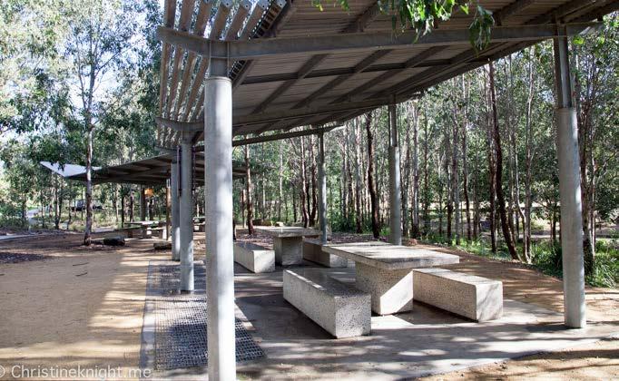
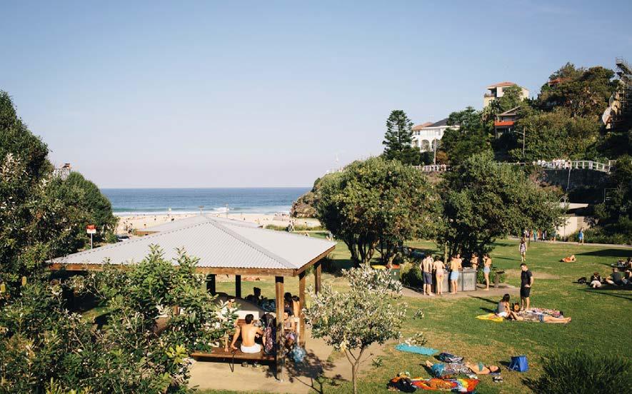


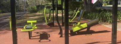
6. APPENDIX 36 MAJORS BAY RESERVE PARK MASTERPLAN PLACE DESIGN GROUP OCT 2022 SCALE STUDY PLAYGROUNDS BUNGARRIBEE PLAYGROUND LIZARD LOG PICNIC AREA THE IAN POTTER CHILDREN’S WILD PLAY GARDEN GREEN PICNIC AREA BUNGARRIBEE GOSFORD LEAGUES CLUB PLAYGROUND PRIRRAMA PARK PICNIC SHELTERS LIZARD LOG PLAYGROUND TAMARAMA BEACH APPROX. 1665 m2 APPROX. 8850 m2 APPROX. 7120 m2 APPROX. 9553 m2 APPROX. 8541 m2 APPROX. 3785 m2APPROX. 5384 m2 APPROX. 5384 m2 APPROX. 8274 m2 APPROX. 6148 m2 PASSIVE PICNIC AREA/ KICK ABOUT ZONE MAJORS BAY PLAYGROUND MAJORS BAY PASSIVE PLAY
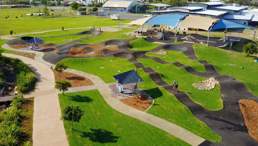
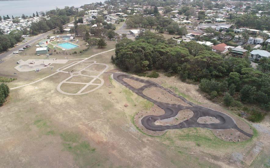


6. APPENDIX 37 MAJORS BAY RESERVE PARK MASTERPLAN PLACE DESIGN GROUP OCT 2022 BARDEN RIDGE PUMP TRACK GLADSTONE PUMP TRACK MAJORS BAY PUMP TRACK SHOALHAVEN HEADS LEUMEAH APPROX. 3068 m2 APPROX. 3211 m2 APPROX. 5127 m2 APPROX. 2456 m2 PUMP TRACK SCALE STUDY APPROX. 1920m2
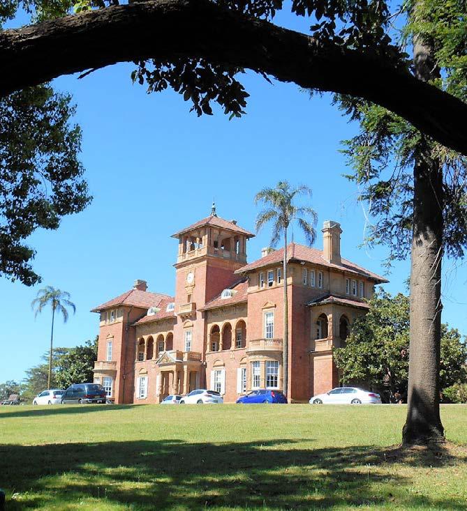
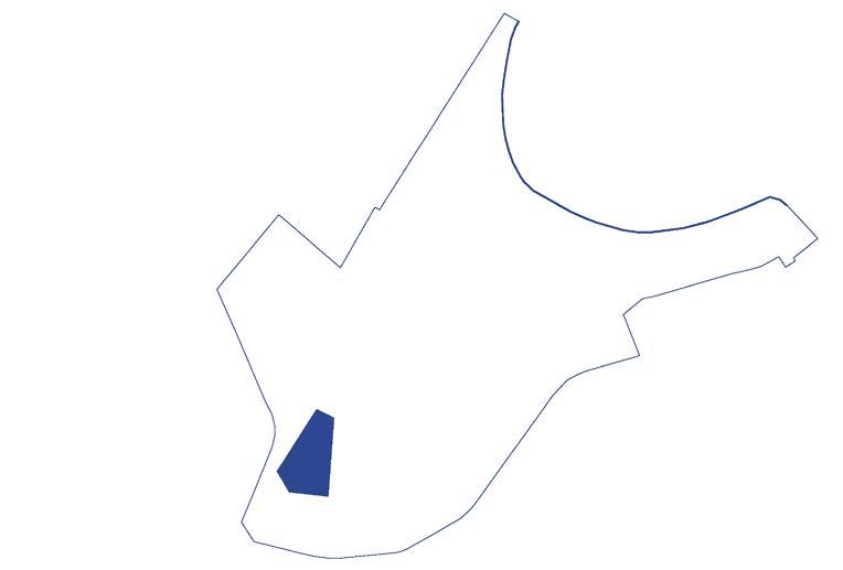
3. SITE ANALYSIS 38 MAJORS BAY RESERVE PARK MASTERPLAN PLACE DESIGN GROUP OCT 2022 MAJORS BAY RESERVE BRAYS BAY HOMEBUSH BAY KENDALL BAY MORRISONS BAY GLADES BAY FRANE BAY EXILE BAY PA R R A M ATTA B AY H O M E B U S H B A Y R D P O W E L L S C R K SALT CRK W A T E R 3. CONTRIBUTORY BUILDINGS 3. CONTRIBUTORY BUILDINGS 2. DAME EADITH WALKER HOSPITAL GROUP 1. THOMAS WALKER CONVALESCENT HOSPITAL HASLAMS CRK HEN AND CHICKEN BAY MAJORS BAY YARALLA BAY HERITAGE + CONSERVATION Source: https://maps.canadabay.nsw.gov.au/ LEGEND Major Road Site Boundary Suburb Boundary State Heritage Item Conservation Area 3 2 1 NTS
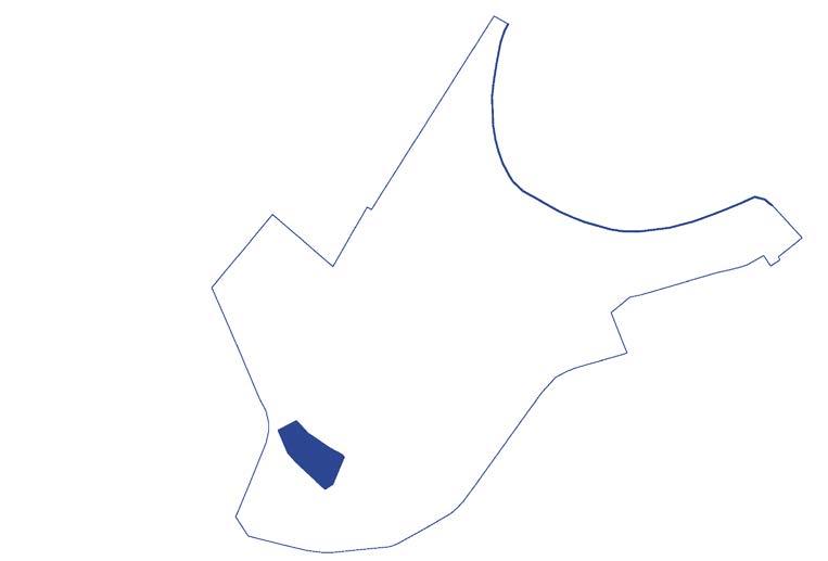
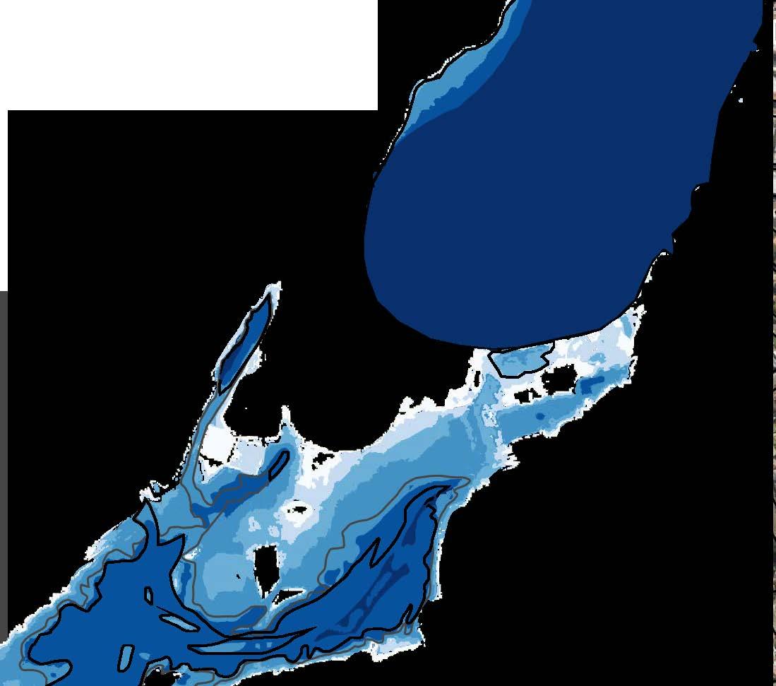
3. SITE ANALYSIS 39 MAJORS BAY RESERVE PARK MASTERPLAN PLACE DESIGN GROUP OCT 2022 SOIL + CONTAMINATION 9130bt 9130bt 9130xx 9130xx 9130xx 9130xx 9130xx 9130of 9130of 9130la 9130la 9130of 9130of 9130gy 9130gy 9130gy 9130gy 9130lh 9130xx 9130xx 9130bt 9130bg 9130bg 9130et BRAYS BAY HOMEBUSH BAY KENDALL BAY MORRISONS BAY GLADES BAY FRANE BAY EXILE BAY PA R R A M ATTA B AY H O M E B U S H B A Y R D P O W E L L S C R K SALT CRK W A T E R bg bt gy et la of xx LEGEND Major Road Site Boundary Suburb Boundary High Acid Sulfate Risk Medium Acid Sulfate Risk Birrong Blacktown Gymea Ettalong Lambert Oxford Falls Disturbed Terrain HASLAMS CRK MAJORS BAY RESERVE HEN AND CHICKEN BAY Source: geo.seed.nsw.gov.au, epa.nsw.gov.au MAJORS BAY YARALLA BAY NTS Note: Majors Bay Reserve is listed as NSW Contaminated Notified to the EPA as of 9 January 2019
4. OPPORTUNITY + CONSTRAINTS 40 MAJORS BAY RESERVE PARK MASTERPLAN PLACE DESIGN GROUP OCT 2022 FLOOD IMPACT STUDY: EXISTING CONDITIONS Site Boundary 10% AEP Peak Flood Depth 1% AEP Peak Flood Depth Stormwater Pipes Stormwater Pits < 0.15 0.15 to 0.30 0.30 to 0.50 0.50 to 1.00 1.00 to 2.00 > 2.00 LEGEND PVF Peak Flood Depth Source: Hydro Spatial Majors Bay Reserve Flood Study And Flood Impact Assessment (2018) NTS
Existing
TENNYSON
SYDNEY OLYMPIC PARK FUTURE METRO STATION
WEST STATION
CONCORD
VICTORIA
NORTH STRATHFIELD
METRO
Local Strategic Planning Statement: City of Canada Bay 3. SITE ANALYSIS 41 MAJORS BAY RESERVE PARK MASTERPLAN PLACE DESIGN GROUP OCT 2022 HOMEBUSH BAY KENDALL BAY MORRISONS BAY GLADES BAY EXILE BAY PA R R A M ATTA B AY H O M E B U S H B A Y R D P O W E L L S C R K SALT CRK W A T E R HASLAMS CRK HEN AND CHICKEN BAY MAJORS BAY RESERVE RHODES STATION CABARITA WHARF TRANSPORT + ACCESS 5mins400m10mins800m15mins1000m 30mins2000m Site Boundary Train Line Train Station Public Ferry Wharf Bus Route Bus Stop
On-road Cycle Route (LSP, 2020) Existing Off-road Cycle Route (LSP, 2020) Proposed Future Cycle Route (LSP, 2020) Existing Foreshore Walk Existing Informal Foreshore Walk Proposed Future Foreshore Connection LEGEND
RD BEFORE BETRAM ST BUS STOP 12min Walk 850m
RD BEFORE
AVE BUS STOP 10min Walk 750m
FUTURE
STATION 28min Walk 2200m
44min Walk 3400m CONCORD
17 Min Walk 1300m NTS
MAJORS BAY RESERVE 3. SITE ANALYSIS 42 MAJORS BAY RESERVE PARK MASTERPLAN PLACE DESIGN GROUP OCT 2022 EXISTING OPEN SPACE NETWORK LEGEND Major Road Site Boundary Suburb Boundary District Play Space Regional Play Space Local Play Space x x x BRAYS BAY HOMEBUSH BAY KENDALL BAY MORRISONS BAY GLADES BAY FRANE BAY EXILE BAY PA R R A M ATTA B AY H O M E B U S H B A Y R D P O W E L L S C R K SALT CRK W A T E R 8 10 9 4 13 17 14 11 HEN AND CHICKEN BAY 6 5 2 1 12 16 18 15 7 3 Wangal Reserve Breakfast Point Cabarita Park Kendal Reserve Prince Edward Park Edwards Park Greenlees Park Warbrick Park Mason Park Bressington Park Concord West Playground Wentworth Common Lewis Berger Park Rhodes Park McIlwaine Park Bicentennial Park Howse Park5mins400m10mins800m15mins1000m 30mins2000m MAJORS BAY YARALLA BAY NTS Murphy Reserve
3. SITE ANALYSIS 43 MAJORS BAY RESERVE PARK MASTERPLAN PLACE DESIGN GROUP OCT 2022 REF #. OPEN SPACE PLAY EQUIPMENT WATER PLAY PICNIC TABLES AMENITY BLOCK BBQ COMMUNITY GARDEN SENSORY GARDEN SPORTING FACILITIES OUTDOOR FITNESS SWIMMING CYCLE TRACK WALKING TRACK DOG AREA (UNLEASHED/ LEASHED) ACCESS TO FORESHORE EDGE CULTURAL MONUMENT SIGNIFICANT VIEW ECOLOGICAL ASSETS Majors Bay Reserve X X X X X 1. McIlwaine Park X X X X X 2. Rhodes Park X X X X X X X 3. Wangal Reserve X X X X X X X X X 4. Murphy Reserve X X X X 5. Lewis Berger Park X X X X 6. Wentworth Common X X X X X X 7. Breakfast Point X X X X X 8. Cabarita Park X X X X X 9. Howse Park X X 10. Kendal Reserve X X X 11. Concord West Playground X X X X X 12. Bicentennial Park X X X X X X X X 13. Warbrick Park X X 14. Bressington Park X X X X X X 15. Prince Edward Park X X 16. Edwards Park X X X X X 17. Mason Park X X X X X X 18. Greenlees Park X EXISTING OPEN SPACE MATRIX 2 5 1683
Major Road
Site Boundary
Suburb Boundary
Vegetation Class: Northern Hinterland Wet Sclerophyll Forests
Vegetation Formation: Wet Sclerophyll Forests
Sydney Turpentine - Grey Ironbark open forest on shale in the lower Blue Mountains, Sydney Basin Bioregion
Vegetation Class: Mangrove Swamps
Vegetation Formation: Saline Wetlands
Mangrove Forests in estuaries of the Sydney Basin Bioregion and South East Corner Bioregion
Vegetation Class: Coastal Floodplain Wetlands
Vegetation Formation: Forested Wetlands
Swamp Oak swamp forest fringing estuaries, Sydney Basin Bioregion and South East Corner Bioregion
Vegetation Class: Coastal Swamp Forests
Vegetation Formation: Forested Wetlands
Flax-leaved Paperbark open to closed mesic forest on alluvial riverflats in the Sydney region
Vegetation Class Salt marshes
Vegetation Formation: Saline Wetlands.
Salt marsh in estuaries of the Sydney Basin Bioregion and South East Corner Bioregion
HASLAMS CRK
3. SITE ANALYSIS 44 MAJORS BAY RESERVE PARK MASTERPLAN PLACE DESIGN GROUP OCT 2022 VEGETATION COMMUNITIES BRAYS BAY HOMEBUSH BAY KENDALL BAY MORRISONS BAY GLADES BAY FRANE BAY EXILE BAY HEN
AND CHICKEN
BAY PA R R A M ATTA B AY H O M E B U S H B A Y R D P O W E L L S C R K SALT CRK W
A T E R
MAJORS BAY RESERVE
LEGEND
MAJORS BAY
YARALLA BAY
Source: geo.seed.nsw.gov.au NTS
3. SITE ANALYSIS 45 MAJORS BAY RESERVE PARK MASTERPLAN PLACE DESIGN GROUP OCT 2022 BIODIVERSITY CORRIDORS LEGEND Major Road Site Boundary Suburb Boundary Critical Habitat Significant Habitat Supporting Habitat Opportunities to connect existing Biodiversity corridors BRAYS BAY HOMEBUSH BAY KENDALL BAY MORRISONS BAY GLADES BAY FRANE BAY EXILE BAY HEN AND CHICKEN BAY PA R R A M ATTA B AY H O M E B U S H B A Y R D P O W E L L S C R K SALT CRK W A T E R HASLAMS CRK MAJORS BAY RESERVE MAJORS BAY YARALLA BAY Source: geo.seed.nsw.gov.au NTS
RHODES STATION CONCORD WEST STATION BRAYS BAY HOMEBUSH BAY KENDALL BAY MORRISONS BAY GLADES BAY FRANE BAY EXILE BAY PA R R A M ATTA B AY H O M E B U S H B A Y R D P O W E L L S C R K SALT CRK W A T E R LEGEND Major Road Site Boundary Suburb Boundary Existing Formal Foreshore Walk Existing Pathway Through Park Existing Informal Foreshore Walk No Foreshore Connection (Potential Connection) MAJORS BAY RESERVE FORESHORE CONNECTIONS 1. Opportunity to improve foreshore along existing mangrove edge. 3. Viewing platform, Wangal Reserve. 2. Viewing Platform, Northcote Street Reserve. HASLAMS CRK HEN AND CHICKEN BAY 3 2 1 MAJORS BAY Local Strategic Planning Statement: City of Canada Bay 3. SITE ANALYSIS 46 MAJORS BAY RESERVE PARK MASTERPLAN PLACE DESIGN GROUP OCT 2022 MAJORS BAY YARALLA BAY NTS
