16O BURWOOD RD, CONCORD URBAN DESIGN REVIEW
Final Report
November 2022
Prepared for the City of Canada Bay Council by Studio GL
Document Information
Job title Urban Design Review 160 Burwood Road, Concord
Client City of Canada Bay
Job number 20063
Report title Draft Urban Design Review Report
File name 20063_BurwoodRd_UrbanDesignReview_PP2022.indd
Revision Date Prepared by Approved/Reviewed by
Draft 23/08/22 NH, DG, AN DG
Final 31/08/22 AN DG
Re-issue 4/11/22 AN DG
Note: This document takes into account the particular instructions and requirements of our client. It is not intended for and should not be relied upon by any third party and no responsibility is undertaken to any third party. The report layout is designed to be printed at A4 portrait.
Studio GL Pty Ltd 77 Buckland Street
Chippendale NSW 2008

Chapter 1 - Introduction 1-1 Background 5 1-2 Documents reviewed 6 1-3 Previous schemes 8 1-4 Comparison table 14 Chapter 2 - Context 2-1 Metropolitan Context ........................................................................ 17 2-2 Regional context 18 2-3 Local context 19 2-4 Photographic Study 20 2-5 Key planning controls 28 Chapter 3 - Urban Design Review 3-1 Approach 35 3-2 Context and neighbourhood character 40 3-3 Built form, scale and aesthetics 46 3-4 Density and FSR 56 3-5 Land use 65 3-6 Landscape and amenity 70 3-7 Safety 74 3-8 Sustainability and diversity 76 Chapter 4 - Recommendations 4-1 Overview 79 4-2 Heritage 80 4-3 Foreshore Building Line 81 4-4 Land Use 82 4-5 Height 84 4-6 FSR 88 4-7 Recommended Site Layout 90 Appendix 160 Burwood Rd, Concord | Urban Design Review | November 2022 3
TABLE OF CONTENTS
INTRODUCTION O1
1-1 Background Background
Studio GL have been commissioned by the City of Canada Bay to undertake an Urban Design Review of the amended Planning Proposal (May 2022) for the “Bushells Factory Redevelopment”, a 3.9 ha site located at 160 Burwood Road, Concord. Studio GL have been providing urban design advice to Council regarding this site since 2016.
The amended Planning Proposal (PP) submitted in May 2022 responds to recommendations made by the Sydney Eastern City Planning Panel (SECPP) in its determination of the Rezoning Review on 31 March 2020 and the Gateway Determination conditions issued by the Department of Planning, Industry and Environment on 31 October 2021. The amended Planning Proposal (PP) revised a previously revised Planning Proposal, submitted in February 2019.
This report reviews the revised Concept Plan and assesses the key urban design issues on this large and significant site. Specifically, this report considers whether the proposed layout, massing and built form of the development, as outlined in the amended PP, provides an appropriate response given the location and surrounding context of the site. The report also considers best practice urban design; SEPP 65, the Apartment Design Guide; and Better Placed, an integrated design policy for the built environment of New South Wales.
The site is located in Concord on the southern edge of Exile Bay. It lies within the City of Canada Bay Local Government Area (LGA) and is subject to the Canada Bay Local Environmental Plan (CBLEP) 2013 and the Canada Bay Development Control Plan (DCP) 2017.
As per CBLEP 2013 the site is currently zoned IN1, General Industrial, and contains a working factory (Freshfood Services Pty Ltd). Development in the surrounding area consists of low and medium density residential uses.
The amended PP (May 2022) outlines demolition of most of the current structures, except the large Central Roasting Hall, and the construction of multiple buildings with heights ranging from 12m to 21m. The proposed uses include residential and mixed-use with commercial and retail uses at the lower levels and residential uses above.
Approach and methodology
This urban design review has taken the following approach:
• A review of the site context. This review considers both the physical context and the planning context of the site.
• An explanation of what is considered best practice urban design. This is particularly important on larger, mixed use sites as SEPP 65 and the Apartment Design Guide provide some guidance on the masterplanning of mixed use sites but less consideration of wider issues such as urban structure, urban grain and the public realm.
• A review of the amended PP (May 2022) particularly considering the nine Design Quality Principles set out in SEPP 65, namely:
• Principle 1: Context & neighbourhood character
• Principle 2: Built form and scale
• Principle 3: Density
• Principle 4: Sustainability
• Principle 5: Landscape
• Principle 6: Amenity
• Principle 7: Safety
• Principle 8: Housing diversity & social interaction
• Principle 9: Aesthetics
This review focusses on the critical purpose of a planning proposal, which is to amend the planning controls which outline the future development possible on the site. These controls, both key controls in the LEP including Height, FSR, Land Use and Heritage, and the more detailed considerations in the DCP need to provide sufficient confidence that the proposal is suitable for the site. This is consistent with the Local Environmental Plan Making Guideline (2021) which states, “the planning proposal is to demonstrate that the proposal is suitable for the site and the site is (or can be made) suitable for the resultant development”.
160 Burwood Rd, Concord | Urban Design Review | November 2022 5
INTRODUCTION O1
The following documents were reviewed during the review of amended PP (May 2022):
A Metropolis of Three Cities- Greater Sydney Region Plan
Eastern City District Plan
SEPP 65 and the Apartment Design Guide
Better Placed - An integrated design policy for the built environment of New South Wales
Amended Planning Proposal for 160 Burwood Road, Concord
Part A: Survey
Part B: Amended Urban Design Report ‘Bushells 3.0’
Part C: Concept Plan, Analysis & SEPP 65 Certification
Part D: Landscape Master Plan
Part E: Public Domain Plan
Part F: Traffic Impact Assessment
Part G: Arboricultural Development Assessment Report
Part H: Heritage Listing Nomination Report
Part I: Heritage Significance Assessment
Part J: Heritage Response to Local Planning Panel
Part K: Statement of Heritage Impact
Greater Sydney Commission, March 2018
Greater Sydney Commission, March 2018
NSW Government
Government Architect NSW, May 2017
LFA Pacific Pty Limited, May 2022
CMS Surveyors, May 2015
HATCH Roberts Day, April 2022
AJC Architects, May 2022
AJC Architects, June 2020
BVN Architects, June 2020
Stantec, April 2022
Kinesis, September 2019
Heritage 21, February 2019
Heritage 21, April 2016
Heritage 21, September 2019
Heritage 21, September 2019
PLANNINGPROPOSAL URBANDESIGN GATEWAYRESPONSE APRIL2022 CREATINGABETTERPLACE BUSHELLS3.0 AMENDEDPLANNINGPROPOSALINRESPONSETOTHE GATEWAYDETERMINATIONREPORT 2 Title: Bushells AmendedPlanningProposal Responsetothe GatewayDeterminationReport Preparedfor: NSWDeparment Planning,IndustryandEnvironment Reference: CON Date: 2022 Preparedby: AntonioPozzi,ElizaGay,BrigittaSchyns,OlegBilotserkevych Approved StevenMoore DISCLAIMER COPYRIGHT Thisdocumentwasprepared theexclusive Bushells.HatchRoberts acts professionalmattersas faithfuladvisortoitsclientsandexercises reasonable andcare theprovisionof professionalservices.Theinformationpresentedhereinhasbeencompiledfromanumberofsourcesusing variety methods.Hatch RobertsDaydoesnotattempttoverifytheaccuracy,validity comprehensiveness anyinformationsupplied Roberts bythirdparties.HatchRobertsDay warranty,express implied, assumesanylegalliability responsibilityfor theaccuracy,validity comprehensiveness thisdocument, misapplication ormisinterpretationbythirdparties contents.Referenceherein anyspecific commercialproduct,process, service tradename,trademark,manufacturer, otherwise,doesnotnecessarilyconstitute imply endorsement,recommendation, favouring HatchRoberts Thisdocument becopiedorreproduced wholeorpart anypurposewithoutthepriorwrittenconsentofHatchRobertsDay.HATCHRoberts Pty 2020 RobertsDay Level 50CarringtonStreetNSW2000+61282028000 www.robertsday.com.au 53 ACN 892
160 Burwood Rd, Concord | Urban Design Review | November 2022 6
1-2 Documents reviewed
Part L: Facade Report
Part M: Draft Letter of Offer
Part N: Draft Affordable Housing Contributions Scheme
Part O: Economic Impact Assessment
Part P: Retail Demand Assessment
Part Q: Aboriginal Due Diligence Assessment
Part R: Preliminary Soil Contamination Assessment
Part S: Additional Contamination Assessment
Part T: Preliminary Geotechnical Investigation
Part U: Additional Geotechnical Investigation
Part V: Sustainability Strategy
Part W: Social Infrastructure & Community Uses Demand Assessment
Part X: Flood Report
Part Y: Detailed Site Investigation (Round 1)
Part Z: Draft DCP - K19 160 Burwood Rd, Concord
AJC Architects, September 2019

LFA, February 2022
City of Canada Bay Council, June 2020
HillPDA, February 2019
HillPDA, January 2019
Heritage 21, June 2017
Geotechnique, September 2014
Geotechnique, August 2015
Geotechnique, September 2014
Geotechnique, August 2015
Kinesis, February 2019
Urbis, August 2015
Northrop, May 2022
Geotechnique, May 2022
City of Canada Bay Council & Studio GL, June 2022
INTRODUCTION O1
LFA(Paci PtyLtd. rightsreserved.Thiswork covered bycopyright andcannot reproducedor copiedinanyform or anymeans withoutwritten permissionofLFA (Paci c)PtyLtd. RevVersion/Amendments 00Draft01FinalDraft WorkInProgress 02Final03Amendment(version2)inresponsetoCouncil'sfeedback 04Amendment(version3)inresponsetoCBLPP 05Amendment(version3)inresponsetoCBLPP minorwording 06Amendment(version4)inresponsetoSECPP 07Amendment(version4-1)inresponsetoCouncilcomments Amendment(version4-2)inresponsetoCouncilcomments 09 Amendment(version4-3)inresponsetoCouncilcomments Amendment(version5)inresponsetoGatewayDetermination conditionsAmendment(version5-1)inresponsetoGateway DeterminationconditionsandCouncilfeedback 160bURWOODrD,cONCORD bUSHELLS Factory REDEVELOPMENT aMENDED pLANNING pROPOSAL (PP2018/0004) May 2022 Preparedby: Preparedfor: New Concord PtyDevelopments Ltd 160 Burwood Rd, Concord | Urban Design Review | November 2022 7
1-3 Previous schemes
Overview
The scale, design and character of development envisaged for this site has been under consideration for many years and has changed significantly over this time. The original Planning Proposal (PP) was submitted in June 2017. Amendments to this proposal were submitted in July 2018, February 2019 and May 2022. A brief summary of these proposals and how the scheme has changed is provided in this introduction.
Planning Proposal, June 2017
The original Planning Proposal, dated 20 June 2017, prepared by Urbis sought to achieve the following outcomes:
• Amendment of the Canada Bay Local Environmental Plan (CBLEP) 2013 ‘Land Zoning Map’ as it applies to the subject site, from IN1 General Industrial to B4 Mixed Use.
• Insertion into Schedule 1 of additional permitted uses for the subject site, including ‘boat sheds’, ‘jetties’ and ‘moorings'.
• Amendment of the CBLEP 2013 ‘Height of Buildings Map’ as it applies to the subject site, from a 12m maximum height limit to a 125m maximum height limit (p32 of the PP) or a maximum height of 121.5m (p36 of the PP).
• Amendment of the CBLEP 2013 ‘FSR Map’ as it applies to the subject site, from an FSR of 1:1 to an FSR of 1.95:1.
The original PP (June 2017) did not seek to amend the CBLEP 2013 ‘Heritage Map’ to include the existing factory buildings. However, the original PP (June 2017) stated that the Heritage Significance Assessment “provides measures to facilitate the adaptive reuse of this building to retain its heritage context and character (...) and will inform the design response (...) as part of any future DA on the site".
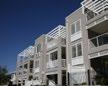
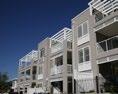
The Concept Plan in the original PP (June 2017) prepared by Allen Jack + Cottier Architects and BVN Architects incorporated 69,095m² of residential GFA (683 apartments), 3,718m² of retail and commercial GFA, 18,900m² of publicly accessible open space, 2,769m² of community facilities (in the lower levels of the ‘Roasting Hall’ and ‘Boiler House’) and a 660m² childcare facility. 1,205 car parking spaces were proposed in two to four levels of basement parking.
The concept plans in the original PP show five key buildings:
• Building 1 was an eight (8) storey apartment building approximately 155m long and located along the western boundary of the site.
• Building 2 was a twenty-five (25) storey apartment building with a six (6) storey podium along Burwood Road.
• Building 3 was an eight (8) storey apartment building approximately 130m long adjacent to the eastern boundary of the site.
• Building 4 was the retained industrial ‘Central Roasting Hall’ or Former Bushells Factory Building.
• Building 5 is a thirty-seven (37) storey apartment building with a six (6) storey podium.
INTRODUCTION O1
Figure 18 – Concept Plan Building Layout
(Source: AJ+C and BVN 2017)
A new internal street
Road 2)
and Zoeller Street to the foreshore, providing opportunities for community spaces and uses within the northern portion of the site; Retention of the existing north-south internal street
Road 1) along the site’s western boundary, extending at each end to connect Burwood Road to Zoeller Street and providing residential car park access to the western block;
The concept plan has taken into consideration the specific context and characteristics of the subject site and incorporates the following features:
(New
off Burwood Road to provide access to public and private car parking and loading access to development within the southern portion of the site. The concept plan also incorporates several
pedestrian walkways to provide public access from Burwood Road
(New
5 2 1 4 3
Figure 2 Impression of the development on the site as outlined in the original PP (June 2017) (Source: AJ+C and BVN 2017)
160 Burwood Rd, Concord | Urban Design Review | November 2022 8
INTRODUCTION O1
Amended Planning Proposal, July 2018
An amended Planning Proposal, dated 30 July 2018, prepared by LFA Pacific Pty Limited sought to achieve the following outcomes:
• Amendment of the Canada Bay Local Environmental Plan (CBLEP) 2013 ‘Land Zoning Map’ as it applies to the subject site, from IN1 General Industrial to B4 Mixed Use.
• Amendment of Schedule 1 Additional Permitted Uses to permit ‘Multi dwelling housing’ on the subject site.
• Amendment of the CBLEP 2013 ‘Height of Buildings Map’ as it applies to the subject site, from a 12m maximum height limit to a range of heights including 12m along Burwood Road, 18m along the northern portion of the site, 22m along the western boundary, 25m along the eastern boundary and a maximum of 46m towards the centre of the site.
• Amendment of the CBLEP 2013 ‘FSR Map’ as it applies to the subject site, from an FSR of 1:1 to an FSR of 1.6:1.
The Concept Plan in the amended PP (July 2018) had 60,780m² of total GFA including 535 residential apartments, and 3,557m² of retail and commercial GBA. 1,600 car parking spaces over two basement levels were also proposed. The scheme incorporated two new through-site public streets between Burwood Road and Zoeller Street, bicycle and pedestrian access to the foreshore and publicly accessible open space in the form of a new plaza and foreshore park.
Based on the concept plans, the buildings can be grouped into the following blocks:
• Block 1 included buildings along the western edge of the site that are predominantly six (6) storeys high with a step down to three (3) storey terraces along Burwood Road. Three (3) storey terraces are proposed as infill development between the six (6) storey buildings.
A key consideration of the proposal is to transition height to the surrounding context, maintaining privacy and amenity for neighbours. The below diagram highlights this transition, focusing lower building heights to the site periphery, ensuring the interface with surrounding context is appropriate.
A key consideration of the proposal is to transition height to the surrounding context, maintaining privacy and amenity for neighbours. The below diagram highlights this transition, focusing lower building heights to the site periphery, ensuring the interface with surrounding context is appropriate.
• Block 2 included buildings along the southern edge of the site with three (3) storey terraces facing Burwood Road and three (3) and five (5) storey apartments behind.
The amended PP (July 2018) did not seek to amend the CBLEP 2013 ‘Heritage Map’ to include the existing factory buildings, similar to the original PP (June 2017).
• Block 3 included buildings along the eastern edge of the site that are predominantly six (6) and seven (7) storeys high with a step down to three (3) storey terraces along the foreshore and along Burwood Road.
Block 4 was the retained industrial ‘Central Roasting Hall’ or Former Bushells Factory Building. Block 5 included buildings along the northern edge of the site and comprised a curvilinear building facing the foreshore to the north that is four (4) and five (5) storeys high, and a thirteen (13) storey high
BUILT FORM AND MASSING
BUILT
1 2 4
Block 1
Western edge
Block 5 Northern edge
Block 4
Central
49
Roasting Hall
HEIGHT TRANSITION LOW MIDRISE MEDIUM HIGH MEDIUM LOW
49
FORM AND MASSING
HEIGHT TRANSITION 5 storey apartments 4 storey apartments 7 storey apartments 6 storey apartments 5 storey apartments 3 storey terraces 3 storey terraces 6 storey apartments 13 storey apartments 3 storey terraces 3 storey terraces 6 storeys 7 storeys 13 storeys 5 storeys 4 storey 3 storey LOW MIDRISE MEDIUM HIGH MEDIUM LOW
Building
form has been appropriately scaled based on function, orientation of views to amenity and public spaces as well as height transition. The centre of the site features the largest allocation of height, stepping down to the perimeter of the site to approximately 3-6 storeys.
160 Burwood Rd, Concord | Urban Design Review | November 2022 9
Figure 4 Built form and massing diagram (Source: Roberts Day 2018)
INTRODUCTION O1
1-3 Previous schemes
Amended Planning Proposal, February 2019
The amended Planning Proposal, dated 7 February 2019, prepared by LFA Pacific Pty Limited sought to achieve the following outcomes:
• Amendment of the Canada Bay Local Environmental Plan (CBLEP) 2013 ‘Land Zoning Map’ as it applies to the subject site, from IN1 General Industrial to part B1 Neighbourhood Centre, part R3 Medium Density Residential and part RE1 Public Recreation.
• Amendment of Schedule 1 Additional Permitted Uses to permit ‘Light Industries’ in the proposed R3 Medium Density Residential zone.
• Amendment of the CBLEP 2013 ‘Height of Buildings Map’ as it applies to the subject site, from a 12m maximum height limit to a range of heights including 12m along Burwood Road; 16m along the western and northern boundaries of the site; 12m, 21m and 24m along the eastern boundary; and a maximum of 30m towards the centre of the site.
• Amendment of the CBLEP 2013 ‘FSR Map’ as it applies to the subject site from an FSR of 1:1 to an FSR of 1.5:1
The amended PP (Feb 2019) also proposed to list the Former Bushells Factory Building as an item of Local Heritage in CBLEP 2013 Schedule 5 Environmental Heritage.
The Concept Plan in the amended PP (Feb 2019) retained an identical building layout to the amended PP (July 2018) with reduced building heights. The Concept Plan proposed 55,968m² of total GFA including 475 residential apartments, 3,500m² of retail and commercial GBA, and 813 car parking spaces over two basement levels. The plan retained the proposed through-site public streets between Burwood Road and Zoeller Street, along with bicycle and pedestrian access to the foreshore. The plan also proposed an RE1 Public Recreation zone fronting the foreshore to provide a public plaza and foreshore park.
Based on the concept plans, the buildings can be grouped into the following blocks:
• Block 1 included buildings along the western edge of the site that are predominantly five (5) storeys high with a step down to three (3) storey terraces along Burwood Road and four (4) storeys along Zoeller Road. Three (3) storey terraces are proposed as infill development between the five (5) storey buildings.
• Block 2 included buildings along the southern edge of the site with three (3) storey terraces facing Burwood Road and four (4) and six (6) storey apartment buildings behind. One (1) storey of ‘Urban Services’ has been proposed on the ground level linking the four (4) and six (6) storey apartment buildings.
• Block 3 included buildings along the eastern edge of the site that are predominantly six (6) and seven (7) storeys high with a step down to three (3) storey terraces along the foreshore and along Burwood Road.
• Block 4 was the retained industrial ‘Central Roasting Hall’ or the Former Bushells Factory Building.
• Block 5 included buildings along the northern edge of the site and comprises a five (5) storey high curvilinear building facing the foreshore and a nine (9) storey high apartment building adjoining the retained Central Roasting Hall.
Note: The 3-D models and views in the Urban Design Report (Roberts Day 2019) showed the curvilinear building along the foreshore split into four (4) and five (5) storeys although the amended PP (Feb 2019) sought a consistent five (5) storey building along the foreshore.
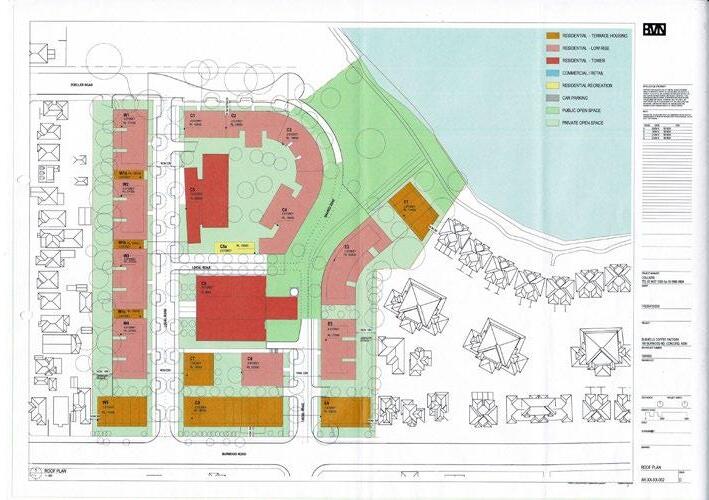
C1 C2 C3 C4 C5 C5a C6 C7 C8 C9 E1 E2 E3 E4 W1a W1c W2 W3 W4 W5 STOREY W1b W1 STOREY 6 STOREY LOCAL ROAD LOCAL ROAD NOM 22M 6.3M SETBACK NOM. 23M NOM. 3M NM3M NOM 3M LANDSCAPE SHARED ONE RL 21000 RL 22800 RL 13000 RL 18000 RESIDENTIAL TOWER COMMERCIAL RETAIL RESIDENTIAL RECREATION CAR PARKING RESIDENTIAL TERRACE HOUSING RESIDENTIAL LOW RISE PUBLIC OPEN SPACE PRIVATE OPEN SPACE URBAN SERVICES E indicated@A1 AR-XX-XX-002 1504003 160 BURWOOD RD, CONCORD. NSW ROOF PLAN TEL 02 9437 1300 fax 02 9966 9804 ROOF PLAN 1 1 3 2 5 4 Block 1 Western edge Block 5 Northern edge Block 3 Eastern edge Block 2 Southern edge Block 4 Central Roasting Hall
Figure 5 Key buildings of the amended PP (Feb 2019) identified over the Roof Plan (Source: BVN 2019)
160 Burwood Rd, Concord | Urban Design Review | November 2022 10
INTRODUCTION O1


Amended Planning Proposal, September 2019


An amended Planning Proposal (PP), dated 10 September 2019, prepared by LFA Pacific Pty Limited sought to achieve the following outcomes:
• Amendment of the Canada Bay Local Environmental Plan (CBLEP) 2013 ‘Land Zoning Map’ as it applies to the subject site, from IN1 General Industrial to part B1 Neighbourhood Centre, part R3 Medium Density Residential and part RE1 Public Recreation.
• Listing of the Former Bushells Factory Building as an item of Local Heritage in Schedule 5 Environmental Heritage.
• Amendment of Schedule 1 Additional Permitted Uses to permit ‘Light Industries’ in the proposed R3 Medium Density Residential zone.
• Amendment of the CBLEP 2013 ‘Height of Buildings Map’ as it applies to the subject site, from a 12m maximum height limit to a range of heights including 12m along Burwood Road; 18m along the northern boundary; 16m along the western boundary; 12m, 17m and 21m along the eastern boundary; 15m between the Central Roasting Hall and the terraces on Burwood Road; and a maximum of 21m towards the centre of the site.
• Amendment of the CBLEP 2013 ‘FSR Map’ as it applies to the subject site from an FSR of 1:1 to an FSR of 1.25:1.


The amended PP (Sep 2019) sought to enter into a Voluntary Planning Agreement (VPA) that provides 8,900m² of land for public open space, proposed to be dedicated to Council upon completion of the development project. Other provisions proposed in the draft VPA include restoration works to the seawall with waterfront edge landscaping, a minimum 5% of dwellings to be dedicated to an independent affordable housing provider for the provision of Affordable Housing, funding for a bus service for three years, and funding of protective golf nets to be installed on the golf course lands near the northern boundary of the site.
Based on the concept plans, the buildings can be grouped into the following blocks:


• Block 1 included buildings along the western edge that are three (3) storeys high.


• Block 2 included buildings along the southern edge of the site with three (3) storey terraces facing
of the site and comprises a five (5) storey high curvilinear building facing the foreshore and a six (6) storey high apartment building adjoining the retained Central Roasting Hall.
C1 C2 C3 C4 C5 C5a C6 C7 C8 C9 E2 E3 E4 W2 W3 W4 W5 STOREY STOREY STOREY STOREY STOREY W1 STOREY LOCAL ROAD LOCAL ROAD LOCAL ROAD NOM. 6M NOM. 23M NOM. 3M AR DZONE STOREY RL 46400 RL 15000 RL 17000 FUTURE RETAIL RL 11500 URBAN SERVICES STOREY RL 24200 RL 24200 RL 21200 RL 19400 COMMERCIAL RETAIL RESIDENTIAL RECREATION CAR PARKING PUBLIC OPEN SPACE PRIVATE OPEN SPACE URBAN SERVICES ROOF PLAN NEW TREE PLANTINGS EXISTING TREES RETAINED
Block 1 Western edge Block 5 Northern edge Block 3 Eastern
Block 2 Southern
Block 4 Central Roasting Hall 52 HEIGHT TRANSITION 5 storey apartments 5 storey apartments 5 storey apartments 5 storey apartments 6 storey apartments 3 storey terraces 3 storey terraces 3 storey apartments 6 storey apartments 3 storey terraces 3 storey terraces LOW MIDRISE MEDIUM HIGH MEDIUM LOW BUILT FORM AND MASSING
Figure 6 Key buildings identified over the Roof Plan amended PP (Sept 2019) (Source: BVN 2019)
1 3 2 5 4
edge
edge
160 Burwood Rd, Concord | Urban Design Review | November 2022 11
Figure 7 Built form and massing diagram (Source: Roberts Day 2019)
INTRODUCTION O1
1-3 Previous schemes
Rezoning Review (March 2020)
The Sydney Eastern City Planning Panel (SECPP) conducted a rezoning review of the planning proposal on 31 March 2020.
The SECPP determined that the planning proposal demonstrated both strategic and site-specific merit and should be submitted for a Gateway determination, subject to the following recommended conditions:
• A local planning provision be introduced into the instrument for the site to allow light industrial (IN2) uses to be permissible on the site. This is in the absence of a definition in the standard instrument of 'urban services'.
• A development standard be introduced into the instrument to increase the minimum provision of non-residential uses to 10,000m², where a minimum 3,000m² shall be provided for 'urban services' (aka light industrial uses).
• Satisfactory arrangements be in place prior to the instrument being made to allow for, at least, the maintenance on the site of a minimum of 8,900m² of Public Open Space, and a minimum of 10% affordable housing to be provided in perpetuity.
• A DCP shall be prepared and exhibited concurrently with the planning proposal to include urban design criteria; increased setbacks relative to building/wall height adjacent to existing lower density residential uses; increased building separation; height distribution relative to boundaries; building mass distribution; deep soil landscaping; sustainability measures and heritage and curtilage.
Gateway Determination (October 2021)
On October 31 2021 the Department of Planning, Industry and Environment determined that the planning proposal is to be revised to address the following:
• Ministerial Direction 2.3 Heritage Conservation as it relates to the proposal and inclusion of the Aboriginal Due Diligence Assessment for public exhibition.
• Ministerial Direction 2.6 as it relates to the proposal and preparation of a Detailed Site Investigation (DESI) to address the recommendations of report
13188/2, prepared by Geotechnique Pty Ltd.
• Ministerial Direction 4.3 Flooding by assessing the proposal against the requirements of the Direction.
• Demonstrate that future development is capable of achieving the minimum solar access requirements in the Apartment Design Guide (3D and 4A) to apartments and communal open space.
• Clarify the proposed FSR controls. The planning proposal is to include a FSR map showing the proposed site FSR, and a supporting plan showing the resulting block by block distribution of FSR across the site.
• Include provisions to ensure spatial needs of light industry uses are addressed, including requirements for light industry to be located on the lower and upper ground floor levels of the Central Roasting Hall, and appropriate floor-to-ceiling heights.
• Update the Explanation of Provisions to acknowledge the need to amend Clause 6.12 Affordable Housing in the LEP in accordance with the Affordable Housing Contribution Scheme.
• Update the draft DCP to address the spatial needs of light industrial uses as well as detailed design considerations such as floor to ceiling height spans, loading docks and vehicle access/parking, vehicle circulation, waste disposal, storage and service areas/ corridors, etc.
• Address the inconsistency with Ministerial Direction 6.3 to provide further justification that the inconsistency with Direction 6.3 is a minor inconsistency.
• Update the Transport Impact Assessment to reflect the current proposal and following consultation with Transport for NSW.
The time frame for completing the LEP is to be 12 months from the date of the Gateway Determination.
160 Burwood Rd, Concord | Urban Design Review | November 2022 12
INTRODUCTION O1

Amended Planning Proposal, May 2022

The amended Planning Proposal (PP), dated May 2022, prepared by LFA Pacific Pty Limited seeks to achieve the following outcomes:
• Amendment of the Canada Bay Local Environmental Plan (CBLEP) 2013 ‘Land Zoning Map’ as it applies to the subject site, from IN1 General Industrial to part B1 Neighbourhood Centre, part R3 Medium Density Residential and part RE1 Public Recreation.

• Amend Part 6 Additional Local Planning Provisions to apply the Foreshore Building Line to the portion of the site proposed to be zoned RE1 Public Recreation.
• Amend Part 6 Additional Local Planning Provisions to introduce a development standard for the site which sets out a minimum provision of 10,000m² GFA for non-residential uses, of which a minimum 3,000m² GFA shall be light industrial uses.
• Amend Schedule 1 Additional Permitted Uses to permit "Commercial Premises" within the portion of the site proposed to be zoned R3 Medium Density Residential.


• Listing of the Former Bushells Factory Building as an item of Local Heritage in Schedule 5 Environmental Heritage.
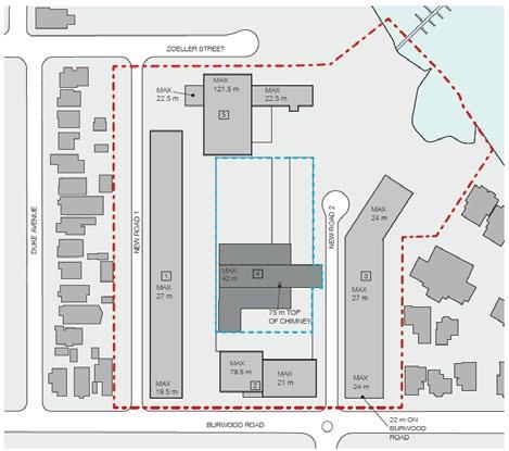
• Amendment of the CBLEP 2013 ‘Height of Buildings Map’ as it applies to the subject site, from a 12m maximum height limit to a range of heights including 15m along Burwood Road; 12m


5 4
1 3 2
along the western boundary and southern boundary, 18m along the northern boundary of the site; 12m, 17m and 21m along the eastern boundary; and a maximum of 21m towards the centre of the site.
• Amendment of the CBLEP 2013 ‘FSR Map’ as it applies to the subject site from an FSR of 1:1 to an FSR of 1.25:1.


The amended PP (May 2022) seeks to enter into a Voluntary Planning Agreement (VPA) that provides 5,900m² of land for public open space, and restoration works to the seawall with waterfront landscaping. The public open space is proposed to be dedicated to Council upon completion of the development.
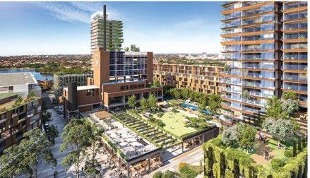
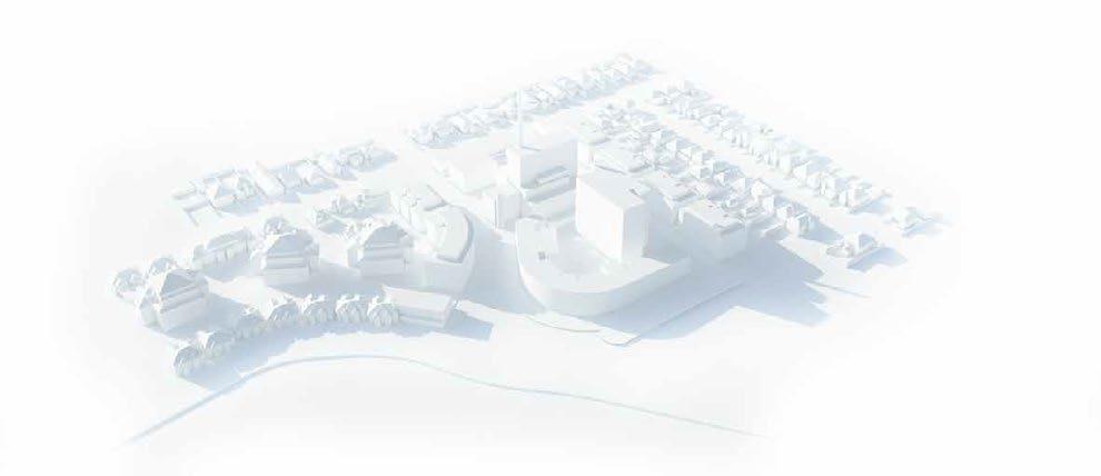
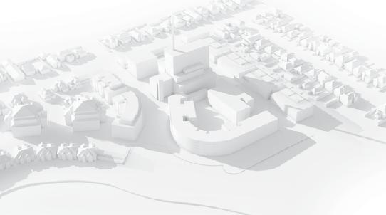
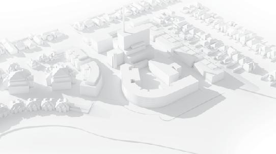
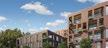
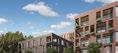
The Concept Plan proposes 48,551m² of total GFA including 384 residential apartments, 7,000m² of retail and commercial GFA, and 3,000m² of light industrial uses/urban services. There are 774 car parking spaces proposed over two basement levels. The plan retains the proposed public streets through the site between Burwood Road and Zoeller Street and bicycle and pedestrian access to the foreshore. The plan also proposes an RE1 Public Recreation zone fronting the foreshore to provide a public plaza and foreshore park.
Based on the concept plans, the buildings can be grouped into the following blocks:


• Block 1, Western Edge - Buildings along the western edge that are three (3) storeys high.


• Block 2, Southern Edge - Buildings along the southern edge with three (3) storey buildings facing Burwood Road and four (4) and five (5) storey buildings behind. One (1) storey of ‘Urban Services’ has been proposed on the ground level linking the four (4) and five (5) storey apartment buildings.
• Block 3, Eastern Edge - Buildings along the eastern edge that are five (5) and six (6) storeys high reducing to three (3) storeys on Burwood Road.

• Block 4,‘Central Roasting Hall’ - The retained Former Bushells Factory Building.
• Block 5, Northern Edge - Buildings along the northern edge comprising a five (5) storey high curvilinear building facing the foreshore, stepping down to two (2) and three (3) storeys facing the Roasting Hall, and a six (6) storey high building behind.
Block 1 Western edge
Block 5 Northern edge
Block 3 Eastern edge
Block 2 Southern
edge
Block 4 Central Roasting Hall
160 Burwood Rd, Concord | Urban Design Review | November 2022 13
Figure 8 Key buildings of the amended PP (May 2022) identified over the Roof Plan (Source: AJC 2022)
INTRODUCTION O1
1-4 Comparison table
The following table outlines the key differences between the submissions in June 2017, July 2018, Feb 2019, Sep 2019 and the current proposal of May 2022, and highlights the changes that have been made in response to the matters raised.
Key consideration PP (June 2017) Amended PP (July 2018) Amended PP (Feb 2019) Amended PP (Sep 2019) Amended PP (May 2022) LEP Controls Total site area 3.9 ha 3.9 ha 3.9 ha 3.9 ha 3.9 ha Proposed FSR 1.95:1 1.6:1 1.5:1 1.25:1 1.25:1 Proposed zones B4 Mixed Use B1 Neighbourhood Centre R3 Medium Density Residential RE1 Public Recreation Maximum building height 112.5m (37 storeys) 46m (13 storeys) 30m (9 storeys) 21m (6 storeys) 21m (6 storeys) Additional permitted uses Boat shed, jetties, etc Multi unit dwellings Light Industries (in R3 zone) No change Commercial Premises (in R3) Numeric standards Number of apartments 683 535 475 399 384 Total GFA 75,500m2 60,780.32m2 55,968.04m2 48,033.73m² 48,551m2 Residential GFA 69,095m² Not provided (Assumed 52,070 m2) (HillPDA 2018, p7) Not provided (Calculated value 51,210 m2) Not provided 29,000m² (LFA PP) 39,000m2 (Architectural Concept Plans) Retail & Commercial GFA 3,718m² Up to 3,500m2 3,500m2 3,500m² (plus 1,200m² urban services) 10,000m² (3,000m² light industry) Population density 372.5 people/ ha Not provided Not provided Not provided Not provided Car parking spaces 1,205 1,600 813 (proposed) 871 (required) 774 774 (proposed) 793 (required) 160 Burwood Rd, Concord | Urban Design Review | November 2022 14
INTRODUCTION O1
Key consideration PP (June 2017) Amended PP (July 2018) Amended PP (Feb 2019) Amended PP (Sep 2019) Amended PP (May 2022) Public domain considerations Public Open Space 18,900m² (48.4%) in private ownership 15,700m² (40.25%) in private ownership 7,400m2 (19%) 8,900m² in public ownership 9,740m² In public ownership See Note 1 below Factory Heritage listed No No No Yes Yes Private bus service 3 years Yes Yes Yes Yes Yes Private ferry 3 years Yes Yes Yes No No Publicly accessible roads No 2 new roads 2 new roads 2 new roads 2 new roads Reduced rate housing 68 (10%) 53 (10%) 10% with 25% discount 5% 10% Community facility 2,769 m² (Exclusive area) 2,148 m2 (in commercial GFA) 2,148 m2 Not specified Not specified Childcare facility 660m² No No No Not specified 160 Burwood Rd, Concord | Urban Design Review | November 2022 15
Note 1: 9,740m2 of proposed open space (including a plaza, a shared road and a foreshore park) to be dedicated to Council. Of this, approximately 5,900m2 lies within the proposed RE1 Public Recreation zone (green open space).
160 Burwood Rd, Concord | Urban Design Review | November 2022 16
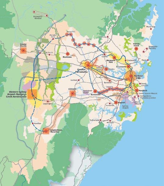
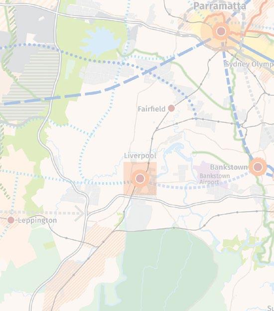
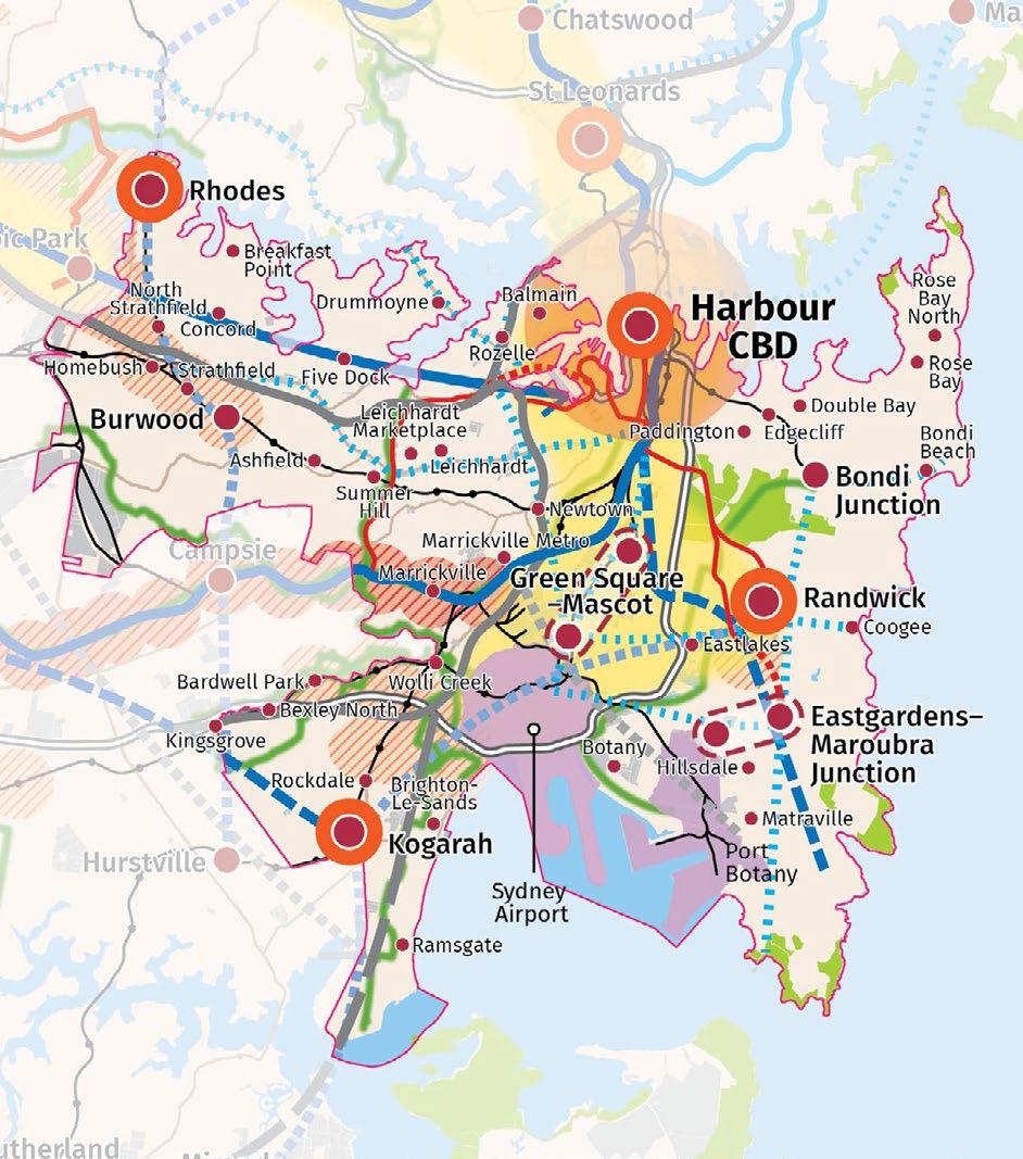
2-1 Metropolitan Context
The site is located in the suburb of Concord, approximately 15km to the west of the Sydney CBD and lies in the Eastern City District of Greater Sydney. The site has limited connectivity by public transport; it is 2.6km away from the closest train station at Burwood and 3km away from Strathfield

O2 15
CONTEXT
15 14 NOTE: Committed projects of Western Harbour WestConnex to President Avenue Kogarah, Parramatta Sydney Metro West are subject to final business yet. Routes and stops for some transport corridors/projects Metropolitan Centre Metropolitan Cluster Health and Education Precinct Strategic Centre Economic Corridor Trade Gateway Western Sydney Employment Area Land Release Area Transit Oriented Development Urban Renewal Area Greater Penrith to Eastern Creek Growth Area Urban Investigation Area Urban Area Protected Natural Area 14 Metropolitan Centre Metropolitan Cluster Health and Education Precinct Strategic Centre Economic Corridor Trade Gateway Western Sydney Employment Area Land Release Area Transit Oriented Development Urban Renewal Area Greater Penrith to Eastern Creek Growth Area Urban Investigation Area Urban Area Protected Natural Area Metropolitan Rural Area Major Urban Parkland including National Parks and Reserves South Creek Parkland Investigation Waterways Train Station Committed Train Link Train Link/Mass Transit Investigation 0–10 years Train Link/Mass Transit Investigation 10–20 years Train Link/Mass Transit Visionary Site Site 160 Burwood Rd, Concord | Urban Design Review | November 2022 17
Structure Plan for the Eastern City District
(Source: Greater Sydney Commission 2018, p.11)
The Eastern City District Plan released in March 2018 by the Greater Sydney Commission provides a 20-year plan to manage social, economic and environmental growth in the Eastern City suburbs in order to achieve
Within this Plan, Concord is identified as a Local Centre (p.10). The Plan identifies five housing market demand areas that influence the housing market in the Eastern City District, but the area of Concord is not identified amongst these (p.37).
The Plan also states that new developments along the foreshore should enhance community access to and provide connected green space around the foreshores (p.101).
Greater Sydney Commission | Eastern City District Plan
CONTEXT O2 2-2 11
Connecting Communities
Eastern
District Plan 2056
City
Site 10
Metropolitan Centre Health and Education Precinct Strategic Centre Local Centre Economic Corridor Trade Gateway Industrial Land Transit Oriented Development Urban Renewal Area Urban Area Major Urban Parkland including Train Station Committed Train Link Train Link/Mass Transit Investigation 10–20 years Train Link/Mass Transit Visionary City Serving Transport Corridor Light Rail Light Rail Investigation Motorway Committed Motorway Road Investigation 0–10 years Road Visionary Commission | Eastern City District Plan
Metropolitan Centre Health and Education Precinct Strategic Centre Local Centre Economic Corridor Trade Gateway Industrial Land Transit Oriented Development Urban Renewal Area Urban Area Major Urban Parkland including National Parks and Reserves Waterways Green Grid Priority Corridor Train Station Committed Train Link Train Link/Mass Transit Investigation 10–20 years Train Link/Mass Transit Visionary City Serving Transport Corridor Light Rail Light Rail Investigation Motorway Committed Motorway Road Investigation 0–10 years Road Visionary District Boundary Commi�ed projects of Western Harbour Tunnel & Beaches Link, F6 – WestConnex to President Avenue Kogarah, Parrama�a Light Rail Stage 2 and Sydney Metro West are subject to final business case, no investment decision yet. and stops for some transport corridors/projects are indicative only. 160 Burwood Rd, Concord | Urban Design Review | November 2022 18
Structure Plan for the Eastern City District
2-3 Local context
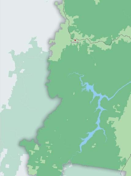
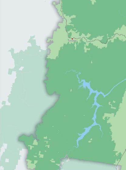
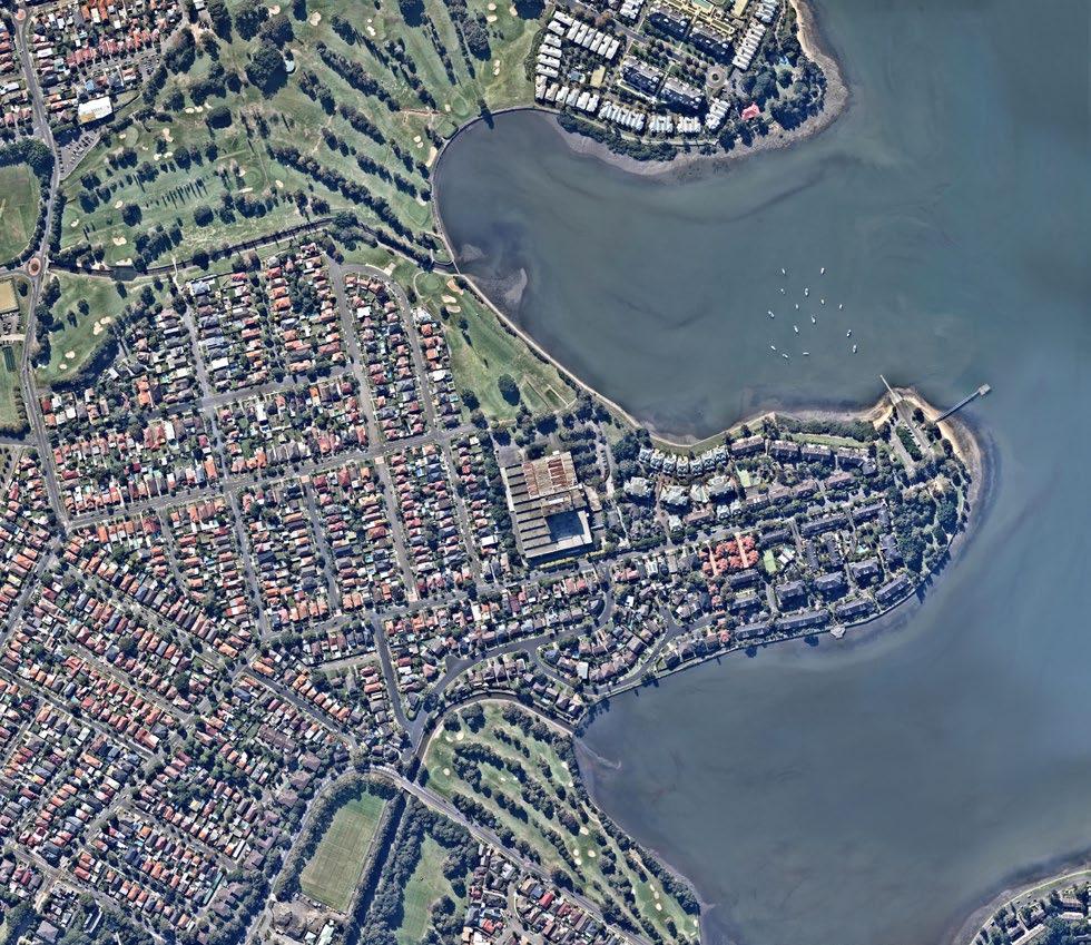
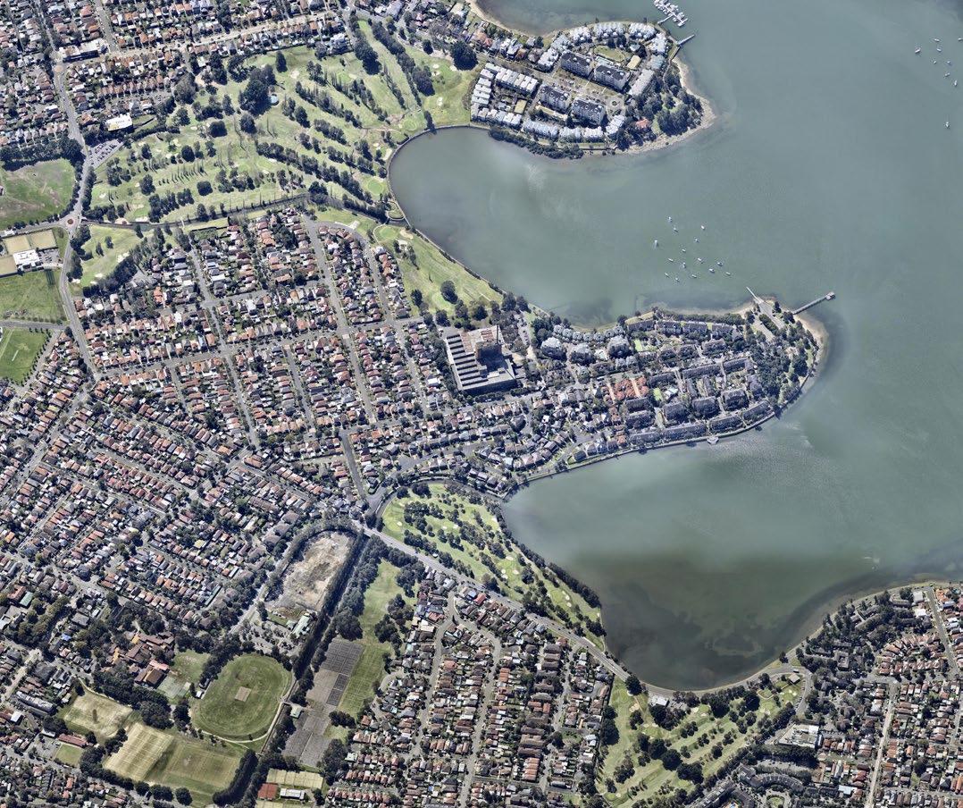
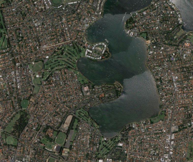
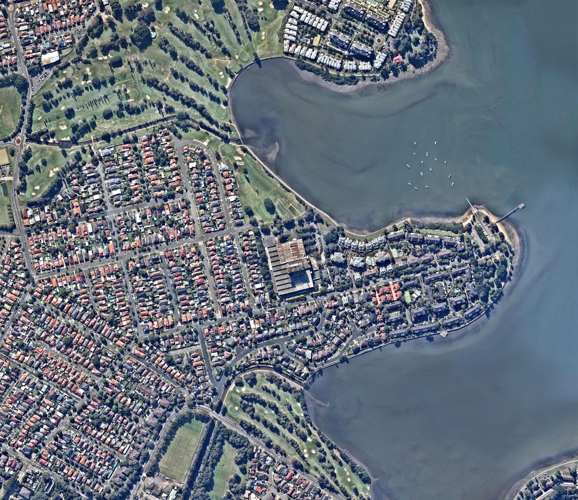
The site is situated on a small peninsula of land between Exile Bay and Canada Bay. Access to the site is provided off Burwood Road which is a key local access road that runs east to west down the centre of the peninsula to a small public park, Bayview Park, which is located at the eastern most tip of the peninsula.
The site is located to the north of Burwood Road and is generally rectangular in size. The site slopes gently down to a small area of land fronting onto Exile Bay. A small section of the north west corner of the site connects to Zoeller Street.
The site adjoins low density housing to the west and south and medium density housing to the east. Massey Park Golf Course, a publicly owned golf course, lies along the northern boundary of the site.
CONTEXT
400mradius Bayview Park Wharf Bayview Park Massey Park Golf Course Prince Edward Park Barnwell Park Golf Course Canada Bay Exile Bay Saltwater Creek Saltwater Creek 0m 100m Study area Public open Golf course Creekline Sydney Harbour
BURWOOD ROAD, CONCORD Urban Design Review - Context map File name Scale Date 1614_BurwoodRd_Context-Aerial.ai NTS May 2016 N 400mradius Bayview Park Wharf Bayview Park Massey Park Golf Course Prince Edward Park Barnwell Park Golf Course Canada Bay Exile Bay Saltwater Creek Saltwater Creek 0m 100m 200m Study area (160 Burwood Road) Public open space Golf course (limited public access) Creekline Sydney Harbour
CONCORD Review - Context map File name Scale Date 1614_BurwoodRd_Context-Aerial.ai NTS May 2016 N 400mradius Bayview Park Wharf Bayview Park Massey Park Golf Course Prince Edward Park Barnwell Park Golf Course Canada Bay Exile Bay Saltwater Creek Saltwater Creek 0m 100m 200m Study area (160 Burwood Road) Public open space Golf course (limited public access) Creekline Sydney Harbour
CONCORD
File name Scale Date 1614_BurwoodRd_Context-Aerial.ai NTS May 2016 N
O2
160
ROAD,
BURWOOD ROAD,
Review - Context map
NORTH
Figure 11 Local context plan showing the location of the site
160 Burwood Rd, Concord | Urban Design Review | November 2022 19
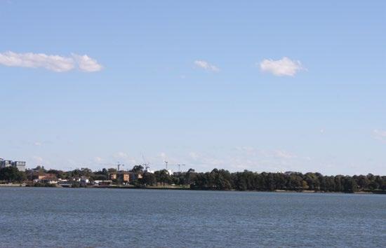
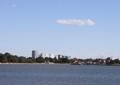
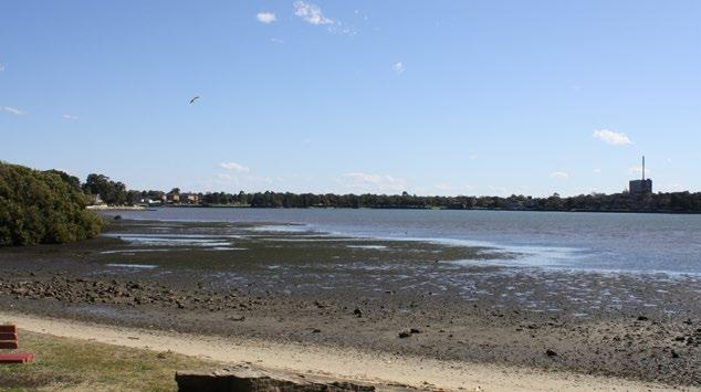
2-4 Photographic Study
CONTEXT O2 2 3 1
160 Burwood Rd, Concord | Urban Design Review | November 2022 20
Figure 12 View locations shown over an oblique aerial (Source: nearmap.com 2016)
NORTH
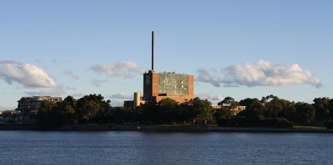
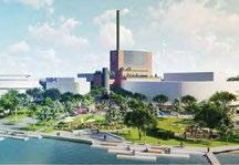
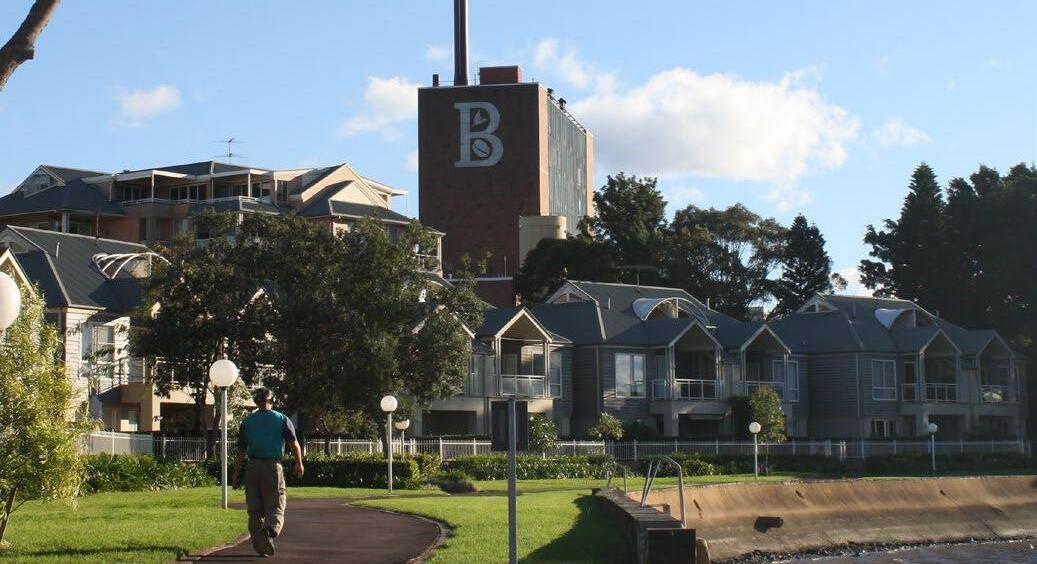
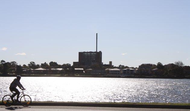
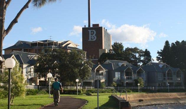
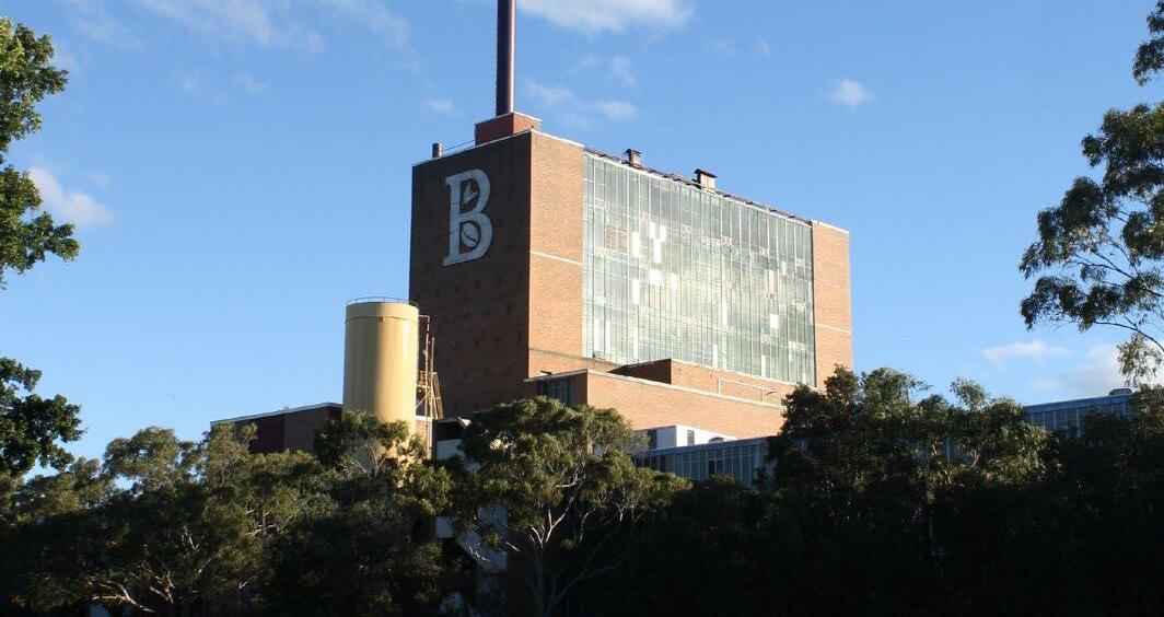
The Bushell’s Central Roasting Hall is a local landmark as it is substantially taller than other buildings in the surrounding context. This contrast is particularly noticeable as most buildings in the area are not higher than the tallest tree canopy.
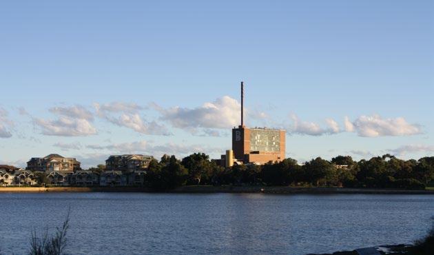
The view from the other side of Exile Bay, as seen from Cabarita and Prince Edward Park, provides a clearer view of the detail of the Central Roasting Hall. This view clearly shows that this part of the factory is substantially taller than adjacent 2 and 6 storey buildings and the tallest trees on the peninsula.
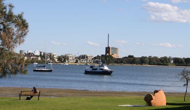
The view from the southern side of Canada Bay looking north. The Central Roasting Hall forms a silhouette against the skyline and is significantly taller than surrounding buildings. The chimney is a thin sculptural element that does not contribute to the bulk and scale of the development.
CONTEXT O2
View 3 - from Lyons Road looking north
View 2 - from Prince Edward Park looking south west
View 1 - from Henry Lawson Park looking south west
160 Burwood Rd, Concord | Urban Design Review | November 2022 21
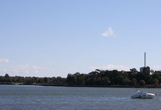
2-4 Photographic Study
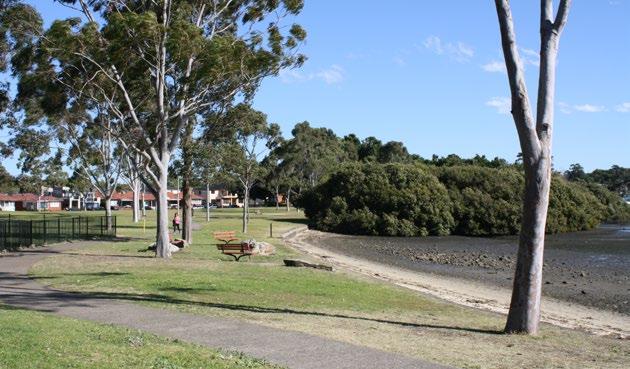
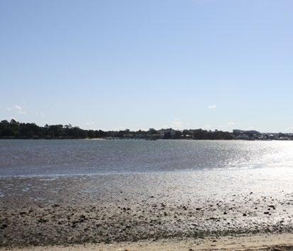
Halliday Park is one of three popular parks in the area, the others being Quarantine Reserve and Henry Lawson Park, located on the eastern side of Hen and Chicken Bay with views of the site.
CONTEXT O2
View 4 - Halliday Park
View 5 - from Halliday Park looking north west towards the site
160 Burwood Rd, Concord | Urban Design Review | November 2022 22
2 3
1 6 4
5

Continuous public access is provided along the eastern foreshore of Hen and Chicken Bay linking Quarantine Reserve to the south with Henry Lawson Park. Much of this access is provided along the western side of Wymston Parade.
Views from this eastern foreshore place the site in the larger context of a wide, low lying and predominately horizontal context. The surrounding land form is relatively flat and few buildings are higher than the tallest trees. Distant apartment towers can be seen at the District Centre of Burwood and the Strategic Centre of Sydney Olympic Park.
CONTEXT O2
Figure 13 View locations over an aerial oblique view of the context (Source: nearmap.com 2016)
View 6 - from Wymston Parade
160 Burwood Rd, Concord | Urban Design Review | November 2022 23
400mradius Massey Park Golf Course Park Barnwell
Canada Bay Exile
Saltwater Creek Saltwater
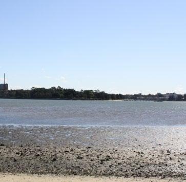
ROAD, CONCORD 9 8 12 7 10 11 NORTH 2-4 Photographic Study 160 Burwood Rd, Concord | Urban Design Review | November 2022 24
Park Golf Course
Bay
Creek
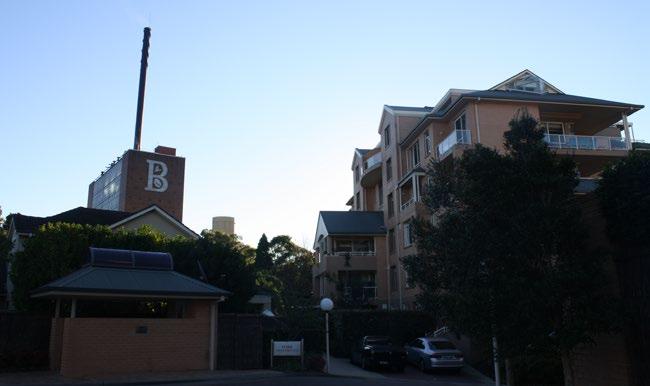
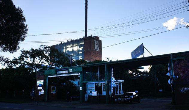
The Central Roasting Hall and the “B” sign can be seen from private roads within the Pelican Quays development.
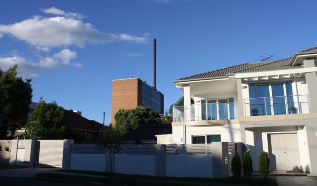
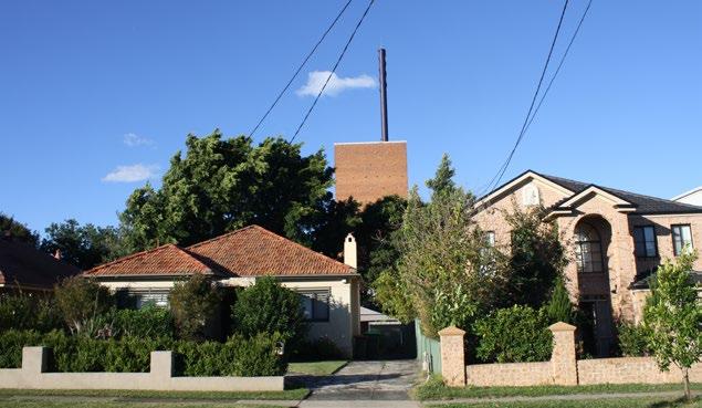
The Central Roasting Hall can be seen through the gaps between buildings and above the roof tops of houses along Duke Avenue.
The Central Roasting Hall can be seen through the gaps between buildings and above the roof tops of houses along Duke Avenue.
CONTEXT O2
View 7 - from Pelican Quays development looking west
View 8 from Duke Avenue looking east-north-east
View 9 - from Duke Avenue looking east
160 Burwood Rd, Concord | Urban Design Review | November 2022 25
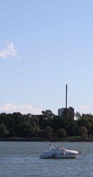
View 10 - from the foreshore of Exile Bay looking west
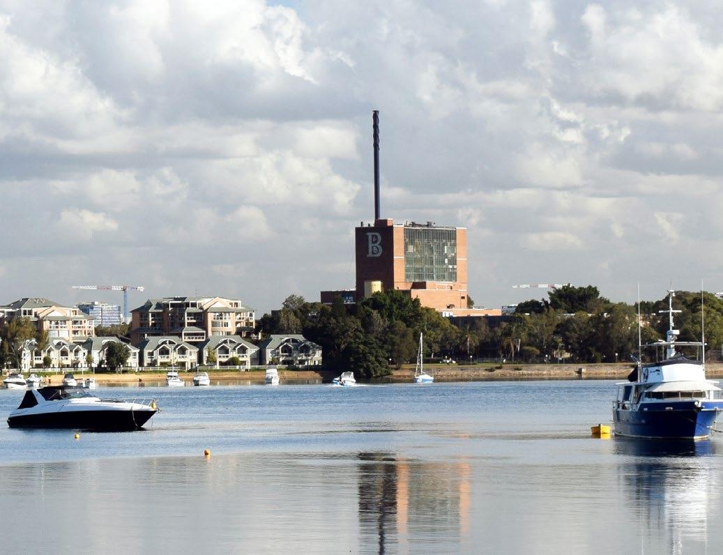
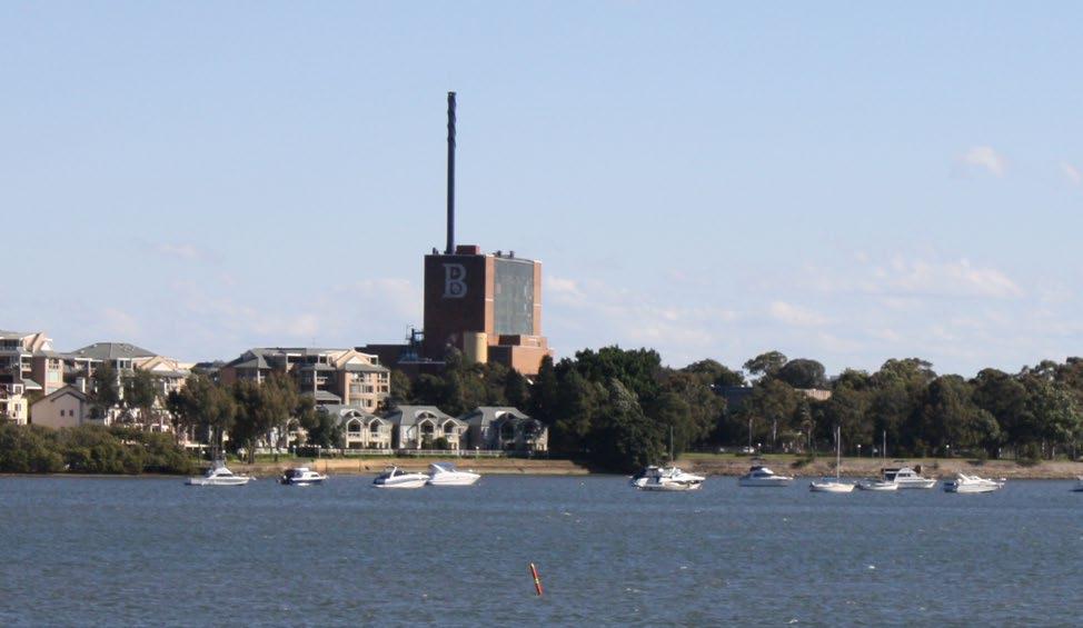
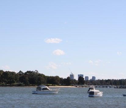
The Central Roasting Hall and the “B” sign can be seen from the publicly accessible foreshore of Exile Bay above the 2-6 storey development at Pelican Point.
View 11 - from the Massey Park Golf Course looking north
The view from Massey Park Golf Course looking north across Exile Bay towards development at Cape Cabarita. This view will be available from the northern boundary of the proposed development.
View 12 - from Burwood Road looking north west into the site
The Central Roasting Hall and the “B” sign can be seen from Burwood Road over the entry gates into the factory.
CONTEXT O2
160 Burwood Rd, Concord | Urban Design Review | November 2022 26
2-4 Photographic Study
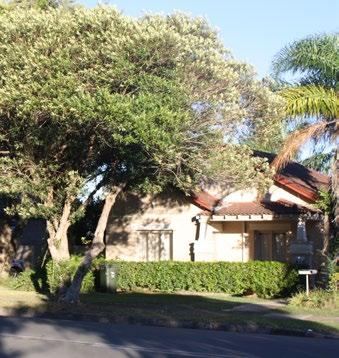
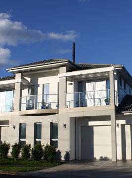
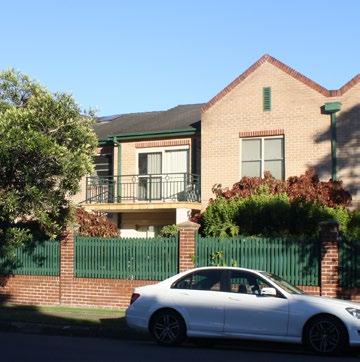
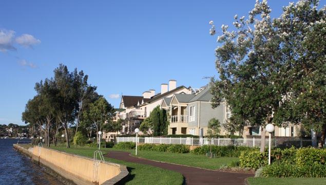
Local Character
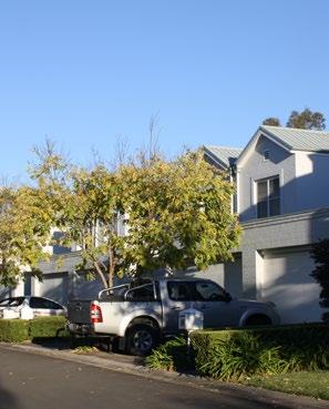
The area surrounding the site is characterised by low density detached and semi detached housing that is 1-2 storeys high, and medium density townhouses and apartments set back from the street and the waters edge that range from 2-6 storeys in height.
O2
CONTEXT
160 Burwood Rd, Concord | Urban Design Review | November 2022 27
2-5 Key planning controls
Canada Bay Local Environmental Plan (CBLEP)
The site is currently zoned IN1, General Industrial and is located between an area of R3 Medium Density Residential to the east and R2 Low Density Residential to the south and west. An area of RE1 Public Recreation is located along the northern boundary of the site.
The site has a maximum FSR of 1:1 and a maximum building height of 12m.
The R3 Medium Density Residential to the east of the site has been developed in the last 15 years and is strata titled. This area has a maximum FSR of 0.75:1 and a maximum building height of 15m.
The R2 Low Density Residential that surrounds the site to the south and west is predominantly detached and attached houses. This area has a maximum FSR of 0.5:1 and a maximum building height of 8.5m.
CONTEXT
Burwood Road Marceau Drive Durham St Sanders Pde View Street Tripod Street Frederick Street Phillips Street Zoeller Street Broughton Street Empire Avenue Salt Street Duke Avenue Tremere Street Tripod Street Ian Parade La Mascotte Street EdithAvenue CorbyAvenue EvelynAvenue Finch Avenue Crane Street Crane Street LyonsRoadWest Ward Street NicholasAvenue Wallace Street Burwood Road 12m 1:1 IN 15m 0.75 R3 8.5m 0.5 R2 8.5m 0.5 R2 8.5m 0.5 R2 8.5m 0.5 R2 8.5m 0.7 R3 11m 0.7 R3 17m 0.7 R3 8.5m 0.5 R2 8.5m 0.5 R2 8.5m 0.5 R2 15m 0.75 R3 0m 100m Study 17m height 15m height 12m height 11m height 8.5m height Height limit 15m 160 BURWOOD ROAD, CONCORD Urban Design Review - Context map File name Scale Date 1726_BurwoodRd_Context-Aerial.ai NTS July N Burwood Road Sanders Pde View Street Tripod Street Frederick Street Phillips Street Zoeller Street Broughton Street Empire Avenue Salt Street Duke Avenue Tremere Street Tripod Street Ian Parade La Mascotte Street 12m 1:1 IN 15m 0.75 R3 8.5m 0.5 R2 8.5m 0.5 R2 8.5m 0.7 R3 8.5m 0.7 R3 17m 0.7 R3 8.5m 0.5 R2 8.5m 0.5 R2 15m 0.75 R3 Study area (160 Burwood Road) 17m height limit 15m height limit 12m height limit 11m height limit 8.5m height limit Height limit Max. FSR Land Use 15m 0.75 R3
O2
Figure 15 Key planning controls - combined diagram
NORTH 160 Burwood Rd, Concord | Urban Design Review | November 2022 28
CONTEXT O2
Canada Bay Development Control Plan


The Canada Bay DCP identifies many controls that apply to this development. This report highlights key sections from the DCP that are particularly relevant to the future development of this site including Section D Heritage, Section E Residential Development, and Section F Mixed Use Areas and Neighbourhood Centres.

Canada Bay DCP Part D Page D-59 D1 Heritage reports to accompany development applications 60 D1.1 Statement of heritage impact 60 D1.2 Conservation policy 60 D1.3 Conservation management plan 60 D1.4 Requirements for heritage reports 60 D2 Development of heritage items 62 D2.1 Setting 62 D2.2 Scale 62 D2.3 Form and detailing 62 D2.4 Materials and colours D2.5 Doors and windows D2.6 Carparking D2.7 Fencing D2.8 Landscape elements including paving and driveways D2.9 Outbuildings 66 D2.10 Modern technologies D2.11 Demolition D2.12 Subdivision D3 Development in the vicinity of heritage items D4 Development in and in the vicinity of Heritage Conservation Areas 72 D4.1 Setting 72 D4.2 Scale 73 D4.3 Form and detailing 74 D4.4 Siting 75 D4.5 Materials and colours 75 D4.6 Doors and Windows 76 D4.7 Carparking 77 D4.8 Fencing 78 D4.9 Landscape elements including paving and driveways 79 D4.10 Outbuildings 79 D4.11 Modern Technologies 80 D4.12 Demolition 80 D4.13 Subdivision 80 D PART D - HERITAGE Development Control Plan CITY OF CANADA BAY Canada Bay DCP Part E Page E-83 PART E - RESIDENTIAL DEVELOPMENT E E1 Design Quality 84 E1.1 Design of dwelling houses, dual occupancies and semi-detached dwellings 84 E1.2 Design of residential flat buildings and multi dwelling housing 87 E1.3 Materials, colour schemes and details 90 E2 Environmental criteria and residential amenity 91 E2.1 Topography 91 E2.2 Harbour foreshore development and foreshore access 91 93 E2.4 Visual and acoustic privacy 94 98 99 100 E3.1 Subdivision and allotment size 100 101 E3.3 Site coverage 101 E3.4 Density 101 E3.5 Building setbacks 108 E3.6 Height of buildings 112 E3.7 Private open space 118 E3.8 Landscaping 118 E3.9 Parking and access 120 E4 Ancillary structures 126 E4.1 Fencing 126 E4.2 Site facilities 128 Date of adoption: 21 February 2017 Effective date: 7 March 2017 CITY OF CANADA BAY DEVELOPMENT CONTROL PLAN Development Control Plan Mixed use areas and neighbourhood centres CITY OF CANADA BAY Canada Bay DCP Part F Page F-131 PART F - MIXED USE AREAS AND NEIGHBOURHOOD CENTRES F F1 General Requirements 132 F1.1 General objectives 132 F1.2 Building design and appearance 132 F1.3 Retail frontages 134 F1.4 Visual and acoustic privacy 134 F1.5 Safety and security 135 F1.6 Daylight and sunlight access 136 F1.7 Building envelope controls and site specific design controls 137 F2 Building Envelope controls and site specific design controls 138 F2.1 Victoria Road, Drummoyne 138 F2.2 Five Dock Town Centre 144 F2.3 Majors Bay Road Shopping Centre, Concord 164 F3 Local Neighbourhood Shops 166 F3.1 Victoria Avenue Shopping Centre, Concord West 166 F3.2 355-359 Lyons Road, Five Dock 168 160 Burwood Rd, Concord | Urban Design Review | November 2022 29
2-5 Key planning controls
DCP - Section D Heritage
Although the factory is not currently listed as a heritage item, much of the justification in the amended PP (May 2022) for the scale and type of development on this site is based on the heritage and cultural values of the factory and retention of key buildings on the site. To ensure long term protection of important buildings it is therefore expected that these buildings (or parts of) will become heritage items and therefore the heritage controls in the DCP will apply. Relevant controls include the following:
D2.1 Setting
Setting is the area around a heritage item that contributes to its heritage significance and may include the visual catchment of a heritage item. Topography, trees, gardens, fencing, and pavement can all contribute to the setting of a heritage item. Where a heritage item is a landmark, it is particularly important that new development does not obscure its visual presence in the streetscape and/or townscape.
Objectives
O1 To provide an appropriate visual setting for heritage items, including landscaping, fencing and car parking.
O2 To ensure that new development respects the contribution of a heritage item to the streetscape and/or townscape.
D2.2 Scale
Scale is the size of a building and its relationship with surrounding buildings or landscape. It is important that new development at places of heritage significance respects the scale of the existing buildings and/or landscape elements that contribute to the significance of the place.
Objectives
O1 To ensure that additions to a heritage item and new buildings on the site of a heritage item are of a scale consistent with the heritage item
O2 To ensure that the heritage item remains the visually dominant element on the site.
Controls
C1 Alterations and additions to a heritage item should not be larger in scale than the heritage item.
C2 Development of a larger scale than the heritage item is allowable only if it can be demonstrated that the new development will not detract from the aesthetic quality and important views of the heritage item.
D2.3 Form and Detailing
The form of a building is its overall shape and volume and the arrangement of its parts. The roof lines of buildings and elements such as chimneys, parapet walls, verandahs etc. are often important elements of the form of a heritage item.
Objectives
O1 To ensure that important elements of the form of a heritage item are not obscured or destroyed by alterations and additions.
O2 To ensure that the form of a heritage item retains its importance in the streetscape and/ or townscape.
Controls
C1 Important elements of the form of a heritage item such as main roof forms, chimneys, parapet walls, verandahs etc. should not be demolished or obscured by alterations and additions.
CONTEXT O2
160 Burwood Rd, Concord | Urban Design Review | November 2022 30
DCP - Section E Residential Development
The DCP contains controls regarding the development of residential flat buildings. Should the site be rezoned to allow residential flat buildings, the DCP controls will be relevant to development on this site. Controls of particular relevance to the Concept Plan are E1.2 Design of residential and multi dwelling housing, E2.2 Harbour foreshore development and access, E2.6 Safety and Security, E3.3 Site Coverage, E3.4 Density, and E3.6 Height of buildings. Excerpts of these controls can be found below.
E1.2 Design of residential and multi dwelling housing.
The Objectives and controls contained within this part of the DCP support the design quality principles of State Environmental Planning Policy No. 65 – Design Quality of Residential Flat Development (SEPP 65).
E2.2 Harbour foreshore development and access Objectives
O1 To recognise, protect and enhance the natural, scenic, environmental, cultural and heritage qualities of the foreshore of the City of Canada Bay.
O2 To ensure the Parramatta River foreshore is developed and promoted as a community asset in public ownership or with unrestricted access.
O3 Sydney Harbour is to be recognised as a public resource, owned by the public, to be protected for the public good:
• The public good has precedence over the private good whenever and whatever change is proposed for Sydney Harbour and its foreshores.
• Protection of the natural assets of Sydney Harbour has precedence over all other interests.
• The public good includes but is not restricted to the existing views, vistas and amenity available from the public and private domain.
Controls
C1 Building forms should follow the natural topography and maintain and enhance vegetation cover as viewed from the Parramatta River. For example, buildings are not to be cantilevered.
C2 Roof lines should be below the tree canopy backdrop to maintain the importance of any tree-line.
C3 Buildings should be designed and constructed to present a recessive appearance when viewed from the Parramatta River through the use of materials, colours, wall articulation, building form and landscaping. Glass elevations and excessive use of windows resulting in reflectivity and glare will not be permitted.
Foreshore Access
Objectives
O1 To ensure that new development and alterations and additions to existing development result in a site coverage that is consistent with the existing character of adjoining dwellings and those found in the wider locality.
O2
To ensure that new development and alterations and additions to existing development result in site coverage which allows adequate provision to be made on site for infiltration of stormwater, deep soil tree planting, landscaping, footpaths, driveway areas and areas for outdoor recreation.
O3
To minimise impacts in relation to overshadowing, privacy and view loss.
CONTEXT O2
160 Burwood Rd, Concord | Urban Design Review | November 2022 31
2-5 Key planning controls
E2.6 Safety and security
Objectives
O1 To facilitate a safe physical environment by promoting crime prevention through design.
O2 To facilitate the security of residents and visitors and their property and enhance community safety and well-being.
O3 To ensure a development relates well with the public domain and contributes to an active pedestrian-orientated environment.
O4 Effective use of fencing or other means to delineate private and public areas.
Controls
C4 Buildings adjacent to public streets or public spaces should be designed so residents can observe the area and carry out visual surveillance. At least one window of a habitable room should face the street or public space.
E3.3 Site Coverage
Objectives
O1 To ensure that new development and alterations and additions to existing development result in a site coverage that is consistent with the existing character of adjoining dwellings and those found in the wider locality.
O2 To ensure the security of residents and visitors and their property and enhance community safety and well-being.
E3.4 Density
Council’s Floor Space Ratio (FSR) and site coverage controls aim to facilitate an acceptable bulk and scale of development that maintains a satisfactory relationship with adjoining development and the wider street context.
Objectives
O1 Provide a low to medium density residential environment which will accommodate a variety of building forms.
E3.6 Height of buildings
Height of buildings is an important control because it has a major impact on the physical and visual amenity of a place. Building height is also critical in addressing impacts from development such as solar access, privacy and view loss.
Objectives
O1
To ensure that buildings are compatible with the height, bulk and scale of the existing and desired future character of the locality.
O2 To minimise visual impact, disruption of views, loss of privacy and loss of sunshine to existing residential development.
O3 To minimise the adverse impact on Conservation Areas, Heritage Items and contributory buildings.
O4 To reduce the visual impact of development when viewed from the Parramatta River as well as other public places such as parks, roads and community facilities.
O2
CONTEXT
160 Burwood Rd, Concord | Urban Design Review | November 2022 32
DCP - Section F Mixed Use Areas and Neighbourhood Centres
Should part of the site be rezoned to B1 Neighbourhood Centre the DCP controls regarding neighbourhood centres will be relevant to development on this site.
F1.1 General Objectives
The controls in this section of the DCP apply to permissible development in mixed use areas and neighbourhood centres. It contains general controls that apply to all commercial development and specific controls that apply to selected commercial precincts.
Objectives
O1 To facilitate the development of ALL commercial areas in a way that is economically sustainable and environmentally sensitive.
O3 To ensure development contributes to the improvement and amenity of public spaces.
O4 To maintain the heritage values through appropriate alterations and additions.
F1.2 Building Design and Appearance
Objectives
O1 Alterations and additions respect the identified heritage and conservation values of the place.
O2 To ensure new development maintains a pedestrian scale and provides weather protection at street level.
Controls
C4 Buildings adjacent to public streets or public spaces should be designed so residents can observe the area and carry out visual surveillance. At least one window of a habitable room should face the street or public space.
F1.7 Building envelope controls and site specific design controls
The building envelope aims to ensure that the scale and bulk of future development is compatible with site conditions and the desired future character.
The building envelope helps achieve the LEP and DCP’s objectives of:
• Ensuring a scale of commercial development that is compatible with the amenity of surrounding areas;
• Ensuring the bulk and scale of development reflects the character of the streets which define these precincts; and
• Ensuring that the bulk and scale of development is compatible with the amenity of surrounding areas.
Objectives
O2 To ensure buildings are of a height and scale which is consistent with the character of the area.
O3 To maintain the privacy and amenity of adjoining and nearby residential developments.
CONTEXT O2
160 Burwood Rd, Concord | Urban Design Review | November 2022 33
Urban Design Review
3-1 Approach
In order to undertake an urban design review of the concept design identified in the amended PP (May 2022), it is necessary to understand the key considerations for successful urban design.
This review looks beyond SEPP 65 and the Apartment Design Guide in order to assess the urban design success of the proposed concept design. This is to ensure that the focus reflects the issues that need to be considered in the master-planning of larger mixed use sites and the elements relevant to planning at a neighbourhood level, as identified in the Urban Design Protocol for Australian Cities and Better Placed - An integrated design policy for the built environment of New South Wales.
To structure this urban design review, the issues which are most relevant to the amended PP (May 2022) have been considered first. These issues have direct links to the proposed LEP amendments (including land use zoning, maximum Height of Buildings and Floor Space Ratios), and are as follows:
• Context and neighbourhood character
• Built form, scale and aesthetics
• Density, FSR and land use
The remaining issues that have been considered are as follows:
• Landscape and amenity
• Safety
• Sustainability and diversity
The considerations in each section have been sourced from a combination of the Apartment Design Guide (Chapter 1 and 2), the SEPP 65 Design Quality Principles, the elements of urban design relevant to planning at a neighbourhood level set out in the Urban Design Protocol for Australian Cities and the design objectives identified in Better Placed- An integrated design policy for the built environment of New South Wales.
SEPP 65 and the Apartment Design Guide

The NSW Government has been focused on improving the design of residential apartments for many years. SEPP 65 and the Residential Flat Design Code (RFDC) first came into force in 2002. Revisions to SEPP 65 and the release of the new Apartment Design Guide (ADG) occurred in July 2015.
New South Wales State Environmental Planning Policy No 65— Design Quality of Residential Apartment Development under the Environmental Planning and Assessment Act 1979 Status information Currency of version Current version for 17 July 2015 to date (generated 22 July 2015 at 11:34). Legislation on the NSW legislation website is usually updated within 3 working days. Provisions in force All the provisions displayed in this version of th other details see the Historical notes. This version of the legislation is compiled and maintained in a database of legislation by the Parliamentary Counsel’s Office and published on the NSW legislation website. (2002 No 530) Formerly known as: State Environmental Planning Policy No 65—Design Quality of Residential Flat Development Apartment Design Guide Tools for improving the design of residential apartment development
160 Burwood Rd, Concord | Urban Design Review | November 2022 35
O3
URBAN DESIGN REVIEW
3-1 Approach
CREATING PLACES FOR PEOPLE
‘Urban design is concerned with the arrangement, appearance and function of our suburbs, towns and cities. It is both a process and an outcome of creating localities in which people live, engage with each other, and the physical place around them.

It involves many different disciplines including planning, development, architecture, landscape architecture, engineering, law and finance.
‘Urban design operates from the macro scale of the urban structure (planning, zoning, transport and infrastructure networks) to the micro scale of street furniture and lighting.’
(An Urban Design Protocol for Australian Cities 2011, p5)
Creating Places for People


Creating Places for People - An Urban Design Protocol for Australian Cities was produced in 2011 to provide a framework to identify, implement, measure and improve best practice in urban design. The protocol was developed in response to an agreement by the Council of Australian Governments (COAG) in 2009 to reform the planning systems of Australia’s capital cities “to ensure Australian cities are globally competitive, productive, sustainable, liveable and socially inclusive and are well placed to meet future challenges and growth”.
Nine criteria were listed in the COAG agreement and the Protocol was specifically created to address the 8th criteria which was “to encourage world-class urban design and architecture”.
The Protocol provides a definition of urban design and the objective of the document is to encourage the highest standard of urban design across all Australian suburbs, towns and cities.
Founded on five pillars (productivity, sustainability, liveability, leadership and design excellence), the Protocol establishes twelve broadly agreed principles for quality urban places in Australia. Four of the principles (Context, Engagement, Excellence and Custodianship) relate to process while the other eight design principles relate to the desired outcomes of development (Enhancing, Connected, Diverse, Enduring, Comfortable, Vibrant, Safe and Walkable).

score/fold score/fold INFRA1219 November 2011
AN URBAN DESIGN PROTOCOL FOR AUSTRALIAN CITIES
160 Burwood Rd, Concord | Urban Design Review | November 2022 36 URBAN DESIGN REVIEW O3
URBAN DESIGN REVIEW O3
• Height and massing
The scale of buildings in relation to height and floor area, and how they relate to surrounding land forms, buildings and streets. It also incorporates the building envelope, site coverage and solar orientation. Height and massing create the sense of openness or enclosure, and affect the amenity of streets, spaces and other buildings.
• Details and materials
The close-up appearance of objects and surfaces and the selection of materials in terms of detail, craftsmanship, texture, colour, durability, sustainability and treatment. It includes public and private structures and space, street furniture, paving, lighting and signage. It contributes to human comfort, safety and enjoyment of the public or private domain.
• Public realm
The Protocol identifies that the following elements of urban design are relevant to planning at a neighbourhood level:
• Urban structure
The overall framework of a region, town or precinct, showing relationships between zones of built forms, land forms, natural environments, activities and open spaces. It encompasses broader systems including transport and infrastructure networks.
• Urban grain
The balance of open space to built form and the nature and extent of subdividing an area into smaller parcels or blocks. For example, a ‘fine urban grain’ might constitute a network of small or detailed streetscapes. It takes into consideration the hierarchy of street types, the physical linkages and movement between locations, and modes of transport.
• Density and mix
The intensity of development and the range of different uses (such as residential, commercial, institutional or recreational uses).
Much of urban design is concerned with the design and management of publicly used space (also referred to as the public realm or public domain) and the way this is experienced and used. At times, there is a blurring of the distinction between public and private realms, particularly where privately owned space is publicly used.
• Topography and landscape
The natural environment includes the topography of landforms, water and environment.
• Social and economic fabric
The non-physical aspects of the urban form include social factors (culture, participation, health and well-being) as well as the productive capacity and economic productivity of a community.
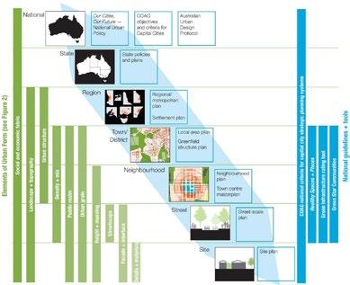
CREATING PLACES FOR PEOPLE 4 Figure 1: Line of sight from national to site level Thinking about urban design, strategic and statutory planning at different scales helps put them in context. The elements of urban design are illustrated next to the scale of planning at which they are commonly addressed. Concept adopted from Next Generation Planning, published by the Council of Mayors (SEQ), 2011
160 Burwood Rd, Concord | Urban Design Review | November 2022 37
BETTER
Better Placed
Better Placed - An integrated design policy for the built environment of New South Wales is a state-wide built environment design policy developed by the Government Architect of NSW in 2017. The design policy aims to deliver a strategic approach to achieve good design of infrastructure, architecture and public spaces for the towns and cities of New South Wales.
The recent amendment to the Environmental Planning & Assessment Act 1979 incorporates object (g) to promote good design and amenity of the built environment. The Better Placed policy provides clarity on what the NSW government means by good design.
“Better Placed confirms our collective wishes for the future design of our infrastructure, architecture, and public spaces, and endorses the power of design to enable a better and resilient future for our communities”. (Better Placed 2017. p5)
160 Burwood Rd, Concord | Urban Design Review | November 2022 38 URBAN DESIGN REVIEW O3
Good design has the ability to make future developments more liveable, productive, healthy and sustainable. For this, the policy identifies key priorities in six challenge areas including health; climate resilience; rapidly growing population; changing lifestyles and demographics; infrastructure and urban renewal; and providing consistent and timely review of major projects.
The Better Placed design policy advocates for a shared responsibility in achieving better design outcomes and is intended to be used by a large range of stakeholders including State and Local Government, politicians, architects, design professionals, developers, planners, engineers, builders, businesses, as well as the community.
PLACED An integrated design policy for the built environment of New South Wales
3-1 Approach
fit
Seven distinct objectives have been created to define the key considerations the design of the built environment. Achieving these objectives will ensure our cities and towns, our public realm, our landscapes, our buildings and our public domain will be healthy, responsive, integrated, equitable, and resilient.
URBAN DESIGN REVIEW O3
Seven distinct objectives have been created to define the key considerations in the design of the built environment. Achieving these objectives will ensure our cities and towns, our public realm, our landscapes, our buildings and our public domain will be healthy, responsive, integrated, equitable, and resilient.
Better
contextual, local and its place
Good design in the built environment is informed by and derived from its location, context social setting. It is place-based and relevant and resonant with local character, heritage communal aspirations. also contributes to evolving and future character and setting.
Better fit contextual, local and of its place
Better performance sustainable, adaptable and durable
Better for community inclusive, connected and diverse
Better performance sustainable, adaptable and durable
Better for community inclusive, connected and diverse
Better for people safe, comfortable and liveable
Better for people safe, comfortable and liveable
Better working functional, efficient and fit for purpose
Better working functional, efficient and fit for purpose
Better value creating and adding value
Better value creating and adding value
Better look and feel engaging, inviting and attractive
Better look and feel engaging, inviting and attractive
Environmental sustainability and responsiveness is essential to meet the highest performance standards for living and working.
• Better fit
Good design in the built environment is informed by and derived from its location, context and social setting. It is place-based and relevant to and resonant with local character, heritage and communal aspirations. It also contributes to evolving and future character and setting.
Sustainability is no longer an optional extra, but a fundamental aspect of functional, whole of life design.
Environmental sustainability and responsiveness is essential to meet the highest performance standards for living and working. Sustainability is no longer an optional extra, but a fundamental aspect of functional, whole of life design.
The design of the built environment must seek to address growing economic and social disparity and inequity, by creating inclusive, welcoming and equitable environments. Incorporating diverse uses, housing types and economic frameworks will support engaging places and resilient communities.
The design of the built environment must seek to address growing economic and social disparity and inequity, by creating inclusive, welcoming and equitable environments. Incorporating diverse uses, housing types and economic frameworks will support engaging places and resilient communities.
Better Placed advocates seven key objectives for achieving a better design of the built environment:
Every place has distinctive qualities and characteristics which should be retained even with significant growth. It is desirable for buildings to resonate with the local community. New developments can also contribute to character and add further quality and diversity to the existing context.
• Better performance
The built environment must be designed for people with a focus on safety, comfort and the basic requirement of using public space. The many aspects of human comfort which affect the usability of a place must be addressed to support good places for people.
New developments should incorporate systems to create positive environmental benefits through use of sustainable building materials, energy efficiency, water recycling and higher overall performance to create positive environmental benefits.
• Better for community
Growing social and economic inequity needs to be addressed by advocating diverse uses and housing types, inclusive economic frameworks and places for social engagement and recreation.
• Better for people
The built environment must be designed for people with a focus on safety, comfort and the basic requirement of using public space. The many aspects of human comfort which affect the usability of a place must be addressed to support good places for people.
Having a considered, tailored response to the program or requirements of a building or place, allows for efficiency and usability with the potential to adapt to change. Buildings and spaces which work well for their proposed use will remain valuable and well-utilised.
Good design generates ongoing value for people and communities and minimises costs over time. Creating shared value of place in the built environment raises standards and quality of life for users, as well as adding return on investment for industry.
Having a considered, tailored response to the program or requirements of a building or place, allows for efficiency and usability with the potential to adapt to change. Buildings and spaces which work well for their proposed use will remain valuable and well-utilised.
• Better working
Good design generates ongoing value for people and communities and minimises costs over time. Creating shared value of place in the built environment raises standards and quality of life for users, as well as adding return on investment for industry.
Accessible public spaces for people should be designed with a focus on safety, well-being and enjoyment. Buildings and spaces that are liveable and respond to people’s needs will be better maintained and cared for.
The built environment should be welcoming and aesthetically pleasing, encouraging communities to use and enjoy local places. The feel of a place, and how we use and relate to our environments is dependent upon the aesthetic quality of our places, spaces and buildings. The visual environment should contribute to its surroundings and promote positive engagement.
Functionality and efficiency in buildings, streets and spaces is essential. Good design must support long-term usability and productivity for both formal and informal activities.
• Better value
Design of urban precincts, spaces and buildings to maximise long-term returns in terms of financial, social and environmental value. Good design can result in more user-friendly, high-performance and lower-maintenance places and buildings.
• Better look and feel
Buildings, places and spaces should be welcoming, engaging and attractive to the community. For this, the built environment must consider a balance of materials, finishes, proportions and details that bring a sense of local pride and identity.
The built environment should be welcoming and aesthetically pleasing, encouraging communities to use and enjoy local places. The feel of a place, and how we use and relate to our environments is dependent upon the aesthetic quality of our places, spaces and buildings. The visual environment should contribute to its surroundings and promote positive engagement.
2.6.1 Design Objectives for NSW Better Placed / 2. Designing Better Places
OBJECTIVE 1. OBJECTIVE 2. OBJECTIVE 3. OBJECTIVE 4. OBJECTIVE 5. OBJECTIVE 6. OBJECTIVE 7.
Better Placed / 2. Designing Better Places 37
OBJECTIVE 1. OBJECTIVE 2. OBJECTIVE 3. OBJECTIVE 4. OBJECTIVE 5. OBJECTIVE 6. OBJECTIVE 7.
160 Burwood Rd, Concord | Urban Design Review | November 2022 39
Context and neighbourhood character
SEPP 65 Design Principle 1: Context and Neighbourhood Character
Good design responds and contributes to its context. Context is the key natural and built features of an area, their relationship and the character they create when combined. It also includes social, economic, health and environmental conditions.
Responding to context involves identifying the desirable elements of an area’s existing or future character. Well designed buildings respond to and enhance the qualities and identity of the area including the adjacent sites, streetscape and neighbourhood. Consideration of local context is important for all sites, including sites in established areas, those undergoing change or identified for change.
Commentary:
Metropolitan context
The Greater Sydney Region Plan sets out the future context for metropolitan Sydney, and identifies suburbs where future housing, employment and transport infrastructure should be provided. This site is not located within any of the target locations for housing densification or employment opportunities.
The Plan states that there is a shortage of industrial land in the Eastern City District and identifies that industrial land should be retained and managed. In response to this, the previous PP (Feb 2019) stated “There is recognition from Council that the site is considered an ill-suited location for the purpose of growing industrial employment, however there remains potential for low-impact urban services and light industrial uses to be integrated on the site. So as to retain this opportunity provision has been made in the amended Concept Plan for some light industrial uses that would service the growing resident population in this locality” (p41). The Sydney Eastern City Planning Panel recommended light industrial (IN2) uses remain permissible on the site. The recommendation used "light industrial" as the standard instrument does not have a definition of "urban services”. This report takes a similar approach and uses "light industrial".
The amended Concept Plan (May 2022) locates light industrial uses under the former Central Roasting Hall and in Block 2 - Southern Edge and within the proposed B1 Neighbourhood Centre zone. The inclusion of light industrial uses is supported as there is a lack of these types of facilities in the local area, however the potential for land use conflict remains and close attention needs to be given in the design and planning controls to ensure the servicing, access and realistic functioning of the light industrial uses can coexist with the predominantly residential future use of the site.
Light industry Wide range of business that service other business and populations. Include warehousing, freight and logistics, construction and building supplies, and domestic storage.
Mixed lot sizes depending on the sizes and needs of the business. Close to the surrounding residential and commercial community they directly serve.
Region Boundary Local Government Area Boundary Waterways Protected Natural Area Metropolitan Rural Area Retain and Manage Review and Manage Plan and Manage Natural Area Metropolitan Rural Area Retain and Manage Review and Manage Plan and Manage Site
Approaches to planning for industrial and urban services land in existing and planned urban areas
Activity Roles and uses Location and infrastructure requirements
Figure 17 Industrial and urban services activity types defined in ‘A Metropolis of Three Cities’ (Greater Sydney Commission 2018, p.128)
160 Burwood Rd, Concord | Urban Design Review | November 2022 40
URBAN DESIGN REVIEW O3
URBAN DESIGN REVIEW
Regional context
The Eastern City District Plan (Planning Priority E12) develops further on the Greater Sydney Region Plan and notes that "Industrial and urban services land in the Eastern City District is highly constrained due to the development of residential dwellings and large-scale retail, which are higher-return land uses, and the lack of opportunities for new supply".
Action 51 of the plan states "Retain and manage industrial and urban services land, in line with the Principles for managing industrial and urban services land in the Eastern City District by safeguarding all industrial zoned land from conversion to residential development, including conversion to mixed use zones". The plan notes that "Specifically these industrial lands are required for economic and employment purposes" and that "Small, inner-city industrial precincts have relatively affordable rents and provide high proportions of urban services jobs for local communities. The value of these precincts should not be underestimated". While the Sydney Eastern City Planning Panel appear to have accepted that the entire site cannot be retained for employment purposes it did support the retention of up to 10,000m2 of employment generation uses on the site.
A key challenge for the long term success of light industrial uses on this site will be to ensure the design mitigates noise and air pollution and visual and traffic conflicts and to ensure that the light industrial spaces remain affordable for the long term.
The Eastern City District Plan (EDCP) also identifies precincts where housing supply should be provided via detailed Planning Priorities. This site is not identified as a priority precinct in the District Plan. In response to this, the amended PP (May 2022) states, “it is noted that the ECDP envisages new housing is to be delivered in the Sydenham-Bankstown, Parramatta Road and Redfern to Eveleigh urban renewal corridors, as well as the Bayside West Precincts and The Bays” (p64).
The amended PP (May 2022) justifies the development on the site by stating - “Although the site is not within these precincts, future residential development on the site will be in accordance with the 30-minute city aspiration given recently improved bus services to Burwood Town Centre" (p.64). However the application also proposes a privately funded shuttle bus for the first three years after occupation which appears to indicate that the current public transport provision is insufficient. This appears also to be confirmed by the traffic study which states that residents of the wider area have a private vehicle mode share of 76% for journeys to work, which is higher than the Sydney Greater Metropolitan Area average (p.10). The traffic assessment also recommends considering providing electric bicycles to residents of the development to access future transport connections such as the future metro station and a car share pod of a minimum of 10 vehicles.
Sydney Metro West
Since the original Planning Proposal was submitted in 2017 the NSW Government has announced a commitment to build Sydney Metro West, a new metro line linking central Sydney to Greater Parramatta. Although this site is not within the walkable catchment of one of the new stations, Burwood North Station is approximately 1.5km south west of the site and Five Dock Station is approximately 2km south east (by land). This would mean both stations would be within a 10 minute bicycle ride of the site.
Chapter 1 | Introduction
(Sydney Metro West Environmental Impact Statement p.1-3)
Figure 1-2 Sydney Metro West
1.1.1 Staged planning approval
Sydney Metro West is being assessed as a staged infrastructure application under section 5.20 of the Environmental Planning and Assessment Act 1979 (EP&A Act).
The Concept and major civil construction work for Sydney Metro West between Westmead and The Bays (Stage 1 of the planning approval process, application number SSI-10038) was approved by the Minister for Planning and Public Places on 11 March 2021. Appendix A (Assessment requirements) outlines how the requirements of this approval, where relevant, have been considered for this proposal. The Concept includes:
Site 160 Burwood Rd, Concord
Design Review
November 2022 41
• construction and operation of new passenger rail infrastructure between Westmead and the central business district of Sydney, including:
| Urban
|
O3
URBAN DESIGN REVIEW O3
3-2 Context and neighbourhood character
Local character
Areas to the south and west of 160 Burwood Road are a mix of single and two storey detached and semi-detached houses. To the east of the site, development on former industrial lands consists of two storey townhouses and apartments up to six storeys in height. The area has seen a lot of change over the last twenty years as former industrial sites have been redeveloped, and it is not expected to undergo further change in the foreseeable future. The scale of the buildings outlined in the amended PP (May 2022) therefore are likely to have the same impact on the local context over a long period of time.
The local character of the area is defined by more than just the scale of the existing buildings and surrounding dwellings. The site is located on a small peninsular of land between Exile Bay and Canada Bay. The shape of the peninsular, combined with the generally flat topography of the surrounding area and buildings along the foreshore, which are between 2-6 storeys, creates a landscape that has a strong horizontal dominance. This combined with the predominantly wide horizontal views from streets and public open spaces emphasises the impact of the existing Central Roasting Hall and the chimney as such a clear landmark in the landscape.
This horizontal nature of the surrounding landscape is not unique to the local context. Development along both sides of Sydney Harbour is typically higher on
the ridge lines (away from the foreshore), reducing in height along the foreshore. Where taller development is located close to the foreshore (such as Barangaroo South or Rhodes) it tends to occur in urban centres and in the context of other taller buildings, not on an isolated site surrounded by low rise housing.
The amended PP (May 2022) proposes a range of building scales from two (2) storeys up to six (6) storeys in height. With regard to the visual impact of the new buildings, the amended PP (May 2022) states, “New buildings as a consequence of the amended Planning Proposal will not cause significant public domain view loss or blocking effects. Primary view loss of key public domain locations are likely to be restricted to upwards views of open sky. Whilst new buildings will alter the composition of foreground views from close public and private viewing locations, they will not block views to scenic or more highly valued items. The visual impact when viewed from the across the bay (north and east of the site) may also be reduced with careful selection of materials and finishes” (p98-99).
The height of the Central Roasting Hall building breaks the horizontal datum of the area created by the landform, buildings and trees, providing an opportunity for some increased height in this zone however new buildings should be below the tree height and similar to the adjoining six storey apartments and the Central Roasting Hall should remain the tallest building in the area.
160 Burwood Rd, Concord | Urban Design Review | November 2022 42
URBAN DESIGN REVIEW O3
Heritage
The amended PP (May 2022) nominates the Former Bushells Factory Building, including the Central Roasting Hall, the chimney stack, the ‘B’ sign on the facade, and the landscaped setting, be added as an item of environmental heritage in the Canada Bay Local Environmental Plan 2013. According to the amended PP (May 2022), the heritage listing of the site “will provide for the adaptive re-use of the Central Roasting Hall, with future development on the site to respect the ‘Factory in a Garden’ setting of the site. Adequate building separation will enhance views to and from this central building, converting it into a destination for community and retail uses, while celebrating its industrial heritage" (p.106).
A Heritage Listing Nomination Report prepared by Heritage 21 (2019) identifies that the site meets seven of the NSW heritage assessment criteria provided by the NSW Office of Environment & Heritage (OEH). The report assesses the site’s significance and compares the site with other industrial sites in the area.
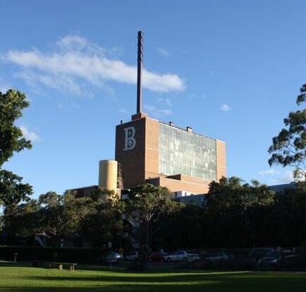
As per the report, “the subject site is a rare extant example of a factory operating during the twentieth century in the Concord local area. Other factories which were operating in the Concord area during the twentieth century, such as the Farleigh, Nettheim & Company Tannery and Austral Bronze Factory, have undergone demolition” (Heritage 21 2019, p.37).
With regards to the site’s setting, the report states that “the overall nature of the subject site, the large industrial building set amidst soft landscaping on the water’s edge, creates a pleasing juxtaposition enabling a physically loud structure to sit quietly within its surrounding environment” (p26).
The report also mentions that “the factory’s eastern facade is distinctive due to the ‘B’ signage that is located on the upper storeys of the factory wall. The signage can be seen for some distance and contributes to the views of the factory, particularly from Hen and Chicken Bay and further east” (p27).
The Heritage Listing Nomination Report states that “it is imperative that the landscaped setting is maintained, regardless of the proposed use of the subject site” (p47).
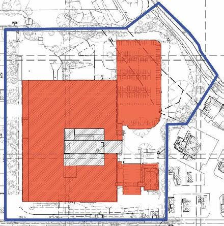
1.3 Heritage Context
1.3.1 Heritage Listings
The subject site is not listed as an item of environmental heritage in the Canada Bay Local Environmental Plan 2013 (CLEP) The subject site is also not listed in the NSW State Heritage Register, the National Heritage List, the Commonwealth Heritage List or the Register of the National Trust of Australia (NSW).
However, Heritage 21 have conducted an Assessment of Significance, included in Section 5.0 below,
HERITAGE LISTING NOMINATION REPORT Bushells Factory 160 Burwood Road, CONCORD
Figure 5. Plan of the existing site, the Former Bushells Factory Building core is
Figure 19 Plan of the existing site with the Former Bushells Factory Building core outlined in black as shown in the Heritage Listing Nomination Report (Heritage 21 2019).
160 Burwood Rd, Concord | Urban Design Review | November 2022 43
The Roasting Hall with the distinctive ‘B’ sign in its landscape setting viewed from Exile Bay foreshore
3-2 Context and neighbourhood character
• How the Concept Plan responds to the elements of a "factory in a garden setting"?
1.3.3 Heritage Items in the Vicinity
Curtilage - In the Heritage Response to Local Planning Panel (September 2019) Heritage21 argues the curtilage is maintained by the visual prominence of the Roasting Tower, the open space and the smaller scale built forms surrounding the Roasting Tower. The response notes that "Much of the grassed area surrounding the Roasting Tower will be maintained and therefore, it is our opinion that the historical landscape setting will continue to be understood and interpreted by future owners and visitors to the site".
The subject site is adjacent to or within the vicinity of the following items of environmental heritage as listed in the CLEP 2013:
With regards to the impact of the proposed development on the nominated heritage item, the Statement of Heritage Impact (Heritage 21 2019) states that since the site is not currently listed as an item of environmental heritage there has been no consideration of the impact of the proposed development on the retained Former Bushells Factory Building. As a result of this approach, the assessment of heritage impact only considers the impact of the development on the existing heritage items in the vicinity of the site, such as item 1259 (Massey Park Golf Course and Grounds and Samders Reserve), item 154 (Bayview Park) and item 156 (Street trees along Burwood Road).
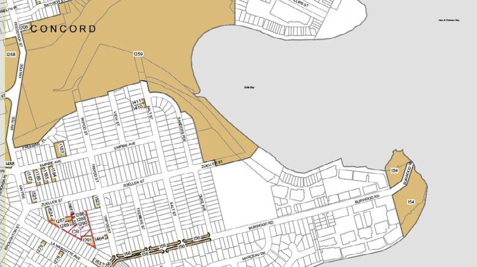
As the Former Bushells Factory Building (including the Central Roasting Hall, the chimney stack, the ‘B’ sign on the facade, and the landscaped setting) is nominated for heritage listing, Heritage21 was asked to address the issues raised at Council's Local Planning Panel Extraordinary Meeting (June 2019).
• What is the appropriate curtilage for the retained building?
• What are the principles around adaptive reuse?
Adaptive Reuse - The Concept Plan shows the Central Roasting Hall with ground floor 'urban services', with two storeys of light industry or retail above, and the remaining five (5) storeys as residential. Heritage21 states the "Roasting Tower is proposed to be adaptively reused to accommodate residential, commercial and community uses. AJ+C has prepared drawings which indicate how the existing structure of the Roasting Tower could be adaptively reused without altering the exterior or interior spaces except where the upper floors are to be converted into residential apartments" (Heritage21, p3).
1.4 Methodology
HERITAGE LISTING NOMINATION REPORT Bushells Factory 160 Burwood Road, CONCORD
Item Name Address Level of Significance Item Number Massey Park Golf Course grounds and Sanders Reserve 1 Ian Parade (also known as 1C and 1P Ian Parade) Local I259 Street trees Burwood Road (between Crane Street and Duke Avenue) Local I56 Bayview Park 166P Burwood Road Local I54
Figure 6 Heritage map HER_004 showing the location of subject site outlined in red and the heritage items located in the vicinity are brown.1
Park Golf Course
Bayview Park
Massey
grounds and Sanders Reserve
Street trees
Figure 20 Extract of the existing Heritage LEP map as shown in the Heritage Listing Nomination Report (Heritage 21)
Heritage Impact
160 Burwood Rd, Concord | Urban Design Review | November 2022 44
O3
URBAN DESIGN REVIEW
The Hertiage21 report also notes that there will be a retail food hall on the ground floor and community workshops and studios on the first floor, and that "all of the original structural elements (beams, columns and large internal open area) will be maintained" (p4).
However, the existing glass and aluminium framing on the northern and southern façades cannot be retained, due to BCA and NCC requirements. Heritage21 states that when the building is "viewed from a distance, the contemporary curtain wall, in our opinion, would read closely to that which already exists" (p5).
'Factory in a Garden' Setting - Heritage21 states that by "converting the factory building into retail, commercial and community uses, with appropriate interpretation, the public will begin to have greater access to the building than that which currently exists. Large areas of private open space will also be provided. Consequently, the factory building will become a public facility rather than its current inaccessible and limited use" (p6). The report also mentions the proposed winter garden, and the proposed residential blocks being broken into smaller forms will also contribute to the 'factory in a garden' setting.
Views - Another highly significant aspect of the proposed heritage site is the views to and from the Roasting Tower from the foreshore and surrounding area. Heritage21 states that "the most important aspects to the current heritage setting is (...) a visually prominent roasting tower; and (...) the characteristic industrial landscape setting" (Sept 2019, p2).
Noting that all of the buildings in the current proposal are lower in height than the Roasting Tower, Heritage21 states that "we are of the opinion that these views will be maintained in the context of the proposed residential accommodation. We stress that views from the foreshore constitute the most important heritage aspect of the subject site" (Sept 2019, p1).
Conclusion
While rezoning of the existing industrial site to primarily medium density residential does not align with the Metropolitan vision to ‘retain and manage’ existing industrial land in the Eastern City District it is noted that the site is in an isolated peninsula location, with limited connectivity making it less desirable for long term industrial uses. The development of a large increase in residential dwellings on this site is also not in line with the metropolitan and regional plans, which outline strong criteria for locating future housing in the right location, however the amenity of the site does make some provision of housing justifiable although connecting the site long term with services and public transport remains a challenge.
Development on this site predominantly ranges from three (3) to six (6) storey buildings. This is higher than the predominantly single and two storey detached and semi-detached houses in the neighbourhood. However, the building heights are considered appropriate given the dominant height of the Former Bushells Factory Building and the size of the site which allows development to reduce towards sensitive interfaces.
From an urban design perspective the nomination of the Former Bushells Factory Building (including the Central Roasting Hall, the chimney stack, the ‘B’ sign on the facade, and the landscaped setting) is supported as it is part of the local character of the area and provides a visual link to the history of the area. The retention of the tall Central Roasting Hall building, in the centre of the site, and the provision of views to the building from the water allows the preserved industrial building to retain its landmark quality within a landscaped setting.
It is recommended that the extent of the ‘Factory in a Garden’ landscape setting is clearly defined within the Heritage Listing Nomination Report to ensure its preservation during detailed design and long term maintenance of the site. It is also recommended that the site-specific Development Control Plan for this site provides detailed objectives and provisions for the conservation, adaptive reuse and interpretation of the heritage item similar to the Sydney Development Control Plan (Harold Park) 2011 which retains the Former Rozelle Tram Depot.
160 Burwood Rd, Concord | Urban Design Review | November 2022 45
URBAN DESIGN REVIEW O3
3-3 Built form, scale and aesthetics
SEPP 65 Design Principle 2: Built Form and Scale


Good design achieves a scale, bulk and height appropriate to the existing or desired future character of the street and surrounding buildings. Good design also achieves an appropriate built form for a site and the building’s purpose in terms of building alignments, proportions, building type, articulation and the manipulation of building elements. Appropriate built form defines the public domain, contributes to the character of streetscapes and parks, including their views and vistas, and provides internal amenity and outlook.
SEPP 65 Design Principle 9: Aesthetics


Good design achieves a built form that has good proportions and a balanced composition of elements, reflecting the internal layout and structure. Good design uses a variety of materials, colours and textures. The visual appearance of well designed apartment development responds to the existing or future local context, particularly desirable elements and repetitions of the streetscape.
Commentary: Scale


The scale of the existing neighbouring buildings along the western boundary of the site and to the south are typically one (1) to two (2) storeys in height. Existing buildings along the eastern boundary (Pelican Quays development) are two-three (2-3) storeys along the interface with the road and waterfront, rising to six (6) storeys within the centre of the site.
The desired future character of the area is expected to remain substantially as it is now. It is not an area identified as a suitable location for housing intensification and urban renewal as it is not close to a strategic centre, a priority precinct or a key public transport corridor.


The Concept Plan in the amended PP (May 2022) shows buildings with a range of heights and typologies.


• Block 1, Western Edge includes buildings that are three (3) storeys high, with three (3) storey terraces along Burwood Road.
• Block 2, Southern Edge includes three (3) storey building facing Burwood Road and a four (4) and five (5) storey building behind, incorporating a one storey ‘Urban Services’ podium.
Block 3, Eastern Edge includes buildings that are five (5) and six (6) storeys high with a step down to three (3) storey terraces along Burwood Road.
Block 4 is the retained industrial ‘Central Roasting Hall’ of the Former Bushells Factory Building.
Block 5, Northern Edge comprises a five (5) storey high curvilinear building facing the foreshore, stepping down to two (2) and three (3) storeys as it wraps around adjacent to the neighbourhood centre zone, and a six (6) storey high apartment building to the west.
RL 15000 RL 13800 1 3 2 5 4
Figure 21 Key buildings identified over the Roof Plan, amended PP (May 2022) (Source: BVN 2019)
Block 1 Western edge
Block 5 Northern edge
Block 3 Eastern edge
Block 2 Southern edge
160 Burwood Rd, Concord | Urban Design Review | November 2022 46 URBAN
O3
Block 4 Central Roasting Hall
DESIGN REVIEW
The heights proposed in the amended PP (May 2022) are similar to the amended PP (Sep 2019). The tallest buildings are now six (6) storeys which is appreciably lower than the ‘landmark’ Central Roasting Hall. The Central Roasting Hall is a landmark structure of significant industrial heritage, and creates a datum that sharply contrasts with the horizontal nature of the surrounding area. The proposed six (6) storey block supports this contrast by allowing the Central Roasting Hall to be prominent against the surrounding development.
The three (3) storey apartments in Block 1, Western edge are broken into four separate buildings, each approximately 36m long and 21m deep, with a 6m separation between each building. The reduced height and provision of four separate building with gaps between is an improvement to an earlier concept (Feb 2019) which proposed a single apartment building with a continuous 160m long wall. However, further consideration needs to be given to the design of the buildings and how this will impact the visual scale of the apartments. For example four identical buildings are likely to be 'read' together and will be more visually prominent than four buildings each designed by different architects.
The scale of the built form is also linked to the potential for overshadowing of neighbouring properties. Appendix C (BVN, p11) in the PP (May 2022) provides drawings showing the overshadowing impact of the proposed development on the surrounding streets and neighbouring sites in mid winter from 9am to 3pm. The shadow diagrams show the following:
• A revised shadow diagram provided shows some additional overshadowing of a few front gardens on the southern side of Burwood Road after 2pm.
• The majority of overshadowing impacts fall within the site and on Burwood Road.
• The shadow of the existing Central Roasting Hall casts a shadow across Burwood Road by 3pm.
• The greatest impact is found along the eastern boundary of the site.
• A five (5) storey building in Block 3, Eastern Edge will overshadow smaller one (1) and two (2) storey detached dwellings by 3pm in mid winter.
Height
The Concept Plan (May 2022) shows the heights of buildings across the site, with the tallest buildings, located in Block 3, Eastern Edge and Block 5, Northern Edge up to six (6) storeys in height.
The PP (May 2022) identifies a change in building heights in the buildings in Block 2, Southern Edge when compared to the PP (Sep 2019) as follows:
• Building C8 - Reduced height on plan from 6 storeys to 5 storeys with a small reduction in height from RL 27900 to RL 26900.
• Building C4 - Remains at 4 storeys but has an increase in height from RL 21900 to RL 23800
• Building C9 - Remains at 3 storeys but has an increase in height from RL 16500 to RL 17600
It is noted that while Building C8 is identified as 5 storeys on the architectural plans the PP (May 2022) proposes increasing the building height to 21m (six storeys) in this part of the site and while Elevation 3 states this building is 5 storeys it retains a RL 27900 height and indicates a six storey building over ground level parking. The FSR calculations assume 6 storeys so it is assumed that six storeys of development, not five, is intended.
It is accepted that if light industrial uses are located in Block C7 and C8 the recommended 5m ceiling height will result in a taller built form and so the slight increase in proposed building height is reasonable however this should be linked to the provision of industrial uses and a lower height provided for commercial and/or residential uses. To ensure a built form that fits within the proposed height limits and provides industrial space with 5m high ceilings, basement parking may need to be excavated lower into the site.
Block C9 is an important building for this development as it is located on Burwood Road and is opposite smaller one (1) and two (2) storey detached dwellings. The previous PP (Sep 2019) located 3 storey terraces in this sensitive location. The amended PP (May 2022) has replaced these with apartments over ground level retail/commercial uses. This changes the visual character of the street and externalises some of the potential impacts of retail such as noise and servicing of the site onto the surrounding neighbourhood.
160 Burwood Rd, Concord | Urban Design Review | November 2022 47 URBAN DESIGN REVIEW O3
O3


3-3 Built form, scale and aesthetics
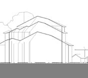
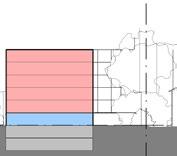
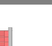
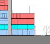
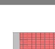
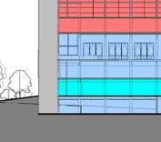
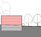
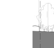
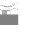
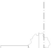
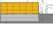
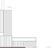
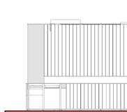
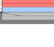

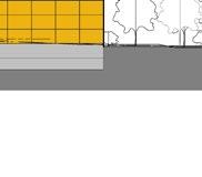
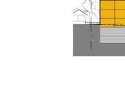
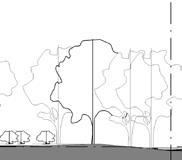
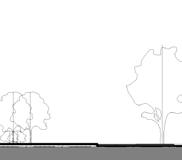
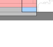
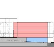
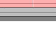
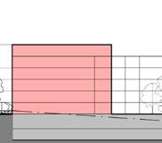
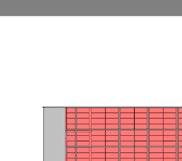
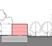
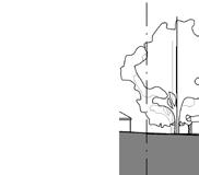

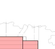
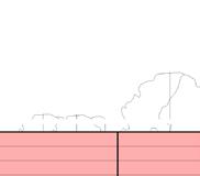
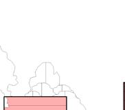

SITE BOUNDARY SITE BOUNDARY 5 STOREY PRIVATE OPEN SPACE SHARED ZONE 3 STOREY LOCAL ROAD W1 C1 5 STOREY C2 5 STOREY C3 RIVERSIDE PARK PRIVATE OPEN SPACE LOCAL ROAD PRIVATE OPEN SPACE PRIVATE OPEN SPACE 3 STOREY LOCAL ROAD SHARED ZONE E2 SITE BOUNDARY SITE BOUNDARY 3 STOREY TERRACES SECTION 1 SECTION 3 SECTION 4 SITE BOUNDARY SITE BOUNDARY 5 STOREY PRIVATE OPEN SPACE SHARED ZONE 3 STOREY LOCAL ROAD W1 C1 5 STOREY C2 5 STOREY C3 RIVERSIDE PARK SITE BOUNDARY SITE BOUNDARY 6 STOREY PRIVATE OPEN SPACE 3 STOREY LOCAL ROAD 5 STOREY PRIVATE OPEN SPACE SHARED ZONE C4 W2 C5 EX. ROOF RL 46400 SHARED ZONE LOCAL 3 STOREY TERRACES 3 STOREY C9 1 500 XX-XX-003 SECTION 1 1 SECTION 3 3 SITE BOUNDARY SITE BOUNDARY 5 STOREY PRIVATE OPEN SPACE SHARED ZONE 3 STOREY LOCAL ROAD W1 C1 5 STOREY C2 5 STOREY C3 RIVERSIDE PARK SITE BOUNDARY SITE BOUNDARY 6 STOREY PRIVATE OPEN SPACE 3 STOREY LOCAL ROAD 5 STOREY PRIVATE OPEN SPACE SHARED ZONE C4 W2 C5 EX. ROOF RL 46400 PRIVATE LOCAL ROAD SHARED ZONE 1 SITE BOUNDARY SITE BOUNDARY LOCAL ROAD LOCAL ROAD 3 STOREY TERRACES 3 STOREY 3 STOREY TERRACES W5 C9 E4 EX. ROOF RL 46400 1 500 XX-XX-003 SECTION 1 1 1 500 XX-XX-003 SECTION 4 4 Figure 22 Proposed sections (BVN 2022, p.6)
SITE BOUNDARY SITE BOUNDARY 5 STOREY PRIVATE OPEN SPACE SHARED ZONE 3 STOREY LOCAL ROAD W1 C1 5 STOREY C2 5 STOREY C3 RIVERSIDE PARK SITE BOUNDARY SITE BOUNDARY 6 STOREY PRIVATE OPEN SPACE 3 STOREY LOCAL ROAD 5 STOREY PRIVATE OPEN SPACE SHARED ZONE C4 W2 C5 EX. ROOF RL 46400 SITE BOUNDARY SITE BOUNDARY PRIVATE OPEN SPACE 3 STOREY LOCAL ROAD 6 STOREY PRIVATE OPEN SPACE SHARED ZONE W3 9 STOREY C6 E2 1 XX-XX-011 EX. ROOF RL 46400 SITE BOUNDARY SITE BOUNDARY LOCAL ROAD LOCAL ROAD 3 STOREY TERRACES 3 STOREY 3 STOREY TERRACES W5 C9 E4 EX. ROOF RL 46400 1 500 XX-XX-003 SECTION 1 1 1 500 XX-XX-003 SECTION 3 3 1 500 XX-XX-003 SECTION 4 4 12 0m 21m RL46 4 11 0m 20m 20m 20m SITE BOUNDARY SITE BOUNDARY 3 STOREY - 15700 6 STOREY - RL 27200 4 STOREY - RL 21900 5 STOREY - RL 24200 BURWOOD ROAD LOCAL ROAD ZOELLER ROAD C1 C5 C7 C9 9 STOREY C6 SITE BOUNDARY 3 STOREY 5 STOREY - RL 27900 BURWOOD ROAD LOCAL ROAD C8 C9 9 STOREY C6 SITE BOUNDARY 3 STOREY TERRACES 5 STOREY - RL 20400 6 STOREY - RL 23400 BURWOOD ROAD E2 E3 E4 RL 15000 6 STOREY RL 27200 C5 5 STOREY RL21200 C4 C3 ZOELLER ROAD SITE BOUNDARY 5 STOREY - RL 24200 C2 SITE BOUNDARY WATERFRONT PARK 1 500 XX-XX-003 ELEVATION 1 1 1 : 500 XX-XX-003 ELEVATION 2 2 1 500 XX-XX-003 ELEVATION 3 3 1 500 XX-XX-003 ELEVATION 4 4 12m 21m RL 46 4 21m 12m 18m 11m 20m 20m 20m 11m 20m
Proposed LEP maximum Height of Building (in blue) and Studio GL’s recommended maximum building heights - Aug 2022 (in red)
160 Burwood Rd, Concord | Urban Design Review | November 2022 48
DESIGN REVIEW
URBAN
Proposed LEP maximum Height of Building (in blue) and Studio GL’s recommended maximum building heights- Aug 2022 (in red)


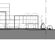
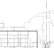

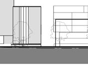
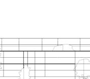

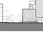

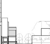
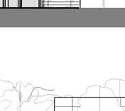
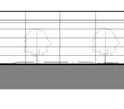

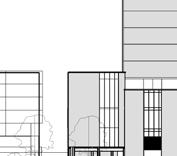
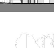
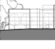

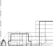


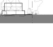
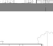

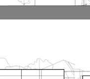
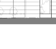

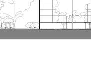
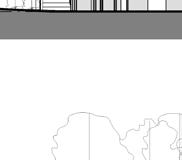
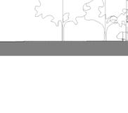
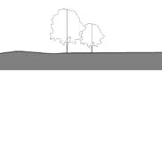

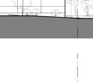

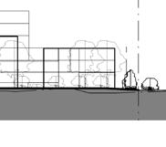
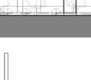
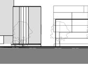


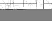
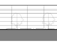
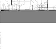

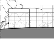

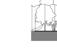

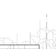
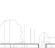
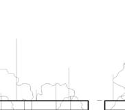
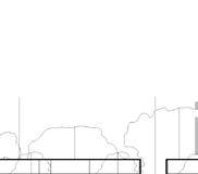
RESIDENTIAL -TOWER COMMERCIAL / RETAIL RESIDENTIAL -TERRACE HOUSING RESIDENTIAL -LOW RISE PRIVATE OPEN SPACE DRAWING COPYRIGHT BVN ARCHITECTURE PTY LIMITED. UNLESS OTHE AGREED IN WRITING;ALL RIGHTS TO THIS DOCUMENT ARE S PAYMENT IN FULL OF ALL BVN CHARGES;THIS DOCUMENT MA BE USED FOR THE EXPRESS PURPOSE AND PROJECT FOR WHI HAS BEEN CREATED AND DELIVERED, AS NOTIFIED IN WRIT BVN;AND THIS DOCUMENT MAY NOT BE OTHERWISE USED, O ANY UNAUTHORISED USE OF THIS DOCUMENT IS AT THE USE RISK AND WITHOUT LIMITING BVN'S RIGHTS THE USER REL INDEMNIFIES BVN FROM AND AGAINST ALL LOSS SO ARISIN CONTRACTOR TO CHECK AND VERIFY ALL DIMENSIONS ON SI TO COMMENCEMENT OF WORK OR PREPARATION OF SHOP DRAW BUSHELLS COFFEE FACTORY 160 BURWOOD RD, CONCORD. NSW TEL 02 9437 1300 fax 02 9966 9804 ISSUEDATE FOR A19/06/18REVIEW B21/06/18REVIEW C06/12/18REVIEW D03/09/19REVIEW E06/09/19REVIEW F10/09/19REVIEW G17/06/20REVIEW H22/06/20REVIEW I23/06/20REVIEW J20/07/21REVIEW 3 STOREY TERRACES 3 STOREY - RL 19400 SITE BOUNDARY SITE BOUNDARY BURWOOD ROAD ZOELLER ROAD W4 W3 W2 W1 W5 RL 17000 3 STOREY - RL 19400 3 STOREY - RL 19400 3 STOREY - RL 19400 6 STOREY RL 21900 ZOELLER ROAD 9 STOREY 5 STOREY C5 ZOELLER ROAD WATERFRONT PARK ELEVATION 1 3 STOREY TERRACES 3 STOREY - RL 19400 SITE BOUNDARY SITE BOUNDARY BURWOOD ROAD ZOELLER ROAD W4 W3 W2 W1 W5 RL 17000 3 STOREY - RL 19400 3 STOREY - RL 19400 3 STOREY - RL 19400 SITE BOUNDARY SITE BOUNDARY 3 STOREY - 15700 6 STOREY - RL 27200 4 STOREY - RL 21900 5 STOREY - RL 24200 C1 C5 C7 9 STOREY C6 RL 27900 9 STOREY BURWOOD 6 STOREY RL 27200 5 STOREY RL21200 ZOELLER 1 : 500 XX-XX-003 ELEVATION 1 1 3 STOREY TERRACES 3 STOREY - RL 19400 SITE BOUNDARY ZOELLER ROAD W4 W3 W2 W1 W5 RL 17000 3 STOREY - RL 19400 3 STOREY - RL 19400 3 STOREY - RL 19400 SITE BOUNDARY 6 STOREY RL 27200 4 STOREY 9 STOREY C6 5 STOREY LOCAL 3 STOREY TERRACES RL 23400 BURWOOD ROAD E3 E4 RL 15000 ZOELLER SITE BOUNDARY WATERFRONT PARK Figure 23 Proposed elevations
2022, p.7)
SITE BOUNDARY SITE BOUNDARY LOCAL ROAD 5 STOREY RIVERSIDE PARK OPEN LOCAL ROAD PRIVATE OPEN SPACE SITE BOUNDARY SITE BOUNDARY PRIVATE OPEN SPACE 3 STOREY LOCAL ROAD 6 STOREY PRIVATE OPEN SPACE SHARED ZONE W3 C6 E2 1 XX-XX-011 RL 46400 1 500 SECTION 1 1 500 XX-XX-003 SECTION 3 3 12 0m 21m 11 0m 20m 20m 20m 3 STOREY TERRACES 3 STOREY - RL 19400 SITE BOUNDARY SITE BOUNDARY BURWOOD ROAD ZOELLER ROAD W4 W3 W2 W1 W5 RL 17000 3 STOREY - RL 19400 3 STOREY - RL 19400 3 STOREY - RL 19400 SITE BOUNDARY SITE BOUNDARY 3 STOREY - 15700 6 STOREY - RL 27200 4 STOREY - RL 21900 5 STOREY - RL 24200 BURWOOD ROAD LOCAL ROAD ZOELLER ROAD C1 C5 C7 C9 9 STOREY C6 SITE BOUNDARY 3 STOREY 5 STOREY - RL 27900 BURWOOD ROAD LOCAL ROAD C8 C9 9 STOREY C6 SITE BOUNDARY 3 STOREY TERRACES 5 STOREY - RL 20400 6 STOREY - RL 23400 BURWOOD ROAD E2 E3 E4 RL 15000 6 STOREY RL 27200 C5 5 STOREY RL21200 C4 C3 ZOELLER ROAD SITE BOUNDARY 5 STOREY - RL 24200 C2 SITE BOUNDARY WATERFRONT PARK 1 500 XX-XX-003 ELEVATION 1 1 1 : 500 XX-XX-003 ELEVATION 2 2 1 500 XX-XX-003 ELEVATION 3 3 1 500 XX-XX-003 ELEVATION 4 4 12m 21m RL 46 4 21m 12m 18m 11m 20m 20m 20m 11m 20m 160 Burwood Rd, Concord | Urban Design Review | November 2022 49
(BVN
URBAN DESIGN REVIEW O3
3-3 Built form, scale and aesthetics
LEP Building heights
The Proposed Height of Building map in the PP (May 2022), see Figure 24, identifies a range of building heights across the site with lower building heights adjoining the western and southern boundaries towards lower density housing, with taller heights in the centre of the site and adjoining the golf course and proposed new waterfront open space. The allocation of a range of heights across the site is supported however when establishing maximum building heights in a LEP it is necessary to provide sufficient height to accommodate the proposed development and desired number of storeys without making it possible, or even encouraging future developments to include additional storeys or height.
5.2.2 Proposed amendment to the height of buildings map
Amend CBLEP 2013 ‘Height of Buildings Map Sheet 004’ as it applies to the subject 12.0 for a portion of the site to:
part O1 - 15m (4 storeys);
To simplify the Height of Building Map and avoid an adverse outcome it is recommended that the maximum building height of the Central Roasting Hall block is shown at 20m. This will accommodate six (6) potential storeys of development and also allow the nine (9) storey Central Roasting Hall building to be renovated. It will also ensure that if the Central Roasting Hall is not retained, a new building in this location, will be at a lower height and not benefit from the landmark qualities of retaining the existing building.
part P1 - 17m (5 storeys);
part P2 - 18m (5 storeys);
part R1 - 21m (6 storeys);
In a number of occasions the current heights identified in the PP (May 2022) are greater than needed to accommodate the proposed built form and could, potentially, encourage even taller development in the future. To avoid this the following is recommended:
• Three (3) storey development is to have a maximum building height of 11m not 12m.
• Four (4) storey development can remain at 15m. This is higher than is typical to accommodate industrial uses on the ground floor.
• Five (5) storey apartments can remain at 17m.
• Five (5) storey mixed use can remain at 18m.
• Six (6) storey mixed use development is to have a maximum height of 20m not 21m.
The Proposed Height of Building map also identifies the maximum building height of the existing ‘Central Roasting Hall’ to be the same as the existing building height (RL46.4). The challenge with this approach is that, if for any reason the existing building could not be refurbished this height could make it possible for a new building, of a similar height, to be built in this location. It is also noted that the area allocated to this height is longer than the existing building, possibly encouraging additional development at each end of the current building.
The precinct plan for this site has been developed over many years and shows an agreed road, block and open space arrangement that is generally supported. To help 'lock in' this plan, it is recommended that the Height of Building map does not show building heights over roads (see Figure 25). This is similar to the approach taken on other sites such as Harold Park.
RL 46.4 to re ect the existing roof height of the Central Roasting Hall building to as shown in Figure 25. The remainder of the site remains unchanged.
BURWOODRD AUMAVE D ST SALT ST BURWOODRD DUKE AVE MARCEAUDR ZOELLERST SANDERS PDE EMPIREAVE EW ST ZOELLERST BURWOOD RD TRIPOD ST TREMERE ST I I I I II I I I I II I I I I II I I I I IIII I I I I II I I I I II I I I I II I I I II I I I II I I II I I I II I I I I II I I I I II I I I I II I I I I II I I I II I I I II I I I I II I I I I II I I I I II I I I I II I I I I II I I I II I I I II I I I I II I I I I II II I I I II I I I II I I II I II I I I II I I I II I I I II I I I I IIII I I I II I I I II I I II I I II I I I II I I I I II I I II I I II I I II I I II I II I I I II I I I I II I I I I II I I I II I I I II I I I I II I I I I II II I I I I II I I II I I II I I I I II I I I I II I I I I II I I I I II I I I I II I I I I II I I I II I I I II I I I I II I I I I II II I I I I II I I II I I II I II I I I II I I I II I I I II I I I I II I I I II I I I II I I II I I II I I II I I II M M M M M M M M M MM M M M M M M M M M M M M M M M O1 O1 O1 O1 O1 O1 O1 O1 O1 O1 O1 O1 O1 O1 O1 O1 O1 O1O1 O1 O1 O1 O1 O1 O1 O1 O1 O1 O1 O1 O1 O1 O1 O1 O1 O1 O1 O1O1 P2 P1 M M O1 RL 46.4 R1 R1 BURWOOD VE ST SALT ST BURWOOD RD DUKE AVE MARCEAU DR ZOELLER ST SANDERS PDE EMPIRE AVE EW ST ZOELLER ST BURWOOD RD OD ST TREMERE ST R2 R2 R2 R2 R2 R2 R2 R2 R2 R2 R2 R2 R2 R2 R2 R2 R2 R2 R2 R2 R2 R2 R2 R2 R2 R2 R2 R2 R2 R2 R2 R2 R2 R2 R2R2 RE1 RE1 RE1 RE1 RE1 RE1 RE1 RE1 RE1 RE1 RE1 RE1 RE1 RE1 RE1 RE1 RE1 RE1 RE1 RE1 RE1 RE1 RE1 RE1 RE1 RE1 RE1 RE1 RE1RE1 R3 R3 R3 R3 R3 R3 R3 R3 R3 R3 R3 R3R3 R3 R3 R3 R3 R3 R3 R3 R3 R3 R3 R3 R3 R3 R3 R3 R3 R3 R3 R3 R3 R3 R3R3 R2 R2R2 RE1 RE1 RE1 RE1 RE1 RE1 RE1 RE1 R3 R3 IN1 IN1 IN1 IN1 IN1 IN1 IN1 IN1 IN1 IN1 IN1 IN1 IN1 IN1 IN1 IN1 IN1 IN1 IN1 IN1 IN1 IN1 IN1 IN1 IN1 IN1 IN1 IN1 IN1 IN1 RE1 R3 B1
Figure 24: Proposed Land Zoning Map
Figure 25: Proposed Height of Building Map
160
Burwood Road, Concord Bushells Redevelopment - Amended Planning Proposal v5-1 | LFA (Paci c)
Figure 24 Proposed Height of Building map (Source: LFA 2022, p49)
BURWOOD DURHAMST EDITHAVE WARD TAUM AVE ST SALT ST BURWOOD
DUKE
MARCEAU DR ZOELLER ST SANDERS PDE EMPIRE AVE ZOELLER ST BURWOOD RD TREMERE ST I I I I II I I I II I I I II I I I IIII I I I II I I I II I I I I II I I I II I I I II I I I II I I I II I I I II I I I II I I I I II I I I II I I I II I I II I II I I I II I I II I I I II I I I II I II I I I I II I I I I II I I I I II I I I II I I I II I I II I I II I I IIII I I I II I I I II I I I I II I I I I IIII I I I II I I I II I I I II I I I II I I I II I I I II I I I II I I I IIII I I I II I I I II I I I I II I I I II I I I IIII I I I II I I I II I I I II I I I II I I I II I I I II I I I IIII I I I II I I I II I I I II I I I II I I I II I I I II I I I II I I I II I I I II M M M M M M M M M M M M M M M M M M M M M M M M M MM O1 O1 O1 O1 O1 O1 O1 O1 O1 O1 O1 O1 O1 O1 O1 O1 O1 O1 O1 O1 O1 O1 O1 O1 O1 O1 O1 OO1 1 O1 O1 O1 O1 O1 O1 O1 O1 O1 O1 O1 O1 O1 O1 O1 O1 O1 O1 O1 O1 O1 O1 O1 O1 O1 O1 O1 O1 O1 O1 OO1 1 P1 P2 O1 O1 L L L L Q Q Q Q 8.5m 12m 15m 17m 18m 21m I M O1 P1 P2 R1
Figure 25 Recommended Height of Building map prepared by Studio GL (Aug 2022)
RD
AVE
BURWOOD RD ZOELLER ST M M M M M M M M M M M M M M M M M M M M M M M M M M M M M M M M M M M M M M M M M M M M M M M MM O1 O1 O1 O1 O1 O1 O1 O1 O1 O1 O1 O1 O1 O1 O1 O1 O1 O1 O1 O1 O1 O1 O1 O1 O1 O1 O1 O1 O1 O1 O1 O1 O1 O1 O1 O1 O1 O1 O1 O1 O1 O1 O1 O1 O1 O1 O1 OO1 1 P1 P2 O1 O1 L L Q Q Q Q LEGEND 8.5m 11m 15m 17m 18m 20m LEP boundaries (LFA 2022) I L O1 P1 P2 Q
160 Burwood Rd, Concord | Urban Design Review | November 2022 50 URBAN DESIGN REVIEW O3
URBAN DESIGN REVIEW

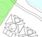


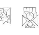


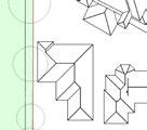
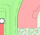
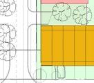
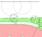
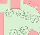
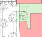
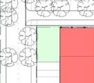
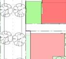
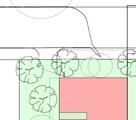
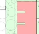
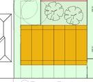
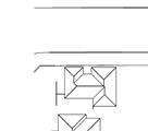
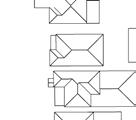
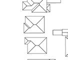
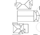
Setbacks
The Concept Plan retains the street layout from the previous PP (Sep 2019). This layout is supported as it locates the ‘backs’ of the apartments facing the ‘backs’ of neighbouring properties, and creates clearly defined streets which connect into the surrounding street and open space network.
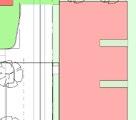
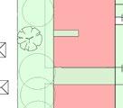
A ‘nominal’ 12m setback has been provided along the western boundary to retain trees and minimise the visual impact of Block 1 on the neighbouring two (2) storey properties. This setback is required to retain the existing trees and should be a minimum (not nominal). The amended PP (May 2022) also indicates that balconies may be able to encroach into this space by 3m. This should not be permitted as it would reduce the visual buffer and may impact on the existing trees.
The building separation distance between Blocks C7-C8 and the Central Roasting Hall is only 7m and other buildings are separated by only 6m or 7.7m. This may be a challenge for sun access and amenity of apartments and C7-C8 may impact on the visual curtilage of the Central Roasting Hall, which has been nominated for heritage listing in the amended PP.
The amended Concept Plan shows setbacks as “nominal” rather than “minimum” dimensions, which suggests these dimensions may be flexible. The amended PP (May 2022) does not specify all setbacks, street widths or open space areas. The detailed DCP exhibited with the PP incorporates clear plans with minimum setback distances to all boundaries and minimum street widths and open space areas. It is recommended that these are updated and adopted to provide certainty for future development of this site.
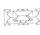
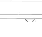

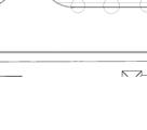
12m setback to western boundary to retain existing trees however 'private open space', assumed to include terraces and balconies is shown as encroaching 3m into this setback.

Blocks C7 and C8 are separated by 7m from the Central Roasting Hall.
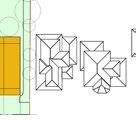
Terraces on Block C9 have been replaced by a three storey mixed use building with ground floor commercial/retail uses.
Gaps between buildings are 6m and 7.7m and are too narrow for facing habitable windows under the ADG and building floor plates are too deep for corner apartments to only rely on a single aspect.

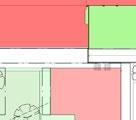
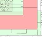
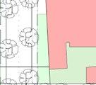
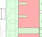
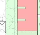

12m setback to eastern boundary to be 'minimum' not 'nominal'

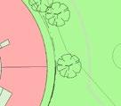

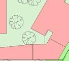
Key setback and separation distances highlighted on Roof Plan (BVN May 2022). C1 C2 C3 C4 C5 C5a C6 C7 C8 C9 E2 E3 E4 W2 W3 W4 W5 5 STOREY 5 STOREY 5 STOREY 5 STOREY 2 STOREY 6 STOREY 4 STOREY 3 STOREY 5 STOREY 3 STOREY 3 STOREY 3 STOREY W1 6 STOREY 3 STOREY 3 STOREY 3 STOREY 5 STOREY LOCAL ROAD NOM. 12M LOCAL ROAD LOCAL ROAD ZOELLER ROAD NOM 22M LANDSCAPE SETBACK 6.3M SETBACK NOM. 23M NOM. 3M NOM 12M NOM 3M LANDSCAPE SETBACK 9 STOREY RL 15000 URBAN SERVICES 1 STOREY 3 STOREY RL 13800 RL 13800 RL 24200 RL 24200 RL 21200 RL 23800 RL 26900 RL 20400 RL 23400 RL 27200 8700 3 XX-XX-021 1 XX-XX-021 2 XX-XX-021 4 XX-XX-021 5 XX-XX-021 6 XX-XX-021 RL 17600 RL 21200 RL 19400 RL 46400 RL 19400 RL 19400 RL 19400 RL 17000 BURWOOD ROAD SHARED ZONE RESIDENTIAL COMMERCIAL CAR PARKING RESIDENTIAL RESIDENTIAL PUBLIC OPEN PRIVATE OPEN URBAN SERVICES C:\Users\buzevska\Documents\180514_UpdatedScheme_AJC_Luiz NEW TREE PLANTINGS EXISTING TREES
160 Burwood Rd, Concord | Urban Design Review | November 2022 51
O3
3-3 Built form, scale and aesthetics
Building form
The bulk of a building is created by a combination of height, depth, length, setbacks and design.
The amended Concept Plan has three (3) storey terraces along Burwood Road to the south, which are approximately 30m long at the western and eastern ends of the Burwood Road elevation. The depth of the terraces is 18m.
The three (3) storey apartment buildings in Block 1, Western Edge are broken into four blocks (W1, W2, W3, W4) each approximately 36m long. Each of the four apartment blocks have two 2m wide by approximately 8m deep 'building indentations' on the western side of the apartment block. It appears the intention of these 'building indentations' is to allow for daylight access, ventilation and airflow, however they are insufficiently wide.
The ADG recommends that building indentations have a width to depth ratio of at least 2:1 or 3:1 to "ensure effective air circulation and avoid trapped smells" (p83). With a width to depth ratio of approximately 4:1, the proposed building indentations are too narrow and too deep and are not considered a high amenity solution for a suburban location. In addition these buildings have a building envelope that is 21m deep which is greater than the preferred depth stated in the ADG of 18m from glass line to glass line and rely on an additional 3m deep encroachment into the landscaped setback to achieve the required private open spaces. The poor design and inability for the proposed development to be located within the building envelope indicate that the proposed FSR for Block 1, Western Edge is too high.
The character of the building facing Burwood Road within Block 2, Southern Edge has changed since earlier proposals from three (3) storey terraces to a three (3) storey mixed use building with ground floor commercial/retail uses. The scale and built form needs to be compatible with the low rise housing on the opposite side of the street and the taller buildings to the north should avoid being parallel with the Central Roasting Hall due to the limited setbacks. The current enclosed design indicates that the proposed FSR for Block 2, Southern Edge is too high.
Buildings within Block 3, Eastern Edge are also deep floorplate buildings (approx. 21m deep) and building E3 also relies on substandard deep 'building indentations' on the eastern side to achieve light and ventilation.
The five (5) storey curvilinear building Block 5, Northern Edge whilst achieving an efficient urban form which maximises views of open space and water, creates a street wall of approximately 150m, with no breaks or upper storey setbacks. This edge will require careful articulation in detailed design to ensure it relates to the human scale.
160 Burwood Rd, Concord | Urban Design Review | November 2022 52
O3
URBAN DESIGN REVIEW
URBAN DESIGN REVIEW


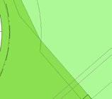

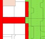
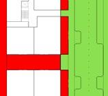


If private open space is not allowed within the 12m side setback the area of communal open space would be increased removing the need for rooftop communal spaces
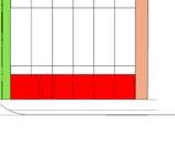
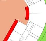
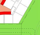
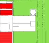
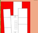
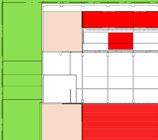
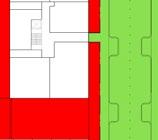
This plan shows private open spaces (assumed to be balconies and terraces) encroaching into the 12m side setback. This reduce the area of deep soil planting and bring built form closer to the rear boundaries of adjoining low density housing.
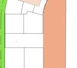
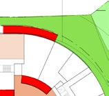
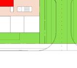
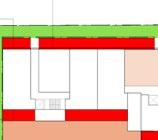
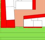
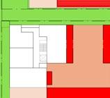
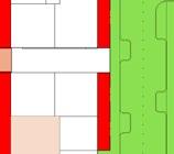
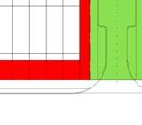
Providing private open space to Burwood Road as long as it takes the form of 'front gardens" providing access to the terraces.
3m of private open space is proposed within the 6m setback to the golf club site. It is recommended that the private open space is reduced by 1.5m and the width of publicly accessible footpath increased to 4.5m.

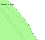
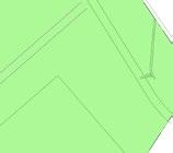
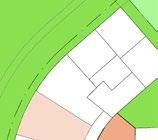

No private open space is identified on the eastern side of the site. This means balconies and terraces will need to be accommodated within the building envelopes and this should be reflected in the assumptions about building efficiencies.
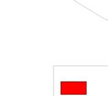
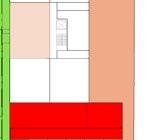
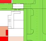
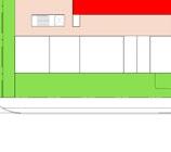
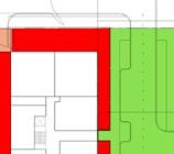
C1 C2 C3 C4 C5 C5a C6 C7 C8 C9 E2 E3 E4 W2 W3 W4 W5 W1 BURWOOD ROAD LOCAL ROAD ZOELLER ROAD 3000 3000 6000 9700 6000 11000 3000 2300 2300 3 0 0 0 0 0 COMMUNAL PRIVATELY PUBLICLY W1 -W5 C1 -C5a COS @ RL 14260 COS C9 ROOF @ RL 17600 COS C9 ROOF @ RL 17600 3000 3000 3 0 0 0 PRIVATE COMMUNAL ROOF 10900 W1 - W5 C1 - C5a E2 - E4 C6 C7 - C9 PUBLIC C:\Users\buzevska\Documents\180514_UpdatedScheme_AJC_Luiz C1 C2 C3 C4 C5 C5a C6 E2 W2 W3 W1 ZOELLER ROAD 3000 6000 11000 3000 2300 2300 3 3 0 0 3 0 0 0 COMMUNAL OPEN SPACE PRIVATELY OWNED AND PUBLICLY ACCESIBLE W1 -W5 1868.00 1691.00 C1 -C5a 1042.00 3000 3000 3 0 0 0 PRIVATE OPEN SPACE COMMUNAL OPEN SPACE ON ROOF W1 - W5 C1 - C5a E2 - E4 C6 7330sqm 7035sqm PUBLIC OPEN SPACE 175.00 -25%
160 Burwood Rd, Concord | Urban Design Review | November 2022 53
Figure 27 Communal Open Space Diagram (BVN /Aj&C May 2022).
O3
3-3 Built form, scale and aesthetics
Example Harold Park
Development at Harold Park, 2.5km from the Sydney CBD, provides a useful comparison with the scale of the development proposed for the subject site.
The Harold Park Concept Design proposes 2-5 storey development along the eastern and western boundaries of the site adjoining predominantly 1-2 storey dwellings and apartments up to 6 storeys. The building heights increase towards the centre of the site to up to 8 storeys high. The maximum street wall length of the buildings at Harold Park is 73m.
The upper levels of Harold Park have been designed to reduce the visual impact. It should be noted that even with an upper level setback, the upper floors still contribute to the overall bulk and scale of the development.
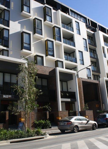
Example Burwood Precinct
It is generally considered good practice to reduce the height of buildings close to sensitive interfaces with adjoining lower scale development. The Parramatta Road Urban Transformation Strategy (2016) follows this approach identifying only two areas in the Burwood Precinct (on sites on Parramatta Road and within 1km of the train station) with a height of 42m (12 storeys) and then dropping to 8.5m (2 storeys) towards lower development to the north.
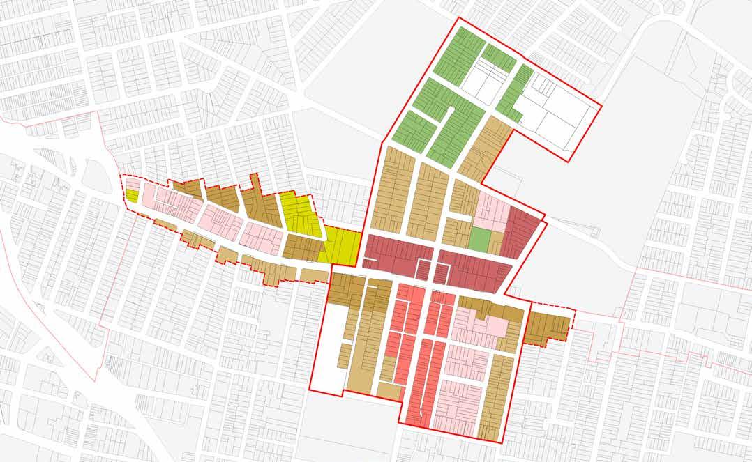

SWAN AVE MASON RD Precinct Boundary Frame Boundary Height of Buildings 8.5m 12m 17m 21m 24m 32m 40m 42m I M P R S U W1 W2 Figure 8.13: Burwood-Concord Recommended Building Heights 165 Parramatta Road Corridor | Planning and Design Guidelines
COMER ST PARK RD NEICH PDE BRITANNIA AVE GRANTHAM ST ROWLEY ST COOPERST Frame Boundary Height of Buildings 8.5m 12m 17m 21m 24m 32m 40m 42m I M P R S U W1 W2 P P P 43 Harold Park Urban Design Study Issue B May 2010 located close to maximum height blocks. end) should be development neighbouring the eastern level of the Buildingsstoreys 02550 100 PROVISIONS THE CRESCENT ROSS ST MINOGUE CR MAXWELLRD WIGRAMRD BOYCEST TOXTETHRD ARCADIARD VICTORIARD JOHNSTONS CK PARRAMATTARD ADA ST DALY AVE COMER ST PARK RD NEICH PDE BRITANNIA AVE GRANTHAM ST WENTWORTH RD PHILIP ST MOSELY ST SWAN AVE MASON RD ROBERTS ST COLES ST MELBOURNE ST JOHN ST PARK AVE ADDISONAVE PATTERSON ST ALEXANDRA ST ROWLEY ST COOPERST Precinct Boundary Frame Boundary Height of Buildings 8.5m 12m 17m 21m 24m 32m 40m 42m I M P R S U W1 W2
Figure 28 Height of Building Plan for the Harold Park Concept Plan (Government Architect, May 2010)
Building Heights R M M R M S S R R R S S P P P P P P P P
Figure 8.13: Burwood-Concord Recommended
Figure 29
Burwood Precinct plan with proposed building heights between 3 and 25 storeys
160 Burwood Rd, Concord | Urban Design Review | November 2022 54
URBAN DESIGN REVIEW O3
URBAN DESIGN REVIEW
Conclusion
The tallest apartment building at six (6) storeys is an appropriate height, which will allow the Central Roasting Hall's landmark qualities to retain dominance.
• Block 1, Western Edge - Buildings W1, W2, W3, W4 along the western edge are three (3) storeys high but are too deep and rely on encroachment into the side setback to provide private open spaces. The depth of these buildings should be reduced. Careful consideration also needs to be given particularly to the design and articulation of the buildings to ensure they don't appear monotonous. To achieve diversity and interest in the architectural character of the precinct, the use of multiple architectural firms is recommended.
• Block 2, Southern Edge - Buildings C7-C8 provide inadequate separation distances from the Central Roasting Hall to the north. These blocks should be reduced in size and redesigned to ensure adequate solar access to apartments, reduce overshadowing of the terraces to the south and to reinforce the heritage significance of the Central Roasting Hall. Additional height required for urban services should be conditional on the successful design and provision of urban services.
• Block 3, Eastern Edge - Buildings E2 and E3 adjoin lower scale detached housing and the foreshore park and it is recommended that the overall depth of these buildings is reduced and an upper level setback should be applied to reduce their bulk and scale and minimise overshadowing.
• Block 4,‘Central Roasting Hall’ - The site specific DCP needs to provide specific controls regarding the character, views and landscape setting for the Former Bushells Factory Building to ensure the heritage values are reflected in the design and use of this building.
• Block 5, Northern Edge - Careful articulation and upper level setbacks are recommended, particularly for the five (5) storey curvilinear building in Block 5 to ensure it relates to the human scale and to the public foreshore park adjacent. It is recommended that the upper level storey of the curvilinear building in Block 5 is broken in at least two places to help reduce the building's length and bulk.
• It is also recommended that the site-specific DCP, that clearly identifies on a plan all ground level and upper level setback and setbacks off boundaries, is adopted and reflected in future design development.
160 Burwood Rd, Concord | Urban Design Review | November 2022 55
O3
URBAN DESIGN REVIEW


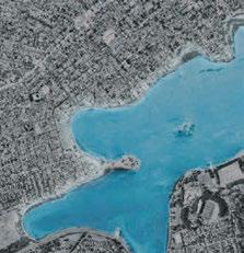

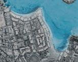


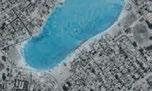

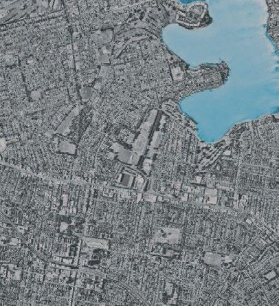
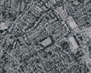
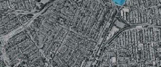
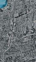
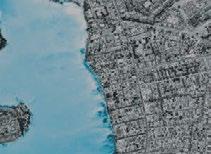


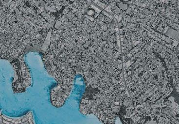
3-4 Density and FSR


SEPP 65 Design Principle 3: Density


Good design achieves a high level of amenity for residents and each apartment, resulting in a density appropriate to the site and its context.
Appropriate densities are consistent with the area’s existing or projected population. Appropriate densities can be sustained by existing or proposed infrastructure, public transport, access to jobs, community facilities and the environment.


Commentary:

The concept design in the amended PP (May 2022) outlines a significantly higher density than the surrounding area. The proposed FSR (gross) is 1.25:1 with buildings up to six (6) storeys high and a total floor area of over 48,551m² (GFA).
The detailed analysis of the local market in the Economic Impact Assessment states that “the suburb is characterised by low density housing – separate houses accounted for 71% of total dwellings in 2016, apartments just 16%. Of a total of 783 units, 69% were in one or two storey blocks and only 30% were located in a block with four or more storeys” (HillPDA 2019. p24). The Economic Impact Assessment also highlights the Planning Priorities listed in the Eastern City District Plan such as providing housing supply, choice and affordability, with access to jobs, services and public transport.
Figure 25 of the Hatch Roberts Day Urban Design Report shows the lack of transport facilities within walking distance from the site, and the Eastern City District Plan illustrates the isolation of this site from local and neighbourhood centres (Greater Sydney Commission, p.11). It can also be seen that the combination of Exile Bay, Canada Bay, Barnwell Park Golf Course and Massey Park Golf Course significantly reduces the amount of density and activity that occurs within an easy walking distance of the site.
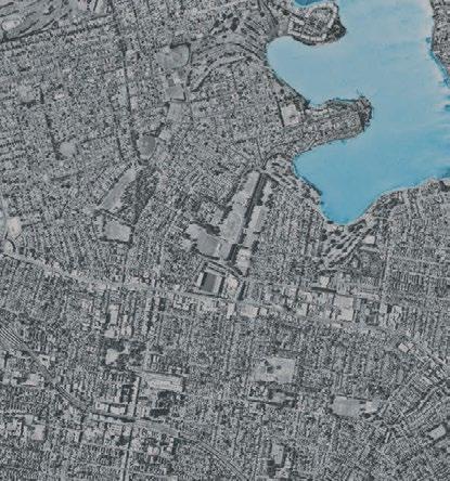
The limited public transport is confirmed by the Transport Impact Assessment which states that “despite the relatively close proximity of the site to the Sydney CBD, the existing residents surrounding the site have a higher private vehicle mode share (73 per cent) compared with the average for the wider Sydney GMR (61 per cent). Public transport uptake is slightly lower than the wider Sydney GMR noting the surrounding area is limited to bus services unless connecting at Burwood or Strathfield stations. Active travel modes such as walking and cycling is similar to the wider Sydney GMR at around five per cent" (Stantec 2022, p17-18).
It is noted, however, that the previous Transport Impact Assessment stated "the public transport mode share is consistent with the wider Sydney GMR at 20%, whilst the walking and cycling mode share is lower than the wider Sydney GMR (1% compared to 4%)” (GTA 2019, p.10).
In addition, the strategic merit assessment in the amended PP (May 2022) states that: "Although the site is not within these precincts, future residential development on the site will be in accordance with the 30-minute city aspiration given recently improved bus services to Burwood Town Centre” (LFA 2022, p.64). The previous PP (Feb 2019) justified the higher density of the site by providing a private ferry service to Barangaroo for the first three years after completion. While this is no longer mentioned as a justification for higher density, temporary public transport provision and potential car share services to the site do not provide adequate justification for the proposed FSR compared with the FSR of the surrounding neighbourhood.
B B B B B B M B go go go go PARRAMATTA RD DOBROYDPARADE VICTORIARD VICTORIA RD RAPID BUS STATION TLE BUS ROUTE BURWOOD RD BICYCLE PRIORITY 1km 2km BURWOOD STRATHFIELD CA CABABARI R TA BREAKFAST POINT ROODD DD POIOINT NT WA WAREREEMEMBA BA AB ABBO B TS TSFOFOR O D R RUUSSSSELLL L LE L A E ROOZ OYNEDRUMM RT RTH RA RATH T F FIELELD TE TENNNNYSYSON ON PO N IN I T GL GLADADESESVIVILLLE VE DOCOCK FI F V DOCK FIVE DO BAY CANADA AD BUR WOOD CONCORD ORD D TNEYPU RATHFIELD T HUNTERS HILL WO Bushells Factory Site Ferry Route (Parramatta River) Local Bus Network Local Cycle Network Fragmented Foreshore Access Train Station Future Metro Station Major Bus Interchange/Stop & Parramatta Road Rapid Bus Stop Shared Mobility (GoGet) Active Ferry Stop Train Line Arterial Roads M go B Scale 1:30,000 @ A3 N KEY
Density
160 Burwood Rd, Concord | Urban Design Review | November 2022 56
Figure 30 Connectivity Analysis of the site shows that the only existing public transport within walking distance is the bus (Hatch Roberts Day 2022, p.25)
O3
URBAN DESIGN REVIEW


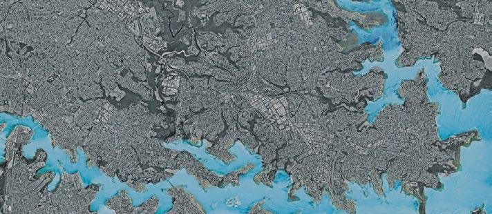


The Urban Design Report compares the Floor Space Ratios (FSRs) of water-oriented sites across Sydney in order to justify the proposed high density on the site (Hatch Roberts Day 2022, p.28-29). From the diagram, it can be seen that recent and proposed developments with FSRs over 1:1 include Rhodes East (1.25), Rhodes West (1.18-9.5), Pyrmont (2.5:1), Meadowbank (2.7:1), Westmead (4.5:1), Parramatta CBD (8:1), Olympic Park (3.6-8:0) and Barrangaroo (12-14:1), all of which are located within walking distance to a train station or the Sydney CBD.

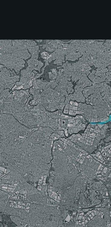
Of these sites, the Report identifies Jacksons Landing in Pyrmont Point, the recent development in Meadowbank and the proposed development at Parramatta River Square as ”precedent benchmarks” for this site (Hatch Roberts Day 2022, p.20). It should be noted that Jacksons Landing at Pyrmont Point has residential towers of 4-32 storeys, is only 2km from the Sydney CBD and is serviced by light rail, ferry and bus services. The Meadowbank development is adjacent to the Meadowbank railway station and Parramatta River Square is a precinct wide proposal that relates to a strategic location within the Parramatta CBD.
The Report also identifies Newmarket Green in Randwick as a benchmark for the proposed density of the site (Hatch Roberts Day 2022, p.54). Newmarket Green is within 1km of Randwick centre which is identified as a strategic centre and a health and education precinct within the Eastern City District Plan (Greater Sydney Commission, p.11).
Recent developments which more closely relate to the character and setting of this site can be found in the Appendix to this report and include Breakfast Point (0.65:1), Chiswick (0.7:1) and Rosemeadow Drive (0.7:1), all of which have an FSR under 1:1.
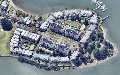


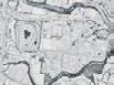 Floor Space Ratios of water-oriented sites (Source: Hatch Roberts Day 2022, p28-29)
2.5 1.4 1.0 1.0 1.0 1.7 4.5 5.0 8.0-12.0 8.0 3.6-8.0 6.0 3.0 3.4 1.3 Melrose Park Olympic Park Newington Silverwater Broughton Street River Rd W Parramatta CBD North Parramatta Granville Westmead RIVER-ORIENTATED CITY SHAPING city) where compositional yellow from and Factory will form 12.0 -14.0 5+ 2.1 2.5-2.6 2.7 2.5 3.5 Recent development/Under LEP (FSR) Proposed 5.6-9.5 1.5-12.0 1.25 1 1.18 1.5 1.3 1.3 0.7 0.7 0.9 1.54 2.0 5.0 8.0 Wentworth Point Sanctuary Meadowbank Rhodes East Barangaroo Pyrmont Drummoyne Gladesville Mortlake Breakfast Point Bushells Factory Chiswick Sydney CBD Potts Point Darling Point Point Piper Rhodes West Max. building height 8.5 to 17m Max. FSR 0.7:1 Land use zone R3 Predominant typology Apartments, townhouses Retained heritage items No Total site area 7 ha
Chiswick Case Study
160 Burwood Rd, Concord | Urban Design Review | November 2022 57
Figure 32 Aerial photo (source: nearmap.com)
O3
3-4 Density and FSR
Precincts
Apartment Design Guide: Part 1B Local character and context
Precincts are characterised by large land parcels or a group of larger sites undergoing extensive change. These sites often need to be restructured to support a change of land use mix, building height and density.
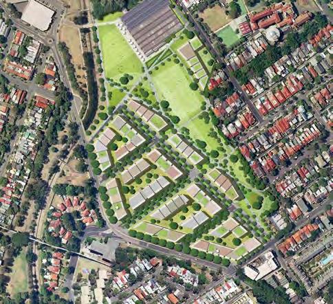
Part 1B of the Apartment Design Guide states that the process of defining the context’s setting and scale has direct implications for the design quality of apartments.
Precinct plans typically incorporate new streets and infrastructure, through-site links and public open spaces that relate in scale, location and character to the local context. The subdivision of large land parcels into smaller ones assists in creating a finer urban grain and achieving greater diversity in building design. It can also assist with the staging of redevelopment.
“The planning process establishes the appropriate location for residential apartment development by determining land use and density in proximity to transport, employment, services, land form and environmental features. Within this framework, the specific characteristics of a place or its setting will inform design decisions”.
Precinct plans provide a number of opportunities including:
• reconnecting parts of the city or town that have previously been isolated
This section goes on to state that the four common settings for residential flat buildings are strategic centres, local centres, urban neighbourhoods and suburban neighbourhoods.
• improving the public domain network and providing more public open space
The setting of the subject site can be classified as a suburban neighbourhood, which is typically characterised as “detached housing in a landscaped setting”.
Commentary:
• incorporating a mix of uses to support more vibrant renewal areas
• integrating heritage and important views within the site or surrounding context
• providing greater housing diversity
• providing space for new community facilities such as recreational centres, libraries and childcare centres
“Considerations for residential apartment development in suburban neighbourhood settings include relationships and interface with existing houses, appropriateness of apartment buildings compared to other forms of medium density housing (such as terraces or townhouses), landscape setting, existing significant trees and the pattern of front and rear gardens” (NSW DPE 2015, p.21).
• leveraging efficiencies of scale to deliver more effective environmental measures such as on site energy production, integrated stormwater management and waste water recycling
• supporting greater flexibility in site layout to provide greater amenity to individual apartments and open spaces.
Precinct plans establish building envelopes and inform the controls within a local environmental plan and development control plan, against which future development applications are assessed. Indicative plans at both ground and upper levels can assist to describe the expectations of future development types within the envelope providing more certainty for local government, applicants and the community.
When determining the floor space of a precinct plan, the net floor space is based on the whole site area including streets and open spaces. This will be significantly lower than the net floor space of individual parcels within the precinct plan (see also section 2D Floor space ratio).
Through the precinct plan design process and the testing of proposed building envelopes against the site constraints, alternative solutions to some of the design criteria in this guide may be appropriate.
The Concept Design in the amended PP (May 2022) is a marked improvement on earlier designs. While the majority of development in the surrounding context is only one to two (1 to 2) storeys high the existing Central Roasting Hall (approximately 9 storeys high) and its narrow chimney and clearly visible ‘B’ are a recognisable landmark, well above the lower scale of surrounding development. It has been accepted by Studio GL that as the Central Roasting Hall building is to be retained, it creates a context where buildings that are slightly taller than the surrounding context, up to a five to six (5 to 6) storey maximum height in the centre of the site, would be possible.
Some design criteria may be best applied to the entire precinct area or to stages within the site, for example deep soil and communal open space may be consolidated and accessed by a number of buildings.
Other design criteria associated with the amenity of individual apartments, such as visual privacy, sunlight access and ventilation, are typically applied to each building within the precinct plan.
The scale of these buildings should however reflect that they are to be located in a suburban, not urban neighbourhood, with buildings located in a landscaped setting. As the proposed density is a result of building envelopes with overly deep floor-plates and few breaks between buildings or upper level setbacks it creates a poor level of amenity, especially for a suburban, not urban, location and suggests that the proposed density is too high for the suburban location.
25 Apartment Design Guide 01 I Context
Figure 1C.2 Precinct: this precinct plan for the redevelopment provides a clear structure of new streets, public parklands, adaptive re-use of former tram sheds and mid block shared communal open spaces
Figure 33 Example of a Precinct Plan showing new roads and through site links which connect to the surrounding neighbourhood (source: NSW DPE 2015, p.25)
160 Burwood Rd, Concord | Urban Design Review | November 2022 58
O3
URBAN DESIGN REVIEW
URBAN DESIGN REVIEW O3
Apartment Design Guide:
Part 1C Precincts and individual sites
Part 1C of the Apartment Design Guide notes that apartment development either occurs on individual sites or within precincts. It notes that “precincts are characterised by large land parcels or a group of larger sites undergoing extensive change. These sites often need to be restructured to support a change of land use mix, building height and density”.
Furthermore the guide notes that development at a precinct scale provides particular opportunities including reconnecting parts that have previously been isolated, improving the public domain network and providing more public open space, incorporating a mix of uses, integrating heritage and important views within the site or surrounding context and providing space for new community facilities.
Commentary:
The size of this site means that it should be considered as a precinct. The ADG notes that “precinct plans typically incorporate new streets and infrastructure, through-site links and public open spaces that relate in scale, location and character to the local context. The subdivision of large land parcels into smaller ones assists in creating a finer urban grain and achieving greater diversity in building design. It can also assist with the staging of redevelopment” (p25).
The opportunity to create a clear structure of streets and blocks is critical to the success of any development. It is particularly important to learn from the mistakes of the past where waterfront developments have created internal “gated” communities and poor quality, isolated areas of public foreshore land such as that which occurs at the Sydney Wire Mill Site, Chiswick (see Figure 34 and Figure 35 adjacent).
The amended Concept Design indicates a robust urban structure of streets and public open space and this layout is supported as it is well connected into the rest of the neighbourhood and provides significant public benefit. There is a clear definition between public and private domain areas and the foreshore is proposed to be zoned public open space. The next step will be to ensure the proposed LEP and DCP controls are designed to ensure that this robust structure and public benefits are delivered in the final design.
AbbotsfordCoveDr Blackwall Point Rd BlackwallPointRd Parkview Rd BiddySt ShoreRd FortescueSt WeddleSt BurnsCres Swannell Tyler Cres Florey Pl Kokoda St Windward Pde Manta Pl Janda Pl Bechert Rd BechertRd DophinCl BlackadderCl TheProminade MaherCl Point Ave Marine Dr SearayCl MelroseCres WaltonCres Montrose Ave HabourviewCres FigtreeAve Abbotsford Bay Sydney Wire Mill Site - Chiswick
Figure 34 LEP 2013 showing the Sydney Wire Mill Site, Chiswick
Figure 35 Plan of the Sydney Wire Mill Site, Chiswick
160 Burwood Rd, Concord | Urban Design Review | November 2022 59
3-4 Density and FSR
Apartment Design Guide: Part 2D Floor Space Ratio
Part 2D Floor Space Ratio of the ADG notes that when determining the floor space of a precinct plan, the gross floor space is based on the whole site area including streets and open spaces. This will be significantly lower than the net floor space of individual parcels within the precinct plan.
Commentary:
Floor Space Ratio
Maximum building envelope
Potential additional floor space based on incentives
The ADG considerations in setting FSR controls include a recommendation to “consider how floor space is implemented across larger sites. A single floor space ratio may result in under or over development. For example, in an area with a consistent height control (...) large sites with multiple buildings require greater space between buildings and may have less floor space capacity” and “on precinct plan sites with new streets and/or open spaces, both the gross FSR for the whole site and the net FSR for individual development parcels need to be defined. The net FSR may be significantly higher than the gross FSR” (p33).
‘Allowable’ floor space
Considerations in setting FSR controls
An understanding of residential and non-residential FSR is critical when establishing FSR provisions for a mixed use site of this size. There are important differences in built outcomes of an industrial development with an FSR of 1:1 and a residential development with an FSR of 1:1 and the difference between a gross FSR of 1:1 for a precinct compared to a net FSR of 1:1 for an individual site. It is important to note that when changing the planning controls of a site, building envelopes and FSRs need to be conservative and realistic because they establish a benchmark for all future development. If the FSR is too high, it can create unrealistic expectations and the final development may require unusual or poor quality built form solutions in order to achieve the established FSR.
Test the desired built form outcome against the proposed FSR to ensure its is coordinated with the building envelope, height, depth, setbacks and open space requirements
Part 2D of the ADG also notes that “where both residential and non-residential uses such as retail or commercial offices are permitted, develop FSR controls for each use. Commercial and retail generally fill 80-85% of their envelope. Allow for services, circulation, car park and loading requirements” and “note that residential FSR tends to be lower compared with commercial or retail ratios. This is because residential buildings are typically less deep than commercial buildings to provide higher levels of internal amenity and to incorporate more non-GFA elements such as balconies” (p33).
Considerations in setting FSR controls
The GFA should fit comfortably within the building envelope as the envelope needs to also account for building elements and service areas that are not included in the GFA definition and to allow for building articulation (see section 2B Building envelopes)
Test the desired built form outcome against the proposed FSR to ensure its is coordinated with the building envelope, height, depth, setbacks and open space requirements
The GFA should fit comfortably within the building envelope as the envelope needs to also account for building elements and service areas that are not included in the GFA definition and to allow for building articulation (see section 2B Building envelopes)
Figure 2D.2 When determining floor space ratio controls, maximum building envelopes can be used to test the FSR, including any potential incentives and bonuses
Part A
Whole site:
2:1 FSR (gross)
Part A:
2.5:1 FSR (net)
Part B:
2.3:1 FSR (net)
Consider how floor space is implemented across larger sites. A single floor space ratio may result in under or over development. For example, in an area with a consistent height control:
The proposed FSR as per the amended PP (May 2022) is 1.25:1. While a gross FSR of 1.25:1 might sound modest especially when compared to a net FSR for sites in an urban centre, it is high for a gross FSR on a suburban site as it includes public roads and public open space. The net FSRs within the current amended PP (May 2022) are still too high for this suburban location. For comparison, the Harold Park development, which is predominantly 6 to 8 storey development and has a large area of open space has a gross FSR of only 1.15:1.
• corner, mid-block or wide shallow sites tend to have different floor space capacities
Consider how floor space is implemented across larger sites. A single floor space ratio may result in under or over development. For example, in an area with a consistent height control:
• small sites with a single building may have greater floor space capacity than larger sites with multiple buildings
• corner, mid-block or wide shallow sites tend to have different floor space capacities
The amended PP (May 2022) identifies net FSRs for individual blocks. This diagram (Figure 38) clearly shows that net densities are predominantly much higher than 1.25:1, ranging from 1.15:1 to 3.05:1.
• small sites with a single building may have greater floor space capacity than larger sites with multiple buildings
• large sites with multiple buildings require greater space between buildings and may have less floor space capacity
• large sites with multiple buildings require greater space between buildings and may have less floor space capacity
On precinct plan sites with new streets and/or open spaces, both the gross FSR for the whole site and the net FSR for individual development parcels need to be defined. The net FSR may be significantly higher than the gross FSR
On precinct plan sites with new streets and/or open spaces, both the gross FSR for the whole site and the net FSR for individual development parcels need to be defined. The net FSR may be significantly higher than the gross FSR
Where both residential and non-residential uses such as retail or commercial offices are permitted, develop FSR controls for each use. Commercial and retail generally fill 80-85% of their envelope. Allow for services, circulation, car park and loading requirements. Note that residential FSR tends to be lower compared with commercial or retail ratios. This is because residential buildings are typically less deep than commercial buildings to provide higher levels of internal amenity and to incorporate more non-GFA elements such as balconies
Figure 37 includes the differences in height, GFA and FSR between the two previous amended PPs (July 2018 and Feb 2019) and the current amended PP (May 2022). The table illustrates that net FSRs for Blocks 1 & 5 have been reduced as these blocks have become lower in height. The net FSRs for Block 3 has increased, as the E1 block has been removed to retain the Hills Fig tree, thus also reducing the overall size of Block 3. The net FSR for Block 4 has also increased from 2.68:1 to 3.05:1. The net FSR for Block 2 has increased as this block has replaced the three (3) storey terraces along Burwood Road with a three (3) storey mixed use building.
Consider opportunities to achieve public benefits such as community facilities and public domain improvements, such as new streets, through-site links and open spaces
In noisy or hostile environments, the impacts of external noise and pollution may require enclosing of balconies (e.g. wintergardens). When setting FSR controls in these situations, consider providing additional area to compensate for the enclosing of balconies
Where both residential and non-residential uses such as retail or commercial offices are permitted, develop FSR controls for each use. Commercial and retail generally fill 80-85% of their envelope. Allow for services, circulation, car park and loading requirements. Note that residential FSR tends to be lower compared with commercial or retail ratios. This is because residential buildings are typically less deep than commercial buildings to provide higher levels of internal amenity and to incorporate more non-GFA elements such as balconies
02 Controls
Figure 36 Diagram showing the difference between gross FSR and net FSR (source: ADG, p33)
Whole site: 2:1 FSR (gross) Part A: 2.5:1 FSR (net) Part B: 2.3:1 FSR (net) New street Part A Maximum building envelope Potential additional floor space based on incentives ‘Allowable’ floor space
Figure 2D.2 When determining floor space ratio controls, maximum building envelopes can be used to test the FSR, including any potential incentives and bonuses
Figure 2D.3 On sites with subdivision and public domain dedication (e.g. a new street), the overall gross FSR is lower than the net FSR for each individual development parcel
Part B 02 I Controls
New street
Consider opportunities to achieve public benefits such as community facilities and public domain improvements, such as Part B
160 Burwood Rd, Concord | Urban Design Review | November 2022 60 URBAN
O3
DESIGN REVIEW
5.2.3 Proposed amendments to the floor space ratio map
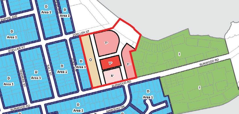
Amend CBLEP 2013 ‘FSR Map Sheet 004’ as it applies to the subject site from N-1.00:1 to 1.25:1 across the whole of the site which, when broken down into the proposed blocks, corresponds to FSR for each blocks as follows:
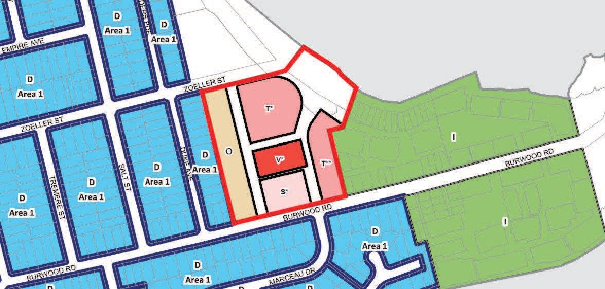
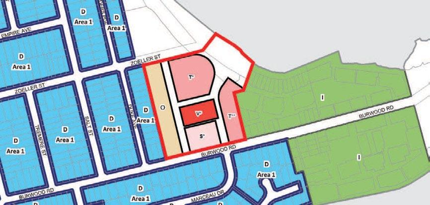
* Total GFA combines residential and non-residential floor space (i.e. commercial, industrial, urban services)
part O - 1.15:1;
part S* - 1.85:1;
part T** - 2.1:1;
The PP (May 2022) includes a proposed LEP map for maximum FSR and this is shown in Figure 38.
part T* - 2.2:1;
part V* - 3.05:1
shown in Figure 26.
Studio GL has prepared a recommended amended site layout (see Chapter 4, Figure 72) that reduces the overall building depths, accommodates balconies within the building envelopes, increases building setbacks and introduces upper storey setbacks.
These changes result in a recommended permissible density of 0.96:1 (approx. 38,000m2). If the Central Roasting Hall is retained, a bonus FSR of 2.0:1 (approx. 5,900m2) can be applied to Block 4, resulting in an increased total FSR of 3.0:1 for this block and an increased overall gross site FSR of 1.11:1 (approx. 43,900m2). These calculations are shown in Figure 37.
Numbering of categories will need to be amended to accommodate the new block-by-block FSR controls.
These amendments are reflected in Studio GL's
Figure 37 Height, GFA, and FSR comparison table, 2022
Planning Proposal July 2018 C-Amended Draft DCP (PP 07/02/2019, figure 6, page 7) D-Amended Arch Drawings (BVN Sheet 1, 29/01/2019) E-Amended Arch Drawings (BVN May 2022) Studio GL recommendations Suggested layout 2022 without heritage FSR bonus Studio GL recommendations Suggested layout 2022 with heritage FSR bonus Height 3-6 storeys 4-5 storeys 4-5 storeys 3 storeys 3 storeys 3 storeys Total GFA (combined*) 14,812 n/a 11,827 8,204 7,833 7,833 FSR (net per block) 2.0 1.6 1.62 1.15 1.1 1.1 Height 3-5 storeys 3-6 storeys 3-6 storeys 3-6 storeys 3-6 storeys 3-6 storeys Total GFA (combined*) 4,931 n/a 5,885 6,317 4,379 4,379 FSR (net per block) 1.4 1.71 1.65 1.85 1.3 1.3 Height 3-7 storeys 3-7 storeys 3-7 storeys 3-6 storeys 3-6 storeys 3-6 storeys Total GFA (combined*) 11,231 n/a 11,231 9,771 8,292 8,292 FSR (net per block) 2.0 1.9 1.97 2.10 1.8 1.8 Height 9 storeys 9 storeys 9 storeys 9 storeys 9 storeys 9 storeys Total GFA (combined*) 8,666 n/a 8,666 8,921 2,987 8,921 FSR (net per block) 2.7 2.66 2.68 3.05 1.0 3.0 Height 4-13 storeys 5-9 storeys 5-9 storeys 2-6 storeys 2-6 storeys 2-6 storeys Total GFA (combined*) 21,141 n/a 18,358 15,339 14,484 14,484 FSR (net per block) 2.9 2.6 2.53 2.20 2.1 2.1 Total GFA 60,780 n/a 55,967 48,552 37,975 43,909 Total Gross FSR 1.54 1.50 1.41 1.23 0.96 1.11 Total Site Area 39,558
Block 5 Env C1-C5 Block 1 Env W1-W5 Block 2 Env C7-C9 Block 3 Env E1-E4 Block 4 Roasting Hall
0.50 D
LEGEND 0.50 0.75 1.00* 1.10 1.30 1.80 A bonus 2.0:1 can be added if the Central Roasting Hall D I N* O Q1 S4 T2 I LEGEND 0.50 0.75 1.00* 1.10 1.30 1.80 2.10 A bonus 2.0:1 can
if the Central
Hall is retained D I N* O Q1 S4 T2 * LEGEND 0.50 0.75 1.00* 1.10 1.30 1.80 2.10 A bonus 2.0:1
if
D I N* O Q1 S4 T2 * 160 Burwood Rd, Concord | Urban Design Review | November 2022 61 URBAN
be added to this Block FSR
Roasting
can be added to this Block FSR
the Central Roasting Hall is retained
DESIGN REVIEW O3
Apartment Design Guide: Part 2E Building Depth


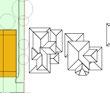

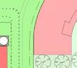
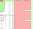
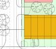
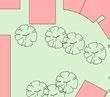

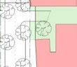
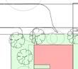
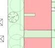
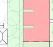
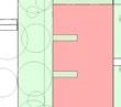
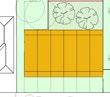
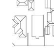
Part 2E of the ADG notes that building depth is an important tool for determining the development capacity of a site. The ADG also comments that building depth has a direct relationship to internal residential amenity by determining room depths.
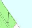

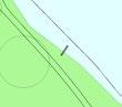
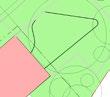
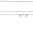
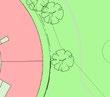

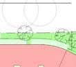

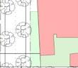
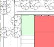
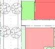
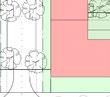
The ADG considerations in setting building depth controls include a recommendation to ‘Use a range of appropriate maximum apartment depths of 12-18m from glass line to glass line’ and also note that ‘The building depth includes the internal floor plate, external walls, balconies, external circulation and articulation such as recesses and steps in plan and section’.

Commentary:
Building depth is an important factor to consider when setting density controls, as the depth of a building’s floor plate has a direct relationship with the total floor area achieved. The plan below (Figure 40) illustrates the range of building depths within the amended PP (May 2022). The plan shows a number of buildings deeper than 18m which create deep floor plates that make it difficult to achieve good residential amenity, and meet sunlight and natural ventilation requirements required by the ADG. It is recommended that building depths over 18m are reduced to ensure a high level of residential amenity can be provided, that is appropriate to the suburban context.

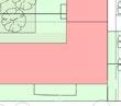
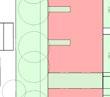
The ADG also notes that building depths should include balconies. Balconies have not been indicated on the architectural plans within the amended PP (May 2022) and have not been included in the GBA calculations.

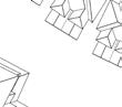
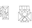
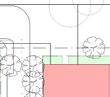
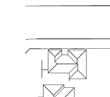
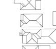
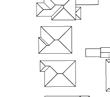
As shown in the Communal Open Space Diagram (BVN May 2022) the provision of balconies and roof top communal open spaces will create additional bulk to the development, reduce privacy distances, and further reduce internal amenity on blocks deeper than 18m. It is recommended that balconies are accommodated within the proposed building envelopes.
The gap between buildings is too narrow for facing habitable windows under ADG criteria. However the floor plates of the blocks are too deep for corner apartments to rely on only a single aspect.
Terrace floor plates are too deep to achieve good daylighting to centre of plan.
D Sca e F e name Re s on no P epared by 79 Buck and St eet Ch ppenda e NSW 2008 www s ud og com au nfo@s ud og com au D scla mer: © Copyright Studio GL The si e boundar es and surroundings are based on the data prov ded by the cl ent These drawings are o be read n conjunct on with al other relevant documentation produced by Stud o GL Legend Burwood Road Urban Des gn Rev ew SGL Commentary 28 F b y 2019 1:1000 @ A3 19008 FSR Ca cu a ons vwxRE N C1 C2 C3 C4 C5 C5a C6 C7 C8 C9 E2 E3 E4 W2 W3 W4 W5 5 STOREY STOREY 5 STOREY STOREY 2 STOREY 6 STOREY 4 STOREY 3 STOREY 5 STOREY 3 STOREY STOREY 3 STOREY W1 6 STOREY 3 STOREY 3 STOREY 3 STOREY 5 STOREY LOCAL ROAD NOM. 12M LOCAL ROAD LOCAL ROAD ZOELLER ROAD NOM 22M LANDSCAPE 6.3M SETBACK NOM. 23M NOM. 3M NOM 12M NOM 3M SETBACK 9 STOREY RL 15000 URBAN SERVICES 1 STOREY 3 STOREY RL 13800 RL 13800 RL 24200 RL 24200 RL 21200 RL 23800 RL 26900 RL 20400 RL 23400 8700 XX-XX-021 XX-XX-021 RL 17600 RL 21200 RL 19400 RL 46400 RL 19400 RL 19400 RL 19400 RL 17000 BURWOOD ROAD SHARED ZONE RESIDENTIAL -TOWER COMMERCIAL RETAIL CAR PARKING RESIDENTIAL -TERRACE HOUSING RESIDENTIAL -LOW RISE PUBLIC OPEN SPACE PRIVATE OPEN SPACE URBAN SERVICES CLIENT PROJECT BVN PROJECT NUMBER ISSUE GRAPHIC SCALE DRAWING KEY PROJECT MANAGER BE USED FOR THE EXPRESS PURPOSE AND PROJECT FOR HAS BEEN CREATED AND DELIVERED, AS NOTIFIED IN WRIT BVN;AND THIS DOCUMENT MAY NOT BE OTHERWISE USED, INTELLECTUAL PROPERTY 10000 0 1 As indicated@A1 C:\Users\buzevska\Documents\180514_UpdatedScheme_AJC_Luiz AR-XX-XX-002 1504003 BUSHELLS COFFEE FACTORY 160 BURWOOD RD, CONCORD. ROOF PLAN COLLIERS TEL 02 9437 1300 fax 02 9966 9804 FRESHFOODS NEW TREE PLANTINGS EXISTING TREES RETAINED ISSUEDATE FOR 120/05/22FINAL SUBMISSION A25/05/18REVIEW B19/06/18REVIEW C21/06/18REVIEW D27/06/18REVIEW E06/12/18REVIEW F03/09/19REVIEW G06/09/19REVIEW H10/09/19REVIEW I17/06/20REVIEW J22/06/20REVIEW K23/06/20REVIEW L20/07/21REVIEW 1 8 m 1 4 m 16m 21m 1 6 m 26m 21m 24m 1 4 m 21m 1 8 m 0 10m 50m 20m Note: Studio GL notations added to plan produced by BVN dated 20/07/21
Figure 40 Studio GL annotations overlaid on L-01 Plan (BVN 2021)
deeper than the recommended depth of 18m from glass line to glass line, as per the ADG.
Blocks
3-4 Density and FSR 160 Burwood Rd, Concord | Urban Design Review | November 2022 62 URBAN DESIGN REVIEW O3
Apartment Design Guide:
Part 4B Natural Ventilation
The ADG notes that ‘Apartment layout and building depth have a close relationship with the ability of an apartment to be naturally ventilated. Generally as the building gets deeper, effective airflow reduces'.
Objective 4B-3 within the ADG requires 60% of apartments to be naturally cross ventilated in the first nine storeys of a building. Objective 4B-2 advises that apartment depths are limited to maximise ventilation
In addition to building depth, the length of a building also affects cross ventilation; long uninterrupted blocks have fewer corner apartments than multiple separate buildings. The annotated plan of a typical block (Figure 41) illustrates that the deep 21m floor plate creates deep apartment plans; where a significant portion of the apartment is greater than 8m from the facade.
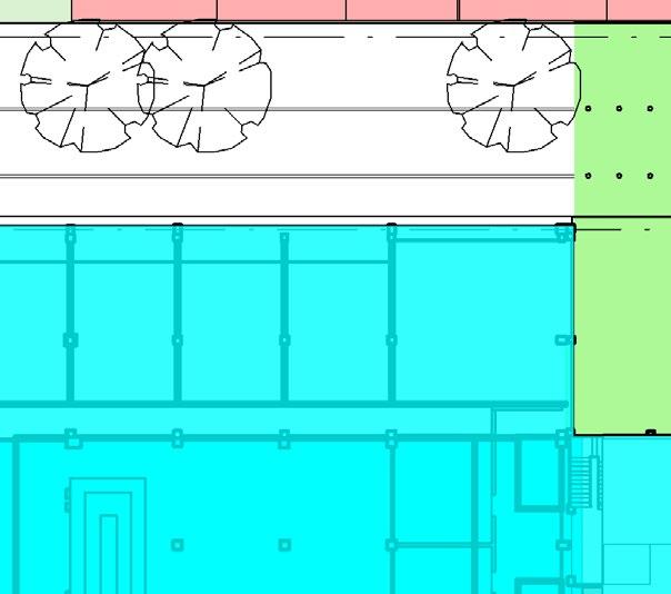
Relying on buildings deeper than 18m (which cannot be planned with standard sized apartments) reduces efficiency and design flexibility. Deeper buildings also create uncertainty as to whether a scheme with a different unit mix and more units, within the same FSR and height limits, could provide an appropriate level of
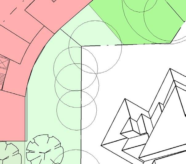
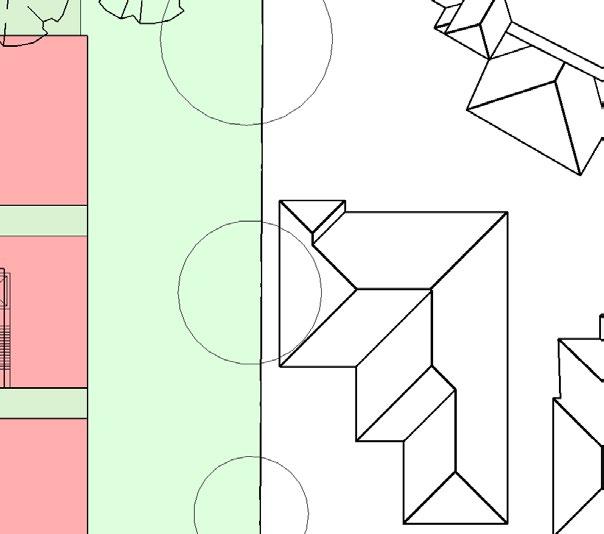
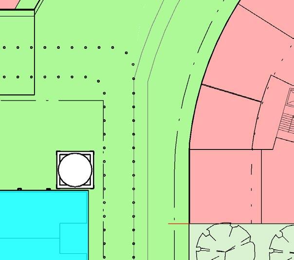
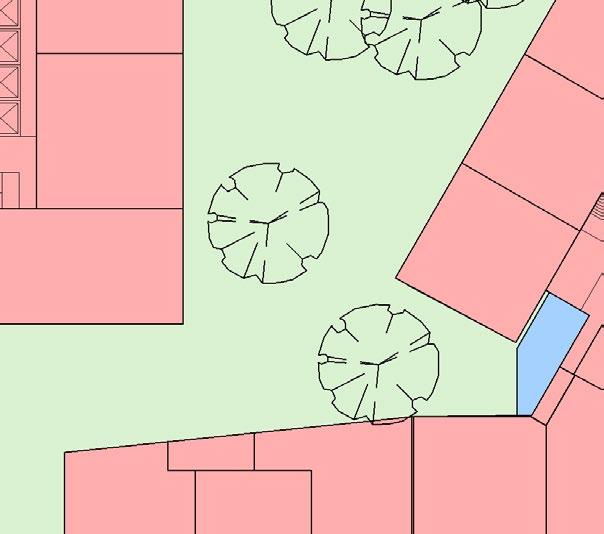
Buildings in Block 1 and Block 3 show ‘slot’ lightwells located at the rear of the typical buildings. It is assumed these slots have been located to provide communal circulation space with natural ventilation. This is a poor solution to providing ADG compliant cross ventilation to single aspect west facing units and creates very narrow light-wells. While this type of solution can be used on a constrained urban site, to rely on such a constrained solution to establish suitable planning controls for a suburban site appears perverse.
It is recommended that apartment layouts are reconfigured to achieve cross ventilation requirements within a regular building envelope, less than 18m deep, that avoids light-wells/slots and provides flexibility during the detailed design phase so that future buildings can be designed to achieve a high quality
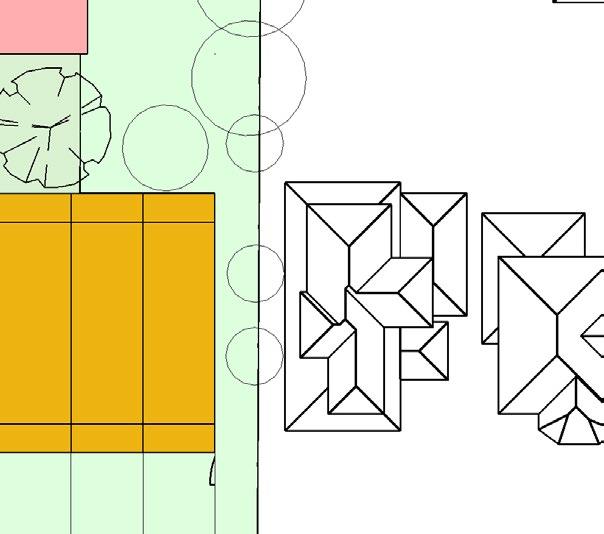
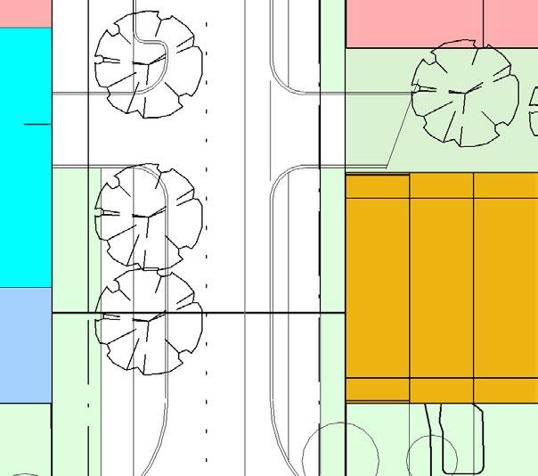
Approx. 128sqm Approx 88 sqm
3 STOREY 7700 7000
Approx. 122 sqm Approx 166 sqm Approx 122 sqm
Approx 68 sqm Note: Studio GL notations added to plan extract produced by BVN dated 20/07/21
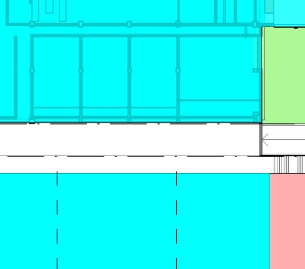
Apartment floor area further than 8m from a primary facade
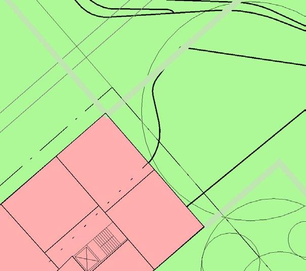
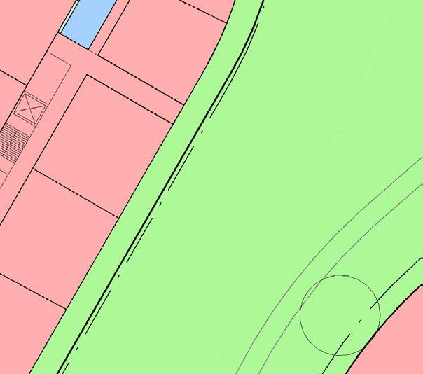
160 Burwood Rd, Concord | Urban Design Review | November 2022 63
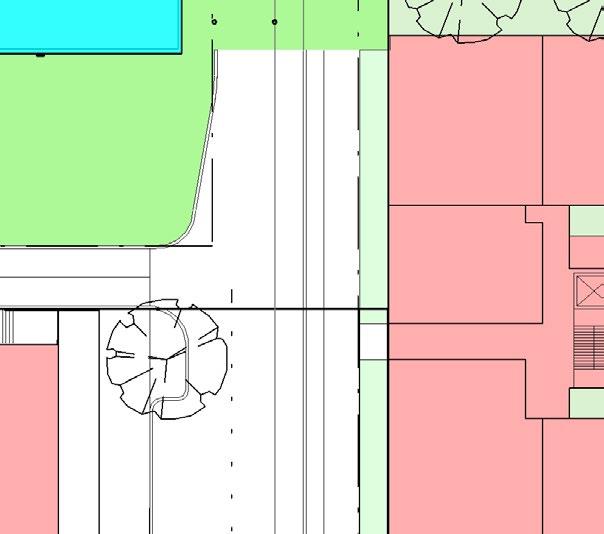 Studio GL annotations overlaid on extract from L-01 Plan
E2 E3 E4
C8
3 STOREY
5 STOREY
6 STOREY
RL 5470 LOCAL ROAD
5 STOREY RL RL 5360
SHARED ZONE 2060 21100 38400
It is also noted that a previous PP (Feb 2019) had an average unit size of 109m2 (gross residential floor area divided by proposed apartment numbers). This is similar to the approximate apartment sizes shown in Figure 41 below which shows an average unit size of 115m2. The amended PP (May 2022) proposes 400 dwellings, which with a total residential GFA of approximately 39,335, equates to an average unit size of approximately 98m2. The reduction in unit size is questioned given the suburban location where larger dwelling sizes, for both market and affordable housing, would seem more appropriate. It is also noted that a reduction in dwelling size is likely to increase the challenges for apartments to meet ADG requirements for solar access and cross ventilation.
URBAN DESIGN REVIEW O3
URBAN DESIGN REVIEW O3
3-4 Density and FSR
Conclusion
The density of the proposed built form and the population density proposed is inconsistent with the site’s isolated suburban character, limited access to high frequency public transport and the lack of nearby facilities. More relevant density precedents are the adjoining former industrial sites at Pelican Point, Pelican Quays & Phillips Landing which have been developed with an FSR of 0.75:1 and a maximum building height of 15m. A more appropriate population density would be one that is closer to 100 people/ha to reflect the isolated location and surrounding low density context.
The density proposed for this site in the amended PP (May 2022), although slightly reduced, remains high and the proposed building massing that has been illustrated to identify impacts does not include balconies or roof terraces. Providing balconies, as required by the Apartment Design Guide, will either increase the bulk of the development or reduce the overall GBA and therefore the FSR of the development. In order to set a realistic FSR the provision of balconies and their contribution to bulk and scale should be considered as part of the planning proposal. The relationship between building footprint, height and density affects the character of development and the amenity of residential accommodation. The concept plans have a high density for the proposed heights and this has resulted in overly deep and long buildings, which are likely to result in a lower level of amenity for the apartments than is appropriate in a suburban setting. It is recommended that building depths that are greater than 18m deep are reduced to create higher amenity units within the proposed heights. Reducing building height, length and depth is likely to further reduce the maximum FSR that is achievable on this site.
FSRs for individual sites have been identified in the May 2022 PP (LFA 2022, p57) and reflected in the proposed floor space ratio LEP map. This should encourage appropriate built form outcomes, with lower FSRs on sites that adjoin sensitive residential interfaces and higher FSRs where the impacts of development are reduced. Different uses create different bulk and scale outcomes. For example, if the FSR for ‘urban services’ within Block 2 were to become residential this would create increased bulk and scale, as the additional apartments could not be located in a single, deep, ground floor podium form. Therefore it is recommended that maximum FSR controls are established for residential and non-residential uses on the site. This is particularly important as, while desirable, the current provision of community spaces and facilities is uncertain and the quantum of retail, commercial and light industrial uses may not be commercially viable.
Whilst the application to list the former Bushells Factory Building as an item of local heritage is supported it may be advisable to ensure that some of the increase in FSR is linked to the retention and restoration of the Central Roasting Hall. In the future, if the Central Roasting Hall is not restored and non-residential floor space and/or heritage floor space is transferred to residential floor space it is likely to change the character of the development and possibly also increase the bulk and scale of the development.
It is recommended that the maximum permissible residential density is reduced to 0.77:1, with a bonus of 0.15:1 for the retention of the Central Roasting Hall, and an additional maximum non-residential FSR of 0.19:1 be applied (no more than 7,500m2). The maximum combined FSR would be 1.11:1.
160 Burwood Rd, Concord | Urban Design Review | November 2022 64
Commentary:
Neighbourhood Centre
The amended Concept Plan proposes to change the land use of the site from IN1 General Industrial to part B1 Neighbourhood Centre, part R3 Medium Density Residential and part RE1 Public Recreation. The objective of the B1 Neighbourhood Centre is “to provide a range of small-scale retail, business and community uses that serve the needs of people who live or work in the surrounding neighbourhood".
The PP (May 2022) notes that "The proposed B1 Neighbourhood Centre zone will enable the development of urban services (light industries), as well as become the focus of the retail and commercial uses". The most recent version of the PP (see Figure 43) has relocated the Neighbourhood Centre zone away from the waterfront and proposed waterfront open space and onto Burwood Road with buildings in Block 2, Southern Edge altered from three (3) storey terraces to a three (3) storey mixed use building with ground floor commercial/retail uses.
Retail uses in this south facing, Burwood Road location would draw activity away from the north facing open space plaza, reduce the opportunity for screen landscaping along Burwood Road and impact on the amenity and privacy of the low density dwellings across the street. Commercial uses, preferably accessed from within the site, might be acceptable in this location but an active retail frontage should be discouraged.
Neighbourhood centre
Low density residential
Medium density residential
Public recreation
In addition, as the Neighbourhood Centre zone has moved away from the waterfront to enable shop top development facing the new plaza and open space, the PP (May 2022) proposes that "Commercial premises" are made an additional permitted use within the portion of the site proposed to be zoned R3 Medium Density Residential. A challenge with this approach is that it does not require that this additional permitted use occur near the waterfront nor does it restrict non residential uses to parts of the site that do not adjoin the residential neighbours.
Another challenge is that under the Canada Bay LEP 'Commercial premises' means any of the following (a) business premises, (b) office premises and (c) retail premises which would allow a very wide range of activities, some of which would not be appropriate for the location including garden centres, hardware and building supplies and vehicle sales or hire premises.
It is recommended that the area where additional uses are permissible is limited to areas close to the proposed new open space area and clearly identified in the LEP. The clause applying additional permitted uses should be limited to office premises, shops and restaurants or cafes.
5.2.1 Proposed amendment to the land zoning map
The SECPP recommended that the minimum provision of non-residential uses be 10,000m², where a minimum 3,000m² shall be provided for 'urban services' (aka light industrial uses).
Amend CBLEP 2013 ‘Land Zoning Map’ Sheet 004’ as it applies to the subject site General Industrial to part B1 Neighbourhood Centre, R3 Medium Density Residential, Recreation as shown on Figure 24.
3-5 Land use BURWOOD VE ST SALT ST BURWOOD RD DUKE AVE MARCEAU DR ZOELLER ST SANDERS PDE EMPIRE AVE EW ST ZOELLER ST BURWOOD RD OD ST TREMERE ST R2 R2 R2 R2 R2 R2 R2 R2 R2 R2 R2 R2 R2 R2 R2 R2 R2 R2 R2 R2 R2 R2 R2 R2 R2 R2 R2 R2 R2 R2 R2 R2 R2 R2R2 RE1 RE1 RE1 RE1 RE1 RE1 RE1 RE1 RE1 RE1 RE1 RE1 RE1 RE1 RE1 RE1 RE1 RE1 RE1 RE1 RE1 RE1 RE1 RE1 RE1RE1 R3 R3 R3 R3 R3 R3 R3 R3 R3 R3 R3 R3 R3 R3 R3 R3 R3 R3 R3 R3 R3 R3 R3 R3 R3 R3 R3 R3 R3 R3 R3 R3 R3 R3 R3 R3 R3 R3 R3 R3 R3 R3 R3 R3 R3 R3 R3 R3R3 R2 R2 R2 R2 R2 R2 R2 R2 R2 R2 R2 R2 RE1RE1 R3 R3 R3 R3 R3 R3 R3R3 R3 R3 R3 R3 R3 IN1 IN1 IN1 IN1 IN1 IN1 IN1 IN1 IN1 IN1 IN1 IN1 IN1 IN1 IN1 IN1 IN1 IN1 IN1 IN1 IN1 IN1 IN1 IN1 IN1 IN1 IN1 RE1 R3 B1
Figure 24: Proposed Land Zoning Map
B1 R3 RE1
Neighbourhood centre Medium density residential Public recreation BURWOOD RD BURWOOD RD URHAMST WA TAUM AVE SALT ST BURWOOD RD DUKE AVE MARCEAU DR ZOELLER ST DERS PDE AVE LLER ST BURWOOD RD TREMERE ST RE1 RE1 RE1 RE1 RE1 RE1 RE1 RE1 RE1 RE1 RE1 RE1 RE1 RE1 RE1 RE1 RE1 RE1 RE1 RE1 RE1 RE1 RE1 RE1 RE1 RE1 RE1RE1 R3 R3 R3 R3 R3 R3 R3 R3 R3 R3 R3 R3 R3 R3 R3 R3 R3 R3 R3 R3 R3 R3 R3 R3 R3 R3 R3 R3 R3 R3 R3 R3 R3 R3 R3 R3 R3 R3 R3 R3 R3 R3 R3 R3 R3 R3 R3 R3R3 RE1 RE1 RE1 RE1 R3 R3 R3 R3 R3 R3 R3 RE1 RE1 RE1 RE1 RE1 RE1 RE1 RE1 RE1 RE1 RE1 RE1 RE1 RE1 RE1 RE1 RE1 RE1 RE1 RE1RE1 E2 E2 E2 E2 E2 E2 E2 E2 E2 E2 E2 E2 E2 E2 E2 E2 E2 E2 E2 E2 E2 E2 E2 E2 E2 E2 E2 E2 E2 E2 E2 E2 E2 E2 E2 E2 E2 E2 E2 E2 E2 E2 E2 E2 E2 E2 E2 E2E2 IN1 IN1 IN1 IN1 IN1 IN1 IN1 IN1 IN1 IN1 IN1 IN1 IN1 IN1 IN1 IN1 IN1 IN1 IN1 IN1 IN1 IN1 IN1 IN1 IN1 IN1 RE1 R3 R3 B1 1: Proposed Land Zoning Map B1 R2 R3 RE1
Figure
42
Proposed Land Zoning LEP map (Source: LFA 2019, p39)
Figure 43 Proposed Land Zoning LEP map (Source: LFA 2022, p49)
160 Burwood Rd, Concord | Urban Design Review | November 2022 65
URBAN DESIGN REVIEW O3
URBAN DESIGN REVIEW O3
3-5 Land use
The Retail Demand Assessment prepared by Hill PDA (Appendix P) notes lessons learnt from case studies indicate that multiple anchors are desirable as they will serve to broaden the appeal of the centre, extend the trade area and operating hours / activity. Anchors could include a supermarket or convenience foodstore, dining precinct, upmarket food hall, club and/or community uses such as a medical centre or childcare centre and the location of the anchor tenants is important in terms of urban activation and ensuring the maximum commercial potential.
In addition the Retail Demand Assessment notes that convenience retail should address the southern boundary and entrance, being the main entrance and the most convenient for residents in the walkable catchment, while the themed retail should utilise the heritage features on the site but could also capitalise on the waterfront amenity. Club and themed restaurants are good examples.
The report notes a centre of around 3,500m2 could be supported providing a combination of 2,000m2 to 2,500m2 of convenience retail and commercial services for local residents and 1,000m2 to 1,500m2 of themed retail and services including restaurants and the like with heritage and waterfront themes. These roles won’t necessarily be distinct and there is likely to be some blurring of the two roles. The suggested retail mix was :
• Approximately 800 to 1,000m2 supermarket (small format Coles or Woolworths, IGA, Harris Farm or similar)
• 200m2 to 400m2 of specialty food (liquor, bakery, butcher, confectionary, coffee, etc)
• Approximately 800m2 of restaurants and fast food/ take-aways (at least half of this space would be themed by the water)
• Approximately 500 to 800m2 of non-food retailing and personal services (newsagency, arts, hair and beauty, chemist, etc)
• Approximately 500m2 of non-retail space (travel, finance, medical, massage, real estate services, etc).
Total shop front floor space identified in the Retail Demand Assessment is in the order of 3,000 to 3,500m2. There is an large inconsistency between the amount of non-residential floor space that can be supported by retail demand (3,500m2), the required light industrial floor area (3,000m2) and the quantum of non residential floor space required to be delivered on the site, being 10,000m2. Given the limited identified demand it is recommended that the non-residential floor space be reduced to no more than 7,500m2 and provide for a mix of retail, light industrial and community facilities.
Community Facilities
The proposal lacks clarity on the proposed breakdown between social, community and retail space. The original development provided 2,148m2 of community uses and a 90 space childcare facility. The childcare facility is no longer part of the proposal and community uses are not specified within the PP (May 2022). If a 90 space childcare facility is proposed, the non-residential floor space could be increased by 700m2, but outdoor play and parking and drop off facilities would need to be accommodated in the planning framework. A gym, childcare and/or community facility could help to activate the location.
Medium Density Residential
The amended PP (May 2022) seeks an R3 Medium Density Residential zoning across all the proposed Blocks except for Block 2 and 4, which are proposed as B1 Neighbourhood Centre zone. As the maximum residential building height has now been reduced to six (6) storeys a zoning of R3 Medium Density residential is considered appropriate.
Light Industries and Urban Services
Industrial land in central Sydney has been declining and small businesses, manufacturing, workshops and studios have made way for housing. In order to mitigate the loss of industrial land, and ensure that jobs and essential urban services are retained in a balanced way across the city, the Greater Cities Commission recommends that "industrial services land is planned, retained and managed" (Greater Sydney Region Plan).
160 Burwood Rd, Concord | Urban Design Review | November 2022 66
The Bushells Factory site is currently zoned IN1 General Industrial zone. Previous planning proposals for this site have sought to rezone the industrial land to R3 Medium Density and RE1 Public Recreation (Sept 2019). The original planning proposal sought a zoning of B4 Mixed Use (June 2017). In March 2020, the Sydney Eastern City Planning Panel (SECPP) conducted a review of the planning proposal and recommended that "a development standard be introduced into the instrument to increase the minimum provision of non-residential uses to 10,000m², where a minimum 3,000m² shall be provided for 'urban services' (aka light industrial uses)".
In October 2021 the DPI&E determined that the planning proposal be revised to address ten key items, with the following two relevant to light industry and urban services:
• Include provisions to ensure spatial needs of light industry uses are addressed, including requirements for light industry to be located on the lower and upper ground floor levels of the Central Roasting Hall, and appropriate floor-to-ceiling heights.
• Update the draft DCP to address the spatial needs of light industrial uses as well as detailed design considerations such as floor to ceiling height spans, loading docks and vehicle access/parking, vehicle circulation, waste disposal, storage and service areas/ corridors, etc.
In response to this requirement, the PP (May 2022) shows approximately 1400m² of urban services located on the ground floor of Block 2 Southern Edge, and approximately 1600m² of urban services on Level 1 of the retained Central Roasting Hall. The PP (May 2022) states "there is currently no legal definition, zone or performance criteria in the Standard Instrument Local Environmental Plan template for 'urban services' or 'mixed light industry, new economy' or 'creative use'. However, the B1 Neighbourhood Centre zone will adequately cater for these uses" (LFA 2022, p55).
Council’s preliminary assessment of the amended PP (July 2018) noted ‘The capacity of the site to accommodate low impact urban support services is to be informed by the capacity of the road network and an astute/functional design response that enables this type
of light industrial use to be co-located with residential uses’ (City of Canada Bay, November 2018, p.3).
The co-location of industrial spaces with residential living is an unusual urban configuration. Historically, residential and industrial lands have been distinctly separate. The combination of industrial and residential zoning is a key feature of this development proposal and thus requires a great deal of consideration. With careful design this unique combination of uses can succeed in the long term and can serve as a prototype for the integration of residential and industrial uses for future development sites.
To inform best practice, some precedents from overseas are highly relevant. Caxton Works, London, combines 336 apartments with a range of flexible light-industry units at ground level. The project prioritises pedestrians in a 'working alley' with areas for loading and unloading, whilst also making a feature of the ground floor workshops to activate the street. The urban research firm 'We Made That', were commissioned by the Greater London Authority to undertake research and testing on industrial intensification and co-location of functional industrial space with residential spaces, producing a report titled "Industrial Intensification and Co-location Guidance" (2019). This report informs some of the design strategies outlined below.
A significant consideration for this mode of development is the structural grid. While traditional single storey industrial buildings may have structural spans of 30m, this would not be structurally efficient for stacked industrial and residential buildings. The study recommends an optimum structural grid of around 15m for vertically-mixed buildings.
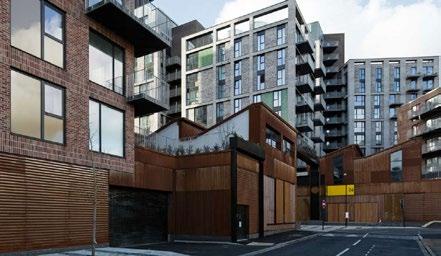
160 Burwood Rd, Concord | Urban Design Review | November 2022 67 URBAN
O3
Figure 44 Caxton Workshop, London, Studio Egret West
DESIGN REVIEW
URBAN DESIGN REVIEW
3-5 Land use
The study offers some specific design guidance for the development of industrial intensification co-located with residential buildings. Some of the recommendations that are particularly relevant to this planning proposal include:
• Position most active uses or operational making areas at ground floor along the street.
• Ensure that ground floor uses adjacent to the street have high levels of visual permeability.
• Locate residential entrances and units along the street edge to provide positive street frontage.
• Incorporate sufficient space for service vehicle turning circles within the site to prevent service vehicles manoeuvring on busy roads.
• Provide a dedicated pedestrian entrance directly from the street and segregate servicing and pedestrian routes.
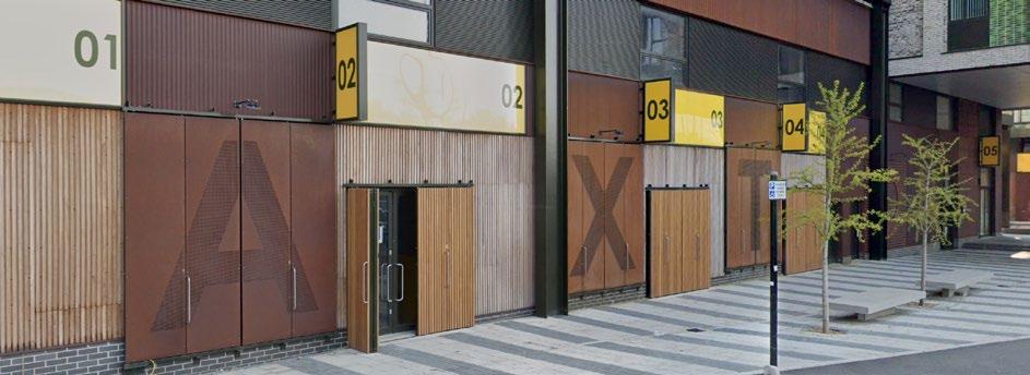
• Take advantage of sites with access from multiple sides to separate access.
• Use green roofs to provide amenity space for workers and residents and contribute to urban greening.
• Orient industrial and residential units to minimise overlooking.
• Incorporate acoustic mitigation measures such as winter gardens, non opening windows and mechanical ventilation, triple glazing and wall and floor build-ups into residential blocks.
Smaller workshops and studio spaces for manufacturing and other small creative making activities would typically require up to 500m². Small industrial units could require up to 1000m² for uses such as construction-related activities, specialist recycling or food catering. Consideration of typical sizes and possible uses helps to inform the location of services, pedestrian entrances and driveways. Other key considerations are the acoustic and other environmental mitigations. The wall and floor construction between adjacent and stacked developments need to consider environmental mitigation of odours, dust and vibration between industrial and residential uses. This includes design features such as increased wall and floor acoustic performance specification, triple glazing, appropriate ventilation and extraction, and winter gardens.
The Draft DCP (Part K, Special Precincts, June 2022), for the site identifies many of these considerations in K19.7 Urban Services, Commercial and Retail Uses, and in K19.10 Activated Urban Services Frontage however the amended PP ( May 2022) is not clear on the types of uses or intended sizes of workshops or studio spaces, if sufficient space has been allocated for the turning of vehicles service vehicles and strategies to mitigate acoustic and other environmental impacts. While this should be able to be addressed at a development application stage it is critical that there is sufficient incentives and flexibility in the planning controls to ensure that the complexity of the design challenge can meaningfully be addressed.
Figure 45 Caxton Workshop, London, Studio Egret West
160 Burwood Rd, Concord | Urban Design Review | November 2022 68
O3
Proposed Open Space and Public Plaza
The approach to rezone the proposed public space along the foreshore as RE1 Public Recreation is considered good practice and is supported. The amended PP (May 2022) proposes 9,740m2 of open space including a plaza, a shared road and a foreshore park of which approximately 5,900m2 lies within the proposed RE1 Public Recreation zone. The (SECPP) recommended a minimum of 8,900m² of Public Open Space be provided.
As per the draft VPA Letter of Offer (Feb 2022), the 5,900m2 of public open space would be ‘dedicated to Council upon completion of the development project’.
The redevelopment of a north facing waterfront site provides a rare opportunity to increase the amount of high amenity water-facing open space and, co-locating this space with retail facilities will allow more residents of Concord, and the City of Canada Bay, to enjoy the exceptional amenity of the local area. While the overall quantum of open space provided is important, the quality, accessibility and activation of the open space will be equally as important.
Conclusion
The proposed B1 Neighbourhood Centre, R3 Medium Density Residential and RE1 Public Recreation zones are considered appropriate for the site.
Rezoning the majority of the site to R3 Medium Density Residential with maximum building heights of 3-6 storeys is supported. Allowing additional uses in specific parts of the site zoned R3 Medium Density is supported, but the clause applying additional permitted uses should be limited to office premises, shops and restaurants or cafes.
The provision of light industrial within the proposed B1 Neighbourhood Centre zone is supported, however, close attention needs to be given to the servicing, access and realistic functioning of the design of these services. It is recommended that 'mixed light industry, new economy or creative uses’ are encouraged and ideally, these should be located within the retained Central Roasting Hall building, if this is possible after due consideration of the heritage constraints. Careful consideration also needs to be given to the interface between residential, retail and 'urban services' uses to avoid conflicts and mitigate adverse environmental impacts.
It is recommended that the proposed B1 Neighbourhood Centre zone is relocated to be fully within the site. In recognition of the Retail Demand Assessment it is accepted that it needs to be closer to Burwood Road and accessible and visible from Burwood Road, however the location proposed in the amended PP (May 2022) could result in a development where the retail and urban services are not integrated into the development but accessed and serviced off Burwood Road and access to and activation of the waterfront is not required to occur. An amendment to the proposed Land Zoning Map can be found below at Figure 46.
Suggested changes to the proposed local clause '6.14 Non-residential uses for 160 Burwood Road, Concord' are highlighted in blue below.
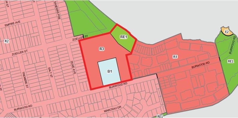
....(3) Development consent must not be granted to development on land to which this clause applies unless the consent authority is satisfied—
a) a minimum provision of 10,000 7,500 square metres of non-residential gross floor area is provided.
b) a minimum provision of 3,000 square metres of light industrial floor space area is provided.
c) shops have a maximum gross floor area of 1,000 square metres per tenancy; and
d) light industrial uses are located on the ground floor (inclusive of the lower and upper ground floor) and provide floor to ceiling heights, servicing and access that accommodate the
B1 R3 RE1 R3 R2 B1 R3 RE1 Neighbourhood centre Medium density residential Public recreation 160 Burwood Rd, Concord | Urban Design Review | November 2022 69
O3
URBAN DESIGN REVIEW
3-6 Landscape and amenity
Design Quality Principle 5: Landscape


Good design recognises that together landscape and buildings operate as an integrated and sustainable system, resulting in attractive developments with good amenity. A positive image and contextual fit of well designed developments is achieved by contributing to the landscape character of the streetscape and neighbourhood.
Good landscape design enhances the development’s environmental performance by retaining positive natural features which contribute to the local context, co-ordinating water and soil management, solar access, micro-climate, tree canopy, habitat values and preserving green networks.
Good landscape design optimises usability, privacy and opportunities for social interaction, equitable access, respect for neighbours’ amenity and provides for practical establishment and long term management.
Commentary


The Concept Plan includes a “Public Domain Plan" that identifies public open space and privately owned publicly accessible public domain (see Figure 47). 44% of the site area is identified as “Public Realm” in the Urban Design Report (Hatch Roberts Day 2022, p.6), and this includes the proposed plaza and foreshore park, the two proposed north-south roads and east-west street connections. This area also includes most of the front setbacks along the new roads and along Zoeller Street and the side setbacks of Block 2 and 4. Interestingly, the ramps leading to the Central and East basements are also identified as 'private open space'.

When Studio GL calculated the “Public Realm” area excluding the building front setbacks, this area amounts to 39% of the site area (see Figure 48). The Urban Design Report (Hatch Roberts Day 2022, p.6) states that 51% of this “Public Realm” is occupied by the new foreshore parkland and plaza. Studio GL calculated that the area zoned RE1 Public Open Space accounted for only 38% of the overall 'public realm' (see Figure 49).


The amended PP (May 2022) shows an extension of the existing public road (Zoeller Street) outside the site boundary to join the proposed roads within the site and create a connected street network. Extending Zoeller Street would require an agreement with the Council and the Golf Club however there is no information in the amended PP (May 2022) with regards to an agreement with the Council or the Golf Club to construct this road. Unless an agreement can be made to ensure the future road structure is robust and visually and physical linked, it is recommended that the plan be altered to allow a connection to occur off the end of the existing Zoeller Street. This requires detailed technical design resolution with the objectives to provide legibility along existing and proposed streets and visually link streets to areas of open space including the golf course. While this should have minimal impact on Zoeller Street, golf course and heritage land, some changes will be required.


The Concept Design in the amended PP (May 2022) retains the existing trees along the western and eastern boundaries of the site, and some along the foreshore, which is commendable. Although the PP states that the


 Figure 47 Plan indicating public open space and privately owned publicly accessible open space (Source: BVN 2022, p14)
RL 17000 RL 13800 RL 13800 Publicly Owned Open Space 5,900sqm Privately Owned Publicly Accessible Public Domain 9,740sqm 160 Burwood Rd, Concord | Urban Design Review | November 2022 70 URBAN DESIGN REVIEW O3
Hills Fig tree (Tree 184) is to be retained, this is not reflected in Figure 18: Open Space and Tree Retention (Source: Roberts Day) which does not show the tree as being retained or the Tree Protection Plan (Moores Trees 2019, p23), which does not show the tree as being retained (see Figure 50) and the summary notes this tree could be relocated within the site.
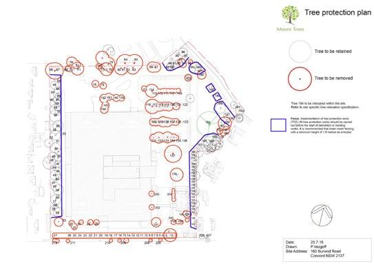
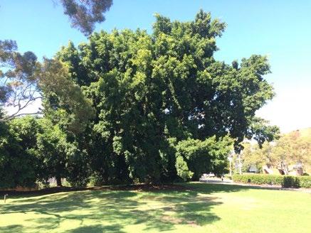
It is desirable to retain the existing trees in a healthy condition along the site boundaries as they play an important role in screening development on the site from adjoining low density housing. The amended PP (May 2022) includes an Arboricultural Development Assessment Report which was last updated in September 2019. Currently along the boundary of the site with Burwood Road is a continuous row of screen landscaping that is 5m deep. The Tree Protection Plan in the Arboricultural Development Assessment Report
does show these trees to be retained (although some of them are shown as being retained in the Open Space and Tree Retention by Roberts Day). The report states that “the large mature Jacaranda by the front gate is significant (...). The proposed building near this tree is very close and extensive pruning of the canopy to comply with scaffolding standards will not allow much of a specimen to be retained” (Moore Trees 2019, p.13).
Conclusion
Care should be taken that the existing trees of value are identified and retained in a healthy condition as they play an important role in screening development on the site from adjoining low density housing. The Tree Protection Plan should reflect the amended proposal. The amended PP (May 2022) should also include an agreement with the Council on how Zoeller Street will be connected into the site extension to ensure that connectivity within the neighbourhood and public access within the site is maintained.
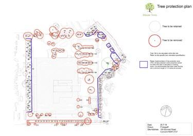
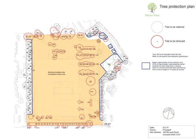 Plate 3: Trees 145-166 along the driveway entry. P. Vezgoff.
Plate 4: Tree 184, the large specimen tree. P. Vezgoff.
Tree 184, a large mature Hills Fig that is “certainly worth retaining”. (Moore Trees 2019, p19)
Tree to be retained
Tree to be removed Fence
Figure 48 Diagram showing Studio GL’s calculation of the private area and the “Public Realm” on the site, including public roads and public open space
Figure 49 Diagram showing Studio GL’s calculation of the public open space within the “Public Realm”
Private = 61% of site area
Public Realm = 39% of site area
Roads/other = 62% of ‘Public Realm’ Public Open Space = 38% of ‘Public Realm’
Figure 50 Tree Protection Plan (Moore Trees 2019, p23)
Plate 3: Trees 145-166 along the driveway entry. P. Vezgoff.
Plate 4: Tree 184, the large specimen tree. P. Vezgoff.
Tree 184, a large mature Hills Fig that is “certainly worth retaining”. (Moore Trees 2019, p19)
Tree to be retained
Tree to be removed Fence
Figure 48 Diagram showing Studio GL’s calculation of the private area and the “Public Realm” on the site, including public roads and public open space
Figure 49 Diagram showing Studio GL’s calculation of the public open space within the “Public Realm”
Private = 61% of site area
Public Realm = 39% of site area
Roads/other = 62% of ‘Public Realm’ Public Open Space = 38% of ‘Public Realm’
Figure 50 Tree Protection Plan (Moore Trees 2019, p23)
160 Burwood Rd, Concord | Urban Design Review | November 2022 71 URBAN DESIGN REVIEW O3
3-6 Landscape and amenity
Design Quality Principle 6: Amenity
Good design positively influences internal and external amenity for residents and neighbours. Achieving good amenity contributes to positive living environments and resident well being.
Good amenity combines appropriate room dimensions and shapes, access to sunlight, natural ventilation, outlook, visual and acoustic privacy, storage, indoor and outdoor space, efficient layouts and service areas and ease of access for all age groups and degrees of mobility
Commentary
The overshadowing analysis provided by BVN Architects (2022) shows that the neighbouring properties on the western edge of the site are overshadowed until 9am. There is no overshadowing impact on the properties to the south of Burwood Road. The properties along the eastern edge of the site are overshadowed from 1pm onwards, reducing their access to afternoon sunlight. The overall overshadowing impact of the design is minor, although given the low density nature of the entire area local residents would have a high expectation of excellent access to sunlight, natural ventilation and visual privacy of gardens, balconies and indoor spaces.
With regards to these overshadowing impacts, the amended PP (May 2022) states that “the impact on existing buildings may be minimised through careful building massing and articulation” (LFA 2022, p.99).
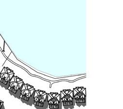
The overshadowing analysis also highlights the impact of the buildings in Block 5 on the proposed public square and retail spaces in the amended Concept Plan. The shadow diagrams show that the proposed public square will be partially overshadowed from 2pm in the afternoon and completely overshadowed by 3pm. The public plaza will be partially overshadowed by 2pm and completely overshadowed by 3pm onwards. The ground floor retail space along the curvilinear building in Block 5 will be overshadowed for most of the day.
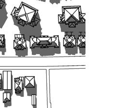
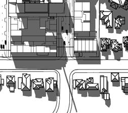
The overshadowing of the proposed public square, public plaza and retail spaces occur just outside the core hours of 12-2pm, and although this is acceptable, it is recommended detailed design should explore ways to improve the amenity of the public space and reduce overshadowing impact.
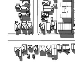
The proposed back gardens of the three (3) storey terraces in Block 1 and Block 3 of the amended PP (May 2022) will not achieve 2 hours of solar access between 9am to 3pm. It is also concerning that the proposed location of the basement ramps will not allow for the provision of back gardens for many of these terraces. It is recommended that the proposed ramps be relocated to allow all terraces to have back gardens of appropriate size and amenity.
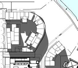
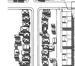 Overshadowing analysis diagram at 2pm on 21 June (BVN, 2022) with mark-ups by Studio GL
LOCAL ROAD SHAREDZONE
BURWOOD ROAD
LOCAL ROAD SHAREDZONE
BURWOOD ROAD
LOCAL ROAD SHAREDZONE
BURWOOD ROAD
ROAD SHAREDZONE
PM 21 JUNE -2 PM
BURWOOD ROAD
LOCAL
AM 21 JUNE -11 AM
Proposed public square Proposed public plaza
Proposed retail space
Proposed back gardens of terraces
160 Burwood Rd, Concord | Urban Design Review | November 2022 72
URBAN DESIGN REVIEW O3
URBAN DESIGN REVIEW


As previously stated, the proposed three (3) storey apartment buildings in Block 1 along the western edge and the five (5) and six (6) storey apartment buildings in Block 3 along the eastern edge of the site show narrow slits in the built form. These slits are approximately 2m wide and 8m deep and would create poor internal amenity for any external window located at the base of the slit. Although the provision of these slits may technically meet the requirements for apartment design, according to the Apartment Design Guide, they are not considered a high amenity solution for a suburban location.
Conclusion


It is recommended that the depth of the five (5) and six (6) storey buildings along Block 3, Eastern edge be reduced and the uppermost floor be setback to minimise the overshadowing impact on the neighbouring properties. It is also recommended that the proposed public plaza adjoin the northern end of Block 3 facing the foreshore to improve the amenity of the public space and reduce overshadowing impact.
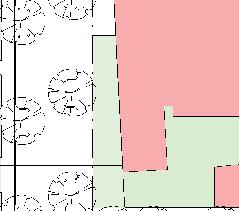
The location of the proposed basement ramps reduces the private open space of the three (3) storey terraces along Burwood Road. The configuration of the ramps should be reconsidered to ensure each terrace is provided with the required private open space.
The provision of narrow slits in the built form is considered a poor design solution. It is recommended that Block 1 takes the form of a minimum of three separate buildings similar to the proposal recommended by Council in February 2018 showing a series of courtyard buildings. The draft Development Control Plan should also be updated to strengthen controls that ensure overlooking and privacy concerns between adjoining buildings are addressed.
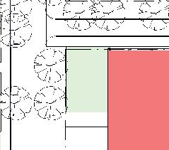
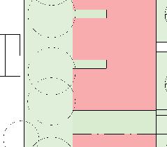
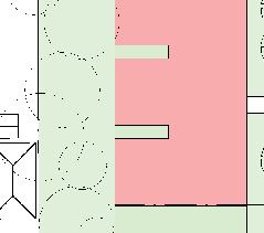
retail space will be overshadowed for most of the afternoon pop up markets public facilities maker space pedestrian focus water activity foreshore park water interaction social space local creatives retail activity cafe/ restaurant light industry golf course
The following urban design analysis establishes a robust framework for the Bushells Factory master plan, highlighting the key moves and design techniques incorporated throughout the design and refinement process to provide evidence on the place specific merits of this proposal.
URBAN DESIGN ANALYSIS
Figure 53 Part Roof Plan of the Concept Plan (Source: BVN 2022) with mark-ups by Studio GL
Proposed 8m x 2m slits
160 Burwood Rd, Concord | Urban Design Review | November 2022 73
O3
3-7 Safety
SEPP 65 Design Principle 7: Safety
Good design optimises safety and security within the development and the public domain. It provides for quality public and private spaces that are clearly defined and fit for the intended purpose. Opportunities to maximise passive surveillance of public and communal areas promote safety.
A positive relationship between public and private spaces is achieved through clearly defined secure access points and well lit and visible areas that are easily maintained and appropriate to the location and purpose.
Commentary
Typically industrial sites have a “coarse grain” with large lots and street blocks and few connecting streets. This creates internally focused developments which also act as a barrier to pedestrian access in the local area. When industrial sites redevelop, it is good practice to use this opportunity to create a new network of public streets and/or public open space that improves connections to the site and through the site from the surrounding area.
The amended PP (May 2022) provides new publicly accessible streets within the site that connect to Burwood Road and Zoeller Street. One of the new roads off Burwood Road is located opposite an existing road, Marceau Drive and serviced by a new roundabout. The location of this new road assists in integrating the new development into the exiting street network and provides new visual links from Marceau Drive to the Central Roasting Hall and a new direct connection to the waterfront. The proposed new urban structure creates an efficient, finer grain block structure with views along the key new streets terminating in the golf course or new waterfront open space.
While the proposed road network improves connectivity within the neighbourhood, the proposed access to this site from Zoeller Street has raised concerns from Zoeller Street residents about the increase in noise and traffic along Zoeller Street. Traffic along Zoeller Street could be reduced by changing the location of the basement ramps within the site so that they are
accessed off one of the new roads within the site rather than Zoeller Street. In addition, traffic calming within the site such as the use of road narrowing and street deflection or even bollards and banning trucks from using this access point could improve the attractiveness, safety and quality of the Zoeller Street connection. While cul-de-sacs are a widely used solution, they are not recommended from an urban design perspective as they create safety issues and discourage pedestrian and bicycle access across the site.
Due to the impact on the Golf Course, it now appears likely that it will not be possible to extend Zoeller Street along most of the northern boundary of the site. This is unfortunate as the cadastre indicates that a road was once anticipated in this location but has subsequently been subsumed into the golf course and because roads help to create a safe boundary between development and open spaces. The Concept Plan assumed that pedestrian access would have occurred along the edge of this extended road but if this cannot occur, pedestrian access will need to be provided within the northern boundary of the site.
The previous PP (Feb 2019) proposed new public roads connecting to Zoeller Street and the foreshore park, and bicycle and pedestrian access to the foreshore as public benefit in the draft VPA Letter of Offer. The amended PP (May 2022) proposes dedicating the foreshore to the Council, however the ownership of the proposed public plaza and public roads is unclear.
Where the boundaries between areas of public and private land are unclear, or where the public is only allowed to access private land, there is a risk that concerns about maintenance, public liability and privacy will, over time, result in the privatisation of what was initially promised as public open space. This has occurred on other waterfront sites in the Canada Bay LGA. Recent development to the east of the site, on a former industrial site, was developed with an internal focused or “gated” style of development with private roads. This has created a disconnected street structure, and limited provision of foreshore open space that is difficult to access or discover.
160 Burwood Rd, Concord | Urban Design Review | November 2022 74 URBAN DESIGN REVIEW O3
URBAN DESIGN REVIEW O3
A blurred boundary between the public and private spaces makes territorial reinforcement difficult and can discourage public use over time. It may also reduce the passive surveillance and sense of ownership of public open space necessary to promote safety. It is not uncommon for the owners of a development, in response to incidents and concerns about liability, to reduce or restrict access to areas identified at a concept design stage as “public”.
How a building addresses roads and areas of open space plays an important role in activating these places and increasing or decreasing perceptions of safety. The orientation of buildings within the proposal, to face existing and proposed streets, and the location of active uses at ground level adjoining the open space, follows good urban design practice and is supported.
Conclusion

MOVEMENT & ACCESS
The urban structure in the Concept Plan in the amended PP (May 2022) is much improved from the original PP (July 2017) and the previous PP (Sep 2019). The urban structure of roads and public open
space follows good urban design practice and is supported. To maximise public access and public safety for the long term, the new network of streets and areas of open space should be Council owned and publicly accessible, with buildings designed to address both existing streets and new streets. Council ownership of the streets may not be possible, therefore to ensure the proposed roads are delivered and remain publicly accessible, an easement for permanent public access is required.
To reduce the impact on Zoeller Street, it is recommended that the primary access to Blocks 1 and 5 the site is provided from inside the site and accessed off one of the new roads linking to Burwood Road. Any Zoeller Street connection should be designed as a slow speed secondary link with the width of the road narrowed. Ideally truck movements, especially trucks servicing the retail and light industrial uses should occur off Burwood Road. A pedestrian link with a minimum width of 4.5m will need to be established within the site along the northern boundary to accommodate public access if Zoeller Street can not be extended.
An internal hierarchy of movement networks increases the overall permeability & accessibility within the site and to other local networks. Free flowing public movement along the foreshore (east west) and north south avenue completes the Green Loop. Pedestrian networks are the key focus of this proposal.
The foreshore access east of the site is pedestrian only and cyclists must dismount along this section. This makes the proposed cycle connection through the site, between Burwood Rd and the foreshore, critical to provide a direct, cycle friendly access.
Figure 54 Movement and Access Diagram (Hatch Roberts Day 2022, p50)
BLOCK STRUCTURE vehicular driveway cycleway pedestrian
Refined from the design of the internal movement hierarchy and through site linkages, block structure orientates
160 Burwood Rd, Concord | Urban Design Review | November 2022 75
URBAN DESIGN REVIEW O3


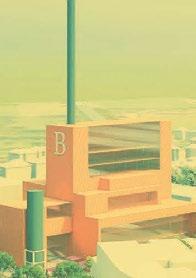


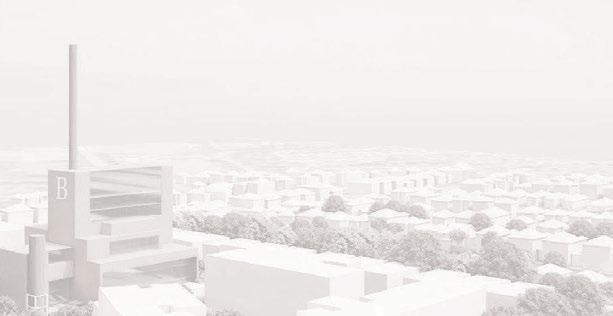

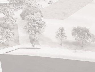

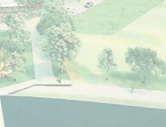


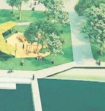
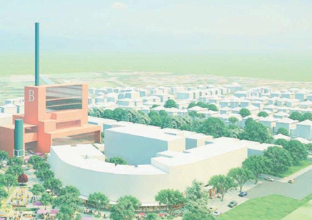

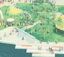

3-8 Sustainability and diversity


Design Quality Principle 4: Sustainability
Good design combines positive environmental, social and economic outcomes.
Good sustainable design includes use of natural cross ventilation and sunlight for the amenity and liveability of residents and passive thermal design for ventilation, heating and cooling reducing reliance on technology and operation costs. Other elements include recycling and reuse of materials and waste, use of sustainable materials and deep soil zones for groundwater recharge and vegetation.
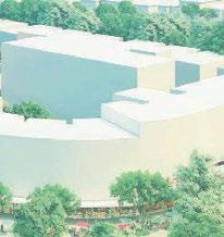
Commentary


SUSTAINABLE DESIGN CONCEPT
In addition to the sustainable design strategies outlined above, the ADG also identifies issues that could be considered as part of a precinct development, such as greater housing diversity and leveraging efficiencies of scale to deliver more effective environmental measures
such as on site energy production, integrated stormwater management and waste water recycling. The Urban Design Report contains a ‘Sustainable Design Concept’ which briefly mentions six sustainable features of the concept design; street trees, light industrial uses, creative hub, adaptive re-use, local pop-up markets, green roofs, green walls and solar panels (Hatch Roberts Day 2022, p.56-57). The Sustainability Strategy (Kinesis, 2019) identifies five key findings to enhance the sustainability outcomes of the proposal:
• Efficient appliances and improved thermal design.


• Solar voltaic and battery ready facilities.


• Recycled water ready infrastructure.

• Green facade treatment for cooler dwellings.


• Best practice parking measures and access to car share facilities.


These interventions could reduce the greenhouse gas emissions from the development by 34% (Kinesis, 2019).
enhance the local character broad public benefits. achieved, contribute to and contribution to Bushells Factory. The diagram, seen adjacent, proposals sustainable
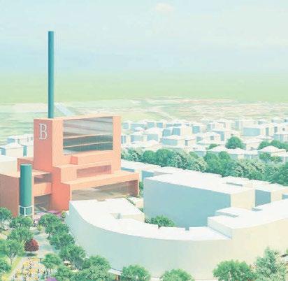
STREET TREES Street trees increases tree canopy cover, reducing heat island effect, improves streetscapes and has social benefits.


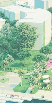


LIGHT INDUSTRIAL USES Food and Beverage Production, Furniture/ Woodwork, Leatherwork, Textiles
CREATIVE HUB Artists, Music recording, Gallery, Theatre props.
ADAPTIVE RE-USE Maintaining character buildings reduces construction costs.

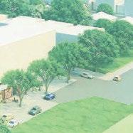
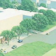
LOCAL POP UP MARKETS Space for local markets allow residents to buy fresh produce.
GREEN ROOFS Rooftop space for recreation and amenities improves residents health and wellbeing, reduce stormwater runoff and mitigate heat island effect.
GREEN WALLS Green walls contribute to insulation and mitigate heat island effect.


SOLAR PANELS Photovoltaic cells contribute to energy supply, reducing demand, and reduces heat retention.
10 MINUTE NEIGHBOURHOOD
The diverse mix of uses on site enables a liveable, connected, walkable and sustainable community.
Planning Proposal, Urban Design Report - Bushells Factory 57
Figure 55 Sustainability Design Concept of the proposed development (Hatch Roberts Day 2022, p.56-57)
160 Burwood Rd, Concord | Urban Design Review | November 2022 76
Principle 8: Housing Diversity and Social Interaction
Good design achieves a mix of apartment sizes, providing housing choice for different demographics, living needs and household budgets. Well designed apartment developments respond to social context by providing housing and facilities to suit the existing and future social mix. Good design involves practical and flexible features, including different types of communal spaces for a broad range of people, providing opportunities for social interaction amongst residents.
Concept Plans indicate approximately 39,000m2 of residential GFA. A development with 29,000m2 of residential GFA plus 10,000m2 of non-residential GFA would generate an overall site FSR of approximately 1:1 which is not what the amended PP (May 2022) is seeking.
Conclusion
It is recommended that the amended PP (May 2022) includes the residential GFA and distribution of apartment and dwelling types, including affordable housing in the proposed development in order to clarify the diversity of housing proposed.
Commentary
The proposed residential dwellings in the Concept Plan include apartments and three (3) storey terraces. The Social Infrastructure and Community Uses Demand Assessment has not been updated with the amended PP (May 2022) and therefore there is no information with regards to the distribution of 1, 2 and 3 bedroom apartments in the amended Concept Plan.
With regards to affordable housing, the Economic Impact Assessment, which has not been updated to reflect the current proposal, states “the Planning Proposal would provide 53 affordable housing dwellings – a mix of 1, 2 and 3 bedroom units – at a 25% discount to the prevailing market price. It is anticipated that some of these dwellings would fall within the price bands that would qualify for stamp duty relief from the NSW State Government, further improving their affordability to first home buyers” (HillPDA 2019, p.26).
The Sydney Eastern City Planning Panel (SECPP) recommended that a minimum of 10% affordable housing is to provided in perpetuity. The Draft Affordable Housing Contributions Scheme identifies a 10% contributions rate. The number of affordable housing units is calculated as “10% of the total residential GFA” (HillPDA 2019, p.7). The total residential GFA is given in the amended PP (May 2022) as approximately 29,000m² however the architectural
It is also recommended that an updated Sustainability Strategy be included within the amended PP (May 2022) in order to ascertain the adherence of the proposal to sustainability standards.
160 Burwood Rd, Concord | Urban Design Review | November 2022 77
URBAN DESIGN REVIEW O3
Chapter 4 Recommendations
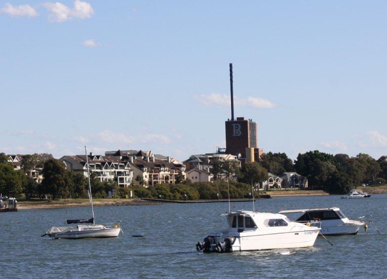
Recommendations O4 4-1 Overview
The Concept Plan in the amended PP (May 2022) is the result of considerable effort by a skilled and experienced team of consultants. A number of the ideas in the amended PP (May 2022) are attractive and desirable, including the provision of open space that is publicly owned and zoned for public recreation along the waterfront, two new access roads across the site, retention and local listing of part of the industrial heritage, and the desire to include a mix of uses on the site, including retail that will service local needs and the retention of some light industrial uses on the site
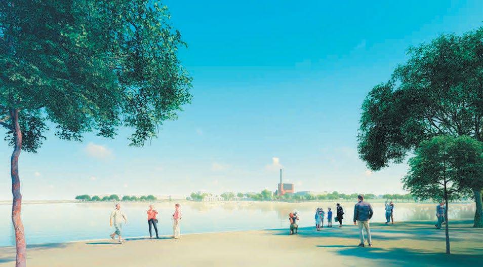
The critical issue for the redevelopment and rezoning of this site and the proposed change in the planning controls is the scale and density of the proposed development, particularly the proposed FSR.
A conventional approach to redeveloping this site would take a ‘business as usual’ approach which demolishes all of the industrial buildings on the site, with redevelopment that follows the pattern set by other development of similar sites in the area with a mix of 2-6 storey development and an FSR of 0.75:1.
A different future is outlined in the amended PP (May 2022) which envisages retaining some of the heritage fabric, including the landmark Central Roasting Hall and combining this with high density development with an FSR of 1.25:1 which is significantly higher than the FSR of Pelican Quays, the existing development on the eastern side of the site.
While much of the Concept Design in the amended PP (May 2022) is generally supported, key issues identified from an urban design perspective include heritage, FSR and land use, and recommendations around these topics have been further discussed in this
Figure 56
View from Harmony Point looking south towards the site shows the scale of the development in contrast to the surrounding area (Hatch Roberts Day 2022, p.61)
VIEW 7: View from Harmony Point looking south to Bushells Factory with clear building transitions
160 Burwood Rd, Concord | Urban Design Review | November 2022 79
VIEW 8: Typical view from corner of Burwood Rd & Duke St showing appropriate transition of built form
4-2 Heritage
Emphasis is given in the amended PP (May 2022) to the importance of the industrial heritage of the site and the opportunity to create something unique and special by retaining key buildings on the site. This is clearly reflected in the detailed consideration of heritage provided in the Heritage Listing Nomination Report.
The nomination of the Former Bushells Factory Building, including the Central Roasting Hall, the chimney stack, the ‘B’ sign on the facade and the landscaped setting, for local heritage listing within the Canada Bay Local Environmental Plan 2013, is supported from an urban design perspective as it is part of the local character of the area and provides a visual reminder to the history of the area.
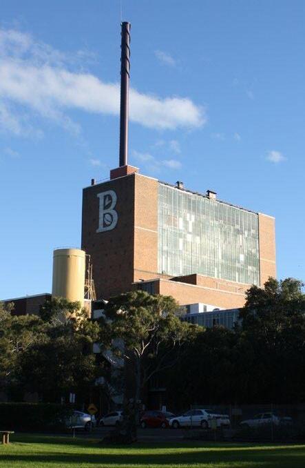
The Heritage Listing Nomination Report emphasises the importance of maintaining the landscape setting of the factory. However, the amended PP (May 2022) does not outline how the ‘landscape setting’ of the site will be retained. It is recommended that the area of the ‘landscaped setting’ be defined prior to the heritage listing of this site in order to ensure that the ‘Factory in a Garden’ setting of the site is retained. If more detailed heritage advice considers that development will impact on the ‘landscape setting’, the proposal would need to be altered and this is likely to reduce the maximum FSR achievable on the site.
As stated previously, retention of the industrial buildings may provide some justification to allow a small increase in height and FSR compared to adjoining sites. It is also recommended that the site-specific Development Control Plan for this site is strengthened with regards to the detailed objectives, controls and provisions for the conservation, adaptive reuse and interpretation of the heritage item. Recommendations from Council's heritage advisor include:
• An objective about understanding the heritage values of the place – eg To ensure that changes to the Bushells building are guided by a clear understanding of the heritage values of the place.
• The DCP should include a control that requires a heritage interpretation plan to be submitted with a DA.
• The DCP should include an objective to celebrate the site’s industrial heritage.
• The DCP should have a control that requires compliance with the controls in Part D2 of the Canada Bay DCP.
Recommendations O4
The Central Roasting Hall is considered a recognisable landmark in the local area by the heritage report
160 Burwood Rd, Concord | Urban Design Review | November 2022 80
Recommendations O4
4-3 Foreshore Building Line
The amended PP (May 2022) suggests that the 'Foreshore Building Line Map Sheet 004' of the CBLEP 2013 be "Amend(ed) to apply to the portion of the site proposed to be zoned RE1 Public Recreation. No change to the written instrument is proposed". However, the Foreshore Building Line in the PP (May 2022) LEP map (Figure 57), appears to be inconsistent with the proposed RE1 Public Recreation area/ boundary shown in the architectural Concept Plans. It is recommended that the precise location of the RE1 boundary is clarified by the applicant and provided to Council.
Studio GL also recommends adjusting the proposed Foreshore Building Line so that it clearly defines the proposed maximum building footprint. This modification
To make it simpler it is recommended that both ends of the Foreshore Building Line (FBL) are located at the corner junctions of the existing cadastre/ site boundary.
Public Recreation
The recommended FBL is approximately 5m off the FBL proposed in the PP (May 2022) Concept Plans. This has reduced the FSR parcel of Block 3 by approximately 200m2
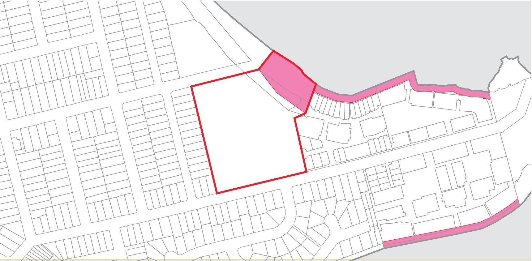
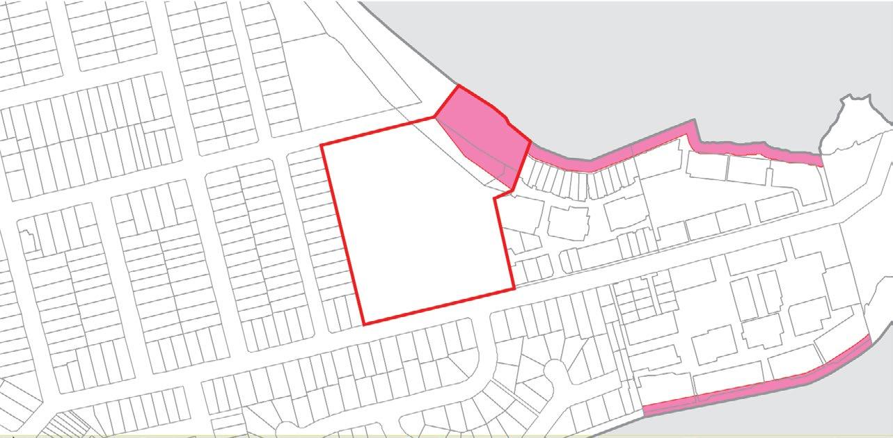
PP 2022 LEP Foreshore Building Line (FBL)
Proposed Foreshore Building Line (LFA, 2022) Recommended Foreshore Building Line (SGL)
Recommended Foreshore Building Line, annotated,
LEGEND
Maximum building envelopes Recommended FSR block boundary Site boundary FSR Block SGL recom SGL recom PP 2022 L PP 2022 co SGL recom 82.9 39 .7 5 73° 154° 114 ° BLOCK 4
C6 W1 W2 W3 W4 W5 C7 C8 C9 E4 E3 E2 E1 C1 C2 C3 C4 C5a C5 BLOCK 2 C4 NEW LANEWAY 1 storey urban services 3 storeys 3 storeys 3 storeys 3 storeys 9 storeys 6 storeys 2 storeys 3 storeys 4+1 storeys 4+1 storeys 4+1 storeys 4+1 storeys 5+1 storeys 4+1 storeys 1+2 storeys 1+2 storeys +2 storeys 4 storeys 5+1 storey SGLRecommendedFBLPPConceptPlanRE1Boundary/FBLPPLEPFBL
BLOCK 1 BLOCK 5 BLOCK 3
RE1
Da e Scale Fi e name Rev sion no Prepared by D sc aimer: © Copyrigh Stud o GL The s te boundar es and surround ngs are based on he data provided by he cl ent These drawings are o be read in conjunct on with al other re evant documenta ion produced by Stud o GL 03 May 2019 1:1000 @ A3 19002 BurwoodRd 240419 vwxDN N 0 10m 50m 20m
FSR Block area
SGL recommended building footprint SGL recommended upper level floor area
Foreshore
Line W5 829 39 7 5 73° 154° 114 ° L Recommended Site Layout Plan BLOCK 4 BLOCK 1 BLOCK 5 BLOCK 3 C6 W1 W2 W3 W4 W5 C7 C8 C9 E4 E3 E2 E1 C1 C2 C3 C4 C5a C5 BLOCK 2 C4 NEW LANEWAY ST BURWOOD RD 1 storey urban serv ces 3 storeys 3 storeys 3 storeys 3 storeys 9 storeys 6 s oreys 2 s oreys 3 storeys 4+1 storeys 4+1 s oreys 4+1 s oreys 4+1 s oreys 5+1 s oreys 4+1 s oreys 1+2 s oreys 1+2 s oreys 1+2 storeys 4 storeys 5+1 storey SGLRecommendedFBLPPConceptPlanRE1Boundary/FBLPPLEPFBL RE1 Pub ic Recreat on 160 Burwood Rd, Concord | Urban Design Review | November 2022 81
PP 2022 concept design RE1 boundary/ FBL SGL recommended
Building
Recommendations O4
4-4 Land Use
The amended PP (May 2022) incorporates a mix of B1 Neighbourhood Centre, R3 Medium Density Residential, and RE1 Public Recreation which is supported.
It is recommended that the proposed B1 Neighbourhood Centre zone and the light industrial uses is relocated off Burwood Road to be fully within the site and to ensure activation of the waterfront occurs. In recognition of the Retail Demand Assessment it is accepted that it needs to be closer to Burwood Road and accessible and visible from Burwood Road. The reinstatement of residential terrace dwellings along Burwood Road, instead of retail uses, is recommended as they are more compatible with the neighbouring residential character and surrounding low density dwellings.
The amended PP (May 2022) seeks ‘Commercial Premises’ to be an additional permitted use within the R3 Medium Density Residential zone. Allowing additional uses in specific parts of the site zoned R3 Medium Density is supported but the clause applying additional permitted uses should be limited to office premises, shops and restaurants or cafes.
The rezoning of the proposed public space along the foreshore as RE1 Public Recreation is considered good practice and is supported. While the overall quantum of open space provided is important, the quality, accessibility and activation of the open space will be equally as important. The redevelopment of a north facing waterfront site provides a rare opportunity to increase the amount of high amenity water-facing open space which will allow more residents of Concord, and the City of Canada Bay, to enjoy the exceptional amenity of the local area.
5.2.1 Proposed amendment to the land zoning map
The provision of light industrial within the proposed B1 Neighbourhood Centre zone is supported, however, close attention needs to be given to the servicing, access and realistic functioning of these services. It is recommended that 'mixed light industry, new economy or creative uses’ are encouraged and ideally, these should be located within the retained Central Roasting Hall building. It is recommended that careful consideration is given to the interface between residential and urban services / light industry spaces in terms of building design, vehicular access and services and mitigation of any adverse environmental impacts.
An amendment to the proposed Land Zoning Map can be found at Figure 60. The recommended change to the LEP map increases the amount of land zoned B1 (an increase of approx. 2,000m2), however this additional area does include roads (approx. 750m2) and the 12m side setback between the eastern site boundary and buildings E2/E3 (approx. 1,000m2).
Amend CBLEP 2013 ‘Land Zoning Map’ Sheet 004’ as it applies to the subject site from IN1 General Industrial to part B1 Neighbourhood Centre, R3 Medium Density Residential, RE1 Public Recreation as shown on Figure 24.
B1 R3 RE1 R3 R2
Neighbourhood centre Low density residential Medium density residential Public recreation PP LEP boundaries BURWOOD RD URWOOD RD RE1 RE1 RE1 RE1 RE1 RE1 RE1 RE1 RE1 RE1 RE1 RE1 RE1 RE1 RE1 RE1 RE1 RE1 RE1 RE1 RE1 RE1 RE1 RE1 RE1 RE1 RE1 RE1 RE1 RE1RE1 E2 E2 E2 E2 E2 E2 E2 E2 E2 E2 E2 E2 E2 E2 E2 E2 E2 E2 E2 E2 E2 E2 E2 E2 E2 E2 E2 E2 E2 E2 E2 E2 E2 E2 E2 E2 E2 E2 E2 E2 E2 E2 E2 E2 E2 E2 E2 E2E2
5.2.2 Proposed amendment to the height of buildings map Recommended Land Zoning map prepared by Studio GL,
LEGEND Neighbourhood centre Low density residential Medium density residential Public recreation PP LEP boundaries (LFA 2022) B1 R2 R3 RE1 160 Burwood Rd, Concord | Urban Design Review | November 2022 82
Given the limited demand identified in the Retail Demand Assessment (Hill PDA, 2019), it is recommended that the amount of non-residential uses on the site is reduced from 10,000m2 to no more than 7,500m2. Of this, 3,000m2 of the non-residential uses is required to be light industrial uses, with the remainder to serve as other convenience retail and commercial services such as a small format supermarket, specialty food and restaurants. There is also opportunity to include a gym, childcare and/or a community facility that could help to activate the location.
Reducing the quantum of non-residential uses to much less than 7,500m2 would alter key design elements and the bulk and scale of the recommended scheme. For example, approximately 1000m2 of non-residential floor space is allocated on Level 01, 02 within the existing Central Roasting Hall. This space is internal with limited opportunities for natural ventilation and solar access and can not easily be converted to residential. Non-residential uses are also required to activate the foreshore park. The reduction in non-residential floor space can occur in Blocks 2 and 5 as shown in Figure 62.
Figure 61 Exhibited draft DCP Public Domain diagram
Recommended modifications to the local clause '6.14 Non-residential uses for 160 Burwood Road, Concord'. are highlighted in blue below.
....(3) Development consent must not be granted to development on land to which this clause applies unless the consent authority is satisfied—
a) a minimum provision of 10,000 7,500 square metres of non-residential gross floor area is provided.
b) a minimum provision of 3,000 square metres of light industrial floor space area is provided.
c) shops have a maximum gross floor area of 1,000 square metres per tenancy; and
d) light industrial uses are located on the ground floor (inclusive of the lower and upper ground floor) and provide floor to ceiling heights, servicing and access that accommodate the activities and equipment of the light industrial use(s).
Block 3 N
Figure 62 Suggested changes to draft DCP Public Domain diagram incorporating Studio GL recommendations
Block 5 Block 4 Block 2 Development Controls Plan 1:1000 @ A3
160 Burwood Rd, Concord | Urban Design Review | November 2022 83
min 12m 3m min 3m min 16m 17.2m min 12m 6m min 6m min 6m min 6m min Tree 184 3m min Potential Service Lane Northern Link Rd Western Rd Eastern Rd BURWOOD RD DUKE AVE ZOELLER ST Landscape setback Deep soil zone Publicly owned open space Privately Owned & Publicly Accessible land Residential ground floor use Non-residential ground floor use Urban services ground/upper ground floor use Active frontage Activated urban services frontage Vehicular access (preferred location) Driveway access (preferred location) Loading access (preferred location) Required pedestrian link Indicative future road location/ alignment Existing tree to be retained Burwood Road Development Controls Plan N min 12m 3m min 3m min 16m 17.2m min 12m 6m min 6m min 6m min 6m min 6m min Tree 184 Potential Service Lane Northern Link Rd Western Rd Eastern Rd BURWOOD RD DUKE AVE ZOELLER ST Block 5 Block 4 Block 2 Block 3 Block 1 0 20 Burwood Road Development Controls Plan 3m min 17.2m min 12m 6m min 6m min 6m min Tree 184 Potential Service Lane Northern Link Rd Eastern Rd BURWOOD RD
Recommendations O4 LEGEND Landscape setback Deep soil zone Publicly owned open space Privately Owned & Publicly Accessible land Residential ground floor use Non-residential ground floor use Urban services ground/upper ground floor use Active frontage Activated urban services frontage Vehicular access (preferred location) Driveway access (preferred location) Loading access (preferred location) Required pedestrian link Indicative future road location/ alignment Existing tree to be retained 40m 0 20 File name Scale
Proposed amendment to the land zoning map
Amend CBLEP 2013 ‘Land Zoning Map’ Sheet 004’ as it applies to the subject site from IN1 General Industrial to part B1 Neighbourhood Centre, R3 Medium Density Residential, RE1 Public Recreation as shown on Figure 24.
The majority of development in the area immediately around the site, and the wider area around Canada Bay and Exile Bay, is only one to two (1 to 2) storeys high. This low scale, horizontally dominant context has created the situation where the existing Central Roasting Hall (approximately 13 storeys high) and its narrow chimney and clearly visible ‘B’ is able to become a recognisable landmark above the lower scale of surrounding development.
24: Proposed Land Zoning Map
It is accepted that, should the Central Roasting Hall building be retained, it creates a context where a five to six (5 to 6) storey maximum height, similar to the maximum height on the adjoining site to the east, is possible. The maximum six (6) storey height in the amended PP (May 2022) is considered appropriate.
The maximum building heights in the proposed amended LEP map identified in the PP (May 2022) are greater than needed to accommodate the proposed built form and could, potentially, encourage even taller development in the future. To avoid this the following is recommended (as shown in Figure 64):
• Three (3) storey development is to have a maximum building height of 11m not 12m.
• Four (4) storey development can remain at 15m. This is higher than is typical to accommodate industrial uses on the ground floor.
• Five (5) storey apartments can remain at 17m.
• Five (5) storey mixed use can remain at 18m.
Proposed amendment to the height of buildings map
• Six (6) storey mixed use development is to have a maximum height of 20m not 21m.
part O1 - 15m (4 storeys);
part P1 - 17m (5 storeys);
The amended PP (May 2022) proposed height of building map (Figure 63) generally locates lower building heights along the western and southern boundaries where the site adjoins lower density housing and locates taller heights centrally to the site and adjoining the golf course and proposed new open space. This approach is supported.
Amend CBLEP 2013 ‘Height of Buildings Map Sheet 004’ as it applies to the subject site from Mfor a portion of the site to:
part P2 - 18m (5 storeys);
part R1 - 21m (6 storeys);
• The Central Roasting Hall block (Block 4) is to have a maximum building height of 20m. This will accommodate six (6) potential storeys of development and also allow the nine (9) storey Central Roasting Hall building to be renovated at its existing height if it is retained. A bonus FSR of 0.15:1 is also recommended if the Central Roasting Hall is retained (see also Chapter 4-6 FSR).
46.4 to re ect the existing roof height of the Central Roasting Hall building to be retained; shown in Figure 25. The remainder of the site remains unchanged.
25: Proposed Height of Building Map
Recommendations O4
63
BURWOOD RD BURWOODRD AUMAVE ST SALT ST BURWOODRD DUKE AVE MARCEAUDR ZOELLERST SANDERS PDE EMPIREAVE ZOELLERST BURWOOD RD TREMERE ST I I I I II I I I II I I I IIII I I I II I I I II II I I I II I I I II I I I II I I I II I I I II I I I II I I I II I I I I II I I I IIII I I I II I I I IIII I I I II I I I I I I II I I I I I II I I I I I IIII I I I I I II I I I I I II II I I I II I I I II I I I IIII I I I II I I I II II I I I IIII I I I II I I I II I I II I I II I I I II I I I I I I IIII I I I I I II I I I I II I II I I I I I II I I I I I II I I I I II I I I II I I II I I II I I I II I I II I I II I I I I I I IIII I I I I I II I I I I II I II I I I I I II I I I I I II I I I I I I IIII I I I I I II I I I II I I I I II I I I I I II I I I I I II I I I I I I II I I I I I II I I I I I II I I I II I I I I II I I I I I II I I I I I II M M M M M M M M M M M M M M M M M M M M M M M M M M M M M M M M M M M M M M M M M M O1 O1 O1 O1 O1 O1 O1 O1 O1 O1 O1 O1 O1 O1 O1 O1 O1 O1 O1 O1 O1 O1 O1 O1 O1 O1 O1 O1 O1 O1 O1 O1O1 O1 O1 O1 O1 O1 O1 O1 O1 O1 O1 O1 O1 O1 O1 O1 O1 O1 O1 O1 O1 O1 O1 O1 O1 O1 O1 O1 O1O1 P2 P1 M M O1 RL 46.4 R1 R1 BURWOOD RD BURWOOD RD VE ST SALT ST BURWOOD RD DUKE AVE MARCEAU DR ZOELLER ST SANDERS PDE AVE ZOELLER ST BURWOOD RD TREMERE ST RE1 RE1 RE1 RE1 RE1 RE1 RE1 RE1 RE1 RE1 RE1 RE1 RE1 RE1 RE1 RE1 RE1 RE1 RE1 RE1 RE1 RE1 RE1 RE1 RE1 RE1 RE1 RE1 RE1 RE1 RE1RE1 R3 R3 R3 R3 R3 R3 R3 R3 R3 R3 R3 R3 R3 R3 R3 R3 R3 R3 R3 R3 R3 R3 R3 R3 R3 R3 R3 R3R3 RE1 RE1 RE1 RE1 RE1 RE1 RE1 RE1 RE1 RE1 RE1 RE1 RE1 RE1 RE1 R3 R3 R3 R3 R3 RE1 RE1 RE1 RE1 RE1 RE1 RE1 RE1 RE1 RE1 RE1 RE1 RE1 RE1 RE1 RE1 RE1 RE1 RE1 RE1 RE1 RE1 RE1 RE1 RE1 RE1 RE1 RE1 RE1 RE1 RE1 RE1 RE1 RE1 RE1 RE1 RE1 RE1 RE1 RE1 RE1RE1 E2 E2 E2 E2 E2 E2 E2 E2 E2 E2 E2 E2 E2 E2 E2 E2 E2 E2 E2 E2 E2 E2 E2 E2 E2 E2 E2 E2 E2 E2E2 IN1 IN1 IN1 IN1 IN1 IN1 IN1 IN1 IN1 IN1 IN1 IN1 IN1 IN1 IN1 IN1 IN1 IN1 IN1 IN1 IN1 IN1 IN1 IN1 IN1 IN1 IN1 IN1 IN1 IN1 IN1 IN1 IN1 IN1 IN1 IN1 IN1 IN1 IN1 IN1 IN1 IN1 IN1 IN1 IN1 RE1 R3 B1
Figure
Proposed Height of Building map (Source: LFA 2022, p49)
Burwood Road, Concord Bushells Redevelopment - Amended Planning Proposal v5-1 | LFA (Paci c) Pty Ltd 49 8.5m 12m 15m 17m 18m 21m I M O1 P1 P2 R1 4-5 Height TAUM AVE ST SALT ST BURWOOD RD DUKE AVE MARCEAU DR ZOELLER ST SANDERS PDE EMPIRE AVE ZOELLER ST BURWOOD RD TREMERE ST I I I I I I II I I I I I II I I I I I II I I I I II I I I I I II I I I I I II I I I I I II I I I I I I II I I I I I II I I I I I II I I I I II I I I I I II I I I I I II I I I I I II I I I I I I II I I I I I II I I I I I II I I I I II I I I I I II I I I I I II I I I I I II I I I I I I II I I I I I II I I I I I II I I I I II I I I I I II I I I I I II I I I I I II I I I I I I II I I I I I II I I I I I II I I I I II I I I I I II I I I I I II I I I I I II I I I I I I II I I I I I II I I I I I II I I I I II I I I I I II I I I I I II I I I I I II I I I I I I II I I I I I II I I I I I II I I I I II I I I I I II I I I I I II I I I I I II I I I I I I II I I I I I II I I I I I II I I I I II I I I I I II I I I I I II I I I I I II I I I I I I II I I I I I II I I I I I II I I I I II I I I I I II I I I I I II I I I I I II I I I I I I II I I I I I II I I I I I II I I I I II I I I I I II I I I I I II I I I I I II M M M M M M M M M M M M M M M M M M M M M M M M M M M M M M M M M M M M M M M M M M M M M M M MM P1 P2 O1 O1 L L L L Q Q Q Q P2 LEGEND 8.5m 11m 15m 17m 18m 20m LEP boundaries (LFA 2022) I L O1 P1 P2 Q
to
160 Burwood Rd, Concord | Urban Design Review | November 2022 84
Figure 64 Recommended Height of Building map prepared by Studio GL, 2022. LFA planning proposal LEP boundaries shown
illustrate changes
22.73
• Road reserves should not be assigned a building height to achieve greater certainty in the location of built form across the site.
• The northern boundary of the 11m maximum building height in Block 3 should shift north approximately 6m from the boundary shown in the amended PP (May 2022). This would not impact the proposed concept plan building envelopes but provides stronger controls to ensure a 17m building height does not encroach closer to Burwood Road.
• To reduce the scale of buildings it is recommended that an upper level setback is required for buildings along sensitive interfaces over 4 storeys high.
BURWOOD RD
Suggested changes to the LEP maximum building heights will also impact the draft DCP building envelope diagram (see Figure 65). Similarly, the draft DCP control sections are recommended to be updated to reflect the suggested reduction of building heights as shown by the red line in Figure 66 and Figure 67.
The proposed building heights (in storeys) shown in the exhibited Draft DCP diagram (Figure 65) are supported. It is recommended to add upper level setbacks to this DCP diagram for buildings as shown in Studio GL's recommended site layout (Figure 72).
Generally, the minimum setbacks, road reserves and separation distances presented in the draft DCP building envelope diagram are supported and it is recommended that the controls be adopted and reflected in future design development.
Max. building height to remain RL 46.4
Max. building height to remain RL 22.73
Max. building height 21m (6 storeys)
Max. building height 18m (5 storeys)
Max. building height 17m (5 storeys)
Max. building height 15m (4 storeys)
Max. building height 12m (3 storeys)
Max. building height 8.5m (2 storeys)
Max. building height 7m (1 storey) Max. number of storeys
O4 BURWOOD RD I I I I I I I O1 O1 O1 O1 O1 O1 O1 O1 O1 O1 O1 O1 O1 O1 O1 O1 O1 O1 O1 O1 O1 O1 O1 O1 O1 O1 O1 O1 O1 O1 O1 O1 O1 O1 O1 O1 O1 O1 O1 O1 O1 O1 O1 OO1 1 O1 O1 O1 O1 O1 O1 O1 O1 O1 O1 O1 O1 O1 O1 O1 O1 O1 O1 O1 O1 O1 O1 O1 O1 O1 O1 O1 O1 O1 O1 O1 O1 O1 O1 O1 O1 O1 O1 O1 O1 O1 O1 OO1 1
Recommendations
23m min 9m min 9m 3m min min 12m min28m min 6m
Figure 65 Draft DCP Building Envelope Diagram annotated with Studio GL recommendations where changes are suggested in orange
1 6 6 RL 46.4 RL
6 6 5 3 3 3 2 40m 0 20 N LEGEND
6 20m 11m 22m 22m 30m 23m min 12m min 20m min 30m min 6m min 6m min 6m min 7m min 9m min 9m min 9m min 13m 3m min 3m min min 12m min 6m min 6m min 6m min28m min 6m min 6m BURWOOD RD DUKE AVE ZOELLER ST 4 1 6 6 6 RL 46.4 RL 22.73 6 6 5 5 3 3 3 2 3 3 3 3 3 0 Burwood Road Development Controls Plan 6 160 Burwood Rd, Concord | Urban Design Review | November 2022 85
Recommendations O4


4-5 Height


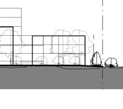
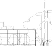
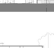

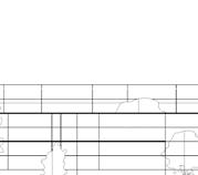
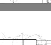

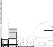
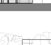
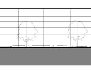
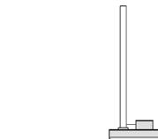
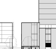
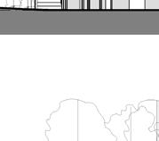
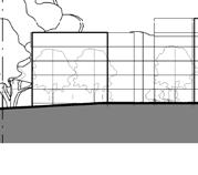
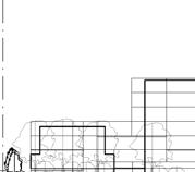
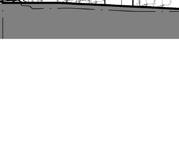


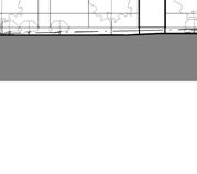

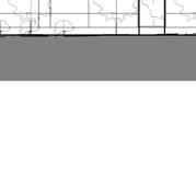
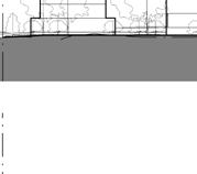


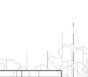
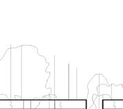
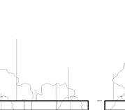
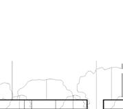
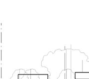 Figure 66 Concept Plan elevations (BVN 2022) overlaid with PP (May 2022) LEP maximum Height of Building (in blue) and Studio GL’s recommended maximum LEP building heights 2022 (in red)
SITE BOUNDARY SITE BOUNDARY 3 STOREY - 15700 6 STOREY - RL 27200 4 STOREY - RL 21900 5 STOREY - RL 24200 BURWOOD ROAD LOCAL ROAD ZOELLER ROAD C1 C5 C7 C9 9 STOREY C6 SITE BOUNDARY 3 STOREY BURWOOD ROAD RL 15000 SITE BOUNDARY 1 : 500 XX-XX-003 ELEVATION 2 XX-XX-003 XX-XX-003 2 7 3 STOREY TERRACES 3 STOREY - RL 19400 SITE BOUNDARY SITE BOUNDARY BURWOOD ROAD ZOELLER ROAD W4 W3 W2 W1 W5 RL 17000 3 STOREY - RL 19400 3 STOREY - RL 19400 3 STOREY - RL 19400 RL 27200 BURWOOD ROAD C1 9 STOREY RL 27900 C8 9 STOREY 5 STOREY BURWOOD E3 6 STOREY RL 27200 5 STOREY RL21200 5 STOREY RL 24200 WATERFRONT PARK 1 500 XX-XX-003 ELEVATION 4 4 12 0m 11 0m 1 3 STOREY TERRACES 3 STOREY - RL 19400 SITE BOUNDARY SITE BOUNDARY BURWOOD ROAD ZOELLER ROAD W4 W3 W2 W1 W5 RL 17000 3 STOREY - RL 19400 3 STOREY - RL 19400 3 STOREY - RL 19400 SITE BOUNDARY SITE BOUNDARY 6 STOREY - RL 27200 4 STOREY - RL 21900 5 STOREY - RL 24200 BURWOOD ROAD C1 C5 C7 9 STOREY C6 RL 27900 9 STOREY 5 STOREY BURWOOD E3 6 STOREY RL 27200 5 STOREY RL21200 WATERFRONT PARK 1 : 500 XX-XX-003 ELEVATION 1 1 1 : 500 XX-XX-003 ELEVATION 4 4 21m RL 46 4 21m 12m 18m 20m 20m 15m 11m 20m 2 SITE BOUNDARY SITE BOUNDARY LOCAL ROAD 5 STOREY RIVERSIDE PARK OPEN LOCAL ROAD PRIVATE OPEN SPACE SITE BOUNDARY SITE BOUNDARY PRIVATE OPEN SPACE 3 STOREY LOCAL ROAD 6 STOREY PRIVATE OPEN SPACE SHARED ZONE W3 C6 E2 1 XX-XX-011 RL 46400 1 : 500 SECTION 1 12 0m 21m 11 0m 20m 20m 20m 3 STOREY TERRACES 3 STOREY - RL 19400 SITE BOUNDARY SITE BOUNDARY BURWOOD ROAD ZOELLER ROAD W4 W3 W2 W1 W5 RL 17000 3 STOREY - RL 19400 3 STOREY - RL 19400 3 STOREY - RL 19400 SITE BOUNDARY SITE BOUNDARY 3 STOREY - 15700 6 STOREY - RL 27200 4 STOREY - RL 21900 5 STOREY - RL 24200 BURWOOD ROAD LOCAL ROAD ZOELLER ROAD C1 C5 C7 C9 9 STOREY C6 SITE BOUNDARY 3 STOREY 5 STOREY - RL 27900 BURWOOD ROAD LOCAL ROAD C8 C9 9 STOREY C6 SITE BOUNDARY 3 STOREY TERRACES 5 STOREY - RL 20400 6 STOREY - RL 23400 BURWOOD E2 E3 E4 RL 15000 6 STOREY RL 27200 C5 5 STOREY RL21200 C4 C3 ZOELLER ROAD SITE BOUNDARY 5 STOREY - RL 24200 C2 SITE BOUNDARY WATERFRONT PARK 1 500 XX-XX-003 ELEVATION 1 1 1 : 500 XX-XX-003 ELEVATION 2 2 1 500 XX-XX-003 ELEVATION 3 3 1 500 XX-XX-003 ELEVATION 4 4 12m 21m RL 46 4 21m 12m 18m 11m 20m 20m 20m 11m 20m 3 160 Burwood Rd, Concord | Urban Design Review | November 2022 86
Recommendations O4

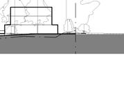
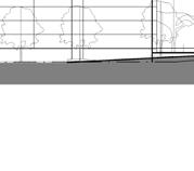
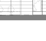
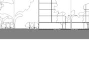
SITE BOUNDARY 3 STOREY 5 STOREY - RL 27900 ROAD LOCAL ROAD C8 C9 9 STOREY C6 SITE BOUNDARY 3 STOREY TERRACES 5 STOREY - RL 20400 6 STOREY - RL 23400 BURWOOD ROAD E2 E3 E4 RL 15000 6 STOREY RL 27200 C5 5 STOREY RL21200 C4 C3 ZOELLER ROAD SITE BOUNDARY 5 STOREY - RL 24200 C2 WATERFRONT PARK 3 4 12m 17m 21m 11m 20m 3 STOREY TERRACES 3 STOREY - RL 19400 SITE BOUNDARY SITE BOUNDARY BURWOOD ROAD ZOELLER ROAD W4 W3 W2 W1 W5 RL 17000 3 STOREY - RL 19400 3 STOREY - RL 19400 3 STOREY - RL 19400 SITE BOUNDARY SITE BOUNDARY 3 STOREY - 15700 6 STOREY - RL 27200 4 STOREY - RL 21900 5 STOREY - RL 24200 BURWOOD ROAD LOCAL ROAD ZOELLER ROAD C1 C5 C7 C9 9 STOREY C6 SITE BOUNDARY BURWOOD ROAD LOCAL ROAD C6 3 STOREY TERRACES BURWOOD ROAD E3 E4 RL 15000 ZOELLER SITE BOUNDARY RL 24200 SITE BOUNDARY WATERFRONT PARK 1 : 500 XX-XX-003 ELEVATION 1 1 500 ELEVATION 2 XX-XX-003 1 : 500 XX-XX-003 ELEVATION 4 12 0m 11 0m 4 D M M M M M M M M M M M M M M M M M M M M M M M M M M M M M M M M M M M M M M M M M M M M M M M MM O1 O1 O1 O1 O1 O1 O1 O1 O1 O1 O1 O1 O1 O1 O1 O1 O1 O1 O1 O1 O1 O1 O1 O1 O1 O1 O1 O1 O1 O1 O1 O1 O1 O1 O1 O1 O1 O1 O1 O1 O1 O1 O1 O1 O1 O1 O1 OO1 1 P2 O1 L Q Q LEGEND 8.5m 11m 15m 17m 18m 20m LEP boundaries (LFA 2022) I L O1 P1 P2 Q BURWOOD RD DURHAMST ARD SALT ST BURWOOD RD DUKE AVE MARCEAU DR ZOELLER ST AN I I I I I I II I I I I I II I I I I I II I I I I II I I I I II I I I I II I I I I II I I I I I I II I I I I I II I I I I I II I I I I II I I I I I II I I I I I II I I I I I II I I I I II I I I I II I I I I I II I I I I II I I I I I II I I I I I II I I I I I II I I I I I I II I I I I I II I I I I I II I I I I II I I I I I II I I I I II I I I I II I I I I I I II I I I I I II I I I I I II I I I I II I I I I I II I I I I I II I I I I I II I I I I I II I I I I II I I I I II I I I I II I I I I II I I I I II I I I I I II M M M M M M M M M M M M M M M M M M M M M M M M M M M M M M M M M M M M M M M M M MM O1 O1 O1 O1 O1 O1 O1 O1 O1 O1 O1 O1 O1 O1 O1 O1 O1 O1 O1 O1 O1 O1 O1 O1 O1 O1 O1 O1 O1 O1 O1 O1 O1 OO1 1 O1 O1 O1 O1 O1 O1 O1 O1 O1 O1 O1 O1 O1 O1 O1 O1 O1 O1 O1 O1 O1 O1 O1 O1 O1 O1 O1 O1 O1 O1 O1 O1 O1 O1 O1 O1 OO1 1 P1 P2 O1 O1 L L L L Q Q Q Q 5 SITE BOUNDARY SITE BOUNDARY 5 STOREY PRIVATE OPEN SPACE SHARED ZONE 3 STOREY LOCAL ROAD W1 C1 5 STOREY C2 5 STOREY C3 RIVERSIDE PARK SITE BOUNDARY SITE BOUNDARY 6 STOREY PRIVATE OPEN SPACE 3 STOREY LOCAL ROAD 5 STOREY PRIVATE OPEN SPACE SHARED ZONE C4 W2 C5 EX. ROOF RL 46400 SITE BOUNDARY SITE BOUNDARY PRIVATE OPEN SPACE 3 STOREY LOCAL ROAD 6 STOREY PRIVATE OPEN SPACE SHARED ZONE W3 9 STOREY C6 E2 1 XX-XX-011 EX. ROOF RL 46400 SITE BOUNDARY SITE BOUNDARY LOCAL ROAD LOCAL ROAD 3 STOREY TERRACES 3 STOREY 3 STOREY TERRACES W5 C9 E4 EX. ROOF RL 46400 1 : 500 XX-XX-003 SECTION 1 1 1 : 500 XX-XX-003 SECTION 3 3 1 : 500 XX-XX-003 SECTION 4 4 12 0m 21m RL46 4 11 0m 20m 20m 20m SITE BOUNDARY SITE BOUNDARY 3 STOREY - 15700 6 STOREY - RL 27200 4 STOREY - RL 21900 5 STOREY - RL 24200 BURWOOD ROAD LOCAL ROAD ZOELLER ROAD C1 C5 C7 C9 C6 SITE BOUNDARY 3 STOREY 5 STOREY - RL 27900 BURWOOD ROAD LOCAL ROAD C8 C9 9 STOREY C6 SITE BOUNDARY 3 STOREY TERRACES 5 STOREY - RL 20400 6 STOREY - RL 23400 BURWOOD ROAD E2 E3 E4 RL 15000 6 STOREY RL 27200 C5 5 STOREY RL21200 C4 C3 ZOELLER ROAD SITE BOUNDARY 5 STOREY - RL 24200 C2 SITE BOUNDARY WATERFRONT PARK 1 500 XX-XX-003 ELEVATION 2 2 1 : 500 XX-XX-003 ELEVATION 3 3 1 : 500 XX-XX-003 ELEVATION 4 4 12m 21m RL 46 4 21m 12m 18m 11m 20m 20m 20m 11m 20m 5 160 Burwood Rd, Concord | Urban Design Review | November 2022 87
Figure 67 Concept Plan elevation and section (BVN 2022) overlaid with PP (May 2022) LEP maximum Height of Building (in blue) and Studio GL’s recommended maximum LEP building heights 2022 (in red)
Recommendations O4
The amended PP (May 2022) is seeking a gross FSR of 1.25:1, however a typical gross FSR for development of former industrial sites in the area is 0.75:1. This proposal is seeking a significantly higher FSR than that of similar sites in the area.

The gross FSR should also identify a minimum non-residential FSR to encourage development of the less lucrative, but desirable, uses on the site such as industrial uses and a small supermarket, cafés etc. The non-residential FSR should not be able to be transferred to residential uses which would create additional bulk and scale and provide fewer benefits for the local area.
5.2.3 Proposed amendments to the floor space ratio map
It is recommended that a gross residential FSR of 0.77:1 (30,500m2) is appropriate for this site which is similar to other rezoned industrial sites. An additional non-residential FSR of 0.19:1 (7,500m2) is required to help activate the site. Of this, a minimum of 3,000m2 is to be light industrial to retain some light industrial uses on the site. This results in an overall site FSR of 0.96:1 (approx 38,000m2).
Amend CBLEP 2013 ‘FSR Map Sheet 004’ as it applies to the subject site from N-1.00:1 to 1.25:1 across the whole of the site which, when broken down into the proposed blocks, corresponds to FSR for each blocks as follows:
The FSR proposed by the amended PP (May 2022) reflects the proposed Concept Plan building massing which does not appear to include balconies. Providing balconies, as required by the Apartment Design Guide, will either increase the bulk of the development or reduce the overall GBA and therefore the FSR of the development. In order to set a realistic FSR, the provision of balconies and their contribution to bulk and scale should be considered as part of the planning proposal. It is also recommended that building depths that are greater than 18m deep are reduced to create higher amenity units within the proposed heights. Reducing building height, length and depth and requiring upper level setbacks will further reduce the maximum FSR that is achievable on this site.
part O - 1.15:1;
part S* - 1.85:1;
part T** - 2.1:1;
part T* - 2.2:1;
part V* - 3.05:1
While a small bonus FSR could be desirable to ensure the listing, retention and refurbishment of the Central Roasting Hall and to ensure its long term survival, any bonus should be limited and must have regard to other urban design considerations including local character. If a gross FSR is used it must reflect large areas of land allocated to open space and roads.
shown in Figure 26.
A bonus is recommended if the Central Roasting Hall is retained and restored. This bonus should be allocated to Block 4, where the Central Roasting Hall is located, and would increase the FSR of this site from 1.0:1 (approx. 3,000m2) to 3.0:1 (approx. 8,900m2). This would increase the overall gross site FSR by 0.15:1 to 1.11:1 (approx. 43,900m2).
4-6 FSR
LEGEND 0.50 0.75 1.00* 1.10 1.30 1.80 2.10 A bonus 2.0:1 can be added to this Block FSR if the Central Roasting Hall is retained D I N* O Q1 S4 T2 * LEGEND 0.50 0.75 1.00* 1.10 1.30 1.80 2.10 A bonus 2.0:1 can be added to this Block FSR
Central
D I N* O Q1 S4 T2 * 160 Burwood Rd, Concord | Urban Design Review | November 2022 88
if the
Roasting Hall is retained
Recommendations O4
Studio GL has also prepared a recommended amended site layout (Figure 72) that reduces the overall building depths, accommodates balconies within the building envelopes, increases building setbacks and introduces upper storey setbacks. These changes show a maximum permissible density of 1.11:1 (43,900m2) as shown in Figure 70.
BURWOOD RD
It is recommended that FSR in the CBLEP is identified per block to ensure lower FSRs are located next to the sensitive interfaces with higher FSR for Block 5 and the Central Roasting Hall similar to the diagram shown in Figure 69. These recommendations should also be reflected in the draft DCP FSR Block diagram as suggested in Figure 71.
Figure 70 Height, GFA, and FSR comparison table, 2022
Figure 71 Draft DCP FSR Block Diagram annotated with Studio GL recommendations where changes are suggested in orange
Planning Proposal July 2018 C-Amended Draft DCP (PP 07/02/2019, figure 6, page 7) D-Amended Arch Drawings (BVN Sheet 1, 29/01/2019) E-Amended Arch Drawings (BVN May 2022) Studio GL recommendations Suggested layout 2022 without heritage FSR bonus Height 3-6 storeys 4-5 storeys 4-5 storeys 3 storeys 3 storeys Total GFA (combined*) 14,812 n/a 11,827 8,204 7,833 FSR (net per block) 2.0 1.6 1.62 1.15 1.1 Height 3-5 storeys 3-6 storeys 3-6 storeys 3-6 storeys 3-6 storeys Total GFA (combined*) 4,931 n/a 5,885 6,317 4,379 FSR (net per block) 1.4 1.71 1.65 1.85 1.3 Height 3-7 storeys 3-7 storeys 3-7 storeys 3-6 storeys 3-6 storeys Total GFA (combined*) 11,231 n/a 11,231 9,771 8,292 FSR (net per block) 2.0 1.9 1.97 2.10 1.8 Height 9 storeys 9 storeys 9 storeys 9 storeys 9 storeys Total GFA (combined*) 8,666 n/a 8,666 8,921 2,987 FSR (net per block) 2.7 2.66 2.68 3.05 1.0 Height 4-13 storeys 5-9 storeys 5-9 storeys 2-6 storeys 2-6 storeys Total GFA (combined*) 21,141 n/a 18,358 15,339 14,484 FSR (net per block) 2.9 2.6 2.53 2.20 2.1 Total GFA 60,780 n/a 55,967 48,552 37,975 Total Gross FSR 1.54 1.50 1.41 1.23 0.96 Total Site Area 39,558 * Total GFA combines residential and non-residential floor space (i.e. commercial, industrial, urban services) Block 5 Env C1-C5 Block 1 Env W1-W5 Block 2 Env C7-C9 Block 3 Env E1-E4 Block 4 Roasting Hall Planning Proposal July 2018 C-Amended Draft DCP (PP 07/02/2019, figure 6, page 7) D-Amended Arch Drawings (BVN Sheet 1, 29/01/2019) E-Amended Arch Drawings (BVN May 2022) Studio GL recommendations Suggested layout 2022 without heritage FSR bonus Studio GL recommendations Suggested layout 2022 with heritage FSR bonus Height 3-6 storeys 4-5 storeys 4-5 storeys 3 storeys 3 storeys 3 storeys Total GFA (combined*) 14,812 n/a 11,827 8,204 7,833 7,833 FSR (net per block) 2.0 1.6 1.62 1.15 1.1 1.1 Height 3-5 storeys 3-6 storeys 3-6 storeys 3-6 storeys 3-6 storeys 3-6 storeys Total GFA (combined*) 4,931 n/a 5,885 6,317 4,379 4,379 FSR (net per block) 1.4 1.71 1.65 1.85 1.3 1.3 Height 3-7 storeys 3-7 storeys 3-7 storeys 3-6 storeys 3-6 storeys 3-6 storeys Total GFA (combined*) 11,231 n/a 11,231 9,771 8,292 8,292 FSR (net per block) 2.0 1.9 1.97 2.10 1.8 1.8 Height 9 storeys 9 storeys 9 storeys 9 storeys 9 storeys 9 storeys Total GFA (combined*) 8,666 n/a 8,666 8,921 2,987 8,921 FSR (net per block) 2.7 2.66 2.68 3.05 1.0 3.0 Height 4-13 storeys 5-9 storeys 5-9 storeys 2-6 storeys 2-6 storeys 2-6 storeys Total GFA (combined*) 21,141 n/a 18,358 15,339 14,484 14,484 FSR (net per block) 2.9 2.6 2.53 2.20 2.1 2.1 Total GFA 60,780 n/a 55,967 48,552 37,975 43,909 Total Gross FSR 1.54 1.50 1.41 1.23 0.96 1.11 Total Site Area 39,558 residential and non-residential floor space (i.e. commercial, industrial, urban services) 23m min 7m min 9m min 9m 3m min min 12m 6m min 6m
1 6 RL 46.4 RL 22.73 6 5 3 3 40m 0 20 N Potential Service Lane Northern Link Rd Western Rd Eastern Rd BURWOOD RD DUKE AVE ZOELLER ST 0 20 Burwood Road Development Controls Plan Eastern Block 3 Northern Block 5 Southern Block 2 Western Block 1 Roasting Hall Block 4 3.05:1 2.2:1 1.85:1 2.1:1 1.15:1 Site area: 7,035sqm Site area: 2,945sqm Site area: 3,500sqm Site area: 4,730sqm Site area: 7,330sqm 3m 12m 35m 18m 10m 66m 36m 16m 4.5m 2.5m 1m 3m 3m 2m 4.5m 2.1:1 6995m2 7225m2 1.8:1 1.1:1 1.0:1* 1.3:1 4565m2 5m *A bonus 2.0:1 can be added to the FSR of Block 4 if the Central Roasting Hall is retained 160 Burwood Rd, Concord | Urban Design Review | November 2022 89
Recommendations
4-7 Recommended Site Layout
Studio GL's recommended site layout is shown in Figure 72 with key commentary below.
Modified Zoeller St entry
To reduce the loss of golf course area, heritage land and public land, an alternative to the extension of Zoeller St may be required. To ensure a legible road network the connection should be visually and physically continuous and minimise deviations. The suggested connection into Zoeller St shown here, results in a modification of the footprint of building W1 and the FSR parcel of Block 1.
Setbacks to Massey Park Golf Course
Setback the FSR parcel boundary of Block 5 4.5m (rather than 3m) from the northern boundary to safeguard public pedestrian access along this boundary and accommodate footpaths and landscaping. This is to provide public pedestrian access along this boundary if Zoeller St can not be extended. The minimum building setback from the northern site boundary to buildings W1, C1 and C2 should remain at 6m.
Upper level setbacks
The PP (May 2022) Concept Plans illustrate setbacks for the upper two storeys of the terrace typologies along Burwood Road. This is supported as it helps reduce the bulk and scale of the three storey terraces along this interface.
Studio GL also recommends upper level setbacks for apartment buildings as shown in Figure 72 for buildings generally over 4 storeys. This will help reduce the overall bulk and scale, minimise overshadowing and reduce the sense of enclosure for pedestrians at street level.
Building widths and separation distances
As shown in Figure 72, Studio GL recommends reducing some of the overall building depths shown in the concept designs to accommodate balconies within the building envelopes and avoid encroachments into the sensitive side setbacks.
Separation distances should also be increased as suggested in Figure 72 where they do not achieve the minimum criteria set out in the Apartment Design Guide.
Built form along Burwood Rd
Studio GL recommends that the Concept Design reverts to terraces along Burwood Rd to replace the retail uses proposed in Block Two. This will be more compatible with the neighbouring residential character and will improve the amenity and privacy of the surrounding low density dwellings and provide greater opportunity for screen landscaping. It is also recommended that the building footprints of Buildings C7 and C8 are reduced to the south of the 9 storey Central Roasting Hall as the proposed development is very close and will receive minimal solar access.
Primary site entrance opposite Marceau Drive
The proposed new urban structure creates an efficient, legible and finer grain block structure which is more permeable for pedestrian and vehicles.
The proposed primary site entry is located at the intersection of Burwood Rd and Marceau Dr which is currently serviced by a roundabout. The technical specifications and traffic impacts of this entry will need to be assessed by a traffic expert, however from an urban design perspective the location of this site entry and new road is supported as it assists in integrating the new development into the exiting street network and provides new visual links from Marceau Drive to the Central Roasting Hall and a new direct connection to the waterfront.
Foreshore Building Line
The exact location and dimensions of the proposed Foreshore Building Line vary slightly between the proposed Concept Plans and LEP maps in the PP (May 2022). It is recommended that an amended Foreshore Building Line be established that more closely defines the proposed building envelopes to reduce any potential encroachment closer to the water. The suggested change would slightly reduce the FSR area of Block 3 and the footprint of building E2.
O4
1 2 3 4
6 7
5 160 Burwood Rd, Concord | Urban Design Review | November 2022 90
Recommendations O4
FSR Block area
SGL recommended building footprint
SGL recommended upper level floor area
PP 2022 concept design building footprint
Non-residential ground floor use
PP 2022 LEP Foreshore Building Line (FBL)
PP 2022 concept design RE1 boundary/ FBL
SGL recommended Foreshore Building Line
Date Sca e Fi e name Revision no Prepared by Disclaimer: © Copyright Studio GL The site boundaries and surroundings are based on the data prov ded by the c ient These draw ngs are to be read n conjunction w th al other relevant documentation produced by Stud o GL - 2022 03 May 2019 1:1000 @ A3 19002 BurwoodRd 240419 vwxDN N 0 10m 50m 20m
Figure 72 Recommended site layout prepared by Studio GL with building envelopes used to calculate FSR
W5 6 6 8 6 6 6 6 18 3 3 1 2 9 9 7 6 6 3 1 0 7 6 7 3 3 3 3 9 18 18 7 1 4 1 8 1 8 10 1 2 4 5 36 16 66 18 35 3 2 0 3 4 5 5 3 4 0 8 9 12 12 5 5 5 6 SGL Recommended Site Layout Plan BLOCK 4 BLOCK 1 BLOCK 5 BLOCK 3 C6 W1 W2 W3 W4 W5 C7 C8 C9 E4 E3 E2 E1 C1 C2 C3 C4 C5a C5 BLOCK 2 C4 NEW LANEWAY ELLER ST BURWOOD RD 1 storey urban services 3 storeys 3 storeys 3 storeys 3 storeys 9 storeys 6 storeys 2 storeys 3 storeys 4+1 storeys 4+1 storeys 4+1 storeys 4+1 storeys 5+1 storeys 4+1 storeys 1+2 storeys 1+2 storeys 1+2 storeys 4 storeys 5+1 storey SGLRecommendedFBLPPConceptPlanRE1Boundary/FBLPPLEPFBL RE1 Pub ic Recreation Date Sca e F le na Revisio Prepar Disclaimer: © Copyright Studio GL The site boundaries and surroundings are based on the data provided by the client These drawings are to be read in con unct on with a l other relevant documentation produced by Studio GL D R D ite Layout Plan - 2022 N 0 10m 50m 20m FSR Block area SGL recommended SGL recommended PP 2022 concept de Non-residential grou PP 2022 LEP Fores PP 2022 concept de SGL recommended W5 6 6 8 6 6 6 6 18 3 3 1 2 9 9 7 6 6 3 1 0 7 6 7 3 3 3 3 9 18 18 7 1 4 1 8 1 8 10 1 2 4 5 36 16 66 18 35 3 2 0 3 4 5 5 3 4 0 8 9 12 12 5 5 5 6 SGL Recom m ended Site Layout Plan BLOCK 4 BLOCK 1 BLOCK 5 BLOCK 3 C6 W1 W2 W3 W4 W5 C7 C8 C9 E4 E3 E2 E1 C1 C2 C3 C4 C5a C5 BLOCK 2 C4 NEW LANEWAY ZOELLER ST BURWOOD RD 1 storey urban serv ces 3 storeys 3 storeys 3 storeys 3 storeys 9 storeys 6 storeys 2 storeys 3 storeys 4+1 storeys 4+1 storeys 4+1 storeys 4+1 storeys 5+1 storeys 4+1 storeys 1+2 storeys 1+2 storeys 1+2 storeys 4 storeys 5+1 storey SGLRecommendedFBLPPConceptPlanRE1Boundary/FBLPPLEPFBL RE1 Public Recreation 1 4 7 6 5 2 3 160 Burwood Rd, Concord | Urban Design Review | November 2022 91
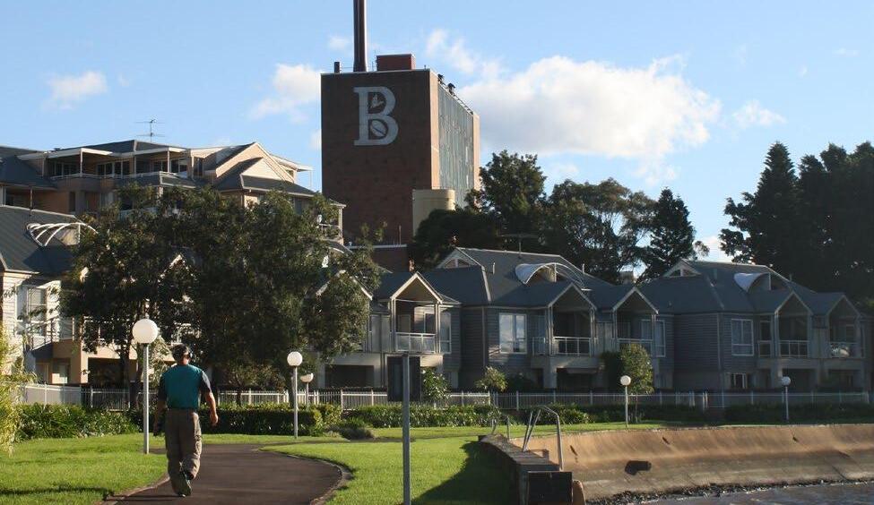
Appendix
APPENDIX
Case studies: redeveloped industrial sites in Canada Bay
The Canada Bay Development Control Plan, Part 8 Heritage, notes that “the late twentieth century has seen the most dramatic change to the Council area with the rehabilitation and redevelopment of many of the large industrial sites. Most of these have been replaced with medium density residential and commercial developments that enjoy the proximity of the sites to Parramatta River”.
The adjacent shows six former industrial sites in the Canada Bay LGA that have been redeveloped in recent times. The sites range from 6 to 11ha in size. With the exception of Site 03 (Kings Bay), all sites have a water frontage to Sydney Harbour. The following pages outline key data for each site, including the applied FSR and maximum building height.
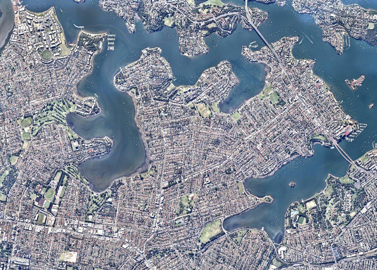
01 06 05 04 03 02
160 Burwood Rd, Concord | Urban Design Review | November 2022 93
APPENDIX
Site 01 - Abbotsford Cove (former Nestle site)
Max. building height 8.5 to 17m
Max. FSR 0.65:1 (estimated)
Land use zone R3
Abbotsford Cove
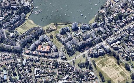
Predominant typology Apartments, townhouses
Retained heritage items Yes
Total site area 9.5 ha
Site 02 - Sydney Wire Mill Site, Chiswick
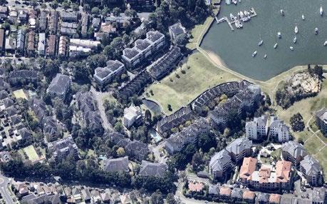
Max. building height 8.5 to 17m
Max. FSR 0.7:1
Land use zone R3
Predominant typology Apartments, townhouses
Retained heritage items No
Total site area 11 ha
Figure 74 Location map
Abb o sfordCoveDr Walton Cres Blackwall Point Rd Great North Rd Tyler Cres Windward Pde Manta Pl Figtree Ave Catham Pl Janda Pl Bechert Rd Montrose Rd MelroseCres HabourviewCres AltonaSt AbbotsfordPde GowSt Henry LawsonAve RaynorAve MayneLn Abbotsford Bay
Figure 75 Location map
AbbortsfordCoveDr Blackwall Point Rd BlackwallPointRd Parkview Rd BiddySt ShoreRd FortescueSt WeddleSt BurnsCres Swannell Tyler Cres Florey Pl Kokoda St Windward Pde Manta Pl Janda Pl Bechert Rd BechertRd DophinCl BlackadderCl TheProminade MaherCl Point Ave Marine Dr SearayCl MelroseCres WaltonCres Montrose Ave HabourviewCres FigtreeAve Abbotsford Bay
Sydney Wire Mill Site - Chiswick
Figure 76
Aerial photo (source: nearmap.com)
Figure 77
160 Burwood Rd, Concord | Urban Design Review | November 2022 94
Aerial photo (source: nearmap.com)
APPENDIX
Site 03 - Kings Bay (former Hycraft site)
Max. building height 8.5 to 20m
Max. FSR 0.7:1
Land use zone R3, RE1
Predominant typology Apartments, multi-level
Retained heritage items No
Total site area 6 ha
Site 04 - Pelican Point, Pelican Quays & Phillips Landing
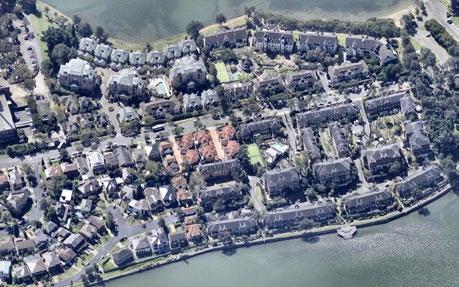
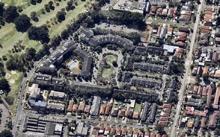
Max. building height 15m
Max. FSR 0.75:1
Land use zone R3
Predominant typology Apartments
Retained heritage items No
Total site area 10 ha
Pelican Point
WilliamSt Myler St Kings Park Walk Kings Rd Kings Rd Bevin Ave Mackaness Ave Henry St Lancelot St Garfield St Queens Rd Watts St Maple Cl Spencer St Queens Rd Harris Rd Harris Rd William St Courland St Rowe St KingBayAve Kings Park Walk
Figure 78 Location map
Figure 79 Location map
Burwood Rd Marceau Dr Zoeller St Duke Ave Ward St Sanders Pde Salt St DurhamSt Governors Dr Exile Bay Canada Bay
Figure 80
Aerial photo (source: nearmap.com)
Figure 81
160 Burwood Rd, Concord | Urban Design Review | November 2022 95
Aerial photo (source: nearmap.com)
Edgewood and Kendall Inlet
Edgewood and Kendall Inlet
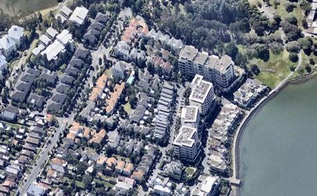
Max.
Land use zone R3
Predominant
Max.
Land use zone R3
K e n d a l l B a y Kendall St DorkingRd WaineSt GrenvilleAve Moore St StamfordAve BishopSt BreakfastPointBlvd Peninsula Dr Admiralty Dr Medora St Mimosa Circuit Cabarita Rd EdgewoodCres CatherineSpencerPl FairwaterCl Correys Sq StrathroyCl Kendal Inlet Kendal Inlet EdgewoodCres Edgewood Cres Regatta Way MedoraLn
APPENDIX Site 06 - Edgewood & Kendall Inlet (fmr Dulux Site)
building
11m
height
Max. FSR 0.7:1
Apartments
Site 05 - Cape Cabarita Figure 82 Location map K e n d a l l B a y Elphinstone St Kendall St BraysRd DorkingRd WaineSt GrenvilleAve Moore St StamfordAve BishopSt BreakfastPointBlvd Peninsula Dr Admiralty Dr Medora St Mimosa Circuit Cabarita Rd EdgewoodCres CatherineSpencerPl FairwaterCl Correys Sq StrathroyCl Kendal Inlet Kendal Inlet EdgewoodCres Edgewood Cres Regatta Way MedoraLn
Predominant typology
Retained heritage items Yes Total site area 9.8 ha
building height 8.5 to 17m
0.7:1
Max. FSR
Apartments,
Total site area
ha PhillipsSt Cabarita Rd Elphinestone St Sanders Pde RobertSt Collingwood Ave DorklingRd Jacaranda Dr Rosemeadow Dr Moore St Exile Bay France Bay Hen And Chicken Bay
83 Location map
typology
townhouses Retained heritage items No
7
Figure
Figure 84
Aerial photo (source: nearmap.com)
Figure 85
160 Burwood Rd, Concord | Urban Design Review | November 2022 96
Aerial photo (source: nearmap.com)