Pg 1 Homebush Precinct Master Plan For: City of Canada Bay Council
Prepared for City of Canada Bay Council | GroupGSA | 04 Feb 2022
HOMEBUSH NORTH PRECINCT MASTER PLAN REPORT
We acknowledge the traditional custodians of the land, and pay our respects to their elders past present and emerging, recognising their continuing connection to land, waters and culture.

Issue Title Date Prepared Checked
1 Draft Issue 27.11.2020 SL/JC/NO JK
2 Draft Issue 18.12.2020 JC/NO JC
3 Revised master plan 21.01.2021 JC/NO JC/NO
4 Revised master plan 28.01.2021 JC/NO JC
5 Revised yield table 29.01.2021 JC -
6 Revised building heights - Lot D 17.02.2021 JC -

7 Revised yield table 18.02.2021 JC -
8 Variation - Issue for Review 16.04.2021 JC/NO JC
9 Revised Master Plan 20.04.2021 JC -
10 Revised yield table 26.04.2021 JC -
11 Revised Master Plan 04/02/2022 HR JK
Pg 2 Homebush Precinct Master Plan For: City of Canada Bay Council
Pg 3
01/ INTRODUCTION 5 02/ INTRODUCTION 6
PRCUTS POLICY FRAMEWORK 8 PRCUTS IMPLEMENTATION TOOL KIT 9 PRCUTS PLANNING AND DESIGN GUIDELINES 10
PRCUTS_FSR + HEIGHTS 11 CITY OF CANADA BAY POLICIES AND GUIDELINES 13 CITY OF CANADA BAY 14 POLICIES AND GUIDELINES 14 03/ POLICY CONTEXT & SITE ANALYSIS 17 THE SITE 19 SITE CHARACTER 20 Streetscape 20 Infrastructure 21 SITE ANALYSIS 22 STRATEGY CONTEXT: PRCUTS 23 Access and connectivity 23 Land use and activation 24 Public domain and streetscape 25 OPPORTUNITIES & CONSTRAINTS 26 Opportunities 26 Challenges 27 04/ MASTER PLAN 29 HOMEBUSH NORTH PRECINCT VISION 30 MASTER PLAN 32 LOT AMALGAMATION 33 GROUND LEVEL SETBACK 34 BUILDING HEIGHT STRATEGY 35 STREET WALL 36 OPEN SPACE AND LINKS 37 PROPOSED ZONING 38 SHADOW ANALYSIS 40 05/ STREET INTERFACE 43 GEORGE & KING STREET SPINE 44 VICTORIA AVENUE 45 KING STREET SHARED ZONE 46 STATION AVENUE SHARED ZONE 47 06/ YIELD ESTIMATE 49 YIELD ESTIMATE 50
Pg 4
For:
Homebush Precinct Master Plan
City of Canada Bay Council
INTRODUCTION
Pg 5 01
INTRODUCTION
In November 2016, Urban Growth NSW released the Parramatta Road Corridor Urban Transformation Strategy (PRCUTS) together with a package of implementation and reference documents. A Section 117 Ministerial Direction gives the Strategy and Implementation Tool Kit statutory weight.
PRCUTS aims to renew Parramatta Road and adjacent communities through investments in homes, jobs, transport, open spaces and public amenity. It presents significant urban renewal opportunities for land within defined development precincts.
In response to PRCUTS, the City of Canada Bay has commenced additional urban design, traffic and transportation investigations for 3 precincts: Burwood, Homebush and Kings Bay. This work seeks to ensure that all future decisions to rezone land will be made with a thorough understanding of potential cumulative impacts and will achieve orderly, transparent and high-quality design outcomes.
The Urban Design testing of the PRCUTS planning and design controls has been undertaken and informs this project. The Masterplan proposed in this report for Kings Bay consolidates the PRCUTS with other studies and plans that Council has produced that support the implementation of the PRCUTS. The Masterplan is intended to guide the future built form and urban environment and to inform amendments to the Canada Bay LEP 2013, DCP and contributions plan.
The Parramatta Road Corridor
The Parramatta Road Corridor traverses 20 kilometres from Granville in the west to Camperdown in the east. The corridor includes land adjoining Parramatta Road, and wider focus precincts where future development is considered appropriate based on function and character. Within PRCUTS, the Corridor is separated into two distinct sections – Corridor West and Corridor East. Corridor East includes the land within the Canada Bay, Strathfield and Burwood LGAs.
There are three renewal precincts which include land within the City of Canada Bay: Homebush, BurwoodConcord (Burwood), and Kings Bay.
This Report synthesises all of the above and reimagines the future character of Homebush North Precinct as a new, mixed use precinct housing a new community of residents attracted to the area for its high amenity and access to employment at Parramatta CBD and Sydney Olympic Park. The precinct will provide a long term supply of housing stock to meet increasing demand as Sydney Olympic Park grows into a new city.
The Homebush North Precinct will be an active and varied hub, blending high density residential with mixed use. It will be supported by green links and open space, with connections to rail.
City of Canada Bay LGA
Homebush Precinct
PARRAMATTAROAD
The Burwood Precinct will be a gateway to Burwood Town Centre based around the enlivened spine of Burwood Road strengthening existing amenity for new residents.
Burwood Precinct Kings Bay Precinct
Kings Bay Precinct will be a new residential and mixed use urban village with an active main street and strong links to the open space network along Sydney Harbour.
PARRAMATTA ROAD
Pg 6
For:
Homebush Precinct Master Plan
City of Canada Bay Council
T
T T T T T T T
T
T T
As demonstrated on the flowchart adjacent, there is a substantial amount of policy and strategic thinking that has been evolved and directly impacts the three precincts that are the subjects of this study.
We see the literature review in the following chapters as the next step in this process, and have tried to summarise and graphically represent the key information that will assist in moving the project forward to design development.
Intended as a starting point to evolve throughout the design process, the following chapters will inform our thinking and ground our recommendations through to the master plan phase of the project.
NSW State Government
Government Architect New South Wales
Greater Sydney Commission
City of Canada Bay Council
*coloured boxes indicate literature review input by SGS
Metropolitan
State Local
Implementation Plan UAIP Design Guidelines Infrastructure Schedule
PRCUTS Transformation Strategy GANSW Policies and Guidelines
Greater Sydney Region Plan - A Metropolis of Three Cities Eastern City District
City of Canada Bay Local Strategic Planning documents including LSPS; housing, employment, development contributions plans
Planning Proposals
PRCUTS Specific Policies and Strategies
Canada Bay Local Environment Plan
Canada Bay Development Control Plan
Canada Bay Local Character Statements
Pg 7
As part of the baseline analysis, we have critically reviewed and distilled key information related to PRCUTS.
PRCUTS POLICY FRAMEWORK
Parramatta
Combining big picture considerations, a sub-regional response, and the depth of local knowledge required to plan for existing and future communities, it will lead to the enlivening of this important Sydney artery.
The Strategy is supported by the Implementation Tool Kit – four documents that will guide and inform how the Strategy is to be implemented, and are summarised on the following pages.
While the Strategy does not directly rezone land, it establishes the framework for land use and transport planning to guide, coordinate and facilitate changes to local planning controls that will lead to the Corridor’s transformation. The Strategy will be implemented through planning proposals prepared by landowners or developers, comprehensive local environmental plan reviews undertaken by councils, and State environmental planning policies for future Priority Precincts.
The strategy sets out a vision for the corridor of tomorrow: housing choice and affordability diverse and resilient economy accessible and connected vibrant communities and places green spaces and links sustainability and resilience delivery
Relevance to project:
The Strategy sets an overarching vision and high level employment and dwelling projections that are summarised in the adjacent pages. It also identifies a number of challenges to achieving these, which have been synthesised graphically onto maps in the next chapter.
Homebush Precinct
The Homebush Precinct will be transformed into an active and varied hub, blending higher density housing and a mix of different uses, supported by a network of green links and open spaces with walking access to four train stations.
The activity hub of the Precinct will be located between Homebush Station, North Strathfield Station and Strathfield Station. This area will have a revitalised and active urban mixed-use character with both Parramatta Road and George Street forming main street spines that build on the character and attraction of the Bakehouse Quarter and the curved alignment of Parramatta Road. Taller residential buildings will mark the core of the Precinct near all three stations.
A dense network of streets will extend northward and westward from the activity hub through the Precinct to provide walkable medium-density residential neighbourhoods oriented to the open space network. The green corridor of Powell’s Creek will reach from the heart of the Precinct to Sydney Olympic Park and Homebush Bay beyond.
Population: 19,500 by 2050
Homes: 9,500 by 2050
Jobs: 12,900 by 2050
Pg 8 Homebush Precinct Master Plan For: City of Canada Bay Council
Please Remember: ✔ Full Colour Linear logo is the preferred logo. ✔ Please use the logo layout and format that best suits the design application and which will reproduce at the highest quality for your type of production. ✔ Always use original artwork files as supplied with the Logo Reference Guide. Thank you for your assistance in ensuring our logo is always produced in the best format and at the highest quality. Logo Versions: There are two logo orientations available for use: - Stacked - Linear Each orientation has four colour formats: - Full colour (CMYK) - Full colour (PMS) - Single Colour (black and white) 6. Minimum Size Stacked 30mm wide Linear 45mm wide NEW PARRAMATTA RD Quick Reference Guide As at September 2014 5. Isolation Area Linear Stacked 4. Stacked Mono Positive Negative Negative 2. Linear Mono Positive Positive 3. Stacked Colour For use on white and black 1. Linear Colour * ✔ Preferred) Please note that the full colour version this logo can be used on white, coloured and black backgrounds. This file can be embroidered as is. urbangrowth.nsw.gov.au NOVEMBER 2016
Parramatta Road Corridor Urban Transformation Strategy
The
Road Corridor Urban Transformation Strategy is the long-term vision for developing population and employment growth in the Parramatta Road Corridor.
PRCUTS Planning and Design Guidelines
The purpose of the Parramatta Road Corridor Planning and Design Guidelines is to: describe the priorities and principles that will ensure future development achieves high design quality and design excellence guide the rapidly changing character of the Corridor whilst ensuring future development responds to the distinct character and identity along different parts of the Corridor
The Guidelines have been prepared as planning and development controls significantly differ across the local government areas that make up the Corridor, and have been developed to assist designers and planners apply ‘better practice’ design principles to promote high quality public, private amenity and good design.
Relevance to project:
The controls identified in the PRCUTS guidelines will be tested throughout the master plan process and recommendations made at the conclusion of the study.
The guidelines also identify a number of public domain requirements, strategic links, opportunities and constraints for each precinct, which have been identified and graphically represented for each precinct in later chapters.
Infrastructure Schedule
Identifies infrastructure in the Corridor must respond to population growth and change.
It also recognises that some existing infrastructure is ageing or is insufficient to meet the needs of communities as they grow and change. The Infrastructure Schedule therefore identifies the transport, open space, community, education and health facilities required to support the proposed growth across the Corridor. It will also assist the coordination of infrastructure and services provided by state agencies, government-owned corporations, local government and the private sector.
Relevance to Homebush North:
GroupGSA are working on this study with SGS Planning and Economics who have provided a separate literature review of this document as an Appendix.
Relevance to Homebush North:
to be
as part of any proposed renewal precinct.
Relevance to Homebush North:
Pg 9 PRCUTS IMPLEMENTATION TOOL KIT Implementation Plan 2016 – 2023 Please Remember: ✔ Full Colour Linear logo the preferred logo. ✔ Please use the logo layout and format that best suits the design application and which will reproduce at the highest quality for your type of production. ✔ Always use original artwork files as supplied with the Logo Reference Guide. Thank you for your assistance ensuring our logo always produced in the best format and the highest quality. Logo Versions: There are two logo orientations available for use: - Stacked - Linear Each orientation has four colour formats: - Full colour (CMYK) - Full colour (PMS) - Single Colour (black and white) 6. Minimum Size Stacked 30mm wide Linear 45mm wide NEW PARRAMATTA RD Quick Reference Guide As September 2014 5. Isolation Area Stacked 4. Stacked Mono Negative Negative 2. Linear Mono Positive 3. Stacked Colour For use on white and black 1. Linear Colour * ✔ Preferred) Please note that the full colour version of this logo can be used on white, coloured and black backgrounds. urbangrowth.nsw.gov.au Parramatta Road Corridor Urban Transformation NOVEMBER 2016 IMPLEMENTATION TOOL KIT Implementation
Plan
Intended to inform and guide the land use planning and development decisions in the Corridor in the short term.
Identifies
need for a Precinct wide traffic study
land
densities
upgrades
the
and supporting modeling that considers the recommended
use and
and identifies the necessary road improvements and
delivered
Powells Creek Reserve
cycle
Please Remember: ✔ Full Colour Linear logo the preferred logo. ✔ Please use the logo layout and format that best suits the design application and which will reproduce at the highest quality for your type of production. ✔ Always use original artwork files as supplied with the Logo Reference Guide. Thank you for your assistance ensuring our logo always produced in the best format and at the highest quality. Logo Versions: There are two logo orientations available for use: - Stacked - Linear Each orientation has four colour formats: - Full colour (CMYK) - Full colour (PMS) - Single Colour (black and white) 6. Minimum Size NEW PARRAMATTA RD Quick Reference Guide As September 2014 5. Isolation Area Linear 4. Stacked Mono Positive Negative Negative 2. Linear Mono Positive Positive 3. Stacked Colour For use on white and black 1. Linear Colour * ✔ Preferred) Please note that the full colour version this logo can be used on white, coloured and black backgrounds. This file can embroidered is. urbangrowth.nsw.gov.au Urban Amenity Improvement Plan Parramatta Road Corridor Urban Transformation NOVEMBER 2016 IMPLEMENTATION TOOL KIT
A minimum of 5% of new housing is to be provided as affordable housing Delivery of
pedestrian and
link
ways to deliver tangible public benefits, contributing to the delivery of liveable communities and neighbourhoods and stimulate the development.
Urban Amenity Improvement Plan Identifies
upgrade
of new or improved open spaces, urban plazas and town squares
walking and cycling links to key transport nodes
The works fall into three categories: Streetscape
Creation
New
number of the UAIP improvement works are proposed within the broader Homebush Precinct but do not specifically reference the precinct boundary of this study Planning and Design Guidelines Parramatta Road Corridor Urban Transformation NOVEMBER 2016 IMPLEMENTATION TOOL KIT urbangrowth.nsw.gov.au
A
Please Remember: ✔ Full Colour Linear logo the preferred logo. ✔ Please use the logo layout and format that best suits the design application and which will reproduce at the highest quality for your type of production. ✔ Always use original artwork files as supplied with the Logo Reference Guide. Thank you for your assistance in ensuring our logo always produced in the best format and at the highest quality. Logo Versions: There are two logo orientations available for use: - Stacked - Linear Each orientation has four colour formats: - Full colour (CMYK) - Full colour (PMS) - Single Colour (black and white) 6. Minimum Size Stacked 30mm wide Linear 45mm wide NEW PARRAMATTA RD Quick Reference Guide As at September 2014 5. Isolation Area Linear Stacked 4. Stacked Mono Positive Negative Negative 2. Linear Mono Positive Positive 3. Stacked Colour For use on white and black 1. Linear Colour * ✔ Preferred) Please note that the full colour version of this logo can be used on white, coloured and black backgrounds. This file can be embroidered as is. urbangrowth.nsw.gov.au Parramatta Road Corridor Urban Transformation NOVEMBER 2016 IMPLEMENTATION TOOL KIT Infrastructure Schedule
The Strategy is supported by the Implementation Tool Kit – four documents that will guide and inform how the Strategy is to be implemented, and are summarised on the following pages.
PRCUTS PLANNING AND DESIGN GUIDELINES
The subject site, the North Homebush Precinct, currently largely characterised by R2 - Low density residential, with pockets of IN1 - General Industrial to the north-west and south-east and SP2 - Special Purposes and RE1 - Public Recreation to the west.
PRCUTS proposes rezoning R2 and the north-west IN1 lots to R3 - Medium Density Residential. The SP2 lots will be absorbed into the R3 rezoning. The southeastern IN1 lot will be rezoned B7 - Business Park. The RE1 lots are retained.
Under the PRCUTS Planning and Design Guidelines, the subject site is generally characterised by low building heights of 8.5m adjacent to Concord West Station.
Some peripheral lots to the north-west and southwest will have allowable building heights of 16-25m.
Lots to the south of the subject site and the proposed Employment Hub (zoned B7), and adjacent to the train line, have generally higher allowable building heights of 16-32m. Heights increase approaching Parramatta Road.
The subject site, the North Homebush Precinct, is generally characterised by low densities adjacent to Concord West Station, with an FSR of 0.5:1.
Rezoned industrial lots to the south and lots adjacent to the train line are generally higher, between 1:1 and 1.6:1.
Pg 10 Homebush Precinct Master Plan For: City of Canada Bay Council GEORGE ST KING ST VICTORIA AVE AUSTRALIA AVE S3 T2 N D D S2 D Figure 7.14: Homebush Recommended Densities Precinct Boundary Frame Boundary Land Use Low Density Residential Medium Density Residential High Density Residential Local Centre Mixed Use Enterprise Corridor Business Park General Industrial Infrastructure Public Recreation R4 R3 R2 B2 B4 B6 B7 IN1 SP2 RE1 Figure 7.12: Homebush Recommended Land Uses PARRAMATTA RD POWELL ISMAY CONWAY ARGONNE MENA BRUSSELS ST MOTORWAY S3 D D S2 T1 Figure 7.14: Homebush Recommended Densities PARRAMATTA RD POWELL RD ISMAY AVE STATION ST KNIGHT ST ALBERT RD MOSELY ST ROBERTS ST COOPERST LEICHESTER AVE MANSON RD SWAN AVENUE BROUGHTONRDMEREDITH ST ROCHESTER ST HOMEBUSH RD GEORGE ST KING ST CONWAY AVE ARGONNE ST MENA ST BRUSSELS ST LORRAINE ST WARSAW ST MALTA ST HAMILTON ST LEMNOS ST ALLEN ST ST GRACEMERE ST BERONGA ST WARATAH ST WELLBANK ST SHIPLEY AVE NELSON RD NAPIER ST PRINCESS AVE CARRINGTON ST GEORGE
QUEEN
VICTORIA
0 0 500m 35m 41m 50m 59m 75m 80m V W AA Y Z AB U1 U2 U2 U2 U2 V V T1 V W Y Z Z U2 AB AB AB AB AB I I M P P T1 T1 T1 T2 O O O M O R RO O I I I I K L I U1 U1 141 Parramatta Road Corridor | Planning and Design Guidelines BURLINGTONRDTHECRESCENT PARRAMATTA RD POWELL RD PARK RD ISMAY AVE UNDERWOOD RD STATION ST KNIGHT ST ALBERT RD MOSELY ST ROBERTS ST COOPERST LEICHESTER AVE MANSON RD SWAN AVENUE ABBOTSFORDRD BROUGHTONRDMEREDITH ST ROCHESTER ST HOMEBUSH RD GEORGE ST KING ST
CARTWRIGHTAVE BEDFORD RD FLEMINGTON RD PARKRD COURALLIE AVE TELOPEA AVE CENTENARY DR BELLONACOLEMANAVE AVE
POMEROYST
AUSTRALIA
HOMEBUSHBAYDRIVE M4MOTORWAY KANOONA AVE DEROWIE AVE HILLCRESTST BRIDGE ST CRANEST 0 250 500m 0 500m Precinct Boundary Frame Boundary Land Use Low Density Residential Medium Density Residential High Density Residential Local Centre Mixed Use Enterprise Corridor Business Park General Industrial Infrastructure Public Recreation R4 R3 R2 B2 B4 B6 B7 IN1 SP2 RE1 Figure 7.12: Homebush Recommended Land Uses R4 R3 R3 B7 R3 R3 R3 R3 B4 B4 B4 B4 B6 B6 B6 IN1 IN1 R3 B2 B2 R3 R2 R2 SP2 SP2 SP2 SP2 SP2 SP2 RE1 RE1 RE1 RE1 RE1 RE1 RE1 RE1 139 Parramatta Road Corridor | Planning and Design Guidelines Homebush Precinct Recommended Building Heights Homebush Precinct Recommended Land Uses Homebush Precinct Recommended Densities
ST CONCORD RD
ST CONSETT ST MACKENZIE ST CONCORD AVE CUMMING AVE
AVE YARALLA ST MOTORWAY
CONWAY AVE ARGONNE ST MENA ST BRUSSELS ST LORRAINE ST WARSAW ST
MALTA ST HAMILTON ST LEMNOS ST ALLEN ST
GRACEMERE ST BERONGA ST WARATAH ST WELLBANK ST SHIPLEY AVE NELSON RD NAPIER ST PRINCESS AVE CARRINGTON ST GEORGE ST CONCORD RD QUEEN ST CONSETT ST MACKENZIE ST CONCORD AVE CUMMING AVE VICTORIA AVE YARALLA ST
AVE
BELLONACOLEMANAVE AVE
ST
VICTORIA AVE YARALLA ST
QUEEN ST CONSETT ST MACKENZIE ST
CONCORD AVE CUMMING AVE
PARK RD
POMEROYST
MALTA ST HAMILTON ST LEMNOS ST ALLEN ST
VICTORIA AVE YARALLA AUSTRALIA AVE
QUEEN ST CONSETT ST
KING ST CONWAY AVE ARGONNE ST MENA ST BRUSSELS ST LORRAINE ST WARSAW ST CARTWRIGHTAVE BEDFORD RD FLEMINGTON RD PARKRD COURALLIE AVE TELOPEA AVE CENTENARY DR KANOONA AVE DEROWIE AVE HILLCRESTST BRIDGE ST CRANEST
PARRAMATTA RD
POWELL RD
ISMAY AVE UNDERWOOD RD STATION ST KNIGHT ST ALBERT RD
GRACEMERE ST BERONGA ST WARATAH ST WELLBANK ST SHIPLEY AVE NELSON RD NAPIER ST PRINCESS AVE CARRINGTON ST GEORGE ST
CONCORD RD
COOPERST LEICHESTER AVE MANSON RD ABBOTSFORDRD BROUGHTONRDMEREDITH ST ROCHESTER ST HOMEBUSH RD
HOMEBUSHBAYDRIVE M4MOTORWAY
BURLINGTONRDTHECRESCENT RD STATION ST KNIGHT ST COOPERST LEICHESTER AVE MANSON RD ABBOTSFORDRD BROUGHTONRDMEREDITH ST ROCHESTER ST CRANEST Precinct Boundary Frame Boundary Height of Buildings 8.5m 10m 11m 12m 16m 17m 22m 25m 26m 30m 32m 35m 41m 50m L K M O P R T1 T2 U1 U2 V W Y Figure 7.13: Homebush Recommended Building Heights U2 U2 U2 V V V W Y Z Z AA AB AB AB AB I I P P T1 T1 T1 T2 U1 BURLINGTONRDTHECRESCENT PARRAMATTA RD STATION ST KNIGHT ST MOSELY ST ROBERTS ST COOPERST LEICHESTER AVE MANSON RD SWAN AVENUE ABBOTSFORDRD BROUGHTONRDMEREDITH ST ROCHESTER ST CRANEST 1.5:1 1.6:1 1.9:1 2.2:1 2.3:1 2.4:1 2.8:1 3.2:1 S1 S2 S3 T1 T2 T3 U V T1 X X T1 T3 T3 T3 U V W W W Z Z Z Z D D D T1 R R S3 S3 S3 S3 T1 BURLINGTONRD
THECRESCENT
GEORGE
Precinct Boundary Frame Boundary Height of Buildings 8.5m 10m 11m 12m 16m 17m 22m 25m 26m 30m 32m 35m 41m 50m 59m 75m 80m L K I M O P R T1 T2 U1 U2 V W AA Y Z AB Figure 7.13: Homebush Recommended Building Heights P P P P P U1 U1 U1 U1 U2 U2 U2 U2 V V T1 V W Y Z Z U2 AA AA AA AA AA AB AB AB AB AB P P T1 T1 T1 T2 O O O M O O R RO O I I I I I I K L U1 U1 P P P 141 Parramatta Road Corridor | Planning and Design Guidelines BURLINGTONRDTHECRESCENT PARRAMATTA RD
ABBOTSFORDRD BROUGHTONRDMEREDITH ST ROCHESTER ST HOMEBUSH RD GEORGE ST KING ST CONWAY AVE ARGONNE ST MENA ST BRUSSELS ST LORRAINE ST WARSAW ST CARTWRIGHTAVE BEDFORD RD FLEMINGTON RD PARKRD COURALLIE AVE TELOPEA AVE CENTENARY DR KANOONA AVE DEROWIE AVE HILLCRESTST BRIDGE ST CRANEST BELLONACOLEMANAVE AVE MALTA ST HAMILTON ST LEMNOS ST ALLEN ST POMEROYST
GEORGE
AUSTRALIA AVE HOMEBUSHBAYDRIVE M4MOTORWAY
POWELL RD PARK RD ISMAY AVE UNDERWOOD RD STATION ST KNIGHT ST
GRACEMERE BERONGA
Precinct Boundary Frame Boundary Floor Space Ratio 0.5:1 0.7:1 0.75:1 1.0:1 1.3:1 1.4:1 1.5:1 1.6:1 1.9:1 2.2:1 2.3:1 2.4:1 2.8:1 3.2:1 3.6:1 4.0:1 5.0:1 H D N Q R S1 S2 S3 T1 T2 T3 U V X W Z S1 S1 S1 R R T1 T1 T1 T1 X X X X W W W W W Z Z Z Z Z R R N Q R S3 T2 D I D D D D N D D I S2 S2 D T1 R R S1 H Figure 7.14: Homebush Recommended Densities Parramatta PRCUTS_FSR + HEIGHTS Enlarged view of Homebush North Precinct PRCUTS FSR and height controls HOMEBUSHBAYDR I VE(A3) QUEEN STREET CONSETT STREET MACKENZIE STREET KING STREET GEORGE STREET GEORGE STREET CONCORD ROAD STATION AVENUE VICTORIA AVENUE VICTORIA AVENUE R T2 D D D D N S3 I S2 D D
CITY OF CANADA BAY PRCUTS STRATEGIES


There are a number of Strategic documents that have been engaged by Council specifically for the PRCUTS. We have summarised these, and also graphically represented the key information in later chapters of this report.
SUSTAINABLE PRECINCT STRATEGY
Sustainable Precinct Strategy
The Strategy provides strategies and mechanisms to deliver cost-effective and high environmental performance outcomes across all precincts.


Relevance to project:
The strategy proposes a number of parking principles for all three precincts, to be taken into consideration during later phases of the project:
Minimise underground parking, with no minimum parking within 800m of metro and other rail stations, and no parking within 400m (consistent with East Rhodes DCP).
Any above ground parking delivered through the project should be designed to be reconfigured to other uses, including commercial and residential floorspace.
Unbundle all parking from the sale of apartments to enable affordable housing and housing choice outcomes.
To support these strategies at a building level, Council should identify key on-street parking spaces for car share adjacent or within the new precincts. It is recommended that new car share spaces are provided on-street (rather than in building) to ensure maximum use by the surrounding community.
The 25% canopy cover target will be required to be achieved at a precinct scale, with some sites delivering higher canopy cover and others that are more constrained.
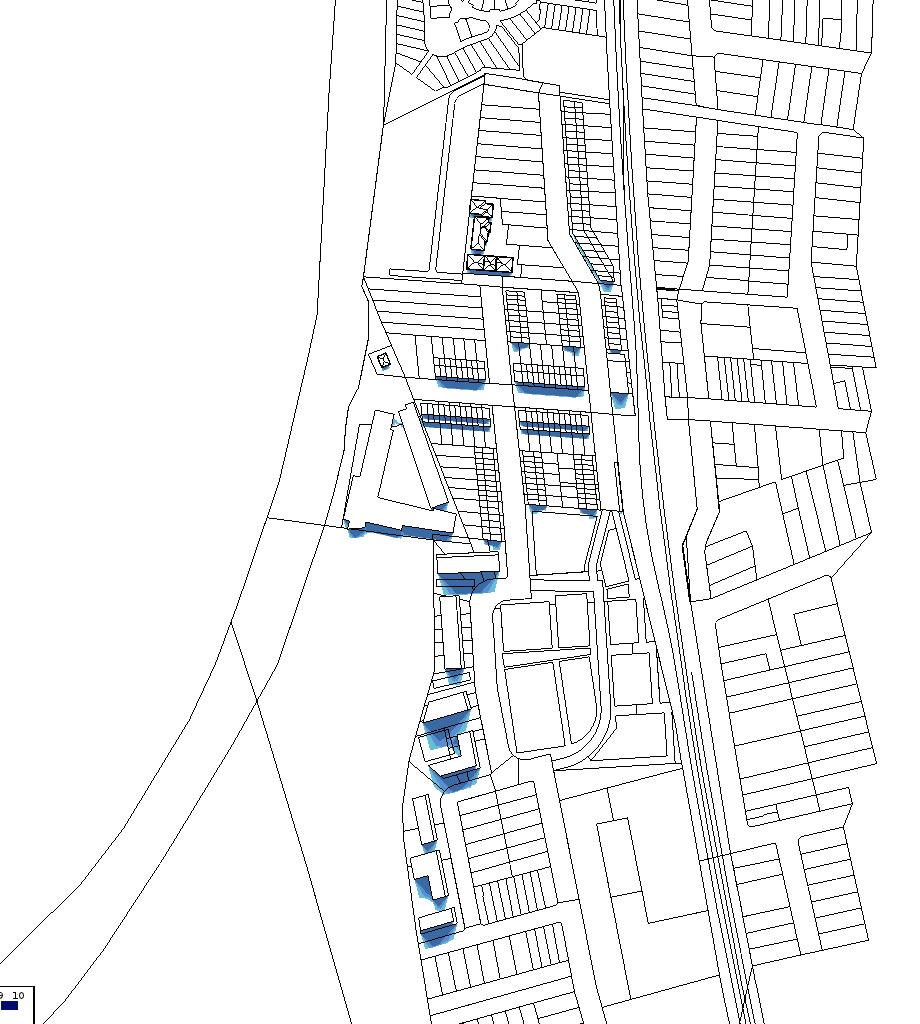
Concord West Precinct Master Plan Flood Study
The study maps the flood risk across the Homebush North precinct.
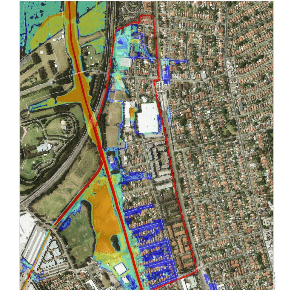
Relevance to project:
The flood hazard and Flood Planning Area have been graphically represented in later chapters.
Site Investigation Contamination
The investigation identifies a number of contaminated sites across the precincts and their risk level.
Relevance to project:
Key sites for at risk of contamination in each precinct has been graphically represented in later chapters.
Parramatta Road Select Precincts Public Domain Plan
The purpose of the plan is to ensure that all public domain needs are identified at an early stage and can inform detailed planning in the Corridor. The three overarching design principles are adjacent.
Relevance to project:


A graphic summary of street setbacks is included in later chapters of this report where we have provided a detailed analysis of each precinct.

Pg 12 Homebush Precinct Master Plan For: City of Canada Bay Council
Homebush North, Burwood-Concord and Kings Bay Precincts 25 June 2020 Prepared by Kinesis for Canada Bay Council
City of Canada Bay Preliminary Site Investigation Parramatta Road Urban Transformation Precincts: Kings Bay, Burwood Road and Homebush/Concord West 17 October 2018 55106_117353 (Rev 0) JBS&G Australia Pty Ltd
JULY 2020 PARRAMATTA ROAD SELECT PRECINCTS PUBLIC DOMAIN PLAN
CITY OF CANADA BAY POLICIES AND GUIDELINES
Priority 5 to provide housing supply, choice and affordability in key locations. The PRCUTS study is specifically highlighted as being able to directly respond to how the additional dwellings needed in the LGA can be provided.
Local Strategic Planning Statement
Priority 5.5: 5% affordable housing is to be provided in new developments
Priority 7.8: Include a minimum lot size of 800sqm for boarding houses in the R2 density zones to improve the amenity of boarding houses and reduce their impact on these areas
Priority 9.2 New local centre in Spencer Street in the Kings Bay Precinct to deliver an active main street.
City of Canada Bay Local Strategic Planning Statement


The City of Canada Bay Local Strategic Planning Statement (LSPS) is the core strategic planning document for the City of Canada Bay. It will guide the character of the centres and neighbourhoods into the future.
The LSPS brings together and builds on planning work found in Council’s other plans, studies and strategies such as the Local Environmental Plan (LEP), Development Control Plans (DCP) and Contributions Plans. The LSPS will be used to update key components of these plans.


Relevance to project:
The PRCUTS precincts can respond to and strengthen the land use vision set by the LSPS.
There are also a number of Priorities identified in the LSPS that PRCUTS can respond to:


Priority 10.1: Investigate and encourage new mixed use forms, larger format uses and urban support services on the ground floor of development with a frontage to Parramatta Road in the Kings Bay Precinct.
Priority 10.2: ensure that the future built form controls and the structure of street blocks in the Kings Bay precinct facilitate:
+ alternate access from a road, other than Parramatta Road
+ Double height ceilings for ground floor uses that front Parramatta Road
+ rear lane low bay access for small truck and customer parking
+ shared loading facilities for non residential uses
Employment and Productivity Study
The study acknowledges that the Parramatta Road Corridor is undergoing significant change as part of the PRCUTS.
It makes recommendations that aim to ensure that sufficient and appropriately located retail floorspace is provided in the emerging centre of Kings Bay as well as identifying opportunities to retain as much floorspace in these new developments as possible to retain some of the uses in the corridor that will otherwise be displaced.
City of Canada Bay Housing Strategy
The Local Housing Strategy analyses the population, demographic and supply issues associated with the delivery and take up of housing in the LGA.
This assessment is required by City of Canada Bay Council to develop an understanding of what it could do to plan for and deliver optimal residential outcomes for its community.
Relevance to project:
The Strategy identifies a number of actions relevant to the PRCUTS:
Large-scale urban renewal to deliver high density housing in the form of apartments as outlined under State Government plans
Develop the Parramatta Road Urban Transformation Precincts as higher density apartment development areas in the short to medium-term.
Housing diversity and choice to be further addressed by infill development around centres, based on planning controls that are feasible, to provide a wider range of housing forms whilst being respectful of local neighbourhood character
Pg 13
CITY OF CANADA BAY
EMPLOYMENT AND PRODUCTIVITY STUDY
FINAL Prepared for AUGUST 2019 City of Canada Bay
VERSION 3
CANADA BAY LOCAL HOUSING STRATEGY
Prepared for SEPTEMBER 2019 City of Canada Bay
There are a number of Local Government Policies and guidelines that will be taken into consideration.
CITY OF CANADA BAY POLICIES AND GUIDELINES


Social Infrastructure Community Strategy and Action Plan
Provides an audit of all community facilities located within our area and owned by Council, NGOs, private sector, and Government agencies.
These trends and principles should inform the future kinds of social infrastructure that is funded and developed within Canada Bay, as well as how they are delivered. The following principles should drive the design and delivery of future community facilities, services and programs to 2036:
Open Space and Recreation Strategy and Action Plan
This report provides a Strategy and Action Plan for social infrastructure (open space and recreation) to 2019, 2026 and 2036. This work identifies our community’s needs, to inform development of a deliverable action plan to inform Council’s budgeting process as well as the operational and resourcing plans for open space and recreation facilities, programs and services.
The Strategy and Action Plan has been developed alongside a suite of other focus area strategiescommunity facilities, housing, economic productivity, biodiversity, traffic and transport - as part of a review of the City’s planning framework. This review includes the development of the Local Strategic Planning Statement (LSPS), the land use strategy for the next 20 years and implementation through a revised Local Environmental Plan (LEP) and Development Control Plan (DCP).
Relevance to project:
Draft Parramatta Road Urban Transformation
Strategy designates new social infrastructure for Homebush as part of the project which would be located in close proximity to catchment residents. These will be explored in later phases of the study.
Urban Tree Canopy Strategy
The purpose of this Urban Tree Canopy Strategy is to inform the development of the revised City of Canada Bay Local Environment Plan and to present Council’s vision, priorities and actions to managing the urban forest.
Achieving the proposed increased canopy cover target will require extensive tree plantings on public and private spaces. If planned appropriately, such plantings can achieve multiple outcomes and maximise the benefits from trees. To identify broad priority planting locations, the following factors were integrated: canopy cover, potential plantable space (Sections 5.2 and 5.3), thermal heat mapping (Section 6.4), and location of proposed green grid opportunities, parks and streets.
Relevance to project:
Homebush North is identified in the strategy as being a high priority hot and plantable suburb.

The strategy also looks at opportunities to interface with the Greater Sydney Green Grid.
City of Canada Bay Biodiversity Framework


City of Canada Bay has developed this Biodiversity Framework and Action Plan to help to ensure that local ecosystem health including species and their genetic diversity survive in their natural habitat.
The Biodiversity Framework and Action Plan supports the Local Strategic Planning Statement which sets out the 20-year vision for land-use in the local area.
The plan is based upon six interconnected themes: native vegetation, urban waterways and foreshores, corridors and connectivity, public spaces, urban habitat and green infrastructure. This plan is supported by international, national, state and local policy that drive the development of a biodiversity plan at the local level. This Biodiversity Plan provides capacity to reinforce regional connections and enhance local corridors. It will allow for regional partnerships and is flexible enough to embrace any future infrastructure and development.
Relevance to project:
Identification of biodiversity corridors in the Homebush North Precinct.
Local Movement Strategy

An overview of the existing transport, opportunities and constraints, future transport and land use trends and changes.
It also presents a series of actions per travel mode that support overarching strategic objectives across the Canada Bay Local Government Area (LGA). It provides a list of key future projects within and surrounding the PRCUTS precinct study areas including; WestConnex, Sydney Metro West.
Pg 14 Homebush Precinct Master Plan For: City of Canada Bay Council
1. Diverse and activated 2. Inclusive and equitable 3. Connected and co-located 4. Collaborative and shared 5. Multipurpose and future-proofed
Social Infrastructure (Community) Strategy and Action Plan CITY OF CANADA BAY COUNCIL August 2019 Social Infrastructure (Open Space and Recreation) Strategy and Action Plan CITY OF CANADA BAY COUNCIL 26 September, 2019
Prepared by: GTA Consultants NSW Pty Ltd for City of Canada Bay Council on 20/08/19 Reference: N161710 Issue #: Final Local Movement Strategy City of Canada Bay Final Report
Canada Bay Biodiversity Framework and Action Plan
City of Canada Bay Council
Pg 15
Pg 16
For:
Homebush Precinct Master Plan
City of Canada Bay Council
POLICY CONTEXT & SITE ANALYSIS
Pg 17 02
Pg 18 Homebush Precinct Master Plan For: City of Canada Bay Council
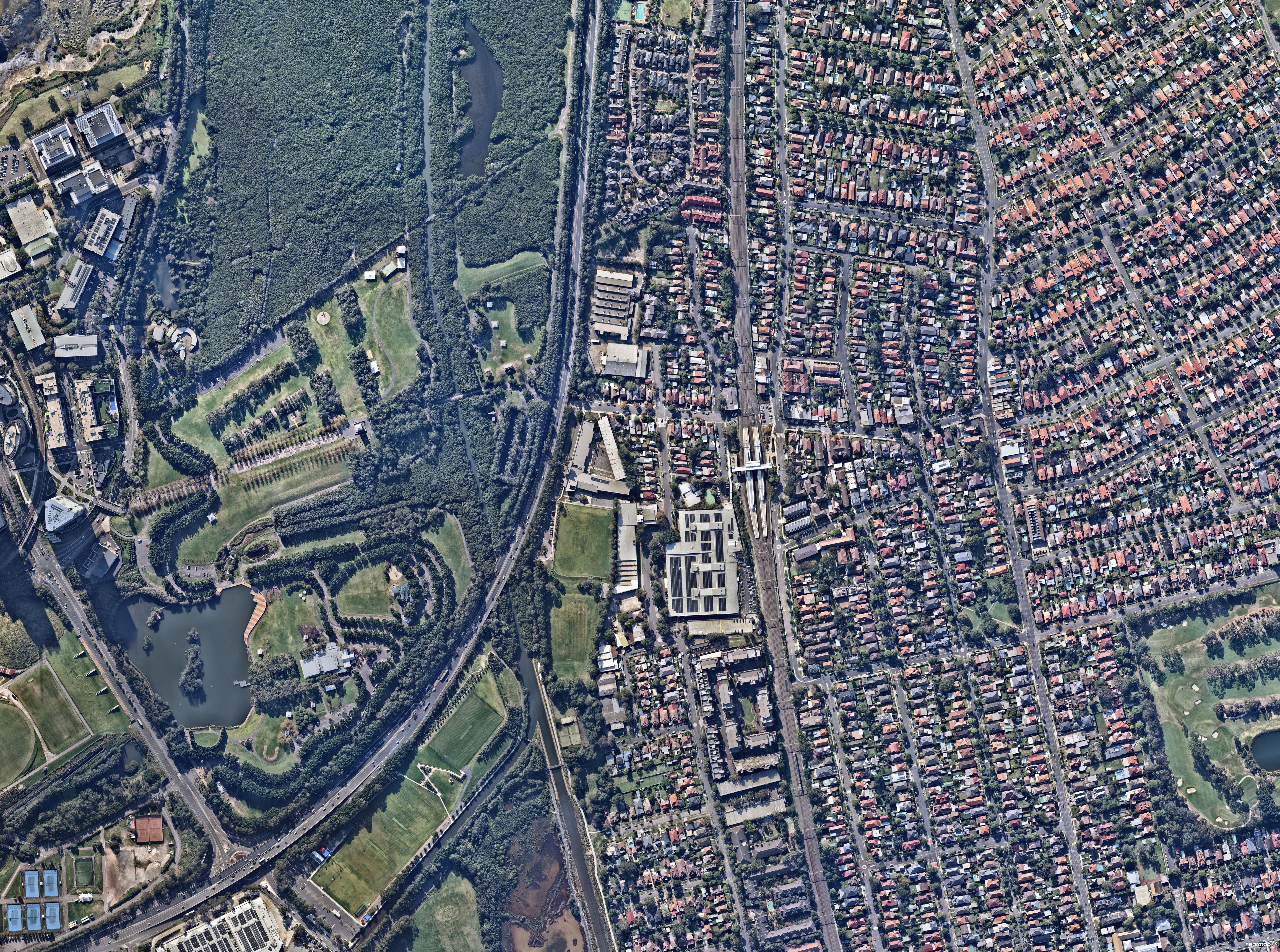
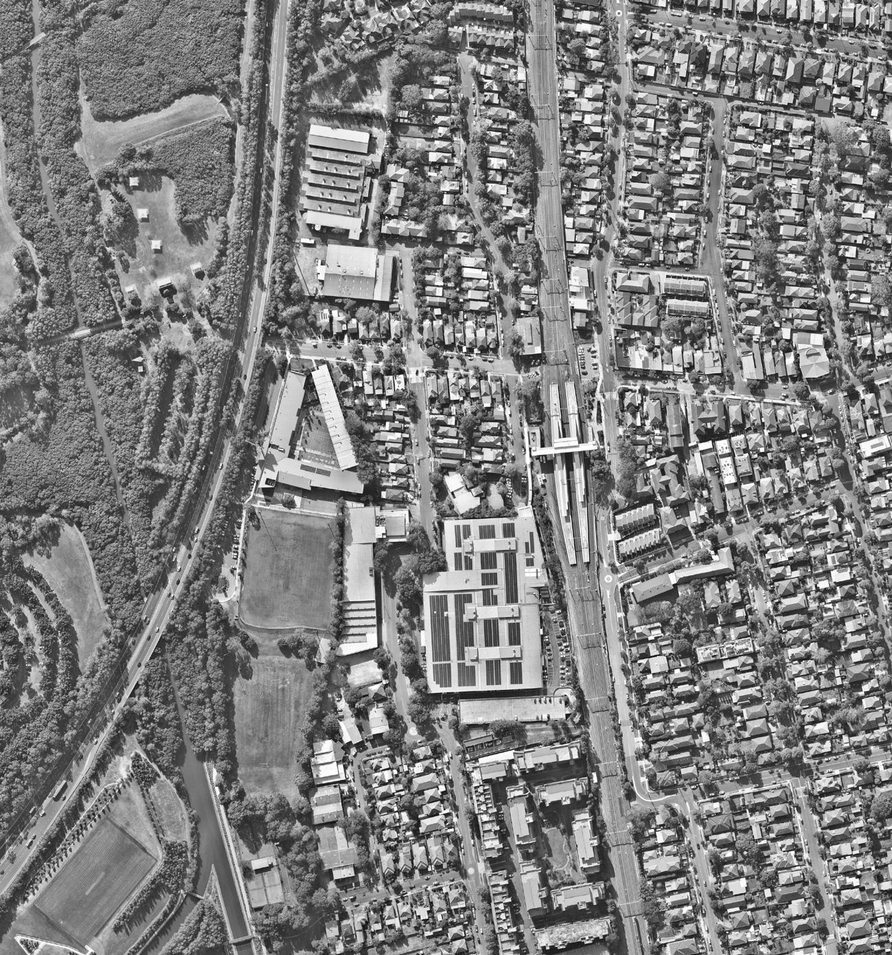
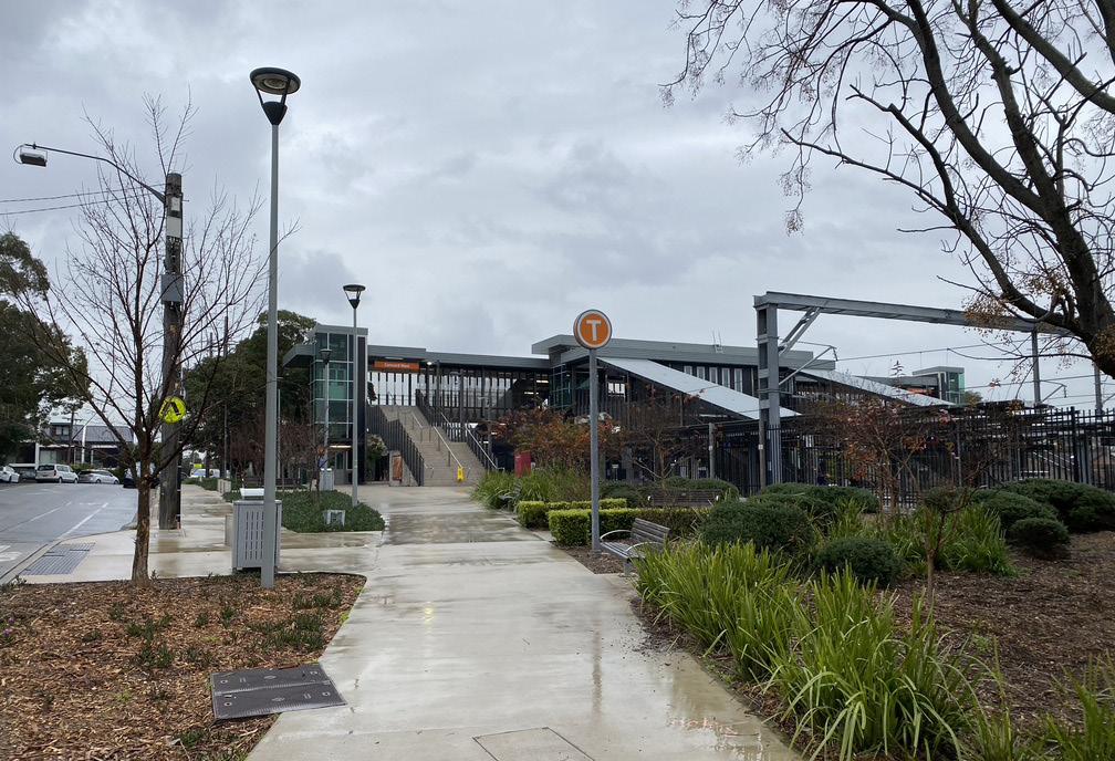
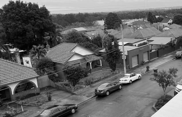
THE SITE
The Homebush North Precinct is an approximately 270m wide stretch of land bound by Homebush Bay Drive and the Northern Line.
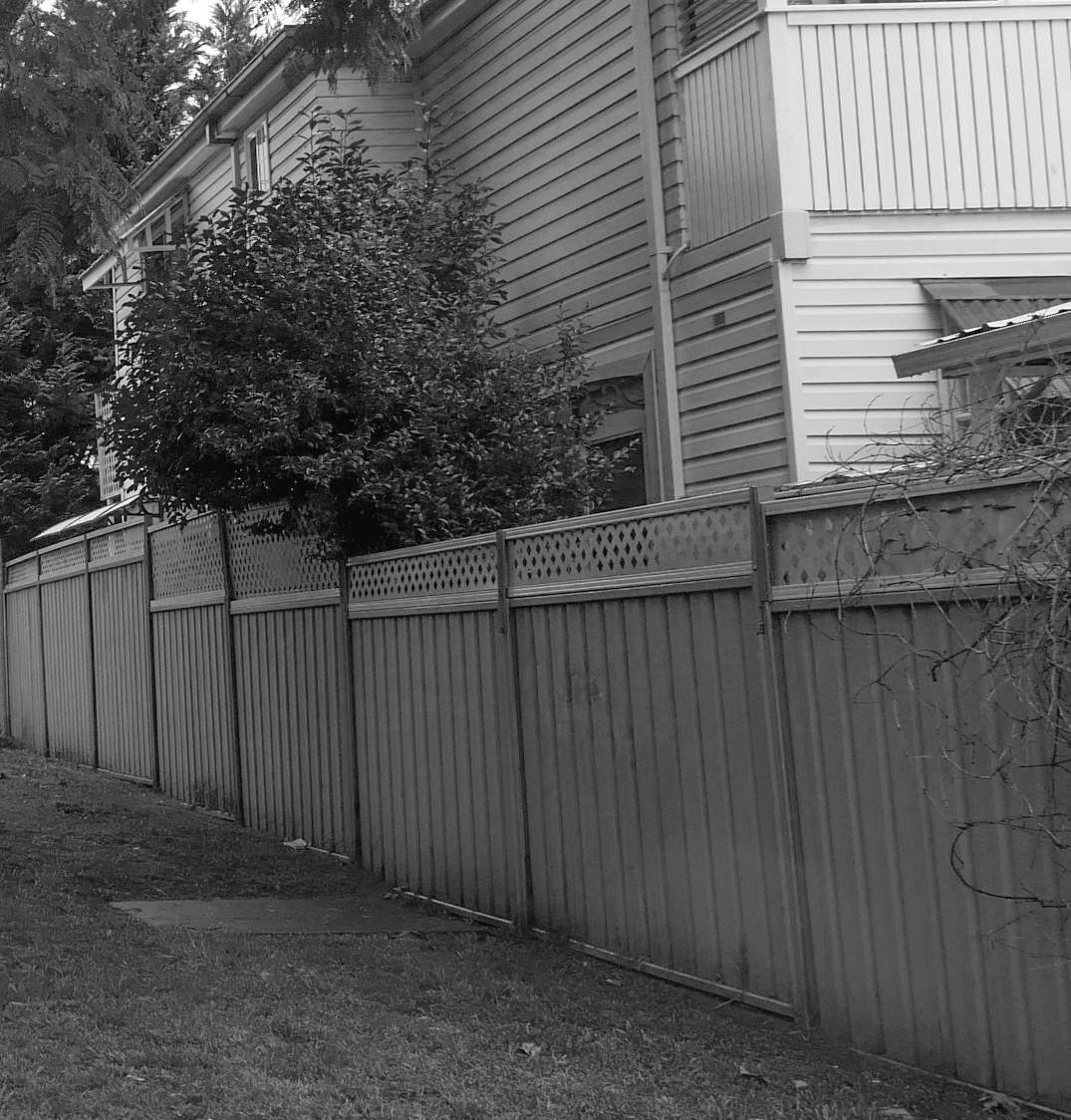
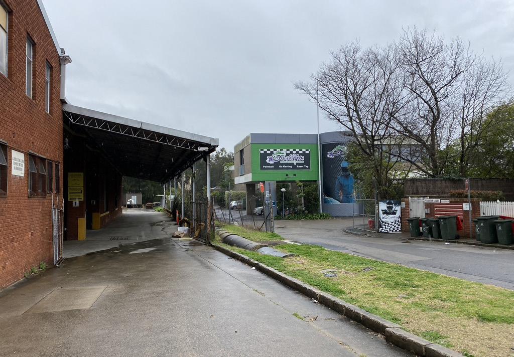
The study area contains a mix of low-density residential and large industrial lots. The study area is accessible by train via Concord West Train Station.
There are two main roads running through Homebush North precinct: Victoria Avenue and George Street.
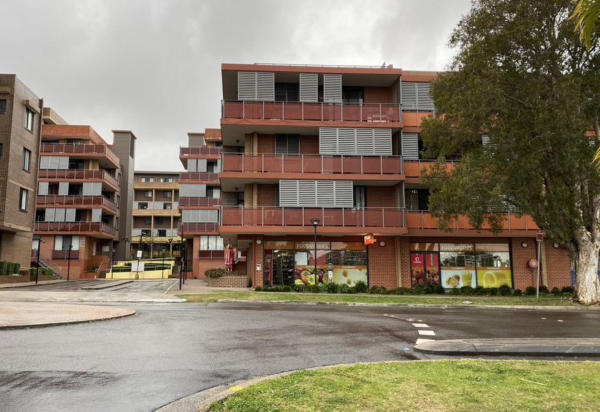
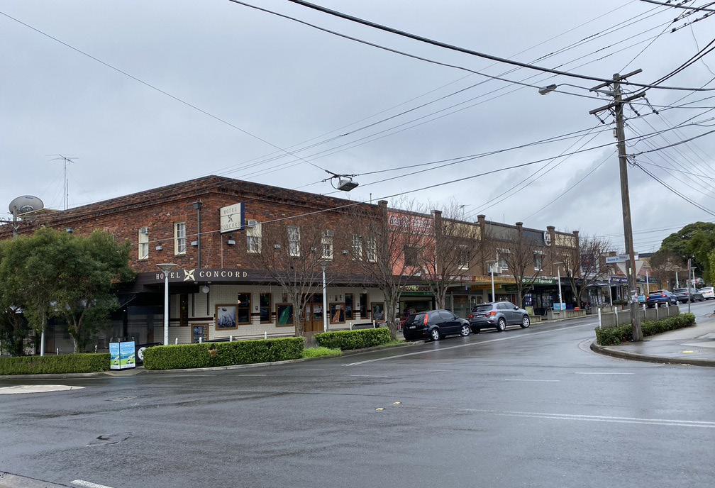
Victoria Avenue, running east to west, is interrupted by the T9 Northern Line. Within the study area, it is characterised by single storey detached dwellings. East of the study area, Victoria Street turns into a local shopping centre with well-designed and activated public realm.
George Street, which runs north to south, connects the study area to higher density residential development to the south.
The precinct is immediately adjacent to Bicentennial Park and the network of green and recreational infrastructure connecting the study area to Olympic Park to the south-west.
Pg 19
374m 91m 293m 243m 138m 105m 117m 118m 105m STUDY AREA HOMEBUSH BAY DRIVE (A3) QUEEN STREET CONSETT STREET MACKENZIE STREET KING STREET GEORGE STREET GEORGE STREET CONCORD ROAD STATION AVENUE VICTORIA AVENUE VICTORIA AVENUE Victoria Avenue Public School Warbrick Park Powells Creek Reserve Bicentennial Park Powells Creek Concord West Train Station P B B B B B B B B B B B B T HOMEBUSH BAY DRIVE (A3) QUEEN STREET CONSETT STREET MACKENZIE STREET KING STREET GEORGE STREET GEORGE STREET CONCORD ROAD STATION AVENUE VICTORIA AVENUE VICTORIA AVENUE Victoria Avenue Public School St Ambrose Catholic Primary School Warbrick Park Powells Creek Reserve Bicentennial Park Powells Creek Concord West Train Station 0m 20 50 100 200m Scale 1:5,000 @ A3 LEGEND Precinct Boundary Frame Boundary Open Space Water Body Educational Industrial Mixed Use Strata Lot Easement Heritage Council Owned Metro West Tunnel High Flood Risk Low Flood Risk Bus Stop Contour (2m Interval) Pedestrian over/underpass Contamination (High Risk) B
SITE CHARACTER
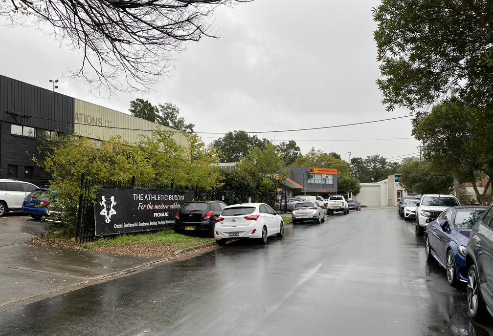
Streetscape
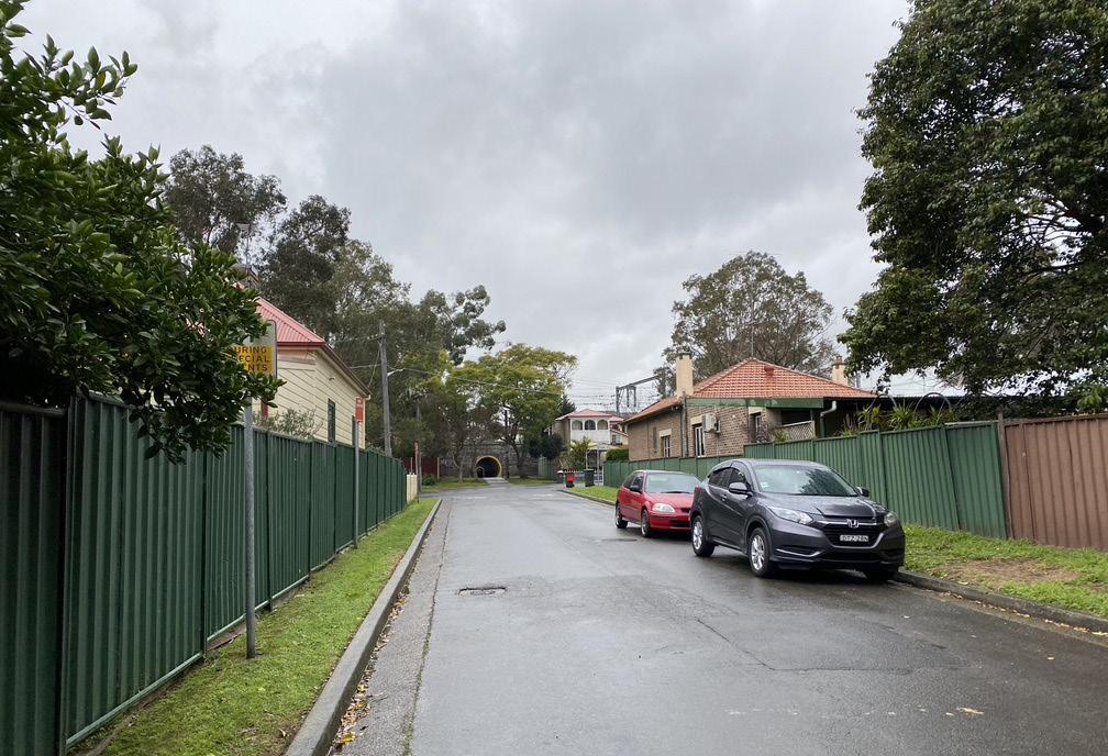
The study area is characterised by a complex arrangement of local streets.
Local streets are characterised by narrow footpaths bound by turfed nature strips. (Station Avenue, to the site’s north, lacks a dedicated pedestrian path.)
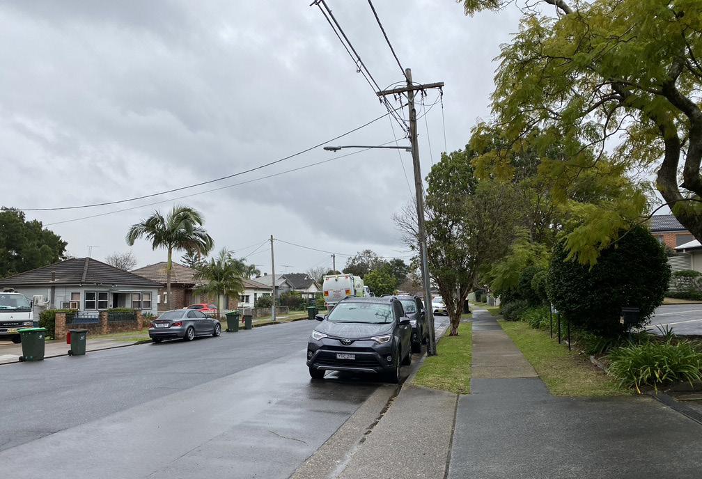
Residential areas are characterised by low rise detached dwellings on narrow lots, contributing to the suburban character of much of the study area.
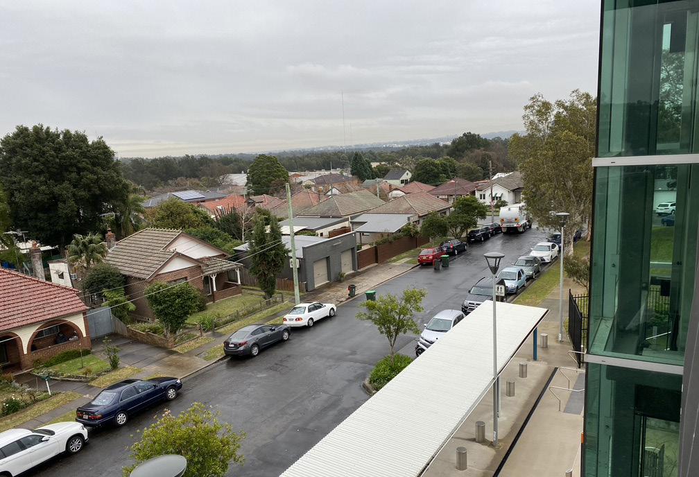
Medium density apartment development to the south of the study area is characterised by long 4-5 storey apartment buildings with a retail ground floor. Public domain is poorly configured to the active street frontage - with footpaths disconnected from the retail by narrow nature strips.
Street tree canopy is uneven across the study area. The exception is King Street, in the study area’s north-east, which is lined with well-established Melaleuca quinquenervia trees. However, most other streets including George Street and Victoria Avenue lack continuous tree canopies.
Pg 20 Homebush Precinct Master Plan For: City of Canada Bay Council
1 2 5 7 8 6 3 4 9
Street George Street
1 2 3 Rothwell Avenue Victoria Avenue Victoria Avenue 4 5 6 Station Avenue Kings Street Kings Street 7 8 9
George
George Street Roundabout
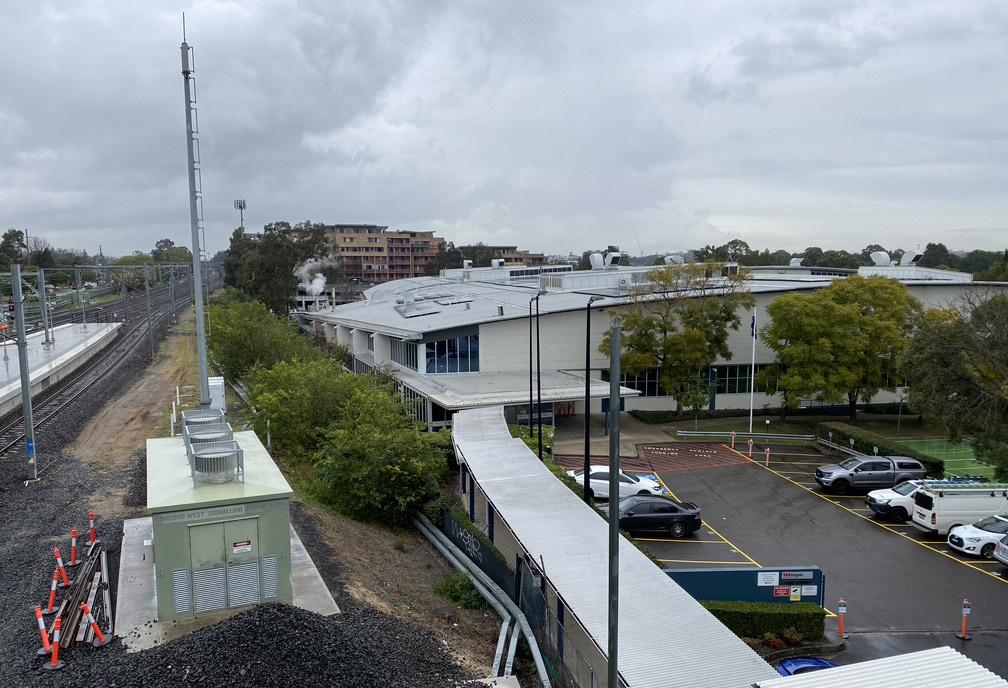
Infrastructure
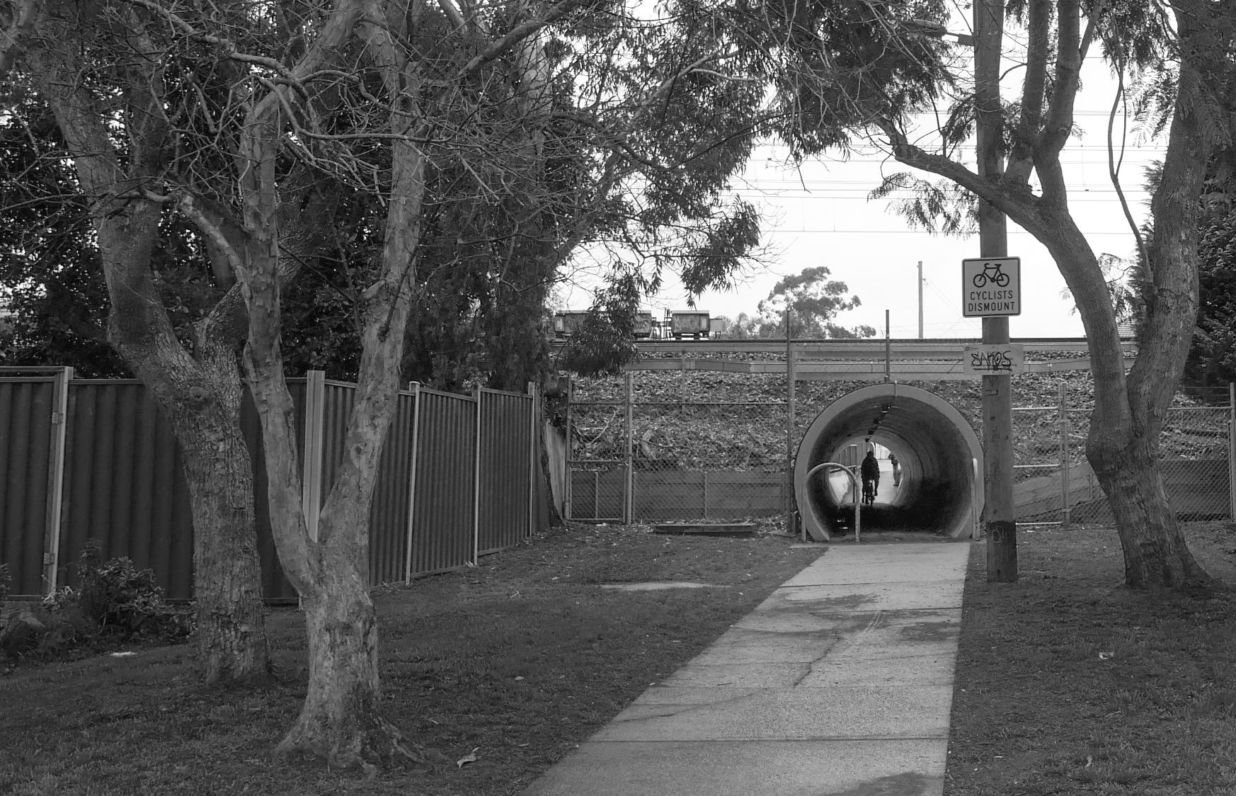
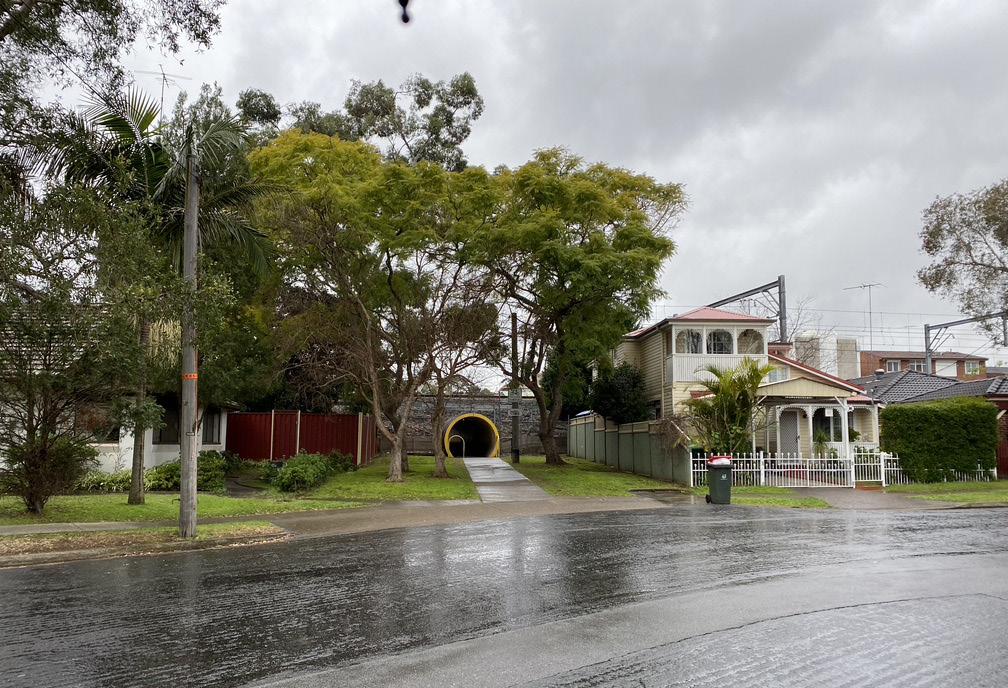
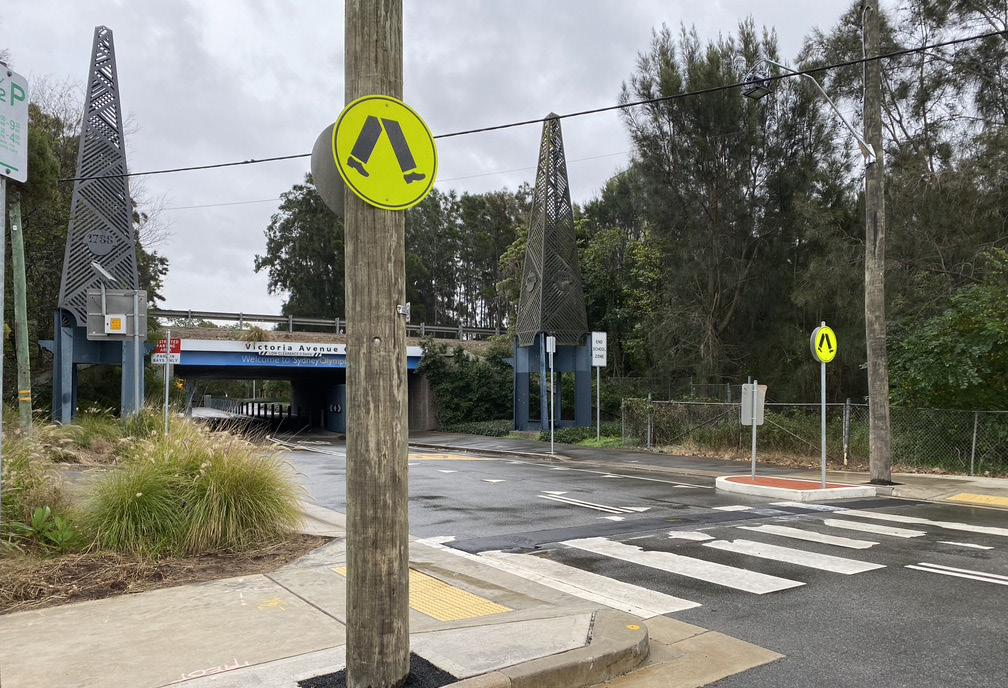
The study area is located in close proximity to transport and leisure opportunities - between Bicentennial Park and Concord West Station.
However, the study area has low quality east-west pedestrian connectivity characterised by poorlydesigned and located underpasses at the train line and Homebush Bay Drive. The poor quality of these connections contributes to the sense of
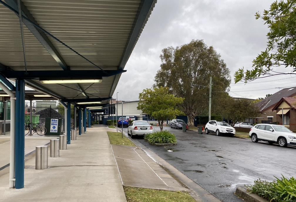
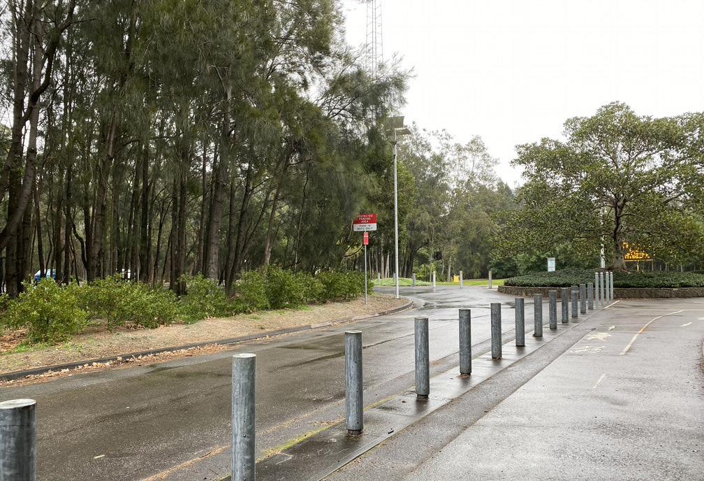
disconnection from the study area’s surrounding recreational assets.
The study area is also served by Victoria Avenue Public School, which opened in 2015. Aside from primary education, the school incorporates a 47-place day care centre (operated by City of Canada Bay Council), an early childhood health centre (operated by NSW Health), shared community sports facilities and an enlarged hall that accommodates out of school hours community use.
Pg 21 1 2 5 7 8 3 6 4 9
1 2 3
4 5 6 Concord West Train Station - East side Concord West Train Station - West side Industrial building next to the train station 7 8 9
Victoria Avenue Public School Victoria Avenue Gates Bicentennial Park
Light industrial buildings View towards Sydney Olympic Park Pedestrian/Cyclist connection under railway bridge
SITE ANALYSIS
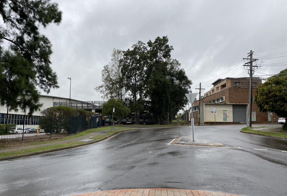
There are two pedestrian connections across the train line - an underpass off Station Avenue and the train station overpass.
Existing local centre is located at the corner of Victoria Avenue and Queen Street with retail and shop-top housing.
The study area has a mixture of residential houses and light industrial buildings. A big industrial block on the southwest of the station reduces the permeability for the southern area to access the station.
George Street that runs North to South is the main street that connects the study area to Parramatta Road.
Lots of mature trees on King Street create a leafy streetscape for the low-density residential area.
Victoria Avenue Public School that sits at the corner of Homebush Bay Drive and Victoria Street is a new school that opened in 2015.
STATION AVENUE VICTORIA AVENUE
Powells Creek Concord West Train Station
VICTORIA AVENUE Victoria Avenue Public School
CONCORD ROAD
Powells Creek Reserve
St Ambrose Catholic Primary School Warbrick Park
GEORGE STREET
LEGEND Precinct Boundary Frame Boundary Open Space Water Body
Educational Industrial Mixed Use Strata Lot Easement
LEGEND
Heritage Council Owned Metro West Tunnel High Flood Risk Low Flood Risk
Precinct Boundary Frame Boundary Open Space Water Body
Educational Industrial Mixed Use Strata Lot Easement
Bus Stop Contour (2m Interval) Pedestrian over/underpass Contamination (High Risk)
Heritage Council Owned Metro West Tunnel High Flood Risk Low Flood Risk
B
Bus Stop Contour (2m Interval)
Pedestrian over/underpass Contamination (High Risk)
Scale
Pg 22 Homebush Precinct Master Plan For: City of Canada Bay Council
P B B B B B B B B B B B B T
HOMEBUSH BAY DRIVE (A3) QUEEN STREET CONSETT STREET MACKENZIE STREET KING STREET GEORGE STREET GEORGE STREET CONCORD ROAD STATION AVENUE VICTORIA AVENUE VICTORIA AVENUE Victoria Avenue Public School St Ambrose Catholic Primary School Warbrick Park Powells Creek Reserve
Bicentennial Park Powells Creek Concord West Train Station 0m 20 50 100 200m Scale 1:5,000 @ A3
B P B B B
B
B B B B T
LEGEND Precinct Boundary Frame Boundary Open Space Water Body Educational Industrial Mixed Use Strata Lot Easement Heritage Council Owned Metro West Tunnel High Flood Risk Low Flood Risk Bus Stop Contour (2m Interval) Pedestrian over/underpass Contamination (High Risk)
B B
B
HOMEBUSH BAY DRIVE (A3) QUEEN STREET CONSETT STREET MACKENZIE STREET KING STREET GEORGE STREET GEORGE STREET CONCORD ROAD STATION AVENUE VICTORIA AVENUE VICTORIA AVENUE Victoria Avenue Public School St Ambrose Catholic Primary School Warbrick Park Powells Creek Reserve
Bicentennial Park Powells Creek Concord West Train Station 0m 20 50 100 200m Scale 1:5,000 @ A3
B P B B B B B B B B B B B B T
KING
HOMEBUSH BAY DRIVE (A3) QUEEN STREET CONSETT STREET MACKENZIE STREET
STREET GEORGE STREET
Bicentennial Park 0m 20
Homebush North Precinct is located immediately west of Concord West Train Station and bound by large established parklands to the west and south-west.
STRATEGY CONTEXT: PRCUTS
Access and connectivity
The proposed open space, linkages and high pedestrian activity zones are summarised from PRCUTS Planning and Design Guidelines Chapter 7.
New public open spaces and improvements to existing parks and reserves are proposed to support the transformation of the Homebush Precinct. New and improved pedestrian and cyclist connections will also be provided throughout the precinct.
Parramatta Road, Homebush Bay Drive and Concord Road will function as Movement Corridors. George Street will function as a Place for People, and will also be a high pedestrian activity zone. All remaining roads, including Underwood Road and Pomeroy Street, will perform a Local Street function.
Any new streets are to be designed as Local Streets under the Street Function Hierarchy. The interpretation of PRCUTS will be implemented by the proposed master plan on pages 30 and 35 of this document.
LEGEND
Precinct Boundary Frame Boundary Open Space Water Body
Existing Cycle Link Proposed Cycle Link Through Site Link Prioritised Walking Link
Existing Cycle Link Proposed Cycle Link Through Site Link Prioritised Walking Link
Heritage Proposed Park People Place High Pedestrian Activity Zone
Existing Cycle Link Proposed Cycle Link Through Site Link Prioritised Walking Link
Scale
Pg 23 T
GEORGE
Concord
HOMEBUSH BAY DRIVE (A3) QUEEN STREET CONSETT STREET MACKENZIE STREET KING STREET
STREET GEORGE STREET CONCORD ROAD STATION AVENUE VICTORIA AVENUE VICTORIA AVENUE Victoria Avenue Public School Warbrick Park Powells Creek Reserve Bicentennial Park Powells Creek
West Train Station 0m 20 50 100 200m Scale 1:5,000 @ A3
LEGEND Precinct Boundary Frame Boundary Open Space Water Body Heritage Proposed Park People Place High Pedestrian Activity Zone
T
KING
GEORGE
GEORGE
Concord
Train Station
HOMEBUSH BAY DRIVE (A3) QUEEN STREET CONSETT STREET MACKENZIE STREET
STREET
STREET
STREET CONCORD ROAD STATION AVENUE VICTORIA AVENUE VICTORIA AVENUE Victoria Avenue Public School Warbrick Park Powells Creek Reserve Bicentennial Park Powells Creek
West
0m 20 50 100 200m Scale 1:5,000 @ A3
LEGEND Precinct Boundary Frame Boundary Open Space Water Body Heritage Proposed Park People Place High Pedestrian Activity Zone
T
KING
GEORGE
Concord
0m 20
HOMEBUSH BAY DRIVE (A3) QUEEN STREET CONSETT STREET MACKENZIE STREET
STREET
STREET GEORGE STREET CONCORD ROAD STATION AVENUE VICTORIA AVENUE VICTORIA AVENUE Victoria Avenue Public School Warbrick Park Powells Creek Reserve Bicentennial Park Powells Creek
West Train Station
Land use and activation
The proposed land use, active frontages are summarised from PRCUTS Planning and Design Guidelines Chapter 7.
The recommended land use zones to implement the vision for the study area are shown in the diagram on the right side.
Active and Commercial Frontages are to be provided in the locations illustrated.
The ground floor level of Active and Commercial Frontages is to match the street level. Consistent paving, street furniture, signage, planting and lighting should be provided along Active and Commercial Frontages.
The interpretation of PRCUTS will be implemented by the proposed master plan on pages 30 to 35 of this document.
Bicentennial Park
Bicentennial Park
STATION AVENUE VICTORIA AVENUE VICTORIA AVENUE Victoria Avenue Public School
LEGEND Precinct Boundary Frame Boundary Open Space Water Body
LEGEND
KING STREET GEORGE STREET
Powells Creek Reserve
HOMEBUSH BAY DRIVE (A3)
KING STREET GEORGE STREET GEORGE STREET
STATION AVENUE VICTORIA AVENUE VICTORIA AVENUE Victoria Avenue Public School
Powells Creek
T
KING STREET GEORGE STREET
HOMEBUSH BAY DRIVE (A3) QUEEN STREET CONSETT STREET
Precinct Boundary Frame Boundary Open Space Water Body
Powells Creek Reserve
HOMEBUSH BAY DRIVE (A3)
Powells Creek Reserve
T
Educational Residential Business Park Heritage
GEORGE STREET
MACKENZIE STREET
LEGEND
Educational Residential Business Park Heritage
Precinct Boundary Frame Boundary Open Space Water Body
QUEEN STREET CONSETT STREET
Active Frontage
Active Frontage
Educational Residential Business Park Heritage
CONCORD ROAD
Concord West Train Station
MACKENZIE STREET
CONCORD ROAD
Warbrick Park
STATION AVENUE VICTORIA AVENUE VICTORIA AVENUE Victoria Avenue Public School Warbrick Park
QUEEN STREET CONSETT STREET
CONCORD ROAD
Warbrick Park
Powells Creek Concord West Train Station 0m 20 50 100 200m
Powells Creek Concord West Train Station 0m 20 50 100
Active Frontage
MACKENZIE STREET
Scale 1:5,000 @ A3
Bicentennial Park 0m 20
Pg 24 Homebush Precinct Master Plan For: City of
Bay Council
Canada
T
200m Scale 1:5,000 @ A3
GEORGE STREET
Scale
Public domain and streetscape
PRCUTS Public Domain Plan includes the visioning work undertaken by Roberts Day which explores the future character of the precinct.
Future character areas:
1. Residential Nexus:
+ Built Form: Town-houses and Terraces
+ FSR: 0.5:1 - 1.6:1
+ Height: 8.5 - 25m
2. Transit Core:
+ Built Form: Shop top housing and Large format employment
+ FSR: 0.5:1 - 2.3:1
+ Height: 8.5 - 16m
3. Employment Hub
+ Built Form: Large format employment
+ FSR: 1.0:1
+ Height: 8.5m
Street Setbacks: The general street setback is a minimum of 3m, with exceptions of 0m for active frontages. The interpretation of PRCUTS will be implemented by the proposed master plan on pages 32, 33 and 34 of this document.
Victoria Avenue Gates Park
Victoria Avenue Gates
Bicentennial Park
Bicentennial Park
Victoria Avenue Gates Park
Victoria Avenue Gates
HOMEBUSHBAY DRIVE(A3)
STATION AVENUE VICTORIA AVENUE
Victoria Avenue Gates Park
Powells Creek Concord West Train Station
LEGEND Precinct Boundary Frame Boundary Open Space Water Body
LEGEND
STATION AVENUE VICTORIA AVENUE VICTORIA AVENUE Victoria Avenue Public School
Victoria Avenue Public School
KING STREET GEORGE STREET
KING STREET GEORGE STREET
Powells Creek Reserve
HOMEBUSHBAY DRIVE(A3)
Powells Creek Reserve
GEORGE STREET
Precinct Boundary Frame Boundary Open Space Water Body
Employment Hub Transit Core Residential Nexus Proposed Park
T
Powells Creek Concord West Train Station
HOMEBUSHBAY DRIVE(A3)
STATION AVENUE VICTORIA AVENUE
GEORGE STREET
Employment Hub Transit Core Residential Nexus Proposed Park
T
KING STREET GEORGE STREET
VICTORIA AVENUE
Powells Creek Concord West Train Station
QUEEN STREET CONSETT STREET
Powells Creek Reserve
QUEEN STREET CONSETT STREET
MACKENZIE STREET
Station Square Warbrick Park
VICTORIA AVENUE Victoria Avenue Public School
GEORGE STREET
T
MACKENZIE STREET
CONCORD ROAD
Station Square Warbrick Park
Active Frontage (0m Setback) General (3m Minimum Setback)
Active Frontage (0m Setback) General (3m Minimum Setback)
Employment Hub Transit Core Residential Nexus Proposed Park
CONCORD ROAD
QUEEN STREET CONSETT STREET
MACKENZIE STREET
CONCORD ROAD
Station Square Warbrick Park
Scale 1:5,000 @ A3
0m 20 50 100 200m
Scale 1:5,000 @ A3
Victoria Avenue Gates 0m 20
Active Frontage (0m Setback) General (3m Minimum Setback)
0m 20 50 100 200m
Scale LEGEND Precinct Boundary Frame Boundary Open Space Water Body
Pg 25
Bicentennial Park
OPPORTUNITIES
Opportunities
LEGEND
Precinct Boundary Open Space Proposed Park High Pedestrian Activity Zone
Existing Cycle Link Proposed Cycle Link Through Site Link Prioritised Walking Link
LEGEND Precinct Boundary Open Space Proposed Park High Pedestrian Activity Zone
Employment Hub Active Frontage (0m Setback) Council Owned Bus Stop B
Existing Cycle Link Proposed Cycle Link Through Site Link Prioritised Walking Link
Employment Hub Active Frontage (0m Setback) Council Owned Bus Stop B
Pg 26 Homebush Precinct Master Plan For: City of Canada Bay Council
& CONSTRAINTS
Based on the site analysis, literature review and an understanding of the local context, the precinct presents a number of opportunities for the design response to the site.
Create an integrated precinct Increase and improve east-west permeability Enhance existing recreational opportunities and linkages for active transport
T HOMEBUSHBAY DRIVE(A3) QUEEN STREET CONSETT STREET MACKENZIE STREET KING STREET GEORGE STREET GEORGE STREET CONCORD ROAD STATION AVENUE VICTORIA AVENUE VICTORIA AVENUE Victoria Avenue Public School Station Square Warbrick Park Powells Creek Reserve Bicentennial Park Powells Creek Concord West Train Station Victoria Avenue Gates Victoria Avenue Gates Park 0m 20 50 100 200m Scale 1:5,000 @ A3 LEGEND Precinct Boundary Frame Boundary Open Space Water Body Employment Hub Transit Core Residential Nexus Proposed Park Active Frontage (0m Setback) General (3m Minimum Setback) T B B B B B B B B B B B HOMEBUSHBAY DRIVE(A3) QUEEN STREET CONSETT STREET MACKENZIE STREET KING STREET GEORGE STREET GEORGE STREET CONCORD ROAD STATION AVENUE VICTORIA AVENUE VICTORIA
Concord West Train Station 0m
TOD Opportunities Limited strata lots
AVENUE Victoria Avenue Public School Warbrick Park Powells Creek Reserve Bicentennial Park Powells Creek
20 50 Scale 1:5,000 @
T B B B B B B B B B B B
HOMEBUSHBAY DRIVE(A3) QUEEN STREET CONSETT STREET MACKENZIE STREET KING STREET GEORGE STREET GEORGE STREET CONCORD ROAD STATION AVENUE
VICTORIA AVENUE VICTORIA AVENUE Victoria Avenue Public School Warbrick Park Powells Creek Reserve Bicentennial Park Powells Creek Concord West Train Station 0m 20 50 100 200m Scale 1:5,000 @ A3
Challenges
Based on the site analysis, literature review and an understanding of the local context, the precinct presents a number of challenges for the design response to the site.
Incompatible land uses
Low permeability
Noise + traffic impacts from Homebush Bay Drive
Contamination
Tree protection zones Heritage Interface Low height and density allowances in close proximity to Concord West Station.
Pg 27
T
KING
GEORGE STREET
STREET
HOMEBUSHBAY DRIVE(A3) QUEEN STREET CONSETT STREET MACKENZIE STREET
STREET
GEORGE
CONCORD ROAD STATION AVENUE VICTORIA AVENUE VICTORIA AVENUE Victoria Avenue Public School Station Square Warbrick Park Powells Creek Reserve Bicentennial Park Powells Creek Concord West Train Station Victoria Avenue Gates Victoria Avenue Gates Park 0m 20 50 100 200m Scale 1:5,000 @ A3
T
KING STREET GEORGE STREET GEORGE STREET
T HOMEBUSH
QUEEN STREET CONSETT STREET MACKENZIE STREET KING STREET GEORGE STREET
STREET
0m
LEGEND Precinct Boundary Frame Boundary Open Space Water Body Employment Hub Transit Core Residential Nexus Proposed Park Active Frontage (0m Setback) General (3m Minimum Setback)
HOMEBUSH BAY DRIVE (A3) QUEEN STREET CONSETT STREET MACKENZIE STREET
CONCORD ROAD STATION AVENUE VICTORIA AVENUE VICTORIA AVENUE Victoria Avenue Public School St Ambrose Catholic Primary School Warbrick Park Powells Creek Reserve Bicentennial Park Powells Creek Concord West Train Station 0m 20 50 100 200m Scale 1:5,000 @ A3 LEGEND Precinct Boundary Open Space Strata Lot Heritage Contamination (High Risk) Easement High Flood Risk Low Flood Risk Tree Protection Zone Contour (2m Interval) Metro West Tunnel
BAY DRIVE (A3)
GEORGE
CONCORD ROAD STATION AVENUE VICTORIA AVENUE VICTORIA AVENUE Victoria Avenue Public School St Ambrose Catholic Primary School Warbrick Park Powells Creek Reserve Bicentennial Park Powells Creek Concord West Train Station
20 50 Scale 1:5,000 LEGEND Precinct Boundary Open Space Strata Lot Heritage Contamination (High Risk) Easement High Flood Risk Low Flood Risk Tree Protection Zone Contour (2m Interval) Metro West Tunnel
Pg 28
For:
Homebush Precinct Master Plan
City of Canada Bay Council
MASTER PLAN
Pg 29 03
HOMEBUSH NORTH PRECINCT VISION
Homebush Precinct will become a new, mixed use precinct housing a new community of residents attracted to the area for its high amenity and access to employment at Parramatta CBD and Sydney Olympic Park. The precinct will provide a long term supply of housing stock to meet increasing demand as Sydney Olympic Park grows into a new city.
- Parramatta Road Corridor Urban Transformation Strategy, UrbanGrowth, 2016
On 11 March 2021, Sydney Eastern Planning Panel advised that rezoning of 7 Concord Ave is inconsistent with good planning principles and with Ministerial Direction 4.3 pertaining to flooding, and recommended that rezoning of the site should not proceed.
202 George Street, 2 Station Avenue and the properties on the western side of King Street were also identified in the Canada Bay Concord West Flood Study as being flood affected.
A flood study is currently being prepared for the Powell’s Creek catchment. This study is anticipated to be completed by mid-2022.
Council intends to adopt a precautionary principle in relation to flood affected land in the Powells Creek catchment and intends to retain 7 Concord Avenue and 202 George Street as IN1 General Industrial zone, and 2 Station Avenue and the King Street properties as R2 Low Density Residential, until completion of the study, which can then inform the suitability of the area for rezoning.
Flood Affected Land
Socio Economic Study
Action 6.5 of the Canada Bay Local Strategic Planning Statement requires Council to undertake a Socio Economic Study prior to any land use change occurring on the site known as 1-7 King Street, Concord West. The study will consider matters including the PRCUTS and Sydney Metro West. It will provide a recommendation on the preferred land use outcome for the site having regard to prevailing strategies and considerations.
Business Park
Neighbourhood Centre
Mid-rise residential
Low-rise residential
Victoria Avenue Public School
Concord West Shopping Village
Pg 30 Homebush Precinct Master Plan For: City of Canada Bay Council
Site greyed out as current LEP controls are being retained and will not be changed Controls are consistent with PRCUTS
Powells Creek Reserve
Site greyed out as current LEP controls are being retained and will not be changed Retention of current controls is pending consistent with LSPS
Employment Hub
George Street
George Street Victoria Avenue
Transit Core Residential
Victoria Avenue Public School
Underpass below HB Drive
Bicentennial Park
Concord West Station
Concord West Shopping Village
George Street
Victoria Avenue Gates Park
Sites will retain current LEP controls and will not be changed due to flooding impacts
Homebush Bay Drive King Street
Underpass below rail line
Pg 31
T
MASTER PLAN
The aim of this master plan is to illustrate how sites proximal to Concord West Station could be redeveloped to increase resident density and transform existing industrial lots into new commercial and residential uses.
The master plan proposes the amalgamation of select lots in the precinct to facilitate medium density residential and commercial redevelopment.
The master plan illustrates the conversion of large industrial lots on the precinct’s periphery to accommodate larger, ADG-compliant buildings.
Where FSR is lower, town house and terrace house redevelopment is proposed to ensure the character of the local neighbourhood is respected while also facilitating densification.
Non-amalgamated lots were designed to comply with the following controls detailed in PRCUTS Planning and Design Guidelines

8.5m (height control)
0.7:1* (FSR control on all lots unless noted otherwise)
R3 Medium density residential (zoning control)
* PRCUTS illustrates a 0.5:1 FSR for a large number of lots in the precinct. 0.7:1 was agreed upon in conversation with Canada Bay Council to facilitate the intensification of these lots through town- and terrace house redevelopment.
Pg 32 Homebush Precinct Master Plan For: City of Canada Bay Council
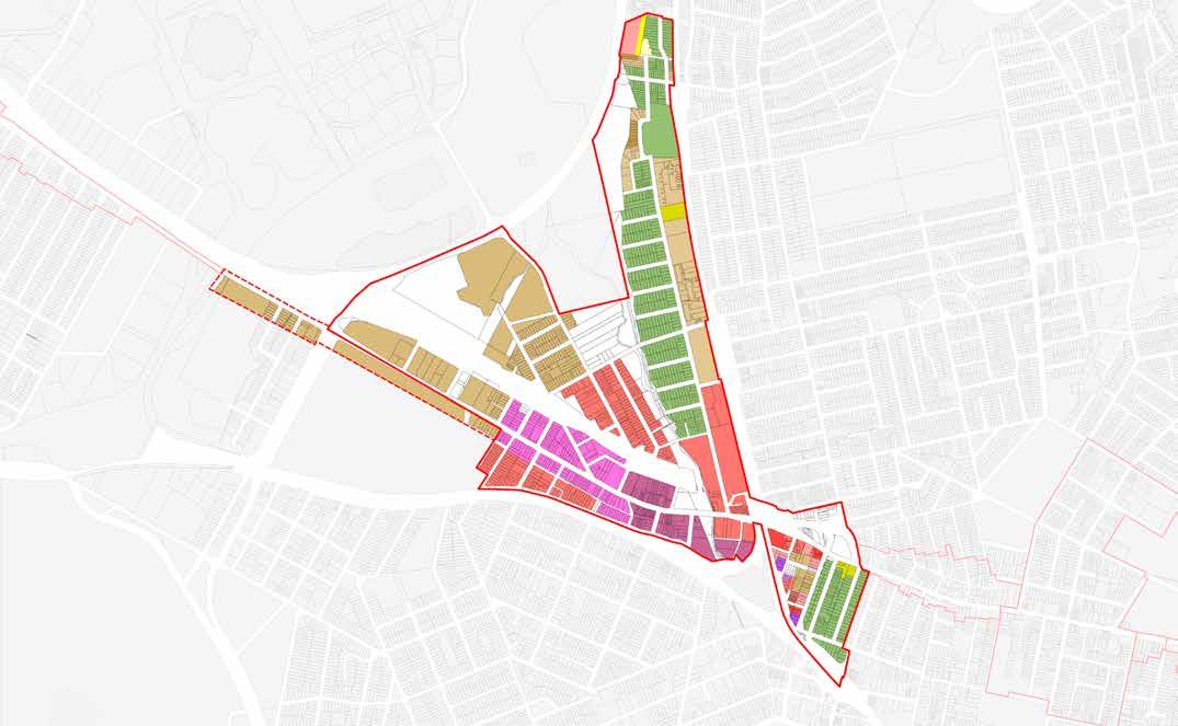
P T HOMEBUSHBAYDR I VE(A3) QUEEN STREET CONSETT STREET MACKENZIE STREET KING STREET GEORGE STREET GEORGE STREET CONCORD ROAD STATION AVENUE VICTORIA AVENUE VICTORIA AVENUE Powells Creek Victoria Avenue Public School Warbrick Park Powells Creek Reserve Bicentennial Park Concord West Shops 0m 20 50 100 200m Scale 1:5,000 @ A3 LEGEND Precinct Boundary Existing lots Open Space Water Body Concord West Train Station LOT F 2.3 1 LOT E TERRACES 0.7 : 1 LOT B 1.9 1 LOT A LOT D 1.4 : 1 LOT C 1.4 1 4 4 6 6 1-2 1-2 1-2 1-2 1-2 1-2 1-2 1-2 1-2 1-2 1-2 Metro West Tunnel Train Station Lots retaining current LEP controls T Existing Built Form Existing Ground Floor Retail Proposed Built Form Proposed Lot Amalgamation * Note: Numbers on plans indicate number of storeys Sites will retain current LEP controls and will not be changed Sites will retain current LEP controls and will not be changed due to flooding impacts
LOT AMALGAMATION
The amalgamation pattern is proposed with consideration of current land ownership status, public domain dedication requirement, built form efficiency and urban design outcome.
The length and depth of the amalgamation are considered to provide space for efficient and functional built form while respecting the original subdivision pattern.
Amalgamation is concentrated on existing industrial lots. Existing lots amalgamated under ‘Lot A’ were identified as an opportunity site for residential redevelopment - the depth of these lots can accommodate a second row of dwellings.
No amalgamation plan has been proposed for a large number of existing residential lots.
Pg 33
P T HOMEBUSHBAYDR I VE(A3) QUEEN STREET CONSETT STREET MACKENZIE STREET KING STREET GEORGE STREET GEORGE STREET CONCORD ROAD STATION AVENUE VICTORIA AVENUE VICTORIA AVENUE Powells Creek Victoria Avenue Public School Warbrick Park Powells Creek Reserve Bicentennial Park Concord West Shops 0m 20 50 100 200m Scale 1:5,000 @ A3 LEGEND Precinct Boundary Existing lots Open Space Water Body Lot C Lot D Lot A F Lot B Lot E Amalgamation
Redevelopable lots
Desired
Link Sites will retain current LEP controls and will not be changed Sites will retain current LEP controls and will not be changed due to flooding impacts
Boundary
(No amalgamation)
Through-site
GROUND
Pg 34 Homebush Precinct Master Plan For: City of Canada Bay Council
Building
P T HOMEBUSHBAYDR I VE(A3) QUEEN STREET CONSETT STREET MACKENZIE STREET KING STREET GEORGE STREET GEORGE STREET CONCORD ROAD STATION AVENUE VICTORIA AVENUE VICTORIA AVENUE Powells Creek Victoria Avenue Public School Warbrick Park Powells Creek Reserve Bicentennial Park Concord West Shops 0m 20 50 100 200m Scale 1:5,000 @ A3 LEGEND Precinct Boundary Existing lots Open Space Water Body 4.5 m Setback to Street 6.0 m Setback to Street 9.0m Side Boundary Setback Current LEP controls retained Sites will retain current LEP controls and will not be changed Sites will retain current LEP controls and will not be changed due to flooding impacts
LEVEL SETBACK The street setback are generally following the PRCUTS design guidelines and Public Domain Plan.
setbacks to local streets are 3m, unless noted otherwise.
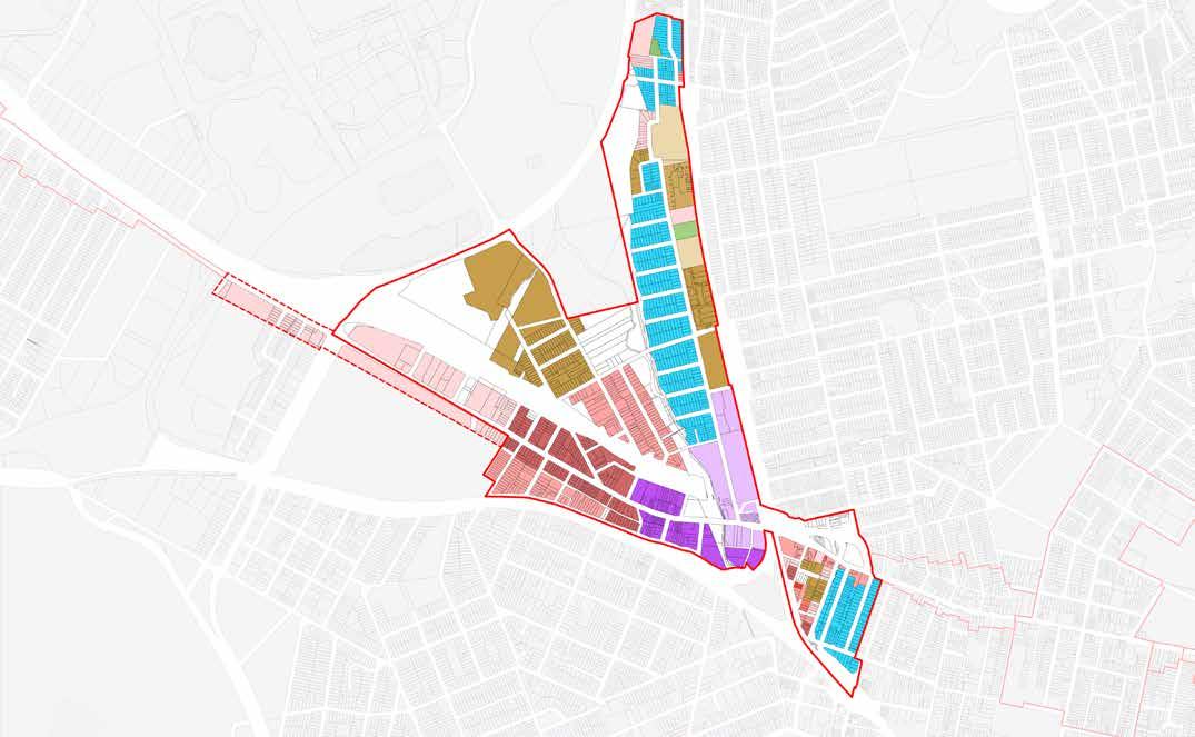
BUILDING HEIGHT STRATEGY
The building height strategy is informed by the PRCUTS design guidelines, context interface, solar impact to open space and utilisation of land.
The PRCUTS Planning and Design Guidelines set up the base building height control of 8.5m (2 storeys), 10m, 11m (3 storeys), 16m (4 storeys), 22m (6 storeys) and 25m (7 storeys) for different zones.
The building heights are arranged in a way to minimise impact on public parks, low scale residential areas, schools and heritage buildings.
Heights are utilised within the guideline to minimise site coverage, in order to free up more space on the ground and provide generous separation between buildings.
A maximum building height of one storey will be applied for all areas of open space to allow for structures within parks and plazas.
A planning proposal to permit additional maximum building height for terrace housing is currently with the Department of Planning, Industry and Environment for determination.
If a multi dwelling (terrace) development is proposed the maximum height for that development will be 8.5m. However, if the development complies with the following requirements then it may have a maximum height of 9.0m if:
a) The development follows a 45 degree height plane, measured at the front and rear building line, springing from 7m above the natural ground level, and
b) Only bedrooms and non-habitable spaces are located in the third storey.
Pg 35
P T HOMEBUSHBAYDR I VE(A3) QUEEN STREET CONSETT STREET MACKENZIE STREET KING STREET GEORGE STREET GEORGE STREET CONCORD ROAD STATION AVENUE VICTORIA AVENUE VICTORIA AVENUE Powells Creek Victoria Avenue Public School Warbrick Park Powells Creek Reserve Bicentennial Park Concord West Shops 0m 20 50 100 200m Scale 1:5,000 @ A3 LEGEND Precinct Boundary Existing lots Open Space Water Body 16 22 22 16 8.5 8.5 8.5 8.5 8.5 8.5 8.5 8.5 8.5 8.5 8.5 16 6.5 16 16 16 6.2-8.5m 8.5-11m 15-16m 19-22m 25m Note: Numbers on buildings indicate height of building in metres 8.5m PRCUTS height control 10m PRCUTS height control 11m PRCUTS height control 16m PRCUTS height control Existing LEP controls retained 22m PRCUTS height control 25m PRCUTS height control Sites will retain current LEP controls and will not be changed Sites will retain current LEP controls and will not be changed due to flooding impacts
STREET WALL
The street wall heights are informed by the street character, total building height and adjacent built form.
Two-storey street walls have been applied along Victoria Avenue, George Street and King Street to ensure future development creates a consistent streetscape commensurate with the character of the area.
Pg 36 Homebush Precinct Master Plan For: City of Canada Bay Council
P T HOMEBUSHBAYDR I VE(A3) QUEEN STREET CONSETT STREET MACKENZIE STREET KING STREET GEORGE STREET GEORGE STREET CONCORD ROAD STATION AVENUE VICTORIA AVENUE VICTORIA AVENUE Powells Creek Victoria Avenue Public School Warbrick Park Powells Creek Reserve Bicentennial Park Concord West Shops 0m 20 50 100 200m Scale 1:5,000 @ A3 LEGEND Precinct Boundary Existing lots Open Space Water Body 2-storey Street Wall Current LEP controls retained Sites will retain current LEP controls and will not be changed Sites will retain current LEP controls and will not be changed due to flooding impacts
OPEN SPACE AND LINKS
New public open space and linkages are proposed to improve the existing pedestrian and cyclist network.
Public Open Space and through-site links are provided to align with the PRCUTS design guidelines. In addition to that, several new ones are introduced:
+ Through-site links to the large industrial lots to the south-west (Lot G) and north-west (Lot B) of Concord West train station
+ Potential rear lanes have been identified for nonamalgamated lots to mitigate the impact of car parking on Victoria Avenue, George Street and King Street resulting from the increase in occupants.
For additional information regarding the intended character of the public domain and activation concepts for the open spaces, refer to the Parramatta Road Selected Precincts Public Domain Plan pages 22-23.
Pg 37
P T HOMEBUSHBAYDR I VE(A3) QUEEN STREET CONSETT STREET MACKENZIE STREET KING STREET GEORGE STREET GEORGE STREET CONCORD ROAD STATION AVENUE VICTORIA AVENUE VICTORIA AVENUE Powells Creek Victoria Avenue Public School Warbrick Park Powells Creek Reserve Bicentennial Park Concord West Shops 0m 20 50 100 200m Scale 1:5,000 @ A3 LEGEND Precinct Boundary Existing lots Open Space Water Body Desired Through-site Link Potential Rear Lane Cycleway Victoria Avenue Gates Station Square Sites will retain current LEP controls and will not be changed Sites will retain current LEP controls and will not be changed due to flooding impacts
Pg 38 Homebush Precinct Master Plan For: City of Canada Bay Council PROPOSED ZONING P T HOMEBUSHBAYDR I VE(A3) QUEEN STREET CONSETT STREET MACKENZIE STREET KING STREET GEORGE STREET GEORGE STREET CONCORD ROAD STATION AVENUE VICTORIA AVENUE VICTORIA AVENUE Powells Creek Victoria Avenue Public School Warbrick Park Powells Creek Reserve Bicentennial Park Concord West Shops 0m 20 50 100 200m Scale 1:5,000 @ A3 LEGEND Precinct Boundary Existing lots Open Space Water Body R2 R3 R3 R3 R3 R3 IN1 IN1 B1 RE1 RE1 SP2 R2 Current SP2 School zoning is to be retained Current B1 Neighbourhood Centre zoning is to be retained R2 - Low Density Residential R3 - Medium Density Residential B1 - Neighbourhood Centre RE1 - Public Recreation SP2 - School IN1 - Industrial Refer notes on drawing Sites will retain current LEP controls and will not be changed Sites will retain current LEP controls and will not be changed due to flooding impacts Amendments to the PRCUTS recommended land use strategy are proposed to accommodate strategic uses Current SP2 School zoning on the Victoria Avenue Public School lot is to be retained Current B1 Neigbourhood Centre at 3-7 King Street will be retained IN2 Industrial and R2 Low Density Residential zoning is to be retained in the north-western corner of the site (indicated on the map adjacent) due to flooding impacts.
Pg 39
SHADOW ANALYSIS
The shadow diagrams are generated by SketchUp with the date set to mid winter (21st June) when the sun is lowest in the sky, and limited between 9 am and 3 pm. The diagram represents the ‘worst case‘ scenario for solar access.
LEGEND
2 hrs sunlight
1 hrs sunlight
0 hrs sunlight
Note: Greyed out sites have been excluded as current LEP controls will be retained
Pg 40 Homebush Precinct Master Plan For: City of Canada Bay Council
Pg 41
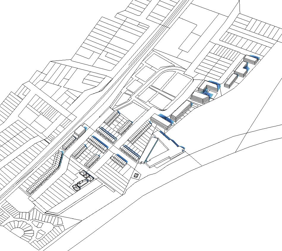
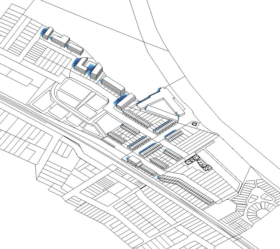
North-west Isometric North-east Isometric
Pg 42 Homebush Precinct Master Plan For:
of
City
Canada Bay Council
STREET INTERFACE
Pg 43
04
GEORGE & KING STREET SPINE
George Street and King Street will form the major thoroughfare through the proposed Homebush North precinct. The roads are oriented north-south and will link the Concord West Railway Station to the residential streets beyond.
An additional 3m setback has been proposed along this spine, widening the green space within the public domain and accommodating footpaths to both sides of the road. A dedicated, two-way cycle lane has also been designed to the east of the road, improving the safety and amenity of cyclists and providing a significant active transport connection to the station.
2-storey terraced town-houses have been proposed along George and King Streets, which will increase the density of residential dwellings in the precinct, optimising the benefits of station proximity for more people.
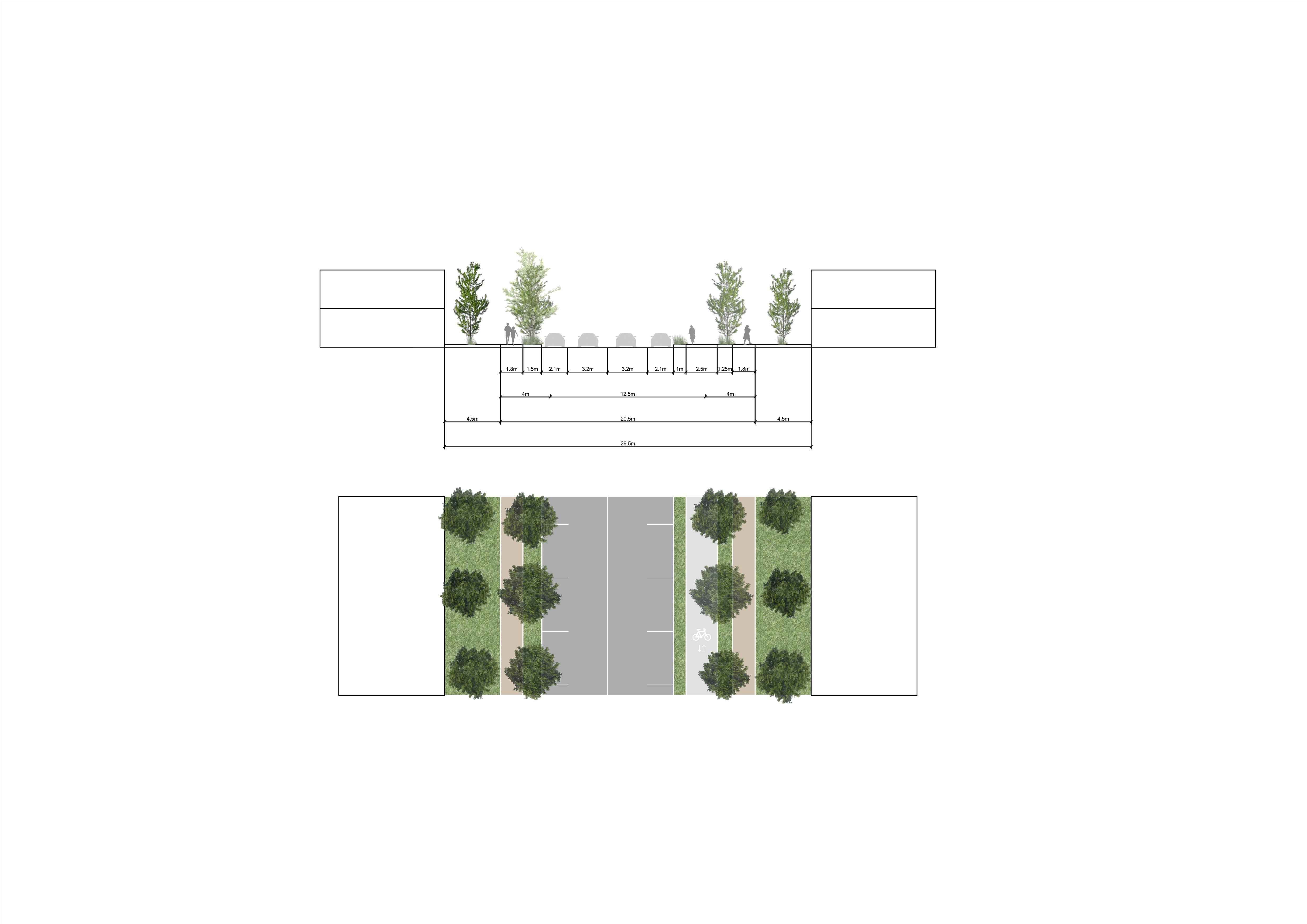
Pg 44 Homebush Precinct Master Plan For: City of Canada Bay Council EXISTING PROPERTY BOUNDARY EXISTING PROPERTY BOUNDARY EXISTING KERB TOTAL PROPOSED CORRIDOR VERGE TRAVEL LANE PARKING LANE TRAVEL LANE PARKING LANE VERGE EXISTING ROAD CORRIDOR PROPOSED BUILDING SETBACK FOOTPATH FOOTPATH TWO WAY CYCLE PROPOSED BUILDING SETBACK RESIDENTIAL RESIDENTIAL RESIDENTIAL RESIDENTIAL
1:2,000 GEND reci Boundar Existing lot Existing building footprint Open pac Co cor Wes inc ma m ion RD ropos lo ga tion dow Submission
VICTORIA AVENUE
The proposed design of Victoria Avenue will improve the pedestrian amenity between Victoria Avenue Public School and Concord West Station.
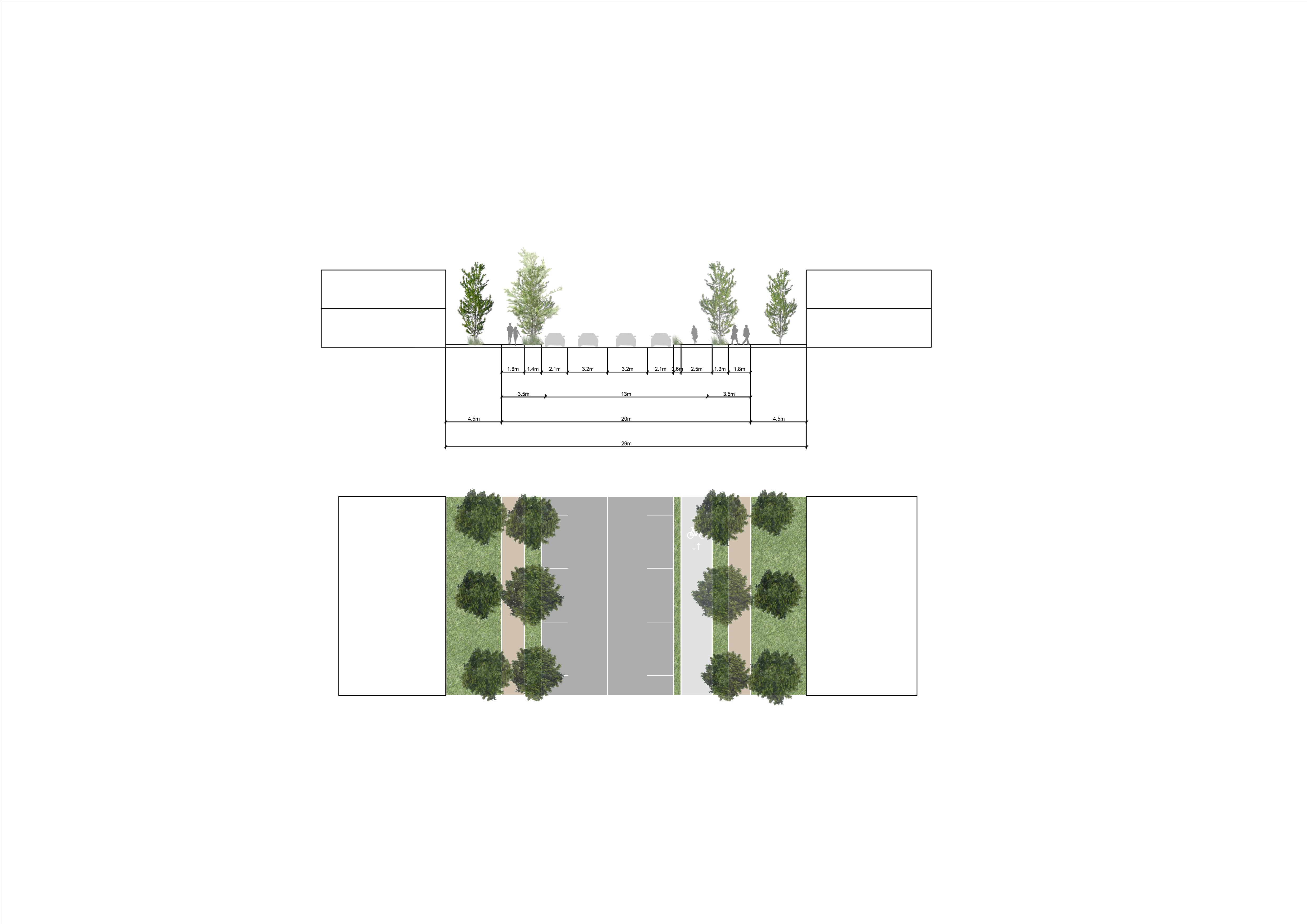
The overall appearance of the street will be upgraded, incorporating significant landscaping and improving paths of travel to enhance the role of the street as a gateway to Sydney Olympic Park.
Widening the public domain by increasing setbacks to 3m either side of the road has enabled the provision of 1.8m footpaths and a two-way cycle lane. Additional portions of planted landscaping will delineate cyclists from motorists and pedestrians, and will improve the overall appearance of the street.
The built environment of Victoria Street will feature 2-storey attached dwellings, which will provide a comfortable street wall to sympathetically integrate with the surrounding single story residences.
Pg 45 EXISTING PROPERTY BOUNDARY EXISTING PROPERTY BOUNDARY RESIDENTIAL RESIDENTIAL RESIDENTIAL RESIDENTIAL EXISTING KERB TOTAL PROPOSED CORRIDOR VERGE TRAVEL LANE PARKING LANE TRAVEL LANE PARKING LANE VERGE EXISTING ROAD CORRIDOR FOOTPATH FOOTPATH TWO WAY CYCLE PROPOSED BUILDING SETBACK PROPOSED BUILDING SETBACK
1:2,000 GEND reci Boundar Existing lot Existing building footprint Open Co Wes inc ion RD ropos lo ma gam tion ropos dow Submission
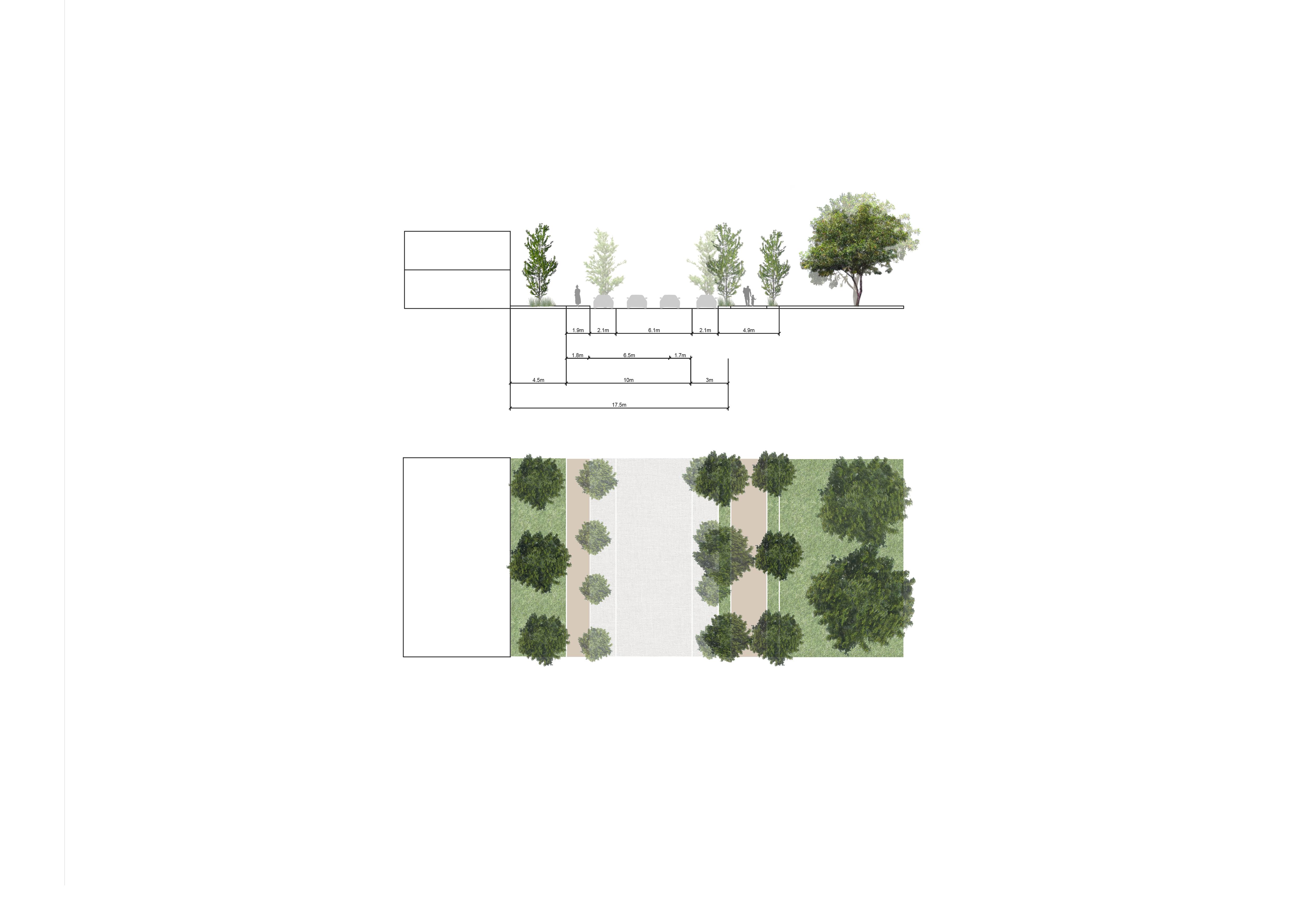
KING STREET SHARED ZONE
The urban design to the southern portion of King Street addresses the street’s primary function as a threshold to the adjoining station.
The flush kerbs and paving will indicate the road’s intention as a shared space, while wide portions of planting will link to the adjoining green open space at the corner of King Street and Victoria Avenue.
A series of 2-storey terraced townhouses have been proposed along the street’s western elevation. These will be set back by 3m, transferring more space to the public domain.
Pg 46 Homebush Precinct Master Plan For: City of Canada Bay Council EXISTING PROPERTY BOUNDARY EXISTING KERB TOTAL PROPOSED CORRIDOR VERGE TRAVEL LANE PARKING LANE TRAVEL LANE PARKING LANE VERGE EXISTING ROAD CORRIDOR PROPOSED SETBACK PROPOSED BUILDING SETBACK FOOTPATH FOOTPATH CONCORD WEST TRAIN STATION RESIDENTIAL RESIDENTIAL
1:2,000 GEND reci Boundar Existing lot Existing building footprint Open pac Co cor Wes inc ma m ion RD ropos lo ga tion dow Submission
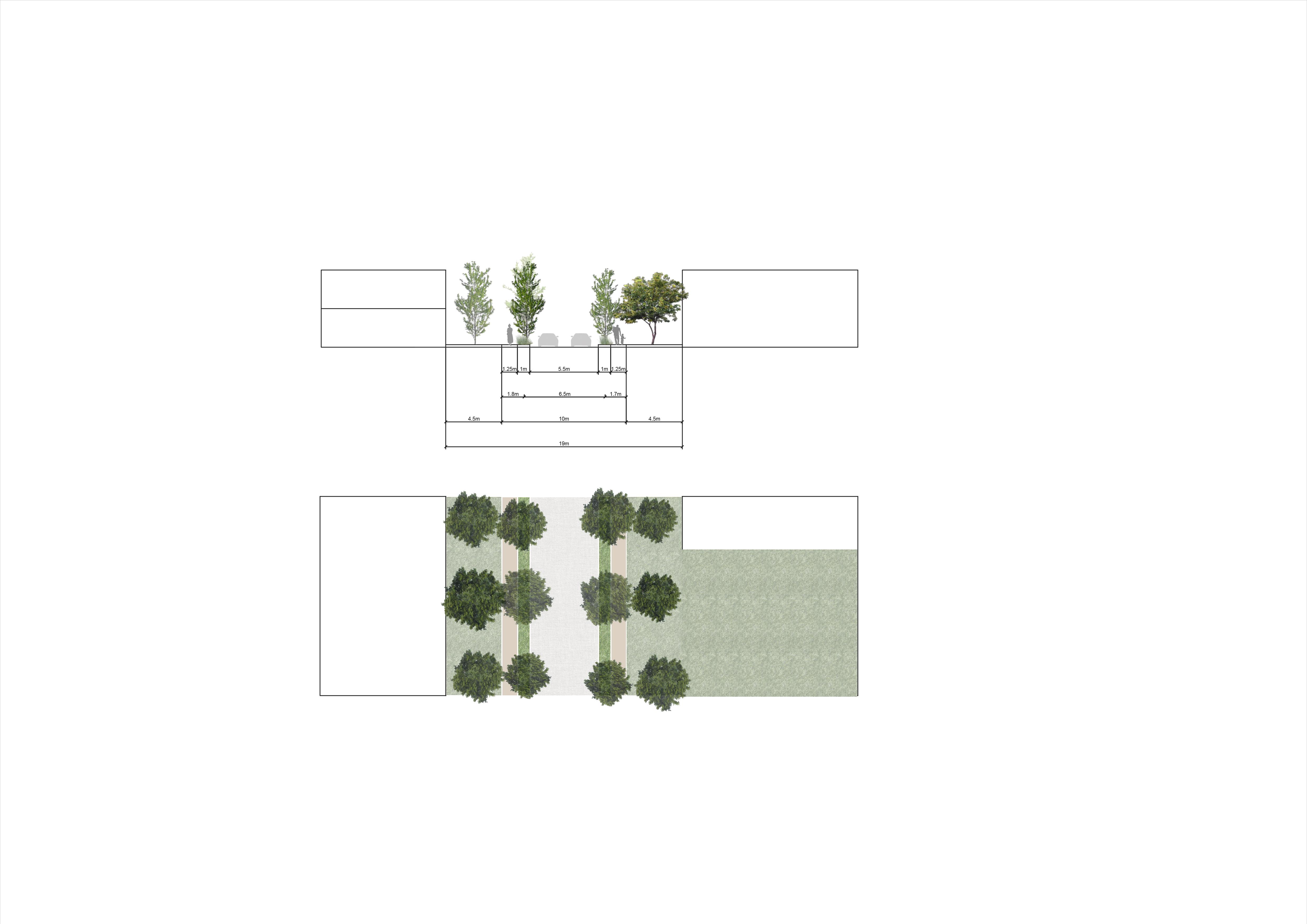
STATION AVENUE SHARED ZONE
The design approach to Station Avenue aims to provide a public zone in which pedestrians, cyclists and motorists can comfortably share a key local connection. The road will link the higher density dwellings proposed to the north west of the precinct, to the amenity of Concord West station.
As a pedestrianised lane, flush kerbs and a paved road surface will delineate the shared intended use of the road. Wide portions of significant planting will also be introduced to the space to enhance comfort and appearance.
The side boundaries of 2-storey terraced townhouses will extend along this street. These dwellings have been set back by a proposed 3m to ensure a sympathetic transition from built form to the public domain of the laneway.
Pg 47
EXISTING PROPERTY BOUNDARY EXISTING PROPERTY BOUNDARY EXISTING KERB TOTAL PROPOSED CORRIDOR VERGE SHARED ZONE VERGE EXISTING ROAD CORRIDOR PROPOSED BUILDING SETBACK FOOTPATH FOOTPATH PROPOSED BUILDING SETBACK
TOWNHOUSE
TOWNHOUSE
1:2,000 GEND reci Boundar Existing lot Existing building footprint Open pac Co cor Wes inc ma m ion RD ropos lo ga tion dow Submission
Pg 48 Homebush Precinct Master Plan For:
of
City
Canada Bay Council
YIELD ESTIMATE
Pg 49
05
Pg 50 Homebush Precinct Master Plan For: City of Canada Bay Council
ROAD HOMEBUSH PRECINCT GroupGSA for City of Canada Bay Council Description Date Revision Master plan issue 18.12.2020 A Building heights added 21.01.2021 B Revised lot amalgamation boundaries 28.01.2021 C Revised FSRs 29.01.2021 D Revised Lot D 17.02.2021 E Revised lots 20.04.2021 F Existing dwelling numbers added 26.04.2021 G Table 1: Study Area Summary Overall Area: 112,353 sqm Total Estimated GFA (for the Non-Developed Land): 108,230 sqm Study Area FSR: 0.96 :1 Potential Additional Units: 492 units* (* incomplete information from existing PP reports) Total units to be retained: 78 units Density 44 dw/ha Development Assumptions Building Efficiency (Non-Resi) GFA / GEA Ratio: Retail / Commercial 75% Apartments GFA / GEA Ratio 75% NSA GFA Ratio 85% Apartments: Typical Unit Size 1B 55 sqm (NSA) 2B 77 sqm (NSA) 3B 105 sqm (NSA) Parking Area per Parking Space (Structured Parking) 35 sqm Table 2: Yield Estimate Breakdown DEVELOPABLE LAND (on the non-developed parts of the Study Area) 1-Bed 2-Bed 3-Bed % 1-Bed % 2-Bed % 3-Bed Existing Industrial lots Industrial 51,489 1.0 :1 51,489 A+B/DP370556 Residential 1,395 0.5 :1 698 2 King Street lots Residential 16,102 0.5 :1 8,051 27 Strata Lot, Station Avenue Residential 2,875 0.75 :1 2,156 49 Lots where Current LEP contols are retained 71,861 0.9 :1 62,394 78 1-Bed 2-Bed 3-Bed % 1-Bed % 2-Bed % 3-Bed Terraces Residential 22,269 0.5 :1 0.7 :1 2 8.5 15,588 183 - - - 0% 0% 0% 85 Non-Amalgamated Lots SUBTOTAL 22,269 0.7 :1 15,588 183 - -LOT B Residential 8,000 1.9 :1 1.9 :1 4 to 6 9.9 to 16 15,200 165 33 99 33 20% 60% 20% 92 LOT C Residential 3,389 1.4 :1 1.4 :1 3 to 4 9.9 to 16 4,745 52 10 31 10 20% 60% 20% 92 LOT D Residential 6,017 1.4 :1 3 to 4 9.9 to 16 8,424 92 18 55 18 20% 60% 20% 92 * site will retain current LEP controls LOT F Residential+Commercial 817 2.3 :1 2.3 :1 2 to 4 6.2 to 16 1,879 No information Lots employing new FSR controls 40,492 1.1 :1 45,836 492 units 118 374 96 TOTAL 112,353 1.0 1 108,230 570 units TOTAL ALLOWABLE GFA (m2) Existing Units Indicative Average Unit Size (GFA, m2) Unit Mix New FSR TOTAL GFA (m2) Units Unit Mix Lot Land Use Lot Area (m2) PRCUTS FSR REF New FSR Building Storeys Lot Land Use Lot Area (m2) Building Heights (metres) Building Storeys CURRENT FSR REF Building Heights (metres) Indicative Average Unit Size (GFA, m2) YIELD ESTIMATE
PARRAMATTA
Pg 51
www.groupgsa.com
SYDNEY
Level 7, 80 William Street East Sydney NSW 2011 Australia
MELBOURNE
Level 1, 104 Exhibition Street Melbourne VIC 3000 Australia
BRISBANE Level 14, 100 Edward Street Brisbane QLD 4000 Australia
PERTH Level 2, 307 Murray Street Perth WA 6000 Australia
SHANGHAI Room 407, No. 71, Xi Suzhou Road Jingan District Shanghai 200041 PR China
HO CHI MINH CITY 19th Floor – Havana Tower, 132 Ham Nghi,
Thanh Ward,
Ben
District 1, Ho Chi Minh City Vietnam
