PARRAMATTA ROAD SELECT PRECINCTS

SEPTEMBER 2022
PUBLIC DOMAIN PLAN - STAGE 1
PARRAMATTA ROAD SELECT PRECINCTS PUBLIC DOMAIN PLAN DRAFT FOR REVIEW
SEPTEMBER 2022 by CONTEXT Landscape Architecture for City of Canada Bay Council
DOCUMENT CONTROL
RevDateDescription Approved
A08/04/2020Preliminary Draft for Review JP
B04/06/2020Final Draft JP
C24/06/2020Final Issue - Check Print JP
D06/07/2020Final Issue JP
E21/04/2021Revised Final Issue for Masterplan IntegrationJP
F21/05/2021Revised Final Issue for Masterplan IntegrationJP
G21/09/2022Updated Public Domain Plan draft for reviewCW
H26/09/2022Updated Public Domain Plan CW
I27/09/2022Updated Public Domain Plan CW
Context acknowledges the Wangal clan as the Traditional Custodians of this land, and recognise Elders past and present. Through authentic understanding of the landscapes within which we work, we strive to deepen our understanding of country and our relationship with its people.
ii PARRAMATTA ROAD SELECT PREC i NCTS PUBL i C DOMA i N PLAN
© 2022
CONTENTS PARRAMATTA ROAD SELECT PRECINCTS PUBLIC DOMAIN PLAN iii 01 INTRODUCTION 02 DESIGN FRAMEWORK 03 HOMEBUSH NORTH PRECINCT 04 BURWOOD PRECINCT 05 KINGS BAY PRECINCT 1 6 14 25 40
INTRODUCTION
iv PARRAMATTA ROAD SELECT PRECINCTS PUBLIC DOMAIN PLAN
01
INTRODUCTION
The Parramatta Road Corridor Urban Transformation Strategy (PRCUTS) provides a vision and strategy for how the Corridor will grow and bring new life to local communities.
PRCUTS aims to renew Parramatta Road and adjacent communities through investments in homes, jobs, transport, open spaces, and public amenity. It presents significant urban renewal opportunities for land within defined development precincts.
In response to PRCUTS, the City of Canada Bay, Strathfield and Burwood Councils have undertaken additional urban design, traffic, and transportation investigations for three precincts: Homebush, Burwood, and Kings Bay.
CONTEXT was engaged by the City of Canada Bay to prepare a Public Domain Plan (the Plan) for the streets and open spaces of these three precincts within the Canada Bay Local Government Area (LGA).
The purpose of the Plan is to ensure that all public domain needs are identified at an early stage and can inform detailed planning in the Corridor, including DCP requirements, requirements for private land (e.g. for street widening), and developer contributions.
The Plan illustrates preliminary concept designs for streets and open spaces to assist in the visioning, preliminary costing, and future development of these public domain areas.
HOMEBUSH NORTH
BURWOOD
PARRAMATTA ROAD SELECT PRECINCTS PUBLIC DOMAIN PLAN 1 01
KINGS BAY
The Parramatta Road Corridor traverses 20 kilometres from Granville in the west to Camperdown in the east.
The Corridor includes land adjoining Parramatta Road, and wider focus precincts where future development is considered appropriate based on function and character.
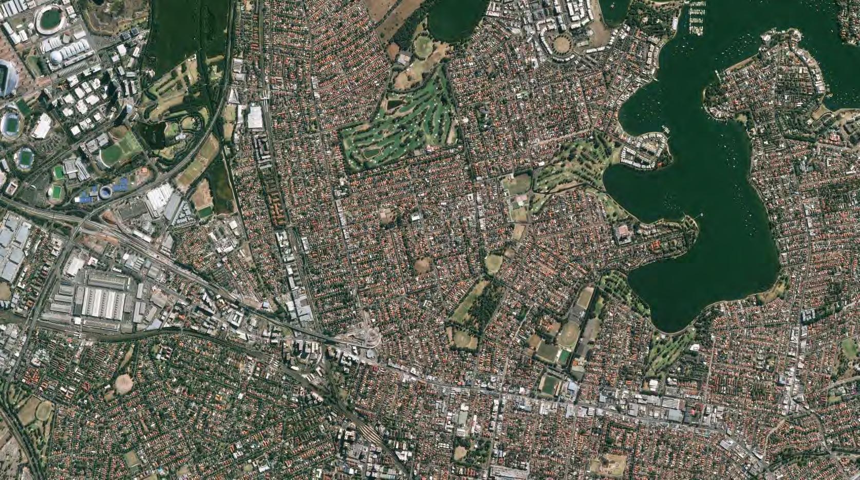
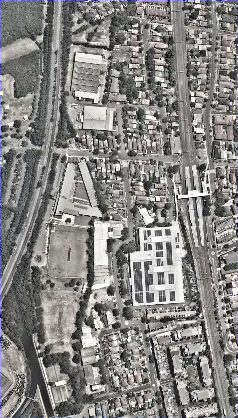
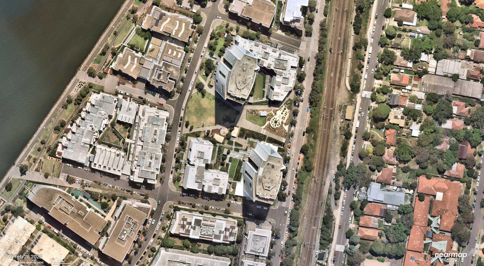
Within PRCUTS, there are three renewal precincts which include land within the City of Canada Bay: Homebush, Burwood-Concord (referred to herein as Burwood), and Kings Bay. These are illustrated on the right.
Park Road WoodvilleRd Park Road Wellington Rd Guildford Rd Waterloo Rd Boronia Rd Cosgrove Rd GeorgesRiverRd Burwood Rd King St OldCanterburyRd AddisonRd Barker Rd Silverwater Rd Victoria Rd Wharf Rd Spurway St HillRd Holker St BuffaloRd James Ruse Dr O’Connell St Pitt St ParramattaRd Cabarita Rd City West Link Darling St BalmainRd LyonsRd Johnston St RamsaySt Queen StCroydonRd ParramattaRd Parramatta Rd GlebePointRd M4WesternMotorway Joseph St Brunker Rd JohnstonRd Miller Rd Hector St Ferndell St Clyde St Blaxcell Street HumeHighway Concord Road Homebush Bay Drive Victoria Rd VictoriaRoad Burns Bay Road River Rd Epping Road PacificHighway Granville Old Granville South Granville Silverwater Rockwood Chullora Greenacre Strathfield Strathfield South Haberfield Balmain Russell Lea Hunters Hill East Ryde Putney Melrose Park Lane Cove St Leonards Leichhardt Annandale Marrickville Ashbury Burwood Heights Newington Westmead Parramatta Harris Park Rydalmere Clyde Merrylands Camellia Rosehill Granville Guildford Auburn Lidcome Berala Regents Park Sefton Chester hill Leightonfield Birrong Yagoona Concord West North Strathfield Homebush Strathfield Burwood Croydon Ashfield Summer Hill Lewisham Dulwich Hill Hurlstone Park Campsie Petersham Stanmore Newtown Macdonaldtown St Peters Erskineville Olympic Park Flemington Rhodes Meadowbank 0 1 2 3 4 Kilometres Water Motorway / primary road Arterial / distributor road Existing ferry stop Existing heavy rail Existing light rail Transformation area Transformation precinct Parks and open space This product is for informational purposes and may not have been prepared for, or be suitable for legal, engineering or surveying purposes. While every effort has been made to make this product correct as at the date of its publication, UrbanGrowth NSW will not be liable in any event for any losses or damages, including incidental or consequential, resulting from the use of the product or any material referred to in it.
14 Parramatta Road Corridor Rosehill N 15 Parramatta Road Corridor | Urban Transformation Strategy 2 PARRAMATTA ROAD SELECT PRECINCTS PUBLIC DOMAIN PLAN
Parramatta Road Urban Transformation
Parramatta Road Corridor Transformation Area Parramatta Road Corridor Transformation Precinct City of Canada Bay Parramatta Road Stage 1 Precincts PRCUTS PARRAMATTA ROAD CORRIDOR (SOURCE: PRCUTS, 2016) HOMEBUSH NORTH BURWOOD KINGS BAY CONTEXT
CONSIDERATIONS
The Public Domain Plan addresses a range of considerations relating to the planning and design of the public domain within dense urban environment. A high level summary is provided below.
TRAFFIC + TRANSPORT
–Space provided for vehicle travel and parking, cycling and pedestrian circulation, access and connections;
–Carriage widths and their ability to accommodate different streets users, and alternative proposals to make better use of available street space;
–Priority treatments for hierarchy of usage that prioritises a street’s most vulnerable users - pedestrians and cyclists;
–Any amendments required to recommended PRCUTS planning controls to create built forms that can accommodate the above access and circulation needs;
–Traffic calming and intersection treatments; and
–Connections to the wider street, cycle and pedestrian network.
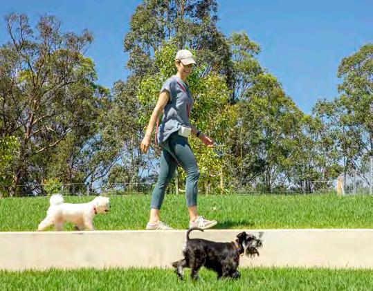
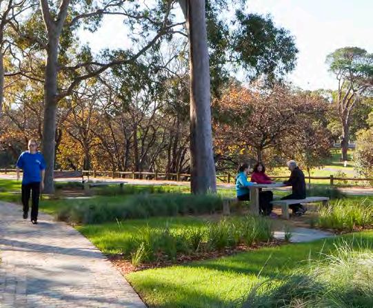
OPEN SPACE + LANDSCAPING
–Current and anticipated future trends in the use of open space and recreation facilities; and
–Consider how recommendations from Council’s Urban Tree Canopy study and Biodiversity Study can be implemented.
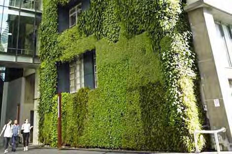
ENVIRONMENTAL SUSTAINABILITY
–Opportunities for Water Sensitive Urban Design measures in streets and open spaces;
–Climatic considerations and urban heat island effect through provision of shade and other methods for cooling of the urban environment;
–The need to minimise potable water usage and use sustainable materials; and
–The need to reduce carbon emissions in line with Council’s draft Emissions Reduction Action Plan.
ECONOMIC + SOCIAL CONSIDERATIONS
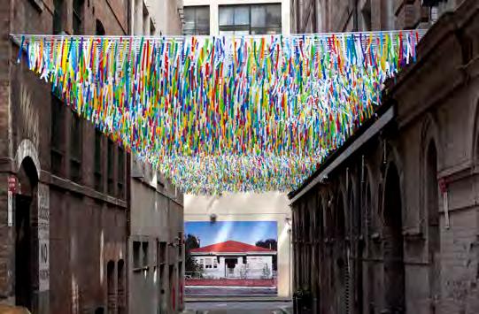
–Possible locations and themes for public art and heritage interpretation opportunities (including Aboriginal interpretation opportunities);
–Relationship between, and improving interface of, the public and private domain;
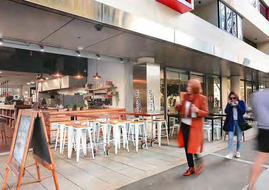
–Opportunities for outdoor dining or other economic activation of public domain areas; and
–Locations for seating, wayfinding and other street furniture.
4 PARRAMATTA ROAD SELECT PRECINCTS PUBLIC DOMAIN PLAN
PAGE
LEFT
PARRAMATTA ROAD SELECT PRECINCTS PUBLIC DOMAIN PLAN 5
INTENTIONALLY
BLANK
DESIGN FRAMEWORK
02 6 PARRAMATTA ROAD SELECT PRECINCTS PUBLIC DOMAIN PLAN
02 DESIGN FRAMEWORK
The design framework presented in this chapter reviews the policies and plans shaping our design approach the public domain, and provides overarching design principles, key design strategies and recommendations for the Public Domain Plan.
The vision and principles for the public domain of Homebush North, Burwood, and Kings Bay are shaped by an overarching policy and planning framework set forth by NSW Government and the City of Canada Bay.
In addition to this, the Public Domain Plan also draws on local and international best practice for the design of streets and open spaces.
These collectively define the Plan’s Design Framework.
This section provides an overview of relevant and related documents that have shaped the Public Domain Plan and informed the overarching design principles and the vision for each precinct.
Greater Sydney Commission, 2018
Eastern
City District Plan
The Public Domain Plan delivers on a number of planning priorities setout in the plan.
The plan sets out NSW Government’s vision for Greater Metropolitan Sydney as a city of three cites where residents live within 30 minutes of their daily needs.

The plan sets out ten directions:
–A city supported by infrastructure
–A collaborative city
–A city for people
–Housing the city
–A city of great places
–A well-connected city
–Jobs and skills for the city
–A city in its landscape

–An efficient city
–A resilient city
The plan encourages public open space as a form of green infrastructure that enhances the character of the Eastern City District’s neighbourhoods, supports healthy and active lifestyles and brings communities together.
The Public Domain Plan will contribute towards the delivery of Planning Priorities E17 Increasing urban tree canopy cover and delivering Green Grid connections, and E18 Delivering high quality open space.
The Homebush North, Burwood, and Kings Bay will create new places that should aspire to the quality of design advocated within this policy.
Better Placed is about enhancing the design quality of our built environment, raising expectations and raising standards, about working better and creating better environments.
Seven principles are identified:
–Contextual, local and of its place – Sustainable, efficient and durable –Equitable, inclusive and diverse –Enjoyable, safe and comfortable –Functional, responsive and fit for purpose –Value-creating and cost effective –Distinctive, visually interesting and appealing
The Precincts’ streets and open spaces provide an opportunity to embed green infrastructure within the urban environment.
The draft Greener Places policy has been produced by GANSW to guide the design, planning and delivery of green infrastructure across NSW.
The aim is to create healthier and more liveable cities and towns by improving community access to recreation and exercise, supporting walking and cycling connections, and improving the resilience of our urban areas.
A number of Green Grid projects require consideration within the Homebush North, Burwood, and Kings Bay precincts.
The Sydney Green Srid promotes the creation of a network of high quality open spaces that supports recreation, biodiversity and waterway health.
The Green Grid will create a network that connects strategic, district and local centres, transport hubs, and residential areas, such as Homebush North, Burwood, and Kings Bay.

PARRAMATTA ROAD SELECT PRECINCTS PUBLIC DOMAIN PLAN 7
GREATER SYDNEY REGION PLAN A
of Three Cities – connecting people OUR GREATER SYDNEY 2056 Eastern City District Plan –connecting communities
Metropolis
PLACED
BETTER PLACES SPATIAL FRAMEWORK AND PROJECT OPPORTUNITIES
GREENER
SYDNEY GREEN GRID
Greater Sydney Region Plan - A Metropolis of Three Cities
Greater Sydney Commission, 2018
Better Placed Government Architect NSW, 2017
Greener Places Government Architect NSW, 2017
Sydney Green Grid Government Architect NSW, 2017
The evolution of Homebush North, Burwood, and Kings Bay will build upon the plan’s strategic directions.
Parramatta Road Corridor Urban Transformation Strategy

UrbanGrowth NSW


The strategy provides high level guidance on the future evolution of the Parramatta Road Corridor and the precincts within it.
Social Infrastructure Strategy and Action Plan - Open Space and Recreation
City of Canada Bay
The plan highlights the significant trend towards informal, unstructured recreation activities rather than traditional organised sport.
Social Infrastructure Strategy and Action Plan - Community City of Canada Bay
Biodiversity Framework and Action Plan City of Canada Bay
The precincts’ public domain will play a key role in improving access to social infrastructure and community facilities.
The Strategy is the NSW Government’s 30-year plan setting out how the Parramatta Road Corridor will grow and bring new life to local communities living and working along the Corridor.
The Strategy has been adopted by the NSW Government and is given statutory force by a Ministerial Direction under section 117 of the EP&A Act 1979 (NSW).
There is a need to plan for the diverse recreation preferences of our community.

Continued focus on sustainability and protecting our natural environment and waterways.
Increased activation of parks and open spaces including through provision of a variety of spaces and uses; cafes in parks; and programming of spaces.
The plan provides the evidence and analysis for Council’s planning over the short, medium and longer term to support social wellbeing and a strong and cohesive community.
It delivers recommendations that will inform future priorities for social infrastructure and deliver facilities, spaces, programs and services that reflect community needs.

The precincts’ streets and open spaces will play a critical role in ensuring local ecosystem health.
Urban Tree Canopy Strategy City of Canada Bay Local Movement Strategy City of Canada Bay
Streets and open spaces are the primary method for achieving an extensive and robust urban tree canopy.
The movement strategies and priorities provided by this document require consideration in the design of streets.
The plan is based upon six interconnected themes: –native vegetation –urban waterways and foreshores –corridors and connectivity –public spaces –urban habitat –green infrastructure
Commits Council to increasing its tree canopy cover across the City to at least 25% by 2040, an increase of over 6%.
Priority action themes to deliver this increase in canopy are:
–Protect and value –Renew and grow –Support and sustain –Engage and create –Manage and resource

The report provides an overview of the existing transport situation, relevant transport opportunities and constraints, future transport and land use trends and changes.
It also presents a series of actions per travel mode that support overarching strategic objectives across the Canada Bay Local Government Area.
8 PARRAMATTA ROAD SELECT PRECINCTS PUBLIC DOMAIN PLAN Please Remember: Full Colour Linear logo Please use the logo layout Guide. ensuring logo always produced best format and the highest Logo Versions: There are two logo orientations-- Full colour (PMS) - Single Colour (black and white) NEW PARRAMATTA RD Quick Reference Guide Isolation Area urbangrowth.nsw.gov.au NOVEMBER 2016 Parramatta Road Corridor Urban Transformation Strategy Social Infrastructure (Open Space and Recreation) Strategy and Action Plan CITY OF CANADA BAY COUNCIL September, 2019 Social Infrastructure (Community) Strategy and Action Plan CITY OF CANADA BAY COUNCIL August 2019 Canada Bay Biodiversity Framework and Action Plan City of Canada Bay Council Local Movement Strategy City Canada Bay Final Report
The Master Plan illustrates a future vision for the precinct, including its streets and open spaces.
In order to achieve a balanced development approach, the master plan acknowledges the competing forces that provide a basis for both greater density as well as reasoning to keep new development lower scale.
The Master Plan acknowledges that it is the public domain that holds and connects a place together. Parks, streets, footpaths, bike paths and pedestrian connections all play a role in stitching together the urban fabric that give a place an identity, provide places for recreation, interaction and promote a sense of community.
The Engineering Specifications provide the applicable standard for works within the road reserve.
The specifications provide technical design guidance and design requirements for a broad range of public domain and road design elements within the road reserve.
The policy provides design guidance on the role that street environments play in creating place.
The policy recognises that road infrastructure has a major influence on the existing and future form, function and character of our cities.
The document provides nine principles:
–Contributing to urban structure and revitalisation

–Fitting into the built fabric –Connecting modes and communities
–Fitting with the landform –Responding to natural patter n –Incorporating heritage and cultural contexts
–Designing an experience in movement
–Creating self-explaining road environments

–Achieving integrated and minimal maintenance design


This guide provides global best practice in the design of streets that prioritise amenity, safety, and environmental performance.
The Guide encourages streets to be designed as quality public spaces, as well as pathways for movement of pedestrians, cyclists, and other vehicles.
Streets play a big role in the public life of cities and communities, and should be designed as places for cultural expression, social interaction, celebration, and public demonstration.
Design streets to be enjoyable, comfortable, equitable, and inclusive, serving the needs and functions of diverse users with particular attention to people with disabilities, seniors, and children.
Design streets to be safe and comfortable for all users. Selfexplaining streets naturally encourage drivers to adapt their behaviour in a way that is compatible with the design, function and speed of a road.
Sydney Metro West Scoping Report
Westmead to the Bays and Sydney CBD, 2020 (Chapter 6 & 7)
This report outlines the scope of the work to be completed to facilitate the Sydney Metro West Project.
This report outlines and explains the work to be completed within Canada Bay Council Land. It outlines the land to be effected by construction for Burwood North Station.
Sydney Metro West is a catalyst for renewal within City of Canada Bay, which aligns with LSPS Priorities 1 (Action 1.4) and Priority 11.
PARRAMATTA ROAD SELECT PRECINCTS PUBLIC DOMAIN PLAN 9 Urban Design Study Concord West Precinct Master Plan Canada Bay Council APPENDIX ENGINEERING SPECIFICATIONS A2 Road Footpath Works ......................................................................................................282 BEYOND THE PAVEMENT Global Designing Cities Initiative Design Street NACTO Global Guide Global Design
Concord West Master Plan City of Canada Bay Canada Bay DCP - Appendix 2 Engineering Specifications City of Canada Bay
Beyond the Pavement Roads and Maritime Services, 2019 Global Street Design Guide Global Design Cities Initiative, 2016
OVERARCHING DESIGN PRINCIPLES
1 2 3
ADAPTABLEACTIVATEDSUSTAINABLE
STREETS AND PUBLIC SPACES THAT ARE ADAPTABLE...
...are designed for flexible use, and allow for a diverse range of travel and recreation preferences and user groups.
Streets need to be designed as quality public spaces, as well as pathways for movement of pedestrians, cyclists, and other vehicles.
Public space plays a significant role in the public life of cities and communities, and should be designed as places for cultural expression, social interaction, celebration, and public demonstration.
STREETS AND PUBLIC SPACES THAT ARE ACTIVATED...
... are designed to be enjoyable, comfortable, equitable, and inclusive, serving the needs and functions of diverse users, with particular attention to people with disabilities, seniors, and children.
Regardless of income, gender, culture, or language, whether one is moving or stationary, streets must always put people first.
Public space should draw on adjacent development and ground floor uses to maximise activation of open spaces and encourage use through different times of day and night.
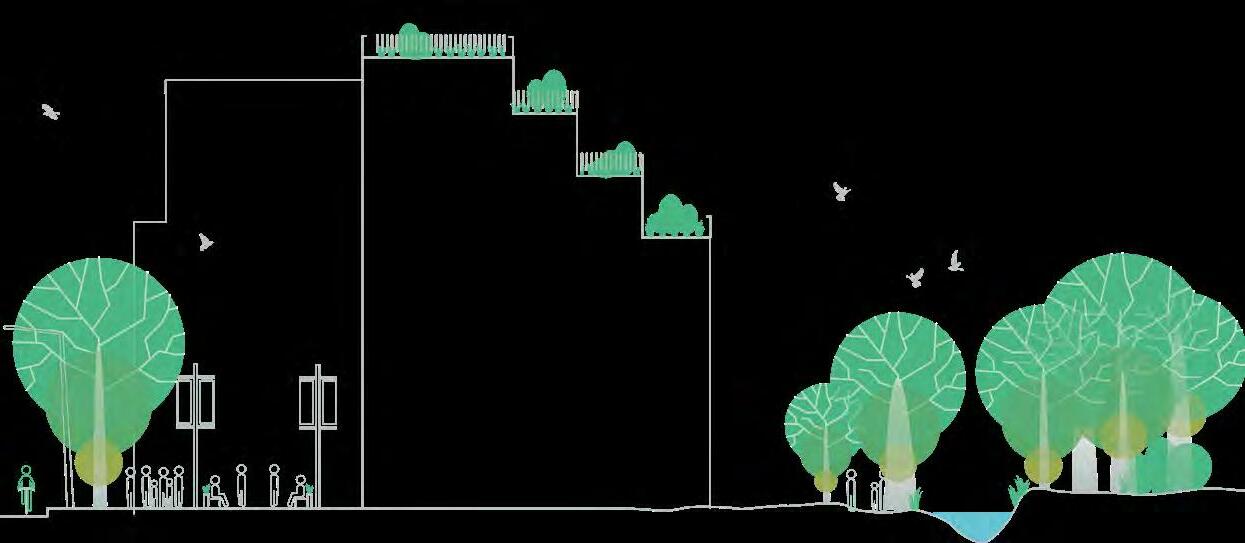
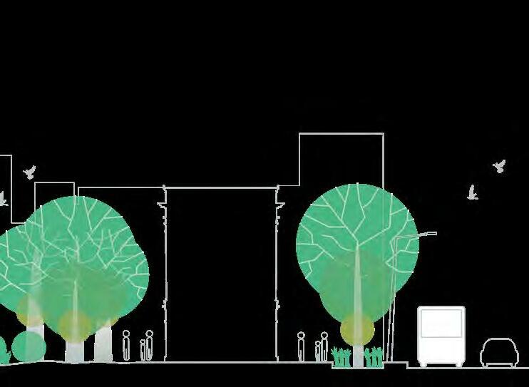
STREETS AND PUBLIC SPACES THAT ARE SUSTAINABLE...
...are designed to be both environmentally and financially sustainable, by enhancing connections to nature, mitigating the impacts of climate change, and remaining fit-forpurpose with achievable maintenance requirements.
Streets and public spaces form an integral part of their urban ecosystems, requiring the integration of green infrastructure to improve biodiversity and environmental outcomes.
Design should be informed by natural habitats, climate, topography, water bodies, and other natural features.
10 PARRAMATTA ROAD SELECT PRECINCTS PUBLIC DOMAIN PLAN
KEY DESIGN STRATEGIES
These key design strategies present a snapshot of the themes underpinning the designs presented within the following chapters.
PUBLIC SPACES SHOULD BE SELFEXPLAINING ENVIRONMENTS
Steets should be designed to be safe and comfortable for all users. This means prioritising the safety of pedestrians, cyclists, and the most vulnerable users among them: children, seniors, and people with disabilities. Self-explaining streets naturally encourage drivers to adapt their behaviour in a way that is compatible with the design, function and speed of a road.
Through the street’s design, drivers should feel uncomfortable exceeding the speed limit, and should be aware of the type of conditions ahead without excessive prompting from road signage.
NEW STREETS AND OPEN SPACES NEED LARGE TREES & ADEQUATE SOIL VOLUME
New street trees should be planted at a size that immediately maximises visual and environmental impact.
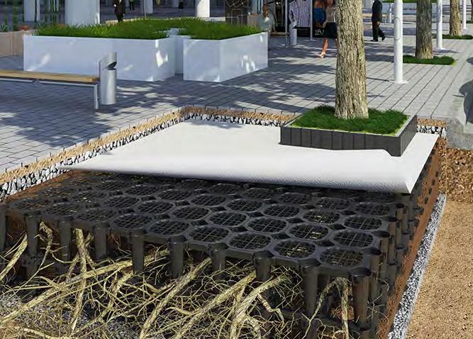
Mature tree stock should be planted wherever possible, varying from 100-400L and dependent on species and site conditions. Suppy of mature tree stock should be prioritised within street and open space upgrades to ensure availability. Substitutions on the basis of availability should not be granted.
Adequate soil volumes are critical for optimum tree and canopy growth. To obtain adequate soil volume in an urban context, the use of structural cells or structural soil should be specified. All soils are to be specified to Australian standards and will be site-specific.
Tree planting spacing is also species dependant, generally a good guide is 6m spacing for small trees to 12m spacing for very large trees.
Soil volumes should be calculated based on tree size at maturity, and minimum requirements can vary between individual pits and shared tree pit trenches. Adjacent site soil can be included in soil volume calculations if it can be demonstrated that tree roots have unrestricted access to it.
The table shown adjacent provides high-level guidance on varying soil volume requirements. Assumptions for these volumes include:
–Climatic growing conditions are dry, unreliable and/or hot or extreme conditions
–Soil suitability is not particularly fertile or effective
–There is no maintenance, with no fertiliser applications, no mulch, no supplementary irrigation
Refer to https://www.elkeh.com.au/soils/ for further information and detailed calculations of required tree soil volume.
Tree SizeTree Height (typical)
Min. Soil Volume Soil per tree for individual tree pit
Soil per tree in shared trench
Smallup to 4m9m3 6m3
Small-medium4-9m14m3 9m3
Medium7-10m21m3 14m3
Large9-20m33m3 22m3
Tall + wide8m+ canopy 14m+ wide 44m3 29m3
PARRAMATTA ROAD SELECT PRECINCTS PUBLIC DOMAIN PLAN 11
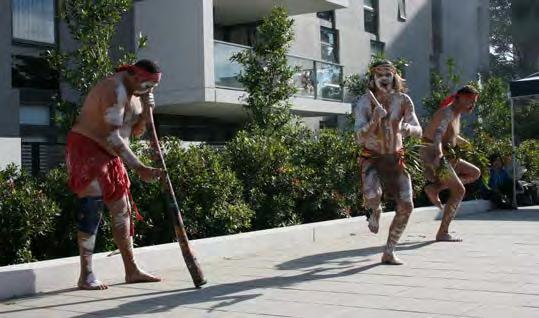
A Develop a staged cultural program to enhance key natural environments and the foreshore areas
design considers the innate relationship between people and nature. Informed by design, this relationship could be understood as a genesis for Indigenous architecture.
B Use the Parramatta River to create strong cultural linkages between key sites between the City and Parramatta
C Ensure cultural input in the early stages of planning and design of public places to promote distinctiveness and authenticity
Connection to Country
D Involve local communities in public art, place making and urban design projects to create more vibrant and meaningful environments

E Expand the capacity of outdoor venues to accommodate a range of cultural events
Design Comfort
F Work with the Aboriginal community on interpreting and managing key sites
G Develop cultural projects to interpret environmental issues and educate the community
H Support Council’s goals for environmental sustainability through arts and cultural initiative by fostering appreciation, knowledge and responsibility for our environment through the use of artistic and cultural practices.
Traditionally cognitive mapping by Aboriginal people was done through walking Country and learning about important sites, cultural lore, and wayfinding through storey telling. This can be argued as a universally human trait where our brain (like animals) senses place – using mental models of space to navigate and remember important features in the environment.
—Stephanie Golik – Mapfit 2017
In 1960, urban planner Kevin Lynch proposed that mental mapping has five elements: 1. paths 2.edges 3. districts 4.nodes 5. landmarks
These features can be incorporated into the design of our places.
PUBLIC SPACE MEANS DESIGNING WITH COUNTRY
The NSW Environmental Planning and Assessment Act 1979 was updated (with the passing of the Environmental Planning and Assessment Amendment Act 2017) in November 2017.
The Act now includes new objects that reflect the Government’s commitment to thriving, safe and well–designed communities with local character and heritage, with one new object now requiring the sustainable management of built and cultural heritage, including Aboriginal cultural heritage.
Research and design methods should seek to underpin public domain proposals with an acknowledgement of understanding of the local landscape, its life, and traditions. Doing so not only adds value to the project and its design process, but more importantly to its legacy, and how this project informs the next.
NODE Community gardens
1 Continue to develop the series of artworks at key sites along the foreshore
2 Work with Sydney Harbour Foreshore Authority, Arts NSW, Sydney Olympic Park Authority, Bay Run Partners (Leichhardt and Ashfield Councils who we have a joint working relationship established with an MOU) alongside Parramatta and other ‘River’ Councils to develop a regional focus to the river
3 Package and promote cultural experiences in collaboration with river tour boats and transport providers and visitors to the City
LANDMARK Heritage buildings
Catalogue, preserve and highlight trees through lighting, and interpretive
EDGE Indigenous landscaping (native plant species)
Integrate recommendations and features from the Riverside Scoping Study into developing master plans for parks and reserves and engage cultural planners and /or artists in the early stages of planning and design of public places to enable integrated artwork and cultural interpretation through the place
make a significant contribution to a more sustainable future world.
6 Continue to create specific character in local parks i.e. identify parks best suited for off leash areas, environmental education programs, tree lighting, small arts markets
Ego-centric v Eco-centric diagram adapted from Art Tawanghar, Designer, San Diego (2016)
The Wangal
The City of Canada Bay is part of the traditional lands of the Wangal clan, one of the 29 tribes of the Eora nation. The Wangal people held a deep connection to the land and landscape of the City of Canada Bay. The bushlands and foreshore areas were their lands, their home and part of the territory they were responsible for.
The lives of the Wangal people were strongly focused around the harbour and its foreshore. The Parramatta River, as it is now known, provided a large focus for local traditional food gathering, however, the Wangal people also hunted animals, harvested plants and gathered raw materials in the local area.
7 Develop pop ups, food vans, kiosks and cafes in parks to encourage people to gather and expanded social networks
8 Commission indigenous arts and cultural interpretation at key sites as identified in the Aboriginal Cultural Heritage Study
9 Engage local schools and communities in regeneration projects, community gardens and landscape
PATH Naming Wayfinding
NODE Public art Public space Welcome to Country
LANDMARK Cultural building landmark
DISTRICT Waterways and riparian corridors
Designing with Country is a discussion paper that encourages all stakeholders –designers, clients, communities, planners and developers – to consider how they respond to Aboriginal cultural connections to Country when they are designing and planning new projects.
It stems from a growing desire to ensure that the value and significance of contemporary Aboriginal culture, as well as Aboriginal heritage, is respected and celebrated in the built environment.
12 PARRAMATTA ROAD SELECT PRECINCTS PUBLIC DOMAIN PLAN
THE PATHS, EDGES, DiSTRiCTS, NODES, AND LANDMARKS – BASED ON THE 1960 WORK OF URBAN PLANNER KEviN LYNCH – AS PRESENTED WiTHiN THE DESiGNiNG WiTH COUNTRY DiSCUSSiON PAPER.
Diagram source: Designing with Country, Government Architect NSW
30
City Of Canada Bay Cultural Plan
discussion paper for all stakeholders engaged built environment projects that impact Aboriginal communities as well as their culture and heritage. GANSW March, 2020 Aboriginal people know that if we care for Country, it will care for us. For tens of thousands of years they have managed, cultivated and cared for the landscape where our towns and cities were established and continue to grow. Aboriginal culture is developing a stronger presence in the NSW planning system. Undertaking archaeological investigations and recording Aboriginal heritage is a well established part of the planning process, but response to Country and culture in the design of places is relatively new idea. This discussion paper presents series of questions and issues that Government Architect NSW (GANSW) has identified through their work. Some these issues also emerged from the “Designing with Country Forum” held in Sydney 2018, hosted by GANSW in partnership with the Australian Institute of Architects, the Australian Institute of Landscape Architects, and the Planning Institute of Australia. Designing with Country not possible without engaging with, and more importantly, being guided by Aboriginal community and recognised knowledge holders. To address the challenge of how to 'design with Country' GANSW will lead series of engagement processes inviting Aboriginal community members, recognised cultural knowledge holders, design and planning industry experts, and government representatives to consider and respond to the themes explored in this document. These responses will help inform set Cultural Design Principles and framework to apply them all built environment projects delivered by government. Photo by Olivia Hyde, featuring 'Welcome Redfern' by Reko Rennie and local Redfern artists
—Biophilic
Passive
Architecture
Urban
Performance
3
/
Design
competing functional uses that need to be considered for a streetscape design project. Within this section, the City’s minimum and preferred setouts and dimensions are provided.
There are many competing factors that need to be considered when allocating space across City streets, an analysis by the City will be undertaken to consider factors such as:
• Available pedestrian and vehicle through movement space;
• Anticipated pedestrian volumes;
• Anticipated traffic volumes and speeds;
• Anticipated shared pedestrian zones and cycleways; and
• Necessary street infrastructure.
After these factors have been considered, illustration 5.1 and table 5.2 assist in making space allocation decisions. Each street will vary depending on its unique balance of all functions and require individual assessment and approval by the City.
Table 5.1 Cross section showing the street zones and reflecting space allocation considerations.
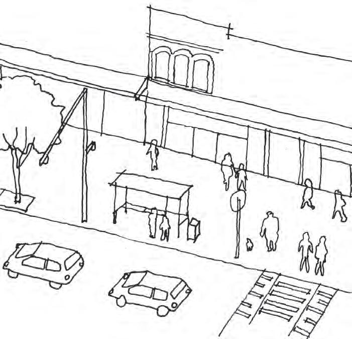
STREET SHOULD BE STRUCTURED TO MAXIMISE ACCESS AND AVOID CLUTTER
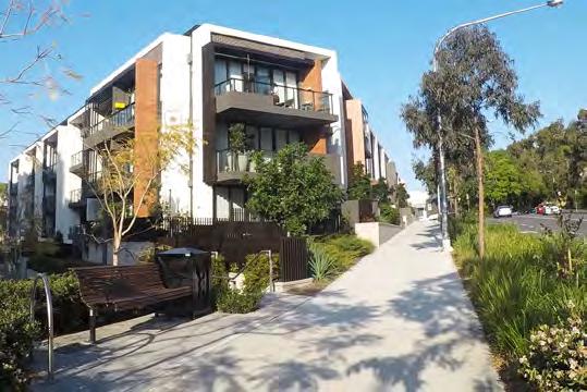
The Pedestrian Through Zone provides an accessible path of travel along the street, and as such must be clear of obstacles that inhibit universal access, be well-lit and functional in all weather conditions, and meet accessibility standards.
The Public Domain Furniture Zone occurs to the back-of-kerb and provides for the placement of public domain elements clear of pedestrian movement in the adjacent footpath and vehicle movement in the adjacent roadway. This zone is used to collocate street trees and other landscaping, streetlights, site furnishings, traffic and parking poles and equipment, utility poles, and other site furnishings. This zone is also used by people accessing parked vehicles.
CARRIAGEWAY ZONE
FOOTPATH ZONE
PUBLIC FURNITUREDOMAINZONE
BUILDINGS PEDESTRIAN THROUGH ZONE EXTENSION ZONE CARRIAGEWAY
The Parking Lane / Extension Zone refers to the kerbside parking lane where kerb extensions can provide for alternate uses of the parking lane where other performance requirements of the street necessitate this. Kerb extensions should be maximised to accommodate landscaping, bicycle lanes, tree planting, Water Sensitive Urban Design features, seating, street furniture and outdoor dining use.
The Carriageway refers to the area of the street where various forms of movement occur, such as bicycles, private motor vehicles, or public transport, in a one- or two-way arrangement.
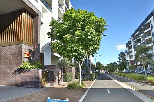
STREETS SHOULD BE SAFE FOR CYCLISTS OF ALL ABILITIES
All streets should be designed with cyclists in mind.
On regional and local cycle routes, this means dedicated cycling infrastructure in the form of separated cycleways or generously sized shared paths.
On local streets, it is still important to provide residents and local businesses with safe cycling access to their properties. A minimum width of 3.0m should be adopted for shared paths wherever possible, however this can be reduced, where unavoidable, to a minimum 2.5m wide.
UTILITIES NEED TO BE ACCOUNTED FOR EARLY IN THE DESIGN PROCESS
Overhead power lines should be undergrounded at every opportunity so as to not inhibit future tree canopy growth. However, the future location of undergrounded electricity conduits, and the resultant requirements for LV infrastructure on the ground, needs to be coordinated with the arrangement of public domain elements and provision of soil volume for street trees.
Tree root barriers and other utility protection methods should be installed along utilities, not around rootballs, so as to not inhibit tree root access to adjacent soil volumes for optimal tree growth.
 84Sydney Streets Design Code © City of Sydney Adopted 2013
PARRAMATTA ROAD SELECT PRECINCTS PUBLIC DOMAIN PLAN 13
Image source: Sydney Streets Code 2013, City of Sydney
HOMEBUSH NORTH PRECINCT
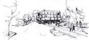
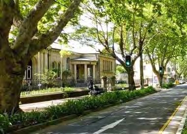
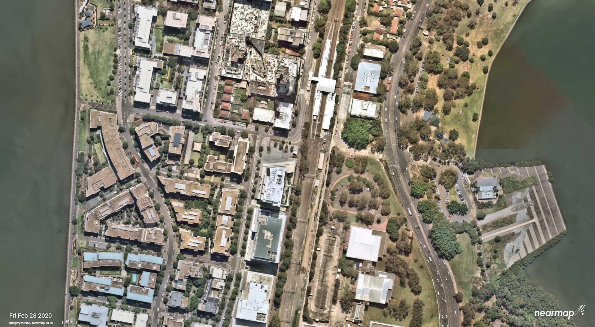
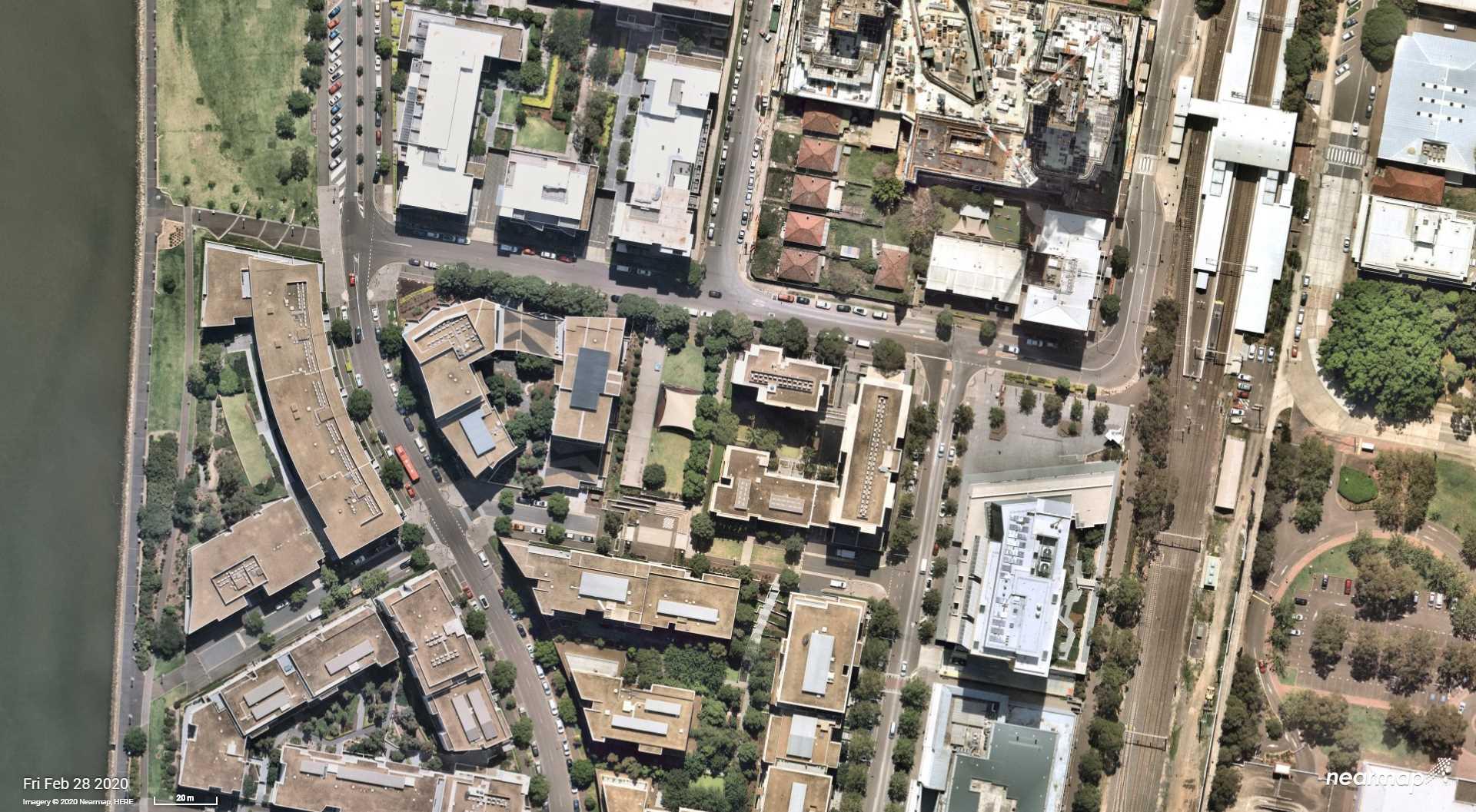
Homebush Precinct is strategically located between Sydney’s two main CBDs and near the junction of two major rail routes. This key location provides the opportunity to transform Homebush into a major high-density, mixed-use Precinct that draws together employment opportunities and housing, supported by an extensive open space network and efficient vehicular, active, and public transport linkages.
The activity hub of the Precinct will be located between Homebush Station, North Strathfield Station and Strathfield Station. This area will have a revitalised and active urban mixed-use character with both Parramatta Road and George Street forming main street spines that build on the character and attraction of the Bakehouse Quarter and the curved alignment of Parramatta Road. Taller residential buildings will mark the core of the Precinct near all three stations.
A dense network of streets will extend northward and westward from the activity hub through the Precinct to provide walkable medium-density residential neighbourhoods oriented to the open space network. The green corridor of Powell’s Creek will reach from the heart of the Precinct to Sydney Olympic Park and Homebush Bay beyond.
ELLATE EST, ODI AS QUE CORA ARUM FUGIAE EUM UT DOLORIBUSA VOLOREHENT.
14 PARRAMATTA ROAD SELECT PRECINCTS PUBLIC DOMAIN PLAN
- Parramatta Road Corridor Urban Transformation Strategy, UrbanGrowth, 2016
03
03 HOMEBUSH NORTH
The Homebush North Precinct is located between Sydney Olympic Park’s Bicentennial Park to the west and Concord Railway Station to the east. It forms the northernmost portion of the broader Homebush Precinct that extends from the Western Rail Line in its south, northwards along the Northern Rail Line and into Concord West.
The Homebush North Precinct will transform into an active and varied town centre, with a mixture of higher density housing and mixed uses, supported by a network of green streets in close proximity to the railway station.
The Public Domain Plan’s scope for this precinct includes:
–George Street
–Victoria Avenue
–King Street
–Station Avenue
–Station Square, a new open space at the eastern termination of Victoria Avenue adjacent the rail corridor
–Victoria Avenue Gates, a new open space at the western end of Victoria Avenue adjacent the existing Sydney Olympic Park entrance
800m PARRAMATTA ROAD SELECT PRECINCTS PUBLIC DOMAIN PLAN 15
400m 800m 400m
GREEN GRiD PROJECT: POWELLS CREEK AND MASON PARK, STRATHFiELD
TITLE HOMEBUSH NORTH PRECINCT ANALYSIS SCALE 300m NORTH PRECINCT BOUNDARY 400m / 800m CATCHMENT OPEN SPACE EDUCATION SYDNEY GREEN GRID PROJECT OPPORTUNITY CCB EXISTING AND POTENTIAL FUTURE BIKE ROUTES PRCUTS CYCLE ROUTE LOCAL R i DGE LOCAL RiDGE
GREEN GRiD PROJECT: SYDNEY HARBOUR FORESHORE AND PARRAMATTA RivER WALK
16 PARRAMATTA ROAD SELECT PRECINCTS PUBLIC DOMAIN PLAN
i N CONCEPT VICTORIA AVE VICTORIA AVE STATION AVE GEORGE ST HOMEBUSH BAY DRIVE QUEEN ST CONCORD ROAD KING ST STATION SQUARE CONCORD WEST RAILWAY STATION BICENTENNIAL PARK VICTORIA AVE GATES TITLE HOMEBUSH NORTH CONCEPT PLAN SCALE 100m NORTH
PUBL i C DOMA
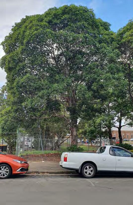
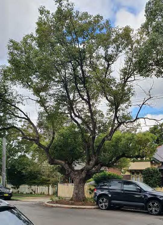
SIGNIFICANT TREE ASSESSMENT
A preliminary assessment of significant trees within the Homebush North Precinct was undertaken to record location, species, and size.
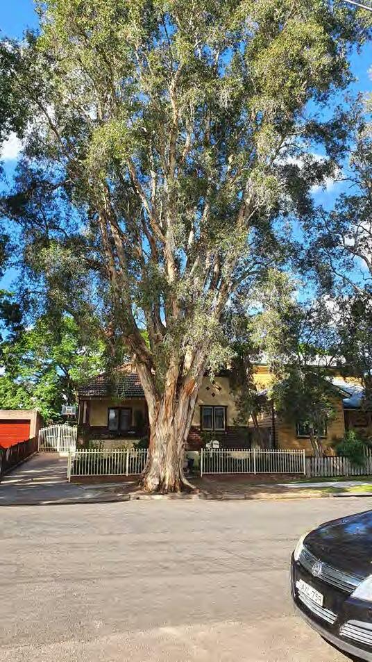
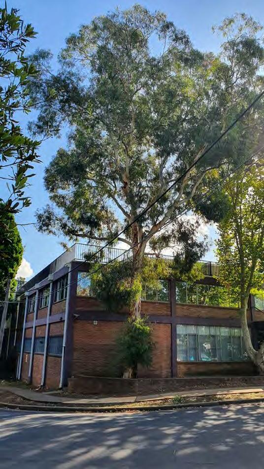
This allowed for a preliminary mapping of structure root zone (SRZ) and tree protection zone (TPZ), illustrated within the plan adjacent and where appropriate throughout the concept plans presented herein.
Further arboricultural assessment is required as detailed design and construction works progress.
01 02 03 04 05 06 07 08 09 10 11 12 13 14 15 16 17 18 19 20 21 22 23 24 25 26 27 28 29 30 31 32 33 34 35 36 37 38 39 40 41 42 43 44 45 46 4847 49-56 57 59 58 60 61 62 63 64
VICTORIA AVE STATION AVE GEORGE ST KING ST PRELiMiNARY TREE ASSESSMENT PLAN - HOMEBUSH NORTH
SiNGLE
WiTH FULL CANOPY LOCATED ON
STREET
MELALEUCA QUiNQUENERviA WiTH FULL CANOPY FORMiNG AvENUE PLANTiNG ALONG KiNG STREET PARRAMATTA ROAD SELECT PRECINCTS PUBLIC DOMAIN PLAN 17
LARGE
TRUNKED EUCALYPTUS
GEORGE
MATURE
1 Melaleuca quinquenervia Broad Leaved Paperbark N 12m S 4.9m30m N High
2 Eucalyptus spp. Rough barked gum N 15m S 4.9m30m N High
3 Melaleuca quinquenervia Broad Leaved Paperbark N 12m S 4.9m30m Y High
4 Melaleuca quinquenervia Broad Leaved Paperbark N 12m S 4.5m26.4m Y High
5 Melaleuca quinquenervia Broad Leaved Paperbark N 15m S 6m55.2m N High
6 Melaleuca quinquenervia Broad Leaved Paperbark N 15m S 5.8m45.6m N High
7 Melaleuca quinquenervia Broad Leaved Paperbark N 15m S 5.2m36m N High
8 Melaleuca quinquenervia Broad Leaved Paperbark N 12m S 5.2m36m Y High
9 Melaleuca quinquenervia Broad Leaved Paperbark N 12m S 5m28.8m N High
10 Melaleuca quinquenervia Broad Leaved Paperbark N 15m S 5.7mm43.2m N High
11 Melaleuca quinquenervia Broad Leaved Paperbark N 12m S 5m31.2m Y High
12 Melaleuca quinquenervia Broad Leaved Paperbark N 15m S 4.8m36m N High
13 Melaleuca quinquenervia Broad Leaved Paperbark N 15m S 4.4m36m N High
14 Melaleuca quinquenervia Broad Leaved Paperbark N 12m S 4m24m Y High
15 Melaleuca quinquenervia Broad Leaved Paperbark N 15m S 5.6m40.8m Y High
16 Melaleuca quinquenervia Broad Leaved Paperbark N 15m S 5.4m38.4m N High
17 Melaleuca quinquenervia Broad Leaved Paperbark N 15m S 5.4m38.4m N High
18 Jacaranda mimosifolia Jacaranda E 12m S 4.3m21.6m N High
19 Jacaranda mimosifolia Jacaranda E 12m S 4m21.6m N High
20 Triadica sebifera Chinese tallow E 7m S 3.2m10.8m N High
21 Triadica sebifera Chinese tallow E 7m S 3.2m10.8m N High
22 Melaleuca quinquenervia Broad Leaved Paperbark N 12m S 5.8m51.6m Y High
23 Melaleuca quinquenervia Broad Leaved Paperbark N 12m S 4.4m36m N High
24 Melaleuca quinquenervia Broad Leaved Paperbark N 15m S 5.5m49.2m Y High
25 Melaleuca quinquenervia Broad Leaved Paperbark N 12m S 6m52.8m N High
26 Melaleuca quinquenervia Broad Leaved Paperbark N 20m S 6m48m N High
27 Melaleuca quinquenervia Broad Leaved Paperbark N 15m S 6.2m54m N High
28 Melaleuca quinquenervia Broad Leaved Paperbark N 15m S 5.3m31.2m N High
29 Melaleuca quinquenervia Broad Leaved Paperbark N 15m S 5m28.8m N High
30 Corymbia maculata Spotted gum N 12m S 3.3m13.2m N High
31 Corymbia maculata Spotted gum N 15m S 3.5m14.4m N High
32 Corymbia maculata Spotted gum N 20m S 4m19.2m N High
33 Melaleuca quinquenervia Broad Leaved Paperbark N 15m S 6m52.8m N High
34 Triadica sebifera Chinese tallow E - M - Y Low
35 Triadica sebifera Chinese tallow E 9m S 3.2m9.6m NModerate
36 Melaleuca quinquenervia Broad Leaved Paperbark N 15m S 5m26.4m N High
37 Triadica sebifera Chinese tallow E 6m S 4.2m18m Y Low
38 Triadica sebifera Chinese tallow E 9m M 4.3m18m N High 39 Triadica sebifera Chinese tallow E 9m S 3.6m14.4m N High
40 Triadica sebifera Chinese tallow E 12m M 4.4m18m N High
41 Triadica sebifera Chinese tallow E 6m S 3.6m10.8m NModerate
42 Triadica sebifera Chinese tallow E 9m M 4.4m18m NModerate
43 Triadica sebifera Chinese tallow E 9m M 4.3m18m NModerate
44 Platanus × acerifolia London Plan tree E 15m S 5m28.8m N High
45 Eucalyptus spp. Smooth barked gum N 20m+ S 4.8m21.6m N High 46 Ficus rubiginosa Port Jackson Fig E 25m S 6.5m60m NVery High 47 Cypruss spp. Pine tree E 20m+ S 4.4m18m YModerate 48 Liquidamber styraciflua Liquid amber E 12m S 4.5m18m NModerate 49 Casuarina spp. Swamp Oak N 15m S 3.4m8.4m NModerate 50 Casuarina spp. Swamp Oak N 15m S 3.5m10.8m NModerate 51 Casuarina spp. Swamp Oak N 15m S 3.4m8.4m NModerate 52 Casuarina spp. Swamp Oak N 15m S 3.2m7.2m NModerate 53 Casuarina spp. Swamp Oak N 15m S 3.5m8.4m NModerate 54 Casuarina spp. Swamp Oak N 15m S 3.8m10.8m NModerate 55 Casuarina spp. Swamp Oak N 18m S 4.2m14.4m N High 56 Casuarina spp. Swamp Oak N 18m S 4.6m18m N High 57 Eucalyptus spp. Rough barked gum N 18m S 4.5m18m N High 58 Corymbia maculata Spotted gum N 8m S 3m7.2m N Low 59 Corymbia maculata Spotted gum N 18m S 3.5m14.4m N High 60 Corymbia maculata Spotted gum N 18m S 3.8m15.6m N High 61 Eucalyptus spp. Rough barked gum
Tree Number Botanical Name Common Name Native/Exotic/Pest Height (approx.) Single or Multi trunked SRZTPZ Canopy Prunned Significance
WEST PRECEINCT
MATURE MELALEUCA
WiTH
TO AvOiD OvERHEAD SERviCES LOCATED ON KiNG STREET
TRiADiCA SEBiFERA WiTH FULL CANOPY LOCATED ON viCTORiA AvENUE 18 PARRAMATTA ROAD SELECT PRECINCTS PUBLIC DOMAIN PLAN
N 20m S 4.8m27.6m N High 62 Casuarina spp. Swamp Oak N 15m S 3.8m13.2m N Low 63 Eucalyptus spp. Rough barked gum N 20m S 5m26.4m N High 64 Eucalyptus spp. Rough barked gum N 18m S 4.8m21.6m N High Victoria Avenue George Street CONCORD
King Street
QUiNQUENERviA
PRUNED CANOPY
MATURE
GEORGE & KING STREET SPINE
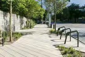
George Street and King Street will form the primary north-south public domain spine through this neighbourhood as it evolves from its current industrial development pattern to medium density residential developement and business park.
King Street will provide important walking and cycling connections between Concord West Station and Liberty Grove to the north, while George Street will provide the same connectivity south to the Bakehouse Quarter.
Key design features include:
1. Generous pedestrian footpaths, providing continuous universal access along both sides of the street.
2. A separated cycleway, protected with understorey and street tree planting in landscape garden beds, providing safe clearance to adjacent car parking and pedestrian footpaths.
3. Landscape setbacks (3m) on both sides of the street.
4. Continuous avenues of kerbside street trees on both sides of the street, supplemented with additional street tree planting between the cycleway and footpath, within kerb extensions, and in landscaped setbacks.
5. Landscape garden beds passively irrigated by adjoining hard surfaces to maximise stormwater infiltration, with intermediate stepping stones / crossing points for pedestrians to access parked vehicles.
6. Kerb extensions at intersections and other dedicated pedestrian crossings points, to provide traffic calming, improve visibility between pedestrians/cyclists and motorists, define on-street parking and provide opportunities for rain gardens and low level planting.
CONCEPT PLAN GEORGE & KiNG STREET SPiNE
iNSiTU CONCRETE PATH UNDERSTORY MASS PLANTiNG ASPHALT SEPARATED CYCLEWAY STENCiL CONCRETE RAiSED CROSSiNG 1:500 @ A3 PARRAMATTA ROAD SELECT PRECINCTS PUBLIC DOMAIN PLAN 19
TYPiCAL SECTiON - GEORGE & KiNG STREET SPiNE
Proposed Open Space Proposed Through Link Proposed Vehicle Link Proposed Cycle Way 1:2000 @A3
GENEROUS
MAXiMiSED SOiL vOLUMES
OPTiMAL
1 2 3 3 5 4 6 6 6 6 4 4 5 5 5 1
RAiSED PEDESTRiAN CROSSiNGS AT DESiRE LiNES FOR SAFE iNTERACTiONS BETWEEN PEDESTRiANS, CYCLiSTS & MOTORiSTS
PLANTiNG AREAS AND
FOR
TREEE GROWTH
VICTORIA AVENUE
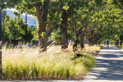
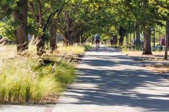
VICTORIA AVENUE
Victoria Avenue will form the primary east-west spine through Homebush North, and a key link between Concord West Station and Sydney Olympic Park.
Key design features include:
1. Generous pedestrian footpaths, providing continuous universal access along both sides of the street.
2. A separated cycleway providing cycling connectivity between the railway station and SOP, protected with understorey and street tree planting in landscape garden beds, providing safe clearance to adjacent car parking and pedestrian footpaths.
3. Kerb extensions and a pedestrian/cycle crossing near the Victoria Avenue Gates to SOP, to slow traffic and provide safe connections into SOP.
4. Landscape setbacks (3m) on both sides of the street.

5. Continuous avenues of kerbside street trees on both sides of the street, supplemented with additional street tree planting between the cycleway and footpath, within kerb extensions, and in landscaped setbacks.
6. Generous landscape garden beds passively irrigated by adjoining hard surfaces to maximise stormwater infiltration, with intermediate stepping stones / crossing points for pedestrians to access parked vehicles.
7. Retention of significant existing trees to maintain canopy cover and street character.
3.5m EXISTING VERGE 3.5m EXISTING VERGE 13m EXISTING KERB 20m EXISTING ROAD CORRIDOR 4.5m PROPOSED BUILDING SETBACK 29m TOTAL PROPOSED CORRIDOR 4.5m PROPOSED BUILDING SETBACK MEDIUM DENSITY RESIDENTIAL MEDIUM DENSITY RESIDENTIAL EXISTING PROPERTY BOUNDARY EXISTING PROPERTY BOUNDARY 1.8m FOOTPATH 1.8m FOOTPATH 2.5m TWO WAY CYCLEWAY 0.6m 1.3m PLANTING 1.4m PLANTING 2.1m PARKING LANE 2.1m PARKING LANE 3.2m TRAVEL LANE 3.2m TRAVEL LANE P ROPOSED SETBAC K PROPOSED SETBACK 1:100 @A3
TYPiCAL
iNSiTU CONCRETE PATH UNDERSTORY MASS PLANTiNG ASPHALT SEPARATED CYCLEWAY STENCiL CONCRETE RAiSED CROSSiNG 1:500 @ A3 20 PARRAMATTA ROAD SELECT PRECINCTS PUBLIC DOMAIN PLAN
SECTiON - viCTORiA AvENUE
Proposed Open Space Proposed Through Link Proposed Vehicle Link Proposed Cycle Way 1:2000 @A3
SEPARATED CYCLEWAY WiTH STREET TREES AND LANDSCAPE SETBACKS ARTiCULATED WiTH BOUNDARY TREATMENTS CONCEPT PLAN viCTORiA AvENUE 1 2 3 5 7 7 7 7 4 1 2 3 3 4 4 4 5 5 6 6 6
LANDSCAPE SETBACKS WiTH iNCiDENTAL OPPORTUNiTiES FOR DWELLiNG AND SOCiALiSiNG
STATION AVENUE SHARED ZONE
Station Avenue will provide the northern portion of the precinct with amenable local access for pedestrians, cyclists, motorists, and service vehicles.
While the street is currently a narrow, local access laneway and low traffic speed environment, it is without footpaths, tree planting or other amenities conducive to walking and cycling.
Redevelopment of the precinct will provide an opportunity for Station Avenue to become an intimate laneway that welcomes casual inhabitation of the street space by those that live along it.
Key design features include:
1. A pedestrianised road surface, with paving treatments and flush kerb environments that build on the ‘shareway’ concept presented within the Concord West Master Plan.
2. Dedicated pedestrian pathways abutting property boundaries on both sides of the street.
3. Understorey and street tree planting within landscape garden beds and rain gardens, to delineate the shared movement space from pedestrian paths.
4. A flush shared travel space that drains to adjacent rain gardens and passively irrigates landscape planting areas.
TREE LiNED STREET WiTH WiDE PLANTiNG
SHARED ZONE DELiNEATED WiTH PLANTiNG
STREET
CONCEPT PLAN STATiON AvENUE TYPiCAL SECTiON - STATiON AvENUE 1 2 3 3 1 2 2 3 1:100 @A3 STATION
1.7m VERGE 1.8m VERGE 1.25m FOOTPATH 6.5m EXISTING KERB 10m EXISTING ROAD CORRIDOR 4.5m PROPOSED BUILDING SETBACK 19m TOTAL PROPOSED CORRIDOR 4.5m PROPOSED BUILDING SETBACK MEDIUM DENSITY RESIDENTIAL MEDIUM DENSITY RESIDENTIAL 1m 1m 1.25m FOOTPATH 5.5m SHARED ZONE P ROPOSED SETBAC K PROPOSED SETBACK EXISTING PROPERTY BOUNDARY E XISTING PROPERTY BOUNDAR Y
NARROW
AND
TREES
AVENUE
SHARED
ZONE UNiT PAvERS
1:500 @ A3 PARRAMATTA ROAD SELECT PRECINCTS PUBLIC DOMAIN PLAN 21
UNDERSTORY MASS PLANTiNG
Proposed Open Space Proposed Through Link Proposed Vehicle Link Proposed Cycle Way 1:2000 @A3
KING STREET SHARED ZONE
The King Street shared zone adjacent Concord West Station will provide an amenable ‘slow zone’ that prioritises safe pedestrian and cyclist movement to and from the station.
Pedestrians, cyclists, and motorists will share a flush, slow speed environment, with parking and pick-up / drop-off bays defined by an avenue of street trees.
Key design features include:
1. A pedestrianised road surface, with paving treatments and flush kerb environments that clearly communicate the shared environment to all street users.
2. Understorey and street tree planting within landscape garden beds and rain gardens, to delineate the shared movement space and dedicated parking and pick-up / drop-off areas.
3. Porous paving areas and pavement grades that drain to adjacent rain gardens.
4. Retention of significant existing trees to maintain canopy cover and street character.
CONCEPT PLAN KiNG STREET SHARED ZONE 1 2 3 4 4 3 1 1 SHARED ZONE UNiT PAvERS UNDERSTORY MASS PLANTiNG TREE GRATE iN PAviNG 1:100 @A3 KING ST
1.7m VERGE 1.8m VERGE 1.9m FOOTPATH 6.5m EXISTING KERB 10m EXISTING ROAD CORRIDOR 3m PROPOSED SETBACK 17.5m TOTAL PROPOSED CORRIDOR 4.5m PROPOSED BUILDING SETBACK E XISTING PROPERTY BOUNDAR Y CONCORD WEST TRAIN STATION MEDIUM DENSITY RESIDENTIAL 4.9m FOOTPATH 6.1m SHARED ZONE 2.1m PARKING LANE 2.1m PARKING LANE PROPOSED SETBACK TYPiCAL SECTiON - KiNG STREET SHARED ZONE 1:500 @ A3 22 PARRAMATTA ROAD SELECT PRECINCTS PUBLIC DOMAIN PLAN
SHARE
FLUSH SHARED ZONE WiTH ‘GO SLOW’ PAviNG TREATMENTS PLANTiNG AND TURF DELiNEATE PEDESTRiAN AND vEHiCLE MOvEMENT SPACES Proposed Open Space Proposed Through Link Proposed Vehicle Link Proposed Cycle Way 1:2000 @A3
STATION SQUARE
Station Square will function as an entry plaza to the station precinct, activated by ground floor uses of the adjacent redevelopment site and providing a civic extension to the existing pocket park.
The square will deliver the Concord West Precinct Master Plan vision for the space:
“Station Square is envisioned as a small urban plaza that provides a meeting place and focal point for the neighbourhood near the station entry. The square will be activated through the redevelopment of 3 King Street (Site 3) into a mixed use building with a ground floor cafe or restaurant that can utilise the square for outdoor seating and dining. The square will offer a quite and shady environment where one can wait for the train, or to pick up / drop off friends and family on their way to / from work, school or the city.”
Concord West Precinct Master Plan, pg 16
Key design features include:
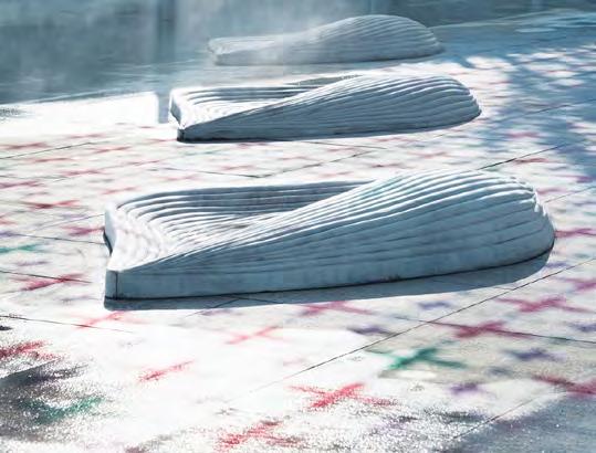
1. A paved plaza space with seating under shade tree planting for informal dwelling and meeting.
2. Ground floor activation and outdoor dining spaces along the northern side of the plaza.
3. Public art located within the plaza;
4. Screen planting along the eastern boundary of the plaza to provide visual and noise screening to the railway corridor.
5. A formal urban lawn / green edge to the southern portion of the plaza to provide inhabitable edges and a new interface with the existing pocket park.
FACiLiTiES & PROGRAMS
17m 55m 50m 35m 1 2 3 4 5 CONCEPT PLAN - STATiON SQUARE
1:500 @ A3 PARRAMATTA ROAD SELECT PRECINCTS PUBLIC DOMAIN PLAN 23
SCALE COMPARiSONS
THE PLAZA
PUBLiC
ART iNTEGRATED WiTHiN
TREES AND SEATiNG iN PAviNG
CAFE SEATiNG AND SPACE ACTivATiON
STATiON SQUARE
UNiON
Proposed Open Space Proposed Through Link Proposed Vehicle Link Proposed Cycle Way 1:2000 @A3
STATiON SQUARE CONCORD RAiLWAY PLAZA
SQUARE, RHODES
VICTORIA AVENUE GATES
Victoria Avenue Gates to Sydney Olympic Park provide a welcoming and human-scale interface between the Homebush North neighbourhood and parklands.
The revitalised Gates will play an important role in providing safe pedestrian and cyclist connections to SOP, while also maximising pedestrian/cycle north-south connectivity for the planned future shared path along the eastern side of Homebush Bay Drive.
Key design features include:
1. Kerb extensions and a dedicated pedestrian crossings point to provide traffic calming, improve visibility between pedestrians/cyclists and motorists, and provide opportunities for rain gardens and low level planting.
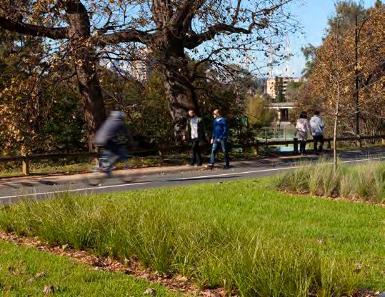
2. A north-south shared path.
3. Landscape works around the northern SOP gateway structure to improve its visual and physical integration within the street.
4. A dog off-leash area within residual green space surrounding the existing electricity substation site.
5. Fitness station.
6. Native shade trees and mass planting.
FACiLiTiES & PROGRAMS
26m 50m 60m 51m 1 2 3 4 5 SCALE
CONCEPT PLAN - viCTORiA AvENUE GATES 1 6 6 1:750 @ A3 24 PARRAMATTA ROAD SELECT PRECINCTS PUBLIC DOMAIN PLAN
COMPARiSONS
viCTORiA AvENUE GATES
viCTORiA AvENUE GATES
PEG PATERSON PARK, RHODES
HOSKiNS RESERvE, RHODES
SHARED PATH WiTH TURF BREAKOUT SPACES
Proposed Open Space Proposed Through Link Proposed Vehicle Link Proposed Cycle Way 1:2000 @A3
DOG OFF-LEASH AREA
SEATiNG AND NATivE PLANTiNG
BURWOOD PRECINCT 04
The Burwood-Concord Precinct will develop to reinforce it’s role as the major centre for the Corridor, allowing for a greater diversity of housing while maintaining the quality of buildings in the area.
The Precinct will also connect to existing open space areas, such as Burwood Park to the south, and Queen Elizabeth Park and St Luke’s Park to the north. The northern parks are part of the open-space network that leads to the Harbour.
Extending north from Burwood Station, the renewed streetscape will likely continue to Parramatta Road and form part of the regeneration of the Parramatta Road area.
Streets within the Precinct will include tall and medium-density residential buildings, and mixeduse buildings. Residential development will occur in adjacent streets. This development will be designed to sensitively respond to the character of heritage structures, open space, educational facilities and existing residential neighbourhoods.
Built form will generally taper down towards the north, transitioning to the adjoining lower-scale residential areas. The area north of Parramatta Road will be characterised by lower-scale development that will provide additional definition to street edges and open space areas.
The Precinct’s new open spaces and road connections will provide a denser network of walkable paths and reinforce links to surrounding open space areas. New streets are planned north of Parramatta Road, while new open space is included in the area south of Parramatta Road. These changes will increase connectivity and encourage pedestrian traffic.
- Parramatta Road Corridor Urban Transformation Strategy, UrbanGrowth, 2016
PARRAMATTA ROAD SELECT PRECINCTS PUBLIC DOMAIN PLAN 25
04 BURWOOD PRECINCT
The Burwood Precinct is located approximately 500m north of the existing Burwood Town Centre and 1km from Burwood railway station. The existing town centre accommodates a large Westfield shopping centre near Burwood Park, and a smaller shopping plaza south of the station. A wide range of high street retail shops and commercial office buildings are also located along Burwood Road.
The Burwood Precinct will complement the town centre and provide additional housing whilst maintaining the quality of buildings in the area.
The Public Domain Plan’s scope for this precinct includes:
–Parramatta Road, limited to the norther n side only
–Burwood Road
–Burton Street
–Broughton Street, as being the primary opportunity within this precinct for completing the ‘Burwood Green Link’ Green Grid project (prioritising the cycleway on the western side of the street and tree planting within future landscape setbacks on eastern side of street)
–Loftus Street
–Frankie Lane –Neichs Lane
–The proposed open space at 26-36 Burton Street
–The proposed open space in the block to the east of Burwood Road, fronting Burton Street
–New Shared Stree in the Eastern block of the precinct
GREEN GRID PROJECT: BURWOOD GREEN LINK: BURWOOD PARK TO HEN AND CHICKEN BAY
GREEN GRID PROJECT: ST LUKES PARK AND CONCORD OVAL GREEN LINK
GREEN GRID PROJECT: HEN AND CHICKEN BAY FORESHORE
ADDITIONAL GREEN GRID LINK
GREEN GRID PROJECT: PARRAMATTA ROAD URBAN RENEWAL CORRIDOR
400m 800m
26 PARRAMATTA ROAD SELECT PRECINCTS PUBLIC DOMAIN PLAN
TITLE BURWOOD PRECINCT ANALYSIS SCALE 300m NORTH PRECINCT BOUNDARY 400m / 800m CATCHMENT OPEN SPACE EDUCATION SYDNEY GREEN GRID PROJECT OPPORTUNITY CCB EXISTING AND POTENTIAL FUTURE BIKE ROUTES PRCUTS CYCLE ROUTE LOCAL R i DGE
PUBLIC DOMAIN CONCEPT
M PARRAMATTA ROAD SELECT PRECINCTS PUBLIC DOMAIN PLAN 27
BURTON ST BURWOOD RD BURWOOD RD LOFTUS ST BROUGHTON ST PARRAMATTA RD PARRAMATTA RD NEICHS LN FRANKIE LN BURTON STREET PLAZA CONCORD OVAL 26-36 BURTON STREET PARK TITLE BURWOOD CONCEPT PLAN SCALE 100m NORTH
PARRAMATTA ROAD PARRAMATTA ROAD BURWOOD RD TITLE BURWOOD PRECINCT TFNSW ROAD WIDENING SCALE 300m NORTH PRECINCT BOUNDARY LOT AMALGIMATION BOUNDARY 6M SETBACK VARIABLE TFNSW ROAD WIDENING PROPOSED BUILDINGS 6.6 DIMENSION FROM ROAD RESERVE TO PROPERTY BOUNDARY 595mm 610mm 622mm 526mm 612mm 582mm 800mm 1849mm TfNSW VARIABLE ROAD WIDTH DIMENSIONS TFNSW VARIABLE ROAD WIDTHS - BURWOOD 6.6 6.6 6.6 6.5 6.8 6.8 6.6 6.5 6.5 6.3 6.4 6.6 28 PARRAMATTA ROAD SELECT PRECINCTS PUBLIC DOMAIN PLAN
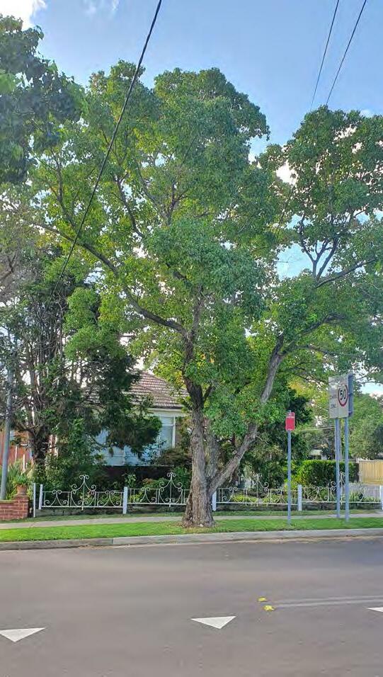
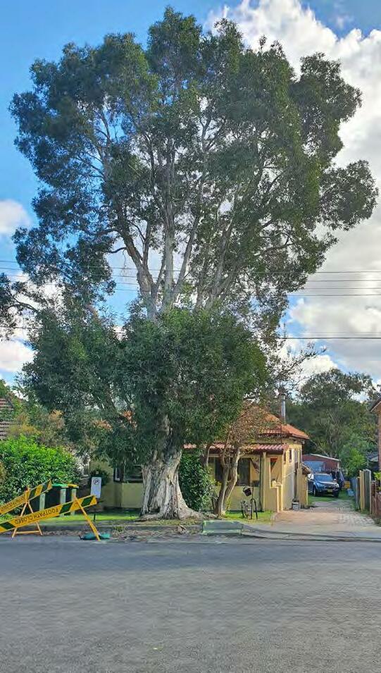
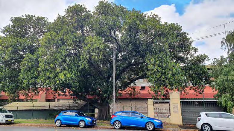
SIGNIFICANT TREE ASSESSMENT
A preliminary assessment of significant trees within the Burwood Precinct was undertaken to record location, species, and size.
This allowed for a preliminary mapping of structure root zone (SRZ) and tree protection zone (TPZ), illustrated within the plan adjacent and where appropriate throughout the concept plans presented herein.
Further arboricultural assessment is required as detailed design and construction works progress.
01 02 03 04 05 06 07 08 09 10 11 12 13 14 15 16 17 18 19 20 21 22 23 24 25 26 27 28 29 30 31 32 33 34 36 35 37 38 BURTON ST BURWOOD RD LOFTUS ST BROUGHTON ST PARRAMATTA RD NEICHS LN FRANKIE LN
LOPHOSTEMON CONFERTUS LOCATED ON LOFTUS STREET. PRELiMiNARY TREE ASSESSMENT PLAN - BURWOOD PARRAMATTA ROAD SELECT PRECINCTS PUBLIC DOMAIN PLAN 29
MATURE
Tree Number Botanical Name Common Name Native/Exotic/Pest Height (approx.) Single or Multi trunked SRZTPZ Canopy Prunned Significance
1 Triadica sebifera Chinese tallow E 7m M 4m12.36m N Low
2 Triadica sebifera Chinese tallow E 9m S 3.8m15.6m N Low
3 Triadica sebifera Chinese tallow E 9m S 3.8m15.6m N Low
4 Triadica sebifera Chinese tallow E 8m S 3.3m10.8m N Low
5 Cinnamomum camphor Camphor laurel P - - - Y Low
6 Cinnamomum camphor Camphor laurel P - - - Y Low
7 Lophostemon confertus Brush box N 7m S 4m18m Y Low
8 Triadica sebifera Chinese tallow E 7m S 3.7m13.2m Y Low
9 Triadica sebifera Chinese tallow E 7m M 4m16.8m N Low
10 Triadica sebifera Chinese tallow E - - - Y Low
11 Triadica sebifera Chinese tallow E - - - Y Low
12 Triadica sebifera Chinese tallow E - - - Y Low
13 Triadica sebifera Chinese tallow E - - - Y Low
14 Triadica sebifera Chinese tallow E 9m M 4.2m18m N Low
15 Triadica sebifera Chinese tallow E 7m S - Y Low
16 Triadica sebifera Chinese tallow E 9m M 5m25m N Low
17 Triadica sebifera Chinese tallow E 6m S - - Low
18 Triadica sebifera Chinese tallow E 6m S - - Low
19 Triadica sebifera Chinese tallow E 12m M 4.2m15.2m N Low
20 Triadica sebifera Chinese tallow E 8m M 3.8m11.9m N Low
21 Triadica sebifera Chinese tallow E 7m M 4.5m16.9m N Low
22 Eucalyptus spp. Gum Tree N 16m S 4.8m26.4m N High
23 Lophostemon confertus Brush box N 10m S 4.4m21.6m N High
24 Lophostemon confertus Brush box N 10m S 4.4m21.6m N High
25 Lophostemon confertus Brush box N 10m S 4.4m21.6m N High 26 Lophostemon confertus Brush box N 12m S 4.8m24m N High 27 Ulmus parvifolia Chinese Elm E 9m S 3.9m14.4m N High 28 Melaleuca quinquenervia Broad Leaved Paperbark N 12m S 5.4m36m Y High 29 Melaleuca quinquenervia Broad Leaved Paperbark N 9m S 5.4m36m Y High 30 Ulmus parvifolia Chinese Elm E 15m M 5m25.9m N High 31 Ulmus parvifolia Chinese Elm E
33 Livistona australis Cabbage Tree Palm N 30m a NVery High 34 Livistona australis Cabbage Tree Palm N 30m S NVery High 35 Livistona australis Cabbage Tree Palm N 30m S NVery High 36 Araucaria heterophylla Norfolk Island Pine E 20m S N High 37 Schinus molle Pepper Tree E 12m S N Low 38 Schinus molle Pepper Tree E 12m S N Low
15m M 5.2m26.4m N High 32 Ficus rubiginosa Port Jackson Fig E 25m S 6.5m60m NVery High
Parramatta Road Loftus
BURWOOD PRECEINCT Burton Street
Street
MATURE FiCUS RUBiGiNOSA LOCATED ADJACENT LOFTUS STREET.
30 PARRAMATTA ROAD SELECT PRECINCTS PUBLIC DOMAIN PLAN
HEAviLY PRUNED CiNNAMOMUM CAMPHORA LOCATED ON BURTON STREET.
ROAD
PARRAMATTA ROAD (BURWOOD)
Parramatta Road within the Burwood Precinct will continue to play a signficant role as an east-west arterial for wider metropolitan Sydney.
The corridor will undergo signficant transformation in the future, evolving into a vibrant and productive economic and employment corridor, and catering for a greater diversity of travel modes.
The introduction of high capacity transit will provide an important interchange at the future Burwood Metro Station, while an increase in corridor width will allow for a signficant east-west pedestrian and cycle connection through the precinct.
Key design features include:
1. A large landscape setback (6m) along the norther n side of the street.
2. A shared path setback from the kerb and bordered by understorey planting to provide a sense of separation between the adjacent roadway and footpath areas.
3. Street tree planting set back from the road edge to avoid conflicts within clear zone requirements.
4. A continuous area of accessible public domain along the edge of the corridor abutting adajcent buildings, suitable for activation by adjoining ground floor uses if appropriate.
5. Flush pedestrian crossovers at laneway entries to prioritise pedestrian and cyclist movement along Parramatta Road.
3m SHARED PATH EXISTING VERGE FUTURE PUBLIC DOMAIN MIXED USE EXISTING PROPERTY BOUNDARY 1m PLANTING 6m PROPOSED SETBACK N EW PROPERTY BOUNDAR Y EXISTING PROPERTY BOUNDARY VARIABLE WIDTH LAND DEDICATION 6m LAND DEDICATION T fNSW VARIABLE ROAD WIDENIN G FUTURE VERGE PARRAMATTA ROAD 3m EXISTING VERGE 1:100 @A3 PARRAMATTA
WiDE PLANTiNG ADJACENT TO PUBLiC DOMAiN TYPiCAL SECTiON - PARRAMATTA
(BURWOOD) CONCEPT PLAN PARRAMATTA ROAD (BURWOOD) 2 3 5 2 3 4 4 1 1 iNSiTU CONCRETE PATH UNDERSTORY MASS PLANTiNG PUBLiC DOMAiN AWNiNG 1:500 @ A3 PARRAMATTA ROAD SELECT PRECINCTS PUBLIC DOMAIN PLAN 31
ROAD
Proposed Open Space Proposed Through Link Proposed Vehicle Link Proposed Cycle Way 1:1500 @A3
LANDSCAPE SETBACKS WiTH WiDE SHAREWAY
BURWOOD ROAD
The section of Burwood Road north of Parramatta Road will form the primary north-south thoroughfare through the northern portion of the Burwood precinct and the entry point south into Burwood.
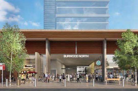
The future Sydney Metro West station will front the corner of Burwood Road and Parramatta Road, providing a signficant source of, and destination for, pedestrian, cyclist and public transport movement.
Key design features include:
1. Maximised clear pedestrian footpath widths to provide for ground floor activation and spill-out.
2. A continuous avenue of kerbside street trees on both sides of the street, subject to coordination with utilities during future design stages.
3. Kerb extensions at its intersection with Burton St to provide traffic calming, improve visibility between pedestrians/cyclists and motorists, define on-street parking and provide opportunities for rain gardens and low level planting.
4. A kerbside parking/travel lane to allow for a combination of on-peak travel, off-peak parking, and transport interchange at the Metro station.
5. Bus pull-in lane
6. Burton square
3.5m PARKING TRAVEL LANE 3.5m PARKING TRAVEL LANE MIXED USE MIXED USE 13.4m EXISTING KERB 3.25m EXISTING VERGE 3.25m EXISTING VERGE 20m TOTAL CORRIDOR 3.2m TRAVEL LANE 3.2m TRAVEL LANE E XISTING PROPERTY BOUNDAR Y EXISTING PROPERTY BOUNDARY 5m PROPOSED SETBACK 4.5m PROPOSED ENHANCE PROPOSED PROPERTY BOUNDARY PROPOSED PROPERTY BOUNDARY 1:100 @A3 BURWOOD
OPPORTUNiTY FOR TREES iN PAviNG THE PROPOSED BURWOOD NORTH METRO STATiON CONCEPT PLAN BURWOOD ROAD TYPiCAL SECTiON - BURWOOD ROAD 2 4 1 1 2 3 3 4 iNSiTU CONCRETE PATH PUBLiC DOMAiN AWNiNG UNDERSTORY MASS PLANTiNG 1:500 @ A3 TREE GRATE iN PAviNG 5 6 32 PARRAMATTA ROAD SELECT PRECINCTS PUBLIC DOMAIN PLAN
ROAD
Proposed Open Space Proposed Through Link Proposed Vehicle Link Proposed Cycle Way 1:1500 @A3
BURTON STREET
BURTON STREET
Burton Street will form the main east-west neighbourhood street for the Burwood North precinct, with front doors and landscaped edges fronting a green, tree-lined street.
Key design features include:
1. A pedestrian footpath providing universal access along the southern side of the street.
2. A shared path separated by wide landscape planting areas, providing local cycle access along the northern side of the street to people’s front doors, parks and plazas, and visitor bicycle parking.
3. A landscape setback (3m) along the souther n side of the street.
4. Generous landscape garden beds passively irrigated by adjoining hard surfaces to maximise stormwater infiltration.
5. Kerb extensions at intersections and other dedicated pedestrian crossings points, to provide traffic calming, improve visibility between pedestrians/cyclists and motorists, define on-street parking and provide opportunities for rain gardens and low level planting.
6. Retention of significant existing trees to maintain canopy cover and street character.
1:100 @A3
1.8m FOOTPATH 2.3m PARKING LANE 2.3m PARKING LANE 1.7m PLANTING 3.5m SHARED PATH 1m PLANTING MEDIUM DENSITY RESIDENTIAL 3.75m EXISTING VERGE 12.5m EXISTING KERB 20.5m EXISTING ROAD CORRIDOR 4.5m PROPOSED SETBACK 24.5m TOTAL PROPOSED CORRIDOR EXISTING PROPERTY BOUNDARY PROPOSED SETBACK 3.2m TRAVEL LANE 3.2m TRAVEL LANE EXISTING PROPERTY BOUNDARY 1m PLANTING GENEROUS LANDSCAPE PLANTiNG ADJACENT FOOTPATHS AND SHARED PATHS WiDE SHARED PATH WiTH ADJACENT PLANTiNG TYPiCAL SECTiON - BURTON STREET CONCEPT PLAN BURTON STREET 2 4 1 1 2 4 6 6 6 6 3 5 5 5 5
CONCRETE PATH UNDERSTORY MASS PLANTiNG 1:500 @ A3 3 PARRAMATTA ROAD SELECT PRECINCTS PUBLIC DOMAIN PLAN 33
iNSiTU
Proposed Open Space Proposed Through Link Proposed Vehicle Link Proposed Cycle Way 1:1500 @A3
BROUGHTON STREET
BROUGHTON STREET
Broughton Street contributes to the ‘Burwood Green Link’ Green Grid project, linking Goddard Park and Parramatta Road, with the inclusion of a dedicated cycling facility and street trees where space allows.
It will be primarily residential, with potential ground floor activation spilling north into Broughton Street from Parramatta Road.
The street will form a secondary north-south spine within the Burwood precinct and a critical part of the regional cycling network. The location of the existing footbridge over Parramatta Road provides a significant opportunity for regional cycling connections along Broughton Street.
Key design features include:
1. Generous pedestrian footpaths, providing continuous universal access integrating with areas of ground floor retail activation on the eastern side of the street.
2. Council’s adopted Broughton Street shared path / cycleway design on the western side of the street.
3. A setback of 3m on the easter n side of the street, providing activated retail in the southern portion of the street and landscape residential interfaces in the northern portion.
4. Street tree planting on the eastern side of the street and within kerb extensions and in landscaped setbacks.
5. Generous landscape garden beds passively irrigated by adjoining hard surfaces to maximise stormwater infiltration.
PLANTING 2.3m PARKING LANE MIXED USE 2.5m SHARED PATH 3.75m EXISTING VERGE 12.5m EXISTING KERB 20.5m EXISTING ROAD CORRIDOR 3m PROPOSED SETBACK 23m TOTAL PROPOSED CORRIDOR EXISTING PROPERTY BOUNDARY E XISTING PROPERTY BOUNDAR Y PROPOSED SETBACK 3.2m TRAVEL LANE 3.2m TRAVEL LANE 3.2m TRAVEL LANE 1:100 @A3
TREES iN WiDE AREAS OF PLANTiNG TYPiCAL SECTiON - BROUGHTON STREET CONCEPT PLAN BROUGHTON STREET 1 1 2 2 4 5 iNSiTU CONCRETE PATH UNDERSTORY MASS PLANTiNG ASPHALT SEPARATED CYCLEWAY PUBLiC DOMAiN AWNiNG 1:500 @ A3 34 PARRAMATTA ROAD SELECT PRECINCTS PUBLIC DOMAIN PLAN
Proposed Open Space Proposed Through Link Proposed Vehicle Link Proposed Cycle Way 1:1500 @A3
STREET
LOFTUS STREET
Loftus Street will provide a generously wide streetscape oriented towards its residential neighbourhood setting, adjacent the regional open space of Concord Oval.
Key design features include:
1. Generous pedestrian footpaths, providing continuous universal access along both sides of the street.
2. A shared path separated by wide landscape planting areas, providing local cycle access along the northern side of the street to people’s front doors, parks and plazas, and visitor bicycle parking.
3. A landscape setback (3m) on the wester n side of the street.
4. Continuous avenues of kerbside street trees on both sides of the street, supplemented with additional street tree planting within kerb extensions, and in the landscaped setback.
5. Generous landscape garden beds passively irrigated by adjoining hard surfaces to maximise stormwater infiltration.
6. Kerb extensions at intersections and other dedicated pedestrian crossings points, to provide traffic calming, improve visibility between pedestrians/cyclists and motorists, define on-street parking and provide opportunities for rain gardens and low level planting.
7. Retention of significant existing trees to maintain canopy cover and street character.
8. Existing substation retained.
25.5m TOTAL PROPOSED CORRIDOR 2m PLANTING 2.3m PARKING LANE 2.3m PARKING LANE MIXED USE OR MEDIUM DENSITY RESIDENTIAL 2m FOOTPATH 3.5m SHARED PATH 4m EXISTING VERGE 4m EXISTING VERGE 13m EXISTING KERB 21m EXISTING ROAD CORRIDOR 4.5m PROPOSED SETBACK PROPOSED SETBACK EXISTING PROPERTY BOUNDARY 3.2m TRAVEL LANE 3.2m TRAVEL LANE EXISTING PROPERTY BOUNDARY 2.5m PLANTING 1:100 @A3 LOFTUS
WiDE SHAREWAY WiTH ADJACENT PLANTiNG TYPiCAL SECTiON - LOFTUS STREET CONCEPT PLAN LOFTUS STREET 1 2 1 2 3 4 4 8 4 5 5 6 7 6 6 iNSiTU CONCRETE PATH UNDERSTORY MASS PLANTiNG 1:500 @ A3 PARRAMATTA ROAD SELECT PRECINCTS PUBLIC DOMAIN PLAN 35
Proposed Open Space Proposed Through Link Proposed Vehicle Link Proposed Cycle Way 1:1500 @A3
LANE
FRANKIE LANE & NEICHS LANE
Frankie Lane and Neichs Lane are proposed to be shared slow zones providing safe thoroughfare for pedestrians and cyclsts in addition to service access to future development sites.
Key design features include:
1. A flush paved carriageway area to clearly communicate go-slow shared zones suitable for mixed pedestrian, cyclist, and vehicular traffic.
2. Footpath crossovers at laneway entries to prioritise pedestrian movement along adjacent streets.
3. Permeable paving adopted where possible to maximise stormwater infiltration.
4. Opportunities for green walls and trellis planting along property boundaries to improve amenity and cooling.
3.5m TRAVEL LANE MIXED USE MIXED USE 1m VERGE 4m EXISTING KERB 6m TOTAL CORRIDOR 1m VERGE 1:100 @A3
GREEN WALLS AND TRELLiSES PROviDE GREENERY iN CONTRAiNED SPACES PUBLiC ART CAN BRiNG LiFE AND COLOUR TO OTHERWiSE UNiNviTiNG LANEWAYS TYPiCAL SECTiON - NEiCHS LANE CONCEPT PLAN - NEiCHS LANE 2 2 3 3 3 4 4 2 1 1 1 4 4 4 4 iNSiTU CONCRETE PATH PUBLiC DOMAiN AWNiNG 1:500 @ A3 36 PARRAMATTA ROAD SELECT PRECINCTS PUBLIC DOMAIN PLAN
FRANKIE
Proposed Open Space Proposed Through Link Proposed Vehicle Link Proposed Cycle Way 1:1500 @A3
SHARED STREET
NEW SHARED ZONE STREET
This new shared zone will form important connections through the Burwood precinct. It also provides rear access to Burton Street Plaza.
Key design features include:
1. Creation of a shared zone, incorporating a pedestrianised road surface, with paving treatments and flush kerb environments that clearly communicate the shared environment to all street users.
2. Retention of significant existing trees to maintain canopy cover and street character.
3. A lining of trees along its length to formalise the link.
4. The pedestrian link to Parramatta Road will use bollards for safety.
5. Opening to Burton Street Plaza.
1:100 @A3 NEW
EXISTING PROPERTY BOUNDARY 3m TRAVEL LANE 2m FOOTPATH 16.5m TOTAL PROPOSED CORRIDOR 12m ROAD CORRIDOR 1m PLANTING 3m TRAVEL LANE 1m PLANTING 4.5m PROPOSED SETBACK 2m FOOTPATH GENEROUS LANDSCAPE PLANTiNG ADJACENT FOOTPATHS AND SHARED PATHS WiDE SHARED PATH WiTH ADJACENT PLANTiNG TYPiCAL SECTiON CONCEPT PLAN NEW SHARED ZONE 2 4 1 1 2 3 5 4 iNSiTU CONCRETE PATH UNDERSTORY MASS PLANTiNG 1:500 @ A3 Burton Street Plaza Pedestrian Link to Parramatta Road Neichs Lane TREE GRATE iN PAviNG 3 PARRAMATTA ROAD SELECT PRECINCTS PUBLIC DOMAIN PLAN 37
Proposed Open Space Proposed Through Link Proposed Vehicle Link Proposed Cycle Way 1:1500 @A3
This park will provide for the daily routines of the Burwood North community, functioning as a local meeting place for residents with neighbourhood oriented activities and programs.
Key design features include:
1. Ground floor activation and outdoor dining spaces along activated edges of the space.
2. An unprogrammed breakout turf area suitable for individual relaxation or group gatherings.
3. A through-site link to Parramatta Road to improve precinct permeability and accessibility for pedestrians and cyclists.
4. Tree and understorey planting with stepping stones for through-access.
5. A neighbourhood-scale local playground.
26-36 BURTON STREET PARK FACiLiTiES
1 3 ACTivATED RETAiL EDGES 1:500 @ A3 CONCEPT PLAN - 26-36 BURTON STREET PARK 12m 38 PARRAMATTA ROAD SELECT PRECINCTS PUBLIC DOMAIN PLAN
PROGRAMS
&
50m 45m 40m 40m SCALE COMPARiSONS 26-36 BURTON STREET PARK 26-36 BURTON STREET PARK HOSKiNS RESERvE, RHODES RUBY GRANT PARK, GREEN SQUARE Proposed Open Space Proposed Through Link Proposed Vehicle Link Proposed Cycle Way 1:1500 @A3
BURTON STREET PLAZA
The new plaza at Burton Street will provide the new civic heart of the evolving Burwood North precinct, providing town centre activation in close proximity to the Metro station.
The park will likely function as a thoroughfare for customers walking to/from the future Burwood North Metro Station, although integration with the Metro project is ongoing and as yet undetermined.
Key design features include:
1. Gr along activated edges of a paved town centre square.
2. A formal br and occupiable seating edges for incidental seating or group gatherings.
3. A local meeting place fr focal point of the plaza for wayfinding and gathering, potentially incorporating interactive public art elements that can be programmed to provide for different use patterns of the plaza.
4. A formal gr public seating, to provide for informal gathering and people watching.
4
PLAN
1:500 @ A3 39
ACTivATED THROUGH-SiTE LiNK CONCEPT
- BURTON STREET PLAZA
116m 112m 61m 48m SCALE COMPARiSONS BURTON STREET PLAZA BURTON STREET PLAZA ONE CENTRAL PARK, CHiPPENDALE CENTENARY SQUARE, PARRAMATTA Proposed Open Space Proposed Through Link Proposed Vehicle Link Proposed Cycle Way 1:1500 @A3
FAC
KINGS BAY PRECINCT 05
Kings Bay is envisaged as a new residential urban village with a Parramatta Road address. It will have a dense network of streets and an identity built on its proximity to Sydney Harbour.
Spencer Street will form the basis of a new and compact local centre − an east-west axis for local shops and services, and a new address for medium and high-density residential development. Taller residential buildings will mark the centre of the Precinct at the corner of Parramatta Road, William Street and Spencer Street. The scale of development will gradually decrease towards adjacent residential areas and Rosebank College.
A new green corridor will be created along William Street to reinforce connectivity to Barnwell Park Golf Course and the foreshore, while providing a green marker along Parramatta Road at the centre of the Precinct. Other new features include a series of active transport connections across blocks, and the extension of Spencer Street to the east and west.
40 PARRAMATTA ROAD SELECT PRECINCTS PUBLIC DOMAIN PLAN
- Parramatta Road Corridor Urban Transformation Strategy, UrbanGrowth, 2016
05 KINGS BAY PRECINCT
The Kings Bay Precinct is located between the established activity centres of Five Dock and Burwood, located approximately 1km to the east and west respectively.
The precinct will evolve from a low scale industrial precinct into a new mixed use neighbourhood, anchored by a small local centre and offering a range of housing choices.
The Public Domain Plan’s scope for this precinct includes:
–Parramatta Road, limited to the norther n side only –Queens Road
–Spencer Street, including new extensions of the street east and west to improve precinct permeability
–W illiam Street, a natural low point within the local landscape and WSUD opportunity
–Regatta Road
–Harris Road, a significant north-south movement corridor
–Walker Street, running roughly along a local ridge line
–Regatta Road Park
–Spencer Street Plaza
–W illiam Street Park
–Kings Bay East Park
400m 800m
PARRAMATTA ROAD SELECT PRECINCTS PUBLIC DOMAIN PLAN 41
LOCAL RiDGE LOCALRiDGE
GREEN GRiD PROJECT: PARRAMATTA ROAD URBAN RENEWAL CORRiDOR
GREEN GRiD PROJECT: ST LUKES PARK AND CONCORD OvAL GREEN LiNK
ADDiTiONAL GREEN GRiD LiNK
TITLE KINGS BAY PRECINCT ANALYSIS SCALE 300m NORTH PRECINCT BOUNDARY 400m / 800m CATCHMENT OPEN SPACE EDUCATION SYDNEY GREEN GRID PROJECT OPPORTUNITY CCB EXISTING AND POTENTIAL FUTURE BIKE ROUTES PRCUTS CYCLE ROUTE
GREEN GRiD PROJECT: HEN AND CHiCKEN BAY FORESHORE
WiLLiAM ST NATURAL LOW POiNT iN LOCAL LANDFORM
WILLIAM STREET SPENCER STREET QUEENS ROAD REGATTA ROAD KINGS ROAD WALKER STREET SPENCER STREET EXTENSION (15m) PARRAMATTA ROAD COURLAND STREET QUEENS RD SPENCER ST SPENCER ST EAST SPENCER ST WEST REGATTA RD PARRAMATTA RD KINGS RD WALKER ST WILLIAM ST HARRIS RD REGATTA ROAD PARK SPENCER STREET PLAZA WILLIAM STREET PARK KINGS BAY EAST PARK ROSEBANK COLLEGE 42 PARRAMATTA ROAD SELECT PRECINCTS PUBLIC DOMAIN PLAN PUBLIC DOMAIN CONCEPT TITLE KINGS BAY CONCEPT PLAN SCALE 100m NORTH
WILLIAM STREET SPENCER STREET QUEENS ROAD REGATTA ROAD WALKER STREET SPENCER STREET EXTENSION (15m) PARRAMATTA ROAD SPENCER STREET QUEENS ROAD KINGS ROAD SPENCER STREET EXTENSION (15m) PARRAMATTA ROAD PARRAMATTA ROAD PARRAMATTA ROAD REGATA RD WALKER ST WILLIAM ST 6.4 6.4 6.5 6.3 6.7 7.6 6.9 6.9 6.9 6.9 7.1 6.2 PARRAMATTA ROAD SELECT PRECINCTS PUBLIC DOMAIN PLAN 43 TITLE KINGS BAY PRECINCT TFNSW ROAD WIDENING SCALE 300m NORTH PRECINCT BOUNDARY LOT AMALGIMATION BOUNDARY 6M SETBACK VARIABLE TFNSW ROAD WIDENING PROPOSED BUILDINGS 6.6 DIMENSION FROM ROAD RESERVE TO PROPERTY BOUNDARY 300mm 295mm 500mm 120mm 1100mm 900mm TfNSW VARIABLE ROAD WIDTH DIMENSIONS TFNSW VARIABLE ROAD WIDTHS - KINGS BAY EAST
WILLIAM STREET SPENCER STREET QUEENS ROAD ROAD KINGS ROAD SPENCER STREET EXTENSION (15m) PARRAMATTA ROAD COURLAND STREET PARRAMATTA ROAD PARRAMATTA ROAD ROSEBANK COLLEGE WILLIAM ST HARRIS RD 6.7 7.7 7.6 8.0 6.0 6.4 7.4 6.9 44 PARRAMATTA ROAD SELECT PRECINCTS PUBLIC DOMAIN PLAN TITLE KINGS BAY PRECINCT TFNSW ROAD WIDENING SCALE 300m NORTH PRECINCT BOUNDARY LOT AMALGIMATION BOUNDARY 6M SETBACK VARIABLE TFNSW ROAD WIDENING PROPOSED BUILDINGS 6.6 DIMENSION FROM ROAD RESERVE TO PROPERTY BOUNDARY 2000mm 1600mm 1600mm 1100mm 1900mm TfNSW VARIABLE ROAD WIDTH DIMENSIONS TFNSW VARIABLE ROAD WIDTHS - KINGS BAY WEST
SIGNIFICANT TREE ASSESSMENT
A preliminary assessment of significant trees within the Kings Bay Precinct was undertaken to record location, species, and size.
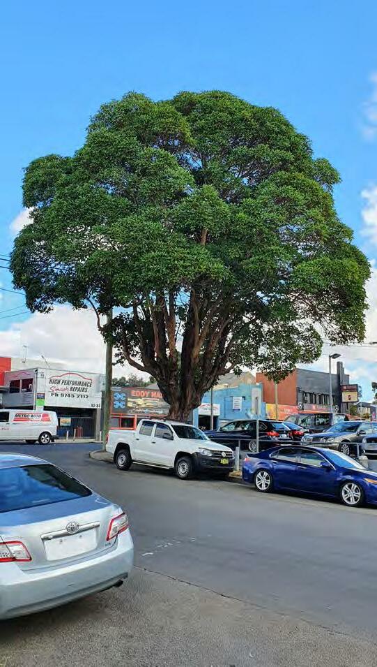
This allowed for a preliminary mapping of structure root zone (SRZ) and tree protection zone (TPZ), illustrated within the plan adjacent and where appropriate throughout the concept plans presented herein.
Further arboricultural assessment is required as detailed design and construction works progress.
01 02 04 03 05 06 07 08 09 10 11 12 13 14 15 16 17 18 19 20 21 22 23 24 25 26 27 28 29 30 31 32 33 34 35 36 37-46 47 48 49 50 51 53 52
QUEENS RD SPENCER ST REGATTA RD KINGS RD WALKER ST WILLIAM ST HARRIS RD
PRELiMiNARY
KiNGS BAY PARRAMATTA ROAD SELECT PRECINCTS PUBLIC DOMAIN PLAN 45
MATURE LOPHOSTEMON CONFERTUS LOCATED AT THE CORNER OF PARRAMATTA ROAD & REGATTA ROAD
TREE ASSESSMENT PLAN -
Tree Number Botanical Name Common Name Native/Exotic/Pest Height (approx.) Single or Multi trunked SRZTPZ Canopy Prunned Significance
1 Ficus microcarpa var. hillii Hills Weeping Fig N 20m+ S 6.5m60m NVery High
2 Ficus microcarpa var. hillii Hills Weeping Fig N 20m+ S 6.5m60m NVery High
3 Ficus microcarpa var. hillii Hills Weeping Fig N 20m+ S 6.5m50.4m NVery High
4 Ficus microcarpa var. hillii Hills Weeping Fig N 20m+ S 6.5m54m NVery High
5 Ficus microcarpa var. hillii Hills Weeping Fig N 20m+ S 6.5m48m NVery High
6 Ficus microcarpa var. hillii Hills Weeping Fig N 20m+ S 6.5m60m NVery High
7 Ficus microcarpa var. hillii Hills Weeping Fig N 20m+ S 6.5m60m NVery High
8 Ficus microcarpa var. hillii Hills Weeping Fig N 20m+ S 6.5m54m NVery High
9 Ficus microcarpa var. hillii Hills Weeping Fig N 20m+ S 6.5m60m NVery High
10 Ficus microcarpa var. hillii Hills Weeping Fig N 20m+ S 6.5m48m NVery High
11 Ficus microcarpa var. hillii Hills Weeping Fig N 20m+ S 6.5m60m NVery High
12 Corymbia maculata Spotted gum N 15m S 3.5m12m N High
13 Eucalyptus spp. Rough barked gum N 20m+ S 4m16.8m N High
14 Eucalyptus spp. Rough barked gum N 15m S 3.7m14.4m N High
15 Eucalyptus spp. Rough barked gum N 18m S 3.9m15.6m N High
16 Corymbia maculata Spotted gum N 18m M 5.2m31.9m N High
17 Cinnamomum camphor Camphor laurel P - - - Y Low
18 Cinnamomum camphor Camphor laurel P - - - Y Low
19 Cinnamomum camphor Camphor laurel P - - - Y Low
20 Eucalyptus spp. Rough barked gum N 15m S 4.2m19.2m N High
21 Eucalyptus spp. Rough barked gum N 15m S 4.2m19.2m N High
22 Lophostemon confertus Brush box N 12m S 4.8m24m Y High
23 Lophostemon confertus Brush box N 18m S 5.6m36m Y High
24 Corymbia maculata Spotted gum N 18m S 5m28.8m N High
25 Eucalyptus spp. Smooth Barker Gum N 16m S 3.5m10.8m NModerate
26 Casuarina spp. Swamp Oak N 16m S 3.6m13.2m N Low
27 Casuarina spp. Swamp Oak N 20m+ S 5m27.6m NModerate
28 Casuarina spp. Swamp Oak N 15m S 3.4m9.6m N Low
29 Corymbia maculata Spotted gum N 20m+ S 5m25.2m N High
30 Corymbia maculata Spotted gum N 18m S 5.3m30m N High
31 Corymbia maculata Spotted gum N 15m S 3.7m14.4m N High 32 Eucalyptus spp. Rough barked gum N 15m S 4.8m24m N High 33 Eucalyptus spp. Rough barked gum N 12m M 5.4m34m N High
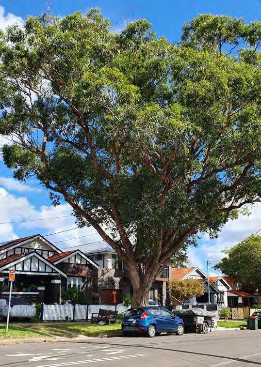
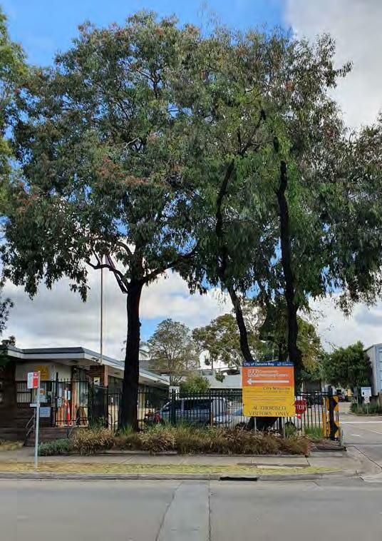
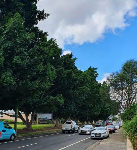
34 Melaleuca quinquenervia Broad Leaved Paperbark N 12m S 5.5m34.8m N High 35 Melaleuca quinquenervia Broad Leaved Paperbark N 15m M 6.5m60m N High
36 Jacaranda mimosifolia Jacaranda E 12m S 3.6m9.6m N Low 37 Casuarina spp. Swamp Oak N 12m S 2.8m8.4m N Low 38 Casuarina spp. Swamp Oak N 12m S 2.8m8.4m N Low 39 Casuarina spp. Swamp Oak N 12m S 2.8m8.4m N Low 40 Casuarina spp. Swamp Oak N 12m S 2.8m8.4m N Low 41 Casuarina spp. Swamp Oak N 12m S 2.8m8.4m N
Low 42
spp. Swamp Oak N 12m S
N Low 43
spp. Swamp Oak N 12m S
N Low 44 Casuarina spp. Swamp Oak N 12m S
N Low 45
spp. Swamp Oak N 12m S
N Low 46 Casuarina spp. Swamp Oak N 12m S
N Low 47 Lophostemon confertus Brush box N 9m S 4.7m25.2m Y High 48 Lophostemon confertus Brush box N 12m S 4.9m27.6m Y High 49 Lophostemon confertus Brush box N 10m S 4m24m Y High 50 Lophostemon confertus Brush box N 12m S 4.2m25.2m Y High 51 Corymbia maculata Spotted gum N 20m+ S 3.8m19.2m N High 52 Eucalyptus spp. Rough barked gum N 20m+ S 4.2m24m N High 53 Eucalyptus spp. Rough barked gum N 20m+ S 6.5m48.5m N High King Street
BAY
Queen Street Parramatta Road Regatta Road Walker Street MATURE EUCALUPTYUS SPP. LOCATED ON REGATTA ROAD
MATURE
HiLLii
MATURE EUCALYPTUS SPP. LOCATED ON KiNGS ROAD 46 PARRAMATTA ROAD SELECT PRECINCTS PUBLIC DOMAIN PLAN
Casuarina
2.8m8.4m
Casuarina
2.8m8.4m
2.8m8.4m
Casuarina
2.8m8.4m
2.8m8.4m
KINGS
PRECEINCT
AvENUE PLANTiNG OF
FiCUS MiCROCARPA vAR.
ALONG QUEENS ROAD
(15m)
PARRAMATTA ROAD (KINGS BAY)
While Parramatta Road will continue to play a significant movement role within the Precinct, the future local centre at Kings Bay will see the introduction of place features along this road.
The transformation strategy will catalyse a shift in the approach to providing for movement along Parramatta Road, with the introduction of high capacity transit.
In addition to this, an increase in corridor width will allow for a signficant east-west pedestrian and cycle connection through the precinct.
Key design features include:
1. A large landscape setback (6m) along the norther n side of the street.
2. A shared path setback from the kerb and bordered by understorey planting to provide a sense of separation between the adjacent roadway and footpath areas.
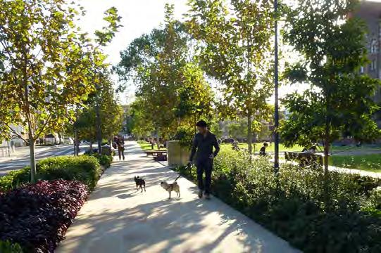
3. Street tree planting set back from the road edge to avoid conflicts within clear zone requirements.
4. A continuous area of accessible public domain along the edge of the corridor abutting adajcent buildings, suitable for activation by adjoining ground floor uses if appropriate.
SPENCER STREET
QUEENS ROAD
5. Through site links provide pedestrian connections between the public domain
REGATTA ROAD
PARRAMATTA ROAD
WILLIAM STREET
17m EXISTING PARRAMATTA ROAD KERB 3m EXISTING VERGE MIXED USE OR MEDIUM DENSITY RESIDENTIAL EXISTING PROPERTY BOUNDARY NEW PROPERTY BOUNDARY EXISTING PROPERTY BOUNDARY VARIABLE WIDTH LAND DEDICATION 6m LAND DEDICATION TfNSW VARIABLE ROAD WIDENING 3m SHARED PATH EXISTING VERGE 1m PLANTING 6m FUTURE VERGE FUTURE PUBLIC DOMAIN 1:100 @A3
1 3 1 2 2 3 5 5 3 4 4 GENEROUS LANDSCAPE PLANTiNG ADJACENT FOOTPATHS AND SHARED PATHS iNSiTU CONCRETE PATH UNDERSTORY MASS PLANTiNG PUBLiC DOMAiN AWNiNG 1:500 @ A3 PARRAMATTA ROAD SELECT PRECINCTS PUBLIC DOMAIN PLAN 47
PARRAMATTA ROAD
TYPiCAL SECTiON - PARRAMATTA ROAD (KiNGS BAY) CONCEPT PLAN PARRAMATTA ROAD (KiNGS BAY)
Walker Street will continue to be a relatively quiet residential street, with the streetscape public domain balancing the scale of new density on the eastern side of the street existing low rise residential properties on the west.
Key design features include:
1. Pedestrian footpaths providing universal local access along both sides of the street, setback from new buildings on the east with abundant landscape planting.
2. A landscape setback (3m) on the easter n side of the street.
3. Continuous avenues of kerbside street trees on both sides of the street, supplemented with additional street tree planting within kerb extensions, and in the eastern landscape setback.
4. Generous landscape garden beds passively irrigated by adjoining hard surfaces to maximise stormwater infiltration, with intermediate stepping stones / crossing points for pedestrians to access parked vehicles.
5. Kerb extensions at intersections and other dedicated pedestrian crossings points, to provide traffic calming, improve visibility between pedestrians/cyclists and motorists, define on-street parking and provide opportunities for rain gardens and low level planting.
6. Retention of the existing Walker Street Reserve road closure.
7. Retention of significant existing trees to maintain canopy cover and street character.
8. Existing substation retained.
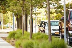
1.8m FOOTPATH 4.5m EXISTING VERGE 7m EXISTING KERB 4.5m EXISTING VERGE E XISTING PROPERTY BOUNDRA Y 16m EXISTING ROAD CORRIDOR 19m TOTAL PROPOSED CORRIDOR 2.1m PARKING LANE 1.8m FOOTPATH 3.2m TRAVEL LANE 3.2m TRAVEL LANE 1.6m PLANTING 1.6m PLANTING 0.7m EXISTING PROPERTY BOUNDRAY 3m SETBACK 1:100 @A3 WALKER STREET WALKER STREET SPENCER STREET EXTENSION (15m) 1 4 2 1 1 4 7 7 7 8 5 5 5 iNSiTU CONCRETE PATH UNDERSTORY MASS PLANTiNG 3 3 6 1:500 @ A3 vERGE STREET TREE AND UNDERSTOREY PLANTiNG 48 PARRAMATTA ROAD SELECT PRECINCTS PUBLIC DOMAIN PLAN WALKER STREET TYPiCAL SECTiON - WALKER STREET EXISTNG PARKING FRONTING SCHOOL RETAINED CONCEPT PLAN WALKER STREET
QUEENS ROAD
Queens Road will transform into an activated place within the Kings Bay Precinct, while still functioning as a regionally important movement corridor and significant walking and cycling route.
The evolution of this currently car-dominated road environment will need to prioritise pedestrian and cyclist amenity and safety, within a constrained corridor width, to ensure integration with, and place activation of, the Kings Bay Precinct.
Key design features include:
1. Paved landscape setbacks (3m) along the souther n side of the street, to provide comfortable and amenable pedestrian thoroughfare along the street, and activation where supported by adjacent ground floor building uses.
2. Separated uni-directional cycleways on either side of the street, where space allows, to provide safe clearance to adjacent car travel lanes and pedestrian footpaths.
3. Shared paths in constrained areas of the corridor, to reduce corridor width and negate impacts on adjacent properties.
4. Continuous avenues of kerbside street trees on both sides of the street, supplemented with additional street tree planting within landscaped setbacks and between the cycleway and footpath where space allows.
5. Landscape planting in garden beds passively irrigated by adjoining hard surfaces to maximise stormwater infiltration.
6. Retention of existing significant trees, including the large Fig trees located at the Five Dock Leisure Centre.
7. Existing substation retained.
QUEENS ROAD
2 2 4 5 1 iNSiTU CONCRETE PATH UNDERSTORY MASS PLANTiNG ASPHALT SEPARATED CYCLEWAY PUBLiC DOMAiN AWNiNG 1.5m FOOTPATH LUCAS GARDENS SCHOOL EXISTING RESIDENTIAL PROPERTIES 2.5m EXISTING VERGE 2.5m EXISTING VERGE 10.4m EXISTING KERB 15.4m EXISTING ROAD CORRIDOR E XISTING PROPERTY BOUNDAR Y 3.2m TRAVEL LANE 3.2m TRAVEL LANE 1.5m ONE WAY CYCLE 1.5m ONE WAY CYCLE EXISTING PROPERTY BOUNDARY 1.2m PLANTING 1m PLANTING 1.5m FOOTPATH 0.6m PLANTING 1:100 @A3
QUEENS ROAD
1:1000 @ A3 1 2 2 2 2 3 4 4 5 5 1 PARRAMATTA ROAD SELECT PRECINCTS PUBLIC DOMAIN PLAN 49
CONCEPT PLAN - QUEENS ROAD
SEPARATED CYCLEWAY PROTECTED WiTH PLANTiNG
TYPiCAL SECTiON 01 - QUEENS ROAD
KINGS ROAD 2.3m PARKING LANE 2m FOOTPATH MIXED USE MEDIUM DENSITY RESIDENTIAL 2.5m EXISTING VERGE 1.7m EXISTING VERGE 10m EXISTING KERB 14.2m EXISTING ROAD CORRIDOR 3m PROPOSED SETBACK 20.25m TOTAL PROPOSED CORRIDOR 3m PROPOSED SETBACK PROPOSED SETBACK EXISTING PROPERTY BOUNDARY PROPOSED SETBACK 3.2m TRAVEL LANE 3.2m TRAVEL LANE 1.5m ONE WAY CYCLE 1.5m ONE WAY CYCLE EXISTING PROPERTY BOUNDARY 1.25m PLANTING 0.6m 1.1m PLANTING 0.6m PLANTING 4.5m LANDSCAPE SETBACK 1:100 @A3 QUEENS
MIXED USE CHARLES HEALTH RESERVE 2.5m EXISTING VERGE 2.5m EXISTING VERGE 10m EXISTING KERB 15m EXISTING ROAD CORRIDOR 3m PROPOSED SETBACK 21m TOTAL PROPOSED CORRIDOR EXISTING PROPERTY BOUNDARY PROPOSED SETBACK 3.2m TRAVEL LANE 3.2m TRAVEL LANE 1.5m ONE WAY CYCLE 1.5m ONE WAY CYCLE EXISTING PROPERTY BOUNDARY 1:100 @A3 QUEENS ROAD 1:500 @ A3 1 2 2 2 2 2 3 3 3 7 7 4 4 4 5 5 50 PARRAMATTA ROAD SELECT PRECINCTS PUBLIC DOMAIN PLAN 01 02 03 TYPiCAL SECTiON 03 - QUEENS ROAD 2 TYPiCAL SECTiON 02 - QUEENS ROAD
ROAD
SPENCER STREET
Spencer Street will provide the civic heart for the new Kings Bay Precinct as a pedestrian priority place with fine grain shops, urban plazas, and spaces for lingering and socialising.
The street will form the basis of a new and compact local centre − an east-west axis for local shops and services, and a new address for medium and high-density residential development.
Key design features include:
1. Landscape setbacks (3m) on both sides of the street, paved to provide generous public domain areas that maximise pedestrian comfort within, and occupation of, the street and public domain.
2. Ground floor activation and outdoor dining on both sides of the street to support local retail and the social life of the future local centre.
3. Continuous avenues of kerbside street trees on both sides of the street and within kerb extensions.
4. Generous landscape garden beds passively irrigated by adjoining hard surfaces to maximise stormwater infiltration, with intermediate stepping stones / crossing points for pedestrians to access parked vehicles.
5. Kerb extensions at intersections and other dedicated pedestrian crossings points, to provide traffic calming, improve visibility between pedestrians/cyclists and motorists, define on-street parking and provide opportunities for rain gardens and low level planting.
6. Desired plaza
SPENCER STREET
ROAD
STREET
26m TOTAL PROPOSED CORRIDOR PROPOSED SETBACK 3.75m EXISTING VERGE 12.5m EXISTING KERB 3.75m EXISTING VERGE 20m EXISTING ROAD CORRIDOR 12M LANEWAY 3m PROPOSED SETBACK E XISTING PROPERTY BOUNDAR Y MIXED USE 2.1m PARKING LANE 3.2m TRAVEL LANE 3.2m TRAVEL LANE 2.1m PARKING LANE 1.5m PLANTING 2.7m FOOTPATH 1.5m PLANTING 2.7m FOOTPATH 1:100 @A3
SPENCER STREET QUEENS
SPACES FOR DWELLiNG ALONG THE STREET RAiSED PEDESTRiAN CROSSiNGS AND KERB EXTENSiONS TO SLOW TRAFFiC
1 3 4 1 2 2 3 4 5 5 6 5 5 5 5 iNSiTU CONCRETE PATH UNDERSTORY MASS PLANTiNG SHARED ZONE UNiT PAvERS 1:500 @ A3 TREE GRATE iN PAviNG PARRAMATTA ROAD SELECT PRECINCTS PUBLIC DOMAIN PLAN 51
TYPiCAL SECTiON - SPENCER STREET CONCEPT
PLAN SPENCER STREET
STREET
SPENCER
EXTENSION EAST
Extending Spencer Street to the east will provide an intimate streetscape environment that encourages town centre activation to spill into adjacent blocks.
While the total road corridor width of the eastward extension (18m) is narrower than Spencer Street proper (26m), a narrow carriageway and appropriate street tree and understorey planting can provide adequate space for an intimate street experience.
Key design features include:
1. Ground floor activation and outdoor dining on both sides of the street to support local retail and the social life of the future village centre.
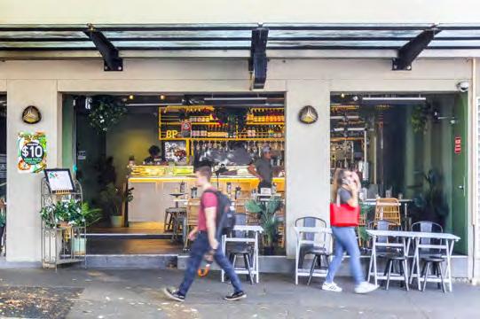
2. Continuous avenues of kerbside street trees on both sides of the street, and within kerb extensions.
3. Generous landscape garden beds passively irrigated by adjoining hard surfaces to maximise stormwater infiltration, with intermediate stepping stones / crossing points for pedestrians to access parked vehicles.
4. Kerb extensions at intersections and other dedicated pedestrian crossings points, to provide traffic calming, improve visibility between pedestrians/cyclists and motorists, define on-street parking and provide opportunities for rain gardens and low level planting.
5. The creation of a new access way to the western boundary of Rosebank College.
STREET 1:100 @A3 SPENCER
2.1m PARKING LANE 3.2m TRAVEL LANE 3.2m TRAVEL LANE 2.1m PARKING LANE PROPOSED SETBACK MIXED USE P ROPOSED SETBAC K MIXED USE 18m TOTAL PROPOSED CORRIDOR 3.7m PROPOSED VERGE 3.7m PROPOSED VERGE RETAiL SPiLLOUT AND ACTivATiON OF THE FOOTPATH
STREET
vERGE
TREE AND UNDERSTOREY PLANTiNG
CONCEPT PLAN SPENCER STREET EXTENSiON EAST 1 3 4 2 2 3 4 5 1 iNSiTU CONCRETE PATH UNDERSTORY MASS PLANTiNG PUBLiC DOMAiN AWNiNG SHARED ZONE UNiT PAvERS 1:500 @ A3 52 PARRAMATTA ROAD SELECT PRECINCTS PUBLIC DOMAIN PLAN
TYPiCAL SECTiON - SPENCER STREET EXTENSiON EAST
STREET
STREET
The extension of Spencer Street to the west will create an intimate local urban residential street a primary east-west corridor for pedestrians to and from the town centre.
As with the east extension, a narrow carriageway and appropriate street tree and understorey planting provides provide adequate space for an intimate street experience.
Key design features include:
1. Creation of a shared zone at the eastern end of the street, incorporating a pedestrianised road surface, with paving treatments and flush kerb environments that clearly communicate the shared environment to all street users.
2. Footpaths on both sides of the street abutting adjacent residential buildings.
3. Continuous avenues of kerbside street trees on both sides of the street, and within kerb extensions.
4. Generous landscape garden beds passively irrigated by adjoining hard surfaces to maximise stormwater infiltration.
5. Kerb extensions at intersections and other dedicated pedestrian crossings points, to provide traffic calming, improve visibility between pedestrians/cyclists and motorists, define on-street parking and provide opportunities for rain gardens and low level planting.
1:100 @A3
2.1m PARKING LANE 3.2m TRAVEL LANE 3.2m TRAVEL LANE 2.1m PARKING LANE PROPOSED SETBACK MEDIUM DENSITY RESIDENTIAL P ROPOSED SETBAC K 18m TOTAL PROPOSED CORRIDOR 1.8m FOOTPATH 1.8m FOOTPATH MEDIUM DENSITY RESIDENTIAL 1.9m PLANTING 1.9m PLANTING ROAD SPENCER STREET EXTENSION (15m)
SPENCER
1 3 4 2 1 2 3 4 5 5 5 5 iNSiTU CONCRETE PATH UNDERSTORY MASS PLANTiNG SHARED ZONE UNiT PAvERS 1:500 @ A3 3 3
STREET TREE AND UNDERSTOREY PLANTiNG PARRAMATTA ROAD SELECT PRECINCTS PUBLIC DOMAIN PLAN 53 SPENCER STREET EXTENSION WEST TYPiCAL SECTiON - SPENCER STREET EXTENSiON WEST CONCEPT PLAN SPENCER STREET EXTENSiON WEST
vERGE
NEW ROAD AND THROUGH SITE LINK
New road as part of the Spencer Street East extension runs from Queens Road to Spencer Street along the western edge of Rosebank College. Vehicle traffic terminates at Spencer Street and becomes a through site pedestrian link to Parramatta Road.
The total road corridor width of the new road reserve (18m) is provides a safe pedestrian link along either sides of the road to connect to the surrounding activated public domain areas.
The adjoining 12m laneway will provide better pedestrian movement between the busy Parramatta Road and Queens Road to the north activated by the surrounding retail and commercial buildings.
Key design features include:
1. Continuous avenues of kerbside street trees on both sides of the street, and within kerb extensions.
2. Generous landscape garden beds passively irrigated by adjoining hard surfaces to maximise stormwater infiltration, with intermediate stepping stones / crossing points for pedestrians to access parked vehicles.
3. Kerb extensions at intersections and other dedicated pedestrian crossings points, to provide traffic calming, improve visibility between pedestrians/cyclists and motorists, define on-street parking and provide opportunities for rain gardens and low level planting.
4. 3m setbacks along the new road between mixed use buildings and the new road
5. Generous pedestrian priority laneway lined with avenue trees
TYPiCAL SECTiON NEW ROAD
STREET NEW ROAD
54 PARRAMATTA ROAD SELECT PRECINCTS PUBLIC DOMAIN PLAN
THROUGH-SiTE LiNK
TYPiCAL SECTiON
TYPiCAL SECTiON - SPENCER STREET EXTENSiON EAST iNSiTU CONCRETE PATH UNDERSTORY MASS PLANTiNG PUBLiC DOMAiN AWNiNG SHARED ZONE UNiT PAvERS
1 1 2 2 3 3 3 4 5 1:500 @ A3 CONCEPT PLAN NEW ROAD AND THROUGH-SiTE LiNK 1:100 @A3 SPENCER
2.1m PARKING LANE 3.2m TRAVEL LANE 3.2m TRAVEL LANE 2.1m PARKING LANE EXISTING PROPERTY BOUNDARY ROSEBANK COLLEGE P ROPOSED SETBAC K MIXED USE 18m TOTAL PROPOSED CORRIDOR 3.7m PROPOSED VERGE 3.7m PROPOSED VERGE 1:100 @A3 SPENCER
EXISTING PROPERTY BOUNDARY ROSEBANK COLLEGE P ROPOSED SETBAC K MIXED USE 18m TOTAL PROPOSED CORRIDOR
STREET NEW ROAD
WILLIAM STREET
WILLIAM STREET
William Street will become a new green corridor that reinforces connectivity between Barnwell Park Golf Course and the foreshore to the north, while providing a green marker along Parramatta Road at the centre of the Precinct.
The signficant proposed setback on the western side of the street will provide generous space for comfortable walking and cycling, and ground floor activation of the public domain.
Key design features include:
1. A landscape setback (8m) on the wester n side of the street.
2. Generous pedestrian footpaths, providing continuous universal access along both sides of the street. Western side only to have additional widening to the public domain to allow for ground floor activation and spill out.
3. A separated cycleway, protected with understorey and street tree planting in landscape garden beds, providing safe clearance to adjacent travel lanes and public domain areas.
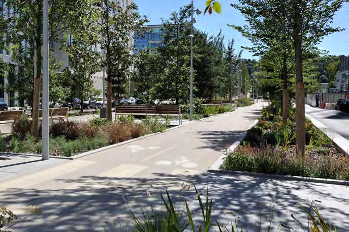
4. Continuous avenues of kerbside street trees on both sides of the street, supplemented with additional street tree planting between the cycleway and footpath. ROAD
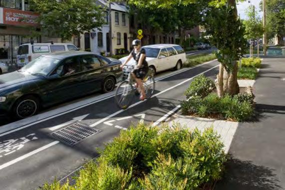
CYCLEWAY ADJACENT PLAZA AND SEATiNG DELiNEATED BY PLANTiNG 2.5m TWO WAY CYCLEWAY PROPOSED SETBACK MIXED USE WILLIAM STREET OPEN SPACE 17.5m TOTAL PROPOSED CORRIDOR 9.5m EXISTING ROAD CORRIDOR 8m PROPOSED SETBACK 7m EXISTING KERB 1.25m EXISTING VERGE 1.25m EXISTING VERGE 1.5m PLANTING 3.5m PUBLIC DOMAIN 3m PUBLIC DOMAIN 3.5m TRAVEL LANE 3.5m TRAVEL LANE E XISTING PROPERTY BOUNDAR Y E XISTING PROPERTY BOUNDAR Y 1:100 @A3
KINGS ROAD SEPARATED CYCLEWAY iNSiTU CONCRETE PATH UNDERSTORY MASS PLANTiNG SHARED ZONE UNiT PAvERS 1:500 @ A3 TREE GRATE iN PAviNG PARRAMATTA ROAD SELECT PRECINCTS PUBLIC DOMAIN PLAN 55
TYPiCAL SECTiON - WiLLiAM STREET CONCEPT PLAN WiLLiAM STREET 3 2 4 2 2 2 3 4 1
REGATTA ROAD
REGATTA ROAD
Regatta Road will provide generously wide streetscape oriented towards its mixed use neighbourhood setting secondary.
Key design features include:
1. A pedestrian footpath on the easter n side of the street, setback from adjacent buildings with abundant landscape planting.
2. A shared path on the western side of the street, separated by wide landscape planting areas and providing local cycle access to people’s front doors, parks and plazas, and visitor bicycle parking.
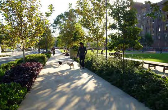
3. A landscape setback (3m) on both sides of the street.
4. Continuous avenues of kerbside street trees on both sides of the street, supplemented with additional street tree planting within kerb extensions, and in the landscape setbacks.
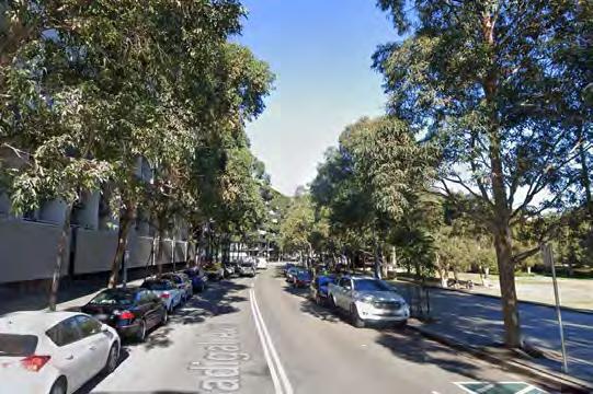
5. Generous landscape garden beds passively irrigated by adjoining hard surfaces to maximise stormwater infiltration, with intermediate stepping stones / crossing points for pedestrians to access parked vehicles.
6. Kerb extensions at intersections and other dedicated pedestrian crossings points, to provide traffic calming, improve visibility between pedestrians/cyclists and motorists, define on-street parking and provide opportunities for rain gardens and low level planting.
7. Existing substation retained.
MIXED USE 26m TOTAL PROPOSED CORRIDOR PROPOSED SETBACK EXISTING PROPERTY BOUNDARY 3m SHARED PATH 1.8m FOOTPATH 3.75m EXISTING VERGE 3.75m EXISTING VERGE 12.5 EXISTING KERB 20m EXISTING ROAD CORRIDOR 3m PROPOSED SETBACK 3m PROPOSED SETBACK PROPOSED SETBACK MEDIUM DENSITY RESIDENTIAL 3.2m TRAVEL LANE 3.2m TRAVEL LANE E XISTING PROPERTY BOUNDAR Y 2.3m PLANTING 2.3m PLANTING 2.1m PARKING LANE 2.1m PARKING LANE 1:100 @A3
AvENTUE OF STREET TREES FOOTPATH WiTH GENEROUS LANDSCAPE PLANTiNG AND DOUBLE AvENUE OF STREET TREES SPENCER STREET QUEENS REGATTA ROAD (15m) 1 2 5 4 1 2 3 3 3 3 3 4 4 4 5 5 5 6 6 6 7 6 6 6 6 iNSiTU CONCRETE PATH UNDERSTORY MASS PLANTiNG 1:500 @ A3 56 PARRAMATTA ROAD SELECT PRECINCTS PUBLIC DOMAIN PLAN
CONCEPT PLAN REGATTA ROAD
TYPiCAL SECTiON - REGATTA ROAD
HARRIS ROAD
HARRIS ROAD
Harris Road will continue to play a significant role in local access between Parramatta Road, Rosebank College, and the Five Dock town centre to the north.
The location of Rosebank College and the existing 4951 Queens Road development provide fixed constraints on corridor width that are unlikely to be resolved with landscape setbacks in the short- to medium-term.
This, combined with the need for travel lanes that provide for peak hour traffic numbers, creates a constrained environment for public domain opportunities.
The focus of public domain improvements in this street is thus about maximising pedestrian footpath widths and increasing street tree planting where possible.
Key design features include:
1. W idened pedestrian footpaths on both sides of the street, improving pedestrian access along the street, in particular at the existing highly constrained area at Rosebank College.
2. Street trees in tree pits on the eastern side of the street to maximise canopy cover while maximising pedestrian path widths, subject to underground utilities.
3. Kerbside parking/travel lanes to allow for a combination of on-peak travel and off-peak parking.
HARRIS ROAD
1:100 @A3
1:100 @A3
MEDIUM DENSITY RESIDENTIAL EXISTING DEVELOPMENT EXISTING FOOTPATH 4m EXISTING VERGE 12.5m EXISTING KERB 17.5m EXISTING ROAD CORRIDOR 3m PROPOSED SETBACK 1m EXISTING VERGE 20.5m TOTAL PROPOSED CORRIDOR P ROPOSED SETBAC K EXISTINGPROPERTY BOUNDARY E XISTING PROPERTY BOUNDAR Y 3.5m PARKING TRAVEL LANE 3.2m TRAVEL LANE 3.2m TRAVEL LANE 3.5m PARKING TRAVEL LANE 1.8m FOOTPATH 3.5m PARKING TRAVEL LANE 3.2m TRAVEL LANE 3.2m TRAVEL LANE 3.5m PARKING TRAVEL LANE 2.6m FOOTPATH 4m EXISTING VERGE 12.5m EXISTING KERB 17.5m EXISTING ROAD CORRIDOR 1m EXISTING VERGE 20.5m TOTAL PROPOSED CORRIDOR 1.8m FOOTPATH EXISTINGPROPERTY BOUNDARY E XISTING PROPERTY BOUNDAR Y 3m PROPOSED SETBACK PROPOSED SETBACK
1 1 2 2 3 3 3 3 iNSiTU CONCRETE PATH UNDERSTORY MASS PLANTiNG 1:500 @ A3 TREE GRATE iN PAviNG PARRAMATTA ROAD SELECT PRECINCTS PUBLIC DOMAIN PLAN 57
TYPiCAL SECTiON 01 - HARRiS ROAD TYPiCAL SECTiON 02 - HARRiS ROAD CONCEPT PLAN HARRiS ROAD 02 01
KINGS ROAD
Kings Road will provide a generously wide streetscape oriented towards its residential neighbourhood setting, adjacent the regional open space of Concord Oval.
Key design features include:
1. A pedestrian footpath on the souther n side of the street, setback from adjacent buildings with abundant landscape planting.
2. A shared path on the northern side of the street, separated by wide landscape planting areas and providing local cycle access.
3. A landscape setback (3m) on the wester n side of the street.
4. Continuous avenues of kerbside street trees on both sides of the street, supplemented with additional street tree planting within kerb extensions, and in the landscaped setback.
5. Generous landscape garden beds passively irrigated by adjoining hard surfaces to maximise stormwater infiltration, with intermediate stepping stones / crossing points for pedestrians to access parked vehicles.
6. Kerb extensions at intersections and other dedicated pedestrian crossings points, to provide traffic calming, improve visibility between pedestrians/cyclists and motorists, define on-street parking and provide opportunities for rain gardens and low level planting.
7. Retention of the significant existing trees at the eastern end of the street to maintain canopy cover and street character.
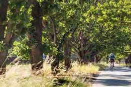
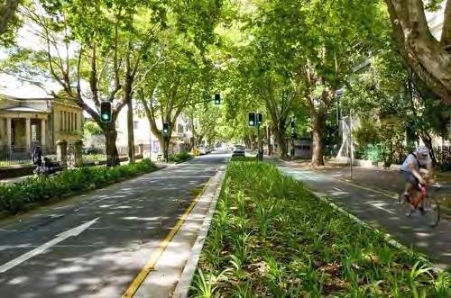
2.5m SHARED PATH 1.8m FOOTPATH 4.75m EXISTING VERGE 4.75m EXISTING VERGE 10.5m EXISTING KERB 20m EXISTING ROAD CORRIDOR 4.5m PROPOSED SETBACK 29m TOTAL PROPOSED CORRIDOR 4.5m PROPOSED SETBACK MEDIUM DENSITY RESIDENTIAL MEDIUM DENSITY RESIDENTIAL 2.1m PARKING LANE 3.2m TRAVEL LANE 3.2m TRAVEL LANE 2.1m PARKING LANE 2.15m PLANTING 2.9m PLANTING PROPOSED SETBACK EXISTING PROPERTY BOUNDARY EXISTING PROPERTY BOUNDARY PROPOSED SETBACK 1:100 @A3 KINGS
GENEROUS LANDSCAPE AREAS MAXiMiSE SOiL vOLUME AND TREE CANOPY
ROAD
LARGE AREA OF PLANTiNG AND TREE PLANTiNG 1 3 4 4 2 2 3 5 5 7 7 6 6 iNSiTU CONCRETE PATH UNDERSTORY MASS PLANTiNG 1:500 @ A3 58 PARRAMATTA ROAD SELECT PRECINCTS PUBLIC DOMAIN PLAN
KINGS ROAD
CONCEPT PLAN KiNGS ROAD
TYPiCAL SECTiON - KiNGS ROAD
REGATTA ROAD PARK
Regatta Road Park will become an everyday neighbourhood park, activated by the daily routines of the Kings Bay community.

Key design features include:
1. Large informal turf areas for relaxing, socialising and other forms of passive recreation.
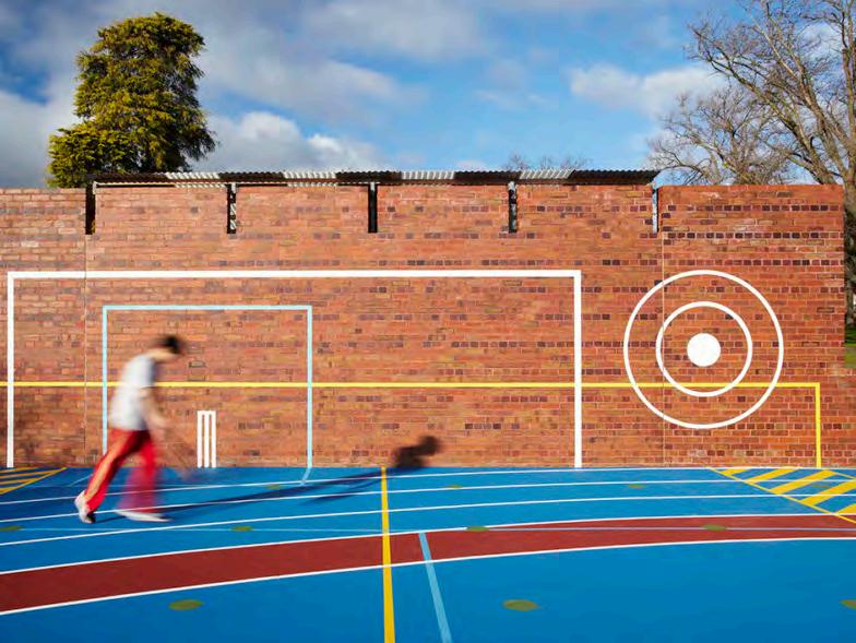
2. A neighbourhood-scaled local playgr
3. Seating areas located to support and supplement other park uses, such as parents sitting adjacent the playground.
4. Large shade tree planting to maximise park amenity and provided filtered screening to adjacent properties.
5. Ground floor activation and outdoor dining spaces along activated edges of a paved town centre square.
6. Turf and planted area with seating adjacent to Spencer Street shared zone. 7. Retention of existing significant tr 8. Creation of a shared zone at the eastern end of the street, incorporating a pedestrianised road surface, with paving treatments and flush kerb environments that clearly communicate the shared environment to all street users.
SPENCER STREET EXTENSION (15m)
FACiLiTiES & PROGRAMS
REGATTA ROAD
3
102m 28m 100m 85m 5 6 1:500 @ A3 7 7 PARRAMATTA ROAD SELECT PRECINCTS PUBLIC DOMAIN PLAN 59
COMMUNiTY GARDENS
AREA CONCEPT PLAN - REGATTA ROAD PARK REGATTA ROAD PARK REGATTA ROAD PARK SHANNON RESERvE, SURRY HiLLS WARD PARK, SURRY HiLLS
NEiGHBOURHOOD PLAYGROUND MULTi-USE
YOUTH RECREATiON
SCALE COMPARiSONS
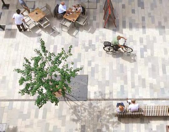
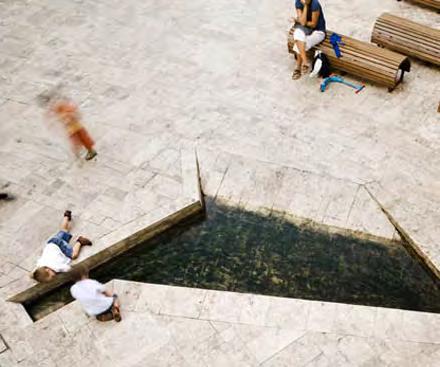
ROAD 51m 40m 1 1 1 1:500 @ A3 5 12m 3 60 PARRAMATTA ROAD SELECT PRECINCTS PUBLIC DOMAIN PLAN iNTERACTivE WATER ELEMENTS ACTivATED PLAZA EDGES PUBLiC ART CONCEPT PLAN - SPENCER STREET PLAZA SPENCER STREET PLAZA SPENCER STREET PLAZA CUSTOMS HOUSE SQUARE, CiRCULAR QUAY CENTENARY SQUARE, PARRAMATTA SCALE COMPARiSONS
WILLIAM STREET PARK
William Street Park will provide a neighbourhood civic space supporting flexible uses and curated with community-oriented programs and events.
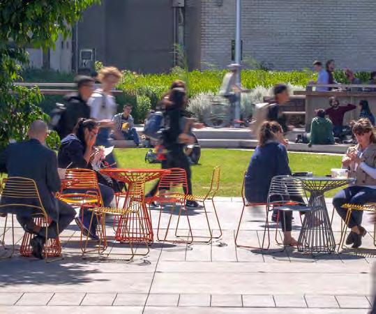
Key design features include:
1. Ground floor activation and outdoor dining spaces along activated edges of a paved town centre square;
2. A formal breakout lawn space with shade tree planting and occupiable seating edges for incidental seating or group gatherings;
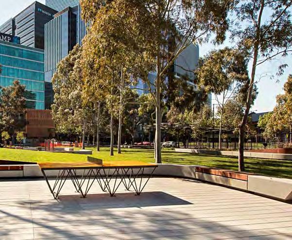
3. Interactive public art elements that can be pr to pro vide for different use patterns of the plaza and alternate plaza uses;
4. A formal paved plaza space to pr with community events with formal tree planting for shade.
FACiLiTiES & PROGRAMS
STREET
1 4
SPENCER STREET
40m 40m
FLEXiBLE PLAZA SPACES PROviDE FOR ACTivATiON WiTH COMMUNiTY EvENTS TREES iN LAWN WiTH OCCUPiABLE AND ACTivATED EDGES
ACTivATED PLAZA EDGES
WiLLiAM STREET PARK WiLLiAM STREET PARK RUBY GRANT PARK, GREEN SQUARE
RESERvE, SURRY HiLLS 1:750 @ A3 PARRAMATTA ROAD SELECT PRECINCTS PUBLIC DOMAIN PLAN 61
CONCEPT PLAN - WiLLiAM STREET PARK
SHANNON
SCALE COMPARiSONS
KINGS BAY EAST PARK
Bay East Park will create a large neighbourhood park providing for the daily social practices and gatherings of the community.
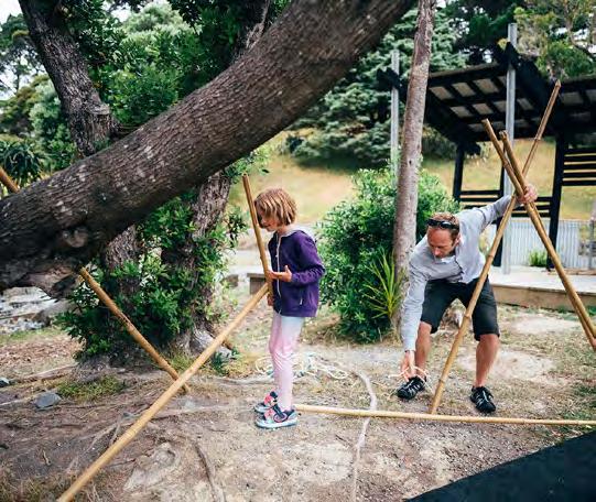
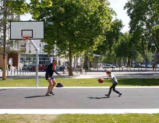
KINGS ROAD
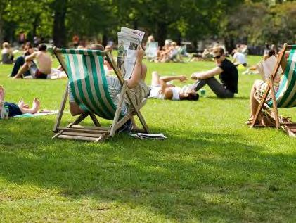
WILLIAM STREET
COURLAND STREET Kings
Key
include: 1. A
2. Community
3. Seating areas
4. Through-site links
tree
5. Dog off-leash area
square 6. Desired open space 7. Large shade trees FACiLiTiES & PROGRAMS
design features
neighbourhood-scaled nature-oriented playground;
gardens
located to support and supplement other park uses, such as parents sitting adjacent the playground
with
and understorey planting.
in the central
103m 100m 102m 80m 1:1000 @ A3 62 PARRAMATTA ROAD SELECT PRECINCTS PUBLIC DOMAIN PLAN SCALE COMPARiSONS KiNGS BAY EAST PARK KiNGS BAY EAST PARK HARMONY PARK, SURRY HiLLS PHOENiX PARK, RHODES NATURE-BASED PLAY AND COMMUNiTY GARDENS PATHWAYS AND NATivE PLANTiNG iNFORMAL LAWN AREAS CONCEPT PLAN KiNGS BAY EAST PARK 3 6 7 7 7 5 1 2 4 4 4 HARR i S ROAD QUEENS ROAD PARRAMATTA ROAD
PAGE
LEFT
PARRAMATTA ROAD SELECT PRECINCTS PUBLIC DOMAIN PLAN 63
INTENTIONALLY
BLANK