Tyreeanna & Pleasant Valley
Neighborhood Plan

Adopted -May24,2022
TYREEANNA & PLEASANT VALLEY NEIGHBORHOOD PLAN 2
1 INTRODUCTION A. PURPOSE AND NEED ............................................................ 6 B. SCOPE ................................................................................... 9 C. KEY RECOMMENDATIONS................................................... 10 D. PREVIOUS PLANS .................................................................. 12 E. ONGOING INITIATIVES......................................................... 14 F. PLANNING PROCESS & COMMUNITY ENGAGEMENT ..... 14 2.BACKGROUND AND HISTORY A. NEIGHBORHOOD CONTEXT ............................................... 19 B. HISTORICAL SIGNIFICANCE ................................................ 20 3.EXISTING CONDITIONS A. DEMOGRAPHICS ................................................................. 25 B. LAND USE ............................................................................. 26 C. PHYSICAL ENVIRONMENT AND FORM 28 D. CLEANLINESS & MAINTENANCE ......................................... 32 4.FUTURE LAND USE A. SPECIFIC NEEDS & OPPORTUNITIES .................................... 34 B. RESIDENTIAL .......................................................................... 35 C. COMMERCIAL ...................................................................... 37 D. GOALS................................................................................... 38 5.CONNECTIVITY & NEIGHBORHOOD DESIGN A. STREET NETWORK & CHARACTER ...................................... 39 B. CONSIDERATIONS ................................................................ 40 C. DESIGN AND POLICY RECOMMENDATIONS ................... 41 D. STREET IMPROVEMENT PROJECTS ...................................... 43 E. GATEWAYS ............................................................................ 47 F. OTHER MULTI-MODAL OPTIONS ......................................... 48 G. GOALS................................................................................... 50 6.PARKS & OPEN SPACE A. GATHERING PLACES 53 B. DESTINATION PARKS............................................................. 54 C. GOALS................................................................................... 56 7.HISTORIC RESOURCES A. IDENTIFICATION.................................................................... 57 B. RECOGNITION ..................................................................... 57 C. PROTECTION ......................................................................... 59 D. GOALS................................................................................... 60
TABLE OF CONTENTS
9.IMPLEMENTATION
APPENDIX
IMPLEMENTATION MATRIX TABLE
INCENTIVES AND FINANCING TOOLS TABLE
TYREEANNA & PLEASANT VALLEY NEIGHBORHOOD PLAN 3 8.MOVING FORWARD A. NEIGHBORHOOD CONTEXT IN 2021 .................................. 61 B. ECONOMIC DEVELOPMENT ............................................... 62 C. UTILITY INFRASTRUCTURE ..................................................... 63 D. IDENTITY AND BRANDING ................................................... 67
A. PROCESS ............................................................................... 69 B. POLICY .................................................................................. 69 C. RESOURCES .......................................................................... 69 D. PARTNERSHIPS ...................................................................... 72 E. IMPLEMENTATION MATRIX ................................................... 72 F. INCENTIVES AND FINANCING ............................................ 72
TYREEANNA & PLEASANT VALLEY NEIGHBORHOOD PLAN 4
PAGE LEFT INTENTIONALLY BLANK
VISIONSTATEMENT
The Tyreeanna/Pleasant Valley neighborhood will maintain its natural beauty and rural character while growing economically in strategic locations. The housing market will have places for families and aging adults with a focus on neighborhood and community. The neighborhood will offer recreation opportunities, scenic views, neighborhood services, and strong sense of community. Through better access, community spaces, and strategic growth, the neighborhood will strengthen its own identity while defining its place within the City of Lynchburg as a whole.

N
TYREEANNA / PLEASANT VALLEY
residents. institutions and others. proximity to Richmond residents).
walking, Monument
Lynchburg’s case, and food
The City of Lynchburg has identified ten benchmark communities that compare to the City in terms of their demographic makeup. Benchmarks were selected based on following criteria:
Data helps tell the stor y of our city. After taking a hard look at our strengths and weaknesses, we uncovered numerous opportunities for growth. While the City of Lynchburg inevitably faces some obstacles to prosperity, its economic foundation is solid and its workforce is becoming more skilled and dynamic by the day. The following assessment looks at these assets and challenges in comparison to Lynchburg’s benchmark communities. The assessment is based on more than 65 different metrics, including demographic and socioeconomic trends, diversity, equity, business climate, workforce skills, and education. (See appendix for a full list of metrics.) Here are some of our key findings.
The Tyreeanna / Pleasant Valley Neighborhood Plan is a product of the input received from neighborhood residents, citizen members of the project’s Steering Committee, City of Lynchburg planning staff, and the consultant firm Hill Studio working together to envision opportunities for sustainable growth in the neighborhood. The plan has been developed under the direction established by the City’s Comprehensive Plan 20132030 to build strong neighborhoods; conserve the City’s unique places and resources; promote business vitality; enhance the attractiveness of gateways and travel corridors; and protect the natural environment while also promoting sensitive development and redevelopment.
•Similar in Size. Selected communities have a population size that is similar to Lynchburg’s nearly 80,000 residents.
POPULATION TRENDS
•Presence of an Anchor Institution. The City of Lynchburg benefits from the presence of higher education institutions like Liberty University, the University of Lynchburg, Randolph College, Central Virginia Community College, and others. Selected communities house an anchor institution such as a university, hospital, or medical center.
Data helps tell the stor y of our city. After taking a hard uncovered numerous opportunities for growth. While the City to prosperity, its economic foundation is solid and its workforce day. The following assessment looks at these assets and challenges communities. The assessment is based on more than 65 different socioeconomic trends, diversity, equity, business climate, workforce (See appendix for a full list of metrics.) Here are some of our
Given the limited amount of developable land and Lynchburg’s challenging topography, continued growth must occur through infill development of vacant land, or redevelopment, in Downtown and surrounding areas; including the Tyreeanna / Pleasant Valley neighborhood. In addition to development pressures within the City, ongoing planning efforts by Amherst County create synergies for the City and County to partner on initiatives that will benefit both municipalities.
•Proximity to a Metro Area. Like the City of Lynchburg, selected communities are situated in relatively close proximity to a metropolitan area without being located in the metro itself. In Lynchburg’s case, the City is a two-hour drive to Richmond and a three-and-a-half-hour drive to Washington, D.C. (the closest large metro with more than one million residents).
POPULATION TRENDS
Chattanooga, TN
•Outdoor Amenities. Just as the City of Lynchburg benefits from 17 parks and more than 40 miles of trail for walking, biking or running, selected communities contain a wealth of outdoor amenities.
Fort Collins, CO
Savannah, GA
Bend, OR
Fort Collins, CO
Greenville, SC
•Cultural or Heritage Sites. Selected communities contain cultural or heritage sites, such as Lynchburg’s Monument Terrace or Court House Museum.
A. PURPOSE AND NEED
Roanoke, VA
Reading, PA
To achieve this vision, the Tyreeanna / Pleasant Valley Neighborhood Plan is [to be] adopted as a supplement to the City of Lynchburg Comprehensive Plan; as such, it reinforces and extends its goals and policies. Future initiatives and improvements in this community should be consistent with both the Comprehensive Plan and the Tyreeanna / Pleasant Valley Neighborhood Plan.
Asheville, NC
Charlottesville, VA
Savannah, GA
Chattanooga, TN
•Economic Makeup. Selected communities have a similar breakdown of income, talent and industries. In Lynchburg’s case, this includes a median household income of $41,000 annually and a significant number of healthcare, retail and food services companies.
citywide
Bend, OR
Lynchburg, VA
Portland, ME
Greenville, SC
Charlottesville, VA
OR
Asheville, NC
Lynchburg, VA Roanoke, VA
ME
The following is a selected list of benchmarks
Asheville, NC
Bend, OR
Greenville, SC
Portland, ME
With a population of 78,000 residents, Lynchburg ranks eight among other benchmark cities. Between 2000-2016, the population in Lynchburg increased by 4%, which is higher than growth in comparable cities like Roanoke, VA (2.6%). (Blueprint for Opportunity, 2019). The 2020 Census data indicates a population growth of 4.6% since 2010.
Charlottesville, VA
Chattanooga, TN
Fort Collins, CO
Reading, PA
Development in Lynchburg is expected to continue, particularly in nearby Downtown. In the last 20 years, Lynchburg’s public and private sector have invested significantly in the city’s urban core in response to citywide population growth. According to the City’s five-year economic development strategic plan, the Blueprint for Opportunity, the City of Lynchburg alone has spent over $50 million in public spaces and infrastructure projects, which has generated substantial private investment and increased real estate values in the Central Business District (p. 39).
Roanoke, VA
Savannah, GA
With a total of 78,000 residents and an annual population among its fellow benchmark cities. This ranking places the City but ahead of Roanoke, Virginia (2.7 percent), both of which are than 14 percent of Lynchburg’s population moved from a different second place ranking among its benchmark cities. Only Charlottesville of 19.2 percent.
With a total of 78,000 residents and an annual population growth of 4 percent, Lynchburg ranks eighth among its fellow benchmark cities. This ranking places the City behind Charlottesville, Virginia (5.4 percent), but ahead of Roanoke, Virginia (2.7 percent), both of which are located nearby. In the last year alone, more than 14 percent of Lynchburg’s population moved from a different county, state or country, giving Lynchburg a second place ranking among its benchmark cities. Only Charlottesville ranked higher, with a population growth of 19.2 percent.
TYREEANNA & PLEASANT VALLEY NEIGHBORHOOD PLAN 6 CHAPTER 1: INTRODUCTION
1 INTRODUCTION
BENCHMARK COMMUNITIES
POPULATION 2016
Collins,
Asheville,
Bend,
Lynchburg,
Portland,
Greenville,
Charlottesville, VA Fort Charlottesville, Chattanooga, 175,462 157,251 144,717 99,329 87,899 87,531 84,416 78,755 66,649 62,776 45,538
Chattanooga, TN Fort
CO Savannah, GA Roanoke, VA Reading, PA
NC
VA
ME
SC
16
POPULATION 2016 POPULATION GROWTH 2012 - 2016
Portland,
Reading,
175,462 157,251 144,717 99,329 87,899 87,531 84,416 78,755 66,649 62,776 45,538
PA
9.5% 9.0% 5.9% 5.4% 5.1% 4.5% 4.5% 4.1% 2.7% 0.6% 0.0%
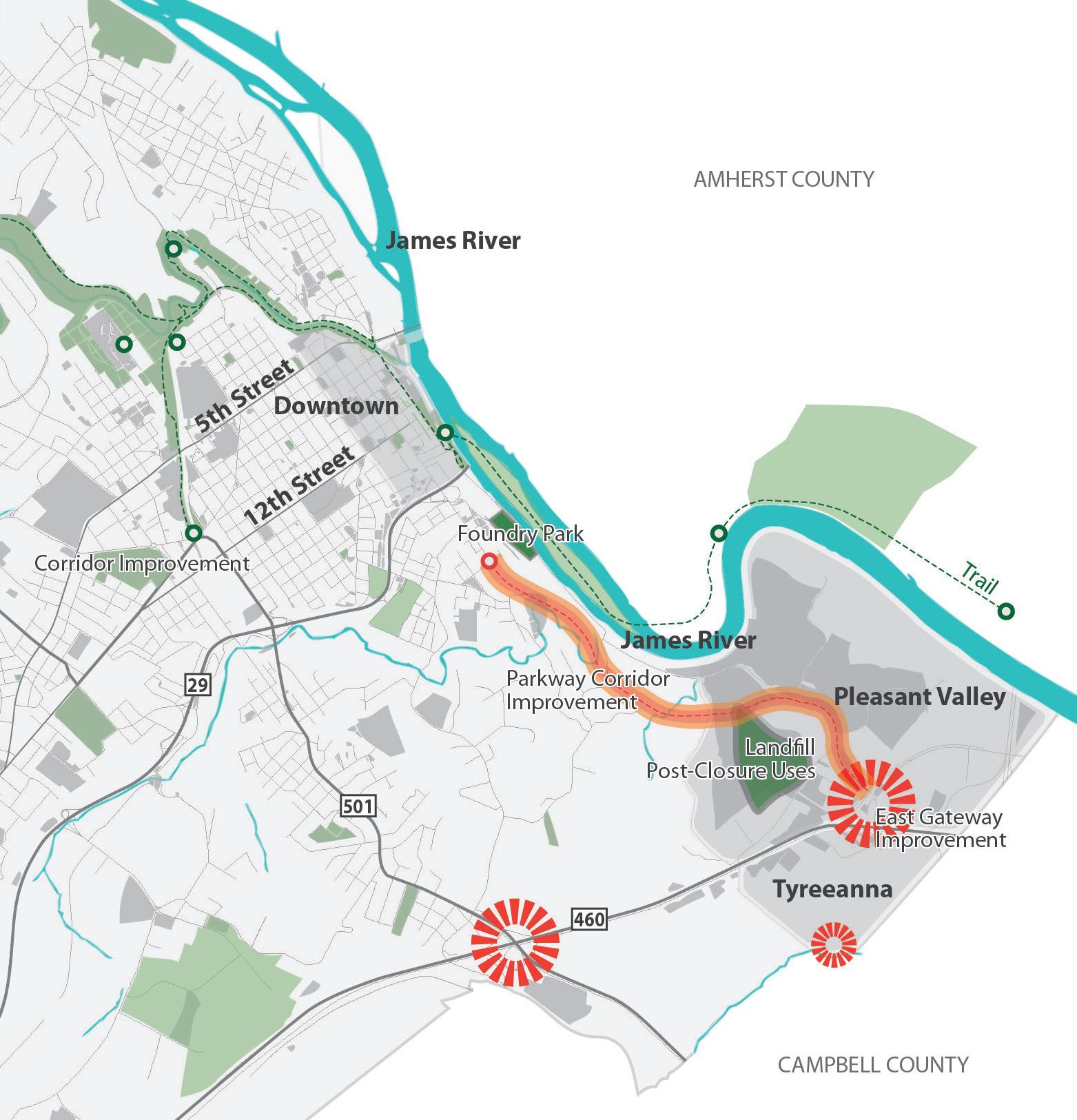
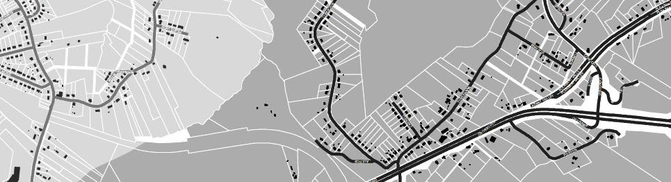
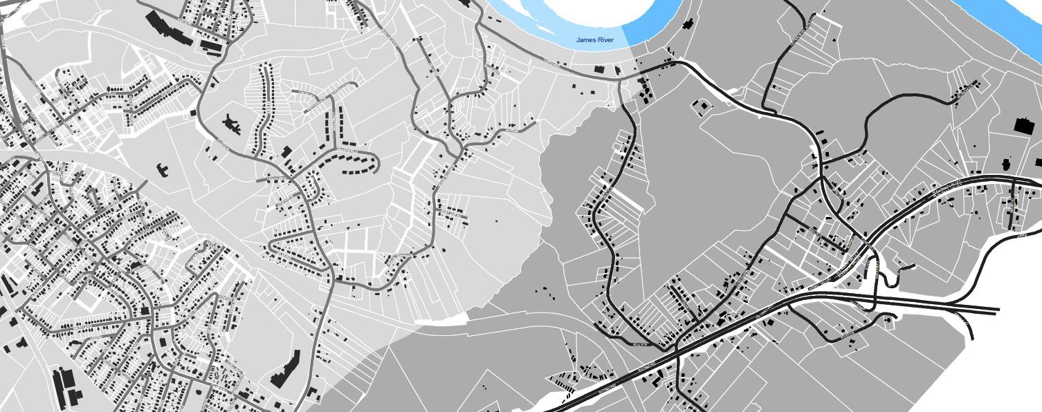
Tyreeanna / Pleasant Valley is an important corridor and gateway community connecting Downtown to Route U.S. 29/U.S. 460 Bypass. It is primarily a low-density residential area with a few industrial and commercial uses along Route U.S. 460 and Pleasant Valley Road. A significant number of parcels in Tyreeanna / Pleasant Valley are owned and managed by the City of Lynchburg and the Virginia Department of Transportation (VDOT).
The Tyreeanna / Pleasant Valley neighborhood is home to several sites that likely qualify as brownfields and may require environmental testing and remediation prior to their redevelopment. In 2018, the City of Lynchburg received $300,000 from the Environmental Protection Agency (EPA) as part of its Brownfields Grants program to conduct environmental site assessments and develop cleanup plans, with particular emphasis on the Tyreeanna / Pleasant Valley neighborhood. Currently, assessments are underway at two City-owned properties located between Downtown and Tyreeanna. The City’s Office of Economic Development and Tourism continues to pursue brownfields grants from the EPA as well as the state, and to work with brownfields property owners to assess and improve their sites through the “Fields of Opportunity” program. This program promotes investment and can assist with funding needed improvements at underutilized brownfields properties throughout the city.
PublicPropertyHolders
MAINST K N I G H T S T MAPLE ST RIDGEAVE FRANKLINST AUGUSTA ST HIGH ST PLEASANTVALLEY RD TULIPST DURHAMST POCAHONTASST TYREESTVIRGINIAS T PINEST GEORGIAAVE OTEY ST WOODROWST GLOBE ST ELM ST FORDST KINGST HILLVIEW ST STATHAMRD PRINCE ST J U BILE E D R KAVANAUGHRD POSTONST TOPRIDGEDR NICKERSON RD TEX SA A VE GUMST GREENFIELD DR DUKEST GILMORE CIR HUDSONST POPLARST TYREEANNA RD MAYFLOWERDR W I N S TON RIDGE DR ROBINSRD WINCHESTERST F L ORIDA AVE FLORIDA AVE MARTINST GRACEST CONCORDTPKE ROCKWELL RD HOLCOMBPATHRD CAMPBELL A VE 460HWY L Y N C H B URGEXPY CAMPBELLAVE RTE 29 BYP RICHMONDHWY
ofLynchburg
State/VDOT
TyreeannaNeighborhood City
Region2000ServicesAuthority
Owners 7 CHAPTER 1: INTRODUCTION
level
& PotentialBrownfieldSites StudyAreaBoundary " PotentialBrownfields
neighborhood
TYREEANNA & PLEASANT VALLEY NEIGHBORHOOD PLAN City-Owned / VDOT Owned Properties & Brownfields (City) MAINST K N I G H T S T MAPLE ST RIDGEAVE FRANKLINST AUGUSTA ST HIGH ST PLEASANTVALLEY RD TULIPST DURHAMST POCAHONTASST TYREESTVIRGINIAS T PINEST GEORGIAAVE OTEY ST WOODROWST GLOBE ST ELM ST FORDST KINGST HILLVIEWST STATHAMRD PRINCE ST J U BILE E D R KAVANAUGHRD POSTONST TOPRIDGEDR NICKERSON RD TEX SA A VE GUMST GREENFIELD DR DUKEST GILMORE CIR HUDSONST POPLARST TYREEANNA RD MAYFLOWERDR W I N S TON RIDGE DR ROBINSRD WINCHESTERST F L ORIDA AVE FLORIDA AVE MARTINST GRACEST CONCORDTPKE ROCKWELL RD HOLCOMBPATHRD CAMPBELL A VE 460HWY L Y N C H B URGEXPY CAMPBELLAVE RTE29BYP RICHMONDHWY TyreeannaNeighborhood CityofLynchburg Region2000ServicesAuthority State/VDOT PublicPropertyHolders &PotentialBrownfieldSites StudyAreaBoundary " PotentialBrownfields Owners MAINST K N I G H T S T MAPLE ST RIDGEAVE FRANKLINST AUGUSTA ST HIGH ST PLEASANTVALLEY RD TULIPST DURHAMST POCAHONTASST TYREESTVIRGINIAS T PINEST GEORGIAAVE OTEY ST WOODROWST GLOBE ST ELM ST FORDST KINGST HILLVIEWST STATHAMRD PRINCE ST J U BILE E D R KAVANAUGHRD POSTONST TOPRIDGEDR NICKERSON RD TEX SA A VE GUMST GREENFIELD DR DUKEST GILMORE CIR HUDSONST POPLARST TYREEANNA RD MAYFLOWERDR W I N S TON RIDGE DR ROBINSRD WINCHESTERST F L ORIDA AVE FLORIDA AVE MARTINST GRACEST CONCORDTPKE ROCKWELL RD HOLCOMBPATHRD CAMPBELL A VE 460HWY L Y N C H B URGEXPY CAMPBELLAVE RTE29BYP RICHMONDHWY Tyreeanna Neighborhood City of Lynchburg Region 2000 Services Authority State/VDOT Public Property Holders & Potential Brownfield Sites Study Area Boundary " Potential Brownfields Owners
As growth extends into the Tyreeanna / Pleasant Valley area, a unified vision will be important to establish priorities and leverage available resources. This plan looks to define that vision in a way that promotes the healthy balance of land uses; enhances the character and identity of the neighborhood; strengthens a sense of community and pride; improves the resident’s quality of life; and protects Tyreeanna / Pleasant Valley from arbitrary development projects.
To that end, important considerations for this plan include:
• Improving safety for pedestrians and bicyclists
• Promoting and maintaining a clean curb appeal
• Strengthening sense of community
• Improving access and connections to and within the neighborhood.
• Fostering a balanced mix of uses and needed services
• Providing more housing options and opportunities
• Sustainable re-use of underutilized sites (such as the former landfill) for public spaces
• Establishing a strategy for sewer infrastructure improvements
guiding principles & neighborhood goals
T he goals, projects, and initiatives of the Tyreeanna / Pleasant Valley Neighborhood Plan reflect the needs of the area and are based on a set of guiding principles. These principles were defined by citizen members of the Steering Committee, City staff, and the consultant team from public input received during the planning process.
The guiding principles for the Tyreeanna / Pleasant Valley Neighborhood Plan are as follows:
1. Ensure Tyreeanna / Pleasant Valley is a great place to live.
2. Enhance and preserve the neighborhood’s natural resources.
3. Celebrate the history of the neighborhood.
4. Make Tyreeanna / Pleasant Valley a multigenerational community.
5. Improve connections to and within Tyreeanna / Pleasant Valley.
TYREEANNA & PLEASANT VALLEY NEIGHBORHOOD PLAN 8 CHAPTER 1: INTRODUCTION
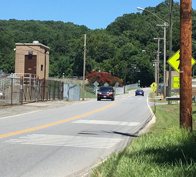
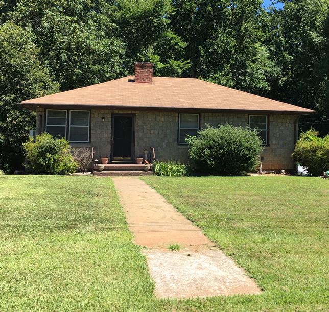
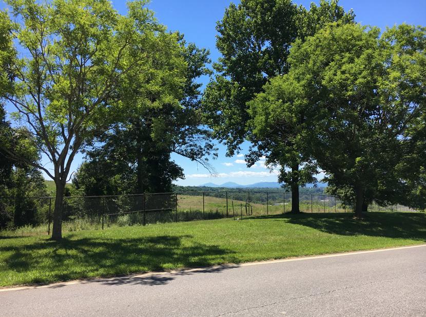
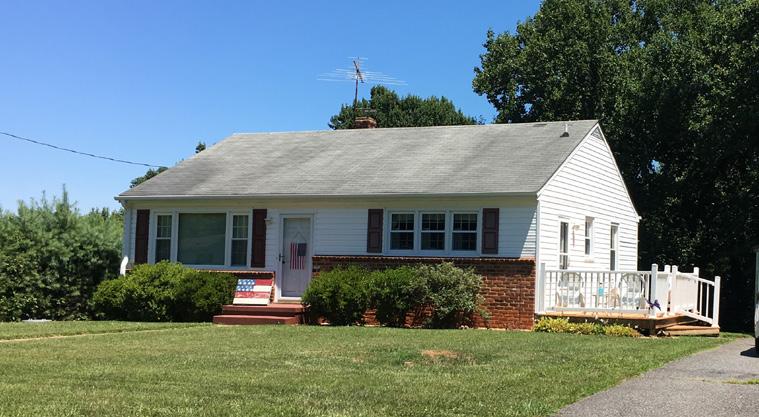
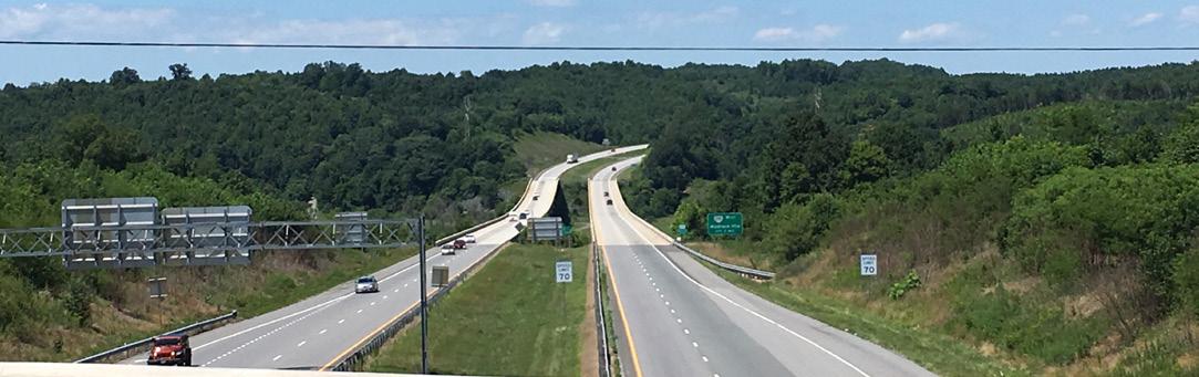
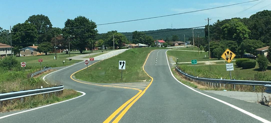
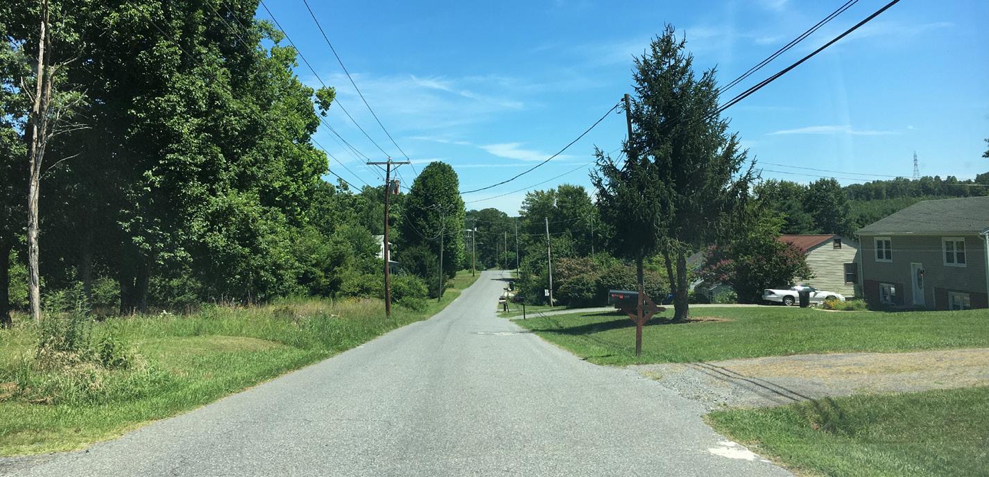
Photos of Tyreeanna / Pleasant Valley
B. SCOPE
The Tyreeanna / Pleasant Valley Neighborhood Plan is a long-range area plan to supplement the City of Lynchburg’s Comprehensive Plan 20132030 and the Downtown 2040 Master Plan. The physicalboundaries of the planning area align with the boundaries of the neighborhood and takes into consideration the interaction with Route U.S.29/U.S. 460 Bypass, the James River, and Downtown Lynchburg.
TYREEANNA & PLEASANT VALLEY NEIGHBORHOOD PLAN 9 CHAPTER 1: INTRODUCTION
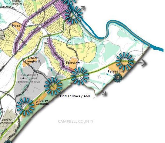
Diagram map illustrating neighborhood boundary, Route U.S. 460, river, main gateways, and green spaces.
a smart growth approach to tyreeanna / pleasant valley
Smart Growth is a planning theory that encourages economic growth, strong communities, and environmental health by concentrating growth in compact areas. Smart Growth gives priority to development that encourages a mix of building types and uses, provides better housing and transportation options, and fosters community engagement. At the core of the Smart Growth approach are the following central themes:
• Mix land uses
• Take advantage of compact design
• Create a range of housing opportunities and choices
• Create walkable neighborhoods
• Foster distinctive, attractive communities with a strong sense of place
• Preserve open space, farmland, natural beauty, and critical environmental areas
• Direct development towards existing communities
• Provide a variety of transportation choices
• Make development decisions predictable, fair, and cost effective
• Encourage community and stakeholder collaboration in development decisions
More than a vision, the Tyreeanna / Pleasant Valley Neighborhood Plan is a toolkit that will guide the neighborhood towards sustainable development. The plan aligns Smart Growth guidelines with the principles identified during the planning process to define the policies, projects, and initiatives that will help residents meet their community goals.
The topics covered in the plan include: Future Land Use, Connectivity & Neighborhood Design, Parks & Open Space, and Historic Resources. It also includes broader considerations to Moving Forward (Utility Infrastructure and Economic Development) and Implementation. For a complete summary of goals, policies, projects, and initiatives, see Chapter 11 Implementation.
C. KEY RECOMMENDATIONS
While all the recommendations of the plan are important in achieving the overall community vision, the recommendations below are identified as high-priority initiatives because of their strong potential to catalyze revitalization and promote sustainable growth in the Tyreeanna / Pleasant Valley neighborhood.
1. Define an identity for the neighborhood that builds upon its history and assets.
2. Establish an urban design palette that reflects the neighborhood’s identity into the built environment.
3. Designate a neighborhood commercial area for neighborhood residents.
4. Develop a greenway system.
5. Repurpose brownfield sites for future development.
6. Transform the landfill into an attractive public outdoor destination.
7. Protect historic sites from development.
8. Foster the development of housing types for diverse demographics (young families and aging population groups)
9. Develop a streetscape plan for complete streets.
10. Design and install city and neighborhood gateways.
TYREEANNA & PLEASANT VALLEY NEIGHBORHOOD PLAN 10 CHAPTER 1: INTRODUCTION
Right page: Illustrative master plan highlighting key initiatives proposed
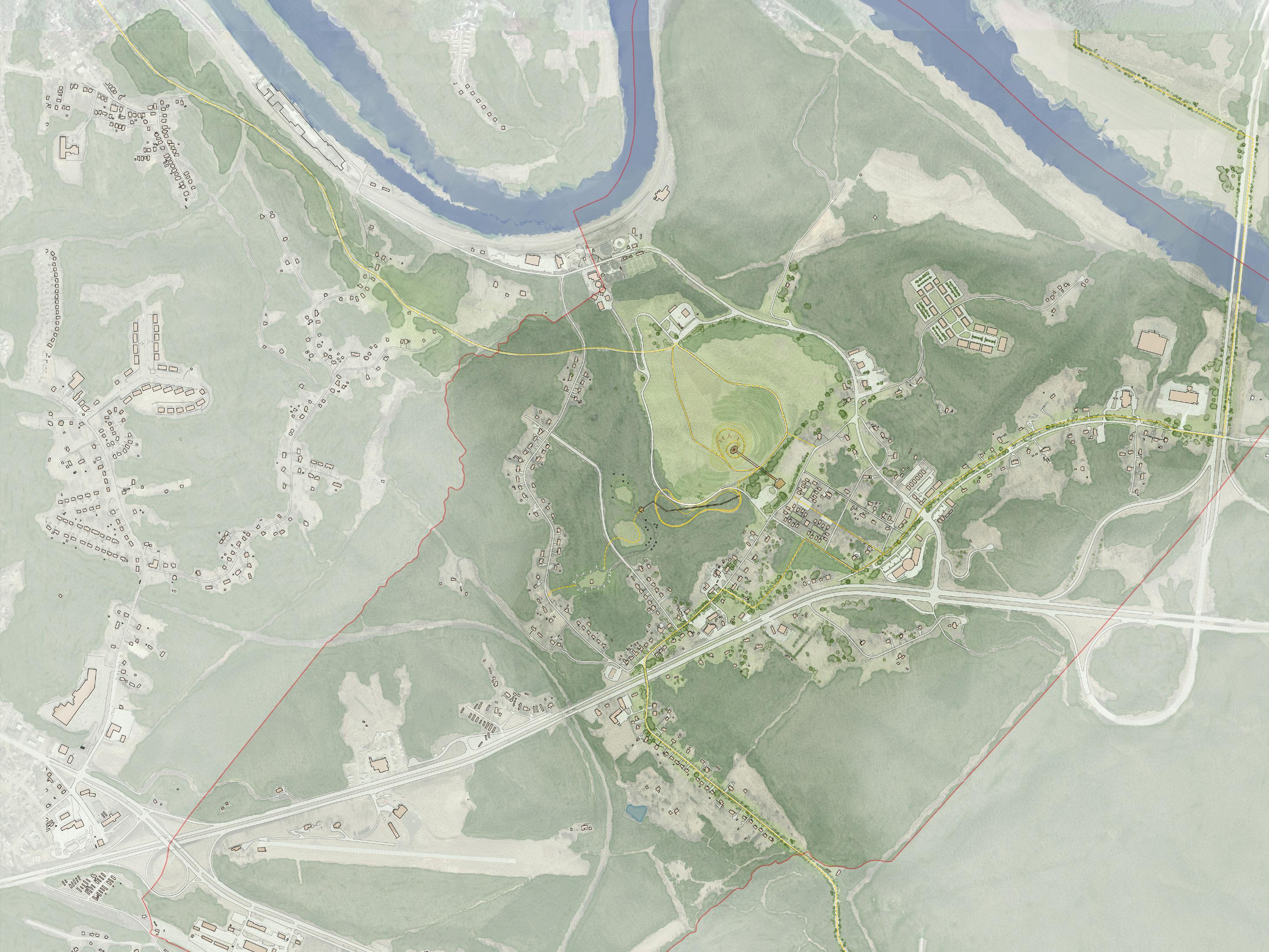
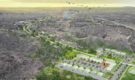
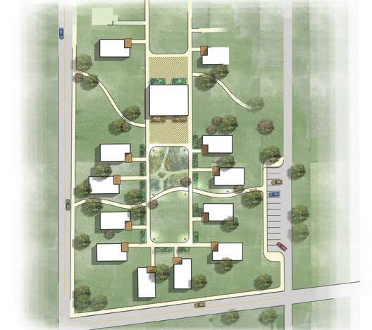
TYREEANNA & PLEASANT VALLEY NEIGHBORHOOD PLAN TYREEANNA PARK & TRAIL SYSTEM ConcordTpke. TyreeannaRd. PleasantValleyBlvd. U.S.Route460 HolcombPathRd. RockwellRd. CarnellLn. CarnellLn.(Extension) NewRoad New Road COMPACT HOUSING DEVELOPMENT MIXED-USE DEVELOPMENT GREENWAY (PHASE IV) HOLCOMB MULTI-MODAL BRIDGE CONCORD TPKE. ACCESS PROJECT GREENWAY (PHASE II) GREENWAY (PHASE I) GREENWAY (PHASE III) JAMES RIVER PARKWAY BUSINESS PARK DEVELOPMENT NEIGHBORHOOD COMMERCIAL DISTRICT BUSINESS RESEARCH PARK / MIXED USE-DEVELOPMENT (POTENTIAL) BUSINESS RESEARCH PARK (POTENTIAL) StathamRd. ConcordTpke. Turner Ln. SpinozaCir. NickersonRd. KavanaughRd. Rockwell Rd. MegginsonLn. U.S. Route 29 U.S.Route460 CampbellAve. FOUNDRY PARK (DOWNTOWN PLAN) MainSt. NEIGHBORHOOD GATEWAY SIGN CITY GATEWAY SIGN JAMESRIVER JAMESRIVER
PLEASANT VALLEY
UTLITIES EXPANSION NEIGHBORHOOD COMMERCIAL DISTRICT PLEASANT VALLEY BLVD. GREENWAY COMPACT HOUSING DEVELOPMENT HOLCOMB MULTI-MODAL BRIDGE NEIGHBORGOOD GATEWAY SIGN Central Green Community Garden Community Building Plaza Plaza Cottage House Communal Parking Alleyway Flowerbeds Street Lighting New Road New Road Compact Housing Development Concept N
TYREEANNA /
NEIGHBORHOOD PLAN
D. PREVIOUS PLANS
2003 tyreeanna / pleasant valley neighborhood plan
In2003,CityCounciladoptedtheTyreeanna/PleasantValleyNeighborhood
Plan as part of the Comprehensive Plan: 2002 - 2020. Major issues facing the neighborhood at the time included compatibility of existing land uses, post-landfill closure, the Route 29 Bypass, commercial development potential, and other factors.
As written, the 2003 Plan has remained largely unimplemented due to a lack of funding. This outcome, in combination with the sentiment of remaining residents regarding the neighborhood’s annexation into the Lynchburg in 1976, has eroded trust between the Tyreeanna / Pleasant Valley community and the City. In response, the City and Steering Committee are putting forward a more realistic plan for a cohesive and actionable vision. In contrast to previous efforts, this plan is meant to be a guide for City Council to prioritize resources in the upcoming years. It also provides a template to shape future development in a way that most benefits the existing community.
city of lynchburg comprehensive plan
The City’s Comprehensive Plan 2013 - 2030 establishes specific goals for all Lynchburg neighborhoods, as well as general goals applicable to the Tyreeanna / Pleasant Valley neighborhood. These include:
• LU-2: Foster a vibrant mix of stable neighborhoods and cultural centers, open spaces, and thriving commercial and industrial areas to reinforce Lynchburg’s quality of life in partnership with Lynchburg’s citizens.
• AP-1: Recognize and reinforce the unique character of different neighborhoods and corridors in the City; preserve the elements that strengthen each area; and foster changes that enhance the area’s stability, vitality, and resilience.
• AP-7: Revitalize and redevelop Tyreeanna to create a vibrant mixed-use neighborhood with strong connections to the River and Downtown in coordination with the City’s long-term landfill plans.
• ED-2: Lead and coordinate existing efforts regarding business development, encouragement of entrepreneurship, and recruitment strategies.
• NH-2: Promote well-designed mixed-use residential neighborhoods that incorporate a variety of housing types and densities with pedestrian-oriented streets, small-scale neighborhood-oriented services; and parks to where residents are able to live, work, and play close to home.
• HCA-2: Celebrate the rich cultural heritage of the area and promote the City and region as a destination for culture, arts, recreation, and history.
• HCA-5: Engage the community, build social capital, and encourage citizen leadership.
• PR-3: Provide access to parks, trails, and recreation facilities and programs.
• T-2: Enhance mobility for all residents through safe and convenient access to transportation choices that attend to the needs of pedestrians, bicyclists, transit riders, and motorists. Streets should help move goods and people while accommodating trees, stormwater, and other utilities that enhance Lynchburg’s livability.
• PU-1: Comply with all regulatory requirements to provide the citizens of Lynchburg with safe, dependable, and affordable services with sufficient system capacities to meet the City’s long-term requirements.
• PFS-3: Increase awareness of the quantity and quality of the public and private facilities and services available to City residents.
TYREEANNA & PLEASANT VALLEY NEIGHBORHOOD PLAN 12 CHAPTER 1: INTRODUCTION
downtown 2040
The Downtown 2040 Master Plan was created as a supplement to the Comprehensive Plan 2013 - 2030. Although the Downtown 2040 Master Plan does not include Tyreeanna / Pleasant Valley within its geographic scope, the reflected values, goals, and policies outlined in the plan have a relative impact on this neighborhood. Some of the recommendations of the plan as they relate to the Tyreeanna / Pleasant Valley community are:
• Design and implement Foundry Park.
• Develop a Public Art Plan.
• Adoptdesignguidesandimplementationproceduresfortransportation design to foster implementation of a Complete Streets Policy.
• Retrofit entryways into Downtown for bicyclists and pedestrians.
• Extend trails to neighborhoods.
• DevelopamasterplanfortheconstructionoftheJamesRiverParkway.
• Implement pedestrian and bicycle improvements on neighborhoods streets.
• Work with neighborhoods to identify and build potential spur trails.
• Increase bus frequency and enhance bus stops along key corridors.
• Extend paved trail network to reach additional neighborhoods and promote commuting via bicycle Downtown.
a blueprint for opportunity
Economic development trends indicate that more and more people are moving to urban areas. While some urbanites move for economic reasons, others seek places with unique cultural, aesthetic, and demographic characteristics. Building upon market research and demographic analysis, Lynchburg’s Blueprint for Opportunity is a 5-year strategic plan that will guide the City in its efforts to stay competitive as one of the best small cities in the country. The plan outlines specific goals and objectives that aim to establish a firm sense of place as well as attract and retain talent. Given the potential for growth in Tyreeanna / Pleasant Valley, the following objectives from the Blueprint for Opportunity are expected to have the most impact on future planning efforts in the neighborhood:
• 1.4 Develop the real estate, land, infrastructure, and incentive tools to support business expansion.
• 4.1 Adopt a placemaking strategy for Lynchburg’s downtown core and neighborhoods.
• 4.2 Create strategies for “tourism experiences” to drive visitor and tourism growth.
• 4.3 Improve Lynchburg’s connectivity
TYREEANNA & PLEASANT VALLEY NEIGHBORHOOD PLAN 13 CHAPTER 1: INTRODUCTION
E. ONGOING INITIATIVES
Lynchburg Parks Master Plan
The City of Lynchburg is currently working on a Parks and Recreation Needs Assessment and Master Plan effort. The assessment will identify the types of park facilities, programs, and operational improvements needed citywide. Currently, the project is still in the public input phase.
middle james river vision plan
In 2020, Amherst County was awarded participation in the National Park Service Rivers, Trails, and Conservation Assistance Program (RTCA), a nationally recognized program that provides NPS staff assistance to facilitate outdoor protection and recreational initiatives. The Amherst grant, which includes project partners the City of Lynchburg, Central Virginia Planning District Commission (CVPDC), and the James River Association (JRA), will guide a vision and action plan to expand interaction with the James River and its waterfront. The Middle James River Vision Plan is in the initial public input phase and there may be overlap between these projects, as the Tyreeanna / Pleasant Valley neighborhood has a significant amount of river shoreline at its border.
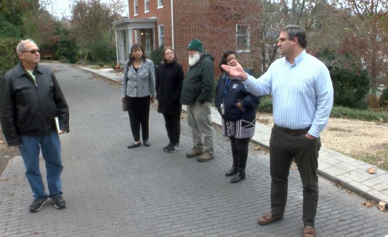
F. PLANNING PROCESS & COMMUNITY ENGAGEMENT
kick-off meetings
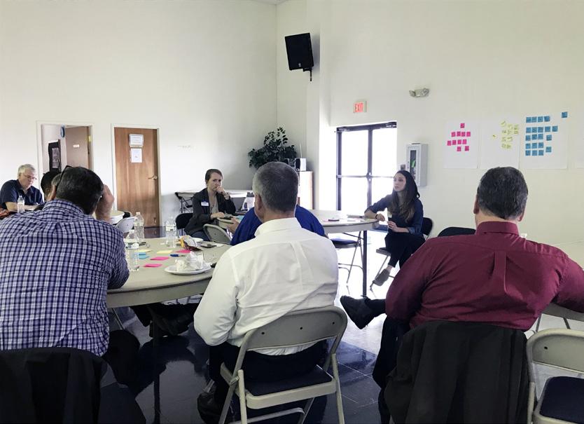
The planning process officially kicked-off in August of 2018 with a meeting between the consultant team and City staff. The discussion focused on the general scope of the plan and issues to cover, as well as the need to establish a community outreach strategy for the planning process. A steering committee structure consisting of City Department representatives and members of the Tyreeanna / Pleasant Valley neighborhood was recommended. City staff identified a number of key stakeholders and community leaders that would be invited to join the steering committee. The goal of this approach was to foster fruitful conversations regarding current and future needs of neighborhood residents as well the community’s vision for future improvement and growth.
focus group sessions
On the months following the kick-off meeting, the consultant team engaged in a series of round-table discussions with various City Departments, including Water Resources, Public Works, the Regional Landfill Authority, Neighborhood Services, Greater Lynchburg Transit Company (GLTC), and Parks and Recreation. The objective of these meetings was to get a better understanding of citywide objectives and initiatives impacting the Tyreeanna / Pleasant Valley neighborhood. Several topics surfaced during these conversations, with the most relevant listed as follows:
• Lynchburg has little land vacant left for development. Due to the magnitude of proposed utility extensions across the city and the lack of job centers in Tyreeanna / Pleasant Valley, the neighborhood and city would benefit from a larger economic-driven plan to extend sewer infrastructure east of Route U.S. 460 as part of an anchor strategy.
• The James River is an untapped resource for the neighborhood and the city. Strategies to increase access to the river for recreation should be addressed in this plan.
• The previous plan was driven primarily by road safety and improvement projects by the Virginia Department of Transportation (VDOT). The new plan needs to focus on addressing residents’ concerns as well as improving and strengthening the neighborhood as a vibrant community.
• While the decommissioned landfill is deemed unsuitable for conventional development, the large tract of land presents a great opportunity for an outdoor recreation destination and to catalyze growth.
TYREEANNA & PLEASANT VALLEY NEIGHBORHOOD PLAN 14 CHAPTER 1: INTRODUCTION
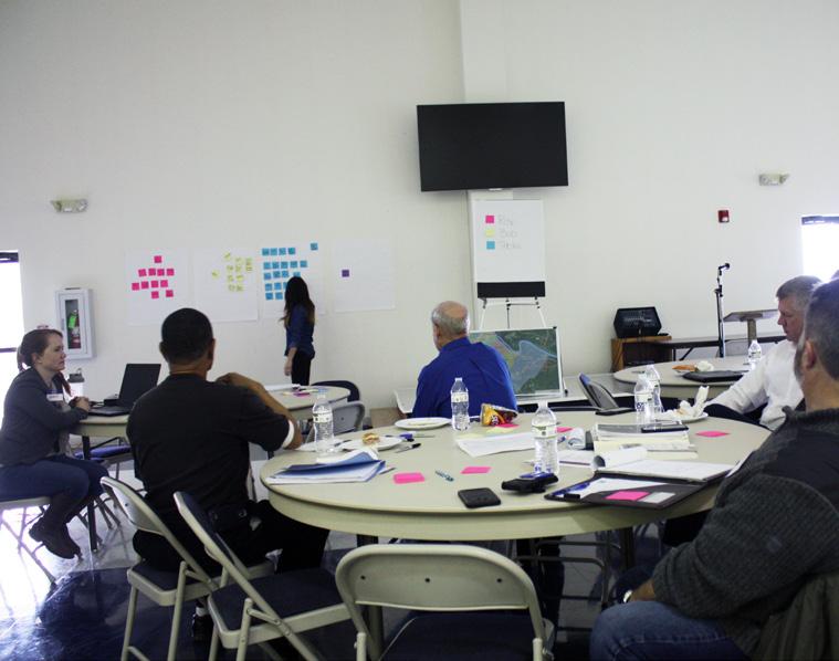
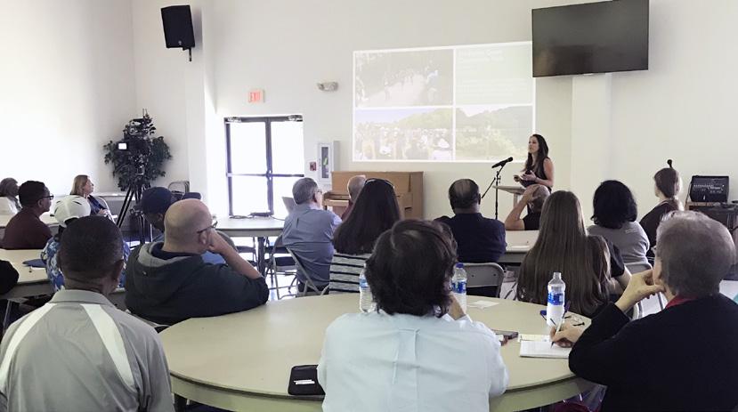
resident steering committee meeting
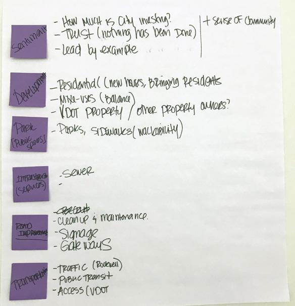
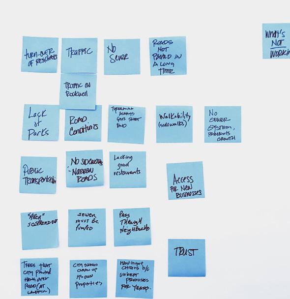
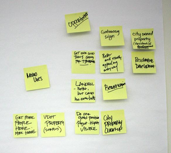
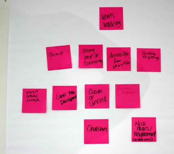
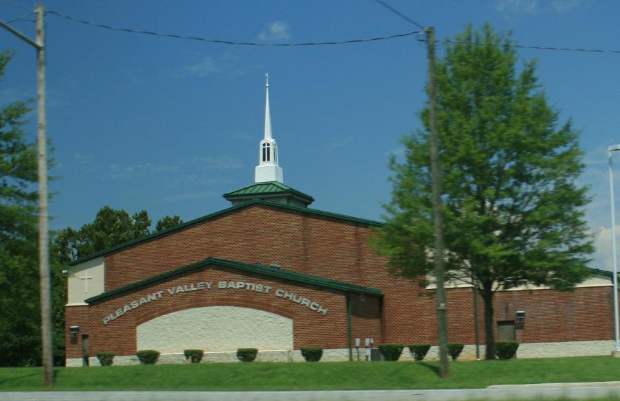
On February 15th, 2019, the project team hosted an initial steering committee meeting with neighborhood residents at the Pleasant Valley Baptist Church. The purpose of the event was to introduce the planning effort to the residents, connect with potential steering committee members, and foster an open conversation regarding community needs. Attendees participated in a “Rose, Bud, Thorn” exercise that helped the group identify the assets, opportunities, and challenges perceived in the Tyreeanna / Pleasant Valley neighborhood. Some of the general themes that emerged at the meeting include road improvements, public spaces, infrastructure, development types, and sense of community.
TYREEANNA & PLEASANT VALLEY NEIGHBORHOOD PLAN 15 CHAPTER 1: INTRODUCTION
Resident meeting at Pleasant Valley Baptist Church
Thoughts and themes from the Rose, Bud, Thorn exercise
The project team performed interviews to major property owners in the area to discuss their plans for development as well as potential alignment with city and neighborhood goals. There was a consensus that any initiative will take a concerted effort with Lynchburg’s main employers such as manufacturing companies and higher education institutions.
Major Property Holders
Tyreeanna Neighborhood
Study Area Boundary Structure Owners
City of Lynchburg
JOB LLC
Region 2000 Services Authority
Falwell Family/Airport
Virginia Holding Corp
Rock Tenn
State/VDOT
TYREEANNA & PLEASANT VALLEY NEIGHBORHOOD PLAN 16 CHAPTER 1: INTRODUCTION
stakeholder interviews
Pleasant Valley JAMESRIVER Multi College Conference Center Randolph College Virginia University of Lynchburg Lynchburg College Liberty College & University Central Virginia Community College TYREEANNA 1 Mile 5 Mile 3Mile MAINST MAPLE ST RIDGEAVE FRANKLINST HIGH ST PLEASANTVALLEY RD TULIPST DURHAMST TYREESTVIRGINIAS T PINEST E WOODROWST ELM ST HILLVIEW ST STATHAMRD PRINCE ST J U BILE E D R KAVANAUGHRD POSTONST R NICKERSON RD TEX SA A VE GREENFIELD DR GILMORE CIR HUDSONST POPLARST TYREEANNA RD W I N S TON RIDGE DR WINCHESTERST F L ORIDA AVE FLORIDA AVE MARTINST CONCORDTPKE ROCKWELL RD HOLCOMBPATHRD CAMPBELLAVE RTE 29 BYP RICHMONDHWY
Main Property Owners in Tyreeanna / Pleasant Valley Educational Institutions near Tyreeanna /
community workshop
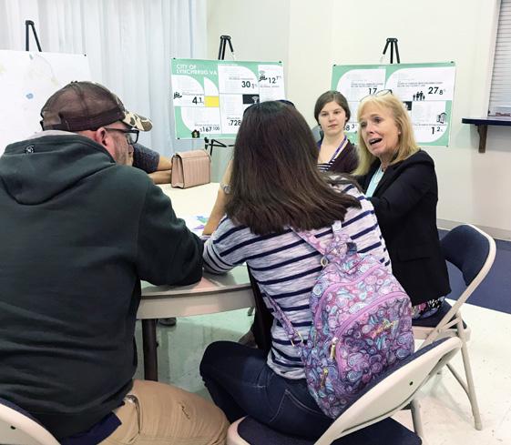
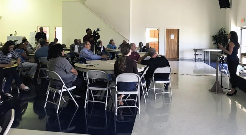
On May 13th, 2019, the project team hosted a community wide workshop at the Pleasant Valley Baptist Church. Neighborhood businesses and residents were invited to learn more about the City’s efforts to improve the neighborhood and to provide input on topics that surfaced at the Resident Steering Committee meeting.
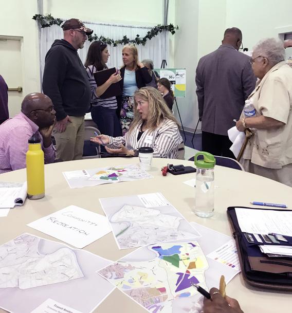
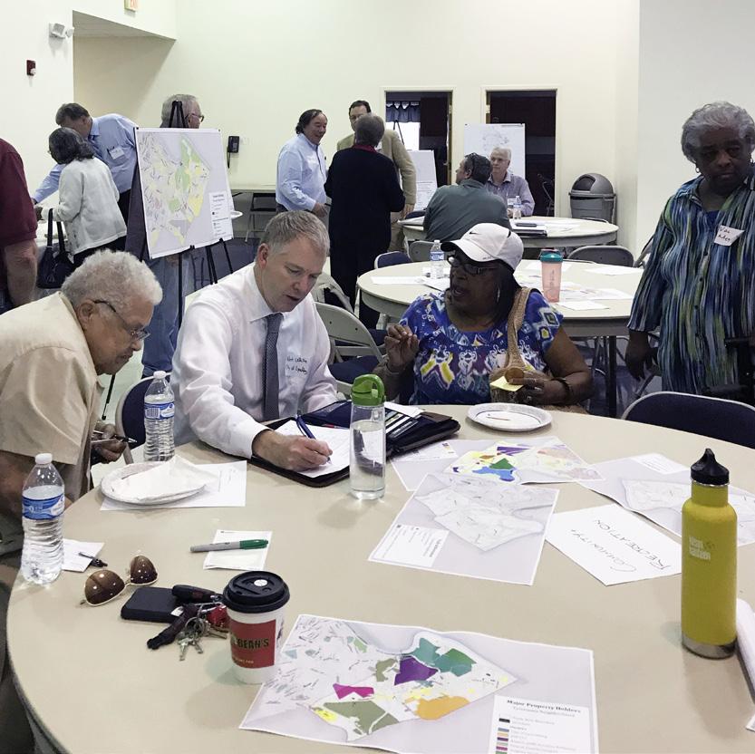
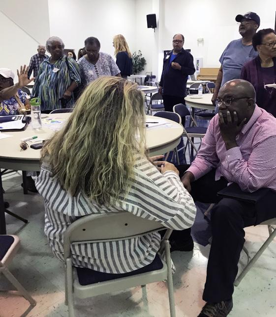
The first part of the workshop provided attendees with an overview of the project and updates regarding the planning process. Each attendee was asked to gather at one of four tables, for 10-15 minutes at a time, to share their thoughts and ideas on specific topics, including Community and Recreation, Economic Development, Land Use, Utilities, and Transportation. Key takeaways from topic discussions are listed below:
• In spite of population loss over the past few years, there is a strong sense of community in the neighborhood. Churches have become centers for resident support and activity. However, residential growth is needed for existing churches and businesses to survive.
• Increased traffic from U.S. Route 460 has become a challenge particularly in residential areas such as Rockwell Road, where vehicular and truck traffic have increased.
• Access to the neighborhood is difficult, specifically from Route U.S. 460, where entrances to local roads are restricted.
• Residents rely heavily on their vehicles as a mode of transportation yet they don’t believe there is demand for a bus route.
• Streetscape improvements are needed in order to make the neighborhood more walkable.
• Beautification, cleanliness, and property maintenance is a challenge across the neighborhood. Residents believe the City should lead by example in this regard.
• Parks and recreational areas that are accessible from residential areas and cater to diverse population groups are needed in the neighborhood.
• A zoning change at the corner of Pleasant Valley Road and Concord Turnpike creates challenges to develop a welcoming environment and gateway at this prominent intersection.
TYREEANNA & PLEASANT VALLEY
2040 Neighborhood Plan
COMMUNITY WORKSHOP

Time:
6pm - 8pm
For more information contact: Rachel Frischeisen rachel.frischeisen@lynchburgva.gov 434.455.3900
SAVE THE DATE !!!
May 13, 2019 @ 6pm
“ Why should I attend? ”
This workshop is an opportunity to learn more about the City’s efforts to improve our neighborhoods and provide input. Ideas will be collected on alternatives regarding land use, circulation, services, open space, and more to position Tyreeanna for success in years to come.
Location: Pleasant Valley Baptist Church 5517 Pleasant Valley Rd. (during service)
Please join us at the time and location shown here. Share your initial thoughts on the back side of this postcard and return by May 5th, 2019 to any of the locations below:
Share your thoughts below:
1.What is the most pressing need in the neighborhood
“ What’s happening?”
The Tyreeanna / Pleasant Valley Neighborhood Plan update presents an exciting opportunity to create a new vision for the future of our community. The process has been established as a collaborative that places neighborhood residents and businesses at the core of the plannnig process.
By engaging the public in this process, we will ensure that the plan is reflective of the community it serves.
Through a 6-month planning process, a steering committee and planning team will engage community members in conversations about the future of Tyreeanna and Pleasant Valley. Planning work with the consultant team, Hill Studio, includes data collection, public outreach, and a neighborhood-wide workshop
3.What are the top 3 priorities the neighborhood plan should address?
The outcome will be a community-driven plan to guide development in Tyreeanna and Pleasant Valley according to the vision set-forth by neighborhood residents and businesses.
2.What kind of development will help the neighborhood thrive? (check all the apply) Commercial Residential Industrial PLAN & DESIGN PHASE II LISTEN & GATHER PHASE I P RIORITIZE & STRATEG I Z E

Please join us in this community effort to create that vision!

Tyreeanna United Methodist Church 5215 Tyreeanna Rd (during service) DATA COLLECTION STEERING COMMITTEE DISCUSSIONS PUBLIC OUTREACH
ANALYZE DATA DESIGN WORKSHOP STEERING COMMITTEE DISCUSSIONS
FINAL MASTER PLAN PRIORITIZATION & BUDGETING FINAL PRESENTATION
Mixed-Use (commercial & residential) Recreation Other: PHASE III Community Workshop Flyer sent out to Tyreeanna / Pleasant Valley residents
TYREEANNA & PLEASANT VALLEY NEIGHBORHOOD PLAN 17 CHAPTER 1: INTRODUCTION
Pleasant Valley Baptist Church 5517 Pleasant Valley Rd. Lynchburg, VA 24504 Templeton’s Market 4928 Richmond Hwy. (daily)
City staff and members of the consultant team facilitated and documented conversations at each table.
Following the community workshop, the project team compiled ideas and thoughts from the event and identified common themes. These themes led to the development of the guiding principles and neighborhood goals of this plan.
The impact of COVID-19 caused the public process to be placed on hold while in-person meetings could not safely be held throughout the majority of 2020 and 2021. Although this delay was not ideal, the recommendations outlined in this plan are still relevant and important for improving quality of life in the Pleasant Valley / Tyreeanna neighborhood.
VIRTUAL NEIGHBORHOOD MEETING
On December 2, 2021, a virtual neighborhood meeting was held via Zoom. The meeting was available to view via the internet, City LTV Channel 15, Facebook, and later posted to Youtube. Participants were able to use the chat function to
TYREEANNA & PLEASANT VALLEY NEIGHBORHOOD PLAN 18 CHAPTER 1: INTRODUCTION
Community Workshop at Pleasant Valley Baptist Church
2.BACKGROUND AND HISTORY
A. NEIGHBORHOOD CONTEXT
background
The majority of the Tyreeanna / Pleasant Valley neighborhood is a low to medium density residential area with some industrial and public utility land uses. This area became part of the City of Lynchburg by order of annexation in 1976 from Campbell County.
As with many Virginia cities in the 1960s through 1980s, Lynchburg pursued annexation as a way to increase its developable land and thus its tax base during periods of increasing urbanization and costs of services. Since 1904 there were 160 annexation attempts across Virginia, with 128 (80%) being approved. The state issued a moratorium on annexations in 1987 which halted the rapid claiming of land.
Now that annexation is no longer an option for the land-constrained cities, the City of Lynchburg must look within its own boundaries to support a growing population while maintaining community character. The moratorium on annexation has also compelled localities (both cities and counties) to form partnerships and agreements to achieve economic prosperity for both parties.
TYREEANNA & PLEASANT VALLEY NEIGHBORHOOD PLAN 19 CHAPTER 2: BACKGROUND & HISTORY
! ! ! ! ! ( MAINST K N I G H T S T MAPLE ST RIDGEAVE FRANKLINST AUGUSTA ST HIGH ST PLEASANTVALLEY RD TULIPST DURHAMST POCAHONTASST TYREESTVIRGINIAS T PINEST GEORGIAAVE OTEY ST WOODROWST GLOBE ST ELM ST FORDST KINGST HILLVIEW ST STATHAMRD PRINCE ST J U BILE E D R KAVANAUGHRD POSTONST TOPRIDGEDR NICKERSON RD TEX SA A VE GUMST GREENFIELD DR DUKEST GILMORE CIR HUDSONST POPLARST TYREEANNA RD MAYFLOWERDR W I N S TON RIDGE DR ROBINSRD WINCHESTERST F L ORIDA AVE FLORIDA AVE MARTINST GRACEST CONCORDTPKE ROCKWELL RD HOLCOMBPATHRD CAMPBELL A VE 460HWY L Y N C H B URGEXPY CAMPBELLAVE RTE 29 BYP RICHMONDHWY Tyreeanna School Megginson School Megginson Cemetery Megginson Homestead Tyree Plantation Tyreeanna & Pleasant Valley ! Historic Resources Historic Resources Study Area Boundary
B. HISTORICAL SIGNIFICANCE
lower basin historic district
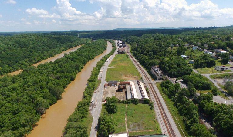
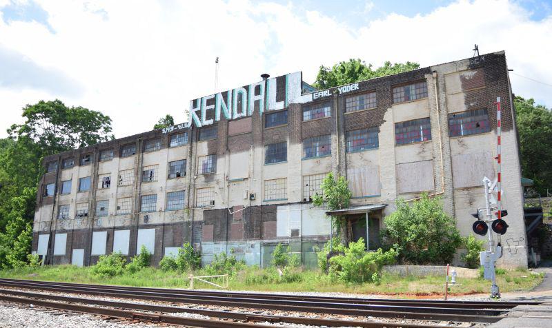
First listed in 1987, the Lower Basin Historic District includes prime examples of turn-of-the-20th-century industrial architecture. The industries that utilized the space were an important part of Lynchburg’s economy from the 1890s to the 1950s. In December 2018, an expansion of the Lower Basin was determined to be eligible for listing on the Virginia Landmarks Register and National Register of Historic Places. The expansion includes the area past Downtown and reaches to the south where Concord Turnpike makes a dogleg turn across the C&O Railroad corridor.
The expansion area remained an active and dense commercial and industrial corridor until the downturn of manufacturing and tobacco in the late 1980’s that lead to the current decline and vacancy of the area. This is particularly evident along the industrial corridor of Concord Turnpike. Several buildings have since been demolished due to neglect and deterioration, including the majority of the Lynchburg Plow Foundry and John H. Heald Company complex; however, remnants of both complexes remain, and the rest of the surviving buildings have been minimally altered since that time.
Lower Basin Expansion
While the James River was Lynchburg’s primary means of receiving and shipping goods and services, the Kanawha Canal and the C&O Railroad supplanted it during this time. This area was used for manufacturing, industry, and tobacco storage, along with general commercial use.
TYREEANNA & PLEASANT VALLEY NEIGHBORHOOD PLAN 20 CHAPTER 2: BACKGROUND & HISTORY
DUNBARDR[PVT] 11THST 18THST MAINST K N I G H T S T PEARLST 10THST MAPLE ST BUENAVISTAST 13THST FRANKLIN ST BRANSFORDST HAZELST AUGUSTAST HIGH ST TAYLORST UNIONST MONROEST BLUFFST TULIPST VIDENCEPL 17THST TYREE ST VIRGINIA ST 16THST KEMPERST WALNUTST PINEST DUNBARDR ROSEST POLKST 19THST VINE ST GLOBEST IVY ST LAUREL ST DUDLEY ST ANN ST HORSEFORDRD HILLVIEWST JUBILE E D R LOCUST ST GUM ST ELM ST LANI ER ST AVANAUGH RD 15THST CONCORDTPKE L O RAINEST HUDSONST 14THST CLAYST POPLARST IDGE RD WASHINGTONST MADISONST ROBINSRD EASTLYNCHST WINCHESTER ST F L O R IDA AVE GRACEST M I L L E R S T GRACE ST MAINST CHURCHST 12THST LYNCHBURGEXPY Local Historic District State National Historic District Lower Basin Expansion
Study Area Boundary Corporate Limit
LOWER BASIN TO TYREEANNA / PLEASANT VALLEY
Chestnut Hill
Located just outside the neighborhood study area, 2205 Concord Turnpike was owned by Charles Lynch, Sr. and was known as Chestnut Hill. Charles Lynch, Sr. was the father of John Lynch, founder of Lynchburg. This tract of land was divided between Lynch's heirs and part of it was the original land for the City of Lynchburg.
The original house on the property is said to have burned some time after Lynch's death; however, there may be some outbuildings that date to the Lynch period that are still standing. There is also a large grave marker near the house which, based on size and apparent age, is suspected to be the grave marker for Charles Lynch.

TYREEANNA & PLEASANT VALLEY NEIGHBORHOOD PLAN 21 CHAPTER 2: BACKGROUND & HISTORY
Photos of Lower Basin Expansion Area
Chestnut Hill, located near the intersection of Concord Turnpike & Rockwell Road
pleasant valley
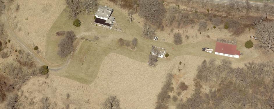
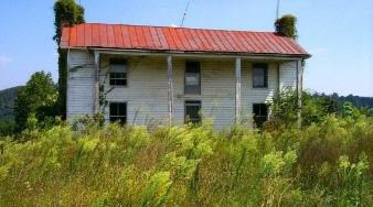
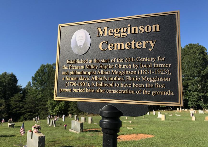
Megginson Homestead
The Megginson family has been an integral part of Pleasant Valley since the 1880s, when the Megginson Homestead at 6080 Pleasant Valley Road was established. The homestead was the final home of Hanie Megginson (~1796 – 1901), who lived free for 35 years after being enslaved since birth and was the matriarch of the Megginson family. Her son, Albert Megginson (1831-1923), became a key historic figure in the area. Albert bought land after the Civil War to create his homestead and donated a portion of that land to the African American community. At the height of its production, the homestead contained 34 acres of improved land; encompassed 100 acres of woodland; raised cows, pigs, horses, and chickens; and grew oats, wheat, flint corn, and tobacco.
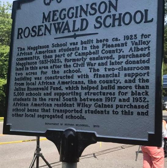
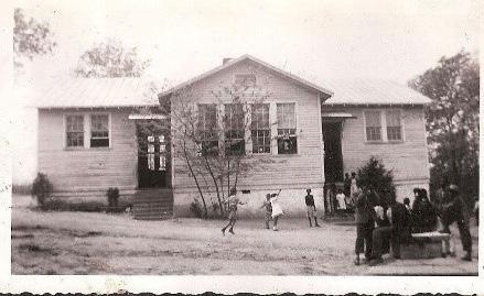
Megginson School
While neither Albert Megginson nor his wife Judie Johnson Megginson (1840-1925) could read or write, they valued learning and made educational opportunities available for their children and community. One of the pieces of land that Albert Megginson donated was for an African-American Church/School which was named the Megginson School in his honor. The school cost a total of $5,000: $300 was provided by the African-American community, $4,000 from a local school board, and the remaining $700 from the Julius Rosenwald Fund. The Rosenwald fund was established during Reconstruction and leveraged private funding to construct schools for African-Americans with little access to public education. There were over 5,000 Rosenwald schools built in the Southern U.S., with more than 600 in the state of Virginia.
TYREEANNA & PLEASANT VALLEY NEIGHBORHOOD PLAN 22 CHAPTER 2: BACKGROUND & HISTORY
Megginson Homestead
Historic Photo of Megginson Rosenwald School
Historical Marker for Megginson Rosenwald School
Historical Significance of Rosenwald Schools
Rosenwald schools are eligible for listing in the National Register of Historic Places under Criterion A (Education, Ethnic History –African American), and Criterion C (Architecture) with a period of significance from 1917 to 1932.
Under Criterion A the Rosenwald schools are eligible for their association with Rosenwald School Building Fund which constituted an important avenue for the advancement of African-American education during much of the first half of the twentieth century. The Julius Rosenwald Fund contributed to the construction of 664 schools, 18 teachers’ homes and vocational buildings in Virginia.
The school buildings reflect not only one of the most ambitious school building projects ever undertaken but they symbolize the AfricanAmericans’ struggle for educational opportunities in a segregated South. They are also eligible under Ethnic Historic - African American for their association with the development of important community centers for African American communities and often set the standard for the neighborhood in regard to architecture, sanitation, and maintenance.
Under Criterion C they are eligible in the area of Architecture. The Rosenwald schools reflect innovations in educational architectural design and set the standard for school construction for years to come. One of the greatest contributions of the Julius Rosenwald Fund was the development of floor plans and specifications for a variety of schools. These plans and specifications ensured every community a quality school.
The designs commissioned by the Rosenwald School Building fund revolutionized rural school architecture. See the Rosenwald Schools in VA MPD for additional information
Source:https://www.dhr.virginia.gov/wp-content/uploads/2018/04/012-5041_ Rosenwald_Schools_2004_NRHP_MPD_FINAL.pdf
Besides funding, the Rosenwald Fund also provided plans for the school, which is a textbook example of “Floor Plan No. 20, Two Teacher Community School, to face East or West only.” The plan was published by the Rosenwald Fund in a booklet titled “Community School Plans” in 1924, though its use for this school (built 1-2 years earlier) is evidence that the Fund was providing the plans to communities before they published the booklet.
Today, the Megginson School is located at 136 Spinoza Circle, which has been recognized by the Virginia Department of Historic Resources as a property meeting the criteria for listing on the National Register of Historic Places as presented in the Rosenwald Schools of Virginia MPD.
Megginson Cemetery & Pleasant Valley Baptist Church
The Megginson Cemetery may have been the site of the first one room ChurchSchool for African-Americans in the area before the Megginson School was established.
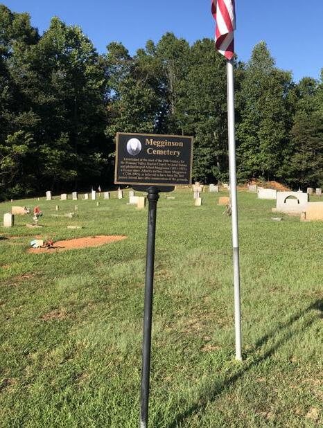
In addition to providing land for the Megginson School, Albert Megginson also donated land to Pleasant Valley Baptist Church.
TYREEANNA & PLEASANT VALLEY NEIGHBORHOOD PLAN 23 CHAPTER 2: BACKGROUND & HISTORY
Megginson Cemetery on Megginson Lane
tyreeanna area
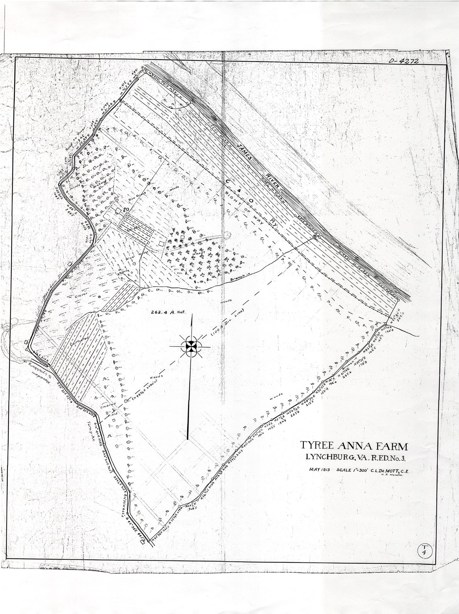
Tyree Plantation
Located on what is today known as Kavanaugh Road, the Tyree Plantation was a tobacco farm that overlooked the James River and was a stop on the railroad leading from Richmond westward. Built in the mid-1800s by John Henley Tyree (1806-1876) and Anna Phoebe Bransford Tyree (18121876), the plantation house was turned into a hotel in the 1880s, and later burned in 1936. The Tyreeanna name is presumed to have originated from the Tyree Plantation.
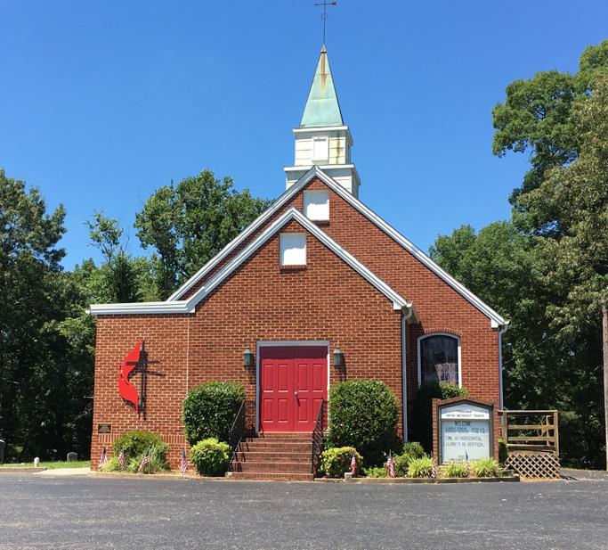
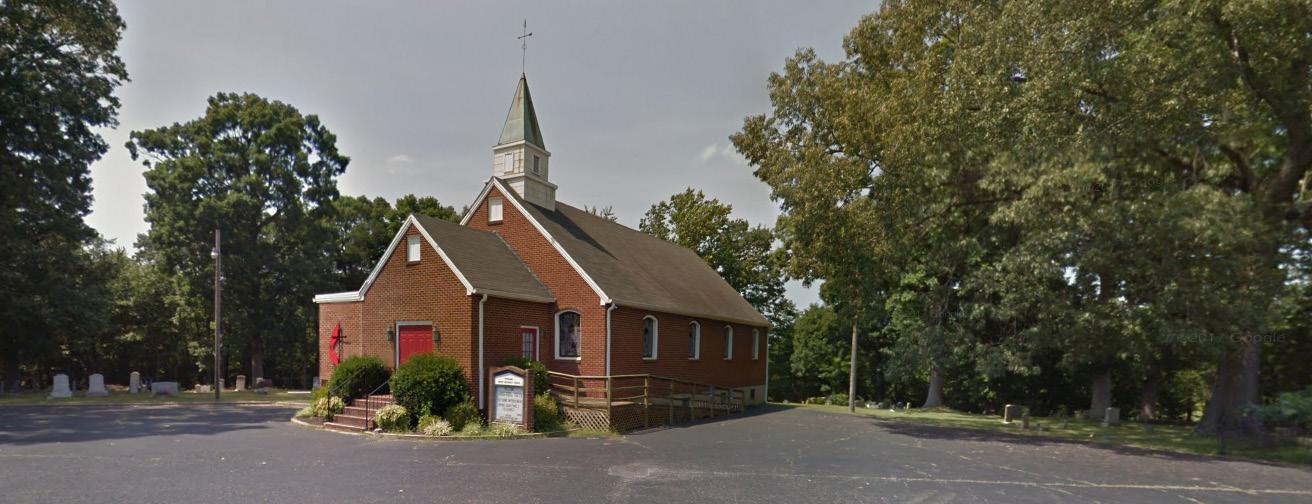
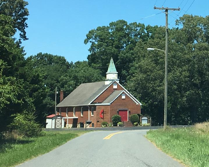
Tyreeanna United Methodist Church
Located at 5219 Tyreeanna Road, this church was founded in 1857 through John Henley Tyree and Anna Phoebe Bransford Tyree, owners of the Tyree Plantation. The original church was destroyed in a fire on March 31, 1953. The current church structure was constructed later that year.
TYREEANNA & PLEASANT VALLEY NEIGHBORHOOD PLAN 24 CHAPTER 2: BACKGROUND & HISTORY
Tyreeanna United Methodist Church
3.EXISTING CONDITIONS
A. DEMOGRAPHICS
The following demographic information has been analyzed to compile important characteristics for the Tyreeanna / Pleasant Valley neighborhood. The data, provided by ESRI Community Analyst, combines projections with the 2010 Census to provide valuable insight in identifying this plan’s recommendations and guiding future planning efforts.
population & households
As of 2019, there were a total of 628 residents estimated in the neighborhood. Roughly 50% of residents identify as white alone and 45% identify as black alone. In terms of age group, there is a significant concentration of baby boomers ranging between the ages of 45 and 80 years old (44%). There is also a smaller concentration of children under 14 years old (18%). There were approximately 257 households. From conversations with residents of the Tyreeanna / Pleasant Valley neighborhood, there is the possibility that many children in the area are living with their grandparents. The median household income is $43,102.
occupancy, tenure and home values
Based on 2019 estimates, about 256 of 290 housing units were occupied (88%) while the rest are vacant. Of the occupied housing units, approximately 57% are owner-occupied while the rest are rented. Most housing structures in the neighborhood are single-family homes valued between $86,000 and $105,000.
Source: esri Community Analyst (U.S. Census Bureau, Census 2010 Summary File 1. Esri forecasts for 2021 and 2026 Esri converted Census 2000 data into 2010 geography)
TYREEANNA & PLEASANT VALLEY NEIGHBORHOOD PLAN 25 CHAPTER 3: EXISTING CONDITIONS
Tyreeanna Neighborhood LynchburgVirginia Population Total 625 82,517 8,685,513 By Gender Male 317 35,474 4,273,370 Female 299 40,094 4,412,142 By Race Black 45.2% 64.4% 65.1% White 50.0% 29.3% 19.5% By Age Under 10 11.5% 10.5% 11.5% 10‐14 6.1% 4.9% 6.2% 15‐24 10.2% 22.0% 12.7% 25‐34 12.1% 15.3% 13.8% 35‐44 13.4% 10.3% 13.2% 45‐54 11.1% 9.1% 12.5% 55‐64 15.3% 10.5% 13.3% 65‐74 12.1% 9.1% 10.1% 75‐84 5.3% 5.4% 4.8% 85+ 2.7% 2.8% 1.8% Households Total 257 31,165 3,309,888 Type Family 167 17,512 2,186,215 Non‐Family 90 13,653 1,123,673 Income Median Household Income $43,102 $51,966$76,442 Housing Housing Units Total 290 34,974 3,651,919 Occupied 57.2% 92.2% 90.7% Vacant 11.4% 7.8% 9.4% Ownership Owner Occupied 57.2% 54.0% 60.5% Renter Occupied 31.4% 38.2% 30.2% House Value Median $98,913 $181,090$311,462
B. LAND USE
existing land use
The Tyreeanna / Pleasant Valley neighborhood is a low-density community characterized primarily by residential blocks with some industrial and commercial uses throughout. There is also a heavy concentration of “taxexempt” parcels that are managed by city, state, and non-profit entities such as churches. Most of these parcels are located along main corridors including U.S. Route 460, Campbell Avenue, and Concord Turnpike. (See Current Land Use Map below).
In 2008, the Virginia Department of Transportation (VDOT) acquired properties and easements along the U.S. Route 460 corridor as part of the safety improvement project. Close to 30 parcels from the U.S. Route 29 Bypass to U.S. Route 501 (Campbell Avenue) were purchased for rightof-way construction, maintenance, and utility relocations. The goal of the project was to create a limited access highway in order to address traffic safety concerns.
Limited access routes are those routes that restrict the number and locations of access points. Limited access highways provide high levels of safety, especially when traffic volumes are high, and allow traffic to flow safely at higher speeds. These facilities nearly eliminate the types of incidents usually found at or near intersections and entrances
Source http://lynchburg.granicus.com/MetaViewer.php?view_id=4&clip_id=710&meta_id=10912
Currently, VDOT is exploring the opportunity to liquidate and sell properties associated with the safety improvement project. Many of these parcels are categorized as stormwater retention areas and are attached to environmental quality credits managed by the Department of Environmental Quality (DEQ). The City of Lynchburg will have to collaborate closely with VDOT to establish a strategic plan for their use.
TYREEANNA & PLEASANT VALLEY NEIGHBORHOOD PLAN 26 CHAPTER 3: EXISTING CONDITIONS
Current Land Use Map MAINST MAPLE ST HIGH ST PLEASANTVALLEY RD TULIPST DURHAMST TYREESTVIRGINIAS T PINEST E WOODROWST ELM ST HILLVIEW ST STATHAMRD PRINCE ST J U BILE E D R KAVANAUGHRD POSTONST R NICKERSON RD TEX SA A VE GREENFIELD DR GILMORE CIR POPLARST TYREEANNA RD W I N S TON RIDGE DR WINCHESTERST F L ORIDA AVE FLORIDA AVE MARTINST CONCORDTPKE ROCKWELL RD HOLCOMBPATHRD CAMPBELLAVE RTE 29 BYP RICHMONDHWY Tyreeanna Neighborhood Residential VACANT - RESIDENTIAL VACANT - MULTI FAMILY Commercial VACANT - COMMERCIAL Industrial VACANT - INDUSTRIAL Tax Exempt (City, Churches etc.) Mobile Home Park Public Service (Railways) Current Land Use According to Assessor Records Study Area Boundary Corporate Limit
future land use map (FLUM)
The Future Land Use Map is a tool the City uses to guide future development and public improvement efforts. It is intended to work with the policies and the Plan Framework Map contained in the City of Lynchburg Comprehensive Plan to determine whether a specific zoning category is appropriate in meeting citywide goals.
Currently, the FLUM designates most City-owned land on the north side of Concord Turnpike for public use and the previous landfill site for a public park. The map also suggests a mix of low and medium-density residential and expects this land use to extend south of U.S. Route 460, along with mixed-use development.
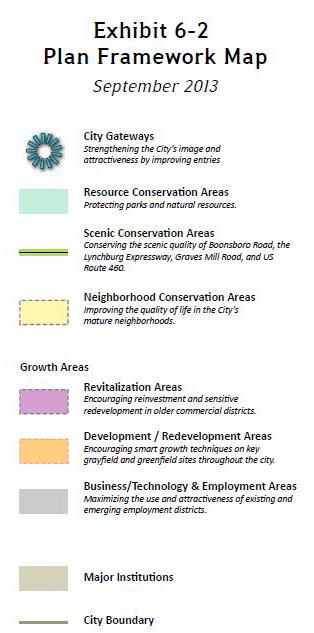
plan framework map
The Plan Framework Map within the Comprehensive Plan illustrates development patterns for the City of Lynchburg, including areas where changes are encouraged and expected. The plan identifies three main City gateways located within the boundaries of the Tyreeanna / Pleasant Valley neighborhood. While the gateway at the junction of U.S. Route 460 and Campbell Avenue is well defined, the other two lack identity. Improvements to the intersections of Route U.S. 460 and Concord Turnpike, Holcomb Path Road, and Pleasant Valley Boulevard are recommended.
The Tyreeanna / Pleasant Valley Neighborhood Plan looks at land use patterns that will protect and enhance residential areas while promoting sustainable development. Recommendations give priority to policies and initiatives that will improve walkability, connectivity, and a sense of place. Proposed changes to the FLUM and the Plan Framework Map set the foundation for the recommendations of this plan.
Future Land Use Map (FLUM) (top)
Plan Framework Map (bottom)
TYREEANNA & PLEASANT VALLEY NEIGHBORHOOD PLAN 27 CHAPTER 3: EXISTING CONDITIONS
MAINST K N I G H T S T MAPLE ST RIDGEAVE FRANKLINST AUGUSTA ST HIGH ST PLEASANTVALLEY RD TULIPST DURHAMST POCAHONTASST TYREESTVIRGINIAS T PINEST GEORGIAAVE OTEY ST WOODROWST GLOBE ST ELM ST FORDST KINGST HILLVIEW ST STATHAMRD PRINCE ST J U BILE E D R KAVANAUGHRD POSTONST TOPRIDGEDR NICKERSON RD TEX SA A VE GUMST GREENFIELD DR DUKEST GILMORE CIR HUDSONST POPLARST TYREEANNA RD MAYFLOWERDR W I N S TON RIDGE DR ROBINSRD WINCHESTERST F L ORIDA AVE FLORIDA AVE MARTINST GRACEST CONCORDTPKE ROCKWELL RD HOLCOMBPATHRD CAMPBELL A VE 460BYP L Y N C H B URGEXPY CAMPBELLAVE RTE 29 BYP RICHMONDHWY Tyreeanna Neighborhood Traditional Residential Low Density Residential Medium Density Residential High Density Residential Neighborhood Commercial Community Commercial Employment 2 Downtown Institution Public Use Public Parks Resource Conservation Mixed Use Future Land Use Study Area Boundary Corporate Limit
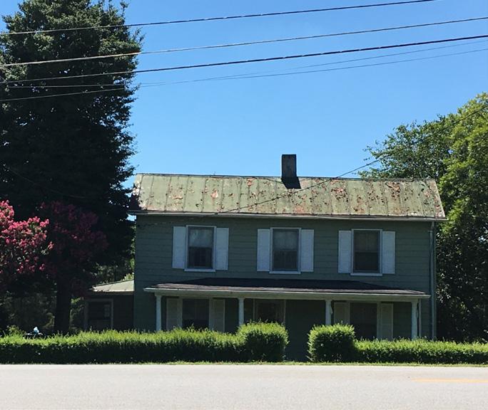
C. PHYSICAL ENVIRONMENT AND FORM structures
Single-Family Homes and Community
Residential areas in the Tyreeanna / Pleasant Valley neighborhood are primarily located along Rockwell Road, Holcomb Path Road, Tyreeanna Road, Carnell Lane, and Statham Road Housing units are single-family homes of craftsman and vernacular architectural style. Most residences in the neighborhood were built in the early-to-mid 1900’s on large tracts of land. Given the age of housing stock, the demographic data showing a concentration of young children in Census tract 19, and high rental occupancy, there is an increased potential for lead exposure in this area. This plan recommends the exploration of a lead abatement program as a potential tool to ensure safety and to help spur revitalization of the neighborhood.
There are three main churches in the neighborhood which have become centers for community activity: Tyreeanna United Methodist Church, Pleasant Valley Baptist Church, and Saint James Episcopal Church.
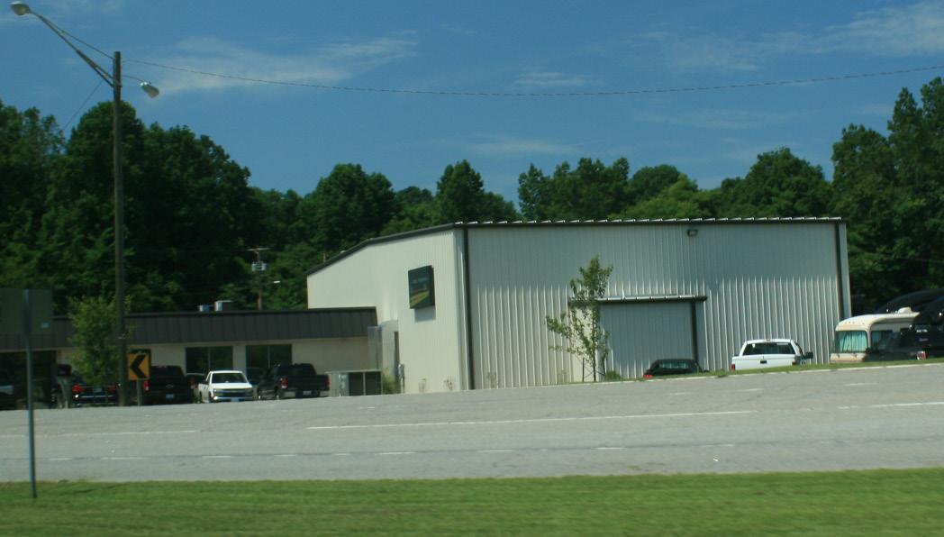
Commercial and Industrial
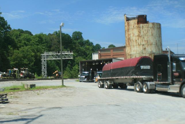
CommercialstructuresarelimitedinTyreeanna/PleasantValley.Onestore and several office buildings are scattered throughout the neighborhood, mainly along Concord Turnpike and U.S. Route 460. There are also a few industrial facilities along Tyreeanna Road and Pleasant Valley Road.
During the public engagement process, many residents identified the need and desire for more retail and restaurant facilities in the neighborhood. A balanced mix of uses in a defined core area could provide the community with basic businesses and services within walking distance from residential areas, fostering a more vibrant neighborhood.
TYREEANNA & PLEASANT VALLEY NEIGHBORHOOD PLAN
28 CHAPTER 3: EXISTING CONDITIONS
Various types of structures in the Tyreeanna / Pleasant Valley neighborhood
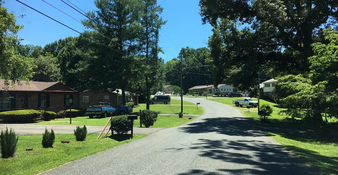
street network
The area within Tyreeanna / Pleasant Valley is served by a network of neighborhood-scale two-lane streets that provide access to regional facilities such as U.S. Route 29/U.S. 460 Bypass and to Downtown Lynchburg via Concord Turnpike. The neighborhood streets are somewhat disjointed and lack a strong “street grid.” The exception to the typical two-lane configuration is the U.S. Route 29/U.S. 460 Bypass, which over time has morphed into an expressway with four travel lanes and highly-controlled access. This transformation created a corridor carrying large amounts of regional traffic at high speeds and a barrier between the north and south portions of Tyreeanna / Pleasant Valley. Access between the two sections of the neighborhood is only afforded at a couple of locations and in an indirect manner that requires u-turns. Given the regional significance of Route U.S. 29/U.S. 460 Bypass, changes to this corridor would be problematic. However, there could be opportunities to reconnect the two sections of the neighborhood through complete street connections above grade (see Chapter 5 Connectivity & Neighborhood Design).
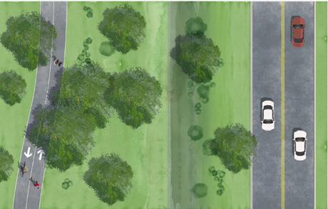
The other exception to the neighborhood’s typical street configuration is the underutilized Pleasant Valley Road. This is the previous Route U.S. 29/ U.S. 460 corridor prior to the new alignment of Route U.S. 29 north toward Charlottesville and the large interchange at the eastern boundary of Tyreeanna. Pleasant Valley Road has two lanes in each direction, divided by a grass median.
TYREEANNA & PLEASANT VALLEY NEIGHBORHOOD PLAN 29 CHAPTER 3: EXISTING CONDITIONS
Street character in Tyreeanna / Pleasant Valley
mobility
Currently, it is very challenging to move to, from, or around the Tyreeanna /PleasantValleyneighborhoodwithouttheuseofapersonal motorvehicle. Even in a car, it can be a challenge to get from the north side of the neighborhood to the south side. Fixed route transit service to Downtown, Liberty University, and other destinations is simply not available today. Finally, there is a lack of network for active transportation. In many areas of the neighborhood sidewalks are discontinuous or missing, making pedestrian safety a challenge. In addition, there are no dedicated bicycle facilities, so anyone who wants to ride a bike must share the road with vehicles – including large trucks. On narrow connections with blind hills and curves, such as Concord Turnpike and Tyreeanna Road, cycling can be extremely dangerous for both the rider and the driver.
None of the streets within the neighborhood can be characterized as “complete streets,” as they are geared primarily to moving motor vehicle traffic. Complete streets are those that are designed for the safety and convenience of all users, regardless of their mode of transportation. Prioritizing the design of complete streets in terms of network, connectivity, and mobility alternatives will give Tyreeanna / Pleasant Valley residents choices regarding the way they move within and around their neighborhood. From a broader perspective, complete streets can render significant environmental, economic, and health benefits to the community.
Lastly, there are opportunities to reclaim unused capacity on Pleasant Valley Road for other uses. It is important for truck traffic to remain and serve existing industrial uses. Other modes of travel, such as biking and walking, can besafelyseparatedfromthis trafficusing much oftheexisting infrastructure (see Chapter 5 Connectivity & Neighborhood Design).
TYREEANNA & PLEASANT VALLEY NEIGHBORHOOD PLAN
30 CHAPTER 3: EXISTING CONDITIONS
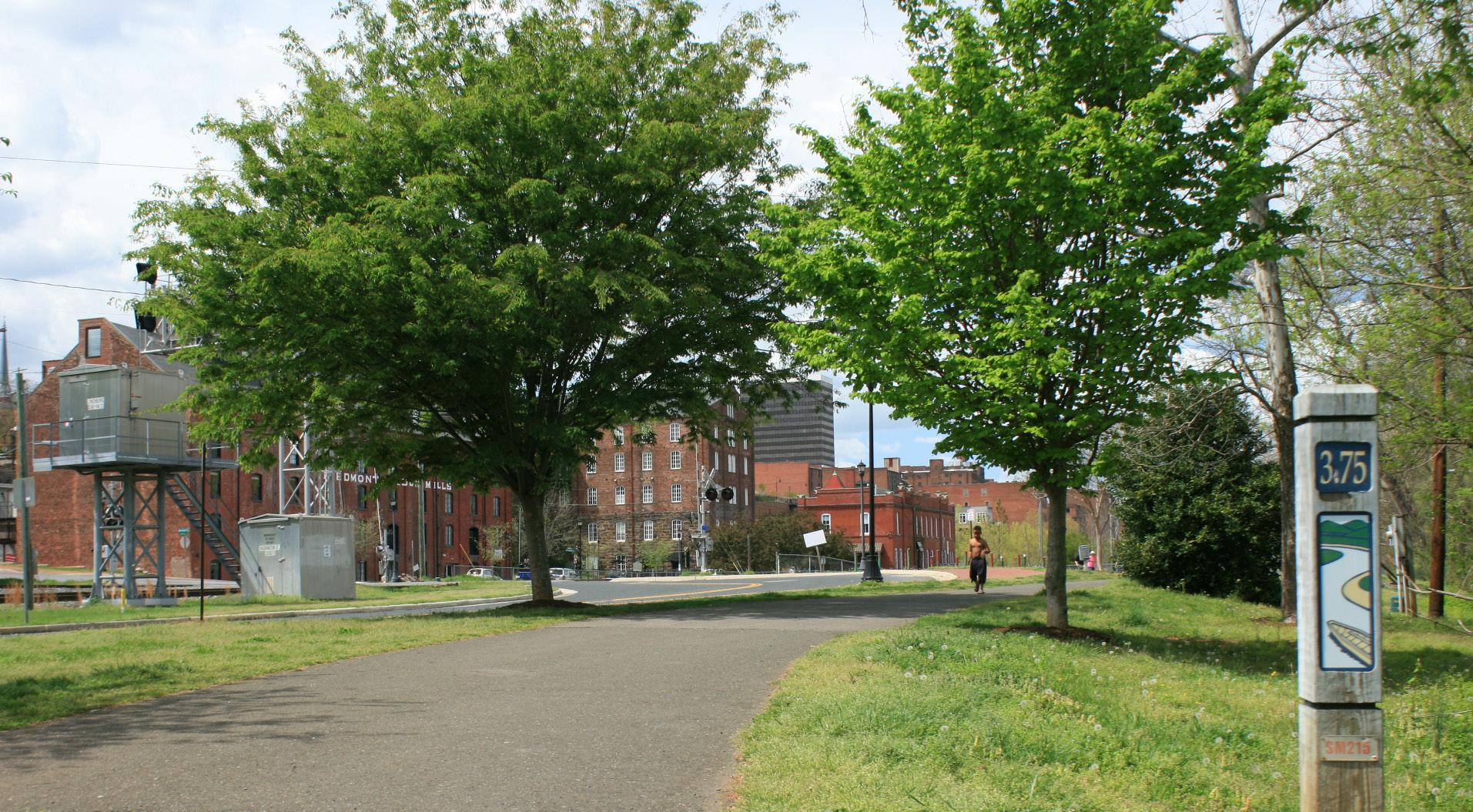
Dedicated pedestrian and bicycle facilities in Downtown Lynchburg improve connectivity and promote walkability
Currently streets in Tyreeanna / Pleasant Valley are not conducive to walking and/or biking
utility infrastructure
The utilities provided by the City’s Department of Water Resources to residents in the Tyreeanna / Pleasant Valley neighborhood are limited by topography. Currently, there is public water service throughout the area, but the sanitary sewer service is not readily available.
The public sewer main that serves the region stops at the top of the hill near the former landfill. The line is fed by gravity down to the City’s Wastewater Treatment Plant. While this part of the main works without complication, it is difficult to serve the neighborhood on the other side of this hill. Multiple pump stations are needed to bring sewer to that area. Unfortunately, a sewer study conducted by the City in 2005 found this project to be cost prohibitive, barring some major developmentalincentive.
Currently, residents must use private septic drain field systems. The lack of sewer hinders growth opportunities for the region. During the community workshop, a business located in the neighborhood described their private sewer system as very costly to maintain and welcomed the idea of sewer service. Another participant maintained that getting new drain fields to pass the Health Department’s percolation tests has been difficult.
Although residents understand that improved infrastructure and more diverse land uses would help promote growth, they were also concerned with the impacts new development would have on density. The community stressed that they would like Tyreeanna / Pleasant Valley to remain a residential neighborhood.
City’s Water and Sanitary Sewer Services within Tyreeanna / Pleasant Valley
31 CHAPTER 3: EXISTING CONDITIONS
TYREEANNA & PLEASANT VALLEY NEIGHBORHOOD PLAN
MAINST K N I G H T S T MAPLE ST RIDGEAVE FRANKLINST AUGUSTA ST HIGH ST PLEASANT VALLEY RD TULIPST POCAHONTASST TYREESTVIRGINIAS T PINEST GEORGIAAVE OTEY ST WOODROWST GLOBE ST ELM ST FORDST KINGST HILLVIEW ST STATHAMRD PR NCE ST J U BILE E D R KAVANAUGHRD POSTONST TOPRIDGEDR NICKERSON RD TEX SA A VE GUMST GREENFIELD DR DUKEST GILMORE CIR HUDSONST POPLARST TYREEANNA RD MAYFLOWERDR W I N S TON RIDGE DR ROBINSRD WINCHESTERST F L ORIDA AVE FLORIDA AVE GRACEST MARTINST CONCORDTPKE ROCKWELL RD HOLCOMBPATHRD CAMPBELLAVE 460HWY L Y N C H B URGEXPY CAMPBELLAVE RICHMONDHWY RTE 29 BYP 1200 1080 1040 940 10601020980 880 1000960 900 840 600 560 540 520 720 580 700 640 640 520560 720 700 580 600 540 820 780 800 760 740 800 760 720 740 640 1080 1040 800 780 820 760 720680 640 600 800 780 760720 720 680 700740 660 620 780 760 700 680 700680 680 660 620 600 920 880 780 740 740720 940 920 800 780 680 660 620 600 500 480 1100 860 680 620 660 620 800 760 740 700 680 660 640 620 600 780 740 760 600 520 1060 740 580 820 760 780 720 740 520 600 560 540 500 720 700 720 720 720 680 660 640 620 660 620 600 560 540 580 560 960 980 900 900 900 920 760 780 760 740 740 720 720 720 720 680 700 680 680 700 680 660 660 680 660 660 660 680 660 640 600 580600 560 920 920 860 820 840 840 800 800 820 820 780 760 780 780 760 760 760 720 740 720 720 720 700 720 720 720 720 700 700 700 700 660 660 680 680 680 660 640 640 640 620 620 620 640 640 600 620 620 580 580 580 580 600 580 500 500 500 520 500 500 500 480 800 500 500 500 Tyreeanna Neighborhood 20ft Contour Lines Sanitary Sewer Gravity Main Active Abandoned Proposed Water Main Active Abandoned Proposed Water Only Active/Move-In Inactive Sewer Only Active/Move-In Inactive Water and Sewer Active/Move-In Inactive Utilities & Topography Study Area Boundary Corporate Limit
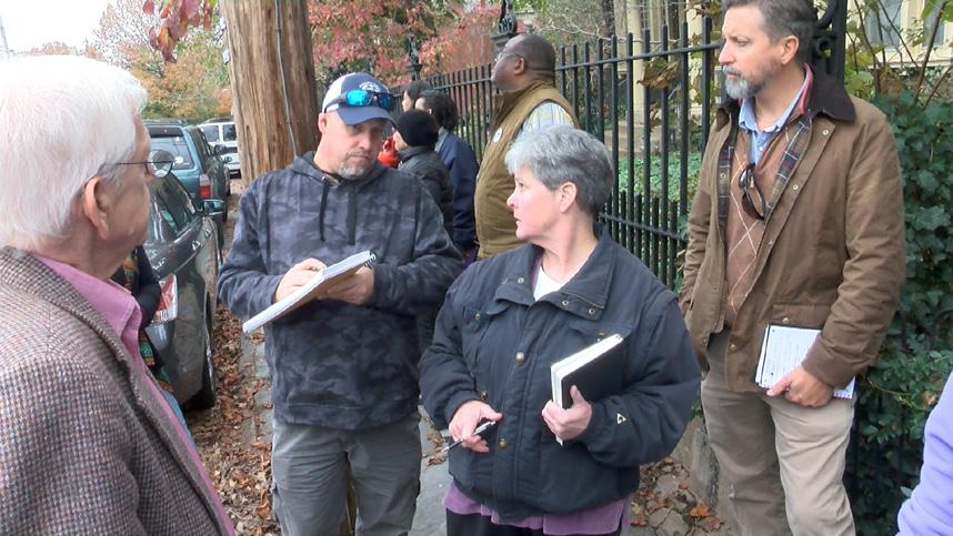
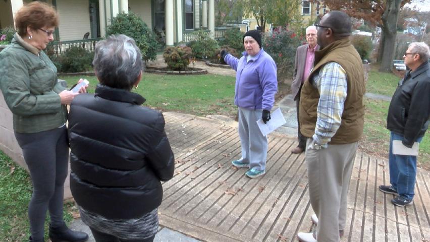
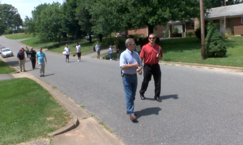
D. CLEANLINESS & MAINTENANCE
Overall cleanliness and maintenance are priorities for residents. The City has existing tools to address these issues, such as the Citizens First line (434-856-CITY) where problems can be reported and directed to the appropriate department. If numerous issues arise, the Code Compliance division within the Department of Community Development can schedule a neighborhood walkthrough. These walkthroughs are designed bring staff and neighbors together to identify trends and issues, and offer an opportunity to build relationships between the community and City staff while finding solutions.
TYREEANNA & PLEASANT VALLEY NEIGHBORHOOD PLAN 32 CHAPTER 3: EXISTING CONDITIONS
Code Compliance Walkthroughs in other Lynchburg Neighborhoods
4. FUTURE LAND USE
Proposed
LEGEND
NEIGHBORHOOD BOUNDARY
NEW ROAD ALIGNMENT
Proposed Projects:
James River Scenic Parkway (include gateway sign)
New Collector Rd. (Tyreeanna Rd. to Pleasant Valley Blvd.)
New Collector Rd. (residential development to Concord Tpke. Jughandle Project Holcomb Bridge Project
ROAD EXTENSIONS
Proposed Projects:
Carnell Ln. Road Extension (to Rockwell Rd.)
Statham Rd. Extension (to Pleasant Valley Blvd.)
GREENWAY
Proposed Projects: Pleasant Valley Urban Trail.
Phase 1: Pleasant Valley Blvd. (up to bridge)
Phase 2: New Residential Road/off-street path
Phase 3: Holcomb Path Multi-modal Bridge
Phase 4: Monocan Bridge connection to Amherst County
CITY / NEIGHBORHOOD GATEWAY
Proposed Projects: Gateway Sign(U.S. 460)
PUBLIC PARKS
Open space areas designated for active & passive outdoor recreational activities. Gathering areas that promote the interaction of neighborhood residents.
Proposed Projects:
1. Foundry Park
2. Tyreeanna Park (fields & trail system)
3.Tyreeanna Gathering Area
- Phase 1: picnic tables, fields, playground, trail head and entrance to Tyreeanna Park.
- Phase 2: neighborhood center
MEDIUM-DENSITY RESIDENTIAL (COMPACT HOUSING)
Grouping of small, single family dwelling units clustered around a common area and coordinated design. Allow densities that are higher than typical in single-family neighborhoods while minimizing impacts on adjacent residential areas and enhancing / maintainig architectural character.
Proposed Projects:
4. Tyreeanna Rd. Compact Housing Development
5. Concord Tpke. Compact Housing Development
EMPLOYMENT
Areas intended for future large-scale development and research. A mix of commercial uses is permitted that serve the needs of surrouding businesses.
Proposed Projects:
8. Nickerson Business Park
9. Tyreeanna Business / Research Park (Long-Term)
MIXED-USE
Areas planned for a mix of uses carefully designed so as to mitigate any potential land use conflicts.
Proposed Projects:
10. Nickerson Rd. Mixed-Use Development
NEIGHBORHOOD COMMERCIAL
Areas of the neighborhood surrounded by residential uses/ character. Scale of buildings and density of development complement the neighborhood. Serve the immediate needs of residents and promote walkability.
Proposed Projects:
Tyreeanna Neighborhood
6. Tyreeanna Village
7. Nickerson Corner
PUBLIC USE
Areas owned and operated by the City to provide needed services and utilities to the community
Study Area Boundary
TYREEANNA & PLEASANT VALLEY NEIGHBORHOOD PLAN 33 CHAPTER 4: FUTURE LAND USE MAINST BUENAVISTAST RACEST HIGH ST PLEASANTVALLEYRD TULIPST PROVIDENCEPL OAKST G L EN N ST INEST ROSE ST TURNER LN E ODROWST FRONT ST DUDLEY ST ELMHURSTST HARMONY CT PINEHURST ST PEAKSVIEWDR CAMPBELLAVE BROWNHAVENLN AULTIC LN CARNELLLN C H A N N I E LN LONGVIEW RD MEGGINSONLN HILLVIEW ST STATHAMRD PRINCEST JUBILEE DR KAVANAUGHRD POSTONST NICKERSONRD ELM ST SPINOZACIR GREENFIELDDR OLDCOURTHOUSE TPKE GILMORECIR L O RAINEST POPLARST TYREEANNA RD WINSTON RIDGERD GARNETST EASTLYNCHST WINCHESTERST F L ORIDA A VE MARTINST CONCORD TPKE ROCKWELLRD HOLCOMBPATHRD CAMPBELLAVE RTE 29 BYP RICHMONDHWY
Structure 1 PU PU E E BUSINESS RESEARCH PARK PP FOUNDRY PARK PP TYREEANNA PARK & TRAIL SYSTEM E BUSINESS / RESEARCH PARK PP MDR MU NC NC LAND USES
PRIMARY NODE 6 2 3 7 4 8 9
MDR 10 GATHERING AREA 5
9
projects and changes to Lynchburg’s Future Land Use Map (FLUM)
The goal of the future land use chapter is to create viable opportunities for redevelopment in Tyreeanna / Pleasant Valley while maintaining a healthy balance of uses and housing options for the neighborhood.
The recommendations below are based on a study of existing land uses, an understanding of the community’s needs, and planning principles for Smart Growth, as described in Chapter 1: Introduction. Important considerations in the development of these recommendations include longterm economic goals for Lynchburg, development pressures from citywide population growth, the desire from Tyreeanna / Pleasant Valley residents to attract younger families, the need for affordable housing (less than 30% of household income), and the need for aging-in-place infrastructure in the neighborhood.
A. SPECIFIC NEEDS & OPPORTUNITIES
Development pressures from Lynchburg’s growth requires City officials to identify effective housing strategies for its residents. According to data from the Comprehensive Plan 2013 - 2030, almost 24% of the total land area within city limits is identified as vacant. However, a large portion of that land is impacted by environmental constraints such as steep topography, floodplains, or unsuitable soils for septic systems.
Tyreeanna / Pleasant Valley is one of the few areas in the city with open land suitable for potential development, although it remains undeveloped due to current infrastructure constraints. Furthermore, the neighborhood has received funding from the Environmental Protection Agency (EPA) to help with the assessment and remediation of brownfield sites.
The strategic implementation of this grant can increase development opportunities in Tyreeanna / Pleasant Valley and help address the immediate and long-term needs of the community. Demographic trends fortheneighborhoodindicateasignificantagingpopulation.Infrastructure improvements are needed to ensure the livability of residents from all income levels and population groups.
Brownfields – Real property, either presently in use or vacant, the expansion, redevelopment, or reuse of which may be complicated by a previous use. Assessing, mitigating (if necessary) and reinvesting in these properties protects the environment, reduces blight, and takes development pressures off green spaces.
Source http://www.opportunitylynchburg.com/brownfields/
TYREEANNA & PLEASANT VALLEY NEIGHBORHOOD PLAN
34 CHAPTER 4: FUTURE LAND USE
MAINST K N I G H T S T MAPLE ST RIDGEAVE FRANKLINST AUGUSTA ST HIGH ST PLEASANT VALLEY RD TULIPST POCAHONTASST TYREESTVIRGINIAS T PINEST GEORGIAAVE OTEY ST WOODROWST GLOBE ST ELM ST FORDST KINGST HILLVIEW ST STATHAMRD PRINCE ST J U BILE E D R KAVANAUGHRD POSTONST TOPRIDGEDR NICKERSON RD TEX SA A VE GUMST GREENFIELD DR DUKEST GILMORE CIR HUDSONST POPLARST TYREEANNA RD MAYFLOWERDR W I N S TON RIDGE DR ROBINSRD WINCHESTERST F L ORIDA AVE FLORIDA AVE GRACEST MARTINST CONCORDTPKE ROCKWELL RD HOLCOMBPATHRD CAMPBELLAVE 460HWY L Y N C H B URGEXPY CAMPBELLAVE RICHMONDHWY RTE 29 BYP MAINST K N I G H T S T MAPLE ST RIDGEAVE FRANKLINST AUGUSTA ST HIGH ST PLEASANT VALLEY RD TULIPST POCAHONTASST TYREESTVIRGINIAS T PINEST GEORGIAAVE OTEY ST WOODROWST GLOBE ST ELM ST FORDST KINGST HILLVIEWST STATHAMRD PRINCE ST J U BILE E D R KAVANAUGHRD POSTONST TOPRIDGEDR NICKERSON RD TEX SA A VE GUMST GREENFIELD DR DUKEST GILMORE CIR HUDSONST POPLARST TYREEANNA RD MAYFLOWERDR W I N S TON RIDGE DR ROBINSRD WINCHESTERST F L ORIDA AVE FLORIDA AVE GRACEST MARTINST CONCORDTPKE ROCKWELL RD HOLCOMBPATHRD CAMPBELLAVE 460HWY L Y N C H B URGEXPY CAMPBELLAVE RICHMONDHWY RTE29BYP Potential Brownfield Sites Tyreeanna Neighborhood # * Commercial - Active ! ( Vacant Commercial " Vacant Lot Study Area Boundary Corporate Limit
Potential brownfield sites in Tyreeanna / Pleasant Valley
B. RESIDENTIAL
Currently, most of Tyreeanna / Pleasant Valley is designated as a lowdensity residential area. Low density residential uses include detached single-family homes that are generally zoned R-C, R-1, or R-2. Each of these zoning classifications provide use and site development standards for the district which restrict elements like building heights, setbacks, and lot coverage.
The Future Land Use Map (FLUM) identifies residential blocks between TyreeannaRoadandthesoutheastboundaryoftheneighborhoodtochange to a medium-density residential designation. Medium density residential uses include attached single-family houses, duplexes, townhouses, and mobile home parks. These areas are generally zoned R-3 which provide more flexible standards for use and site development, thus creating opportunities to increase housing options.
a sustainable housing strategy
Smart Growth & Housing
One of the primary focuses of Smart Growth (see Chapter 1 Introduction) is to provide quality housing that is affordable and accessible to all population groups. Housing is an important component of a community because it makes up the majority of new construction and development. There are several factors associated with a sustainable housing strategy, including efficient use of infrastructural resources; healthy balance between jobs and housing units; and support for additional ammenities and services (transit stops, commercial centers, etc.).
the missing middle housing
Aholistichousingstrategy integratesdifferentformsandscalesofdwellings within neighborhoods. By promoting the construction of diverse compact residential units, a community can increase choices for residents without radically changing its character.
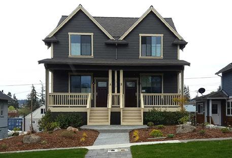
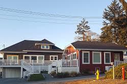
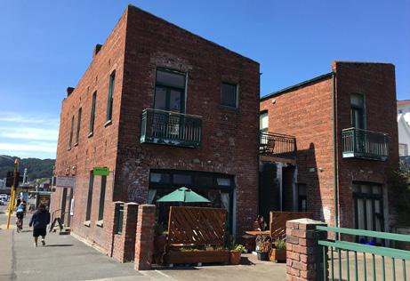
Missing Middle Housing is an initiative developed by the Congress for NewUrbanismtoconfrontthemarketgapin housingoptions.Theconcept refers to multi-unit or clustered housing types designed to be compatible with the scale of single-family homes while helping meet a growing demand for walkable neighborhoods. The objective of the Missing Middle Housing initiative is to provide diverse dwelling choices that range in style and affordability to promote pedestrian activity, local retail, and public transportation options. Types of housing units might include duplexes, fourplexes, cottage courts, carriage houses, live/work units, townhouses, and more.
“Missing middle” housing diagram developed by CNU member Dan Parolek and Opticos Design
Source: https://www.cnu.org/our-projects/missing-middle-housing
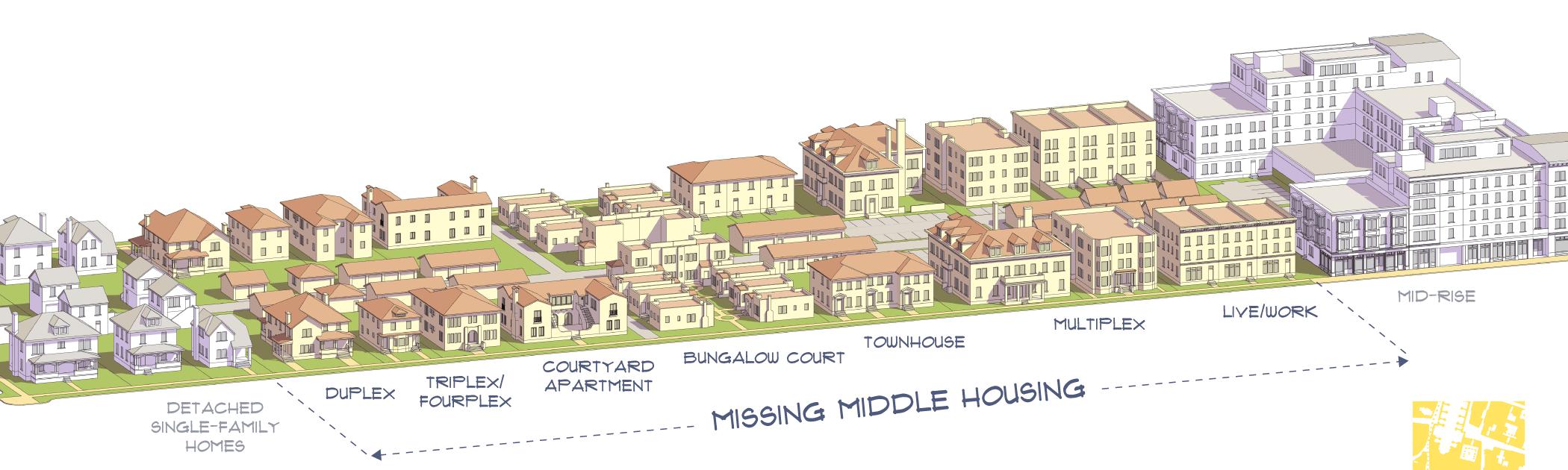
TYREEANNA & PLEASANT VALLEY NEIGHBORHOOD PLAN 35 CHAPTER 4: FUTURE LAND USE
Examples of “missing middle” housing types and styles
Pocket Neighborhoods in Tyreeanna / Pleasant Valley
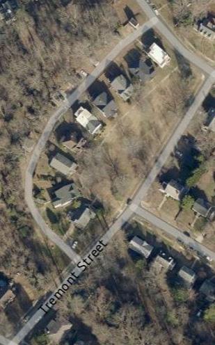
A number of vacant city-owned parcels in Tyreeanna / Pleasant Valley are located within residential blocks of the neighborhood. Future land use designations for these properties create an opportunity to develop pocket neighborhoods that incorporate various types of “middle housing” units. The site plan below illustrates how compact homes can be accommodated along a section of Tyreeanna Road and Statham Road. The concept features a cluster of 10 homes of approximately 1,000 SF each facing a shared common space. The common space is meant to serve as the center of community activity. Depending on the need of residents, common spaces can take the shape of gardens, courtyards, or community rooms. Residents of surrounding units share the management, care, and oversight of the space, promotes a sense of ownership and of safety.
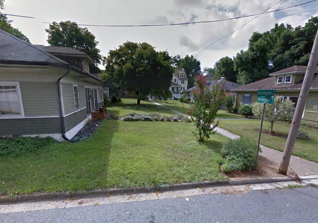
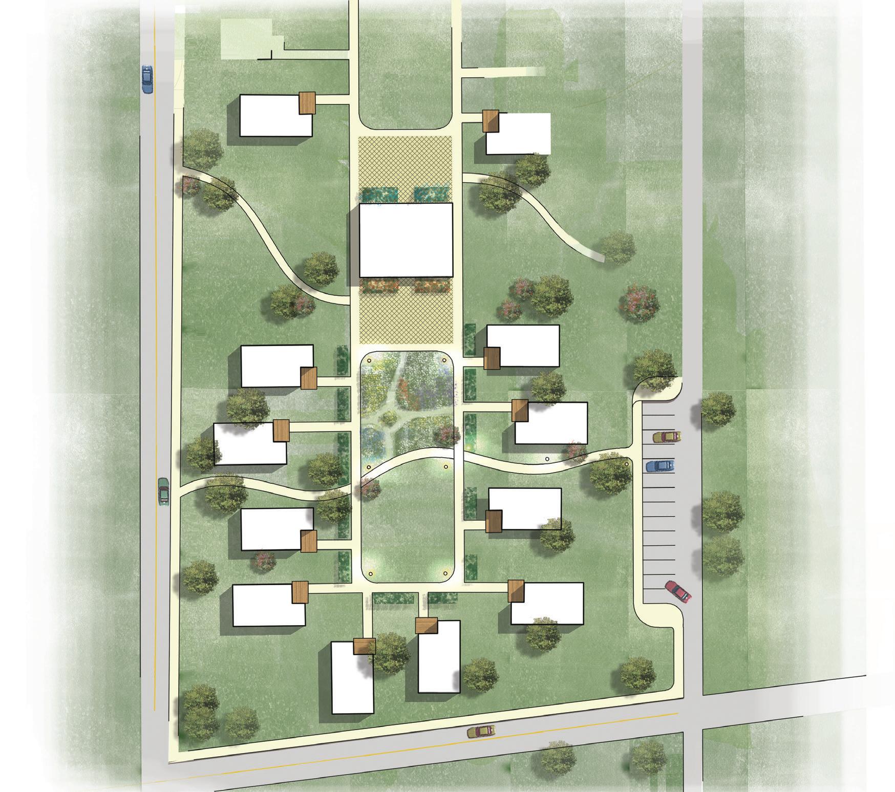
These developments should be designed to blend in with the existing neighborhood. The density and scale should compliment the surrounding homes.
Pocket Neighborhoods are grouped housing units around a shared open space — a garden courtyard, a pedestrian street, joined backyards, etc. — all of which have a clear sense of shared stewardship. They can be in urban, suburban or rural areas.
Source: http://pocket-neighborhoods.net/whatisaPN.html
TYREEANNA & PLEASANT VALLEY NEIGHBORHOOD PLAN 36 CHAPTER 4: FUTURE LAND USE
Tyreeanna Rd. Compact Housing Concept
Central Green
Community Garden
Community Building
Plaza Plaza
Cottage House
Communal Parking
Alleyway
Flowerbeds
New Road
Street Lighting
New Road
Compact Housing Development Concept
to Tyreeanna Rd. to Statham Rd.
< Pocket Neighborhood on Tremont St. Lynchburg, VA
^ Single Family Homes with central green space at Arlington Place Lynchburg, VA
C. COMMERCIAL
Currently, commercial uses in Tyreeanna / Pleasant Valley are limited to a few office and retail buildings scattered across the neighborhood. While the Route U.S. 29 / U.S. 460 Bypass is conveniently located near residential areas, people living in Tyreeanna / Pleasant Valley rely heavily on their vehicles to access goods and services. This dependency, coupled with a lack of public transit, impacts the health and safety of its residents.
mixed land uses
Principles of Smart Growth demonstrate that mixed land uses are an important component of vibrant communities. By placing residential, commercial, and recreational uses in proximity, communities can encourage alternatives to driving, (such as walking and biking), and support public transit access. Mixing land uses also promotes walkability which increases physical activity and a sense of security among residents.
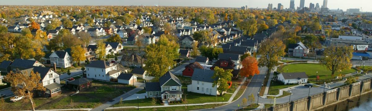
From an economic standpoint, placing commercial uses near residential areas can increase property values and foster a healthy tax base. Furthermore, businesses recognize the benefits of locating near recreational uses that attract people, increasing economic activity.
In an effort to foster a vibrant mix of stable neighborhoods, the Future Land Use Map (FLUM) designates two Neighborhood Commercial areas within the boundaries of Tyreeanna / Pleasant Valley. The map also illustrates a mixed-use area south of Route U.S. 29/U.S. 460 Bypass.
This plan proposes an extended commercial area near the residential blocks of the neighborhood that provides a pedestrian-friendly environment for residents and visitors, as well as better access to goods and services for the community. The plan also recommends designating mixed-use areas on public and privately-owned land in anticipation of future development in accordance with the City’s long-term economic goals.
Case Study: Fall Creek Place. Indianapolis, IN
Located north of downtown Indianapolis, Fall Creek Place is a neighborhood that experienced disinvestment in the 1980s and 1990s. The community now serves as a model of mixed-income revival; offering a mix of housing options, four parks, a greenway, restaurants, shops and services. These amenities are within walking distance in a pedestrian-friendly environment. Residents can also access downtown via bike, bus, car or foot.
Source: http://smartgrowth.org/fall-creek-place-indianapolis-indiana/
COMMERCIAL LAND USE DESCRIPTIONS IN LYNCHBURG, VA
Neighborhood Commercial areas include retail, personal service, and restaurant uses that are sized and designed to serve their immediate neighborhood. Patrons can walk, bike or take a short drive to reach them. They are comprised of individual businesses, clusters of businesses, or small shopping centers. Neighborhood shopping centers meet the day-to-day needs of a limited residential trade area of 2,500 to 10,000 people and average about 50,000 square feet of space. A small grocery store or drug store is often the anchor for a neighborhood shopping center.
Mixed Use areas do not it into any single use category as they are planned for a mix of uses carefully designed so as to mitigate any potential land use conlicts.
Source: City of Lynchburg Comprehensive Plan 2013 - 2030
TYREEANNA & PLEASANT VALLEY NEIGHBORHOOD PLAN 37 CHAPTER 4: FUTURE LAND USE
tyreeanna / pleasant valley neighborhood hub
The proposed boundary for the Tyreeanna / Pleasant Valley neighborhood hub incorporates the intersection of Concord Turnpike and Pleasant Valley Rd. along with commercial properties within the quadrants of the intersection. The hub would serve as a small-scale retail area with businesses and services that would meet some of the everyday needs of neighborhood residents.
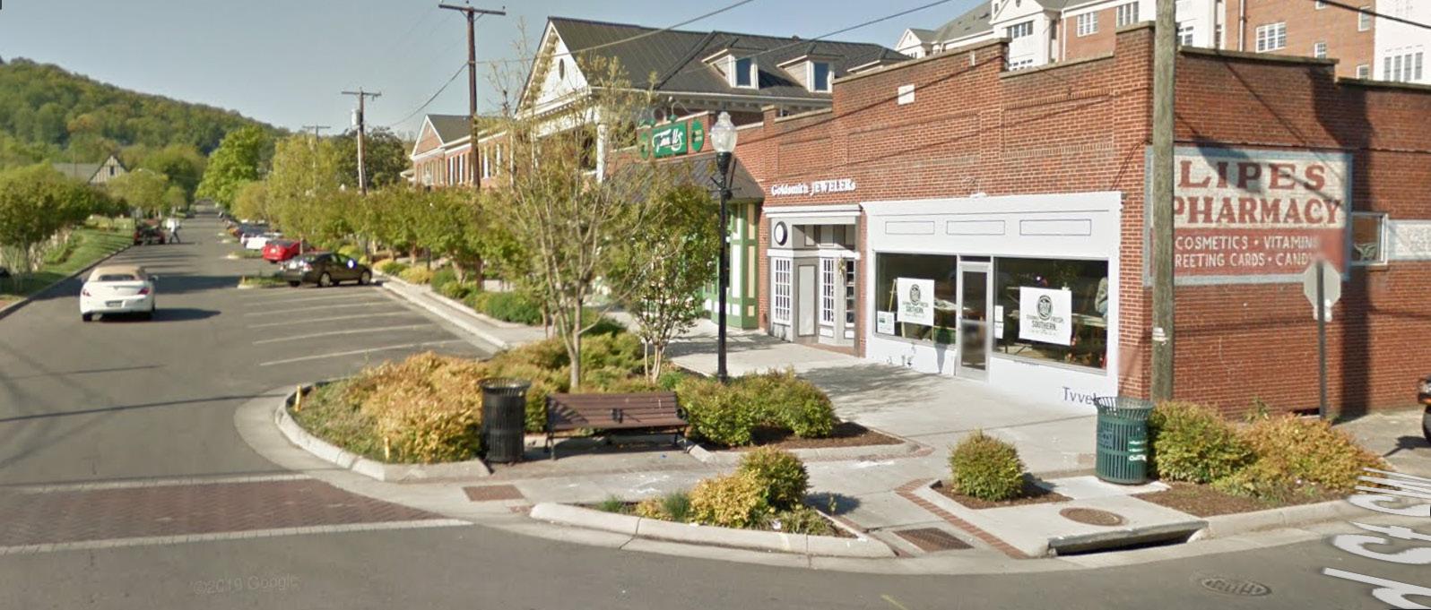
Standards within this development would encourage construction and improvements that enhance the character and appeal of the neighborhood while respecting the character of residential blocks. Businesses and public spaces within the neighborhood hub will focus on meeting current and future needs of a multi-generational growing community. Examples might include restaurants, a coffee shop, a small grocery store, retail shops, and pedestrian areas along Pleasant Valley Rd. and the proposed greenway. See Chapter 5 Connectivity & Neighborhood Design.
D. GOALS
• Encourage a balanced mix of uses that is complementary to the current scale and character of the neighborhood.
• Promote the sustainable development of public and privately-owned vacant land.
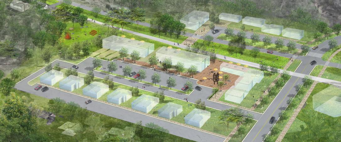
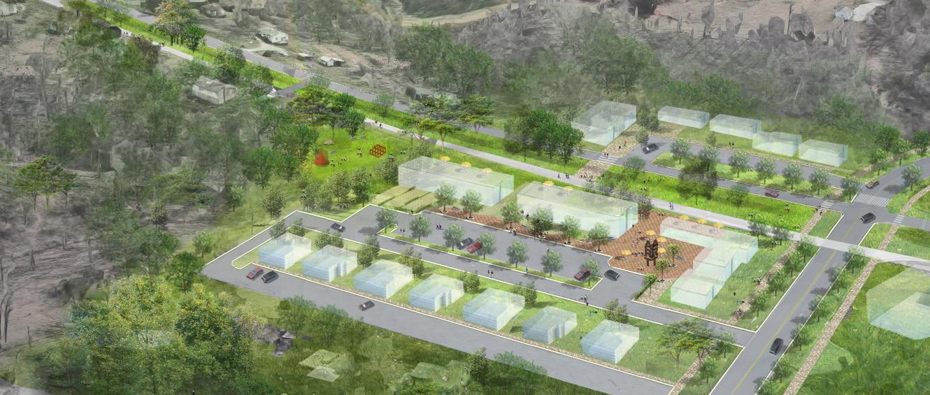
• Provide a variety of accessible housing options.
• Promote businesses that cater to all population groups.
TYREEANNA & PLEASANT VALLEY NEIGHBORHOOD PLAN 38 CHAPTER 4: FUTURE LAND USE
Crystal Springs commercial corner in a residential neighborhood. Roanoke, VA
ConcordTpke. PleasantValleyRd. (toU.S.460)
Tyreeanna / Pleasant Valley Commercial Node
5.CONNECTIVITY & NEIGHBORHOOD DESIGN
A. STREET NETWORK & CHARACTER
The Tyreeanna / Pleasant Valley neighborhood is an important connector and gateway for Lynchburg. Concord Turnpike, a major arterial road, carries heavy truck traffic from Route U.S. 29/U.S. 460 Bypass into Downtown. Development in Tyreeanna / Pleasant Valley is primarily concentrated along Rockwell Rd., Tyreeanna Rd., and Pleasant Valley Rd. Land on the south side of the highway is mostly undeveloped except for areas along Route U.S. 29/U.S. 460 Bypass as well as housing units on Holcomb Path Rd.
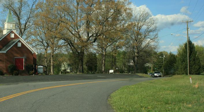
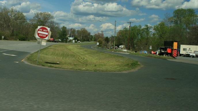
During public input sessions, members of the community expressed concerns regarding several aspects of connectivity and neighborhood design, including traffic flow, safety, walkability, signage, access, and neighborhood aesthetics. It was also apparent during input sessions that residents perceive Tyreeanna and Pleasant Valley as two very distinct areas. Increasing connections between them can foster a stronger sense of community going forward, while celebrating the character and history of both places. See Chapter 2 Background and History and Chapter 7 Historic Resources.
The street grid in Tyreeanna / Pleasant Valley reflects the neighborhood’s historic rural character. Large street blocks and narrow roads limit the use of bicycles as a means of transportation. In addition to an incomplete network of sidewalks, lacking pedestrian crossings make it difficult for residents to move around their community without a personal vehicle.
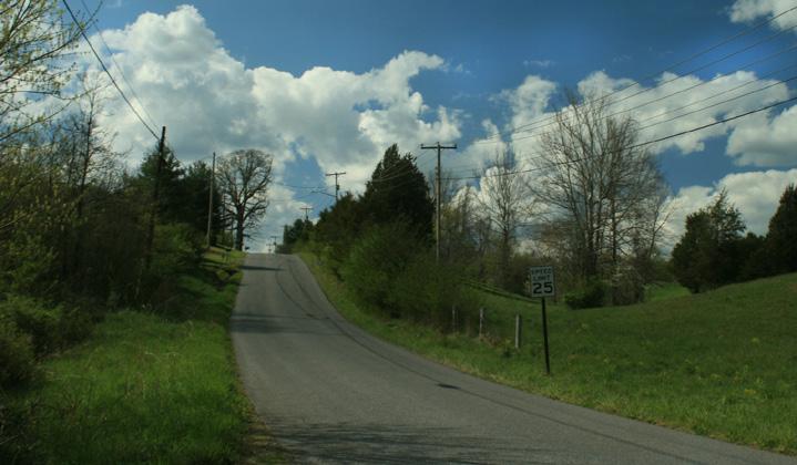
This chapter proposes infrastructure improvements and design strategies for Tyreeanna / Pleasant Valley that address the immediate needs of residents and set the stage for future development. The goal of these recommendations is to improve the quality of life in the neighborhood while respecting and enhancing the appeal of residential areas.
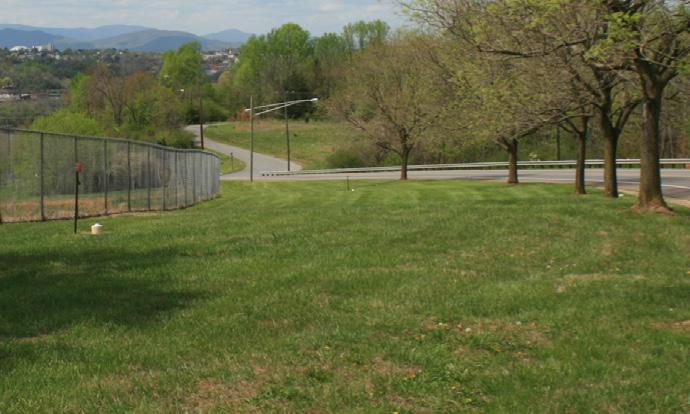
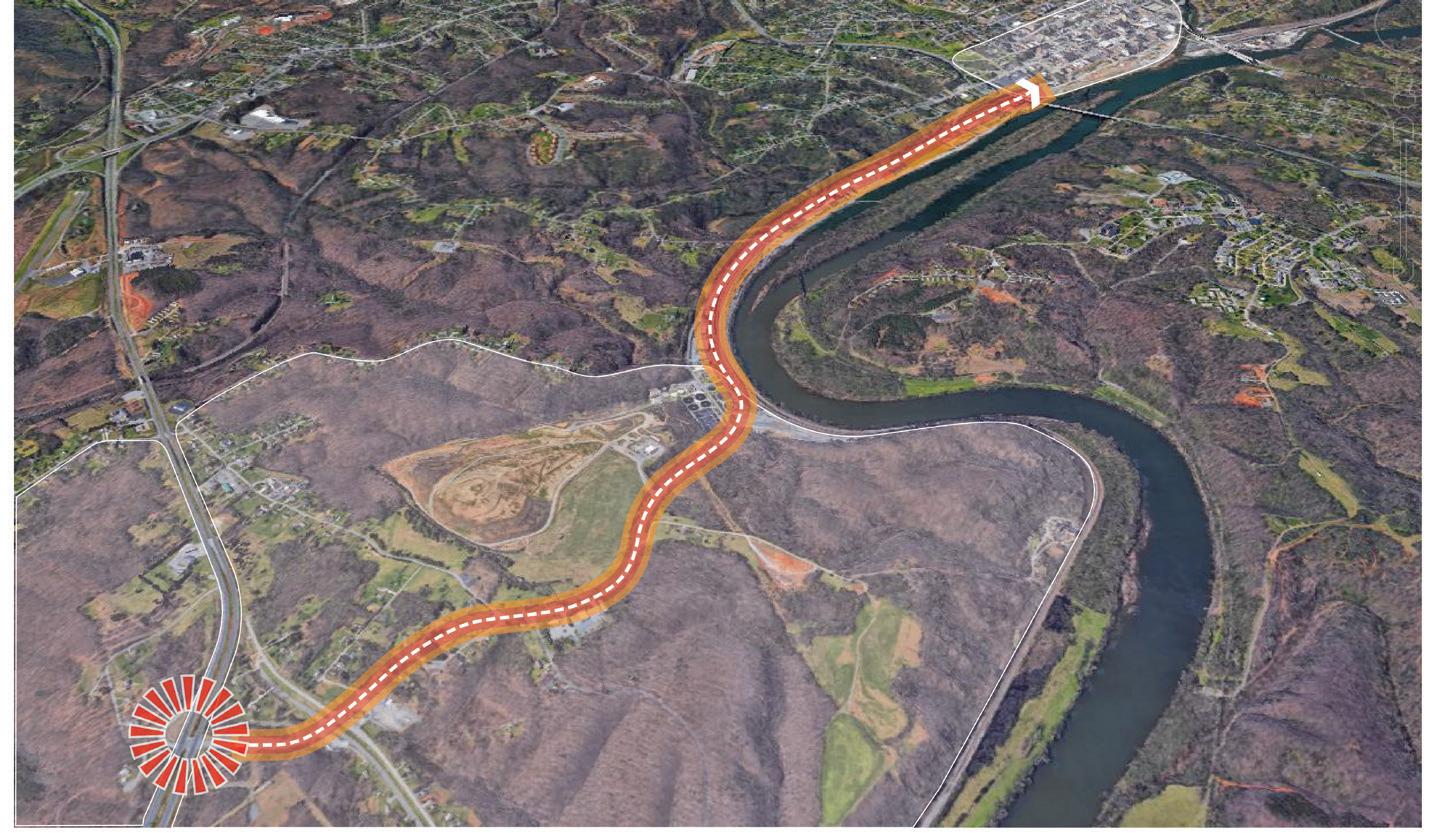
TYREEANNA & PLEASANT VALLEY NEIGHBORHOOD PLAN 39 CHAPTER 5: CONNECTIVITY & NEIGHBORHOOD DESIGN
Main neighborhood arterials: Concord Turnpike (top left), Holcomb Path Rd. (top right), Pleasant Valley Rd. (bottom left), Tyreeanna Rd. (bottom right)
Proximity & Connectivity from Tyreeanna / Pleasant Valley to Downtown
ConcordTpke.
U.S. 29 ./ U.S. 460
James River
B. CONSIDERATIONS
aesthetics
While zoning classifications provide some guidance regarding land use and site development, design guidance is still needed to boost the aesthetics of the community and protect its residential character as growth occurs. The quality of architecture, site design, and the relationship of structures to the built environment are also important considerations when attracting new residents to the neighborhood. Just as important is establishing effective policies and programs that ensure the cleanliness and maintenance of public and private properties, particularly those that are vacant and/or underutilized. The City’s Neighborhood Services division is tasked with ensuring properties within Lynchburg are maintained to a minimum standard and should be contacted when issues (with trash, yard maintenance, inoperable vehicle storage, etc.) arise. These standards are set to promote thriving, safe, and attractive neighborhoods.
walkability
Walkability measures how friendly an area is for pedestrians. Factors that impact walkability include quality of pathways (sidewalks and rights of way), road conditions, land use patterns, accessibility to destinations, safety, and more. Walk Score is an online tool that measures and ranks the walkability of areas across the country. Based on this methodology and visible land use patterns, Tyreeanna / Pleasant Valley is a car-dependent neighborhood where all errands, as well as access to goods and services, require a vehicle. Low walkability impacts a community’s wellbeing and hampers its ability to attract people. Walkable neighborhoods promote a stronger sense of community, increase safety, reduce the demand on city resources, and improve the health of residents.
Walk Score, Transit Score, and Bike Score indicate that Tyreeanna / Pleasant Valley is one of the least walkable neighborhoods in Lynchburg with minimal
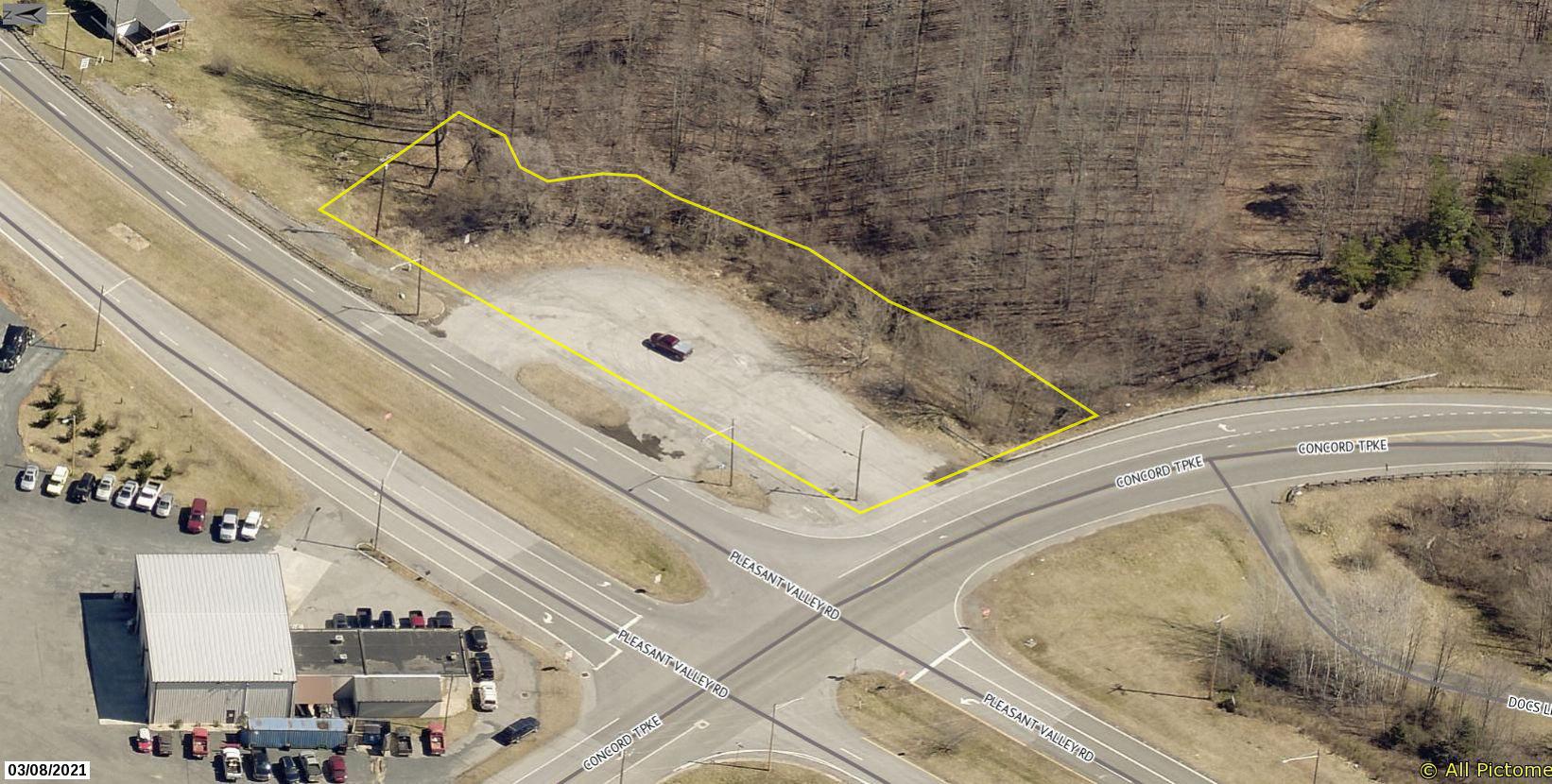
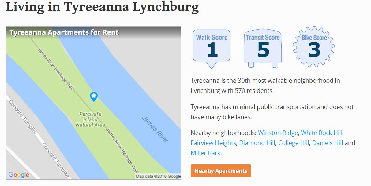
Neighborhood Ranking - Compared to other neighborhoods, Tyreeanna / Pleasant Valley ranks 30th for walkability, access to transit and availability of bicycle infrastructure
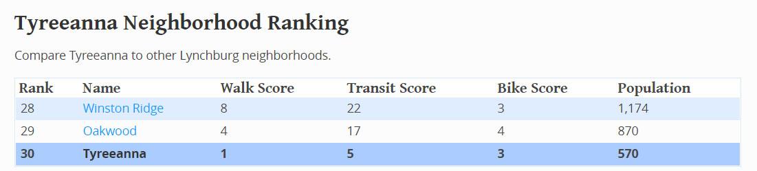
TYREEANNA & PLEASANT VALLEY NEIGHBORHOOD PLAN 40 CHAPTER 5: CONNECTIVITY & NEIGHBORHOOD DESIGN
Aerial view of vacant /underutilized properties in the Tyreeanna / Pleasant Valley neighborhood
safety
(a)A primary entrance shall face the primary street (see Figures 10 & 11). A side or rear entry shall also be permitted depending on thesite layout.
Throughout the planning process, residents have identified safety as a main concern. Members of the community would like to incorporate traffic calming measures on residential and commercial roads. In addition, street lighting within the neighborhood has been traditionally designed to meet vehicular safety requirements but has not considered pedestrian activity. Well-lit public spaces will provide a safer and more inviting environment for residents. By implementing a streetscape plan, the neighborhood can define appropriate safety and lighting strategies to be considered as development occurs.
(b) The placement of building entrances shall be of a similar rhythm and spacing to existing structures on the same street (see Figure 11).
C. DESIGN AND POLICY RECOMMENDATIONS design standards

The Lynchburg Residential Design Review Guidelines Manual provides specific criteria for rehabilitation work, new construction, and demolition in Lynchburg’s designated historic districts. Even though Tyreeanna / Pleasant Valley is not a historic district, the neighborhood would benefit from design tools that can guide property owners in maintaining and enhancing the overall appearance of their community. Effective tools, such as development guidelines and material palettes for public projects will ultimately drive property values and improve the livability of the neighborhood.
This chapter of the Tyreeanna / Pleasant Valley Neighborhood Plan proposes a holistic approach to neighborhood aesthetics, walkability, and safety through a series of design and policy recommendations, street improvement projects, gateways, and multi-modal options.
(c) Not Used
(d) Buildings fronting on 2 streets shall have a primary entry on either the primary street or at
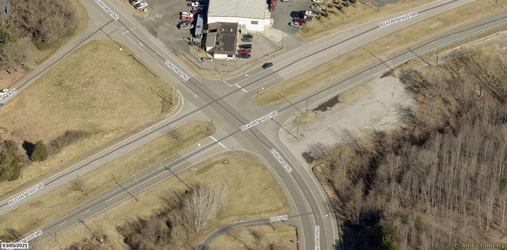
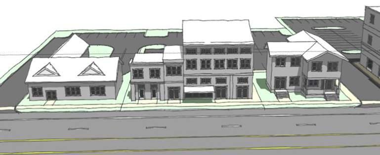
The concept of pocket neighborhoods, introduced in Chapter 4 Future Land Use , presents an opportunity to define a cohesive look and create a unique identity for the community. An effective set of design standards can help the residential and commercial areas in the neighborhood achieve specific objectives. Some of the main elements that design standards address include building location, mass and scale, building form, building materials and style, open space and landscaping.
design considerations, details, and treatments consistent with meet the standards set forth in prominently designed and constructed to provide visual cues to pedestrians independent of site or building signage (see Figure 10 and § 112-17G(5)).
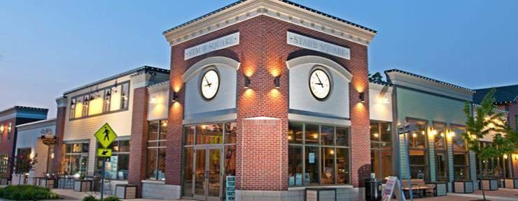
Example of how communities use standards to foster cohesive neighborhood design. Village of Williamsville, NY.
Source: http://walkablewilliamsville.com/
TYREEANNA & PLEASANT VALLEY NEIGHBORHOOD PLAN 41 CHAPTER 5: CONNECTIVITY & NEIGHBORHOOD DESIGN
§ 112 - 1A B Site Planning anu Design
§112 - 17B(4)
Building Entry
:ppoopoiate
Buildings shall be accessible from a primary street.
Figure 10 depicts a primary entrance along the primary street in the Village of Hamburg, that is well-defined and provides a clear visual cue to pedestrians on where to enter the structure.
The placement of entrances along the primary street (red arrows) are important to the development of streetscape rhythm, and provide a sense of scale and comfort to pedestrians as they traverse the corridor.
Figure 10
Figure 11
Good spacing
Poor spacing
Good spacing
Aerial view of the intersection of Pleasant Valley Boulevard and Concord Turnpike
better streets
Lynchburg’s Better Streets Policy is outlined in the Comprehensive Plan 2013 –2030, and combines two concepts for street design. Green Streets intended to enhance stormwater quality by capturing rainfall where it lands, rather than directing runoff to a storm sewer. Complete Streets enable safe, convenient, and comfortable travel and access for users of all ages and abilities regardless of their mode of transportation. The design and construction of new roadways should incorporate green and complete streets principles to safely and efficiently accommodate additional travel modes other than motor vehicles, as well as incorporate stormwater infrastructure. Existing streets should be retrofitted with these features when possible.
Context and geometric constraints dictate the various levels of “complete” in road design. In Tyreeanna / Pleasant Valley, the existing hilly, curvy streets may make fully separated bicycle paths or sidewalks not possible on some street segments. Nonetheless, the goal is to allow for as many transportation options as possible including cars, transit, bicycles, and pedestrians. With this infrastructure, residents and visitors of the neighborhood will have choices about how they move around the neighborhood and connect to the greater Lynchburg area. Complete streets move people in different ways, not just by car.
The Tyreeeanna / Pleasant Valley Neighborhood Plan proposes incorporating complete streets principles in the following manner:
• Retrofit existing streets such as Tyreeanna Road to safely accommodate pedestrians and bicyclists
• Include pedestrian and bicycle accommodations on any new streets such as James River Parkway and extensions of Holcomb Path Road, Concord Turnpike, and their bridges
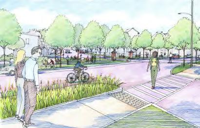
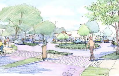
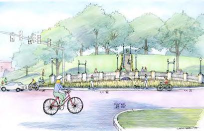
• Integrate pedestrian accommodations at existing intersections such as curb ramps, crosswalks, and pedestrian countdown signals as appropriate
Jefferson Avenue
In 2014, the city of Richmond, Virginia, applied to EPA’s Greening America’s Capitals Program to create a plan for Jefferson Avenue that would help remedy confusing and unsafe traffic patterns caused by the street’s alignment.
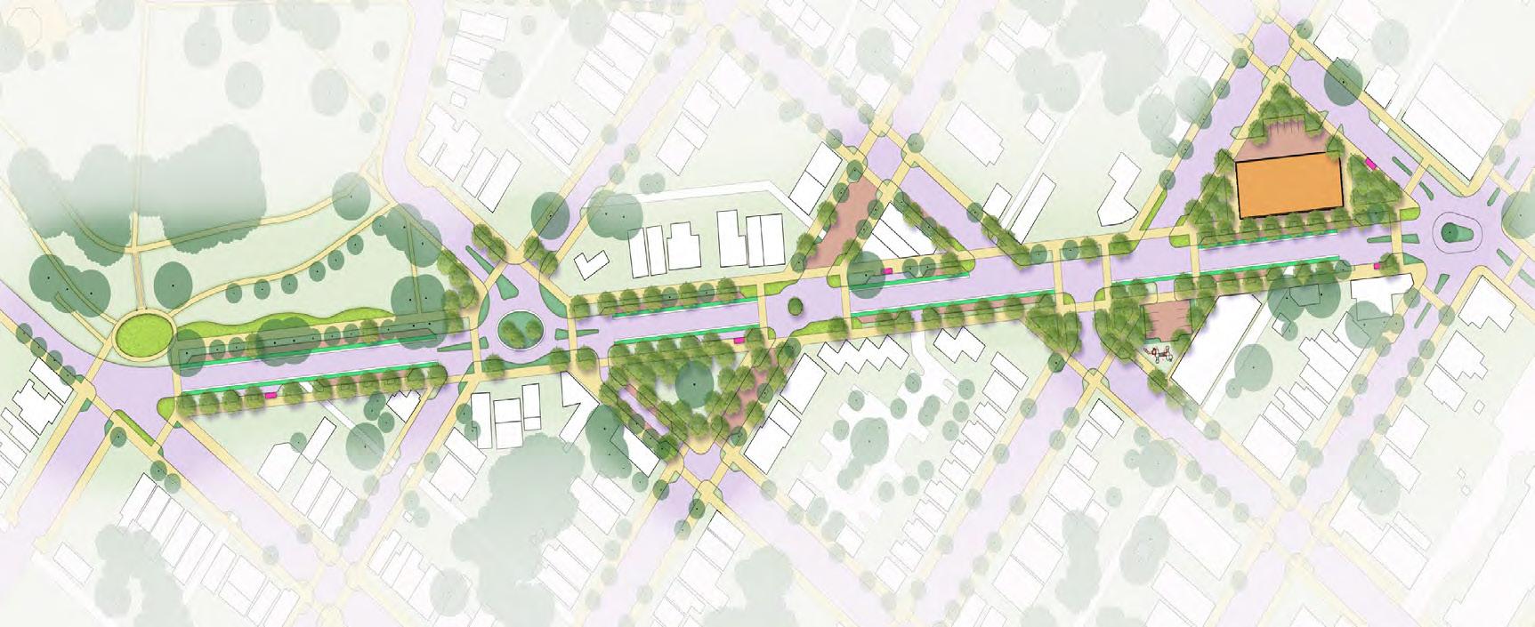
Source: https://www.epa.gov/smartgrowth/greening-americas-capitals-richmond-va

TYREEANNA & PLEASANT VALLEY NEIGHBORHOOD PLAN 42 CHAPTER 5: CONNECTIVITY & NEIGHBORHOOD DESIGN
D. STREET IMPROVEMENT PROJECTS
As the neighborhood grows, enhancing connections to and within Tyreeanna / Pleasant Valley will become necessary. The following infrastructure recommendations should be considered as the area evolves to improve circulation.
james river parkway
As articulated in the Downtown 2040 Master Plan, the James River Parkway is a scenic route intended to provide an alternative access from Route U.S. 29/U.S. 460 Bypass into Downtown Lynchburg. The future parkway will provide a critical connection between Tyreeanna / Pleasant Valley and the heart of Lynchburg, both accommodating vehicular traffic in a safe and efficient manner while alleviating traffic loads from Concord Turnpike and multiple at-grade railroad crossings. The Parkway will also provide visibility to the neighborhood and a direct route from Downtown to the proposed park at the previous landfill site. See Chapter 6 Parks and Open Space.
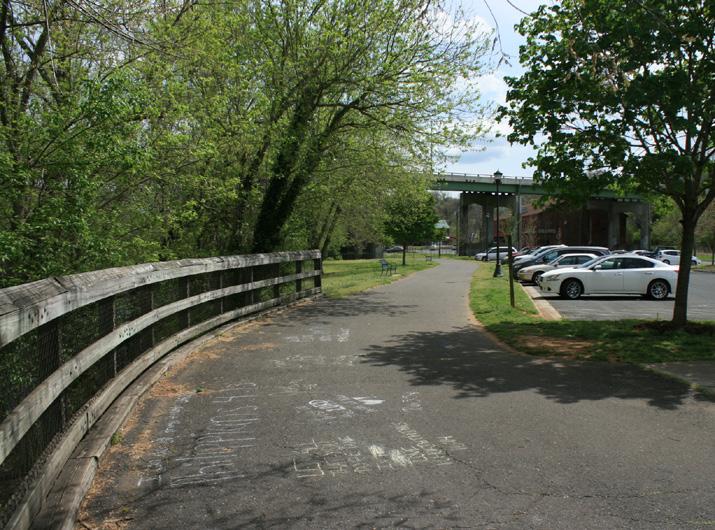
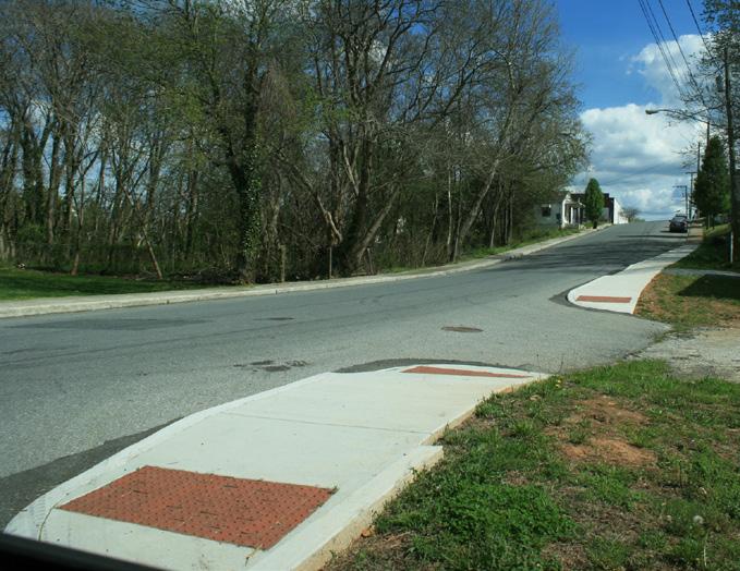

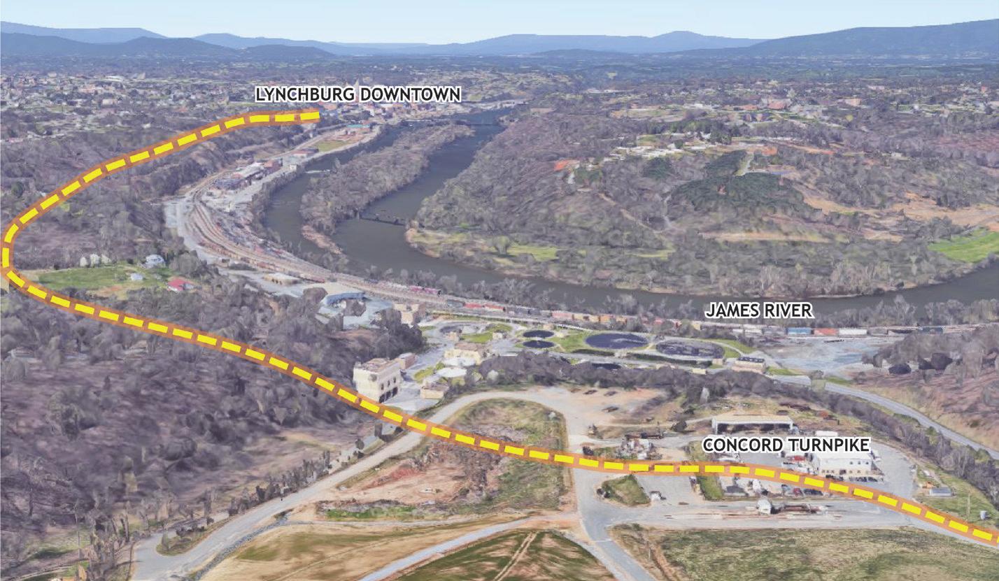
RESIDENTIAL AREAS
The Tyreeanna / Pleasant Valley Neighborhood Plan proposes assessing Tyreeanna Road and Rockwell Road and implementing the necessary measures to make them into Better Streets. Improvements will consider provisions for bicycle and pedestrian infrastructure. Some of the strategies to transform these areas into Better Streets might also include installing sidewalks and evaluating the best configurations for bike facilities where possible, whether it be dedicated lanes or a multi-use path. The intersections surrounding the Neighborhood Commercial areas identified in Chapter 4 should also be evaluated to ensure safe crossings for all means of travel.
TYREEANNA & PLEASANT VALLEY NEIGHBORHOOD PLAN 43 CHAPTER 5: CONNECTIVITY & NEIGHBORHOOD DESIGN
Proposed James River Parkway (Downtown 2030 Plan)
Streetscape improvements in neighborhoods around Lynchburg
concord turnpike & U.S. 29/ U.S. 460 bypass intersection
The current jughandle intersection provides access to Concord Turnpike and the northern part of the Tyreeanna / Pleasant Valley neighborhood but doesn’t provide access to the south side. To reconnect the residents south of Route U.S. 29/U.S. 460 Bypass and improve access to potential development in that area, it will be necessary to reconsider the jughandle and construct a connection. This plan has developed three potential configuration options described below:
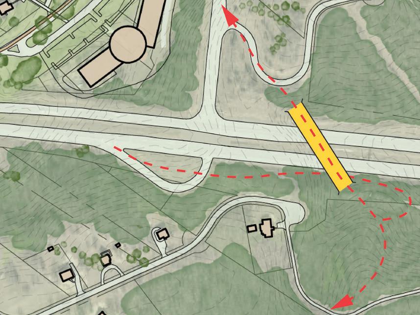
Option 1. This configuration modifies the current off-ramp from Route U.S. 29/U.S. 460 Bypass to skirt around the hill and ramp to the level of Poston Street. It then crosses Poston Street and routes the Bypass with a bridge, landing on the north side right before the intersection with Pleasant Valley Road.
Option 2. The second option creates a route bypassing Poston Road and proposes a bridge further east that coneccts exiting traffic via a loop ramp.
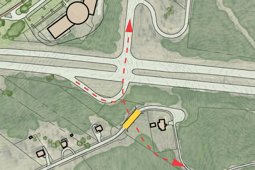
Option 3. The final option proposes a cut or tunnel under Poston Street and an at-grade connection at the existing signal with Route U.S. 29/U.S. 460 Bypass in a more conventional intersection configuration.
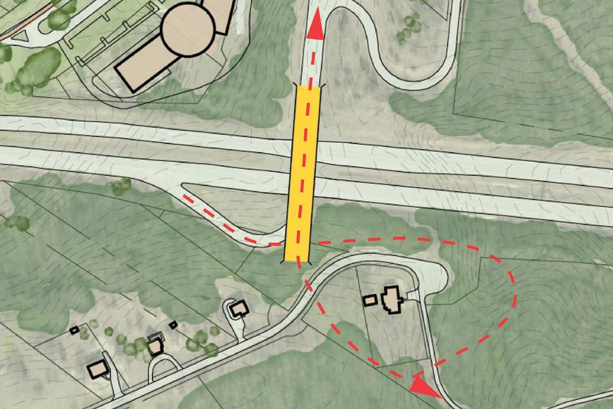
All proposed options include a bridge and connector with pedestrian and bicycle infrastructure that would provide access to vacant land on the south portion of the neighborhood. Any alterations to the jughandle intersection would be made in close collaboration with the Virginia Department of Transportation (VDOT) and would need a special study to evaluate all options.
Option 1
Jughandle Safety Improvements
Option 2
Jughandle Safety Improvements
Option 3
Jughandle Safety Improvements
TYREEANNA & PLEASANT VALLEY NEIGHBORHOOD PLAN
44 CHAPTER5:CONNECTIVITY& NEIGHBORHOODDESIGN
holcomb path road bridge
The Holcomb Path Road Bridge is envisioned as a connector between the north and south parts of the neighborhood. The concept proposes a multi-modal bridge with wide pedestrian accommodations and dedicated bicycle lanes. The bridge would be part of the greenway system proposed in this chapter (see Greenway System section). Depending on its design, the bridge could become an iconic element and high-profile gateway for the City of Lynchburg. Like the juglandle reconfiguration, this project would also be done in close collaboration with the Virginia Department of Transportation (VDOT) and will need more study.
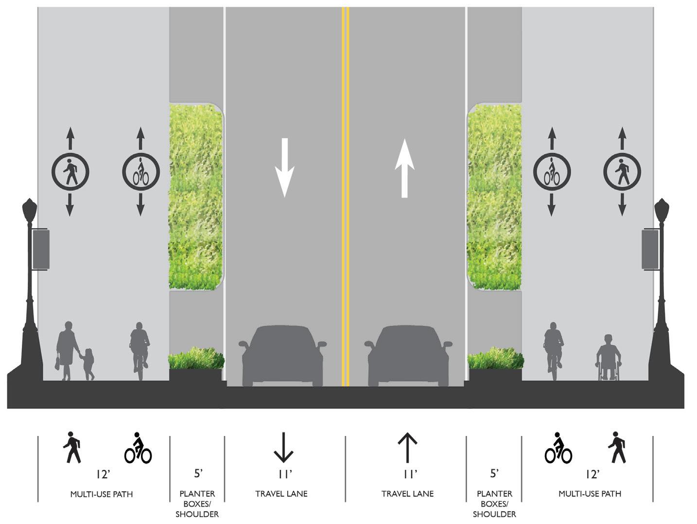
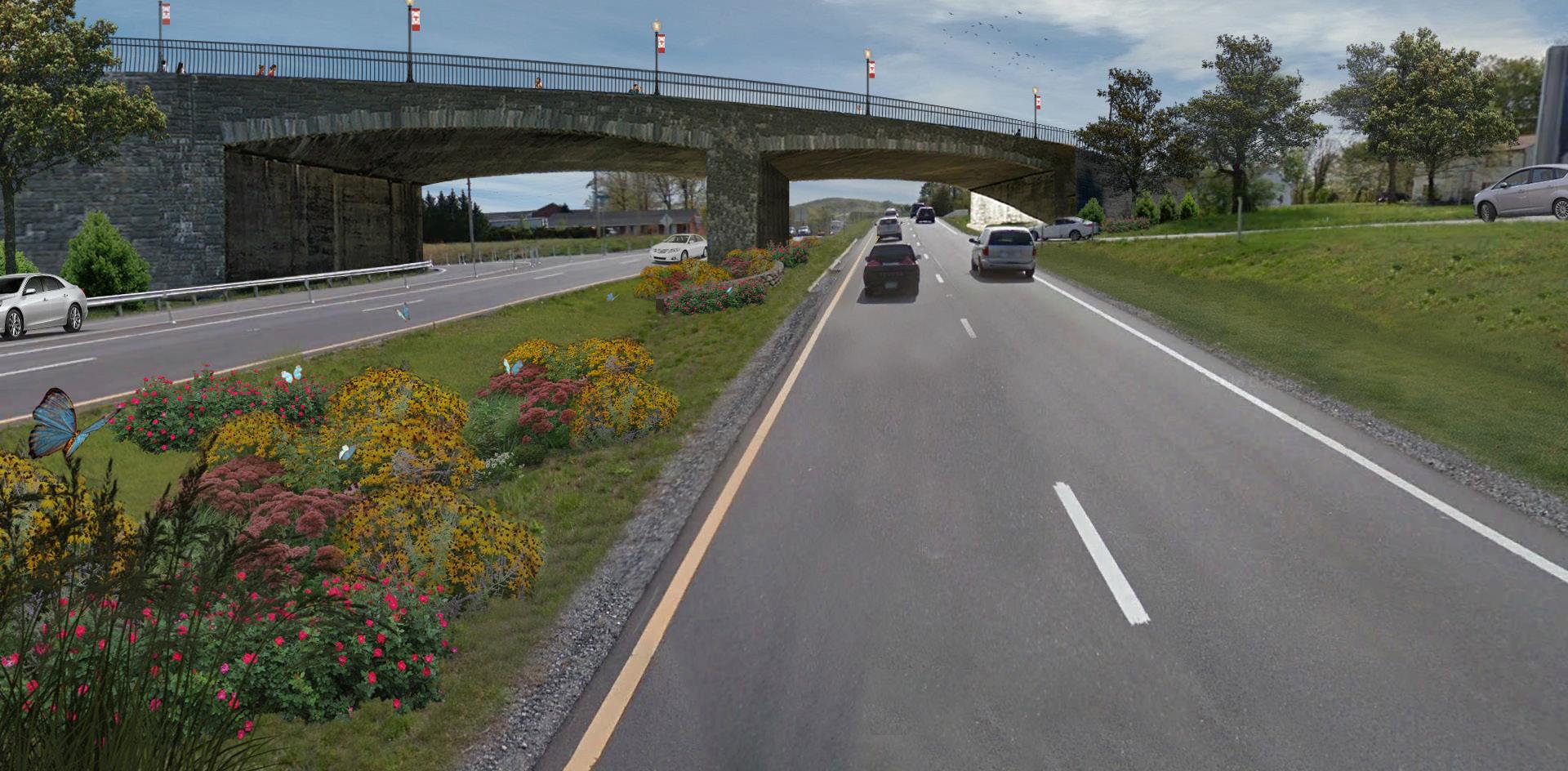
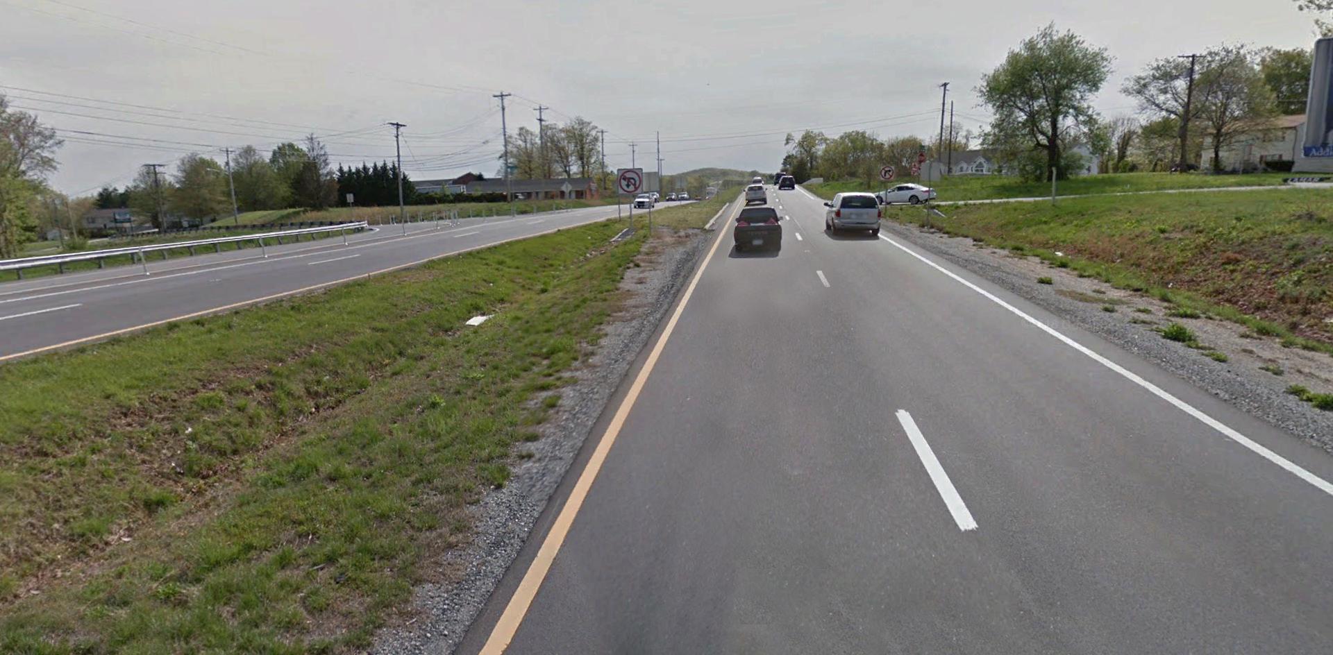
TYREEANNA & PLEASANT VALLEY NEIGHBORHOOD PLAN 45 CHAPTER 5: CONNECTIVITY & NEIGHBORHOOD DESIGN
Proposed connector bridge from Tyreeanna Rd. to Holcomb Path Rd.
Existing conditions on U.S. Route 29/ U.S. 460 Bypass
Plan and section view for connector bridge from Tyreeanna Rd. to Holcomb Path Rd.
road extensions & new alignments
Along with retrofitting existing streets, the Tyreeanna / Pleasant Valley Neighborhood Plan proposes a number of road extensions and new road alignments to improve connectivity to and from Downtown; alleviate traffic loads from Concord Turnpike; promote the design of walkable environments; and create a compact street grid.
NEIGHBORHOOD BOUNDARY
NEW ROAD ALIGNMENT
Proposed Projects:
James River Scenic Parkway (include gateway sign)
New Collector Rd. (Tyreeanna Rd. to Pleasant Valley Blvd.)
New Collector Rd. (residential development to Concord Tpke.
Jughandle Project
Holcomb Bridge Project
ROAD EXTENSIONS
Proposed Projects:
Carnell Ln. Road Extension (to Rockwell Rd.)
Statham Rd. Extension (to Pleasant Valley Blvd.)
GREENWAY
Proposed Project: Pleasant Valley Greenway Trail
Phase 1: Pleasant Valley Blvd. (up to bridge)
Phase 2: New Residential Road/off-street path
Phase 3: Holcomb Path Multi-modal Bridge
Phase 4: Monocan Bridge connection to Amherst County
CITY / NEIGHBORHOOD GATEWAY
Proposed Projects:
Gateway Sign(U.S. 460)
PRIMARY NODE
TYREEANNA & PLEASANT VALLEY NEIGHBORHOOD PLAN 46 CHAPTER 5: CONNECTIVITY & NEIGHBORHOOD DESIGN
extensions and alignments
Proposed
PLEASANTVALLEYRD TURNER LN PEAKSVIEWDR CARNELLLN C H A N N I E LN MEGGINSONLN HILLVIEW ST STATHAMRD PRINCEST KAVANAUGHRD STONST NICKERSONRD SPINOZACIR TYREEANNA RD WINSTON RIDGERD WINCHESTERST CONCORD TPKE ROCKWELLRD RTE 29 BYP LEGEND
TURNER LN AULTICE LN CARNELLLN C H A N N I E LN MEGGINSONLN STATHAMRD KAVANAUGHRD POSTONST NICKERSONRD SPINOZACIR TYREEANNA RD CONCORD TPKE ROCKWELLRD HOLCOMBPATHRD RTE 29 BYP RICHMONDHWY
PLEASANTVALLEYRD
E. GATEWAYS
greeting visitors to lynchburg
An opportunity exists to create a gateway to the City in the area along Route U.S. 29/ U.S. 460 Bypass. With the construction of the James River Parkway envisioned as part of the Downtown 2040 Master Plan, this gateway can formalize the entry to Downtown and the City of Lynchburg as a whole for travelers coming from the east and north, as well as those traveling from the Wards Road area, and points west and south along the highway. This project will require close coordination and collaboration between the City and the Virginia Department of Transportation (VDOT) since current state policy prohibits gateway signs located along limited access highway.
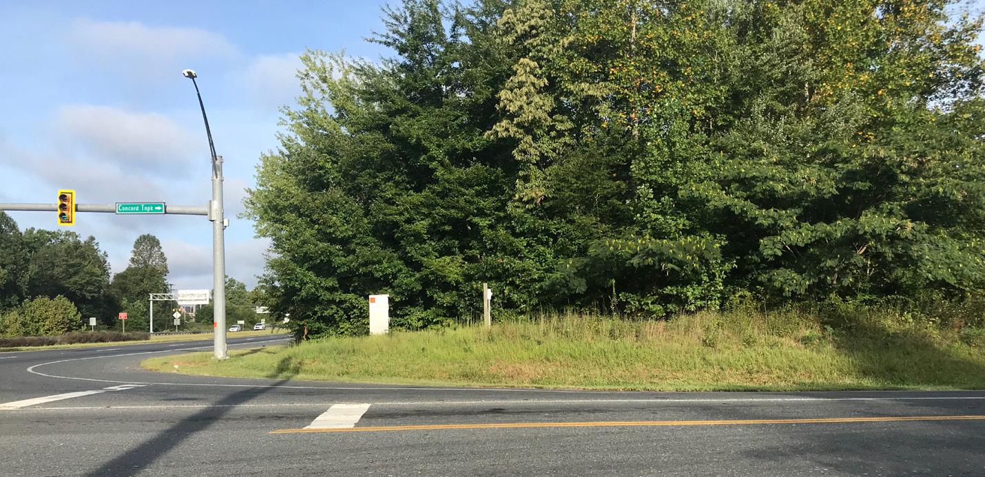
a welcoming neighborhood
Like the City gateway, an opportunity also exists to define the entrance into Tyreeanna / Pleasant Valley. Building upon the neighborhood’s history, this plan proposes defining a unique community identity that can then be translated into the built environment. One way to reflect a community’s brand is through urban design elements such as streetlight flags, street furniture, and a neighborhood gateway sign.
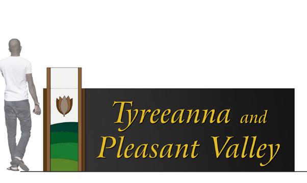
Proposed location and illustrative representation of a neighborhood gateway sign. The sign’s design needs to be part of a larger identity and branding strategy that effectively illustrates the vision of the whole community. Choice of materials should allow for relocation of the sign as needed based on development and growth.
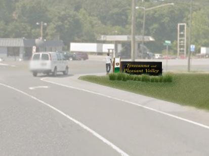
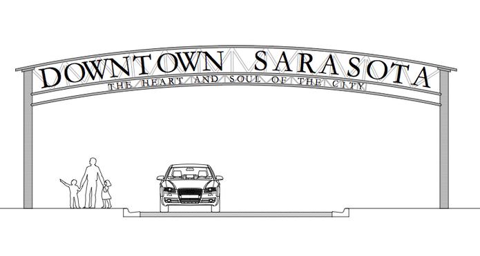

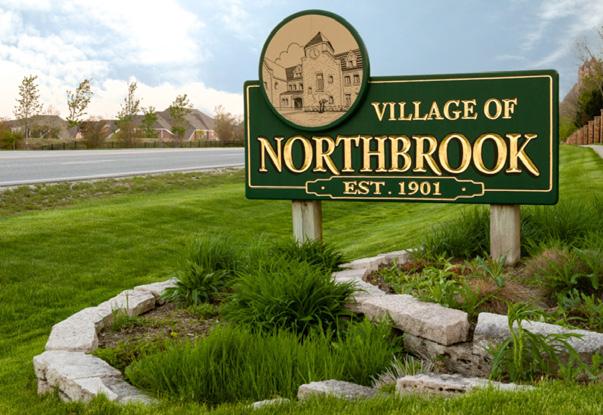
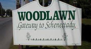
TYREEANNA & PLEASANT VALLEY NEIGHBORHOOD PLAN 47 CHAPTER 5: CONNECTIVITY & NEIGHBORHOOD DESIGN
Examples of gateway signs
Proposed location for Lynchburg gateway sign
As development takes place in Tyreeanna / Pleasant Valley, a cohesive streetscape palette can reinforce entrances and important nodes within the neighborhood. A branding palette should be incorporated into larger infrastructure projects and in accordance with established design standards as recommended at the beginning of this chapter.
F. OTHER MULTI-MODAL OPTIONS
greenway system
An important mobility element of this plan is a greenway system with dedicated pathways for pedestrians and cyclists. The long-term vision for the greenway is to build a continuous system that links destinations within Tyreeanna / Pleasant Valley and that connects to other areas of the city. The proposed route starts at the south edge of the neighborhood on Holcomb Path Road, crosses over U.S. Route 29/U.S. 460 Bypass and runs through the neighborhood to the east side of the river to link to the James River Heritage Trail. The Tyreeanna / Pleasant Valley greenway is to be completed in four (4) phases:
Phase 1 converts two underutilized lanes on Pleasant Valley Road into a multi-purpose pathway. This phase includes improvements starting at the west end of Pleasant Valley Road up to the bridge where the road crosses U.S. Route 29. Once completed, this section of the greenway will create opportunities to extend connections to proposed recreational areas and housing developments. In portions of the greenway near the proposed commercial area, public art and streetscape elements can highlight the neighborhood’s history and brand.
Example of how various materials (brick and concrete) and urban design elements (benches, bike racks, trees, and landscaped areas) are used to define the entrance of a neighborhood in the City of Lynchburg.
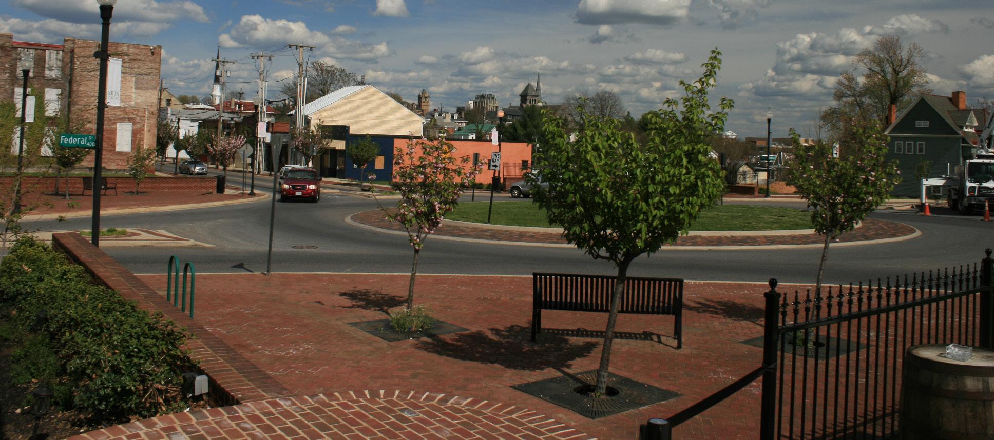
Phase 2 extends the greenway northwest through a new residential road and onto Tyreeanna Road on an off-street path.
Phase 3 links the north and south sides of the neighborhood, cur-rently split by Route U.S. 460 via a multi-modal bridge as described earlier in this chapter (see section titled Holcomb Path Road Bridge)
Phase 4 connects the greenway system to Amherst County by providing a safe route for pedestrians and cyclists under the Monacan Bridge. The concept also proposes a trail link to the James River Heritage Trail in Downtown Lynchburg and the Pleasant Valley Historic Mile described in Chapter 7 Historic Resources.
TYREEANNA & PLEASANT VALLEY NEIGHBORHOOD PLAN 48 CHAPTER 5: CONNECTIVITY & NEIGHBORHOOD DESIGN
Phase 1 repurposes the north side of Pleasant Valley Rd. to create a multi-use trail for bikers and pedestrians. Pocket parks are proposed along the greenway for passive and active use. Public art can also be integrated as part of the neighborhood’s identity and branding efforts.
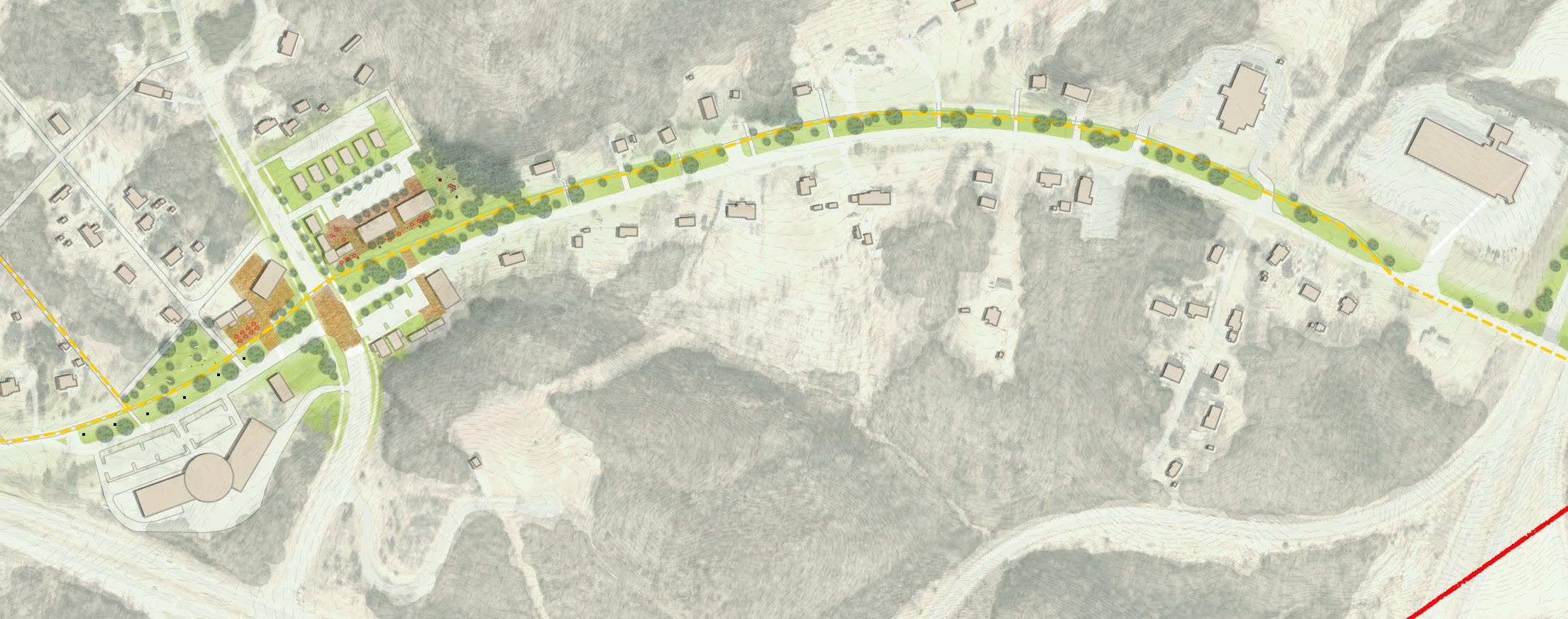
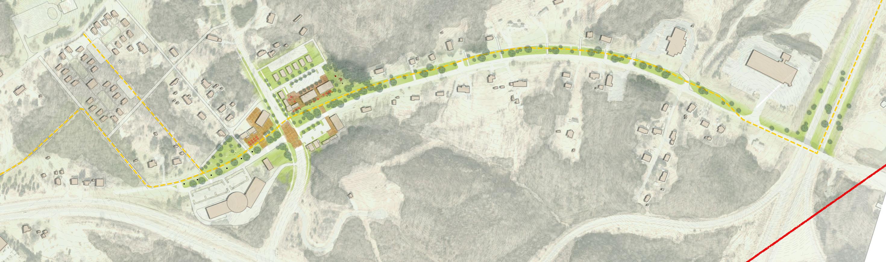
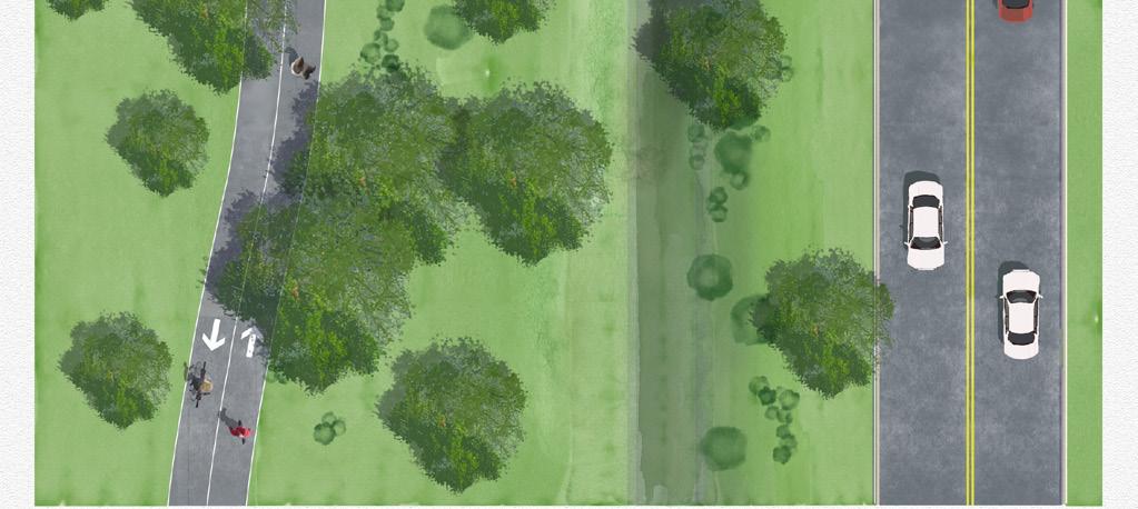
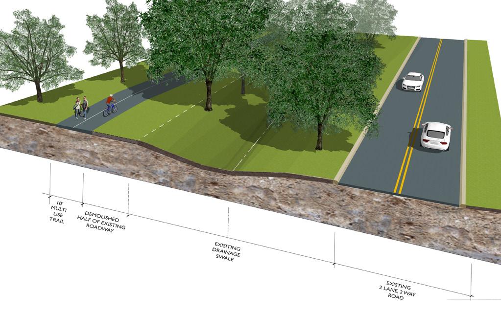
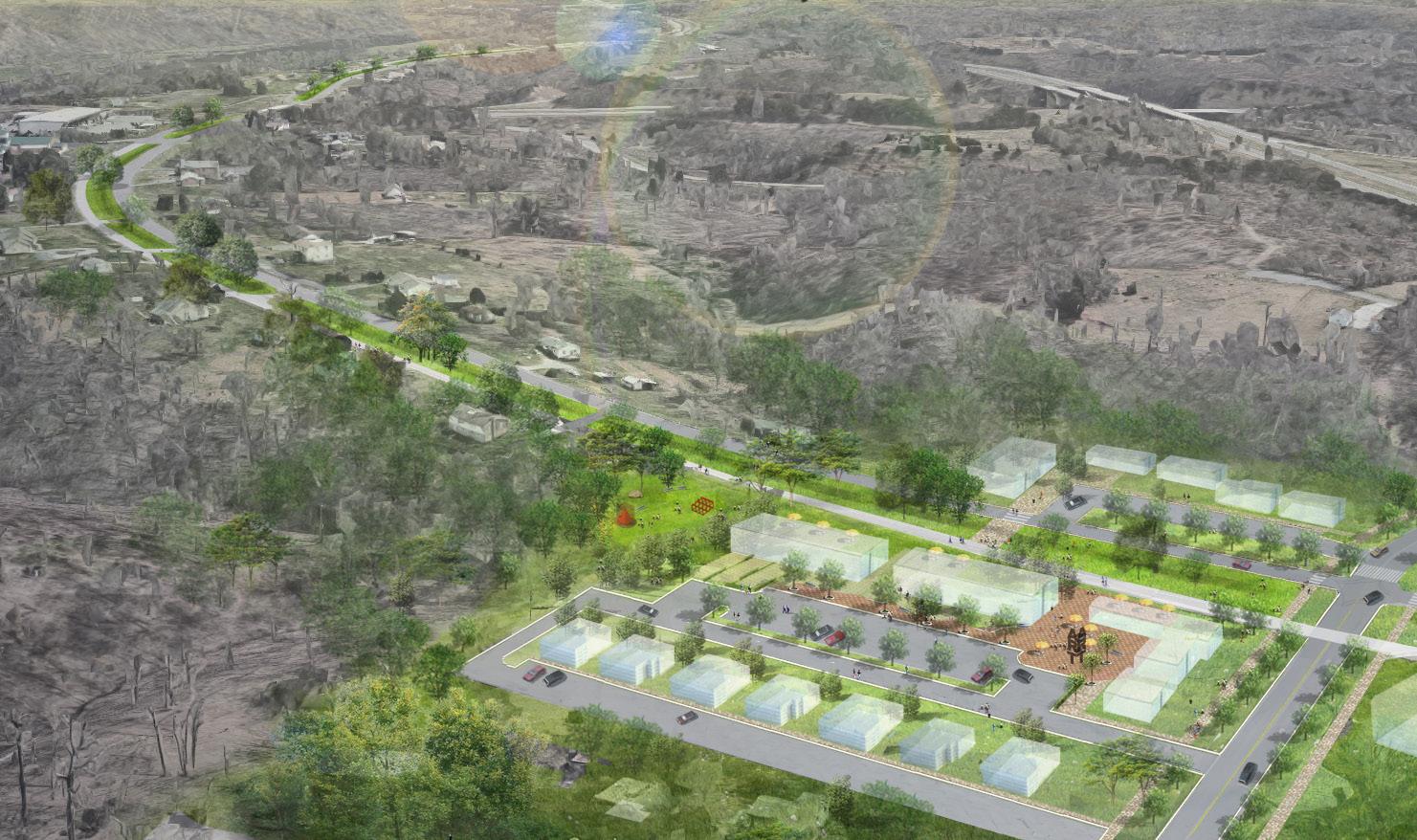
TYREEANNA & PLEASANT VALLEY NEIGHBORHOOD PLAN 49 CHAPTER 5: CONNECTIVITY & NEIGHBORHOOD DESIGN
View of greenway and proposed commercial area
Plan view and axonometric section illustrating the transformation of the northern lane on Pleasant Valley Rd.
PleasantValleyRd.
ConcordTpke.
Pleas Blvd.
public transit
Currently, there is no fixed route bus service in Tyreeanna / Pleasant Valley. Although residents expressed a lack of need or desire for transit , the goals and objectives set forth in this plan suggest the need for public transit in the future. As the recommendations of this plan are adopted and implemented, the City can work with Greater Lynchburg Transit Company (GLTC) to determine when the timing is appropriate based on need.
G. GOALS
• Address pedestrian safety and traffic concerns in the neighborhood.
• Promote pedestrian activity and walkability.
• Enhance and maintain the cleanliness and appeal of the neighborhood.
• Create a unified identity for Tyreeanna / Pleasant Valley.
• Better define neighborhood entrances and nodes.
• Connect the south side of neighborhood with the rest of the neighborhood.
• Promote multi-modal transportation options.
There are currently no transit routes available between Tyreeanna / Pleasant Valley and other city neighborhoods. Residents in this community are cardependent and would benefit from an alternative mode of transportation. This is particularly for the aging population group that is not/will not be able to drive in the near future.
TYREEANNA & PLEASANT VALLEY NEIGHBORHOOD PLAN 50 CHAPTER 5: CONNECTIVITY & NEIGHBORHOOD DESIGN
MAINST K N I G H T S T MAPLE ST RIDGEAVE FRANKLIN ST AUGUSTA ST HIGH ST PLEASANTVALLEY RD TULIPST DURHAM ST POCAHONTASST TYREE STVIRGINIA S T PINEST GEORGIAAVE OTEY ST WOODROWST GLOBE ST ELM ST FORD ST KING ST HILLVIEW ST STATHAMRD PRINCE ST J U BILE E D R KAVANAUGHRD POSTONST TOPRIDGEDR NICKERSON RD TEX SA A VE GUM ST GREENFIELD DR DUKE ST GILMORE CIR HUDSONST POPLARST TYREEANNA RD MAYFLOWERDR W I N S TON RIDGE DR ROBINSRD WINCHESTERST F L ORIDA AVE FLORIDA AVE MARTINST GRACEST CONCORDTPKE ROCKWELL RD HOLCOMBPATHRD CAMPBELL A VE 460 BYP L Y N C H B URGEXPY CAMPBELLAVE RTE 29 BYP RICHMONDHWY Tyreeanna Neighborhood GLTC Bus Route Parcels Transit Routes Study Area Boundary Corporate Limit
6.PARKS & OPEN SPACE
Parks and open spaces are important land uses that promote the physcial and psychological health of citizens, strengthen the social frabric of communities, and make neighborhoods more attractive places to live and work. There are many public health, economic, environmental, and social benefits associated with city and neighborhood parks. Some of these include:
• Increased physical activity which reduces the risk of premature death and chronic illnesses related to obesity. Physical activity and access to nature also improve mental well-being, helping reduce symptoms of anxiety and depression.
• Higher property values and healthy tax base. Real estate market research demonstrates that people are willing to pay more for properties located near parks and green spaces. Well-designed parks in commercial areas can also become venues for cultural events, attracting and retaining businesses.
• Reduced pollution and stormwater run-off from trees and landscaped areas. In addition to raising oxygen levels, trees act as natural air conditioners by reducing the heat island effect of impervious surfaces. At the same time, green areas absorb water, slowing the rate at which it reaches stormwater facilities and staving off overflow.
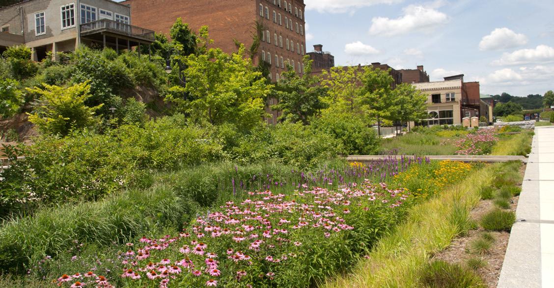
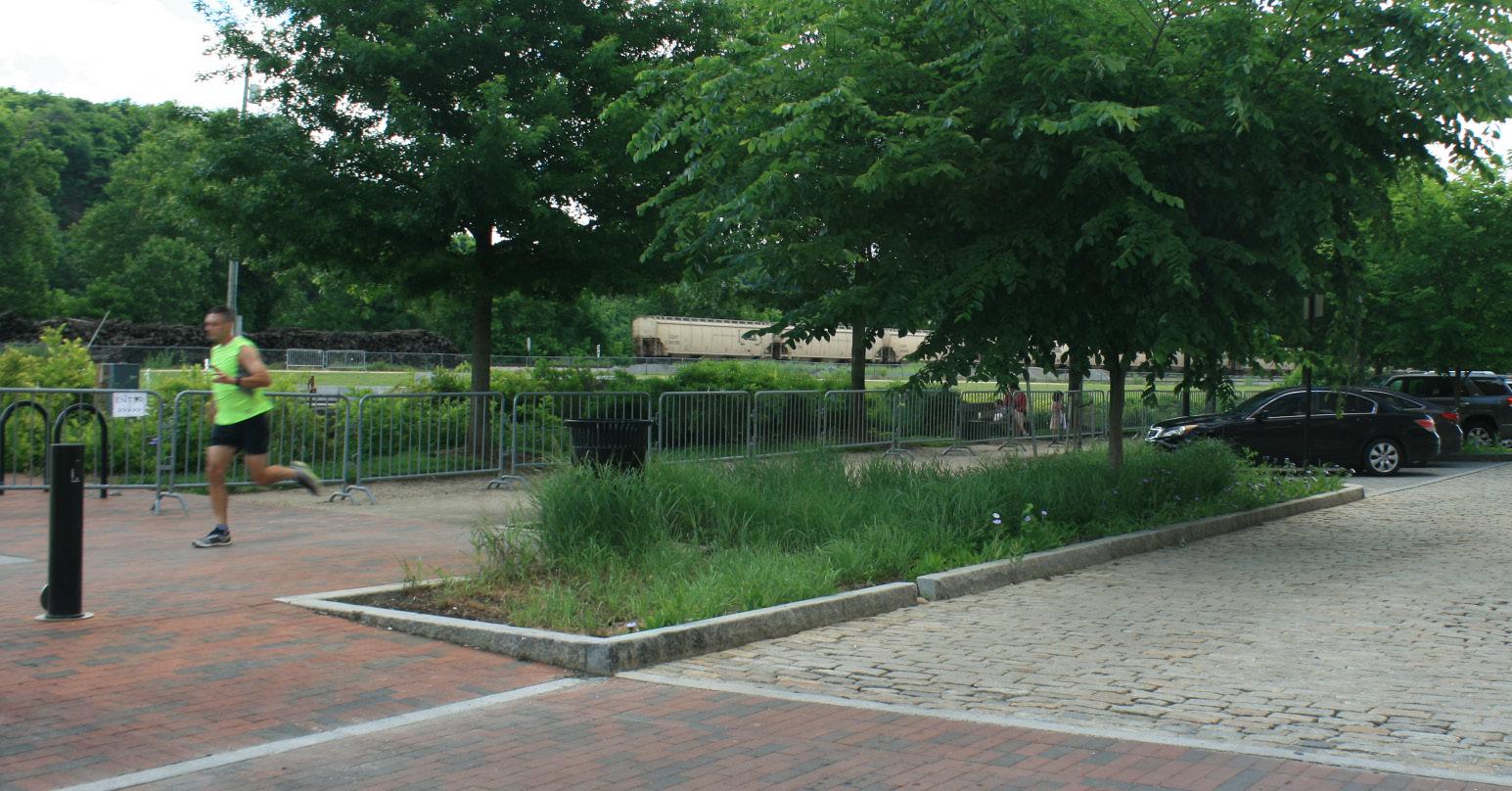
• Strengthened sense of community and reduced crime. While hard to quantify, parks are an important community development tool. Parks make city neighborhoods more livable; they can offer recreational opportunities for at-risk youth, low-income children, older population groups; and they provide places for people to gather. Access to public parks and recreational facilities has also been linked to reductions in crime and in particular to reduced juvenile delinquency.
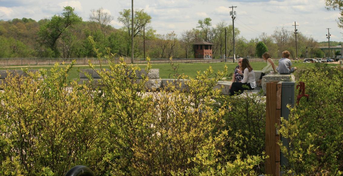
TYREEANNA & PLEASANT VALLEY NEIGHBORHOOD PLAN 51 CHAPTER 6: PARKS & OPEN SPACE
Riverfront Park in Downtown Lynchburg provides a number of benefits to residents and visitors such as green infrastructure
While there is a lot of undeveloped land in Tyreeanna / Pleasant Valley, the neighborhood lacks dedicated recreational areas and gathering places. Feedback during planning sessions revealed that many housholds, particularly families with young children, often travel to other areas of the city to access parks and participate in outdoor activities. The community would like to see the implementation of dedicated parks and green spaces as long as they are accessible to people of all ages and population groups.
Lynchburg’s Future Land Use Map (FLUM) designates a portion of publicly-owned parcels in Tyreeanna / Pleasant Valley to parks and open space, including the former city landfill site. The Tyreeanna / Pleasant Valley Neighborhood Plan provides concepts for the transformation of vacant and underutilized properties across the neighborhood into a connected network of passive and active recreational areas. The proposed sites are designed for multi-generational use and vary in scale, type, and character. The goal is to illustrate how parks and gathering places can improve the quality of life of residents, catalyze economic activity, and foster a sense of community in Tyreeanna / Pleasant Valley.
Riverfront Park is the nearest park accessible (by car) to Tyreeanna / Pleasant Valley. It is located approximately four miles away
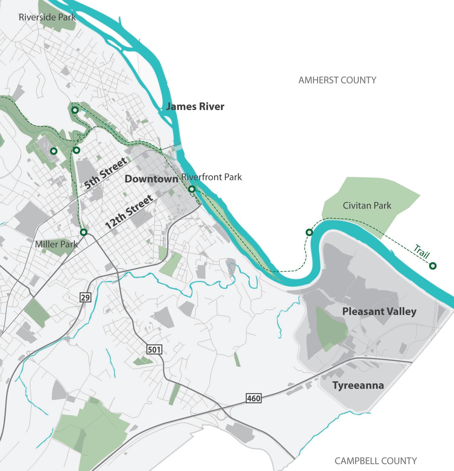
TYREEANNA & PLEASANT VALLEY NEIGHBORHOOD PLAN 52 CHAPTER 6: PARKS & OPEN SPACE
A. GATHERING PLACES
community gardens & courtyards
The pocket neighborhood concept introduced in Chapter 4 Future Land Use illustrates how green spaces and common areas can be incorporated as part of planned housing developments. Gardens and courtyards are great places for residents to come together and participate in activities that foster community at a smaller scale. Pocket neighborhoods with few housing units can also include a small shed for storing tools needed to tend a shared garden. Larger developments might afford additional amenities such as a shared kitchen, workshop space, or a swimming pool.
pocket parks
A pocket park is a small accessible outdoor area often created on a single vacant lot or on an irregular parcel. It might also be implemented as an element of large building projects. The greenway concept introduced in Chapter 5 Connectivity and Neighborhood Design illustrates how a system of pocket parks can be connected across Tyreeanna / Pleasant Valley through a multi-modal trail or linear park.
The pocket parks proposed along the neighborhood greenway would function as active recreational areas to foster physical activity. Examples include playgrounds, fitness courses, or sports fields. At the same time, passive pocket parks along the greenway can offer “low-intensity” recreation, serving as venues for art & culture activities, preservation of natural habitats, and historical heritage sites. See then Historic Mile project in Chapter 7 Historic Resources.
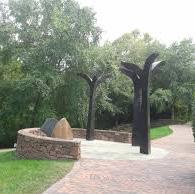
A number of gathering places are proposed near and around the greenway project. These spaces create opportunities for active and passive recreational activities that improve the quality of life and strengthen the sense of community in the neighborhood
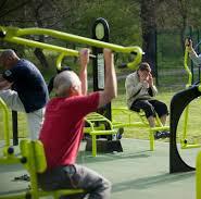
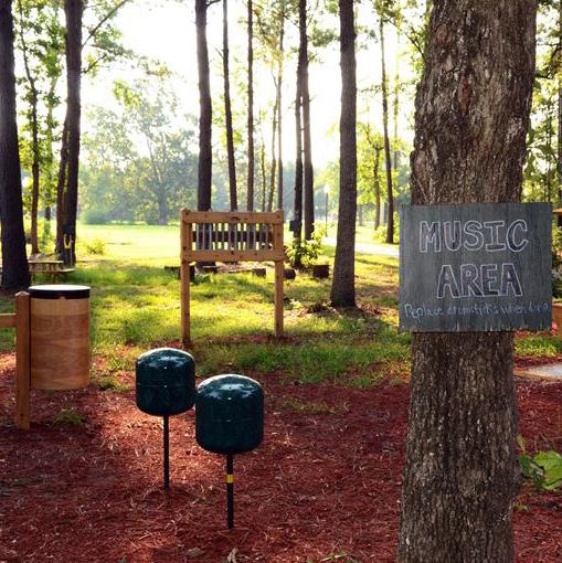
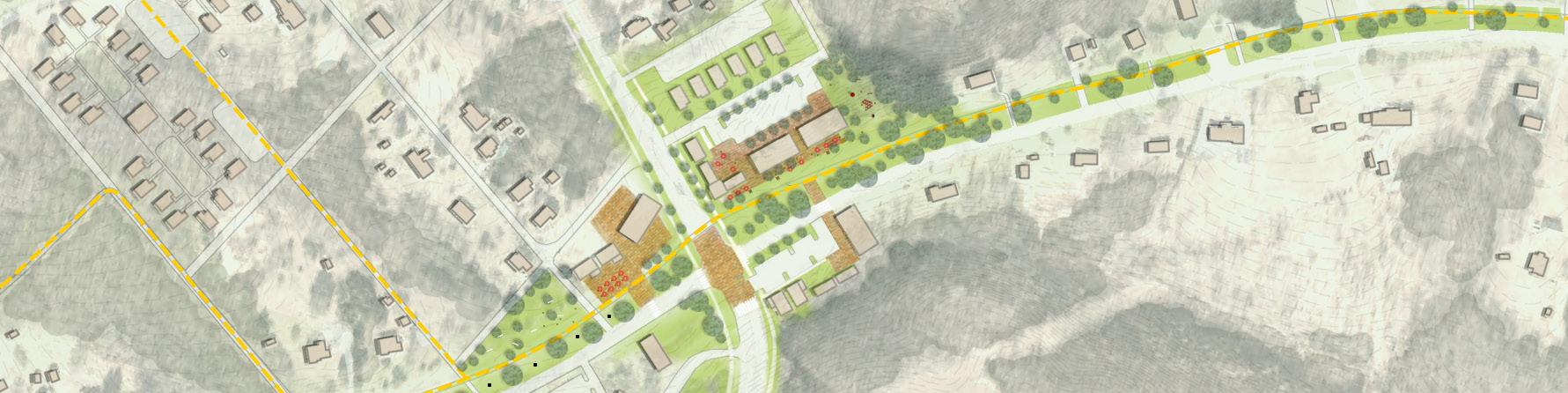
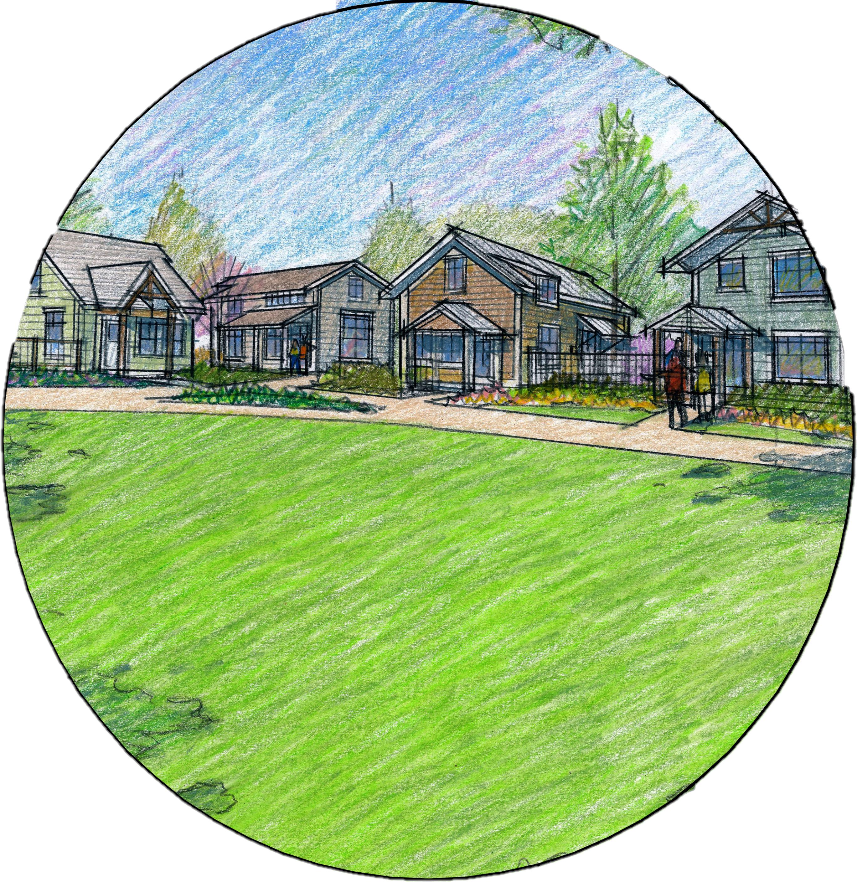
TYREEANNA & PLEASANT VALLEY NEIGHBORHOOD PLAN 53 CHAPTER 6: PARKS & OPEN SPACE
PleasantValleyBlvd.
ConcordTpke.
StathamRd.
STATIONS
COMMUNITY GARDEN / COURTYARD HERITAGE / SCULPTURE PARK INTERACTIVE PLAYGROUND FITNESS
B. DESTINATION PARK
tyreeanna park
Once a site associated with negative connotations and sentiment citizens, the former landfill now presents a significant recreational opportunity for residents of Lynchburg and the Tyreeanna / Pleasant Valley neighborhood. The concept described below illustrates activities and amenities that could be incorporated into a public the former landfill taking into consideration the site’s current natural and infrastructural characteristics.
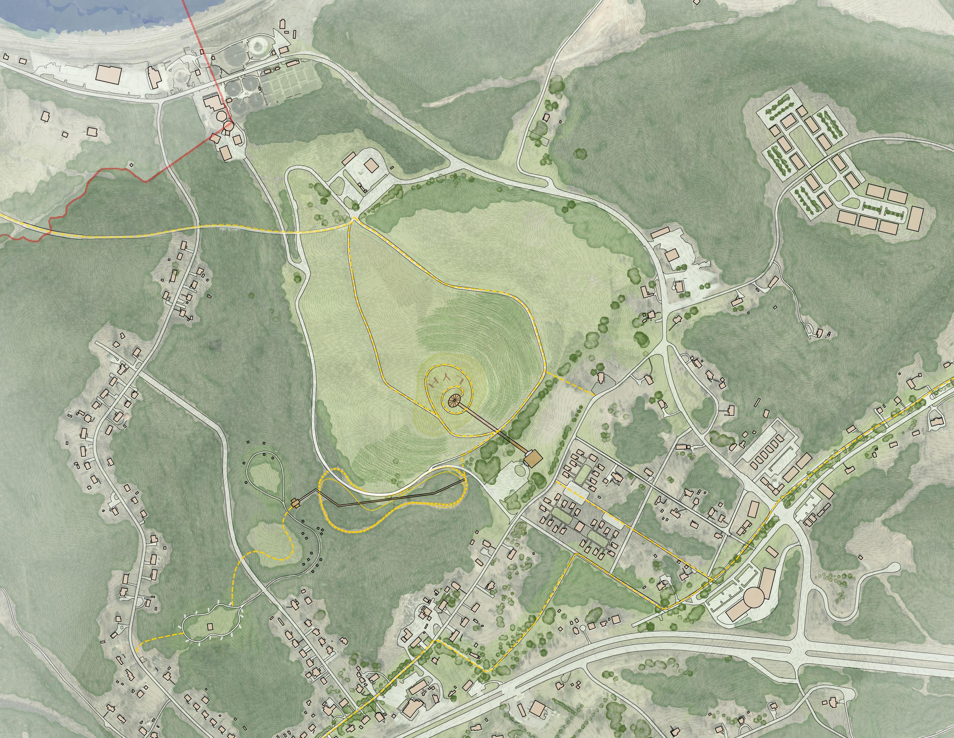
While topography and environmental concerns limit development options for the landfill, there is great potential to repurpose the site as a destination parkwith adedicatedsystemoftrailsandpaths.Accesstothepark provided from the north side through the James River Parkway proposed in the Downtown 2040 Master Plan. A south entrance is also illustrated in this concept along Tyreeanna Road as part of a potential project for a community center and multi-generational recreational area. The existing network of paths and roads within the site provide a framework for a future system of trails that would connect proposed recreational areas. Some of the activities identified include:
The goal of this concept is to foster productive discussions between City staff and neighborhood residents as part of the larger vision for Lynchburg’s Parks Master Plan. See Chapter 1 Introduction.
TYREEANNA & PLEASANT VALLEY NEIGHBORHOOD PLAN 54 CHAPTER 6: PARKS & OPEN SPACE
James River Pavilion & Walk Interactive Sculpture Dog Park Pollinator Valley Healing Arts Trail Loop Tent Camping Loop Tiny House Camping RV Loop Wild Flowers Field Kite / Frisbee/ Balloon field Slide & Sled Community Center & Multi-Gen. Play Elevated Canopy Walk Active Sports Pump Track 1 2 3 4 5 6 7 8 9 10 11 12 13 14
ConcordTpke.
TyreeannaRd.
U.S.Route460
RockwellRd.
CarnellLn.
NewRoad New Road StathamRd.
Turner Ln. SpinozaCir. NickersonRd. Rockwell Rd. 1 2 3 4 5 6 9 8 10 11 12 13 7 14
CarnellLn.(Extension)
ConcordTpke.
CASE STUDIES:

The environmental challenges associated with decommissioned landfills limit the types of activities that can take place at these sites. In response, cities across the country are implementing innovative ideas that put landfills into productive use and transform them into assets for their communities.

TYREEANNA & PLEASANT VALLEY NEIGHBORHOOD PLAN 55 CHAPTER 6: PARKS & OPEN SPACE 1 5 6 7 2 3 4 8 9 10 11 12 13 2 5 6 7 8 9 10 11 12 13 3 4 1
C.RIVER ACCESS
OVERLOOK AT MONOCAN BRIDGE
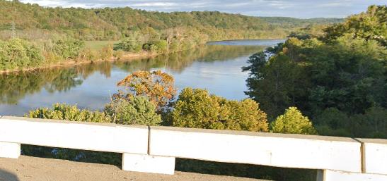
A railroad separates the City of Lynchburg from the James River, mostly with steep terrain, and majority of the property adjoining the railroad is either private or owned by utility companies. The Tyreeanna / Pleasant Valley neighborhood has roughly two miles of James River shoreline, none of which is accessible by the public for those same reasons. Still, residents of Lynchburg consistently express a desire for river access, as evidenced from input opportunities in other recent planning efforts, including the development of the Downtown 2040 Master Plan and the Middle James River Vision regional plan.
Despite the inherent challenges, this plan recommends that the City work to find opportunities for river access. One such opportunity would be the potential for an overlook located in Phase 4 of the Pleasant Valley Greenway. This phase consists of multi-modal access between Amherst County and Lynchburg via the Monocan Bridge, possibly via pedestrian walkway below the vehicular bridge deck (similar to the Harry Flood Byrd Memorial Bridge on the Blue Ridge Parkway). An overlook could be incorporated into this project, and ideally, would also include access via stairs or ramps to the riverbank below.
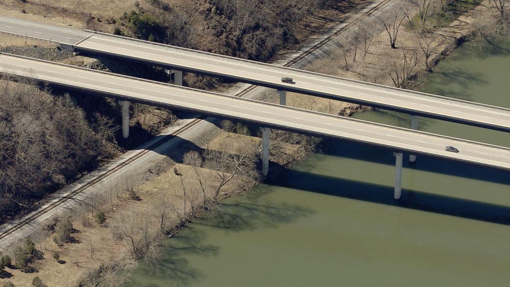
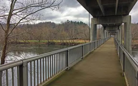
C. GOALS
•Promote the sustainable development of vacant public land
• Develop a connected network of parks and public spaces
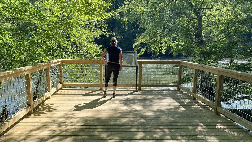
• Create gathering spaces that foster the interaction of the whole community
Above: Overlook project location
Below: View from the Monocan Bridge Lynchburg, VA
TYREEANNA & PLEASANT VALLEY NEIGHBORHOOD PLAN 56 CHAPTER 6: PARKS & OPEN SPACE
River Overlook at Cochran Shoals trail - Marietta, GA
Photo courtesy of Chattahoochee National Park Conservancy
Harry Flood Byrd Memorial Bridge has a separate pedestrian walkway below the vehicular bridge
7.HISTORICRESOURCES
From the construction of the Tyreeanna Plantation to the establishment of the Megginson School, Tyreeanna / Pleasant Valley has a deep and rich history that shaped how the neighborhood exists today. These historic resources are a key part of the area’s story and should be identified, recognized, and protected so that they can be experienced by generations to come.
A. IDENTIFICATION
putting tyreeanna / pleasant valley’s history on the map
Thosefamilies whohaveresided in Tyreeanna / PleasantValley thelongest are the most knowledgeable about its past. The generational wisdom of these residents will be fundamental in identifying the neighborhood’s foundational landmarks. Stories related to Tyreeanna / Pleasant Valley’s historic heritage can be collected through community-based events. A neighborhood walkthrough, for example, will allow City staff and other members of the community get more familiar with historic resources. A neighborhood story project can also help established residents collect archival documents, identify historic landmarks, and anecdotal stories to bring awareness to important historic events.
B. RECOGNITION
sharing tyreeanna / pleasant valley’s story
A neighborhood’s unique character can enhance the pedestrian experience andfosterastrongsenseofcommunity.AfterTyreeanna/PleasantValley’s resources are identified, their significance and history can be recognized and become part of the neighborhood’s distinct identity. Articulating this identity on the physical environment will, in turn, improve the visibility of the community, and help to attract new residents. Urban design elements such as gateways, signage, and public art can be designed to celebrate the neighborhood’s history.
The Historic Mile is a grassroots effort through which a group of residents seek to promote Pleasant Valley's African American heritage. The project identifies eight sites of historic significance along Pleasant Valley Rd. and Concord Turnpike. These sites include: Riverbends Landing, Slave Quarters, Albert and Judie Megginson Home, Royal and Roxie Megginson Home, Megginson Rosenwald School, Pleasant Valley Baptist Church, and the Megginson Cemetery. There is a great opportunity to integrate the Heritage Mile project with the proposed greenway concept as described in Chapter 5 Connectivity and Neighborhood Design.
In addition to the Heritage Mile, an ongoing initiative seeks to restore the MegginsonHomestead andfurther thelegacy,leadership,andcivicservice of the Megginson family. The goal of this project is to fund improvements and repairs needed for the facility to become a community resource. The building will be used to bring awareness to the rich history of Hanie Megginson and her descendants; celebrate the African American agricultural, religious, and educational heritage in Pleasant Valley; and to recognize and preserve the family’s history.
The Historic Mile and the Megginson Homestead Restoration projects are examples of community-driven initiatives that can complement and leverage the objectives of the Tyreeanna / Pleasant Valley Neighborhood Plan. City officials should seek ways to support these and future initiatives as part of Lynchburg’s overarching community development and historic preservation goals.
57
HISTORIC RESOURCES
CHAPTER 7:
TYREEANNA & PLEASANT VALLEY NEIGHBORHOOD PLAN
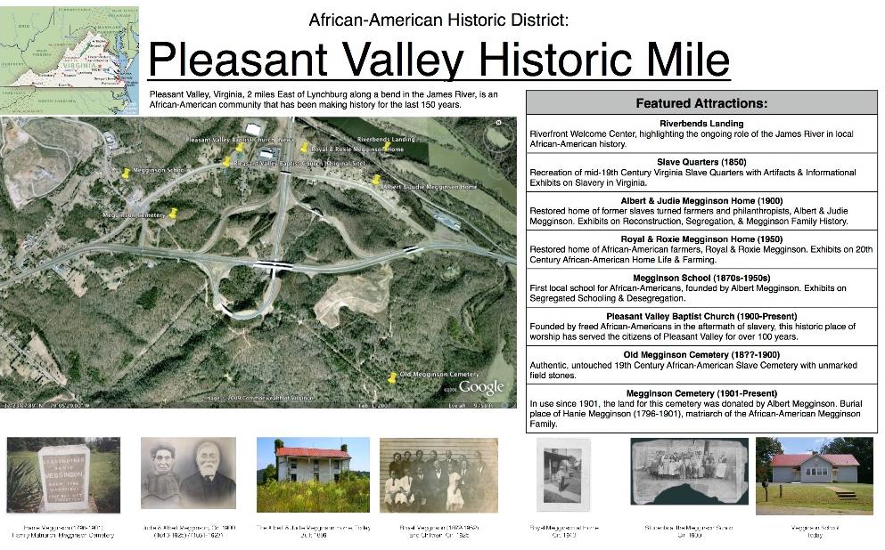
TYREEANNA & PLEASANT VALLEY NEIGHBORHOOD PLAN 58 CHAPTER 7: HISTORIC RESOURCES
Heritage Mile Project - Proposed Map
C. PROTECTION
preserving the past for the future
Historic Properties
The Tyreeanna/Pleasant Valley neighborhood includes several known historic properties, including Tyreeanna United Methodist Church, Megginson Homestead, Megginson School, Megginson Cemetery, and Chestnut Hill. Except for the Megginson School, none of these properties have been surveyed or documented in the Virginia Cultural Resource Information System (VCRIS), the statewide database for historic resources. Identifying these resources (and any research that comes out of this process) can help inspire themes and context for heritage tourism as exemplified by the Heritage Mile project described in this chapter. The survey process can also help determine if any of these properties are individually eligible for listing on the National Register of Historic Places (NRHP). Listing properties in the NRHP provides economic incentives to property owners including state and federal historic tax credits.
The Tyreeanna / Pleasant Valley Neighborhood Plan recommends that City staff work with community leaders to conduct further research on the Megginson Homestead, Megginson School, Megginson Cemetery, and Chestnut Hill. Staff should also work with the community to explore the potential for listing these historic resources on the Virginia Landmarks Register (VLR) and the National Register of Historic Places (NRHP). Doing so will make these sites eligible to participate in state and federal historic rehabilitation tax credit programs, which can offset rehabilitation costs and encourage the preservation of these resources. Lastly, the research completed as part of the nomination process can be used to create interpretive signage and/or tours connecting historically significant sites within the neighborhood.
Chestnut Hil has been reognized with a historic marker near the intersection of Campbell Avenue and Martin Street, yet further study is needed to determine what resources are still intact on the property, possibly including the gravesite of Charles Lynch, Sr.
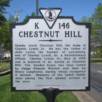
The Megginson School is eligible for listing on the Virginia Landmarks Register and the National Register for Historic Places under DHR’s Multiple Property Nomination Form. This particular Rosenwald Schools marks an important chapter in Tyreeanna / Pleasant Valley’s history because of the role it had in providing education to African-American residents in heavily segregated times (see “Megginson School” in Chapter 2: Background and History).
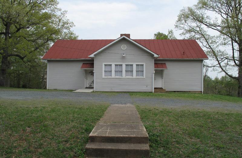
TYREEANNA & PLEASANT VALLEY NEIGHBORHOOD PLAN 59 CHAPTER 7: HISTORIC RESOURCES
Lower Basin Historic District
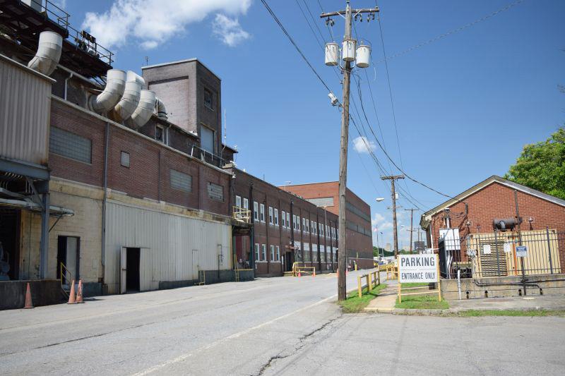
The Lower Basin Historic District expansion discussed in Chapter 2 Background and History is an important link between Downtown and the Tyreeanna/Pleasant Valley area. Like the Megginson School, the Lower Basin expansion has been identified as eligible for listing on the Virginia Landmarks Register (VLR) and National Register of Historic Places (NRHP) but has not been nominated. Having the Lower Basin expansion area formally recognized by the VLR and NRHP is an important first step in highlighting the area’s historical significance. Inclusion in the VLR and NRHP will make any contributing buildings in the historic district eligible to participate in state and federal historic tax credit programs, encouraging their rehabilitation and adaptive reuse.
Promoting redevelopment along sections of the Concord Turnpike corridor within the Lower Basin Historic District will strengthen the connection between Downtown and the Tyreeanna / Pleasant Valley neighborhood. This strategy also aligns with pedestrian and bicycle improvements recommended in this plan which have historically encouraged private investment in other Lynchburg neighborhoods. See Chapter 5 Connectivity and Neighborhood Design.
D. GOALS
• Recognize the significance of the neighborhood’s historic resources
• Increase awareness to important historic resources in the neighborhood
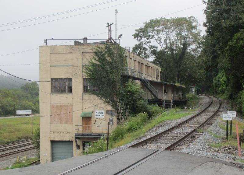
TYREEANNA & PLEASANT VALLEY NEIGHBORHOOD PLAN 60 CHAPTER 7: HISTORIC RESOURCES
Lower Basin Historic District Area
The previous chapters have focused on strategies that improve quality of life for current and future residents of Tyreeanna / Pleasant Valley. From a larger perspective, there are fundamental challenges which have a significant impact on community and economic development that must be addressed before the neighborhood will begin to develop/redevelop significantly.
This area of the city represents some of the last large, open tracts of undeveloped land in Lynchburg. The main reason for this is the lack of utility infrastructure. If water and sewer were readily available to this neighborhood, this area would likely already be experiencing growth. In a way, the lack of utilities has acted as a land bank by preserving the area’s rural character and preventing suburban sprawl. As Lynchburg continues to become more densely developed, the question arises: when is the right time for growth in Tyreeanna / Pleasant Valley?
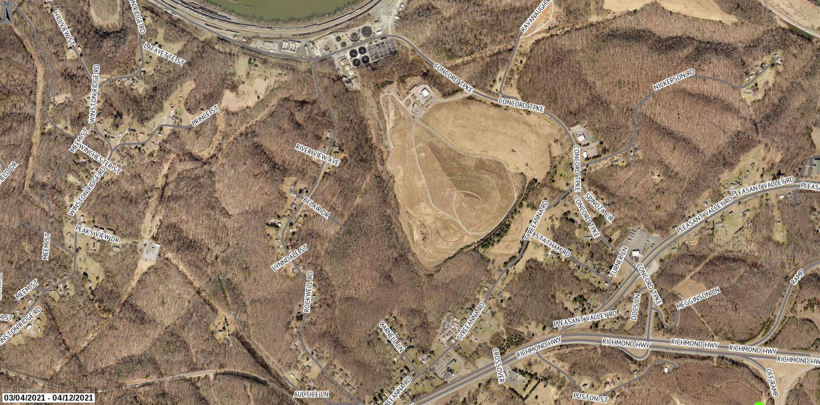
To answer this question, this plan must take these critical factors into account and attempt to strike a balance between the three:
• Neighborhood residents want to maintain and enhance the neighborhood but have expressed concern about radical change to the area, which is a real possibility when utilities are expanded.
• The limited size of the city means that to continue to grow, the city must use its existing footprint as efficiently as possible.
• The capital cost of sewer installation is high, yet the area cannot support significant new development without this infrastructure. This also negatively affects existing housing stock currently using septic, since those systems have a limited lifespan.
A. NEIGHBORHOOD CONTEXT IN 2021
Historically, the Tyreeanna / Pleasant Valley neighborhood has had to contend with impacts from the City’s waste collection and treatment services that are located within its boundaries. The wastewater treatment plant was established in the early 1960s, prior to the area’s annexation from Campbell County in 1976, and has since been expanded multiple times to meet regional demand. The Concord Turnpike landfill was created in 1979, shifted to its current location in 1993, and operated as the regional landfill until its closure in 2012.
Although some odor mitigation strategies have been implemented at the wastewater plant and the landfill itself has closed, many neighbors feel resentment towards the City for annexation, which, from their perspective, resulted in higher taxes but little investment to improve quality of life for these residents.
It is recommended that the City of Lynchburg work closely with the neighborhood action committee (see Chapter 9: Implementation) to strengthen relationships between the local government and residents, especially when either private or public investment will bring any degree of change to the neighborhood.
TYREEANNA & PLEASANT VALLEY NEIGHBORHOOD PLAN 61 CHAPTER 8: MOVING FORWARD
8.MOVING FORWARD
Aerial view of decomissioned landfill in Tyreeanna / Pleasant Valley
B. ECONOMIC DEVELOPMENT
A Blueprint for Opportunity outlines the big picture for Economic Development in Lynchburg and is built on five key priorities: growing local businesses, engaging anchor institutions, filling workforce pipelines, enhancing quality of place, and communicating Lynchburg’s story to the world. Several objectives defined in the Blueprint are especially relevant to this neighborhood:
1.4 Develop the real estate, land, infrastructure, and incentive tools to support business expansion
The Office of Economic Development has supported the redevelopment of brownfield sites by applying for and obtaining EPA assessment grants. The Tyreeanna / Pleasant Valley neighborhood has several candidate sites that may be eligible for this program to facilitate redevelopment.
4.1 Adopt a placemaking strategy for Lynchburg’s downtown core and neighborhoods
This plan reinforces the need to tell the story of the Pleasant Valley and Tyreeanna communities including signage for gateways and historic resources. It also brings attention to much needed quality of life improvements, such as the Pleasant Valley greenway. The “history mile” project (see Chapter 6) proposed along the Pleasant Valley greenway is one example of how a green space can provide a unique experience to drive tourism.
4.2 Create strategies for “tourism experiences” to drive visitor and tourism growth
Many of the improvements recommended in Chapter 6, Parks and Open Space, support this objective by providing public greenspaces. The proposed park at the former landfill site represents a significant opportunity for a unique outdoor recreation experience for both visitors and neighborhood residents of all ages.
4.3 Improve Lynchburg’s connectivity
Route U.S.29/U.S. 460 is a major gateway for visitors to Lynchburg, and currently, the entry into the City from this area is unmarked and does not provide a positive first impression. The gateway improvements proposed in Chapter 5, Connectivity & Neighborhood Design, seek an iconic and memorable entrance to the City for visitors.
Quality of place has a major influence on where talent decides to locate. Communities that attract the most talented, highly skilled residents tend to have a strong local identity characterized by a diversity of cultural assets. Increasingly, cities with a firm “placemaking” strategy—one that leverages their strengths to maximize local health, happiness and well-being—are seeing higher levels of investment and development. With its fair share of historical and heritage sites, Lynchburg has an opportunity to position itself as a must-see destination for tourists. By developing a placemaking strategy that centers on these local assets, the City can drive additional economic development.
Quality of place has a major influence on where talent decides to locate. the most talented, highly skilled residents tend to have a strong local identity cultural assets. Increasingly, cities with a firm “placemaking” strategy—one that maximize local health, happiness and well-being—are seeing higher levels of With its fair share of historical and heritage sites, Lynchburg has an opportunity destination for tourists. By developing a placemaking strategy that centers on drive additional economic development.
Source: Blueprint for Opportunity, Goal 4
TYREEANNA & PLEASANT VALLEY NEIGHBORHOOD PLAN 62 CHAPTER 8: MOVING FORWARD
Create, embrace, & promote community.
GOAL 4
C. UTILITY INFRASTRUCTURE
The Tyreeanna/Pleasant Valley community has not seen significant improvement in utility (water and sewer) infrastructure for some time. From a financial perspective, the limited number of residents in the neighborhood has not justified the significant infrastructure cost. Additionally, it is important that there is community support and commitment to connect to new infrastructure to further help justify the cost. The topographic constraints limiting sewer is the most expensive challenge, which is described in more detail in the Tyreeanna Sewer Study, 2005.
The City has extended water service to the area and most residents have connected their homes to the waterline. Some residents are still on wells, and almost all have private septic systems. Even though sanitary sewer service has been extended along Rockwell Road, there are very few connections. When only a limited number of residents connect to a utility, the cost of extending the service to others increases significantly. However, septic systems have limited lifespans, and when they fail, customers will have to connect to sanitary sewer out of necessity.
TYREEANNA & PLEASANT VALLEY NEIGHBORHOOD PLAN 63 CHAPTER 8: MOVING FORWARD
Utility Billing and Mains Map MAINST K N I G H T S T MAPLE ST RIDGEAVE FRANKLIN ST AUGUSTA ST HIGH ST PLEASANTVALLEY RD TULIPST DURHAM ST POCAHONTASST TYREE STVIRGINIA S T PINEST GEORGIAAVE OTEY ST WOODROWST GLOBE ST ELM ST FORD ST KINGST HILLVIEW ST STATHAMRD PRINCE ST J U BILE E D R KAVANAUGHRD POSTONST TOPRIDGEDR NICKERSON RD TEX SA A VE GUM ST GREENFIELD DR DUKEST GILMORE CIR HUDSONST POPLARST TYREEANNA RD MAYFLOWERDR W I N S TON RIDGE DR ROBINSRD WINCHESTERST F L ORIDA AVE FLORIDA AVE MARTINST GRACEST CONCORDTPKE ROCKWELL RD HOLCOMBPATHRD CAMPBELL A VE 460 BYP L Y N C H B URGEXPY CAMPBELLAVE RTE 29 BYP RICHMONDHWY Tyreeanna Neighborhood Sanitary Sewer Gravity Main Active Abandoned Proposed Water Main Active Abandoned Proposed Water Only Active/Move-In Inactive Sewer Only Active/Move-In Inactive Water and Sewer Active/Move-In Inactive Utility Availability & Status Corporate Limit Study Area Boundary
Utility and Water Main Map for Tyreeanna / Pleasant Valley
tyreeanna sewer study, 2005
As mentioned previously, the topography makes extending sewer in this area a challenge. While most of Lynchburg’s sewer system is gravity-fed, the neighborhood sits over a ridge from the wastewater treatment plant. This means that gravity-fed sewer alone is not an option for the area. With this in mind, the City conducted a sewer study in 2005, which showed two methods to serve the Tyreeanna / Pleasant Valley Neighborhood.
The first option is to serve the area with a low-pressure sewer system with grinder pumps. While this system would be the more economical option, there are some drawbacks to consider. The City would bear the cost of the collector lines; however, a significant burden would lie with the property owner to pay availability and connection fees (which currently total $3,280). Property owners would also be responsible for the installation (estimated to be around $6,000) and any associated maintenance costs. Ownership and maintenance policies would need to be established to ensure functionality of the system.
Another downside of this option is longevity. Grinder pumps have a lifespan of eight to ten years, though they can last as little as five or up to twenty. These systems are also typically used in low density, suburban settings, meaning that it could support the current residents (at a cost to them), but would likely not be appropriate for longer term growth as outlined in this plan.
Conventional Gravity Sewer Map from Tyreeanna Sewer Study, 2005
The other option identified by the study is to build two new pump stations and connect these to existing gravity-fed sewer. This would be a more significant cost. In addition to the pump stations, there is a higher cost associated with gravity mains, which need to be installed deeper and sized for more capacity than the collector lines in the low-pressure system. There would also still be a cost for property owners to connect (but less than the cost of grinder pumps plus maintenance) – a typical connection and availability fee in the City is currently around $4,000 –$5,000. However, this solution is more sustainable for the future of the neighborhood, as capacity would allow for flexibility in future development of residential and scale-appropriate commercial uses within the neighborhood, north of U.S. Route 460. It would also set the stage for a larger future mixed-use development south of U.S. Route 460.
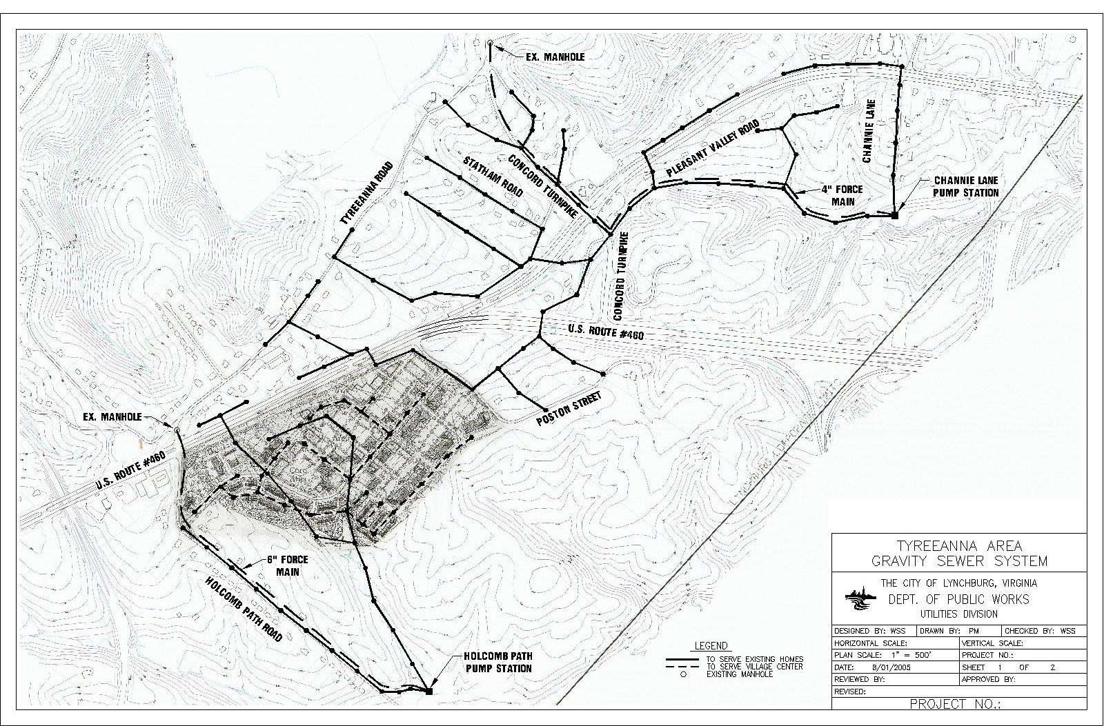
TYREEANNA & PLEASANT VALLEY NEIGHBORHOOD PLAN
64 CHAPTER 8: MOVING FORWARD
Pleasant Valley Road could be served with new gravity lines leading to a pump station at Channie Lane. The new lines would pump the sewer to the existing gravity line that currently ends near the top of the hill at the old Regional Landfill and then to the wastewater treatment plant.
Properties to the south of U.S. Route 460 could be served by new gravity sewer lines to a new pump station at the end of Holcomb Path Road. That pump station would convey the sewer to a gravity line at the west end of Tyreeanna Road, then to the wastewater treatment plant.
recommended strategies
Making the Call on Sanitary Sewer
The sewer question has been a looming question in this neighborhood for years. It’s essentially a “chicken or the egg” scenario – which comes first? Should the City wait for a development proposal to help offset the cost of the infrastructure, or should the City shoulder the cost in order to attract development? The answer can be found in the progress, or lack thereof, in the neighborhood since the first Tyreeanna / Pleasant Valley neighborhood plan, written in 2003. A development proposal for the Village Center concept on the south side of U.S. Route 460 (and associated utility infrastructure) identified in that plan has not come to fruition. The neighborhood has not developed (and likely will not develop in the future) without key investment in utilities.
This plan recommends that the City definitively commit to providing sewer to this neighborhood; however, the timing will be determined by several factors. The Department of Water Resources recognizes that sewer service is critical for long-term sustainability of neighborhoods and is currently in the process of developing a citywide master plan for unsewered areas within the City, including Tyreeanna / Pleasant Valley. Prioritization factors for the unsewered areas include but are not limited to: parcel size, age of septic systems, cost per parcel, residential costs, and customer demand.
While the estimated cost of $67,400 per lot makes sewer service cost prohibitive at this time (and the current density doesn’t justify sewer in this neighborhood ahead of others without sewer service) the future development potential of vacant land in Tyreeanna would bring this cost down considerably. Other recommendations in this plan will also affect the prioritization factors listed above, such as the zoning analysis, economic development interest, and the potential to integrate infrastructure with the neighborhood improvement projects listed in previous chapters.
TYREEANNA & PLEASANT VALLEY NEIGHBORHOOD PLAN 65 CHAPTER 8: MOVING FORWARD
Taking future development potential into consideration, the preferred method to serve the neighborhood should be the conventional gravity sewer system with pump stations as identified by the 2005 Sewer Study. The Department of Water Resources is currently evaluating capacity for future sanitary needs and has found that in order to accommodate demand, there may be a need to increase the footprint of the existing wastewater treatment plant at the corner of Rockwell Road and Concord Turnpike. As this is a neighborhood already deeply impacted by municipal facilities and their nuisances, special consideration should be given to limit unpleasant smells, sights, and sounds of any new pump stations or other government infrastructure or facilities.
Depending on economic conditions at the time of construction, the Tyreeanna / Pleasant Valley neighborhood could see a sudden wave of interest in real estate once the sewer infrastructure is complete. It is recommended that prior to this, a fine-grained analysis of zoning in the area should be completed to ensure that the growth happens in a way that is healthy for both the neighborhood and the City as a whole. Likewise, careful consideration should be given to rezoning and Conditional Use Permit petitions that have long-lasting impacts to the neighborhood.
North Side of Route U.S. 29 / U.S. Routh 460
The residents have expressed the desire to see some level of improvements in their neighborhood, such as sidewalks and wider streets along some corridors, but have concerns about radical change. They enjoy the somewhat rural character and don’t want to lose that. Those neighbors who live primarily on the northern side of Route U.S.29/U.S. 460 expressed that they could envision a larger development on the southern side, where the mixed-use area is designated on the Future Land Use Map in Chapter 4.
TYREEANNA & PLEASANT VALLEY NEIGHBORHOOD PLAN
MAINST K N I G H T S T MAPLE ST RIDGEAVE FRANKLINST AUGUSTA ST HIGH ST PLEASANT VALLEY RD TULIPST POCAHONTASST TYREESTVIRGINIAS T PINEST GEORGIAAVE OTEY ST WOODROWST GLOBE ST ELM ST FORDST KINGST HILLVIEW ST STATHAMRD PRINCE ST J U BILE E D R KAVANAUGHRD POSTONST TOPRIDGEDR NICKERSON RD TEX SA A VE GUMST GREENFIELD DR DUKEST GILMORE CIR HUDSONST POPLARST TYREEANNA RD MAYFLOWERDR W I N S TON RIDGE DR ROBINSRD WINCHESTERST F L ORIDA AVE FLORIDA AVE GRACEST MARTINST CONCORDTPKE ROCKWELL RD HOLCOMBPATHRD CAMPBELLAVE 460HWY L Y N C H B URGEXPY CAMPBELLAVE RICHMONDHWY RTE 29 BYP NORTH SIDE SOUTH SIDE
Aerial view of the Tyreeanna / Pleasant Valley neighborhood
To strengthen the existing neighborhood, this plan recommends that the City work to strengthen the existing residential areas in the short term by focusing on the quality-of-life improvements outlined in Chapters 5, 6, and 7 to benefit current residents. As projects are implemented, such as the Greenway along Pleasant Valley Boulevard, the City should seek out opportunities to lay the groundwork for the future utility mains where needed, even if they are not brought online and into the existing system immediately. Incremental construction could be used to avoid a larger lump-sum cost.
South Side of Route U.S. 29 / U.S. Route 460
Until there is an increase in development pressure within the City, the Tyreeanna / Pleasant Valley area is unlikely to see radical change or growth; however, when critical mass is reached on developable land in Lynchburg, attention will inevitably turn to this neighborhood.
When future development occurs south of Route U.S. 29 / U.S. Route 460, it is expected to happen as Planned Unit Development, Traditional Neighborhood Development, or other large-scale project that will likely require approval from City Council. This area is identified as a Business/Research Park and Mixed Use in Chapter 4, but the focus could change depending on market forces at the time of development.
Special consideration will be given to access from Route U.S.29/U.S. 460, connections to the north side of the neighborhood, and proposed improvements outlined in Chapter 5: Connectivity and Neighborhood Design. These improvements include the intersection of Concord Turnpike and Route U.S.29/U.S. 460 and the multimodal bridge on Holcomb Path Road. Chapter 5: Connectivity and Neighborhood Design also contains suggestions on building form and street design that will be incorporated in future development projects.
Environmental Needs
In addition to the Refuse Collection Operation and Convenience Center currently located at 2525 Concord Turnpike, the City also has a leaf storage site at 328 – 416 Kavanaugh Road, where leaves and other storm debris are stored before composting into mulch. Beyond its function to meet the growing demands of refuse disposal, recyclables and organic matter life-cycling, this site could potentially incorporate an environmental center use into its operational function. The center would be home to much more than simply debris collection and composting; it would be an all-encompassing facility with opportunities for hands-on education about environmental issues for all ages. Components such as public art and gardens would make the center an asset to the neighborhood, rather than an eyesore.
D. IDENTITY AND BRANDING
defining the neighborhood
As outlined in both the Blueprint for Opportunity and the Comprehensive Plan 2013-2030, placemaking is a key aspect in fostering strong neighborhoods. The first step in placemaking is identifying the resources that make a place unique and are important to residents. Chapter 7, Historic Resources, outlines the key areas of historical significance that were the foundation of both Pleasant Valley and Tyreeanna.
The juxtaposition of these two areas is striking. Pleasant Valley is a community built-up by former slaves and site of one of the first schools for African Americans in Virginia, while Tyreeanna is named for a plantation that likely held slaves. Although Downtown and the neighborhoods immediately surrounding the city center are typically cited as Lynchburg’s most important historic areas, Pleasant Valley and Tyreeanna represent a lesser known but equally significant part of the community’s history. Working with neighborhood residents to determine placement and style, small neighborhood gateway signs should be used to signal entry into each area.
67 CHAPTER 8: MOVING FORWARD
TYREEANNA & PLEASANT VALLEY NEIGHBORHOOD PLAN
The way nding recommendations are composed of several unique sign types which serve different functions. All dimensions should be considered “typical” for each sign type, as detailed below.
DIRECTIONAL TRAILBLAZERS
Directional Trailblazers are designed to be as visible as possible without creating unnecessary distraction for motorists. These signs include an optionalcolor-codedpanelonthereversesidetoidentifythecorridor the observer is on. Another option is a Downtown Lynchburg panel near the top of the pole. Decorative posts for trailblazers are shown for illustration purposes only.
DOWNTOWN LYNCHBURG BRAND IDENTITY
> Trailblazers must meet federal and state requirements for breakaway features.


This brand represents both the destination and organization of Downtown. The brand is fully integrated into digital, socialmedia, and video tools.


> Text must have a minimum of 4” cap height.
Creating a uniform, destination-based brand for the Tyreeanna / Pleasant Valley would strenghthen the neighborhood’s identity and sense of community, recognize important resources, and create opportunities for placemaking.
> No more than 3 destinations per sign.
POLE-MOUNTED GATEWAY
> Destinations are ranked in the following directional order with destinations in the same direction being ordered from nearest to farthest: • Straight
Pole-mounted Gateways are constructed similar to Directional Trailblazers and are to be placed at the edges of the Downtown District where a Monument Gateway is not feasible.
The community brand would include unique, yet connected logos and palettes to be integrated into the built environment (i.e gateway and directional signage). This new placed-based identity could also be used on marketing materials to bring awareness on tourist destinations (i.e. proposed greenway and Tyreeanna Park. See Chapter 6: Parks & Open Space)
Left


Right
This task would require an extensive public engagement process on character and design as well as coordination with efforts in Downtown and adjacent neighborhoods.
> A separator is to be used when directional arrows change on each panel.
POLE-MOUNTED GATEWAY
MONUMENTAL GATEWAY
Monumental Gateways are located at the primary ingress points to the Downtown District. They establish the identity for the district and create a sense of arrival for visitors. These gateway signs are designed toreect the historic character of the Downtown architecture while incorporating the current brand system. Appropriate illumination should be used to ensure visibility at all times of day. Gateway entrances are discussed in more detail in Section 8.3: Gateway Entrances.
Opportunity Lynchburg and Downtown Lynchburg have achieved very effective outcomes working with local design firms to create brands and marketing strategies. A community-wide brand for Tyreeanna / Pleasant Valley could be developed through a similar process.
Pole-mounted Gateways are constructed similar to Directional Trailblazers and are to be placed at the edges of the Downtown District where a Monument Gateway is not feasible.
Positioning
Monumental gateways should be positioned so that each ingress route it faces has as close to a direct line-of-sight as possible and adhere to all federal and state guidelines as they pertain to rights-of-way, clear zones, breakaway, etc. For example, the current gateway sign on Main Street coming into Downtown, off the expressway, is directed only at the traffic comingoff of the southbound exit from Madison Heights. When coming from the northbound exit, the gateway sign is not placed in the direction of traffic, which is not ideal. This unique situation may require a multi-faced gateway construction that includes two separate gateway panels.
MONUMENTAL GATEWAY
Monumental Gateways are located at the primary ingress points to the Downtown District. They establish the identity for the district and create a sense of arrival for visitors. These gateway signs are designed toreect the historic character of the Downtown architecture while incorporating the current brand system. Appropriate illumination should be used to ensure visibility at all times of day. Gateway entrances are discussed in more detail in Section 8.3: Gateway Entrances.
TYREEANNA & PLEASANT VALLEY NEIGHBORHOOD PLAN 68 CHAPTER 8: MOVING FORWARD
255 CHAPTER 11: WAYFINDING
Examples of different types of brande signage in Downtown Lynchburg from Downtown 2040 Plan DOWNTOWN 2040LYNCHBURG, VIRGINIA
LYNCHBURG
Pole-Mounted Gateway LYNCHBURG
Monumental Gateway
DOWNTOWN 2040 LYNCHBURG, VIRGINIA
254 CHAPTER 11: WAYFINDING
•
•
JEFFERSON STREET COMMERCE STREET City Hall Amazement Square Riverfront Park
City Hall Amazement Square Riverfront Park
J J I K K F E E G
Dimensions F4” G3.5” H4” I0.5” J30” K1.5”
Directional Trailblazers
Directional Trailblazer
LYNCHBURG
Pole-Mounted Gateway
A. PROCESS
As the City of Lynchburg continues to thrive, development pressures will extend to neighborhoods adjacent to the Downtown urban core. The Tyreeanna / Pleasant Valley Neighborhood Plan will serve as a toolkit to guidethesustainablegrowth ofthecommunity.Assuch, itshouldbeadded to regulatory processes and checklists to ensure that the recommendations within the plan achieve the vision laid out by neighborhood residents in alignment with the City’s overarching goals as set forth in the Comprehensive Plan 2013-2030.
B. POLICY
Existing regulations in the Land Use Plan and Zoning Ordinance could support or adversely impact the implementation of this plan. Further evaluation of existing regulations will be needed to identify conflicts with the goals outlined in the Tyreeanna / Pleasant Valley Neighborhood Plan.
Housing is a key component of this plan. Furthermore, providing a variety of options to attract young families and retain existing population groups is an important priority for the Tyreeeanna / Pleasant Valley community. Approaches to increasing housing options vary by neighborhood, existing land uses, and market conditions. There are many resources that provide guidance to municipalities seeking to encourage the construction of “missing middle” housing as a way to diversify housing options. Missing Middle housing refers to housing options at densities somewhere between single family homes and high density apartments – examples include duplexes, triplexes, and smaller homes on small lots (see Chapter 4). General considerations when reviewing and/or drafting an appropriate ordinance include units allowed, cluster size, total floor area per unit, height limit, common space, setbacks, and parking.
A hol istic review and update of Lynchburg’s existing ordinances will help foster the development of housing types needed and wanted in the Tyreeanna / Pleasant Valley neigborhood. These existing ordinaces include, but are not limited to: residential cluster development, traditional neighborhood development, and planned unit development.
C. RESOURCES
The successful implementation of recommendations included in this plan will also depend on the City’s ability to leverage existing resources effectively. A strategic planning approach should seek to maximize funding from a variety of sources.
capital improvement plan (cip)
The Fiscal Year 2022 Budget provides recommendations for various capital improvement projects that foster the highest quality of life possible in Lynchburg. The process of developing and updating this budget ensures that the City’s assets are maintained where possible, replaced when necessary, and further developed to maximize their potential. The long-term strategy is to focus on planned projects to ensure that the City remains financially stable and to minimize the impact of needed improvements on taxpayers.
Since 2001, the City has applied a portion of undesignated funds balance -10% above the General Fund Revenue- to pay-as-you-go small capital construction projects. In addition to these projects, the FY 2022-2026 Capital Improvement Plan adds additional funds to complete important maintenance projects.
69 CHAPTER 9: IMPLEMENTATION 9.IMPLEMENTATION
TYREEANNA & PLEASANT VALLEY NEIGHBORHOOD PLAN
It is intended that a series of proposed improvements be included during future budget meetings to allocate funding for specific projects in Tyreeanna / Pleasant Valley. This chapter provides an Implementation Matrix to help the City identify and prioritize potential capital improvement projects to carry through implementation.
Given the potential for development, revitalization, and redevelopment of the neighborhood, a new classification could also be added to the annual budget, designating improvements and initiatives in Tyreeanna / Pleasant Valley as dedicated projects. Examples of dedicated projects might include the Tyreeanna / Pleasant Valley greenway project, and the Tyreeanna Destination Park, to name a few.
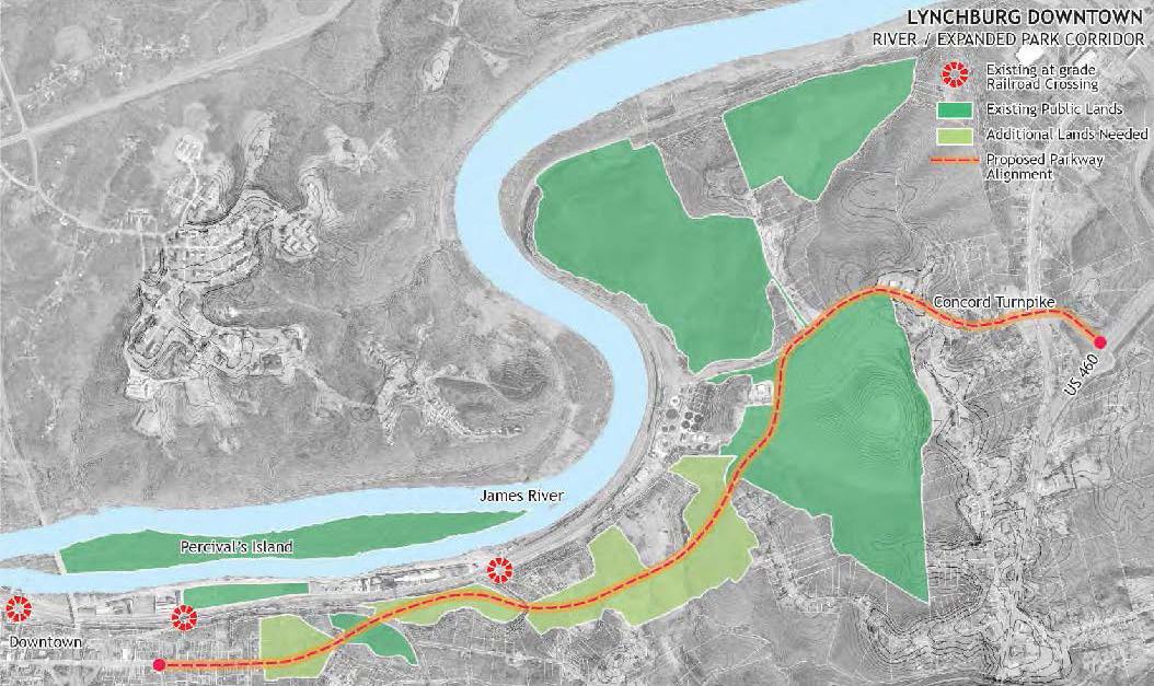
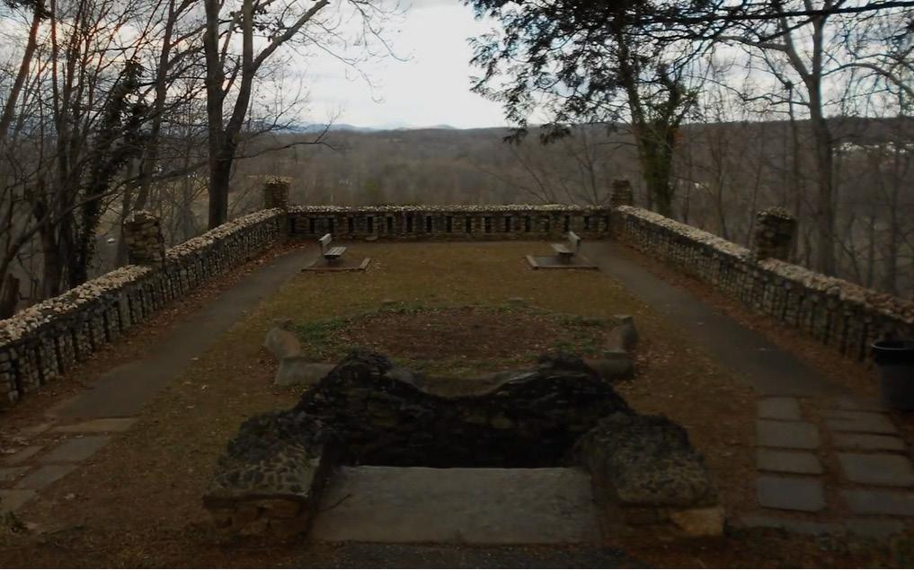
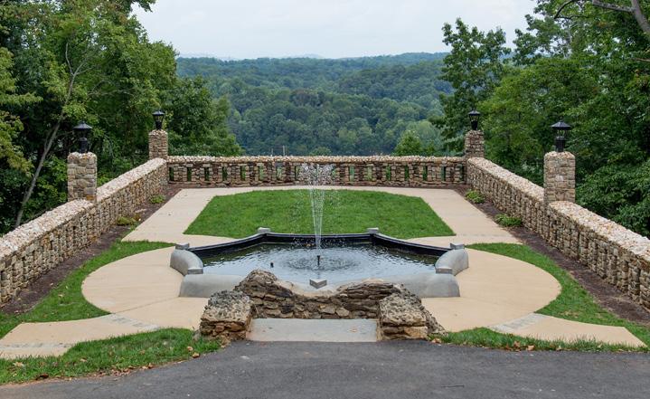
Having a separate budget item and discussion each year, will help the community see continued improvement throughout administration terms and keep the sustainable development of the neighborhood a priority in regards to funding allocation.
local & regional planning efforts
The City should also seek for ways to align the recommendations proposed in this plan with ongoing and upcoming citywide efforts. A number of recent planning projects are described in Chapter 1: Introduction. Additonal initiatives with potential to complement this plan should also be considered during the implemetation phase.
Many visitors travel along Concord Turnpike to reach Downtown. Concord Turnpike carries traffic through an industrial zone, passing the former landfill and the wastewater treatment plant. The James River Scenic Parkway proposed in the Downtown 2040 Plan creates an alternate route that facilitates access to the urban core from U.S. Route 29 / U.S. 460 Bypass while improving connectivity between Tyreeanna / Pleasant Valley and White Rock Hill to Downtown. The Tyreeanna / Pleasant Valley Neighborhood Plan proposes a destination park at the landfill site. This site is also the connecting point between the proposed parkway route and Concord Turnpike. Both, the Tyreeanna destination park and James River parkway, create an opportunity for the City to align efforts and resources that meet several of Lynchburg’s overarching goals pertaining access, connectivity, and improved public spaces.
TYREEANNA & PLEASANT VALLEY NEIGHBORHOOD PLAN 70 CHAPTER 9: IMPLEMENTATION
James River Scenic Parkway proposed in the Downtown 2040 Plan
Riverside Park Overlook Capital Improvement Project (Before & After)
Brownfields Grant from the Environmental Protection Agency (EPA)
In2018,theEPAselectedtheLynchburgEconomicDevelopmentAuthority for two brownfields assessment grants. Community-Wide Hazardous Substances grant will be used to conduct up to seven Phase I and three Phase II environmental site assessments, and prepare three cleanup plans. Community-Wide Petroleum grant funds will be used to conduct three Phase I- and two-Phase II environmental site assessments, and prepare two cleanup plans. Funds from both grants will also be used to expand the existing brownfields inventory and hold public informational meetings.
Assessment activities are planned for Census Tract 19 which includes the Tyreeanna / Pleasant Valley area. The current EPA Brownfield Grant closes September 30, 2021. The Economic Development Authority of the City of Lynchburg intends to apply for the next round of EPA Grants.
ManyofthesitesperceivedaspotentialbrownfieldsinTyreeanna/Pleasant Valley are also identified in this plan as possible locations for catalyst projects that would foster redevelopment and revitalization. Effective assessment and clean-up strategies are needed to leverage resources, efforts, and support for the implementation this plan.
Community Development Block Grants (CDBG) and HOME Program
CDBG and HOME funds are provided to the City through an annual entitlement grant administered by the U.S. Department of Housing and Urban Development (HUD). Both funds are used to support homeownership,housingrehabilitationandrepairprograms,neighborhood projects,infrastructure,spotblightacquisitionsanddispositions,andother initiatives administered directly by the Grants Administration Office. The neighborhood makes up a large portion of Census Tract 19, which is identified as a target area in the City’s CDBG HOME Program Year 20202024 Five-year Consolidated Plan, so it has already been identified as a focus for these initiatives. The City of Lynchburg received $ 714,865 in CDBG entitlement funds and $424,288 in HOME funds from HUD for Fiscal Year 2021. CDBG and HOME provide opportunities for the City to create partnerships with neighborhood organizations, nonprofit and for-profit entities in Tyreeanna / Pleasant Valley to address community development needs.
other funding sources
The Incentives and Financing table at the end of this chapter provides general information on potential incentives and financing tools for the City of Lynchburg to consider as part of the implementation effort of neighborhood plans.
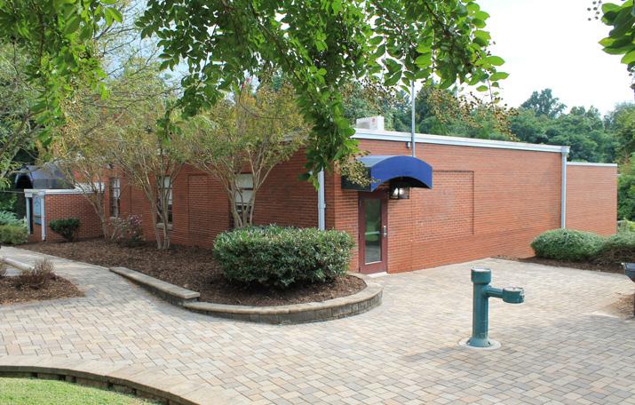
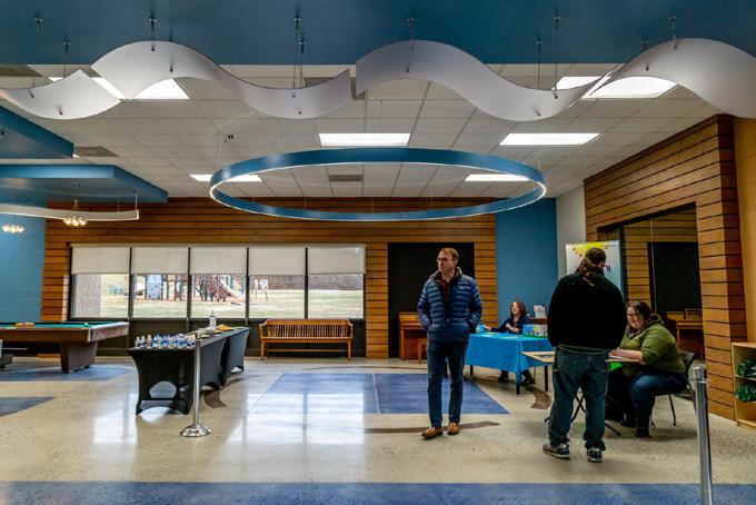
TYREEANNA & PLEASANT VALLEY NEIGHBORHOOD PLAN 71 CHAPTER 9: IMPLEMENTATION
opportunities
grants
Examples of CDBG-funded projects in Lynchburg: Jefferson Park Community Center (left), and Yoder Center Ecterior (right)
D. PARTNERSHIPS
The Tyreeanna / Pleasant Valley Neighborhood Plan focuses on a broad vision and scope. The successful implementation of the vision and goals laid out in the plan will be dependent on the collective efforts of the City, neighboring jurisdictions, partner organizations, and the private sector.
Region & County
Collaboration between Lynchburg and its surrouding counties plays a vital role in the economic prosperity of the region. Strenghthening relationships and pursuing opportunites for large-scale efforts with long-term impact should be a top prority for the City. Collaboration with surrounding counties is particularly important for Lynchburg neighborhoods located near county lines. Strategic partnerships and resource allocation across jurisdictions would not only benefit the region but also increase local impact.
An important opportunity for collaboration is through parks and trails. The City of Lynchburg shares a common border with Amherst County on the James River. The concept of a recreation loop was introduced in Downtown 2040 through pedestrian connections on John Lynch and Carter Glass bridges. This will allow circulation between Amherst’s Riveredge Park and Lynchburg’s Riverfront Park. More opportunity exists with the possibility of connecting this trail loop to the Tyreeanna / Pleasant Valley area via the Monocan Bridge. Lynchburg currently has no direct river access, and citizens have voiced their desire for this access.
As the Central Virginia Training Center (CVTC) in Amherst County has recently closed, a redevelopment plan is currently underway. The 350acre site will have economic impact on Lynchburg and the entire region. Tyreeanna / Pleasant Valley is located a short drive (less than 10 minutes) away from the CVTC.
Neighborhood
Increased community engagement is one of the main objectives of the Tyreeanna / Pleasant Valley planning process. For that reason, a small citizen committee was established at the beginning of this effort. While the City will continue to lead the process in accordance with citywide objectives, resident engagement is vital in the successful implementation of this plan. It is recommended that an Neighborhood Action Committee be created to include members of the private sector such as business and property owners, investors, and vested citizens.
E. IMPLEMENTATION MATRIX
The purpose of the matrix at the end of this chapter is to provide a tool for the City of Lynchburg to prioritize the implementation of future planning efforts and capital improvements in the Tyreeanna / Pleasant Valley neighborhood. The matrix provides a summary of the recommendations and action steps designed to achieve the goals and planning principles identified in the plan. Both, the goals and planning principles were developed on the activities and feedback of the community engagement process.
F. INCENTIVES AND FINANCING
The table following the Implementation Matrix provides general information on potential incentives and financing tools for the City of Lynchburg and to consider as part of their implementation efforts for the Tyreeanna / Pleasant Valley neighborhood.
TYREEANNA & PLEASANT VALLEY NEIGHBORHOOD PLAN 72 CHAPTER 9: IMPLEMENTATION
IMPLEMENTATION MATRIX
Goal#1: Create a unified identity for the Tyreeanna / Pleasant Valley neighborhood
Define an identity for the neighborhood that builds upon its history and assets
Develop a branding & marketing strategy
City of Lynchburg
Action Committee
City of Lynchburg
Action Committee
> Seek funding for community image project
> Establish a community advisory board to participate in this effort
> Procure services for a branding and marketing plan
> Develop marketing materials needed to promote Tyreeanna
Goal#2: Enhance and maintain the cleanliness and appeal of the neighborhood
Establish a beautification program City of Lynchburg > Perform survey to gather feedback and get a better understanding of resident perception
> Assess code to determine ways the appeal of the neighborhood can be improved
Green and screen parking lots and underutilized parcels City of Lynchburg > Inventory all underutilized sites
> Develop a strategy for green infrastructure
Establish an urban design palette that reflects the neighborhood's identity into the built environment City of Lynchburg
Action Committee
Designate a neighborhood commercial area for neighborhood residents
> Procure services for design guidelines
Goal#3: Encourage a balanced mix of uses that is complementary to the current scale and character of the neighborhood Make Tryeanna a great place to live
> Ensure use of consistent palette throughout the neighborhood
> Establish a strategy to promote / strengthen partnerships with key property owners
> Establish a collaborative between owners and Office of Economic Development and Tourism
Goal#4: Promote pedestrian activity and walkability
> Perform a sidewalk and walkability assessment throughout the neighborhood.
> Establish strategies for the repair and construction of new sidewalks and crosswalks
Perform an analysis of the street network in residential areas
> Map "hot spots" with regard to crashes (specifically those involving pedestrians) and develop plan to address through intersection or street enhancements
City of Lynchburg
Develop a greenway system
Reconfigure Pleasant Valley Road to accommodate phase 1 of greenway project
Owners
Action Committee
of Lynchburg Property Owners
Action Committee
> Identify potential corridors and understand constraints and opportunities; identify funding sources and potential public and private partners
> Develop concept plan for reconfiguration with costs and responsibilities to vet feasibility
PROJECT/INITIATIVES KEY PARTNERS ACTION STEPS CATEGORY PRIORITY TIMELINE C&ND
Neighborhood
High Short
Neighborhood
High Mid C&ND
High Short
Medium Long
Neighborhood
Medium Long LU
City
Property
Neighborhood
Committee
of Lynchburg
Owners
Action
High Mid
City of
Neighborhood
Committee High Short C&ND
Update FLUM to define the types of uses in NCD
Lynchburg
Action
City
of Lynchburg
High Short
Property
Neighborhood
High
Long
City
Neighborhood
High
Mid
Goal#1: Promote the sustainable development of vacant public land
Develop a complete inventory of City‐owned parcels City of Lynchburg
Develop a complete inventory of State‐owned parcels
Clean up brownfield sites
>Use EPA's Brownfields Grant fund to assess sites based on potential future land use
> Prioritize impact
> Use EPA's Brownfields Grant fund to remediate and stabilize critical sites
Goal#2: Develop a connected network of parks and public spaces
> Seek funding and partners
Transform the landfill into an attractive public outdoor destination
Repurpose vacant and underutilized sites for the creation of pocket parks, gardens, and other outdoor gathering areas
Work with developers and vacant land owners to explore potential projects
Promote development on south side of Route U.S. 460
Incentivize new development to incorporate low‐impact stormwater management strategies
of Lynchburg
> Procure design services for the park
> Develop phasing plan
Goal#3: Promote sustainable development of privately‐owned land
> Establish a strategy to promote / strengthen partnerships with key property owners
> Establish a collaborative between owners and Office of Economic Development and Tourism
Revise and update ordinances as needed
PROJECT/INITIATIVES KEY PARTNERS ACTION STEPS CATEGORY PRIORITY TIMELINE LU / P & OS
High
City of Lynchburg VDOT High
City
of Lynchburg
High P & OS
City
High Long
City of Lynchburg Medium Long LU
City
VDOT Private Sector HighLong
of Lynchburg
City of Lynchburg VDOT Private Sector
High Short
City of Lynchburg Private Sector>
High Long Enhance and preserve Tyreeanna’s natural resources
Goal#1: Recognize the significance of the neighborhood’s historic resources
Inventory historical places and events in the neighborhood City of Lynchburg Neighborhood Action Committee
Celebrate Tyreanna’s history.
Protect historic sites from inappropriate development City of Lynchburg Virginia Department of Historic Resources Neighborhood Action Committee
Integrate Tyreeanna's history into neighborhood's branding and identity efforts
Complete and submit form to nominate the Lower Basin Historic District 2018 Boundary increase to the Virginia Landmarks Register and the National Register of Historic Places.
> Walkthrough with community members to identify historically significant locations
> Capture and compile stories from residents
> Identify potential historically significant sites
> For qualifying sites, apply for designation of State and/or National Historic District designation to make them available to tax credit resources.
> Seek local historic designation if the sites are clustered and the neighborhood agrees that protecting existing resources is important.
of Lynchburg
of Lynchburg
Action Committee
Goal#2 : Increase awareness to important historic resources in the neighborhood
design guidelines
> Ensure use of consistent palette throughout the neighborhood
HR
PROJECT/INITIATIVES KEY PARTNERS ACTION STEPS CATEGORYPRIORITY TIMELINE
High
High
City
Neighborhood
High
Action Committee
City
Neighborhood
High HR Support a history walk project City of
Neighborhood
Committee University of
Low
Lynchburg
Action
Lynchburg
Integrate Tyreeanna's history into public art James River Council for the Arts and Humanities > Procure services for
Low
Goal#1: Provide a variety of affordable and accessible housing options
Provide housing types needed to attract young families to the neighborhood and to allow for senior population to age-in-place
City of Lynchburg Housing Collaborative Private Sector
> Perform housing analysis to identify potential options for future housing stock
> Compile demographic/occupational details/projections
> Perform housing study Identify the need for affordable housing, workforce housing, multi-family, compact housing.
> Identify the opportunities and benefits of diversifying housing type options.
> Update Future Land Use Map and zoning for compatibility as needed
> Collaborate on opportunities to evaluate interest and establish partnerships to promote "missing middle" housing opportunities
Explore the feasibility of redeveloping City-owned property into pocket neighborhoods
Market city‐owned properties suitable for desired housing options
City of Lynchburg
> Design and implement an incentive program to promote the development of pocket neighborhoods
City of Lynchburg (OEDT)> Ensure appropriate development via performance agreements
Goal#2: Promote businesses that cater to various population groups
Expand retail, restaurant and entertainment choices
City of Lynchburg Neighborhood Action Committee
> Inventory current businesses and create a "wishlist" of neighborhood business needs/desires
> Perform assessment to promote a balanced mix of commercial and retail businesses
Goal#3: Create gathering spaces that foster the interaction of the whole community
Establish / build a central public neighborhood facility or gathering place that encourages the interaction of various population groups
City of Lynchburg
> Create conceptual design for Landfill Park south entrance and multigenerational gathering place on Tyreeanna Road
> Identify other potential multi-generational spaces through the Parks Master Plan process
PROJECT/INITIATIVES KEY
ACTION
CATEGORY PRIORITY TIMELINE LU
PARTNERS
STEPS
Mid Long LU
P & OS
Make Tyreeanna a multi ‐generational community.
High Short
Provide bridge connection from Concord Turnpike to other side of Route U.S. 460
Provide bridge connection from Tyreeanna Rd. to Holcomb Path Rd. (other side of Route U.S. 460)
Provide bus service to Tyreeanna
Develop a bike plan
Provide alternate route from Downtown to Concord Turnpike (James River Parkway)
Develop a streetscape plan for complete
City of Lynchburg
Neighborhood Action Committee
City of Lynchburg VDOT
Neighborhood Action Committee
Goal#1 : Connect south side of neighborhood Goal
> Establish partnership with agencies to study bridge options and funding sources; seek grant funding and/or PPP
> Establish partnership with agencies to study bridge options and funding sources; seek grant funding and/or PPP
City of Lynchburg, Greater Lynchburg Transit Company (GLTC)
Virginia Department of Transportation (VDOT)
Promote multi‐modal transportation options Goal#3 : Address pedestrian and traffic concerns in the neighborhood Require new development to incorporate low‐impact stormwater management strategies
> Perform a transportation needs assessment for existing residents
> Work with GLTC to develop routing and ridership data; identify funding source for capital and operations
Develop scope for Tyreeanna community or greater area
Survey truck usage and, if warranted, mitigate truck traffic via signage
> Develop schematic design for corridor with estimates of cost; identify funding sources and partners
> Establish a strategy to promote / strengthen partnerships with key property owners
> Establish a collaborative between owners and Office of Economic Development and Tourism
Design the intersection of Concord Turnpike and Pleasant Valley Boulevard as a gateway
> Develop concept to identify range of costs; identify funding opportunities and partners. Coordinate with VDOT as needed
PROJECT/INITIATIVES KEY PARTNERS ACTION STEPS CATEGORY PRIORITY TIMELINE C&ND
VDOT
C&ND
Medium Mid
City
>
Medium Long C&ND
of Lynchburg
City
>
High Short
Remove heavy truck traffic from Rockwell Road
of Lynchburg (DPW)
City
of Lynchburg
High Long
City
streets
of Lynchburg
High Mid C&ND
City
VDOT Neighborhood Action Committee
Design & install neighborhood gateway sign (temporary)
of Lynchburg
VDOT
High Short
City of Lynchburg VDOT Neighborhood Action Committee
Coordinate with VDOT as needed High Long
City of Lynchburg VDOT Neighborhood Action
> Seek funding for gateway sign projects > Coordinate with
as needed
Design & install city gateway sign
> Seek funding for gateway sign projects >
Committee
High Long
Improve connections to and within the neighborhood
#2:
Community Business Launch (CBL)
VA Department of Housing and Community Development (VDHCD) Varies
Weyerhaeuser Giving Fund WeyerhaeuserMin. $1,000
Provide the tools to effectively prepare multiple entrepreneurs to operate successful businesses in a downtown or neighborhood commercial district and allow them to compete for funding to start up their new endeavor.
Local government and non‐profits
Supports communities where they have a significant presence or business interest. Communities range from rural to metropolitan, each with unique priorities and needs. Employees serve on local advisory committees for the Giving Fund and develop funding priorities within four focus areas to support their particular communities.
TAX CREDITS
Local government, non‐profit located within their "giving footprint"
Help communities begin to develop a coordinated, comprehensive sustainable environment that identifies, launches and supports community‐based entrepreneurs and small business at all levels of development.
http://www.dhcd.virginia.gov/index
.php/community‐partnerships‐dhcd/community‐business‐launch‐cbl.html
Funding in four focus areas:
Affordable Housing and Shelter
Education and Youth Development
Environmental Stewardship
Human Services, Civic and Cultural Growth
https://www.weyerhaeuser.com/su
stainability/communities/communit y‐investment/giving‐fund/
Federal Investment Tax Credit
for Certified Historic Rehabilitation National Park Service
20% of rehabilitation cost (certified historic structure)
State Tax Credit for Historic Rehabilitation Virginia Department of Historic Resources 25% eligible renovation costs
Federal income tax credits are available for the costs of rehabilitation projects
State income tax credit is available for rehabilitating a historic structure listed (or eligible for listing) on the Virginia Landmarks Register (individually or as a contributing structure in a historic district)
Designates local districts within which businesses creating jobs and improving facilities can receive:
> State tax credits on income and sales taxes for real property improvements
> Grants for creating jobs
> State and local incentives for job creation
Incentivizes community development and economic growth through the use of tax credits that attract private investment to distressed communities.
Income‐producing properties
Individually listed on the National Register or contributing to a National Register Historic District. Credits. Can be carried forward 20 years.
Credits may be used by individuals, partnerships, and corporations. Can be carried forward for up to 10 years
Historic preservation and revitalization
https://www.dhr.virginia.gov/tax‐credits/
Historic preservation and revitalization https://www.dhr.virginia.gov/tax‐credits/
http://www.dhcd.virginia.gov/index
Under §15.2‐1129.1 of the Code of Virginia, localities may establish arts and cultural districts for the purpose of increasing awareness and support for the arts and culture in the locality.
Available to businesses and zone investors who create jobs and invest in real property within the boundaries of enterprise zones.
Varies
.php/business‐va‐assistance/startingexpanding‐a‐business/virginia‐enterprise‐zone‐vez‐business.html
NMTC Program applicants must be certified as CDEs by the CDFI Fund
Job creation, business development, revitalization
https://www.cdfifund.gov/program s‐training/Programs/new‐markets‐tax‐credit/Pages/default.aspx
Criteria for what qualifies as an “arts” business is at the discretion of the locality. Incentives should be provided to businesses that positively contribute to the spectrum of arts and cultural activities and venues within the targeted area
Administer incentives and provide certain regulatory flexibility to qualifying businesses or entities within the boundaries of the district
https://vacode.org/15.2‐1129.1/ Tourism
Under § 58.1‐3851 of the Code of Virginia, any city, county, or town may establish, by ordinance, one or more Tourism Zones to provide tax incentives and regulatory flexibility to encourage tourism related business development. They serve both new and existing businesses whose primary purpose is to establish desirable destinations to attract tourists from outside of the community.
Targeted businesses include attractions & entertainment, lodging, restaurants, and specialty retail
Create an environment for visitors that will deliver a memorable experience or promote educational opportunities while increasing travel‐related revenue
https://www.vatc.org/tdfp/applicat ionprocess/tourismzone/
PROGRAM / TOOL AGENCY FUNDING AVAILABLEDESCRIPTIONELIGIBILITY / REQUIREMENTSUSESRESOURCE
Enterprise Zone Virginia Department of Housing & Community Development (DHCD) Varies
New Markets Tax Credits Community Development Financial Institutions Fund 39% of original investment amount claimed over seven years
Arts & Cultural Districts* MunicipalityVaries
Zones* MunicipalityVaries
Allow investors to receive tax benefits on currently unrealized capital gains by investing those gains in qualified census tracts (Opportunity Zones).
Qualification of Opportunity Investment Funds
and Qualified Opportunity Investments must be written at the federal level and are expected to be formalized later this calendar year
TAXATION & FINANCING
Promote revitalization through private sector investment http://www.dhcd.virginia.gov/index .php/opp‐zones.html Community
Can be created to issue tax exempt revenue bonds to develop and manage facilities and services including roads, parking, utilities, streetlights, landscaping, security, maintenance, recreation, schools, etc. A separate and additional tax on real estate may be assessed to pay the debt service on the bonds
Can be created to stimulate private investment in development project areas. District boundaries are set and the current or "base assessed value" of tax revenue is determined. In the ensuing years, the base values continues to go to the locality's general fund, but any increase in revenue due to redevelopment (the increment) is placed in a separate TIF fund.
Local government
Improvement projects for revitalization, community and economic development
https://law.lis.virginia.gov/vacode/t itle15.2/chapter51/section15.2‐5158/
Local government
Pay off debt incurred to provide redevelopment incentives such as land assembly and site preparation, infrastructure improvements, etc.
https://vacode.org/2016/58.1/III/3 2/4.1/
SUPPLEMENTAL POLICY TOOLS
The purpose of the ordinance is to:
> Ensure that owners of vacant properties are known to the city and other interested parties and can be reached if necessary
Vacant Property Registration Ordinances (VPROs)
Tree Ordinance MunicipalityN/A
Local government
Taxes are paid on the pre‐rehab value of the building for up to 15 years on residential, commercial or industrial properties. Abatement up to 25 years is allowed for hotel/motel properties at least 35 years of age rehabilitated for residential use.
https://law.lis.virginia.gov/vacode/t itle58.1/chapter32/section58.1‐3220.01/
Local Historic District MunicipalityN/A
> Ensure that owners of vacant properties are aware of the obligations of ownership under relevant codes and regulations
> Ensure that owners meet minimum standards of maintenance of vacant properties.
Any locality with a population density of at least 75 persons per square mile or any locality within the Chesapeake Bay watershed may adopt an ordinance providing for the planting and replacement of trees during the development process
Preservation ordinance is a local statute that provisions for designating historic resources, establishes a design review board (also called a preservation or historic district commission), and creates a design review process and guidelines.
Local government
The fee structure established in the ordinance may serve additional purposes, including covering costs incurred by the municipality to deal with vacant properties, and under some circumstances, motivating owners to restore and reuse vacant properties.
Local government
https://www.communityprogress.n et/tool‐1 vacant‐property‐registration‐ordinances pages‐257.php
Preserve existing trees and increase tree canopy https://law.lis.virginia.gov/vacode/t itle15.2/chapter9/section15.2‐961/
Local government
Protect and increase property values, promote tourism and economic development
https://savingplaces.org/stories/10‐steps‐to‐establish‐a‐local‐historic‐district#.W83uU1VKhEZ
PROGRAM / TOOL AGENCY FUNDING AVAILABLEDESCRIPTIONELIGIBILITY / REQUIREMENTSUSESRESOURCE Opportunity Zones Virginia Department of Housing & Community Development (DHCD) Varies
Development Authorities MunicipalityVaries
Increment Financing (TIF) MunicipalityVaries
Tax
Real Estate Tax Abatement Municipality Up to 90% of the structure's value after renovation
exemption from taxation of real estate on which a structure no less than 20 years of age has been substantially rehabilitated"
"Partial
MunicipalityN/A
