Claire Mei - Urban Design & Landscape Portfolio

Page 1

8:28 8:27 8:26 midpointincline 8:25 am urban design and landscape portfolio the ohio state university mcrp ‘22 Claire Mei

Claire Mei clairemei03@gmail.com / 312-802-6085

Hello! I am graduate student studying city and regional planning at The Ohio State University with a background in GIS and landscape architecture. I am passionate about using asset-based, bottom-up approaches to design and create inclusive urban environments that are safe, resilient, and sustainable

EDUCATION

The Ohio State University Columbus, OH

Master of City and Regional Planning August 2020 - December 2022 (Expected)

MLA G1 Coursework GPA: 4.0/4.0

• City and Regional Planning Academic Excellence List, Spring 2021

• ULI HIines Student Competition 2022 Honorable Mention: The Roots

• APA Ohio Future Leaders Award, Spring 2022

The Ohio State University Columbus, OH

B.S. Geographic Information Sciences August 2016 - May 2020

National Buckeye and Trustees Scholar

• Minors: Landscape Architectural Studies, City and Regional Planning

PROFESSIONAL EXPERIENCE

TBG Partners San Antonio, TX

Landscape Design and Planning Intern May 2022 - August 2022

Planning NEXT Columbus, OH

Planning Intern February 2021 - August 2021

Kirwan Institute for the Study of Race and Ethnicity

Columbus, OH

Graduate Research Associate August 2020 – Present

GIS Intern September 2019 – August 2020

geoAMPS

Powell, OH

GIS Intern May 2019 – August 2019

PROFICIENCIES

GIS: ArcGIS (ArcMap, ArcGIS Online, ArcGIS Pro)

Modeling: SketchUp, AutoCAD, Rhino

Adobe Creative Suite Illustrator, InDesign & Photoshop

Microsoft Office Word, PowerPoint & Excel

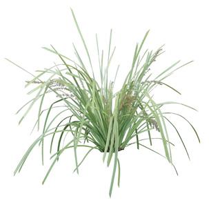
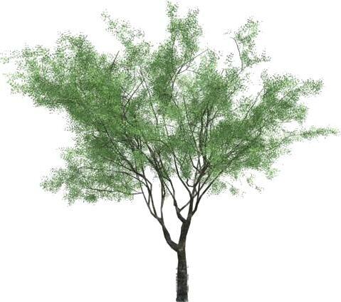
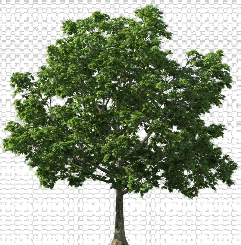
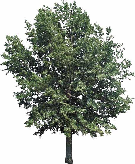
Others: Plant ID, grading, construction documentation

table of contents

uli competition ‘22

tbg partners castell ave streetscape

mla studio water garden sp ‘21 audubon park

mla studio: a way of walking au ‘21

charting a walk ecological movement walking as a political act rhino modeling collection of maps

MATERIAL LEGEND CONCRETE FINISH CONCRETE FINISH 2 TACTILE PAVING TRENCH DRAIN TBG [210] 366 9933 tbgpartners.com castell avenue streetscape proposed stage furnishing zone seating/ flex zone seating/flex zonepedestrian zoneentry (beyond) trench grate trench grate tactile paving tactile paving 10’14’ 6’ ~40’20’ 3 4 25 21 Bald cypress

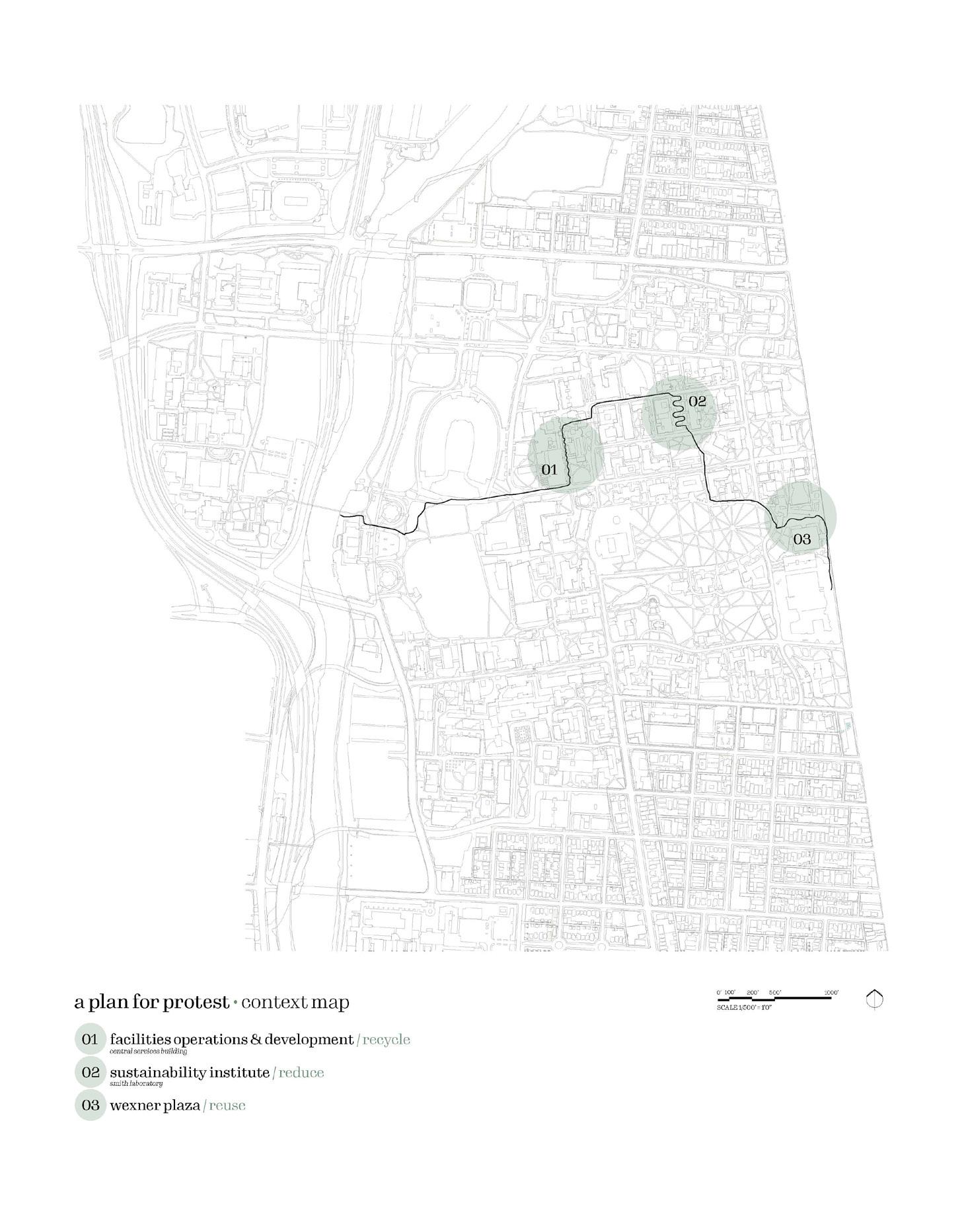
uli competition 2022 / oakland, ca

Award: National Honorable Mention

The Urban Land Institute Student Competition of 2022 gave me the opportunity to work in an interdisplinary team with Brett Wedding (architecture), Bill Dinan (landscape architecture), Isabel Francis-Bongue (landscape architecture), and Joe Pappas (finance). Our goal was to tackle the issues in the competition brief including Urban Renewal impacts, social equity, lack of affordable housing, and more for the site in Oakland, CA.

My role as the main urban planner was to perform an overall site analysis of the Old Oakland site, determine community and future needs, create the overall site identity, vision, and branding for the project (name, logo, and color palette), while ensuring visual cohesion for all the graphics and renderings for the final board.

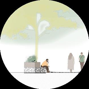
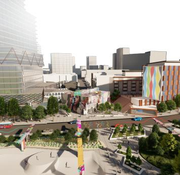
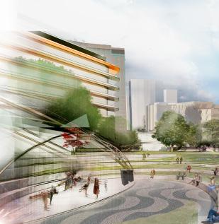
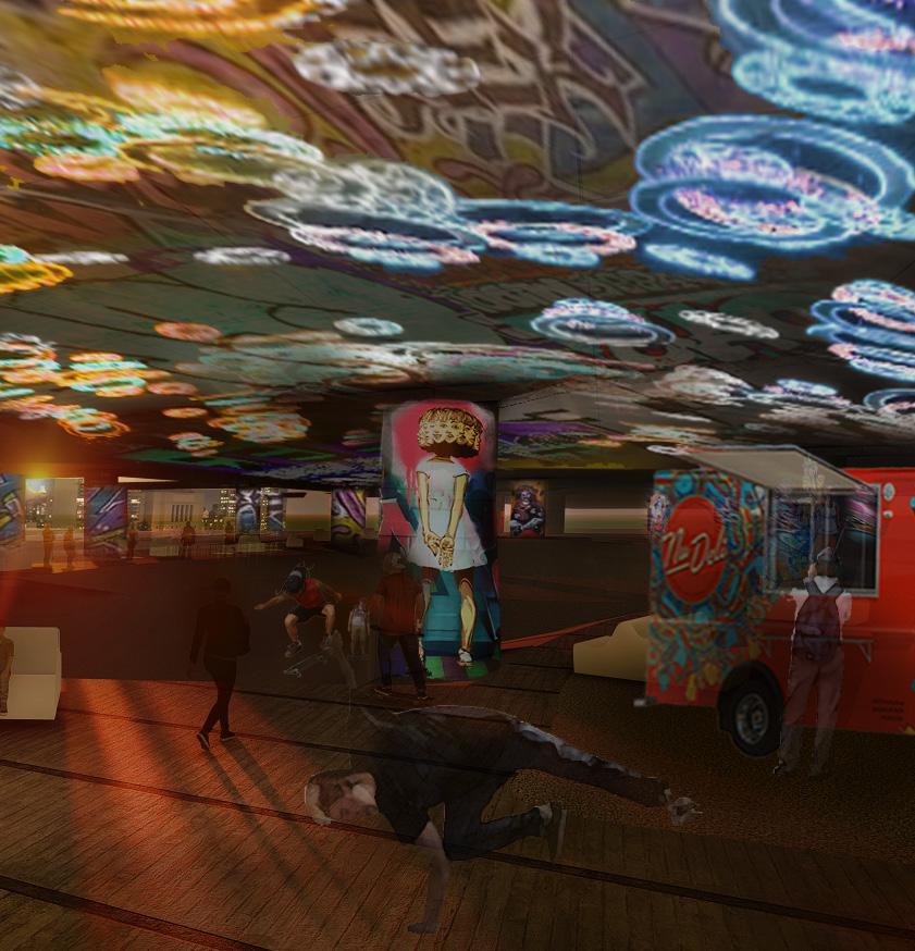
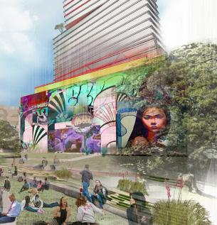
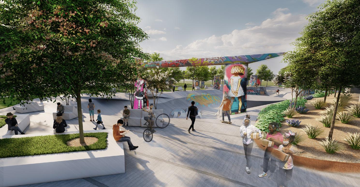
The ROOTS development has goals to reclaim the heart of Oakland by creating an inclusive and vibrant space that is accessible and equitable for all; focusing on the main assests of the site: arts and culture.
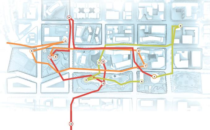
Analysis

minute walk boundary)

Urban Renewal efforts and the creation of i-980 and i-880 has fractured Oakland communities; and through our phased development, we aim to incorporate cultural, creative, and resourceful hubs to support its existing and future populations. One of the major components that required addressing in this project was the large unhoused population. We proposed transitional housing and increased social services for this population, and both affordable and market rate housing to support people of different socioeconoic statuses. As the landscape evolves, the fractures dissolve as the new artwork starts to reflect the people and cultures in Oakland. The historical Roots of Old Oakland will be showcased as they branch out to form the shape of the present and future, reviving a once culturally thriving urban core.
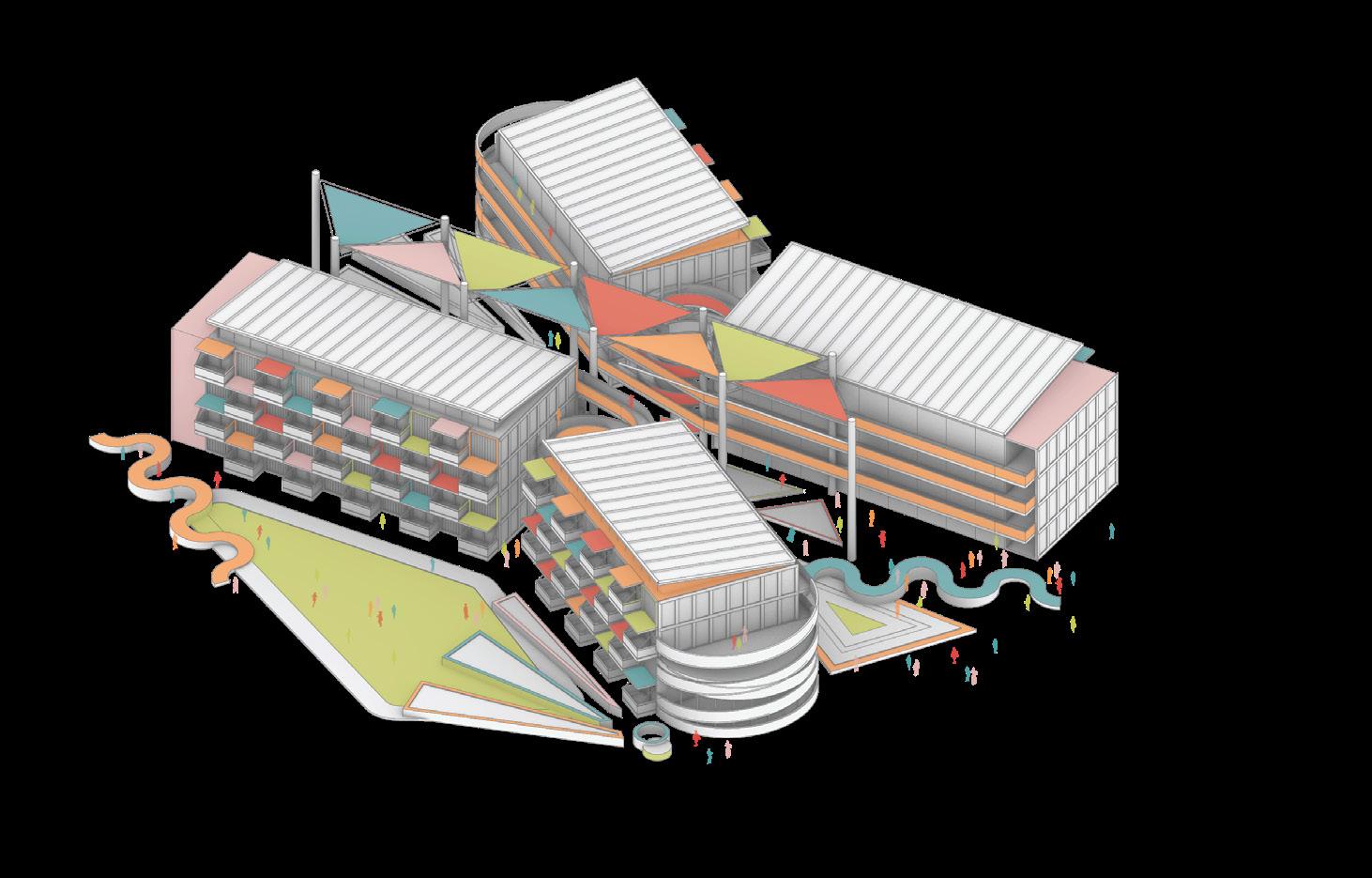
Site Plan

880 980 880 Oak Center Adams Point Acorn ndustrial Lakeside Acorn Ralph Bunche Old C y P oduce and Waterfront P Chinatown San Pablo Gateway Civic Center Downtown 1:22000 EXISTING Art Centers Cultural Centers PROPOSED Cultural Center Cultural Programming Housing Opportunity Zone Proposed New Residential 1:22000 880 980 880 Oak Center Adams Point Acorn ndustrial Lakeside Acorn Ralph Bunche Old C y P oduce and Waterfront P Chinatown San Pablo Gateway Civic Center Downtown 880 980 880 Oak Center Adams Point Acorn ndustrial Lakeside Acorn Ralph Bunche Old C y P oduce and Waterfront P Chinatown San Pablo Gateway Civic Center Downtown JACK LONDON SQUARE PROPOSED OAKLAND A’S PARK 1:22000 BART STATIONS Existing Proposed BART SF Bay Ferry Existing/Future Bikeways 880 980 880 Existing Proposed Redevelopment/ New Development 1:22000 Oak Center Adams Point Acorn ndustrial Lakeside Acorn Ralph Bunche Old C y P oduce and Waterfront P Chinatown San Pablo Gateway Civic Center Downtown
Site
(15

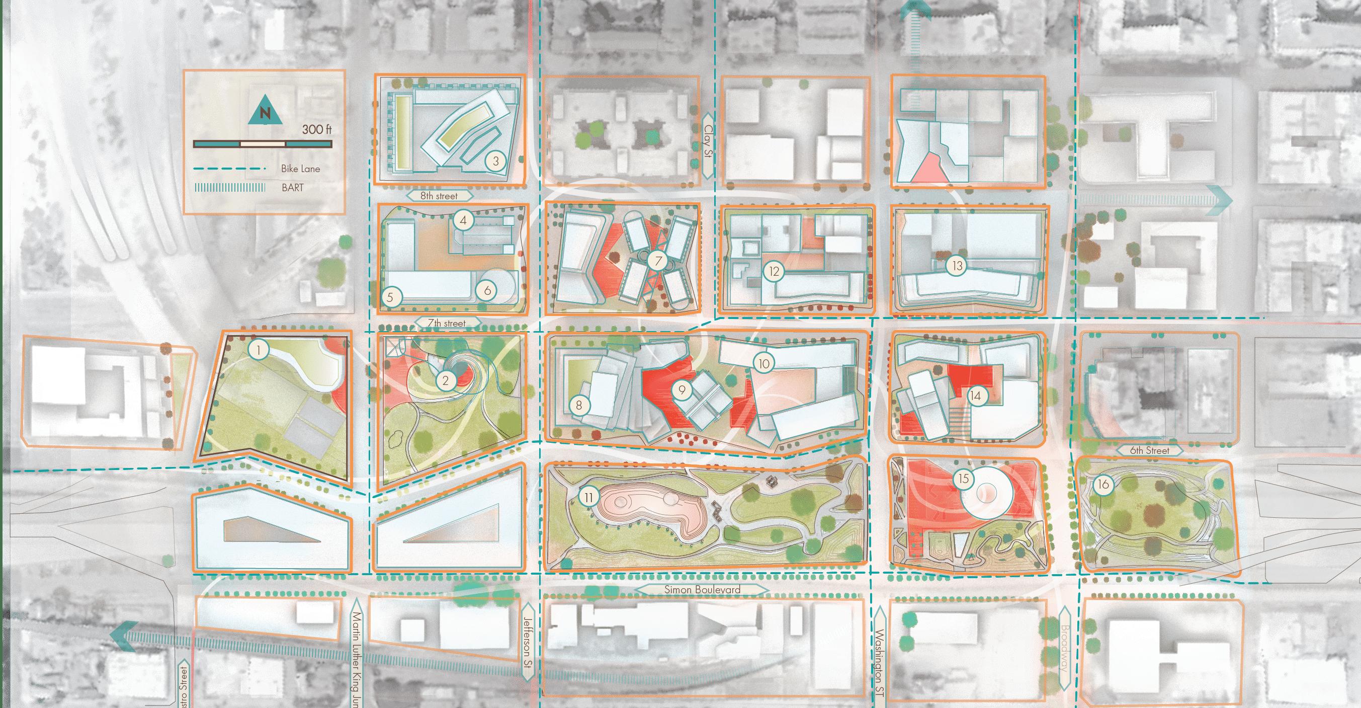
There are many ways for both visitors and residents to root themselves within and outside of the Old Oakland site area. From the proposed library, community center, cultural center and more, there are countless opportunities for people to discover the area on a pedestrian and human scale level.

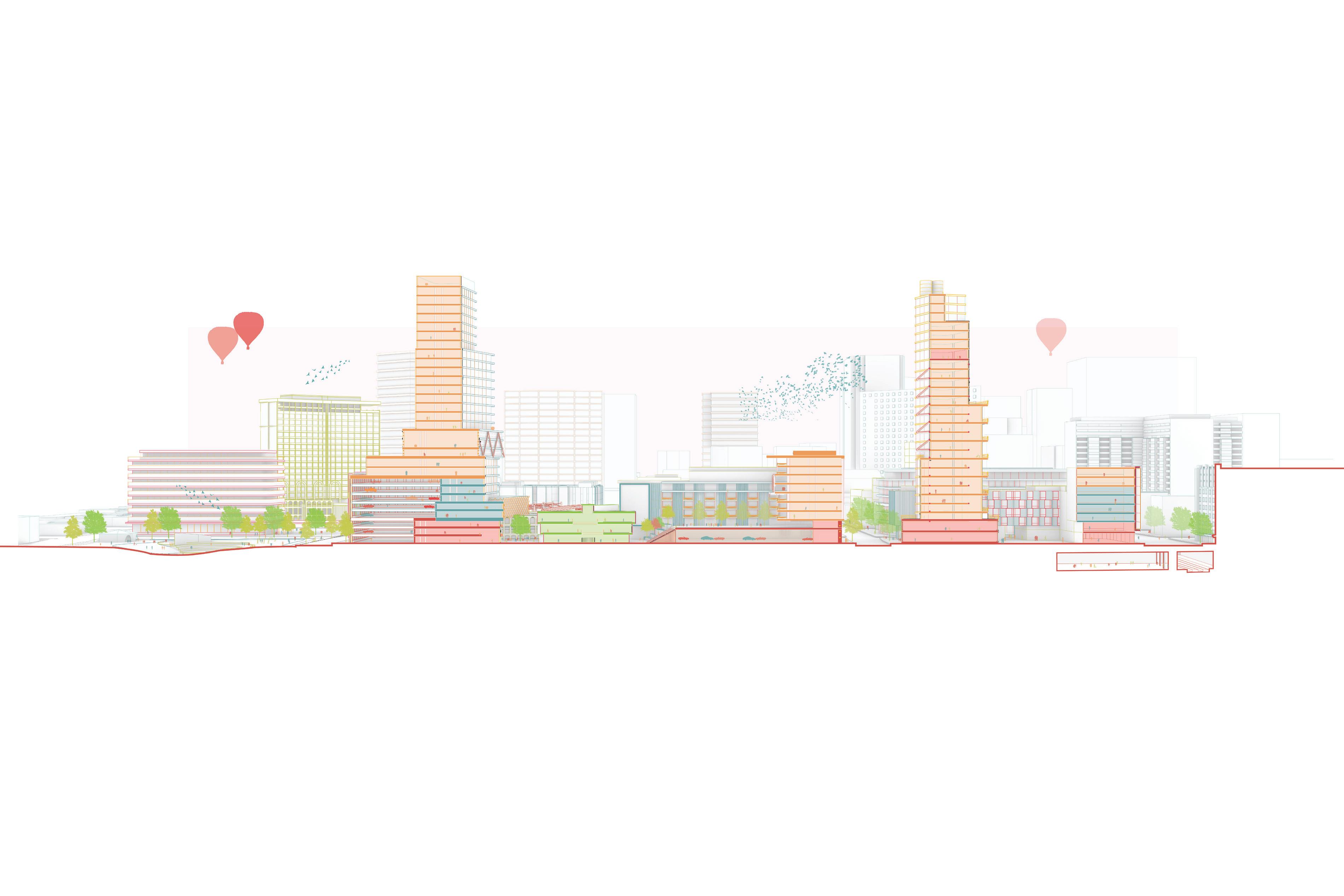
Pre-highway removal: Skatepark, creative to increase humane conditions under

The Bays Transitional Housing and adjacent social services are situated across the street from the former sheriffs department and seek to address issues faced by the unhoused and low income populations.

Hotel Dendrite welcomes visitors into the Roots district and connects them to exciting experiences, including the new home of the Oakland Aʼs just blocks away.

The Park Square Lofts provide market rate and affordable units looking over the newly refreshed Jefferson Square Park.

PHASEPHASE III
Redesign of Jefferson Square Park featuring
*Renderings by Brett

creative lighting designs, and seating the highway

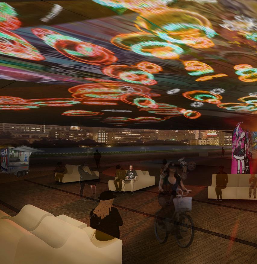
Post-highway removal: An oak tree grove is planted to play homage to the city. Highway pylons are kept to acknowledge the legacy and destructive fractures of the highway, transformed into an evolving museum of urban art.

One Civic Plaza com bines accessibility, affordability, and modern amenity at the root of this devel opment

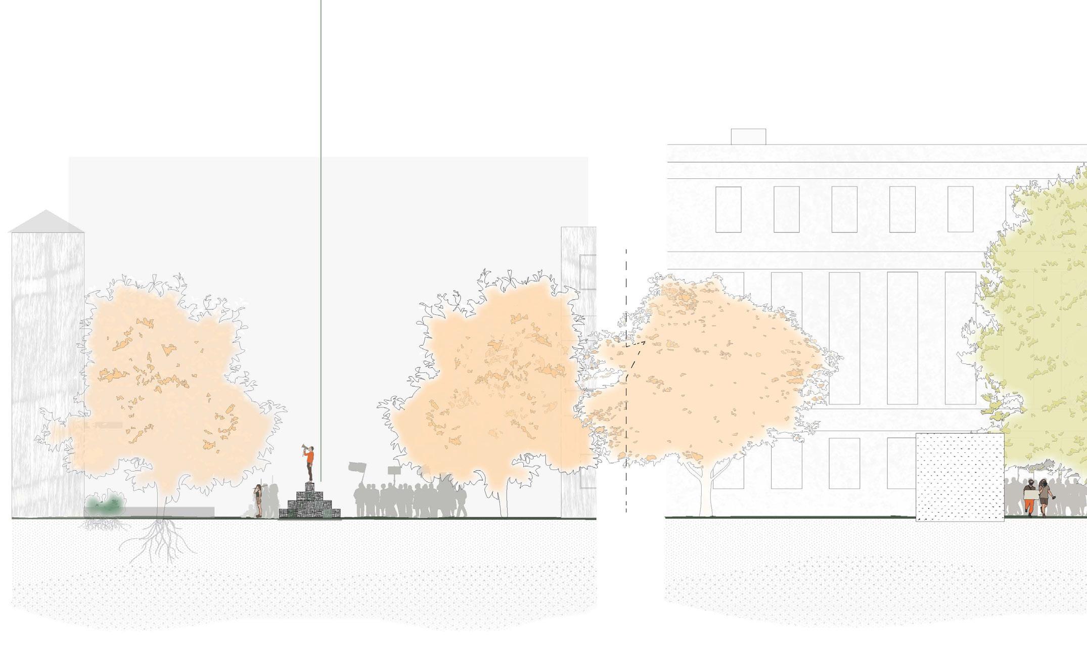
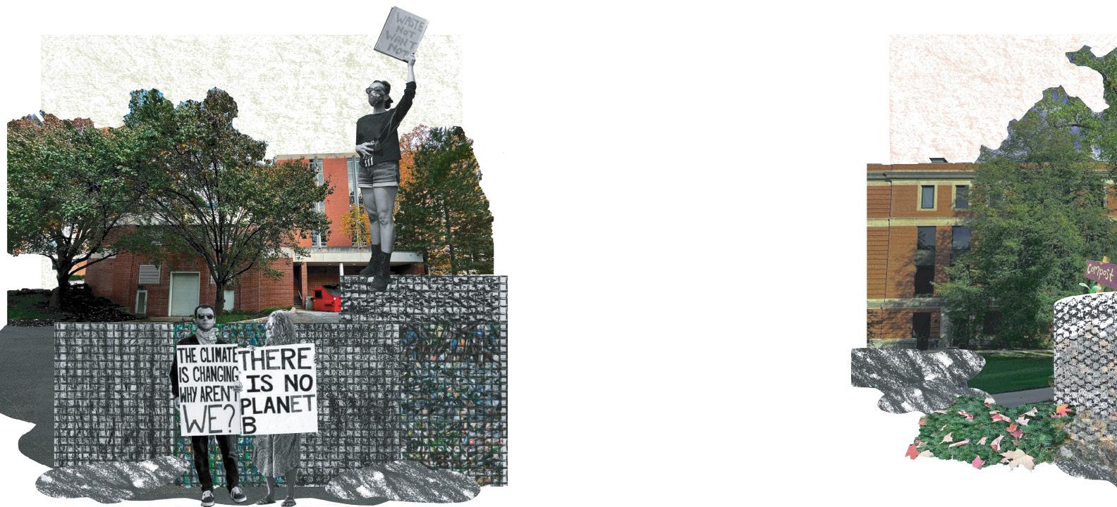
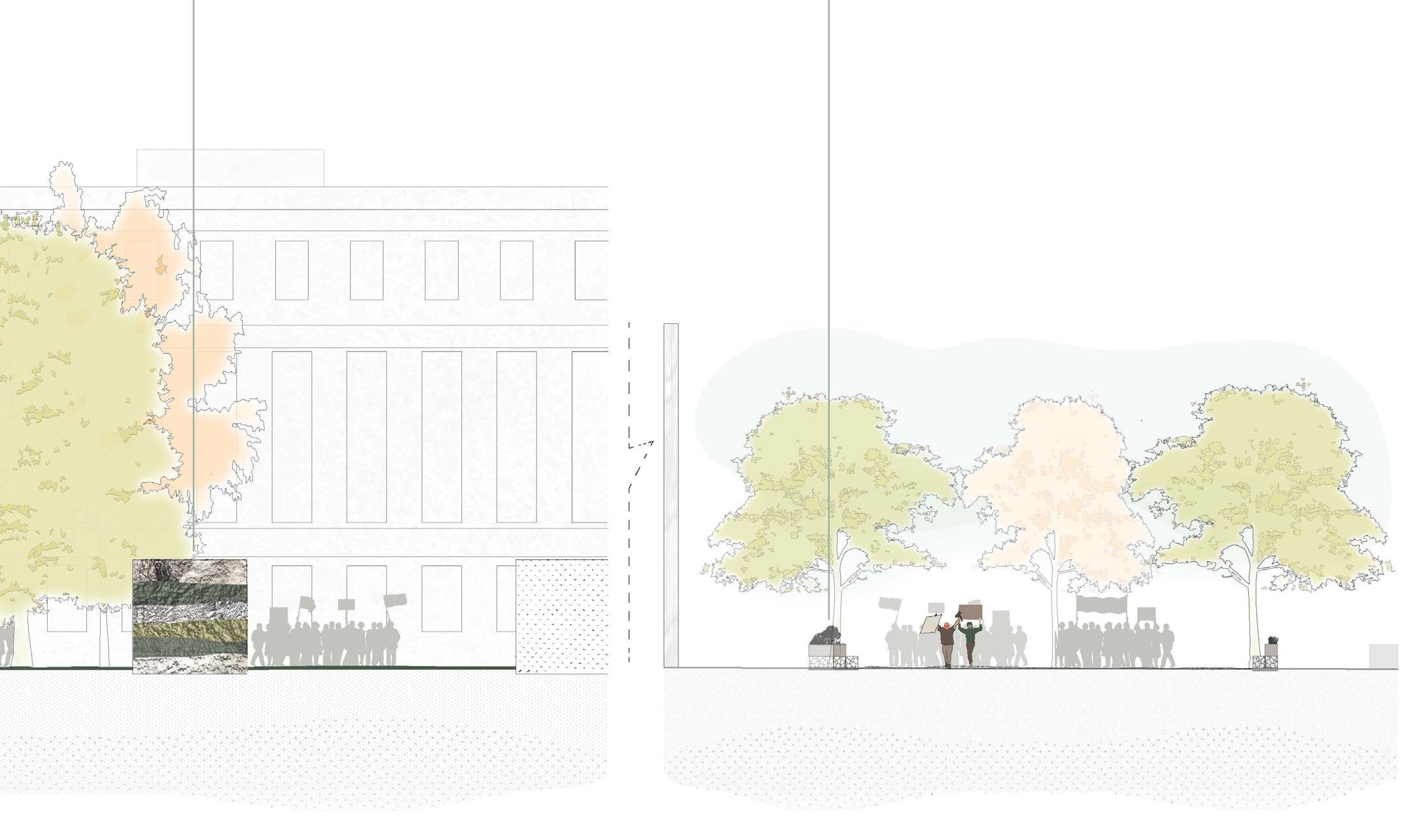
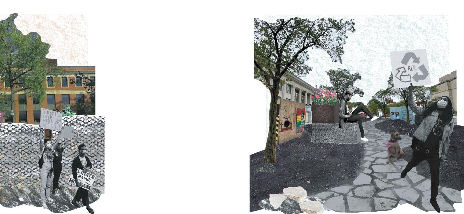
The Court House and Cultural Center create a vibrant, mixed use plaza for gathering, activism, and exploration.

The Gateway creates a green corridor on Broadway and connects to the existing BART lines.

PHASE I
PHASE II
7th Street Corridor to increase public transit and bike accessfeaturing an open-air amphitheater

castell avenue streetscape / new braunfels, tx

TBG Partners San Antonio, TX

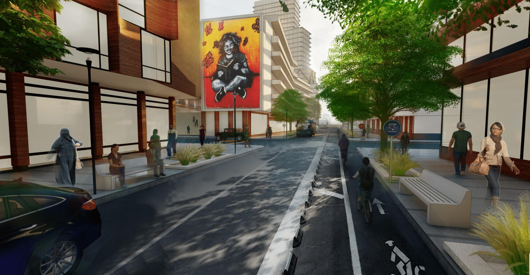
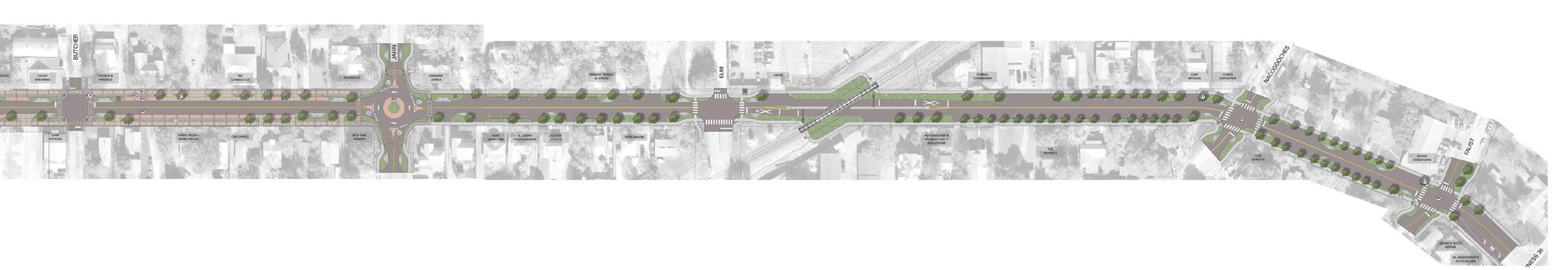
Castell Avenue Streetscape is ~1.5 mile long urban design project in Downtown New Braunfels, right outside of San Antonio. To play tribute to its German roots as well as engage with their community and visitors, the City of New Braunfels aims to provide new cultural and community spaces, incorporate a storytelling element with native plantings that adhere to the local climate, and catalyze economic development.

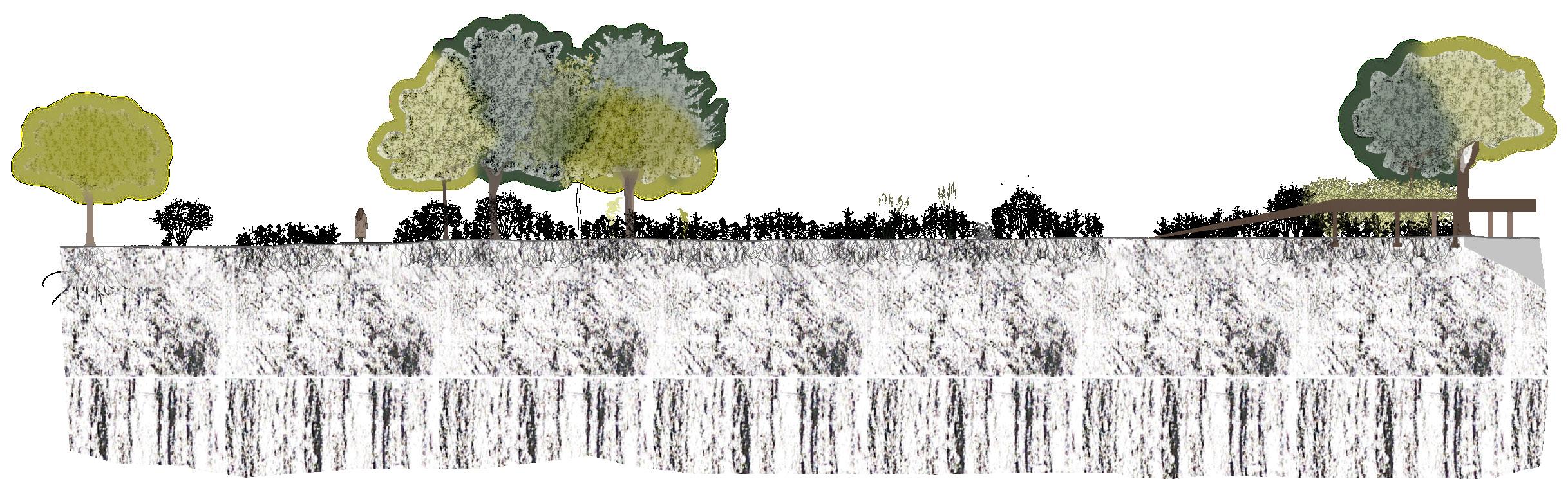
For this project, I researched and compiled material, furnishing, and planting palettes. I also created street sections using AutoCAD and Illustrator. Within this project, there are three proposed character zones along this stretch of Castell Ave: Downtown Core, Neighborhood Mixed, and Civic Plaza.

BRIDGE MILL SAN ANTONIO COLL GARDEN
a c

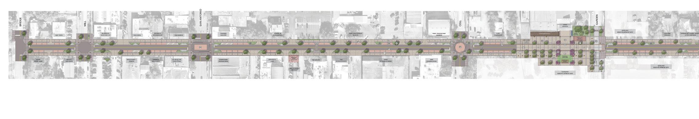
Existing Conditions for Proposed Character Zones

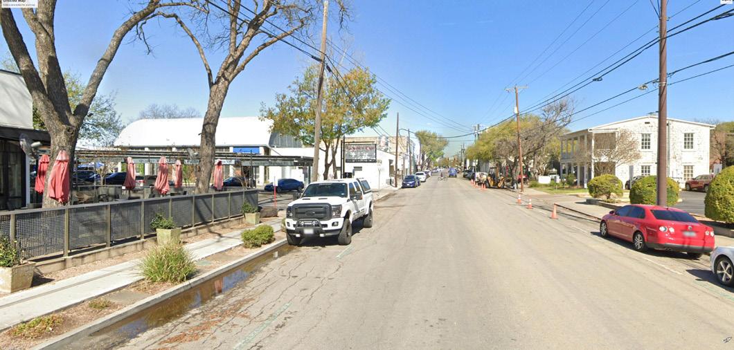
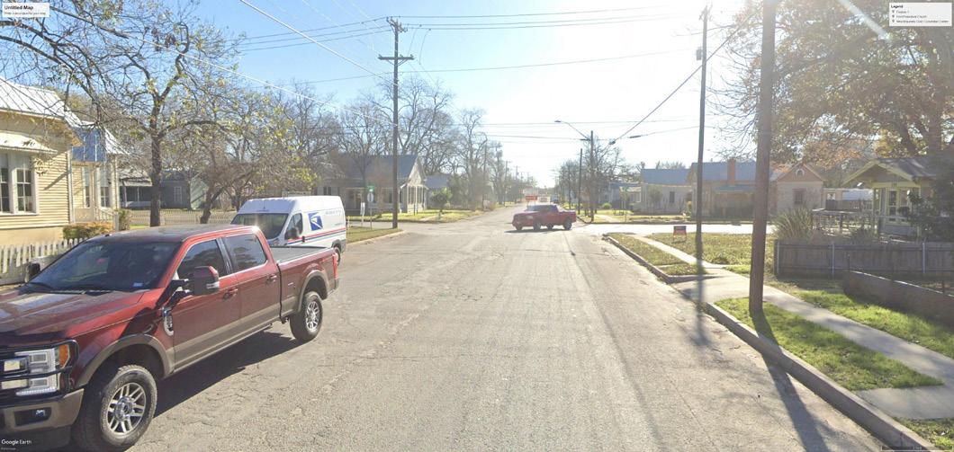
a / downtown core main retail area with beer garden and empty lots b /neighborhood mixed residential with some storefront/ retail in houses

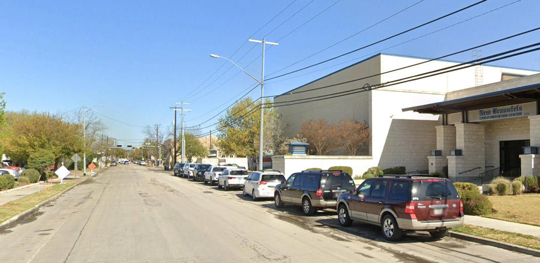
c / civic plaza convention center with empty lots across the street

NACOGDOCHES

BUTCHER
JAHN
ELM
FAUST BUS35
b

* this is at 1:10 scale

MATERIAL LEGEND

castell avenue

MATERIAL LEGEND CONCRETE FINISH 1 CONCRETE FINISH 2 PAVERS ASPHALT
section a: urban segment varies 11’ to 12’ varies 11’ to 12’ varies 4’-5’ varies 4’-5’ varies 3’-4’ varies 6’-7’ varies 7’-8’ varies 7’-8’ pedestrian zonefrontage zone furnishing zone furnishing zone travel laneslandscape/parking zone landscape/parking zone a Thornless honey mesquite / Prosopis glandulosa ‘Maverick’ Palo verde / Parkinsonia florida 0
CONCRETE ASPHALT castell avenue section b: neighborhood 7’ varies 11’ to 12’varies 22’ to 24’6’ varies 4’ to 5’ varies 11’ to 12’varies
but pedestrian zone travel laneslandscape/parking zone landscape/parking zone b Cedar elm / Ulmus crassifolia Monterrey oak / Quercus polymorpha MATERIAL LEGEND CONCRETE FINISH 1 CONCRETE FINISH 2 PAVERS ASPHALT castell avenue streetscape section a: urban segment varies 11’ to 12’ varies 11’ to 12’ varies 4’-5’ varies 3’-4’ varies 6’-7’ varies 7’-8’ varies 7’-8’ pedestrian zonefrontage zone furnishing zone travel laneslandscape/parking zone landscape/parking zone a Thornless honey mesquite / Prosopis glandulosa ‘Maverick’ Palo verde / Parkinsonia florida

Section A / Downtown Core

This first section of Castell Ave. is mostly retail with food and beverages and shops. The proposal calls for landscape bulb-outs, parking zones with brick pavers, additional plantings, and furnishings including lighting and seating.

but is being used at 1:5 scale

Section B / Neighborhood Mixed

This section of Castell Ave. is mostly residential, with some retail storefronts in houses. The proposed changes include narrowing the travel lanes for a bulb-out with a landscape zone or a parking zone.

5’ TBG – [210] 366 9933 – tbgpartners.com 430 austin street, suite 100, san antonio, tx 78215 The information shown is subject to change without notice. varies 3’-4’ varies 6’-7’ frontage zone pedestrian zone 5’ 10’ 6’ varies
pedestrian zone b
a

Section C / Civic Plaza

The New Braunfels Civic and Convention Center plans to expand to a civic plaza. In this part of Castell Ave., the road meets the sidewalk in the plaza to promote walkability, and allows the opportunity to close the road for events. Tactile paving and bollards at the crosswalks are safety measures, and furnishings like planters, specialty lighting, and seating are added for everyday use.

MATERIAL LEGEND

CONCRETE FINISH 1 CONCRETE FINISH 2 TACTILE PAVING TRENCH DRAIN

proposed stage pedestrian zone seating/ flex zone civic center entry (beyond) 14’ 10’~20’ Bald cypress c
travel lanes/flex zone furnishing zone furnishing zone seating/flex zonepedestrian zone trench grate trench grate tactile paving tactile paving 10’11’ 11’ 6’6’ 2’ 2’2’ 2’ ~40’ cypress / Taxodium distichum 0 5’ 10’ TBG – [210] 366 9933 – tbgpartners.com 430 austin street, suite 100, san antonio, tx 78215 The information shown is subject to change without notice. castell avenue streetscape section c2: civic plaza street travel lanes furnishing zone furnishing zone pedestrian zone trench grate trench grate tactile paving tactile paving 11’ 11’ 2’2’ 6’ 10’10’ 6’ 2’2’ pedestrian zone 3 4 25 c 22

charting a walk / g1 studio au ’21

This project involved taking a walk and notating experiential qualities such as light, temperature, enclosure, and activity. A mix of hand and digital drawing techniques were used to showcase different qualities and elements from the walk. Hand-drawn textures were used to indicate ground conditions, temperature, and light. A variety of digital lines and marks notated the landmarks, events, rhythms and thresholds seen along the walk.

stippling

represented by

varying

8:31 8:30 8:29 8:28 declinemidpoint 8:32 Ground conditions are
different
patterns of
densities and darknesses.

The different hues of watercolor reflect the shadows from trees and buildings.

The thresholds are notated by the dark lights that label each minute of the walk.

8:27 8:26 incline 8:25 am
Paper model showing the
feelings
of
enclosure

ecological movements / g1 studio au ‘21

For this studio project, we chose our specific site at Waterman Farm (a research farm on campus) to analyze ecological movements and design walking paths based on a central idea. On my initial visit, I saw a fox jump out of the stream as well as deer running across the soybean and corn fields, so I focused on the movement of wildlife and redesigned the site to allow wildlife to thrive by increasing edge conditions and adding brush piles while at the same time allowing human interaction by having clear paths, a bridge, and pond for wildlife viewing.

Site Analysis

prairie cornfields

woodlands area walked paths

soybean fields

stream

Site Analysis

prairie

Section

0’ 48’24’12’ SCALE 1/36” 1’0” Site Plan Site Plan
Cornus sp. Panicum virgatum increased edge conditions Solidago sp.Ostrya virginianaFagus grandifoliaAmelanchier arborea brush piles pondbridge pond paths bridge prairie

walking as a political act / g1 studio au ‘21

A path for protest was created around an environmental issue, which is The Ohio State University’s waste generation and revolves around the 3 R’s of waste management: reduce, reuse, and recycle. Ohio State started a Zero Waste Initiative in 2015, with ambitious goals to reach Zero Waste status by 2025. To achieve this goal, the university must divert 90% of all campus waste away from landfills by recycling and composting. However, the university has long ways to go, as the average diversion rate for the past 7 years (2015-2021) is only at 30.8%.

01 / recycle involves a zigzag path going up a road that is made from gabion baskets filled with recyclable materials like plastics, paper, glass, etc. There are 7 rows in a pyramid-like formation, with one gabion baskets higher than the rest for a person to stand on and protest.

02 / reduce involves creating a zigzag dirt path that curves alongside large mesh bins filled with compost that are 14ft in height and 15ft in diameter to display a way of how waste can be reduced.

03 / reuse has a mixture of elements from the first two moments. A curvy path is formed using recycled concrete, possibly from the buildings that Ohio State has been demolishing recently. There are two rows of gabion baskets that curve along the path. These will act as seating as well as planters, with the bottom row filled with recycled building materials and the top with soil and plants. Three of the large compost mesh bins would also be on the site, and the rich soil would be used to replant the existing trees on the site that are not doing well in current conditions.

Collages

Sections

/ recycle

gabion baskets with recyclables

01
02 / reduce

reduce 03 / reuse

gabion seating and planterscompost mesh bins

audubon park / columbus, oh

This studio project involved designing stormwater management strategies for the 5-acre site as it used to be part of a ravine. My main objective is to keep as much of the original site as possible, and my design philosophy is to preserve character and elevate existing assets, even though the site seems to be lackluster and is underutilized. I am generally keeping all elements in the site, like the existing pedestrian path, basketball court, playground, and drainage centers. There is a cottonwood alley in the middle and since some of them are towards the end of their lifespan, they will be repurposed.

The inner park elements are bounded by a square that is the redesign’s water management. There is a new water play area that is connected to the existing playground where cottonwood trunks will be repurposed to create a stepping path. Since the site was formerly an apple orchard, I am bringing back that piece of neighborhood history. South of the apple orchard is a new amphitheater and picnic pavilion.

Analysis

3 1 2 3 4 cottonwood alley basketball court playground berm rain garden E Tulane Rd Audubon Rd Homecroft Dr Site

water gardenwater play area

stepping path with repurposed tree trunks

hill apple orchard

amphitheater wetland mound seating

Site Plan Render
seesaws
BA
path wetland apple orchardmound stage & picnic pavillion SECTION B 10’ 20’ 40’ stage & picnic pavillion SECTION A 10’ 20’ 40’ site edge retention poolseesaws - water circulation path Section A Section B Models clay test model final chipboard model
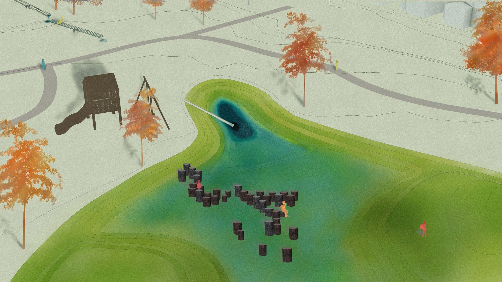
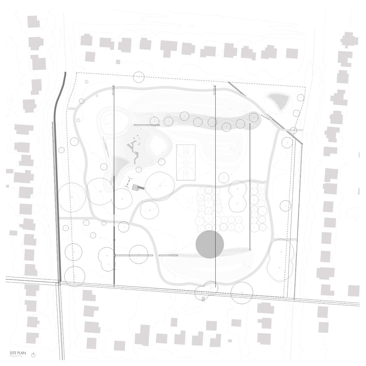
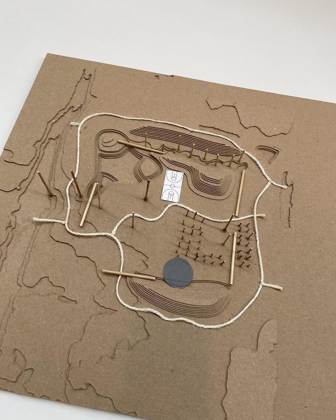
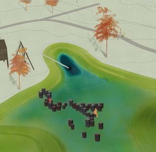
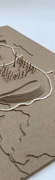
path hill moundwater garden path path water play area pathregraded to show water pipe

illinois + michigan canal lift lock no.

Wall 86’ Distance
Gate
Paddles Jack Type
1 / chicago, il 3D Rhino model of the first 1848 Illinois and Michigan Canal Lift Lock. Reference image above from industrialscenery.blogspot.com gate paddles wall 86’ distance
Lower Canal Pool Balance Beam and Striking Postbalance beam and striking post lower canal pool upper canal pool

collection of maps / LA gis seminar

884929939991 951 955 980 955 888899 971950 922 963 922 943 883 969 971 894 946 881 985 881888 880 964 997 947 939 942 906 877 919911 928943 892 915 869 889 936 868 964 888 900 864 868 925 945 866 889 The Great Smoky Mountains Hydrology 0 10.5 Miles Legend Contours - 1ft Hydrology Stream Type 334 336 420 460 558 Slope Value (ft) High : 60.2153 Low : 0
8:31 8:30 8:29decline 8:32

Turn static files into dynamic content formats.

Create a flipbook
Issuu converts static files into: digital portfolios, online yearbooks, online catalogs, digital photo albums and more. Sign up and create your flipbook.