2 minute read
Flyovers Aid Agriculture


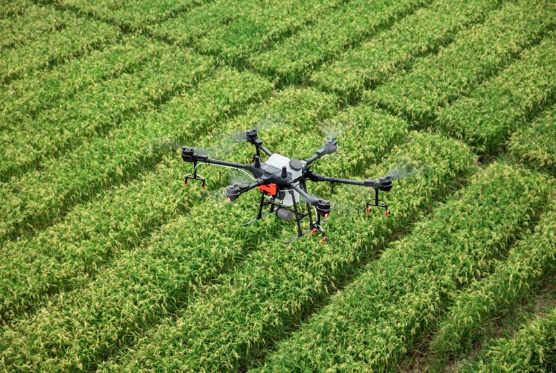
Kenji Shimada, professor of mechanical engineering, and his team of engineers are using drones to detect damage in agricultural water canals in a town in Niigata, an agricultural district on the northwest coast of Japan. These canals that total approximately 40,000 kilometers throughout Japan are essential for the rice farming economy. Damage to the canals accumulates due to age, earthquakes, and extreme weather. They can only be analyzed and repaired during the annual two-month dry season. Of these two months, one and a half are devoted to laborious inspections by technicians who walk along the canals to manually identify, measure, and record damage. This leaves only two weeks for repairs. “Forty thousand kilometers are equivalent to the equatorial circumference of Earth, and the manual labor for inspecting and evaluating the condition of water canals is enormous. We automate the work by flying autonomous drones equipped with high-resolution cameras that detect cracks and wear with machinelearning algorithms,” said Shimada. Shimada and his team have developed a systematic framework with a fleet of drones and cars to effectively assess the canals, extending the coverage area and minimizing inspection time. Di Deng, a Ph.D. candidate in mechanical engineering, works on the coverage planning aspect of the project. Last year, she traveled to Japan to conduct field tests. “Over the summer, we flew our autonomous drone and tried different sizes of water canals, so the system can automatically decide the position of the drone inside the water canals,” said Deng. “We tried out canals that go from 2.4 to 5 meters in width. We could clearly see a lot of stone exposed, so these were the places we needed to repair.” Using public maps and research data, the researchers formulated an algorithm to plan the drones’ path along the canals. They can fly along different sized canals in multiple directions to record video of the walls for crack detection. The commercial drone they used is limited to thirty minutes in the air and it must stay within a range of a few kilometers from the remote controllers. This makes it impossible for the drones to cover all of the canal in one flight. To ameliorate these limitations, the drones are paired with cars that are strategically parked to provide batteries and pick up the drones when needed. Once the drones have recorded video of the entire canal, the data from the images is fed into a neural network to detect damaged areas and map them in CAD models. To plan paths for the drones, a scaled map of a canal is converted to a graph. This graph is then divided into subgraphs, which represent the areas they will cover. The team also graphs the roads to generate a route for the car that is within communication distance of the drones. The cars are programmed to automatically find alternative routes if faced with traffic. The team presented their research at the International Conference on Intelligent Robots and Systems (IROS) last October. In the future, they plan to tackle potential road blocks. Additional challenges to this project include potential vehicle collisions, aerial constraints (such as flying zones, aerial traffic, and other regulations), and inaccurate maps and measurements. A long-term goal is to develop large-scale automated vehicle planning. “We believe that this type of technology is critical to keeping the aging infrastructures healthy and safe—it enables faster, cheaper, and more regular inspection and monitoring,” said Shimada.


