2 minute read
Project 3 Density and Accessibility
For any populations within dense metropolitan areas, accessibility to crucial amenities such as grocery stores, parks, public libraries, and schools are extremely necessary. For people living in these areas—especially those walking—accessibility enables everyone to attend, participate.
This analysis seeks to determine how current levels of development and densities throughout the Salt Lake City area a ects levels of accessibility to certain amenities. Additionally, this project will seek to determine areas of high accessibility compared to areas of considerably lower levels of accessibility.
Advertisement


Although the data itself and results show that this method is inaccurate, it provides a great entry into dialogue and further research into the topic

Factors of Accessibility
Add 8 shapefiles: SLC municipality, Census Blocks, Parcels, Transit Stops, Schools, Grocery stores, Parks, Libraries
Data Management ToolsFeature to Point for Parcels
Through GIS, Select By Location: The 7 shapefile amenities within the source layer (SLC Municipality)
Select by Attributes: Parcels that are either residential or Multi-housing (Res or MH)
Data Management Tools - Feature to Point for Parks
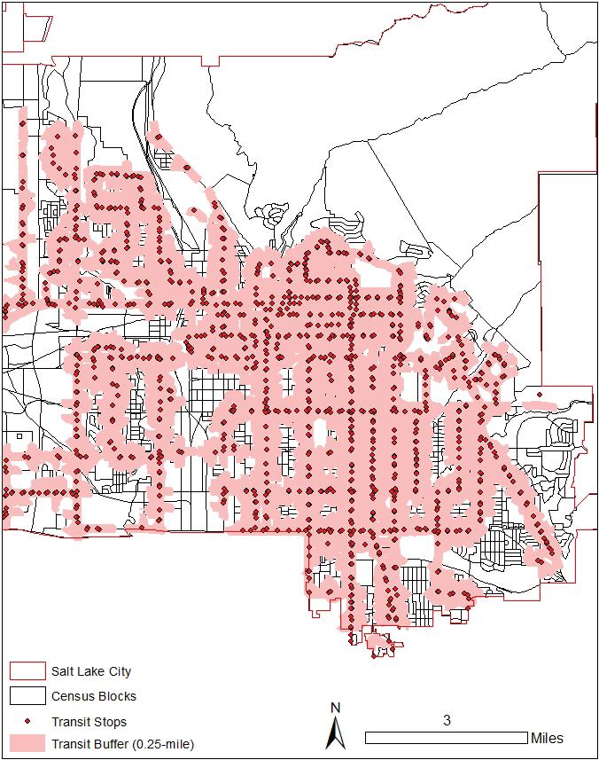
Create proper buffer distance for each 5 amenities and export each as shapefile
Export the Parcels Attribute table to Excel. Multiple the scores by the number of housing units on each parcel.
Sum the number of housing units on each parcel then sum for each census block
Join by Spatial Location: Census Blocks to Parcel Points (all attributes)
Join attributes from a table: Parcel Points to Parcels
1.0447
Editor - Create point features for parks at entrance points
Select by Location: Select parcels in each service area and add accompanying amenity scores (1 if parcel is within the buffer, 0 otherwise).
Sum the numbher of housing units for each census block. Multiple amenity scores by number of housing units on each parcel then sum for each census block
Calculate accessibility score for each census block

Network Analysis - Add SLC Roads and Junctions, create service area for each of the 5 amenities.
Mulitiply the scores by the number of housing units on each parcel
Divided total score for each amenity by the total number of housing units in the census block. Calculate the accessibility score for each census block
Update symbology for census blocks to graduated colors of quantities based on accessibility scores
The analysis model and calculations method that we provided were unable to create a solid connection between accessibility and density. Of course, although the relationship of density and distance strongly a ects accesibility levels, it is not the only deciding force.
Even so, there is still an important takeaway from this visualization. What is most obvious is that there are many neighborhoods and communities that do not have any form of acccessibility to the amenities that we laid out in the study (i.e public libraries, parks, transit stops, public schools, grocery stores). As shown in the accessibility score map, there are many census blocks and households that are not within a walkable distance.


