8 minute read
The Big One: 40th Anniversary


by Mark McLaughlin
This winter started off at a blistering pace precipitation-wise, as did winter 2011, which ultimately became the eighth wettest season since 1946 and ninth snowiest since 1878. But neither year could keep up with the precipitation trajectory set by the winter of 1983. That epic season is still the wettest in Sierra history and the benchmark by which all others are measured.
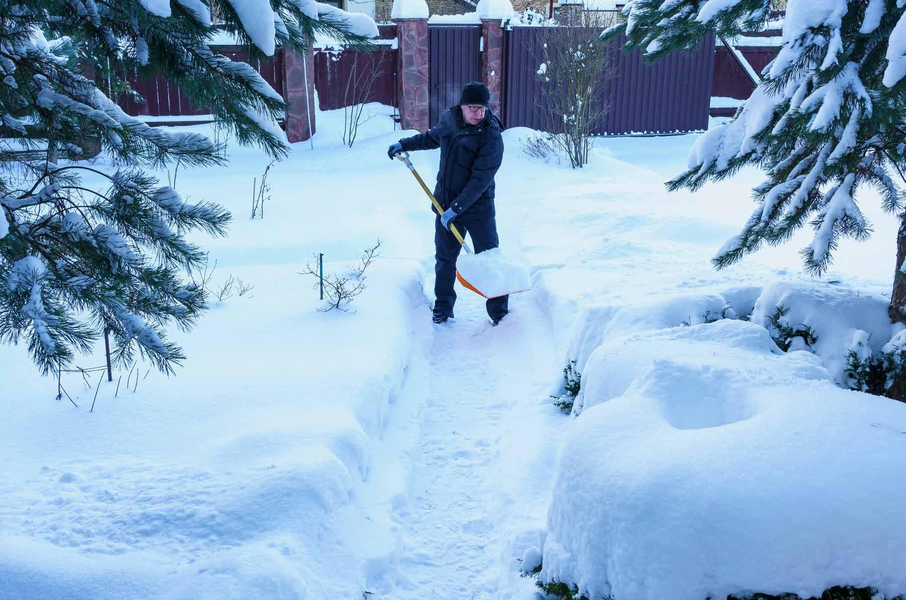
Forty years ago, the West endured one of the most brutal winters in the annals of Sierra weather. Nearly 67 feet of snow fell at Norden on Donner Pass in 1983, the sixth greatest all-time total for that location. The incessant storm activity and heavy snowfall took its toll on local residents and businesses, as well as visitors looking to ski some of the deepest powder in decades.
Typically, California can expect about four or five major storms during the course of the five-month rainy season, November through March. But in 1983 potent storms came early, originated in various regions of the Pacific Ocean, and persisted until early May with only short reprieves. Heavy snow buried the mountains, torrential rain lashed the lowlands and 25-foot waves pounded the coast from Fort Bragg to San Diego.
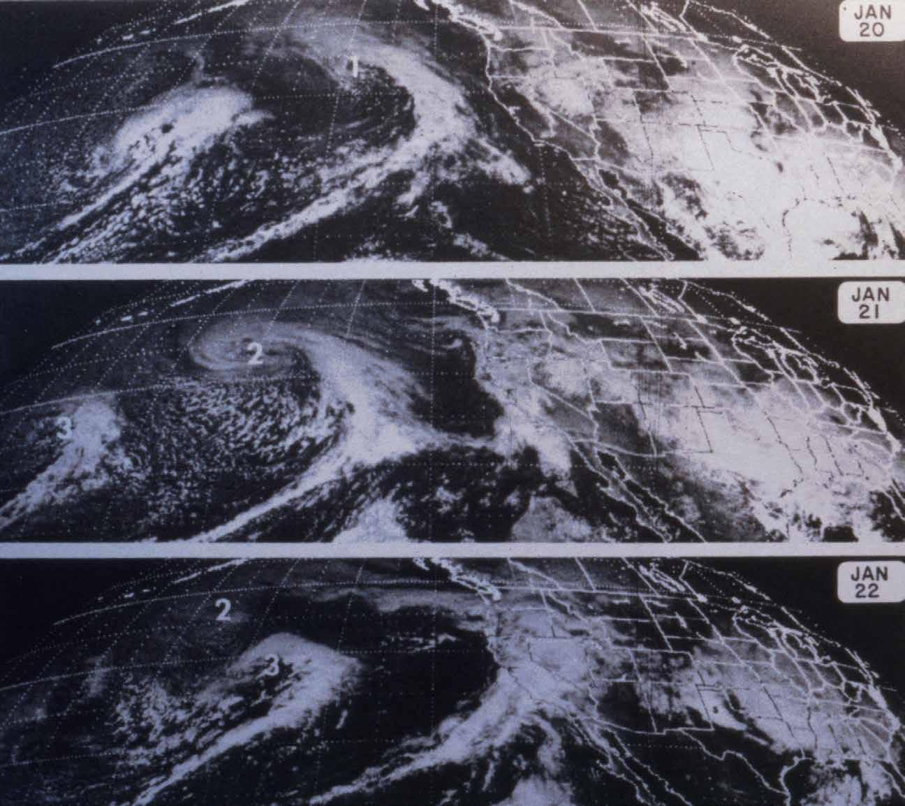
The big winter of ‘83 was not a complete surprise. An unusually strong El Niño event in the Pacific Ocean was adding more juice to the jet stream and climatologists warned of increased potential for a wet winter. A persistent, deep low pressure system in the Gulf of Alaska combined with an intensified high pressure dome in the central Pacific to “squeeze” the jet stream and effectively double the speed of the westerly flow of air across the ocean. Fast moving storm systems embedded in the jet stream were fueled by released energy from exceptionally warm sea water as they raced toward the West Coast. Depending on your perspective, it was either a recipe for disaster or a powder hound’s ultimate fantasy.
The Storm King wasted no time in fulfilling the prophecies for a heavy season. As a harbinger of things to come, rare September snowfall hit the mountains. Enough, in fact, that twice that month CalTrans was forced to require chains on Interstate 80 and other local roadways. Nearly two inches fell in Reno, the city’s first September snowfall since 1889 when about half an inch covered the ground. The unusually early snowfall was an ominous omen: the winter of 1889-90 is known as the “Great White Ruin” and considered the worst in Nevada’s history.
In late October, activity picked up again as a strong flow of moist, subtropical air from near Hawaii inundated the Sierra with heavy rain and high elevation snow. More than 10 inches of rain soaked Blue Canyon that month, more than double its October average. The jet stream soon shifted, however, and a week later the first in a series of cold storms from the Gulf of Alaska slammed the West Coast. This relentless stream of powerful weather systems buried the TruckeeTahoe region. Most resort operators had never seen anything like it.
To top off November, the last storm was a wild one, dumping four feet of snow in downtown Truckee, which paralyzed traffic and closed schools for two days. Alpine Meadows Resort picked up 87 inches of snow that month, which got the ski season off to a great start. By Dec. 1, more than 6 feet of snow covered the ground at Norden, compared to an average of 11 inches for that time of year. In many locations in the Sierra, it was the wettest fall season (Sept.-Oct.Nov.) on record.
After that barrage there was a three-week lull between storms, typical for December or January in the Sierra. And then, just before the economically important ChristmasNew Year’s holiday period, the most intense storms so far roared in with damaging winds and 10 feet of new snow. The final cold front set a new record for low barometric pressure at Sacramento. Fierce winds associated with this dynamic and tightly wrapped weather system exceeded 90 mph at Mt. Tamalpais in Marin County and closed down the Golden Gate Bridge for only the third time in history. In the mountains, Norden received another 7 feet of snow and the snowpack rose to a solid 11 feet deep. Despite all the holiday traffic, CalTrans shut down westbound Interstate 80 for two full days. Power lines were ripped down by the tempest and communities in Truckee and Lake Tahoe went dark. Walt Sady, spokesman for Pacific Gas and Electric said, “We’re suggesting to people to prepare for the worst and be aware that they may be out of power for three or four days.” In fact, some customers in the Truckee area were without electricity for 13 days while temperatures plummeted to 7 degrees below zero.
By New Year’s Day, mountain highways were clear for everyone to enjoy some of the best holiday ski conditions in memory. Alpine Meadows reported a base of 10 to 15 feet while Sugar Bowl boasted 12 to 18 feet of white gold. A strong ridge of high pressure dominated for the first half of January, blocking the Pacific storm track. Sunny days and warmer temperatures gave locals hope that the destructive storms had abated. (The same mid-winter dry pattern encouraged members of the Donner Party to assume that the spring thaw was upon them and they could make their escape to safety in the Sacramento Valley.) But in both 1847 and 1983, heavy snow storms returned during the third week of January dashing all hopes for some relief. On January 21, 1983, another juiced-up Pacific storm barreled onshore, pounding California with heavy rain and snow, high winds, and massive waves and surf along the coast. Santa Cruz was inundated with an incredible 25 inches of rain in 36 hours and up to 10 feet of new snow immobilized Lake Tahoe. By early February, the snowpack at Sugar Bowl had reached 26 feet deep.
The bottomless snow along the Mt. Rose Highway got rave reviews from participants indulging in the hottest winter rage at the time— snowboarding. Southern California resident, Steve Cathey, a former surfing and skateboarding champion, had begun manufacturing his patented “Slicker Snowboard” in 1980. His prototype snowboard was about three feet long with two plastic straps running from tip to tail on the top of the board. Riders Southern Pacific telegrapher’s home buried in 1983. Courtesy of Richard Steinheimer placed their feet beneath the straps, and then attached nylon safety straps to each foot. Cathey was in the area to help set up the first championship competition for snowboarding in the Lake Tahoe basin. He said, “Lake Tahoe is the nicest place I’ve found for snowboarding. The terrain is great, the weather perfect and the lake beautiful.”

Storms in February, March and April continued to batter California with rain, wind and snow. The statewide precipitation averaged 200% of normal in February and 300% of normal in March. A huge cyclone dumped another 7 feet on Norden from February 28 to March 3. Cold storms during March triggered tornadoes in the southern Sacramento Valley and Los Angeles County. In Truckee and Lake Tahoe, where residents were longing for sunshine, it snowed every day from April 18-30, including 40 inches on the last weekend of the month. Snow depths at Norden exceeded 17 feet; some of the deepest snow since World War II. At the Sugar Bowl ski area, General Manager Don Schwartz proclaimed the snowfall of ’83 to be the greatest ever. Schwartz said, “This is an all-time record. Right now you can walk off our porch onto 25 feet of snow.”
The skies finally cleared in May and warmer temperatures began to quickly melt the awesome snowpack. Snow was gone from Blue Canyon by May 24 and at Norden by June 22. Fortunately, cool temperatures in June and an effectively managed reservoir storage system avoided uncontrolled releases and damaging downstream flooding, thus sparing lowland Californians from what could have been the worst flood since 1862.
The unrelenting storms broke many weather and stream flow records in the Golden State. New rainfall benchmarks were established at 49 locations throughout the state. In terms of precipitation amounts, runoff volumes and the geographical extent of winter flood damage, 1983 is unparalleled in California’s modern history. The impact was so great here and around the world that winter ’83 is the year that put the previously littleknown words “El Niño” into the lexicon of the media and popular culture.
Tahoe historian Mark McLaughlin is a nationally published author and professional speaker. His awardwinning books are available at local stores or at www.thestormking.com.