
12 minute read
tuna tour


From the watery realm of the herons – those slender birds that have become symbols in Castro Marim – to the cosmopolitan oasis of Monte Gordo. From the monuments of Tavira with its 32 churches, to the warm clear waters of Manta Rota. Nowadays, there are few signs of that old trade in the place where men set off to catch tuna: nets and boats cover the calm waters, as if in resignation or maybe by choice. However, there are the sons of brave tuna fishermen. A rare breed, with white hair and large petrified fingers, they now sew the fishing nets by hand. We can also see them, poles in hand, searching for shellfish in the sands of the Cacela peninsula at dawn. At the same time, the grandchildren of the tuna fishermen spread out along the coast, filling the buildings in Monte Gordo and friendly eating-houses in Cabanas and Altura. Later, with the eternal blue of the south in sight, we shall try the produce of the sea, cooked over charcoal. Looking out into the blue, we can discern the glorious feats and the battles of those men from the past, on the tuna tour.
Tavira island (HR)
Advertisement
tuna tour
SUMMARY OF THE TOUR
Monte Gordo > Vila Real de Santo António > Castro Marim > Aldeia Nova > Manta Rota > Cacela Velha > Fábrica > Cabanas > Tavira > Ilha de Tavira > Vila Real de Santo António > Monte Gordo
KEY TO THE MAP
Beach
Dam
Ferry Boat Harbour Lighthouse
Monument
Museum Nature Reserve
Pier
Viewing Point
Motorway
National Road Municipal Road
Tour Starting Point
Protected Area
Alcaria Cova de
Cima
VAQUEIROS
Zambujal Barluco de Cima Alcaria Cova de Baixo PEREIRO
Cruzamento
Barluco de Baixo
Guerreiros do Rio Montinho das Laranjeiras EN122
Álamo
Furnazinhas Foz de Odeleite
Sevilla Madrid A22
Reserva Natural do Sapal de Castro Marim e Vila Real de Santo António Barragem de Beliche Barragem de Odeleite Taipas Casas Bentos Cintados Vale Covo Carrapateira Estorninhos Portela da Corcha Santa Catarina da Fonte do Bispo Cacela Velha Monte Gordo Estrada Cerro da
Cabeça Foupana Marim Ilha de Tavira Ilha da Armona Alfandanga Arroteia de Barro Livramento Torre de Ares Pedras d’el Rei Estiramantens Santo Estêvão Malhão Moinhos da Rocha Picota Palheirinhos
Àgua dos Fusos
Alcaria do Cume Ribeira Manta Rota Quinta de Cima Nora Areias Santa Rita Casas Novas Buraco Bomacha Lagoa Altura Aldeia Nova Monte Francisco Junqueira Castelhanos Beliche Sentinela Quebradas Corujos Corte Gago Alcarias Grandes
Marroquil Cortelha
Serro do Enho Corte de António Martins Ribeira da Gafa Fonte do Penedo Alcaria Fernandilho Alcarias Fortim MONCARAPACHO S FUSETA CABANAS CONCEIÇÃO AZINHAL ODELEITE LUZ DE TAVIRA O TAVIRA CASTRO MARIM VILA REAL DE SANTO ANTÓNIO EN125 F useta (Mar) Homem Nu Barri l Te rra Estr eita (St.ª L uzia) Ta vira Ilha de Cabanas Cacela V elha Manta Rota L ota Monte Go rd o Santo António T esos (Ria) EM508 EM512 EM506 EN397 EN397 IC27 IC27
The Tuna Tour will take you to see the blue of the oceans, the golden yellow of the beaches, the green of the pine forests, the white of the houses and the salt pans.
Monte Gordo is the starting point. Have a look at the wide bay and the immense beach. The colourful boats lined up on the western side of the beach show that tradition is still what it was. Small-scale fishing still continues.
There were already fishermen living here at the beginning of the 18 th -century and, apart from Portuguese and Andalusians, there is evidence of people coming from the coasts of France and Catalonia.
At the time of the 1755 earthquake, the Marquês de Pombal wanted to force them to move to the recently constructed Vila Real de Santo António. The fishermen did not like the idea; some went to Andalusia, others got into their

Monte Gordo (HR)

boats and went to Meia Praia in Lagos, where the bay and the beach are of similar proportions and some refused to move.
Perhaps it was because of these problems or because of this unequal struggle between the powerful marquis and the modest fishermen, that the habit arose of relieving one’s feelings by swearing, in colourful and sometimes unrepeatable language. The people of Monte Gordo are notorious throughout the Algarve for their swearing.
In the 1940s, wealthy Alentejo families began to build houses to spend the “bathing season” here. In the 1960s, with the advent of the tourist industry, one of the first hotels in the region was built here.
We now move on to Vila Real de Santo António on the road that runs alongside the deep green forest of stone pines where a protected species, the chameleon, lives.
On the right, we can see the imposing lighthouse, standing 46 metres tall. Sailors depend on its light at night to know where the sea ends and land begins. By day, the blue bars painted on the tower show them where the coastal area is.
Vila Real de Santo António (PR)

Castro Marim Salt Marsh (LC)
The coast road then turns towards the mouth of the Guadiana River, where you can see the buildings of Ayamonte on the other side, de- spite the width of the river.
It is now just a short distance to the historical town centre built in the Pombaline style, unique in the Algarve and inspired by the rebuilding of Lisbon after the 1755 earthquake.
The streets, laid out in a grid pattern, converge on the square Praça Marquês de Pombal, which is paved in Portuguese stone, radiating out from the centre. Around the square, are the church, the town hall and the old guardhouse, decorated with masonry work and wrought iron. Built to replace Santo António de Arenilha, which was destroyed by the earthquake, the town came into being on 30 December 1773 to defend the border. In time, it became an important centre for canning and a lively commercial centre.
The inhabitants are well-known as food-lovers. They make dishes with tuna, put shellfish and molluscs to creative use, and have turned the lively shopping district into an almost continuous outdoor seating area.
We will leave the city to the north on the IC 27 towards Castro Marim, passing through the Nature Reserve of Castro Marim and Vila Real de Santo António Salt Marsh, which is home to more than a hundred species of birds. Added to these, there are birds that seek refuge dur- ing particular seasons and others that stop here while migrating to the warmth of the south.
In the autumn, you can see the pinkish colour of the flamingos in the marshes, whereas the elegant flight of the resident stork is visible all year round.
The wild ducks seem to respond to some invisible signal as all of a sudden they flap their wings and head south.
Castro Marim has existed for millennia: it was the Roman port of Besarius and the headquarters of the Military Order of Christ in the 14 th -century. Since time immemorial, the geometric shapes of the salt pans have been a feature of the salt marshes into which the Guadiana River empties
as it nears the coast. The salt crystals, arranged in piles, shine in the sun. This is a traditional activity, which still continues today. From the battlements of the old castle, there is a view overlooking the river and the reserve, with the cities of Ayamonte and Vila Real de Santo António on the horizon.
At the foot of the walls, an outstanding feature of the traditional architecture is the Main Church dating back to the 18 th -century. On the surround- ing hills, the Fort of São Sebastião and the Chapel of Santo António can be seen.
The traditional cuisine is based on fish, crusta- ceans and shellfish. Fish soup, crabs from the salt marsh, favas sapatadas (made with broad beans) and fried fish with açorda (a Portuguese bread soup with garlic and coriander) are just some of the local specialities.
Items of rustic handicrafts include delightful wooden miniatures, basketwork, bobbin lace and tapestry. A four-day festival, the Medieval Days of Castro Marim, is held every year in August, dur- ing which the inhabitants dress up in period clothes. The banquets are especially popular. There is also a market and a colourful parade.
To return to the coast, we take the 125-6 connect- ing road that winds through the Reserve as far as the EN 125 proper, near Aldeia Nova.
There we head west for about 4 km to the turn-off to Manta Rota.
Between the Guadiana estuary and the Ria Formosa, which starts here, there are 12 km of continuous beach, one of the largest in Europe. This area has the warmest waters in Portugal, as the bay protects the beaches from the ocean currents.
Manta Rota manages to remain a small town where it is nice to live or spend the summer.
A small road near the sea allows us to cover the half a dozen kilometres to Cacela Velha.
This old village is built around the medieval water wheel, but the view of the Ria from the railing at the fort, built in 1749, makes the visit worthwhile.
Tuna (TV)


Manta Rota (HR)
Cacela Velha (LC)

Armona island (HR)
One of the houses has the following poem by Sophia de Mello Breyner Andresen inscribed on its walls:
“The strongholds were conquered With their power the cities of the sea were besieged For their riches, But Cacela was wanted just for its beauty.”
The Ria Formosa Nature Park can be seen from here in all its splendour. On one side is the ocean; on the other, creeks, marshes and islets interspersed with channels and small areas of sea. Between them, there is a barrier of narrow, sandy islands stretching away almost parallel to the coast: Barreta, Culatra, Armona, Tavira and Cabanas. The movement of the sea and the tides contrast with the mirrored water of the Ria bordering the beaches and the dunes heralding terra firme.
Cacela is a very old place, which grew on the right bank of the river of the same name, on the top of a cliff.

It was first settled by the Phoenicians around 800 B.C. The Romans, in turn, built fishing facilities, and the Arabs built a fort. Paio Peres Correia, Master of the Order of Santiago, re-conquered it in 1242.
Today, the walls of all the houses are painted with whitewash, with the door and window frames trimmed in blue or grey, creating a harmonious whole that has remained practically intact.
Leaving Cacela, we take the turn-off to Fábrica, which is right beside the water and gets its name from an old fish processing factory, since the Por- tuguese word “fábrica” means “factory”. The area is rich in breeding grounds for oysters and clams, which can be savoured in nearby restaurants.
Returning to the EN 125, after 8 km we come to Cabanas, hidden in the Ria Formosa, which is worth visiting for its beautiful beach that is only accessible by boat. Initially, there were only fish- ermen’s huts there, fragile dwellings occupied temporarily during the tuna fishing season. This was replaced by octopus fishing, when Sebastião Viana, a local man, discovered the technique of using the “clay pot”. This is still used along the whole coast.
This is the right place to try out the delicious range of octopus recipes.
On the EN 125 once again, we will drive 5 km to Tavira, the city of 32 churches, which dates

Octopus (LC)

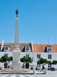
Tavira (PR)


back to prehistoric times as a port for shipping minerals from the north-east of the Algarve and unloading produce from the Mediterranean. During the period of Islamic rule, it was one of the main settlements in the Algarve. It became the main supporting port after the conquest of Ceuta (1415) which led to it being elevated to the status of a city in 1520.
The Gilão River has had a major influence over the city’s appearance and identity, and its banks are linked by means of a seven-arched medieval bridge.
There are beautiful streets in Tavira, and an impor- tant historical centre with a huge architectural heritage and a wide range of archaeological finds.
An example of this is the famous Tavira Vase, a lavishly decorated piece, probably dating back to the 11 th -century.
It is thought that it must have been used for Islamic wedding ceremonies. There are small carvings of a couple, warriors symbolising strength, musicians and animals. Of these, the doves symbolise feeling and the turtle, fidelity.
At that time, the town was known as Alcaria Tabila.
In the surrounding area, there is fine countryside to be enjoyed, but it is certainly in Quatro Águas or on the Ilha de Tavira that the city is in greatest harmony with the sea, with calm and luminous nuances of light. The Ria Formosa is a perfect setting for a city with history and full of stories to be discovered.
We shall return to Vila Real de Santo António on the Via do Infante motorway, taking advantage of the easy road access. To the south, we can see the different blues of the bay of Monte Gordo, with the neat rows of houses close to the beach. To the north, the undulating hills of the Barrocal stand out on the horizon. The perfume of orange trees in blossom fills the air, with the steeper slopes populated by olive trees and holm oak. Here and there, a splash of colour coming from the limewashed walls of the rural houses makes the green of the cistus even deeper.


