1 minute read
FINAL DESIGN DETAIL: Nonotuck Park Connection North
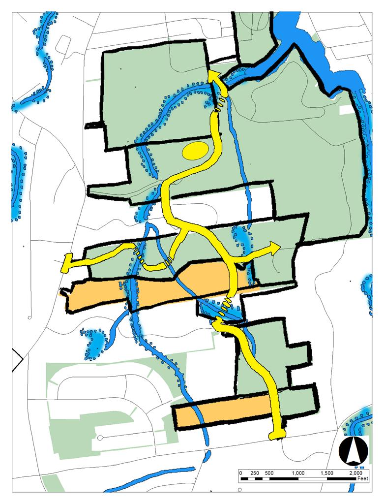
Restoration of Eroding Stream Banks. People currently use a network of informal trails behind the Middle School to cross White Brook on makeshift wooden bridges and connect to Nonotuck Park. These trails traverse the steep stream banks and muddy wetland soils around White Brook. The steep slopes and muddy terrain are challenging to navigate, and inaccessible to many users. In addition, heavy use of these trails is damaging sensitive vegetation and eroding the stream banks. In this design, pedestrian and bicycle traffic between the White Brook School and Nonotuck Park is redirected to a single universallyaccessible stream crossing, and the degraded stream banks behind the school have been restored and stabilized with native wetland plants. See Section Y below for a typical crosssection of the steep stream crossings behind White Brook School.
Connection to the North. In order to reach an area of moderately sloped stream banks suitable for an accessible stream crossing, the Shared-Use Nature Path would travel along the western bank of White Brook, skirting through the corner of a property northwest of Nonotuck Parked owned by Williston Academy, a private school. Extending the Shared-Use Nature Path to create this northern connection to Nonotuck Park would require the City to obtain an easement from Williston Academy.
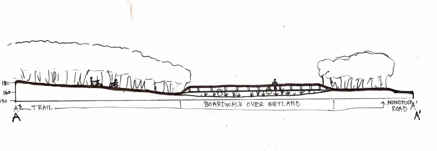
Wetland Crossing. The path descends a moderately sloped stream bank and crosses White Brook on a 100-foot-long boardwalk before ascending the opposite bank and merging with Nonotuck Park Road near the entrance to Nonotuck Park. See Section X below for a cross-section of the more accessible stream crossing.
x' B
C
A
x y'

x

x'
Above: Cross-section of the proposed wetland crossing north of the school.

Below: Typical cross-section of existing stream crossings behind the school.
y y'


