
4 minute read
Designing Across Scales


Conway designers approach landscape challenges at different scales. Instead of focusing on one scale or another—for example, specializing in residential landscape design or regional planning—they see the relationship between these fields. Looking at a small site from a broader perspective explains context, while giving a large plan a closer examination reveals how it might affect individual properties.
Our ten-month program introduces this zooming across scales. In the fall term, each student has his or her own small site-design project. Zooming out for the winter term, teams of two or three students work on plans for entire towns, regions, or large tracts of private land. In the spring term, the scope shifts to master plans for intermediate-scale sites such as parks, schools, and city streets.
While completing these three projects, each student builds a professional-quality portfolio and gains preparation for a wide variety of careers.
FALL-TERM PROJECTS | STARTING WITH SITE DESIGN
Following orientation, each student is assigned an individual project selected from local property owners who have requested site-design services.
Although they focus on a small area, these fall-term projects are never simple. Students learn design principles through application of a systematic problem-solving process. This involves eliciting and interpreting clients’ needs, developing a proposal for design services, analyzing and assessing site conditions, researching legal constraints, and conceptualizing alternative design solutions. Along the way, students learn to survey and create base maps.
The classes and workshops held during the fall term—at the school and in the field—introduce and reinforce the skills and concepts necessary to complete these site-scale design projects. Each week, students present their progress to faculty and classmates for feedback. These presentations provide an opportunity to integrate their growing understanding of site conditions with new skills in graphic representation and oral presentation.
Near the end of the term, clients and a panel of guest critics attend a formal presentation of projects, providing feedback that students then incorporate into their finished products. At the end of the term, students deliver the completed plan sets to their clients.
Groups of students working together learn to use surveying equipment and software to produce a topographic map of their project site. Professional critics, clients, alums, faculty, and community members attend formal presentations.

WINTER-TERM PROJECTS | BROADENING TO CITY AND REGIONAL PLANNING
In the winter term, the projects increase in scope and complexity and are undertaken by teams of students. Typically: • the projects are for a public agency or non-profit organization • students work in teams of two or three • students study natural systems that lead them to either accommodate or revise client requests • students produce a written report–including maps, charts, and other illustrations–that summarizes the design and planning process and recommendations
Students are assigned to teams based on their individual goals and the particular needs of the project.
Team members learn to exercise ethical leadership, collaboration, and project management skills. Often projects are complicated by multiple stakeholders, conflicting client interests, and diverse opinions on land management options. Weekly presentations at the school often serve as rehearsals for presentations to boards of directors, planning boards, conservation commissions, or public meetings. Following the formal presentation that takes place toward the end of each term, the team summarizes the entire project in a comprehensive report.
Classes and guest speakers in the winter term provide material helpful to the winter projects and introduce students to a broad range of career options.
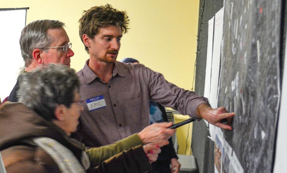
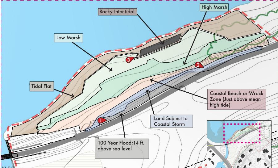
In the winter and spring terms, students work with the public to facilitate community meetings. GIS mapping is an integral part of larger scale analyses in both winter and spring projects. (Image above from project by Emily Berg, Jeffery Dawson, and Allison Ruschp.)
SPRING-TERM PROJECTS | INTERMEDIATE-SCALE MASTER PLANNING
Typically, the spring-term projects are narrower in scale and more detailed in design than the winter projects. They present opportunities to learn about technical issues such as stormwater management, erosion control, road alignment, long-term management techniques, ecological restoration, barrier-free access, native planting plans, and design detailing. Many projects include cost estimates and most include a phased plan for implementation. By the spring term, students have become increasingly familiar with the design process and the dynamics of working as teams. Projects often require a rapid site assessment and development of design alternatives, with the expectation that teams will achieve a greater level of detail. Classes continue to supplement project work and increase in complexity and detail to match that required by the projects.
In addition to providing students with living laboratories and hands-on experience, the community projects provide valuable design and planning services to municipalities and regional agencies at an affordable cost. Since the school’s inception in 1972, more than 450 community clients have benefited from these projects. Every year, students are exposed to 30–35 different projects, each with its unique clients and site challenges—an expansive introduction to the broad field of ecological design.


