3 minute read
Trails and Hiking
12 Trails and hiking
Agreat way to stay cool when the summer temperatures climb is to take a hike and see some of nature’s finest creations.
Advertisement
Adams Mountain Way
Length: 3.6 miles Use: hiking, mountain bike Degree of difficulty: most difficult Trailhead: Brice Creek Road No. 22 to Lund Park Campground. This route was used by early miners traveling from Lund Park to Bohemia City. There is an occasional view of the Cascades from the trail.
Bohemia Mountain Trail
Length: .8 miles Use: hiking Degree of difficulty: most difficult Trailhead: Bohemia Saddle located on Road No. 2460 Bohemia Mountain Trail leads up a steep grade to the rocky summit of Bohemia Mountain, the highest point on the Cottage Grove Ranger District providing excellent views of the Cascades, Mt. Hood and Mt. McLaughlin.
Bohemia National Recreation
Length: 6.7 miles Use: hiking, horse, mountain and motor biking Degree of difficulty: more difficult Trailhead: Road No. 23 to Shane Saddle on Road No. 2358. This trail was built in 1864-65 as a mining route from the Oakland-Roseburg area to the Bohemia Mining District and reconstructed in 2008. Portions are designated as a historical National Recreation Trail.
Brice Creek Trail
Length: 5.7 miles Use: hiking, mountain biking Degree of difficulty: easy to more difficult Trailhead: Brice Creek Road No. 22. The east portion of the trail follows an abandoned flume built in the early 1900s to channel water to Lund Park, where electricity was produced for buildings and several mines.
Crawfish Trail
Length: 5.2 miles Use: hiking, mountain bike
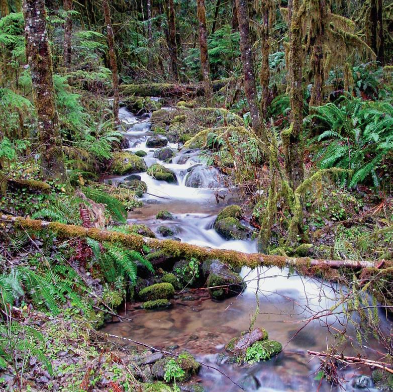
Brice Creek Trail offers hours of hiking enjoyment in stunning terrain.
Degree of difficulty: most difficult Trailhead: Brice Creek Road No. 22 to milepost 5.8, parking area on left. The trail forms a loop system with Adams Mountain Way and Knott trails, traveling through timber and reforested lands.
Crawfish Lake Trail
Length: .5miles Use: Hiking Degree of difficulty: Easy Trailhead: Brice Creek Road No. 22 to Road 2263717, right on 2263-834 A short, fairly flat grade trail travel through the forest to a small, tranquil lake and trail shelter
Fairview Creek Trail
Length: 3.0 miles Use: hiking only Degree of difficulty: more difficult Trailhead: Mineral Camp on Road No. 2460. The trail parallels Fairview Creek, traveling through old-growth forests, steep rock walls and cascading streams.
Hardesty Way
Length: 2.2 miles Use: hiking, mountain biking Degree of difficulty: more difficult Trailhead: Road No. 1758 to Sawtooth Trail. The original “way” trail has been abandoned but now the first 1.2 miles follows a gentle grade of a closed spur road offering an
Knott Trail
Length: 4.8 miles Use: hiking, mountain & motor biking Degree of diffi culty: more diffi cult Trailhead: Road No. 2241-760 to Road No. 2263763. This trail was built in 1871 by John Knott to haul mining equipment to Bohemia Mines.
Marten Flume Trail
Length: .75 miles Use: Hiking Degree of diffi culty: More Diffi cult Trailhead: Brice Creek Road No. 22 to Lund Park Campground Trail follows a historic route used to bring water via a 3-sided wooden fl ume to a holding tank on the south side of Lund Park.
Martin Sharps Trail
Length: .75 miles Use: Hiking Degree of diffi culty: More Diffi cult Trailhead: Sharps Creek Road No. 2400 to Martin Creek Road #23 Enjoy a shaded streamside picnic site with picnic table built by modern day Conservation Corps at the end of this ¾ mile trail.
Mount June
Length: 1.1 miles Use: hiking only Degree of diffi culty: most diffi cult Trailhead: Road No. 1721-941. Mount June was once the site of a 50’ pole platform fi re lookout station, circa 1920’s, later replaced by a 50’ wooden tower and cabin quarters.
Noonday
Length: 6.9 miles Use: all; recommend one-way up for small fourwheel-drive vehicles Degree of diffi culty: more diffi cult Trailhead: East Brice/Champion Creek Trailhead. Brice Creek Road to Champion Creek Road No. 2473. The Noonday Trail was originally constructed in 1896 as a wagon road for hauling supplies and equipment into the Bohemia Mining District.
13
Sawtooth
Length: 4.0 miles Use: hiking only Degree of diffi culty: more diffi cult Trailhead: Road No. 5840-550 to Mount June Trail This trail is located within the semi-primitive non-motorized recreation area of Hardesty Mountain.
Swordfern
Length: 2.1 miles Use: hiking Degree of diffi culty: more diffi cult Trailhead: Road No. 1700-420, Rujada Campground picnic area This trail travels through a beautiful stand of second growth Douglas fi r and lush swordfern understory.


