

ABOUT ME
EDUCATION
Master of Urban Design
-University of California, Berkeley, CA
Master of Landscape Architecture
-Texas A&M University, College Station, TX
Bachelor of Landscape Architecture
Bachelor of Law
-Northeast Forestry University, China
Majoring in Art Design, School of Art and Culture (Exchange)
-Kangwon National University, South Korea Winter Visiting
-Waseda University, Japan
WORK EXPERIENCE
Urban Planner - Tongji Architectural Design (Group) Co.,Ltd

CONTACT
■ Participated in more than 20 planning projects, covering Northeast China, South China and Southwest China and even Southeast Asia.
■ Various types of design projects: including campus planning design, campus landscape renovation projects, new city area planning, TOD area design.
■ Responsible for AutoCAD drawing, models making, master plan rendering, planning strategy, portfolio production and brainstorm participation.
Landscape Designer - East China Architectural Design & Research Institute (Internatinal Deign Center)
■ Various types of design projects: including high school landscape projects, new city area planning and conceptual design.
■ Responsible for AutoCAD drawing, models making, master plan rendering, planning strategy, portfolio production and brainstorm participation.
Reaserch Assistant - Center for Housing & Urban Development at Texas A&M University
■ Published an article based on individual graduation project in the Journal of Environment and Health as the first author.
■ Responsible for data collection, Geo-database analysis, graph drawing, and article writing.
PROJECTS
■ Conceptual Planning and Design of the Eastern Area in Pei County, Xuzhou
■ Sichuan Maritime Transport Vocational College Planning and Design, Chengdu
■ Campus Landscape Renovation Planning of Tibet Agricultural and Animal Husbandry University, Tibet
■ Overall Urban Design of Pingluowan New Area, Yuhong District, Shenyang City
■ Urban Design Project of New Destrcit in Hui Min County,Binzhou City
■ China & Lao Railway - Conceptual Design of Wanrong & Wangxiang Railway Station Planning Scheme, The Lao People’s Democratic Republic
■ Landscape Improvement of Fuling & Zhaoling Parks in Qing Dynasty & Urban Renewal of Surrounding Areas,etc.
■ Conceptual planning of Wanfenglin Resort Town in Xingyi, Guizhou
■ Southwest Petroleum University campus planning and landscape improvement
■ Eastern University of Science and Technology Ningbo Campus Planning Competition
LINKEDIN https://www.linkedin.com/in/ tianqi-ticky-shi-773072130/
COMPETENCE
Creative Cloud (Photoshop | Illustrator | InDesign) Lumion | | AutoCAD SketchUp
ArcGIS | Xiangyuan REGULATION
| | Grasshopper 3D Revit Rhino
| Twinmotion Affaffinity
APPLICATION
■ National Computer Rank Examination - G2
■ Microsoft Word / PowerPoint / Excel
ENGLISH / MANDARIN / KOREAN
STATEMENT
I am A graduated urban planner with MLA degree from TAMU, now studing in UCB in MUD. believe that a successful landscape design must achieve a balance among ecology, human being and architecture. The successful landscape design should be within the nuture rather than on top of it. The design of green space is a solution to the problems related to the site instead of a solely represtation of personal fancies of the designer. In addition, the design of greenspace is to produce more livable cities, icrease biodiversity, provide resilience to climate change and better resource management.
MUD PROGRAM
02A 05/2024
Repairing a Broken Historical Fragment:
Using Design to Awaken New Urban Imaginations of Indigenous Legacies
Key Word: Urban Fragment, Resilience Design, Managed Retreat
A Basket of Dreams, Inspired by The Land:
If the Ohlone Return to This Land in 2050
Key Word: Urban Landscape Design, Cultural Expression, Sacred Places, Cummunity, Open Space
WORK SAMPLE
Charming Water of Hui County:
Urban Design Project of Core Area of New District in Huimin County, Binzhou City
Key Word: New District Planning, Composite Function, CBD Design 09A
Connected Resilience Space with Ecological Fabric:
Detailed Regulatory Planning of Pingluo Bay New District in Yuhong County, Shengyang City
Key Word: Ecological, Resilience, Urban Design, Open Space 11A
Pinghe Valley, Shanshui School:
Interior Landscape Scheme Design of Shanghai Pinghe International School
Key Word: Master Plan of Landscape Scheme, Shanshui School, Campus Landscape
S.H.I.E.L.D:
Sampling Health Indicators for Equity in Lower-Income Districts, Manchester in Houston
Key Word: Industrial Pollution, Green Buffer, Residential Retrofit, Open Space
19A 09/2017 Manifesto of Rejuvenation:
A Dynamic Hybrid of City And Nature, Naxi County in Luzhou
Key Word: Urban Renewal, Ecological Tourism, Mix-use Community
23B
Living Resilence Arboretum:
Reforestation as A Tool to Mitigate Flooding, League City in Houston
Key Word: Urban Regeneration, Vacant Land Development, Planting format
BLA PROGRAM
27A 05/2015 Tomorrow Will Be Better:
Ecological Governance Project of Suqian Central Public Park, Suqian City
Key Word: Urban Internal Revier Treatment, Community Park
OTHER WORKS
31A Hand Drawing(Master Plan), Colorings, Gouache Paintings, Clay Sculpture, Water Panitings, Marker Drawing, Interaction of Color
INVOLVE TIME: MAY,

SHELLMOUND MAP

<DISTRIBUTION OF SHELLMOUNDS IN SAN FRANCISCO BY REGION>
- Recorded by Nels Nelson,1909
Shellmounds have existed in the San Rafael area for millennia, offering valuable information about prehistoric coastal communities and their interactions with the environment, providing insights into the lifeways, cultures, and histories of the indigenous peoples.
<COMPOSITION OF CALIFORNIA SHELLMOUNDS> EDWARD WINSLOW GIFFORD, February 24,1916
7 main constituents into which each sample of Shellmound material was separated were fish remains, other vertebrate remains, shell (oyster mussel, clam) charcoal, ash, rock and residue. Shell is the most abundant, the average mound containing over 52% by weight.
Mound
SHELLMOUND "EWU"

<ETHNOHISTORY AND ETHNOGEOGRAPHY OF THE COAST MIWOK AND THEIR NEIGHBORS, 1783-1840 > - by Randall Milliken,2009
Between 1794 and 1914 Proselytization spread to San Rafael, and the earliest group of Indigenous People, Coast Miwok, settled in the area. 4 original villages were formed, of which the one known as Ewu at Gallinas Creek was the prototype of the present community - Santa Venetia.
<Placing Refuge: Shell Mounds and the Archaeology of Colonial Encounters in the San Francisco Bay Area, California> Ewu, one of three key ethnographic village sites recorded in the Aguasto area.


Santa Venetia was built on marshland that had been filled in 1914. Due to World War I, the developers, Mabry McMahan,abandoned the original project of developing it into a bayside luxury development model.

Marin County Civic Center is considered one of Frank Lloyd Wright's most significant works. The construction began in 1960, completed in 1962. It is a state and National Historic Landmark

>> Phase Initial Operating Segment: Downtown San Rafael North Santa Rosa (42-Miles)
>> Construction of the SMART Phase 1 project started in January 2012
>> $15,954,000 has been programmed into planning.

>> 40% of Nation's total population live along the coast.
>> Approximately 355,000 residents and $46.2 billion worth of property in the Bay Area are at risk during a 100-year storm
>> By 2050, HIGH TIDE FLOODING is likely to occur between 25 - 75 days per year, depending on location.
>> Shellmounds as the way to establish a more permanent public edge as a kind of structural fill to the shoreline.

>> LIFE'S BACKTRACKING:
1000 yrs ago: Indigenous People used shellfish as a source of food and formed their sacred place; 1000 yrs later, People draw on the power of shellfish to cope with seawater intrusion.


SITE COMPARISON
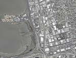

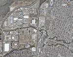

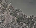


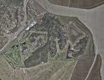


>> Each period of the city's growth has energized San Rafael and requires a reasonable use of development.
>> Public transportation has also served as a link in the promotion of urban culture.

>> A single adult oyster can filter more than 50 GALLONS of water a day.
>> Oyster reefs are


Shellmounds in Bay Area,1909 @ Nels C. Nelson
Satellite Map of Bay Area,2024
Emeryville
San Pablo
Alameda
Tiburon
Berkeley Mill Valley
El Cerrito
Novato
Richmond San Rafeal
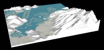


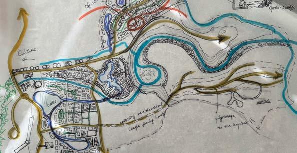


As sea levels rise, levees stand as protective barriers, safeguarding life. Though much of the mudland are submerged, connecting pathways still remain, preventing these small islands from becoming fully isolated—just as we strive to connect and empathize with the lives of the Indigenous Peoples from thousands of years ago.


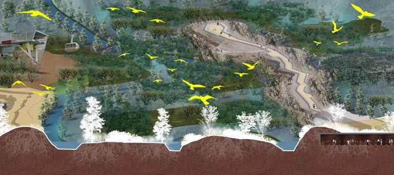
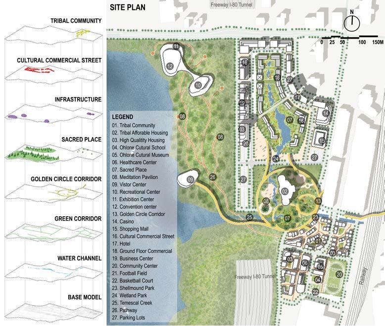
PROJECT NAME: A BASKET OF DREAMS, INSPIRED BY THE LAND - IF THE OHLONE RETURN TO THIS LAND IN 2050
LOCATION: EMERYVILLE, CALIFORNIA
KEY WORDS: URBAN LANDSCAPE DESIGN, CULTURAL EXPRESSION, SACRED PLACES, CUMMUNITY, OPEN SPACE TYPE: INDIVIDUAL PROJECT
INVOLVE TIME: SEPTEMBER, 2023
RESPONSIBLE: INTERVIEW + CASE STUDY + SITE DESIGN + DESIGN STRATEGY + SCENE SIMULATION DIAGRAM

MUD - A BASKET OF DREAMS, INSPIRED BY THE LAND: IF THE OHLONE R ETURN TO THIS
TIMELINE OF EMERYVILLE If we compare a city to a piece of music, then the prelude sets a neat tone...

If we compare a city to a novel, then the prologue opens the theme of the story...
If we compare a city to a dinner party, then the appetizers are responsible for arousing the interest of the diners...
What is the prelude of Emeryville?
What is the original theme of Emeryville?
What is the appetizer that attracts visitors to taste Emeryville?
“I think it takes much greater courage to create things to be gone than to create things that will remain.” – Christo Vladimirov Javacheff
This design project envisions a cityscape that embraces Ohlone's cultural renaissance and fosters reconciliation. Grounded in principles of respect and collaboration, this endeavor seeks to weave the rich tapestry of Ohlone's heritage into the fabric of our urban environment. Our mission is to create spaces that honor the traditions, stories, and practices of the Ohlone communities that have long guarded this land, helping preserve and celebrate the heritage and allowing residents to understand their city's evolution over time.
INTERVIEW: DESIGN WITH OHLONE

OHLONE'S NEEDS? DISTRICTS PROGRAMMING




PROJECT NAME: URBAN DESIGN PROJECT OF CORE AREA OF NEW DISTRICT IN HUIMIN COUNTY, BINZHOU CITY
LOCATION: SHANDONG, CHINA
KEY WORDS: NEW DISTRICT PLANNING, COMPOSITE FUNCTION, CBD DESIGN
TYPE: IFP, SUCCESSFUL BIDDER
INVOLVE TIME: MARCH, 2022
RESPONSIBLE: CASE STUDY + PLANNING DESIGN + DESIGN STRATEGY + SCENE SIMULATION DIAGRAM

MASTER PLAN
Huimin County has a long history and culture and is the hometown of Sun Wu, a famous military strategist in ancient China. The project is located on the east side of the old city of Huimin County, Binzhou. The design starts from six aspects of ecology, transportation, industry, life, image, and space, aiming to build an ecologically vibrant new city in northern Shandong. The core area covers an area of about 475 hectares and is located in the upper part of the whole project. There are CBD, Administrative Center, Equipment Manufacturing R&D Center, City Business Center, and Commerce & Trade Center around Shenghao Lake.
LEGENDS
1. CENTRAL BUSINESS DISTRICT
2. ADMINISTRATIVE CENTER
3. HUANHU CULTURAL PARK
4. EQUIPMENT MANUFACTURING R&D CENTER
5. NINE-YEAR EDUCATION SCHOOL
6. CITY BUSINESS CENTER
7. COMMERCE AND TRADE CENTER

STRUCTURE DEDUCTION


SCENE SIMULATION - EQUIPMENT MANUFACTURING R&D CENTER
The Equipment Manufacturing R&D Center is located to the east of Le'an 2nd Road, linked to the high-end equipment industrial park. This area has functions such as R&D center, operation headquarters, entrepreneurial center, high-end talent apartment, etc., integrating production, research, and residence


The CBD is located on the north side of the Administrative Center, along the central axis to the south is the citizen's service center, and on the north side are the twin towers composed of star-rated hotels and 5A office buildings, shaped like the backs of chairs. The west of the courtyard is a financial center, which brings together financial, banking, insurance, securities, and other institutions; the east is a business and trade center, which gathers functions such as corporate


international trade, and Grade A office buildings.


PROJECT NAME: DETAILED REGULATORY PLANNING OF PINGLUO BAY NEW DISTRICT IN YUHONG COUNTY
LOCATION: SHENYANG , CHINA
KEY WORDS: ECOLOGICAL, RESILIENCE, URBAN DESIGN, OPEN SPACE
TYPE: IFP, SUCCESSFUL BIDDER
INVOLVE TIME: OCTOBER, 2021
RESPONSIBLE: CASE STUDY + PLANNING DESIGN + SCENE SIMULATION DIAGRAM

MASTER PLAN
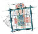
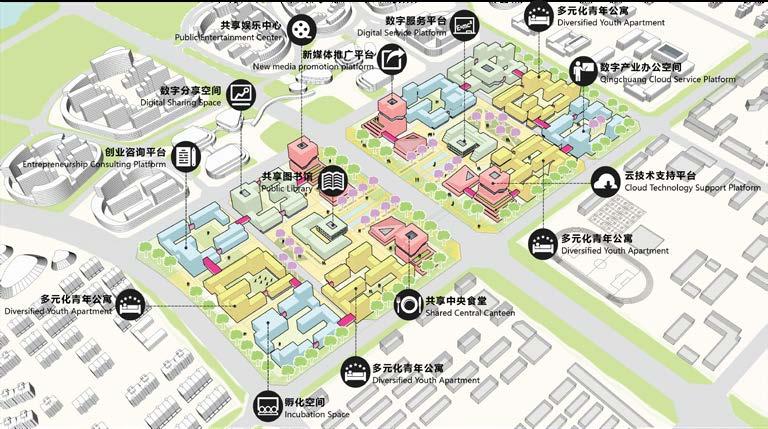
Pingluo Bay New District, located in the north of Shenyang's central urban area, is one of the key new district in Yuhong County and an important part of Shenyang's northern sub-city. The total planning area is about 31.32 square kilometers. The ecological water vein is an unrepeatable silver belt resource for Shenyang. As one of the central urban areas in the north, Pingluo Bay New District will surely become an ecological and livable living area in the future. The planning concept is to use the Ecological Corridor Axis of Pingluo Bay and the only main road in the planning area as the Urban Innovation Development Axis, connecting ten sub-zone in the development of the new district, including Cultural Tourism Industrial Zone, Digital Youth Innovation Zone, Comprehensive Service Zone, Intelligent Manufacturing Zone, Digital Economy Zone, etc. Utilize resilience green space to penetrate the urban base and weave new fabrics.

LEGENDS
1. CULTURAL TOURISM INDUSTRIAL ZONE
2. DIGITAL YOUTH INNOVATION ZONE
3. COMPREHENSIVE SERVICE ZONE
4. INTELLIGENT MANUFACTURING ZONE 5. DIGITAL
Possibility of Optimization of Road Network Structure: Through the evaluation of the overall regional selectivity, the optimized road network appears more uniform, and the accessibility of the land within the region is significantly improved.
Figure 1. Based on the spatial accessibility calculated from the topological depth of each axis (road centerline) as the starting point, the blue axis represents the roads with higher inter-regional accessibility.
Figure 2. Each axis (road centerline) represents the frequency of being selected for travel, and the darker axis represents a higher degree of choice, and also plays a greater role in the traffic connection between various areas.
Figure 3. Due to the influence within the Puhe Bay New Town in Yuhong District, the future accessibility will spread outward with the core area rail transit transfer station as the center.
WIND ENVIRONMENT SIMULATION - RESILIENCE ENVIRONMENT
Through the building layout, the wind environment of Puhe Bay New District is improved, making it cooler in summer and warmer in winter - the annual temperature difference is reduced by 3.2°C


The design considers the way that different buildings connect and share spaces. As for the commercial street, the commercial space and the commercial space connecting by the Leisure connection layer. The connection between the commercial space and the office space is established by the leisure connection layer. In the health care block type, the connection between the serviced apartments for the elderly constructed by the leisure connection layer, and the rest of the R&D space and the healthcare function building connect by the health connection layer.


LEGENDS
MIAN WIND CORRIDOR
MICROCLIMATE CYCLE


CORE AREA - DIGITAL ENTREPRENEURSHIP YOUTH COMMUNITY
PROJECT NAME: INTERIOR LANDSCAPE SCHEME DESIGN OF SHANGHAI PINGHE INTERNATIONAL SCHOOL
LOCATION: SHANGHAI, CHINA
KEY WORDS: MASTER PLAN OF LANDSCAPE SCHEME, SHANSHUI SCHOOL, CAMPUS LANDSCAPE
INVOLVE TIME: DECEMBER, 2020

LEGENDS
1. SMART VALLEY
2. DREAM PEAK
3. SPORT PEAK
RESPONSIBLE: MASTER PLAN RENDERING + SCENE SIMULATION DIAGRAM MASTER PLAN
4. CHILDISHNESS VALLEY
5. BRIDGE

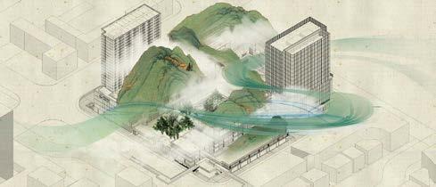
■ The design concept is set as: PINGHE VALLEY, SHANSHUI SCHOOL. It aims to create an open, inclusive, diverse and equitable campus with inspiring landscapes.
■ The design fully respects the natural conditions of the site, and uses the design thinking of building and landscape integration to form a dialogue between landscape and nature.
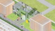
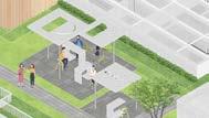
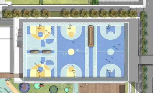
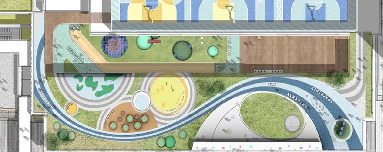
■ This design area mainly includes: comprehensive gymnasium - SPORT PEAK, roof garden - DREAM PEAK, sunken courtyard - SMART VALLEY, and kindergarten areaCHILDISHNESS VALLEY









PROJECT NAME: SAMPLING HEALTH INDICATORS FOR EQUITY IN LOWER-INCOME DISTRICTS
LOCATION: MANCHESTER, HOUSTON
KEY WORDS: INDUSTRIAL POLLUTION, GREEN BUFFER, RESIDENTIAL RETROFIT, OPEN SPACE
TYPE: INDIVIDUAL FINAL STUDY
INVOLVE TIME: SEPTEMBER, 2018
RESPONSIBLE: GIS DATA COLLECTION + MASTER PLAN + INFOGRAPHIC DIAGRAM + SCHEME MODEL

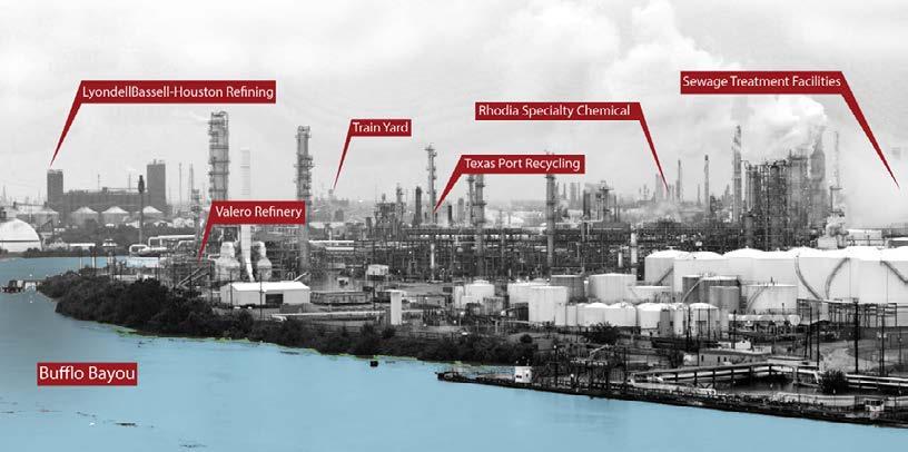
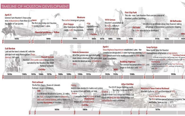
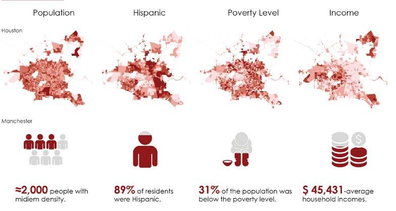
Houston's urban development, convenient rail, and high-speed transportation have all benefited from the oil industry, but over time, the industry's development has brought serious damage to the environment.
SITE INVENTORY


LAND CONDITION

causing toxin. If isfound


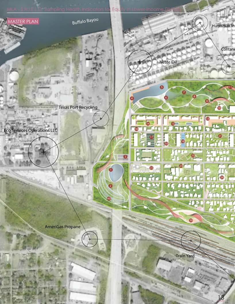
The large red dots show where large concentrations of benzo pyrite was found, a major cancer
where many of the sinks in the topography are located.

DESIGN SCHEMATICS

POTENTIAL DISEASE HAZARD
This Sankey diagram shows that a large number of toxins come from the industry and affect various biological systems. Even shortterm exposure can lead to various uncomfortable reactions. if human exposure to such an environment for a long term can cause various cancers

POLLUTION DECREASE


SHIELD - HIGHWAY UNDERPASS


OVERALL IMPACT

SHIELD - LINEAR RAILWAY PARK
PROJECT NAME: A DYNAMIC HYBRID OF CITY AND NATURE, NAXI COUNTY IN LUZHOU
LOCATION: LUZHOU, CHINA
KEY WORDS: URBAN RENEWAL, ECOLOGICAL TOURISM, MIX-USE COMMUNITY
INVOLVE TIME: SEPTEMBER, 2017
RESPONSIBLE: CASE STUDY + SITE ANALYSIS + INFOGRAPHIC DIAGRAM + PERSPECTIVE RENDERING

MLA - A DYNAMIC HYBRID OF CITY AND NATURE, NAXI COUNTY IN LUZHO U
BACKGROUND PLANNING VISION

POTENTIAL USERS
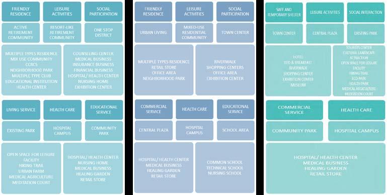
Our mission is, “to design affordable community housing and healthcare services for the elderly, amidst sustainable socio-ecological landscapes that attract tourism and foster job opportunities.”

Depend on site analysis and researches, our potential users will be elderly people, other residents and tourists. For elderly people, local elders, home returning people, migrating people and elders from working population families are characters in this group. For other residents, graduates, local population and migrating labor force may be attractive by our site. The last group is tourists, different ages has different need, we need to consider about it. Below are requirements from these three groups, proper facilities or places will be applied in design.


SECTION - INDIVIDUAL PART
LEGENDS
01. MAIN ENTRANCE
02. PARTERRE
03. WALKING TRAILS
04. SHENG TERRACE
05. ARC GALLERY
06. TREE POOL
07. HIGHWALL TRAIL
08. DISPLAY PLAZA
09. MUSIC BACKGROUND WALL
10. STAIRS GALLERY
11. GREEN HEDGE
12. WALKING TRAILS
13. RETENTION TERRACE
14. DOG PARK
15. RETENTION POND
16. RED BRIDGE
17. FARMING STORE & MUSEUM
18. VIEWING PLATFORM
19. FARMING STORAGE
20. WATER TOWER
21. TERRANCE FARMING
22. LINEAR FLOWERING
23. HOTEL
24. MOBILE VENDORS
25. PARKING LOTS
26. FLOWER SCAPE
27. RETENTION WALL




Grass Grass Water
Culture Brick
Cement Asphalt


PROJECT NAME: REFORESTATION AS A TOOL TO MITIGATE FLOODING
LOCATION: LEAGUE CITY, HOUSTON
KEY WORDS: URBAN REGENERATION, VACANT LAND DEVELOPMENT, PLANTING FORMAT
INVOLVE TIME: FEBRUARY, 2017
RESPONSIBLE: INFOGRAPHIC DIAGRAM + PERSPECTIVE RENDERING + SITE GIS ANALYSIS
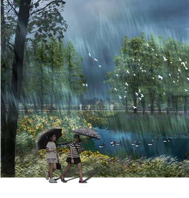
As for the coastal city, League City has a great threat to sea-level rise. At the same time, as trees are reduced year by year, the increase in more impervious areas has increased the possibility of floods. According to the research, half of the cities in 50 years have been submerged in the sea. This situation is not optimistic.
PERSPECTIVE - WETLAND PARK

PROBLEM STATEMENT


SEA LEVEL RISE
United States League City Site Area: 97 acres
“Rapid Urbanization Has Resulted In Massive Deforestation Giving Rise To Increasing Flooding.”


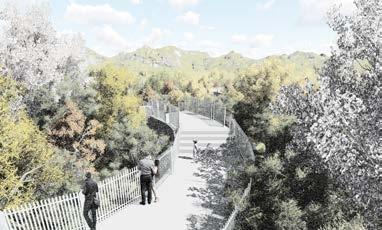
PERSPECTIVE - PEDESTRAIN BRIDGE


An AMPHIBIOUS HOUSE is a building that rests on the ground on fixed foundations but whenever a flood occurs, rises up in its dock and floats there buoyed by the floodwater.

HOUSING UNITS - AMPHIBIAN HOUSE TYPE 1
PERSPECTIVE - PERSPECTIVE TERRACE

MLA - REFORESTATION AS A TOOL TO MITIGATE FLOODING
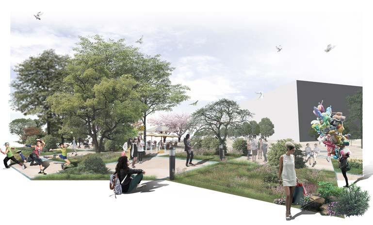
PERSPECTIVE - COMMERCIAL PLAZA
HOUSING UNITS - AMPHIBIAN HOUSE TYPE 2
An AMPHIBIOUS HOUSE is a building that rests on the ground on fixed foundations but whenever a flood occurs, rises up in its dock and floats there buoyed by the floodwater.
STORAGE SPACE/ GREEN HOUSE


PLANTING STRATEGY

PLANTING PATTERN


PROJECT NAME: ECOLOGICAL GOVERNANCE PROJECT OF SUQIAN CENTRAL PUBLIC PARK
LOCATION: SUQIAN, CHINA
KEY WORDS: URBAN INTERNAL REVIER TREATMENT, COMMUNITY PARK
INVOLVE TIME: MAY, 2015
RESPONSIBLE: CASE STUDY + SITE ANALYSIS + PRELIMINARY DESIGN ON TRACING PAPER + HAND DRAWINGS

BLA - ECOLOGICAL GOVERNANCE PROJECT OF SUQIAN CENTRAL PUBLIC PA
LOCATION

Suqian is adjacent to Xuzhou in the north and Nanjing, Shanghai and Hangzhou in the south. The traffic in Suqian is very convenient, and the waterway trunk line extends in all directions.
The Beijing-Hangzhou Grand Canal runs through the north and south, and the Beijing-Shanghai Expressway passes through.
SURROUNDING SITUATION

The design project is located near the tributary of the Beijing-Hangzhou Grand Canal. The site is adjacent to the original industrial park, so it faces the pollution of industrial.
The park is designed to purify water and soil, protect the local natural environment, service local citizens and attract tourists.
SITE LOCATION

SITE PHOTOS
HYDROLOGY

TOPOGRAPHY


HOUSE VACANT LAND POLLUTED CANNEL INDUSTRIAL BUILDING


The image of a great city is largely derived from the quality of public spaces, that is, people's feelings about parks, plazas, streets, and markets. ------Cyrillic
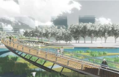
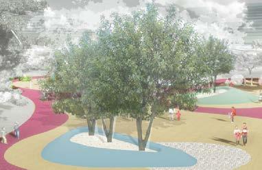
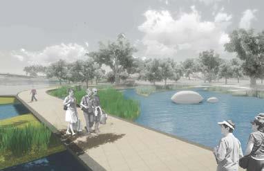
This plan will create an ECOLOGICAL AND CULTURAL OPEN SPACE through the construction of city level parks, and create a new image for the overall construction of the city. The planning site is adjacent to the residential area, and the function of the east area of the city should be improved to provide a space for citizens to enjoy leisure and entertainment, as an important ecological landscape display platform in the urban area.
MASTER PLAN

EMBANKMENT DESIGN


EMBANKMENT DESIGN


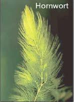

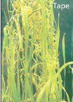
Figure 1. Functional Layout
Figure 2. Growing Plants
Figure 3. Refinement Masterplan
Atrificial Lake Bed Eco-matrix Stsyem
Diagram of Artificial Lake Ecological Purification System
Aquatic Plants Mixed Sand Base Submerged Plants Wetland Plants






Othrer WOrks
PROJECT TYPES: HAND DRAWING, COLORINGS, GOUACHE PAINTINGS, CLAY SCULPTURE, WATER PANITINGS, MARKER DRAWING, INTERACTION OF COLOR

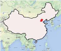


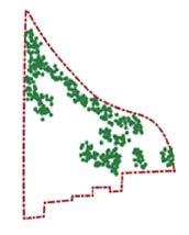
The project is located in Haidian district of Beijing city, China. It is a deserted area surrounded by all kinds of cultivate,residential areas and Xiyu River locatedin its northeast. The main idea of the design is to improve the environment, useing eco-logical cycle to purify sewage waterand beautify the environment.
SCHEME COMPARISON




DETAILS SKETCH DRAWING OF ECOLOGICAL FILTER

Red Beds
Aquatic Plant Wooden Walkway
Wooden Cushion Sewage
Red Beds
Red Beds Cleaning Water
HAND DRAWING - MASTER PLAN

HAND DRAWING - SECTION


OTHER WORKS - COLORED PENCILS & MARKERS DRAWING
COLORED PENCILS DRAWING

COLORING - MARKERS DRAWING

INTERACTION OF COLOR - CYANOTYPE VERSUS WARM


OTHER WORKS - GOUACHE PAINTING & MARKERS PAINTING
GOUACHE PAINTING

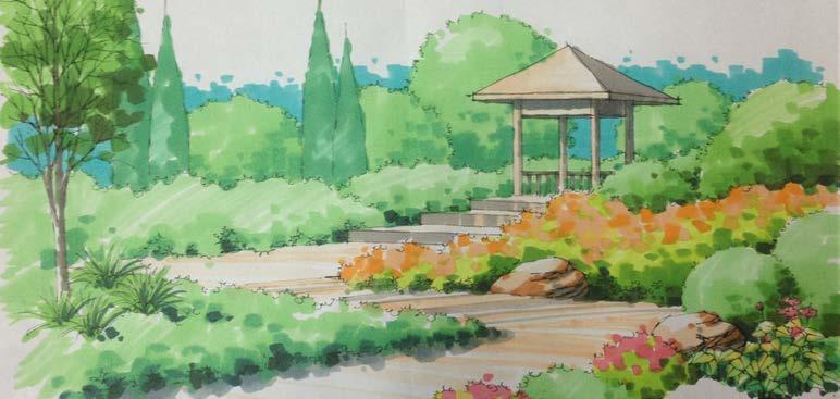
CLAY SCULPTUR - NATURAL LANDSCAPE GARDEN
MARKERS PAINTING

URBAN DESIGNER
MASTER OF URBAN DESIGN
MASTER OF LANDSCAPE ARCHITECTURE
+1(510)926 5736
TICKY_SHIH@BERKELEY.EDU/TIANQISHI0012@GMAIL.COM 685 LIBERITY SHIPWAY, APT 203 ALBANY, CA,94706
