
2 minute read
Solutions and Innovations


PADRE DAM DIGALERT SAVES RESOURCES & HELPS PROVIDE TIMELY INFORMATION
By Kristin Withrow, CSDA Communications Specialist
TECHNOLOGY AWARD WINNER AT 2021 CSDA ANNUAL CONFERENCE & EXHIBITOR SHOWCASE
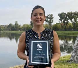
Padre Dam Municipal Water District in Santee received the first-ever CSDA Excellence in Technology Award at the CSDA Annual Conference and Exhibitor Showcase in September. This new award category highlights the use of technological innovation utilized by special districts to achieve operational efficiencies in their industry.
Padre Dam’s innovative new DigAlert application improved their response time when customers request utility location mapping before undertaking any project requiring them to dig. Using Geographic Information Systems to map underground utilities, they’ve integrated the information into their database and added it to a DigAlert Response Web Map. When an email request is received, the system automatically opens and pinpoints the request on an interactive map.
The map is available on a mobile app and includes measuring tools, enables photos to be added to a request, and includes a variety of map layers to aid the on-site staff member in assessing the location. These built-in layers allow staff on site to locate water, wastewater and recycled water systems separately or in conjunction with one another, while the base layer of the map allows them to see buildings and other structures and topography.
Prior to implementing their new system, the district would receive requests for clearing dig sites by email. Staff would print the requests and venture into the field to mark out utility areas. They would return to the office and transcribe their field notes into an email reply and catalog the notations as a manual print-out stored in a binder. The district maintained these filled binders for years to maintain their records. A single day of location marking requests could involve multiple trips from the site to the office as they were processed. With a service area spread over 73 square miles, the driving time could be significant!
Conversely, locations that are well out-ofrange of underground utilities can be cleared quickly and without a site visit from staff. Staff can now use color-coded symbology to prioritize and coordinate information requests.
Once marked, the electronic response is submitted through the DigAlert system which also makes a record of the notation and clearance that is stored for three years.
The DigAlert Response System saves Padre Dam staff time and enables customers to receive faster responses, while helping to meet all DigAlert requirements.


