1
Chae Yeon Woo
24 cwoo01@risd.edu
Rhode Island school of design
BARCH’
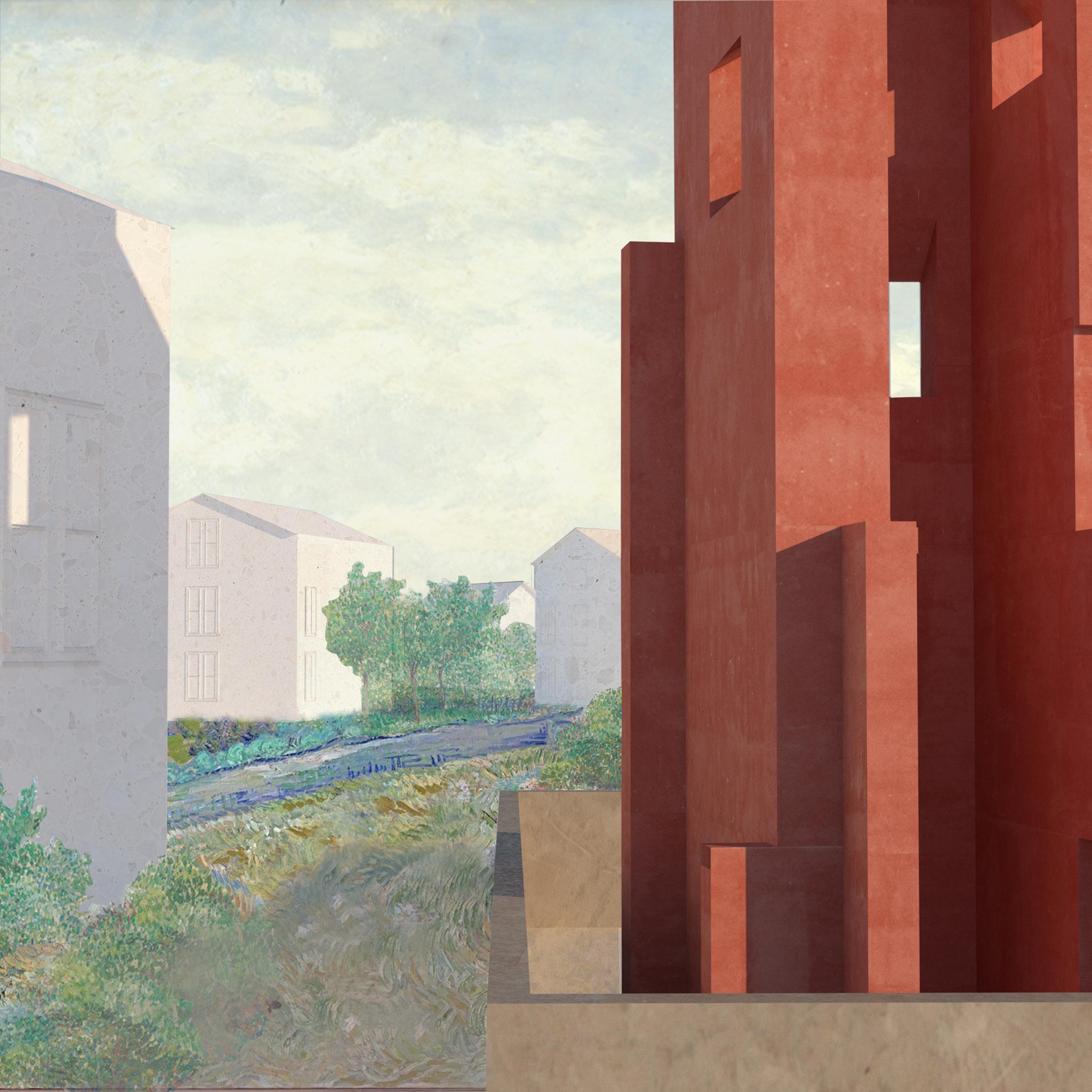
The essence of architecture, as portrayed in my work, unfolds through a meticulously materialized atmosphere and a profound embodied connection. These projects serve as a testament to my commitment to unraveling the intricate spatial narrative that defines the interaction among humans, nature, and the urban environment.
The exploration extends beyond mere design aesthetics, delving into the intricacies of materials, building systems, and the dynamic interplay within urban contexts. This portfolio encapsulates a journey of envisioning and shaping the landscapes where life unfolds in harmony with architectural ingenuity.
2
01
Crossing the city
Saint-Gobain’s 2023 Architecture competition, selected as one of four finalists in the US national stage
02
Cultivating new industry
Urban planning, Cultural, Sustainability
03
Water and the city Model making
04
Life with infrastructure
Conceptual, Residential, Urban Planning, Model making
3
Urban Apertures_Common Ground Research, Urban Planning
06
07
Professional experience 08 Integrated building systems What cheer flower farm
as a burrow Conceptual library design
05 Library
Crossing the city
Saint-Gobain’s 2023 Architecture competition
Finalist of US National Award
Individual project
Year: 2022 Fall, RISD
Course: Advanced Studio
Type: Residential, Cultural, Sustainability
Instructor: Jonathan Knowles
Location: Lisbon, Portugal
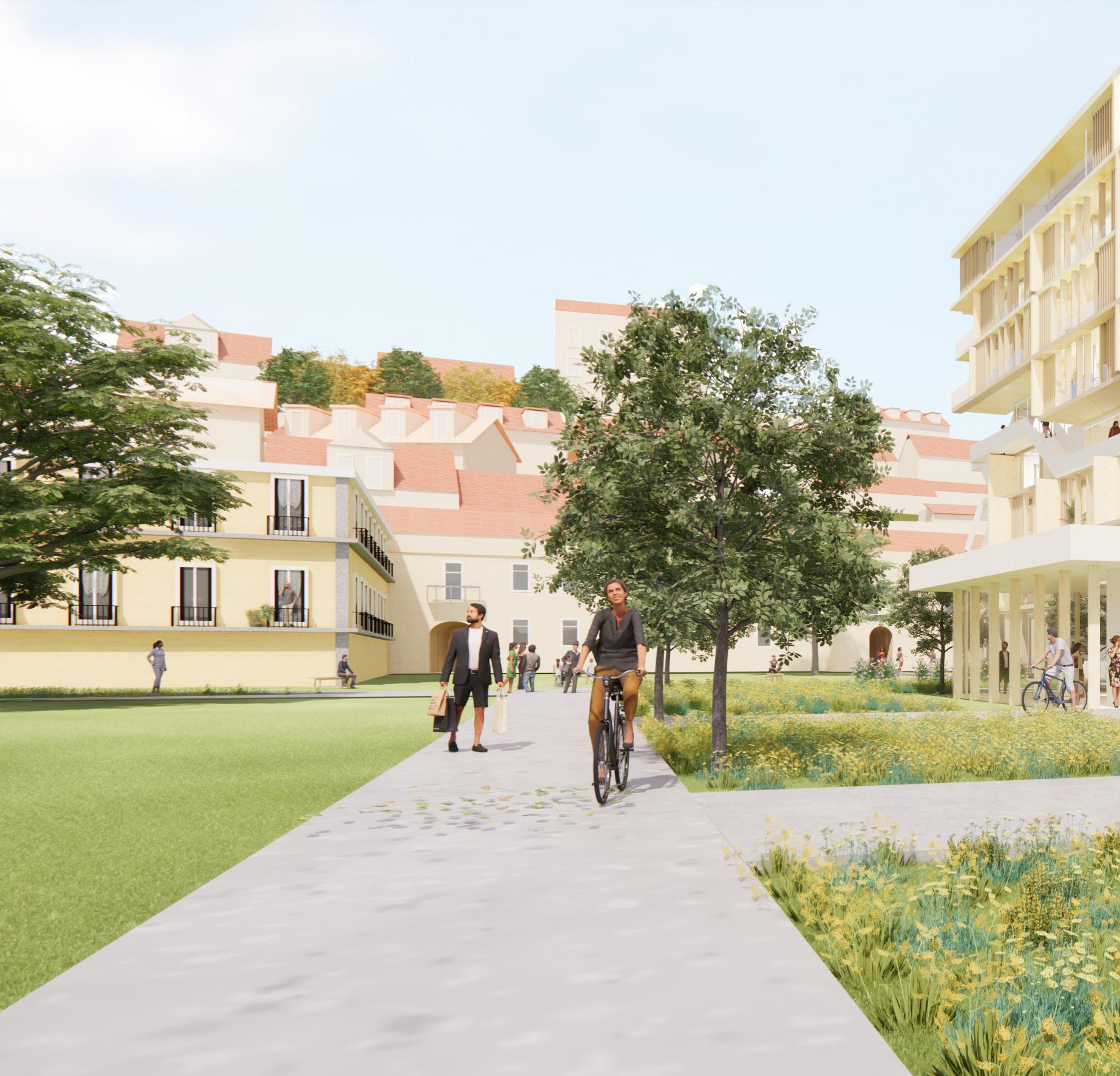
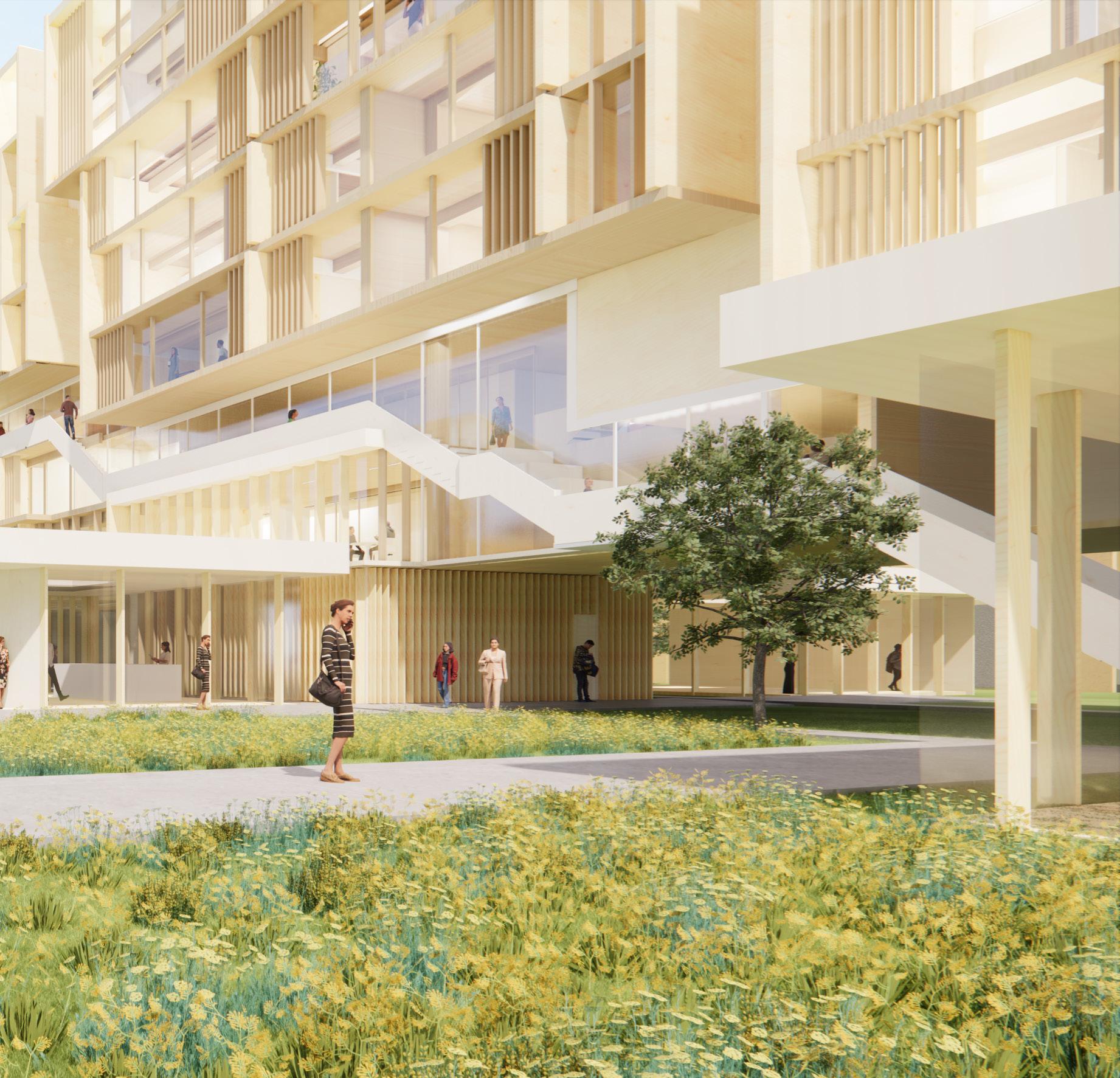
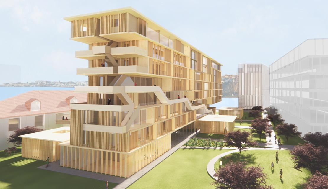
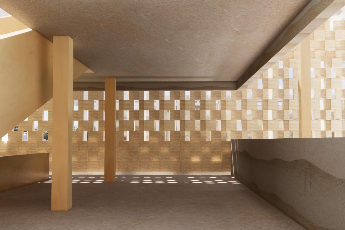
The main proposal is to revitalize public and clutural use of the original plot, close to Tagus river, by designing landscape and 8-story residential building and renovating an existing 3-story building to create new video library located in Lisbon, Portugal. Also, it aims to exhance the original urban context and offer sustainable living with the use of timber wood construction and minimal energy use.
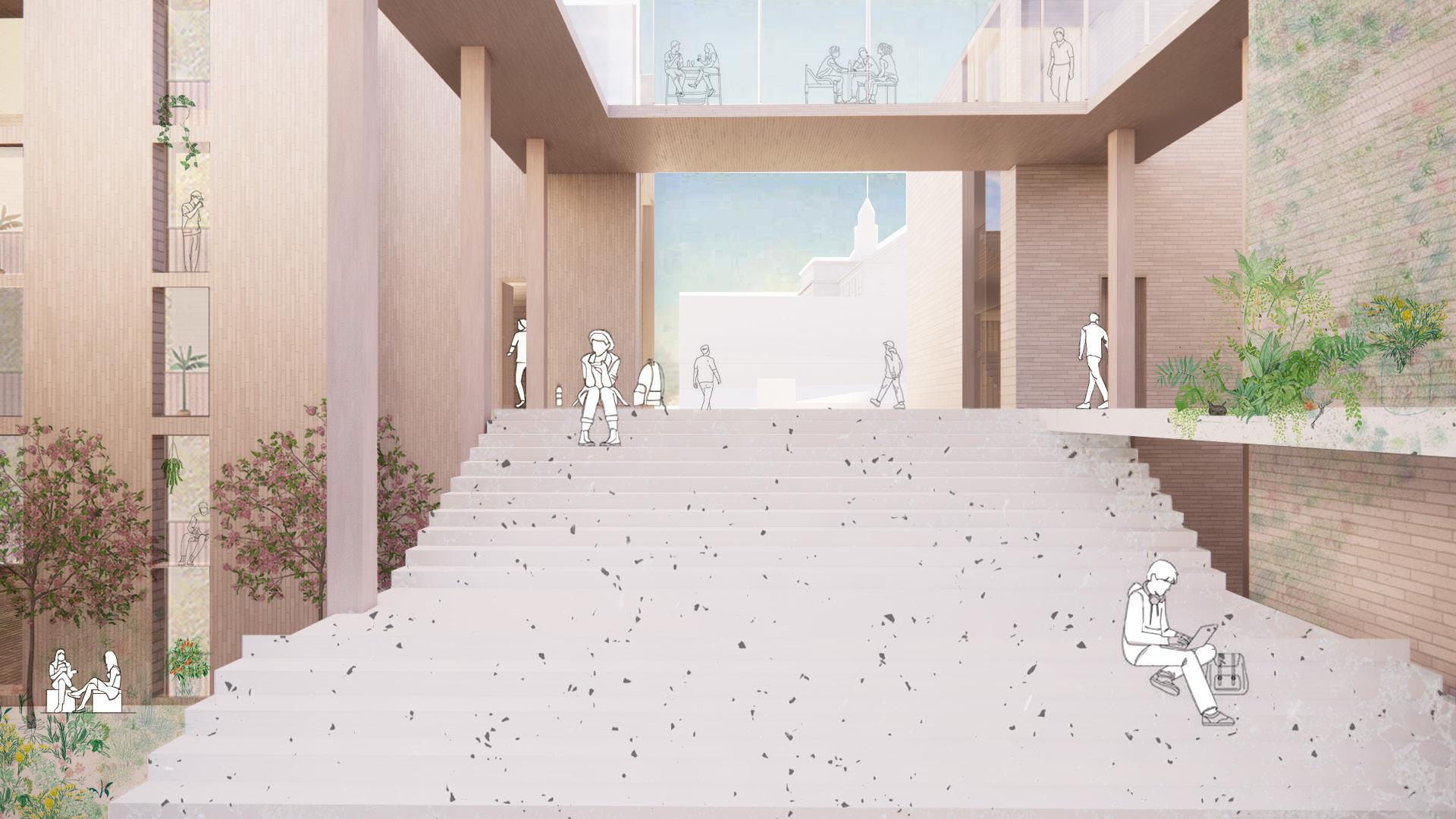
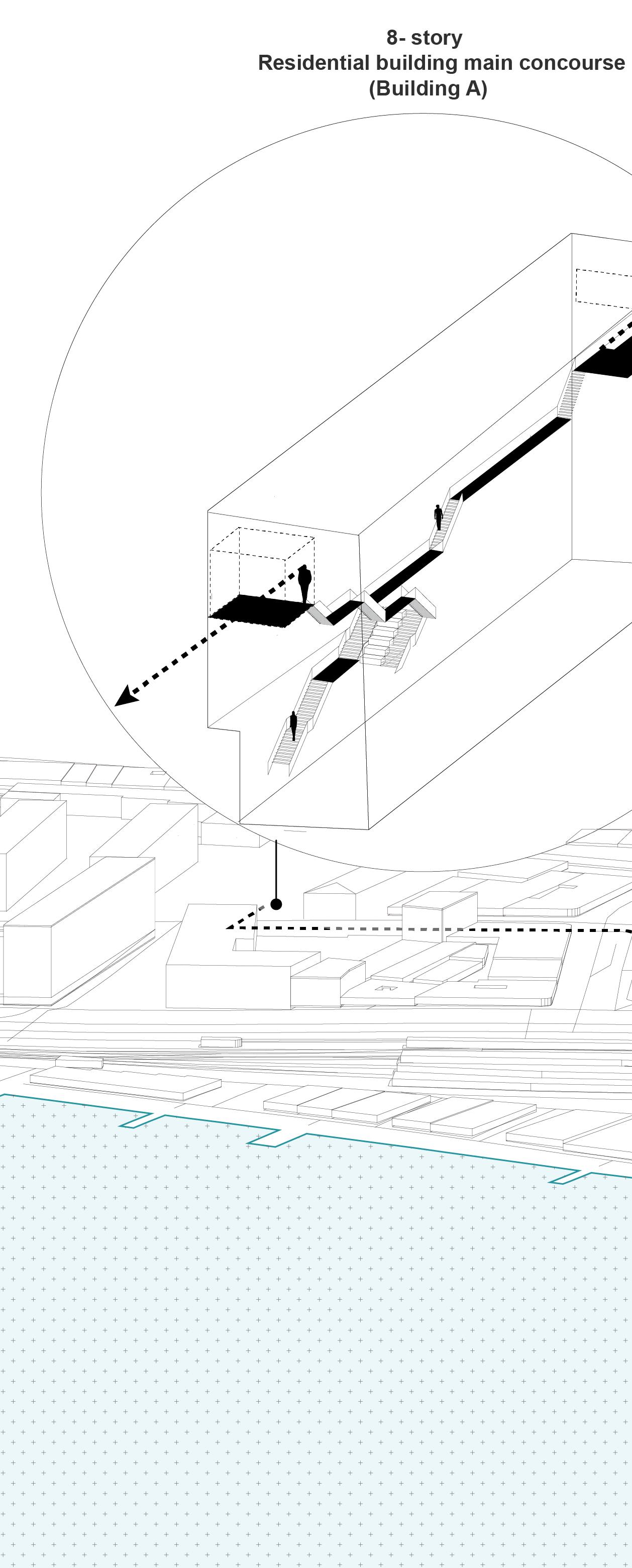
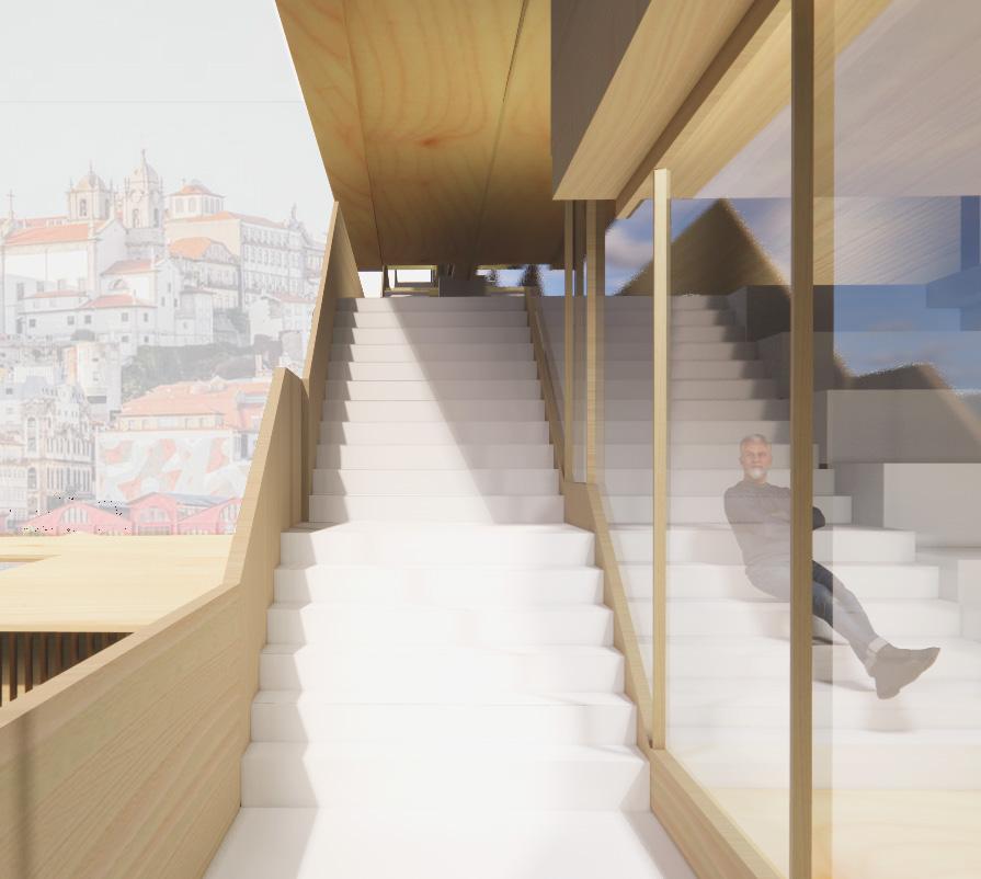
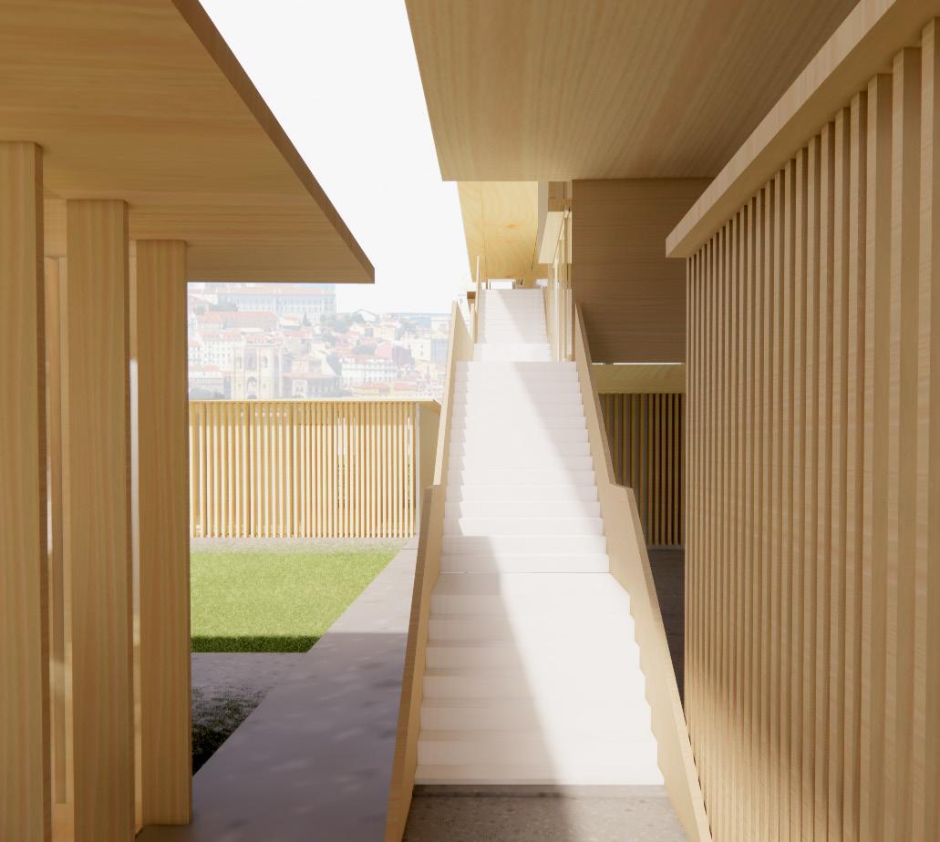
Considering these three design tasks as a newly built “campus” which will have an integrated networking and circulation system between them, the residential building has a public concourse, moving people up in order to encounter the different urban characteristics and settings of Lisbon – the Tagus river and the hillside topography.
4
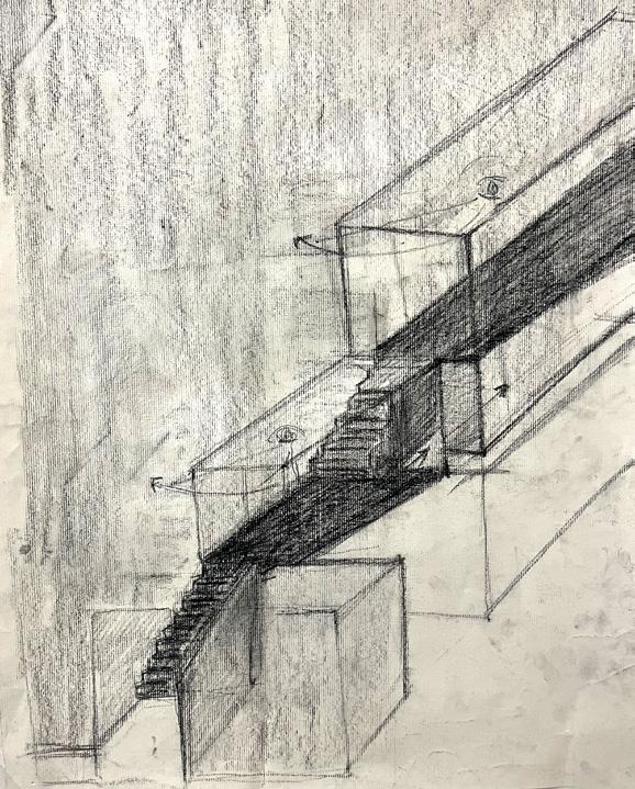
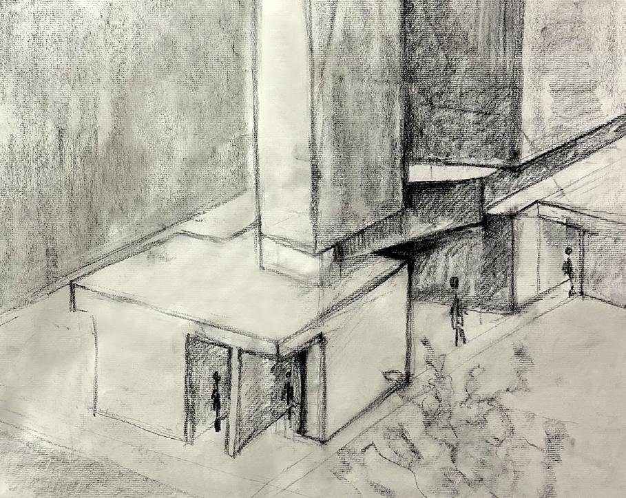
5 Initial concept charcoal drawings
Portugal, Lisbon
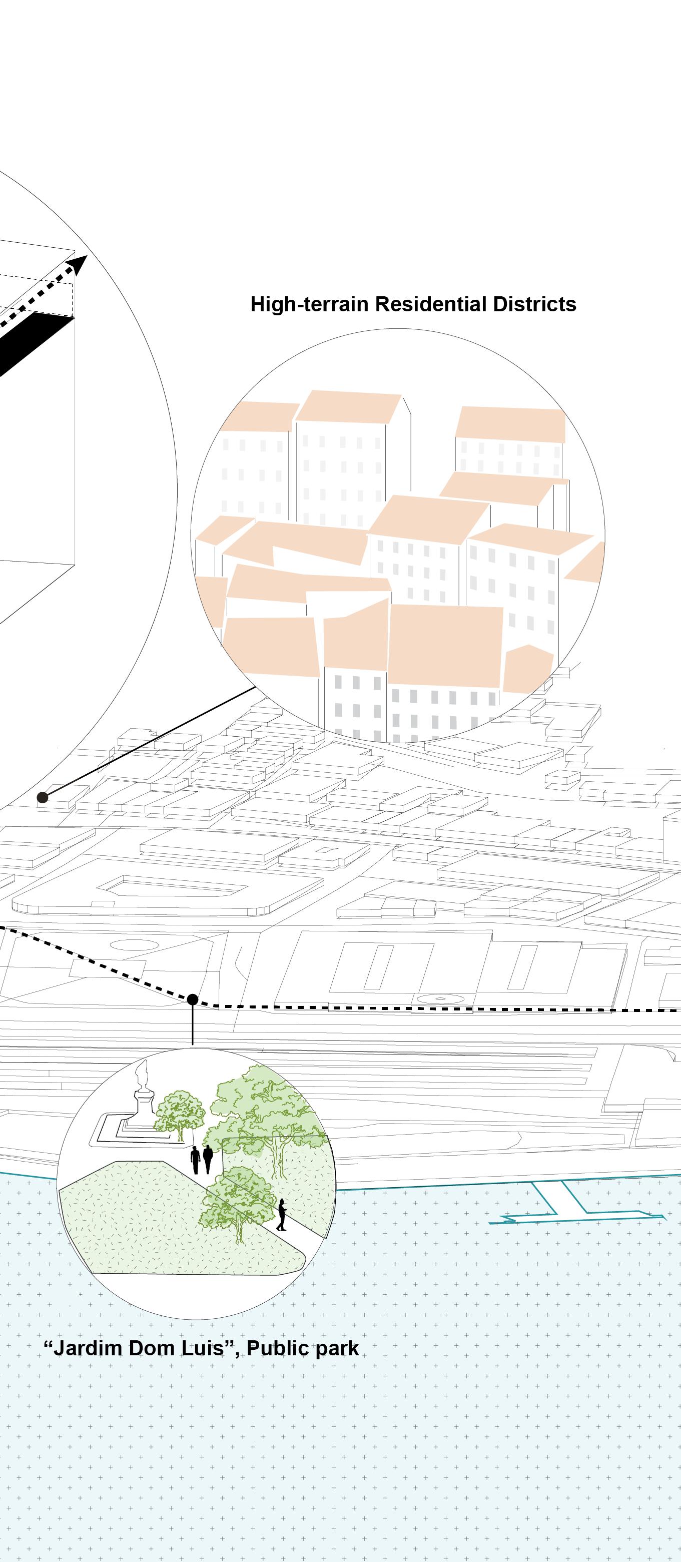
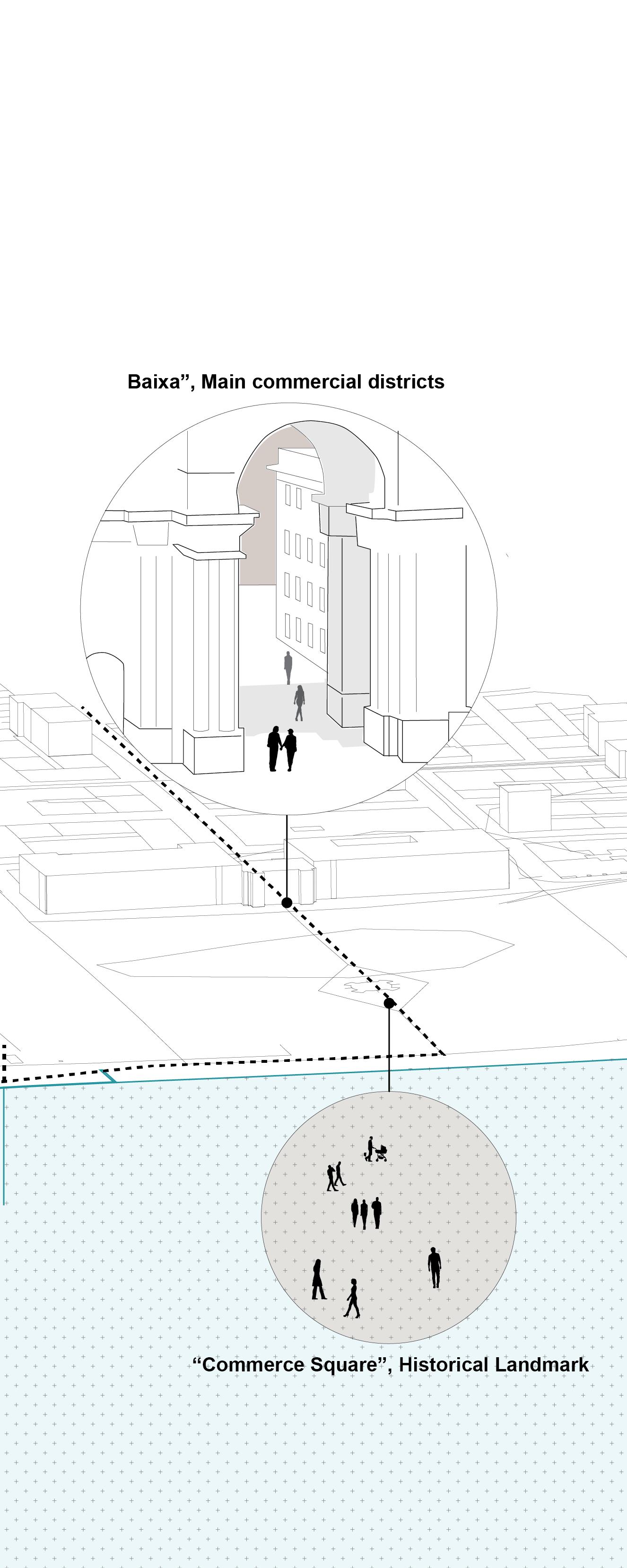
The site is located near the historical landmark, “Commerce square”, the main commercial districts, “Baixa”, and the higher-terrain residential districts. The residential building, renovated library, and urban landscape connects each of the distinct neighborhoods of the city and provides a new campus for Bairro Alto, a district where the site is situated on.
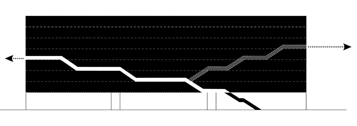
Urban context diagram (right) shows how the site communicates within the city, highlighting different movements of people in each different urban contexts and places. Extending these movements in the city to the residential building, the residents can sense of belonging to the city.
6
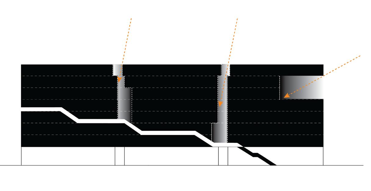
a. Diagram of circulation
b. Diagram of light
Site context diagram
View from the hillside topography
7
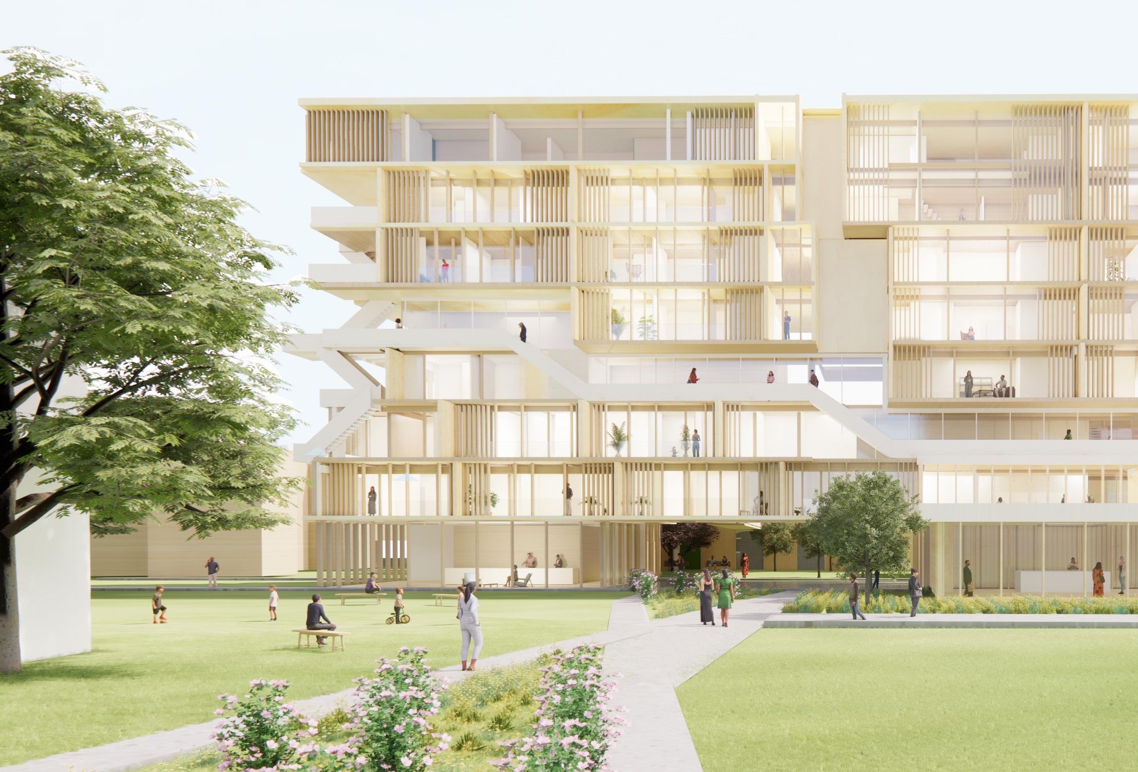
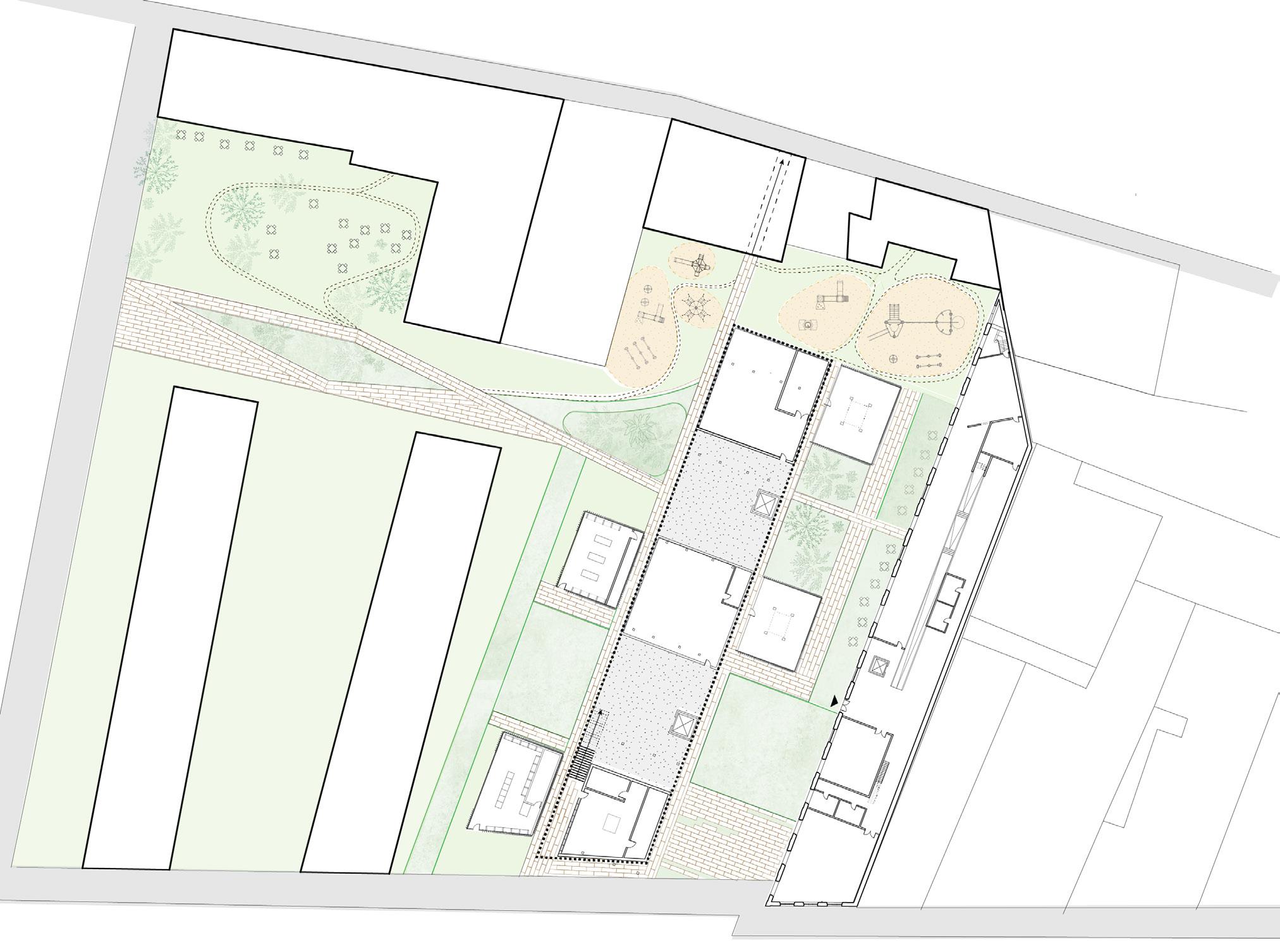
8 Building A (8- story residential building) Building B (Renovated Lisbon Audio Library) c. Kindergarten Rua da Boavista St. Praca Dom Luis I St. Kindergarten EDP Office building Hotel d e f f g h f f c. b. b. b. Masterplan a. a. c. Gallery d. Exhibition area e. Shop f. Restroom g. Cafe h. Auditorium b. Lounge a. Store Perspective view from view A
View A
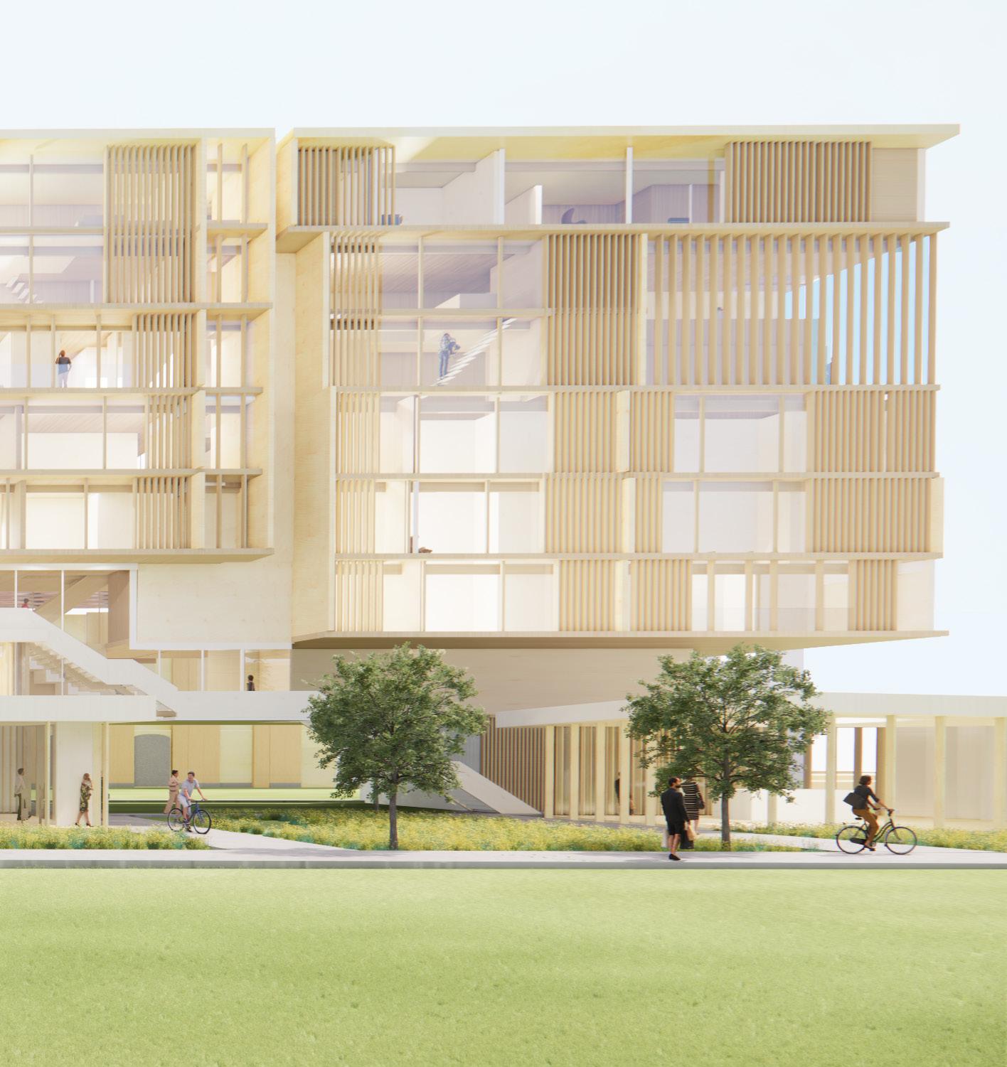


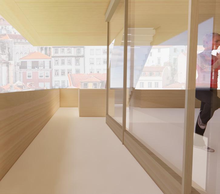
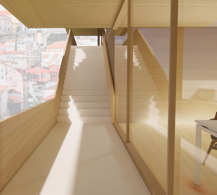
Sequences of main concourse


9
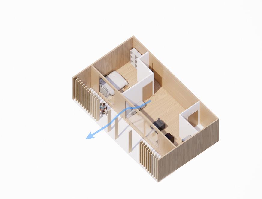
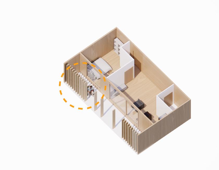
Providing Privacy Providing Privacy
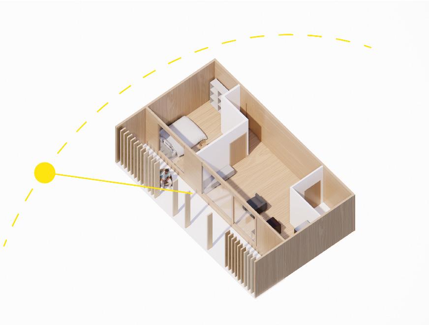
1. Sunlight protection
Balcony terrace
2. Natural ventilation
3.
Functions of facade
Residential Unit Types

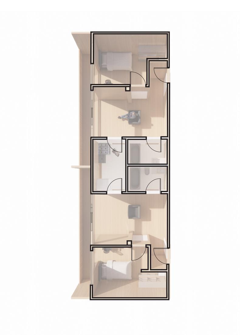
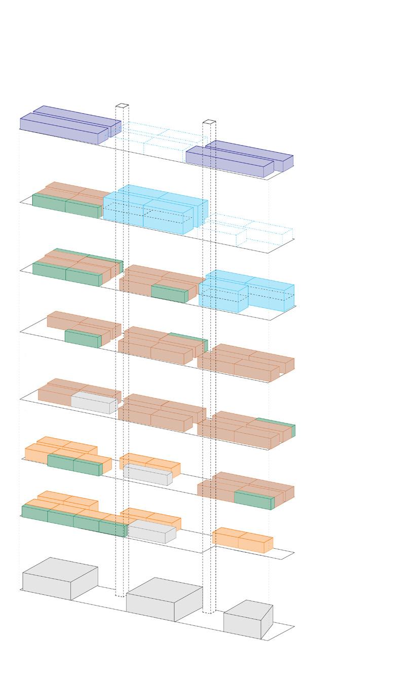
Co-living Units for two people with shared kitchen areas are for resident artists and workers in renovated Lisbon audio library located right next to the residential building. This unit types is mostly located on second floor so as to easily access to the library and public concourse of the residential building.

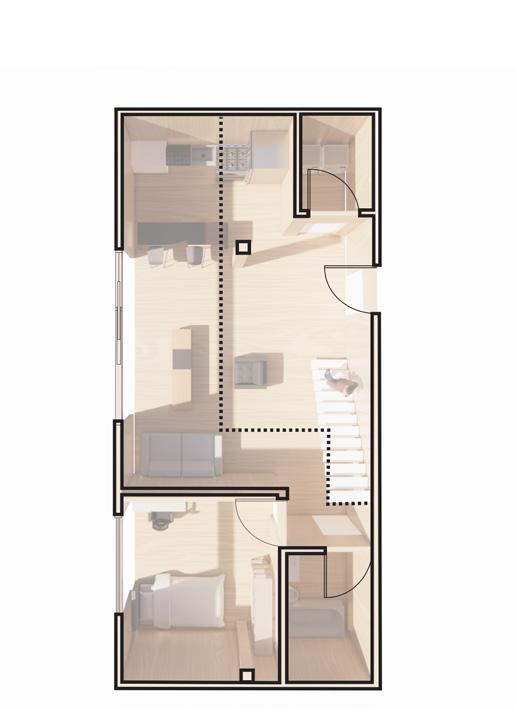
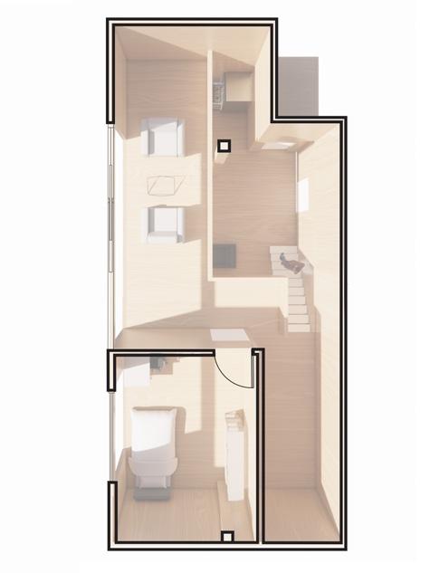
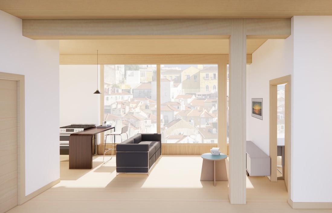

10 One bedroom Unit Co-living Unit Community area Balcony area Two bed Unit -2 Two bed Unit -1 Unit type diagram
c.
Two bed Unit -1
Gross floor area 49, 518 sf Co-living Units One bedroom Unit Two bedroom Unit 1,060 sf 540 sf 1,404 sf
d. Two
bed Unit -2
16 ft 53 ft
b. Co-living Units with shared kitchen
One bedroom
38 ft 15 ft 18 ft 40 ft 77 ft 18 ft Interior view Balcony view
a.
Unit
c.
b.
a. a.
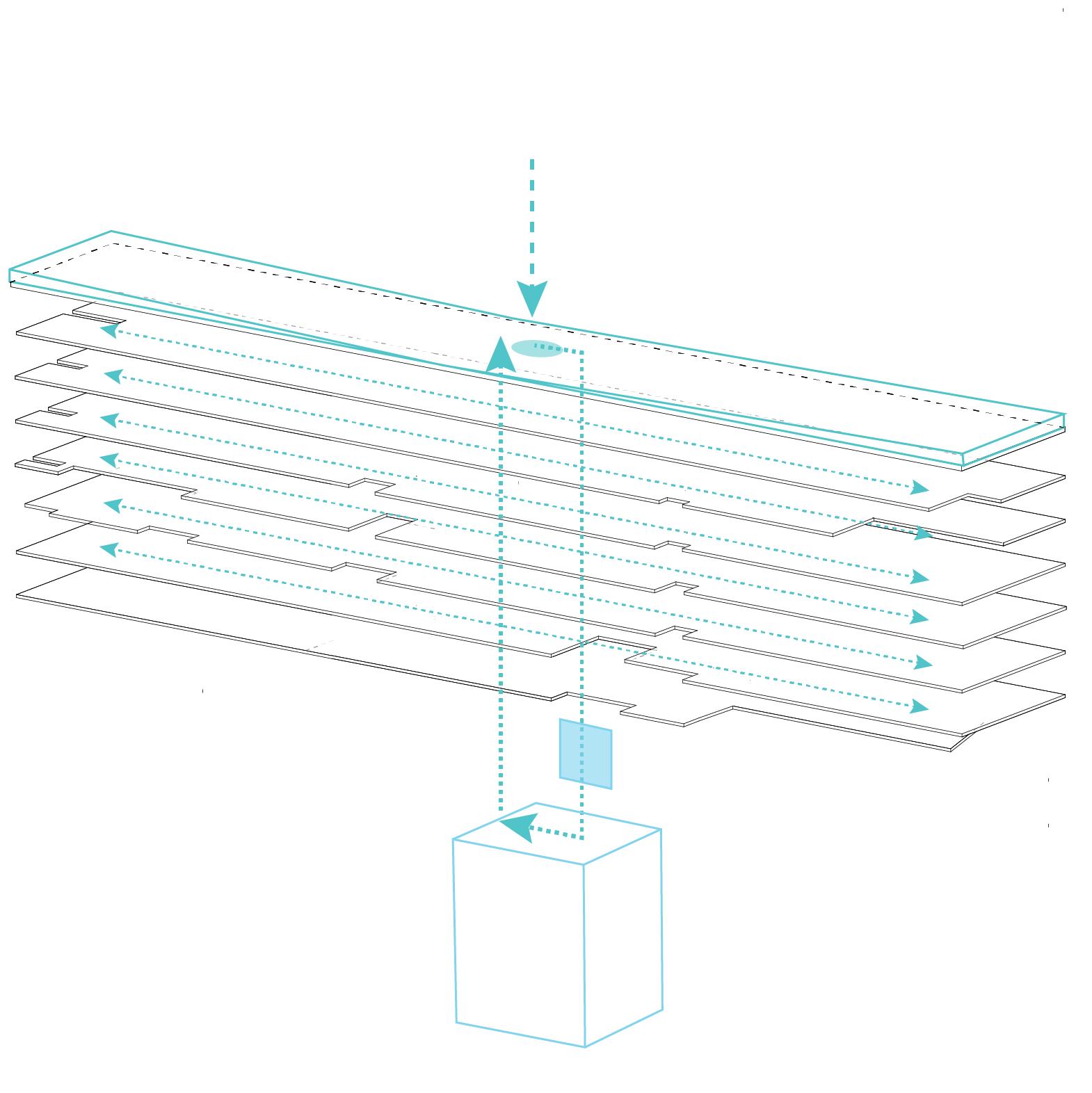
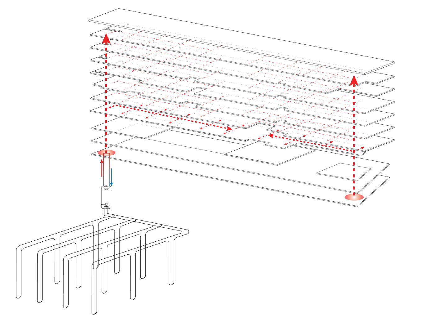
a. geothermal heat
b. heat pump
c. distribution system
a. rainwater collector
b. filter
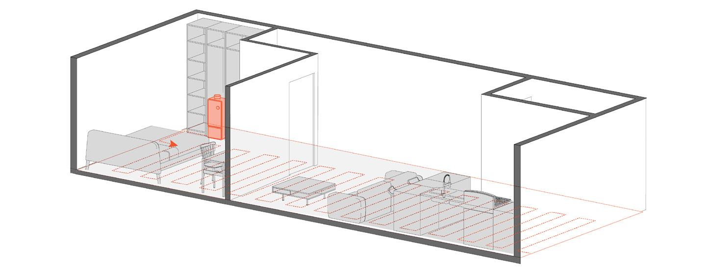
 A. On demand water heater
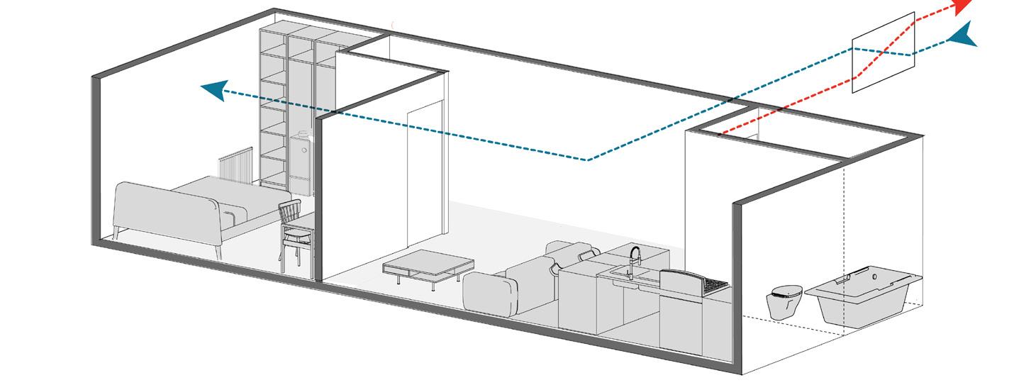
B. ERV- Air circulation
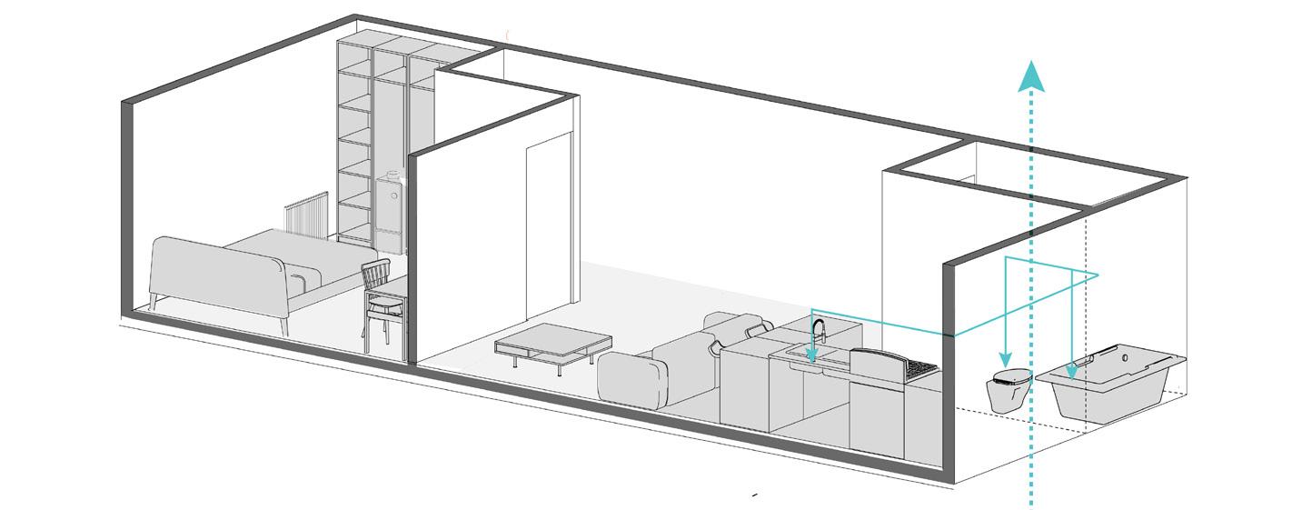
C. Rainwater reuse
c. rainwater storage
b. c.
Building systems


12 Residential Floor Plans 3rd Floor 4th Floor 256 ft 39ft N 5th Floor


Exterior wall (from exterior to interior):
Wood cladding panel 19.05mm
Wood stands 22mm
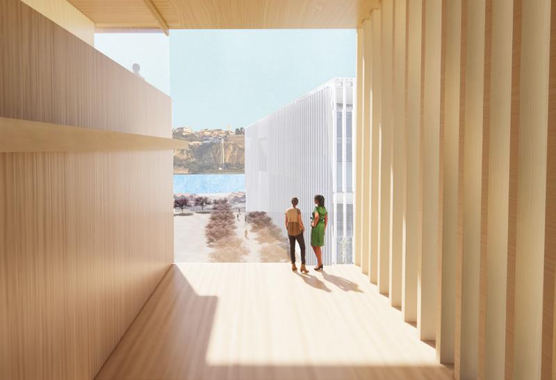
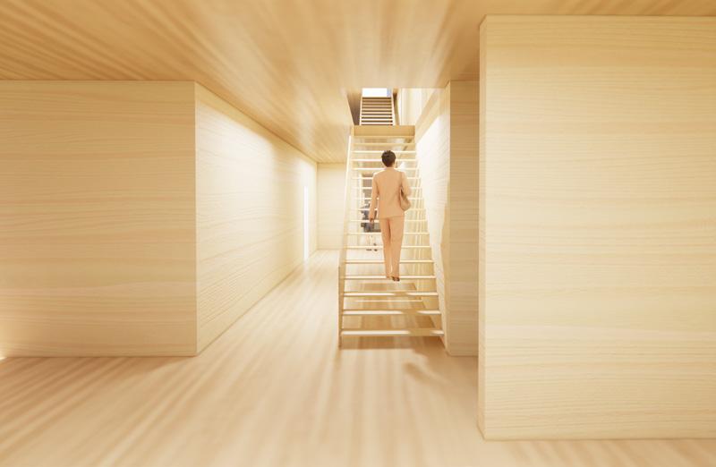
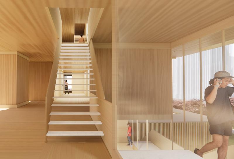
People can move toward to Tabus river using the circulation path in the corridor.
Detailed timber wall system
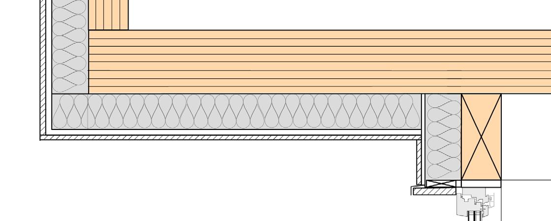
ISOVER stone wool 101.6mm
Waterproof membranes
CLT 5 PLY 174.625mm
R Value: 32
Balcony (Exterior) floor (from floor to ceiling):
Timber decking 25mm
Wood stands 22mm
Isover stone wool 101.6mm
Waterproof membranes
CLT 5 ply 174.625mm
ISOVER stone wool 101.6mm
Wood stands
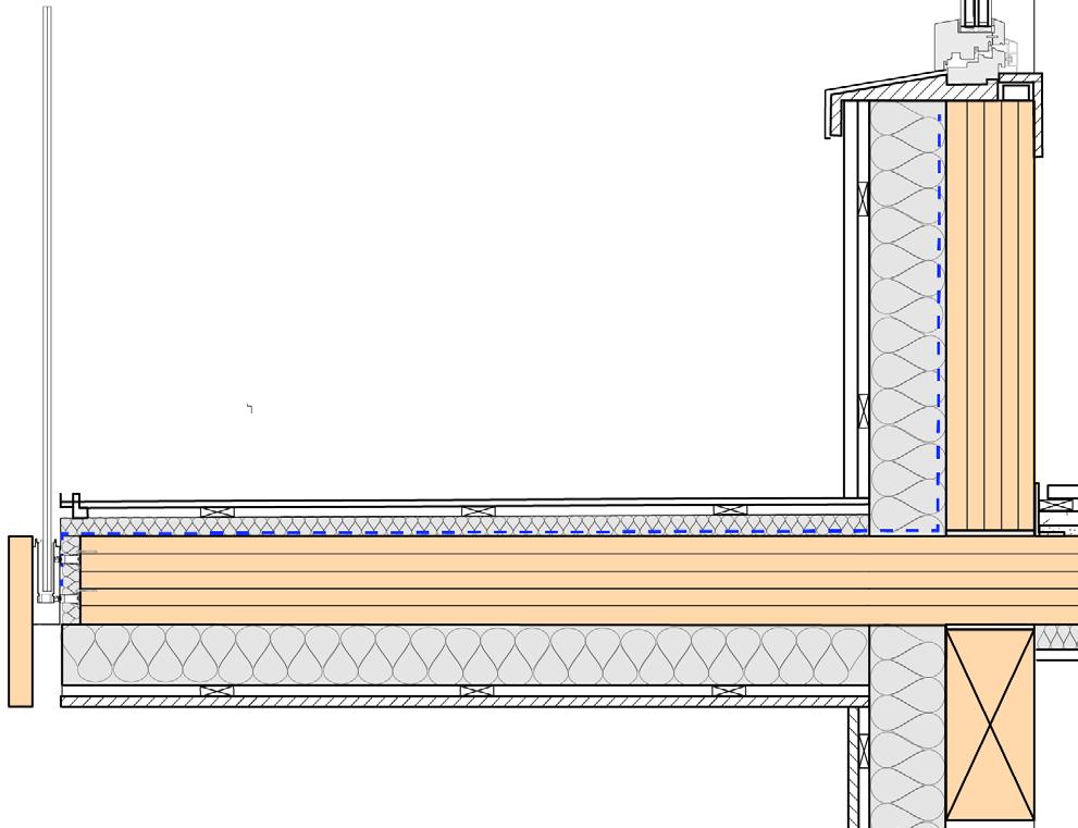
13 Exterior Wall: Wood Cladding panel 19.05mm Wood Stands 22mm ISOVER Stone Wool 101.6mm Waterproof Membranes CLT-5PLY 174.625mm R-Value: 32 Balcony Floor: Timber decking 25mm Wood Stands 22mm ISOVER Stone Wool 101.6mm Waterproof Membranes CLT-5PLY 174.625mm ISOVER Stone Wool 101.6mm Wood Stands Wood Cladding panel 19.05mm
in the residential public corridor 3rd Floor 4th Floor 6th Floor
Sequences

Residential Section Scale 1:200
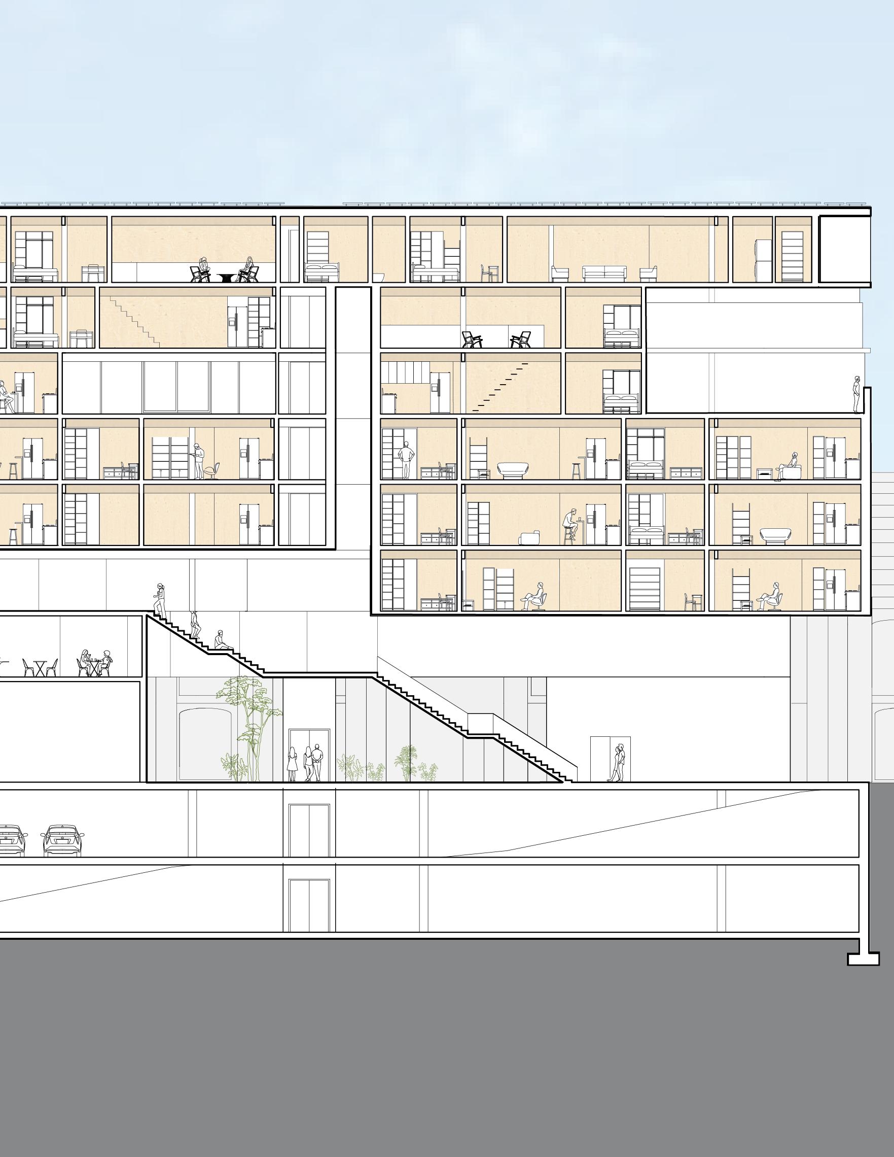
Renovated Audio Library
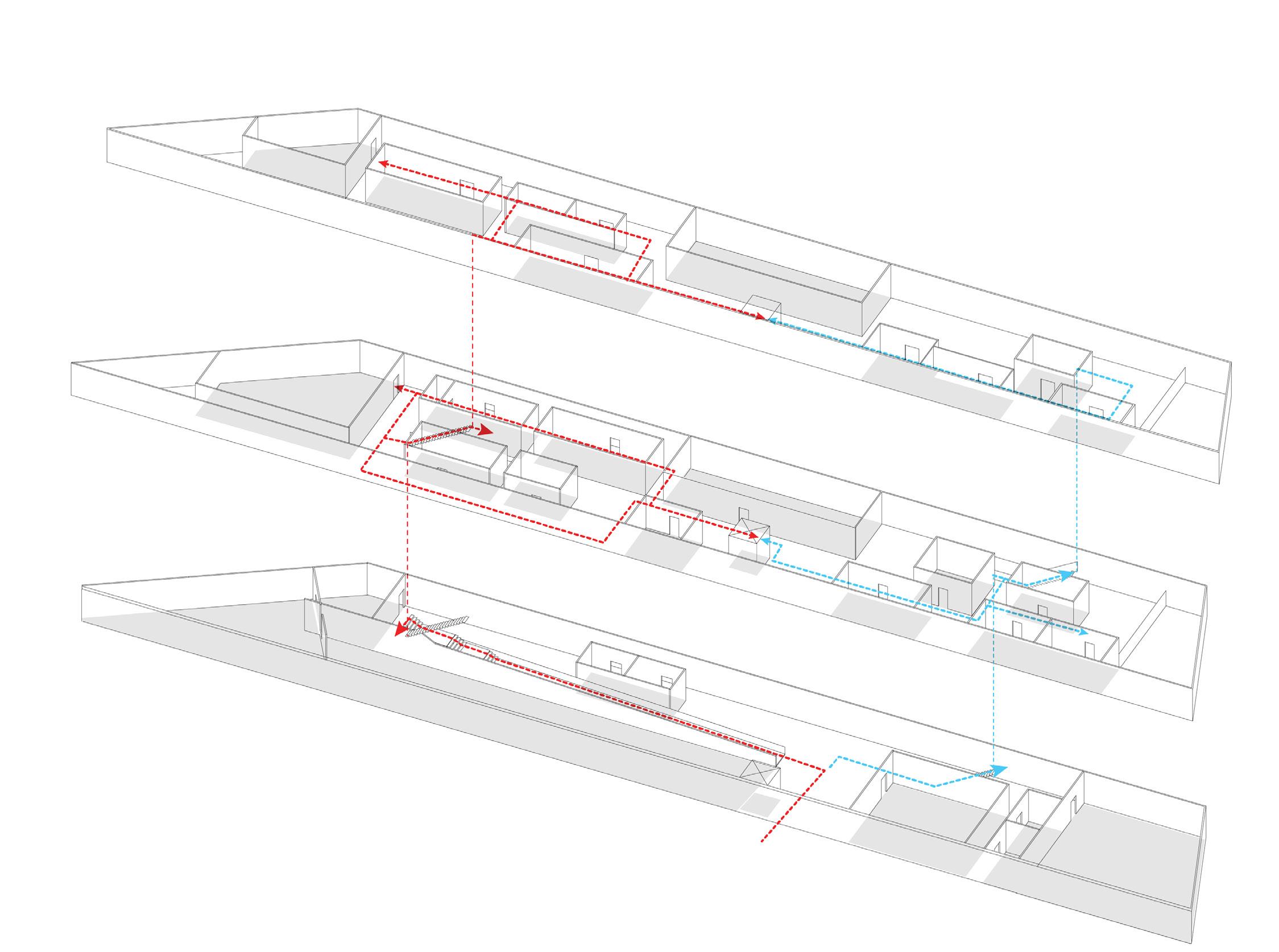
Circulations for visitors and resident artists
Circulations for workers and committee
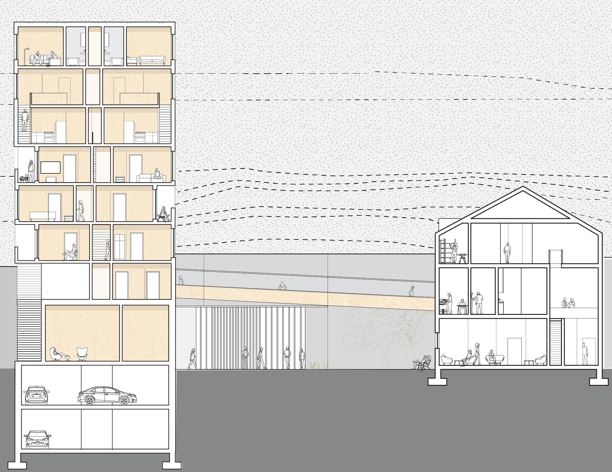
Section between residential building and audio library
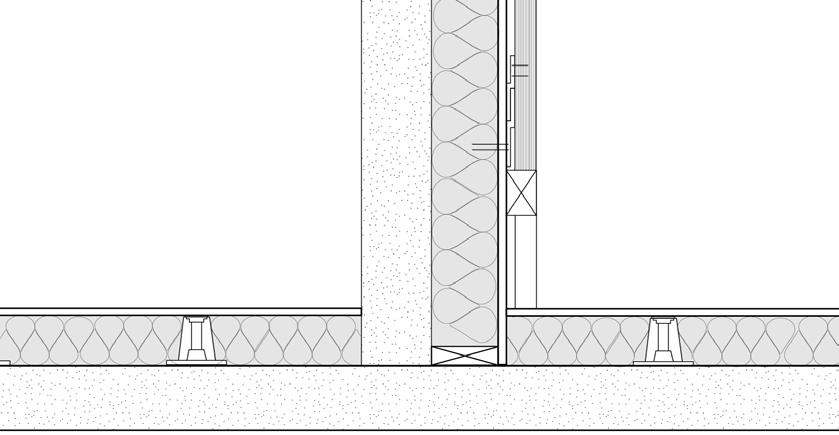
Detailed sound absorbtion wall for audio library
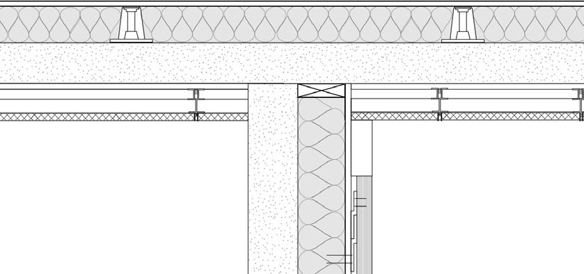
Ceiling (from top to bottom):
Decoustics sound panel
Grid of panel
Ceiling suspension system 50mm
Joint 3.175mm
Corridor wall: Existing concrete wall
1 2 3
Floor (from top to bottom):
Wooden floor
Glass mineral wool 158mm
Wallboard
Z-clip 38mm
Wood panel 50mm
Sound absorption wool 150mm
Vibration isolator
Existing concrete floor
16
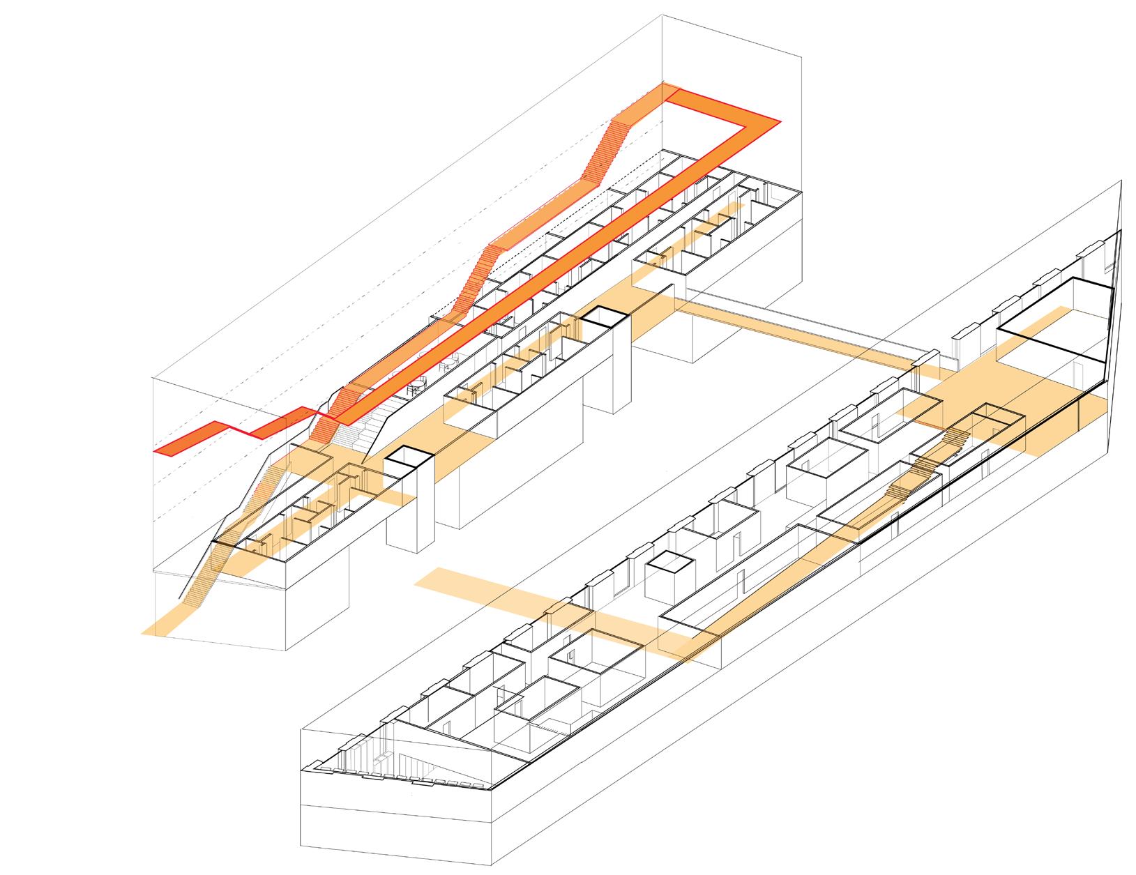
Public for resident artist & visitors
Private for residents
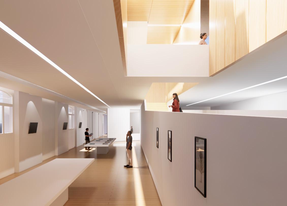
17 Integrated circulation between residential and library building
View from 1st floor exhibition hall
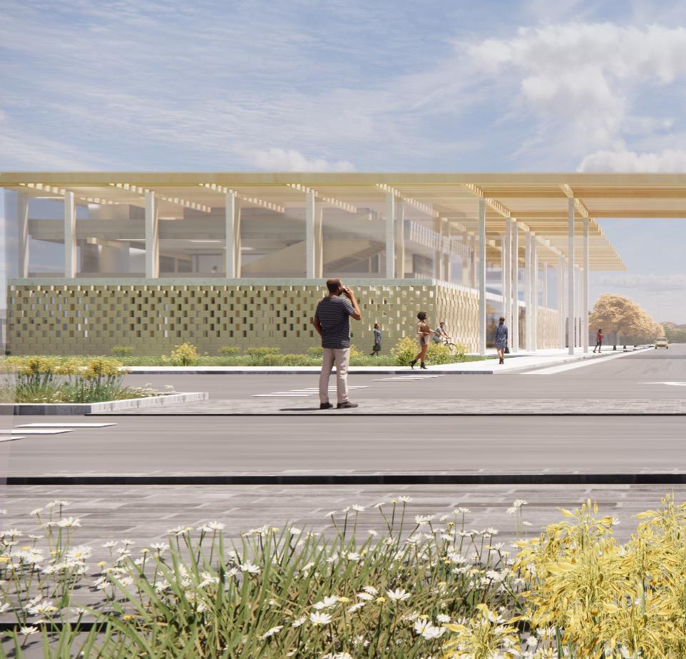
Cultivating new industry
Individual project
Year: 2022 Spring, RISD
Course: Envision resilience
Type: Urban Planning, Cultural, Sustainability
Instructor: Anne Tate, Laura Briggs
Location: Warren, Rhode Island
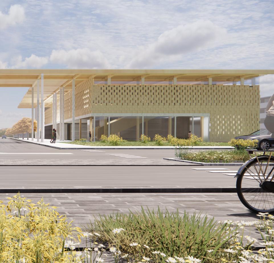
This project is to explore the challenges and opportunities of adapting to climate change along the coastal edge of Rhode Island, Warren, understanding the need to transition rapidly to a zero-carbon economy and to design for a future landscape which takes into account the changes we are already beginning to see.
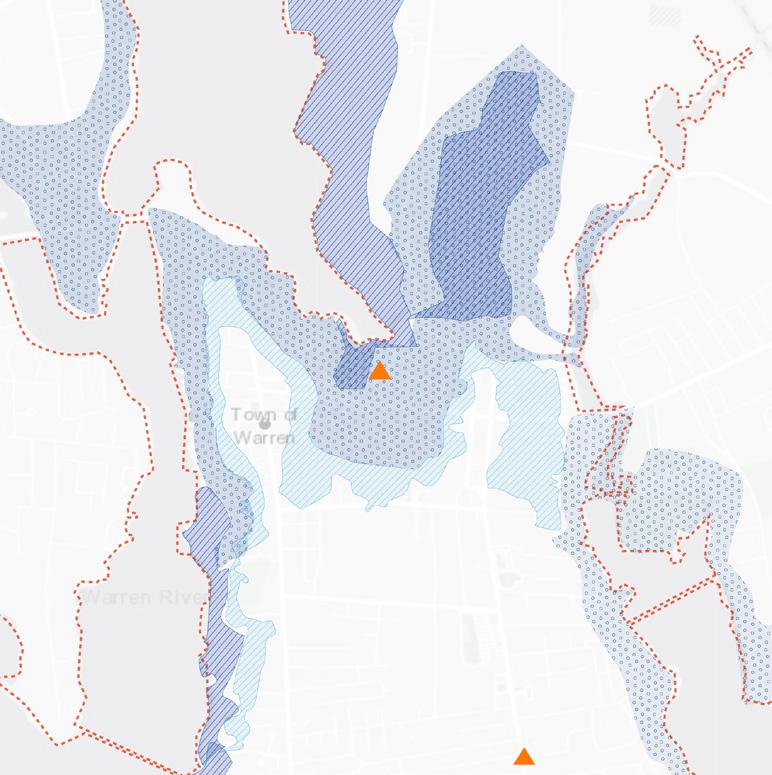
As the town has a plan to retreat from Market street, already highly vulnerable to flooding because of its near location, the ultimate goal is to design new urban models for densifying and transforming a commercial and residential strip into a vital urban boulevard, located on Metacom Avenue.
18
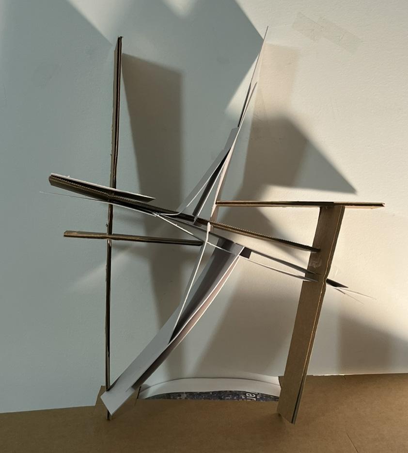
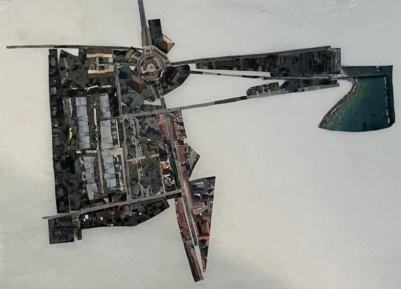
19 Conceptual site model Initial collage of proposed land use
These conceptual drawing methods(right) helped better understand of the site, Warren, RI. Finiding the main axis of the site, Metacom Avenue, and connecting other major points, including Market Street and Kickemuit river, I could start to imagine the future possibilities of the site.
Migration From Market Street to Metacom Avenue
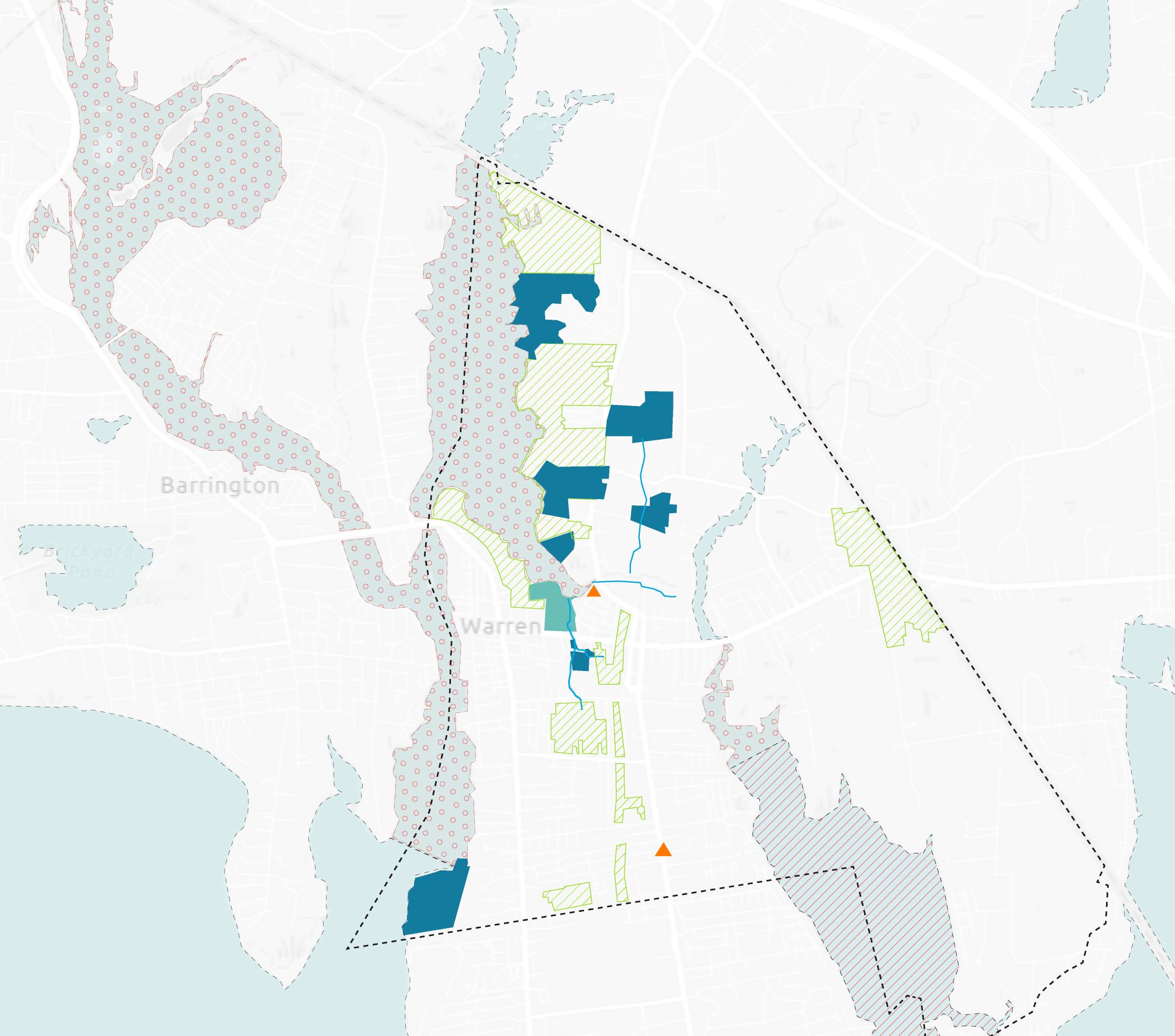

Wetland area
Prohibited shellfish harvesting area
School house road
Small bay area_Belcher’s cove
Market street
Wetland area
Metacom avenue
Salt marsh area
Shellfish harvesting/management area
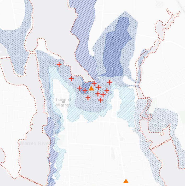

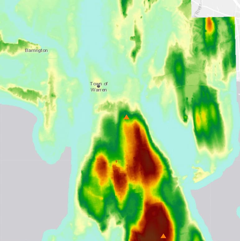
Metacom Avenue (RI Route 136) retail/commercial corridor is on higher ground than Market street. So, the town of Warren initiated a future plan for migrating existing residents to Metacom avenue due to frequent flooding issues.
20
land and sea 1 Area of
Existing
Warren
Flooding impacts in 2050 2 Structural damage due to flooding 3 Elevation of the land 1 Main factors of migration from Market street to Metacome avenue 2
Boundary of sea Flood depth <2 ft 2 ft-6 ft 8 ft-10 ft High: 811.796 Low: -8.797 Possibility of damage Conservation area Public green spaces
Proposed masterplan of Metacom Avenue
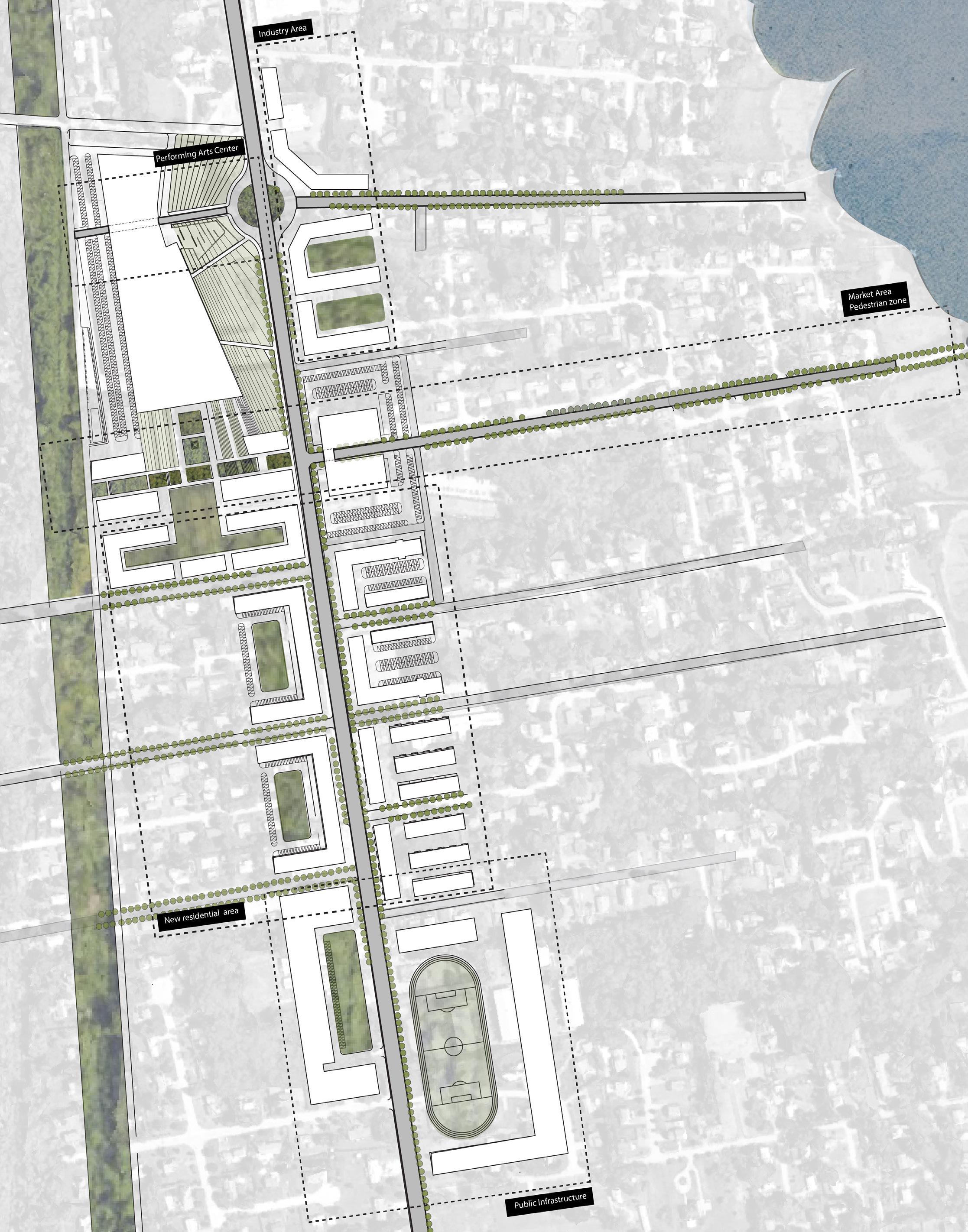
For reassembling the original communities respectively into a lively, attractive, dynamic, and integrated district, the proposed zoning shows a strong set of east west connections, linking the communities of the historic downtown on Main street, with the new town center on Metacom Avenue. And that new district connects to its own waterfront along the Kickemuit River, with a new Fish Market at the intersection with Metacom.
21
Fish market area/ pedestrian zone
Community arts center
Industry area
New residential area
Public infrastructure
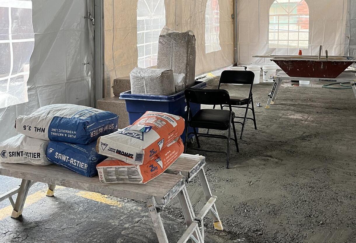
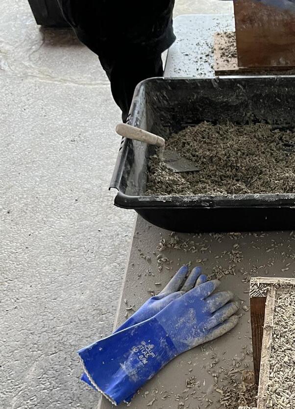
These collection of images show the process of making hempcrete blocks, a future-rising sustaible I learned the overall proportions of mixtures and materials for making hempcrete, including lime and
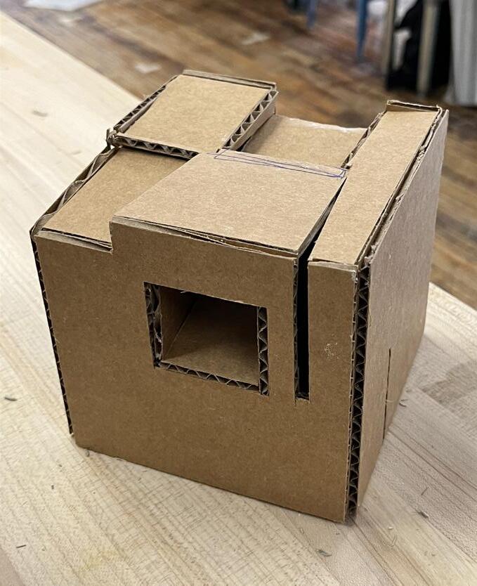
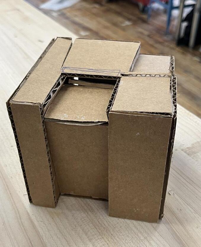
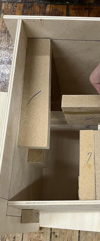
For better understanding of its material and properties, I made 12”x12”x12” hempcrete block, considering After creating several iterations, the hempcrete block represented three dimensional urban fabrics/patterns
22
Envisioning future building material;
Hempcrete
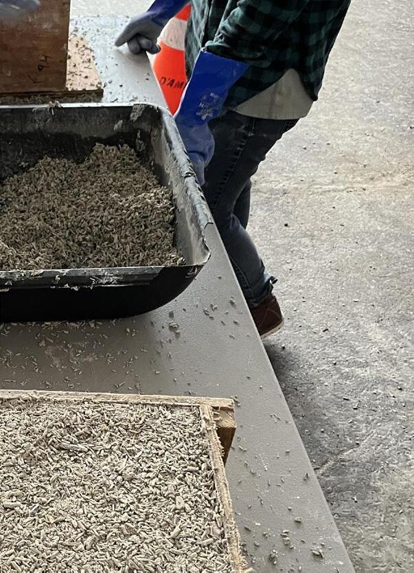
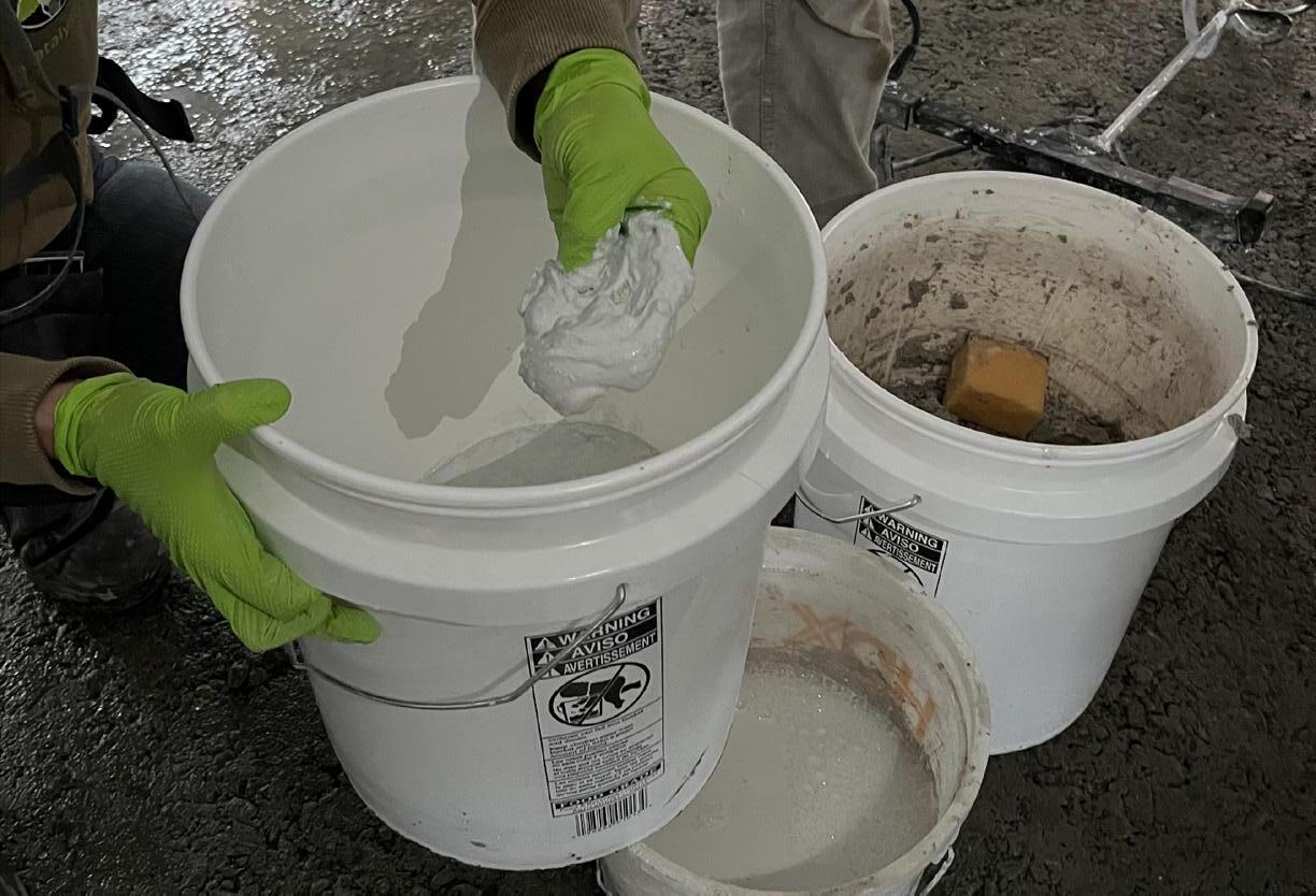
sustaible building material. and water.
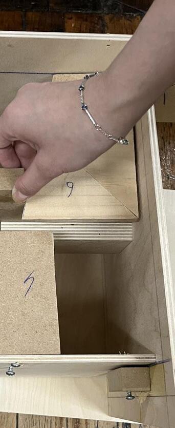
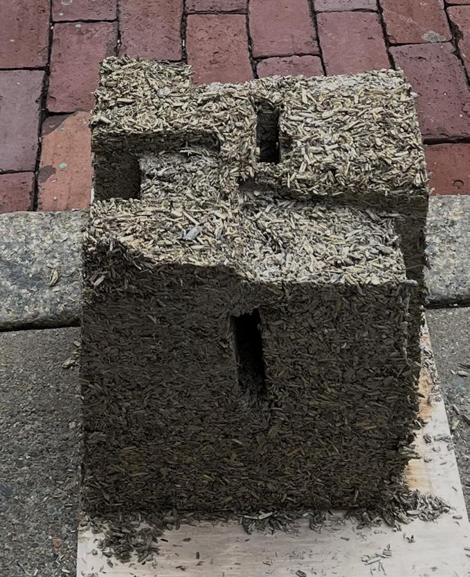
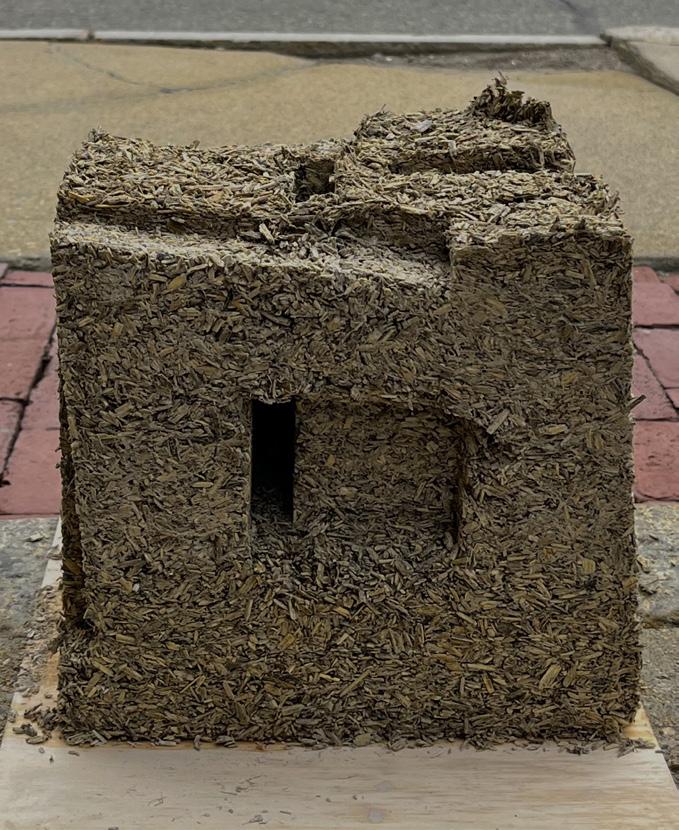
considering the void and solid spaces. fabrics/patterns through void and solid spaces.
23
Fish market as a new community space

24
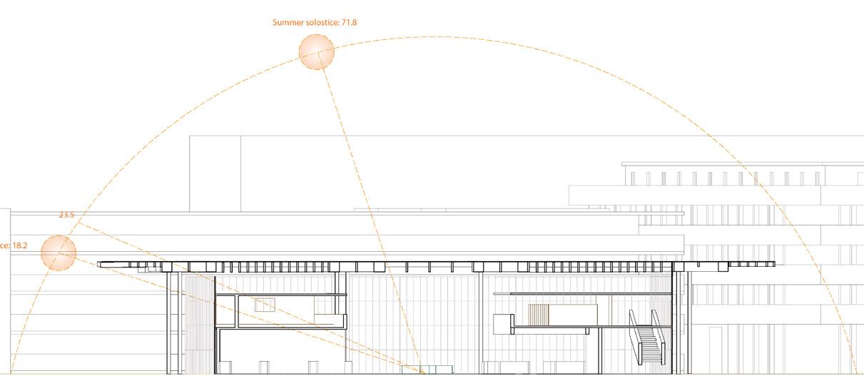
LOADING AREA MAIN ENTRANCE STORAGE First Floor Plan Scale 1:650 Metacom avenue toward river toward natural land Circulation& Program axon 1 Market district Exisiting residential area New residential district Community arts center STORE CAFE STORE TASTING TASTING TASTING TASTING STORE LOUNGE LOUNGE Floor program diagram Pedestrian zone Building section with sun study Summer solstice: 71.8 Winter solstice: 18.2 2

Concrete
25
Floor Plan AUDITORIUM OFFICE LOUNGE LOUNGE CAFE OFFICE Floor program diagram
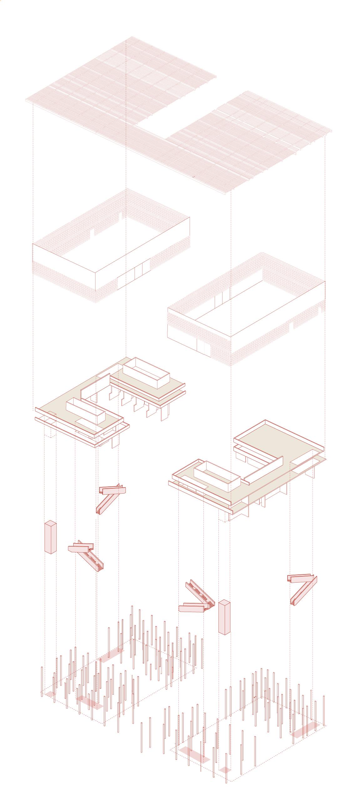
view -Hempcrete block facade Passive house strategy High performance glass solar panels Solar shading device Air ventilation Passive solar gain Thermal insulation Air tightness 3 4 Exploded axon 5
block
column (interior)
Second
Interior
Hempcrete
Timber
column (exterior)
wall Timber beam Circulation core Wooden floor
Hempcrete
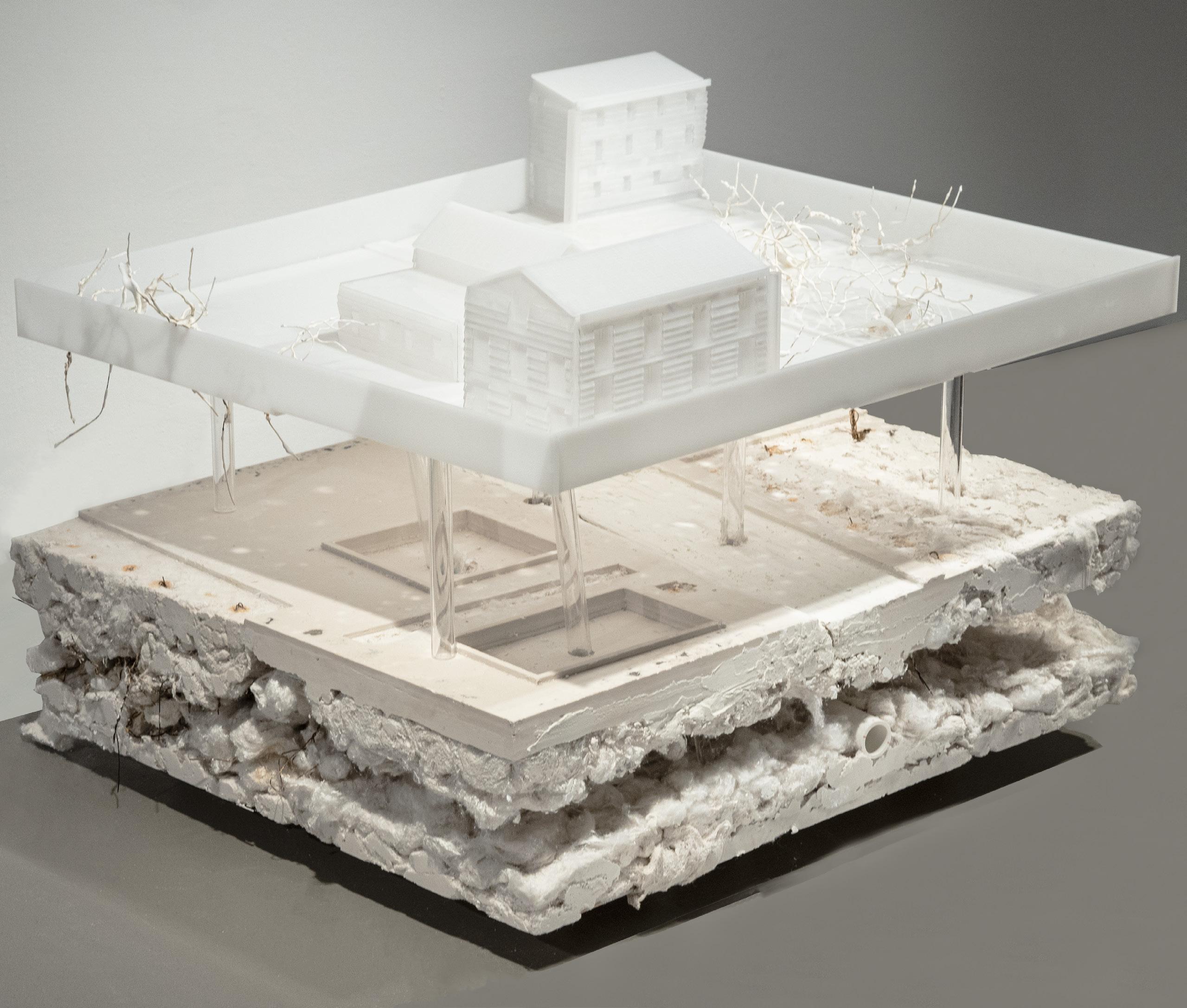
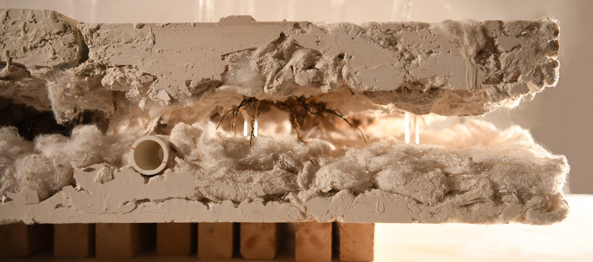
Materials: plasters, cottons, acrylic sheets, tubes, and wires
Water and the city
Group project: Ruyue Qi, Haomin Wu
Year: 2021 Fall, RISD
Course: Urban Ecology
Type: Site model making
Instructor: Leeland Mcphail
Location: West End, Providence
This analytical model is a reinterpretation of the site, West End, Providence, investigating the site conditions, such as road conditions, infrastructures, human interaction on the ground, etc.
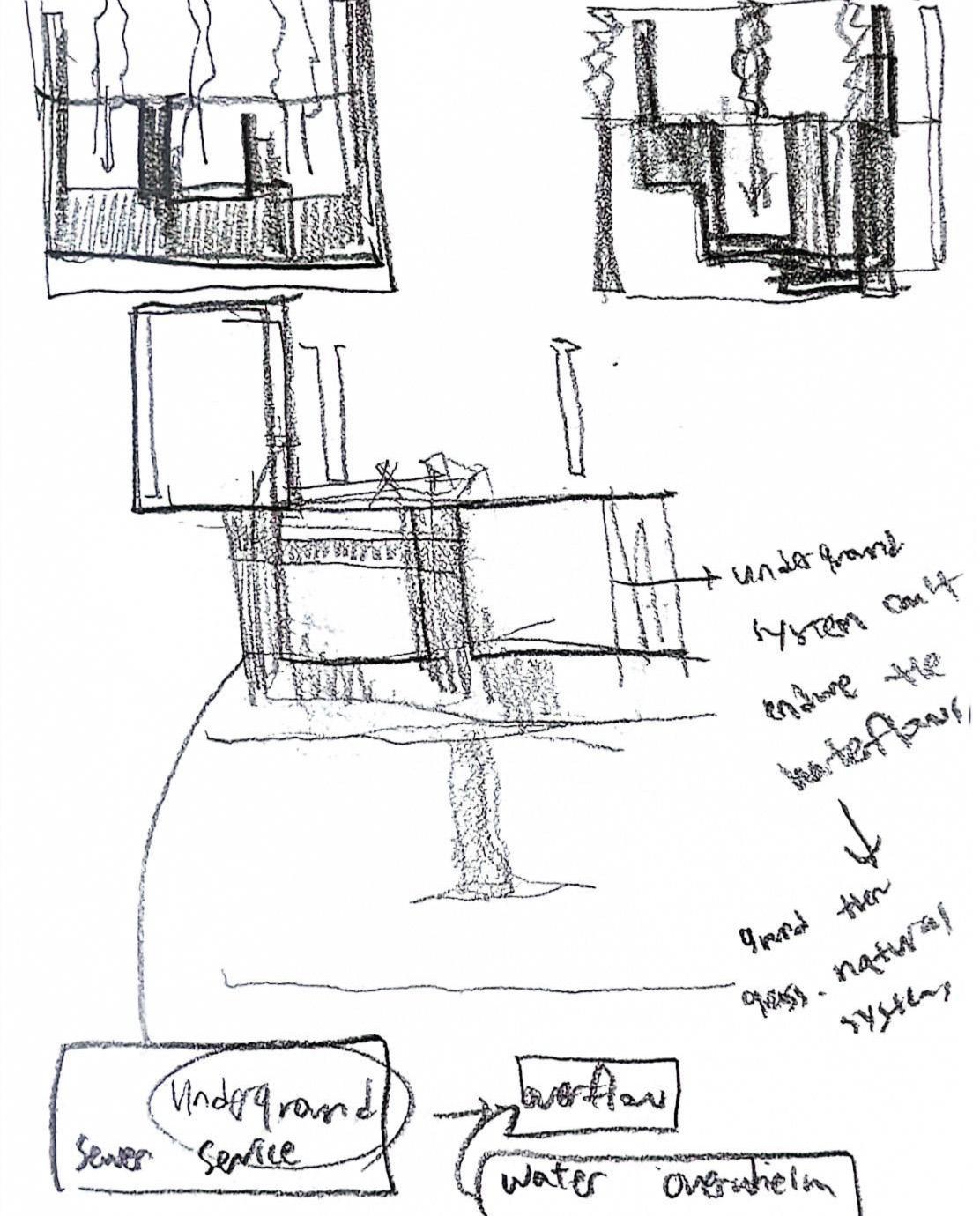
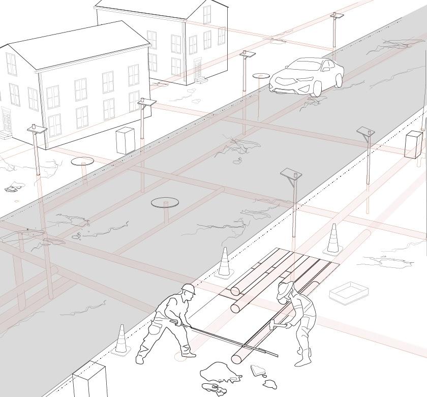
We focused on how underground infrastructures are interlocked with different layers of ground, using water as a medium which is flowing through the void spaces of the site; gurders attatched to the roofs, underground pipes, etc.
This project is grounded on urban ecology project, especially related to ground conditions and layers of the ground, as a beginning of the design project.
26
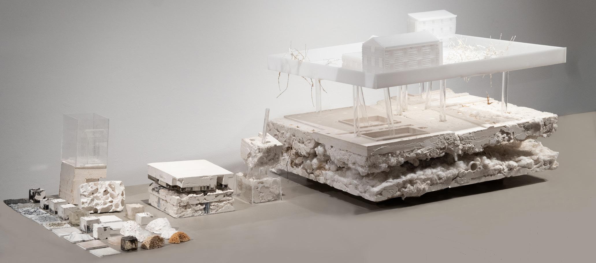
27 My initial sketch about the relationship between underground and waterflow
Collection of site materials and iterative models
Detailed photo of layered materials
Life with infrastructure
This project is focused on designing housing and neighborhood strategies across from human to urban scales in West end, Providence, at the same time, investigating urban infrastructure systems, nature,landscape, surrounding buildings, etc.
Group project: Ruyue Qi, Haomin Wu
Year: 2021 Fall, RISD
Course: Urban Ecology
Type: Site model making
Instructor: Leeland Mcphail
Location: West End, Providence
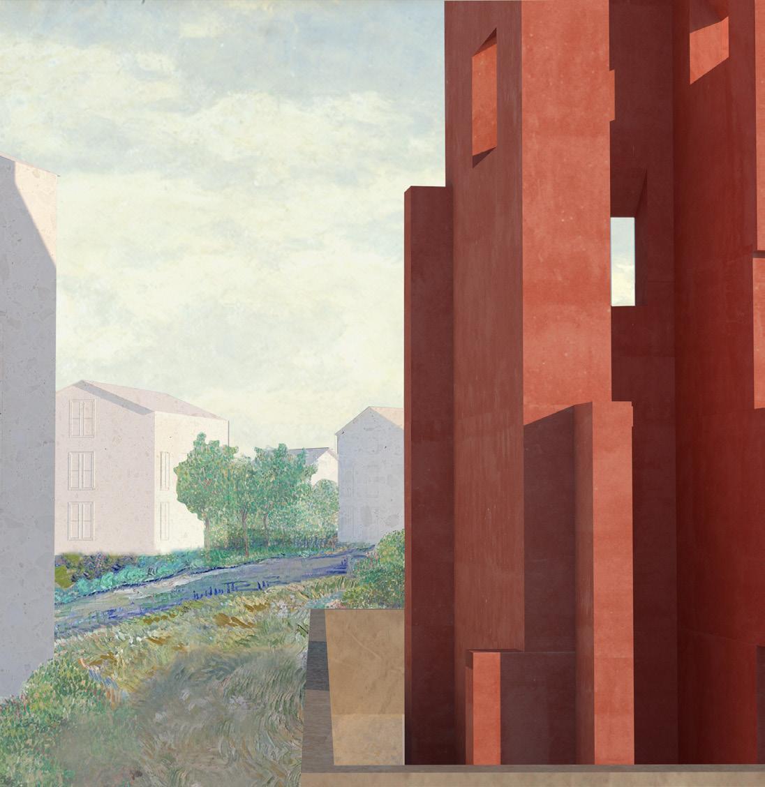
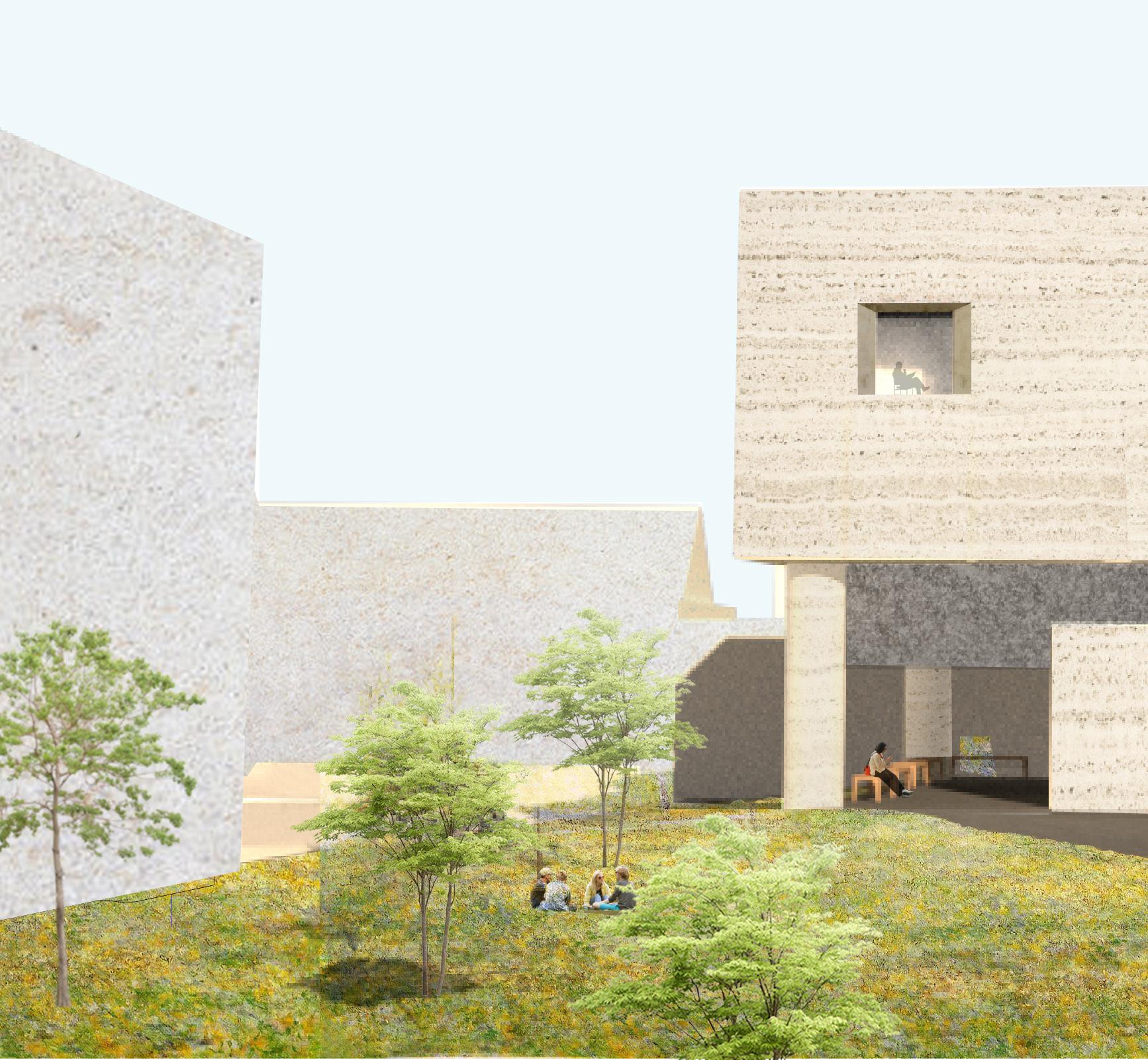
Addressing surrounding environmental issues, such as poorly-maintained roads and infrastructure conditions, which cause terrible condition for walkable areas and a lack of green spaces for interaction with people and nature, design proposals are geared toward ecological movements, ultimately bringing nature closer to people.
By creating integrated infrastructure systems within the boundaries of the neighborhood, each dwelling unit and public spaces can live in efficient, flexible and resilient environment.
28
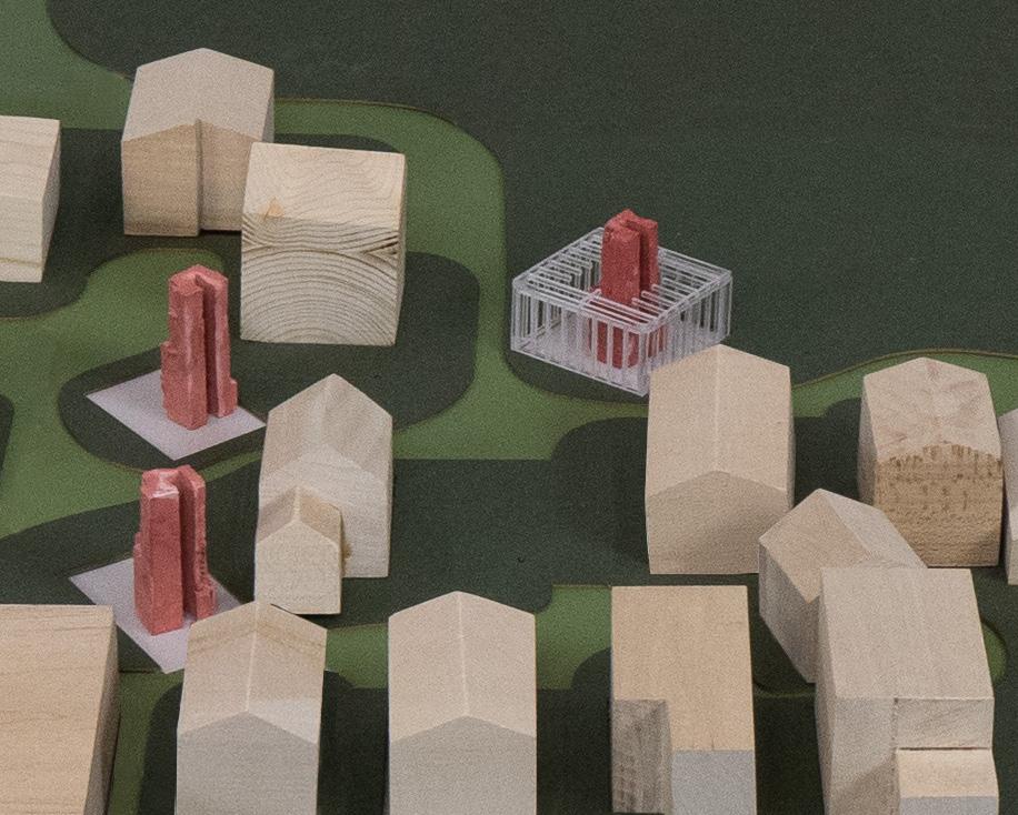
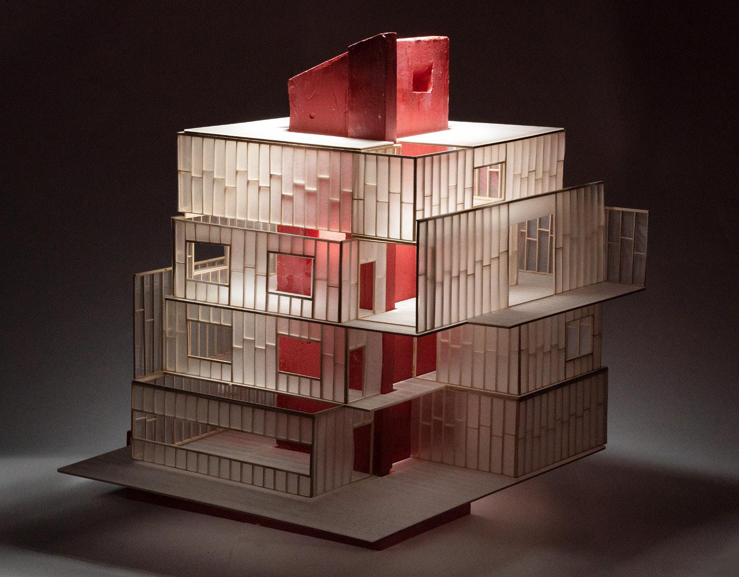
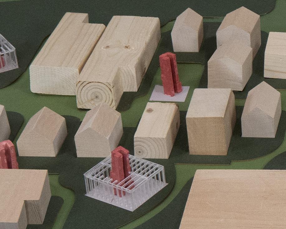
29 Physical model
Masterplan and ground levels
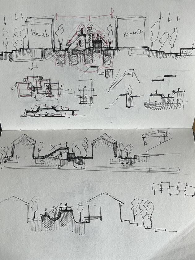
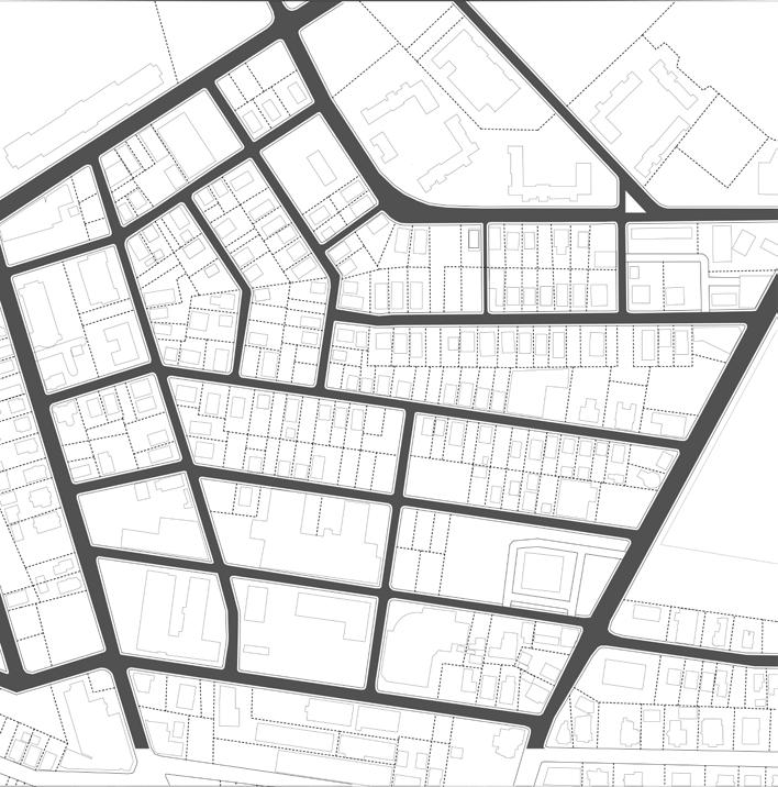
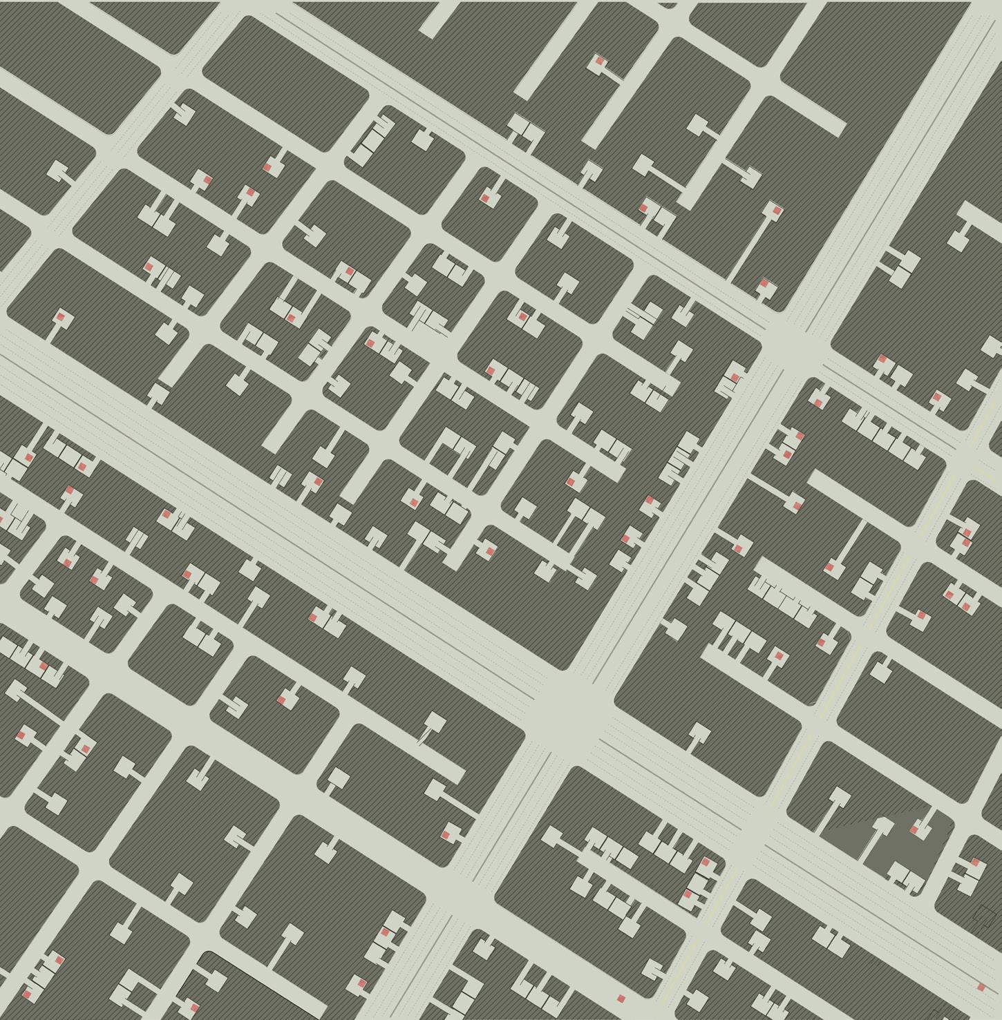
Based on the regulating line, a strategy is shifting all roadways for transportation, such as cars and public transportation, to the basement level.
It enables people to enjoy the green life on the ground, which means that ground is purely walkable area for pedestrians and green areas. Parking lots stretched out to main underground roadways are connected to each house’s garage for efficiency.
Circulation of underground roadways, heading towards downtown Providence, connects residency areas to a larger community area.
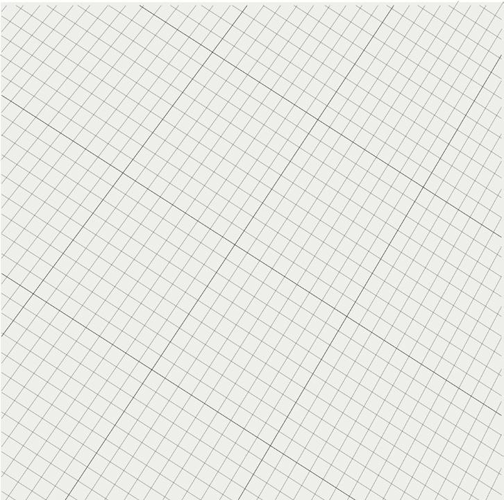
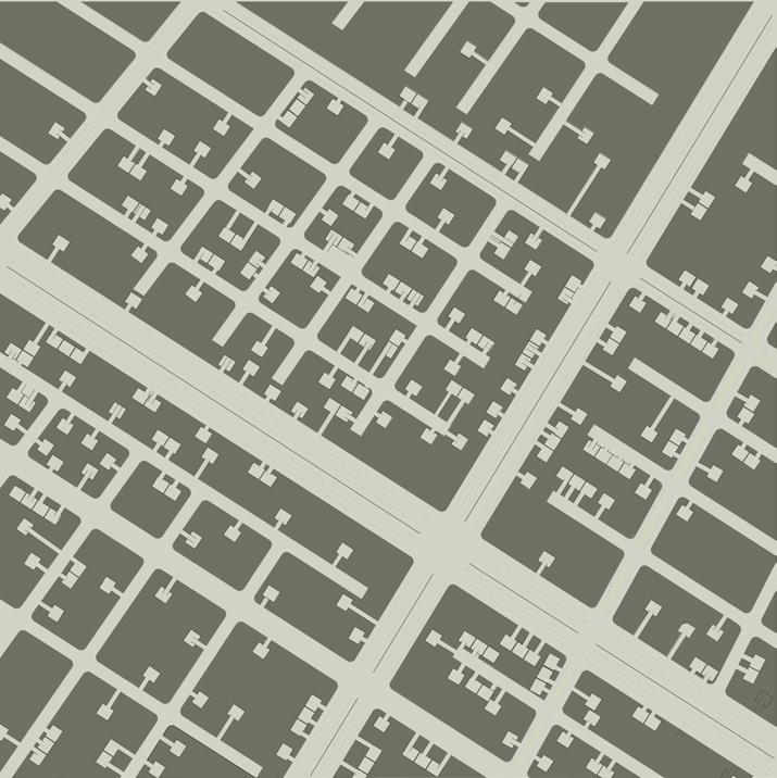
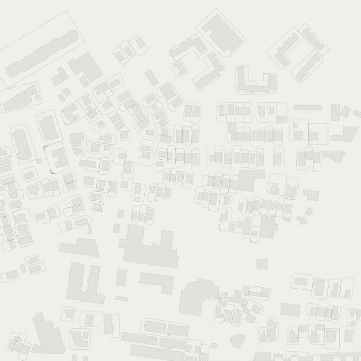
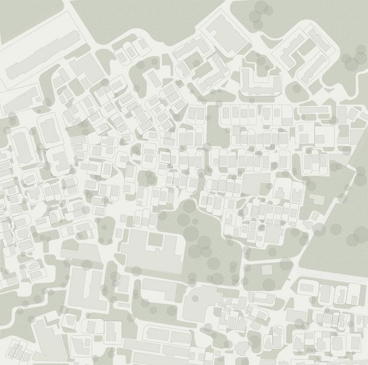
Phases of masterplan
30
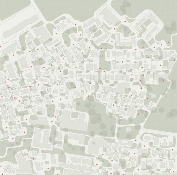
a. Original masterplan
b. Regulating lines from the original site
c. Underground parking grid systems from the original regulating lines
d. Redefined propery lines
e. Green pocket areas
f.
Public core (infrastructure)
Existing road condition
Idea sketch about elevation of the ground
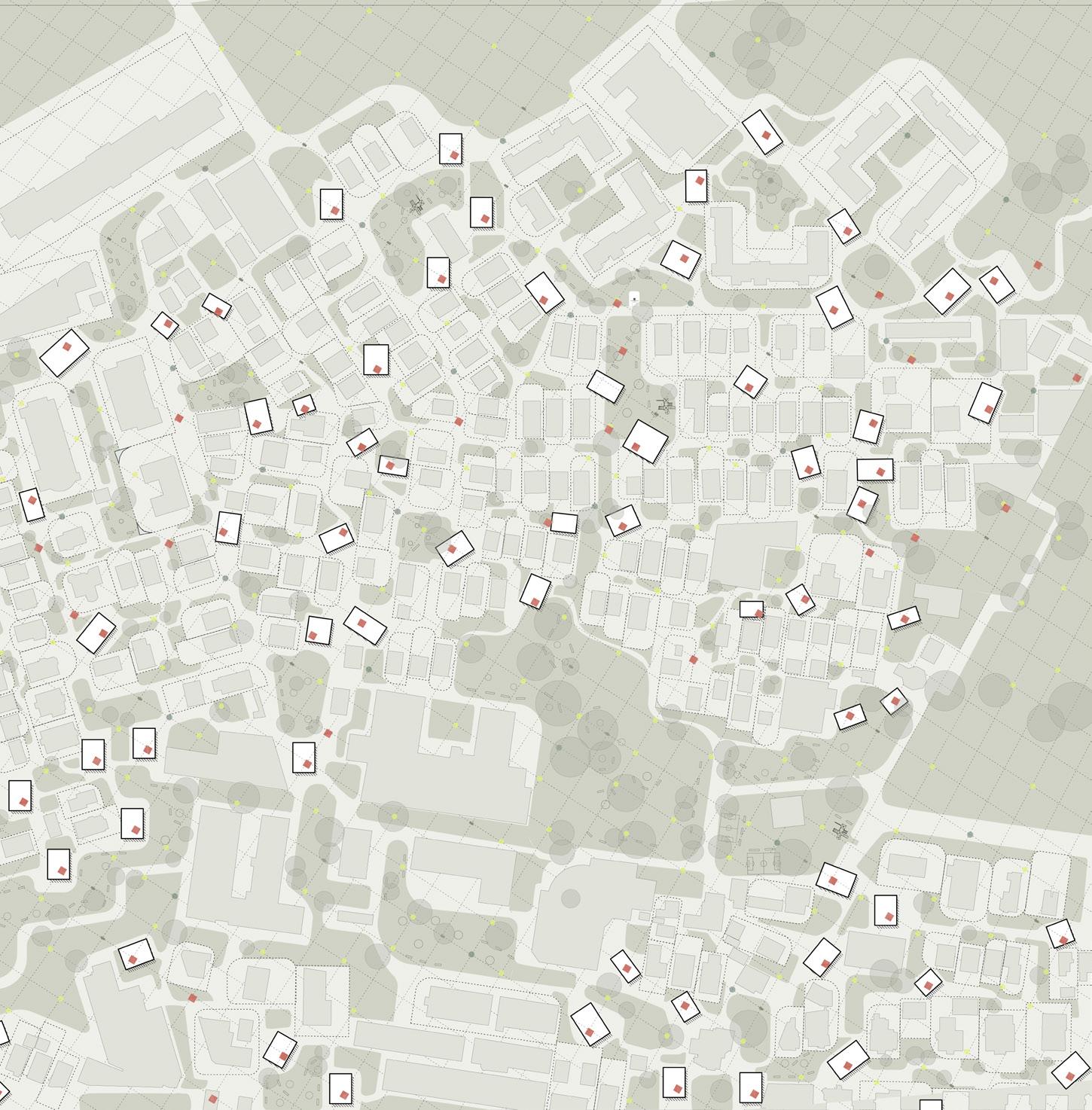
Ground masterplan
Rearranged house, which has collinear direction with infrastructure core
Originally existing house
Green areas
Street light
Water drainage
Infrastructure
Roadways
31
core Underground masterplan
soil
Underground


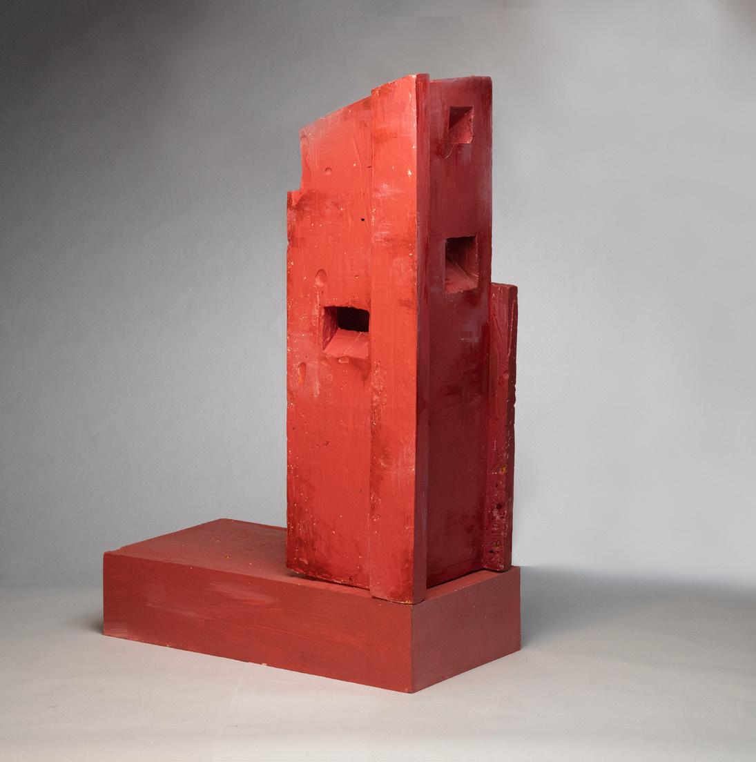
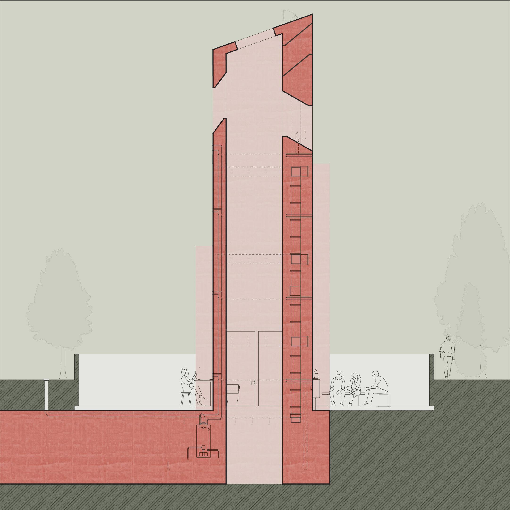
 Site model shows diffrent phases of the infrastructure core.
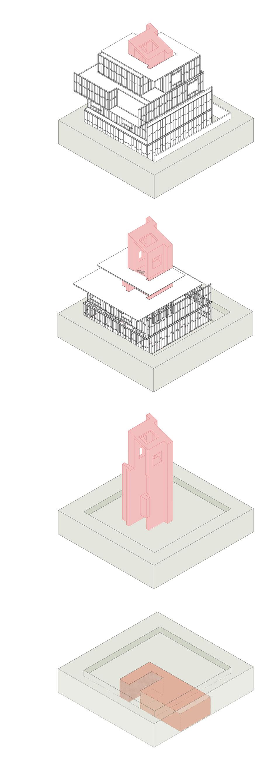
Phase 2 (private infrastructure)
Construction process of the housing
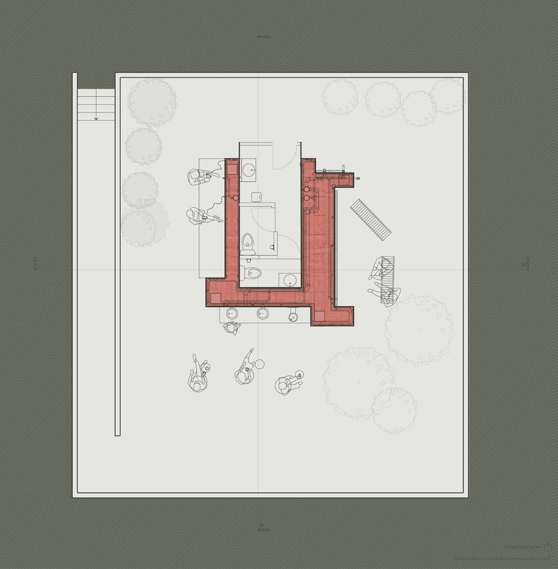
Phase 1 (public infrastructure)
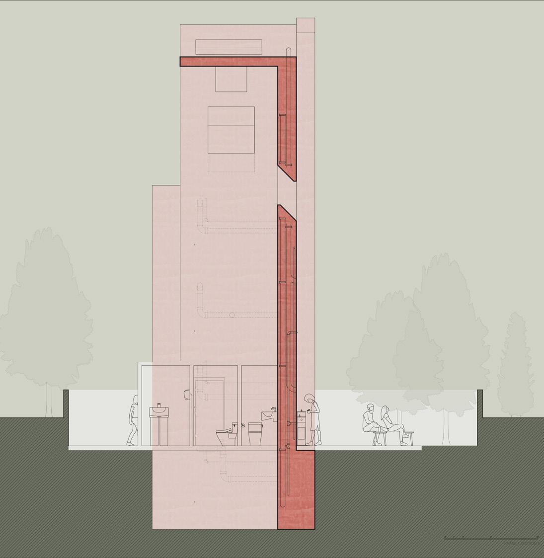
Underground Infrastructure systems

Phases - phase 1
34
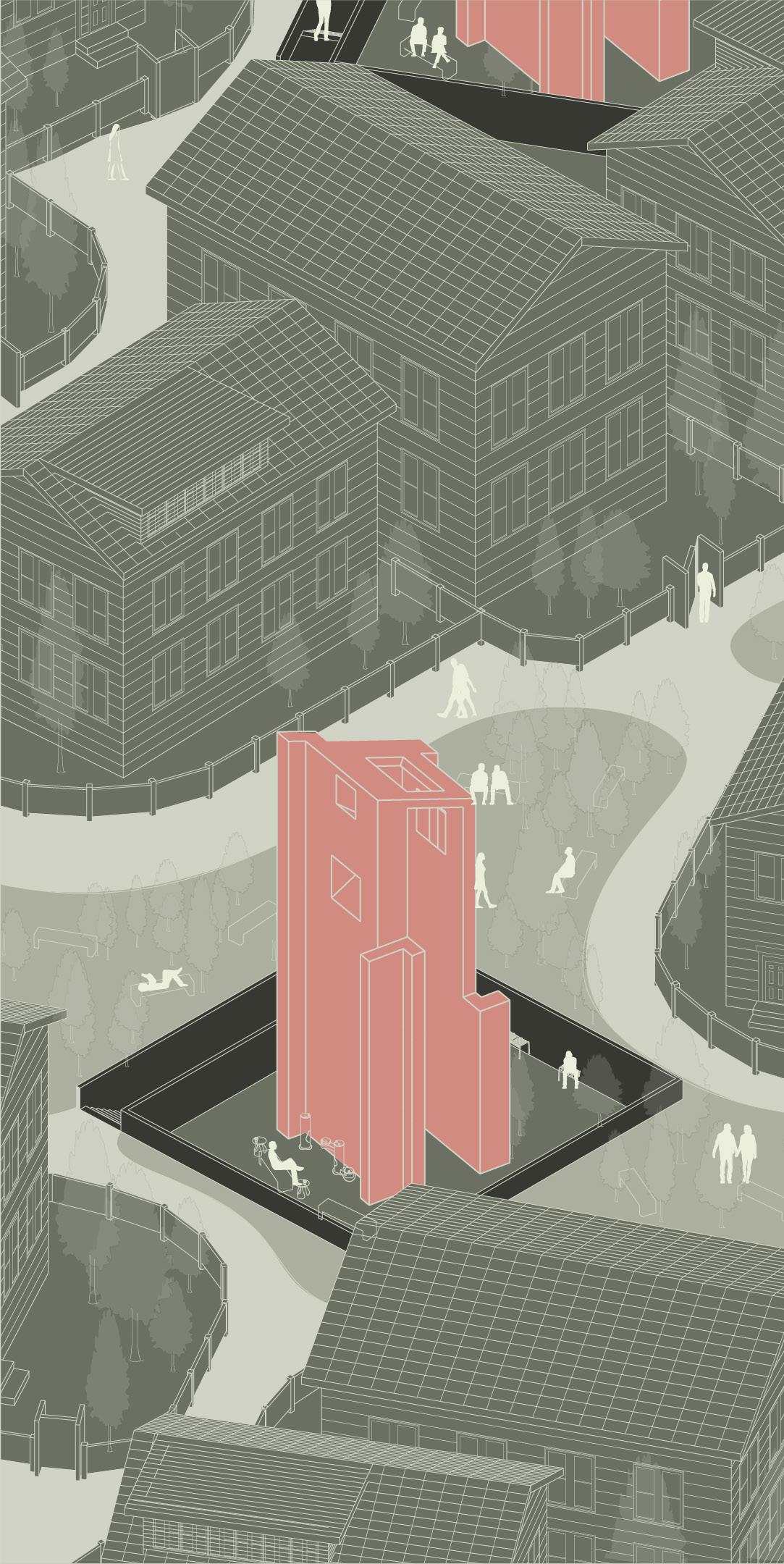
Phase 1 shows how infrastructure core provides public infrastructure systems for people, such as electricity, water, heating/cooling systems, restroom, etc.
35
Phases - phase 2
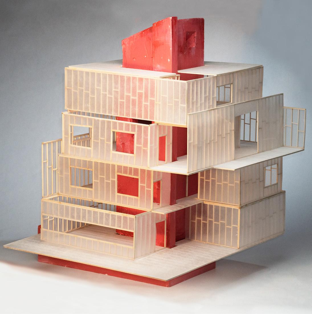
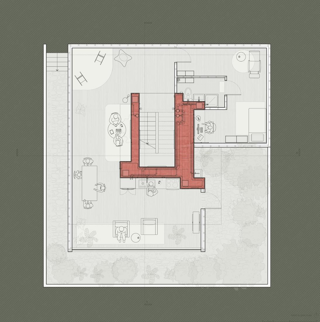
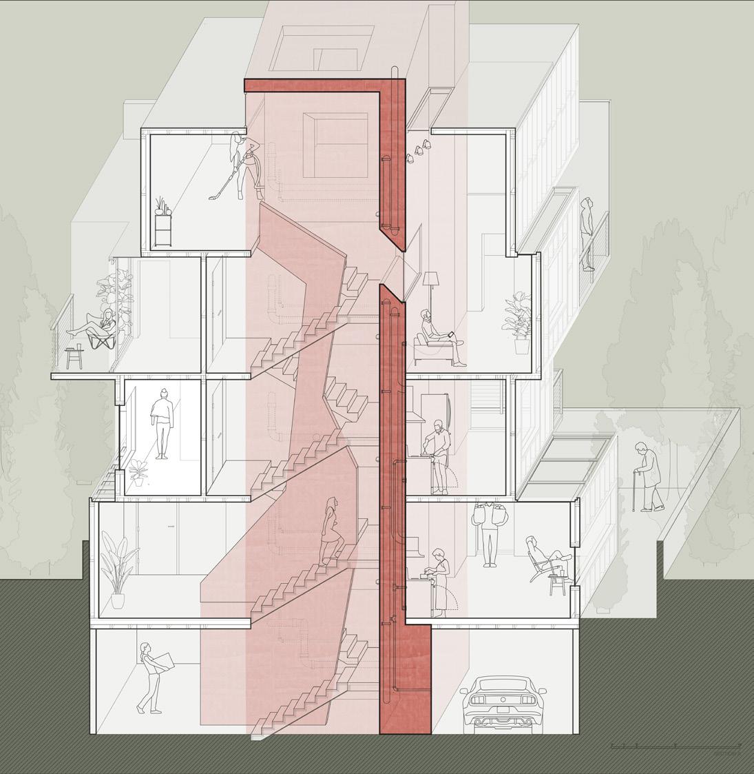
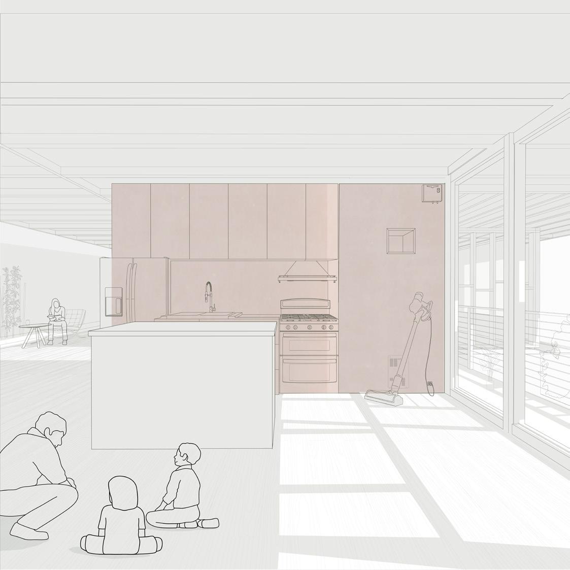
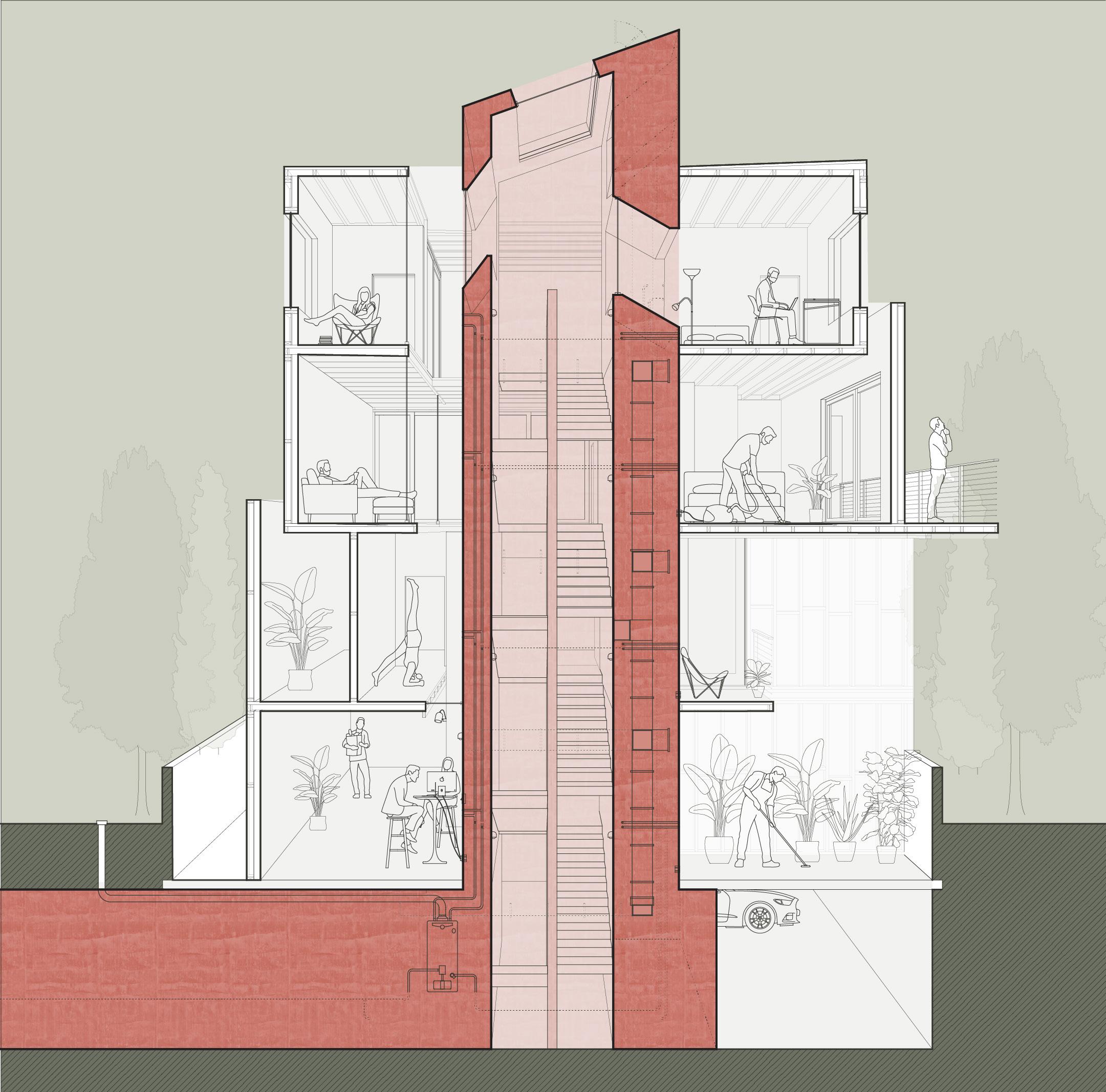
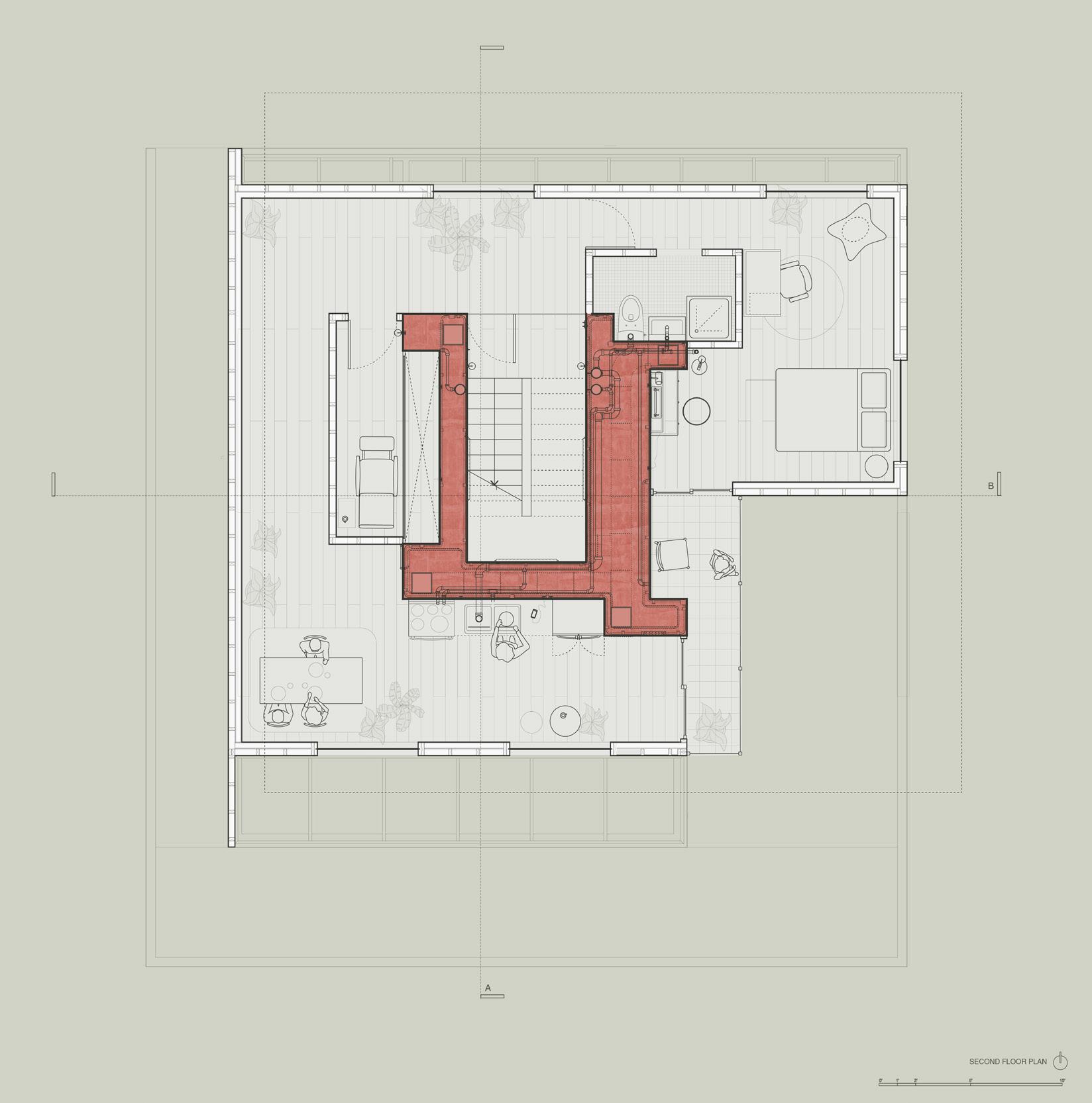
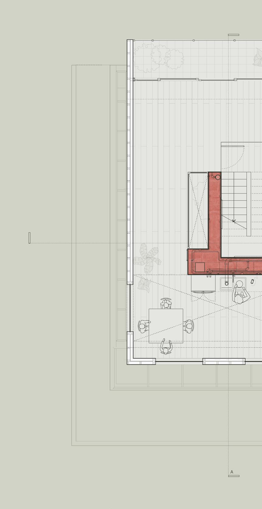
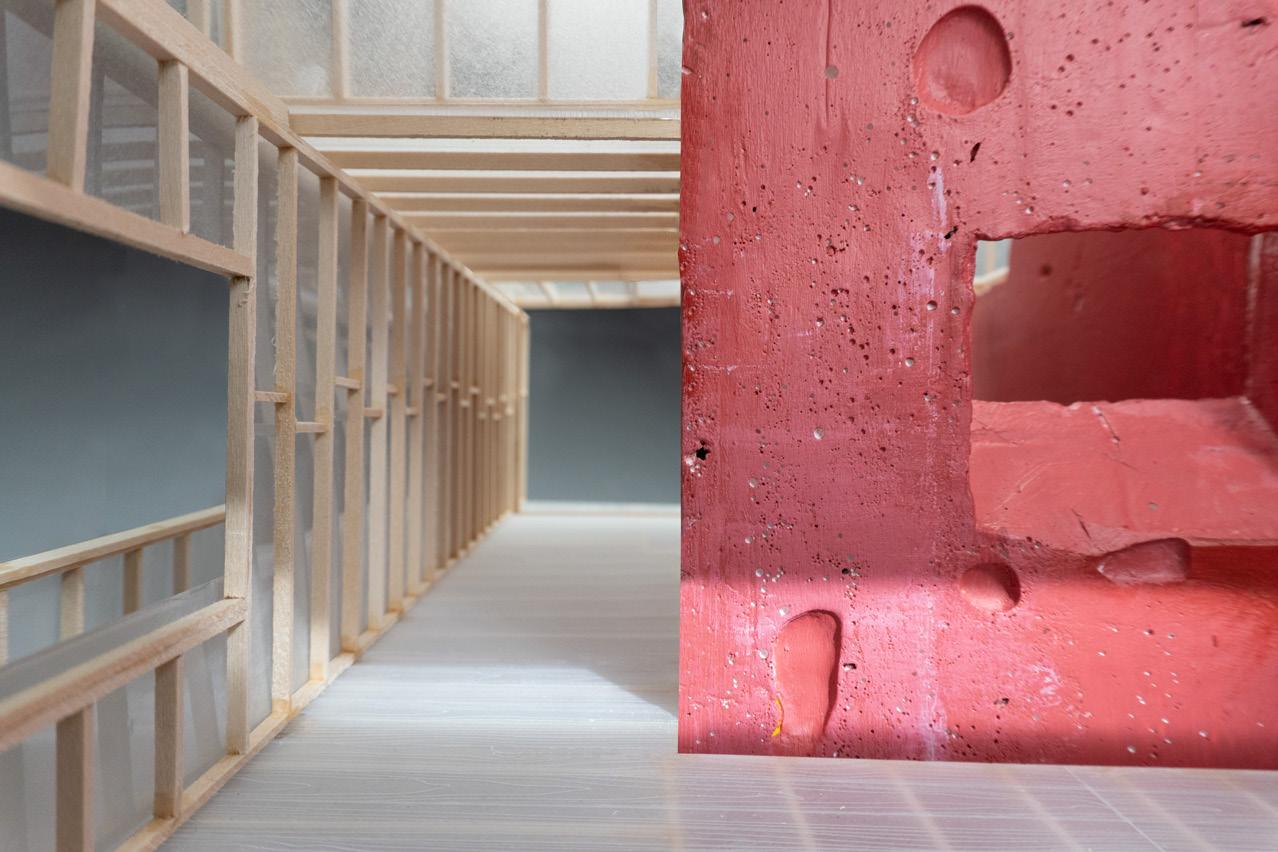
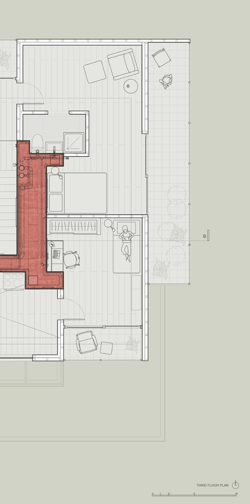
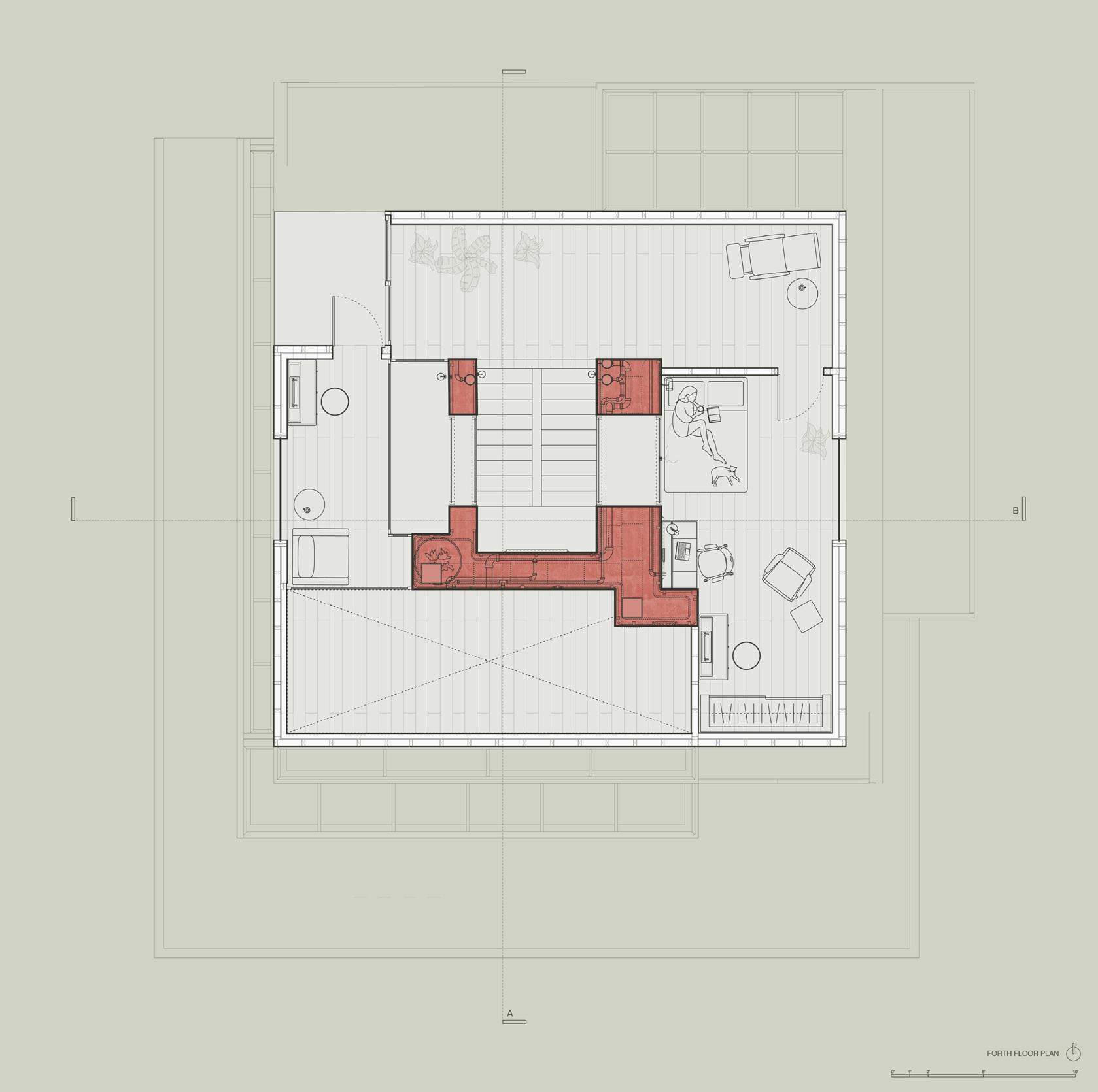
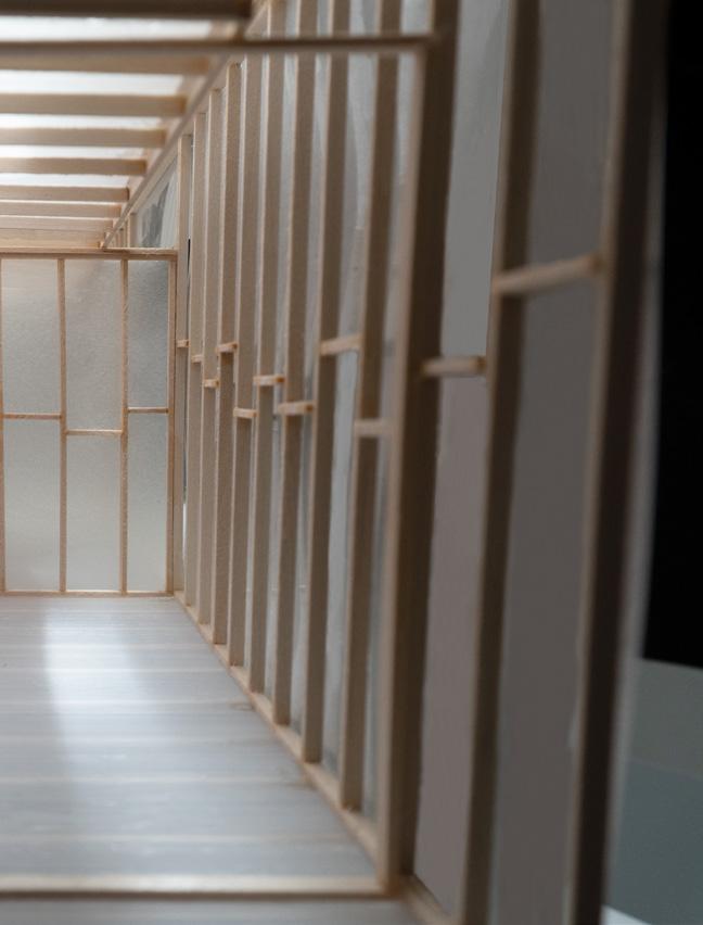
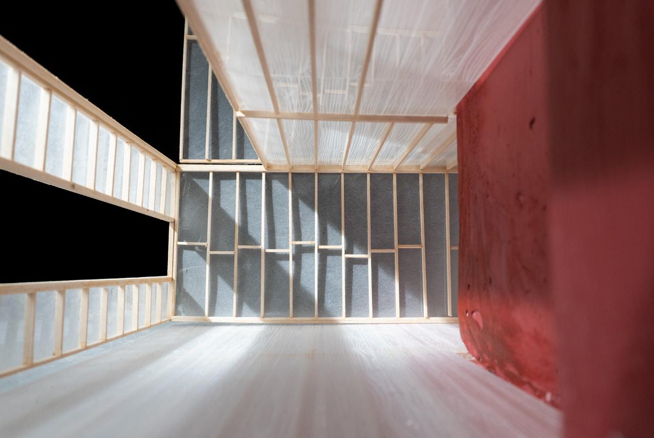
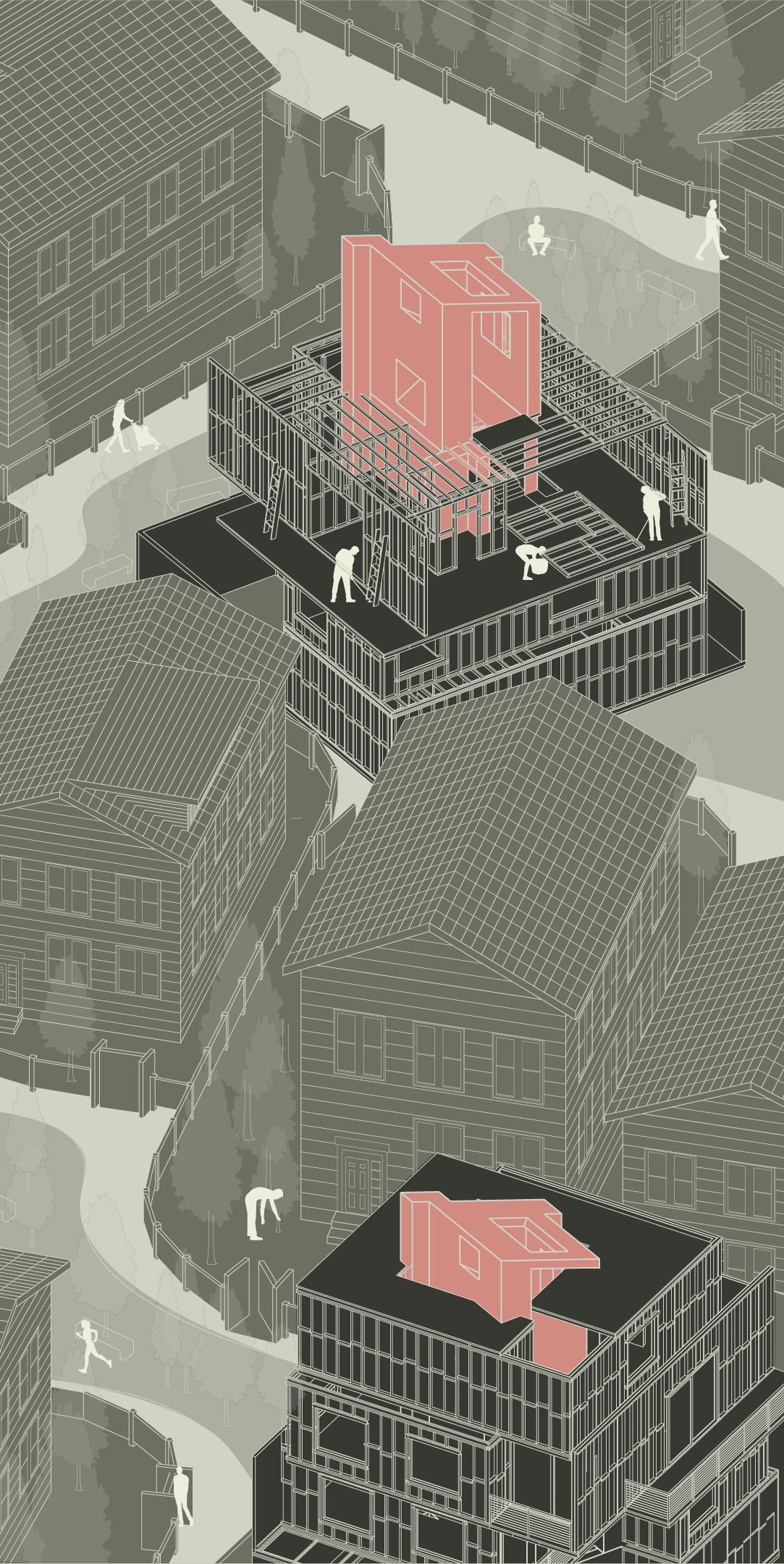
Phase 1 can be adapted to phase 2, which is applied in residential units. It allows different units to create multi-family housings, such as a combination of a single housing and 4 family housing with use of wood construction. The core brings light, ventilation, and also nature closer to people who live in there.
The wood frame walls with CLT floor panels attached to the core make spatial arrangements more flexible according to the programs in the house.
36
37

38 Floor plans - phase 2
2nd floor
39
3rd floor
4th floor
40
41
Library as a burrow
Individual project
Year: 2020 Spring, RISD
Course: Architectural design
Type: Conceptual, Library design
Instructor: Evan Farley
Location: Providence, Rhode Island
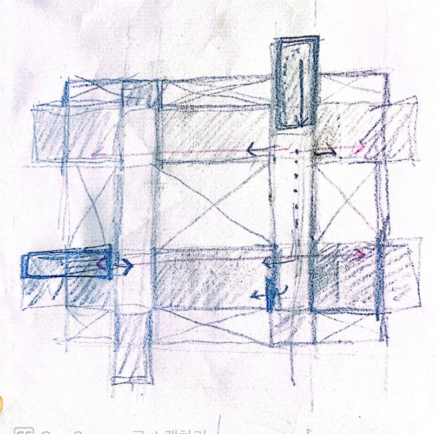
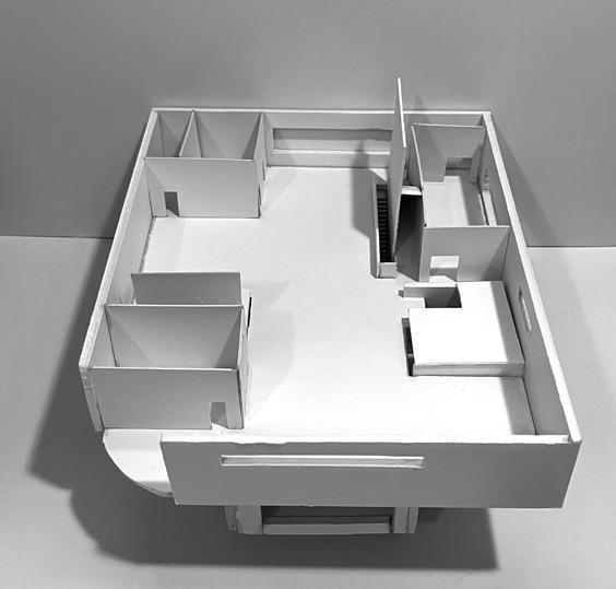
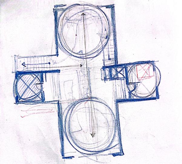
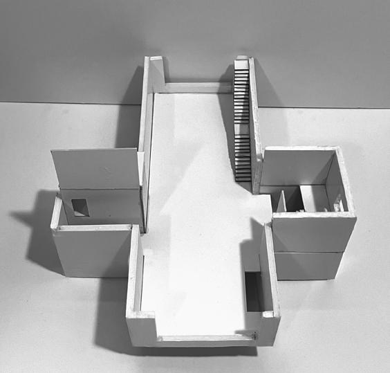
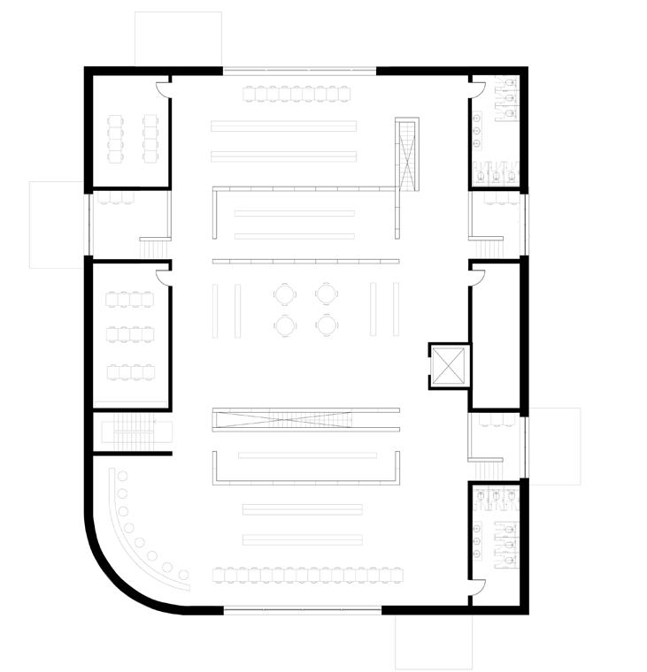
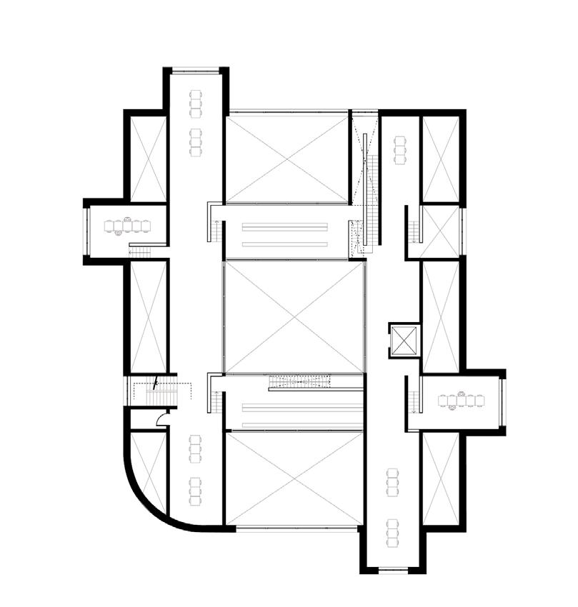
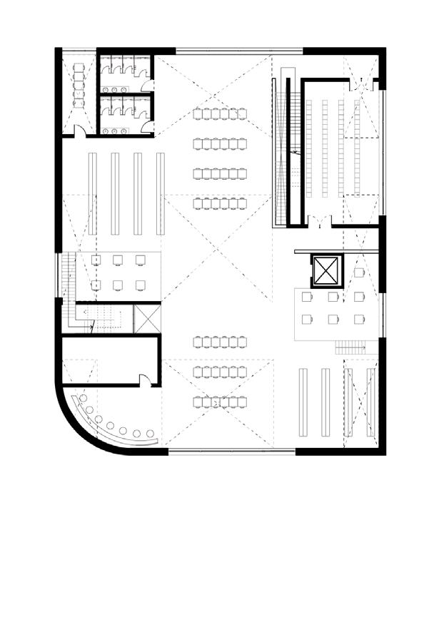
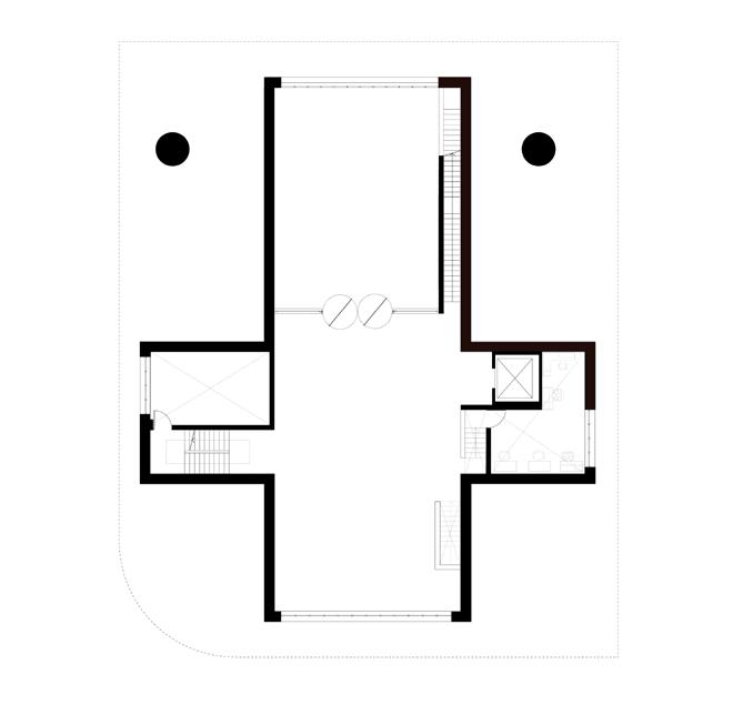
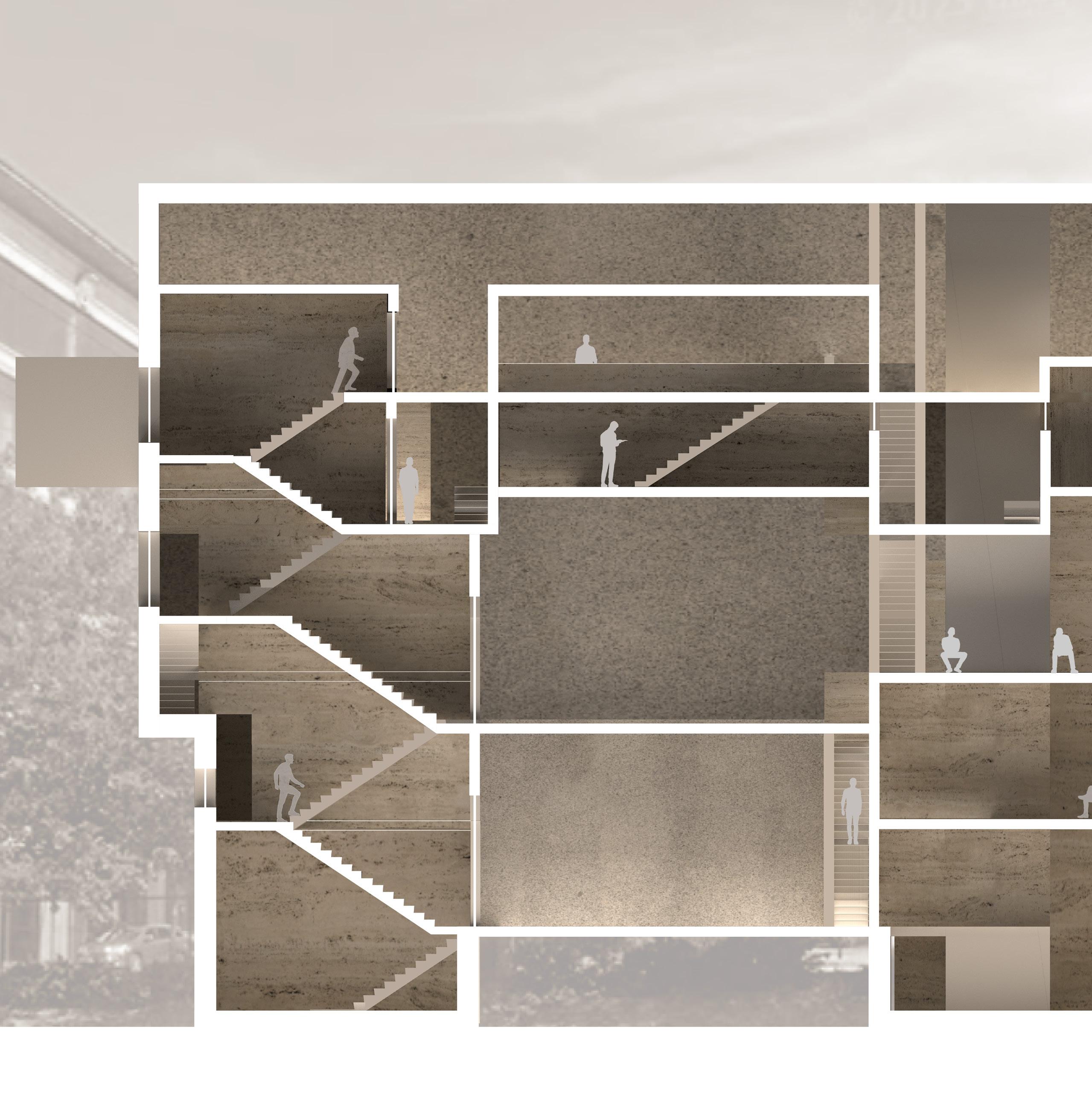
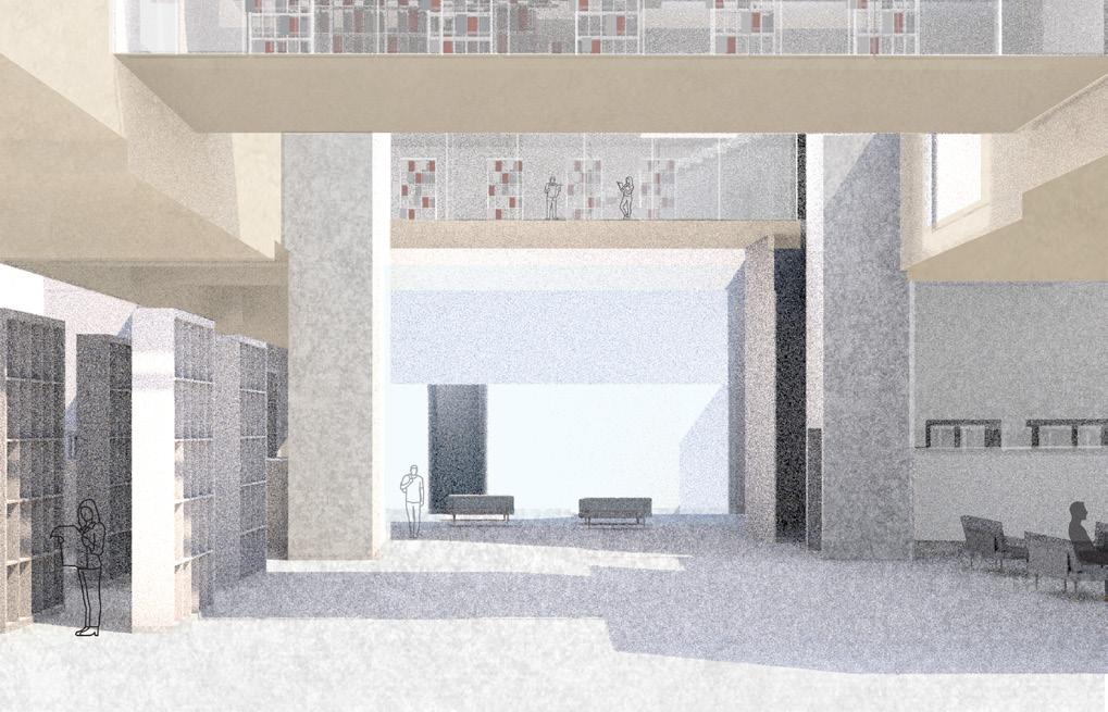
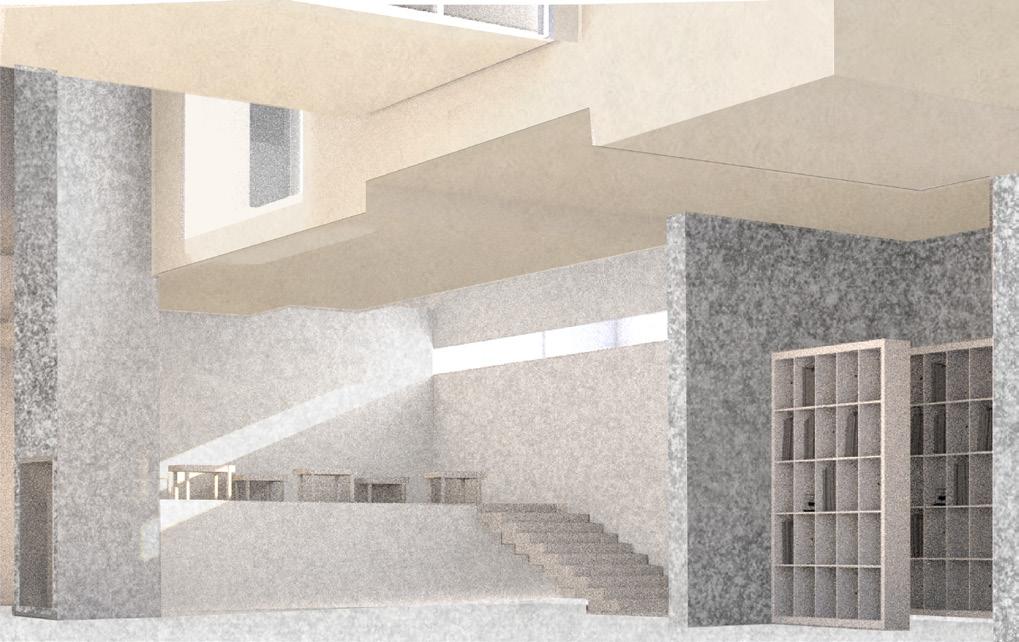
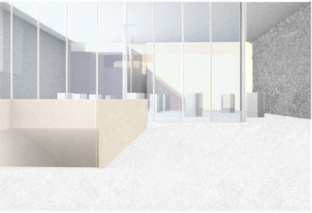
Located in downtown Providence, Rhode Island, the library project derives from a gesture,“burrow”, the main idea carried over this project.
The library defines how burrow, as a sunken space, creates dynamic spatial rhythms on each floor, by questioning on spatial continuity and . The gesture creates extruded volumes by slightly lower the elevation of certain spaces, related to the function and atmosphere of the space, such as private and individual places.
42

43 Gesture drawing of burrow
Discovery of the spaces of “Burrow”
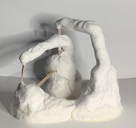
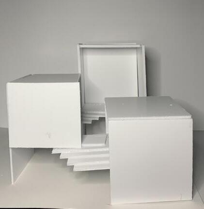
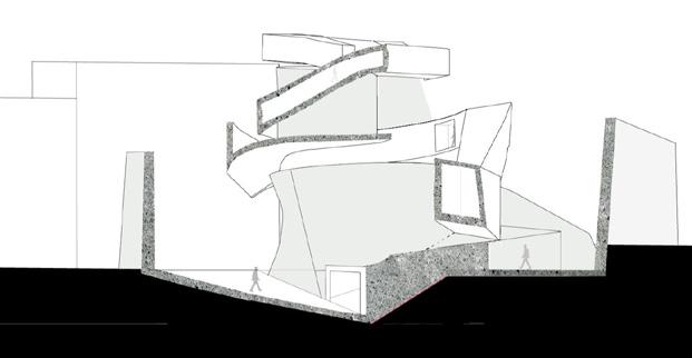

Through intial discoveries and iterations about how burrow can be interpretated as spaces and buildings, two sketches start to describe “rooms” as service, containers, and circulations.
2. Development + Library program

44
First burrow spaces
1 Abstract forms of “Circulation”
1. Initial discovery of spatial term, “Burrow”
2 Thinking about the definition of “Floor”
4 Abstract forms of how burrow spaces can be revealed from the exterior view.
Second burrow spaces
3 Sectional sequence of burrow & Fluid forms and definitions of floor
Spatialized
burrows

Two
45 Third FL Fourth FL 3. Floor plans ChapelSt. SnowSt. Ground Second Third Fourth Fifth Access for freight/storage Second FL b. b. a. Fifth FL 4. Circulation axon a. a. Special collection room b. Librarian office c. Stack & study area d. Auditorium e. Meeting room c. c. d. e. f. f. f. Speciall collection room g. Study room g. g. h. h. I. I. J. f. f. H. Stack area I. Meeting room J. Storage space c. c.
major circulations are moving separted from the ground. While passing through these circulations, people can experience various scales of rooms and programs.
46
a.
1.
2.
3.
6.
4.
5.
3.

47
1. Storage 2. Librarian office 3. Office 4. Lobby/Exhibition area 5. Main hall 6. Special collection room 7. Special collection room
7.
Section
drawing 1:100
5-Main hall
4- Special exhibition area
3-Studying area
6.
Urban apertures_Common Ground
Individual project
Year: 2022 Spring, RISD
Course: Common Grounds
Type: Research, Urban Planning
Instructor: W. Gavin Robb
Location: Somerville, MA
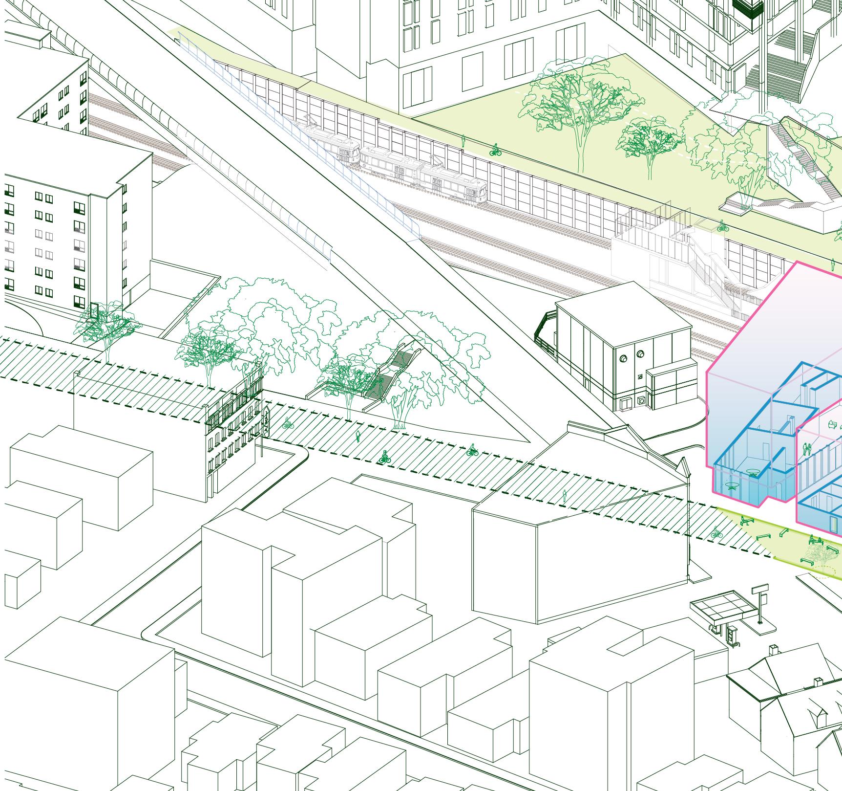
Gilman square, currently a vacant plot located in Somerville, MA, faced a challenge of housing crisis and gentrificiation. As MBTA Green line extended to Somerville, Cambridge, Medford, many tradeoffs came out from existing residents, immigrants, and communities. Through the various ways of researching the site, such as interviewing various stakeholders, analyzing the site conditions, and publishing research book, I could learn the way to deeply engage with the community and carelly use architecture as a design tool to enhance the living conditions of the site.
48
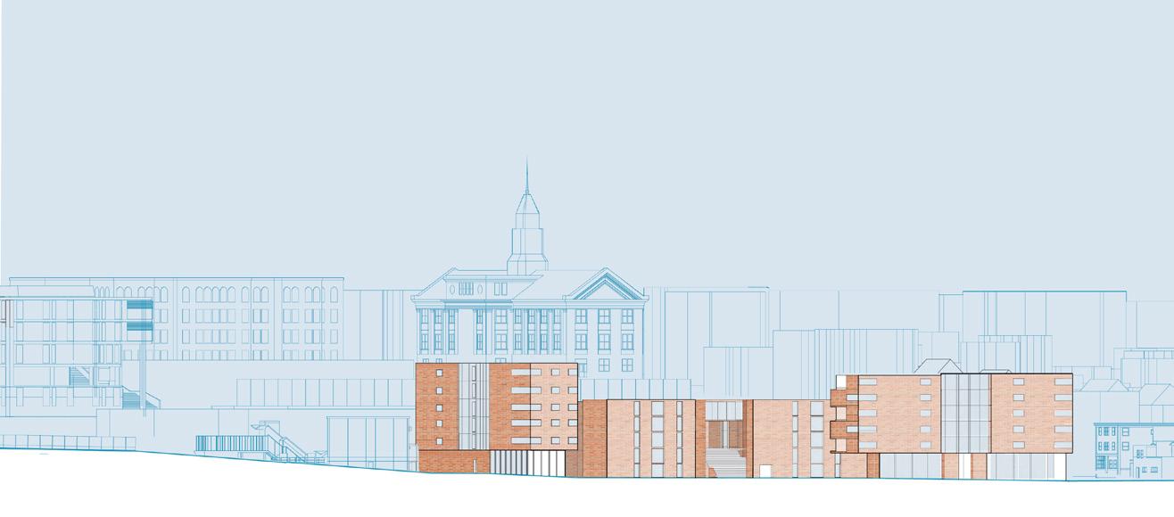
49 Elevation of new residential districts
Analysis and explorations of the ground
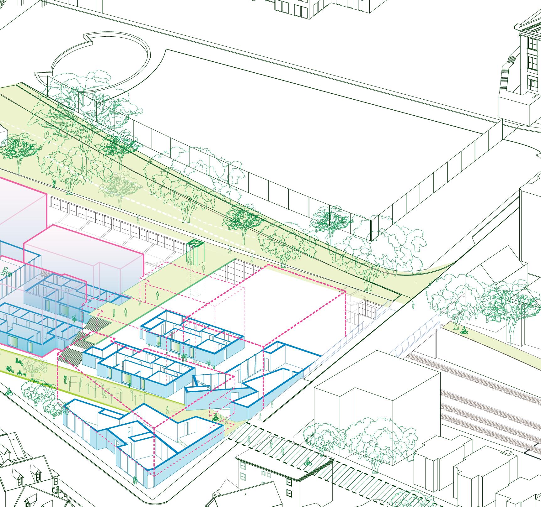
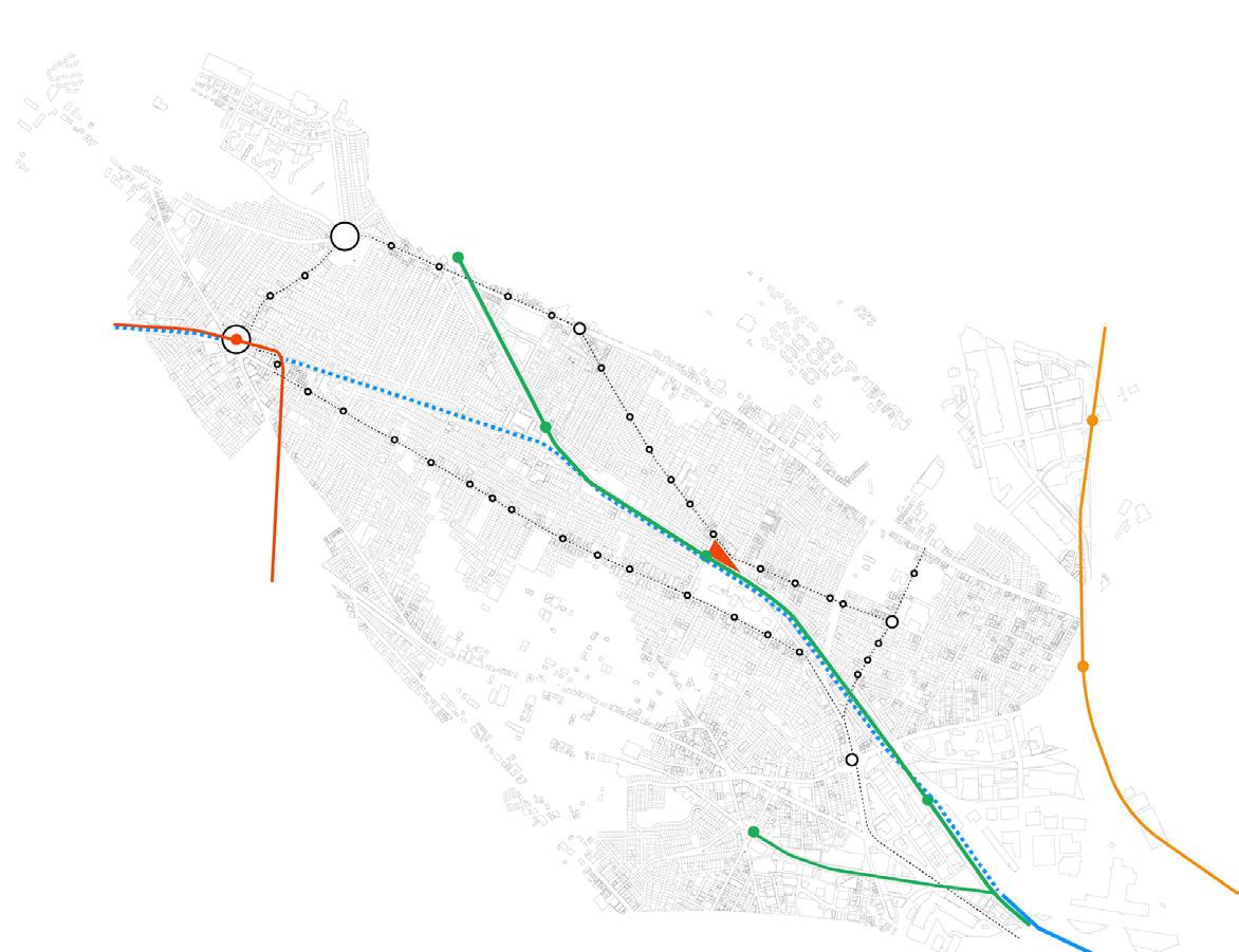
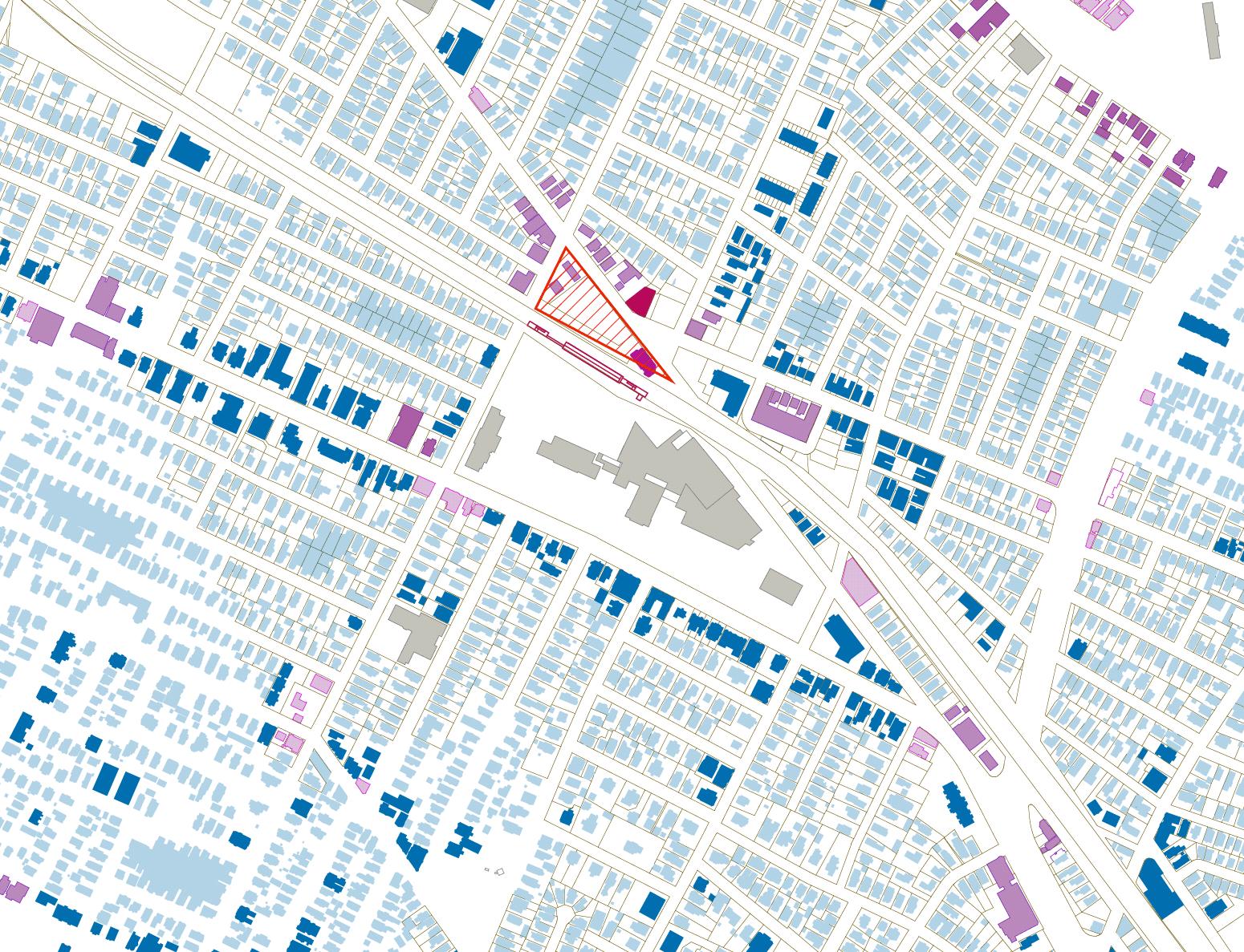
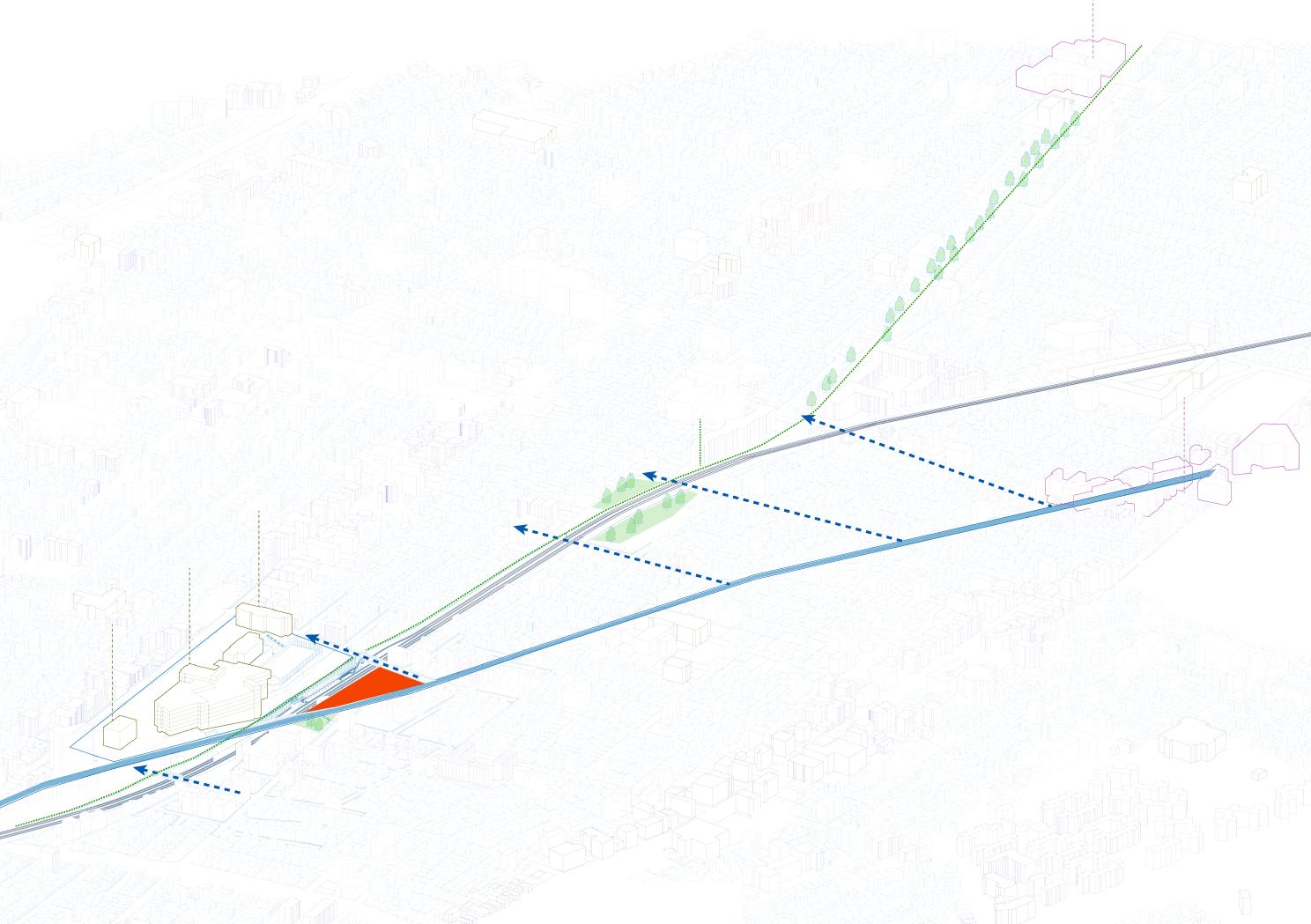
MBTA Green line extension project hugely impacted on the neighborhood of Boston, Somerville. As the needs of housing issues arise, Gilman square, a triangular-shaped vacant plot, has a potential of building housing blocks and mixed use programs for both bringing new residents and existing communities.
50
Public Library High School City Hall Community Pathway MAGUAN SQUARE
SQUARE
Medford St. DAVIS SQUARE MBTA Red Line MBTA Green Line MBTA Orange Line Bus transit stop Site_Gilman Square Civic Mid-rise residential Residential Commercial Mid-rise residential 2
Land of Somervile and transportation Site plan and programs 3 Detailed analysis and proposal EXTENSION OF THE EXISTING STREET INTO THE TRIANGURAL SITE (Proposal) PearlSt. N N Existing street connections
GILMAN
(Site)
1
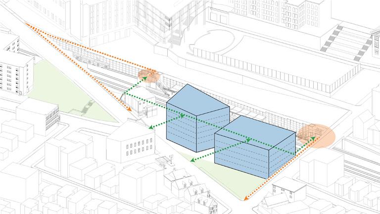
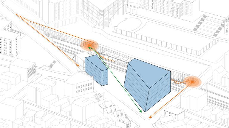
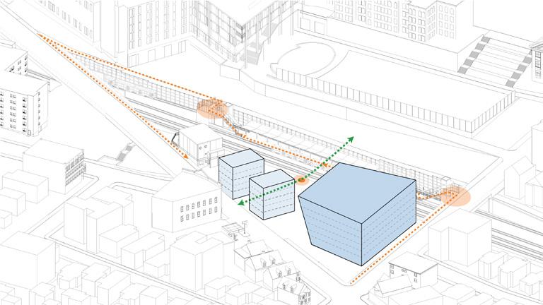
Gilman Square is centered around residential districts, mostly triple decker housings, and civic buildings. Also, the site is hugely impacted by the circulations of the cars, trains, and pedestrians.
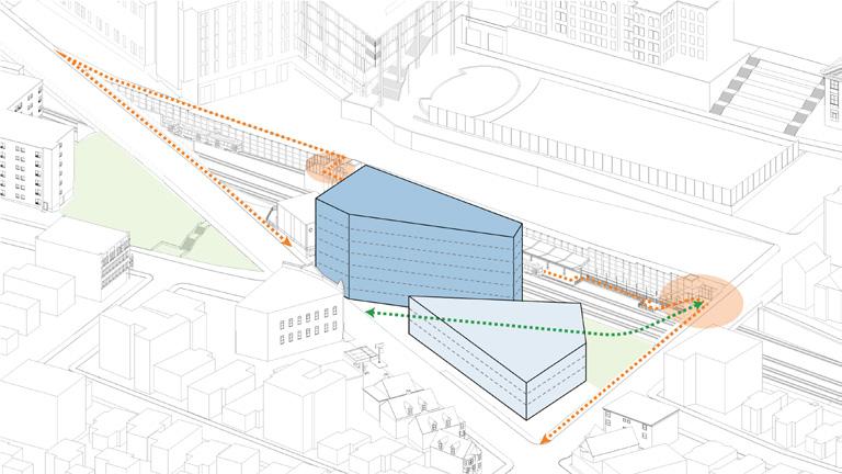
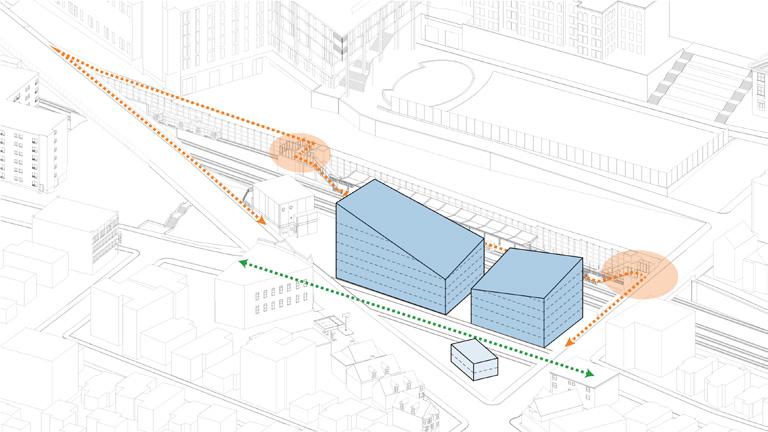
Massing studies tested various possibilities of connections between MBTA train station, pedestrians, and cars.

51
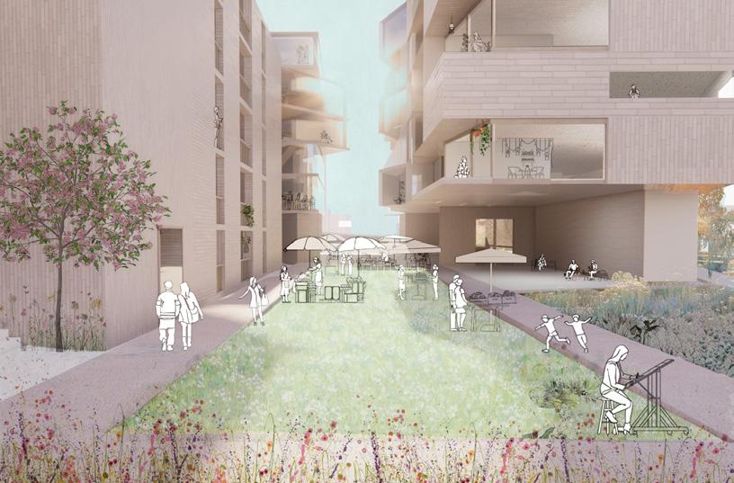
By extending the existing Pearl street to the site and dividing the triangular plot, Gilman square will be a small town, well merging with the existing residential areas and communities.
N
Detailed axon of the proposal
4 Massing studies
5
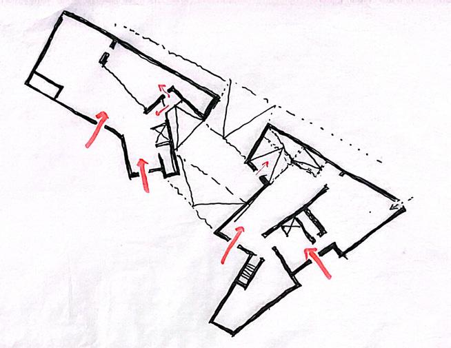
Shaping the ground floor and a new vibrant street

52
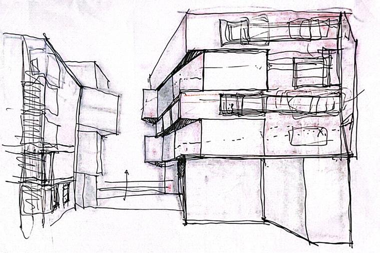
Sketch of how building forms create a main aperture of the street
Sketch of building
N
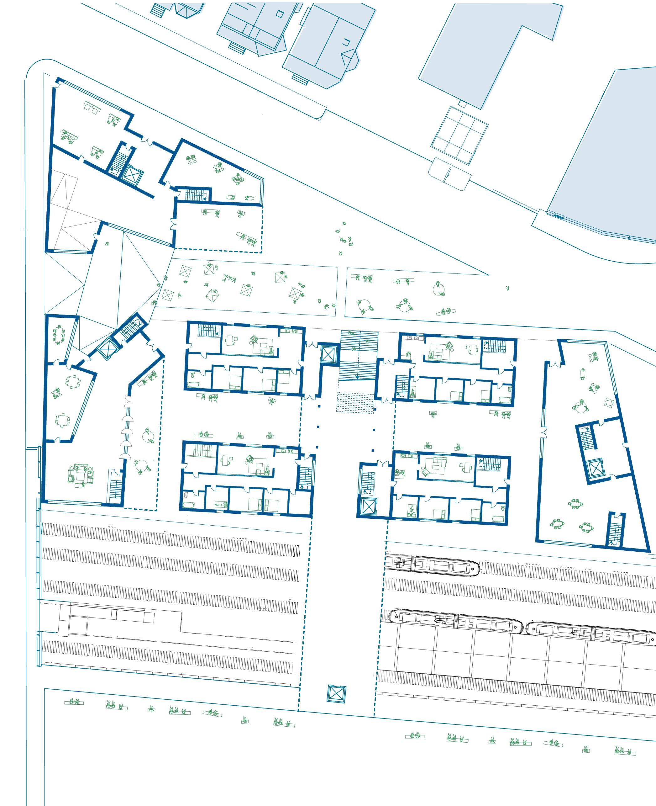
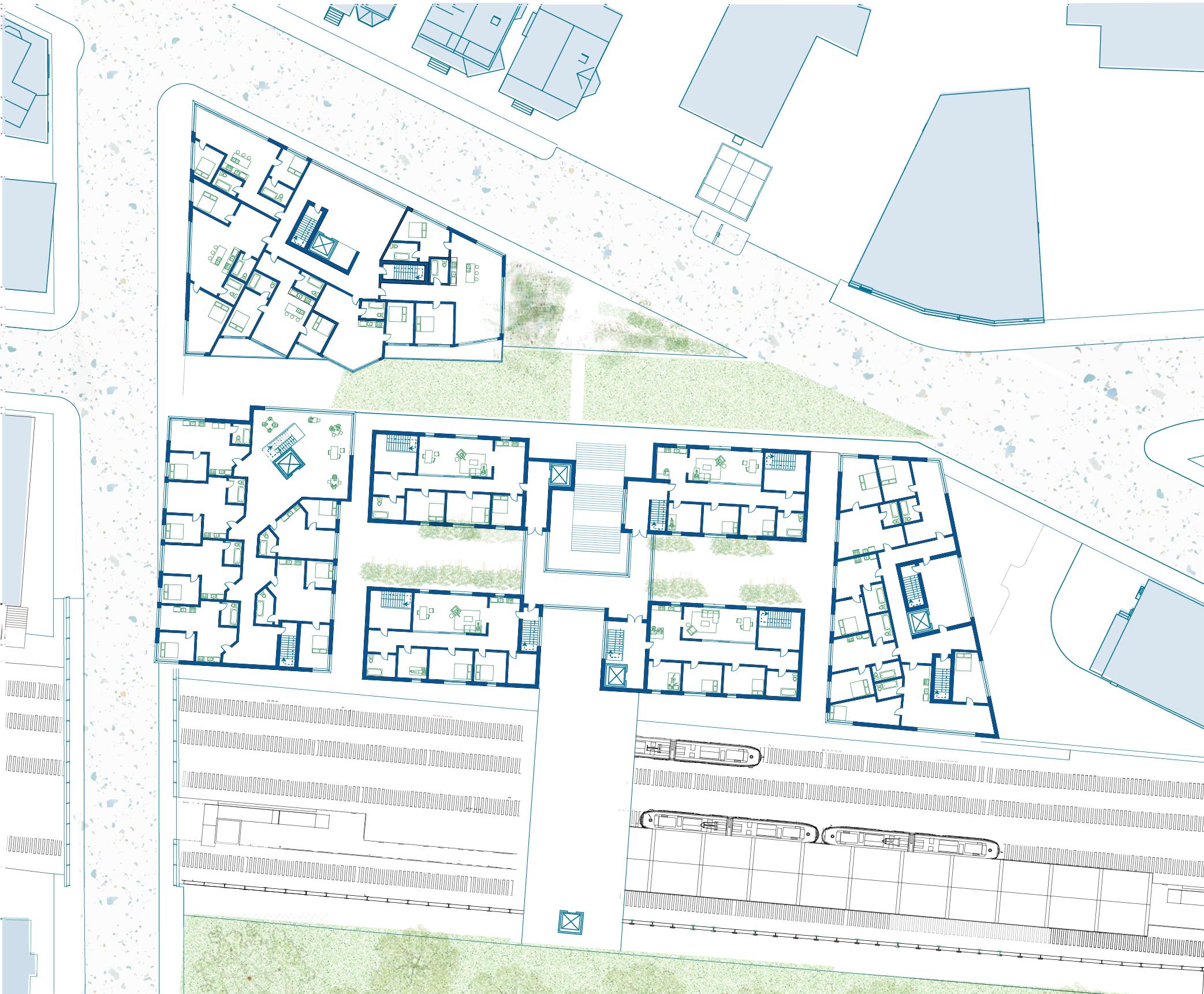
Ground floor plan- Clustered triple decker housings and mixed-use residential buildings
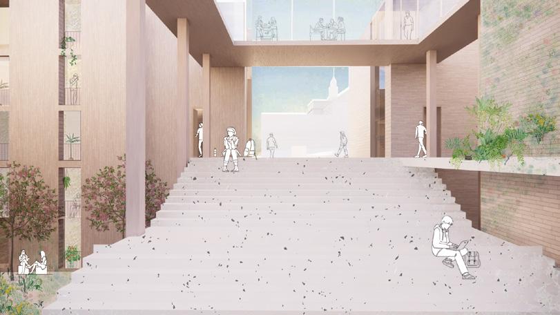
A Community bridge across new triple decker housings
1 2
A new threshold between residential buildings, extending to existing streetway and districts

53
An urban aperture connecting existing and new communities
A section through two mixed use residential buildings
Typical floor plan-triple decker and mixed use residential buildings

Floor plans 2
Integrated building systems
Group project: Aanya Arora, Ben Roland, Sidney Om
Year: 2024 Fall, RISD
Course: Integrated Building Systems
Type: Structure design
Instructor: Rachel Stopka
Location: Providence, Rhode Island
What cheer flower farm is a non-profit organization, dedicated to bolstering ecological health through the cultivation of native plants, the establishment of hedgerows, and the promotion of permanent plantings.
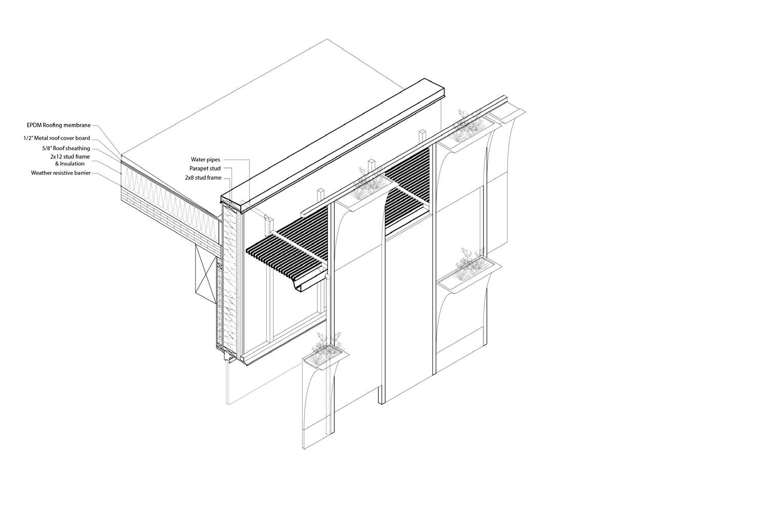
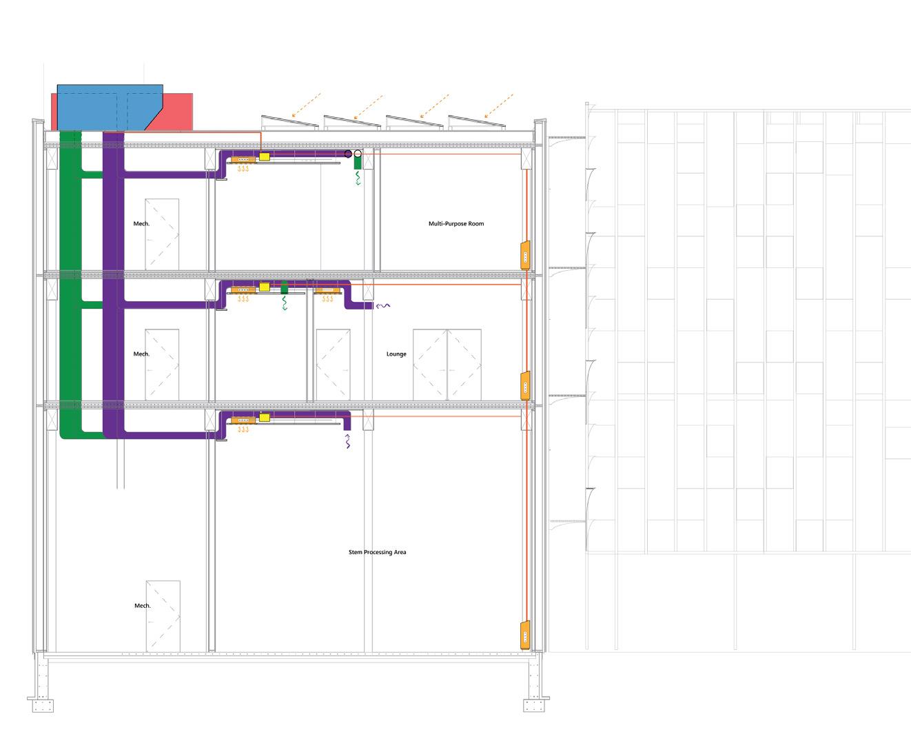
This project really delved into detailed facade building structure and overall building systems, including HVAC, VRF, ERV. Moreover, it aims to design a new community hub with an activity of growing plants.
54
27’-8” 52’-2” 37’-1” A-301 2 Stem Processing Industrial Storage/Shop Accessory Storage Accessory Storage Compost Accessory Storage Utility/Mech. Indoor Event Space Reception Assembly Uncon. Lobby Assesmbly Standing Utility/Mech. 1/16” =1’ 0 4 8 16 32 A-301 1 20’-0” 20’-0” 20’-0” 20’-0” 20’-0” 20’-0” 20’-0” 20’-0” 17’-0” 15’-0” 15’-0” 20’-0” 20’-0” 15’-0” 15’-0” 15’-0” A-301 2 Assembly Uncon. Assembly Uncon. Multipurpose Multipurpose Offices Assembly Uncon. Outdoor Balcony Assembly Con. Reception Business Support Office Executive Office Utility/Mech. Accessory Storage Utility/Mech. 38’-7” Utility/Mech. Accessory Storage 1/16” =1’ A-301 1 20’-0” 20’-0” 20’-0” 20’-0” 20’-0” 20’-0” 20’-0” 20’-0” 17’-0” 15’-0” 15’-0” 20’-0” 20’-0” 15’-0” 15’-0” 15’-0” 20’-0” Small Classroom Small Classroom Medium Classroom Medium Classroom Medium Classroom Workshop Workshop Administration Open Lounge Enclosed Lounge Assembly Uncon. Utility/Mech. Faculty Office Faculty Office Faculty Office Maximum Exit Access Travel Distance 147’-5” Utility/Mech. A-301 2 1/16” =1’ 0 8 16 32 A-301 1 20’-0” 20’-0” 20’-0” 20’-0” 20’-0” 20’-0” 20’-0” 20’-0” 17’-0” 15’-0” 15’-0” 20’-0” 20’-0” 15’-0” 15’-0” 15’-0” 20’-0” Site analysis 1
Detailed
0.75” PARGECOAT
0.25” WATER BARRIER
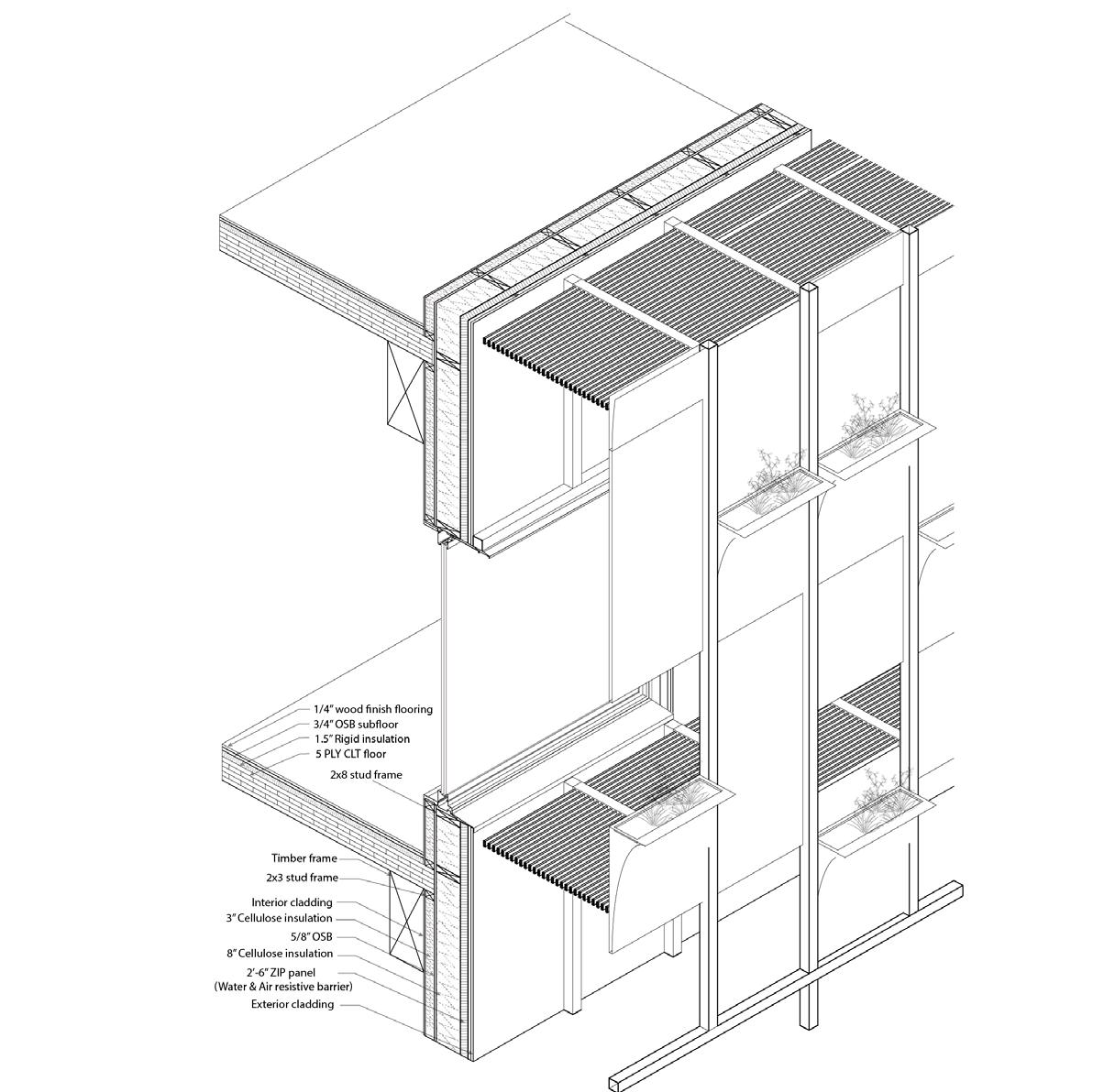
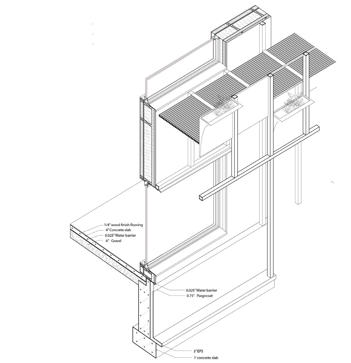
Detailed
INTERIOR CLADDING
3” CELLULOSE INSULATION
5/8” OSB
2X3 WOOD STUD
2X8 WOOD STUD
#10X1 1/2” SELF DRILLING SCREW
WINDOW SILL
EXTERIOR- WINDOW
Mechanic section of ERV and VRF
RAIN SCREEN CLIP
NON-THERMAL SUPPORT SYSTEM
8” CELLULOSE INSULATION
2’-6” ZIP PANEL
0.13”WATER BARRIER LAYER
EXTERIOR CLADDING
STEEL COLUMN (ANCHORING PLANTERS)
WOOD BLOCKING
2X6 FRAMING
SCALE 1’=1”
55
SCALE 1’=1”
INTERIOR EXTERIOR
structure axon
drawing
section of exterior wall
3 4 5 ERV rooftop unit ERV fresh air duct ERV stale air duct VRF unit VRF rooftop unit VRF distribution box
Professional experience
Company: Monte French Design Studio Architecture & Planning
Location: Boston, Massachusetts
Advisor: Monte French, principal
Alex Yoon, Project Manager

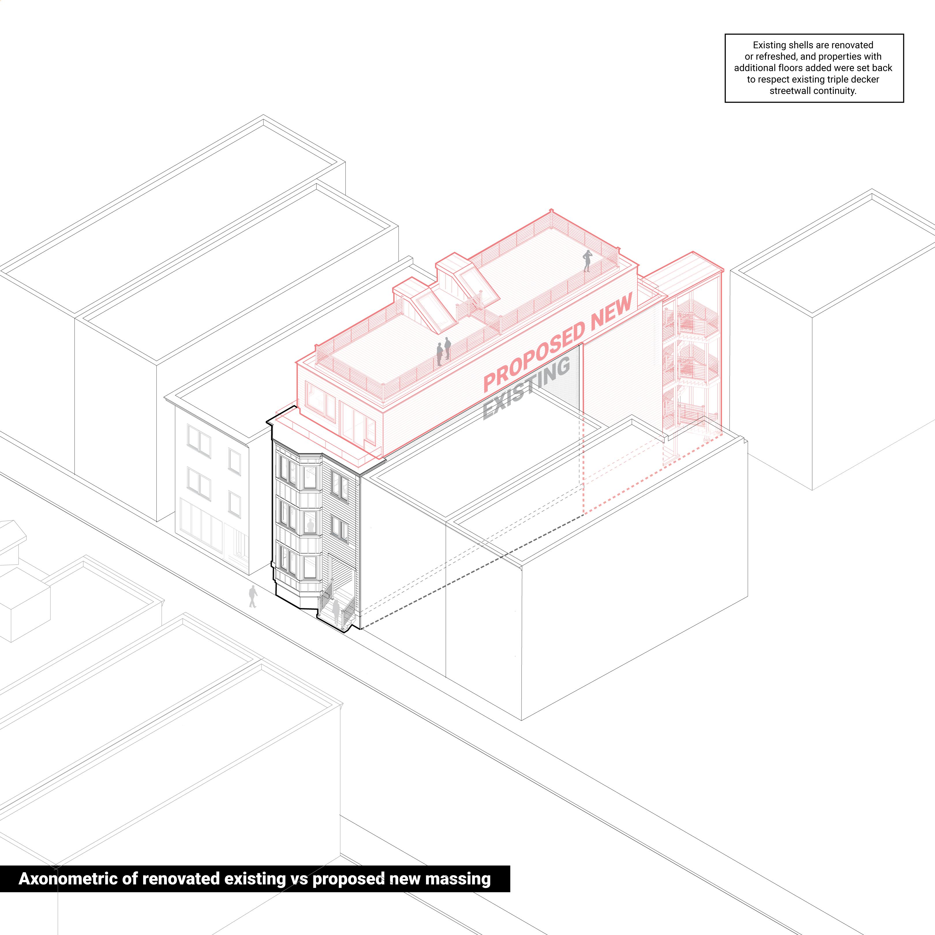
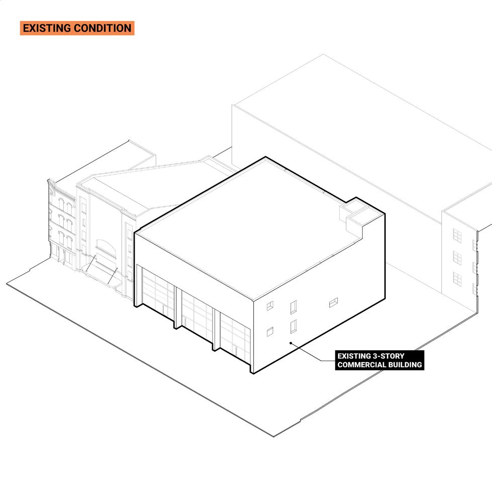
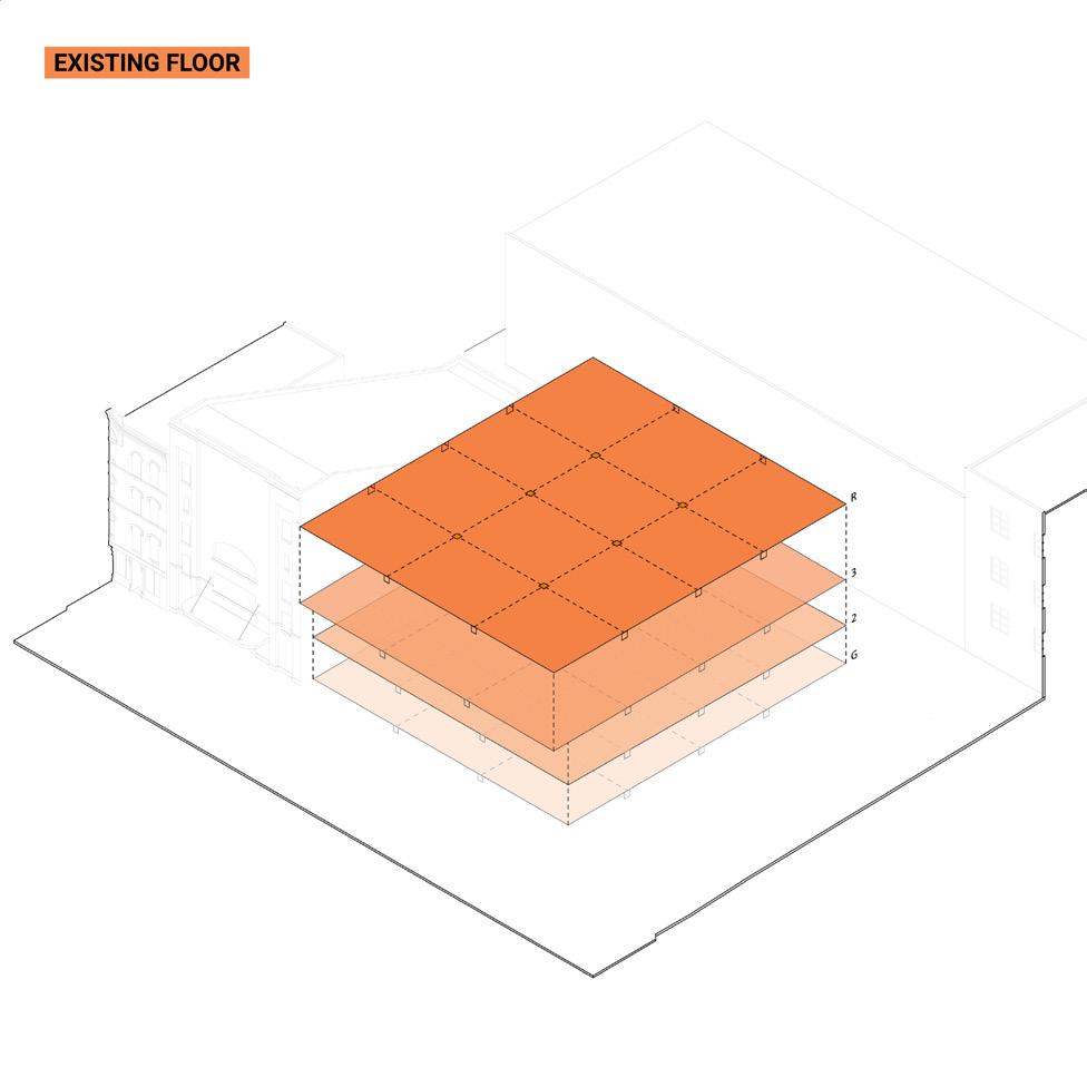
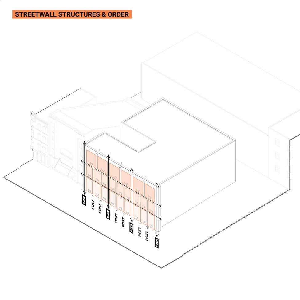
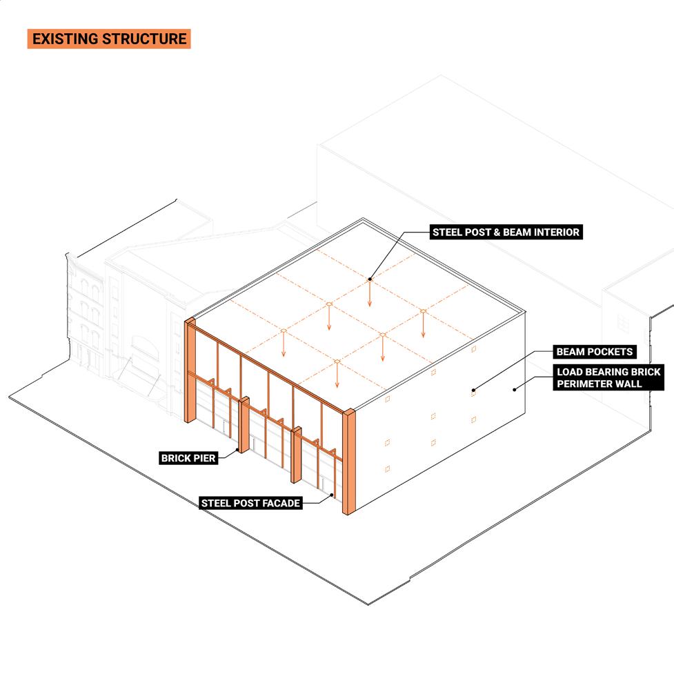
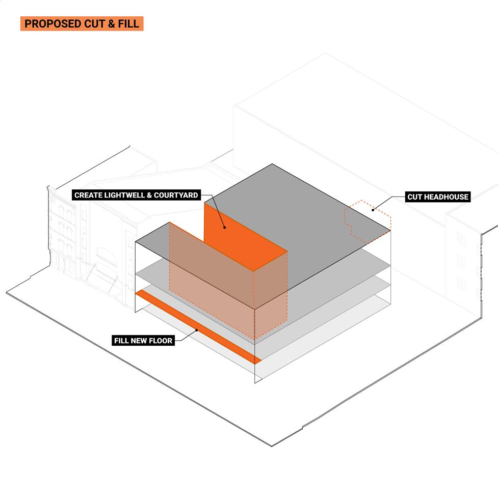
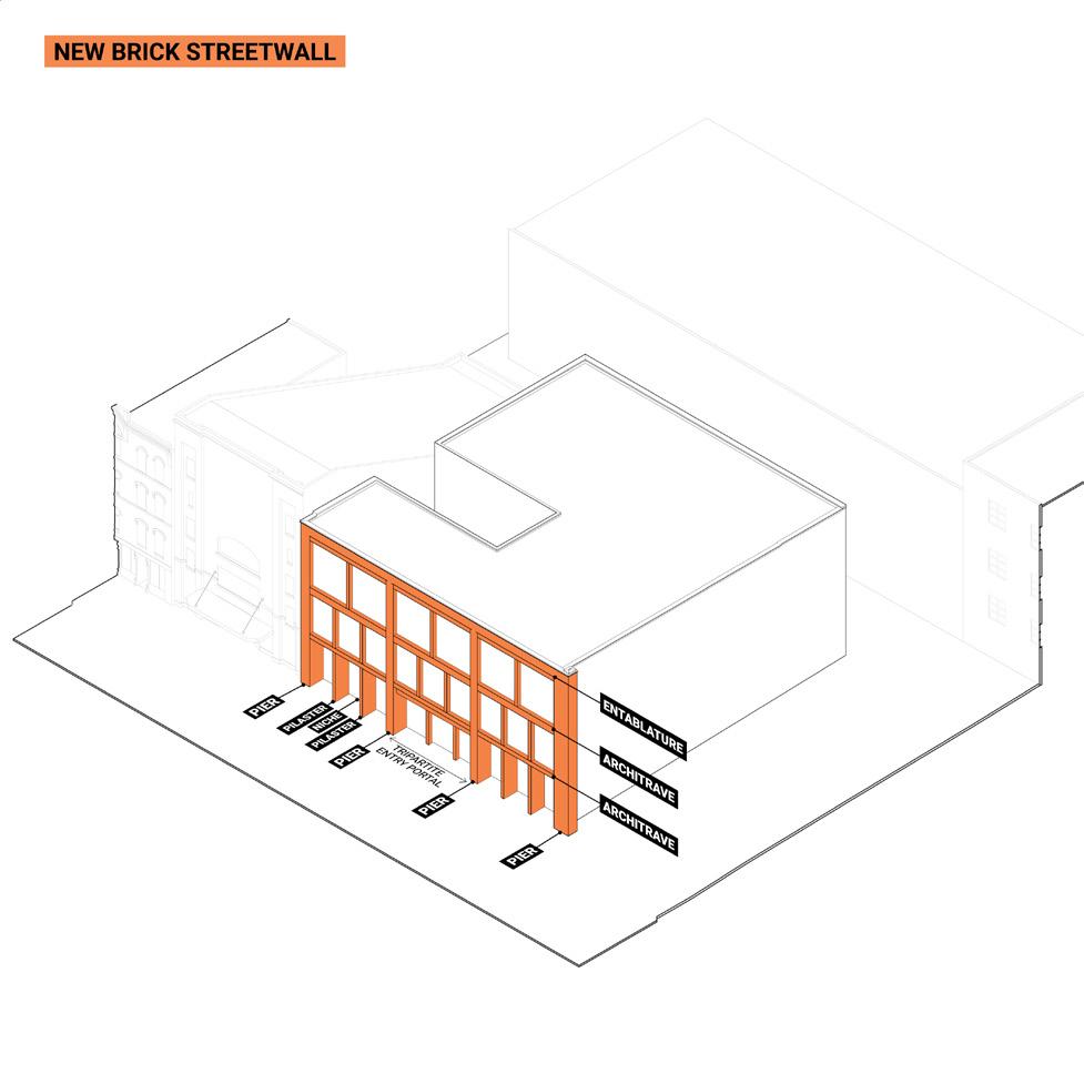
During the internship, I closely worked with principal and project manager to develop conceptual diagrams and to create structural and contextual narratives of each project. I mainly assisted in developing visual representations and making context models for on going projects, such as documentations for presentation and diagrams using Adobe Illustrator, photoshop, premiere pro, Revit, and AutoCAD.
56
57
Diagrams of adaptive reuse residential building
Rhode Island school of design’ 24
cwoo01@risd.edu
58
Chae Yeon Woo


 A. On demand water heater
B. ERV- Air circulation
C. Rainwater reuse


 Site model shows diffrent phases of the infrastructure core.


